Leave Verdun[1] by the Chaussée Gate. Beyond the ramparts, turn to the
left into N. 64 (leaving N. 3 in front, and, fifty yards further on,
N. 18 on the right).
N. 64 follows the right bank of the Meuse, crosses the Faubourg of
Belleville, climbs the Hill of Belleville Fort, and passes close to
Froide-Terre Hill. Opposite stands Bras, at the foot of Poivre Hill.
To visit Verdun, Bras, Charny, Esnes, and Malancourt, see the Michelin
Illustrated Guide: “The Battle of Verdun.”

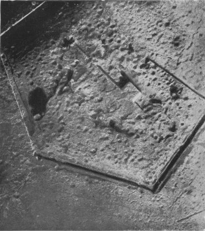
THE FORT OF DOUAUMONT AND ITS APPROACHES
(Photographed from aeroplane in May, 1916.)
Extracted from The Michelin Illustrated Guide, “The Battle of
Verdun.”
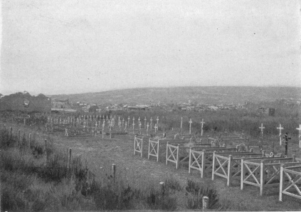
BRAS VILLAGE. FRENCH CEMETERY. POIVRE HILL IN BACKGROUND
At the entrance to Bras, on the left, there is a large French
military cemetery (photo above). In the village, completely ruined,
turn to the left into G.C. 38, which soon crosses the Est Canal and
then the Meuse (on the right, under the ruined bridge: fortifications
and shelters). Charny, about one mile from Bras, is next reached.
G.C. 38 crosses the ruins of this village (level-crossing on leaving),
then turns to the right, leaving the Thierville road opposite.
The road goes round the Heights of Vacherauville and Marre Forts, then
enters the almost entirely ruined village of Marre (about three miles
from Charny). Turn to the left at the first houses, pass in front of
the ruined church, then turn to the right, leaving the Bourrus Woods
road opposite. Follow the railway.
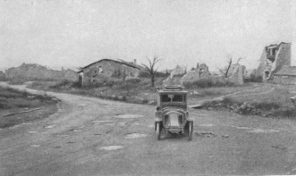
MARRE. G.C. 38 FROM CHARNY. RUINS OF CHURCH ON THE
RIGHT
Two kilometres beyond Marre, before Chattancourt Station, G.C. 38 turns
to the left (leaving the Cumières road opposite), then, 1 km. from the
fork in the road, reaches Chattancourt (completely ruined) at the foot
of Mort-Homme (photo below).
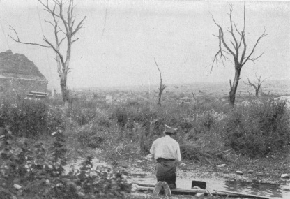
ALL THAT IS LEFT OF CHATTANCOURT. IN THE BACKGROUND:
MORT-HOMME
On leaving the village, G.C. 38 turns to the left and climbs the side
of Hill 275, from the top of which there is a fine view of Mort-Homme
Hill and Hill 304; a little to the left, Montzéville village, situated
in a hollow, and, behind, the Valley of the Meuse, Poivre Hill, Talou
Hill and Samogneux, are also visible.
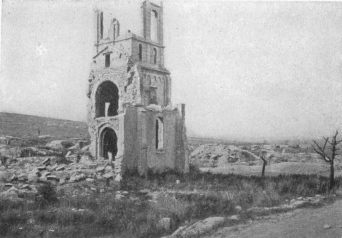
ESNES CHURCH, HILL 304 (LEFT) and G.C. 38 (BEHIND THE
CHURCH)
The road next descends; at the sides are numerous military works and
French graves. 2 km. 200 beyond Chattancourt there is a crossroad: the
Montzéville road lies ahead, while G.C. 38, turning to the right, climbs
a crest from which there is a view of Esnes and Hill 304. Esnes (4 km.
200 from Chattancourt), partly ruined, is reached: Panorama of Hill
304 (photo, pp. 34-35).
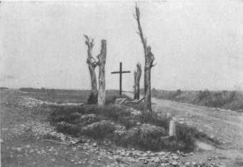
WAYSIDE CROSS OF ESNES ON HILL 304. AVOCOURT ROAD (LEFT)
AND MALANCOURT ROAD (RIGHT)
G.C. 38 passes in front of the church (photo, p. 35) and then rises
towards Hill 304. 1 km. from Esnes, near a wayside cross (photo
above), is a fork; take the road on the right (G.C. 18) to the top
of Hill 304. On the right there is a fine view of the Valley of the
Meuse.
The road crosses the old front lines, then zigzags down to Malancourt
(5 km. from Esnes). At the entrance to the village, on the right of
the road, is a concrete blockhouse (photo below).
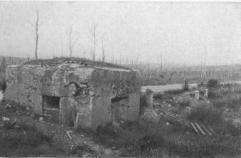
GERMAN BLOCKHOUSE, WITH MACHINE-GUNS, AT ENTRANCE TO
MALANCOURT
Malancourt was completely devastated. Pass in front of the ruins of
the church, quite near to which there is another blockhouse. Keep
along
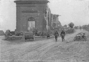
CUISY-SUR-MEUSE. AMERICAN SOLDIERS IN FRONT OF RUINED
CHURCH
The road on the left leads to Gercourt; that on the right to
Béthincourt.
G.C. 18, leaving on the left, in the village, the Avocourt road..
Climb Hill 251, from the top of which Montfaucon Ridge is seen.
3 km. 400 beyond Malancourt (and 1 km. before Montfaucon) the road
joins G.C. 19, which take to the right in the direction of Consenvoye.
One kilometer further on, at the fork, keep along G.C. 19, which turns
to the left (the Cuisy road, straight ahead, is impassable). On the
right, in a tiny valley, is seen the village of Cuisy, completely
ruined. 1 km. 200 further on, to the right, there is a road leading to
Cuisy. G.C. 19, after rejoining the Septsarges road, reaches Gercourt,
5 km. beyond Cuisy.
Several concrete German defence-works are to be seen in Gercourt, while
the ruins of the houses and church present a terrible scene of
desolation (photo below). Opposite the church stands a house lined
with concrete, in which the Germans had installed a telephone exchange.
Cuisy and Gercourt were within the German front lines from 1914, and
were only retaken in 1918 during the American offensive of September 26.
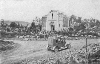
RUINS OF GERCOURT CHURCH
On the right: G.C. 19, leading to Consenvoye.
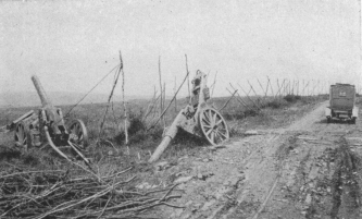
DESTROYED GERMAN GUNS ON G.C. 19, BETWEEN GERCOURT AND
CONSENVOYE
The road turns to the right near the church. After leaving the village,
it passes 500 yards to the left of Forges Wood, in which German
batteries were posted. Large calibre guns destroyed by French artillery
are still to be seen on the road, 1 km. from Gercourt (photo above).
On rejoining the road from Dannevoux (I.C. 23) turn to the right and
follow the railway as far as Consenvoye (1 km. 800 from Gercourt),
which is reached after crossing the Meuse and the canal.
Consenvoye, on the left bank of the Meuse, was connected with the right
bank by a fine bridge, which the French blew up after the retreat from
Charleroi. After the victory of the Marne, all efforts to dislodge the
Germans from the village were unavailing, and until the German offensive
of February 21, 1916, Consenvoye marked the limit of the advance on both
sides. It was over this bridge that supplies were brought up for the
sector on the left bank of the Meuse during the 1916 offensive. The
village was retaken in the course of a brilliant combined action by the
French and Americans during the offensive of October 7, 1918.
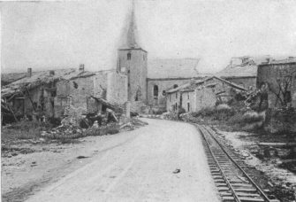
SIVRY-SUR-MEUSE
The Church and N. 64.
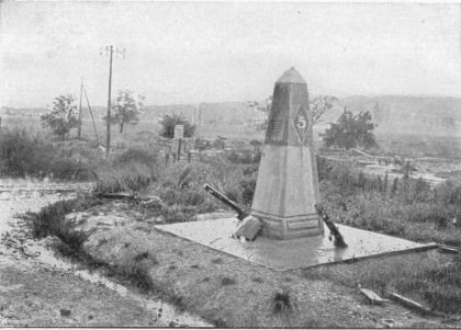
AMERICAN MONUMENT COMMEMORATING THE CROSSING OF THE MEUSE
ON NOV. 1, 1918 (On I.C. 49, 3 km. from Vilosnes.)
Consenvoye suffered less than the other villages previously mentioned.
Around the church, which was not severely damaged, are some soldiers’
graves.
Keep along past the church as far as N. 64, into which turn to the
left. Follow the valley of the Meuse to Sivry (4 km. from
Consenvoye).
N. 64 crosses the partly destroyed village, then runs alongside the
canal and the Meuse to a fork in the road, 2 km. 500 from Sivry. Here
leave N. 64
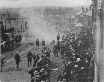
BRIEULLES-SUR-BAR, NOV. 4, 1918
117th American Engineers (42nd Inf. Div.)
Arrival of the Field Kitchen.
and take the Vilosnes road on the left, which continues alongside the
Meuse. Part of Vilosnes (3 km. 500 from Sivry) was destroyed, but the
church, which stands on a height, was not seriously damaged.
Near the church, take the road on the left across the canal and the
Meuse, then beyond the level-crossing at Vilosnes Station turn into I.C.
49 on the right. Follow the railway, which is on the left bank of the
Meuse.
Three kilometres from Vilosnes Station, on the right, between the road
and Châillon Wood, there is an American monument commemorating the
crossing of the Meuse on November 1, 1918 (photo, p. 39). Further on,
at the entry to Brieulles, opposite the station, stands another
similar monument.
The outskirts of Brieulles were stubbornly defended by the Germans
during the American offensive of September, 1918. On September 29,
during the first stage of the offensive, the American 3rd Corps reached
the southern outskirts of the village, but were unable to enter it. It
was not until October 9 that the American troops, after a fierce
struggle, captured it.
At the station, turn to the left along the road through Brieulles (4
km. 500 from Vilosnes). Pass near the church, leaving the Nantillois
road on the left. Cross the village, in which a number of the houses
are in ruins. The rising road leads to the cemetery (numerous German
graves), then descends to the I.C. 64, which runs beside the railway
and the Meuse to Cléry-le-Petit (3 km. 500 from Brieulles). Before
entering the village, a third American monument is seen on the left.
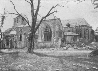
CHURCH OF DUN-SUR-MEUSE. SOUTH FRONT
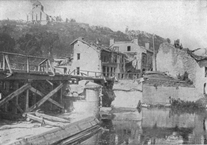
DUN-SUR-MEUSE. BRIDGE ACROSS THE MEUSE DESTROYED BY THE
GERMANS
Cléry-le-Petit was slightly damaged. On November 4, 1918, the Americans
reached the Meuse between Brieulles and Villefranche. On September 5,
they crossed the river at Brieulles and Cléry, on foot-bridges built by
the American engineers, in spite of the stubborn resistance of the
Germans established on the right bank. It was the American 5th Division
which first effected the crossing of the river and established solid
bridgeheads at Cléry and Brieulles, which resisted every attack. Keep
straight on, leaving the church on the right, and the Cléry-le-Grand
road on the left. After crossing the little River Andon, Dun-sur-Meuse
on the top of the opposite hill comes into view. The G.C. 2 bis near
Doulcon is reached, which take to the right as far as Dun-sur-Meuse (3
km. from Cléry-le-Petit).
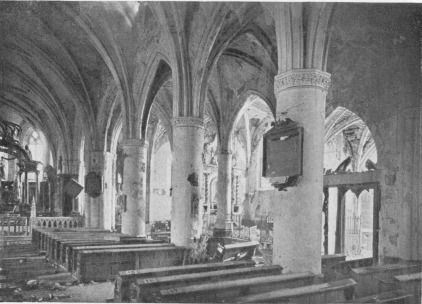
DUN-SUR-MEUSE. DAMAGED NAVE AND SOUTH AISLE OF CHURCH
(SEEN FROM THE CHOIR)
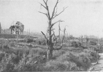
BANTHÉVILLE. RUINS OF CHURCH AND VILLAGE
(G.C. 2 bis.)
The town is reached after crossing first the railway (l.c.) near the
station, then the canal and the Meuse (photos, pp. 42-43). Motor-cars
can climb as far as the church. Turn to the left beyond the last bridge
in the lower town, then take the first street on the right, which by a
wide bend and a steep ascent leads to the upper town and to the terrace,
where stands the church. There is a fine view over the lower town and
the valley of the Meuse (photo, pp. 40-41) from here.
Return to and recross the bridges; keep straight on to Doulcon,
leaving the Cléry road on the left.
At the fork in the road beyond Doulcon (in ruins), take G.C. 2 bis on
the left, as far as Romagne (9 km. from Doulcon), passing through
Aincreville (severely damaged) and Banthéville (completely ruined).
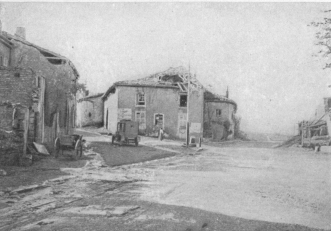
ROMAGNE. RIGHT SIDE OF ROAD COMING FROM BANTHÉVILLE
(On the left: I.C. 4, leading to Sommerance.)
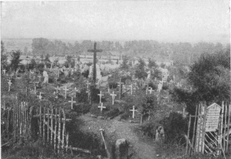
ROMAGNE. GERMAN GRAVEYARD (700 GRAVES) NEAR VILLAGE
CEMETERY
Before entering Romagne, on the right, there is a large German
cemetery and some American graves.
Most of the houses in Romagne were destroyed. Near the church (in
ruins), take on the left the Cunel road and cross the bridge. 300 yards
from the village there suddenly comes into view on the side of the hill
a very large American cemetery containing some 28,000 graves (photo,
pp. 14 and 15). Return by the same road to Romagne Church, and take
the Sommerance road (photo, p. 44) on the left.
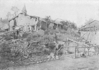
SOMMERANCE. RUINED CORNER OF VILLAGE AT JUNCTION OF THE
ROMAGNE AND FLÉVILLE ROADS
Pass the other side of the German cemetery (photo above), then go
through Romagne Wood, in which are numerous German dug-outs and
gun-emplacements. Next cross a large plateau (Hill 247); 7 km. 400
beyond Romagne, Sommerance (damaged houses) is reached (photo
below). In the village,
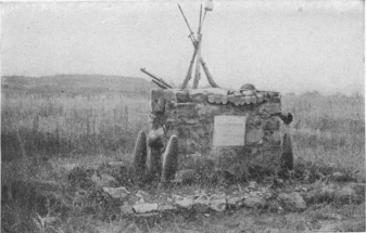
AMERICAN MONUMENT (1ST DIV., OCT. 11, 1918) On I.C. 4, 1
km. from Sommerance village.
beyond the public washing place near the church, take the street (I.C.
4) which ascends on the right. 1 km. beyond Sommerance, on the right
of I.C. 4, there is another American monument (1st Division, October
11, 1918) (photo above).
3 km. 200 beyond Sommerance, Landres village (severely damaged) is
reached. During the American offensive of October 14, 1918, the approach
to Landres was fiercely contested. The American 5th Corps reached the
outskirts of the village on October 14, but it was only on the 18th,
after three days’ heavy fighting, that Landres was taken. The church was
partially destroyed. Turn to the right beyond the church and then to
the left. After crossing the stream, turn to the right again, and 100
yards further on, to the left.
One kilometer beyond the village, at the fork in the road, take I.C. 15
on the left across a plateau, and through the pretty little village of
Landreville in the Valley of the Agron. At the entrance to this
village, on the left, there is an interesting château with turrets, one
of which was destroyed (photo, p. 47), Bayonville, 5 km. beyond
Landres, is next reached.
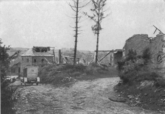
LANDRES. I.C. 4. RUINS OF CHURCH ON THE RIGHT
Several houses in Bayonville were destroyed, the village having been
frequently bombed by the Allied airmen during the Franco-American
offensive of September-October, 1918. The badly damaged church dates
from the 16th century, but has been frequently restored.
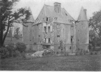
LANDREVILLE. THE OLD CHÂTEAU, WITH DESTROYED TURRET
LANDREVILLE. THE OLD CHÂTEAU, WITH DESTROYED TURRET
After passing in front of the church, the road turns first to the left,
then to the right. At the end of the village take I.C. 12, which climbs
Hill 290, called Bellevue. Looking back there is a fine view over
Bayonville, and the district of Romagne-Banthéville. 3 km. 300 from
Bayonville, at the fork, take the left-hand road; picturesque run down
to Buzancy (4 km. 400 from Bayonville).
At the cross-ways on I.C. 12, near the first houses, keep straight on
along Rue du Général Chanzy to the Place Chanzy.. The statue of Chanzy
(born at Nouart, in this district), which stood in this square, was
carried away by the Germans.
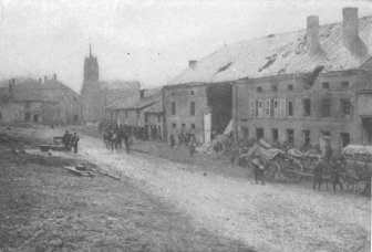
BAYONVILLE. RUE HAUTE DE L’EGLISE, WITH TROOPS OF THE
89TH INF. DIV., ON NOV. 2, 1918
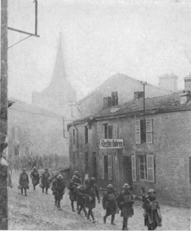
BUZANCY. THE 306th AMERICAN MACHINE-GUN BATTALION
MARCHING THROUGH THE BURNING VILLAGE ON NOV. 3.
Buzancy was formerly a fortified town. In 1650, Turenne, after his
defeat at Somme-Py, retreated on Vouziers and thence to Buzancy. On
September 12, 1792, the town was occupied by the Austrian troops under
Clerfayt, on their march to Croix-aux-Bois. In October, after Valmy, the
rearguard of the retreating army was attacked by Valence near Buzancy,
the Republicans capturing a standard of the 6th Division of the
Lifeguards from the Emigrés. This standard was taken to Dumouriez’s
headquarters and hung in the window of the Vouziers Château. Offered
some days later to the Convention, the latter decided that this symbol
of rebellion should be burned by the public executioner.
On August 27, 1870, a reconnoitring party of two squadrons of the 12th
Chasseurs of the French 5th (Active) Corps, having passed through the
town, was climbing the opposite hill when they were attacked by Saxon
Dragoons debouching from La Folie Wood. The Saxons, greatly superior in
numbers, forced back the French to the entrance of the village; but a
third squadron coming to the rescue, the French attacked, and after a
sharp fight, lasting half an hour, forced the Saxon Dragoons to retreat
up Sivry Hill. Pursued by the French, the latter were finally stopped by
the sudden unmasking of enemy batteries.
From 1914 to 1918 Buzancy was occupied by the Germans who, at the end of
October, 1918, hotly defended its approaches against the American First
Army. The village was, however, taken and passed on November 2.
Several houses in the Rue Charles Coffin were burned down. Most of the
church is late 13th century.
Take Rue du Château on the left of the Place Chanzy.
The Château de la Cour is supposed to have been built on the site of a
house occupied by St. Remi, Archbishop of Rheims. Two very large
sculptured lions, presented by Louis XV. to King Stanislas and brought
from the Château of Lunéville, ornament the entrance. Of the 17th-18th
century château, only the outbuildings are left.
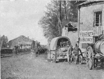
BUZANCY. I.C. 12 AT ENTRANCE TO VILLAGE
The Itinerary follows Rue du Gen. Chanzy opposite.
The Mosque of Mahommed is a fragment of a very old square building.
According to tradition it was built by a Noble Jean d’Anglure, a
crusader who, captured by the Mohammedans, regained his liberty by
promising to build a mosque. It seems more probable that this building
is the remains of a lodge attached to the Château de la Cour.
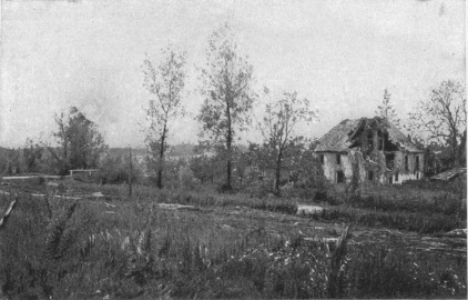
CHAMPIGNEULLE. RUINED MILL NEAR RIVER AGRON, AT END OF
VILLAGE
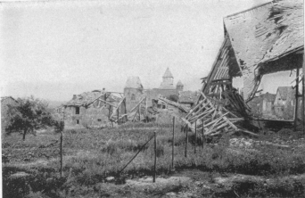
CHAMPIGNEULLE VILLAGE AND CHURCH, SEEN FROM I.C. 20,
BEFORE ENTERING THE VILLAGE
Take I.C. 6, a continuation of the Rue du Château, as far as
Thénorgues (3 km. 200 from Buzancy).
Before entering Thénorgues, a German burial ground is seen on the
right in the communal cemetery. In front of the church take I.C. 20 on
the left, which, 2 km. 700 further on, reaches Verpel. Beyond the
church of Verpel turn to the left, and immediately afterwards to the
right. Outside the village, the I.C. 20 divides; keep straight on.
Picturesque run down into the Agron Valley.
Cross the Agron near a mill, reaching Champigneulle, which stands on a
hill, 4 km. 200 from Verpel. Numerous houses are in ruins. The road
passes in front of the very curious church, the nave of which has fallen
in (photo below). On leaving the village, the road again descends
into the valley, recrosses the Agron, then rises on the left up Hill
182, on which stands the village of St. Juvin (2 km. from
Champigneulle). At the entrance to the latter there is a large German
cemetery.
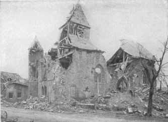
CHAMPIGNEULLE CHURCH, SOUTH FRONT
On September 15, 1792, a strong Prussian detachment, under the command
of Hohenlohe, drove a small body of French troops from the village,
forcing them back on Senuc. Eighty foot-soldiers were taken prisoners
and sent to the headquarters at Landres. Among them were several
Alsatians whom the Prince of Prussia addressed in German, offering to
enrol them in his regiment, but only one of them agreed to serve against
France.
In October, 1918, along the St. Juvin—Landres—St. Georges line, the
Americans delivered a long series of fierce assaults upon the
“Brunehilde” position, or second line of defence which the Germans had
prepared in this district. On October 11, 1918, at the time when the
Americans approached St. Juvin, the village was in flames. Its recapture
proved difficult. On October 14, the Americans outflanked it on the
north, and, on the 15th, regardless of their heavy losses, they
succeeded in taking it inch by inch, and in gaining the positions of St.
Georges and Landres-St. Georges. On the 16th they were fighting in
Champigneulle on the west of St. Georges, and holding the Châtillon Hill
on the south of Landres. By the 18th they had occupied both these
villages.
St. Juvin is dominated by its church—one of the most interesting of the
fortified churches in this district—which, in the distance, looks like
a fortress. Its high thick walls, with narrow windows and occasional
loopholes at the top, form a parallelogram, flanked at each corner by a
round tower with corbels.
In the interior of the church there is a well and an oven. Dating from
the early part of the 17th century, it was rebuilt between 1615 and 1623
on the site of the old church destroyed under the League about 1552.
Some of the relics of the patron-saint of the Parish, St. Juvin, were
preserved in a shrine of gilded bronze.
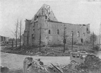
FORTIFIED CHURCH OF ST. JUVIN
The Fountain of St. Juvin, situated between the Woods of Marcq and
Cornay, is frequented by peasant pilgrims who invoke the Saint to cure
their sick pigs. Failing a visit to the well, the peasants touch the
shrine in the church with a piece of bread, which is afterwards given to
the animals. The church contains a statue of St. Juvin, depicted with a
stick in his hand and two pigs at his feet. There is a legend that St.
Juvin was the disciple of St. Oricle, the Martyr of Senuc. One day when
he was walking with Oricle and his sisters (Oricule and Basilique), they
had to cross the Aisne near Senuc at the “Ford of Madame Anciaux.”
Oricle’s sisters had lifted their skirts before entering the water, and
Juvin, who was behind them, exclaimed: “Oricle, Oricle, what fine legs
your sisters have.” Oricle, in anger, reprimanded Juvin severely, and
condemned him to keep pigs for the rest of his life, which is why Juvin,
up to his death, kept pigs in the heart of the forest, round the well
which to this day bears his name.
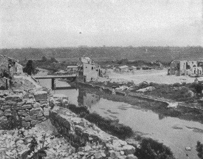
VARENNES-EN-ARGONNE, SEEN FROM N. 46 IN THE UPPER TOWN
On the right: The ruined Church. In the foreground: The River Aire.
After visiting the church keep straight on, leaving the St. Georges
road on the left, and on the right, that leading to Grandpré. After a
rather steep descent, turn to the left along N. 46, at the end of the
village.
Follow the Valley of the Aire to Fléville (4 km. 200 from St.
Juvin), which escaped practically unscathed. 4 km. further on N. 46
passes close to Apremont, then over a ridge, from the top of which
Vauquois Hill, now quite bare, comes into view on the right. From here,
a rather steep descent brings the tourist to Varennes (1 km. from
Fléville).
This little town, made famous by the arrest of Louis XVI. (p. 74), was
almost completely destroyed.
In September, 1914, it was occupied by the Germans, who converted it
into a fortress. On September 26, 1918, the first day of the
Franco-American offensive, it was retaken by the American First Army in
a single charge.
The River Aire divides the town into two parts: the upper town on the
left bank, and the lower on the right bank. The visit to the upper town
will be made on the second day (see p. 74).
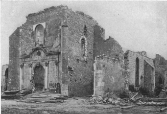
VARENNES CHURCH. SOUTH-WEST FRONT
N. 46 coming from Fléville, passes the church (hist. mon.—photos
above and below).
The three-sided apse of this church, with its fine windows, dates from
the 14th or 15th century; the façade and the tower from the 18th.
The Hôtel du Grand Cerf, near the church, contains carved presses and
pretty Argonne earthenware.
The bridge over the Aire, from which there is a pretty view of the
river, connects the upper and lower town.
Before crossing the bridge, take G.C. 38 to the left, 1 km. 800 from
Varennes; leave the Cheppy road on the left, and keep on in the
direction of Vauquois, the bare crest of which is seen on the right.
3 km. 500 from Varennes, on the right, is a sheet of water, behind
which rises Vauquois Hill. One hundred yards further on, at a small
wood, leave the car and take on foot the (bad) road on the right for
about 400 yards, to a square constructed in cement and stone. This was
a German Command-Post (photo, p. 54). On the left of this building,
follow a small winding path up to Vauquois Crest.
(The visit on foot to Vauquois Crest takes an hour.)
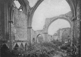
VARENNES. NAVE OF CHURCH SEEN FROM THE CHOIR
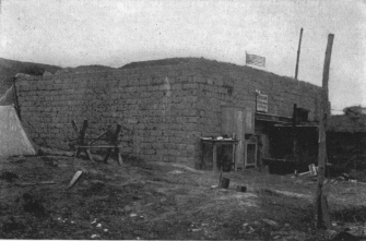
NEAR VAUQUOIS. GERMAN POST OF COMMANDMENT, AFTER CAPTURE
BY AMERICAN TROOPS, WITH STARS AND STRIPES FLYING
Vauquois is one of the famous spots of the Argonne battlefield. The
Germans took it in September, 1914, during a strong attack on the French
3rd Army, in their efforts to encircle Verdun. The ridge concealed their
operations to the north of Varennes, covered the re-victualling of the
Argonne front by the Four-de-Paris road, and above all furnished their
artillery with an excellent observation-post. The importance of the
position caused the Germans to convert it into a veritable fortress.
Caves were made in the rock and connected by underground passages. The
streets of the village were excavated, so that the vent-holes of the
cellars formed loop-holes on a level with a man’s head. The walls of the
houses and gardens were battlemented, and trenches were dug in the
slopes in front of the village. The position was supported and flanked
by the guns in the Woods of Cheppy, Montfaucon and Argonne. Approach was
the more difficult, in that the position was surrounded on all sides by
ravines and glacis, which provided admirable firing positions for the
machine-guns.
This formidable position, which earlier in the war, before the
improvement in the French artillery, would have been considered
impregnable, was taken by the French 10th Infantry Division after heroic
sacrifices. The first assaults especially, made without artillery
preparation or support, cost the splendid French Infantry heavy losses.
The first attack was made on October 28, 1914, by two battalions of the
46th Regiment of the line. The French front lines were then on the
Mamelon Blanc, facing Vauquois. Two companies debouching from Noir
Wood attacked the western slopes of Vauquois, the sections deployed in
skirmishing order, without artillery preparation, and without a single
big French gun being fired on the village. As the men dashed forward up
the slopes they were shot down by the carefully concealed German
riflemen, but continued nevertheless to advance, in spite of the rain of
bullets, till an avalanche of big German shells overwhelmed and
scattered them. At the end of half an hour almost all of them were out
of action.
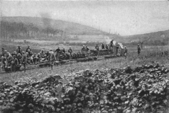
NEAR VAUQUOIS. CAPTURE OF GERMAN TRAIN LOADED WITH RAILS
The second assault was made on the following day (the 29th), after a
very short artillery preparation, during which only a few shells were
fired, most of which failed to burst. Fresh companies attacked further
to the right, near the Cigalerie. The men charged with the bayonet, but
as on the previous day, were mown down by the German machine-guns and
rifles, and failed, after heavy losses. At night, an attempt to rescue
the wounded left on the field was unsuccessful, the enemy firing
pitilessly on the stretcher-bearers, in spite of the Red Cross lantern.
The third assault was carried out on February 17, 1915, by the 76th,
31st and 46th Infantry Regiments. This time the operation, which almost
succeeded, was better prepared. The French artillery had improved its
equipment and methods, being now better adapted to stationary warfare.
The artillery preparation with guns of 75, 95, 150, 155 and 270 m.m.
lasted more than twelve hours. The 31st Regiment of the line charged
into Vauquois, and reached the ruins of the church, but, caught by the
fire of the Argonne and Montfaucon batteries, and that of the
machine-guns of Cheppy, it was forced, after heavy losses, to fall back.
Abandoning the plateau, this regiment held on half-way down the hill.
The fourth assault was made on February 28, under further improved
conditions. A plan of the village, of which only the ruins were left,
was issued to the troops. Each company had its precise objectives
assigned to it, and the men were armed, for the first time, with the new
hand-grenades, charged with melinite. The bombardment began at dawn. Big
guns shattered the shelters, and 75’s, hoisted to the top of the
Mamelon Blanc, fed by infantry, who carried up the shells on their
backs, fired directly on the village. When the attack began, the band of
the 46th Regiment of the line, stationed at the bottom of the ravine,
played the “Marseillaise.” Within a few minutes a number of the bandsmen
fell killed or wounded, but the survivors sounded the charge, and the
storming waves of the 89th, 76th and 46th Regiments
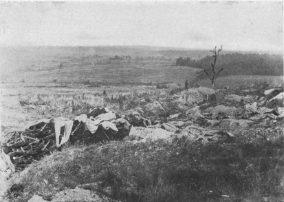
NEAR VAUQUOIS. GERMAN DEPÔT. CAMOUFLAGED BARBED WIRE
DEFENCES
dashed forward. Bullets and shells soon silenced the music; of fifteen
bandsmen only five escaped unwounded, but the companies leading the
charge were by this time climbing the slopes of Vauquois. At the
divisional observation-post, General Valdant, who was following the
attack, turning with great emotion to his officers, raised his képi,
and said: “Gentlemen, salute!” The fight was stubborn; twice the troops,
dashing from one shell-hole to another, reached the plateau, the second
time standing firm. The houses were taken one by one, and the church
reached. The village had been wiped out—only shell-holes, heaps of
stones, bits of walls and shattered cellars remained. Throughout the
next day the Germans shelled the defenders, who were armed only with
rifles. Outflanked, the French were slowly forced back from shell-hole
to shell-hole, fighting all the time, but their line of defence,
organised under fire on the edge of the plateau, brought the enemy to a
standstill. At 2 p.m. the French infantry, for the fifth time, stormed
the village, carried the German trenches, entered the ruins, and within
half an hour drove back the enemy at the point of the bayonet. At 3, 4,
5 and 5.30 p.m., the Germans counter-attacked; but although troops of
fourteen different units were successively launched, they could not
dislodge the French from the main street. Twice during the night they
tried, in vain, to take the church. For four days and nights, under an
incessant pounding by high-explosive shells and a rain of bullets, the
French troops held on without supplies, dependent for their food on the
rations taken from the dead. The Colonial Infantry, who for a short time
relieved the attacking troops, were decimated in a few days. The Germans
were already making use of a powerful minenwerfer, to which the French
could only reply with hastily-devised mortars roughly made out of 77
m.m. shell-cases, and which carried only 100-150 yards. It was an
unequal contest. The Germans attacked almost every night, but were
repulsed with hand-grenades and rifle fire, sometimes with the bayonet.
The position became untenable and the French had either to retreat or
advance. Once more they attacked. On the afternoon of March 4, the 76th
regiment of the line took the German trenches west of the church,
reaching the wall of the cemetery, in spite of enemy grenades and mines.
On the 5th a German counter-attack was repulsed and the capture of
Vauquois by the French was definitive. During the night of the
15th-16th, a fresh German attack was easily repulsed. On the 16th, at
the Cigalerie, which during the attacks of February and March had served
as a dressing station, Standard-bearer Collignon, of the 46th Regiment
of the line, Councillor of State, and former Secretary-General to the
Presidency of the Republic, who had voluntarily enlisted at the age of
fifty-eight, was killed by the explosion of a shell while trying to
rescue a wounded man belonging to the 76th Regiment of the line. Ever
since, at Regimental roll-calls, his name follows that of La Tour
d’Auvergne, and the reply is made: “Died on the field of honour.”
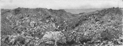
VIEW OF THE MINE CRATERS, WHERE VAUQUOIS VILLAGE USED TO
STAND
(Seen from the crest of Vauquois Ridge.) In the background: Argonne
Forest.
Cazeneuve of the Opera Comique, Adjutant of the 46th
Regiment of the line, who had volunteered at the age of fifty-four, was
also killed at Vauquois by a bomb which shattered his dug-out.
Vauquois for long remained a particularly dangerous sector, the scene of
frequent hand-to-hand struggles, of mining and counter-mining, and of
continuous bombardment. The Germans were not reconciled to the loss of
this position, which gave the French an outlook over Varennes and the
road which formed a continuation of the light railway which they had
built between
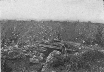
SHELTER ON CREST OF VAUQUOIS RIDGE
Montfaucon and Spincourt. On March 22, 1915, near the ruins of the
church, they attacked a trench with liquid fire. Mines were exploded
almost every month, followed by fighting for possession of the craters.
Engagements of this nature took place on April 5, July 26, August 3,
September 4, November 18 and 21, and December 16, 1915, and on January
13 and 16, February 3, and March 24, 1916.
The Battle of Verdun was followed by a period of comparative calm in
this sector, both sides practically abandoning mine warfare. In 1917
there was hardly anything but hand-to-hand fighting, and a few more or
less important raids. Three times during the first three months of 1918,
the French carried out important raids in this region. On March 17
especially, along a front of 1,400 yards, they advanced to a depth of
800 yards into the enemy lines, and brought back about a hundred
prisoners. On September 26, 1918, the first day of the Franco-American
offensive, the outskirts to the north of Vauquois were completely
cleared, while Boureuilles was taken by the Americans.
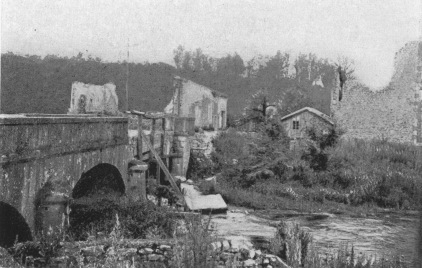
AUBREVILLE. RUINED BRIDGE AND HOUSES
The ridge, which rose 390 feet above the Valley of the Aire, and more
than 250 feet above that of the Buanthe, is no longer recognisable, the
bombardments and mine-explosions have shattered, and, so to speak,
decapitated it. The sight is impressive; mine craters have swallowed up
the village; trenches, shelters, barbed-wire are all that remain
(photos, p. 58).
The view extends as far as Clermont-en-Argonne.
After visiting Vauquois, return to and follow G.C. 38. The original
front lines are soon crossed. Cheppy Wood on the left and Hesse Forest
on the right were cut to pieces by the shells. The ground is covered
with defence-works. 6 km. 500 beyond Varennes the road divides on the
edge of Hesse Forest, G.C. 38 running to the left, towards Avocourt.
Take the right-hand road (I.C. 60), which enters the forest. Numerous
French military works, and some gun emplacements, may be seen along the
road. The road to Récicourt, on the left, is soon passed.
Coming out of the forest I.C. 60 crosses a plateau, then reaches
Aubréville (14 km. from Varennes).
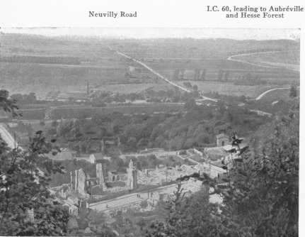
CLERMONT-EN-ARGONNE. PANORAMIC VIEW OF COUNTRY LOOKING
TOWARDS VAUQUOIS
Cross the railway (l.c.) near the station, then the Couzance River, and
enter the ruins of Aubréville (photo, p. 59). At the end of the
village the road forks; keep straight along I.C. 60, which crosses first
the Aire, then the railway (l.c.). The Ridge of Clermont-en-Argonne
soon comes into view.
The road joins that leading to Neuvilly; cross the bridge over the
railway and enter Clermont, coming out at the Place de la Mairie.
The history of this picturesque little town, which was the capital of
the old Comté of Clermont, has been a troubled one. In 719,
Charles-Martel gave it and its dependencies to the Bishop of Verdun. In
1094 it was taken by an adventurer named Odon, and recaptured from him
by the Bishop of Verdun. In 1110, Dudon, Count of Clermont, having
insulted the Bishop of Verdun, the town was besieged by the Emperor. In
the subsequent struggles between the Bishops of Verdun and the Counts of
Bar for the possession of the town, it was several times besieged and
burnt. The Counts of Bar, who finally gained the upper hand, on the
condition that they would pay homage to the Bishops of Verdun, strongly
fortified it. A fortress, added by Henri II., Count of Bar, in the 13th
century, was built on the St. Anne Plateau. Letters of enfranchisement
were given to the inhabitants of the fortress by Count Tiébault II. in
1246, and to the people of the town by the Duke Henri IV. in 1339. In
1354, Yolande of Flanders, Countess of Longueville, Bar, and Cassel, had
a mint at Clermont. In 1539, Clermont became a feudatory state of the
Empire. Ceded to France in 1634 by the Treaty of Liverdun (confirmed by
the Treaty of the Pyrénees in 1659) it was definitely incorporated in
France by the Treaty of Paris on March 29, 1641. In 1648, Louis XIII.
settled it on the Great Condé, whose family held it until the
Revolution. During the Fronde, Clermont took part in the war of the
rebel princes; in 1654, the town was besieged by the royal troops, the
siege being conducted by Vauban, who had himself fortified the place in
1652. On November 8, 1654, the Marquis de Riberpray took the fortress
and church by assault, and on the 22nd, after a siege lasting one month,
the town surrendered. The upper town and the fortress were entirely
destroyed, while the peasants of the surrounding district were made to
pull down the fortress. Clermont and its dependencies were added to the
national domain in 1790. In 1792, Clermont was occupied by the Austrian
and Hessian troops under Hohenlohe. On September 11, enemy hussars
surprised and captured some French troops near Clermont, who, while
foraging, had lost their way in the fog; they also surrounded a company
of infantry in the gardens of the town. On September 20, the French, who
were holding the pass of Les Islettes, took their revenge on the
Hessians. The latter, held up by the fire of the French artillery, were
forced to retreat, and the sharpshooters, under Marceau, drove them back
to the gardens of Clermont.
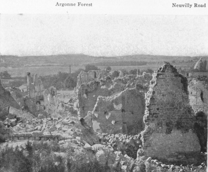
CLERMONT-EN-ARGONNE. GENERAL VIEW OF RUINS, SEEN FROM THE
TERRACE OF THE CHURCH
In 1914, Clermont was occupied by German troops of the Crown Prince’s
Army. The town was almost deserted, with the exception of the old men’s
asylum, in which the pensioners remained under the care of Sister
Gabrielle. During the night of September 4, the 121st and 122nd
Wurtemberg Regiments broke in the doors of the houses with the butt-ends
of their rifles and pillaged the town. At the asylum, after smashing the
doors, officers entered with revolvers in their hands, but Sister
Gabrielle, surrounded by her nuns and the inmates, received the
invaders, and by her firm demeanour won their respect. In the rest of
the town the pillaging went on throughout the day. About noon 3 German
soldier started an incendiary fire; everything was burned or destroyed,
with the exception of the asylum, which owed its escape to Sister
Gabrielle.
At the Place de la Mairie turn to the right into the Grand Rue.
To visit the interesting church of St. Didier (hist. mon.) climb the
rather steep Rue Casimar-Bonjour (accessible to motor-cars), to the
terrace on which stands the church. Very fine view.
The Church of St. Didier dates from the 16th century. The date of the
choir (1530) is carved on the keystone of the vaulting. The three naves
and main portal were added in 1596. However, the building as a whole is
pointed-flamboyant in style, the ogive being preserved in the arches,
vaultings and transept. The Renaissance style appears only in the
decoration of the capitals, the consoles in the interior, and the doors.
The western façade is late Renaissance, and must have been completed
about the beginning of the 17th century. Its two arched portals retain
their old wooden folding-doors ornamented with rose-headed nails. Above,
in a niche surmounted by a fine rose-window is a modern statue. On the
south an ancient corner turret was rebuilt in 1728. The façade bears the
escutcheon and crowned monogram of Henri de Lorraine, Duke of Bar.
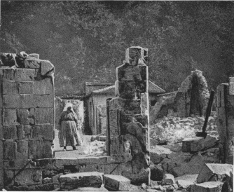
CLERMONT-EN-ARGONNE. OLD WOMAN CONTEMPLATING THE RUINS OF
HER HOUSE, RUE CASIMIR-BONJOUR, NEAR CHURCH
The interior of the choir is imposing. The apse is six-sided—rather an
uncommon arrangement.
In the “Chapelle des Morts,” which opens off the northern nave, near the
transept, there is a Renaissance tomb with a remarkable bas-relief;
below is depicted a nude body lying in a grave, being devoured by worms;
above, three successive panels represent the Weighing of Souls, the
Mirror of Death, and Purgatory. Each subject is accompanied by an
inscription in French verse carved in fine black Gothic characters.
There are few sculptural representations of Purgatory earlier than the
16th century, and this is one of the earliest examples to be found.
The Presbytery.—The Presbytery, standing in a narrow street which runs
along the south side of the church, is an old wooden building, the
interior of which is in a perfect state of preservation. In it is kept
an earthenware model dating from 1530, which was brought from the Chapel
of St. Anne. This model, attributed to Ligier Richier, represents the
Virgin receiving the body of Christ after it had been taken down from
the Cross. It has been imperfectly restored and painted.
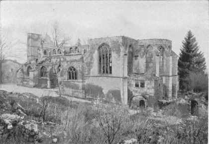
CLERMONT-EN-ARGONNE. SOUTH-EAST FRONT OF CHURCH
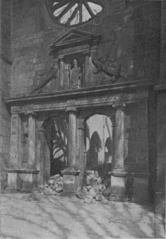
CLERMONT-EN-ARGONNE. 15TH CENTURY CHURCH. RENAISSANCE
PORTAL
Chapel of St. Anne.—Above the church, on the top of the St. Anne
Plateau, where the fortress used to stand, there now remains only an
unpretending chapel, much frequented by pilgrims. The building has a
wooden front, surmounted by a small steeple, and a stone choir with
pointed vaulting, the flamboyant ornament being in the same style as
that of the St. Didier Church. Four ancient elms give shade to the
parvis and rise high above the steeple. Inside is a sepulchre with six
almost life-size statues, acquired in 1829 when the Church of the
Minimes of Verdun was pulled down. Three only of these statues, the
three Maries, all painted, are late 16th century. The finest, which is
in the centre, is attributed by some to Ligier Richier, but this
appreciation is open to question. Near by there is a hermitage, which at
the beginning of the 17th century belonged to the Benedictines, and
later to the Franciscans. In 1845, the town of Clermont acquired the
whole plateau, the promenade, hermitage, and the chapel. From the
plateau—the highest point in the Argonne—there is a fine and very
extensive view over the Forest of Argonne on the left, and the Forest of
Hesse on the right, while the Vauquois-Montfaucon ridge appears in the
distance.
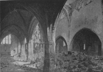
CLERMONT-EN-ARGONNE. CHURCH NAVE, SEEN FROM NORTH AISLES
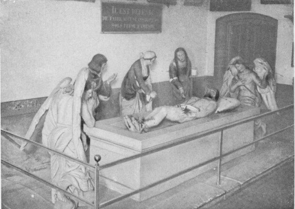
CLERMONT-EN-ARGONNE. THE ENTOMBMENT IN THE CHAPEL OF ST.
ANNE, ON THE PLATEAU OVERLOOKING ST. MENEHOULD
Return to and follow the Grand Rue which, outside the town, becomes N.
3 and runs alongside the railway to Les Islettes (5 km. 800).
This large market town marks the centre of the valley. In 1789, Arthur
Young, in his “Travels in France,” described it as a “heap of mud and
manure.” Since then it has been drained and embellished. Thatched roofs
are still common there. Its glass-making industry, which formerly
flourished, has greatly declined.
On September 17-20, 1792, while the Prussian Army was advancing towards
the Châlons road and fighting at Valmy, the Austro-Hessians of the
Landgrave of Hesse and of Hohenlohe Kirchberg made two demonstrations
against Les Islettes, but were promptly checked by the French. During
the action of September 20, a bullet killed a gunner near the Landgrave,
who was himself unhorsed.
In 1914, the tunnel of Les Islettes, though mined, was intact on
September 3 when the Germans took the village. A fortnight later the
Germans, driven northwards by the French, evacuated the village. The
Crown Prince, unable to resign himself to the loss of this capital
position on the Châlons-Verdun road and railway, for a whole year (until
the French offensive of September, 1915, in Champagne) made strenuous
efforts to retake Les Islettes, in order to cut this important railway
and turn Verdun. However, his numerous attempts to crush in the French
line all failed. Only once (June 29, 1915) did his troops seriously
threaten the position. On that occasion they got within 8 km. of the
station, but a formidable barrage by the 75’s held them, and French
reserves hurriedly brought up soon drove them back beyond the
Four-de-Paris. Throughout the war the town was an important military
centre, General Headquarters, and food, clothing, and munitions depôts
being established there.
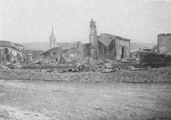
LES ISLETTES, AFTER THE BOMBARDMENT
The town, which was somewhat damaged by the bombardments, contains a
very large French military cemetery.
Outside the town, the road climbs a steep slope and enters the forest.
Pretty view of Les Islettes and the Forest of Argonne (on the left).
N. 3 next reaches Grange-aux-Bois (5 km. beyond Les Islettes), which
takes its name from a house and grange, formerly the den of a gang of
cutthroats who were wiped out in 1514.
The church is of no particular architectural interest, although it
contains some curious statues, notably that of St. Nicolas (18th
century) over the altar in the right aisle.
St. Menehould is next reached (3-1/2 km.), after a pleasant run down
the shady Avenue Victor Hugo, which crosses the Aisne.
The origin of this town is uncertain, and its history prior to the
Merovingian epoch obscure. Judging by the Gallo-Roman relics and graves
discovered in the neighbourhood, it seems probable that at an early date
a Pagan temple or Gallo-Roman castrum stood on the rock encircled by
the two arms of the Aisne. Houses gradually arose about the fortress—an
important stronghold prior to the 5th century. During that century,
Count Sygmar held assizes in the château. Sygmar and his seven daughters
were Christians. One of the latter, Manechildis or Manehildis, being of
a religious turn of mind, devoted herself to the care of the sick and
poor, and was greatly beloved in consequence. After her death she was
honoured by the people as a saint, and the town then took her name St.
Menehould.
During the wars of Chilpéric against Sigebert the town was partly
destroyed. More than a hundred years later, towards the end of the 7th
century, Drogon, Duke of Champagne, son of Pépin of Héristal, rebuilt
the castle and surrounded the rock with ramparts. St. Menehould was
frequently besieged. In the 11th century it was attacked by troops of
the Duke of Lorraine and the Bishop of Verdun. In the 12th century the
castle fell into the hands of a robber-chief, Albert or Aubert, who
plundered the Bishoprics of Verdun and Châlons. At the end of the 12th
century St. Menehould was finally included in the County of Champagne.
It became French in the 13th century, after the union of Champagne with
France. In 1398, Charles VI. built a wall round the town proper. In
1423, the English took the town, but the Constable of Richemont
recaptured it in 1435. In 1545, Marini, an Italian engineer, built a new
line of ramparts with moats and four gates. Several years later the
town, ravaged by plague, was attacked by Antoine de Cory, the Calvinist,
who, however, failed to take it. Under the League, the Governor,
Mondreville, sided with the Guises, but could not shake the allegiance
of the burgesses to Henri III. On May 1, 1589, Antoine de Saint-Paul, a
leader of the League, pursued the royal troops as far as the gates of
the town, but the burgesses forced them to retreat after a battle
lasting two hours. In 1590 the Duke of Lorraine tried in vain to reduce
the town by force. In March, 1603, Henri IV., after renouncing the
Protestant faith, visited the faithful city, accompanied by Marie de
Médicis. In 1613, the Prince of Condé and the Duke of Nevers took the
castle by surprise and forced the burgesses to lay down their arms. In
1630, Marillac was imprisoned in the castle for several months. In
December, 1631, and January, 1632, Louis XIII. stayed in the town. In
1634, the King ordered the castle to be pulled down; by mistake the
walls of the town were also razed, and in 1635 they had to be rebuilt.
In October, 1652, during the Fronde, the Great Condé, with an army of
15,000 to 16,000 men and two guns, laid siege to the town, which
eventually capitulated, with the honours of war, after thirteen days of
trench warfare and three assaults. In October of the following year the
royal troops besieged the town in their turn and forced the garrison to
surrender. This siege of 1653 was the last to which the town was
subjected. In 1712, St. Menehould had to pay a war-levy to the Dutch
robber-chief Growenstein. On the night of August 7, 1719, the town was
almost entirely destroyed by fire. It was at St. Menehould in 1791 that
Louis XVI., while attempting to escape from France, was recognised by
Drouet, son of the postmaster of Varennes. On September 3, 1792, the
body of Beaurepaire, Military Commander of Verdun, who committed
suicide rather than surrender to the Prussians, was buried in the town
cemetery. It was before St. Menehould that Dumouriez established himself
while awaiting the arrival of Kellermann, who defeated the Prussians at
Valmy in September 20, 1792.
In 1914, the town was for a long time occupied by the enemy. Early in
August of that year, the first refugees from the neighbourhood of
Longwy, Longuyon, Audun-le-Roman, and the region of the Meuse reached
St. Menehould. On Monday, August 24, the guns in the north-east of the
Argonne were heard in the town. On the 31st the sound of the cannonade
drew nearer, and refugees from the Ardennes flocked in, terrifying the
inhabitants with stories of German pillage and atrocities. On September
1, the horizon towards Monthois was lit up by the incendiary fires, and
the next day the people were advised to leave the town. The banks
closed, and many of the inhabitants left the city, the trains in the
evening being literally taken by storm. The last train left at about ten
o’clock on the morning of the 3rd. Early in the morning of the 4th, the
last French troops marched through the town on their way to Verrières.
At 8.30 companies of a Prussian Reserve Corps, preceded by Uhlans,
entered St. Menehould by the Moiremont road and destroyed the
telegraphic and telephonic apparatus at the post-office and the station.
The Germans, exasperated by the evacuation of the inhabitants, hastened
to pillage the deserted houses and shops. The tobacco warehouse, the
Caïffa stores, and the cellars of Quesnel the wine-merchant were emptied
and the contents sent away on army waggons.
Of the population only eighty-two men had remained, twelve of whom were
obliged to present themselves each morning at six o’clock before the
Kommandantur, as surety for the order and peace of the town. Six men by
day and six by night were kept as hostages by the German sentries, first
at the Maison Viard, where the Kommandantur was housed, and then at the
Hôtel-de-Metz. The Mayor was kept busy by the German requisitions. From
Nettancourt, where the Crown Prince was reported to be, came an officer
to demand champagne, fine wines, and liqueurs. On the Mayor’s declaring
that there was nothing left the officer lost his temper and threatened
to have him shot. General von Schaeffendorf, commanding the VIth
Artillery Corps, took up his residence at the Château de la Mignonnerie.
Headquarters were established in the Maison Géraudel, Rue de la Force,
where the Duke of Wurtemberg was erroneously reported to have been
housed. The able-bodied men of the town were commandeered for
fatigue-duty and for the cleaning of the streets. A day or two before
evacuating the town, the Germans requisitioned 6,000 bottles of claret,
but left them behind in the hurry of their departure.
On September 13, a cannonade was heard from the south. On the 14th,
there was great excitement in the German garrison, regimental
baggage-trains passed through the town northwards and the Staff prepared
to leave. In the morning the enemy troops streamed along the Verrières
and Daucourt roads, soon followed by the garrison and waggon-loads of
stolen furniture. The Municipal Buildings, Savings Banks, and
Post-office were full of German sick and wounded, only part of whom
could be evacuated through lack of ambulances. There was a speeding up
of the retreat, resulting in great confusion, the bridge, Faubourg de
Verrières and Rue de Vitry being encumbered with German troops on the
way to Moiremont and Chaudefontaine. Shortly afterwards an enemy battery
of 77’s, which had taken up a position on the Verrières road, withdrew
at a gallop through the town, while the last German troops fled along
the Rue de Prés towards the Pont des Maures. Almost immediately
afterwards the French artillery occupied the ridge of Bel-Air and opened
fire on the retreating enemy columns. At about 5.30 p.m. the French
advance-guards, cyclists and light cavalry entered St. Menehould. A
Prussian laggard was shot in the Avenue Kellermann on his refusal to
surrender. At 7 p.m. General Cordonnier arrived in the town, which was
occupied by the 51st Regiment of the line, and a continuous stream of
French troops passed through, following up the pursuit in the direction
of Ville-sur-Tourbe, Vienne-la-Ville and Florent.
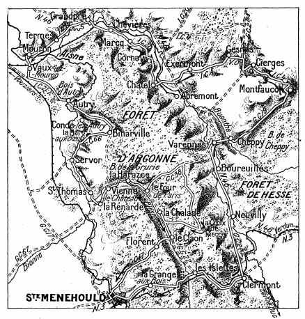
SAINTE-MENEHOULD TOWN AND CHÂTEAU (old engraving)
While the trench warfare lasted the headquarters, supply-depôts and
hospitals for the Argonne front were centred in St. Menehould, and for
four years it was entirely given over to military activities. Frequently
bombarded, the first shells were fired at the station at 4.30 a.m. on
April 26, 1915, when some houses were struck and two civilians killed.
On July 20 of the same year another bombardment was directed by
aeroplanes. At 1.30 a.m. on August 28, an aeroplane dropped a few bombs.
On September 14, a heavy bombardment set fire to the evacuation
hospital, killing two civilians, one of whom, M. Bocquillon, the Deputy
Mayor (acting for the Mayor, who was ill), was struck on his way to the
Hôtel-de-Ville.
During 1918 the town was frequently bombed by enemy aeroplanes.
A VISIT TO THE TOWN
On arriving by the Avenue Victor Hugo, after crossing the bridge over
the Aisne, the Gendarmerie, at No. 8 on the right, should be noticed.
It is the old post-house where Louis XVI. was recognised during his
flight in 1791. Over a door which opens into the Rue de la
Porte-des-Bois, the word “Poste” carved in the stone may still be seen.
The royal carriage stopped near this post-house in broad daylight,
arousing the curiosity of the bystanders by its imposing appearance and
by the respect paid to the traveller and his family by the members of
his suite. The postmaster, Drouet, thought he recognised Louis XVI.,
whom he had seen at Versailles, and he was confirmed in his belief by an
assignat (paper money) with the king’s head stamped upon it, which had
just been given him.
After the departure of the carriage, Drouet followed it to Varennes,
where he caught it up and had the royal family arrested.
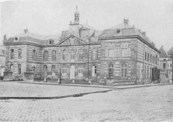
SAINTE-MENEHOULD HÔTEL-DE-VILLE
The Place de l’Hôtel-de-Ville is next reached with the Hôtel-de-Ville,
an 18th century building, on the right (photo above).
Cross the “Place,” keeping to the left, via the Rue Chanzy, which is
the main street. On the right, at No. 33, is the Hôtel-de-Metz, an old
inn on the road from Metz to Paris, formerly well known, the original
kitchen of which has preserved its ample dimensions and innumerable
copper utensils.
The Rue Chanzy ends on the bank of the Aisne at the Place d’Austerlitz.
At the sharp turning on the left, before crossing this “place,” take the
Rue de la Côte-du-Château, then the Rue des Ormes, which leads to the
church.[2]
The church, surrounded by a graveyard, stands on a rock in the centre of
the old town, of which nothing is left but fragments of the castle and
some ruined walls to the south and south-west. The church was built in
the 13th and 14th centuries. Its exterior is massive; the main doorway
is hidden by a modern porch. Beyond the Chapel of the Virgin, on the
right of the choir, a low sacristy was added at the end of the 17th or
beginning of the 18th century. Some fine fragments of earlier sculpture
(five panels depicting scenes from the Passion, and three richly
decorated canopies) have been incrusted in the outside walls. Tombstones
have been built into the walls on either side of the doorway in the left
transept, at the entrance to the church.
The interior consists of five naves with low vaulting. In the left arm
of the transept, under a tri-cusped pointed arcade, the group “The Death
of the Virgin,” represents the Virgin recumbent, with children reading
and clinging to her hands and feet, and eight weeping women carrying
books. In the chapel on the left of the choir there is a 17th century
picture—a view of St. Menehould, with three figures, one of which is
the Patron-Saint of the town; the other two are supposed to be Louis
XIII. and Richelieu. Behind this chapel, which was formerly used for the
ceremonies of the town-guilds, is a recess called the Treasury, a small
vaulted 15th century room opening on the choir. The polygonal choir
presents a fine appearance with its five slightly pointed windows,
framed by two archivolts, supported on little columns with Romanesque
capitals. All around is an elegant 13th century arcade, screened with
rather heavy woodwork. The last nave on the right consists of three
separate 14th century chapels. The capitals of the aisles represent
human heads. The chapel of the Virgin contains a curious capital
representing an oak laden with acorns, towards which a peasant is
driving three pigs. This Chapel was founded in 1552 by the Lord de
Saulx, and was used from the end of the 16th century onward by the Guild
of Vine-dressers, who had the vaulting painted with frescoes. It is also
known as the Chapel of our Lady of the Vines. Formerly it contained a
number of tombstones, since removed. There is still to be seen, in one
of the chapels off the right aisle, a large and very fine 15th century
tombstone with effigies of Jean Toignel and his wife under a handsomely
carved Renaissance pediment.
Take the Rue du Cimetière, which passes behind the church, then the Rue
Basse-du-Château, which leads to a path skirting the old walls of the
castle. From this path there is a fine view over the town, the Valleys
of the Aisne and the Auve, and the surrounding hills. Go round the
cliffs and return to the steps which lead down to the Rue Chanzy.
Distance: 130 km.
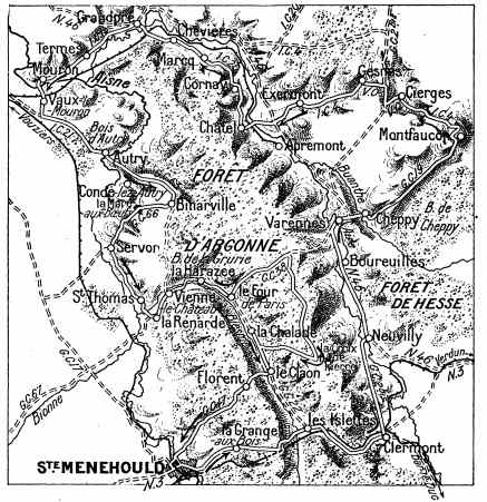
ITINERARY FOR THE SECOND DAY
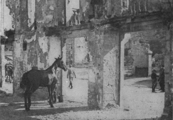
CLERMONT-EN-ARGONNE. RUINS ON THE BAR-LE-DUC ROAD
From St. Menehould to Clermont-en-Argonne (15 km.) take the same road
as the first day (see pp. 31-70).
On reaching the Place de la Mairie at Clermont, turn to the left, cross
the railway, leave I.C. 60 on the right, and keep straight on. G.C.D. 2
runs straight from Clermont to Neuvilly (6 km. 500).
During the trench warfare of 1914 to 1918, this road was often swept by
the German artillery. At the beginning of September, 1914, Neuvilly was
taken by the enemy, but a fortnight later it was recaptured by the
French.
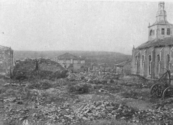
NEUVILLY, seen from behind the CHURCH. At the back:
ARGONNE FOREST
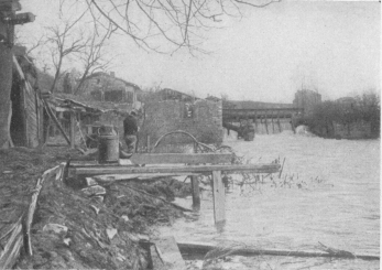
NEUVILLY. RUINS OF ELECTRIC POWER STATION ON RIVER AIRE
Until the end of the war it was in close proximity to the front lines,
and was frequently shelled.
Opposite the church of Neuvilly the road joins N. 46, which take to the
left.
3 km. 500 further on, the original front lines are crossed.
Boureuilles lies 1-1/2 km. beyond.
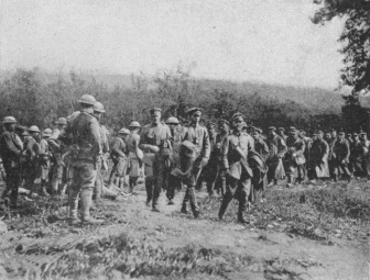
GERMAN PRISONERS TAKEN BY THE 35TH INF. DIV., NEAR
BOUREUILLES
The village of Boureuilles-on-the-Aire has completely disappeared. As
early as November, 1914, it had been reduced to a mere heap of stones
and rubbish.
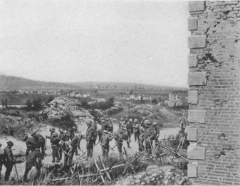
BOUREUILLES. D. CO. OF 111TH ENGINEERS ROAD-MAKING
After being rushed by the French on January 4, 1915, it was retaken by
the Germans, who held it until the Franco-American offensive of
September 26, 1918.
2 km. 500 beyond Boureuilles the tourist comes to Varennes.

BOUREUILLES. THE 27TH ENGINEERS REPAIRED THIS BRIDGE OVER
THE AIRE IN AN HOUR AND A HALF
(N. 46 crosses the bridge.)
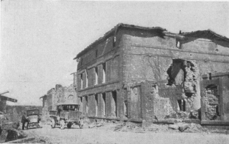
VARENNES. MAISON DE PRÉFONTAINE
On June 21, 1791, Louis XVI. and his suite, in their flight from Paris,
halted here late at night to enquire the way.
Enter the upper town by the Rue des Religieuses (or Rue de
l’Hôtel-de-Ville). The first house on the right is the Maison de
Préfontaine (photo above), which is still as it was when, on June 21,
1791, at 11 o’clock at night, Louis XVI. and his suite, in their flight
from Paris, knocked at the door to ask their way.
On the other side of the street is the Place du Château, where there
are some German soldiers’ graves.
The Rue de la Basse-Cour—a continuation of the Rue des
Religieuses—crosses the Place du Marché (photo below) in which stands,
on the left, the ruined house of Sauce, the grocer, Procureur of the
Commune, in which Louis XVI. passed the night. This house, formerly No.
28, had, until the war, remained much as it was in 1791.
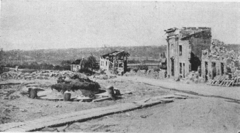
VARENNES. PLACE DU MARCHÉ AND RUE DE LA BASSE-COUR, NEAR
THE BRIDGE
Ruins of house where Louis XVI. was arrested.
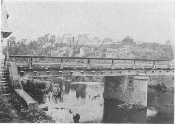
VARENNES. BANKS OF THE AIRE.
N. 46 crosses the bridge.
Drouet, who recognised the King at St. Menehould (p. 68) reached
Varennes before him, by a short-cut. The whole town, aroused by the
tocsin, assembled, and compelled the carriage of the king to stop.
The arrest of Louis XVI. was made at the Bras d’Or Inn, the site of
which was afterwards occupied by three houses, one of which was No. 340
(the bottom photograph on p. 74 shows the ruins of these houses).
The king and his family stayed at Sauce’s house until the morning, when
they were taken back to Paris.
At the Mairie the authentic official report of the arrest of Louis XVI.
may be seen.
Keep along the Rue de la Basse-Cour, then cross the Aire which divides
the upper from the lower town (visited on the first day, p. 52).

VARENNES. BRIDGE OVER THE AIRE
Seen from N. 46, coming from Neuvilly. At back: Ruined Church.
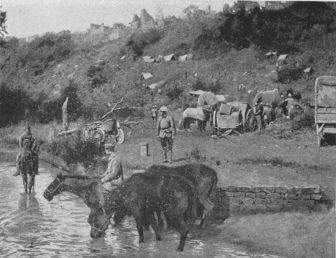
CHEPPY. TROOPS OF 1ST INF. DIV. WATERING HORSES
The ruined village is on the top of the hillside.
Beyond the bridge, take G.C. 38 to the right for 1 km. 800, then
G.C. 19 on the left, 2 km. beyond Varennes, after crossing the
Buanthe, Cheppy is reached.
This village, with its interesting church, remained within the German
lines from 1914 to 1918, being retaken by the Americans on September 26,
1918. Frequently bombarded by aeroplanes and artillery, especially
during the Battle of Verdun, it was completely wiped out.
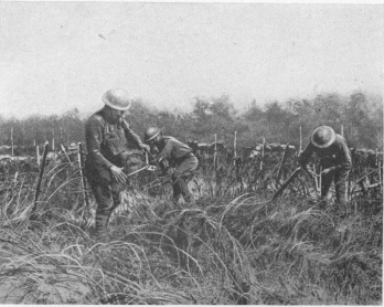
CHEPPY. DETACHMENT OF 107TH ENGINEERS (32ND INF. DIV.)
CLEARING ROADS OF BARBED-WIRE ENTANGLEMENTS
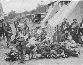
CHEPPY. DRESSING STATION
The Itinerary follows the left-hand road, at fork, to Montfaucon.
To visit the ruins, turn to the left at the first houses along the
road, which runs past the quarries for 400 yards (photo below).
Return to G.C. 19. At the end of the village (photo above) the road
divides. Leave the road lying straight ahead, which leads to Avocourt,
and follow G.C. 19 on the left, through Chéhémont Wood, and cross a
great plain dominated by the Montfaucon Ridge.
Five hundred yards before reaching Montfaucon, take the road on the
right which, at Montfaucon, joins the road from Malancourt.
Montfaucon is 8 km. from Cheppy.
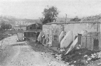
CHEPPY. GERMAN POST OF COMMANDMENT ON BAULMY ROAD
Ruins of Cheppy in the background.
This very old market town, whose origin is said to date back to the end
of the 6th century, grew up around a monastery founded by St. Balderic,
son of Sigebert I., King of Austrasia.
It was below Montfaucon that Count Eudes, in June, 888 or 889, aided by
several nobles, including Marc de Doulcon, is said to have inflicted a
bloody defeat on the Normans. The Chronicler, Abbon le Courbe, tells
how, after the defeat of the Normans before Paris, Eudes, pursuing them
across Champagne and the Argonne, caught them up near Montfaucon. After
a terrific struggle the Normans were cut to pieces and 19,000 of them
were left on the battlefield. In 1081, Godefroy de Bouillon, Duke of
Basse-Lorraine, built a castle-fortress there, which, however, he
dismantled before leaving for the Crusade in 1096. Another castle was
subsequently erected on the same site. In 1349 the Flagellants, who as a
penance marched in procession, scourging themselves publicly, passed
through Montfaucon under the leadership of Gilles de Rodennack, Lord of
Chassepierre.
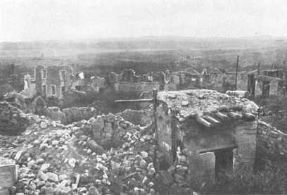
MONTFAUCON VILLAGE IN RUINS, WITH GERMAN OBSERVATION-POST
IN FOREGROUND, ON THE RIGHT
During the Hundred Years’ War the district was frequently ravaged by
bands of robbers, in consequence of which Charles V. authorised the
inhabitants to build a wall round the town. In 1387 the town suffered
during the war between the burgesses of Verdun and three neighbouring
lords. During the religious wars the town was taken and burned (1552).
In 1591, Henri IV. razed the castle, of which not a trace remains.
In 1636, Montfaucon was once again ravaged by war, the enemy burning the
whole town, one house only being left standing. The Parish Church of St.
Laurent caught fire, and a number of the inhabitants who had taken
refuge there perished in the flames.
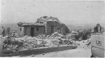
MONTFAUCON. OBSERVATION-POST ON ROADSIDE NEAR CHURCH
Overlooking Montfaucon Wood, Cheppy Wood, Hesse Forest, and Clermont
Argonne.
On September 9, 1792, Montfaucon was occupied by Prussian troops under
Kalkreuth.
In 1914, after the battle of the Marne, the Crown Prince had his
headquarters there for a few days, before establishing himself at
Stenay. The French 40th Infantry Division, during the retreat at the end
of September, forced the Bavarians to fall back on the woods of
Montfaucon, but the Germans quickly consolidated their positions on the
ridge, from which it was impossible to dislodge them.
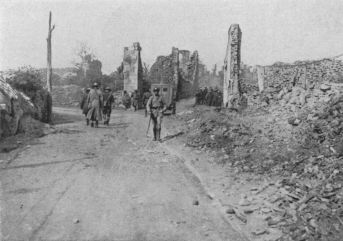
MONTFAUCON. RUINS OF MAIN STREET
The Itinerary follows I.C. 4, on the right to Cierges.
From the end of 1914 to 1918 they continued to improve the defence-works
of this naturally strong position, making it the centre of their
intermediate positions between the Hindenburg line and the
“Kriemhildestellung,” or second line of defence. It also provided them
with a splendid observation-post, from which to survey the whole of the
surrounding French lines. Another observation-post had been installed in
the church, from which the enemy could see Verdun, and this post played
a great part during the battle. The village, frequently pounded by the
French heavy batteries, was reduced to ruins.
It was retaken by the Americans on September 26-27, 1918, after
desperate fighting with the German 37th Division, but only when it had
been surrounded, and Septsarges, Nantillois and Ivoiry had fallen.
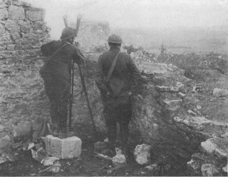
MONTFAUCON. FRANCO-AMERICAN OBSERVATION-POST IN THE
RUINS, NEAR THE CHURCH
The site of Montfaucon is an unusual and striking one; unfortunately,
the town was almost entirely ruined.
At the junction of the road from Malancourt, turn to the left, passing
shortly afterwards in front of a concrete observation-post (photo, p.
79). Keep along the principal street as far as the fork, where take
the uphill street on the right, turning immediately again to the right,
and coming out at the top of the ridge near the ruins of the church.
Several observation-posts may be visited, including one inside the
church (photo below).
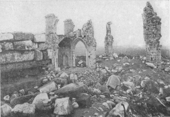
MONTFAUCON. RUINS OF THE CHURCH. GERMAN OBSERVATION-POST
ON THE LEFT
The old Collegiate Church was surrounded by 17th century houses, built
on the site of the old cloister, and inhabited by the canons. Below this
part of the town several underground tunnels, since walled-up, were
made.
The porch and the vestibule of the church dated from the 14th century,
the other parts were rebuilt or restored in 1597 and 1781.
In the steeple a stone staircase of eighty steps led to the belfry,
whence wooden stairs ascended to a platform in the spire, in which six
openings gave a far-reaching view over the surrounding country. This
platform, 170 feet above the base of the church, had a total altitude of
about 1,240 feet. In the direction of Verdun the forts of Marre and
Dugny could be seen, and, still further away (about 25 miles), the
heights which dominate Souilly. To the south-west lie the plains of St.
Menehould, and on the west the plain and plateaux of Champagne. In the
same direction, in clear weather, the Fort of Berru, near Rheims, is
visible. The panorama further embraces the following: on the
north-east, the whole of the region of Grandpré; on the north,
Carignan and Montmédy; on the east, the heights of the Meuse, seven
miles away, shut in the horizon, hiding Damvillers and the Woëvre. From
the top of the ridge may be seen: on the south, the 1916 battlefield
of Verdun; on the north, the terrain of the offensive of September 26,
1918. Between the Meuse and the Aire, from Brieulles-sur-Meuse to
Grandpré, the line of villages, woods and hills, which, after being
fortified, formed the formidable German position known as the
“Kriemhildestellung,” should be noticed. Certain points in this line
were only carried in October, and even at the beginning of November,
1918. Several of them, like Hill 299 to the north-east of Cunel and
north-west of Brieulles, were taken, lost and retaken several times by
the Americans.
Return by the Rue de l’Eglise to I.C. 4, which take to the right down
the hill. Half-way down, at the fork, take I.C. 4, on the right, to
Cierges (4 km. 500 from Montfaucon).
From 1914 to 1918 the Germans had an aviation camp at Cierges. The camp
and station were frequently bombed by the Allied aviators. In September,
1918, during the first days of the American offensive, fires broke out
in the village, to which the Germans held on stubbornly. On the 28th,
they launched several counter-attacks, but at the beginning of October
were forced to abandon the village. On October 4, the capture of Gesnes
(through which the tourist passes on his way to Exermont) finally
cleared Cierges.
On reaching the Rue de l’Eglise, turn along the first road on the left,
which, 1 km. 300 beyond Cierges, runs into G.C. 2 bis.
Turn to the right and follow G.C. 2 bis for 1 km., then take the Chemin
Vicinal (local road) on the left—German dug-outs, 200 yards away on the
left—which leads to the interesting village of Gesnes, lying in a
little valley. Many of the houses were destroyed.
The road passes in front of the church, then turns to the left, skirts
a German cemetery, then goes straight to Exermont (8 km. 800 from
Cierges). Numbers of German dug-outs, sometimes forming veritable
villages, are met with on the way.
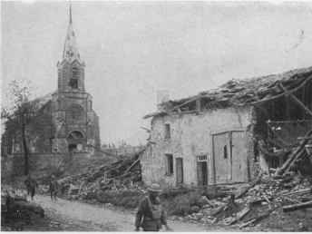
CIERGES. RUINED CHURCH AND HOUSES IN RUE DE L’EGLISE
The folklore of the district, like that of many villages in the Argonne
and the Ardennes, is rich in stories of fairies, demons and witches.
Near the well called Fontaine-St. Germain, about a kilometre north of
the village, is a place called “Ronde-de-Danses,” where the grass never
grows. Here, the fairies of the “Château d’Ariétal,” near the spring of
the same name, used to meet and dance all night.
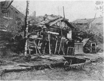
GERMAN SHELTER AT FERME-AUX-BOIS, NEAR CIERGES.
AFTERWARDS POST OF COMMANDMENT OF THE 315TH AND 318TH R.A.C., 2ND
AMERICAN ARMY
Exermont was retaken by the Americans on September 28 1918.

GESNES VILLAGE AND CHURCH, seen coming from Cierges
Beyond the church turn to the left and at the fork, 300 yards after
the last houses, take the left-hand road (I.C. 4). After crossing the
river and over Hill 183, the road cuts N. 46. passes over the river
Aire, then the railway (l.c.), and after joining the Apremont road,
enters Châtel-Chéhéry (4 km. 300 from Exermont).
This village, which suffered little (photo, p. 84), was abandoned by
the Germans without much resistance, on October 7, 1918. in the face of
the advance by the Americans, who had, however, encountered great
difficulty in capturing the outskirts.
Gérard de Melcy, one of the heroes of the siege of Sebastopol, was
buried in the cemetery which surrounds the church.
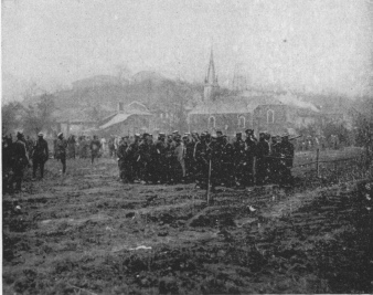
EXERMONT. GERMAN PRISONERS
During the Franco-American
offensive of September, 1918, the Americans found among the papers of
the German Town-Major the following document.
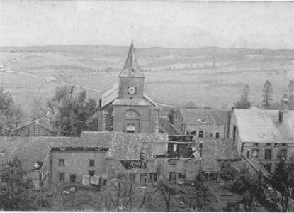
CHÂTEL-CHÉHÉRY VILLAGE AND CHURCH
Behind the latter, I.C. 4 leading to Exermont.
which throws light on the German methods of treating the inhabitants of
occupied districts:—
“33rd General Divisional Headquarters,
“10th May, 1916.
“We have absolutely no reason to be lenient with the French population.
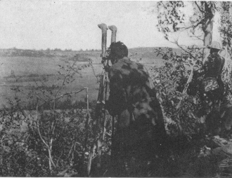
ADVANCE POST ON HILL 240 AT MONTREFAGNE NORTH-WEST OF
EXERMONT
I order a fresh examination of the taxable capacity of the inhabitants,
and no misplaced feeling of sympathy with the people of the district
must be allowed to affect that enquiry. It would be well to consider
whether, with this end in view, we might not occasionally imprison some
of the inhabitants.
“(Signed) Vollbrecht.”
Pass in front of the church and keep straight on. Cross the Boulasson
Stream and follow the road past the foot of the promontory on which the
Château of Cornay used to stand. This castle comprised several forts:
Camp-Crochet, Vieux-Château, Grand Bel, and Petit Bel, all separated by
deep trenches and connected by underground passages. A cross called
“Croix-de-Bayle” now stands on the site of the “Grand Bel.” There is a
tradition that this cross was erected to commemorate “the extinction of
heresy,” Protestants having been numerous in the district. The fortress
is said to have been destroyed during the Wars of the League.
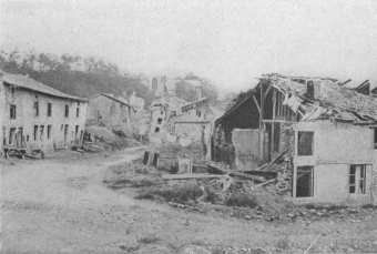
CORNAY VILLAGE AND CHURCH
I.C. 4 leading to Marcq.
The pretty little village of Cornay (photo above) which is soon
reached, is 2 km. from Châtel.
Burned down by the troops of Charles-Quint in 1552, it was rebuilt
beside the ruins.
The church dates from the 12th century, but was frequently restored. The
last restoration dates from 1854, and is in harmony with the original
style of the building.
Opposite Cornay, on the right bank of the Aire, is Fléville, which
possesses a fine 16th century château. This village was taken by the
Americans on October 4, 1918, whilst Cornay and Marcq, the next village,
were only evacuated by the Germans on October 9 and 10.
Leave the Church of Cornay on the left and at the fork at the end of
the village, take the left-hand road (I.C. 20) which crosses the
valley (traces of artillery emplacements). At the first houses of
Marcq the road crosses that from St. Juvin. At the crossing there is
a large German cemetery.
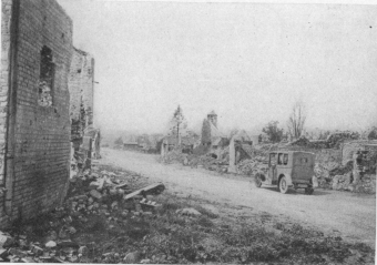
CHEVIÈRES. BURNT DOWN BY THE GERMANS
Many of the houses at Marcq (2 km. 800 from Cornay) were destroyed.
Pass through the village and keep straight on to Chevières (2 km.),
completely burned down by the Germans previous to their departure
(photo above).
Two kilometres beyond Chevières the road crosses the railway (l.c.) and
runs into the Senuc road. Turn to the right and cross the Aire.
Grandpré, a pretty little town, many of whose houses have been
destroyed, is next reached (2 km. 900 from Chevières).
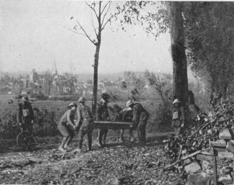
B. CO. OF 303RD ENGINEERS (78TH INF. DIV.) BUILDING
BRIDGE OVER THE AIRE, DESTROYED THREE TIMES BY ENEMY ARTILLERY FIRE. At
back: GRANDPRÉ.
Grandpré lies at the eastern end of the pass formed by the Valley of the
Aire, which cuts deeply into the Argonne. The town is very old. To the
south, on the Nègremont Mountain, there are traces of a camp which is
supposed to be Roman. Attila, after his defeat in the Champs
Catalauniques, also camped there, and long after him, Dumouriez. The
village was possibly founded or extended by a follower of Clovis, who
built a château there, but of which nothing now remains. Grandpré was
pillaged in 884, by the Normans; during the Hundred Years’ War, by the
English; and, under the League, by the rival troops of the Marshal of
St. Paul, Mayenne, and Henri IV. The latter stayed there in 1591. His
letter of October 3, 1591, in which he relates the events of the
preceding days, was dated from Grandpré. During the Fronde the country
was again ravaged, and at a later date, pillaged by the Dutchman
Growenstein.
In 1792, Dumouriez had his headquarters at Grandpré, and after the
battles of Croix-aux-Bois and Montcheutin, the headquarters of the King
of Prussia were transferred there. In October of the same year, during
the Prussian defeat, Grandpré was crowded with enemy sick, struck down
by dysentery.
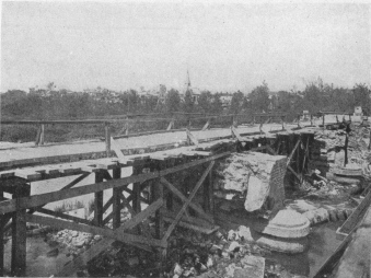
GRANDPRÉ. TEMPORARY BRIDGE ACROSS THE AIRE
According to Goethe, the castle was at that time the abode of pestilence
and death; the neighbourhood of the village, thickly strewn with corpses
and graves, was one gigantic cemetery.
During the war of 1914-1918 the German camps and military works at
Grandpré were frequently bombed by the Allied airmen. Only at the end of
September, 1918, did the Franco-American troops recapture the village
after a long and severe struggle.
On a terrace, in grounds to the north of the village, stands a château
in the style of Louis XIII., which is but the main entrance of an old
and larger castle belonging to the Dukes of Joyeuse. This castle, in
which Charles VI. lodged when on his way to the Ardennes, was rebuilt by
Louis de Joyeuse, assisted by the generosity of Louis XI. Joubert,
Commander-in-Chief of the Army of Italy, was married to Mlle. de
Montholon Senonville in this castle on the 7th Messidor of the year
VII. (June 26, 1799). The castle was destroyed by fire in 1834.
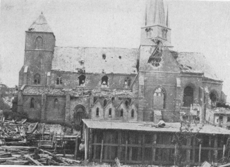
GRANDPRÉ. RUINS OF CHURCH
The road passes slightly to the right of the Church—a large, handsome
building of yellow stone (hist. mon.—photo above), which suffered
greatly from the bombardments.
Dating from the 13th century, when it formed part of the old Priory of
St. Médard, it had frequently been restored and altered. The pulpit and
the choir-stalls were composed of fragments of magnificent 16th century
woodwork, brought from the Abbey of Belval. The church contains the tomb
of Claude de Joyeuse, a remarkable monument in black marble.
One hundred yards beyond the village, turn to the left, into I.C. 15,
which leads to Termes (3 km. 500 from Grandpré).
Many of the houses in Termes were destroyed. Pass in front of the
church, which has lost the top of its steeple (photo, p. 89). In the
interior there is an old holy-water basin shaped like a mortar.
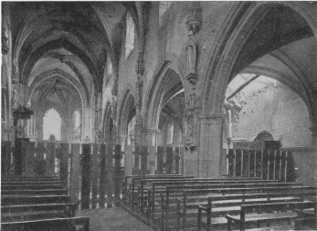
GRANDPRÉ CHURCH. NAVE AND SOUTH AISLE, SEEN FROM THE
CHOIR
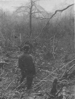
SHELL HOLES ON MORT-HOMME HILL
5 km. north of Grandpré.
Opposite Termes, stands the village of Senuc, which dominates the
junction of the Aire and the Aisne.
In 1918 the position of Senuc, strongly fortified by the Germans, was
taken by the French troops after a long struggle.
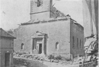
TERMES. RUINED CHURCH
I.C. 15 at the corner of Olizy road.
Keep along I.C. 15, which leads straight to Mouron (2 km. 700).
It was between Termes and Mouron that, on October 2, 1792, the Prussian
Army, retreating after the Battle of Valmy, recrossed the Aisne on two
pontoon-bridges. Goethe, who was standing between the two bridges,
watched the disappointed and exhausted troops go by.
The King of Prussia and the Duke of Brunswick, with their staff, brought
up the rear. “Both,” wrote Goethe, “paused for a moment before crossing
the bridge, as if reluctant to abandon the Plains of Champagne, where
they had just suffered a humiliating defeat.”
Mouron and Vaux guard the entrance to the Grandpré Pass—the easiest
pass of the Argonne.
In 1792, Dumouriez concentrated the greater part of his army there,
leaving practically undefended the passes of Les Islettes,
Croix-aux-Bois and Chesne.
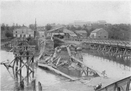
MOURON. DESTROYED BRIDGE OVER THE AISNE, AND TEMPORARY
BRIDGE
In 1918, the Germans clung desperately to these positions, from which
the French had to drive them by main force.
The Church of Mouron is modern, but contains some interesting 17th
century woodwork.
On leaving the village, take the left-hand road, which soon crosses
first the Aisne (photo above), then the railway (l.c.), reaching
Vaux-lez-Mouron (1 km. 200 from Mouron).
The road runs along the south side of Vaux Church, and after passing
the portal, goes straight ahead.
About 100 yards beyond the church, leave the Challerange road on the
right, and continue for another 800 yards, where the I.C. 21 joins up.
Turn into the latter on the left.
GERMAN VILLAGE ON THE EDGE OF AUTRY WOOD
1 km. 800 further on, after crossing the I.C., the edge of Autry Wood
will be reached. On the right will be seen a village built by the
Germans (photo above).
I.C. 21 now runs through the wood, which was strongly fortified by the
Germans from 1914 to 1918.
On leaving it at the fork in the road, turn to the left; 500 yards
further on, at another fork, turn again to the left, reaching Autry
soon afterwards (6 km. 300 from Vaux).
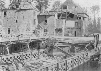
AUTRY. DESTROYED BRIDGE ACROSS THE AISNE
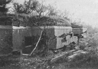
GERMAN TELEPHONE EXCHANGE
50 yards to the left of G.C. 66 (coming from Autry) and 150 yards this
side of Binarville.
Autry, like all the surrounding villages, has had a chequered history.
It was besieged and taken by the English in 1359. At the beginning of
the 17th century it was practically a deserted ruin.
Under the Fronde it suffered again. The Lord of Autry was one of the
four knights who bore the canopy of the Sacred Ampulla during the
consecration of the kings at Rheims.
The road winds round the rock on which stands the ruined church. St.
Lambert’s Chapel in the cemetery contains some interesting frescoes.
The château, which is below the church, dates from 1635.
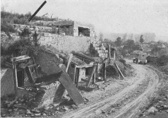
SERVON. GERMAN SHELTERS
Along G.C. 66, below site of destroyed Church.
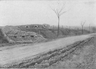
ST. THOMAS. ROUTE DE SERVON, WITH BARRICADES AND TRENCHES
(Feb. 2, 1916).
Leave Autry by two bridges across the Aisne.
Beyond the second bridge and the second house, there is a German
structure under the cliff, on the right.
On the left is the road to Lançon, the village where the French and
American troops effected their junction during the offensive of
September-October, 1918.
Keep along I.C. 21 in the direction of Binarville. 1 km. 700 beyond
Autry, leave the road to Condé-les-Autry on the right. 500 yards this
side of Binarville and 200 yards before the fork with G.C. 66 coming
from Varennes, there is a French military cemetery on the left.
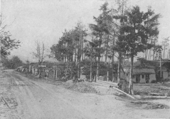
FRENCH DEFENCE WORKS AND DRESSING-STATION
G.C. 66, between Servon and St. Thomas.
Just before reaching Binarville, fifty yards to the left of the road,
are two large German concrete structures, a post of commandment, and a
telephone exchange (photo, p. 92).
The village of Binarville, and the adjacent hamlet of Mare-aux-Bœufs,
were occupied by the Germans from 1914 to 1918, and were only recaptured
in September, 1918, by the French 4th Army.
Binarville was completely destroyed.
Outside the village, leave on the left the (impassable) road from
Vienne-le-Château, and keep straight on along G.C. 66.
Two kilometres further on, a few houses in ruins mark the site of
Mare-aux-Bœufs. Keep to the left, leaving on the right the road from
Condé-les-Autry.
Fire hundred yards beyond Mare-aux-Bœufs, on the left, there is a
German post of commandment in concrete, with rooms, shelter and
telephone exchange. An Iron Cross is carved on one of the doors.
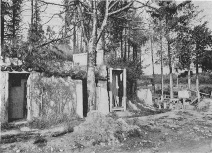
FRENCH DEFENCE WORKS BETWEEN SERVON AND ST. THOMAS
Keep along G.C. 66, past numerous defence-works and shelters, some in
concrete.
This region, an excellent artillery position and a veritable stronghold,
from which the Germans launched many counter-attacks against the right
flank of the French 4th Army, during the offensive of September 26,
1918, was liberated by the French on September 30, after a heroic
struggle.
Five kilometres beyond Binarville is Servon.
It was near Servon that, on August 25th, 1786, the aeronaut Blanchard,
on his way from Lille to Paris, where he hoped to present a bouquet to
the King, was forced to descend after being carried out of his course by
contrary winds.
Occupied by the Germans since September, 1914, and strongly fortified by
them, the village and surrounding country were attacked by the French on
September 25, 1915, during a minor offensive, intended to cover the main
attack in Champagne. The French, after a short advance, were forced to
retire on their original positions, in consequence of counter-attacks
debouching from Servon.
The village was only retaken on September 26, 1918, by the French 4th
Army, which, on the evening of the same day, reached the wood 1 km. 500
to the north-east of the village, after a fierce struggle.
To-day Servon is an absolute ruin. The cemetery alone, on the left of
the road, indicates the site of the village.
Below the ruins of the church, which stood on the top of the hill on
which the village was built, several German shelters (photo, p. 92)
may still be seen along G.C. 66.
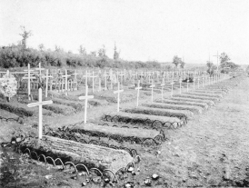
FRENCH MILITARY GRAVES AT ST. THOMAS
Alongside the road from Servon.
Immediately beyond these shelters turn into the road on the left, which
runs through the village; on both sides are other defence-works.
Outside the village, leave the (impassable) Vienne-le-Château road on
the left, and keep straight on.
G.C. 66 runs alongside the Aisne as far as St. Thomas, then passes
by trenches and barbed-wire entanglements—the remains of the old
German front lines.
Shortly afterwards, the old French front lines are reached. To the
right, on the left bank of the Aisne, is seen the hamlet of Melzicourt,
which the French retook on October 25, 1914.
All through the trench warfare the French line ran through the
Melzicourt Ford.
Two kilometres beyond Servon, by the side of the road, are large
shelters of stone and cement (photo, p. 92). Opposite is a French
military cemetery (photo, p. 95). Two kilometres further on St.
Thomas is reached.
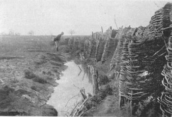
FIRST FRENCH LINE IN AISNE VALLEY BEFORE SERVON
(St. Thomas’ Sector.)
The little village of St. Thomas formerly possessed a rich priory,
founded in 1096 by Robert, Abbot of St. Méry, and Manassés, Archbishop
of Rheims.
The modern church was built on the site of the Priory Chapel, destroyed
during the Revolution.
The village has completely disappeared; of the church only a few broken
fragments of wall remain.
On leaving St. Thomas, G.C. 66 winds down into the valley of the
Biesme, passes near a military cemetery, crosses the valley, then
divides. Take the left-hand road (G.C. 67) which soon passes near the
farm of La Renarde, then alongside a large military cemetery, finally
reaching Vienne-le-Château (3 km. beyond St. Thomas).
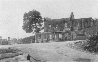
ST. THOMAS CHURCH AND VILLAGE
Seen from G.C. 66 going towards Servon.
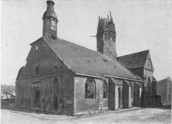
VIENNE-LE-CHÂTEAU. RUINS OF CHURCH
This very picturesque, industrial and forestal village was a royal
provostship before the Revolution.
In the 6th century it belonged to the Bishops of Verdun.
The castle-fortress on the hill which dominates the town to the west was
razed in 959 by the Count of Grandpré.
Later, it was several times rebuilt and demolished. Fragments of the
ramparts may still be seen.
In the 12th century the district was purchased by the Count of Bar.
Vienne-le-Château was shelled by the Germans, especially in 1914 and
1915. The greater part of the village was wiped out, but the church and
neighbouring Town Hall did not greatly suffer.
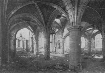
VIENNE-LE-CHÂTEAU. NAVE AND TRANSEPT OF CHURCH
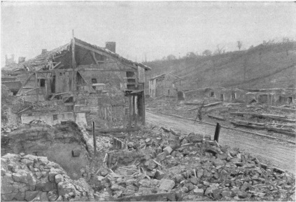
VIENNE-LE-CHÂTEAU. ROAD LEADING TO LA PLACARDELLE
The church dates from the 15th century, with the exception of the
façade, which is 18th century.
G.C. 67, after turning to the right, passes by the Town Hall, and
follows the valley of the Biesme.
This almost straight river is often called “the canal” by the
inhabitants.
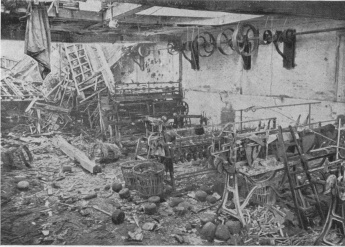
VIENNE-LE-CHÂTEAU. INTERIOR OF RUINED FACTORY (1915)
The road hereabouts is very picturesque, and one of the finest in the
Argonne. It runs south of the woods of Gruerie, Bolante and Chalade,
i.e., through that part of the forest where, in 1914-1915, the battles
which have made the Argonne famous were fought. Of the many famous
places in this forest those most accessible to tourists are mentioned
and described in the order in which they may be visited without unduly
prolonging the itinerary.
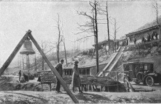
LA HARAZÉE. CHURCH BELL INSTALLED AS GAS ALARM SIGNAL
One kilometre from Vienne-le-Château, take on the left a road, made
during the war, which crosses the Biesme, and then follow the right
bank, past numerous constructions and shelters (photos above and
below), to La Harazée.
In this village, completely ruined, near a French military cemetery,
G.C. 67, coming from the left bank of the Biesme, is joined.
Take the small path which first runs alongside a stream, then climbs
towards Gruerie Wood, for 500 yards, to see the battlefield. The wood,
which was hacked to pieces by the shells, contains numerous
defence-works of all kinds, and makes an impressive sight. Further
along the road are the German front lines.
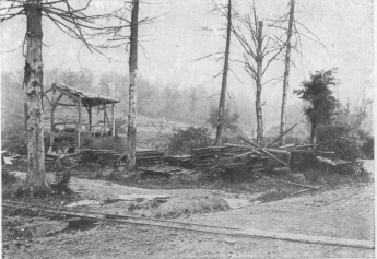
LA HARAZÉE. ALL THAT IS LEFT OF THE VILLAGE
At back: GRUERIE WOOD
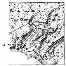
PATH FROM LA HARAZÉE TO GERMAN TRENCHES IN GRUERIE WOOD
Gruerie Wood, which the poilus called “Tuerie Wood” (Slaughter Wood),
was one of the most active and dangerous sectors on the Western front
from September, 1914, to the end of 1915. The conditions of warfare
there were particularly trying. Attack followed attack almost without a
pause, generally preceded by mine explosions, and often developing into
ferocious hand-to-hand struggles. In this wood, sectors like the
Pavillon de Bagatelle, and the valleys of the Fontaine-aux-Charmes
and Fontaine-Madame, were the most fiercely contested.
From Bagatelle a path leads to Fontaine-aux-Charmes, following the
stream of that name (which falls into the Biesme at La Harazée), and
then running beside the stream of Fontaine-Madame. These two streams, on
the south-east of Bagatelle, enclose a plateau broken by ravines and
hills, along which the French advanced in September and October, 1914,
threatening the German lines of communication through the Argonne. The
Germans repeatedly tried to force them back south of the Servon-Varennes
road, and to slip in through the valley of Fontaine-aux-Charmes, towards
La Harazée. In December, 1914, they attacked Fontaine-Madame six times
and Bagatelle three times. In January, 1915, attacks and counter-attacks
occurred almost daily. From the 16th to the 26th, fifteen German attacks
were launched in succession between Fontaine-Madame and St. Hubert,
lying to the south-east, on the stream of Fontaine-au-Mortier. The
French replied by immediate counter-attacks, and in the terrible
fighting which followed each side gained a hundred yards or so of
trenches. On the 27th, the Germans launched three attacks in the
direction of Bagatelle, while two days later the whole of the XXVIIth
Wurtemberg Division, previously drugged with alcohol and ether, hurled
themselves against the same position. The French left gave way, but
retook part of the lost ground after six counter-attacks. The struggle
continued on the following days, and, after heavy losses on both sides,
the Germans were repulsed twice during the night of January 29, once on
January 30, once on February 1, three times on the 2nd, twice on the 4th
and 7th. On February 17, 1915, while a French offensive was developing
in the district of Hurius-in-Champagne, the French troops in the Argonne
attacked the enemy, to prevent reinforcements being sent from that part
of the front. On the right bank of the Fontaine-aux-Charmes stream they
blew up a German blockhouse, and subsequently shelled the
gun-emplacement with a 65 mm. gun at 400 yards range. The most important
operation was directed against the German position of the Blanleuil
Croupe, lying between Sec Ravin and the Ravine of Fontaine-Madame,
from which it was possible to enfilade the Bagatelle salient. Three mine
chambers were made under the German lines. The attacking troops were
divided into three waves: the first (one company), after the explosion
of the mines, was to seize the position, pass it, and push on; the
second (one company) was to consolidate the captured position; the third
(a battalion) was to reinforce the attacking party and exploit the
success. Each assaulting column was preceded by a bomb-thrower and
followed by sappers with sand-bags and entrenching tools. At 8 a.m. the
mines were fired, one of them blowing up a German mine. Two
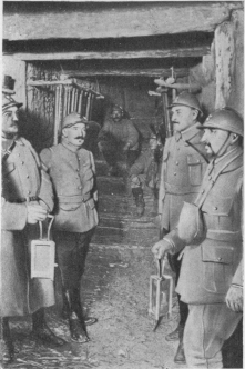
GRUERIE WOOD. SUBTERRANEAN PASSAGE, 25 FT. DEEP
Awaiting inspection by General commanding Sector.
minutes later the three assaulting columns, led by their officers,
dashed forward. The position, attacked from three sides, was taken, and
a hundred Germans were killed in the trenches. Four prisoners and a
machine-gun were captured. At 8.30 the French held 350 yards of the
German trench, and reached the second line, which was full of Germans.
The enemy then launched fierce counter-attacks, which gave them back
their second line. On the French side the second wave had arrived to
reinforce the first company in the captured position. Two machine-guns
mowed down the advancing Germans, but were in turn put out of action by
the enemy, who renewed their counter-attacks with grenades. The French
were reinforced by two companies of the third wave, the third company
being used to revictual the combatants with grenades, bombs, and
sand-bags. The Germans renewed their counter-attacks, but were driven
back. Between 1.30 and 3 p.m., after a violent bombardment with
artillery and minenwerfer, which churned up the ground, the enemy
counter-attacked the French right in force with bayonets, but were
checked. The attack was renewed with grenades and bombs, and this time
the Germans advanced through all the trenches in the vicinity. After a
heroic resistance the French had to give way, and at about 4.30 p.m. the
position was lost. The enemy then attacked the rest of the trench on the
flank; under an incessant hail of bombs, the French were forced to
withdraw, retreating step by step—200 yards in two hours—with a loss
of 40 per cent of their forces. Little by little, their ammunition
exhausted, and in the face of the impossibility of bringing up supplies,
they were obliged to abandon the position and return to the trench from
which they had started. A company of Chasseurs fought for two hours with
German rifles and ammunition, and with unexploded German bombs. On March
1 another desperate struggle took place at Blanleuil. At about 7.15 a.m.
three enemy mines exploded under the French trenches, and the Germans
rushed into the craters, overwhelming two companies in the first line,
the survivors of which fought hand-to-hand. The Germans, heavily
reinforced, made considerable progress in Fontaine-Madame ravine, but a
counter-attack by a French battalion stopped and held them. At nightfall
another battalion counter-attacked in a snow-storm, and after four hours
of bayonet fighting recaptured the greater part of the lost ground. Very
few prisoners were taken on either side. On March 22, at Bagatelle,
after the explosion of three mines, two French companies took a German
trench and repulsed a strong attack, while 500 yards away the enemy also
exploded mines, threw themselves into the French trenches, and in a
hand-to-hand fight were beaten and driven back. From June 30 to July 15
the sector was affected by the German offensive between Four-de-Paris
and Binarville road. On July 28, and on August 4 and 17, three German
efforts against Fontaine-aux-Charmes broke down. On September 9, a fresh
and more powerful attack ended in a desperate struggle. The Germans,
repulsed, renewed the attack a second time without success. On the
following day the sector was heavily bombarded with big shells. From
1916 this sector became quieter, the fierce and prolonged struggle of
1915 giving place to a mutual shelling of the trenches with occasional
grenade attacks and raids on both sides.
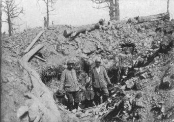
GRUERIE WOOD. ST. HUBERT SECTOR
Taking the soup to troops in first-line trenches.
Another sector, that of St. Hubert, was the scene of frequent struggles
from October, 1914, to September, 1915. In December, 1916, the Germans
attacked St. Hubert five times. After alternately advancing and
retreating, the French succeeded in maintaining their positions.
Between January 16 and 27, 1915, some fifteen enemy attacks took place
in this region. At the beginning of July the battle became more violent.
On August 2, the Germans made use of liquid fire in an attack.
Subsequently the sector became quieter, like the rest of the Argonne.
Not far from St. Hubert the French line described a pronounced salient,
known as Marie-Thérèse, in the enemy positions to the north of
Fontaine-la-Mitte. This name was given to the position by the poilus,
probably on account of the proximity of the lodge of a gamekeeper who
had a daughter named Marie-Thérèse. Surrounded on three sides by the
German lines, the Marie-Thérèse salient was difficult to hold, and the
Germans frequently endeavoured to reduce it. On January 19, 1915, they
exploded two mines in front of the French trenches, but the French
immediately occupied the craters. On the 22nd, after having pushed
sap-heads as close as possible to the French lines, the German
grenadiers suddenly emerged from them at about 10 a.m., each throwing
two large bombs. Then one of their battalions attacked the three sides
of the position, killed the machine-gunners, and at certain points
penetrated into the French second line. At 2 p.m. a battalion of French
Chasseurs counter-attacked, and partly reoccupied the first line, but
was then repulsed by German reinforcements. A third counter-attack in
the evening and a fourth on the following morning regained some of the
lost positions after a terrific struggle. All day and all night the
fight went on with bombs, grenades, bayonets, knives, pickaxes—anything
the men could lay their hands on—with equal ferocity on both sides. A
hundred Frenchmen, nearly all wounded, were taken prisoners. At about
9.30 a.m. on February 10, the Germans mined some of the French trenches,
and then attacked in considerable force, but although they occupied part
of them, the attack was arrested almost immediately by a counter-attack,
and in the evening the enemy was partially driven back. The fighting
here was ferocious. The Germans, mostly drunk or drugged, murdered some
prisoners after disarming them. About midday on the 12th, the enemy, in
columns four abreast, on a front of 300 to 400 yards, once more hurled
themselves against the Marie-Thérèse salient. However, after being
brought to a stand by rifle fire, then scattered by an artillery
barrage, they retreated with very heavy losses. Two hours later, two
companies of French Chasseurs attacked in their turn, but suffered
severely from the machine-gun fire, only one party succeeding in getting
into contact with the enemy in a trench to which they clung. Twice on
May 12, several times in the beginning of July, on August 2 (when they
used liquid fire), on August 12 and 24, and twice on August 29, the
Germans attacked this so greatly coveted and so well defended salient.
Finally, there, as elsewhere, they abandoned all hope of breaking down
the resistance of the French, and thereafter “Marie-Thérèse” was seldom
mentioned in the communiqués.
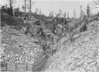
GRUERIE WOOD. ST. HUBERT SECTOR. MARIE THÉRÈSE RAVINE
After visiting Gruerie Wood, return to and proceed along G.C. 67. The
road passes beside two large French cemeteries, then a row of
dug-outs. The forest becomes more and more denuded of trees, which were
smashed by the shells. The site of Four-de-Paris is soon reached,
though not a trace of the village remains (photo, p. 104).
Four-de-Paris is 2 km. from La Harazée.
It was against the Four-de-Paris sector that the first efforts of the
Germans, after their retreat of September, 1914, were directed. No
sacrifice, however costly, was considered too great to recapture this
essential position on the road to Les Islettes.
In two days (November 27-28) seven enemy attacks were launched to the
north of Four. Three times on December 5 their troops, to the sound of
fife and drum, returned to the charge, but without success. On the 18th,
after blowing up a trench, they again attacked. On January 5, 1915, by
way of a diversion, the French 2nd battalion of the 4th Foreign (or
Garibaldian) Regiment carried out an operation in this sector, while,
further to the east, the rest of the regiment delivered the main attack
at Courte-Chausse. At 10 a.m., the Garibaldians, supported by some
bomb-throwers belonging to the 9th Battalion of Chasseurs and French
91st Regiment of the Line, and by two sections of the engineers,
attacked the enemy trenches on a front of 400 yards, but, decimated by
machine-gun fire, they were unable to reach them. On February 16-17 and
on March 9 there were renewed and violent struggles. From June 29 to
July 15 the battle broke out again in this sector, interrupted from time
to time by terrible bombardments with gas shells.
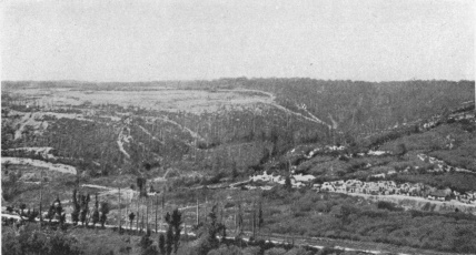
GENERAL VIEW OF THE “FOUR-DE-PARIS” (see page 103)
The road in the foreground leads from Four-de-Paris to Varennes.
In 1916 and 1917 this sector, like the rest of the Argonne, quieted
down. Mining operations continued from time to time, but there were no
battles properly so called. In the occasional surprise attacks which
took place, the French generally got the better of the enemy.
From Four-de-Paris, instead of going to La Chalade by the direct road
through the valley of the Biesme (2 km. 500), the Itinerary follows a
number of roads (17 km. 500 in all) through the forest, in order to
visit certain picturesque spots and at the same time to see places like
Bolante, Les Meurissons, La Haute-Chevauchée, Fille-Morte,
Pierre-Croisée and Courte-Chausse, made famous by the war. All these
places were the scene of fierce conflicts in 1914 and 1915.
In December, 1914, many engagements, in which the French made slight
progress, took place in this sector. It was to the east of Bolante Wood,
in the wild ravine of La Fontaine-des-Meurissons, that the Garibaldian
Regiment—raised by the Republicans of Italy to fight in France, and
placed at the disposal of General Gérard (commanding the 2nd Active
Corps)—received its baptism of fire. On December 26, 1914, the 2nd
Garibaldian Battalion was detailed to carry a German trench. The
attacking front was limited, about 150 yards, but the position was
strongly held and protected by a deep entanglement of barbed wire. After
an artillery preparation lasting from midnight until dawn, the
Garibaldian companies rushed forward, one behind the other, to make a
breach at all costs, but were held up by the uncut wire. At
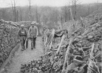
“FOUR-DE-PARIS.” FRONT-LINE DEFENCES (1916)
one point an opening was made and a few men got through to the edge of
the German trench, only to be killed there. It was during this
engagement, which cost the 2nd Battalion 30 dead, 17 missing, and 111
wounded, that Second-Lieutenant Bruno Garibaldi—a grandson of Giuseppe
Garibaldi, “the old red bird” whom, in 1870, the Prussian General Werder
confidently expected to “catch in his nest” in the Vosges, but failed in
the attempt—was killed. Bruno Garibaldi, though in reserve, advanced to
the assault with the 2nd Battalion, his sword drawn, his green tunic
unfastened, showing the traditional and symbolic red shirt. Wounded in
the hand, he went back to the trench to have it dressed, then returned
immediately to the fight. Struck by a bullet he continued to urge his
men forward, until another laid him low. Before dying, he embraced a
wounded comrade near by, saying, “Kiss my brothers for me.” On January
5, 1915, further to the right, on the Courte-Chausse plateau, the 1st
and 3rd Garibaldian Battalions had their revenge. Eight mines, the
galleries of which, forty to fifty yards in length, ran under the German
trench, were charged with about 6,000 lbs. of explosives during the
night. At 7 a.m. the next morning the mines were fired, one after the
other, after which, to the sound of bugles and drums, eight Garibaldian
companies took the shattered enemy front line in a single charge, threw
a German counter-attack into disorder, took and retook the second line,
and penetrated into the third German line. This they were unable to
hold, but they had nevertheless made an important advance, taken four
machine-guns, two minenwerfer, and 200 prisoners of the 135th, 26th,
and 24th German Regiments—most of them Pomeranians. By a strange
coincidence it was the flag of a Pomeranian regiment—the LXIst—that
had been taken in 1870 at the Battle of Dijon by Ricciotti Garibaldi,
Bruno’s father. The Garibaldians’ losses that day were heavy. Among the
dead was Adjutant-Chief Costante Garibaldi, Bruno’s brother. Some days
later a violent battle took place in the Meurissons ravine. On January
7, after a half-hearted German attack, which was easily beaten off,
rough trenches were dug on the plateau—in view of a possible
retreat—by men belonging to the 46th French Regiment of the Line, who
worked under heavy fire. General Gouraud, commanding the 10th Infantry
Division, who came to examine the position, was wounded in the shoulder
by a machine-gun bullet. On the following day a violent German artillery
preparation began at dawn. At 7.30 a.m. three regiments of fresh enemy
troops (Bavarian infantry) advanced to the attack. A trench held by men
of the 89th Regiment of the Line was blown up, the French line was
broken, and the Bavarians took on the flank the first and second lines
held by troops of the 89th and 46th Regiments of the Line, who put up a
fierce resistance. On the plateau the 11th Company of the 46th, which
held the unfinished supporting trench, stopped the rush of the enemy.
The Germans, unwilling to risk a frontal attack, turned the position on
the right flank, and finally took the trench, but only after the gallant
defenders had fired their last cartridges. The Germans penetrated into
the ravine, capturing the regimental headquarters, and wounding the
colonel and his staff. The 11th Company, however, still held on. On the
crest, the cooks and the sick seized rifles and joined in the fight. At
about 9.30 a.m. a blast of trumpets on the right announced the arrival
of reinforcements. Units of the French 89th Regiment of the Line and 2nd
Garibaldian Battalion charged through the undergrowth. A furious
hand-to-hand struggle ensued in the copse-wood, no quarter being given.
The French succeeded in saving their comrades of the 46th, and checked
the enemy, who eventually evacuated the ravine. At dawn on the 9th,
units of the 120th Regiment of the Line relieved the Garibaldians, who
numbered among their dead the Regiment’s adopted child, Gaston Huet, a
French boy of twelve, who had fought like a man. It was in vain that the
Germans renewed their attacks; until nine o’clock in the evening they
were repulsed and held. The remnant of the French 46th Regiment of the
Line—some three hundred men—under the command of a captain clung for
three days without supplies, to their positions. Their splendid
resistance and sacrifice were not in vain, as reinforcements arrived in
time to re-establish the position.
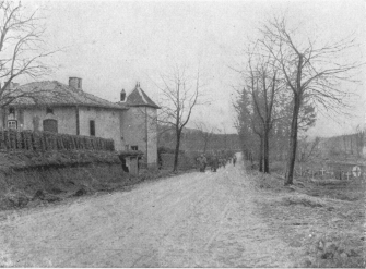
FOUR-DE-PARIS FARM IN 1915 (SUBSEQUENTLY RAZED TO THE
GROUND), ON THE ROAD TO CHALADE
From March 9 to 19, several French attacks between Four-de-Paris and
Bolante gave slight gains, in spite of enemy counter-attacks.
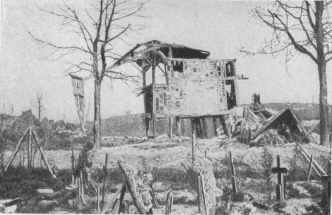
FOUR-DE-PARIS FARM IN 1918 (see p. 103)
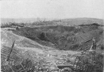
SHELL CRATERS ON HILL 285, IN THE “FILLE MORTE” SECTOR
(as seen from the road)
On August 7, part of a trench was taken by the Germans in a night attack
at Fille-Morte. During the whole of that month, at Courte-Chausse, Les
Meurissons, La Haute-Chevauchée and Bolante, continual fighting took
place with artillery, mines, trench-mortars, grenades and bombs. On
September 27, during the French offensive in Champagne, the Germans
attempted a diversion against Bolante and Fille-Morte. After a heavy
bombardment with explosive and gas shells, a force of nearly two
regiments attacked in four successive waves. At first they made some
slight progress, but were soon almost everywhere repulsed with very
heavy losses. From October, 1915, it was in this part of the Argonne
that the activity was greatest, though here, as elsewhere, the fighting
considerably diminished. In 1916, frequent mining operations gave rise
to grenade fighting around the craters at Fille-Morte, Bolante, La
Haute-Chevauchée and Courte-Chausse. In 1917, mine warfare was
practically abandoned, but both sides frequently made raids into the
opposing trenches, for the purpose of taking prisoners and destroying
the works and shelters there.
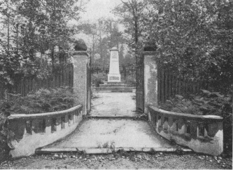
GERMAN CEMETERY ON THE ROAD FROM FOUR-DE-PARIS TO
VARENNES (4 km. from the former)
On reaching Four-de-Paris from La Harazée, take G.C. 38, on the left,
towards Varennes.
The road follows the valley of Les Meurissons (on the right is
Bolante Wood), crosses Hill 265, and passes by the original front
lines.
From here onwards, veritable villages built by the Germans may be
seen on the sides of the hill, on the left bank of the Meurissons
stream.
The forest on the crest of the hill was cut to pieces by the shells.
Almost at the top of the hill the road runs past a German cemetery
containing a curious monument (4 km. from Four-de-Paris; photo above).
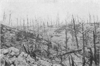
DESTRUCTION OF THE ARGONNE FOREST
One kilometre further on, at the Meurissons cross-roads, La
Haute-Chevauchée, an old Roman road, is reached.
Follow La Haute-Chevauchée—a very interesting road, but in bad
repair—driving slowly and carefully for the first 2 km.
The road passes through Jardinet Wood, which is full of dug-outs,
shelters and gun-emplacements.
On leaving the wood the view is impressive. Hill 285, opposite, is
literally ploughed up by the shell fire, while not a single tree is left
(photo below).
This is the sector of the Fille-Morte, Pierre-Croisée and
Courte-Chausse.
The road goes round the hill, passing a succession of shell-craters on
the crest.
Shortly afterwards, after entering Chalade Wood, the road improves. On
both sides are French structures of stonework.
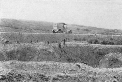
HILL 285, IN THE “FILLE MORTE” SECTOR
(The car is going towards the Croix-de-Pierre cross-roads.)
One kilometre beyond Hill 285 is the Sept-Fontaines cross-roads, where
stood a French dressing-station, facing the road going towards the
Mont-de-Villers.
Keep straight on: 1 km. 800 further on, at the cross-roads, near the
site of the Forest Keeper’s Lodge, there is a large military cemetery.
The Lodge was completely destroyed.
2 km. 300 further on, Croix-de-Pierre cross-roads is reached. Fifty
yards this side of the cross-roads, on the left, is the shelter where
Lieutenant de Courson met a glorious death in 1915 (photo, p. 110).
At Croix-de-Pierre cross-roads, where the Neuvilly road (on the left)
and the Clermont road (in front) start, turn to the right into the road
leading to Chalade (called Chemin des Romains).
Pass an old camp (Camp Monhoven), then 1 km. beyond Croix-de-Pierre
leave the Claon road on the left.
Two kilometres further on there is a sharp descent leading to G.C. 22,
which take on the right for 1 km. to Chalade.
The village of Chalade grew up around a monastery founded in 1120 by
Robert and Riouin, monks of the Abbey of St. Vanne at Verdun.
The Abbey, occupied first by the Benedictines, and afterwards (from
1127) by the Cistercians, was placed under the care of the Bishops of
Verdun, protected by the Lords of Vienne-le-Château.
The monks drained the marshes of the valley of the Biesme and cultivated
the slopes.
The Abbey church, begun in 1275, was never finished.
There is a legend that the prior, who had given up all hope of finishing
the church, received a visit from the Devil, who offered to finish the
building for him, on condition that he should have the soul of the first
Christian who crossed the threshold of the completed church.
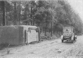
SHELTER, NAMED AFTER FRENCH OFFICER WHO FELL THERE IN
1915
The prior having refused this offer, the Devil scattered in all
directions the houses which had until then been grouped around the
monastery, and reduced to dust the blocks of “gaize” in the quarries.
Since that time the houses have remained scattered, and there are no
more blocks of “gaize” to be found in the neighbourhood.
This legend is doubtless a naïve explanation of natural phenomena,
“gaize” being a silicious clay peculiar to the district.
The Abbot’s house in the enclosure is in ruins. South of the church,
monastic buildings, probably erected in the 17th century, are still
standing, though in a dilapidated condition.
The Abbey church became the church of the parish. The windows and
rose-window were restored in the 19th century. The nave has lost two of
its bays, and the steeple has been pulled down.
The Gothic nave is large and high, the springing of the vaults resting
on sculptured capitals. Fragments of old stained-glass, still to be
found in some of the windows before the war, were destroyed by the
bombardments.
At the end of the nave there is a fine rose-window, the mullions of
which are said to have been taken from the old Abbey of St. Vanne at
Verdun.
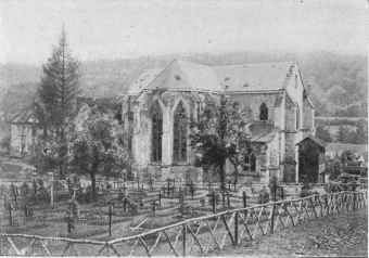
CHALADE. MILITARY GRAVES AND CHURCH
Return by G.C. 22, continuing along this road to Claon (3 km).
This little village served as a cantonment during the war, and was also
a revictualling centre.
Take the road to the right in the village, returning to
Sainte-Menehould, via Florent (9 km).
Before entering Sainte-Menehould, the road passes by a large French
military cemetery containing 9,000 graves.
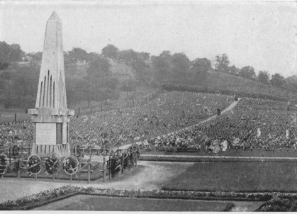
SAINTE-MENEHOULD. GREAT FRENCH MILITARY CEMETERY,
with monument to the defenders of the Argonne (10th and 18th C.)