A.—Commercy to Pont-à-Mousson (See above.)
B.—Pont-à-Mousson to Metz (See p. 109.)
Leave Commercy (Place de l’Hôtel-de-Ville) by the Rue du
Pont-des-Religieuses which, after crossing the Meuse, joins N. 58. Take
the latter.
Pass through Vignot (2 km.) and enter Vignot Wood (French gun
emplacements).
After crossing the wood the tourist approaches Gironville. Before
entering the village, on the crest to the right, is Gironville Fort.
In the village immediately beyond the church, N. 58 turns to the left.
Continue along it for 500 yards beyond the church, then leave it where
it turns to the right, and take G.C.D. 10 towards Apremont.
The road crosses the old French and German lines (shelters and
blockhouses), then rejoins, 200 yards east of Apremont, G.D.C. 1 bis,
which take to the right towards Bouconville.
Before going to Bouconville, visit Apremont, Brûlé Wood and Ailly Wood,
if this was not done on the first day (see pp. 42-52).
Notice, in succession, on the left, the ruins of Loupmont Village,
1,500 yards from the road; Montsec, further north, dominating the
whole district; and Vargévaux Pond, near the road.
Follow G.C.D. 1 bis, to Bouconville. Enter the village, leaving the
fine Girondel Pond on the right.
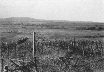
NO-MAN’S LAND, NEAR RAMBUCOURT
The 13th-14th century Church of Bouconville with its three naves is very
curious.
In the cemetery are numerous French graves.
The front line, after passing south of Apremont, continued first to the
right of the Bouconville road, then crossed the road to the west of
Vargévaux Pond, making a bend to include the latter within the French
lines, as also the village of Xivray, which was the junction of the
French armies with the American divisions. It then passed through the
hamlet of Seicheprey, and at Flirey rejoined the main road leading to
Pont-à-Mousson.
Keep along the road towards Rambucourt.
A little before this village, N. 58 is picked up again. All the way
the road is camouflaged and bordered by numerous trenches. Rambucourt
was badly damaged. Numerous shelters were made along the road against
the houses, the basements of which were occupied.

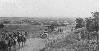
AMERICAN AMMUNITION CONVOY ENTERING SEICHEPREY
After passing through Rambucourt, N. 58 leads to Beaumont (in ruins).
Notice the shelters in the houses. The curious church suffered badly
(photo, p. 74).
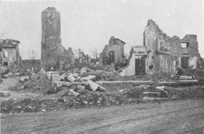
ROMANESQUE CHURCH OF SEICHEPREY
Four hundred yards beyond Beaumont, leave the National road and take
the Seicheprey road on the left.
Trenches, shelters and gun emplacements are met with, especially in a
hollow on the left. Seicheprey is next reached.
This village was the scene of one of the first successes of the American
Army. The Germans had taken it by surprise in April, 1918, and had kept
it for some time, when it was retaken by the 26th (New England)
Division.
Part of the belfry of the 12th century church is still standing (photo
above).
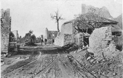
SEICHEPREY. THE MAIN STREET ON SEPT. 12, 1918
Near the church the road bends to the right and goes towards St.
Baussant. Half a mile further on the French and German first line
trenches are crossed. On entering St. Baussant, notice in a house on
the right in front of the stream a large machine-gun blockhouse in
concrete. The loopholes are on a level with the roof.
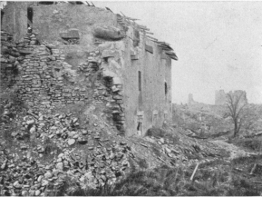
ST. BAUSSANT VILLAGE, ON ENTERING
The house on the left was transformed into a concrete Blockhouse. Above
the ruined wall: Loop-holes for the machine-guns. In the background:
Ruins of old Castle.
St. Baussant is almost entirely in ruins. To the right, on the hill,
stood the old château, of which only a few broken walls are left.
This village, being an important road junction, had been strongly
fortified by the Germans. It is one of the places where the American
tanks performed wonders, taking the position in less than half an hour.
The last house of the village, at the I.C. 13 crossing, on the right,
bears the inscription “Café Hocquard.” Here are three large concrete
shelters, the walls of which are five feet thick. At the fork in the
road is a machine-gun blockhouse in concrete.
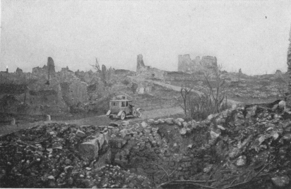
ST. BAUSSANT VILLAGE AND RUINS OF THE OLD CASTLE
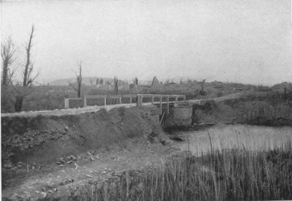
RICHECOURT VILLAGE AND THE RUPT-DE-MAD STREAM
In the foreground: The bridge over which I.C. 19 passes. In the
background: Montsec Hill.
Take I.C. 13 to the left, which follows the Rupt-de-Mad stream and
becomes G.C. 33 on reaching Lahayville. 1,600 yards beyond this
village (greatly damaged), leave G.C. 33 and take I.C. 19 to the
right. After crossing the bridge over the Rupt-de-Mad, Richecourt,
razed to the ground, is reached (photo above).
Near a house on the left, at the end of the village, is a German
concrete shelter with the inscription “Pommernburg.” Other shelters of
less importance are to be seen among the ruins.
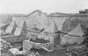
GERMAN SHELTER IN RICHECOURT VILLAGE
This concrete shelter is seen on leaving the village by the road to
Montsec. Over the door is the word “Pommernburg.” The village is a
heap of ruins.
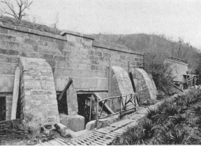
MONTSEC
German Telephone Exchange on the road to Woinville.
Follow I.C. 19 as far as Montsec (3 km.).
The village of Montsec is at the foot of the hill; it was badly damaged.
Montsec Ridge, or Hill 380, made a first-class observation-post for the
Germans, as it dominates the whole district from Apremont to Flirey.
Montsec was the scene of the fiercest fighting on June 17, 1916. The
French were unable to take it on account of its formidable defences.
From that time no surprise-attacks took place in this district.
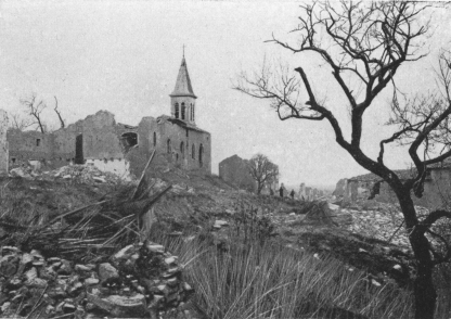
MONTSEC. RUINS OF CHURCH AND VILLAGE
On the crest, the Germans had constructed a system of tunnels, the
entries of which overlooked the region of Heudicourt-Buxières, and at
the end of which chimneys over 30 feet in height opened in the summit of
the hill. The observers climbed up the chimneys by means of ladders and
directed the firing of the artillery, which was massed in the
surrounding woods.
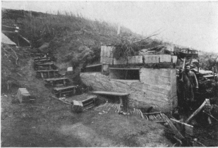
MONTSEC
German Signalling Post.
The system of trenches and shelters was remarkable. In some places the
shelters were furnished with electric light.
To visit the military works of Montsec, go beyond the village along
I.C. 19 and stop at the last houses on the left, where there is an
enormous concrete shelter, which served as an artillery telephone
exchange, (photo, p. 78). A narrow road leads from this shelter to
the entrances of the tunnels on the crest. (Time required to visit:
one hour.)
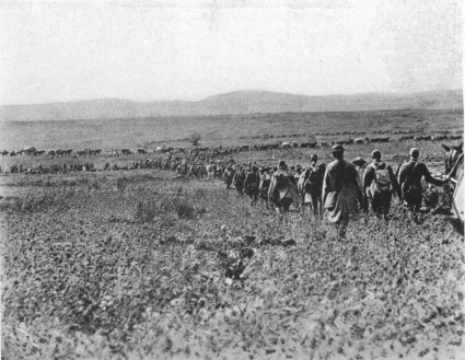
AMERICAN COLUMNS MARCHING TOWARDS MONTSEC (SEPT. 13,
1918)
After visiting Montsec return to St. Baussant by the same roads (I.C.
19 to Richecourt, then G.C. 33 and I.C. 13).
Follow I.C. 13 beyond St. Baussant to Maizerais (completely ruined),
seen on the left of the road, and Essey on the Rupt-de-Mad stream.
From December, 1916, the village of Essey was close to the front, and
occupied by the Germans. The inhabitants and mayor remained during the
occupation, but were forbidden, on pain of death, to go more than a
short distance from their homes.
In the village, at the corner of the Rue Béquille and the Grand Rue,
is a concrete blockhouse.
The church was partly destroyed. On its north front, protected by the
church belfry, were the Kommandantur’s quarters—an important concrete
construction with walls five feet thick.
After visiting Essey, take D. 3, which passes in front of the church,
and follow it towards Flirey.
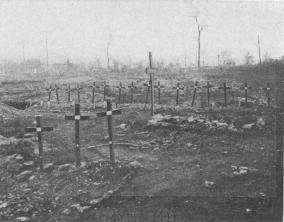
SONNARD WOOD
American Cemetery. In the background, at the foot of the larger trees,
is the road D. 3.
To the right and left are numerous shelters. Turn to the right
alongside Sonnard Wood, beside which, 50 yards from the road, are an
American cemetery and, on the left, Mort-Mare Wood.
Mort-Mare Wood is famous for the terrible struggles that took place for
its possession.
It was while reconnoitring over this wood in an aeroplane that Senator
Reymond was killed on October 22, 1914. He was returning from a flight
over Mars-la-Tour, Chambley and Thiaucourt, with Pilot Adjutant
Clamadieu, and the machine was turning to the right of the southern edge
of the wood, when it was seen descending, apparently normally, between
the French and German lines. Machine-guns at once opened fire; the
Adjutant was killed and Senator Reymond wounded. The French came out of
their trenches and a fierce struggle, which lasted until night, took
place round the machine. Only then was Reymond able to crawl into the
lines, while the French carried back the body of the Adjutant.
Reymond was taken to the hospital at Toul, and was able, before he died,
to give an exact account of the mission in the fulfilment of which he
had met such a glorious end.
On reaching the crest, the road crosses the old German first lines
(concrete blockhouses). Flirey next comes into sight.
This village, which formed part of the first French lines from 1914, is
almost completely in ruins, while the whole country around is laid
waste.
On the right are seen the ruins of Toul-Thiaucourt railway bridge.
Half a mile from the village, keep along D. 3, to visit the famous
Flirey Quarry, where there are numerous shelters and French graves. The
surrounding woods contain the emplacements of several batteries.
Return to Flirey and take, on the right, N. 58 towards Pont-à-Mousson.
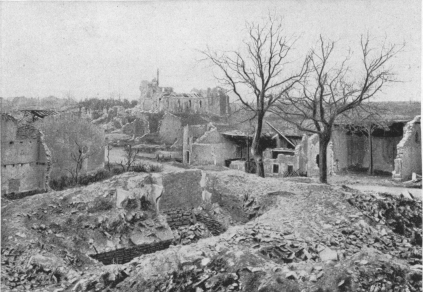
RUINS OF FLIREY VILLAGE
N. 58, seen in the photo, passes through the village.
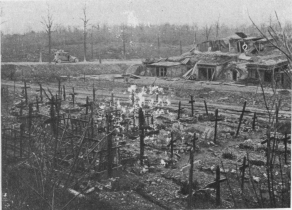
FLIREY QUARRY
In the background: D. 3 and Sonnard Wood.
One kilometre from Flirey, at the top of the crest, on the right, is a
military cemetery. The road runs parallel with the old French
first lines, which followed the crest on the left.
At the entrance to Limey, through which N. 58 runs, there is a large
French cemetery on the left.
The village of Limey, famous for the hard and bloody battles fought
there in September, 1914, is in ruins. The west front of the church was
torn open. Numerous shelters are seen, two of them, in cement, being
very large; the first, in the middle of the village on the right of the
main road; the other, a machine-gun blockhouse, in the last house on
the right.
Beyond Limey the road crosses a vast wooded district, known as La
Haye, which covers the whole plateau.
Two and a half kilometres from Limey, on the left side of the road, a
place called Fond-des-Vaux contains numerous French shelters (several in
concrete), and also a military cemetery. This is Lampe Camp.
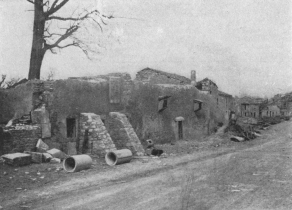
LIMEY VILLAGE
Concrete shelter on the right of N. 58, when coming from Flirey in the
middle of the village.
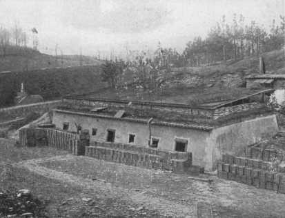
LAMPE CAMP
At the back, on the left: N. 58.
Three hundred yards further along the road there are American graves to
the right.
The Inn of St. Pierre is next reached, from which D. 15 leaves to the
left towards Thiaucourt. Take this road.
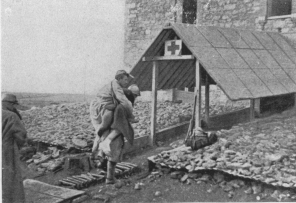
ST. PIERRE INN DRESSING STATION
Arrival of wounded soldier.
Throughout the war St. Pierre Inn, which is at the entrance to Prêtre
Wood, was the nearest dressing station to the front. The buildings
suffered little, thanks to the sheltering forest. Prêtre Wood will be
visited on leaving Pont-à-Mousson.
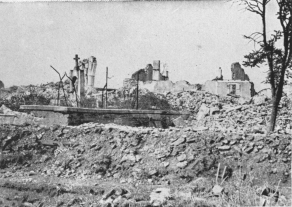
FEY-EN-HAYE CHURCH AND CEMETERY IN 1915
Eight hundred yards from the inn, to the right of D. 15, the
Fey-en-Haye road debouches. This road is not available for motors. A
visit to the village is interesting, as it was in the first French lines
(distance there and back, 3 km.).
Fey-en-Haye is about 100 yards from the western edge of Prêtre Wood.
At the end of September, 1914, a bloody engagement took place there. Up
to the end of March, 1915, this unfortunate village was continuously
bombarded, and it was entirely demolished when, on April 2, 1915, it was
taken by a French battalion (169th Infantry). Its capture was the
prelude to the last series of attacks which, after seven months of
terrific fighting, ended on May 31, in the capture of Prêtre Wood.
Fey-en-Haye is now merely a heap of ruins. A number of trenches run
through it, and a few shelters still exist.
After coming back to D. 15, continue along it as far as Regniéville, a
village of which nothing remains but part of the belfry of the church
(photo, p. 85).
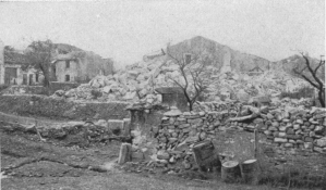
FEY-EN-HAYE. PLACE DE L’EGLISE IN 1915
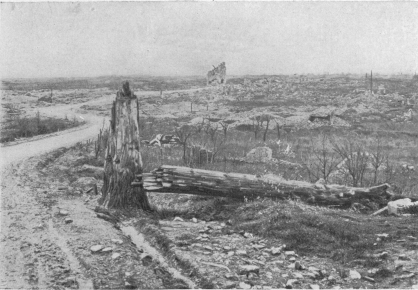
REGNIÉVILLE VILLAGE AND THE RUINED BELFRY OF THE CHURCH
For a long time Regniéville was the advance-post of the French line
between Mort-Mare Wood, on the left, and Prêtre Wood, on the right.
At the beginning of April, 1915, the French advance was especially
dangerous for the enemy, whose counter-attacks became more frequent. It
was evident that the slightest advance in the direction of Thiaucourt
would hamper the German communications between Metz and St. Mihiel, and
would hinder the revictualling of the troops as well as the steady
supply of reinforcements and munitions. That is why, on April 9, the
Germans made fifteen successive attacks to drive the French from their
trenches and the edge of Mort-Mare Wood.
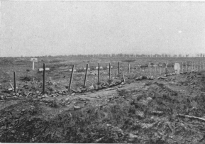
AMERICAN GRAVES AT REGNIÉVILLE
Keep on towards Thiaucourt. To the left of D. 15 there is an
American cemetery (photo below), 500 yards from Regniéville. 1 km.
further on, fifty yards from the road, and before entering Four Wood,
lies a derelict Renault tank (photo above), and beside it the graves
of its drivers. In the Wood are numerous German gun emplacements.
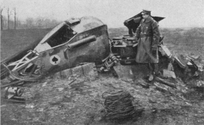
FOUR WOOD
Smashed Renault Tank at the edge of the wood.
On reaching the crest (Hill 340), on the right, alongside Saules
Wood, are two German gun shelters.
Further on, at the “milestone” 4 km. from Thiaucourt, is a concrete
blockhouse (photo below).
From I.C. 13, D. 15 descends in a large bend across Heiche Wood.
One kilometre from Thiaucourt, in a ravine on the right of D. 15, there
stood a large railway station and an important German military depot.
On the other side of the road there is a German cemetery containing
600 graves.
Thiaucourt, altitude 750 feet, stands in an amphitheatre, in the centre
of a loop described by the Rupt-de-Mad stream.
A large number of its houses are in ruins, especially on the banks of
the Rupt.
Thiaucourt was a rest-camp behind the German lines. Numerous huts were
erected on the banks of the stream, many vestiges of which still remain.
After crossing the Rupt-de-Mad in Thiaucourt, keep along the street
which continues the bridge and rises to the end of the town. On the
right, towards the last of the houses, is I.C. 13, leading to Jaulny.
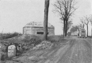
THIAUCOURT ROAD (D. 15). MACHINE-GUN BLOCKHOUSE
Recross the Rupt-de-Mad at the entrance to Jaulny. Take to the left,
along the river, the road running through the village, many of whose
houses were damaged by shells.
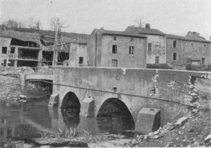
THIAUCOURT. BRIDGE OVER THE RUPT-DE-MAD
On leaving Jaulny there is a large German cemetery on the right.
I.C. 13 runs through a pretty valley, alongside the Rupt-de-Mad and
passes near the railway station. The old road having been destroyed by
the explosion of a German ammunition train, a new road enables the
tourist, by crossing the river, to reach the village of Rembercourt on
the left bank. The bridge was blown up and many of the houses are in
ruins.
I.C. 13, which continues alongside the Rupt-de-Mad as far as the
Moselle, is next reached. This road is extremely picturesque.
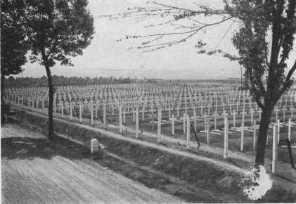
AMERICAN CEMETERY AT THIAUCOURT, AT THE SIDE OF D. 15,
HALF A MILE FROM THE VILLAGE
Leaving Villecey-sur-Mad, slightly damaged, on the right, go towards
Onville. Three hundred yards this side of the village, to the left of
I.C. 13, is a large German cemetery. The village, on which a few shells
fell, contains a fine church.
Vandelainville, which is the continuation of Onville, contains several
houses damaged by the bombardments.
Passing through the villages of Bayonville and Arnaville, N. 52
bis, which runs along the left bank of the Moselle, and which take to
the right in the direction of Pagny-sur-Moselle.
This village, also called Pagny-sous-Prény, from the name of the hamlet
and château which dominates the surrounding country, was for forty-eight
years the Custom House, being the last French railway station before the
frontier.
Prény Château, the ruins of which are visible from here, was one of the
most famous castles of the Middle Ages. Built by the Dukes of Lorraine,
it was dismantled by Richelieu. It formed a square flanked by high,
strong towers connected with one another by walls and subterranean
passages hollowed out of the rock. At one end there was a second
building, also surrounded by moats and flanked by towers, in one of
which was the famous “Mande-Guerre” bell. The keep with the chapel and
living-rooms stood there.
Pagny suffered severely, most of the houses being in ruins.
The road turns to the left into the valley, then to the right beyond
the church, which is left on the right.
Just outside Pagny-sur-Moselle the Germans built a concrete barrier
across the road to stop the tanks.
About 500 yards from Pagny, near the bridge over Mouton stream, is a
machine-gun blockhouse in concrete on the right.
N. 52 bis next passes through Vandières, which was burnt down by the
Germans during their retreat of September 16. All the houses along the
road, especially those on the left, are in ruins.
Five kilometres further on, after crossing the railway, Pont-à-Mousson
is entered by the Rue du Port, Place Colombe and Rue St. Laurent; the
latter brings the tourist to the Grand Place or Place Duroc.
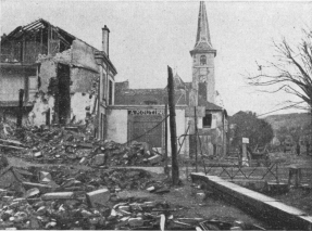
VILLAGE OF PAGNY-SUR-MOSELLE, NEAR THE CHURCH
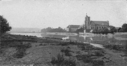
PONT-À-MOUSSON. THE BANKS OF THE MOSELLE
Pont-à-Mousson is an old town, in whose archives are found deeds dating
back to 896 and 905. At that time it was called “Villa Pontus sub
castro Montionis” (The Town of the Bridge under the Castle of Monçon).
In the 16th century there was a long controversy between the professors
of the University and those of the Jesuit College as to whether the town
(“Pont”) or the castle (“Monçon” or “Mousson”) should have precedence,
i.e. if one should say “Ponti Mussum” or “Mussi Pontum.” The
dispute was settled and the name “Ponti Mussum” (Pont-à-Mousson)
decreed by Duke Charles III. Nevertheless, the inhabitants still insist
on calling themselves “Mussipontins.”
Renaud I., Count of Bar, living a retired life in his château of
Mousson, founded near the town in 1106 a priory dedicated to St. Michel,
which he gave to the Abbey of St. Mihiel. In 1239 the “Messins”
(inhabitants of Metz) broke down the bridge to prevent the Count of Bar
communicating with his castle, but three years later they joined the
Count of Bar against Duke Mathieu who, in revenge, burned down the
little town of Pont.
Enfranchised in 1263 by Count Thiébaut II., Pont-à-Mousson was raised to
a marquisate in 1355 by Emperor Charles IV., and, in 1356, was granted
the rights and privileges of an imperial town.
Charles-the-Bold took possession of it in 1476, but it was retaken later
by Duke René. However, the defection of his Swiss troops forced him to
surrender it again to the Duke of Burgundy.
What made the glory and prosperity of the town was the foundation of a
University in 1572. The influx of students and the renown of the
professors made Pont-à-Mousson famous until 1763, when the University
was transferred to Nancy.
The University encouraged the establishment of printing works, and
volumes printed by Marchand and Melchior Bernard are still justly
prized.
Although an open town, Pont-à-Mousson was violently bombarded by the
Germans as early as August 11, 1914. After a short occupation the town
was liberated by the French on September 13, 1914. The bombardments were
resumed and lasted till the end of the war.
As to the part played by Pont-à-Mousson in the Battle for the Grand
Couronné Heights, see the Michelin Guide, “Nancy and the Grand
Couronné.”
| Arbitrary Signs |
A.—Church of St. Laurent.
B.—Church of St. Martin.
C.—Lesser Seminary.
H.—Hôtel-de-Ville.
1.—Rue du Port.
2.—Rue St. Laurent. |
3.—Place Duroc.
4.—Rue de l’Union.
5.—Rue Gambetta.
6.—Rue St. Martin.
7.—Rue Victor Hugo.
8.—Place Thiers.
9.—Avenue Carnot. |
Starting-point: Place Duroc (or Grand Place), in which stands the
Hôtel-de-Ville.
Place Duroc, with its irregular arcades and Renaissance houses, presents
a very characteristic appearance.
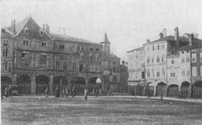
PLACE DUROC, WITH ITS ARCADED HOUSES
Maison Leguy: the 3 first arcades, beginning at the turret. The 4th and
5th arcades belong to the House of the Seven Capital Sins.
Visit first the “House of the Seven Capital Sins,” decorated with
caryatids. At the bottom of a court there is a fine bas-relief
representing The Conversion of St. Paul.
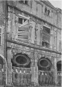
THE HOUSE OF THE SEVEN CAPITAL SINS
A little further on is the Maison Leguy, recognisable by its hexagonal
turret, which rests on one of the corner pillars of the arcades.
Tradition attributes its construction to the Templars, and says that a
subterranean passage led from it across the Moselle and up to Mousson.
The turret is at the corner of Rue Victor Hugo, which take to see, in
the Rue de l’Union (first street on the left), two curious doors at Nos.
6 and 8.
Return to Place Duroc, turn to the left into Rue St. Laurent and see,
in the court of No. 9, a fine gallery delicately carved in Renaissance
style (slightly damaged by the bombardment); at No. 11, a handsome
façade with a charming court, an old well, the railing of the old
terrace, a spiral staircase and timbered ceilings; at No. 19, the
façade, door and entrance.
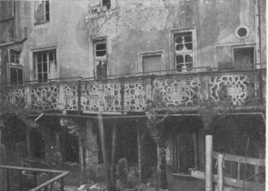
OLD RENAISSANCE BALCONY AT NO. 7, RUE ST. LAURENT
Opposite No. 19 is the Church of St. Laurent; it was slightly damaged,
the roof being pierced by shells in several places.
This church, frequently restored, offers no particular interest.
Inside there is a reredos in the form of a triptych, which came from the
neighbouring Convent of the Poor Claires at Pont-à-Mousson. This work is
by “Georgin le painctre,” and dates from the 16th century.
It represents: the Baptism of Christ, the Resurrection of Lazarus,
the Healing of the Blind at the Pool, and the Burial of Christ.
The Chapel of Our Lady of Pity contains a celebrated “Christ carrying
the Cross” by Ligier Richier. (See note, p. 56, regarding this famous
sculptor’s works.)
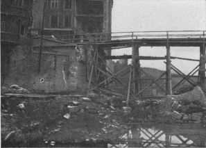
TEMPORARY BRIDGE OVER THE MOSELLE (left bank)
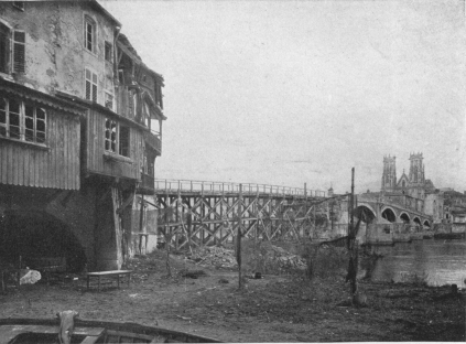
DESTROYED STONE BRIDGE OVER THE MOSELLE, WITH TEMPORARY
WOODEN FOOT-BRIDGE
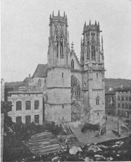
CHURCH OF ST. MARTIN. WEST FRONT
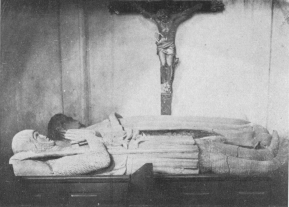
CHURCH OF ST. MARTIN
14th century tomb of a knight and his wife.
Return to the Place Duroc, take the street leading to the bridge, which
comes out opposite the “House of the Seven Capital Sins.” The fine
stone bridge was partly destroyed. A temporary footway, however, makes
it possible to cross the Moselle here and reach the Rue Gambetta.
On the left, at the corner of Rue St. Martin, stands the greatly
damaged Church of St. Martin. All the stained-glass windows were
destroyed. Several shells pierced the walls and roof.
The Church of St. Martin (Hist. Mon.) is the old church of the
Antonists, and was built in 1474.
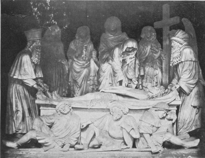
THE SEPULCHRE (16TH CENTURY) IN THE CHURCH OF ST.
MARTIN

CHURCH OF THE PETIT SÉMINAIRE
Façade facing the Rue St. Martin.
The very narrow façade is in florid pointed style. The interior of the
church has undergone numerous unfortunate restorations. In the aisles
are: on the left, the funeral statues of a 14th century knight and his
wife; on the right, the tomb of Esther of Apremont, with her
coat of arms (1592), and a particularly interesting late 16th century
sepulchre (see photos, p. 94).
A triforium runs round the nave, and the tribune is closed by a fine
open-work gallery dating from the end of the 16th century.
Unfortunately, the choir is disfigured by a facing of marble which
conceals the frescoes that decorated the walls.
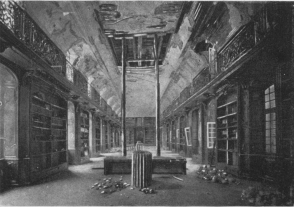
THE LIBRARY OF THE PETIT SÉMINAIRE
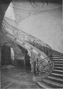
SPIRAL STAIRCASE OF THE PETIT SÉMINAIRE
Beside the church, in the Rue St. Martin, is the Petit Séminaire,
housed in the sumptuous Abbey of the Premonstrants, dating from the
early part of the 18th century.
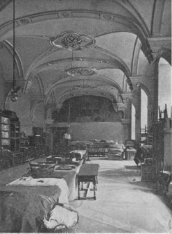
REFECTORY OF THE PETIT SÉMINAIRE
It was very seriously damaged by the bombardments. The chapel and its
façade, the parlour, in very outlined rock-work style, splendid
staircases, large cloisters and, above all, the famous wood-carvings in
the library, were especially noteworthy.
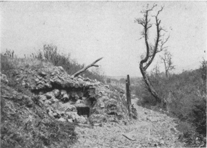
NARROW RISING ROAD TO MOUSSON, WITH SHELTER IN THE
FOREGROUND
To reach Mousson, proceed to the end of the Rue Gambetta, in the
opposite direction to the Moselle.
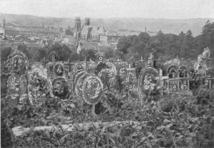
CEMETERY OF PONT-À-MOUSSON
At the side of the above road (continuation of Rue Gambetta).
Leave the car at the entrance to the Avenue de Metz (on the left) and
walk up the hollow road (opposite the Rue Gambetta), which skirts the
cemetery. (Time required: half an hour.)
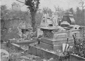
RUINS OF TOMBS IN THE CEMETERY AT PONT-À-MOUSSON
Along this road artillery batteries were posted, the emplacements of
which may still be seen.
Take a glance at the cemetery, where a number of graves have been
destroyed.
The village of Mousson is at the top of a hill where there have been
successively: a Roman camp, an Austrasian fortress and, in the 10th
century, the château of the Countess Sophie de Bar, reduced to ruins by
Richelieu.
The fortifications consist of a first line covering the village, and a
second surrounding the château. The houses thus form a semicircle
between the two ramparts.
The village was greatly damaged during the war. Most of the houses are
in ruins. Some of them had tricusped windows and curious 15th and 16th
century doors.
Skirt the ancient Chapel of the Templars to reach the terrace of the
old château.
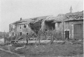
A CORNER OF MOUSSON VILLAGE
In the background: JOAN-OF-ARC TOWER AND STATUE
All that remains of the château is the central chapel (11th-12th
century) (Hist. Mon.), which was unhappily enlarged about 1895, and
to which a battlemented tower surmounted by a gilt statue of Joan-of-Arc
was added.
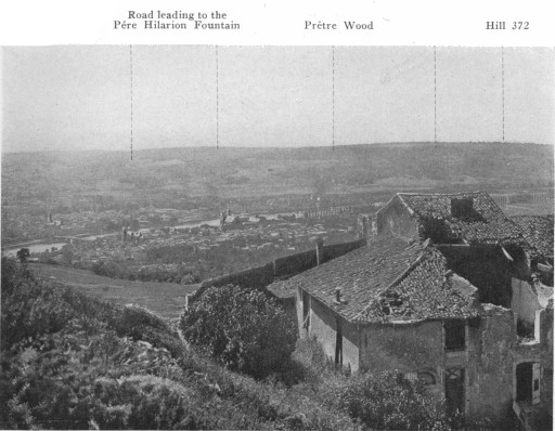
PONT-À-MOUSSON AND PRÊTRE WOOD, SEEN FROM MOUSSON
The chapel (Hist. Mon.), with a semicircular vaulted roof on curious
pillars, contains fine baptismal fonts (1085) decorated with sculptures.
These fonts, resembling the curb-stone of a well, are decorated with
bas-reliefs representing: John the Baptist preaching repentance to
publicans and soldiers who came to him in the wilderness; John baptizing
two naked Jews immersed in a cistern; John baptizing Jesus Christ,
plunged up to the waist in the waters of Jordan.
On the terrace are numerous trenches, in addition to shafts dug by the
engineers to reach the underground passages which communicate with
concrete shelters. One of these shelters may still be seen along the
southern ramparts of the old château. All these military works are very
interesting to visit.
There is a splendid panorama from this terrace: on one side (photo,
pp. 100 and 101) the town of Pont-à-Mousson and the valley of the
Moselle with, behind Pont-à-Mousson, Puvenelle Forest and Prêtre Wood;
on the other side, the valley of the Seille, with Metz Cathedral in
the distance. To the south-east is seen the Grand Couronné.
Mousson was a first-rate observation-post for the French gunners, which
explains the fortifications that were erected there during the war.
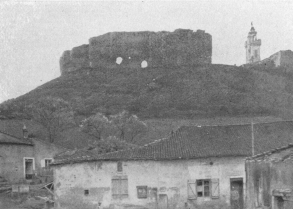
RUINS OF THE OLD FORTIFIED CASTLE OF MOUSSON
On the right: JOAN-OF-ARC TOWER AND STATUE
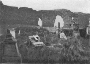
MOUSSON CEMETERY
In the background: WALLS OF THE OLD FORTIFIED CASTLE
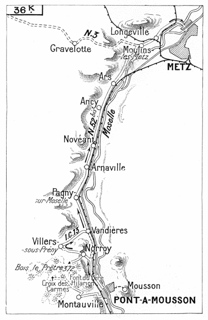
A.—From Pont-à-Mousson to the Croix des Carmes, via Montauville,
returning to Pont-à-Mousson
Prêtre Wood dominates all the southern part of the Plain of Woëvre
(altitude: 1,200 feet).
From October, 1914, to May, 1915, it was the scene of a continual
struggle, at the end of which the wood remained in the hands of the
French.
It was in September, 1914, that the Germans installed themselves in
Prêtre Wood, which they at once fortified with barbed wire,
chevaux-de-frise, etc.
On September 30, 1914, the French obtained a footing in the
south-western edges of the forest. A month later (October 29) they
captured a German post in the south-eastern salient. Their efforts were
next concentrated on Père Hilarion Ravine, which they gradually occupied
after many fights in the rain and snow of November and December.
Their troops advanced by short rushes as far as the principal line,
which had to be taken by a direct attack. First, artillery was brought
up by night to prepare the attack. Sappers, by long and patient sapping,
blew up the minor defences and penetrated the blockhouses. The
adversaries were at times less than a hundred yards apart.
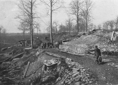
PRÊTRE WOOD. SHELTERS IN CARRIÈRES RAVINE
From January, 1915, the French operations were directed against the
western portion, towards Quart-en-Réserve and Croix des Carmes Hill.
Four lines of trenches bristling with machine-guns and defences held up
the attack. The ground had to be taken bit by bit, and often a
counter-attack would win back in the evening the gains of several days’
hard fighting. The first line was carried on January 17, and the second
on February 16. At this point aerial torpedoes and hand grenades caused
progress to slow down. The third line was captured on March 30. Attacks
and counter-attacks followed. Fighting with hand grenades took place in
the communicating trenches, behind barrages, and the artillery on both
sides covered this narrow strip of ground with projectiles, breaking
down the parapets and destroying the communicating trenches. The
Germans, who lost heavily, brought up endless reinforcements—in all
about sixteen battalions—thus showing the importance which they
attached to this position.
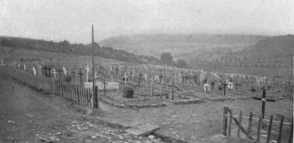
The final attack was launched on May 12. The French carried the
blockhouses and the northern slopes beyond the crest, but the enemy
still clung to the eastern and western slopes. However, the wood was
won, and the splendid observation-post which the hill afforded was
thenceforth in the hands of the French.
In the little cemetery on the hillside hundreds of heroes sleep their
last sleep.
The slopes near the road throughout this district are one vast cemetery,
while the wood proper hides beneath its soil hundreds of dead entombed
by the explosion of mines or the falling-in of trenches.
This wood of tragic memories was called by the Germans “The Wood of
Death,” or “The Widows’ Wood.”
Leave Pont-à-Mousson by Avenue Carnot, cross the railway (l.c.),
leaving N.57 on the left (which follows the railway towards Nancy) and
continue along N.58 to Montauville, 2 km. from Pont-à-Mousson.
This village did not suffer much. On entering, there are several large
concrete machine-gun blockhouses on the right.
The nearest dressing station was at Montauville, in the cellar of a
ruined house. First aid was given in the trenches or in the little hut
near the big oak tree. From Montauville the wounded were taken in motors
to Pont-à-Mousson. There was a constant procession of ambulances,
stretcher-bearers and hospital attendants on the road.
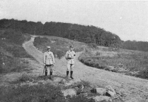
ENTRANCE TO PRÊTRE WOOD
Motors stop at the fork. The road to the left leads to Fey-en-Haye,
Tourists should take the one to the right leading to the Père Hilarion
Fountain and the Croix des Carmes.
Beyond a knoll opposite the church of Montauville, take on the right a
downhill road which turns sharply and leads to the village cemetery.
Here the road forks. Take the road on the left, which first dips and
then a little further on rises in the direction of Prêtre Wood. This
road is in bad condition, but in dry weather motors can go as far as the
entrance to the wood.
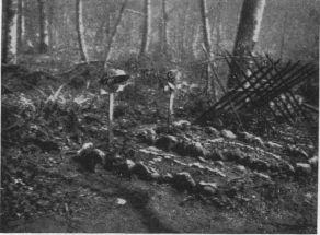
FRENCH AND AMERICAN GRAVES ON THE ROAD TO THE PÈRE
HILARION FOUNTAIN
About 800 yards from the cemetery the road branches, that on the left
going to Fey-en-Haye. Take the road on the right, which soon leads to
Prêtre Wood.
On the right, at the roadside, about 1,200 yards from the fork, are two
graves: one of an American, the other of a French soldier.
Three hundred yards further on, in a ravine to the right of the road,
are the fountain and house of Father Hilarion. All around are
numerous trenches, shelters and military works of all kinds.
Père Hilarion fountain remained for some time between the opposing
lines. Germans and French alike came there every day to draw water, and
by a tacit understanding each side came at the definite hour. During
this respite no shot was fired from the trenches.
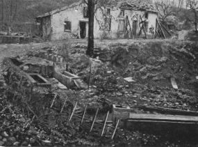
THE PÈRE HILARION FOUNTAIN AND HOUSE
Follow the road (leaving on the right a steep uphill road, 150 yards
from the fountain) which for 800 yards, down a gentle slope, crosses
the part of the wood called the “Mouchoir” and “Croix des Carmes”
Sector. This formed the first Franco-German lines.
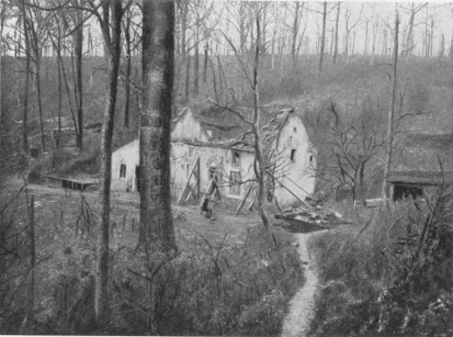
THE HOUSE OF FATHER HILARION IN PRÊTRE WOOD
The sight is a moving one: destroyed trees, the ground torn up by
shells, trenches fallen in and battered shelters.
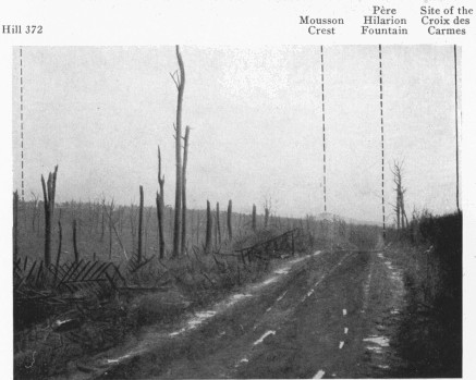
When the road reaches the crest, look back. The sight is more tragic
still. In the distance is seen Mousson Crest, which stands out above the
trees of Prêtre Wood and, to the right, on a small hill, 100 yards from
the road, the site of the famous “Croix des Carmes.”
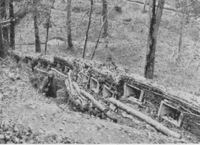
GERMAN TRENCHES IN “MOUCHOIR” SECTOR, PRÊTRE WOOD, NEAR
PÈRE HILARION FOUNTAIN
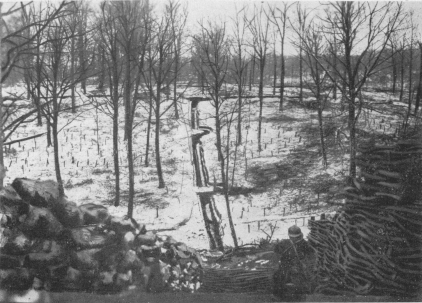
PRÊTRE WOOD, THE “PELLEMENT” TRENCHES IN “MOUCHOIR”
SECTOR
When the position was taken by the French, sappers of the Engineers
Corps piously removed the cross from its place and carried it to the
cemetery in the valley where the heroes of these battles lie buried.
There they erected it, and surrounded it with some of the barbed wire
from the late German trenches.
Return to Montauville, then to Pont-à-Mousson by the same road.
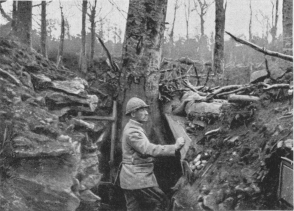
PRÊTRE WOOD. “MOUCHOIR” SECTOR Gen. Le Bocq in a Trench,
twenty yards from the enemy lines.
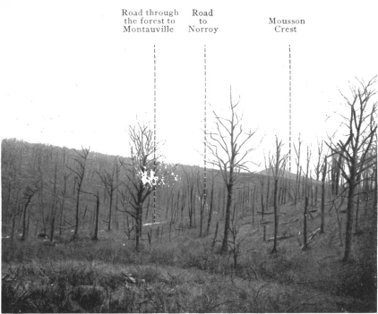
Road Through the forest to Montauville
Road to Norroy
Mousson Crest
PRÊTRE WOOD. CROIX DES CARMES SECTOR
Hill 372
Mousson Crest
Père Hilarion Fountain
Site of the Croix des Carmes
PRÊTRE WOOD. BETWEEN THE FRENCH AND GERMAN LINES
Seen from near the Croix des Carmes, on the road to Montauville (in the
foreground).
SECOND DAY (continued)
B.—From Pont-à-Mousson to Metz
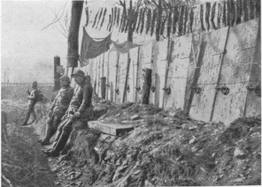
BARRICADE ON THE ROAD FROM PONT-À-MOUSSON TO NORROY
B.—PONT-À-MOUSSON TO METZ
From Pont-à-Mousson to Norroy and Hill 372
At Pont-à-Mousson, on returning from Montauville, cross the railway
(l.c.), take Avenue Carnot, then Rue Victor Hugo to Place Duroc. Turn to
the left into Rue St. Laurent, which leads to N. 52 bis.
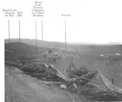
NORROY AND THE MOSELLE VALLEY, SEEN FROM HILL 372 TO THE
S. W. OF NORROY, ON THE NORROY-FEY ROAD
Follow the latter 3 km. to a narrow road on the left leading to
Norroy. Cross the village to the Place de l’Eglise. Leave the church
on the right and keep along the road which rises sharply towards the
crest of Hill 372. The entrance to Prêtre Wood, on the German side, is
here.
On this crest several fortified quarries served as shelters for the
guns. In the wood are a number of concrete shelters, trenches and
observation-posts, one of which, cupola-shaped, is well worth a visit.
Return to Norroy, then, in front of the church, take on the left the
road towards Villers-sous-Prény, which winds round Hill 372.
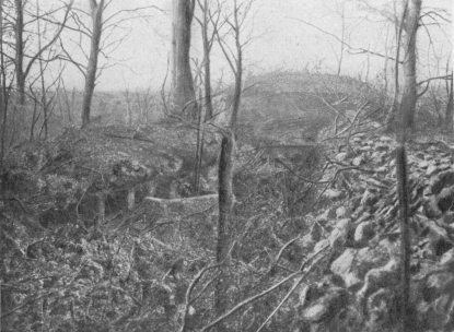
GERMAN OBSERVATION-POST ON THE TOP OF HILL 372. ENTRANCE
TO PRÊTRE WOOD (coming from Norroy)
On leaving Norroy, the road rises sharply, then zigzags down the side
of Hill 372. One kilometre from Norroy, and 100 yards to the left of the
road, is a veritable village of concrete and stone, built in a quarry
by the Germans, with shelters in the rock more than thirty feet deep. It
served as a Post of Commandment, and was fitted with a telephone
exchange which directed the artillery-fire in the Prêtre Wood sector.
The road continues to descend to Villers-sous-Prény (2 km.). There is
a German cemetery on the left, before entering the village, many
houses of which are in ruins.
At Villers take I. C. 13 on the right to Vandières (3 km.), where
N. 52 bis is joined. Take same on the left to Metz.
This road, which runs alongside the Moselle, is picturesque, but in bad
condition, especially between Arnaville and Metz. (N. 57 from
Pont-à-Mousson to Metz, on the right bank of the Moselle, is in much
better condition, but less picturesque.)
The road passes through Pagny-sur-Moselle (see p. 109).
The valley of the Moselle becomes prettier and prettier; varied scenery,
picturesque landscapes and villages nestling in the sides of the hills.
The road turns to the left and crosses the Rupt-de-Mad stream at
Arnaville—the last village on the frontier since 1870, and the boundary
of the old “département” of the Meuse.
It next passes through Novéant, where for a long time the German
customhouse was installed. The village contains a château; in the church
there is a carved ivory figure of Christ.
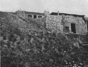
GERMAN POST OF COMMANDMENT BELOW HILL 372
(1 km. from Norroy on the left of Norroy-Villers road.)
After passing through Dornot and Ancy, the tourist soon reaches
Ars-sur-Moselle.
The name “Ars” (Arches) is derived from the arcades of the Roman
aqueduct, the imposing remains of which are still to be seen. Known
locally as the “Devil’s Bridge,” it extended as far as the village of
Jouy on the right bank of the Moselle, and served to bring water to the
baths and swimming-pool of the amphitheatre of the ancient Divodurum
(Metz). It was 3,240 feet long, and 50 feet high. The church, burned
down in 1807, was rebuilt in 1816 on the site of an ancient Roman
fortress. Ars contains important ironworks and a paper factory.
Moulins and Longville are next passed, after which Metz is entered
by France Gate. Take the Rue de Paris, Ponts des Morts, Rue du Pont des
Morts, Pont Moyen, Rue St. Marie, Rue du Faisan, Place de Chambre, then
Rue d’Estrées on the right, to Place d’Armes, in which stands the
Cathedral.
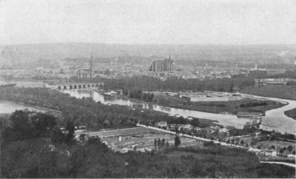
METZ SEEN FROM THE FORT OF ST. QUENTIN
METZ ORIGIN AND CHIEF HISTORICAL FACTS — The Fortifications — METZ AFTER THE SIGNING OF THE ARMISTICE — A VISIT TO METZ — The Cathedral — The Hôtel-de-Ville — THIRD DAY — METZ-ETAIN-VERDUN — ETAIN
The origin of Metz dates back to the Celtic epoch, when it was the
capital of the Mediomatrici. The Romans fortified it, to defend the
frontiers of the empire against the barbarians. Metz then became the
centre of six great Roman roads leading to distant provinces: two from
Metz to Rheims, two from Metz to Trèves (one on the right, the other on
the left bank of the Moselle), one from Metz to Strasburg, and one from
Metz to Mainz.
A very rich and populous town, it was embellished by numerous Roman
buildings, of which excavations have laid bare important remains: an
amphitheatre, near Porte Mazelle, and above all Gorze Aqueduct (4th
century), more than thirteen miles in length, which brought water from
Gorze to Metz. Some fine remains of the aqueduct may still be seen at
Jouy-aux-Arches.
The Roman Emperors who visited Metz stayed at the Governors’ Palace,
which stood in Place St. Croix.
Metz was taken and laid waste by the Huns in 451.
Half a century later it was rebuilt and, on the death of Clovis (511),
became the capital of Austrasia and the cradle of the Carolingian
dynasty. Louis-le-Débonnaire was buried in the Abbey of St. Arnoul. The
Treaty of Verdun (843) gave it to Lothaire, who made it the capital of
his kingdom Lotharingia (afterwards Lorraine). Thirty years later the
Treaty of Mersen (870) handed it over to Louis the Germanic.
It was governed, in the name of the emperor, first by the counts and
later by the bishops. In 1220, on the death of Count Thiébaut, the town
became a sort of republic under the title of “Free Imperial Town,” and
was governed by the sheriffs until 1552.
Under Henri II. the French, led by Montmorency, occupied the town, after
a treaty concluded with Maurice of Saxony. The Duke of Guise, appointed
Governor, energetically defended Metz, besieged by Emperor Charles-Quint
(October 19, 1552). On January 1, 1553, Charles-Quint raised the siege,
after having lost 30,000 men. For a long time the kings of France bore
the title of “Protector.” Henri III. was the first to call himself
“Sovereign Ruler.” The Parliament of Metz, created in 1633, completed
the ruin of its municipal independence, and the Treaty of Westphalia
(1648) definitely incorporated it with France. It was the capital of the
“Three Bishoprics” formed by the union of Metz, Toul and Verdun.
Until the Revolution (1789) Metz, while escaping the horrors of war,
constantly felt its effects. Troops were continually passing through it,
and its barracks became a mustering-ground. Turenne, Villars, the
Marquis de Créquy, and Marshal de Villeroy camped within its walls, and
it was at Metz that in August, 1744, Louis XV. was taken seriously ill,
on which occasion the whole of France prayed and fasted for their
“well-beloved” King.
In 1790, Metz became the chief town of the new “Département” of Moselle.
Two sieges, in 1814 and 1815, were victoriously resisted.
1870 was a black year in the annals of the town—till then known as
“Virgin Metz.”[A] The battles of Borny (August 14), Rézonville (August
15), St. Privat (August 18), forced Marshal Bazaine to retire under
the walls of the town. He resisted feebly, contenting himself with
awaiting events, and did not even attempt to cut his way through, which
would have saved the honour of the armies under his command. On October
28 he signed the capitulation, and on the following day surrendered with
173,000 men, 60 generals, 6,000 officers, 58 standards, 622 field-guns,
876 siege-guns, 72 machine-guns, 260,000 rifles and huge quantities of
stores and munitions. Six months later (May 10, 1871), by the Treaty of
Frankfort, Metz and part of the “département” of Moselle were ceded to
Germany. Metz thus became the capital of German Lorraine.
It was from Metz that La Fayette set out in 1775 on his immortal
expedition to help America win her freedom and independence. In grateful
remembrance of that glorious event the “Knights of Columbus” recently
decided to erect a statue of La Fayette in Metz (to be inaugurated in
1920).
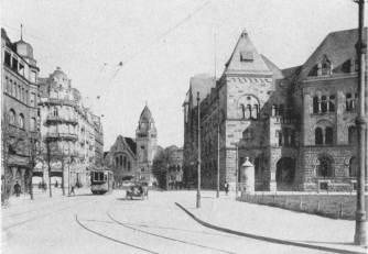
GENERAL POST OFFICE AND RAILWAY STATION
From its position Metz was destined to become a stronghold of the first
importance. The Romans fortified the town built by the Gauls, and
erected the first citadel. The walls were preserved for a long time, and
Bishop Robert, in the 10th century, utilised their remains. It was only
in the 12th century that the new ramparts included the island formed by
the two arms of the Moselle. They consisted of a high wall protected by
sixty-eight towers. In 1552 the Duke of Guise commissioned an engineer,
Pierre Strozzi, to restore these fortifications, which had withstood
two sieges (1444 and 1552), and were in a dilapidated condition. Four
years later (1556) Marshal de Vieilleville erected a citadel flanked by
four bastions, on the site of the old convents. This citadel (which
remained standing until 1802) stood on the site of the present
Esplanade.
About a century later Vauban, fully aware of the strategic value of
Metz, conceived a great scheme, which was carried out in the 18th
century by an engineer, M. Cormontaigne. Vauban, for his part, added
eleven new bastions to those which already guarded the citadel, but it
was Cormontaigne who perfected the plans for inundating the valley of
the Seille by utilising the waters of Lindre Pond.
Metz became finally one of the most formidable fortresses of Europe.
Under Louis-Philippe the fortifications were entirely restored, and in
1866 preparations were made to rebuild them on a new plan, better
adapted to the exigencies of modern armaments and technique. Of the four
detached forts of St. Quentin, Plappeville, Queuleu and St. Julien, only
the first two were completed in 1870.
The Germans considerably strengthened the fortifications by means of
nineteen bastions surrounded by moats, the latter being protected by
thirteen out-works. The length of the line of forts was increased to
eighteen miles, and eleven new forts were added.
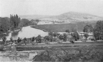
METZ. ST. QUENTIN FORT (seen from the Esplanade)
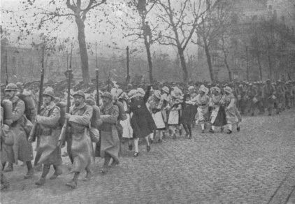
METZ. AFTER THE ARMISTICE. ENTRY OF FRENCH TROOPS
November 19, 1918.
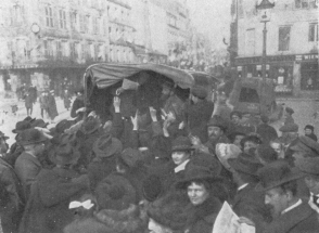
THE FIRST FRENCH NEWSPAPERS TO ARRIVE
November 19, 1918.
When the Armistice was signed on November 11, the forts of Metz were
within range of the American artillery, which had already bombarded them
several times, while the troops had taken up the positions from which
the offensive, arranged for the 16th, was to have been launched. The
terms of
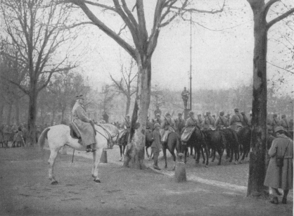
METZ. FRENCH TROOPS DEFILING BEFORE MARSHAL PÉTAIN
November 19, 1918
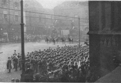
PLACE D’ARMES, NOVEMBER 19, 1918
In the background: Statue of Marshal Fabert.
the Armistice called for the evacuation of the invaded territory,
including Alsace and Lorraine, before the 26th. It was into Metz, freed
of German soldiers, that the French troops made a solemn entry on
Tuesday, November 19, 1918, amid scenes of indescribable enthusiasm.
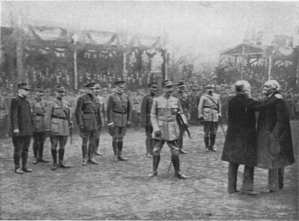
METZ. GENERAL PÉTAIN MADE MARSHAL OF FRANCE
After the ceremony: President Poincaré embraces Prime Minister
Clémenceau.
The march past took place on the Esplanade, before General Pétain, made
Marshal that morning. Mounted on a white horse and wearing his large
blue coat, he had taken his stand in front of the statue of Marshal Ney.
He was assisted by General Fayolle, commanding a group of armies, and by
Major-General Buat. General Mangin, commanding the 10th Army, had met
with an accident while riding, and his place was taken by General
Leconte. On the same day M. Mirman, who had been appointed Commissioner
of the Republic, was received by General de Maud’huy, Governor of Metz.
Salvos of cannon and the ringing of the famous “Mutte” bell in the
Cathedral celebrated this joyful day.
On the following Sunday, November 24, the leading men of Metz elected
the new Town Council, and decided to restore the names of the streets in
use prior to 1870, and to name new streets after generals and prominent
men who had distinguished themselves in the Great War. The list was
published in a decree dated December 7.
On Sunday, December 8, President Poincaré, accompanied by the French
Prime Minister, M. Clémenceau, the Presidents of the Chambers,
Ministers, Marshals, and French and Allied Generals, proclaimed the
definite return to France of the lost provinces. It was a day never to
be forgotten by those who witnessed it. Young girls in the national
costume of Lorraine—birthplace of the French President—marched through
the streets, and flowers were showered from the windows on the
procession.
In the morning there was a review on the Esplanade, and a
Field-Marshal’s bâton was presented to General Pétain. The President
of the Republic opened the proceedings with an address, after which an
unforeseen and touching incident occurred; overcome with emotion, M.
Poincaré and M. Clémenceau embraced each other.
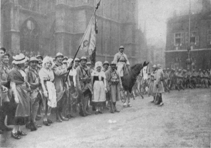
METZ. LORRAINE GIRLS GROUPED AROUND THE FRENCH FLAG
November 19, 1918.
In the afternoon there was a reception in the Hôtel-de-Ville, at which
President Poincaré summed up in a stirring speech the whole history of
Metz, and concluded with the following words:—
“Years have gone by, but Metz has not changed. The protests
formerly made to the ‘Reichstag’ in the name of the people of Metz,
in the name of all the people of Lorraine, by that great Bishop,
Mgr. Dupont des Loges, continued calmly and firmly after his death.
Citizens of Metz, you renewed them, year after year, by pilgrimages
to Mars-la-Tour, by visits to the cemeteries, and by fostering
French memories.... Beloved town of Metz, your nightmare is
over—France returns and opens her arms to you!”
The procession was then received with great ceremony by Mgr. Felt at the
Cathedral, and finally went to the cemetery of Chambière, to pay homage
to the dead of 1870.
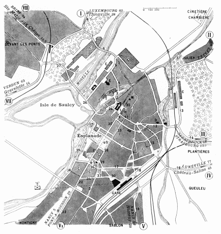
| METZ |
1. Place d’Armes.
2. Prefecture Bridge.
3. Prefecture Square.
4. Rue Pont-Moreau.
5. Rue Belle-Isle.
6. Thionville Bridge.
7. Rue de l’Hôpital Militaire.
8. Route de Thionville.
9. Rue Fabert.
10. Rue de la Tête-d’Or.
11. Rue de la Grande Armée.
12. Rue des Allemands.
13. Rue de St. Julien.
14. Rue de Sarrebruck.
15. Rue Haute-Seille.
16. Rue de Strasbourg.
17. Avenue du Maréchal Foch. |
18. Rue Vauban.
19. Rue de Magny.
20. Rue des Clercs.
21. Avenue de la Citadelle.
22. Rue de Nancy.
23. Rue de Pont-à-Mousson.
24. Chambre Square.
25. Rue de la Paix.
26. Rue Pont-des-Morts.
27. Rue de Paris.
28. Avenue Serpenoise.
29. Rue Harelle.
30. Rue de la Gare.
31. Rue de Thionville.
32. Rue du Haut-Poirier.
33. Rue Serpenoise.
34. Rue de President Wilson.
35. Rue de Verdun. |
36. Avenue de Maréchal Joffre.
37. King George Square.
38. Bd. Georges Clémenceau.
39. Bd. President Poincaré.
40. Place de la République.
41. Rue Fournirue.
A. Cathedral.
B. German Gate.
C. Barracks.
D. St. Eucairés Church.
E. St. Vincent’s Church.
H. Hôtel-de-Ville.
J. Palais-de-Justice.
M. Museum.
P. Prefecture.
P.S. Serpenoise Gate.
T. Theatre. |
Starting-point: the Place d’Armes.
The Place d’Armes, in which the Cathedral and the Hôtel-de-Ville stand,
is a handsome square embellished with noble buildings. On its site
formerly stood the Cathedral cloister, the musicians’ quarters, several
chapels and private houses.
In 1753 the Governor, Marshal de Belle-Isle, decided that a square
should be laid out there and a portal erected giving access to the
Cathedral.
The plans of the architect (Blondel) for the portal made it necessary
to lower the level of the ground. For months and years, canons and
sheriffs alike stopped or impeded the work. During the night of August
9, 1755, M. de Belle-Isle called out the garrison, and had the work
finished by torchlight. By morning the excavation was complete.
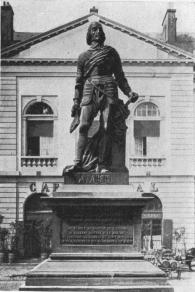
STATUE OF MARSHAL FABERT, PLACE D’ARMES, METZ
In the Place d’Armes stands a statue of Marshal Fabert (by Etex,
1840). The only inscription on the statue of the great Metz general
(1599-1662), who was governor of Sedan, is one of his own sayings: “If,
to prevent the enemy taking a place entrusted to my care by the king, it
were necessary, I should not hesitate for an instant to sacrifice
myself, my family, and all my belongings.”
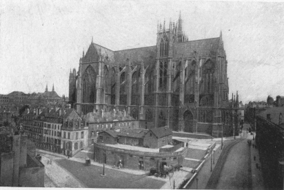
The whole of one side of the Place d’Armes is occupied by the Cathedral
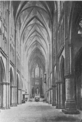
of St. Etienne, a masterpiece of Gothic architecture. The body of the
church reminds one of Amiens and Beauvais. If, on the outside, it
appears somewhat narrow, the interior (393 feet long, 71 feet wide, 139
feet high), with its magnificent stained-glass, is imposing and of
exceeding beauty.
The oldest portions of the Cathedral date from the 13th century.
The nave, completed in the 14th century, has eight bays. At the fourth
bay it is flanked by two square towers.
The northern tower, called the “Mutte” Tower, contains the town-bell. It
is surmounted by a fine spire, from which there is an extensive view of
the surrounding country. It was there that the city watchman was
installed, whose duty it was to give the alarm in case of fire. On the
other side of the nave stands the Chapter Tower, which was finished in
1839. There is a fine doorway at the foot of each tower.
Another, smaller polygonal tower, called the Clock Tower, is built over
the southern aisle.
On each side of the choir, where it meets the arms of the transept, are
the two small “Charlemagne” towers, so called in memory of those which
existed in the romanesque building. They give access by spiral stairways
to the outside terraces over the Cathedral.
While the nave is 13th century the transept dates from the 15th, and the
choir, built over a great sepulchral crypt, is contemporary with the
last Gothic period.
Although completed in 1546 the Cathedral later underwent many
alterations. Fires necessitated repairs, and in 1753, by order of the
Governor (Marshal de Belle-Isle), the laying out of a square in front of
the Cathedral necessitated the demolition of the outbuildings of the
bishop’s house and the erection of a portal.
INTERIOR OF METZ CATHEDRAL
The ground was excavated to a depth of some eight or nine feet, and the
architect (J. B. Blondel) was instructed to prepare plans on a grand
scale.
This was done between 1761 and 1764, after which the work was at once
put in hand, and completed in 1771. While endeavouring to respect the
old building, Blondel sought, not so much to build the portal in the
style of the Cathedral, as to erect an independent portal in front of
the church. Its irregular lines contrast with the general style of the
Cathedral.
In 1791, the rood-loft, old altars and vaults were removed, in
accordance with the plans of Gardeur Lebrun. The roof, destroyed by
fire on the night of May 6, 1877—the day Emperor Wilhelm I. entered
Metz—was replaced in 1880-1882 by a copper roof several yards higher
than the original.
Lastly, the Doric projection of the main front was pulled down in 1903
to make room for a portal planned in the style of the rest of the
church. Statues of the prophets were carved at the corners, one of
which—that of the prophet Daniel—is a likeness of the ex-Emperor of
Germany, Wilhelm II. The people of Metz would not have the
ex-Kaiser-prophet take part in the entry of the French, and during the
night bound his hands with a chain attached to which was a board
bearing the inscription, “Sic transit Gloria Mundi” (thus passes away
man’s glory) (photo above).
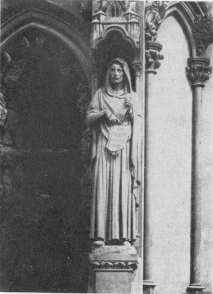
THE EX-KAISER WILLIAM II. AS DANIEL
Statue on Metz Cathedral.
The offending statue is to be replaced by a work of the Metz sculptor
Hannaux, who designed the French monument at Noisseville.
In no other church is there so large an area of window space. It is
calculated that in the transept and choir there are 4,071 square metres
of glass and it is no exaggeration to say that the whole building seems
to be one immense window.
METZ CATHEDRAL. WEST FRONT
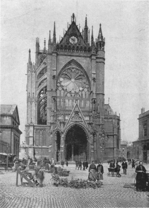
METZ CATHEDRAL. SOUTH FRONT AND PORTAL
Among the windows are several dating from the 13th century. The large
rose-window at the end of the nave, which dates from the 14th century,
is the work of the master-glassworker Hermann. The windows of the north
transept and the Chapel of Our Lady date from the 15th century.
Those of the south transept, Chapel of St. Nicholas, choir and apse are
16th century.
The bell called “La Mutte,” which hangs in the tower of the same name,
did not belong to the church, but to the town. The present bell, which
is rung on all special occasions, was cast in 1505. It weighs thirteen
tons and, when set in motion, causes the large and small spires to rock
perceptibly. It bears the following inscription:
“Dame Mutte suis baptisée,
De par la Cité ci-posée,
Pour servir à la Cité
Aux jours de grandes solennités:
Et aussi pour crier justice,
Prendre ban de bonne police;
Les contredire quand bon me semble
Et pour convoquer gens ensemble.”
The best view of Metz and the surrounding country is to be obtained from
the top of the Cathedral tower. Here one realizes the immense importance
of the forts, of which the Moselle is a kind of natural moat. On the
left bank the steeply rising hills form natural defences, while the
lower hills on the right bank are reinforced by the line of forts. From
their gleam in the distance one gets a better idea of the number of
waterways which surround and run through Metz—the River Seille, the
streams of St. Pierre, Noisseville, and Châtel-St.-Germain, the River
Moselle (which divides), and the canal running parallel to it. Before
Metz lies the large island of St. Symphorion; then, near the Wadrineau
dyke, the smaller island of Saulcy. At the foot of old Metz there is yet
another arm of the Moselle, which divides, forming an island, on which
stand the Prefecture and Theatre. Beyond lies the large island of
Chambière, recognisable by its parade-ground and cemeteries.
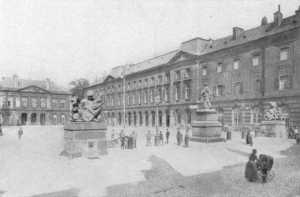
METZ. PLACE D’ARMES AND HÔTEL-DE-VILLE
On leaving the Cathedral the tourist should next visit the Town Hall,
also in the Place d’Armes (1766-1771). The architecture is simple:
façade embellished with two pediments and handsome railings. A portico
leads to a fine staircase. Opposite the balustrade is a bas-relief in
white marble on which are engraved the famous lines of Ausonius: “Salve
magna parens frugumque virumque Mosella....” (“Hail, O Moselle!
illustrious mother of fruits and of men.”)
In the interior are large reception-rooms, in which the public meetings
of the Academy are held. The Academy of Metz was founded in 1760 by
Marshal de Belle-Isle under the title of “The Royal Society of
Literature, Science and Art,” and endowed with the sum of sixty thousand
“livres.” Suppressed at the Revolution, then restored on March 14, 1819,
with the motto “Useful,” it obtained the title of “Royal Academy” from
Charles X. on September 5, 1828. It consists of thirty-six titular
members, eighteen resident members, and four honorary corresponding and
associate members. The Academy largely contributed to maintain French
culture in Lorraine during the German annexation.
In the grand staircase there are three windows, erected in 1852, in the
middle, the Duke of Guise after the siege of Metz; on the right,
Bishop Bertram of Metz; on the left, Sheriff Pierre Baudoche
(1464-1489).
The flag which now flies over the building is the one which was there
in 1870, and which was carefully preserved in the Carnavalet Museum in
Paris. It was restored to the Mayor of Metz by the Vice-President of the
Town Council of Paris on December 25, 1918.
Leaving the Town Hall take Rue Fabert on the left of the Place d’Armes,
then its continuation (Rue des Clercs). At the end of the latter, on the
left, is the Place de la République, and on the right the Esplanade.
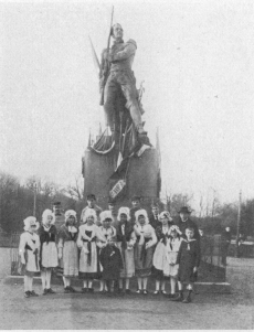
GROUP OF LORRAINE GIRLS AT FOOT OF MARSHAL NEY’S STATUE
The fine Promenade de l’Esplanade served as a parade-ground for the
garrison troops, who defiled along the first row of plane-trees, past
the statue of Marshal Ney (by Pètre, 1855). Ney, Duke of Elchingen and
Prince of Moskowa, was born at Sarrelouis. He is represented, rifle in
hand, ready to fire.
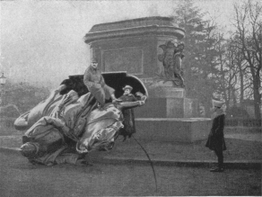
STATUE OF EMPEROR WILHELM I. TAKEN DOWN BY HIS “GRATEFUL
SUBJECTS” OF METZ. IT WAS REPLACED BY A STATUE OF “LE POILU”
Moskowa, was born at Sarrelouis. He is represented, rifle in hand, ready
to fire.
Go to the end of the Esplanade, beyond the bandstand on the terrace;
magnificent view of the Hill and Fort of St. Quentin, Fort Plappeville
and the Moselle. The island of Saulcy, on which stands the
powder-factory, is just opposite.
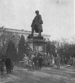
THE “POILU” STATUE, WHICH REPLACES THAT OF WILHELM I.
It was on this terrace that the bronze equestrian statue of Kaiser
Wilhelm I. (1892) used to stand. According to the inscription on the
pedestal the statue was erected by the Emperor’s “grateful people.” The
conqueror was represented pointing to the Moselle and the powerful forts
of Plappeville and St. Quentin which protect the town.
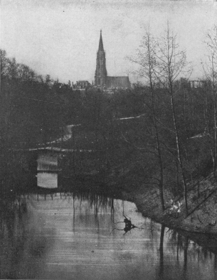
THE “PROMENADE DE LA MOSELLE”
The “grateful people” dragged this statue off its pedestal into the mud
a few days before the French entered the town, and on the night of
January 6 replaced it with a statue “To the Victorious Poilu,” bearing
the inscription “On les a” (variation of the famous rallying cry “On
les aura”) as a pleasant surprise for Marshal Pétain who, next day, was
to decorate sixteen regiments with the “fourragère” cord and bestow
decorations on various officers and soldiers. This statue was made in
seven days by the local sculptor Bouchard (photos, p. 128).
In the Esplanade stands the Palais-de-Justice (1776), on the site of
the former Hôtel de la Haute-Pierre, the property of the Duke of
Suffolk, lover of Mary Tudor, Queen of England. He had this mansion
pulled down and the fine Hôtel de Suffolk built, which, for a long time,
served as the Government House. Finally, in 1776, Clairisseaux built
the present palace. The iron railings of the grand staircase and, in
the inner court, two bas-reliefs—one recalling the humanity of the
Duke of Guise in succouring the soldiers of the Duke of Albe after the
raising of the siege; the other glorifying the peace concluded in 1783
between England, France, Spain, the United States of America and
Holland, are especially noteworthy.
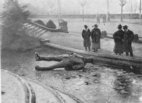
STATUE OF KAISER FREDERICK CHARLES DRAGGED DOWN FROM ITS
PEDESTAL BY THE PEOPLE OF METZ
Return to the Place de la République and take on the right the Avenue
de la Citadelle, which separates the Esplanade from the Place de la
République. Follow this avenue, which soon skirts on the left the
Engineers’ Barracks, and a garden.
Beyond the garden, turn to the left into the Avenue du Maréchal Joffre,
which leads to the Place du Roi-George (in front of the old railway
station). It was here that the statue of Kaiser Frederick III. was
pulled down by the people. Not far from this square may be seen a
round tower—a relic of the ramparts of the Middle Ages.
Turning his back on the old railway station, the tourist next takes
Avenue Serpenoise (beside the gardens), along which run the tram lines.
On the left is the Serpenoise Gate (1852).
Continue along the Avenue, which skirts, on the left, first the
Engineers’ Barracks, then Place de la République.
Beyond the latter the Avenue is continued by Rue Serpenoise—the
busiest street in Metz—which take. Rue Ladoucette, which continues it,
leads to Rue Fournirue.
Take the latter on the right, then Rue du Change (which continues it to
the right) to Place St. Louis.
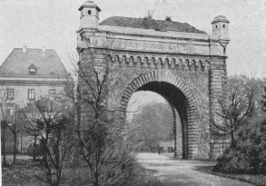
SERPENOISE GATE, leading to the Place de la
République.
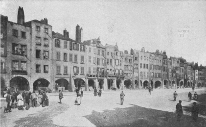
PLACE ST. LOUIS AND THE ARCADES
In former times, Place St. Louis (or Place du Change) was occupied by
sixty moneychangers’ stalls. Several of the houses in the square have
retained their battlements, pointed or semicircular arches, tricusped
windows and Renaissance balconies. The name of St. Louis comes from a
statue of Louis XIII., found among the ruins of the citadel and which
the Curé of St. Simplice took for one of Louis IX. Mystery plays used to
be acted in the square, which later was used for the execution of
criminals. Finally, it became the corn market.
At the end of the square take Rue Royale, then turn to the left into
Rue Coislin, which skirts the Coislin Barracks.
At the end of Rue Coislin take Rue Pont-à-Seille to Place des Charrons,
then, at the end of this square, Rue du Grand-Wad, to the Rempart des
Allemands. Follow the latter to the left as far as the German Gate.
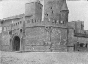
PORTE DES ALLEMANDS (GERMAN GATE) Seen from the Quai des
Allemands.
The German Gate, on the banks of the Seille, is a remarkable structure.
Mention of it occurs as early as 1324. In the 15th century it was
completely restored by the architect Henri de Banceval.
Opposite the Gate take the Rue des Allemands; on the right is the
interesting Church of St. Rucaire. Continue to Place des Paraiges.
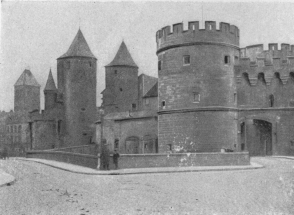
THE GERMAN GATE Seen from the right bank of the
Seille.
At the end of the square, take Rue Saulnerie to the right (continued on
the left by Rue du Paradis), which leads to Rue des Capucins. At the end
of the latter is Place des Maréchaux, in which stands the Church of St.
Ségolène, built on the site of an oratory founded by St. Ségolène in the
8th century. The present church, built at two different periods (the
choirs, nave and portal are earlier than the aisles), dates from about
the 13th century. Long, narrow windows, mostly double, end in
stanchions. The two side chapels contain fine stained-glass. Note the
curious open-work gallery of the organ loft, and several interesting
paintings.
Turn to the left and take the Rue des Trinitaires. Skirt an old
building with a square turret, beside a doorway—“Hostel St.
Ligier”—then turn to the right into Rue de la Bibliothèque.
In this street, at the corner of Rue Chèvremont, there is a large
building (formerly the Church of the Petits-Carmes), the work of
Sébastian Leclerc, in which are housed both the library (80,000 volumes
and 1,987 manuscripts) and the Museum (local archæology, natural
history, objects of art and three rooms of pictures).
Besides the museum, take Rue Chèvremont, which runs into Rue de la
Boucherie, in which turn to the left to St. Georges Bridge over the
Moselle.
Cross this bridge, from which there is a lovely view, and take the Rue
du Pont St. Georges. Rue Chambière opens at once on the right, and leads
to Chambière Cemetery, in which are the graves of the French soldiers
who fell in the siege of 1870.
The road passes between the large slaughter house and cattle market,
and huts serving as an army stores. Cross an old cemetery, in the
middle of which are several monumental tombs. Skirt the Jewish cemetery
and the Moselle, as far as the Military Cemetery: numerous graves under
the trees. In the centre stands a pyramid thirty-seven feet high, with a
great number of piled up coffins carved on the base. Here lie the
soldiers who died in the Metz hospitals of wounds received in the
battles of Borny, Gravelotte, St. Privat, Servigny, Peltre and
Ladonchamps—7,203 in number.
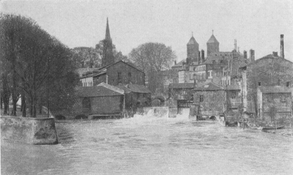
MOSELLE RIVER Seen from St. George’s Bridge.
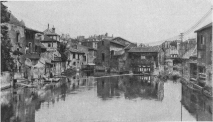
MOSELLE RIVER AND ST. GEORGE’S BRIDGE
On the principal façade is a bas-relief in white marble representing
religion, taken from a disused vault belonging to the de Salse family.
On the other side are inscriptions. At the base of the pyramid is the
inscription: “The Women of Metz to those whom they nursed.”
Beside the pyramid there is a monument to the memory of the fallen
French officers.
For forty-eight years wreaths, tri-colour cockades and ribbons were
piously placed on these graves, and on each anniversary day the women of
Metz covered them with flowers.
Take Rue du Pont St. Georges to Rue St. Vincent (on the left), which
follow, then turn to the right into Rue des Bénédictins.
Apply at No. 7 to visit the Church of St. Clément.
Founded in 1668, the choir, nave and aisles were begun in 1680 by
Spinga, an Italian. The portal was damaged during the Revolution.
To-day the church forms part of the college founded by the Jesuits. A
fine cloister with a well should be visited.
Return to Rue des Bénédictins and follow it as far as Rue St. Vincent
(on the left), which leads to the square of the same name, where stands
the curious Church of St. Vincent, founded in 1248.
Partially destroyed by fire in 1711, by an apostate monk, it was used as
a stable during the Revolution, and then as a hospital in 1814. Once
more a church, a portal in composite style was added. The graceful nave
on twelve shafted pillars, the symmetrical choir and the fine chapels in
pointed style are well worth seeing.
Continue along Rue St. Vincent, on the other side of the square. Its
continuation, Rue St. Marcel, leads to Rue du Pont-à-Mort, into which
turn to the left.
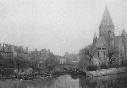
ST. MARCEL BRIDGE AND THE PROTESTANT CHURCH
Seen from Moyen Bridge.
Cross the Moselle by Moyen Bridge (lovely view). Take Rue St. Marie,
which continues the bridge, then Rue du Faisan on the left, leading to
the pretty little Place de Chambre. This square owes its name to the
Knights of Malta, who in 1323 lived there in a castle called Petit St.
Jean.
From the Place de Chambre return to the Cathedral and to the Place
d’Armes by the narrow Rue d’Estrées.
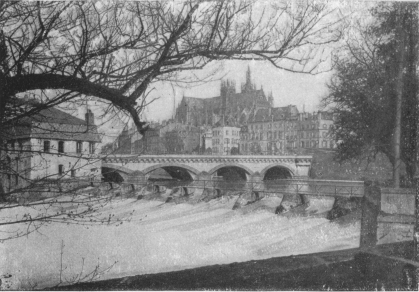
MOYEN BRIDGE AND THE CATHEDRAL Seen from Saulcy
Island.
(See Itinerary, pp. 138-139)
Leave Metz (Place d’Armes) by Rue d’Estrées, cross Place de Chambre
(soon reached on the left), take Rue Faisan, then Rue St. Marie, leading
to Moyen Bridge over an arm of the Moselle. Cross the bridge and take
Rue du Pont-à-Mort. Cross the ramparts, then the second arm of the
Moselle. Take Rue de Paris and, follow the tram lines towards Moulins;
after crossing the second belt of ramparts and the railway, the route
turns to the left.
The road hereabouts is bordered with fine trees. After passing through
Ban-St.-Martin (Infantry Barracks on the right) and
Longeville-les-Metz, the tourist arrives at Moulins.
At the fork, take the Verdun road, on the right, which passes in front
of the barracks.
Two hundred yards beyond Moulins leave on the right the Briey road, and
at the milestone marked “Metz 7 km.,” turn to the left into the uphill
road to Gravelotte.
Near milestone “Metz 9 km.,” there is a fine view of Metz: in the
foreground the village of Rozérieulles is seen in the valley; in the
background, the Moselle valley and Metz.
At the top of Hill 342, the road passes near Joan-of-Arc Fort,
formerly the German fort “Kaiserin.” It stands about 300 yards to the
right of the road. The latter, a little further on, turns sharply to
the left near a monument surrounded with trees, which was erected to
the memory of the soldiers who fell in 1870. Several graves bear the
inscription: “Krieger v. 18 8-1870.”
St. Hubert Farm is soon reached, then the deep Ravine of Mance,
along which the defeated Germans were forced to retreat in the course
of the great battle of August 16, 1870, fought between the villages of
Gravelotte (which the tourist soon reaches), Rézonville and
Mars-la-Tour (further west).
In Gravelotte (12 km. 700 from Metz) take the road to Doncourt (D.I.)
on the right, in front of the Post Office. The road passes close to
Mogador Farm, from which Kaiser Wilhelm I. saw his troops thrown into
confusion and beating a hurried retreat under the cover of night.
After passing in front of Malmaison Farm, the old frontier is
crossed.
Eight kilometres 900 beyond Gravelotte, Doncourt village is reached.
Cross through and keep straight on along D.I. After passing by Jarny
Mines, the road crosses the railway (l.c.) and enters Jarny village, 4
km. from Doncourt. Several houses were destroyed and the church badly
damaged.
Two kilometres beyond Jarny, Conflans-en-Jarnizy is reached. Several
of the houses were destroyed. Go through the village and at the far end
take the Etain road. 5 km. from Conflans, Jeandelize is reached. The
church (on the right) was torn open by shells. Note the Renaissance
doors of several of the houses.
Keep straight on. Olley village (on the right) is passed, 2 km.
beyond Jeandelize. There is a large German cemetery fifty yards from
the road on the right.
St. Jean-lés-Buzy and Buzy (the latter 11 km. from Conflans) are
passed through, after which Hill 198—on which is a German stronghold
with blockhouse, trenches and barbed wire entanglements—is reached.
The partly destroyed village of Warcq is next passed through, after
which 2 km. further on, Etain is reached.
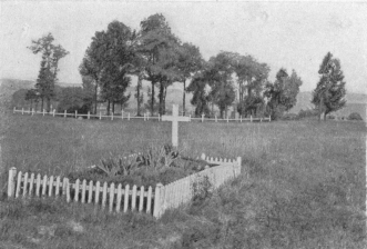
NEAR GRAVELOTTE. GRAVES OF FRENCH SOLDIERS WHO FELL ON
AUGUST 18, 1870
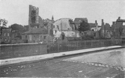
ETAIN. RUINED CHURCH AND HOUSES Seen from the bridge
over the Orne, on the road to Verdun.
Etain was looted by the Swedes in 1622, during the reign of Louis XIII.
Later, it was often taken and retaken by the French, Germans, Spaniards
and Lorrains. Its fortifications were destroyed under Louis XIV. By the
Treaty of Vienna (18th century) the town was definitely ceded to France.
In October, 1792, Kellermann’s advance guards, in pursuit of the
Prussians, encamped at Etain.
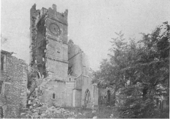
ETAIN. THE TOWER AND SOUTH FRONT OF THE CHURCH The tower
was used as an observation-post by the Germans.
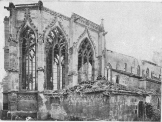
ETAIN. CHEVET AND NORTH FRONT OF CHURCH
In 1914, the town was bombarded by the Germans on August 24, from 1 p.m.
to 2 a.m. the next day, and again on the 25th at 11 o’clock, with
incendiary shells.
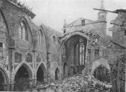
ETAIN CHURCH. CENTRAL NAVE SEEN FROM THE CHOIR
Many of the inhabitants were killed on the 24th. On the 25th others, who
had taken refuge in the cellars of the Town Hall, perished under the
ruins of that building. 200 fled along the Verdun road. A girl
telephonist remained at her post and kept in touch with Verdun every
quarter of an hour. Her last message (on the 25th) was: “A bomb has just
fallen on the office.”
The same day French troops routed the German XXXIIIrd D.R. in a glorious
battle at Etain. Nevertheless, the enemy occupied the town, which was
systematically looted. Every two days train-loads of furniture, linen,
wines, food, cloth, boots, tools and raw materials were sent to Germany.
In April, 1915, French troops captured Hills 219 and 221, Hôpital Farm
(formerly belonging to Order of St. Jean de Rhodes) and Haut-Bois Farm,
reaching the immediate vicinity of the town, without, however, entering
it.
In the partly destroyed town, N. 18 is picked up again, which take to
the left. The greatly damaged church (photos, pp. 141 and 142) is
seen on the right. Its belfry was torn open by the bombardments,
leaving visible the interior, where the Germans had installed an
observation-post.
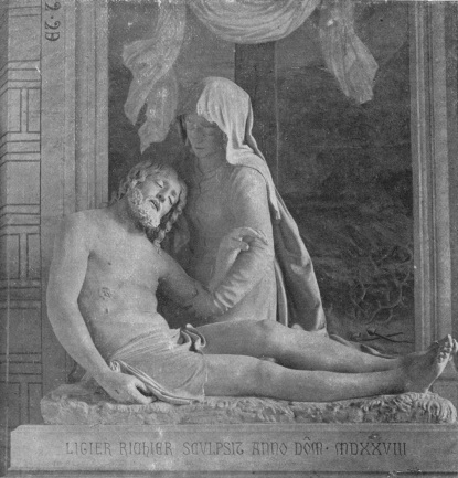
ETAIN CHURCH. LIGIER RICHIER’S “DESCENT FROM THE CROSS”
Viollet-le-Duc considered the Church of Etain, with its three naves,
as one of the five most remarkable churches in the Meuse province. Begun
in the 13th century, it was completed in the 15th. The imposing choir,
with its large, many-mullioned windows, is 15th century. In the right
aisle are a remarkable holy-water basin, and a statue of Our Lady of
Mercy by Ligier Richier. The basin is of bell-metal and, like those of
Nevers and Bourges,
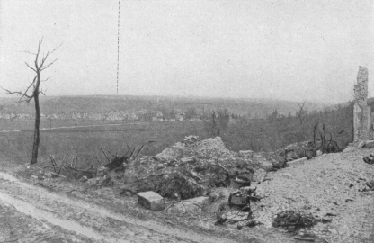
FIÉVÈTERIE FARM AND VILLAGE OF EIX
Seen from the Verdun road.
shaped like a mortar, but the epitaph round it proves its sacred origin.
The Ligier Richier group (1528) represents the Virgin Mary gazing on
the dead body of Christ. It differs slightly from that of
Clermont-en-Argonne, attributed to the same sculptor.
Beyond Etain, N. 18 crosses the Orne stream (photo, p. 141) and the
military defences of the town, of which several concrete works remain.
The road crosses Woëvre Plain. Shortly before reaching the
level-crossing, before arriving at the railway station and village of
Abaucourt, the Meuse Heights can clearly be seen on the horizon, at the
end of Woëvre Plain (panorama above).
Go through Abaucourt (razed to the ground) to Fiévèterie Farm (in
ruins), which lies at the foot of the Meuse Heights (photo, p. 144). A
road starts on the left of the farm and leads to the small ruined
village of Eix, which was the scene of fierce fighting throughout the
war.
The road up the Meuse Heights is fairly steep and passes between the
Forts of Souville and Tavannes (on the right) and Moulainville
Fort (on the left). It then descends in a gentle slope to Verdun,
which is entered by the Faubourg Pavé and Chaussée Gate.


