The shifting of globe making interest to the northwest of Europe
at the close of the sixteenth century.—The Van Langrens as
leaders.—Jodocus Hondius and his son Henricus.—Willem
Jansz. Blaeu and his sons, John and Cornelius.—The Ferreri
armillary sphere.—Globes of Peter Plancius.—Isaac Habrecht.—Globes
of Mattheus Greuter and their reproduction by Rossi.—Manfredus
Settàla.—Abraham Goos.—Adam Heroldt.
AS the first post-Columbian century came to its close
the center of interest in great transoceanic exploration
and discovery shifted to the northwest of
Europe, to England, and to the Netherlands. Since expeditions
were daily setting sail to all shores of the world,
“Quoniam in omnes mundi plagas quotidie magis magisque
navigatur,” quoting the word of the enthusiastic Hondius,
the chart and globe makers found their services in great
demand, globes both terrestrial and celestial being still regarded
as essential to a navigator’s complete outfit of sailing
instruments. The quick-witted Netherlanders, with well-developed
business instincts, engravers, printers, map and
globe makers, set to work to correct the old and to construct
new “seamen’s cards” to serve the seafarers in their enterprises,
and it was not long after entering this field of scientific
endeavor that leadership by them was clearly attained.
Although of Danish origin, perhaps logically the Van
Langren family should have had first consideration in this
chapter, since father and sons came to be loyal supporters of
their new homeland’s interests, and it was in the Netherlands
where were laid the scenes of their activities in the
field here under consideration. Chronologically, however,
they had place in the preceding chapter because their work
as globe makers began in the early eighties of the sixteenth
century. They, at least, be it said to their credit, led the way,
achieving some of their highest successes in the early seventeenth
century. This, too, was the time when the Hondius,
the Blaeu, the Jansson, and the Goos families came to the
front to contribute their part, in a very distinguished manner,
toward the promotion of the work so ably begun by
their contemporary, Jacobus Florentius van Langren.
Jodocus Hondius (1567-1611) was a native of Wacken
(Fig. 60).1 To this village his parents, shortly before his
birth, had fled from Ghent to escape the persecuting hand
of Count Egmont. The father, Oliver de Hondt, a modest
teacher but a man very learned in theology, had embraced
the reformed faith and therefore became an outlaw by decree
of the government. On the arrest of Egmont, he with his
family returned to Ghent, to remain but a short time, for in
the year 1569 we find a residence had been taken up at
Duffel near Antwerp. In this city two children were born,
a daughter whose name is now unknown and a son Henry,
usually referred to as Henry the Elder.
Jodocus at an early age gave evidence of possessing very
remarkable talent for designing and engraving. We are told
that at the age of eight he began to apply himself to the art
of portraiture, of ivory carving, and of copper engraving,
and that his father, noting the exhibition of special talent
in the son, placed him as an apprentice with an engraver and
sculptor in Antwerp. During this period of apprenticeship
he carried on his studies of the fine arts, also of Latin, Greek,
and mathematics, under the direction of his father, at the
same time applying himself to the work of map engraving.
It probably was about the year 1585 that he went to England,
where, by reason of the talent he exhibited, he found
employment with the English geographers, Richard Hakluyt
and Edward Wright, during which period he appears to have
engraved and printed a small world map in hemispheres. In
the year 1592 he returned to Amsterdam, where he established
himself as an engraver and printer, turning his attention
especially to the issue of geographical maps.2 Among
his friends he numbered the men most prominent in his
field, notably Petrus Bertius, very learned as a geographer,
and Petrus Montanus.3 It appears to have been Bertius who
informed him of the intention of the heirs of Mercator to
dispose of that illustrious geographer’s engraving and printing
establishment, and who perhaps negotiated the sale of
the same. At any rate, we find that in the year 1604 Jodocus
Hondius came into possession of the Mercator copper
plates of the Ptolemy maps, and at the same time he seems
also to have acquired the greater part of the edition of Mercator’s
‘Atlas’ of 1602 then remaining unsold. In the year
1605 Hondius prepared and issued a third edition of the
Ptolemy maps; in 1606 he issued a third edition of Mercator’s
‘Atlas’; in 1608 he published a fourth edition; in
1609 and in 1610 other editions.4 It must have been in the
year 1611 that he issued his great world map in two hemispheres,
bearing the title “Novissima ac exactissima totius
orbis terrarum descriptio magna cura & industria ex optimis
quibusque tabulis Geographicis et Hydrographicis nuperrimisque
doctorum virorum observationibus duobus planisphaerijs
delineata. Auct. I. Hondio.” This work has been recently
issued in a superb facsimile of the only known extant
original copy, now in the possession of Prince Maximilian
of Waldburg zu Wolfegg-Waldsee.5 Of such superior
excellence is the work of Hondius, as exhibited in this
masterpiece, that it justly entitles him to first place among
those who, up to this date, had undertaken to construct
world maps.
It seems to have been early in his career as engraver and
printer that he prepared his first globe gores and issued
his first celestial globe. The director of the Germanisches
Nationalmuseum of Nürnberg, in courteous communication,
reports that in the rich collection of that institution there is
a Hondius globe of the year 1592, which date, if accurately
read, makes this to be the only known copy of what must
be taken as his first issue. The map is a colored copper engraving
covering a ball of wood having a diameter of 60 cm.
The mounting of the globe, which clearly is the original,
consists of the usual circles, resting upon six wooden support
columns. A more detailed description of this particular
example it has not been possible to obtain.6
Not until the year 1600 does there appear to have been
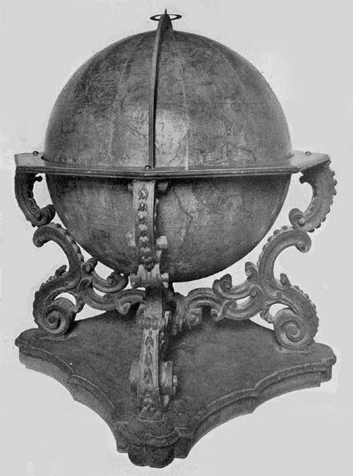
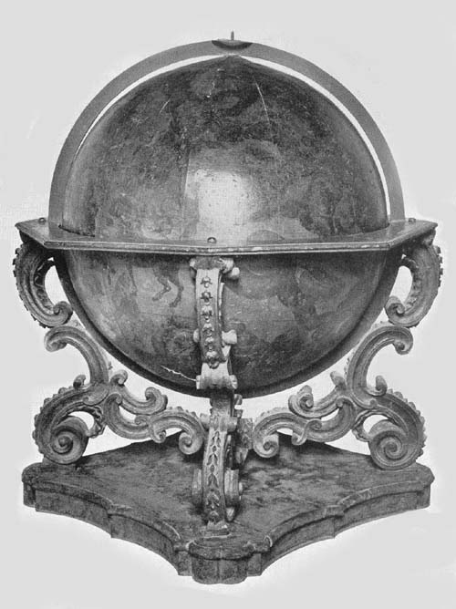
a second issue of his globes. Of this second issue a remarkably
fine pair (Figs. 88, 89) was recently acquired by Mr.
Henry E. Huntington of New York City.7 Excepting very
slight damage to the celestial globe in the north polar region,
they may be said to be in practically as fine condition as
they were when first given out from the master’s workshop.
Their complete history has not been obtainable, but so remarkably
well preserved are they that it seems quite probable
they have been kept through all these years in the
library case of some rich Italian treasure-loving family.
There cannot be the slightest doubt of their age, certainly
none of the age of the spheres themselves, but the exact date
of the bronze mounting, though clearly in the style of certain
Italian workmanship of the period, is less easy to determine.
These globes have a diameter of about 34 cm. and
an entire height, including the base, of 73 cm. The spheres
on which have been pasted the twelve engraved gores are
of papier-mâché, over which is a covering of plaster and a
coating of thick varnish or shellac giving a smooth surface
for the terrestrial and the celestial maps. To each, color
was artistically applied by hand, which still retains a richness
of tone. Each is supplied with a bronze meridian and
horizon circle and with an hour circle attached in the accustomed
manner at the north pole. These circles are appropriately
graduated, the horizon circle having, in addition
to its graduation into three hundred and sixty degrees, a
series of concentric circles engraved, counting from the outermost,
with the names of the winds, compass directions in
the Dutch language, the names of the months, and the signs
of the zodiac. Each sphere with its circles is carried on a
base composed of three artistically designed and engraved
bronze supports, these being attached at their lower extremities
by an appropriately designed plate, and in this plate has
been set a compass, still apparently in perfect condition, the
dial face of this compass having a diameter of 8 cm. Aside
from their scientific value for the student of geography and
of astronomy, these are fit pieces to adorn the library shelves
of a prince among American book collectors, as they must,
in keeping with the custom of the time, have once adorned
the shelves of an Italian patrician book lover.
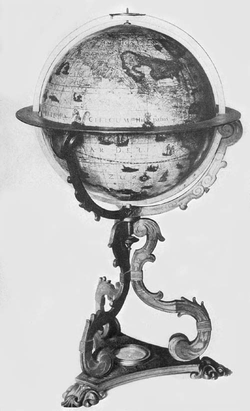
Fig. 88. Terrestrial Globe of Jodocus Hondius, 1600.
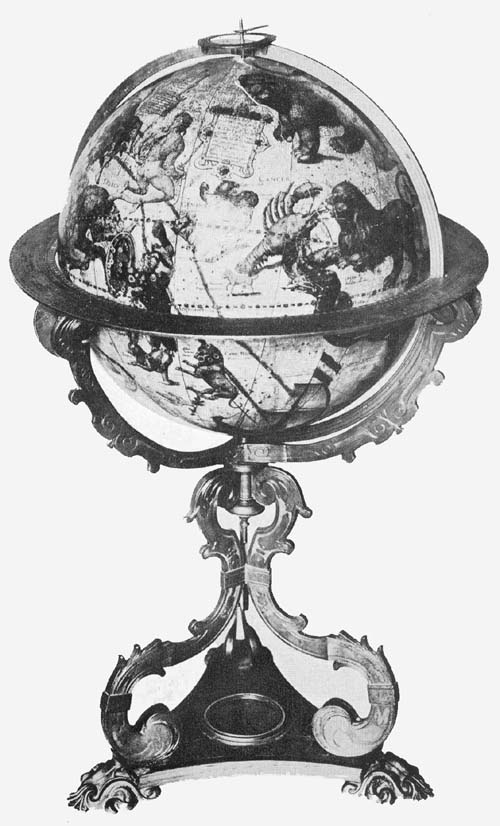
Fig. 89. Celestial Globe of Jodocus Hondius, 1600.
The terrestrial globe has the following dedication:
“Illustrissimo Principi Do Mauritio à Nassau, Principi
Auraico, Comiti à Nassau, etc. Gubernatori Provinciarum
Foederatarū Summoque Praefecto mari Inferioris Germaniae
Domino suo colendissimo. Jod. Hondius Flander
L. M. D. D. Cum privilegio decem annorum.” “To the
illustrious Prince D. Maurice of Nassau, Prince of Orange,
Knight of Nassau, etc. Governor of the Federated Provinces
and High Prefect of the Lower German Ocean, his Most
Worshipful Master, Jodocus Hondius dedicates (this globe).
With privilege for ten years.” This dedication is placed
within an artistic cartouch (Fig. 90) which is surmounted
with the coat of arms of the Princes of Nassau, to which
appropriate colors have been added. To the left of the above
is an address to the reader: “Iod. Hond. Lectori S. P.
Quoniam crebriores in omnes mundi partes quotidie navigationes
instituūus ejusdem certius perspicitur
atque innotescit; nemini idcirco mirum spero visum iri, si
haec nostri globi descriptio ab aliis antehac in lucem editis
plurimū discrepet. Quin uti par est, nostrae diligentiae et
curae favebit, qua recens patefacta et cognita, qua directiones,
latitudines et similia cōgruenter distincta suis locis
habentur. Quod ipsum in ducendis lineis Directorii fecimus
et peritis cumulate satisfactum confidimus. Postremo lectorē
benev. rogam⁹ ut si quam loci alicujis pleniorem notitiam
habeat eandem nobiscū, provehēdi boni publici gratia, lubens
comunicet. vale.” “Hondius to the reader greeting. Inasmuch
as frequent voyages into all parts of the world are
undertaken every day, whereby the several locations (of
places) are more certainly seen and are made known, I hope
therefore no one will be surprised to find this delineation
on our globe very different from that on most others previously
issued. But who, as is right, will not prefer our diligence
and care, whereby recently discovered and known
lands, and whereby directions, latitudes, and such like are
all properly distinguished and are to be found in their places.
What we have done in drawing the lines of direction, we
trust will be satisfactory on the whole to experts. Finally,
we ask the kind reader that, if he has fuller knowledge of
any place, that of his own free will he will communicate
the same to us, to the end of advancing the public welfare.
Farewell.” Within the Arctic circle and north of North
America is the title and date legend reading “Globus Terrestris
de integri revisus & emendatus an. 1600.” “Globe of
the entire earth revised and corrected in the year 1600.” To
the right of the dedicatory legend we find instruction given
as to the method of finding the direction from one place
to another, of which one may be desirous of having
knowledge; it reads: “Modus investigandi locorū directionē.
Duorum locorum in hoc globo quorum directionem
scire cupis hoc est in quam coeli partem alter ab altero vergat,
primo longitudinis et latitudinis differentiam notabis,
qua cognita vertas globum donec Rhumbus aliquis intersecet
meridianum in latitudinē primi loci, deinde volvas
versus Ortum aut Occasum, prout res postulat, donec gradus
aequatoris numero aequales differentiae longitudinis duorū
locorum meridianum pertranseant postea vide num assūptus
Rhumbus intersecet meridianum in latitudine loci. Quod si
fecerit hic est horum locorū Rhumbus sive linea directionem
indicans: sin secus, alius assumendus est, usque dum occurrat
qui hoc praestiterit. Subjecimus scalam longitudinum.”
“Of two places on this globe whose direction from one
another you are desirous of knowing, that is in what part of
the heavens the one diverges from the other, first of all note
the difference of latitude and longitude. This ascertained
turn the globe until some one rhumb cuts the meridian in the
latitude of the first place, then turn to the east or to the
west as is required, until the degrees of the equator through
which the meridians of the places pass equal in number the
difference in longitude of the two places. Then note whether
the selected rhumb cuts the meridian in the latitude of the
place. If it does so then this is the rhumb of these places or
the line which shows the required direction: but if it does
not then another rhumb must be chosen until the condition
is satisfied. We subjoin a scale of longitudes.” Other legends,
describing briefly some event in the history of discovery, or
describing briefly the characteristic features of some locality,
are exceedingly numerous. As a record of the geographical
knowledge of the time, this Hondius terrestrial globe map
may justly be referred to as one of the most valuable of
the period.
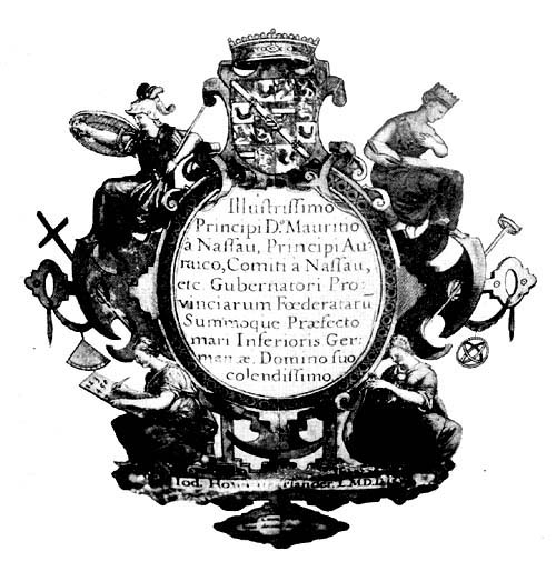
Fig. 90. Dedication Appearing on Globe of Jodocus Hondius, 1600.
For astronomical study the celestial globe is none the less
valuable and interesting than is the terrestrial for the study
of geography. Its descriptive title reads: “Globus coelestis.
In quo Stellae fixae omnes quae a N. viro Tycone Brahe
sūma industria ac cura observatae sunt accuratissime designantur:
nec non ea quae a peritis. nauclero Petro Theodori.
Mateseos studioso annotatae sunt.” “Celestial globe, in
which all of the fixed stars which were observed by the illustrious
Tycho Brahe, with great care and industry, are most
accurately shown for the scientific student: also those which
were noted by the distinguished navigator Peter Theodorus.”
The dedication differs somewhat from that on the terrestrial
globe and reads: “Clarissimis Belgii luminibus sapientiae doctrinae
et verae pietatis officinis Academiae Lugdunensis
Batavorum et Francveriensis. Hos globos ad Mathematicas
artes promovendas manu propria à se caelatas luculentissime
dedicat consacratque Jodocus Hondius ann. 1600.” “To the
most renowned lights of Belgium, fountains of wisdom, of
doctrine and of true piety, of the Academy of Leiden and
of Frankfurt these globes, for the promotion of the
mathematical arts and constructed with his own hands, are
dedicated and consecrated by Jodocus Hondius in the year
1600.” The several constellations are artistically represented
in appropriate figures which include, in addition to those
of Ptolemy, a considerable number in the southern hemisphere,
for which, as the author states, he made use of the
observations of the navigator Theodorus. That star in the
constellation Cassiopeia, which so greatly interested Tycho
Brahe, has a special but brief legend distinguishing it, reading
“Stella mirabilis quae insolito prae aliis fulgore ao 1572
p. an. et trientem apparuit.” “Remarkable star which appeared
with brightness beyond all others in the year 1572
and for a year and one third.”
A second pair of Hondius’ globes of the year 1600 is
reported as belonging to Count Rocco Giannini of Lucca.
Fiorini says of them that they have mountings of bronze,
resembling in this respect the pair described above, but he
adds that they are without inscriptions of special note.8
Either the information which he received concerning them
was inaccurate or there exists a very marked difference
between these pairs, the only ones it has been possible to
locate.
In the year 1601 Hondius issued a pair of globes which
were somewhat smaller than the preceding, each having a
diameter of 21 cm. The inscription on the celestial globe,
in which appears the date of construction, differs but little
from that appearing on the issue of the year 1600; it reads:
“Globus coelestis in quo fixae omnes quae a N. viro Thicone
Brahe sum̄a cura observatae sunt, accuratissime designantur
quibus adjuncta sunt circa Pol. Australe stel. quae a pertissimo
nauclero Petro Theodori. annotatae sunt simul accomodatae
ad annum 1600. editus vero 1601.” “Celestial
globe in which all the fixed stars which were observed with
the utmost care by the illustrious Tycho Brahe and accurately
noted, to which are added the stars around the south
pole which were observed by the skilful navigator Peter
Theodorus. Adapted to the year 1600, but edited in the year
1601.” The general design of the figures of the several constellations
agrees with that of the first edition, the chief
difference lying merely in the matter of size.
On the terrestrial globe is the following dedication:
“Serenissimis Principibus Alberto et Isabellae Cla. austriacis
Brabantiae Ducibus. Jodo. Hondius. auctor et Joan Baptista
Vriendt. Antuerpiae.” “To the Most Serene Rulers
Albert and Isabella, the renowned Princes of Austrian
Brabant, Jodocus Hondius author and John Baptist Veen
(dedicate this globe). Antwerp.”
The author has added a rather lengthy address to the
reader, in which is interesting reference to the difficult problem
of determining the longitude of places.9 “Hondius
Lectori S. In locorum longitudine hactenus mirifice peccatum
esse hydrographiae peritis satis constat: Regiones enim
fere omnes descriptae sunt prout naucleri in suis navigationibus
directionem duorum locorum ab uno loco ad alterum
invenerunt, idque nulla habita ratione loci tertii, vel deviationis
acus nauticae, vel etiam directorii nautici, quo indifferenter
utuntur, quamvis in uno non aeque ac in alio chalyben
ille acus ponatur, et a vero septentrione magis vel minus
divertatur, pro uso loci in quo directoria fabbricata sunt,
unde necessario longitudo locorum distorta est. Multi hos
errores frustra conati sunt emendare per polares stellas, alii
per Lunae cursum, alii certius per eclipses. Verum hoc opus,
ille labor. Quis enim in tanta locorum multitudine eclipses
observabit? At cum jam tandem per variationem, aut deviationem
acus nauticae, ut vocant, locorum, longitudo inveniatur,
operae praetium me facturum putavi si in hoc globo
regiones omnes (saltem quarum longitudo jam cognita est)
suis quas q̄ veris longitudinis gradibus delineavero, quamvis
id non exigui laboris fuerit. Longitudines incepimus non ab
Insulis Fortunatis ut Ptolomeus, sed ab iis quae açores vocantur
quod acus nautica ibi recta in septentrionem vergat.
Vale. Anno 1601.” “Hondius to the reader greeting. In the
matter of the longitude of places all hydrographers, it is
agreed, have blundered marvelously, since nearly all regions
have been described as navigators, in their voyages, found
the direction from one to another, of any two places, without
reckoning having been taken from a third place, or account
having been taken of the variation of the nautical
needle, or even of nautical direction, which they indefinitely
make use of, although in one place the needle does not
point exactly as in another, being deflected more or less from
the true north according to the usage of the country in which
the compass card employed was made, and thus the longitude
of places is made to vary. Many have tried in vain to
eliminate these errors by the polar stars. Others have tried
to do the same by noting the course of the moon, and others
again, with more certainty, by observations of eclipses; but
all this is with much labor, and who will be able thus to
get an accurate observation? But now since the longitude of
places has been sought through the variation or deviation of
the needle, as they say, I thought it would be a work of
merit if I noted on this globe all the regions (at least all
whose longitude is known) each with its own degree of
longitude although knowing this would be no little labor.
We have begun our reckoning of longitude not from the
Fortunate Islands, as did Ptolemy, but from those which
are called the Azores, because there the nautical needle
points directly to the north. Farewell. In the year 1601.”
These globes of 1601 are composed of a hollow wooden
shell, over which have been pasted the twelve engraved
gores. They are mounted on well-constructed bases of copper
from which rise the supports for the horizon circle, on
the surface of which are the usual graduations, the calendar
and zodiacal representations. The meridian circles are of
brass, are graduated, and have in addition the engraved
designations “Zona torrida,” “Zona temperata,” “Zona
frigida.” An example of each of these globes of 1601 may
be found in the Museo Municipale of Milan, and one of
the celestial globes in the library of the Seminario Vescovile
of Rimini.
In the year 1613, shortly after the death of Jodocus
Hondius, there was issued in Amsterdam, by Adrian Veen10
and Jodocus Hondius, Jr., a terrestrial and a celestial globe,
each having a diameter of about 56 cm. The dedication of
the first reads: “Illustrissimis, Nobilissimis, Amplissimis et
Prudentissimis Federatarum Inferioris Germaniae Provinciarum
Ordinibus ac Patribus Patriae Dominis Suis Clementissimis
Dedicabant Jodocus Hondius Junior et Adrianus
Veen. In the year 1613.” “To the Most Illustrious, Most
Noble, Most Exalted, Most Prudent Lords of the Federated
Provinces of the Netherlands, and Fathers of their Country,
their Most Benign Masters, Jodocus Hondius Jr. and
Adrian Veen dedicate (this globe).” The title of the terrestrial
globe is given as “Globus terrestris summa cura ac
diligentia a Jodoco Hondio piae memoriae inchoatus, globosis
autem directorii nautici lineis ab Adriano Venone ad
usum navigantium accomodatus, illiusque et Jodoci Hondii
junioris ope et industria absolutus atque perfactus. Amsterodami
1613.” “Terrestrial globe begun with great care and
diligence by Jodocus Hondius of pious memory, furnished
with the lines of nautical direction (loxodromes) for the use
of navigators, by Adrian Veen, and finished by the industry
and labor of the same and of Jodocus Hondius, Jr. Amsterdam
1613.” It seems probable that the Jodocus Hondius
here referred to was Henricus Hondius, who for reasons of
business had taken the name of his father, affixing the word
“Junior.”
The celestial globe to accompany the above terrestrial has
the title, “Globus coelestis in quo stellae fixae omnes, quae
a Nob. viro Tychone Brahe summa industria ac cura observatae
sunt, accuratissima designantur, nec non circa polum
austrum eae quae a Peritiss. nauclero Petro Theodorico et
Friderico Houtmanno Mathessos studioso annotatae sunt.”
“Celestial globe on which are accurately depicted all the
fixed stars that were observed by the illustrious Tycho Brahe,
with great industry and care: also those stars around the
south pole which were noted for the scientific student by the
skilful navigator Peter Theodorus, and by Frederick Houtmann.”
Surmounting the cartouch containing the above
title is a portrait of Tycho Brahe with the legend “Effigies
Nob. viri Tychonis Brahe Dani Domini de Knudstrup.
Summi Mathematici. Aetatis 47.” “Portrait of the illustrious
Tycho Brahe, Danish Lord of Knudstrup, the great
mathematician, in his 47th year.” The dedication of this
globe differs somewhat from the former, reading, “Illustrissimis,
Amplissimis, Clarissimisque D. D. Dominis Ordinibus
Provinciarum Foederis Belgici, Don̄is suis Clementissimis in
assiduae Gratitudinis memoriam, Dant Dedicantque Adrianus
Veen et Jodocus Hondius Junior. Anno 1613.” “To
the Illustrious, the Great, the Renowned Lords of the Provinces
of United Belgium, their Most Benign Masters, as a
token of constant gratitude, Adrian Veen and Jodocus Hondius
Jr. give and dedicate (this globe). In the year 1613.”
There is evidence that Hondius drew from the work of
Willem Jansz. Blaeu for certain features of this edition, in
which he followed a practice of the time. Frequent complaint
is to be met with, that this borrowing was not always
done with the proper note of credit. We find, for example,
that in the year 1608 Blaeu presented a special plea to the
States of Holland and West Friesland that he be made
secure against the loss caused by pirated editions of his
works. He informed the States that he had given himself
hope of being able to support his family in an honest way,
and that he would have succeeded with God’s mercy and
blessing, if certain individuals engaged in the same business
had not undertaken to copy his productions.11 It seems probable
that Blaeu’s complaint touched in some manner his
large world map of the year 1605, since there is striking
resemblance between this and the world map of Hondius
issued in the year 1611, and, as noted above, we find that
Jodocus Hondius’ son, signing himself Jodocus Hondius,
Jr., continued to borrow from his distinguished contemporary’s
work. The practice of borrowing, however, seems
to have been later reversed, when Blaeu, undoubtedly noting
the success of Hondius’ large globe of 1613, decided himself
to produce one yet larger, as a result of which we have
the splendid Blaeu globe of 1622.
A pair of this issue of the year 1613 may be found in the
Biblioteca Barbarini of Rome, and another pair in the Biblioteca
Civico of Treviso. An example of the celestial globe
may be found in the Museo di Strumenti Antichi di Astronomia
e di Fisica of Florence.
In the year 1615 we find that Josef de Rossi of Milan
undertook, without giving proper credit, the publication of
the Hondius globes of the year 1601.12 In size there is agreement,
but certain changes in dates are to be noted, as in the
address to the reader, wherein we find 1615 instead of 1601,
but in other respects there has been a literal transcription.
In the celestial globe of 1601 we find the following reference
to the recorded position of the fixed stars, “Accomodata ad
annum 1600, editus vero 1601,” whereas in the Rossi copy
we find “accomodatae ad annum 1614 editus vero 1615.”
The dedication of this terrestrial globe of 1615 reads: “Illmo
viro optimaraq̄ artium amatori et Fautori D. Paulo Mellino
Romano. Josephus de Rubeis Mediolanensis devoti animi
monumentum dat dicatque.” “To the Most Illustrious, the
Lover and Promoter of the best arts D. Paulus Mellinus of
Rome, Joseph de Rossi of Milan gives and dedicates this
token of devoted friendship.” A copy of the terrestrial globe
of 1615 may be found in the private library of the Italian
artist, Lessi, of Florence, and a copy of the celestial globe
belongs to Collegio Romano of Rome.
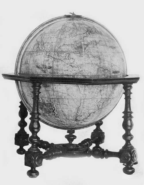
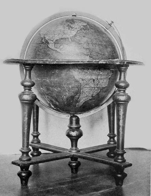
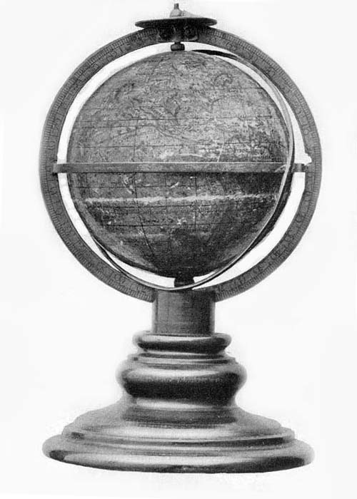
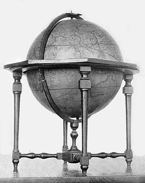
The Hispanic Society of America possesses a terrestrial
globe signed Jodocus Hondius and dated 1618 (Fig. 91).
Jodocus the elder died in the year 1611, and while the map
of this globe may be a reprint of one which he had engraved,
it should be noted that it does not agree in all of its details
with any other known globe of his, and may therefore be the
work of the son. The sphere of papier-mâché has a diameter
of 20 cm. and is supported on a base of wood which includes
a horizon circle, having pasted on its surface the usual representations
of zodiacal signs, the calendar, and the names of
the principal winds or directions. This horizon circle rests
upon four small turned legs joined at the bottom by cross
bars, covering which bars is a circular turned disc 22 cm. in
diameter, from the center of which rises a short post.
Through a slot in this post passes a graduated meridian
circle within which the globe ball revolves.
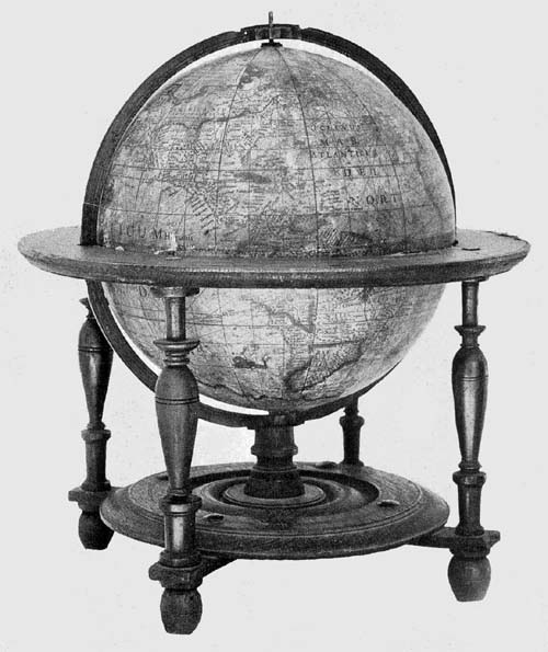
Fig. 91. Terrestrial Globe of Jodocus Hondius, 1618.
The map is slightly water-stained, but the American portion
is particularly well preserved. A crack in the sphere
along the meridian of 150 degrees east extends from pole to
pole, and is rather a disfigurement than a serious injury to
any part of the surface. The map is a remarkably fine example
of the Dutch map engraver’s art. The lettering and the
continental outlines were remarkably well cut in the copper
plate used in the printing, and in many places the luster
of the ink is still preserved. In the northern part of North
America is the brief and interesting dedication “Clarissimis
Consultissimique Nauticae Belgicaeque Federatarum Inferioris
Germaniae Regionum Praefectis D. D. Jodocus Hondius.”
“To the most illustrious and most prudent prefects
and seamen of Belgium and of the region of lower Germany,
Jodocus Hondius gives and dedicates (this globe).”
In the “Terra Australis incognita” is the address to
the reader which is practically identical with that to be
found on the Hondius terrestrial globe of 1601, omitting,
however, the word “Vale” and changing the date to “1618.”
Near the entrance to Hudson’s Bay is a legend reading “Huc
retrocesserunt Amstelodamensis anno 1612.”
From this bay an arm extends to the southwest which is
referred to as “The bay where Hudson did winter,” and an
arm extends to the southeast, which is referred to as “The
Bay of Gosneres.” A few other brief legends are given, referring
to an event or to events supposed to have taken place
in the locality in which they are placed. Small but artistically
engraved ships sail the Atlantic and the Pacific, and
here and there a marine animal is represented. Loxodromic
lines are made a conspicuous feature, having their crossing
centers at longitudes 0, 90, 180, and 270 on the equator,
likewise on the prime meridian at latitude 35 degrees both
north and south, as well as at the same latitudes on the
opposite side of the sphere, where the prime meridian becomes
the meridian of 180 degrees. In addition to this example
belonging to The Hispanic Society’s collection, one may
be found in the Germanisches Nationalmuseum of Nürnberg.13
Not until the year 1640 do we find the name Hondius
again appearing on a dated globe. Attention has been called
to the fact that Henricus, the son of Jodocus, continued,
with more or less diligence, the work of map engraving and
map printing, which the latter had carried on so successfully
in Amsterdam until the time of his death. We are told
that a partnership in the business, about the year 1639, was
formed by Henricus Hondius with Johan Janssonius, his
brother-in-law, and that this business, after the year 1644,
passed entirely into the hands of the latter. It was in the
year 1640 that the firm referred to undertook the reissue of
the Hondius globes of earlier date. These had a diameter of
about 52 cm. The gore maps, consisting of twelve parts,
were made to extend to within twenty degrees of each pole,
the polar space being covered with the usual polar cap.
The address to the reader, to be found on the terrestrial
globe of the year 1613, is repeated on this of 1640,14 but the
dedication differs somewhat in the two, reading, on those
of the 1640 issue, “Illustrissimis, Nobilissimis, Amplissimis
et Prudentissimis Foederatarum Inferioris Germaniae provinciarum
Ordinibus ac Patribus Patriae Dominis suis clementissimis
dedicabat Henricus Hondius. Henricus Hondius
excudebat An. 1640.” “To the Most Illustrious, Most
Noble, Most Exalted and Prudent Lords of the United
Netherlands, the Fathers of their Country, his Most Clement
Master, Henricus Hondius dedicates (this globe). Constructed
by Henricus Hondius in the year 1640.” There have
been added a number of interesting legends, such as the following:
“Inter S. Laurentii et los Romeros insulas vehemens
admodum est versus ortum et occasum fluxus et refluxus
maris.” “Between the islands of St. Lawrence and Los
Romeros there is an exceedingly strong ebb and flow of the
sea eastward and westward”; “Psitacorum regio sic a Lusitanis
appellata ob eorum avium ibidem magnitudinem.”
“The region of the parrots, and this is so called by the Portuguese
because of the great number of these birds found
here”;15 “Promontorium terrae australis distans 450 leucas
a capite Bonae Spei et 600 a S. Augustini.” “This promontory
of the southern land is distant 450 leagues from the
Cape of Good Hope, and 600 from Cape St. Augustine”;
“Accolae Freti Magellanici septentrionem versus procerae,
meridiem vero versus exiquae magnitidinis reperiuntur.”
“The inhabitants of the Strait of Magellan toward the
north are of large size, but toward the south they are of
small stature”; “Lybia inferior quae hodie Saara appellatur
quae vox idem quod desertum significat.” “Lower Lybia
is called today Sahara, which word means desert.” In the
Hudson Bay region we find, “In sinu Maris Hudsons Bay
vulgo dictus ubi M. Hudson hybernavit, ibidem maris
aestus non ultra duos pedes accrescebat, quod et observabit
D. Thomas Jacobus a. 1631 in sinu ‘James his Bay’ dicto
et ubi mensuram duorum pedum non excedebat maris
tumor.” “In the bend of the sea called Hudson’s Bay, where
Hudson passed the winter, the tide of the sea did not rise
more than two feet, which also was observed by Thomas
James in the year 163116 in the Bay called James his Bay
where the rise of the sea likewise did not exceed two feet.”
Near the last-quoted legend we find, “Thomas Button hibernans
in portu Nelson ad altitudinem grad. 57 observavit
singulis ex horis aestum maris accrescere 15 pedes aut ultra,
qui flante Zephiro solito magis instar plenilunii intumescebat.
Sequenti aestate animadvertit quoque ad altitudinem
grad. 60 similes aestus maris qui nunc orientem versus nunc
occidentem vergebant.” “Thomas Button,17 who passed the
winter in Port Nelson, at the high latitude of 57 degrees,
observed hour by hour the tide of the sea to rise 15 feet or
more, which tide, with the accustomed wind blowing,
swelled very like a (spring) tide. Next summer he noticed
at a latitude of 60 degrees similar ocean tides which now
had an eastward flow and now a westward.” A legend has
been added relating to the magnetic poles and to the difficulty
of locating the same, reading “Duos in hoc loco
Gerardus Mercator et alii eundem secuti posuerunt Polos
magnetis, unum respectu insularum capitis viridis, alterum
respectu insulae Corvi et Floridis: cum vero de his nihil certi
sit, et quotidiana experientia nos aliter doceat de deviatione
acus nauticae ambos omissimus.” “Gerard Mercator and
others following him have placed two magnetic poles in this
locality, one according to the direction indicated (by the
compass needle) at the Cape Verde Islands, the other according
to the direction indicated at the Islands of Corvus
and Flores: but as nothing is known for a certainty concerning
these, and a daily experience teaches us otherwise
concerning the variation of the magnetic needle, we have
omitted both poles.”18
The globes of this edition were supplied with the usual
brass meridian circles, wooden horizon circles, on the surface
of which was pasted the printed representation of the
zodiacal signs, the names of the months, and of the principal
winds or directions.
The celestial globe follows, in its records, more closely
than does the terrestrial, the issue of 1613. The title legend,
the reference to Tycho Brahe, and the reference to the star
which appeared in the year 1572 in the constellation Cassiopeia,
all agree with those in the earlier edition, as do, in
the main, the representations of the figures of the several
Ptolemaic constellations and those added in the southern
hemisphere. The dedication reads, “Illustrissimis Nobilissimis
Amplissimis Clarissimisque D. D. Dominis Ordinibus
Provinciarum Foederis Belgici Dominis suis Clementissimis
in assiduae gratitudinis memoriam dat, dicat dedicatque
Illustriss. Amplit. Vest. devotus Henricus Hondius.” “To
the Most Illustrious, Most Noble, Most Exalted, Most Renowned
Lords of the United Provinces of Belgium, his
Most Clement Masters, as a memorial of constant gratitude,
gives and dedicates to Your Illustrious Highnesses (this
globe). Henricus Hondius.”
A copy of each of these globes of 1640 may be found in
the library of the Seminario Vescovile of Portogruaro, a
copy of each in the Biblioteca Quiriniana of Brescia, and
one of each, though undated, in the Museo Civico of
Vicenza.
If the Van Langren family and the Hondius family
brought renown to their country through the excellence of
their work in the field of cartography, so likewise did the
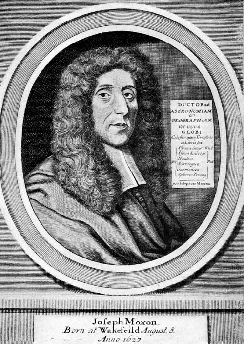
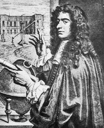
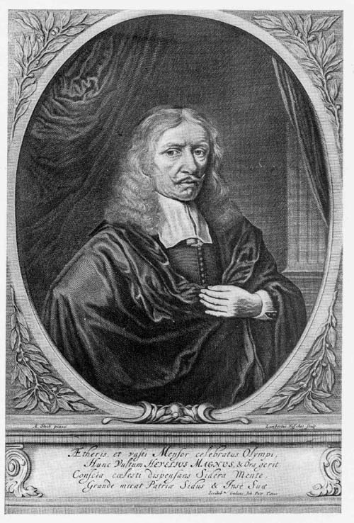
Blaeu family, father and sons. Perhaps to Willem Jansz.
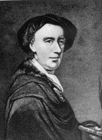
Blaeu (Fig. 92) and his son, John, belongs first place in
the long line of distinguished map and globe makers of the
Netherlands.19
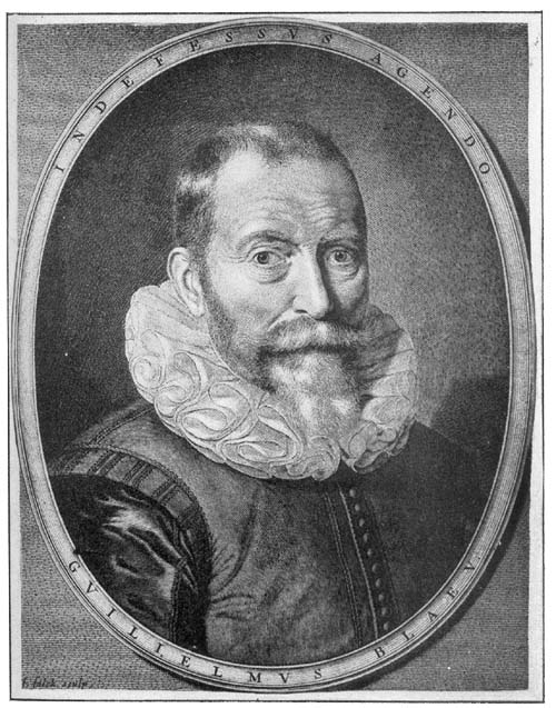
Fig. 92. Portrait of Willem Jansz. Blaeu.
A record which finds general acceptance tells us that
Willem Blaeu was born in the village of Alkmaar in the
year 1571.20 Of his childhood years very little is known.
It was some time in his early boyhood that he went to
Amsterdam, where he found employment, it appears, at
first in the house of a Holland merchant, and later as a
joiner’s apprentice. We can be certain neither of the time
when he decided to leave Amsterdam, nor of the exact circumstances
which induced him to visit the island of Hveen,
then belonging to Denmark, an event of much significance
in his life. We, however, cannot be far wrong in asserting
the promptings for this visit to have been his early liking
for mathematical, geographical, and astronomical studies.
It was here that he first came into intimate relations with
Tycho Brahe, the famous Danish astronomer, who, in the
year 1576, through princely favor, came into possession of
this island, and, as before noted, had erected here his remarkably
well-appointed astronomical observatory, which he
called Uranienburg.21 For nearly a quarter of a century this
was one of the most famous centers in all Europe for the
study of astronomical science and of its practical application.
Blaeu, however, was not the first of the young Netherlanders
to find the way to Uranienburg to receive instruction
from the great master.22 Of his sojourn on the island we
have but little direct information. It appears certain that
he passed at least two years with Tycho, engaged the while
in study and in the construction of mathematical and astronomical
instruments. That the relations between the two
distinguished scientists continued to be of the most friendly
character after Blaeu returned to Amsterdam is very certain.
Not a few of those who in later years praised Blaeu’s scientific
attainments refer to him as “the pupil and longtime
friend of Brahe,” and Blaeu himself, in certain legends
appearing on his globes and maps, refers to him as his
teacher. It cannot be doubted that Blaeu owed to his abode
on the Island of Hveen the real foundation of his scientific
knowledge, both in the field of geography and astronomy,
as well as his knowledge of the construction and the skilful
use of mathematical instruments. We have reason for believing
that a number of the instruments which served the
great astronomer in his investigations23 were the work of
Blaeu, and it is an interesting fact, as we know, that
Brahe’s observations, here made, formed the basis for Kepler’s
calculations, leading him to the discovery of the laws
which immortalized his name.24
It was perhaps late in the year 1596 or early in the year
1597 that Blaeu returned to Amsterdam, where he soon
established himself as a maker of mathematical instruments,
of maps and of globes, and as an engraver and printer.
There is good reason for thinking that from the first he
prospered in his undertakings, and, from incidental references
to his activities, it may be inferred that it was not
long after 1600 he was in his own fully equipped house.
From his presses numerous works were issued, the many
examples of which, still adorning the shelves of most prominent
libraries, are a monument to his great abilities.
On his ‘Paescarte,’ one of his earliest publications,25 and
usually referred to the year 1606, we read that it was
“Ghedruckt t’ Amsterdam bij Willem Janssoon op’t Waeter
inde Sonnewijser,” a location often referred to in certain
later publications as “op’ t water In de vergulde Sonnewyser,”
reference here being to the gilded sundial which, as
a business sign, adorned the gable of his establishment. It
appears that in this originally selected locality his work was
carried on until the year 1637, when his entire plant was
moved into more commodious quarters in the Blumengracht,
one year only before his death. The sons, John and
Cornelius, succeeded to the business, and to the former especially
belongs the credit of issuing the most sumptuous atlas
in that period of remarkable map making.26 In the year 1672
practically the entire establishment was destroyed by fire.
Willem Blaeu’s training admirably fitted him to serve
his country in matters pertaining to its maritime interests,
and its calls as well as its rewards for service were not
infrequent. As proof of the confidence that his contemporaries
had in his knowledge of geography and navigation, the
Estates General of Amsterdam, January 3, 1633, by resolution,
appointed him Map Maker of the Republic, an honorable
position held by him until his death, then being successively
passed on to his son and to his grandson.27
We are told that Tycho had given to Blaeu a copy of his
astronomical observations before their publication, that this
copy was carried to Amsterdam, and that after a careful
study of the records contained therein the latter began the
practice of globe making.28 The implication contained in
this reference is that his first work as a globe maker was
the preparation of material for a celestial globe, but no such
globe of his, bearing date earlier than 1602, is known. His
first dated work appears to have been a terrestrial globe of
the year 1599. In many of its features it gives evidence that
Mercator was the master followed, notably in the representation
of the loxodromic lines which radiate from the
numerous wind or compass roses, or from centers regularly
placed on the surface of the globe.
This first issue has a diameter of 34 cm., which is less
than that of Mercator’s globe of the year 1541, but greater
than that of the Van Langren globe of the year 1585.29 The
gores, twelve in number, were cut seven degrees from the
poles, the polar space being covered with a circular disc.
Blaeu, as many other globe makers of his period, found that
by thus dividing the engraved globe map a more nearly perfect
covering for the sphere could be obtained. Meridians and
parallels are drawn at intervals of ten degrees, the prime
meridian passing through the island of Santa Maria in the
Azores group. In a conspicuously placed cartouch he presents
his address to the reader. “Spectatori meo S. Hanc
terrae marisque faciem qui aspicis sic inspice ne dispicias:
multa hic mutata, (sed nihil temere) quae, nisi attendas,
facile fugiant. Ratio constructionis in multis nova, sed
proba. Gibbum plano, planum globo commutavimus: duplicato
labori: sed certiori: idque ut ventorum spirae justis per
orbem trrarum gyris discurrerent: hinc factum ut in omnibus
terrae oris praeter parallelorum et meridianorum etiam
plagae ratio nobis fuerit habenda. Quae quidem omnia attento
spectatori facile apparebunt. Vale et fruere. Guilielmus
Jansonius Alcmariensis auctor et sculptor. 1599.”
“Greeting to my observer. This representation of the earth
and sea, which thou beholdest, be pleased to take note of in
this manner. Many things here have been changed, but
nothing without reason, and unless thou art attentive these
things might easily escape thee. The method of construction
is in many points new, but correct. We have changed that
which is relief into the flat, and the flat into the globular,
a double labor but more nearly correct, and we did this
that the directions of the winds throughout the world might
be given their proper (loxodromic) spirals: and we have
made a representation of the coast lines of all shores of the
earth, besides a representation of the parallels and meridians.
All this will be seen by the attentive observer. Farewell,
and may you be happy. William Jansz. Alcmar,
author and sculptor. 1599.” Fiorini is of the opinion the
expression “multa hic mutata” in the above quoted inscription
indicates that the copies in which it is found are reprints
of an earlier edition, and that it has been inserted for
the purpose of keeping the globe on sale. Is not the reference
rather to this simple fact that Blaeu borrowed much
of his geographical information from others, as he admits,
including Mercator and Van Langren, and that he had
merely altered the same to the end of bringing his records
to date? The dedication reads “Noblissimis, Amplissimis,
Clarissimis, D. D. Dominis Ordinibus Foederatarum Inferioris
Germaniae Provinciarum dignissimis fidis Patriae
Patribus hoc terrae marisque Theatrum L. M. Q. Dat,
Dicat, Dedicat Cliens Vester subjectis. Guilielmus Jansonius
Alcmarianus.” “To the Most Noble, Most Distinguished,
Most Illustrious, Lords of the United Provinces
of Lower Germany, Fathers of their Country this representation
of the land and the sea gives, grants, and delivers
your humble client Willem Jansz. Alcmar.” It will be noted
that the family name Blaeu was not employed in the signature,
but instead Alcmar, the name of his native place. He
apparently did not consider it essential always to employ
the same name. Sometimes he gave this as Guilielmus Jansonius
Blaeu, Guil. Jansz. Blaeu, Guiljelmus Blaeuw;
sometimes he gave it as Guilielmus Janssonius Alcmarianus,
or Guil. Jansz. Alcmar; sometimes as Guiljelmus
Caesius or J. G. Caesius, in which he had classicized his
name Blaeu; sometimes the name is coupled with that of
the son as Guil. et Johan Blaeu. The legends on this globe
are numerous which tell of great discoveries and explorations,
of which the principal ones are here quoted from
Baudet’s readings from the Leiden copy. Near the north
pole we find “Hic tandem passi graviora Batavi, proxima
tempestate diversum iam iter ingressi, nostrum altius mundi
verticem versus progressi, ignotas quaerere terras, et si qua
proprior ad Chinam aditus aggressi sunt. Mirum quid invenerint!
immane quid evenerit! Sic, macte Proles Neptunia
novisque honoribus hanc gentem nostram cumula,
male coepisti, si hic sistas. Durum hoc, sed perdura, nec
cede malis sed contra audentior ito. Fata viam expedient.”
“As far as this, after suffering great hardships, the Dutch,
in recent times have progressed toward the top of the world,
seeking unknown lands, and if there is any shorter way to
China. Wonderful are their discoveries! Strange things have
happened! Go on, O blessed progeny of Neptune, and add
new honors to our race. You have begun ill if you stop here.
It is a hard task, but endure. Do not yield to misfortune, but
on the contrary be more daring. Fate will clear the way.”
In the same locality “Immortale nomen & gloriam incomparabilem
vobis, Columbe et Americe comparastis, Qui
primi has terras (alteram orbis partem) tot iam secula
latentes adire, detegere, lustrare et utinam perlustrare voluistis:
Fructs vero maximos multis perperistis.” “Ye have
gained an immortal name, and incomparable glory for yourselves,
Columbus and Americus, who were the first to approach
these lands to discover and disclose them (the other
part of the world) unknown for so many centuries, and I
would that you had desired to explore them. You have
brought forth much fruit for the many.” Another reads,
“Magnam porro gloriae partem Ferdinande Magellane,
iure tibi vendicas: cui ... vastae regionis Australem terminum
quaerere eamq. freto cognimini nobis perviam facere
lubuit & licuit.” “A large share of the glory thou doest
rightly claim, O Ferdinand Magellan, to whom it was
pleasing and to whom it was allowed to seek the southern
bounds of a vast region, and to open the Strait for us that
bears thy name”; also a legend referring to the Cortereals,
“Utinam vero par eventus Casparo Cortereali contigisset,
qui iam ante maiori conatu quam successu transitum a
Borea attentaverat: et quoties Britannis idem fervide molientibus
et aeris iniutiis gradum revocare coactis.” “I wish
that like success had come to Gaspar Cortereal, who before,
with greater effort than achievement attempted to find a
passage by way of the north. Likewise to the British (I
wish success) strenuously attempting the same but forced
to retreat by reason of adverse weather.”
As in the issue of his sheet maps, Blaeu was not always
careful to add an exact date of preparation, in the majority
of instances, indeed, omitting the date altogether, so also
in the issue of his globes he frequently omitted dates or
gave one which we know to have been later than was that
of the original issue. His geographical records serve us,
however, as fairly accurate guides in the determination of
these dates, and what was so frequently true of the globes
he constructed in the last years of his life was true of this
his first. We have, for example, copies of this bearing date
1599, which contains geographical records of the year 1616,
indicating therefore a later reprint with a few alterations.
It was not until the year 1603 that he undertook the
preparation of a celestial globe to serve as a companion of
his first terrestrial. This he dedicated, “Illustrisso Principi
ac Domiōauritio, Principi Auraico Comiti de Naussau
etc., Marchioni Veriae et Flissingae etc., Domino suo Clementissimo,
Hos astriferum, stellarum arte coelo deductarum,
coelum Gratus M.O.D.D.C.Q. Guilielmus Jansonius
Alcmarianus.” “To the Illustrious Prince and Lord D.
Maurice, Prince of Orange, Count of Nassau, etc., Marquis
of Veria and Flissingen, etc., his Most Benign Lord, this
globe of the stars brought down from heaven by art is
gratefully dedicated by its maker with dutiful mind.
Willem Jansz. Alcmar.” In his title legend he makes particular
reference to his teacher Tycho, which legend reads:
“Sphaera stellifera. In qua ut speculo quondam firmamenti
Universaum Syderū ornatum ac stellarum ordinem summa,
qua fieri potuit, industria a Guilielmo Jansonio, magni
Tychonis quondam discipulo, accuratissime disposititum:
earumque numerum multo quam hactenus, auctiorem ex
observationibus recens. a Nob. viro D. Tychone Brahe,
astronomo incōparabili, habitis, depromta anno 1600, et
quo deinceps seculo, accommodata intueri liceat.” “Celestial
sphere. Herein as in a mirror all the stars of the firmament
are depicted, and in proper order with the greatest possible
industry and accuracy by Willem Janson the former pupil
of the great Tycho: their number much increased from recent
observations made by the noble D. Tycho Brahe, that
incomparable astronomer, taken from his observations made
in the year 1600, and made with an accommodation for
the coming century.” Near this cartouch is a portrait of the
great astronomer with his favorite motto, “Non haberi, sed
esse.” Near the south pole we find a reference to recent
astronomical discoveries in the following words: “Habetis
hic, Astronomum studiosi, trecentas et plures antarctici
mundi vertici viciniores stellas, ex observationibus secundum
jam a Frederico Houtmanno, majori studio et accommodatioribus
instrumentis, ad stellas a Tychone positas factis, depromptas:
auctiori numero et accuratiori dispositione vestro
commodo et delectationi depictas A. 1603.” “Thou hast
here, O student of astronomy, more than three hundred
stars, that are nearest the pole of the antarctic world, from
the observations made by Frederick Houtmann with further
study and with more suitable instruments, along with
the stars that were located by Tycho: this increased number
and this more accurate location having been set down
for your use and delight in the year 1603.” He adds here
and there a brief legend in which he directs attention to
recently discovered stars.
The purchase of a pair of these globes, that of 1599 and
of 1603, was reported in the year 1885 by Dr. Baumgärtner,31
who refers to them as having a diameter of 34 cm.,
as being well mounted and artistically colored. On the first,
he notes, are represented sea monsters swimming in the
oceans, and the natives of many of the little known regions
appear in picture, as, for example, in the region of Patagonia,
near which appears the legend, “Patagonae regio ubi
incolae sunt gigantes.” “The region of Patagonia where
giants live.” Greenland is laid down as a small island, as
is also Corea. The region of Bering Sea shows clearly how
inexact was the knowledge of the North Pacific in his day,
and the same inexact geographic knowledge of the southernmost
region of South America and of Australia is strikingly
recorded. There are slight differences apparently existing
between Dr. Baumgärtner’s globes and certain other known
copies of the same date, but differences which are of no
special significance.
A pair of these globes was announced in the sales catalogue,
“Geographie cartographie & voyage, 1891,” of Frederik
Muller of Amsterdam. A geographical record on the
terrestrial globe clearly indicates that it was not issued,
however, until after 1616, although dated 1599, since it
contains a reference to the Van Schouten voyage of 1615-1617.
It was on this voyage, says Van Schouten in his
‘Journal,’ that he gave the name “Staten Lant” to that
region on the left as one enters the Lemaire Strait, and the
name “Isle of Barnevelt” to the island discovered in this
strait.32 Both of these names appear on this globe. It has
in addition an interesting legend which might be taken to
suggest that the globe was not constructed until the year
1682, although the gores, save for this legend, may have
been printed much earlier. This legend reads, “’t Amsteldam
by Joannes van Ceulen, Joanniszoon op de hoek van
de Mol-steegh, in de Nieuwen Atlas, werd gedruckt en op
nieu uytgegeven met Praevilegie ... alle de Globes en
Spaeren by den Heer Joan Blaeu Zal. nagelaten. Ao. 1682.”
The celestial globe seems to agree with other known copies.
Two copies of the terrestrial globe of 1599 and two of
the celestial of 1603 may be found in the Germanisches
Nationalmuseum of Nürnberg. A pair may be found in the
Biblioteca Angelica of Rome and a pair, reported to be in
good condition, belongs to the Biblioteca Comunale of
Fano. Adam Kästner reports, in his ‘Geschichte der Mathematik,’
the purchase of a pair of this first edition of Blaeu’s
globes.33 According to a catalogue entry of objects belonging
to the University of Leiden in the year 1716 there is
reference to two pairs of Blaeu’s globes. Only one pair of
these, however, seems now to be known, which pair a few
years since was removed to the Astronomical Observatory.34
In the year 1602 Blaeu issued a terrestrial and a celestial
globe, each having a diameter of 23 cm. In a legend on his
terrestrial globe he refers to it as an improvement, doubtless
meaning that he had undertaken to bring its geographical
records to date. This globe he dedicates as follows:
“Noblisis Illustris Hollandiae Zelandiae ac Westphrisiae
ordinibus, P.P.P. Clementissis hanc terrae marisque aphaerum
summa diligentia accuratissime fabricatam: debiti
honoris gratique animi testimonium L.M.D.D.D. Amstelodami.
Guilielmus Jansonius Blaeu. anno 1602.” “To the
Most Noble, Most Illustrious Princes of Holland, Zeeland
and West Friesland, Most Benign Rulers. This sphere of
the earth and sea, accurately constructed with the utmost
care is dedicated by Willem Jansz. Blaeu of Amsterdam as
a testimony of honor due and of a grateful mind. In the year
1602.” Over this legend have been placed the coats of arms
of the three provinces designated and near it a legend reading,
“En denuo studiose Geographiae, terrestrem contractioriforma
globum, multo, quam ante hac unquam, emendatius
et auctius confectum: a ventorum spiris navigantium
comodo, exquisitius adornatum: nec non navigationis curriculo,
ab Oliverio van Noort Batavo in orbem peracto, notatum.
Auctor Guilielmo Iansonio Blaeu.” “Here again, O
student of geography, thou hast a terrestrial globe in smaller
size, much smaller than ever before, and more accurately
and completely furnished, having the spiral directions of
the winds (the loxodromes) represented for the use of navigators.
These have been carefully drawn, and there is also
indicated the course of circumnavigation of the Dutchman
Oliver van der Noort.35 Willem Jansz. Blaeu author.” Van
der Noort, to whom reference is made in this legend, had
started out in the year 1598, hence his expedition was a
recent event and was therefore thought worthy of reference.
He sailed through the Strait of Magellan, reached the Indies
of the East, and with four of his original ships returned to
Holland in the year 1601. Blaeu, as he states, marked on
his globe the course of this expedition. The celestial globe
constructed as a companion of the former has a similar dedication
reading, “Nobilisis Illustis Hollandiae Zelandiae
Westphrisiae Ordinibus D. D. suis Clementisis hunc astriferum
inerrantium stellarum globum, summa cura et industria
adornatum debiti ossequii et gratitudinis ... D. D.
D. Guilielmus Jansonius Blaeu.” “To the Most Noble, and
Illustrious Princes of Holland, Zeeland, and West Friesland,
Most Benign Rulers: this celestial globe of the fixed
stars, prepared with the greatest care and industry is dedicated
as a gift of obedience due and of gratitude. William
Jansz. Blaeu.” A legend somewhat descriptive in character
near the former reads, “Habes hic Astrophile stellarum
inerantium ex certisis D. Ticho Brahe (mei quondam praeceptoris)
observationibus numero et dispositione prae aliis
an̄o 1600 accomodatarum sphaeram accuratissime expolitam
et Australibus asterismis quod novum a Federico Houtmano
observatis exornatam. Auctor Guilielmo Janso Blaeu.”
“Thou hast here, O lover of the stars, a globe of the fixed
stars from the most accurate observations of D. Tycho
Brahe (my onetime preceptor) in their number and disposition,
besides other observations accommodated to the year
1600, finished and furnished with (a representation) of the
southern stars which have of late been discovered by Frederick
Houtmann. Willem Jansz. Blaeu author.” Stars varying
in magnitude from the first to the sixth, receive each an
appropriate representation or sign, and there is a separate
distinguishing mark for the nebulae. To each of the constellations
is given its Latin name. In addition to the forty-eight
constellations of Ptolemy he gives the two sometimes
referred to by the ancients, “Bernice’s Hair” and “Antinous,”
adding, with names, more than ten constellations in
the southern sky. A legend in the constellation “Cepheus”
tells us, with reference to one of its stars, “Haec stupendae
magnitudinis stella insolito fulgore anno 1572 in Cassiopeia
sede amicuit.” “This star of great size and unwonted brilliancy
appeared in the Chair of Cassiopeia.” In the constellation
“Cygnus” is a legend reading “Novam illam stellam
quae anno 1600 primum in pectore Cygni apparuit (atque
etiam nunc immota parte) ex diligenti nostra ad eandem
Lyrae lucidae observatione Longitudo 16° 15´, latitudo
55° 30´ labore comperimus.” “The new star which in the
year 1600 first appeared in the breast of the Swan and to the
present has not altogether disappeared, this we have located,
by diligent search in Lyra long. 16° 15´ and lat. 55° 30´.”
By reason of the fact that so few copies of this issue are
known to exist, it has been thought that for some reason
Blaeu issued a very limited number. We know, however,
that his terrestrial globes were highly valued and were much
in demand, because of the care with which they had been
prepared, because of the efforts to give information concerning
the latest discoveries, and because of his representation
of the loxodromic lines which made them of special
value to navigators; that his celestial globes found favor by
reason of the fact that he was known to be a pupil of Tycho
Brahe, and that he himself was known to be a mathematician
and astronomer of distinction. To the following known
examples of the 1602 issue brief reference may be made.
In the Accademia dei Concordi of Rovigo, Italy, there may
be found a fine pair. The Stadtbibliothek of Nürnberg
possesses a fine pair, reported by the librarian to be in excellent
condition, and two copies of the celestial globe may be
found in the Germanisches Nationalmuseum of the same
city. A copy of the terrestrial globe is to be found in the collection
of the Königliches Museum of Cassel, and one in
the town of Rüdingen near Schaffhausen.
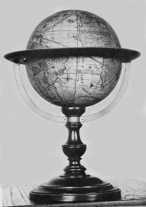
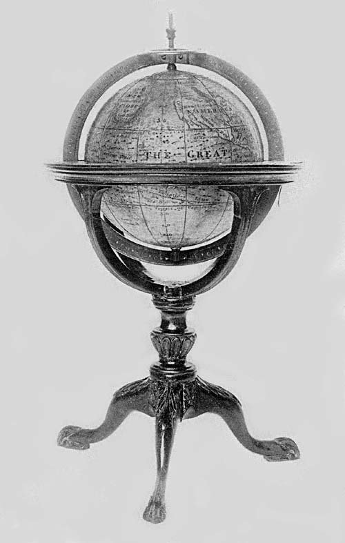
The Hispanic Society of America possesses, in its rich
collection of globes, a fine example of Blaeu’s terrestrial of
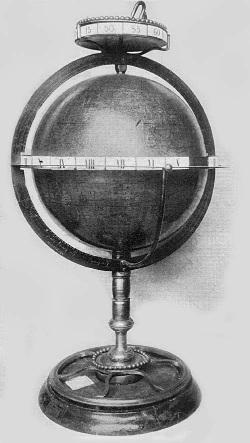
the year 1606 (Fig. 93). It has a diameter of 13.5 cm., is
mounted on a substantial wooden base, has a graduated
meridian circle, half of which, however, is missing, a
wooden horizon circle, on the upper surface of which is
pasted an engraved slip of paper with the usual graduation,
the calendar, and the names of the zodiacal signs. A legend
in the great austral land which is called “Magallanica,” contains
the date and refers to its dedication to Blaeu’s learned
friend of Edam, Cornelius Petrius. This legend reads
“Omnium virtutū genere ornatissimo viro Domino Cornelio
Petreio ecclesiastae apud Edamenses vigilantiss. et mathematico
eximio suo singulari hanc orbis sphaerae a se hoc
modo delineatae L. M. Q. D. D. Guilielmus Blaeu. Anno
D. 1606.” “To Dom. Cornelius Petrius, a man adorned with
all virtue, a most vigilant ecclesiastic among the people of
Edam and a mathematician of singular renown, Willem
Blaeu dedicates this terrestrial globe now completed by him
in the year 1606.” In the northern part of North America is
the title legend reading “Nova et accurata terrae marisque
sphaera denuo recognita et correcta a Guilielmo Blaeu.”
“A new and accurate sphere of the earth and sea newly revised
and corrected by Willem Blaeu.” The globe ball is of
hollow metal thinly covered with a preparation of plaster
on which have been pasted the twelve engraved gores extending
from pole to pole. As in the case of the Muller
copy of the issue of 1599 this one, though dated 1606, contains
a record of the discoveries of the Van Schouten expedition,
that is, the names “Staten Lant,” “I. Barnevelt,”
and “Fr. le Maire,” discoveries made in the year 1616, as
before mentioned.36 The magnitude of the austral land is
made to equal or to exceed that of the entire Old World,
the most northern extension of which, in the East Indian
region, bears the name “Nova Guinea.”37 Its geographical
information in general agrees with that so carefully recorded
on the Blaeu maps. In the western and southern sections of
North America the source of information has been largely
Spanish, in the eastern the source has been French and English,
and in the northeast almost entirely English. In the
north Atlantic we still find “Brazil,” “Maides,” and
“Frisland,” the mythical islands of the Zeno Brothers, and
north of Europe a record of the attempts of the Netherlanders
to reach “Nowaja Semlja.” For so small a globe the
detailed geographical information given is very remarkable.
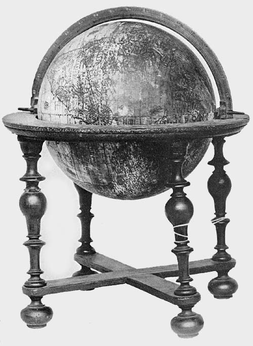
Fig. 93. Terrestrial Globe of Willem Jansz. Blaeu, 1606.
In addition to this example the British Museum kindly
sends the information that in its collection there is a copy
of Blaeu’s terrestrial globe of the year 1606, agreeing in its
dimensions with the copy in the collection of The Hispanic
Society of America, also of a celestial globe of the same date
which appears to be a unique copy.
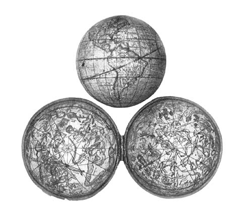
The Hispanic Society of America also possesses a terrestrial
and a celestial globe, the work of Blaeu, globes clearly
issued as companion pieces (Fig. 94), which appear to
be the only copies known, the latter dated 1616, the
former undated.38 The spheres have each a diameter of about
10 cm., a substantial and artistic mounting of brass, including
meridian and horizon circles, four twisted support
columns, and a circular base plate. Though small in size,
probably the smallest constructed by Blaeu, in their geographical
and astronomical details they are remarkably full.
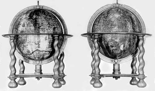
Fig. 94. Terrestrial and Celestial Globes of Willem Jansz. Blaeu, 1616.
The terrestrial globe, in an artistic cartouch near the south
pole, is referred to as “Nova Orbis Terrarum Descriptio
Auctor Guilielmo Blaeu.” “A new description of the world
by Willem Blaeu author.” Unlike that of the year 1606,
noted above, it contains no reference to the expedition of
Van Schouten and Le Maire, and records only the Strait of
Magellan at the southern extremity of South America.
Continental contours, even that of “Magallanica” and of
the New World, agree in practically all details with his
earlier globes and general world maps. He has retained certain
geographical names which appear more or less conspicuously
on some of the earlier maps, as “Estotiland”
north of Labrador, “Frisland” and “Island” in the north
Atlantic and “Norembega” applied to the coast of Maine.
The north Pacific is entirely too narrow and the island of
“Japan” is located not far from the west coast of North
America. Bering Strait is well represented but is unnamed.
The map is not well preserved, the chief injury to it being
in the western part of North America and in the central and
eastern Pacific.
The celestial globe, which is the companion of the
former, has a similar brass mounting. It is remarkably well
preserved and all inscriptions on the surface of the ball are
easily legible. It is made to revolve about the axis of the
ecliptic. The figures representing the several constellations
have been artistically engraved, and stars up to the sixth
magnitude have appropriate and distinct representation.
A legend near the south pole reads “Sphaera stellata in qua
ceu speculo Stellae fixae ex accuratis Nobilis viri D.
Tychonis Brahe observationibus ad annum 1600 accommodatae
conspicuae sito ponuntur.” “The starry sphere in
which as in a mirror the fixed stars are placed by the accurate
observations of the Noble D. Tycho Brahe, accommodated
to the year 1600.”
Blaeu’s earliest globes, as has been noted, were of small
dimensions. It must have been shortly after the year 1616
that he decided to undertake the construction of those of
much greater size, to the end of making his work the more
serviceable; but to this he may have been led in part, as
before noted, by the success of the large globes of Hondius
of the year 1613.39 Unfortunately it is not easy to determine
the exact date of the several issues of his work appearing in
the last twenty years of his life. In general, the date of the
construction of the globes of these years is altogether wanting.
The dedications in the several reprints or editions vary,
as do many of the inscriptions, while the large size of the
globes remains practically the same. One cannot feel certain
that a date, apparently given as the year of construction,
is accurate, since it is very evident in the several
reprints care was not always given to this detail.
The first issue of his large terrestrial globes seems to date
from the year 1622, though the suggestion is not wanting
that he had actually completed the celestial globe before
the close of the year 1616.
With but slight variation in the form of the expression,
we find on all examples of his largest globes the inscription
“Amstelredami. Excusum in aedibus auctoris ...,” indicating
at least that the printing was done in the author’s
Amsterdam workshop. All have a diameter of about 68 cm.,
though the mountings of the several known examples differ
somewhat.
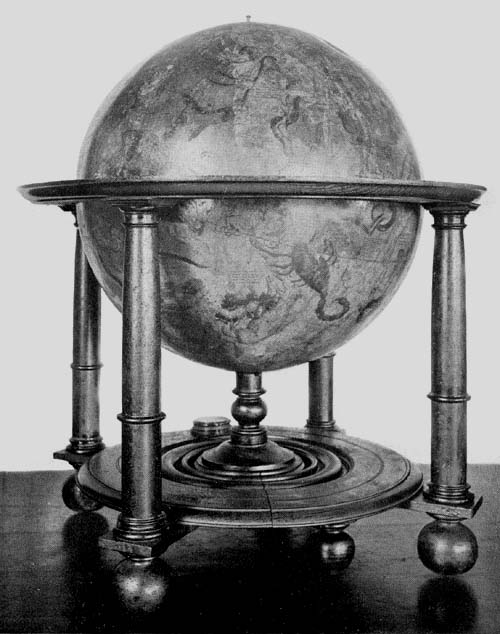
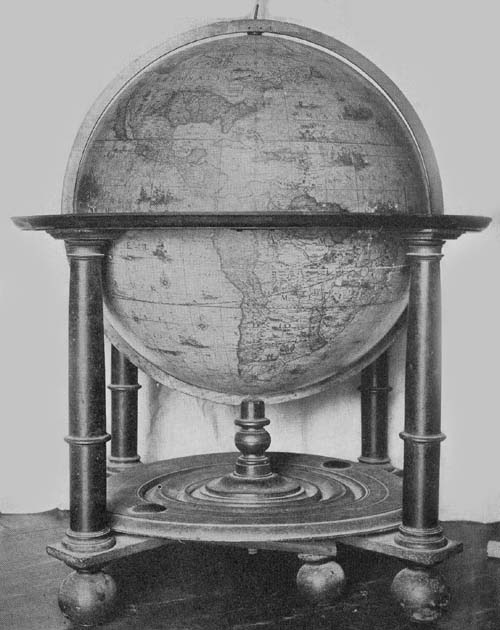
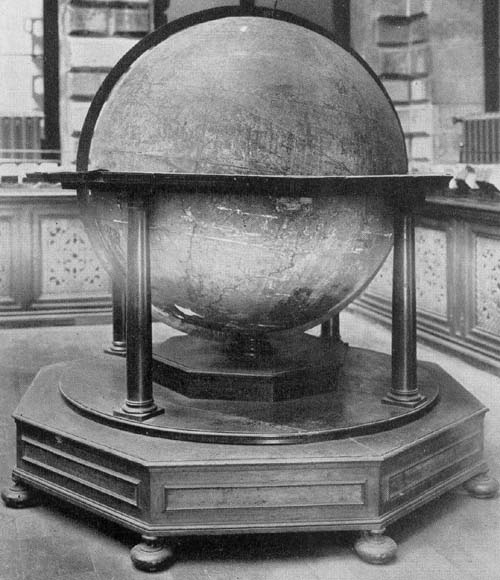
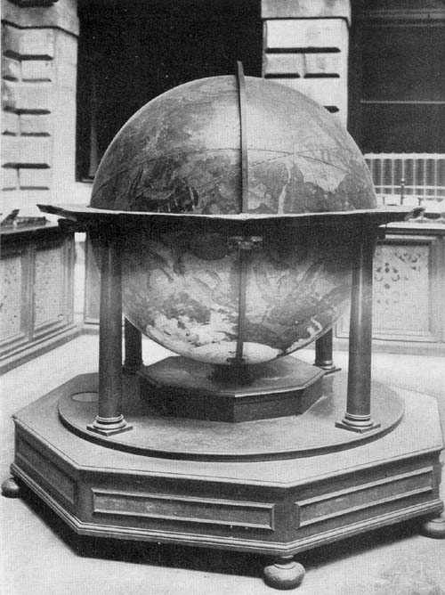
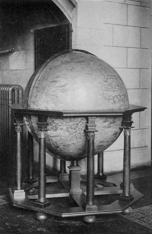
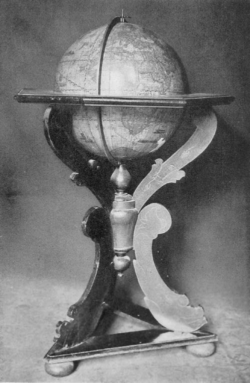
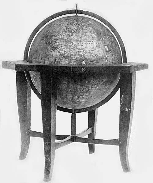
The Hispanic Society of America possesses a fine example
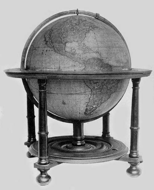
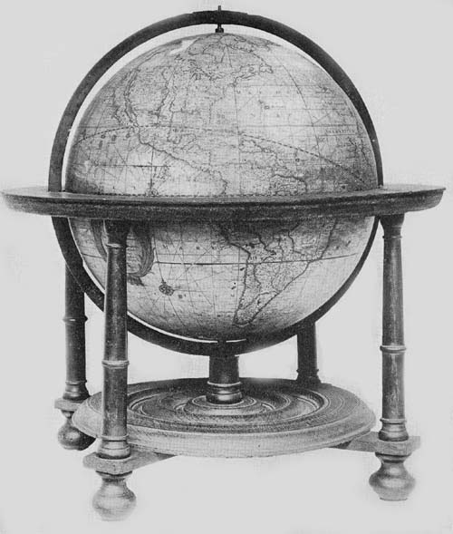
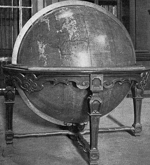
of the terrestrial globe, dated 1622 (Fig. 95). The ball
is formed of papier-mâché, having over its surface a thin
coating of plaster made perfectly smooth and shellacked to
receive the thirty-six engraved gores, or twice eighteen half
gores, and the usual circular polar caps. It is well preserved,
considering its great size and its age, though somewhat
injured in the region of the western Mediterranean, in the
East Indian Islands, in West Africa, in South America, and
in parts of the Pacific Ocean. It is furnished with an elaborate
wooden base, a considerable part of which appears to
have been added subsequent to that constituting the main
support, a horizon circle of wood, and a meridian circle of
brass. The map is a fine example of the work done in the
Netherlands by the copper engravers and printers of the
period, in particular of the work which issued from the
Blaeu press. Continental outlines are well drawn, lands and
seas are crowded with geographical records, including individual
names and legends. Very artistically designed ships
sail the oceans singly or in fleets, and compass lines as well
as loxodromic lines are very numerous, radiating from centers
distributed over the surface of the map. Much of the
original color which had been artistically applied by hand
still remains, particularly on the southern hemisphere, which
has been less exposed to the light and to careless handling.
The author and date legend placed near the south pole in an
artistic cartouch reads, “In ista quam exibimus, terreni globi
descriptione omnium regionum juxta et insularum, quotquot
hacetnus a nostris Argonautis, vel etiam ab aliarum gentium
Naucleris visae et notatae, loca in suo secundum longitudinem
et latitudinem situ, summa sedulitate et industria
disposita invenies, quae res non solum Geographiae studiosis
jocunda, verum etiam iis, qui terras longe dissitas et sub alio
sole calentes frequentent, maxime utilis futura est. In quorum
gratiam etiam rhombus nauticos (ita vocantur Helices
lineae secundum ventorum plagus delineatae) quam accuratissime
expressimus. Hunc igitur laborem nostrum ut tam
Gratis animis accipiatis, quanta sedulitate a nobis est obitus,
ex aequo omnes rogatos volo. Guiljelmus Caesius Auctor.
Anno CICICCCXXII.” “In this terrestrial globe, which we
here present, you will find all the regions and islands as far
as they have been seen, up to the present, and marked by
our navigators, or have been seen and marked by the navigators
of other nations, placed in their own proper position
of longitude and latitude, with the greatest care and industry,
which not only will be a source of pleasure to the students
of geography but also of the greatest utility to those
who visit far distant shores, which are warmed by another
sun. And for their benefit we have also inserted the nautical
rhombs (for so are designated the lines which show the
direction of the winds). This labor of ours I hope and pray
you will accept with as much gratitude as we have bestowed
care upon it. Willem Caesius. In the year 1622.”
A citation of all legends which the author has placed on
his map would indeed fill many pages, and but few of
these are here quoted.
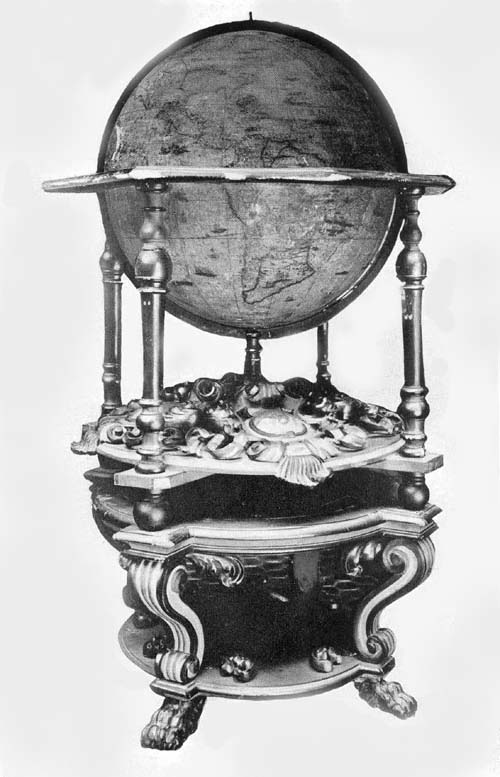
Fig. 95. Terrestrial Globe of Willem Jansz. Blaeu, 1622.
In the southern hemisphere, and particularly conspicuous
by reason of the artistic cartouch in which it is placed, we
find a reference to the question of the proper location of the
prime meridian,40 somewhat lengthy but quoted here in full.
“Quamvis longitudinis initium arbitrarium esset, ab occasu
tamen ejus auspicium facere ideo veteribus placuit quod illic
aliquis terrae limen esset, qui ortum versus nullis expeditionibus
deprehendi potuisset. Atque eam ob causam Ptolemaeus
(cujus sedulitati et industriae Geographiae incolumitatem
omnes, vel inviti, debent) ab ultimo termino
occidentis cognito, quae Insulae in Atlantico Mari Fortunatae
dictae sunt, auspicium fecit in eisque primum Meridianum
defixit: quod theticum principium deinceps fere omnes ejus
auctoritate moti retinuerunt. Interim hoc seculo nonnulli
hoc principium ex ipsa natura eruendum censuere. Qua in
re acus Magneti junctae indicium sequendum sibi sumpserunt,
eumque primum Meridianum statuunt quo in loco ea
Boream spectat Quos plane allucinari addita illa Magneti
vis convincit, penes quem nullum longitudinis arbitrium sit,
cum is ipse sub eodem meridiano varium habeat enclisin
prout huic aut illi continenti vicinus fuerit. Sed et illi ipsi
qui ita sentiunt, ob instabile magnetis indicium, in primo
Meridiano, multum inter se dissentiunt. Quamobrem ut
summo Geographiae commodo, certus aliquis Meridianus
tamquam primum principium servari et retineri possit,
Ptolemaei vestigiis insistentes, easdem Insulas, et iis Junonem,
quae Teneriffa vulgo creditur, delegimus, cujus excelsa
illa et praerupta petra, perpetuis nebulis obsessa, Indigenis
El Pico dicta, primi Meridiani terminus esto. Qua in re ab
Arabum longitudinibus (qui extrema Africae littora versus
occidentem delegerunt), vix unius gradus quadrante abimus
diversi: quod quoque monuisse operae pretium putavi.”
“Although the beginning of longitude is arbitrarily selected
nevertheless it pleased the ancients to begin the counting of
it from the west, because there was the limit of the earth,
as some thought, while no expedition to the east was able
to determine this. Therefore Ptolemy, to whose application
and industry all men, even though unwilling to admit it,
owe the preservation of geography (geographical science),
made the location (of the beginning of longitude) in the
farthest known limit of the west, which is called the Fortunate
Islands, in the Atlantic Ocean, and in them he fixed
the first meridian. This hypothetical beginning, almost all
who came after him retained because of his influence. But
in our century there are some who have said that this beginning
should be taken from nature herself, and in this matter
they have taken the indication of the magnetic needle as
their guide, and fix the first meridian in that place in which
the needle points to the true north: That this is clearly an
error is proved by this additional (and peculiar) property
of the magnetic needle, that on the same meridian it has a
variation according as it is near to this or that continent.
But the very men who think this, on account of the uncertainty
of the variation, disagree much among themselves as
to where the first meridian is to be located, and so for the
highest good of geography, that this same fixed meridian as
a first beginning may be marked and be retained, we ourselves,
following in the steps of Ptolemy, have chosen the
same islands as he, and from their number that one which is
called Juno, or commonly Tenerif; of these (islands) that
high and steep rock beset by perpetual clouds and called by
the natives El Pico, shall for us be the location of the first
meridian. In this matter, from the longitude of the Arabs,
who selected the shore of Africa farthest toward the west,
we vary scarcely the fourth part of a degree, and this I
thought worthy to be noted.”
There is a brief but important legend near the Strait of
Magellan reading, “Fretum Magellanicum, sic dictum a
Ferdinando Magellano Lusitano, qui omnium primus id
aperuit atque emensus est, anno 1520, Franciscus Draach et
Thomas Candish, uterque anglus Fretum emensi sunt, ille
anno 1579, hic anno 1587. Oliverius van Noorth et Georgius
Speilbergius, uterque Belga annis 1600 et 1615.” “The
Strait of Magellan, so called by Ferdinand Magellan a
Portuguese who was the first to discover it and to sail
through it in the year 1520, Francis Drake and Thomas
Candish, both Englishmen, sailed through the strait, the
one in the year 1579, the other in the year 1587. Oliver van
Noort and George Spilbergen, both Belgians in the years
1600 and 1615.” Near the last-quoted legend we find “Fretum
Le Maire a Wilhem Scouten Hernano et Jacobo Le
Maire per eum inventum et lustratum Ao 1616.” “The
Strait of Le Maire discovered and surveyed by Wilhem
Scouten and Jacob Le Maire in the year 1616.” To the
northwest in the Pacific we find “Magellanus ad insulas has
delatus, cum in iis nec hominum ulla vestigia, nec quicquam
humano usui opportunum invenisset, Infortunatus nuncupavit.”
“Magellan came to these islands and finding in them
no trace of man nor of anything suitable for human use
called them the Unfortunate Islands.” Near New Guinea is
the information recorded “Novissime detecta et lustrata est
a Wilhelmo Scouten anno 1616.” “Very recently discovered
and surveyed by Wilhelm Scouten in the year 1616.”
In the far north is a reference to the attempts made by
numerous explorers to find a passage to the east by way of
the north, reading, “Quemadmondum post apertum a Lusitanis
iter illud ad regiones orientales, quod Promontorium
Bonae Spei navigantes circumducit non defuere qui et ante
Ferdinandum Magellanum, breviorem aliquam per Septentrionem
Cauriumque ad easdem illas regiones opulentissimas
ac toto orbe decantatus, Moluccas, indagarent viam: et
nominatim quidem anno jam tum 1500, duobusque seqq.
Gaspar et Michael Cortereales, fratres lusitani, et post eos
anno 1507, Sebastianus Cabotus venetus: ita et post superatum
jam a praedicto Magellano Fretum, quod de ejus
nomine Magellanicum dicitur, extitere celebres aliquot
praestantes naucleri, qui ne codem quidem itinere contenti,
tum per easdem regiones septentrionales Caurique tractus,
tum per Aquilonaria quoque Moscoviae Tartariaeque littora,
idem tentaverint. Tales, ut alios nunc omittam, fruere anno
1553 Hugo Willoughbeus, Eques anglus, annis 1576 et 77
Martinus Forbisherus, et annis 1585, 86, 87 Ioannes Davisuis,
uterque itidem anglus, item Guilijelmus Bernard et
Ioannes Hugo Linschotanus, Batavi, annis 1594, 95 et 96.
Quibus omnibus etsi, post incredibiles exantlatos labores,
conatus non successissent, non destitere tamen Henricus
Hudsonus, et ipse anglus ac post eum Batavi quidam Amsteredami
emissi, eandem terram (quod dici solet) reciprocare.
Is Hudsonus anno 1611, superato, ad Americae borealis
oras, sub latitudinis 61, 62 et 63 gradu, ut indicat globus
noster, praelongo freto, in exitu ejus engens ac late diffusum,
invenit pelagus: cujus quidem detectio, multis spem addidit
fore ut tandem inibi transitus aliquis inveniatur. Utrum
vero huic spei eventus sit responsurus, propediem, quod
vovemus, ipsum tempus ostendet.” “When the way had been
opened by the Portuguese to the eastern regions which led
the navigators round the Cape of Good Hope, there were
some who said there was a way, even before Ferdinand
Magellan, a shorter way by the north and the northwest to
those opulent and world famous regions, the Moluccas. To
name these, in 1500, the two brothers Miguel and Gaspar
Cortereal, and after them in the year 1507 Sebastian Cabot
a Venetian, and after the Strait had been navigated by the
aforesaid Magellan, which is called the Strait of Magellan
after him, there were certain famous and excellent navigators
who, not content with a knowledge of this passage,
attempted another both by the same northern and northwestern
route and by the northern coasts of Moscovie and
Tartary, among these, to omit others for the present, there
were in the year 1553 Hugo Willoughby an English Knight:
in the years 1576 and 1577 Martin Frobisher: in the years
1585, 86, 87 John Davis, both of the last named being
Englishmen: also William Bernard and John Hugo Linschoten,
Dutchmen, in the years 1594, 95, 96. Although
none of these attempts, in spite of the Herculean labors,
were successful, nevertheless Henry Hudson, himself an
Englishman, and after him certain Dutchmen sent from
Amsterdam, did not give up the attempts to find that land,
as it was called. Hudson himself, in the year 1611, having
navigated along the shore of North America in latitudes 61,
62, and 63, as our globe indicates, a very long inlet at its
farthest extremity discovered an immense and far-stretching
sea, the discovery of which gave hope to many that at
last some outlet would be found therein. Whether the event
would answer to this hope, and we pray it may, only time
will tell.”41 Somewhat nearer the pole we read “Anno 1594
et seqq. Illm̄orum D. D. Ordinum Foederatorum, anno vero
1596 Amplismi Senatus Amsterodamensis jussu atque auspiciis.
Fortissimus Archithelassus Iacobus Heelmsterchius et
cum eo pertissimus navarcha Guilijelmus Bernard filius
uterque civis Amsterodamensis viam per Septentrionem ad
regna Cathayae et Chinae indagaturi, cum littora Novae
Zemlae usque ad gradum latitudinis 78 perlustrassent, neque
immensis e glacie coacervatis montibus impedito, ulterius
possent tendere, tertio postremoque itinere, quo loco casam
a nobis expressam vides, hibernare coacti sunt.” “In the
year 1594 and the following years, by the command and
under the auspices of the illustrious Lords of the United
Netherlands, and in the year 1596, under the auspices of
the distinguished Senate of Amsterdam, the brave sea captain
Jacob Heelmstrech, and with him the skilful navigator
William Bernard’s son, both citizens of Amsterdam, sought
passage by the north to the regions of Cathay and China.
When they had passed the shore of Nova Zembla to latitude
78, without being stopped by the immense mountains of ice,
and could have gone further, on this third and last journey
they were compelled to pass the winter at the spot where
you see a hut depicted by us.” In addition to the above
legends we find such as “Hic anno 1611 H. Hudson hibernavit.”
“Here in the year 1611 Henry Hudson passed the
winter.” “Huc usque processit H. Hudson anno 1612.”
“As far as this Henry Hudson came in the year 1612.” In
the western part of North America, that is, in “Nova Albion,”
there is a legend referring to the expedition of Francis
Drake, reading, “Hoc loco ad latitu. 42 grad. appulsus
Franciscus Dracus in gentem incidit prorsus indolatricam, et
quod merito quis miretur ipso adeo mense Junio prae frigoris
quam acerrime saevientis vi coactus est, terram hanc Novae
Albionis nomine a se decoratam deserere.” “In this place, at
latitude 42° Francis Drake came upon a tribe wholly idolatrous
and what is justly to be wondered at, in the month of
June he was compelled by the violence of the cold that
raged here to desert this land of New Albion which he distinguished
with its name.”42
The great inland sea appearing on the large world map
of Jodocus Hondius of the year 1611 (Fig. 96), and called
“Mare Septentrionale Americae,” is here represented as
“Lacus iste quantum ex accolis colligi potuit trecenta ut
minimum miliaria in longitudinem pateat.” “This lake, as
far as can be learned from the inhabitants, stretches at least
three hundred miles in length.”43
Fig. 96. Section of Jodocus Hondius World Map, 1611.
This representation is of particular interest in connection
with a grant to the London Company, as expressed in its
charter of the year 1609 wherein the jurisdiction of the
company is defined as extending “In that part of America
called Virginia, from the point of land called Cape or Point
Comfort, all along the sea coast, to the northward two hundred
miles, and from the said point of Cape Comfort, all
along the sea coast to the southward, two hundred miles,
and all that space and circuit of land, lying from the sea
coast of the precinct aforesaid up into the land, throughout
from sea to sea, west and northwest.”44 It is of further interest
to note that on this globe of Blaeu there appears for
the first time on a dated map the representation of Manhattan
as an island.
The Osservatorio Astronomico, located near Florence,
possesses a fine pair of Blaeu’s large globes, the terrestrial
being signed, at the conclusion of the address to the reader,
“Guiljelmus Blaeu” instead of “Guiljelmus Caesius,” as on
The Hispanic Society’s copy, although as on this copy the
signature “Guiljelmus Caesius anno 1622” appears on the
celestial globe. The dedications of these Florentine examples
read, “Serenissimo Potentissimoque Principi Ferdinando
Secondo Magno Etruriae Duci, Domino Suo Clementissimo.
Suos hosce Coelestem et Orbis Terrarum Globos accuratius
pleniusque quam hanctenus descriptos editosque L. M. D.
C. Q. Humillimus Cliens Guilielmus Blaeuw.” “To the
Most Serene, Most Powerful Prince Ferdinand II, Prince
of Etruria, his Most Clement Lord, these globes, both celestial
and terrestrial, more carefully and more accurately depicted
and edited than has been done previously, Willem
Blaeu His Most humble client dedicates and consecrates.”
It may here be noted that Ferdinand II was of the house of
Medici and that he came to the throne in the year 1621.
A pair of Blaeu’s globes of 1622, signed “Guiljelmus
Caesius,” belongs to the Biblioteca Comunale of Palermo,
reported to be without mountings and otherwise in bad condition.
Most of the terrestrial globe map is missing but
there remains enough of each to determine their original
likeness to the preceding pair.
In the archaeological section of the Biblioteca Gambalunghiana
of Rimini there may be found a well-preserved
pair, each dated 1622.
A terrestrial globe dated 1622, and a celestial clearly
intended as its companion but dated 1616 and signed “Guilielmus
Janssonius,” belong to the Biblioteca Barbarini of
Rome. If correctly dated it is evident that Blaeu completed
his work on this globe of large size in the same year that
he completed his work on the smallest of all his globes, to
which attention has been called above. These examples are
in a fair state of preservation, having each a base consisting
of a single column supported on the backs of two satyrs
who are seated with hands upraised.
A pair of these globes of 1622 may be found in the Museo
Civico of Venice with dedication differing from those which
have been previously noted. On these globes we read, “Serenissimo
Potentissimo Gustavo II ejus nomine Suedorum
Gothorum, Vandalorum Regi et Principi hereditario,
Magno Duci Finlandiae, Estmanniae, Westmanniaeque
Domino Suo Clementissimo, Suos hosce coelestem et Ordis
Terrarum Globos accuratius pleniusque quam hactenus descriptos
L. M. D. C. Q. Humillimus Cliens Guiljelmus
Caesius.” “To the Most Serene and Most Powerful Gustavus
II, King and Hereditary Prince of the Swedes, Goths,
and Vandals, the Mighty Ruler of Finland, Eastmania and
Westmania, his Most Clement Lord, these his celestial and
terrestrial globes more accurately and fully depicted and
edited than previously, Willem Caesius, his humble client
dedicates and consecrates.”
A copy of the 1622 celestial globe, signed “Guilielmus
Caesius,” belongs to the Stadtbibliothek of Nürnberg, and a
copy of the same, dedicated to Gustavus II of Sweden, is in
the possession of Reichsgraf Hans von Oppersdorf in Oberglogau.
Eleven additional pairs of Blaeu’s globes, reprints, and
reissues, not all agreeing in details, but alike in their main
features, have been located. These belong to the years 1622-1640,
having only an occasional record or date in legend to
indicate, though indefinitely, the year of construction. A
very brief reference to these editions here follows.
A pair may be found in the Osservatorio Astronomico of
Bologna, somewhat damaged by neglect and careless handling.
It seems probable, though the records are imperfect,
that these are the globes referred to in an old catalogue of
the Specola Library, and that they have been in the observatory
since its founding in the year 1724.45
The Royal Estense Library of Modena is in possession of
a well-preserved pair of Blaeu’s large globes, as the librarian
has kindly informed the author.46 Each is supplied with an
artistic wooden base, with a meridian and a horizon circle,
the whole being about 79 cm. in height. Each is furnished
with a domelike cover of pasteboard, over the outside of
which, and crossing at right angles, are two bands of carved
leaves, and in each of the four spaces thus formed is a decoration
consisting of the lily of the Royal House of France.
It appears not to be known how or when these globes came
to the Estense Library; perhaps as a gift to a prince of the
Ducal House of Este, from a member of the House of
Orleans, or they were purchased perchance by an Estense
ambassador once having residence in Holland, as has been
suggested.
Other undated pairs of the 1622 and 1640 issues may be
found in the Seminario Vescovile of Chioggia, in the Museo
di Strumenti Antichi of Florence, in the Biblioteca Governativo
of Lucca, in the Biblioteca Nazionale of Naples, in the
Biblioteca Chigi of Rome (Fig. 97), in the Collegio delle
Scuole Pie of Savona, in the Liceo Marco Foscarini of
Venice (Fig. 98), in the Pinacoteca Quirini of Venice, and
in the private library of Count Francesco Franco of Venice.
A copy of the terrestrial only may be found in the Biblioteca
Comunale of Como, in the Königl. Math. Phys. Salon
in Dresden, in the Istituto Tecnico of Florence, in the Biblioteca
delle Misione Urbane of Genoa, in the Germanisches
Nationalmuseum of Nürnberg, and a copy of the eighteen
unmounted terrestrial globe gores, probably of the year
1647, in the British Museum. A copy of the celestial globe
only may be found in the Biblioteca Civico of Aquila in the
Königl. Math. Phys. Salon of Dresden, and one in the British
Museum, which is reported, however, to have a diameter
of only twenty-four inches.
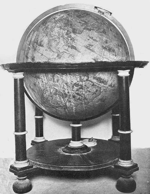
Fig. 97. Terrestrial Globe of Willem Jansz. Blaeu, 1622.
Fig. 98. Celestial Globe of Willem Jansz. Blaeu, 1622.
Fig. 98a. Terrestrial Globe of Willem Jansz. Blaeu, ca. 1640.
Fig. 98b. Celestial Globe of Willem Jansz. Blaeu, ca. 1640.
The Biblioteca Barbarini of Rome possesses four armillary
spheres, all appearing to be of the early seventeenth
century. A description of two of these, neither signed nor
dated, it has not been possible to obtain; two are the work
of J. Paolo Ferreri, the one constructed in the year 1602
according to the brief record “Jo. Paulus Ferrerius f. f. an.
1602,” and the other in the year 1624 being inscribed “Fco
gio. Paulo Ferreri Rono ano 1624.” Professor Uzielli has
given to the author the information that these are of brass,
having each a graduated horizon circle supported by four
half circles which in turn rest on a single brass column.
Through this horizon circle passes an adjustable meridian
circle 39 cm. in diameter, which is graduated and which supports
other movable circles, such as the colures carrying the
polar circles, the tropics, which are graduated, and the ecliptic,
a broad band inclined 23½ degrees to the equator, likewise
graduated and engraved with the names of the months
and of the constellations of the zodiac. Within the circles
of each of these spheres, placed at what may be called their
common center, is a small solid sphere to serve as a representation
of a terrestrial globe but without geographical
details. There appear to be but slight differences in the construction
of these two armillary spheres, the one of 1624
having certain circles which are slightly smaller than are
the corresponding ones on that of earlier date. From the
same source it is learned that the artist, Tito Lessi of Florence,
possesses an armillary sphere signed and dated “Lud:
s Sem: s Bon: Fac: A. D. MDCXII,” near which is a representation
of a coat of arms with a dragon. The sphere is of
brass, the diameter of its greatest circle being 63 cm. We
know nothing of the Ludovico referred to as the maker, but
who, as is noted, was a Bolognese. The same artist, as we
are informed, likewise possesses another unsigned and undated
armillary sphere which presumably is of the early
seventeenth century.
Peter Plancius (1552-1622), a native of Drane-outer,
West Flanders, is especially remembered as a militant theologian
(Fig. 99) and as one of the most influential men
active in the shaping of the colonial policy of the States
of the Netherlands in the late sixteenth and early seventeenth
centuries. His was indeed a stormy career wherein it
touched the Reformation movements. In early life a monk,
he later became an ardent reformer supporting the Calvinistic
faith. After passing some years in Germany and in England
in study, he became, in the year 1578, a pastor in the
city of Brussels. When persecution threatened him, he fled,
in the year 1585, to Amsterdam, where he again became a
pastor, exerting for many years a far-reaching influence in
matters touching the relations of the reform movements and
the state. Plancius, however, was not only learned in matters
theological, he was interested, as stated above, in Dutch
colonial enterprise, was a geographer, and a map and globe
maker of great distinction. He in part planned and actively
supported the Dutch expeditions of Barents, Hemskerken,
Linschoten, and Le Maire, who undertook to find new routes
to the Indies, both East and West. He assisted in the organization
of the East India Company, which company made
large contributions to the commercial prosperity of the
Netherlands.47 He was instrumental, with his countryman,
William Usselinx, and others, in organizing the West
India Company.48 He took an active part in the planting of
New Amsterdam in the New World, and in the establishment
of Batavia in Java. He was counselor for twenty-five
years in practically all matters pertaining to the welfare of
the peoples of the Netherlands.
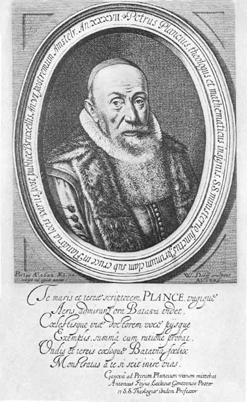
Fig. 99. Portrait of Peter Plancius.
As map maker Plancius appears to have begun his activities
shortly after taking up a residence in Amsterdam. His
great world map in two hemispheres, one of his first productions,
and one which may in part have served Blaeu and
Hondius in the preparation of their masterpieces, of the
years 1605 and 1611, respectively, was issued in the year
1592, a unique copy of which belongs to the Collegio del
Corpus Christi of Valencia.49 This map, bearing the title
“Nova et exacta terrarum orbis tabula geographica ac hydrographica,”
is composed of eighteen sheets, which, when
joined, give a world map measuring 146 by 233 cm. Blundeville
makes interesting reference to this map under the following
caption: “A Plaine and full Description of Petrus
Plancius his vniuersall Mappe, seruing both for Sea and
Land, and by him lately put forth in the yeere of our Lord
1592. In which Mappe are set downe many more places, as
well of both the Indies, as Afrique, together with their true
Longitudes and Latitudes, than are to be found either in
Mercator his Mappe, or in any other Moderne Mappe whatsoeuer:
And this Mappe doth show what Riches, Power, or
Commodities, as what kind of Beasts both wild and tame,
what Plants, Fruits, or Mines any Region hath, and what
kinds of Merchandize do come from euery Region. Also the
diuers Qualities and Manners of the People, and to whom
they are subiect. Also who be the most mightie and greatest
Princes of the World: A Mappe meet to adorne the House
of any Gentleman or Merchant, that delighteth in Geographie:
and herewith this Booke is also meete to be bought,
for that it plainely expoundeth euery thing contained in
the said Mappe.”50 Blundeville notes further that Plancius
drew another map of the whole earth in two hemispheres,
employing the polar projection. He does not give the date of
this map, but it presumably was issued shortly after that of
1592. A Plancius world map in two hemispheres, bearing
title “Orbis terrarum typus de integro multis in locis amendatus,
auctore Petro Plancio 1594,” appears in the account
of Linschoten’s expedition of 1599.51 It is a well-drawn
map, containing much valuable geographical data. Like
Mercator, Hondius, and Blaeu, Plancius also undertook the
construction of globes. Of these the oldest known appears
to have been begun as early as the year 1612, the date
appearing in the following dedication, “Nobilissimis Amplissimis
Consultissimis ac Prudentissimis Dominis Consulariis
Thalassiarchis atque Thalatto Oratoribus Hollandiae
Zelandiae et Frisiae occidentalis nec non Magnificis ac
Clarissimis Dominis Consulibus praeclarissimi Emporii Amstelodami,
Petrus Kaerius humillimus cliens L. M. Q. dat,
dicat, dedicat. Anno 1612.” “To the Most Noble, Exalted,
Learned and Prudent Consular Lords and Orators Maritime
of Holland, Zeeland and West Friesland, also to the
Great and Distinguished Lords Counselors of the Renowned
Emporium of Amsterdam, Peter Kaerius their humble client
gives and dedicates (this globe). In the year 1612.” Below
the legend is engraved “Petrus Kaerius excudit ann. 1614,”
the date here given clearly indicating the year of issue. Not
far from the dedicatory legend appears the following:
“Ipsa experientia peritos Naucleros docuit volubiles libellas
magnetis virtute infectas in Insulis Corvi et Florum
Mundi polos recte respicere: idcirco ibi, taquam a communi
Mundi Magn. Meridiano Logitud. justis de causis initum
sumunt Petrus Kaerius et Abrahamus Goos patrueles sculptores.”
“Experience itself has taught skilful mariners that
loose leaves when under the electrical influence, in the islands
of Corvo and Flores, turn directly toward the poles of the
world, and for this reason it is here, as a common magnetic
meridian of the world, that Peter Kaerius and Abraham
Goos his cousin, engravers, locate with reason the beginning
of longitude.” The customary address to the reader, though
here not so designated, reads, “In hujus nostri Globi delineatione
ubique castigatissimas Tabulas Hydrographicas ac
Geographicas sequuti sumus, quibus Germani, Hispani,
Galli, Itali, Angli, Scoti, Dani, Norvegi, Suedi nec non et
navigationibus utuntur: ad quae omnia comparanda nulli
nec labori nec sumptui pepercimus: ventorum quoque regimmes
ad usum navigantium admussim accomodavimus:
quemadmodum artis periti, proprius inspiciendo, reperient.
Vale ac frere. Petrus Plancius.” “In the delineation of this
our globe, we have everywhere followed the most correct
hydrographic and geographic tables which the Germans,
Spaniards, French, Italians, English, Scotch, Danes, Norwegians
and Swedes use in their voyages. In doing this we have
spared no labor nor expense. The directions of the winds
(loxodromic lines) we have laid down with great exactness
for the use of sailors, as those experienced in navigation will
see on close inspection. Farewell and be happy. Peter Plancius.”
This gives us definitely to understand that this terrestrial
globe was the work of Plancius.
The sphere is covered with a world map engraved on
twelve gores, truncated at latitude 70 degrees, the polar
spaces being covered by the usual circular discs, each having
in this case a radius of twenty degrees.
On his celestial globe, probably issued at the same time
as the terrestrial just referred to, and intended as a companion
of the same, having the same dimensions, we find
the following legend: “In hac coelesti sphaera stellae affixae
majore quam hactenus numero ac accuratiore industria delineantur.
Novos Asterismos in philomathēom gratiam de
integro addidi: quae omnia secundum Astronomorum Principis
Tychonis Brahe, ac meam observationem verae suae
Longitudinis ac Latitudinis ad annum Christi 1615 restitui.
Petrus Plancius.” “In this celestial sphere the fixed stars
to a greater number than previously and with more exactness
are depicted. I have added for the use of the student
some entirely new star readings according to the prince of
astronomers Tycho Brahe, and also my own observations of
their true latitude and longitude adapting these to the year
of Christ 1615. Peter Plancius.” It then will be noted that
the position of the stars located thereon is computed to the
year 1615. In the southern hemisphere is a portrait of Tycho
Brahe with the inscription “D. Tyco Brahe Summ. Mathematic,”
below which is the legend “Tabula continens quantum
quovis proposito anno vel addendum vel demendum sit
Lōgitudini affixarum: nam hae 70 annorum et 5 mensis
spacio unicum gradū secundū signorū ordinē, super Pol.
Zod. progrediuntur.” “Table indicating how much for any
given year is to be added to or to be subtracted from the
longitude of the fixed stars. For these in the space of 70
years and 5 months move one degree reckoned on the signs
of the zodiac.” But one pair of Plancius’ globes can now be
located, this pair having been acquired a few years since
for the Museo Astronomico of Rome (Fig. 100). They are
reported to be in excellent condition. The spheres are of
wood covered with plaster, having a diameter of about 21
cm., upon which the gores have been pasted. Wind roses
are numerous, from which the usual direction or loxodromic
lines radiate. Ships and sea monsters add to the decoration
of the terrestrial globe map, and the figures of the several
constellations have been artistically drawn. Each globe is
furnished with a wooden base, having its horizon circle supported
by four columns which are joined below by crossbars.
Each has a brass meridian circle within which the globe
is adjusted to revolve.
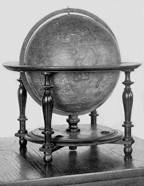
Fig. 100. Terrestrial Globe of Peter Plancius, 1614.
Fiorini reports information received from Gabriel Marcel
of the Bibliothèque Nationale and Captain F. v. Ortroy
that there may be found in the Stein Museum of Antwerp a
terrestrial globe of copper, neither signed nor dated, but
which is thought to be the work of Peter Plancius.52 Additional
information concerning this globe has not been obtainable.
Isaac Habrecht (1589-1633), physician and mathematician,
was a native of Strassburg, where he passed the
greater part of his life.53 Incidental references to him assure
that he was regarded in his day as a man of much ability.
Among his publications, not numerous but scholarly, reference
here may be made to his ‘Tractatum de planiglobio
coelesti & terrestri,’ issued in Latin in the year 1628, and
again in the year 1666 in both Latin and German, by Johann
Christoph Sturm of Nürnberg.54 In this work Habrecht
describes his terrestrial and celestial globes, constructed, it
appears, a few years previous to the issue of the publication.
The Hispanic Society of America possesses a fine example
of what appears to be his first terrestrial globe (Fig. 101).
It is undated, but internal evidence assures us that it was
not constructed prior to the year 1612. Near the Arctic circle
and north of the representation of Hudson’s Bay we
read “Huc usque retrocesserunt Amstelodamenses anno
1612.” “At this point the Amsterdam (explorers) turned
about in the year 1612.” His first celestial globe, referred
to below, seems clearly to be of the year 1619, and there is
reason for placing his first terrestrial globe in the same year,
since, in their size, and in many of their general features
there is agreement. The globe ball of wood has a diameter
of 20 cm. Its horizon circle, which has pasted on its upper
surface the usual information relative to the names of the
months, to the principal directions, and to the signs of the
zodiac, is supported by four turned legs joined below by
crossing bars, these bars in turn supporting a carved circular
disc with a raised center through a slot in which the
meridian circle is made to pass. The whole is indeed a remarkably
well-preserved example of Habrecht’s work.
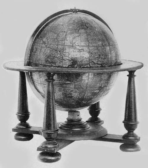
Fig. 101. Terrestrial Globe of Isaac Habrecht, 1625.
In an artistic cartouch to the south of the East Indian
Islands and within “Terra Australis” is the following
signed dedication: “Perillustri et Generossissimo Dno Dno
Eberardo Dynaste in Rappolstein. Hohenaccio et Geroltzeccio
ad Vogasinum Divi Mathiae II Imp. nec non Sereniss.
Maximiliani Archiducis Austriae. P. M. Camerario et
Citeriorum Ordinum Provincialium Praesidi Magnifico: ex
antiqua Ducā Spoleti familia oriundo: Domino meo Clementissio
Triplicem hunc globum: Coelestem scilicet: convexum
et concavum et hunc terrestrem novissimae editionis
et correctionis. D. D. D. Isaacus Habrect Phil. et med. d.
Argentinensis.” “To the Most Illustrious and Most Generous
Lord Eberhardt Ruler in Ruppelstein, Hohenau and
Geroldseck in the Vosges, Divine Emperor Matties II and
also the Most Serene Maximilian Archduke of Austria, the
Exalted President of the Provincial Orders of the Cameria,
and those on this side of the mountains, sprung from the
Ancient Ducal Family of Spoleto, my Most Gracious Lord,
this triple globe, that is celestial, convex and concave terrestrial,
corrected according to the latest information, gives
and dedicates Isaac Habrecht, philosopher and physician of
Strassburg.” In the northern part of North America is a
legend referring to the expeditions of Davis, Schouten, and
Le Maire reading, “Versus Articum polum ulterior transgressus
hactenus ab Herculis licet Davis Angli labore id
examinatus fuerit sicut et circa antarcticum fretum noviter
a Guilielmo Schout detectum Le Maire nuncupatum extremus
adhuc navigationum est terminus. Quamvis nullus
dubitet maxima totius orbis magnalia sub polis delitescere
quorum detectionem forsitan summus Deus suo tempore reservat.
Typis Jacop. ab Heyden Argentinae.” “Toward the
Arctic pole the last voyage up to the present was made, with
Herculean labors, by Davis an Englishman. Around the
Antarctic a strait has lately been discovered by William
Schouten and named Le Maire, and this, up to the present,
is the extreme limit of navigation, although no one doubts
that the greatest wonders of all the world lie hidden under
the poles, the discovery of which, it may be that Almighty
God reserves for his own time. Printed by Jacob von Heyden
of Strassburg.” It is probable that the Jacob von Heyden
here referred to was a relative of Christian Heyden of
Nürnberg, mathematician and globe maker of renown.55 Below
the legend last quoted is a brief one reading, “America
septentrionalis a Christoforo Colombo 1492 detecta.”
“North America discovered by Christopher Columbus in
the year 1492.” This appears to have been quoted from the
Hondius globe of the year 1618. The austral continent is
referred to as “Terra Australis incognita,” and near New
Guinea is inscribed the following, likewise quoted from
Hondius: “Sic dicta quod ejus littora locorūqȝ Guineae Affricanae
multum sint similia. Dicitur a nonnullis Terra de
Piccinaculi; et sit ne insula an pars continentis Australis
incertum est.” “So called because its shores are much like
those of African Guinea. It is called by some the land of
Piccinaculi: and it is uncertain whether it is an island or a
part of the Australian continent.”
A considerable number of brief legends appear upon different
parts of the globe map, each having a local significance.
In coloring the map attention was given to the representation
of territorial boundaries which gives an added
interest to the globe. The “Meridianus Primus” is made to
pass through the Island of Corvo, and other meridians are
drawn at intervals of ten degrees. The loxodromic lines, as
on the Hondius globes, are made a conspicuous feature of the
map, having their crossing centers at longitudes 0°, 90°,
180°, and 270° on the equator, and on the prime meridian at
latitude 35° both north and south, as well as at the same
latitude on the opposite side of the sphere, where the prime
meridian becomes the meridian of 180°. Habrecht appears
to have followed somewhat closely the globes of Hondius
for his geographical data.
In addition to the Habrecht terrestrial globe in The
Hispanic Society’s collection, two other copies are known,
which likewise are undated. One of these belongs to the
Biblioteca Comunale of Sondrio, and the other to the
Archivo Municipale of Asti.
Of the celestial globes of Habrecht four copies have been
located; one being in the Biblioteca Comunale of Sondrio,
in a good state of preservation; one in the Germanisches
Nationalmuseum of Nürnberg, wanting, however, the original
mounting, having its map engraved, as stated in a
legend, by Jacob von Heyden et Johann Christoph Weigel;
one in the Biblioteca Comunale of Asti; one in the Royal
Museum of Cassel.
It is strikingly evident that Habrecht followed in the
main the work of Willem Jansz. Blaeu, and Jodocus Hondius
for his celestial globes. As the year 1619 was selected
as the one in which star positions were to be recorded, it
is probable, as intimated above, that these globes were constructed
in that year. Each of the globes referred to is
reported as retaining the brilliant coloring which had been
laid on by hand.
Garcia de Céspedes, writing in 1606,56 calls attention to
a globe, concerning which nothing farther is known, referring
to it as a “Globillo que hizo en Portugal aquel grau
Piloto que se emborrachana cuyo nombre no me acuerdo.”
“A small globe constructed in Portugal by a great pilot,
whose name is unknown, but who was a great drunkard.”
In the year 1893 Baron Nordenskiöld presented to the
Royal Geographical Society a facsimile in gores of a globe
map, which fact is noted in that society’s Journal. The
globe is one of silver, bearing the author and date legend
“Johann Hauer. 1620.” The record tells of its having been
presented in the year 1632 to Gustavus Adolphus and that
it is now one of the treasures of the National Museum of
Stockholm. The engraved map is of the Hondius or the
Mercator type presenting in the main the best geographical
knowledge of the time. Its many legends are in the Latin
language; the lettering, though small, is easily legible. The
engraver has adorned the seas with ships and with such
marine animals as are frequently to be found in the maps
of the period.57
It has been previously noted that the employment of
engraved gore maps in globe construction was not received
with general favor in Italy in the sixteenth century, although
Mercator’s globes were copied to some extent, as
were those of De Mongenet. Toward the close of the century,
the preference for manuscript globes, or for engraved
bronze or copper globes seems gradually to have yielded to
a belief in the more practical method of construction which
had established itself in the North. Originality, however,
does not appear to have been a striking feature of Italian
endeavor in this method of globe making. There was an
occasional manifestation of independence and individuality,
it is true, but in general there was a disposition to copy, and
the early seventeenth century furnishes us an example in the
reissue by Giuseppe de Rossi of the work of Jodocus Hondius,
but without credit, as has been previously observed.
Among those who attained distinction in Italy in the first
half of the seventeenth century in the construction of globes
having engraved gore maps, may be named Mattheus
Greuter. He was born in Strassburg in the year 1556, where
he learned designing and engraving. In early life he went
to Lyons in France where he carried on his work, but later
he removed to Avignon, adding to his art in this city that
of type cutting. We next find him in Rome, busily engaged
in the work of engraving, in which he had become exceedingly
proficient, winning for himself a high place among the
Italian artists of his day. Map engraving, we learn, early
claimed his attention, and among his masterpieces in this
field may be mentioned a large map of Italy. Of this work
no copy is at present known, but it is thought that it probably
served Magini as a model for his “Italia” which was
published in the year 1620. It could not have been long
after he had taken up his residence in Rome, where he became
a naturalized citizen, that he began the preparation
of his first terrestrial globe, which he issued in the year 1632.
So well did he perform his work that he is entitled to rank
with the leading globe makers of the Netherlands.
An excellent example of this first issue may be found
in the Museum of The Hispanic Society of America (Fig.
102), this being one of the most valuable in its large collection.
It has a diameter of 50 cm., and is mounted on a
wooden base having four feet, which, though evidently very
old, is clearly not the original base. It is furnished with a
narrow wooden horizon circle which is not graduated, and
the calendar and other representations, which one usually
finds pasted on this circle in early globes, are entirely wanting.
The meridian circle of iron, likewise, is not graduated,
and like the wooden base is not a part of the original mounting.
The sphere itself is remarkably well preserved, there
being scarcely a noticeable injury to its surface save the
slight discoloration of age. The engraved gore map covering
the papier-mâché ball, which is of very light construction, is
composed of twelve sections, or rather of twenty-four, since
each of the sections is cut at the equator, and the poles are
covered with small circular discs.
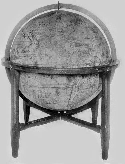
Fig. 102. Terrestrial Globe of Mattheus Greuter, 1632.
In the south Atlantic and near the great southern continent,
in a neat cartouch surmounted by the coat of arms
of the Boncompagni family of Bologna, is the following
dedication: “Illustrissimo et Excellentissimo Principi D.
Iacobo Boncompagno Sorae Arcisque Duci Marchioni Vignolae
Aquini Comiti Dno suo colendissimo. Mattheus
Greuter Humill. obseqii ergo. D. D.” “To the Most Illustrious
and Excellent Prince Lord Jacob Boncompagni, Duke
of Sora and Arce, Marquis of Vignola and Count of Aquino,
his Most Worshipful Lord Mattheus Greuter with humble
obedience dedicates (this globe).” Iacopo Boncompagni, to
whom Greuter dedicated his work, belonged to a famous
family of Bologna.58 He was born in Sora in the year 1613
and died in the year 1636. It was his great-grandfather,
Hugo, who, in the year 1572, at the age of seventy, became
Pope Gregory XIII, and who immortalized himself through
his reform of the calendar. Iacopo, the grandfather of that
member of the family to whom Greuter dedicated his globe,
was in position, at the time of the elevation of his father
to the Papacy, to have bestowed upon him great honors
and riches. He was nominated Castellan of St. Angelo, and
shortly thereafter, receiving the title General of the Holy
Church, was sent to Ancona with a commission to defend
the maritime regions of the papal states. He was soon
thereafter admitted to the nobility of Rome, of the Kingdom
of Naples, and of Venice. Through the riches of the
Papacy he was able to purchase from Alfonso II of Este the
Marquisate of Vignola for seventy-five thousand Roman
scudi, the Duchy of Sora and of Arce from the Duke of
Urbino for one hundred and ten thousand ducats, and the
lands of Arpino and Roccasecca, together with the County
of Aquino from Alfonso of Avalon, Marquis of Guasto, for
one hundred and forty thousand ducats.
In the austral continent, and on the opposite side of the
globe to that on which the dedication is placed is an address
to the reader which is inscribed in a neat cartouch, reading
“In ista quam exhibemus terreni globi descriptione omnium
regionum iuxta et insularum quotquot hactenus ab Argonautis
tam Lusitaniae quam aliarum gentium Naucleris
visae et notatae loca in suo secundū longitudinem et latitudinem
situ sum̄a sedulitate et industria disposita invenies
quae res non solum Geographiae studiosis jucūda, verum
etiam ijs, qui terras longe dissitas et sub alio sole calentes
frequentent, maxime utilis futura est. Hūc igitur laborem
nostrum ut tam gratis animis acceptatis sedulitate a nobis
est obitus ex aequo omnes rogatos volo. Mattheus Greuter
auctor. Excudit Roma Anno MDCXXXII.” “On this globe
which we exhibit, you will find all the regions and islands
as far as they have hitherto been seen and noted by navigators
of Portugal and of other nations, set down in their
proper positions of latitude and longitude with the greatest
care and industry. This will be pleasing not only to students
of geography but it will be especially useful to those who
visit far distant lands (which are) warmed by another sun.
I hope therefore that all those whom I ask will accept this
labor of ours with as much gratitude as we have employed
care upon it. Matthew Greuter maker. Made in Rome in the
year 1632.” This address agrees with that on the Blaeu terrestrial
globe of 1622 except that Blaeu wrote “vel etiam
ab aliarum gentium ...,” whereas Greuter writes “tam
Lusitaniae quam aliarum gentium ...,” and Blaeu inserted
a reference to the loxodromes he had drawn on his
map, which loxodromes Greuter, omitting, had therefore no
occasion for such reference. In the inscription referring to
the prime meridian, Greuter again borrowed from Blaeu
with scarcely an alteration, as he did in his reference to
recent discoveries made for the purpose of finding a way to
the East by the North. Blaeu’s legend in the vicinity of the
Tiborone Island, that near the Cape of Good Hope, and that
near the Strait of Magellan were all copied literally by
Greuter, and likewise that referring to the Le Maire Strait.
Greuter employed, in general, for the names of the regions
of the Old World and for the seas, the Latin language,
though he wrote “Mar del Nort” for the Atlantic and “Mar
del Zur” for the Pacific. For the names of the New World
he used the Spanish or the Portuguese, but occasionally the
English, the French, the Dutch, or the language native to
the region bearing the name. For the names of the cities he
generally employed the language of the country or the
Italian language.
Numerous ships are represented sailing the seas, and the
pictures of sea monsters are many. A few wind roses adorn
the map, but, as before stated, loxodrome lines, regarded in
general at that time as of great importance to sailors who
had occasion to make use of the chart or the globe, were
omitted by Greuter.
Hudson Bay, which is left nameless, is represented without
a definite coast line in the north, but through a wide and
extended channel it opens into “Fretum Davis.” The St.
Lawrence River appears to drain a lake, which may be taken
from its location to be Lake Ontario; but the remaining four
Great Lakes appear as one great inland sea with an outlet
of somewhat uncertain character northward toward Hudson
Bay. The geographical representations in this region
are of special historical interest, as are indeed the geographical
records in the several sections of North America, particularly
in the South and the West.
As a companion to the terrestrial globe of the year 1632,
Greuter prepared a celestial globe of the same dimensions,
and with similar mountings, which he issued in the year
1636. He gives due credit, in one of his legends, to Tycho
Brahe and to Willem Blaeu as sources of information for
his representation of the stars and the several constellations,
following, in particular, Blaeu’s globe of 1622. His explanatory
legend reads “In hoc coelesti Globo notantur omnes stellae
fixie an annum 1636 accom̄odatae q̄ iuxta observationē
Nob. viri Tychonis Brahe, in max̄ illo Iansonii, an̄o 1622
edito, positae sunt additis stellis q̄ à peritisso nauclero Petro
Theod: circa Pol. Aust. notatae sū novisque Asterismis et
stellis min. apparētib’, ab aliis sum̄ studio observatis, omnia
in Philomatico gratia copiosa delineata. Romae, 1636, M.
Greuter.” “In this celestial globe are noted all the fixed
stars accommodated to the year 1636, which are placed (on
the map) according to the observations of the noble Tycho
Brahe in that great (work) of Jansson (Blaeu), edited in
the year 1622, to which are added the stars noted by the
skilful navigator Peter Theodori around the south pole and
the new and less apparent stars observed by others with
great zeal. All these have been represented for the use of the
student. At Rome, 1636. M. Greuter.” As to how much he
thought should be added to or subtracted from the longitude
of the fixed stars each year, to the end of taking due note
of the precession of the equinoxes, he copied Plancius literally.
The equatorial circle, the tropics, the polar circles, the
equinoxes, the solstitial colures, the ecliptic, and twelve
meridians are all represented. The constellations include the
Ptolemaic, with the addition of those recently discovered
and named in the southern hemisphere. The figures of the
several constellations are well drawn, having their names
in Latin or in Arabic, and are artistically colored in most
of the copies of the globe known.
Greuter’s globes all appear to have been made in the same
size, and they have the same general construction, with the
exceptions noted below.
A pair of these globes, that is, of the terrestrial, of the
year 1632 and the celestial of 1636, may be found in the
following public and private libraries and museums in addition
to those above mentioned: Scuole Comunale of Ancona;
in the Biblioteca Comunale of Bologna; in the Biblioteca
Comunale of Camarino; in the Seminario Vescovile of
Carpi; in the Biblioteca Comunale and also in the Museo
Agabiti of Fabriano; in the Biblioteca Comunale of Ferrara;
in the Biblioteca di Santa Maria Nuova of Florence; in the
Biblioteca Comunale of Gubbio; in the Biblioteca Governativo
of Lucca; in the Biblioteca Capitolari of Reggio; in the
Museo Astronomico, also in the Biblioteca Chigi and
the Biblioteca Vittorio Emanuele of Rome; in the Biblioteca
Comunale of Sanseverino; in the Biblioteca Gonzaga
of Mantua; in the Biblioteca Universitario of Messina; in
the Biblioteca Nazionale of Milan; in the Museo Civico of
Modena; in the Museo di Fisica and also in the Seminario
Vescovile of Padua; in the Biblioteca Palatina of Parma
and a pair in the possession of Joseph Baer & Company of
Frankfurt, 1914. A copy of the terrestrial globe of the year
1632, in addition to the one described above as belonging
to The Hispanic Society of America, may be found in the
Biblioteca Comunale of Bassano; in the Ateneo of Brescia;
in the Museo di Fisica of Catania; in the Archivo di Stato
of Venice. In private libraries copies of these globes may be
found in the possession of the General Antonio Gandolfi of
Bologna; of Sr. P. Marezio Bazolle, once belonging to the
Counts of Piloni of Belluno; of Professor Luigi Bailo of
Treviso; of Sr. D. Luigi Belli of Genga. A copy of the celestial
globe of the year 1636 may be found in the Biblioteca
Comunale of Serra S. Quirico, and also a copy in the library
of Mr. W. B. Thompson of Yonkers, N. Y.
It does not appear that Greuter himself issued other editions
of his globes. His death occurred in the year 1638, and
in this same year what may be called a second edition of his
globes of the years 1632 and 1636, having the same dimensions,
was offered to the public. It has been noted above that
one Giuseppe de Rossi of Milan reprinted in Rome, in the
year 1615, the Hondius terrestrial and celestial globes of
1601, making but slight alterations in the same but giving
the impression that he was the original author. It was perhaps
a near relative of this Milanese engraver and printer,
Giovanni Battista de Rossi, who in the year 1638 reprinted
in Rome the Greuter globes with but few changes, none of
which can be considered of special import save the introduction
of his own name as printer instead of that of Greuter.
It may, however, be noted that both globes are dated
1636, that below the Tropic of Capricorn on the terrestrial
globe is the legend “Si stampa da Gio Bat̄ta de Rossi Milanese
in Piazza Navona. Roma,” and that the title legend of
the celestial reads “In hac coelesti sphaera stellae fixae majori
quam hactenus numero et accuratiori industria delineantur
novis Asterismis in Philomaticom̄ gratiam de integro
additis: quae omnia secundum Astronomorum Principis
Tychonis Brahe et aliorum observationem verae suae longitudini
ac latitudini ad annum Christi 1636 restituta sunt.
Romae Matteus Greuter exc. 1636.” “In this celestial globe
are shown the fixed stars in greater number than previously,
and with greater care and industry, the new constellations
being added for the sake of the student. All these, according
to the observations of the Prince of Astronomers, Tycho
Brahe, and likewise the observations of others, have been
assigned to their proper latitude and longitude for the year
of Christ 1636. Made at Rome by Mattheus Greuter 1636.”
A pair of these globes of the second edition may be found
in the private library of Cav. Giampieri-Carletti of Piticchio
in the Marche; in a private library of Ancona (owner unknown);
in the Seminario Vescovile of Toscanella. A copy
of the terrestrial globe may be found in the Seminario Vescovile
of Macerata; and of the celestial in the library of Count
Francesco Conestabile of Perugia.
The Hispanic Society of America has in its collection a
unique globe which is clearly the work of Mattheus Greuter
(Fig. 103), although issued by Giovanni Battista de Rossi,
as is attested by the legend, “Si Stampa da Gio Batta de
Rossi Milanese in Piazza Navona Roma.” This legend, appearing
in a neat cartouch, occupies the same position in the
southern hemisphere, near the prime meridian, as that in
which one finds the dedication of his first issue, but that part
of the cartouch in the earlier issue showing the coat of arms
of the Boncompagni family is here left blank. The title of
the first issue is repeated save in the concluding words. Here
we read “In iste quam exhibimus ... Mattheus Greuter
auctor. Excudit Romae 1638.” Other legends, such as those
in the northern part of North America beginning, “Post
apertum a Lusitanis ...,” that southeast of Africa beginning,
“Quam longitudinis initium ...,” and the
briefer ones referring to the discovery of the Cape of Good
Hope, to the expedition of Schouten, and to that of Magellan,
are identical in the two editions. It, however, is to be
noted that many of the briefer legends appearing in the
first edition are wanting in this of the year 1638, and that
in the latter the place names are greatly reduced in number.
It is further particularly worthy of note that the North
American continent in this later issue is very much altered
in its outline. California appears as an island, “Insula California,”
and is separated from the great northwestern section
of North America, which is likewise represented, though
somewhat doubtfully, as an island, by the “Stretto di
Anian,” while the “Estreito de Jeso” separates the New
World from Asia. The globe ball has a diameter of 26 cm.
Its mounting is of wood. It has a broad horizon circle, on
which are the representations of the signs of the zodiac, the
calendar, the Roman and the Italian names of the winds or
directions appearing in concentric circles, the whole being
supported on a base consisting of four exquisitely carved and
rather heavy support columns which are joined below by
carved cross bracings. Its meridian circle is a comparatively
recent and very clumsy substitute of wood for the original
which doubtless was of brass. It is very seldom that one finds
a globe of a date so early as is this which is so well preserved.
The engraved map has the freshness of a new and unused
print, excepting a very slight yellow tinge which is the contribution
of age. On this globe map may be found one of the
earliest attempts to give boundary lines to territorial divisions
in the New World such as “Virginia,” “La Florida,”
“Nuovo Mexico,” “N. Amsterdam,” “N. Suetia.”
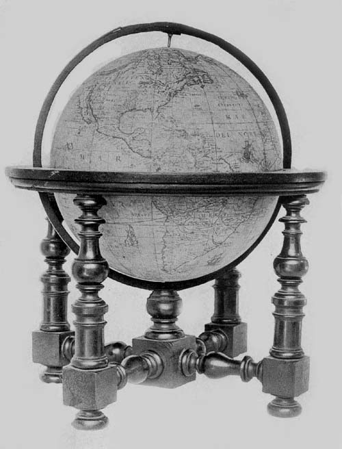
Fig. 103. Terrestrial Globe of Mattheus Greuter, 1638.
Fig. 103a. Terrestrial Globe of Dominico Rossi
(Mattheus Greuter), 1695.
Fig. 103b. Celestial Globe of Dominico Rossi
(Mattheus Greuter), 1695.
Attention has previously been called to the reproduction
in Italy of the Hondius globes by Giuseppe de Rossi in the
year 1615. It appears that to the Rossi family belonged a
number of map engravers and art printers during the seventeenth
century and particularly to that branch making its
home in the city of Rome. As globe makers we however find
them playing the rôle of copyists rather than that of independent
producers.
In The Hispanic Society’s collection of old globes may be
found a pair in an excellent state of preservation signed
“Dominici de Rubeis (Rossi),” and dated “1695.” Each
globe ball is composed of papier-mâché, having a diameter
of 49 cm. and each is covered with a map printed on twelve
gores, with a small circular disc for the polar space (Figs.
103a, 103b). In the List of Globe Makers other examples are
noted.
In the South Pacific, on the terrestrial globe, one finds the
inscription “Romae ex Chalcographia Dominici de Rubeis,
heredis 70. Jacobi, ad templum S. Mariae de Pace, Anno
1695.” Dominico, whose name here appears, achieved considerable
distinction as the publisher, with his relative
Giovanni Giacomo de Rossi, of an atlas of one hundred and
fifty-two maps, one of the finest examples of Italian cartography
of the period. In a cartouch in the South Atlantic, on
this globe, we find the name Mattheus Greuter given as the
engraver, whose work has been referred to above, clearly
suggesting that Rossi had merely reissued a globe of earlier
date, since Greuter had died in the year 1638. A careful
examination of the globe map confirms the suggestion, since
no record is made of geographical discoveries after the year
1630. In the region of the North Pole the discoveries of the
English and of the Dutch are recorded to the year 1628, and
it may further be noted that in this same northern region
the islands of “Frislanda” and “Brasil” are laid down,
while in Greenland is a reference to the location of the
fabled Monastery of St. Thomas.
References are made in legends to the discoveries of
Magellan, Lemaire, Schouten, Frobisher, Davis, Hudson,
and Drake. The region about New York is called “Nieu
Nederland.” One can recognize the representation of the St.
Lawrence, and the Mississippi. In the western region of the
New World there appears to be considerable confusion as to
the geography of the country, apparently the result of reading,
without understanding, the records of the Spanish and
of the English. One finds, for example, California represented
as an island, and a double representation of the
Strait of Anian.
The Spanish, French, English, Dutch, and Latin languages
have been employed in names and legends.
The mounting of the globe is artistic and substantial, consisting
of the usual horizon circle, octagonal on its outer
edge, but circular on the inner edge to receive the globe ball,
and having pasted on its upper surface the usual engraved
paper strips and all that there is engraved thereon in the best
examples of globe making. The meridian circle of wood,
within which the sphere is made to revolve, is graduated.
The supporting base consists of four exquisitely turned
columns, braced at bottom with correspondingly well-turned
crossbars.
The celestial globe has a mounting altogether like that
of the terrestrial, and in the character of the map engraving
there is agreement. The figures of the several constellations
are copies of these drawn by Tycho Brahe, and all have been
exquisitely colored. Stars from the first to the sixth magnitude
are represented, while special attention is called to the
new star in Cassiopeia first appearing in the year 1572, and
to the comets of the years 1597 and 1616. Near Ursa Major
is the author and date legend reading “In hoc Caelesto
Globo notantur omnes stellae fixae, ad annum 1636 accommodatae,
quae iuxta observationes Tychonis Brahae maximo
illo Jansonii anno 1622 edito positae sunt, additis stellis
quae a nauclero Petro Theod. circa Polum Australem notatae
sunt ... Romae ex chalcographia Dominici de Rubeis,
her. Jo. Jac. de Rubeis anno 1695.”
The twelve gores of the map have been mounted so as
to join at the north and south poles of the ecliptic, there
however being a small covering disc at each pole, so frequently
employed since Mercator’s day, the globe itself
being made to revolve on its equatorial axes.
To the makers of armillary spheres in the first half of the
seventeenth century there may be added the name of Adam
Heroldt, a native of Germany. We know little, however,
of the extent of his activities. One example of his work is
known, which bears the simple inscription engraved near the
south polar circle “Adam Heroldt fecit Romae anno dn̄i
MDCIL.” “Made by Adam Heroldt in the year 1649.” This
sphere once belonged to the astronomer De Gasparis of
Naples, but passed some years since into the collection of
the Museo Astronomico of Rome. It is constructed entirely
of brass, the diameter of the largest circle being about 14
cm. Its several circles, including the polar, the equatorial,
the zodiacal, and the horizon, are graduated, the last-named
having engraved on its surface the names of the months and
of the winds, and resting on two semicircles, which in turn
are supported by an artistically designed foot. The entire
height of the sphere is about 20 cm. At the north pole is an
hour circle bearing the inscription “Index Hor: Italic.”
Within and at the common center of the several circles is a
small ball representing the terrestrial sphere, which has a
diameter of but 1 cm., and within the circle of the ecliptic
and coördinated with it is a ring carrying the sun, while
within this is one for the moon. The piece may be referred
to as a fine example of the armillary sphere of the period.
Manfredo Settàla (1600-1680)59, a nobleman of Italy,
was in his day a distinguished promoter of science and art,
and an intelligent collector of rare objects, which he brought
together in a museum of his own founding. This he described
in a work bearing title ‘Museum Septalianum,’ which was
published in Italian in the year 1666 by Scarabelli. This
museum later passed into the possession of the Ambrosiana
of Milan, where it has been considered one of the choicest
additions.
Settàla had included globes in his collection, among
which there has previously been mentioned that made by
the Cremonese Gianelli, in the year 1549. But not only was
he a collector; he likewise became interested in the actual
work of globe construction. Among the objects coming to
the Ambrosiana from his museum is an armillary sphere
bearing the inscription, “Manfredus Settalius fecit MDCXLVI.”60
It is described as a sphere having a base of brass,
its several circles including those representing the zodiac,
the equator, the meridians, and the horizon, all being movable
on a common axis, on which axis at the common center
of the circles is a small ball 4 cm. in diameter, representing
the earth. To this sphere rather extravagant praise is given in
the descriptive catalogue referred to above.
There is a third armillary sphere belonging to the Settàla
collection, which is of silver and which probably was
constructed near the middle of the seventeenth century, although
it is neither signed nor dated. It is 40 cm. in height,
having a circle representing the ecliptic 15 cm. in diameter,
which is graduated, having on its upper surface engraved
figures representing the twelve zodiacal constellations. The
meridian circle has a diameter of 16 cm., the horizon a
diameter of 16 cm. and a breadth of 3 cm., on the upper
surface of which have been engraved the names of the
months, and the signs of the zodiac. In addition to the parts
mentioned it has two small polar circles, and at the common
center a small silver ball 1 cm. in diameter representing the
earth.
Attention has been previously called to the transfer of
the business of Jodocus Hondius into the hands of the son-in-law,
Johan Janssonius, and of Abraham Goos, by whom
it was carried on after the year 1640. This firm continued
to issue the Hondius globes, modifying them from issue to
issue with the addition of some of the latest geographical
information obtainable. In the year 1648, with Johan Janssonius
as editor and Abraham Goos as author and engraver,
there was issued a pair of these revised Hondius globes, each
having a diameter of 87 cm. On the terrestrial globe we read
“Amstelodami Edebat Joannes Jansonius Sculpebat magnoque
studio componebat Abrahamus Goos Amstelodamensis.”
“Amsterdam. Edited by Johan Jansonius. Composed
with much study and engraved by Abraham Goos a native
of Amsterdam.” Further details concerning this globe have
not been obtainable, but it is very certain, although differing
in size, it contains practically all the features common to the
earlier editions of the Hondius terrestrial globes, and especially
of the later ones.
The celestial globes have the following inscription:
“Sphaera nova summo studio summaque diligentia atque
industria Clarissimi viri D. Adriani Metii Watheseos apud
Frunequeranos Professoris Ordinarii ad abacos Nobilissimi
viri Thiconis Brahe configurata observationibus quamplurimis
tum circa polum arcticum a discipulo suo Houtmanno
adhibitis aucta et in annum 1620 reducta. Edente Joanne
Jansonio 1648.” “A new globe constructed with the greatest
industry, zeal and diligence accommodated to the tables of
the most noble Tycho Brahe, enlarged by very many observations,
those around the Arctic pole being made by myself,
and those around the Antarctic by his disciple Houtmann.
All, accommodated to the year 1630. Constructed by Johan
Jansonius, 1648.” A pair of these globes may be found in the
library of the Marquis Borromeo of Milan.