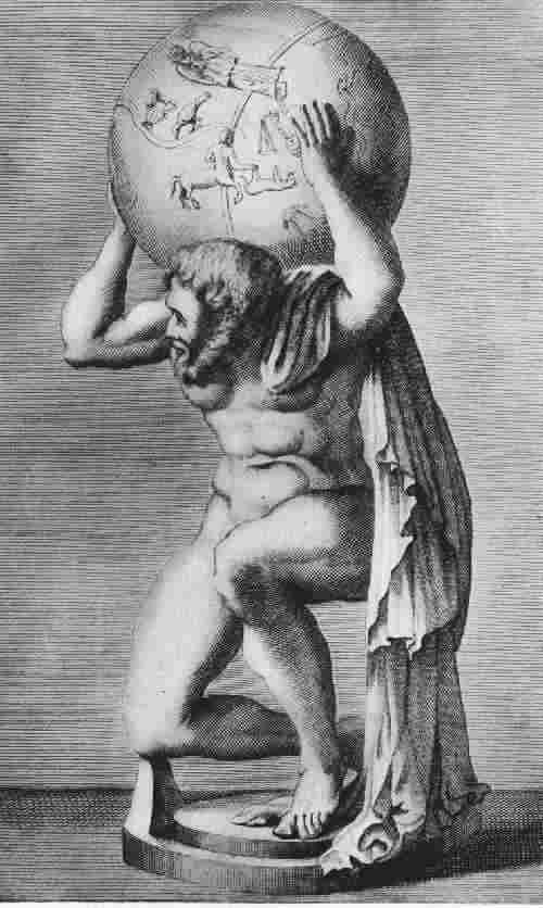
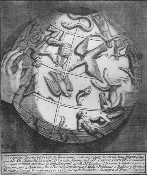
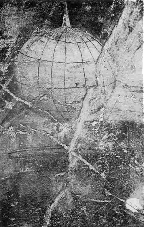
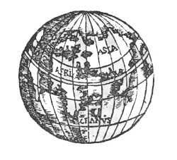
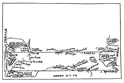
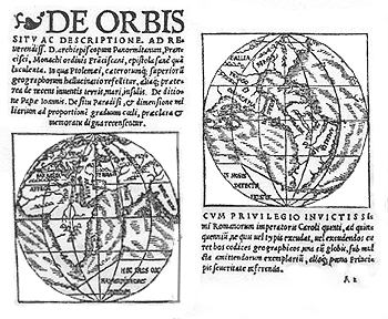
Brief summary of sixteenth-century globe making.—The
close of the century introducing us to the great Dutch globe
makers.—The clock maker Dasypodius.—Peter and
Philip Apianus.—The armillary sphere of Carlus
Platus.—Roll and Reinhold.—Tycho Brahe and his
influence.—Titon du Tillet.—The terrestrial
globe of Rouen.—Globes of Emery Molyneux.—Globes
of Bürgi.—Zürich globe.—Beaker
globes.—Ivory globe of Antonio Spano.—The Van
Langren globes.—Santucci.—B. F. globe of
Dresden.
IN the last three chapters attention has been called to the
globes and globe makers of the earlier years of the
sixteenth century, special mention having been made in
Chapters VI and VII of the notions entertained concerning
the geography of the New World as exhibited in the
terrestrial globe maps. In the first quarter of the century,
as was stated, the newly discovered lands were represented
as having no geographical connection with the Old World, and
with few exceptions the two continents of the western
hemisphere were separated from each other either by a strait
or by a wide expanse of ocean. In the second quarter of the
century the belief seemed to have found very general
acceptance that the New World was but a prolongation or
eastward extension of the Asiatic continent, a belief which
found expression in the plane as well as in the globe maps.
Exceptions to such belief were likewise noted, as was also
the inclination manifesting itself in this second quarter to
return to the earlier notions, that a great body of
water separated Asia from the northern continent, in the
spread of which notion Mercator seems to have exerted a
dominating influence. In the third quarter of the century
the globe maps indicate that a belief in the independent
position of the New World had again found very general
acceptance, although there appeared now and then an
expression in the maps that the theory of an Asiatic
connection still lingered. In this third quarter it was the
Italian globe makers who were the most active, yet it must
be admitted that the majority of the globes produced in
these years in the peninsula were not of striking
importance. In the literature of the period, references to
globes which were constructed, and which appear to have been
well known, are not infrequent, but one is inclined to a
belief, based upon these references, and upon those globes
which are extant, that time has destroyed the best of them.
The records of the last quarter of the century, of which we
come now to speak in this chapter, seem to show a decline of
interest in globe making among the Italians, the examples of
their work left to us being exceedingly few. We note a
rising interest and activity in globe making in the North in
this period, which reaches a climax during the early years
of the seventeenth century in the splendid work given out by
the great masters of the Netherlands. A well-merited fame
especially crowns the labors of members of the Van Langren,
the Blaeu, and the Hondius families.334
Although remembered chiefly for his part in the construction
of the famous Strassburg cathedral clock, Conrad Dasypodius
(1530-1600) can also claim a place among the globe makers of
his day, that is, of the period we now have under
consideration.335 He was the son of Petrus Dasypodius, a
native of Frauenfeld in Switzerland, whose name originally
was Rauhfuss or Hasenfuss, and who for some years held a
position as professor of the Greek language in Zürich.
In the year 1530 he removed to Strassburg to accept a
similar position in the Strassburg Academy, where he died
in the year 1559. Young Conrad, after an association for a
period with the then famous Strassburg mathematician,
Christian Herlin,336 as his favorite pupil, traveled
extensively, going to Paris and later to Lyons, where he
continued his mathematical studies. In October, 1562, he
became the successor of Herlin, and in the year 1563 canon
of St. Thomas. To the impulse which he contributed to
mathematical studies is due the high place held for a
considerable period by the Strassburg Academy.337 It is a part of
his great service that he not only encouraged the study of
the Greek mathematicians, but he also was especially
interested in having their works brought to the attention of
the public through their reissue, especially the works of
Euclid. The list of Dasypodius’ publications338 is a long one and is
such as to place him among the foremost scholars of his day,
but it was, however, his astronomical clock, noted above,
which brought him special renown in the larger circles. It
was near the middle of the fourteenth century that the first
clock, which was of wood, was constructed for the cathedral,
but time had wrought its destructive work, and as early as
1547 a commission was appointed to consider the question of
its restoration, and of this commission Christian Herlin was
a prominent member. His death in the year 1562 left the plan
incomplete, and eight years passed before his pupil,
Dasypodius, was successful in urging the magistrates of the
city to take up the work anew. In the year 1570, through his
advice, two young globe makers of Schaffhausen, Isaac and
Josias Habrecht,339 who had given aid to their father in the
construction of the “Frohnwaagthurm Uhr” of the last-named
city, together with the Schaffhausen artists, Tobias and
Josias Stimmer,340 were invited to take up the work under
his supervision. At the end of three years the clock was
completed and soon came to be referred to as one of the
seven wonders of Germany. “Truly a masterpiece,” said
Montucla, “and the first of its kind in all Europe by reason
of the numerous movements which it executes.”341 In the year 1580 a
description of the same was prepared and published by
Dasypodius himself.342 Although calling for frequent repairs
the clock continued running until the year 1789, when it
ceased, and after fifty years had passed the old mechanism
was replaced by new, the work of Schwilgué.343 Remarkable as is
the entire masterpiece, it is the globes with which
Dasypodius furnished it that especially interest us here. At
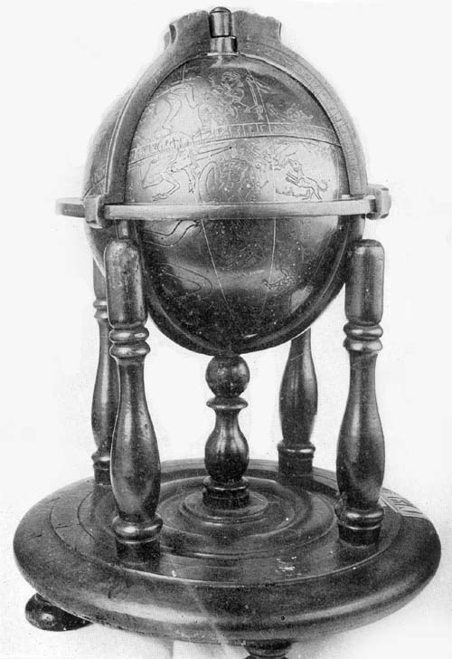
the base of the clock is placed a celestial sphere (Fig. 70) three feet in diameter, supported
by four columns of wood richly carved. On the surface appear
the forty-eight Ptolemaic constellations, each constellation
having its appropriate figure, and the 1022 stars which had
been located in Ptolemy’s day. The globe is so connected
with the machinery, by which the various parts of the clock
are made to perform their functions, that it makes one
revolution on its axis every twenty-four hours, thus
representing the rising and the setting of the several
celestial bodies. Two circles were added, one carrying the
sun and the other the moon, adjusted so as to turn about the
globe, the first in twenty-four hours, and the second in
about twenty-five. The arrangement of the movements, it
appears, was not greatly altered in the reconstruction of
1838-1842, and the clock, as it now stands, is thus
described by Britten: “On the floor level is a celestial
globe indicating siderial time. In its motion round its axis
the globe carries with it the circles that surround
it—namely, the equator, the ecliptic, the solstitial
and equinoctial colures, while the meridian and horizon
circles remain motionless, so that there are shown the
rising and the setting, as well as the passage over the
meridian of Strassburg, of all stars that are visible to the
naked eye, and which appear above the horizon. Behind the
celestial globe is the calendar; on a metallic band, nine
inches wide and thirty feet in circumference, are the months
and the days of the months, Dominical letters, fixed and
movable feast days. The band is shifted at midnight, and a
statue of Apollo points out the day of the month and the name of the saint corresponding to
that day. The internal part of the annular band indicates
true solar time, the rising and the setting of the sun, the
diurnal motion of the moon around the earth, and its passage
over the meridian, the phases of the moon and the eclipses
of the sun and moon. Adjacent compartments are devoted to a
perpetual calendar, solar and lunar cycles and other
periodic occurrences, solar and lunar equations, etc. Above
the calendar appear allegorical figures, seated in chariots,
and representing the days of the week. These chariots, drawn
by such animals as are assigned as attributes of the
divinities, run on a circular railway and appear each in
order. In the story above the globe is a planetarium in
which the revolutions of the planets are represented upon a
large dial plate, and above the planetarium, and upon a
star-decked sky, is a globe devoted to showing the phases of
the moon. In the second story of the clock has been placed a
terrestrial globe, which likewise is adjusted to revolve in
representation of the revolution of the earth.”344
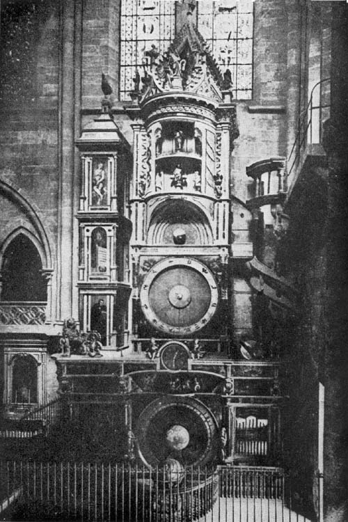
Fig. 70. Strassburg Clock and Globe of Conrad
Dasypodius, 1574.
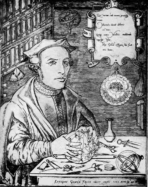
Peter Apianus (Bienewitz or Bennewitz) (1495-1552) was a
native of Leisnig, Saxony.345 His earliest education was
received in the village of Roschlitz, but at the age of
twenty-three he entered the University of Leipzig, where it
appears that astronomy and mathematics chiefly claimed his
interest (Fig. 71). In 1527 he received and accepted an
appointment as professor of mathematics in the University of
Ingolstadt, and in 1541, for his distinguished abilities, he
was ennobled by the Emperor Charles V. In addition to the
fame acquired through his mathematical treatises he became
widely known as a maker of physical and astronomical
instruments, among which were celestial globes. Numerous as
appear to have been these globes of his construction, no
example at present is known bearing the unmistakable
evidence of his workmanship. Clemens, in his description of
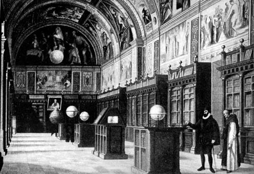
the Library of the Escorial,346 gives us to understand that
it possessed at one time one or more Peter Apianus globes,
which were probably carried to Spain by the Emperor
himself. It seems probable that a diligent search through
public and private libraries and museums in that country
would lead to the discovery of some of his globes or
mathematical instruments.
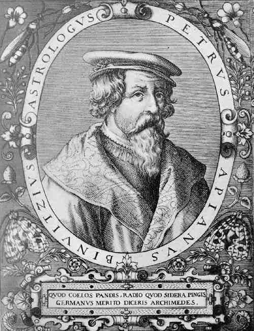
Fig. 71. Portrait of Peter Apianus.
Kepler tells us of an Apianus globe which he saw on a
journey from Würtemberg to Gratz, noting that it was so
constructed that the stars could be removed at pleasure from
the sphere.347 Of this particular globe nothing seems now to
be known. It is thought hardly probable that the one
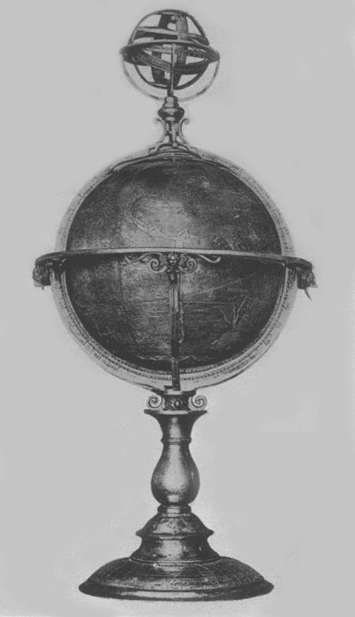
referred to by Kepler is that fine celestial Apianus globe
(Fig. 72) belonging to the K. B. Hof- u. Staats
Bibliothek of Munich. There seems to be scarcely a doubt
that this, as its companion, a terrestrial globe, is the
work of the son Philip. Repeated inquiry has not resulted in
obtaining definite answer as to the dimensions of these
globes nor a description of such detailed features as would
here prove of interest. The photographic reproductions show
them to be of remarkably artistic workmanship. Each is
furnished with a heavy meridian circle, and with a similarly
designed horizon circle supported by a semicircle which
rests upon an elaborately constructed base.348 The history of
these globes seems not to be known, as stated above. We have
an inventory of the Herzoglich-Bayrische collection of
mathematical and astronomical instruments, prepared by the
Jesuit, Fickler, which contains, page 147, the following
entry relative to the globes to be found therein: “Folget
die Tafl. Nr. 34. Daraus stehen drey grosser hulzinen Globi
Coelestes, davon d. ain in einem messingen gestell, mit
ainem messingem zodiaco, der dritt von mettall. 1777. Sechs
grosser Globi terrestres von Holz. mit mettallinen zodiacis
1778. Zwei claine Globi der ain Coelestis der ander
Terrestris, auf gedraxelten holzen fuesslen.”349 “Next in order is table
No. 34. On this there stand three large celestial globes of
wood, one of which has a base of brass, with a brass horizon
circle, the third of metal, 1777. There are six large
terrestrial globes of wood, with metal horizon circles,
1778. Two small globes, one celestial, the other
terrestrial, resting on turned wooden feet.” It will be
noted, however, that there is no mention therein of Apianus
globes. Kobalt tells us that Apianus “vertigte allerley
mathematische instrumente, als Cosmolabium, Globos duos
Caeli et Terrae maximos, und Planisphaerium,” “constructed
many kinds of mathematical instruments such as astrolabes,
two large globes celestial and terrestrial and
planispheres.” This same author gives us the information
that “in der k. b. Central-Bibliothek befinden sich zwei
grosse, von Apian ververtigte und von Johann Mielichs
gemalte Globi Coelestes et Terrestres, worauf folgende
Inschrift zo lesen ist, ‘Illustrss Seren. Principi ac Domino
D. Alberto Com. Pal. Rheni. Sub. Inf. que Bar. Duci Domino
suo Clementissimo Globum hunc geographicum cels. ejus jussu
juxta veterum ac recentium Historiographorum Observationes
Traditionesque Descr. et Ded. Philippus Apianus M. D. Anno
Salutis 1576.’” “In the K. B. Central Library there are two
large globes celestial and terrestrial constructed by
Apianus and painted by Johan Müelichs, on which is the
following inscription: ‘To the Most Illustrious, Most Serene
Prince and Lord D. Albert Count of the Rhenish Palatinate,
etc. His Most Clement Lord this celestial globe by his
command, fashioned according to the observations and
traditions of both ancient and modern historiographers
dedicates Philip Apianus in the year of Salvation 1576.’”350 It seems, therefore,
probable, from the above citation, that it was the son
Philip who constructed these Munich globes. It was in the
year 1552 that he followed his father as professor of
mathematics in the University of Ingolstadt and like his
father soon won distinction for himself as cartographer,
producing his famous Bayrische Landtafeln as his first work
of note. It seems further probable that shortly after this
work he became interested in globe construction, in which
line of activity he made for himself a place of first rank.
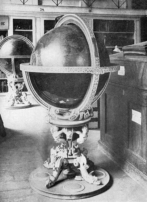
Fig. 72. Globes of Philip Apianus, 1576.
The celestial globe referred to above has represented on
its surface the several Ptolemaic constellations,
exquisitely colored, and the stars have been given names in
Greek, Latin, and Arabic. The terrestrial globe map is
considerably injured, especially in the polar regions, but
the continental and other outlines are all clearly
traceable. Three large compass roses, of ornamental pattern,
are placed along the Line of Demarcation. The coast outline
of Europe is, in the main, well done, as is that of Africa
and the New World. The Nile and the Niger rivers no longer
find their source in the same common lake. The
representations of the far eastern regions indicate that
Apianus had a fairly good knowledge of the records of the
Holland explorers.
A fine example of the metal worker’s art of this period may
be found in a silvered bronze celestial globe (Fig. 73)
belonging to the Morgan collection recently placed in the
Metropolitan Museum of New York. On the meridian circle we
find the maker and date legend reading “Gerhard Emmoser,
sac. caes. meis horologiarius, F. Viennae 1579.” The sphere,
which can be opened on the line of the ecliptic, has a
diameter of about 13 cm. Within has been placed a delicately
constructed mechanism by means of which the sphere is made
to rotate once in twenty-four hours on its equatorial axis,
the key winding stem for this machinery projecting at the
north pole through an engraved hour plate with pointer. With
its meridian and its horizon circle it is adjusted to make
one revolution in three hundred and sixty-five days. A
stationary ring, about 2 cm. in width, which closely
surrounds the horizon circle and in its same plane, fits the
instrument as a calendar. This ring has engraved on its
surface crossing lines, one for each day of the year, to
each month there being assigned its proper number of days or
lines, as, for example, “October habet 31 dies,” “November
habet 30 dies.” As the sphere with its circles revolves, a
pointer attached to the horizon circle indicates on the
calendar ring each day of each month in succession. The
surface of the sphere is exquisitely engraved with representations of
the several constellations, the name of each being given in
Latin. The instrument is made to rest upon the back of a
winged horse in silvered bronze, this in turn standing upon
an artistic circle base. It is well preserved and is a
choice example of such instruments, which in this period
were in particular favor.
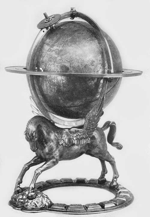
Fig. 73. Silver-Gilt Globe of Gerhard Emmoser, 1573.
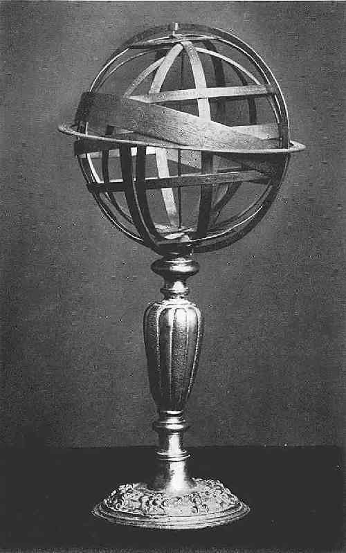
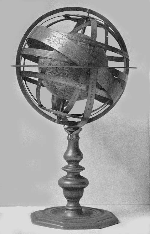
Carlus Platus, a maker of metal globes in the last quarter
of the sixteenth century, is known to us through two fine
extant examples of his work.351 The first of these,
inscribed “Romae a. 1578 Car. Pl.,” may be found in the
Museo di Strumenti Antichi of Florence, having been added to
this collection by its former distinguished director, F.
Meucci. The horizon diameter of this armillary sphere is
about 21 cm. It has been described as one beautifully
constructed of brass and mounted on a carved wooden base.
The circle representing the course of the sun and that made
to represent the course of the moon are made to revolve on
the axis of the ecliptic, and a small ball, of recent
construction, representing the earth, is placed in the
common center of the armillae, and is made to revolve on the
axis of the equator. A dial attached to the axis of the
earth below the meridian circle marks the hours, which are
engraved on the Arctic polar circle. A few points marked on
the colures indicate the position of the principal stars.
All of the circles have been carefully graduated. On that
one representing the zodiac have been engraved the names of
the months and the pictures of the several zodiacal figures,
while on the horizon circle are the names of the principal
winds in Greek, Latin, and Italian.
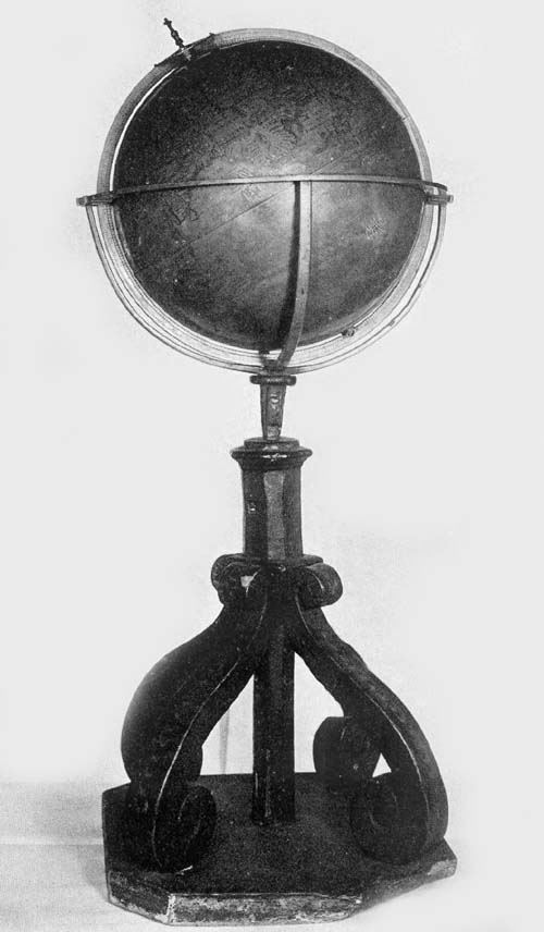
A second globe of Platus, signed “Carolus Platus Romae Anno
1598,” may be found in the Biblioteca Barbarini of Rome. It
is composed of two hollow brass hemispheres, making a ball
14 cm. in diameter, which is surrounded by a brass meridian
and a brass horizon circle, the whole resting on a tripod
base. It is a fine example of an early metal engraved globe, the
representation of the figures of the constellations in
particular being done in a very superior manner. On the
surface of the sphere the equator, the ecliptic, the
equinoctial, and the solstitial colures are represented. The
history of the globe seems not to be known, but it is
probable that it came to the Barbarini Palace in the time of
Pope Urban VIII, who, before filling his pontifical office,
was known as Maffeo Barbarini.
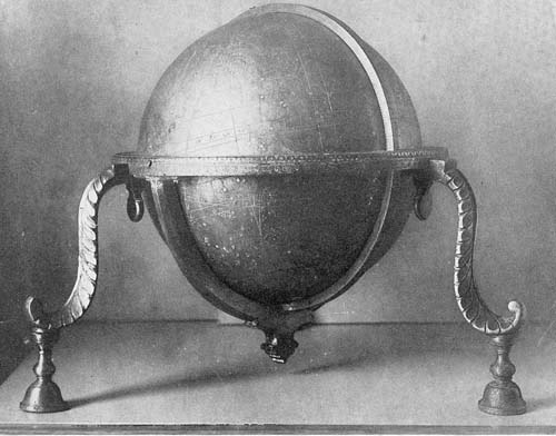
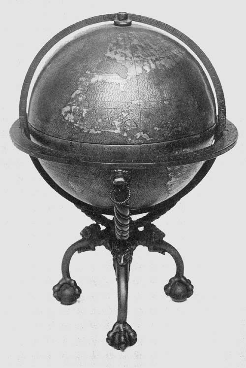
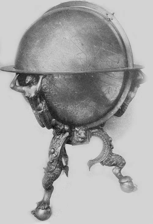
Of the celestial globes constructed by George Roll and
Joannes Reinhold three examples are known.352 One of these may
be found in the collection of the Mathematical Salon of
Dresden (Fig. 74) one in the Osservatorio di
Capodimonte of Naples and one in the K. K. Hofbibliothek in
Vienna. The Roll and Reinhold globe of the Dresden
collection, bearing the inscription “Georg Roll et Joannes
Reinhold elaborabant Augustae 1586,” is an exceedingly
interesting instrument, unique in the manner of its
construction and remarkably well preserved. It is of brass,
having a diameter of 36 cm., and is furnished with numerous
movable circles, a large meridian circle surmounted with an
armillary sphere, and a brass horizon circle on which are
marked the old and the new calendars, the names of the
twelve months and of the important holy days. The globe
base, very artistically wrought, rests upon four griffin’s
feet, between which a small terrestrial globe 10 cm. in
diameter has been placed, this having been furnished with
its own independent support. The large celestial sphere is
furnished with a clocklike mechanism by means of which it is
made to revolve in representation of the diurnal motion of
the heavens. According to existing records it was purchased
in the year 1593 by order of the Elector Christian II, and
by him was presented to the Academy of Arts of Dresden.
Zeiller tells us that this and the Heyden globe were those
“with which the Prince Elector Augustus was accustomed to
amuse himself.”
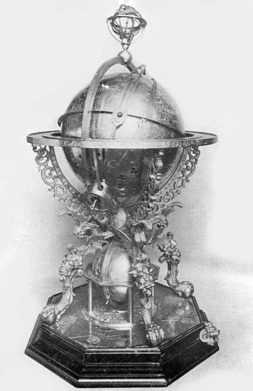
Fig. 74. Globe of George Roll and Johannes Reinhold,
1586.
It has not been possible to obtain a description of the
Vienna globe. It appears that it was constructed in the year
1588, and that, like the Dresden example, the celestial
sphere is made to revolve by means of clockwork.
The Roll and Reinhold globe belonging to the Osservatorio di
Capodimonte, according to Fiorini, is one especially worthy
of mention.353 This is described as a hollow ball having a
diameter of about 21 cm. The sphere itself is made of
copper, the remaining parts of gilded brass. The horizon
circle is composed of several overlapping brass plates. A
clockwork mechanism is supplied, by means of which the
sphere and certain circles may be made to revolve. The
surface of the copper sphere is artistically engraved,
having numerous circles representing the ecliptic system
with its parallels and meridians, and the equatorial system
including its five zones. The Ptolemaic constellations are
represented, the figure of each being engraved in outline
with the name in Latin. The several stars are not named but
near each is an engraved number to indicate its magnitude,
these numbers ranging from 1 to 6. Nebulae are distinguished
by small circles, and the Milky Way by numerous dots. The
meridian circle, in which the sphere revolves, has the usual
graduation from 0 to 90, but has in addition a climatic
graduation designed “Climata ex Ptolomeo,” and a division
into zones called “Torrida Zona,” “Zona habitabilis
temperata,” and “Frigida zona.” On the convex surface of the
horizon circle we find engraved the names of the four
cardinal points, and on the upper surface of this circle are
engraved the Julian and the Gregorian calendars, the names
of the saints, the dates on which the sun enters the various
signs of the zodiac, and the ancient names of the principal
winds. The globe mountings, all of brass, are artistic and
well preserved. Like the Dresden example it rests upon a
four-branched support, the extremities of each branch
representing the claws of the griffin. Including the base,
the instrument is 43 cm. in height. It seems not to be known
when or how this globe, constructed in Augsburg, found its
way to the Naples Museum, where it is treasured as one
of the choicest of ancient astronomical instruments.
Tycho Brahe, the great Danish astronomer (Fig. 75), was
a native of Knudtstrup near Helsingborg, born in the year
1546.354 The care of his early education was assumed by an
uncle, George Brahe, who in the year 1559 sent him to the
Academy of Copenhagen with the intention of fitting him for
the legal profession. Three years later we find him
registered at the University of Leipzig, then famous for its
department of jurisprudence. Like many another of the
world’s great men for whom, in the days of his youth,
interested relatives or friends have chosen a life career
only to find in later life the choice not well made, Tycho’s
bent was not for the legal profession but for science, that
is, for mathematics and astronomy. While yet a student in
Copenhagen an eclipse of the sun which occurred August 21,
1560, interested him greatly, and here we seem to find the
beginning of that great future which was to be his.
Forbidden by his schoolmaster to give his time to a study of
the stars, in the quiet of the night he would secretly
betake himself into the open, there to watch with unaided
eye the movements of the heavenly bodies, or to follow these
movements as best he could with the assistance of a simple
astronomical circle and a small celestial globe which he had
been able to purchase. It probably was in his Leipzig days
that he became intimate with Bartholomaus Scultetus
(Schultz), lecturer on mathematical subjects, and by him was
encouraged to pursue further his astronomical studies. Among
the first practical results of his activities in this field
we have his correction table for readings with the Jacob
staff. The death of his uncle in the year 1565 occasioned
his return to his native country, but Germany offering him
special opportunities for continued study in his favorite
field, we soon find him in Wittenberg, later in Rostock,
where in a quarrel with a peasant he lost part of his nose
and thereafter to the end of his days wore a silver
substitute. In 1567 we find him in Lauingen engaged in
the study of astronomy with the distinguished Cyprian
Leowitz, in 1568 in Basel with Peter Ramus, and for two
years thereafter in Augsburg with the brothers Johan and
Paul Hainzel, with whom he constructed a large quadrant
having a radius of seventeen and one half feet. While in
Augsburg it appears that he began the construction of a
celestial globe four feet in diameter, but there is some
uncertainty as to his completion of this work. A short but
unhappy sojourn in his native town followed his years of
congenial study in Germany, and we soon learn of his visit
to the observatory of Landgraf Wilhelm of Cassel, an event
of great significance for him. His travels carried him to
other cities of Germany, including the city of Regensburg,
where he witnessed the coronation of the Emperor Rudolf II.
Landgraf Wilhelm, a Maecenas of wide repute in his day, had
been greatly impressed with the abilities of Tycho, and he
urged upon the Danish King Frederick that he should make
suitable provision for the further astronomical studies of
his distinguished subject, which suggestion the King
generously met. In the year 1575 the documents were signed
and sealed granting to Tycho full possession for life of the
little Island of Hveen, lying between Seeland and Schonen;
in addition he was furnished with all the means necessary
for the erection of an observatory and the adequate
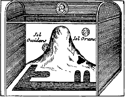
equipment of the same (Fig. 76). The Uranienburg, as
his observatory was called,355 became a great center for
astronomical studies, and students came to him from various
European lands, among these being Arnold van Langren, Willem
Jansz. Blaeu, and Longomontanus (Christian Severin of
Longberg). The death of his patron, King Frederick II, in
the year 1588 brought misfortune to Tycho, in so far as his
life and studies on the Island of Hveen were concerned,
since the succeeding ruler, Christian IV, was but little
interested in the further promotion of astronomical science.
Enduring court intrigue for nine years, he determined, in
the year 1597, to leave the scenes of his remarkable
successes, and after a brief sojourn with Count Henry of
Ranzau near Hamburg, he accepted an invitation from the
Emperor Rudolf II to become imperial astronomer and
counselor at Prague. Thither he went with his family in the
year 1599, at the same time taking with him those
astronomical instruments which had served him in his studies
in the northern island home. While preparations were under
way for the erection of a new observatory for him he died in
the year 1601. From Tycho’s heirs the Emperor Rudolf
purchased his instruments and manuscripts, the latter
passing into the hands of Kepler, his successor at the
Imperial Court, but as to the fate of his instruments little
seems to be known. Kästner tells us that in 1619,
during an uprising in the city of Prague, some of these were
destroyed while others were carried away, and at present
only an iron quadrant, once in his observatory, remains in
that city.
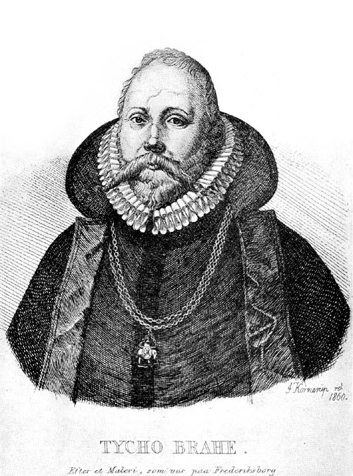
Fig. 75. Portrait of Tycho Brahe.
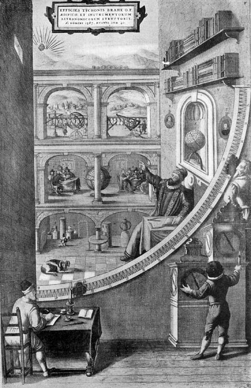
Fig. 76. Interior of Tycho Brahe’s Observatory at
Uranienburg.
His large brass celestial globe, six feet in diameter, was
carried back to Copenhagen in the year 1623 by King
Christian’s son, Ulrich, and there it was carefully kept
until the year 1728, when with the castle in which it had
been placed it was destroyed by fire.
Recalling the far-reaching influence of Tycho Brahe on
astronomical studies and on celestial globe making, it
cannot be without interest to quote here his own reference
to his great globe, wherein he describes its construction.
“This globe,” he says,356 “which is a very large one, we
have made with great care, but with none the less than we
have employed in all of our others. The interior is of wood
with many intersecting circles and special supports,
strengthened here and there from the center, and being then
fashioned into a spherical shape. As for its parts of wood,
these were made at Augsburg in the year 1570 before I
returned to my native land, as I found there a capable
workman, having sought for a long time elsewhere in vain for
such an one. There, on account of its size, which made it
difficult to move, it had remained for five years, when I
returned to Augsburg; this was in the year 1575 as I
came out of Italy on my way to Ratisbon to be present at the
coronation of the August Emperor Rudolf II, when I found the
globe had been finished some time previously. But its shape
(sphericity) did not altogether satisfy me, moreover certain
cracks could be seen. In the following year, and not without
much difficulty I had it carried to Denmark. There the
cracks were filled in and the sphericity made more nearly
perfect by laying over the surface about one hundred skins.
There followed a testing for a period of two years to
ascertain whether the cracks would reappear after two
summers and two winters. When, after this test, I saw that
it retained its sphericity, I covered it over with thin
brass plates of uniform thickness without mishap, and this I
did with such care and skill that you would be led to say
the globe was made of solid brass, the joinings of the
plates being scarcely visible. I next fashioned it into a
perfect sphere and marked thereon the zodiac, and the
equator with its poles, also the degrees each of sixty
minutes by engraved lines as we do in such work. I then left
it for the space of one year, as there was some doubt after
putting on the brass plates as to whether the globe would
retain its sphericity in winter and in summer. When it had
been sufficiently tested not only did I indicate the circles
of which I have spoken but also all the stars of the eighth
sphere I represented in their proper places, as many stars
as were to be seen in the heavens, and I increased their
number more and more in succeeding years up to 1600. Thus I
with purpose added all the stars visible to the naked eye,
in their proper places adapted to the year 1600 which was
near at hand. And so there passed nearly twenty-five years
from the first work on this globe until it was finished, by
the addition of its proper divisions and its stars. This
delay, although it might seem tedious, was not without its
value; for all things were thus done more carefully and
better. ‘Work quickly only if you work well.’ Then the outer
circles were fitted to it, that is, a meridian and after that a horizon
circle. This meridian is made of brass, and each degree is
divided into minutes, and the horizon has the width of a
palm of the hand, being covered with brass having the
degrees and minutes marked. The vertical quadrant passing
from the zenith to the horizon is of brass.
“The globe rests on a firm base having two iron supports
crossing each other, two of which you see on one side and
two on the other. These are for the purpose of giving
strength lest the horizon of the instrument should not be
firm because of its bulk and weight.
“The entire support is five feet high, and on the lower part
of the structure various mathematical devices are to be seen
skilfully painted for the sake of ornamentation, and with
the other features adding beauty to the whole. The globe
itself is approximately six feet in diameter, and from this
dimension the size of the meridian, of the horizon and of
the rest of the instrument can be obtained.
“Such a globe, so solidly made, so finely wrought, and in
every part so finely constructed and properly constituted
never before in any part of the world, so I believe and say
without the thought of arousing envy, has been completed. It
is an immense and a magnificent work; so much so that many
have come from various countries to Denmark that they might
have a view of it together with my other instruments, while
the Kingdom of Urania and its far-famed citadel were
standing.
“Around the horizon circle one could read in letters of gold
‘In the year of Christ CIƆ IƆ XXCIV (1584),
Frederick II reigning in Denmark, this globe like unto a
celestial machine, in which are fixed the stars of the
eighth sphere as set down on his globe each exactly in its
place, also the wandering stars as they appear among these,
Tycho Brahe, to all on earth who desire to understand this
matter, shows the heavens by this mechanical device which he
perfected for his sons, for himself and for posterity.’
“The date 1584 is inscribed hereon because that is the middle of the period of
time in which it was in the process of construction, and
further it is the year before the death of King Frederick of
most worthy memory, who liberally supported both myself and
my work, and his princely love followed me as long as he
lived. I will add only this one thing—this globe has a
canopy indicated by Y Z (Fig. 77) circular, and concave
within to enclose the upper half of the globe, which canopy,
fastened to the roof by a chain, may be let down as a
protection from dust and from other injury. The use of the
globe is the same as is that of others, and this use I have
decided to describe in a special work during my leisure
time, since it cannot be done in few words. This globe has,
on account of its great size, an advantage over all others,
namely that all details on it can be given with the utmost
exactness and minuteness. And those points concerning the
doctrine of the primum mobilum and the study of the
heavenly bodies in their relations to the position of the
ecliptic and the equator and of certain other circles on the
globe, are easily determined with a minimum of trouble and
without any laborious effort, by the machine.”
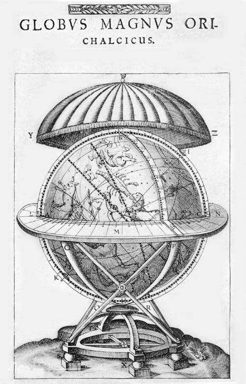
Fig. 77. Globus Magnus of Tycho Brahe, 1584.
Van Raemdonck refers to a globe by Titon du Tillet, of the
year 1584, citing a reference to this work to be found in
“Memoirs lus à la Sorbonne.” We have been unable to
obtain concerning Titon any additional information to that
given in the above citations.357
In March, 1861, the Bibliothèque Nationale of Paris
acquired by purchase a copper engraved globe mounted on a
metal base.358 The record referring to the purchase reads
“Trouvé à Lignières (Cher) et provenant
de l’abbé L’Écuy.” (Fig. 78.)
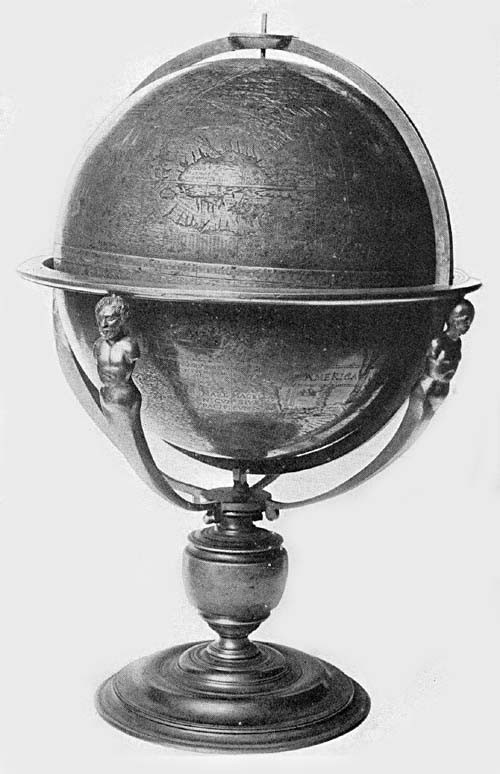
Fig. 78. L’Écuy Terrestrial Globe, ca. 1578.
Aside from its geographical interest it is particularly
significant in that it is the only globe of metal known to
have been made in Rouen in that period. It is neither signed
nor dated, but its inscriptions seem to assure us that it
was not made prior to 1578, yet in all probability before
1600. It seems not to be known how the globe found its way
into the locality designated. The Abbé
L’Écuy died in Paris in the year 1634 at the age of
eighty-four, Vicar General of the Prebendary of Nôtre
Dame. It is probable that at the death of the Abbé
the globe was taken to the province of Cher by some dealer
or purchaser, as he was born in the town Yvoi-Carignan in
French Luxembourg. Of the earliest history of this
remarkably interesting object we know only that it was made
in Rouen, at a date we cannot definitely fix.
It has a diameter of 25.6 cm. In an oval cartouch one finds
the inscription “Nova et integra universi orbis descriptio.
Rothomagi.” “A new and complete description of the world.
Rouen.” Below the last line there appears to be space left
for the insertion of the author’s name, a thought suggested
by the arrangement for the inscription, and underneath the
cartouch is engraved a representation of Neptune driving his
sea horses and chariot and armed with a trident. There are
numerous vessels represented on the globe, sailing the seas,
in the style of the sixteenth century. The prime meridian
passes through the Canary Islands. The author seems to have
drawn largely from Spanish sources, but to some extent from
the Portuguese.
The outlines of the several countries of the Old World are
not particularly well drawn, and it does not appear that the
author thought of making an especial point of accuracy.
Africa has the outlines of the maps of the sixteenth
century, but with an indifference to details. The Senegal
and the Niger are made to unite to form the Nile. Asia is
not particularly well drawn. Below the island of Cipango the
author has engraved the following legend, “Hoc loco secuti
sumus recentiores hanc partem verius a continente
separantes.” “In this place we have followed the most recent
(observers) who rightly separate this part from the
continent.”
The western coast of America gives evidence of a want of
detailed knowledge. Here we read “Haec littora nondum
cognita,” “this coast is not yet known,” and below this,
“Novus orbis,” and “Hispania major a Nuño Gusmano
devicta anno 1539,” “Greater Spain conquered by Nuño
Gusman in the year 1539.” California is represented as a
peninsula and not an island as on so many of the maps of the
closing years of the sixteenth century. The nomenclature
along the coast of Mexico is exceedingly rich. Pizarro’s
conquest is referred to, but Chili is unknown, “Ulterius
incognitum.” The estuary of La Plata is represented as very
large. The coast names north of Florida seem to have been
obtained from the Verrazano sources of 1524. In the region
of Newfoundland, which is represented as a region of
numerous small islands, we find “Baccalearum regio,”
“Gamas,” “insule Corteralis,” “terro de laborador.” The
strait separating Greenland from the mainland is referred to
as “Fretum arcticum per quod Lusitani in orientem et ad
Indos et Molucas navigare conati sunt,” “Arctic strait
through which the Portuguese attempted to sail to the east
and to the Indies and the Moluccas,” an allusion to the
unhappy results of the Cortereal expedition. Along the coast
of the strait which forms the northern boundary of North
America we read “Terra per Britannos inventa,” “Land
discovered by the British.” A very curious legend along the
east coast of Greenland reads “Quii populi ad quos
Joañes Scovus Danus pervenit anno 1476,” “These are
the people to whom the Dane John Scovus came in the year
1476.” Humboldt was one of the first to call attention to
this expedition, and Gomara was actually the first to
mention it, that is, to give a reference to the Dane
Skolnus.359
There are no more interesting survivals among the globes of
the late sixteenth century than are those constructed by
Emery Molyneux, now belonging to the Middle Temple Library
of London (Fig. 79), which Sir Clements Markham refers
to as “their burial place,” considering this to be “a
strange depository for geographical documents of such
interest and importance.” In the address “To the Reader” or
preface to his ‘Voyages,’ Hakluyt gives the first reference
in print to these globes. “Nowe,” he says, “because
peraduenture it would bee expected as necessarie, that the
descriptions of so many parts of the world would farre more
easily be conceiued of the Readers, by adding Geographicall,
and Hydrographicall tables thereunto, thou art by the way to
be admonished that I have contented my selfe with inserting
into the worke one of the best generall mappes of the world
onely, untill the coming out of a very large and most exact
terrestriall Globe, collected and reformed according to the
newest, secretest, and latest discoueries, both Spanish,
Portugall, and English, composed by M. Emmerie Mollineux of
Lambeth, a rare gentleman in his profession, being therein
for diuers yeeres, gratly supported by the purse and
liberalitie of the worshipfull marchant M. William
Sanderson.”360 It was not until near the close of the year
1592 that the globes were completed, and soon thereafter we
have their first printed description, which description was
given by Dr. Hood of Trinity College, Cambridge, a lecturer
on mathematics and navigation in the city of London.361 Blundeville, in
his ‘Exercises,’362 refers to them, and in 1594 Robert Hues
published the first edition of his most valuable and
interesting treatise on globes, bearing the title,
‘Tractatus de Globis et eorum usu, accomodatus iis qui
Londini editi sunt anno 1593,’ taking the Molyneux globes as
the basis for his observations.
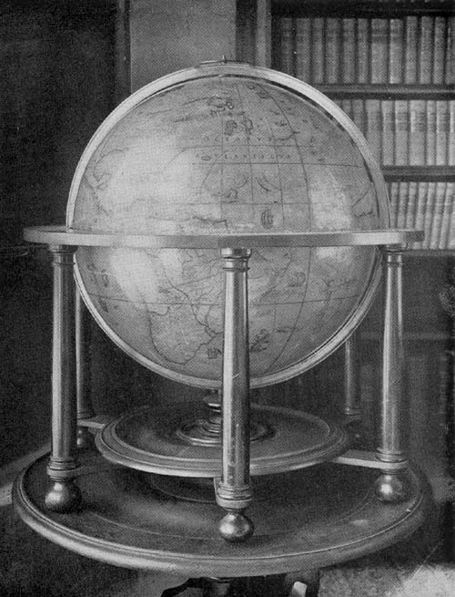
Fig. 79. Terrestrial Globe of Emery Molyneux, 1592.
Very little is known of the life of Molyneux. He appears to
have been a member of the Cavendish expedition of the years
1586-1588, as is suggested by one of the legends on his
terrestrial globe. He was known to Sir Walter Raleigh, to
Richard Hakluyt, to Edward Wright, and to John Davis. To the
suggestions of the last-named we perhaps owe the existence
of these globes.363 As noted by Hakluyt in his preface, the
globes were constructed at the expense of William Sanderson,
a merchant prince of London, a liberal and patriotic
citizen, one interested in geographical exploration, who had
fitted out the Davis Arctic Expedition.
Sir Clements Markham, in his edition of Robert Hues’
‘Tractatus de Globis,’364 edited for the Hakluyt Society and
published in the year 1889, gives in his introduction the
following brief but adequate description of these globes:
“The Molyneux globes are 2 feet 2 inches in diameter, and
are fixed on stands. They have graduated brass meridians,
and on that of the terrestrial globe a dial circle or
‘Horarius’ is fixed. The broad wooden equator, forming the
upper part of the stand, is painted with the zodiac signs,
the months, the Roman calendar, the points of the compass,
and the same in Latin, in concentric circles. Rhumb lines
are drawn from numerous centers over the surface of the
terrestrial globe. The equator, the ecliptic, the polar
circles are painted boldly; while the parallels of latitude
and meridians, at every ten degrees, are very faint lines.
The globe received additions, including the discoveries of
Barents in Novaya Zemlya, and the date has been altered with
a pen from 1592 to 1603. The constellations and fixed stars
on the celestial globe are the same as those on the globe of
Mercator, except that the Southern Cross has been added. On
both the celestial and the terrestrial globes of Molyneux
there is a square label with this inscription ‘This globe,
belonging to the Middle Temple, was repaired in the year
1818 by J. and W. Newton, Globe Makers, Chancery Lane.’
“Over North America are the arms of France and England
quarterly; supporters, a lion and dragon; motto of the
garter; crown, crest, and baldrequin; standing on a label,
with a long dedication to Queen Elizabeth.
“The achievement of Mr. William Sanderson is painted on the
imaginary southern continent to the south of Africa. The
crest is a globe with the sun’s rays behind. It stands on a
squire’s helmet with baldrequin. The shield is quarterly;
1st, paly of six azure and argent, over all a bend sable for
Sanderson; 2nd, gules, lions, and castles in the quarters
for Skirne alias Castilion; 3rd, or, a chevron between 3
eagles displayed sable, in chief a label of three points
sable for Wall; 4th, quarterly, or and azure, over all a
bend gules for Langston. Beneath there is an address from
William Sanderson to the gentle reader, English and Latin,
in parallel columns.
“In the north polar regions there are several new additions,
delineating the discoveries of English and Dutch explorers
for the first time. John Davis wrote, in his ‘World’s
Hydrographical Discovery’: ‘How far I proceeded doth appear
on the globe made by Master Emerie Molyneus.’ Davis Strait
is shown with all the names on its shores which were given
by its discoverer, and the following legend ‘Joannes Davis
Anglus anno 1583-86-87 littora Americae circumspectantia a
quinquagesimo quinto grado ad 73 sub polarem scrutando
perlegit.’ (‘John Davis, an Englishman in the years
1583-86-87, gave these names when he mapped the shores of
America lying between the parallels of 55 degrees and 73
degrees north latitude.’) On another legend we have
‘Additions in the north parts to 1603’; and below it are the
discoveries of Barents, with his Novaya Zemlya winter
quarters—‘Het behouden huis.’ Between Novaya Zemlya
and Greenland there is an island called ‘Sir Hugo Willoghbi
his land.’ This insertion arose from a great error in
longitude, Willoughby having sighted the coast of Novaya
Zemlya; and the island, of course had no existence, though
it long remained on the maps. To the north of Siberia there
are two legends, ‘Rd. Cancelarius et Stephanus Burrow Angli
Lappiae et Coreliae oras marinas et Simm. S. Nicolai vulgo
dictum anno 1553 menso Augusto exploraverunt’ (‘Richard
Chancelor and Stephen Burrow Englishmen explored the shore
of Lapland and Corelia, and of Simm. S. Nicolai commonly so
called, in the month of August 1553’), and ‘Joannes
Mandevillanus eques Anglius ex Anglia anno 1332 Cathaiae et
Tartariae regiones penetravenit.’ (‘John Mandeville an
English knight from England in the year 1322 entered the
regions of Cathay and Tartary.’)
“Many imaginary islands, in the Atlantic, are retained
on the globe: including ‘Frisland,’ ‘Buss Ins,’ ‘Brasil,’
‘Maidas,’ ‘Heptapolis,’ ‘St. Brandan.’ On the eastern side
of North America are the countries of Florida, Virginia, and
Norumbega; and also a large town of Norumbega up a gulf full
of islands.
“The learned Dr. Dee had composed a treatise on the title of
Queen Elizabeth to Norumbega; and in modern times Professor
Horsford has written a memoir to identify Norumbega with a
site up the Charles River, near Boston. On the Atlantic,
near the American coast, is the following legend ‘Virginia
primum lustrata, habitata, et cultu ab Anglis impensis D.
Gualteri de Ralegh Equitis Aurati ammenti Elizabethae
Angliae Reginae.’ (‘Virginia first surveyed, inhabited and
cultivated by the English at the expense of Sir Walter
Raleigh, Knight, subsidized by the gold of Elizabeth Queen
of England.’)
“A legend in the Pacific Ocean furnishes direct evidence
that information, for compiling the globe was supplied by
Sir Walter Raleigh. It is in Spanish: ‘Islas estas descubrio
Pedro Sarmiento de Gamboa por la Corona de Castella y Leon
desde el ano 1568 llamolas Islas de Jesus aunque vulfarmente
las llaman Islas de Salomon.’ (‘Pedro Sarmiento of Gamboa
discovered these islands in the year 1568 for the crown of
Castile and Leon calling them the Islands of Jesus though
they are commonly called the Salomon Islands.’)
“Pedro Sarmiento was the officer who was sent to fortify the
Strait of Magellan after Drake had passed through. He was
taken prisoner by an English ship on his way to Spain, and
was the guest of Raleigh in London for several weeks, so
that it must have been on information communicated by
Raleigh that the statement respecting Sarmiento on this
legend was based.
“Besides ‘Insulae Salmonis’ there are two islands in the
Pacific, ‘Y Sequenda de los Tubarones,’ and ‘San Pedro,’
as well as the north coast of New Guinea, with the names
given on Mercator’s map.
“Cavendish also appears to have given assistance, or
possibly Molyneux himself accompanied that circumnavigator
in his voyage of 1587. The words of a legend off the
Patagonian coast seem to countenance this idea, reading,
‘Thomas Caundish 18 Dec. 1587 haec terra sub nostris oculis
primum obtulit sub latitud 47 cujus seu admodum salubris
Incolae maturi ex parte proceri sunt gigantes et vasti
magnitudinis.’
“The great southern continent is made to include Tierra del
Fuego and the south coast of Magellan’s Strait, and extends
over the greater part of the south frigid zone.
“S. Matheo, an island in the Atlantic, south of the line,
was visited by the Spanish ships under Loaysa and Sebastian
del Cano, but has never been seen since. It appears on the
globe. In the south Atlantic there are painted a
sea-serpent, a whale, Orpheus riding on a dolphin, and ships
under full sail—fore and main courses and topsails, a
sprit sail, and the mizzen with a long lateen yard.
“The track of the voyage of Sir Francis Drake and Master
Thomas Cavendish round the world are shown, the one by a red
and the other by a blue line. That these tracks were put on
when the globe was first made is proved by the reference to
them in Blundeville’s ‘Exercises.’
“The name of the author of the globe is thus given: ‘Emerum
Mullineus Angl. sumptibus Guilelm Sanderson Londinensis
descripsit.’”
Markham likewise tells us that the celestial globe, in its
general features, closely resembles the terrestrial. It
carries the same arms of Sanderson, and the same label of
Newton, but a briefer dedication to the Queen. It appears
that the map was engraved and printed by Hondius of
Amsterdam, since it carries the brief legend “Judocus
Hondius Fon. Sc.” In addition to the Molyneux globes in the
Middle Temple, a pair may be found in the Royal Museum of
Cassel. A detailed description of this pair it has not
been possible to obtain.
Jost Bürgi, a native of Lichtensteig in the Toggenburg,
Switzerland, was born in the year 1552 and died in Cassel in
the year 1632.365 Early in life he became a clock maker’s
apprentice, and for some time was engaged with Dasypodius in
the construction of the famous Strassburg Cathedral clock.
In the year 1579 he was called to the court of Landgrave
William IV in Cassel, under whose patronage he won great
distinction as a maker of astronomical and mathematical
instruments. In the year 1603 he was called into the service
of the Emperor at Prague, but in the year 1631 he returned
to Cassel, where he died in the following year. Bürgi,
skilful workman that he was, seems not to have found time to
tell in words of his various activities. “He found pleasure
in work,” says one of his biographers, and left it for
others to write of his attainments, which, it may here be
said, they seem not to have done in a very detailed manner.
Landgrave William’s interest in the promotion of scientific
studies led him to the founding of a museum to which he made
numerous contributions of apparatus, mathematical and
astronomical. This museum, in the course of years, became
one of the most famous of its kind in all Europe, and indeed
remains such to this day. In its collections the work of
Bürgi is well represented, which in the quality of the
workmanship exhibited, as in the interest it awakens by
reason of its place as a nucleus around which so much of
value has been gathered, is unsurpassed.
Among the first of his instruments may be mentioned an
astronomical clock, elaborately wrought, with movable discs
and circles for illustrating the movements of the heavenly
bodies, and surmounted with an engraved celestial globe,
which, driven by clockwork, is made to turn on its axis once
in twenty-four hours. It seems evident that Bürgi
constructed other clocks of like character, supplied, as
is this example, with a celestial globe.
In this same Museum of Cassel there is a second celestial
globe, the work of Bürgi, which was begun in the year
1585, and not entirely completed until the year 1693 by
Heinrich van Lannep. This copper sphere, 72 cm. in
diameter, is remarkably well preserved. It has a heavy brass
meridian circle to which is attached an engraved hour circle
46 cm. in diameter. A large brass semicircle intersects this
meridian circle at right angles through the north pole, and
is attached to the horizon circle at its extremities. The
instrument rests upon an artistic and substantial brass
support. On the surface of the sphere are engraved the
principal celestial circles, including the colures, the
equator, the tropics, the polar circles, the ecliptic, and
twelve parallels. The stars, of which the largest are
distinguished by a bit of inlaid silver, and the several
figures of the constellations which are very artistically
engraved, are clearly the work of a master.
A third globe of gilded brass, containing clockwork within
by means of which it is made to revolve and apparently the
work of Bürgi, may also be found in this Cassel
collection. A small silver sun, movable along the equator,
is mechanically attached in such manner as to serve
admirably for demonstrative purposes. The engraved surface
of the globe is equal in its artistic merits to that of the
copper globe referred to above.
There is yet a fourth metal globe in this collection,
apparently the work of Bürgi, which is not gilded. In
other respects it is said to resemble the one designated
above as the third globe. Kepler is said to have held in the
highest esteem the scientific work of Bürgi, and to
have placed him, within his field, as high as he did
Albrecht Dürer among artists. There appears to be good
reason for attributing the invention of the pendulum clock
to Jost Bürgi, and that before 1600 he had proved this
method of clock regulation practical.
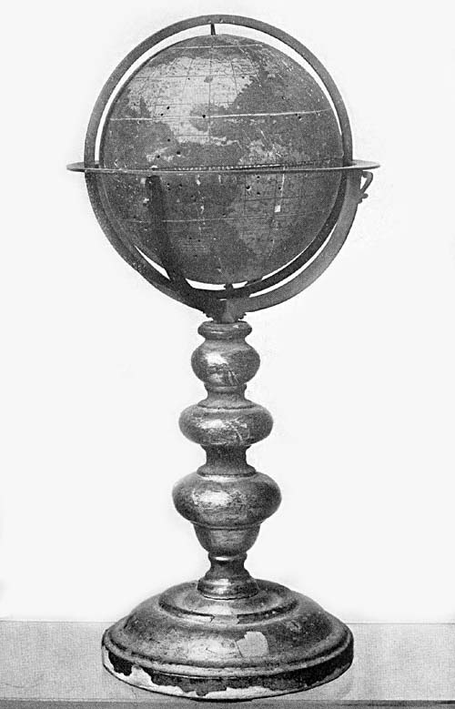
Among the numerous and interesting treasures to be found
in the Landesmuseum of Zürich is a terrestrial globe
(Fig. 80) having neither name of maker nor date of
construction, but belonging, undoubtedly, to the late
sixteenth century.366 The sphere has a diameter of about 121
cm., is mounted on a substantial wooden base, and appears to
have been made for the monastery of St. Gall, from which
place it was taken to Zürich in the year 1712. On the
semicircular arms which support the equatorial circle are
represented the armorial bearings of the abbey and monks of
St. Gall, and the date in gold, 1595, which may refer to the
date of construction or to the date when it was placed in
the monastery. On the equatorial circle one finds
represented the signs of the zodiac, the calendar, the names
of the saints and of the winds. On the heavy meridian circle
are indicated the climatic zones and the degrees of
latitude. The prime meridian is made to pass through the
Azores Islands. The sphere is of papier-mâché
and plaster, on which the engraved gores are mounted. The
seas have been colored green, the lands a dull yellow, the
mountain ranges brown. Numerous barbaric kings are
represented in picture, likewise numerous animals of land
and sea, and ships artistically drawn sail hither and
thither over the oceans. The austral continent is wanting.
Marcel especially notes the striking resemblance of the
globe map to the Mercator map of 1569, suggesting the
possibility of its Mercatorian origin, in support of which
suggestion he quotes a number of geographical names as well
as certain legends. The globe, it appears, has never been
critically studied, but is clearly an interesting
geographical monument of the period.
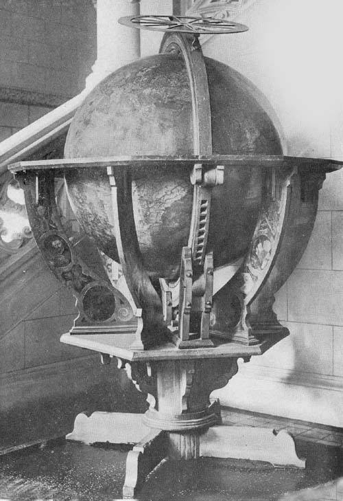
Fig. 80. Anonymous Terrestrial Globe, ca. 1595.
The making of globe-goblets in the latter half of the
sixteenth century and early seventeenth appears to have been
in response to a fashion especially pronounced in South
Germany, although their construction was not limited to that
region. Not a few of such globes are extant, which are fine
examples of the metal worker’s art, having, however, a
decorative rather than a scientific value.
Professor Fischer gives us an interesting description of
such a goblet of gilded silver (Fig. 81), dating from
the end of the sixteenth or the beginning of the seventeenth
century, and it is from his account that the following
reference is taken.367 This piece he pronounces the most
valuable treasure in the plate room of the princely castle
of Wolfegg, to which castle it was the author’s privilege to
pay a most interesting visit more than a decade ago. The
globe was long considered a christening gift from the
Emperor Francis to his godson Francis of the Waldburg zu
Wolfegg princely family and was supposed to date from the
end of the eighteenth century. Professor Fischer, however,
found this “globis terrestris” referred to in a testament
dated January 17, 1779, with instructions that it, with
certain other treasures, should not be recast or otherwise
altered from its ancient form. It was at that time
recognized as a masterpiece, but from the hands of an
unknown master, and not until recently was it definitely
determined to be the work of the Zürich goldsmith,
Abraham Gessner (1552-1613). “Gessner appears to have
manufactured his globe-goblets,” says Fischer, “not in
response to orders previously given, but in the regular
pursuit of his trade. At a time when rich merchants and
scholars took such a lively interest in geography, and the
opening up of new countries, he could count upon a market
all the more readily because his goblets were made with the
utmost care in every detail and were perfect examples of the
various branches of the goldsmith’s art; casting, embossing,
chasing, engraving, and solid gilding.”368
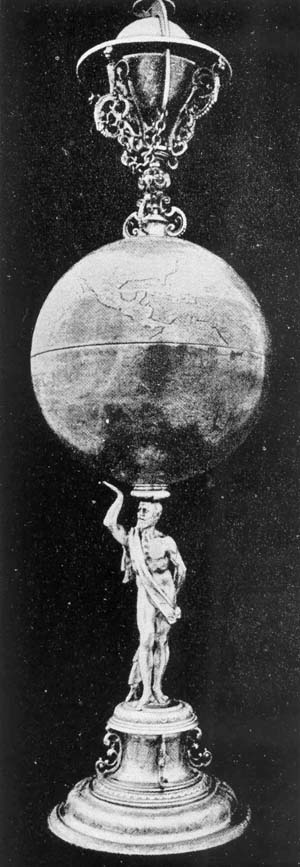
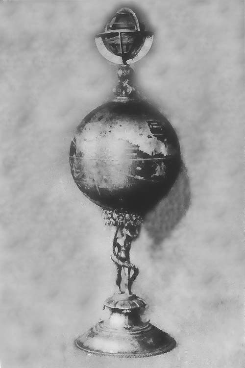
Fig. 81. Globe-Goblet of Abraham Gessner, ca. 1600.
The goblet is 58 cm. in height. Its larger globe, a
terrestrial, is composed of two hemispheres joined on the
line of the equator, and has a diameter of 17 cm. The
support is a standing figure of Atlas, which also serves as
a stem of the lower half or the lower goblet, just as the
celestial sphere with its support which tops the piece
serves as the stem of the upper half or upper goblet.
The oceans, lakes, and rivers have a silver surface, while
the continents, islands, sea monsters, sailing vessels,
principal parallels, and meridians are gilded. The
continents of Europe, Asia, and Africa, and the “terra
australis sive Magallanica” have their outlines drawn in the
main as they appear on Mercator’s map of 1569. While certain
recent discoveries as “Nowaja Semlja” (Nova Zembla) are
represented, it does not appear that Gessner was inclined to
insist on his map records being laid down with the strictest
accuracy as to geographical detail.
The celestial globe topping the goblet is given an artistic
setting. It is furnished with horizon, meridian, and hour
circles. The several constellations represented on the
surface of the sphere are, through gilding, given special
prominence, their execution, like other parts of the piece,
being of the finest workmanship.
The figure of Atlas supporting the globes exhibits skill in
its construction. It stands with one foot slightly advanced,
with the right hand extended upward as if to catch the ball
should it fall from the head of the figure. The hair and the
beard are gilded, as is also the drapery, one end of which
hangs loosely over the right shoulder, while the other
covers the front of the body and is held in the left hand at
the back, being made to serve in part as a support.
Fischer calls attention to two globe-goblets belonging to
the University of Basel and to one privately owned; to one
in the town hall of Rappoltsweiler; one in what was formerly
the Rothschild Collection of Frankfurt, and to one in the
Museum of Stockholm, once the property of Gustavus Adolphus,
which probably is the one elsewhere referred to; and he also
calls attention to an undated globe-goblet, purchased in
Paris in the year 1901 by the Swiss National Museum of
Zürich for the sum of forty-two thousand francs. It had
previously been referred to by Marcel as the work of Gessner, in proof
of which he noted that it bears the mark of this goldsmith,
the same being the letter “Z.” The terrestrial globe, like
that of Wolfegg, has a diameter of 17 cm., the whole being
very artistically designed and engraved. It, too, is
surmounted by a celestial globe and rests on a figure of
Atlas, which figure in turn stands upon an ornamental base.
Each of the two globes can be opened on the line of the
equator, thus practically making four drinking cups. On the
terrestrial globe, Marcel notes, California is represented
as an island. Near “Nova Guinea” one finds the inscription
“Nova Guinea semper inventa qual ... insula an pars
continentas australis.” A large austral land is represented
with the inscription “Hanc continentem australem nonvulli
Magelanicam regionem ab ejus inventore nuncupant.” The
absence of the Strait of Lemaire and of New Zealand, with
the representation of the austral land with more or less
indefinite outline, Marcel thinks warrants a belief that it
was constructed near the close of the sixteenth century.
Attention is likewise called by Marcel in his article to
three other small globes which he found in the Museum des
Cordeliers of Basel, and also to one “très beau et
très riche” in the Museé Ariana of Geneva.
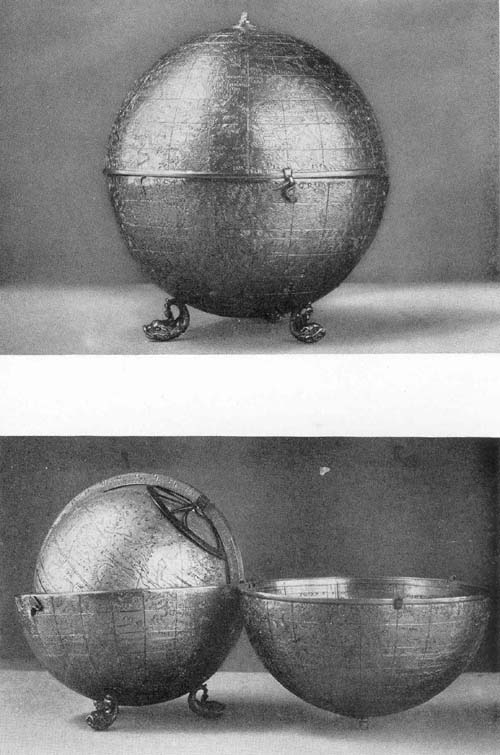
A very artistic gold beaker globe (Fig. 82) may be
found in the collection presented by Mr. J. P. Morgan to the
Metropolitan Museum of New York City. The sphere of this,
which opens on the line of the ecliptic, has a diameter of 8
cm. and rests upon the figure of a satyr with uplifted hands
forming a part of the support, this figure in turn resting
upon an ornamental circular base. Topping the sphere is a
small figure of Neptune carrying a trident and standing in a
shell or conventionalized small boat. The engraved figures
of the many constellations decorate the surface of the
sphere.
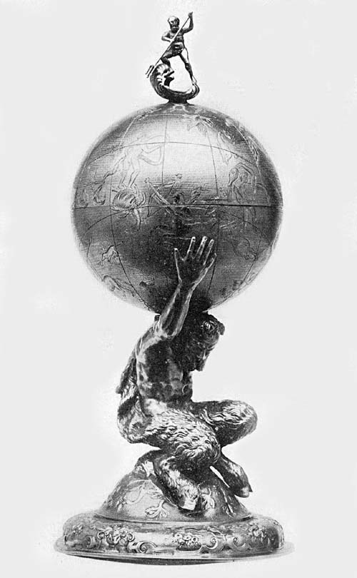
Fig. 82. Gold Globe-Goblet, ca. 1575.
In the private library of Mr. J. Pierpont Morgan may be
found a fine example of an ivory terrestrial globe of this
period (Fig. 83). It is hollow, being composed of two
hemispheres joined on the line of the equator, and has a
diameter of about 8 cm. Near the south pole is the author
and date legend (Figs. 84, 84a) “Antonius Spano tropiensis
fecit 1593.” “Made by Antonio Spano of Tropea, 1593.” In the
unnamed southern continent, and over a representation of the
Spanish arms, is the dedication to the Infante Philip,
afterward Philip III, reading “Principi Philip. Philip
II Hisp. Indiar. Neap. e Siciliae Cathol. Regis
Filio,” and within the Antarctic circle a salutation reading
“Princeps felicissime totus Orbis ad se gubernandum te vocat
et expectat.” “O most fortunate ruler, the whole world calls
and awaits you to govern it.” Antonio, a native of Tropea,
near Naples, was granted in the year 1595 a pension of one
hundred ducats, by his master and patron, Philip II. This he
seems to have enjoyed until his death, which occurred in
Madrid in the year 1615. We learn that this was continued to
his son, Francisco Spano, by King Philip III. The mounting
of the globe, which is simple, seems to be of a later date
than that given as the year of construction in the date
legend, but it is well suited to the artistic piece. The
world map is well executed, and may be said to be in a
perfect state of preservation. Its geographical details, in
so far as given, are quite as good as the best to be found
at this time, though it is very evident that the piece was
primarily intended to possess decorative rather than
scientific value. The Mediterranean region gives us in its
general features a representation of the Ptolemaic ideas,
particularly to be observed in the representation of Italy
and the Caspian Sea. In Chinese Asia appears a legend
reading, “Hic artem impremendi ante mille años
habuerunt.” “Here they had the art of printing a thousand
years ago.”
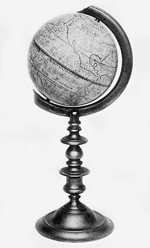
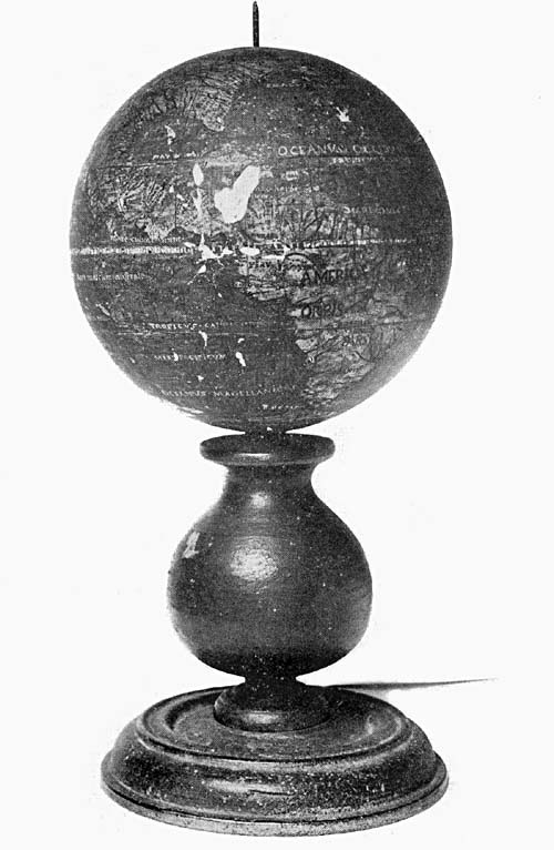
Fig. 83. Ivory Terrestrial Globe of Antonio Spano,
1593.
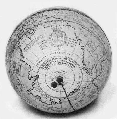
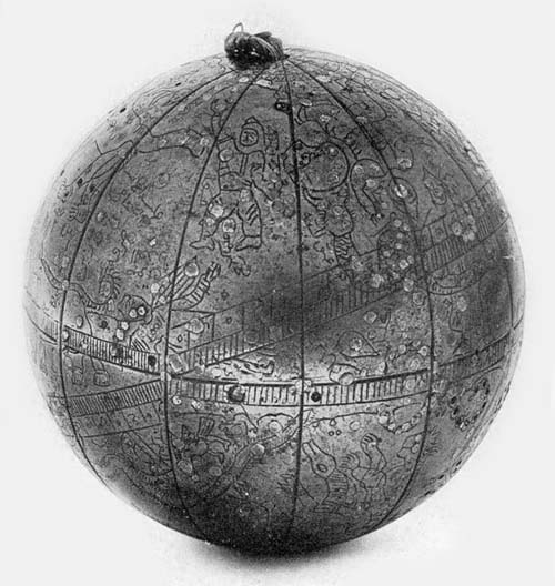
Fig. 84. South Polar Region on Globe of Antonio Spano,
1593.
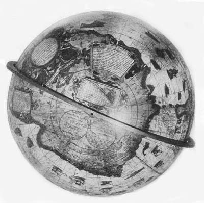
Fig. 84a. South Polar Region on Globe of Jodocus
Hondius, 1600.
In “Ratai” (Katai) a flag is represented reminding of Marco
Polo, and near this the legend “His magnus Cham Tartarorum
et Chataiae imperator longe dominatur.”
In this Asiatic region we find such names as “Tabin,”
“Ania,” “Quinsai,” “Catigara,” “Zaiton,” “India Orientalis.”
“Stretto Anian” appears as a long channel. In Africa we
read, “His Imperator magnus Presbyter Africae Rex potentis
mus.” In the New World we find “America sive India nova,”
which is not connected with Asia. The coast in the northern
regions is better drawn than in the southern. The St.
Lawrence River is represented, but the Great Lakes are
omitted. “Estland,” “Frisland,” and “St. Brandan” are laid
down. The austral land, as represented, is very large, being
designated “Terra Australis: Vastissimas his esse regiones
ex M. Pauli Ven. et Lud. Vartomani scriptis
perigrinationibus constat.” “Austral land: here is known to
be a very extensive region referred to in the travel records
of Marco Polo and of Ludovico Vartema.” Mr. Beazley says of
the globe that it once belonged to the Kempenaer family of
Leenwarden, and was later acquired by Mr. H. J. Pfungst
through the firm of Miller & Company of Amsterdam.369 It later passed into
the library of Mr. Morgan.
As noted at the beginning of this chapter, leadership in
globe and map making, in the closing years of the century,
was passing into the Netherlands, which in the second
quarter of the century had contributed in this field of
scientific endeavor the great Mercator. His influence, as
was also noted, found its way into Italy and into favor with
certain globe makers, although the individualistic spirit of
the Italians seemed to show a marked preference for
manuscript and engraved metal globes. In the front rank of
those who were to lead the Low Countries into their place of
preëminence stood the Van Langren family, the father,
Jacobus Florentius, as he was accustomed to call himself,
and the sons, Arnoldus Florentius, Henricus Florentius, and
Michael Florentius.370 The father was a native of Denmark,
but sometime prior to 1580 he transferred his residence to
Arnhem in Gelderland, and later to Amsterdam. Legends on his
oldest extant globe give us to understand that at the time
of its construction he labored jointly with his son Arnold
in this work, these legends reading “Jacobus Florentius
Ultrajectensis autor,” and “Arnoldus Florentius filius
sculptor Amstelodami 1585,” that is, the father was the
author and the son was the engraver.
In the early seventeenth century the family left Amsterdam,
going to Antwerp in the Spanish Netherlands. Here in the
year 1609, according to an Antwerp record, Arnold
constructed a “Sphaera Mundi,” which he dedicated to the
chief magistrate of that city, receiving therefor 120 Artois
livres. It probably was not long after this date that he was
appointed Globe Maker of the Archdukes, a title he retained
until the death of the Archduke Albert in the year 1621, and
a somewhat later record tells us that he was honored shortly
after that event by an appointment to the office of Royal
Cosmographer and Pensioner of His Majesty the Catholic King.
Michael became a resident of Brussels, where he carried on
his work as an engraver, particularly of maps, but it was as
an astronomer that he won special distinction, having given
much attention to the investigations of methods for the
determination of longitude and he is further credited with
having given the so-called seas of the moon the names by
which they are still known.
As globe maker perhaps the greater honor is due Jacobus
Florentius, since it appears that Arnold, though perhaps the
more active, reproduced in the main only the works of his
father, adding improvement here and there and endeavoring,
perhaps in part for business reasons, to keep his globe maps
up to date. Reference has been made above to the oldest
extant Van Langren globe, which bears the date 1585. Van der
Aa refers to a request of Arnold Floris van Langelaer and of
his father, Jacob Floris van Langelaer, presented to the
States of Gelderland and accompanying a copy of his globe,
which seems to have been dated 1580. Of this globe it is
stated that it was “een seer correcte ende schoone Globum
terrestrem, van de grootste forme,” and that it was
inscribed as is that of the year 1585. A doubt, however,
arises as to the accuracy of the date 1580, since Van der Aa
states in the same article that Arnoldus was born in the
year 1571. This particular globe was formerly kept in the
“Geldersch Gerichtshof,” as Van Hasselt tells us, but since
the destruction of that court nothing has been known of the
inventory of the objects which had been placed therein. In
support, however, of an early date, perhaps 1580, for the
first Van Langren globe, we find in the dedication of a work
by Nicolas Petri, published in the year 1588, and issued as
a manual for the use of globes, that it was especially made
for the use of a Van Langren globe. In this work the author
is represented in picture in the act of examining a globe, a
picture practically the same as that appearing in a work by
Petri issued in the year 1583. It seems, therefore, not to
be an erroneous inference that the author gives us here a
representation of the Van Langren globe of 1580, which is
wanting much in the accuracy with which its details are
given.
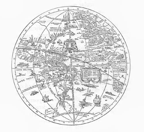
The globe of 1585, referred to above as the oldest extant of
Van Langren, may be found in the collection of the Museo
dell’ Osservatorio del Collegio Romano (Fig. 84). The
dedication under an elaborately colored coat of arms of
Denmark reads, “Serenissimo atque potentissimo Principi
Domino D. Christiano nn. Daniae Norvegiae Vandalorum et
Gothorum Regi Duci Slesvivi Holsatiae Stormariae et
Dithmortiae Comiti Oldenburgi et Del menorsti Jacobus
Florentius dedicabat.” “To the Most Serene and mighty Prince
Lord D. Christian King of Denmark, Norway, the Wends and the
Goths, Duke of Schleswick Holstein, Stormarn, Ditmarsh,
Count of Oldenburg and Delmenhorst (this globe) is dedicated
by Jacobus Florent.” The usual letter to the reader or to
the one who might have occasion to make use of the globe
gives the information: “In descriptione hujus globi ubiq:
sequuti sumus castigatissimas Tabulas geographicas quibus
Hispani et Lusitani in suis americis et indicis
navigationibus utantur; aliorumque probatissimas
Septentrionalium regionum descriptiones. De nostro suis
locis addidimus quadrata ut vocant nautica et ventorum regiones quae omnia ad
usum navigantium ad amussim accomodavimus quaemadmodum
Geographiae candidati propius inspiciendo reperient. Vale
fruere.” “In the construction of this globe I have
everywhere made use of the most accurate geographical
tables, such as were used by the Spaniards and the
Portuguese in their voyages to America and the East Indies;
as also for the northern regions the very best drawings of
others. My own contribution has been to insert in the proper
places the nautical squares, as they are called, and the
directions of the winds, all of which I have carefully
adapted to the need of the navigator, as experts in
geography will, on examination, recognize. Farewell and may
you be happy.” In a cartouch on the left we read “Jacobus
Florentius Ultrajectensis autor,” and on the right “Arnoldus
Florentius filius sculptor Amstelodami 1585.” The sphere,
which is hollow, is constructed of wooden strips covered
with a preparation of plaster. It has a diameter of about 32
cm. and is therefore slightly smaller than is the Mercator
globe of 1541. It is furnished with a graduated brass
meridian circle and with a horizon circle of the same
material, which is supported by four arms or quadrants
upheld by a simple base. The engraved gores pasted on the
ball are twelve in number and extend to within twenty
degrees of the poles, the remaining space being covered with
an engraved circular disc, in accord with a method first
employed by Mercator. The surface of the globe is not well
preserved, yet notwithstanding the injuries which time has
brought to it, it remains a masterpiece of engraving and a
valuable geographical record of that early day. Its numerous
inscriptions are of much interest. We read, for example, in
latitude 35 degrees south and longitude 185 degrees,
“Vastissimas hic esse regiones ex M. Pauli Veneti et
Ludovico Vartomanni scriptis peregrinationibus liquido
constat.” “The voyage of Marco Polo and of Ludovico Varthema
make it certain that an enormous territory exists here.” In
latitude 16 degrees south and longitude 175 degrees is the legend, “Moluccae
vocantur 5 insulae ordine postiae juxta Gilolo quarum
suprema Tarenare deinceps Tidore Motir Machiam et infima
Bachiam.” “The Moluccas is the name given to the five
islands in a row close to Gilolo, the uppermost of which is
Tarenare, then Tidore, Motir, Machiam, and the lowest
Bachiam.” In latitude 10 degrees south and longitude 348
degrees we read, “Marañon fluvius investus fuit a
Vincentio Yañes Pinzon an: 1499 et an: 1542 totus a
fontibus fere ad ostia usq: divulgatus a Francesco Oregliana
leucis 1560 mensibus 8 dulces in mari servat aquas usque 40
leucis.” “The Amazon River was discovered by Vicente
Yañez Pinzon in 1499, while in 1542 Francisco
Orellana explored it a distance of 1560 leagues or almost
its entire length from source to mouth in eight months. In
the sea its waters are still fresh forty leagues from land.”
The following is placed in latitude 28 degrees north and
longitude 320 degrees, “B. C. 1492. 12 octobris
Christophorus Columbus novam Indiam nomine regis Castellae
delexit, prima terra quam conquisit fuit Haiti nunc
Hispaniola.” “October 12, 1492, Christopher Columbus took
possession of New India in the name of the King of Castile.
The first land he conquered was called Haiti now called
Hispaniola.” In latitude 65 degrees north and longitude 230
degrees is the legend, “Regio deserta in qua equi oves et
boves silvestres sunt plurimi quales esse in una Hebridum
insularum narratur.” “A desert country in which there are a
great many wild horses, sheep and cattle, as is said to be
the case in one of the Hebrides.”
That this Van Langren globe was well received by his
contemporaries seems to be witnessed by the special
privilege granted September 9, 1592, to Jacobus Florentius a
Langren by the Estates of Amsterdam to issue the same.371 On presenting his
request for the privilege the author states that he was the
inventor of globes of this character, that his globes were
unsurpassed in the matter of correctness by any which had
been previously issued, and that with the aid of his globes certain
Dutch navigators had sailed to Pernambuco in Brazil, to the
island of St. Thomas under the equator, to the Isle de
Principe and to other places. This privilege was renewed to
him and to his sons Arnoldus and Henricus in the year 1596.
In the following year the Estates General granted a
privilege to Jodocus Hondius, who had constructed a globe in
England in the year 1593, of which, however, no example
appears now to be known. The Van Langrens contested this
claim at law, the results of which contest seem not to be
recorded, but we know that Jodocus Hondius enumerated at
this time what he considered to be the particular points in
which his own globes excelled.372 In his report he
enumerated no less than fourteen important geographical
discoveries which were not represented on the globes of his
opponents, the Van Langrens, the majority of which, as
corrections, seem to have been accepted, since they appear
on the later Van Langren globes and not on the earlier, that
is, on the one of 1585.
The Kon. Nederl. Aardrijkskundig Genootschap has recently
come into possession of the finest known example of the Van
Langren globes (Fig. 85), as indeed it is one of the
finest extant globes of that period.373 The engraved gores, twelve in number,
are pasted on a hollow sphere of papier-mâché
and plaster, having a diameter of 52.8 cm. It is furnished
with a graduated copper meridian circle within which it is
adjusted to revolve, a horizon circle of wood on which
appear the names of the winds in Greek, Latin, and Dutch,
the names of the months, the names of the principal feast
days, and the signs of the zodiac, the whole resting on a
base of oak having six supporting columns. As an example of
the engraver’s art the map which covers the sphere is one of
superior excellence. A manuscript dedication, pasted on its
surface near the “Mar di India” and surmounted by a
representation of the Spanish coat of arms, reads, “Collegio
Ratiociniorum Brabanti regnantibus; Alberto et Isabellae
Opt. Max. Belgii Principibus. Singulari observantia
Dedicabat Arnoldus Florentinus a Langren. Ano Dni 1612.”
“To the College of Computations of Brabant, to Albert and
Isabella, the very great Princes of Belgium, Arnold
Florentius van Langren dedicates with great respect (this
globe) in the year 1612.” Beneath “Nova Guinea” is given the
privilege “Cautum est privilegio ordinum
Confœderatorum Inferioris Germaniae, ne quis alius ad
decennium globum hunc terrestrem absq. consensu Jacobi
Florentii civis Amsteldamen. typis mandare vel simili, vel
alia forma excudere, vel alibi impressum adducere, aut
vendere ausit, sub poena in diplomate statuta, 1608.”
“Warning is given by the privilege (copyright) of the
Confederated States of the Netherlands that no other
individual for a period of ten years, shall venture to print
in similar or in other form, to stamp (engrave) or make an
impression, or to sell, under penalty set down in the
diploma, 1608.” In this legend the date 1608 has been
written over the engraved date 1597.
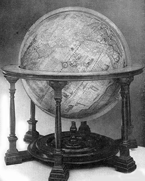
Fig. 85. Terrestrial Globe of Van Langren, 1612.
Among the legends appearing in the southern hemisphere is
one which is but a repetition of that appearing in the
edition of 1585 referring to the source of information
beginning, “In descriptio hujus ...” Beneath the artistic
cartouch wherein is placed the last-named legend is one in
which are recorded the names of the author and the engraver,
“Jacobus Florentius Ultrajectensis Author: Arnoldus
Florentius filius sculptor Amstelredami Ao. Dni,” the date,
partially erased from the copper plate employed in the
printing, seems to read 1585. Certain regions are adorned
with pictures in which are represented the aborigines, and
the local fauna and flora. Sea monsters constitute a part of
the decorative features of the globe map, and ships sail
hither and thither over the oceans, carrying the flags of
their respective countries. The author has laid down the
“Streto de Anian” which separated America from Asia, and
California is a peninsula. The “Quivira regnum” is made to
include a part of western North America, and the great
stretch of country to the west of the Mississippi appears to
be the home of wild horses and cattle. The eastern coast
line of America included within the present limits of the
United States is represented with a remarkable approach to
accuracy, a portion of his information for that region being
derived from the report of Thomas Heriot. Following Mercator
there have been placed four large islands around the north
pole, and in the north Atlantic “Frisland,” “S. Brandain,”
and “Brasil.” India, Australia, and other regions of the Far
East have been represented with remarkable faithfulness to
the latest and best records of Dutch navigators, and the
author profited by Dutch records of exploration in his
representation of the Nova Zembla region. There is yet a far
from accurate delineation of the great eastern archipelago.
Java, Celebes, Borneo, and “Nova Guinea” have been fairly
well outlined, and about the south pole is that great
austral continent conspicuous on the maps of the period, but
very generally outlined as the fancy of the map maker
directed.
In the library of the University of Ghent is a Van Langren
terrestrial globe undated but apparently completed not long
after 1616, since it directs attention to the Strait of
Lemaire, discovered in that year. It has the authors’
inscription “Jacobus Florentius Ultrajectensis Author.
Arnoldus Florentius filius sculptor Amsterdam,” and bears in
addition the legend “Arnoldus Florentius a Langren,
Serenissum. Archiducu. Austr. Burgundiae, Brabantiae, Ducum,
Sphaereographus Author. Cum Privileg.” “Arnoldus Florentius
a Langren globe maker and author to the most Serene Archduke
of Austria, of Burgundy, Duke of Brabant. With privilege.”
This globe is described as one well preserved, resembling
very closely that of 1612, particularly in its geographical
details as well as in its mountings.
The Bibliothèque Nationale of Paris possesses a Van
Langren terrestrial globe, with date illegible, but thought
to be 1625, which appears to be a reissue of the previous
editions, especially of the later ones. A legend including
an address to the reader concludes with a reference to the
author “Arnoldus Florentio a Langren Reg. Cat. Majis.
cosmografo et pensionario.” “Arnoldus Florentius a Langren,
cosmographer and pensioner of His Catholic Majesty.”
There are two globes of Arnoldus, a celestial and a
terrestrial, formerly in the Municipal Archives of Antwerp,
now in the Plantin-Moritus Museum. An inscription on the
celestial globe reads: “Globus coelestis stellarum fixarum
loca ipsis in coelo ad amussim congrua repraesentans ad
annum 1600 juxta accuratas observationes Tychonis Brahe
denuo ad annum 162—: diligentiss. restitutus novis
item stellis 400 hactenus non notatis. Ornatusque trecentis
stellis circa polum antarcticum ab Houtmanno Holando
observatis industria Arnoldi Florentii van Langren
Cosmographici, qui olim observationibus: Tyconis interfuit.
Operam sibi filii parenti felicissime contulerunt.” “A
celestial globe which represents the position of the fixed
stars, corresponding to the actual position of the stars in
the sky in the year 1600, following the accurate
observations of Tycho Brahe and with great care again
calculated for the year 162—: also 400 new stars are
added which had not hitherto been recorded. Also there have
been added 300 south polar stars that were observed by
Houtman of Holland. Constructed by Arnold Florent van
Langren, cosmographer who assisted Tycho in his
observations. The sons have aided their father with the
happiest effect.”
The terrestrial globe, in a much better state of
preservation, contains, in a neat cartouch, an address to
the reader, explaining the merits of the globe map:
“Quandoquidem quotidiana diversarum nationum, praecipue
tamen Holandorum navigatione omnes mundi plagas
perlustrantium, varii orbis tractus, remotae insulae et
quamplurima regna hactenenus incognita nunc in dies
innotuere, et quae fuere cognita majori studio et situs
observatione perlustrata sunt. Prodit hic noster Globus
multo praecedentibus a nobis editis, qui primi in his
provinciis prodierunt accuratior et emendatior. In quo
omnium locorum nomina, et quo tempore, et cujus auspiciis quaeque detecta sint
expressimus. Curavimus praeterea non sine magno labore et
cura, ut singulae Regiones, Insulae, Portus, Braevia, et
Scopuli suae longitudini et latitudini respondeant, quibus
Indices seu lineas ventorum ...” “Inasmuch as, on account of
voyages, daily undertaken by various nations, especially the
Dutch, who have sailed along all the coasts of the world,
the various regions of the earth, distant islands, and
innumerable countries hitherto unknown, have every day
become better known (additional facts) and our knowledge of
those already discovered has become much clearer through a
more detailed examination and detailed observation, this
present globe of ours, presents itself to the public as one
much more exact, more free from errors than those previously
issued by us, which were the first ever presented to the
public of these provinces. On it we have recorded the names
of all places, also when and under whose auspices they were
severally discovered. We have taken the greatest care and
pains to make the location of the various regions, islands,
seaports, shoals, and rocks correspond to the true latitude
and longitude, whereby the directions of the winds
(loxodromic lines) ...” The concluding lines of this address
are illegible, but there seems to be nothing of special
importance lost. The author’s signature reads “Auctor
Arnoldo Florentio a Langre Reg. Cat: Matis Cosmographo et
Pensionario.” “Author Arnoldus Florentius a Langren,
cosmographer and pensioner of His Royal Catholic Majesty.”
A copy of a Van Langren globe may be found in the Museum of
Zütphen, but information concerning it has not been
obtainable other than that it is in a damaged condition, and
is apparently another example of the one referred to above
as of 1612.
Among those interested in geography, in astronomy, and
particularly in the construction of armillary spheres in
this period very special mention should be made of Antonio
Santucci. For some time he served Prince, later Grand Duke,
Ferdinand de’ Medici as his cosmographer. It was during
this period of service that he restored the famous
terrestrial globe of Egnazio Danti which was a particularly
creditable piece of work. In the year 1582 he constructed a
large armillary sphere composed of wooden rings, very
artistically gilded and painted, representing in particular
the orbits of the planets. This the Prince is said to have
presented to one Battaglioni of Naples; further than this
fact nothing seems to be known of this particular example.
In the year 1606, we are informed, he collected and sent to
the Grand Duke a number of valuable maps relating to Europe,
Asia, Africa, and the West Indies, and to the several
separate countries of Europe. In the year 1619 he published,
through the favor of Duke Ferdinand, a treatise on comets
and the new stars appearing between the years 1577 and 1607.
What is probably the finest of all his spheres belongs to
the Museo di Strumenti Antichi of Florence, which has been
restored and interestingly described by the distinguished
scholar, Ferdinand Meucci.374 As an instrument intended to
represent the entire universe, though constructed for
display rather than for use, it remains one of the finest
constructed in the peninsula during the century.
The largest of its nine concentric circles has a diameter of
220 cm., the smallest a diameter of 70 cm., and at the
common center is a terrestrial globe having a diameter of 60
cm. Each of the nine great circles or spheres has its own
smaller circles representing the equator, the ecliptic, the
colures, and the polar circles, the ninth having also the
tropics and the hour circle. The eighth, representing the
starry heavens, has its ecliptic four times the width of the
corresponding circles of the other spheres. Meucci states,
in his detailed description, that there are no less than
eighty-two armillae or rings, large and small, to which, he
adds, eight larger ones might be added, these being cut in
half and arranged somewhat in the form of a cup, the lower
half supporting the horizon circle, the upper half serving
as a support for an adjustable cover of the entire
instrument. This arrangement suggests that it was the
author’s intention to have these last-named half circles
represent the empyrean or home of the celestial spirits, a
thought supported by the fact that at the common
intersecting point of the upper half of these circles is
placed a disc on which is represented the Deity in the act
of contemplating his creation. The whole instrument is
topped by a cross.
Meucci, in referring to his own work of restoring and
remounting the great sphere, observes that at the poles of
the ecliptic there are two discs on which have been painted
the coat of arms of the Medici family together with the coat
of arms of the Lorena, Christina di Lorena being the wife of
Ferdinand, to whom the work had been dedicated. He further
notes that his researches led him to the discovery that the
instrument originally cost 1052.2 scudi, which, with an
incidental addition of 170 scudi, thought proper to be
included in the reckoning, would make the entire expense of
construction 1222.2 scudi or about 7187 liri, that is, less
than $1400. The amount seems insignificant, remembering that
the work was begun in the year 1588 and was not completed
until the year 1593, claiming therefore five years of the
maker’s time. The map on the terrestrial globe seems to have
been well drawn, and is remarkable for its representation of
the geography of the interior of Africa, particularly for
the region about the source of the Nile.
In the library of Mr. Henry E. Huntington may be found an
exceedingly fine armillary sphere (Fig. 86). It is
neither signed nor dated, but there appears to be good
reason for attributing it to Antonio Santucci, and its date
to about the year 1580. Constructed entirely of wood, with
paper identifying labels pasted on the surface of each of
the numerous circles, it is a well-preserved example of
Italian workmanship. It is furnished with horizon, meridian,
tropical, polar, and ecliptic circles, the first being
graduated on both the outer and the inner edge. This horizon
circle has a diameter of about 50 cm., and a width of
about 7 cm., the width of the other circles being well
proportioned for artistic effect. Within the circles named
are those representing the orbits of “Luna,” “Mercurio,”
“Venere,” “Sole,” “Marte,” “Giove,” “Saturno,” with the
earth at the center according to the Ptolemaic system. It
has a single standard support resting on a solid circular
disc about 33 cm. in diameter.
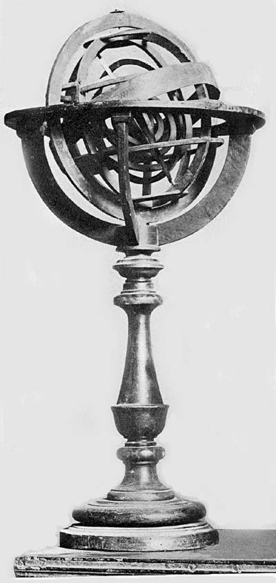
Fig. 86. Armillary Sphere of Antonio Santucci (?), ca.
1580.
The Mathematisch-Physikal. Salon of Dresden possesses a fine
celestial globe signed and dated “B. F. 1600.” It is an
exceedingly elaborate piece (Fig. 87), being made of
gilded bronze and furnished with a mounting of ornamental
design. The sphere, having a diameter of 11.6 cm., exhibits
on its engraved surface in outline the figures of the
several constellations, with the name of each, and in
addition the principal celestial circles including the
meridians. It is furnished, in its mountings, with a
graduated bronze meridian circle to which is attached, near
the north equatorial pole, a clock dial with hour and minute
hands, the dial being marked with the hours from I to XII.
Surmounting the whole is an artistic bronze box, within
which have been placed the works by means of which the clock
is driven and the sphere made to revolve. The broad horizon
circle, which is engraved with the usual concentric circles,
rests upon branched supports, which in turn are attached to
a finely wrought base having four curved legs terminating in
conventionally designed griffin claws.
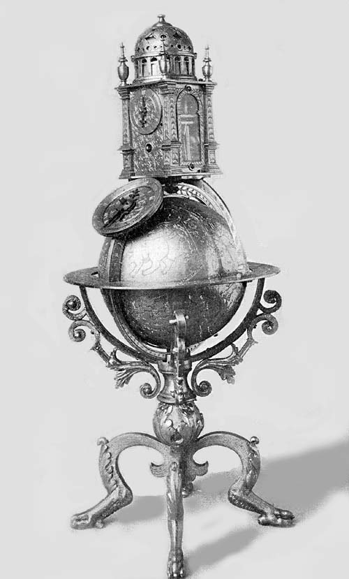
Fig. 87. Celestial Globe of B. F., 1600.
Though differing very considerably in the details of its
construction, it may be classed with such globes as are
those made by Roll and Reinhold, briefly described above.
Indeed, the suggestion forces itself upon one that to their
workshop or to one who may be referred to as a workman of
their school, we owe this interesting example. Attention has
been previously called to certain early globes which seem
primarily to have been constructed to contain the works of
clocks such as the Jagellonicus. Here as in the case of the
Roll and Reinhold globes, and as in certain other examples,
we find clockwork attachments designed to regulate the
revolutions of the globe of which they form a part. While
the globe is the more elaborately wrought part of this
particular example, it does not seem improbable that the
clock originally was considered to be the more important
part.