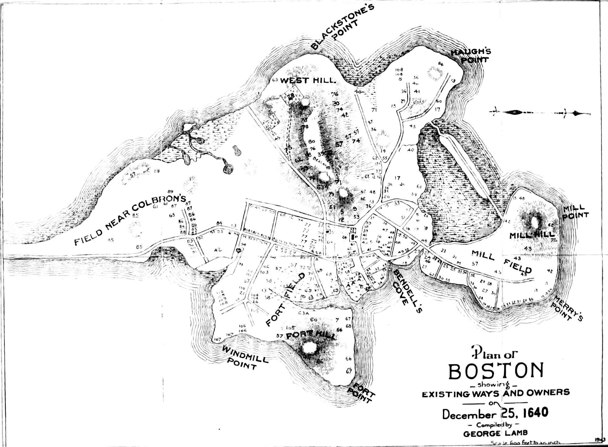
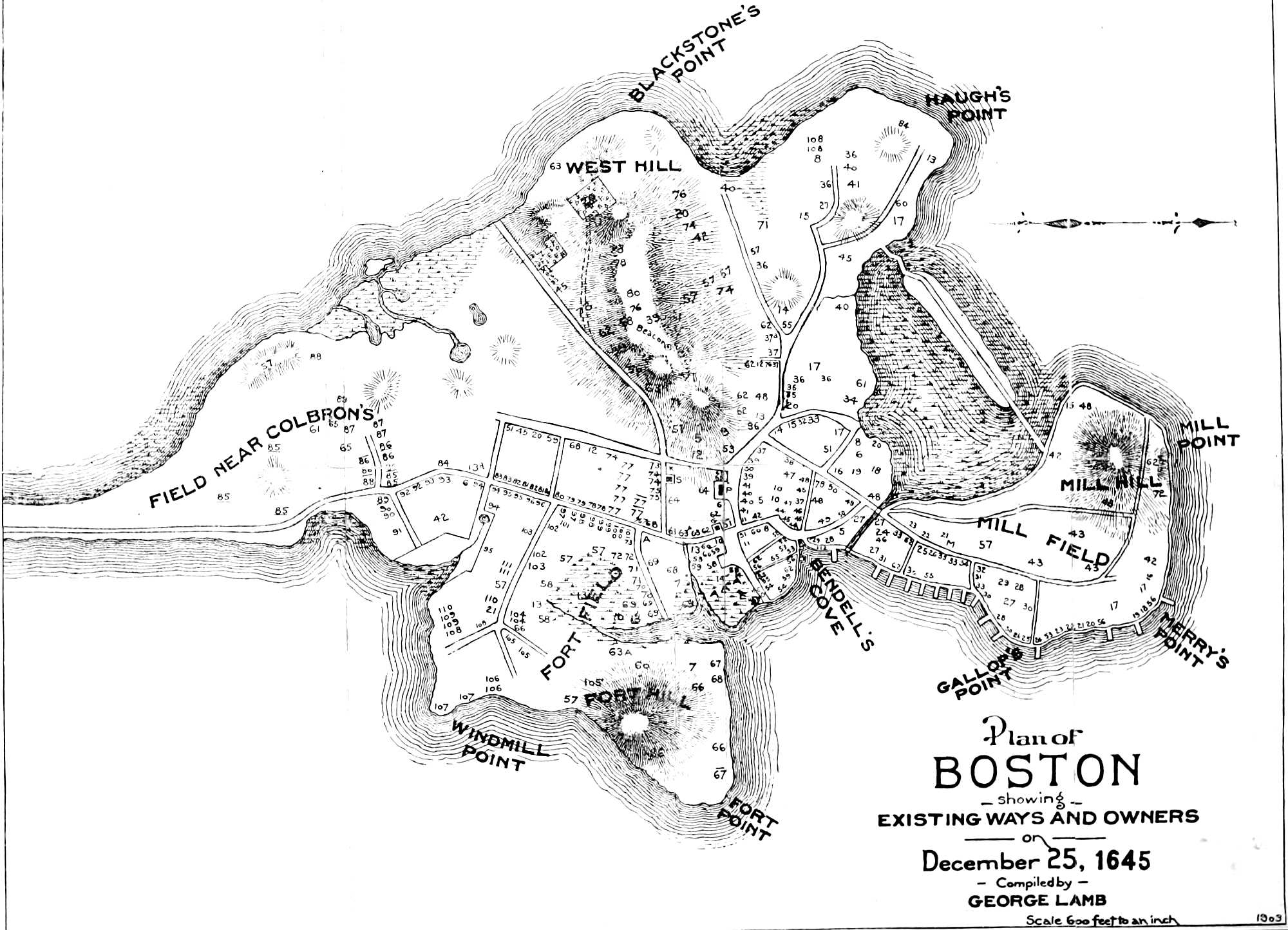
This series of plans of the Town of Boston is the result
of a great amount of research, and presents in a most interesting
manner the growth of the Town from the first
settlement to 1645.
The plan dated December 25, 1645, while in the main
correct, does not show all the transfers made during that
year, as will be seen by consulting Suffolk Deeds, Lib. 1,
as noted in the introduction to the Book of Possessions
(Volume 2 of the Boston Records), the first 111 pages of
which were written by William Aspinwall prior to the 10th
month, 1645.
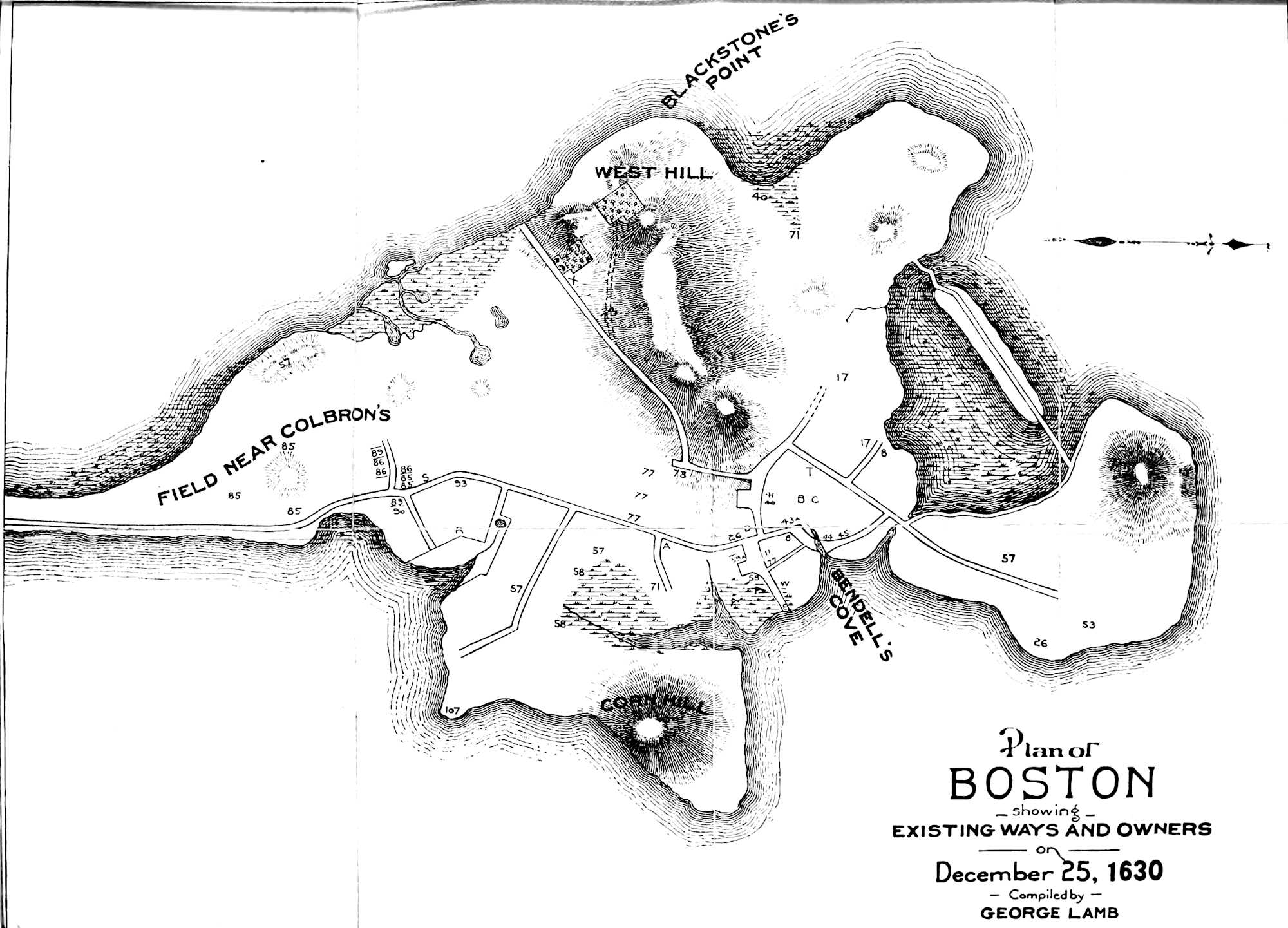
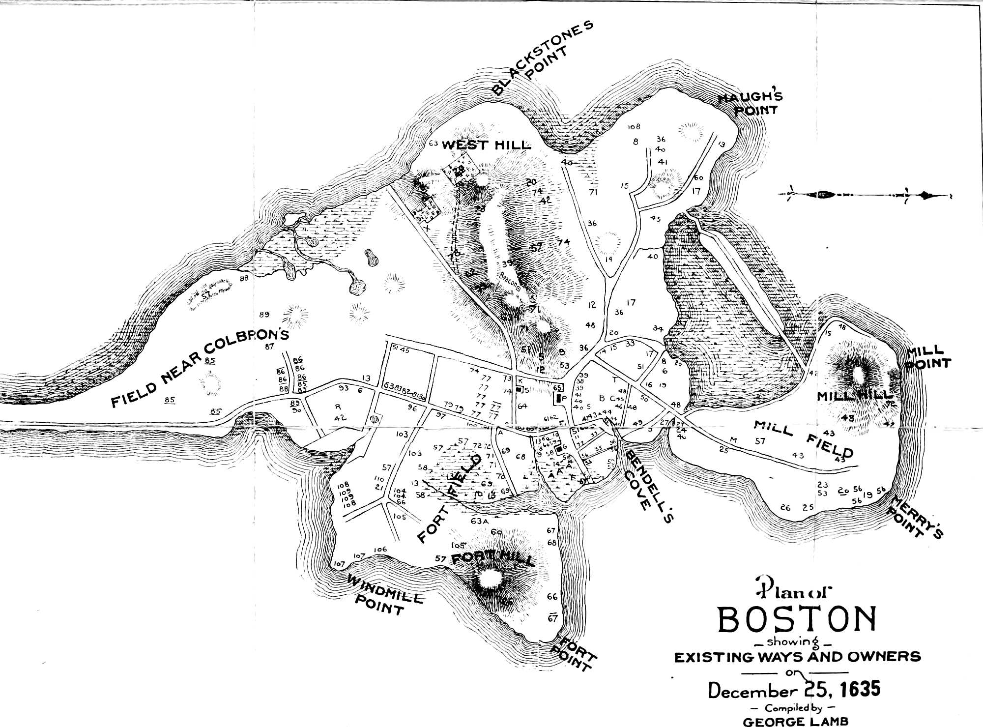
The numbers on the plans follow the original pagination
of the Book of Possessions.
On the plan of 1630 the lot marked S should have been
assigned to Thomas Sharp.
These plans show the old peninsula of Boston; consequently
the allotments at the “field end next Roxbury”
do not appear.
The New Field was located at the west part of the town
in the angle bounded by the present Cambridge street, and
extending through Lynde and Leverett streets to Haugh’s
Point. The principal town landing was at the head of the
cove or dock, around which Valentine Hill’s highway was
laid out in 1641. Street names were not given until a later
period, though the present Washington street was known as
the “High street, the great street or highway to Roxbury.”
Other allotments were made at Rumney Marsh (Chelsea),
Mt. Wollaston (Quincy), and Muddy River (Brookline).
Ownership and transfers of many lots between the periods
shown by the plans are not noted.
E. W. McGlenen,
City Registrar.
Boston, 1905.