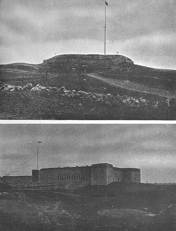
The tourist on the coast of Cape
Breton Island, Nova Scotia—for
in summer hundreds of people
seek out this pleasant land
for its cheerful climate—may
come upon a little bay on the
easternmost verge of the land
where is a deep land-locked inlet protected from elemental
fury by a long rocky arm thrust out from the
shore into the sea. He will not be able to surmise from
the present aspect of his surroundings that this was the
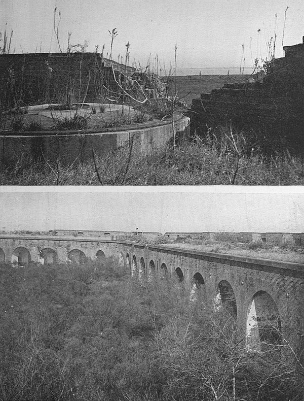
site of mighty Louisburg, the greatest artificial stronghold
(Quebec being largely a work of nature) that the
French ever had in the New World. Of this massive
and menacing fortress, which cost thirty million livres
and twenty-five years of toil to build after the designs
of the great Vauban, hardly one stone lies placed upon
another and grass and rubble have taken the place of the
heavy walls. Standing on the ground where New
France’s greatest leaders stood it is difficult to-day to
picture the martial pomp which once must have claimed
this spot, to visualize, more particularly, the setting for
the farcical onslaught of the zealous New Englanders
of 1744, under the doughty Pepperell, in their greatest
single military exploit.
The Treaty of Utrecht, which provided a basis of
agreement for France and England in the New World
for almost half a century, did not establish boundaries
between the two countries and the contest to determine
the question was unceasing, though not officially recognized.
France busied herself in building fortifications
and was ready frequently to formally draw the sword;
yet it needed the outbreak of the War of The Austrian
Succession in 1744, in far distant Europe, to precipitate
the American quarrel.
The news of the beginning of this conflict came to
Duquesnel, commandant of Louisburg, before it reached
the English colonies, however, and it seemed to him an
essentially proper thing to do to strike against the
English. He accordingly sent out an expedition against
the English fishing village of Canseau, at the southern
end of the Strait of Canseau, which separates Cape
Breton Island from the peninsula of Acadia. With a
wooden redoubt defended by eighty Englishmen anticipating
no danger, Canseau offered no great resistance
and was easily taken, its inhabitants sent to Boston, and
its houses burned to the ground. The next blow was an
unsuccessful expedition against Annapolis Royal. By
these two valueless strokes Duquesnel warned New England
that New France was on the aggressive.
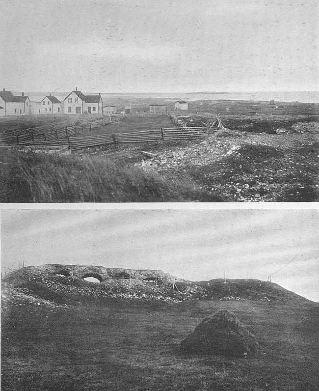
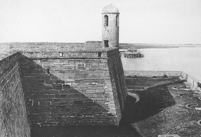
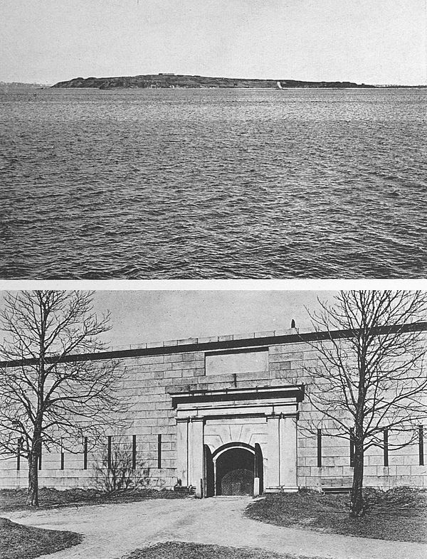
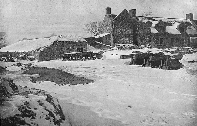
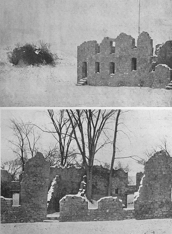
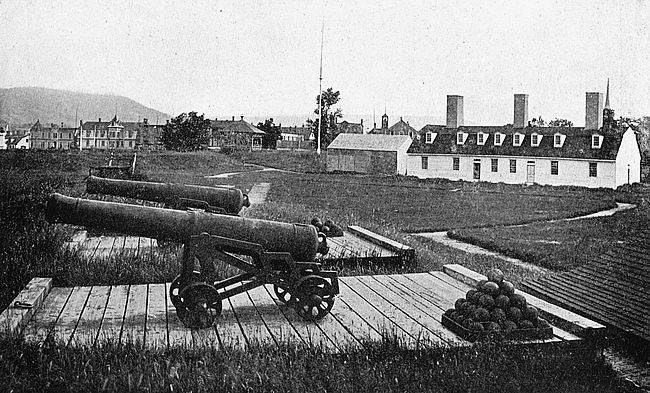
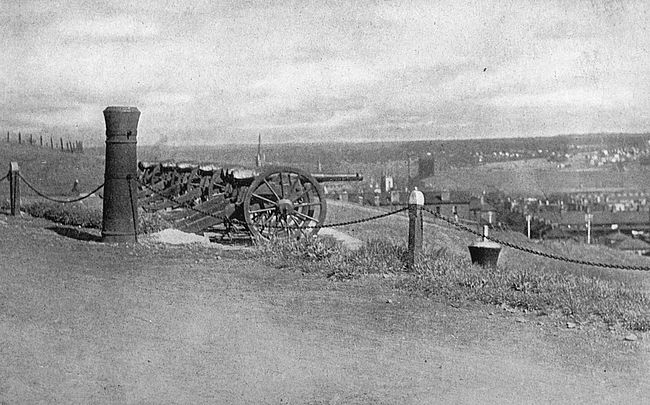
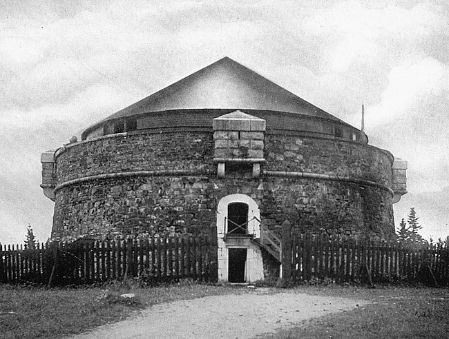
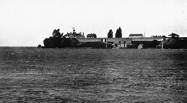
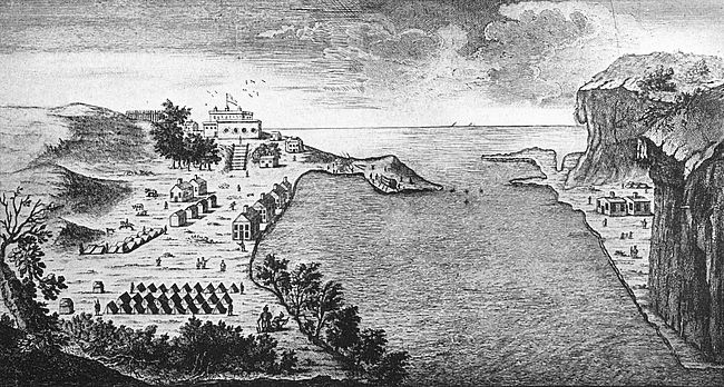
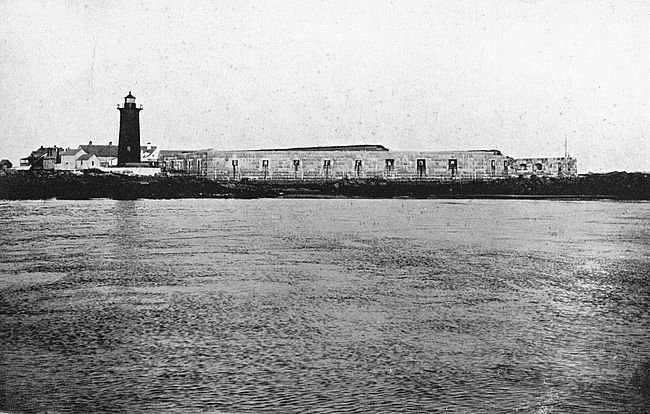
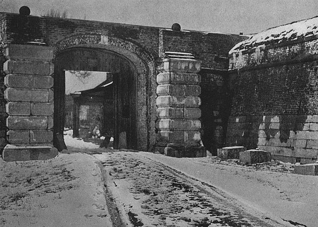
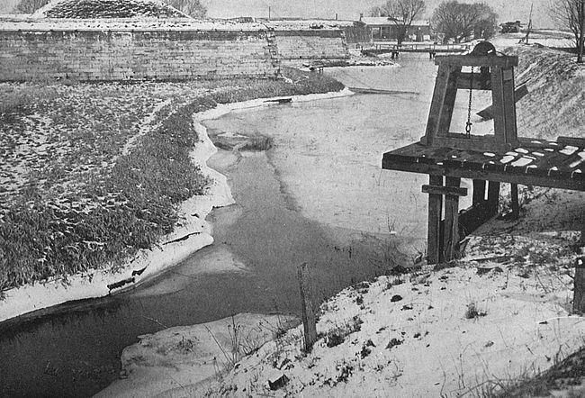
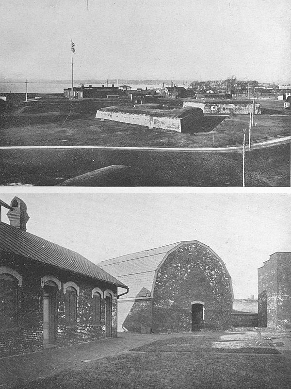
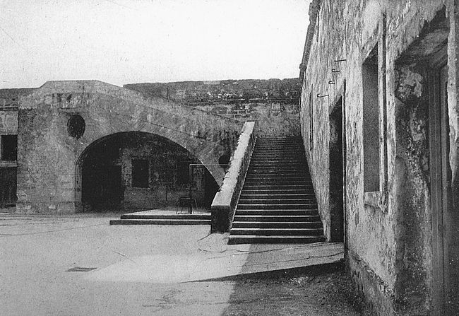
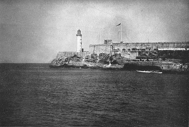
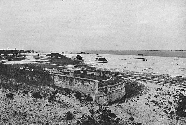
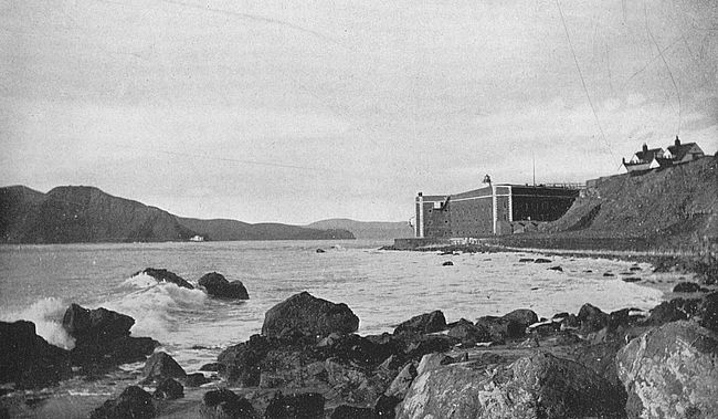
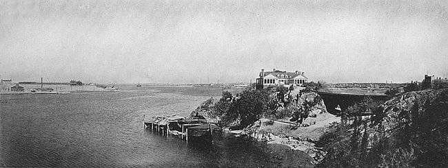
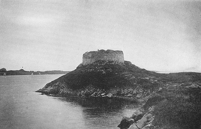
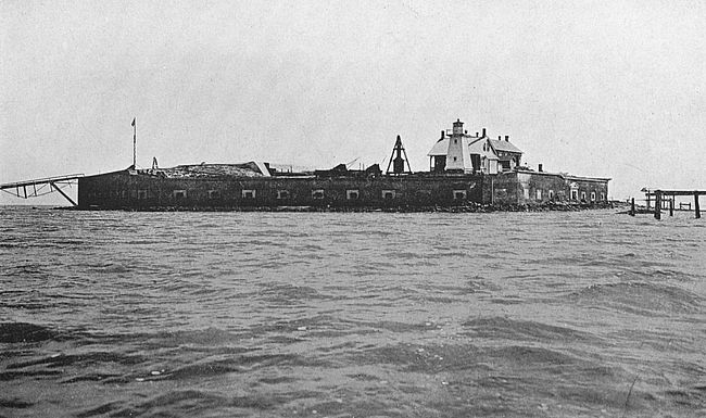
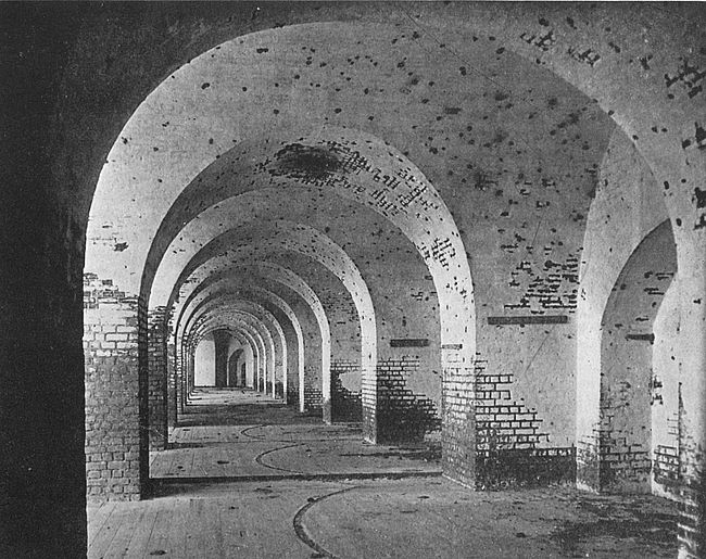
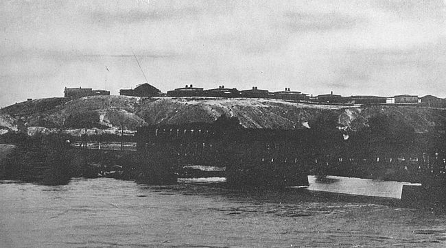
To sea from the ruined walls [top]
All that remains standing
MIGHTY LOUISBURG TO-DAY, CAPE BRETON, NOVA SCOTIA
Enraged by the attacks upon Canseau and Annapolis
and with the easy self-confidence which is a heritage
of the children of the hardy north Atlantic coast, the
people of Massachusetts were prepared for the suggestion
of William Vaughan, of Damariscotta, that with
their untrained militia they should attack New France’s
mightiest stronghold. Vaughan found a willing listener
in the governor, William Shirley, who helped the enterprise
on its way.
The originator of this astounding project was born
at Portsmouth, in 1703, and was a graduate of Harvard
College nineteen years thereafter. His father had been
lieutenant-governor of New Hampshire. Soon after
leaving college Vaughan had betrayed an adventurous
disposition by establishing a fishing-station on the island
of Matinicus off the coast of Maine. Afterward he
became the owner of most of the land on the little river
Damariscotta where he built a little wooden fort, established
a considerable settlement and built up an extensive
trade in fish and timber. Governor Shirley was an
English barrister who had come to Massachusetts in 1731
to practise his profession and who had been raised by
his own native gifts to the position of highest eminence
in the colony.
On the 9th of January, 1745, the General Court of
Massachusetts received a message from the governor
that he had a communication to make to them so critical
that he must swear all of the members to secrecy. Then
to their astonishment he proposed that they undertake
the reduction of Louisburg. They listened with respect
to the governor’s suggestion and appointed a committee
of two to consider the matter. The committee’s report,
made in the course of several days, was unfavorable and
so was the vote of the court.
Meanwhile intelligence of Governor Shirley’s proposal
had leaked out despite the pledge of secrecy. It
is said that a country member of the court more pious
than discreet was overheard praying long and fervently
for Divine guidance in the matter. The news flew
through the province and public pressure compelled a
reconsideration of the project. It was urged against
the plan that raw militia were no match for disciplined
troops behind ramparts, that the expense would be
staggering and that the credit of the colony was already
overstrained. The matter was put to a vote and carried
by a single vote. This result is said to have been
due to one of the opposition falling and breaking his
leg while hurrying to the council.
The die was now cast and hesitation vanished.
Shirley wrote to all of the colonies as far south as Pennsylvania,
but of these only four responded: Connecticut,
Rhode Island, New Hampshire and Massachusetts,
which blazed with holy zeal as, since the enterprise
would be directed against Roman Catholics, it was supposed
that heaven would in a peculiar manner favor it.
There were prayers in churches and families. New
Hampshire provided 500 men, of which number Massachusetts
was to pay and provide for 150; Rhode Island
voted a sloop carrying fourteen cannon and twelve
swivels; Connecticut promised 516 men and officers provided
that Roger Wolcott should have second rank in
the expedition; and Massachusetts was to provide 3000
men and the commanding officer.
This last condition was one of the hardest to fulfil,
for, as Governor Wanton of Rhode Island wrote, there
was not in New England “one officer of experience nor
even an engineer.” The choice fell upon William
Pepperell, of Kittery, Maine (then a part of Massachusetts),
who though a prosperous trader had had little
experience to fit him for commanding an attack upon
a great fortress. Pepperell’s home is still standing at
Kittery and is a substantial structure as befitted its
affluent master.
There was staying at Pepperell’s house at this time
the preacher Whitefield. Pepperell asked his guest
for a motto for the expedition. “Nil Desperandum
Christo Duce” was suggested; and this being adopted
gave to the expedition the air of a crusade.
A novel plan was suggested, among others, to Pepperell
by one of the zealots of New England. Two
trustworthy men, according to this plan, were to be sent
out at night before the French ramparts, one of them
carrying a wooden mallet with which he was to beat
upon the ground. The other was to place his ear to the
ground and wherever a concealed mine would give back
a hollow sound was to make a cross mark with chalk so
that the New England boys would know where not to
walk when they attacked the fort. The French sentry
meanwhile, it was supposed, would be too confused by
the unusual noise of the thumping to take any action.
Within seven weeks after Shirley issued his proclamation
preparations for the expedition were complete.
The force, all told, numbered about four thousand men.
Transports were easily obtained in the harbor of Boston
or in the towns adjoining. There was a lack of cannon
of large calibre, but it was known that the French possessed
cannon of large calibre, so cannon balls and supplies
to fit such guns were carried along, it being foreseen
that the army would capture sufficient of the French cannon
to supply its needs. Of other supplies there was a
sufficiency and, to overbalance the lack of any military
training whatever in the officers, Governor Shirley had
written a long list of instructions for the siege. These
instructions, after going into such minute directions as
how to make fast the windows of the Governor’s apartment
at Louisburg, and outlining a complex series of
military manœuvres to be undertaken after dark by men
who had no idea of the country they would be in, ended
with the words, “Notwithstanding the instructions you
have received from me I must leave you to act, upon
unforeseen emergencies, according to your best discretion.”
On Friday, April 5, 1745, the first of the transports
arrived at Canseau, the rendezvous, about sixty miles
from Louisburg, and this little post which had now a
small French garrison changed hands again. Captain
Ammi Cutter was put in command with sixty-eight men.
On Sunday there was a great open-air concourse at which
Parson Moody preached on the text “Thy people shall
be willing in the day of Thy power.” Parson Moody’s
sermon was disturbed by the drilling of an awkward
squad whose men were learning how to handle a musket.
For three weeks the expedition lay at Canseau waiting
for the ice to clear from the northern waters, and
then, on the morning of the 29th, it set out expecting to
make Louisburg by nine o’clock that evening and to
take the French by surprise as Shirley had directed.
The French, of course, had been aware all the time of
the location of the enemy and had even had intelligence
from Boston when the affair was first bruited about. A
lull in the wind caused a change in the plan of taking
the French by surprise and it was not until the keen
light of the following morning that the New Englanders
saw Louisburg, no very great sight at that, as the buildings
of the town were almost completely hid behind the
massive walls which encircled them.
And now how were matters going on inside the
mighty walls? Badly, it must be admitted. The garrison
consisted of five hundred and sixty regulars, of whom
several companies were Swiss, and of about fourteen hundred
militia. The regulars were in bad condition and
had, indeed, the preceding Christmas, broken into mutiny
because of exasperation with bad rations and with
having been given no extra pay for work on the fortifications.
Some of the officers had lost all confidence in their
men and the commandant, Chevalier Duchambon, successor
to Duquesnel, was a man of hesitant and capricious
mind. It is thus to be seen that the fortress was
fatally weak within though in material circumstances it
was the strongest on the North American continent.
The landing of the provincial forces was accomplished
creditably about three miles below the fortifications.
Vaughan then led about four hundred men to the
town and saluted it with three cheers, much to the discomfiture
of the garrison, which was entirely unused to
this kind of warfare. He then marched unresisted to the
northeast arm of the harbor where there were magazines
of naval stores. These his men set on fire and he the
next day set about returning to the main force.
The strongest outlying work of Louisburg was the
Grand Battery more than a mile from the town. As
Vaughan came near this work he observed therein no
signs of life. One of Vaughan’s party was a Cape Cod
Indian. This red man was bribed by a flask of brandy
which Vaughan had in his pocket to undertake a reconnoissance,
which he carried through in a unique fashion.
Pretending to be drunk, and waving his flask around his
head, the Indian staggered toward the battery. There
was still no life. The Indian entered through an embrasure
and found the place empty. Vaughan took
possession and an eighteen-year-old drummer boy
climbed the flagstaff and fastened thereon a red shirt as a
substitute for the British ensign. Thus also did the
Massachusetts men acquire the cannon for which they
had been hoping.
It is difficult to understand how it was that the
Grand Battery was deserted. “A detachment of the
enemy advanced to the neighborhood of the Royal Battery,”
writes the Habitant de Louisburg in his invaluable
narrative retailed by Parkman. “At once we were
all seized with fright and on the instant it was proposed
to abandon this magnificent battery which would have
been our best defence, if one had known how to use it.
Various councils were held in a tumultuous way. It
would be hard to tell the reasons for such a strange proceeding.
Not one shot had been fired at the battery,
which the enemy could not take except by making regular
approaches as if against the town itself, and by besieging
it, so to speak, in form. Some persons remonstrated,
but in vain; and so a battery which had cost the
King immense sums was abandoned before it was attacked.”
The battery contained twenty-eight forty-two
pounder cannon and two eighteen-pounders. Several
of these guns were opened upon the town the next morning,
“which,” wrote a soldier of New England in his
diary, “damaged the houses and made the women cry.”
In this good-natured fashion did the whole siege
progress. It is hardly possible to write about the informal
procedure in an orderly fashion. Accomplishing
incredible tasks in fashions opposed to all of the laws of
warfare the New Englanders went on with only rudimentary
observance of discipline under their merchant
commander. While the cannon boomed in front the
men behind the lines wrestled, and ran races, and fired
at targets, though ammunition was short, and chased
French cannon balls for exercise, bringing back the cannon
balls to be used in the guns. Some of the men went
fishing about two miles away. Now and then some of the
fishermen lost their scalps to Indians who prowled about
the camps of the besiegers.
At last the impossible happened. Discouraged by
humiliating failures and badly, though not fatally, battered,
mighty Louisburg surrendered. The strongest
work of man in the New World had fallen to ignorant
New England fishermen! The soldiers of France received
the ridicule of the whole Old World and an effort
was made from Versailles to recover the point lost, but
unsuccessfully.
Louisburg was restored to the French Crown in 1748
by the treaty of Aix-la-Chapelle. It was to fall again
to English arms in the Seven Years War, which ended
with the complete extinction of French power in the
New World; but with the account of this siege, which
was conducted painfully and formally in accord with the
rules of war, we need have no concern. The great
fortress was then destroyed block by block and Time has
continued the work of demolition which the English
began.
While Louisburg and Quebec were great eastern
strongholds of the French in America, their centre of
power in the far west was Fort Chartres on the Mississippi
River, at the mouth of the Kaskaskia River, Illinois.
Here they held gay sway over a wilderness empire
that included many Indian tribes and extended over
thousands of miles.
The first Fort Chartres was commenced in 1718 when
Lieutenant Pierre Dugue de Boisbriant, a Canadian
holding a French commission, accompanied by several
officers and a large body of troops, arrived at Kaskaskia
by boat from New Orleans. A site was selected about
eighteen miles north of that little village and by the
spring of 1720 the fort was substantially completed.
It was a stockade of wood strengthened with earth between
the palisades. Within the enclosure were the
commandant’s house, a barracks, a store-house and a
blacksmith shop, all constructed of hand-sawed lumber.
Almost immediately a village of Indians and traders
sprang up around the place and the enterprising Jesuits
built a church, St. Anne de Chartres, where many a
service was recited for motley congregations of red and
white. For thirty-six years this first Fort Chartres
flourished and during this time was the setting for
dramatic and pregnant happenings. Here, in 1720,
came Phillippe Francois de Renault, bringing with him
five hundred San Domingo negroes into the wilderness,
thus introducing negro slavery into Illinois. In 1721
the post was visited by the famous Father Xavier de
Charlevoix, in whose train was a young Canadian officer,
Louis St. Ange de Belle Rive, who was destined afterward
to be the commandant of the fort. Under the administration
of the Sieur de Liette, 1725–1730, a captain
in the Royal army, the French forces were engaged
in armed pacification of the Fox Indians. Belle Rive
succeeded de Liette and under his sway the post became
the scene of social gayety.
In 1736 there left Fort Chartres a disastrous expedition
against the Chickasaw Indians on the far distant
Arkansas River. The result of this expedition was a
defeat in which D’Artaguette, the leader, de Vincennes,
for whom the little town of Vincennes, Indiana, is
named, Father Senat, a Jesuit, and about fifteen other
Frenchmen were taken prisoners and held for ransom.
The ransom not arriving, the prisoners were roasted at
a slow fire by their savage captors. A second expedition
against the Chickasaws in 1739 was somewhat more successful.
By 1751 the fort was much out of repair and in this
year there came to command it a French major of engineers
(Irish by descent) Chevalier Macarty, who was
accompanied by nearly a full regiment of grenadiers.
In 1753 the second Fort Chartres, a solid structure of
stone and one of the strongest fortifications ever erected
on the American continent, was commenced by Macarty
and his men. In 1756 it was finished. The site chosen
was about a mile above the old fort and about half a
mile back from the Mississippi River and would seem to
have been a strange selection for such a structure, as it
was low and marshy.
Of the first Fort Chartres not a sign remains to-day,
and its exact site is a matter of disagreement. Of the
second Fort Chartres the old powder magazine is to be
seen. The fort itself has succumbed to the encroachments
of the river, which cut away its bank even so far
back as to undermine the walls of the fort itself and,
in 1772, to cause the desertion of the structure by its
garrison. The quarry from which the limestone of which
the walls were constructed was obtained was located in
the great bluffs four miles east of the point. The finer
stone with which the arches and ornamental parts were
faced came from beyond the Mississippi.
The fort covered altogether about four acres and
was capable of sheltering a garrison of three hundred
men. The expense of its erection was one million dollars,
a sum of money only equalled in those days by the
expenditure for the fortifications of Louisburg, Quebec,
and Crown Point. It is generally believed that large
profits went to the commandant and to others interested
in its construction.
The command of the point in 1760 passed from
Macarty to Nenon de Villiers, who led the French and
Indians against Washington at Great Meadows in the
skirmish which virtually was the opening engagement of
the French and Indian War, a part of his force on this
occasion being drawn from the garrison of Fort
Chartres.
The veteran St. Ange de Belle Rive, stationed at
Vincennes, took charge of the fort in 1764 and had the
melancholy distinction of surrendering it to the English,
October 10, 1765, when Captain Thomas Stirling came
from Fort Pitt with one hundred Highlanders of the
42d British regiment,—a fitting distinction when one remembers
that St. Ange had been in command of the
first fort shortly after its establishment, and when there
was no rival to French power in all of the West.
A predecessor of Fort Chartres in making sure
French dominion of the West was Fort St. Louis, on
Starved Rock, on the Illinois River, about forty miles
southwest of Chicago of to-day and not far distant from
the present-day city of Ottawa, Illinois. Of Fort St.
Louis there remains not a trace, but to its existence and
to La Salle, its intrepid founder, there will for centuries
be a natural monument—that great towering crag upon
whose flat summit the stronghold was built.
A natural phenomenon of great geologic interest,
Starved Rock rises directly from a level river plain. Its
sides are as steep as castle wall and attain a height of
one hundred feet and more. The river washes its western
base and its summit overhangs the stream so that water
can be drawn therefrom by means of a bucket and a
cord. On three sides the pinnacle of the rock is inaccessible
and the fourth side might be held by a handful of
men against an army. The top of the cliff measures
about two hundred feet in diameter and is flat.
On this ideal site, in 1682, the French built Fort St.
Louis. In less than three months fourteen thousand
Indians lay encamped on the plains of the river within
sound of the guns of the fort. To-day the point is a
pleasure park.
From Fort St. Louis many an exploring expedition
pushed forth into the wilderness and here many a treaty
was concluded with savage tribes. While frequently
obliged to give up command temporarily Henry de
Tonti, La Salle’s very faithful lieutenant, was supreme
at Fort St. Louis practically from its foundation until
its abandonment in 1702. In 1718 a number of French
traders were making it their headquarters, but its military
history ceased with Tonti’s departure.
A predecessor even of Fort St. Louis was Fort
Crevecœur—Fort of the Broken Heart—which wore
its poetic name for only a few months after its construction
in 1680, by La Salle, on the east shore of the Illinois
River, not far below Peoria Lake. Fort Crevecœur
was destroyed by mutineers during the absence of its
commander, Tonti, and was not rebuilt, Fort St. Louis
succeeding to its mission. The exact site to-day is a
matter of dispute.
Fort Crevecœur was the fourth in La Salle’s comprehensive
scheme of a chain of fortifications to extend
from Quebec, the centre of French power, up the St.
Lawrence, through the Great Lakes, across the portage
country which lay between the western lakes and the
headwaters of the navigable tributaries of the Mississippi
and then down the Mississippi to its mouth, thus
hemming in the English to their coast possessions east
of the Appalachian range, and ensuring the vast major
part of the American continent to the French. The
other three of La Salle’s fortifications at this date were
Fort Frontenac, now Kingston, Ontario, Canada; Fort
Niagara, commanding the passage from Lake Ontario
to Lake Erie, and Detroit, commanding the passage
from Erie to Michigan.
The foundation of the city of Detroit thus needs no
further pointing out. Where La Salle’s tentative fortifications
were the city now presents a busy water-front,
with steamers and factories and great buildings where
Indian canoes and the palisades of the French once
were.
Developments of this plan of La Salle’s, which was
adhered to tenaciously by the French for almost a century,
until they fell before the slow-growing mass of the
English, were Michillimackinac and a chain of posts
along the Ohio River. Of this Ohio series the most
important element was the much fought over Fort
Duquesne—the objective of Braddock’s fateful march—later
Fort Pitt, and now the city of Pittsburgh.
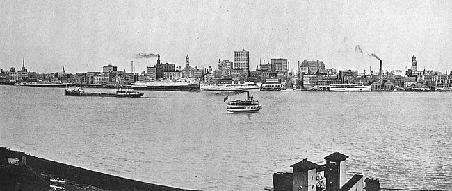
Copyright, Detroit Publishing Co.
WATER-FRONT OF PRESENT-DAY DETROIT
Where Indian canoes and the palisades of the French were
The visitor to Pittsburgh to-day will find on Fourth
street, midway between the Monongahela and Allegheny
Rivers, a little block-house, more correctly a redoubt,
sixteen by fifteen feet in lateral dimensions and twenty-two
feet high. The structure is constructed of brick
covered with clapboards and with a layer of double
logs, and contains thirty-six port-holes in two layers.
This little block-house is all that remains to-day of Fort
Pitt. It was built by Colonel Boquet in 1764 and was
purchased by private parties in the early days of Pittsburgh.
In 1894 the property was deeded by its owner of
that generation, Mrs. Mary E. Schenley, of London, to
the Pennsylvania Chapter of the Daughters of the
American Revolution, and is maintained by this organization
to-day for the benefit of the public.
The situation of Fort Pitt and its predecessor, Fort
Duquesne, was of immense strategic importance in the
early days of the American nation, the considerations
which gave it value having operated in the field of commerce
in late years to make Pittsburgh notable as a
manufacturing and distributing centre. It stood at the
gateway to the Ohio River and the rich country which
the Ohio waters, and since it commanded the Ohio it
commanded the key to the West.
These considerations were appreciated by the Colonial
Virginians, and in 1754 Captain William Trent was
commissioned by Governor Dinwiddie, of Virginia, to
erect a fort at the juncture of the Monongahela and the
Allegheny Rivers at the expense of the Ohio Company.
Captain Trent commenced his work in February, 1754,
but in April, 1754, surrendered to a detachment of
French under Le Mercier.
The French then commenced the erection of a fort of
their own on the extreme neck of land between the rivers.
They finished their work in the summer of that year and
named it Fort Duquesne in honor of Governor-General
Duquesne, of Canada.
In the same year a force of English colonists, about
150 strong, made a tentative advance against the work
under the leadership of our own George Washington,
then a young man. Washington found the post too
strong for attack and became himself the object of hostile
attention from the French, being forced to fall back
to Great Meadows and to erect a temporary triangular
earth fortification there which he named Fort Necessity.
In 1755 it was the plan of the British ministry to
concentrate its forces in the colonies in three directions
of attack against the French. One blow was to be
struck at Acadia; a second blow was to be struck at
Crown Point, and a third, under General Braddock, an
English-born officer of wide Continental experience, at
Fort Duquesne.
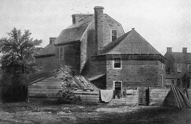
From a painting in the collection of the Pennsylvania Historical Society
OLD BLOCK-HOUSE, FORT PITT, PITTSBURGH, PA.
Braddock’s unfortunate march began May 27, 1755,
from Fort Cumberland, Maryland (Cumberland, to-day),
and of the details of that disastrous journey little
need be told in these pages as the story is already familiar.
Braddock had the bravery of his calling and the
arrogance and presumption of the European brought
into contact with provincials. He did not believe that
anything very good could come out of the colonies and
did not hesitate to show this attitude of mind. On the
line of march he scorned to send out scouts ahead as was
necessary in fighting Indians. He insisted on sending
his Continental troops in solid order against an enemy
who fought behind trees and stumps in any kind of
order that suited his purpose. He committed all of the
stupidities that vanity and overweening self-confidence
could dictate, and, when the French in a despairing last-minute
effort against overwhelming numbers had found
easy victory, gave up his life on the field of battle. He
was buried beneath the feet of the retreating troops so
that their steps should obliterate from the fiendish enemy
the location of his last resting place.
The English loss in this battle was 714 men killed
and a shattering of their military prestige with all of the
Indian people of the borderland. The French loss was
3 white men killed and 27 Indians. The access to their
influence amongst the savage tribes because of their
unexpected victory was much.
Fort Duquesne fell to the English in 1758 when
7,000 men under Brigadier General John Forbes slowly
and circumspectly proceeded against it. The French
deserted the post after attempting to destroy it and the
English took possession November 25 of that year. A
new fort was commenced under Forbes which stood on
the Monongahela side of the city at the south end of the
present West Street and between West and Liberty
Streets. It was occupied in 1760 and was completely
finished in the summer of 1761. The stone bomb-proof
magazine stood until 1852 when the Pennsylvania Railroad
built its freight terminal here.
Of the remainder of the line of French forts along
the Ohio River there are no relics left, though memorials
have been established at several points. The first of
this Ohio River chain was Presque Isle on Lake Erie,
now the little city of Erie, Pennsylvania. For some
years after French domain in the New World Presque
Isle was of importance and, indeed, for some years after
the Revolution.
The post was taken by the English in 1759, and in
1763 fell a victim to Indian attack as a corollary to the
Pontiac conspiracy which had as its object the complete
extinction of English life in the West. The fort, a
rectangle of earth and wooden palisades, stood on the
west bank of Mill Creek and at the intersection with
the shore of the lake. Here the veteran Indian fighter,
General Wayne, died in 1796. In 1876 the State of
Pennsylvania erected a block-house on the site of the
old fort as a memorial. This block-house is now included
in the grounds of the Pennsylvania Sailors and
Soldiers’ Home.
From Presque Isle there was a portage to Fort Le
Bœuf, now the little city of Waterford, Pennsylvania.
Fort Le Bœuf stood at High and Water Streets,
Waterford, though there is at this point no sign of its
existence. It was erected in 1753 and fell before
Pontiac’s far-reaching conspiracy in 1763.
Venango, the next of the French line of forts east
of Pittsburgh (Duquesne), was the fore-runner of
Franklin, Pennsylvania, and stood at Elk and Eighth
Streets. Of Venango, too, no sign remains. It fell to
the Indians in 1763.
South of Pittsburgh the English had a post at
Brownsville, on the Ohio River, Pennsylvania, built in
1754, and known as Redstone Old Fort. The French
had Fort Massac to which about one thousand troopers
retired after the evacuation of Fort Duquesne. Later
years also saw small fortifications developed on the
Ohio River, some holding the potentialities of future
greatness such as that at the falls of the Ohio River,
which was to be the nucleus of the settlement of the
present-day city of Louisville, Kentucky.
At the south end of Lake Erie during the French
occupancy of the West stood Fort Sandusky which has
given its name to the City of Sandusky of to-day. On
the Maumee River, Indiana, was Fort Miamis, Miami
of to-day.
In the early days of the French there had been a
trading post at the site of the future great city of
Chicago, but it remained for the United States, in 1803,
to establish a formal fortification here, Fort Dearborn,
of bloody memory. Fort Dearborn, as every good
Chicagoan knows, or ought to know, stood at the southern
approach to the Rush Street bridge and extended a
little across Michigan Avenue and somewhat into the
river, as it now is. The ground rose into a little mound
yielding a fine view of the surrounding flat prairie land.
Here the pioneer soldiers erected a rude stockade of logs
fifteen feet in height and enclosing a space sufficiently
large to contain a small parade ground, officers’ quarters,
troop barracks, guard house, magazines and two block-houses,
one at the northwest and the other at the southeast
corner of the palisade. This rude structure with
its small garrison was the seed of the present-day great
city.
Upon the outbreak of the War of 1812 General Hull,
who was commanding the American army of the border,
ordered the evacuation of Fort Dearborn, as the place
was too remote to be adequately defended and as its
possession meant no access of strength to the United
States. There were at this time in the garrison four
officers and fifty-four non-commissioned officers and
privates under the leadership of Captain Nathan Heald.
The wives of the two senior officers were with them and a
number of the privates had, also, their families, so that
the stockade contained twelve women and twenty children.
Though an experienced soldier, Captain Heald
seems to have misjudged the temper of the hostile
Indians surrounding his post and to have too easily
accepted their assurances of non-interference with the
garrison as it left the fort. At all events, on August 15,
1812, Captain Heald evacuated his fort, and though the
Indians allowed the little company—a long cavalcade—to
proceed as far as the end of present-day Eighteenth
Street without molestation, they then fell upon men,
women and children indiscriminately. Of the company
of Americans only a handful survived.
In 1816 Fort Dearborn was rebuilt and regarrisoned
but after the Black Hawk war fell into disuse, and in
1837 was abandoned by the army. It was used for
various purposes by different departments of the Federal
government until 1857, when it was torn down except
a small building which stood until the great fire of
1871. A commercial building now occupies the site
which is commemorated by a small bronze tablet set into
the wall by the Chicago Historical Society in 1880.
At the foot of Eighteenth Street at the point where
the attack upon the devoted column commenced, a
beautiful bronze monument has been erected depicting a
scene from the massacre.
Fort Gage, Illinois, memorable as the first objective
of George Rogers Clark in 1778, stood at the historic
little village Kaskaskia, of French foundation, on the
Kaskaskia River near the confluence of that stream with
the Mississippi. In shape an oblong, 280 feet by 251
feet, constructed of squared timbers founded upon heavy
earthwork, Fort Gage was never heavily garrisoned.
It was the point to which the British retired when the
crumbling walls of Fort Chartres would no longer hold
them. In 1772 the garrison consisted of one officer and
twenty soldiers. In 1778 when Clark reached the spot
there was not a British soldier on duty and the fort was
in command of a Frenchman.
Fort Clark, Illinois, was erected in 1813 on the site
of the future city of Peoria, Illinois, and about where
the Rock Island depot now stands. For several years it
gave its name to the locality and was a post of importance
garrisoned by rangers and United States troops.
At one time it sustained a severe Indian attack.
The foundation of Cincinnati, Ohio, was Fort Washington,
which was in existence until after the War of
1812.