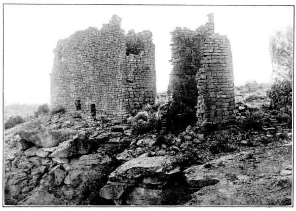
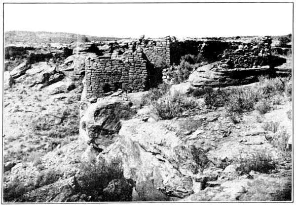
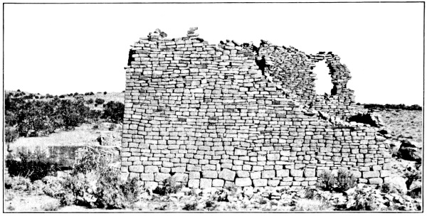
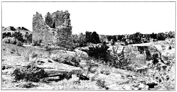
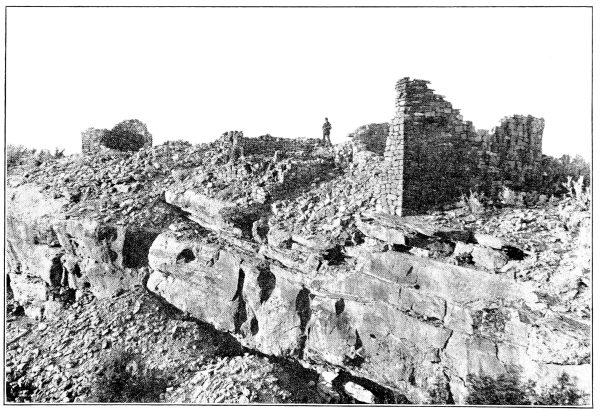
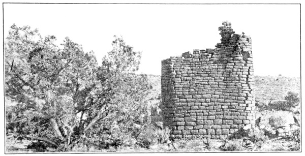
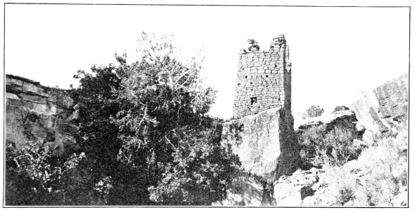
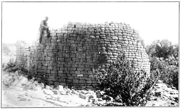
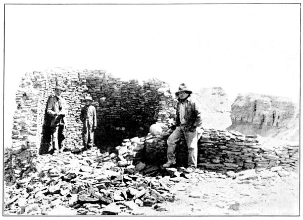
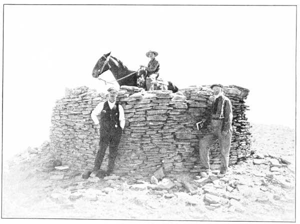
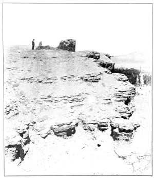
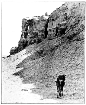
In the classification by Morley and Kidder and the majority of writers,
sites rather than structural features are adopted as a basis although
all recognized that large cliff-dwellings like Cliff Palace are
practically pueblos built in caves. In the following classification
more attention is directed to differences in structure than to situation,
notwithstanding the latter is convenient for descriptive purposes.
1. Villages or clusters of houses, each having the form of the pure
pueblo type. The essential feature of the pure type is a compact pueblo,
containing one or more unit types, circular kivas of characteristic
form, surrounded by rectangular rooms. These units, single or
consolidated, may be grouped in clusters, as Mitchell Spring or Aztec
Spring Ruins; the clusters may be fused into a large building, as at
Aztec or in the community buildings on Chaco Canyon.
2. Cliff-houses. These morphologically belong to the same pure type as
pueblos; their sites in natural caves are insufficient to separate them
from open-sky buildings.
3. Towers and great houses. These buildings occur united to
cliff-dwellings or pueblos, but more often they are isolated.
4. Rooms with walls made of megaliths or small stone slabs set on edge.
In reports on the excavation of Far View House[11]
on the Mesa Verde, the author called attention to clusters of mounds
indicating ruined buildings in the neighborhood of Mummy Lake, a little
more than 4 miles from Spruce-tree House. This cluster he considers a
village; Far View House, excavated from one of the mounds, is regarded
as a prehistoric pueblo of the pure type. The forms of other buildings
covered by the remaining mounds of the Mummy Lake site are unknown, but
it is probable that they will be found to resemble Far View House, or
that all members of the village have similar forms.
This grouping of small pueblos into villages at Mummy Lake on the Mesa
Verde is also a distinctive feature of ruins in the Montezuma Valley
and McElmo district. In these villages one or more of the component
houses may be larger and more conspicuous, dominating all the others,
as at Goodman Point, or at Aztec Spring. The houses composing the
village at Mud Spring were about the same size, but at Wolley Ranch
Ruin only one mound remains, evidently the largest, the smaller having
disappeared.
The third group, towers and great houses, includes buildings of oval,
circular, semicircular, and rectangular shapes. Morphologically
speaking, they do not present structural features of pueblos, for they
are not terraced, neither have they specialized circular ceremonial
rooms, kivas with vaulted roofs surrounded by rectangular rooms,
or other essential features of the pueblo type. The group contains
buildings which are sometimes consolidated with cliff-houses and
pueblos, but are often independent of them. In this type are included
castellated buildings in the Mancos, Yellow Jacket, McElmo, and the
numerous northern tributary canyons of the San Juan.
As the word is used in this report, a village is a cluster of houses
separated from each other, each building constructed on the same plan,
viz, a circular ceremonial room or kiva with mural banquettes and
pilasters for the support of a vaulted roof, inclosed in rectangular
rooms. When there is one kiva and surrounding angular rooms we adopt
the name “unit type.” When, as in the larger mounds, there are
indications of several kivas or unit types consolidated—the size
being in direct proportion to the number—we speak of the building as
belonging to the “pure type.” Doctor Prudden, who first pointed out the
characteristics of the “unit type,”[12]
has shown its wide distribution in the McElmo district. The Mummy Lake
village has 16 mounds indicating houses. Far View House, one of these
houses, is made up of an aggregation of four unit types and hence
belongs to the author’s “pure type.”
While villages similar to the Mummy Lake group, in the valleys near
Mesa Verde, have individual variations, the essential features are
the same, as will appear in the following descriptions of Surouaro,
and ruins at Goodman Point, Mud Spring, Aztec Spring, and Mitchell
Spring. Commonly, in these villages, one mound predominates in size
over the others, and while rectangular in form, has generally circular
depressions on the surface, recalling conditions at Far View mound
before excavation. These mounds indicate large buildings in blocks,
made up of many unit forms of the pure type, united into compact
structures. One large dominant member of the village recalls those
ruins where the village is consolidated into one community pueblo.
The separation of mounds in the village and their concentration in
the community house may be of chronological importance, although the
relative age of the simple and composite forms can not at present
be determined; but it is important to recognize that the units of
construction in villages and community buildings are identical.
Surouaro
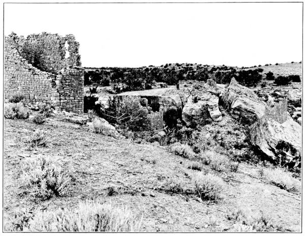
The cluster of mounds formerly called Surouaro, now known as Yellow
Jacket Spring Ruin, is situated near the head of the canyon of the same
name to the left of the Monticello road, 14 miles west of Dolores. This
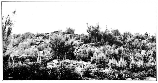
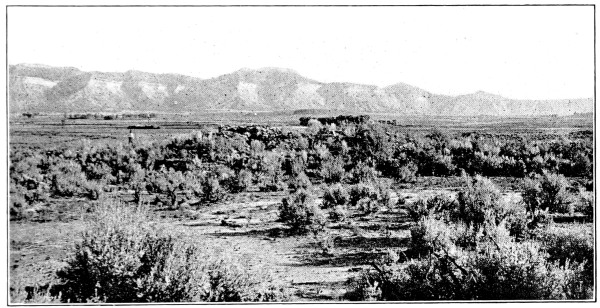
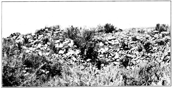
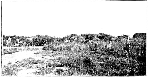
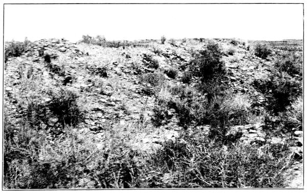
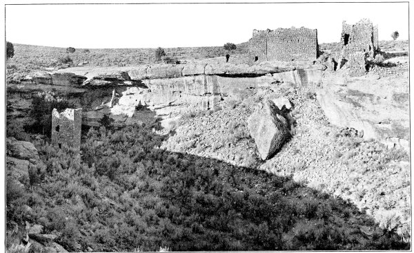
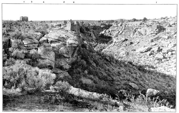
village (pls. 1, c; 2, c)
contains both large and small houses of the pure pueblo type, covering an area somewhat
less than the Mummy Lake group, on the Mesa Verde. The arrangement of mounds in
clusters naturally recalls the Galisteo and Jemez districts, New Mexico,
where, however, the arrangement of the mounds and the structure of each
is different. The individual houses in a Mesa Verde or Yellow Jacket
village were not so grouped as to inclose a rectangular court, but were
irregularly distributed with intervals of considerable size between
them.[13]
The largest mound in the Surouaro village, shown in plate 1, c,
corresponds with the so-called “Upper House” of Aztec Spring Ruin, but
is much larger than Far View or any other single mound in the Mummy
Lake village.
Surouaro was one of the first ruins in this region described by
American explorers, attention having been first called to it by
Professor Newberry,[14]
whose description follows: “Surouaro is the name of a ruined town
which must have once contained a population of several thousands. The
name is said to be of Indian (Utah) origin, and to signify desolation,
and certainly no better could have been selected.... The houses are,
many of them, large, and all built of stone, hammer dressed on the
exposed faces. Fragments of pottery are exceedingly common, though like
the buildings, showing great age.... The remains of metates
(corn mills) are abundant about the ruins. The ruins of several large
reservoirs, built of masonry, may be seen at Surouaro, and there are
traces of acequias which led to them, through which water was brought,
perhaps from a great distance.”
Goodman Point Ruin
This ruin is a cluster of small mounds surrounding larger ones,
recalling the arrangement at Aztec Spring. They naturally fall
into two groups which from their direction or relation to the adjacent
spring may be called the south and north sections.
The most important mound of the south section, Block A, measures
74 feet on the north, 79 feet on the south, and 76 feet on the
west side. This large mound corresponds morphologically to the
“Upper House” at Aztec Spring (fig. 1, A). About
it there are arranged at intervals, mainly on the north and east sides, other
smaller mounds generally indicating rectangular buildings. The
southeast angle of the largest is connected by a low wall with one
of the smaller mounds, forming an enclosure called a court, whose
northern border is the rim of the canyon just above the spring. A
determination of the detailed architectural features of the building
buried under Block A is not possible, as none of its walls stand above
the mass of fallen stones, but it is evident, from circular depressions
and fragments of straight walls that appear over the surface of
the mound, that the rooms were of two kinds, rectangular forms, or
dwellings, and circular chambers, or kivas. This mound resembles Far
View House on the Mesa Verde before excavation.
A large circular depression, 56 feet in diameter, is situated in the
midst of the largest mounds. A unique feature of this depression,
recognized and described by Doctor Prudden, are four piles of stones,
regularly arranged on the floor. The author adopts the suggestion
that this area was once roofed and served as a central circular kiva,
necessitating a roof of such dimensions that four masonry pillars
served for its support. The mound measures about 15 feet in height,
and has large trees growing on its surface, offering evidence of
a considerable age. Several other rooms are indicated by circular
surface depressions, but their relation to the rectangular rooms can be
determined only by excavation.
Johnson Ruin
This ruin, to which the author was conducted by Mr. C. K. Davis, is
about 4 miles west of the Goodman Point Ruin near Mr. Johnson’s ranch
house, in section 12, township 36, range 18. It is said to be situated
at the head of Sand Canyon, a tributary of the McElmo, and is one of
the largest ruins visited. The remains of former houses skirt the rim
of the canyon head for fully half a mile, forming a continuous series
of mounds in which can be traced towers, great houses, and other types
of buildings, and numerous depressions indicating sunken kivas. The
walls of these buildings were, however, so tumbled down that little
now remains above ground save piles of stones in which tops of buried
walls may still be detected, but not without some difficulty. In a cave
under the “mesa rim” there is a small cliff-house in the walls of which
extremities of the original wooden rafters still remain in place.
In an open clearing, about 3 miles south and west of Mr. J. W. Fulk’s
house, Renaraye post office, there is a small ruin of rectangular form,
the ground plan of which shows two rectangular sections of different
sizes, joined at one angle. The largest section measures approximately
20 by 50 feet. It consists of low rooms surrounding two circular
depressions, possibly kivas. Although constructed on a small scale,
this section reminds one of the Upper House of Aztec Spring Ruin. The
smaller section, which also has a rectangular form, has remains of
high rooms on opposite sides and low walls on the remaining sides.
In the enclosed area there is a circular depression or reservoir,
corresponding with the reservoir of the Lower House at Aztec Spring Ruin.
Bug Mesa Ruin
The author was guided by Mr. H. S. Merchant to a village ruin, one of
the largest visited, situated a few miles from his ranch house. This
village is about 10 miles due south of the store at the head of Dove
Creek, and consists of several large mounds, each about 500 feet long,
arranged parallel to each other, and numerous isolated smaller mounds.
Not far from this large ruin there is a prehistoric reservoir estimated
as covering about 4 acres. Many circular depressions, indicated
kivas, and lines of stones showed tops of buried rectangular rooms.
Excavations in a small mound near this ruin were conducted by Doctor
Prudden.[15]
The canyon which heads near the corral on the road to Merchant’s house
revealed no evidence of prehistoric dwellings.
Mitchell Spring Ruin
This ruin takes its name from the earliest known description of it by
Morgan,[16]
which was compiled from notes by Mr. Mitchell, one of the early settlers
in Montezuma Valley. Morgan’s account is as follows:
“Near Mr. Mitchell’s ranch, and within a space of less than a mile
square, are the ruins of nine pueblo houses of moderate size. They are
built of sandstone intermixed with cobblestone and adobe mortar. They
are now in a very ruinous condition, without standing walls in any
part of them above the rubbish. The largest of the number is marked
No. 1 in the plan, figure 44, of which the outline of the original
structure is still discernible. It is 94 feet in length and 47 feet
in depth, and shows the remains of a stone wall in front inclosing a
small court about 15 feet wide. The mass of material over some parts of
this structure is 10 or 12 feet deep. There are, no doubt, rooms with a
portion of the walls still standing covered with rubbish, the removal
of which would reveal a considerable portion of the original ground plan.”
The author paid a short visit to the Mitchell Spring village and by
means of Morgan’s sketch map was able to identify without difficulty
the nine mounds and tower he represents. The village at Mitchell Spring
differs from that at Mud Spring and at Aztec Spring mainly in the small
size and diffuse distribution of the component mounds and an absence
of any one mound larger than the remainder. It had, however, a round
tower, but unlike that at Mud Spring village, this structure is not
united to one of the houses. The addition of towers to pueblos, as
pointed out by Doctor Prudden[17]
several years ago, marks the highest development of pueblo architecture
as shown not only in open-air villages but also in some of the large
cliff pueblos, like Cliff Palace. Isolated towers are as a rule earlier
in construction.
The unit type mound uncovered by Doctor Prudden is one of the most
instructive examples of this type in Montezuma Canyon, but the author
in subsequent pages will call attention to the existence of the same
type in Square Tower Canyon. All of these pueblos probably have kivas
of the pure type, practically the same in structure as Far View House
on the Mesa Verde National Park.
Mud Spring (Burkhardt) Ruin
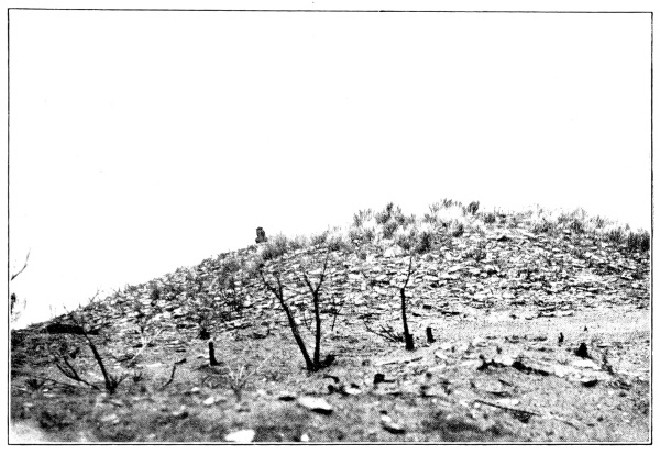
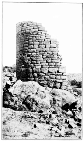
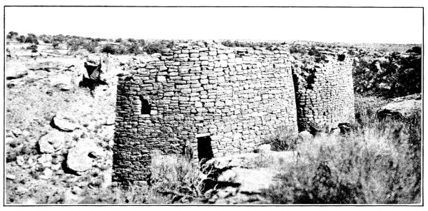
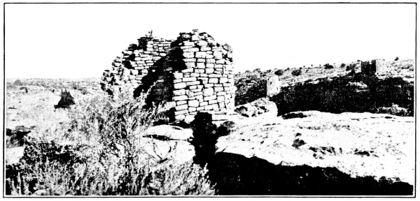
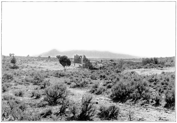
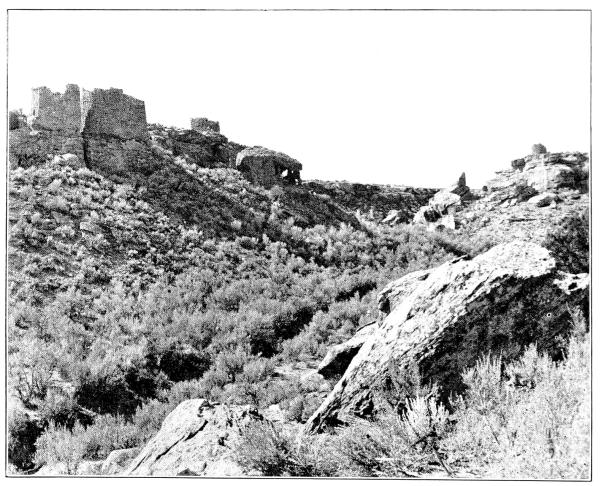
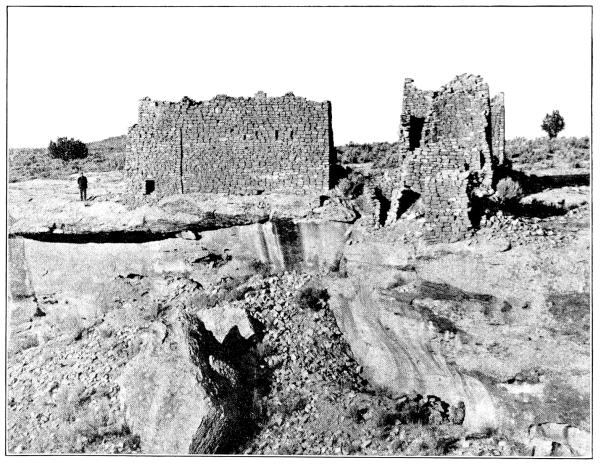
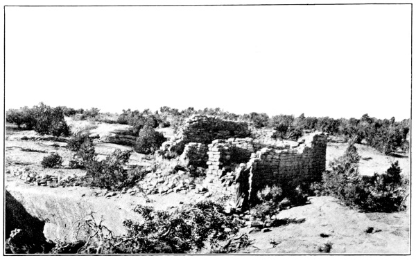
The collection of mounds (pl. 3, b), sometimes
called Burkhardt Ruin, situated at Mud Spring, belongs to the McElmo series. This
ruin, in which is the “triple-walled tower” of Holmes, for uniformity
with Mitchell Spring Ruin and Aztec Spring Ruin, is named after a
neighboring spring. Like these, it is a cluster of mounds forming a
village which covers a considerable area. The arroyo on which it is
situated opens into the McElmo, and is about 7 miles southwest from
Cortez, at a point where the road enters the McElmo Canyon.
The extension of the area covered by the Mud Spring mounds is
east-west, the largest mounds being those on the east. These latter
are separated from the remainder, or those on the west, by a shallow,
narrow gulch. There are two towers united to the western section
overlooking the spring, the following description of one of which, with
a sketch of the ground plan, is given by Holmes.[18]
“The circular structures or towers have been built, in the usual
manner, of roughly hewn stone, and rank among the very best specimens
of this ancient architecture. The great tower is especially
noticeable.... In dimensions it is almost identical with the great
tower of the Rio Mancos. The walls are traceable nearly all the way
round, and the space between the two outer ones, which is about 5 feet
in width, contains 14 apartments or cells. The walls about one of these
cells are still standing to the height of 12 feet; but the interior
can not be examined on account of the rubbish which fills it to the
top. No openings are noticeable in the circular walls, but doorways
seem to have been made to communicate between the apartments; one is
preserved at d.... This tower stands back about 100 feet from
the edge of the mesa near the border of the village. The smaller tower,
b, stands forward on a point that overlooks the shallow gulch;
it is 15 feet in diameter; the walls are 3½ feet thick and 5 feet high
on the outside. Beneath this ruin, in a little side gulch, are the
remains of a wall 12 feet high and 20 inches thick.... The apartments
number nearly a hundred, and seem, generally, to have been rectangular.
They are not, however, of uniform size, and certainly not arranged in
regular order.”
Morgan[19]
gives the following description of the same ruin which seems
to the author to be the Mud Creek village:
“Four miles westerly [from Mitchell ranch], near the ranch of Mr.
Shirt, are the ruins of another large stone pueblo, together with an
Indian cemetery, where each grave is marked by a border of flat stones
set level with the ground in the form of a parallelogram 8 feet by 4
feet. Near the cluster of nine pueblos shown in the figure are found
strewn on the ground numerous fragments of pottery of high grade in the
ornamentation, and small arrowheads of flint, quartz, and chalcedony
delicately formed, and small knife blades with convex and serrated
edges in considerable numbers.
“This is an immense ruin with small portions of the walls still
standing, particularly of the round tower of stone of three concentric
walls, incorporated in the structure, and a few chambers in the north
end of the main building. The round tower is still standing nearly
to the height of the first story. In its present condition it was
impossible to make a ground plan showing the several chambers, or to
determine with certainty which side was the front of the structure,
assuming that it was constructed in the terraced form.... The Round
Tower is the most singular feature in this structure. While it
resembles the ordinary estufa, common to all these structures,
it differs from them in having three concentric walls. No doorways are
visible in the portion still standing, consequently it must have been
entered through the roof, in which respect it agrees with the ordinary
estufa. The inner chamber is about 20 feet in diameter, and the
spaces between the encircling walls are about 2 feet each; the walls
are about 2 feet in thickness, and were laid up mainly with stones
about 4 inches square, and, for the most part, in courses. There is a
similar round tower, having but two concentric walls, at the head of
the McElmo Canyon, and near the ranch of Mr. Mitchell [Mitchell Ruin].”
As the name Mud Spring is locally known to the natives, especially
to employees of livery stables and garages, the ruin is here called
Mud Spring. The tower and the other circular buildings are united to
other rooms as in similar groups of mounds. The presence of surface
depressions, thought to indicate circular kivas,[20]
shows that the Mud Spring mounds are remains of a village of the same
type as the Mummy Lake group, but with towers united to the largest mounds.
The time the author could give to his visit to the Mud Spring Ruin (pl. 3, b) was too limited to survey it, but he noticed in addition
to the two circular buildings already recorded, a large mound situated
on the west side of the gulch, and numerous small mounds on the east
side of the same, each apparently with a central depression like
a kiva. All these mounds have been more or less mutilated by
indiscriminate digging, but many mounds, still untouched, remain to
be excavated before we can form an adequate conception of the group.
The “triple-walled tower” is now in such a condition that the author
could not determine whether it was formerly circular or D-shaped;
the “small tower” is in even worse condition and its previous form could
not be made out. The Mud Spring mounds cover a much larger area than
descriptions or ground plans thus far published would indicate.
Originally Mud Spring Ruin consisted of a cluster of pueblos of various
sizes, each probably with a circular kiva and rectangular rooms,
combined with one or more towers at present too much dilapidated to
determine architectural details without excavations. Like the other
clusters of pueblos in the McElmo and Montezuma Valley, the cemetery
near Mud Spring Ruin has suffered considerably from pothunters, but
there still remain many standing walls that are well preserved.
Ruin with Semicircular Core
This ruin is situated on the San Juan about 3 miles below the sandy bed
of the mouth of the Montezuma, on a bluff 50 feet above the river. The
ground plan by Jackson[21]
indicates a building shaped like a trapezoid, 158 feet on the northeast
side, 120 on the southeast, and 32 on the northwest side. The southwest
side is broken midway by a reentering area at the rim of the bluff over
the river.
In the center of this trapezoidal structure there is represented a
series of rooms arranged like those of Horseshoe House, but composed
of a half-circular chamber surrounded by seven rooms between two
concentric circular walls. Thus far the homology to Horseshoe House is
close but beyond this series of rooms, following out the trapezoidal
form, at least five other rooms appear on the ground plan. The position
of these recalls the walls arranged around the tower at Mud Spring
village. In other words, the ruin resembles Horseshoe House, but has
in addition rectangular rooms added on three sides, forming an angular
building. So far as the author’s information goes, no other ruin of
exactly this type, which recalls Sun Temple, has been described by
other observers.
Wolley Ranch Ruin
Wolley Ranch Ruin, situated 10 miles south of Dolores, is one of the
largest mounds near Cortez. There are evidences of the former existence
of a cluster of mounds at this place, only one of which now remains.
This is covered with bushes, rendering it difficult to trace the
bounding walls.
Blanchard Ruin
Several years ago private parties constructed at Manitou, near Colorado
Springs, a cliff-dwelling on the combined plan of Spruce-tree House and
Cliff Palace. The rocks used for that purpose were transported from
a large mound on the Blanchard ranch near Lebanon, in the Montezuma
Valley, at the head of Hartman’s draw, about 6 miles south of Dolores.
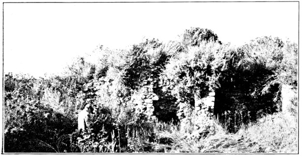
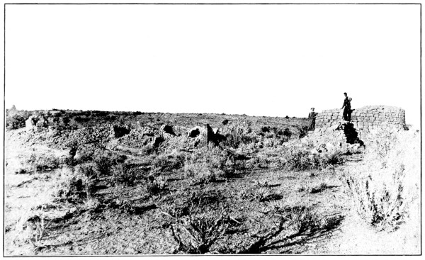
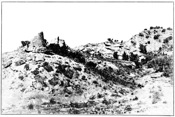
Two mounds (pl. 2, a, b),
about three-quarters of a mile apart, are all that now remain of a
considerable village; the other smaller mounds, reported by pioneer
settlers, have long since been leveled by cultivation. As both of these
mounds have been extensively dug into to obtain stones, the walls that
remain standing show much mutilation. The present condition of the
largest Blanchard mound, as seen from its southwest angle, is shown in
plate 2, b. About half of the mound, now covered
with a growth of bushes, still remains entire, exposing walls of fine masonry,
on its south side. The rooms in the buried buildings are hard to make out on
account of this covering of vegetation and accumulated débris; but the
central depressions, supposed to be kivas, almost always present in the
middle of mounds in this district, show that the structure of Blanchard
Ruin follows the pure type.
Ruins at Aztec Spring
The mounds at Aztec Spring (pl. 1, b),
situated on the eastern flank of Ute Mountain, at a site looking across the valley to the
west end of Mesa Verde, were described forty years ago by W. W. Jackson[22]
and Prof. W. H. Holmes.[23]
The descriptions given by both these pioneers are quoted at length
for the reason that subsequent authors have added little from direct
observation since that time, notwithstanding they have been constantly
referred to and the illustrations reproduced.
As a result of a short visit, the author is able to add the few
following notes on the Aztec Spring mounds. The ruin is a village
consisting of a cluster of unit pueblos of the pure type in various
stages of consolidation. No excavations were made, but the surface
indications point to the conclusion that the different mounds indicate
that these pueblos have different shapes and sizes.
The author’s observations differ in several unimportant particulars
from those of previous writers, and while it is not his intention to
describe in detail the Aztec Spring village he will call attention to
certain features it shares with other villages in the Montezuma Valley.
The best, almost the only accounts of this village are the following
taken from the descriptions by Jackson and Holmes published in 1877.
Mr. Jackson gives the following description:[24]
“Immediately adjoining the spring, on the right,
as we face it from below, is the ruin of a great massive structure
[Upper House?] of some kind, about 100 feet square in exterior
dimensions; a portion only of the wall upon the northern face
remaining in its original position. The débris of the ruin now
forms a great mound of crumbling rock, from 12 to 20 feet in height,
overgrown with artemisia, but showing clearly, however, its rectangular
structure, adjusted approximately to the four points of the compass.
Inside this square is a circle, about 60 feet in diameter, deeply
depressed in the center. The space between the square and the circle
appeared, upon a hasty examination, to have been filled in solidly
with a sort of rubble-masonry. Cross-walls were noticed in two places;
but whether they were to strengthen the walls or divided apartments
could only be conjectured. That portion of the outer wall remaining
standing is some 40 feet in length and 15 in height. The stones were
dressed to a uniform size and finish. Upon the same level as this
ruin, and extending back some distance, were grouped line after line
of foundations and mounds, the great mass of which is of stone but not
one remaining upon another.... Below the above group, some 200 yards
distant, and communicating by indistinct lines of débris, is
another great wall, inclosing a space of about 200 feet square [Lower
House?].... This better preserved portion is some 50 feet in length,
7 or 8 feet in height, and 20 feet thick, the two exterior surfaces
of well-dressed and evenly laid courses, and the center packed in
solidly with rubble-masonry, looking entirely different from those
rooms which had been filled with débris, though it is difficult
to assign any reason for its being so massively constructed.... The
town built about this spring is nearly a square mile in extent, the
larger and more enduring buildings in the center, while all about are
scattered and grouped the remnants of smaller structures, comprising
the suburbs.”
The description by Professor Holmes[25]
is more detailed and accompanied by a ground plan, and is quoted below:
“The site of the spring I found, but without the least appearance of
water. The depression formerly occupied by it is near the center of a
large mass of ruins, similar to the group [Mud Spring village] last
described, but having a rectangular instead of a circular building
as the chief and central structure. This I have called the upper
house in the plate, and a large walled enclosure a little lower on
the slope I have for the sake of distinction called the lower house.
“These ruins form the most imposing pile of masonry yet [1875] found
in Colorado. The whole group covers an area about 480,000 square
feet, and has an average depth of from 3 to 4 feet. This would give
in the vicinity of 1,500,000 solid feet of stonework. The stone used
is chiefly of the fossiliferous limestone that outcrop along the base
of the Mesa Verde a mile or more away, and its transportation to this
place has doubtless been a great work for a people so totally without
facilities.
“The upper house is rectangular, measuring 80 feet by 100 feet, and is
built with the cardinal points to within a few degrees. The pile is
from 12 to 15 feet in height, and its massiveness suggests an original
height at least twice as great. The plan is somewhat difficult to make
out on account of the very great quantity of débris.
“The walls seem to have been double, with a space 7 feet between; a
number of cross-walls at regular intervals indicate that this space has
been divided into apartments, as seen in the plan.
“The walls are 26 inches thick, and are built of roughly dressed
stones, which were probably laid in mortar, as in other cases.
“The enclosed space, which is somewhat depressed, has two lines of
débris, probably the remains of partition-walls, separating it
into three apartments, a, b, c [note]. Enclosing
this great house is a network of fallen walls, so completely reduced
that none of the stones seem to remain in place; and I am at a loss
to determine whether they mark the site of a cluster of irregular
apartments, having low, loosely built walls, or whether they are the
remains of some imposing adobe structure built after the manner of the
ruined pueblos of the Rio Chaco.
“Two well-defined circular enclosures or estufas [kivas] are
situated in the midst of the southern wing of the ruin. The upper one,
A, is on the opposite side of the spring from the great house, is 60
feet in diameter, and is surrounded by a low stone wall. West of the
house is a small open court, which seems to have had a gateway opening
out to the west, through the surrounding walls.
“The lower house is 200 feet in length by 180 in width, and its walls
vary 15 degrees from the cardinal points. The northern wall, a,
is double and contains a row of eight apartments about 7 feet in width
by 24 in length. The walls of the other sides are low, and seem to have
served simply to enclose the great court, near the center of which is a
large walled depression (estufa B).”
The number of buildings that composed the Aztec Spring village (fig. 1)
when it was inhabited can not be exactly estimated, but as indicated
by the largest mound, the most important block of rooms exceeds in
size any at Mitchell Spring Ruin. While this village also covered more
ground than that at Mud Spring, it shows no evidence of added towers, a
prominent feature of the largest mound of the latter. Two sections
(fig. 1, A, B) may be distinguished
in the arrangement of mounds in the village; one may be known as the
western and the other as the eastern division.
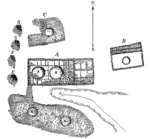
Fig. 1.—Ground
plan of Aztec Spring Ruin.
The highest and most conspicuous mound of the western section
(A) is referred to by Professor Holmes as the “Upper House.”
Surface characteristics now indicate that this is the remains of a
compact rectangular building, with circular kivas and domiciliary rooms
of different shapes, the arrangement of which can not be determined
without extensive excavations. The plan of this pueblo published
by Holmes[26]
shows two large and one small depression, indicating peripheral
rectangular chambers surrounded by walls of rectangular rooms.
The author interprets the depressions, K, as kivas, but supposes
that they were not rectangular as figured by Holmes, but circular,
surrounded on all four sides by square secular chambers, the “Upper
House” being formed by the consolidation of several units of the pure
pueblo type. Although Aztec Spring Ruin is now much mutilated and its
walls difficult to trace, the surface indications, aided by comparative
studies of the rooms, show that Holmes’ “a,” “b,” and
“c,” now shown by depressions, are circular, subterranean kivas.
They are the same kind of chambers as the circular depressions in the
mounds on the south side of the spring. The height of the mound called
“Upper House” indicates that the building had more than one story on
the west and north sides, and that a series of rooms one story high
with accompanying circular depressions existed on the east side.
The “Upper House” is only one of several pueblos composing the western
cluster of the Aztec Spring village. Its proximity to the source of
water may in part account for its predominant size, but there are
evidences of several other mounds (E-H) in its neighborhood,
also remains of pueblos. Those on the north (C) and west sides
(E-H) are small and separated from it by intervals sometimes
called courts. The most extensive accumulation of rooms next the “Upper
House” is situated across the draw in which the spring lies, south of
the “Upper House” cluster already considered. The aggregation of houses
near the “Upper House” is mainly composed of low rectangular buildings
among which are recognized scattered circular depressions indicating
kivas. The largest of these buildings is indicated by the mound on
the south rim of the draw, where we can make out remains of a number
of circular depressions or kivas (K), as if several unit forms
fused together; on the north and west sides of the spring there are
small, low mounds, unconnected, also suggesting several similar unit
forms. The most densely populated part of the village at Aztec Spring,
as indicated by the size of the mounds clustered on the rim around the
head of the draw, is above the spring, on the northwest and south sides.
There remains to be mentioned the eastern annex (B) of the Aztec
Spring village, the most striking remains of which is a rectangular
inclosure called “Lower House,” situated east of the spring and lower
down the draw, or at a lower level than the section already considered.
The type of this structure, which undoubtedly belonged to the same
village, is different from that already described. It resembles a
reservoir rather than a kiva, inclosed by a low rectangular wall,
with rows of rooms on the north side. The court of the “Lower House”
measures 218 feet. The wall on the east, south, and west sides is only
a few feet high and is narrow; that on the north is broader and higher,
evidently the remains of rooms, overlooking the inclosed area.
Perhaps the most enigmatical structures in the vicinity of Aztec Spring
village are situated on a low mesa south of the mounds, a few hundred
feet away. These are circular depressions without accompanying mounds,
one of which was excavated a few years ago to the depth of 12 feet; on
the south there was discovered a well-made wall of a circular opening,
now visible, by which there was a communication through a horizontal
tunnel with the open air. The author was informed that this tunnel
is artificial and that one of the workmen crawled through it to its
opening in the side of a bank many yards distant.
No attempt was made to get the exact dimensions of the component
houses at Aztec Spring, as the walls are now concealed in the mounds,
and measurements can only be approximations if obtained from surface
indications without excavation. The sketch plan here introduced (fig. 1)
is schematic, but although not claimed as accurate, may serve to
convey a better idea of the relation of the two great structures and
their annexed buildings than any previously advanced.
The author saw no ruined prehistoric village in the Montezuma Valley
that so stirred his enthusiasm to properly excavate and repair as that
at Aztec Spring,[27]
notwithstanding it has been considerably dug over for commercial purposes.
Great Open-Air Ruins South and
Southwest of Dove Creek
Post Office
In the region south and southwest of Dove Creek there are several large
pueblo ruins, indicated by mounds formed of trimmed stone, eolean sand,
and clay from plastering, which have certain characters in common.
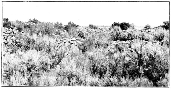
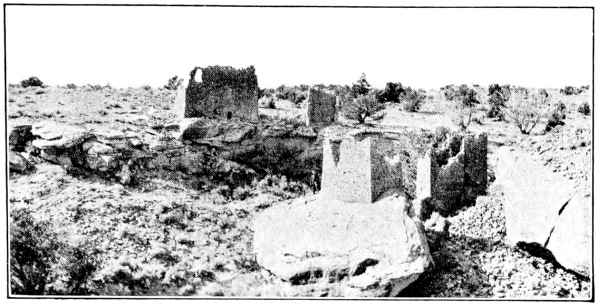
Each mound is a large heap of stones (pl. 3, a) near
which is a depression or reservoir, with smaller heaps which in different ruins
show the small buildings of the unit type. These clusters or villages
are somewhat modified in form by the configuration of the mesa surface.
The larger have rectangular forms regularly disposed in blocks with
passageways between them or are without any definite arrangement.
Squaw Point Ruin
This large ruin, which has been described by Doctor Prudden as Squaw
Point Ruin and as Pierson Lake Ruin, was visited by the author, who has
little to add to this description. One of the small heaps of stone or
mounds has been excavated and its structure found to conform with the
definition of the unit type. The subterranean communication between one
of the rectangular rooms and the kiva could be well seen at the time of
the author’s visit and recalls the feature pointed out by him in some
of the kivas of Spruce-tree House. The large reservoir and the great
ruin are noteworthy features of the Squaw Point settlement.
It seems to the author that the large block of buildings is simply a
congeries of unit types the structure of one of which is indicated by
the small buildings excavated by Doctor Prudden, and that structurally
there is the same condition in it as in the pueblo ruins of Montezuma
Valley, a conclusion to which the several artifacts mentioned and
figured by Doctor Prudden also point.
The same holds true of Bug Point Ruin, a few miles away, also excavated
and described by Doctor Prudden. Here also excavation of a small mound
shows the unit type, and while no one has yet opened the larger mound
or pueblo, superficial evidences indicate that it also is a complex of
many unit types joined together. Until more facts are available the
relative age of the small unit types as compared to the large pueblo
can not be definitely stated, but there is little reason to doubt that
they are contemporaneous, and nothing to support the belief that they
do not indicate the same culture.
Acmen Ruin
Following the Old Bluff Road and leaving it about 5 miles west of
Acmen post office, one comes to a low canyon beyond Pigge ranch. The
heaps of stone or large mounds cover an area of about 10 acres, the
largest being about 15 feet high. East of this is a circular depression
surrounded by stones, indicating either a reservoir or a ruined
building.
The top of the highest mound (pl. 3, a)—no walls
stand above the surface—is depressed like mounds of the Mummy Lake group on
the Mesa Verde. This depression probably indicates a circular kiva
embedded in square walls, the masonry of which so far as can be judged
superficially is not very fine. There are many smaller mounds in the
vicinity and evidences of cemeteries on the south, east, and west
sides, where there are evidences of desultory digging; fragments of
pottery are numerous.
These mounds indicate a considerable village which would well repay
excavation, as shown by the numerous specimens of corrugated, black and
white, and red pottery in the Pigge collection, made in a small mound
near the Pigge ranch.
The specimens in this collection present few features different from
those indicated by the fragments of pottery picked up on the larger
mounds a mile west of the site where they were excavated. They are the
same as shards from the mounds in the McElmo region.
Oak Spring House
About 15 miles southwest of Dove Creek on Monument Canyon there is a
good spring called Oak Spring, near which are several piles of stones
indicating former buildings, the largest of which, about a quarter of a
mile away, has a central depression with surrounding walls now covered
with rock or buried in soil or blown sand. Very large piñon trees grow
on top of the highest walls of this ruin, the general features of which
recall those at Bug Spring, though their size is considerably less. In
the surface of rock above the spring there are numerous potholes of
small size. One of these, 4 feet deep and about 18 feet in diameter, is
almost perfectly circular and has some signs of having been deepened
artificially. It holds water much of the time and was undoubtedly a
source of water supply to the aborigines, as it now is to stock in that
neighborhood.
Ruin in Ruin Canyon
One of the large rim-rock ruins may be seen on the left bank of Ruin
Canyon in full view from the Old Bluff Road. The ruin is an immense
pile of stones perched on the very edge of the rim, with no walls
standing above the surface. The most striking feature of this ruin is
the cliff-house below, the walls and entrance into which are visible
from the road (pl. 9, b). It is readily accessible
and one of the largest in the country. On either side of the Old Bluff Road from
Ruin Canyon to the “Aztec Reservoir” small piles of stone mark the
sites of many former buildings of the one-house type which can readily
be seen, especially in the sagebrush clearings as the road descends to
the Picket corral, the reservoirs, and the McElmo Canyon.
Cannonball Ruin
One of the most instructive ruins of the McElmo Canyon region is
situated at the head of Cannonball Canyon, a short distance across the
mesa north of the McElmo, at a point nearly opposite the store. This
ruin is made up of two separate pueblos facing each other, one of which
is known as the northern, the other as the southern pueblo (pl. 22, b).
Both show castellated chambers and towers, one of which is situated at
the bottom of the canyon. The southern pueblo was excavated a few years
ago by Mr. S. G. Morley, who published an excellent plan and a good
description of it, and made several suggestions regarding additions of
new rooms to the kivas which are valuable. Its walls were not protected
and are rapidly deteriorating.
This pueblo, as pointed out by Mr. Morley,[28]
has 29 secular rooms arranged with little regularity, and 7 circular
kivas, belonging to the vaulted-roofed variety. It is a fine example of
a composite pueblo of the pure type, in which there are several large
kivas. Morley has pointed out a possible sequence in the addition of
the different kivas to a preexisting tower and offers an explanation
of the chronological steps by which he thinks the aggregation of rooms
was brought about. Occasionally we find inserted in the walls of these
houses large artificially worked or uncut flat stones, such as the
author has mentioned as existing in the walls of the northwest corner
of the court of Far View House. This Cyclopean form of masonry is
primitive and may be looked upon as a survival of a ruder and more
archaic condition best shown in the Montezuma Mesa ruins farther west,
a good example of which was described by Jackson.[29]
It has long been recognized that circular ruins in the Southwest differ
from rectangular ruins, not only in shape but also in structural
features, as relative position and character of kivas. The relation
of the ceremonial chambers to the houses, no less than the external
forms of the two, at first sight appear to separate them from the pure
type.[30]
They are more numerous and probably more ancient, as their relative
abundance implies.
These circular ruins, in which group is included certain modifications
where the curve of one side is replaced (generally on the south) by a
straight wall or chord, have several concentric walls; again, they take
the form of simple towers with one row of encircling compartments, or
they may have a double wall with inclosed compartments.
Many representations of semicircular ruins were found in the region
here considered, some of which are of considerable size. The simplest
form is well illustrated by the D-shaped building, Horseshoe
House, in Hackberry Canyon, a ruin which will be considered later in this
article. Other examples occur in the Yellow Jacket, and there
are several, as Butte Ruin, Emerson, and Escalante Ruins, in the
neighborhood of Dolores.
In contrast to the village type consisting of a number of pueblos
clustered together, but separated from each other, where the growth
takes place mainly through the union of components, the circular
ruin in enlarging its size apparently did so by the addition of new
compartments peripherally or like additional rings in exogenous trees.
Judging from their frequency, the center of distribution of the
circular type lies somewhere in the San Juan culture area. This type
does not occur in the Gila Valley or its tributaries, where we have an
architectural zone denoting that a people somewhat different in culture
from the Pueblos exists, but occurs throughout the “Central Zone,” so
called, extending across New Mexico from Colorado as far south as Zuñi.
Many additional observations remain to be made before we can adequately
define the group known as the circular type and the extent of the area
over which it is distributed.
The following examples of this type have been studied by the author:
Wood Canyon Ruins
Reports were brought to the author of large ruins on the rim of Wood
Canyon, about 4 miles south of Yellow Jacket post office, in October,
1918, when he had almost finished the season’s work. Two ruins of size
were examined, one of which, situated in the open sagebrush clearing,
belongs to the village type composed of large and small rectangular
mounds. The other is composed of small circular or semicircular
buildings with a surrounding wall. The form of this latter (fig. 2)
would seem to place it in a subgroup or village type. Approach to the
inclosed circular mounds was debarred by a high bluff of a canyon on
one side and by a low defensive curved wall (E), some of the
stones of which are large, almost megaliths, on the side of the mesa.
From fragmentary sections of the buried walls of one of these circular
mounds (A, B), which appear on the surface, it would seem
that the buildings were like towers (C, D). This is one
of the few known examples of circular buildings in an area protected by
a curved wall. In the cliffs below Wood Canyon Ruin is a cliff-dwelling
(G, H, J) remarkable mainly in its site.
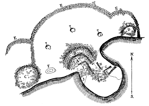
Fig. 2.—Ground
plan of Wood Canyon Ruin.
Butte Ruin
The so-called Butte Ruin, situated in Lost Canyon, 5 miles east of
Dolores, belongs to the circular type. It crowns a low elevation, steep
on the west side, sloping more gradually on the east, and surrounded by
cultivated fields. The view from its top looking toward Ute Mountain
and the Mesa Verde plateau is particularly extensive. The butte is
forested by a few spruces growing at the base and extending up the
sides, which are replaced at the summit by a thick growth of sage and
other bushes which cover the mound, rendering it difficult to make out
the ground plan of the ruin on its top.
From what appears on the surface it would seem that this ruin was
a circular or semicircular building about 60 feet in diameter, the
walls rising about 10 feet high. Like other circular mounds it shows
a well-marked depression in the middle, from which radiate walls or
indications of walled compartments. Like the majority of the buildings
of the circular form, the walls on one side have fallen, suggesting
that a low straight wall, possibly with rectangular rooms, was annexed
to this side.
In the neighborhood of Butte Ruin there is another hill crowned with a
pile of stones, probably a round building of smaller size and with more
dilapidated walls. Old cedar beams project in places out of the mounds.
The cliff-houses below the largest of these mounds show well-made walls
with a few rafters and beams. There are pictographs on the cliff a
short distance away.
Emerson Ruin
This ruin crowns a low hill about 3 miles south of Dolores (fig. 3).
The form of the mound is semicircular with a depression in the
middle around which can be traced radiating partitions suggesting
compartments. Its outer wall on the south side, as in so many other
examples of this type, has fallen, and the indications are that here
the wall was straight, or like that on the south side of Horseshoe Ruin.
The author’s attention was first called to this ruin by Mr. Gordon
Parker, supervisor of the Montezuma Forest Reserve, it having been
discovered by Mr. J. W. Emerson, one of his rangers. The circular or
semicircular form (fig. 4) of the mound indicates at once
that it does not belong to the same type as Far View House; the central depression
is surrounded by a series of compartments separated by radiating
walls like the circular ruins in the pueblo region to the south. Mr.
Emerson’s report, which follows, points out the main features of this
remarkable ruin.[31]
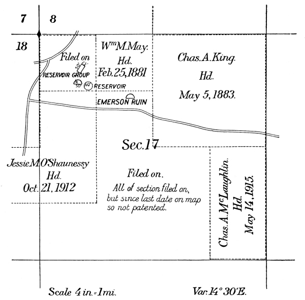
Fig. 3.—Metes
and bounds of Emerson Ruin. (After Emerson.)
Dolores, Colorado,
July 7, 1917.
In August, 1916, I visited Mesa Verde National Park. While there
Doctor Fewkes inquired in regard to ruins in the vicinity of the Big
Bend of the Dolores River. He informed me that the log of two old
Spanish explorers of 1775 described a ruin near the bend of the Dolores
River as of great value.
Later, during October, 1916, I visited a number of ruins in this
vicinity, including the one which (for the want of a better name)
I have mapped and named Sun Dial Palace. Later, last fall, I again
visited these ruins with Mr. R. W. Williamson, of Dolores, Colorado.
On July 5, 1917, I again visited these ruins, which I have
designated as Reservoir Group and Sun Dial Palace.[32] For location and status
of land on which they lie see map of sec. 17, T. 37 N., R. 15 W., N. M.
P. M. (fig. 3).
While examining Sun Dial Palace I noted the
“D-shaped construction, also that the south wall of
the building ran due east and west.” Also please note the regularity
of wall bearings from the approximate center of the elliptical center
chamber. I also noted that a shadow cast by the sun apparently
coincides with some of these walls at different hours during the day.
This last gave suggestion to the name. Also please note that the first
tier of rooms around the middle chamber does not show a complete set of
bearings but seems to suggest that these regular bearings were obtained
from observation and study of a master builder. The result of his study
was built as the next circular room tier was added. The two missing
rooms on the western side of the building seem to suggest that this
building was never completed, and also bear out my theory of an outward
building of room tiers from the middle chamber.
On the ground this building is fully completed on the south side
and forms a due east and west line. An error in mapping the elliptical
middle chamber has given the south side an incomplete appearance.
I believe that the excavation and study of this ruin will recall
something of value, as Father Escalante wrote in his log in 1775.
Respectfully submitted.
(Signed) J. Ward Emerson,
Forest Ranger.
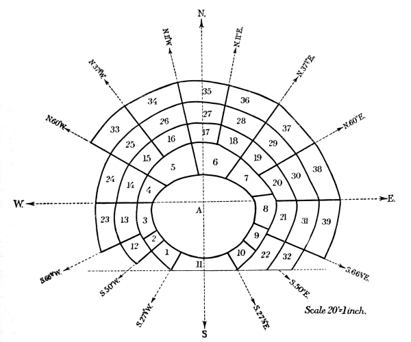
Fig. 4.—Schematic
ground plan of Emerson Ruin. (After Emerson.)
A personal examination of the remains of this building leads the author
to the conclusion that while it belongs to the circular group, with a
ground plan resembling Horseshoe House, and while the central part had
a wall completely circular, the outer concentric curved walls did not
complete their course on the south side, but ended in straight walls
comparable with the partitions separating compartments. The author
identifies another ruin as that mentioned by the Catholic fathers in 1775.
Escalante Ruin
The name Escalante Ruin, given to the first ruin recorded by a white
man in Colorado, is situated about 3 miles from Dolores on top of a low
hill to the right of the Monticello Road, just beyond where it diverges
from the road to Cortez. The outline of the pile of stones suggests a
D-shaped or semicircular house with a central depression
surrounded by rooms separated by radiating partitions. The wall on
the south or east sides was probably straight, rendering the form not
greatly unlike the other ruins on hilltops in the neighborhood of
Dolores.
This is supposed to be the ruin to which reference is made in the
following quotation from an article in Science:[33]
“There is in the Congressional Library, among the documents collected
by Peter Force, a manuscript diary of early exploration in New Mexico,
Colorado, and Utah, dated 1776, written by two Catholic priests, Father
Silvester Velez Escalante and Father Francisco Atanacio Dominguez. This
diary is valuable to students of archeology, as it contains the first
reference to a prehistoric ruin in the confines of the present State of
Colorado, although the mention is too brief for positive identification
of the ruin.[34]
While the context indicates its approximate site, there are at this
place at least two large ruins, either of which might be that referred
to. I have no doubt which one of these two ruins was indicated by these
early explorers, but my interest in this ruin is both archeological and
historical. Our knowledge of the structure of these ruins is at the
present day almost as imperfect as it was a century and a half ago.
“The route followed by the writers of the diary was possibly an Indian
pathway, and is now called the Old Spanish Trail. After entering
Colorado it ran from near the present site of Mancos to the Dolores.
On the fourteenth day from Santa Fe, we find the following entry: ‘En
la vanda austral del Vio [Rio] sobre un alto, huvo anti-quam (te) una
Poblacion pequeña, de la misma forma qᵉ las de los Indios el Nuevo
Mexico, segun manifieran las Ruinas qᵉ de invento registramos.’
“By tracing the trip day by day, up to that time, it appears that
the ruin referred to by these early fathers was situated somewhere
near the bend of the Dolores River, or not far from the present town
Dolores, Colo. The above quotation indicates that the ruin was a small
settlement, and situated on a hill, on the south side of the river or
trail, but it did not differ greatly from the ruined settlements of the
Indians of New Mexico with which the writers were familiar, and had
already described.”
There are numerous cliff-houses in this district, but while, as a
rule, they are much smaller than the magnificent examples in the Mesa
Verde, they are built on the same architectural lines as their more
pretentious relatives. Both large and small have circular subterranean
kivas, similarly constructed to those of Spruce-tree House, and
have mural pilasters (to support a vaulted roof, now destroyed),
ventilators, and deflectors.
There are also many rooms in cliffs, possibly used for storage or for
some other unknown purposes, but too small for habitations. It is
significant that these are identical so far as their size is concerned
with the “ledge houses,” near Spruce-tree House, indicating similar or
identical uses.
The kivas of cliff-dwellings of size in the region considered have the
same structural features as those of adjacent ruins, but very little
resemblance, save in site, to those of cliff-dwellings in southern
Arizona, as in the Sierra Ancha or Verde Valley, the structure of which
resembles adjacent pueblos.
The absence in the McElmo region of very large cliff-houses is due
partly but not wholly to geological conditions, the immense caves of
the Mesa Verde not being duplicated in the tributaries of the McElmo;
but wherever caverns do occur, as in Sand Canyon, we commonly find
diminutive representatives. While differences in geological features
may account for the size of these prehistoric buildings, the nature of
the site or its size is not all important.[35]
Here and there one sees from the road through the McElmo Canyon a few
small cliff-houses, and if he penetrates some of the tributaries, he
finds many others. The canyon is dominated by the Ute Mountain on the
south, but on the north are numerous eroded cliffs in which are many
caves affording good opportunities for the construction of cliff-houses.
These buildings do not differ save in size from the cliff-houses of the
Mesa Verde. Their kivas resemble the vaulted variety and the masonry is
identical.
Although the existence of cliff-dwellings in the tributaries of the
McElmo has long been known, the characteristic circular kivas which occur
in the Mesa Verde had not been recognized previous to the present report.
The relative age of the pueblos and great towers and the same
structures in caves can not be decided by the data at hand, but the
indications are that they were contemporary.
On account of the similarity in structure of the McElmo cliff-dwellings
to those on Mesa Verde, only a few examples from the former region
are here considered. It may be worthy of note that while McElmo
cliff-dwellings are generally accompanied by large open-air pueblos
and towers or great houses on the cliffs above, in the Mesa Verde
open-air buildings[36]
are generally situated some distance from the
cliff-dwellings.
Several small cliff-houses occur in Sand Canyon, one of the northern
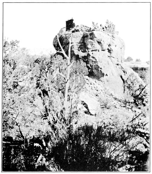
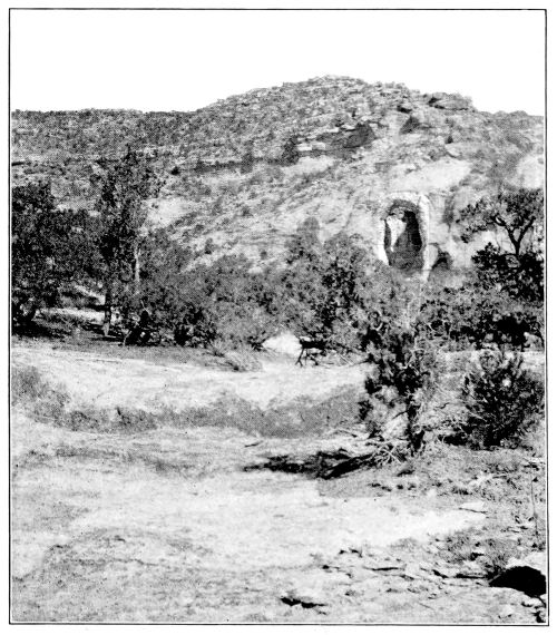
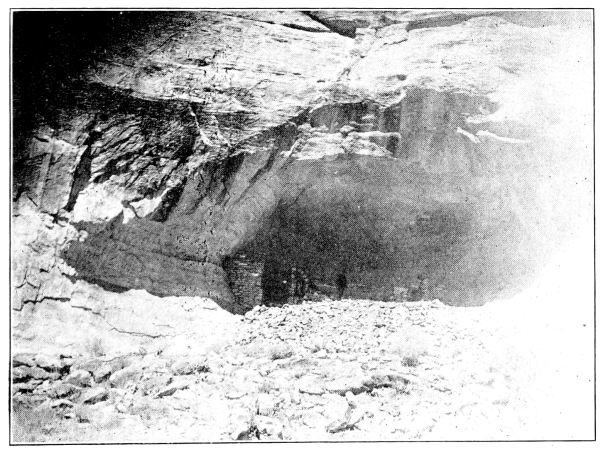
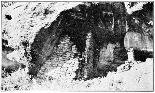
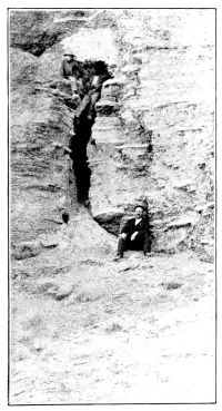
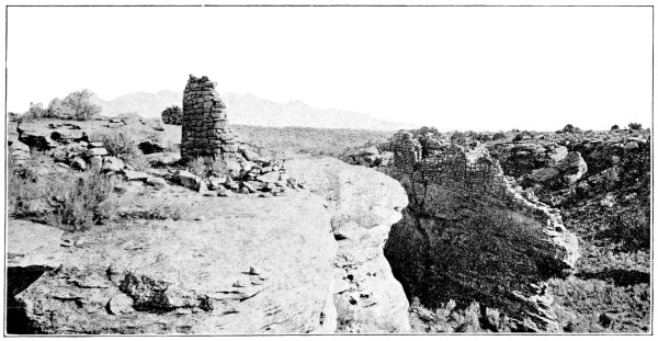
tributaries of the McElmo. Stone Arch House, here figured (pl. 6, a),
so-called from the eroded cliff (pl. 4, b)
near by. It is situated in the cliff, about a mile from where the canyon enters
the McElmo Canyon near Battle Rock. Abundant piñon trees and a few
scrubby cedars grow in the low mounds of the talus below the ruin,
near which, on top of a neighboring rock pinnacle, still stand the
well-constructed walls of a small house (pl. 4, a).
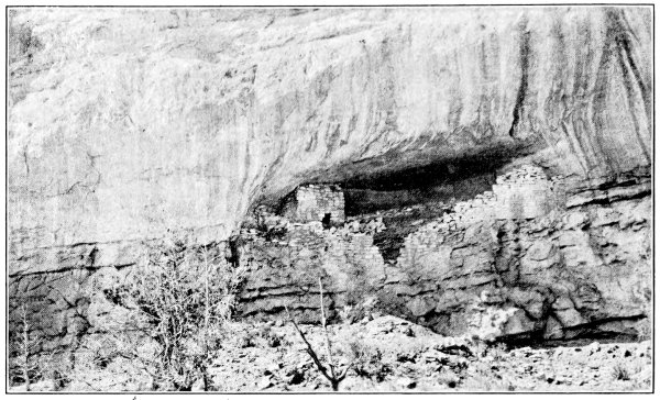
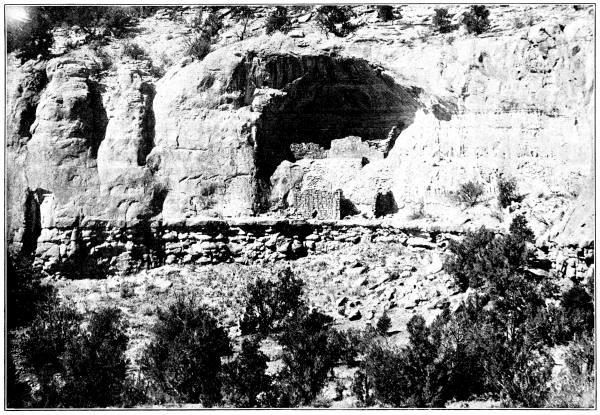
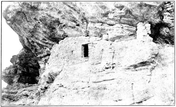
The formerly unnamed cliff-house shown in plate 8[37]
is one of the best preserved in Sand Canyon. It consists of an upper
and a lower house, the former situated far back in the cave, the
latter on a projecting terrace below. Unfortunately it is impossible
to introduce an extended description of this building as it was not
entered by the author’s party, but from a distance the walls exhibit
fine masonry. It is unique in having double buildings on different
levels, an arrangement not rare in a few examples of cliff-dwellings on
the Mesa Verde. As shown in plate 8, the character of the rock
on which the lower house stands is harder than that above in which the cave has
been eroded. The upper house is wholly protected by the roof[38]
of the cave and occupies its entire floor. The lower house shows from a
distance at least two rooms, the front wall of one having fallen.
From a distance the walls of both the lower and the upper house seem to
be well preserved, although many of the component stones have fallen to
the base of the cliff.
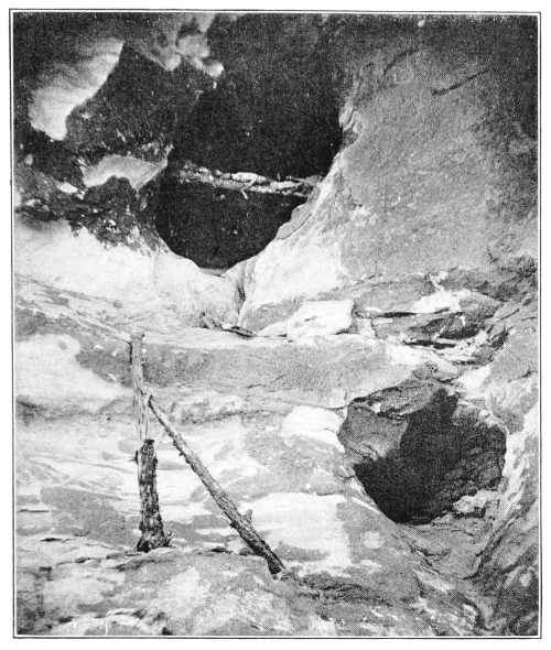
One of the cliffs bordering Sand Canyon has an inaccessible cave in
which is an artificial platform or lookout shown in plate 7, a.
Although this structure is not as well preserved as the scaffold in the
neighborhood of Scaffold House in Laguna (Sosi) Canyon, on the Navaho
National Monument, it seems to have had a similar purpose. It is
constructed of logs reaching from one side of the cave to the other
supporting a floor of flat stones and adobe. Its elevated situation
would necessitate for entrance either holes cut in the cliffs or
ladders.
In subsequent pages the author will describe a ruin called the
Unit type House, situated in the open on the north rim of Square
Tower Canyon. A similar type of unit type house is found in a cave
in Sand Canyon. The reader’s attention may first be called to the
definition of a unit type, which is a building composed of a circular
kiva, with mural banquettes and pedestals supporting a vaulted roof,
with ventilator, reflector, and generally a ceremonial opening near
a central fire hole in the floor. This kiva (fig. 5) is
generally embedded in or surrounded by rectangular rooms. The single-unit type
has one kiva with several surrounding rooms; the so-called pure type is
composed of these units united.
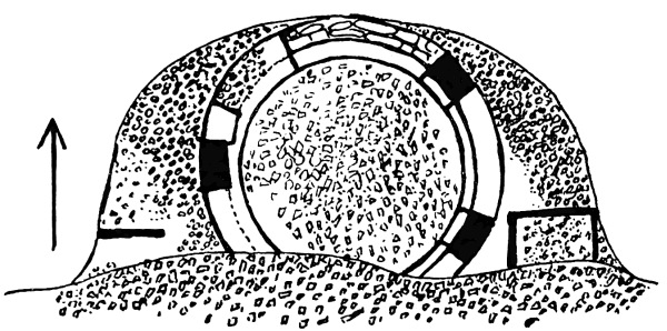
Fig. 5.—Ground
plan of Unit type House in cave.
In an almost inaccessible cave (pl. 5, b) in Sand
Canyon a few miles from the McElmo road near the scaffold already mentioned there is
a cliff ruin, so far as known the first described single-unit house in
a cave. It covers the whole floor of the cave (fig. 5) and
its walls are considerably dilapidated, but the kiva shows this instructive
condition: The walls are double, one inside the other, with two sets
of pedestals, the outer of which are very much blackened with smoke
of constant fires; the inner fresh and untarnished, evidently of late
construction. A similar double-walled kiva known as “Kiva A” exists
in Spruce-tree House, as described in the author’s account of that
ruin.[39]
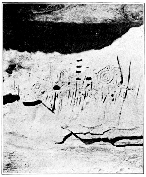
On the perpendicular wall of the precipice at the right hand of the
ruin in the cave above mentioned are several pictographs shown in plate 7, c.
The rectangular rooms about the kiva are in places excavated out of the
cliffs, but show standing walls on the front. These were not, however,
constructed with the same care as those of the kiva.
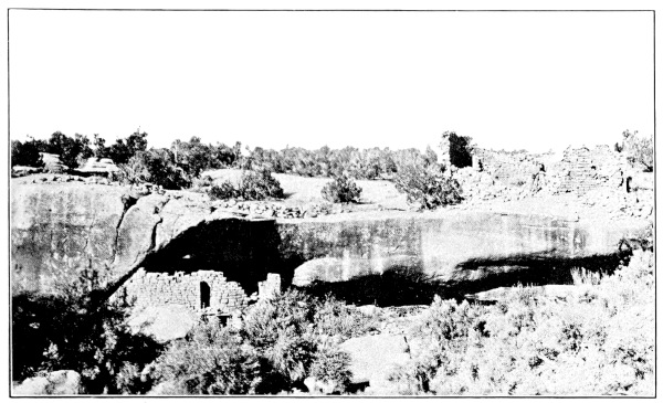
The cliff-house in Hackberry Canyon (pl. 9, a)
is one of the most instructive. It lies below Horseshoe House and appears to be a
second example of a unit type kiva and surrounding rooms.
The cliff-dwelling in Ruin Canyon[40]
visible across the canyon from the Old Bluff City Road is well
preserved. On the rim of the canyon are piles of stone indicating a
very large pueblo, with surface circular depressions indicating unit
type houses.
Lost Canyon, a southern tributary of the Dolores River, contains
instructive cliff-houses to which my attention was called by Mr. Gordon
Parker, superintendent of the Montezuma Forest Reserve, who has kindly
allowed me to use the accompanying photographs. This cliff-house
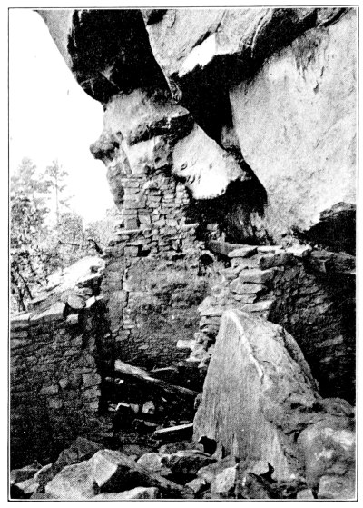
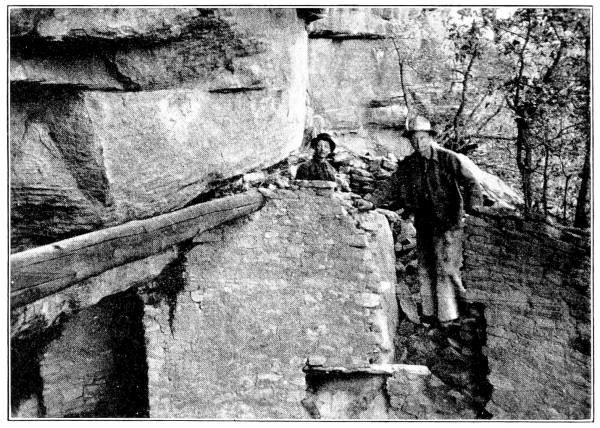
(pl. 10, a, b)
belongs to the true Mesa Verde type and shows comparatively good
preservation of its walls, some of the beams being in place. It is most
easily approached from Mancos.
There are small cliff-houses in the same canyon not far from Dolores,
but these are smaller and their walls very poorly preserved.
An interesting feature of these cliff-houses in Lost Canyon is that
they mark the northern horizon of cliff-dwellings of the Mesa Verde
type, having kivas similarly constructed.
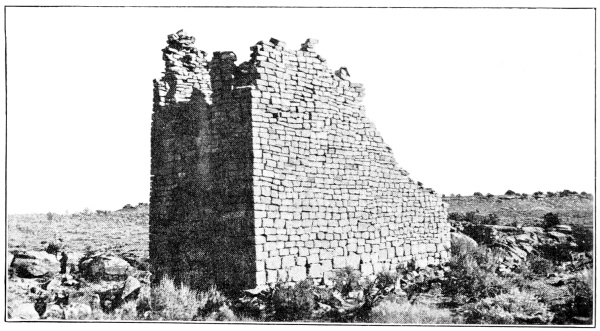
Great houses and towers differ from pueblos of the pure type but may
often be combined with them, forming composite houses arranged in
clusters called villages. Castles and towers may be isolated structures
without additional chambers, or may have many annexed rooms which
are rectangular, round, or semicircular in form. Semicircular towers
surrounded by concentric curved walls connected by radial partitions
forming compartments are shown in Horseshoe Ruin, to which attention
has been called in preceding pages, and possibly in the circular or
semicircular ruins on hilltops near Dolores.
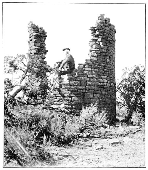
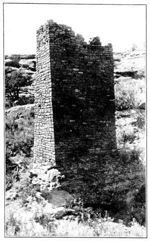
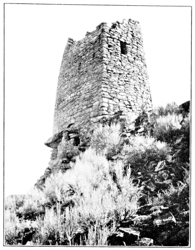
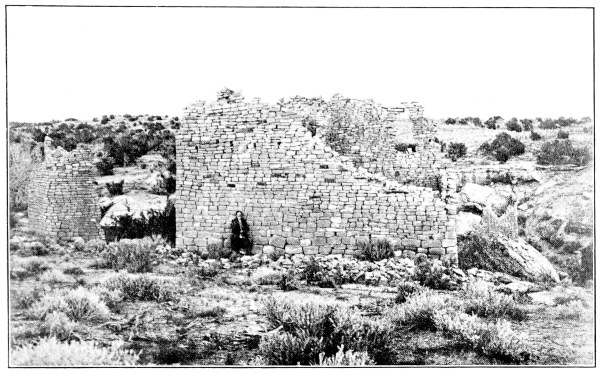
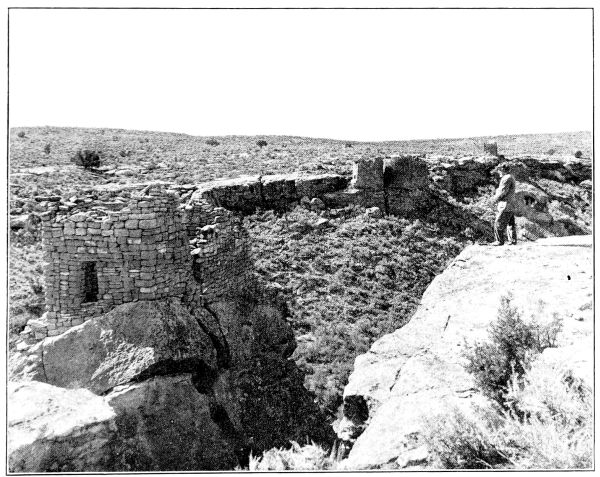
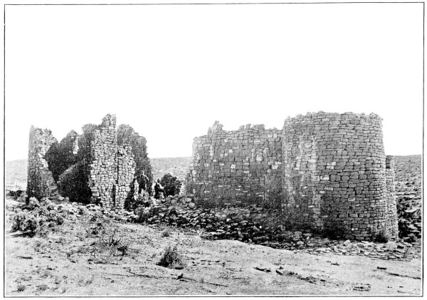
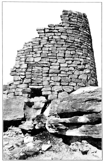
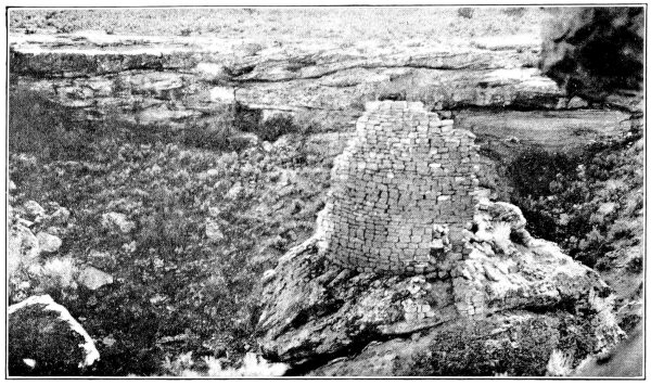
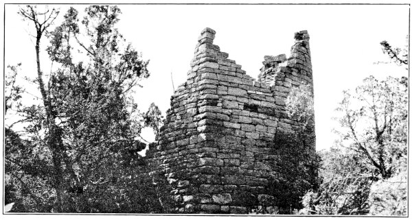
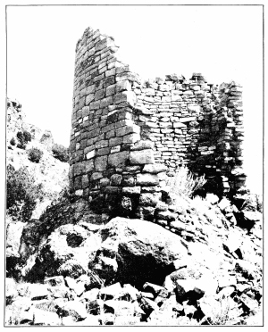
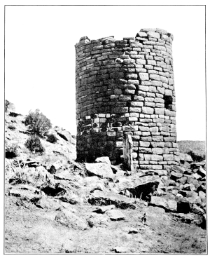
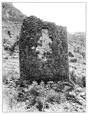
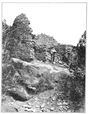
The masonry of the great house and tower type (pl. 11, a,
b) varies in excellence, not only in different examples
but also in different portions of the same building. Some of the walls contain
some of the best-constructed masonry north of Mexico; others (see pl. 6, b)
are crudely made. In the Great House of the Holly group,
where the walls show superior construction, the lowest courses of rock
are larger than those above, but in Hovenweep Castle small stones are
found below those of larger size; the Round Tower in McLean Basin shows
small and large stones introduced for ornamentation.
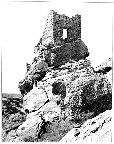
The ambitious constructors of several towers have built the foundations
of these towers on bowlders sloping at a considerable angle, and it
is a source of wonder that these walls have stood for so many years
without sliding from their bases. Although so well constructed in many
instances, the courses were weak from their want of binding to the
remaining wall. As a consequence many corners have fallen, leaving
the remaining walls intact. The builders often failed to tie in the
partitions to the outer walls, by which failure they lost a brace and
have sprung away from their attachment.
In a general way we may recognize masonry of two varieties.
1. That in which horizontal courses are obscure or absent. This has
resulted from the use of stones of different sizes, the intervals
between which are filled in with masses of adobe. These stones are
little fashioned, or dressed only on one side, that forming the face of
the wall.
2. That constructed of horizontal courses, constituting by far the
larger number of these buildings. Each course of this masonry is made
of well-dressed stones, carefully pecked, and of the same size. In this
horizontal masonry the thickness of stones used may vary in different
courses (pl. 11, b). They may be alternately narrow
or thick, or layers of thick stones may be separated by one or more layers of
tabular or thin stones. This method of alternation may be so regular
as to please the eye and thus become decorative, a mode of decoration
that reached a high development in the Chaco Ruins. The stones in the
horizontal style of masonry are equal in size throughout the whole
building in some cases, and show not only care in choice of stones but
also in dressing them to the same regulation size. In these cases the
joints fit so accurately that chinking has not been found necessary and
a minimum use of adobe was required.
The inner walls of kivas are much better constructed than the outer
walls of the same or of the walls about them. The masonry here is
regular horizontal. The sides, lintels, and thresholds of doorways
are among the finest examples of construction. With the exception of
walls sheltered by overhanging cliffs, the plastering has completely
disappeared, but there is no reason to doubt that the interiors of all
the great houses and towers were formerly plastered.
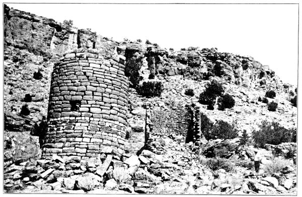
It is instructive to compare the masonry of the great houses and towers
of the Mancos with that of the towers in Hill Canyon (pl. 11, c)
in Utah, the most northern extension of these two types. In Eight Mile
Ruin, one of the largest of these buildings in Hill Canyon, we have a
circular tower with annexed great houses, all constructed of
well-dressed stones, the masonry in the walls showing on one side of
the tower. No excavations, however, have yet been undertaken in Hill
Canyon Ruins, and it is not known whether the unit type of kiva is
found there, but the combination of great houses and towers is evident
from the ground plans elsewhere published.[41]
The feature of the towers in Hill Canyon is the clustering into groups,
somewhat recalling the condition in Cannonball Ruin, where, however,
they are united. In the Eight Mile Ruin one of the towers is separated
from the remaining houses.
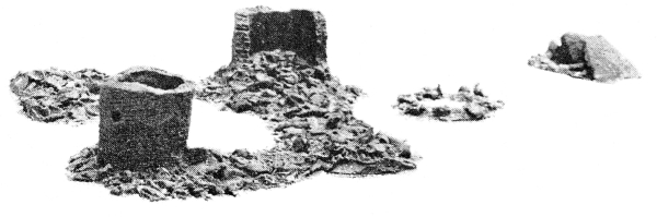
Several towers have accompanying circular depressions with surrounding
mounds. This association can well be seen in Holmes Tower on the
Mancos Canyon and in Davis Tower and one or two others on the Yellow
Jacket. These depressions, sometimes called reservoirs, have never been
excavated, but from what is known of rooms accompanying towers in the
western section of Hovenweep Castle it may be that they indicate kivas.
Some towers have no sunken area in the immediate vicinity, especially
those mounted on rocky points or perched on bowlders. At Cannonball
Ruin there are several kivas side by side in one section and towering
above them is a massive walled tower and other rooms.
None of the towers examined have evidences of mural pilasters to
support a roof or recesses in the walls as in vaulted-roofed kivas.
They are sometimes two stories high, the rafters and flooring resting
on ledges of the inner wall. Lateral entrances are common and windows
are absent.[42]
While the author has found no ruin of the same ground plan as Sun
Temple on the Mesa Verde, D-shaped towers or great houses from
several localities distantly recall this mysterious building, and there may be
an identity in use between Sun Temple and the massive walled structures
of the McElmo and Yellow Jacket; what that use was has not thus far
been determined.[43]
If they were constructed for observatories we can not account for the
square tower in the South Fork of Square Tower Canyon, from which one
can not even look down the canyon, much less in other directions,
hemmed in as it is by cliffs. Isolated towers are often too small for
defense; and they show no signs of habitation.
Are they granaries for storage of corn or places for rites and
ceremonies? Do they combine several functions—observation, defense,
and storage of food? Thus far in studies of more than 30 towers and
great houses not one has been found so well preserved that enough
remains to determine its use, and yet their walls are among the best
in all southwestern ruins. Some future archeologist may find objects
in towers that will demonstrate their function, but from our present
knowledge no theory of their use yet suggested is satisfactory.
It is impossible from the data available to determine the century in
which the towers and great houses of the region were constructed. Thus
far a few were seen with great trees growing in them, but none with
roofs; the state of preservation of the walls does not point to a great
age. Several writers have regarded them as occupied subsequently to
the Spanish conquest, while others have ascribed to them a very remote
antiquity. It can hardly be questioned that the cliff-dwellers, and by
inference their kindred, the tower builders, were superior in their
arts to modern Pueblos.
It is important to determine first of all the forms of these towers;
whether their ground plans are circular, oval, square, rectangular, or
semicircular. The northern wall of many is uniformly curved and the
last to fall, which might lead to the belief that the southern side,
generally straight, was poorly made, but one can not determine that by
direct observation, since the latter has fallen. As a matter of fact
the south wall was generally low and straight, over 50 per cent of
the “round” towers being semicircular, D-shaped,
or some modification of that form; but we also have square and
rectangular towers. It is also important to determine whether these
had single or multiple chambers and the arrangement of the rooms
in relation to them. This is especially desirable in towers with
concentric compartments.
It is also instructive to know more of the association of towers with
pueblos and cliff-dwellings or to analyze component architectural
features. The tower type often occurs without appended rooms. At Cliff
Palace and Square Tower House it is united with a pueblo village under
cliffs; in Mud Spring Ruin it has a like relation to rooms of a pueblo
in the open. Has its function changed by that union? What use did the
tower serve when isolated and had it the same use when united with
other kinds of rooms in cliff-dwellings and pueblos?
No writer on the prehistoric towers of Colorado and Utah has emphasized
the fact that a large number of these buildings are semicircular or
D-shaped, but it has been taken for granted that the fallen wall on the
south side was curved, rendering the tower circular or oval.[44]
In most cases this wall was the straight side of a D-shaped tower.
Doctor Prudden, who first recognized the importance of a union of towers with
other types of architecture in the McElmo district, says:[45]
“Towers of various forms and heights occasionally form a part of composite ruins
of various types.” He says also: “Several of the houses are modified by
the introduction of a round tower.” And again: “At the head of a short
canyon north of the Alkali, which I have called Jackson Canyon ... each
building consists of an irregular mass of rooms about 200 feet long,
with low towers among them.”
As our studies are morphological, dealing with forms rather than
sites of towers, little attention need be paid to their situation on
bowlders, in cliffs, or at the bottoms of canyons. The majority of the
castellated ruins considered in the following pages are in the proposed
Hovenweep National Monument, but there are others in the main Yellow
Jacket and its other tributaries.
The name Hovenweep (“Deserted Valley”) is an old one in the
nomenclature of the canyons of southwestern Colorado and formerly
(1877) was applied to the canyon now called the Yellow Jacket, but at
present is limited to one of the tributaries. The name is here used to
designate an area situated just over the Colorado State line, in Utah,
part of which it is hoped will later be reserved from the public domain
and made a monument to be called Hovenweep National Monument.
The ruined castles and towers in this district are marvelously well
preserved, considering their age and imperfect masonry. We can
determine their original appearance with no difficulty and use them
in reconstructing the possible forms of more dilapidated ruins, now
piles of débris. The best castles and towers known to the author are
localized in three canyons: (1) Square Tower Canyon, (2) Holly Canyon,
(3) Hackberry Canyon. There are, of course, other castles and towers in
the Yellow Jacket-McElmo region, but there is no locality where so many
different forms appear in equal numbers in a small area.
Ruin Canyon
The Old Bluff Road from Dolores diverges southward from that to
Monticello at Sandstone post office and passes a pile of rocks visible
from the road on the Ruin Canyon long before it reaches Square Tower
Canyon (fig. 6). This large ruin is situated on the east
rim and under it in the side of the cliff are fairly well-preserved cliff-houses.
Other ruins with high standing walls were reported in Ruin Canyon but
were not visited.
The duplication of names of canyons in this district is misleading.
Names like Ruin Canyon are naturally applied to canyons in which
there are ruins. When the author learned at Dolores of Ruin Canyon,
he supposed it was a tributary of the Yellow Jacket or McElmo, but
while the canyon known to cowboys at Dolores by this name has large
ruins on its rim, it is not the “Ruin Canyon” to which attention is
now directed. The duplication of names has led me to retain the name Ruin
Canyon for one and to suggest the name Square Tower Canyon for the other.
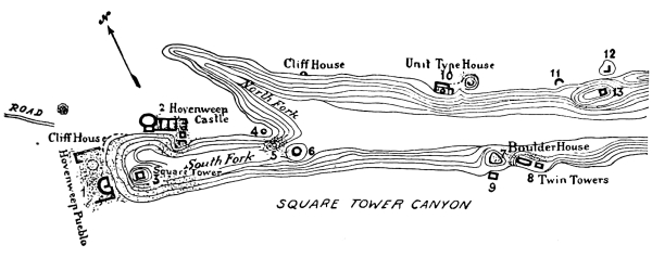
Fig. 6.—Square
Tower Canyon.
After leaving Ruin Canyon the Old Bluff Road takes a southerly course,
passing through the cedars until a sagebrush clearing replaces the
“timber,” where it crosses two well-preserved Indian reservoirs, or
bare surfaces of rock, dipping south, the southern border having as
a retaining wall a low ridge of earth to hold back the water. The
retaining wall of the second reservoir has been built up by stockmen
and, when the author was there, contained considerable water. Crossing
the second reservoir a trail turns east or to the left and follows the
road to Keeley Camp, near which are the “Keeley Towers.”
At present an automobile can approach within a mile of these ruins.
Square Tower Canyon
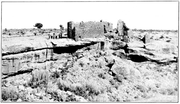
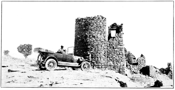
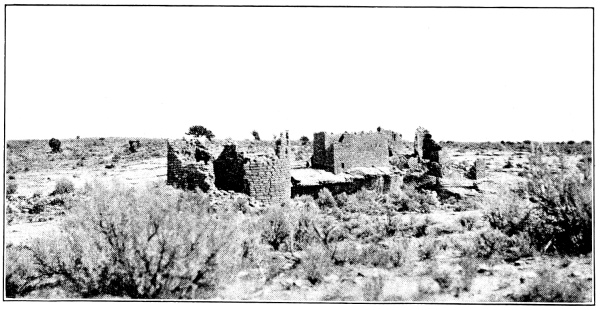
To reach the Square Tower Canyon (pls. 11-17) one returns
to the reservoir on the Bluff Road and continues east about 3 miles farther,
where a signboard on the left hand indicates the turn off to Square
Tower Canyon. Following the new direction about southeast the great
buildings are visible a mile away. An automobile can go to the very
head of this canyon and a camp can be made within a few feet of
Hovenweep House. If the visitor approaches Square Tower Canyon from the
McElmo, he passes through Wickyup Canyon, where there are two towers on
the summits of elevated buttes, not far from the junction of the canyon
and the Yellow Jacket.
The castles and towers in Square Tower Canyon have been known for many
years and have been repeatedly photographed.[46]
Several descriptions of these ruins have been printed, but no
satisfactory studies of their structure have been published. They
are recognized as prehistoric and are generally thought to have been
inhabited contemporaneously with the cliff-dwellers of the Mesa Verde,
being built in the same style of architecture.
Classification of Ruins in
Square Tower Canyon
The ruins in Square Tower Canyon are classified for convenience in
description as follows:
(1) Ruins which have indications of inclosed circular kivas, with
mural pilasters and banquettes, and closely approximated surrounding
rooms. To this class belong ruins 1, 2, and 10. Of these, Unit type
Ruin (No. 10) has only one kiva and belongs to the simplest or unit
form of the pure type. Ruins 1 and 2 have two or more kivas and are
formed by a union of several units, combined with towers and great
houses. (2) Ruins, the main feature of which is absence of a circular
kiva. The Twin Towers belong to this second or “great house” type. The
few cliff-dwellings in this canyon are small, generally without kivas,
resembling storage cists rather than domiciles.
Hovenweep House (Ruin 1)
This ruin (fig. 7), the largest in the canyon, is situated
at the head of the South Fork. Although many of its walls have fallen, there still
remains a semicircular great house (B, C, D)
with high walls conspicuous for some distance. The ruin is a pueblo
of rectangular form belonging to the pure type, showing circular
depressions identified as kivas (K), embedded in collections of
square and rectangular rooms, and massive walled buildings (E)
on the south side.
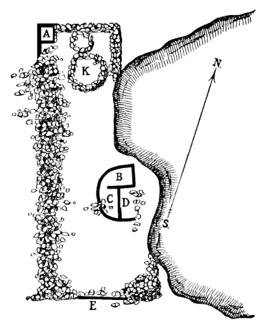
Fig. 7.—Ground
plan of Hovenweep House.
The standing walls of the ruin are remains of a conspicuous D-shaped
tower (B, C, D), which is multichambered. Its
straight wall measures 23 feet, the curved wall 56 feet, and its
highest wall, which is on the northeast corner, is 15 feet high. At the
northwest angle of the ruin (A) there stand remains of high walls which
indicate that corner of a rectangular pueblo. Hovenweep House (pl. 14, a)
was the largest building in this canyon, but with the exception of
the addition of a semicircular tower or great house, does not differ
greatly from a pueblo like Far View House on the Mesa Verde. The piles
of stone and earth indicating rooms below justify the conjecture that
when the fallen débris is removed the unfallen walls will still rise
several feet above their rocky foundations. If properly excavated,
Hovenweep House would be an instructive building, but in its present
condition, while very picturesque, its structure is difficult to determine.
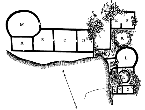
Fig. 8.—Ground
plan of Hovenweep Castle.
Hovenweep Castle
This ruin (pls. 14, b, c;
18, b), like the
preceding, has circular kivas compactly embedded in rectangular
rooms arranged about them, indicating the pure type of pueblos. The
massive walled semicircular towers and great houses are combined with
square rooms and kivas, indicating that it is distinguished by two
sections, an eastern and a western, which, united, impart to the whole
the shape of a letter L (fig. 8).
WESTERN SECTION OF
HOVENWEEP CASTLE
The western section (fig. 8, A-D, M) of Hovenweep
Castle is made up of five rooms, the most western of which, M, is
semicircular, while A, B, C, and D are
rectangular. Room A is almost square, one of its walls forming
the straight wall of the south side of the semicircular tower,
M. At the union its walls are not tied into the masonry of the
circular wall of the tower, as may be seen in the illustration, plate 14, b,
implying that it was constructed later. There is an
entrance into A from the south or cliff side, and a passageway
from A to Room B, which latter opens by a doorway into
Room C. All rectangular rooms of the western section communicate
with each other, but none except A seem to have had an external
entrance. The photograph of the south wall of the west section of the
ruin (pl. 14, c) shows small portholes in the
second story and narrow slits in the tower walls. The lower courses of masonry
are formed of thinner stones than the rows above, but smaller stones
compose the courses at the top of the wall. A view of the north wall of
the western section (pl. 22, a) shows the
tower and rooms united to it. There is no kiva in the western section.
EASTERN SECTION OF
HOVENWEEP CASTLE
The longest dimension of the western section (pls. 12,
14, c)
is approximately east-west; that of the eastern is nearly north-south.
The eastern section (fig. 8, E-L), like the western, has
a tower (L), which is situated between two circular depressions or kivas
(K). On the north and south ends the eastern section is flanked
by rectangular rooms. Those at the north end were better constructed,
and even now stand as high as the walls of the western tower. The views
show that their corners are not as well preserved as their faces, which
is due to defects in masonry, as lack of bonding. Although much débris
has accumulated around the kivas, especially in their cavities, it is
evident that these ceremonial rooms were formerly one storied, and
practically subterranean on account of the surrounding rooms. Several
fragments of walls projecting above the accumulated débris indicate
rooms at the junction of the eastern and western sections of the ruin,
but their form and arrangement at that point are not evident and can be
determined only by excavation. The inner kiva walls show evidences of
mural pilasters and banquettes like those of cliff-dwellings and other
pure pueblo types.
Ruin 3
The square tower (pl. 11, a), standing on
a large angular rock in the canyon below Hovenweep Castle, is a remarkable example
of prehistoric masonry so situated that it is shut in by cliffs, rendering
the outlook limited. Several published photographs of this tower give
the impression that it stands in the open and was an outlook, but that
this is hardly the case will be seen from a general view looking west
up the South Fork.
Ruin 4
This ruin is a small tower situated in a commanding position on the
point of the mesa where the canyon forks. The section of the wall still
standing indicates a circular form, the north side of which has fallen;
the part still intact, or that on the south side, exhibits good masonry
about 8 feet high (pl. 15, c).
Ruin 5
The walls of the north segment of a tower stand on a large angular
block of stone rising from a ledge above the arroyo, or bed of the
canyon, below Ruin 4, on the South Fork. What appears to have been a
doorway opens on its north side; this opening is defended by a wall,
remains of a former protected passageway into the tower.
On the perpendicular cliff of the precipice near Ruin 5 and below
the point on which Ruin 4 stands there are several almost illegible
pictographs, below which are rather obscure evidences of a building,
the features of which can be determined only by excavation.
Instructive features of Tower No. 5 are two parallel walls, one
on each side of the doorway, like those of the circular towers on
the promontory at the junction of the Yellow Jacket and McElmo.
Other towers on the canyon rim show defensive walls, as in Ruin 9,
constructed about their entrances from corners of the buildings to
the mesa rim, effectually preventing passage. Morley and Kidder have
suggested that the walled recess in the cliff below Ruin 9 was probably
built to prevent access from below. This feature is found in the floor
entrances of a building near the Great House of the Holly group.
Ruin 6
This ruin is a small tower whose curved walls are so broken down that
the form is not evident. It is situated in the base of the talus at the
head of the South Fork (pl. 26, a).
Eroded Bowlder House
(Ruin 7)
This house, more remarkable from its site than its structure, was
constructed in an eroded cave of a bowlder halfway down the talus of
the cliff. The front walls are somewhat broken down, but others built
in the rear of the cave still remain intact. On the top of the bowlder
is the débris of fallen walls, suggesting a former tower, but not
much remains in place to determine its outlines. Where the walls are
protected the mortar shows impressions of human hands and at one place
there are the indentations of a corncob used by the plasterers to press
the mortar between the layers of stone. There were formerly at least
two rooms in the rear of the cave, the front walls of which have fallen
and are strewn down the talus to the bottom of the canyon.
Twin Towers
(Ruin 8)
The so-called Twin Towers, which seen together from certain points
appear as one ruin (pl. 15, a,
b), rank among the most
impressive buildings in Square Tower Canyon. They stand on the south
side of the canyon on a rock isolated by a cleft from the adjoining
cliff. The larger (fig. 9, A-E) has an oval ground
plan and a doorway in the southwest corner; the smaller (F, G,
H, I) is horseshoe shaped with a doorway in the east
wall, which is straight. The arrangement of rooms is seen in figure 9.
Small walled-up caves are found below the foundation on the northwest
base of the larger room.
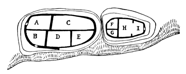
Fig. 9.—Ground
plan of Twin Towers.
Ruin 9
The ground plan of this ruin is rectangular in form, 19 feet 6 inches
long by 10 feet wide. The standing walls measure 11 feet in altitude.
It is situated on the south rim at the mouth of the South Fork, just
above Ruin 7, a few feet back from the cliff. A doorway opening in the
middle of its north wall was formerly made difficult of entrance by
walls, now fallen, extending from the northeast and northwest angles to
the edge of the cliff. The masonry throughout is rough; projecting ends
of rafters indicate a building two stories high. There are peepholes
with plastered surfaces through the southeast and west walls, which
suggest ports. A short distance east of the building is a circle of
stones reminding the author of a shrine.
Unit Type House
(Ruin 10)
This pueblo (pl. 19, c), from a comparative point
of view, is one of the most interesting ruins in the Hovenweep, and is situated on
the very edge of the canyon on the North Fork not far from where it
begins. It is the simplest form of prehistoric pueblo, or the
unit[47]
of a pure type, made up of a centrally placed circular ceremonial
room (fig. 10, K) embedded in rectangular rooms,
six in number (A-F). The resulting or external form is rectangular, oriented
about due north and south; the southern side, which formerly rose
from the edge of the canyon, being much broken down and its masonry
precipitated over the cliff.
The central kiva (fig. 10) is made of exceptionally fine
masonry and shows by what remains that it had mural banquettes, and pilasters to
support the roof, with other features like a typical kiva of the Mesa
Verde cliff-houses. A side entrance opens in one corner into a small
room (fig. 10, G) in which ceremonial objects
may have been formerly stored (pl. 32, b).
The kiva of Unit type House is architecturally the same as those with
vaulted roofs at Spruce-tree House, Cliff Palace, and Far View House on
the Mesa Verde. A similar structure, according to Prudden,[48]
occurs at Mitchell Spring Ruin in the Montezuma Valley, and near the Picket
corral. The same type was found by Morley[49]
at the Cannonball Ruin and by Kidder[50]
in a kiva on Montezuma Creek in Utah, where clusters of mounds would
appear to be composed of single or composite ruins of this type. This
small pueblo was probably inhabited by one social unit, and may be
regarded as the first stage of a compound pueblo.
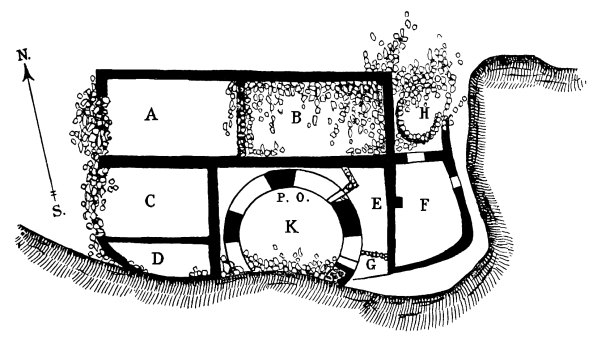
Fig. 10.—Ground
plan of Unit type House.
Stronghold House
(Ruin 11)
Ruin 11 is composed of a cluster of several small buildings, one of
which is situated on the north edge of the mesa somewhat east of Ruin
10 (pl. 25, b); another, called by Morley and Kidder
Gibraltar House, formerly of considerable size, was built on the sloping surface
of an angular bowlder (pl. 17, 21, b).
Although many walls have fallen, enough remains to render it a
picturesque ruin, attractive to the visitor and instructive to the
archeologist, by whom it has been classed as a tower. This building
from the east appears to be a square tower, but it is in reality
composed of several rooms perched on an inaccessible rock.
Ruins in Holly Canyon
The towers in Holly Canyon (fig. 11) are in about the
same condition of preservation as those in Square Tower Canyon. They cluster about
the head of a small canyon (pl. 18, a) and may be
approached on foot along the mesa above Keeley Camp, about a mile distant. Two of
the Holly ruins belong to the tower type and were built on fallen bowlders.
One of these has two rooms on the ground floor. (Pls. 19, a,
b; 20, a,
c.)
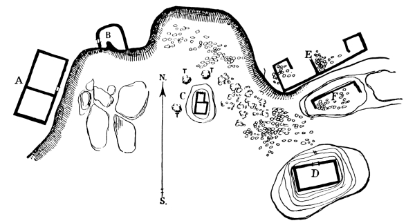
Fig. 11.—Holly
Canyon Ruins.
RUIN A, GREAT HOUSE,
HACKBERRY CASTLE
Ruin A (pl. 21, a), the largest building of
the group, which stands on the edge of the canyon, is rectangular in form, measuring
31 by 9 feet, and is 20 feet high (fig. 11, A).
Evidences of two rooms appear on the ground plan, one of which is
14 feet long, the other 12 feet inside measurement. The partition
separating the two rooms is not tied into the outer walls, an almost
constant feature in ancient masonry. The ends of the rafters are still
seen in the wall at a level 12 feet above the base. Fallen stones have
accumulated in the rooms to a considerable depth, and the tops of the
remaining wall, where the mortar is washed out, will tumble in a short
time.
Ruin B (pl. 20, b),
situated a short distance north of Ruin A, also stands on the canyon
rim. The north wall is entire, but the south wall has fallen. What
remains indicates that the ruin was about square, with corners on the
north side rounded, imparting to it a semicircular form. The entrance
into this room may have been through the floor.
TOWERS [C AND D]
These towers (pl. 23, a, b)
show some of the finest masonry known in this region, being constructed on fallen bowlders
which their foundations almost completely cover. Holly Tower (pl. 23, b)
measures 16 feet high and 21 feet in diameter. It is 7
feet wide, its top rising to a height level with that of the mesa on
which stand buildings already considered. One of the two rooms of this
tower is narrower and wider than the other, shown in an offset as if
constructed at a different time. Its foundations are 17 feet long by
8 feet wide, the highest wall measuring, at the southeast corner, 12
feet 8 inches. There is a fine doorway, wide above and narrow below,
in the north wall. The approach at present is difficult on account of
the height of the rock on which it stands, but there are evidences of
former footholes.
HOLLY HOUSE
Several broken-down walls, some of which are over 6 feet high, situated
east of Ruin A, appear to belong to a pueblo of considerable size
(fig. 11, E, F), but the large
foundation rock on which it is situated has settled, its top having
separated from the edge of the canyon, so that the corner of the
building (F) is out of plumb. The walls on the adjoining cliff
are also much broken down, although several sections of them rise a few
feet above the general surface. The cause of this change in level of
the base may have been an earthquake or the settling or sliding of the
bowlder on the talus down the hill. The united building appears to have
been a pueblo of rectangular form. Its walls are so broken down that it
was not possible to determine its exact dimensions.
Ruins in Hackberry Canyon
HORSESHOE HOUSE
The large building in Hackberry Canyon, one of the terminal spurs of
Bridge Canyon, a mile northeast of the cluster in Holly Canyon, is
particularly instructive from the fact that surrounding the remains of
a circular tower, for two-thirds of its circumference, is a concentric
wall with compartments separated by radial partitions (fig. 12, 1).
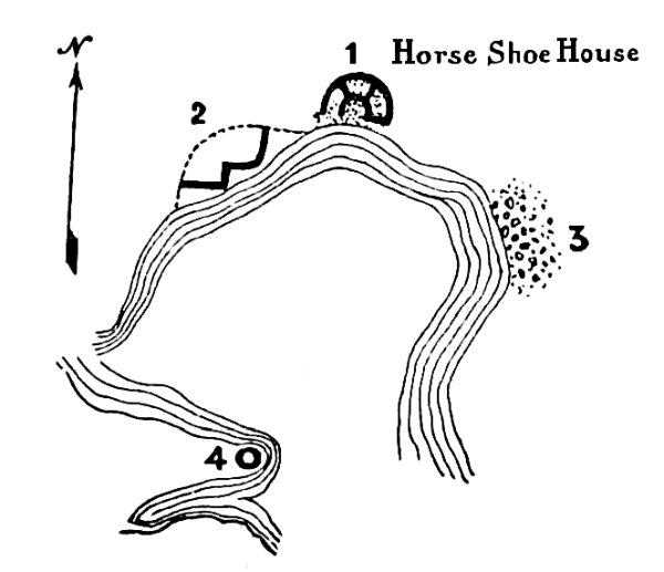
Fig. 12.—Horseshoe
(Hackberry) Canyon.
Horseshoe House (pl. 23, c) stands on the north edge
of the canyon (fig. 12, 1), having its straight wall on the south
side, as is usually the case, the well-preserved north side being curved. The
northeastern corner still stands several feet high. The southeastern
corner formerly rested on a projecting rock, which recalls the
cornerstone of Sun Temple. The masonry of most of the southern segment
of the enclosed circular room or tower has fallen down the cliff. There
does not appear to have been a doorway on the south side, and there is
not space for rooms on this side on account of the nearness to the edge
of the cliff. While the form (fig. 13) of Horseshoe Ruin
recalls that of Sun Temple, in details of room structure it is widely divergent.
The length of the south wall, or that connecting the two ends of the
horseshoe, is 30 feet, its width 27 feet; the highest wall on the
northwest side is 12 feet. Figure 13 shows the arrangement
of the rooms and the mutilation of the south wall of the ruin. The distance between
the outer and inner concentric walls averages 4 feet; the circular room
is 17 feet in diameter.
In the same cluster as Horseshoe Ruin (pl. 24, a) there
is another well-made tower (fig. 12, 4), constructed on a point
at the entrance to the canyon, and below it in a cave are well-preserved walls
of a cliff-dwelling.
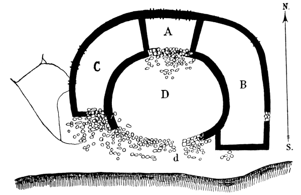
Fig. 13.—Ground
plan of Horseshoe House.
A short distance due north of Horseshoe House, at the head of a small
canyon, a tributary of Bridge Canyon, there are two large pueblos and a
round tower. The pueblos are mentioned by Prudden, who gives a ground
plan which indicates an extensive settlement.
Of the several towers and great houses of the main Yellow Jacket Canyon
two may suffice to show their resemblance to those in Square Tower
Canyon. The two towers considered belong to the D-shaped variety,
the straight wall, as is almost always the case, being on the south side.
Davis Tower
Mr. C. K. Davis, who lives not far from the Yellow Jacket Spring,
conducted the author to a tower of semicircular ground plan (fig. 14)
near his ranch. This ruin (pl. 26, b), is situated
on a rocky ridge on top of the talus halfway down to the bottom of the canyon, on
its right side.
Lion (Littrell) Tower[51]
This tower (pl. 29, b) is built on a bowlder situated
in Yellow Jacket Canyon a mile from Mr. Littrell’s ranch and about 5 miles south
of the Yellow Jacket post office; approximately 20 miles from Dolores,
Colorado. Its ground plan (fig. 15) is D-shaped,
the lower story being divided by partitions into four rooms. The wall
of the middle room seems to be double, or to have been reenforced. It
measures 40 feet on the straight side, the highest wall being about 25
feet above the base. The foundations rest on the irregular surface of a
bowlder to which it conforms.
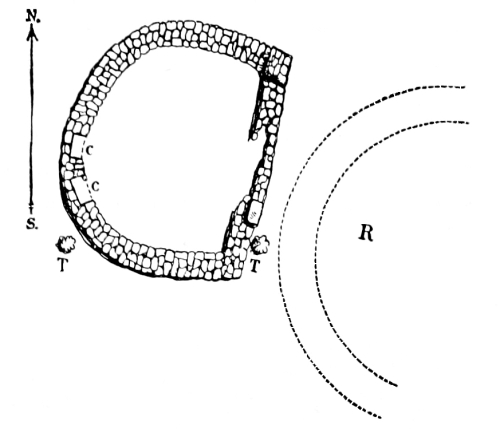
Fig. 14.—Ground
plan of Davis Ruin.
McLean Basin is 3 miles from the Old Bluff City Road near Picket
corral, 32 miles from Dolores. It has been a favorite wintering place
for stock and is well known to herdsmen. One can approach the ruin
from the road to Bluff City and the towers here referred to are easily
reached by a trail down the mesa to the highest terrace. There are
said to be several ruins in the McLean Basin, the two towers (pls. 26, c,
27, 28, a,
b) visited being placed in an
exceptional position in reference to surrounding rooms. One of these
towers is circular, the other D-shaped or semicircular in ground plan
(fig. 16, A, B).
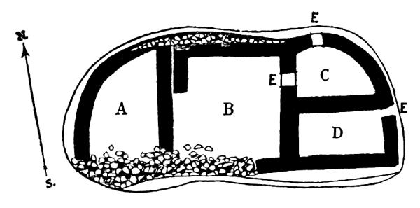
Fig. 15.-Ground
plan of Lion House.
Previously to the author’s study of the southwestern towers two forms
of these structures were recognized; the square or rectangular, and the
circular or oval. It is now known that several of the towers previously
described as circular are in reality D-shaped, and this form is
probably more common than the circular.
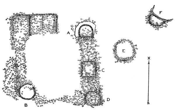
Fig. 16.—Ground
plan of ruin with towers in McLean Basin.
The rectangular building in the McLean Basin has a circular tower (pl. 28, b)
on the southwest angle and a D-shaped tower (pl. 28, a)
on the northeast. They resemble two turrets rising above
the remaining walls that form the sides of the rectangles. These
towers average about 12 feet high, and are well constructed, while low
connecting walls of coarse masonry rise slightly above the surface.
It would appear from the amount of débris that the remaining walls
indicate a row of buildings, one story high, with circular subterranean
kivas, but this can not be accurately determined without excavation of
the ruin. Outside of the rectangle, however, there are at least two
circular areas, possibly kiva pits. The rectangular building measures
about 50 feet square. The ground on which the buildings formerly
stood slopes to the south, and back of it on the north rises a low
perpendicular bluff which effectually shelters it in that direction.
The union of a circular and a semicircular tower with, a rectangular
ruin is a feature not common in the McElmo-Yellow Jacket region but
appears in Hovenweep Castle, elsewhere described. Lower down the sides
of the basin and near by are many indications of walls of buildings.
The pottery in the neighborhood belongs to the same black and white
types commonly found in the Hovenweep and Mesa Verde areas.
Except for their peculiar relation to the rectangular building the
McLean towers do not differ essentially from others, which leads to the
inference that they were used contemporaneously and for the same
purpose. There is a well-made doorway (fig. 17)
in the Round Tower.
Sand Canyon, which opens into McElmo Canyon near Battle Rock, has
several types of prehistoric ruins, viz, towers, cliff-houses, and
large rim-rock pueblos. The tower type of architecture represented by
the example here figured (pl. 5, a) is isolated
from other forms of buildings. This tower is figured by Doctor Prudden, who mentions
another in the neighborhood which the author did not visit.
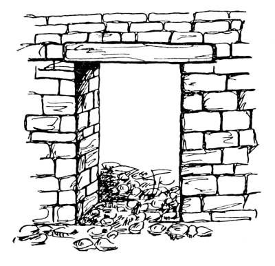
Fig. 17.—Doorway
in Round Tower, McLean Basin.
The nomenclature of the northern canyons of the McElmo has considerably
changed in the last 40 years. What we now call the Yellow Jacket was
formerly known through its entire course as the Hovenweep. A small
canyon opening near its mouth, now known as Road Canyon, was formerly
called the Wickyup. The Old Bluff City Road from Dolores, Colorado, to
Bluff City, Utah, divides into two branches a short distance before
it descends into the McElmo, its left branch passing through Road
Canyon, the right bank of which follows the Yellow Jacket, which the
traveler fords a short distance above its junction with the McElmo.
Wickyup Canyon may be called picturesque, its cliffs being worn into
fantastic shapes by water and sand. It has important antiquities, among
the most striking of which are two towers (pl. 24, b),
crowning the tops of low buttes or hills. The walls of these towers are well
constructed, one being a simple structure with a single room, the other
having appended rectangular rooms extending toward the northwest, some
distance along a ridge of rocks. An examination of these two towers,
which are about one-quarter of a mile apart, shows that they belong to
the same type as the simple forms of those above mentioned, and as the
entrance to Square Tower Canyon is not far away, they probably belong
to the same series. The first of the towers, called “Bowlder Castle,”
is situated a few hundred feet east of the road, from which it is
easily seen. This ruin is rectangular in shape and rises from a basal
mass of débris indicating broken-down walls of rooms. At a level with
the top of this débris on its southern side stands a well-constructed
tower with well-made doorway, the threshold and lintel of which are
smooth stones, whose edges project slightly from the surface of the
wall. One remarkable feature of this tower is that the doorway has been
walled up with rude secondary masonry (pl. 25, a).
The south wall of this building has tumbled over, as is usually the case, but the
north wall rises several feet above the base. The masonry of the second
tower is also broken down on the south side, but the standing remains
of the north wall, which is circular, are over 10 feet high. The
indications are that the ground plan of this building was oval in shape
and that it inclined inward slightly from foundation to apex. Scattered
over the surface are the remnants of fallen walls, and near it there is
a well-marked depression, not unlike those found in unit type mounds,
indicating kivas.
The author’s examination of the towers in the region considered
embraced likewise a few in the Mancos Canyon and valley. In all
essential features the Mancos towers resemble those of Mesa Verde, the
McElmo, and the Yellow Jacket Canyons, and were evidently built by the
same people who constructed the towers on Navaho Canyon and elsewhere
on the Mesa Verde National Park. A brief reference to two or three
of these Mancos River towers may suffice to point out their general
structure.
Holmes Tower
One of the towers figured by Holmes in 1877 is still among the best
preserved in this region and can be visited by following up the Mancos
Canyon from the west about 10 miles from where the Cortez road crosses
the Mancos River before going on to Ship-rock. There is at this point a
bridge and near the crossing an industrial farm of the Ute Reservation
where accommodations were obtained. The Mancos Valley widens after
leaving the canyon, the southern side of Mesa Verde appearing as a
series of high mesas separated by canyons. In the neighborhood of the
western end of Mesa Verde are lofty buttes, one called Chimney Rock,
another the Ute Woman. This valley and the canyons extending into the
Mesa Verde contain numerous piles of stone indicative of buildings of
rectangular shape with numerous circular depressions. No cluster of
mounds like those in Montezuma Valley was seen, but about 40 sites of
buildings were distributed at intervals. None of these have standing
walls above ground.
Following up the Mancos Canyon is a wagon about 9 miles an arroyo was
encountered and from there horses were taken and the river crossed to
its south bank, above which, on the shelving terrace, is the Holmes
Tower, visible many miles down the canyon. This tower (pl. 29, a)
is in much the same condition as when sketched by Holmes over
40 years ago. It is circular in form, about 10 feet in diameter, and
about 16 feet high, with a broken window on the north side. The sky
line is irregular. It is one of the best preserved towers, but not as
high or as well constructed as some of the Hovenweep specimens.
Accompanying this tower on the north there are mounds indicative of
rooms and two circular saucer-like depressions. Excavations revealing a
few human bones, including a well-worn human skull, have been made in a
burial place southeast of the tower, where the surface is covered with
fragments of pottery. Except in size Holmes Tower does not differ from
others already described, but, like them, is connected with rectangular
rooms. Farther up the Mancos Canyon there are other towers, one of
which, Great Tower, is mentioned by Holmes in his report.
On the way up the canyon, perhaps two-thirds of the distance from the
bridge to the Holmes Tower, midway in the alluvial plain and on the
right bank of Mancos Creek, stands a circular ruin which conforms to
Holmes’s description of Great Tower but is too poorly preserved to be
positively identified. All that now remains of this building is a large
pile of rocks with a central depression, but no signs of radiating
partitions, although such may have existed when it was constructed and
for many years after it began to fall into ruin.
Towers on the Mancos River
Below the Bridge
TOWER A
There are two towers situated on the south side of the Mancos below the
bridge on the Ship-rock Road, one about 6, the other 7 miles distant.
The walls of the first of these (pl. 30, b) are
visible for some distance and are about 6 feet high, evidently very much broken
down on the south and east sides. Its shape is round and there is a pile of
stones indicating rooms on the east side separated from the tower by
a depression. It would be a valuable contribution to our knowledge of
these ruins if some one would determine the nature of these pits, which
can hardly be regarded as reservoirs, but suggest kivas.
TOWER B
The tower (pl. 31, a) situated farther down the
Mancos River has a more commanding position than Tower A and is conspicuous because
it stands on a projecting precipice, below the rim of which are walled-up
artificial caves. These caves have apparently never been entered by
white men; the walls of masonry are unbroken and there are square
openings, windows or doorways, which can be made out long before
reaching the place.
This tower (pl. 30, a) is almost perfectly round,
about 10 feet in diameter, and stands at least 6 feet high. The south wall
has fallen. In the pile of rocks on that side may be readily seen
the top of a straight wall reaching to the edge of the cliff as if
for protection, but no other fallen walls may now be seen in the
neighborhood. The face of the cliff below this tower (pls. 7, b;
31, b) is almost perpendicular, the component strata of soft
shale alternating with harder rocks, the former well fitted for
artificial excavations.
The author was not impressed with the idea that any considerable number
of troglodytic inhabitants dwelt in the small cliff rooms (pl. 31, b)[52]
dug in it. Farther on there are other caves the walls of the entrance
to which are still in sight. It is true the surface of the cliff may
have been eroded and fallen in the time since they were abandoned. They
appeared to be storage cists rather than inhabited rooms.
Along the valley by the side of the road down the Mancos from the
bridge to the ruins many heaps of stone were noticed in the valley but
none of these were extensive or had walls standing above ground. Nor
were they arranged in clusters as is common in the Montezuma Valley.
On top of these heaps were found large fragments of slag in which was
embedded charred corn, indicating a great fire. Similar slag also with burnt
corn has often been found by the author on the floor of excavated rooms.
The ruined walls on the bluff situated at the junction of the McElmo
and Yellow Jacket Canyons are archeologically instructive. As the mesa
between the two canyons narrows in a promontory, about 100 feet in
altitude, its configuration reminds one of the East Mesa of the Hopi.
It is inaccessible on three sides, but on the fourth, where the width
of the mesa is contracted, there are remains of a low zigzag wall,
extending from one side to the other. At the western base of this
promontory, on the ledge higher than the river, there are artificial
walls built on bowlders in the sides of which shallow caves are eroded
and near by them circular depressions. There are likewise remains of
a small pueblo with walls much broken down and across the river the
ruins of a community house, one of the largest in the district. The
exceptional character of the ruins on top of this promontory has been
mentioned or described by several visitors, as Holmes, Jackson, and
Morley and Kidder, and various conjectures have been made as to their
character and relation to the other ruins in this neighborhood.
The ruins on this mesa are of two kinds: small inclosures made of
slabs of stone set on edge and semicircular structures (fig. 18),
also constructed of upright stone slabs or megaliths. Three of the latter
have concentric surrounding walls with a “vestibule” entrance (?) at
the south somewhat like rooms at the bases of towers. One of these is
said by Morley and Kidder to have three concentric walls. The small
box-like structures are numerous, and are rudely constructed, united in
an imperfect ring about the circular rooms.
In verification of the various theories that have been suggested
to account for these rectangular structures—their interpretation
as storage bins, burial places, and cremation rooms—we have no
proof. Similar rooms of megaliths exist on Sandstone Canyon and at
other places to the north and in Montezuma Canyon to the west. The
rude, massive character of the masonry leads me to refer them to
the slab house culture of Kidder and the imperfect masonry suggests
they were habitations in a period antedating that of the pure pueblo
culture. Such fragments of pottery as were found were, like the
architecture, rude and archaic, adding weight to the interpretation
that they belonged to a very old epoch.
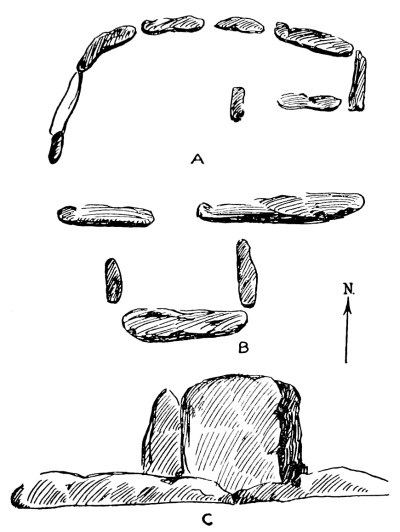
Fig. 18.—Megalithic
stone inclosure, McElmo Bluff.
The author regards the structures made of stones set on edge as very
old, possibly examples of the most primitive buildings in the McElmo
region, antedating the pueblos with horizontal masonry farther east.
West of the mouth of the Yellow Jacket, especially on the Montezuma
Mesa, these megalithic walls are more pretentious, as if this was the
center of the earlier phase of house buildings. In the eastern ruins
these slabs of stone set on edge sometimes appear as at Far View House
with horizontal masonry, but more as a survival.
Since their discovery and description by Jackson and Holmes 40 years
ago, little has been added to our knowledge of these inclosures,
although similar remains have been reported at various points from
Dolores far into Utah. They are called cemeteries and crematories by
the farmers and stockmen, but skeletons or burnt bones do not occur
in them; the charcoal shows wood fiber, and is not bone ash. More
knowledge must be obtained through excavations before their
significance can be determined. Their association with circular
rooms appears in Jackson’s account[53]
of the stone structures on the promontory at the mouth of the
Yellow Jacket. He says:
“The perpendicular scarp of the mesa ran round very regularly, 50
to 100 feet in height, the talus sloping down at a steep angle. On
cave-like benches at the foot of the scarp is a row of rock shelters,
much ruined, in one of which was found a very perfect polished-stone
implement. Gaining the top of the mesa with some difficulty, we found
a perfectly flat surface, 100 yards in width by about 200 in length,
separated from the main plateau by a narrow neck, across which a wall
had been thrown, but which is now nearly leveled. Almost the entire
space fenced in by this wall was covered by an extended series of
small squares, formed by thin slabs of sand-rock set on end. All were
uniform in size, measuring about 3 by 5 feet, and arranged in rows, two
and three deep, adjusted to various points of the compass. There were
also a few circles disposed irregularly about the inclosed area, each
about 20 feet in diameter, their circumferences being formed of similar
rectangular spaces, leaving a circular space of 10 feet diameter in
the center. These rectangles occur mainly in groups, and are found
indiscriminately scattered through the whole region that has come under
our observation upon the mesa tops and in the valleys. They all have
the same general shape and size, and are seldom accompanied by even the
faintest indication of a mound-like character. We have always supposed
them to be graves, but have not as yet found any evidence that would
prove them such. Some that we excavated to the depth of 5 and 6 feet in
a solid earth that had never been disturbed did not reward our search
with the faintest vestige of human remains. In nearly every case,
however, a thin scattered layer of bits of charcoal was found from 6 to
18 inches beneath the surface. In one instance, near the Mesa Verde,
the upright slabs of rock which inclosed one of these rectangles were
sunk 2 feet into the earth and projected 6 inches above it.”
Holmes (op. cit., pp. 385-386) describes similar structures:
“The greater portion of what are supposed to be burial places occur
on the summits of hills or on high, barren promontories that overlook
the valleys and cañons. In these places considerable areas, amounting
in some cases to half an acre or more, are thickly set with rows of
stone slabs, which are set in the ground and arranged in circles or
parallelograms of greatly varying dimensions. At first sight the idea
of a cemetery is suggested, although on examination it is found that
the soil upon the solid rock surfaces is but a few inches deep, or if
deeper, so compact that with the best implements it is very difficult
to penetrate it.
“On the west bank of the Dolores, near the second bend, I came upon a
cluster of these standing stones on the summit of a low, rounded hill,
and in the midst of a dense growth of full-grown piñon pines.”
The rows of stones at this place, according to the same author,
were composed of undressed slabs, many of which had fallen, the
parallelograms averaging 3 by 8 feet in dimensions. Thin layers of bits
of charcoal and pottery occur in the neighborhood. The date these slabs
were placed upright was very early, for trees growing in the inclosures
were estimated to be three or four hundred years old. These stones were
sometimes “embedded in the sides and roots of the trees.” Holmes had
the “impression that these places, if not actually burying grounds,
were at least places used for the performance of funeral rites ... the
remains of the dead being burned or left to decay in the open air.”
The interiors of the inclosures were found on excavation to be filled
to a depth of about a foot with soil mixed with ashes. There were many
fragments of pottery, and some other objects near them, but nothing
to indicate, as suggested by previous observations, that they were
burial cists or even crematories for burying the dead. No charred
human remains occur, but charcoal is abundant. It may have been that
these places were used as ovens for roasting corn or for some culinary
purposes, the neighboring circular rooms being possibly used for the
same purposes as towers by the people who formerly inhabited this
region. They are not large enough for dwellings and the soil in them is
too shallow for burial purposes. They belong to a type which is widely
distributed over the district visited by the author. Especially fine
examples occur north of Sandstone Canyon district.
At the base of the great cliff, on the top of which the remains in
question are found, under the shelter of an overhanging bowlder, may be
seen one of the finest collections of pictographs of animals and human
beings. Not far from the last-mentioned bowlder the walls of a large
pueblo can readily be traced along the banks of the McElmo Canyon.
In his studies of the antiquities of this region the author did not
penetrate west of the mouth of Yellow Jacket Canyon, but he was told
by stockmen and sheep herders of the existence of many other ruins
contiguous to the road all the way from this point to Bluff City. The
most important of these have already been described in a general way.