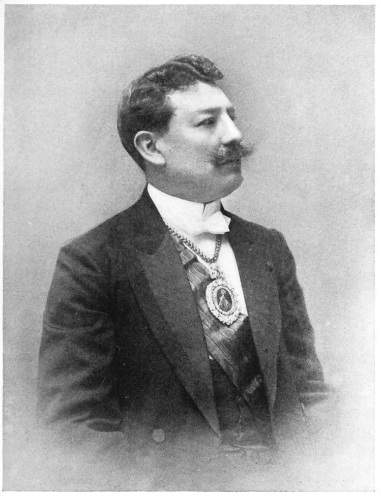
MY purpose in this work is to consider and describe
the effect of the Panama Canal on the
West Coast countries of South America from the year
1905. At this period its construction by the United
States may be said to have begun. If my own deep
conviction that this influence makes powerfully for
their industrial development and their political stability
be an illusion, the pages which follow may afford the
disbelievers grounds for pointing out wrong premises
or false conclusions. “We doubt” long has been the
dogma of the North American and the European in
everything relating to the permanency of progress in
the Spanish-American Republics. “I believe” is yet
only the creed of the individual. A huge material
fact obtruding itself may secure a listening ear from
the doubters. The Canal obtrudes.
The severely practical Northern mind finds itself in
a brain-fog with reference to the Southern Continent.
Speculative reasoning regarding new forces of civilization
does not appeal to it. It wants the concrete circumstances.
Now the Canal is not an abstraction.
The industrial and commercial energies which it wakens
are not abstractions. The interoceanic waterway is a
national undertaking, but it shows the way to individual
enterprise. More than the gates of chance are
opened to American youth. They are the gates of
opportunity. Consequently the need of knowledge.
The number of recent books relating to the history
of South America seems to indicate a demand for this
knowledge in its primary form. They open the path
for a volume which may be limited more strictly to
industrial, fiscal, and political information. For that
reason, while not overlooking the historical element in
the institutions and governmental systems, I have not
thought it necessary to consider them chronologically
from the colonial epoch or even from the era of independence.
The effort to divorce economic and social forces
from places and peoples in order to analyze a principle
usually is so barren that I have not attempted
it. Places have their significance, and people are the
human material. Customs and institutions are only
understood properly in their environment. So many
excellent descriptive works have been written about
South America that I have sought to subordinate
these features; yet since the information applies to
localities something about them could not entirely
be omitted. Moreover, I have that abounding faith
which leads me to look forward to the time when
the engineering marvels of the Canal construction may
prove enough of a magnet to draw thither the travelled
American who would know what his country is doing
and who, once on the Isthmus, will be likely to continue
down the West Coast with a view to determining
the relative attractions of the noble Andes and the
Alps. Yet I have made no attempt to preserve the
form of continuous narrative. The treatment of the
subject does not demand it.
To South American friends who may be offended
at the frankness or the bluntness of the views expressed,
a word may be communicated. The confidences
extended me while on an official mission
widened my own vision of the aspirations of their
public men. At the same time they conveyed the
idea that the economic evolution to which all look
forward will come more swiftly if reactionary tendencies
are combated more openly and aggressively.
Opinions on the policy of the United States being
uttered with freedom, I have not thought it necessary
to adopt the apologetic attitude in regard to other
Republics. In seeking the constructive elements in
the national life and character of the South American
countries, it has been with the undisguised hope
that the contact and the impact of North American
character may be a reciprocal influence.
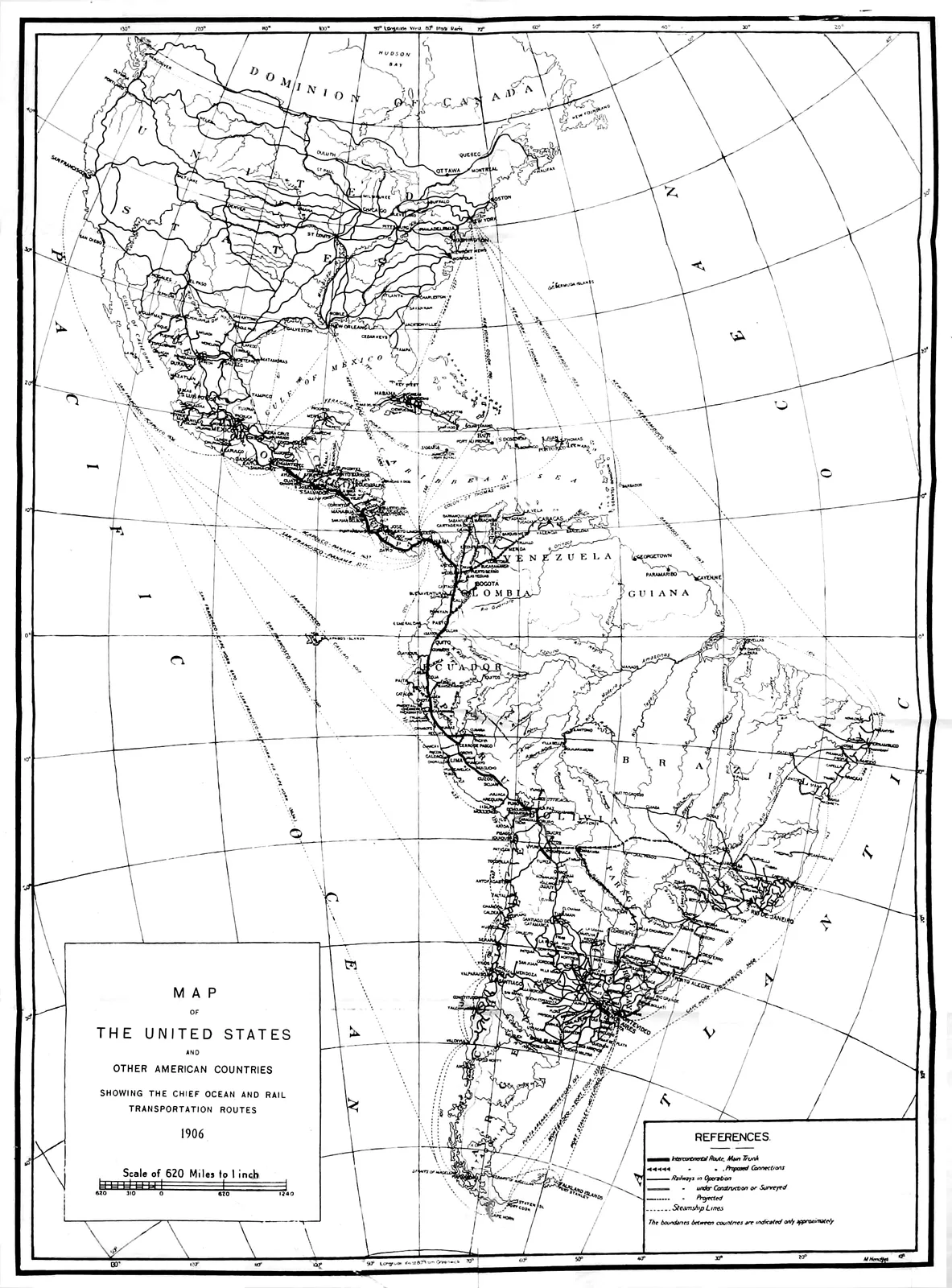
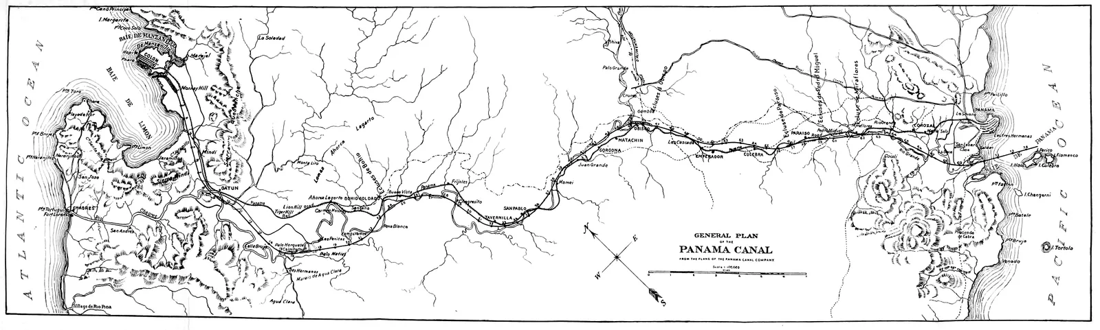
Acknowledgment of material for the general map,
which amplifies that of the permanent Pan-American
Railway Committee, is due its chairman, Hon. H. G.
Davis, whose faith in the future relation of the United
States to the other American countries is an example
to the generation which will share the benefits both of
the Canal and of railroad construction.
C. M. P.
Washington, D. C. January, 1906.
CONTENTS
CHAPTER I
ECONOMIC EFFECT OF THE CANAL
Page
Philosophic Spanish-American View—Henry Clay’s Mistaken Population
Prophecy—The Andes Not a Canal Limitation—Intercontinental
Railway Spurs—Argentina and the Amazon
as Feeders—Centres of Cereal Production—Crude Rubber—Atlantic
and Pacific Traffic—Growth of West Coast Commerce—North
and South Trade-wave—Distances via Panama,
Cape Horn, and the Straits of Magellan—Waterway Tolls
and Coal Consumption—Ecuador and Peru—Bolivia and
Chile—Isthmian Railroad Rates—Value of United States Sanitary
Authority—American Element in New Industrial Life
Adopting Local Customs—Value of the Spanish Language—Knowledge
of People Obtained through Their Speech—English
in Trade—Serviceable Clothing in Different Climates—Moderation
in Diet—Coffee at its True Worth—Wines and
Mineral Waters—Native Dishes—Tropical Fruits—Aguacate
and Cheremoya Palatal Luxuries—Hotels and Hotel-keepers—Baggage
Afloat and Ashore—Outfits for the Andes: Food and
Animals—West Coast Quarantines—Money Mediums—The
Common Maladies and How to Treat Them
Canal Entrance—Colon in Architectural Transformation—Unchanging
Climate—Historic Waterway Routes—Columbus
and the Early Explorers—Darien and San Blas—East and
West Directions—Life along the Railway—Chagres River and
Culebra Cut—Three Panamas—Pacific Mouth of the Canal—Functions
of the Republic—Natural Resources—Agriculture
and Timber—Road-building—United States Authority
on the Zone—Labor and Laborers—Misleading Comparisons
with Cuba—The First Year’s Experience
Tranquil Ship Life—Dissolving View of Panama Bay—The
Comforting Antarctic Current—Seeking Cotopaxi and Chimborazo—Up
the Guayas River—Activity in Guayaquil Harbor—Old
and New Town—Shipping via the Isthmus and Cape
Horn—Chocolate and Rubber Exports—Railway toward
Quito—A Charming Capital—Cuenca’s Industries—Cereals
in the Inter-Andine Region—Forest District—Minerals in
the South—Population—Galapagos Islands—Political Equilibrium—National
Finances
Pizarro’s Landing-place at Tumbez—Last Sight of the Green
Coast—Paita’s Spacious Bay—Lively Harbor Scenes—An
Interesting and Sandy Town—Its Climatic and Other Legends—Future
Amazon Gateway—Sugar and Rice Ports—Eten and
Pacasmayo—Transcontinental Trail—Cajamarca—Chimbote’s
Naval Advantages—Supe’s Attractions—Ancon’s Historic
Treaty—Callao’s Excellent Harbor—Importance of the Shipping—Customs
Collections—Pisco’s Varied Products—Rough
Seas at Mollendo—Bolivian and Peruvian Commerce for the
Canal
Pleasing Historic Memories—Moorish Churches and Andalusian
Art—Pizarro’s Remains in the Cathedral—Transmitted
Incidents of the Earthquake—The Palace, or Government
Building—General Castilla’s Humor—Decay of the Bull-fight—Cultured
Society of the Capital—Foreign Element—San
Francisco Monastery—Municipal Progress—Chamber
of Commerce—A Trip up the Famous Oroya Railway—Masterwork
of Henry Meiggs—Heights and Distances—Little
Hell—The Great Galera Tunnel—Around Oroya—Railroad
to Cerro de Pasco Mines—American Enterprise in
the Heart of the Andes
Capital of Southern Peru—Through the Desert to the Coast—Crescent
Sand-hills—A Mirage—Down the Cañon—Quilca
as a Haven of Unrest—Arequipa Again—Religious Institutions—Prevalence
of Indian Race—Wool and Other Industries—Harvard
Observatory—Railroading over Volcanic
Ranges—Mountain Sickness at High Crossing—Branch Line
toward Cuzco—Inambari Rubber Regions—Puno on the Lake
Shore
Topography a Key to Economic Resources—Coast, Sierra, and
Montaña—Cotton in the Coast Zone—Piura’s High Quality—Lima
and Pisco Product—Prices—Increase Probable—Sugar-cane
as a Staple—Probability of Growth—Rice as an
Export and an Import—Irrigation Prospects—Mines in the
Sierra—Geographical Distribution of the Deposits—Live-stock
on the High Plains—Rubber in the Forest Region—Iquitos
on the Amazon a Smart Port—Government Regulations for the
Gum Industry
Importance of River System—Existing Lines of Railroads—Pan-American
Links—Lease of State Roads to Peruvian Corporation
of London—Unfulfilled Stipulations—Law for Guaranty of
Capital Invested in New Enterprises—Routes from Amazon to
the Pacific—National Policy for Their Construction—Central
Highway, Callao to Iquitos—The Pichis—Railroad and Navigation—Surveys
in Northern Peru—Comparative Distances—Experiences
with First Projects—Future Building Contemporaneous
with Panama Canal
Density of Population in Time of the Incas—Three Million Inhabitants
Now Probable—Census of 1876—Interior Country
Not Sparsely Populated—Aboriginal Indian Race and Mixed
Blood—Fascinating History of the Quichuas—Tribal Customs—Superstition—Negroes
and Chinese Coolies—Immigration
Movements of the Future—Wages—European
Colonization—Cause of Chanchamayo Valley Failure—Climatic
and Other Conditions Favorable—An Enthusiast’s Faith
Seeds of Revolution Running Out—Educated Classes Not the
Sole Conservative Force—President Candamo’s Peacemaking
Administration—Crisis Precipitated by his Death—Triumph
of Civil Party in the Choice of his Successor—President
Pardo’s Liberal and Progressive Policies—Growth in Popular
Institutions—Form of Peruvian Constitution and Government—Attitude
of the Church—Rights of Foreigners—Sources
of Revenue—Stubborn Adherence to Gold Standard—Interoceanic
Canal’s Aid in the National Development
Arica, the Emerald Gem of the West Coast—Memorable Earthquake
History—A Future Emporium of Commerce for the
Canal—Iquique the Nitrate Port—Value of the Trade—Antofagasta’s
Copper Exports—Caldera and the Trans-Andine
Railway to Argentina—Valparaiso’s Preëminence among
Pacific Ports—Extensive Shipping and Execrable Harbor—Plans
for Improvement—No Fear of Loss from the Interoceanic
Waterway—Coal and Copper at Lota—Concepcion and
Other Towns—Rough Passage into the Straits—Cape Pillar—Punta
Arenas, the Southernmost Town of the World—Trade
and Future
Railway along Aconcagua River Valley—Project of Wheelright,
the Yankee—Santiago’s Craggy Height of Santa Lucia—A
Walk along the Alameda—Historic and Other Statues—The
Capital a Fanlike City—Public Edifices—Dwellings of
the Poor—Impression of the People at the Celebration of
Corpus Christi—Some Notes on the Climate—Habits and
Customs—“The Morning for Sleep”—Independence of
Chilean Women—Sunday for Society—Fondness for Athletic
Sports—Newspapers an Institution of the Country
Extensive Use of Nitrates as Fertilizers—Enormous Contributions
to Chilean Revenues—Résumé of Exportations—Description
of the Industry—How the Deposits Lie—Iodine a By-product—Stock
of Saltpetre in Reserve—The Trust and
Production—Estimates of Ultimate Exhaustion—A Third of
a Century More of Prosperous Existence—Shipments Not
Affected by Panama Canal—Copper a Source of Wealth—Output
in Northern Districts—Further Development—Coal—Silver
Mines Productive in the Past—Prospect of Future
Exploitation
National Life a Growth—Anarchy after Independence—Presidents
Prieto, Bulnes, Montt, Perez—Constitution of 1833—Liberal
Modifications—The Governing Groups—Civil War
under President Balmaceda—His Tragic End—Triumph of
his Policies—Political System of To-day—Government by
the One Hundred Families—Relative Power of the Executive
and the Congress—Election Methods Illustrated—Ecclesiastical
Tendencies—Proposed Parliamentary Reforms—Ministerial
Crises—Party Control
Existence of the Roto Discovered—Mob Rule in Valparaiso—Indian
and Caucasian Race Mixture—Disquieting Social
Phenomena—Grievances against the Church—Transition to
the Proletariat—Lack of Army and Navy Opportunity—Not
Unthrifty as a Class—Showings of Santiago Savings Bank—Excessive
Mortality—Need of State Sanitation—Discussion
of Economic Relation—Changes in National Tendencies—Industrial
Policies to Placate the Roto
Agricultural Possibilities of the Central Valley—Its Extent—Wheat
for Export—Timber Lands of the South—Wool
in the Magellan Territory—Grape Culture—Mills and
Factories—Public Works Policy—Longitudinal and Other
Railway Lines—Drawbacks in Government Ownership—Trans-Andine
Road—Higher Levels of Foreign Commerce—Development
of Shipping—Population—Experiments in
Colonization—Internal and External Debt—Gold Redemption
Fund—Final Word about the Nitrates
Old Spanish Trail from Argentina—Customs Outpost at Majo—Sublime
Mountain View—Primitive Native Life—Sunbeaten
Limestone Hills—Vale of Santa Rosa—Tupiza’s People and
Their Pursuits—Ladies’ Fashions among the Indian Women—Across
the Chichas Cordilleras—Barren Vegetation—Experience
with Siroche, or Mountain Sickness—Personal Discomforts—Hard
Riding—Portugalete Pass—Alpacas and
Llamas—Sierra of San Vicente—Uyuni a Dark Ribbon on a
White Plain—Mine Enthusiasts—Foreign Consulates
A Hill-broken Table-land—By Rail along the Cordillera of the
Friars—Challapata and Lake Poöpo—Smelters—Spanish
Ear-marks in Oruro—By Stage to La Paz—Fellow-passengers—Misadventures—Indian
Tombs at Caracollo—Sicasica a
High-up Town, 14,000 Feet—Meeting-place of Quichuas and
Aymarás—First Sight of the Famed Illimani Peaks—Characteristics
of the Indian Life—Responsibility of the Priesthood—Position
of the Women—Panorama of La Paz from the
Heights—The Capital in Fact—Cosmopolitan Society
Depression and Revival of Mining Industry—Bolivia’s Tin Deposits
and Their Extension—Oruro, Chorolque, Potosi, and
La Paz Districts—Silver Regions—Potosi’s Output through
the Centuries—Pulacayo’s Record—Mines at Great Heights—Trend
of the Copper Veins—Corocoro a Lake Superior
Region—Three Gold Districts—Bismuth and Borax—Bituminous
Coal and Petroleum—Tropical Agriculture—Some
Rubber Forests Left—Coffee for Export—Coca and Quinine—Cotton
Panama Canal as Outlet for Mid-continent Country—Railways
for Internal Development—Intercontinental Backbone—Proposed
Network of Lines—Use Made of Brazilian Indemnity—Chilean
Construction from Arica—Human Material for
National Development—Census of 1900—Aymará Race—Wise
Governmental Handling of Indian Problems—Immigration
Measures—Climatic Variations—Political Stability—General
Pando’s Labors—Status of Foreigners—Revenues
and Trade—Commercial Significance of Treaty with Chile—Gold
Legislation—A Canal View
John Quincy Adams’ Advice—Canning’s Trade Statesmanship—Lack
of Industrial and Commercial Element—Excess of
Benevolent Impulse—Forgotten Chapters of the Doctrine’s
History—The Ecuador Episode—President Roosevelt’s
Interpretation—Diplomatic Declarations—Spectres of Territorial
Absorption—Change Caused by Cuba—Progress of
South American Countries—European Attitude on Economic
Value of Latin America—German and English Methods—Proximity
of Markets to United States Trade Centres—Conclusion
Philosophic Spanish-American View—Henry Clay’s Mistaken
Population Prophecy—The Andes Not a Canal Limitation—Intercontinental
Railway Spurs—Argentina and the Amazon
as Feeders—Centres of Cereal Production—Crude Rubber—Atlantic
and Pacific Traffic—Growth of West Coast
Commerce—North and South Trade-wave—Distances via
Panama, Cape Horn, and the Straits of Magellan—Waterway
Tolls and Coal Consumption—Ecuador and Peru—Bolivia
and Chile—Isthmian Railroad Rates—Value of
United States Sanitary Authority—American Element in
New Industrial Life.
THE effect of the Panama Canal on the West
Coast industrial development and the reciprocal
influence of this South American progress on the waterway
are economic facts. The citizen of the United
States who would know the subject in a wider range
than the mere gratification of his patriotic impulses and
his national pride, should turn to the study of commercial
geography, the potential political economy of
unexploited natural resources. The European statesman,
jealously watchful of trade conditions in the
New World and the causes which modify them, will
follow these channels without suggestion.
Whether the digging of the Canal take ten, fifteen,
or twenty years, does not affect its industrial value.
The Spanish-American, with his inherited inertia and
his lack of initiative, in waiting for to-morrow would
be content if the work consumed half a century.
What Humboldt prophesied of the Southern Continent
as the seat of future civilization, what Agassiz
predicted of the Andean and the Amazon populations,
he is sure now will be realized. He even
reverts to his favorite method of comparing the
square miles of Belgium with the square miles of his
own South American country, whichever one it may
be, and exhibits the latter’s possibilities for the human
race by explaining the number of people it can sustain
when it shall have as many inhabitants to the
square mile as has Belgium. Yet while he believes
that the destiny of the Southern Continent is at
the threshold of realization, Yankee impatience only
would amuse him. Since the interoceanic waterway
and all its benefits are to be, what matter a few years?
Time, says the Castilian proverb, is the element.
This philosophic Latin view may serve as a curb to
fault-finding if the construction work on the Canal
seems to halt while the engineering obstacles are
studied and experiments are made in order to determine
the best means to overcome them.
But though the Spanish-American, who is of the
race that controls the West Coast countries of South
America, is patient in his waiting for ultimate results,
he does not fail to grasp the immediate effect. All
the processes of the economic evolution unroll before
his mental vision. For Colombia, Ecuador, Peru,
Chile, and Bolivia, the standard already has been set,
and the goal towards which they must work has been
fixed. Their national policies and their commercial
and industrial growth at once come under the stimulus
of the waterway. “The Panama Canal,” said the
leader of public thought in one of the Republics,
“will precipitate our commercial evolution.” It is
the spring from which will gush the streams of
immigration.
MAP OF THE UNITED STATES
AND OTHER AMERICAN COUNTRIES
SHOWING THE CHIEF OCEAN AND RAIL TRANSPORTATION ROUTES
1906
In the present volume I shall have little to say of
Colombia, for though the Isthmus of Panama is the
reception-room of that country, the Canal is to be
considered jointly with relation to the Caribbean and
the Pacific shores. I include Bolivia because, while
as a political division it is not ocean-bordering, geographically
it is a Pacific coast country on account of
its outlet through Chilean and Peruvian seaports.
Population in South America is not marked by
periods of phenomenal increase. Henry Clay, in his
generous pleas for the recognition of the struggling
Republics, was led in the warmth of his imagination
to foresee the day when they would have 72,000,000
and we would have 40,000,000 inhabitants. The
population of the United States was then less than
10,000,000. Clay spoke when the resources of the
Louisiana Purchase were still distrusted by many conservative
public men, and long before Daniel Webster
had delivered his celebrated philippic against the Oregon
region as a worthless area of deserts and shifting
sands. Mindful of the slow growth in the Southern
Hemisphere, I make no predictions of sudden leaps,
but merely seek to indicate what proportion of the
present and future inhabitants comes within the sphere
of the Canal.
The population of western Colombia and of
Ecuador, Peru, Chile, and Bolivia is approximately
11,000,000, dwelling chiefly along the seacoast. It
has been assumed that only this long slope of almost
continuous mountain wall from Panama to Patagonia
is subject to the direct influence of the Canal, and
that the barrier of the Andes makes all the rest of the
South American continent dependent on Atlantic outlets.
The assumption is presumptuous. It is based
on an unflattering lack of geographical knowledge
and on a complete ignorance of political and economic
conditions.
The primary mistake is in considering the Coast
Cordilleras as the principal chain. The great rampart
of the Andes in places is hundreds of miles across.
Productive plains and fertile valleys lie on the western
side of the Continental Divide as well as on the Atlantic
slope. Besides, there are many bifurcations of
these lofty ranges which must be pierced toward the
Pacific. The mineral belt with its incalculable wealth,
after centuries only partially exploited, has its basis
of profitable production and export by means of the
water transport of the Pacific. And greatest of all the
facts is the certainty that railways will bore through
the granite ramparts in a westerly direction. The
central spine or backbone of the Intercontinental or
Pan-American trunk line is not all a dream, and from
its links spurs will shoot out toward the Pacific. It
would have been as reasonable to imagine that the
Rocky Mountains could forever shut in the region
between them and the Sierra Nevadas, barring all
outlet to the Atlantic and the Gulf of Mexico, as to
suppose that the Pacific Ocean from Panama south is
everlastingly restricted to the fringe of coast for its
commerce. This is in the industrial sense and aside
from the reasons of national polity which by railway
enterprises on the part of the various governments
are causing the Andes to disappear.
The grain fields and pastures of Argentina lie close
to the Pacific. How close? Within less than 200
miles. The pampas of the western and northwestern
provinces are from 500 to 1,200 miles distant from the
Atlantic seaboard. The pressure of the agricultural
population is westward. A generation—perhaps a
decade—will bring it to the slopes of the Andes.
The first railway to join the Atlantic and the Pacific,
that from Buenos Ayres to Valparaiso, will be completed
by means of a spiral tunnel long before vessels
are propelled through the Canal.
But Valparaiso is far south, so far that, in the opinion
of some authorities, it is the limit of the Canal
radius. Let this be granted momentarily while the
map is scanned. Place the thumb on the Chilean port
of Caldera, 400 miles north of Valparaiso; the index
finger on Tucuman, and the middle finger on Cordoba.
The lines forking from these Argentine cities
forecast the next chapter of railway expansion. Let
it be known also that Nature, in kindly mood, has
formed a saddle in the mountain range in this section,
and that engineering surveys of routes through the
depression are the basis of projects which only await
a larger agricultural area under cultivation in order to
become railway enterprises with an assured commercial
basis. Both Cordoba and Tucuman will be in rail
communication with the Pacific coast some years before
the waterway is finished. Nor are these the only
trans-Andine lines in prospect. They serve the purposes
of illustration, so that a description of the others
may be omitted. I cite the first two in order that it
may be known there is an Argentine relation to the
Canal, and a highly important one as to population
and as to the exports and imports which are the
foundation of maritime and rail traffic.
If this suggestion is new and strange, I follow it by
a more startling proposition. As one result of the
Panama Canal, a measure of Amazonian commerce
will flow to and from the Pacific.
To begin with, there is the nearness. By several
trans-Andine routes the navigable affluents of the Amazon
are less than 300 miles from the coast. Steamships
of 800 tons navigate as far as Yurimaguas on
the Huallaga River, which was the historic route of
the Spaniards over the Continental Divide. Steam
vessels also go up the Marañon from Iquitos, 425 miles
to the Falls of Manserriche, which by several practicable
railway routes are within less than 400 miles of
the Bay of Paita. Minor Peruvian ports below Paita
are able to offset its shipping advantages by shorter
trails. Not more than 225 miles of difficult railway
construction are necessary to open to a large section
of the vast Amazon region the commerce of Callao,
Peru’s chief port.
In relation to the Amazon as a feeder, it has to be
recognized that the Andes form a greater obstacle than
in Argentina, and that the river basins will be populated
much more slowly and never so densely as the
Argentine pampas and sierras. But the mighty stream
is within the sphere of the Canal, as I shall have occasion
to explain more fully in subsequent chapters.
For the present purpose a single illustration, perhaps
fanciful, will answer.
It may seem a far cry from the 200,000 telephones
used by the farmers of Indiana, the trolleys which
tangle their way through that State, and the automobiles
and bicycles which traverse the country roads, to
the gum forests of South America. But the world’s
hunger for crude rubber is a growing one. Bicycles,
the infinite variety of motors, electric lighting, and
telephones, all demand more of this article; and the
55,000 tons, which was substantially the world’s production
in 1905, is insufficient for future needs. This
increasing demand will stimulate the rubber production
of an extensive region in northeastern Peru, and Peru
has imperative reasons of national policy for wanting
to turn that traffic down her own rivers, and across and
over the Andes to the Pacific, instead of letting it flow
out through Brazilian territory. Iquitos, the centre of
this commerce, is 2,300 miles up the Amazon from
Para, and Para is 3,000 miles from New York, a total
of 5,300 miles by the all-water route. By river and
future rail Iquitos is, at the furthest, 800 miles from
Paita, and Paita, via Panama, is a little short of 3,100
miles from New York; so that the total distance is less
than 4,000 miles. New Orleans by the isthmian route
is within 3,300 miles of the Peruvian rubber metropolis.
Instead of the Pacific commerce being limited to
the seashore strip after the Panama Canal is dug, the
view which receives attention in South America is the
probable influence of the waterway in diverting traffic
from the Atlantic to the Pacific. Trade may not be
turned upstream, and commerce is slow to leave established
lines of transportation, but trade-waves are not
so fixed as isothermal lines. They may show variations
until the current finds its natural course to the
newer markets created.
I do not mean from this to infer that the aggregate
commerce of the Atlantic coast countries of South
America will be lessened by the Panama Canal. Tropical
Brazil, for an indefinite period, will continue to
supply the bulk of the coffee consumed, and the maritime
movement will follow the existing courses of
navigation. Temperate Brazil, the Argentine Republic,
and Uruguay will develop as the granary and the
grazing-ground of the world in proportion as the
United States consumes its own wheat and beef. Their
exports increase with the widening of the market for
these staple products. Political economists and crop
statisticians have been slow to perceive that the extension
of the area of agricultural cultivation and the
growth of population in this great cereal region depend
more on the ability of Europe to take the surplus
grain, beef, and mutton than on the demands for
home consumption. Public men, especially in the
Argentine Republic, in their measures for encouraging
immigration also have neglected to take into account
this overshadowing economic factor. But it explains
why during certain periods immigration has been almost
stationary, while at other periods the incoming of
settlers for the field and farm has been a rushing one.
As a natural balance, therefore, for the diversion of
traffic to the Pacific coast through the agency of the
artificial waterway, the Atlantic slope has the certainty
of steadily growing exports of agricultural products.
As regards Argentina, the coming railways to the
Pacific, of which I have made mention, mean that a
quantity of the cereals, wool, and hides will find their
outlet by these routes; and a larger volume of the exchange
for them—farm tools, cottons and woollens,
mineral oils, and miscellaneous merchandise—will obtain
the cheaper and shorter transit through the Canal
and down the West Coast. Thus, without damage to
the Atlantic commerce, the Pacific coast traffic will
form a larger proportion in the total of South American
commerce than in the past. This is especially
true with reference to the United States. The trade-wave
north and south may be accounted one of the
phenomena of international intercourse. It is not
tidal, but a brief comparison shows its growing volume.
In 1894 Argentina took from the United States
goods to the value of $4,863,000, and sent in return
products worth $3,497,000. In 1904 the exports were
$10,751,000, and the imports $20,702,000, and in the
following year they were increasing.
The commercial relation of the West Coast countries
may better be exhibited by tabulation in the
following form:
Exports to United States[1]
Imports from United States
1894
1904
1894
1904
Chile
$3,536,000
$10,685,000
$2,272,000
$4,880,000
Peru
491,000
3,008,000
591,000
3,961,000
Ecuador
816,000
2,347,000
761,000
1,354,000
Total
$4,843,000
$16,040,000
$3,624,000
$10,195,000
1 See Foreign Commerce of the United States, Annual Review, 1904.
Here, within the extremes of the eleven years, is an
increase in the foreign commerce between the West
Coast countries named and the United States from
$8,467,000 to $26,235,000 as measured by the annual
volume. The growth continued in the subsequent
twelvemonth. It is a forcible illustration of the north
and south trade-wave movement. Under the further
stimulus of the Canal for industrial development and
commercial growth the contribution to traffic for the
waterway will be not inconsiderable.
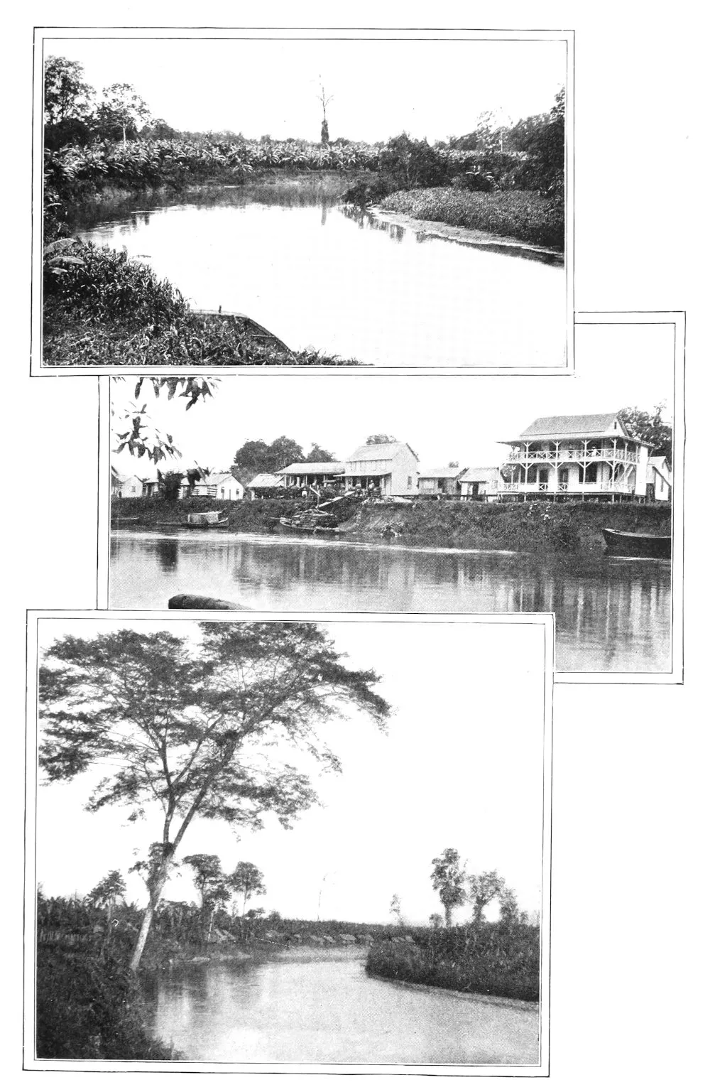
Swamp Section of the Canal—The Atlantic Entrance to
the Canal—Scene on the Chagres River
An analysis of the West Coast foreign commerce
for a given year shows it to have exceeded $211,000,000,
with a rising tendency. The intercoast trade, which
is included under the foreign head, may be placed at
$11,000,000 to $12,000,000. There is left, therefore,
approximately $200,000,000 of international traffic for
Europe and the United States.
If the international traffic were to remain stationary,
the amount that would be diverted from the Cape
Horn or the Magellan route through the Canal would
be important, but the overshadowing element in the
waterway as an economic factor is the certainty of an
increase in the foreign trade. The marked feature of
the West Coast countries in recent years is the growth
in consumptive capacity as shown by the imports, for
the increase in population has not been large. Oriental
trade may be diverted from other channels through
the Canal, but western South American commerce may
look for growth in volume on account of internal development
of the countries which are tributary to it.
In this view it may be doubted whether the estimate
that 75 per cent of the Canal traffic will be between
ports north of the same parallels of latitude will prove
correct. The north and south trade-waves may be
watched for an indication of the proportion of waterway
freight that will go south, keeping in mind that
New York is almost on a direct line north of the
western South American ports.
These West Coast markets may be studied with reference
to the shortening of distance. We may take
the fact that from Colon to New York is 1,981 miles,
and from Colon to New Orleans 1,380 miles; add the
48 miles of future waterway and then make our comparisons
of the ports along the coast—Guayaquil,
Callao, Valparaiso—with the distance through the
Straits of Magellan or around Cape Horn. We
also may figure on the national policy of the United
States, which will not be to treat the Canal as strictly a
commercial proposition. The fixing of the toll rates
is not near enough to furnish the basis of definite
calculation any more than is the possibility of estimating
the total prospective tonnage each year, though
the guesses have ranged from 300,000 to 10,500,000
tons.
The steamers which ply between New York, Hamburg,
or Liverpool and the Pacific coast ports vary
from 3,000 to 6,500 tons. That hardly may be taken
as the measure of carrying capacity of the major part
of the vessels which will pass through the Canal, but
on such a basis the estimate may be made of the saving
in coal consumption, and the radius within which
it will be cheaper to use the Canal than to double
Cape Horn or thread the difficult and dangerous passage
through the Straits. For New Orleans, Mobile,
and the other Gulf ports, the element of distance is
not comparative, because heretofore no direct maritime
movement between them and the West Coast of South
America has been maintained. With the waterway
once open the whole Mississippi Valley becomes the
beneficiary. Nor does the talk of carrying coal and
other cargoes from Pittsburg through Panama to
Patagonia without breaking bulk appear fantastic.
Variations in the steamers’ courses are responsible
for the differences in the tables of distances usually
given, but they are not important.[1] The relation in
nautical miles of the chief shipping-ports on the West
Coast to trade centres may be set forth as follows:
Miles
New York to Colon
1,981
Colon to Panama
48
Panama to Guayaquil
835
“ “ Paita
1,052
“ “ Callao
1,569
“ “ Mollendo
1,928
“ “ Arica
2,161
“ “ Iquique
2,267
“ “ Antofagasta
2,418
“ “ Valparaiso
3,076
1 See Appendix for tables of the Hydrographic Office of
the United States Navy.
This brings Valparaiso within 5,100 miles of New
York by way of Panama; but with the omission of all
the intervening ports except Iquique, Callao, and
Guayaquil, it would be less than 5,000 miles. By
way of the Straits the distance from Valparaiso is
usually accounted 9,000 miles, touching at Montevideo
and the Brazilian ports. When the Straits are
avoided and Cape Horn is doubled, from the Cape to
Pernambuco is 3,468 miles, and from Pernambuco to
New York 3,696 miles. Either by the Straits or
around the Cape the total is almost twice the distance
via Panama.
Colon is 4,720 miles from Liverpool, and the relative
advantages of the West Coast ports between
Valparaiso and Panama may be calculated in the
proportion of their respective distances. From Valparaiso
to Liverpool via Panama is 7,600 to 7,800 miles
according to the vessel’s schedule of wayports on the
Pacific. From Valparaiso to Liverpool, through the
Straits of Magellan, is 9,800 miles, touching at
the Falkland Islands, and about 300 miles shorter
by omitting them.
For Hamburg the saving in distance by the isthmian
route may be placed at 2,400 miles. Proceeding north
from Valparaiso, the loss by Cape Horn is in inverse
proportion. Fifteen hundred miles north of Valparaiso
is the central Peruvian port of Callao, which
therefore has 3,000 miles’ gain in distance by Panama
to Hamburg instead of by Cape Horn.
I have given these general figures before reciting
details on the maritime commerce of the various countries.
They show how the economic value of the
Canal to them is primarily a question of subtraction,—the
difference between the coal needed on the
longer sea voyage and the Canal tolls. But the question
of the return cargo also enters into the calculation
and is distinctly in favor of the waterway, as is also
that of the duration of maritime insurance.
No statistics are available which show the commerce
of the western departments of Colombia; and the unsettled
state of that country for years past gives no
index of what its potential traffic may be. But the
valley of Cauca in its variety of agricultural and mineral
resources is a kingdom in itself. It is a future
commercial feeder to the Canal.
The foreign trade of Ecuador amounted in the latest
available year to $19,000,000.[2] Substantially all of it
constitutes what might be called light freight, and a part
of it now goes across the Isthmus by transshipment.
Yet the portion which follows the longer route around
Cape Horn or through the Straits is not small. The
traffic flows through Guayaquil as in a single stream.
Guayaquil, by way of Panama, is 2,864 miles from New
York and 2,263 miles from New Orleans; by the
Cape Horn route it is 11,470 miles to New York.
The entire foreign commerce of Ecuador in the future
is for the Panama Canal, except the excess which follows
up the coast to San Francisco and beyond.
2 Statistics obtained by New York Chamber of Commerce for 1904.
The foreign commerce of Peru may be placed
above $40,000,000 annually.[3] The bulk of the traffic
is now via the Straits of Magellan and Cape Horn.
From Callao to New York, by way of Cape Horn, is
10,700 miles. By way of Panama it is 3,600 miles,
only a little longer than from New York to San Francisco
or from New York to Mexico City by the transcontinental
railroad lines. In reference to Peru, it
also is to be noted that the heaviest exports are from
the ports north of Callao. Sugar is the largest marine
freight in quantity, and this comes from Salaverry and
other ports fully 500 miles north. Much of this raw
sugar is now carried around Cape Horn, though some
of it is left at the Chilean ports to be refined for the
West Coast consumption. When the Canal is opened,
with the exception of this Chilean traffic, all the raw
sugar of Peru will be shipped through it to New
Orleans, New York, or Liverpool.
3 Estimated on the basis of the calendar year 1904, when the total
was $41,000,000, according to the report of the British Consul
General.
Through the port of Mollendo, 360 miles south
of Callao, come the ores, the metals, and the wools,
both of southern Peru and of Bolivia. Some of the
minerals may continue their course around the Horn,
and also the guano which Peru in the future may
export, but not all of these cargoes will find the longer
route cheaper. All the wools will take the shorter
route. Some wool is sent up the coast and transshipped
across the Isthmus by the railways. This
method is also followed in the shipment to Liverpool
of some of the raw cotton raised in southern Peru.
The whole of this light freight is traffic for the interoceanic
waterway.
Bolivian commerce finds its outlet and inlet, chiefly
through Chilean and Peruvian seaports, to the amount
of $18,000,000 a year. Small as this is, the bulk of
it follows the Cape Horn and Magellan routes, though
some of the European merchandise is imported on the
Atlantic slope through Argentina. The silver and
copper ores are transported principally through the
port of Antofagasta, which is 650 miles north of Valparaiso.
For the mineral freights, Canal tolls may
neutralize the advantage of the shortened distance via
Panama to Liverpool, or may not compensate for the
lessened coal consumption. But whether they do or
not, the general merchandise from England and from
Germany, not being bulky, will have the shorter course
and probably the cheaper one on the return voyage
through the Canal.
But Antofagasta, though of growing importance,
is not likely to be indefinitely the chief port of export
for Bolivia. The building of a railway from the great
central plateau to Arica makes it certain that the
copper output of Bolivia, much of the tin, and part of
the silver product in time will be shipped through
that port, while it will be a natural inlet for imported
merchandise. Arica is so close to Mollendo—only
233 miles—that with regard to distances it may be
considered on the same basis. The mineral and other
internal developments, which are to fix the industrial
status of Bolivia and which I shall have occasion to
discuss in subsequent chapters, have a very direct
relation to the facilities that will be afforded by the
isthmian waterway.
Formerly it was thought that Chile would be
seriously harmed by the Panama Canal. In the commercial
sense this supposition does not bear scrutiny.
Chile’s foreign trade is approximately $130,000,000
annually, with a tendency to reach $150,000,000. By
far the heaviest proportion of this commerce is the
shipments of the nitrates of soda or saltpetre fertilizers.
Iquique is the principal shipping-point. The sailing-ships
are the cheapest carriers for these bulky cargoes,
and tolls based on tonnage may make it unprofitable
to transport a large portion of them through the
interoceanic channel. There is also the other consideration
that the vessels which bring coal to the
Chilean ports from Australia and from Newcastle
secure their return cargoes of nitrates. These fertilizers
being a natural monopoly, Chile will have
the benefit of the industry, and the Panama Canal
in no way can lessen this traffic. In its permanent
effect the waterway can have little influence on the
nitrates, because the deposits will be worked out
not many years after its completion. Within a third
of a century, or forty years at the furthest, the
exhaustion of the saltpetre beds will have begun,
and the cargoes of fertilizers will be lessening before
that time.[4] In any aspect of the broad future of
the Canal and its effect on the West Coast, the
nitrates of Chile need not be considered as an influencing
factor.
But it may be said that until the interoceanic canal
is actually open these subjects are too remote to call
for immediate consideration. This view does not hold
when analysis is made of the swift recognition of its
effect by South American countries. There are present-day
influences which are clear enough to be taken into
account.
For the entire West Coast there is at once a beneficial
result in having the Canal an enterprise of the
United States government. This is the equal treatment
which must be accorded all the steamship
companies in transshipping freight over the Panama
Railway. The line was operated in the interest of
the transcontinental railroads to prevent competition.
Under this arrangement little regard was shown for the
traffic from the coast south of Panama. The result of
the control of the isthmian railway line by the transcontinental
roads was against encouraging the steamship
lines to seek to increase their freight between Valparaiso
and the intervening ports to Panama for transshipment,
because the Panama Railway exacted what
it pleased.[5] With the stock of the company vested in
the United States, hereafter all traffic agreements must
be made on the basis of equality. This is a very
important factor in the tendency of the West Coast
countries to mould their national policies for industrial
development and commercial expansion. It enables
them to enjoy some of the benefits of the Canal
without waiting for its completion. It means more
shipping from the year 1906 on.
5 In the memorial presented in 1905 to the United States government
by the diplomatic representatives of various South American
Republics, asking for fair treatment in Panama railroad rates,
these statements were made:
It may be calculated that the most distant ports of our respective
Republics are from New York, 4,500 miles, via Panama. From those
same ports to New York there is a distance of over 11,000 miles,
via Magellan; and, nevertheless, the transportation by this last
route and the transportation by steamer from our ports to Europe,
are on an average from 25 to 30 per cent cheaper than our commerce
with New York via Panama.
The Peruvian sugar pays, by the Isthmus, 30 shillings sterling a
ton, and 23 shillings sterling a ton via Magellan.
The cacao of Guayaquil, via Panama, pays to Europe from 52 to 58
shillings a ton, and to New York 65 to 68 shillings a ton.
From Hamburg shipments of rice from India are constantly being made
to Ecuador, via Panama, at the rate of from 30 to 33 shillings
sterling per ton of 2,240 pounds, or, say, from $7.50 to $8 per ton;
while the same article from New York pays at the rate of $0.60 per
100 pounds, or, say, $13.20 per ton,—an overcharge of almost 75
per cent. Twelve coal-oil stoves, which in New York, free-on-board,
cost from $45 to $48, pay on the coast of Ecuador and of Peru 30
and 37½ cents, respectively, per cubic foot, or, say, $19.20
to $21, which represents 42.66 per cent upon the cost price. The
same article bought in Germany would pay a freight of from $6.40
to $6.75.
An international good also comes from the presence
of the United States on the Isthmus in the capacity of
a sanitary authority. It will not be hampered, as at
home, by state quarantine systems. The example of
what it is doing at Panama will be of immense benefit
to all the ports south to Valparaiso. Its resources
and its assistance will be at the disposal of the various
governments which may seek its aid. With them power
is centralized, and they will be able to coöperate effectually.
The International Sanitary Bureau, with headquarters
in Washington, for which provision was made
by the Pan-American Conference held in Mexico, may
become a vital force through this means. Epidemics
and plagues, of which the most malignant is the yellow
fever, may never be entirely wiped out, but that their
area can be restricted and their ravages infinitely lessened
will be demonstrated by a few years’ experience.
Commerce will be immensely the gainer, and the trade
of the West Coast may look for a steady and natural
growth in proportion as the epidemic diseases of the
seaports are controlled.
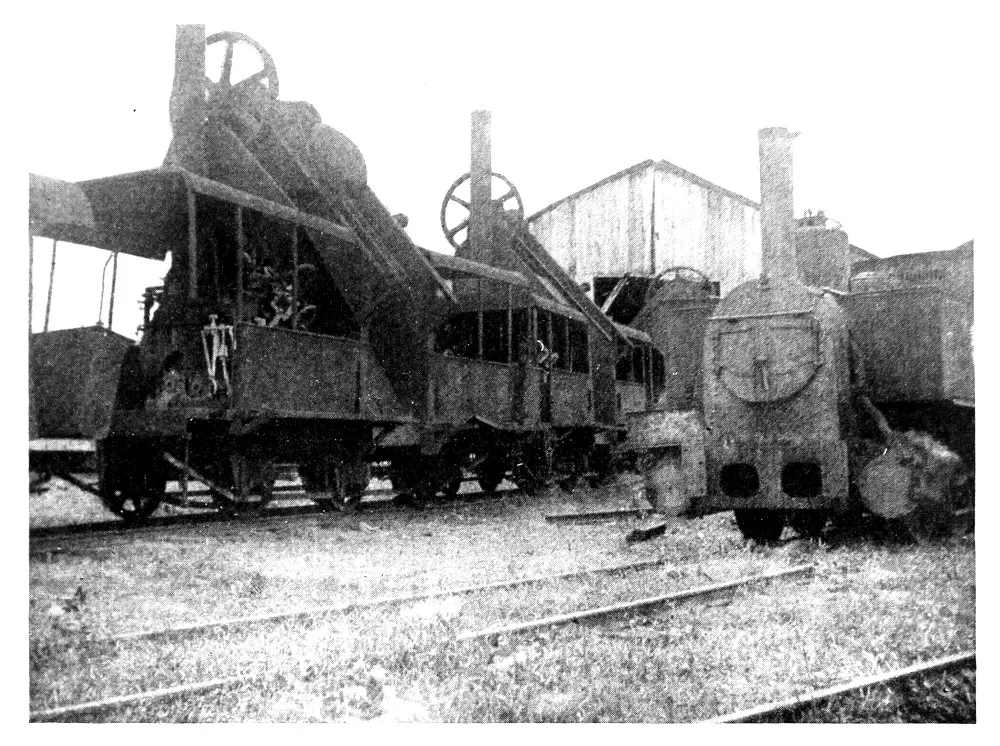
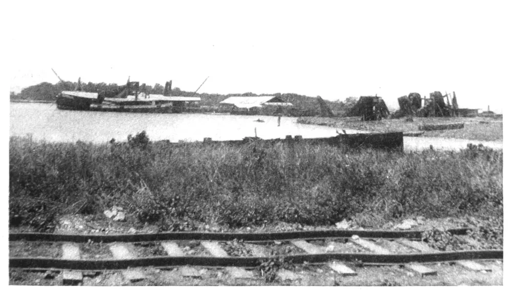
Abandoned Machinery
The influence of the gold standard of Panama will
be helpful to commerce, though it will not in itself
cause the several Republics which are on a silver or
a paper basis to change to gold. But they will be
benefited by being neighbors to financial stability.
Uniformity of exchange will be promoted, and the
inconveniences of travellers will be lessened. The
fact that the currency of the United States is legal
tender in the Panama Republic will help merchants
and shippers at home, who heretofore have had to
make their transactions entirely on the basis of the
English pound sterling or the French franc.
In an outline of the general subject some attention
should be paid to the inevitable overflow of energy
and capital after they once become engaged in building
the waterway and in supplementary projects. No
one who understands the constructive American character
doubts that the capitalists and contractors enlisted
in the work will fare forth to seek other fields.
It happens that coincident with the beginning of the
Canal construction by the United States, the West
Coast countries are entering upon definite policies of
harbor and municipal improvements and other forms
of public works, including railway building. There
is also the new era of the mines. The industrial impulse
is one of the immediate economic effects of the
Canal. It appeals to the American spirit. It will
find a quickening response. In subsequent chapters
I therefore venture to indicate its field of activity, with
such suggestions as may be of practical worth.
CHAPTER II
TRAVEL HINTS
Adopting Local Customs—Value of the Spanish Language—Knowledge
of People Obtained through Their Speech—English
in Trade—Serviceable Clothing in Different
Climates—Moderation in Diet—Coffee at its True
Worth—Wines and Mineral Waters—Native Dishes—Tropical
Fruits—Aguacate and Cheremoya Palatal Luxuries—Hotels
and Hotel-keepers—Baggage Afloat and
Ashore—Outfits for the Andes: Food and Animals—West
Coast Quarantines—Money Mediums—The Common
Maladies and How to Treat Them
TO live as they live; to travel as they travel;—that
is about all there is to living and travelling in
South America and on the Isthmus.
All the customs will not be adopted by Northerners,
nor all the habits followed. More comfort will be
demanded and more cleanliness. But the general fact
holds that the people living in any country have
acquired by experience the knowledge of what is required
by climatic and other conditions in regard to
food, drink, dress, shelter, and recreation. There
is reason for all things, even for the adobe tomb
dwellings of the aboriginal Indians of Bolivia, or the
mid-day siesta of the busy merchant of Panama.
First of all, it is desirable to know the language.
Spanish is the idiom of South America, with the exception
of Brazil. At the outset let me say that the
chance traveller who wants to go down the coast or
even take an occasional trip into the interior can get
along with his stock of English. In all the seaport
towns are English-speaking persons, merchants or
others. On the ships English is as common as
Spanish, and in some of the obscurest places the
tongue of Chaucer may be heard. In one of the
most out-of-the-way and utterly forsaken little holes
on the coast, I found the local official who was
sovereign there teaching his boy arithmetic in English.
He had been both in England and in the
United States, and while his own prospects now were
bounded by the horizon of the cove and the drear
brown mountain cliffs that shut it in, he was determined
that his son should have a wider future. There
are also many young South Americans who have been
educated in the United States and some of whom are
met at almost inaccessible points in the interior.
I state this so that no one who contemplates a
journey may be turned away from it by any supposed
difficulty in getting along through inability to speak
the prevailing idiom. He can do very well. Yet
with all his faculties of observation alert he will miss
much through his ignorance of the readiest mode of
conveying and receiving thought. To know any
country it is necessary to know the people, and the
people are only known through the medium of their
speech. Their customs are better understood, their
limitations are appreciated, and their strivings for
something better, if they have any, are interpreted
sympathetically. The paramount local topic becomes
a living theme into which the visitor can enter understandingly
and add to his stock of knowledge.
Let me say, also, that wherever trade is, there is the
English language, and as commerce grows it will spread.
The terse English business letter is the admiration of
the Latin-American merchant. Yet there is no wilder
notion than that trade will advance itself without the
knowledge of the language of the country into which
it is pushing. Many native mercantile houses have
English-speaking clerks, or occasionally a member of
the firm knows the idiom. But the commercial traveller
from the United States who does not speak
Spanish never will compete with his German rival who
talks trade in all known tongues.
This, in brief, is the commercial situation as to the
English language. The business man who waits for
Spanish America to come within its sphere as the world
language, will not achieve success in this generation.
For those who look forward to a future in South
America, either in trade or in industrial enterprises,
there is only one word of advice to be given: that
is, to learn Spanish and to learn it at once. Diffident
as the North American is about foreign tongues and
badly as he speaks any language except his own, there
is little reason why his self-distrust or his contempt for
other nationalities should keep him from acquiring
Spanish. “It is pronounced as written and is written
as pronounced.” Colloquially it is the easiest of
tongues to master. Since every letter is sounded and
is always pronounced the same, there is no trouble
with the syllables and there are no such difficult
sounds as the German umlaut or the French “en.”
The high-sounding expressions, while they seem very
formal and complicated, are quickly acquired, and the
habit of thinking of the greetings of the day and similar
commonplace topics in the strange tongue comes
more easily than is imagined. With practice any
fairly persistent person can get enough of Spanish to
avoid the cumbersome process of thinking in English
and then translating his thoughts. A vocabulary of
2,000 words is an ample one for the purposes of
every-day life.
The oaths need not be learned. The English expletives
are expressive enough not to need translation,
and they lack the suggestive obscenity of the Spanish
objurgations. It is good to learn “Caramba!” in
all the tones and inflections and to stop there.
The phrase-book may be studied without ridicule,
and every opportunity be taken for putting its precepts
to the test. I do not mean from this to indicate
that a thorough knowledge of Spanish can be
gained in such manner, or that the Yankee ever will
master the noble and stately literary language of Cervantes,
Calderon, and Lope de Vega. He will not
need to use the literary language. If he have a
chance to secure his first training in Bogota or Lima,
that will be an unusual advantage, for it is in those
capitals that the purest Spanish of the New World is
spoken. But this is not necessary, and if it be his
misfortune to learn the rudiments through an uneducated
Chilean or Argentine source, even that harsh
and choppy Spanish will be understood. By all this
I mean the practical tool of the tongue in common
use, and not the melodious Castilian that may be desirable
in polite society.
It is a very decided advantage to know enough of
the written language to read the newspapers, an occasional
book by a native author, the steamship schedules,
the railway time-tables, the proclamations and
official decrees, and the advertising posters. All
serve their purpose to the man who has business or
who would be in touch with his surroundings. It is
true that in the interior the Indian tribes adhere to
their own dialects and the majority of South American
Indians do not understand Spanish. But the
officials everywhere speak it, and in the Indian villages
there is a head man, or cacique, who knows the
idiom of the master race. If they are not familiar
with Spanish, the sounds of English are even more
strange to them.
Dress for sea voyages is easily determined, but
clothing for land and sea is a more difficult question.
My own experience, and I think it is the experience
of other travellers, has been that woollens are the most
serviceable in all climates. In the cold regions they
are essential. In the tropics, when loosely woven,
they are comfortable. Where the pure wool is disagreeable
to the wearer, a mixture of cotton in the
garment may serve. Flannels are the best protection
against an overheated body and quick changes of
temperature. These hints apply to all places, all
times, and all conditions.
For the rest, although the Anglo-Saxon newcomer
sometimes assumes otherwise, the people of all the
West Coast cities are civilized and accustomed to the
usages of polite society. Men wear the conventional
dress suit, or traje de etiqueta, on formal occasions. The
six o’clock rule does not hold in Spanish-American
countries. Official functions, weddings, and similar
social gatherings call for the dress suit as early as ten
o’clock in the morning. But the visitor in this matter
may consult his own convenience to some extent,
regardless of local customs. The professional classes,
doctors and lawyers especially, have a habit of upholding
their dignity by wearing the tall hat and the frock
coat in the hottest seasons. It is rather a tradition
than a requirement of good breeding. The traveller
may ignore it without losing social caste.
In the matter of eating and drinking moderation is
a rule which slowly impresses itself on foreigners. As
to drinking, the Englishman on the West Coast has
not yet learned temperance. He absorbs vast quantities
of brandy and soda, or of whiskey and water,
with the soda or water always in infinitesimal amounts.
He has his excuse for it,—the loneliness of his exile,
the climate, and so forth. But he also has a counter-irritant
for the drink habit in his fondness for the
manly outdoor sports which he practises as regularly
as at home.
French wines may be procured anywhere in South
America, but it is not always well to trust the labels.
A fair native wine is made in Peru, and Chile produces
an unusually good article. If the quality of
the claret is not quite equal to Medoc, it is good
enough for any one except a connoisseur. English
ales also are to be had, and of recent years bottled
St. Louis or Milwaukee beer can be obtained at all
the larger places. I have found St. Louis beer up
in the Cerro de Pasco mining regions of Peru. All
of the countries have local breweries, but Americans
do not like the brew.
Mineral waters, which are to be had everywhere,
in time come to pall on the palate. They may be
alternated with the wines or other beverages satisfactorily.
There is a native drink called chicha, a
distillation of corn fermented in lye, which is refreshing
and strengthening and tastes like fresh cider.
The subjects of the Incas refreshed the Spanish conquerors
with this drink. It is celebrated in song,—“O
nectar sabroso.” Yet a word of warning—to
enjoy chicha a second time and other times, make
no inquiry and take no thought of how it is prepared.
Always imbibe it from a gourd.
The aboriginal thirst of the Indians and also of
the mestizos, or half-breeds, is for raw alcohol. This
thirst is satisfied by the aguardiente, or cane rum.
It demoralizes the native population, and is a curse
with which the governments are unable to cope.
When the rum cannot be obtained, some other form
of alcoholic spirits is provided.
The Continental custom as to meals obtains both
in the tropical parts of the West Coast and in the
colder climates, as in Bolivia and Chile. There is
simply breakfast, or the mid-day meal, and dinner.
In the morning coffee and rolls—or with most of
the Spanish-Americans, coffee and cigarettes—are the
sole refreshment which is expected to carry one through
till noon. Americans, however, usually procure fruit
and eggs. Coffee-making and coffee-drinking are arts
unknown to the Yankee. Travel in South America is
a liberal and much-needed education in this respect.
The almuerzo, or mid-day breakfast, is fully as substantial
a meal as the six or seven o’clock dinner.
Both begin with soup and fish, the best of the latter
being the corbina. At the breakfast eggs invariably
are served, and usually rice. The latter is prepared
as a vegetable with rare art, retaining the form and
whiteness of the grain. Meat courses, beginning with
the fowl, follow in procession, and a salad always may
be had.
The Spaniard and his descendants in South America
approach roast pig as reverently as Charles Lamb
did. For them it is a poem. A very good dish
transplanted from Spain is called the puchero, and is
something like a New England boiled dinner, having
a variety of vegetables cooked with the meats which
are its foundation.
In the interior, where reliance has to be had on the
Indian population, the standard dish is the chupé,
though it bears different names. This is a rich soup,
highly seasoned by dried red peppers, with plenty
of vegetables, and with a meat stock as the basis.
Sometimes the meat is the vicuña or llama, sometimes
goat, sometimes mutton, and once in a while
beef. It is wholesome and satisfying. The only
caution to be observed is not to see its preparation
by the Indian women.
Two luxuries among the fruits of the tropics make
oranges, bananas, and pineapples seem commonplace.
These are the alligator pear and the cheremoya. The
Northern appetite cloys at the preserved sweets which
the tropical palate demands, but it never loses the
enjoyment of these fruits. The alligator pear (Guanabanus
Persea) in the West Indies and in Mexico
goes by the name of aguacate or avocat. In South
America it is called the palta. It is eaten as a salad,
and French genius never concocted a delicacy equal
to this natural appetizer.
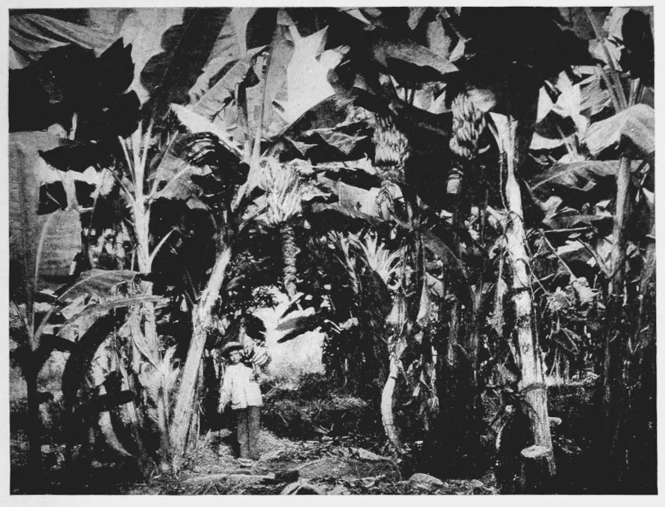
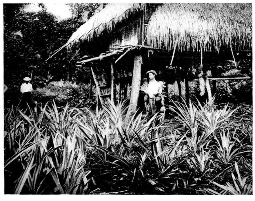
Banana GrovePineapple Garden
The aguacate looks like a small squash rather than
a pear. It has a kernel, or hard stone, as big as the
fist. The flanks are laid open, the stone removed,
and the fruit is ready to serve in its own dressing.
Some prefer it with just a pinch of salt. Others add
a touch of pepper. Many like a little vinegar with
the salt and pepper, and a few even prefer a regular
French dressing with oil, though that is apt to spoil
the natural flavor. Epicures like it with sugar and
lemon juice. The aguacate is one of the undisguised
palatal blessings of the tropics and the semi-tropics.
It should be sought after and insisted on at every
occasion. The imported fruit loses the poetic savor.
The most careful packing and tenderest care cannot
preserve its delicate taste. I tried it once in bringing
some from Honolulu to San Francisco. They looked
well, but something was lacking in the taste. A similar
experience between Jamaica and New York was the
reward for my efforts. I was convinced after these
experiments that the aguacate is one of the real luxuries
which it pays to go abroad in order to enjoy.
Young persons who travel will be interested in knowing
that it is said to germinate the tender sentiment.
The cheremoya is not unlike the pawpaw of the temperate
climates. The fibre is harder and not so juicy.
But the fruit is very rich, so rich that the palate does
not crave much. A mouthful lingers like the dream
of the poet. The cheremoya is called the anona in
Cuba. Several varieties of it differ from one another
only in the delicacy and richness of the flavor.
Cracked ice is the complement of the fruit. They
should be introduced to each other an hour before
serving.
A delusion which the adventuring North American
should get rid of is that no decent hotels are found on
the West Coast and in the interior. Everywhere are
passable ones and in some of the cities exceptionally
good ones. In the ordinary coast towns they
are not much more than stopping-places, yet almost
invariably an excellent breakfast or dinner can be
obtained. As to the lodging conveniences the old
Spanish tradition still obtains that a place to sleep in
is all that is called for, and clean linen and similar
comforts should not be demanded by the traveller
who is moving on. But even in this respect improvements
are being made.
Most of the hotel-keepers are of foreign nationality,—French,
Germans, Italians, and Spaniards. It is
rare to find anything of a higher grade than an inn
kept by a native. The best hotels are those under
the control of the Frenchmen, and when a choice is
to be made they should be given the preference, for
there is not only good eating but cleanliness and some
consideration for the conveniences of life. A Frenchman
keeps the hotel at La Paz in Bolivia, and it is
a good one. Another passably fair house of entertainment
in the same place is kept by a Russian. At the
mining-town of Oruro a North American of German
descent provides excellent accommodations. In the
remote town of Tupiza in the fastnesses of the Andes,
where of all places one would hardly look for a foreigner,
I found a Slav hotel-keeper and a decent kind
of a resting-place. The proprietor was from one
of the Danubian provinces. In Lima a very well
appointed hotel is managed by an Italian. In Santiago
the best one is under the control of a Frenchman.
In the interior palatial inns are not to be expected,
though a young French mining engineer who came
out telegraphed along the Andes trail which he was
to follow to have room with bath reserved for him.
The telegram is still shown. Such inns as exist are
called tambos. Even in the poorest of these, while
the lodging is wretched, a good meal usually can
be had.
The practice obtains nearly everywhere of charging
separately for the lodging, but in some of the larger
cities the hotels now are conducted on the American
plan. The visitor is apt to be puzzled by the annexes.
Naturally he assumes that the annexes to a hotel are
part of it, but usually they are separate and under
a distinct management. In Valparaiso there are a
Hotel Colon and a Hotel Colon Annex, a block
or two apart and altogether different. In Santiago
are the Hotel Oddo and the Annex to the Oddo,
and so on. This causes confusion, and the traveller
should make inquiry in advance so as to know where
he is going. While the sanitary conveniences in most
of the hotels are poor, improvements are being made,
and there is something of an approach to the demands
of civilization.
A simple rule as to baggage holds good. Take
as little as practicable and pack it as conveniently as
possible. That means a good deal of loose luggage;
but since trunks are charged by weight and very few
of the railroads make any allowance for free baggage,
it is desirable to have one’s belongings arranged so
that they can be piled up around him. One soon
becomes accustomed to this and to providing himself
with an armful of rugs and blankets.
Railroad fares are about one-third less than in the
United States. The accommodations are not luxurious,
but they are fair. Night trips are unknown.
Chile is the only country on the West Coast which
provides a through night train with a sleeper. This
is on the line between Santiago and Talca.
An addition to the regular expense of travel is that
for embarkation and disembarkation. It is not
covered in the steamship ticket, and since, with few
exceptions, in the different ports the vessels do not
go to wharves of their own or put their passengers
ashore in lighters, each makes his choice of the small
boats and pays the bill. These charges are not high,
yet in the course of a long voyage they mount up, and
it always is desirable to make the bargain with the
boatman in advance.
For travel in the Andine regions it is necessary to
provide one’s own outfit. For those who have to
go about much it is not practicable to have their own
pack and riding animals, though occasionally a mining
engineer will keep a pair of horses or mules and transport
them from place to place. Usually the mules
and burros, or donkeys, have to be hired. In every
case it is advantageous to own the montura, or saddle,
and other accoutrements, with especial regard to the
capacity of the saddle-bags. Though in the United
States the McClellan is the favorite for hard travelling,
Americans engaged in mining or in exploration work
in the Andes prefer the Mexican saddle. A mining
company in southern Peru after various trials discarded
everything except Mexican saddles, and had
these made especially in San Francisco. In my own
experience I found them the most comfortable.
The petacas, or leather trunks, are used by all the
South Americans. These are small, and a pair of them
balance nicely on either side of the pack animal. Yet
during a long mountain journey I managed to transport
an ordinary trunk. The Andean mule is bred in
northern Argentina. It is not the society pet that
is its cousin of the United States Army, and it will
carry a burden of two hundred pounds in the upper
altitudes.
A supply of canned goods and similar provisions is
essential, for it is not possible to rely solely on such
wayfaring entertainment as may be had at the Indian
huts, even when the trip is short enough to keep
within the limits of human habitation. Charqui, or
jerked beef, is the mainstay of the stomach for a long
journey, but dried mutton sometimes may be had, and
is less likely to become unpalatable. Chuni, the dried
and frozen potato which nourishes the Bolivian Indians,
has nutritive virtues, but palatability is not one
of them.
The chief problem in mountain travelling is fodder
for the animal rather than food for the man. In the
valleys and part way up the punas, or table-lands, fresh
alfalfa may be had. But in the higher sierras this is
lacking, and it is necessary to carry a stock of barley.
In some places where barley can be raised it runs to
straw and does not mature into the grain, so that the
local supply is not to be depended on.
A hammock is useful in the forest regions. A tent
and other camping outfit are sometimes desirable, yet
where it is possible to keep within the range of population
it is better to risk shelter in the Indian huts, the
traveller carrying his own blankets or sleeping-bag.
A Western frontiersman or miner has little difficulty
in outfitting for the Andean regions.
The quarantine is one of the serious annoyances
of travel on the West Coast, though the interruption
which it causes often is exaggerated. At times
one may have to postpone a landing or a departure
because of the restriction, and in that case there is
nothing to be done but go on to the next open port
and wait in patience. The regulations of the different
governments are similar, though they are not always
enforced with discretion and common-sense. Yet they
are no more severe than the regulations of New
Orleans or other Southern ports of the United States.
Their purpose of self-protection is justifiable. The
objection is that the application of the measures
taken is unreasonable. The steamship companies insist
on the exaction of charging the passengers an
extra sum for the time in which the vessel is held in
quarantine.
So many sorts of money are in circulation that it is
impossible for the traveller not to lose through
exchange. The United States dollar is known well
enough, but it has not yet made its way down the coast
sufficiently to insure being taken for its full worth.
Letters of credit and bank drafts would better be in
English money, for the banks and exchange houses
insist on counting the $5 gold piece as equal only to
the pound sterling, or $4.85. It will take some years
for the full result of the Panama money system to be
felt on the West Coast, though ultimately that will
help to extend the use of United States currency.
A calculation is made every quarter by the United
States Mint of the value of the coins representing the
monetary units of the various Latin-American countries.
This serves as an index of values, though in
actual transactions it cannot always be insisted upon.
The universal coin on the West Coast is the Peruvian
sol, equal to 48½ cents gold. It is the size of the
American silver dollar. Since Peru has the gold
standard and coins a Peruvian pound called the inca,
exactly the weight and fineness of the English pound
sterling, there is no fluctuation. Ten soles make a
pound. For local purposes along the coast the
Peruvian sol is therefore the best medium of exchange.
I have left for separate consideration the subject
of the diseases incident to West Coast travel and
residence. Their mention frightens. Why, I do not
know.
Pneumonia and typhoid in the temperate climates
cause greater ravages than tropical diseases in their
field, nor is malaria in its manifold manifestations
limited to a given area. Fever and ague in the United
States, calentura in the West Indies, terciana in the
forest regions of the Andes,—it all is essentially
the breakbone fever. Quinine and calomel remain the
tonic preventives. Tropical dysentery is to be guarded
against by common-sense in diet. The social vices
bring their inexorable penalty more swiftly than in the
North, but their remedy is the moral prophylactic.
Yellow fever, since the demonstration of the mosquito
as the active agent in its propagation, is losing its terrors,
but its avoidance comes under the sphere of epidemic
quarantines rather than of individual measures.
The exceptional conditions which will prevail on the
Isthmus during the Canal construction and the exceptional
means adopted to combat disease are not to
be taken as representative of the West Coast. Yet
the benefit of this experience will be great. But
whether along the coast, on the plateaus of the Andes,
or in the tropical valleys, one general rule is more
valuable than a medicine chest. It is that of a healthy,
fearless mind which does not magnify ordinary ailments
and which keeps its poise in the shadow of
more serious illness.
CHAPTER III
THE ISTHMUS OF PANAMA
Canal Entrance—Colon in Architectural Transformation—Unchanging
Climate—Historic Waterway Routes—Columbus
and the Early Explorers—Darien and San Blas—East and
West Directions—Life along the Railway—Chagres River
and Culebra Cut—Three Panamas—Pacific Mouth of the
Canal—Functions of the Republic—Natural Resources—Agriculture
and Timber—Road-building—United States
Authority on the Zone—Labor and Laborers—Misleading
Comparisons with Cuba—The First Year’s Experience.
WHEN the Caribbean is restive, restless is the
voyager. After tossing in misery one April
night I peered through the port-hole of the steamer’s
cabin at what seemed a cluster of swinging lanterns
dipping into the sea. They were the lights of Colon.
The vessel was riding at anchor to await the morning
hour when the approach to the quays could be
made.
Daybreak unfolded through the mist, disclosing
green foliage ridges and broken forest-clad hills sloping
to a shallow bowl. This circular basin is the
island of Manzanillo. The town lies as in the bottom
of a saucer. Colon is not a harbor in the usual
sense, for the curving Bay of Limon which it fringes is
an open roadstead. The improvements by the United
States will make it a commercial haven.
For all the years to come the blue horizon will be
swept by the eager eye of the traveller for the Canal
entrance. Seen from the ship’s deck, it is like the
smooth surface of a sluggish river, broad and open.
The artistic instinct of the French engineers found
expression even in the prosaic work of earth excavation.
They planted a village in the midst of cocoanut
groves, and the palm-thatched cottages charm the eye.
The bronze group of Columbus and the Indian, Empress
Eugenie’s gift, allegorical of the enlightenment of
the New World, may be seen through glasses, while the
showy residence built for De Lesseps is discerned.
The De Lesseps House, Colon
Little is noted of the town till the wharves are approached.
There is a group of warehouses, a glimpse
of railroad yards, a conglomeration of frame houses
with peaked roofs and outside balconies and stairways,
and then swamps, marshes, and hills beyond. The
great transatlantic liners stretched along the docks are
far more imposing than the port town itself.
Ashore, the frame structures give an impression of
all that is temporary and unsubstantial. Some have
been streaked with deep indigo blue, but the sun and
the salt air have worn the pigment to a faded azure.
Colon has little that is typically and traditionally Spanish,
because when the insurgents burned it in 1885
they left only a few brick and mortar buildings. The
town which then sprang up was built with economy
in view, though pine lumber was not very cheap.
The newer city which gradually will replace the
aggregation of shanties will be more substantial
and more like a permanent seaport. The Gothic
brownstone church in which the Jamaica negroes and
the whites who profess the Anglican form of faith
worship, is the one edifice in Colon that in the transformation
should be allowed to remain.
The cocoanut grove in front of the hotel, facing
the Caribbean, is a pretty bit of landscape, and the
statue erected to William H. Aspinwall, John L.
Stephens, and Henry Chauncey, associates in the building
of the Panama Railroad, if not a monument of
taste, at least serves a praiseworthy purpose as a tribute
to indomitable American enterprise. Ornate homes,
tropical in the extreme, line the sea-front, but the
residence district is a very limited one and will remain
so until the swamp is filled in and the marshes cleared
away. Colon may be regarded as in the process of
hygienic architectural transition, and its lack of attractiveness
need not be deplored. The work of reconstruction
would be immensely facilitated if another
fire could sweep across the marshes and leave nothing
but the brownstone church, the hotel, and the
wharves.
Caribbean Cocoa Palms
Colon is the most typically cosmopolitan place
upon the Isthmus, and will continue so until the
world’s commerce begins to flow through the waterway.
Then the city of Panama will share with it in
this respect. But Panama does not have in so full a
degree the European mixture as Colon, for the crews
of the transatlantic vessels seldom get across to the
Pacific port. In all the mingling of tongues in Colon—German,
Spanish, Italian, French, Chinese, dialect
Indian, Greek, Swedish, and many varieties of English—nothing
is so mellow and so distressing in whining
intonation as the broad cockney accent of the Jamaica
blacks.
The work accomplished by the Panama Railroad
Company, hygienically and otherwise, serves as a basis
for the physical regeneration of Colon which must
accompany the Canal construction. Its provisions
for its employees, its hospitals, and its general sanitary
regulations were so well conceived and carried out
that their value as an example and a precedent is very
great. The engineering problem is comparatively
simple. It is to raise the level of the island of Manzanillo,
and then to provide sanitary conveniences and
enforce hygienic principles both for the community
and for the individual. The question of water supply
is one of gathering the plentiful showers of heaven
in cisterns and distilling them. A system of waterworks
which will bring pure water from the springs
of the Cordillera is not impracticable.
Colon is hot and humid. Its climate cannot be
modified by artificial devices. During the dry season,
which is from April to July, the mean temperature is
nearly 90° Fahrenheit in the shade, while in the sun it
is 110°. The humidity is about 77 per cent. In the
rainy season the mean temperature is 85°, and the
humidity varies from 86 per cent to complete saturation.
The annual rainfall is seldom less than 125
inches. A man six feet in stature standing on the
shoulders of another man of equal height, would just
about be able to keep his shoulders above water if the
two were placed in a reservoir which would catch and
hold the entire rainfall of the year. But in spite of
heat and humidity and precipitated moisture, existence
can be made passably comfortable.
As the traveller takes his way across the Isthmus,
he may wish also to view in retrospect the waterways
that have been conceived in the brains of men who
were ahead of their times, and the paths of trade and
travel that have been followed; for now, in the
presence of actual construction along a determined
course, these pioneer routes quickly fade into oblivion.
The projects have been many. They were to unlock
the key of the universe and to throw open a gateway
to the Pacific. Columbus explored the Mosquito
coast in search of the passage to the Indies, and thought
he had found another Ganges, though the strait which
he sought was obstinate in hiding itself. He planned
colonies at the Gulf of Uraba, or Darien. Balboa and
his companions, among whom was Pizarro, from near
the same place, 200 miles east of the Chagres, hewed
their way through tropical forest jungle and over
mountains till they reached the summit of Piuri, from
which they saw the Pacific and named the ocean inlet
San Miguel Bay in honor of St. Michael. A few
years later Balboa had “the little boats” carried over
this path from the Atlantic to the Pacific. Long
afterward, more than a century and a half, Sir John
Morgan led his loyal buccaneers in Balboa’s footprints
to the bloody sacking of the opulent city of
Panama.
But the early Spaniards found a shorter route for
their traffic. At different periods the Chagres was
followed from its mouth till within twenty miles of
Panama, and then the jungle was pierced by paths.
Yet this was not the camino real, or king’s highway.
That royal road was a cobble-paved mule trail from
Portobello, twenty miles east of what is now Colon,
to Santes on the upper Chagres, and thence to Panama.
This is the route over which the traffic passed for
two centuries. The land trails could be tested. The
canal courses could only be dreamed or projected in
the imagination.
Of the three interoceanic routes which have become
historic, the early explorers, Spanish and Portuguese,
thought most of the Darien or Caledonian cross-cut
channel. It was to start north of the Gulf of Darien,
near the bay which afterward became known as Caledonian
Bay, and follow a general direction southwest
to the Pacific. Señor Don Angel Savedro, one of the
first petitioners to Charles V for an interoceanic waterway,
had this general direction in his mind. This was
the route advocated by the Scotch banker, William
Patterson, in his broad scheme for Great Britain to
save control of the Antilles, by seizing Havana, acquiring
the Isthmus, and constructing an isthmian
canal in order to carry the blessings of commerce and
civilization to the Sandwich Islands.
During the nineteenth century the Darien general
route was no less earnestly advocated than in the sixteenth
and seventeenth centuries, and the mythical
low level had many believers. Frederick M. Kelley,
the New York banker, who gave fortune and a life’s
ambition to the project of an interoceanic waterway,
also based his hopes on the Darien route. It required
the explorations of Commander Selfridge and subsequent
American expeditions, as well as the investigations
of Reclus and Wyse for the French company, to
dissipate the unfounded hopes regarding Darien.
The San Blas route, being the shortest, should have
had more advocates, for it is only thirty-one miles
across from ocean to ocean, but the solid mountain
wall of the Cordillera discouraged most of the early
explorers. Its merits and demerits were made familiar
to the public through the discussions in Congress.
It was of the upper Chagres route that the intrepid
Frenchman, Champlain, whose voyage to the West
Indies and the Isthmus in 1602 seems to be historically
established, wrote: “At Panama is a little river
which rises in the mountains and descends to Porte
Bello, which river is four leagues from Panama ...
and being embarked on the said river there are but
eighteen leagues to Porte Bello. One may judge that if
the four leagues of land which there are from Panama
to this river were cut through, one might pass from the
South Sea to the ocean on the other side and thus
shorten the route by more than 1,500 leagues; and
from Panama to the Straits of Magellan would be an
island, and from Panama to the Newfoundlands would
be another island, so that the whole of America would
be in two islands.”
The Raspadura channel, by which the Jesuit Fathers
were said to have made the passage from ocean
to ocean in canoes with a very short portage, lacks
historical verification.
The Chagres route was included in the broad vision
of the future which Lopez de Guevara had in the
middle of the sixteenth century. The realization of
his dreams may be for the twenty-fifth century. He
proposed the union of the two oceans by three canals
opening in three points,—the Chagres in Panama,
Nicaragua, and Tehuantepec.
Before following the jungle-screened railway line or
tracing the course of the Canal with its luxurious
border of tropical vegetation, it is desirable to clear
away geographical confusion. The Isthmus of Panama
extends almost directly east and west. It is the contour
of the two continents as formed by a neck not
simply awry but completely twisted,—in popular
language, a gooseneck. The entire West Coast of
South America, except a slight bulge near the Equator,
lies east of the longitude of Cleveland, Ohio. Panama
City is about on the north and south line with Pittsburg.
It is southeast of Colon, and the general direction
of the Canal from the Atlantic entrance, therefore,
will be southeast.
GENERAL PLAN OF THE PANAMA CANAL
From the plans of the Panama Canal Company
The route selected by the French engineers, and
which with some variation will be continued by the
United States, does not need detailed description.
The course of the Canal can be observed in the railroad
journey to Gatun, where the first view is had of
the defiant Chagres fed by its twenty-one tributaries.
I have seen the Chagres a tame, sleeping brook, losing
itself in the tropical jungle or the narrow gorges, and
again have looked on it when it was a wild, resistless
torrent. The engineering problems never can be fully
appreciated until one has seen the Chagres sweeping
on in its conquering career.
Native customs and the mixed life of Canal construction
are seen at the stations along the railway.
Every village has its collection of parrots and monkeys.
The sights differ from the scenes in other
parts of the Isthmus, because of this intermingling of
foreigners, largely Chinese and Jamaican. But the inhabitants
are so markedly of the local type that they
may be easily distinguished from the foreign mixture.
The aboriginal Indian race, of which there are various
branches, forms a third of the inhabitants. The Panameñan
is about three-fourths Indian blood and one-fourth
Spanish, although farther away from the Canal
Zone a very strong negro element exists, due to the
introduction of African slavery by the early Spaniards.
The natives, from their familiarity with the jungles and
their ability to withstand the hardships of the climate
and the exposure, are useful principally to the exploring
parties and the pioneering expeditions. They are
too indolent for the actual work of excavation.
The Culebra Cut is not seen to full advantage from
the railway, yet a fair idea may be obtained of the
task involved in cutting the spine of the Cordillera
or the Continental Divide at this the lowest depression,
272 feet. The excavation and removal of the
material from this section is said to be the controlling
factor in the Canal construction. The valley with the
city of Panama huddled at the foot of Mt. Ancon,
and Taboga Isle in the bay, are seen to advantage
from Culebra.
There are three Panamas. One is primitive Panama,
in jungle-covered ruins, a few miles from the
present port. This was the city whose opulence was
the envy of the world until its treasures awakened
the greed of Morgan and his fellow freebooters and
became their spoil. Then the new town was built
and fortified. It is gloriously mediæval with all its
Spanish and Moorish buildings, its cluster of emerald
rocks in the bay, its high tides and its mixed nationalities,
with little Italy and modernized China side by
side. But the present Panama attracts only at a distance,
and will be attractive only at a distance until
modern sanitation can be installed and some of its picturesqueness
be destroyed in the interests of public
and private hygiene.
Rivalry exists between Panama and Colon over
their relative climatic attractions. Panama is much
drier than the Caribbean seaport, the annual rainfall
usually being not more than 70 inches and the humidity
of the atmosphere not so great. But 90°
Fahrenheit in the shade is the average mean temperature,
and the humidity is penetrating enough to
serve all practical purposes of discomfort.
The new Panama is at La Boca, the Pacific mouth
of the Canal. This is the railway terminus, and it
is there the United States authorities created the port
of Ancon and then abandoned the plan of collecting
customs duties in competition with the Isthmian Republic.
Wharves are located there, and for shipping
the place offers some advantages over the port of
Panama. The present Panama with its population
of 25,000 is congested. Its old buildings are overcrowded.
They are solid, substantial, and will last
for centuries yet; but the natural movement of population,
especially in view of the enormous rents demanded
in Panama, will be to seek the new city
which will grow up as a frame town with elements
of stability. Much business is certain to drift to the
Canal mouth, some of it in American hands. The
mercantile community in the days when Colombia
controlled the Isthmus was anything but Colombian.
It was West Indian, Italian, Chinese, German, French,
American, and English. It is the same to-day and
will be the same to-morrow.
The United States is the paramount authority on
the Isthmus, the control of the Canal Zone making
it such, and its duty to itself and its responsibility to
the world could be discharged in no other way. Yet
there is also the government of the Republic of Panama,—a
protected commonwealth. All that needs
to be understood is Article I of the Hay-Varilla
Treaty. This says that the United States guarantees
and will maintain the independence of the Republic
of Panama.
In its political relations the Spanish term may be
adopted, and the Republic may be said to be “in
function” within the sphere of the United States. I
omit particulars of the governmental system in order
to examine the industrial resources and prospects.
Details of administration are unnecessary, because the
authority exercised by the American officials in the
Canal Zone, and the supervising power over sanitation
in Colon and Panama, take the subject out of its
local limitations. The liberality shown by President
Roosevelt’s administration in adjusting the jurisdiction
of the United States on the broad lines laid down
by Secretary Taft, left the Panama government free to
work out its commercial and industrial growth through
its own measures and to the full extent of its own
abilities as a commonwealth. A full account of fiscal
policy may be omitted, with the general statement that
international traffic in transit as taxed by port dues is
not subjected to heavy burdens, while the imposts on
domestic trade are not severe. While a tariff in the
protective sense may not be said to exist, the system
of ad valorem valuations secures a customs revenue
which places all merchandise under tribute. Internal
taxation has many forms, modelled, as it is, after the
Spanish system. In addition the income from the
$10,000,000 received from the United States assures
that the government will continue to be a “going”
concern, in practical operation as well as in legal
phraseology.
For the student of political institutions the interest
is in the moulding of the inheritance of Spanish laws
and Spanish administrative system to American models
and the influence of an environment so pronounced as
the American control of the Canal Zone. The evolution
of the civic spirit, instead of being under the
shadow of an unfriendly Power, is in the sunshine of
a big genial Republic.
In its soil of decayed vegetation the Isthmus, with
an area equal to the State of Indiana, has natural wealth
enough for the subsistence of a continent. But it is
tropical natural wealth, much of which exists under
conditions unfavorable for development. Timber exploitation
may one day open the longitudinal path
eastward from the Canal Zone through the health-destroying
jungles to the Gulf of Darien. Mahogany
and others of the precious hardwoods offer the temptation.
But the trail will be blazed slowly, a score or
so of miles each decade. The mineral deposits also
lie to the east. They will aid in the conquering of
this hitherto unconquered region, yet gradually.
The territory which will be developed most rapidly
is that lying principally west of the Canal Zone and
extending to the limits of Costa Rica. Tropical agriculture
in the hands of natives of the temperate
countries is entirely practicable in this region, much
of which has a climate markedly superior to the belt
lying between Colon and Panama in the valleys of the
Chagres and the Grand Rivers. The fruit industry,
and in particular banana culture, has made rapid
strides, but its possibilities are only in their beginning.
Coffee cultivation was becoming a profitable business
until the political disturbances ruined it. The revival
may be expected within the five years necessary to
bring the trees to the point of commercial production.
Ivory nuts, rubber, and the infinite variety of minor
tropical products will be stimulated by the market
that will be opened. In the extreme west along the
Pacific slope, where grazing has been enough of an
agricultural industry to create the flourishing town of
David, an enduring basis will be given to the live-stock
industry.
But none of this agricultural growth can precede
the building of roads. These are totally lacking in
the interior. The Panama government made sensible
provision out of its first revenues for this form of
internal improvement, and the policy may be looked
upon as a continuous one. The railroad line of
development will be from Bocas del Toro on the
Atlantic slope to David on the Pacific coast. Bocas
del Toro will reach the Canal Zone by a railway
through the banana-producing lands, and David in
time may be connected with Panama.
In the general sense the prosperity of the Isthmus
for many years depends more on the excavation work
and on the international commerce than on its internal
resources. It is this which will swell the trade of
$2,000,000 or $2,500,000 annually to greater figures.
Yet the waterway is the sure harbinger of the exploitation
of the productive founts. The Canal community
and the Canal construction are the potent economic
factors.
When all is said, the Zone is the thing. The laws
administered may not in their entirety be American
laws, but they are such in spirit. Actually, the Canal
Zone is a semi-military camp. It must continue such
for purposes of sanitation and law and order during the
entire period of Canal construction. What follows is
the establishment of a colony within the Republic of
Panama, yet not of it. This colony, which includes
laborers, civilian officials, occasional detachments of
marines, and a police force, is not apt at any time
greatly to exceed 25,000 persons. The early estimates
of the very large number of laborers who
would be required were reduced when the engineers
began to make closer study of the degree to which
improved machinery could be used in the excavation
and other work. It will be a conglomerate mass,—Jamaican
and other West Indian negroes, Chinese coolies,
Mexican and Central American peons, possibly a
few American blacks, Italian railway workers, and similar
elements. In spite of all scepticism and detraction,
the Jamaica and Barbadoes negroes will do the bulk of
the work on the Canal. They did the most of what
was accomplished by the French company. They
built the railroads along the unhealthy coast of Costa
Rica. They have shown the greatest adaptability to
the climate and the best capacity for hard labor. The
Panama Canal will be the monumental contribution of
the despised black race to civilization.
Panama Natives from the Swamp CountryPanama Natives from the Mountains
Aside from determining the engineering conditions
of the Canal, which I have no purpose of discussing in
this volume, the most important functions of the United
States on the Isthmus are in regulating sanitation
and hygiene. This regulation could not be restricted
merely to the inhabitants of the Canal Zone, for to
guard them against epidemics Colon and Panama had
to be protected.
I never shared the enthusiasm over the rose-colored
comparisons of the region lying between Colon and
Panama with Havana and Cuba. Measures of hygiene,
public sanitation, and even individual cleanliness
will be secured on the Canal Zone and in the seaport
cities. This will be valuable in decreasing the danger
from yellow fever, bubonic plague, or other epidemics.
And it also may be assumed that the strict supervision
given by the medical officers will in a measure serve as
a preventive against dysentery and enteric diseases,
which are common to the tropics and especially so to
the moist lands. But the Canal Zone topographically
is vastly different from the island of Cuba. The Atlantic
Ocean sweeps across Cuba. Every day of the
year a healthful breeze is felt in the great central belt
of that island. This not only purifies the northern
coast, but it also invigorates the interior region, and its
effect is felt even on the south coast. But in the Canal
belt are the dead calms of the Pacific on one side and
the limited area of the Caribbean winds on the other
side. The Atlantic breezes are lost in the marshes
before they reach the ridge of the Cordillera, while
the zephyr which sometimes springs up in the Bay
of Panama rarely extends as far as the Culebra Cut.
When the Canal is completed, it will not serve as a
tube through which the breezes of one ocean will
whistle to the other ocean.
I write these opinions without the purpose of opening
a controversy with enthusiastic scientists, medical
officers, or meteorologists, but merely as a statement
of climatic conditions which cannot be changed by the
agency of man. There is the peculiar configuration
of the Cordillera that causes the moist blankets to
hang over the Isthmus and precipitates the enormous
quantities of rain. Cuba has its wet season during
certain months, but these rains are normal phenomena
and are not supercharged with disease.
Miasma must result from the excavation of the decayed
vegetation of a thousand years which constitutes
the waterway line with the exception of the
Culebra Cut, and yet the central belt of the Isthmus
has enough of pernicious malaria even with the
earth undisturbed. Experiences at Havana and elsewhere
will be utilized, and the mosquito, if not exterminated,
will have its harmfulness curbed. Whatever can
be accomplished by artificial means to combat disease-breeding
Nature will be accomplished, and no doubt
need be felt regarding the efficiency of the sanitary
corps as organized under the Canal Commission. But
when all is not simply said but done, it comes to this:
the inherent unhealthy conditions of the Canal Zone
will be reduced to a minimum. The climate will not
be conquered. What may happen will be to reconcile
it to the presence of a larger number of inhabitants
than the region heretofore has had.
For those who will dwell and work on the Isthmus
the suggestions of the sanitary corps are so complete
that I can add nothing except to advise to follow these
instructions and to take a vacation either to the healthful
mountains of Costa Rica or down the Pacific coast
or back home as often as possible. The population
which will be living in the Canal Zone for the next
twenty years in relation to health is to be taken in the
mass, and the experiences of a few individuals who
have been able to regulate their own occupations with
a special view to conserving their strength are not to
be accepted as applying to thousands of other individuals.
Nor is the result of a few months’ life on the
Isthmus in its effect on the human energies to be accepted
as the index of what may be expected after
several years, during which the mental and the physical
faculties are concentrated on one task.
The lessons of the first year’s experience are easily
learned. In the beginning was the buoyant, hopeful
American temperament which goes straight forward to
the task and, once determined that it shall be done,
takes no note of obstacles. The Canal never would
be built if the spirit of pessimism obtained at the outset.
Optimism is always better in a great national
undertaking. A large number of cheerful and confident
Americans flocked to the Isthmus to fill positions
in the engineering, the clerical, the sanitary departments
and on the railroad. That there were confusion
and cross-purposes in administration and complaint
of red tape was not important. Actually the Washington
authorities cut far more of the red tape than
ordinarily can be done safely in government enterprises.
But within a few months loud complaints
were heard about low wages, the high cost of living,
the long hours of labor, and the lack of recreation and
amusement. Then the discouraged employees began
to come home. They were of two classes. Many of
the early home-comers were the adventurous fellows
who had gone to Panama wanting a new experience
and having had it more rapidly than they had anticipated,
returned to spread the discontent. There was
the other, and perhaps the more numerous, class who
had gone in good faith, expecting to find conditions as
to health and personal comfort similar to the United
States, and intending to stay. It is likely, too, that
both classes, working as they were for the government,
expected easier conditions than would obtain in private
employment.
The unvarying tendency of the returning employees
was to discredit the glowing official and semi-official
reports which had been made, and the promises held
out of immunity from even the common ailments,
including lassitude and homesickness. Then came
the yellow fever epidemic of the Summer of 1905
and the long period during which the health authorities
were baffled in locating the focus of infection.
There was also the disagreeable evidence that pernicious
malaria had had time to work havoc in many
strong constitutions. The picture of the panic-stricken
groups struggling to get away from Colon
with every vessel may have been a little overdrawn,
but that the feeling throughout the Isthmus was one
of illy suppressed and contagious terror was undeniable.
Yet to those experienced in tropical diseases
the mortality was not an excessive one, nor were the
general health conditions bad, allowance being made
for surroundings. The permanent hospital records
and vital statistics unquestionably will show that wonders
were really worked under a scientific and systematic
sanitation and provisions for conserving the health
of employees. But the medical officials in their spirit
of hopefulness had predicted freedom from the inevitable
diseases of the Isthmus of Panama, and the failure
of their prophecies caused the disappointing results to
be exaggerated.
Ruins at Panama
Generally, during the first year the United States
suffered from too much expert opinion and advice
regarding engineering and administrative work of the
Canal and too little practical application to the task in
hand. This was not true of the sanitary authorities,
who worked harmoniously and effectively. If only
they had been more conservative in their original
statements, it would have been better for their reputations
as prophets of health. It always is to be remembered
that ditch-digging in the most humid and
rainiest section of the tropics cannot be made an entirely
healthful occupation, and as fast as the subsoil
is turned up by the steam-shovel the earth’s resentment
at being disturbed will make itself felt. The
procurement of the permanent class of employees and
laborers with the physical stamina and the moral fibre
which the work of Canal construction requires, is necessarily
an evolution and not the creation of a single
year. But that class will be evolved, and the undertaking
will go forward.
My own point of view is twofold. The Canal
insures the industrial development of the Isthmus of
Panama along the lines of tropical agriculture. It
creates an international commerce and it adds to the
domestic trade. It will secure an increased permanent
population to replace the army of construction
when the work of excavation shall be completed.
This is the certainty in relation to the resources and
the people. It will be good for Panama. But there
is a wider good which is not local. For ten or twenty
years the Canal will be a training-school in which to
test and strengthen the constructive energy of the
American character. Nowhere will the initiative
faculty make greater demands on the individual.
For those “who die victorious” the tribute of Time
will be the completed Canal. For those who live the
task will be from year to year out of their abundant
experience to help on the industrial development of
adjacent lands, among them the West Coast countries.
And that is the civilization which will sweep
from the Atlantic through the Canal and down the
Pacific.
CHAPTER IV
A GLIMPSE OF ECUADOR
Tranquil Ship Life—Dissolving View of Panama Bay—The
Comforting Antarctic Current—Seeking Cotopaxi and Chimborazo—Up
the Guayas River—Activity in Guayaquil
Harbor—Old and New Town—Shipping via The Isthmus
and Cape Horn—Chocolate and Rubber Exports—Railway
toward Quito—A Charming Capital—Cuenca’s Industries—Cereals
in the Inter-Andine Region—Forest District—Minerals
in the South—Population—Galapagos Islands—Political
Equilibrium—National Finances.
SHIP life along coast from Panama south is dreamful,
placid, nerve-soothing.
“This South Sea,” wrote the Augustine Friar
Calancha, in his chronicle of the early Spanish
voyagers, “is called the Pacific because, in comparison
with the Atlantic and the Mediterranean, its
storms are less violent and fewer and its calm is
more tranquil. It is also called the sea of drunkards
because a drunken man might navigate in it. Both
oceans and ships are ruled over by five beautiful stars
in the form of a cross, in a happy prognostic of holy
domination over sea and land—at the sight of which
the devil even when most enraged retreats and leaves
all in tranquillity.” This is surely a happy description
of the quiet ocean and a devout poet’s image of the
Southern Cross.
The steamers are commodious floating Summer
homes. The smooth waters of the Pacific make it
possible to have a type of vessel that would be impracticable
for transatlantic voyages. Deck cabins,
a dining-saloon on the upper deck, and ample room are
properties of them all. Some of the steamers are twin
screw, though such enterprise hardly was demanded
by the traffic and this type is not so comfortable as
the single screw. From Panama to Valparaiso, 3,100
miles by the stops, there is rarely enough of a ripple
to send the most sensitive traveller below with symptoms
of sea-sickness.
The voyage is a marine trip along a great winding
Continental street, with stops at many corners and turns
up many lanes. Up and down the coast means putting
into innumerable wayports. This makes them
more or less acquainted with one another, and one
coast community feels an interest in what is happening
in a neighbor port a thousand miles away.
The vessels bring the gossip,—usually of trade, of
the value of the last cargo, of quarantine, of troubles
with the native longshoremen, of disputes with the
minor officials, and of political events or the latest
revolution. The through freight is not yet sufficient
for the big steamers to omit the minor landings and
make quick time, which could be done if Guayaquil,
Callao, and Valparaiso were the only ports touched.
This should be a matter of eight or ten days from
Panama to Valparaiso, whereas now it takes from
twenty-one to twenty-three days. The time will be
shorter when the through traffic developed by the
Panama Canal has had a chance to grow.
As the steamer threads its way out into the ocean
through Panama Bay, the vista is of cone-shaped, vivid
green-clad volcanic mountains rising sheer out of the
water. On a disappearing view they look like gopher
mounds on the prairies. At sunset the sky is of
indigo-blue and the waters are a maroon expanse,
but the next night the great copper disk in the west
burnishes the liquid plain, which seethes at its embrace.
For two days the voyage is apt to be disagreeably
hot, though the air rarely becomes so stifling that
the deck cabins have to be abandoned. The weather
is decently comfortable in the daytime. The nights
may be choking, but this does not last long. The
third day the equatorial line is crossed, not very far
out at sea yet out of sight of land. The Humboldt,
or Antarctic, current is met as it sweeps up from Cape
Horn, and its refreshing coolness is enjoyed for the
remainder of the voyage. The only unpleasant feature
is that during the season from April to August
the fogs which hang over the mainland charge the
atmosphere with too much moisture, and there is no
relief by their precipitation into rain; yet the discomfort
from this cause is not serious.
Only the small coasting-vessels put into the minor
Colombian and Ecuadorian ports. On the Pacific side
Colombia has but one shipping-point of consequence—Buenaventura,
where the bay bends in a deep inlet.
It is the gateway to the immensely rich country of
the Cauca and of the overland route by Cali and the
mountain passes through the Cordilleras to Bogota.
“It is a strange thing,” says my Lord Francis
Bacon, “that in sea voyages where there is nothing
to be seen but sky and sea, men should make diaries.”
But down the West Coast, after crossing the equatorial
line, much more than sky and sea is to be seen and
the diary-maker need not be furtive in his occupation.
On the larger steamers one is always straining the eyes
for Ecuador’s famous volcanoes, Cotopaxi and Chimborazo.
They are not often visible from the sea,
though Cotopaxi is sometimes to be discerned. One
evening I thought I caught a glimpse of one of these
giant summits. It was towards sunset. Off shore
was a seeming range of peaked clouds, then through
a pink mist a sloping green and brown profile disclosed
itself; after that bolder conical elevations, a
dim fringe of them, and finally an unmistakable crown.
“It is Monte Cristo,” the ship’s mate told me. “We
are in the Bay of Caracas.” The chalk-like surface
was of sheer cliffs sliced as by a knife and with a
fleece spreading alongside half-way up to the summit.
“Snow?” “Oh, no; only the surf.”
We are not more than ten miles off shore, but
Monte Cristo dominates as though it were one of the
colossal volcanoes. The vapors close in, the ribbons
of gold in the western sky unroll themselves and are
lost. It is night, and our last chance of seeing Cotopaxi
is gone.
The voyage up the Gulf of Guayaquil and the
Guayas River gives a vista of conical and pinnacled
hills of living green, sparkling in their verdure like
raindrops on the leaves when the sun comes out after a
thunder shower. The gulf narrows, and the point is
rounded at the island of Puna, which is the Ecuadorian
customs and quarantine port. There are bathing-houses
and pretty Summer or Winter homes,—we
do not know which, for we realize that under the
Equator there are no seasons. Beyond Puna the river
is hardly more than half a mile across from one low
bank to the opposite low bank. These are bordered
with algaroba trees and cocoanut palms. There are
open pastures and some neat houses, with ridges of
mountains in the background, brown and green. The
borders of the river are pleasant, but the miasma seems
to hang over the land like a steaming blanket, and one
gets the impression of malaria,—which impression is
a correct one.
Lower Guayaquil is first seen, then the sloping part
of the city proper. The big rectangular building in
the saddle of the hills, the most prominent of all the
structures, is the famous hospital,—a comforting reflection
for strangers who have heard of Guayaquil’s
yellow fever record and are told grewsome tales of the
epidemics. Fewer than eight cases in the hospital
count as a cipher, and ships get a clean bill of health.
The profile of peaks back of the town apparently is
not very high, and the valleys open gently between
them. A closer view of the city from the ship’s deck
shows that it is not such a bad sort of tropical port.
Church spires and domes are many, and some very
handsome buildings are discernible.
The Waterfront at Guayaquil
The harbor is full of maritime life. Pointed shoe-like
canoes and sail-boats are constantly shooting
around, while farther down the river are the balsas, or
house rafts, with their tenants, including men and
women, children, poultry, pigs, and other accessories.
The timbers of these house rafts are from a native
wood of the cork variety, said to be unsinkable.
Apparently the living occupants of the rafts also are
of cork, tumbling off into the water and bobbing about
just as easily. I did not hear of any of them, even
the smallest, being drowned. I noted the old American
river-boat patterns, and could imagine myself on
the Mississippi or the Ohio, except that this craft is
even more blunt as to outline and more tub-like than
anything that ever floated down from Pittsburg or
St. Paul.
The crooked old part of the city is attractive in its
picturesqueness, and is inviting at a distance. The
newer section is so regular as to be uninteresting.
The Guayaquil climate is trying to foreigners,
though many of them manage to acclimate themselves.
The mean temperature is 81° Fahrenheit. The extremes
in the shade are 90° and 65°. During two or
three days in the harbor it seemed to me that there
was but one extreme and that the maximum.
The city, in addition to its commerce, has a number
of local industries which include sugar-mills, breweries
and distilleries, tanneries, foundries, saw-mills, and
shipbuilding and repair shops. Besides the balsas
small vessels built of the native timber are constructed
in Guayaquil.
Guayaquil is a city of 60,000 inhabitants, the most
populous port south of San Francisco, with the exception
of Valparaiso. About 300 foreign vessels, with a
tonnage varying from 360,000 to 375,000, enter and
clear the port every year. The coasting commerce
employs a considerable number of small vessels,—2,000,
whose tonnage aggregates from 22,000 to 23,000.
The relation of the port to a waterway across the
Isthmus appears very clearly from the statement of
the distances, which may be repeated. From Guayaquil
to New York around Cape Horn is 11,470 miles,
and the time required for the steam cargo vessels
varies from 60 to 74 days. From Guayaquil to Panama
is 835 miles, and to New York by this route it
will be 2,864 miles, or to New Orleans 2,263 miles.
The time now required, allowing for transshipment by
the railway and the consequent unloading and reloading
of the freight, varies from 14 to 20 days. With
through water communication and the advantages
which will justify supplying coal for faster trips, the
time need not exceed eight or nine days. From
Guayaquil to Liverpool via Cape Horn is 10,795
miles; to Havre, 10,577 miles; to Hamburg, 11,203
miles. The difference in maritime advantage is exhibited
by the subtraction of the distance from Panama
or Colon to those ports.
In years when no long-continued quarantine interrupts
the commercial movement, the imports vary
from $7,000,000 to $7,500,000, and the exports are
$9,000,000 to $9,300,000. In 1904 the imports were
$7,670,000, and the exports $11,642,000. Relatively,
90 per cent of the foreign commerce of Ecuador passes
through Guayaquil. It is the entrepôt for the interior
region and also for much of the coast. Esmeraldas in
the north has a little foreign trade, and also Machala
in the south. But their imports and exports hardly
affect the volume of commerce that is concentrated
in Guayaquil.
One-third of the world’s supply of cacao, or chocolate,
is had from Ecuador, and this is measured by
shipments through Guayaquil of 450,000 to 550,000
quintals, or 45,450,000 pounds to 55,550,000 pounds.
In one year, of a total crop of 499,000 quintals, 456,000
were exported through this port. In a later year
the value of the cacao exported was $7,624,000. A
large section of the cacao-producing region is directly
tributary to the city. The exportations of vegetable
ivory—the tagua or ivory nut of commerce—vary
from 39,000,000 pounds to 44,000,000 pounds annually,
valued at from $600,000 to $750,000, according
to the market price. In one very successful year
the value was $1,100,000. For the last year given the
exports of crude rubber reached 1,100,000 pounds,
valued at $600,000. The United States takes 75
per cent and upwards of the rubber product. The
coffee shipments were worth $500,000. There is also
a considerable export trade in the various kinds of
straw and felt hats which are manufactured in the
interior. Hides are also an article of export.
Cacao Trees
The statistics of production and of the foreign trade
are compiled by the Guayaquil Chamber of Commerce,
a very progressive institution in a country that is
not excessively enterprising in exhibiting the natural
resources. From the figures supplied me by the
Chamber, I found that the United States enjoyed a
fair proportion of the Ecuador commerce. France
takes the larger portion of the chocolate and coffee,
but the United States furnishes Ecuador a market
to the amount of $2,250,000 to $2,600,000 annually,
and ships goods in about the same proportion.
Germany received in one year about $2,150,000;
Great Britain, $2,000,000. In the imports England
has the advantage over all others in cottons and
woollens. The heaviest item in the exports from the
United States to Ecuador is provisions, which amount
to $500,000 yearly. Petroleum, lumber, machinery,
and hardware also find a market.
This United States trade and all the foreign commerce
of Guayaquil are so essentially a Panama Canal
traffic that their details do not call for analysis. In the
increase of the future the largest proportion belongs
to the United States.
The Wharf at Duran
The ambitious project of a railway to connect
Guayaquil with Quito, the capital, was many years
in assuming form, but the narrow-gauge line is
creeping to Quito. The railway starts at Duran,
on the bay across from Guayaquil, and runs eastward
through a very rich agricultural plateau to Alausi,
80 miles distant, where it bends to the north. The
tropical vegetation of foliage and weeds along the roadbed
is so very luxuriant that the railway company
has found it necessary to erect a plant midway in the
hothouse belt for preparing and distributing, by a
process of spraying, a solution composed of arsenic and
nitre. By means of vats and steam-pipes the ingredients
are boiled and dissolved into a strong solution,
which is drawn off into a large tank, similar in construction
to a regular railway water-tank, from which
the spraying-car is filled. When the rainy season
opens, the weed-killing plant begins its operations,
spraying the roadbed at regular intervals. This is a
very interesting feature of tropical railway operation.
Weed-killer Plant, Guayaquil and Quito RailwayRailway Spraying Cart
The road surmounted the greatest engineering difficulties
when it reached Guamote, 115 miles from
Guayaquil; and the mountain section was completed
so that trains could be hoisted from the coast level
to the Andine plateau, a sheer vertical distance of
almost two miles. The railway will cheapen the traffic
both for imported merchandise and for exports.
The corporation had an up-and-down financial history.
The railway construction was begun, or rather
a local line was continued, by Americans who secured
the concession from the government of Ecuador,
the money being furnished mainly by Glasgow and
London capitalists. The Americans who held the
concession had frequent difficulties, not only with the
bondholders but with the contractors and the laborers.
The work of excavation and grading was done by
Jamaica negroes. The nation guaranteed the bonds
of the railway, and by a somewhat subtle process
the government debt was funded into these railway
bonds which are a second mortgage on the customs
duties. The obligations were issued as the respective
sections of the railway were completed. Notwithstanding
the frequent financial difficulties of the contractors
and of the English bondholders, the government
paid the interest, 6 per cent, regularly.
Quito is accounted by all travellers, in what relates
to climate and picturesqueness, one of the most charming
capitals in South America. It lies in the central
plateau, at an elevation of 9,371 feet. Though an
ancient and historic capital, it has been modernized
by electricity. The city has a population of 80,000,
and supports a variety of local industries, including
flour-mills, woollen mills, potteries, sugar refineries,
and small manufactories of Indian felt hats; yet it is
chiefly interesting as the seat of government. Forty
years ago a German-American, Frederick Hassaurek,
who had represented the United States as Minister and
Consul-General, wrote his impressions of Quito and
its people,[6] and there has been little to add since then.
6 Four Years among the South Americans, by F. Hassaurek,
Cincinnati, 1865.
One leaf from the Quito municipal records may be
worth extracting. The Cabildo, or Council, under
date of August 16, 1538, adopted this resolution:
“Since the arrival at Quito of a certain attorney, Bachiler
Guevara, many suits have been stirred up whereby, as there
was no other attorney in the town, many persons might lose
their legal rights; and therefore the said Bachiler Guevara is
forbidden to exercise his profession, or to give advice or his
opinion on any controversy or matter of litigation, under penalty
of 100 pesos for the first offence and one year’s banishment
for the second offence.”
Cuenca, in southern Ecuador, is an important industrial
and commercial centre. It has between 25,000
and 30,000 inhabitants, and is surrounded by a rich
agricultural and stock-raising district. It is seeking
a railway outlet to Machala on the coast; but in the
course of years it will have railway communication
with Quito, for the route is a natural one for commerce
along the central plateau. This location is a
link in the ultimate Pan-American Railway trunk line.
From Cuenca to a junction with the railway already
built from Duran beyond Guamote is less than 100
miles.
Misunderstanding of the topography of Ecuador
causes the country’s resources to be underestimated.
By many persons no account is taken of any section
except the humid and productive coast lands. But
there is the vastly productive inter-Andine region
between the two chains of the Cordilleras. The transverse
ranges between these two Cordilleras have the
appearance of knots, and are generally described as
the nudos. They do not offer insuperable obstacles
to railway construction and other interior development,
though ordinary roads are lacking.
All the cereals are grown in this central plateau lying
under the torrid zone at an altitude of 10,000 feet.
It is the growing of corn, wheat, and other grains at
these heights which causes the Spanish writers, with
their warm imaginations, to write so enthusiastically
of cultivation in the clouds. The region offers great
opportunities for stock-raising, and generally it may
be said to be the field for future immigration and
colonization. Public officials of Ecuador glow with
enthusiasm over this section of their country. A
cabinet minister, in his official report, thus poetically
and prophetically voiced the national aspiration:
“Not much time will have passed when the inter-Andine
railway, vanquishing all the obstacles which have halted our
progressive march, will salute the wall of the Andes and come
with the whistle of the locomotive to awaken the spirit, almost
dead, of our mountain populations to the civilizing influence
of industry and commerce, giving easy outlet to the richness of
our fertile zones, and assuring us a broader life by placing us
in immediate contact with the coast and bringing us nearer
to the exterior at will, multiply the relations of common interest,
break the yoke of preoccupations and routine custom to
which we have submitted blindingly, and will stimulate us for
work, and supply the deficiencies of our education.
“The line of iron and steel will traverse our climates and
will go collecting in its train diverse productions, to bear them
to our ports and deliver them to the commerce of the world.
The struggle for subsistence will then be borne among the
peoples of the interior, and from province to province will be
established reciprocally the interchange beneficial to their respective
provinces.”
The Montaña, or forest region lying on the eastern
slope of the Andes and with its network of river basins
stretching to the Amazon, is less exploited in the Ecuadorian
than in the Peruvian territory. The rubber
in these tropical forests will be secured in the process
of time. The development of this region on the
part of Ecuador is not remote. But there must be
means of communication. The government, realizing
this, decided to build a railway from Ambato, on
the Guayaquil and Quito Railroad, 100 miles to the
Curarey River, a branch of the Amazon with head-waters
near Iquitos in Peru. This line will enable
that district to export its rubber through Guayaquil
instead of out through the Atlantic Ocean. The railway
route lies east of the Andes.
Tobacco is grown in the north near the coast for
home consumption. Sugar-cane is cultivated successfully
on the nearer border of the Montaña and also
nearer the coast, but it will be a long time before
Ecuador exports sugar in appreciable quantities. This
may be less true of cotton, which is becoming a national
industry. A fine quality is grown in the northern districts,
of which Ibarra is the centre, and the cotton tree
thrives in other sections. The mills, which employ
the cheap labor of the native Indian women, have
proven successful, and they find a profitable home
market, though it will be many years before Manchester
is seriously hurt by their output.
The minerals of the country are principally in the
southern zone, though there are rich placers in the
rivers of the north. The southern province, of which
Zaruma is the centre, in the last century was famous
for its gold-mines, and it is still known as El Oro, or
the gold country. In late years little has been done,
though the quartz veins have been worked intermittently
and in some of the streams gold-washing has
been carried on. Minerals are abundant farther south
in the district of which Loja is the centre. Some copper
is found, and there are deposits of iron and anthracite
coal, silver, and lead. The engineers who made
the Intercontinental Railway survey were impressed
with the richness of this district, but its development
awaits the building of the links in the Pan-American
railroad, for the lack of transport facilities under present
conditions renders exploitation of the mines too
costly to be attempted except with large capital.
In proportion to its size Ecuador, though sparsely
populated, is as well inhabited as other South American
countries. The population is very largely Indian,
with the usual Spanish intermixture. The total number
of inhabitants is 1,275,000. The whites and the
mestizos, or mixed bloods, comprise about 25 per cent
of the population. The central plateau easily could
sustain an agricultural population of twice that number.
The volcanic Galapagos Islands, lying 600 to 700
miles west of the mainland, on the equatorial line,
usually are considered an Ecuadorian asset. They are
not, however, a source of revenue, and the 300 or 400
people who inhabit them are not likely to increase to
a larger number. At different times the government
has been willing to dispose of the islands under the
form of a perpetual lease for coaling or naval stations.
Tentative offers have been made in Europe, but
European governments hardly would seek to lease
them for naval purposes without ascertaining the
wishes of the United States. Since the Monroe Doctrine
as interpreted under President Roosevelt’s administration
forbids military establishments of foreign
Powers to be set up in the Southern Hemisphere,
no European country is likely to come into their
possession. Naval officers on various occasions have
urged the purchase of the Galapagos group by the
United States, but the high price at which they are held
by Ecuador, or opposition in Washington, prevented a
bargain. The last negotiation was by Secretary Blaine
during the Harrison administration. With the authority
of the United States established on the Canal
Zone and with the Pearl Islands in Panama Bay under
the same authority, the necessary naval base in the
Pacific is secured, and no further suggestions for purchasing
the Galapagos group are likely to be favored
by public sentiment. The only ground would be
that, through the control by the United States, European
intrigues and, possibly, complications would be
avoided.
Chile at different times has been credited with wanting
to control the Galapagos Islands and establish a
naval base at the Equator. Since the Chilean national
policy is no longer one of unlimited naval expansion,
it may be doubted whether that country now would
care to undertake the expense of establishing and
maintaining a station off Ecuador. But should Chile
take this course, probably there would be no objection
on the part of the United States, which, in the broad
sense, as related to Europe, is a party in interest with
Ecuador.
Of recent years Ecuador has maintained political
equilibrium, if not absolute political stability. President
Alfaro during his term was compelled to combat
the reactionaries and the Church party, but
his programme of Liberal measures was sustained.
The greatest progress that has been made is toward
financial stability. The money of the country was
put on the gold basis, and that having been maintained
for several years, the promise of its continuance
is encouraging. The standard of coinage is the gold
condor, equal to the English sovereign in weight and
fineness. The common circulating medium is the
silver sucre, ten of which constitute the condor, or the
pound sterling. The sucre is equal to 48.66 cents.
Paper money is circulated, but the outstanding issue
is not very large. There are two banks of emission,
each of which has a capital of 3,000,000 sucres. By
the last report the total amount of bills emitted was
6,356,000 sucres.
The Ecuador banks do a profitable business in
international exchange. The Guayaquil institutions
regularly pay 14 and 15 per cent dividends. Their
deposits in the period from 1898 to 1904 rose from
20,688,000 to 31,492,000 sucres.
CHAPTER V
PERUVIAN SHORE TOWNS
Pizarro’s Landing-Place at Tumbez—Last Sight of the Green
Coast—Paita’s Spacious Bay—Lively Harbor Scenes—An
Interesting and Sandy Town—Its Climatic and Other Legends—Future
Amazon Gateway—Sugar and Rice Ports—Eten
and Pacasmayo—Transcontinental Trail—Cajamarca—Chimbote’s
Naval Advantages—Supe’s Attractions—Ancon’s
Historic Treaty—Callao’s Excellent Harbor—Importance
of the Shipping—Customs Collections—Pisco’s Varied
Products—Rough Seas at Mollendo—Bolivian and Peruvian
Commerce for the Canal.
WE steamed out of the Guayas River and into
the Zambelli Channel for Tumbez by moonlight
one evening. A hazy ridge lay directly in front
of us, “Isla de Plata,” or little Silver Island, where
the Spanish pirates buried their plunder. The gold
and silver have not yet been found. So many treasure
islands with the buried booty of the buccaneers
lie off the Pacific coast that one does not have time
to stop and exploit them all.
I always take a long look at Tumbez. There is
not much to see,—a low crest of mountains somewhere
inland; a long line of sandy beach bordered
by mangroves and algaroba trees; a slit in the fringe
of foliage, which is the mouth of the river; and
a monotonous stretch of watery greenness. Back
among the bushes, hidden, is the port. A few small
sail-launches are hovering around, and after a time
the port official comes out to the ship in one of
them.
Tumbez is historic. Somewhere among these mangrove
trees Pizarro and his hardy followers penetrated
with their boat one day and began that wonderful
march known as the Conquest of Peru. And Tumbez
lies just over the line from Ecuador in what is
still Peru and what was then the Empire of the Incas.
Pizarro stretched his iron claws not only south to
Cuzco but north to Quito. But I shall not recount
history. Tumbez may be viewed to revive historic
memories, but also it should claim a lingering look in
order to keep alive a sense of the freshness of Nature.
After it there is no green on the coast,—only rugged
mountain masses, sand-hills, and towering snow-peaks.
After Tumbez the coast chains of the Andes and the
sublimity of Nature at rest, frowning but always majestic.
Sometimes the brown cliffs with cavernous
mouths rising sheer from the water, and then the plateau
between this wall and the Coast Range. Oftener
the sandy plain stretching from the shore to the lower
flanks of the Cordilleras; beyond, the table-land; and
then the lofty profiles of everlasting hills made loftier
to the sight by the one range having another for its
background.
The view of Paita after entering the expansive bay
is a vision ranged by sand-hills. To the left are a
hazy mountain, and a long reach of earth platforms,
rocks, sand, and clay, rising longitudinally. To the
right the land mounts to one level with torn sides like
gravel viscera. The whole forms the rim of a bowl.
The town hangs over the water’s edge like a drooping
willow tree. The buildings are cream-colored.
The harbor is full of life. There are many small
schooners and floats for loading cattle, sail rafts, and
bobbing canoes with keg-like anchors. A cloud of
whirling sea-gulls hangs over the bay seeking the
spoils of the kitchen refuse. The captain of the port
in brilliant uniform comes out with his crew in their
white caps, blue blouses, and red trousers, as though
they were manning a Roman emperor’s barge. The
steamer is received, and then twoscore rowboats make
for the vessel. The pirates board it. They are the
fleteros, or boatmen, who must be braved and pacified
at every port on the Pacific, for there is no other
means of getting ashore. “A tierra, a tierra, Señor,—To
land, to land, Sir,” they cry. One of them has
you before you know it, and you are in the town.
Meantime the women pirates have swarmed over
the ship. They have all kinds of wares for sale, clay
drinking-vessels, knick-knacks, limes and other fruits,
and the Panama hats, for the manufacture of which this
district is celebrated. But we may leave them while
we go ashore. There are a custom-house and government
warehouse, good piers and wharves, and a
passable hotel. A group of stocky soldiers, in part
police and in part army, are in blue uniforms with
heavy cartridge belts. All their faces are of the Indian
type.
The life of Paita is seen in the market-place among
the chattering women venders and their customers.
All is animated, good-natured, obliging, but it is
chiefly Indian with very little of the Spanish trace.
The houses are of mortar, adobe, wild cane, or bamboo
laths, some having mud roofs, and they are not bad
dwellings. We go on a trip of exploration and find
a really clean town—that is, as clean as a town can
be that is swept by constant sand-storms—and evidences
of good local administration. A hum like
all the bees of the universe proves to be merely the
murmur from the open school-room. There are
two churches, one of cathedral architecture and a
more modern one with a wooden steeple like a Congregational
meeting-house in New England. In the
plaza a forlorn but determined effort is made to coax
Nature. Some palm blades are enclosed, and around
the borders are scraggy carnations and scrub roses,
while in the centre are Kansas sunflowers. Many
of the dwellings also have climbing vines, dusty yet
still green.
Paita is historic in the annals of the West Coast on
account of the legends that have been grouped around
it. Most of them relate to its dryness. The rain is
said never to fall. This is not quite correct, but difficulty
is experienced in finding when a shower may
be expected. On my first visit after returning to the
ship I casually mentioned at the dinner-table the information
given me by an old inhabitant that it rained
every seven years. The polite German merchant from
Lima corrected me with an apology. “You didn’t
quite understand the gentleman,” he said. “He
told you that it hadn’t rained for seven years and
they didn’t look for rain for another seven years.”
After a while the Swiss drummer came aboard just
in time for coffee. “Think of it,” he remarked, “it
only rains in this place once in twenty-one years.”
From later and reliable sources of information I
learned that rainfall can be looked for with a reasonable
degree of expectation about every fourteen years
in the Piura desert, though the moisture sometimes
dries before it reaches Paita and the coast. The mean
annual temperature is 77° Fahrenheit.
One of the legendary libels which has clustered
around Paita is that of the endless flock of goats.
The basis of this legend is that the goats are driven
down to the port to water, and by the time they get
back in the foothills they are so thirsty they have to
return, and thus the procession is continuous. Seeing
a long flock of them filing through one of the town
streets and waiting in vain for the rear-guard to pass,
the legend does seem to have a basis in truth, but it
is a perversion or exaggeration of facts.
Another libel is that the little dwarf palm which is
seen at the top of the highest hill is not a palm at all,
but only a slab of boards painted in imitation, so that
the inhabitants may believe that a tree can grow in
that soil. Actually it is a palm and not a painted
post. Moreover, there are real trees. I found a
group of the hardy pepper trees just back of the
town, where the foothills branch off, and also some
acacias, or thorn bushes.
But while it is libelled, Paita also accepts some of
the stories which are circulated concerning it. One is
that of the English consul or commercial agent who
had lived there forty years. When his pension and
retirement came, he went to his old home in England,
announcing that he would spend his remaining days
in the grassy downs where his boyhood had been
passed and would be laid away in the green cemetery
of his native village. In six months he was back
in Paita, declaring that it was the only place in the
world in which to live and die. In the course
of nature the old gentleman passed away at a very
advanced age, and was given the largest funeral that
Paita ever had known.
Passing from these legends, Paita, which is now
a town of 5,000 or 6,000 inhabitants, has a future
as the emporium of northern Peru. It will be the
Pacific gateway to the Panama Canal for the Amazon
country. Its splendid sheltered bay, with all the facilities
for docks and wharves and sea-room for the
commercial fleets of a dozen nations, assures its future
greatness. It once was the rendezvous of the Yankee
whaling-fleets. The railroad runs 60 miles back to
Piura, the largest interior city of northern Peru, which
has a population of 15,000. Piura is the centre of
the cotton-growing district, and with the extension of
the irrigating systems the cotton product alone will
give Paita a considerable commerce. The total of
its imports and exports is between $1,400,000 and
$1,500,000 annually. The certainty of the railway
being extended as far as the Pongo, or Falls of Manserriche
on the Marañon River 400 miles distant, is
to be viewed as one means of diverting the rubber
and other commerce of the Amazon from the Atlantic
to the Pacific. The railway may be built before the
Canal is completed.
Paita is the petroleum port. The oil fields lie between
it and Tumbez at Talara. The Pennsylvania
oil-drillers whom I met on two visits were graphically
frank. They thought the petroleum possibilities were
great, but they had a poor opinion of the English and
French companies. The sulphur beds are near the
Bay of Sechura, and are connected with the port of
Bayovar by a railway thirty miles long.
A night out from Paita and the morning discloses
a sandy shore with round bluffs. After traversing
what seems a causeway, there are rocks with a salt
crystalline surface. “Guano,” briefly says the experienced
traveller, “the Lobos Islands.” “But where
is the port of Eten?” “Eten is over there,” pointing
to a shell-like side of the hill. A smashing surf
is beating, and nothing can be seen but the outline
of a pier. Finally heavy surf-boats with strong-armed
crews to handle the long oars make their appearance.
The passengers are disembarked by means of crane
and basket and are hauled up to the pier by the same
agency. Eten is the outlet for the sugar and rice of
the Lambayeque region, and a railroad spur runs a
few miles back in the interior to Ferrenafe. Its
yearly commerce is $1,300,000. The Yuncas Indian
dialect is spoken in this region. It antedates the
Quichua, which was the language of the Inca tribes.
From Eten to Pacasmayo there is a low beach or
no beach at all, with the mountains humped up at the
foot of conical jagged peaks, beyond which are more
peaks in regular order, the Coast Range of the Andes.
Pacasmayo bathed in the sunlight and lying at the
foot of a high mountain, presents a very pretty picture.
The surf is heavy, but the caballitos, or grass
canoes, of the natives, are at home in the tumbling
waves, and the going ashore is not an unpleasant experience
barring the ever present possibility of an upset.
The jetty which aids commerce was built by an American
company. Pacasmayo ships large quantities of
sugar from the valleys beyond and also some rice and
fruits. Its oranges are famous. I never saw so many
sea-birds as are in this vicinity. The pelicans hang
like clouds, and often they dash for the water like an
inverted whirling pyramid. Porpoises are numerous,
while some seals and whales are found in these
waters.
Pacasmayo was the seaport for the transcontinental
trail or route to the Amazon which was followed both
by the natives and the early Spaniards. The road led
over the Cordilleras to Yurimaguas on the Huallaga
River. Various projects have been attempted for the
purpose of securing through steam and river navigation.
An American company has received liberal
land grants and other concessions from the Peruvian
government. The traffic is large enough to justify
building a railway line from Cajamarca to connect
with one of the existing coast spurs.
Cajamarca lies across the Continental Divide in the
valley of the Marañon River. It is a town of 12,000
or 15,000 inhabitants, and is the centre of a large
commerce. Freight rates by burros to the coast, the
only present means of transportation, amount to $7
per ton. Historically Cajamarca has an attractiveness
all its own. It was here that the usurping Inca
emperor Atahualpa, who seized his brother Huascar’s
birthright, hospitably received Pizarro, and, simple
savage that he was, propounded the question which
puzzled other untutored minds in other parts of the
world during that epoch of discovery and conquest:
By what right could the great man called the Pope
give to the other great man called the King of Spain
power and jurisdiction over land where he himself
held no control?
Beyond Pacasmayo is the little sugar-loading port
of Huanchaco. When the vessel puts in there, it is
worth while going ashore and taking the diligencia
(stage) or a horse across to Trujillo, for the road leads
through a huaca, or ancient burial and treasure ground
of the Incas. There is not much to see except the
mud walls, but the short journey is a good introduction
to the old civilization. Trujillo is a very pretty
and active little place on a small river. The railroad
runs down to Salaverry on the jutting slope of the
mountain, the summit of which is marked by a cross.
It is the fourth port of Peru in point of trade, the
commerce being about $2,500,000 each twelvemonth.
There is a cemetery which tourists seek in order to
read the inscription, “Se prohibe pasar la muralla los
botes—boats are forbidden to pass over the wall.”
From this it may be understood that this graveyard
sometimes is under water. From the sea Salaverry
is an open roadstead nestling by a little cub of a
mountain which crouches at the feet of a big mother
mountain. All the time the towering peaks of the
Andes are growing in grandeur.
Chimbote, the next port, as yet has little commercial
importance, because the coal and other mineral
wealth of the country back of it have not been developed.
It has great prospects in the future, possibly
as an American naval station, for the Peruvian government,
it is understood, is anxious to grant the United
States certain privileges there. It lies nearly midway
between Panama and Valparaiso. The Bay of Ferrol,
of which Chimbote is the port, is protected by a large
number of islets. Its waters are always tranquil and
seem more those of a lake in the interior than of the
sea. The bay measures seven miles by five, and at all
points offers anchorage of the first order. It is deep
and a very large number of vessels of the heaviest tonnage
could at all times find a shelter. Quays and
wharves could easily be erected. The railway extends
to Suchiman, a distance of thirty-two miles. It is to
be prolonged to Recuay, and some day may form an
important link in transcontinental communication to
the affluents of the Amazon. The ruins of the Inca
aqueduct at Chimbote possess an interest alike for
tourists and for engineers.
Farther down the coast is the landing-place of Supe.
I know Supe well. Five days were passed there once,
not, the officials said, in quarantine, but simply under
observation for the bubonic plague. The hamlet has
artesian wells and a lighthouse, due to the public spirit
of the planters. It ships cotton, sugar, cane rum, and
rice. It also has a huaca. Several of my fellow-voyagers
went ashore and dug in the graveyard.
They came back with their finds,—pottery vessels
looking suspiciously new and some of which, as they
afterwards admitted, they bought from the natives.
The visitor is allowed to dig up the pottery himself.
The villagers are hospitable. They made no objection
when the ship’s doctor unearthed a skeleton and
left them a gratification, or hush money, for the privilege
of carrying it off. His bribery was fruitless, for
the captain of the Tucapel, complaining already of
ill-luck and sailors’ superstitions, gave him the choice
of dropping the skeleton overboard or of being dropped
overboard himself.
Ancon is one of the minor ports sometimes utilized
for commerce when Callao is under quarantine. When
the fog rises, a perspective is disclosed of sandy mountains
and of palm trees along the shore. The bay is
a fine one. Seals and whales frequent it without
disturbing the bathers, for Ancon is a resort to which
all Lima comes by taking the railroad for thirty miles
through the winding paths that penetrate and surmount
the overlapping white sand-hills. Ancon is
famous historically as the place in which the treaty
of peace with Chile was signed when that victorious
nation was exacting terms, and it is the Treaty of
Ancon to which reference is so often made in the discussion
of the still unsettled Tacna-Arica question.
To enter the port of Callao, the vessels follow a
semicircular course around the rocks to get within the
shelter of the island of San Lorenzo and the long sandy
tongue of land. It is sometimes stated that the island
of San Lorenzo was split off from the mainland by
an earthquake, but geology gives no support to this
assumption. Of recent years the government has
initiated many improvements in the bay. One of the
best is a fine new navy mole, and as the warships of all
nations make Callao their frequent station, this improvement
is appreciated. There are also the darsena,
or system of wharves and piers, controlled by the
government, and the floating iron dock which was constructed
by a French company. This dock has a
capacity of 5,000 tons. A new contract between the
government and the company in 1905 relieved commerce
of many burdens. Callao is a fine port. The
plaza in the centre, with its blending of tropical trees
and statuary, forms a refreshing picture. The custom
house is the most pretentious building, but there are
other tasteful structures. The population of Callao
is 30,000, but in the daytime it seems to be larger, as
many of the people doing business at the port live at
Lima, which is only nine miles inland and is connected
by an electric trolley and two steam railways. The
foreign commercial colony is a large one. Much of
its social life centres in the English Club.
All the commerce of central Peru passes through
Callao. The shipping is extensive. Enterprising
Chinese merchants have established a direct line to
Hongkong via Panama, but the ships flying the
English flag exceed all the other nations. Callao is
visited annually by more than 1,000 coasting-vessels,
steamers, and sailing-ships, with a cargo tonnage of
175,000 to 200,000 for discharge. England is first
in the shipping, Chile next, and Germany third. The
maritime movement is more active than at any port
south of Panama except Valparaiso. With the completion
of the Canal its commercial importance will be
prodigiously enhanced. At present nearly half the
trade of Peru pays tribute to its shipping, and the bulk
of the revenues of the country are collected in its custom
house. For the last year for which statistics are
given, its foreign commerce amounted to $16,908,000
out of a total for the whole Republic of $37,058,000.
The imports were about $13,000,000 and the exports
$4,350,000. The coastwise traffic, in which foreign
vessels are permitted to engage, centres in this port.
From Callao south are a large number of open
roadsteads which hardly deserve to be called vessel
landings, for they are entirely without harbor facilities.
By means of lighters and small craft, freight and
passengers are loaded and unloaded through the surf.
Cerro de Azul means “blue hills,” but the place is not
very blue except for ship-captains. It is a shipping-port
for sugar and cattle which are driven in from the
interior. Lomas is another wretched little place.
Chala is an attractive coast village, chiefly a cattle-loading
port. The region is noted for the production
of the granadilla fruit. The granadilla is similar to
the mandrake, or May apple.
Pisco is a thriving port, with an open bay sheltered
by rocky islets. Among these are the Chinchas, or
guano islands, which are yet capable of exploitation.
The beach, with smooth rounded hills in the background,
bends like a scythe. There is green vegetation,
which is always grateful, and palm, olive, pine,
and other trees. The beach is possible for bathing,
but the sharks are too numerous to make it enjoyable.
The town lies about a mile back from the port,
with which it is connected by a mule tramway. The
commerce exceeds $1,100,000 yearly. A railroad runs
from Pisco to Ica, forty miles. It follows a rich valley
in which there are many fine haciendas, or plantations.
The products are both tropical and temperate. They
include cotton, sugar-cane, alfalfa, and corn. A big
cotton field on the edge of the port looks like a small
section of North Carolina. Pisco is noted especially
for the vineyards, which extend to Ica and beyond.
From these grapes is made the wine called Italia. It
is enclosed in queer-looking oval-shaped earthen jars,
some of them of enormous size. The best brandy
that is to be had anywhere in South America takes its
name from Pisco. It is a grape brandy. The pure
article is superior to French cognac, but, alas! the art
of adulteration has been learned, and the real distillation
of the grape juice is not often procured.
The district around Pisco is famous for its variety
of tropical fruits, including bananas and paltas, or
alligator pears. The Pisco watermelons also are noted.
In the markets of Lima they are what the Georgia
watermelons are in the markets of New York. I
never tasted finer ones. The whole of the surrounding
country, when it can be watered, is of enormous
fertility. A vast irrigation scheme has been projected
for the region which extends south. There is a high
range of blue-veiled, cloud-shrouded mountains, and
then the plain of Noco, which spreads down to the
gentle bluffs that overlap the sea. This plain parallels
the coast as far as Tambo de Mora, and all of it is
capable of irrigation. Tambo de Mora has some
ancient tombs or burial-grounds and high mounds
marked with crosses right on the edge of the village.
Its shipments are cotton in bales, and liquors in casks
and barrels.
Mollendo, which is the railway outlet of southern
Peru and of northern and central Bolivia, is one of the
three worst ports on the West Coast. Iquique and
Antofagasta farther down dispute the claims, but it is
impossible to see on what grounds. They are positive
and comparative while Mollendo is simply superlatively
worst. Seen from the sea, the town looks well enough,
spreading on the flat slope of the hill, with its party-colored
houses glistening in the sunlight. On a feast
day or national holiday the many foreign flags flying
indicate the presence of numerous consuls, which is a
sure indication of commercial importance. It is the
getting into the port through the open roadstead that
is terrifying. There is a causeway, and in order to
land it is necessary to pass through this rocky opening.
Sometimes the vessels have to wait several days before
they can transfer their cargo to the lighters.
View of Mollendo Harbor and Railway Yards
For voyagers there is only one way, and that is to
risk life and the hope of further voyaging to the care
of the strong-armed native rowers. Long practice has
enabled them deftly to grab the passenger from the
ship’s ladder and stow him or her in their craft. The
manœuvres are repeated until all who are courageous
enough are in the boat. Then it is a question of
breasting the breakers. The first time I went ashore
there were three Peruvian women aboard. One was
an old lady who made the trip to Lima twice a year;
the others were wives of local merchants. The dame
began her “Ave Marias.” The younger women were
less devout. Every moment they exclaimed, “Jesu
Maria” and “Madre de Dios,” but in the tone of a
man swearing. A huge breaker swept over the boat
and gave us all a bath. Then the craft danced on the
crest of the next one like a cork. The aged lady
became more calm, though she continued to pray.
Later, when we were safely ashore, she confided to me
that she always was terrified till the first ducking, and
after that she felt that the shore would be reached.
The sea is not always quite so bad, but it cannot be
counted on two hours in succession to be what the
natives call “consolodora.” By that they mean, not
tranquil or consoling, but comparatively calm. “Comparatively”
is the difference between a raging sea and
a roaring surf.
Around the point from Mollendo is the Bay of
Islay, calm, sheltered, and deep. It was once a place
of importance. Now its population consists of a few
fishermen. Everyone inquires why it was not made
the port, to which one answer is that when the railroad
was built the land-owners became exorbitant in their
demands, and there was no way for the line to secure
terminal facilities except by paying more than the
road was worth. Another explanation is that the
property-owners of Mollendo, by liberal subsidies and
other inducements, persuaded the railway to stop at
the causeway. Whatever the reason, Mollendo now
has vested rights as a port, and the change could not
be made to Islay without encountering the most
strenuous opposition. Consequently it will not be
made. Recognizing this, the government in 1905
undertook harbor improvements for Mollendo at an
initial expense of $500,000.
Mollendo has a kind of double-jointed custom
house, the first for imports into Peru, and the
second for imports which are to be carried through
Peruvian territory up to Bolivia. The exports which
come from the interior are chiefly alpaca and other
wool. The last year for which figures are given, these
amounted to 71,000 Spanish quintals, or approximately
7,200,000 pounds. A considerable quantity
of borax and minerals are exported and a small
amount of coffee. The shipments of crude rubber
amount to 500,000 pounds. Mollendo is second only
to Callao in its exports and imports, the total commerce
averaging $5,000,000 annually according to the
figures of the Peruvian officials. When the Panama
Canal is opened, the major portion of the shipments
from this district, which are light freight, will have
the benefit of competitive ocean rates through the
waterway with the tolls added, or around Cape Horn
without tolls but with heavier coal bills and longer time
in transport. The traffic will tend toward Panama.
CHAPTER VI
LIMA AND THE CORDILLERAS
Pleasing Historic Memories—Moorish Churches and Andalusian
Art—Pizarro’s Remains in the Cathedral—Transmitted
Incidents of the Earthquake—The Palace, or Government
Building—General Castilla’s Humor—Decay of the Bull-Fight—Cultured
Society of the Capital—Foreign Element—San
Francisco Monastery—Municipal Progress—Chamber
of Commerce—A Trip up the Famous Oroya Railway—Masterwork
of Henry Meiggs—Heights and Distances—Little
Hell—The Great Galera Tunnel—Around Oroya—Railroad
to Cerro de Pasco Mines—American Enterprise
in the Heart of the Andes.
PLEASANT Lima! Fairest of transplanted capitals!
The Moorish memories of Andalusia linger
over the City of the Kings which Pizarro founded.
The stern monuments of the Inquisition are yet with
her. Seek them in the Senate Chamber, where the inquisitors
sat in judgment; search for them just over
the bridge, where the doomed victims after condemnation
awaited their fate; or in the Plaza Mayor, where
the autos de fe were celebrated and the condemned
were burned or hanged. Reflect, the last victim of
the stake was a woman, Madame Castro. She was
burned, in 1736, “for being a Jewess.” She would
talk heterodoxy!
Historic Lima! Seat of the viceroyalty; throbbing
heart and scourging soul of the Spanish colonial
empire; home of the Royal Audiencia, centre of law-giving
and delegated authority, whence the Ordenazas—the
minute code of government and administration
alike for subjugated savage and freebooting colonist—were
promulgated for all the vast territory from
Panama to the Straits of Magellan and from the
Pacific far beyond the Andes to the Amazon and
La Plata!
But the glory of rulers perishes. Few can name
their quota of those forty-four viceroys of Spain who
held the sceptre on the Pacific coast. After Pizarro,
the Conquistador, of the iron fist and will of steel,
and as his superior, came—who? Blasco Nuñez
Vela was the first of the viceroys,—a harsh, haughty,
obstinate servant of the Crown, whose blundering
nearly overwhelmed Spain with the sunset of the
splendid colonial empire at its very dawn. Who
came between and who was the last?
The sentimental antiquarian grieves over the destruction
of the viceregal residence of this last delegated
ruler. It lay in a grove of palms and orange trees
under the shadow of Mt. San Cristobal, with the ancient
garden of the Descalzos, or Barefoot Friars, neighboring
it. The mansion was mediæval and tropical. But
the big brewery encroached on it. The horses and
mules of the big brewery had to be stabled; the beer
wagons had to have room. Mr. Champion Jones, the
English manager of the industry, gave a breakfast to
foreign and resident society one Sunday morning. We
revived the memories of the viceroys over an exquisite
French menu, and some of us carried away a few
mementos. The next day the vandal destroyer pulled
down the walls. The mules are stabled there now.
Yet there is cheer for the sentimentalist who mourns
over departed glories. The mansion never really was
the residence of the viceroy. It was only the bower of
his favorite mistress, who dispensed hospitality and
received the recognition that the stern society of the
times gave to power and place without questioning the
private morals of the high and mighty. Besides, it was
long after the Inquisition, for the viceroyalty lasted till
the young years of the nineteenth century.
But the fourscore churches, with their minarets and
towers, their tessellated mosaics and blending of bright
colors,—they are Andalusian adaptations of Moorish
art. Very shabby are most of them and not kept
in good repair. There are too many mosque-like
worship-places, and too few devout and open-pursed
worshippers. From the roof of the American Legation
I counted thirty of these churches. The artist might
preserve all the charm of antiquity and yet satisfy the
craving for the picturesque if the means were provided
and the disposition to do it existed. These edifices are
of Spain in the colonial epoch, and Spain never repaired
church or castle or dwelling. Let them rust and fall
apart, for have not crumbling stone and fading colors a
graphicness of their own? Yet with these decaying
and neglected Moorish churches in Lima the ruin discloses
too much that is tawdry, too much veneer.
The Cathedral is modern, not moth-eaten or
weather-rusted within or without. It took the place of
the old structure, which was destroyed by earthquake.
The interior is tile-paved and clean; there are antique
mural paintings, fine examples of wood-carving
in the pulpit, solid silver altar fixings, the money value
of which the guide recites with swelling pride; and,
greatest of all memorials, the bones of Francisco
Pizarro.
On my first visit to Lima, in the hurry of business
matters and social engagements, I indulged in no
sightseeing. The hotel runner who was piloting me
about was puzzled. The Cathedral was only a block
distant. “Won’t you go to the Cathedral,” he said,
“and see the bones of Mister Pizarro?” The lingering
and respectful emphasis on the “Mister” was
almost too much for my gravity. The Pizarros, as
my recollection runs, were swineherds, and the appellation
Don never was theirs. But if respect were
lacking for their family tree in their lifetime, no descendant
could complain of irreverence or want of
courtesy in this volunteer guide who sorrowed because
of my apparent indifference regarding the late
Mr. Pizarro.
On a subsequent visit I went to view the remains.
The caretaker irreverently draws the curtains from the
niche in the little chapel of the Virgin. I am sure the
hotel runner would not do so. But habit in satisfying
tourist curiosity has made the Cathedral guide a showman.
The remains are in a marble casket. The
skeleton is well preserved. The frame is that of a
big man; the brains are kept apart in a jar. Rolled
in a metal case is the parchment certificate of authenticity.
This is what was the mighty conqueror, the
most heroic of the Conquistadores, the peer of the
indomitable Cortez. Shall we muse curiously, or
shall we give way to the physical sensation of being
in the anatomical museum of a medical school? It
depends on the temperament.
The Cathedral has more than Pizarro’s remains. It
possesses the manuscript records of the Municipality
of Lima. They are bound in modern calf, though
the original parchments are sear and rusty and yellow.
There is also a modern library which is open to the
public. I found among its attractions, in one of the
stairway vestibules, a unique painting on the wall
typifying life in Lima in the sixteenth century. It
represents a scene in the plaza. It pictures the gay
cavalier of Spain in his fancy habiliments; the sedate
matron demurely wearing the historic mantilla; the
maid in the same head-dress, but coquettish and answering
the sly glances of the cavalier; the native
Indian race in groups of individuals; women market-venders;
the Indians from the country with the llamas
and burros,—all as we may guess it was in the sixteenth
century and much of it as it is to-day with the
native race.
Interior of Cathedral, Lima
Lima’s earthquake record is a continuous one from
1683, when the great trembling was experienced, until
the present day. One of the most memorable of
these seismic disturbances was that of October, 1746.
The memoirs of the viceroy, Count Superunda, tell a
curious story of those days of wonder and terror and
the scenes enacted,—how debtors sought for their
creditors in order to pay them; how enemies became
reconciled and embraced one another in fraternal forgiveness;
how slanderers on their knees besought the
pardon of those whom they had slandered; and how
courteous cavaliers, seeking injured husbands who
until then had been ignorant of their wives’ transgressions,
asked forgiveness, which the injured husband,
in spite of his surprise, would grant with an effusive
embrace. A strange picture of morals—ten years
after the Inquisition had burned Madame Castro for
being a Jewess!
The balconies and arcades of Lima, the façades and
graceful arches, are Andalusian, yet there is a trace of
Greece in the adaptations of Doric and Ionic columns.
The paseos, or walks and drives, the parks and
gardens, in their grace and symmetry are Moorish
again; so are the kiosks.
The Palace, or Government Building, which is to be
supplemented by a new structure, is neither archaic nor
modern. It is somewhere midway between two epochs.
The tree which Pizarro planted, a fig, is in one of the
inner courts. I saw the tree, but was more interested
in the pictures in the anteroom of the Foreign Office—old
prints of American subjects. One of them was
of Washington crossing the Delaware.
In the Palace is a portrait of Joaquin Castilla, one
of the sturdy characters in Peruvian history. He
was a Spanish soldier without education but of great
natural ability who joined the patriots in the struggle
for independence and afterwards became President.
He had the humor of Sancho Panza. Once a delegation
of women waited on him. The request they
had to make related to some matter of administration
to which an answer would be embarrassing. The
old warrior, though he was of low birth, had all the
courtesy of a Castilian hidalgo. “Why, ladies,” he
said, “you chatter like birds, all trying to talk at
once. Now let’s have silence and let one of you
speak for all.” A pause. “Let the oldest lady
speak.” The tradition is that the delegation at once
filed out and bothered the grim soldier no more.
I have encountered many evidences of poverty in
Lima, but the poorer classes seem to be contented.
When the nights are chilly, they gather their blankets
or shawls around them, according to the sex, and
huddle in the Plaza. When the day is bright, they
bask in the sunshine. The beggars are a nuisance in
their obtrusiveness, but they are tolerated.
On a down voyage a party of young foreigners
persuaded the captain to hurry the ship into Callao
Saturday night, so that they could get ashore and go
over to Lima to attend the Sunday bull-fight. The
spectacle did not meet their expectations, which had
been whetted by what they had seen in Spain. Once
the bull-fight in Lima was a recognized social institution
and was very brilliant, but its glory has faded.
Humane impulses have found place in the municipal
regulations, and the horrible spectacle of the bull goring
a few poor old horses is not permitted. This takes
away much of the excitement. The bull-fight has to
be tolerated, and the President of the Republic attends
the function given in his honor, but I noticed in the
newspaper accounts that it was an indifferent affair.
In time the bull-fight will entirely disappear. The
races, which are popular, will take its place.
The lottery will stay longer. The drawings are
held on the public square every week. The lottery
is legalized, and a portion of the proceeds goes to the
charitable institutions. That is why it is so difficult to
grapple with this evil which demoralizes all classes.
Lima always has been noted for its cultured society.
The Spanish spoken is the purest heard in South
America. It is as pure as that of Andalusia or
Madrid. Music, art, and literature,—these always
have had their place. At the hospitable board of Dr.
Isaac Alzamora, the former Vice-President, the wittiest
host in Peru, I met many persons whose talents and
accomplishments hardly could be equalled. The life
of the rich families is refined, and notwithstanding its
seclusion comes nearer to the American ideal of home
than anywhere else in Spanish America.
Lima has two leading clubs. The National is the
more conservative, and is where all that is solid in
business, politics, and professional life is met. The
Union Club is composed of the younger element, and
one of its attractions is that more liberty is permitted
in gambling.
The foreign society of Lima I found to be more
in sympathy with the native society than almost any
other place. Its dean, and the most popular foreigner,
is Mr. Richard Neill, for twenty years the Secretary
of the American Legation, affectionately called Don
Ricardo by his Peruvian friends. French, Germans,
Italians, even the English, find something in common
with the Peruvians. The British colony is numerous
enough to be split into factions. The Scotch element,
very masterful in business, predominates.
Among the Europeans the Italians are by far the
most numerous. They have very largely the retail
trade and they are property-holders in an unusual degree.
A Little Italy lies across the Rimac River.
A very large Chinese population exists in Lima.
Much of it is the second and third generation. Originally
the Chinese were brought to Peru as contract
coolie laborers, but of late years the immigration has
been of a normal kind. The Chinese of this period
have discarded the queue and have adopted the conventional
dress. Some wealthy Chinese merchants have
an appreciable influence in the commerce of the country.
These rich merchants are antagonized by another
faction which objects to their assumptions of superiority.
This element also is getting rich. China keeps
a Consul-General in Peru with semi-diplomatic functions,
and usually he has enough to do.
I went one day in company with Minister Dudley
to call on one of the notable figures in the cultured
life of Lima. This was Dr. Ricardo Palma, Director
of the National Library, the learned author of an instructive
History of the Inquisition and of many other
books, both historical and literary. Dr. Palma, during
the war with Chile, lost his own library and had the
anguish of seeing the accumulated historic treasures
of the National Library sacked by the victorious invaders,
but he set to work at once to form a new collection.
He has gathered together 400 manuscripts,
and the Library itself is the best arranged and most
easily accessible that can be consulted on the West
Coast.
The University of San Marcos also has played a
notable part in the intellectual life of Peru.
Of the many churches, convents, and monasteries,
the most interesting is that of San Francisco. I went
there one afternoon with Mr. Alejandro Garland, the
best-informed man in Peru, to learn in a scant half-day
something of the ancient institution, though a
week would not have been long enough to wander
through the cloisters.
Church of San Francisco, LimaChurch of San Augustin, Lima
The monastery covers several squares. The contemplative,
meditative life of the Middle Ages no
longer exists. The friars are engaged chiefly in charitable
work. The jovial priest who was assigned to
be our guide enjoyed having visitors. He explained
that the incandescent electric lights had been adopted
because they were cheaper than candles, and the Order,
being poor, had to economize. But the monks in
their cells are still restricted to the tallow dips. He
courteously asked us to take afternoon tea with him.
Here certainly was an innovation. We hesitated, but
he pressed us so heartily that there was no escape.
When the bell sounded, we passed into the refectory,
were seated on a wooden bench alongside the board
table, and were served with coffee and a slice of bread.
The friars filed in, bowed politely, and took their
places. Some of them looked with evident surprise
at our host and his guests, but none with reproof.
To ourselves our presence seemed incongruous, yet
as a variation of the monotonous routine of their daily
life it did not appear unwelcome to the Franciscans.
We chatted in an undertone for a while, and on our
departing the monks all rose and bowed. My companion,
though a persona grata to the monastery and
well acquainted with the priests, was as much surprised
at our novel experience as myself. He never had
heard of a layman or a visitor taking afternoon tea or
coffee with the friars.
The patron saint of Lima was Father Francis Solano,
the founder of the Franciscan Order in Peru,
and the missionary who went through toils unutterable
in seeking to Christianize the Indians. I was shown
the cell in which he died, and then (a somewhat
rare privilege) was permitted to see his skull. Newspapers
are received within the walls of the monastery,
because, as the good father explained to me, in these
stirring days it is necessary to be en rapport with what
is going on in the outside world in order to do good
works. Some of the friars read English.
Independence Monument, Lima
Until recently Lima was not a progressive municipality.
It preserved the old Spanish traditions of
dirt and indifference. But it had an awakening.
Public works, such as befit a city of its political and
commercial importance, were initiated. A loan for
municipal improvements was taken by the local banks.
This was gratifying, but the improvements themselves
were more gratifying. The town is becoming an industrial
centre, with many small factories as the basis.
A very important factor in the progress is the Lima
Chamber of Commerce, whose members include all
the leading merchants, both native and foreign. The
Chamber has exercised a marked influence on the
fiscal policy of Peru, and the Government with its
coöperation has been able to strengthen the credit
of the country abroad and to carry through the
measures which are the basis of the commercial and
industrial revival that has been enjoyed. Without
the aggressive support of this body the establishment
of the gold standard scarcely would have been
secured. Its advice with regard to the negotiation
of commercial treaties to which Peru aspires is valuable,
and its suggestions concerning administrative
reforms in the customs usually receive respectful
attention. I do not know any nation where the
business man in public affairs—not in partisan
politics—fulfils his proper functions so well as in
Peru, and this is done through the concentration in
the Chamber of Commerce.
In the public works municipal sanitation is a leading
feature. That is good. The death rate of Lima, in
spite of a healthful climate, is disproportionately high.
The returns show a birth rate of 28.37 as compared
with a death rate of 37.43. The ignorance of the
poorer classes of the proper means of living is not
the only cause of this high death proportion, but
they have to be taught hygiene, and the municipality
has to lead the way.
The climate of Lima merits the praises given it,
yet the Winter season from June to September is raw
and disagreeable and especially bad for rheumatism.
Tuberculosis claims many victims. The legend is
that rain never falls, that the dews and the moisture
from the clouds, which is not precipitated, and the
fogs on the coast, take the place of rain. This is
not quite true. Sometimes there is actual rain and
sometimes a drizzle. Minister Dudley and I had
the proof two successive evenings, when we were out
to dinner and had our high hats spoiled through
our failure to carry umbrellas.
Peru, as far as the main Cordillera of the Andes,
is bisected by the Central Railway, which runs from
the seaport of Callao to Oroya, following the course
of the Rimac River. The distance is 138 miles. In
these later days of mechanical triumphs it is still possible
to declare that this railroad is the engineering
marvel of the world. It is an often told story, but
one that bears re-telling.
The name of Henry Meiggs in the Yankee mind
is vaguely identified with something big in South
America and with something wrong in the United
States. Meiggs was a fugitive financier from California.
He had been the treasurer of San Francisco
County, had loaned the public funds to his friends,
and when they failed to pay up had been forced to
flee as a defaulter. He afterwards made good the
defalcation. He first went to Chile, but in a few
years settled in Peru. He built the Southern Railway
from Mollendo to Lake Titicaca, which is itself
a marvellous work. But his fame as a captain of
industry and his reputation as a benefactor to Peru
rest on the Central Railway. Meiggs was not an
engineer. He was a financial genius with a bold
imagination and daring mind. He had the capacity
to get other men of genius, among them the Polish
engineer Malinowski, to carry out his ideas on the
side of construction. He could win the confidence
of the money-bags of London and float South American
bonds at good prices, when the countries issuing
those bonds could not give them away.
In 1869 Henry Meiggs signed the contract with
the Peruvian government to build the Oroya Railway
for $29,000,000 in bonds, which he took and floated
at 79, thus making the actual price $22,000,000. He
carried the railroad construction as far as Chicla, 88
miles, and built the great Galera tunnel ready for the
rails, though they were not laid through it till years
after his death, when the extension of the road from
Chicla was carried to the terminus at Oroya by the
Peruvian Corporation. The road climbs to its greatest
elevation in a distance of 88 miles without a single
down grade. The ascent is from the tropical ocean
border to everlasting snow, through the sublimest
scenery that the eyes of man ever dwelt on. There
are curves, tunnels, bridges, viaducts, switchbacks,
almost without number.
Scene on the Oroya Railway, Chicla Station
What the railway is as a marvel of engineering
construction can be exhibited in no better way than
by a simple table giving the distances and heights
above sea-level and the “V’s” and “V V’s,” or
switchbacks and double switchbacks.
DISTANCES AND ELEVATION ABOVE SEA-LEVEL OF THE
CENTRAL RAILWAY OF PERU
Name of station
Distance in miles
Elevation in feet
Callao
0.0
8.7
Lima
7.7
499.9
Santa Clara
18.3
311.7
Chosica
33.6
2,800.6
Cocachacra
45.0
4,622.6
San Bartolomew, station and switchback
47.1
4,959.4
Agua de Verrugas, bridge
51.9
5,839.4
Cuesta Blanca, tunnel
52.8
6,001.1
Surco
56.5
6,660.9
Challapa, bridge
61.8
7,504.1
Matucana
63.9
7,788.8
Quebrada Negra, bridge
65.5
8,054.1
Tambo de Viso, bridge
68.8
8,706.5
Chaupichaca, bridge
73.0
9,472.6
Tamboraque, switchback
74.9
9,826.9
Aruri, switchback
76.3
10,094.5
San Mateo
78.7
10,534.1
Infiernillo, bridge, and tunnels
80.4
10,919.9
Cacray, double switchback
81.6
11,033.1
Anchi, bridge
83.9
11,306.4
Copa, bridge
84.8
11,638.8
Chicla, lower switchback
88.0
12,215.5
Chicla, upper switchback
90.0
12,697.1
Casapalca
95.5
13,606.2
Galera, tunnel
106.4
15,665.0
Yauli
120.5
13,420.8
Oroya
138.0
12,178.7
I travelled up the road tourist fashion in the regular
passenger train, but that gives only a faint idea of the
wonders of the railway or the splendor of the scenery.
The down trip is the best for observation. This can
be taken on an open flat car which is used for the
bags of ore. Sometimes the railway officials transport
favored guests part of the way down in hand cars, but
while the experience is thrilling enough to satisfy the
craving of the most exacting nature, the pace is too
swift to give a chance for observation. I repeat, the
proper way is on an open freight car.
Scene on the Oroya Railway, San Bartholomew Switchback and Grade
The tunnel and bridge, or viaduct it might be called,
like a cobweb reaching from the gorge up to the sky,
which generally is most sought after for experiences, is
Infiernillo, or Little Hell, also called the Devil’s
Bridge. The elevation here is 10,920 feet. The
road plunges out of one tunnel and across the great
cobweb of steel and iron into another tunnel.
The principal station is Casapalca. It is here that
the biggest smelting-works are located. Both silver
and copper are treated. Black Mountain Peak is the
dominating spur in this neighborhood. Its height
is 17,600 feet. San Bartolomew and Verrugas are the
places that have a sad fame for the peculiar malady
known as verrugas, or bleeding warts. It is a deadly
and malignant disease of the blood, is of native origin
and confined to a limited area. Its ravages were
frightful among the laborers who built the road, but
it rarely is heard of now.
The most glorious views of the valleys shut in by
the colossal precipices are at San Mateo and Yauli.
On the up trip, until Chosica is reached, the valley of
the Rimac is broad and regular, a panorama of green
and yellow and white,—alfalfa, corn, sugar-cane, and
cotton. Here, too, the ruined terraces on the steep
mountain-sides, vestiges of the Inca system of aqueducts
and irrigation, are numerous.
Mt. Meiggs, 17,575 feet high, is the marker for the
Galera tunnel. The mountain is snow-clad. Ordinarily
the flagstaff on the peak is visible. The tunnel
is three-quarters of a mile long. On the down trip I
noticed that we were four minutes in passing through
it. The time, it might be supposed, would seem longer
than it is, yet my guess was three minutes, and I was
surprised when the watch showed a minute more. The
cold air draughts were invigorating, like tempered blasts
from an ice furnace, and there were to me no disagreeable
sensations. I merely wondered when and how we
would get out.
Many persons who take this journey complain of
the siroche, or mountain sickness, the nausea and
headache destroying their pleasure. For those who
suffer from this distemper a good plan is to allow
two days for the trip and stop over night at one
of the stations half-way up, Matucana being the most
convenient.
Night trains never have been run on the line, but
this innovation may be made. Practical railroad men
say that there is no more danger in the night than in
the day, for in the daytime, with so many abrupt curves
and tunnels, it never is possible to see very far ahead,
and the locomotive headlight might really be an advantage.
The chief trouble of the railway management
is in preventing landslides, but the greatest
damage has been wrought by cloudbursts.
The Central Railway was built in order to cheapen
the transportation of the ores and the minerals to the
seaboard. The bulk of the traffic always will be in
one direction, though with the development of the
Andine region a considerable increase in agricultural
products and general merchandise in both directions
may be expected. The management has not always
been alive to its own opportunities as a freight carrier.
Various companies formed to exploit the coal deposits
were discouraged by the railway officials on the ground
that the railroad would be put to too much trouble in
hauling the output if the mines proved successful!
Oroya is snuggled in among four cañons, which
branch off almost at the points of the compass.
There are gigantic granite and limestone wedges
which split the town into triangles and have resulted
in two distinct villages on the bends of the river.
The elevation of Oroya is 12,179 feet, but the peaks
around are easily a thousand feet higher, and a climb
up one of them gives the most splendid view of mountain
grandeur that I have seen in any quarter of the
world. I have pleasing memories of several days
spent in this neighborhood in amateur explorations.
Oroya is a good place in which to observe the native
life, both that of the cholos, or mixed race, and the pure
Indians. All that is characteristic of civilization or
partial civilization in the heart of the Andes may be
seen here. The Quichua, or aboriginal Indian race,
seems to have preserved its identity side by side with
the tincture of Spanish or Caucasian blood which has
produced the cholo. They appeared to me a reasonably
industrious people, especially the women.
Oroya is the mining-centre for all this district and
is the outlet for Cerro de Pasco. It used to be a
vastly interesting trip by the highway from Oroya to
Cerro de Pasco, and the interest is not greatly lessened
now that the American syndicate which controls the
copper and silver mines has built a railway 87 miles
long. The railroad follows the cañon for 15 miles,
and then strikes across the great level plain, or pampa,
of Junin, which it leaves at the foothills in order to
climb up to Cerro de Pasco. The elevation of this
mining-town is 14,200 feet.
A pyramid on this plain catches the eye, and the
inquiry is made as to its significance. It is the historic
monument marking the last battle between the
Spanish forces and the patriots in the war for Independence.
The town of Junin near the lake of the same
name, while it is one of mud huts and grass-thatched
dwellings, is clean and pleasing in appearance.
Pyramid of Junin
I never met quite so many weather changes as were
encountered in riding across this pampa of Junin.
We were in the midst of clouds so thick that they
wet us through. Just ahead was a broad level of
sunlight, and beyond that a driving snow-storm, and
we found the sunlight and the snow exactly as they
had appeared. There was a hail-storm which we also
saw ahead of us. When it was pelting us, we could
look back and through the snow see the sunlit plain
and then the violet mantle of the clouds.
Cerro de Pasco is a cold place, but the Montana
people who are engaged in developing the mines say
that they like the climate, and they compare it approvingly
to that of their own State. Heretofore the
silver output has been the great source of the wealth
of this region. It is a story of the romance of always
romantic mining history. It was in 1630 that an
Indian shepherd, having made a fire to cook his
humble meal and warm his hands, found the stones
covered with silver threads. That was the beginning
of the silver mining, and since then 450,000,000
ounces are known to have been taken out. The
quantity was probably much larger, because the Spanish
tax of one-fifth was so heavy that it put a premium
on evading it. The American capitalists who invested
in the Cerro de Pasco region did so chiefly with
the purpose of developing the copper deposits. By
the burros and other pack animals the freight for the
copper ore down to the railway at Oroya amounted to
$40 per ton. That is why the first move of the
Americans was to build the railway to connect Cerro
de Pasco with Oroya. The coal outcroppings also
gave encouragement that the smelters which were
erected could secure cheap fuel. The money actually
paid out in buying the mining properties and in building
the railway was understood to be $8,000,000.
The probability is that at the present time the cash
investment is not less than $10,000,000, and the capitalists
are considering another outlay to the amount
of $15,000,000, to build a railway paralleling the
Oroya road down to the coast, unless the London
directors of the Peruvian Corporation make satisfactory
traffic arrangements for freighting the copper and
the bullion turned over to their line.
Should the yet untouched mineral wealth of the
Cerro de Pasco district prove a fraction of what the
mining-experts have declared it to be, the output of
ore will be only in its initial stages when the interoceanic
canal is opened and the advantages of this
route are set off against the long course around Cape
Horn to Liverpool or New York. American private
enterprise in the heart of the Andes will respond
to American national enterprise on the Isthmus of
Panama, and the pleasing historic memories of Lima
will be blended with the more pleasing prospect of
the Cordilleras’ contribution to the material progress
of Peru and her people.
CHAPTER VII
AREQUIPA AND LAKE TITICACA
Capital of Southern Peru—Through the Desert to the Coast—Crescent
Sand-hills—A Mirage—Down the Cañon—Quilca
as a Haven of Unrest—Arequipa Again—Religious
Institutions—Prevalence of Indian Race—Wool and Other
Industries—Harvard Observatory—Railroading over Volcanic
Ranges—Mountain Sickness at High Crossing—Branch
Line toward Cuzco—Inambari Rubber Regions—Puno
on the Lake Shore.
AREQUIPA is the commercial, ecclesiastical, and
political capital of southern Peru. It has a
university, several colleges, an Institute of Agriculture,
and a School of Arts. A fairer city never bloomed in
volcanic desert. The valley of the river Chili is so
vividly green that it seems alive. The snow-cap of
the extinct crater of El Misti is ever in sight, while
the fleecy dome of Coropuna and the glistening pinnacle
of Chachani stand out like sentinels in white
robes, all of them above 19,000 feet. Their icy breath
is seldom felt, for Arequipa enjoys the balmiest climate
that mortal could long for. It banishes pulmonary
diseases. Life is gentle in this soft atmosphere, yet
some persons complain that the night air chills the
marrow. The mean temperature is 57° Fahrenheit,
but water freezes in June and July.
Arequipa, which is in south latitude 16° 24′, is
7,500 feet above sea-level, about the altitude of the
City of Mexico. The railway from Mollendo winds
along the shore and through the volcanic soil for 106
miles to reach the city, climbing almost spirally. This
road was the first experience of Henry Meiggs as
a railway builder in Peru. He took it as a subcontractor,
and spent $500,000 in supplying fresh
water to the laborers and the animals during the
eighteen months which its construction required. The
length of the entire main trunk from Mollendo to
Lake Titicaca is 330 miles.
A better idea of the region which lies between Arequipa
and the coast is had by the slower mode of
travel with horse or mule. I made this journey in
company with two others during one of those periods
when the port of Mollendo was closed on account of
the bubonic plague, and when in order to get out of
the country it was necessary to reach the little port
of Quilca forty miles north of Mollendo. Leaving
the railway at Vitor, an hour’s run from Arequipa, we
took the animals and started across the sand-hills to
the ranch of Santa Rosa. It is the only habitation
in fifteen miles, for there is no possibility of human
dwelling amid those dunes. Stone heaps have been
placed at various points to mark the route which is
followed by the llamas and the burros and the occasional
wayfarer, but the frequent wind-storms cover
the mounds and they are not always to be discerned.
It is the region of the famous moving sands and
travelling hills. An experienced desert traveller, if he
should be without a pocket compass, might “sense”
the direction for the first half of the distance from the
contour of the mountain range on the horizon. After
that his danger of losing himself would not be so
great, for there is an ascent to the top of a ridge of
hills, and the landmarks here are more stable. The
descent is down the flank of the barranca, or ravine,
into the river valley. This is diversified by several
pretty fincas, or farms. The dwellings are of adobe
or bamboo. Alfalfa is raised and is the common
fodder. There are also vineyards, some of them
quite extensive.
We put up for the night at the finca of the former
prefect of the Department. The owner of the estate
was away, but the Indian tenants in charge gave
us the hospitality of their dwellings,—the privilege
of spreading our blankets in one of the cabins while
they prepared for us the always appetizing broth, or
chupé.
We were up with the stars in the morning, for fifty
miles had to be covered in order to reach the ocean,
and there was no intervening shelter, no camping-place,—only
billowy sand-plain, rugged ravine, and
sombre cañon. One of the Indian lads acted as our
guide till we had wound our way up through the steep
ravine and again out on the open. Then he gave us
some hints to keep from losing our way and bade
us “adios.”
The pampa was spotted with many curious formations
of white sand in half-moon and crescent form,
geometrical figures, as the whims of the winds had
willed it. Some of these had gaps or circular passes;
others could be passed by circling around the foothills,
while still others could be surmounted only by
a straight-away ride ahead to the crest and down the
slope. The sand was packed so tight that it withstood
the animal’s heels as readily as a paved road.
This vista of crystal crescent sand-hills impressed me
as of a gigantic Turkish scymitar beginning in the limitless
desert and stretching to the unbounded horizon.
There was no vegetation, not even a blade of tuft
grass or of the common cactus, nothing for the sight
except the half horns of sand and the unbroken level
of the pampa stretching ahead to the sloping mountain
wall which seemed to lie straight across the path.
But though the plain was absolutely barren, experiments
have shown that this sterile soil is capable of
producing in infinite variety, if only it is given water.
The rain, if it could fall, would bring the oasis in a
single season. Provide artesian wells, bring the snow
rivulets down from Coropuna by the methods of
modern irrigation, and this desert becomes carpeted
with the verdure of growing green grain and yellow
ripening fruit.
In bargaining at Arequipa for the animals, we had
been fortunate enough to secure cargo mules for our
baggage and good horses for ourselves. At every
level stretch the horses took the bridle and cantered
off, racing for miles until checked by the riders.
Then, after a few minutes of slower pace, again the
canter and the exhilaration of the Arab on his Sahara
steed. In this manner the snow-peaks of Coropuna
and the crystal apex of Chachani were lost to sight
before the mid-day rest, and the sheet of glistening
water ahead ceased to fret us or puzzle us to determine
how a lake came there. It was the mirage,
the quavering effect of the hot and dry atmosphere on
the white sands.
When the base of the mountain spur was reached,
we found it an easy climb to the ridge, and then
plunged down a long ravine and up again to another
plain partly shut in by the hills. The woman member
of our party claimed the privilege of her sex to question
and doubt. She was sure we were getting lost.
The glint of the sea far off did not reassure her. She
insisted that we were going in the wrong direction.
We should be headed southwest in order to reach the
coast, and she had satisfied herself that we were going
northeast. I took out my pocket compass to
convince her. Our actual direction was north. We
had made one turn, and the gorge through which we
had to descend in order to reach the sea required
another turn, but she maintained to the end that we
might have got there by some other route.
The cañon had many crevasses, clefts, and gashes,
but none of these was wide enough to turn us aside,
and after a time we reached the willow marshes and
forded the Vitor River. Then a very steep climb to
the hill, which was crowned by the church, and we
were in Quilca. The caleta, or cove, which constitutes
the port, lies below, and it took a half-hour’s winding
ride to get there.
The vessel for Callao which we had hoped would
be waiting had put in and out four hours earlier.
When another ship would be along, no one could tell.
The last passengers who had come overland had
waited for two weeks. Every day we climbed the
outjutting cliff and scanned the sea, watched some
vessels go by without heeding our signals, and said
harsh things of them. Then we dug into some of
the aboriginal huts. The work was hot and not interesting
enough to be pursued. The villagers had some
relics, but the most valuable ones and those which
indicated the highest lost civilization had come from
the interior. Mica deposits abounded in the vicinity,
and a passing American miner had posted up the legal
denunciation, or claim, to them. The copper and
gold mines were a hundred miles back somewhere in
the red volcanic hills.
The people were a kindly folk, and a vacant house
was put at our disposal. They loaned us chairs, and
our own sleeping-bags and blankets were all the rest
of the furniture that was necessary. But the fleas!
Neither Texas, Havana, nor San Francisco ever bred
fleas equal to those in the sands of Quilca. Fortunately
for us a big shipment of cattle was coming
down from the interior, and the owner had more
influence with the steamship company than we had.
I had spent a small fortune in cables. Mr. Meier,
our consul at Mollendo, had reënforced me, and our
minister in Lima was enlisting the full influence
of the government. But all this would have been
without avail if the steamship managers had not
decided to put in and take the cattle away and the
waiting passengers with them. Consequently instead
of a fortnight our stay was less than a week.
But back to Arequipa. It is a blending of old and
new towns, a grouping of sandstone houses and eucalyptus
or camphor trees surrounded by greenish-white
hills. The streets are fairly wide, and have open
drainage, which is facilitated by the slope. They are
not kept too clean. Blue is the dominant color of the
dwellings and other buildings. Ambitious and somewhat
gaudy decoration is attempted in the way of
painting the outside walls. The subject and the execution
generally are more novel than artistic. The
place has a peculiarity that I did not note elsewhere.
The tiendas, or stores, the dwellings of the poorer
classes and of some of the fairly well-to-do, are tent-shaped
with whitewashed mortar roofs. These give
to the section of the town lying along the river the
look of a permanent camp. The public institutions,
the Carmen Monastery, the hospitals, are shut in by
mortar walls. The thermal springs of iron and sulphur
are a few miles distant at Yura.
View of Arequipa and the Crater of El Misti
Arequipa is a city of churches. One side of the
plaza of San Francisco is taken up by the Cathedral.
It is a new structure, rebuilt after the earthquake of
1868, and was consecrated in 1893. It is roomy, but
not notable as an example of ecclesiastical architecture.
There are twin spires, and an arch at either end, the
front being of smooth white lava rock. The Cathedral
is not meant to be an earthquake tempter; that is the
reason for its simplicity of construction. Other churches
are much more mediæval and therefore much more
picturesque. One of them has been partly wrecked
by a seismic disturbance.
Arequipa has been noted for its religious intolerance.
This has entered into political affairs and has made it
the centre of reactionary influences. Sometimes this
reactionism has been the basis of revolutions or attempted
revolutions against governments of liberal
tendencies. But this spirit is slowly yielding. Ex-President
Edward Romaña, who, notwithstanding his
education at a Jesuit college in England, antagonized
the reactionary clerical influence, has an estate near
Arequipa and makes it his home. His administration
was of immense good in carrying Peru through
a critical period.
Despite its inheritance of Spanish blood and customs,
Arequipa still illustrates the predominance of the
Indian type. Natives with their burros and llamas
fill the streets, gossiping and sometimes working. The
official and higher classes show their Spanish origin.
In the morning the women on their way to church
with their black shawls and mantillas wrapped around
them are followed by the servants carrying chairs,
but in the afternoon and evening the sombre mantillas
are changed for Paris hats and smart gowns, and the
brightness of Andalusia sparkles in those piercing
black eyes.
Like Lima, Arequipa was founded by Pizarro; and,
like Lima, it has its earthquake history. The record
runs quite evenly.
The population is 35,000. There are a number of
local industries, including a cotton factory and flour-mills,
and it is the mining-centre for all the region that
extends up to Lake Titicaca and beyond. It also is
beginning to be a possible centre of the rubber export.
The Inca Company, which controls the Santo Domingo
gold-mines and which has valuable concessions for
opening up the Inambari rubber region, has its headquarters
in Arequipa. But the chief trade comes from
the wool industry. All the alpaca and other wools
are marketed here. The alpaca wools are divided into
two grades, the production of the superior being about
two and a half times as large as the inferior. Much
of the wool is handled by American firms and is
shipped to New York and Boston. The vicuña, or
finer grade, is shipped to France, and some of it finds
its way back to the United States in the form of
expensive rugs.
The foreign colony of Arequipa includes a number
of Americans engaged in mining, wool, railroading, and
miscellaneous business. The Harvard Astronomical
Observatory, half-way up the slope of El Misti, insures
the presence of cultured Americans. During my visit
Professor Bailey, the director, was off on a trip to the
rubber country, and I did not have the privilege of
meeting him.
The journey from Arequipa up to Lake Titicaca
affords a day of varied mountain scenery. The valley
of the Chili is like a green thread looped or knotted
somewhere far down amid the volcanic mountains.
Conical and domelike snow-peaks, cupolas, apexes,
pagodas, and pinnacles are scaled, gorges entered, and
cross-chasms passed. These do not have to be
bridged. Since there is no rainfall and no snow-slides
from the distant peaks, the abysses are filled in
and ballasted for the roadbed. Besides the long viaduct
at Arequipa and a bridge across the gorge at
Sumbay, there are no bridges on this railroad, hardly
any culverts, and no long tunnels. The earth’s surface
is igneous soil, ridges of lava and plains of pumice
stone. In some places the lava bowlders stand out
in isolated, grotesque forms, the play of the fancy to
name them. I amused myself for an hour in this
manner. The sulphur deposits ought to have a distinct
commercial value. There is brimstone enough
for a continent.
The railroad, in the parlance of the South, “coons”
the ridges at a maximum grade of 4 per cent. A
gentle slope is reached, and we are on the edge of a
plain intersected with clear streams over which hover
many beautiful species of water-fowl. I have not seen
elsewhere so great a variety. The pampa has some
coarse grass and mosses, but no fir brush or even cactus.
Patches of melting snow diversify it. Droves
of llamas, alpacas, sheep, and even the rare vicuñas
with their ruddy skins are seen; the latter seem to
me more like red deer. The sun is bright, and though
the air is sharp the cold is not penetrating; when the
train pauses, one can step out on the platform without
shivering.
A hill covered with brown bowlders in the background,
rounded and sloping mountains a little
farther away, an ordinary railway station house, some
huts close by with groups of Indian women and
children huddled in the doorways, and the sign-post
says, “Crucero Alto—14,660 feet.” It is High
Crossing, the summit of the Divide. From Vincocaya,
at a height of 14,360 feet, to Crucero Alto, the
distance is 20 miles, and the approach to the summit
is so gentle that it scarcely is perceptible as an up-grade.
Several of the passengers have been complaining for
an hour of headache and nausea, the unmistakable
siroche, or mountain sickness. They tell those of us
who are exempt that they always have it at this point.
They are relieved when the descent has been begun.
The railway follows through many turns and twists
along the flanks of volcanic precipices until a chain of
lakes lying in the basin breaks on the view,—a fine
sight, the placid surfaces soothingly suggestive for
irritated nerves and rebellious stomachs. No more
siroche! These mountain mirrors are Lakes Saracocha
and Cachipuscana, 13,600 feet above sea-level,
1,000 feet higher than Lake Titicaca. The smelter
for the silver mines is located at Maravillas in this
lake region.
At Juliaca the branch road runs off to Sicuani,
87 miles away, whence a cart-road, now traversed
by a traction automobile, continues to Cuzco, the
historic Inca capital and still the seat of all that is
most interesting in Peru, both in ruins and in whatever
relates to the descendants of the Incas. Ancient
Cuzco’s future as a modern city will commence when
it becomes a station between Buenos Ayres and Lima
on the Intercontinental Trunk Line. An important
step in this development was taken in 1905, when the
government contracted with the Peruvian Corporation
for the extension of the line from Sicuani and the first
section, as far as Checcacupe, was finished. The route
is along the river Vilcanota through a populous and
well-cultivated valley, where the products of the
temperate zone abound. There are rich tributary
districts which will be benefited by the lowering of
freight rates, and encouragement also will be given
to immigration through the easier access to Puno
and Mollendo.
Ruins of an Inca Fortress at Cuzco
The station of Tirapata is the starting-point for the
Santo Domingo gold-mines in the Province of Carabaya,
which have been developed by an American company,
the Inca, composed of California miners and
Pennsylvania oil-men. Some of the ore runs $4,000
to the ton. The journey to the mines occupies five
days. The company, in opening up a through line
of communication to the railway, has accomplished
some daring engineering work in building cable
suspension bridges across the chasms. They are
narrow, and the newcomer who knows he is under
observation and wants to show his nerve, rides his
mule along the frail suspended framework and makes
a pretence of looking with unconcern into the gaping
abyss. But after one demonstration of his physical
bravery he usually develops moral courage enough
to get off and lead the animal.
The mining company has extended its operations
and has acquired privileges of rubber exploitation
from the Peruvian government. Under the contract
it opens roads and mule trails into the forest region,
and receives land grants and rubber concessions in
compensation. Ultimately a route will be opened to
the head-waters of the Inambari River, and this district
will add to the output of crude rubber through the
port of Mollendo.
The opening of the river basins of the Inambari
and the Madre de Dios is essential to the future
traffic of the Southern Railway. In a message to
Congress in 1905 the President of Peru stated that
the bridle-paths and cart-roads under construction,
or contracted for, aggregated 1,300 miles. A grant
of 2,000,000 acres of land was authorized with the
chief purpose of securing 200 miles of wagon-road.
Besides the American syndicate a Peruvian company
has extensive rubber interests along the left bank of
the San Gaban. There are extensive gold washings
in Carabaya and Sandia. Heretofore the rubber product
of this region has followed the river courses till
the Amazon was reached and it could be exported to
Europe by way of Para, the time occupied in getting
it to market being from six to eight months. By
the cart-roads to Tirapata, ten to twelve days are
required, and three days more by railway to Mollendo,
whence the transit to Europe after the completion of
the Panama Canal may be made in thirty days or less.
From Juliaca, a distinctively Quichua Indian collection
of adobe cabins, to Puno, the railway line is again
straight up and down over the mountains, cooning
the ridge once more, till the road begins to follow the
more crooked courses of the waterways. It winds
through a rich agricultural district, plain and valley
where there are many pretty farms. The live-stock
industry seems to be a flourishing one, for there are
great herds of sheep, alpacas, llamas, and some
cattle.
Puno, on the shore of Lake Titicaca, is 12,540 feet
above sea-level. It is a town of blue buildings lying
in the concave side of the mountain. It is the head
of the Department, has a population of 5,000, and is
the customs port and the commercial centre. The
vigilance of both Peruvian and Bolivian customs officials
is constantly exercised to prevent contraband
trade in alcohol, of which the people are inordinately
fond. Indian life is seen in many phases, especially
on Lake Titicaca, where the natives with their balsas,
straw boats with square grass sails and grass hoods
that open and shut like an umbrella, lead a half-shore,
half-sea life, fishing and trading. They did not seem
to me an idle class, but rather good-naturedly willing
to work if the labor were not too strenuous.
Lake navigation begins at Puno, and since the place
is the terminus of the railroad the shipping causes an
unusual degree of activity for an inter-Andine town.
Bolivian commerce comes up the Desaguadero into
Lake Titicaca or directly across from the terminus of
the Bolivian Railway line at Guaqui. The lake is
interesting because it is the highest large body of
fresh water on the globe that has steam navigation,
but I saw no evidences of the peculiar properties
attributed to its waters. The captains of these little
steam-vessels are either Scotchmen or Scandinavians.
I learned to my discomfort that when the winds were
blowing Titicaca could become as unruly as Lake
Michigan and could cause sea-sickness. A daring conception
of engineering genius is to tap the waters of
Lake Titicaca for the purpose of securing electric
power and utilize them to supply motive force for the
railways.
Puno formerly had a considerable trade in the highly
prized vicuña rugs which are brought there by the
Indians, but the industry has lagged in recent years
due to the scarcity of the skins. A Chilean established
a factory at Arica, and most of the pelts are
carried across the Cordilleras to his market. The
mineral deposits of the district include silver, mercury,
copper, lead, and bituminous coal. The latter is lignite,
but the existence of coal-oil or petroleum appears
to be well established. The Americans who control
the Santo Domingo mines had arranged to sink wells,
but the failure to secure satisfactory transportation
rates from the railroad company caused them to give
up their project.
CHAPTER VIII
THE REGIONS AND THEIR RESOURCES
Topography a Key to Economic Resources—Coast, Sierra, and
Montaña—Cotton in the Coast Zone—Piura’s High Quality—Lima
and Pisco Product—Prices—Increase Probable—Sugar-Cane
as a Staple—Probability of Growth—Rice as
an Export and an Import—Irrigation Prospects—Mines in
the Sierra—Geographical Distribution of the Deposits—Live-Stock
on the High Plains—Rubber in the Forest Region—Iquitos
on the Amazon a Smart Port—Government Regulations
for the Gum Industry.
TO know the topography of Peru is to understand
her economic outlook. The key to her industrial
growth and to the mastering motives of her national
policy is found in the knowledge of the three
zones into which the country naturally divides itself.
A lesson in physical geography is a study of the Peruvian
aspect of the Panama Canal.
The zones are the Coast Region, relatively 1,500
miles in length, varying in width from 20 to 80 miles,
and extending from the foot of the Coast Range to
the Pacific; the Sierra, or Cordilleras of the Andes,
including the vast table-lands, averaging 300 miles in
breadth; and the misnamed Montaña, or mountain
region, actually the land of tropical forest, and plains
extending from the eastern slope of the Andes to the
Amazon basins. The settlement of the boundary
disputes with Ecuador, Colombia, Brazil, and Bolivia
may reduce the 500,000 square miles of territory
which Peru claims as her area, yet when the limits
finally are fixed this trans-Andine region will still comprise
more than one-half the total extent. Its wealth
is in rubber and the varied products of tropical agriculture.
The Sierra, in the future as in the past, is
for the minerals, with alpaca wools and live-stock as an
agricultural addition.
The Coast Zone is for tropical and temperate products.
The principal ones are the vegetable family,—beans,
potatoes; the cereals,—wheat, corn, oats; grapes
and the generality of fruits; rice, tobacco, sugar, and
cotton. Except in reference to two great world staples,
they may be viewed almost solely in the light of
domestic consumption. Sugar and cotton are on a
different plane.
Peruvian cotton production cannot become large
enough to affect the world’s markets, yet it may be a
gain to the national wealth in the quantity which can
be raised for export and also for the domestic spindles.
The sands of Piura which stretch from the coast at
Paita back to the Cordilleras have in them possibilities
that are yet barely dreamed. The cotton tree of Piura
amazes the beholder when he sees it in all stages of
production,—in bud, in fleecy blossom, and in seed.
The quality surprises the expert. It is finer than the
finest Egyptian and is equal to certain grades of wool.
It is known variously as vegetable wool and as wool
cotton. Irrigation is employed to a limited extent.
One ambitious scheme which was to bring 60,000
acres under cultivation was stopped for lack of capital.
In the Chira valley between 90,000 and 100,000 acres
will be utilized for production when a canal 56 miles
long is completed, and the crop will be increased by
50,000 bales. An American company experimented
on a project of watering the Piura lands by means of
pumps to be driven by electric power from the river
Quiros. The native field-labor in this region is reliable,
and probably is as efficient as that of the negroes
on a Mississippi plantation.
Cotton of good quality is raised in the central district
of Lima and in the southern region of Pisco and
Ica. While rains are not common in these districts,
the fogs at certain seasons are heavy enough to be
accounted rainfall, and the moisture in the air is precipitated
in quantities sufficient for the product, taken
with the somewhat restricted means of irrigating
employed on the plantations. The cotton plant, no
longer the cotton tree as in Piura, is met with for
fifty miles north of Lima, and especially in the
neighborhood of Ancon. The plantations lie under
and between the overlapping sand-hills, side by side
with fields of sugar-cane. Cotton is also grown from
the north along the river Rimac to the lower slope
of the Cordilleras.
Farther south from Pisco the region extends as far
as the little port of Cerro de Azul, where an excellent
quality is obtained. This is sent north to Panama for
transport across the Isthmus and then to Liverpool
instead of through the Straits of Magellan or around
Cape Horn; but the cargoes will be larger when the
Canal is opened and the expense of transshipment
by railway across the Isthmus can be avoided. The
cotton possibilities of the Pisco region are as yet
in their infancy. They will begin to unfold when
the projects for irrigating the great plain of Noco
are put into effect.
Taken as a whole, the advantages of Peru as a
cotton-producing country are a suitable climate, the
alluvial soil of the valleys, the facilities for irrigating
the sandy plains, and a sufficiency of fairly cheap labor.
The price of the land is a fraction of the value of similar
soil in Egypt. An official publication of the government
places the yield per acre at 630 pounds, of
which 250 pounds is lint cotton.
The Peruvian cotton is free from boll weevil.
When that pest was ravaging the Texas plantations,
a thorough inquiry was made by Minister Dudley
under instructions from Washington, and the universal
experience of the cotton-growers established
that their fields never were visited by it.
Gins for baling the product are imported both from
England and the United States. Encouragement has
been given the manufacturing industry in Peru by
the cotton production. Some of the factories have
paid fair returns, though, as in the case of Mexico,
capital went into mills somewhat heedlessly and in
advance of the demand which could be created for
the manufactured goods. Factories, making chiefly
the cheaper calicoes, are in operation at Lima, Ica, and
Arequipa, where the natives prove satisfactory mill-hands.
Part of the manufactures find a market in
Bolivia. The total exports of the manufactured
goods for a given year were $110,000, while the
imports for the same period reached $2,240,000. The
exports of raw cotton in the present state of production
are approximately $1,500,000 to $1,600,000
annually.
What is known as the hard cotton, rough, is produced
in the Piura region, and in the dry years varies
from 20,000 to 30,000 bales of 200 pounds. The
moderate rough, chiefly from the Ica district, amounts
to 40,000 bales. The hard cotton with some of the
moderate rough goes to the United States, but the
greater portion of the latter is shipped to Havre and
Liverpool. The production of the Egyptian, or soft
cotton, is about 80,000 bales per year. It is governed
by the American price, usually with a premium of
1 to 2 cents per pound over New Orleans middling.
The home factories consume 25,000 bales, the bulk
of the balance going to Liverpool, though Barcelona
obtains 6,000 bales and Genoa 2,000.
From these figures it will be seen that the Peruvian
production is about 150,000 bales, or 30,000,000
pounds. An estimate by a leading authority of the
increased production when idle lands are brought
under cultivation by means of irrigation is 375,000
Peruvian bales (160,000 American), or 75,000,000
pounds. Other authorities double this estimate.
Peru has produced sugar for many years, and the
industry has had the usual ups and downs, but it has
capabilities of increase. About 125,000 acres were
under cultivation in 1905, and 25,000 persons found
employment on the plantations and in the mills.
Both natives and Chinese coolies form the field hands.
The production for export in recent years has varied
from 100,000 to 125,000 tons, and it is gradually advancing
to 200,000, reflecting the decrease of the beet-sugar
crop in Europe and some enhancement of the
price, though that is subject to the customary fluctuations.
The average production may be placed at
140,000 tons, of which between 20,000 and 25,000
tons are consumed at home.
The raw sugar exported in the period from 1900 to
1905 inclusive ranged in value from $5,000,000 to
$7,000,000 annually. The by-products, particularly
the aguardiente, or cane rum, add substantially to
the value of the staple. The alcohol, in addition to
the local consumption, finds a profitable market in
Bolivia.
The production of sugar-cane per acre in Peru is in
the proportion of 56 quintals of sugar from 700 quintals
of cane. The plantations are in the valleys of the
streams which flow from the foot of the Coast Cordilleras
to the ocean. Though the sugar industry is an
old one and though partial irrigation is employed, it is
doubtful if Peru’s present product is more than a fraction
of what the soil can yield under universal irrigation.
The cane-producing area is not confined to the
coast. In the valley of Chanchamayo in the inter-Andine
region are productive regions, and also in the
valley of the Apurimac River in southern Peru. It
may reasonably be said that within the next quarter of
a century, provided the material development of the
country goes forward without interruption, Peru will
be producing 400,000 tons of sugar-cane, the major
portion of which will be freighted through the Panama
Canal to New Orleans or Brooklyn refineries at
lower rates than can be had by shipments through the
Straits of Magellan. Of the output some goes down
the coast to Chile and some up the coast to San Francisco,
a relatively small quantity around Cape Horn
to Liverpool, and a large quantity across the Isthmus
for transshipment to New York. The freight via the
Straits is about 23 shillings per ton. The Canal is a
positive factor in Peruvian sugar production.
Peru imports rice for her own consumption and
exports it for foreign consumption. The great rice
fields are in the north, in the Lambayeque valley, and
from this district in one year 4,100 tons were exported.
But much larger imports came from China. The industry
is capable of development, yet chiefly with a
view to local consumption. The normal expansion of
this agricultural industry would appear to be in fully
supplying the home demand and then in cultivation
for the export trade.
Cotton, sugar, rice,—all call for an artificially
watered soil. Irrigation is ancient in Peru. No
new system for intensive cultivation and for ordinary
crops can be expected to surpass the marvels secured
by the Incas. Whether the ruins of the artificial
waterworks be those still observed at Cuzco, the ancient
seat of empire, or in the great passes of the
Central Cordillera now traversed by the railway, or
the old aqueduct at Chimbote, the wonder does not
lessen. Can the moderns do as well as the ancients?
They must do better. While they may not excel
the Inca system of aqueducts and of packing water
up the perpendicular slopes of the mountains, they
may surpass them in inducing production in the
arid plains. The topography and hydrography favor
artesian wells in some sections and in others complete
systems of irrigating ditches. The artesian wells may
tap those lost rivers which, starting from the Cordilleras,
dry up and reach the sea through subterranean
channels. The arid tracts are fertile, probably due
to the damp which is retained for a certain depth
underground.
Peru has a very excellent irrigation law, the practical
workings of which are satisfactory and from which
good results have been obtained. The government
has given wise attention to this subject.
The future growth of the Coast Region in wealth
and population may be said to be largely one of irrigating
ditches and artesian wells.[7]
7 On this general subject United States Consul Gottschalk quotes
C. Reginald Enock, an English engineer, as follows:
“Peru possesses a valuable element in the yet undeveloped hydraulic
power which exists on both the eastern and western slope of the
Cordillera of the Andes. The source of this water supply is the ice
cap above the line of perpetual snow which crowns the summit of the
range and the continual and exceedingly heavy snow and rain storms
of the high plateaus. All along this vast chain, from Ecuador to
Chile, there exists a series of lakes, practically astride the summit
of the Andes, at altitudes varying from 12,000 to 17,000 feet above
sea-level, and these, together with the streams to which they give
rise, form the source of enormous hydraulic energy. The volumes
of water which descend upon the Pacific side are not necessarily
very great, but they are numerous and constant, and their fall is
exceedingly rapid.
“As an example, the river Rimac, which rises in the ice cap of the
Cordillera, at an elevation of more than 17,000 feet, debouches on
the coast at Callao, with a course not more than 80 miles long. This
river is already used as motive power for generating electricity for
the railway between Lima and Callao, and could furnish constant and
unlimited power over any portion of its course. Similar conditions
exist, more or less, with the numerous other rivers and streams
all along the 1,500 miles of Pacific littoral belonging to Peru.”
The treasure beds of the Andes, as they have been
exploited for centuries, are in the Sierra, though the
output of the precious metals in the Coast Region
has been great. The Department of Ancachs, which
comes down to the sea, has enormous mineral wealth.
The district lies within the two Andean chains which
parallel the Pacific, and which are known as the
White Cordillera and the Black Cordillera, the latter
being nearer the coast. Raimondi, whose studies and
surveys were the basis of much subsequent exploitation,
estimated that this Department could supply for
export 700,000 tons of minerals annually for an indefinite
number of years. Silver, gold, and copper
are the chief sources of mineral wealth. In the Cerro
de Pasco district, since control was secured by the
American syndicate, the copper output is more important
than the silver production. Yet it is doubtful
whether, notwithstanding the possibilities of the
nobler metals, Peru has not more to hope from coal
as a new industry during the next few years and
especially during and after the Panama Canal construction
period, than from gold and silver.
The petroleum deposits are in the north between
Tumbez and Paita, around Talara, Zorritos, and Cape
Blanco. Several of the English companies were not
very successful, owing to bad management. The
French company seemed to have the promise of
better results. No contention is made that the oil
is not there. In 1905 the output of the districts
of Amotope and Tumbez was placed at 12,000,000
gallons. The supply which is now obtained is utilized
as fuel on the railways and in many of the smelters.
The value of the annual production is approximately
$750,000.
Government data regarding mining often are tinctured
with the enthusiasm of the private prospector,
yet for guidance the distribution of the minerals as
they are given in official publications may be quoted.
I have not undertaken to present the complete statistics
of production, not only because they are confusing
and unsatisfactory, but also because local and
temporary conditions destroyed their value as an
index of the normal output.[8] An example of this
was afforded by the practical suspension of silver
and copper mining in the Cerro de Pasco properties
of the American syndicate until the new railroad
could be completed and the smelters built and put
in operation. But for the prospector and the capitalist
the preliminary information that is desired may
be accepted in the form adopted by the government,
that is, the geographical distribution of the minerals:
Gold—Paucartambo, La Mar, Union, Angaraes,
Cajamarca, Otuzco, Luya, Huamachuco, Arequipa,
Aymaraes, Huamalies, Carabaya, Sandia, Tayacaja,
Ica, Huanuco.
Gold Washings—Marañon, Inambari, and nearly all
the rivers that flow from the eastern side of the Andes.
8 The mineral output for a recent year when there was little
activity was placed at the following figures:
Kilograms
Value in pounds sterling
Gold
1,078
145,205
Silver
170,804
580,000
Copper
9,496,583
477,000
Lead, chiefly in argentiferous minerals
1,302,365
5,141
The production of borax was 2,466 tons; crude petroleum, 25,440
tons, and its by-products 11,639 tons.
The Peruvian mining-code and the corps of engineers
which is maintained under it are of very great value.
The annual tax on pertenencias, or mine claims, is 15
soles ($7.50), but in the administration of the law
frequent complaint is made of the encouragement
given to claim-jumpers. Unlike most other countries
of South America, Peru lays no export tax on minerals
except gold. The future of the mining industry depends
so largely on cheapening and increasing the
facilities of transportation, that it will be better understood
in connection with the explanation of the
Peruvian railway system and the plans of the government
for further railroad development.
Live-stock or grazing may be said to be one of the
industries of the Sierra, but in relation to the foreign
commerce of the country it does not promise to be an
appreciable source of national gain. Sheep-raising—alpacas,
vicuñas—is of the high plains. With the
increase in the population at these altitudes through
mining settlements, the flocks are not likely to grow extensively.
The vicuña, not being domesticated, is more
apt to recede before the advance of civilization. Such
growth as the live-stock industry may have in the Cordillera
region may be looked upon chiefly as a means of
supplying local consumption. The exports of hides and
wool, while not necessarily stationary, do not indicate
a heavy increase. The exports of hides are $750,000
per annum, and of wools, chiefly alpacas, $2,000,000.
The world does not yet fully grasp the possibilities
and limitations of the Amazon rubber production, but
the Peruvian government has a proper conception of
it and has enacted legislation both to secure the development
of the gum forests and to preserve them
from heedless destruction. The rubber region within
Peruvian territory has its main extension in the Department
of Loreto and in the provinces of that
interior country, but the area reaches almost to Cuzco
and Lake Titicaca. All of it is within the Montaña,
or forest region. In the Loreto district the population
does not exceed 100,000 inhabitants, if it reaches
that number. The productive forests lie along the
banks of the rivers. The crude rubber that is of the
best quality is known as jebe. The coarser article is
called caucho. The jebe is obtained from the incisions
made in the tree, while the caucho is the sap that is
had from cutting down the tree which produces it and
then extracting the milk. It is claimed also that the
rubber tree can be sown and cultivated, but for many
years, or until the supply grows scarcer, this effort is
not likely to be made.
It is the aim of the authorities to prevent wanton
waste and to preserve the trees. These are not allowed
to be cut down. Two forms of contract are
adopted. Under the first form the government leases
to the grantees a certain number of acres for the term
of ten years on condition of receiving a royalty approximately
of 1 cent per pound in addition to the
export duty. Under the second form it leases the
rubber walks (estradas) of groups of 150 trees at an
annual rate of about 10 cents plus another 10 cents
for each 2½ acres (1 hectare) on which they are situated.
A decree was issued in 1900, in pursuance of the law
passed two years previously, fixing the manner in
which the estradas, or rubber groves, could be located.
Land in the forest region can be bought outright, can
be located under rental, or acquired under contract of
colonization.
A Farmhouse in the Forest Region
Iquitos is the centre of the rubber trade for Peru,
and substantially all the product now goes out from it
to the Atlantic coast under the name of Para rubber;
but with the completion of the central highway or
transcontinental railway much of the product unquestionably
will come to the Pacific coast and pass through
the Panama Canal. In 1858 Iquitos was founded by
the Peruvian government as a strategic outpost. In
1885, the year in which the rubber exploitation began,
it was an obscure settlement. In 1905 its population
was 20,000, and it was agitating municipal sanitation,
electric lighting, and inviting bids for sewers. It is
the third port of Peru in point of its foreign commerce,
which amounts to $3,575,000 to $4,000,000.
The exports of rubber from Peru for the year 1904
were $2,142,000, and they passed almost entirely
through Iquitos. Since a contraband commerce is
carried on in order to escape the export tax, the full
production in a stated year is not obtainable. The
quantity exported ranges from 1,200 to 1,500 tons
each year. The exports are divided about equally
between Havre and Liverpool.
When Bolivia settled her controversy with Brazil
over the Acre territory, she transferred a boundary
dispute with Peru. The latter country and Brazil,
after some threatening passages of diplomatic arms,
agreed on a modus vivendi, and that the extent of rubber
territory belonging to each Republic should be fixed
by arbitration. This dispute did not relate so much
to the territory contiguous to Iquitos as to the Yavari
River frontier. This basin has an annual known production
of 1,500 tons and a large contraband output.
The southern districts as yet are in the initial stages
of exploitation. The Inambari River basin, including
the Marcapata valley, is an almost virgin field.
The Peruvian government, having adopted effective
measures for the protection of the rubber forests from
prodigal destruction, also has sought to aid the various
private enterprises by supervising the supply of labor.
This is a much more difficult problem. The native
Indians and the cholos are hardly numerous enough to
meet the needs of the industry in its present state, and
both persuasion and compulsion are exerted in order
to force them to work. Its ultimate solution and the
full exploitation of the rubber wealth of Peru must rest
on the colonization of the trans-Andine region, and a
gradual transformation into tropical agriculture of the
districts which are not rendered unfit for habitation
and cultivation by the annual high-water overflows of
the Amazon’s affluents. But for this river region, as
for the other regions of Peru, there is no artificial aid
which can compare with the Panama Canal.
CHAPTER IX
WATERWAYS AND RAILWAYS
Importance of River System—Existing Lines of Railroads—Pan-American
Links—Lease of State Roads to Peruvian
Corporation of London—Unfulfilled Stipulations—Law for
Guaranty of Capital Invested in New Enterprises—Routes
from Amazon to the Pacific—National Policy for their
Construction—Central Highway, Callao to Iquitos—The
Pichis—Railroad and Navigation—Surveys in Northern
Peru—Comparative Distances—Experiences with First
Projects—Future Building Contemporaneous with Panama
Canal.
NEITHER the economic future of Peru nor the
prospect of realizing the national aspirations
can be understood without turning to the map and
studying the waterways and the railways. The
Marañon, having its source in Lake Lauricocha
within the inner slope of the Central Cordilleras, flows
in a northwesterly direction till about south latitude
40°, when it turns abruptly northeast. The Ucayali,
receiving its initial waters farther south and east of the
eastern range of the great Cordilleras, flows north until
it joins the Marañon below Iquitos and the two
form the mighty Amazon. Between them flows the
Huallaga, smaller than either, yet a great river. It
empties into the Marañon. The general parallelism
of the Marañon, the Huallaga, and the Ucayali afford
alternative routes from the Amazon basin to the
Pacific coast. The Huallaga was on the transcontinental
trail of the early Spaniards, who crossed the
mountains from Pacasmayo to Cajamarca and then
continued to Yurimaguas on its banks.
The existing railroad lines of Peru extend from the
coast toward the Andes, the only practicable system
in the first stages of national development. The
second stage is to secure a spine for these disjointed
ribs by means of a main trunk line north and south—the
Intercontinental or Pan-American idea—and to
fill in the lacking links in rail and water transport
from the Amazon or trans-Andine region to the
Pacific. The intercontinental project contemplates
rail connection to the shores of Lake Titicaca, so that
ultimately there will be through communication with
Buenos Ayres, and also the gradual and necessarily
slower plan of joining railroad and water links north
to the boundary of Ecuador. All of this will make
for mineral development.
The rubber industry of the Iquitos and tributary
territory is to Peru what the fur trade of Oregon was
to the United States in the period between 1830 and
1850. The populating of the vast inlying country,
the trans-Andine slopes and the river basins, means to
Peru what the settlement of the Rocky Mountain
region extending to the Pacific meant to the people of
the United States. If the hardy pioneer class is lacking,
and it is, the Peruvian national instinct is not
wanting. Enlightened public men are seeking to find
expression for it. Immigration, colonization, are the
only means. Access, transportation facilities, ways of
getting in and out, must precede colonization. Therefore
the railway policy. But imperative reasons of
state polity require that the development shall converge
from the Amazon toward the Pacific instead
of from the Continental Divide toward the Atlantic.
Hence the inestimable value of the Panama Canal as
an incentive, a stimulating cause, an influencing factor
in the national advancement. It fixes the Pacific coast
as the unchanging goal toward which all Peruvian
industrial growth must tend.
It is desirable to have an intelligent grasp of the
present railway systems of Peru, their management,
and their bases of extension. The total length is
about 1,400 miles. Most of them are of the standard
gauge of 4 feet 8½ inches, and with few exceptions they
are the property of the State. However, substantially
all of them are operated by the Peruvian Corporation
of London under the sixty-five years’ lease executed
by the government in 1891, when the English bondholders
assumed the foreign debt and took over the
railways in compensation. This was the substance of
the contract that relieved Peru from a crushing burden,
though it also entailed heavy responsibilities which
were viewed with misgivings that afterwards were
justified. The contract included huge land grants, a
practical monopoly of the guano deposits for a long
period, exclusive rights of navigation on Lake Titicaca,
and freedom from burdensome taxation.
Some of the provisions in this agreement were very
evil for Peru, and some were bad for the bondholders.
Always it will be a subject of controversy whether the
government or the Peruvian Corporation has been
most at fault in the non-fulfilment of the conditions.
The disinterested observer must admit that both have
been to blame. Both entered on obligations which
they could not meet,—the Peruvian government to
pay annually £80,000, or approximately $400,000, to
the corporation; and the corporation to make important
extensions of the railways, particularly toward the
Amazon, and to plant colonies. For the latter purpose
it received a grant of 1,100,000 hectares, 2,750,000
acres of land, in the fertile Chanchamayo valley.
The corporation taunted the government that but
for its lease of the railways they would have been
abandoned and have become nothing more than trails
over the mountains. On its part the company was
as monumental an exhibition of English incompetence
and mismanagement as can be found in foreign lands,
where there are so many monuments of incompetence
made possible by confiding English investors and dull-witted
London directors. When the disagreements
with the government got acute, its officers exerted
themselves principally to blacken Peruvian credit in
London and to keep other capital out. Their success
for several years was satisfying to the resentful sentiment
of the managers and stockholders, if not profitable
to their pocketbooks.
The Peruvian Corporation, not on account of progressiveness
of its own, but through the enterprise
of the American capitalists who acquired the Cerro
de Pasco mines and built the railroad to connect with
the line to the coast, and whose industries are furnishing
it with traffic, began to earn money. Nominally
it represents a capital of $100,000,000. While this
capital is inflated, in the new and improving conditions
of Peru there is a prospect for earning a reasonable
return on the actual value of the leased railways. The
corporation and the government have reconciled some
of their differences, and the remaining ones may be
compromised and the coöperation which is so essential
be secured.
I have noted that the physical feature of the
Peruvian railway lines is their general direction from
the coast straight to the Andes, and that the policy of
the government is to supply them with a backbone by
filling in links along the intercontinental location and
to extend the transcontinental outshoots so as to secure
the through rail and water outlet from the Amazon
to the Pacific. Definite measures of legislation have
been adopted in furtherance of these plans. The law
passed in 1904 with the purpose of encouraging foreign
capital, set aside the proceeds of the tobacco tax to the
amount of $1,000,000 annually after 1905 as a guaranty
for capital invested in railway building. The returns
do not indicate that the income from tobacco will
reach this amount for some years, yet the value of
the legislation in establishing a fixed railway fund is
very great.
The government took energetic measures, and the
extension of the existing line from Oroya to Huancayo
was assured, as also the one from Sicuani to Cuzco.
That leaves between 300 and 400 miles to be built
across savagely broken country from Huancayo to
Cuzco, in which the engineering difficulties are serious.
But while it is ultimate rather than immediate, the
closing up of this section is inevitable, and though the
local traffic will not pay the government can afford to
aid the enterprise just as the United States government
helped the transcontinental lines by subsidies
and bonds. The impetus given to railway building
in Bolivia which insures through connection from
Lake Titicaca to the border of Argentina makes it
imperative that Peru, for strategic reasons of the greatest
significance, shall reach Titicaca in time to become
linked with the general system.
View of Oroya, the Inter-Andine Crossroads
The extension of the line from Oroya south to
Huancayo, the first dozen miles of which was coincident
with the other railway construction, insures the
progress of a very rich section. Well-populated valleys
rich in agricultural products are traversed, while
mineral veins, especially copper and coal, are tapped.
The famous quicksilver mines of Huancavelica are in
this zone. The region as a whole, from the variety
of its climate, offers encouraging prospects for immigration.
The valley of Jauja is one of the most
inviting fields for irrigation that is to be found within
the limits of Peru.
Routes from the Amazon to the Pacific are many.
The one which promises the earliest realization is that
known as the Pichis, or the central highway. When
the contract was made with the Peruvian Corporation,
this was one of the proposed extensions in which the
greatest faith was felt, and the enormous land grant
was chiefly to insure its construction. Disappointment
at the failure to carry forward this line was one
of the causes of the resentment of the government
toward the corporation and of the friction that followed.
The surveys and explorations of Arana,
Werthemann, Tucker, Wolfe, Barandiaran, Father
Sala, Carlos Perez, and others, showed the feasibility of
navigation from Iquitos to the Pichis, a total distance
of 900 to 1,000 miles according to the river courses
followed. Navigation was established. Then came
the greater problem of climbing the clinging eyebrow
of the Eastern Cordilleras through untried passes
and scaling mountain walls to the puna, or table-land.
Plans formed during the term of President Prado
in 1879 were inaugurated by President Caceres, and
under the administration of General Pierola in 1896
the government undertook to open communication
from the terminus of the present road at Oroya to
the Pichis. The central highway was laid out and
made passable for man and beast. “The mule path
grows to a trodden road”—but not in the Andes.
For much of the distance the highway meant only
a trail, yet a way was opened chiefly through the
genius of the Peruvian engineer, Joaquin Capelo. It
was enormously expensive, especially since, on account
of the controversies with the Peruvian Corporation,
the government made a detour to avoid crossing the
lands granted to that company, and by pushing straight
up the steepest mountain-sides ignored the engineering
basis of road-making.
The history of the central highway has been written
by Señor Capelo and other Peruvians. It is a brilliant
chapter in hardy enterprise. Like so many State projects,
the full benefits were not reaped immediately, and
much costly engineering work was allowed to fall into
disuse. But in spite of misuse and disuse the achievement
stands out that the Pichis road was opened and
communication with the Amazon established. This
helped to preserve and strengthen the national spirit
when the territorial integrity was threatened by the
abortive movements for the separation of Iquitos and
the Department of Loreto.
The methods of locomotion employed and the means
of following the central highway from Lima to Iquitos
are given below:
ITINERARY FROM LIMA TO IQUITOS
Method of travel
Place of transit
Days
Total distance from Lima in kilometres
By railroad
Lima to Oroya
1
206
“ horse
Oroya to Tarma
1
236
“ mule
Tarma to Huacapistana
1
280
“ “
Huacapistana to La Merced
1
314
“ “
La Merced to Vista Alegre
1
348
“ “
Vista Alegre to Tambo Enenas
1
390
“ “
Enenas to Tambo kilometro 93
1
432
“ “
Tambo kilometro 93 to Azupizu
1
482
“ “
Azupizu to Puerto Yessup
1
524
“ canoe
Puerto Yessup to Puerto Bermudez
1
544
“ steamer
Puerto Bermudez to Iquitos
7
1,500
Total
17
2,044
In English terms the distance is 1,265 miles. The
return journey requires five days more, as it is upstream
from Iquitos to Port Bermudez. Variations of this
route are possible. With a through railway from Lima
to Port Bermudez, Victoria, or other navigable point,
and the improved navigation which will follow, the
time will be ten days. A telegraph line extends from
Lima to Bermudez, and an irregular postal service is
carried on with Iquitos. Under present conditions
the traveller who makes the entire trip is rare, and
there is no through traffic. Officials who may be ordered
from Lima to the Department of Loreto prefer to
make the trip by steamer from Callao to Panama,
1,570 miles, by rail and steamer to New York, 2,030
miles, by steamer from New York to Para at the
mouth of the Amazon, 3,000 miles, and up the Amazon,
2,300 miles, to Iquitos. A journey of 8,900 miles
in order to cover a distance of less than 1,300 miles
is the most graphic illustration that can be given of
the compelling force of through rail and water communication
on the part of Peru with its Amazonian
territory. It also is an example of the prospective
advantage of traffic by the Panama Canal route, since
the productive and undeveloped region of the Ucayali
basin rivers is nearer to the Pacific than to the sources
of the Amazon.
The route traversed by the central highway with
some modifications is feasible for a railway. The government
recognized this, and under the authority conferred
by the law of 1904 put surveyors in the field to
determine which is the most practicable and cheapest
in the engineering sense of several alternative routes.
The reasonable belief is that the distance to be covered
need not exceed 250 miles, at a maximum cost of
$10,000,000. The calculation made by Monsieur A.
Plane, the representative of French commercial societies
who studied the region with a view to determining
the prospective capacity of the rubber production, was
$13,000,000.[9] But this was a general estimate and not
an engineering reconnaissance. While it would not pay
at once as a commercial proposition, he believed that
the government would be justified in undertaking it.
Some of the estimates have been as low as $7,500,000.
Unquestionably the Peruvian government can afford,
though not in a short period, to spend $10,000,000
or $11,000,000 to secure this connection to the forest
regions and the development of the rubber and other
resources which lie there. The rich Chanchamayo
valley is within the zone of productive tropical agriculture
and offers an incentive to colonization. The
settlement of the boundary dispute with Brazil regarding
the frontier territory is a further motive for securing
transportation facilities for that portion of the
region which may be conceded to Peru, and for improving
the unsatisfactory navigation of the Ucayali
and its tributaries.
9Le Perou, par Auguste Plane, Paris, 1903.
When the government took measures for bringing
the Pichis line within the sphere of early realization,
representatives of the northern Departments sought to
secure similar advantages for their localities which had
been reconnoitred by Von Hassel and other explorers.
Various surveys were ordered, and concessions in force
were amplified.
A project related to the central highway is that
which contemplates prolonging the short spur of railway
which runs from Chimbote so that it will reach
Recuay, 137 miles from the coast, and then some point
on the Cerro de Pasco line. The mineral deposits
which exist along this proposed route include anthracite
coal, and are exceedingly rich, but heretofore they
have not been alluring enough to draw the full amount
of the capital needed for the railroad construction.
When the central highway is converted into a railroad,
the connection of Cerro de Pasco with Recuay
will be more easily secured, and the Amazon region
and the Ucayali basin may obtain an outlet to the
seaboard through Chimbote as well as through Callao.
Another route which has received official sanction
is from Cerro de Pasco to Huanuco and beyond,
following the course of the river Huallaga along the
Pan-American location.
An American company, the Pacific, which had valuable
mining and railway concessions in the North,
and which among alternative routes had made engineering
reconnaissances for a line from Pacasmayo
through to the affluents of the Amazon, secured additional
exclusive privileges of navigation and exploitation
of the rivers.[10] However, the selection of Paita
as the seaport is more probable, and the government
authorized a liberal law for this location, though the
terms did not carry a financial guaranty. The project
of a railway from Paita to the Falls, or Pongo of
Manserriche, has captivated the imagination of the
explorers and engineers who have reconnoitred this
route to the Amazon, and who have foreseen the certainty
of an outlet to the Pacific as one result of the
Panama Canal. Large vessels navigate the Marañon
425 miles above Iquitos.
10 Under the terms of the concession the Pacific Company was given
the right to construct branch lines north to Ecuador and south to
latitude 10°, along with trading and water rights on the Amazon and
its tributaries. Construction of the railroad lines was to begin
in 1907 and to be completed within ten years.
The railroad necessary to connect the Pongo de
Manserriche or Borja with Piura and Paita would be
less than 400 miles. The extension of cotton cultivation
in Piura might prove of more utility in securing
the railroad than the iron ore deposits, the commercial
value of which capitalists may distrust. An advantage
of this route is that the engineering difficulties are not
serious, and the highest pass to be surmounted is not
more than 7,200 feet. By one survey the Marañon
is 310 miles from Paita, though this is at a point
above the Falls of Manserriche, the power from which
it is proposed to utilize for electric traction. The
railroad now covers the distance from Paita to Piura,
and leaves the following distances along the proposed
location:
Miles
Piura to Vinces
30.0
Vinces to Chalaco
30.0
Chalaco to Cumbicus
19.5
Cumbicus to Huancabamba
27.0
Huancabamba to Tabaconas
30.0
Tabaconas to Tambo-botija
25.5
Tambo-botija to Perico
34.0
Perico to Jaen
42.0
Jaen to Bellanista
12.0
Total
250.0
Whenever this rail connection from Paita to the
navigable waters of the Marañon shall be made,
Iquitos will be at least 1,000 miles nearer to New
York by way of the Pacific and the Panama Canal
than by the Amazon and the Atlantic.
Other tentative locations are one from the port of
Eten through Jaen to Bellanista on the Marañon,
about 240 miles, and from Salaverry via Cajamarca
to Balzas on the Marañon, 200 miles. From through
Suchiman to the Huallaga River are several trails which
make the distance about 185 miles. From Pacasmayo
several engineering reconnaissances have been made.
One of these through Cajamarca reaches the Marañon
at Balzas over a route which is asserted to be only
138 miles in length. Other routes vary from 140 to
150 miles. But it is to be remembered that Balzas is
farther than Bellanista above the Falls of Manserriche,
that is to say, above the waters of the Marañon
open to steam navigation.
It may be that the waiting for the full fruition of
the Peruvian waterway and railway projects will be a
long one. The public men who are guiding the policy
of the nation in the present progressive channels
will have their spells of dejection, and the checks, and
discouragements will cause periods of doubt. That is
the history of most countries in their measures for
material development, but it more especially is the history
of Spanish-American republics. The Southern
Railway, which was to cross the volcanic Cordilleras
and reach Lake Titicaca, was long a dream. Then
the enterprise took form, was abandoned, reinaugurated,
halted, and finally the government pushed a
line of rails through the desert to the town of Arequipa.
After Arequipa was reached came the longer
and more formidable extension to Titicaca. But in
time the work was done.
The Central Railway, the Oroya, was a huger task.
Henry Meiggs carried it forward, with reckless confidence
and superb courage, half-way up the gigantic
Cordilleras, and died. Destructive war came. Peru
was prostrate amid industrial ruins and political chaos,
yet the forces of recuperation were not dead. After
years they were vitalized. The Oroya line was pushed
through to the mining-region for which it was meant
to be the outlet, and there only remains the extension,
in the face of lesser engineering and commercial
obstacles, to the navigable waters which reach the
Amazon. The Southern and the Oroya roads were
contracted for in the times of riotous national wealth,
the era of the guanos and the nitrates, when the saying
“As rich as a Peruvian” was the common way of
describing the opulence of the country and its favored
classes. They were built extravagantly, as national
luxuries.
Future railways can have none of this profuseness.
They can be had only by husbanding the revenues;
by strict retrenchment, even parsimony; by outrunning
at hardly more than a hare’s pace the industrial
and commercial development of the country in order
that greater growth may follow. But they can be
built for sound economic conditions, and patriotic
reasons are their basis. If not simultaneous, their
construction at least may be contemporaneous with
the Panama Canal.
CHAPTER X
THE PEOPLE AND THEIR INCREASE
Density of Population in Time of the Incas—Three Million Inhabitants
Now Probable—Census of 1876—Interior Country
Not Sparsely Populated—Aboriginal Indian Race and Mixed
Blood—Fascinating History of the Quichuas—Tribal Customs—Superstition—Negroes
and Chinese Coolies—Immigration
Movements of the Future—Wages—European
Colonization—Cause of Chanchamayo Valley Failure—Climatic
and Other Conditions Favorable—An Enthusiast’s
Faith.
IN the times of the Incas the territory which is now
Peru supported a dense population. The vestiges
which remain of the intensive cultivation of the land
show that it must have sustained a very large number
of inhabitants. This population extended from the
Sierra and its sides to the coast, and took little account
of the forest region stretching to the Amazon. The
enumeration made by the Spanish colonial officials in
1793 has little value as a basis of estimating the increase,
because it was not limited to the present Peru.
It is interesting only as showing that out of a total
of 1,077,000 inhabitants there were 618,000 Indians,
241,000 mestizos, 136,000 Spaniards, and 82,000 negroes
and mulattoes. Another estimate made at that
period was of 1,250,000 persons.
It is difficult to figure out that the population
of Peru at the end of 1905 exceeded 3,000,000
to 3,250,000, though an estimate of 4,000,000 was
attributed to the Geographical Society of Lima a few
years ago. The last census was taken in 1876. It
gave a total of 2,673,000 persons. The enumeration
admittedly was deficient, and an open question was
whether the semi-civilized tribes in the trans-Andine
region had been underestimated or overestimated. In
subsequent years the Province of Tarapacá was ceded
to Chile, and Peru suffered not only the losses caused
by the war with that country, but also from the complete
industrial prostration which supervened and from
the intestine struggles of the revolutionary factions.
Only within the last decade a basis of normal growth
of population may be said to exist, and, with reference
to the natural increase, the high rate of infant mortality
both in the cities and in the Sierra has to be kept
in mind. A long period of comfortable existence and
of hygienic education must elapse before this mortality
will be sensibly diminished. In many communities the
birth rate and the death rate are evenly balanced,
while there are districts in which the grave claims
more than the rude cradle.
By the national census of 1876 Lima had 101,000
inhabitants. In November, 1903, a municipal count
fixed the population at 131,000. Lima has received
the cream of the immigration in recent years, and has
drawn to itself all the floating elements. The smaller
coast cities have shown no such growth, while in
the interior the towns appear almost stationary as to
their inhabitants. If the rate of increase were 30
per cent for the whole country, as with Lima, and if
the census of 1876 could be accepted as a safe basis
of calculation, the total population to-day would be
approximately 3,500,000. The notable increase of
Peru’s foreign trade in recent years is evidence of
improved consumptive capacity, due to industrial prosperity,
rather than of an increased number of consumers.
It came too swiftly to be accounted for by the
growth in population, and therefore does not support
the theory of upward of 3,500,000 inhabitants.
I have taken into account the statement of travellers
in the interior, who have found the people more
thickly distributed than they had thought. Two
young Americans, Messrs. Whitehead and Peachy,
who in 1902 travelled through northern Peru to the
Amazon, encountered a relatively dense population.
The engineers who in 1895 made the Intercontinental
Railway Survey from the border of Ecuador to
Cuzco, calculated the number of inhabitants along the
route to be 482,000, substantially in agreement with
the national census and with no signs of a marked
increase. The location was through the Sierra and
directly on the line of many of the most populous
Andine towns. Engineers for private companies who
made a reconnaissance of a route along the left bank
of the Marañon, were surprised to find every little
stretch of plain or valley between the glaciers occupied
and cultivated by an Indian family, yet when
they came to estimate the aggregate of the inhabitants
the total was not a large one. This inter-Andine
population may be numerous enough to justify the
belief that the census of thirty years ago was not wide
of the mark, but it is impossible to find grounds for
the assumption of an increase of 30 per cent since
then. The population of Peru at the beginning
of the Panama Canal epoch reasonably may be
placed at 3,250,000.
In the enumeration of 1876 the estimate was that
of the inhabitants 57 per cent were pure Indian, 23
per cent mestizos, and, except for a fraction of negroes,
the remaining 20 per cent was Caucasian, chiefly Spanish.
The aboriginal proportion is now smaller than it
was thirty years ago, since European immigration has
added to the white population, and the mixed blood
also has been augmented.
Group of Peruvian Cholos
There is no more fascinating history than that of
the Quichuas, the aboriginal population of Peru which
still survives. The distinctions are yet marked
between this basic race and the races which were
subjected, such as the Yuncas, who dwelt in the
northern part and along the coast and whose language
is still spoken by their descendants. Some of the
tribes around the shores of Lake Titicaca are not of
pure Quichua descent, being sprung from the rival
race of the Aymarás, while in the forest region the
Chunchos and others of the uncivilized tribes have
little of the Quichua traditions or customs and speak
dialects of their own. But the great mass of the
population of Peru to-day is Quichua. The Spanish
and other intermixtures which have produced the
cholos, or half-breeds, have had four centuries to work
out the blood mingling, and the cholo in every community
is very easily distinguishable from the pure
Quichua.
The Quichua is of the soil. Under the Incas the
communal system of land cultivation prevailed, and
the natives, even in the loftiest recesses of the mountains,
were agriculturists. They found means to
irrigate the most barren spots. On the plains and
valleys they cultivated the land. The fondness for
the freedom of the country still survives, and many
of them prefer this life to being grouped in villages.
On some of the great haciendas the crops are
apportioned on shares almost as in the times of the
Incas. The natives are born shepherds, and the pastoral
life suits them. In the Cordilleras, wherever
there is a pass or a valley, the cabins of the Indians
are scattered about as thickly as the producing qualities
of the land will permit.
Much of the work in the mines is done by the
cholos or mestizos. These also are the freighters who
handle the droves of llamas, burros, and mules that
bring the ore from the mines and take back the
supplies. On the coast the population might be called
chiefly cholo, for here the intercourse with other races
has made the conditions different from those in the
Sierra.
In the forest region the tribal customs are observed
almost as before the Spaniards came. Many of the
tribes are still restricted to bows and arrows, and as
they are hostile to the government and accept its rule
unwillingly, the authorities take pains to see that they
are not encouraged in procuring fire-arms and learning
the use of modern weapons. The marriage relation
is primitive, but the traditions are rigidly maintained.
An Englishman who had spent some years in the
basin of the Ucayali told me that in one tribe polyandry
was practised. An epidemic of smallpox had left
many more men than women.
The owner of an hacienda on the edge of the forest
region gave me an account of the marriage customs
which had prevailed almost immemorially. One
instance which had come to his attention was of a girl
of nine who was married to a boy of eleven. When
the child-wife was eleven years old, she was a mother.
The gentleman had verified this incident himself
and had no question of the age of the husband and
wife.
The native is deeply attached to his surroundings
and does not take readily to labor elsewhere. The
climate has something to do with this unwillingness
to move. It has been found by experience that the
inhabitants on the punas, or table-lands 5,000 feet
above the sea-level, do not work well when taken
up another 5,000 feet. They are not only homesick;
they suffer from real physical illness. It is
the same with those who are brought down to the
lower plains. Alcohol is the worst drawback to their
physical well-being and moral advancement. The
coca leaf, the essential principle of cocaine, which
they use as a food, is far less responsible for their lack
of physical stamina than cane rum.
In many of the villages of Peru which I visited
I formed an impression that the natives were further
advanced than in similar villages in Bolivia and Chile.
There was more cleanliness, more evidence of good
order and of wise local administration. They are
a brooding, solitude-loving race, though not altogether
spiritless. How far they still preserve the traditions
and sorrow over the Incas I do not profess to know,
but their gentle resistance makes it more difficult to
impose civilization on them than would be sullen
opposition.
While the army is distasteful to the Indian population,
and while they evade the conscription wherever
possible, it is one of the strongest civilizing forces.
The discipline is good, and the change of environment
also is advantageous. Obedience has been so fixed
a habit of the natives since the Spanish conquest that
they never think of questioning authority. As to the
degree of superstition which is mingled with the nominal
adhesion given by the Indian populations to the
Church, I do not profess to judge.
The Peruvian government seeks to enforce a good
school system, and in the larger towns and villages
with some success. But on the part of the mass of
the Quichuas there is still inextinguishable hostility
to learning Spanish, not the less effective because it
is passive. The suggestion has been made that the
authorities provide a system of primary schools where
Quichua shall be the language and shall be taught
systematically. It is the lingua general, or common
speech, of a large majority of the inhabitants.
At Huanuco, where a German agricultural colony
was established forty or fifty years ago, the sons of
the early colonists still speak German, and many of the
Quichuas in the neighborhood have acquired a smattering
of that language. Apparently they distinguished
between the tongue of the conqueror and another
strange tongue.
Under good industrial and administrative conditions
a natural increase on the basis of the present Quichua
and cholo population may be expected. More comforts
of life, a little rudimentary knowledge and practice
of hygienic conveniences, will help to alter the
disproportion between the birth rate and the death
rate. Somewhere in their nature a spark of ambition
may be kindled.
The negro element in the population in Peru is
sometimes remarked by strangers. They are told
that it has become thoroughly intermixed with the
native race. In the early days of the viceroys, when
African slavery was exploited by the two great Christian
powers, England and Spain, many Africans were
brought to Peru. It is thence that the name Zambo
or Sambo came. They are yet called Sambos. Though
the Spanish and Indian intermixture is said to be
thorough, there seems to be much of the African racial
identity still preserved. One day in Lima I watched
the religious procession in honor of Our Señor of
America. Nearly all the processionists were negroes,
unmistakably so.
The Chinese coolies were brought to Peru in the
fifties. They still work in the sugar plantations and
the rice fields and a few of them also in the cotton
fields. The coolie in the second generation, however,
becomes a storekeeper and a property-owner. On
some of the sugar estates the Chinese steward in the
course of a few years leases the plantation and later
becomes the owner. There are many wealthy Chinamen
in Peru, and not all of them made their money as
merchants at Lima. The policy of the government is
not to encourage coolie immigration.
For the industrial and political future of which Peru
dreams there must be immigration as well as the
natural increase of the present native population. The
potter’s clay is not all at hand. Some of it must be
brought in. This immigration will be along three
lines, which may be called topographical or geographical,—first,
on the coast; second, in the Sierra;
third, in the trans-Andine country and the vast basin
of the rivers that feed the Amazon. A phenomenal
growth in the population of the latter region during
the present generation is not probable, though it has
enormous colonization possibilities which gradually
will be utilized, especially with the opening up of the
means of communication. Some of them, too, are
European or Caucasian possibilities, for the explorations
of numerous scientists and their studies have
shown that the European can live and thrive in these
regions. These climatic and similar observations may
be had from a score of books giving the experiences
of individuals.
In the development of its mines Peru necessarily
must add to the population of the Sierra. Mining
labor now is hardly sufficient, and the preference of
the natives for agriculture and for service as freighters
makes the problem one of increasing difficulty. The
wages in the mines are good, varying according to
locality. In the Sierra day labor can be had for
about half a sol, which is equivalent to 25 cents gold.
The American syndicate, in building the Cerro de
Pasco Railway, paid the natives a sol, or 50 cents, and
got satisfactory returns. But for the mining development
of the future miners from Spain and Italy should
supply the deficiency that will exist so long as sole
reliance is placed on the natives. They may come in
considerable numbers.
Irrigation of the region between the Sierra and the
coast is assured, and this is going to furnish the basis
for the largest and earliest increase in population. A
portion of this increase should also come from Italy
and Spain and perhaps also from Germany, for the
Germans are highly successful in semi-tropical agriculture.
The Italians have been very successful in Peru
in retail trade and in some of the mechanical employments,
but the conditions also are favorable for them
in the agricultural pursuits. The vineyards in the
region around Pisco and Ica seem to afford an especially
inviting field for them. By the time the Panama
Canal is open the big transatlantic liners from Genoa
and Naples which now come to Colon should be
bringing a full quota of Italian immigrants through
the waterway to the Peruvian ports.
The government has enacted liberal legislation providing
for immigration and colonization, but it does
not follow the theory of government-aided colonies.
Its course is sound. It grants lands to private enterprises
for colonization, and in the industrial plans
which are now a part of its political policy there is
a certainty of an increased population to be drawn
from abroad. An old law authorizes an annual appropriation
of $50,000 for encouraging immigration,
and the passage of immigrants may be paid, but this
is the limit of state aid.
Colonization plans by private enterprise received a
check a few years ago, when the Peruvian Corporation
abandoned its efforts. Of the total grant of 2,750,000
acres in the region of the rivers Perene and Ene and
the Chanchamayo valley, more than a million acres
were set aside for immediate peopling. The corporation
began to attract settlers to the lands, but the
movement was feeble and was not sustained. The
complaint made was that instead of inviting fresh
and virile European immigration it drew the dregs
from neighboring countries, taking colonists who had
proven their own worthlessness in the places where
they first settled. The experiment was still another
instance of ignorant London directors and incompetent
management.
Many of the earlier colonists in this district went
into coffee-growing with fair success. The climate,
the soil, the slopes of the Cordilleras, all were favorable.
Good crops were raised and found a profitable
market. But this market was obtained at the period
when Brazil was changing from the Empire to the
Republic, and when through that and subsequent disturbances
the supply to meet the world’s demand
was interrupted. When the Brazilian crop became
abnormal in its productiveness, weighting the price
down below the level of profitable production, coffee-raising
no longer was business for the colonists in
Peru. They themselves did not clearly perceive the
cause of their distress. Many of them, instead of
turning to other products, got discouraged and went
away. But merely because of this failure there is no
ground to believe that in the future colonizing movements
in this region, intelligently directed by the
Peruvian Corporation or by any private company,
will not succeed. The climatic and soil conditions
are inviting, and the only question is the means of
utilizing these gifts of Nature. The entire Pichis
zone is favorable to European colonization. When
it is connected with the Pacific by the extension of
the present railroad to Port Bermudez or some other
river point, its colonization capabilities will be appreciated;
for the lack of access has been the drawback.
This rich region lies within 300 miles of the
coast.
A similar observation may be made concerning the
northern districts. From any one of half a dozen
little seaports the valleys of the Marañon and its
tributaries are less than 200 miles distant. But
the Continental Divide lies between, and this mass
of mountain wall must be pierced by the railroad.
Once this is done, the immigration possibilities of
northern Peru will develop rapidly.
For all this there must be faith, and resolution,
and definite measures. It is not a question of settling
a new land, for Peru is an old, old country.
Nor is it the problem of reconstructing the ancient
civilization of the Incas, or the civilization which
twentieth-century iconoclastic antiquarians charge the
Incas with stealing from other races. In its economic
aspect the matter is simply one of getting
more people into a country which has plenty of
room for them.
During a stay in Lima I spent an afternoon with
the Rev. Dr. Wood, a Methodist Episcopal missionary,
who had been in South America for thirty
years, and who had made the most discriminating
study of social conditions of any Yankee living in
the Andes. I came away permeated with some of
Dr. Wood’s enthusiasm and, I hope, with some of his
devout faith. The South American continent, he
declared, had been held in reserve by Providence
for a time when the population of other countries
would press for room and for means of subsistence.
The present Peru, he thought, was easily capable of
supporting 20,000,000 inhabitants in conditions of
life and comfort similar to those enjoyed by dwellers
in the Alps and the Apennines.
But if, in the years pending the completion of
the Panama Canal, Peru by natural increase and by
immigration can add 1,000,000 to her population,
that modest addition will determine her industrial
future. A million more people during the next ten
years will mean an extra 2,000,000 in the decade
that follows. The horizon does not need to be
extended farther.
CHAPTER XI
PERU’S GROWING STABILITY
Seeds of Revolution Running Out—Educated Classes Not the Sole
Conservative Force—President Candamo’s Peacemaking Administration—Crisis
Precipitated by his Death—Triumph
of Civil Party in the Choice of his Successor—President
Pardo’s Liberal and Progressive Policies—Growth in Popular
Institutions—Form of Peruvian Constitution and Government—Attitude
of the Church—Rights of Foreigners—Sources
of Revenue—Stubborn Adherence to Gold Standard—Interoceanic
Canal’s Aid in the National Development.
WHEN Professor James Bryce wanted an apt
illustration of the numerous elections in the
United States, he compared them in their frequency
to revolutions in Peru. The comparison was not
unjust. Civil wars have occurred almost as often.
The bloodiest drama was enacted as recently as 1895.
In that year the streets of Lima were choked with
corpses and ran with the blood of brother shed by
brother. No one to-day can give a rational cause for
it. A few years earlier, when Peru yet was prostrate
at the feet of Chile, there were revolutions and counter-revolutions.
But the seeds of revolution do run out after centuries.
The soil grows barren. The soil in this case
is the mass of aboriginal population, the Indians and
the mixed bloods, who have known only blindly to
follow one chief or another. Slowly they learned that
in the revolving of rulers they were no better off. An
English monarchist repeated to me the story of an old
Indian at Chosica. He was bent with age and hard
work, was in rags and was a beggar. This was after
the Spanish power had been broken and independence
established. He came one day to the group of political
chiefs who were then in control and were controlling
for the benefit of themselves. They were
eulogizing Liberty and the glory of having done with
kingships. The old fellow listened and then meekly
remarked: “But, sirs, it is all the same. Under the
viceroy I was a beggar. Under the Republic and
your Honors, I am a beggar. I don’t see that Liberty
means anything to poor old Juan Martinez.”
For the bulk of the inhabitants it has not been quite
so bad, because even the republican semblance of
government has been better training for them than the
monarchical rule. Yet in the uprisings and counter-uprisings
they were like the old beggar. Whatever
dictator was in and was promulgating high-sounding
proclamations of liberty, they were no better off than
under his predecessor. They followed one cacique
(chief or boss) or another, killed one another at his
behest, and then settled back in the old way. But of
late years the condition of the mass of the Indian
and mixed population has improved. I take this
statement on the evidence of discriminating foreigners,
and not as a conclusion from my own observations,
which were made within too short a period
to afford a basis for comparison. It is the testimony
of the Europeans that more than one ambitious
leader has been willing to lead revolt when his faction
lost, but he could not get followers or dupes,
and therefore he acquiesced.
It is true also that the educated classes have become
more stable and have put forth a stronger influence
against political disturbances. Yet over-credit should
not be given them, for the hot Spanish blood in all of
them has not been brought down to an even temperature.
This was very forcibly impressed on me during
the Spring of 1903, when the presidential election was
pending. Señor Miguel Candamo, for several years
president of the Lima Chamber of Commerce, was the
only candidate who had a political party back of him.
He had been an influential supporter of the liberal
administration of President Romaña. He was the
choice of the Constitutionalists and Civilistas. There
was another aspirant whose canvass was entirely personal.
Besides the Civilistas the only important political
organization was the Popular Democrats, who
were supposed to represent the popular element, or
the masses. They nominated no candidate, but they
sought to control the Congress.
One of their leaders, Señor A——, calmly explained
to me that they would get control of Congress, would
declare the election null and void, and substitute their
own man for Señor Candamo. He looked on this as
perfectly legitimate politics. Señor A—— had been
educated in the United States in order to have the
benefit of free government, had spent his youth there,
and after returning to Peru had held important public
offices. When he was explaining to me the plans of
his faction, the future of Peru hinged on the peaceful
succession to President Romaña.
After Señor Candamo had been chosen for a faction
which had not even proposed an opposing candidate,
to seek to prevent his inauguration and put in its own
man—who never had made even a pretence of seeking
the suffrage of the electors—meant to precipitate,
if not actual revolution, a condition fully as bad. It
meant to destroy the confidence of foreign capital, and
to take from Peru the prestige which she slowly was
regaining among South American nations. It was
inconceivable how a patriotic Peruvian could harbor
a purpose of encouraging such a condition, and yet
Señor A—— was intensely patriotic and ready to fight
for his country.
The election was held, and some of the hot-heads,
among whom was Señor A——, did undertake to question
the result, and for a brief period the fate of Peru
trembled in the balance. It was settled by the stern
displeasure of General Nicolas de Pierola, the former
President, himself the chief actor in many revolutions
and at that time the leader of the Popular Democratic
party. He told his radical followers that insurrection
against the government would be treason to the
nation, and Señor Candamo was inaugurated with his
support.
In this incident I do not mean to lose sight of the
real significance, which was that patriotism did triumph,
but it was in spite of Señor A—— and a group of highly
educated Peruvians, like himself, who would have
revolted if they could have been sure of enough followers.
It showed that Peru’s educated classes were
not yet educated to the point where they alone could
be trusted with the destinies of their country, but that
the bulk of the population, this common clay, was
acquiring a conservatism which insured the future.
Let hard times come and there may be some discontent
among this mass, yet it will not be moulded
to the ambitious purposes of selfish leaders so easily
as formerly. The national policy on which Peru has
entered is one that, by the material development which
it promises and the industrial and agricultural prosperity
which its carrying out assures, is a guaranty, so
far as administrative measures can be, against economic
depression, and consequently of conservatism among
the mass of the people.
Another test came when, a few months after President
Candamo’s inauguration, he was taken ill and
in May, 1904, died. He had been conspicuously and
honorably identified with the history of Peru, had the
confidence of the whole people, and especially of
the commercial classes both foreign and native. His
programme had been purely a civilian one. All the
political parties had been harmonized and were supporters
of his administration. His death inevitably
brought on a contest for the succession. In this
struggle there was to be an alignment of political
organizations. Again Peru was approaching a crisis
which would test her stability, and show the world
whether confidence could be placed that the progressive
career on which she had entered would be uninterrupted
by domestic dissensions.
Under the Peruvian Constitution a first and a second
vice-president are chosen, but the vice-president has
not exactly similar functions to that official in the
United States. The first vice-president, in the absence
of the president or his temporary retirement
from official cares, discharges the responsibilities of
the executive office, and in the absence or disability
of the first vice-president the second one acts.
But in the event of the death of the Executive, the
vice-president fills the office only until an election can
be called and a successor chosen. It happened in 1903
that Señor Acorta, who was chosen first vice-president,
died before the inauguration. On the death of President
Candamo, Señor Serapio Calderon, the second
vice-president, discharged the executive functions and
issued the call for the election of a new chief magistrate.
If the emergency had been pressing, he could
have called the Congress in extra session.
The administration between the death of President
Candamo and the inauguration of his elected successor
was in essence a provisional one. Judge Alberto
Elmore was called from the Supreme Bench to become
Minister of Foreign Affairs and president of the
Council of State. By Peruvian law the nation can
have the services of its jurists in political positions
temporarily without the necessity of their leaving
the bench permanently. I had known and esteemed
Judge Elmore as a colleague in the Pan-American
Conference in Mexico, and in common with other
friends of Peru was reassured on reading the news
that he would be at the head of the cabinet during
the period of uncertainty that was to ensue. His
firmness and equipoise were a pledge of public order,
if not of complete tranquillity. Mr. Manuel Alvarez
Calderon, the Peruvian minister in Washington, in
announcing that the death of President Candamo
would cause no halt in the progress of Peru, had
spoken with the voice of authority.
After some delay nominations were made by the
opposing political parties. The Civilistas united on
Señor José Pardo as their choice, and the Constitutionalists
endorsed him, he becoming the candidate
of this coalition. The Popular Democrats and a
political group known as the Liberals named General
Nicolas de Pierola, the former President, as their candidate.
His career in the stormy periods of Peruvian
history for forty years had made him a leading character
and he had strong influence with the masses.
On his retirement from the presidency he had become
the head of a business enterprise in Lima. His old
opponent, General Caceres, one of the Constitutionalists,
supported Señor Pardo.
Portrait of José Pardo, President of Peru
José Pardo is a member of a distinguished family,
one of several brothers influential in the business and
politics of the country, sons of the President who
founded the Civil party in 1872. He was educated
for the law, and had been in the diplomatic service in
Europe, but had returned to Peru and was occupied
as a sugar-planter when Miguel Candamo was chosen
President. He was one of Señor Candamo’s active
supporters, and entered the latter’s cabinet as Minister
of Foreign Affairs. He was generally recognized
as the coming leader of the Civilistas, and was surrounded
by a group of young men who were aggressive
in their advocacy of civilian policies. His speech
in accepting his party’s nomination was singularly free
from the generalities and the apostrophes to Liberty
with which presidential candidates and dictators in the
Spanish-American Republics are accustomed to season
their discourses. Instead it was a plea for a school system,
internal improvements, railways, irrigation, harbor
works, fiscal reforms, and economical administration.
General Pierola also made industrial measures the
leading feature of his programme.
The campaign caused anxiety, though the tension
clearly was less than in the previous year in the period
between Señor Candamo’s election and his inauguration.
Demonstrations by the rival political groups
resulted in bad blood, there were collisions with the
police in which several persons were killed or injured,
and election riots after the manner of some sections
of the United States. But these incidents were not
numerous enough to show the existence of a revolutionary
spirit, and they were dismissed with the euphemistic
designation of “electoral effervescences.”
Meanwhile the real electoral contest was going on
in the newspapers, in meetings, and by manifestoes
and addresses to the public. It soon became evident
that the Civil party with Señor Pardo as its leader
would triumph. The Pierolistas asked the government
for a postponement of the election. This was
refused on the ground that under the laws and the
Constitution no authority existed for such postponement.
Then the Pierola ticket was withdrawn by the
Popular Democrats and the Liberals, and their followers
were advised not to vote. This action was a
resort to the minority method practised in Spain and
her offshoot countries in America. It is an admission
in advance that the other party will win.
After General Pierola’s withdrawal the Civilistas
and their allies exerted themselves against what in the
United States is called apathy. To comply with the
law and make the election valid, it was necessary to
have one-third of the registered vote cast. The proportion
of the ballots was much larger than that.
Señor Pardo was elected in August and inaugurated
in September. He formed his cabinet with young
blood tempered by experience. Señor Leguia, who as
his colleague in President Candamo’s cabinet had been
Secretary of the Treasury and had been the warm advocate
of the new industrial policy, was called to the
Treasury again and became president of the cabinet.
Other members of the cabinet selected also had the
confidence of the public. The continuance of civil
administration and the dominance of civilian measures
were reaffirmed, and it was shown that Peru had taken
another stride toward stability by the acquiescence of
the defeated party. The opposition made no effort to
question the election.
Peru’s growth in genuine popular institutions and
the recognition of public sentiment has been shown
in the caution with which the executive power has
been exercised by the presidents during the last
twelve or fifteen years. There has been little of
the dictator either in disguise or in proper person.
Under President Pardo representative government is
certain to make further progress.
I have given the substance and the spirit of the
government of Peru as it exists to-day, leaving only
brief space for an analysis of the form. The Constitution
now in force was adopted in 1860 and was
modelled after that of the United States. Power is
centralized, though there is a reasonable measure of
local self-government or local administration. Geographical
isolation of the different sections is one cause
of the centralized authority. The political division of
the Republic is into 21 departments, which are subdivided
into 97 provinces, and these into 778 districts.
The source of administrative authority in each department
is the prefect, who is named by the central government.
In many of the departments the prefect is
an officer of the regular army. Each of the provinces
has a sub-prefect, and the districts have their local
rulers or governors, depending from the higher power.
In the municipalities the alcalde is appointed, but the
members of the Council are elected. The Amazon
Province of Loreto has a system of administration
somewhat different from the other departments. It
is more under military administration. The customs
administration at Iquitos also requires a close supervision
by the national authorities.
The powers of the Executive are defined with clearness.
They are complete, though there is something
of a limitation in the Council of State and the cabinet.
Members of the cabinet occupy a position midway
between constitutional advisers and clerks of the Executive.
The Council of State, which was created by
law in 1896, is in some respects an executive body.
When the cabinet is in full sympathy with the President,
the Council of State is his instrument. But
when this body is made up of warring political elements,
the President is not always able to have his
way. The system obtains of having the various political
groups represented, and when there is a hostile
majority in the Congress that is the only means by
which the government can be carried on. Frequently
it results in an administration of cross purposes. The
cabinet members may be also members of the Congress,
and may be summoned before either branch
of that body to give explanations and may take part
in the debates. The Peruvian Congress is peculiar in
one respect. This is in the election of suplentes, or
deputy representatives and deputy senators. When
the election is held, it is both for members and for
deputy members. Thus it happens that the Congress
never need be without a quorum in either branch, and
no district or department need be deprived of representation
temporarily by the death or absence of the
senator or representative. His deputy can be counted
on to attend the sessions.
The Church is a part of the state in Peru, and has
been usually an unprogressive part. The ecclesiastical
organization consists of an archbishop, resident in
Lima, and eight suffragan bishops for the various
dioceses. The Church as an institution has opposed
movements to liberalize Peru, and has instigated revolutions
against reforms.
Roman Catholicism is intrenched in the Constitution,
not only as the religion of the state, but by the prohibition
of other forms of worship. The Protestant
congregations are not numerous, and it is still necessary
to call their places of worship halls instead of
churches. Yet under liberal administrations no real
difficulty is experienced by the missionaries who temper
good sense with zeal. In remote districts the
central government cannot always insure protection
against local prejudices, but its authority is exerted to
that end. The testimony of the missionaries themselves
is that they are meeting fewer and fewer difficulties,
and even in the strongholds of intolerance,
such as Cuzco and Arequipa, they are able to carry
on their proselyting labors without interference.
In the passing of years the Constitution of Peru
will be amended so as to welcome Protestantism,
though the Roman Catholic Church will remain the
state church. This constitutional amendment is somewhat
cumbersome, since it requires consecutive action
by two Congresses in order to become effective;
but the sentiment in favor of it is spreading and
propositions already have been presented to Congress.
Wise Protestants do not believe in urging it too
rapidly. They realize that, with a succession of liberal
governments and with the toleration that already is
manifest, Protestantism can afford to wait and work.
The provisions of the Peruvian Constitution and
the laws with regard to foreigners are liberal. Foreigners
may be naturalized after two years’ residence.
The government at Lima through the prefects extends
every possible protection to those who are
travelling or who seek to engage in mining or other
industries. The trouble which arises generally is with
the local authorities, and Europeans or Americans who
have a reasonable degree of tact and are willing to
adapt themselves to their surroundings usually can
make themselves personas gratas. Where they start
in with the disposition to flaunt their foreign citizenship
and to override the natives, not even the central
authority can prevent local antagonisms. In four
cases out of five the foreigner in Peru who gets into
trouble with the local authorities has only himself to
blame.
The government in the laws it has promulgated for
the mining industry, for the exploitation of the rubber
forests, for irrigation, and for the navigation of the
waterways has sought especially to protect and encourage
foreign capital and individuals. Foreigners
may be members of the deputations or delegations
which are provided in the mining-code, and they also
may serve in the municipal councils. On the aldermanic
ticket at Cuzco and other places I found English
and German names, and was told that these candidates
had not been naturalized and had no intention
of being. This provision should be of particular
value in colonization movements where communities
may be established without the native Peruvians.
In relation to income and outgo there are three
sources of revenue,—general, municipal, and departmental.
The general revenues are had from the customs
import and export duties, from the stamp tax,
and from the internal revenues on tobacco, alcohol,
sugar, matches, and similar articles of consumption.
Salt is a natural monopoly. The departmental revenues
are from the land tax (which is very light),
from the imposts on property transfers, from the inheritance
tax, and from a variety of industrial sources.
The municipal taxes are obtained from local tolls, licenses,
surveys, and like means. They are not heavy.
Somewhat curiously in this age, the collection of the
internal taxes is farmed out by the national government.
A joint-stock company known as the National
Tax Collection Society, Compania Nacional de Recaudacion,
by an agreement with the government collects
all these revenues and turns them in, retaining its percentage
and providing loans when needed for current
purposes. The stock of this company was taken
mainly by the Lima Chamber of Commerce. There
is also in Lima a provincial tax collection association,
which takes charge of the local revenues in the same
manner that the national company collects the general
revenues. Contrary to what might be supposed, this
system works very well, and is satisfactory to the taxpayers,
while the government gets a larger return than
if it itself were the collector.
Peru is almost exceptional among the South American
Republics for establishing and maintaining the
gold standard. This is a brilliant and instructive
chapter of financial history. The beginning was
made in 1897, following the presidential election in
the United States. General Pierola was President
and was strongly in favor of the gold basis. Though
Peru was a silver-producing country, a law was passed
providing that gold should be the sole standard, that
the customs duties should be thus paid, that there
should be no further silver coinage, and that the ratio
should be ten soles of silver, equal to the English
pound sterling, or the Peruvian pound sterling, which
is the exact equivalent in weight and fineness of the
English pound and is known as the inca. It also
was provided that silver should not be legal tender in
amounts greater than $100, that no person should be
permitted to bring more than ten soles into the country,
and that the export duties on silver should be
repealed.
Subsequent legislation strengthened this law, and the
government by an arrangement with the banks called
in and melted into bullion the redundant soles, itself
taking the loss. There was opposition, especially in
the Cerro de Pasco mining-region, where the output
of silver was greatest. In the interior also the Indians,
who had been accustomed to silver, could not be
made to understand gold. But as they have few
transactions in which a yellow coin is necessary, this
was not a serious drawback. Silver enough remains
in circulation, and at Arequipa and other interior
commercial points gold yet can be had only by paying
a slight premium. In the natural processes of commerce
a considerable quantity of the minted gold of
other countries is imported, the amount having reached
$1,900,000 in 1903. No question exists that Peru’s
gold standard has been immensely beneficial in maintaining
the credit of the country abroad and in facilitating
commerce at home.
Paper money, either bank emissions or national
notes, is prohibited by the law of 1879. The currency
which was in circulation in 1881 was converted
into the internal debt. This internal debt grew out
of the calling in of the paper currency and the liquidation
of old accounts. The total is approximately
$15,000,000. A small yearly disbursement is required
for its service. Part of this so-called internal debt earns
1 per cent yearly interest, and the remainder receives
no interest, being provided for out of a redemption
fund which amounts to $125,000 annually. The
liquidation has been regularly carried on since the
bonds were issued under the terms of the law of
1888. The yearly fund appropriated for interest and
the sinking fund remain stationary unless increased by
Congress.
In the ten years following 1895 the banking capital
of Peru increased at the rate of 150 per cent,
while the deposit accounts ran up from $4,500,000
to $14,000,000. The banks pay dividends of 14 to
16 per cent. Volumes might be written about the
causes which are leading to the commercial and industrial
prosperity of the country and contributing to the
political stability. The convincing evidence of the
fact is the growth in the bank deposits.
In the chapters on Peru I have sought to show
something of the country and the people, of the resources
and the commerce, of the economic prospects
and the political conditions, for all of them must be
known if the country’s future is to be judged. What
the joining of the Amazon to the Pacific means, what
the new industrial life promises, what the governmental
stability signifies, may find an answer in what
has been written, for I believe in the destiny of Peru,
but not an iridescent, dazzling destiny to be realized
within a twelvemonth or a decade. Instead, a gradual
growth to be attained by a plodding policy, sympathetic
to the popular aspirations yet rock-rooted in
sound principles of national progress. The Panama
Canal helps to develop the Amazon section of Peruvian
territory, vivifies industries, and strengthens
already stable governments by contributing to their
commercial prosperity. Its impression on Peru is
deep and lasting, for under its beneficent influence the
seeds of revolution will cease to germinate.
CHAPTER XII
ALONG COAST TO MAGELLAN STRAITS
Arica the Emerald Gem of the West Coast—Memorable Earthquake
History—A Future Emporium of Commerce for the
Canal—Iquique the Nitrate Port—Value of the Trade—Antofagasta’s
Copper Exports—Caldera and the Trans-Andine
Railway to Argentina—Valparaiso’s Preëminence
among Pacific Ports—Extensive Shipping and Execrable
Harbor—Plans for Improvement—No Fear of Loss from the
Interoceanic Waterway—Coal and Copper at Lota—Concepcion
and Other Towns—Rough Passage into the Straits—Cape
Pillar—Punta Arenas, the Southernmost Town of the
World—Trade and Future.
THE emerald gem of the West Coast is Arica, a
day’s voyage from Mollendo. After days and
weeks of rocky coast without vegetation and of the
long chain of the naked Andes farther inland, the
clumps of green trees and the bushy fringe of verdure
along the sandy beach are a seeming paradise and a
close one too. The huge cliffs which beetle over
Arica do not appear so barren as those farther north,
and the flat-topped hills do not limit the vision so entirely
as to shut out the thread of valley which marks
the line of the railway back to Tacna and the desert.
On the highest hill is a great cross, but down on the
level are ancient and modern windmills. The train is
slowly puffing its way across the plain, while the bay
is filled with rowboats and small launches. In all it
is a charming, reposeful sight. The island fort at the
base of the cliffs is rugged and stern, but it does not
spoil the picture.
View of Arica
Ashore are a handsome little plaza with an elliptical
enclosed plot of shrubbery in the centre, blue morning-glories
and purple vine trees. Lieutenant Commander
de Faramond, the French naval officer who went
ashore with me, stopped to look at the flowers a
moment. “Aha!” he remarked, “they have the
fever here. This is the purple fever flower of Algiers.
Wherever it grows you find sickness.” Later I made
inquiries and learned that he was correct. Arica,
while a most charming spot, is peculiarly subject to
malarial influences.
But a walk through the town deepens the pleasing
impression. There is a well-built custom house, the
sloping cobble-paved streets are clean, and the dwellings
are very attractive. The latter are neat one-story
structures. Some are blue as to exterior, some subdued
green, others brown or orange,—a real prismatic
blending. Most of them have arbor-arched entrances,
and the passing view of the interior is delightful. The
church is the biggest building, and at a distance it is
not unattractive, though it does not improve architecturally
on near approach. Glimpses of native life
are afforded by the Indian women coming in from
the country. Some of them are mounted astride their
donkeys, while the panniers, or baskets which contain
their merchandise, almost smother them. Others
trudge along by the sides of their animals. The
buildings in Arica are of galvanized or corrugated
iron. They are of one story, so that they will not be
shaken down by the earthquakes.
Arica’s history has been a memorable one. Sir
Francis Drake and his sea-hawks from the Golden
Hind who touched there in 1579, found a collection
of a score of Indian huts. The earthquake record
begins in 1605. The most celebrated of these convulsions
of Nature was that of 1868, when the United
States frigate Wateree was carried a mile inland by the
tidal wave, and left there to become the dwelling of
a number of Indian families, until another earthquake
and tidal wave drew it back toward the beach without
harm to the inmates. The companion ship, the
Fredonia was destroyed.
Commerce passes through Arica chiefly for Bolivia.
Mules and burros transport the freight from the railway
terminus at Tacna into the interior. The imports
are mining-supplies and miscellaneous merchandise.
The exports are saltpetre, salt, sulphur, and some
minerals. There is a shop on shore in which are sold
the noted vicuña rugs. These are brought down from
Bolivia. The skins of the guanaco, much coarser, are
vended to unwary buyers for vicuñas. For several
years the annual commerce of the port at the maximum
was $1,000,000, but it will grow rapidly.
The railroad from Arica to Tacna is of the standard
gauge and 39 miles long. It was among the first
constructed in South America, the concession having
been granted by the Peruvian government in
1851 and the line completed six years later. The
aspiration then was to continue it over the pampas
along the route followed by the ancient highway of
the Incas and across the igneous Cordillera of Tacora
to La Paz in Bolivia. A waiting of half a century
was necessary before the project could be considered
as tangible, but by the terms of the treaty negotiated
between the Bolivian and the Chilean governments
in October, 1904, it approached realization. The
distance from Tacna to La Paz is about 300 miles,
but the Corocoro copper mines, which will furnish
much of the traffic, are 60 miles nearer to Tacna.
The freight carried over this route by pack animals—mules,
burros, and llamas—of recent years has not
exceeded 20,000 tons annually, but in the earlier years
the quantity was much larger.
When the railway from Tacna to Corocoro and La
Paz is completed, the commercial importance of Arica
as a West Coast seaport will be greatly enhanced.
This railroad will be an artery of commerce which
will bring the heart of Bolivia to the Pacific, for it will
lead to and from the most populous and most productive
regions of that country by the shortest and
most direct route. The line will be finished long before
the Panama Canal is opened, but the result will
be the same. Arica is 2,200 miles from Panama, relatively
4,200 miles from New York, and less than 3,600
miles from New Orleans. To New York around Cape
Horn and Pernambuco is approximately 9,500 miles.
From Arica to Liverpool via Panama is 6,900
miles; by way of the Straits of Magellan is 10,400
miles. Can a doubt be entertained as to the course
of the commerce which will flow without ebb through
the future great port of Arica?
The afternoon on which we left Arica we had a
rare privilege. It was the sunlit view of the snow-cap
of the distant Mt. Tacora in Bolivia. The summit
is 19,000 feet above sea-level. Though the other
snow-ridges often are seen, Tacora rarely shows her
ghostly face. In the late afternoon the azure mist
gathered over the plain and lower mountain range;
the shadows fell on the shell-like hillsides; the sun
glistened on the chalky, beetling bowlders; the brown
cliffs became browner; the faintest suggestion of
twilight hovered for a moment; the snow-caps disappeared,
and it was night and we were steaming out
of the bay.
From Arica south the cliffs rise from the sea almost
perpendicularly. In the morning Pisagua is sighted.
This is a centre of the nitrate industry and of what
remains of the guano traffic. Colonel North, the
hotel-keeper who became the nitrate king, had his
beginnings as a captain of industry here. The mountains
come down to the sea in parallel ridges. Pisagua
is like a little Pennsylvania mining-town, except that it
seems likely to slide into the sea. A fearful visitation
of fire and plague depopulated it in 1905.
Double-header engines drawing short trains climb
the steep walls as though they were going up a ladder.
After a time they wind their way to the nitrate plains
and then across the dreary desert to Iquique. There
is not much to be seen on the railway route, and
travellers prefer to keep the ship along the sheer cliffs
till Iquique is sighted through the masts of the sailing-vessels
which are clustered in the harbor waiting for their
cargo. Sometimes a hundred of these are gathered.
There is really no harbor, and scarcely what can be
called docks, for the vessels must anchor outside and
the rude breakwater is hardly more than a pretence.
To get ashore the reef has to be crossed in a small
boat. Upsets are frequent, and fatalities are not unknown.
Iquique is a fragile city of frame and corrugated
iron buildings. In the plaza are a reasonably tasteful
monument and a pretty municipal building. There
is a brown wooden church with a wooden effigy of the
crucified Saviour, which is far from attractive to look at.
The town has a population of 40,000. Iquique has a
history which surpasses that of the bonanza mountain
towns of the West in swiftness, for in the first days of
the saltpetre riches nothing was allowed to be slow.
It is more staid and sedate now, but the Englishmen—younger
sons and some of the earlier generation—do
not let life become too dull. They are terrific
brandy and whiskey drinkers, showing a nice discrimination
in not exhausting the wealth of the nitrate
beds by taking too much soda with their brandy.
There is a Country Club and a convenient café at
Camache, just out of the town proper. An American
missionary school is maintained by the Methodist
Episcopal denomination. When I was in Iquique,
besides the school instructors there were only two
Americans. One was a mining prospector, and the
other was waiting for something to turn up. But
North American enterprise was threatening to invade
the nitrate industry.
The municipal administration of Iquique under the
Chilean authorities is excellent; that is the common
testimony of all foreigners. The population which
has to be dealt with is a rough and ready one; the
nitrate laborers are like the miners in their rude independence,
and the longshoremen and harbor workers
are as burly and aggressive as the same class in the
United States.
In commercial importance Iquique ranks with the
leading ports of the Pacific, all due to the nitrate
trade. Its saltpetre shipments about equal those of
all the other coast towns, and are valued at from
$28,000,000 to $30,000,000 annually. In a single
year the ships entering the port, many of them sailing-vessels,
aggregate from 850 to 1,200, with a tonnage
varying from 1,250,000 to 1,800,000. As the nitrate
beds are being worked on a more extensive scale, it
is safe to assume that almost any given year in the
future will disclose the presence of not fewer than
1,200 vessels in the roadstead. Since the industry is
largely in British hands, the English flag is by far the
most common, though the German ensign is seen with
growing frequency.
It is not probable that the Panama Canal will have
a marked influence, either beneficial or detrimental, on
Iquique. What nitrate freight may exist by the time
the waterway is ready for traffic will be governed by
the conditions that obtain to-day. The saltpetre fertilizers
form a bulky cargo. Part of the profits of the
ocean carrying-trade lies in transporting coal from
Australia or Newcastle to the Chilean coast and then
taking on the nitrates. That brought from England
scarcely would find it profitable to pay the Canal tolls.
Nor would the distance be shortened sufficiently to
secure an advantage for the nitrates as return cargo.
Their ocean route, in the future as in the past, is
through the Straits of Magellan or around Cape Horn,
and Iquique remains an unimpaired port so long as
the nitrate beds are unexhausted. Some shipments
may be through the waterway direct to Charleston,
to mix with the phosphates and thus fertilize the
Southern cotton fields.
At various times projects have been agitated for
extending the nitrate railways in a manner to form a
through line into Bolivia, but the preference given by
the Chilean government to the Arica route seems to
end the probability of such an enterprise. In view of
the raw materials right at hand, it is surprising that
neither native nor foreign capital has established
manufactories of explosives.
Twenty-four hundred miles from Panama, geographically
on the Tropic of Capricorn, is Antofagasta, a fair
sort of town, with regular streets, rectangular warehouses,
and a graveyard on the hillside. Its pride is the
plaza, which has been coaxed from unwilling Nature
and made to bear evidences of grass and trees. It is
the starting-point of the two-foot six-inch gauge railway
which runs 575 miles up into the interior of Bolivia,
and brings the mining products down to the shore.
The railway pays a 6 per cent annual dividend, and
is said to earn more. The gross receipts are about
$9,000,000 per year. Antofagasta is a shipping-point
for the nitrates as well as for bullion and ores. The
nitrate shipments are increasing rapidly, and promise
to rival Iquique. The harbor is a wretched roadstead.
To get ashore it is necessary to brave a lashing, dangerous
surf. The Chilean government is promising
extensive improvements. They are badly needed.
When made, they will enhance the commercial importance
of Antofagasta. The foreign vessels entering
and clearing annually have a tonnage of 1,000,000.
Antofagasta is the centre of the chief copper-producing
district of northern Chile, and also it is the
outlet of Bolivian tin, silver, and copper. The reduction
works built by the Huanchaca Company of Bolivia
are located near here, and a large quantity of the
ores are transported to these works to be treated. It
always will be their outlet, but in the future Antofagasta
will have sharper competition than at present
with Arica and Mollendo, as the shipping-port of
Bolivian products. The Canal will be of some benefit
in lessening ocean freights, more particularly for
the general merchandise imported.
Below Antofagasta is Taltal, a passably well-sheltered
nitrate shipping-port. Then the coast toward Chañaral
begins to vary; the mountains are lower, more
broken and jagged, with more cross ranges. Chañaral
has copper-smelting works.
Caldera is a small town, with substantial warehouses,
fronting on a big, fine bay. It has a Panama potency,
for it is the beginning of the Copiapo Railway that in
time will cross the Andes and make the plains of northwestern
Argentina tributary to the Pacific. This trans-Andine
route was the dream of William Wheelright,
the Yankee pioneer railroader of Chile and the Argentine
Republic, often called the father of public works
in South America. The passes are low and easily
traversed, as compared with those farther south. The
gradual extension of population in the northwestern
provinces of Argentina, the increase in the areas
under cultivation, are followed—or, better said, are
preceded—by railroad extensions. A few years will
bring her lines to the boundary of the Andes. In
the meantime the Chilean government is encouraging
the prolongation of the railway from Copiapo to the
dividing line of the Cordilleras. The time cannot be
far distant when Tucuman, the railway cross-roads of
northern Argentina, will have rail communication with
the West Coast at Caldera, and an extensive district
will be weighing the comparative advantages of the
Atlantic transport and the Pacific and Panama transport
for its agricultural products and the merchandise
brought to the people who grow those products for
export.
Coquimbo is a port of considerable importance.
From the sea it is attractive. One main street extends
along the water front, while the others branch off up
the hill at right angles. There is the cemetery, somewhat
suggestively prominent. A neat frame dwelling
in the seaside, peak-roofed style, hollowed out of the
hillside, and surrounded by needle-pointed pine trees,
secures attention. Coquimbo ships large quantities of
manganese and copper, and formerly a British coaling-station
was maintained.
We arrived in Valparaiso one morning late in May.
The American woman whose home it was, had promised
we should see another Bay of Naples. The fogs
lifted slowly. They showed apparently a city afloat,
for the vessel masts were first visible and then the port
proper, which seemed to lie flat to the sea. Later the
skies were sapphire, yet it was not Naples. That
morning there was a celebration in honor of the arrival
of the Brazilian warship Almirante Barroso, and the
bay was alive with small craft and stately ships, while
the people swarmed over the heights and along the
shore like ants.
Valparaiso (vale of Paradise) is the largest place on
the Pacific coast, with the exception of San Francisco,
and it is equally as fine a metropolis. Its population
is 140,000. The city lies at the foot of high hills,
which no one climbs because there are ascensors, or
elevators, as in Pittsburg and Quebec. Unhappily it
has not a golden gate and a sheltered harbor. The
finest part of the city is the Avenida, or Avenue Brazil,
at once shaded boulevard, business thoroughfare, and
promenade.
The city has many fine business blocks of modern
construction, and the government buildings are unusually
tasteful and harmonious. All bear the impress
of Italian architecture. The commemorative spirit
finds expression in a group celebrating the heroism of
Arturo Prat, the young naval commander who gained
unfading laurels in the war with Peru. On the Avenue
Brazil is a bust of William Wheelright, the son of
Massachusetts, who provided steam navigation as well
as built railways for Chile. There is also a statue to
Lord Cochrane, the Scotchman who took command
of the Chilean fleet in the contest for freedom from
Spain and helped to bring victory. It cannot be said
that Chile is unmindful of the strangers who have
served her, whether in arms or in peaceful progress.
Scene in the Harbor of Valparaiso, showing the Arturo Prat Statue
The port, as is natural, is cosmopolitan. The
German colony is largest, and after that the Italians in
numbers, though in influence they are hardly so strong
as either the English or the French. The French
community is self-contained and is an important factor
in commerce. The Britishers, chiefly from Scotland,
are in everything except retail trade. Though the
English language is common, Valparaiso is the one
city in South America in which I heard German
spoken oftener.
The shipping of Valparaiso is vast and varied, a
floating panorama of many nations, like a miniature
Hamburg. The English lines maintain a regular
fortnightly service of cargo and passenger vessels, and
also a special service of cargo vessels to Liverpool.
The steamers are of 5,000 tons and upward. The
distance to Liverpool by way of the Straits is 9,500 to
9,800 miles, and the sailing schedule is 35 days. The
vessels touch alternately at the Falkland Islands,
both for mail and for the cargo of wool. They coal
at Montevideo, Rio Janeiro, and in the Madeiras.
They bring out to Valparaiso general merchandise,
and they take away products of the country.
The Bay of Valparaiso is a discouraging one. It is
surprising that so extensive a commerce can be handled
with such poor facilities. The shipping approximates
1,000,000 tons yearly. The engineering difficulties in
the way of creating a real harbor are well understood,
though not easily overcome. The rains wash the
hills down into the sea, but the detritus, or silt, does
not fill in what seems to be the bottomless bed of
the ocean, so profound is it. There is no breakwater.
At the beginning of every Winter season the question
is raised,—what will be the harvest of disaster?
It seems incredible that vessels of 3,000 tons could be
lost in this bay, but that is what has happened. In
May, 1903, voyaging down the coast in the Tucapel,
we were told that the Arequipa of 3,000 tons burden
was the next ship following us. She arrived two or
three days later, and took on passengers and cargo for
the return trip. One night a savage tempest arose,
many of the smaller vessels were wrecked, and the
Arequipa foundered and went down with the loss of a
hundred lives. Two weeks later from my hotel
window I watched the wild bay and waited three days
for a chance to get off on the Oropesa, one of the big
ships which run between Valparaiso and Liverpool.
Smoke from the funnels showed that the large vessels
were keeping steam up, and they frequently steamed
out into the open to avoid the dangers of the harbor.
This storm was a norther which came in a circular
path from the south. The immense floating docks
tossed about as if they were eggshells; the buoys
bobbed like dancing water-sprites; the schooners
plunged their noses into the angry breakers until the
mastheads dipped; again the masts and yardarms
would be as a stripped forest in Winter bending before
the blasts. And the wreckage of the hurricane of a
fortnight earlier was still visible,—two big schooners
driven hard against the rocks, their masts under
water.
In July, 1904, another destructive storm swept
along the coast. The lower part of the city was completely
covered with mud and water, the sea-wall was
destroyed, and the railroad badly damaged. The loss
of life was not great, but the destruction of property
was serious.
In the period from 1823 to 1893 the shipping statistics
show the loss of 378 water-craft in the Bay of
Valparaiso, of which 100 were rowing and sailing
boats. The money value was incalculable.
The Chilean government after many discouragements
accepted the plans of Mr. Jacob Kraus, the
Holland engineer, for conquering the difficulties which
Nature had placed in the way of making Valparaiso
Bay hospitable instead of hostile to the ships that
bear the commerce of many seas. The estimated cost
of the harbor improvement is $15,000,000 gold,
though the initial provision was for $11,000,000. The
scheme contemplates the construction of a series of
sea-walls in the bay. The water is so deep that it is
considered impracticable to build a single breakwater
across the mouth of the harbor. It is believed that
the several sea-walls constructed in the manner proposed
will protect the vessels and the merchandise
from the terrific seas which drive in during the storms
of the Winter months. A dry dock is included in the
proposition. The calculation is that the shipping of
the port will be benefited annually to the extent
of $1,250,000 and upward by the projected improvements.
The Chilean Congress approved the Kraus
plans at the Autumn session of 1904.
These harbor improvements will lay some additional
charges on maritime commerce, but they can be
borne in view of the increased security and the better
facilities. If the Panama Canal were likely to impair
the commercial prestige of Valparaiso, they would
serve as a means of retaining it. Not improbably the
Congress had this contingency in mind when sanction
was given the government projects for making the
dangerous bay a safe shelter. The only loss from
vessels which will pass through the Canal instead of
making the voyage through the Straits or around
Cape Horn, touching at Chilean ports, will be in
coaling them and providing other supplies. This is
not an important factor in Valparaiso’s trade. The
imports and exports of the port are based on the
products and the wants of the country. Its maritime
movement, which is estimated at 3,000,000 tons annually,
is measured by the facilities provided for this
foreign commerce.
Trade with the United States grows regularly, and
agricultural implements and mineral oils, which are
among the chief imports, will pay the Canal tolls and
still have cheaper ocean transport from New York or
New Orleans than down the Atlantic and up the
Pacific. It is not an unreasonable assumption that
for a proportionate share of the merchandise imported
from Great Britain 9,500 miles’ water carriage from
Liverpool through the Straits of Magellan may be
offset by 7,800 miles via Panama plus the Canal tolls
and other commercial considerations. The same holds
true of Hamburg and the trade with Germany.
On two visits to Valparaiso I found that the shipping
interests were not worrying over a dimly prospective
loss of commerce through the construction of
an isthmian waterway. Instead they were looking
forward to it as an incentive to making the bay a genuine
harbor, and as a stimulus to closer trade relations
with the United States. That appears to be a sound
interpretation of the economic relation of the Panama
Canal to the port of Valparaiso.
After leaving Valparaiso one feels the pertinence of
the suggestion that far enough south the Pacific is not
always pacific. The sea is not excessively rough, yet
it heaves and rolls uncomfortably. The tops of the
Cordilleras, covered with snow, are very clear in the
bright sunlight. At Lota there are trees and Winter
vegetation on the high hills. Lota and Coronel are
really twin ports. They both lie alongside the great
vein of coal and copper, and are coaling-stations for
the vessels. Most of the steamers come down to Lota
for the fuel which will be needed in returning to Panama,
while those passing through the Straits of Magellan
or around Cape Horn take on enough to serve
them to Montevideo. It crops out of the hillside and
is mined in primitive and inexpensive manner. The
copper mining is also primitive.
Lota has a good bay, but hardly a harbor. The
town is not a bad one. Its main street is well paved.
It has an attractive plaza, a club, a shabby church, a
fundicion, or copper-smelting works in which old processes
are used, and pottery and brick factories. It is
also noted for the coal tunnel under the sea. Until
they were turned into a stock company, Lota and
Coronel were the property of the Cousiño family, and
the company is still controlled by that family. The
widow Cousiño at one time was the richest woman in
the world. Cousiño Park at Lota is the pride of Chile.
It is bizarre, and blends English and French landscape
gardening with some original ideas of Nature improved
and unimproved. There is a French chateau on the
hill, and there are ravines, grottoes, fountains, statuary,
artificial lakes, arbors, terraces, flower gardens, and a
small zoo. A lighthouse in the corner commanding
the sea has a history. It was brought from Paita in
Peru as the spoil of war.
Indian faces are numerous in Lota. They are
the strongest type I have seen, and are of the unconquerable
Araucanian stock. These Indians and half-Indians,
besides being engaged in fishing and water
traffic, are mingled with Europeans as mine-workers.
It is a half-savage mining population, among which
strikes, bloodshed, and murder are not unknown.
For those who wish to visit the Chilean Annapolis,
the train may be taken from Coronel to Concepcion,
and then to Talcahuano, which is the naval port. The
journey does not occupy more than an hour. The
Chileans have a patriotic pride in this naval school.
Talcahuano is a principal port and has much shipping.
It is about the only good harbor on the Chilean coast.
View of Talcahuano
Concepcion, after Santiago and Valparaiso, is the
largest city in Chile, and has a decided importance as
the outlet for the great central valley. Many passengers
come by the railway from Santiago through the
central valley to Concepcion, and take the ship at
either embarkation. The English and the Germans
divide the foreign trade, which is large and profitable.
Continuing down the coast on a voyage on the
Oropesa, we passed the briefest day of the year,
June 21, out of sight of land. The day was clear and
cold. The seas were very heavy. At sunset the
navigating officer told us we were in south latitude
41°. The Milky Way never seemed so luminous,
nor the evening star, set in the dark southern sky,
so bright. The following day was alternate rain and
shine, with just a sight of the Chiloe Archipelago
through the mists. Few of the vessels now take the
more picturesque route into the archipelago and
through Smythe’s Channel. The wrecks have become
too common.
Heavier seas were encountered in the afternoon and
at night. What a night! The Oropesa, a ship of
7,000 tons, was pounded as with an anvil, tossed like
a chip, knocked, hammered, slammed and banged
about, chased by huge seas astern, struck obliquely
by mountain waves, caught horizontally and spun
around like a top. First she went at half speed and
then at quarter speed, but with plenty of sea-room no
one worried.
The next morning at daybreak the lighthouse which
marks the Evangelist Islands was sighted. The name,
Islands of Direction, which is sometimes given them,
is a better description. They fix the entrance into
the Straits of Magellan. They are four rocky heaps,—Matthew,
Mark, Luke, and John. After they are
sighted the rough seas become gentler, and the ocean
is like a rolling, gently swelling prairie. A knob of
brown earth is seen. It is Cape Pillar. The gray
clouds change into violet and purple, a blinding snow-storm
of three hours follows; then the sun lifts a little,
and discloses on the right Desolation Islands and the
great snow fields. By mid-day the land on either side
is quite close. The channel does not appear to be
more than a quarter of a mile across. There is some
brush, but no trees. The blue glaciers of which we
have read are not blue, but are white against the water-green
sky. In the afternoon a gauze spreads over
the glaciers like a veil of mist, and they are blue.
Scenes at the Straits of Magellan Cape Pillar—The Evangelist Islands—Cape Froward
A look astern shows that we are passing through
the narrowing neck of a long channel with snowy
crags and slopes on either side. We are in south
latitude 54°, no twilight, a black night, not a star
visible, the water not to be seen from the lower deck,
the ship groping for anchorage like a blind fisherman.
“Two hundred sixty fathoms, no; thirty-six fathoms,
yes.” We have conquered the treacherous currents,
have turned the dangerous elbow corners, and learn
that we anchor for the rest of this black night off
Cape Coventry. I thought of Ferdinand Magellan and
his sail-ships threading those unknown channels nearly
four centuries ago.
We are under way at four o’clock in the morning, and
come out on deck to find the sun hooded and cloaked
in the snow clouds. It clears later, showing the
straits much broader and the hills on either side lower
but still under a white mantle. We round Cape
Froward, latitude 53° 54′, at times losing sight of
Tierra del Fuego. We get a sight of Punta Arenas,
the most southerly town on the American Continent
or on any continent, 1,600 miles farther south than
Cape Town, 900 miles nearer to the South Pole than
Christ Church, New Zealand. It is the world’s cross-roads
for ocean travel.
The first view is of wide streets running back to
forest-clad hills which are almost lost in the snow
clouds. Everything about the town is brisk and
bright. Ashore the snow crunches under our feet,
and we have the buoyant feeling of the Hudson’s Bay
trapper. There is a Chilean cruiser in the bay, and
German, English, French, and Spanish ships. Even
rarer is one bearing the American flag. There are
hotels, gasthauses, posadas, and other signs which tell
in many languages of sailors’ lodging-houses. The
mingling of many tongues is also heard, for the sailors
are ashore.
Punta Arenas has very good wharves and warehouses,
substantial bank buildings, some private residences
that look like Swiss chalets, and a somewhat
pretentious plaza in which on this day the fountain
has become a beautiful ice crystal. The town also
has sailors’ bar-rooms. There is a new church, and a
few vacant lots are left in the business section. A
troop of urchins come chattering from school, leap
into the snow-drift, and pelt the passers-by, the universal
privilege of boyhood. Though it is Winter
the women are bareheaded, or most of them are, and
the black alpaca shawls thrown carelessly over their
shoulders do not indicate that the cold is penetrating.
The men wear vicuña robes like blankets, or many of
them have the skins made up into overcoats. The
steamer has brought the fortnightly mail, and every
one gathers at the post-office waiting for letters. The
talk is of new sheep companies and gold washings in
Tierra del Fuego.
Punta Arenas has no custom house. It is a free
port,—a very wise policy considering that its trade is
of an international character, selling to the passing ships
and buying from them only such articles as are needed
for local consumption. The commercial movement
reaches $2,250,000 per year, the exports exceeding the
imports by $250,000. The export commerce is of
wool, hides, tallow, ostrich feathers, foxskins, guanaco
and vicuña rugs. The imports are alcohol for the
Patagonian Indians, cereals, and general merchandise.
The best fur store is kept by a Russian woman. The
town is the seat of the territorial government of
Magellans, and is the official residence of the Governor.
There is also an army barracks and a weather bureau
office. It is a station of the Chilean navy, which has
rendered much service to navigation in the hydrographic
work of the Straits. Punta Arenas has its daily
newspaper, filled with shipping intelligence and containing
cable news which is transmitted by land wire
from Buenos Ayres. Wireless telegraphy finds it a
convenient station.
Punta Arenas thinks it has a cloud on its future.
This is the Panama Canal. It now is an important
coaling-station, the coal being brought both from
Australia and from Newcastle, and it has a good
business in supplying passing vessels. Some of this
trade will be lost when the Hamburg and the New
York ships which follow this route to San Francisco
are able to take the shorter course through the waterway.
But by that time the improvements which the
Chilean government is making in the navigation of the
Straits, and the natural development of trade in the far
southern regions will have more than compensated for
the diminution from the diversion of the through ocean
traffic to other channels. As the centre of the sheep
industry of Tierra del Fuego and of the Chilean mainland,
the southernmost town has a stable future.
CHAPTER XIII
LIFE IN THE CHILEAN CAPITAL
Railway along Aconcagua River Valley—Project of Wheelright,
the Yankee—Santiago’s Craggy Height of Santa Lucia—A
Walk along the Alameda—Historic and Other Statues—The
Capital a Fanlike City—Public Edifices—Dwellings
of the Poor—Impression of the People at the Celebration of
Corpus Christi—Some Notes on the Climate—Habits and
Customs—“The Morning for Sleep”—Independence of
Chilean Women—Sunday for Society—Fondness for Athletic
Sports—Newspapers an Institution of the Country.
IN places the river Aconcagua is like the Platte of
Nebraska, which is famous for spreading out so
that it is all bed and no depth. Yet the stream is
more picturesque than the flat top of Mt. Aconcagua,
22,425 feet high, for the monarch of the snow-covered
Cordilleras lacks the majesty of the apex peaks, which
are 2,000 or 3,000 feet lower. The railroad creeps
along the valley from Valparaiso, cuts across the
ravines and transverse spurs into a narrow pass, following
the watercourse and clinging to the mountain-side
like the rim of a wheel. The vegetation is both
temperate and tropical. In making the journey on
a June day I passed from the balminess of perpetual
Spring to the chill of Winter, but Nature was not stern
and there was no bleakness. A little back from the
seacoast were short and stocky palms, fields carpeted
with yellow cowslips, milk-white nut trees, green willows,
silver poplars, young apple orchards side by
side with orange groves, firs, and the taller forest
trees.
Scene on the Aconcagua River
After the main valley is left and the gorge entered, it
is a steady, curved climb to Llai-Llai. The place is
an eating-station, and a very good one too. The name
is Indian and not Welsh. Though it was midwinter,
the breath of the tropics lingered and the dews had
freshened the vines and trees. The railway splits at
this point, one branch going south to Santiago and
another straight on to Los Andes, where the mule-path
leads across the cumbre, or summit, but where
in a few years the big spiral tunnel will complete
the through rail connection via the Uspallata Pass
between Valparaiso and Buenos Ayres. In this region
I had glimpses of vineyards, of pretty farms, and of
pasturing cattle and sheep. The valley below is an
agricultural Arcadia. Coming out of the gorge in the
wildest part, the beauties of the scenery were temporarily
lost, for a big, staring coffin sign greeted my eye.
Sometimes the Chileans call themselves the English
of South America; sometimes the Yankees. The
advertiser’s art here is both English and Yankee—it
stops at nothing.
View of Los Andes
But the snow-peaks, the overhanging vaporous
milky masses on the summit, and the darker purple
masses on the mountain-sides, make it possible to forget
the coffin man and his wares, though his sign at
first jars the æsthetic sensibilities so disagreeably.
Railroad travel is comfortable on the line from
Valparaiso to the capital. There are Pullman cars
and other conveniences. But though it is midwinter,
the cars are not heated. Every one unrolls blankets
and robes. The women settle back to a nap or a
little gossip. The men light their cigars, and between
the intervals of newspaper reading, talk politics and
the weather. Two or three peruse French novels.
The five hours consumed in the journey pass quickly.
This railroad was projected by William Wheelright.
The opposition the enterprise met in the
Chilean Congress reads like a chapter of George
Stephenson’s struggles with the English Parliament.
Wheelright carried the line as far as Llai-Llai.
Then came a long wait, till Henry Meiggs arrived in
the first flush of his exile, and with his extraordinary
mental activities thirsting for a field for their employment.
For ten years the government had been deciding
to have the remaining sections of the railway
completed “to-morrow.” It was in 1861 that they
made the contract. They had no idea of quick work.
Meiggs, shrewd California Yankee, got a clause inserted
giving a premium if Section A should be finished
within one year instead of three years, and so
forth. Then he built the railroad in the shortest
period and collected the largest premium. The authorities,
wondering, paid, but allowed no rush clauses
in subsequent contracts.
Few big cities can boast the possession of a craggy
mountain. Santiago has such a treasure in Santa
Lucia, an alluvial outcropping, isolated, and apparently
not kin to the granite spur of San Cristobal
near by. After waiting many years, the municipality
converted it from a sterile mass of rugged rock into
a park with drives and gardens, serpentine paths, statues,
terraces, parapets, bowers, grottoes, basins, cascades,
and aquariums. There is a statue to Pedro
Valdivia, the first of the Spanish conquerors, whose
conquering career was ended by the unconquerable
Araucanians, and a chapel and monument to the
public-spirited Archbishop Vicuña. A theatre, a café,
and some other structures also have been erected.
Their value in beautifying the mountain is not great,
yet art and advertising have not been allowed altogether
to spoil Nature.
Santa Lucia is Santiago’s crown jewel, her Kohinoor.
Every day during my stay I went to walk
there, often through the clouds, but always with a
freshened sense of enjoyment. The approach is like
Chapultepec in the City of Mexico, but this isolated
mountain mass, while less extensive, is more dominating
than Mexico’s pride. Though it does not
afford the splendid sight of two volcanic snow-clad
peaks, as Chapultepec does in the vista of Popocatepetl
and Ixtaccihuatl, yet the circular snow profile
of the Andes through the violet mist is an always
pleasing vision.
The Roman Aqueduct on Santa Lucia, Santiago
A morning or an evening stroll along the Alameda
de las Delicias—Delicious Walk, in English—shows
much of Chilean life. It is a shaded avenue with a
central paseo, or walk, a roadway on either side between
rows of poplar trees,—the roadway being given
over to the trolley cars, and then the main thoroughfares
which form the street. There are some handsome
residences and many commonplace ones. The
stores are not fine. The Alameda is too long (three
miles) and too broad for trade, and the shopping district
locates itself elsewhere.
Chilean patriotism is rampant on the Alameda,
though it is not always artistic. The avenue has
statues to O’Higgins and other national heroes, with
groups commemorative of incidents in the war for
independence. A statue has been erected to the international
hero, San Martin, the Argentine chieftain
who led the allied armies of the patriots to victory
against Spain. An unambitious monument to Buenos
Ayres typifies the completion of the telegraph line
between Chile and the Argentine Republic across the
Andes in 1865.
While many of the groups on the Alameda commemorate
war heroes and war incidents, peace also
is recognized. There is a statue to Benjamin Victor
MacKenna, the historian, with the inscription that
the heroes thus pay tribute to the chronicler of their
prowess. He was defeated for the Presidency by a
soldier. I like even better the memorial to Father
Molina, the Jesuit naturalist, who rendered distinguished
service to science. It is an obscure little
statue, yet it shows that the warlike nation has
thoughts of the sacrifices and the achievements of
science as well as of arms.
Santiago is an ancient capital, for when the Boston
tea party was held, its population was larger than that
of either Boston or Philadelphia. With its suburbs
included, it numbers about 300,000 inhabitants. It
was laid out by the old Spanish town-makers with the
customary regularity of streets and plazas, but not in
the usual checkerboard form. The Alameda and the
Mapocho River form a triangle which encloses the
most densely populated sections like a fan, so that
the east and west streets are not parallel. Santa Lucia
is at the vertex or the rivet. The fan opens from the
Alameda, and spreads over Cousiño Park, the race-track,
and various public institutions.
The principal square is the Plaza of Arms, one corner
of which is occupied by the Cathedral. Nothing
about the Cathedral is especial, nor are the churches
themselves particularly striking, for they are not mediævally
ecclesiastical. Some of them are Florentine.
Santiago as a whole has less of the typical Spanish
architectural appearance than any other large city in
South America. The business blocks are substantial
structures of two and three stories, with many arcades
and portals. The private residences have fronts with
many façades, and are quite ornate. The patios, or
courts, within are paved with variegated tiles. The
glimpses of the fountains and of green trees and yellow
oranges afford a pleasing picture to the stranger.
He longs to enter and be at home in these secluded
orange groves, set, as they are, in the amphitheatre
of the snow-covered Cordilleras.
Some of the public edifices are comparatively new,
while many are of the Spanish and colonial epoch.
The Moneda, or Government Building, belongs to the
latter class. It is rambling and old, with no exterior
pretensions, but with many courts, circular balconies,
and grilled windows. The President occupies a smaller
house for his residence. The Congress building is new,
and is of the architecture of the Renaissance. It is on
the site of the Jesuit Church that was burned in 1863,—one
of the world’s holocausts, in which 2,300 persons
lost their lives. In front of the Supreme Court
building is a statue to Andre Bello, the author of
the Chilean Civil Code and an eminent authority on
international law.
The National Library is housed in the old Congress
hall. It has a very extensive collection of manuscript
records of the Inquisition, brought from Lima, and
of other rare historical documents, including the colonial
archives. I visited the Library one afternoon, and
was shown some of its treasures by Director Montt.
But the atmosphere of secluded scholarship did not
come upon me until in a remote recess I met the
Orientalist of the institution, a priestly bookworm in
his clerical sotana, a skull-cap covering his tonsure,
keen eyes peering from the spectacles across a large
inquisitive nose,—altogether a striking figure of the
recluse in the midst of the musty wisdom of the
past.
Some sections of the capital city are shabby. A
walk in the poorer parts—and they cover much territory—disclosed
to me even more than shabbiness,
grinding poverty. Across the Mapocho, the walled
and bedded river, is a church with a gaudy blue front
and a dreary triangular plaza. Penury stretches on
all sides. The dwellings are low, with floors below
the street level and in the cold and rainy season under
water. The interiors are repulsively forbidding and
unsanitary. The comforts of life, let alone the decencies,
cannot be acquired in such squalid surroundings.
No subject of municipal legislation is more
pressing than that of sanitary tenements, and no municipality
has shown greater indifference to it heretofore
than Santiago. Until something is done in
this direction, the palpitating social question will continue
to palpitate, and purely political issues will have
to be decided under the scowl of the proletariat.
The women conductors on the Santiago tramways
have been often described. They are not many, and
they are not all of them the loveliest of their sex,
but they are faithful and obliging. They collect the
fares about as rapidly as men would do. The motorists
on the trolleys are men.
A pleasing view of the poorer class of the population
may be had on a national holiday or a Church
celebration. I had it one day when the festival of
Corpus Christi was commemorated. Both Church
and State took part. In the Plaza de Armas were
altars with burning candles. There were the troops
in their gayest trappings; the infantry in blue breeches
with yellow stripes, wearing white plumes; the cavalry
with blue plumes, and the military bands with red
plumes,—a gorgeous grouping of colors. It was a
fine army showing, more imposing than the priestly
conclave which, approaching from the adjoining streets,
entered the plaza in front of the Cathedral. The
parade was led by the Procession of the Cross, composed
of various societies. Delegations from the different
parishes followed. Next came the religious
communities,—the Franciscans, the Dominicans, the
Capuchins, the Mercedarios, and the Augustinians.
After them the parochial clergy brought up by the
prebendary under the pallium, the archbishop being
unable to occupy that place on account of illness.
The pallium was preceded by the archbishop’s cross,
and was conducted by local notabilities.
During the procession some of the women and
many of the boys knelt in the streets and a few men
doffed their hats, but the crowd as a whole was not
devout and the ceremony was not impressive. It
partook more of the nature of a perfunctory official
function.
Though the snow of the Cordilleras is always in
sight, Santiago does not have a snow-storm oftener
than once in ten years. But it rains. During June,
early Winter, I saw clear skies on not more than half
a dozen days. My Chilean friends told me this was
exceptional, and to prove it they brought the verified
weather statistics. These showed an average of only
35 rainy days out of 365. The largest proportion was
in August, when there were ten days on which rain
fell. But the sky is overcast much oftener than this.
There are very many days which are described by the
expressive Spanish word triste, that gives to Nature
the element of personality and means sombre and
sorrowful. Besides, while the actual rainfall is not so
great, there are seasons when the humidity is very disagreeable,
and this is in Winter instead of in Summer.
In January the relative humidity was 64.6, while in
July (midwinter) it was 83.7. The average for the
year was 73.29. The temperature is quite variable,
and the difference between sun and shade is marked.
In January the maximum in the shade was 68° Fahrenheit,
and in the sun 85°. In July it was 46° in
the shade and 57° in the sun. The mean average for
the year was 69°.
The Chilean of the upper class is as indifferent as
he thinks the humbler class ought to be to mere physical
comfort. He resents the statement that not more
than half a dozen dwellings in the capital have chimneys,
and he is right in doing so, for that is a libellous
exaggeration. Yet the majority of them are without
chimneys, and their occupants get through the villanous
Winter season with oil-stoves or perhaps even
without this means of artificial warmth. I went an
afternoon in midwinter to call on one of the local
captains of industry. He had a handsome residence,
and, happily, a parlor upholstered in warm colors.
No other means of getting warm were provided. He
came down to see me in his overcoat, and I had gained
experience enough not to think of removing mine.
“It is only a few months,” is the smiling explanation
of shivering through the Winter. But the means to
provide comfort during those few months are coming.
The wealthy citizen now builds his residence with
chimneys and open grates.
Life in Santiago—that is, social, professional, and
business life—is only for the classes. The gulf between
comfort and poverty—for it is simply comfort,
since there are few great fortunes—is bridged by
ignoring poverty. And it has to be confessed that,
with wretchedness blinked out of sight, existence in the
Chilean capital is agreeable. The city is both the
heart and the pulse of the nation. The commercial
habit—hardly industrial, for the factories are few—limits
itself to an hour in the morning before breakfast
and rather resents intrusion during that hour. Though
he is at his office, the business man would rather have
you come around after breakfast, since it spoils his mid-day
meal to take up the work of the day before then.
Some humorous experiences of my own, some polite
postponements, satisfied me of the fixedness of this
custom. In the afternoon there is real activity, concentration
which in a few hours makes up for apparent
slackness.
In professional and official affairs it is the same. An
official appointment or a call of any nature on a public
functionary should be made somewhere between half-past
two and half-past four. I discovered that the
official urbanity was greatest if the call could be made
between three and four o’clock.
The social life is more of the clubs than of the
home, yet there are many fine homes where a charming
hospitality is dispensed. The breakfast, preferably
on Sunday, is a favorite social function, beginning
at mid-day and conducted with all the formality
of an evening dinner. At a breakfast in the home
of Mr. Emilio Bello Codecido, a colleague in the
Pan-American Conference at Mexico, I met many
of the leading people of Santiago, among them Mr.
Auguste Matte, another colleague in that conference.
Madame Bello is the daughter of former President
Balmaceda. Again, Mr. Juan Walker Martinez, the
brother of the Chilean minister in Washington, desiring
to give me an opportunity to meet some of
the principal men of the city, arranged a breakfast
at the Union Club. When given on week days,
these social breakfast functions presuppose no pressing
business or professional engagements during the
afternoon.
The Santiagonian is a night-hawk. His club life,
and when he is not at the club his family life, does not
begin till two or three hours after sundown. Every
evening he is found at the Union Club, one of the best
associations of gentlemen in South America. It may
be that he is going to forego this practice for a few hours
and accompany his wife and daughters to the opera or
the ball, which celebrates some charity or a public function.
Female society is satisfied with these diversions
and with church-going. At the opera it is resplendent
in Parisian costumes. Charity draws all its members.
At a charitable performance in the Municipal Theatre
one night I was assured I saw all that was lovely in the
capital—and very lovely it was.
The Chilean women are less restricted by traditional
Spanish formalities than their sex in other South American
countries. They shop by themselves, and many
are employed in the stores and similar places, but man
is the master, and the women take pleasure in recognizing
this. They go to the ball or the opera to
be admired, and the strangers admire and continue to
admire.
The chivalry of the male Chilean, while formal and
precise, is rather commonplace. He gives the lady the
inner side of the street, and will politely describe the
arc of a great circle and cheerfully step off into
the sewer that his gallantry in this matter of etiquette
may not be questioned. But this is the limit of his
concession, except that if he be of a literary turn he
may write sonnets to her black eyes. He extends the
first greeting. Without it his most intimate female
acquaintance must not manifest the faintest sign of
recognition. This custom is intensely exasperating to
the visitor, who finds the Chilean women look so much
alike that he may have calmly ignored his vis-à-vis
at a social function while he has greeted with effusive
politeness a lady who makes it apparent, though not
disagreeably, that she never saw him before.
At the theatre the zarzuela, or one-act comedy, is as
popular as in Spain. After the performance the clubs
find all the men congregated there. The gambling is
high. It has been said that the Chilean who forms a
part in the social life of the country must be either
a soldier, a priest, or a farmer. With the predominance
of the army and navy, the first class would be
certain. The priest is less an element than formerly,
but the farmer is the constant factor. The latter class
includes the professional men, lawyers and doctors, and
the business men, for all are landed proprietors.
Sunday is the day for society, for drives to Cousiño
Park, and to the Quinta Normal or Agricultural Experiment
Station, which is also a zoölogical garden.
The grounds are extensive and well wooded with sycamores
and cypresses, but they impressed me as being
badly neglected. Cousiño Park also had the appearance
of unkemptness. Chile long ago abolished the
bull-fight, and she does not permit a national lottery,
though there is no interference with the sale of tickets
for the Buenos Ayres drawing. Football and other
athletic sports are in high favor. Santiago in this
respect is an English town. The great attraction is
the racing, and on a Sunday afternoon in the season
the Carrera, or Club Hipico, gathers all that is fashionable
and all that is animated.
Though Santiago has a delightful Summer climate,—the
thermometer never gets above 85° Fahrenheit,—every
one who is anybody has a fundo, or country
estate, to which the family flits at the first approach
of the heated season. Later in November all move to
the seashore resort of Viña del Mar, near Valparaiso,
and play golf.
The English group in Santiago is the largest of the
foreign colonies, but it is not so extensive as the many
English and Scotch names would lead one to suppose.
These names are borne by Chileans whose great-grandfathers
were from the British Isles, or a very few
of whom were from the United States.
Newspapers in Chile are as much an institution as
in the United States. This is true both of Santiago
and of Valparaiso. El Mercurio, “The Mercury,”
which is published in both cities, has fine buildings,
superior in their conveniences to newspaper offices in
the United States, and with provisions for editors,
reporters, printers, and other employees that the Land
of Journalism (I mean the United States) is a century
behind in. Dining-rooms, private parlors, working-offices
with baths, bedrooms, chess, for the working-staff
of a daily newspaper! The Santiago office of
El Mercurio is notable not only for its own facilities,
which are very complete, but for its salons and other
rooms which are maintained for the benefit of the
public. In a newspaper office in the United States
the patron is lucky if he can get standing-room
against any kind of counter or railing in order to
write his advertisement. In Santiago he may have
a table and chair and take his time. In consulting
the files he has all the luxury of a modern library
reading-room. The salons in the “Mercury” building
are thrown open to the public for receptions and
similar functions. One afternoon I attended by invitation
a concert given by the members of the
visiting Italian Opera Company in the music-room.
Members of the Diplomatic Corps, public functionaries,
and all that was distinguished in professional and
social life in the capital were present by invitation of
the newspaper management.
The owner of El Mercurio, Mr. Augustin Edwards,
is a young man. He is of the banking family of that
name, is a member of the Congress, and has been
Minister of Foreign Affairs. His journals publish
more foreign and cable intelligence than any two
newspapers in any city of a quarter of a million inhabitants
in the United States.
While a large amount of telegraphic and local news
is printed, the leader, or editorial on the foremost topic
of the day, is a prominent feature of the daily issue,
and one that carries great weight with the reading
public. One evening at dinner, at the house of Mr.
Alejandro Bertrand, the distinguished Chilean civil
engineer, who was his country’s expert commissioner
in the boundary dispute with Argentina, the talk turned
on the negro question. There are no blacks in Chile,
and one of the guests, a man of prominence in finance
and politics, who had lived much in Europe, confessed
his perplexity over the negro issue, and wanted to
know something about the African race. The clearest
exposition that I ever heard of the life-work of Booker
Washington, and the most discriminating explanation
of the race problem in the United States, were given
by Mr. Silva, the leader writer on El Mercurio.
Though he had spent some years in England, he never
had visited the United States, yet he was thoroughly
conversant with our national perplexity. It therefore
may be understood that the leading problems of the
United States are discussed with intelligence in Chile,
though Chilean subjects may not always receive the
same treatment in the journals of the United States.
Besides El Mercurio, Santiago has other vigorous
papers. One of them is La Lei, “The Law.” The
name is misleading, for it is merely a daily journal
devoted to current topics. It represents radical political
tendencies. Its editor, Mr. Phillips, was declared
to me to be either feared or loved by every public man
in Chile, and the alternations of fear and love were
said to be as regular as the seasons. Here, then, was
the ideal editor. In a call on Editor Phillips I was
impressed with this feeling. His aggressive personality
would be bound to make friends and enemies, and his
independence in discussing public questions would be
certain to insure ideal journalism.
CHAPTER XIV
NITRATE OF SODA AN ALADDIN’S LAMP
Extensive Use of Nitrates as Fertilizers—Enormous Contributions
to Chilean Revenues—Résumé of Exportations—Description
of the Industry—How the Deposits Lie—Iodine a By-product—Stock
of Saltpetre in Reserve—The Trust and
Production—Estimates of Ultimate Exhaustion—A Third
of a Century More of Prosperous Existence—Shipments not
Affected by Panama Canal—Copper a Source of Wealth—Output
in Northern Districts—Further Development—Coal—Silver
Mines Productive in the Past—Prospect of
Future Exploitation.
IS nitrate of soda, the saltpetre of commerce, a
national blessing or a national curse?
After the war with Peru and Bolivia, by which Chile
added to her territory 1,200 miles of seacoast, including
the Bolivian Province of Antofagasta and the Peruvian
Province of Tarapacá, a Chilean naval commander was
credited with the foreboding prophecy that the nitrates
would ruin Chile as they had ruined Peru.
In its political phase the question may be answered
according to the bias of the individual. It enters
into the subjects concerning which Chileans engage in
heated controversies when discussing policies and tendencies,
or criticising government expenditures. But
this aspect has no direct bearing on the naked economic
facts of production and the addition to the
nutritious substances of the world’s soil.
Nitrates are among the most extensively used fertilizers
known to agriculture, and the demand for them
grows. Their relation to the fiscal system of Chile
may be understood when it is known that from 85 to
87 per cent of the total revenues is derived from the
export tax on the saltpetre products. This impost is,
in terms of English currency, at the rate of 28 pence
per 46 kilograms or Spanish quintal of 101.4 pounds,
relatively 55 cents for each 100 pounds. Their ratio
of contribution to the national wealth is shown by an
analysis for a given year, when the total value of the
exports was $73,786,000 gold, of which $53,565,000
was nitrates and the by-product of iodine, while the
balance of $20,221,000 was composed of mineral and
agricultural products and manufactured articles. In
Chilean currency the figures were $202,153,000, of
which the nitrates constituted $146,756,000. In the
last quarter of a century the nitrate beds have yielded
to the Chilean government $273,000,000 gold, and it
is estimated that during the next twenty-five years, on
the basis of the present export tax, the revenue will
amount to $436,000,000.
The first exportations were made in 1832. They
continued on a small scale until the war in which Peru
lost the Province of Tarapacá, and their exploitation
on a large scale may be said to have begun in 1882
under the Chilean administration. In that year the
exportations amounted to 10,701,000 Spanish quintals.
In the period inclusive from 1832 to 1904 the total
reached the enormous sum of 602,438,000 quintals,
or 61,087,213,200 pounds, equal to 27,271,077 long
tons of 2,240 pounds. The personal histories of the
individuals who engaged in the exploitation of the
saltpetre deposits are as romantic as the experiences
of the bonanza mining-kings. Nitrate kings have
risen and thriven and have held their courts with
titled courtiers in their train. Colossal fortunes have
been made and plain commoners have become peers
of England treading the golden path which was paved
with saltpetre.
So little is known about the nitrate industry that I
venture to repeat the substance of a description which
I found at once entertaining and instructive.[11]
11 For the facts here given I am indebted, through the courtesy
of Minister Walker Martinez, to Mr. J. J. Campana, of Iquique; but
the opinions are my own.
The saltpetre or nitrate zone embraces the extension
comprehended between the Camarones in south
latitude 19° 11′ on the north and parallel 27° to the
port of Caldera on the south, 450 miles in length.
The distance which separates it from the coast varies.
In the northern part the sea is only 15 miles away;
in the South it is 93 miles distant.
The deposits of saltpetre situated in the Province
of Tarapacá occupy the small folds and the gently
rising hills which extend from the west of the pampas
of Tamarugal. To the south of the Loa River these
deposits follow no lode, and they are met with in the
midst of the great pampas as well as in the folds of
some hills. But they extend always in a zone which
runs to a distance varying from 37 to 93 miles from
the coast. The short space that separates them from
the sea makes easy the access to the neighboring ports
by means of the railroads through the ravines which
traverse the Cordillera of the coast.
The saltpetre is found mixed with other substances
and forming an irregular layer, frequently broken up
into barren parts, in which generally common salt dominates,
or simply a conglomeration of clay, gravel, and
sulphate of soda.
The layer or covering which contains the nitrate is
encountered at a very slight depth, covered by a fold
of the conglomeration indicated, and which in general
is altogether sterile, though in some parts, principally
in the North, it contains a regular vein of nitrate.
The vein of nitrate of soda in the layer which contains
it is quite variable, the highest proportion being
in the Province of Tarapacá, where in some points the
medium quality amounts to 60 per cent. In the
southern region this quality of caliche, or crude material,
diminishes, and does not exceed an average of 30
per cent.
The name caliche is given to the raw material which
contains the saltpetre that is found in the beds of
deposits mixed with common salt, sulphate of soda,
clay, and other foreign substances. The thickness of
the layer is decidedly variable, and fluctuates between
a few inches and three feet. Deposits of greater thickness
exist, but these never have a great extension.
The height above sea-level at which these deposits
are met with varies from 3,600 to 13,000 feet.
The layers composing a saltpetre deposit are:
1st. Chuca.—This is formed by clay mixed with
earth very fine and evenly spread. The thickness of
the chuca generally does not exceed an inch and a
quarter.
2d. Costra.—This layer, which forms the immediate
covering for the caliche, has a thickness fluctuating
between four-fifths of an inch and several feet.
3d. Caliche.—This is the layer which contains the
saltpetre, and its thickness varies greatly in different
places.
4th. Conjelo and cova.—This is the last layer,
which rests upon the rock. It is formed by a mixture
of common salt, various sulphates, and other salts, but
contains no saltpetre. Its thickness is also very
variable.
The limpid caliche is taken to the finishing establishments,
where it is submitted to a process of purification
which is founded on the great solubility of
nitrate of soda, superior to the other salts which are in
combination with it, in water heated to the boiling-point.
The solutions which result are carried by means
of troughs to great vats, where the nitrate of soda
crystallizes along with the potash, which exists in
small quantity together with a little common salt and
a small amount of sulphates and impurities.
The quality of the saltpetre thus crystallized is 95
per cent of nitrate of soda, and it is known by the
name of ordinary or current saltpetre. Refined saltpetre
of the grade of 96 per cent is also obtained by
submitting the warm solutions to a light and short
decantation, by which there is left a part of the salt
and the impurities. The refined product is passed
immediately to the crystallizing vats. For this process
powerful machinery is used which can refine 1,000,000
pounds of saltpetre daily. The residue of the nitrate
of soda is known by the name of ripio. Its percentage
of saltpetre is estimated below 15.
The saltpetre zone is served with railways. These
leave the various ports and ascend to a height of 4,000
feet above sea-level, with the exception of those of
Caleta Buena and Junin, which stretch from the summits
of the neighboring Cordillera to the sea and
are united with the ports by means of automotors.
The automotor plano of Junin has a vertical height of
2,145 feet, and those of Caleta Buena 2,430 feet.
The Granja or Challorcollo road traverses the
pampas of Tamlugal, and reaches the foot of the hill
of Challorcollo. From this point there is a hanging
railway, which reaches the mines in the summit of the
hill at a height of 4,600 feet and is two miles long.
An important factor in the production of nitrates is
coal, which is used in large quantities, the consumption
being not less than 400,000 tons annually. The
prices fluctuate from 22 to 28 shillings per ton.
Generally English coal or that from Australia is used.
Chilean coal is not employed to any extent. The
home production is hardly sufficient for the needs of
the railroads and the industries in the southern part
of the country. Besides, the ships which carry the
nitrates to foreign ports return with coal as the cargo.
The freight rates to Europe for the nitrates vary from
20 to 30 shillings per ton.
In all the deposits iodine is found formed of salts
with the base of soda. The salts of iodine dissolve
along with the nitrate of soda, and later are extracted
from the mother waters which have remained after the
crystallization of the saltpetre. The process is simple
and cheap, and the iodine is obtained in the metallic
state and perfectly pure, in which condition it is a
commercial commodity.
The small consumption of iodine in the industry
has caused the producers of the entire world to form a
combination to limit the production and fix its relation
to consumption. The agreement obliges all the saltpetre
establishments of each country to withdraw only
a very small part of the iodine which their properties
contain. At some future period the refuse of the
saltpetre will be worked to extract the iodine.
The annual production of iodine is approximately
4,200 Spanish quintals. The price of the substance
is about 5½ pence per troy ounce. The total export
tax varies from $150,000 to $100,000.
To the east of the ports of Punta de Lobos and of
Hurmillos is a great salt field extending over an area
of 32,000 hectares, or 80,000 acres. It is covered with
common salt, or chloride of sodium. The salt is perfectly
pure and crystallized. The analyses have given
99.99 per cent of chloride of sodium. The thickness
of this salt layer is not known. The deepest wells
have reached 82 feet. In a recent year 220,000 quintals
were exported to the interior of the country. The
good quality of this salt allows it to be used in every
class of industry and also for domestic purposes.
Besides the great salt bed named, there are various
others, but these are not so important.
The number of laborers employed in the nitrate
industry varies from 20,000 to 25,000 according to the
activity of the season. Production in some years has
been curtailed through the scarcity of labor or through
strikes and similar causes.
The principal application of saltpetre is in agriculture,
it being employed as manure for land worn out
by many years of continuous cultivation. Some crops
give 25 per cent to 30 per cent more than those which
are raised without fertilizing the ground with nitrates.
In special cases the returns have been much larger,
and it is on this account that this fertilizer has obtained
so considerable an increase in all markets.
The stock of saltpetre was calculated for the entire
nitrate zone as of January 1, 1900, approximately as
follows:
Spanish Quintals
Tarapacá
Private properties
407,160,000
State properties
165,888,513
Total
573,048,513
Toco
Private properties
138,112,000
State properties
87,726,769
Total
225,838,769
Aguas Blancas and Antofagasta
Private properties
153,000,000
Taltal
Private properties
151,984,500
Grand total of nitrates
1,103,871,782
To this calculation should be added the nitrates
which may exist in the pampas without having been
discovered up to this time both in Tarapacá and in
the districts of the South. In Tarapacá are the pampas
of Orcoma, in which have been found layers of
saltpetre of low grade, but which later may prove
worth developing, though not while deposits of greater
importance exist and while the present prices are
maintained.
There are also deposits of saltpetre to the north of
Pisagua in the pampas of Tacna, but in small quantity
and in isolated beds.
Deducting the output from the time the calculation
was made to 1905, the total would be 951,754,000
quintals then untouched. The nitrate fields which
have not been reconnoitred have been estimated at
500,000,000 quintals, but that is rather a guess than a
calculation. A safer assumption would be 300,000,000
quintals. The Antofagasta district has come up to
expectations. Approximately, then, it may be said
that in 1905 Chile had a nitrate reserve of a billion
and a quarter (1,250,000,000) quintals of fertilizing
material for the world’s needs. That is a prodigious
quantity, but not an inexhaustible one. In the eleven
years from 1894 to 1904 inclusive the exports increased
at an average rate of 1,000,000 quintals annually.
They were 23,947,000 in 1894; in 1904,
32,387,000 quintals.
The industry is in every sense a modern one, for it
is controlled by a combination, or trust. This arrangement
has one good feature: it insures reliable
statistical data. The prospect as to production may
be readily grasped when the explanation is made that
the output for the year which ended with the first
quarter of 1905 was placed at 36,000,000 Spanish
quintals as against 32,387,000 the previous year.
This means a direct revenue of $20,000,000 gold as
long as the rate of production is maintained. A
lowering of prices might cause the output to be
lessened a few million pounds, but the world’s demand
is steady enough to assume that for the present
period these figures may stand substantially without
change.
In the entire nitrate zone there are about 100 oficinas,
or clarifying establishments. The original combination
of the producers, or trust, was for five years, and began
March 31, 1901. The amount of saltpetre which
the oficinas may produce is fixed annually by a directorate.
The exportation cannot be less than the previous
year’s consumption.
If the rate of production fixed by the combination
during recent years should be maintained without
further change, there would remain 33 to 35 years
more of nitrate exploitation on the present scale.
Nothing, however, is more improbable. The product
will be increased as rapidly as good prices can be obtained,
and the experience of the last ten years has
shown that the consumption grows fast enough to
justify the larger output. No combination of producers
can keep new capital from coming into the
nitrate fields, for no vague fear of the future will be
strong enough to cause the government to withdraw
from rental for an indefinite period its nitrate properties.
The new capital wants quick returns on the
investment. It urges advertising, spending more
money in the propaganda maintained to educate the
world in the value of saltpetre as a fertilizer.
Against constant pressure for widening the market
may come competition from artificial products, or new
discoveries of nitrate fields in the desert of Sahara or
in California that will terminate the monopoly of production
and cause the export tax to be lowered. But
while the profits might be lessened from some such
cause, it does not follow that the production would be
curtailed. It would the more likely be swollen. Expert
opinion is that the existing oficinas could double
their output. The profit which now accrues from an
annual production of 35,000,000 or 36,000,000 quintals
could be spread over 50,000,000 quintals and
still show a margin of gain. Thus in any view
the quantity of saltpetre extracted is likely to grow
with each year, subject only to temporary checks or
fluctuations.
Studied in every light, Chile’s Aladdin’s lamp
flickers, for the life of the nitrate industry as a national
wealth producer draws to a close. A third of a century
to forty years reasonably may be fixed as the term
of its existence. After that will remain the debris of
the industry, and possibly before the beds approach
exhaustion, irrigation will make the dead pampas
blossom with the luxuriance of tropical agriculture,
and the present sparse and artificially sustained population
will be supplanted by populous farming
communities.
In the opening chapter I have stated that the
Panama Canal in its ultimate economic influence will
not affect the nitrates or be affected by them, because
their life is limited to the infancy of the waterway,
while, during the period of their existence that may remain
after it is opened to traffic, the bulky nature of
the cargo which must pay the tolls counteracts the
possible shortening of the distance. It may develop
that other commercial considerations will cause some
diversion of the nitrate carrying-trade through the
Canal, but this will be chiefly for the gulf ports and
the Atlantic coast of the United States. It is not
likely to become important, since the market for saltpetre
fertilizers is mainly in Europe. England takes
directly and for the Continent between 7,000,000
and 8,000,000 quintals annually, Germany about
1,000,000 more, and France 5,000,000 quintals.
Other European countries import from 500,000 up
to 2,000,000 quintals. The east coast of the United
States imports 5,000,000 quintals, or not more than
15 to 20 per cent of the total production, though the
consumption is a growing one and is stimulated by
systematic advertising. This proportion may increase
without materially lessening the cargoes of nitrates
which will be transported through the Straits or
around Cape Horn to Liverpool, Hamburg, and
Havre.
After the nitrates, copper is the most productive
source of mineral wealth, and is the most important
element in metal mining. The output ranges from
30,000 to 35,000 tons each year. The heaviest output
is in the northern region, where the outlet is
through the ports of Coquimbo and Antofagasta, but
the single district of Lota in the South has a larger
output than either of them. It contributes from
7,000 tons upward in bars and ingots. The Guayacan
mines in the Department of Ovalle have a similar
output. In the district of Chuquicamata, which is in
the volcanic Cordilleras, 160 miles from Antofagasta
by the railway and 9,000 feet above sea-level, are half
a dozen copper mines producing 18,000 to 20,000
tons of ore which averages 18 per cent. The area is
8 square miles of country rock of pure granite with
true fissure lodes, and it is estimated that there are
15,000,000 tons of decomposed rock averaging one-half
of 1 per cent of copper. In the Capopo district
are a group of copper mines which have a monthly
output of 2,500 or 2,600 tons of ore, the sulphides
predominating in most of them.
The copper industry of Chile has been a reasonably
profitable and steady one, and without doubt it is
capable of a considerable expansion by the application
of modern methods and the more general adoption of
improved machinery. The bulk of the shipments is
in the form of fine bar copper, though both regulus
and copper ores are exported.
The coal mines are located in the Provinces of Concepcion
and Arauco, the most productive veins being
at Lota and Coronel. This is utilized on the railways
and in local industries as well as in coaling vessels,
but the output does not equal the demand, and Chile
may be looked upon as an importer of coal for an indefinite
period. There is lignite to the south toward
the Straits, but its commercial value has not been
demonstrated.
Iron ore has been found in the Province of Coquimbo
and elsewhere, but the production is light.
The government made valuable concessions to a
French company which agreed to establish an iron
industry in Valdivia.
The gold that exists in the North, where the lodes
are quartz, and the lavaderos, or washings, in the alluvial
soil of Tierra del Fuego are not likely to become
important sources of national wealth, though new discoveries
which prove worth working are reported
from time to time.
In times past, Chilean silver mines have been quite
productive. The most famous were the Chanarcillo
and Chimbote in the Copiapo district, which a few
years ago were declared to be worked out. A group
in the Iquique region includes the mineral section
of Huantayaja. The total output from this group
during the ten years preceding 1892 was placed at
$22,000,000. After that the production decreased,
though it was said to average $400,000 annually.
The depth of workings in these mines varies from
200 to 2,000 feet. The general character of the ore
is chlorides, and the formation of the rock is porphyritic
and calcareous. White silver about 95 per cent
pure and the very rich ores are found in pockets near
the contact of the calcareous porphyritic rocks. Near
these mines is the mineral section of Santa Rosa which
includes the Consequencia and the Pansio. The latter
is said to have produced $1,600,000 during the
last ten years.
In the Province of Antofagasta are the two silver
districts known as Caracoles and Inca Caracoles. The
former is 110 miles from the coast. These mines were
discovered so recently as 1869. The lodes were of
extraordinary richness. The ores were chiefly chlorides,
iodides, and mixtures of chlorides and sulphides.
The ore deposits were superficial, and the ore generally
was found in pockets. The shafts were from 300 to
600 feet deep, though one of them had a depth of
2,500 feet. Deep mining was abandoned, as it was
shown that the veins split up into small fissures.
The output of the Caracoles group was estimated at
60,000,000 ounces of fine silver up to the time when
the mines were practically abandoned. At present
the output is said not to exceed a few thousand
ounces.
The Inca Caracoles mines are situated near the
town of Calama, 150 miles from the port of Antofagasta.
The country rock is porphyry, and the lodes
range from 3 to 6 feet in width. The ore is chiefly
chloride, and averages 40 ounces to the ton. Heavy
freights and the absence of water have prevented the
development of this group, and the prospective output
cannot be accurately estimated. However, it seems
to have great possibilities.
Neither copper nor silver ever will suffice to make
up the deficiency in the national wealth caused by the
gradual exhaustion of the nitrate beds, yet increased
transportation facilities and the application of the
newer processes give promise of a revival of the mineral
industry and an appreciable addition to the
productive resources of the country.
CHAPTER XV
CHILE’S UNIQUE POLITICAL HISTORY
National Life a Growth—Anarchy after Independence—Presidents
Prieto, Bulnes, Montt, Perez—Constitution of 1833—Liberal
Modifications—The Governing Groups—Civil War
under President Balmaceda—His Tragic End—Triumph
of his Policies—Political System of To-day—Government
by the One Hundred Families—Relative Power of the
Executive and the Congress—Election Methods Illustrated—Ecclesiastical
Tendencies—Proposed Parliamentary Reforms—Ministerial
Crises—Party Control.
CHILE has a political history that marks an
isolated chapter among the Spanish-American
Republics. Its unique and significant feature is four
successive and peaceful presidencies of ten years each.
The phenomenon is worthy of study. The tributes
which the Chileans pay themselves are merited. Their
national life has been a growth and not a series of
spasms.
After independence was achieved through O’Higgins
in 1818, the Liberator was sent into exile, because he
sought to exert kingly powers as a dictator under the
merest crust of republican forms. The riot of liberty
followed for ten or twelve years with frequent revolutions,
changes of rulers, and unavailing efforts to form
a stable government. The anarchy of license under
the mask of popular institutions reached its height
during the period from 1828 to 1833, when the Liberal
party—that is, liberal in name—was in power.
Then came the Conservatives, or reactionists. They
forced the adoption of the Constitution of 1833, which
remained unchanged for thirty-seven years. Order
and tranquillity was the motto, and genuine republicanism
was choked in order that a government of law
might live.
Under this Constitution the colonial despotism
differed only from that of Spain in that it was exercised
by family groups, who controlled the Executive,
rather than by a viceroyal representative of the distant
monarchy. It was easy to suspend the Constitution
and to put the whole country under martial law.
The promptness with which this was done in the
emergencies undoubtedly prevented the series of revolutions
that cursed other South American countries.
It was constitutional for the Executive to abrogate
the organic law when the opposition got too active.
The party in control under this Constitution of 1833
always was known as the Conservatives, and the opposition
in a general way as the Liberals. Sometimes
a faction of the Conservatives would split off and
attempt a revolution; sometimes the conservative element
was really liberal in character, but not in name.
From 1833 to 1873 Chile had four presidents,
all elected and reëlected under constitutional forms.
These chief magistrates were Joaquin Prieto, Manuel
Bulnes, Manuel Montt, and José Joaquin Perez.
During General Bulnes’ administration an army uprising
was attempted; during that of President Montt
a revolution started at Copiapo in the North. There
were also other disturbances. But all of them were
suppressed without long periods of civil dissensions,
and though liberty seemed to be smothered under
councils of war and the absolute suspension of individual
rights, it was a hardy plant and after a brief
period would begin to grow again.
Under the Constitution of 1833 the presidential
term was five years, and there was no prohibition
against a second term. In this manner each president
reëlected himself and enjoyed a ten years’ tenure.
But he could not have done this if the privileged
classes, the family groups, had not sustained him.
They were aggressive in defending their share in
the oligarchy, and their individual independence they
maintained as sturdily as did the English barons who
forced the Magna Charta from King John. With
the national development assured, the country began
to chafe under the recognition of the autocratic power
which was vested in the Executive, and to feel that the
growth which would not have been possible without
the colonial despotism under republican form had now
reached the full measure. Consequently the agitation
for liberalizing the Constitution began and was continued
persistently instead of intermittently. In the
decade from 1860 to 1870 the Conservative reactionaries
were pressed so vigorously and were on the
defensive so constantly that the harsh features of the
Constitution were modified in the spirit if not in
the letter.
During the life of this old parchment and the four
Executives who put it into practice,—for there never
was a dictator among them,—Chile consolidated her
domestic interests, inaugurated the building of railways,
and by the navy and other means prepared for the
war which it was felt one day would be had with Peru
and Bolivia. In view of all that was accomplished, it
can hardly be said that the Constitution of 1833 and
the power of the one hundred families as exerted under
that instrument, were bad for the country. But a
change was inevitable, and in 1870 the Constitution
was reformed in a manner to bring it within the sphere
of modern principles of government and remove its aggressive
antagonism to republican institutions. Greater
independence was conceded to the judicial power, and
larger liberty of action to the municipal authorities,
while the electoral right of the citizen was broadened.
The presidential term remained at five years, but successive
elections were prohibited so that the ten-year
tenure could not continue.
Frederico Errazuriz was the first of the Executives
to serve under the amended Constitution. His term
was peaceful and progressive, but was devoted chiefly
to preparing for war by ordering the construction of
the armored cruisers which rendered the Chilean navy
so formidable. He was succeeded by Anibal Pinto,
who had served in the cabinet as Minister of War.
A financial and economic crisis supervened during his
administration, and in its closing year was fought the
war of the Pacific, with Chile as the antagonist of allied
Bolivia and Peru. Chile’s sweeping victories not
only gave her the nitrate territory which she exacted
as war indemnity; it made her the most aggressive
and the most feared Power in South America.
It is only with the internal political history that I
propose to deal. A Chilean historian naively remarks
that it had been the practice for the outgoing president
to intervene in the elections in order to insure
the election of a candidate of his own choosing.
President Pinto announced his purpose of repudiating
this practice, yet he was succeeded by Domingo Santa
Maria, who had held the portfolio of Foreign Relations
in his cabinet. President Santa Maria found himself
antagonized by the Conservatives and one wing of the
Liberals. He tried to organize an administration
party and to control the election of senators and
deputies in the Congress, but failed. This was a
clear manifestation of the inability of the Executive
to rule without the consent of the families who composed
the various political groups. But the issue between
the Executive and the families was to be forced
by a more resolute hand. Its outcome was dramatic,
a tragedy for the nation and a tragedy for one of the
country’s greatest men.
José Manuel Balmaceda was chosen president in
1886, after a sharp electoral struggle in which the Conservatives
and the reactionary faction of the Liberals
opposed him. He sought to conciliate the latter by
calling some of them to his cabinet. He had grand
plans for the development of the nation, and he wanted
a united support.
President Balmaceda strengthened the naval and
military establishment out of the nitrate proceeds; but
his guiding ambition was to apply them to public improvements,
railways, roads, harbors, and schools. The
Conservative-Liberal fusion thwarted him. It prevailed
in the Congress, and demanded that he name
ministers satisfactory to the majority. This he claimed
was in violation of his constitutional prerogatives.
The Congress refused to authorize the taxes and appropriations
necessary for carrying on the government.
When for any reason this was not done at the regular
session, the practice had been to convoke the Congress
in extra sessions. President Balmaceda, wearied with
the controversy, abstained from taking this action.
On January 1, 1891, he announced that the appropriations
for the current year would be the same as during
the previous year.
Bloody, merciless civil war followed. The Congressionalists
proclaimed that their contest was against
Executive usurpation. They removed to Valparaiso,
and took refuge on the warships which had been prepared
for them. They named Captain Jorge Montt
as Commander of the National Squadron. President
Balmaceda declared Montt and the naval commanders
who obeyed his orders traitors. The President organized
an army, while the navy sailed for Iquique and
seized the nitrate provinces.
The Congressionalists instituted their provisional
government there to carry on the war against President
Balmaceda. They organized troops which were
transported to Valparaiso and defeated the garrison.
A second victory at Placilla and they were in control
of the capital, welcomed by the populace as liberators.
Balmaceda took refuge in the Argentine Legation.
Flight across the Andes was open to him, but he disdained
it. He waited calmly till September 19, the
day on which his constitutional term as president
ended, wrote farewell letters to his family and friends,
arrayed himself in black, pointed a revolver at his
right temple, discharged it, and died instantly. His
policies live.
I have recalled these swiftly tragic events without
any intention of opening up controverted subjects.
My purpose has been to sketch them only in their
relations to the political system of Chile as it exists
to-day, for they influenced it and caused modifications
of the Constitution restrictive of the Executive power.
By the books the form of Chilean government is
popular representative. To the foreign observer the
wonder grows that a system which gives such inordinate
power to small groups of families, who call
themselves political parties, and which binds the Executive
hand and foot, can prove satisfactory. But it
suits Chile, or has suited her, and the country progresses.
That is the conclusive answer. If Chile
chooses to make a strait-jacket for herself, that is her
own concern, and if in that strait-jacket she expands
and develops a progressive national life she may be
permitted to take her own way and her own time for
freeing herself.
But what of the governing classes? Who compose
them? The Chilean professional man or merchant
or government official will tell you, as he told me,
that there are no class distinctions, and at the same
time will take pride in drawing himself and his fellows
far apart from the masses. It has been said that a
hundred families have ruled Chile for seventy-five
years. The numeral might be doubled or trebled, but
the truth would not be changed. The landed interests,
the commercial community, and the Church have
ruled the country, and it must be said that they have
ruled well. They may accuse one another of being
false to their trusteeship, but the foreign observer is
not impressed with this charge. All of them have
worked together to make Chile the powerful and
aggressive little nation that she is, and have secured
her the respect that the rest of South America has
given her. But they have taken all the benefits for
themselves,—the honors and emoluments of public
office, the opportunities for wealth that came from the
nitrate fields, the chances for careers that have been
afforded by the army and the navy. It may almost be
said that the army and navy exist for the employment
of the one hundred families.
Chile herself is not a country of great private fortunes.
One or two families have been enriched by
mines, a half-dozen by banking and commercial development,
a larger number by the nitrates. But when
it is all said, the Chilean hundred families are kin of
moderate means. Their main sources of income are
from their landed estates. These land-owners do not
tax themselves heavily. As in the majority of countries
of Spanish America, the government imposts are
laid on the revenue from the land and not on the
land itself. The landed proprietors contrive that these
imposts shall be light.
The existing regimen, as studied on paper, is almost
a complete reversal of the regimen under which for
nearly half a century Chilean nationality was developed
and the little ribbon of a republic was consolidated
and made strong. The old form was a colonial
despotism, with monarchical powers for the Executive.
The present system is congressional despotism without
republican powers for the Executive, but under
both forms the one hundred families have ruled. The
president is selected by electors chosen in the provinces
through direct suffrage, since there is no such
thing as provincial legislatures.
Intense jealousy of the power of the Executive is
shown. Politically the president of Chile is a cipher,
though he has vast power in relation to public contracts.
But he can rule only as the instrument of the Congress.
Not only does the ministerial system prevail in its
most extreme form, so that it is not unusual for the
cabinet to be changed half a dozen times within a
short period, as happened in 1903 and 1904, but a
further limitation is put on the president’s authority
by the Council of State. He governs through this
body, which is composed of eleven members, the majority
of whom are selected by the Congress, each
branch naming three. The remaining five can be
chosen by the president only from designated functionaries,
one of them always being the Archbishop.
Thus it cannot be said that there are three coördinate
powers, legislative, executive, and judicial, in the
Chilean government.
In operation there is no equilibrium of executive
and legislative powers, because Chile is governed,
ruled or misruled, by the legislative branch. The
authority of the Congress is very extensive, and it
never sleeps on its rights. Usually it keeps the
president awake seeing how they can be respected
and executive policies at the same time be carried
out. An election for Congress is not greatly different
from a similar event in the United States. The parties
nominate their candidates, usually after a caucus.
Minority representation obtains. Electioneering is
done through the newspapers, through meetings, and
through placards. The placards cut a very extensive
figure. The manifestoes of the candidates, their allocutions
and appeals to the voters, are printed in type
so big that the one-eyed man must see and stop to
read.
Election methods in many respects are patterned
after the United States, and it is considered fair politics
for the party which gets control of the voting
machinery to use its advantage without particular regard
for the will of the voters as manifested in the
ballots. An example of this was given me which
showed that Chilean politicians have a fine sense of
humor,—one which would be appreciated by Tammany
or by Philadelphia. Mr. George Asta-Barragua,
who related the incident, had lived in Washington
when his father was minister to the United States,
and could enjoy the pleasantries of politics in either
country.
The contest was very bitter between two candidates
who might be disguised as Lopez and Martinez,
those names being as common as Smith and Jones.
The friends of Martinez secured a majority in the
election board, but Lopez had the privilege of naming
the minority member, one Rodriguez. The ballots
deposited were evenly distributed. The majority of
the board calmly counted all of them for Martinez.
Rodriguez protested, but without avail. The Martinez
faction had determined that in this precinct
there should not be one vote for Lopez. After
numerous energetic and violent protests, Rodriguez
saw that the game was against him, and only varied
the proceedings by violent protests in the nature of
shaking his fist under the noses of his co-judges. Finally
he contented himself with shrugging his shoulders,
and the proceedings went on good-naturedly.
His co-judges joked him, and he jested with them.
The last thing to be done was for the judges themselves
to cast their ballots. Then Rodriguez made
his final stand and delivered a little speech to the
other judges. It was in substance as follows: “Gentlemen,
I recognize that you are two against one. I
won’t say that we wouldn’t have done the same if we
had been two against one. But now that the farce is
nearly over, I have one request to make, which as
honorable gentlemen you surely will grant. It would
be scandalous if, with myself as the representative
of Lopez, the word was circulated that I did not vote
for him. Therefore my request, honorable associates,
is that I may cast my ballot and have it counted for
Lopez.”
His honorable associates conceded that it was his
duty to cast his ballot. He did it with the name
LOPEZ in great black letters. His honorable associates
calmly counted the ballot for Martinez.
Rodriguez protested energetically. Colleague No. 1
picked up the ballot, remarking, “There is no vote
here for Lopez,” Then he held it up and said to
Colleague No. 2, “Do you see anything of the name
of Lopez here?” Colleague No. 2 slowly spelled
out, “M-A-R-T-I-N-E-Z.” Rodriguez then gave
it up, and the vote of the precinct as returned showed,
for Martinez, 267; for Lopez, 0.
I was assured that this was an actual occurrence,
and it certainly was a fine exhibition of campaign
humor.
The Roman Catholic Church is a part of the
political system, and is a political power in Chile,
although there is no discrimination against Protestant
forms of worship. In 1813, during the struggle
for independence, Bishop Villadres preached in the
name of God war against the patriots. Bishop Andreu
preached war against the King’s soldiers. Thus
the Church was not arrayed wholly against the patriots.
They recognized it in the Constitution, and
it receives State aid.
While the influence of the hierarchy in the main
has been reactionary, the ecclesiastical authorities have
been politic enough not to antagonize the ruling family
groups. When they have sought to do so, they
have been worsted.
The Chilean government is measurably independent
of ecclesiastical dictation. It always has insisted
on its right to nominate the Archbishop, and when
Rome has been unwilling to recognize this nomination
the Archbishopric has remained vacant. That was
the condition for several years previous to Balmaceda’s
election as president. Then a compromise was
effected by the Vatican recognizing the choice of the
administration. A Papal legate is maintained at Santiago,
and the intrigues and manœuvres to give him
precedence have caused unpleasantness in the Diplomatic
Corps. Of late years the Church influence has
been decidedly reactionary. This was accentuated on
the death of Pope Leo, when the Bishop took occasion
to preach a political sermon, aimed not only at
the Italian government but at Liberal governments
everywhere. The leading public men resented this
reactionary tendency. When the priests expelled from
France sought an asylum in Chile, they were frigidly
received.
The efforts to reform the political system relate
both to the executive and to the legislative branches.
One group wants the vice-president chosen, as in the
United States, to succeed to the Executive functions
on the death or incapacity of the president. Under
the present form there is no elected vice-president.
That functionary is the Minister of the Interior, and
usually he is a member of the House or of the Senate.
When the president desires to forego temporarily
the responsibilities of office or becomes ill, he can
withdraw and turn the administration over to the vice-president.
The latter official during the interim exercises
all the powers of the chief magistrate, but in
case of the president’s death a new Executive is
chosen to fill out the term. The agitation for an
elective vice-president is not very pronounced, though
it may be made a part of the programme of one or
the other of the political groups.
The movement for a change with regard to the
Congress is more definite. One phase of it relates to
the form. Some want to dispense with the formality
which takes place at the opening of Congress when
the president is escorted to the hall of the Sessions by
the troops, is attended by the cabinet, and delivers his
message in person in the presence of the Diplomatic
Corps and of distinguished officials. It is not a live
question. I attended an opening session in company
with Minister Wilson, and thought that the message
acquired dignity through its ceremonial delivery.
The vital reform which many Chilean public men
think necessary in order that national policies may
be carried forward and the government placed in
harmony with popular sentiment, is a complete overturning
of the present parliamentary system, with its
frequent and ridiculous ministerial crises, the consequent
cabinet changes, and the interruptions in the
Executive’s policy. The theory of parliamentary
government is carried to an extreme which hardly
could be conceived of in England. It would make a
Frenchman envious of the ease with which ministries
can be upset and new ministries set up to be overthrown
in their turn.[12] It is a panorama of lightning
parliamentary changes. The consequence of the present
system is to continue the power of the family
groups who call themselves by various names and who
may or may not reflect distinct political tendencies.
All of them must be represented in the cabinet. Occasionally
by means of a coalition or a fusion the Executive
may secure something like a political majority,
but it does not hold, because the elements composing
it have too many selfish interests and too many individual
ambitions to gratify. Sometimes, too, the
House may be satisfied with the cabinet, while the
Senate refuses to accept it. That was the condition
in the Fall of 1904, when the Liberal Alliance was the
power behind the ministries.
12 The Chilean correspondent of a London newspaper gave this
illustration: “Valparaiso, February 11. The changes effected in the
composition of the Chilean Ministry, and especially the Finance
Department, have at times been so frequent that not very long ago
both the British and the United States Ministers informed the
President that for the future they would be unable to recognize
any change. They complained, not without sufficient reason, that
no sooner had they entered into arrangements with one Minister of
Finance than these had to be suspended and commenced de novo
with his successor, who, again, at the final stages, referred the
foreign representatives to his successor at the Treasury Department.”
The leading men who are agitating for a reform are
radical in their programme, for they want Chile to
adopt the practice of the United States, and nothing
can be more opposite than our own system and that
which now obtains in Chile. These reformers would
have the Executive sustained by a political party in the
Congress; but even when he may not have a partisan
majority back of him, they would have his administration,
chosen as it is for five years, assured the voting
of the necessary appropriations and the power to continue
the policy on which he was elected. That, they
argue, would give continued internal tranquillity and
strength abroad. This was lacking to Balmaceda, and
its lack caused him to defy the Congress and go outside
the Constitution. A long time must pass before
Chilean public sentiment can be educated up to the
point where a hostile partisan majority in the Congress
will not dare to refuse to vote the ordinary appropriations
of the government. When that point is reached,
there will be simply two political parties instead of
half a dozen groups centring around individuals.
When I was in Chile in 1903, there were four parties
who were recognized, and these were split into so
many sections that it was hard to distinguish them.
The parties were the Liberals, the Radicals, the Conservatives,
and the Social Democrats, or Populists.
But the Liberal party was composed of middle-of-the-road
Liberals, moderate Liberals, and liberal Democrats,
while the Conservatives were divided into regular
Conservatives and clerical Conservatives, with a shading
off into minor groups. The general tendencies
were clear, and an alignment was forming between
Liberals of all shades in order to combat the Conservatives.
The growth of the Liberals is a revival of
the Balmaceda policies. Their success means reforms
in the parliamentary system, more freedom for the
Executive, and perhaps a broader foreign policy including
the frank recognition of the influence on the
Panama Canal on all the Pacific coast of South
America. It is generally assumed that no president
can now be elected in Chile who is not satisfactory
to the Balmacedists. President Jerman Riesco, who
was chosen in 1901, gave a liberal and temperate
administration.
But these tentative suggestions of reform in the
political system, and even the tendencies in regard to
public policies are only surface ebullitions if they are
studied without an insight into the deeper social and
economic conditions, for Chile has social and economic
questions of a more pronounced character than any
other country in South America. I defer their analysis
for another chapter.
CHAPTER XVI
PALPITATING SOCIAL QUESTIONS
Existence of the Roto Discovered—Mob Rule in Valparaiso—Indian
and Caucasian Race Mixture—Disquieting Social
Phenomena—Grievances against the Church—Transition to
the Proletariat—Lack of Army and Navy Opportunity—Not
Unthrifty as a Class—Showings of Santiago Savings
Bank—Excessive Mortality—Need of State Sanitation—Discussion
of Economic Relation—Changes in National Tendencies—Industrial
Policies to Placate the Roto.
IN the fabric of Chilean social organization the warp
is the individual unit known as the roto. The
roto constitutes the mass. Pelucon, aristocrat, is a
term transmitted from the old régime. Violent objection
is made to its use at the present day on the
ground that there are no privileged classes and that it
never had more than a restricted meaning. But it
describes the antithesis of the roto since his evolution
into the proletariat began, and it typifies a recognized
social distinction, so that its use is permissible. Pelucon
comes within the designation of the governing
classes and the one hundred families, and does not
require further explanation.
One morning in May, 1903, the Chilean government
and the foreign residents awakened to the existence
of the roto as an organized element in society,
with destructive capabilities and the courage of destructive
tendencies. Disputes with the steamship
companies had resulted in a strike. That morning
the mob seized Valparaiso and took to burning property,
pillaging, and killing. It was a wild mob, but it
had perception and direction. It burned the offices
of the Chilean corporation known as the South American
Steamship Company, and undertook to sack one
of the newspapers, but it left unharmed the property
of the Pacific Steam Navigation Company, which was
a British corporation. Its grievances against both
companies were the same, but this Chilean mob would
give no ground for foreign intervention.
The authorities were blamed for the demoralization
which the strike developed. It was charged that the
forces were at hand to quell the disorder, and that a
firm show of strength would have saved the hundred
lives which were sacrificed before the rioting and sacking
were ended. The inquiry was made why five hundred
marines who were available were not utilized. The
sinister reply was that they had refused to be used, that
they had been on the point of mutiny when it was attempted
to use them. They were of the roto class, recruited
from the same ranks as the strikers. The exact
truth never got to the public. The Chilean government
vindicated its ability to maintain order and by the
presence of warships and of troops silenced the clamor
of the timid English and French residents who were calling
for cruisers to be sent by their own governments.
Ultimately the strike was adjusted. But the conditions
along the coast as far as Pisagua also were
bad. They were especially threatening at the nitrate
shipping-ports. The national authorities kept a cruiser
at Iquique, and moved down from farther north
additional troops. An outbreak of bubonic plague
and the practical cessation of all industry helped to
prevent the repetition of the scenes that had been
witnessed at Valparaiso. Yet months afterward the
embers of unrest at Iquique were smouldering, and
official commissions were reporting “remedies for the
grievances of the working-classes.” A chain of trades
unions under various names, coöperative labor societies,
mutual aid associations, brotherhoods of workingmen,
seamen’s unions, was in existence. The social
question was the palpitating one. The restlessness of
the masses of the population, including the roto
classes, found another exemplification in October,
1905, when Santiago for a time was under the control
of rioters. The immediate cause was the agitation
against the tax on the importation of cattle from Argentine.
Back of it was the old-time discontent and the
feeling that the government was being managed for the
classes at the expense of the masses. The high cost of
meat was something that came home to the bulk of the
population, and it took to rioting, killing, and wounding
as well as to destroying property as the means of showing
its dissatisfaction. The rioting was not stopped
until the police had been reënforced by the troops.
A generation ago J. V. Lastarria, the Chilean diplomat
and historian, asserted: “The Chileans are the
most homogeneous, most enlightened, most patriotic,
and most united people of Spanish America, and they
know how to use in the most practical and most
prudent manner their political rights.” He also declared
that the physical and social elements of his
country explained her salvation from the disastrous
anarchy which the other Republics had suffered and
her progress in all spheres of human activity.
This complacent judgment was not unjust, but in
describing his countrymen Señor Lastarria meant
chiefly the higher stratum, the governing classes.
When he wrote, the robust race mixture was yet going
on, the amalgam of peasant northern Spain and of the
Basque, after two centuries of transplantation, with the
fierce Araucanian Indian blood. Not all of the aboriginal
amalgam has been Araucanian. There are ten
distinct aboriginal tribes known in Chile, and in the
northern part the mixture has been more that of the
Indians of the historic Upper Peru or Bolivia. All
of these tribes have been habituated to hardship, and
the grosser qualities of civilization have been developed
aggressively.
Group of Araucanian Indian Women
The Chilean lower stratum of to-day is far from the
refinements of civilization. Its vices and its virtues
are equally strong. Among the virtues is native independence.
The vices are of crude, half-conscious
brute power, with little restraint of the passions.
Out of the race mixing—the mingling of European
blood not always of the best and the Indian stock, with
the Araucanian predominating—has come the roto.
I studied him in various places and under varied conditions.
He is not an individual for parlor-car company,
or an agreeable companion as to the physical
senses in a journey in a second-class train, nor yet so
unpromising as usually he is painted. In the ports he
is found as a coast product. He is a longshoreman,
stevedore, boatman. The English word roustabout
in a measure helps to describe the Chilean roto, but
insufficiently. It gives too transitory an idea of the
personality. The roto is no wharf rat. He is a permanent
quantity, a fixture in the social fabric of the
State, and he is a trade unionist.
In the agricultural regions the roto class is peon
and is not so marked, but it is the basis of the population.
The day laborer in the towns of the North
who has more of the Aymará Indian blood than of the
Araucanian, and who possesses less instinct of class
organization than the longshoreman, also shows discontent.
This wanderlust is one of the characteristics
of the Chilean laborer. He is born a nomad. Even
the most highly paid laborers in the nitrate fields
refuse to be content and to stay. They are forever
moving on.
The outcome of the events of 1903 was that
Chile discovered she had a palpitating social question,
and began to seek the horizon which might bound the
zone of unrest. Among the social phenomena observed
were the disproportion between the deaths and
births, the excessive child mortality, the emigration
of Chilean peons to Argentina, the constant movement
of the migratory mass apparently without aim, and the
popular fever for striking. In these phenomena were
discovered conditions which showed the actual state of
the lower stratum, but the horizon was not complete.
The Chilean observers did not note the phenomenon
of the roto’s slow perception of his own power, and his
dawning conviction that there were classes in the State,
and that in some way his class was down in the abyss.
He was becoming a proletariat.
The roto has many qualities in common with the
higher classes. His patriotism is fully as deep. Heretofore
he has been willing to fight at the dictation of the
military commander, but the threatened mutiny of the
marines was a warning. At that very time the conscription
was going on, and an uncommon sullenness
was shown by the conscripts in the interior, and a
vague resentment against being enlisted to fight their
brothers. This was when the necessity of employing
the army to break the strike was most openly discussed.
In relation to the nitrate fields the roto fails to see
that the high wages at one time prevailing there helped
him, and now that the pay is dictated by the trust his
resentment grows. He has a vivid grievance in the
payment of his wages in scrip. In the early days fortunes
were made out of the saltpetre beds by officials
and private individuals who already were comparatively
rich. English parvenus little better than day laborers
also gained riches. But the Chilean laborer developed
no successful nitrate operator, no earner of day wages
who became a millionaire. He seems to have been
treasuring this up until the culmination has come and
he is asking the question, How have the nitrates
helped me? Though he furnishes the chief revenues
of the State and though he is not heavily taxed, the
proportion he bears is not in ratio to his wealthy
employer. This belief, undoubtedly, is one basis of
the discontent. It may be summed up that the roto
feels that he is no better off than if Chile did not draw
an enormous income from the export tax on saltpetre.
He also cherishes a grievance against the Church.
Heretofore his devoutness or his superstition has
been one of the bulwarks of the hierarchy. It interfered
little with his crude morality, his notions of
private vengeance, or his general conduct in the affairs
of life. In a certain manner he venerated the priest
and the symbols of ecclesiastical authority, and could
be depended on to do whatever was put upon him.
But this submissiveness has gone. The Church is a
very large property-owner, and does not pay taxes in
proportion to the burdens of the nation. The proletariat
has become imbued with the belief that its
aggressions are directed specially against him.
This feeling in part may be due to the spread of
socialistic doctrines, though the socialistic propaganda
in itself in Chile is weak. So far as it has a standing,
this is because the roto in his protest finds the movement
the only available vehicle of utterance for his
dissatisfaction. He is not socialistic by nature, because
what he takes by brute force from his weaker
neighbor he expects to keep for himself and not to
turn over to the vague entity known as society. The
falling away of the roto from the Church is because of
its goods and property which escape taxation, because
of the feeling that his back is bent to the pack in order
that a greedy ecclesiastical power which claims spiritual
dominion over him may exist and pamper its ministers
in luxurious idleness.
Another cause of dissatisfaction, which a foreign
observer may note more quickly than a native one, is
the feeling of resentment that there is no opportunity
for him in the army and navy. He forever must be
of the ranks. He must fight the battles, but always
in inferior station. The enlisted man never can be
anything else. Both army and navy draw the line as
severely as in the most exclusive military organization
of Europe. The common soldier or sailor is clay, a
mud ball, something to be kicked, but never to be
recognized as a human being with aspirations and ambitions.
Yet it is the sailors of this class, as much as
the daring commanding officers, who by their bravery
and endurance have given glory to the Chilean navy.
But neither naval commander nor army officer yet
realizes that this clay is beginning to think, and to
feel that something is wrong in the political organization
of the State when he who sustains the State is
nothing.
Among the qualities of the roto, whether in the
army or the navy or in the mass of the population, is
persistence in his prejudices. He is not easily changed
from that which is taught him. I was in Santiago
during the celebration of the peace pacts with Argentina.
The governing classes and the merchants entered
heartily into those festivities. They knew that the
prevention of war by the treaties had saved the
country from bankruptcy, even though war might
have brought territorial extension. But it was noticed
everywhere that the masses took no part in the demonstrations.
They either were surly or indifferent.
They had been taught to believe that Argentina was
an enemy with whom they would have to make war
and from whom they would have a chance to take
spoils. They could not readily change about and join
in the celebrations of peace.
If the roto in such a persistent manner retains the
lesson that has been taught him, how much greater
will be his doggedness in adhering to his self-taught
lesson that something is wrong in the social order, and
that he is the one who is wronged?
In the economic discussion of the social movement,
citations will be made of the lack of thrift on the part
of the roto classes, and their unwillingness to do anything
for themselves. This is loose assumption, which
is not warranted. On the seacoast he may be reckless
with his wages, but in the interior this is not true,
and I question myself whether it is true to the extent
claimed even in the seaports. In Santiago the Caja
de Ahorros, or Savings Bank, has between 49,000 and
59,000 accounts. The total deposits, as shown in a
late annual report, amounted to $3,625,000. Out
of nearly 50,000 depositors, only 355 had balances of
$1,000 and more. Of the depositors under that sum,
1,409 were soldiers; 730 were private employees; 311,
servants; 1,020, students; 342, seamstresses; 255,
merchants; 102, farmers; 144, shoemakers; 67, laundresses;
and 3,225 were set down as without profession.
Presumably this meant unskilled laborers.
Santiago and its suburbs have a population of 300,000.
While the aggregate of the deposits is not great, the
very fact that the Savings Bank carries 50,000 small
accounts, and some of them very small indeed, indicates
no lack of thrift on the part of the mass of
the population.
In seeking the horizon of the social question one
blot which may be remedied has been laid bare. This
is the excessive mortality. A cause of the physical
sturdiness of the roto who reaches manhood is undoubtedly
to be found in the survival of the fittest.
That brutal doctrine is exemplified in him. He endures
harsh conditions of life, lack of comforts, want
of everything that is decent and helpful, and when he
does grow up it is as a robust animal only half tamed
by nature.
The figures on this subject are startling. The
annual death rate has been placed as high as 70 per
1,000 and frequently it is given as 50 per 1,000. This
is correct for the majority of the towns and cities, but
does not apply to the country as a whole. The
official statistics for a period of ten years, which I
examined, did not exceed an average of 35 per 1,000.
But even that is nearly double the normal death rate
in temperate countries; and Chile, not being in the
torrid zone, is not subject to yellow fever and similar
tropical epidemics. The figures showed that the birth
rate and the death rate were almost balanced, since the
birth rate ranged from 35 to 37 per 1,000. In 1895
the total births reported were 110,000, and the deaths
92,000, leaving an excess of 18,000 births over deaths.
In 1898 the birth excess was a little larger. But in
1901 the births were 116,000 and the deaths 111,000,
giving an excess of only 5,000. In previous years the
births were not larger and even have fallen below the
deaths. In a subsequent year a more normal condition
was shown, the births numbering 115,813 and
the deaths 88,607. In the two big cities no natural
increase was contributed to the population. In Valparaiso
Province with 243,000 inhabitants, during a
twelvemonth period there were 9,475 births and 9,674
deaths. One year an epidemic of measles caused
frightful ravages. In the year 1900, in the city of
Valparaiso, the births were 5,610 and the deaths 7,170,
and of the latter 2,245 were infants under one year of
age. During this annual period the death rate per
1,000 in Valparaiso was 54.4. In Santiago Province,
with a total population of 434,000, the births numbered
16,074, and the deaths 17,798. This excess was
due to the city of Santiago, where there were 11,000
births and 12,500 deaths in a total urban population
of 262,000. The mean average death rate is a little
higher than in Valparaiso, though the latter is subject
to the vicissitudes of seaports. In a given year only
one city of more than 10,000 inhabitants showed a
death rate of less than 50 for each 1,000. This was
Antofagasta, in which the proportion was 44 out of
every 1,000.
Indifference to personal comfort and the inevitable
results of unsanitary living have helped to brutalize
the roto, but it is wide of the mark to say that he prefers
this existence. Cleanly and sanitary living are not
so repugnant to him. What he needs is guidance and
example.
On the part of the State there is a remedy for this
condition. University settlements and similar movements
for bettering the condition of the poor through
individual initiative are not yet practicable. In a
government where Spanish paternalism is inherited,
hygiene and sanitation are emphatically the province of
the State and of the municipalities which depend on
it, since they do not enjoy a large measure of home
rule. A perception of this truth has been shown in
the disposition to treat the roto’s grievances as a social
question rather than as a political issue. When this
perception is translated into definite measures, his discontent
with the existing order will become less menacing.
For the government the lowering of the death
rate and the increase of the birth rate per thousand
has both economic and political significance.[13]
13 A cabinet minister was thus quoted on this subject in a foreign
journal:
“‘You may put in the most up-to-date drainage, and introduce the
most admirable sanitary improvements, but you cannot induce the
low-class peons, such as form the bulk of the residents of this
and other Chilean cities, to use them. The housing arrangements of
the poorer classes are simply indescribable, and they live like
animals, crowded together in miserable rooms for which they pay an
exorbitant price. The people—and especially the respectable class
of employees—find it is impossible to secure clean and wholesome
accommodation. Even the smallest rooms in the most unattractive
houses are set out at absurdly high rentals—say from $10 to $15
(15s. 10d. to 22s. 9d.) a month each
room.
“‘Does the Government, then, do nothing to improve or control the
conditions of the poor classes and protect them from the extortions
and ill-treatment of the landlords?
“‘Unfortunately, no kind of sanitary or habitation laws exist at
the present moment; but I have often talked over the matter with
the President of the Republic, and both he and I are determined to
do something, if we can, later on. Things move slowly in Chile, you
know, and, although it may appear rather strange to you, coming
from a European country, Chileans are not accustomed to see, and do
not expect, radical alterations effected in their country. However,
you have touched upon a most important social question, and one
which I have had much at heart myself. Perhaps we may be able to
do something in the direction of improvement.’”
But is the economic and industrial relation of the
roto to the State understood? Yes. How often I
heard it discussed, how often I listened to the assertion
made by Chileans, that Chile as a nation has a
rotten core, that the anomaly of a government riotously
rich through a single source of revenue and of
a people superlatively poor, cannot long continue!
I sat through one night with Señor A, and listened
to his eloquent and passionate indictment of his country
and of the class of which he was the exponent,
for he was of the ruling families. Another night it
was with Señor B until the sun was breaking, and a
third time it was with Señor C until the lingering
habitués of the club were calling for their morning
coffee. The talk ran in the same vein. The condition
of the poor must be bettered. There must be
a change in economic policies; dreams of conquest
must be given over; the national revenues must be
devoted to internal improvements; foreign capital must
be encouraged to go into other industries than the
nitrate gamble; the military party must be curbed.
“Then, Señor, there is a military party in Chile?”
“Ah, my friend, there is. Who can deny it?”
The military party was not a partisan organization,
for it was only reflected in the different political groups
which were at variance among themselves as to the
details of their programme, though not as to the main
purpose. This was territorial accretion, and the indefinite
application of the nitrate resources for military
ends as the means for continuing the supremacy of the
army and navy elements. The reliance was the aggressive
and sacrificing patriotism which is part of the being
of every Chilean, whether high or low; hence the difficulty
of combating it. But it took no thought of the
roto; therefore its weakness.
A series of swift events—some domestic, some
international—checked the militant military tendency.
Through the peace pacts with the Argentine Republic,
Chile found the opportunity of freeing herself from
naval expenditures that were weighing her down. In
the construction and control of the Panama Canal
by the United States, her conservative statesmen were
enabled to establish the definite lines of both commercial
and political relations with the other countries
of South America. By reason of the acuteness of the
financial and industrial crisis which prevailed in 1903,
the depth of the popular discontent was revealed, and
the imperative need of finding a remedy was disclosed.
The roto had to be conciliated, propitiated, humored,
perhaps bamboozled a little, but always with a view
to bettering his material condition. A comprehensive
system of public works, railways, harbors, rivers, roads,
and also municipal improvements, was recognized to
be the channel into which the national income should
flow.
It is the slow process of years during which the
palpitating problems sometimes may throb with pregnant
intensity, but their solution progresses in the
degree that Chile adheres to industrial and commercial
policies, and recognizes the true function of the masses
in the political and social fabric of the State.
CHAPTER XVII
CHILE’S INDUSTRIAL FUTURE
Agricultural Possibilities of the Central Valley—Its Extent—Wheat
for Export—Timber Lands of the South—Wool in
the Magellan Territory—Grape Culture—Mills and Factories—Public
Works Policy—Longitudinal and Other Railway
Lines—Drawbacks in Government Ownership—Trans-Andine
Road—Higher Levels of Foreign Commerce—Development
of Shipping—Population—Experiments in
Colonization—Internal and External Debt—Gold Redemption
Fund—Final Word about the Nitrates.
TRADE and industry in the future will have a
broader scope in Chilean national policies. The
passing of the era of unlimited naval expansion assures
this result. After the peace pacts with Argentina were
made effective, and the building of new battleships
was stopped, it was estimated that $1,000,000 went
into industries of the soil. By the sale of other superfluous
naval armament to European Powers, more
funds can be released for public works and agricultural
development.
The basis of the agriculture of Chile is the great
central valley. This lies between the Cordillera of
the Andes and the Coast Range. It begins at the
hill of Chacabuco in latitude 33°, and extends to the
estuary at the head of the Gulf of Ancud known as
the Bay of Reloncavi, latitude 41° 30′. Santiago is in
the plain at the upper end of the valley. At the lower
end is the bed of lakes and gulf channels. The central
valley is 580 miles long, and has an average of 31
miles in width, though in the northern section it is not
more than 15 miles across, and at the Angostura de
Paine in latitude 34° a stone may be tossed from one
side to the other. The area is approximately 18,000
square miles.
In this valley are the chief centres of permanent
and growing population, as distinguished from the
floating population of the nitrate provinces. The
region favors all kinds of farming, both temperate and
semi-tropical, for the grape, the orange, and the apple
are found together. It grows the products which
supply the inhabitants of the whole country, and it
also has a surplus for export. Wheat and barley are
regularly shipped to England in steadily increasing
quantities, the £250,000 worth of wheat which Great
Britain received from Chile in 1904 having come from
this district. Corn, or maize, and linseed also are exported,
and some wool is sent abroad. The live-stock
industry is a successful one, but its products are chiefly
utilized for home consumption.
The central valley is capable of a very large extension
of the area under cultivation. The total of land
given over to the production of the cereals, alfalfa,
and vegetables, is about 9,000,000 acres. One drawback
to increase is the tendency of the land-proprietors
to keep their holdings intact and to prevent a material
addition to the number of small farmers. There are
no vast single estates, as in the wheat-growing regions
of the United States. But there are many large haciendas,
whose owners are content to receive a relatively
small return from them rather than sell a part in order
to secure capital for developing the remainder. This
question enters into the relation of the roto or peon
to the State, though not in an acute degree.
When the government and the individual Chilean
land-owners succeed in bringing a larger area under
cultivation, it will be by means of the small farmers.
They will add enormously to the productive resources.
While the central valley may not be said to have
anything like the present wealth of the deserts of
Atacama and Tarapacá, with their saltpetre deposits,
yet its founts of production are enduring, and they
will broaden and spread while the nitrate beds are
being exhausted. This is both an economic and a
political fact of vast importance to Chile.
The forest lands in the southern provinces are
being gradually developed. Here is another source
of national riches, for timber on the Pacific coast is
not plentiful, and southern Chile has forests which
are capable not only of supplying her own demands,
but also of supplementing the needs of neighboring
countries. In the Provinces of Arauco, Valdivia, and
Llanquihue, the exploitation of the native timber has
caused a lessening of the quantity imported from
Oregon and California.
Below the central valley is the territory of Magellan,
stretching to the Straits and across to the Chilean
section of Tierra del Fuego. It comprises 47,500,000
acres, a large portion of which is unusually well
adapted to sheep-raising. At the close of 1904 there
were 4,250,000 head of sheep in this region. The
animals furnish a strong, silky white wool, and there
is some commerce in sheepskins. The wool exports
range from 120,000,000 to 140,000,000 pounds annually.
Great Britain and the United States take the
bulk of the merinos, while France shares with them
the common and mixed wools. The value of the
annual commerce in wool, hides, and skins is about
$2,000,000. In a recent year the estimate was that
$24,000,000 was invested in new enterprises, chiefly
mining companies and cattle-ranches in the Magellan
district.
Grape culture is both a profitable and a promising
agricultural industry. The capital invested in it is
estimated at $17,000,000 to $20,000,000 gold. The
area under cultivation is 60,000 acres, and the vineyards
have a production of 1,062,000 hectolitres. In a
twelvemonth the value of the product was $3,250,000.
The government encourages the industry by an export
bounty on wines and grape alcohols.
Efforts have been made to introduce the cultivation
of beet root into Chile, and government favor has been
shown these projects. Yet it is very doubtful whether
the outcome is worth the forced aid necessary to nurture
the beet-root industry. It is more profitable for
Chile to follow along the lines of the agricultural products
which do not require a highly artificial stimulus.[14]
14 A different view is taken by Chilean authorities. An article
in the Boletin de la Sociedad de Fomento Fabril (Bulletin
of the Manufacturers’ Association) stated:
“The soil and climate of Chile indicate that the sugar industry
would prosper in the Republic, if properly exploited, not only to
the extent of supplying the domestic needs of the nation with that
important product of prime necessity, but also in such quantities as
would leave a considerable surplus for export to foreign markets.
The sugar beet is one of the tubers that flourish most luxuriantly
in the lands of the central zones of the Republic. In addition to
the natural adaptability of the soil and climate of Chile for the
growth of this tuberous root, the country also possesses deposits
of nitrate and guano which are recognized to be the best and
most appropriate fertilizers in the cultivation of this highly
saccharine-producing tubercule.”
The duty on the raw sugar is 6.50 pesos, or Chilean dollars,
per 100 kilograms, equal to nearly one cent per pound in gold. The
duty on refined sugar is about two cents per pound. The output of the
refinery at Viña del Mar is 53,000,000 to 54,000,000 pounds, much
of which is exported. This refinery, with a capital of $1,500,000
gold, through a period of ten years, paid annual dividends of 10½
per cent.
Agricultural exports, in the decade from 1893 to
1902, ranged from $2,000,000 to $4,500,000 annually.
The latter sum seems likely to prove the minimum
basis for the future.
The industrial resources of Chile are mirrored,
though not with completeness, in the Permanent Industrial
Exhibition which was opened in 1904. This
covers not only the products of the soil, but also the
home manufactures that are fabricated either from imported
raw material or from half-manufactured products
brought in to encourage the home industries.
The Chilean policy is protective both by bounties and
by duties. The sugar refineries, which import the raw
cane sugar from Peru, are among the most stable of
the industries. The flour-mills are also profitable
enterprises. They grind the native wheat, and have
a market for the flour for export in Bolivia and Peru,
as well as farther up the coast.
The country has about 8,000 industrial establishments.
Among these are 400 engaged in tanning
and curing hides, 430 in various kinds of wood-working,
308 in metallurgy, 268 in chemical products,
560 in ceramics or pottery, 1,900 in food products,
1,920 in cloth manufacture and tailoring, 700 in
building, and so on. Car-shops are maintained in
connection with the State railways. A disposition on
the part of foreign capital to engage in textile manufactures
has received encouragement, and woollen and
cotton mills may result. The native labor, judged by
the experiments, is competent.
The public works policy has become the programme
of all political groups, though the Congress sometimes
is laggard in voting the appropriations recommended
by the Executive. Railways are its most important
feature. No chapter in Chile’s history is more creditable
to her people than the sacrifices made for building
railways, and nothing shows the national instinct
better than the perception that was demonstrated of
the part which railroads play in both the industrial
and the political development of a nation. In 1905,
3,100 miles were in operation, with many new lines
under way. The majority of the lines are owned by
the government, with the exception of the nitrate roads
and the Chilean section of the Antofagasta and Bolivian
Railway.
This State ownership is at once an advantage and a
drawback. The policy of government proprietorship
has made possible the building of links that have
been of great value in internal development, and that
will be of greater value when they become joined
together as parts of one system. The disadvantage is
in operation. When a Buenos Ayres railroad president
was considering the extension of the Southern
Railway of Argentina through the lower Andes to a
junction with the Chilean roads,—all of which will
come some day,—he made inquiries about the earnings
of the Chilean system under government control.
He was told that they had amounted to $18,000,000.
That was very good indeed, considering the mileage
and rolling-stock. “And how much did it cost to
operate them last year?” he inquired. “$20,000,000,”
was the reply. This meant that under State management
roads which would have paid dividends showed
a healthy deficit. The deficit is not invariable, for in
1903 the government railways showed a surplus of
$1,360,000 Chilean currency.
This government administration illustrates the evils
of the use of patronage. The management is expensive;
there is favoritism, discrimination, losses, unnecessary
employees by the hundred. When the national
policy is matured, and the country has the railways
which are necessary and which would not have been
constructed except by the government, the political
evils can be overcome easily. The lines can be leased
to private companies under a rental which will insure
profit to the lessees and a steady revenue to the
government. The State railways have an annual traffic
of 3,000,000 to 3,500,000 tons of freight, and carry
from 7,000,000 to 7,500,000 passengers.
The Chilean aspiration has been shown very clearly
in the dogged determination with which the longitudinal
line paralleling the coast and the Cordilleras
has been carried forward. This policy already has
given a section of the central valley the benefits of
railway transportation, and in a few years undoubtedly
the gaps will be closed so that the through journey
can be taken from Santiago to Puerto Montt at the
entrance of the Chiloe Archipelago. Also it will bring
Iquique and the nitrate provinces of the North into
through railway communication with the capital and
the South. These northern links will be of marked
value in reviving copper and silver mining.
The trans-Andine road, completing the gap from Los
Andes through the Uspallata Pass to the Argentine
boundary, when completed, will open a new chapter
of intercontinental transportation. Promise is held
out that the line may be in operation by the end of
1907, but the great spiral tunnel, which is the engineering
device for breaking the back of the Cordilleras,
may require a longer time. The important fact is
that after delays of forty years the Chilean government
guaranteed capital to the amount of $7,500,000
an annual return of 5 per cent for twenty years, and
let the contract. A colossal bronze statue, resting on
a granite column, the Christ of the Andes, at the very
pinnacle of the Cordilleras, is a striking monument
along this railway line. It is just on the boundary
between Chile and Argentina, and commemorates the
peace treaty without which the railroad systems of the
two Republics would not have been joined. The idea
of the commemorative statue was due to Señora
Angela de Costa, of Buenos Ayres. The influence
of this trans-Andine railway on the mutual commerce
of Chile and Argentina by establishing through communication
between Valparaiso and Buenos Ayres will
be considerable, but it promises to be even more
beneficial in bringing the western pampas of Argentina
to the Pacific and to Panama.
“Christ of the Andes”
Chilean foreign commerce reaches to higher levels
with each year. Naturally the nitrates form the bulk
of the exports, and assure a balance of trade in favor
of Chile. On this account, by England and Germany
an advantage is maintained; but since the United
States is not a large consumer of the saltpetre, the
balance of trade is in its favor. For the ten years
from 1895 to 1904 inclusive, the United States products
imported into Chile aggregated $41,610,000, while her
exports to the United States amounted to $26,100,000.[15]
Farm implements, builders’ hardware, machinery, and
mineral oils composed the larger part of the shipments.
15 The figures are on the basis of Chilean export and import
valuations. The United States Treasury statistics place a higher
value on the imports from Chile, chiefly nitrates.
This commerce is likely to grow to much larger
proportions in the degree that railway building, municipal
improvements, and harbor works are carried
forward by Chile. A government agent who visited
Europe and North America in 1905 in connection
with contracts which were to be let, suggested to Pittsburg
manufacturers the formation of a company that
should give special attention to iron and steel products,
railway and road supplies, for the Chilean market.
The commerce is certain to grow after the Canal is
constructed, because the agricultural machinery, mineral
oils, and other products of which Chile is a heavy
importer, will best be furnished by the United States,
more especially in view of the cheapened transportation.
An American bank in Valparaiso, in order to
make the United States trade independent of English
banking relations, is one of the probabilities of
the future.
Chile’s dependence on the sea makes foreign trade
a vital element of her growth and prosperity. She
has an encouraging future in the development of her
own shipping. With the hardy marine population of
the Chiloe Archipelago and the other seafaring population
of the coast as the basis, her advantage on the
Pacific is manifest. She will have in the future a
much larger share in the coast-carrying trade which
will result from the Panama Canal. Efforts to run
Chilean vessels as far as San Francisco failed a few
years ago, because of obstacles which competitors were
enabled to throw in the way. This was a temporary
check. The shipping along the coast as far as Vancouver
will not always be denied her, but after the
Canal is opened there will be a more pronounced
advantage in passing through it to the Atlantic, and
the flag of the Chilean merchant marine will be seen
in New Orleans and New York.
The existing navigation has a substantial base for
developing the maritime commercial movement. In
a recent year the number of sailing-vessels calling at
the Chilean ports was 549, and the total registry of
these vessels was 797,000 tons. Most of them were
British, the number being 302, and the tonnage
447,000. After that came Germany, with 92 ships
and 146,000 tonnage. The United States sailing-ships
numbered 17, and their aggregate tonnage was
15,000. Chile had the same number, but with a tonnage
of 13,000.
The steamships numbered 1,255, with a total registry
tonnage of 2,741,000. Of these Great Britain contributed
685, whose total tonnage was 1,477,000;
Germany, 381, with a tonnage of 946,000; the United
States, 15, with 39,000; and Chile 149, with a tonnage
of 224,000. The Chilean government pays a small
subsidy to the companies which carry the mails along
the coast and to and from Panama. The Chilean
merchant marine consists of 136 vessels, with a total
registry of 67,936 tons. Next to Chile herself, the
greatest volume of the coast trading is done by ships
under the English flag.
The population of Chile is between 3,000,000 and
3,100,000. In 1796 an enumeration showed 350,000
inhabitants. In 1810, almost at the threshold of the
struggle for independence from Spain, the number was
500,000. In 1866 it was estimated at 2,000,000.
The census of 1895, which was taken with care,
gave 2,712,000 inhabitants, nearly equally divided between
town and country. The urban population was
1,250,000, and the rural 1,472,000.
Measures for adding to the number of inhabitants
by means of colonization and other forms of stimulated
immigration have not given very encouraging results.
The public men and political economists who analyze
the causes which prevent the natural increase of
population from being normal, also find that the artificial
propagation is unsatisfactory. During the ten
years ending in 1902 the government spent $100,000,
Chilean money, a year in its colonization efforts, and
maintained an agency in Paris. The result of that
work and the expenditure of half a million dollars was
the arrival of 7,000 persons, some of whom went back
and many of whom drifted to other countries. During
the same period the Manufacturers’ Association, the
Fomento de Fabrica, secured 2,000 individuals. That
is to say, in ten years government agency and private
enterprise did not succeed in bringing 10,000 permanent
immigrants to Chile.
Yet colonies have not always been failures. The
German revolutionists of 1848 who settled around
Valdivia, Osorno, and Lake Llanquihue, took root
and flourished. With their tanneries and breweries
they have made Valdivia the industrial centre that it
is. After the war with Peru the Colonial Department
sought to establish frontier colonists on the lands south
of the river Bio-bio and also in the archipelago of
Chiloe, where cereals grow in spite of the ceaseless rain.
It is doubtful if large groups of foreigners ever can be
settled permanently among those islands, but on the
mainland there is no reason why colonization should
not succeed. The forest clearings in the South and
the opportunities for sheep-raising and wool-growing
should induce an appreciable immigration in those
localities.
The Chilean government is seeking more especially
immigrants from northern Europe, Scandinavians, who
would find the climate cold enough for them but
much less severe than that of their own country.
The climate of Chile has its eulogists, and the eulogies
are not undeserved. There are, as the books
say, the three climates,—the dry heat of the North,
the tropical warmth of the Central region, and the
temperate climate of the South. Actually two-thirds
of Chile might be called temperate, and the South,
even in the Straits of Magellan, is not frigid, for the
warm winds of the ocean, not having a whole continent
but only the tapering end to sweep over, modify
what otherwise might be Antarctic cold.
Whether the Boer colonies which were established
after the war in the Transvaal will spread is uncertain.
The first colonists were pleased with their surroundings.
But there is no veldt in southern Chile, no
limitless stretch of level country, and the probability
is that the Patagonian plains and the pampas of Argentina
will absorb most of the Boers who elect or
who have elected to leave South Africa for good.
Hitherto colonization has been conducted by Chile
as a government project, but it is an open question
whether better results would not be obtained by making
the state ancillary to private enterprise. It also
may be assumed that universal education in hygiene
and observance of sanitary principles, along with the
improvement in the physical condition of the working-classes,
by lessening the mortality, in a single generation
would result in a large addition to the permanent
population through the simple processes of natural
increase.
The foreign debt of Chile in 1905 was £16,650,000,
or $222,000,000 in Chilean currency. This debt was
created under refunding and other laws passed subsequent
to 1885. Of the total, 83 per cent is held by
the Rothschilds and 8 per cent by the Deutsche Bank
of Berlin, the balance being distributed among various
creditors. Chile has paid very liberal commissions in
securing loans, whether they were temporary or for
refunding purposes. She always has preserved her
credit, but this credit often has been a too ready
excuse for further borrowing.
In the period of unlimited naval expansion and war
preparations, in spite of the regular income from the
nitrates, Chile kept piling up her obligations, and,
abandoning the gold standard, began issuing paper
notes. The latest issue of $30,000,000 made under
the law of December 29, 1904, brought the outstanding
paper up to eighty million pesos, the value of the
peso being 36.5 cents United States currency. With
the view to getting back to the gold standard, a conversion
fund had been established, and when this
paper issue was authorized the gold redemption reserve
was close to $13,500,000. The hope had been
to reëstablish the gold basis in 1907, but this law
specifically fixed the date for the conversion of the paper
currency at January 1, 1910. The gold reserve is to be
strengthened from the proceeds of the sale of nitrate
grounds, the sale of public lands in the Straits of
Magellan territory, and a reserve of $500,000 in gold
monthly, which the government undertakes to hypothecate
for the conversion scheme, all of which is
to be deposited in first-class European banks and in
those of the United States. To these deposits will be
added the interest as it accrues.
The Chilean Minister of Finance, at the time of the
passage of this law, estimated that on January 1, 1910,
the supply of gold would amount to $86,000,000,
which would leave the government a surplus of
$6,000,000 after the retirement of the paper notes; but
there is no assurance that further issues of currency
may not be made in the interval; and this keeps
foreign capitalists and investors nervous, although,
since the nitrate taxes are payable in gold, as are also
the customs receipts, the position of the country is not
a perilous one financially.
The basis of further debt on the part of Chile may
be found in providing funds for the Valparaiso harbor
improvements and also for the railroad from Arica
into Bolivia. The latter project and the guaranty of
the payment of interest on other railroads to be built
by the Bolivian government, may be considered justifiable,
because these railroads are expected to make
Chile commercially dominant in Bolivia and to increase
her trade very largely.
Notwithstanding the conditions which were held
to justify the country in increasing the amount of
paper currency, the system, while very profitable to
the banks and the money-changers, is unequivocally
bad for the merchants. They have to buy abroad in
gold and also to pay the customs duties in the same
manner, while they must sell on a fluctuating paper
basis. With decreasing naval and military expenditures,
with improving industrial conditions, and with
widening commerce, Chile should return to the gold
basis and maintain it.
After this outline sketch of the resources, industries,
commerce, and finances of Chile, I am brought back
to the question of the nitrates. They form more than
75 per cent of the exports, and they contribute more
than 85 per cent of the government revenues. Because
their exhaustion is foreseen and the time calculated,
does it follow that the Republic rests on quicksand,
that the foundation will disappear and leave no solid
national superstructure behind? One answer might
be found in an historical review of the growth and
consolidation of the national life during the seventy-five
years before the nitrate provinces were acquired.
Another answer may be found in the newer industrial
and commercial life on which the country
is entering. The fertilizers have yet in them the
means of internal development—roads and railways,
harbors, municipal improvements—sufficient for a
century’s growth. The central valley, the forests of
the South, the sheep pastures of the Magellan territory
and Tierra del Fuego, the coal of Arauco and
Concepcion, the copper and silver of the northern
provinces, all have potencies of production while the
nitrate exhaustion goes on, and their development may
be contemplated with equanimity while awaiting the
advance of scientific irrigation to make green at some
future period the white refuse of the saltpetre beds.
Closer commercial relations with the neighboring
countries of South America and wider trade with all
the world, the expansion of the native merchant
marine until it becomes an international factor in
the ocean transport trade, offer the natural outlet for
the national energies while assuring the national integrity.
With these economic forces recognized and
given their proper sphere, the collisions and the cross-purposes
of domestic politics need have no deterrent
influence on the industrial future of Chile. Agriculture,
mining, and trade are better for her than
battleships.
CHAPTER XVIII
WAYFARING IN BOLIVIA—THE ROYAL ANDES
Old Spanish Trail from Argentina—Customs Outpost at Majo—Sublime
Mountain View—Primitive Native Life—Sunbeaten
Limestone Hills—Vale of Santa Rosa—Tupiza’s
People and Their Pursuits—Ladies’ Fashions among the Indian
Women—Across the Chichas Cordilleras—Barren Vegetation—Experience
with Siroche, or Mountain Sickness—Personal
Discomforts—Hard Riding—Portugalete Pass—Alpacas and
Llamas—Sierra of San Vicente—Uyuni a Dark Ribbon on
a White Plain—Mine Enthusiasts—Foreign Consulates.
I JOURNEYED into Bolivia, the heart of South
America, from northern Argentina with pack animals
over the old Inca and Spanish trail. The Pacific
coast routes for reaching the imprisoned country are
by the railroad from Mollendo to Lake Titicaca, and
then across the lake and by the little railway from
Guaqui to La Paz; by the railroad from Arica to
Tacna, and from Tacna by mules to Corocoro, whence
a stage may be had to La Paz, 60 miles farther on;
and by the railroad from Antofagasta to Oruro, 575
miles, and then by stage to La Paz, 160 miles.
The ancient and historic route from the Atlantic
is the one that is followed in the prolongation of
the Argentina Railway lines, and in joining the new
Bolivian links so as to form a complete section in
the Intercontinental or Pan-American system from
Buenos Ayres to Lake Titicaca. From Jujuy,
1,000 miles distant from Buenos Ayres, up through
northern Argentina, the course is in a double funnel
along the great cañon, or quebrada, of Humahuaca.
The trail widens in the valley of Tupiza, and then
contracts from Tupiza west and north into difficult
mountain passes through the Chichas Cordilleras and
the sierras of San Vicente, until the Altiplanicie, or
great Bolivian table-land that lies between the granitic
Oriental, or Royal, Cordilleras and the volcanic Occidental,
or Western, Cordilleras, is reached.
The boundary between Argentina and Bolivia is
the Quiaca River. The town of La Quiaca on the
Argentine side is the frontier custom house. On
the Bolivian border is a big ranch with a row of
willow trees. There is a fair road through an alternation
of gravelly mountain-sides and rounded tops.
The first Bolivian settlement is Majo in the valley,
an adobe village of a few hundred inhabitants. This
place is the customs outpost. Majo has a government
post, or inn, which is called a tambo. The tambo
consists of a corral for the animals and an adobe hut
for the accommodation of strangers. Lodging is free.
The traveller spreads his blankets on the earth floor
or on the mud benches along the wall. The innkeeper,
who is a government official, provides him
with food. I got chicken, rice, and bread, which was
luxurious feasting after ten days’ hardships. Fodder
was supplied the animals at a fair charge, and a smithy,
which was part of the inn, was free for the use of the
arriero, or muleteer.
It was September when I was at Majo. At five
o’clock in the afternoon the thermometer marked 76°
Fahrenheit, and at seven o’clock, when the sun had
gone down, it marked 46.5°, a noticeable change. At
mid-day at this season the temperature was about 86°.
In the early morning before sunrise I had broken a
film of ice on one of the rivulets in a sequestered
gulch.
But Bolivia is not seen from the little valley in
which the hamlet of Majo lies. After two hours
of going down and up steep hills the eminence on the
edge of an extensive gorge is reached. It is the first
view of the Royal Andes and their sierras. A sublime
sight it is. The change from the arid, half-desert
scenery is startling. The mountains in the foreground
lie in irregular, transverse black and gray masses, and
through the mists the fleecy peaks and pinnacled precipices
are visible. The dominating one is Guadalupe,
18,870 feet above sea-level, the Pike’s Peak of Bolivia.
Closer at hand the sierras are covered with some
appearance of vegetation,—pale green cacti and russet
brown thorn-bushes or acacias. I followed the ravine
down along the banks of the dried-up river, which
was bordered with pepper trees and willows. In this
valley are a number of attractive small farms. After
leaving it there is another hill climb. Yuruma, the
hill village, is a dilapidated collection of adobe cabins.
Genuine Bolivian life, the primitive and patriarchal
existence, I encountered in the villages of Nazarene
and Suipacha. They lie on either side of the Grand,
or San Juan, River, which is easily forded in the dry
season. It was a rural scene that would have delighted
the poet or the philosopher who wants to go back to
Nature. Nothing more tranquil in all the world than
this secluded nook in the Andes. The women were
washing clothes in the streams, the men and boys
were working in the fields, the flocks of sheep and
cattle grazed placidly in the valley and on the hillside,
and everybody had a respectful greeting to
the stranger, sometimes in Spanish, sometimes in
the Quichua tongue. The donkeys wandered about
bearing clay water-jars and apparently without a
driver until a small and wrinkled old man with most
wonderfully patched and brilliantly colored trousers,
screamed to them, and they stopped where a customer
waited. The cabins were of adobe, or unbaked brick.
Some were quite neat and were half hidden in gardens
surrounded by mud walls covered with thorn-bushes.
I never met so many very old people as in these
two primitive villages. Far from the carking cares
and ambitions of the world, they follow their uneventful
course until the sands of life literally run out. In
front of one cabin was an old woman crooning over
her bowl of porridge. She appeared to me a vitalized
mummy. I reined my mule before a dwelling a little
farther on and asked, “What is the age of la viejicita
(the little old woman)?” “We don’t know, sir,”
replied the occupant, civilly. “We think she is more
than one hundred and fifteen years old. Her great-grandchildren
say she is one hundred and twenty-five.”
I might doubt the family records of the crone as preserved
by the great-grandchildren, yet seeing her it
was easy to believe that her life may have spanned
three centuries,—born in the late years of the eighteenth
and stretching through the nineteenth into the
twentieth,—for she certainly was more than one hundred.
When the Bolivian census was taken a few
years ago, the enumerators reported 1,261 persons
whose age passed the century mark, and many of
these centenarians dwelt in this San Juan valley.
The gold-hunters at various times have ruffled the
placid life of the inhabitants. A ledge of quartz
cropping out from the side of the sierra near Suipacha
has been attacked viciously, but more promise has
been held out by the placer yields. Its sands are not
all golden, yet they have yielded enough to encourage
the investment of a large amount of capital in companies
formed for the purpose of dredging the river-bed.
These enterprises have their headquarters in
Buenos Ayres. During my journey I found the
people impatient for the arrival of the heavy dredging
machinery which was at the seaboard awaiting
transportation. It arrived later.
After leaving Suipacha there was a very hot and
dusty hill climb of three hours, although most of it
was along a fine piece of mountain highway, really a
splendid triumph of road engineering. The hills all
around here seemed to be limestone, and the sun beating
on them created the most intense heat that I
experienced anywhere. In the morning at sunrise
my thermometer registered 50° Fahrenheit. In the
early afternoon in the midst of these limestone cliffs
it marked 110° Fahrenheit. This was 15 degrees
higher than at any other point in the journey. I
might have questioned the correctness of the thermometer,
but its previous and its subsequent registrations
I was able to verify, so that there was no reason
to doubt its verity in registering this locality.
But though the glaring sun and the choking dust
made the afternoon very uncomfortable, there was compensation.
It was almost dusk when we—myself,
the muleteer, and the pack animals—descended
into the vale of Santa Rosa and found it gloriously
restful. A model ranch spreads through the valley.
The bed of the river is among spur cliffs and broken
mountain walls on either side, out of which plunge
miniature Niagaras. The stream is bordered by willows.
It narrows until its course is forced through
a cliff which rises sheer in front to the height of 700
or 800 feet and is known as the Angustora, or Narrow
Way. The needle-point chasm made by the river
has been enlarged by artificial means, and the narrow
way is wide enough for ox-carts.
After the Angustora the course broadens again into
the valley. The stream is very crooked and has to be
forded often. At this season the fording was not difficult,
but in January and February, when the rains come,
the only passage is along a trail well up the side of the
precipice, for the river-bed is a tumultuous torrent.
Tupiza lies in this vale of Santa Rosa, the brook
being an affluent of the San Juan and sometimes called
the San Juan. I entered the village by moonlight.
I left it early one morning by starlight. The night
of my arrival fourteen hours continuously in the
saddle had wearied me greatly, yet the physical sensation
disappeared in an instant on entering the beautiful
valley, bathed as it was in the soft moonlight.
When taking a last look at it, there was the same
impression of charm. The river is fringed by drooping,
feathery willows of the softest and most velvety
green. They seem to be taking a perpetual bath in
the dews. There are also the pepper trees. After
a long desert ride the sober verdure of these trees
is always refreshing. It is a harbinger of revivified
Nature, but here in contrast with the glistening green
willows they are the merest drabs.
The mountains which shut in the valley are brown,
with granite flanks exposed; and the sunsets—ah!
the artist would have to penetrate this lovely region
to see whether the miracle of silver gray changing into
impalpable azure and then flaming into red prairie fire
can be transferred to canvas.
Tupiza is the most important place in southern
Bolivia. It is the gateway north, south, east, and west.
It is 9,800 feet above sea-level. The town has 5,000
inhabitants, and is the head of administration for the
department. The church edifice has twin towers and
a blue front, with much gaudy and gingerbread ornamentation
inside and out. The government building,
which includes the custom house, post-office, and
telegraph office, is more tasteful. It is of two stories,
with brown front and with arcade windows. There
are a few two-story houses with narrow window balconies,
but the dwellings are mostly of one story, with
sloping grass-thatched roofs and whitewashed or dark
blue fronts. They have square inner courts, or patios,
and are without windows opening on the streets. As
the street door is kept closed, there is complete seclusion
from outside life.
The plaza is ornamented with feathery willow trees,
under one of which in the heat of the day the public
business is transacted, the desks and chairs being
moved out from the government building. I watched
the process for a couple of hours one day, and found
it a not unpleasing picture of local and patriarchal
administration. A fountain in the centre of the plaza
at all hours is thronged by the men and women with
their earthen water-jars, gossiping and quarrelling.
There are many small shops for the sale of fruits,
vegetables, and gaudy handkerchiefs. The women
venders exercise squatter sovereignty on every street
corner.
Ladies’ fashions are of so world-wide an interest
that I digress to describe them as they were seen at
Tupiza, as I had seen them in the primitive villages
of Nazarene and Suipacha, as I saw them afterward at
Uyuni and other places, including the capital.
The prized possession of the Bolivian Indian woman,
and her chief pride also, whether she is pure Indian
or chola, is her petticoat. Her dowry is in this garment.
Like the Dutch woman of tradition, she carries
her wealth about her. These petticoats are of all the
colors of the rainbow and divers other hues not found
therein. I first noticed them at Nazarene, and remarked
the love of color, which must be inborn, for
the garments were of purple, violet, fiery red, crimson,
scarlet, subdued orange, glaring saffron, blue, and
green. They were very short, reaching barely below
the knee, and no difference was observed between
childhood, maidenhood, matronly middle life, and
wrinkled old age. Glancing from my window in
Tupiza, I thought it was a parade of perambulating
balloons.
The more well-to-do of the Indian women have
stockings and shoes, but the love of color does not extend
to the hosiery. Most of this wear is of ordinary
brown or black. There is, however, pride and something
like social distinction with regard to the footwear.
I was amused on seeing the number of russet
gaiters. Later at Uyuni I remarked that the prevailing
fashion was high-heeled French gaiters, but in
Tupiza and the other villages the extreme was not so
great. Nor does the possession of the shoes make
stockings necessary. Many of the Indian women with
their plethora of petticoats apparently consider the
acme reached if they can also have shoes, and do not
fret themselves over hosiery.
These women have a habit which the bashful
traveller does not at first understand. When he sees
one of them calmly removing a petticoat, he is apt to
turn away, but he need not do so. It may be that
the advancing heat of the day has caused the wearer
to discard the outer skirt, but more likely it is the
vanity of her sex, and the desire to make her sisters
envious by showing what is beneath, for each new
vesture disclosed is more brilliant than the one which
overlapped it. I sat in the plaza at Tupiza and
watched two Indian women try to make each other
envious. The first one removed the outer petticoat,
which was of purple. This divestment disclosed another
garment of blazing red, and after that came a
brilliant yellow. The other woman started with a
green petticoat, and gradually got down to a mixture
of blue and yellow. By that time I had begun to fear
for the consequences, and made a pretence of turning
my back by strolling to the hotel.
From Tupiza to Uyuni is three days’ hard riding
with horse or mule, and usually it is nearer four. The
region is graphic in its grandeur of conical peaks,
Chorolque, Guadalupe, Cotaigata, Ubina, eternally
snow-covered, which hold beneath their granite domes
a mass of mineral wealth that is for the centuries.
The trail by which one passes is along the torn flanks
and through the harsh passes of the Chichas and the
San Vicente ranges.
Sandstone Pillars near Tupiza
The morning we left we followed the river-bed,
passed some good farms and mud huts, and continued
through a pasturage on which were grazing goats,
llamas, and sheep. The vegetation was of yellow
mustard flowers in bloom, pale cactus stalks, brown
thorn-trees, and clumps of russet grass. There are a
big, gaudy ranch-house, which looks like an imitation
French castle, and an ornate little chapel at the head
of the valley before it narrows into a chain of crooked
gorges. The mountains seem to lie squarely across
the way in irregular masses, like gigantic wedges, but
there are abrupt hatchet gashes in the sides and many
defiles, crevasses, and chasms.
A few miles from Tupiza the geological formation
is very curious. At a distance the appearance is that
of an old city of crumbling brown cathedrals, towers,
buildings, and solitary sentinels. The sandstone formations
resemble brown instead of crystal stalagmites.
Some of the figures are strikingly grotesque. It is
really a series of crenellated mud mountains which
have been worn by the atmosphere and the water cutting
down and washing away the earth.
The first stopping-place is the hamlet of Ingenia.
This place has a tambo and a mud chapel and church.
The Indian natives were blear-eyed, dirty, and the
most repulsive that I met anywhere, but they were
devout and hospitable. They escorted me to the
chapel to see the image of the Virgin, which had some
special history, and they got some fresh eggs for me.
The altitude of Ingenia is 10,200 feet. I set out in
the early morning with my pack animals and muleteer,
all of us in ill humor because of a bad night’s entertainment.
The day’s journey to Escariano, the next
lodging-place, was not a long one. Beyond Ingenia
the river course is narrow, and allows no room for
ranches or even farms of the ordinary size, though there
are some pasturage and a weedy kind of grass, scrub
fir, or juniper. I was surprised at the number of quail
which started up from every bush, and also at the
variety of song-birds that hardly would be looked for
in a treeless country.
Two or three hours from Ingenia the thread of the
trail along the margin of the ravine narrows until it
is not possible for animals or persons to pass. On
entering the long cañon it is necessary to call out and
make sure that no one is coming from the opposite
direction. The echoes rumble through the gorges
and finally die away. If no answering call is heard, it
is safe to go forward along the edge of the sloping
precipice. Sometimes tropas, or droves of burros and
llamas, get into this gorge from both entrances, and
then there is a controversy, and also a difficulty about
backing out until space can be found for passing.
The cañon opens into a circle of slaty limestone
hills, which have to be climbed and descended with
considerable care. There are some white cactus bulbs
with yellow flowers, and also in this locality some
abandoned mine shafts. The cost of fuel and of freight
transport made it necessary to close the mines until a
railroad shall be built.
An incident of the day is thunder and a threatened
rain. A ragged purple curtain hangs over the summit
of Guadalupe, but that is far away and the clouds pass.
They are followed by a soft wind which grows almost
into a gale.
These winds are said by the Indians to cause the
siroche, which is the dread both of the natives and of
travellers. Some authorities claim that the illness is
due to the presence in the earth of minerals, which are
exhaled like gases and poison the atmosphere. I had
been warned especially against this sickness when
crossing the sierras between Tupiza and Uyuni, but
during my travels in the Andes I experienced only
one attack of siroche, and this was before reaching
Tupiza. It had been a long morning climb and ride
across sandy plains and among the cactus and fir
underbrush. Coming up gradually from the sea-level
and by slow stages, I had not felt any serious
apprehension, though somewhat troubled by a neuralgic
headache and by just the appearance of bleeding
at the nostrils.
That morning the wind was blowing so softly that
it seemed to cradle itself. A feeling of intense depression
came over me. It was purely mental, because
the day had not advanced far enough for the physical
fatigue to manifest itself. I was out of temper, and
my nerves were on edge. At noon, taking the observation
of the temperature by means of a Centigrade
thermometer, I found myself in a hopeless muddle in
trying to reduce it to Fahrenheit. The method was
absolutely clear in my mind,—“divide by 5, multiply
by 9, add 32,”—but at every calculation the result
was different, though I was certain I was following the
rule. Finally I turned to the muleteer and asked him
crossly, “Loreto, what’s the matter with me?” “It’s
the siroche, sir,” he explained. “The wind is very bad
to-day, but if you can keep on for a few hours we’ll be
all right.” Then he looked at me a little suspiciously
and said, “I don’t think we had better stop here.”
I had no desire to stop there under the savage sun,
while the wind was forming white mantles of sand on
the fir bushes, and told him we would go on. We
kept on, and I began to feel myself again, though for
a period of perhaps six hours I was in a condition of
collapse similar to that which I often had experienced
following attacks of sea-sickness. In my own case,
however, there was none of the nausea which accompanies
that distressing malady, and which with most
persons is also an incident of siroche. My muleteer’s
fear was that I would insist on stopping or on turning
back. He had had that trouble with two or three
persons whom he had guided over the mountains,
and, as he told me, they had given him a great deal
of worry by their whims.
Having had this attack, I was a little apprehensive
with regard to crossing the punas, or table-lands, from
Tupiza to Uyuni, and I could see that my arriero also
was watchful. But I felt not the slightest symptoms.
Mining engineers who make that journey two or three
times a year told me that they always suffered from
the siroche. Animals likewise suffer from it. The
horse is of little use in these altitudes, and the mules
are not immune. My own pack animals gave out
twice.
My greatest annoyance was from the blistering and
bleeding of the lips due to the dry wind. The natives
grow expert enough to save themselves by means of
scarfs while riding, but I found that this method gave
me no protection. My lips were swollen unnaturally,
and local applications did not reduce the swelling or
the pain except temporarily at night. It was weeks
before they became normal, and this I found was the
gravest inconvenience in traversing the punas. My
nerves also were under intense strain. That tension
is unavoidable so high up, but it is something that
gradually can be overcome. After living a month at
an altitude of 12,000 to 14,000 feet, I experienced little
annoyance from keyed-up nerves.
The increased heart movement is something which
no one can escape, and it varies only in degree according
to the individual. Jogging along comfortably on
the back of a mule, the accelerated action is not appreciated,
but let the traveller get off to rest the animal
by walking and he quickly discovers the limit of his
exertion. In my own case I found it easier to climb
the hills afoot than to descend them, the heart apparently
pumping with more regularity on the up-grade.
But at night, after a hard day’s travel, on lying down
to sleep it would be half an hour to an hour before
the trip-hammer beating would lull itself away into
slower and more regular palpitations.
From Escariano to Tambilla is a wearying ride.
The course is across gorges and chasms, up the dry
river-bed, then down for a good many hundred feet
and again up into white plains covered with scrub.
The longest climb is up the corkscrew height of
Portugalete. It would be not only cruelty, but physical
impossibility, to surmount this summit on the back
of a mule, and I trudged it at an even pace with the
panting pack animals. The pass or gateway of Portugalete
is 14,137 feet above sea-level. Through this
pass the railroad will wriggle its way.
After the divide was reached the descent was fairly
steady, though abrupt. Guadalupe was in sight part
of the day, and there were also glimpses of other peaks,
snow-covered, while in some of the transverse gorges
which the sun did not penetrate I saw the perpetual
ice and snow. I stopped two or three times to gather
a handful of snow, and then climbed back on the mule,
passing in a very brief space of time from temperature
below freezing to 90° or 95° Fahrenheit. On this
slope were pasturing many alpacas and other sheep as
well as goats and llamas.
During that long day we passed just two human
dwellings, adobe huts, and reached Tambilla after
nightfall. Tambilla lies in a valley, but its altitude is
12,900 feet. The Indians who kept the tambo were
very indifferent to our comfort. They were having
some kind of a celebration, and at first professed not
to understand Spanish. As the arriero knew a little
Quichua, he went after them in the Indian vernacular,
and I swore some Spanish oaths, which were not nice
but which brought out sullen rejoinders and the promise
of something to eat. This was prepared in time,—the
usual chupé,—but having seen its preparation, my
stomach revolted, and I went to bed after partaking
of hot coffee and crackers. During the night a freight
train arrived, burros laden with dynamite for the
mines, and I felt satisfaction in hearing the freighters,
all of whom were natives, take possession of the sleeping
quarters of the inmates of the tambo.
It was a relief to get away in the early morning
long before sunrise. The sun disclosed the edges of
a vast mountain plain, with sand-dunes and scrub
breaking its monotonous stretch and a rim of chalk-white
mountains enclosing the whole basin. This was
the Sierra of San Vicente. Again I noticed the presence
of both quail and song-birds. About noon we
reached a bend in the dry river-bed and even a rivulet
of water. A ruined cabin and a corral fallen into
disuse were here. In front were two graves marked
by stones and a rude cross. My muleteer mused a
moment. He pointed to the cabin, then to the
graves, and shook his head. “I was here a year ago,
Señor,” he said, “and they [pointing to the graves
as though he could see their tenants] were there
[pointing to the cabin] then.”
The afternoon was a gradual but steady climb among
vast sheep pastures which were still peopled with many
flocks, although nearly all the huts had been abandoned
by their human dwellers. Toward evening after
another long ascent we crossed an easy gradation of
summits and then down to Amachuma. It is 12,444
feet above sea-level. The Indians at Amachuma were
indifferently hospitable. At first they professed ignorance
of any language except Quichua, but later, when
the government innkeeper appeared, we got passable
accommodations, one of the mud benches along the
wall being cleared of the dogs and the natives in order
that I might spread my blankets.
From Amachuma the next morning we rode for two
hours up and across the chalk-white hills, and then a
dark ribbon forked out on a vast plain below. “That
is Uyuni,” said Loreto, my muleteer, simply. It lay
against the horizon like a frozen sea. For the first
time in weeks Loreto became enthusiastic. “There
[to the north] is Oruro; there [to the south] is Antofagasta;
there [to the east] the Potosi silver mines;
here, Huanchaca silver mines; but, Señor, there is no
water in Uyuni for my mules. I shall have to lead
them back here to-night.”
Uyuni is a waterless oasis on the salt pampa.
Two hours descending through the white sand and
scrub and we were on the outskirts of the place. The
most prominent spot which we had seen proved to be
the cemetery. The town is a staked, plain kind of
settlement, without shrub or tree. The railroad yard,
enclosed by a corrugated iron fence stockade, takes in
most of the municipal territory. Caravans of llamas
and droves of burros and mules filled the streets.
Much of the freighting is done by the llamas. There
are many small shops and several very extensive warehouses
and supply stores.
Uyuni is an outfitting and shipping centre. It is
on the edge of one of the most productive and varied
mineral districts in Bolivia. In 1885 there was almost
no settlement, but the development of the Huanchaca
and the other mines made a town necessary. Huanchaca
is nine miles away on the railroad spur. Though
the company a few years ago was compelled to spend
a large amount of money in pumping out the Pulacayo
mines, the output was diminished only temporarily. It
furnishes the bulk of the freight down the railroad to
the coast at Antofagasta.
Everybody in Uyuni is an enthusiast on mines. I
felt myself in Colorado or the Black Hills when the local
judge and a party of citizens came to welcome me. The
judge drew a rough map of the district. “Here,”
he said, “is tin; there, gold; yonder, silver; over there,
copper; out this way, borax; off here, bismuth; this
way, lead; a little beyond, antimony.” He and his
fellow-citizens were very anxious for the railroad to be
built to Guadalupe and Tupiza, so that the mineral
industry could be assured of transportation facilities.
In strolling about I observed all the characteristics
of the native Indian race, and of the cholos. The fondness
of the women for bright petticoats and French
gaiters I have recounted. It affords a lesson to the
political economist by showing that artificial wants can
be created and goods sold in remote communities.
Not only were French gaiters in demand, but gaudy
handkerchiefs for head-dresses and also much jewelry
that was not gaudy. Many of the women had finger-rings
and ear-rings of gold. They appeared superior
to the men, who are given to imbibing alcohol. But
I would not be too censorious. I had seen these
men in the desolate, lonely passes and on the dreary
sand-plains, and was not sure, if my life from New
Year’s to New Year’s had to be passed in the same
way, that whenever I got into Uyuni with a chance
for human companionship, I also would not get
drunk.
Uyuni is intensely cold, lying, as the town does, at
an altitude of 12,100 feet under the snow mountains
which send down their icy breath, and on the salt
plains which, when the rays of the sun are off them,
are scarcely less chilling. The legend told every newcomer
is of going to bed with a bottle of hot water
to keep the feet warm, and waking up to find the
glass in fragments and the ice retaining the perfect
form of the bottle. I did not have this experience,
but in September, which is in the beginning of Spring,
the cold was penetrating enough to make me believe
the story.
I noted on Sunday several foreign flags flying over
various consulates; and this was a reminder that Uyuni,
through its commercial and mining interests, is a kind
of international centre. The Italians, French, Germans,
and Chileans have the largest interests among
the foreigners, though a fair proportion of the business
is in the hands of Bolivians. Some of the foreigners
originally came over the trail from Argentina. More
of them followed the routes of travel from the Pacific.
CHAPTER XIX
WAYFARING IN BOLIVIA.—THE CENTRAL PLATEAU
A Hill-broken Table-land—By Rail along the Cordillera of the
Friars—Challapata and Lake Poöpo—Smelters—Spanish
Ear-marks in Oruro—By Stage to La Paz—Fellow-passengers—Misadventures—Indian
Tombs at Caracollo—Sicasica a High-up Town, 14,000 Feet—Meeting-place of
Quichuas and Aymarás—First Sight of the Famed Illimani
Peaks—Characteristics of the Indian Life—Responsibility
of the Priesthood—Position of the Women—Panorama of
La Paz from the Heights—The Capital in Fact—Cosmopolitan
Society.
THE Altiplanicie, or Great Central Plateau, because
of its mineral riches, was called by the
geographer Raimondi a gold table with silver legs.
Once the bed of a vast inland sea, the table-land now
forms the Titicaca basin and lies between the Oriental
and the Occidental Cordilleras. Its surface is broken
by many conical hills and small sierras, supposedly
the result of volcanic eruptions, yet it comes within
the definition of level country as level country is
understood in the Andine regions. The southern
zone of the Altiplanicie has been aptly described as
a solid cape of salt.
From Uyuni, in the lower corner of the great plain,
the railway skirts along the mountain range known
as the Cordillera of the Friars. The road crosses the
salt pampas and winds among the foothills and along
the Marques River into agricultural lands, chiefly
grazing, with pasturage for some cattle, donkeys, and
llamas, and many sheep. There are a number of villages,
always with a little church in the centre. The
September day on which I took the trip the people
were making a romeria, or pilgrimage, from hamlet
to hamlet, to celebrate one of the numerous religious
holidays.
During the first three hours weather changes were
swift and sharp,—heavy clouds, thunder, the first rain
I had experienced for weeks, a whirling dust-storm,
thunder again with looped lightning, pelting hail, and
finally blinding snow. My fellow-passengers were
Bolivian business men and their families, and English
and German mining superintendents. An excellent
breakfast was served in the station at Sevaruyo.
The principal town on the line is Challapata, near
the borders of Lake Poöpo. Challapata is a starting-point
for Sucre. Sucre is the old capital of Bolivia,—an
historic city and a very rich one, lying in a fertile
valley but very remote from the highways of travel.
Few foreigners or natives in Bolivia know how to find
it. The most confusing directions are given in regard
to reaching it. A trail or cart-road of a very
hard kind to travel runs from Tupiza to Sucre, and
in La Paz I was gravely told that to get there I
would have to go to Tupiza. Other directions are
as vague. The shortest way from either La Paz or
from the coast is to proceed to Challapata and then
procure mules to Sucre, though for two days the journey
may be followed by means of a stage or similar
vehicle.
Lake Poöpo is a teacup beside a soup-tureen in
comparison with Lake Titicaca; yet it receives the
waters of that lake, which is not an evaporating pan,
through the Desaguadero River, and then loses them
in the Laca-Amra, a disappearing and reappearing
stream. Only one gallon in a hundred of the water
drained into Lake Poöpo by the Desaguadero is
carried off by other streams. The Titicaca current
is 23.73 metres per minute, and the volume of the
Desaguadero is 4,822.5 cubic metres per minute.
From Poöpo on to Oruro I noted a succession of
smoke-stacks from the smelters, and very apparent
evidences of the mining industry. After that it was
all mine sights and mine talk. There is a large
foreign colony, which includes Yankees, Englishmen,
Germans, and Chileans. The town is a bare sort
of place, with the shafts gaping from the mountains
all around. It has a population of 10,000, a newspaper,
two banks, and some extensive commercial
establishments.
Oruro is an old town, and still shows many Spanish
ear-marks. The Jesuit chronicles say that in
the height of the mining fever, in the seventeenth
century, it had 70,000 inhabitants. The streets are
narrow, and the buildings have balconies and overhanging
eaves. The local administration is progressive,
and the plaza is an evidence of local public
spirit. It has a fountain in the centre, and some effort
at adornment has been made by fencing in the
flower-plats. The pilgrimage of women and children
to and from the fountain with their water-jars is an
endless one. There is a military garrison and a
Cabildo, or municipal headquarters. In the market
are the women venders, decked out in their brilliant
petticoats, selling onions, fruits, fish, rock salt, and
the other commodities of humble life. Here, as in
Uyuni, I observed many kindly and intelligent faces
among them, and they seemed to me superior to
the men. The latter are the cargadores, or burden-bearers.
They travel around with their backs bent,
pedler fashion, even when they have no burden.
Scene in the Plaza at Oruro—Ancient Tombs at Caracollo—Primitive
Methods of Tin-crushing
Oruro’s climate cannot be made a subject of local
pride. It is raw and rainy, with snow in the morning
which melts quickly under the sun. The mean average
temperature as I gleaned from the local records is 43°
Fahrenheit, but in the month of November the extremes
are 68° and 34°. An ordinary year has 54
days of rain, 8 days of heavy snow, and 52 days of
sleety winds. The mineral resources of the sub-Andine
region, of which Oruro is the centre, compensate
for its lack of genial temperature. The most
important of the mines is the San José, which produces
both tin and silver.
La Paz by the stage route is 160 miles from Oruro.
When the railroad is completed, the distance will be
shortened a little, though the same general course will
be followed. I left Oruro one September morning
in the diligencia. The transportation had been controlled
by a pair of Scotchmen, and it was generally
praised for the service, but they turned it over to
local management and then there was nothing to
praise. We had a dozen passengers, though only
room for ten. They included a Peruvian gentleman
and his Chilean wife; two Chilean rotos, or rough-and-ready
workers who were going to La Paz to take jobs;
a party of Italian pedestrians who walked in this
manner; a German drummer; a native merchant,
and myself. The route followed the pampa along
the edge of the mountain range, and as there had
been local snow-storms the regular line of white
silhouettes glistening in the sunlight presented a most
exquisite sight. But the road was very heavy, and our
six mules had difficulty in pulling the stage from one
mud hole to another.
At noon we were mired. It rained and hailed
throughout the afternoon. One of the Italians, after
a long parley with the driver and the Indian postilion,
took a mule from the traces and started for the hamlet,
which lay eight miles farther on, to see if means
could not be found for transferring us.
About nine o’clock through the darkness we heard
shouts, and found that a carreta, or two-wheeled cart,
with four mules had been sent to our rescue. No
promise was held out to us of reaching the village, but
the stage was so uncomfortably crowded that some of
us felt bound to make room for those who preferred
to remain. We clambered out, and the outrider took
us on his shoulders and waded through the mud till
he was able to drop us into the cart. He had been
picked up somewhere along the way. Without him
we would have had to pass the hours till morning in
the open carreta. The wind was biting, and though
wrapped in heavy overcoats and blankets, we could
not keep the chill from our marrow-bones.
The night was so black that nothing could be seen
ahead except the moving silhouette of the Indian
guide. I learned on this occasion of the endurance
of this class of natives. Our postilion was barefoot,
clad only in thin cotton trousers and some kind of
shirt, yet he plunged through the ponds, waded the
creeks, and marked out a course for the mules, urged
by their hoarse, screeching driver, to follow. When
they got mired, he was at their heads or at their heels,
yelling at them in the Aymará tongue with the heartiness
that a muleteer on the Western frontier will put
into his coaxing of the same animals. After seeing
him set the pace, I could readily understand how these
men could travel all day on foot and keep the animals
going at a good pace. Two or three times we thought
we were hopelessly lost, but at last he brought us into
the village of Caracollo and to the tambo, or inn.
The breakfast had been waiting since eleven o’clock in
the morning. We sat down to it at a quarter of an
hour before midnight. After enjoying the repast we
went to bed commiserating our companions who were
huddled together in the stage somewhere back on the
pampa.
The next morning I made a little study of native
life as seen at Caracollo, chiefly in the plaza, which
was more in the nature of a market-place. It was
under water, but the Indian women were squatted
about selling their wares with stoical indifference to
personal comfort. The priest was fat, good-natured,
and more intelligent than others of his class whom
I met. He told us that the Indian tombs or tomb
dwellings which we saw on the edge of the village
were at least four centuries old and were still venerated
by the natives. I strolled up the hillside to
have a closer view of them, and found that they are
now put to baser uses. The veneration of the natives
apparently is shown by finding the shady side in order
to take a snooze at mid-day. Half a score of the
Indians were enjoying their siestas.
The tombs are oblong in form, from six to twelve
feet high, and are hollow. Some are open at the
top, but more are closed and have a kind of arched
roof. All that I noticed opened or faced toward
the east. Some have openings on each side. The
straw and mortar seemed to be so fresh that it was
hard to conceive of these monuments of the past
being centuries old, but of the fact there is no
question.
The stage managed to pull itself out of the mud
and reach Caracollo at noon. We set off at once.
At Villa Villa, a dreary spot, the eating-house had
nothing ready for us because we were running off
schedule time. Yet the Frenchman and his wife who
kept it managed to provide us a mouthful. They
were from Marseilles. “How did you get away off
here?” I incautiously asked him. He shrugged his
shoulders.
We reached Pandura at nightfall to find that the
stage coming from La Paz, also running off schedule
time on account of the rains and the bad roads, had
arrived there ahead of us. Pandura, which consists
of three or four mud structures, by squeezing itself
could just shelter one set of passengers. There was
no possibility of accommodations for us, nothing
we could do except to continue our journey over
dangerous roads. The more fortunate passengers,
however, were very considerate. We could not ask
them to give up their beds, but they themselves volunteered
to forego their dinner. It had been ordered
before our arrival and would be ready in an hour.
Since they had the whole night before them, they
could wait for another dinner to be prepared. We
accepted their offer, and after the meal had been eaten
with gluttonous appetites, we plunged off in the darkness.
The animals were utterly worthless and could
barely drag us along. Where fresh mules were in
waiting they were already blown, and the local tambo-keepers
refused to let us have the animals which
were reserved for the government mail. Usually after
alternate threatening and cajoling we would get the
post mules, sometimes taking them forcibly, and then
proceed a little better. But it was a nightmare of a
journey.
In the morning we reached Sicasica. Sicasica is a
town of consequence and the centre of a silver-mining
district. It is one of the highest inhabited places in
Bolivia, the altitude being 14,000 feet. It has an old
Jesuit church, built in 1622, notable for the fantastic
carving on the lava stone exterior and for some
passable paintings on the interior walls as well as a
fine altar.
Sicasica is notable in another way. It is the
meeting-place, as it were, where the two distinct Indian
races, the Aymarás and the Quichuas, come front to
front. Heretofore in southern Bolivia it was the
Quichua race I had met and their language I had
heard, but from Sicasica on the Aymarás were my
study. Both these Indian idioms are spoken, and
neither race learns the tongue of the other, nor do
they have a common medium in Spanish. The local
innkeeper told me that few of them knew any Spanish,
and that the little intercourse they had with one
another was more sign language than anything else.
Aymará was predominant, and its barking sounds
were heard in sharp contrast to the softer accents of
the Quichua. I wandered into a girls’ school, where
the little maids were seated on vicuña skins and, rocking
forward and backward, were conning their lessons
aloud while the woman teacher accompanied their
sing-song, standing. There was neither bench nor
desk of any kind. The primer was in Aymará, and
seemed to correspond to Noah Webster’s spelling-book.
In the afternoon we reached Ayoayo, where a small
garrison of soldiers is maintained. Ayoayo is historic
for an uprising which was instigated by the priests
against foreigners. It resulted in a massacre. The
place also was the headquarters of a stubborn Indian
uprising against the authority of the Bolivian government.
That was many years back, and I do not know
that the maintenance of a garrison at this time has
anything to do with past history. The officers were
bright, fine-appearing men; the soldiers were stolid-looking,
but apparently were under excellent discipline.
There are Indian tombs in the neighborhood
of Ayoayo, though not so many as at Caracollo.
After leaving Ayoayo is the sublime sight of the
peerless Illimani,—a vision to my mind equal to that
of the famed Sorata seen from Lake Titicaca, and unsurpassed
among the many glorious panoramas of
mountain grandeur which the Bolivian Andes afford.
The Continental Andes fork northwest of Lake
Titicaca in latitude 14°. The Occidental Cordilleras
trend south to the Pacific coast. The Oriental Cordilleras
extend in a general direction from northwest
to southeast. They are marked by three series of
peaks,—the Cololo, which is in Peru; the Illampu;
and the Quisma Cruz, or Three Crosses. The greatest
of these are the Illampu, which begin with the towering
glacier peak of Sorata and end with the grouped pinnacles
of the Illimani. The heights of the summits
according to the best estimates vary from 21,200 feet
to 21,700 feet. It is this region which entitles Bolivia
to be called the roof of the world fully as much as
Thibet.
On the Illimani the snows of yesterday are the
snows of to-morrow. Their sublimity cannot be
grasped at close view. It is necessary to see them at
a distance such as that afforded after leaving Ayoayo
in order fully to appreciate their magnificence, for from
this point the lower flanks, brown and barren, are not
visible. A great wall of marble whiteness, with turrets
and minarets surmounting it, stretches along the horizon.
When the turn in the road is made and the sloping
sides are in sight, the view is grand enough, but
nothing like the first vision. The chain extends more
than a hundred miles. The cold from the Illimani is
felt very sensibly, yet it is a clear and crisp cold and is
not disagreeable.
The night was spent at Calamarca, where we found
an unusually good tambo with the rarest of innovations—two
or three camp bedsteads—and excellent
food, well cooked by the wife of the innkeeper, a
very intelligent chola.
We left Calamarca on the fourth day, though we
should have been in La Paz at the end of the second
day. The approach to the capital is across a great
meseta, or mountain plain. It swarms with Indian
life. All the region between Oruro and La Paz
seems to be as thickly populated as the land will sustain.
The stage road not only passes through many
villages, but there are more of these to the right and
to the left a short distance from the highway. Some
of them are not unattractive collections of adobe huts,
and several of the groups are rendered picturesque by
the big oval ovens or kilns almost as large as the
cabins themselves.
The life is a primitive, pastoral one. Sheep and
some cattle, alpacas, llamas, and burros are raised and
graze on the plain and in the valley. Maize, or Indian
corn, and a little wheat are grown along with barley,
and the native cereal known as quinua, which is
like millet. The crops appear scanty, and the vegetation
at this height is not exuberant.
A Drove of Llamas on the Pampa
The native existence, while not a joyous one, does
not appear to be too sombre. The religious festivals
are celebrated with undeviating punctuality. No
matter how small the collection of huts, somewhere
among them is a church, and each group of cabins
has its own curé. I remarked everywhere the grass
cross over the dwellings. It was very rare to find a
hut without this symbolism. It seemed to indicate
great devoutness, but what I had already seen of the
curés and their flocks made me doubt whether this
was the correct explanation. The cross, I was told,
was blessed by the priest, and then it kept out the rain,
which at times is very heavy. One old man, who,
after pretending that he knew nothing but the Aymará
tongue, had talked very well in Spanish, was asked if
the crosses really did keep out the rain. He replied
gravely, “Yes, if the roof is a good one.”
Whether the orthodoxy of the Indians is more
than a crust of superstition I do not profess to know,
but I have the conviction that a true missionary
priesthood would work a vast improvement in their
condition, and would produce the evidences of genuine
belief in the doctrines of the Church which
is demonstrated by the practice of those doctrines.
They have had Roman Catholicism for four hundred
years, and another form of worship would be meaningless
to them; but what they need is the vital principles
of the Catholic worship, and not the abuses of
unfaithful servants of the Church.
I had heard that the Indians in the depths of their
natures preserved the old traditions, and that they
still secretly worshipped the White Spirit of the Illimani.
Several persons whom I asked replied that
they knew nothing of this belief. One of them, a
Peruvian who had spent much time among the Indians,
said the only spirit they worshipped was the spirit
of alcohol.
Among the native population the cholos are easily
distinguished. They are the migratory classes who
live in the larger towns and some of whom work in
the mines. Many of them are freighters. They have
charge of the pack trains to and from the mines.
They have a distinctive dress,—the loose cotton
trouser, widening below the knee and with a V-strip
of different cloth in either side. They are a political
power, for, while they take little part in the elections,
they are not unready to share in a disturbance.
The aboriginal native yet preserves many customs
distinct from the cholo. He wears a cap, or gorro,
which was worn in the time of the Incas, and he contents
himself with a blanket instead of trousers if he
cannot afford the latter. The pure-blood Indians are
the best for the freight caravans where the llamas are
employed, for they can manage those whimsical beasts
of burden as no one else can. The llama feeds as it
goes along, and a born manager of animals is needed
to handle a tropa, or drove, of them, and keep them
moving in regular order. The life of the freighter is
a hard one, tramping all day and at night sleeping in
the corral with the beasts.
The Indian woman in Bolivia occupies a plane on
an equality with the man. She has no lord and master,
as has the American Indian woman in the noble red
man of the West. She works, but he also must work.
She accompanies him with the pack trains, all the
while that she is trudging along twirling her spools
and winding the wool into yarn. It is rare to see an
Indian woman without her spools unless she is weaving
at the loom. Walking and talking, gossiping and
scolding, shouting at the llamas, tramping over the
sharpest mountain-pass or plunging down into the
gorges, she manages to keep the spool always twirling.
It is a most peculiar process, and would drive a small
boy who has a notion of spinning a top on the end
of his finger wild with emulation, though he hardly
would be able to imitate the process.
Bolivian Indian Women Weaving
Aymará Indian Woman and Child
Marriage bonds among these Indians are not loose
ties. In all the settled communities where the little
church has been planted, the priest sees that the ceremony
is performed, for it means a fee to him. But
when the man wanders away for work and is gone for
years, as sometimes happens, it is no interruption to
the family bond that on his return a brood of children
greet him. He resumes the matrimonial relation and
accepts the children without question.
There is a prevalent delusion that in these altitudes
the birth rate is very low, and, moreover, that many
of the children come into the world deaf or lose the
sense of hearing soon after birth. While the families
are not so large as in the tropics or lower altitudes,
they are numerous enough, and I was not surprised
to be told that the report about deafness and the
excessive rate of infant mortality does not bear the
scrutiny of scientific investigation.
To reach La Paz from Calamarca it is necessary to
cross several quebradas, or wide ravines. Then the
gravelly plain spreads out and stretches to the precipice
of the circular basin in which lies the city. La
Paz spreads along the inner sides of a rocky amphitheatre,
a panorama of red roofs, blended blue and
white buildings, church towers, and parks of willow
and eucalyptus trees. The greenest and most refreshing
spot in the mountain bowl, the one which gladdens
the eye and rests the mind while filling it with pleasing
anticipations, is the cemetery. But from the Heights
no one guesses that this oasis is a graveyard.
A splendid highway leads down to the city, which is
1,400 feet below the level of the great plain. At
first it is a straight slanting road at an angle of
45 degrees. Then it winds and becomes very crooked
and abrupt. This is the coachman’s hour of triumph.
He sends the mules at a full gallop, and if a spill does
not happen the plaza is reached in half an hour. In
passing, there is a blurred impression of steep mountain-sides
with burros, llamas, and men and women
slowly climbing the precipitous paths. This vision
becomes more substantial when the level is reached
and it is possible to look back and see what appear to
be countless processions of two-legged and four-legged
ants losing themselves on the ridges and steep slopes.
La Paz has a plaza and an alameda and two or
three smaller parks which are not uninviting. The
Chuquiyupu, or La Paz, River winds through the
town. The hillsides on which the buildings are
located are very steep. The Plaza Murillo is a sort
of terrace or level between the river and the ridge.
There is an old cathedral,—one of the few in South
America about which I know nothing, for I did not
even enter it. The market-place in front affords the
best examples of native life. La Paz, notwithstanding
it is the commercial centre and has the largest Spanish
and foreign element, is still the home of the native
race. The town has a population of 60,000, of whom
40,000 are said to be Aymarás, 10,000 cholos, and the
remainder of European, chiefly Spanish, origin. The
cholos learn to speak Spanish, but the Aymarás will
not.
View of the Cathedral, La Paz
Though no act of Congress has formally made effective
the provision of the Constitution which allows
the capital to be shifted, Sucre no longer is the seat
of government. The President has his residence in
La Paz, it is the headquarters of the army, the national
custom-house is there, and the Congress meets there.
When Sucre was the actual capital, it was isolated from
the rest of the country. The foreign ministers lived
at La Paz. Some of them during their term of office
never visited Sucre, but contented themselves by sending
their credentials by messenger or through the
mails.
La Paz is notable for the international character of
its society. At a dinner at the home of Minister
Sorsby I met a Bavarian mining capitalist and his wife,
an English railway manager married to an Argentine
lady, the wife of a Greek mining engineer who had
come out from Constantinople on her bridal trip, a
French financier, a Spanish merchant, two or three
Peruvian gentlemen, as many Americans, and a Brazilian.
This is the cosmopolitanism of a mining
country in any part of the world. Mr. Mathieu, the
Chilean Minister, I had known in Washington when
he was Secretary of the Legation. Mr. Ignacio Calderon,
afterwards Bolivian Minister to the United
States, at the time of my visit was the Secretary of the
Treasury. A pleasant incident was a breakfast with
his family and a talk of home affairs, for his wife was
a Baltimore lady.
A resting-place after weeks of wayfaring, a vantage
point for digesting information and maturing impressions
of the imprisoned country and her people, a
preparation place for further wayfaring,—all these
La Paz was for me.
CHAPTER XX
THE MEXICO OF SOUTH AMERICA
Depression and Revival of Mining Industry—Bolivia’s Tin Deposits
and Their Extension—Oruro, Chorolque, Potosi, and
La Paz Districts—Silver Regions—Potosi’s Output through
the Centuries—Pulacayo’s Record—Mines at Great Heights—Trend
of the Copper Veins—Corocoro, a Lake Superior
Region—Three Gold Districts—Bismuth and Borax—Bituminous
Coal and Petroleum—Tropical Agriculture—Some
Rubber Forests Left—Coffee for Export—Coca and
Quinine—Cotton.
BOLIVIA, in the character, variety, and extent of
her resources, is the Mexico of South America.
Her mines yielded the precious metals for hundreds
of years. She was the casket of gems held in pawn
by the Spanish Crown. She poured the riches of
prodigal mother Nature into the lap of the mother
country.
Nor was the largess limited to the colonial epoch.
The prosperity continued until world conditions, the
fall in the price of silver, the depression in the baser
metals, bore with crushing weight on an industry
which after centuries of ceaseless exploitation must
show exhaustion. Lack of transportation facilities
discouraged capital from meeting the stress of lowered
prices by replacing primitive processes with modern
methods. Mining was not abandoned, but it did not
advance. Fresh discoveries did not follow exhausted
ore beds.
But the dawn of the mining revival came. It was
heralded by the basis of all modern industrial development,—railways.
The country will have means of
communication. The impulse will be given to working
old mines and developing new ones, and the progress
for the next quarter of a century promises to
parallel that made by Mexico during the last twenty-five
years. Much of it will be due to the policy
initiated by General José M. Pando, and followed by
his successor, President Ismael Montes. The understanding
of the prospect will best be had after knowledge
of what constitutes the mineral resources of the
country. From 83 to 85 per cent of the exports are
of this class.
Bolivia has not only the precious metals. She also
possesses tin. So few countries in the world produce
tin, and the article maintains so steady a price, that it
is surprising enterprising capital has not made greater
efforts to exploit the Bolivian deposits. This mineral
is found all through the eastern fold of the plain lying
between the Oriental and the Occidental Cordilleras.
It extends from the vicinity of Lake Titicaca to the
southern boundary of the Republic. The richest and
most productive zone of this region is between south
latitude 17° and 19°, but the tin fields cover an extent
of 300 miles. The most common formation is of
slate and gravel, tin being found in the igneous rocks.
The best-known districts are Milluni; Huayna-Potosi,
where the mines are worked more than
17,000 feet above sea-level; Colquiri, where the early
Spaniards found tin concentrates, and other sections of
the Province of Inquisivi; Oruro; parts of the Province
of Poöpo, and the districts of Chayanta, Potosi,
Porco, Tacna, Chorolque, Chocaya, and Cotagaita.
The three latter deposits are in the vicinity of Uyuni.
The productive districts are known as La Paz, in
the north; Oruro, in the centre; Chorolque, in the
south; and Potosi, in the east. Some of the deposits
are superficial and thinly spread out over a great extent,
while others have been followed to a depth of
1,000 feet and are still continued. The thickness of
the veins varies from a few inches up to 10 feet. In
some of the mines the mineral is found comparatively
pure, containing 40 or 50 per cent and even as high as
65 per cent of the metal. In others the oxide of tin
nearly pure is encountered in the form of crystal grains
and nodules of a kind of sticky iron sand.
In the northern district between the Illimani and
Sorata, and not more than 20 miles from La Paz, is the
beginning of the tin deposits of Huayna-Potosi. The
tin is found in combination with bismuth, iron pyrites,
silver, galena, and even with gold. Milluni is a few
miles north of Huayna-Potosi. It has a group of
parallel lodes, running east, north, and south, which are
composed of quartz impregnated with fine earth, more
or less crystallized, and oxides of iron pyrites. There
are also veins, running in a westerly direction, which
have galena, blends, and carbonates of iron. The
greater part of the workings have been at slight depths
where the mineral is easily extracted. Chocaltaga,
which is within 12 miles of La Paz, is operated under
similar conditions. It forms part of the single deposit
of Huayna-Potosi and Milluni. The ore extracted
from this group is exported by way of Lake Titicaca
and Mollendo.
The Oruro region is the most important, as appears
from the comparisons of production. The output of
the different districts for a series of years is shown
in the following table, in terms of metric quintals of
220.46 pounds:
District
Metric quintals
1897
1898
1899
1900
1901
1902
Oruro
14,256
17,215
44,256
82,269
100,206
96,981
Chorolque
8,680
10,960
20,615
40,146
68,998
56,201
Potosi
8,361
9,153
19,826
29,979
39,175
13,365
La Paz
6,198
6,632
8,097
9,948
10,780
9,536
Total
37,495
43,960
92,794
162,342
219,159
176,083
This shows that the production rose from 37,495
metric quintals, in 1897, to 176,083 in 1902. The
value as expressed in bolivianos mounted from 2,986,000
to 8,783,000, or from $1,255,000 to $3,689,000.
Since then the output has grown continuously. The
Potosi district has increased its production steadily, but
the greatest development is in the Oruro zone. The
tin is exported mainly to Liverpool, though a variable
quantity goes to Hamburg. It is subject to a small
export duty, the rate being 1.60 bolivianos for each
46 kilograms of bar tin and 1 boliviano for the mineral
in the spongy form known as barilla, or black tin. For
the bar this is about 70 cents per 100 pounds, and 43
cents for the barilla. The latter is the form preferred
for export. In a recent year the exports through the
port of Antofagasta were: barillas, 29,583,000 pounds,
and bars, 4,686,000 pounds.
In every sense the tin-mining industry may be said
to be one of the future, notwithstanding that it has
been worked for years chiefly with a view to securing
the pure tin and without much regard to the silver
associated with the deposits. In the Oruro region
some oxidized ores from near the outcrops are operated
for tin, but the bulk of the mineral comes from the
sulphide zone. From 2 to 4 per cent of tin has been
obtained by concentration and lixiviation tailings. In
Potosi there are also silver amalgamation tailings.
The past development of the industry was due to the
building of the railroad from Antofagasta to Oruro.
This provided means of transportation which made it
profitable to work the tin deposits within the limited
zone where lower freights could be assured. The
company granted a special tariff for the transport of
machinery, fuel, and ores. By the llama or other pack
animals it cost about $1.25 per ton for each mile of
transportation to the concentration mills. The freight
to Europe for each metric ton of 2,204 pounds averaged
35 bolivianos, or $14.90, the proportion charged
by the railroad from Oruro to Antofagasta being about
4.89 bolivianos per metric quintal of 220 pounds.
Other transport and shipping charges were about 3
bolivianos for each quintal.
Of the world’s total tin output, say 100,000 tons,
the Bolivian production under present conditions may
be placed at from 9,000 to 10,000 tons, or more than
equal that of Cornwall and Australia combined. Since
the United States consumes 43 per cent of the entire
production of tin, the importance of the development
of the deposits in Bolivia and of the transportation
facilities should be appreciated.
The richest silver-producing districts of Bolivia are
in the western part and along the metalliferous zones
of the central plateau which form the base of the great
plain. Toward the north, south, and east the ore
deposits crown the summits of the Andine sierras
sloping to the west. The region is divided into three
sections which differ fundamentally in their geological
composition. The Department of Potosi is the most
abundant in silver ores. In it are situated the deposits
of Huanchaca, Aullogas, Colquechaca, Porco, Guadalupe,
Chorolque, Portugalete, and Lipez.
The famous, though not fabulous, silver field of
Bolivia was the Potosi. It is said that there may be
people in the world who never have heard of Bolivia,
but there can be no one to whom the name Potosi is
unknown. “Were I to pay thee, Sancho,” said Don
Quixote to his squire, when the servitor was bargaining
to inflict lashes on himself in order to disenchant the
knight’s Dulcinea, “in proportion to the magnitude
of the service, the treasure of Venice and the mines of
Potosi would be too small a recompense.”
The discovery was made by an Indian herder, named
Gualca, who was pasturing his drove of llamas when
he came upon what seemed to be a white metal cord.
It was silver. The cerro, or conical hill, of Potosi at
the apex is 4,780 metres, 15,675 feet, above sea-level.
The configuration is volcanic. The veins run from
north to south, with an average inclination of 75
degrees crossing to the east. The igneous rock which
composes the interior mass of the cerro is impregnated
in all directions with metallic substances,—lead, tin,
copper, and iron. It is distinguished principally by
the abundance of silver in the state of chlorides and
sulphides. The great system of lagoons or canals was
finished in 1621, and cost $2,500,000, or what would
be equivalent to-day to $12,000,000. Originally there
were thirty-two of these canals.
A chain of authorities from Humboldt to Soetbeer
have estimated the silver production of the Potosi
district through different periods. From 1545 to
1800 these mines rendered to Spain $163,000,000,
which was the tribute that the Crown exacted of one-fifth
of the production. This would fix the taxed
output at more than $800,000,000, but historians are
agreed that this was far from the actual amount. In
1611 the Spanish authorities tabulated 160,000 inhabitants
in this district. In 1905 the population was
12,000. This measures the decadence of the industry.
The carved stone head which marks the entrance
to the old mint, the one established by the Spaniards
in 1585 and kept in operation for more than two
centuries, now grins on the few Indians who gather
around the fountain under it with their droves of
llamas. The grinning head seems to mock their
present meagre burdens with the memories of the
silver caravans of the past. But it does not follow that
those days have gone forever. The Potosi mines
await the railway to replace the llama, and they want
also modern methods to restore the riches that defy
the old processes of mining.
The most productive silver mine in South America
is the Pulacayo. It is located in the Province of
Porco in the Huanchaca district, and is operated by
the Huanchaca Company. The height is 15,153 feet,
and the entrance is through a tunnel, or socavon,
known as the San Leon. The claim is made that
this mine as a silver producer is the second in the
world, the first being the Broken Hill of Australia.
From 1873 to 1901 the production was 4,520 tons of
silver, and the value of the output was estimated at
$116,000,000. Formerly the ore was smelted at
Huanchaca, Asiento, and Ubina, but now much of it
is carried down to Playa Blanca, near Antofagasta.
The company employs 3,200 laborers.
In the Chorolque district is said to be the highest
mine in the world, 18,696 feet above sea-level. The
altitude of the colossal conical peak is 21,156 feet.
In this mountain and its environment are veins of
silver, tin, bismuth, lead, copper, bronze, kaolin, and
wolfram. It is in the region of eternal snows, of never-ending
winds, of intense cold, and of rarefied atmosphere.
It is operated through a tunnel known as
the San Bartholomew and an aerial railway, half a mile
long, by means of which the workingmen descend and
return to outer earth. A drawback to the exploitation
of this region is the lack of transportation facilities,
the nearest railroad junction, at Uyuni, being 95 miles.
This difficulty will be overcome when the railway is
built from Uyuni to Tupiza, as a short spur will enable
connection to be made with Chorolque.
The mines in the neighborhood of Oruro were discovered
in 1575. In the beginning of the eighteenth
century, just before the War of Independence, in three
years they paid to the Spanish Crown as the tax of
one-fifth, $40,000,000, which would mean an admitted
production of $200,000,000. In the district of Oruro
are said to be nearly 5,000 abandoned silver mines.
In the immediate vicinity of the city a score of silver
and tin mines are in operation. The most important
of these is the Socavon of the Virgin. This is owned
by a Chilean company. The smelting, or amalgamation,
works are located at Machacamarca. Since 1898
the process employed has been the use of hyposulphide
lixiviation. The San José mine is located in
a basin two miles from Oruro. It is controlled by a
Bolivian company, is electrically lighted, and has a
smelting establishment employing the Wetherill system
by means of electro-magnetism. During several
years the value of its annual output amounted to
$1,000,000.
Under the law the mines are obliged to deliver
in silver bullion the fifth part of the exploitation to
the national mint for coinage, and the price is fixed
monthly by the Secretary of the Treasury. When
the drop in silver continued, Bolivia lowered its export
duty, and finally, in December, 1902, silver bullion and
minerals were freed from export payment. The present
Bolivian silver production, which is 8,000,000 to
9,000,000 ounces annually, forms a very small proportion
of the world’s total output. But with the
building of railroads and the assured decrease of
transportation charges, it is a safe prophecy that within
a few years the output will be doubled, if not quadrupled.
Here Mexico again furnishes the illustration.
In 1877 Mexico’s total silver production was
$25,000,000, while in 1902, or a quarter of a century
later, it had risen to $73,000,000, and this increase had
been brought about very largely through the facilities
afforded by the railroads, causing many old mines to be
worked profitably and new ones to be discovered.
The copper deposits follow principally the course
of the Andes from the Atacama desert through Lipez,
Porco, Chayanta, and Calchas, northeast to Corocoro.
The most important field is that of Corocoro in the
Department of La Paz, 13,000 to 13,200 feet above
sea-level. It is the Lake Superior region of Bolivia.
The form in which the copper is most commonly met
with is in small, irregular, spongy grains which are
called barilla, and which are from 70 to 80 per cent
pure. The native metal varies from the microscopic
grains, or barilla, to great masses of almost pure copper
which the miners call charqui. Other metals are found
in combination. An analysis made in Hamburg gave
the following results:
Copper
329
Nickel
175
Silver
9
Zinc
117
Other substances
370
1000
At times the mines of Corocoro have been exploited
chiefly for the silver deposits, and their auriferous character
also has been an element in their value. The
claim is made that enough gold exists in the copper ore
to pay the freight charges to Europe. The town has
15,000 inhabitants, and is the capital of the Province
of Pacajes. The copper layers of this region are
known in an extension of 35 miles. The mines are
owned by Chilean, French, English, German, and
Bolivian capitalists, to whom American syndicates
make regular offers.
The production of the Corocoro district, in spite of
discouraging markets, has mounted steadily. In 1879
it was 20,240 metric quintals, but in 1886 it had
dropped to 10,000. In 1900 it was 25,636, and in
1902, 42,014 quintals, or nearly 1,000,000 pounds.
The freight charges have been a heavy drawback to
the industry. The two outlets from Corocoro are
through Desaguadero River to Nazacara on Lake
Titicaca, across the lake to Puno, and thence by the
railroad to Mollendo and by ship to Europe; by pack
animals to Tacna, and thence by rail to Arica and by
ship to Europe. To Mollendo the cost of freight
and insurance was 1.87 bolivianos (78 cents), while to
Arica it was 2.24 bolivianos (96 cents) per quintal.
The ocean freight to Europe from either point was
about 2.78 bolivianos ($1.17). The building of the
railroad from Corocoro to Tacna will afford the copper
mines cheaper freights.
The government exacts a small export duty on the
copper ore. The industry has promising possibilities
in other regions, in addition to the increased development
that may be looked for in the Corocoro district.
The best paying of these is in Lipez, where the
white native copper is produced and the ore treated
simply by concentration.
There are three gold regions. The first extends
from the western borders of the Republic, beginning
in the basin of the Inambari River, to the upper Paraguay.
It includes the mountain zone of Caupolican,
Munecas, Larecaja, Cercado, Yungas, Inquisivi in the
Department of La Paz, continues through the Department
of Cochabamba, and is prolonged through Santa
Cruz. There are some famed placer washings in this
district, including the Suches and the Tipuani. The
Suches is promising both for quartz and for placers.
American gold-miners undertook to dive for the gold
washings in the Tipuani, and they are said to have
had a fair degree of success.
The Larecaja placers of Tipuani are historic. They
have been worked since the time of the Incas. The
Portuguese began to test them in the middle of the
sixteenth century, and introduced negro laborers from
Brazil. The Villamil family from 1818 to 1867 obtained
151,000 ounces of gold from the Larecaja
properties controlled by them. The placers of the
Yani River are also given considerable importance.
The best-known mine in this section is the Elsa.
The German mining engineer, Stumpff, estimated the
quartz here at 61,000,000 tons, giving 36 cents of
gold for each ton.
The city of La Paz lies in the gold gulch of the
river Chuquiyupu. This is an Aymará name, meaning
inheritance of gold.
The second gold-producing region, generally called
the Chuquisaca, commences at Atacama and Lipez on
the border of Chile, and runs through the southern
section of the district of Chayanta, Sur Chichas, Mendez
or Tarija, and Chuquisaca, extending to the plains
of Santa Cruz. The best-known placers are in the
bed of San Juan River, known as the Gold River of
St. John. A large amount of money is invested in
dredging machinery for the exploitation of this river.
In the Province of Chayanta many gold-mining claims
have been filed, but few are worked.
The third auriferous region, and the one believed to
be the richest, is in the far north of the Republic,
along the limits of Peru, and following the watercourses
of the Madre de Dios, the Acre, and the
Purus Rivers. As this zone is occupied entirely by
savages, its wealth of gold has not been exploited
and is more or less fabulous.
The gold production of Bolivia which is accounted
for is very small, though the calculation of Humboldt
and others is that from 1540 to 1750 it amounted to
£420,000,000. No reliable statistics regarding present
production are obtainable, for, notwithstanding the
very light export duty, which is 20 cents per ounce,
there is reason to believe that full reports are not
made by the mines. In 1901 the output of which
the government had account was 550 kilograms, and
in 1902, 580 kilograms.
In the production of bismuth Bolivia claims to lead
the world. The King of Saxony takes the product in
order to protect his own monopoly. The geological
formation and the geographical distribution of bismuth
follow the same direction as tin, the deposits being in
the transverse folds of the eastern slope of the Andes.
It is found mixed with the veins of tin and silver, and
occasionally it is encountered in the native state. The
tin and silver beds of Chorolque contain bismuth.
The deposits in this district have sulphurs of copper
and iron which are easily separated. The most recent
discoveries have been in the Province of Inquisivi.
The production in 1901 was 4,925 metric quintals;
in 1902, 3,450. The value the latter year was about
$350,000. The government imposes a very slight
export duty.
Among the mineral substances not metallic, which
Bolivia counts as a source of wealth, is borax. The
chief deposits are situated in the Province of Carangas,
in the Department of Oruro. The principal field there
is the Chilcaya, which has an extent of 30,000 acres.
The Chilcaya borax is said to be of the best quality,
with 47 per cent water. Its exploitation is quite
primitive. Chilcaya is 120 miles from Arica, which
is the export port for it.
Geologically, and in general terms, the carboniferous
zone is described as extending south toward the Pilcomayo.
Bituminous coal and petroleum exist, but
their commercial possibilities have not been established.
Petroleum is found in the peninsula of Copacabana
and other points along the shores of Lake Titicaca,
but these deposits are not important. Coal veins of
uncertain value exist in the northern chains of the Cordilleras,
extending from the Tinchi River to the border
of Peru. In the Province of Caupolican the crude
petroleum is used by the local population.
Coal and petroleum also are found in some districts
of Tarija, Cochabamba, and Santa Cruz. An analysis
was made in 1904 by the French geologists, under
direction of the government, of the coal beds in the
Chimoré and Apilla-pampa districts. It showed for
the Chimoré samples volatile substances, 24 per cent;
carbon, 47.5 per cent; ash, 28.5 per cent. In the
Apilla-pampa specimens an appreciable quantity of
sulphur was found. Specimens from both districts
burned well, although not free from slate. Preference
was given the Chimoré coal as containing a greater
quantity of coke and volatile substances. It was
declared to be capable of utilization in industries and
particularly in the production of gas. Since the central
plateau and the most thickly populated regions are
above the timber line, and recourse has to be had to
the llama droppings for fuel, if further exploitation of
the Chimoré region shows the presence of coal in large
quantities, it will be a decided economic gain to the
country. But the indications do not favor it.
As regards tropical agriculture, Bolivia is also similar
to Mexico. Rubber was a great fount of prospective
income until the value was compounded in the form
of a cash indemnity of $10,000,000 from Brazil, when
all title to the Acre territory was yielded. But there
are other regions yet left, and Bolivia may still look
upon rubber as a source of national wealth. She
retains some gum forests in the Madre de Dios zone,
which has its outlet through Villa Bella at the confluence
of the Beni and Mamoré Rivers, and which
includes the Madidi, Orton, upper and lower Beni,
and Manuripi Rivers. Another region is comprehended
in the districts of Chalanna, Songo, Mapiri,
Huanay, Coroico, and a part of the Province of Caupolican.
This district has its outlet through Puerto
Perez on Lake Titicaca. Its rubber product already
is exploited to a fair degree. The Germans have large
interests in this region.
A district which is practically unexploited is in the
northern and eastern part of the Department of Santa
Cruz, formed by the provinces of the Velasco and
Magdalena, and bordering on the Brazilian State of
Matto Grosso. The gum forests here are along the
rivers Paraguay and Verde. They are very remote
and practically unexploited, but in time undoubtedly
they will be opened up. In the region of Yuracares,
in the Department of Cochabamba, there is also a species
of rubber tree.
Bolivia has a complete code of legislation governing
the production and export of rubber, including the
imposts to be paid. The gum trees are national
property, and neither natives nor foreigners have the
right to exploit them without special license, preference
being given the one whose discovery claim is filed first.
In the Territory of Colonias, which included Acre,
each person was permitted to acquire 500 trees, while
companies could acquire 1,000.
Of Bolivian agricultural products for export, coffee
is entitled to a chief place. Its cultivation is carried
on chiefly in the district known as the Yungas, or hot
lands, but the shipments for the world’s consumption
cannot be large in competition with Brazil and other
countries. Coffee is exported to northern Argentina
and to Chile with profit. The European shipments
of late years have been unimportant, notwithstanding
that the excellent quality of the exported product had
given it a trade standing. With the coffee lands given
railroad transportation, the Yungas product, whose
flavor is as fine as that of Arabia, may regain its
foreign market.
It is a question whether coca is a blessing or a curse
to Bolivia. This is the plant from which cocaine is
had, and from the similarity in name is often confused
with cacao, or chocolate. The natives have chewed
the leaves for hundreds of years, and the students of
racial atavism profess to see in its qualities stupefying
effects which have brutalized the existing Indian race.
It is, however, an important agricultural industry.
The shrub grows from two to eight feet high. It is
cultivated in the lower plains of the eastern slope of
the Andes at heights varying from 1,100 to 5,300 feet.
Its cultivation is the leading industry of the Yungas
district, in which there are many fine plantations. A
plantation lasts from thirty to forty years if handled
with care and intelligence. The last year for which
figures were given, the coca product was placed at
3,450,000 kilograms (7,890,000 pounds), valued at
$1,250,000. The government taxes the production,
and draws considerable revenue therefrom, since the
home consumption is so common. The exportation
is through the ports of Mollendo, Arica, and Antofagasta,
and also through Argentina by way of Tupiza.
France is the chief buyer. The exports amount to
556,275 kilograms on an average each twelvemonth,
but the foreign market is uncertain, and in some years
the quantity sent out of the country is much smaller.
Gathering Coca Leaves in the Yungas
Sometimes it is forgotten that when the British
government secured the cultivation of the cinchona
tree in Ceylon and India, the quinine industry was not
entirely transplanted from Peru and Bolivia. Annually
from 250,000 to 325,000 kilograms, or 715,000
pounds, of cinchona bark are shipped through the
ports of Mollendo and Arica. In the eastern Andine
region 6,000,000 trees are said to be under culture,
there being a large number of the groves on the broken
mountain-sides at altitudes of 3,200 to 6,500 feet. The
Bolivian product gives from 30 to 32 grammes of
sulphate of quinine for each kilogram, and, it is claimed,
is superior to other South American bark.
Cotton-growing without question has a future in the
Santa Cruz and Chimoré region. It has been claimed
that this district can produce 375,000,000 kilograms,—at
least, this was the pretension of some enthusiastic
railway promoters. They estimated that one hectare,
or 2½ acres, would grow 1,600 plants, each of which
would yield two pounds of ginned cotton, and that
50,000 families could be colonized in this region
who would cultivate each six months 15,000 pounds.
While experienced cotton-growers smile at these
fanciful figures, the experts who have studied the possibilities
of the soil and climate in this region credit
it with undoubted cotton capabilities. It is another
illustration of Bolivia’s varied resources and of her
similarity to Mexico.
CHAPTER XXI
BOLIVIAN NATIONAL POLICY
Panama Canal as Outlet for Mid-continent Country—Railways
for Internal Development—Intercontinental Backbone—Proposed
Network of Lines—Use Made of Brazilian Indemnity—Chilean
Construction from Arica—Human Material
for National Development—Census of 1900—Aymará
Race—Wise Governmental Handling of Indian Problems—Immigration
Measures—Climatic Variations—Political Stability—General
Pando’s Labors—Status of Foreigners—Revenues
and Trade—Commercial Significance of Treaty
with Chile—Gold Legislation—A Canal View.
MID-CONTINENT country though she is, Bolivia
realizes the value to her of the Panama
Canal. For a great many years the larger part of
her exports must be ores and metals. The mineral
regions lie chiefly on the Pacific side of the Royal
or Oriental Andes. A portion of the output in the
southern district may find its way profitably down
through Argentina, but the overwhelming bulk of
the mineral products will have the shortest transit,
and therefore the cheapest outlet by the West Coast,
through Antofagasta, Arica, and Mollendo, all within
the waterway radius. This also will be the route for the
machinery and the merchandise imported.
The future of Bolivia is so intensely an industrial
one, that the public men who came into power when
General Pando became President keenly appreciated
that they must secure the means of internal development.
This could be fostered only by building
railways. In relation to the general subject of rail
communication and transportation the Bolivian plans
fit intimately with the Intercontinental or Pan-American
railroad idea. To have a complete national system of
railways it is essential that there shall be a through
trunk line from Lake Titicaca to Argentina, though the
branches toward the Pacific themselves partake of the
nature of main lines. In the political aspect the motive
is to secure such domestic progress as in time will
enable Bolivia to obtain a seaport of her own. Yet
a patriotic policy of forethought for all contingencies
forbids her to be dependent entirely on the Pacific
outlet. Out of this feeling grew not only the determination
to complete the connection with the Argentine
system, but also the purpose of combining railroad
and water transportation, so that the great river basins
of the northeastern region shall have through communication
with the capital and with the interior of
the country, and afford an Atlantic outlet by means of
Villa Bella and the Amazon River.
In this manner Bolivia helps to maintain her independence
and to free herself from too heavily leaning
on her Pacific coast neighbors. Nevertheless, geography
decrees that her earlier stages of development
for a quarter of a century, perhaps for half a century,
shall be to obtain the fullest advantage of the extension
of the Panama Canal zone along the West
Coast.
The political, geographical, and economic conditions
which, in the view of President Montes and the progressive
public men of Bolivia, are necessary for the
development of the nation, involve the construction
of railway lines somewhat as follows:
1. Viacha to Oruro.
2. Uyuni to Tupiza and Quiaca.
3. Oruro to Cochabamba.
4. Cochabamba to the Chimoré River.
5. Chimoré to Santa Cruz.
6. Uyuni or Sevaruyo to Potosi.
7. Potosi to Sucre.
8. Sucre through Padilla and Lagunillas to Santa Cruz and
Yacuiba.
9. Tarija to junction with Argentine lines.
10. La Paz to head-waters of the Beni at Puerto Pando.
11. La Paz via Corocoro to Tacna and Arica.
12. Oruro to Potosi.
13. Potosi to Tupiza.
This scheme is very general, yet it has a solid basis.
When visiting Bolivia in the Autumn of 1903 on an
official mission, the plans were explained to me, and
the prospective events on which were founded the
expectations of realizing them. Concurring circumstances
followed swiftly. At the beginning of 1905
Bolivia was in the possession of cash capital of
$10,000,000,—the indemnity received from Brazil
for the Acre rubber territory; Chile, for patent reasons
of national policy, by a treaty agreement had
obligated herself to construct the line from Arica to
La Paz, and also to advance funds to Bolivia, as a
guaranty for further railway building; the Peruvian
Corporation, to insure its share of future traffic to the
Pacific, was engaging in various projects, and minor
enterprises were advancing under the encouragement
given by the government.
A rough calculation of the cost of railway building
was $20,000 per mile in the central plateau, $24,000
in the valleys, and $32,000 in the mountain regions.
The latter estimate was too low, but taking the topography
of the country in its entirety and making a
general engineering reconnaissance of the proposed
routes with a maximum grade of 3 per cent, it may
be assumed that the 700 miles of railway which are
reasonably sure to be constructed can be built for an
average cost of $35,000 per mile, or $25,000,000.
Half that amount of capital might be said to be in
the control of the Bolivian government at the beginning
of 1906. The ultimate extension projected in
order to league all the parts of the country together is
about 1,700 miles, but that is a matter of many years.
When the 128 miles of the Pan-American system
between Viacha and Oruro are completed, there will
remain only 125 miles from Uyuni to Tupiza, and
then the through links will exist from Lake Titicaca
to Buenos Ayres, for the Argentine government will
have completed the prolongation of its line to Tupiza,
the section within Bolivian territory, 55 miles in length,
being constructed and operated under a special treaty.
Three-fourths of the traffic of the Southern Railway
from Puno to Mollendo is furnished by Bolivia, and
it is important for the Peruvian Corporation, which
operates that railroad, to make sure that its Bolivian
freight shall not be diverted. The traffic by way of
Lake Titicaca and Mollendo is about 25,000 tons
annually.
The network of railways in project includes the section
between Uyuni and Tupiza, and the line from
Uyuni or Sevaruyo to Potosi, and from Oruro to
Cochabamba. The commerce of Cochabamba is
considerable, yet the most pressing national need
is to furnish the Potosi mines with transportation
facilities. After the convention with Chile for the
construction of the line from Arica to La Paz the
American engineers who were making the reconnaissance
indicated a preference for the routes from Oruro
to Potosi and from Potosi to Tupiza as the complement
of that system.[16]
16 Reconnaissance Report upon the Proposed System of Bolivian
Railways, by W. L. Sisson, C. E. La Paz, 1905.
How soon the territory of the Yungas, that is, the
head-waters of the Beni, will be opened up may be
a matter of conjecture; but the very great advantage
resulting to the Bolivian government from having
this rich tropical territory developed, which among
other things would help to provide the capital with fuel,
insures the building of a railway of some kind. The
success attending the electric road from the Heights
of La Paz down into the city may afford some test of
the feasibility of using the waters of the Inquisivi
River as the means of traction to Puerto Pando, for
the water-power of this stream is almost unlimited.
Once the head-waters of the Beni are reached, the
way will be open for navigation to the confluence at
Villa Bella of the Mamoré and the Madre de Dios,
which later reach the Amazon. When the Brazilian
government carries out the long-postponed plan of
building a railway around the Madeira Falls, Bolivia’s
course to the Atlantic will be shortened.
This Amazon outlet is likely to become practicable
long before the route by way of the Paraguay and the
Plate is opened.
The Antofagasta and Oruro railway, with its 2½ feet
gauge for the whole 575 miles, has been a very profitable
enterprise, and indicates the prospective profit of
other railways. The government guaranteed 6 per cent
annually on the cost of the Bolivian section, that cost
not to exceed £750,000, but it never has been called
on to meet the guaranty, the net earnings being sufficient
to pay all fixed charges and handsome dividends.
The railway between Viacha and Oruro, when built,
will be of the 1 metre gauge (3 feet, 3⅜ inches) which
is the gauge of the line between La Paz and Viacha.
Ultimately the Oruro and Antofagasta line is bound
to be widened in conformity with it.
There may be halts in the policy of the Bolivian
government. Changes may occur. Unexpected obstacles
may postpone the fruition of all these national
hopes. Yet during the period when the Panama
Canal is building between $35,000,000 and $40,000,000
is likely to be employed in railroad construction,
and this will mean collateral expenditures in other
directions. It may be guessed that $50,000,000 will
be spent in internal development during the next
twenty or twenty-five years. That would not seem
much in the United States, but in a country such
as Bolivia it is an enormous sum.
What is the human material for this development,
the mineral and other physical resources being understood?
Taking the Acre region from it, and averaging
the territory which will be given Bolivia in the
settlement of the boundary disputes with Peru and
Paraguay, the country may be said to have an area
of 400,000 square miles. A reasonably trustworthy
census was taken in September, 1900, and this placed
the total number of inhabitants at 1,816,000. Of
these the classification was made:
Aboriginal Indian race
1,028,000
Mestizos, or mixed blood
560,000
Whites
215,000
The remainder was composed of negroes and
blended nationalities.
The relative number of inhabitants in the different
political divisions of the country was:
Department
Inhabitants
Chuquisaca
196,434
El Beni
25,680
Oruro
86,081
Tarija
67,887
Cochabamba
326,163
Santa Cruz
171,592
Potosi
325,615
La Paz
426,930
Territory of Colonias
7,228
1,633,610
Not enumerated
182,661
Total
1,816,271
A curious circumstance is the even ratio of the sexes.
Of the 1,633,610 enumerated population, the males
were 819,247 and the females 814,363. The Indian
woman fills so important a function in the industrial
economy of the country that her numerical standing is
of consequence.
This census of 1900 showed that the foreigners
domiciled in Bolivia were few. The total was 7,400,
and it was made chiefly of Argentinos, Peruvians,
and Chileans. The Europeans—Italians, Spanish,
Germans, French, Austrians, and English—numbered
1,500. Substantially it might be said the Republic
up to the present is without a foreign population large
enough to influence its national character and development.
The native inhabitants are the economic
element of growth.
The whites are of Spanish origin. The cholos are
more Indian than Spanish, but they have shown considerable
capacity for civilization and progress. The
Indians are very largely the Aymará race. Possibly
one-fourth may be of Quichua stock, but certainly not
more. Included in this aboriginal people are a large
number of unclassified Indian tribes, and some of
these, particularly the savages, have no affiliation with
Aymarás or Quichuas. The number of savages is
placed at 91,000, though that is hardly more than an
estimate. They are found in the river regions of the
East and Northeast. The Quichuas are in the South
along the Argentine border, and in the North along
Lake Titicaca. The great central belt is Aymará, and
the mixed blood there is Aymará and Spanish, somewhat
more virile than the Spanish Quichuas.
The Aymarás, though conquered by Spain and
recognizing that they were vanquished, have resisted
absolutely the imposition of more than the thin layer
of Caucasian civilization upon them. They are said
to have aspirations for independence, but the uprisings
which have taken place never have been general and
usually have been due to local causes. Their most
marked characteristic is the tenacity with which they
have held to their language. It would seem absurd
to say that a majority of the inhabitants of La Paz do
not understand Spanish, because their intercourse with
the Spanish-speaking classes must be assumed to give
them some knowledge of that language, yet some
experiences of my own showed that it was useless
to depend upon Spanish. In the interior there are
a few persons among the Indians who understand
the language of the government, but the mass of
them resolutely refuse to know it. The wife of a
mining engineer, whose camp was only a few miles
away from La Paz, told me her experience with the
household servants. She had had to acquire enough
of the Aymará tongue to give the ordinary household
orders, and her children had picked up more, so that
they got along very well. But no persuasion had been
sufficient to secure the consent of the Aymarás to learn
a little Spanish. In other mining camps there was the
same difficulty. The miners always master a few phrases
of Aymará and get along in that manner.
It is not unusual to hear reports of uprisings, or
attempted uprisings, by the Indians. I witnessed one
of these occurrences at Guaqui, on Lake Titicaca.
The Indians were said to be coming down a thousand
strong. But when the local authorities exerted themselves,
and made a show of a few extra soldiers, what
had been a noisy, drunken demonstration quieted
quickly. However, there are instances in which the
Indians give trouble, but in most cases the disturbances
are purely local. The testimony is that the
Indian population is to be feared only during periods
of political tumult, when the government is divided
into factions, or when one leader is fighting against
another leader, and the bonds of authority are loosened.
Then there is danger. The Indians make a
pretence of joining one faction or the other, but it
is only with the purpose of freeing themselves from
restraint.
Considering that the European race is relatively so
small a part of the population, the Bolivian government
has handled the Indian problem very well,—much
better than it has been handled in the United States.
Without question, the army, which is an army of conscription,
has been of great benefit, not only in the
military control of the natives, but in the training it
gives the Indians and the cholos. Military service is
compulsory, but it is evaded by many of the Aymarás,
and discriminating state policy does not seek to enforce
it too rigidly.
In spite of the commonplace and stereotyped talk
about the worthlessness of the aborigines and their laziness,
all my observations led me to believe that the Bolivian
Indians are an appreciable element in the economy
of the State, and are capable of assisting the national
development. In the puna, or mountain regions, where
most of them are found, Nature has not been so prodigal
that they can live without work. They do labor in
the mines, in tilling the fields, in tending their flocks,
and as freighters. Their endurance is remarkable.
But this native population is not enough for the
development of the mines which may be expected during
the next ten or twenty years. A mining population
will have to be brought from other lands, and if
not from neighboring countries, then from Europe,
possibly Galicia, in Spain, and the northern districts
of Italy. The white race endures the cold, and works
in the rarefied air of the mines, 12,000 to 15,000 feet
above sea-level, without serious impairment of its vital
powers. I noted this from individual experiences and
from what mining superintendents told me.
The Bolivian government has a very liberal policy
with respect to immigration and the public lands.
Hopes are entertained that a scheme of European
colonization on an extensive scale will be inaugurated
within a few years. This must come with the development
of the chaco, or tropical prairie and forest
region, which extends from the eastern slopes of the
Royal Andes to the Paraguay River. Some of the
chaco is swamp desert, and some is baked soil, covered
with thorny scrub; but much of it is fertile, and
the climatic conditions are not unfavorable. Several
years ago the government granted a railway concession,
known as L’Africaine, to the French Bank of
Brussels, with the special purpose of securing the
peopling of this region. The railway enterprise has
not advanced rapidly. In time it may be carried forward
and bring the chaco district into railway communication,
not only with Santa Cruz, which is the
tropical capital, but also with Sucre and the whole
network of railways. Santa Cruz has encouraging
possibilities for the European immigrant.
The agricultural region in the Southeast, of which
Tarija is the capital, is now partly settled, but there
is room for a much larger number of tropical farmers
in that locality. In proportion as the mining population
grows, colonization may be encouraged, because
there will be the inducement to the agricultural production
which supplying the mining camps will demand.
There also will be an overflow into farming
and pastoral industries.
The climate of Bolivia is so modified by the configuration
of the country that more than a general
statement is not possible. Lying within the torrid
zone, the altitudes are to be taken into consideration
as modifying influences. Fully 80 per cent of the
population lives at altitudes above 10,000 feet, and
not less than 60 per cent may be said to exist above
12,000 feet. That is the height above sea-level of
La Paz, which is the largest city, and of the central
plateau. The mean temperature between 12,000 and
13,000 feet varies in different years from 57° Fahrenheit
to 59°. Above 15,000 feet it is 43°. The seasons,
wet and dry, are of more consequence than the
temperature. The central plain, the regions of the
Cordilleras, and the chaco, are all in their climatic
character hospitable to natives of the temperate zone.
There are three distinct climatic belts or zones in
the Bolivian territory, according to the altitude of the
respective regions. These are called yungas, or hot
valleys; valles, or valleys; and punas, or cold lands.
Cabecera de valle, or head of valley, is a subdivision of
the main valley division. The puna brava is also a
subdivision of the puna. The mean temperature and
the production of the several zones are as follows:[17]
Thick woods, coffee, cacao, sugar-cane, coca, rubber, cinchona bark, and fruits of all kinds
Puma, tapir, and birds of beautiful plumage
17 Sinopsis Estadistica y Geografica de la Republica de
Bolivia, La Paz, 1903.
The average annual rainfall is shown in the following
table:
Latitude
Temperature
Rainfall
C.
mm.
0
38.00°
836
5
35.34°
818
10
32.68°
800
15
30.02°
782
20
27.56°
764
25
24.90°
746
Bolivia has only had one revolution in a quarter of
a century, that is, since the Constitution of 1880 was
adopted. The revolution took place in 1898, when
General José M. Pando, the head of the army, superseded
President Alonso. It was not a very serious
affair, and the tranquillity of the country was not long
disturbed. The foreign interests favored the change,
for the one issue was whether the populous and progressive
Department of La Paz should be held back
by the unprogressive sections of the country. Since
then the Pando policy has prevailed, and has been
continued by President Ismael Montes, who was
elected as the candidate of the Liberal party with
many evidences of popular approval, and was inaugurated
in August, 1904. Previous to that time he
had been Secretary of War in Pando’s cabinet. He
has made the policy of railway and industrial development
the principal programme of his administration.
Señor Villazon, the Vice-President, was formerly Minister
of Foreign Relations, and his election was very
satisfactory to the foreign interests. Señor Fernando
Guachalla, former minister to Washington and one of
the leaders of the Liberal party, is looked upon as a
prospective president. He has had wide experience
in European diplomacy and in conducting negotiations
with neighboring South American Republics, and enjoys
an international reputation. His success at some
future election would be very satisfactory to the foreign
interests.
Portrait of Ismael Montes, President of Bolivia
The president is elected by popular suffrage, or, in
case there is no election by the voters, by the Congress.
His term is for four years. A body of 35,000
electors substantially constitutes the political power of
Bolivia. The vote for president in the last three or
four elections has varied little from these figures.
The Congress is composed of 16 senators and 72
deputies.
The country is divided into eight political divisions,
called departments. These are La Paz, Oruro, Beni,
Santa Cruz, Potosi, Chuquisaca, Tarija, and Cochabamba.
There is also the national territory of Colonias,
which is of lessened importance since the Acre
district that was part of it has been yielded to Brazil.
The departments are subdivided into provinces, and
these in turn into cantons or counties. The administration
is highly centralized. Each department is
governed by a prefect, the provinces by sub-prefects,
and the cantons by officials known as corregidores, or
magistrates. There are also alcaldes in the municipal
divisions known as the vice-cantons. Municipal councils
are elective, but the administrative officials are
named by the higher authorities.
The school system I thought, from observations in
different places, a creditable one. The country has
700 schools, with more than a thousand teachers and
with between 35,000 and 36,000 pupils. It has 15
institutions called colleges, the pupils of which number
2,200. There is also the national university. President
Montes hopes to have an American school
established as one of the measures of his administration,
and has been assured by Washington officials
of the coöperation of educators in the United States.
Bolivia now observes only one national holiday.
This is the 6th of August, the anniversary of independence
from Spain. The Church takes many days for
its celebrations, and General Pando, when he was
President, thinking that they formed sufficient rest
and recreation for the population, abrogated various
occasions which were celebrated as national holidays.
The Bolivian legislation with regard to foreigners
is satisfactory. They enjoy all the civil rights of
natives, and are not subject to military service. They
may acquire political privileges and be naturalized
after a year’s residence in the country. The recognition
of the rights of non-citizens with reference to
mining claims is quite specific in the revised mining
code. Foreigners get along very well in Bolivia, even
in the remote localities, when they choose to adapt
themselves to their surroundings.
There is no prejudice against North Americans,
who, in fact, are preferred to Europeans. For a while
Englishmen were not welcome,—it was after one of
the dictator presidents had set the English minister on
a donkey, with his back to the animal’s ears, and sent
him out of the country. Great Britain did not feel
that she could afford to land forces and cross the
Andes in order to secure reparation for the insult,
but for many years thereafter she refrained from
sending a minister. Diplomatic relations, however,
never were suspended, because the interests of British
citizens were looked after by the ministers of the
United States. In 1903 Great Britain accredited
Mr. Beauclerc, her minister to Ecuador and Peru,
to Bolivia also. He presented his credentials and
was warmly received. The aggregate of English investments
in Bolivian mines is large. In 1905 Germany
accredited a minister to Bolivia.
The national revenues are derived from internal
taxes and from both export and import duties. The
chief source of internal revenue is alcohol, which is
farmed out to a private company as in Peru. Under
this arrangement the government does much better
than when it itself undertook to collect the alcohol
duties. As the export taxes were on the minerals
and on rubber, the low state to which they fell during
the world-wide depression of silver and copper is not
difficult to understand. The controversy with Brazil
cut off almost completely the returns from the rubber
district. Now that source of revenue is gone for good,
yet there is enough rubber territory left for Bolivia to
expect a fair return from the domestic impost and the
export tax. With the revival of the mining industry,
the country may expect that the financial condition
will improve, because a small export tax on the various
minerals will bring in a good revenue. The weakness
of the Bolivian fiscal resources, however, comes
from the nation’s isolated position without a seaport.
Under its treaties with Peru and Chile, their products,
both natural and manufactured, were admitted free of
duty, but in 1905 Bolivia gave notice of her intention
to terminate the commercial arrangement with Peru,
this being a result of the convention with Chile for
railroad construction.
The international commercial movement shows a
balance of trade in favor of Bolivia. For a ten-year
period, ending in 1905, the total foreign commerce
ranged from 34,000,000 to 54,000,000 bolivianos annually.
In a recent year the value of the exports was
25,170,000 bolivianos, and of the imports 16,253,000
bolivianos, or, on the computation of 1 boliviano as
equal to 42.6 cents, $10,571,000 and $6,826,000,
respectively. Germany and Great Britain have even
shares in the foreign commerce, but Germany’s advantage
is in the merchandise she exports to Bolivia.
Sometimes the United States does not appear in statistical
abstracts as an exporter, but this is because
consular invoices are made out for the Peruvian
and Chilean ports through which the merchandise
is entered. According to the Bolivian figures, goods
to the amount of $400,000 to $500,000 are imported
annually from the United States, but it is doubtful
if this is anything like the full sum. Railway enterprises
carried on by American capitalists would mean
largely increased importations of equipment, mining
machinery, and merchandise.
The treaty between Bolivia and Chile which was
ratified in 1905 and put into effect, has a highly important
commercial and industrial significance. By its
terms Bolivia formally yielded all claim to the littoral,
or coast strip of territory, which was taken from her
by Chile as a war indemnity in 1881. The principal
feature of the treaty is the agreement of Chile to
construct at her own cost a railway from the port of
Arica to La Paz, the Bolivian section to be transferred
to Bolivia at the expiration of fifteen years from the date
of completion, Chile also giving Bolivia, in perpetuity,
free transit through Chile and the towns on the Pacific.
Bolivia is authorized to constitute customs agencies in
the ports which may be designated for her commerce.
Under this treaty Chile further agreed to pay to Bolivia
a cash consideration of £300,000, and to discharge
various liabilities recognized by Bolivia for certain
claims both Chilean and American.
Another provision of the treaty is that Chile will
pay the interest, not exceeding 5 per cent, which
Bolivia may guarantee on the capital invested in the
construction of railways from Uyuni to Potosi, Oruro
to La Paz, and via Cochabamba to Santa Cruz, La
Paz to the region of the Beni and Potosi via Sucre,
and Lagunillas to Santa Cruz. It is stipulated, however,
that Chile shall not be required to disburse more
than £100,000 a year, that the aggregate disbursements
shall not exceed £1,600,000, and that the
undertaking shall be void at the end of thirty years.
The terms of this guaranty are somewhat indefinite,
and their vagueness may give rise to controversy in
the future. The present, immediate, and prospective
value of this treaty to Bolivia is in securing a railway
outlet from the interior to the Pacific at Arica, and
thus being assured of a commercial artery which is
bound to become a great highway of commerce. Its
relation to the Panama Canal through the port of
Arica I have explained in previous chapters.
In order that the country’s fiscal growth may keep
pace with its industrial and political development, the
government has sought to insure financial stability
by recognizing the gold standard, somewhat after the
manner of Peru. An important step in this direction
was taken when, notwithstanding the silver production
and the coinage of the white metal by the national
mint, a monetary commission was created. This body
matured a plan for the adoption of the gold standard.
The report was accepted and recommended by the
government to Congress at the Autumn session in
1904, and was enacted into law.
The financial system of Bolivia, as fixed by this
legislation, may be said to be an approach to the gold
standard. The basis of the currency is the silver
boliviano of 25 grammes, 900 fine, and supposed to
equal 100 centavos, or cents. In United States terms
the boliviano is equal to 42.6 cents. In a recent
year 19,187,610 kilograms of silver were coined into
866,592 bolivianos. The law of November, 1904,
fixed the value of Bolivian silver currency in terms
of the English pound sterling. It declared that the
pound sterling, or English sovereign, should thenceforth
have a cancelling value of 12 bolivianos, 58 centimes;
also that from January 1, 1905, 50 per cent of
the customs duties should be paid in gold coin at this
rate, or, if a whole or part should be paid in silver,
this quota should be subject to a surcharge of 5 per
cent. Amounts less than one pound sterling may be
paid in silver without being subject to the surcharge.
By this law the Executive was empowered to suspend,
should it become necessary, the mintage of silver coin;
the exportation of silver coin was declared free, and
its importation into the Republic was prohibited under
the penalty of confiscation.
This gold approach law apparently caused no inconvenience
to domestic trade, while it was a great
help to Bolivia’s international commerce and to her
credit abroad.
In 1905 the outstanding issues of the four banks
which had the authority to emit notes was 9,144,000
bolivianos. The paid-up capital of these banks was
7,350,000 bolivianos. German and Chilean banks
established branches in Bolivia in 1905. By a law
passed in November, 1904, an issue of bonds was
made to the amount of 2,000,000 bolivianos, to cover
government obligations to the banks. They bear 10
per cent interest, and the amortization, or refunding,
is to be at the rate of 6 per cent each year, 320,000
bolivianos being included in the national budget for
interest and amortization.
The chapter is becoming long. The conclusion
shall be short. The treatment of the topics has
been paragraphic. If it were not so, further chapters
would be necessary for the exposition of the
guiding motives of the Bolivian national policy.
Much of it is as yet only national aspiration. But
the basis is industrial and, therefore, sound. Bolivia
shares with her West Coast neighbors the stimulating
influence of the Panama Canal. Its economic effect
is her industrial and commercial opportunity.
CHAPTER XXII
NEW BASIS OF THE MONROE DOCTRINE
John Quincy Adams’ Advice—Canning’s Trade Statesmanship—Lack
of Industrial and Commercial Element—Excess of
Benevolent Impulse—Forgotten Chapters of the Doctrine’s
History—The Ecuador Episode—President Roosevelt’s Interpretation—Diplomatic
Declarations—Spectres of Territorial
Absorption—Change Caused by Cuba—Progress of
South American Countries—European Attitude on Economic
Value of Latin America—German and English Methods—Proximity
of Markets to United States Trade Centres—Conclusion.
WHEN John Quincy Adams was Secretary of
State, he issued instructions to the minister
accredited to Colombia after that country’s recognition
as an independent Republic. They related to
the negotiation of a commercial treaty with a single
nation, but their blunt advice might have been given
to all Spanish America. “Let Colombia,” wrote Secretary
Adams, “look to commerce and navigation,
and not to empire.”
I have shown in the preceding chapters how the
West Coast countries are looking to navigation, and
to the commerce that comes from the railway which
was undreamed when Secretary Adams issued his instructions
to the minister to Colombia. They have
laid the bases of industrial development in public
works and private enterprise. They have prepared the
approach to financial stability which is demonstrated
by the adoption of the gold standard and the very
marked success of some of them in maintaining
it. They have given a hint of the possibility of refunding
national obligations and of the profitable employment
of reproductive savings. They have sought
to induce the currents of immigration, which in the
case of South America never will rise with the phenomenal
flood of the great West, but which may
be expected to grow in depth and movement. They
have given the proofs of political progress in the
substitution of civilian presidents, bankers and sugar-planters,
for the old-time military dictators, and they
are working out their own destinies after their own
manner.
But what of the United States?
The United States, in its relations with South
American countries during the eighty years since the
monitory words of John Quincy Adams were written,
has not dreamed of political empire, and, unfortunately
for its international prestige, has not looked to trade
dominion. The lack of a commercial and industrial
basis for the Monroe Doctrine never has been fully
appreciated by the nation which promulgated it and
accepted the responsibility for maintaining it, though
some understanding of this defect has been felt in the
countries to which the Doctrine applies, and a keener
realization has been shown in Europe.
Canning, by patient and adroit manœuvres, was
able to consolidate the mercantile classes as a counter-irritant
to the prejudices of the English aristocracy,
which sympathized with the Holy Alliance in its war
against republican institutions. His cold and calculating
intellect perceived that the commerce which
Spain had monopolized in her colonies was drifting
to Great Britain as a result of their revolt, and he
was resolved that it should be held. The threat was
made to France that the independence of the colonies
would be recognized in case Spain should seek to
restore her former monopoly system and should attempt
to stop the intercourse of England with them.
When the British trade instinct began to manifest
itself, the edifice of aristocratic intrigue crumbled.
England supported the United States in the recognition
of the revolted Spanish colonies, the Holy
Alliance failed, and British merchants and manufacturers
sought the channels which Canning’s statesmanship
had opened for them. They never have ceased to
follow those channels. Much later came Germany.
But the United States always has been indifferent.
If they gave the subject any thought, public men
failed to grasp why there was not invariably a warmer
welcome to their promulgations, and why the grateful
South Americans did not buy more goods in the
United States. Now, sentiment alone does not bring
trade. The Monroe Doctrine, beneficent as it has
been, at no period has caused the sale of a dollar’s
worth of merchandise in Southern markets. Nor in
their most benevolent and belligerent moods, when
ready to fight all Europe in behalf of some other
Republic, have the North American people ever
ordered an extra ship’s cargo from these markets.
Fraternal sentiment does not change the currents
of commerce, but commerce sometimes strengthens
brotherly relations. And in this manner it will
strengthen the Monroe principle by increasing the
material interests of the United States, which in the
past have been so immaterial in comparison with
Europe. When they see and come in contact with
the concrete Yankee nation as represented by trade
and by industrial investments, the South Americans
will understand better what the Monroe Doctrine is
and why it is. The Panama Canal extends the responsibility
of the United States. It enlarges the commercial
opportunity commensurate with the increased
responsibility, and the rest remains for the enterprise
and the initiative of the individual citizen.
Since these commercial and industrial elements cannot
be entirely divorced from political subjects and
international policies, a brief review of the Monroe
Doctrine in its historic and political aspect may be
permitted.
Has national polity ever been more bragged about
and less understood than this Doctrine? It was
dogma, creed for the American people, but with the
vaguest ideas of what it meant. Heretofore one fundamental
error has obtained in the United States,—an
error which explains why South America did not
always welcome our paper assertions of it. In the
loose discussion and affirmation of the principle we
usually assumed that it was purely philanthropic, and
that our national benevolence was to be exerted solely
for the good of the weaker nations of the hemisphere,—an
altruistic, even quixotic, mission on our part. Internationally
our motives are benevolent, but the Monroe
Doctrine was asserted in the first place for the welfare
and the self-protection of the United States. When
John Quincy Adams told Russia that the Western
Hemisphere was not to be used territorially for the
extension of monarchical institutions, he made the
declaration for our own safety. When that official
pronouncement was applied to the Spanish colonies
which lately had secured their independence, the fear
that the establishment of kingships on this continent
would threaten the United States was what gave the
declaration force as the will of the American people.
Protection of the neighboring infant Republics was
secondary. The United States was no more disinterested
than was Canning in giving effect to the
will of British commercial interests rather than to the
prejudices of the British aristocracy against republican
government.
Nor were the revolted colonies themselves in that
formative period so averse to European alliances.
Some of them began their republican careers under dictatorships,
but others turned to Europe. O’Higgins,
the liberator of Chile, would have had another viceroyalty
with a deputy monarch from some European
Power. La Plata, which is the Argentine Republic
of to-day, sent the Rivadavia mission to Europe to
borrow some member of a reigning house. It was
Canning’s perception that the effort to maintain a
balance of South American power by lending European
princes as rulers would only add to the difficulties
of preserving the European balance that caused
the Rivadavia mission to be discountenanced.
I recall this forgotten chapter of history very briefly
in order to show that in their infancy not all the South
American countries were averse to monarchical institutions,
and that therefore the objection by the United
States to such institutions because of the danger to
itself was the more marked. The Monroe Doctrine in
the beginning was enlightened and necessary national
selfishness, with incidental benefit to the nations protected.
It is only within the last half-century, since
Maximilian was overthrown in Mexico, that the American
people have learned they have nothing to fear from
kingdoms and empires in the New World, and it is
during this period that the Latin-American Republics
have reaped the substantial and most disinterested
results of the original assertion of the policy of the
United States.
Nor has aggressive South American support of the
Monroe Doctrine been lacking. It was during the
French occupation of Mexico that the Peruvian Foreign
Office invited an interchange of views and an
agreement on a general policy repudiating European
interference. Argentina and monarchical Brazil did
not at that time join heartily in the proposed concert
of action, and Ecuador actually was trying to consider
herself under a French protectorate. A coterie of
individuals there had proposed an arrangement with
Napoleon III, the Dictator-President of Ecuador
favored it, and the Emperor had assumed that the
protectorate was a fact. When a proposition was
made to incorporate Ecuadorian territory into Colombia,
the French minister at Bogota formally protested,
under directions from his government, that this could
not be done, because France had paramount interests
of sovereignty in Ecuador. This episode is one of
the most interesting of all the forgotten chapters in
the history of the Monroe Doctrine.
In Chile in 1864, at the period of Maximilian’s
attempted usurpation of Mexico, the Chamber of
Deputies passed a resolution asserting the historic
Doctrine.
The Monroe principle, as it has been interpreted by
President Roosevelt’s administration, has two phases.
One was asserted quietly and without calling out special
comment. It was that no European military power
should be established within striking distance of the
American Continent. This assertion would apply to
the Galapagos Islands and to naval coaling-stations in
the Caribbean.
The second phase, and the one which received
more attention, was the President’s declaration that
the Doctrine was not to be used as a shield to prevent
the collection of just debts. This interpretation sometimes
has met with prompt acceptance, and sometimes
has been received with mild interrogation. The direct
statement was given most specific endorsement by the
distinguished public man who has had so much to do
with shaping the policy of the United States in recent
years. This was in the address of Mr. Elihu Root,
when, as a private citizen, he proclaimed the rights of
the United States as a police power over the affairs of
all other Republics on the American Continent.[18] He
was referring especially to claims and international obligations,
and the responsibility of the United States
for redressing wrongs. In substance this was not different
from Secretary Olney’s declaration during the
administration of Mr. Cleveland, that the United States
is practically sovereign on this continent, and its fiat is
law upon the subject to which it finds its interposition.
At that time Lord Salisbury could find no support in
international law for the Monroe Doctrine, but Great
Britain afterward, for reasons affecting her policy in
other parts of the world, became willing to accept the
Olney-Root interpretation, even to the point of letting
her holders of Latin-American bonds look to the
United States for the collection of their debts, though
that responsibility never has been accepted by the
United States, and never should be.
18 Annual dinner of the New England Society in New York, November,
1904.
Germany’s acquiescence in the Monroe Doctrine
has not been so complacent or so sudden, but this
acquiescence may be accepted as a fact. A statement
was attributed to Baron von Sternberg, the German
Ambassador in Washington, that the Kaiser would
not accept territory within the Monroe Doctrine’s
jurisdiction if brought to him on a silver platter. An
interview with Chancellor von Bülow, published in a
South American organ of German interests, was even
more positive.[19] “We know,” the Chancellor was
quoted as saying, “that commercial relations are cemented
by peace and confidence.... We have absolutely
no political aspiration in the New World, but
since we possess extensive industrial interests we desire
to obtain the greatest possible participation in South
American commerce.”
19 Deutsche La Plata Zeitung, 1903.
While the declarations of diplomats sometimes may
be accepted with reservation, the conditions in South
America are such that no reason exists why their pronouncements
with reference to the Monroe Doctrine
should not be given full force. Except as to debts
and debt collections, at most the question is an academic
one and has little practical bearing. In the
matter of the international obligations, while the
American people approve President Roosevelt’s position
that the Doctrine shall not be construed to
enable debtor countries to avoid paying their just
obligations, nevertheless in practice probably they
would expect the national administration to question
whether it is necessary for a European government
to occupy any portion of the territory of a
Latin-American Republic for debt collection.
The United States is justified in fearing that the
repression shown by the landing of troops for purposes
of debt collection might assume the form of
indefinite territorial occupation by a Power not American,
and that would be acquisition. The actual circumstances
would have to be considered; but official
disclaimers of such intention might not be sufficient.
Nor would the experience in the reference of the
Venezuela claims to The Hague Court be likely to
convince the American people that territorial occupation
and administration could be permitted pending
the settlement of the disputed questions.
The excessive timidity with which the United States
Senate approached the sane and sensible provision
for a receivership in Santo Domingo, which was a
sure way of preventing this question of European
occupancy from arising, indicated that further education
was necessary before this perplexing phase
of the Monroe Doctrine could be assured of full
support along the lines proposed by the national
administration. But speaking in terms of actuality
rather than of speculation, the perplexity relates
chiefly to the West Indies, the shores of the Caribbean,
and possibly some of the Central American
countries. The West Coast republics, in their great
industrial strides and their immense advances toward
financial and political equilibrium, give little reason
to expect that the question will arise with reference to
them.
The Venezuela imbroglio in its influence on South
American sentiment has to be understood in the light
of the agitation which had been going on for the abrogation
of the Monroe Doctrine. This movement
had supporters in the United States as well as in
Europe. The argument was, that, since we had gone
to the Philippines, and since Europe had great
interests in South America, we no longer had a
right to say to the European Powers that they
should keep hands off. Instead, they were to be
told to carry out their colonizing aims, which only
could be successful by territorial acquisition. Until
the United States undertakes to exercise sovereignty
on the European Continent or along the Mediterranean,
there can be no comparison. And until the
continental Powers adjust their balance of greedy and
mutually distrustful ambitions, so that the Balkan
States may enjoy the privileges of civilized government,
their mission to civilize South America and
establish a balance there cannot be expected to receive
serious attention.
And let not the notion obtain that there can be a
geographical limitation of the responsibility of the
United States. After the war with Spain, when our
new duties pressed heavily on us, the suggestion was
made that we might draw the line, say at the Equator,
and that we should not go farther afield. It was an
impracticable suggestion, and does not need discussion
now. Having the isthmian canal to protect, we could
not, if we would, limit our responsibilities by a line
anywhere through South America.
Another aspect of the same subject may be considered
in brief space. This is the figment of territorial
ambition and territorial absorption on the part
of the United States. It is a phantom to the well-informed
Northern mind, yet to the South American
imagination it is a spectre. In the Republic of
Washington and Lincoln are two classes. One talks
vaguely on the Fourth of July, and other occasions of
national boasting and self-gratulation, about the destiny
of the rest of this hemisphere to become a territorial
appanage of the United States. The majority
of these talkers have the vaguest possible notion of
the geography of the Southern Continent, of the
physical conditions, and of the political relations.
If they knew more, they would talk less. At
home their outgivings receive little attention, but in
South America they are given undue importance,
and often distorted into supposed policies of the
government.
The other class not only entertains no idea of
territorial absorption, but dreads the notion of the
due and just exercise of our influence. It looks on
South America as a nest of revolutions with which
the United States should have nothing to do, ridicules
the possibilities of commerce, and professes disbelief
in the capacity for progress.
After the war with Spain, in Latin America the
same idea was entertained of the good faith of the
United States that was held in Europe. The belief
was that in relation to Cuba it would be a case not
only of England in Egypt, but of outright annexation.
This class of prophets have not fully recovered from
the staggering effect of the withdrawal of the United
States from Cuba. It made a deeper impression in
dissipating their jealousy and fear of the giant Republic
of the North than any of them were ready to admit.
Yet I have heard South American public men of the
reactionary group, who would have been loudest in
condemning the United States for staying in Cuba,
and would have used it as an object lesson to terrify
their people with the shadow of the North American
Colossus, seriously argue that we should have remained,
that annexation is inevitable, and that this
should have taken place at once instead of being
allowed to await the normal evolutionary process.
My friend Don X, whom I had known in Mexico,
when I met him in Buenos Ayres pointed out to me
the errors of my own contention, that in getting out
of Cuba we had kept the national faith and had done
our duty. “Cuba,” he said, “belongs to you. You
should have taken her. We would have used it as
an awful example against you, but we would have
known you were only doing what you had a right
to do.”
Thus it appeared that the reactionary South Americans
held it as a grievance against the United States,
that we did not give them an example of overweening
territorial ambition. But the proof that we were
not greedy permeated all classes; helped to convince
the intelligent population, and even the unintelligent
mass, that there could be such a thing as a nation
with disinterested purposes, and that nation the Yankee
Republic.
The position of the United States with reference
to absorption was set forth so fully in the letter of
Secretary Hay to Minister Leger of Haiti, and this
position was approved so fully by the American
people, that no further declaration is required.[20]
20Department of State, February 9, 1905.
Dear Mr. Minister,—In answer to your inquiry made this
morning, it gives me pleasure to assure you that the government of
the United States of America has no intention of annexing either
Haiti or Santo Domingo, and no desire of acquiring possession of
them, either by force or by negotiations, and that, even if the
citizens of either of these republics should solicit incorporation
into the American Union, there would be no inclination on the part
of the national government, nor in the sphere of public opinion,
to agree to any such proposal. Our interests are in harmony with
our sentiments in wishing you only continued peace, prosperity,
and independence.
Very sincerely yours,JOHN HAY.
Mr. J. N. Leger, &c.
That the attitude of the United States is better
understood and better appreciated in the farthest
countries of South America was shown during the
presidential campaign of 1904, in an article on the
views of the two candidates, which was published by
an influential Chilean paper.[21]
21 “In reality, it is to the interests of the United States that
the South American Republics should look up to them as their best
friend, so that they may gradually open their markets to the enormous
products of North America, and that the overflow capital of the
great Republic may find good investments, so that they may hope
some day to expel entirely European capital. All violent measures
which may bring forth the distrust of South Americans and European
intervention are entirely against the best interests of the United
States, and would be considered in that country a great political
blunder and an attempt against its economic development.”—El
Mercurio, Santiago.
In considering the economic effect of the Canal on
the West Coast countries it has not been my thought
to discuss in detail its political influence. Moral influence
is the better term. This is one of the great forces
that counts in their industrial development. The
United States is on the Isthmus. It is there to stay
for all time. Its presence, rightly understood, gives no
support to those who dream of territorial aggrandizement,
or to the other class who see spectres and have
nightmares. But its authority, fully established in the
control of the Canal Zone, does give assurance of increased
stability to the various governments, and this
stability is the greatest inducement that they can offer
to the investment of foreign capital. The Monroe
Doctrine became automatic from the ownership of the
interoceanic waterway by the United States; yet the
influence on the Pacific coast countries will be even
more beneficial in relation to their internal affairs than
with reference to their protection from possible European
aggression. What is needed is for the Fourth of
July orator who ignorantly hints at territorial absorption,
either to inform himself on the subject and to understand
how the Panama Canal becomes the greatest
factor in enabling the Spanish-American Republics to
work out their own destinies, or else for him to confine
his ambitious dreams to Canada. Let Canada be his
theme, while Latin America solves her own problems.
In the analysis of the South American countries
credit should be given them for what they have accomplished
and are accomplishing among themselves.
A very competent observer in an exhaustive volume has
noted the change in the Spanish character in the South
American countries, the modifying influence of environment,
and the growth of the constructive element.[22]
22 Charles E. Akers, South America, 1854–1904, London,
1904.
It may be said that every boundary dispute is either
settled or in process of settlement. The inheritance
of these controversies from the Spanish and Portuguese
colonial epochs was a grievous one, because in the
vast interior regions it was impossible to have positive
knowledge of the limits. The doctrine of uti possidetis
was wittily translated by a Spanish diplomat as meaning
that the territorial possession of the discovering
nation extended from the coast as far as the eye could
not see, to whatever frontier the discoverer could imagine.
But no serious difficulties have arisen over the
application of this principle. The respective parties
in interest are settling these border disputes without
going to war. All the boundaries will be delimited
before the interoceanic waterway is completed.
Their limits fixed beyond dispute, the question of
the permanent relation of the countries to one another
becomes important. South America for South Americans
is a wholesome doctrine, so long as they are willing
to work in their respective spheres for the advancement
of the whole continent. As some of their writers have
pointed out, it never can mean a continental alliance.
While much is made at times of the distrust of the
United States, a state of mind which is disappearing,
it is usually overlooked that there is just as much distrust
of one another among themselves. Though it
cannot be said that racial antipathies exist, there are
national jealousies. The little Republics fear the
big ones. When the talk was loudest about an alliance
of Chile, Argentina, and Brazil, the other South
American commonwealths refused to believe that such
an agreement would not mean their own destruction.
At least one of them caused representations to be made
to Washington, asking whether it could not be taken
under a United States protectorate. And it was a far-away
Atlantic coast country, too. The smaller and
weaker nations feel that, like the fowl in Voltaire’s
fable, they might express their preference as to how
they should be carved up, but in objecting to be
carved up at all they would be told they wandered
from the question.
There is really only one acute South American
question, which is that between Chile and Peru relative
to Tacna-Arica, and since it does not enter into
the economic conditions of political progress I omit
its discussion here.
In the European attitude with regard to the commercial
and industrial bases of the Monroe Doctrine
has been much that is both grotesque and humorous.
But at the bottom of it all is the full appreciation of
the economic value of Latin America. France frequently
chides herself for her failure to profit more by
the moral influence of Latin ideas and literature on
the neo-Latin countries. “We know,” wrote one authority,[23]
“the grand scheme of economic absorption
of the Latin Republics by the imperialism and the
industrialism of the North.”
23 La Vie Latine, Paris, 1904.
The imperialism may be dismissed, but the industrialism
of the United States, when it once ventures
into South America and becomes rooted, is worthy of
the attention which European economists give it.
Though Germany and Great Britain are engaged in
a ceaseless struggle for supremacy, the French writer
bewailed the Anglo-Teutonic commercial movement as
if it were a joint one. He proposed Latin-American
leagues; the Spanish moral and economic re-conquest
of the colonial empire with the aid of France; a kind
of family pact, Hispano-Americanism as opposed to
Pan-Americanism or Germanic-Anglicism. On their
side the Germans complain of the loss of German
prestige in South America, and some of their writers
advocate a European trade combination against the
Yankee invasion of the Southern Continent, just as
a similar combination is proposed in Europe. Each
nation in the international trust would expect to get
the lion’s share of the benefit. John Bull occasionally
has a tearful period of brotherly affection, and asks
Uncle Sam to poke his long fingers into the hot
coals where the English walnut has been dropped.
With regard to these suggestions it may be said
that in international commerce racial affinity counts
for as little as do sentimental ties. The presence of
English, German, or French capitalists and immigrants
in any foreign country naturally draws some home
trade, but this has little influence on the general volume.
European colonization of South America need
not mean Europeanizing it commercially any more than
politically. In spite of the large German colonies in
southern Brazil, Germany lost commerce with that
nation, while she gained it with other South American
countries. It is often remarked that much of Germany’s
profitable traffic is with British colonies.
In an analysis of European interests in South
America it is necessary to distinguish between the
securities or various forms of national debts and the
actual investments in trade and industry, including
railways and mines. While the statisticians vary
widely in their estimates, it is reasonable to conclude,
from an examination of the leading ones, that Great
Britain has $2,000,000,000 in South American investments,
of which $300,000,000 to $350,000,000 may
be assigned the West Coast; Germany has from
$475,000,000 to $500,000,000, with possibly $150,000,000
in the Pacific countries; and France, with
about the same amount, has West Coast investments
reaching $100,000,000, her Chilean holdings amounting
to $42,000,000.
The relative characteristics of the two principal
European competitors in South America are very
marked. The Germans are slow, cautious, persistent;
taking few pioneering risks, but always on the
ground, filching markets and industries on a thoroughly
scientific system. They are very largely in
the commission trade and in banking. It may be said
without injustice, that, in proportion to the amount
of actual capital risked, Germany has contributed the
smallest share of all the leading European nations to
South American development, and has done least for
industrial projects.
Great Britain on her part has gone in with her capital,
roystering and swaggering, and always has blundered
boldly and courageously. The personnel of
her enterprises has been honeycombed with younger
sons, dependants of the London directors, and the
whole class of inefficient parasites which clog the administration
of English industrial undertakings abroad.
Her capitalists have built railroads in the mountains,
where the tropical torrents require enormous resisting
works, just as though they were constructing lines
across the plains of India or from London to Liverpool.
The stolid and dogged British investor has
paid for it all, and has kept on pouring more money
into these enterprises. So it came that he floundered
into the untold wealth of the Peruvian guanos, stumbled
into the nitrates with their incalculable riches,
drifted into the golden stream of mining lotteries,
and even fell upon fortunate and undeserved surprises
in the way of profitable railway projects; while
the expansion of his banking facilities, sometimes undertaken
with a recklessness that would paralyze conservative
bankers, brought him returns that justified
further plunges into doubtful financial enterprises.
As a whole, this blundering, or even stupid, English
policy of investments has paid pretty regular dividends,—in
all probability greater in proportion to the
capital than the timid and over-cautious German investor
has received. When the United States fully
appreciates the field which the Panama Canal opens
on the West Coast of South America, her captains
of industry will be as bold as the Britishers, but not
so recklessly stupid, in their preliminary plunges.
These observations bring the subject back to the
point that in international rivalry the country does
best that meets its competitors on the vantage ground
of better and cheaper goods, rather than by dependence
on racial sympathy or fraternal sentiment. The
great point for the United States is the very marked
advantage in which it is placed with reference to the
West Coast countries of South America by the Canal.
The trade centres of the Eastern States and of the
Mississippi Valley will front on the Pacific, as they
now front on the Atlantic and the Caribbean. Proximity
of markets is a clear gain, and it will help the
commerce of the United States to adventure abroad.
In that sense, for a section of South America it definitely
enlarges the commercial basis of the Monroe
Doctrine.
But proximity alone is not enough. The United
States enjoys no extensive barter with the Caribbean
countries, notwithstanding their nearness. Brazil and
Argentina are as close to Europe as to the United
States. The need of expanding the home market
will be stronger in the future, and when that is felt
more keenly the north and south trade-wave will
deepen its channel.
Always there will be resourceful, persistent competition.
The Pacific coast does not become a mare
clausum. The United States would not and could
not make it a closed sea. The foreign commerce
of South America is approximating $1,000,000,000.
Of this amount relatively $600,000,000 is exports
and $400,000,000 imports. The ratio of the West
Coast to the entire continent is about 25 per cent;
that is, on the basis of $1,000,000,000 it will have
$250,000,000 foreign commerce. The United States
is in this trade to the amount of $175,000,000. In
one year its exports were $53,000,000 and its imports
$140,000,000. The disproportionate balance
was caused largely by the coffee and rubber imports
from Brazil. But on the West Coast the balance is
in its favor.
I have written this chapter as though the admonition
of John Quincy Adams had been addressed to
my own country instead of to another commonwealth.
But it again may be said that empire is not the national
thought of the United States, and lust of territorial
dominion is not a serious malady with the
strongest South American republics. Commerce and
navigation are based on agricultural and industrial development.
The interoceanic waterway renders certain
the permanent influence of United States capital
on the industrial and commercial life of its southern
neighbors. It is for them to reap the larger benefit
in the increased development of the national resources
and the more stable political institutions. Some of
them chafe under the implication that the Monroe
Doctrine will be necessary in the future, and view it
as a shadow rather than a shield. The new basis, the
economic basis, of that doctrine which is provided by
the Panama Canal furnishes the foundation on which
its evolution may begin, so that they may get out from
under the shadow while enjoying the sheltering protection
of the shield.
The lessons in physical and commercial geography
embraced in these chapters have shown that the geographical
sphere of the Canal includes the Amazon
basins, the Argentine wheat plains, and the Andes
treasure box of mines from Panama to Patagonia.
They have shown how railroad progress is crowding
mule-trail civilization, how the arteries of trade
are lengthening, how fresh commercial currents are
developing, how the new industrial life is unfolding,
and how the problems in the political conditions
of the Western Hemisphere are being solved.
They give promise of the deferred realization of
Henry Clay’s population prophecy. Finally, they
bid the citizen of the United States to look out
from the windows of his own self-contained nation
down the South American Canal line, and, accepting
the responsibility which that grand enterprise has
brought, to share in the opportunity which it has
created for contributing to the civilization that comes
through the spread of commerce and industry.
APPENDIX
The relation of the Panama Canal to ocean transportation
routes is best exhibited in the painstaking tables prepared by
the Hydrographic Office of the United States Navy. These
show, in terms of nautical miles, the comparative distances,
which are as follows:
The following changes have been made to the text as printed.
1. Illustrations and end-of-page footnotes (marked with an asterisk)
have been located in appropriate paragraph breaks.
2. Where a word is used repeatedly in the same way, spelling and
hyphenation have been made consistent, preferring the form most
often used in the printed work, or failing that the more usual form
in general use at the time of publication. No typographical change
has been made within direct quotes from other works.
3. The spelling of the following names has been changed to agree with normal usage at the time of the original publication: