Before beginning our homeward trek to Los
Angeles, we decided to return to San Francisco and
once there it occurred to us that we must visit old
Fort Ross to familiarize ourselves with another
colorful chapter of Golden State history. This tiny
hamlet is on the sea coast about one hundred miles
(by wagon road) north of the metropolis and may
be reached by either of two routes, so we determined
to go by one and return by the other. The
briefest possible outlines of the story of Fort Ross
may serve to illustrate the motives of our "little
journey" into the northern hills:
The settlement was founded in 1812 by Russian
traders. The fact that it was a military post
whose crude fortifications were defended by forty
cannons lends color to the supposition that the Czar
may have entertained dreams of conquest in the
weakly defended Spanish territory on the Pacific
Coast. The Spaniards themselves thought so, for
in 1818 the Governor at Monterey received orders
to organize an expedition to capture Fort Ross—a
mandate which he declared he was unable to carry
out "for lack of men, transport and equipment."
The Russians spread from Fort Ross into the surrounding
territory and many names such as Sebastopol,
Bodega, Mt. St. Helena and Russian River
persist to-day as reminders of the Muscovite occupation.
Their traders came from time to time and
carried on more or less traffic with the Spaniards
despite their deep distrust of the Czar's intentions.
There were many romantic incidents with this intercourse.
The pathetic story of Rezanov, the noble
commander of the Russian fleet, and Donna Concepcion,
daughter of the Spanish governor, will
always survive as one of the famous romances of
early California. It was made the subject of Gertrude
Atherton's novel of "Rezanov"—a colorful
picture of the times, a story really savoring more
of history than fiction. The Russian colonies never
prospered sufficiently to become a menace even to
the weak dominion of Spain, and when Mexico
threw off the yoke of the mother country, Russia
formally pledged herself against the acquisition of
any territory in California. Seventeen years later
the settlement had so declined that the Russians
were glad to sell their property to Col. John A.
Sutter, founder of Sacramento, and to retire permanently
from California.
It seemed to us that a memorial of events that
might have changed the course of history on our
Pacific Coast was worthy of a pilgrimage, and our
knowledge of the beauty of the hills of Marin and
Sonoma was an additional lure. And so we crossed
by the Sausalito Ferry and were soon away on the
fine highway to Santa Rosa—now familiar ground
to us. It was late in May and by all the weather
man's rules the rainy season was past, but the unusual
(as usual in California) happened; a sharp
little shower caught us as we left Sausalito and fitfully
followed us as we coursed swiftly over the
fine road. It had its compensations, however, in
the wonderful effects of cloud and mist on the
Marin hills—a perfect symphony of blues, grays
and purples. At Petaluma we recalled that the
town was the prototype of Rosewater in Mrs.
Atherton's "Ancestors"—the home of her very
unconventional heroine who, naturally enough,
owned a poultry ranch, the poultry industry being
the outstanding occupation of the inhabitants.
The rain had ceased by the time we reached
Santa Rosa, where we paused for lunch. Here we
branched from the main highway, coursing through
a lovely green valley to Forestville, where we
entered the wooded hill range. We covered several
miles of easy mountain road before reaching
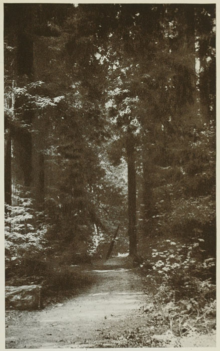
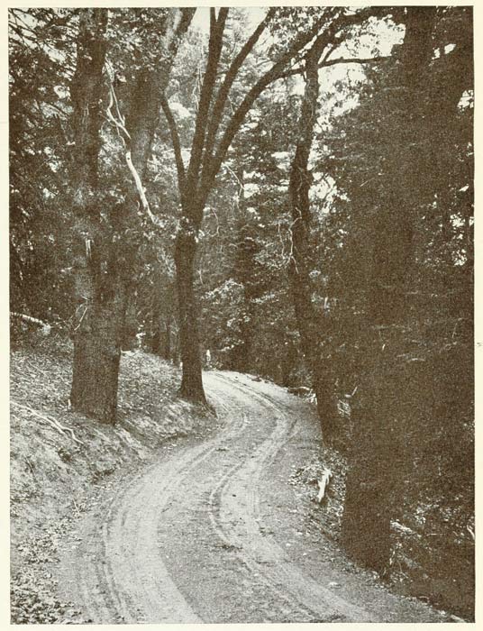
Guerneville, winding through groves of redwood
and many other varieties of conifers and
deciduous trees. At Guerneville we dropped
down into the Russian River Valley, famous
as a summer playground for San Francisco.
We crossed the river over a high, spider-web
bridge which afforded a vantage point for extensive
views up and down the wooded valley.
The emerald-green river lay far beneath us
in deep, still reaches, for there is little fall to the
valley here. Beyond the river we began the ascent
of a long, winding grade over the second range.
The road climbed through a dense forest and there
were many sharp turns and steep pitches, somewhat
the worse for the lately fallen showers, but
the magnificent panoramas that occasionally burst
on our vision as we continued the ascent made the
effort well worth while. The valley was diversified
with well-groomed fruit ranches and scattered grain
fields; groups of oaks with velvety glades beneath,
straggled over the rounded foothills, all combining
to make a scene of wonderful sylvan charm. As
we approached Cazadero we had an enchanting
view of the deep valley and the village far below.
But distance lent enchantment to the view of Cazadero,
for we found it a rather mean-looking little
place—a station for the motor busses that
run over this road, its principal sign of life being
the huge repair shops.
Beyond Cazadero there was still more climbing
through the "forest primeval," whose increasing
greenness and luxuriance called forth more than
one exclamation of delight. The madrona, horse-chestnut,
dogwood and locust were in full bloom
and huge ferns grew riotously everywhere underneath
the trees. The road was wet and dangerous
in places, making our progress slow, but at last we
came out on the clifflike headland above Fort Ross
and the ocean, silver-white in the declining sun,
flashed into view. Far beneath, directly on the
shore, we could see the little hamlet, the object of
our pilgrimage, nestling among the green hillocks.
A very steep, narrow road, wet from the recent
rain, plunged down the almost precipitous bank
and we narrowly escaped disastrous collision with
a tree from a vicious "skid" in the descent, which
has several pitches of twenty-five per cent.
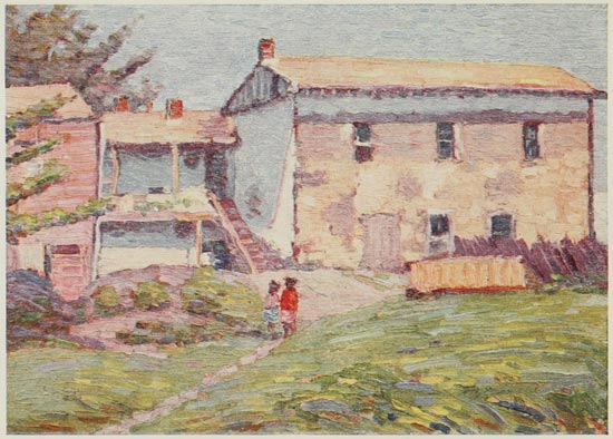
We found only a scene of desolation at our
goal; there were two or three families living in the
place, but most of the houses were abandoned.
The huge, windowless hotel covered with creepers,
testified mutely to the one-time importance of the
town. Relics of the old fort or blockhouse were
in evidence, but only two fragments of the walls,
built of huge squared logs, were still standing. The
quaint little church had just been restored—a tiny
whitewashed structure perhaps twelve by fifteen
feet, with an odd domelike cupola and square tower
in front. It had been rebuilt at public expense and
the fort was also to be restored from the same legislative
appropriation.
There was nothing to detain us in the lonely
village and after a mad scramble up the wet slope,
slipping backward dangerously at one point, we
paused again on the headland to contemplate the
glorious panorama of rugged coast and shining sea.
Rain was still threatening, however, and it seemed
best not to stop, as we had planned, at Sea View
Inn, near by, but to return to Guerneville for the
night. The vistas seemed even more wonderful in
the gathering twilight than on our outward trip—the
great hills with their fringe of forest loomed
against the rich sunset sky and purple shadows
filled the vast canyons with mysterious gloom.
The hotel at Guerneville was primitive in the
extreme, but the landlord was very considerate and
we were too cold and hungry to be over-critical.
Leaving the town on the following morning, we
pursued the northward road along the Russian
River, passing Bohemian Grove, famous for the
antics of a San Francisco club, to Monte Rio, a
much frequented summer resort town. The road
climbed a forest-fringed grade with endless vistas
of river and valley as well as vast stretches of
wooded hills. Wild flowers bloomed in profusion
and the air was redolent with the invigorating fragrance
of the balsam pines. At the summit we
paused to admire the endless panorama of hills,
merging from green into deep solid blue in the far
distance. Leaving Monte Rio we followed a tortuous,
undulating road along a clear little river. The
trees and undergrowth crowded up to the edge of
the road and overarched it most of the dozen or so
miles—a perfect wall of greenery on either hand.
Beyond Freestone we came again into the
open hills, green and rolling and sloping to the sea
a little to our right. Here our admiration was
again excited by the marvel of the wild flowers,
which bloomed in richest profusion; vast dashes of
yellow, blue and white spangled the meadows and
hills through which the fine road courses. At
Tomales, an antique-looking little town, we came
to the head of Tomales Bay, a "shoestring" of
water some twenty miles long but nowhere more
than two miles wide. The road runs alongside, up
and down the low hills, affording fugitive glimpses
of the bay, as inconstant in coloring as an opal.
From Olema we pursued the coast road—or shall I
say trail?—to Bolinas and thence to the Sausalito
Ferry.
Despite the rough and difficult going, we had
reason to congratulate ourselves upon our choice
of route, for we saw much wild and picturesque
coast and had many clear-cut views—not common
in the land of frequent cloud and fog—of the coastward
side of San Francisco. We climbed the winding
ascent to Forts Baker and Barry, where one of
the most comprehensive views of the whole district,
the bay, the cities and the hills, may be had. So
clear was the air that the Farralones, fifteen miles
distant, stood out distinctly against the evening
sky; and in the city the long green strip of Golden
Gate Park and even the outlines of the streets and
notable buildings were plainly observable. It was
a wonderful scene and we had the day of a thousand
to view it. Good fortune still attended us when
we crossed the ferry, for we saw a perfect sunset
directly through the Golden Gate. No language
could exaggerate the splendor of the scene; no
picture could do justice to its ethereal beauty of
coloring. Fully as enchanting was the afterglow
with its reflections of the crimson and gold cloud
banks in the still waters. Behind us the windows
and lights of Oakland and Berkeley flashed like a
million gems set in the dark background of the hills,
and eastward the lavender-tinted sky bent down to
the still blue waters of the bay. We are quite ready
for the spacious comfort of the Fairmont; it has not
been an easy jaunt by any means. But we all agree
that it would be hard to find even in California a
more delightful tour than the little journey to old
Fort Ross, granted weather as propitious as that
which favored us.
It was always a difficult matter for us to shake
off the lure of Del Monte whenever we made the
run between Los Angeles and San Francisco and
even though considerably out of our way, we nearly
always put the old capital on our itinerary. What
were a hundred or so miles additional as weighed
against the delights of the famous inn?—and,
besides, there was one road from San Francisco to
Del Monte which we had not yet traversed. We
have a decided fondness for trails directly along the
ocean, though usually they are of the worst, and
the little-used road along the coast running southward
from Golden Gate Park to Half Moon Bay
and Santa Cruz proved no exception to the rule. In
fact, if it was an exception in any way it was in
the degree of badness—but there is no need anticipating
an unpleasant subject. I may say right
here, however, that I think that nearly all of this
wonderful run is now over paved roads and deserves
to be far more popular than it is.
Following Ocean Drive southward from the
Cliff House in Golden Gate Park, a few miles down
the coast the highway swings landward to Sloat
Avenue, which we pursued to Colma. Here the
road turns to the left and closely follows the ocean
through a number of small fisher villages and beach
resorts. There are some long and rather heavy
grades in places, but they are atoned for by inspiring
views of rugged coast and shining sea, particularly
at San Pedro Point, just below Salada,
where we enjoyed a far-reaching vista from an elevation
of several hundred feet above the sea.
Beyond Montara grade the road drops down into
the fertile plains about Half Moon Bay. Here is
the famous artichoke section of California and we
saw hundreds upon hundreds of acres of the succulent
vegetable in the vicinity of the village.
There is also a delightful alternate route to Half
Moon Bay which we took on another occasion, following
the main highway to San Mateo, where a
well-improved macadam road swings to the left and
plunges into the hill range between the bay and the
ocean. It winds in graceful curves and easy grades
among the giant hills, passing several of the huge
fresh-water lakes of the San Francisco water supply
system. This route is the easier one, but hardly the
equal of the coast in scenic grandeur.
Half Moon Bay is a forlorn-looking little town
with a decidedly un-American appearance—which
is not so strange since the inhabitants, who engage
in fishing or in cultivating the endless artichoke
fields about the place, are mostly Portuguese and
Italians. Thinking that Half Moon Bay, notwithstanding
its unprepossessing looks, was about our
only chance for luncheon before we should reach
Santa Cruz, we inquired of the bank cashier, who
responded rather dubiously, it seemed to us, that
the French Hotel was the "best to be had in town."
We found it a second-class country inn whose main
business was evidently done in the bar-room, which
occupied the most prominent place in the building.
The lunch hour was past but the proprietor went
to considerable trouble to prepare a hot meal,
which, we agreed in Yorkshire parlance, "might
have been worse." Outside there was a little
garden with some wonderful roses and, altogether,
the inn was neater and cleaner than appearances
had led us to expect.
Our real troubles began when we left the
town, for a rougher, meaner and more uncomfortable
fifty miles we hardly found in all our wanderings
in the Golden State. A new macadam road
was being built to Pescadero, twenty miles south,
and was just at the stage calculated to most distress
the motorist. We wallowed through miles of loose,
sharp stones, made long detours through the rough,
steep hills, crept over shaky bridges, plunged down
and out of huge gulches and crawled through miles
of rough, stony trails, deep with dust. Pescadero,
which marks the end of the railroad, is as lonely
and wretched a little hamlet as one will find in
California; in fact, it took quite a mental effort to
assure ourselves that we really were in California—it
reminded us so strongly of some of the old-world
villages we had seen. We took on "gas" at a dilapidated
smithy recently decorated with a huge
"garage" sign, though I doubt if a sizable car could
have gotten inside. Beyond Pescadero the road
was still rough, dusty and steep in places, but it was
free from construction work and we made better
time. Beyond Swanton the road steadily improved.
When we came into Santa Cruz the sun was still
high and by grace of the long evening we were able
to reach Del Monte by way of Watsonville and
Salinas shortly after dark. It is superfluous to remark
on the satisfaction we experienced in reaching
such a haven of rest after an unusually strenuous
and uncomfortable run.
We lingered in the pleasant surroundings until
afternoon of the following day, making an easy
and eventless run to Stockton for the night. We
had seen enough of forced schedules and long hours
to determine us to make the run to Los Angeles by
easier stages. Leaving Stockton in the late forenoon,
we soon reached the little city of Modesto,
which hopes some day to be the official gateway
of Yosemite. Perhaps it was in anticipation of this
distinction that two immense hotels, the Modesto
and the Hughson, seemingly out of all proportion
to any possible need, were being built. The former
was practically completed, a seven-story concrete
structure with all modern hotel improvements and
conveniences, including ballroom, roof garden, and
swimming pool. The Hughson was even larger
and we could not help wondering if the hotel business
in Modesto were not in danger of being slightly
overdone.
At Merced we found another handsome new
hotel, the Capitan, which would be a credit to a city
with several times Merced's four or five thousand
people, but perhaps the Yosemite traffic justifies
the enterprise of the builders. We paused here for
lunch and I was greatly amused at a conversation
which I overheard in the lobby, illustrating the effect
of the California microbe upon so many visiting
Easterners. A gentleman wearing a light summer
suit, a white hat and white shoes, and carrying
a camera and golf bag—the very personification of
a man who was enjoying life to the limit—was just
leaving for the train.
"Well," queried a friend who met him, "are
you about ready to go back to Peoria?"
"Go back to Peoria!—go back to Peoria!!
I'm never going back to Peoria if I live a hundred
years. Say, do you know that I wouldn't take all
the Eastern States as a gift if I had to live in 'em,
after having lived in California?"
A straight, level road runs from Merced to
Fresno on the south, one of the finest links of the
inland route of the new state highway. We found
much of it under construction at the time and in
passing around through the wheatfields we struck
some of the deepest dust and roughest running that
we found anywhere. We made up for it when we
came back into the finished portion, which extended
for several miles north of Fresno. It is a perfect
road—concrete with a "carpet" of crushed stone
and asphaltum rolled as smooth and hard as polished
slate. It runs for miles through wheatfields,
whose magnitude may be judged from the fact that
we saw a dozen ten-mule teams ploughing one
tract. Near Fresno we ran into the endless vineyards
which surround the raisin town and which
looked green and prosperous, despite the drouth
which had nearly ruined the wheat. The raisin
crop is one of Fresno County's greatest sources of
wealth, netting the growers over five million dollars
yearly. The abundant sunshine makes the grapes
too sweet for light wines, though there were several
wineries producing the heavier quality, which was
mostly shipped to Europe, where it was blended
with lighter wine and sent back strictly an "imported
product." This practice, of course, became
obsolete with the advent of prohibition, but the
Fresno growers, as is the case everywhere, are now
reaping the greatest profits in their history.
Fresno, with a population of nearly fifty
thousand, has quadrupled in size in the last twenty
years. It is thoroughly metropolitan in appearance
and in public and private improvements. The
Hotel Fresno is an immense fireproof structure of
marble and concrete that will compare favorably
with the best hotels in many cities ten times as large
as Fresno, and here on our first visit we proposed
to stop for the night, but changed our plan when
we found that a road out of the town crosses the
mountain ranges to the sea. We had not forgotten
our failure to see San Antonio and La Purisima on
our upward trek—and determined to seize the opportunity
to get back to the coast. Paso Robles
seemed the only satisfactory stopping place for the
following night, but if we stayed in Fresno we could
hardly hope to reach the "Pass of the Oaks" the
next day. The road cuts squarely across the desert
to Coalinga and we found ourselves wondering
what kind of accommodations we should find at
Coalinga. A garage man said he had been there
once—a place of five hundred people, he guessed,
and there was a pretty good boarding-house down
by the depot. Not a very attractive prospect, to be
sure, but Coalinga was the only town between Fresno
and the mountains. It was some sixty miles
distant, and by hitting a lively pace we could reach
it by dark—if we had no ill luck.
For ten miles out of Fresno we followed Palm
Drive—a splendid boulevard between rows of
stately palms, the largest we had seen in California.
At the end of the drive we turned sharply to the left
following an unimproved road into the desert.
This road is as level as a floor—a perfect boulevard
in dry weather—though abandoned ruts indicated
pretty heavy work after the infrequent rains. For
the entire distance there was little variation; about
midway we came to a green belt of pastures and
trees along Kings River, and a new railroad was
being built through this section. A native at a little
wayside store—the only station on the way—told
us that this desert land, counted worthless a few
years ago, was now worth as much as twenty-five
dollars per acre and that it was all capable of being
farmed. It certainly did not look so; a white, alkali-frosted
plain tufted with greasewood and teeming
with jack-rabbits stretched away to distant hills on
either side. The road meandered onward at its own
sweet will and when it became too rough or dusty
in spots it was only necessary to take another tack
to have an entirely new boulevard. We did some
lively going over the hard, smooth surface, which
made forty miles seem a fairly moderate pace, but
we were at a sore loss when we came to a branch
road in the middle of the plain, with nothing to
indicate which led to our destination. We had just
decided to take the wrong one when an auto hove
into sight and we paused to inquire.
"Straight ahead on the road, my brother; you
can't miss it now and when you get to Coalinga go
to Smith's garage, and God bless you."
We concluded that we must have run across a
peripatetic evangelist, but when we went to Smith's
garage—only it wasn't Smith's—after dinner to
get an article from the car, we found our pious
friend manager of the place.
As we came near the range of brown hills beneath
which the town lies, we saw a row of oil-derricks
running for miles along the side of the
valley, for here is the greatest oil-producing section
of California. The oil fields have made Coalinga,
which we were surprised and pleased to find a live-looking
town of several thousand people, with an
excellent modern hotel quite the equal of the best
country town hostelries.
Coalinga is full of California "boost;" our
friend at the garage endeavored to enlist our sympathy
in a movement to put the town on the state
highway map—though I failed to see how we could
be of much use to the enterprise.
"O, a word from tourists always helps, my
brother. You can write a letter to the commissioners
and tell them that we need the road and I reckon
you'll know that we need it if you cross the hills to
King City, as you propose. You'll find it something
fierce, I can promise you; crooked, rough,
stony, steep—lucky if you get through without a
breakdown. There are one hundred and fifty fords
in the sixty miles—no, I don't mean Ford automobiles,
but creeks and rivers. It's shoot down a steep
bank and jump out, and the sharp stones won't
help your tires any, either. There are some
grades, too, I want to tell you, but your rig looks
as if they wouldn't worry her much. But when you
get across, write a line to the Highway Commission
and tell them something about it. So long! God
bless you all."
When we waved our pious monitor adios and
resumed our journey, it was still early morning. Of
course we took the one hundred and fifty fords as
a pleasant bit of exaggeration—we couldn't use a
stronger term in view of our friend's evident piety;
but we found, in slang parlance, that his statement
was literally "no joke." We kept count of the
times we crossed streams of running water and
there were just one hundred and eighteen, and
enough had dried up to make full measure for Mr.
Smith's estimate, with a few to spare. And fearfully
rough going it was—sharp plunges down
steep banks, splashing through shallow streams,
over stones and sand, and wild scrambles up the opposite
side, an experience repeated every few
minutes. At times the trail followed the bed of a
stream or meandered closely along the shores, never
getting very far away for the first dozen miles.
Then we entered a hill range, barren at first, but
gradually becoming wooded and overlooking long
valleys studded with groups of oak and sycamore,
with green vistas underneath. There was some
strenuous work over the main mountain range,
where the road was a narrow shelf cut in solid rock,
with a precipice above and below. It had many
heavy grades and sharp, dangerous turns; we all
breathed a sigh of relief when we found ourselves
in the valley on the western side of the range. Here
were more streams to be forded—one of them a
sizable river, which we crossed several times.
At last we came out into the King City highway
and paused a moment to look ourselves over.
The car was plastered with sand and mire from stem
to stern; tires had suffered sadly from the rocky
bottoms of the streams, and a front spring was
broken. We agreed that crossing from Coalinga to
King City was an experience one would hardly care
to repeat except under stringent necessity.
The run to King City, after we had left the
hills, was easy, enabling us to make up somewhat
for the time consumed in crossing the range. A
flock of more than two thousand sheep, driven
along the highway, impeded our progress for half
an hour and served to remind us of one of the great
industries of the Salinas Valley.
A little foraging about King City provided a
passable luncheon, which we ate under one of the
mighty oaks at the foot of Jolon grade. In repassing
this road, we were more than ever impressed
with the beauty of the trees; thousands of ancient
oaks dotted the landscape on either hand, some
standing in solitary majesty and others clustered in
picturesque groups. Dutton's Hotel at Jolon is
nearly a century old, portions of it dating from
mission days, and the proprietor is an enthusiast on
historic California, having collected a goodly number
of old-time relics in a little museum just across
the road from the inn. Most of these came from
San Antonio and the inn-keeper is anxiously looking
forward to the day when he can return these
treasures to the restored mission—though this,
alas, does not appear to be in the near future.
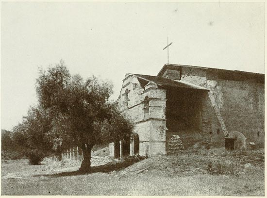
It was to visit this ruin, which we missed on
our northward trip, that we crossed the desert and
mountains from Fresno to King City. It is one of
the remotest and loneliest of the chain, the nearest
railway station being King City, forty miles away.
It stands six miles west of Jolon and we followed
a rutty trail, deep with fine, yellow dust which
rolled in strangling clouds from our wheels. But
a lovely country on either hand glimmered through
the dust haze, and in the pleasantest spot at the
head of the wide valley stood the brown old ruin of
San Antonio Mission. Behind it towered the high
blue peaks of the Santa Lucias, the only barrier remaining
between the valley and the sea, while the
windowless, burnt-brick fachada fronted upon a
wide meadowland, dotted with glorious oaks and
gnarled old willows, stretching away to the dim
outlines of the distant hills.
It was one of the most delightful sites we had
yet seen, and the ruin had a certain melancholy
picturesqueness peculiar to it alone. Like so many
of its contemporaries, it suffered severely from
earthquakes; about twenty-five years ago the roof
fell and the shattered walls would soon have followed
had not an enthusiastic lover of the old order
of things—a gentleman of Spanish descent residing
near Jolon—undertaken at his own time and expense
to clear away the debris and protect the ruin
against farther onslaught of the weather. A shingle
roof was built covering the entire church and the
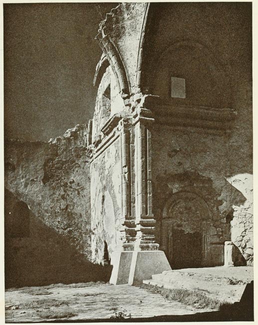
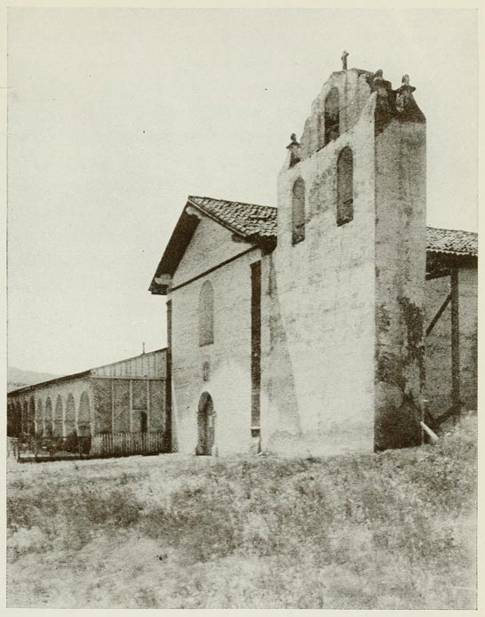
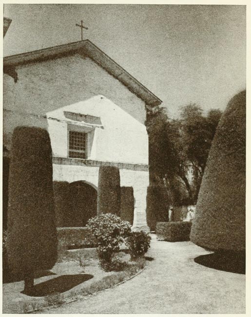
original tiles were piled inside. The fachada, built
of burnt brick, with three entrances and three belfries,
is one of the most charming bits of mission
architecture still remaining and is happily almost
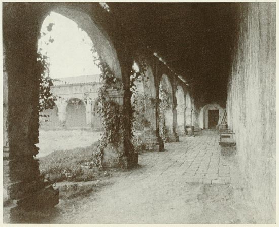
intact. Portions of the long cloisters are still standing—enough
to furnish the motif for a complete
restoration, and with adequate funds it would not
be a difficult matter to restore San Antonio Mission
Church to its former state.
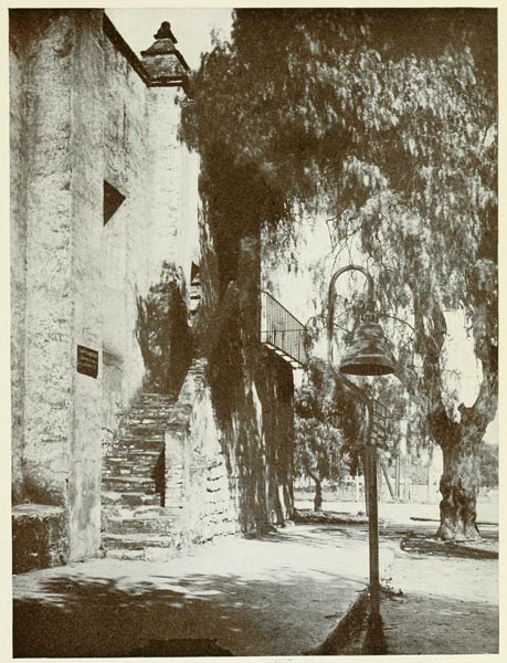
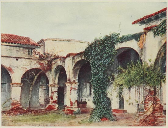
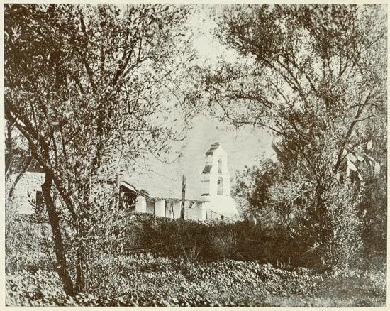
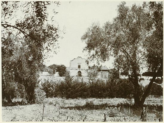
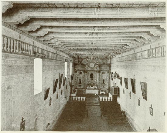
SAN ANTONIO DE PADUA
From Photograph by Dassonville
Inside, the church was quite denuded; birds
and squirrels had found a convenient home and
flitted or scampered about as we entered. A huge
gray owl flapped heavily out of an empty window
and everything combined to impress upon us the
loneliness and isolation of this once rich and prosperous
mission. In one corner we descried the
huge cast-iron community pot which might hold a
hundred or two gallons and which once contained
food for the unmarried folk among the Indians—the
married had to do their own cooking. Inside
the dismantled chancel were the graves of the first
four missionaries of San Antonio, still the objects
of reverent remembrance by the only Indian family
of the vicinity.
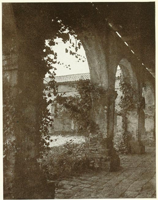
Out of the church we came into the ancient
patio, marked by crumbling arches and shapeless
piles of adobe. Here a few scraggly rose bushes—descendants
of those which once ornamented the
garden of the padres—bloomed in neglected
corners, and two old olives still defied time and
weather. It was a quiet spot; its silence and loneliness
were almost oppressive; but we soon heard
sounds from beyond the wall and found two Mexicans
digging a grave, for burials are still made in
the old cemetery. A little way to the rear San
Antonio Creek—now a trickling thread of water—winds
through a fringe of ancient willows, and
cattle were pasturing quietly in the shade. One
can not escape the spell of the ruin and its surroundings.
It is no wonder that an appreciative
historian of the California missions declares that
San Antonio appeals to him as do none of its rivals,
that—"There is a pathetic dignity about the ruin,
an unexpressed claim for sympathy in the perfect
solitude of the place that is almost overpowering.
It stands out in the fields alone, deserted, forgotten."
True, he wrote before the coming of the
motor, which is doing something to rescue San
Antonio Mission from complete oblivion; but the
Mexican grave-digger said that even motor visitors
were not frequent. Evidently many of the wayfarers
on El Camino Real do not consider the
twelve-mile detour worth while; but we would
count ourselves well repaid had it consumed an
entire day instead of an hour or two. If San Gabriel
and Dolores may be compared as tourist shrines to
Melrose and Dryburgh, surely San Antonio may
vie in sentiment and charm with some of the out-of-the-way
and lesser-known abbeys of Britain such
as Glenluce or Calder. In this quiet and isolated
spot there is hardly field for it as a church institution
and restoration will have to be done by individuals
or by the state. It would be a pity to allow
this delightful example of early mission architecture
to fall into the hopeless ruin of Soledad or La
Purisima.
San Antonio has the added charm of being
one of the oldest of the California missions. It was
the third of the series, its foundation closely following
that of Monterey. Serra himself, assisted by
Pieras and Sitjar, conducted the ceremonies of
consecration which took place July 14, 1771. One
lone Indian was present on the occasion, but others
were brought in before the day closed and the relations
of priest and natives were harmonious from
the start. San Antonio throughout its career was
remarkably free from strife and trouble; the natives
were industrious and peaceful and gladly joined in
the work of building, and tilling the soil. The first
church was completed two years after the foundation,
and as late as 1787 was regarded as the best
in California. The present church was begun in
1810 and dedicated a few years later. It is of adobe
excepting the fachada of burnt brick, whose perfect
condition makes us regret that the whole mission
could not have been built of the same enduring
material. The greatest Indian population was
thirteen hundred and nine in 1805, which had declined
to two hundred and seventy in 1834, the
year of secularization. In 1843 the mission was
restored to the church and nominally occupied until
about forty years ago. At that time the buildings
were in a fair state and the present ruin was
wrought chiefly by earthquake.
Pausing a moment for one more survey of the
lovely valley and with a lingering look at the romantic
old ruin over which the shadows of evening
were beginning to lower, we were away for Paso
Robles, which we reached before nightfall.
We retraced our way over El Camino Real the
following morning as far as Santa Margarita, from
whence we diverged to the coast road. For on our
outward journey we had missed another of the
missions—La Purisima, situated a few miles from
Lompoc. The road which we followed out of Santa
Margarita was unmercifully rough, and a fierce
wind from the sea blinded us with clouds of dust
and sand. We were glad when we reached the
shelter of the giant hills, just beyond which lay the
object of our pilgrimage. The ascent seemed almost
interminable; the yellow road swept along the hillsides,
rising steadily in long loops which we could
see winding downward as we looked back from the
summit. The grade was not heavy, but continuous;
the descent was shorter and steeper and we
dropped quickly into the pleasant valley of the
Santa Ynez, where stands the isolated village of
Lompoc.
A few miles out of the town we beheld the
object of our search—the lonely ruin of La Purisima
Concepcion, standing at some distance from
the highroad, surrounded by a wide wheatfield. A
narrow lane, deep with dust and sand, almost impassable
in places, led to the melancholy old pile,
which we found even more dilapidated than San
Antonio. It is little more than a heap of adobe,
and the rent and sundered walls show plainly the
agency of the earthquake—the deadly foe of the
California missions. The winter rains have
wrought havoc with the unroofed walls; only one
or two window openings remain and the outlines
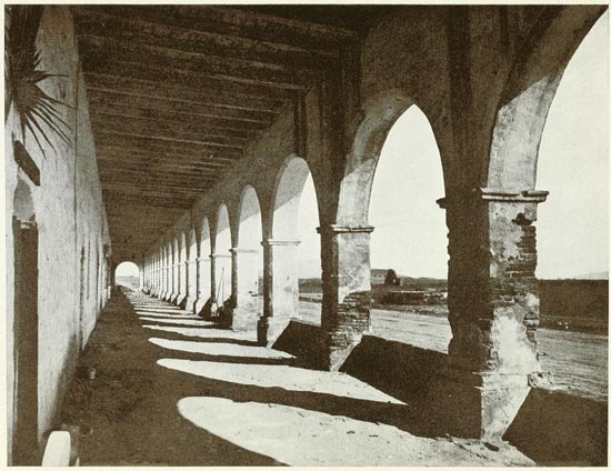
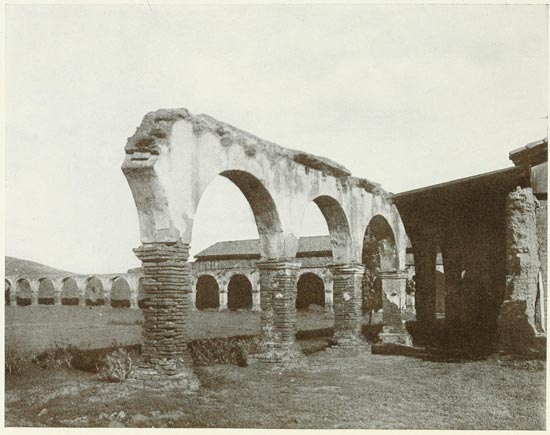
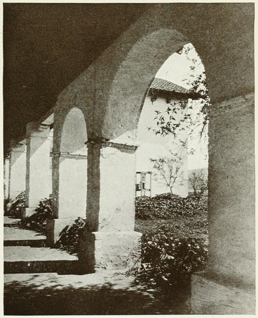
of a single doorway may still be seen. The most
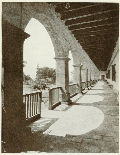
striking feature is the row of twenty square filleted
pillars gleaming with white plaster, the corners
striped with still brilliant red. These formed a long
arcade from which there must have been a glorious
view of wooded valley and rugged hills when the
good old padres conned their prayers in its shady
seclusion. There is hardly enough to give an adequate
idea of the plan of the structure when at its
best—little is left of the church except its foundation,
but it seems to have been quite unique in
design. The old tiles that once formed the roof are
piled near by—but there is little hope that they will
ever be used in the restoration of La Purisima Concepcion.
About thirty years ago Helen Hunt Jackson
visited the mission and found the dormitory
building standing and used as a sheep-fold. The
church then showed traces of its ancient decorations
and the pulpit and altar rail were still in place,
though in sad disrepair. The condition of the ruin
to-day shows how rapid has been its decay since
that time and it is safe to say that unless something
is done to protect it, all traces will have vanished in
another quarter century.
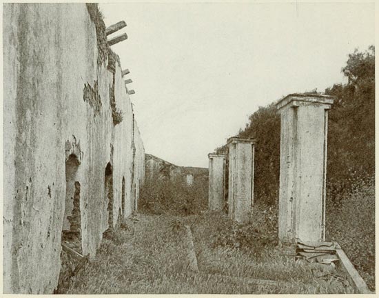
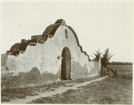
RUINS OF LA PURISIMA
From Photograph by Dassonville
The mission which we visited was not the
original La Purisima; of this only a few earthen
heaps remain. The date of its foundation was December
8, 1787, and the ceremonies were conducted
by Padre Lasuen, who has so many missions to his
credit. The success of the new venture was phenomenal—in
less than twenty years the population
numbered over fifteen hundred and the mission was
rich in live stock and other property. This prosperity
received a sad check from the great earthquake
of 1812, which totally destroyed the buildings,
leaving the people homeless at the beginning
of an unusually wet and cold winter. Then it was
that the original site was abandoned and the erection
begun of the buildings which I have described.
The Indians were intelligent and industrious and
worked hard to rebuild the mission and their homes,
which had also been destroyed. An extensive irrigation
scheme was devised and carried out, but a
series of misfortunes prevented the return of former
prosperity. Plague decimated the cattle and sheep,
and fire destroyed the neophytes' quarters in 1818.
In 1823 the revolt at Santa Barbara spread to
Purisima, and several Indians and Spanish soldiers
were killed before quiet was restored. Under such
depressing influence the population steadily declined
and numbered but four hundred at secularization
in 1835. After the looting was completed
the property was turned back to the church in 1843,
but a year later an epidemic of smallpox practically
wiped out the scanty remnants of the Indian population.
From that time the mission was abandoned
and uncared for, gradually falling into ruin, and its
melancholy condition to-day is the result of seventy
years of decay and neglect.
Leaving Lompoc, we followed the Santa Ynez
River for several miles. The road winds among the
splendid oaks which overarch it much of the way
and finally joins the main highway at the top of
Gaviota Pass. It seldom took us out of sight of the
river, though in places it rose to a considerable distance
above the stream which dashed in shallow
rapids over its stony bed. The last few miles were
a steady climb, but there was much sylvan beauty
along the way—wooded slopes dropped far beneath
on one hand and rose high above us on the other.
Through occasional openings in the trees we caught
long vistas of hills and valleys, now touched with
soft blue shadows heralding the approach of evening.
From the summit of Gaviota the long winding
descent brought us to the broad sweep of the sunset
sea, which we followed in the teeth of a high
wind to Santa Barbara, where the Arlington afforded
a welcome pause to a strenuous day.
Just across the bridge a few miles out of Ventura
we noted a sign, "To Nordhoff," and determined
to return to Los Angeles by this route. It
proved a fortunate choice, the rare beauty of the
first twenty miles atoning for some rough running
later. For the entire distance we closely followed
the Ventura River, a clear, dashing mountain
stream bordered by hundreds of splendid oaks
whose branches frequently met over our heads.
We crossed the stream many times, fording it in a
few places, and passed many lovely sylvan glades—ideal
spots for picnic or camp. Along the road
were water tanks to supply the sprinklers, which
kept down the dust during the rainless season, giving
added freshness to the cool retreats along this
pleasant road. Nordhoff is a lonely little town of
two or three hundred people, set down in the giant
hills surrounding it on every hand. Four or five
miles up the mountainside is Matilija Hot Springs,
with a well-appointed resort hotel, a favorite with
motorists, who frequently come from Los Angeles
to spend the week-end.
Out of Nordhoff we climbed a stiff mountain
grade on the road to Santa Paula, which we found
another isolated little town at the edge of the hills.
From here we pursued a fairly level but rough and
sandy road to Saugus, a few miles beyond which
we came into the new boulevard leading through
Newhall Tunnel to San Fernando. An hour's run
took us into the city, just two weeks after our departure,
and our odometer indicated that we had
covered two thousand miles during that time.
A year later, on our return from the north, we
pursued the "Inland Route" by way of Bakersfield
and the Tejon Pass. This route has been finally
adopted by the State Highway Commission, but at
the time of our trip little had been done to improve
the road north of Saugus, thirty miles from Los
Angeles. It certainly was in need of improvement,
as the notes set down in my "log book" testify.
Concerning our run between Fresno and Bakersfield
I find the following comment:
"A day on rotten roads—hardly a decent mile
between the two towns. We followed the line of
the Southern Pacific for the entire day over a
neglected, sandy trail, with occasional broken-up
oiled stretches. Towns on the way were little,
lonely, sandy places, unattractive and poorly improved.
No state highway completed, though some
work was in progress in Kern and Fresno Counties,
making several detours necessary—not a mile free
from unmerciful jolting."
And here I might remark that had we taken
the longer route from Goshen to Delano by the way
of Visalia and Portersville, we might have avoided
forty miles of the roughest road. The highway is to
make this detour; but there was no immediate prospect
of building it at the time of our trip, as Tulare
County felt too poor to buy the bonds.
For several miles out of Fresno we ran through
vineyards and orchards, passing two or three large
wineries not far from the road. A narrow belt of
grainfields and meadows succeeded, but the country
gradually became poorer until we found ourselves
in a sandy desert whose only vegetation was a short
red grass with barbed needles which stick to one's
clothing in an annoying manner.
Maps of California usually show Lake Tulare
as a considerable body of water, twenty to thirty
miles in diameter, lying a few miles west of the
town. They told us at Tulare that the lake had
practically disappeared, a good part of its bed now
being occupied by wheatfields. Dry weather and
the diversion of water for irrigation have been the
chief factors in wiping out the lake, which was
never much more than a shallow morass.
Beyond Tulare we again came into a sandy,
desert-looking country and were astonished to see
billboards in one of the little towns offering "bargains
in land at one hundred and thirty-five dollars
per acre"—to all appearances the country was as
barren and unpromising as the Sahara, but no doubt
the price included irrigation rights. Along this
road we noticed occasional groves of stunted
eucalyptus trees, neglected and dying in many
instances. It occurred to us that these groves were
planted by the concerns which sold stock to Eastern
"investors" on representation that the eucalyptus
combined all the merits to be found in all the trees
of the forest. The fact is that it is not fit for much
and the "fly-by-night" concerns disappeared as soon
as they had pocketed the cash, leaving their victims
to bemoan "another California swindle."
While the country was mostly flat and uninteresting,
the scene was varied by the dim ranks of the
Sierras far to our left all day long—always dominated
by one lone, snow-capped summit rising in
solemn majesty above the blue shadows that
shrouded the lower ranges. It was Mount Whitney,
the highest peak within the limits of the United
States, with an altitude of fifteen thousand feet
above sea level. A road leads well up the slopes
of the mountain and from its termination one may
ascend in three hours by an easy trail to the summit,
which affords one of the grandest views on the
American continent.
In this same vicinity, about twenty-five miles
east of Visalia, are Sequoia and General Grant
National Parks, each of which has a grove of redwoods,
and the former is said to be the most extensive
in the state. It has one tree, the General
Sherman, which contests with the Grizzly Giant
of Mariposa for the honor of being the largest living
tree in the world, being eighty feet in circumference
one hundred feet from its base. In all there are
over three thousand trees in this grove which
measure forty-five feet or more in circumference.
Both of these parks are easily reached by motor
from Visalia.
We reached Bakersfield weary enough to wish
for the comforts of Del Monte, but found the New
Southern far from the realization of our desires.
It was "new" in name only—apparently an old
building with furnishings and service far below the
California standard for towns like Bakersfield, a
live-looking place of nineteen thousand people. It
is the center of an oil-producing section and has
considerable wholesale trade.
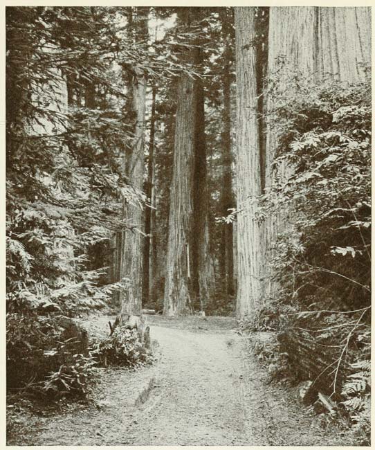
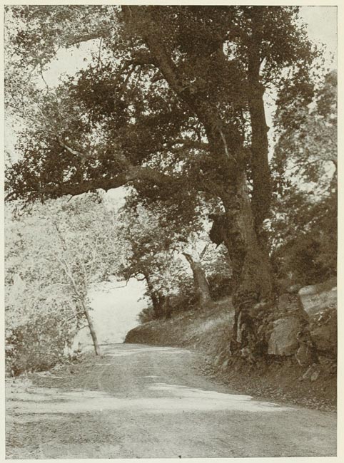
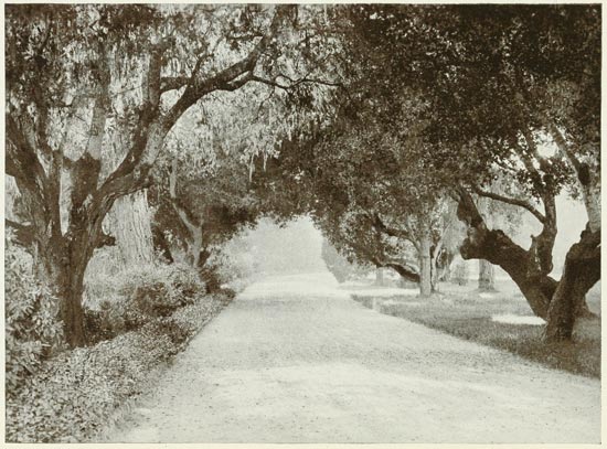
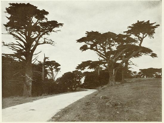
A ROAD THROUGH THE REDWOODS
From Photograph by Pillsbury
A few miles out of town, on the Tejon route,
we found ourselves again in the desert and
ploughed through several miles of heavy sand before
reaching the hill range to the south. There
were no houses or people for many miles, the only
sign of civilization being an oil-pumping station
near the foothills. We beheld a wide stretch of
sandy country, dashed with red and purple grasses
and occasional wild flowers. To the south and east
lay the mottled hill ranges, half hidden by dun and
purple hazes and cloud-swept in places. Before us
rose a single snow-capped peak and as we ascended
the rough, winding grades of Tejon Pass, we were
met by a chilly wind which increased in frigidity
and intensity until we found need for all the discarded
wraps in the car. Some distance from the
foot of the grade we came to Neenach Post Office,
which proved only a small country store, and beyond
this were long stretches of sandy desert
dotted with cacti and scrub cedars and swarming
with lizards and horned toads. The cactus blooms
lent a pleasing bit of color to the brown monotone
of the landscape—myriads of delicate yellow, pink,
red, and white flowers guarded by millions of
needle-like spines.
The desert road continued for fifty miles—deep
sand and rough, broken trails alternating with
occasional stretches of easy going over smooth sand
packed as hard as cement. As we came to Palmdale,
a lonely little town marking the terminus of
the railroad, we noted frequent cultivated fields
which showed the fertility of this barren desert
when irrigated. From Palmdale we proceeded to
Saugus through Mint Canyon, since the San Francisquito
and Bosquet routes—both shorter—were
closed by washouts. We found the state highway
completed to Saugus; the village showed many improvements
and had a decidedly smarter appearance
than two years previously—a result that will
no doubt follow in all the little towns when the
highway reaches them. Near Saugus we passed
over the great Owens River Aqueduct, a near view
giving us a better conception of the giant dimensions
of the iron and cement tubes carrying the
water supply to Los Angeles. From Saugus it is an
easy jaunt of thirty miles to Los Angeles over one
of the finest boulevards leading into the city.
We agreed that while the trip over the "Inland
Route" from Fresno was interesting and well
worth doing once, we would not care to repeat it
under such conditions except upon actual necessity.
When we are ready to go again we hope to find that
the new highway has replaced the terrible old trails
which served for roads the greater part of the five
hundred miles of the run.
In the foregoing paragraphs I have endeavored
to give some idea of our earliest run over the Inland
Route in the good old days when California roads
were in their virgin state. My revised edition
would hardly deserve the name if I were to omit
reference to the present condition of this now very
popular route between Los Angeles and San Francisco,
since nearly all of it has been improved and
much of it entirely re-routed. To-day (1921) practically
a solid paved boulevard extends between the
two cities and the run of about five hundred miles
may be made in two days with greater ease than in
twice the time under old conditions.
For more than three-fourths of the distance
the road runs in level, straight stretches, permitting
all the speed that any car may be capable of—if the
driver is willing to risk his neck and take chances
of falling into the clutches of the frequent "speed
cop" along the way. In the main it is not a "scenic
route"—though one is never out of sight of the
mountains. The country is mostly flat and uninteresting—for
California—but if it grows too monotonous,
Sherman and Grant National Parks and
Yosemite are only a few miles off this highway.
There are excellent hotels at Bakersfield, Fresno,
Merced, Modesto, and Stockton, and very good
ones in several smaller places. A modern hotel,
the Durant, has also been built recently at Lebec,
just beyond the summit near the northern extremity
of the ridge. Lake Castaic, near by, is a good-sized
body of water, affording opportunity for boating
and fishing and there is much wooded country
in the vicinity—attractions which will doubtless
make the Durant a popular stopping-place for
motorists.
The road is redeemed from monotony, however,
by the section known as the "Ridge Route"
between Saugus and Bakersfield—thirty miles of
the most spectacular highway in California. This
superlative feat of engineering supersedes the old-time
Tejon Pass trail, long the "bete noir" of the
Inland Route. It cost the state of California nearly
a million dollars to fling this splendid road along
the crest of the great hill range that must needs be
crossed, to pave it with solid concrete, and to adequately
guard its many abrupt turns. It rises from
an elevation of about 1000 feet above Saugus to
5300 feet at the highest point, near the northern
terminus of the grade, but so admirably have the
engineers done their work that nowhere is the rise
more than six per cent.
No description or picture can give any idea of
the stupendous grandeur of the panorama that unrolls
before one as he traverses this marvelous road.
Vast stretches of gigantic hills interspersed with
titanic canyons—mostly barren, with reds and
browns predominating—outrun the limits of one's
vision. Nearer Saugus greenery prevails in summer
and at the northern end there is some fine
forest. In winter snow not infrequently falls
throughout the entire length of the ridge and affords
the variation of a dazzling winter spectacle to anyone
hardy enough to make the run, which is rather
dangerous under such conditions.
Any extended tour of California must surely
include the Ridge Route. If one is minus a car of
his own he still can make the trip quickly and comfortably
in one of the motor stages which ply daily
between Los Angeles and Bakersfield. At the San
Francisco end of the Inland Route there is some
pretty hill scenery between Stockton and Oakland,
which has been referred to elsewhere in this book.
If one were making the trip between San Francisco
and Los Angles only one way, there would need be
no hesitancy in selecting the Coast road, on the
score of greater scenic beauty and historic interest.
If he should be seeking the easier run and quicker
time he would choose the Inland Route. If, as in
the case of the average tourist, he is out to see as
much of California as possible and expects to make
the round trip between north and south, he will
naturally go by one route and return by the other.