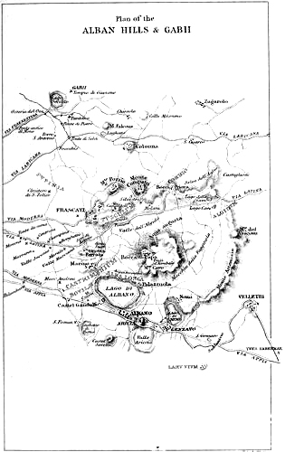
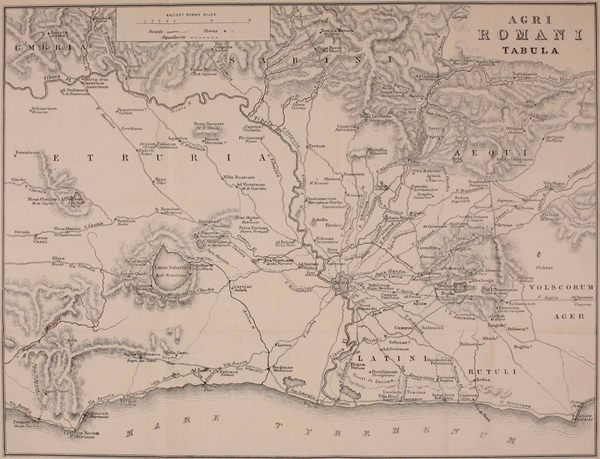
(A) THE VIA APPIA AND THE ALBAN HILLS.
The Appian Road.
Of the great roads along which the principal traffic from ancient Rome
passed, the Appian Road may perhaps be said to have been the most
important, as it led to the southern and oriental provinces of the great
empire; and it is on the line of this ancient road that the greatest
number of ruined tombs and other buildings are still left. Two hundred
ruins are said to stand on the sides of the Appian Road between the site
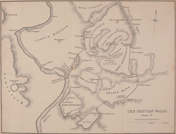
of the Porta Capena, by which this road left the Servian walls, and
Albano, a distance of fourteen miles. The tombs were of the most varied
and fantastic shapes and designs, the most common forms being those with
square or circular bases, cylindrical superstructure, and conical roof.
Some were square with several floors, and surmounted by a pyramid, others
consisted of chapels in brick, placed upon a cubical base, or of
sarcophagi in various shapes, mounted upon brick substructions.
Many fragmentary inscriptions have been found which once belonged to these
tombs, but not one of any historical importance. The greater part of them
record the names of freedmen, and other obscure people, as the larger and
more highly decorated tombs were plundered first, and their marble casing
and inscriptions completely destroyed at an early period. The older
fragments which have been saved may be studied in the Berlin Collection of
Inscriptions where they are learnedly and ably edited by Th. Mommsen.
There were also many fountains and semicircular ranges of seats by the
side of the road designed as resting-places for travellers.
The commencement of the ancient Appian Road now lies between the Porta S.
Sebastiano and the site of the old Porta Capena. From this part of the
road the Via Latina diverged on the left, and the Via Ardeatina on the
right. Beyond the Porta S. Sebastiano, the first monument now visible is a
mass of stonework on the left hand, about one hundred yards from the gate.
From its form and the style of masonry there can be little doubt that it
was a pyramidal tomb similar to that of Caius Cestius at the Porta S.
Paolo, and that it was built in the Augustan era. The road then crosses
the Almo, and the remains of another pyramidal tomb are to be seen on the
left. This is sometimes called the Tomb of Priscilla, mentioned by
Statius, but that name more probably belongs to the larger tomb further
on, beyond the Church of Domine quo Vadis. This latter ruin agrees better
with the description of Statius, as it had a cupola and loculi for the
reception of unburnt corpses. The immense number of ruined tombs and other
buildings which crowd the sides of the road beyond this point, make it
necessary to restrict our remarks as much as possible, and we shall
therefore only notice a few of the most prominent ruins upon the road or
in the immediate neighbourhood.
Divus Rediculus.
The brick building called the Temple of the Divus Rediculus stands half a
mile to the left of the road at the second milestone in the Caffarella
valley. The legend which connects it with Hannibal’s march on Rome is
altogether unworthy of credit,[129] and it is plain that the building,
which had no rows of surrounding columns, but is constructed with
Corinthian pilasters, had two stories, and cannot therefore have been a
temple. Professor Reber considers that it was a chapel tomb similar to
that to be seen further on the road at S. Urbano, near the Tomb of Cæcilia
Metella.
Grotto of Egeria.
The Grotto of Egeria, as it is called, lies in the valley of the Almo
about half a mile above the building just mentioned. It is an arched
nymphæum of brick, at the back of which a plentiful stream of clear water
issues. The mutilated statue of the nymph still remains, but no other
parts of the decorations. There is little doubt that it was the nymphæum
of some suburban villa.
Temple of Bacchus or Honos.
On the hill above it stands the Church of S. Urbano, probably an ancient
tomb in the shape of a chapel. It is commonly called the Temple of Bacchus
from the discovery under it of an altar of Dionysus with a Greek
inscription. But this altar seems to have been moved here from some other
spot. The building is in the form which has a projecting porch with four
Corinthian columns and capitals. These are now built up into the modern
wall. The whole, except the entablature and columns, is of brickwork of
the Antonine era, as appears from the stamps of the bricks. The triple
frieze, forming a kind of attica between the architrave and cornice, seems
to contradict the notion that this was a temple, though the great
antiquary E. Q. Visconti considered that it was the Temple of Honour built
by Marius outside the Porta Capena.[130] The interior is tolerably well
preserved, and has a vaulted roof with coffers and reliefs in the form of
trophies.
The Circus of Maxentius and Temple of Romulus.
On the left of the Appian Road, where it dips suddenly into a valley near
the Church of S. Sebastian, lies a group of ruins, the principal of which
consist of a circus, a building enclosed in a large square court, and some
remains of rooms apparently belonging to an ancient villa. The walls of
the circus are still in such preservation that they can be easily traced
round the whole enclosure, and are in some parts nearly of the original
height. They are built of rubble mixed with brickwork, and with jars of
terra-cotta to lighten their weight, as in the case of the masonry in
other walls of the same date. The towers at each side of the Carceres, or
starting post, the curved line of Carceres themselves, and the spina, or
central division line, can be easily traced. An inscription in honour of
Romulus, son of Maxentius, found here in 1825, and now placed at the
entrance to the ruins, seems to show the circus was built in honour of
Romulus, son of Maxentius, who died before his father, A.D. 309. This is
confirmed by a statement in one of the ancient chronicles published by
Roncalli, in which it is said that Maxentius built a circus near the
catacombs, evidently referring to the neighbouring catacombs of S.
Sebastian and others, and also by the style of masonry used in the circus.
The adjoining ruined temple, with its enclosing court, seems to belong to
a somewhat earlier style of construction, but some reasons derived from
the coins of Maxentius and Romulus have been given for supposing that it
was the temple dedicated to Romulus after his apotheosis by his
father.[131] The ruins are not sufficiently preserved to make it certain
that the building was a temple, and there is nothing to contradict the
hypothesis that it was a tomb. Nor is anything whatever known about the
adjoining villa.
Tomb of Cæcilia Metella.
On the end of the mound formed by the great lava stream which ages ago
flowed down from the Alban Hills, and along the top of which the Via Appia
runs from this point, stands the conspicuous Tomb of Cæcilia Metella, the
daughter of Metellus Creticus, and wife of Crassus, but whether of the
Triumvir Crassus, or of the orator, or of some other less well known
Crassus is uncertain. The inscription on the tomb is Cæciliæ, Q. Cretici
Filiæ, Metellæ Crassi. The shape of the tomb is the same as that of the
Mausoleum of Hadrian, and the Tomb of the Plautii at Tivoli; a cylindrical
towerlike edifice, resting on a square base of concrete with massive
blocks of travertine. The upper part has been destroyed, and the marble
casing stripped off, with the exception of a band of ox skulls and
garlands which surrounds it, and some trophies carved in relief above the
inscription. The roof was probably conical. Mediæval battlements, erected
by the Caetani family, who held it as a fortress in the 13th century, now
crown the upper edge. The remains of their castle are still visible on
each side of the road beyond the tomb.
Roma Vecchia, Villa of Seneca.
After passing the third milestone, the Appian Road is fringed with ruins
of innumerable tombs, and here and there the relics of a suburban villa.
Scarcely any of these can have names attached to them with any certainty.
The spot is now called Roma Vecchia, and the Campus sacer Horatiorum, the
Fossa Cluilia, and the Villa Quintiliana Commodi lay here. The suburban
villa in which Seneca committed suicide by opening his veins was at the
fourth milestone, as we learn from Tacitus, and near this was found in
1824, by Nibby, a marble slab with the name of Granius, a military
tribune. A tribune of this name was employed by Nero to compel Seneca to
kill himself, but whether the stone refers to him or not is of course
doubtful.
Tomb of Atticus.
At the fifth milestone on the right hand of the road is a round mass of
ruins with a rectangular chamber inside, which has been supposed to be the
tomb mentioned by Cornelius Nepos, as the burial place of Atticus,
Cicero’s friend. Near this is the great platform of peperino blocks which
are thought to have been used as a burning place (ustrina) for the bodies
interred at the sides of the road.
Villa Quintiliana.
On the left hand, a little way beyond the fifth milestone, the remains of
the Villa Quintiliana of Commodus begin, and reach along the side of the
road for at least half a mile, extending also towards the left into the
adjoining fields as far as the edge of the great lava current, on the top
of which the Via Appia is here carried. The whole of this space, nearly
two miles in circumference, is covered with fragments of costly marbles,
of sculpture, and bits of mosaic, showing that it was covered with
handsomely decorated buildings. The style of construction, says Nibby,
belongs to three different epochs. The buildings nearest to the Appian
Road, comprising the great reservoir, on the foundation of which the
farmhouse of S. Maria Nuova is built, are of brickwork and reticulated
work of the time of Hadrian, the great mass of the ruins which lies on the
left towards the new road to Albano, exhibits workmanship of the Antonine
era, and amongst them have been found numerous fragments of sculpture,
also belonging to the reigns of the Antonines. The third style of building
is that called opera mista by the Italian antiquarians, which prevailed in
the Constantinian times, at the beginning of the fourth century. The
buildings of the Antonines have been repaired and overlaid in many places
by this later work. The stamps of most of the bricks found here belong to
the reigns of Antoninus Pius, Marcus Aurelius, and Commodus, and were made
chiefly in the imperial brickyards. Thus the date of the principal parts
of the building is decided, and it is seen that the villa was most
probably an imperial villa. But all doubt on this point was completely
cleared away by the discovery in 1828, of a number of large leaden pipes
bearing the inscription, II. QUINTILIORUM CONDINI ET MAXIMI, from which it
became evident that the villa was the same place which Vopiscus and Dion
Cassius mention as the property of the Quintilii, consuls in the year A.D.
151, under Antoninus Pius, and victims of the spite of Commodus in A.D.
182.[132] Commodus seized their property, and the villa became one of his
favourite residences. The great extent of the ruins explains the
circumstance related by Herodian, that the emperor, being in the back part
of the villa, could not hear the shouts of the infuriated mob on the
Appian Road, who were demanding the life of Cleander.[133]
The ruins which extend along the side of the road, are plainly fragments
of a kind of vestibule or grand entrance to the imperial villa. They
consist of a nymphæum or grand fountain, and a row of chambers intended
for slaves’ lodgings. The fountain is supplied with water by an aqueduct,
the arches of which can be seen at the seventh milestone, where it leaves
the lava rocks, and crosses the country towards Marino, at a higher level
than even the Aqua Claudia. This nymphæum and aqueduct are built of opera
mista, which shows that they are probably the work of the Constantinian
Age.
The principal mass of the villa itself stood nearly half a mile from the
old Appian Road, on the edge of the rocks of basaltic lava. Between them
and the road the space was occupied by gardens and ornamental
summer-houses and ponds. Nibby describes the chief ruins as having
belonged to a richly ornamented fountain, and a suite of bathing-rooms of
great grandeur.
One spacious saloon, the walls of which form a picturesque ruin, as seen
from the new post road to Albano, stands on the edge of the rising ground,
and commands a magnificent view of the whole of the Alban and Sabine Hills
and the city of Rome. Near this was a small theatre, from which the
cipollino columns of the entrance to the Tordinone Theatre in Rome were
taken.
An immense quantity of valuable sculpture, now in the Roman museums and
palaces, was discovered by excavations here in 1787 and 1792. Among these
sculptures was a splendid statue of Euterpe, now in the Galleria dei
Candelabri, a tiger now in the Hall of Animals; and the busts of Lucius
Verus, Diocletian, and Epicurus, Socrates, the Isis and Antinous in the
Vatican, with numerous Sileni, Fauns, and Nereids.
Casale Rotondo.
Between the sixth and seventh milestones from the Porta Capena there is a
large round ruin 300 feet in diameter, called Casale Rotondo, now
supporting a house and olive orchard upon the top. The fragments of
sculpture found here have been arranged on the face of a wall, close to
the pile of ruins. The name Cotta was found on an inscription belonging to
this, and hence it has been supposed to be the tomb of the gens Aurelia,
who bore the surname of Cotta. On the left are the arches of the aqueduct
which supplied the Villa of Commodus.
At the eighth milestone there was a Temple of Hercules erected by
Domitian. Martial mentions this temple in several passages. There are
considerable remains of a tetra-style temple on the right hand of the
road, consisting of columns of Alban peperino; but this, which was once
supposed to be the Temple of Hercules, is now said to have contained an
altar to Silvanus.
Bovillæ.
The Villa and Farm of Persius the poet is said by his biographer to have
been near the eighth milestone. At the ninth stood the Tomb of Gallienus,
and perhaps the ruins there belong to his suburbanum. At the tenth
milestone, the Rivus Albanus, formerly the Aqua Terentina, is crossed; and
at the eleventh, the road begins to ascend the slope towards Albano. At
the twelfth, the circuit of the walls of the ancient town of Bovillæ is
approached. Dionysius says that Bovillæ was situated where the hill before
reaching Albano first begins to be steep, and this answers to the position
of the modern Osteria delle Frattocchie. The ruins which are now generally
held to be those of Bovillæ lie on the cross road, called Strada di
Nettuno, a little way above Frattocchie.[134] They consist of a small
theatre built of brickwork and opus reticulatum, and a somewhat larger
circus, the enclosure of which and the carceres are still pretty well
preserved. The town did not lie close to the road. It was founded by a
colony from Alba Longa, and was a flourishing place until Coriolanus
destroyed it. For centuries afterwards we find but little notice taken of
it. In Cicero’s time it was a very insignificant village, and had it not
been immortalised by the assassination of Clodius there, which led to such
important results, it could hardly excite any interest in later
times.[135]
The honour of being the native place of the gens Julia gave it some
artificial importance in the imperial times. Tiberius is mentioned by
Tacitus as erecting a sacrarium of the Julian family and a statue of
Augustus there, and founding Circensian games in honour of the gens Julia.
Some inscriptions found on the spot show the town still existed in the 2nd
century A.D. It is now occupied by plots of land laid out as gardens. The
Villa of Clodius, Cicero’s enemy, appears to have been at or near the
thirteenth milestone from Rome, close to the left side of the Appian Road,
between Bovillæ and the modern Albano. It was raised on immense
substructions, the arches of which were capable of concealing a thousand
men, and Cicero declares that Clodius had not respected even the confines
of the Temple of Jupiter Latiaris or the sacred groves of Alba.[136] The
ruins which lie under Castel Gandolfo, on the left side of the road
towards the Porta Romana of Albano, may have formed part of the
substruction of which Cicero speaks. The estate of Clodius passed after
his death, when the family of the Claudii Pulcri became extinct, into the
hands of the Claudii Nerones, from whom Tiberius inherited it, and thus it
became imperial property.
Villa of Pompey.
The Villa of Pompey was between that of Clodius and Aricia, and therefore
occupied the site of the present town of Albano. Nibby thinks that the
walls of reticulated work in the Villa Doria belonged to Pompey’s house,
and that the great tomb, near the Roman gate of Albano was Pompey’s burial
place. Plutarch states that Pompey was buried at his Alban villa. The
tomb, with five truncated cones, usually called the Tomb of the Horatii
and Curiatii, has also been called the Tomb of Pompey. It is more probably
an imitation of the old Etruscan tombs executed at a later time. After the
death of that great general, the estate became the property of Dolabella,
and subsequently of Antony, who held it till the battle of Actium, when
Augustus took possession of it. After the adoption of Tiberius, it was
united with the Clodian grounds, and thus formed the nucleus of the
Albanum Cæsarum.
Albanum Cæsarum.
Augustus and some of the early emperors found the Albanum a convenient
halting-place on their journeys to the south, but it was in the time of
Domitian that the place was extended so much as to contain a military
camp, enormous reservoirs of water, thermæ, a theatre, an amphitheatre,
and a circular temple. It is called Arx Albana by Juvenal, Tacitus and
Martial.
The plan of the camp can still be traced. It resembled that of the
Prætorian camp at Rome, in being a quadrangular space rounded off at the
corners. The two longer sides extend from the Church of S. Paolo at Albano
to the round Temple, now the Church of S. Maria. One of the shorter sides
was parallel to the Appian Road, and the other ran near the Church of S.
Paolo. There were four terraces or levels in the camp rising towards the
hill behind. The Porta Decumana was in the north-eastern side, and the
Porta Prætoria on the south-western. The great reservoirs for water stand
on the northern side near S. Paolo, and the thermæ towards the south-east
on the opposite side of the Appian Road. At the western corner is the
round building usually called the Temple of Minerva, and supposed to be
that alluded to by Suetonius as annually visited by Domitian. This round
building is in good preservation, but its purpose cannot be determined
with certainty. Nibby says that the ancient mosaic pavement still remains
at a depth of six feet below the present surface. The amphitheatre is
situated between the Church of S. Paolo and that of the Capuchin Convent.
It is principally constructed of opus quadratum, but the interior parts
are of a mixed masonry, consisting of bricks and fragments of the local
stone. This amphitheatre is supposed to have been the scene of the feats
performed by Domitian, in killing with his own hand hundreds of wild
beasts with arrows and javelins, and also of the degradation of Acilius
Glabrio, who was forced, according to Juvenal, by Domitian to join him in
these sports of the arena.
Between Castel Gandolfo and Albano four magnificent terraces, rising one
above the other, were traced by Cav. Rosa as forming part of the Albanum
Cæsarum, and in the Villa Barberini there is a considerable part of a
cryptoporticus, ornamented with stucco reliefs, which probably stands over
the old substructions of the Villa Clodi.[137] On the side towards the
lake there were open balconies for viewing the mock naval engagements; and
near the entrance of the Barberini Villa the ruins of a theatre have been
discovered. It appears probable from the numerous ruins found upon the
edge of the lake that the whole of it was surrounded with quays and tiers
of stone seats, and chapels of Nymphs, making it resemble a gigantic
natural naumachia, or sheet of water for sham naval fights. These ruins
may possibly, however, have belonged to separate private villas placed at
different points round the water.
To the south of Albano, in the grounds of the Villa Doria, there are the
ruins of an extensive Roman villa. Whether this was a part of the Albanum
Cæsarum or not, is uncertain. Some of the bricks bear the stamps of
Domitian, others those of the third consulship of Servianus (A.D. 134),
Hadrian’s brother-in-law, others of Commodus.[138]
Lago Albano or Di Castello.
The Alban lake belongs to the water system of the Tiber, and has most of
its outlets on the western side. It has been supposed that a subterranean
communication exists between this lake and that of Nemi, but Nibby asserts
that this is impossible, as the level of the lake of Nemi is higher than
that of the Alban lake. The circumference of this sheet of water is more
than six miles, and it is nearly elliptical in shape. The story of the
sudden rise of its waters in the sixth year of the siege of Veii is well
known, and the response of the Delphic oracle as given in Livy.
Cicero gives a distinct account of the drainage of the lake. “We are told,
he says, by the Annalists, that during the siege of Veii, when the Alban
lake had risen to an unusual height, a Veientine noble fled to Rome as a
deserter, and declared that it was written in the books of fate which were
kept at Veii, that Veii could not be taken, so long as the lake was
overflowing its banks, and that if the lake were tapped, and flowed into
the sea by its own channel and stream, it would be fatal to the Roman
nation, but that if the water were so discharged as to make it impossible
for it to reach the sea, then the Romans would be victorious. In
consequence of this our ancestors contrived that admirable plan for
drawing off and dispersing the water of the lake.”
From this passage it would seem likely that the whole object of the
drainage of the lake was to obtain a constant supply of water for the
irrigation of the Campagna. In another passage Cicero states his opinion
still more clearly, that the work was really undertaken for the benefit of
suburban agriculture. “The Veientine prophecy that if the water of the
Alban lake rose above its margin and flowed into the sea, Rome would
perish; but that if it were checked, Veii would be taken, in consequence
of which the Alban water was diverted, was intended to benefit the
suburban farms, and not to secure the safety of Rome.” What appears
strange, is that it should have been necessary to appeal to a
superstitious motive in the case of a people evidently so far advanced in
civilization as to be capable of carrying out an engineering work of such
difficulty in a single year.[139]
Emissarium of the Alban lake.
The tunnel which still carries off the superfluous water of the lake is
cut through solid peperino and occasional masses of still harder basaltic
lava. It is more than a mile and a half in length, from seven to ten feet
in height, and never less than four feet in breadth. The height of the
edge of the lake basin above the level of its water at the part which is
pierced by the tunnel is 430 feet. Three vertical shafts are still
discoverable, by which a draft of air was created and the rubbish was
removed, and one slanting shaft for the entrance and exit of the miners.
The rock was cut with a chisel an inch wide, as may be seen from the marks
left upon the sides of the tunnel.
At the points where the water enters and leaves the tunnel, considerable
pains have been taken to regulate the flow. The channel of stonework at
the mouth is placed in a slanting direction so as to break the force of
the rush of water. At the end of this first channel is a cross wall with
openings, protected by gratings to catch the leaves and floating rubbish.
Behind this is a reservoir, similar to the cisterns in use in the Roman
aqueducts, allowing the mud to settle before the water entered the tunnel.
Next to the tunnel itself there is a closed building to protect the canal
from the fall of rocks and stones, and the actual entrance into the rock
is faced with a massive portal of wedge-shaped blocks of stone. The water
in this enclosure is now used by the fishermen of the lake as a receptacle
for keeping fish, and is for this purpose provided with sluices. Hirt
thinks that these arrangements at the mouth are very ancient.[140] Others
ascribe them to the imperial era.
The point where the tunnel emerges from the mountain on the west of Castel
Savelli, nearly a mile from Albano, is called Le Mole. The water was there
received in a long troughlike reservoir arched over with a stone vaulted
roof. From this it ran through five smaller openings into five separate
channels, and was so dispersed into the fields for irrigation. At the
present time the whole stream is united, and after passing the road to
Anzio, thirteen miles from Rome, takes the name of Rio d’Albano, receives
the brook from the valley of Apiolæ, and joining the Acqua Acetosa and
Cornacciola crosses the Ostian way near Tor di Valle, three miles and a
half from Rome, and then discharges itself into the Tiber.
It is the opinion of some archæologists that the Romans brought engineers
from Greece to superintend the Alban tunnel. This supposition, however, is
not necessary. If the Italian engineers could construct the Cloaca Maxima
they would be fully equal to the task of tapping the Alban lake.
The physical conformation of Central Italy compelled its inhabitants to
turn their attention at an early period to the construction of drains and
other hydraulic works. Considerable artificial channels were rendered
necessary in order to regulate the flow of the Arno and Tiber in the
neighbourhood of Chiusi. In southern Etruria, the district now known as
the pestilent Maremma, could only have been rendered healthy by systematic
artificial drainage. The sites of Populonia, Saturnia, Cosa, Veii, and
Cære were thus rendered habitable and fertile, and a great part of Latium
Maritimum, the Pomptine marshes, and the tract about Suessa Pometia must
have been artificially and skilfully drained at the time of the greatest
prosperity of those places. Many of the ancient cities of Central Italy
had tunnels bored underneath their streets which served as thoroughfares
connecting the different parts of the city, or as secret passages leading
out into the country. Such tunnels are found at Præneste and Alba
Fucensis. An account of the attempted escape of Marius from Præneste, by
means of the tunnels, is given by Velleius. The catacombs show that the
same genius for tunnelling operations existed at a later time among the
Italians of the empire.
Alban Mount.
The triumphal route by which the festal processions from Rome ascended the
Alban Mount diverged from the Appian road at the ninth milestone. It
probably passed by Marino to Palazzuolo and thence ascended to the summit
by a series of zigzags. The stones which mark its course have the letters
N V. (numinis via) cut upon them. On the summit stood the Temple of
Jupiter Latiaris, the ancient sanctuary of the Latin league. The sole
remains of this famous building are now built into the wall of the
reservoir of the convent of Palazzuolo. They consist of fragments only.
Most of the stones employed by Cardinal York in 1783 in the erection of
the convent of Palazzuolo and the church of the Trinity, on the site of
the temple, were taken from the ruins, but nothing can be learnt from them
regarding the ancient buildings. The summit of the hill is not broad
enough to have supported any large building, and we may therefore conclude
that the temple was of small size, and that the great festival games at
the Feriæ Latinæ were held in the Prati d’Annibale below. The inscriptions
on some of the stones are merely the freaks of some modern stonemasons.
The fragments which remain were probably used for the area round the
temple.
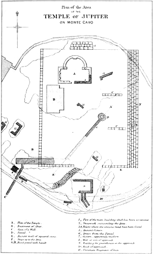
The explorations carried out in 1876 seem to have proved that the
buildings consecrated to Jupiter Latiaris on Monte Cavo were a walled area
of about sixty-five yards long, and fifty wide, a fragment of the wall of
which was found; a chapel dedicated to Jupiter, one corner of which was
excavated; a large altar, and some other chapels dedicated as votive
offerings. A tracing of the shape and position of the area, chapels and
altar was found by M. S. De Rossi in a seventeenth century MS. in the
Barberini Library, and was published in the Annali dell’ Instituto for
1876. This traced sketch agrees with the excavations. (See Plan.)
Alba Longa.
The early destruction of Alba Longa, so famous in Roman legendary lore,
has completely deprived us of the means of tracing its site by the
discovery of any remains of the walls or buildings which it contained. It
was razed to the ground by Tullus Hostilius in B.C. 667 and never rebuilt.
Dionysius thus describes the site: “The city was built close to the
mountain and lake, upon a site between the two. They serve as defences to
it, and make it almost impregnable, for the mountain is very steep and
lofty and the lake deep and wide.” Livy says that the city was named Longa
because it extended along a ridge of the Alban hills. The words of
Dionysius seem to imply that Alba stood immediately between Monte Cavo and
the lake on the site of the convent of Palazzuolo, and Cav. Rosa, the
highest modern authority on the topography of the Campagna, who has made
the neighbourhood of Albano and Nemi the subject of special study, holds
this opinion. Nibby thought that the whole edge of the crater from
Palazzuolo nearly to Marino, a distance of more than two miles, was
occupied by the city of Alba. Sir William Gell discovered an ancient road
running along the edge of the crater above Monte Cuccu, and a few blocks
of stone on the top of the precipice bordering the lake further eastwards,
which he thought must have belonged to the gate of Alba.
At the sixteenth milestone on the Appian road beyond Albano, in the valley
below the modern town of Ariccia, is the massive causeway 700 feet in
length and 40 in width, upon which the old Appian road was raised. It is
built of blocks of peperino and is a solid mass of masonry, except where
three archways give passage to the water which descends from the Alban
hills and the neighbourhood of Nemi.
Lake of Nemi.
Beyond the ancient viaduct we come to the tunnel through which the lake of
Nemi discharges its waters.
The name of this lake and of the village on its margin, is derived from
the great grove of Diana (Nemus Dianæ) whose temple probably stood on the
site of the present village of Nemi. The wooded cliffs which surround the
crater here are steep and descend immediately into the water, except on
the side near Genzano, where they slope magnificently and are planted with
vines. Their average height is 300 feet. In the Latin poets frequent
mention is made of this lake as one of the principal ornaments of the
neighbourhood of Rome, and in connection with the widely celebrated temple
of Diana. Hence it was called Speculum Dianæ, lacus Triviæ and Stagnum
Dianæ.
Whether the name Lacus Aricinus also belonged to this lake is doubtful,
for Pliny speaks of a lake which formerly occupied the valley of Ariccia,
and the water in this valley was certainly called Lacus Aricinus in the
middle ages.
The water of the lake is supplied partially at least from a small spring
near the road from Genzano to Nemi, and also from the copious stream which
turns the mills of the village of Nemi. The latter is probably alluded to
by Strabo when he says that the sources whence the lake is filled are
visible, and are near the temple of Diana.
Nibby gives the following account of the Lake of Nemi, and of the
investigations carried on in his time for the purpose of discovering the
real nature of the curious wooden fabrics said to have been found at the
bottom of the lake:
“The situation of Nemi is picturesque, and the view from it of the crater,
and of the lake, which resembles an enormous mirror spread below, is
magnificent. But beyond the historical reminiscences of the Temple of
Diana, it presents nothing worth particular mention. The baronial castle
near it has all the appearance of a feudal fortress. It was built by the
famous Colonna family, once the lords of the estate, who also built the
round tower or keep which surmounts it. By ascending the side of the
mountain which rises above it, a splendid panoramic view of the coast of
Latium and of the adjacent Rutulian and Volscian territory may be enjoyed.
The eye ranges along the whole coast line of the Tyrrhenian Sea, from the
Circæan promontory to the mouths of the Tiber, and the situations of
Astura, Antium, Ardea, Lavinium, Laurentum, Ostia and Porto are clearly
distinguishable, together with many other points.”
“The crater is surrounded in parts by rocks of the hardest basaltic lava,
in others by conglomerated cinders and scoriæ, and in some places by banks
of tufa. Its circumference is about five miles; and the level of the water
is higher than that of the Alban Lake. The story of the ship discovered at
the bottom of this lake and said by some authors to have belonged to the
time of Tiberius, by others to that of Trajan, is well known. Biondo, Leon
Battista Alberti, and particularly Francesco Marchi a celebrated architect
and military engineer of the sixteenth century, who went down into the
lake himself, have spoken of it.[141] Fresh investigations have been
carried on of late, at which I was present, and saw and examined
everything which was brought to the surface, and inquired of those who
went down what they saw there. I consider myself in a position to assert
that the pretended ship was nothing more than the wooden piles and timbers
used in the foundations of a building. The beams are of fir and larch, and
are joined by metal nails of various sizes. The pavement, or at least the
lowest stratum, of the remains is formed of large tiles placed upon a kind
of grating of iron, on which the name CAISAR, in ancient letters, is
marked. Some of these tiles and nails and gratings are now kept in the
Vatican Library.
“The name Caisar seems to explain the history of the building, for
Suetonius in his ‘Life of Julius Cæsar,’ as an illustration of Julius
Cæsar’s extravagance, asserts that after having built a villa on the lake
of Nemi at an enormous expense, he had the whole destroyed because it did
not quite suit his taste. It is my belief that the pretended ship was
nothing else than the piles and wooden framework upon which this villa was
supported, and that after the upper part was destroyed the foundations
under the water still remained, partly covered by the fragments of the
demolished building above.”[142]
The mention of paving tiles, marbles, and leaden pipes as among the
objects raised from the bottom of the lake, renders the notion that they
belonged to a ship improbable, and Nibby’s conjecture that a Roman villa,
partly built out into the water, stood here, seems much more likely,
though his application of the passage of Suetonius is very doubtful.
Cav. Rosa, who examined the neighbourhood of Nemi and Genzano with a
special view to the solution of the question of the site of the Temple of
Artemis, has given a careful account both of the ruins under Genzano and
those to the west of Nemi. The former he pronounces undoubtedly to belong
to a villa, the latter he thinks belonged to a temple with a large court
in front, and an ancient road leading to it from the western side of the
lake. These ruins are just above the lower road leading from the Capuccini
convent at Genzano to Nemi, at the point where a cross road leads to the
left and joins the higher road to Nemi, not far from the place called le
Mole.[143] Genzano is a town of mediæval origin.
(B) THE VIA LATINA AND TUSCULUM.
Latin road.
The modern Porta Giovanni is now the point at which the new road to
Albano, and also that to Frascati, leave Rome. The Latin road anciently
diverged, after passing the Porta Capena, from the Alban road and had a
gate of its own in the Aurelian wall, called the Porta Latina, now walled
up.
Tombs on Latin road.
The old Via Latina is unfortunately now almost lost, and can only be
traced by the lines of ruined tombs which mark its former course. After
leaving the old Porta Latina it runs along the edge of the hills which
fringe the right bank of the Caffarelli valley, and crosses the new road
to Albano at the second milestone, at a point on the other side of the
valley almost opposite to the so-called fountain of Egeria. Not far from
this spot some very interesting tombs were excavated in 1860. A full
account of them has been given in the ‘Annali dell’ Instituto di
Corrispondenza Archeologica’ for 1860. The sarcophagi and stucco ornaments
are the most perfect remains of the kind in the neighbourhood of Rome.
These sepulchral monuments are near the remains of the Basilica of S.
Stefano, a ruin of the fifth century, and on the farm which bears the name
of Arco Travertino from the travertine arches of the Claudian Aqueduct
which cross it. The ancient pavement of the Latin road has been uncovered
in some places near the tombs, and also some traces of a villa, which
probably belonged to the Servilian and Anician families, have been
excavated. The portico of the tomb which faces the southern side of the
road leads down to two large vaults, in the outer of which stand the
mutilated remains of a marble sarcophagus in a niche, while the inner
vault is decorated with well-preserved stucco ornaments in relief,
representing sea-monsters and nymphs. Some of the marble casing which
covered the walls remains, but no name has been found on the bricks or
stones. In the tomb on the opposite side of the road there is a
well-preserved mosaic with figures of sea-monsters at the entrance, and
below are paintings of birds upon the arches which support the sarcophagi
in the outer chamber, and an inscription which gives the name of the
Pancratii as the owners of the tomb. The family figures and profiles are
only sketched roughly in outline, as is common in the catacombs. The roof
of the inner chamber in this second tomb is exquisitely ornamented with
paintings and stucco reliefs, representing mythological subjects and
landscapes. In the centre a large marble sarcophagus containing places for
two bodies is left standing. This sarcophagus is plain and without any
decoration. The date of this tomb cannot precede the Antonine era, as
there are no cinerary urns in it.
Torre Fiscale.
At the fourth milestone from the Porta Capena, the Latin road passed under
the arches of the Claudian and Marcian aqueducts, at the tower now called
Torre Fiscale. At this point the two aqueducts cross each other, and
present a most magnificent series of arcades running along the side of the
old Latin road for more than a mile. The arches of the Claudian aqueduct
are here more than fifty feet in height. The railway to Naples runs very
close to the line of the old Latin road here.
A great number of ruins are still to be seen at a place called Sette
Bassi, four miles and a half from the Porta S. Giovanni and near the
Osteria del Curato. This spot, as well as the district near it on the
Appian road, bears the name of Roma Vecchia. The scattered ruins occupy a
space of nearly three-quarters of a mile in circumference, and appear to
have been built at two different epochs. The bricks of which one portion
of them is constructed have the dates A.D. 123 and 134 upon them, the
years when Pœtinus and Africanus and Servianus and Juventius were
consuls. The other part of the building is evidently contemporaneous with
the ruins on the Appian road and belongs to the Antonine era. All the
bricks were made at one of the imperial kilns, and it has therefore been
generally supposed that the villa was an imperial residence, forming a
part of the already-mentioned Suburbanum Commodi. The marbles found on the
spot show that it was decorated with great magnificence, and a particular
kind of breccia, numerous fragments of which have been picked up there,
obtains its name, Breccia di Sette Bassi from the place.
The plan, according to Nibby, was that of a large oblong area, the longer
sides of which ran north and south. In the centre there was room for a
large pleasure garden. The front of the buildings was at the northern end
towards Rome, and the remains of a portico can be traced, which supported
a terrace on a level with the first floor rooms of the mansion. One of
these rooms with three doors and the same number of windows can still be
traced. In some of the walls the remains may be seen of terra-cotta pipes
for heating the rooms. The ground floor apartments were without
decorations, and are therefore supposed to have served as storehouses for
grain and farm produce.[144]
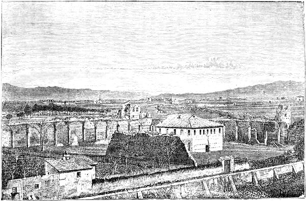
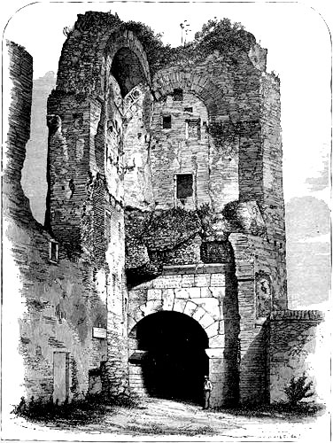
Circus of Maxentius, with Torre Fiscale beyond it and the hills above Præneste and Tusculum.
Behind this front building, on the eastern and western sides, are long
ranges of building, the eastern consisting of two suites of rooms,
probably intended for baths or for gymnasia, and the western forming a
long ambulacrum terminated by an exedra. On the south side there is a
cryptoporticus and a reservoir for water which was supplied by a branch of
the Claudian aqueduct.
About a quarter of a mile farther south, near the Latin road, there is an
outlying building which seems to have been intended to command a view of
that road. The railway to Frascati now runs between the Claudian aqueduct
and these ruins.
The castella of the Aqua Marcia, the Tepula, the Julia, the Claudia, the
Anio Vetus, and the Anio Nova lie on the right of the old Latin road here,
at the sixth milestone, where the arcades make a right angle. The old road
then runs to the right of the present road to Frascati, nearly on the line
of the modern Strada di Grotta Ferrata, and ascending the slopes of the
Alban Hills, passes behind Tusculum and Corbio, along the valley called
Vallis Albana.
Tusculum.
Since the excavations carried out by Lucien Bonaparte at the beginning of
this century, there has been no doubt left as to the site of the ancient
city of Tusculum. The ruins lie from about a mile and a half to two miles
above Frascati, upon the ridge forming the edge of the most ancient crater
of the Alban Hills. Between this ridge, which bore the name of Tusculani
Colles, and the hills upon which Marino and Rocca di Papa stand, the great
Latin road ran. Tusculum stands just over this road and was approached
from it by a steep path ascending the northern side of the valley. The
main road entered the city on the other side, from the direction of
Frascati and Rufinella, leaving the Via Latina at the tenth milestone,
between Morena and Ciampino. The ancient pavement of this road can be
clearly traced on the slope of the hill above Frascati, and it leads us
along the top of the hill through what has plainly been the main street of
the town to the citadel, which stood at the eastern extremity.
Theatre.
The site of the citadel is a platform nearly square and 2700 feet in
circuit, standing about 200 feet above the level of the surrounding parts
of the hill. Its walls were completely demolished By the Romans in 1191
and not a vestige of them is left. Sir William Gell thought, however, that
he could discover the traces of four ancient gates, one on the west,
another on the side of the Alban valley, a third on the eastern side, and
not far from this last, a postern communicating with a steep and rocky
path which descended to the Alban valley. Most of the ruins now visible
belong to the mediæval fortress of the Dukes of Tusculum, and a few only
of the quadrilateral blocks of the ancient enclosure are visible. In the
Æquian and Volscian wars this citadel played an important part. It must
therefore have been a fortress of considerable strength from very early
times. Dionysius describes it as a very strong position, requiring but a
small garrison to hold it, and adds that the whole country as far as the
gates of Rome, is plainly visible from it, so that the defenders could see
the Roman forces issuing from the Porta Latina. The city itself lay on the
ridge of the hill westwards from the citadel. The area which it occupied
is an oblong strip of ground about 3000 feet long, and from 500 to 1000
feet in width. On the north and south sides the limits of the city are
clearly marked by the edges of the hill, but on the west they are not so
easily defined. At the foot of the descent from the citadel are the ruins
of a large water tank of an oblong shape divided into four compartments by
three rows of piers, and immediately under this tank is a small theatre
built of peperino, which was excavated by the dowager Queen of Sardinia
Maria Christina in 1839 and 1840. This, with the exception of the theatres
at Pompeii, is the most perfectly preserved in Italy. The walls of the
scena are unfortunately destroyed, but the ground plan of it can still be
traced. The stage, which abuts closely on the western side of the
semicircular cavea, is 110 feet in length, and 20 feet in depth. It has
the three usual entrances from the back, and one at each end. These open
into a corridor and communicate with two chambers, probably used as
dressing rooms by the actors. Nearly the whole of the fifteen rows of
seats in the lower division are still preserved unbroken, but the upper
part which contained, to judge by the height of the outer walls still
remaining, about nine rows of seats, is entirely destroyed.
Other ruins.
Gate and walls.
The curved walls on the northern side of the theatre were supposed by
Nibby to have belonged to another theatre, but are now generally believed
to have been a part of a fountain connected with the above-mentioned
reservoir. Along the northern side of the reservoir are two parallel
walls, which apparently enclosed the street leading to the citadel. The
roadway must have been here carried by an arched corridor under the side
of the theatre. Near the ancient road from the theatre westwards is a mass
of ruins the plan of which cannot be determined, and beyond these, not far
from the point where the road divides, and on its right-hand branch, is
one of the gates of the city, marked by two fragments of ancient fluted
columns which perhaps formed a part of its architecture. Near this are the
remains of the ancient north wall of the city, consisting of blocks of
peperino of great size more or less regularly laid, and of restorations
here and there in reticulated work, partly of the later republic, and
partly of more modern times. The pavement of the street is here perfectly
preserved, and near the gateway there is a wide space left, probably as a
turning place for carts or carriages.
Tank and fountain.
In the walls near this point is a stone doorway leading into a stone
water-tank, with a pointed roof formed by overlapping stones, on the same
principle as the roof of the so-called Mamertine prison at Rome, the gate
of Arpinum and the treasuries of Mycenæ and Orchomenos. The doorway is
about ten feet high and five wide, and the tank of the same dimensions. In
the interior are three divisions or basins for water, and at the back an
aqueduct enters by means of which the water was supplied. At the side of
this tank there is a small ancient fountain under the wall which was
supplied from the tank by a leaden pipe. An inscription on the fountain
records that it was made by the Ædiles Quintus Cælius Latinus, son of
Quintus, and Marcus Decumo, by command of the Senate of Tusculum. Not far
from the fountain was found the fifteenth milestone from Rome.
On the road to Frascati, near the point where the western gate of the
city has been supposed to have stood, the remains of an amphitheatre can
be discovered. The seats are entirely destroyed, and it is only by the
oval shape and by the position of the substruction that the ruins can be
recognized as those of an amphitheatre. A round tomb stands a little above
the amphitheatre, and beyond this the ruins of a large villa called Scuola
di Cicerone cover the side of the hill towards the Alban valley.
The legend which ascribes the foundation of Tusculum to Telegonus, the son
of Circe and Ulysses, is familiar to all readers of the Latin poets. It is
remarkable, however, that Virgil, who mentions most of the towns of
Latium, has entirely omitted to notice Tusculum. This may be mere
accident, or it may be attributable to a grudge similar to that which led
him, according to Aulus Gellius, to omit Nola from the lines in the
Georgics celebrating the fertility of Campania, but it certainly cannot be
due to the fear of making an anachronism, as Nibby supposes. In the times
of the Latin league, from the fall of Alba to the battle of the Lake
Regillus, Tusculum was the most prominent town in Latium. It suffered,
like the other towns of Latium, a complete eclipse during the later
republic and the imperial times, but in the ninth, tenth, eleventh and
twelfth centuries under the counts of Tusculum it became again a place of
great importance and power, no less than seven Popes of their house having
sat in the chair of St. Peter. The final destruction of the city is placed
by Nibby, following the account given in the records of the Podesta of
Reggio, on the 1st of April, A.D. 1191, in which year the city was given
up to the Romans by the Emperor Henry VI., and after the withdrawal of the
German garrison, was sacked and razed to the ground. Those of the
inhabitants who escaped collected round the church of S. Sebastian on the
foot of the hill, in the district called Frascati, whence the town of
Frascati took its origin and name. They founded their new town upon the
remains of an ancient villa, which stood near the round tomb which still
remains on the road to the Villa della Ruffinella. The name of Lucullus
has been attached to this villa and tomb from the statement of Plutarch
that Lucullus was buried by his brother at his Tusculan villa. It is
however, much more probable that the larger round tomb in the vigna
Angelotti on the road towards Rome was the burial-place of Lucullus.
Scuola di Cicerone.
The building now called Scuola di Cicerone is not far from the ruins of
the western gate of Tusculum. The ground floor is apparently about 270
feet in length and 100 in depth, but the upper parts of the buildings have
now completely disappeared. The materials were of brick and reticulated
work, similar to that now found in the gardens of Sallust at Rome, and
generally considered as belonging to the last age of the Republic or the
early Empire. The ground floor had a cryptoporticus along its whole
length, and above this on the first floor was probably an open portico
with a colonnade. Eight large rooms opened out behind the cryptoporticus,
in the second of which are the remains of some stairs, and at the back of
the eighth a recess. At the ends of the cryptoporticus are the remains of
some more rooms. There are no signs of decoration on any of the walls, and
therefore this lowest story of the building is supposed to have been used
as a storehouse for corn and farm produce.
There is, however, no evidence whatever to connect these ruins with
Cicero’s Villa. The only indication we have of its site is given by the
Scholiast on Horace, who speaks of it as situated near Tusculum on the
upper slopes of the hill.[145]
Villa of Gabinius.
This will agree either with the ruins just described or with those found
in 1741 under the modern Villa Rufinella, which is a little way lower down
the western slope. That Cicero’s Villa was upon the upper part of the hill
is confirmed by his own statement that it was so near that of the consul
Gabinius, that at the time of Cicero’s exile, not only the furniture but
the trees in his garden were transferred to the Villa of Gabinius, and we
also find that this latter villa was upon the upper part of the hill.
Nibby accordingly places the Villa of Gabinius on the site of the modern
Villa Falconieri close to the Rufinella.
Several particulars about his villa are mentioned by Cicero himself. It
contained two rooms called gymnasia, to the upper of which he gave the
name of Lyceum, and which contained his library. The lower gymnasium was
called the Academy in honour of Plato.
The Lyceum seems to have been used in the morning, and the Academia in the
afternoon, as being more sheltered from the heat of the sun.
The Hermathena, a double-headed bust of Hermes and Athena, mentioned in
the letters to Atticus, was probably placed in the Lyceum, for the phrase
he uses there seems to refer to Apollo as the patron of the gymnasium, in
which it was placed. There were also some Hermæ of Pentelic marble, bronze
busts, and Megarian statues placed in the gymnasia, and Atticus had a
general commission to buy up anything which he might think suitable for
these rooms.
Another part of the villa was called the atriolum. Nibby has shown from
one of the letters to Quintus that the atriolum of a villa was a small
courtyard surrounded with bedchambers and offices. The Tusculan atriolum
was decorated with stucco reliefs on the walls, like those in the tombs on
the Latin Road.
(C) GABII AND PRÆNESTE.
Tomb of Atta.
Villa Gordiana.
The road to Gabii and Præneste leaves Rome at the Porta Maggiore. The most
conspicuous ruin, which it passes at about one mile from the walls of
Rome, is a very large circular sepulchral monument more than a hundred
feet in diameter, to which the name of Quintus Atta has been attached.
Beyond this, at a distance of two miles and a half from Rome, we come to
the remains of a vast villa, which has been identified with that spoken of
by Julius Capitolinus in his history of the Gordian family. That historian
says that their “country house was situated on the road to Præneste, and
was remarkable for the magnificence of a portico with four ranges of
columns, fifty of which were of Carystian, fifty of Claudian, fifty of
Synnadan and fifty of Numidian marble. There were also three basilicas in
it, each of a hundred feet in length, and other buildings of corresponding
size, in particular some Thermæ more magnificent than any others in the
world except those at Rome.” The ruins of this great imperial villa extend
for nearly a mile along the road, consisting chiefly of some huge
reservoirs for water, two spacious halls belonging to the Thermæ, a round
temple or Heroon, and a stadium surrounded with arcades. The style of
construction in most of these is the irregular brickwork with thick layers
of mortar which is known to be characteristic of the third century.
Gordian III. was killed in A.D. 244. The great reservoirs are close to the
road, two on the left and two on the right-hand side, beyond the
depression in which the stream called Acqua Bollicante runs, where the
ground rises towards the hill of Torre de’ Schiavi. Some of them appear to
be of an earlier date than the reigns of the Gordians, and are referred by
Nibby to the Antonine epoch. The brickwork of these last is more regular,
and they contain a good deal of reticulated work and layers of squared
tufa stones. The two large halls which belonged to the Thermæ are to the
east of the reservoirs. One of them was a spacious octagonal building with
round windows. It was occupied as a fortress or watch-tower in the middle
ages, and has been repaired in the style called Saracenesca. In the walls
of this may be seen the earliest instances of a mode of construction
afterwards, as in the Circus of Maxentius, very common, the introduction
of jars of terra-cotta in the walls to make the work lighter. The interior
is ornamented with niches alternately square and circular headed, and
retaining some of their ancient stucco decorations.
The other hall of the Thermæ stands not far off, and is circular with a
domed roof.
The Heroon, or circular temple, of which mention has been made, is similar
to that near the Circus of Maxentius. The diameter of this is fifty-six
feet, and it was lighted by four large round windows. The front was turned
towards the road according to the rule laid down by the architect
Vitruvius. Underneath, there is a crypt supported by a massive round
pillar, and containing six niches. In this, Nibby thinks that the ashes of
the dead were placed, as their statues were in the temple above, and that
the building was the Heroon of the reigning family. In the middle ages
this Heroon was used as a church, and some of the paintings then
introduced are still visible on the interior walls. Not far from the
Heroon are the ruins of the arcades which surrounded the stadium and
bounded the domain of the villa on the east side.
Torre Pignatara.
In this district, but along the ancient Via Labicana which runs in the
direction of Frascati, stands the conspicuous tower now called Torre
Pignatara from its construction with pigne or earthen pots. It surmounts a
large circular hall and a catacomb to which the titles of S. Helena’s
Mausoleum and the Chapels of SS. Peter and Marcellinus have been given,
but the real history of the building is unknown.
Ponte di Nono.
At the ninth milestone on the road to Palestrina, where the road crosses a
small brook, is a magnificent monument of ancient Roman architecture,
consisting of an arched viaduct built of peperino and tufa blocks. The
length of this viaduct is 105 yards, and the highest of the seven arches
about fifty feet. The blocks of stone used are in some cases ten feet in
length, and they are firmly fitted together without any kind of cement.
This viaduct is now called Ponte di Nono.[146] The ancient roadway of
polygonal fragments of basalt still remains, but the parapet on each side
has been destroyed.
Gabii.
At a distance of about three miles beyond the Ponte di Nono are the ruins
of Gabii on the edge of the lake called Lago di Pantano in the district of
Castiglione. Numerous traces of the ancient city are still visible. It
occupied a long strip of ground extending from the sepulchral mound on the
right of the road near the outlet of the lake to the tower of Castiglione.
Nibby thinks that this tower stands on the spot formerly occupied by the
citadel of Gabii, the original stronghold founded according to the legend
by a colony from Alba. In the year 1792 extensive excavations were made on
the site by Prince Marcantonio Borghese at the suggestion of Mr. Hamilton
a Scotch painter, and a quantity of sculptures and inscriptions now in the
Louvre at Paris were discovered. The principal ruins now remaining are
those of the cella of a temple built of the famous lapis Gabinus, and some
steps in a semicircular form, probably the remains of a theatre. The
temple is generally supposed to have been that of Juno alluded to by
Virgil.
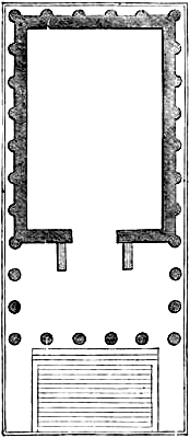
The form of this temple was almost identical with that at Aricia. The
interior of the cella was twenty-seven feet wide and forty-five feet long.
It had columns of the Doric order in front and at the sides, but none at
the back. The walls of the chamber at the back were here, as at Aricia,
prolonged on each side, so as to close the side porticoes at the back. The
surrounding area was about fifty-four feet in breadth at the sides, but in
front a space of only eight feet was left open, in consequence of the
position of the theatre, which abutted closely upon the temple. On the
eastern side of the cella are traces of the rooms where the priests in
charge of the temple lived.
The shape of the forum can only be partially made out. From the plan
published in the ‘Monumenti Gabinoborghesiani,’ it appears that it was a
rectangular quadrilateral space, traversed by the Via Prænestina at the
southern end, and that it was surrounded with a portico of Doric columns
except at the end along which the Via Prænestina was carried. It was
believed at the time when the excavations were made that the Curia and
Augusteum could be distinguished among the surrounding buildings, but this
seems now to be very doubtful. In the centre stood the statue of Titus
Flavius Ælianus, the patron of the borough town. The pedestal of this
statue with its inscription was found in situ in 1792.
“The stone of Gabii quarried near the lake and the product of its extinct
volcano, is used in many of the Roman buildings and especially in the
building called the tabularium at the head of the Forum Romanum. It is a
hard species of peperino, of a brownish-grey colour, which when exposed to
the air becomes paler than the common peperino of Albano. It resists the
action of fire, and is a compound of volcanic ashes mixed with small
fragments of black, brown, and reddish lava, scales of mica, and bits of
Apennine limestone.”[147]
The city of Gabii lost its independence soon after the beginning of the
Republican era of Rome. It was restored as a colony of veterans by Sylla,
but sank into obscurity, and became almost proverbial for its desolate
condition in the Augustan era. It afterwards recovered its prosperity in
some degree by means of the celebrity of its cold baths, and in the time
of Hadrian was patronised by the Emperor, who built an aqueduct and a
Curia Ælia there. The inscriptions found on the spot belong chiefly to the
Antonine era, and the busts of Severus and Geta also found there show that
in the first part of the third century Gabii was still a flourishing
borough town.
Labicum.
The most conspicuous outlying hill of the volcanic district not far from
Gabii is that of La Colonna, about three miles below Rocca Priora. It
stands apart from the rest of the range, and is easily seen from Rome.
From Strabo’s description of the site of Labicum there can be but little
doubt that this hill must be considered to be the place to which he refers
in his account of the Via Labicana. “That road,” he says, “begins at the
Esquiline Gate, at which the Prænestine Road also leaves the city, and
leaving both this latter and the Esquiline plain on the left, proceeds for
more than a hundred and twenty stadia (fifteen and a half Roman miles)
till it reaches Labicum, an old, dismantled city, lying on a mount. The
road leaves it and Tusculum on the right, and ends at the station called
ad Pictas, where it joins the Latin Road.” There are no ancient ruins now
on the spot. In Strabo’s time it was apparently ruined and deserted, and
at an earlier date Cicero says that it was difficult to find any
inhabitant to represent Labicum at the Feriæ Latinæ. It seems probable,
therefore, that it suffered severely in the civil wars of Sylla and
Marius, and did not recover itself until the establishment of an imperial
villa there gave it some importance.
Præneste.
Beyond La Colonna, the ancient Labicum, by far the most important place on
the Æquian frontier was the strong fortress-town of Præneste, now
Palestrina, which commands the passage from Latium into the valley of the
Sacco. Præneste is placed on one of the projecting spurs of the
mountainous district which intervenes between the Anio and the Sacco.
Standing, as the city does, more than 2100 feet above the sea level, it
forms a very conspicuous object in the view from the hills of Rome.
After its eventful history as the great border fortress of Latium, we can
only wonder that it has been found possible to restore the ancient plan of
Præneste with tolerable accuracy, as has been done by Nibby and other
archæologists. The modern town, an agglomeration of filthy narrow alleys,
occupies little more than the space on which stood the great Temple of
Fortune and its approaches. Nearly a mile distant from this, on the summit
of the hill, stood the citadel united with the town by two long walls of
polygonal masonry, traces of which are still to be seen, though they do
not rise to any height above the ground. The site of the citadel is now
occupied by a wretched little suburb called Borgo di S. Pietro, and by a
ruined mediæval castle of the Colonnas built in the style called opera
Saracenesca. On the side towards the town the walls of the citadel are
still easily traced, and present admirable examples of polygonal
structure, rising in some places to a considerable height. On the other
side, where the steepness of the hill made artificial defences less
necessary, the walls have almost disappeared.
The original fortifications of the city may be followed from the Porta del
Sole, where the ancient polygonal masonry is visible. “In this part of the
walls,” says Nibby, “are some towers of opus incertum, standing between
the Porta delle Monache and the Porta Portella. Near the latter gate the
polygonal wall is nearly fifteen feet in height, and on one great block
may be read in very ancient letters the words PED. XXX. After having
surrounded the summit of the hill of S. Pietro, the wall descends to the
Porta S. Martino, where it was strengthened at the time of the Punic wars
with additions of quadrilateral structure, and where an ancient gate now
closed may be seen. From this point the wall proceeds in a nearly straight
line in the direction of the upper garden of the Barberini Palace and the
Via di S. Girolamo towards the Porta del Sole. This circuit of about three
miles in length was intersected at different points by at least three
other lines of fortifications above the Contrada della Cortina, and hence
perhaps the city bore the name of ‘many crowns,’ given it by Strabo,
forming, as it were, four separate inclosures, besides the various
terraces of the great temple, which could almost be regarded as so many
divisions of the town.”[148]
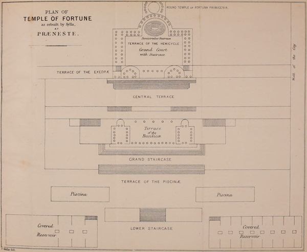
The original foundation of the Temple of Fortuna Primigenia at Præneste is
lost in obscurity; but the ancient polygonal substructions which support
it show that it was a very large temple even in early times.
Cicero in his description of the Prænestine lots, calls it a splendid and
ancient temple, and Valerius Maximus speaks of it as the most celebrated
oracle of Latium at the end of the first Punic war.
The original extent of the temple appears to have included only that part
of the lower town, which lies between the modern streets of the Corso and
the Borgo, and the ancient city principally lay on the side towards the
citadel. But after Sylla had rebuilt the temple, its precincts reached as
far downwards as the modern Contrada degli Arconi, and upwards to the
Contrada Scacciato behind the baronial palace. The whole of this space was
filled with a gradually ascending series of flights of marble stairs and
terraces, arranged in a pyramidal form, at the summit of which stood the
tholus or round temple of the goddess, 450 feet above the lowest terrace.
The base of this pyramidal approach was 1275 feet broad, and the upper
terraces gradually diminished in width. The temple faced the south, like
those of Diana at Aricia, of Juno at Gabii and Lanuvium, and of Jupiter
Capitolinus at Rome. The modes of construction found in the ruins are
referred by Nibby to four different epochs—the polyhedral stonework of
the primitive temple, which was incorporated in the buildings of the new;
the squared stonework of the time of the Punic wars; the structures
composed of smaller polygonal stones erected by Sylla; and the brickwork
of the imperial times. There were five principal terraces or platforms
rising one above the other. Nibby calls these the terrace of the cisterns,
the terrace of the halls, the central terrace, the terrace of the
recesses, and the terrace of the hemicycle. In front of the lowest terrace
was a large open space on which the boundary of the sacred precincts was
marked out by stone landmarks, some of which have been found on the spot.
This open area was on the right of the Contrada degli Arconi, which takes
its name from the arches still remaining. The sides of the area were
bordered by two immense reservoirs. One of these is still entirely
preserved, but the other is filled with rubbish. On the side of the open
area towards the hill were twenty-nine arches, five of which in the centre
projected, forming a kind of portico with fountains in niches, while the
other twenty-four completed the sides towards the reservoirs. The style of
these arches seems to indicate that they were built by Sylla as an
addition to the older temple precincts. One arch on the left hand, and all
the twelve on the right, still remain intact. They were probably used as
rooms for the slaves belonging to the temple.
Reservoirs.
The two reservoirs, as may be seen by the brickwork of which they consist,
were added after Sylla’s time. They served to collect and keep the water
which flowed from the fountains of the upper terraces, and to distribute
it to those parts of the city which lay below the temple. The western
reservoir, which can still be seen, is one of the most remarkable of such
edifices now extant. It is 320 feet in length and 100 in width, and is
divided internally into ten compartments, in the same manner as the Sette
Sale at Rome, each communicating with the next to it by three apertures,
and each lighted by two openings in the roof covered with circular
well-mouths of stone. The interior walls of this reservoir are covered
with the finest cement. On the exterior to the south, the walls are
decorated with niches, one of which, with a square head, was intended to
contain the inscription stating the names and titles of the builder of the
reservoir.[149] The brickwork, which is similar to that of the Prætorian
camp at Rome, and the fact that an inscription dated A.D. 18, when
Tiberius was consul-designate for the third time, has been found near,
seem to point to Tiberius as the builder. On the western side there are no
niches, but a doorway, with a stair leading down to the bottom of the
reservoir, and ornamented with two brick half-columns of the Doric order.
Terrace of cisterns.
From the area between the reservoirs just described, two staircases built
by Sylla ascended to the level of the first principal terrace 1275 feet in
breadth, containing two large basins for water, of rectangular shape, each
250 feet by 90 in size. They were intended for the purpose of the
ceremonial ablutions commanded by the religious rites of the temple. That
on the western side can still be seen in the Barberini garden, though it
is now filled with rubbish. The rim or edging of these basins was of white
mosaic.
Terrace of halls.
Above this terrace two flights of stairs conducted to the next principal
esplanade, which was of the same length as the first, but narrower. At the
back of this esplanade, against the side of the hill, stood two
magnificent halls, with an open area between them. The eastern hall is now
entirely destroyed, but that on the western side, now serving as the
kitchen of the modern seminario, is partly preserved. The front, which may
be seen near the cathedral in the Piazza Tonda, was decorated with four
Corinthian half-columns, the capitals of which still remain in their
original position. The interior had seven recesses on each side, separated
by half-columns and pilasters, and probably intended for statues. In front
of the side recesses ran a low wall or podium, ornamented with triglyphs
like a Doric frieze. These decorations are executed in a style which Nibby
considers equal to that of any of the ancient Doric buildings now extant.
At the end of the hall there was a large rectangular recess, with niches
for statues. In the easternmost of these recesses was found the celebrated
Prænestine mosaic, now in the Barberini Palace at Palestrina. The rest of
the floor was composed of white mosaic work. Between the fronts of the two
halls ran a row of columns, three of which still stand in their original
positions in the wall of one of the chapels near the cathedral, and at the
back of the area between them was a corridor with nine windows, some of
which may still be seen in the court of the seminario.
Central terrace.
Above the terrace of the halls rose the central grand terrace, supported
by a great wall of polygonal masonry, which at the point called the
Rifolta still stands at its full height. This terrace is now occupied by
the Contrada del Borgo. On the eastern side it reached to the wall of the
city, where the ancient gate, now closed, near the Porta Portella, stands.
Two lofty arches stood, one at each end of the back of this terrace,
containing fountains and statues.
It was upon this level, according to Nibby, that the original temple
stood, before the alterations made by Sylla.
Terrace of Recesses.
The whole of the two uppermost terraces were the work of the great
dictator. They were supported by walls of opus incertum, and the lower of
them contained two large semicircular recesses, for the accommodation of
the persons who came to consult the oracle. Hence it may be called the
terrace of the recesses. The eastern recess is still remaining under the
name of the Grotta Petrelli. It is supported in the interior by four
Corinthian columns, and the roof preserves the traces of decorative
designs in bronze. It is probable that the chamber in the centre, between
the two recesses, was the spot where, as Cicero narrates, the mysterious
Prænestine lots were originally discovered by Numerius Suffucius, and
where the statue of Fortuna, mentioned by him, stood. On each side of the
recesses were arched chambers, probably appropriated to the priests of the
temple and the interpreters of the lots.
Terrace of Hemicycle.
Above the terrace of the recesses, rose that of the Hemicycle. This was
divided into two parts, the lower consisting of a great rectangular
sacrificial court, with porticoes surrounding it, and the upper, of a
semicircular recess, somewhat similar to those which existed in the fora
of the emperors at Rome, having at the back of it a smaller raised terrace
on which stood the actual ædes, or shrine of the goddess Fortune. This
must have been the place where, according to the legend as told by Cicero,
the olive-tree which yielded honey grew, from which the casket was made
for the Prænestine lots.
Fragments of an inscription which are still visible on the frieze,
surmounting two arched chambers under the hemicycle, seem to show that
this part was rebuilt by the civic officials and the municipality, but at
what period is not discoverable. No traces are now left of this part of
the building except the ground-plan of the hemicycle, which may be
traced in front of the Barberini Palace, and a few columns belonging to
the portico of the great square court. These stand in the public prison,
and the house of the sacristan of S. Rosalia.[150]
The ancient town extended to a considerable distance beyond the precincts
of the temple. Outside the Porta S. Francesco of the modern town, at about
the distance of half a mile, are two huge reservoirs, similar to those
described as placed at the foot of the Temple of Fortune; and in the
Contrada degli Arconi is the cistern of an aqueduct. This, with other
ruins near it, belonged to that part of the town founded by Sylla, which
extended to a distance of a mile and a half from the lowest terrace of the
great temple.
The forum of the city lay between the western reservoir of the temple, and
the churches of S. Lucia and S. Madonna dell’ Aquila. This is inferred
from numerous inscriptions, and some commemorative pillars and altars
found there. The Prænestine Registers of Verrius Flaccus were found in the
Contrada delle Quadrelle, a mile and a half from this spot. They may,
however, as Nibby suggests, have been moved from the forum, where we
should naturally expect to find them.
(D) OSTIA AND PORTO.
Ostia.
Ostia is fifteen miles distant from the Porta di S. Paolo of Rome. The
site of the old town is plainly discernible by the hillocks of rubbish
with which it is covered, and the ruined brick walls which protrude here
and there.
On approaching from the modern village, which is half a mile nearer Rome
than the ruins of the old town, we pass between lines of tombs on each
side of the road, similar to those which have been excavated at Pompeii.
The tombs are very closely packed together, and of different sizes and
shapes. On the left-hand side, two sarcophagi remain, with the names of
Sex. Carminius Parthenopæus Eq., and T. Flavius Verus Eq., and a
terra-cotta inscription on the tomb of Flavia Cæcilia, priestess of Isis
at Ostia.[151]
At the end of this street of tombs, the gate of the city has been laid
bare, and its foundations can be easily traced together with those of a
guard-house on the left-hand side, having a rude tabula lusoria marked on
the pavement, where the soldiers whiled away their time at some game
resembling skittles.
The street which is then entered passes between the ruins of private
houses, without anything more remarkable about them than a few common
mosaic pavements and two fountains. The principal public buildings which
have been excavated, are, I. The house of the priests of Mithras, in which
a well-preserved altar still stands with the inscription:
C CAELIVS . HERMAEROS
ANTISTES . HVIVS . LOCI
FECIT
II. The Thermæ, consisting of a large court, and several smaller side
rooms for vapour-baths, with mosaic pavements of various designs. These
baths may possibly be the lavacrum Ostiense of Antoninus Pius. The stamps
on the bricks are said to be of the Antonine era.
III. A large rectangular brick edifice with three windows on each side. In
the interior are the remains of ornamental niches, Corinthian capitals,
and a marble cornice. The walls have rivets upon them, by which it appears
that they were covered with a marble casing, and the magnificent block of
African marble which serves as the threshold shows that the building was
of a costly description. Traces have been found of a front chamber with a
portico of grey granite columns. Whether this was a temple or not is
uncertain, but it has been supposed that the arrangements in the interior
would agree with such a supposition. The masonry may be assigned to the
age of Trajan or Hadrian. The name of Vulcan has been usually given to
this temple, which was at one end of the ancient forum. Many excavations
have been made here within the last ten years, and some valuable works of
art have been discovered, and numerous stores and shops of various kinds
have been uncovered.
IV. The ruins of a theatre supposed by Nibby to be that mentioned in the
Acta Martyrum, near which S. Quiriacus and S. Maximus, and S. Archelaus,
and a number of others were martyred. It is built partly of yellow and red
brickwork, and partly of opus reticulatum, and apparently belongs to the
restorations and additions made by Hadrian to the city.
V. The ruins of an extensive building, probably an emporium, on the bank
of the river near Torre Bovacciano. In this place a great number of works
of art were discovered by Fagan in 1797, showing the magnificent
decorations with which the building was ornamented; and several
inscriptions with the names of Severus and Caracalla found here are given
by Nibby.[152]
Grove of the Arval College.
Fiumicino at the present mouth of the Tiber, and Porto which stands at the
site of the ports formed by Claudius and Trajan, may be reached from Rome
by steamer down the river, or by carriage. The road which leads to
Fiumicino and Porto leaves the city walls at the Porta Portese, and at
about the fifth milestone reaches the celebrated grove of the Dea Dia,
where the worship of the great collegiate priesthood of the Fratres
Arvales was carried on. The railway to Civita Vecchia crosses the road at
this spot, to which the modern names of the Monte delle Piche and the
Vigna Ceccarelli are given. Discoveries of inscriptions had been made here
since the year 1570, but no formal collection of them was made until the
publication of Marini’s great work in 1785. No effective investigations
were, however, carried on until April 1868. The remains of a Christian
cemetery were then disinterred on the slope of the hill above the Vigna
Ceccarelli, where many of the marble tablets upon which the Arval Brothers
had inscribed their records were found to have been used in the graves in
lieu of coffins and as gravestones. One tomb was covered with a slab
containing the records of the year A.D. 155, and numerous fragments of
inscriptions were found scattered in all directions. The cemetery was
ascertained to have been adjacent to an oratory founded by Pope Damasus
(A.D. 1048), and a subterranean catacomb was found to have been formed,
which is mentioned in the Acta Martyrum as the Cemeterium Generosæ. The
inscriptions obtained from this spot refer chiefly to the year A.D. 90,
but some fragments belonging to the years 38, 87, and 59 were also found.
These inscriptions are of great interest both archæologically, as
containing authentic particulars about the worship of the Arval Brothers,
and the places at Rome or elsewhere in which it was held, and also
historically, since many of them give the titles of eminent persons, or
fix the dates of consuls and other ministers of state, and enable us
thereby to correct and compare the statements of Tacitus and Suetonius
with those of Dion Cassius. Many points of mythology are also illustrated
by the mention of the divinities whom the college worshipped in their
ritual.
An instance of the value of these inscriptions in determining the relative
accuracy of Dion and Suetonius is afforded by the inscription belonging to
the year A.D. 39, which gives us some historical facts about the reign of
Caius, a portion of Roman history rendered difficult and obscure by the
loss of the central books of the Annals of Tacitus. Suetonius states that
the title of Augusta was conferred on Antonia by Claudius, whereas Dion on
the contrary attributes the conference of this title to Caius. The
inscription decides the question in favour of the account of Dion Cassius.
Again, the date of the recognition of Caius by the Senate is fixed by the
same inscription as having occurred on the 18th of March, and not on the
16th as recorded by Tacitus and Suetonius, nor the 26th, as Dion Cassius
states. Many other interesting corrections or elucidations of the Latin
historians will be found in Henzen’s learned treatises, or in his articles
in the ‘Annali dell’ Instituto’ for 1867, and the ‘Hermes’ 1867. Besides
the grove of the Arval College, which was an extensive wood, four
buildings are mentioned in the Records—the Ædes Deæ Diæ, the Cesareum,
the Tetrastylon and the Circus.
With regard to the position of these, Pellegrini is of opinion that the
Circus was situated on the ridge of the hill on the western side of the
Vigna Ceccarelli, in which place some remains apparently belonging to a
circus have been found. Henzen leaves the site of the Circus
undetermined, thinking that there is not sufficient evidence. The
Tetrastylon and the Cesareum were supposed by Mommsen to have been names
of the same building, but Henzen thinks that they are mentioned as
separate places in the same inscription. The college feasts and meetings
were held in one or other of these, which must therefore have been large
enough to contain, besides the dining hall, an assembly-room, as the
Brothers are said to have met there and to have sat in rows of seats. The
Cesareum was a quadrangular building, as the form of the inscriptions
which were attached to its walls seems to show, since they could not have
been placed on a round surface. The temple of the Dea Dia stood upon a
hill, for the priests are described as ascending in order to perform the
sacrifices, and descending afterwards. Yet there are no vestiges of a
building upon the top of the hill. Henzen therefore concludes that the
ruins of the round building, upon which the modern Casa rustica in the
Ceccarelli vineyard is placed, must have belonged to this Ædes. It was not
decorated with columns but with Corinthian pilasters, and the inscriptions
were affixed to the interior until the year 81, when it became necessary
from want of space to place them on the pedestals of the columns.[153]
Porto.
Beyond the site of the Arval Chapel, the road passes by the relics of the
papal palace of La Magliana, and then along a causeway six miles in length
to Porto. The site of the ancient Portus Trajani on the right branch of
the Tiber is now occupied by the town of Porto, mainly consisting of the
cathedral, the Villa Pallavicini, and some farm buildings. The sea has
here continuously receded for many centuries, and the river deposits of
sand and marl have extended. Fiumicino at the present mouth of the river
is two miles distant from Porto, and its site was entirely covered by the
sea at the time when Claudius, and Trajan after him, constructed their new
ports. The large marshy tract to the north of Porto marks the site of the
port of Claudius. The hexagonal basin of Trajan lies between this marsh
and the town of Porto.
It is not at all clear when the right arm of the Tiber, or rather the
canal which now serves for communication between the sea and the Tiber
proper, assumed its present shape. Inundations and occasional repairs and
alterations have changed its course, and the constant retreat of the sea
must have lengthened it considerably.
Nibby’s opinion is that, besides the large harbour, Claudius constructed
an inner basin between the harbour and the old course of the river. Into
this basin he cut a canal from the bend of the river near modern Ostia,
and thus allowed the superfluous waters of the Tiber to escape through the
harbour, and at the same time gained a supply of water for his docks. The
inscription found in 1837, and now placed by the roadside near the Villa
Pallavicini, alludes to this canal. The words of this inscription seem to
show that the primary object of the canal was to supply the port with
water, and that the advantage of preventing inundations at Rome was only
secondary. Trajan probably enlarged and reconstructed the inner basin of
Claudius, and surrounded it with the massive quays and warehouses, the
ruins of which still remain. This inner basin is referred to by Juvenal.
At the same time the canal was probably enlarged, and it is to this
enlargement that Pliny alludes when he speaks of the canal formed by the
most provident of all emperors.[154]
Ruins at Torre Paterno.
Passing from Ostia along the sea coast through the woods of Castel Fusano
to Torre Paterno, we find the ruins of a large villa, which have been
supposed by some to belong to Pliny’s Laurentinum. But they are more
probably the relics of an imperial villa mentioned by Herodian as the
retreat to which Commodus withdrew, by the advice of his physicians, at
the time of the great plague in Rome, in the year 187. The neighbourhood
of Laurentum was recommended, says the historian, on account of its being
cooler than Rome, and also because it was shaded with large woods of
laurel and bay trees, the strong scent from which was supposed to
counteract the influence of the deadly malaria which was devastating the
capital.[155] The present ruins at Torre Paterno consist of brick walls
in two styles, one of which Nibby refers to the age of Nero, and the other
to the reign of Commodus or Severus. The central building, which contained
the grand suite of rooms, is the only part where work of the first
century, analogous to that of Nero’s buildings at Rome, is to be seen; the
rest, says Nibby, is composed of various courtyards in the style of the
Antonine era, which have been altered and partly concealed by later modern
edifices. On one side of the ruins are two large cisterns, supplied by an
aqueduct which comes from the Tenimento la Santola. The brickwork of this
is apparently contemporaneous with other works which we know to have
belonged to the age of Commodus or Severus as having very thin bricks and
a great quantity of mortar. Near these reservoirs is an enclosed space
which was probably a courtyard or garden of a rectangular shape. On the
north side it has some ruins in the mode of construction called opus
mixtum of the fourth century; and on the east is the principal part of the
villa built of large and thick triangular bricks, with thin layers of
mortar beautifully laid, and evidently of an early date. On the west there
is a large dining-hall looking towards the sea, like that described in
Pliny’s Laurentinum. Various other rooms and the foundations of a tower
can be traced on the sites occupied by the modern guardhouse and the
Chapel of S. Filippo.[156]
(E) TIBUR.
The Via Valeria or Tiburtina leading to Tivoli, the ancient Tibur, now
leaves Rome at the Porta S. Lorenzo. Traces of the polygonal pavement of
the old road can be seen at intervals along the modern road to Tivoli,
especially between the eighth and ninth milestones, and here and there
elsewhere. In the Basilica of S. Lorenzo, a mile from the gate, are many
ancient fragments of architecture. The Ponte Mammolo, by which the Anio is
crossed at three and a half miles from Rome, is modern and there are
scarcely any relics of the old bridge. Here and there on the road are the
naked cores of tombs, but nothing of any interest offers itself to an
archæologist until the Aquæ Albulæ are reached. Some few remains of an
ancient building, which may have belonged to the Thermæ here, have been
discovered. They are now built into the walls of a modern farmhouse. These
ruins may have belonged to the Thermæ of Agrippa, which Augustus
frequented.
The ancient quarries of travertine mentioned by Strabo, whence the stone
of the Coliseum came, lie on the right of the road beyond the Solfatara,
and the modern quarries on the left. The road then crosses the Anio over
an ancient bridge still called the Ponte Lucano, from Marcus Plautius
Lucanus, a Tiburtine magistrate, whose memory is preserved in an
inscription discovered upon the ancient fourteenth milestone on this road.
The bridge was originally composed of three travertine arches, of which
the one next to the left bank remains entire. The central arch has been
restored with masonry of the sixth century, similar to that in the Ponte
Nomentano and the Ponte Salario. The arch on the right bank was restored
in the fifteenth century, and the whole bridge was repaired again about
1836. This bridge was broken down by Totila when he was encamped at Tibur,
and Nibby thinks that he destroyed the middle arch, which was then
restored by Narses.
Tomb of the Plautian family.
Just on the other side of the bridge is the tomb of the gens Plautia, well
known from numerous paintings and photographs. It is very similar to that
of Cæcilia Metella on the Appian Road, and to the Mausoleum of Hadrian, in
its main features. A cylindrical tower of travertine, based on a square
foundation, and capped with a cone, was the original design, but a
mediæval tower built upon the top now disfigures it.
Two inscriptions placed in a projecting front with Ionic pilasters record
the names of M. Plautius Silvanus, consul with Augustus in the year B.C.
2, and his son Ti. Plautius Silvanus, prefect of the city in A.D. 73. A
third inscription, which is now destroyed, commemorated a P. Plautius
Pulcher. The longer inscription is given with notes in Wilmann’s Inscr.
Lat. No. 1145. The person whose memory it preserves was the pontifex who
officiated at the rebuilding of the Capitoline Temple in A.D. 70, as
recorded by Tacitus.
Hadrian’s Villa.
Beyond the Ponte Lucano to the right are the ruins of Hadrian’s great
Tiburtine Villa. They occupy the slopes of a hill of volcanic tufa, which
may be called an outlying part of Monte Affliano, extending for about
three miles in a direction from south-east to north-west. The various
levels afforded by the ground have been formed into terraces adapted to
the buildings they were intended to support by means of substructions,
which in some places are of vast solidity and gigantic height. “From these
terraces,” says Nibby, “the views are most varied and picturesque. On one
side the horizon is bounded by the pointed heights of the Montes
Corniculani, and by the ridges of the Peschiatore, the Ripoli, and the
Affliano, and on the other, the eye ranges over the gently undulating
expanse of the Ager Romanus, from which rise the towers of the Eternal
City; while beyond, the long streak of light reflected from the waters of
the Etruscan and Laurentine Sea seems to encircle the whole with a silvery
zone. The situation of the villa is open to the healthy breezes of the
west wind, but is sheltered by the mountains from the fury of the north
wind, the piercing chills of the north-east, and the unwholesome hot
summer blasts of the south.”
The high ground on which the villa stands rises between two valleys, which
may be called from their position the north and south valleys. They run
down into the plain through which the Anio cuts its bed. The northern
valley has been artificially altered, with the view of increasing its
picturesque appearance, by cutting the sides so as form perpendicular
cliffs of reddish stone. The tints of these rocks, the soft verdure of the
plants and trees which grow luxuriantly upon them, the bright colours of
the wild flowers scattered here and there, and the lovely hills which rise
as a screen behind them, give this valley such a character of soothing and
enchanting retirement and beauty, that it has been universally regarded as
the spot to which the name of the Vale of Tempe was given by the emperor.
The southern valley is less deep and bold, and from its monotonous and
severe aspect it may perhaps have been the spot where Hadrian placed his
imitation of the infernal regions.[157]
The brook which runs at the bottom of the northern valley (Fosso dell’
Acqua Ferrata) has received the name of the Peneius from antiquaries, and
that in the southern valley is called Fosso di Risicoli by the modern
inhabitants. These streams are now very scantily supplied with water, but
in ancient times, when the villa was watered by a constant flow from its
aqueducts, they must have been of considerable volume. The ruins, now
overgrown with clumps of cypress and other trees, extend for a space of
seven miles in circumference, and in the middle ages were known as Tivoli
Vecchio, from a vague and unfounded idea that the ancient city of Tibur
stood here. It has been remarked that the Coliseum is strikingly
characteristic of the Flavian emperors who planned and executed it, and
with equal truth it may be said that the Tiburtinum of Hadrian gives a
marvellous picture of the many-sided genius of the great man who was at
once the ruler of the whole known world and had travelled throughout his
vast domains from Britain to the Euphrates, organising and controlling
everywhere, and at the same time showing an appreciation of and value for
literature, philosophy, and the fine arts, which was generally foreign to
the Roman character. Hadrian constructed in his villa at Tibur a panorama
of all the sights which had struck him most in his world-wide travels, in
order that he might in this realm of enchantment, when no longer able to
travel, have the sights and thoughts in which he had taken such pleasure,
revived for his imagination to feed upon. Considering the size and
magnificence of the place, which almost resembles a town in its vast
extent, it is surprising that so few notices of it should be found among
the Roman historians and biographers. Dion Cassius, or rather his
epitomiser Xiphilinus, does not even mention it, and Spartianus and
Aurelius Victor pass it over without such special remark as we should
expect. As, however, a great part of the building consisted of the
familiar Thermæ, stadia, theatres and gymnasium, which were constructed in
every large Roman villa, they were perhaps not noticed, as matters of
course, and only the peculiarities of the villa were recorded. After
Hadrian’s return to Rome at the end of his last journey to the East in
A.D. 135, he resigned the care of the empire to Lucius Ælius Verus and
retired to this villa, which had probably been built during his absence,
and may have been begun in 125 when he returned to Rome from his first
journey, and finished during the last three years of his life from 135 to
138.
This opinion as to the date at which the villa was built is confirmed by
the stamps found on the bricks, which range from the year 123 to the year
A.D. 137, and that the ruins belong to Hadrian’s villa is sufficiently
attested by universal tradition, and by the number of statues of Antinous,
and other works of art found here unquestionably belonging to the reign of
Hadrian.
The ruins contain specimens of almost every kind of construction. The most
ancient part is a wall of opus incertum, composed of small polygonal
fragments of tufa, which stands near the Casino Fede. This wall is
probably a remnant of some older villa rustica or farmhouse which occupied
the site before Hadrian’s time, and may have belonged to the gens Ælia. It
apparently belongs to the first half of the first century B.C. The most
common mode of construction is opus reticulatum, with squares of tawny
coloured tufa cut in the valley adjoining and bonded at the corners with
blocks of the same rock, or with red bricks. In those parts of the
buildings, which require great durability from being exposed to the action
of water, brickwork is used throughout. The Greek theatre and parts of the
academy are built of small squared blocks of tufa, or in some cases of
irregular fragments of tufa resembling the later opera Saracenesca. These
are sometimes strengthened with bands of reticulated work. In most cases
the outer covering of the walls has been removed, especially where it
consisted of marble slabs. Some of the stucco ornaments are still very
beautiful and well preserved.
Each part of the buildings is complete in itself, but they do not seem to
have been arranged on any general plan, and now that the roads which
conducted from one part to another have disappeared, they present a
confused mass which requires some careful attention to unravel. I have
been obliged to confine myself to a very general and cursory account of
each main feature. To notice every detail would be far beyond the compass
of this book. In Ligorio’s plan 334 different parts of the villa are
marked and separately described, and he spent a year in his investigation
of the ruins.
Spartianus gives us the names of the Lyceum, the Academy, the Prytaneum,
the Canopus, the Pœcile, the Tempe and the Inferi as the parts of the
villa made by Hadrian in imitation of their foreign originals. To these
Ligorio has added the name Cynosarges found upon a brick stamp. The sites
of the Canopus, the Pœcile, the Academy, Tempe, and the Inferi may be
said to be ascertained with tolerable certainty, but those of the Lyceum
and Prytaneum have not been discovered.
The other names given by antiquarians to the different buildings are
generally founded upon some definite evidence drawn from their shape and
situation, and are probably upon the whole fairly applicable. They are the
Theatres, the Palæstra, the Nymphæum, the Library, the Imperial Palace,
the Hospitals, the Stadium, the Camp, and the Thermæ.
Proceeding from north to south, the ruins may be divided, for the
convenience of description, into ten grand groups—A, the Palæstra,
including the Greek and Latin Theatres and the Nymphæum; B, the Pœcile;
C, the Guards’ Barracks; D, the Library; E, the Imperial Palace; F, the
Stadium; G, the Thermæ; H, the Canopus; I, the Academy, including the
third theatre or Odeum; K, the Inferi. In giving these general divisions,
some attempt is made to represent the parts of the villa as they were in
Hadrian’s time. The ruins are in such different states of
preservation—some being entirely destroyed and the ground-plan barely
traceable, while others are almost entire—that their real relative
importance is completely obscured. The modern alleys and walks also create
much confusion, and render the recognition of the ancient arrangement much
more difficult.
The ancient grand entrance to the grounds was at the north-western end of
the ruins, on the road towards Tibur, about a quarter of a mile beyond
the Ponte Lucano. It seems to have consisted of two large pedestals of
white marble, between which the carriage-road passed, and which were
pierced with arched passages for the footways on each side. One of these
is still traceable in the Vigna Gentili, and has the remains of a
bas-relief upon it, while the other has been destroyed, and its
corresponding bas-relief placed in the Villa Albani at Rome. This gateway
has been imitated by the architect of the gateway at the old Villa
Borghese. It is erroneously called a tomb by Piranesi and Ligorio (see
Piranesi, Ant. Rom. tom. ii. tav. 39.)
The modern entrance to the ruins is at the gate of the Villa Braschi, and
leads, through an avenue of cypress-trees, in a direction at right angles
to the ancient road of approach. The avenue runs across a space which was
formerly a large quadrilateral court, 350 feet by 250 feet, surrounded
with porticoes, attached to the theatre which stands a little to the side
at the end of the avenue. The ancient road from the Ponte Lucano entered
this court at the northern angle. The porticoes have now nearly
disappeared, but part of them was remaining in Ligorio’s time. They served
the same purposes as the great colonnades behind the Theatres of Pompey
and Balbus at Rome. The theatre is an oval building, sunk in the slope of
the rising ground, the southern side containing the seats for spectators,
and the northern being occupied by the orchestra and scena, which has a
stage in the form of a long and narrow parallelogram. The plan corresponds
exactly to the description by Vitruvius of a Greek theatre, and has,
therefore, been called the Greek Theatre by the antiquaries. The Greeks
had the orchestra wider and the actual stage much narrower than the
Latins. Fragments of the travertine substructions of the scena still
remain.
At some distance from this theatre, towards the east, and on the other
side of the stream which runs along the Valley of Tempe, is the Latin
Theatre, so called because the stage is much broader than that of the
theatre just described. Externally it was surrounded with arched porticoes
decorated, like the Theatre of Marcellus at Rome, with half-columns,
There were probably two tiers of these arches, corresponding to the two
divisions of seats. At the sides of the scena there were rooms for the use
of the actors and for the machinery, and behind the scena are three rooms,
probably corresponding to the three doors in the wall behind the stage.
The spectators’ seats are turned towards the south, contrary to the rules
of Vitruvius.
Between the two theatres there is a natural rise in the ground, which has
been further heightened by the rubbish heaped upon the spot. The ruins
here occupy a space in the form of a trapezium, the largest side of which
lies towards the north-west, and the shortest towards the south-west. They
are now covered with modern buildings belonging to the Villa Braschi.
Palæstra.
The northern angle of these ruins shows the remains of a quadrilateral
area surrounded by a covered way; and at the eastern angle there is
another smaller court, surrounded with a portico, which has a double row
of columns on the south-west side. This court is called the Palæstra by
Ligorio and Piranesi, and it is supposed by them that the double portico
was intended to be used in bad weather, when the athletes could not take
their exercise in the unsheltered part of the court. Several statues of
athletes, the colossal bust of Isis, now in the Museo Chiaromonti, and a
statue of Ceres, were found here. There is a suite of rooms on the
north-west side, intended, perhaps, for anointing-rooms, dust rooms, or
sparring-courts. On the southern side there is a spacious recess, with
niches for statues, and attached to it are two large halls, in the form of
a Greek cross, with small recesses at the sides, still retaining some
marks of their ancient decorations in stucco and paint. The western angle
of these ruins is conjectured to have been the site of the Xystus or
covered Palæstra, a cloistered court, with a small square opening in the
centre.
The ruins of the Nymphæum lie on the south side of the Palæstra, and are
connected with it by some chambers in which the stucco ornaments are still
well preserved, and show what elegance of design and workmanship was
bestowed even on the inferior parts of the villa. The curved basin of the
Nymphæum can be traced, though it is now overgrown with trees, and some of
the niches still covered with stucco-work remain. The western side of one
of the adjacent rooms, now used as a granary, is ornamented with niches,
and Nibby thinks that this, which was the back of the Nymphæum, was
arranged so as to present a fountain supplied from the main pipe of the
aqueduct. A similar arrangement, he says, may be seen in the remains of
the Nymphæum at Ampiglione. The great vase now at Warwick Castle came from
Hadrian’s Villa.
Pœcile.
The Pœcile lies to the south of the Nymphæum. Between them is a
reservoir and the remains of a fountain belonging to some building now
entirely destroyed.
Castra.
The Athenian Pœcile, of which this is an imitation, was a portico, the
walls of which were decorated with the paintings of Polygnotus and Micon.
From the description given of it by Pausanias, the Athenian building
appears to have been a portico with three sides at least, on one of which
the battle of Oenoe was represented; on the second, and longest, the wars
of Theseus against the Amazons, and the council of the Greek chiefs after
the capture of Troy; and on the third, the battle of Marathon. It thus
appears that one of the sides was much longer than the others; and this is
the case with the ruin in the Villa of Hadrian, which has three sides,
one, 640, on the north, and the others, on the east and west, each 240
feet in length. In Ligorio’s time, 1550, a part of the porticoes, which
were of brick, still remained, and some of the paintings corresponding to
the Athenian pattern. It is not certain whether there was a similar wall
and portico on the southern side. The wall of the northern side, which is
the longest, still remains entire. It had a portico on the exterior, which
terminated in two circular buildings; and in the centre was the principal
entrance to the Pœcile. The present entrance is modern. Both the
eastern and western sides are slightly curved. The former contains a
recess in the centre connected with the buildings behind. In the centre
was an open reservoir of the same shape as the building surrounding it. On
the western and southern sides the area of the Pœcile is supported by
substructions of masonry, against which are built a number of soldiers’
rooms commonly called the Cento Camarelle. At the corner towards the
south-west is a public washhouse, the tubes of which are still in good
preservation.
Attached to the north-eastern corner of the Pœcile is a fine building,
in the form of a recess, with a semicircular niche turned towards the
north, which, from the connection of the Stoic philosophy with the Stoa
Pœcile at Athens, has been called the Temple or School of the Stoics.
It was possibly a hall for conversation and discussion.
Library.
Opening from this school, towards the north-east, is a building in the
form of two concentric circles. Between the two circular parts there was a
canal filled with water. This edifice was probably a swimming-bath. It
appears to have been very highly ornamented with precious marbles and
sculptures, most of which were taken to Rome by Cardinal Alessandro
Farnese, and others to Tivoli by Cardinal Ippolito d’Este. The ruin
commonly goes by the name of Theatrum Maritimum. A little farther to the
north-east is a quadrilateral court, 200 feet wide, which was surrounded
by a portico with Corinthian columns. On the north-west side of this court
are the buildings usually supposed to belong to the library, and called
the Greek and Latin libraries. They consist of a large number of rooms,
more or less preserved, which may have been ante-rooms and chambers for
the attendants and librarians. In the centre of the north-western side of
the court is a well-preserved Nymphæum, and on the north-east a long
corridor with windows towards the south, which may be called a Helio
Caminus, or room for basking in the sun, from its resemblance to the place
so called by Pliny at his Laurentine villa. The ruins to the north-east of
these, towards the Valley of Tempe, are thought by Nibby to be the remains
of a suite of rooms belonging to one wing of the imperial palace, but
their plan is very imperfectly known.
Palace.
The great mass of the imperial apartments were farther to the south-east,
and were grouped round three large courts of dazzling magnificence. The
most splendid of those, which afforded spoil for generations of
plunderers, is called by Piranesi, from the richness of its decorative
work, the Piazza d’Oro. Round the courts were numberless suites of rooms
and several large recesses, a basilica, and a great hall now called Eco
Corintio, formerly supported on vast granite columns, and cased with slabs
of the choicest marbles.
Stadium.
The Stadium lies in a direction at right-angles to the southern side of
the Pœcile. The curved end is towards the south. Between the
swimming-bath and the northern, or square end of the Stadium, are some
bath-rooms for the use of the athletes, and on the west side stands a
temple surrounded by a sacred enclosure formed by two vast semicircular
walls ornamented with niches. On the eastern side are more rooms, and a
magnificent quadrilateral covered way.
Thermæ.
The Thermæ stand between the Stadium and the Canopus. Numerous pipes and
conduits for water, and also the arrangement of the various parts of the
buildings, show that they have been rightly placed here. There seem to
have been two distinct sets of bath-rooms, which are generally called the
Terme virili and the Terme muliebri by the Italian antiquaries. The
northern group of buildings is connected with the curved end of the
Stadium, and contains the usual number of halls and an elliptical
Laconicum. The Laconicum of the southern wing is circular, and is
connected with a grand central hall similar to that in the Baths of
Caracalla at Rome.
Canopus.
The place called Canopus lies to the south of the Thermæ, and close to a
mass of buildings now utterly destroyed, but in Piranesi’s time thought to
be a vestibule of the villa. The Canopus itself consists of an oblong pool
of water or euripus excavated in the tufa, with a row of buildings on the
west side, and a magnificent nymphæum at the southern end, containing a
great number of niches for statuary, and holes for jets of water. At the
back of the Nymphæum is a hall called the Sacrarium, in which it is
supposed the statue of Serapis stood. A passage of Strabo explains the
idea which Hadrian had in forming this canal and Nymphæum. He says that on
the grand festival of Serapis, whose temple and oracle were at Canopus,
120 stadia from Alexandria, immense crowds of men and women go down to
Canopus from Alexandria by boats on the canal, on the banks of which are
pleasant houses of entertainment, where the worshippers stop on their way
to feast and dance.[158] The long, broad pool was intended to represent
the Canopic canal, and the rooms ranged along the side, the houses of
refreshment. A confirmation of this is derived from the character of the
statues found here which were almost all those of Egyptian deities.
Academy.
To the south-west of the Canopus rise the immense substructions, 1755 feet
in length, which supported the highest terrace on this side of the villa.
They extend as far as the square tower called Rocca Bruna in Ligorio’s
plan. This terrace and hill are supposed to have been the imitation of the
Athenian Academy mentioned by Spartianus. There was a gymnasium here, the
ruins of which are to be seen in a vineyard at the southern end of the
hill, consisting of a large court, a circular temple, and a large recess.
Beyond these there was a large square block of buildings supposed by Nibby
to have been used for the students and masters of the School of Art
maintained by Hadrian, and beyond this again was a spacious Odeum or
theatre for musical performances. The raised seat of this is now converted
into a vineyard, but the stage is still well preserved. There were, as in
the Odeum of Catania, two divisions, and at the top of the central
division was a round temple dedicated to the presiding genius of the
Odeum; just as in the Theatre of Pompey the Chapel of Victory stood above
the seats.
Close to this Odeum are the vast subterranean passages supposed to be the
Inferi which Spartianus mentions. The depth at which these lie is only
fourteen feet, but they occupy a trapezoidal area, the longest side of
which is about one thousand and fifty feet, and the shortest two hundred.
Most of these corridors are excavated like catacombs in the natural rock.
A brick stamped with the name Cynosarges was found near the aqueduct which
runs to the south of the Inferi. There are two other names found in
Spartianus, the Lyceum, and the Prytaneum, and Piranesi identifies the
Lyceum with a ruined portico at a little distance to the south of the
Inferi, and the Prytaneum with some more extensive ruins to the
south-east.
After Constantine’s time, the Villa of Hadrian remained in a desolate
state, and was abandoned to the caprices of the imbecile Cæsars, who
tormented the empire in the fourth and fifth centuries, and to occasional
visits from the plundering hordes of Goths, Vandals, and Heruli, who
successively ravaged the neighbouring country. In the middle of the sixth
century it was completely pillaged and ruined. In the Gothic wars of
546-556 Totila took Tibur after a siege of some months, and revenged
himself for the resistance of the Isaurian garrison by putting all to the
sword without sparing even the bishop. At the same time Totila broke down
all the bridges on the Anio. During that long siege, the Villa of Hadrian
with its enormous halls, its vast ranges of rooms, and its advantageous
and commanding site at the junction of several roads, offered convenient
quarters to the barbarian king and his host. It may be imagined what
devastation such tenants would inflict upon the place. In the sixth
century the villa fell more and more into ruins; to the disasters of the
Gothic wars were added those incurred during the Lombard wars under
Astulf. The Lombards were a more savage horde than the Goths, and their
object was to destroy the Roman empire utterly, and to divide Italy into
dukedoms. These barbarians attacked Rome many times, and ravaged the
Campagna, but Astulf distinguished himself above all the rest in these
incursions, massacring and burning everywhere without distinction. As we
hear that he was encamped near Tivoli, we may conclude that the Villa of
Hadrian suffered severely in or about the year 755.
The wars between emperors and popes, and the quarrels between the factions
in Rome itself which followed, injured Rome perhaps rather more than the
cities of the Campagna. But the greatest damage of all was done to the
villa by its being made the quarry whence the churches, the monasteries,
and the houses of the wealthy Tiburtines were decorated with marbles,
columns, and costly stonework, and when these were filled and could hold
no more of the innumerable marble sculptures and statues, they were
condemned to the lime-kiln and converted into mortar. After the revival
of letters and arts in the fifteenth century, the lamentations poured out
in the time of Pius II. (A.D. 1458) over the ruins of the villa are most
pathetic. “The lofty vaults of the temples are still standing, and the
wonderful columns of the cloisters and magnificent porticoes. The
swimming-baths and Thermæ can be traced, where the water of the Anio once
mitigated the summer heats. But the hand of time has defaced all these,
and the walls once draped with embroidered tapestry and cloth of gold are
now clad with ivy; the thorns and briar grow where tribunes sat in purple
robes, and serpents crawl, in their kings’ chambers.” In spite of the
existence here and there of such love of antiquity, the burning of the
Tiburtine marbles into lime continued throughout the sixteenth century,
and the levelling of the ground for cultivation has gone on even to the
present century.[159]
The same fate attended all the other grand monuments of the Campagna.
Rutilius Numatianus, writing probably in 417 in the reign of Honorius,
speaks of the buildings of Rome and the aqueducts of the Campagna as if
they were still uninjured, but he prefers to return to his native home in
Gaul by sea, on account of the bad state of the roads on the coast caused
by the Gothic devastations.
Tibur.
Ascending from Hadrian’s Villa to the point where the Anio issues from a
valley dividing the Æquian from the Sabine Mountains, we find the river
winding round a considerable hill, partly clothed with groves of olive,
and rising to the height of 830 feet. At the back of this hill the river
has forced a passage for itself through the limestone rocks which threaten
to impede its exit from the upper valley, and falls in a tremendous
cataract down a precipitous cliff of 320 feet in height to the lower
level. The water is strongly charged with carbonate of lime, which is
constantly being deposited in the shape of masses of travertine in the
channels through which the stream runs, especially where the water, in
consequence of the violent agitation caused by its rapid descent, parts
quickly with the carbonic acid gas contained in it. The course of the
stream is from time to time blocked up by its own formations of stone,
and it is forced to open new passages for itself. From this cause the city
of Tibur, which stands on the hill, close to the point where the river
falls to its lower level, has always been subject to violent and dangerous
inundations. The great inundation of 1826 proved so formidable that it was
at once resolved to divert the course of part of the river and provide it
with an artificial outlet. This was effected by boring two tunnels through
Monte Catillo on the east of the city, through which any rush of water can
be allowed to pass and fall harmlessly into the lower valley. A part of
the river water is always allowed to pass through these tunnels, and forms
at their lower end a magnificent cascade. Another part passes under the
bridge called Ponte S. Gregorio and then rushes through a fantastic grotto
of travertine blocks called by the local guides Grotta di Nettuno, and
joins the stream from the tunnels at the bottom of the valley. A third
portion of the Anio is diverted just above the bridge into canals
apparently of very ancient date, which, passing completely through the
centre of the town, are used as the motive power of watermills and
factories of various kinds, and then fall again into the main stream at
various points of the romantic cliffs on the western hill side. These form
the wreaths of “snow white foam” so celebrated as the cascades of the
Anio, and explain perfectly the expression of Horace:
O headlong Anio, O Tiburnian groves,
And orchards saturate with shifting streams.
But few traces of the ancient walls of the city are left. Nibby is however
doubtless right in saying that there can be no question about their course
along the northern and eastern sides of the city, where the brow of the
hill is steep and perfectly adapted for defence by a wall placed on the
edge of the rocky valley of the Anio. The citadel was probably situated in
the quarter called Castro Vetere—where the two temples commonly called
the temples of the Sibyl and of Drusilla stand, for it is plain that some
pains have been taken to isolate this from the remainder of the site. On
the western side the limit of the ancient walls is marked by the old
gate, and by the fragments of walls which still exist at the point where
the direct road from Rome enters the city by the modern Porta del Colle.
The course of the walls then excludes the Villa d’Este, and runs across
the hill to the Church of the Annunziata and the Porta Santa Croce and the
citadel built by Pius II. on the site of the ancient amphitheatre. From
thence the walls passed in a straight line down to the river near the
Church of S. Bartolommeo. The ancient town did not extend to the right
bank of the Anio.
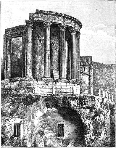
Temple of Vesta at Tibur.
Temple of Vesta.
Two ancient temples are still standing in tolerable preservation at Tibur.
The first of these is a small round temple perched on the very edge of the
precipitous ravine through which the Anio dashes. It has been protected
against the violence of the furious torrent by massive substructions,
which apparently existed in ancient times and have often been renewed. Ten
of the eighteen columns which formerly surrounded the inner chamber still
remain.
The details of this temple are rather peculiar in style, and show an
originality of invention very rare in Roman architecture. The columns have
Attic bases, but the grooves of the fluting are cut in a style which is
neither Doric nor Ionic. They terminate above in an abrupt horizontal
line, and reach at the foot of the column quite down to the base without
any intermediate cylinder. The capitals exhibit a fantastic variety of the
Corinthian order, having the second row of acanthus leaves nearly hidden
behind the first, and a lotus blossom as the decoration of the abacus. The
frieze is ornamented with the skulls of oxen and festoons, in the loops of
which are rosettes and pateræ placed alternately. The inner chamber, which
is built of opus incertum, is partly destroyed, but the lower half of the
door and a window still remain.
From the above description it will be seen that the architecture of the
temple appears to belong to the end of the Republican era, but the
inscription on the architecture gives us no further hint of the exact
date, as the whole of it: with the exception of the words L. CELLIO. L.
F., has disappeared. The most probable conjecture as to the deity to whom
it was dedicated is that based upon the fact that Vesta was worshipped at
Tibur, as is shown not only by two inscriptions found near the spot, but
also by the mediæval name of this quarter of the town. The form of the
temple also confirms such an opinion.
Temple of Albunea.
The second temple stands quite close to this round building, and is now
consecrated as the Church of S. Giorgio. Its shape was that of a
pseudoperipteral temple, i.e. with the side columns half sunk in the
walls, raised on a meagre base of tufa blocks. It had a front, with four
Ionic columns, one of which still remains, forming a support to the
Campanile. An inscription dedicated to Drusilla, the sister of Caligula,
was found here, but no reference as to the name of the temple can be drawn
from it. A bas-relief, also found on the spot, represents the Tiburtine
Sibyl sitting, and in the act of delivering an oracle. Hence it has been
thought that we have in the Church of S. Giorgio the Temple of the Sibyl
Albunea mentioned by Horace, Tibullus, and Lactantius, and this seems to
be the most probable of the various conjectures which have been hazarded
on the subject. The Grove of Tiburnus mentioned by Horace was probably on
the right bank of the Anio, but further than this it is impossible to
determine its exact position. There was also a grove dedicated to Diana.
The Mons Catillus, now Monte Catillo or Monte della Croce, is the height
on the right bank of the Anio. The name is at least as early as the time
of Servius.
Villas.
As may easily be imagined there are numerous remains of ancient villas
scattered about the immediate neighbourhood of Tibur, and the local
guides, in order to please travellers but without the slightest evidence
in support of their assertions, have dubbed them the Villas of Catullus,
Horace, Ventidius, Quintilius Varus, Mæcenas, Sallust, Piso, Capito,
Brutus, Popillius, and other celebrated Romans.
The most remarkable ruins are those to which the name of Mæcenas has been
attached. The greater part of these have been now unfortunately concealed
by new buildings and by an iron manufactory, but a fine terrace and parts
of the porticoes still remain on the lofty bank of the Anio. The rest is
a mere confused mass of vaulted chambers and archways. The Via Tecta, or
Porta Oscura, as it is sometimes called, by which the road passes
underneath these ruins, was built, as we learn from an inscription now in
the Vatican collection, by O. Vitulus and Rustius Flavos. The materials
and style show that it can hardly be of a later date than the first
century A.D.
Tempio della Tosse.
The Tempio della Tosse which probably obtains its name from a vulgar
interpretation of the name of the gens Tossia, is a ruin standing in a
vineyard at the side of the old road, called the Via Constantina, below
the Villa d’Este. It has none of the characteristic marks of an ancient
temple, and the large number of windows it contains forbid us to suppose
it to be a tomb. The interior of the building is round, the exterior
octagonal. It is built of layers of small fragments of tufa intermixed
with courses of bricks, materials which point to the fourth century as the
earliest possible date of its erection. On the walls are the remains of
frescoes of the Saviour and the Virgin, dating probably from the 13th
century. These show that, if it was not originally a Christian Church, it
was used as one at the time the frescoes were painted.
Villa of Cassius.
The ruins of a considerable villa lie near the Porta S. Croce of Tivoli,
in the estate called Carciano, from the mediæval name of the Fundus
Cassianus, which is stated in a list of the estates belonging to the
cathedral at Tivoli to have been the site of a villa of Caius Cassius.
Part of these ruins consist of a very ancient structure of polygonal work,
but the rest is pronounced by Nibby to belong to the time of the later
republic. The casino of the Collegio Greco is now built on the spot, but
the plan of the ancient villa can be so far traced as to show that it had
several terraces, and looked towards the south-west. In the 16th century
there were still eighteen large apartments existing, surrounded with a
portico of Doric columns, and also some temples, a theatre, some
fountains, and fish ponds. The opus reticulatum of these ruins is peculiar
for the alternate arrangement of coloured tufa in its lozenges. An immense
number of works of art were dug up here, and the nearly complete
destruction of what still remained of the villa in the 16th century, is
probably due to the fact of its having been found to be so rich a mine of
sculpture.
Sabine Farm of Horace.
The Sabine farm of Horace can hardly be passed over here, though it is not
strictly included within the district of Tibur. There is no evidence to
show that Horace ever had any villa at Tibur in addition to his Sabine
farm; indeed his own words seem expressly to imply the contrary. The
estate he had was plainly usually called a Sabinum, not a Tiburtinum, and
must therefore be looked for at some distance from Tibur. Horace mentions
two places in its neighbourhood, Varia, and Mandela, the sites of which
can be exactly determined. The ancient list of towns places Varia on the
Via Valeria, eight miles beyond Tibur, and precisely at this distance are
the remains of an ancient town now covered by the modern village of Vico
Varo. But the position of Mandela is more important for ascertaining the
site of Horace’s farm, because if we can fix upon it, we then can discover
to which of the mountain streams which flow into the Anio the name
Digentia belonged. An inscription dug up in 1757 near the Church of S.
Cosimato on the Via Valeria, two miles from the village of Bardella, shows
that an estate in the modern district formed by the union of Cantalupo and
Bardella was called in the later imperial times, or the early Middle Ages,
Massa Mandelana.
From this it is plain that the Digentia was the torrent called Mariscella,
which joins the Anio between Cantalupo, Bardella and Vico Varo, descending
from near Licenza, a small village about six miles from Vico Varo. As to
the exact spot where the farm of Horace itself stood in the valley of the
Digentia, we cannot be quite certain. The ruins usually pointed out are on
a little knoll opposite to the village of Licenza, and on the other side
of the stream. These are possibly situated on the spot on which the
farmhouse stood, if they do not date so far back as the lifetime of the
poet himself. Dennis in Milman’s Horace says, “The ruins consist only of a
mosaic pavement, and of two capitals and two fragments of Doric columns
lying among the bushes. The pavement has been much ruined by the planting
of a vineyard, and can only be seen on removing the earth which covers
it. The groundwork is white with a border of animals in black. These are
the sole traces now visible (1842), but some fifty years ago, the mosaic
floors of six chambers were brought to light, but were covered again with
earth, as nothing was found to tempt any further excavation. The farm is
situated on a rising ground which sinks with a gentle slope to the stream,
leaving a level intervening strip now yellow with the harvest. In this I
recognised the sunny meadow which, as the poet says, was in danger of
being inundated. The sunny fields were probably then, as now, sown with
corn. Here it must have been that the poet was wont to repose on the grass
after his meal, and here his personal efforts perhaps to dam out the
stream provoked his neighbours’ smiles.” The place is surrounded on all
sides by hills, except where the main valley of the Digentia separates
them, running nearly due north and south, so that facing down the valley,
the sun before midday rests on the right-hand slopes, and in the afternoon
on the left hand, thus corresponding exactly to the poet’s description of
the site.[160]
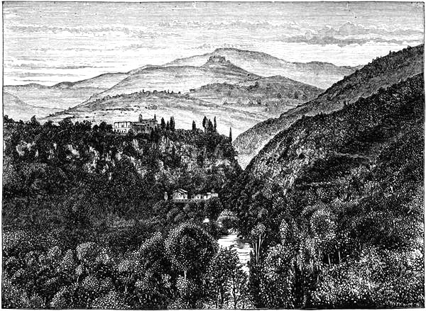
Vico Varo and Lucretilis.
The other spots mentioned by Horace as near his farm, are the Chapel of
Vacuna, the slopes of Ustica, and the mountain of Lucretilis. The first of
these has been placed by the Italian topographers at Rocca Giovane, a
village perched on a hill on the west side of the valley about two miles
above Cantalupo Bardella. The evidence for this identification is,
however, very doubtful.
The Ustica cubans of the poet is commonly with some probability supposed
to be La Rustica, which lies on the hill close to Licenza on the eastern
side of the valley. Lucretilis is probably a name applied to the whole
range of hills connected with Monte Gennaro. Cav. Rosa, however, places it
at Monte del Corynaleto just above Rocca Giovane. The name of Fons
Bandusiæ has been given to most of the springs in this valley by the
enthusiastic admirers of Horace, but it is quite uncertain whether the
Fons Bandusiæ was not in Apulia.
(F) THE NORTH-WESTERN DISTRICT.
The principal roads which traversed the Campagna to the north and
north-west of Rome are the Nomentana, the Salaria and the Flaminia.
These roads offer but little, within the bounds of ancient Latium, which
calls for remark.
The Via Nomentana diverged from the Via Salaria at the Collina gate in the
Servian walls, and passed through the Aurelian wall at a gate which now
stands a little to the south of the modern Porta Pia. The present road
follows the line of the ancient Via Nomentana, as may be seen by the ruins
of tombs which fringe it beyond S. Agnese. The Chapel of S. Constanza,
opposite S. Agnese, is an interesting building of the Constantinian epoch,
and the mosaics it contains, including a mixture of Christian and pagan
emblems, are very remarkable. The Mons Sacer stands just beyond the bridge
over the Anio, and the Villa of Phaon, where Nero ended his life, was at
the Vigne Nuove, on a side road which branches off to the right, just
beyond the Ponte Nomentano.
The Via Salaria is said to have been so named from the supplies of salt
conveyed along it to the Sabine district at the time when the Romans and
Sabines were confederates. It is first mentioned in history as the scene
of the single combat between Manlius and the gigantic Gaul. The ancient
road passed out at the Collina gate, and followed very nearly the same
line as the present road along the left bank of the Tiber, as may be seen
by the ruins near Serpentara, and by the position of the ancient bridge,
the Ponte Salaro, which carries it over the Anio close to Antemnæ. Beyond
this, Fidenæ and the Allia are the most remarkable points of interest upon
the road in the neighbourhood of Rome. Beyond Malpasso, the ancient road,
according to Nibby, diverges to the right, crossing the railway to Ancona.
The Via Flaminia, after passing through the Porta Ratumena at the Tomb of
Bibulus, left the Aurelian fortifications at the Porta Flaminia, which
stood a little nearer the slope of Monte Pincio than the present Porta del
Popolo. It ran to the right of the present street, and then crossed the
Tiber at the well-known Milvian bridge, and then diverged to the right
along the Tiber valley, while the Via Cassia ascended to the left among
the Etruscan hills towards Veii, which lay to the right at the twelfth
milestone. The old Flaminian Road lay closer to the river than the
modern, which is carried through a cutting in the hills and rejoins it at
Tor di Quinto. There are a few rock tombs on the left hand, between the
fifth and sixth milestones. One of them has been connected with the poet
Ovid by a mistaken inference drawn from the inscription found upon it
which bears the name of Q. Nasonius Ambrosius.
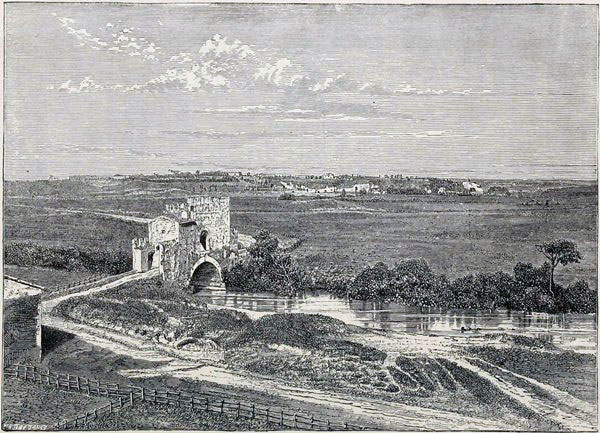
Ponte Nomentano.
The Ponte Molle, which derives its name from an unknown Roman Mulvius, or
from the neighbouring hills, carries the Flaminian Road over the Tiber at
a distance of two miles from the Porta del Popolo. Some of the foundations
of the bridge, and parts of the peperino and travertine stonework in the
smaller arches, are ancient. The victory of Constantine over Maxentius,
which is usually called the battle of the Pons Mulvius, was gained six
miles further along the road.
An inscription cut in a block of travertine has been fixed in the
right-hand parapet of the bridge. This inscription records the inspection
of the banks of the Tiber by the Censors of M. Valerius and Publius
Serveilius, who were Censors in the year B.C. 55.
Villa of Livia at Prima Porta.
One of the imperial villas of an early date was placed on the right bank
of the Tiber at the ninth milestone on the Via Flaminia in the Veientine
territory.
The Via Flaminia is here bordered for a long distance on the left-hand
side by tufa rocks of a reddish hue, whence the district had obtained, in
Livy’s time, the name of Saxa Rubra. The Cremera, now the Valca, is one of
the streams which enter the Tiber in this district, and beyond it, where
the road turns to the left, and, leaving the valley of the Tiber, ascends
the hill through a cutting, is the stream and hamlet of Prima Porta. On
the right of the road here, and between it and the Tiber, lie the ruins of
a large villa, the various terraces of which, raised one above the other,
occupy the whole of the top of the hill, and command magnificent views of
the Sabine and Æquian highlands. There can be no doubt that these ruins
are the remains of the villa of Livia called ad Gallinas, mentioned by
Pliny and by Suetonius as situated at the ninth milestone on the Via
Flaminia. The style of construction in the walls which remain corresponds
to that of the Mausoleum of Augustus in the Campus Martius. The
reticulated work has that peculiar irregularity about it which indicates
the transition from the opus incertum to the more regularly formed opus
reticulatum. Nibby had pointed out this spot in 1837 as one in which a
rich harvest might be reaped from excavating, but it was not till 1863
that the splendid Statue of Augustus, now in the Braccio Nuovo of the
Vatican with other interesting sculptures, was dug up here.[161]
At the same time some rooms were excavated at a depth of ten feet, under
the level of the ancient villa. They had apparently been closed at a very
early time and filled with earth, in order to erect a building over them.
The largest of these was apparently intended as a cool retreat during the
summer heats, and the walls are painted with trees and birds, in imitation
of a rustic bower. These paintings have attracted great attention as being
some of the most ancient now in existence, and also on account of their
intrinsic beauty, and the wonderful way in which they have preserved their
freshness of colour. The pavement of this painted room was of marble,
which was, however, removed when the earth was thrown in at the time of
building the rooms above.
The legend about this villa connects it with the death of Nero, relating
that the laurel bushes and the white fowls, for which the villa had been
celebrated since the days of Livia, withered and died out during Nero’s
last days.
Veii.
Beyond Prima Porta, to the west, is the site of Veii. This is about twelve
miles from Rome, and now bears the name of Isola Farnese. But little
remains of the ancient city have been found, but no doubt is now felt by
antiquaries that the city occupied the rocky ground between the Cremera
and the Fosso de’ due Fossi.
Inscriptions bearing the names of some Etruscan families, especially the
Tarquitii, have been found here, and the remains of the ancient citadel,
on the spot now called the Piazza d’Armi, are mentioned in some old
ecclesiastical documents.
One of the gates must have been at the spot now called the Porta de’ Sette
Pagi as the road from Veii to Sutri probably passed out here, and another
gate was opposite Isola called the Porta dell’ Arco. A third may have
stood towards Fidenæ, where the ancient postern and flight of steps is
now to be seen, called La Scaletta. Other remains are to be seen near
the site of a gate called by Canina La Spezieria. The Ponte Sodo and the
tombs near it are worth attention, as is also the ancient Etruscan tomb
called the Grotta Campana, in which a most interesting set of sepulchral
ornamentations and cinerary urns has been preserved. The chief monuments
of Veii, which have been taken to Rome, are the Ionic columns in front of
the Post Office in the Piazza Colonna, the Statue of Tiberius, and the
colossal heads of Tiberius and Augustus, now in the Vatican Museum.[162]