(Winnipeg, Man., Can.)—Pembina—Grand Forks—Fargo—Wahpeton—(Watertown,
S. Dak.). US 81.
Canadian boundary to South Dakota Line, 256.5 m.
N. P. Ry. parallels route between Canadian border and Joliette;
G. N. Ry. between Hamilton and Fargo; Milwaukee R. R. between
Fargo and South Dakota Line. Winnipeg-Fargo route of Northwest
Airlines parallels route between Canadian border and Fargo.
Graveled roadbed except about 31 m. bituminous-surfaced.
Accommodations of all types in principal towns.
US 81 crosses North Dakota along its eastern boundary from
the Canadian to the South Dakota border, and passes through the
rich low valley of the Red River of the North, a wide level plain
that was once the bed of the great prehistoric Lake Agassiz. The
route parallels the Red River to Wahpeton, and the Bois de Sioux
River between that city and the South Dakota Line. Constantly
in sight to the left of the road are the heavily wooded river banks,
but except for crossing several timbered tributaries the route runs
through almost unbelievably flat green fields, broken here and
there by an occasional farmstead.
During the early settlement of this region the Red River provided
transportation into the newly opened Northwest, and beside
its course slow-moving trains of creaking oxcarts preceded the
steamboat into the new land. It was in the Red River Valley that
the first white settlements in the State were made. Here in the
last quarter of the nineteenth century flourished the bonanza farms—those
huge land tracts entirely devoted to the growing of wheat
that earned for this valley the title of "the bread basket of the
world." Today the Red River Valley produces many other crops—potatoes,
sugar beets, alfalfa—in addition to wheat. Its natural
endowments of rich soil and good rainfall combine with the man-made
facilities of transportation to constitute the most prosperous
section of North Dakota.
US 81 crosses the Canadian border 64.5 m. S. of Winnipeg,
Can.
PEMBINA (Chippewa, highbush cranberry), 3 m. (792 alt., 551
pop.), named for the berries that lend their flaming color to the
nearby woods in autumn, is the cradle of North Dakota white
settlement. Here, at the confluence of the Red and Pembina Rivers,
the earliest trading posts and the first white colony in the State
were established. Charles Chaboillez, representing the North West
Co., built the first fur post on North Dakota soil on the south
bank of the Pembina River within the present site of Pembina in
1797-98. Rudely constructed and of short duration, it had already
disappeared when Alexander Henry, Jr., also of the North West
Co., came up the Red River in 1800. The following year he built
a post on the north side of the Pembina, and in the same year
both the XY and the Hudson's Bay Co. opened posts at the mouth
of the river. The three competing companies, with their free rum
and unscrupulous trading, brought about a lawless social condition
in the new settlement. Drinking bouts and brawls were continuous
as the Indians were plied with liquor by the conscienceless traders,
who excused their conduct on grounds of competition.
It was during this time that the first child of other than
Indian blood was born on North Dakota soil. The child was not
white, but Negro, the daughter of Pierre Bonza, Henry's personal
servant. The first white child in the State was born at Henry's
post in 1807, the illegitimate son of the "Orkney Lad", a woman
who had worked at the post for several years in the guise of a
man. Her imposture was not generally known until the birth of
her child, after which a collection was taken up and she and the
child were sent back to her home in the Orkney Islands.
During the middle of the nineteenth century Pembina was the
rendezvous for white and metis hunters, and the town was the
starting point for the great Pembina buffalo hunts (see Side Tour
5A).
The fur trade brought some white settlers to this area, but it
was not until 1812 that systematic colonization was attempted. In
that year William Douglas, Earl of Selkirk, brought a group of
dispossessed Scottish peasants to the Red River Valley to farm under
an agreement with the Hudson's Bay Co. Untrained for the rigors
of frontier life, and persecuted by the fur traders of the rival
North West Co. who did not want settlers in their lucrative area,
many of the Selkirk colonists moved to Canada in 1818 after establishment
of the international boundary defined Pembina as United
States soil. The next 30 years saw a slow influx of settlers into the
Red River Valley and by 1851 Pembina had become a fairly important
river port. In that year Norman Kittson, a fur trader,
was named postmaster, the first in North Dakota; and Charles
Cavileer, for whom the town and county of Cavalier were later
named (see Tour 5), was appointed collector of customs at Pembina.
Cavileer became postmaster in 1852, and, as under his influence
newcomers arrived to farm, the fur trade declined and
there developed the first permanent agricultural community in the
State.
Pembina appears from a distance more like a grove of trees
than a town. Most of its buildings are old, reflecting the rococo
architecture of an earlier day.
On the Red River at the eastern end of Rolette St. is Masonic
Park, where a marker commemorates the site of the first Masonic
lodge in the State, organized at Pembina in 1863. Each year, both
on July 1, which is Dominion Day (the Canadian holiday similar
to the U. S. Independence Day) and on July 4, the flag of the
United States and the Canadian Union Jack fly together from the
park flagpole, a practice illustrating the neighborliness of the border
States and Provinces. The Canadian flag is a gift of the Masonic
Grand Lodge of Manitoba.
The highway crosses the Pembina River, which in dry seasons
is likely to appear more like mud than water. Left on the highway
is Pembina State Park (good water, firewood, kitchens, and
tables), which includes the site of the Chaboillez trading post.
A bridge over the Red River connects Pembina with St. Vincent,
Minn., situated on US 59 (see Minn. Tour 17).
At 4 m. is the PEMBINA AIRPORT (R), airport of entry
operated by the Northwest Airlines. It is on part of the former
military reservation of Fort Pembina, established in 1870. The
reservation was turned over to the U. S. Department of the Interior
in 1895 and sold at public auction. The fort was situated
a mile and a half S. of the city of Pembina on the Red River.
JOLIETTE, 14.5 m. (796 alt., 100 pop.), is a French-Canadian
community named for Joliette, Quebec.
At 16.4 m. is the junction with ND 44, a graveled highway
and an alternate route of shorter distance between Joliette and
Manvel (see below).
Left on ND 44 is BOWESMONT, 8.6 m. (794 alt., 125 pop.),
named for William Bowes, the first storekeeper. It lies on the
level land just W. of the Red River, its treeless streets more like
a western North Dakota prairie town than the usual Red River
Valley village. The story is told that Bowes won the opportunity to
name the town in a game of cards. Bowesmont was first built on
the banks of the river, but settlers experienced great hardships
when the stream overflowed its banks each spring, and the buildings
were moved.
Near Bowesmont in the spring of 1860 occurred an event illustrative
of the hardships suffered by the missionaries to this region.
The Rev. Joseph Goiffon, assistant at the Pembina Catholic Mission,
returning from a trip to St. Paul, left his party behind in an effort
to reach the mission in time to conduct a certain Mass. A driving
rain had been falling and this suddenly turned to a swirling snowstorm.
In a short time the ground was covered with six or seven
inches of snow, and the driving wind made it impossible for him
to continue. The blizzard did not abate, and in two days his horse
had died from exposure and his own legs had frozen so that he
was unable to walk. For five days he remained on the prairie,
living on the flesh of his horse, until the storm subsided and a
passer-by heard his feeble cries for help. It was found necessary
to amputate parts of both legs, but in spite of this he returned
to the Pembina mission, and was later transferred to St. Paul and
Mendota, where he served until his death in 1910.
DRAYTON, 18.5 m. (800 alt., 509 pop.), first known as Hastings
Landing, was given its present name by settlers who came west
from Drayton, Ont., Canada. In contrast with its neighbor Bowesmont,
Drayton is situated directly in the timber on the banks of
the Red. Its 42-acre city park is unusual in that it lies in another
State, across the river in Minnesota. The bridge leading to the
park is also unusual; it is a drawbridge, built in 1911, when the
high stage of the Red aroused hope of reviving steamboating. After
the bridge had been completed the river stage fell, and has never
risen, so that the draw has not been lifted since it was built.
Drayton is an active sports town, especially interested in curling,
and 10 teams compete in the large enclosed rink each winter.
Left on ND 44 to ACTON HALL, 29.5 m., a community building.
On ND 44 to the junction (R) with a graveled road, 36.5 m.
In a triangle formed by the junction is a CRUCIFIX. On a base of
natural boulders, in summer the clear, marble-like whiteness of
the cross and canopied figure stands out in contrast with the green
of the surrounding countryside.
At 50 m. is the junction with US 81 (see below).
HAMILTON, 24.5 m. (830 alt., 151 pop.), also a Canadian settlement,
is named for Hamilton, Ont. The oldest State bank in
North Dakota, organized in 1886, is operated here. The Pembina
County Fair, established in 1894, is held here (June or July) each
year. In Hamilton is the junction with ND 5 (see Tour 5).
In GLASSTON, 31.5 m. (843 alt., 70 pop.), named for Archibald
Glass, first postmaster, and ST. THOMAS, 37 m. (846 alt., 595 pop.),
named for St. Thomas, Ont., are the homes of many retired farmers.
The latter is also a potato and sugar-beet shipping center.
AUBURN, 46.5 m. (848 alt., 50 pop.), was larger than its neighbor
GRAFTON, 52.5 m. (833 alt., 3,136 pop.), until the latter became
a railroad junction. Named by early settlers for Grafton
County, N. H., Grafton is on the Park River in the center of a
rich farming area. It was the first city in this part of the Northwest
to maintain a municipal light plant, and had the first public
library in North Dakota, established by a women's club in 1897.
A Spanish-American War Memorial, one of the few in the State,
is on the Walsh County Courthouse grounds. On a hill W. of the
town is the Grafton State School for the feeble-minded. Opened
in 1904, the institution in 1937 had 778 inmates and a faculty
and staff of 110. The grounds, including the school farm, cover
20 acres.
Left from Grafton on ND 17, a graveled highway, to the junction
with ND 18, 10 m.
Right on this highway 8.5 m. is HOOPLE, (901 alt., 325 pop.),
one of the largest primary potato-shipping points in the State.
More than a thousand carloads of Red River Valley potatoes are
loaded here each year. The town is named for Allen Hoople, an
early settler. U. S. Senator Lynn J. Frazier, former Governor of
the State (1917-1921), lives on a farm NE. of here.
On ND 17 is PARK RIVER, 16.5 m. (1,000 alt., 1,131 pop.), on
the Park River, probably named by early explorers for the buffalo
parks along the stream. The Indians had no weapons which were
effective on buffalo at long range, so they constructed corrals of
brush into which the animals could be herded for killing. Whenever
possible these corrals, which the first white explorers called
buffalo parks, were built near the bank of a river or edge of a
hill so that the buffalo would charge over the edge and be killed
or badly injured in the crushing fall. The Walsh County Agricultural
and Training School, secondary vocational institution,
is located in the town. In Park River are offices of the South
Branch Park River Project of the Soil Conservation Service, which
has a demonstration area of 51,000 acres in central Walsh County
on which contour farming and wind strip cropping are practiced.
Sinclair Lewis, the novelist, owns a farm 1 m. S. of Park River,
which he has never seen.
William Avery Rockefeller, father of John D. Rockefeller, the
late oil magnate, lived on a Park River farm for some time. In
1881 an elderly man who gave his name as Dr. William Levingston
homesteaded on a quarter section of land just E. of the town,
where he lived each summer for 15 years. He later purchased
an adjoining quarter, but the deed to this land was in the name
of Pierson W. Briggs, a son-in-law of William Rockefeller and then
purchasing agent for the Standard Oil Company. In 1895 George
W. Towle, former Park River banker, who transacted much of Dr.
Levingston's business, saw a picture of the senior Rockefeller in a
copy of McClure's Magazine, and recognized it as that of his
former client, Levingston. William A. Rockefeller was not a doctor,
but sold patent medicines and acted as a cancer specialist.
MINTO, 63 m. (826 alt., 565 pop.), originally settled by Canadians
and named for an Ontario town, is now a Czech and Polish
settlement. The Feast of St. Wenslaus, September 28, and Czechoslovakian
Independence Day, October 28, are occasions of festivity.
Minto is situated on the Forest River. There is a park by the
stream S. of the town (swimming pool, recreational area, and
campgrounds.)
ARDOCH, 69 m. (830 alt., 110 pop.), also named for an Ontario
town, is now predominantly Polish. Lake Ardoch, a large artificial
lake constructed as a water conservation and migratory
waterfowl project, adjoins the town on the E.
At 80.5 m. is the second junction with ND 44 (see above).
MANVEL, 81.5 m. (826 alt., 183 pop.), is named for Gen. A. A.
Manvel of the G. N. Ry. Originally known as the Turtle River
station, it was one of six stops on the Fort Abercrombie-Fort
Garry trail in the 1860's. The stage station was a crude log hut,
roofed first with prairie sod and later with a thatch of weeds
when the rain washed the sod away. The hut had one window
and one door. Cooking was done on a fireplace made of clay
dobes or hand-made bricks. For meals, served on an improvised
table, the traveler paid 50 cents, and for the same price he had
the privilege of sleeping on the dirt floor. These stations were
comfortable, however, in the coldest weather, with great fires
roaring in the fireplaces to warm and cheer the traveler.
At 92.5 m. is the junction with a graveled road.
Left on this road to the GRAND FORKS SILVER FOX FARM,
2 m. (visitors allowed Jan. 1-June 1; arrange with manager).
About 200 pair of foxes are kept at the farm each winter.
Left at 93 m. is a stone memorial marking a point on the old
RED RIVER OXCART TRAIL between St. Paul, Minn., and Fort
Garry (Winnipeg), Canada. During the late summer and fall most
of the traffic through the region was on this trail. It was first
used by traders at Fort Garry to transport furs to St. Paul. The
exact route is not known today, but it is believed to have run
through Grand Forks on 3rd St., turned S. at the present corner
of S. 3rd St. and Minnesota Ave., whence it followed approximately
the route of US 81 to the Lincoln Park golf course. Here it is
believed to have turned E. toward the river, which it followed to
Frog Point (Belmont, see below), and thence up the valley. Mr.
and Mrs. Charles Cavileer, pioneer settlers at Pembina, made a
romantic honeymoon journey to St. Paul on this trail in 1840.
At 93 m. is the junction with a graveled road.
Left on this road to the NORTHERN PACKING COMPANY
PLANT (open), 0.3 m., which in its 15-year existence (1937) has
purchased more than $20,000,000 worth of livestock.
At 93.5 m. (R) is the NORTH DAKOTA STATE MILL AND
ELEVATOR (open weekdays 9-5; conducted tours), a State-owned
plant. A product of the Nonpartisan League's industrial program,
this institution has played an important role in State politics since
its opening in 1922. As early as 1915 the Society of Equity and
the Equity Exchange had attempted to establish a State-owned
elevator, but had failed, and this failure hastened the formation
of the Nonpartisan League. By 1919 the league was strong enough
in the legislature to establish its industrial program, part of which
was a State mill and elevator. The State Industrial Commission
governs the mill and elevator. Managership is generally considered
a political plum. Whether or not the mill is a paying venture is
a perennially hotly debated question. Its opponents, taking into
consideration the original cost of the mill, an amount in excess
of $3,000,000, cannot see how it will ever pay for itself, while
those who favor its operation maintain that it makes a profit,
and assert further that the creation of a market within the boundaries
of the State is of invaluable benefit to the farmers. Salesmen
for the State sell the mill's product in eastern States, and
one of the accusations repeatedly hurled at the mill manager during
political campaigns is that Dakota Maid Flour retails at a lower
price in the East than in North Dakota.
A State law requires all official State documents to be stamped
"Buy 'Dakota Maid' Flour."
The mill and elevator consists of six steel-and-concrete fire-proof
buildings. The mill proper has three storage wings, and
contains three mills, each with a daily capacity of 1,000 bbl. The
elevator, equal in height to the average 12-story skyscraper, has
a capacity of 1,659,600 bu. Thirty-two storage tanks each have a
capacity of 50,000 bu. The elevator is operated independently of
the mill, which buys in the open market and pays a rental to the
elevator for storage space. In addition to Dakota Maid Flour the
mill manufactures cereals, oatmeals, and poultry feeds.
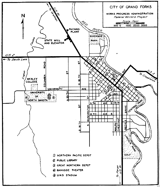
GRAND FORKS, 94.5 m. (834 alt., 17,112 pop.) (see Grand
Forks)
Points of Interest: University of North Dakota, Wesley College.
At N. 16th St. and Skidmore Ave. N. is the junction with
US 2 (see Tour 6).
At 105.5 m. is the junction with ND 15, a graveled highway.
Right on this road is THOMPSON, 2 m. (972 alt., 273 pop.),
the center of a large potato-farming area.
At 116.5 m. is the junction with a graveled road.
Right on this road is REYNOLDS, 2 m. (915 alt., 351 pop.),
named for Dr. Henry Reynolds, an early settler and temperance
apostle. The town is on the Grand Forks-Traill County line and
many of the residents have their business places in one county
and their homes in the other.
At 121.5 m. is the junction with a graveled spur.
Right on this spur is BUXTON, 1 m. (935 alt., 410 pop.), a
Scandinavian town named for Thomas Buxton, a business associate
of Bud Reeves, the town site owner. Reeves, active in State
politics, was one of the leaders in the drive to obtain funds for
maintenance of State colleges after veto of the appropriation bill in
1895 (see Side Tour 1A). When Reeves campaigned for election
to Congress on the Democratic ticket in 1894 he traveled over the
State in what was probably the first house trailer ever used here,
and one of the first used in the region. He had a log cabin built
on wheels, and in this he visited every part of the State, a large
cowbell attached to the cabin announcing his arrival in each town.
No mean patriot, during his speeches he had with him on the platform
the American flag and a live eagle.
Several important personages have been residents of Buxton,
including two Governors of the State, R. A. Nestos (1877-) and
A. G. Sorlie (1874-1928); U. S. Senator A. J. Gronna (1858-1922),
one of the six members of the Senate who opposed entrance of the
United States into the World War; and Dr. Lila M. O'Neale (1886-),
anthropologist and ethnologist who has engaged in research work
in Guatemala under the auspices of the Guggenheim Memorial
Foundation, and is now a faculty member at the University of
California.
At 123.5 m. is the junction with a dirt road.
Right on this road is BELMONT, 11.5 m., a ghost town which
in the 1870's was a booming river port known as Frog Point. It
was named by Capt. Sam Painter, one of the first Red River pilots,
on an early trip down the river, probably in 1860. Finding the shores
almost covered with frogs, he is said to have erected a rude sign
reading "Frog Point", and through the rise and fall of the town
which grew up there the name remained. In 1871 the Hudson's
Bay Co. established a trading post on the point. A year later,
because of the fall of the river, Frog Point became head of navigation,
and in short order was a rendezvous for boatmen, trappers,
hunters, teamsters, and drifters, all living in tents or hastily constructed
buildings. Teamsters hauling freight overland from the
S. in their heavy, eight-horse, high-wheeled "jumpers", and trappers
and Indians with their catches, here boarded the Hudson's
Bay Co. steamer International, and James J. Hill's Selkirk. The
town, cut from the woods on the bank of the Red, and towered
over by tall oaks, became a wilderness metropolis, and its reputation
spread to Europe. In England it was believed by many to be
a city of broad avenues and tall spires, second in size only to
Liverpool, and filled with the hum of industry. Foreign visitors,
traveling to Fort Garry, looked eagerly for this Red River capital,
and even their disillusionment on seeing the little backwoods city
could not dim its reputation. In its streets rough, rugged, heavy-booted
woodsmen, rivermen, and trappers thundered up and down
the wooden walks, and many a citizen was hastily despatched by
their 44's. Heavy-jowled saloonkeepers, slim-fingered sleek gamblers,
and gay dance-hall girls were all a part of the mushroom
town.
Nature brought downfall to the Point as quickly as she had
elevated it to importance. The river fell lower still, and Frog
Point lost its position as head of navigation. Many of its inhabitants
departed as swiftly as they had come. Fire wiped out a
number of buildings which were never rebuilt. Trade dwindled
and storekeepers shut up shop. Some 20 years later, with the
river level again up, the town revived as a grain-shipping center,
but the flood of 1897 ruined grain elevators and their contents,
and within a short time the bustle of the town again faded into
the past. Today the Hudson's Bay Co. building, which houses a
farm implement shop, is all that remains of the early affluence.
The present population of the hamlet, which is not even an organized
village, is 33.
CUMMINGS, 124.5 m. (935 alt., 84 pop.), named for Henry
Cumings, an early G. N. employee who helped build the railroad,
is principally a Scandinavian community. Originally spelled
with one "m", its name was misspelled so consistently that the
Post Office Department legitimized the misspelling by inserting
the second "m."
At 129.5 m. is the junction with ND 7, a graveled highway
(see Side Tour 1A).
HILLSBORO, 132.5 m. (907 alt., 1,317 pop.), named for James
J. Hill, the "Empire Builder" of the G. N. Ry., was platted in
1880 on the attractive Goose River. A bitter fight for the Traill
County seat was prominent in the early history of the town.
Neighboring Caledonia, on the Red River, had been the county
seat since organization of Traill County in 1875, but the routing
of the G. N. Ry. through Hillsboro gave that young city aspirations,
and in 1890 it came forward as a contender for the county
seat. The campaign grew heated, and Caledonia citizens carried
arms and posted guards around their village. To lead their defense
they organized a committee, whom Hillsboro residents dubbed
Tigers of the Jungle and Irreconcilables. The Tigers imported
Col. W. C. Plummer, a widely known professional standard bearer
who had served as campaign speaker in many parts of the country,
and whom James G. Blaine once called "one of the three best
political speakers in the United States." The colonel became the
leading figure in the county seat fight. He was an impressive
speaker, and the floods of oratory he loosed in behalf of Caledonia
were greatly enjoyed by his listeners. The majority of
them, however, apparently remained impervious to his arguments—when
the votes were counted Hillsboro enjoyed a 1,291 to 218
majority.
Woodland Park, a 25-acre recreational and tourist camp area
in the northern part of town, contains a log cabin, originally built
at Belmont, in which are an old-fashioned loom once used in weaving
the homespun clothing of a pioneer family, and other relics of
pioneer days.
Right from Hillsboro on a graveled highway to STONY POINT,
1.5 m., site of a camp used by pioneers freighting their supplies
overland from Fargo during early settlement of the region. The
camp site, situated on a sandy ridge left by the recession of glacial
Lake Agassiz, is marked by a large, pointed boulder 20 ft. in
diameter, which once served as a landmark. In early days it was
believed, from the manner in which the rock was situated in the
earth, that it might have dropped from the sky.
South of Hillsboro are many well-built farmsteads—some of
which were once part of bonanza farms—and four peaceful villages
which in bonanza days were busy wheat centers, but now lie
quietly basking in their memories.
GRANDIN, 146 m. (898 alt., 172 pop.), is the largest of these
towns. It was named for J. L. Grandin, one of the two Tidioute,
Pa., brothers who bought 99 sections of Red River Valley land and
farmed them under the bonanza system. Dividing their land into
1,500-acre farms, each with a superintendent and a foreman, they
harvested their first crop in 1878. They had 14,000 acres under
cultivation near Grandin, and 6,000 at Mayville. Before the advent
of the railroad the wheat raised on their land was hauled
on barges towed by the steamers Grandin and Alsop to Fargo, a
distance of 90 m.—overland Grandin is 35 m. from Fargo. The
Grandin farm was one of the earliest practical users of the telephone,
although whether the first in the State was installed on
this or the Dalrymple farm (see Tour 8) is in dispute.
GARDNER, 154.5 m. (891 alt., 108 pop.), named for the town
site owner, was founded in 1880 when the surrounding territory
was being developed as wheat country, but was not incorporated
village until 1929.
ARGUSVILLE, 161.5 m. (889 alt., 115 pop.), is believed to have
received its name from the Daily Argus, Fargo newspaper published
at the time of the town's founding in 1880.
HARWOOD, 169 m. (892 alt., 82 pop.), was named for A. J.
Harwood, a prominent Fargo real estate dealer who bought all the
town sites between Fargo and Grand Forks when the G. N. Ry.
was built.
At 179.3 m. is the junction with a graveled road.
Right on this road to HECTOR AIRPORT, 0.5 m., a U. S.
Department of Commerce A-1 field, land for which was donated
by Martin Hector, pioneer Fargo banker, in 1931. The buildings
include a city hangar of laminated truss-arch construction, completed
in 1936 under the Works Progress Administration.
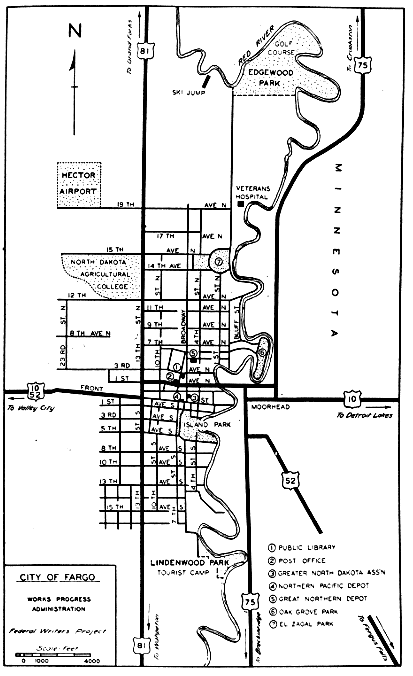
FARGO, 181 m. (907 alt., 28,619 pop.) (see Fargo).
Points of Interest: North Dakota Agricultural College, Veterans' Hospital,
Dovre Ski Slide.
At Front and 13th Sts. is the junction with US 10 (see Tour 8).
The WILD RICE RIVER, which the route crosses at 188 m.,
was named for the wild grain which formerly grew on its banks.
Near here, in a battle between the Sioux and Chippewa in 1807,
Tabashaw, a Chippewa chief, was slain while avenging the death of
his eldest son, who had been killed a short time before by the Sioux.
At 189 m. is the junction with a dirt road.
Right on this road is HOLY CROSS CEMETERY, 0.3 m., one
of the first cemeteries in the State, established in 1862. The first
burial here is said to have been that of a priest who had been
beheaded by an Indian. Another victim of frontier tragedy whose
body rests here was Archibald Montrose, a young English nobleman
who came to America to establish a home. He was found
frozen within a few rods of his own door during a blizzard in 1871.
His devoted young wife ordered a covered shelf built on the outside
wall of their cabin beneath her bedroom window, and had
his coffin placed there. In the spring, when the ground had thawed
sufficiently to permit the digging of a grave, she unwillingly consented
to the burial of her husband's body. Soon afterward their
baby daughter, born after the father's death, died also, and the
mother, her mind affected by the grief of her bereavements, joined
them in the nearby burial ground. For many years a large wooden
cross marked the spot where Montrose died.
WILD RICE, 191 m. (909 alt., 35 pop.), is the center of a
French-Canadian farming community.
HICKSON, 196 m. (915 alt., 100 pop.), is named for the Ole
Hicks family who were early farmers in the vicinity.
At 198.5 m. is the junction with ND 46, a graveled highway.
Right on this highway to a bridge crossing the SHEYENNE
RIVER, 9 m. On the bridge a tablet has been placed reading:
"Sibley Trail 1863. Sibley's Indian Expedition crossed the Sheyenne
at this point Aug. 20, returning from the Missouri to Fort Abercrombie."
At 9.5 m. is the junction with a graveled spur.
Right on this road to KINDRED, 1 m. (948 alt., 429 pop.), a
tree-shaded town named for F. E. and W. A. Kindred, surveyors
who platted the town site and later were large landholders in the
vicinity. The community is principally Scandinavian. An interesting
Collection (open by arrangement) of European museum pieces
and Indian artifacts is owned by Hjalmer Rustad of Kindred, and
is kept at his home.
ND 46 traverses a low range of sandy hills, the western rim
of glacial Lake Agassiz. At 19 m. is the junction with a dry-weather
dirt road. Left on this road at 26.5 m., just across the
river to the SHEYENNE RIVER PARK (central building of native
logs, spring-fed swimming pool, five picnic areas, cabins, and camp
sites), under development (1938) as a recreational center by a
Federal land utilization project. The park includes an area of
unusual scenic attraction. A road winds along the heavily wooded
river bottom, and side roads and graveled trails lead out of the
valley to the sand dunes which stretch away to the S. The great
plain here was deposited in glacial days, when the rushing Sheyenne,
then a large stream carrying the sediment-laden waters of
the melting ice sheet, flowed into Lake Agassiz. As the lake retreated
the sand was left to the winds, which pushed and whipped
it into dunes that dip away toward the horizon. Hummocks of
trees and shrubs appear like green islands in this wide sea of dull
brown. In some places, to combat the moving sand, elm and oak
bark has been laid lengthwise in the road to preserve the trail.
CHRISTINE, 204.5 m. (926 alt., 204 pop.), has a population 95
percent Scandinavian. When Christine Nilsson, the noted Swedish
operatic soprano, appeared in the United States in 1873, she was
honored by American Scandinavians, who named this town for her.
A Collection (open by arrangement) of pioneer implements, including
spinning wheels, brass kitchen utensils, and relics from
Fort Abercrombie, is owned by Dr. M. U. Ivers.
ABERCROMBIE, 212.5 m. (935 alt., 242 pop.), is a typically
peaceful small town on the banks of the Red River. The air of
serenity which lies over its tree-lined streets and substantial homes
is in decided contrast with the bustling activity of the settlement
which surrounded the pioneer post of Fort Abercrombie, first
Federal fort in North Dakota, built in 1858. It was named for
Lt. Col. John J. Abercrombie, officer in charge of its erection.
The most westerly outpost of the settlers' advance during the 1860's,
Fort Abercrombie became the gateway to the Dakotas. From here
expeditions set out to the unexplored plains of the Northwest, and
trains of settlers left by oxcart and covered wagons to seek homes
on the prairie beyond.
It was between Fort Abercrombie and Fort Garry that the
first steamboat to ply the waters of the Red River of the North
carried passengers and freight. Built in Georgetown in 1859, the
Anson Northrup, named for its owner, who hauled the machinery
overland from the Mississippi River, made its maiden trip to the
Canadian post the same summer.
Because of its position on the outskirts of the white settlement,
Fort Abercrombie was particularly vulnerable to Indian
attacks, and during the Minnesota uprising of 1862 was besieged
for five weeks by the hostile Sioux. The first attack, September
3, was repulsed with the loss of one man. At the close of this
encounter the defenders discovered that only 350 rounds of rifle
ammunition remained—- a supply had been ordered in the spring but
had not arrived. The ingenuity of the garrison was exercised;
canister shells for the 12-pound howitzers contained balls which
fitted the rifles, so the women in the fort were put to work opening
the canisters. The makeshift ammunition served its purpose
well.
The fort had no stockade; consequently, after the first attack,
the defenders threw up around the entire fort a cordwood breastwork
8 ft. high. In the meantime messengers had slipped through
the Indian lines to summon aid from Fort Snelling at Minneapolis.
On September 6 a force estimated at 400 warriors again attacked
the fort, but was driven back after a long fight in which two
soldiers were killed and many wounded. The Indians made no
more determined attacks on the fort, but continually harassed the
beleaguered settlers with desultory sniping until the arrival of
a detachment of 350 infantrymen from Fort Snelling relieved the
garrison September 23.
In November of the same year 10 acres of the fort reserve
were enclosed by a heavy oak-log stockade with blockhouses at
three corners, and about the same time a larger garrison was stationed
at Abercrombie. It was from this enlarged post that the
Sibley expedition set forth to punish the Sioux the following summer
(see History). The enlarged garrison was maintained until
the abandonment of the fort in 1877. During the 1870's Fort Abercrombie
was the point from which trails led W. to Forts Totten,
Ransom, Wadsworth, and Garry, and many a train of home seekers
or gold seekers spent a few days there before embarking on the
hazardous trip through Dakota.
Fort Abercrombie in 1870 was the scene of a treaty between
the Chippewa and Sioux, concluded through the influence of
Father J. B. Genin, a Roman Catholic priest. After this treaty
the eastern part of the Territory was comparatively free from fear
of Indian attacks.
Fort Abercrombie State Park, on the eastern edge of the
town, preserves 7 acres of the original 7 sq. m. of military reservation.
The park lies along the river, and its natural beauty makes
it a pleasant recreation center. An old cabin in the park houses
a collection of early-day relics. Nearby stands a Red River oxcart
whose wooden wheels once creaked over the old river trail before
the days of railroads and highways.
DWIGHT, 224 m. (959 alt., 104 pop.), was named for Jeremiah
W. Dwight, head of a large bonanza farm company organized here
in 1879, and was the home of John Miller, first Governor of North
Dakota. Miller was superintendent of the Dwight Farm and Land
Company, which operated 27,000 acres, and was established with
a cash capital of $150,000. The Miller Residence (private), former
home of the family, is R. of US 81 in the southeastern corner of
the village.
At 227.5 m. is the junction with ND 13, a graveled highway.
Right on this road is MOORETON, 7 m. (966 alt., 147 pop.).
Here is the headquarters farm of F. A. Bagg, one of the largest
landowners in the Red River Valley. He maintains three airplanes
in a hangar on his farm and supervises his holdings by air.
WAHPETON (Sioux, village of the leaves), 233 m. (969 alt.,
3,176 pop.), is at the confluence of the Bois de Sioux (Fr., forest
of the Sioux) and Ottertail Rivers, where the two streams meet
to form the Red River of the North. From 1871 to 1893 the town
was known as Chahinkapa (Sioux, top of the trees), an old Indian
name given this area by the Sioux who, coming from the W. to
fight the Chippewa, would here see the tops of the trees appear
over the level prairie.
Alexander Faribault, for whom Faribault, Minn., was named,
has told of visiting the present site of Wahpeton in 1810 when
3,000 Indians were encamped and engaged in hunting buffalo and
drying the meats for food. At that time the grasslands along the
Red River were black with bison, who summered on the grazing
lands here, and wintered on the uplands of the Missouri Slope W.
of the Missouri River.
That politics was a momentous vocation when Wahpeton was
a young county seat is indicated in this political advertisement in
an 1880 issue of the Richland County Gazette:
"Republicans of Richland County, please remember and vote
for me on election day. Come old and young, father and son, one
and all and vote for me. Do not look on money or on the rich
man but on an honest man. I have come to this lovely country
and have made my happy home and I will be a good citizen of
Richland County. You know I am a candidate for County Treasurer
of Richland County. Come and spend the whole day on election
day and vote for me. We are all brothers and sisters. It makes
no difference whether a man is rich or poor, if he is honest; then
he is a good man. Come all and see me on election day, in our
nice town of Wahpeton."
The Richland County Courthouse here, built in a modified
Classic style with a cupola, is considered a good example of the official
buildings in this State. The first floor exterior is of Kettle
River sandstone, with upper stories and dome of Bedford limestone.
Across the street from the courthouse is the Leach Public Library,
a light-colored brick and sandstone building presented to the city
in 1923 by Mr. and Mrs. O. A. Leach, Wahpeton residents since
1896. The library contains 14,000 volumes.
In the northern part of Wahpeton are the State School Of
Science and the U. S. Indian School. The science school is a vocational
institution and junior college with a trades educational
program that has received recognition outside the State. Near
the entrance to the landscaped campus is a cast bronze life-size
bust of the Norwegian poet-dramatist Henrik Ibsen, the work of
Jacob Fjelde, distinguished Norwegian sculptor who made his
home in Minneapolis from 1877 until his death in 1896. Another
portrait of Ibsen in Como Park in St. Paul, Minn., is also the
work of Fjelde; these are said to be the only statues of Ibsen in
the U. S. The bust at Wahpeton was a gift to the city and Richland
County from the Norwegian people of the county, and was
unveiled at ceremonies held on Norwegian Independence Day,
May 17, 1912. The figure stands on a tapering rough-hewn 8-foot
granite pedestal.
The Indian school consists of 40 red-brick buildings housing
300 students, mainly Sioux and Chippewa from reservations in
North and South Dakota and Minnesota. In addition to academic
work through the ninth grade, vocational training in farm methods
is taught the boys, while the girls receive instruction in home
economics and sanitation.
Chahinkapa Park, in the northeastern part of Wahpeton, lies
between the high banks of the old bed of the Red River and
the present channel, its inviting woods cut off from the mainland
by meandering lagoons. Improvements and recreational
facilities (swimming pool, playgrounds, athletic field) by Federal
agencies were completed under the Works Progress Administration
(1937).
Wahpeton was the home of the late U. S. Senator Porter J.
McCumber, who gained national recognition for his work on the
Fordney-McCumber Tariff Bill.
The route leaves Wahpeton by way of 2nd St., and for 5 m.
follows a winding course parallel to the Bois de Sioux. This
portion of the highway runs over a trail used in 1823 by the military
expedition of Maj. Stephen H. Long sent to establish the
Canadian boundary, and still later as a freight route between
St. Cloud, Minn., Fort Abercrombie, and Pembina in the 1860's
and 1870's.
FAIRMOUNT, 247.5 m. (985 alt., 611 pop.), named for Fairmount
Park in Philadelphia, Pa., was platted in 1887 until which
time it was known as Michigan Settlement because many of its
settlers came from that State. Of interest in the town is the
widely known Sermon in Stone, an obelisk erected in St. Anthony's
Roman Catholic churchyard by Rev. G. C. Bierens. Stones and
ores, some semiprecious, have come from all parts of the world
to be patterned into this bright-colored shrine. The Ten Commandments,
Faith, Hope, and Charity, the Trinity, the Sacraments,
and many other abstractions are symbolized in stone.
Father Bierens is an authority on bird life in the Red River
Valley, and operates a U. S. Biological Survey Bird Banding Station
(1937), one of the few in the State. Since he began the work in
1928 he has banded more than 10,000 birds, never less than 1,000
a year, and as many as 70 species in one season, not including
field and shore or water birds. In April 1935 he banded the first
European starling caught in North Dakota.
At the F. P. Nelson store in Fairmount is a Collection (open
by arrangement) of Indian artifacts and of firearms, including a
Chinese gun made in 1526.
Right from Fairmount on ND 11, a graveled road, is HANKINSON,
11 m. (1,068 alt., 1,400 pop.), named for R. H. Hankinson,
town site owner. Here are the Convent and Academy of the
Sisters of St. Francis, the mother house of the order in the United
States. This order was established in Germany in 1241. The convent
and academy, founded in 1927-29, are housed in a three-story
Renaissance-style building of tapestry brick trimmed in Indiana
limestone. In a niche over the entrance is a statue of St. Francis,
carved in Danube limestone by the Joseph Mueller Art Institute
of Munich, Germany, and donated to the order.
South of Fairmount the distant Coteau des Prairies is visible
(R). Back in these hills, which form part of the watershed between
the Gulf of Mexico and Hudson Bay, live the Sioux Indians
of the Sisseton Reservation, a triangular section of which juts into
the State from South Dakota.
At 256.5 m. US 81 crosses the North Dakota Line, 106 m. N.
of Watertown, S. Dak. (see S. Dak. Tour 10).
Junction US 81—Mayville—Portland—Hatton. ND 7 & 18.
Junction with US 81 to Hatton, 27 m.
G. N. Ry. branch line parallels route between Mayville and Hatton.
Graveled roadbed entire route.
Accommodations in principal towns.
This short route traversing a fertile farming area twice crosses
the Goose River, which the French Canadians who first explored
it called Rivière Aux Outardes (River of the Geese), because of
the great number of wild geese that nested on its banks. The route
proceeds along the western edge of glacial Lake Agassiz. The
rich, black soil—a sandless, clayey silt, peculiar to western States
and locally known as gumbo—becomes a muggy, sticky mass when
wet. Before the era of graveled highways, travel was virtually
impossible after even the lightest rainfall, as wagon or automobile
wheels became clogged with the heavy, gummy earth; even today
this is true on unimproved roads.
ND 7 branches W. from US 81 (see Tour 1) 5 m. S. of Cummings.
MAYVILLE, 12 m. (891 alt., 1,199 pop.), was named for May
Arnold, first white child born in the Hudson's Bay Co. trading post
established near the present town site in the early 1870's. It is a
small, tree-shaded, staid college town on the banks of the Goose
River. First settled in 1881, it was moved to the railroad which
was built through here in 1883. In that year Mayville and Portland
conspired to win the county seat for a new town, Traill Center,
platted midway between the two older towns, planning that if
their candidate won the election the three towns would merge
into one city. So brisk was the campaign that the ballots cast
outnumbered the legal voters, and Traill Center won 2,011 to 450.
The election was contested, however, and while the case was in
litigation the Territorial legislature transferred the two western
tiers of townships in Traill County to Steele County. This lost
Traill Center its strategic position and with it the county seat.
Mayville State Teachers College, in the northern part of the
town, founded in 1889, held its first classes in 1893. When Gov.
Roger Allin in 1895 vetoed funds for operating the colleges in
North Dakota, enterprising citizens kept the schools open by popular
subscription. Bud Reeves, wealthy Minneapolis man who pioneered
at Buxton and later became a political figure in the State
(see Tour 1), was one of the leaders in the drive for funds to
support the schools. In one day he collected $2,000 from heads of
large Minneapolis grain firms.
On the college campus is a log cabin built in 1879 and used
as the first schoolhouse in the Mayville area.
Alm's Park, on the eastern edge of the city, is a tourist park
and camp; Island Park, in the western part, is a recreational center.
Railroad Park, E. of the Great Northern depot, contains a
tall marble pillar on which is a bronze plaque bearing a relief
of Bjornstjerne Bjornson, famed Norwegian author. The plaque
is the work of Paul Fjelde, who once attended the Valley City
Teachers College (see Tour 8).
In Mayville is the home of Rev. and Mrs. A. M. West, parents
of the etcher Levon West (1900-), who has also won recognition
for photography under the pseudonym of Ivan Dmitri.
At the western end of the long business street of PORTLAND,
14.5 m. (987 alt., 500 pop.), is the gravel ridge of Campbell's Beach,
second hump of sand laid down in prehistoric times by the retreating
waters of Lake Agassiz. Portland has four producers and
consumers cooperatives—an oil company, elevator, creamery, and
store. Across the street from a large Lutheran church in the
western part of the town stand the now unused buildings of
Bruflat Academy, one of the first private educational institutions
in the State, established by the local Lutheran Church in 1889.
Portland and vicinity were first settled in 1871, and the place
became a boom town when the railroad arrived in 1881.
At 19 m. is the junction (R) with ND 18, a graveled highway
on which the route proceeds N.
At 24 m. is the junction with a county dirt road.
Left on this road to the THORVAL STAVENS FARM, 1 m.,
where the success story of an outstanding but nevertheless typical
Norwegian immigrant family is told by the buildings ranging from
the lowly sod house of Hans Anderson Stavensbraaten, who homesteaded
here in 1870, to the 15-room home and the airplane hangar
of his grandson, Thorval Stavens. The original family home and
its contents are preserved as a Museum. Across the road is the
first school in the district, built in 1879.
HATTON, 27 m. (1,085 alt., 804 pop.), named for Frank Hatton,
Third Assistant Postmaster General when the town was founded
in 1882, is at the southern end of the Elk River Delta, a rich,
fertile deposit laid down in ancient times as the waters of the
melting glacier flowed into Lake Agassiz.
Hatton was the birthplace and boyhood home of Col. Carl Ben
Eielson (1897-1929), pioneer Alaskan aviator. Eielson left the University
of Wisconsin to enlist in the Army Air Service in 1916.
Following the World War he barnstormed in North Dakota and
neighboring States in a plane purchased for him by friends in the
vicinity of Hatton. In 1922 he went to Alaska where he pioneered
in aviation and flew the first air mail in the Territory. His experience
as an Arctic flyer drew the attention of the English
explorer Sir Hubert Wilkins, and in 1928 the pair made their flight
across the top of the world from Point Barrow to Spitzbergen.
When Wilkins gave his attention to the Antarctic, Eielson piloted
him on several flights over that continent. He returned to Alaska
in 1929 and late that year was killed while attempting to save
the passengers and cargo of the ice-bound ship Nanuk off North
Cape, Siberia. He had already made one trip to the ship, bringing
back six passengers and part of the fur cargo, when a fierce
storm took its toll. Eielson and his mechanic, Earl Borland, crashed,
and it was more than a month before their bodies were found in
the wreckage of their plane. Eielson's body was returned with
honors to Hatton, where it was interred in the family plot, marked
with an unpretentious stone. In the City Hall is the Alaskan, a
plane he used in his explorations with Wilkins in 1926, and at
the Elmer Osking Home is a collection of the many medals he
received. A part of the fin of the Hamilton all-metal plane in
which he died is displayed in the museum of the State historical
society (see Bismarck).
(Brandon, Man., Can.)—Hansboro—Cando—Minnewaukan—Jamestown—Edgeley—Ellendale—(Aberdeen,
S. Dak.). ND 4 & US 281.
Canadian boundary to South Dakota Line, 253 m.
Branch of G. N. Ry. parallels route between Cando and Churchs
Ferry, branch of N. P. Ry. between Brinsmade and Jamestown,
Midland R. R. between Jamestown and Edgeley.
Graveled roadbed entire route except for 3 m. dirt grade from
Canadian boundary to Hansboro.
Accommodations in principal towns.
South of the international boundary the route traverses an
uneven terrain formed by mighty glaciers as they retreated across
the region during the ice age. It passes Devils and Arrowood
Lakes and crosses the pleasant wooded valleys of the Sheyenne
and James Rivers. Between the groves and farmhouses along
the way are thousands of acres of open fields and grasslands.
Brown and black in spring, these soon turn green with the crops
of wheat, oats, barley, corn, and cultivated grasses grown in this
diversified farming area. The southern part of the route passes
through some of the best pheasant-hunting country in the State,
while grouse and duck are also plentiful.
ND 4 crosses the Canadian boundary, 0.0 m., 8 m. S. of Cartwright,
Man., Canada.
HANSBORO, 3 m. (1,595 alt., 176 pop.), is named for Henry
Clay Hansbrough, the first Representative (1889-91) sent to Congress
from North Dakota, and later U. S. Senator (1891-1909).
The town is a port of entry, and the U. S. customhouse is here.
At 15 m. is the junction with ND 5 (see Tour 5), a graveled
highway, which between this point and 20 m. is identical with ND 4.
ROCK LAKE, 21 m. (1,548 alt., 279 pop.), is on the southern
end of the long, narrow, fresh-water lake of the same name. The
U. S. Biological Survey has created a migratory waterfowl sanctuary
by constructing a large, earthfill dam on the lake just NE.
of town. Overflow from the water impounded will be sufficient
to raise the levels of a number of smaller lakes in the area. At
Rock Lake is a junction (L) with ND 5 (see Tour 5).
At 35 m. is a junction with a county road.
Left on this road to SNYDER LAKE, 3 m., a recreational
center (swimming and picnicking facilities).
CANDO, 44.5 m. (1,486 alt., 1,164 pop.), received its name at
a county commissioners' meeting in 1884, when, during the heat
of an argument over the selection of the Towner County seat, P. P.
Parker, chairman of the board, called out above the confusion,
"There has been much talk about our not having power to locate
this county seat where we see fit. But we'll show you that we
can do it. And furthermore, just to show you what we can do,
we'll name this county seat 'Can-do.'"
Left from Cando on ND 17, a graveled highway, to a DUNKER
(Dunkard) COLONY, 8 m. (about 100 members), the first settlement
of this religious organization in the State. The sect, known
officially as the German Baptist Brethren, originated in Germany
in 1708. Shortly thereafter its members began to come to Pennsylvania,
whence they spread westward. The group at Cando was
brought in by the G. N. Ry. in 1894 to aid in colonizing the land
along their route. The practices and tenets of the Dunkers (Ger.,
those who dip or immerse) are similar to those of the Baptists.
Older members still retain many of the early customs of plain
dress, no jewelry or other adornment, simple living, and no form
of insurance; the women wear the small lace prayer cap for church
attendance. A harvest festival in early October has become an
outstanding holiday of the church life.
MAZA, 53.5 m. (1,463 alt., 70 pop.), is the center of a wheat-producing
and stock-raising community. The derivation of the
name of the town is not definitely known, but is believed to have
been from maize, the Indian word for corn.
At 54 m. is the junction with a graveled county road.
Left on this road is LAC AUX MORTES (Fr., lake of the dead),
4.5 m., named by French trappers who visited the region in the
early 1860's. Indian tradition says that one winter during a severe
smallpox epidemic the dead were so numerous that the trees were
filled with bodies. Fire destroyed the woods a few years later.
At the present time (1938) the lake is nearly dry.
At 59 m. is the junction with US 2, which unites with US 81
between this point and 66 m.
Between BRINSMADE, 72 m. (1,560 alt., 199 pop.), named for
a noted Congregational minister, the Rev. S. Brinsmade, of Beloit,
Wis., and MINNEWAUKAN (Sioux, spirit water), 84 m. (1,458 alt.,
480 pop.), the road makes several sharp, right-angle turns, necessitating
cautious driving. Minnewaukan, the Benson County seat,
during its early years stood on the western shore of Devils Lake,
and there was a steamboat landing on the eastern edge of town,
where the Benson County fairgrounds now stand. The shore line
of the lake has receded, however, and for many years the water
has not reached within several miles of this point.
South of Minnewaukan the road skirts land that was the bed
of Devils Lake when that body of water was truly an inland sea,
and crosses drift prairie, from which the chain of high morainic
hills bordering Devils Lake is visible (L) in the distance, and
reaches the pretty valley of the SHEYENNE RIVER, named for
the Cheyenne (Sioux, people of alien speech) Indians. Early explorers
misspelled the name, changing C to S—an error that aids
in distinguishing this river from the Cheyenne of South Dakota.
In crossing the stream here the route descends into the valley over
terraces cut by glacial waters thousands of years ago.
SHEYENNE, 105.5 m. (1,476 alt., 417 pop.), on the river, originally
was a mile and a half from its present site, and was moved
when the survey for the N. P. Ry. was made.
NEW ROCKFORD, 116 m. (1,533 alt., 2,195 pop.), on the James
River approximately 25 m. from its source, was first called Garrison,
later Rockford, and still later, with the coming of the N. P.
Ry., New Rockford. It is the Eddy County seat and the home of
Ole H. Olson, a Governor of the State (1934).
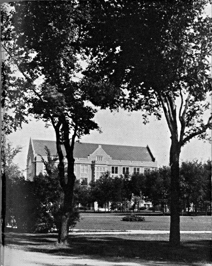
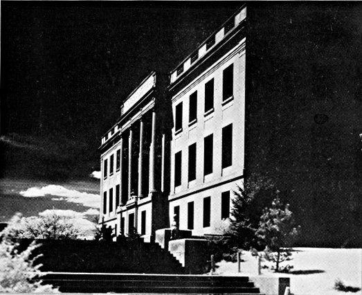
LAW BUILDING, UNIVERSITY, GRAND FORKS
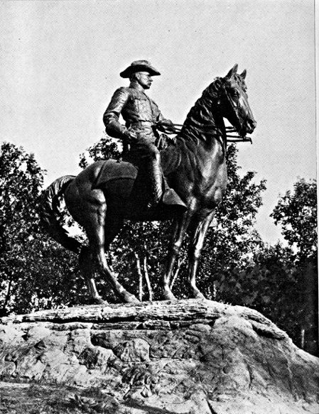
ROOSEVELT MONUMENT, MINOT
BARLOW, 124 m. (1,537 alt., 322 pop.), was named for its
founder, F. G. Barlow, who as a member of the first North Dakota
Legislature (1889) fought the Louisiana Lottery bill (see History).
CARRINGTON, 132.5 m. (1,579 alt., 1,717 pop.), is named for
M. D. Carrington, who platted the city in 1882, and gave sites for
the school, churches, and Foster County Courthouse. It has a
10,000-volume Municipal Library in the City Hall on Central Ave.
and 1st St. N. On the western side of town is a landscaped and
well-equipped tourist camp. Here is a junction with US 52
(see Tour 7), which unites with US 281 between this point and
Jamestown.
MELVILLE, 142 m. (1,597 alt., 50 pop.), was originally laid
out as New Port, but because of a disagreement over the price of
the site the railway company moved the town one-half mile W.
and called it Melville.
At EDMUNDS, 149 m. (1,594 alt., 100 pop.), is the junction
with a graveled county road.
Left on this road to ARROWOOD LAKE, 6 m., the largest of
the chain of three lakes through which the James River flows.
Before white settlement the Indians came here from great distances
to obtain Juneberry shoots for their arrow shafts. On the southeastern
shore is a CCC Camp, and on the western shore the buildings
of the Arrowood Migratory Refuge. This reserve is highly
valued by the Biological Survey as a summer breeding ground,
and is an important feeding place for pelicans.
PINGREE, 155 m. (1,547 alt., 266 pop.), was named for Hazen
Senter Pingree, who, with a rack and wagon and a team of oxen,
came to Dakota Territory in 1880 to start a potato plantation. His
venture was a failure, so he went to Michigan, where he became
an important shoe manufacturer, was made mayor of Detroit, and
twice served as Governor of the State (1897-1900).
BUCHANAN, 163 m. (1,546 alt., 150 pop.), was named for its
founder, James A. Buchanan, a prominent early settler.
South of Buchanan the route continues over rolling terrain
toward the valley of the James River, a steep-sided, flat-bottomed
trough, approximately a mile wide.
JAMESTOWN, 176 m. (1,405 alt., 8,187 pop.) (see Tour 8).
Points of Interest: Jamestown College, State Hospital for the Insane,
Fort Seward State Park.
At 5th Ave. and 3rd St. is the junction with US 10 (see Tour 8).
The area L. of the route here was once the scene of one of
those devastating prairie fires that terrorized and impoverished the
early farmers of the Plains States. This blaze, which began Sept.
25, 1888, swept the entire region from near Jamestown to LaMoure.
"A heavy and smoke laden atmosphere and a sky streaked with
a dull red reflection of burning grass proclaimed the fierce raging
of prairie fires north, south and west of the city last night," reported
the Jamestown Daily Alert.... "For at least 40 miles in
width the fire burned off every vestige of grass unprotected by
breaks. One could hardly recognize the charred land the next
day. Thousands of bushels of grain were burned and many men
lost all they had, grain, buildings and stock."
EDGELEY, 215 m. (1,565 alt., 821 pop.), was named by Richard
Sykes, once owner of the site, for his former home in England.
It is the meeting point of an N. P. Ry. branch line, a branch of
the Milwaukee R. R., and the Midland main line.
From Edgeley to the South Dakota Line, the hills of the Missouri
Plateau loom (R) in the distance.
At 237 m. is a junction with a graveled county road.
Left on this road to WHITESTONE HILL BATTLEFIELD
STATE PARK, 16 m., where Gen. Alfred Sully and his command
met a band of Sioux Indians on the evening of Sept. 3, 1863, in
the most severe engagement fought on North Dakota soil since
the coming of the white man. A granite monument 25 ft. in
height, bearing the figure of a mounted cavalryman, has been
erected about three-fourths of a mile NW. of the site of the battle.
Reinterred about the base of the monument, each with an appropriate
marker, are the remains of the soldiers who died here.
Generals Sully and Sibley had been sent out from Minnesota to
punish the Indians who had taken part in the Minnesota Massacre
of 1862. Sully was to move up the Missouri, while Sibley marched
W. across the country. When Sully, delayed by low water, arrived
in the neighborhood of present Bismarck, where he was to meet
Sibley, he found the latter had given up the idea of the proposed
meeting and started on the return journey to Minnesota. He also
discovered that the Sioux, who had fled over the Missouri upon
Sibley's approach, had now recrossed to their old hunting grounds
on the James River. He immediately set out in pursuit, and overtook
them in a three-day march. The Indians retreated while the
soldiers, on higher ground, poured in a murderous fire. Sully's
casualties were 34 men wounded and 19 killed, while the Indian
loss was estimated at 150. It is now believed that the Sioux encountered
here did not take part in the Minnesota Massacre. The
perpetrators of the massacre were known to have fled W., however,
and it was natural for the soldiers to regard any Indians
they met as enemies.
ELLENDALE, 248 m. (1,448 alt., 1,264 pop.), named for Ellen
Dale Merrill, wife of a Milwaukee R. R. official, is the Dickey
County seat. At the end of Main St. on the eastern edge of the
trim little town, attractively arranged on a well-kept campus, are
the six brick buildings of the State Normal and Industrial School,
a teachers college and vocational institution. When it opened its
doors in 1889 it offered the first free course in manual training
in the United States.
At 253 m. US 281 crosses the South Dakota Line, 35 m. N. of
Aberdeen, S. Dak. (see S. Dak. Tour 11).
(Virden, Man., Can.)—Westhope—Minot—Washburn—Bismarck—Linton—(Pierre,
S. Dak.). US 83.
Canadian boundary to South Dakota Line, 278.5 m.
Soo Ry. branch parallels route between Max and Bismarck, N. P.
Ry. main line between Bismarck and Sterling, N. P. branch roughly
parallels between Sterling and Linton, Milwaukee R. R. branch
between Linton and Strasburg.
Graveled roadbed except for about 75 m. bituminous-surfaced.
Accommodations in principal towns.
South of the Canadian boundary US 83 follows a southwesterly
course across the flat fertile bed of glacial Lake Souris, over the
central Drift Prairie and the hilly upland of the Coteau du Plateau
du Missouri, crossing the South Dakota Line near the center of
the boundary.
Most of the area is diversified dry-farming country, where the
emerald blades of young grain in summer blend with the green
and blue of flax and the verdant stalks of growing corn. As the
crops mature the chief tones of the landscape gradually change to
amber and gold, until after harvest the fields are covered with
tawny, violet-shadowed stubble, dotted with the dull taupe of
Russian thistle. Along the Mouse River and the Missouri, the timberland
is a vivid green in summer, and in autumn becomes a
fantasy of fall color in which yellows, ochers, scarlets, and copper
all strive for dominance.
US 83 crosses the Canadian border 8 m. S. of Coulter, Man.,
Canada. Here is a customhouse.
WESTHOPE, 6 m. (1,508 alt., 521 pop.), is a port of entry to
Canada. It was named by an official of a G. N. Ry. town site
company, who expected exceptional agricultural prosperity for the
town. Far to the L., beyond the level prairie that is the bed of the
great prehistoric lake, are the blue shadows outlining the Turtle
Mountains (see Tour 5).
At 12.5 m. is the junction with ND 5 (see Tour 5), which unites
with US 83 to 29.5 m.
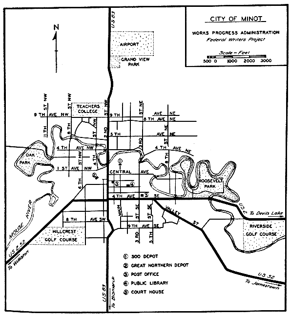
MINOT, 66.5 m. (1,560 alt., 16,099 pop.) (see Minot).
Points of Interest: Minot State Teachers College, Roosevelt Park and Zoo.
At 2nd St. and 4th Ave. SW. is the junction with US 2 (see
Tour 6) and US 52 (see Tour 7).
South of Minot the route is over level drift prairie, gradually
rising to a ridge of hills at 85 m. This is the HEIGHT OF LAND,
the northern rim of the Plateau du Missouri, which is the watershed
between the Gulf of Mexico and Hudson Bay, and also marks
the farthest advance of the last glacier. In addition to its geologic
interest, the elevation commands a view northward almost to the
Canadian border.
MAX, 96 m. (2,100 alt., 500 pop.), a Russo-German community,
was named for the eldest son of an early settler.
At 109 m. is the junction with ND 37 (see Side Tour 3A).
COLEHARBOR, 118 m. (1,900 alt., 153 pop.), derives its name
from the unsuccessful attempt to make this a river shipping point
for lignite coal, which is mined in this vicinity.
UNDERWOOD, 126 m. (2,020 alt., 488 pop.), is the center of a
large diversified farming area. The railway conductor for whom
it was named, in appreciation of the honor, donated a bell to the
school. The town has a circulating library, begun by a 72-year-old
man, Edward Erickson, who bound newspaper and magazine stories
into books. With these he began his collection, and by the time
of his death in 1932 his work, together with donations, had resulted
in a library of 8,000 volumes, most of them now available
to the public at the office of the Underwood News.
WASHBURN, 143 m. (1,731 alt., 753 pop.), McLean County
seat, on the eastern bank of the Missouri River, is named for Gen.
W. D. Washburn of Minneapolis, who was instrumental in its development.
One of the earliest Missouri boat landings was established
at Washburn, and the town was an important trading post
in pioneer days. Where the waterworks stand NW. of the city is
the Site of a Sioux-Arikara Battle fought on May 22, 1869; it
resulted in the death of Swift Runner, young Ree chieftain. On
E. Main St. stands the Log Cabin of Joseph Henry Taylor (open
by arrangement; inquire at Leader office), trapper, hunter, and
author, who built the house near Painted Woods (see Side Tour 3B)
in the early 1870's. He established a woodyard there, and also
became the first postmaster of the settlement; the post office was
a hole cut in the trunk of an oak tree. Taylor printed his books
in his own shop, writing the stories as he set the type by hand.
His books include Frontier and Indian Lives and Kaleidoscopic
Lives, both reflecting the somewhat florid literary style of the
time, but nevertheless giving a colorful and engrossing picture of
the frontier of his day.
Right from W. Main St. in Washburn on a well-marked country
road to FORT MANDAN STATE PARK, 14 m., site of Fort Mandan
on the north bank of the big bend in the Missouri. Here the
Lewis and Clark expedition spent the winter of 1804-5 with the
friendly Mandan Indians. It was here that Sakakawea, or Bird
Woman, a young Shoshone Indian girl, joined the expedition which
she helped to guide to the Pacific (see Bismarck). Warring Sioux
destroyed the buildings of the fort in 1805, and the ever changing
river channel has altered the landscape so that it is impossible to
identify the exact site (see Tour 10). Near the markers that have
been erected are the trenches of unidentified expeditions.
At 150.5 m. is the junction with a county dirt road (see Side
Tour 3B).
WILTON, 160 m. (2,152 alt., 1,001 pop.), named for Wilton,
Maine, is on the McLean-Burleigh County line and is the center of
a Ukrainian settlement. These people come from Galicia, a province
of the former Austro-Hungarian Empire, and found work in
the lignite mines which at that time were just opening here. One
group arrived in 1897 and a second two years later. Many old customs
are preserved, including folk dances performed in picturesque,
brightly colored costumes by both old and young people. The
Ukrainians are fond of flowers and their homes usually have beautiful
gardens, in which they can be seen working in the early
hours of summer days.
On opposite sides of the highway at the northern end of town
are two unusual churches, both focal points of the Ukrainian settlement.
SS. Peter and Paul Greek Catholic Church (R) has two
steeples topped with fourchée crosses. It is of the Greco-Slavonic
branch of the Greek Church. The Russian Orthodox Greek Catholic
Church (L) belongs to the Russo-Greek branch; a cruciform
building, it has three steeples, each bearing the Greek schismatic
cross of papal design, symbolizing the Trinity, with the lowest
member set obliquely to denote that the church does not recognize
the authority of the Pope. Both churches use the Julian calendar
and have similar services and holidays.
A bird-banding station established in Wilton in 1931 by Mrs.
W. H. Gray under the U. S. Biological Survey banded 5,805 birds
of 86 species in its first five years.
Left from Wilton via Main St. to the second largest LIGNITE
STRIP MINE of the Truax-Traer Co., 2 m. Formerly one of the
largest underground lignite mines in the world (see Tours 5 & 7),
in 1934-35 it yielded 185,381 tons of coal.
BISMARCK, 184.5 m. (1,672 alt., 11,090 pop.) (see Bismarck).
Points of Interest: State Capitol, Liberty Memorial Building, State Historical
Society Museum, Roosevelt Cabin.
At 6th St. and Main Ave. is the junction with US 10 (see Tour
8), which unites with US 83 between this point and STERLING,
209.5 m. (1,807 alt., 110 pop.).
MOFFIT, 219 m. (1,738 alt., 130 pop.), is on the west shore of
Long Lake, now under development by the U. S. Biological Survey
as a migratory waterfowl refuge. The town is named for the
Moffit family, who were the first settlers.
As HAZELTON, 233 m. (1,975 alt., 446 pop.), is neared it has
the appearance of an oil town, due to its numerous windmills which
a forerunner of the modern high-pressure salesman succeeded in
selling in the community. The town is named for Hazel Roop, the
daughter of the town site owner.
South of Hazelton the route enters a Russo-German farming
area. The odd, brilliant colors of some of the houses and farm
buildings are characteristic of the taste of these people. Diagonal
stripes of alternating bright colors form a favorite decorative
scheme for barn and granary doors. Since the American influence
has made itself felt, however, many gaily painted buildings have
been dimmed by coats of conservative white or buff paint.
TEMVIK, 242.5 m. (1,925 alt., 75 pop.), is a small Russo-German
settlement.
LINTON, 251 m. (1,706 alt., 1,192 pop.), was named for George
W. Lynn, an early settler. Protected by high, flat-topped hills, the
town is in a valley at the confluence of Beaver and Spring Creeks.
The most prominent building in town is the Emmons County
Courthouse, of modern design, constructed of North Dakota brick.
Hand carving on the spandrels above the first floor windows depicts
the story of progress in Emmons County. Several of the
public buildings in Linton, including the hospital and the Episcopal
church, are constructed of native sandstone quarried a short
distance from the town. Seeman's Park (picnicking, swimming,
camping) on Beaver Creek, named for L. D. Seeman, its donor,
is a recreation and tourist camp.
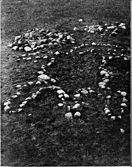
Right from Linton on an improved county dirt road to the junction
with an unimproved road, 0.5 m.; L. on this prairie road, unsuitable
for trailers, to what appears to be an almost perfect specimen
of an INDIAN TURTLE EFFIGY MOUND, 1.5 m. The road passes
directly over the turtle's back, and from the top of the mound the
outlines of the head to the E. and the tail to the W. are clearly
visible.
STRASBURG, 262 m. (1,800 alt., 695 pop.), gets its typically
German name from a German settlement in Russia whence many
of its settlers came. It marks the dividing line between the Russo-German
and Dutch settlements of this vicinity. Both racial groups
make up the population of the town, which is the center of a
large grain and dairy area. Rising from the compact little village
is the double spire of the Roman Catholic church, which is attended
by the largest rural Catholic congregation in the State. The feast
day of SS. Peter and Paul (June 29) is an annual occasion for
celebration.
South of Strasburg the route passes through territory settled
by Hollanders, and the landscape is dotted with their neat, well-kept
farms. Although many of them are American-born, the native
tongue is retained in their homes. The Dutch Reformed Church
forms the focal point in their communities; many of their children
attend college at Holland, Mich., and members of the settlement
annually go to Michigan for the Holland Tulip Festival.
HULL, 270.5 m. (1,800 alt., 50 pop.), is one of the Dutch communities,
named for Hull, Iowa.
At 272.5 m. is the junction with ND 11, a graveled highway.
Left on this highway is HAGUE, 5 m. (1,899 alt., 125 pop.),
named for The Hague in the Netherlands. In a level farming area,
it is one of the market towns for the Dutch settlements, although
its population is principally Russo-German. The Roman Catholic
church is the outstanding building of the community.
US 83 crosses the North Dakota-South Dakota boundary at
278.5 m., 141 m. N. of Pierre, S. Dak. (see S. Dak. Tour 12).
Junction US 83—Garrison—Nishu—Elbowoods—Shell Creek—Van
Hook—Stanley. ND 37 & 8, county and reservation roads.
Junction with US 83 to US 2, 117 m.
Dry-weather, dirt, reservation roads most of route. Gravel 28 m.
W. of junction with US 83, and 28 m. between Van Hook and
Stanley.
Limited accommodations on reservation.
ND 37, which runs through the Fort Berthold Indian Reservation,
branches W. from US 83 (see Tour 3) midway between Max
and Coleharbor.
GARRISON, 7 m. (1,920 alt., 1,024 pop.), named for nearby
Garrison Creek, was formerly the center of a large wheat area,
and is now a primary turkey market. Lignite is mined in the
surrounding country.
At 20 m. is the junction with ND 28 and a county graveled
highway. Straight ahead on the county highway to a small store
and filling station, where is the junction with an unimproved dirt
road, 29 m.; L. to enter the FORT BERTHOLD INDIAN RESERVATION
at 33 m. Established in 1870 with an area of more than
2,000,000 acres, it has now been reduced to 625,000. The region is
principally rugged and broken—typical Badlands, best suited for
grazing, although the eastern portion of the reservation contains
some good farming land. The population figures for 1936 list 600
Arikara, 711 Hidatsa, and 337 Mandans (although few of the latter
are of pure blood), remnants of the three agricultural Indian tribes
that once occupied the Missouri River Valley.
At 38 m. is the junction with a dirt road, not suitable for
trailers.
Left on this road to the junction with another dirt road, 3 m.;
R. on this road to another junction at 4 m.; L. to another junction
at 5 m.; R. to a fence gate, 5.8 m.; R. through the gate, pass a small
farmhouse to the SITE OF FORT BERTHOLD, 6 m. Above the
river bottoms, overlooking a bend in the Missouri's course, are the
ruins of a trading post built in 1845 by Bartholomew Berthold, a
Tyrolese. He had traded in the river country for many years, and
his success at this new fort named for him made it one of the most
important Missouri River posts. Harassed by the warlike Sioux,
the Hidatsa Indians left their village at the mouth of the Knife
River and came to live at Fort Berthold, where, because of the
bend in the river, they named their new home Like-a-fish-hook
Village. The Mandan Indians later joined the Hidatsa at this site.
From the first the history of Fort Berthold is a tale of many
assaults by wandering parties of Sioux. In 1864 a portion of the
second Sully expedition was sent to protect the outpost, and the
following year Fort Berthold became a military post. It was garrisoned
until 1867, when Fort Stevenson, 12 m. E., replaced it.
The rough-hewn log buildings which Berthold and his men erected
were later replaced by frame buildings, the dismantled remains
and cellars of which are all that mark the site today.
The Graves of Son-of-the-Star and White Shield, famed Arikara
chiefs, are marked by a cement monument about 250 yd. NW.
of the fort site. Both chiefs were friendly to the white men and
helped them in their conquest of the region. Son-of-the-Star was
head of the Arikara tribe during the trying times with the Sioux
in 1876, and through his reputation for gentleness and a lofty sense
of justice stood high in the estimation of both red and white
leaders. The two graves are sacred to the Arikara Indians.
A few yards SW. of the monument are the graves of more than
100 Indians of the reservation who served as scouts or enlisted as
soldiers with the U. S. Army since the founding of the reservation
in 1870. The white marble slabs marking the individual graves
stand in precise rows as an army quietly at salute. Each Memorial
Day the American Legion posts of Elbowoods (Indian) and Garrison
(white) hold joint services here.
At 39 m. is the junction with a dirt road, rutted and winding;
not suitable for trailers.
Left on this road to the MISSOURI RIVER, 2 m., known to
the Mandans as Mata (division between two parts of land), and to
the Hidatsa as Anati (navigable water filled with earth). A ferry
(65c per car, 10c per person) crosses the river. Here in the area
adjacent to the route live the Mandan Indians. Left to BEAVER
CREEK STORE, 6 m., a tiny trading post known locally as Ree.
Right to the JAMES HOLDING EAGLE FARM, 12 m., typical of
the modern Mandan home, and far removed from the earth lodges
used by the Indians a century ago.
About 200 ft. L. of the farm is a circular depression believed
by the Mandans to be the SITE OF GRANDMOTHER'S LODGE.
Grandmother, according to legend, is The-Woman-Who-Never-Dies.
She built her home on the first bench of the river, and on the
bottom land below planted her vast cornfield, which the deer and
blackbirds helped her cultivate. She now lives in the moon,
where prayers for favorable weather for crops are addressed to her.
Within the hollow of the lodge site is what appears to be an
ordinary granite boulder. Beneath its edges are often found coins
of large and small denominations, given as offerings for good crops.
The Mandans say that many offerings are left by members of the
Crow tribe of Montana, distantly related to the Hidatsa. It is
told that an earth girl married the Man-From-the-Sky and went
to live with him, but became homesick for the earth, and attempted
to leave the sky on a cord of buffalo hide. Her husband discovered
her hanging by the cord, and, angered by her infidelity,
threw a boulder at her. The rock crushed her to earth, and today
lies where it fell, in the circle of Grandmother's Lodge.
At 39.8 m. is NISHU (Arikara, arrow), community center of
the Arikara (Ree) tribe. The few buildings of the community are
scattered across the level land between the river lowlands and the
hills to the N. Of particular interest is the circular log dance
hall or Medicine Lodge. At the appropriate seasons of the year
are held the ancient tribal ceremonies pertaining to the successful
conduct of agricultural and personal pursuits. In front of the
medicine lodge is the boulder which plays a prominent part in the
annual cedar-tree ceremonial, a New Year ritual usually held sometime
in August. The cedar and the boulder represent the Grandfather
and Grandmother of the tribe, and the tree is left standing
beside the boulder until spring, when it is decorated with children's
moccasins and placed on the ice of the Missouri. When the
ice goes out the tree is borne downstream, to carry greetings from
the Arikara to their old village sites down the river. Other ceremonials
of religious significance include the Mother Corn ritual,
the sage dance of thanksgiving, and medicine ceremonies. Since
they are seasonal, no set date can be given for these occasions
(usually open to public). Arikara beadwork and other articles
of handicraft are sometimes available at the store in Nishu.
At 40 m. the route turns R. and follows the only telephone
line on the reservation. The steep rolling country is occupied
mainly by the Arikara. Their farm homes are usually white frame
buildings, although occasionally there is a poorer log house. There
are few barns on these farms; the Indians seldom have milk cows,
and they let their horses run on the range throughout the entire
year.
At 54 m. is the junction with ND 8, a graded dirt road; straight
ahead on this is SACRED HEART MISSION, 54.5 m., a Roman
Catholic church and mission school established in 1889.
Left from the mission on a road lined with towering cottonwoods
is ELBOWOODS, 0.5 m. (1,770 alt., 135 pop.), agency headquarters
for the reservation. Its name is derived from the elbow
bend of the timber belt along the Missouri at that point. The
town centers about the square of agency lawn. Most of the population
is white. The town was settled in 1891 when the agency
was established. In addition to its regular governmental functions,
the agency operates a non-profit flour mill and conducts an experimental
farm to educate the Indians in modern agricultural
methods. Despite this, many Indians lease their farming lands to
white people. What is now the Government School was built in
1876 as the Congregational mission, the first on the reservation.
Just SW. of the town are the Indian Fairgrounds where three-day
celebrations, with rodeos and tribal dances, are held each year
(July or Aug.).
ND 8 at 55 m. passes SCATTER VILLAGE, a little group of
filling stations and garages that grew up around the approach to
the highway bridge across the Missouri.
At 56.5 m. is the junction (R) with a dirt reservation road, on
which the route continues.
Left on ND 8 to FOUR BEARS BRIDGE, 1 m., the bridge with
19 names. When it was built, the Mandans wished it named for
their chief Four Bears, subject of many paintings by the artist
Catlin who visited this section more than a century ago. The
Hidatsa wished it named for their chief Four Bears, who died a
few years before the bridge was built. Because of these tribal
jealousies it was decided to name the southern end of the bridge
for the Mandan chief, and the northern end for the Hidatsa chief.
At each end of the span is a plaque bearing the names of chiefs
of both tribes given as associate titles to the bridge: for the Mandans
there are Charging Eagle, Red Buffalo Cow, Flying Eagle,
Black Eagle, and Waterchief; for the Hidatsa, Poor Wolf, Porcupine,
Crow Paunch, Big Brave, Crow-Flies-High, Big Hawk, and Old
Dog. This arrangement proved unsatisfactory to the Arikara, and
a partial compromise was effected by adding the names of five of
their chiefs, Bear Chief, Son-of-the-Star, White Shield, Peter Beauchamp,
Sr., and Bobtail Bull, as associates.
The dirt reservation road proceeds NW. along the river lowlands,
enters a reservation timber reserve at 60.5 m., and skirts the
eastern wooded shore of the Missouri before rising again to the
benchland. At 68 m. is a store and filling station. The route now
passes through the area occupied by the Hidatsa, also known as
the Minitari or Gros Ventres (Fr., big bellies). Their homes are
much like those of the other two tribes. The Hidatsa and the
Crow Indians of Montana at one time were a single tribe. During
a period of want one winter in the eighteenth century, a buffalo
was killed by the tribe, and the animal satisfactorily divided until
they came to the stomach. The division of this organ led to a
quarrel which split the group, and one faction moved W. and became
the Crow tribe.
SHELL CREEK, 79 m., is the Hidatsa community center. A
few stores, a dance hall, a handful of dwellings, and the central
agency experimental farm make up the town.
At 82 m., N. of Shell Creek, is the reservation boundary.
North of the boundary is VAN HOOK, 89 m. (1,843 alt., 372
pop.), named for a teamster who served the railroad surveyors. It
is one of the trade points adjacent to the reservation and has the
only creamery in the vicinity, a $20,000 cooperative plant. Here
is a junction with ND 8.
North of Van Hook on ND 8 is BELDEN, 104 m. (2,250 alt.,
25 pop.), the center of a settlement of Finnish people who homesteaded
here in 1903-4. The Finnish tongue is used in most of
their homes, and they also have the sauna or steam bath without
which no Finnish community is complete. The peculiar European
three-cornered head scarf is still worn by many of the women.
Most of the people have been naturalized and are greatly interested
in political trends. About one-third of them are members of the
United Farmers and Workers League of America, an organization
professing communistic doctrines. The radical views and intensive
political activity of these members of the community have earned
it a reputation as the communistic center of North Dakota.
At 117 m. is the junction with US 2 at STANLEY (see Tour 6).
Junction US 83—Junction US 10. County dirt and graveled roads,
"The River Road."
Junction with US 83 to junction with US 10, 35 m.
Dry-weather dirt road except for 6 m. gravel between 29 m. and
US 10.
Drive carefully as route is hilly with many curves. Route parallels
Missouri River.
The River Road between Washburn and Bismarck approximates
the overland freighter trail established in the early 1870's between
the end of the Northern Pacific Railway at Bismarck and Fort
Buford near the mouth of the Yellowstone.
Lewis and Clark, when they came up the Missouri River on
their history-making expedition in 1804-5, sent outriders along
this side of the river. Along much the same route the freighter
trail was established in 1873 when the Northern Pacific brought
to Bismarck goods destined for Forts Stevenson, Berthold, and
Buford, and this soon became the main-traveled highway for soldiers,
traders, and later for ranchers and settlers. Today ruts cut
into the prairie by heavily laden wagons, plodding ox teams, and
flying hoofs of couriers' horses are still visible in many places
along the road.
The route is one of the most attractive in the State as it
follows the winding, wooded course of the Missouri where the high
hills and buttes along the river's edge contrast with the green
meadows and wooded lowlands of the river bottom. This region
was once the home of three Missouri Valley Indian tribes—Mandan,
Hidatsa, and Arikara—and the route passes three Mandan
village sites.
The route branches W. from US 83 (see Tour 3) 10 m. N. of
Wilton on a county dirt road.
At 2 m. is the junction with a dirt road.
Right on this road to WILDWOOD LAKE, 1 m., in an old
channel of the Missouri. The permanent summer camp of the
Missouri Valley Area Council, Boy Scouts of America, is on the
eastern shore of the lake.
At 13 m. a large farmhouse and a decrepit log hut with a sod
roof (L) mark the site of Painted Woods Post Office, one of the
early Missouri River settlements. Between the old post office and
the river are the PAINTED WOODS, so named by the Indians.
According to legend, the woods were a neutral ground between
hostile tribes until a Mandan girl fell in love with a Yanktonai
Sioux warrior. She planned to leave her people and go with him,
but her kinsmen slew him in her embrace; as she knelt by his
bier, avenging Yanktonai arrows pierced her. The two tribes began
a bitter warfare. The bodies of the lovers were placed in the
branches of a tree in the woods, and the tree soon withered and
became white and bleached, like the bones in its branches. Yanktonai
warriors, coming to the woods to paint their faces and prepare
for battle, boastfully portrayed their victories on the tree,
and in retaliation the Mandans painted the surrounding trees with
war paint to mock their enemy.
At 19 m. is the junction with a dirt road.
Right on this road to HALF MOON MANDAN INDIAN VILLAGE
SITE (also known as the Larson site), 1 m., unusual in that
a ditch, still visible, apparently divided the site in two parts and
yet offered no means of defense. A sunken area in the site may
have been the village square, and the circular hollows of the earth
lodges are still visible in some places despite cultivation of the
vicinity.
SQUARE BUTTES, early landmarks, raise their flat-topped
heights across the river near the Larson site, and dominate the
landscape for the next 10 m. Their odd beauty, contrasting with
the graceful slopes of surrounding hills, has appealed to both red
men and white. George Catlin, the artist and explorer who spent
eight years in this region more than a century ago, painted a good
oil of the Square Buttes.
At 22 m. is the junction with a trail (L).
Up the steep bluffs here to DOUBLE DITCH INDIAN VILLAGE
STATE PARK. Archeologically designated as the Burgois
site, it is also known to the Indians as the ancient Village of Yellow
Clay. The inner ditch of the two from which the site receives its
name is still traceable in its entire course. The journals of the
early French explorer, Verendrye, tell that the village was surrounded
by a rampart and protected by an 18-foot palisade and a
ditch 18 ft. wide and 15 ft, deep. The cup-shaped depressions of
the earth lodges, still visible, are as large as 40 ft. in diameter.
Excavations made here by the Peabody Museum, Harvard University,
disclosed fine specimens of agricultural implements, religious
pieces, and artifacts of warfare. Positions of human skeletons
found in the excavations indicate that shallow burial was the custom
of the Mandans occupying the site.
At 33 m. the River Road passes through PIONEER PARK. On
the flood plain of the Missouri, between Burnt Creek and the road,
a picnic and camp ground (rustic shelters, tables, benches, chairs)
has been built among the towering cottonwood trees.
At 33 m. is a junction with a winding gravel road.
Left on this road to the top of the sheer bluffs to LOOKING
VILLAGE, 0.5 m., Mandan site named for Chief Looking. Now
part of Pioneer Park, the village is known as the Ward site,
and several of the earth lodges have been reconstructed under
a CCC project. The natural defenses of this village were exceptional.
On a level, circular summit almost completely cut off
from the surrounding benchland, its eastern side was well protected
by a ditch, still visible, and a wall. To the N., where the
hill is less steep, a ditch and wall were also means of protection.
Built-in log steps and a graded path lead up a round knoll
overlooking the river. On the western slope of this formation is
a large granite boulder believed to be a petroglyph, or picture
rock, of some religious significance. Close observation of the rock
will reveal many small, round impressions that may be a form of
rock-writing known as cup sculpture. From this point, and from
the parking spaces near the Indian village site, is a beautiful view
up and down the Missouri.
At 34 m., almost in the long shadows of the railroad bridge,
Burnt Creek drains into the Missouri. A story related by Joseph
Henry Taylor in his writings tells that, in the summer of 1863, 24
white people, including a woman, a small girl, and a baby, were
killed here by the Sioux, and nearly $90,000 in gold dust strewn
on the banks of the river. The white people had spent the winter
mining at Bannock, Mont., and were returning east with their
gold carried in belts and hidden in holes drilled in their flat-bottomed
mackinaw boat. Stopping at Fort Berthold on their
journey down the Missouri, they were warned by the trader,
F. F. Gerard, that it was unsafe to continue until a large group
was ready to make the trip through the territory occupied by the
hostile Sioux. Thinking Gerard only wished to sell them supplies
at high prices, the party disregarded his advice. This was shortly
after General Sibley had pursued the Sioux across the Missouri.
The Indians, however, following the departure of the military
forces, had returned to the east side of the river, as game was
more plentiful there, and a party was camped on Burnt Creek.
The ever changing Missouri had cut a long sand bar near the
creek mouth, forming a narrow, shallow channel between the shore
and mid-river. On this bar an old Sisseton was fishing as the white
men's boat floated into sight. In a gesture of friendliness the old
man waved the boat away from the shallow channel, but his motion
was mistaken for a signal, and the white men shot him. Indian
women bathing at the river's edge ran screaming to their camp,
bringing the warriors. The party of whites had a small cannon
on board, and with it killed many of the Indians. The recoil
of the cannon fire, however, sank the boat in the shallow
water, and after the leader of the white party had been shot the
Sioux swarmed on board and disposed of the others. They found
the gold dust, but, thinking it only yellow clay, scattered it on
the sands. It was several days later that Gerard heard of the
massacre and sent a party of 10 Mandans, headed by his brother-in-law
Whistling Bear, to recover the gold. They scooped up approximately
$70,000 worth in a coffeepot found in the boat, for
which Gerard gave a fine horse and a few small presents to
Whistling Bear, and a feast to his helpers. The gold thought to
be hidden in the hull of the boat was never recovered, although
several attempts were made by fortune hunters in later years.
At 35 m. is the junction with US 10 (see Tour 8) just L. of
Liberty Memorial Bridge, 1 m. W. of Bismarck (see Bismarck).
(Moosejaw, Sask., Can.)—Ambrose—Belfield—Amidon—Bowman—(Belle
Fourche, S. Dak.). US 85.
Canadian boundary to South Dakota Line, 264.5 m.
G. N. Ry. branch line roughly parallels route between Alexander
and Watford City.
Graveled roadbed except for 7 m. bituminous surface, 40 m. graded
dirt highway, and 16 m. unimproved dirt road.
Accommodations in principal towns.
US 85, a direct route through western North Dakota between
Saskatchewan and the South Dakota Line, traverses the Coteau
du Plateau du Missouri, crosses the Missouri River, and enters
the severe, majestically beautiful region of the Missouri Slope with
its expansive range country and scenic Badlands. Between the
Canadian border and the Missouri, boulder-strewn, smoothly rounded
hills are evidence of glaciation. In the rough country along
the Missouri and Little Missouri Rivers, the high, mesa-like buttes,
flat-topped and capped with thick layers of rock, mark the level
of the land before it was worn by ages of erosion.
It has been said that men have been equal at only three times
since creation—once in the Garden of Eden, once in the Declaration
of Independence, and once in the "cow country" before the
fence. When white settlers were just beginning to invade these
wide plains and rough Badlands, cattle were being driven here from
the Texas Panhandle. The famous Chisholm Trail that ran north
from Texas to Abilene, Kans., had many branching trails, one of
which ran through the area now traversed by US 85. In 1934,
when P. P. Ackley of Elk City, Okla., an old southwestern cattleman,
marked the Chisholm Trail he included this northern branch.
US 85 crosses the Canadian boundary 11 m. S. of Torquay,
Sask., Canada.
At 0.0 m. are clustered the small buildings of the customs
office and the border patrol.
AMBROSE, 3 m. (2,060 alt., 334 pop.), named for a Soo Line
right-of-way employee, in its early history was one of the greatest
primary grain markets in the Northwest. With five elevators, and
many hawkers buying on the track, as many as 300 grain wagons
often crowded the streets, sometimes remaining several days before
they could deliver their loads. Before the railway was extended
W. of Ambrose, the town was a shipping point for horses, sheep,
and cattle from the ranch country of eastern Montana and western
North Dakota. Ambrose has two parks and a swimming pool.
At 6.5 m. is a junction with ND 5, a graveled highway
(see Tour 5), which unites with US 85 between this point and
16.5 m. where US 85 branches L.
In the vicinity of ZAHL, 39.5 m. (2,000 alt., 153 pop.), are
many small underground lignite mines that supply local markets
and truckers. The town is named for F. R. Zahl, who came to
this region in the early 1870's and became an outstanding buffalo
hunter. The first post office here was at his ranch, E. of the
present town. ND 50, a graveled highway (see Side Tour 4A),
unites with US 85 between Zahl and 43.5 m., where US 85 branches
R.
South of Zahl the route parallels the wide, flat-bottomed trough
formed by LITTLE MUDDY CREEK. At 63 m. is the junction with
US 2 (see Tour 6), and the two highways are one route to 77.5 m.,
where US 85 branches L.
At 79 m. the route crosses the MISSOURI RIVER on the Lewis
and Clark Bridge, built in 1927, the second bridge in the State
to span the Big Muddy. Natural gas from the Baker, Mont. field
is piped into the Williston territory through lines that cross the
bridge.
South of the bridge the highway winds through the draws
and ravines of the Little Badlands, a small area showing the results
of severe erosion. At 96.5 m. is the junction with a county
improved road.
Right on this road is CARTWRIGHT, 13.5 m. (1,896 alt., 75
pop.), named for Samuel George Cartwright, the hunter-trapper
who was its first settler. At 17 m. is the YELLOWSTONE RIVER,
the largest tributary of the Missouri, and an important factor in
the history of exploration, settlement, and development of trade
in Montana. Here, where the river joins the Missouri just within
the North Dakota border, the valley once was a hunting paradise
for the upper Missouri Indians, but fur traders, trappers, hunters,
and settlers gave little thought to conservation, and the big game
is now extinct. The three-million-dollar irrigation project completed
in 1909 by the Federal Bureau of Reclamation has brought
the region the title of Prosperous Valley. Sugar beets form the
principal crop, although grains, vegetables, and forage crops are
raised successfully, and there is some small-scale fruit farming.
Center of the sugar industry is the refining plant at Sidney, Mont.
(see Mont. Tour 9). The entire irrigated area contains 58,561
acres, of which 19,500 are in North Dakota. Sugar-beet acreage
in the Yellowstone Valley in this State is approximately 1,800.
Mexican labor is used in the beet fields; most of the Mexicans
make their homes in the Sidney and Fairview, Mont. (see below)
areas.
The Yellowstone can be crossed here on the G. N. Ry. bridge,
on which timber planking has been placed over the ties to permit
automobile traffic. In one span of the bridge is a vertical lift
to allow passage of river boats, although these are much more
scarce than they were when the bridge was built in 1913.
Just E. of the bridge is the only railroad tunnel in the State,
a 1,456-foot timber-supported excavation piercing the soft earth
hills bordering the Yellowstone. It serves a single track on a
curved alignment of three degrees.
At 21.5 m. the road crosses the Montana Line at the city limits
of Fairview, Mont. (see Mont. Tour 9).
ALEXANDER, 98.5 m. (2,146 alt., 386 pop.), was platted in
1905 shortly after organization of McKenzie County by special
legislative act, and was designated temporary county seat by proclamation
of Governor Sarles. Alexander McKenzie, political dictator
of the early Dakota scene, was one of the town site incorporators,
and both the town and county are named for him. Still
standing is the old log building that served as the first county
courthouse.
ARNEGARD, 110.5 m. (2,237 alt., 254 pop.), was named for
Evan Arnegard, an early settler. The community is predominantly
Scandinavian. Certified potatoes, both for southern markets and
foundation stock for growers in the eastern part of the State, form
one of the leading products of the surrounding agricultural area.
Turkeys are also raised here.
1. Left from Arnegard on a graded road 2 m.; L. here to
LAKE PESHECK, 3 m., formed by impounded creek waters. It
is surrounded by fine trees, and is fast becoming a summer recreation
point. The lake was recently stocked with 1,500 trout.
2. Right from Arnegard on a dirt road to the northern entrance
of the NORTH ROOSEVELT REGIONAL STATE PARK,
14 m. (see North Roosevelt Regional State Park).
WATFORD CITY, 117.5 m. (2,082 alt., 769 pop.), was named
for a town in Canada. Because of lack of facilities at Schafer,
the neighboring county seat, Watford City is actually, if not legally,
the seat of the county government. Many of the county officers
and employees live here, and county and Federal agencies have
offices in the city.
The town is the terminus of a G. N. Ry. branch line, and the
trade center of the "Island Empire" county, so called because the
Missouri on the N. and E., the Yellowstone on the W., and the
Little Missouri on the S. almost surround it with water. At the
W. A. Jacobson law office is a private Museum (open weekdays
9-5), a collection of stones, gems, fossils, Indian artifacts, coins,
woods, and other articles of interest, including a Bible printed in
1535. A tourist camp is one-half mile E. on ND 23, a graveled
highway.
Left from Watford City on ND 23 is SCHAFER, 4 m. (1,950
alt., 100 pop.), seat of McKenzie County, in the little Cherry Creek
valley (see Tour 10). Its white frame buildings and dingy log
huts cluster about the frame courthouse which is an object of
long-standing contention with Watford City. The town is named
for Charles Shafer (1850-1930), an early rancher of the region,
whose son George Shafer (1888-) served as Governor of the
State from 1929-32. On the Shafer homestead S. of the town
along the creek are the Schafer Springs, near which are excellent
camping grounds. The springs have a flow of nearly 6,000 gal.
per hour, a flow which has not diminished during recent years of
subnormal rainfall.
A slight curve at 130.5 m. reveals a spectacular view. The grassy
plateau ends abruptly, and below, as though a huge, careless knife
had slashed into the prairie, lies a confusion of endless gray-,
ocher-, slate-, and red-layered buttes, through which winds a maze
of ragged ravines and coulees. In the distance the meandering
LITTLE MISSOURI RIVER looks hardly capable of producing the
strange BADLANDS which it and its tributaries have carved out
of the earth. The red of the scoria-topped buttes, the myriad hues
of the strata laid down ages ago by successive prehistoric seas,
and the brilliant green of the spruce and cedar trees clinging to
the steep hillsides form a startling, almost weird, picture.
Like miniatures at the bottom of the valley are the silvery
steel of the ROOSEVELT BRIDGE and the drab, squat, frame
buildings of a permanent CCC camp. In 3 m. the tortuous, twisting
highway drops 600 ft. (drive carefully) to reach the CCC camp
and the main entrance to the North Roosevelt Regional State Park
at 133.5 m. (see North Roosevelt Regional State Park).
After crossing the river and its wide flood plain the highway
climbs through the Badlands to emerge upon the prairie at 137 m.
In the distance (L) at 143 m. are the Killdeer Mountains (see Side
Tour 8D).
At 151 m. the highway rounds a grass-covered prominence to
enter GRASSY BUTTE (2,300 alt., 40 pop.), a little town founded
in 1913 and named for the neighboring butte, which has long been
a landmark in the region. Although there are many similarly
shaped elevations in the vicinity, Grassy Butte is the only one not
bare of vegetation. Ten Russian laborers first homesteaded in the
Grassy Butte region, forming the nucleus of the present-day farming
population. The old post office building still stands, a typical
frontier log structure. In the early days of the town, when there
were buildings on only one side of the main street, it was a local
jest that Grassy Butte had the widest main street in the country,
"from McKenzie County to the Atlantic seaboard."
The people who inhabit the area surrounding Grassy Butte are
Little Russians or Ukrainians. They preserve many of their Old
Country customs, and retain their Greek Catholic religious allegiance,
though a difference of opinion has resulted in a schism.
A wedding custom of these people requires that the bride and
bridegroom return to their respective homes after the marriage
ceremony. At midnight a delegation representing the bridegroom
abducts the bride and brings her to her husband's home. Wedding
celebrations often last two or three days.
At 155.5 m. is the junction with ND 25 (see Side Tour 8D).
At BELFIELD, 190 m., is the junction with US 10 (see Tour 8).
At 213.5 m. is the junction with ND 21 (see Side Tour 4B).
At 222.5 m. is the junction with a graded dirt road, not suitable
for trailers.
Left on this road to CHALKY BUTTE, also known as White
Butte, 6 m., a long high butte topped with one of the few White
River limestone formations in the State. On its steep talus-covered
slopes fossilized teeth and bones of prehistoric animals have been
found. Outcroppings of large bones are plainly visible in the
limestone cliff. The complete skull and other bones of an oreodon
(small prehistoric hoofed animal) have been taken from this fossil
bed.
In early days of white settlement it was believed that a
treasure was buried somewhere on Chalky Butte because an Indian
chief often went there and returned with gold. Although he was
followed, he always managed to elude his pursuers; his cache, if it
existed, has never been found. According to another story, a small
party of soldiers once left Fort Meade, in the Black Hills, to take
the pay roll to Fort Keogh, Mont. The pay roll never reached
Fort Keogh, and no trace was found of the men, unless the three
revolvers marked "U.S." and several U. S. Army wagon irons with
charred pieces of wood clinging to them, found about 1900 near Sunset
Butte S. of here, were the remains of their luckless expedition.
Whether or not there is any connection between these two stories
is a matter of conjecture.
AMIDON, 223.5 m. (2,800 alt., 141 pop.), named for a U. S.
district judge, Charles F. Amidon (1856-1937), was organized in
1915 and shortly thereafter was selected Slope County seat. In
an enclosure near one of the filling stations in the town is an
8-ton petrified stump almost 6 ft. in diameter, which was uncovered
on the county fairgrounds N. of Amidon. The town commands
a good view of the surrounding country, with Chalky Butte
to the SE., the angular outlines of the Badlands to the N. and W.,
and Black Butte (see below), highest point in the State, to the
SW.
At 225 m. is the junction with a graded dirt road with sharp
curves and abrupt hills (unsuited for trailers).
Right on this road 2 m.; then L. across rolling range land,
gradually descending into the Badlands to the junction with a
little-used trail, 11 m.
Right on this trail 1 m. at the end of a small valley are the
BURNING COAL MINE and the COLUMNAR CEDARS. Across the
ravine on a hillside sloping to the W. is the burning mine, which
at dusk casts a carmine glow over the hill, and a heavy odor of
coal gas hangs in the little valley. How long the lignite bed has
been burning underground is not known. The Indians have legends
telling of the burning ground, and old settlers in the region say
that the burned area has not advanced more than a few hundred
feet in the 50 years since the region was first settled by white
men. The cause of the combustion is not known. As the coal
burns underneath, the earth overburden crumbles and falls, taking
with it all rocks, trees, and vegetation on the surface, leaving in
its wake red scoria and other less brightly colored clays. The
burned area succumbs easily to weathering and erosion. From
large crevices in the earth intense heat pours, but with care one
can peer into the flaming underground pits. (Approach from the
downhill side where there is no danger of the earth crumbling
underfoot.)
In the bottom of the tiny valley, and on its western slope,
grow the columnar cedars, bright green conical trees averaging
15 ft. in height. These trees, found in North Dakota only in this
small area adjacent to the burning mine, taper from a large base
to a narrow tip. Their brilliant green forms a decided contrast
with the dull grays and tans of the hills surrounding them.
On the main side road beyond the junction with the trail, the
dirt graded road winds down to the Little Missouri and upstream
to the SITE OF A LOGGING CAMP, 15 m. When the N. P. Ry.
was, being built W. of the Missouri a wood cutters' camp was
maintained here. The camp bunkhouse is said to have been equipped
with loopholes to shoot through in event of Indian attack.
The cedar ties and pilings cut at the camp were floated down the
Little Missouri, but many became snagged in sand bars or scattered
over the river flood plain, and few reached their destination.
Across the river from the site are the two peaks known as the
RABBIT'S EARS.
US 85 at 229 m. passes directly between Chalky Butte (L) and
Black Butte (R).
At 230.5 m. is a junction with a dirt road.
Right on this road 1 m. to an advantageous point from which
to hike to the top of BLACK BUTTE (3,468 alt.), highest elevation
in the State. The butte is some 8 m. in circumference, and near
the top solid rock cliffs rise perpendicularly 50 to 100 ft. above its
grassy slopes. At its base lie huge boulders, broken from the
sides by the action of weather. Springs form numerous creeks on
the northern side, and their tree-and brush-lined banks are a
favorite ground for berry-picking parties. At the northern corner
of the butte is a hole about 3 ft. wide, from which a slight draught
of air can be felt. When a pebble is dropped into this opening a
dull thud can be heard, as though the stone had not struck solid
bottom. On the S. side of the butte is Snow Cave, where the deep
winter snows often remain until August. There is a fine view
from the top of the butte. At the western edge of the mesa are two
rock-lined Eagle Pits, about 4 ft. wide and 3 ft. deep, from which
hidden Indians caught eagles and plucked out their tail feathers
for their war bonnets. These quills were very valuable, often
worth a pony in trade.
Black Butte is also known as H. T. Butte, since it was part
of the H. T. ranch, which in the 1880's and 1890's was the largest
horse ranch in the State. The surrounding country in those days
was given over to the ranging of cattle, sheep, and horses, and it
was not until the coming of the "honyocks", as the stockmen
called the homesteaders, and the cultivation of former range lands,
that the ranching of this section was curtailed.
Concerning H. T. Butte old-timers of this section tell a story
of a cowhand named Bob Pierce who because of his merciless
riding was known to his fellow workers as "Crazy Loon" as well
as by numerous other uncomplimentary titles. He rode his mount
at any speed anywhere, and it was hard to "keep him in horses."
It chanced that at one time Bob was paired, on the circuit, with
talkative old Colonel Sullers. Thinking to harry the colonel, Bob
began to spur his horse to breakneck speed. Sullers kept beside
him, holding up both ends of a political conversation and trying
to pretend not to notice the speed. His horse, unfortunately, stepped
into a hole, and the rider went sprawling. Stopping at a nearby
creek to wash the dirt and blood from his head and face, he
reviled his tormentor, declaring, "When you're dead your ghost
will ride the tops of the hills and howl like a gray wolf." In the
course of time Bob Pierce died, or he may have been killed on one
of his wild rides. Since then, it is said, a horseman is seen, on
dark nights, riding at breakneck speed up the steep, inaccessible
sides of H. T. Butte, and sometimes the howl of a gray wolf is
heard.
BOWMAN, 248.5 m. (2,958 alt., 888 pop.), seat of Bowman
County, lies at the base of flat-topped, sandstone-capped Twin
Buttes. Known successively as Lowden Post Office and Twin
Buttes, the town won the county seat election in a bitter fight
with Atkinson (later Griffin) in 1907, and in January 1908 was
given its present name. Both town and county are named for
E. W. Bowman, a prominent Territorial legislator.
The junction with US 12 (see Tour 9) is in Bowman, and the
two routes unite to 250 m. where US 85 turns L. and reaches the
South Dakota Line at 264.5 m., 103 m. N. of Belle Fourche, S. Dak.
(see S. Dak. Tour 13).
Junction US 85—Hanks—Grenora—Sodium Lakes—Writing
Rock. ND 50 and unnumbered county roads.
Junction with US 85 to Writing Rock, 30.3 m.
G. N. Ry. parallels route between junction with US 85 and Grenora.
Graveled roadbed 12 m., graded dirt roads and prairie trail remainder
of route.
Accommodations in principal towns.
This short route passes through a region of boulder-strewn,
smoothly rounded hills left by glacial action, and leads to extensive
but undeveloped sodium sulphate beds and the archeologically
important Writing Rock State Park. The populations of both towns
on the route are chiefly Scandinavian; they were settled by immigrants
who arrived with or shortly after the railroad.
ND 50 branches W. from US 85 (see Tour 4) at Zahl.
HANKS, 5 m. (2,114 alt., 213 pop.), named for W. F. Hanks,
a Powers Lake rancher and banker who was connected with the
town site company, begins its history with the arrival of the G. N.
branch line in 1916. In the 1890's the N-N (N Bar N) Cattle Co.
of St. Louis, which ran herds of livestock S. of the Missouri River
in central Montana, refused to ship their stock over the G. N.
because of a disagreement with that line. As a result they had to
trail their large herds many weary miles to the nearest Soo Line
points, which were at Bowbells and Kenmare, N. Dak. (see Tour
7). As many as 30,000 of these Chicago-bound cattle passed
through Hanks in a single season on their way to the railroad,
herded by dust-caked cowboys of the authentic, original, Wild West
variety.
Ranching was the chief industry of this section when it was
first settled, and there is still some small-scale ranching in the
vicinity.
GRENORA, 11 m. (2,105 alt., 487 pop.), has a name derived
from the-first three letters of the words Great Northern, and as
terminus of that railroad enjoyed a brief boom in 1916.
West of Grenora ND 50 is a graded dirt road. At 14 m. is the
junction with a county dirt road (R) which is now the route.
At 17 m. is the junction with a prairie trail.
Left on this trail to FERTILE VALLEY LAKE NO. 2, 1 m.,
largest of the several shallow lakes in this vicinity which contain
millions of tons of sodium sulphate, a valuable mineral resource.
These lakes and sloughs, with no drainage outlets, are part of a
linear series lying NW. to SE. along a preglacial stream course.
The beds range from a few inches to as much as 80 ft. in depth.
Because of the low rainfall in recent years many of the lakes
glisten white in the sunlight.
Literally, a wild goose chase led to the discovery of these
sodium sulphate deposits. A Grenora hunter waded into a shallow
lake to recover a goose which had fallen into the water, and found
the lake bottom covered with a hard crystal formation resembling
salt deposits he had seen in Canada, which he knew to be commercially
valuable. He directed attention to the lake, and as a result
an FERA survey was undertaken in 1934, and a large amount of the
mineral was found here. Fertile Valley Lake No. 2 was estimated
to contain 11,000,000 tons, and two other lakes in the vicinity 5,000,000
and 1,750,000 tons each.
Sodium sulphate is also known as Glauber's salt. Commercially
it has a value of about $20 a ton, and is used medicinally,
in paper manufacture, as salt for cattle, and in manufacturing
soap and munitions. In 1937 the University of North Dakota, in
cooperation with the State Highway Department, was conducting
experiments to determine the value of sodium sulphate in highway
construction. At present there is little demand for North Dakota
sodium sulphate because of the accessibility of sources nearer the
points of consumption.
At 21 m. is the junction with another county dirt road; R. on
this road to the junction with a county highway, the Grenora-Alkabo
route, at 23 m.; R. on this road; at 30 the route turns L.
and proceeds up a hill to WRITING ROCK STATE PARK, 30.3 m.
Of gray granite, Writing Rock stands in a slight hollow on the
crest of a hill, commanding a wide view of the surrounding country.
The top and two sides of the rock are covered with hieroglyphs,
consisting of lines, dots, circles containing dots, and, near
the top, a flying bird. Many attempts have been made to decipher
the writing, which apparently was carved into the rock at several
different periods. Whatever the meaning of the inscriptions, the
rock is regarded as sacred by Indians who, even after the settlement
of the State, made pilgrimages here from the Fort Peck
(Mont.) Reservation and other distant points. The site, because
of its elevation, served advantageously for smoke signals.
Several graves have been found in the vicinity, and excavations
have revealed hammers, hatchets, arrowheads, sea shells, elk teeth,
and beads of many shapes and colors. One grave is said to have
yielded beads that measured 52 ft. when strung.
The Indians have many legends associated with the rock. The
one most often heard is that told by Joe Lagweise and Tawiyaka,
two old Sioux Indians of the Qu'Appelle Agency in Saskatchewan,
Canada, who as young men visited Writing Rock and heard the
story from an old man camped there. Many years ago a party
of eight warriors stopped for the night near this rock, and just as
they were falling asleep they heard a voice calling in the distance.
Fearful of an enemy attack, they investigated but found nothing.
The next morning they heard a woman's voice calling, but still
they found no one. In their search, however, they saw this large
rock with a picture on it, showing eight Indians—themselves—with
their packs lying on the ground. Unable to understand this
mystery, the warriors went on their way. On their return they
again passed the rock, and noticed that the inscription had changed,
and appeared to hold a picture of the future. When they reached
home they told their people of the mysterious rock, and the entire
village moved near it, only to find that the picture had again
changed, this time showing the village with its tipis. From that
time on the rock was believed to foretell the future until white
men moved it; whereupon it lost its power. An old Indian chief
once pointed out that the three lines on the rock indicated
three graves near the stone, one of which he said was that of a white
child. It has been suggested that the inscriptions may be the work
of some race which lived in this region before the Indian known
to history.
Writing Rock is approximately 5 ft. high and 4 ft. thick, and
weighs an estimated 10 tons. A smaller rock, weighing about a ton,
which stood near a spring about a mile below Writing Rock, also
contains inscriptions, and has been moved to New Merrifield Hall
at the University of North Dakota for study.
Ten acres of land surrounding Writing Rock were acquired in
1936 by the State Historical Society of North Dakota and will be
developed as a State park.
Junction US 85—New England—Mott—Carson—Flasher—Junction
ND 6.
ND 21. Junction with US 85 to junction ND 6, 126.5 m.
N. P. Ry. branch line roughly parallels route from Mott to Flasher;
Milwaukee R. R. branch between New England and Elgin.
Graveled roadbed except for 11 m. of graded dirt.
Hotel and tourist camp facilities limited in most towns; many
natural camping places along the Cannonball River.
Traversing the northern part of the Missouri Slope, this route
passes through what was ranch land, now used for diversified farming.
Most of the land adjacent to the route is underlain with
deposits of lignite, and on many farms the winter's fuel is easily
obtained by a little digging. Dominating the general rolling terrain
are jagged, mesa-like hills capped with brown sandstone
formations. Gentle, grass-covered slopes, whose rich spring green
turns to amber in the fall, rise to steeper hillsides, above which
jumbled, broken, weathered rocks lead to the steep cliffs crowning
the flat mesas.
Trees are few along this route, except for the tiny groves on
occasional farms, and the woods and bushes that edge the Cannonball
River and its tributary creeks.
ND 21 branches E. from US 85 (see Tour 4), 23.5 m. S. of
Belfield (see Tour 8). Dominating the landscape immediately E.
of the junction are the two high, flat-topped, coffin-shaped RAINY
BUTTES (R). At 6 m. the highway passes 2 m. N. of West Rainy
Butte, and at 8 m. passes East Rainy Butte, which appears to be
only a short distance from the route, but actually is 6 m. S. The
tops of these twin heights are sometimes clouded in a faint gray
mist, and according to Indian lore they get rain at least once a
day, despite the weather. Although this is an exaggeration, it is
nearly true, for at times when warm currents of air strike the cold
surface of the sides of the buttes the moisture in the air is condensed,
resulting in fogs or mists that usually veil the heights.
This phenomenon is also common to other buttes in this area.
There are evidences of Indian burials on the Rainy Buttes.
NEW ENGLAND, 14 m. (2,593 alt., 911 pop.), its seven grain
elevators standing like sentinels overlooking its level site N. of
the Cannonball River, was founded in 1887. It was named and
first settled by the New England Colony Association, an organization
from the New England States headed by Thomas W. Bicknell
(1834-1925), who was the author of several histories dealing
with Rhode Island. Streets of the new town were laid out by
plowing furrows in the prairie. Before the end of the first summer
50 families had arrived, but from 1888 to 1911, when the
Milwaukee R. R. came in, New England was little more than a
trading post. Although originally founded by New Englanders,
today it is predominantly Scandinavian.
ND 22 forms the main street, at the southern end of which, in
St. Mary's Catholic schoolyard, is a Shrine to the Virgin Mary,
made of huge slabs of petrified woods, scoria, odd rock formations
from the Badlands, and "cannonballs" (see Side Tour 8C) from
the river. The shrine was built by school children. Midway between
the two schools on Main St. is a modern, stuccoed Memorial
Building, a community center completed under the Works Progress
Administration in 1936.
Between New England and 23 m. ND 21 unites with ND 22.
At 18 m. is the junction with a graveled county road.
Left on this road along the north bank of the Cannonball River
is HAVELOCK, 6 m. (2,566 alt., 118 pop.), named for an English
stockholder in the Milwaukee R.R. In 1915 a small group of
Moravians settled here and erected a church, but by 1924 the
colony had dwindled, and the church was sold to the Congregationalists.
The Moravians held their immersion baptismal ceremonies
in the Cannonball. Right from Havelock (inquire directions
at post office), 1 m., to a BURNING COAL MINE, operated
until 1934, when it was discovered to be afire. At times smoke,
accompanied by an unpleasant odor of sulphur, is emitted from
the mine.
At 23 m. is the eastern junction of ND 21 and ND 22; L.
here on ND 21. Rising ahead (R) is a series of conical hills, the
TEPEE BUTTES, resembling a giant Indian encampment. The
highway parallels them their entire length between 25 m. and 28 m.
At 36 m. is the junction with a graveled county road.
Left on this road is REGENT, 0.8 m. (2,461 alt., 308 pop.),
named by the railroad company when it was believed that its
situation in the center of the county would make it the county
seat. The town is on the south bank of the Cannonball. Richard
Tooker (1902-), one of the State's successful fiction writers,
attended high school in Regent, and had his first story published
when only 15. He wrote more than 150 stories before his first
novel, Day of the Brown Horde, appeared.
North of Regent at 1.3 m. is the junction with a county road;
R. on this road to REGENT LAKE, 2.8 m. (camping, picnicking,
swimming).
East of Regent on ND 21 the route proceeds for a few miles
over a level plain lying S. of the almost treeless Cannonball River
valley.
MOTT, 51 m. (2,399 alt., 1,036 pop.), is in the valley of the
Cannonball. On an elevation to the NW. the strikingly modern
Hettinger County Courthouse overlooks the river valley. The
town is the terminal of an N. P. Ry. branch, and is also on the
Milwaukee. Central Park (tourist camp, tennis courts), is
between 3rd and 4th Sts. Its recreation facilities were built as
an FERA project.
BURT, 58 m. (2,358 alt., 125 pop.), originally known as Alton
Post Office, was named by the N. P. Ry. to honor A. M. Burt,
superintendent of the Dakota division. More than 500 poplars and
Chinese elms are planted in the town schoolyard.
At 63 m. the highway crosses THIRTY MILE CREEK, one of
the larger tributaries of the north fork of the Cannonball.
At 68 m. is the junction with a side road.
Left on this 0.1 m. to a LIGNITE STRIP MINE, the largest of
several in this vicinity. It produces 8,000 tons annually, and rough
hummocks of earth are thrown up in the stripping process.
NEW LEIPZIG, 69 m. (2,311 alt., 433 pop.), is a Russo-German
community, named for Leipzig in Germany, and is on both the
Milwaukee and N. P. branch lines where the two roads run
parallel only 200 ft. apart.
Several years before the establishment of New Leipzig the
territory to the S. was settled by a large group of Finns, of whom
about a dozen families now remain. Because the settlement has
dwindled in recent years, many native customs have disappeared,
although a few of the older people retain a superstitious belief
in witchcraft, and there are five or six saunas, or steam baths, in
which water is poured on hot stones in a tightly closed shelter.
At butchering time each autumn, rye and wheat flour are hulled,
ground oats are mixed with the blood of beeves, and baked in
round, thin rings similar to doughnuts. These rings are placed on
long sticks, 30 or 40 at a time, thoroughly hardened near a fire,
then stored in barrels, with lime as a preservative, for use throughout
the winter and coming summer.
ELGIN, 74.5 m. (2,330 alt., 505 pop.), with its many trees, is
a pleasant Russo-German town. Its first name, Shanley, was
discarded when the N. P. came through because of its similarity
to Stanley. A new name was being discussed by a group waiting
for a train one day when a member of the group, having looked
at his watch, suggested the trade name, Elgin, as a good town site
name. His suggestion met with approval of the railroad company.
Right from Elgin on an unimproved county road to the north
fork of the Cannonball River, 2 m., where are several suitable
camping places under the trees of the narrow river valley.
The road continues S. of the river. Sloping up from the
stream, MEDICINE BUTTE (L), 3 m., is a high hill topped with
a large, almost cubical block of sandstone used for many years
as a Prayer Rock by Indian tribes, and carved with picture symbols
of human hands, buffalo heads, bear paws, and other figures.
It was the practice of the Indians to leave offerings at the rock
and return the following day, when, the older Indians still relate,
the pictures on the rock would tell them whether their prayers
were to be answered. Beads, pieces of pottery, and other traces
of votive offerings are still found near the stone. At the foot of
the hill to the W. is a circular area, approximately 80 yd. in diameter,
where it is believed that native worshipers danced while
encamped near the sacred hill. Little vegetation grows on the
plot, indicating that years of dancing packed the earth firmly.
At 76.5 m. is the junction with ND 49, a graveled highway.
Left on this highway to HEART BUTTE (L), 17 m., known
to the Sioux as Ta canta wakpa Paha (Heart River Butte). From
this elevation the surrounding country is visible for 20 m. in all
directions, and in early days ranchers used the hill as a lookout
when searching for strayed cattle or horses. The wooded valley
of the Heart River is 4 m. to the S., although it appears much
nearer. In the sandstone formation atop the butte is a cave
formed by wind and water erosion.
East of Elgin on ND 21 is the junction with a graveled county
road, 85.5 m.
Right on this road is LEITH, 4 m. (2,353 alt., 174 pop.), named
for Leith, Scotland. It is on the Milwaukee R. R.
South of Leith on an unimproved county road to the junction
with another dirt road, 6 m.; R. on this road to another junction
at 7 m., where a vast deposit of small sea shells covers approximately
one square mile to a depth of 4 ft., visible evidence that
ages ago this region was the bed of a large sea. Only a thin
layer of rich black soil covers the deposit, and in plowed fields
the shells are easily seen. The practical-minded farmers of this
region have found a good use for this gift of the prehistoric
sea; they pulverize the shells and feed them to their poultry
to provide the calcium in their diet.
CARSON, 90.5 m. (2,289 alt., 356 pop.), is a compact little
town on the slope of a hill, dominated by the large, white frame
courthouse at the high end of the main street. It is named for two
early settlers, Frank Carter and Simon Pederson.
Left from Carson an unimproved county road leads to the
HEART RIVER, 12 m.
Right on the south bank of the stream to a good camping
place, 1 m. The river, free from rocks at this point, is deep
enough for swimming.
Across the river (L) to the G. A. Johnson home. On a slight
rise in the pasture back of the house is a row of evenly spaced
piles of four or five stones, about one-fourth mile long, placed at
a right angle to the brink of the hill. This is believed to have
been an Indian BUFFALO RUN, in which the Indians placed
banners of red cloth or buckskin between the piles, then drove
the hunted buffalo toward them. The animals, frightened by the
banners, would swerve toward the crest of the hill where in their
rush they would stumble down the incline and fall easy prey to
the arrows and spears of the hunters.
At 103.5 m. is the junction with ND 31, a graveled highway.
Right on this highway to the DOG TOOTH BUTTES (R), 2 m.
From a distance their outlines indicate that they are well named.
These buttes were a landmark on the Bismarck-Deadwood trail
during the Black Hills gold rush from 1876 to 1884. The stagecoaches
with their four-horse teams, and the lumbering ox teams
pulling heavily loaded freight wagons, passed just SE. of here,
leaving deep ruts which are still visible where ND 31 crosses them
immediately S. of the buttes.
At 6 m. on ND 31 is RALEIGH (2,038 alt., 202 pop.), a German
community, originated as Dog Tooth Post Office on the
Bismarck-Deadwood trail. Purebred livestock is raised on many
of the farms in this vicinity.
Left at 8 m. are THREE BUTTES. From the tallest of these
peaks a far-reaching view is presented. On a clear day Mandan,
50 m. to the NE., is visible.
FLASHER, 108.5 m. (1,905 alt., 346 pop.), its residence district
scattered over the south slope of a hill and its business street at
the foot, is a Russo-German community named for Mabel Flasher,
niece and secretary of William H. Brown, head of the land company
that owned many of the town sites along the N. P. Ry. branch.
At 126.5 m. is the junction with ND 6 (see Side Tour 8C),
26 m. S. of Mandan (see Tour 8).
Junction US 81—Cavalier—Rolla—Belcourt—Dunseith—Bottineau—Mohall—Crosby—(Scobey,
Mont.). ND 5.
Junction with US 81 to Montana Line, 329 m.
Soo Ry. branch roughly parallels route from Flaxton to Montana
Line; G. N. Ry. branches touch route at intervals between junction
US 81 and Lignite, and branch parallels route between Lignite
and Crosby.
Graveled roadbed entire route.
Usual tourist accommodations in principal towns.
This route, paralleling the international boundary 10 to 15
miles to the north, passes through some of the oldest and some
of the newest towns in the State. In the eastern section, where
the country is more productive and settlement first began, are
towns established in the 1870's, while in the western area, where
occupation was slower, are a number of towns founded in the
twentieth century. The route begins in the low, level wheatlands
of the Red River Valley, at one time the bed of glacial Lake
Agassiz, and soon doubles its altitude by rising 800 feet upon the
broad, rough, less thickly settled Drift Prairie, which stretches
away approximately two-thirds of the distance across the State.
This wide section, which includes the wooded Turtle Mountains
and the level bottom of another glacial lake, Lake Souris, was
once a hunters' paradise—a prize which involved the Chippewa
Indians, who long held it, in frequent conflict with their enemies
the Sioux. With the coming of the whites the region saw new
rivals, as the XY, North West, and Hudson's Bay Companies struggled
savagely and often bloodily for domination of the fur trade.
Most of the Chippewa in the State now live on the Turtle Mountain
Indian Reservation, through which the route passes.
Over the bed of ancient Lake Souris, west of the hills, once
roamed hordes of buffalo; later, during early white settlement, this
region was the feeding ground of great numbers of horses and
cattle. After crossing the Souris (Mouse) River twice and the long,
narrow Upper Des Lacs Lake, the route ascends 300 to 400 feet to
cross the Missouri Plateau, an open, rugged country, marked here
and there with the homes of ranchers and farmers, and pitted by
the strip mines extracting the huge lignite coal deposits that underlie
the plateau.
HAMILTON, 0.0 m. (see Tour 1), is R. of ND 5 where it
branches W. from US 81 (see Tour 1).
At 5 m. is the junction with ND 18, a graveled highway.
Right on this highway to the junction with a graveled spur,
5 m.; R. on this spur is BATHGATE, 8.5 m. (828 alt., 292 pop.),
pleasantly situated in a bend of the Tongue River. At the southern
side of town on a 40-acre tract of meadow and hayland are the
buildings of the State School for the Blind, established in 1908.
Thirty-five to forty children attend each year for a nine-month
period.
CAVALIER, 9 m. (894 alt., 850 pop.), Pembina County seat,
was named for Charles Cavileer, one of the first white men to
make a home within the borders of the present State. Usage has
changed the spelling of the name. The town was established in
1875 by settlers who came overland from Missouri in a train of
10 covered wagons. The members of the train intended settling
in Manitoba, Canada; but, not liking the country there, they
returned to the United States, two of the families founding the
Tongue River Settlement, which later became Cavalier. They came
from Canada by way of Pembina over the old Fort Totten Trail,
which ran where Main St. now passes and was one of several
trails used by trappers, hunters, and traders as they journeyed
between the hunting grounds and the trading posts. Over these
trails often moved long caravans of creaking, fur-laden Red River
oxcarts, on their long trek to St. Paul. Some trains are said to
have contained as many as 1,500 carts.
The jog in Cavalier's Main St. results from the fact that the
land for the street, contributed by two men who owned adjoining
farms, did not meet exactly. This complication was not discovered
until after some buildings had been erected, but by that time it
would have been too costly to change the route.
AKRA (Icelandic, fields), 14 m. (980 alt., 30 pop.), is near
the southern edge of the Pembina Mountains (see Side Tour 5A),
whose wooded height ahead abruptly marks the western edge of
the level Red River Valley and the eastern edge of the Drift
Prairie. The town is one of a group of communities comprising
what is believed to be the largest Icelandic settlement in the United
States (see below).
At 16 m. is CAMP COMFORT, an acre of beautifully wooded
grounds (good camping and picnicking facilities). Camp Comfort
marks the point at which the old Hunters Trail of fur-trading
days crossed the Tongue River.
HALLSON, 18 m. (1,020 alt., 10 pop.), founded in 1878 and
named for Johan Hallson, the first settler, is the oldest of the
Icelandic settlements (see below). At Hallson is the junction with
ND 32, a graveled highway.
Left on this highway is MOUNTAIN, 5 m. (1,030 alt., 250 pop.),
so named because of its elevation. It is one of the larger
Icelandic towns. A log church here, built in 1886, is said to be
the oldest Icelandic church on the North American continent.
When the Icelanders first came to America in 1874, they settled
at Gimli, Man., Canada. Later, possibly because the rough
topography of the country reminded them of the fjords and cliffs
of their native land, they colonized here near the headwaters of
the Little Tongue River. At present their settlement includes the
towns of Hallson, Mountain, Akra, Svold, Hensel, and Gardar.
From the first they have engaged in diversified farming and therefore
have usually known a fair degree of prosperity. An artistic
and deeply imaginative people, perhaps due to the Celtic infusion
received when their Norwegian ancestors fled to Ireland upon the
ascendency of Harald the Fair-Haired, they still retain many of
their old Icelandic traditions and arts, and their folklore is replete
with weird and highly colored sagas. They take great pleasure in
preserving their native culture, and often present plays and pageants
showing the dress and customs of Iceland.
Icelanders are particularly adept in gold and silver filigree
work and in hand-carving. Almost every home has its treasures
brought from far-off Iceland—beautifully hand-carved riding whips
adorned with silver and gold ferrules, toys and spoons made from
cow-horn, and bread boards carved with leaves and grapes.
The little community has produced many distinguished men,
among whom are Sveinbjorn Johnson (1883-), professor at law
in the University of Illinois and former State supreme court justice
(1922-28); Stephen G. Stephenson, poet honored by the Icelandic
Government; Emil Walters (1893-), whose paintings have
been shown at Eastern art centers; and Vilhjalmur Stefansson
(1879-), scientist and explorer.
Recently large deposits of fuller's earth have been discovered
near Mountain. It is estimated that approximately 5,000,000 tons
lie in one 200-acre plot. This clay is used for reclaiming motor
oil and for purifying animal and vegetable oils. The deposit in
this area lies along the valleys of streams from the Canadian
boundary to about 10 m. S. of Mountain and W. for an unknown
distance.
At 20 m. is the junction (R) with ND 32 (see Side Tour 5A).
At this junction is OAK LAWN HISTORIC SITE, a small park
owned by the State historical society, in which is a weathered old
Log Church, built in 1885 and for many years a landmark in the
area.
At 23 m. is the junction with a county road.
Left on this road is CONCRETE, 1 m. (1,100 alt., 40 pop.),
named by Mrs. Webster Merrifield, whose husband, for many years
president of the State university at Grand Forks, was one of the
owners of the cement mines once operated here near the source of
the Tongue River. At the height of production 500 bbl. were
turned out per day, but operations were discontinued when a
cheaper type of cement was imported.
Left at 43 m. is a small AGRICULTURAL EXPERIMENTAL
STATION, a substation of the State agricultural college at Fargo.
LANGDON, 44 m. (1,612 alt., 1,221 pop.), became Cavalier
County seat in 1884, through the efforts, it is said, of a dozen
bachelors who, working hard and changing names and apparel
often on election day, voted all the sod shacks—whose owners
were either absent or not taking time to vote—for miles around.
Originally called McHugh for a prominent early settler, the town
later adopted the name of Langdon in honor of the man who made
the survey for the local branch of the G. N. Ry. and who presented
the village with a bell for the school soon to be built.
An unusual enterprise in Langdon is the Haymow Theater, a
children's organization which has presented plays annually for more
than a quarter of a century. Children of some of the first members
of the company are now taking part in the plays. Performances
are held (adm. 10c) during the summer in the loft of
the R. T. BURKE BARN (for directions inquire at post office).
CLYDE, 69 m. (1,618 alt., 275 pop.), is named for the Clyde
River in Scotland.
At 86 m. is a junction with ND 4 (see Tour 2), which to 92 m.
unites with ND 5.
ROLLA, 108.5 m. (1,817 alt., 852 pop.), forms the eastern gateway
to the lakes and hills of the TURTLE MOUNTAINS, a rolling
plateau rising 300 to 400 ft. above the surrounding country. It
stretches 40 m. to the W. and about 30 m. N. and S., and is
bisected by the international boundary. The mountains were named
by the Indians, to whom their outline suggested the form of the
sacred turtle. Rolla is the Rolette County seat, and its name is
believed to be a contraction of the county name. At Rolla in 1889
was established the short-lived Rolla University, which opened its
doors to 45 students, and closed them when lack of funds became
pressing. During 15 years of his young manhood John Burke
(1859-1937), three times Governor of the State (1907-13), former
United States Treasurer (1913-21), and former chief justice of the
State supreme court (1935-37), lived in Rolla. Here is the office
of the secretary of the International Peace Garden, Inc. (see below),
where most of the business of the corporation is transacted.
At Rolla is the junction with ND 30, a graveled highway.
Right on this highway is ST. JOHN, 8 m. (1,944 alt., 372 pop.),
named for the parish in eastern Quebec from which came the Rev.
John Malo, early missionary to the Indians. The town is a port of
entry from Canada and is the oldest white settlement on the
eastern edge of the mountains. Because of its position near some
of the most attractive lakes of the region, it has a fair tourist
trade during the summer months. St. John's Day, honoring St.
John the Baptist, patron saint of the French Canadians who settled
the region, is celebrated June 24.
Left from St. John on ND 43, a graded dirt highway, to the junction
with a county road, 9 m.; R. here 0.5 m. to ST. CLAUDE
STATE PARK, established to commemorate the founding of one of
the first permanent white settlements in the Turtle Mountains.
The colony grew up about a school and church inaugurated by
Father Malo in 1882. As it developed it gradually moved S. and
became the town of St. John.
At 13 m. on ND 43 is the junction with a county road; R. here
1.8 m. to the frame buildings of a STATE GAME AND FISH
RESERVE, an 800-acre tract containing Oak, Gravel, and Long
Lakes. Five hundred acres are fenced to confine herds of elk,
deer, and buffalo. Impure water in the lakes, caused by the recession
of the water level, has necessitated the abandonment of
the fish hatchery near Gravel Lake. In the Museum across the
road from the hatchery is a good mounted display of the game
birds, fish, and wild animals of the Turtle Mountains.
On ND 43 is LAKE UPSILON, 14.5 m., largest lake on the
eastern side of the mountains, named for its resemblance to the
Greek letter "Y." It is one of the most attractive and most popular
lakes of the Turtle Mountains group.
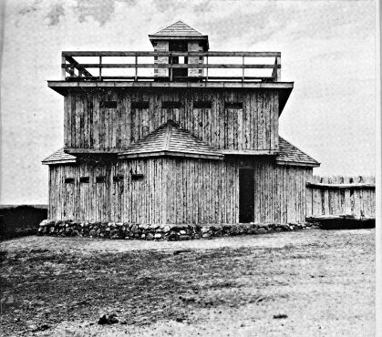
FORT ABRAHAM LINCOLN STATE PARK
Above: Blockhouse of Fort McKeen
Below: Slant Indian Village Lodge
Photos by Russell Reid
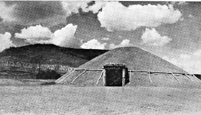
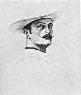
MARQUIS DE MORES
(from an old drawing)
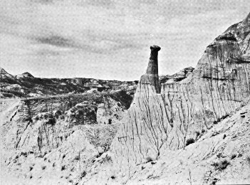
BADLANDS
Photo by Russell Reid
BELCOURT, 115.5 m. (1,619 alt., 6,334 pop., including Indian
reservation), agency headquarters for the Turtle Mountain Indian
Reservation, lies in a shallow valley on the southeastern border
of the hills. It was named for the Rev. George Antoine Belcourt,
a priest prominent in the establishment of the community. The
Indians, about 95 percent of whom are of mixed Chippewa Indian
and French blood, make their homes in crude cabins on small
farms out in the reservation. Academic and vocational training
for the children is provided by the large consolidated school in
Belcourt. The Chippewa are woods Indians who when first encountered
by the whites dwelt in the region of the Great Lakes.
From here they pressed W., often warring with their enemies the
Sioux, until ultimately their hunting grounds included the Turtle
Mountain region. With the white occupation of the West their
range in North Dakota was reduced until finally it was limited
to this small and crowded reservation of 72 sq. m. (See Indians
and Their Predecessors.)
Each year the Indians hold a sun dance (June; approx. 5 m.
NE. of Belcourt; no set date or place). The ceremony lasts for
several days. At the fairgrounds in Belcourt an Indian fair is
conducted (Oct.).
Since 1896 the week of St. Ann has been the occasion of a
retreat at Belcourt for the people of the mountains, for whom St.
Ann is the patron saint. Many of the Indians bring their tipis in
which they live during the retreat. The week is culminated with
the feast of St. Ann (July 26, if it falls on Sun. or on Sun. following
that date). On the feast day a procession is held, with
hundreds participating. Many cures—none, however, authenticated
by the Roman Catholic Church—have been attributed to the shrine
at the Belcourt church.
DUNSEITH, 131 m. (1,715 alt., 484 pop.), scattered over level
land at the edge of the Turtle Mountains, is the southern entrance
to these hills. Its name means city of peace, and was selected to
honor the first white man in the vicinity and also the city of
Dunseith in Scotland. The town is the terminus of a G. N. Ry.
branch from the main line at York (see Tour 6).
The Dunseith Gristmill was built on Willow Creek in 1887
of lumber hauled from Devils Lake by ox teams. It continued
to grind for several years after steam boilers and modern machinery
had come into general use, but in 1913 it was damaged
by fire and has never been repaired.
Dunseith may have a buried treasure somewhere in the foothills.
In 1893 its Turtle Mountain Bank was robbed, and the
robber had time to bury his loot in the hills before he was shot
by a posse. The stolen money was never found, and the bank
was forced to close.
At Dunseith is the junction with ND 3, a graveled highway.
Right on this highway to the junction with a graveled road,
2 m.
Right on this road to SAN HAVEN, 0.5 m., State tuberculosis
sanatorium, situated in a 2,500-acre game reserve on the southern
slope of the mountains overlooking a vast expanse of prairie.
North from the junction with the graveled road, ND 3 runs over
ridges and past little lakes, into the Turtle Mountains, whose hills
are the habitat of hundreds of deer in addition to many varieties
of song and game birds.
On ND 3 is the INTERNATIONAL PEACE GARDEN, 12.5 m.,
a memorial to the peace which has prevailed between this country
and Canada for more than 120 years. The garden lies partly in
North Dakota and partly in Manitoba. On the international boundary
stands a stone cairn with a plaque bearing a pledge of peace:
"To God in His Glory
We two Nations do pledge ourselves
That so long as men shall live
We will not take up arms against one another."
A formal garden, one mile square, is planned (1938) on the
International Line. It will center about a peace fountain around
which a circular garden plot will form a visible ring of friendship
between the two nations. The memorial has attracted wide attention
because of its noble purpose, and several foreign countries
have expressed a desire to aid in its development. It is rededicated
with appropriate ceremonies each year (1st wk. in Aug.).
To the S. and W. of the hills and also in the northeastern
section of the State a great number of the settlers were of Scottish
descent, and each year in connection with the ceremonies at
the Peace Garden a Highlanders' Frolic is held with old-fashioned
Scotch music, dances, and games.
West of Dunseith for 50 m. the route has not a single curve
or jog.
At 138 m. is the junction with a partly improved dirt road.
Right on this attractive road to BUTTE ST. PAUL PARK, 3 m.,
plainly marked by Butte St. Paul (2,500 alt.), highest point on the
southern edge of the Turtle Mountains. A steep climb up the
eastern slope leads to the 15-foot stone cairn commemorating the
work of the Rev. G. A. Belcourt, missionary to the Indians, who on
his first visit in 1853 placed a wooden cross where the cairn now
stands. From the top of the butte a beautiful scene stretches away
to the tree-covered plateau on the N. and E. and to the prairies
on the S. and W.
BOTTINEAU, 148.5 m. (1,645 alt., 1,332 pop.), was named for
Pierre Bottineau (c. 1812-1895), most noted of Dakota guides (see
History). It lies beside tree-bordered Oak Creek on a gently
rolling plain. Most of its settlers were of Scottish descent, but the
western end of the mountains was long nicknamed Little Norway,
and until recent years Norwegian was heard there more often
than English. From 1883-84 a stagecoach line connected the town
with the nearest railroad point, Devils Lake (see Tour 6), 120 m.
to the SE., whence settlers hauled supplies with oxen.
Originally Bottineau was situated a mile farther N. When
the G. N. Ry. survey was made, it became evident that the permanent
site would be farther S. Business houses were soon moved,
but the Bottineau County Courthouse could not be legally moved
without recourse to legislation. Accordingly, one morning the
building was found reposing in the new settlement. As no one
was supposed to know how the transfer had been effected, no one
could be prosecuted, and the expense of returning the building
to its former site provided a convenient and practical argument
against that action.
A catastrophe long remembered by the early residents of Bottineau
was a huge prairie fire in 1886 that swept 500 sq. m. of
territory NW. of town, destroying hay and buildings.
The Indians of the region were not hostile to the white settlers,
but there were Indian scares now and then, and the white men
were inclined to be cautious. An old French settler living near
Bottineau tells the story of being lost with two companions. They
asked some Indians for directions, and were invited to a meal,
which they accepted to avoid giving offense. They were almost
enjoying the meal, when an old squaw, who had been stirring the
stew which they had been eating, urged hospitably, "Dig down
deep; pup in bottom."
The State School of Forestry, in the northeastern part of
Bottineau on Oak Creek, offers a two-year junior college course
in forestry. In the botanical garden or arboretum are about 30
varieties of foreign trees, obtained on a reciprocal basis from other
countries, to be tried out in this climate. Plantings established
under direction of the school are found on farms in every county
in the State. The annual output of the nursery at the present time
(1938) is about 500,000 seedlings.
At Bottineau is the junction with a graveled highway called
the Lake Road, which leads NE. into the hills to Lake Metigoshe,
one of the State's best-known summer resorts.
Right on this road, at the southern approach to the bridge
over Oak Creek, to the junction with a trail, 1 m.
Left on this unusually delightful 5-mile trail, along the western
bank of the creek. At about 0.5 m. is the junction with a less
well-defined trail; L. here on the western side of the creek to a
stone cairn marking the Site of the First White Man's Home in
Bottineau County and the original site of the town of Bottineau,
1 m. Farther on the country becomes hilly, and at 2.3 m. a faint
wagon trail leads R. through a wire gate down to the Gorge, a
pleasant spot where the creek flows through a heavily wooded
ravine, an excellent place for picnicking. Crossing the stream,
the trail follows the eastern side of the creek back toward town.
At 2.5 m. is the State Game Farm, temporarily (1938) used as
the Bottineau Country Club; here is a junction with the Lake
Road (L) which may be followed S.; along the side of the creek,
a much more attractive route, at 4 m. the trail joins the Lake Road
following the creek to the CCC Dam, 4.3 m., just N. of the Willow
Vale Dairy Farm. Here the trail crosses to the western side of
the stream and rejoins the trail on which it began.
Right on the Lake Road to the 640-acre LAKE METIGOSHE
STATE PARK, 14.5 m. In the park lodge is the Henry Klebe
Collection (open) of Turtle Mountain fossils, Indian artifacts, and
geologic formations.
Left on the Lake Road 15 m. to the center of activity on LAKE
METIGOSHE, largest and scenically one of the most attractive of
the Turtle Mountain lakes. It has 70 m. of shore line and extends
across the border into Canada. Its name comes from metigoshe
washegum (Chippewa, clear water lake surrounded by oaks).
There are six resort parks (stores, hotels, cottages, bathing beaches,
boat landings; 12-mile motorboat trip crosses into Canada, not permissible
to land on Canadian side). About 1 m. from shore is
Masons' Island, where Masonic groups hold annual summer meetings.
The Congregational Conference of North Dakota has a summer
Bible camp on the lake, and the Great Plains Area of the
Boy Scouts of America holds an annual encampment here.
West of Bottineau the route proceeds over the extraordinarily
level country formed by the bed of glacial Lake Souris. At 156.5 m.
is the junction with ND 14, a graveled highway.
Left on this highway is KRAMER, 9 m. (1,460 alt., 190 pop.),
believed to have been named for one of the surveyors of the Soo
Ry., which passes through the town. The Kramer Equity Cooperative
Elevator, with a capacity of 110,000 bu., all under one roof,
is one of the largest cooperative elevators in the State.
Right from Kramer 2 m. on an improved county highway to
a junction with a road; L. on this road to the junction with another
road, 3 m.; R. here to a permanent CCC CAMP, 4 m., whose workers
construct dams on the Souris River and work on the LOWER
SOURIS MIGRATORY WATERFOWL REFUGE, an area of 48,000
acres, largest project of the U. S. Biological Survey in North
Dakota (1938).
At 13 m. on ND 14 the route crosses the Mouse or Souris
River, remnant of Lake Souris. At 14.5 m. are the headquarters
of the refuge, where the Administration Buildings are. The 100-foot
observation tower is used in studying bird life (open, children
must be accompanied by adults).
UPHAM, 18 m. (1,461 alt., 257 pop.), is believed to have been
named by the G. N. Ry. town site company. Left from Upham at
22 m. on an improved county road to the largest dam being constructed
on the lower Souris Refuge, a retaining dike approximately
3 m. long.
At 165.5 m. the highway dips slightly and crosses the Souris
River, here resembling a canal, and running almost bank full.
At 175 m. is a junction with US 83; between this point and 192 m.
the two roads coincide (see Tour 3).
MOHALL, 202 m. (1,646 alt., 676 pop.), seat of Renville County,
was named for M. O. Hall, publisher of the first newspaper. Platted
in 1903 as the terminus of the railroad, its growth for the
first few months was rapid. The Renville County Tribune of December
3 of that year said that the G. N. Ry. agent estimated that
during the preceding week 125 carloads of material had been
shipped into the new town, in addition to 175 cars lying on sidetracks
along the line and billed for Mohall. Four tracks were
crowded with cars and eight dray lines were kept busy transferring
the material to the lumberyards and points of construction.
One hundred and seventy-five carpenters were employed, and then
the demand was only half met. At that time the place had nine grain
buyers.
Dick Grace, motion picture stunt flier, lived here for a time.
A CCC CAMP with an enrollment of about 200 adjoins the
town. At present (1938) its members are assigned to work on the
Upper Souris Migratory Waterfowl Refuge (see Tour 7).
At 205 m. the route passes between two farms lighted by
natural gas from wells drilled on the premises. Although natural
gas in large quantities has been found in Montana, and a number
of small wells have been opened in North Dakota, there has never
been a sufficient amount in this State to form the basis for a
permanent commercial enterprise.
At 214 m. the route leads down into the mile-wide Souris
valley. The stream here is lined with box elder, elm, and small
fruit trees.
At 215 m. is the junction with a graveled county road.
Right on this road to the 480-acre MOUSE RIVER PARK
(boating, swimming, roller skating, golf; store, dining hall, auditorium,
cottages), 2 m.
At 229.5 m. is a junction with US 52, a graveled highway,
which unites with ND 5 between this point and 257 m. (see Tour 7).
At 258 m. is the junction with a graveled county highway.
Left on this road is LIGNITE, 1 m. (1,979 alt., 217 pop.), which
was to have been named Kincaid, for an agent of the G. N. Ry.,
but through an error of the town site company was given the
name intended for the neighboring town, a lignite mining center,
which was consequently named Kincaid.
At 8 m. BIG BUTTE (2,200 alt.), a large grassy hill, covers
about two sections of land, rising more than 200 ft. above the surrounding
prairie. At the foot of the butte was once a spring of
excellent water, frequented by Indians passing along the old White
Earth Trail from the Turtle Mountains to the Missouri River.
Circles of stone and Indian mounds are found on the northern side
of the butte. In early days there was a ranch with 300 head of
horses near the spring, but the owner lost all his stock to smugglers.
Somewhere in the vicinity of Big Butte may be the hiding
place of $40,000. A story, not generally credited, relates that in
the late 1870's a Hudson's Bay Co. paymaster, on his way to pay
employees of the company at the several trading posts in the territory,
was robbed of this amount near Estevan, Canada. The
robber was apprehended in the neighborhood of Big Butte, but
not before he had found a place to cache his loot. Taken to Portal,
he died under torture while an attempt was being made to
force his secret from him. On the tanned side of his fur coat
was found a diagram believed to show the hiding place of the
treasure, which has since been the object of many searches. The
accidental unearthing of a stone bearing the inscription "1877" inspired
fresh digging. At another time the Royal Mounted Police
of Calgary are said to have sent men to the locality in an attempt
to recover the money. So far, however, all efforts have proved
unsuccessful. Some believe the treasure was found and taken
away; others think it is still in the vicinity of Big Butte; and a
few skeptics disdain the idea that it was ever buried here at all.
At 268.5 m. is the junction with a graveled road.
Right on this road is COLUMBUS, 0.5 m. (1,930 alt., 516 pop.),
clumped together on the flat prairie. First settled in 1902, it was
moved to the railroad in 1906 when the Soo Ry. was extended
through this part of the State. The first postmaster, Columbus
Larson, gave his Christian name to this town, and his surname
to the next town W.
At 269.5 m. is a junction with ND 40, a graveled highway.
Left on this highway 3 m. to a junction with an improved
road; R. here to the MONTANA-DAKOTA POWER PLANT, 2 m.,
in the heart of the lignite coal field. The plant was opened
1928, and today is a $300,000 enterprise, supplying electrical energy
to the towns of northeastern Montana and northwestern North
Dakota.
At 4 m. on ND 40 is a junction with a second improved road;
L. here to the TRUAX-TRAER LIGNITE STRIP MINE, 4.5 m., the
oldest strip mine in North Dakota. The big shovels which have
been stripping the earth overburden since 1919 have piled ridges of
earth so vast that they resemble miniature mountains. The eight-cubic-yard
shovel saw service in the construction of the Panama
Canal. It is supplemented by another of four-cubic-yard capacity.
About 150,000 tons of coal are taken out annually. Huddled on a
small piece of unbroken ground between the artificial buttes are
the frame homes and store buildings of the little community of
miners.
At 273 m. is the junction with a graveled spur.
Left on this road is LARSON, 0.5 m. (1,931 alt., 89 pop.), a
small Scandinavian town, named for the first postmaster of
Columbus.
West of Larson the route ascends the hills of the Missouri
Plateau. At 278 m. is the junction with a graveled road.
Left on this road to the BAUKOL-NOONAN COAL MINE,
1 m., third largest lignite strip mine in the State. The mining
operations cover an area of 1,040 acres adjacent to the town of
Noonan, and the lignite vein, which lies beneath a 30-foot overburden,
averages 7 to 9 ft. in thickness. The huge, molehill-like
hummocks of earth tossed up by the giant steam shovels spread
fanwise from a central, electrically operated tipple. Loading and
screening facilities at the tipple permit the filling of four cars at
the same time, each with a different grade of coal. The daily
output of the mine, which runs full time during the fall and winter
months, is approximately 100 cars. During the 1935-36 season
more than 170,000 tons of coal were taken out.
NOONAN, 279 m. (1,959 alt., 423 pop.), named for an early
settler, has its white buildings scattered over the northern slope
of a small hill. When the town was platted in 1906, contracts
stipulated that buildings should be painted white in order that the
community might live up to its advertised name of the White City.
CROSBY, 292.5 m. (1,962 alt., 1,271 pop.), dominated by the
dome of the Divide County Courthouse at the northern end of Main
St., was named for a member of the town site company of Portal
(see Tour 7). It sprang up at the junction of the Soo and G. N.
branch lines, a strategic rail position that soon established it as a
focal point for trade in the northwestern corner of the State.
Straight ahead (N) from the fairgrounds on a graveled road
to the CROSBY CITY RECREATION PARK (swimming pool, golf
course, tennis and horseshoe courts, ski jump, camping ground),
5 m., developed along the Canadian border.
At 301.5 m. is a junction with US 85 (see Tour 4), which unites
with ND 5 to 311 m.
FORTUNA, 315 m. (2,190 alt., 196 pop.), a Scandinavian community,
named for the Roman goddess of fortune, was established
in the summer of 1913 when the branch line of the Soo Ry. was
extended from Ambrose, N. Dak., to Whitetail, Mont. The day
lots were sold, temporary business houses, which had been squatting
a mile from the present site at a post office called Norge, were put
on wheels and rolled away to the new town by night.
Right from Fortuna on a county road to the DEWITT SPRING,
1 m., whose flow fills a two-inch pipe of water the year around.
It has furnished water for Fortuna since the founding of the village.
At 329 m. the route crosses the Montana Line, 66 m. E. of
Scobey, Mont.
Junction ND 5—Walhalla—Leroy. ND 32, ND 55, and an unimproved
road.
Junction ND 5 to Leroy, 25 m.
Branch of G. N. Ry. touches at Walhalla.
Graveled roadbed except for 0.5 m. outside Leroy.
Accommodations in Walhalla.
This route runs through the Pembina Mountains, a scenic region
rich in historical associations. From Walhalla, one of the oldest
towns in the State, the route turns east to the settlement of the
metis, descendants of those French-Chippewa who conducted the
famous Pembina hunts of the middle nineteenth century.
ND 32 branches N. from ND 5 at Oak Lawn Historic Site (see
Tour 5), 0.0 m.
At 8 m. the graceful wooded PEMBINA MOUNTAINS are
visible on the horizon. The nearest elevation, 250 or 350 ft.
higher than the country to the E., is known as Second Pembina
Mountain, and is a portion of the Pembina Escarpment, a high
ridge extending from Canada through North Dakota into South
Dakota and southwestern Minnesota. In the southern part of North
Dakota it is known as the Coteau des Prairies. First Pembina
Mountain, lying SE. of Second Mountain, is the prehistoric delta
of the Pembina River, formed when that stream drained the melting
ice sheet into Lake Agassiz (see Natural Setting and Tour 1).
First Pembina Mountain has an average height of 150 ft., and its
eastern edge shows the various shore lines of Lake Agassiz as it
receded in post-glacial times.
To the first white explorers and trappers the Pembina Mountains
were known as the Hair Hills, coveted hunting ground held
by the Chippewa, whose ownership was often hotly contested by
the Sioux. During the early nineteenth century white and half-breed
hunters roamed the hills, gathering furs to be loaded on
lumbering, squeaking oxcarts and sent to eastern trading posts.
It was in this vicinity that Charles Cavileer (see Tour 5), one
of the most prominent settlers of the State, in the 1860's while
making a trip with a party from Pembina to Devils Lake, saw a
herd of buffalo like a black cloud on the horizon. The party
immediately arranged their carts in a semicircle and prepared for
an onslaught. The bison came on with a rumble like thunder,
the rumble became a roar, and the earth trembled; but when they
reached the carts the herd parted and swerved on either side,
upsetting only the outside row of the improvised stockade. Not
until the second day could the journey be resumed, and even then
there were buffalo in sight for another day. The herd was believed
to number two or three million, and in its wake was an area,
several miles in width, entirely devoid of vegetation.
At 9 m. (L) are the SAND SLIDES, where steep sand and
gravel slopes form a precipitous funnel-shaped valley down to the
PEMBINA RIVER. This stream once drained prehistoric Lake
Souris into Lake Agassiz, and its rushing waters cut into the Pembina
Mountains, creating the present canyon 350 to 450 ft. deep.
At 12 m. (R) is WALHALLA (966 alt., 700 pop.), attractively
situated in the wooded river valley on the slope of Second Pembina
Mountain. In 1848 Father G. A. Belcourt established St.
Joseph's Mission here for the Chippewa Indians. By 1860 the settlement
had become an important fur trading post, with a population
of 1,800; but good furs became scarce, the bison virtually
disappeared, and by 1871 "St. Joe" was inhabited only by a priest,
the U. S. customs inspector, and some 50 metis or half-breeds, who
remained only as long as the hunting was good. The town revived,
and was platted in 1877 and renamed Walhalla, for the
palace of immortality in Norse mythology.
The old bell in the Catholic church belfry, known as the
Angelus Bell, was brought to Father Belcourt's mission when
it was opened, and was the first church bell erected on the plains
of North Dakota. It was cast in 1845, and a wreath of raised
figures around the top represents science, art, music, mechanics,
and astronomy. The bell is believed to have been brought down
the Red River by boat, thence to St. Joseph by oxcart. Its tone
is similar to that of the old mission bells of California.
Right from Walhalla crossing the railroad tracks on a graveled
road; L. on a graveled road to a METIS SETTLEMENT, 4 m.
Here, in the foothills of the Pembina Mountains, live descendants
of half-breed French Canadians and Indians of earlier days. The
metis are found throughout the northeastern corner of North Dakota
(see below). In this particular settlement they operate small
farms, gaining their livelihood by selling garden produce, berries,
and cordwood. The graveled road turns L. at 5 m., to Leroy (see
below), 7 m.
Also at 12 m. is WALHALLA STATE PARK (L), on the eastern
slope of the Pembina Mountains. The wooded 5-acre tract
contains the Site of Alexander Henry, Jr.'s Trading Post, a temporary
depot established in 1801, one of the first posts in present
North Dakota; also the Kittson House, erected in 1851-52 as a
trading post and warehouse under the supervision of Norman Kittson,
who became the first postmaster in North Dakota. This building
was originally built nearby and was moved to the park in
1915. Often locally designated as Old Settlers' Park, the area is
the scene of the annual meeting and picnic of the Pembina County
Old Settlers' Association (July).
Left from the park on a winding graveled road to the PROTESTANT
CEMETERY, 0.4 m., where are buried two missionaries killed
by Indians in the early 1850's and hence known as the Martyrs of
St. Joe. At 1.4 m., at the summit of the mountain, LOOKOUT
POINT affords a fine view of the deep Pembina River valley below
and the Red River Valley farming area, dotted with villages and
farmhouses, which stretches away in the distance. The point is
the property of several Masonic lodges in this area, and they hold
an annual picnic here.
At 15 m. on ND 32 is the junction with ND 55, on which the
route continues. At 22 m. is the junction with a graveled road.
After crossing the Pembina River, the highway at 25 m. enters
LEROY (890 alt., 100 pop.). The inhabitants of the town are
chiefly metis and their log cabins are scattered in the timber along
the river. From the time the Hudson's Bay Co. began operations
in 1670, French Canadians migrated westward, intermarrying with
Chippewa women. Their children were known as metis or mixed-bloods.
Inheriting the characteristics of both the Indian and the
French-Canadian woodsman, the metis became adept voyageurs,
and their part in the early fur trade of the Middlewest was very
important. They were excellent hunters, trappers, and couriers,
and it is said they loved the "musical" sound of the Red River
oxcarts which, with their unlubricated wooden axles and hubs
screeching across the plains, brought furs E. from the trading posts.
When this region began to be settled the metis were the first
mail carriers, since their stamina and knowledge of the frontier
made them "brave and bold, and the most reliable men to be
had."
The early metis of North Dakota, ancestors of the present
metis, enjoyed life with true appreciation. They were fond of
good dress, and their clothes were made of the finest imported
merinos, cashmeres, and broadcloths, bought at the trading posts.
The men wore black broadcloth redingotes, long and double-breasted
and trimmed with large brass buttons. At the collar was
a capuchon or hood, which was never worn but served merely as
an adornment. A bright sash about the waist, beaded moccasins,
and a beaded tobacco pouch, used much as a French courtier used
his snuff box, completed the costume. The women wore the tight
basque and flowing skirt, and, in summer as well as winter, a
half dozen gaily colored petticoats, which created quite a dazzling
array when the wearer stooped to tie the lace of a beaded moccasin.
A black silk kerchief was tied about the head, and over this
went a large square of black broadcloth which wrapped about the
entire body and served as a cloak.
The metis were, and still are, fond of music and dancing.
Their songs came down from their French ancestors or were learned
from the mission priests. One favorite was Au clair de la lune (By
Moonlight) and another was Marlbrouck s'en va-t-en guerre
(Marlborough Goes to War). Square dances, the Red River Jig,
Pair O' Fours, and Reel O' Cats were favorite dances, and some of
them are still performed.
The most important event in the year for the metis, in the
first half of the last century, was the Pembina buffalo hunt. For
this, white and metis hunters would meet at Pembina on an expedition
which sometimes took them as far as Fort Union on the
Missouri (see Side Tour 6B). Not only men, but also women and
children, went on the hunt, and even the priest went along to
counsel and advise. Equipment was carried in stridently creaking
oxcarts. It was like a good-sized town on a tour. On the hunt
of 1840, probably the largest ever held, there were 1,630 people and
1,210 oxcarts, and the cost of the expedition has been estimated at
$120,000. The camp was organized under a chief, with 10 captains
under him, and 10 soldiers under each captain to enforce the camp
regulations. For a first violation the saddle and bridle of the
offender were cut up; for a second, his coat was destroyed; and
for a third, he was flogged. A thief, even if he stole something
of no greater value than a buffalo sinew—a common article of
barter in the Red River country—was publicly cried "thief."
Hunting was not always good; hot weather or storms delayed
parties, and sometimes prairie fires were encountered. Eventually
encroaching civilization put an end to the buffalo hunts, but while
they were held, and when they were successful, the hunters lived
in plenty. The 1840 expedition took home more than a million
pounds of meat in their oxcarts.
The main food of the early metis was pemmican, or dried
buffalo meat, but wild game was also plentiful. Galette, an unleavened
bread made by mixing flour with water, salt, and shortening,
was preferred to white man's bread.
Great respect for old age, and deep affection for relatives
characterize metis family relationships. Concerning birds and animals,
they have many unusual beliefs: a hungry beast coming to
the door is regarded as a sign of poverty, a woodpecker pecking
at a window is said to be a sign of death in the family, and
snakes are believed to be symbols of quarrels and enemies.
(Duluth, Minn.)—Grand Forks—Devils Lake—Minot—Williston—(Glasgow,
Mont.). US 2.
Minnesota Line to Montana Line, 390.5 m.
G. N. Ry. roughly parallels entire route, Farmers' Line between
Devils Lake and Webster.
Graveled roadbed except for about 110 m. of short stretches hard-surfaced.
Accommodations in principal towns.
This route reveals a cross section of the agricultural life of
the State. In the east the flat, fertile lands of the narrow Red
River Valley, which formed the bottom of glacial Lake Agassiz,
blend into the uneven, farm-dotted surface of the broad Drift
Prairie, bordered on the west by the rougher, more sparsely settled
grazing areas of the Missouri Plateau. The route touches on Devils
Lake and crosses the level loop of the wooded Mouse River, a region
at one time covered by Lake Souris, another extinct creation of
the glacial epoch. Midway across the State is the geographic
center of North America. The western half of the route is through
a rich, though largely undeveloped, lignite coal area, formed ages
ago by the inundation of prehistoric forests.
GRAND FORKS, 0.0 m. (834 alt., 17,112 pop.) (see Grand
Forks).
Points of Interest: University of North Dakota, Wesley College.
At Demers Ave. and 5th St. is a junction with US 81 (see
Tour 1), which unites with US 2 to the intersection of Skidmore
Ave. N. and N. 16th St.
West of Grand Forks US 2 passes through the western half
of the Red River Valley, part of the bed of ancient Lake Agassiz.
At 9 m. is the junction with a county dirt road.
Left on this road to tiny OJATA, 1 m., the remains of a once
thriving boom town known as Stickney. In its heyday it was a
railroad terminus, and for a time rivaled Grand Forks in trade.
Since the site is swampland, each heavy rain makes it a quagmire,
and residents, considering the first name too literal, soon changed it
to Ojata. The place declined when the railroad was extended W.
At one time a farmer acquired the entire village in exchange for
a stallion.
At 20 m. is the junction with a county graveled road.
Right on this road to TURTLE RIVER STATE PARK (swimming,
picnicking, camping), 3 m., where a picturesque ravine, cut
by the once swift-flowing waters of the TURTLE RIVER, offers a
pleasing variation to the level surrounding country. The river is
named for the many small terrapin found on its banks. Just W.
of the entrance are 15 tumuli (mounds) built by prehistoric Indians.
Excavations by Dr. A. E. Jenks of the University of Minnesota
have yielded copper instruments, an ivory pipe, and other
artifacts. Unlike the mounds in other parts of the State (see Side
Tours 8A and 8B), these have been plowed over and cultivated
until they are only small humps on the prairie. The few tumuli
opened have been easily excavated because they lie in a gravel
deposit.
ARVILLA, 21.5 m. (1,019 alt., 150 pop.), was named for the
wife of a bonanza farmer. The Grand Forks County Farm and
Hospital, a large brick structure, is situated just across the railroad
track on a 136-acre tract adjoining the town on the S. The
Arvilla Academy and North Dakota Conservatory of Music, the
first private college in the State to maintain a music department,
was founded in 1886 by Rev. John Allen Brown, Presbyterian
pastor at Arvilla. Miss Sadie P. Brown, daughter of the founder,
and a graduate of the Boston Conservatory of Music, headed the
music department. The existence of the academy was brief, for
the building was destroyed by fire in 1893 and was never rebuilt.
The CRYSTAL SPRINGS STOCK FARM, 23.5 m., consisting
of 2,480 acres along the Turtle River, was a bonanza farm and
then a stock farm, but now is known for the spring water bottled
here for commercial purposes. In its early days the 20-room
house, now standing empty with its venetian shutters flapping in
the wind, was the scene of a social life that rivaled the surrounding
bonanza acres in expansiveness and amplitude. H. T. Hersey,
a Minnesota millionaire, became interested in wheat farming and
built the house. His wife installed a full staff of servants, and
many parties were held for eastern friends. On several occasions
James J. Hill stopped his special train here to visit the Herseys,
and once a special train carrying members of the State legislature
stopped while its passengers were entertained at this prairie
palace. Eventually Hersey tired of his role of gentleman farmer
and sold his farm to James Streeter, prominent Larimore real
estate dealer and farmer.
LARIMORE, 28 m. (1,135 alt., 979 pop.), was named for N. D.
Larimore, stockholder and business head of the Elk River Valley
Farm, which was once the world's largest farm under single management.
Most of the bonanza farms were divided into a number
of tracts, each under a foreman, but the Elk River Valley Farm
had all operations centralized. Its huge proportions attracted the
St. Louis World's Fair Foreign Commission, which visited the farm
in 1904, at which time there were 11,000 acres under cultivation.
From this visit a great influx of northern Europeans resulted, leading
to the breaking up of the bonanza farms and the sale of small
farms to the new settlers.
The City Park (wading pool, tennis courts, tourist camp) is
in the same block as the city hall.
At 32.5 m. the highway crosses the Turtle River, near a dam
built by the Civilian Conservation Corps (swimming, picnic
grounds).
McCANNA, 38 m. (1,142 alt., 100 pop.), was named for S. A.
McCanna, owner of the McCanna Farm (R), now the largest in
the western part of Grand Forks County. Large modern buildings
adjacent to the town on the NW., and the use of modern farm
methods make it one of the show places in the area.
NIAGARA, 44.5 m. (1,443 alt., 207 pop.), was named for Niagara
County, N. Y. Because of uncertainty as to where the railroad
would pass, the town was first built on skids 1 m. E. of the
present site, and was moved when the railroad came in 1882.
PETERSBURG, 51.5 m. (1,524 alt., 310 pop.), named for a pioneer
clergyman in the community, has a population predominantly
Norwegian, as has MICHIGAN CITY, 57.5 m. (1,520 alt., 433 pop.),
platted on land of the James Lamb family, who were among early
arrivals in the vicinity and have continued to be prominent in
local affairs. The town was named in honor of the native State of
many of its first settlers. In the early 1880's an error in billing
sent here an entire trainload of iron ore intended for Michigan
City, Ind. The village officially retains its original name, but
local usage has abridged this to "Michigan."
MAPES, 62.5 m. (1,530 alt., 56 pop.), once a prosperous grain
shipping center, was named for Emery Mapes, one of the men who
worked out the formula for the nationally known Cream of Wheat.
At 67.5 m. is the junction with ND 1, a graveled highway (see
Side Tour 8B).
LAKOTA, 68.5 m. (1,518 alt., 860 pop.), is the seat of Nelson
County. Its name is derived from the Teton Sioux word meaning
allies, which is the same as the Santee Sioux dakota. The many
trees lining Lakota's streets are the result of experiments by a
pioneer who believed trees could be grown on the barren prairies.
The Tofthagen Library and Museum (open), built in 1927, was
a gift to the city from A. M. Tofthagen, Nelson County pioneer.
It contains 5,000 volumes, and curios gathered by the donor in
his travels.
BARTLETT, 72.5 m. (1,534 alt., 67 pop.), was named for Frank
Bartlett of Larimore, who owned the town site. For a time Bartlett
was the end of the rail line, a typical boom town, and had
21 saloons; one, the Diamond, employed a Negro piano player and
singer who usually ended his performance in a burst of "Bartlett,
dear Bartlett, will be a dandy of Dakota yet."
DOYON, 78.5 m. (1,512 alt., 204 pop.), was named for Charles
H. Doyon, a bonanza farmer.
DEVILS LAKE, 96 m. (1,466 alt., 5,451 pop.), seat of Ramsey
County, was at one time head of steamboat navigation on the then
important inland sea of Devils Lake (see Side Tour 6A). The
lake has receded 5 m. in the half century since the vicinity was
settled, and the town now overlooks a dry bed and shrunken
shore line. Fort Totten, which later became Fort Totten Indian
Agency (see Side Tour 6A), was established on the southern shore
of the lake in 1867 to place the Indians of the region on a permanent
reservation. In 1882 the Government held that the Chippewa
Indians had no claim to the lands N. of the lake, settlers began
to come in, and Creelsburgh, or Creel City, 4 m. NW. of the present
site of Devils Lake, became the first white community in the area.
The town of Devils Lake was founded the following year and
many Creel City citizens moved to the new town site.
One of the first settlers in Creel City was Capt. Edward
Heerman, who inaugurated steamboat navigation on Devils Lake.
On July 4, 1883, the first train on regular schedule arrived in
Devils Lake, and was met by Heerman's steamboat, the Minnie H.
The service was later augmented by two smaller steamers. Rails
were laid on the wharf at Devils Lake so that all freight and passengers
for Fort Totten, Minnewaukan, and other points across the
lake were transferred directly from car to steamer. By 1909,
however, the water of the lake had receded 4 m. from the city,
6 m. from Minnewaukan, and nearly 2.5 m. from the fort, so navigation
came to an end. The shrinking of Devils Lake has been
one of the arguments for the Missouri River Diversion project,
which, it has been asserted, would raise the water level of the lake.
The State School for Deaf is at 14th St. and 1st Ave., situated
in expertly landscaped grounds. Established in 1890, the
school has gained international recognition for its work in physical
education for the deaf. An elaborate revue, known as a Rhythm
Pageant (public, June), is presented annually at the school's graduation
exercises, and motion pictures of this pageant have been
made for study in similar institutions elsewhere.
At the eastern end of 2nd St. is the I. O. O. F. HOME, maintained
by the North Dakota Grand Lodge of the Odd Fellows for
its aged members and orphans of former members. It is a three-story
brick building surrounded by landscaped yard and gardens.
The World War Memorial Building, 504 4th St., is a community
recreation center. Studios and transmitter of KDLR are in the
Grayson Hotel building at the cor. 5th Ave. and 7th St.
At the W. end of 5th St. is the junction of ND 20, a graveled
highway (see Side Tour 6A) and ND 19. Right at this junction
is Roosevelt Park (swimming pool, picnicking, camping), built as
a WPA project.
North of Devils Lake US 2 passes SWEETWATER LAKE, 105
m., once a large body of fresh water that attracted pioneers. Today,
like that of Devils Lake, its shore line has greatly receded.
CHURCHS FERRY, 123 m. (1,460 alt., 295 pop.), developed
from a ferry established by Irvine Church across Mauvaise Coulee
(Fr., bad streambed) in 1886, so named by French explorers because
it was difficult to cross, the channel once drained a large territory
into Devils Lake to the S. Although it has been dry for several
years, in the 1870's and 1880's, until Church began his ferry, all
goods for the area NW. and W. of Devils Lake had to be boated
across or hauled around the southern shore of the lake.
At 124 m. is the junction with US 281, a graveled highway
(see Tour 2), which unites with US 2 from this point to 131 m.
LEEDS, 135 m. (1,514 alt., 725 pop.), with a predominantly
Scandinavian population, was established in 1884. It has paved
streets and a park (swimming pool). Because many stockholders
in the G. N. Ry. were Englishmen, several of the towns along the
railroad, including Leeds, were given names of English towns.
One of the first newspapers in this region, the Leeds News, founded
in 1903, boosting the new community in the customary manner,
lauded it with this characteristic humor: "A man died and entered
heaven. On his first walk about his new abode he noticed
several men fettered in ball and chain. His inquiry of a passer-by
brought the reply, 'They came from Leeds, N. Dak., and if they
weren't chained they'd go back.'"
Left from Leeds on a county dirt road to LAKE IBSEN, 2 m.,
named for Henrik Ibsen, Norwegian poet and dramatist. It is said
that about 1858 a peace agreement between the Sioux and Chippewa
Indians was made at this lake, a treaty well observed by both
tribes. Small islands in the lake were known to explorers of the
region as Petites Isles Aux Mortes (Fr., small islands of the dead),
owing to the fact that the Indians had buried many victims of a
devastating smallpox epidemic here. They placed their dead on
scaffolds, the wooden frames of which were visible from the lake
shores.
YORK, 142.5 m. (1,612 alt., 250 pop.), is another town with
an English name and a predominantly Scandinavian population.
KNOX, 150 m. (1,605 alt., 177 pop.), is named for John Knox,
the Scottish religious reformer.
PLEASANT LAKE (good camping, tourist accommodations,
spring water), 155 m., is a small tree-fringed body of water which
was called Broken Bones Lake by the Indians who camped on its
shores to dry their buffalo meats. They broke the buffalo bones
to remove the marrow, which they sewed into sacks of skin and
preserved for winter use. Evidences of an Indian burial ground
are found on a hill to the N. These burials are not in mounds,
and the only excavations are those made accidentally by farmers
plowing the land.
At 156 m. is the railway station of PLEASANT LAKE (1,603
alt., 33 pop.), where tribal dances were performed on the town
site by a group of Indians as recently as 1883. Some of the settlers
feared that the ritual was a war dance, but the Indians did
no harm.
At 163.5 m. is the junction with ND 3, a graveled highway.
At this crossroads is a stone cairn marking the GEOGRAPHIC
CENTER OF NORTH AMERICA. In 1931 the U. S, Geological
Survey determined that the geographic center of the continent
is in Pierce County, N. Dak., and the marker at the highway junction
is in the approximate center of the county. The survey states,
"The geographic center of an area may be defined as that point
on which the surface of the area would balance if it were a plane
of uniform thickness, or in other words, the center of gravity of
the surface.... It would not be feasible, therefore, to specify for
such a large irregular area as that of North America the exact
section, township and range in which the geographic center lies."
Some years before 1931 Pierre, S. Dak., claimed to be the approximate
center of the continent, based on the fact that two lines
drawn from corner to corner of a map of North America intersected
near Pierre.
Right on ND 3 is RUGBY, 1 m. (1,562 alt., 1,512 pop.), Pierce
County seat, named for Rugby, England. It was platted in July
1885 and the first train arrived a month later. In the City Hall
is a museum (open weekdays, 9-5) containing, among other things,
Indian artifacts found in the county and Spanish-American War
relics. Ellery Park and the tourist camp are in the western
part of town. Rugby was the home of the late N. P. Lindberg,
who is said to have originated the slogan, Say It With Flowers. It is
said that in the course of a talk made at a national florists' convention
in Chicago he remarked, "In North Dakota we say it with
flowers." His words caught the fancy of his fellow delegates, who
adopted them as a slogan. His florist shop and greenhouse, now
operated by a son-in-law, are in the eastern part of town.
TUNBRIDGE, 168.5 m. (1,509 alt., 15 pop.), and BERWICK,
174.5 m. (1,484 alt., 100 pop.), are small hamlets R. of the route.
Although the latter town has a name of English origin, the Berwick
Post, which suspended publication several years ago, was
published partly in German for the large community of Russo-Germans
living S. of the town.
TOWNER, 183 m. (1,478 alt., 622 pop.), named for Col. O. M.
Towner, one of the first ranchers in McHenry County, is the county
seat. It lies in a bend of the SOURIS (Fr., mouse) RIVER, so
named by French explorers for the numerous field mice found in
the river basin. The river itself lies on a level plain that was at
one time the bed of glacial Lake Souris, of which the stream is
now the only remnant. Fully three-fourths of McHenry County
is on this plain, once principally cattle country, now devoted to
diversified farming.
During ranching days in the 1880's the country was a rough
frontier populated by an odd assortment of personalities. Among
these were two English peers, each of whom acquired a ranch near
Towner, built a large home, and settled down to the serious business
of living lavishly on remittances from home. The community
was excited when one of the men had a visit from his sister,
a countess prominent in women's suffrage work in the British
Isles, who arrived on a special train. The other exile also had a
caller from home, an elderly woman who arrived unexpectedly to
find him occupied with the entertainment of a houseful of guests.
She departed without seeing him or even getting out of her carriage.
Not long afterwards both Englishmen took their leave.
Towner is the junction with ND 14, a graveled highway, which
unites with US 2 between this point and 188 m.
1. Left from Towner on a graveled county road to the
SCHULTZ HEREFORD RANCH, 1.8 m., where registered Hereford
cattle and Belgian horses are bred. Situated on the timber-flanked
banks of the Mouse, the ranch has an air of early-day
friendliness. Its huge barns and corrals reflect the large-scale
ranching of pioneer days joined with the efficiency of a modern
business—a combination typical of the present-day stock raising
industry in the State.
2. Right (N) from Towner on a graveled county road to a
GOVERNMENT NURSERY, 1.5 m., where experimental work in
connection with the shelterbelt project is conducted.
3. Right from Towner on ND 14 is BANTRY, 14 m. (1,469 alt.,
150 pop.). Left from Bantry on ND 17, a graveled highway, to
the LONG TURKEY RANCH, 20.5 m. At the age of six weeks
the young turkeys are sent out on the 320-acre range in flocks
of 700, and attain their full bone growth during the summer
months. A few weeks before fall marketing the flocks are driven
in to the ranch and the birds confined in large pens where they
are fattened for market. More than 2,000 turkeys are shipped from
the Long ranch annually.
At 188 m. is a junction with ND 14.
Left on this graveled highway to the junction with a dirt
road, 1.5 m.; R. here to the EATON DAM, 3.3 m., which irrigates
6,800 acres of meadowland. This water adds to the productivity of
the heavy native grasses from which many hundreds of tons of hay
are cut each year. At the close of the haying season the river
bottoms are dotted with hundreds of small, mound-like haystacks
resembling huge grain shocks in a field of giant wheat. In the
time between haying and fall the grasses attain a second growth,
and cover the meadowlands around the stacks with a luxurious
green carpet that contrasts with the dingy brown of the autumnal
stubblefields through which the Souris courses.
At 196.5 m. (L) are the DENBIGH REFORESTATION PROJECT
HEADQUARTERS. The feasibility of growing trees in poor,
sandy soil and semiarid climate is being tested on a 640-acre tract
by the Northern Plains branch of the Lake States Forest Experimental
Station. The results secured will serve as a guide for work
in similar areas of other States.
GRANVILLE, 207 m. (1,513 alt., 450 pop.), named for Granville
M. Dodge, G. N. Ry. civil engineer, is in a level agricultural
area W. of the sand hills bordering the Mouse River. A condition
common in homesteading days drew this worried comment from
the Granville Record in 1904: "It is a great wonder this country
has advanced and is developing as rapidly as it is with so many
old bachelors who do not improve their places and so many old
maids holding down claims. It ought to cause a blush of shame to
mount the face of every bald-headed old bachelor in the vicinity."
At 216 m. is NORWICH (1,529 alt., 100 pop.), named by the
G. N. Ry. town site company for an English town.
West of SURREY, 222.5 m. (1,627 alt., 125 pop.), the route begins
the gradual descent to a second crossing of the Mouse River.
In the distance to the W. and S. of the river, the hills rise to the
Missouri Plateau.
MINOT, 230.5 m. (1,557 alt., 16,099 pop.) (see Minot).
Points of Interest: Minot State Teachers College, Roosevelt Park and
Zoo.
At Valley St. and 4th Ave. SE. is the junction with US 52
(see Tour 7), which unites with US 2 at 236.5 m. At 4th Ave.
and 2nd St. SW. is the junction with US 83 (see Tour 3).
Just W. of Minot is the (L) HIGH STEEL TRESTLE (120 ft.) of
the G. N. Ry., spanning Gassman Coulee. Early one morning in the
1880's a high wind blew down the wooden bridge which then stood
here, and only the quick work of an engineer prevented an entire
train from plunging into the deep coulee.
At 236.5 m. is the junction with US 52 (see Tour 7). A large
tourist camp is L. The highway here makes an abrupt ascent to
the level Missouri Plateau.
All towns along the route W. of Minot are populated principally
by Scandinavians.
DES LACS, 245.5 m. (1,932 alt., 205 pop.), is named for Des
Lacs River and Lake (see Tour 7). The little town received publicity
in 1922 when it elected a complete ticket of women officials.
One eastern newspaper wrote a glowing description of a campaign
torchlight parade around the city hall and told of the enthusiasm
which the men of the town felt over the winning ticket; but a
writer for a women's magazine, sent out to look over the situation,
was forced to report that there was no city hall, and that "the
men were not so enthusiastic now, perhaps because they did not like
to have their own backyards cleaned up."
LONETREE, 249.5 m. (2,002 alt., 36 pop.), was named by the
railroad company for the one tree that was there when the rails
were laid. This little town figured prominently in the Burlington-Minot
battle for the seat of "Imperial Ward" County in 1888, turning
the election for Minot (see Minot).
BERTHOLD, 253.5 m. (2,089 alt., 511 pop.), is the center of a
certified seed potato raising area. In the late 1880's it was the
nearest railhead to Fort Berthold on the Indian reservation to the
S., hence its name.
At 262 m. the terrain becomes more rolling and from here to
the Missouri River the route traverses the ALTAMONT MORAINE,
a range of hills lying on the eastern portion of the Missouri Plateau,
and marking the farthest advance of the western lobe of
the last or Dakota Glacier.
TAGUS, 265 m. (2,189 alt., 136 pop.), was named for a rancher
named Taguson.
Left from Tagus on an unimproved dirt road to CARPENTER
LAKE (swimming), 6 m.
BLAISDELL (L), 273 m. (2,264 alt., 100 pop.), was named for
Alfred Blaisdell, a settler who later became secretary of state of
North Dakota.
PALERMO (L), 280.5 m. (2,201 alt., 205 pop.), is the namesake
of a city in Sicily.
Right from Palermo in the rolling hills of the glacial moraine
N. and E. of the town are several small lakes containing heavy
deposits of sodium sulphate (see Side Tour 4A).
STANLEY, 288 m. (2,253 alt., 936 pop.), is named for one of
the first homesteaders in the area. The Mountrail County Courthouse
(R), topped by a cupola, is at the northern end of town. Stanley
is on a nearly level plateau, while both to the N. and to the S.
the terrain is more rolling. There is a junction here with ND 8, a
graveled highway (see Side Tour 3A). In 1906 the Stanley Sun,
a usually conservative newspaper, joined other papers in the State
in telling of the wonderful fertility of North Dakota soil: "... the
most productive soil on earth, insomuch that if you stick a
nail in the ground at night, it will grow into a crowbar before
morning."
ROSS, 296.5 m. (2,292 alt., 108 pop.), was named by the railway
company. In 1902 a group of 20 Moslem families from Damascus,
Syria, filed on homesteads SE. of Ross, and since 1909, when
the Federal Government withdrew its objection to their naturalization,
many of them have become citizens. They are Americanized
in dress, although the women have a penchant for highly colored
clothes. Many Old Country foods are still used; one Syrian dish
especially well-liked consists of durum wheat boiled, sun-dried,
ground, and screened, and stewed with meats and vegetables or
sweet oils. The dried grain is ground in a large horse-powered
machine resembling a coffee mill.
In 1929 this colony built a basement mosque, and each Friday
a member of the congregation conducts services. Each person
carefully washes his hands and feet before entering the temple;
the sexes are segregated during prayer. During Ramadan—the
ninth month according to the Mohammedan calendar, which is lunar—the
people fast for 30 days, taking food only after dark; the
month ends with a feast. The wedding ceremony of the group is
unusual, for the bride is not present. Before the wedding she
selects two witnesses to act in her behalf, who state the amount
of money to be exchanged between the bridegroom and her parents—the
bridegroom gives the parents this amount and they return
the same amount to him. During the wedding ceremony the bride
retires to another room; the father places his hand in that of the
bridegroom, a large kerchief is placed over the clasped hands, and
a member of the congregation reads the service. It is a custom
of these people to shake hands at any chance meeting, no matter
how recently they have met.
At 298.5 m. is the junction with a graveled road.
Left on this road is SANISH (Arikaran, real people), 23 m.
(1,820 alt., 463 pop.), lying in a valley between bluffs bordering
the eastern bank of the Missouri River. Spanning the Missouri
here is the Verendrye Bridge, completed in 1927, the third highway
bridge built across the river in the State. The site was known to
the Indians from the earliest times as the Old Crossing because
it was used as a ford by the large buffalo herds in their annual
migrations. Adjoining Sanish on the S. is VERENDRYE NATIONAL
MONUMENT, in which is Crow Flies High Butte, named for an
Hidatsa Indian chieftain. On this butte is a monument dedicated to
the Verendryes, who are believed to have visited one of the agricultural
Indian tribes here on their exploratory trip into present North
Dakota in 1738. The site discovered near Menoken in 1936, however,
may be more definitely established as the village they visited
(see Tour 8).
MANITOU (Chippewa, the Great Spirit), 302.5 m. (2,282 alt.,
24 pop.), founded when the G. N. Ry. built through the territory
in 1887, today consists of only a consolidated school, a store, and
an elevator.
WHITE EARTH, 310.5 m. (2,099 alt., 240 pop.), founded in 1891,
probably was named for the fine, white, clayey sand which has
washed down into the White Earth River valley. It overlies the
Laramie formation, which is exposed in many places on the sides
of the valley, 150 ft. deep here. While diversified farming predominates
in the vicinity, traces of the old West are still found
on a few small ranches along the White Earth River between the
route and the Missouri River to the S.
TIOGA (Iroquois, beautiful valley), 321.5 m. (2,241 alt., 435
pop.), was founded in 1902.
RAY, 335 m. (2,271 alt., 621 pop.), named for Al G. Ray, chief
special agent for the G. N. Ry. when the town was established in
1902, is scattered on level land along the railroad right-of-way.
It was one of the first towns in the United States to adopt a
commission form of city government (1910).
1. Right from Ray on a graveled county road to the WILLIAM
SIMPSON FARM HOME, 8 m., where there is an unusual
Collection (open) of South African oddities, collected by Simpson,
a Scotchman, who during several years there obtained animal skins,
beads, heads, and horns from the natives.
2. Left from Ray on a dirt graded county highway to the
junction with another road, 10 m.; L. here to the first Well and
Derrick of the Big Viking Oil Company, on the Nesson Flats, 17 m.,
a level bench just above the Missouri River opposite the mouth of
TOBACCO GARDEN CREEK (see Tour 10). Interest in a prospective
oil field here led to a 40-day $25,000 survey and the expenditure
of $195,000 in test well drilling by the Standard Oil
Company of California in 1937. More than 200,000 acres in oil
leases were taken up in the vicinity, and the company plans (1938)
to expend another $200,000 before completing the test drilling.
Opposite Nesson Flats near the mouth of Tobacco Garden Creek
an attack upon a river steamer was made by a Sioux war party
July 7, 1863. The Sioux, goaded to hostility by repeated violations
of treaties and corrupt handling of annuity goods by governmental
agencies, had met the Robert Campbell at Fort Pierre, S. Dak., to
ask for the goods due them. When Samuel M. Latta, Indian agent
in charge of distribution of the boat's cargo—a newcomer in the
Indian service, arrogant and none too scrupulous—withheld one-third
of the goods, the Indians vowed to follow the boat up the
river to Fort Benton, its destination. For 600 miles they harassed
the steamer, pouring shots into it at every vantage point, attacking
the crew at each woodyard, and making life miserable for all on
board.
At that time the river at the mouth of Tobacco Garden Creek
was quite narrow, and the Indians chose this spot for a massed
attack. Joseph LaBarge, captain of the Robert Campbell, realizing
the hazards of steaming through this point, made his boat fast to
the opposite bank to prepare for a parley. The Sioux sent word
that they wanted no trouble, only the annuity goods due them.
Latta, however, refused to give up the goods, and suggested sending
a yawl ashore to negotiate with the Indians. The Sioux consented,
provided Latta came ashore. He, in turn, agreed to go, but when
the yawl was ready he became conveniently ill in his cabin.
The yawl went ashore and had hardly landed when the Indians,
angered by Latta's perfidy, attacked the crew. Three were killed
and another wounded before the crew of the steamer opened fire,
killing 18 Indians and 20 horses. The slain white men were buried
next day on a bluff opposite the mouth of the Little Muddy Creek,
where the city of Williston now stands (see below).
WHEELOCK, 342 m. (2,387 alt., 115 pop.), named for Ralph
W. Wheelock, an editorial writer on the Minneapolis (Minn.) Tribune
in the early 1900's, is the highest point of elevation on the
G. N. Ry. in North Dakota.
Left from Wheelock on an improved dirt road to the junction
with an unimproved dirt road, 5 m.; L. here 3 m. to HUNGRY
GULCH, a pleasant ravine on Tobacco Garden Creek. From the
base of one hill bubbles a spring of clear water, and level areas
under clumps of trees invite picnic spreads on the banks of the
creek. Along the stream is a deposit of "fool's gold", or pyrite,
which in 1902 had gold prospectors agog in anticipation of wealth.
The story is told that, in the rush to stake claims here, James
Moorman, on whose land the "strike" was made, was the only
person to benefit. He made a substantial profit selling the hungry
prospectors his small stock of flour, in the form of pancakes, at
exorbitant prices. When the supply was exhausted and appetites
still were not satisfied, Moorman told them he would peel bark
from the trees for them to eat. The ravine has since been known
as Hungry Gulch.
South of the junction with unimproved road to SEVEN MILE
HILL, 7 m., a large, fairly level elevation over which passed the old
trail used by fur traders, soldiers, and travelers between Bismarck
and Williston. Blue Buttes, prominent peaks in the Badlands across
the Missouri, are visible in the SE. on a clear day; N. and E. is
an expanse of prairie; and to the S. and W. the Missouri, with
its wooded banks and lowlands, winds to the horizon. Near the
foot of the hill is Cusac Springs Farm (R), where a skirmish apparently
unrecorded in military annals—possibly between Indians
and soldiers—took place near a spring. Rifle pits are still visible,
and rifle shells and human bones have been found in them.
EPPING, 348.5 m. (2,224 alt., 183 pop.), named for Epping, in
England, lies on the southern slope of one of the many rolling
hills of the prairie.
Left from Epping on a graveled county road, formerly US 2,
to the EPPING-SPRINGBROOK DAM, 5 m., largest earthfill dam
in the State. Constructed as an FERA and WPA project, it was
completed in 1936. This bulwark on Stony Creek has created a
lake covering 180 acres, which, including a strip of land around
the water, will be made into a State park devoted entirely to
recreation. A six-inch pipe will make a flow of water available
for a limited amount of irrigation below the dam.
At 358 m. the tableland of the Missouri Plateau comes to an
abrupt end, and the highway descends into the valley of LITTLE
MUDDY CREEK. From the top of the hill leading into this valley
there is a panorama of level land dotted with farmhouses, and in
the distance to the L. are the Missouri River and Williston.
At 359 m. is the junction with an unimproved private road.
Right on this road to the OASIS GARDENS, 0.5 m., a private
truck farm where irrigation has been successfully employed.
At 361 m. is the junction with US 85 (see Tour 4), a graveled
highway. US 2 and 85 are one route to 375.5 m.
At 367.5 m. is the junction with a graveled driveway.
Left on this driveway to the twin artificial lakes known as
LAKE MINNEKOSH (Sioux, twin waters), 0.3 m. These lakes,
built under a Federal project, are formed by dammed springs (sand
beaches, diving towers, bathing houses).
WILLISTON, 370.5 m. (1,861 alt., 5,106 pop.), was named by
James J. Hill, builder and first president of the G. N. Ry., for his
friend S. Willis James of New York City, who was one of the
stockholders in the company. The James Memorial Library, cor.
1st Ave. W. and 7th St., is a gift of the James family.
A large residential district and an active business section form
the city, which is Williams County seat and the trade center for
a large agricultural area in northwestern North Dakota and northeastern
Montana. It lies on a gravelly terrace between the lowlands
of the Missouri River and the hills and prairies. The river,
which at one time flowed at the foot of Main St. and now has cut
its channel nearly a mile to the S., has played a prominent part
in the history of the locality. Up it came Lewis and Clark in 1805
on their historic expedition to the Pacific coast. In 1832 the
Yellowstone, first steamboat to navigate the upper Missouri, passed
the site, and by 1860 several boats were plying the stream. For 20
years after the gold strike in Montana in 1863 and 1864 the river
was the major channel of communication to the Northwest.
The first white settler in the vicinity was Robert Matthews,
employed by the post traders at Fort Buford to cut hay for the
cavalry horses. In the 1870's he established himself some distance
below the present town, near where Stony Creek flows into the
Little Muddy. Here he kept a stock of goods for sale, and often
hired crews of woodcutters to supply the demand for fuel for the
steamboats. A post office known as Little Muddy was established
on his ranch.
Although Matthews was the first permanent settler in the immediate
Williston area, the first white man to settle in Williams
County outside a trading or military post was George Grinnell.
Born in Maryland, he served as a spy for Gen. Philip H. Sheridan
in the Army of the Potomac, was honorably discharged, and in
1865 accompanied a military wagon train from Fort Snelling, Minn.,
to Fort Berthold. The next year found him established as a
"woodhawk", furnishing fuel to the steamboats, near the mouth of
Dry Fork Creek, where he operated a sawmill until advised that
he was on Government property. Part of each year he hunted
along the Missouri, and for a time in 1875 was with a party of
gold seekers in the Musselshell country of Montana.
It was common practice of the period for hunters, traders, or
trappers to select a "woman of convenience" from among the
Indians. In many instances these women were mistreated and
even held in contempt by the very men who took them from their
tribes. Grinnell was one of these men. In his earlier days along
the Missouri he lived with a pure-blooded Indian woman, later
discarding her for an educated and talented half-breed, Josephine
Manuri. One bitter cold winter day Josephine's small son had
wandered from the house and been lost. Several men were ready
to search for the youngster but Grinnell, wishing to show his contempt
for his wife, threatened to kill the first man to go after
him. In the group was George Newton, buffalo hunter and pioneer
Williston businessman, who replied, "Then you've got me to kill,"
and went out and brought the child back to his mother.
One day in 1888, coming from his saloon where he had been
drinking heavily, Grinnell began to abuse his wife, who ran from
him to a nearby field where several men were plowing. Too
drunk to pursue her on foot, he mounted his horse and followed
her to the field where, in an attempt to strike her with the butt
of his pistol, he fell from his horse, carrying his wife down with
him. The two struggled for several minutes, none of the bystanders
daring to interfere for fear of his gun. Suddenly Grinnell relaxed
and lay quiet. He was in the habit of wearing around his neck
a long leather watch thong with a sliding knot, and in the struggle
his wife had clung to this thong and strangled him. After ascertaining
that Grinnell was dead one of the onlookers remarked, "Let's
go get a drink," and they all retired to his saloon, leaving the
body as it was. Later a coroner's jury at Williston absolved the
woman of all blame in the death of her husband with the unique
verdict that Grinnell "... came to his death through an act of
Almighty God, by the hand of His agent, Josephine Grinnell."
With the coming of the railroad Williston was moved to higher
ground farther W. It was only a tent colony and a few log cabins
when the rails were laid into it in 1887, and it was said to have
had a saloon on each corner of its one business block, with seven
or eight others between. The late Joseph Stroud, pioneer Williston
merchant, related that on the occasion of his first visit to the new
town he was attracted by a large crowd of men on the street,
engaged in rolling a man over a barrel. Inquiring of a bystander
as to the cause of the man's accident, he was informed that the
victim had taken a drink of water by mistake.
By 1900 a steady influx of homesteaders into the Williston area
had begun, and by 1910 the most desirable lands in the surrounding
territory had been settled. Williston's population of 5,000,
which has fluctuated little in the last 20 years, was attained by
1915.
An important factor in the rapid growth of the city was the
location here of the division headquarters of the G. N. Ry. The
roundhouse, car repair shop, and huge ice house require the services
of a large force of men. The railroad stockyards E. of the
city accommodate 93 carloads of livestock, and have loading equipment
for 23 cars; many trainloads, of western sheep and cattle are
fed in transit annually. On several occasions a million bushels of
grain have been handled at Williston in a year. The city is an
important primary turkey market, and thousands of birds are
shipped to holiday markets each year.
The Farmers Educational and Cooperative Union of America
has entitled Williston the Cooperative City of North Dakota. The
Farmers Union Cooperative Creamery, rated as the largest enterprise
of its kind in the State, has its modern plant on W. Broadway.
On W. 2nd St. (US 2 and 85) is the Farmers Union Oil Co. Plant,
which maintains a wholesale department for oils, tires, and binder
twine, and has a tractor and farm machinery repair division. On
W. 1st St. is the Farmers National Warehouse Corp. Building, a
concrete elevator with 217,000 bu. capacity, said to be the largest
cooperatively owned primary grain warehouse in the United States.
Newest of the cooperatives is the Poultry Plant on W. 2nd St.
at the outskirts of the city.
In Recreation Park, between 2nd and 3rd Aves. W. and 4th
and 5th Sts. W., are playground facilities, a bandstand, and a number
of cages of wild animals and birds; the larger animals are
kept in Westlawn Park, in the northwestern part of the city.
Harmon Field (baseball diamond, football gridiron, cinder track,
swimming pool), at the northern end of Main St., was built under
the Civil Works Administration. Two annual events in Williston
are the Old Fiddlers Contest (Jan.), and the Upper Missouri Band
Tournament (1st wk. in June).
Left from Williston on E. Broadway on a graveled Scenic Highway,
following the route of the old overland trail between Bismarck
and Fort Buford (see Side Tour 3B), to the junction with
a graded dirt highway at 2.5 m.; R. here across CRAZY MAN'S
COULEE, 3 m. One day in the early 1880's Robert Matthews (see
above), the first settler in the region, was seated on the steps of
his ranch house just W. of the ravine when he saw a man, dressed
in skins and with hair falling to his shoulders, come out of the
thickets in the coulee. Matthews knew that no one lived in the
country for miles around, and was interested in learning his identity.
When the man saw the ranch buildings, however, he
started away, broke into a run, and disappeared into the brush
along the creek running through the ravine. About a year later
a man similarly dressed, perhaps the same person, came out of
the brush and repeated the performance of the previous year.
Matthews remarked to his wife, "That is surely Crazy Man's
Coulee over there. That's the second wild man who has come out
of it."
Left from Crazy Man's Coulee 1.5 m. on an unimproved dirt
road to MEDICINE LODGE SPRING (R), in the coulee farther to
the E. An early homesteader bottled and sold the mineral water
of the spring. However, the Indians had discovered its health-giving
qualities many years before, and used to come long distances
to camp here. One of their favorite camping places was MEDICINE
LODGE HILL, visible about 1 m. N. of the spring, from whose
height signal fires could be seen in all directions, and from which
game or enemies could easily be sighted. Atop the hill are traces
of Indian rings.
Southeast from Crazy Man's Coulee on the Scenic Highway to
a junction at 5.5 m.; L. to 11.5 m.; R. to 13.5 m.; L. to 15.5 m.; R.
to the Babcock Farm, 19 m. Right here on an unimproved trail
to the Harm Arends place on SPANISH POINT, 22 m.
A short distance from the Arends farm is LAKE JESSIE (boating,
fishing, swimming), an oxbow lake formed by the changing
channel of the Missouri. The woods offer many natural camping
places; the Upper Missouri District of the Great Plains Area, Boy
Scouts of America, maintains a summer camp for boys here.
Spanish Point was first known as the Spanish Woodyard, from
the fact that two Mexicans in 1868 started selling fuel here to
the steamers plying between St. Louis and the Montana gold fields.
The Mexicans were joined by other woodcutters, and for a time
the group prospered. A murder, two deaths at the hands of Indians,
and other disasters, however, took their toll, and by 1870 the log
cabin and stockade were deteriorating, and in a short time the
river had washed away all traces of the woodyard.
West of Williston the MISSOURI RIVER (L) is bordered on
the near side by timbered bottomlands, and on the far side by
high, steep buttes.
At 375.5 m. is the junction (L) with US 85 (see Tour 4), and
at 387.5 m. is the junction with a county graveled road (see Side
Tour 6B). The route crosses the Montana Line at 390.5 m., 132 m.
E. of Glasgow, Mont. (see Mont. Tour 2).
Devils Lake (city)—Camp Grafton—Devils Lake—Fort Totten
Indian Agency—Sully's Hill National Game Preserve—Devils
Lake (city). ND 20, ND 57, and Indian Service roads.
Devils Lake to Devils Lake, 33 m.
Graveled roadbed.
No accommodations along route.
This circular route from the city of Devils Lake along the
beautifully wooded southern shore of the lake passes the homes of
the Sioux and Chippewa Indians near the Fort Totten Agency, and
many points connected with Indian life and legend.
ND 20 branches S. from US 2 in DEVILS LAKE, 0.0 m. (see
Tour 6).
South of the city is level farming land, once the bed of a shallow
glacial sea of which DEVILS LAKE, 5 m., is a remnant. The
name is the white man's misinterpretation of the Sioux name Minnewaukan,
mystery, or spirit water. Approximately 30 m. by 10 m.,
the lake is narrow and extremely irregular, with many little bays
and peninsulas, and is surrounded by high morainic hills which,
particularly along the southern shore, are heavily wooded. The
clear water is strongly impregnated with sulphite, sodium carbonate,
lime, magnesium, and iron—much like the water of oceans.
It has been calculated that at the time of origin several thousand
years ago the lake had a depth of 56 ft. A fall of 21 ft. is shown
between that time and the Government land survey of 1883, and
a further fall of more than 26 ft. in the half century since. At
the time of the survey fish were plentiful in the lake, and each
spring in the early 1880's the settlers caught them with pitchforks
and took them away by the wagonload. In 1888, for some reason
never clearly explained, the fish disappeared from the lake, and
by 1909 the water level had fallen so far that commercial shipping
on the lake was discontinued (see Tour 6). The sudden recession
of the lake is attributed to the lack of ground and surface water
in North Dakota, and has constituted a strong argument for the
proposed Missouri River diversion project which would store water
from the Missouri and divert it for use in the eastern part of
this State and South Dakota, and in western Minnesota.
Many legends concerning Devils Lake have been handed down
by the Indians. One tells of two Indian braves who were talking
and smoking on the shore, when one of them idly thrust his knife
into a large log lying on the water's edge. The log slid into the
lake, and the men saw that it was a huge sea monster. Some say
this serpent still lives in a hole in the bottom of the lake, and
can be seen at times; that the water rises and boils when he comes
out of his lair; that he leaves the lake at night to sleep on the
shore.
Another story relates how a victorious party of Sioux warriors,
who had attacked the Chippewa against the advice of Owanda
the Seer, were swallowed up by the lake as they returned across
its surface from the battle.
Phantom ships are the subject of a number of stories told by
both white people and Indians. Under proper atmospheric conditions
the waters of the lake throw off a vapor through which
birds swimming on the surface can be seen from a distance highly
magnified and resembling ships moving on the lake.
At 5 m. is a junction with a graveled road.
Right on this road is LAKEWOOD PARK (cottages can be
rented; due to low water level, lake unsuitable for bathing here
(1938); band concerts, dancing, baseball, and boating), 1 m., (1,460
alt., 200 pop.), on an attractive arm of the lake known as Creel's
Bay. The settlement grew up about a Chautauqua movement which
was inaugurated in 1892, continued for more than 35 years, and
became the third largest in the country (1911). During Chautauqua
season in the early days steamboats, including the Minnie H.
(see Tour 6), made daily excursions to points of interest on the
lake. The Chautauqua association had its own railway from the
park to Devils Lake, and on some occasions special trains were
run on all lines leading into the city. The point is still a popular
summer resort.
At 6 m., at the "Narrows" of the lake, which is now only
about 400 ft. wide, is a junction with a graveled road.
Right on this road to CAMP GRAFTON, 2.5 m., where field
training of the North Dakota National Guard has been conducted
annually since 1904. Named for Lt. Col. Gilbert C. Grafton, who
died in the World War, the camp covers about 6 of the 180 sq. m.
that once composed the Fort Totten military reserve. Two-week
maneuvers are held in June, usually early in the month, with 21
units, totaling approximately 1,100 troops, participating. The high
light of the training events is Governor's Day, the second Sunday
of the period, when the camp is put on dress parade for inspection
by the chief executive of the State, who is commander in
chief of its armed forces.
At 6.5 m. on ND 20 is a junction with ND 57, now the tour
route.
Left on ND 20 to the junction with a graveled county road,
10 m.; R. here is TOKIO, 10.8 m. (1,501 alt., 112 pop.), near the
center of the original Fort Totten Indian Reservation.
Right from Tokio 1.5 m. on a county dirt road to the DEVIL'S
HEART, highest point in the Devils Lake area. For the Sioux it
was a traditional meeting place to discuss war, hunting, or other
ventures, and their name for it, in translation, means center of the
region. Any promise made by an Indian on this hill is said to be
sacred, and must be conscientiously fulfilled. Father J. B. Genin,
one of the earliest missionaries to the Indians of this region, erected
a cross on the crest of the hill March 4, 1868, and at the same
time announced that Devils Lake was to be known as St. Michael's
Lake, but the change was never popularly adopted, and lake and
town still bear the ancient mystic Indian name. From the top of
Devil's Heart there is an excellent panorama of the entire lake
region.
South from Tokio on the county graveled road to a junction
at 11 m.; R. to 12.3 m.; L. to WOOD LAKE (tourist and camping
facilities; boating, fishing supplies), 13.3 m., a small wooded body
of water. Fishing is good during open season (May 15-Nov. 1
for perch, June 5-Nov. 1 for crappie). In June and July a boys'
camp is operated here by the Devils Lake Boy Scouts. On the
northwestern shore is the Benson County Park (picnicking and
camping), a 40-acre tract improved under the Works Progress
Administration in 1937.
Between its junction with ND 20 and Fort Totten, ND 57 winds
along the lake shore at the foot of the high, tree-clad range, and
is known as the Burtness Scenic Highway, in honor of O. B. Burtness
of Grand Forks (1884-), who as a Congressman from North
Dakota (1921-27) was influential in obtaining funds for construction
of the road.
At 11.3 m. on ND 57 is a junction with a trail.
Left on this trail to the SKI SLIDE, 0.5 m., of the Lake Region
Ski Club. Each year (Feb.) riders from all parts of the United
States participate in the tournament held here.
At 13.3 m. is a MONUMENT TO FATHER JEROME HUNT,
who served St. Michael's Mission (see below) almost 40 years.
With the help of a young Indian, Ignatius Court, whom he sent
to the office of the Devils Lake News to learn the art of printing,
he published a small newspaper, two prayer books, and Bible
stories, all in the Siouan language.
FORT TOTTEN, 14 m. (1,470 alt., 1,250 pop., including town
and reservation), with its uniform white agency buildings primly
facing a central square, was originally a military post established
in 1867 as a step in the plan to place the Indians of the region
on a reservation. The reservation, named for Gen. Gilbert Totten,
then Chief, Engineer Corps, U. S. Army, was established through a
treaty in 1867 with the Sisseton, Wahpeton, and Cut-Head Sioux.
On July 17, 1867, Gen. A. H. Terry, commander of the Department
of Dakota, arrived on the southern shore of Devils Lake with three
companies of the Thirty-First U. S. Infantry, to establish the post.
The original fort was of logs, and still stands half a mile S. of
the brick buildings that replaced it in 1868. The bricks for the fort
were made on the reservation, and, with the exception of present
Fort Lincoln (see Tour 8), built much later, this is considered
the best-built fort in the history of North Dakota.
Principally used as troops' winter quarters, the post sometimes
had as many as five companies and at other times only
one. Fort Totten troops acted as escorts for surveyors of the
N. P. Ry. and for the International Boundary Line Commission,
and participated in various campaigns in Dakota and Montana,
returning to the fort for the winter.
Although the Indians of the region were usually quite peaceable,
there was occasional trouble with them, particularly on the
route to Fort Stevenson along the Missouri (see Tour 10). This
trail constituted the main channel of transportation and communication
for Fort Totten in its early days. An anonymous poem
describes what is said to have been an actual occurrence (although
the date given is not correct) in which Josh Murphy and Charlie
Reynolds—General Custer's scout on the Black Hills expedition,
who died with Custer at the Little Big Horn (see History)—are
carrying the mail into Fort Totten.
"It was in the spring of sixty-four,
Just a little while ere the war was o'er,
That 'twas mine the mail bags to transport
From Stevenson Pass to Totten fort;
Through the rugged passes the route to take
O'er the mountains that frown on Devils Lake;
Those canyons alive with skulking crews
Of the Chippewas and the savage Sioux;
But my heart felt light and my arm felt strong
For brave Josh Murphy rode along."
Josh is shot by Indians and begs his companion to prevent
them from taking his scalp. Charlie lifts the dying man to his
saddle and Josh's pony dashes into the night.
"We sought for Josh and we struck his trail
In the dew damp notes of the scattered mail;
And we found him at last, scarce a pistol shot
From the picket wall of the fort he sought.
There he proudly lay with his unscalped head
On the throbless breast of his pony—dead!
And the route from the pass to the cedared hill
Is known as the 'Deadman's Journey' still."
The garrison was withdrawn from Fort Totten in 1890, and
the mission school, which had been conducted by the Grey Nuns
of Montreal since 1874, was consolidated with the Indian Industrial
School and housed with the agency offices in the fort buildings.
Approximately 1,000 Sioux and a small number of Chippewa—many
of both tribes are now of mixed blood—are under jurisdiction
of the agency. At the school here the boys are taught
dairying, gardening, carpentry, shoe repairing, steam and electrical
engineering, baking, and tailoring; and the girls, sewing, laundering,
cooking, and housekeeping.
At the auditorium (last wk. Feb.) is held the annual Midwinter
Fair. Another annual fair is held (1st wk. Sept.) on the
fairgrounds adjoining the agency on the NW. To both of these a
few Indians bring handicraft work for sale; elsewhere such work
is scarce, though beadwork and certain primitive musical instruments—flutes
of red cedar, whistles of bone, large drums, tom-toms,
rattles, and string bells—can be obtained at some of the
homes.
The reservation, with its wooded hills and ravines, and its
numerous lakes, is a beautiful region. Originally covering 360 sq.
m., it has been reduced to 137,000 acres. The land is allotted
in 60-acre tracts to a family, and some farming is done. The
economic status of the Indians here is poor, however.
At Fort Totten is the junction (L) with a graveled Indian
Service road, from this point the tour route.
Right from Fort Totten on ND 57 to the INDIAN RESETTLEMENT
TRACT (R), 0.5 m., where the Government has constructed
13 new homes for the Indians.
At 2 m. on ND 57 are the DEVIL'S EARS, two long hills
through which the highway runs. A man passing between these
hills loses his mind, according to Indian legend, but regains it as
soon as he comes out of the valley. The Indians are reluctant to
discuss these hills with strangers; for while their pre-Christian
philosophy included no devils, the hills were believed to have some
connection with the Great Mystery or Great Spirit.
On the graveled Indian Service road is the 800-acre SULLY'S
HILL NATIONAL GAME PRESERVE, 15.5 m. (no admission
charge; picnic shelters, playgrounds, pure water, camping facilities;
vehicles not allowed within fenced area). Trees and shrubs cover
the hills of the park almost to their peaks, and tiny lakes dot the
valleys, making this a beautiful spot. The park and its highest
point, Sully's Hill, are named for Gen. Alfred H. Sully, to commemorate
his Indian expeditions into North Dakota. A high woven-wire
fence encloses small herds of buffalo, elk, and deer, also
wild fowl. Some of the animals are quite tame, and amuse visitors
with their antics. More than 14,000 people visited the park
in 1935.
The DEVIL'S TOOTH (L), 17 m., a boulder about 6 ft. high
and 5 ft. square at the base, resembles a tooth with its roots extending
upward. This rock is greatly revered by the Indians, who
tell that an Indian mother wandered over the hill one day carrying
her child, and disappeared. Searchers, looking for her in vain,
found this large stone, which had not been here before, and concluded
it was the spirit of the woman and child. The stone has
since had a reputation of connection with evil spirits. Gifts are
often left here by Indians when a relative has died, but it is said
that other Indians sometimes appropriate these offerings. It is an
old custom for an Indian to give away part or even all of his
possessions after the death of a loved one.
At 19 m. L. on a graveled Indian Service road.
At 21 m. (R) is small, attractive COURT LAKE (charge of
10c per day or 25c per wk. for use of bathing beach), named for
Ignatius Court, the Indian who helped Father Hunt print a Siouan
newspaper in the early days of St. Michael's Mission, and who
served for many years as official interpreter at the Fort Totten
Agency.
At 21.8 m. is a junction with a graveled Indian Service road
(L), now the route.
Right on this road is ST. MICHAEL, 2 m. (1,470 alt., 180 pop.),
at the foot of Mission Hill, which affords a good view of the
surrounding country. Here is St. Michael's Mission, established
in 1874 by the Grey Nuns order of the Roman Catholic Church,
through the efforts of Maj. William H. Forbes, first Indian agent
on the reservation. At the mission lived and worked Father Jerome
Hunt (see above). The old mission church is still standing.
Left from the St. Michael junction to ND 57 at 22.5 m.; R.
here to Devils Lake, 33 m.
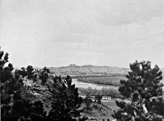
RABBIT'S EARS
NEAR AMIDON
Photo by Russell Reid
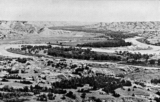
GRAND CANYON OF THE LITTLE MISSOURI
Photo by Hugh W. Hempel
Junction US 2—Buford—Fort Buford State Park.
Junction with US 2 to Fort Buford State Park, 9.5 m.
Unmarked graveled road 8.5 m., unimproved road 1 m.
No accommodations.
The remains of Fort Buford, at the end of this route, evoke
memories of the once feared Indian chieftains Sitting Bull, Gall,
and Joseph, and of the notable military leaders Gen. Hugh E.
Scott and Gen. William H. Hazen.
The route, an unmarked gravel road, branches S. from US 2
(see Tour 6) 17 m. W. of Williston. At 8 m. is BUFORD (1,950
alt., 52 pop.), a little village named for the old fort. At 8.5 m.
is the junction with an unimproved road; L. here.
On the SITE OF FORT BUFORD, 9 m., a stone powder
house and the regimental headquarters buildings still stand; the
military cemetery is to the S.
In 1828 John Jacob Astor's American Fur Co. built its principal
post on the upper Missouri, Fort Union, 3 m. up the Missouri
from the mouth of the Yellowstone, a few hundred yards E. of
the present Montana Line. For almost 40 years Fort Union was
the most important trading post in the Dakotas. Unfortunately, the
traders at the post were more interested in getting furs cheaply than
in preserving the morale of the Indians of the region. Whiskey,
although prohibited, flowed freely. Quarrels between the Indians
and the white men were frequent. Conditions were so bad in
1864 when Gen. Alfred Sully made a visit to the post following
his campaign against the Sioux (see Tour 8 and Side Tour 8D),
that he recommended Government control of the trading posts if
peace were ever to be made with the Indians. Upon his recommendation,
therefore, Fort Buford was established in June 1866
opposite the mouth of the Yellowstone. Fort Union was dismantled
and its materials were brought here for use in building
the new post.
Because of its strategic position, the new fort, named for Gen.
John Buford, who distinguished himself at Gettysburg, commanded
the water routes to the Northwest, and for more than 25 years
was one of the country's vital Army posts. The fort was garrisoned
partly by ex-Confederate soldiers, prisoners of war who
had been paroled on oath that they would not again bear arms
against the Union and on agreement to enlist for service in the
outposts of the West. It played an active part in the settlement
of the Indian troubles, and in establishing the Indians upon the
reservations.
When Chief Joseph and his Nez Perce followers from Oregon
finally surrendered in the Bear Paw Mountains of Montana in
1877 after leading their pursuers a merry 2,000-mile chase through
the Rockies for more than a year, he was brought to Fort Buford
before being placed on a reservation in Washington. Sitting Bull
and his band of Sioux, after their flight into Canada in a vain
attempt to avoid confinement on the reservation, also came to
Fort Buford in 1881, and it was before the regimental headquarters
building, the southernmost of the group now standing, that the
chief surrendered. Gall had preceded him by a few months, also
coming to Fort Buford to give himself up.
Telegraphic connections with Fort Lincoln were established
in 1873, and a wagon road, used until 1881, connected Fort Buford
with the Custer post and with the railroad, which at that time
ended in Bismarck. It followed the eastern side of the Missouri,
and is still in use in some places (see Side Tour 3B). Except for
goods sent by steamboat, all supplies and mail were freighted
over this road.
Fort Buford was sold at public auction in 1895. The 20-room
residence of the commanding officers was purchased by John Mercer,
who maintained it as a museum until its destruction by fire in
1937.
South of the old buildings is FORT BUFORD STATE PARK,
9.5 m., including the military Cemetery of the Fort. The unkept
graves, some marked with marble slabs, some with wooden markers
on which the inscriptions have lost all legibility, are sunken and
overgrown with grass.
About a quarter of a mile SE. of the buildings by the river,
in the 1830's and 1840's, stood a trading post known first as Fort
William and later as Fort Mortimer. When William Sublette and
Robert Campbell built Fort William in 1833, they found themselves
treated as intruders by the monopolistic American Fur Co.
post at Fort Union. The policy of the American Fur Co., in its
fight against competition, was to try every kind of tactics, from
rate wars to the instigation of killings by the Indians. On a typical
occasion a band of Blackfeet Indians, coming to trade, was met by
a procession from Fort Union headed by a band in full uniform,
with the traders following, bearing articles of barter. That day the
impressionable aborigines traded at Fort Union. Another time a
Fort William expedition to the Crow Indians was robbed of everything
including horses by marauders believed to have been sent by
the neighboring post.
The power of liquor as an article of trade was unbelievably
great. Charles Larpenteur, who was at Fort William, tells in his
memoirs of going into an Indian camp in weather so cold that his
mules froze to death in the shelter provided for them, and obtaining
180 buffalo robes for 5 gal. of alcohol, which sufficed to make
everyone in the camp drunk twice. The use of liquor was a sore
point between Fort Union and Fort William, for although it was
illegal in Indian country Sublette had been able to get a supply
into Fort William, while every similar effort at Fort Union had
been defeated. Larpenteur describes the opening of trade at Fort
William thus: "The liquor trade started at dark, and soon the
singing and yelling commenced. The Indians were all locked up
in the fort, for fear that some might go to Fort Union, which was
about two and one-half miles distant. Imagine the noise. Five
hundred Indians with their squaws, all drunk as they could be,
locked up in that small space." (The stockade was 150 ft. by 130
ft.) "The debauch continued during that entire night and well
into the next day ... Indians in stupor from drink lay in every
direction."
Competition grew keen. Beaver skins, which ordinarily were
worth $3, brought as much as $12. It was the policy of the American
Fur Co., however, to buy out its competitors if it could not
frighten them out. Accordingly, after a year of bitter rivalry, an
agreement was reached whereby Sublette and Campbell sold Fort
William to the Astor concern and moved W., leaving the profitable
upper Missouri valley trade to Fort Union.
In 1842 a new post, called Fort Mortimer, was built by Fox,
Livingston & Co. a short distance back from the bank at the Fort
William site. The new traders did not long survive the competition
of Fort Union, and in 1846 found it expedient to sell out
to the American Fur Co. Some 12 years later an adobe trading
post was erected here, but little is known of it other than that it
was abandoned in 1858 and was finally torn down in 1866, its
materials being used in the building of Fort Buford.
Carrington—Minot—Bowbells—Portal—(Regina, Sask., Can.).
US 52.
Carrington to Canadian border, 241.5 m.
Soo Ry. roughly parallels entire route.
Graveled roadbed except 38 m. bituminous-surfaced between Velva
and Foxholm.
Accommodations in principal towns.
US 52, pursuing a diagonal course northwest across the State,
provides a direct route between the Canadian Rockies and the
Middle West. It traverses a diversified farming area, and passes
through the fertile Souris River valley and the treeless valley of
the Des Lacs River. In the green panorama of spring the prairie
grasslands, dotted with small grazing herds of white-faced Herefords
or black and white Holsteins, alternate with tilled fields.
By late summer tones of yellow dominate the landscape, which
after the harvest is left a scarred, grimy tan.
At CARRINGTON, 0.0 m. (see Tour 2), is the junction with
US 281 (see Tour 2).
At 9 m. on US 52 is the junction with ND 30, a graded dirt
road.
Left on this road to the HAWKSNEST, 9 m., a high, flat-topped
hill with well-timbered slopes rising 400 ft. above the surrounding
plain. Near its top is a crystal-clear spring. It was
named in 1873 by a party of surveyors who saw a great number
of hawks swarm from the trees. On top of the hill is a large
serpentine mound. After the coming of the white man the hill
was a camping place for Sioux Indians traveling between Fort
Totten and Fort Yates. They called the hill Huya Wayapa ahdi
(where the eagle brings something home in his beak). According
to Indian legend a large band of Sioux once camped near the hill
but were unable to ascertain the whereabouts of a war party of
Chippewa which they suspected to be near. One of the Sioux,
however, observed that an eagle flying into the trees carried in its
mouth what appeared to be a piece of meat cut with a knife.
From the direction in which the eagle had flown the Sioux were
able to find the enemy. The legend is silent on the outcome of
the warriors' meeting.
Left from the Hawksnest 3 m. to CAMP KIMBALL HISTORIC
SITE, where Sibley camped July 22 and 23, 1863. It was from
this point that the expedition moved SW. to engage in the Battle
of Big Mound (see Tour 8).
SYKESTON, 13 m. (1,233 alt., 327 pop.), a German community
named for Richard Sykes, who platted the town in 1883, is on the
banks of the Pipestem River and artificial Lake Hiawatha. Sykes
Park provides good camping. Buffalo favored this vicinity as a
grazing spot before the coming of settlers, but the semiannual
hunting expeditions of the metis (see Side Tour 5A) destroyed
many, and after the cattlemen arrived only an occasional specimen
was sighted. The library of an Inverness, Scotland, home is adorned
with the head of what was probably the last buffalo killed in this
vicinity. A party of guests at the Sykes ranch in 1881, including
Ewen Grant of Inverness, learned that a buffalo was grazing with
the Sykes cattle, and in the exciting chase to bag the animal Grant
had the good fortune to despatch him.
FESSENDEN, 36 m. (1,610 alt., 738 pop.), named for Cortez Fessenden,
surveyor general of Dakota Territory from 1881 to 1885,
was originally settled by a group of Welsh farmers, though the
population is now predominantly Scandinavian. Fessenden was
platted in 1893, and in the election of 1894 was named Wells
County seat. Its citizens journeyed by teams and wagons in the
still hours of the night to Sykeston, first county seat, seized the
county records, and hauled them to the new location. Each year
(March) Fessenden holds an agricultural exposition culminating in
the coronation of an Alfalfa Queen.
HARVEY, 59.5 m. (1,596 alt., 2,157 pop.), named for Col. James
S. Harvey, a former director of the Soo Line, is on the banks of
the Sheyenne River. It is a division point on the Soo, and is the
largest town on the route with the exception of Minot.
Right from Harvey on ND 3, a graveled road, to junction with
a dirt road at 4 m.; R. on this road to BUTTE DE MORALE, 7 m.,
an ancient landmark rising 300 ft. above the surrounding prairie.
It was to this vicinity that the metis, or French-Indian half-breeds,
came in the 1840's on their buffalo-hunting expeditions (see Side
Tour 5A). It is said that on one occasion a party of 1,390 people
with 824 wagons and 1,200 animals camped here and slaughtered
250 buffalo in a single day. In 1853 the surveying expedition of
Gov. I. I. Stevens passed the hill, and in 1862-63 Capt. James L.
Fisk led two expeditions of Montana gold seekers through the
vicinity.
MARTIN, 72.5 m. (1,589 alt., 211 pop.), known in early days
as Casselman, was later renamed for a Soo official in order to
avoid confusion with other towns of similar names. A group of
Rumanians from Regina, Sask., settled here in 1893, but the population
is now predominantly German, as is that of ANAMOOSE
(from Chippewa uhnemoosh, dog), 80.5 m. (1,620 alt., 495 pop.).
DRAKE, 89 m. (1,634 alt., 644 pop.), named for an early settler,
Herman Drake, is on the watershed between the Mouse and
Sheyenne Rivers in a diversified farming and dairying area. A
small railroad center, it has become a wholesale distribution point;
a $20,000 cooperative creamery is operated here.
Northwest of Drake the route traverses rolling tree-dotted hills
that begin to slope toward the Mouse River valley.
BALFOUR, 97 m. (1,613 alt., 197 pop.), named by the town
site company, and VOLTAIRE, 116 m. (1,587 alt., 61 pop.), believed
to have been named for an early settler, are both young villages
incorporated in 1929.
The road makes an abrupt descent into the flat, trough-like
Mouse River valley at VELVA, 122 m. (1,511 alt., 870 pop.), which
is at the southwestern point of the loop of the river, near a camp
site of the Sully expedition of 1865. The park-like little town is
on the flood plain of the river which flows through it. First
known as Mouse River Post Office, it was given its present name
after organization of the town site in 1891-92. A park in the
northern part of the town offers recreational facilities, and contains
the First Dwelling in Velva, a log hut built in 1885.
1. Right from Velva on a dirt road winding down the Mouse
River valley is VERENDRYE, 11 m. (1,554 alt., 100 pop.). First
known as Falsen, the town was given its present name in honor
of Pierre de la Verendrye, earliest known white explorer in the
region. Right from the town pump 0.5 m. to the globular
masonry DAVID THOMPSON MEMORIAL, erected by the G. N.
Ry. in 1925 on a high point overlooking the river valley. On the
base of the monument is the inscription: "1770—David Thompson—1885,
Geographer and Astronomer passed near here in 1797 and
1798 on a scientific and trading expedition. He made the first
map of the country which is now North Dakota and achieved many
noteworthy discoveries in the northwest." Thompson made his
explorations while an employee of the North West Fur Co.
2. Left from Velva on a graded dirt road to a junction with
another graded road at 4 m.; R. here to another junction at 8 m.;
L. here to a STRIP MINE which is one of the larger lignite operating
units in the United States, 10 m. Here, in order to reach a
vein of coal averaging 14 ft. in thickness, great shovels strip the
40-to 50-feet overburden and pile it into fantastic high mounds
and ridges resembling the work of a giant mole. Nearby is a
small community of some 40 homes of miners.
Northwest of Velva the route follows the foot of the hills
bordering the valley to SAWYER, 128.5 m. (1,525 alt., 206 pop.),
believed to have been named for a Soo Ry. official.
MINOT, 144 m. (1,557 alt., 16,099 pop.) (see Minot).
Points of Interest: Minot State Teachers College, Roosevelt Park and Zoo.
At Valley St. and 4th Ave. SE. is a junction with US 2 (see
Tour 6), which unites with US 52 to 150 m. At 4th Ave. and 2nd
St. SW. is the junction with US 83 (see Tour 3).
Left of the junction at 150 m. is a large tourist camp.
BURLINGTON, 152 m. (1,590 alt., 150 pop.), named for Burlington,
Iowa, under the North Dakota Rural Rehabilitation Corporation
became the scene of the State's first Subsistence Homestead
Project. Here, in the wooded valley at the confluence of the
Mouse and the Des Lacs Rivers, a model village of comfortable
homes arose (1937) to replace the former dwellings of the miners
who have part time employment in the lignite mines of the vicinity.
When completed the project will provide homes and irrigated
garden-land for more than 50 families. The cost to each owner,
including land, house, barn, garage, and chicken and hog houses,
will be approximately $3,500. A concrete dam and bowl spillway
on the Des Lacs River will irrigate more than half the 600 acres
included in the project.
A camp fire unwittingly built upon an outcropping of lignite
at Burlington in the spring of 1883 is credited with first having
acquainted pioneers here with the possibilities of developing the
fuel on a large scale. Three men camped at the fork of the Mouse
and Des Lacs Rivers were surprised one morning to find their
camp fire of the previous night still burning. Upon investigation
they learned that their wood fire had ignited a blackish mineral—lignite—in
the earth beneath it. All lignite mines in the Burlington
vicinity are underground (open on application at mine office
in Burlington).
Northwest of Burlington the route follows the Des Lacs River
valley to FOXHOLM, 163 m. (1,657 alt., 200 pop.), named for Foxholm,
England, and CARPIO, 171.5 m. (1,696 alt., 344 pop.), which
touches the hills on both sides of the narrow valley. One story
has it that Carpio was named by the wife of one of the railroad
officials; another that the name was suggested by the fact that
the first post office was a freight car on which was posted the
sign "P. O."
Right from Carpio on a graveled county road to the UPPER
SOURIS MIGRATORY WATERFOWL PROJECT, 7 m., one of the
largest of its type being undertaken in North Dakota by the U. S.
Biological Survey. Here a marshland along the Mouse River has
been purchased and a large dam constructed to impound a lake 26
m. long. A series of smaller dams farther down the river will control
the flood waters of the Souris and will aid in restoring the
marshes to suitable breeding and nesting grounds for migratory
waterfowl. The low, chalky white, red-roofed buildings E. of the
dam are Project Headquarters.
Left from the dam on a gravel road to the CP RANCH, 14 m.,
which maintains one of the few buffalo herds in the Northwest.
Thirty-five shaggy-coated bison range in a 700-acre pasture, appearing
at the ranch buildings twice daily for water. A large herd
of Hereford cattle is also kept here.
DONNYBROOK, 181 m. (1,760 alt., 259 pop.), named by its
founders for Donnybrook, Ireland, is at the foot of the hills bordering
the western side of the Des Lacs valley.
At 189 m. the route passes S. of DES LACS LAKE, a remnant
of a glacial stream, now divided into three parts and drained by
the Des Lacs River. The U. S. Biological Survey has a large
migratory waterfowl project in progress on the lower lake, and
as the road winds along the eastern shore the nesting islands and
several dams built by the survey are visible.
KENMARE, 197 m. (1,799 alt., 1,494 pop.), believed to have
been named by the wife of a Canadian Pacific Ry. official for a
community in Ireland, lies on a hillside facing Middle Des Lacs
Lake. In the steep sides of the lake valley nearby are a number
of lignite mines.
Opposite Kenmare are the Administration Buildings of the
Des Lacs Lake Migratory Waterfowl Project—low white structures
with red tile roofs.
At Kenmare the highway leaves the valley for the Drift Plain,
which stretches away to the E. to meet the flat bed of glacial
Lake Souris, beyond which lie the Turtle Mountains. To the W.
against the horizon rises the eastern edge of the great Missouri
Plateau topped by the Altamont Moraine, the height of land between
the Missouri and Souris Rivers.
At 202 m. is the Junction with ND 5, a graveled highway (see
Tour 5). US 52 and ND 5 are one route to 234 m.
At 209 m. the highway dips into a large cut to cross UPPER
DES LACS LAKE, which, despite present dry conditions, was once
the scene of steamboating. In early days it was navigable across
the Canadian border near Northgate, and grain from points in
Canada and along the lake in North Dakota was shipped via the
water route to Kenmare for transshipment by rail to eastern markets.
The years of continued subnormal rainfall in this region have
left the upper lake dry in places.
BOWBELLS, 214 m. (1,961 alt., 695 pop.), named by English
stockholders of the Soo Line for the famous Bow Bells in St. Mary-le-Bow
Church in London, is the Burke County seat. Almost treeless,
its squat appearance blends into the flat terrain, with the tall
water tower, the only notable feature of the town, visible for
miles on the level prairie.
FLAXTON, 226.5 m. (1,940 alt., 423 pop.), was given its present
name because the town site was a field of flax when application
for a post office was made.
At 234 m. is a junction with ND 5 (see Tour 5).
PORTAL, 241.5 m. (1,954 alt., 512 pop.), is an important international
port of entry, hence its name. It is an airport of entry,
and also a division point on the Soo, much of the traffic to the
Canadian Northwest passing through its custom offices. The U. S.
Custom and Immigration House (for custom regulations see Information
for Travelers), on Boundary and Railway Aves., is
a two-story brick building in Colonial style. A large canopied
driveway at the front of the building permits inspection of three
automobiles at once. The Canadian custom offices are directly
across the avenue, which is bisected by the international boundary.
Portal is the home of many sports enthusiasts, and most of its
games have an international aspect. Unusual in sports is the international
golf course, on which in August 1934 a young Portal
golfer, George Wegener, made an international hole-in-one, driving
from the eighth tee, which is in Canada, 125 yd. into the cup on
the ninth green, in the United States. The curling club here is
also international, being composed of both Canadian and United
States citizens in the border cities of Portal and North Portal.
They play this winter sport in a specially constructed domed
building.
US 52 crosses the Canadian Line at the customhouses in the
city of Portal, 30 m. S. of Estevan, Sask.
(Minneapolis, Minn.)—Fargo—Valley City—Jamestown—Bismarck—Mandan—Dickinson—(Glendive,
Mont.). US 10.
Minnesota Line to Montana Line, 368 m.
N. P. Ry. and Northwest Airlines parallel route across State.
Paved or bituminous-surfaced roadbed except 73 m. graveled.
Accommodations chiefly in towns.
US 10, rising steadily toward the foothills of the Rocky Mountains,
with a gain of 1,852 feet in altitude in crossing the State,
traverses the three main topographic divisions of North Dakota
(see Natural Setting), from the low, flat Red River Valley, across
the rolling Drift Plain and out upon the Missouri Plateau. Near
the end of the route are the strange and beautiful Badlands.
Most of the country along the road is cultivated, and in the
fields the cycle of farming operations—plowing, seeding, cultivating,
harvesting—repeats itself as the seasons progress. During
the growing season, stretching far across the flat plains and over
the sloping hills, the varying greens of the grains blend with the
blue flax fields and the invading yellow patches of mustard. In
the fall the prairies have a somber, peaceful air as their tawny
stubblefields and newly plowed black acres await the first snowfall.
When winter comes the never-ending expanse of white is
broken by the dark pattern of roads and an occasional lead-colored
clump of trees, bare and shivering in the wind, while at the distant
horizon the whiteness unites with the pale blue of clear winter
skies.
West of the Red River Valley trees are few except along the
rivers. Yet, according to legend, this country was once heavily
forested—until Paul Bunyan, the master woodsman, had his men
log it off, just before his famous fight with his foreman, the Bull
of the Woods, on top of the bottom of the Mountain That Stood
on Its Head. As a matter of geologic fact, the area traversed by
the route has been largely treeless since the gradual cooling of the
climate, incident to the ice age, destroyed the tropical plant and
animal life which once were profuse here.
FARGO, 0.0 m. (907 alt., 28,619 pop.) (see Fargo).
Points of Interest: North Dakota Agricultural College, Veterans' Hospital,
Dovre Ski Slide.
At Front and 13th Sts. is the junction with US 81 (see Tour 1).
WEST FARGO (R) (907 alt., 127 pop.) and SOUTHWEST
FARGO (L) (907 alt., 800 pop.), 5 m., suburbs of Fargo, are the
center of North Dakota's meat-packing industry. An Armour &
Co. Plant (open; tours at 9:30 & 11 a.m., 1 & 3 p.m. Mon.-Fri.,
10:30 a.m. only on Sat.; no children under 10) and a large livestock
market employ the majority of the residents of these two
young villages, incorporated in 1931 and 1937 respectively. Armour's
plant, housed in a four-story brick building, employs more than 400
people. Connected with it is the Union Stockyards where representatives
of commission firms buy livestock from North Dakota
farmers. Included in the yards is an exchange building which
houses offices of the company, dealers, and commission firms, and
State and Federal agencies supervising market operations.
At 12 m. is the junction with a graveled county highway.
Right on this highway is MAPLETON, 1 m. (904 alt., 195 pop.),
one of the oldest towns in the State, organized about 1870. It is
named for the Maple River which flows through it, one of the
many meandering tributaries of the Red.
At 20 m. is the junction with ND 18, a graveled highway.
Right on this road is CASSELTON, 2 m. (936 alt., 1,254 pop.),
named for Maj. G. W. Cass (1810-1888) of Minneapolis, stockholder
in the N. P. Ry. and proponent of the railroad nursery that
propagated the poplar trees that today line the streets. It was
the boyhood home of William Langer (1886-), Governor of the
State (1933-1934; 1937-1939) and a storm center in Nonpartisan
League politics (see History).
During the bonanza farm era (see Agriculture and Farm
Life) Casselton was headquarters of the huge Dalrymple farm,
which made it a metropolis of the Red River Valley. One of the
earliest practical uses of the telephone in the United States, and
what may have been the introduction of the instrument into this
State (see Tour 1), was made in 1876 on the Dalrymple farm.
Oliver Dalrymple had taken advantage of low prices occasioned
by the panic of 1873 to buy 100,000 acres of Red River Valley land
owned by the N. P. Ry. and had set out to demonstrate that the
land was valuable for farming. The first year he seeded 1,280
acres and harvested 32,000 bu. of wheat. By 1878 he was
farming 13,000 acres and by 1895, 65,000 acres. His land was divided
into subfarms, each with a superintendent and foreman, and all
using the most modern farm equipment obtainable. Dalrymple, on
a visit to the Philadelphia Centennial in 1876, became interested in
the newly invented telephone, and at the close of the fair purchased
several of the instruments for installation on his subfarms
and headquarters farm at Casselton.
Among the churches in Casselton is one maintained by a small
group of Moravians, a German religious sect that came to the
State during the early years of settlement.
On ND 18 at 18 m. to the D. H. HOUSTON FARM, where the
principle of the roll film camera was developed. Houston, a native
of Wisconsin, had already invented one camera when he homesteaded
in North Dakota in 1869. Although he acquired 6,000 acres
of land and became one of the early bonanza farmers, he continued
his experiments in photography, and in 1881 developed the
principle of the roll film camera, selling his patent to George Eastman.
It has been said that Houston named his device "kodak"
for North Dakota, but the generally accepted story is that Eastman
himself coined the word because he desired a catchy, easily remembered
name that could be used in any language. Houston's
inventive interests included agricultural improvements, and in the
1880's he developed an improved bluestem wheat which, producing
four to five bushels more per acre than other varieties, was soon
in great demand throughout the Wheat Belt. He also patented
improvements on the disc plow.
At 26.5 m. is the junction with a graveled road.
Right on this road is WHEATLAND, 2 m. (991 alt., 300 pop.),
a quiet, pretty village named for the vast wheat acreage formerly
seeded on the bonanza farms in the area.
At 30.5 m. the highway passes over a noticeable rise of land.
This is Herman Beach, the western shore of ancient Lake Agassiz,
which in glacial times covered 100,000 sq. m. and lay over the
eastern portion of the State, reaching from Lake Winnipeg in
Canada to Lake Traverse in South Dakota. It is estimated that
when this gravelly ridge was formed by the waves of the lake,
the water at the present site of Fargo was 175 ft. deep.
BUFFALO, 37.5 m. (1,201 alt., 242 pop.), is named for Buffalo,
N. Y.
Left from Buffalo on a graveled highway is ALICE, 11 m.
(1,124 alt., 169 pop.), named for a relative of a railroad superintendent.
At the Multz Cafe is a Collection of Indian Artifacts (open).
At 40.5 m. is BUFFALO CREEK HISTORIC SITE (R). A
marker reads: "August 16, 1863. General Sibley marched over this
spot with 3,400 soldiers on his return after driving the Indians
across the Missouri River."
TOWER CITY, 43.5 m. (1,169 alt., 435 pop.), in a grove of
trees, is named for Charlemagne Tower (1848-1924), a Philadelphia
capitalist and diplomat, who owned much land in the vicinity.
He made the foundation plantings of the trees of the city and also
donated the first books to the local public library. In 1886 Baptist
leaders selected this city as the site of a proposed church
college to be named Tower University. Excavations had actually
begun, with the expectation that Tower would be its benefactor to
the extent of $100,000. Because of some misunderstanding of the
preliminary arrangements, however, the endowment fund was not
forthcoming. Tower offered the use of a school building, but the
school, being unable to continue without financial assistance, closed
its doors two years later.
At 48.5 m. is the junction with ND 32, a graveled highway.
Right on this highway is ORISKA, 0.5 m. (1,267 alt., 183 pop.),
once the center of a wide wheat-growing area. The name is believed
to have been that of the heroine of an old book of western
poems.
At 5 m. on ND 32 to CAMP ARNOLD HISTORIC SITE,
where in 1863 the Sibley expedition made one of its many overnight
camps.
At 56 m. is the junction with a graveled road.
Left on this road to CAMP SHEARDOWN HISTORIC SITE,
3 m., another stopping place of the Sibley column. A few rifle
pits dug for camp protection are still visible, and a bronze tablet
marks the site. No engagement took place here, the rifle pits
being evidence of Sibley's precautions against Indian attack.
VALLEY CITY, 58.5 m. (1,220 alt., 5,268 pop.), seat of Barnes
County, lies sheltered and hidden in the deeply wooded Sheyenne
River valley. Originally known as Worthington, it was given its
present name when incorporated as a city in 1881.
The city's first settlers came with the N. P. Ry. in 1872, but
Jay Cooke & Co., financiers of the railroad, crashed in the Nation-wide
panic of 1873, and the next five years brought a suspension
of business and immigration. From 1878, however, the city had a
steady growth; today it is the center of a large area of diversified
farming, with flour milling and the processing of dairy products
the chief industries. One notable asset of the city is a municipal
light plant which supplies electrical energy at the lowest rates
prevalent in the State, and provides an excellent street-lighting
system without taxation. The studios and transmitter of KOVC,
Valley City, are at 312 5th Ave.
On an attractive campus at the southern end of 5th Ave. is
the Valley City State Teachers College, established in 1890. In
1895 Gov. Roger Allin vetoed the State appropriations for the university
and colleges, and, like Other State educational institutions,
the Valley City college was kept open by popular subscriptions
for the biennial period. One of the outstanding alumni of the
school is Paul Fjelde, a former student of Lorado Taft, who
was commissioned to do the bust of Abraham Lincoln that
North Dakota presented to Norway in 1914. A copy of this work
has been placed in the auditorium of the college.
Near the college campus on 1st St. is City Park, which contains
recreational facilities and a small zoo. Chautauqua Park
(swimming pool, playgrounds, large auditorium) is in the northeastern
part of the city.
In the Barnes County Courthouse, 6th St. bet. 3rd and 4th
Aves., is a small museum which includes the Indian collection of
Vernon Gale, an amateur archeologist. Among his exhibits are several
stone hearts, which have been found only in the valley of Spiritwood
Lake (see below).
The N. P. Ry. High Bridge, known as the "Hi-Line", casts its
long shadow across the river valley N. of Chautauqua Park. Including
the approaches, it measures 1 m., a long railroad trestle
for its height, which is 148 ft. above the water level of the
Sheyenne.
Right from Valley City on Chautauqua Blvd., which becomes
a graveled road leading to a spot still known as ASHTABULA,
17 m., the name of a post office once operated here. A ford in
the Sheyenne at this point, Sibley's Crossing, was used by Capt.
James Fisk's immigrant trains to the Montana gold fields in 1862
and 1863, and twice by the Sibley military expedition in 1863, and
later was on the Fort Ransom-Fort Totten trail. Deep ruts of
wagon trains are still visible and can be traced across the valley.
At Valley City is a junction (L) with ND 1, a graveled highway
(see Side Tour 8A), which unites with US 10 to 63.5 m.,
where ND 1 (see Side Tour 8B) branches R.
On US 10 at the western end of the city is Pioneer Park (R),
where an outdoor amphitheater has been built. The park also
contains a small frame schoolhouse, typical of the pioneer period,
which was moved from its site four miles west of the city.
SANBORN, 70.5 m. (1,443 alt., 343 pop.), named for J. N.
Sanborn, a Fargo pioneer, was at one time a booming trade center,
and seemed destined to become important, until two severe blows
retarded its growth. First, in 1880, after a hot campaign, it lost
the county seat election to Valley City; and then, in 1882, the
county treasurer, whose bond had been furnished by the businessmen
of the town, absconded with the county moneys, including a
special fund for the erection of a courthouse. Among the early
settlers of Sanborn was I. W. Barnum, brother of P. T. Barnum
of circus fame.
ECKELSON, 75.5 m. (1,472 alt., 100 pop.), was named for A. O.
Eckelson, a N. P. Ry. civil engineer of the 1870's, and was first
platted a mile E. of its present site. Because of the steep incline
of the railroad at that point, however, trains were unable to stop
and the town had to be moved to more level ground.
SPIRITWOOD, 82.5 m. (1,475 alt., 267 pop.), is named for the
lake 16 m. NW.
At 93.5 m. is the junction with ND 20, a graveled highway.
Right on this highway to the junction with a county graveled
road, 10 m.; R. here to SPIRITWOOD LAKE (bathing beaches,
boathouses, cottages, golf course, and two pavilions on the southern
shore), 16 m., an attractive resort in a wooded valley. It is known
to the Sioux as Minneskaya (water with white foam on top).
According to an Indian legend, a grief-stricken girl plunged into
its waters to join her drowned lover, and her spirit still resides
in the lake.
On the northern shore of the lake the State Game and Fish
Commission maintains an Aviary where Mongolian pheasants are
confined for breeding purposes. Eggs are hatched on nearby farms
and the poults are then returned to the aviary for distribution
throughout the State.
In the vicinity of Spiritwood Lake have been found several
heart-shaped stones marked with a small cross, probably representing
a star. This is the only locality in the State where these
stone hearts have been found, and archeologists believe they are
the product of the early Indians. Specimens are on display at the
State historical society museum (see Bismarck) and in the Vernon
Gale Collection (see Valley City above).
JAMESTOWN, 95.5 m. (1,405 alt., 8,187 pop.), Stutsman County
seat, lies in the fertile valley of the winding James River, described
as the longest unnavigable river in the world. The story
is told that the stream received its name from a French-Indian
hunter-trapper who, having lost his way, was overcome with joy
upon discovering the little river and gave it his own name—Rivière
de Jacques.
The first settlement at Jamestown was made in the fall of
1871, when a corps of five or six N. P. Ry. engineers spent the
winter here in order to be in readiness for work in the spring.
Soldiers from Fort Ransom (see Side Tour 8A) acted as a guard
for the engineers, and in June a military post, Fort Cross (later
Fort Seward), was established. During the summer settlers and
businessmen came to the community, and a brisk trade was carried
on with the 500 railroad workers and the 3 companies of soldiers
stationed at the fort.
On Sept. 13, 1872, the first train to enter Jamestown crossed
the river into the city. Less than a month later construction crews,
incensed because of unpaid wages, stopped work, and even began
tearing up the newly laid tracks. Soldiers from the fort quickly
quelled North Dakota's first strike.
Railroads played an important role in Jamestown's inception
and growth. At one time there were prospects that two other
railroads besides the N. P. would come into the city, and hope was
high that the place would become an important railroad center.
Although these plans did not fully materialize, one of the new
roads, the Midland Continental, did make the city its home office.
Financed by English capital, the Midland began to build in 1913,
with plans for a line connecting Winnipeg, Man., with the Gulf of
Mexico. The World War intervened, foreign support was withdrawn,
and operations ceased after completion of only 70 m. of
road, from Edgeley to Wimbledon.
The first church services here were held in a schoolhouse, and
a pioneer tells of how these meetings were faithfully attended by
an old Indian "clad in great dignity and an old nightshirt." Jamestown's
first church, the Presbyterian, was erected in 1881. The
first resident Roman Catholic priest arrived the same year, and
resided in a rectory that measured 14 x 22 ft. Although there
were many places in the State where Catholic church services
had long been held, Jamestown in September 1889 became the
first seat of the diocese of North Dakota.
In 1879 a group of local businessmen organized the James
River Navigation Co. Of their first steamer, the Belle of Richmond,
the St. Paul Pioneer Press said, "The craft is composed of a steam-whistle,
an engine the size of a teakettle and a little boat under
it." Ice put a stop to river navigation that fall, and in May the
following year the initial trip of a new boat that had been built
during the winter proved unsuccessful.
The fertile James River Valley land has produced such bountiful
crops that between 1875 and 1900 farmers often paid for
their lands in two years. A writer of that time says that "though
North Dakota didn't have granite bluffs and waterfalls for its
beauty, a land that would yield twice its cost in the first year
would look rather beautiful to most men."
Maxwell Anderson (1888-), Pulitzer Prize playwright (1933),
and Curtis D. Wilbur (1867-), Secretary of War in President
Coolidge's cabinet, once attended school in Jamestown.
The two leading institutions of Jamestown overlook the city
from the river bluffs on both sides of town. To the SE. is the
State Hospital For The Insane, with its handsome buildings and
beautifully landscaped grounds, a little city within its 2,000 acres
of farm land.
Jamestown College, on high bluffs (L) on the northeastern
edge of the city, is the oldest, and only private, college in North
Dakota. Founded by the Red River Presbytery in 1883, it was
the first school in the State to offer normal school training for
teachers. A plan for construction in semi-Gothic style has been
followed, with the result that the buildings present a pleasing and
uniform campus group.
On the campus is Voorhees Chapel, one of the finest college
chapels in the Midwest; it is built of reinforced concrete, Bedford
stone, and mat-faced Menominee brick. The interior is constructed
with huge hammer beams of Gothic type, and there are two high
Gothic windows. The chapel is also used for musical and dramatic
performances, as the intent of the institution is to make this building
the center of college life and associations.
Klaus Park, at the southwestern edge of the city, with entrances
on Elder and Willow Aves., consists of 26 acres of heavily
wooded land lying between the James River and Pipestem Creek.
It was donated to the city by the heirs of Anton Klaus, prominent
pioneer affectionately known as "the father of Jamestown." An
outdoor swimming pool is supplied with warm artesian water.
Preserved in the park is one of the original millstones used in
Jamestown's first flour mill built by Anton Klaus in 1879.
Nickeus Park (equipped playgrounds), at the northern end of
5th Ave., is in a loop of the James River. It was donated to the
city as a memorial to a pioneer Jamestown attorney, by Mrs. Fannie
B. Nickeus, his widow.
City Park (municipal tourist camp, ball park, fairgrounds, and
tennis courts), at the southern end of 4th Ave., consists of a 52-acre
tract along the wooded James River. The Park Auditorium,
completed in 1936 as a WPA project, is a domical building,
the design of its facade carried out in the straight lines and angles
of modern architecture. Constructed with laminated truss-type
arches which support the entire roof load, the auditorium has 25,000
sq. ft. of floor space unobstructed by supporting columns. Its
acoustics is excellent, owing to the vaulted shape of the roof and
the absorbing quality of the timbers in the arches.
KRMC, Jamestown's radio broadcasting station, has its studios
in the Gladstone Hotel building at 412 Front St. W.; its transmitter
is just across the James River S. of the city.
The Alfred Dickey Library, corner 5th Ave. S. and Pacific St.
W., is built of red Hebron (N. Dak.) brick. Its style shows a Byzantine
influence.
The Site of Fort William H. Seward is indicated by a marker
on US 281 at the foot of the bluffs on the northwestern outskirts
of the city. The post, named for President Lincoln's Secretary of
State, was abandoned in 1877, and in 1925 the N. P. Ry. donated
the site, which is on the bluffs SW. of the marker, as a State park.
Left from Jamestown 2 m. on Monroe St. to HOMER STATE
PARK, a five-acre tract along the James River that was the site
of an unidentified skirmish between white men and Indians.
ELDRIDGE, 103.5 m. (1,538 alt., 100 pop.), named for a pioneer
family, is the most westerly town on the route lying within the
Central Lowland of the Interior Plains. Between Eldridge and
WINDSOR, 112.5 m. (1,839 alt., 110 pop.), whose name was suggested
by that of Windsor, Ont., there is a rise of 300 ft., which
marks the division between the Central Lowland and the Great
Plains. The Missouri Plateau, as this section of the Great Plains
is called, extends beyond the western border of the State. As the
route continues into the plateau, the altitude rises slightly to the
village of CLEVELAND, 116 m. (1,849 alt., 273 pop.),—named for
Cleveland, Ohio—only to fall away gradually and then rise once
more in topping the Altamont Moraine (see below.)
MEDINA, 124 m. (1,791 alt., 407 pop.), named for Medina, N. Y.,
has a strongly Russo-German population. It was originally known
as Midway for its position halfway between Jamestown and Steele,
and during the first two decades of the century was an important
commercial point in the area.
At 126 m. is the junction with ND 30, a graveled highway.
Left on this highway to the junction with a graded dirt road,
12 m.; R. here to the junction with another dirt road, 17 m.; R. to
another junction, 18 m.; and L. to Lake George, commonly known
as SALT LAKE (swimming), 19 m., because of its heavy impregnation
with natural salts. It is said to be one of the deepest lakes in
the State. The southern shore has an excellent sand beach. Northeast
of the lake are fresh-water springs; here, on land controlled
by the Biological Survey through an easement, dikes and dams have
been built to create a fresh-water feeding and nesting ground
known as the Lake George Migratory Waterfowl Project. On
the southern shore is Streeter Memorial Park, a World War
memorial.
At 132 m. are CRYSTAL SPRINGS LAKES. A cairn (L)
houses a spring (good water). The lake offers fine opportunity to
study varieties of shore birds, as the marshes of the spring-fed
waters provide attractive breeding places. CRYSTAL SPRINGS,
132.5 m. (1,777 alt., 69 pop.), is named for the neighboring lakes.
West of Cleveland (see above) the route descends in a gentle
grade to TAPPEN, 140.5 m. (1,764 alt., 268 pop.), named for an
early settler.
Right from Tappen on a country trail, unsuited for trailers, to
McPHAIL'S BUTTE HISTORIC SITE, 10 m. It was from this hill
that Col. Samuel McPhail directed the movement of his regiment
of Minnesota Rangers July 24, 1863, in the Battle of Big Mound,
one of the Sibley expedition encounters with the Sioux. After
having been harried by the white soldiers, a small group of Sioux
had asked to talk with a delegation of the enemy, and the meeting
was apparently proceeding in an amicable manner when without
warning a young Indian shot Dr. J. S. Weiser, one of the party,
in the back. The Battle of Big Mound was precipitated, and the
Sioux were forced to retreat farther W. Northeast of the battle
site is BURMAN HISTORIC SITE, 2 m., where Dr. Weiser is buried.
DAWSON, 146 m. (1,736 alt., 306 pop.), named for the town site
owner, Dawson Thompson, is in a fertile subirrigated area. A
route for migratory birds crossing the United States passes through
the Dawson vicinity, and a U. S. game reserve is 7 m. S. of the
town on ND 3. At Dawson is one of the six Department of Commerce
intermediate lighted airports in the State.
Left from Dawson on ND 3, a graveled highway, to LAKE
ISABEL, 5 m. Here is Camp Grassick, a children's summer camp
operated by the North Dakota Anti-Tuberculosis Association. It
is named for Dr. J. Grassick, pioneer Grand Forks physician. Just
E. of Lake Isabel are the Lodge and Game Reserve of G. L. Slade
(private). Slade, a son-in-law of the late James J. Hill, the railroad
builder, maintains breeding and nesting grounds for pheasants
and waterfowl—even creating his own Lake Slade by pumping
water from deep wells—and brings large parties of Easterners here
to hunt.
At 25 m. is NAPOLEON (1,955 alt., 709 pop.), seat of Logan
County, named for Napoleon Goodsill who was president of the
town site company. The first business establishment (1886) was
a supply store operated jointly with a newspaper, the Napoleon
Homestead, which is still in operation. Two pigeon-holes in a
desk in the Homestead office served as boxes for the first post
office in Napoleon.
BURNSTAD, 40.5 m. (1,963 alt., 142 pop.), was formerly the
trade center of a large cattle industry. C. P. Burnstad, for whom
the town was named, was known as the "Logan County Cattle
King", and grazed as many as 5,000 cattle on 54 sections of land.
Left from Burnstad 2 m. on a graded dirt road to BEAVER
LAKE STATE PARK (swimming, picnicking), a recreational area
developed by WPA labor. A game refuge surrounds the lake.
At 53.5 m. on ND 3 is WISHEK (2,010 alt., 1,145 pop.), where,
as in many of the neighboring towns, Russo-Germans make up the
greater part of the population. The town is named for J. H.
Wishek of Ashley, who owned the town site and donated lots for
churches, parks, the town hall, and a bandstand.
Left from Wishek 6.5 m. on a graveled road to Doyle Memorial
Park on GREEN LAKE (swimming, picnicking). The land for
this recreational area and memorial to pioneers was given to the
State by Mr. and Mrs. John J. Doyle of Wishek.
At 65 m. on ND 3 is DANZIG (2,029 alt., 86 pop.), named for
the Free City of Danzig in Europe.
ASHLEY, 77.5 m. (2,001 alt., 1,250 pop.), began as the town of
Hoskins on the shore of nearby Hoskins Lake. Originally the
town, as well as the lake was given the maiden name of the wife
of Col. C. A. Lounsberry, historian, and at that time editor of the
Bismarck Tribune. In 1888, to be on the railroad, Hoskins was
moved bodily to the present site and was renamed in honor of
Ashley E. Morrow, a member of the railroad construction company.
In the rotunda of the McIntosh County Courthouse is a series of
pictures of pioneer life. A library founded in 1912 by the Ashley
Women's Club is also in the courthouse.
Right from Ashley 4 m. on ND 11, a graveled highway, to
LAKE HOSKINS (swimming), a summer recreational center.
On ND 3 at 85 m. is the South Dakota Line, 84 m. N. of
Aberdeen, S. Dak.
STEELE, 154.5 m. (1,855 alt., 519 pop.), granted a city charter
by the Territorial legislature in 1882-83, claimed at the time of
its incorporation to be the smallest city in the United States. It
is named for Col. W. P. Steele, one of the original town site
owners, who in 1889 sent the first legislature a certified check for
$100,000 with his bid for locating the State capitol at Steele.
Colonel Steele liked riding on railroad trains and meeting strangers
to whom he could talk of the glowing possibilities of North Dakota.
At one time he procured passes on many of the large railroads
in exchange for passes on his own road, the Steele-Alaska
Northwestern, which despite its impressive title was only a half-mile
spur from the Northern Pacific to his brick plant NE. of
Steele. When his hoax was discovered and he was hailed before
a group of directors of the larger lines, he justified his position
with the statement, "While my line is not as long as yours, I want
it understood that it is every bit as wide."
Left from Steele on a graveled road to the junction with a
dirt road, 12 m.; R. on this road to PURSIAN LAKE (swimming,
picnicking), 15 m., a haven for migratory waterfowl.
DRISCOLL (L), 165.5 m. (1,870 alt., 226 pop.), is named for
a N. P. Ry. stockholder.
Right from Driscoll on a road unsuitable for trailers to the
junction with a country trail, 3 m.; R. here to CHASKA HISTORIC
SITE, 4 m., the grave of Chaska, a Sioux Indian scout with the
Sibley expedition, who died during the campaign. Chaska is said
to have been one of the two friendly Indians who warned the
missionaries at the Yellow Medicine (Minn.) Agency and led the
whites to safety from the vengeful Sioux in the uprising of 1862.
West of Driscoll the route begins the ascent of the ALTAMONT
MORAINE, the terminal moraine formed during the last advance
of the Dakota lobe of the great continental ice sheets.
At 174 m. is the junction with US 83 (see Tour 3). The two
highways form one route between this point and Bismarck, 198.5 m.
Just W. of the junction the highway passes over a crest of the
moraine, from which on a clear day the distant outline of the
19-story State capitol is visible, 24 m. W. The highway descends
the western slope of the moraine in a gradual incline toward the
Missouri River valley.
McKENZIE, 180 m. (1,700 alt., 175 pop.), is named for Alexander
McKenzie, early day political boss in North Dakota.
At 185.3 m. is the junction with a dirt road.
Right on this road to VERENDRYE, STATE PARK, 1 m., believed
by many historians to be the point at which in 1738 Pierre de
la Verendrye, earliest white explorer of present North Dakota, first
visited the Mandan Indians. Prior to the investigation of this site
in 1936 it was generally supposed that Verendrye's first contact
with the Mandans had been made near Sanish, and a monument
commemorating the meeting had been erected at that place (see
Tour 6). The Menoken site shows clearly the position of the
bastions and moat of the old fortifications, and saucer-shaped depressions
indicate where the earth lodges once stood. In addition,
pottery, flint chips, and other artifacts have been found. Verendrye's
journal states that he presented a leaden plate, bearing the
name of the exploring party, to the Mandan chief at the village
he visited. A similar plate was given to the Indians by Verendrye's
sons on an expedition farther S. in 1741, and was found
buried in the earth near Fort Pierre, S. Dak. in 1913. The first
plate, however, has not been recovered and may now lie buried
somewhere in the Menoken site.
MENOKEN, 185.5 m. (1,720 alt., 60 pop.), has had a number
of names, and still retains two officially. In early railroad days
it was known as Seventeenth Siding, and later as Blaine. For
transportation purposes it is now called Burleigh, to distinguish
it from several other towns on the N. P. Ry. which have names
beginning with M.
At 186 m. is the junction with a county graded dirt road.
Right on this road to the TRANSMITTING PLANT OF KFYR,
2.5 m., Bismarck's broadcasting station. The 704-foot all-steel
vertical radiator, one of the three tallest self-supporting aerials in
the United States (1938), can be seen for many miles.
Between Menoken and Bismarck the route crosses and recrosses
APPLE CREEK, along which Sibley's army traveled for some distance.
In ancient times this small, meandering stream was a great
rushing glacial river.
At 196.5 m. (R) loom the brick walls of the STATE PENITENTIARY
(tours daily exc. Sat. and Sun. at 9, 10, and 11 a.m.,
2, 3, and 4 p.m.). When the prison was built (1885-89), the walls
were of cottonwood logs wired together at the top. The present
walls, 27 ft. high and 1,650 ft. long, and made of bricks from clay
found in the vicinity, were constructed by prison labor in 1889.
The island-type of prison architecture has been employed, and
there are two cell blocks of 160 cells each, all locked by a master
control. Inmates are employed in the twine plant, which has an
annual output of more than four million pounds; on the 950-acre
farm; and in the auto license and tag plant.
The fact that most criminals come from large centers of population
is given as the reason that North Dakota, an agricultural
State with no large cities, has a low prison population. In 1937
it was only 270.
At 197 m. is the junction with a graveled road.
Left on this road to FORT LINCOLN, 3 m., only survivor of
the 12 military posts that have been established in North Dakota
since earliest settlement. The post, which covers an area of 900
acres, has brick buildings of modified Colonial design. It was
first occupied in 1903, although established as a military reservation
in 1895. In 1913 its garrison was removed, but in 1917 it was
used as a concentration camp for midwestern troops headed for
France. After the World War it was not garrisoned until 1927,
when Companies I, K, L, and M of the Third Battalion, Fourth
Infantry were ordered here. Including detachments of Headquarters,
Quartermasters and Service Corps, Medical Corps, and
Signal and Finance Corps, the post numbers 426 enlisted men and
20 officers (1937). Since 1928 it has been designated a C. M. T. C.
camp for a four-week period each summer, with a quota of 200
men.
At 4 m. is a junction with a dirt road; R. here to another
junction, 4.8 m.; L. to SIBLEY ISLAND PARK (shelters, tables,
and benches), 7 m. Sibley Island was actually an island when
General Sibley fought the Sioux here in 1863, but now, because
of the changing river channel, is a part of the river lowlands.
The Indians, fleeing before the advancing column, were here forced
to abandon large quantities of supplies and equipment, and to
hurry across the Missouri. Two Sibley men, carrying orders to
detachments in the woods, were ambushed and killed, and the
Masonic burial given one is believed to have been the first instance
of the use of this funeral rite within the borders of the
State. The bodies were removed later, but the position of one
grave is still indicated by a marker. Prior to the Sibley encounter
the island was known as Assiniboine Island, from the fact that the
Assiniboine, a river steamer carrying Prince Maximilian's exploring
party, was destroyed by fire near here (1834).
BISMARCK, 198.5 m. (1,672 alt., 11,090 pop.) (see Bismarck).
Points of Interest: State Capitol, Liberty Memorial Building, Roosevelt
Cabin, State historical society museum.
At Main Ave. and 6th St. is the junction with US 83 (see
Tour 3).
At 199.5 m. US 10 crosses the MISSOURI RIVER on the
$1,358,000 Liberty Memorial Bridge, erected in 1922, first highway
span across the river in North Dakota. At each end are large
natural boulders bearing bronze plaques dedicating the bridge to
men and women who served in the World War.
Natural gas from the fields at Baker, Mont., is piped to Bismarck
through a line crossing the Missouri on this bridge.
At the Bismarck end of the bridge is the junction with a
county graveled highway (see Side Tour 3B).
Thoroughfare of early exploration of western North Dakota
and Montana, the Missouri is still known to the Sioux Indians
native to this region as Wakpa Hehanka (elk river). According to
Sioux legend, once, during the great spring break-up, a large herd
of elk were crossing the stream when the ice broke beneath them,
precipitating them into quicksand. They perished, and when the
ice had floated down the river the antlers of the elk were left
protruding like branches from the sand bar.
The time changes from central to mountain standard W. of
the river; watches and clocks of west-bound travelers should be
turned back one hour, those of east-bound travelers should be set
an hour ahead.
Along the highway on the flat lowlands between Bismarck
and Mandan are several tourist camps and night clubs.
MANDAN, 203.4 m. (1,642 alt., 5,037 pop.), its business section
stretched along one side of its long main street, lies crowded between
the N. P. railroad yards and the hills bordering the Heart
River valley near the confluence of the Heart and the Missouri.
Named for the agricultural Mandan Indian tribe, this western,
overgrown small town is in the area they once occupied, and near
two of their ancient village sites. One, Crying Hill Village, is on
the bluffs along the Missouri, NE. of the city; the other, known as
the Motsiff Site, 2 m. S. on the banks of the Heart. The town
itself is so young that many of the original false-front frame or
ornate red-brick buildings are still standing. A village grew up
here quickly when the railroad crossed the Missouri in 1881, and
incorporation as a city followed in 1883. With the settling of the
adjoining territory, which began within two years after the founding
of the town, development was rapid. Early ranching in the
region has given way to grain raising, dairying, and diversified
dry farming, and the city has become a wholesale and retail distribution
center serving a large agricultural area.
One of the chief economic supports of the city is the N. P.
Ry., which maintains a division point here. The Railway Depot
is a red brick copy of Washington's Mount Vernon home, and the
flagpole in the park surrounding it was used at Fort Abraham
Lincoln when Gen. George A. Custer was in command (see Fort
Lincoln State Park). In the railroad park, in an ellipse formed
by the driveway, stands a small bronze Statue of Theodore Roosevelt
as a Rough Rider, a reproduction of a large monument in a
Minot park (see Minot). On the depot platform, during the summer
months, Yanktonai Sioux perform bits of native dances for
the benefit of tourists on the fast trains. On this platform Nov.
1, 1926, Queen Marie of Rumania, making a transcontinental tour,
was adopted by the Sioux.
The Railroad Yards are unusual in that their accommodations
facilitate handling and housing of the large Pacific type locomotives
known as Five Thousands, so called because they are numbered
above 5,000. Because of their great length, 125 ft., and
their weight, 550 tons, they cannot be used on the sharp curves
of the Rocky Mountains; they are therefore employed exclusively
on the steep Mandan-Billings, Mont., run. Five Thousands are used
only for heavy freight traffic. The largest turntable on the N. P.
system, 126 ft. long, handles these giants of the rails.
At 1st St. and 2nd Ave. NW. is the Memorial Building, which
has the largest indoor swimming pool in the State. The building
was constructed under a Federal project.
The J. D. Allen Taxidermist Shop, 302 5th Ave. NW., contains
a rare collection of Indian relics, original paintings, and a variety
of mounted specimens of animals, birds, and fish found in the
State. In the hodgepodge of his workshop, Allen, who came to
Mandan as a youth in 1881, has mounted thousands of specimens,
and has done work for Theodore Roosevelt and for members of
European nobility. His hobby has been painting, and, although
self-taught in his avocation, he has captured the spirit of early
North Dakota scenes as have few trained artists. Several of his
canvases hang in the museum of the State historical society (see
Bismarck).
KGCU, with studios and transmitter in the Kennelly building,
is at 205 1st St. NW.
Chautauqua Park (picnic grounds, tourist camp, golf course,
clubhouse, tennis and horseshoe courts) in the southwestern part
of the city is on ND 6.
Left from Mandan 1.3 m. on a graveled road to the STATE
TRAINING SCHOOL, to which modern buildings and well-landscaped
grounds give the appearance of an up-to-date preparatory
school rather than an institution for delinquent juveniles. The
school, which is one of four in the United States housing both
boys and girls, and the only one offering a four-year high school
course, teaches farming, carpentry, cooking, laundering, and sewing.
On the high bluffs on the south edge of the city is the U. S.
NORTHERN GREAT PLAINS FIELD STATION (see Side Tour 8C).
At Mandan is the junction with ND 6, a graveled highway (see
Side Tour 8C).
Left from Mandan on 6th Ave. SE. which becomes a county
graveled road and crosses the HEART RIVER, 1 m., which in Sioux
translation is called Tacanta Wakpa Tanka.
FORT ABRAHAM LINCOLN STATE PARK, 4.5 m. (see Fort
Abraham Lincoln State Park).
The graveled road proceeds S. over the benchland of the Missouri
to SCHMIDT, 11 m., an elevator and railroad siding. Here
the route becomes a graded dirt road, and continues S.
At 18 m. the road cuts through an extending clay ridge which
protrudes like an eagle's beak from the Badlands-like formation
to the R. To the W. here rises a flat-topped steep cliff jutting
away from the other hills and connected with them only by a
narrow neck. On this mesa once stood the Eagle's Nose Village
of the Mandans, believed by some to have been built by the great
Mandan tribal hero Good Furred Robe, although this origin has
also been attributed to the Huff Site (see below). To reach the
old village site one must ascend the SW. side of the hill. From
the top there is a far-reaching view of the beautiful Missouri
valley, stretching S. from the gray outlines of the capitol at Bismarck
and the blockhouses on the hill at Fort McKeen.
At 20 m. is HUFF, a store and railroad station. At 20.5 m.
(L) is the HUFF INDIAN VILLAGE STATE PARK, site of a
Mandan village. According to legend the Mandan people at one
time lived underground, but under the leadership of four chiefs,
headed by Good Furred Robe, they climbed a vine to enter this
world through an opening in the ground to the surface. Good
Furred Robe then laid out their first village, placing the houses
in rows like corn. This legend is believed by some Indians to refer
to the Huff Site, whose heavily sodded lodge rings suggest great
age. The reason for the somewhat rectangular shape of some of
the depressions has not yet been determined.
South of Huff to FORT RICE STATE PARK, 29 m., the site
of a fort established by Gen. Alfred H. Sully on his Indian expedition
in 1864. It served as a military post until 1877, when it was
succeeded by Fort Yates down the river. In 1868 Fort Rice was
the scene of a peace council with the Sioux. Sitting Bull and some
five thousand followers, resentful of the appropriation of their
lands by the white settlers, had refused to go on reservations and
had moved to the Powder River in present Wyoming, where they
lived the free, open life to which they were accustomed. They
harbored a bitter hatred for the white people, but there was one
white man whom Sitting Bull trusted. He was Father Pierre Jean
De Smet, a Jesuit missionary who had spent years among the
Indians of the western plains, and was sincerely interested in their
welfare. He was known to the Sioux as "Black Robe." The War
Department and the Indian Bureau, eager to negotiate with the
Sioux, sent Father De Smet to lead a delegation to Sitting Bull's
camp. Many of the hostile Indians had vowed to kill any white
man on sight, but their leader learned that it was "Black Robe"
who was approaching, and welcomed him heartily. During the
council which followed Father De Smet gave Sitting Bull a brass
and wood crucifix, which the Sioux leader, although he never
professed Catholicism, prized highly all his life. At the instigation
of the priest, Sitting Bull, while refusing to attend a peace
council himself, sent two representatives, Chief Gall and Bull Owl,
whom he instructed to say, "Move out the soldiers and stop the
steamboats and we shall have peace." The peace council was held
at Fort Rice, and led to the Laramie Treaty later that year, which
unfortunately was violated in 1875 by the Indian Bureau and the
War Department, precipitating the hostilities that ended in the
disastrous Battle of the Little Big Horn in June 1876 (see History).
West of Mandan US 10 enters that part of the Missouri Plateau
known locally as the Missouri Slope, and proceeds over the rolling
grasslands typical of this area. As the route progresses through
the Slope region, buttes jutting up from the prairie become more
numerous. Many are crowned with brick-red scoria (clay baked
in the earth by the heat of burning lignite beds lying adjacent),
and others have scoria formations protruding from their sides.
At 209.5 m. is the junction with ND 25, a graveled highway
(see Side Tour 8D).
At 231 m. (L) is the WRONG SIDE UP MONUMENT, a four-foot
natural boulder bearing a bronze plate, commemorating an
incident to which the New Salem Holstein Breeders' Circuit, nationally
known dairy organization, credits its success. As one of
the early settlers was breaking land preparatory to seeding it for
the first time, a Sioux Indian and his son approached. The father,
turning a piece of the sod back into its natural position, remarked,
"Wrong side up." His son explained that the father believed the
soil should not be plowed. The farmer, heeding his advice, grazed
cattle on his land instead. Neighbors followed his example, and
today NEW SALEM, 232 m. (2,163 alt., 804 pop.), is the center
of an extensive dairying area. The town was named by members
of the Evangelical Lutheran Church for the Biblical city of Salem.
GLEN ULLIN, 251.5 m. (2,065 alt., 950 pop.), a Russo-German
community, has a name suggested to a railroad official by the
Scottish ballad Lord Ullin's Daughter. An intermediate lighted airport
is maintained here by the Department of Commerce. Levon
West, the etcher, once attended Glen Ullin high school.
HEBRON, 267 m. (2,155 alt., 1,348 pop.), is in a small valley
just W. of the divide between the Heart and Knife Rivers. Like
New Salem, its name is of Biblical origin. The town has more
brick-faced buildings in its business district than most towns of
similar size because of the proximity of the $250,000 Hebron Brick
Plant (for directions inquire at post office; open weekdays 9-5).
Clay deposits suitable for brick manufacture, discovered here in
1904, led to the development of the field. The plant, on the eastern
outskirts of the town, ships its products to all parts of the Northwest,
the Pacific Coast States, and Canada.
Emil Krauth, son of one of Hebron's early settlers, is an
authority on butterflies, and received recognition of his work in
1935 when entomologists named a small yellow butterfly, Colias
christina krauthii, for him. At his residence he has a Butterfly
Collection (open; for directions inquire at post office), 100 cases
displaying specimens gathered from many parts of the world.
Just NW. of the town, where a cemetery now lies, Fort Sauerkraut
was built at the time of a false Indian scare in 1892. There
is no record of why it was given its odd name.
Right from Hebron on a country trail to CROWLEY FLINT
QUARRY STATE PARK, 22 m. Here the Indians obtained flint
from which to make arrow and spear heads. The process of
making an arrowhead or spear point was tedious, the only tool
being a piece of bone or horn that had been buried two weeks in
wood ashes to remove grease and temper the material. On the
palm of one hand was placed a buckskin covering, and on this was
laid the flint, held in place by the fingers of the same hand.
Using the bone tool in the other hand, the worker began flaking
chips from the flint, first up one side and then the other, until the
stone assumed the shape wanted. Today unfinished or broken
arrowheads and spear points are occasionally found in the quarry.
West of ANTELOPE (L), 275 m. (2,410 alt., 20 pop.), the route
follows closely the trail made by Custer's Seventh Cavalry in June
1876, on their way from Fort Abraham Lincoln to the Little Big
Horn country in Montana, to meet death at the hands of the Sioux
they pursued (see History). The deep ruts cut in the prairie by
the military wagons of the expedition, and later by those traveling
over the same trail to Fort Keogh, Mont., are visible R. and
parallel to the highway where it passes S. of YOUNG MEN'S
BUTTE, 277.5 m. According to legend, when the Arikara Indians
were still living on the Grand River, in what is now South Dakota,
a group separated from the tribe and set out toward the northwest
to seek a new home. Two young men in the party, however,
grew lonesome for the sweethearts they had left behind, and when
they reached this butte they decided to return to their old home.
The remainder of the party continued on the journey, and was
never heard from again.
Left from Antelope an unimproved dirt road leads to the
Heart River, 8 m., and the SITE OF GENERAL SULLY'S TEMPORARY
BASE CAMP for the Battle of Killdeer Mountains. On
his march to the Yellowstone River, in 1864, Sully corraled his
wagon train at this camp, and, traveling light, moved quickly
N. to the Killdeer Mountains to make a surprise attack on a camp
of 5,000 Sioux (see Side Tour 8D).
RICHARDTON, 278 m. (2,465 alt., 710 pop.), is the home of
Assumption Abbey of the Benedictine order. The buildings, of Gothic
and Romanesque styles, give the impression of having been transplanted
from ancient Europe to the North Dakota prairie. Twin
red-roofed steeples raise burnished crosses above the buildings, which
are constructed in a square around a garden court. The abbey,
completed in 1910, includes St. Mary's Monastery, St. Mary's Church,
and a high school and junior college for boys. The library contains
14,000 volumes, among which are several books dated 1720 and
bound in pigskin. The town is named for C. B. Richardton, official
of a steamship company that sought homes for German
immigrants, and is predominantly Russo-German.
At 284 m. is TAYLOR (2,487 alt., 263 pop.). South of here
along the Heart River are large deposits of bentonite; a clay used
for commercial manufacture of paints, cleaners, linoleum, cosmetics,
and other products (see Industry and Labor).
At 299.5 m. is the junction with a graveled road.
Left on this road is LEHIGH, 2 m. (2,347 alt., 203 pop.), named
for Lehigh, Pa., because both are mining towns. Here is a Briquetting
Plant (open to large parties and school or college groups;
guides). This is the only plant in the United States producing
lignite briquets with a B. t. u. (British thermal unit: 778 foot-pounds
energy) rating of 15,000. Raw lignite has a B. t. u. rating
of about 6,500. Eighteen thousand tons of briquets are produced
annually by the million dollar plant. The work of the late E. J.
Babcock of the State university has been of great importance in
adapting the lignite briquetting process to North Dakota coal. The
chief byproduct of the plant is creosote, of which about 70,000
gallons are shipped to eastern markets each year. Research conducted
on activated carbon, a lignite product used in the manufacture
of tires and for filtration purposes, points to commercial development
of this byproduct (see Industry and Labor).
DICKINSON, 302.5 m. (2,305 alt., 5,025 pop.), principal stock
and wheat shipping point in the central Missouri Slope area, and
Stark County seat, is on the slope of a hill overlooking the Heart
River, which cuts through the prairie S. of the city. The town is
still young enough to retain much of the friendly atmosphere of
the early West.
When the railroad reached this point in 1880, the site was
known as Pleasant Valley Siding, but in 1883 the name was changed
by H. L. Dickinson, the town's first merchant, to honor his cousin
Wells S. Dickinson, a New York State senator.
The town defeated Gladstone and Belfield for county seat in
1884, and the same year saw its development as a forwarding
point for freight to the booming Black Hills gold fields. On April
15 alone, more than 220,000 lbs. of freight destined for the Hills
were received at Dickinson.
In 1886 the Dickinson Press reported: "The first Fourth of
July celebration attempted in Dickinson took place last Monday.
It exceeded the anticipation of all and proved to be a grand success—a
day that will long be remembered. The day dawned bright and
cool. Early in the morning people began to arrive and by ten
o'clock the largest crowd ever assembled in Stark County lined
the principal streets. The train from the west brought a number
of Medora people. Amongst them was Hon. Theodore Roosevelt,
the orator of the day. The celebration consisted of: A Parade,
Addresses by Hon. Theodore Roosevelt and Hon. John A. Rae,
Races, Fire Works, and a dance in the evening."
Russo-German immigrants seeking homes in this country were
early attracted to Dickinson by the Catholic mission established
there by Bishop Martin Marty of St. Paul, and today the southern
part of the city is a Russo-German settlement, almost a town within
a town. Although the younger generation is Americanized, the
older women still wear old-fashioned, long, dark dresses, and cover
their heads with dark scarfs or tuecher. There are halls for social
functions, and for the gala wedding dances which often last several
days.
The $2,000,000 plant of the Dickinson Fire and Pressed Brick
Co. (open) adjoins the city on the S. The plant, which has a
capacity of 20,000 bricks daily, utilizes the various clays found in
the company's 200 acres along the Heart River. Fine pottery is
also manufactured. Among the clays used is a rare plastic clay
which is worked into sewer pipe and fire brick, and produces a
fine buff shade for facing bricks. In addition there are clays,
semi-shales, and red clays that are worked into old red sandstone,
red, and terra cotta shades for facing.
In the northern part of the city are the Dickinson Country
Club (golf), Whitney Swimming Pool (open June-Sept.; nominal
fee), and Athletic Field (gridiron, baseball diamond, running track,
and tennis courts), and Rocky Butte Park (picnicking).
Atop a knoll on 10th Ave. W. is the campus of the Dickinson
State Normal School. Its buildings, in English Tudor style, constructed
of Hebron brick with white sandstone trim, were not occupied
until 1924, although classes were held in the Dickinson Elks
building as early as 1918. On the top floor of May Hall is a natural
history museum.
Left (S) from Dickinson on ND 22 to a U. S. Department of
Commerce intermediate AIRPORT, 6 m.
At 303.5 m, is a junction with a graveled road.
Right on this road to the DICKINSON SUBSTATION AND
NORTH DAKOTA AGRICULTURAL EXPERIMENT STATION,
2 m. Here, under State and Federal supervision, experiments are
conducted in fruit production, dry land farming, and the raising of
forage and cereal crops.
At 320 m. is the junction with a graveled spur.
Left on this spur is SOUTH HEART, 1 m. (2,474 alt., 150 pop.)
so named because of its position on the southern bank of the
Heart River. One mile W. of the town the trail made in 1864
by Gen. Alfred Sully and his troops on their return from the
Battle of Killdeer Mountain is plainly visible. South of the town
on a country trail is CUSTER HILL, 7 m., where Custer made camp
on his way to the Big Horn country in Montana in 1876. Breastworks
thrown up as a protection are still visible.
BELFIELD, 322 m. (2,578 alt., 653 pop.), is in a small valley
along a tributary of the Heart River. The Dakota Colloidal Corp.,
which operates the only Bentonite Plant (open weekdays 9-4) in
the State, procures the mineral from a clay found N. of town, and
uses it in the manufacture of soaps and washing powders. Here
is a junction with US 85 (see Tour 4).
At 330 m. the route comes dramatically upon the BADLANDS,
cut into the heart of the plateau. In every direction
stretches a confusion of bare, grotesque, garish buttes, their tops
level with the surrounding prairies. Down their sides broad earth
strata—brown, ash gray, sulphur yellow, and salmon—deposited
through geological ages, have been exposed by years of erosion.
French explorers named this region mauvaises terres a traverser,
or bad lands to travel through.
Right at 332 m. is PAINTED CANYON with its jumble of
gorges and superb buttes. Spread as far as one can see toward
the northern horizon is a magnificent display of buttes, showing in
varying light and shadow the great charm of this never-monotonous
country. A drive lined with a wall of brick-red scoria (see Natural
Setting), mottled with green, like weathered bronze, parallels the
highway, providing a good point from which to take photographs.
As the highway descends into the Badlands, it twists through
ravines and valleys. At 335 m. is the eastern entrance to the
SOUTH ROOSEVELT REGIONAL STATE PARK (see Roosevelt
Regional State Parks).
MEDORA, 341.5 m. (2,265 alt., 200 pop.), seat of Billings County,
lies along the eastern bank of the Little Missouri River, at the
foot of a steep wall of yellow clay cliffs. Now a center for tourists
attracted by its history and the scenic beauty of the surrounding
area, it was formerly such a bustling cattle town that on one
occasion a thousand Texas steers stampeded across the tracks and
stopped a train. In the same era, it is said, the more or less adequately
named son of the plains, Hell-Roaring Bill Jones, saw an
old gentleman in a derby get off the train here. Derbies and plug
hats were especially scorned by the cowboys, so with a grunt of
disapproval Bill shot off the offending bit of haberdashery. The
gentleman hastened to reenter the train, leaving his dismantled
headgear to the West. But not so Bill Jones: "Come back!" he
roared in tones that compelled obedience. "We don't want the
blinkety-blank thing in Medora."
In 1879 a military camp named Little Missouri (see below)
was established here on the opposite river bank to protect workers
of the N. P. Ry. from Indian attacks. This typically rough frontier
post saw the arrival in 1883 of two notable young men of almost
the same age. Theodore Roosevelt, a young New York assemblyman
of 25, traveling for his health and also to forget the recent
loss of both his mother and wife, already displayed the rugged,
direct personality which later characterized the wielder of the
"big stick." Because of his eastern dress and his heavy glasses
he became known as "the four-eyed dude from New York", or,
more briefly, "Four-eyes"—until one evening with his naked fists
he knocked out and disarmed a bully. Thereafter his nickname
was subtly changed to "Old Four-eyes."
The other young man was the Marquis de Mores, a handsome,
spirited Frenchman. Arriving in America about six months earlier
with his bride, the rich and charming Medora Von Hoffman of
New York, he had made a hunting trip to the West and, with
characteristic dash, decided to build a packing plant in the cattle
country to capitalize on the advantage of avoiding the cost of
shipping live animals to eastern abattoirs. Wealthy in his own
right and backed by his millionaire father-in-law, de Mores came
to the wild Badlands to build the plant that was to be the center
of operations for the Northern Pacific Refrigerator Car Co., incorporated
to operate in five Territories and nine States, and to
do a general transportation business.
Because of some disagreement over contemplated real estate
purchases in Little Missouri, de Mores bought a huge tract of land
on the east side of the river, where he built his packing plant and
with it a town, named Medora for his wife.
In the middle eighties Medora, together with Mingusville
(present Wibaux, Mont.), had become the center of a new, rich,
cattle-grazing section. The round-up area extended to a radius
of 75 m., and in some round-ups as many as 100 men were employed.
Large outfits ran probably 100,000 head, and ranchers like
Roosevelt, who grazed 2,000 to 3,000 head, were considered small
cattlemen.
Many factors operated against the success of de Mores' packing
plant, which opened in the fall of 1883. He himself was young,
rash, inexperienced, and often ill-advised. His friends found him
honest and confiding, and less open minds than his took advantage
of him. There were costly mistakes, and many hundreds of thousands
were spent before any meat was sold. Moreover, eastern
packers undersold de Mores and forced ruinously low prices. Since
he had to depend on grass for feed, he could supply his trade
from his own stock only at certain seasons, and at the other times
had to buy from outside parties, who took advantage of the situation
to charge him high prices. A plan to feed cattle at Medora
never materialized. De Mores ran sheep, but hundreds died. To
cap it all, the public apparently did not like grass-fed meat.
Another ill-starred enterprise was the Medora-Deadwood stage
line, begun in the fall of 1884 with the idea of securing a mail
contract and some of the passenger and freight traffic going to
the Black Hills gold fields by way of Dickinson. The route from
Medora to Deadwood was shorter than that from Dickinson, but
it was also rougher. De Mores' horses were wild, and often broke
up equipment. In addition, the mail contract failed to materialize;
the shift from placer to deep mining lessened the flow of transients
into the Hills; and after one trip over the rough road, freight
shippers usually chose the Dickinson route. The line was ordered
discontinued in the spring of 1886, ending another of the marquis'
dreams.
Many people of the Little Missouri Valley did not like de Mores.
They doubted his claim to the peerage, or, if they believed it,
regarded it as an affront to their almost belligerent democracy.
Such things as his special car on the N. P. Ry. and his occasional
trips East or abroad irked them. Worst of all, he began to fence
his land—a glaring infraction of wide-open range etiquette. His
fences were cut; he had them mended. They were cut open again.
Things went from bad to worse. Stories were carried to de Mores
of threats against his life. He appealed to the sheriff at Mandan
for the arrest of the trouble makers. When the deputy sheriff
arrived, they bluffed him out, and de Mores, thinking the deputy
overpowered or perhaps killed, endeavored to make the arrest.
There was shooting, and when the smoke cleared, one man was
dead.
This was in June 1883. Twice dismissed by lower courts, the
charge against de Mores was finally brought in district court in
Bismarck in September 1885. He was acquitted. About a year
after the trial, realizing that his packing plant was not to be a
success, he closed its doors, and took his family to Europe. At the
age of 38, while on an expedition to Africa, he was ambushed and
killed by native guides.
Except for his neighbor Roosevelt, the Badlands have never
known a more notable figure than this Frenchman with his dreams
of their industrial development.
Theodore Roosevelt was a frequent visitor at the de Mores'
chateau (see below) during the months he spent in Dakota Territory.
On his first hunting trip here in 1883 he was so attracted
by the wild country that he made arrangements to become a partner
in a ranching enterprise, and for the next six years he spent
part of each year here, first at the Maltese Cross, or Chimney Butte
Ranch (see Bismarck), 7 m. up the Little Missouri, and later at
the Elkhorn, 35 m. downstream (see Tour 10). Both ranch sites
are difficult to reach, and little is to be seen at them other than
the sites where the buildings stood.
Roosevelt's ranching ventures were not financially successful;
he ran small herds, and was interested more in the condition of
his health than that of his fortune. His keen delight in hunting
and the rough cowboy life, however, won him many friends. In
the spring of 1884 he acted as chairman of the local Stockmen's
Association, and the same year he was the principal speaker at
Dickinson's first Fourth of July celebration. One day a cowboy
overheard someone say, "That fool Joe Ferris [a Medora storekeeper]
says Roosevelt is going to be President." Seventeen years
later the cowboy told this to Ferris; the death of McKinley had
just made Roosevelt President.
In company with the other stockmen of the valley, Roosevelt
lost heavily in the severe winter of 1886-87. It is said that scarcely
a rancher did not lose at least half his stock—the Hash-Knife, a
large outfit, lost 65,000 head.
Roosevelt's trips to the West thereafter were of shorter duration.
One of the strongest links that bound him to this country
was his famous Rough Riders, made up mainly of western men, who
served under him in the Spanish-American War. Roosevelt visited
Medora in 1900, on a campaign tour, and again in 1903, and was
warmly received each time by his old neighbors and friends.
Medora was briefly the home of Tom Mix, screen actor, who
was married here to Olive M. Stokes, Jan. 19, 1909. Mix, then a
circus performer, and Miss Stokes had just completed contracts
with the Miller Brothers' 101 Ranch Wild West Show.
Right at the entrance to Main St. is the little buff brick
Athenais Chapel, built for the marquise by her husband in 1884,
and named for their daughter. It was presented to the village in
1920 by members of the de Mores family, and is still in use as the
Roman Catholic church of the community.
Fronting Main St. is the Rough Riders Hotel, erected by
de Mores in 1884. It served as headquarters for cattlemen and
cowpunchers of the day; and although it was built a year after
Theodore Roosevelt came to Dakota, the story is told that his first
night in Medora was spent here. Doubtless, however, he spent
many nights in the hotel, which suggested to him the name of his
Spanish-American War regiment.
One block down Main St. (L) is a bronze Statue of Marquis
de Mores, erected by the family in 1926. It stands in a small plot
which is part of De Mores State Park, three tracts comprising about
77 acres, deeded to the State Historical Society of North Dakota
in 1936 by Louis, Count de Vallombrosa, eldest son of the marquis.
On a second unit of the park, in the northwestern part of town,
is the Site of the de Mores Packing Plant. The abandoned buildings,
with mammoth refrigerators and machinery and mysterious
dark passages, long bore the legend, "Rent free to any responsible
party who will make use of them." Fire destroyed them in 1907;
all that remains today is a tall, gaunt, yellow brick chimney.
Left from Medora on a winding graded county dirt road to the
CUSTER TRAIL RANCH, 5 m., named by its founders, Howard,
Willis, and Alden Eaton, for its position on the trail of the fatal
military expedition to the Little Big Horn in 1876. It is at the confluence
of the Little Missouri River and Davis Creek, where a
Custer camp erected parapets for protection from possible Indian
attack. Deep ruts cut by the wagons of the expedition are still
visible near the ranch buildings. This ranch was established in
the late 1880's, and is the first of the "dude ranches" which have
become so popular in the West. The owners were neighbors of
Roosevelt, whose Chimney Butte Ranch was 2 m. upstream. In
1897 Ernest Thompson Seton, naturalist and author, while gathering
material for his books Lives of the Hunted and Coyotito, spent the
month of September here with the Eatons. The ranch still has its
quota of summer visitors, but in the early 1900's the Eatons transferred
their activities to the vicinity of the Big Horn Mountains.
At 341.7 m. the route crosses the bridge leading over the
LITTLE MISSOURI RIVER. Except in times of flood the stream,
which is narrow here, is shallow and sluggish.
At 341.8 m. is the junction with an improved road.
Left on this road to the third unit (60 A.) of the De Mores
State Park, the DE MORES CHATEAU, 0.5 m., commanding an
excellent view of the river, the bluffs, and the village. The chateau
is a 28-room, 2-story frame structure with a wide veranda, and
windows guarded by old-fashioned shutters.
Deserted by its wealthy young owners and their retinue of
servants, and subjected to the aging of half a century, it presents
a vastly different picture from that of 1883, when the ambitious
Frenchman built it for his red-haired bride.
Although the establishment of the packing plant was de Mores'
chief reason for being in Dakota, he and the marquise led an active
social life, entertaining settlers of the region and also many distinguished
guests from the East and from Europe, who came to
hunt. An item in the Bismarck Tribune of Sept. 4, 1885, read:
"She Killed Three Bears
"The Marquise, wife of Marquis de Mores, has returned from
her hunt in the Rocky mountains, where she killed two cinnamon
bears and one large grizzly bear. The accomplished lady, who was
a few years ago one of New York City's popular society belles,
is now the queen of the Rocky mountains and the champion
huntress of the great northwest."
During their residence in America two children were born to
the de Mores, a son, Louis, and a daughter, Athenais. A third
child, Paul, was born in France soon after the family left Medora.
The marquise died in 1920 as the result of an injury received while
serving as a nurse in the World War. Although she returned to
Medora only once (1893), she removed nothing from the chateau
to which she came as a bride. It was left in the hands of a caretaker
until its transfer to the State historical society in 1936.
At 341.9 m. (L) are the partly filled cellar holes that mark
the SITE OF LITTLE MISSOURI, Medora's predecessor. The story
is told that, during the heyday of the town, passengers on a train
pausing opposite a hotel here heard the sound of shots. Presently,
to their horror, the door opened and a group of cowboys carried
out a limp body. Soon there were more shots, and another body
was brought out. Before the train left the cowboys figured they
had given the "dudes" an eyeful. The "bodies" all belonged to
the same man, and the shots had been aimed so as to do no harm.
At 343 m. is the junction with a graveled road.
Right on this road to the sandstone pillars marking the western
entrance to the South Roosevelt Regional State Park, 0.1 m. (see
Roosevelt Regional State Parks).
At 347.5 m. is the first glimpse of FLAT TOP BUTTE (L),
sometimes known as Square Butte, whose mesa-like top contains
nearly a section of land. On a slope of this butte occurred a
skirmish between Sully's punitive expedition of 1864 and a band
of Hunkpapa and Sans Arc Sioux led by Sitting Bull. Harried
by a sniping fire from the Sioux, the 2,200 soldiers, on quarter
rations because of insufficient supplies, and burdened with an
immigrant train of 600 people and 120 oxcarts, had sweltered
through a hot August day. Just as darkness was closing over the
Badlands they discovered a spring on the northeastern slope of
Flat Top Butte, only to have Sitting Bull, who realized their need
of the water, suddenly pour in a heavy fire from the nearby hills.
The firing continued intermittently all night. In the morning,
however, the Sioux withdrew and went hunting. Several Indians
were killed during the encounter and many soldiers wounded.
At 355.5 m. the highway reaches the level prairie after a
gradual rise out of the Badlands. From here is visible (L)
Sentinel Butte (3,350 alt.), second highest point in the State, a
large flat-topped mesa in the distance. Right is the CAMEL'S
HUMP, a peculiarly rounded, grass-covered hill.
At 358 m. is the village of SENTINEL BUTTE (2,706 alt., 219
pop.), which was named for the nearby mesa to the S. The
Sully expedition, following its encounter with the Sioux at Flat
Top, passed over the present town site.
Left from the town on a graveled road to the junction with a
county dirt road, 3 m.; L. here to a gate (L) at 4.3 m.; follow
rutted trail to foot of southern slope of SENTINEL BUTTE, 5 m.
In a pass at the top of this slope are two supposed graves of
sentinels killed while on guard. Conflicting stories are told of
the sentinels' identity. One Indian legend says romance was involved
in the slaying of the two; another, that they were Arikara
scouts surprised by a Sioux war party. Nearly 80 acres of grassland
are on the flat top of Sentinel Butte, and its precipitous sandstone
cliff-sides rise 719 ft. above the surrounding prairies. From
the eastern rim of the butte on a clear day is a panorama of the
Badlands, with Flat Top Butte in the foreground, and the diggings
of several private lignite coal mines visible in the slopes of the
neighboring hills. To the S. and W. the plain stretches away into
the distance: nicely squared patches of green in the spring and
early summer, rippling areas of gold during harvest, and squares
of plowed black earth etched against patches of grimy yellow
stubble in the fall.
BEACH, 365.5 m. (2,755 alt., 1,263 pop.), is named for Capt.
Warren Beach of the Eleventh Infantry, who accompanied the
Stanley railroad survey expedition in 1873. Beach is Golden Valley
County seat, center of a large agricultural area in western
North Dakota and eastern Montana, and a grain shipping point.
John M. Baer, the political cartoonist, was postmaster in Beach
from 1913 to 1915, and later became a North Dakota Congressman.
US 10 crosses the Montana Line, 368 m., 42 m. E. of Glendive
Mont. (see Mont. Tour 1).
Valley City—Oakes—South Dakota Line. ND 1.
Valley City to South Dakota Line, 75 m.
N. P. Ry. branch line roughly parallels route between Verona and
Oakes, North Western Ry. branch between Oakes and South Dakota
Line.
Gravelled roadbed throughout.
Accommodations in principal towns
ND 1 south of Valley City traverses the rolling plain—part of
the Height of Land—that lies between the Sheyenne and the James
Rivers. The northern end of the route runs near the Sheyenne,
while its southern course roughly parallels the James. Near the
southern border of the State the highway runs across the level
bed of glacial Lake Dakota, a small part of which extended into
present North Dakota. This lake existed before Lake Agassiz, in
the valley of the James River, which was in existence before the
second ice age. Along the entire route pheasants are plentiful.
ND 1 branches S. from US 10 at Valley City (see Tour 8).
At 19 m. is the junction with a graveled road.
Left on this road to BIRCH CREEK HISTORIC SITE (picnic
and camp grounds adjoining), 1 m. In the late 1830's the Federal
Government sent its first exploratory expedition into this area
under Jean N. Nicollet and Lt. John C. Fremont. Their party
camped in this coulee on Birch Creek in 1839. In August 1863 a
detachment of the Sibley Indian expedition under Col. Samuel McPhail
also camped here, naming the site Camp Johnson for one
of the officers. Later, in 1867-72, the Fort Totten-Fort Ransom trail
crossed the coulee.
HASTINGS, 19.5 m. (1,453 alt., 125 pop.), was named by the
N. P. Ry. for Hastings, Minn., which in turn was named for Gen.
Henry Hastings Sibley (1811-1891), first Governor of Minnesota,
and in 1863 commander of an expedition against the Sioux.
At 23.5 m. is the junction with ND 46, a graveled highway.
Left on this highway to the junction with an unimproved
country trail, 7 m.; R. here 0.5 m. to INYAN BOSDATA, or Standing
Rock, one of two rocks within the boundaries of North Dakota
sacred to the Sioux tribes (see Side Tour 8C). The Sioux are
reticent concerning legends of the stone, saying only that it is
waukan (mysterious). About 4 ft. high, it is roughly shaped like
an inverted cone, and stands atop a circular mound, from which
long, narrow mounds extend both E. and W. The significance of
the mound on which it stands is not definitely known, but it is
believed to be of ceremonial origin. Positions of skeletons and
types of artifacts found in the different strata of the few mounds
excavated in this area lead archeologists to believe that the mounds
were built for burial purposes. Discoveries in the oldest stratum
indicate that after the retreat of the glacier the race which built
the mounds was nomadic, living by the hunt and on edible tubers
found in the region, while artifacts found in later strata reveal
that the race had probably become agricultural and lived in permanent
villages.
At 9 m. on ND 46 is the junction with an unimproved dirt road;
L. here 1 m. to CAMP WEISER HISTORIC SITE, named for Dr.
J. S. Weiser, surgeon with the First Minnesota Mounted Rangers,
who was later killed in the Battle of Big Mound (see Tour 8).
This was an encampment of the Sibley expedition the night of July
13-14, 1863.
At 30.5 m. on ND 1 is the junction with a graveled road.
Left here is FORT RANSOM, 7 m. (1,217 alt., 297 pop.),
a quiet little village hidden in the trees at the foot of the hill on
which are the RUINS OF OLD FORT RANSOM. Thousands of
Civil War veterans, released from service, turned to the West for
opportunity, crossing the plains to the gold fields in Montana and
Idaho. To keep the hostile Sioux in check and to guard the immigrant
wagon trains on their overland journeys, it was planned
to establish a chain of forts across the prairies. Fort Ransom was
the first of this chain, built in 1867 by Gen. Alfred Terry and
named for Gen. Thomas Ransom, a Civil War officer. It was
protected by sod and log breastworks 12 ft. high, surrounded by
a ditch 8 ft. deep, a protection never greatly needed, for few
Indians lived in the vicinity. In 1872 Fort Ransom was replaced
by Fort Seward at Jamestown (see Tour 8). Remains of the
breastworks of the fortification are visible.
Across the deep ravine running N. and W. of the fort a lookout
post was situated on BEAR DEN HILLOCK which the Sioux
know as Matoti. On the slope of this hill is a large glaciated
Writing Rock, on the surface of which are four deep grooves.
These the Indians believe to have been written by spirits. Two
legends are told of the stone: one, that a water sprite traced the
markings with his finger, the other that two young women spirits
came daily to write messages to the tribes, until the invasion of
the white man, when they refused to send further messages.
Several tumuli of the mound builders are on this hill.
At 36.5 m. on ND 1 is the junction with ND 27, a graveled
highway.
Left here is LISBON, 18 m. (1,187 alt., 1,650 pop.), Ransom
County seat, named by two settlers for their home cities, Lisbon,
N. Y. and Lisbon, Ill. The first settlers arrived in 1878, and two
years later the town site was platted. Situated at the foot of the
hills bordering the Sheyenne River, the town is scattered on both
wooded banks of the stream. The red-brick buildings of the State
Soldiers Home, in landscaped grounds in the southern section of
the town, accommodate 50 veterans. Sandager Park in the northwestern
part is a well-maintained recreational center (short boat
trips up river available in summer; reasonable fares). W. D.
Boyce (1860-1912), Lisbon newspaper publisher during the 1880's,
who became publisher of the Saturday Blade in Chicago, is credited
with bringing the Boy Scout idea to the United States from England,
and a fine Boy Scout Building and Park on Main St. are a
memorial to him. R. N. Stevens (1852-1925), a Lisbon attorney
and member of the State constitutional convention in 1889, later
associated with Alexander McKenzie in Alaska, is characterized as
the crafty attorney in Rex Beach's novel The Spoilers.
Left from Lisbon 1 m. on ND 9 to OAKWOOD CEMETERY,
the land for which was a gift of William K. Thaw, a large landholder
here in early days. It contains the graves of many soldiers.
In the center of the area is a statue of a bugler in the pose of
sounding taps, a memorial to the Civil War dead.
At 22 m. on ND 27 is the junction with a graveled road; R.
here 2 m. to the junction with another graveled road; L. to another
junction at 3 m.; R. to the SITE OF CAMP HAYES, 4.8 m. On
the first bench above the level Sheyenne River flood plain Gen.
H. H. Sibley and his Indian expedition camped a week in July
1863 while awaiting supplies and mail from Fort Abercrombie.
At each of his camps Sibley erected breastworks of some type, and
remains of the ravine trenches at this site are still visible. Like
giant, round anthills, several tumuli of the mound builders project
against the sky line on the hills bordering the river opposite Camp
Hayes. The largest of the hills along the river here is OKIEDAN
BUTTE, meaning place where they all rushed together, famed in
Sioux legend. At the foot of the hill, near a spring still flowing,
a Sisseton Sioux war party is said to have attacked and killed a
band of 30 Arikara Indians. At this same place in the early 1880's
Bvt. Gen. H. M. Creel of the U. S. Regulars reported having his
command entirely surrounded by so large a herd of bison that it
stretched beyond the vision of his field glasses, and took several
hours in passing.
At 26 m. on ND 27 is the junction with an unimproved dirt
road; R. here 3 m. to the CHEYENNE INDIAN VILLAGE SITE.
A springhouse (L) stands at the entrance to the ear-shaped
site. Depressions mark the position of the earth lodges that once
stood here. A moat is still visible around the entire site. Many
artifacts have been excavated, including traces of pottery. The
homes of the Cheyennes were circular lodges, constructed of earth
over a frame of logs, similar to those of the Mandan and Hidatsa
Indians who lived along the Missouri River (see Side Tour 3A and
Tour 8). In the eighteenth century the Cheyennes were forced
into South Dakota and Wyoming by the continued attacks of the
Sioux and Chippewa.
STRONG MEMORIAL PARK (picnic and camp grounds), 3.3
m., is across the road (R) from the Indian village site. The land
was given the State historical society by Frank Strong, and is a
memorial to him.
ND 1 continues S. to VERONA, 41 m. (1,383 alt., 222 pop.),
first settled in the spring of 1883, and named for the city in
northern Italy.
At 42 m. is the junction with ND 13, a graveled highway.
Left here is LAMOURE, 10 m. (1,304 alt., 889 pop.), named
for Judson LaMoure (1839-1918), an early political power in the
State. It is situated on the banks of the James River, and is the
center of a large dairying area. Its history dates from the arrival
of the railroad in 1883. As the community grew, an intense rivalry
was born between LaMoure and Grand Rapids (see below), a
rivalry that did not end until LaMoure, in a hot fight in 1886,
won the LaMoure County seat from Grand Rapids, which thereafter
declined. Like other frontier towns, LaMoure had many
gaming houses and saloons. Residences being scarce, one pious
family was forced to live above a saloon. When it came time for
the wife to entertain the weekly prayer meeting, the saloon closed
out of deference, and the next issue of the LaMoure Chronicle
mentioned the incident thus: "There were spirits above and spirits
below. The spirits below were spirits of wine, and the spirits
above were spirits divine." One year LaMoure had no speaker for
a Fourth of July celebration, while a popular speaker, Dr. E. P.
Robertson of Fargo, had been engaged by Grand Rapids. He arrived
at Lisbon, the end of the railroad line, and was met by a
fine four-horse team and the best carriage to be found. The driver
shouted, "All aboard for Grand Rapids! Right this way for Dr.
Robertson!" and the unsuspecting doctor was driven to LaMoure,
delivered a glowing address, was returned to Lisbon by the same
rig, and reached home without having learned of his error. An
occasion for excitement in LaMoure was the arrival of the steamer
Nettie Baldwin in the late summer of 1883. The boat docked at
a pontoon bridge, and some citizens had visions of the town's becoming
an important river port. Of a second trip in 1884 the
Chronicle recalls: "The climax to speculation concerning a regular
commercial route came suddenly and sadly. Nettie Baldwin
couldn't cut the buck, or was it the mud?" The boat was left in
the water, where it lay for many years.
At 13 m. on ND 13 is the junction with ND 63, a graveled
highway; R. here is GRAND RAPIDS, 19 m. (1,320 alt., 60 pop.),
named for the cataract in the James River at this point. The
little village, once a prosperous county seat, lies at one of the
widest points of the James River flood plain. It was the first
organized town in LaMoure County, and until 1886 was the county
seat. In that year it lost the position to LaMoure after a bitter
struggle, although the editor of the LaMoure Chronicle dared to
sympathize with Grand Rapids, to an extent that won him in his
home city the title of "Leper of LaMoure."
On ND 63 to LAMOURE COUNTY MEMORIAL PARK (picnic
and camp grounds, playgrounds, swimming, horseshoe courts,
athletic field), 20 m., is a 53-acre tract along the James River,
established as a memorial to LaMoure County World War dead.
Many county gatherings are held here each summer.
ND 1, S. of Verona, continues over the level prairie. At 57 m.
is a junction with ND 11, which unites with ND 1 between this
point and 70 m.
OAKES, 58 m. (1,310 alt., 1,709 pop.), on a level rise of ground
1 m. E. of the James River, is at the extreme northern end of the
bed of glacial Lake Dakota. The town site was platted in 1886 at
the junction of the N. P. and North Western Rys., and was named
for Thomas Fletcher Oakes (1843-1911), one-time vice president
and general manager of the N. P. Ry. A short time later the Soo
Line built into the new community, and these railroad facilities
were a factor in the rapid growth of the town. It was incorporated
as a city in 1888. The foresight of Oakes' first citizens is indicated
by the exceptional width of the streets.
The million dollar North American Creamery Plant is the
chief industrial plant of the town.
Central Park, in the western part of town, contains a lighted
ice-skating rink.
South of Oakes the low-lying hills of the Missouri Plateau
(R) are visible in the distance, while a range of hills (L) marks
the Height of Land between the Sheyenne and James Rivers. Rain
falling on the western side of these hills finds its way into the
James and the Gulf of Mexico via the Missouri and Mississippi
Rivers, while that falling to the E. enters the Sheyenne and eventually
makes its way to Hudson Bay through the Red River.
LUDDEN, 69 m. (1,303 alt., 164 pop.), was named by the town
site owner, Frank Randall, for Mr. and Mrs. J. D. Ludden of St.
Paul, Minn., who had cared for him when he was an infant. First
settled nearby in 1883, the town was moved in 1886 to its present
site on the railway. There are many Finns in the community who
still use the sauna, or steam bath, of their native land. Early marriage
is common among them; the Finnish tongue is usually spoken
in the homes.
At 75 m. the route crosses the South Dakota Line, 48 m. NE.
of Aberdeen, S. Dak.
Junction US 10—Cooperstown—Junction US 2. ND 1 & 7.
Junction with US 10 to junction with US 2, 93 m.
N. P. Ry. branch line roughly parallels route between US 10 and
Binford.
Graveled roadbed throughout.
Usual tourist accommodations in principal towns.
This route proceeds north over the smooth plain of the fertile
black-earth belt, through the hills of the upper Sheyenne River
basin. First the Indians and later the metis or half-breeds hunted
the large herds of buffalo that once roamed this lake-dotted region.
Among the earliest white comers here were the Nicollet-Fremont
exploratory expedition in the 1830's, the Stevens survey party in
1853, the Sibley expedition in 1863, and in the 1870's, the soldiers,
scouts, and wagon trains following the Fort Totten-Fort Abercrombie
trail.
Bonanza farms flourished in this region during the last two
decades of the nineteenth century, but were subdivided eventually
into smaller farms taken up by Scandinavian immigrants who began
to come here in the 1880's. The first Norwegian community in
North Dakota was established near this route, and the fine farms
of the present-day Norse residents are visible from the highway.
ND 1 branches N. from its junction with US 10, 5 m. W. of
Valley City (see Tour 8).
DAZEY, 22.5 m. (1,428 alt., 251 pop.), was named for the father
of Charles T. Dazey, author of the play In Old Kentucky. The
elder Dazey owned the town site.
Right from Dazey on ND 26, a graveled highway, to CAMP
CORNING HISTORIC SITE, 8 m., where Sibley's expedition spent
the night of July 16, 1863. The camp was named for an officer
on the Sibley staff.
WALUM, 27.5 m. (1,429 alt., 60 pop.), was named in 1900 for
a prosperous landowner of this vicinity.
HANNAFORD, 31 m. (1,416 alt., 351 pop.), named for J. M.
Hannaford, one-time vice president of the N. P. Ry., lies W. of
Bald Hill Creek, tributary of the Sheyenne River.
At 33 m. is the junction with a dirt road.
Right here 2 m. to the junction with another dirt road; R. here
to CAMP POPE, 2.3 m., made by members of the Sibley expedition
in August 1863 on their return to Minnesota after driving the
Sioux W. of the Missouri River.
At 36 m. the route crosses both the Sibley and the Fort Totten-Fort
Abercrombie trails, although no traces of these routes are
visible from the highway. The Sibley expedition, in pursuit of
the Sioux believed to be responsible for the Minnesota Massacre
(see History), had learned that the Indians were encamped near
Devils Lake (see Side Tour 6A), so the long column of 4,000 men,
1,350 mules, 800 horses, and 225 wagons set out in a northwesterly
course toward the lake from Lisbon (see Side Tour 8A). Before
they arrived, however, they learned that their quarry had gone to
the Missouri, so they changed their course to the W. The Sibley
route toward Devils Lake was followed by the heavy traffic between
Fort Totten and Fort Abercrombie in the next decade.
At 41.5 m. is the junction with ND 7, a graveled highway.
Right here is COOPERSTOWN, 1 m. (1,425 alt., 1,053 pop.).
It was founded in 1882 by T. J. and Rollin C. Cooper, brothers
who, flush with the profits of successful mining ventures in Colorado,
arrived in this vicinity in 1880, and became bonanza farmers.
They were instrumental in building the Sanborn, Cooperstown &
Turtle Mountain R. R. (later an N. P. Ry. branch) into the town
in 1883, and as terminal of this road Cooperstown grew rapidly.
Although old-fashioned, rambling houses set in spacious lawns
and numerous old buildings fronting the business streets create an
unhurried atmosphere, Cooperstown has contributed several progressives
to the national picture. Gerald P. Nye (1892-), U. S.
Senator from North Dakota, chairman (1936) of the committee for
investigation of the munitions industry, was a weekly newspaper
editor here when he was appointed to a vacancy in the Senate in
1925. Former Congressman James H. Sinclair (1871-), member
of the Agricultural Committee (1925-1935), and coauthor of the
Norris-Sinclair farm relief bill, was superintendent of the Cooperstown
schools (1896-1898), and register of deeds (1899-1905).
Thomas R. Amlie (1897-), Wisconsin Congressman, and Edward
D. Stair (1859-), publisher of the Detroit (Mich.) Free Press,
are also former residents.
Stair established Cooperstown's first paper, the Courier, the
year the town was founded, and even before coming here had a
hand in its history. He was feature writer for the Fargo Argus
and was also working as a mail clerk on a railroad terminating
in Hope at the time that Cooperstown, then only a small settlement,
decided to contest Hope's right to the county seat. Stair
learned that Hope was colonizing voters with an eye to the coming
county seat election, and exposed the plan in a series of stories
in the Argus. Hope residents were enraged, and warned him, if
he wished to keep his skin unpunctured, to stay out of town, which
was extremely difficult in view of the fact that his train made a
lay-over of several hours there. His fellow mail clerk, a six-foot
newspaper man, came to his support, and the two, with six-shooters
dangling from their hips, sauntered about Hope unmolested
but hungry, for the only hotel in town refused to sell food to the
enemy. Cooperstown won the election, but Hope refused to concede
victory, and it required two raids by Cooperstown residents
to obtain the county records for the new county seat.
On the Griggs County Courthouse grounds stands the Opheim
Log Cabin, the first permanent white home in the county. Built
in 1879 by Omund Nels Opheim on his claim NE. of Cooperstown,
it was moved to its present site to become a pioneer memorial,
and contains the hand-made furniture used by its former occupants.
East from Cooperstown on ND 7 to the junction with a dirt
road, 3 m.; R. here to another junction, 7 m.; R. on a prairie trail
to a circular group of five conical MOUNDS, 7.5 m. From excavations
made in similar mounds along the lower Sheyenne River
(see Side Tour 8A) archeologists believe that most of these tumuli
were built for burial purposes.
ND 1 and 7 are identical between 41.5 m. and 49.5 m., where
ND 1 proceeds R. to enter the rounded, lake-dotted hills of the
DOVRE MORAINE, seventh ridge formed by debris deposited during
the halts of the retreating glaciers. The Nicollet-Fremont and
Stevens expeditions, the Sibley column, and both a gold seekers'
caravan and an immigrant train guided by Capt. James Fisk
crossed this moraine at various times, camping on some of the
lakes.
At 55 m. is the junction with a prairie trail. At this junction
is (R) CAMP ATCHESON HISTORIC SITE, commemorating establishment
of Sibley's base camp July 18, 1863.
Left on the prairie trail to LAKE SIBLEY, 0.5 m., a small
morainic lake on the northeastern shore of which is the actual
Site of Camp Atcheson. The camp was named for Capt.
Charles Atcheson of Sibley's staff. When General Sibley heard
from friendly Chippewa Indians that the Sioux he was pursuing
were fleeing from the Devils Lake region toward the Missouri
River, he hastily ordered trenches dug and breastworks thrown
up, and inside this fortification placed all his sick men, weak
horses, the baggage train, the cattle, and the surplus of supply
wagons. Leaving two companies of infantry to maintain the camp
he started after the Sioux. The main column, traveling light,
succeeded in driving them across the Missouri near Bismarck, and
returned to the base camp a month later. On a hill overlooking
the lake from the NE. a marble marker denotes the grave of a
private who died here.
At 57 m. is the junction with an unimproved dirt road.
Right here to LAKE JESSIE, 2.3 m., where the bed of a once
mirror-like body of water now blows with alkali dust. In the
early 1900's 12 ft. of water covered the lake bed, but in 1933
motorcycle races were run here. A heavy growth of timber, which
has survived the lake, and a fine spring at its west end made it a
landmark for explorers of the region. Nicollet and Fremont camped
here in 1839, and Fremont named the lake for his fiancee, Jessie
Benton. In 1853 Gov. I. I. Stevens, guided by Pierre Bottineau
(see History), camped on the lake on his way to become Governor
of Washington Territory. In 1862 Capt. James Fisk, guiding
a party of gold seekers to the fields in Montana and Utah, camped
on Lake Jessie, and again in 1863 stopped at the lake several days
with an immigrant train he led through the State. The second
Fisk expedition and the Sibley column, on Lake Sibley, were but
a few miles apart, and the two camps exchanged visits.
BINFORD, 57.5 m. (1,518 alt., 317 pop.), was named for Ray
Binford, attorney for the D. B. S. Johnston Land Co., which purchased
and platted the town site. The company bought the homestead
of Gilbert Gilbertson, an early settler. The many names
used by Gilbertson illustrate the common Norwegian practice of
changing the surname on arrival in this country, sometimes using
the name of the father with "son" affixed, and sometimes adopting
the title of the home district as surname. To add to this, Americans
thought these names too long or foreign to be practical, and
changed them for the newcomers. Gilbertson filed on his homestead
as Gilbert Gilbertson, but was equally well known in his
community as Gabriel Gabrielson, Gilbert Gabrielson, and Gabriel
Gilbertson.
Left (NW) from Binford on a graveled road is MOSE, 6 m.
(1,539 alt., 30 pop.). Here are the Ansonia Kennels, which raise
white German shepherds. This is a remnant of an industry that
reached its peak in Griggs County in 1924 when the Nation-wide
fad for German police dogs was at its height. In that year as
many as 400 farmers were breeding dogs in the county, and animals
totaling a value of more than $100,000 were shipped to all parts of
the United States, to South America, and to the Philippine Islands.
The industry had its beginning in 1914 near Cooperstown when
farmer Torkel Njaa imported a German shepherd for a watchdog.
Njaa was so pleased with the animal that he imported two females.
His success in raising and marketing dogs caught the fancy of other
farmers, and led to the establishment of the industry.
At 63.5 m. is the junction with a graveled spur.
Left here to RED WILLOW LAKE, 2 m. On the southern
shore is a Tourist Park (cabins, boats, swimming, camping, fishing),
part of a 1,300-acre State game refuge. A pavilion (seating
capacity 1,500) serves for recreational purposes and is the scene
of many conventions, including an annual Lutheran Bible Camp
(June).
ND 1 crosses the wooded SHEYENNE RIVER at 69.5 m. and
at 82.5 m. skirts the eastern end of STUMP LAKE, a body of water
that once covered approximately 10,000 acres, but is now reduced
to slightly more than 2,000. The Sioux called the lake Wamduska
(serpent), and believed it was once a great forest which the Great
Spirit, in anger, allowed to be swallowed by water. On clear days
logs can be seen below the surface, and where the water has receded
many large stumps protrude from the ground, giving the
lake bed the appearance of a timbered area logged off by beavers.
Geologists believe that Stump Lake was once connected with
Devils Lake, 10 m. W., and had an outlet into the Sheyenne River.
The wooded area along the eastern shore has been transformed
into a recreational park, and Bird Island, a 350-acre peninsula in
the southwestern bay of the lake, has been set aside as a U. S.
Biological Survey game reserve.
At 87 m. is the junction with a graveled road.
Left on this road to the junction with an unimproved road at
2 m.; R. here to WAMDUSKA HOTEL, 2.5 m., a lonely 75-room
building that is a silent reminder of the village of Wamduska,
platted, peopled, and abandoned because of a railroad survey. The
town was founded in the 1880's when it was believed that the
G. N. Ry. would be constructed along Lake Wamduska, as it was
then called, but the survey was made 10 m. to the N., and Wamduska
died. Today the old hotel is used as a farm storehouse.
At 93 m. is the junction with US 2 (see Tour 6) 1 m. E. of
Lakota (see Tour 6).
Mandan—Cannonball—Fort Yates—South Dakota Line. ND
6, 21, & 24.
Mandan to South Dakota Line, 85 m.
Graveled roadbed except 15 m. unimproved dry-weather roadbed
on ND 21.
Accommodations at Fort Yates only.
This route traverses the North Dakota section of the Standing
Rock Indian Agency (for history of the agency see Indians and
Their Predecessors) where Sitting Bull, Rain-in-the-Face, and
Chief Gall, Father Pierre De Smet, and Maj. James McLaughlin
made early history in the Dakotas. When organized in 1868 the
reservation contained four million acres. The treaty with the
Sioux in 1887, however, provided for white settlement, and when
the area was opened for homesteading in 1910 the reservation was
reduced to 1,343,000 acres. Today all of Sioux County constitutes
the North Dakota portion of the agency. Here 1,600 members of
the upper and lower bands of the Yanktonai Sioux make their
homes in an area of rugged brown hills, smooth grasslands, and
rugged, distorted, gray-blue buttes. On the South Dakota side of
the agency live 1,100 Hunkpapa and Blackfoot Sioux.
ND 6 branches S. from its junction with US 10 at MANDAN
(see Tour 8), crosses the Heart River, and passes the U. S. NORTHERN
GREAT PLAINS FIELD STATION (guides available at office).
At 4 m. is the U. S. NORTHERN GREAT PLAINS DAIRY
STATION (R). Various crops, plants, trees, shrubs, methods of
farming, breeds of cattle, and even buildings are tried, tested, and
adapted to the dry farming of the Missouri Slope country at these
two Government experimental stations.
As the highway gradually ascends from the river valley to
the flowing prairies, high hills and buttes are outlined in a blue
haze against the southwestern horizon. At 9 m. (R) is the CESKY
ZAKOPNIK (pronounced Chesky za kop' neek) or retreat of the
Western Czechoslovakian Fraternal Organization, a social, benevolent,
and protective society. The Cesky Zakopnik is a lodge hall
and social center for the Czechs of Mandan and the vicinity.
These people are thoroughly Americanized. Their dances (public),
quite American in all other respects, have one unusual feature, the
dancing of Sala Naninka De Zeli (Annie Went to the Cabbage
Patch), a folk dance with intricate steps. It is usually performed
once or twice during the evening, and the older people particularly
enjoy it.
The sharp, high-pointed peak (L) of LITTLE HEART BUTTE
(Sioux name, Ta canta wakpa cikala paha), an early-day landmark,
is visible from a distance before the road passes it at 11 m.
The Bismarck Weather Bureau uses the peak several times daily
for observations of visibility.
At 15 m. is the junction with a graveled road.
Right here is ST. ANTHONY, 0.5 m. (1,790 alt., 116 pop.), a
small community settled in 1887 by Roman Catholic German-Hungarians
from Ohio. In 1906 a parochial school was opened,
and despite the small size of the community this institution is
still in operation, with an enrollment of more than 120.
The highway enters range country with few fences or farms.
At 26 m. is a junction with ND 21 (see Side Tour 4B), which
unites with ND 6 to 33 m. Here, as the highway begins to descend
into the valley of the Cannonball River, there is a far-reaching
view of country severe and imposing. Steep grass-covered hills and
mesas give way to sharp, abrupt, gray clay cones and buttes that
rise in confusion from the plain. The work of erosion in the creation
of these formations is visible in many sidehills, where the
top layers of earth have worn away to expose the bedrock strata
beneath.
At 32 m. is the junction with a graveled roadbed.
Right here is BREIEN, 1 m. (1,694 alt., 53 pop.). Between
the highway and the town is a natural park with camping facilities.
The CANNONBALL RIVER is crossed at 32.5 m. The river,
its thin fringe of trees contrasting with the gray-brown of the
valley, is so named because of the odd spheroidal formations found
in its waters and in the steep banks of its valley. These concretions,
believed to have been formed by the action of moisture
within the Fox Hills sandstone, have been carried away in such
large numbers by collectors that today only the small "cannonballs"
are found along the stream. The Cannonball was the northern
boundary of the Standing Rock Reservation before the area
was opened to white settlement in 1910, and now is the northern
limit of jurisdiction of the agency.
Left at 33 m. on ND 21, an unimproved dry-weather roadbed;
the route passes through rugged hills S. of the Cannonball, reaching
SOLEN, 40 m. (1,671 alt., 103 pop.), on the riverbank.
The route continues through country occasionally dotted with
the small frame buildings of white farmers and the log huts of
Indian families.
At 49 m. is the junction with ND 24, a graveled highway; R.
on this route.
Left from the junction with ND 24 on ND 21 to the junction with
an unimproved road, 1 m.; straight ahead (N) 0.3 m. to the steep
western slope of the HOLY HILL OF THE MANDANS (R). Almost
every tribe of American Indians has a tradition of a great
flood which covered all the earth. The Mandan legend tells that
an ark came to rest on this hill near the Cannonball River, and
after the waters subsided the First Man and First Woman stepped
out on the hill. Mandan, Arikara, and Sioux all revere the place,
and the older natives are reticent about approaching the hilltop.
While the hill is steep on its western slope, it rolls gently
into the surrounding terrain to the E. Clustered at its top are
four granite boulders. Carved into the face of the largest, a red
stone, are many symbols: buffalo tracks, bear paws, thunderbird
tracks, serpents, and turtles. The three smaller gray rocks also
carry one or two symbols each. Through legend and story the
existence of these writing rocks had been indicated for many years,
but, because of Indian reticence regarding sacred objects, their
exact location was not definitely established until early in 1937.
For clearness and number of carvings they compare with the
Grenora Writing Rock (see Side Tour 4A).
On ND 21 at 4 m. is CANNONBALL (1,607 alt., 110 pop.), on
the slope above the first bench of the MISSOURI RIVER. This
is a good place to observe the Sioux in his native surroundings.
During the winter months he lives in a tiny log hut, clay-chinked
and sod-roofed, heated with a crude open hearth or a modern
heating stove, depending on his affluence. In the summer he takes
to the cooler tents or brush wikiups. Sioux beadwork and other
articles of handicraft can be purchased in the stores at reasonable
prices. Many of the Sioux here are well educated and will talk
freely with strangers on current issues, but they are decidedly
reserved concerning information and legends of their people. This
is, of course, typical of the entire agency; the Indian will pretend
ignorance of the identity or whereabouts of any Indian about whom
a white man may inquire, unless the white man is known to him.
The first Sioux sun dance in North Dakota in more than 50
years was held near Cannonball in July 1937.
Nearly opposite the mouth of the Cannonball on the eastern
bank of the Missouri, according to legend, once stood a Sioux
village where in early days a holy man prophesied the coming
of the white people. This holy man saw a vision which made him
very sad, but try as he would, he could not banish it or change
it. Urged by his people to reveal what he saw, he told that a
strange race of people was relentlessly moving westward toward
them, and would eventually claim their lands. He said these people
had pale, hideous, ghastly skins, and their men had hairy faces
like wolves. They had powerful weapons also, and the red men
would not be able to withstand them when they came.
Right from Cannonball 13 m. on a graded dry-weather dirt
road to an abandoned railroad bed, built when the N. P. Ry.
planned a line to Pierre, S. Dak. Atop the old bed runs a trail
through country teeming with upland game (during open season
excellent pheasant, chicken, and grouse hunting). The trail turns
R. at 20 m. and reaches ND 24 at 22 m.
South of Cannonball Corner the route proceeds on ND 24 to
the junction with a graveled road at 69 m.
Right on this road at 0.5 m. are the SIOUX COUNTY FAIRGROUNDS
where an annual Indian fair is held (1st wk. Sept.).
Handiwork and produce are displayed, and bead, quill, and feather
work can be purchased reasonably. A rodeo is usually a feature
of the fair, with both white and Indian riders participating. Each
evening there is dancing in costume, beginning with the true Indian
dances and ending with the kahomni, or half-breed dances.
There are also contests for the most skillful dancers.
At 0.7 m. is the unkept GRAVE OF SITTING BULL, covered
with a concrete slab. This great Sioux chief was killed by Indian
police on the Grand River in South Dakota during the Messiah
trouble in 1890. Sitting Bull had long championed his people
against the invasions of the white men, and was one of the leaders
in the Battle of the Little Big Horn. After the battle Sitting Bull,
Chief Gall, and 300 followers, pursued by Gen. Nelson A. Miles, took
refuge in Canada where they remained until 1881. Gall returned
first, resigned himself to the ways of the white man, and lived
out his life on the reservation. He is buried at Wakpala, S. Dak.
A few months after Gall's surrender Sitting Bull appeared at Fort
Buford (see Side Tour 6B) followed by the tattered and hungry
remnants of his faithful band, and gave himself up to the authorities.
Although he never completely capitulated to the desires of
his conquerors, he returned to the reservation and lived quietly
there, except for a year he spent in Buffalo Bill's Wild West Show.
In 1890, however, the Messiah craze arose. The Indians had been
told a new Messiah was coming to restore their lands to them.
They held ghost dances and planned for the repossession of their
lands as soon as the Messiah appeared. To forestall the possibility
of an uprising the Indian police were sent to arrest Sitting Bull,
who was believed to be a leader of the movement. In the half-light
of a December early morning they entered his home and
took him into custody. His followers were aroused and a battle
ensued. At the first move from Sitting Bull's men the police shot
him, and he fell, mortally wounded. Several of the police were
also slain.
The bodies of the dead were taken to Fort Yates for burial,
the Indian police being buried in the Roman Catholic cemetery
where today a monument marks their resting places. In contrast
with the elaborate rites which attended the burial of the slain
policemen, Sitting Bull's body was interred without ceremony in
the military cemetery. Fort Yates was abandoned in 1895 and
all military graves removed. Only the burial place of the famous
Sioux leader was left.
FORT YATES, 1 m. (1,670 alt., 700 pop.), is Indian Agency
Headquarters, and seat of Sioux County. A few soldiers were
stationed at the Standing Rock Indian Reservation in 1873, but
with the abandonment of Fort Rice in 1877 Fort Yates was established
to protect the western frontier. It was named for Capt.
George Yates of the Seventh Cavalry who was killed in the Battle
of the Little Big Horn.
The superiority of railway transportation to that of the river
boat led to the abandonment of Fort Yates in 1895 and the establishment
of the new Fort Lincoln at Bismarck (see Tour 8).
It was at the Standing Rock Reservation that Rain-in-the-Face,
a young Hunkpapa Sioux, was arrested by Tom Custer, brother of
Gen. George A. Custer, for the alleged slaying of two white men.
Rain-in-the-Face was imprisoned at Fort Abraham Lincoln but
made his escape and joined the band of Sitting Bull, who lived
without benefit of agency. He gained his revenge by participating
in the Battle of the Little Big Horn.
The town today retains much of the appearance and spirit of
its frontier days when it played an important part in the early
Indian history of the State. On a flat plain overlooking the Missouri,
its log huts and contrasting white frame buildings are
scattered in a lazy fashion over a wide area, with the agency offices,
schools, and the hospital as the core of the town.
Across the street from the agency office, overlooking the Missouri,
is the famed Standing Rock (Sioux, Inyan Woslata), for
which the agency was named. Originally sacred to the Arikara,
it came into the possession of the Sioux. When the reservation
was established the rock was on Proposal Hill, but it was later
brought into town and mounted on a brick pedestal. It is of gray
metamorphic composition entirely foreign to this area. If viewed
from the correct angle, and with a discreet degree of imagination,
the stone resembles the seated figure of a small, shawled woman.
According to Dakota legend, a young Indian woman became jealous
of her husband's second wife and refused to leave camp when
the village moved. Thinking she would soon follow, the people
of the village left her sitting before the fire with her child on
her back. When she did not appear her husband sent his brothers-in-law
to look for her. They returned to the deserted camp and
found her and the child still seated before the fire—both transformed
into stone. From that time the rock was carried with the
tribe and occupied a position in the center of each village in which
they lived. This rock is one of two revered by the Sioux. The
other, Inyan Bosdata (erect rock), is on the Sheyenne River (see
Side Tour 8A).
The population of Fort Yates is both white and Indian. The
two great events of the year are the annual fair (see above), and
the Fourth of July, when Indians from miles around come in to
celebrate. On these occasions the fairgrounds present an unusual
sight. Tall, graceful tipis rise above the squat, modern wall tents
of the numerous camps that dot the level area around the race
track, and back and forth is a bustling flow of dilapidated autos,
sleek saddle ponies, running children, hobbling old warriors, and
women dressed in bright colors. Except for their braided hair and
their moccasins, the older men wear modern attire. The younger
men, in keeping with the occasion, adopt western costume, high-heeled
riding boots, blue denim trousers topped with wide, flashy
belts, brightly colored shirts, and the ever present "ten gallon" hat.
Cotton dresses and large bright shawls form the costume of the
women, and moccasins are also worn by the older women. The
highly colored Sioux costumes are seen only during the native
dances.
Memorial Day and Armistice Day are also holidays. On
Memorial Day graves are decorated with crepe paper flowers
which have been made by the women during the winter. The
Indians are intensely patriotic, and it would be hard to find a fair,
tribal council, or any other meeting over which the flag of the
United States does not fly.
A trail runs NW. of the town past the Roman Catholic church
to a Golf Course, all nine holes laid out on the mesa-like top of
Proposal Hill, where Standing Rock once stood. The hill in bygone
days was a popular rendezvous for Indian sweethearts, hence
its name.
Across the river from Fort Yates, in the heyday of the military
post, there sprang up a little town called WINONA, a natural
corollary of the restrictions of military life on an Indian reservation.
By ferryboat in summer and over the ice by bobsled in
winter went the soldier, trader, bullwhacker, Indian, and cowboy,
to taste the "night life" offered in the gaming houses with their
expansive bars and amiable hostesses. In Territorial days no less
than nine saloons were operating, and an excellent race track was
the scene of many financial exchanges.
Like other western towns, Winona attracted a wide variety of
inhabitants. One of the most colorful was "Mustache Maude" Black.
She came to the vicinity as a young school teacher, but, finding
a more lucrative scope for her talents, entered the entertainment
field. Tall, large, and angular, she was masculine in appearance,
but wore women's clothing with the exception of her boots, which
she had made to order, reputedly at $20 a pair. Because of her
occupation the women of Winona ostracized her, but the men found
her well educated, an astute business woman, a good poker player,
and an excellent cook. By one of those quirks which make human
beings as interesting as they are, Mustache Maude, the proprietor
of many of Winona's most scarlet institutions, owned a good library
and was an expert needlewoman. She married Ott Black, a rancher,
and after the decline of her own business interests managed
his ranch. She lived near Winona until her death.
There was another side of life in Winona, too. It was an
enterprising business town, in the center of a growing ranching
country. A Literary Society and Dramatic Club functioned for
years. The Sunday school was organized by Mr. and Mrs. Thomas
Spicer, who in 1897, together with four other members of their
family, were killed by five drunken Indians, three of whom were
subsequently lynched for the crime at nearby Williamsport.
Winona was so close to Fort Yates that at the time of the
death of Sitting Bull and the Indian policemen the wailing of the
squaws was clearly heard across the river. After the abandonment
of Fort Yates, Winona began to decline. Today nothing is left of
it but a few cellars and a solitary group of trees.
The route proceeds S. on ND 24, continuing through agency
land. At 79 m. is the junction with ND 6; left here to South
Dakota Line at 85 m., 8 m. N. of McLaughlin, S. Dak. (see S. Dak.
Tour 2).
Junction US 10—Center—Beulah—Halliday—Killdeer—Junction
US 85. ND 25.
Junction with US 10 to junction with US 85, 141.5 m.
N. P. Ry. branch roughly parallels route between Stanton and
Killdeer.
Graveled roadbed except 4 m. graded dirt.
Accommodations limited.
This route winds over the upper Missouri Slope, through grain-farming
and grazing country, where infrequent farmhouses hide
in the valleys. When ranching was the chief industry here, not
long ago, the rough country provided shelter not only for the herds
but also for rustlers. In the region adjacent to the route are some
of the largest lignite mines in the State. Along the Missouri are
numerous ancient Indian village sites. The Killdeer Mountains at
the northern end of the route present some of the most charming
scenery in North Dakota.
ND 25 branches N. from US 10 (see Tour 8) 5 m. W. of
Mandan.
At 12.5 m. the highway crosses SQUARE BUTTE CREEK,
named for the square-topped buttes to the E. (see Side Tour 3B).
The stream parallels the route for several miles.
CENTER, 30.5 m. (1,760 alt., 293 pop.), was named for its geographic
position in Oliver County. Its buildings, almost all of
them white, are huddled in the narrow valley of Square Butte
Creek. In the Oliver County Courthouse park is a Log Cabin
Museum (open) erected in 1937 under the Works Progress Administration
to house Indian and pioneer relics. Nearby is the Miner
Memorial, a granite marker of Gothic style, erected by former
Gov. L. B. Hanna, in commemoration of 16-year-old Hazel Miner.
In 1920 Hazel and a younger brother and sister were lost in a
raging March blizzard while driving home from school. When they
were found the next morning, the two younger children were still
alive, for Hazel had used her body to shield them and to hold
down the blankets which kept them from freezing. The story of
her life and death has been made part of the official records of
the county.
North of Center the route encounters rougher country and
turns NW. to follow the MISSOURI RIVER for a few miles.
At 40.5 m. is the junction with an unimproved county dirt road.
Right on this road to the junction with another unimproved
road, 1 m.; L. here to FORT CLARK STATE PARK, 2 m., site of
a trading post established by the American Fur Co. in 1829. The
post was only a few feet S. of a village built by the Mandans about
1822, and later occupied by the Arikara. West of the depressions
left by the earth lodges are the remains of a burial ground.
At 46 m. is the junction with a graveled road.
Right on this road is STANTON, 1.5 m. (1,722 alt., 358 pop.),
on the first bench overlooking the Missouri, which it once served
as a river port. The town was founded in 1883 and given the name
of a pioneer mother of the vicinity. Partly within the Mercer
County Courthouse yard is the site of an Indian Village where
excavations have revealed many artifacts.
Straight ahead from Stanton on a county road to the SITE OF
SCATTERED VILLAGE, 2.5 m., one of the three Hidatsa and two
Mandan villages known to white traders and trappers as the Five
Villages. Charbonneau, the French frontiersman, and his Shoshone
wife, Sakakawea, were living here when Charbonneau was engaged
by the exploring party of Lewis and Clark, in 1805, to accompany
them on their hazardous journey to the Pacific coast. Sakakawea
went with her husband, and proved herself invaluable to the
success of the expedition (see Bismarck). Scattered Village lies
on the southern bank of the KNIFE RIVER, which was named by
various Indian tribes who procured flint for their knives from pits
along the river. The area about the mouth of the Knife is rich
in Indian history.
West of Stanton the route moves roughly parallel to the combined
courses of the Knife River and Spring Creek.
HAZEN, 58.5 m. (1,760 alt., 689 pop.), was named for A. D.
Hazen, Third Assistant Postmaster General in 1884 when postal
service was established here. An Old Settlers Monument, at the
E. end of Main St. in a triangular plot known as Washington
Memorial Park, consists of a concrete pyramid with a buffalo skull
embedded in the top. Business men of Hazen have provided a
Tourist Park (camping facilities) in a heavily wooded area along
the Knife on the southern edge of the town.
At 66 m. (L) is the large underground LIGNITE MINE of
the Knife River Coal Mining Co. (Morning preferred for visiting;
guides at mine office in Beulah, see below.) This mine is one
of the largest in the State. The entrance is at the head of a little
valley a few rods L. of the highway. It opens into a long tunnel,
with a narrow-gage trolley line extending down its center. Six
electric locomotives are employed to draw a fleet of 450 mine cars
over almost 30 m. of track which carry coal out of the mine to the
processing plant. The entry has passages branching from it, leading
to the veins from which the coal is taken. As the coal is taken
out, tunnels or rooms are created, extending for miles through the
underground darkness, in some places as much as 140 ft. below
the surface.
The coal is loosened by electric cutting machines and blasting
powder, after which loading machines carry it upward to the mine
cars; these are formed into trains to haul the lignite to the processing
plant.
During an 8-hour shift 2,500 tons of coal are mined, enough
to fill more than 60 40-ton cars. It is estimated that this particular
field contains about 50,000,000 tons of lignite, enough to enable
operations to continue for 50 years. Visitors to the mine are given
electric lights fastened to stout fiber helmets, and get a novel ride
on the underground train.
BEULAH, 68.5 m. (1,797 alt., 913 pop.), named for the niece
of an official of the town site land company, forms one main street
along the Knife River just E. of its confluence with Spring Creek.
The Processing Plant of the Knife River mine, and an Electric
Plant of the North Dakota Power and Light Co. are in the eastern
part of town. The electric plant uses lignite to generate the power
with which it serves surrounding towns.
At 69 m. is the junction with ND 49, a graveled highway.
What is believed to be the SITE OF CHARLES LE RAYE'S CAMP
(L), used by the French explorer in 1803, has been marked by the
Mercer County Old Settlers' Association. Le Raye, who was held
captive three years (1801-4) by a band of Brulé Sioux, is said
to have been the first white traveler to mention the Knife River.
During his captivity he was taken through much of the area between
the Mississippi and the Rockies, and was one of the first
white men to become familiar with that region.
At 75 m. (L) is the large lignite strip mine of the Zap Colliery,
one of the heaviest-producing mines in the State, with an
annual production of 140,000 tons.
At 76.5 m. is the junction with a county graded dirt road.
Left on this road, a winding country trail unsuited to trailer
travel, to MEDICINE HILL, 11.5 m., from which flowed spring
waters attributed with healing powers by the Indians. Chert, a
mineral rock closely allied to flint, is found in the Slope area,
and near the hill is a quarry from which natives took material
for arrow-points and knives.
GOLDEN VALLEY, 83.5 m. (1,946 alt., 294 pop.), was named
for the fertility of the surrounding region.
DODGE, 91 m. (1,979 alt., 204 pop.), is in the valley of Spring
Creek.
At 97 m. is a junction with ND 8 which unites with ND 25 to
99 m., where ND 25 branches L.
Right on ND 8 at the confluence of Alkaline and Spring Creek
is HALLIDAY, 0.5 m. (2,048 alt., 305 pop.), named for one of its
first settlers.
At 19 m. is FOUR BEARS BRIDGE (see Side Tour 3A)
DUNN CENTER, 113 m. (2,191 alt., 276 pop.), is so named
because it is near the geographic center of Dunn County.
At 120 m. is the junction with ND 22, a graded dirt highway.
Right on this highway is KILLDEER, 1 m. (2,233 alt., 495 pop.),
named for the nearby KILLDEER MOUNTAINS, which rise clearly
into view as ND 22 proceeds NW. from the town. The Killdeers
are not mountains, but rather two lofty hills, extending NE. to
SW. more than 10 m., and at their highest points rising 600 ft.
above the surrounding prairie. The Sioux called them Tah-kah-o-kuty
(the place where they kill the deer). The upper 300 to 400
ft. of the hills belong to the geologic stratum known as the White
River formation. This is the youngest of the various layers of
bedrock underlying North Dakota, having been deposited by the
last of the prehistoric seas which inundated this area. It is also
the rarest stratum in the State, since, being at the surface, it has
eroded until it is now found in only a few places. The White River
formation is particularly rich in fossil remains ranging from fish
and turtles to huge prehistoric mammals, although no specimens
have been taken from the Killdeer Mountains.
At 4 m. to the junction with an unimproved county road; L.
here to the junction with another dirt road, 7 m.
Directly ahead 2 m. on the dirt road to the junction with a
prairie trail leading through a pasture gate. Right on this trail
are the buildings of Diamond C RANCH, 4 m., the little white ranch
house, the red cattle barns, and the gray weathered wooden poles
of the corrals all situated along the timbered ravine formed
by Falling Spring, near which took place the Battle of Killdeer
Mountains. The spring drops from a sandstone formation in a
hillside to the rear of the ranch house, providing a steady flow of
cool, clear water as it did one July day in 1864 when 5,000 Sioux
were encamped along it, hunting and preparing hides for clothing
and food for the coming winter. Gen. Alfred H. Sully, sent out
to punish the Sioux for the Minnesota Massacre of 1862, learned
that they were in the mountains. Rapidly moving his force of 2,200
men he attacked the Indians on sight the morning of July 28.
The Indians offered stubborn resistance despite the surprise of the
attack and the confusion caused by the shelling of their camp, but
were finally forced to make a hasty retreat over the mountain
through Dead Man's Gulch, a steep-sided ravine leading through
the mountains back of Falling Spring, into the Badlands along the
Little Missouri River. In their retreat the Sioux were forced to
leave almost all of their belongings, and when 5 companies of
troops set about demolishing the camp it is said they worked
5 hours destroying tipis, travois poles, cooking utensils, robes, and
foods. Dried and drying meat estimated at 200 tons was destroyed.
The Sioux loss was reported as 27 dead on the field in addition
to many carried off by their comrades. Sully's loss in the encounter
was 5 killed and 10 wounded, 2 of whom were pickets
slain the second night. Two white marble slabs enclosed in a steel
wire fence, a short distance S. of the Diamond C ranch house,
mark their graves.
On the county road N. of junction with ranch road to a
junction with a dirt road, 9 m.; L. here to Oakdale, 9.8 m., part
way up the eastern slope of the southern mountain. Formerly a
good-sized frontier town, it now has only a residence and a store
and post office. It is a very pleasant spot, however, for its trees
and many springs of clear, cold water flowing down from the
mountain keep it several degrees cooler in summer than the dry,
shadeless prairie. Oakdale is a good point from which to make
hiking trips into the mountains, but the tourist accommodations
are limited.
From the store is a two-hour hike over a precipitous trail up
the mountain. Past oak, box elder, poplar, and scrub cedar trees,
the path leads to the base of the limestone formation. Here the
trail ascends the face of a steep cliff. In the upward climb it
passes through a narrow cleft in the rock ironically called Elephant's
Pass, and comes at last to the level mountaintop, where
there is a magnificent view of the surrounding country taking in
40 or 50 m. in three directions. To the N. and NE. lies the rough
country along the Missouri and Little Missouri Rivers, while E.
and S. stretches the vast pattern of cultivated fields and virgin
grasslands. The table-like top of the mountain is 3,140 ft. above
sea level, highest elevation in the range. From here the trail skirts
the southern rim of the cliff to Medicine Hole, from which, according
to Indian tradition, the first buffalo emerged upon the
earth. Today the hole is little more than an elongated three-foot-deep
depression in the flat limestone surface of the mountain
top. It has been closed by the lodging, on the first ledge, of a
number of large rocks thrown into the aperture by curious visitors
trying to sound the bottom. It had been explored to a depth of
80 ft. before it was closed, but the extreme cold encountered
below that depth made further exploration difficult. In summer
a cold draught of air formerly rose from the hole, and in winter
a column of steam.
Just W. of Medicine Hole to Signal Rock, said to have been
used as an Indian signal station. From the cliff top here the
buildings of the Diamond C Ranch and the site of the Battle of
Killdeer Mountains (see above) are visible to the S. Part way
down the southern slope of the mountain, from E. to W. in the
order named, rise the odd rock formations known as the Three
Sisters, the Coliseum, and Solomon's Temple. The Three Sisters
are slender spires pointing upward from a common base; the
Coliseum, which belies its name, is a tall pillar of sandstone
shaped like an hourglass; and the Temple is a long, narrow, gray
formation. Continuing W. along the rim of the cliff, the hike
trail leads to Eagle Rock, so named because of the eagle nests
once numerous here, and after touching the timbered edge of
Dead Man's Gulch, retraces its route to Oakdale.
Few large wild animals remain in the Killdeer Mountains,
but in 1848-49 John Palliser, an English sportsman, and his party
killed five grizzly bears here. Deer were once plentiful also.
Pioneer cattlemen still tell of the Wolf Leader, a savage animal,
half wolf and half collie, that led a pack of wolves in depredations
upon the herds of the region. Conspicuous because of the white
ring around his neck, the Wolf Leader was the bane of ranchers
for many years before he was trapped.
West of Killdeer the route proceeds along the valley of Spring
Creek through the foothills of the Killdeer Mountains to the junction
with US 85 at 141.5 m., 24 m. S. of Watford City (see Tour 4).
(McIntosh, S. Dak.)—Hettinger—Bowman—Marmarth—(Miles
City, Mont.). US 12.
South Dakota Line to Montana Line, 94 m.
Milwaukee R. R. parallels route.
Graveled roadbed.
Accommodations in principal towns.
US 12 cuts across the southwestern corner of North Dakota
through an area where herds of cattle and flocks of sheep graze
on the hardy prairie grasses that grow in the small valleys between
high, rough, brown mesa-topped buttes. The day of the pioneer
homesteader and rancher is barely in the past here, and only
within recent years has diversified farming gradually been adopted.
Near its western end the route passes through the southern part
of the Badlands, a strange land of fantastic enchantment where
ever-changing combinations of color and shadow form a background
of weird beauty (see Tour 8).
US 12 crosses the South Dakota Line at 0.0 m. on a railroad
overpass at White Butte, S. Dak. (see S. Dak. Tour 2).
At 1 m. the route passes through a level area adjacent to
HIDDEN WOOD CREEK (L), also called Flat Creek. Along its
course, approximately a mile apart and covered with brush, are
two cutbanks known as BRUSHY BANKS, near which the Custer
Black Hills expedition camped on the way from Fort Abraham
Lincoln in 1874.
On Hidden Wood Creek in this vicinity in 1882 was situated
the main camp of the Indians from the Standing Rock Reservation
who took part in the last big buffalo hunt of the Sioux tribe,
said to be the last large hunt in the United States, held under
the direction of Maj. James McLaughlin, then Indian agent at
Fort Yates (see Side Tour 8C).
In the years following the Custer episode in 1876 (see History
and Fort Abraham Lincoln State Park) many of the Sioux,
except the faithful few who accompanied Sitting Bull into exile
in Canada (see Side Tours 6B and 8C), returned to the reservations
to assimilate the white man's civilization. Before the white
man's restrictions had been placed upon them the Plains Indians
had been trained from childhood to the pursuit of the buffalo,
for the buffalo was the staff of the Indian's life, providing food,
shelter, and clothing. The hunt in 1882 caused much rejoicing
among the tribesmen, offering them a temporary respite from the
humdrum reservation life, and a brief return to the activity which
had once existed in this land that was rightfully theirs.
Long and extensive preparations were made for this hunt.
Strict religious ceremonies invoked the blessing of the Great
Mystery. Running Antelope, whose picture was on the old five-dollar
Treasury notes, was generalissimo of the affair, while under
him, leading the different bands, were such famed Indians as
Gall, Rain-in-the-Face, John Grass, Fire Heart, Kill Eagle, Crazy
Walking, Spotted Horn Bull, Gray Eagle, and Charging Thunder.
Approximately 2,000 men, women, and children, including a
few white men, made the 100-mile journey from Fort Yates to
the scene of the hunt, and McLaughlin estimated that more than
600 mounted red men took part in the actual killing. The herd,
said to number 50,000 head, was first sighted near White Butte,
10 m. S. of the present South Dakota town of the same name, and
covered the valley from that point to Haynes (see below). On
the first day of the hunt 2,000 buffalo were killed, and the second
day was given to skinning and cutting up the dead animals. The
third day found the Indians again on the chase, and this time
3,000 bison were killed. The Hidden Wood Creek camp was maintained
until all the meat was cured and ready to take back to
the reservation. Years later when the railroad was built, many
of the settlers made a nice profit shipping the bones of the buffalo
carcasses left from this hunt.
HAYNES, 3 m. (2,540 alt., 167 pop.), was named for George
B. Haynes, general passenger agent of the Milwaukee R. R. when
it constructed its main line in 1907.
At 5 m. are the junctions with ND 8, a graveled highway, and
with an unimproved county dirt road. US 12 turns L.
1. Right from the junction on the unimproved road to the
rammed-earth home and garage of the SCORIA LILY RANCH,
5 m. The owner, Col. Paul S. Bliss, naturalist and author of
three books of North Dakota verse, has had the two buildings
erected as an example of the practical use of earth for permanent,
low-cost farm buildings. In the building process earth is packed
into plank forms. After "setting" it forms a durable, heat-and
cold-resisting wall.
2. Straight ahead on ND 8 to the abandoned workings of the
STATE MINE, 0.5 m. (R), an underground lignite mine once owned
and used for experimental purposes by the South Dakota School
of Mines. The mine was abandoned several years ago when the
coal vein caught fire. The coal is still burning, and occasionally
at night the red glow of this earthly furnace is visible where the
tunnel timbering and earth have caved in, leaving the hillsides
pockmarked and scarred. Nearby on two short rails is a rusty
railroad steam engine, its gears fast in the grip of rust and its
wooden cab nearly eaten away by wind and rain. Deserted, it
stands where it was last stopped before the rails of the spur from
Haynes to the mine were taken up.
At 9 m. on US 12 is the junction with an unimproved county
dirt road.
Left on this road to PRAIRIE SPHINX BUTTE (R), 2.5 m.,
where the steep sandstone outcroppings at the top of the formation
resemble the features of the Gizeh Sphinx.
HETTINGER, 13 m. (2,668 alt., 1,292 pop.), seat of Adams
County, is at the foot of a high hill rising from the valley of
Hidden Wood Creek. Adams County was formerly part of Hettinger
County, named for Mathias Hettinger, a Freeport, Ill., banker.
When the counties were separated in 1907 each wished to retain
the original name, and a compromise was finally effected whereby
the new county could use the old name for its county seat. The
new brick COURTHOUSE (R) was built in 1929.
Hettinger's first newspaper editor was a man of unusual enterprise.
As he hauled his press overland from Dickinson, he stopped
everyone he met to tell them about his forthcoming publication,
and by the time he reached Hettinger he had procured nearly 100
subscriptions. In 1908 this paper, the Adams County Record, was
appointed official paper for Hettinger, and in one of the first
resolutions it published citizens were instructed to remove their
buildings from the streets, where, in the rush of locating, they had
built with little regard for the town site plat.
BUCYRUS, 22 m. (2,778 alt., 124 pop.), was first known as
Dolan, in honor of the contractor for the Milwaukee R. R. grade
there. During the grading a new name was sought for the town,
however, and Bucyrus, the trade name of one of the huge steam
shovels in use, was suggested and adopted.
REEDER, 31 m. (2,810 alt., 395 pop.), was named for E. O.
Reeder, who at the time of the founding of the town was chief
engineer for the Milwaukee R. R. Alden Scott Boyer, now a well-known
American and French cosmetics manufacturer, operated a
drug store here in 1909-13.
Right from Reeder on ND 22, a graveled road, to LOOKOUT
POINT, 2 m., an elevation from which five towns, Reeder, Bucyrus,
Gascoyne, Scranton, and Buffalo Springs, are visible.
WHETSTONE BUTTES (L), 9 m., a high range of hills visible
for miles, are topped by a peculiar sandstone formation which is
so hard that pieces from it were used by the Indians and early
settlers for sharpening their tools and weapons.
GASCOYNE, 38 m. (2,759 alt., 97 pop.), is L. of the highway.
Northwest of town is a railroad Reservoir (swimming and picnicking
facilities).
SCRANTON, 43 m. (2,773 alt., 381 pop.), is a namesake of
Scranton, Pa., because both are coal-mining towns. The first mine
here opened in 1907, preceding the railroad which arrived late that
year and providing the impetus for the town which grew up. The
discovery of suitable clay resulted in the establishment of a brick
plant, the product of which can be seen in many of the buildings
in the town. On each side of the highway as it passes the Milwaukee
R. R. station are two round markers picturing the head
of a Texas longhorn steer and carrying the legend, "Comin' up
the Texas Chisholm Trail." The markers indicate one of the trails
by which cattle were brought to this part of the Great Plains. Although
the Chisholm Trail is believed to have run no farther N.
than Abilene, Kan., the name has often been loosely applied to
other trails running N. of that city, unofficial extensions of the
original route from the Panhandle region (see Tour 4).
BUFFALO SPRINGS, 48.5 m. (2,850 alt., 75 pop.), was known
briefly as Ingomar, but in 1907 received its present name, suggested
by the nearby springs which once served as a watering
place for the bison that roamed the plains. East of town is a
railroad Reservoir (swimming, fishing). A Collection (open; inquire
directions at post office) of Indian artifacts, pioneer relics,
petrified woods, and other curios, gathered by Ed Gorman, may be
seen at his hardware store.
BOWMAN, 56.5 m. (see Tour 4), is the junction with US 85
(see Tour 4).
RHAME, 73 m. (3,184 alt., 356 pop.), named for M. D. Rhame,
district engineer of the Milwaukee R. R. when it was established
in 1907, has the highest elevation of any town in the State. It
is in a high valley between two large, flat, scoria-capped buttes.
At 78 m. is the junction with an unimproved country dirt road.
Right on this road, across the railroad, to FORT DILTS STATE
PARK (L), 2 m., marking the site where Capt. James L. Fisk's
80-wagon immigrant train, bound for the Montana gold fields, was
corraled in defense formation for 14 days in September 1864. The
expedition, accompanied by a cavalry detachment of 50 men, left
Fort Rice in August, and encountered no trouble until September
1, when a wagon overturned in crossing a steep-sided creek. Fisk
detailed another wagon and a detachment of eight cavalrymen
to remain and right the overturned vehicle. As soon as the main
party was out of sight over a hill, a band of Hunkpapa Sioux—part
of the group met by Sully at the Killdeer Mountains (see
Side Tour 8D) and in the Battle of the Badlands (see Tour 8)—who
were at that time engaged in hunting buffalo, attacked the
detachment, killing nine and mortally wounding three. The expedition
heard the rifle shots and returned to aid their comrades,
but were too late to do more than rout the Indians. Just
as the natives were being driven off, Jefferson Dilts, a scout for
the expedition, returned from reconnoitering in the Badlands, and
rode directly into the fleeing band of Sioux and was killed.
The expedition moved 10 m. the next day, and when it broke
camp the morning of September 3 a large box of poisoned hardtack
was purposely left behind. The Indians swooped down and
hungrily devoured it, and it is said that 25 died from the effects
of the poison, more than were killed by the expedition's bullets.
That day the wagon train advanced only 3 m. before going into
corral and beginning to throw up a defense, which they called Fort
Dilts. Oxen and plows were used to obtain sod with which a
dirt wall 6 ft. high and nearly 2 ft. thick was built outside the
ring of wagons. The cavalry was stationed between the wall and
the wagons. That night 16 volunteers slipped through the Indian
lines and after 3 days and nights of hard riding reached Fort Rice,
whence Col. Daniel J. Dill and a detachment set out at once.
They arrived September 17, but by that time the Hunkpapa had
departed for Cave Hills, S. Dak., where they had learned a large
herd of bison was running. They had lingered only a day or two
after the fortification was thrown up, sniping at it occasionally,
before their interest waned.
The State park, which contains approximately 9 acres belonging
to the State historical society, was dedicated to Jefferson Dilts in
1932. Within the fenced area are the remains of the sod fortification,
and eight Government grave markers have been placed
inside it in memory of those who lost their lives in the episode.
MARMARTH, 87.5 m. (2,709 alt., 721 pop.), is at the confluence
of Little Beaver Creek, Hay Creek, and the Little Missouri River.
Known as the "city of trees", Marmarth is almost an oasis in the
treeless Badlands country. Its name is derived from the mispronunciation
of her own name, Margaret Martha, by a small granddaughter
of the president of the Milwaukee R. R. The town had
its inception in 1902, and grew rapidly following the advent of
the Milwaukee R. R. in 1907 and the establishment of a railroad
division point here the next year. Proximity to the Little Missouri
and its tributaries has not always been advantageous; the
town has been flooded five times—1907, 1913, 1929, and twice in
1921. To prevent another flood a dam has been built on Little
Beaver Creek W. of town, and dikes have been put up around
the town adjacent to the streams.
Theodore Roosevelt killed his first grizzly bear a short distance
W. of Marmarth on the Little Beaver, and just N. of the
town on the Little Missouri he shot his first buffalo. Many years
later, when he was campaigning for the Presidency, on an appearance
in Minneapolis he met a Marmarth pioneer. When informed
the man was from Marmarth, at the mouth of Little Beaver Creek,
the President exclaimed, "A town there? Do you have boats tied
to your back doors?" He had visited the site only at times of
high water.
Marmarth is a shipping point for cattle brought overland from
range grounds in this State, Montana, and South Dakota. The
stockyards, which cover an area of 45 acres, and contain 86 pens
and 15 loading chutes, are built on the site of the old O-X (O
Bar X) ranch. Nearby, on Hay Creek, still stands the squat old
ranch house in which Theodore Roosevelt was once a guest.
Activity in the Little Beaver Dome, an oil field near Marmarth
(see below), brought the town a boom in 1936. Business buildings
and residences that had long stood idle were quickly occupied.
At 88.5 m. is the junction with ND 16, an unimproved road.
Left on this highway to the junction with a country trail, 2 m.;
L. here 1 m. to THE WOMAN IN STONE, a 50-foot rock which
shows the head and face of a woman, even to the hairline, clearly
outlined against the sky. The form of the sandstone is the result
of countless years of weathering.
On ND 16 to a junction with a well-defined prairie trail, 16 m.;
R. on this trail to the NUMBER TWO WELL of the Little Beaver
Dome, 21 m. Work has not advanced far on this well, but results
of the Number One Well, just over the State Line in Montana,
show a crude oil apparently high in gasoline and kerosene content,
very light, but darker in color, and with a somewhat different
odor from that usually associated with mid-continent crude oils.
The Little Beaver Dome is part of the Cedar Creek Anticline, a
geologic formation of arched rock strata extending from eastern
Montana into southwestern North Dakota. It is one of the greatest
natural gas fields in the United States.
US 12 crosses the Montana Line at 94 m., 95 m. E. of Miles City,
Mont. (see Mont. Tour 17).
Medora—South Roosevelt Regional State Park—Beaver River—North
Roosevelt Regional State Park—Cherry Creek—Missouri
River—Elbowoods—Stanton—Fort Clark—Washburn—Bismarck.
Route: Little Missouri and Missouri Rivers.
Medora to Bismarck, 350 m. (by river), 10 to 20 days.
N. P. Ry. parallels route from Stanton to Bismarck.
Special equipment: Light duffle, including 7 x 7 tent, waterproof
sleeping bags, waterproof duffle bags, complete change outdoor
clothing; flat-bottomed boat capable carrying 1,000 lb., of not more
than 5 in. draft for party of three; complete camping gear. No
accommodations available.
Food: Fourteen days supply, carried in paraffin-treated bags;
mainly canned goods—soups, meats, vegetables, and milk; flour,
salt, sugar, coffee, and cocoa; dried fruits. Butter hard to keep.
Biscuits can be made en route.
Water: Carry light water cask or bag. Refill at various ranch
houses. Use chlorine or iodine in settled river water.
Warning: No trip for "tenderfeet" unless accompanied by experienced
guide and riverman; select night camps on high ground at
safe distance back from river's bank, overhanging banks may cave
in, creek and gully bottoms subject to suddenly rising water if
rain falls; tie boats to trees on high ground, boat may be lost in
sudden rise of river if tied too low; avoid drifting near overhanging
cutbanks along stream, landslides dangerous to small boats
occur occasionally; watch channels for snags; high, upstream winds
dangerous on Missouri; carry antivenom serum for treatment of possible
rattlesnake bites.
Seasons: Latter part of June or first weeks of July. Spring floods
and early June rise make rivers treacherous; dry seasons of late
summer may require portage of Little Missouri.
Maps: Highway Planning Survey, Bismarck, N. Dak., can furnish
county maps.
For the experienced camper, for the seeker of adventures, for
the lover of nature, this route offers much pleasure; it is on the
Little Missouri River through the heart of North Dakota's Badlands
and down the Missouri River to Bismarck. During past ages
the Little Missouri has been the chief agent in cutting into the
prairies of North Dakota the wide slash that is the Badlands
region. Rain and surface waters have washed away the
soft upper layers of the deposits made by successive prehistoric
seas, and, continually seeking lower levels, in the slow process
of erosion through the centuries have left a jumble of jagged
buttes. The sides of these buttes expose the various strata, each
the testimonial of one age in the geological history of the area.
Undoubtedly the Missouri and Little Missouri were navigated
by many an Indian hunter in search of the big game that once
roamed the region, and by many a brave seeking the scalp of
some unwary opponent; but Baptiste Le Page, the French explorer
who made the voyage from the Black Hills (which title then
designated all the rough upland country W. of the Missouri here)
to the mouth of the Knife River in 45 days in 1804, is believed
to have been the first white man to journey down the tortuous
Little Missouri into the Missouri, called Wakpa Hehanka (elk
river) by the Sioux. Le Page joined the Lewis and Clark expedition
at one of the Indian villages near the mouth of the Knife
River.
While Le Page drifted down almost the entire course of the
Little Missouri, the modern would-be explorer following this route
slips his boat into the historic waters more than halfway down
the stream at MEDORA (2,265 alt., 200 pop.) (see Tour 8), and
heads downstream with the current.
North of Medora the river flows through a comparatively wide
flood plain dotted with groves of cottonwood, box elder, and ash
trees, with high, many-colored buttes rising on both sides to form
the deep valley.
At about 1 m. (R) is SHEEP CREEK, an intermittent tributary
named for the bighorn mountain sheep that were found in
the Badlands when white men first visited them. Along Sheep
Creek are a few bull pines, Pinus ponderosa scopulorum, probably
the northern limit of the species in the State.
At about 1.5 m. (L) is ANDREWS CREEK, and at about 1.8 m.
downstream from Medora the river crosses the southern boundary
of the South Roosevelt Regional State Park (see Roosevelt Regional
State Parks). At 2.8 m. the park highway fords the Little
Missouri, and at times of low water caution is necessary here in
navigating the ford. To the R. after passing the highway is one
of the park picnic areas, and just below these grounds is the
mouth of KNUTSON CREEK (L), at about 4.3 m.
Below the buildings (R) of the PEACEFUL VALLEY RANCH
(see South Roosevelt Regional State Park) is the mouth of
PADDOCK CREEK (R), 5.8 m., and at about 8.8 m. the route
passes JUEL CREEK (R). At about 11.5 m. is GOVERNMENT
CREEK (R), and at about 17 m. WANNAGAN CREEK (L), the
northern boundary of the park.
A few miles below the boundary is the PARKER RANCH (L),
formerly the Wadsworth, said to be the first cattle ranch in the
Badlands. Downstream from these buildings is ASH COULEE
CREEK (R), named for the many ash trees that line its broad valley.
It should be reached in a day of ordinary drifting. (Good camping
place for first night is opposite the mouth of this little stream.)
During the entire first day's journey the unusual beauty of the
Badlands formations is revealed, but even more detail is evident
as the setting sun lengthens the shadows cast by the hills and intensifies
the reds, ochers, grays, greens, and taupes that form
the weird color combinations of the region.
At 40 m. is the SITE OF THE CABIN OF THEODORE
ROOSEVELT'S ELKHORN RANCH (L). Only a few foundation
stones and a depression in the flat river flood plain show where
the cabin stood. The Rough Rider President, who ran cattle on
two ranches in the Badlands in the 1880's (see Tour 8), spent the
greater share of his time at the Elkhorn, using it as headquarters
for hunting expeditions into the surrounding country.
Nearest neighbor of the future President was Howard Eaton,
whose VI Ranch at 48 m. was near the mouth of BEAVER RIVER,
the Little Missouri's largest tributary. (Opposite confluence here
is good camping place.) Beaver River was first called Big Beaver
Creek to distinguish it from Little Beaver (see Tour 9).
North of Beaver River the stream pursues its way in a meandering
course, winding 14 m. to cross a single township, and
passing MAGPIE and BEICEGEL (Bicycle) CREEKS. Magpie receives
its name from the long-tailed black and white bird that is
found in the area, while Beicegel (despite the spelling) is named
for the Beisigl brothers who were early ranchers along its banks.
They still (1938) live in North Dakota near Lemmon, S. Dak.
(Bet. Beicegel Creek and a point 2 m. farther down river are many
places suitable for camp.)
Thus far the river current has been anything but swift, and
the stream has been flowing between banks quite widely separated.
As the trip is resumed on the fourth day the river soon narrows
and becomes a swiftly rushing stream. Snags and submerged tree
trunks that heretofore were easily avoided now become a danger
to the unwary voyager. The added speed makes navigation more
difficult, and a snag through the bottom of the boat at this point
would precipitate disaster, the probable loss of equipment adding
to the hardships of getting out of the rough country on foot.
In the vicinity of REDWING CREEK are some of the finest
views of the entire journey. Grotesque formations carved in the
wind-blown, rain-washed buttes are set off by cedar-dotted slopes
and river flats covered with sage.
In the Redwing Creek area the river enters the southern boundary
of the North Roosevelt Regional State Park (see Roosevelt
Regional State Parks), and a short hike left of the Little Missouri
leads to one of the largest areas of PETRIFIED FOREST in
the Badlands. Great silicified stumps, weighing many tons, are
found perched atop slender pillars of gray, yellow, and ocher
sandstone, and logs, sometimes several feet long and 12 to 14
inches in diameter, are found here.
Downstream from the Redwing, in a sharp bend of the river,
SPERATI POINT rises to the L. The point is named for Dr. Carlo
A. Sperati, director of the Luther College (Decorah, Iowa) Band
at the time it visited here in 1927. From the summit is an exceptional
view of the GRAND CANYON OF THE LITTLE MISSOURI.
The river makes an almost right-angle turn to the E. here toward
its confluence with the Missouri, and its flood plain again widens
and the current is less swift.
The SQUAW CREEK PICNIC AREA (see North Roosevelt
Regional State Park) is the only man-made camping place on
the entire trip. It was at a sheep ranch on Squaw Creek that
the "vigilantes" of 1884 dropped in for one of their raids, and
burned 500 tons of hay, the barn, harnesses, and all machinery,
and set fire to the prairie, burning a large area.
The glistening silver steel of the ROOSEVELT BRIDGE spans
the Little Missouri, over which US 85 passes, and just E. of which
is the eastern entrance to the North Roosevelt Park (see Tour 4).
US 85 is the eastern boundary of the northern park.
CHARLIE BOB CREEK (R) drains the area N. and W. of the
Killdeer Mountains (see Side Tour 8D). Here the buttes R. of the
river rise 500 to 600 ft. above the stream bed, and the noonday
shadows cast by the scattered groves of cedar on the northern
slopes are cool and inviting. A climb to the butte tops reveals
their precipitous, barren southern slopes.
The wide valley (L) of CHERRY CREEK (good overnight
camping place opposite mouth), together with Tobacco Garden
Creek (see Tour 6), which drains N. into the Missouri, in preglacial
times was probably the bed of the Little Missouri, the
present valley of which was formed when the glacier blocked the
former course and diverted the waters in an easterly direction.
At about a half-day's journey below Cherry Creek a climb to
the high river bluffs, through thickets of red birch, aspen, and oak
trees, leads to a superb view. Southward from the butte tops a
blue haze outlines the Killdeer Mountains, from which the Sioux
fled after the Battle of Killdeer Mountains (see Side Tour 8D)
to take refuge in this very section of the Badlands, the rough terrain
of which prevented the army from pursuing. It was in this
vicinity in 1886 that young Theodore Roosevelt and two of his
ranch hands captured three thieves who had stolen a boat from
his Elkhorn Ranch and had plundered almost every ranch house
along the river. Roosevelt and his men pursued the three for
several days before surrounding their camp and taking them completely
by surprise. He then sent his men home and took the
culprits overland to Dickinson, where he preferred charges against
the two leaders, who were tried and subsequently served their
sentences; one was later hanged for horse stealing in Montana.
The third marauder, an elderly man, Roosevelt said was the "kind
of person who was not capable of doing either much good or
harm." When the old man thanked him profusely for thus befriending
him, the future President remarked that it was the first
time he had been thanked for calling a man a fool.
Between ELK and JIM'S CREEKS (R) the Fort Berthold
Indian Reservation lies to the L. (Good camping places bet. Elk
and Jim's Creeks.)
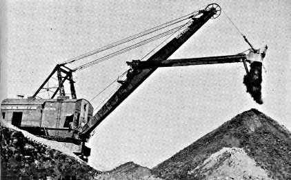
LIGNITE STRIP MINING, VELVA
Courtesy Truax-Traer Coal Co.
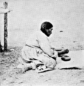
ARIKARA
WOMAN
POUNDING
CHERRIES
Photo by Russell Reid
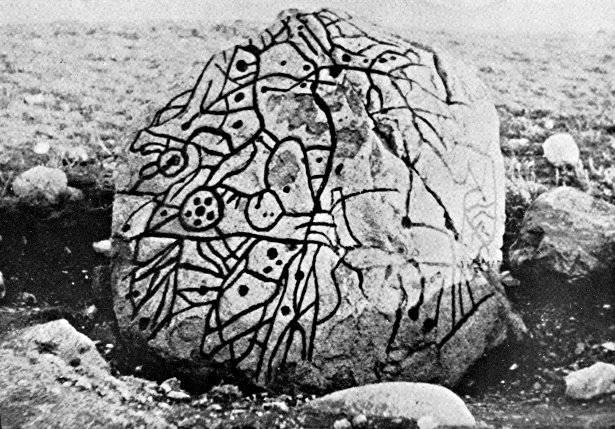
WRITING
ROCK,
NEAR
GRENORA
LAKE UPSILON, TURTLE MOUNTAINS
Photo by Russell Reid
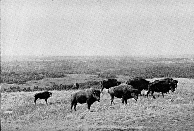
BUFFALO, SULLY'S HILL NATIONAL GAME PRESERVE
Below Jim's Creek the river widens, its flood plain covers a
large area on either side of the stream, broadening the valley
along which the hills begin to be more grassy and less rugged
and colorful. At the confluence with HANS CREEK (R) the river
makes an abrupt right-angle turn L., and while the valley still
remains wide, the stream itself narrows and runs more swiftly.
(Good overnight camp sites in the Indian reservation.)
Below the North Roosevelt Park ranches are fewer, and people
are seldom seen from the river.
The wider, majestic Missouri is soon reached, and forms the
route for the remainder of the voyage. Up this avenue of exploration
came Lewis and Clark, Maximilian, Catlin, Ashley, Lisa, and
other adventurous explorers and traders; first in the round, unwieldy,
skin bullboats of the Indians, and later in the chugging
steamboats, plying the river in search of trade between the tribes
and forts established along its course.
The seasonal rising and lowering of the Missouri's water level
continually changes the channel, leaving shoals, sand bars, and
snags, and these offered a problem to river pilots as long as steamboat
traffic flourished on the river. When a flat-bottomed steamer
ran aground it took hours, and sometimes days, to release it. It
was from the odd device used to work the boats off sand bars that
the term "grasshoppering" came into use. Each steamer carried
two long, heavy spars, similar to telephone poles, near the bow
ready for use. Capt. Grant Marsh, an old river pilot, describes the
operation of these spars in Joseph Mills Hanson's Conquest of the
Missouri:
"When she became lodged on a bar, the spars were raised
and set in the river bottom, like posts, their tops inclined somewhat
toward the bow. Above the line of the deck each was rigged
with a tackle-block over which a manila cable was passed, one
end being fastened to the gunwale of the boat and the other end
wound around the capstan. As the capstan was turned and the
paddlewheel revolved, the boat was thus lifted and pushed forward.
Then the spars were re-set farther ahead and the process repeated
until the boat was at last literally lifted over the bar. From the
grotesque resemblance to a grasshopper which the craft bore when
her spars were set, and from the fact that she might be said to
move forward in a series of hops, the practice came to be called
'grasshoppering.'"
From the beginning river steamers were dependent on wood
for fuel, and as traffic increased woodyards became more numerous
along the stream. At first they were operated only by the hardiest
of white frontiersmen, but as the agency Indians absorbed the
white man's civilization they too began to cut wood to sell. Steamers
usually burned either cedar or cottonwood, although the latter
was suitable for fuel only when fully dried, while cedar burned
readily either green or cured. Boat captains took all the cedar
the Indians could stack, but would not stop their boats when they
saw only green cottonwood corded. The Indians soon learned a
subterfuge to surmount the difficulty of having only cottonwood
on hand. They smeared the freshly hewn ends of cottonwood cuttings
with vermilion so that it resembled cedar, stacked the wood
with the painted ends toward the river, and trusted that when a
boat stopped she would take the camouflaged cottonwood rather
than waste more time.
The Missouri passes beneath the black steel span of FOUR
BEARS BRIDGE, the bridge with 19 Indian names (see Side
Tour 3A.) Approximately 2 m. below the bridge the river
passes within 2 m. of ELBOWOODS (see Side Tour 3A), inland
to the L., the first town neared in the more than 200 m. of drifting
since Medora was left behind. (Good camp site on the Elbowoods
side of the Missouri.)
On the bluffs opposite Elbowoods is the SITE OF A HIDATSA
INDIAN VILLAGE, which according to tradition was once besieged
by the Sioux, who expected to win an easy victory by curtailing
the village water supply. Hidatsa scouts, however, had learned of
the planned attack, and the people in the village made rock-filled
reservoirs and carried water from the river to fill them. Repulsing
the first attack of the Sioux, the besieged rolled a skin of
water down the hill toward their enemy, which, the legend says,
so discouraged the besiegers that they abandoned their efforts to
capture the village and withdrew.
The reservation borders both sides of the river from here to
a point a short distance downstream from Ree.
Below Elbowoods the river passes the sites of GRANDMOTHER'S
LODGE, FORT BERTHOLD, REE, and NISHU (see
Side Tour 3A). EXPANSION (R) consists of a post office and
store marking the site of a formerly active river town. (Good
camp site bet. Ree and Expansion.)
Just upstream W. of Expansion is a large, easily detected sandstone
promontory known as MANUEL ROCK (R), used as a
landmark by old river pilots, and named for the fur trader Manuel
Lisa.
Below Expansion are (L) the mouth of GARRISON CREEK
and the SITE OF FORT STEVENSON. The site was selected by
Gen. Alfred H. Sully in 1864 on his trip down the Missouri during
his second campaign, but the fort was not established until 1867.
A two-company post named for Brig. Gen. Thomas G. Stevenson,
the fort was abandoned in 1883 and the military reservation turned
over to the Interior Department. For a short time the buildings
were used as a school for Indian children from the Fort Berthold
Agency. Garrison Creek was originally called Douglas Creek, but
the name was changed when the Stevenson garrison began using
it for bathing purposes.
A few miles below Garrison Creek is SNAKE CREEK (L),
called Ma po ksa a ti a zi (Hidatsa, snake house river), where a
cave along the banks of the Missouri near the mouth of the creek,
according to legend, swarmed with snakes at certain seasons.
A short distance downstream from the Fort Stevenson site the
course of the Missouri turns S. and passes MANNHAVEN (R),
remnant of a once thriving river town. Near the present village
in 1809 the Missouri Fur Co., directed by Manuel Lisa, erected a
trading post known variously as Fort Manuel Lisa and Fort Lewis,
the latter for Reuben Lewis—brother of Meriwether Lewis, coleader
of the Lewis and Clark expedition—who operated it until its abandonment
in 1812. Under the name of Fort Vanderburgh, the site
was later occupied briefly in 1822 or 1823. Lisa, born in New
Orleans of Spanish parents, is said to have had more influence
over the Indians with whom he dealt than any other trader to
enter the Missouri area, although his activities in the Missouri
basin were of only 13 years duration. He died in St. Louis at the
age of 48.
The mouth of the KNIFE RIVER is just upstream from STANTON
(see Side Tour 8D). (Camp can be made on R. river bank.)
In the vicinity of the confluence of the Knife and Missouri
are the sites of many Indian villages, Hidatsa, Mandan, and Arikara,
the locations of which are easily traceable by the many round,
dish-like depressions marking the sites of earth lodges in the villages.
The Hidatsa had three villages here until 1837 when the
smallpox epidemic reduced their population to only one village.
Prior to their occupation of the Knife River vicinity the tribe lived
near the mouth of the Heart River (see Tour 8), and in 1845, for
protection from the Sioux, they moved to Fort Berthold. The
Mandans, whose two villages some miles below the Knife were
reduced to little more than 100 persons by the smallpox epidemic
of 1837, moved to a small village near the Hidatsa, and followed
that tribe to Fort Berthold in 1845. Migrating up the Missouri at
a later date, the Arikara built villages near the Knife as late as
1851, but they too, because of continued Sioux raids, moved to
Fort Berthold.
It was at one of the Knife River villages, that Charbonneau, and
his Shoshone Indian wife, Sakakawea, lived in 1804 when Lewis and
Clark employed Charbonneau as interpreter of the expedition
to the Pacific (see Bismarck).
Below Stanton is DEAPOLIS (R), marked by a single grain
elevator, all that remains of another of the towns that sprang up
along the Missouri, flourished, and declined with the steamboat
trade. The place was named by its founder, who replaced the
first letter in the name of the ancient city Neapolis with the
first letter of his own surname, Danielson.
Old residents tell the story that in the summer of 1894 the
river at Deapolis was extremely low, exposing a huge boulder in
the center of the stream. An interested group made their way
to the stone, and found it carved with peculiar markings they
were unable to decipher. Before leaving they added the date of
their visit to the inscription. Forty years later the river stage
again was low enough to bring the stone above water, and a
second party visited it, and found the same undecipherable markings
as well as the carving of the 1894 party.
Near the Deapolis elevator is the SITE OF BIG WHITE'S
MANDAN INDIAN VILLAGE. Big White was the Mandan chief
taken to Washington by Lewis and Clark on their return from the
Pacific, and his village was one of two Mandan towns visited by
the expedition on the journey up the Missouri in 1804-5. The other,
Black Cat's Village, was on the L. bank of the river farther upstream.
Lewis and Clark's Fort Mandan was built on the L. bank
downstream from the Deapolis site, but the changing river channel
has removed all trace of the fort, and Black Cat's Village has
never been definitely located (see Tour 3).
South of Deapolis is the SITE OF FORT CLARK TRADING
POST (R), for which the present village of FORT CLARK (1,726
alt., 46 pop.), downstream 1.5 m., is named. The post, a well
stockaded fort 132 x 147 ft., was built in 1829 by James Kipp for
the American Fur Co. and named for William Clark of the Lewis
and Clark expedition. Because of its flourishing trade with the
Mandans it was for several years second only to Fort Union in
Missouri importance, but it was closed during the smallpox epidemic
of 1837, and a few years later was abandoned by the company.
The Arikara Indians reoccupied the site in the 1850's in
their migration up the Missouri. Today there are slight excavations
and scars marking the outline of the fort stockade walls, and traces
of the Indian habitation.
Scorched Village, according to Hidatsa legend, had its locale near
the present city of WASHBURN (L) (see Tour 3), but the Indians
say that the site of the legendary village has been swallowed by
the ever-shifting channel of the river.
The river passes WILDWOOD LAKE and the PAINTED
WOODS (L) (see Side Tour 3B), and the town (R) of SANGER
(1,712 alt., 70 pop.), named for its first settlers, C. H. and George
Sanger. (Camp can be made in vicinity of town; L. bank more
accessible.)
The route passes (R) the post office of PRICE (1,700 alt., 10
pop.), named for William Price, the first homesteader in the
vicinity. Price is on the northern slopes of the flat-topped formations
known as SQUARE BUTTES (see Side Tour 3B). Below
these bold buttes is (L) DOUBLE DITCH INDIAN VILLAGE
STATE PARK (see Side Tour 3B), and a short distance below that
the route passes (R) the mouth of SQUARE BUTTE CREEK (see
Side Tour 8D).
The resting place of the last physical traces of steamboating
on the upper Missouri, ROCK HAVEN (R), is passed almost in
sight of the black steel link of railroad bridge spanning the river
near Bismarck. The advent of the railroad spelled the decline of
river traffic, but before its coming Rock Haven was a river drydock
and boat yard, and today three old craft which have seen
sporadic service in the last decade are resting on large skids,
drawn up from the waters once churned by their paddle wheels.
On the high bluffs across the river below Rock Haven are
the reconstructed earth lodges of the LOOKING VILLAGE (L) of
the Mandans, below which is the mouth (L) of BURNT CREEK
(see Side Tour 3B).
Termination of the 350 m. voyage is made at Bismarck at a
boat landing (L) reached just after passing under the N. P. Ry.
Bridge. Downstream from the landing is the LIBERTY MEMORIAL
BRIDGE over which passes US 10 (see Tour 8).