A burgh and a fortified bridge (whence the name of "Bruges" ("Brugge"))
on the Reye, a brook since absorbed by the canals,—such was the origin
of the town.
In the 9th century Baudouin-Bras-de-fer, first count of Flanders and
vassal of the French King replaced the original establishment with a fortified
castle, around which, in spite of civil discords, quarrels between the
rulers and their turbulent subjects, dissensions between the vassal and his
suzerain, and rebellions by those two powerful Flemish communes—Ghent
and Bruges—the town grew and prospered. These troubles were marked
by sanguinary episodes, chief among which were the "Bruges Matins"
(1302) in which thousands of the "Gens du Lys" (Leliaerts) partisans of
France, lost their lives, and shortly afterwards the famous "Battle of the
Golden Spurs", in which the flower of France's chivalry, lured into the
Groeninghe Marshes, was annihilated by the Flemish pikemen (clauwaerts)
led by Breydel the butcher, and Coninck the draper.
The era which followed this crisis was one of great prosperity for Bruges,
then a vast emporium of European trade, being in close relation with London,
Genoa, Venice, Augsburg and the Hanseatic towns. Wealth abounded.
The rich foreign merchants built sumptuous mansions, several of which
still exist. Bruges attained the height of its prosperity in the 15th century,
under Burgundian rule. Favoured by the long reign of Philippe-le-Bon,
"the Great Duke of the West", the arts, today the glory of the old city,
flourished exceedingly.
Decadence set in, chiefly owing to the retreating of the sea and the gradual
filling up of the creeks and harbours with sand. Trade steadily declined,
whilst in the 16th century, political and religious troubles hastened the
downfall of the city. The population of 200,000 dwindled away to 50,000,
and at last the place came to be known as "Bruges-la-Morte".
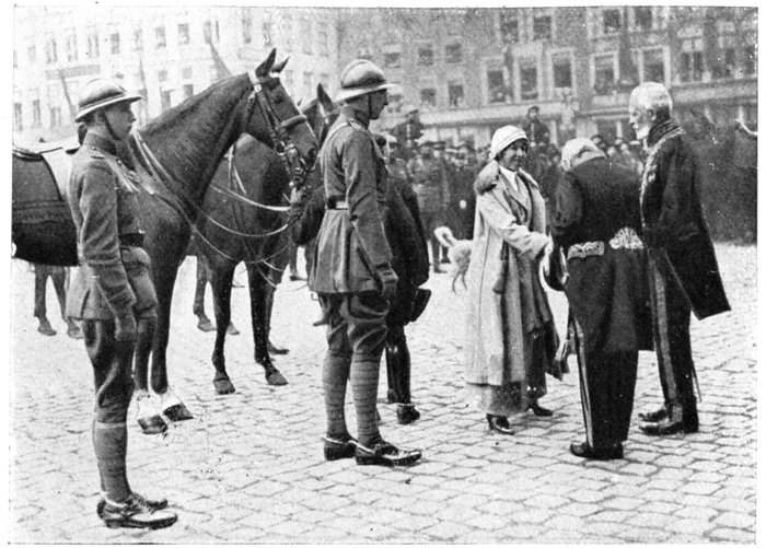
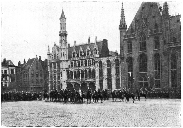
Bruges. The Governor of Flanders and the Burgomaster
of the City welcoming King Albert, Queen Elizabeth and Prince
Leopold in the Grand'Place.
Under the Republic and the Empire, the city, under French domination,
became the capital of the Department of the Lys, and later, under Dutch
rule (1815-1830), of Western Flanders. When, later, the kingdom of Belgium
was constituted, it retained this rank.
Since that time, Bruges with her melancholic chimes has remained a quiet
old-world place, the delight of lovers of art, who each year come to admire
her treasures, amid the charm of quaintly picturesque scenery.
The boundaries of the city have remained unchanged since the time when
Bruge's prosperity was at its height. The area of the town being the same
as in the 14th century, it follows that the present-day population of 50,000—all
that remains of the former 200,000 inhabitants—has plenty of elbow-room.
However, the numerous open spaces and gardens in no way detract from
the æsthetic appearance of the place. In shape an oval, stretching from
the south-west to the north-east, the town is surrounded by ramparts and
a wide exterior moat, except on the north (between the Gates of Ostend
and Damme) where they were demolished at the beginning of the present
century, in order to connect up directly with the new ship canal. Parts
of the ramparts have been transformed into boulevards, promenades and
gardens. Of the numerous windmills which used to form a picturesque
girdle round the city, only two, situated near the Sainte-Croix Gate,
remain.
At the beginning of the present century, when the ship-canal from Bruges
to Zeebrugge was opened, the "dead" city made an effort to revive her
ancient prosperity, but the irony of fate willed that the new port should
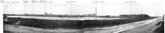
mainly serve the German invader. On October 13, 1914, amid the confusion
which followed the fall of Antwerp, and whilst the remains of the
Belgian Army were falling back on the Yser, the Germans entered Bruges,
and there established the reign of terror under which Belgium suffered for
four long years. Happily, Bruges, like Ghent and Brussels, came out of
the War practically unscathed.
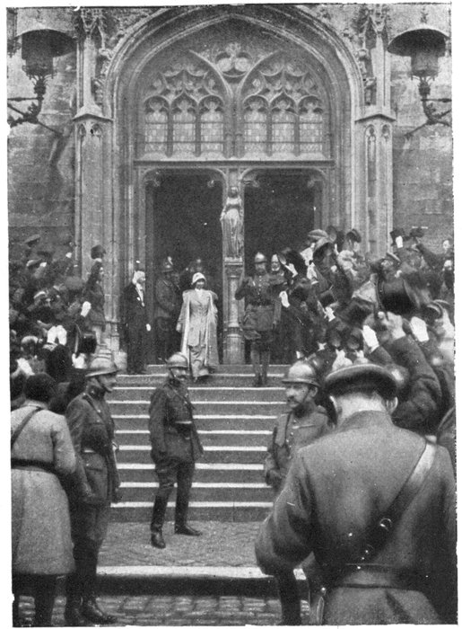
King Albert and Queen Elizabeth leaving
the Hôtel Provincial (October 25, 1918.)
From October 14, 1914
to October 19, 1918,
Bruges was occupied by
the Germans, with Admiral
von Schroeder as
Military Governor.
Requisitions to the
amount of some sixty
millions of francs were
levied; the factories
were emptied of their
machinery, and the
warehouses of their raw
materials.
The bombardments
did little damage. The
maritime quarter, in
which were the Imperial
workshops, alone received
a number of aeroplane
bombs.
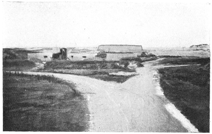
It was in this strictly
guarded arsenal that the
Germans assembled and
repaired their submarines.
Armour-protected
shelters and concrete-covered
docks for the
submarines not on active
service, provided security
for the enemy's
intense activities. Immense
reservoirs of crude
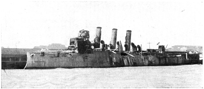
oil furnished the boats with fuel. Before leaving, the Germans destroyed
these works. The floating-docks, drags, cranes, and port machinery, etc.,
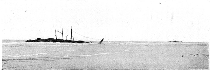
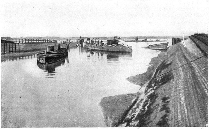
belonging to Belgium, were wrecked. Sunken hulls blocked up the channels.
Huge quantities of stores, including girders, reinforced concrete, sand, etc.,
were left behind on the wharves.
After stripping the place of everything that could be carried off, after
attempting to sell several captured boats which had been brought in there,
and after blowing up the bridges, the enemy left the town. Through some
mysterious and powerful intervention, the chimes in the belfry were left
untouched, and as the Germans hurriedly departed, a peal rang out joyously.
Flags and banners were taken from their hiding-places and hung in the
streets and squares. "Bruges-the-dead" became "Bruges-the-living-and
joyful".
On October 25, 1918, amid indescribable enthusiasm, and to the strains
of "La Brabançonne" and "La Marseillaise", rung out on the old belfry
chimes, King Albert, Queen Elizabeth and Prince Leopold, accompanied
by the General Staff, General Degoutte and Admiral Ronarc'h, re-entered
the liberated city.
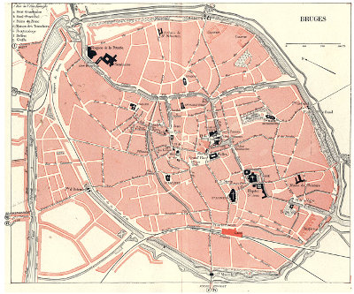
See Coloured Plan between pp. 88-89.
To facilitate visiting the city, two excursions are indicated, both of which
start from and return to the Grand'Place.
In Belgium, the churches are generally closed from noon to 2 p.m. The
chapels, in which the works of art are kept, can be visited at specified hours,
for a small fee. The same applies to the Hôtel-de-Ville.
Before starting to visit Bruges, obtain particulars from the Bureau Officiel
de Renseignements, Grand'Place, underneath the Belfry (3 minutes from the
station).
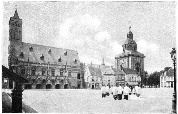
The Grand'Place or Grand Marché is in the centre of the city. The "Halles"
occupy the south side, and the Hôtel du Gouvernement Provincial and
General Post Office the western side. On the northern side is a row of
remarkable gabled houses (photo below), while to the east, at the corner
of the Rue St. Amand, stands the Hôtel Bouchoute which, in 1839, was
surmounted with a metal ball indicating the meridian line. In the centre
is a monument by the sculptor Paul de Vigne, erected in 1887 to the memory
of the famous communists Breydel and de Coninck.
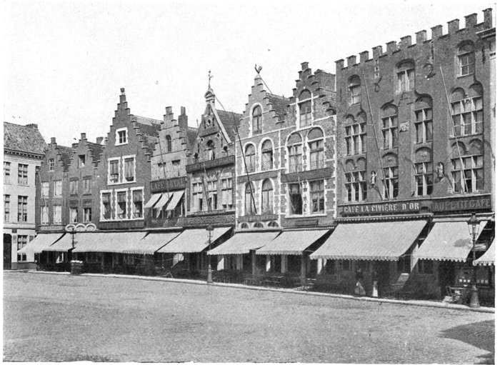
Bruges. Ancient houses in the Grand'Place.
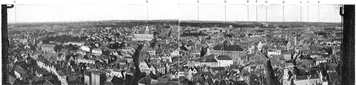
General View of Bruges, seen
from the top of the Belfry.
A. Ostend; B. Church of St. Jacques; C. Blankenberghe; D. The Theatre;
E. Water-Works of Zeebrugge; F. Zeebrugge Canal; G. Port of Bruges;
H. Heyst; I. Duinbergen;
J. Church of St. Gilles; K. Knocke.
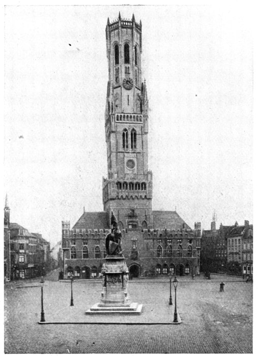
The Belfry. In front: The Statue to
Breydel and Coninck.
It is this edifice—an eloquent
witness of the city's
past grandeur and symbol
of the ancient prosperity of
the "Queen of the West"—which
characterises Bruges.
The building measures 270
feet in length by 110 feet
in width. The low galleries
with groined vaulting on
the ground-floor, contain
an archæological museum,
whilst those on the first
floor are used for exhibition
purposes.
The Belfry, in the centre
of the façade, is 264 feet
high, and comprises two
massive, square, superimposed towers, decorated
with pinnacles connected
by a balustrade. Above
rises a third octagonal tower
supported by flying buttresses.
This last story,
which contains the famous
peal of bells, was added
towards the end of the 15th
century. It was surmounted,
first with a spire, and
later, after the spire was
burnt, with a triple campanile, destroyed by lightning in 1741. A balustrade
now crowns the tower.
The Renaissance statue of the Virgin, on a stem-like ornament over the
main doorway (1819), replaced the original one which was broken during
the Revolution (1793). Above is a bretèche, from which public announcements
were made.
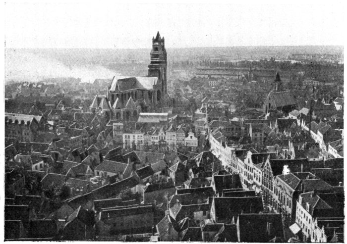
The Cathedral
of St. Saviour
Rue du Beffroi.
The "Halles" date from the 12th century, but were enlarged in the
14th, 15th and 16th centuries. Pass under the vaulted entrance, to the
staircase which leads to the upper stories and tower. A spiral stair of 403
steps leads to the upper platform, which commands a very extensive
and impressive view; on the one side, the littoral, with its watering-places
and ports, stretching as far as Flushing; on the other side, the Flemish
plain, with its towns, burghs, and villages. To the chequered history
of this region, a new and far more tragical page has just been added. The
visit to the tower comprises: the first story, in which is the "Big Ben" dating
from 1680, and weighing nearly six tons; it was taken from Notre-Dame
Church and placed there in 1800; the watchmen's room, and lastly the
belfry proper, containing a peal of forty-six bells, cast in 1743, and rung
either by a cylinder or a key-board. During the German occupation the
bells remained dumb.
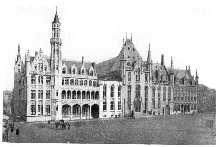
The
Hôtel
du
Gouvernement
provincial.
This edifice was rebuilt in rich 16th century style (Gothic and Renaissance
combined) after the fire which destroyed
the original building in 1878. It
stands on the site of the old "Water Halle"
which was skirted by a canal, now covered
in. The German invasion interrupted the
completion of the right wing, at the corner
of the Rue Philipstock. Excavations
carried out on this site laid bare the old
pillars of the "Water Halle".
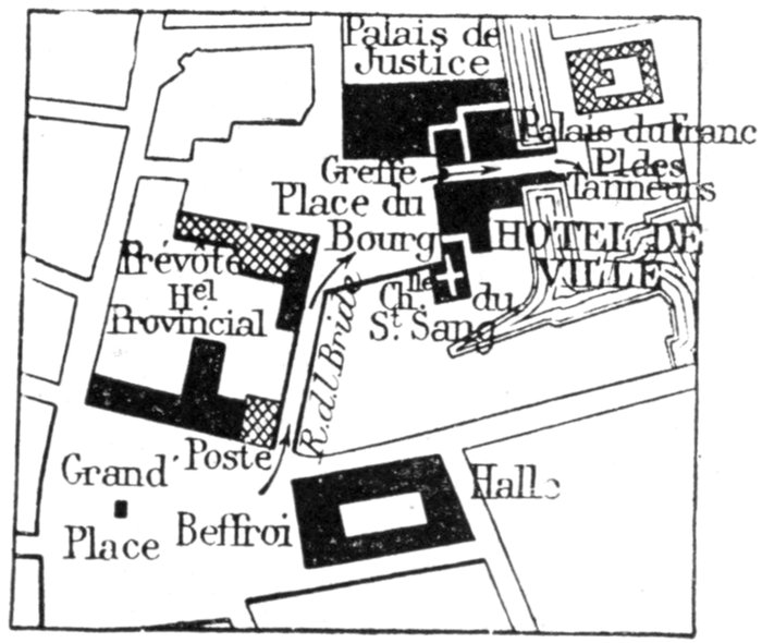
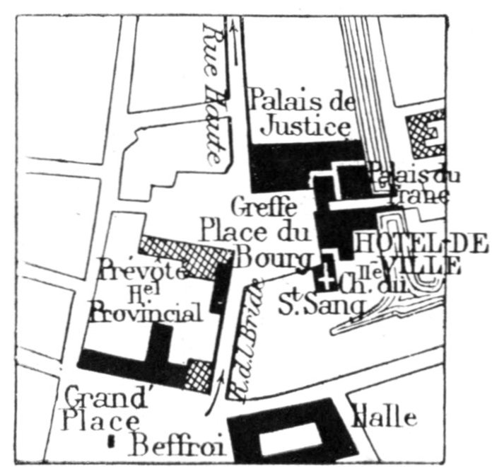
Leave the Grand'Place by Rue de la Bride,
at the corner of which is the Hôtel des
Postes (Post Office). The tourist next
reaches the Place du Bourg, in which are: on
the left, the Prévôté; on the right, the
Hôtel-de-Ville, between the Chapel of St. Sang and the Greffe.
The Prévôté, formerly the residence of the Provosts of the Chapter of
St. Donatian, was built in 1664. Its Renaissance façade has been partially
restored. On the terre-plein planted with fine trees, which adjoins it, stood
the ancient Cathedral of St. Donatian, pulled down in 1790. Charles-le-Bon,
Count of Flanders, was assassinated there in 1127.
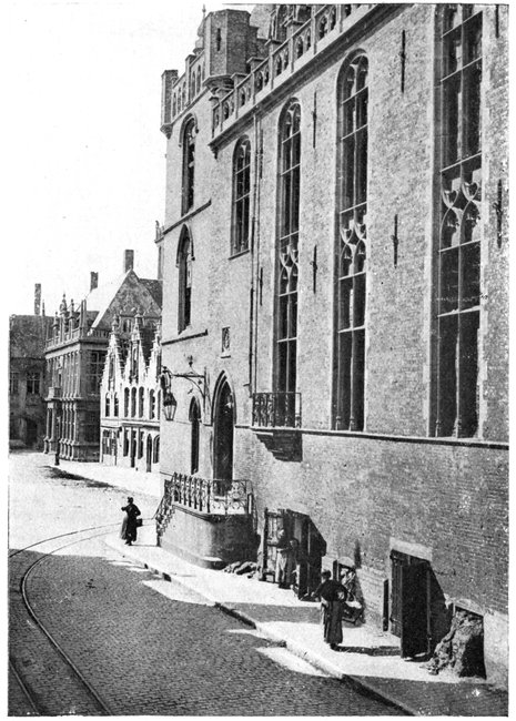
This beautiful Gothic structure is ornamented with six storied corbel-turrets,
covered with niches and small statues of the Counts of Flanders
(1376-1389).
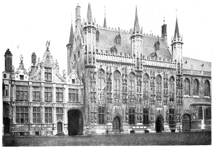
The Hôtel-de-Ville, separated from the "Greffe" (on the left) by the
entrance to the narrow street of the "Ane aveugle".
Badly disfigured during the Revolution, the building was inartistically
restored in 1854, as witness the small replace statues. The dependencies
facing the narrow street "Ane Aveugle", the canal, and the rear of the
Chapel of St. Sang, were either
rebuilt or restored in modern times.
On the ground-floor are a
large hall, the Council Chamber,
and the Burgomaster's office.
The staircase leads to the Salle
des Echevins, which occupies practically
the whole length of the
story. It was decorated quite
recently by A. de Vriendt with
frescoes illustrating episodes from
the history of Bruges. Its magnificent
Gothic vaulting is ornamented
with pendent wood-work.
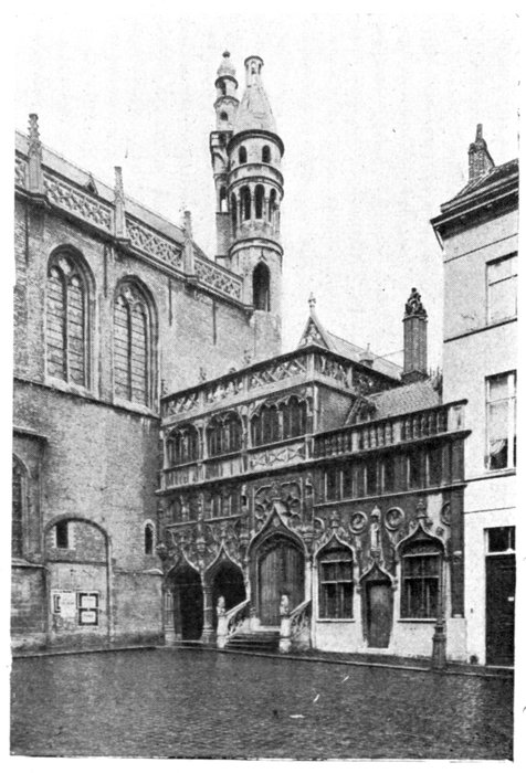
The Chapel of Saint-Sang.
Adjoining the Hôtel-de-Ville, on
the right, is the Chapel of Saint-Sang
(Holy-Blood), (photos opposite
and on p. 9). This famous
name was given to two superimposed
sanctuaries. The lower one
(12th century) with short massive
pillars, was dedicated to St. Basil.
In the upper one (15th century),
is kept the shrine of the Holy
Blood, brought from Palestine,
according to tradition, by Count Thierry d'Alsace, in 1148. This was the
starting-point of the famous procession which, before the German invasion,
used to attract large numbers of people to Bruges each year, and was in
fact a public festival. Inaugurated in 1303, it takes place on the first Monday
following May 3.
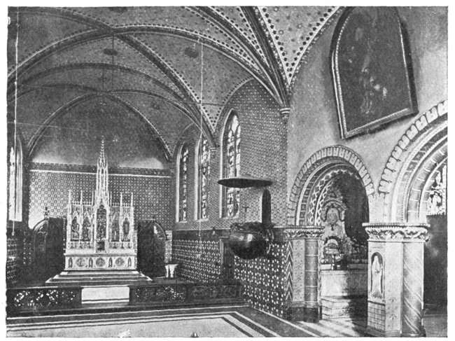
The pretty, Flamboyant, two-storied building of blue stone, containing
the staircase which leads to the upper chapel, dates from 1530. The chapel
is in striking contrast with the massive
"crypt" of St. Basil. The stained-glass
windows, representing the Dukes of
Burgundy, are practically copies of the
magnificent windows formerly sold by
the City Authorities to a local secondhand
dealer for 14 francs each, and
which now adorn an English mansion.
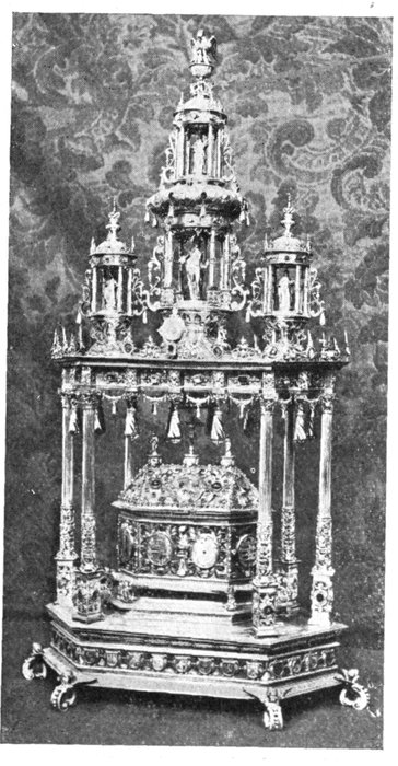
The shrine of St. Sang was made in
1614-1617 by Jean Crabbe, the Bruges
goldsmith, to replace the one destroyed
in 1578. It is a very fine piece of Renaissance
workmanship in different metals
studded with gems (Photo opposite).
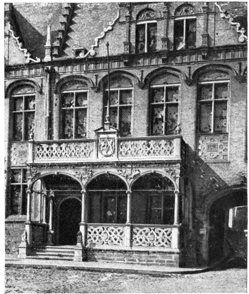
Built in 1535-1537, the pretty façade
was restored, re-gilded and adorned
with statues in 1881-1884 (Photo, p. 93).
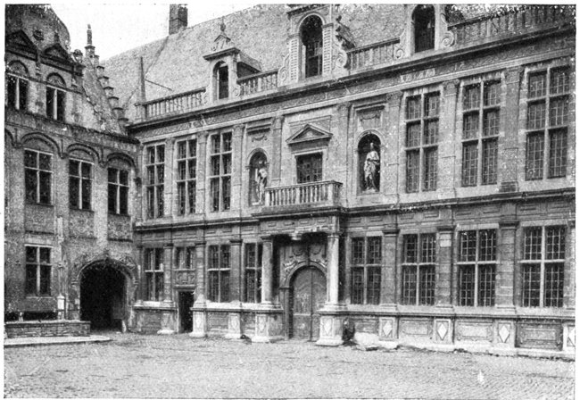
The chief interest of the Palais-de-Justice
lies in the ancient Chambre Echevinale
which contains the famous mantelpiece
so often reproduced pictorially,
although no image can give an adequate
idea of its richness and splendour
(Photo above). In this "poem of carved wood", the great artist, Lancelot
Blondeel, expressed with wonderful power and wealth of detail the apotheosis
of Charles-Quint. The imperial effigy, forming a central motif,
stands out boldly in relief. The other life-size figures which surmount the
panels to the right and left represent: on one side, Maximilian of Austria
and Marie of Burgundy;
on the other side, Ferdinand
of Aragon and Isabella
of Castile, ancestors of
the Emperor. The mantelpiece
proper is in black marble
with a frieze of alabaster
representing, in bas-relief,
the story of Susannah. This
masterpiece was conceived
by Blondeel and executed
by Guyot de Beaugrant.
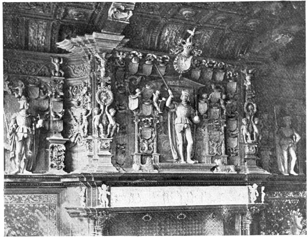
Mantelpiece
in the
Palais-de-Justice.
Leave Place du Bourg by
the narrow street "Ane Aveugle",
which, passing under
an arcade, runs between the
"Greffe" and the Hôtel-de-Ville,
coming out at the "Marché-aux-Poissons" (Fish-Market).
Immediately on
the left is seen the charming
vista of the "Quai des Marbriers"
and "Quai Vert",
one of the most deservedly
renowned places in Bruges.
That part of the "Palais
du Franc" which was rebuilt
in the 16th century
overlooks the canal, with its
long row of gables and graceful
turrets (restored in
1880, by P. Buyck).
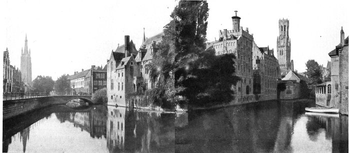
Panorama Seen
from the Quai du Rosaire.
On the left: Church of Notre-Dame and Bridge of
St. Jean de Népomucène. On the right: The Belfry.
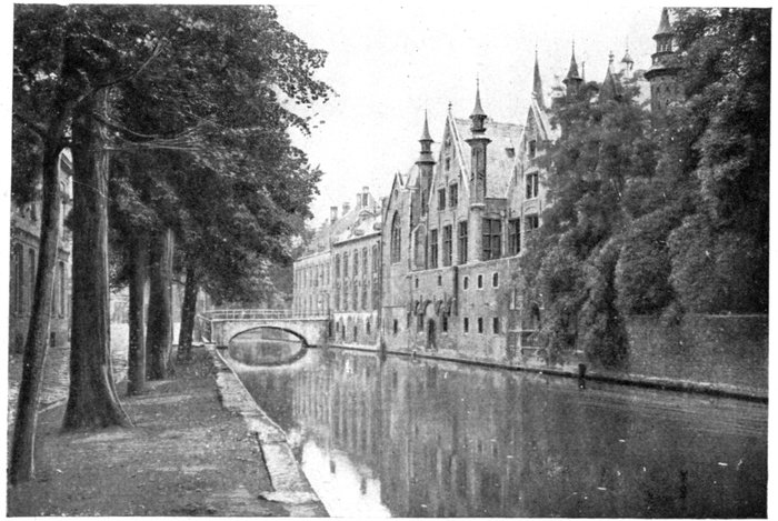
The Palais-de-Justice and Palais-du-Franc.
Seen from the Quai des Marbriers.
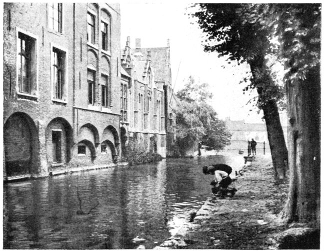
The Quai du Rosaire.
See plan between pp. 88 and 89.
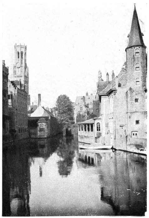
Beyond the canal, turn to the right and cross the Placette des Tanneurs
leading to the charming Quai du Rosaire and Le Dyver. The Quai du
Dyver widens, and is planted with fine old trees. Opposite, picturesque
buildings, nestling amidst foliage, are reflected in the still water. The
lofty spire of Notre-Dame dominates all the surrounding country. The Rue
Neuve Bridge is next reached; there the canal (formerly the river Reye),
makes a sharp bend and disappears under the building facing the bridge.
(Beyond the latter, take the Rue Gruuthuuse as far as a new group of remarkable
buildings: Notre-Dame Church, Hôtel Gruuthuuse and St. John's Hospital).
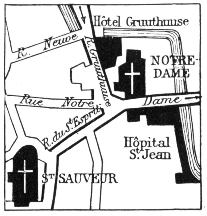
This pretty structure, situated with Notre-Dame Church in a bend of
the Reye, was formerly the house of the
malt tax-collector. It was leased in the 15th
century to a certain Grutarius who erected
that part of the building overlooking the
Reye, a fine primitive Bruges style gable
of which still remains. The main part of
the building, with its façade, beautiful dormer
windows, and a turretted staircase, was
erected some fifty years later by Louis de
Gruuthuuse. The house had just been completed
when, in 1471, Gruuthuuse received
King Edward IV of England, who had been
driven into exile by Warwick. At the end
of the following century, the family having
become extinct, the mansion was purchased
by Philippe II. In 1628, the municipal mont-de-piété
was installed there, where it remained until 1875, in which year
the city acquired the premises to house the collections of the Archæological
Museum. The mansion has been thoroughly restored in modern times.
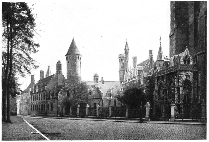
Hôtel Gruuthuuse and North Transept of Notre-Dame Church.
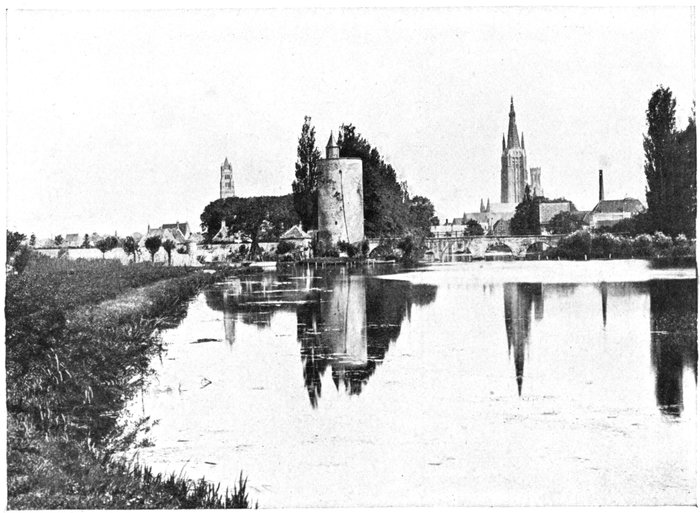
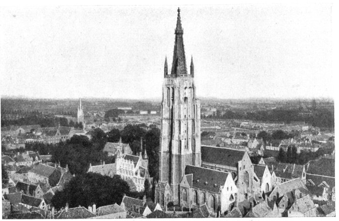
The lofty spire of Notre-Dame Church dominates the surrounding
country. Its reflection is seen in the calm waters of the "Minnewater"
with that of St. Saviour's (on the left) and the Belfry (on the
right).
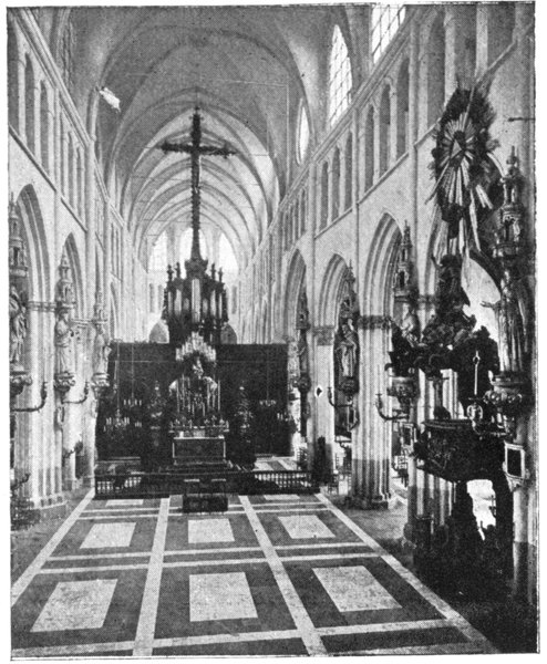
Notre-Dame Church. The Nave.
The church of Notre-Dame with its enormous buttressed tower surmounted
by a crocketted spire, is 400 feet high and with its satellites, St. Saviour
and the Belfry, dominates the entire city and surroundings. It is said
to be the largest brick construction
in existence.
The church is a strange mixture
of restorations, additions and
alterations, which have changed
its character and destroyed its
harmony. The general style is
early Gothic, and reveals its
13th century origin. Two side-aisles
were added to the three original
naves, the first about the
middle of the 14th century, and
the second a century later. The
façade nearest the hospital, flanked
with round turrets, was badly
mutilated. Recent attempts
have been made to restore it,
and at the same time to suppress
certain unbecoming, extraneous
masonry-work, but through lack
of documents, the work was
necessarily carried out in a more
or less hypothetical manner. At
the foot of the gigantic tower and
in striking contrast with its severe nudity is the Radial Gothic Baptistère, an
ancient protruding porch dating from the 15th century, the double arcade
of which was walled up to form a chapel for the font.
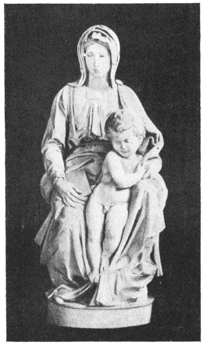
The Virgin and Child.
By Michael Angelo.
In the interior one is struck, on entering, by the work of simple juxtaposition
which added a side-aisle to the original one, by opening the arcades
in the old wall and setting new pillars against the ancient buttresses. The
whole of the interior bears marks of
similar treatment. The vaulting of the
naves was reconstructed in the 18th century,
when the present heavy triforium
was built. The small arcades which ornamented
the walls were filled in, but
portions have recently been uncovered
and restored.
The building is 237 feet long and 165
feet wide. An 18th century rood-loft
surmounted with an organ-case separates
the nave from the choir. Above the
organ a triumphal cross (1594) is suspended
from the vaulting. The choir
stalls, like the cathedral, bear the arms
of the Knights of the Golden Fleece, in
commemoration of the 11th. Chapter
held in Notre-Dame in 1468.
The principal interest of the church
lies in the works of art which it contains:
The Virgin and Child by Michael Angelo,
and the Tombs of the last two
Sovereigns of the House of Burgundy:
Charles-le-Téméraire and his daughter
Marie, wife of Maximilian of Austria,
whose mausoleum at Innsbruck, is likewise
a marvel.
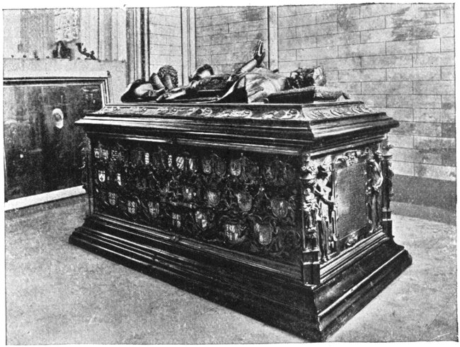
Tomb
of
Charles-le-Téméraire.
The Virgin and Child (on the altar of the Holy Sacrament, at the end of
the right nave), was the gift of Jean Mouscroen, the donor of the altar,
who paid a hundred ducats for it to the great sculptor in 1514. Its origin,
which was long disputed, is now definitely established (Photo, p. 100).
The tombs of Charles-le-Téméraire and Marie of Burgundy, originally
placed in the choir where they worthily contributed to the decoration of
the sanctuary, were later removed to a closed chapel on the right, formerly
the old Chanterie—reconstituted in 1812 of the écoutète Pierre Lanchals,
who was tortured and beheaded in 1488 by the city burghers. His tombstone
is still to be seen there, but it is the Burgundian tombs which retain
the visitor's attention. Reproductions of the latter abound, and several
European museums (among others, Cluny, Paris) possess plaster facsimiles.
That of Marie is sixty years earlier than her father's, and is greatly superior
both in style and execution. It is the work of Pierre Beckee of Brussels;
the other is by Junghelinck, a native of Antwerp. The sarcophagi are in
black marble with recumbent life-size statues of gilded copper; on the sides
are the enamelled armorial bearings of the numerous domains belonging to
the House of Burgundy. Philippe-le-Beau dedicated this mausoleum to his
mother, who died at the age of 25 in consequence of a fall from her horse.
Later, the remains of Charles-le-Téméraire, killed at Nancy, having been
taken to Bruges, Philippe II had a tomb built for them on the lines of the
first one. At the time of the Revolution the tombs were taken to pieces
and hidden; the parts were reassembled in 1816, thanks to a subsidy of
10,000 francs granted by Napoleon.
The church contains many 17th and 18th century pictures, several remarkable
works dating from the 15th and 16th centuries, paintings, panels
and polyptics, among others an Adoration of the Shepherds by P. Pourbus,
a triptych (first chapel on the left of the Ambulatory), and a Transfiguration
triptych, the central panel of which is attributed to Mistaert (first chapel on
the south side-aisle). Claeyssens, Van Orley, Marc Gheeraerts, Gérard Zeghers
(Adoration of the Wise Men (western wall)) etc.... are likewise represented.
In the Ambulatory, on the left-hand side, is the Gruuthuuse tribune
of carved stone and wood, which used to communicate with the
neighbouring house and was built by Louis de Gruuthuuse in 1472. Several
other tombs are worthy of note, among others, that of Gérard David, the
famous painter of The Unjust Judge; deceased in 1523, he was buried
near the tower staircase. The Sacristy contains some fine 16th century
sacerdotal ornaments named after Marie of Burgundy.
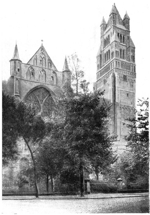
Cathedral of St. Saviour.
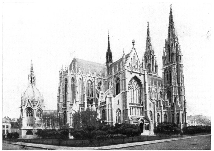
This church, with its massive tower, rises abruptly on the left. The
cemetery which formerly surrounded it has been transformed into a public
garden surrounded with railings and heavy modern pilasters. The church
was built in 1183-1228 in the fine primitive Gothic style of the period,
on the site of an ancient sanctuary which was destroyed by fire. Vestiges
of its stone foundations are still visible in the tower. The building was
frequently modified in the course of time, hence an ensemble, in which
figure the various periods of the Gothic style: parts of the transept and the
choir, 13th century; the naves, 14th century; the chevet and apsidal chapels,
15th and 16th centuries; the vaulting, rebuilt in 1732; the four pinnacled
spires of the tower, completed
in 1875. The principal
measurements are as follows:—length:
330 feet;
width: 126 feet; width at
the transept: 176 feet;
height: 96 feet.
Like Notre-Dame (see
p. 99), St. Saviour's is a
typical specimen of the
Flemish churches, as regards
its rich furnishings,
decoration and ornaments
which form a veritable
collection of works of art.
Access is gained through
two side doorways.
Polychrome decoration
(1874-1875 by J. Bethune)
replaced the previous distemper
on the walls, pillars
and ribs of the vaulting,
itself believed to hide a
former decoration of which
no traces remain. A marble
rood-loft of the 17th
century decorated with a
statue of the The Creator
by Quellin the Younger,
and surmounted by an organ-case,
separates the nave
from the choir. The latter
contains curiously carved 15th century choir-stalls, above which are the
armorial bearings of the Knights of the Golden Fleece, a famous order
founded by Philippe-le-Bon in 1429, and whose 13th chapter was held in
the cathedral in 1478.
The numerous paintings by local artists include: The Martyrdom of St.
Hippolytus, a polyptych (veiled), attributed to Dierick Boute, in the third
chapel of the ambulatory. On the left of the transept, in the Chapelle des
Cordonniers is the Tombstone of Burgher Wautier Copman (1387), with its
wonderful, shrouded figure—the finest tombstone that the 14th century
has left us. Opposite is another fine stone, though inferior in style, i.e.
that of Martin de Visch (1453). Various tablets of brass and bronze in
relief, carved wood altar-pieces, tombs of bishops, the shrine of Charles-le-Bon,
etc ..., besides the art treasures in the Salle des Marguilliers and
sacristy, are worthy of note.
The broad gateway of this building, with its low vaulting, opens out in
front of Notre-Dame, from which it is separated by Rue St. Catherine.
A little further on, the old entrance, now walled-up, has retained its small
corner columns and double tympanum, the latter containing a rare specimen
of 13th century decorative art, i.e. two high reliefs depicting: The Death
of the Virgin and The Burial Scene. Unfortunately, the entrance has been
entirely restored in such a manner as to take away much of the interest
which attached to the mutilated structure.
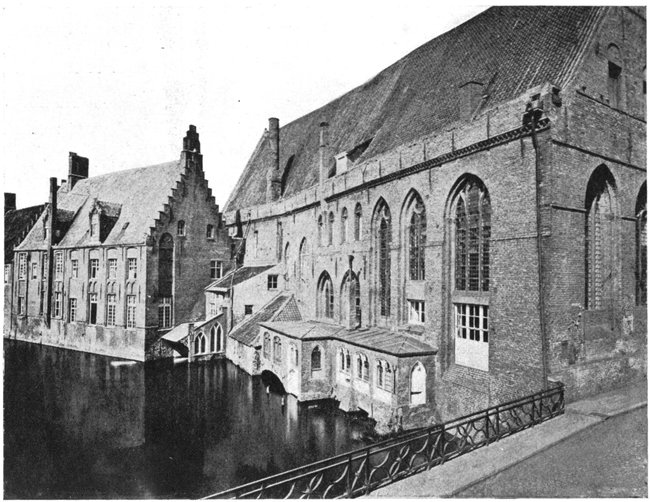
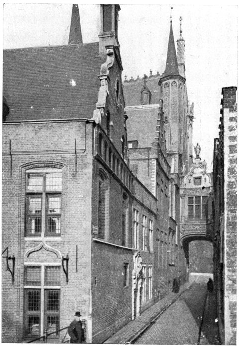
Rue St. Catherine, River Reye, and Hôpital St. Jean.
Here the Rue St. Catherine crosses the Reye, in whose waters are
reflected the gloomy walls, pierced with high windows, and the stepped
gables of the hospital, forming one of the most striking sights of old Bruges
(Photo above).
The building dates from the 13th century and contains a number of antiques
together with the names of the donors. Behind the remarkable old building
facing the street, a new hospital was built in 1856 on the site of the
cemetery; fortunately, the uninteresting appearance of these modern
constructions is hidden by the old buildings.
The hospital includes a small museum, in which are kept the famous
works of Hans Memling, classified under the following names: The Mystic
Marriage of St. Catherine (large folding altar-piece), The Adoration of the
Child Jesus (triptych with oak panels), Sibylle Sambetha (portrait of Mary
Moreel, from the Hospital of St. Julien), The Virgin with Apple (a diptych
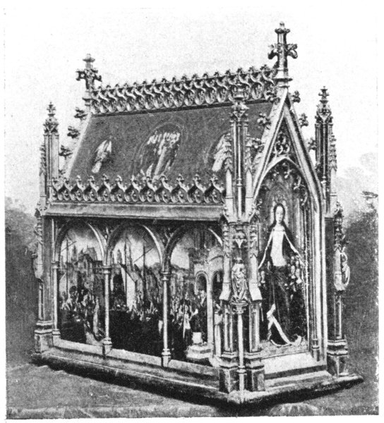
of the same origin), and lastly, the famous Shrine of St. Ursula, made
of wood, with double gables, about 34 inches high, 36 inches long, and
13 inches wide, bearing on its sides, framed with archings and separated
by small columns, representations of the six episodes from the Legend of
St. Ursula and the eleven thousand Virgins. (Photo p. 104.)
The two panels of the gables
represent the Saint and the Madonna
respectively; 6 medallions,
attributed to a pupil of Memling,
decorate the roof.
The six side panels represent
the episodes of the legend: 1, St.
Ursula landing at Cologne; 2,
Passing through Basle; 3, Reception
in Rome (the masterpiece of
the series); 4, Return to Basle; 5,
The Massacre of the Virgins at Cologne;
6, Death of St. Ursula (Photo
opposite).
About sixty pictures of great
value complete the Hospital Museum,
together with a number of
relics and pieces of carving. Most
of them are by unknown masters.
Among others, the masterpiece by
Van Oost the Elder, the Meditating
Christian, is especially worthy of
notice. The hospital contains other curiosities, such as the Chapel, the
Dispensary with its ancient furniture and fittings, and the old patients'
ward with its double vaulted nave.
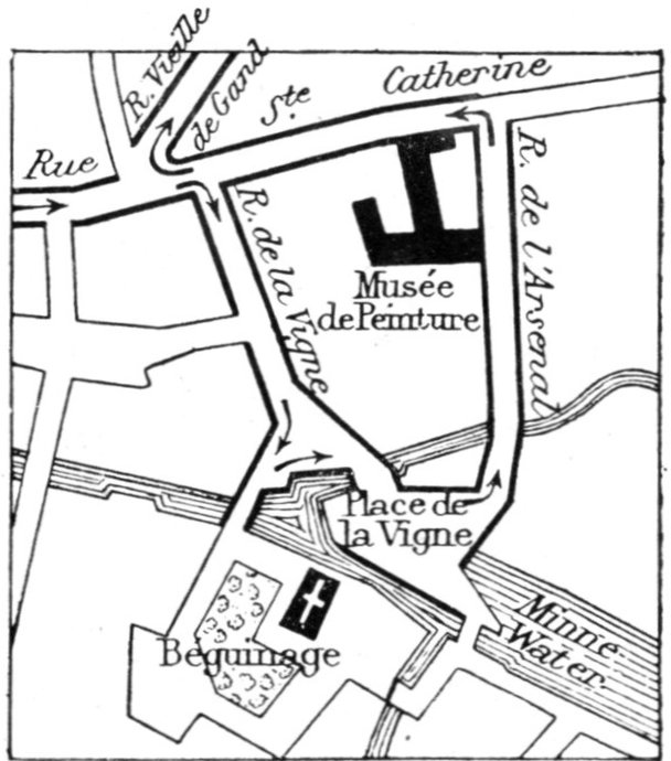
Follow Rue St. Catherine (continuation of Rue Notre-Dame, beyond the
Hospital), then take Rue de la Vigne (third on the right) leading to Place de
la Vigne. Immediately on the right, behind the Béguinage Bridge over the
Reye, at the end of Minnewater Lock, is the Renaissance porch (1776) of
the entrance to the Béguinage Convent (photo, p. 105 and sketch below).
A grassy courtyard shaded with slender elms and bordered by low white
cottages, neat and clean like those of a Dutch village, breathes monastic
calm and peace. The tiny church, dating from the beginning of the 17th
century, was built on the site of the 13th century edifice (destroyed by fire).
The Béguinage was founded by Countess Jeanne of Constantinople. The
northern door is the only remaining vestige of the former building. In the
interior are several paintings and tombs
of Nuns ("Béguines"). Adjoining the
house of the Supérieure (Grande Dame),
is a 15th century chapel containing a
carved tabernacle, a brass tablet with a
16th century effigy, and painted vaulting.
On the right, at the other side of the
bridge is the Minnewater (Photo, p. 105
and sketch opposite).
The Minnewater was formerly a navigable
basin constructed at the point
where the Reye enters the city. The
original wooden bridge, flanked with two
towers of masonry, was replaced in 1470
by the present structure. The eastern
tower no longer exists, but the round
western one still stands at the head of the bridge, and commands a charming
view—often reproduced pictorially—of the town, with its towers and
the Béguinage Convent in the foreground.
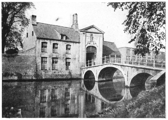
Entrance to the Béguinage.
Follow Rue de l'Arsenal, turning left into Rue St. Catherine, at the corner
of which stands the Musée de Peinture (See sketch, p. 104).
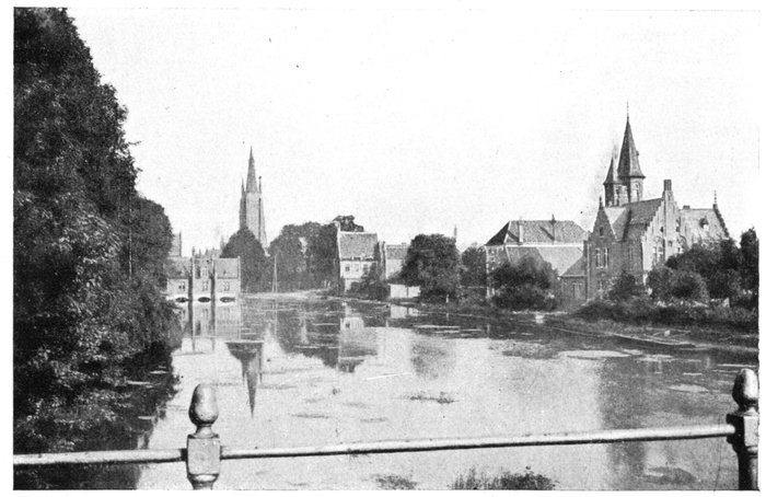
The Minnewater. In the background: Tower of Notre-Dame.
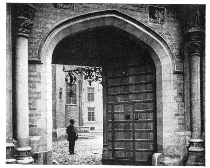
Entrance
to the
Musée
de
Peinture.
This Museum contains a collection of early Flemish masterpieces. At
the entrance are two famous paintings by Gérard David (1498): The Judgment
of Cambyses and The Chastisement of the Unjust Judge. Next come:
The Last Judgment, by Jean Prévost (1525); The Baptism of Christ, a triptych
by Gérard David (1507), with portraits of the donor and his family; The
Virgin and Child, St. George and St. Donatian, with a fine portrait of the
donor, Canon Van der Paele, by Jean van Eyck (1436); a triptych by
Memling (1484); St. Christopher, St. Maurus and St. Giles, with a portrait
of the donor, W. Moreel, his wife, five sons and eleven daughters
(St. George and John-the-Baptist are depicted on the folding leaves); The Last
Judgment, by Van den Coornhuuse, a master-painter of Bruges; two
miniatures, by G. David; two paintings, by Lancelot Blondeel (1545):
St. Luke and The Legend of St. George; also paintings by Pourbus, Clayessens,
Claeys, Van Oost and Van Goyen.
Continue along Rue St.
Catherine, taking on the
right, Rue Vieille-de-Gand
as far as Place de la Porte
de Gand.
This is one of the city's
former seven gates, of which
only four remain. The
Ghent Gate, a specimen
of the military architecture
of the Middle-Ages, has
like the St. Croix Gate (p.
108), retained much of its
mediæval aspect. To the
right of the gate are
gardens which occupy
part of the ramparts.
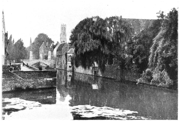
Quai Vert, seen from the Quai des Dominicains.
Take Rue de la Porte de Gand, opposite the gate, to the modern Church of
Mary-Magdalene, Gothic in style, situated in front of a pretty park.
Take Rue des Ciseaux, which skirts the church on the right, then Rue des
Corroyeurs Noirs, on the left, prolonged by Rue du Cheval.
The latter crosses the Reye at the Quai Vert, which, at this point, is
very pretty (Photo above).
Turn left, into Rue Haute, and return to the Grand'Place.
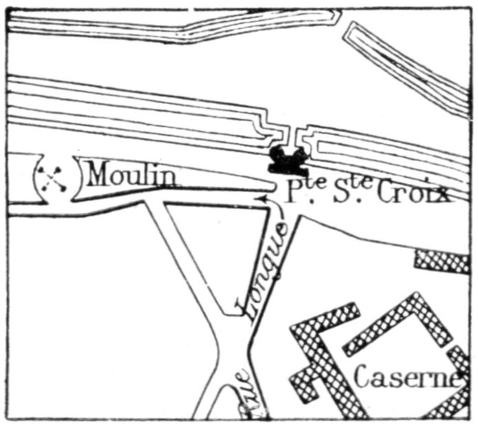
Starting from the Grand'Place, by Rue de la Bride, continued beyond
the Place du Bourg by Rue Haute, cross the Pont du Moulin and follow
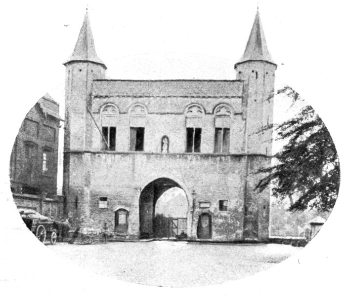
Rue Longue, at the end of which is the mediæval Porte St. Croix (photo,
p. 108.) The last two remaining windmills of Bruges are on the ramparts,
to the left.
Follow the ramparts to Rue des Carmes, at the corner of which is the Local
des Archers de St. Sebastien (16th century), with its quaint, slender
tower. Portraits
of Members
of the
Guild are preserved
there,
among others,
those of Emperor
Maximilian
and
Charles II of
England.
Continue
along Rue du
Persil which
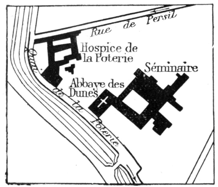
ends at Quai de la Poterie; take the latter on the left, as far as the Hospice
de la Poterie.
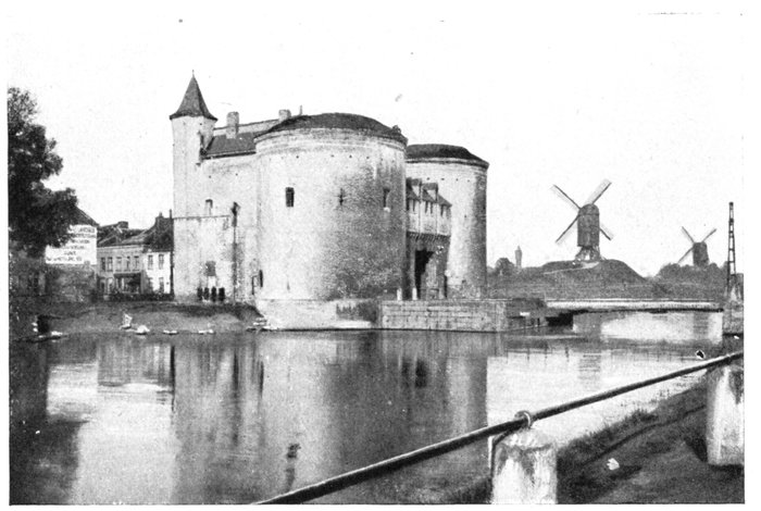
Porte de St. Croix, and the Windmills on the Ramparts.
This is both a church and a home for the aged poor. Its gabled façades
were charmingly restored by Ch. Verschelde, chief initiator of the movement
for the renovation of Bruges Architecture, deceased in 1881.
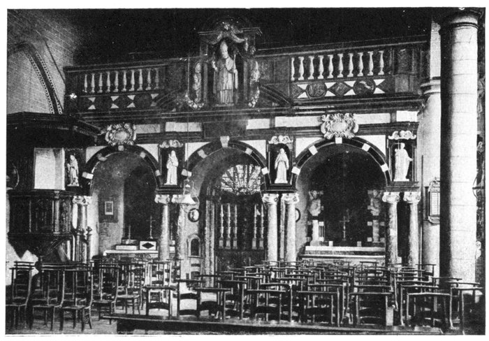
Choir of the Chapelle de l'Hospice de la Poterie.
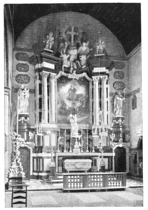
Chapel of the Virgin, in the Chapelle
de l'Hospice de la Poterie.
The polychrome decoration
of the interior of the
church recalls that of the
Frauenkirch at Nuremberg.
The nave dates from 1358;
the choir, marble rood-loft
and other portions are 17th
century. The tombs of Nicolas
Despars (1597) and
Jean de Beer (1608), and
the rich Treasury in the Sacristy
are interesting.
The Museum (parlour,
refectory, corridors) contains
ancient furniture, ivory carvings,
antiquities, rich Flemish
tapestries, and a fairly
large collection of pictures.
The Seminary, situated
immediately beyond the Poterie,
is the old Abbey of the
Dunes, which was reconstructed
at Bruges in 1623-1628.
The church, rebuilt in
1775, replaced the original
edifice founded in the 12th
century between Furnes and
Coxyde, and destroyed by
the Iconoclasts in 1556.
Since the Revolution, it has been successively a hospital, school, lycée,
warehouse, and athenæum. Today it is a diocesan seminary.
The seminary contains a collection of portraits of the bishops and abbots
of Bruges and Ypres, also the famous Visitation, by Albert Dürer, in which
that great master displays to the full his exquisite talent. It is the only
piece of sculpture by Dürer in the country.
Continue along Quai de la Poterie as far as the Pont des Carmes opposite
the street of the same name. Cross the bridge and take Rue de la Cour de
Gand leading to the small Place Memling, in which stand a quaint STATUE
of the artist and the ancient Hôtel des Orientaux.
In the continuation of Rue de la Cour de Gand, beyond Place Memling, is
one of the two last remaining wood-panelled
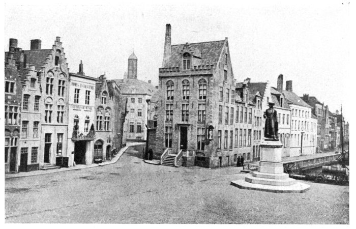
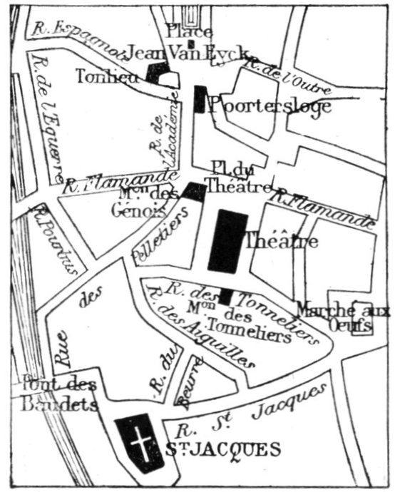
houses of Bruges. Place Jan
van Eyck (Photo and sketch, p. 110) is
next reached.
Here stands the heavy bronze statue
of Jan van Eyck, the gifted inventor of
oil painting.
In front, is the Academy or Poortersloge
(14th century), formerly the
House of the Burghers, then the meeting-place
of the White Bear Company, whose
emblem may still be seen in the corner
of the building which overlooks the Rue
Espagnole. It is the Beertje van Loge, the oldest "burgher" of Bruges,
just as the Mannekenpis is the oldest "burgher" of Brussels. However,
the "Bear of Bruges" is the older of the two (1417).
The building was used as an Art Gallery from 1719 to 1898. Since then
it has been entirely rebuilt in the original style, with a slender tower facing
the Rue de l'Outre, and now contains the State Records.
On the right of the square stands the ancient Tonlieu, with its pretty
façade, large gable and porch, the whole artistically restored in 1880. The
Municipal Library, comprising some 15,000 volumes, is now housed there.
The collection includes a series of incunables printed by Colard Mansion of
Bruges (15th century), 562 MSS, a collection of epitaphs, and the Steinmetz
Collection of drawings and engravings.
Take Rue de l'Académie, facing which, on arriving at the Place du
Theatre, is the Maison des Génois, a souvenir of the great prosperity of
the city during the Burgundian epoch.
The tympanum of the door is decorated with a St. George and Dragon.
This ancient warehouse of the rich
Italian merchants is now a café.
In the middle of the Square is the
Theatre and behind it, the gloomy
Maison des Tonneliers.
Tourists should here take a stroll
through the old picturesque streets of
this quarter, especially Rue des Aiguilles
and Rue au Beurre, which
lead to the Church of St. Jacques.
Irregular in style, this church has
a square tower with a pyramidal roof.
Erected in the 13th century and
enlarged in the 15th, it bears the stamp
of both periods. Especially noticeable
are the irreparable marks of
restorations carried out in defiance of the principles and character of the
original styles. The church was sacked during the religious troubles of
the 16th century. The most unfortunate alterations were those carried
out at the end of the 17th century. In 1820 a ceiling was added, cutting
off the upper portion of the columns and pillars. Attempts have since
been made to remedy these defects.
The church contains many valuable works of art, the most important of
which is The Tomb of Ferry de Gros, treasurer of the Order of the Golden
Fleece, deceased in 1544, and of his two wives, Philippine of Wiebaut and
Catherine of Ailly. It is one of the very few surviving specimens of 16th
century Flemish art, and remained for a long time in a walled-up chapel
used as a store-room. In 1864, the chapel and tomb were completely restored.
The figures are recumbent, on two superimposed stones, Ferry and his first
wife being uppermost. The other stone is by far the more remarkable
of the two. Attempts have been made to restore the original polychromy
of the monument. The tomb and the Chapel form a very harmonious
and decorative whole.
Among the paintings are: on the altar in the Chapel of Souls, a reredos
in three parts. It represents St. Cosmas and St. Damian, and is considered
to be Lancelot Blondeel's greatest masterpiece. In the same chapel: a
triptych, by Peter Pourbus (1556), The Virgin of the Seven Afflictions,
and a Resurrection, by the same painter (1578). In the south aisle: The Presentation
of the Virgin, one of the finest works by Van Oost the Elder (1655).
On the altar, in the northern nave: The Coronation of the Virgin by Albert
Cornelis (1520), the only work of this master, and a fine Triptych, by Jan
Mostaert (1474-1555).
In the chapels are copper and brass tablets. The carved wood pulpit,
rood-loft and choir-stalls are in decadent Renaissance style (17th century).
Behind the high-altar is a three-storied marble tabernacle, dating from 1593.
The belfry contains some very fine bells, the oldest of which was cast in
1525.
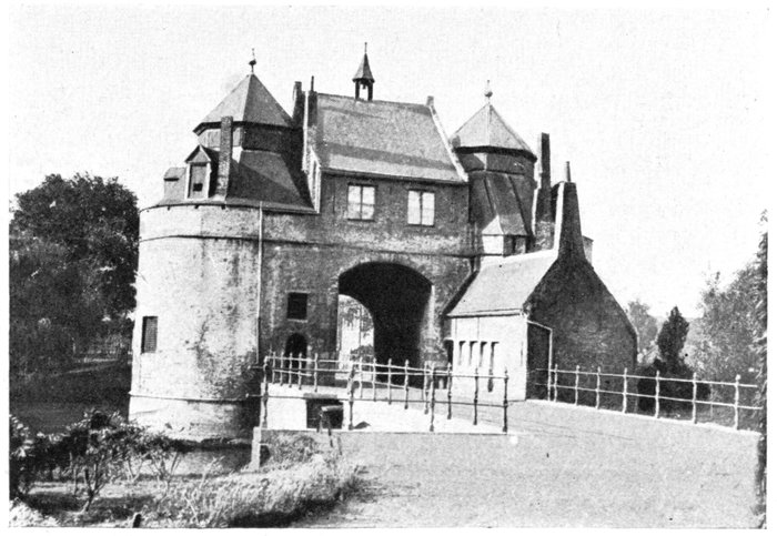
On leaving the Church of St. Jacques, the tourist may either turn left over
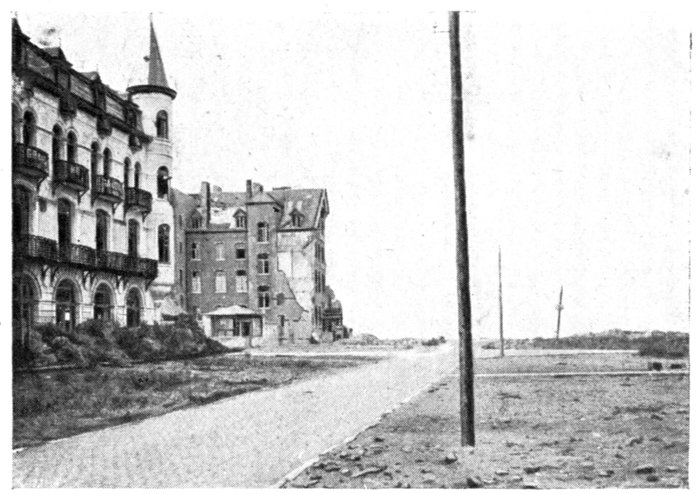
the bridge and along Rue des Baudets, as far as the Porte d'Ostende (photo
below) or return to the Grand'Place, by Rue St. Jacques, on the right.
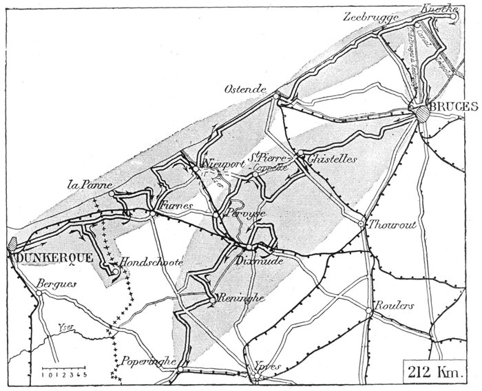
Lunch at Dixmude, but provide luncheon baskets, in case of need.
Leaving the Grand'Place, Bruges, via the Place du Marché-aux Œufs,
take Rue de la Monnaie, on the left, then Rue Nord du Sablon, and beyond the
station and level-crossing, Rue du Maréchal. Go through the Porte Maréchale
which, like the Ostend Gate, bears traces of its 17th century restoration
(Photo, p. 113).
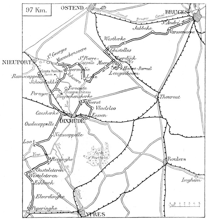
At the fork, 1 km. further on, take the right-hand road to St-André. Pass
through same, then through Varssenaere, Jabbeke, Westkerke and
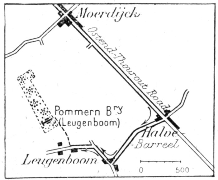
Ghistelles. Beyond Ghistelles (level-crossing), take the Ostend-Thourout
road, on the left. Pass through Moerdijck (24½ kms.), and on reaching the
hamlet of Halve-Barreel, turn to the right.
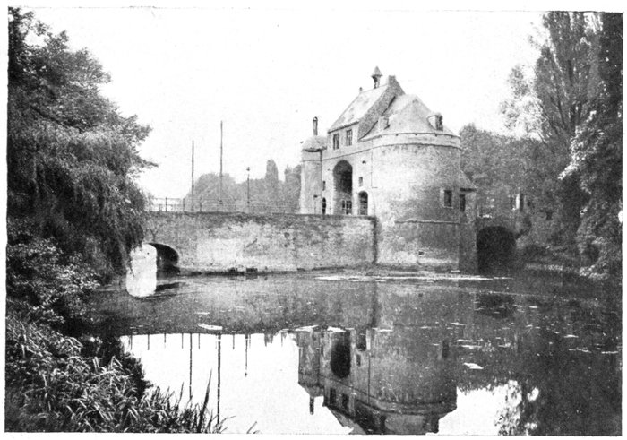
Maréchale
Gate,
by which
the tourist
leaves
Bruges.
At the first group of houses turn to the right, then to the left at the first fork.
At the first house of the hamlet of Leugenboom (3½ kms.), take the foot-path
on the right, from which, 150 yards to the left, can be seen the Pommern or
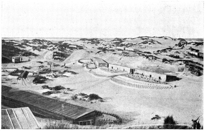
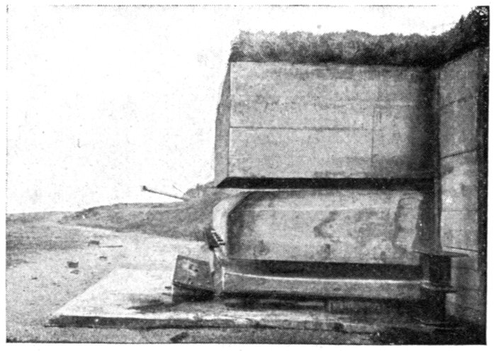
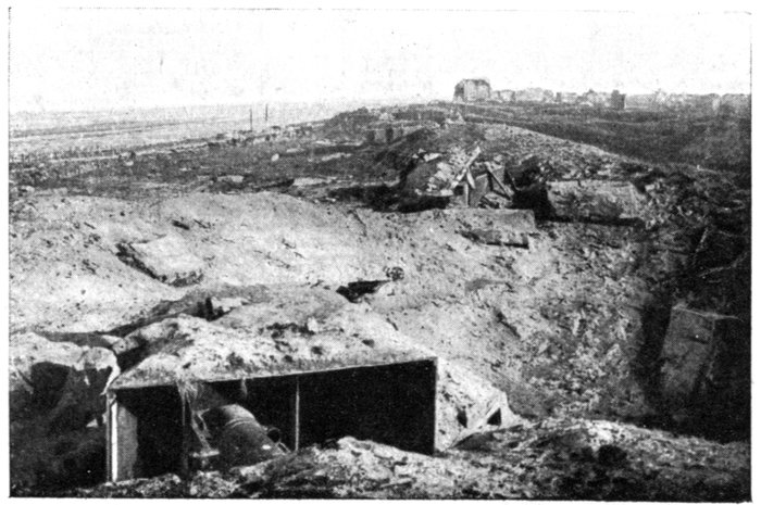
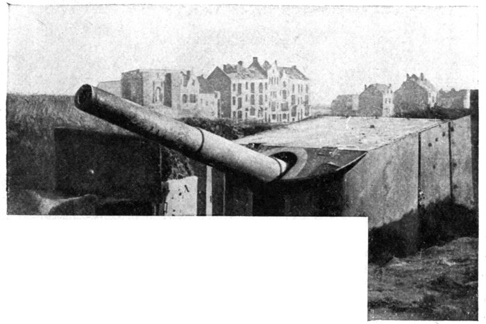
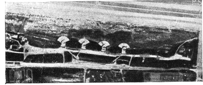
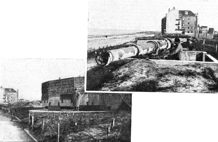
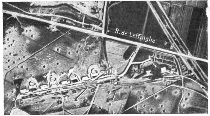
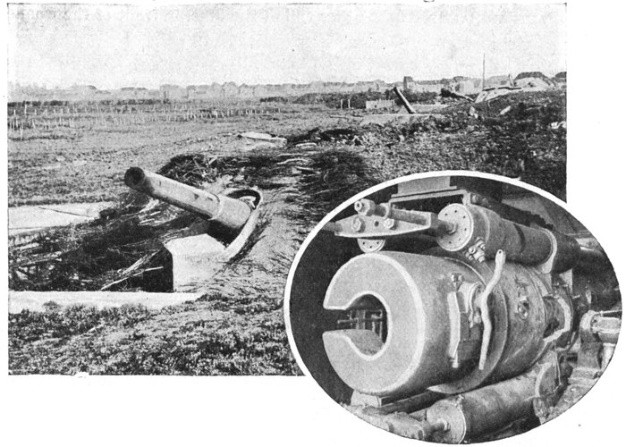
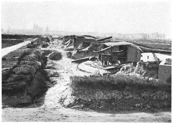
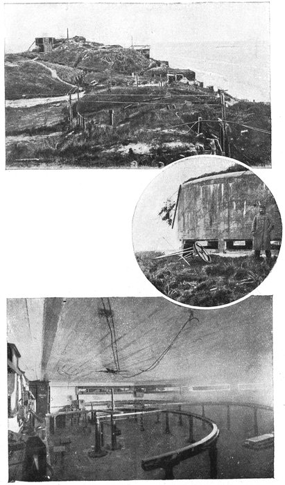
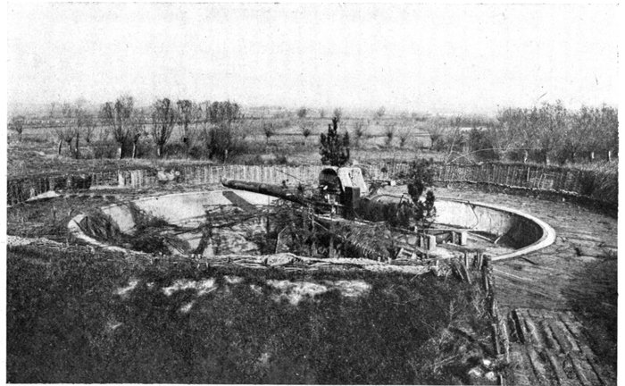
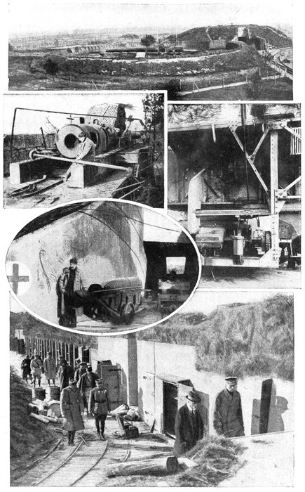
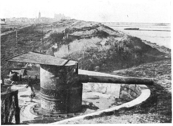
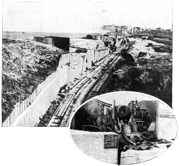
Leugenboom Battery, at the edge of the wood. This battery comprises
a 15in. long range gun, which did most of the bombarding of Dunkirk. The
gun, protected by armour, is mounted on a steel bridge having a pivot in
front, the rear part of the gun travelling
along a circular rail-track in a concrete pit
nearly 70 feet in diameter. The gun was
manœuvred by means of electric motors. On
either side are large shelters in reinforced
concrete. In front of and below the platform
there was an electric generator group.
A large shelter of reinforced concrete, on the
right, was probably the Post of Commandment.
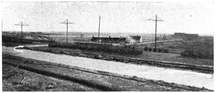
There is a dummy gun emplacement
further on.
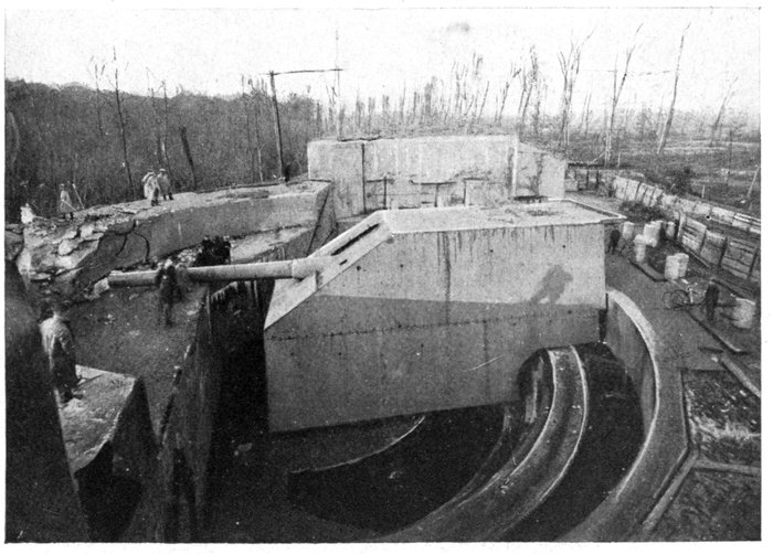
"Pommern"
or
"Leugenboom"
Battery,
near
Leugenboom
Hamlet.
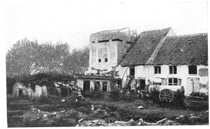
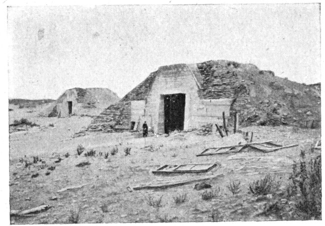
Concrete Shelter at St. Pierre-Cappelle.
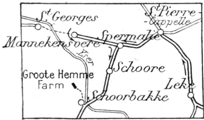
Return by the same road to Moerdijck, turn left beyond the bridge, pass
through Moere (2 kms.),
and after crossing the
light railway, take the
road on the right which
follows the railway to
Leke village (5½ kms.).
Beyond the ruins of the
church, take the right-hand
road to St. Pierre-Cappelle
(4 kms.), whose
church is in ruins.
Continue straight along
the Nieuport road, noticing
the many observation-posts
and concrete
shelters. Throughout the
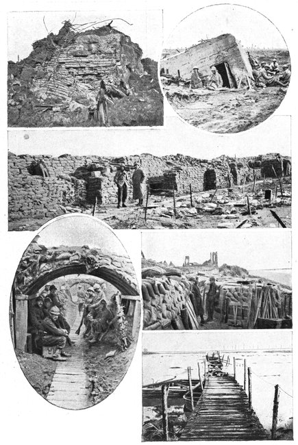
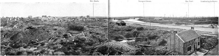
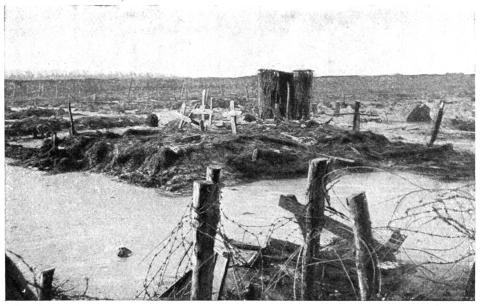
region crossed by the itinerary, on both sides of the Yser, the ground has been
completely devastated by trenches, shelters and bombardments. The villages have
vanished. Today these places are the resort of pilgrims. Spermalie (2 kms.)
is next reached.
Beyond the bridge, at the fork, take the right-hand road (in bad condition)
to Mannekensvere.
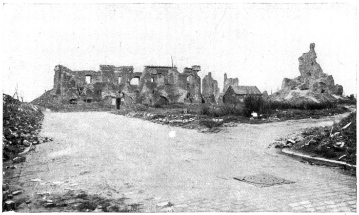
A few heaps of stones and débris are all
that remains of Mannekensvere. To visit St.
Georges, cross the Yser by a small wooden foot-bridge,
near the place where the Pont de l'Union
used to stand. (It is impossible for vehicles to
cross the river). Between the Yser and St.
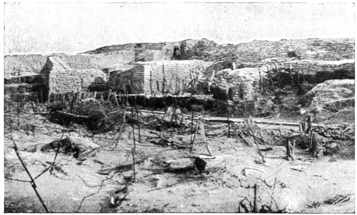
Georges, follow a "boyau" (by-trench) to the
first Belgian and German lines, marked by
many concrete shelters pierced with loop-holes.
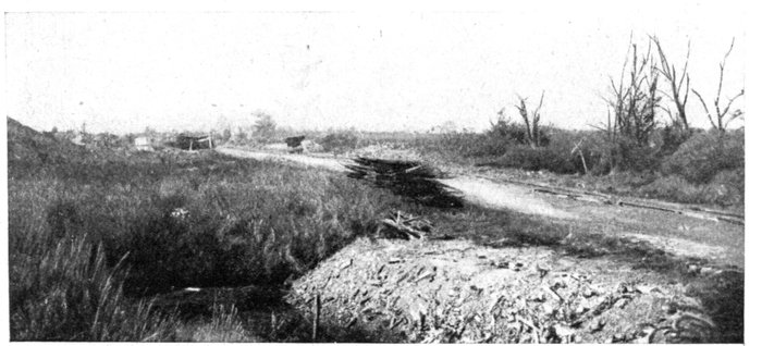
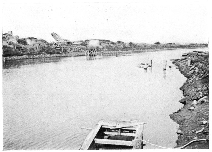
The Site of Mannekensvere village.
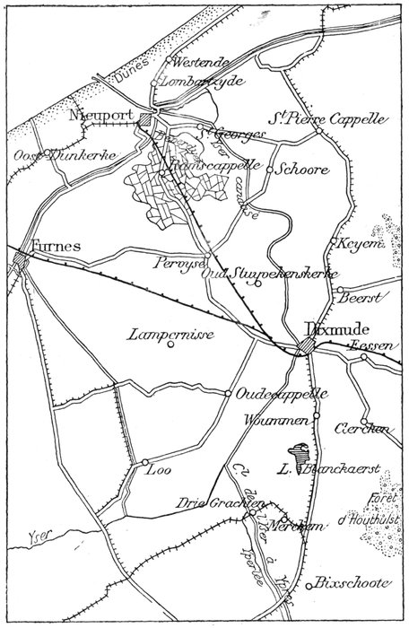
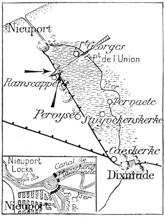
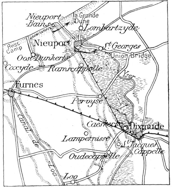
Mannekensvere was situated on the right bank of the Yser. The Pont de
l'Union, which crossed the Yser 3 kms. from Nieuport, connected it with
St. Georges, situated a little further back, on the left bank, along the Nieuport-Bruges
Road. These two villages and the bridge were among the principal
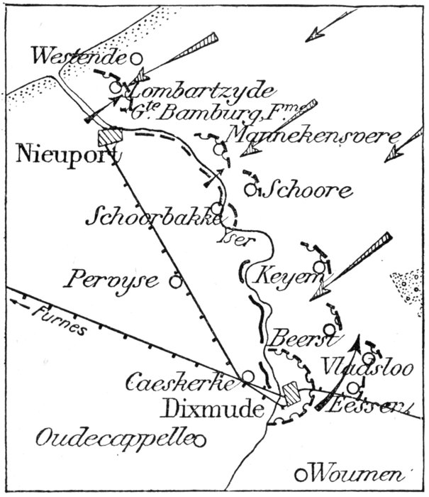
targets of the Germans. On October 18, 1914, Mannekensvere, an advance-post
of the Belgian 2nd Division, was carried by the Germans, but recaptured
shortly afterwards by the Belgian 7th Infantry Regiment (Major
Evrard). Unfortunately, the German heavy artillery made the position
untenable on the following day, and Major Evrard was forced to re-cross
the Pont de l'Union, which he blew up. St. Georges, on the contrary,
was captured only on October 23, after the crossing of the Yser by the
enemy, and the loss of Groote-Hemme Farm which covered it from
the south.
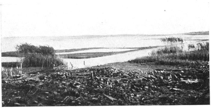
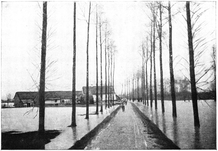
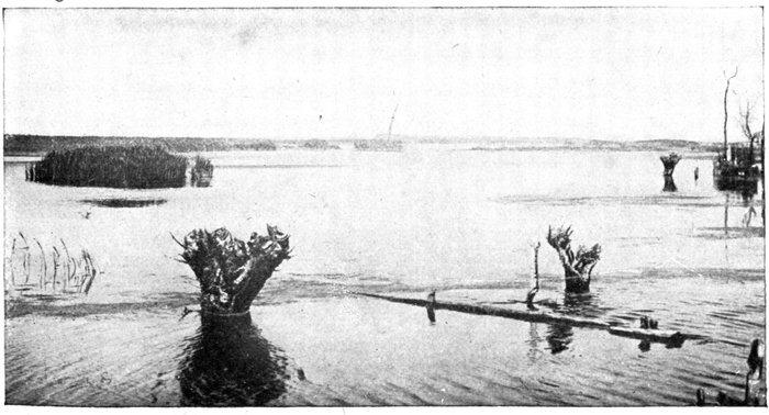
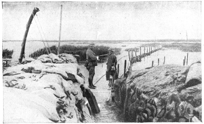
The
Inundations
near
Dixmude.
Return to Spermalie, where turn to the right.
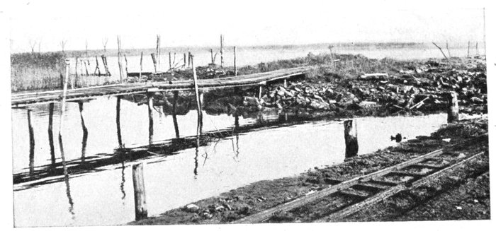
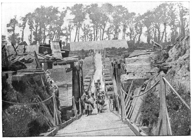
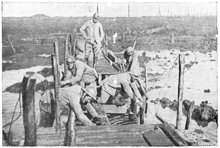
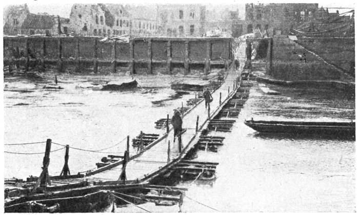
Temporary
foot-bridge
across
the
inundations.
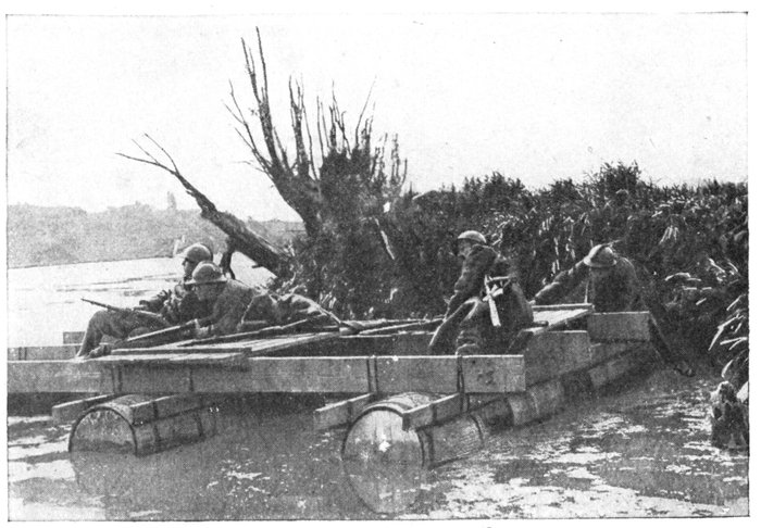
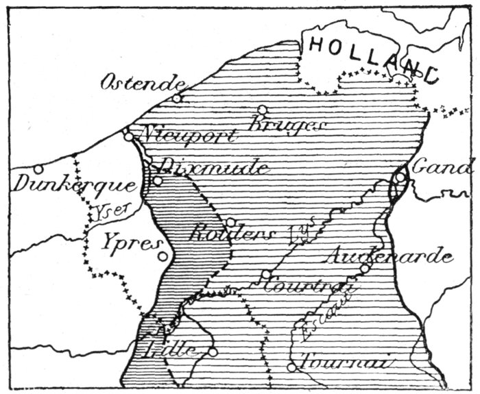
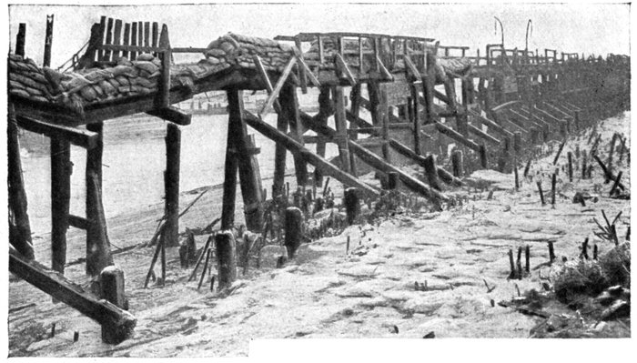
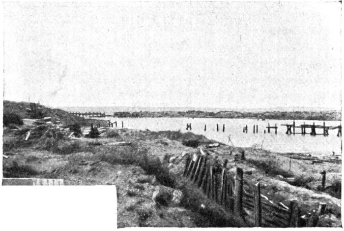
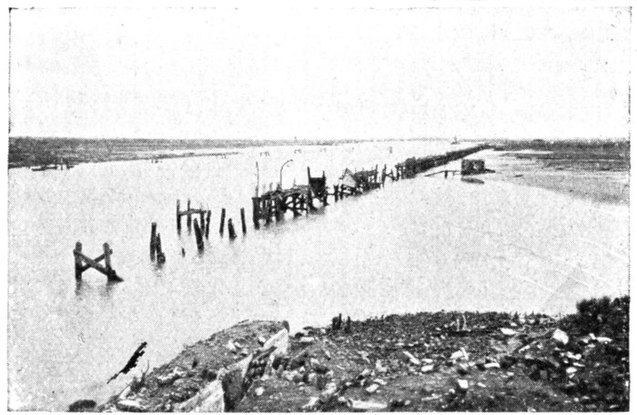
The whole of the region now about to be crossed was flooded throughout
the war. Today, the waters have receded, leaving it covered with reeds.
Schoore (1 km.), completely razed, is next reached.
Schoore was situated slightly to the right of the Yser, on the road to
Bruges. The Belgian 1st Division had its advance-posts there. The village
was captured on October 18, 1914, by a battalion of the German IIIrd
Corps, after a four hours' bombardment.
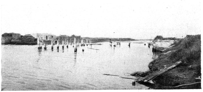
The
Pont de l'Union,
between
St. Georges
and
Mannekensvere.
Cross the Yser at Schoorbakke (2 kms.)
This village had a bridge across the Yser, at the end and to the west
of the great bend in the river, beginning at Tervaete.
This important strategical point was early threatened by the enemy.
After the furious combats of October 15-22, the grand assault was launched
on the night of the 22nd. A battalion of the Belgian 4th Infantry Regiment,
though practically hemmed in by the enemy, defended it heroically,
and only evacuated the position at dawn on the 23rd (see p. 12).
Between the Yser and the shelters bordering its left bank, a foot-path on the
right leads to Groote-Hemme Farm (1 km. 300.)
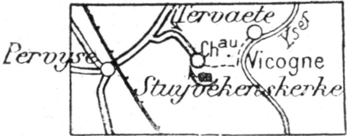
Keep straight along the road. The first road on
the left leads to Stuyvekenskerke (1½ kms.) of
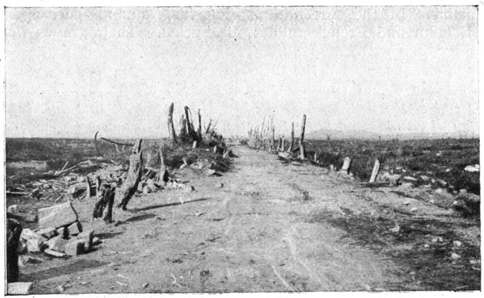
which only a few broken walls remain.
To the left of the church there is a temporary footway
along the road; today the latter is recognizable
only by the stumps of the trees which formerly
bordered it. The footway leads to the site on which stood the Château
of Vicogne, and further on, to Tervaete (Photo, p. 117.)
From this village, the Yser describes a wide curve towards the west
which ends at Schoorbakke. At Tervaete, a bridge spanned the Yser. From
the right bank the enemy were able to enfilade and even attack the Allies'
defences on the left bank, in the rear, and effect a crossing of the river at
that point. This explains the frequency and fierceness of the German
attacks on Tervaete, which was first lost then recaptured on October 22,
1914, being finally captured by the Germans the next day (See p. 12).
From Stuyvekenskerke, return to the road previously followed, turning left
towards Pervyse. Shortly before reaching Pervyse are the remains of an
elevated footway, which formerly crossed the inundated ground. After
crossing what used to be the permanent way of the Dixmude-Nieuport railway,
the village of Pervyse is reached (3½ kms.) The railway embankment
formed the boundary of the inundated area, and was fortified. Shelters and
graves are still to be seen all the way along. There was an observation-post
on the top of the railway-station, to the left of the road.
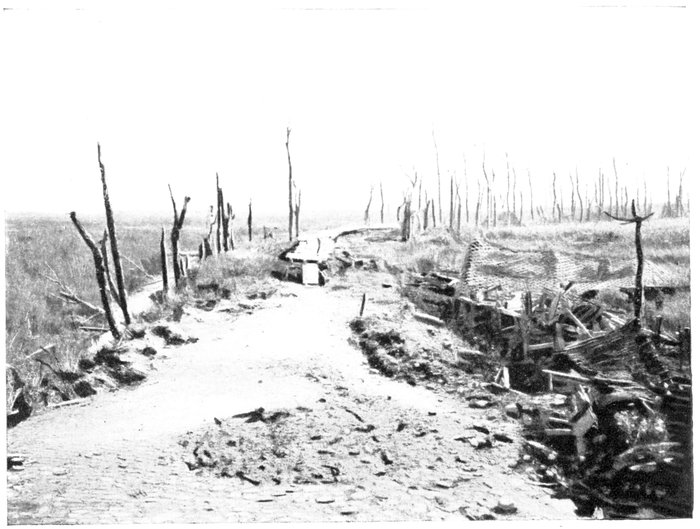
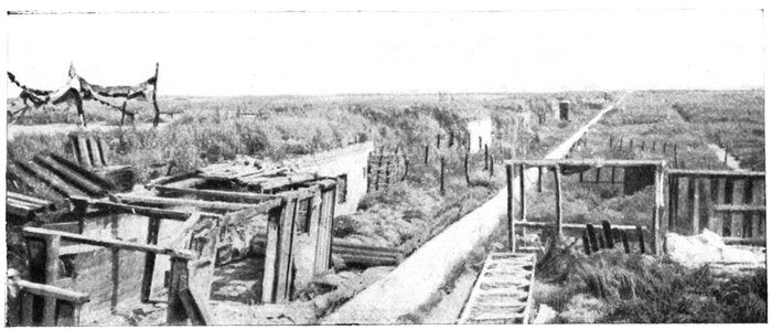
Temporary Bridge at Tervaete, on the impassable road to Stuyvekenskerke,
in 1919.
Pervyse, in ruins, was made famous by the heroic resistance of the French
Marines who beat off the enemy's fierce onslaughts of October and
December 1914.
The houses bordering the road at the entrance to the village were turned
into machine-gun blockhouses, thus barring the way.
Beyond the church is a crossing; the road on the right leads to Ramscappelle
(4½ kms.) which played an important part in 1914. On October 30, 1914,
a fierce German thrust ended in the capture of the village—already on the
point of being inundated—from the Belgian 5th and 6th Infantry Regiments.
The loss was one of the greatest importance, as no lines of resistance had
been prepared in the rear. The recapture of Ramscappelle was therefore
an indispensable if very difficult operation. (See p. 15.)
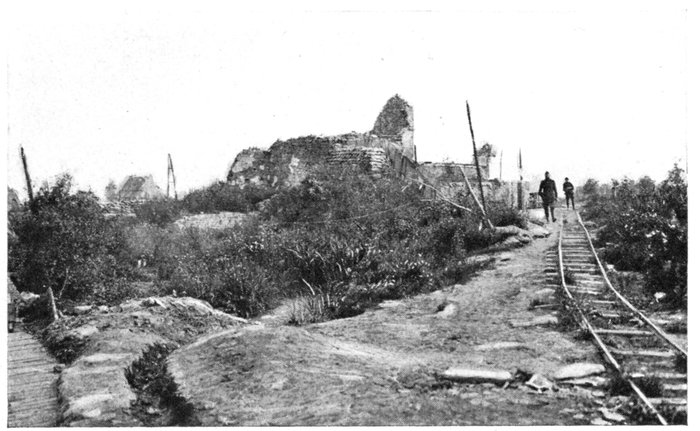
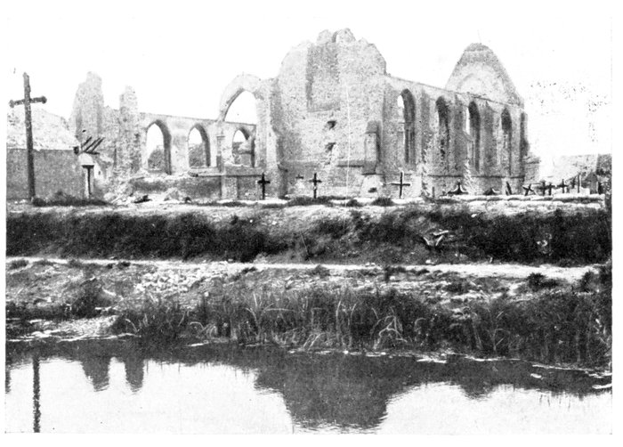
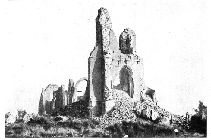
Caeskerke Church (August 1917).
The left-hand road leads to Dixmude. Caeskerke (5½ kms.), a station
on the Dixmude-Nieuport railway, is next reached. The Headquarters of
Admiral Ronarc'h were established there in October 1914, and it was
this fact which caused it to be bombarded by the Germans, whose
shells quickly reduced it to ruins.
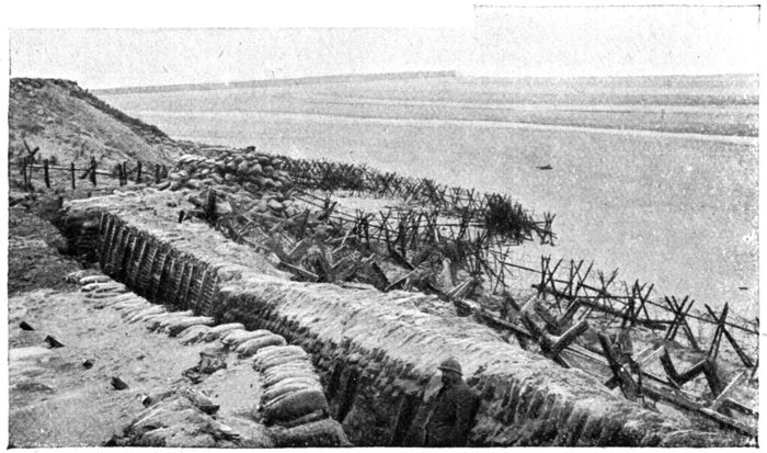
Beyond Caeskerke, cross the Yser; before reaching the bridge, on the left,
along the riverside, is a trench with numerous shelters, known as the "Boyau
de la Mort" (Death Trench). It was enfiladed by machine-guns posted
in the flour-mill on the opposite bank of the Yser (on the right, near the
bridge), which the Germans had converted into a fortress. (Photo p. 124.)
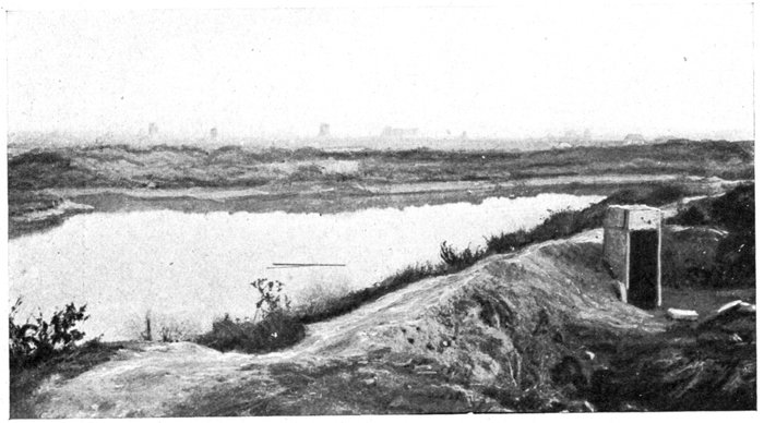
The "Boyau de la Mort" (Death Trench). See p. 19. In the background: Dixmude.
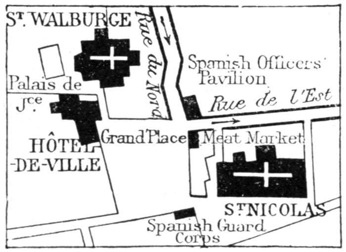
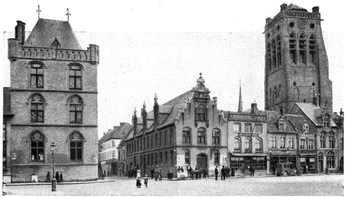
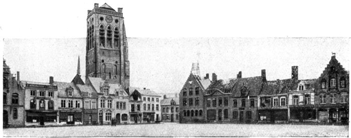
The tourist next reaches Dixmude (2½ kms.), arriving at the Grand' Place.
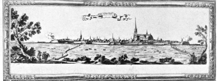
DIXMUDE. — The Defence and Capture of Dixmude. — The Capture of Dixmude.
Dixmude was a small ancient town of some 4,000 inhabitants, situated
in the midst of fields on the right bank of the Yser.
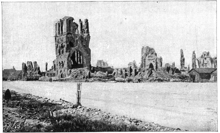
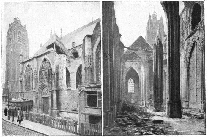
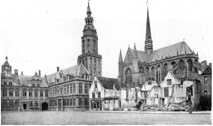
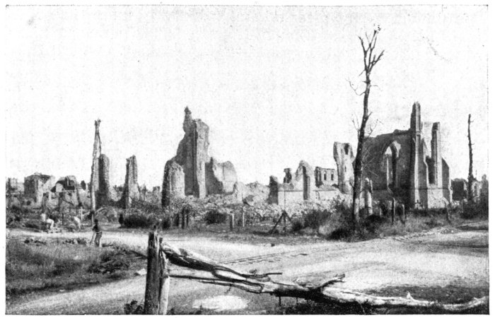
It was entirely destroyed. Of the town's monuments and buildings,
traces of the parish-church of St. Nicholas only remain (on the left side of the
square). The chevet dated from the 14th century, the rest of the building
being early 16th century. The church contained a magnificent rood-loft
of finely carved white stone (1540). Above the high altar was a fine Adoration
of the Wise Men, by Jordaens (1644). The rich ancient furnishings
comprised: a marble font with a bronze cover (1626), choir-stalls, pulpits,
a "Calvary" altar, a carved oak organ-loft, wrought copper chandeliers,
candlesticks, etc.
From the heap of stones and débris—the remains of the church tower—there
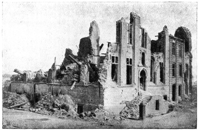
is a good view of the ruined town. In the same square stood the
Hôtel-de-Ville, Gothic in style, built about 1870. It was entirely razed
(Photo below).
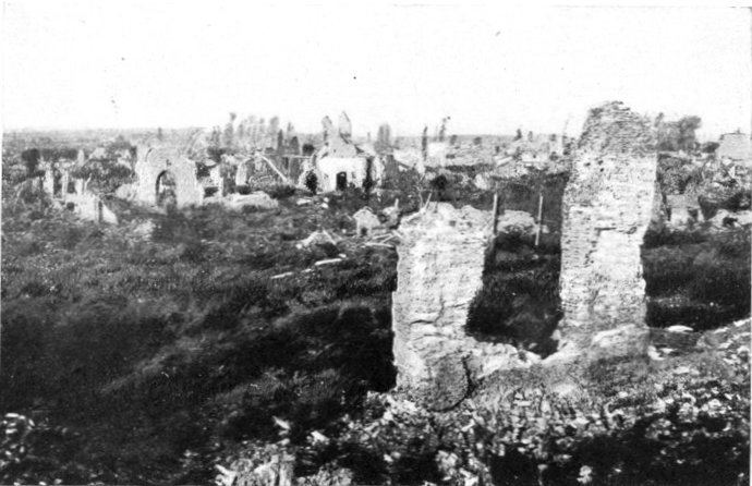
Dixmude, seen from the ruined Church (1919).
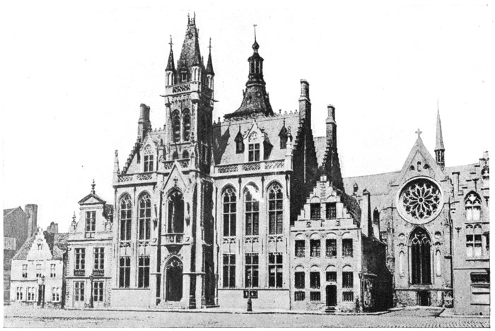
Dixmude. The Hôtel-de-Ville, before the war.
The left-hand road leads to the bridge over the Handzaeme Canal, one of
the most picturesque parts of Dixmude. Close by, to the left of the road,
stood the Béguinage, comprising some twenty houses grouped around a
small chapel, and a fine garden. The place is now overrun with weeds.
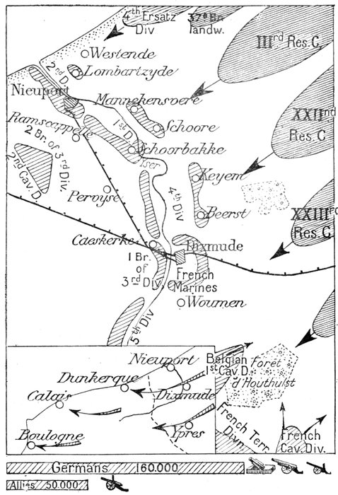
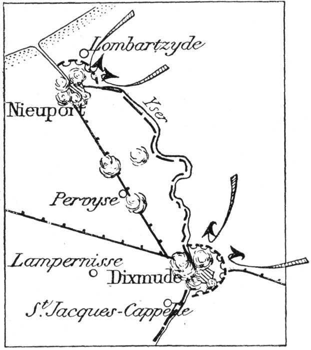
Dixmude was the scene of most desperate fighting from October 15 to
November 10, 1914. The French Naval Brigade—6,000 men commanded
by Admiral Ronarc'h—with a brigade of the Belgian 3rd Division under
General Meiser, and a few battalions of Senegalese troops, held out heroically
for a month against enemy forces six times more numerous and supported
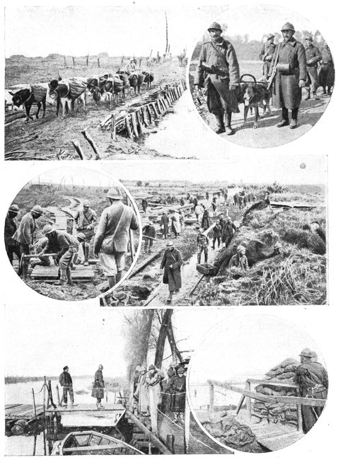
by masses of heavy artillery.
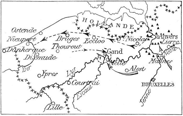
On October 16, along the roads encumbered with refugees from the region
of Thourout, the Marines, in their retreat from Melle to Ghent, reached
Dixmude in the pouring
rain, accompanied by the
Belgian batteries under Major
Pontus. Under enemy pressure
the advanced positions
of the town were abandoned.
At that time, the river
formed the only line of defence
against the enemy
thrust, there being no trenches,
shelters, or wire entanglements.
In spite of great fatigue,
due to the forced marches,
the Marines and Infantry,
with the help of some
companies of Belgian Engineers, organised defences in the vast plain.
Trenches were made round the town, 1 km. beyond its outskirts, whilst
the bridges, footways and dikes of the Yser Canal were fortified at the
same time.
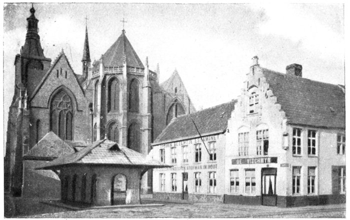
The Chevet of the church before the war. (Photo E. Thill.)
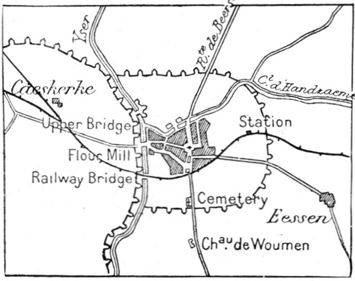
The defences of the bridgehead of Dixmude were divided into two sectors,
separated by the Caeskerke Road.
Having no aeroplanes or heavy artillery, the 6,000 French Marines, with
5,000 Belgians of the Meiser Brigade—11th Regiment (Col. Leermans) and
12th regiment (Col. Jacques)—were attacked by three German Army
Corps.
After an unsuccessful feint attack on October 16-17, the Germans, having
meanwhile received reinforcements and siege artillery from Antwerp,
renewed their assault with increasing violence.
On the 20th, at 11 a.m., the first big shell fell in the town. In conformity
with the Burgomaster's orders, the civilians left the town, except the
Carmelite Nuns and a few other persons, who were forced to leave a few
days later.
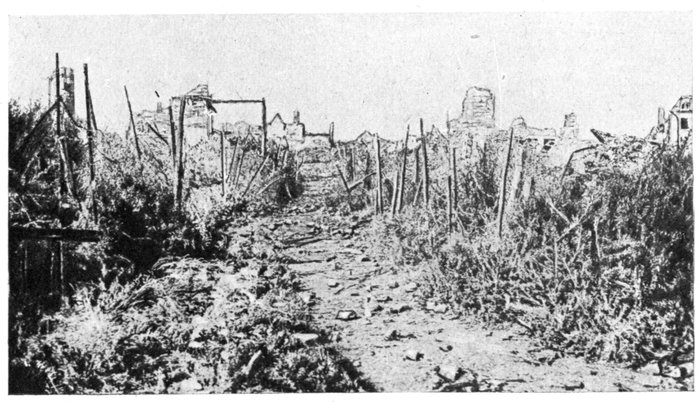
A street in Dixmude, in 1918.
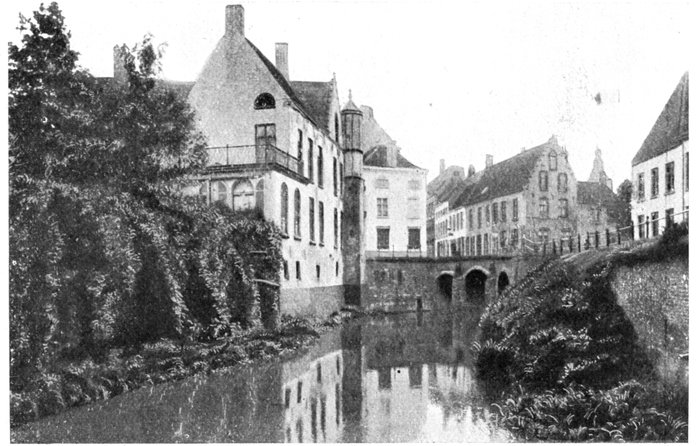
The Yser at Dixmude, before the war. (Photo Nels.)
The first shells fell on the church, which was burnt. Fires broke out
everywhere and soon destroyed the town. The troops stoically awaited
the attack, which came simultaneously from the north, east and south.
The assaulting columns were in massed formation, sixteen lines deep.
They were literally mown down, and after a desperate struggle their scattered
remnants were thrown back on their starting positions.
The attack continued on the following days, without appreciable enemy
gain. Whenever, by force of numbers, they penetrated the defences,
reserve sections of Marines drove them back at the bayonet's point.
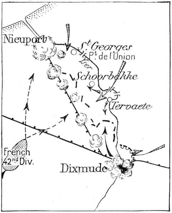
Dixmude was none the less in imminent danger. German troops crossed
the Yser at Tervaete, and slipped along the left bank of the river with the
intention of turning the position. In the thick of the battle and in spite
of the incessant frontal attacks, Admiral Ronarc'h dispatched two battalions
to the threatened point. Although the
men were "half-dead with the cold and
lack of sleep", a front was improvised between
the Yser Canal and the embankment
of the Nieuport-Dixmude railway. The
manœuvre was a difficult one, but by prodigies
of heroism the new line stood firm and
became fixed.
On the 24th, a bombardment of unprecedented
intensity was opened on the town
and its defences, including the station of
Caeskerke, where the Admiral's headquarters
were situated, but the defenders held their
ground unflinchingly under the terrible deluge
of flying splinters. Towards evening,
the enemy made a tremendous effort
against the bridgehead of Dixmude. Eleven
assaults in the north and north-east
sector, and fifteen assaults in the south-east sector were successively
repulsed. The German dead accumulated in heaps, right up to the Allies'
trenches. The struggle continued hand-to-hand until midnight, in pitch
darkness, the men floundering blindly in the mud.
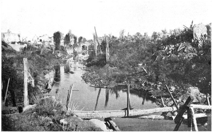
The Yser at Dixmude, after the war. (See opposite.)
Exhausted by their tremendous efforts the enemy gave way. Dixmude
was still inviolate, but on the morrow, as soon as the morning mists had
risen, the bombardment began again along the whole line. Little by little
the town fell into ruins.
On the night of the 25th, a company of German infantry managed to
slip into the town. About a hundred of them crossed the bridge-road
and in close formation made a dash for Caeskerke, with fife and drum
at their head. That the men were drugged, explains their foolhardy
exploit. A few prisoners, including several Belgian doctors, Commandant
Jeanniot and some marines were captured. Held up soon afterwards,
the Germans attempted to get back to their lines, shooting most
of their prisoners at dawn. The doctors and a quarter-master alone were
spared, being eventually delivered by a section of French Marines.
The troops under Colonel Jacques, exhausted by the struggle, were relieved
by two battalions of Senegalese and a battalion of the Belgian 1st
Line Regiment.
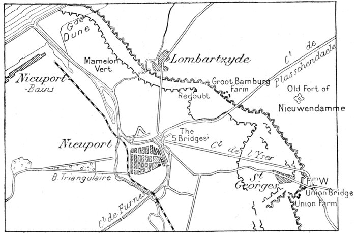
Keeping up their daily bombardment, the enemy now directed their
main effort between Nieuport and Dixmude. However, they were held
by the inundations which soon spread southwards. Moreover, the ceaseless
rain had transformed the ground into a veritable sea of mud, which
gradually invaded the trenches. Shivering with cold and fever, and up
to their knees in slime, the Marines still stood firm.
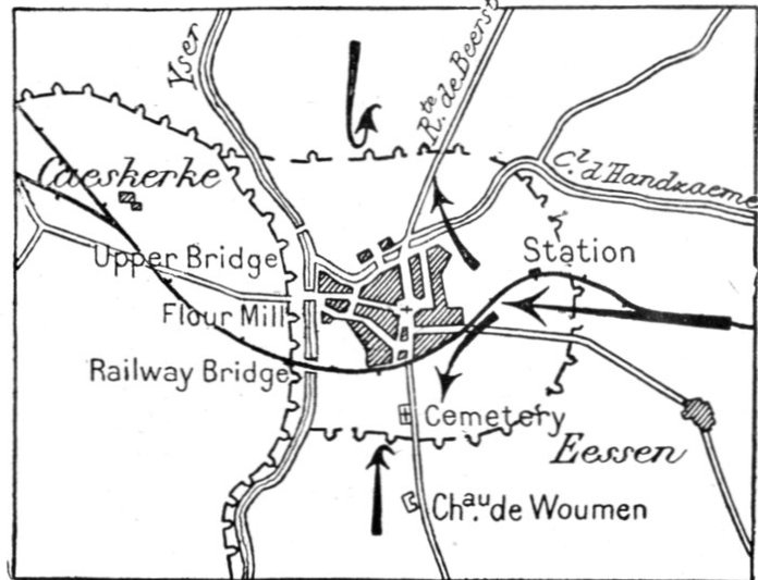
On November 10 the Germans, infuriated by their repeated checks,
attacked again with overwhelming forces. Part of the defences in the
southern sector, between the railway and the Eessen road, held by
Belgian infantry, gave way beneath the shock, bringing about the fall of
the sectors on either side, held by the Senegalese troops. The line was
pierced in the centre. The enemy swarmed through the breach, crossing
the Handzaeme Canal to the north, while to the south, in the direction of
the cemetery, they attacked the companies of Marines who continued to
resist desperately. The Germans entered the town, the fight continuing
from street to street and house to house, with countless surprises and
ambuscades. Unarmed prisoners were made to march in front of the
assailants, who proceeded to attack the positions on the Yser. Amongst
them was Naval-Lieutenant Sérieyx, who, wounded in the arm, had just
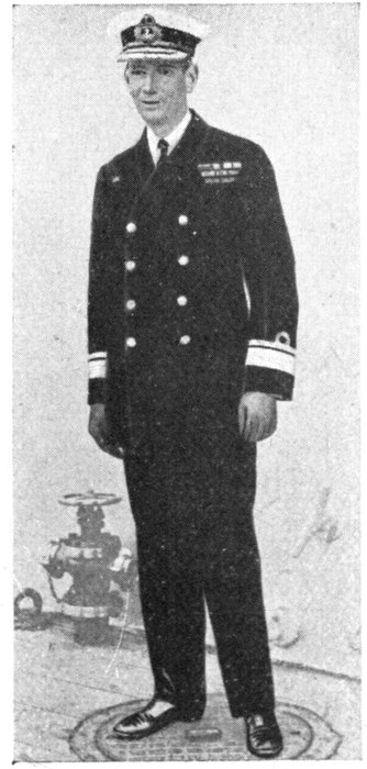
fought with his men to the last cartridge.
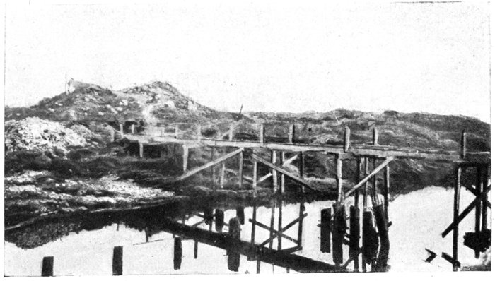
The
Minoterie.
(Flour
Mill.)
On being ordered by the German Commandant to indicate the fordable
places in the river, one of which was only some fifty yards away, the French
officer, to gain time, made a complicated sketch of the position, placing
himself and his men the while in front of the Germans. Becoming impatient,
the German ordered the Frenchmen to call on the defenders of the
canal to surrender.
"But how can you expect them to surrender", was the calm rejoinder,
"seeing that there are ten thousand of them". In reality, they numbered
about two hundred.
At this point, heavy rifle fire to the north drew the attention of the enemy
elsewhere, seeing which, the wounded officer, exhorting his men to follow
him, jumped into the river and swam over to the other side.
When night fell, the bridges and flour-mill—a powerful blockhouse
in reinforced concrete—were blown up, the whole of the Franco-Belgian
troops having meanwhile been withdrawn behind the embankment of the
Yser Canal, which they held
under gunfire. The Germans
sought to organise
the ruins of the unfortunate
town, whose destruction
was now being completed
by the Allies' artillery.
The inundations reached
Dixmude, forming an impassable
barrier for the
enemy.
On November 26, 1914,
the French Naval Brigade,
which later further distinguished
itself on other fields
of battle, and whose flag was eventually decorated with the Légion d'honneur
(fourragère), was mentioned in the Army Orders, in the following terms:
Gave proofs of the greatest energy and devotion in the defence of a most
important strategic position.
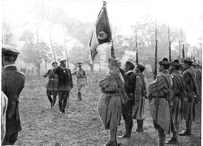
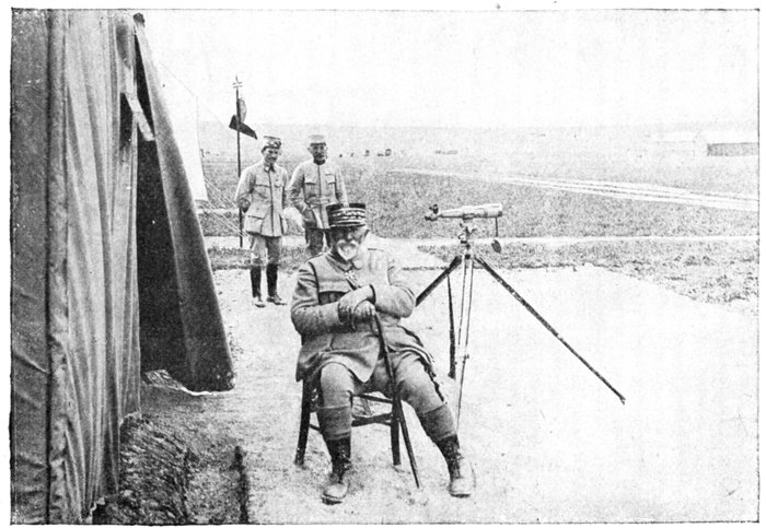
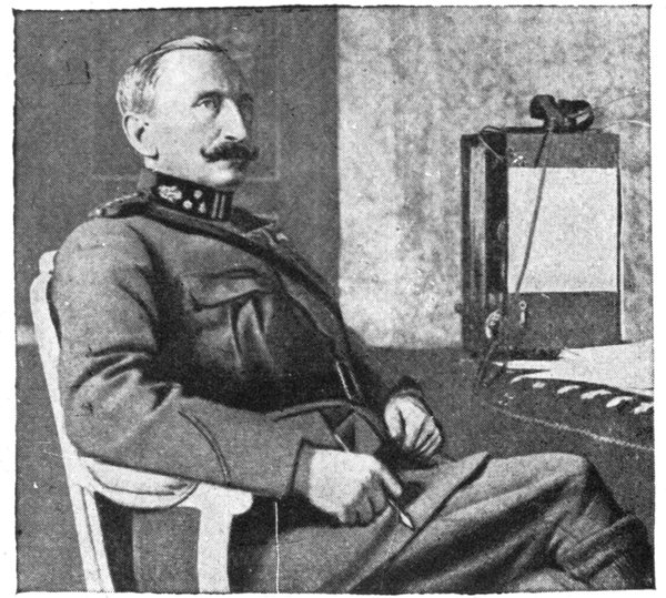
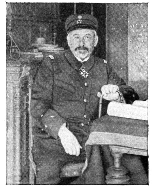
Admiral
Ronarc'h
saluting
the Flag
of the
French
Marines.
Until October 1918, the enemy's front lines followed the banks of the
canal and the Death Trench, dominated by the ruins of the flour-mill
situated upstream from the destroyed bridge-road. For four years, violent
raids and bombardments kept this sector, successively held by French
Marines, Territorials, Zouaves, and Belgian Infantry, in a perpetual state
of activity.
Finally, in September 1918, during the great Liberty Offensive, the Belgian
4th Division attacked the banks of the Yser Canal, turned Dixmude
from the east, and in a single rush reached the banks of the Handzaeme
Canal. On September 29, Dixmude, reduced to a chaotic waste covered
with shapeless masses of débris and tangled barbed wire, and cut up
entirely with trenches, was retaken by the Belgians.
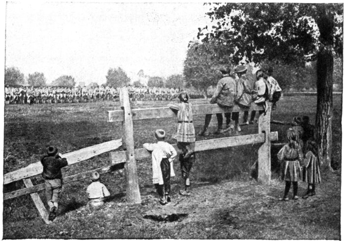
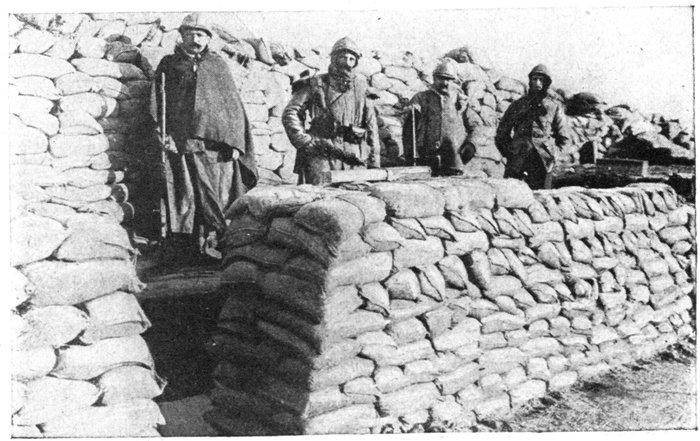
Watching
a Review
of the
French
Marines.
On January 25, 1920, in the presence of King Albert, President Poincaré
conferred the French Croix de Guerre on Dixmude, with the following
mention.
"Won undying fame in the first days of the War by heroic, never-to-be-forgotten
combats. Proved herself worthy of this glory by the fortitude
with which she daily supported bombardments and fires, confident that her
sacrifices were helping to save the Country and the Common Cause."
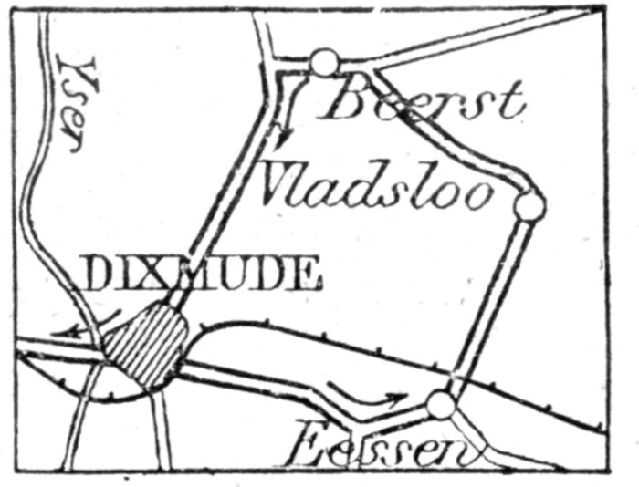
From the canal, return to the Grand'Place and take the Roulers Road,
turning into the first by-road on the left; 3 kms. beyond the level-crossing, leave
the Clercken Road leading to Houthulst Wood, on the right, and keep straight
on to Eessen (3½ kms.) The belfry of the
ruined church was long used by the Germans as
an observation-post (Photo above).
In front of the church, turn left and cross the
railway. The road leads to Vladsloo (large
German cemeteries). Behind the church, turn left.
On reaching the high road, turn left and enter the
village of Beerst (5 kms.)
Beerst and, further north, Keyem served as
advance posts in October 1914 to the Belgian
4th Division which was then defending Tervaete. Violently attacked on
October 18, they were lost and retaken, being finally abandoned on the
morrow. In a desperate effort to save Beerst, the French Marines captured
it twice at the point of the bayonet, covering themselves with glory,
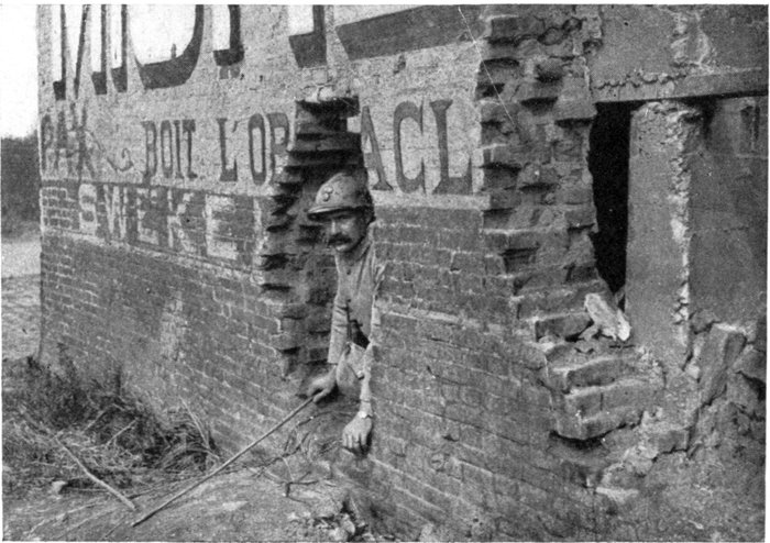
but all to no purpose. Beerst was completely ruined. Many cellars, transformed
by the Germans into fortified shelters, may still be seen.
On reaching the road to Dixmude, turn left, pass through Dixmude (3½ kms.)
and leave the town by the road previously followed. Take the first road on
the left to Loo (1½ kms.)
This small, ancient town is situated on the banks of the Yser canal.
Its large 15th-16th century Gothic church, formerly an abbey, contains
paintings and several fine tombs.
Keeping straight ahead beyond the Grand'Place, in which stands the Renaissance
Hôtel-de-Ville, the tourist will notice, immediately on the left, an Old
Gate (Westpoort), a vestige of the ancient fortifications. A sycamore
tree, probably some four or five centuries old, near by, is said by the inhabitants
to have been used by Julius Cæsar as a picket for tethering his
horse.
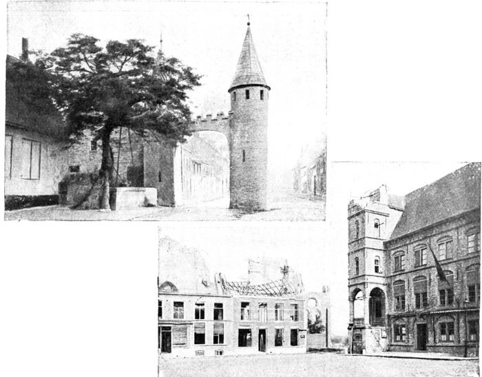
Loo.
1. Westpoort Gate, and
the "Julius Cæsar"
Sycamore Tree;
2. The Grand'Place.
The Hôtel-de-Ville
(on the right), and the
ruins of the Church.
Return to the Grand'Place,
turn to the right,
and cross the Yser.
Reninghe (5 kms.)
(razed) is next reached.
To the right of
the Square, take the
street along which
runs the local railway,
leaving the
church on the left.
Before turning, the tourist will notice just beyond the church a small château
dating from 1648 (Photo below). Follow the railway as far as Oostvleteren
(4 kms. 300), where
cross the Furnes road
to reach Westvleteren,
1 km. 300
further on. Turn to
the left, beyond the
church of the latter village,
keeping straight
on to Poperinghe
(10 kms.), via Eikhock.
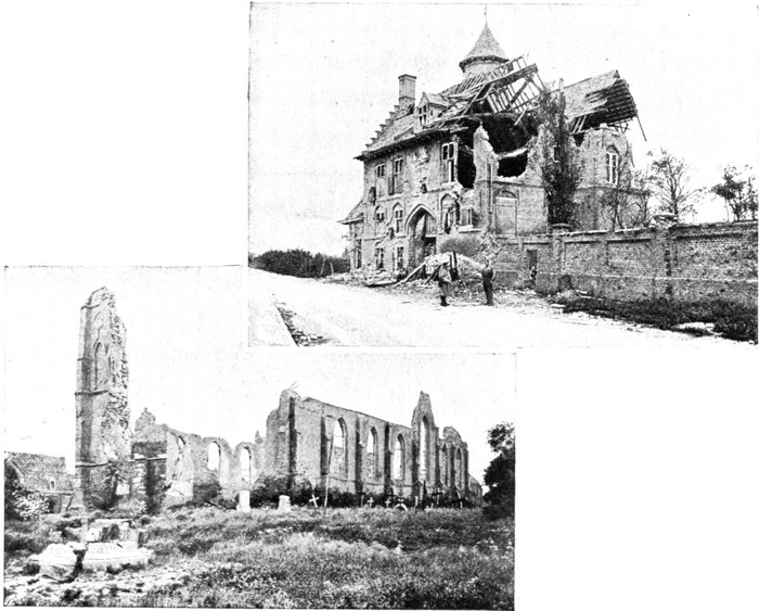
Reninghe.
1. The 17th century
Château;
2. Ruins of the
Church.
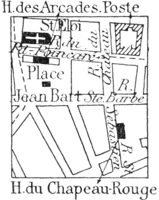
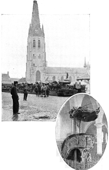
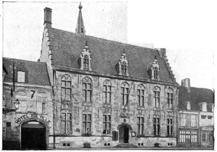
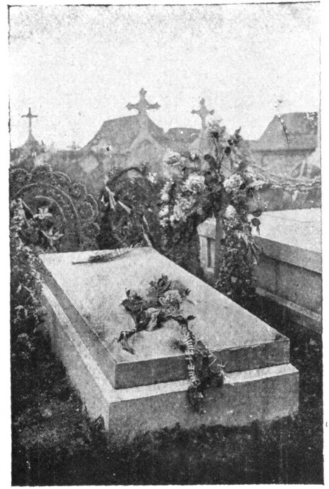
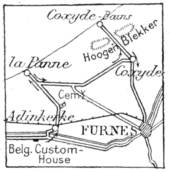
 Arcades. Tel. 1·89.