DIVISION OF MEXICO INTO STATES—EASTERN, WESTERN, INTERIOR.
YUCATAN—BOUNDARIES, DEPARTMENTS, POPULATION, DISTRICTS, TOWNS,
PARISHES, PRODUCTIONS, PRINCIPAL TOWNS, ISLANDS,
HARBORS.—CHIAPAS—BOUNDARIES, PRODUCTS, DEPARTMENTS, TOWNS,
RIVERS, POPULATION—REMAINS IN YUCATAN AND CHIAPAS.—DISCOVERIES OF
STEPHENS, CATHERWOOD, NORMAN, ETC.—PALENQUE—UXMAL—YUCATAN
CALENDAR.—YUCATAN, CHIAPAN, MECHOACAN, NICARAGUA AND MEXICAN
MONTHS.—YUCATESE AND CHIAPAN CYCLE.—YUCATESE AND MEXICAN SOLAR
YEAR—DIFFERENCES.—YUCATESE MONTHS.—TABASCO—BOUNDARIES, RIVERS,
LAGUNE, INHABITANTS, PRODUCTIONS, TOWNS AND VILLAGES.
IN treating this branch of our subject we have followed the order
adopted by Mühlenpfordt in his "Republik Mejico," and acknowledge the
important assistance we have derived from the careful, minute and
laborious personal researches made by that industrious German author
relative to the geography of Mexico. Since the publication of his
volumes, in which he had been greatly aided by the previous works of
Humboldt, Ward, Burkhardt and other explorers during the present
century, the Mexican government has organized a Statistical Commission,
whose investigations have been published in a series of Bulletins, and
to these we are indebted for recent authentic information about some of
the most interesting portions of Mexico. The northern regions,
meanwhile, have been illustrated by the explorations of Frémont, Abert,
Emory, Wislizenius, Cooke, Simpson, and other officers of the American
Government; but as most of the territory examined by them has become the
property of the United States by the Treaty of Guadalupe, their labors
are not of importance in describing the Republic of Mexico as at present
bounded. In the last Book of this work, however, which we have devoted
to the consideration of California and New Mexico, we shall recur to
those brave and scientific explorers of a remote region, so recently a
wilderness, but which their labors, and the combined fortune of war and
mineral wealth have subdued for the benefit of mankind.
In accordance with the plan proposed in the separate consideration of
the several States and Territories of Mexico, we shall divide them into
three groups:—those on the eastern or Gulf coast; those on the western
or Pacific coast, and those in the interior.
| I.—Eastern or Gulf Coast. |
| The State of Yucatan. | The State of Vera Cruz. |
| " State of Chiapas. | "State of Tamaulipas. |
| " State of Tabasco. |
| II.—Western or Pacific Coast. |
| The State of Oajaca. | The State of Jalisco. |
| "State of Puebla. | "Territory of Colima. |
| "Territory of Tlascala. | "State of Sinaloa. |
| "State of Mexico and Federal District. | "State of Sonora. |
| | "State of Guerrero. |
| The State of Michoacan. | "Territory of L. California. |
| III.—Interior. |
| The State of Queretaro. | The State of New Leon. |
| "State of Guanajuato. | "State of Coahuila. |
| "State of Zacatecas. | "State of Durango. |
| "State of San Luis Potosi. | "State of Chihuahua. |
The State of Yucatan, sometimes known by the name of Merida or Campeché,
occupies the greater portion of the peninsula which bounds the southern
edge of the Gulf of Mexico. Its eastern side is washed by the Caribbean
Sea, and touched by the settlements at Balize; on the south it is
bounded by Guatemala; on the west by the Gulf of Mexico and the States
of Chiapas and Tabasco, from which it is separated by the river Paicutun
that falls into the Laguna de Terminos. Its northern coast extends from
Cape Catoché to the Punta de Piedras, about eighty-six leagues; and the
whole area of the State is computed at 3,823 square leagues.
Yucatan possesses very few streams and none of importance that are known
or explored. On the west of the peninsula, debouching into the Gulf of
Mexico, there are the rivers or rivulets of Escatalto, Chen,
Champoton;—the San Francisco falls into the Bay of Campeché; in the
north there are the Silan, the Cedros, and the Conil; while the streams
of Bolina, the Rio Nuevo, the Bacalar, the Ascension, and the Honda or
Rio Grande pour into the Caribbean Sea. In 1841 the population of the
State is stated in a census, taken by order of the government, as
follows:
| Departments. | Men. | Women. | Total. |
| Merida, | 48,606 | 58,663 | 107,269 |
| Izamal, | 32,915 | 37,933 | 70,848 |
| Tekax, | 58,127 | 64,697 | 122,824 |
| Valladolid, | 45,353 | 46,926 | 92,279 |
| Campeché, | 39,017 | 40,639 | 79,656 |
| Total, | 224,018 | 248,858 | 472,876 |
This census, although it professes to be accurate, may nevertheless be
incomplete, inasmuch as the inhabitants of Yucatan, dreading new
contributions and detesting military service, endeavor to reduce as much
as possible the number of their families in the lists prepared for
government. Besides this, it does not appear to comprehend all the
departments according to Mühlenpfordt, who divides the State into
fifteen departments.[44] The population has been estimated by some
careful writers, acquainted with the people and the country, at 525,000
souls; in our table of population on page 42 of this volume, we have on
good authority stated the number to be, in 1842, 508,948, while others
have increased the number to 600,000 and even to 630,000, which amount
is assigned to Yucatan by a census in 1833! The last mentioned number
will give about 165 individuals to each square league.[45]
The character and quality of the productions of Yucatan may be estimated
by the following statistical table, which has been translated and
published by Mr. Stephens in the first volume of his Incidents of Travel
in that State.
| TABLE OF STATISTICS OF YUCATAN |
| DISTRICTS. | PRINCIPAL PLACES. | PARISHES. | VILLAGES ANNEXED. | PRODUCTIONS. |
| Capital | Merida | 4 | 5 | Horned cattle, horses, mules, tallow, jerked beef, leather, salt, gypsum, hemp, raw and manufactured, straw hats, guitars, cigars, and extract of logwood. |
| Campeché | City of Campeché | 2 | " | Salt, logwood, rice, sugar, and marble of good quality. |
| Lerma | Village of Lerma | 3 | 8 | Logwood, timber, rice, and fish oil. |
| Valladolid | City of Valladolid | 11 | 17 | Cotton, sugar, starch, gum copal, tobacco, cochineal, saffron, vanilla, cotton fabrics, yarns, &c., wax, honey, castor oil, horned cattle, hogs, and skins. |
| Coast | City of Izamal | 16 | 27 | Horned cattle, horses, mules, tallow, jerked beef, castor oil, hides, wax, honey, timber, indigo, hemp, raw and manufactured, straw cigars, barilla, and salt. |
| The Upper Highlands | City of Tekax | 9 | 7 | Horned cattle, horses, mules, hogs, sheep, skins, sugar, molasses, timber, rice, tobacco in the leaf and manufactured, spirits, arrow-root, straw hats, cotton lace, ochre, flints, and grindstones. |
| The Lower Highlands | Village of Teabo | 8 | 5 | Horned cattle, horses, mules, hogs, sheep, skins, tallow, dried beef, hemp, raw and manufactured, and cotton lace. |
| The Upper Royal Road | Town of Jequelchakan | 6 | 11 | Cattle, horses, mules, skins, tallow, dried beef, logwood, tobacco, sugar, and rum. |
| The Lower Royal Road | Village of Maxcanú | 5 | 7 | Horned cattle, horses, mules, oil of palma Cristi, tobacco, hemp, and fine straw hats. |
| The Upper "Beneficios" | Village of Ichmul | 7 | 15 | Sugar, molasses, rum, tobacco of good quality, rice, laces, pepper, gum copal, sarsaparilla, hats, hammocks, ebony, barilla, gypsum, and skins. |
| The Lower "Beneficios" | Village of Sotuta | 6 | 16 | Horned cattle, horses, mules, hogs, skins, tallow, and dried beef. |
| Tizimin | Village of Tizimin. | 7 | 18 | Tortoise-shell, skins, timber, logwood, India-rubber, incense, tobacco, achiote (a substitute for saffron, and a very rich dye), starch from the yuca, cotton, wax, honey, molasses, sugar, rum, castor oil, salt, amber, vanilla, hogs, cochineal. |
| Island of Cármen | Town of Cármen | 2 | 1 | Logwood. |
| Seiba-playa | Village of Seiba-playa | 3 | 6 | Timber, rice, logwood, and salt. |
| Bacalar | Town of Bacalar | 2 | " | Logwood, valuable timber, sugar of inferior quality, tobacco of the best description, rum, a fine species of hemp, known under the name of pita, resin, India-rubber, gum copal, pimento, sarsaparilla, vanilla, and gypsum. |
| Total | 15 | 91 | 143 | |

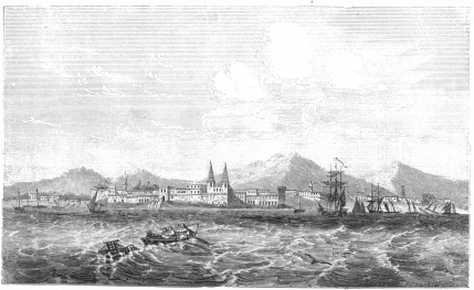 CAMPECHE.
The principal towns of Yucatan, are, 1st: the capital, Merida, in the
northern part of the state, about ten leagues from the coast, containing
a population of near 15,000 individuals. Its port is the small haven of
Sisal, which is in reality nothing but a bleak roadstead, protected by a
fort and a sand bank.
2nd: San Francisco de Campeché, with a population of about 9,000;—a
port which is considered by navigators one of the best in the state, yet
is by no means, a secure or comfortable anchorage.
3rd: Vallodolid, the chief town of the district of that name, with near
4,000 inhabitants.
4th: San Felipé de Bacalar, or Salamanca; a town and military post in
the district of that name, containing a garrison and about one hundred
and twenty houses.
Besides these, there are the villages of Xampolan, Jequetchacan, Lerma,
Champoton, between the rivers Campeché and Champoton on the west coast,
and Silan, Santa Clara, Vigia del rio and Chaboána, on the north coast.
In the interior there are many Indian villages.
The Island of Cozumel on the east coast of Yucatan—which was the first
land discovered by the Spaniards in their voyage to Mexico,—is now
almost uninhabited, and contains some ancient remains, which are
probably the ruins of the splendid structures that attracted the
attention of the adventurers, and satisfied them they had reached a land
which was sufficiently civilized to be worthy their exploration and
plunder.
It has generally been supposed that Yucatan affords no safe harbors or
anchorages, which would either tempt commercial enterprise to her
shores, or afford vessels of war sufficient protection so as to render
the peninsula valuable in a military point of view. Yet it seems from an
official copy of a recent British survey of the coast of Yucatan, which
is to be found in the office of our Coast Survey in Washington, that
there is a fine harbor for vessels of any size under the island of
Mugeres, the easternmost point of Yucatan, where they may ride at anchor
in safety, protected from winds in every direction. The harbors of
Ascension and Espiritu Bay, are represented as good; the latter being
capable of holding a fleet of the heaviest kind of English frigates and
war steamers. There is good anchorage, moreover, off the north-east
point of the island of Cozumel.[46]
This state has been very inadequately examined. It is bounded north by
Tabasco; south and south-west by the Republic of Central America, or
Guatemala; west by the state of Vera Cruz and by a small part of Oajaca;
and on the east partly by Yucatan and partly by Guatemala. Until the
year 1833 the territory comprised in this division belonged to
Guatemala, when it joined the Mexican confederacy. Comprehending the
northern declivities of the Cordilleras and table lands of Central
America, Chiapas is, throughout a considerable part of its territory,
cut up into successions of ridges and valleys, which are rich in many of
the finest tropical productions. Corn, cacao, sugar and garden
vegetables are produced readily. Tobacco of good quality grows in the
district of Sandoval, and in the neighborhood of Oajaca. In the district
of Tonalá, a small quantity of indigo of an extraordinarily fine quality
is cultivated; and here, also, pepper and the maguey plant are yielded
plentifully. Ananas, sapotes, bananas, figs, apricots and various
similar fruits abound in Chiapas, while in its forests, oaks, cedar,
mahogany, ebony, and other valuable woods are found in considerable
quantities. But the greater part of this fruitful state is still an
unknown waste, which the labors of other races must fully explore and
develop.
Chiapas is divided into four departments and nine districts, which,
together, possess 92 parishes.
1st: The Department of the Centre, with 12 parishes, besides the capital
of Ciudad-Real, or San Cristoval de los Llanos and the town of Chamúla.
2nd: The Department of the South, with 10 parishes, in the district of
Llanos, 11 in Ocozingo, and 17 in Tuxtla.
3rd: The Department of the West, with the district of Ystocomitan,
containing 17 parishes; Tonalá, 3 parishes; and Palenque, 4 parishes.
4th: The Department of the North, with the districts of Tila, containing
6 parishes, and Simojoval, 12 parishes.
The chief towns are, Ciudad-Real, or San Cristoval de los Llanos; a fine
town with about 6,000 inhabitants, possessing a cathedral church, four
convents for monks, and one for nuns, two chapels, and a hospital. The
first bishop of Chiapas, who erected the see of that name in 1538, was
the renowned Bartoloméo de las Casas, whose fame is so intimately
connected with the early history of the country, by his constant and
merciful interference in behalf of the Indians.
The other important towns are San Juan Chamúla, containing 4,000
inhabitants; San Bartoloméo de los Llanos, whose 7,000 people are
chiefly engaged in the cultivation of cotton, sugar, tobacco and corn;
San Domingo Comitlan; San Jacinto Ocozingo, with 3,000 inhabitants who
devote themselves to the care of cattle, and cultivate some cacao and
corn; Tuxtla, with 5,000 inhabitants who trade in tobacco and cacao; San
Domingo Sinacantan, on the borders of Tabasco in the territory of the
Zoques, with 2,500 inhabitants who employ themselves in the culture of
silk, of which they weave shawls and other similar fabrics, which are
esteemed of a good merchantable quality, and are used in the country or
adjacent states; Chiapa de los Indios; Tecpatlan; Ostoacan; Teopixca;
Acapala; Capanabastla; Izcuintenango; San Fernando Guadalupe; and
Simojovél.
Chiapas is represented to be rich in rivers which rise chiefly in the
highlands towards the state of Tabasco and debouche into the Mexican
Gulf. The Tabasco river or the Rio de Grijalva; the Usumasinta, the
Chicsoi or the Santa Isabella;—the Machaquita, San Pedro, Dolores,
Yalchitan, Chacamas, Zeldales, Yeixhihujat, Chatlan, and some others;
the Pacaitún or Paicutun; the laguna de Chiapa; some mineral waters; and
a valuable salt spring in the vicinity of San Mateo, enrich various
portions of this fertile state, whose climate, especially in its higher
regions, is said to be delicious and uniform. The number of the
population of this state is not officially known. In 1831, a census made
by order of the governor Ignacio Gutierrez, which however, did not
include fifteen parishes, gave 118,775 inhabitants for the rest of the
state. An estimate in a Mexican calendar of 1833 represents the number
to be about 96,000, while the government calculation for a basis of
representation in Congress in 1842, gives it 141,206, to which about 10
per cent. should be added to give the proximate population in 1850. The
Indian tribes of the Zoques, Cendales or Zeldales, Teochiapanécos and
Mames are still very numerous, and, of course, form the greater part of
the population.
The physical description of these two States, presented in the preceding
pages, will have satisfied the reader that they possess a prolific soil
and an agreeable climate which would probably attract a large population
had they been properly explored and developed by an energetic race. We
are sustained in this belief by the fact, that in these States
travellers have found the most remarkable remains of an advanced ancient
civilization hitherto discovered on our continent. What has existed may
exist again under the benignant influence of modern progress; nor is it
improbable that as human interests direct the attention of maritime or
emigrating nations towards the central portions of the western
continent, Yucatan and Chiapas may again become the seat of a population
even larger than that which thronged it during the palmy days anterior
to the Spanish conquest.
Since the year 1840 three important works have been published in this
country relative to these ancient remains of towns, temples, cities,
idols and monuments. Two of these are due to the pen and pencil of Mr.
John L. Stephens and Mr. Catherwood, while the other and slighter
production is the result of a hasty visit paid to Yucatan by Mr. B. M.
Norman. These three publications, plentifully illustrated by accurate
engravings of the ruins and remains, have been so widely disseminated
throughout Europe and America that readers are already familiar with
them. In the "long, irregular and devious route" pursued by Stephens and
Catherwood, they "discovered the crumbling remains of fifty-four
ancient cities, most of them but a short distance apart, though, from
the great change that has taken place in the country, and the breaking
up of the old roads, having no direct communication with each other.
With but few exceptions, all were lost, buried and unknown, never before
visited by a stranger, and some of them, perhaps, never looked upon by
the eyes of a white man." Leaving Guatemala, the travellers encountered,
in Chiapas, remarkable remains at Ocozingo and Palenque; and passing
thence into Yucatan, in their second journey to those central regions,
they explored and described the architectural and monumental relics at
Maxcanu, Uxmal, Sacbey, Xampon, Sanacte, Chunhuhu, Labpahk, Iturbide,
Mayapan, San Francisco, Ticul, Nochacab, Xoch, Kabah, Sabatsche, Labna,
Kenick, Izamal, Saccacal, Tekax, Akil, Mani, Macoba, Becanchen, Peto,
Chichen, in the interior; and at Tuloom, Tancar, and in the Island of
Cozumel on the eastern coast.
The simple catalogue of these names, indicating the sites of ancient
civilization in the midst of what is at present almost an unexplored
wilderness and covering so wide a field of observation, will satisfy the
reader that it is impossible to condense a satisfactory review of these
architectural remains within the space that we are enabled to
appropriate to antiquarian researches. The ruins of Palenque in Chiapas,
and of Uxmal and Chichen in Yucatan, are, perhaps, the most wonderful
of all that have been explored hitherto in this lonely region; and,
while we regret that our duty to the living present will not permit us
to dwell longer on the curious past, we shall, nevertheless pause,
occasionally, as we pass through the Mexican States, to notice those
remains which have either been visited by us personally, or are not
described in books as accessible to all classes of enquirers and
students as those of Messrs. Stephens, Catherwood and Norman. Mr.
Stephens believes, after full investigation, that these towns and cities
were occupied by the original builders and their descendants at the
period of the Spanish conquest, and our own opinion entirely coincides
with his reasoning and judgment. Those who desire a complete and
conclusive illustration of this branch of the subject will find an
excellent argument thereon in both of his publications.[47]
In the first volume of this work we have given an account of the Mexican
or Aztec Calendar; and the proximate identity of the Yucatese or Mayan
and Aztec Calendar led Mr. Stephens to the conclusion that both nations
had a common origin. This argument is also important in considering the
period of the occupation of the Chiapan and Yucatese edifices, inasmuch
as we know that the Aztecs of Montezuma's period used the Calendar which
we have already illustrated and described.
"Our knowledge of the Yucatan Calendar," says Mr. Gallatin,[48] "is
derived exclusively from the communications made by Don J. P. Perez to
Mr. John L. Stephens, and inserted in the appendix to the first volume
of this gentleman's Travels in Yucatan. It is substantially the same
with that of the Mexicans, though differing in some important
particulars.
"The inhabitants of Yucatan had, like the Mexicans, the two distinct
modes of computing time, by months of twenty days, and by periods of
thirteen days. They also distinguished the days of the year by a
combination of those two series, precisely similar to that of the
Mexicans. And their year likewise consisted of 365 days, viz., of
eighteen months of twenty days each, to which they added five
supplementary days; and also of a corresponding series of twenty-eight
periods of thirteen days each, and one day over. The following table
exhibits the names of the twenty days of the Yucatan month, with their
signification, as far as it has been ascertained by Don J. P. Perez; and
also the days of the Chiapa month as given by Boturini; and which, from
the similarity of the names of several of the days, appears to have been
in its origin nearly identical with that of Yucatan.
| Yucatan. | Chiapa. | Mechoacan. | Nicaragua. | Mexican. |
| 1 KAN | yellow | Ghanan | Inodon | 9 Cipat | Cipactli |
| 2 Chicchan | small | Abagh | Inic Ebi | 10 Acat | Ehecatl |
| 3 Quimi | death | Tox | Inettuni | 11 Cali | Calli |
| 4 Manik | wind ceasing | Moxic | Inbeari | 12 Quespalcoat | Cuetzpalin |
| 5 Lamat | | Lambat | Inethaati | 13 Migiste | Cohuatl |
| 6 Muluc | union? | Mulu | Inbani | 14 Macat | Miquiztli |
| 7 Oc | palm of hand? | Elab | Inxichari | 15 Toste | Mazatl |
| 8 Chuen | board | Batz | Inchini | 16 At | Tochtli |
| 9 Eb | ladder | Enob | In Rini | 17 Izquindi | Atl |
| 10 Be-en | | Be-en | In Pari | 18 Ocomat | Itzcuintli |
| 11 HIX | rough | Hix | Inchon | 19 Malinal | Ozomatli |
| 12 Men | a mechanic | Tziquin | Inthahui | 20 Acato | Malinalli |
| 13 Quib | wax | Chabin | Intzini | 1 Agat | Acatl |
| 14 Caban | | Chic | In Tzoniabi | 2 Ocelot | Ocelotl |
| 15 Eznab | | Chinax | In Tizimbi | 3 Oat | Quauhtli |
| 16 Ca-uac | | Cahogh | Inthihui | 4 Cozgacoatz | Cozcaquauhtli |
| 17 Ajau | period of years | Aghual | Inixotzini | 5 Olin | Ollin |
| 18 Imix | maize? | Mox | Inichini | 6 Topecat | Tecpatl |
| 19 Yk | wind | Ygh | Ini Abi | 7 Quiauvit | Quiahuitl |
| 20 Akbal | | Votan | Intaniri | 8 Sochit | Xochitl |
"The Calendar of the inhabitants of the independent kingdom of
Mechoacan, who spoke the Tarasca language, appears to have been similar
to that of the Mexicans; and the names of the days of their month as
stated by Veytia, are inserted in the table. The names of the days of an
ancient Mexican, or rather Toltec tribe, found in the province of
Nicaragua, have also been inserted. This, as far as we know, is the
extreme southeastern limit of the Mexican Calendar on the Pacific Ocean.
That limit on the Atlantic or Gulf of Mexico may be traced as far as the
islands opposite Cape Honduras (Herrera); beyond which the shores are
still inhabited by the uncivilized Musquito Indians.
"The cycle of fifty-two years was also adopted in Yucatan, and the
arrangement of the years was precisely the same as in that of Mexico,
substituting only the names Khan, Muluc, Hix and Ca-uac, for Tochtli,
Acatl, Tecpatl and Calli, as appears in the following table:
| | YUCATAN CYCLE OF 52 YEARS. | |
| 1st year. | 14th year. | 27th year. | 40th year. |
| 1 | Khan | Muluc | Hix | Ca-uac | The Chiapan Cycle is also
similar, substituting for the
names Khan, Muluc, Hix,
Ca-uac, those of Votan,
Lembat, Be-en, Chinax. |
| 2 | Muluc | Hix | Ca-uac | Khan |
| 3 | Hix | Ca-uac | Khan | Muluc |
| 4 | Ca-uac | Khan | Muluc | Hix |
| 5 | Khan | Muluc | Hix | Ca-uac |
| 6 | Muluc | Hix | Ca-uac | Khan |
| 7 | Hix | Ca-uac | Khan | Muluc |
| 8 | Ca-uac | Khan | Muluc | Hix |
| 9 | Khan | Muluc | Hix | Ca-uac |
| 10 | Muluc | Hix | Ca-uac | Khan |
| 11 | Hix | Ca-uac | Khan | Muluc |
| 12 | Ca-uac | Khan | Muluc | Hix |
| 13 | Kahn | Muluc | Hix | Ca-uac |
"But there was an essential difference respecting the series of the
names and numerical characters of the days, as will appear by the
following table, which shows the termination of the first year of the
cycle, and the beginning of the next ensuing years.
| Year 1 Khan | 1st day of the year | 1 Khan |
| 1st of the Cycle | 1st supplementary day | 10 do. |
| | 2ddo. | 11 Chiccan |
| | 3d do. | 12 Kimi |
| | 4th do. | 13 Manic |
| | 5th do. | 1 Lamat |
| | | |
| Year 2 Muluc | 1st day of the year | 2 Muluc |
| 2d of the Cycle | 1st supplementary day | 11 Muluc |
| Last do. | 2 Be-en |
| | | |
| Year 3 Hix | 1st day of the year | 3 Hix |
| 3d of the Cycle | 1st supplementary day | 12 do. |
| | Last do. | 3 Edznab |
| | | |
| Year 4 Ca-uac | 1st day of the year | 4 Ca-uac |
| 4th of the Cycle | 1st supplementary day | 13 do. |
| | Last do. | 4 Akbal |
| | | |
| Year 5 Khan | 1st day of the year | 5 Khan |
| 5th of the Cycle | 1st supplementary day | 1 do. |
| | Last do. | 5 Lamat |
"Don J. P. Perez positively states, that the fundamental rule is never
to interrupt either of the series of names or of days. Thus, inasmuch as
the last supplementary day of the first year of the cycle (1 Khan) is 1
Lamat; and as, in the order of the days of the month, the day called
"Muluc" immediately follows the day Lamat; the ensuing year 2 Muluc
commences with the day 2 Muluc, in the same manner as the year 1 Khan
commences with the day 1 Khan. It is the same with the other years; so
that the first day of every year has the same name and numerical
character as the year itself.
"Don J. P. Perez acknowledges that amongst the few mutilated remains of
Indian manuscripts or paintings, he has not been able to discover any
trace of an intercalation, either of one day every four years, or of
thirteen days at the end of the cycle, though he presumes that they had
indubitably either the one or the other.
"The Yucatan cycle of fifty-two years, differed in no other respect from
that of the Mexicans. The combination of the two series of twenty and
thirteen days is used in the same manner in both calendars for the
purpose of distinguishing the days of the year.
"The Yucatecs differed materially from the Mexicans with regard to the
time of the solar year, when their year began. Don J. P. Perez informs
us, that the first day of the Yucatan year corresponded with the
sixteenth day of July; and that this was the day of the transit of the
sun by the zenith of a place which he does not mention. But he adds
that, for want of proper instruments, the Indians had made a mistake of
forty-eight hours. In point of fact, it is in the latitude of about
twenty-one degrees and a half that the transit of the sun by the zenith
occurs on the 16th of July; and Yucatan lies between the latitudes of
about eighteen degrees and a half and twenty-one degrees and a half. To
commence the year on the day of the transit of the sun by the zenith, is
attended with the great inconvenience, that this commencement must vary
from place to place, according to their respective latitudes. As Don J.
Pio Perez counts every year as having 365 days, and without regard to
the omitted bissextile days, it is clear that the day in the Yucatan
calendar, on which the transit of the sun by the zenith of any one place
occurs, would vary twenty days, or a whole Indian month, in the course
of eighty years. This would create such confusion that, if it be a well
ascertained fact, that the Yucatan year began on the zenith day, this
renders it highly probable that the calendar was, like that of the
Mexicans, corrected by an intercalation of thirteen days at the end of
the cycle.
"The names of the eighteen months of the Yucatecos, together with such
interpretations as Don Pio Perez has given us, their order and their
correspondence with our year, new style, appear in the following table:
TABLE OF YUCATESE MONTHS.
| 1 Pop, Poop | Mat of Reeds | begins on 16th July, N. S. |
| 2 Uo | Frog | " 5 August |
| 3 Zip | Tree | "25" |
| 4 Zodz | Bat | "14 September |
| 5 Zec | | "4 October |
| 6 Xul | End | "24" |
| 7 Dzeyaxkin | Summer | "13 November |
| 8 Mol | To unite | "3 December |
| 9 Chen | A Well | "23" |
| 10 Yax | First | "12 January |
| 11 Zac | White | "1 February |
| 12 Quej | Deer | "21 " |
| 13 Mac | Lid, cover | "13 March |
| 14 Kankin | Yellow Sun | "2 April |
| 15 Moan | | "22" |
| 16 Pax | Musical instrument | "12 May |
| 17 Kayab | Song | "1 June |
| 18 Cumku | Noise | "21" |
| {Uayebhaab | Bed of year } | the 5 supplementary days} |
| {Xma kaba kit | Days without name} | from 11th to 15th July} |
"The Mexicans counted only by cycles; they designated the termination of
a cycle by a hieroglyphic representing a bundle of reeds tied up; and
they sometimes designated, by an equal number of small circles, the
number of cycles which had elapsed, since the beginning of their era
corresponding with the year 1091. But the Yucatecos, besides their cycle
of 52 years, had another, containing thirteen periods of twenty or
twenty-four years each. These last mentioned periods were called Ajau
or Ahau."
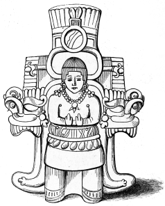 YUCATESE IDOL.
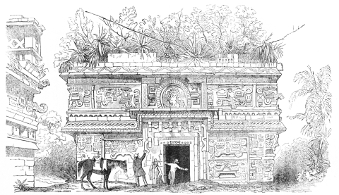 YUCATAN EDIFICE.
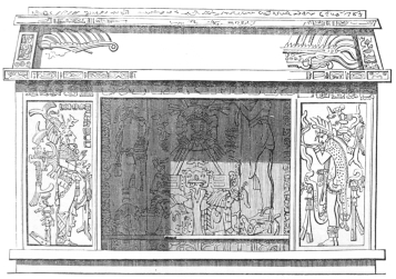 YUCATAN ALTAR.
This State, one of the smallest of the confederacy, was, previous to the
revolution, a province of the Intendency of Vera Cruz. It bounds
eastwardly on the State of Yucatan; south on Chiapas and Oajaca; west on
Vera Cruz, and northwardly on the Gulf of Mexico. Nearly the whole of
Tabasco slopes gradually towards the sea, and is so extremely flat that
it is often subject to inundations, and the communication from village
to village and parish to parish cut off altogether, or only practicable
in canoes. The State is consequently full of streams, though they are
generally short and shallow, whilst their mouths are obstructed by bars
and flats. The most remarkable of these streams are—the Pacaitun, or as
it is sometimes called, Rio de Banderas; the Usumasinta which also
passes through Chiapas; the Tabasco; the Chiltepec; Dos Bocas; Capilco;
Rio de Santa Anna; Tonalá or Toneladas; Tancochapa or San Antonio;
Uspanapan and the Guachapa or Rio del Paso.
On the eastern boundary of Tabasco lies the Laguna de Terminos, which is
fifteen leagues long and ten broad. In this inland sea are locked the
beautiful islands of Laguna, Carmen, and Puerto Real; and, in the two
passes by which the sea is reached from this lagune, twelve to thirteen
feet of water are found in the larger, while but five and a half feet
are obtained in the smaller, or pass of Puerto Real.
The climate of this State is excessively hot along the immediate coast
of the gulf; nor is it very sensibly changed as the interior is reached,
in consequence of the extreme flatness of the soil. During the
prevalence of the northers the harbors are exceedingly insecure; but
these violent storms somewhat temper the heat and render the towns less
sickly.
Tabasco is divided into three departments with nine parishes:
1st. The Department of Villa Hermosa with the districts of Villa
Hermosa, Usumasinta, and Nacayuca. 2d. The Department of the Sierra with
the districts of Teapa, Tacotalpa and Jalapa. 3d. The Department of
Chontalpa with the districts of Macuspana, Cunduacan and Jalpa.
These are subdivided into 49 parishes; (23 of which are in the
Department of Villa Hermosa, 10 in la Sierra, and 16 in Chontalpa;)
besides these there are 543 haciendas and ranchos, or estates and farms;
and, throughout the whole State there are 63 churches. The mass of
inhabitants in Tabasco, as elsewhere in these southern states, is
formed of Indians: and of the 70,000 people who are estimated to compose
the population, it is probable that the majority is formed of the Mijes,
Zoques and Cendales.
Cacao, coffee, pepper, sugar, tamarinds, arrow-root, palmetto and some
tobacco are cultivated; while indigo and vainilla grow wild in the
forests among groves of oaks, cedars, mahogany and ironwood. The
extensive wildernesses of Tabasco are filled with game and wild beasts,
and the streams are full of excellent fish. Bees abound in the depths of
the forests and yield abundant supplies of wild honey and wax.
The capital of Tabasco is Villa Hermosa de Tabasco, or, as it is
sometimes called, Villa de San Juan Bautista, which lies on the left
bank of the Tabasco river twenty-four leagues from its mouth. It
contains about 7,000 inhabitants, and is reached by vessels of light
draft from the sea; but its chief commercial intercourse is carried on
with adjoining states and with Guatemala. There are some other towns or
villages worthy of mention; the principal of which are Usumasinta,
Nacayuca, Tacotalpa, Teapa, Jalapa, Chontalpa, Jalpa, Cunduacan,
Macuspana, Chiltepec, Santa Anna, Tonala, Acalpa, Chinameca, Tochla,
Istapa or Ystapangahoya, San Fernando, Tapichulapa, and Obsolotan.
BOUNDARIES OF VERA CRUZ—RIVERS, LAGUNES, MINERAL SPRINGS,
POPULATION, POLITICAL DIVISIONS, PRODUCTIONS, CATTLE, CITIES,
TOWNS.—VERA CRUZ—ITS DISEASES—METEOROLOGICAL OBSERVATIONS
AT—WATER FALLEN AT VERA CRUZ.—ORIZABA—ASCENT OF THE
MOUNTAIN—MAGNIFICENT VIEWS—DIFFICULTIES—THE CRATER
EXTINCT—ELEVATION OF THE MOUNTAIN—DESCENT.—ANTIQUITIES IN THE
STATE OF VERA CRUZ—RUINS AT PANUCO, CHACUACO, SAN NICOLAS, LA
TRINIDAD—SMALL FIGURES.—PAPANTLA—DESCRIPTION OF THE
PYRAMID.—RUINS AT MAPILCA—PYRAMID AND TEMPLE AT TUSAPAN—ISLE OF
SACRIFICIOS—MISANTLA—REMAINS NEAR PUENTE
NACIONAL.—TAMAULIPAS—BOUNDARIES, RIVERS, LAGUNES, CLIMATE,
POPULATION, PRODUCTIONS, TOWNS.—ANTIQUITIES OF
TAMAULIPAS—TOPILA—RANCHO DE LAS PIEDRAS—SCULPTURE—REMAINS,
ETC., ETC.
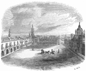 PLAZA OF VERA CRUZ.
The State of Vera Cruz lies under the burning sky of the tropics between
17° 85´ and 22° 17´ of north latitude; and 96° 46´ and 101° 21´ west
longitude from Paris. It is comprised within a long but somewhat narrow
strip of territory along the Gulf of Mexico, running from the mouth of
the Tampico river, in the north, to the Guasacualco and the boundaries
of Tabasco, on the south. Its length is 166 leagues; its breadth, from
25 to 28; and it is estimated to contain an area of 5,000 square
leagues. It is bounded eastwardly by the Gulf; south by Tabasco; north
by Tamaulipas; and west and south-west by Oajaca, Puebla, Mexico,
Queretaro and San Luis Potosi. The eastern part of the State is
generally level, low and sandy; but, further inland, it gradually rises
as the traveller leaves the arid and burning wastes of the coast, until
the country is broken into an uninterrupted series of lofty mountains
and beautiful vallies.
The coasts of this State are rich in rivers, streams, inlets, and
lagunes; but, unfortunately, they are either not navigable for any
considerable distance, or are obstructed by bars at their mouths. Among
these streams the following are chiefly to be noticed as of importance:
The Rio Tampico, the Garzes, the Tuspan, the Cazones, the Tenistepec,
the Jajalapam or Tecolutla, the Nautla, the Palmar, the Misantla, the
Maguilmanapa, the Yeguascalco, the Actopan, the Chuchalaca, the Antigua,
the Jamapa, the Rio Blanco, the San Juan or Alvarado, the Aquivilco, and
the Gúasacualco which is a boundary stream between the States of Vera
Cruz, Oajaca and Tabasco.
The principal lagunes in the State of Vera Cruz are:—The Laguna de
Tamiahua, the largest on this coast of Mexico, being ten leagues long
and eight leagues broad. It has two mouths in the Gulf;—one at the bar
of Tamiahua, and the other, further south near the mouth of the small
stream of Tuspan. Between these mouths lies the island of Tuspan; while
the two islands of Juan Ramirez and El Toro are found in the lake or
lagune itself. The next lagune in importance is that of Tampico, four
leagues long and three broad; and besides this, there are—the Lagunas
de Mandingo, of Alvarado, (which is subdivided into eight smaller
lagunes,) of Catemaico, Alijoyúca, and Tenango.
There are several mineral springs in this State, and at Atotonilco, near
Calcahualco, in the district of Cordova, there are warm baths which are
celebrated for their efficacy in nervous and rheumatic diseases. There
are mineral waters also near the hacienda of Almágros, in the district
of Acayucam, and other warm springs near Aloténgo in the district of
Jalanzingo, whose qualities have not yet been ascertained by chemical
analysis.
The population has been estimated by recent writers at near 251,000;
which distributed over the 5,000 square leagues will give about 50
inhabitants to the square league. According to our estimate in the
chapter on population, the number may be set down at
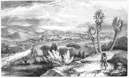 JALAPA.
270,000. The milder regions about Jalapa and Orizaba are more thickly
peopled, than the comparatively sterile and sickly shores of the gulf.
The population is composed of mixed races:—Creoles, Indians, Havanese,
Foreigners, and a few Negroes.
The State of Vera Cruz is divided into four Departments and twelve
districts, with 103 municipalities and 1,370 village jurisdictions.
1st. The Department of Jalapa, with two districts or cantons, viz:—1st,
Jalapa, including the capital of that name,—thirty-one villages,
fourteen haciendas and sixteen ranchos;—and 2d, Jalanzingo, with the
towns of Perote and Jalanzingo, five villages, seven haciendas and
thirty-three ranchos.
2d. The Department of Orizaba, with three districts or cantons: 1st,
Orizaba, including the city of that name,—Sougolican, twenty-seven
villages, six haciendas and fifty ranchos. 2d, Cordova, including the
city of that name, and the towns of Coscomatepec and San Antonio
Huatusco,—twenty villages, twenty-eight haciendas 237 ranchos,—and 3d,
Cosamaloapan, with eight villages, five haciendas and forty-one
ranchos.
3d. The Department of Vera Cruz with four districts or cantons: 1st,
Vera Cruz, including the capital of that name, with Alvarado and
Medellin, 21 haciendas, 149 estancias, and 600 ranchos. 2d, Misantla,
with four villages, two haciendas, and thirty-four ranchos. 3d,
Papantla, with thirteen villages, seven ranchos and the hacienda de
Norias. 4th, Tampico, with Tampico and Panuco,—seven villages,
thirty-nine haciendas and forty-one ranchos.
4th. The Department of Acayucam, with three districts or cantons:—1st,
Acayucam, with the adjacent Acayucam and San Juan Olúta, nineteen
villages, twelve haciendas, twenty-seven hatos and eleven ranchos. 2d,
Huimanguillo, with twenty-one villages, one hacienda and nineteen
ranchos. 3d, San Andres Tuxtla, with the adjacent San Andres and
Santiago Tuxtla,—two villages, one hacienda, thirty-four hatos, and
eight ranchos.
It is impossible in a description of this rich and varied State to sum
up with accuracy what it produces either naturally or by introduction
from abroad, for its genial climate, changed by the elevation of the
interior portions of the State, renders it capable of yielding the
fruits, the flowers, the grains, the woods, the vegetables and the
animals of the temperate as well as of the torrid zone. Tobacco, coffee,
sugar, cotton, corn, barley, wheat, jalap, sarsaparilla, vainilla,
mameis, papayas, pine-apples, oranges, citrons, lemons, pomegranates,
zapotes, bananas, chirimogas, aguacates, tunas, pears, watermelons,
peaches, apricots, guyavas, grapes; mahogony, ebony, cedar, oak,
dragon-blood, tamarinds, palms, dyewoods, and a thousand other plants,
trees, shrubs, cereals and parasites, spring almost spontaneously from
the soil, and render the necessary labor of man almost insignificant.
After the strip of sandy sea-shore has been passed, and the country
begins gradually to rise, health and rich vegetation follow the
traveller's footsteps. He beholds on every side magnificent forests
filled with majestic trees and illuminated by the splendid colors of
flowers and buds. In the midst of these solitary folds among the
mountains, farms and plantations are opened, which gleam with the
freshest verdure of cane or corn; while over the levels, innumerable
herds of cattle are fed from the mere fulness of the land, and without
the necessary tending either of shepherds or vaqueros. An idea of this
State's richness in cattle may be formed from the following account of
the number it possessed in 1831,—the district of Jalapa being excluded
from the list, inasmuch as there were no returns for that year:—
| 291,055 | neat cattle, |
| 49,321 | horses, |
| 9,396 | mules, |
| 3,110 | asses, |
| 17,680 | goats, |
| 35,325 | sheep; |
the total value of which, together with the cattle product of the canton
of Jalapa, cannot be less than $2,000,000.
The principal cities, towns and villages of the State of Vera Cruz, are
1st, La Villa rica or La Villa Heroica de la Vera Cruz—the capital of
the State; 2d, Tampico or Pueblo viejo de Tampico; 3d, Panuco; 4th,
Tuspan; 5th, Misantla; 6th, Papantla. [On the road from the port of Vera
Cruz to the western limit of the State, lie Paso de Ovejas, Puente del
Rey or Puente Nacional, Plan del Rio, and El Encero, but these are small
towns or villages of no great consideration.] 7th, Alvarado; 8th, Boca
del Rio; 9th, Tlacotalpan; 10th, Cotastla; 11th, Talascoyan; 12th, San
Martin Acayucam; 13th, San Andres Tuxtla; 14th, Santiago Tuxtla; 15th,
Soconusco; 16th, Jaltipan; 17th, Chinameca; 18th, Orizaba; 19th,
Cordova; 20th, Cosamaloapam; 21st, Aculzingo; 22d, Jalapa; 23d,
Jalanzingo, and 24th, Perote.
The port of Vera Cruz lies in 19° 11´ 52´´ north latitude, and 98° 29´
19´´ west longitude, from Paris, on a sandy plain,—interspersed with
marshes,—which bound the Gulf of Mexico. Its unhealthiness is
proverbial. From the month of May to that of November,—comprising the
usual period during which the northers cease blowing,—the vomito
prieto, or black vomit, prevails incessantly at Vera Cruz. None but
natives of the town, or acclimated foreigners, are free from its
attacks, and the frightful inroads it made among our troops, in the year
1847, will long be remembered in the history of our army and country.
Time does not appear to have had any effect on this dreadful disease.
Increase of population and sanatory precautions do not seem to abate its
malignity; and the science of the ablest physicians is entirely at fault
in dealing with it. Diarrhœa, dysentery and vomito are the most fatal
and prevalent maladies at Vera Cruz; and, the latter disease, is
reckoned to cause one-sixth of the whole mortality of the port.
| METEOROLOGICAL OBSERVATIONS IN VERA CRUZ IN 1830. |
| MONTHS |
BAROMETER |
THERMOMETER |
HYGROMETER |
WATER FALLEN |
| Highest |
Lowest |
Greatest
Heat |
Least
Heat |
Greatest
Dryness |
Greatest
Humidity |
Feet |
Inches |
Tenths |
| | | | Far. | Reau. | Far. | Reau. | | | | | |
| January, | 30 62 | 30 2 | 77 8 | 20 7 | 66 8 | 15 6 | 6 | 25 | 0 | 5 | 1 |
| February, | 30 49 | 30 2 | 79 3 | 21 4 | 67 0 | 15 8 | 10 | 10 | 0 | 0 | 0 |
| March, | 30 44 | 29 94 | 82 2 | 22 7 | 72 1 | 18 2 | 14 | 19 | 0 | 0 | 0 |
| April, | 30 48 | 29 99 | 84 2 | 23 6 | 72 4 | 18 3 | 14 | 16 | 0 | 0 | 5 |
| May, | 30 28 | 29 95 | 85 9 | 24 8 | 78 8 | 21 2 | 11 | 11 | 2 | 7 | 4 |
| June, | 30 28 | 30 3 | 87 7 | 25 4 | 78 8 | 21 2 | 10 | 11 | 1 | 9 | 2 |
| July, | 30 29 | 30 12 | 86 5 | 24 7 | 76 2 | 20 1 | 14 | 6 | 4 | 11 | 7 |
| August, | 30 33 | 30 15 | 86 5 | 24 7 | 78 8 | 21 2 | 11 | 12 | 2 | 11 | 9 |
| September, | 30 36 | 30 15 | 85 8 | 24 4 | 77 5 | 20 6 | 16 | 12 | 3 | 2 | 9 |
| October, | 30 37 | 30 9 | 86 0 | 24 5 | 75 2 | 19 6 | 18 | 16 | 0 | 8 | 0 |
| November, | 30 37 | 30 5 | 84 0 | 23 6 | 70 8 | 17 6 | 8 | 15 | 0 | 4 | 5 |
| December, | 30 53 | 29 98 | 81 2 | 22 3 | 66 6 | 15 5 | 15 | 17 | 0 | 0 | 4 |
| BAROMETER. |
| Greatest elevation | | | | 30 62 |
| Greatest fall | | | | 29 95 |
| Mean height | | | | 30 20 |
| THERMOMETER. |
| Greatest degree of heat | 87 07 | Far. | 25 04 | Reau. |
| Least degree of heat | 66 06 | " | 15 05 | " |
| Mean temperature | 77 01 | " | 20 04 | " |
In eighty-five days of rain the hyectrometer marked a fall of water
of seventeen feet one inch
and four-tenths of an inch. |
Table showing the fall of water at Vera Cruz in the years from 1822 to
1830, both inclusive:
| Years. | Feet. | Inches. | Tenths. |
| 1822 | 13 | 1 | 5 |
| 1823 | 15 | 8 | 9 |
| 1824 | 10 | 7 | 1 |
| 1825 | 20 | 6 | 4 |
| 1826[49] | 5 | 4 | 4 |
| 1827[50] | 21 | 2 | 8 |
| 1828 | 12 | 2 | 0 |
| 1829 | 23 | 2 | 3 |
| 1830 | 17 | 1 | 4 |
The majestic mountain of Orizaba, or Citlaltepetl, the "Mountain of the
Star," is found within the limits of the State of Vera Cruz, and as it
is somewhat renowned in all geographical descriptions of this continent,
we shall insert the first authentic account of its ascent we have ever
seen, which was prepared by Lieutenant W. F. Reynolds, of the United
States Topographical Engineers, who, with some friends, reached the
lofty peak whilst serving with our army in Mexico.
"The Peak of Orizaba," says he, "though situated nearly a hundred miles
in the interior, is the first land beheld on approaching Vera Cruz from
the gulf. Being visible nearly fifty miles at sea, it is the most
important land mark to the sailor in these regions. While the command
under General Bankhead, which was the first to march from Vera Cruz to
the city of Orizaba, was 'en route,' in February, 1848, the mountain
being constantly in view, a trip to its summit was frequently discussed;
and after our arrival at that place, the marvellous stories told by the
inhabitants only increased our desire to make the attempt. All agreed
that the summit had never been reached, though several knew or heard of
its being attempted. The difficulties to be encountered were represented
as being perfectly insurmountable; craggy precipices were to be climbed;
gullies, two thousand feet deep, it was said, were to be crossed;
inclined planes of smooth ice were to be ascended; to say nothing of
avalanches, under which, we were assured, all the rash party who made
the daring attempt would surely find a grave. These extraordinary
stories produced quite a different effect from the one anticipated, and
the question was not who would go, but who would stay home. It was not,
however, till the latter part of April that the weather was thought
favorable, and securing, for the proposed expedition, the sanction of
the commanding officer, we made our preparations for overcoming all
obstacles. Accordingly, long poles were prepared, shod with iron sockets
at one end and hooks at the other, to assist in scaling precipices;
ropes with iron grapnels were to be thrown over a projecting crag or icy
point; rope ladders were made to be used if required; shoes and sandals
with sharp projecting points to assist in climbing the icy slopes, were
also bespoken;—in short, everything that was thought might be needed or
would increase the chances of success, was taken along. The selection of
a route presented some difficulty, different ones being
recommended—those by San Andres and San Juan de Coscomatepec
particularly. In order to decide between them, we endeavored to persuade
some of the intelligent citizens who were acquainted with the country,
to go with us. At first they consented, but as the time approached one
after another declined, till finally, when the party assembled for
starting, it was found we were to go alone. Then, as some inclined to
one route and others to another, we concluded to reject all their
recommendations, and go direct to the mountain, following the path taken
by the Indians engaged in bringing down snow to the city, as far as the
limits of vegetation, and from that point to go round the peak to the
side that would present the best prospect for success.
"We left the city of Orizaba on the morning of the 7th of May, the party
consisting of ten officers, including one of the navy, thirty-four
soldiers, and two sailors serving with the naval battery, three or four
Mexicans and Indians as guides, and enough pack mules to carry our
provisions and equipments. Our expedition setting out during the
armistice, it was thought advisable to procure a passport from the
prefect of Orizaba to provide against exigencies. About six miles from
the city of Orizaba we passed through the small Indian village of La
Perla; the inhabitants were much frightened at our approach, but our
passport soon quieted them, and when they came to know the object of our
visit, they seemed to regard us as the greatest set of donkeys they ever
saw, telling us very plainly that we could never reach the summit.
Nothing daunted, however, we continued on, and immediately after leaving
the village commenced a rapid assent, and began to enjoy views which in
themselves would have amply repaid us for our trouble. We encamped for
the night at an elevation of 7,000 feet above the level of the sea; the
night was clear and bracing, but not cold enough to be uncomfortable.
The next morning was beautiful and clear, and after an early breakfast,
we were again in motion. The scenery was truly sublime, and ascending
one mountain after another, valley after valley appeared in view; hills
which at first seemed mountains, seemed gradually sinking before our
feet, and the range of vision constantly extending, we could not help
making frequent halts to admire scenes which cannot be surpassed, and
which at every successive turn broke upon our sight with redoubled
magnificence and grandeur. We were now in the region of pines and
northern plants; the old familiar oak, the birch, and trees unknown to
the lower countries, were around us; the heavy undergrowth had
disappeared, and we could almost imagine ourselves in our 'dear native
land.' Cultivation does not extend up as high as we expected to see it;
we passed the upper limit about 8,000 feet elevation. About 12 o'clock,
and at an elevation of rather more than 10,000 feet, the guides reported
that the mules could go no farther, and not knowing anything of our
route beyond, we were compelled to encamp for the night. A brother
officer and myself, however, being on horse-back and feeling
comparatively fresh, determined to go forward and explore. We concluded
that it would not do to stop where we were, but the mules with light
loads could go still higher. Accordingly, next morning we again started,
four or five of us going in advance to select a good place for
encampment, and also to explore the best route for the final ascent. We
selected our camp on the verge of vegetation, and went forward by routes
far above the line of eternal snow. Under shelter of a rock, and far
above that line, some of the party found a rude cross, decorated with
paper ornaments and surrounded by tallow candles. Its history we were
unable to learn, but it gave rise to many reflections. Who placed it
there? when was it erected? and what event did it record? were questions
asked, but not answered. During the trip several parties of Indians
passed us, who make a regular business of bringing down snow on their
backs to the citizens of Orizaba. The cross was probably erected by some
of them. On our return, we found all our baggage brought up to the new
encampment, notwithstanding it had been pronounced impossible, and on
comparing notes, selected the route which seemed most practicable, and
prepared for the ascent in the morning. The night was clear and cold,
the thermometer falling below the freezing point; a heavy frost and
frozen water reminding us forcibly of 'auld lang syne.' While sitting
round our camp-fires this evening, it was discovered that there were two
flags in the party; the sailors not knowing that one had been brought
along, had carried materials and manufactured one in the camp. It was
proposed to get up a rivalry as to which flag should be planted first,
but we came to the conclusion at last, that should the summit be
reached, the honor should be equally shared. As night came on, we
enjoyed a most magnificent sight; the clouds gathered round the foot of
the mountain so as to entirely obstruct our view, while the distant
lightning flash, darting from cloud to cloud, was visible far beneath
our feet; the sky overhead being bright and beautiful. We were encamped
at an elevation, according to the barometer, of 12,000 feet, about
double that of the highest peak of the White Mountains—while the summit
still raised its snow-white head above us to a height nearly equal to
that of Mount Washington above the sea, and seemed to frown upon the
pigmies who dared to attempt to scale its giddy, and, as yet, unascended
height. At daylight on the morning of the 10th of May, we were again in
motion; many of the party had already given out, so that there were but
twenty-four persons to start on the final journey. In a few minutes we
were at the foot of the snow, and taking the route over which there
seemed to be the least of it, passed for half or three-fourths of a mile
over loose volcanic sand. On measuring the slope of this, I found it to
be 33°. It was by far the most difficult portion of our ascent;—sinking
up to our knees in sand, we seemed to go back about as far as we stepped
forward, while the rarefied condition of the atmosphere made exertion
painful in the extreme; indeed, during the whole of this day's ascent,
it was impossible to advance fifty paces without stopping to take
breath. When not exerting ourselves, we could breathe with comparative
ease; but the moment we moved, we were reminded of our great elevation.
I can only compare the sensation to that felt by a person who, after
running at the top of his speed, is ready to sink down from sheer
exhaustion.
"At length, however, we reached firm rock, and it was quite a relief to
be able once more to climb with our hands and feet. But we were yet far
from the point at which we were aiming, and before reaching it were to
be many times sorely disappointed. A projecting crag, far above, would
be hailed as the summit; step after step the weary body was dragged
along, until at length it was reached; but, once there, it was found to
be but the base of another still higher;—this, too, being overcome,
another was discovered above. Thus, time after time, were our
expectations crushed, till hope seemed almost to have forsaken us, and
one after another dropped behind in despair. But—'advance'—was our
motto, and onward we pushed, until at length the efforts of some of the
party were crowned with success, and they dropped exhausted on the
brink of the crater.
"The crater is nearly circular and variously estimated by different
members of our troop at from 400 to 650 yards in diameter. We all
estimated the depth at 300 feet. The sides are nearly vertical, and show
strong and unmistakeable signs of fire, looking like the mouth of a
gigantic furnace.
"At the foot of this perpendicular wall was quite a bank of sand or
débris, which had fallen from the inner surface of the rock,
indicating the great length of time since the volcano had been extinct.
Indeed its fires were perfectly dead, for the bottom of the crater was
covered with snow. Humboldt says its most violent eruptions were in 1545
and 1566,—nor have I seen a record of an eruption since.
"As I desired to test Humboldt's altitude, I had taken the precaution to
be as well prepared as circumstances would admit, and accordingly had
carried with me the best barometer I could get, which, from previous
calculations, I deemed capable of indicating a height of from 300 to 400
feet higher than that given by him. I had, also, provided myself with a
spirit-lamp and thermometer, for the purpose of taking the temperature
of boiling water; but, on the march, the bottle containing the alcohol
was broken and the spirit entirely lost. I therefore determined to test
the combustible qualities of whiskey. One of my first objects after
reaching the summit was to make observations; but, on preparing the
barometer, the mercury sank at once below the graduation.
"I estimated the distance between the lowest line of graduation and the
top of the mercury at two-tenths of an inch, which gives,—with
corresponding observations in the city of Orizaba at the same hour,—an
elevation of 17,907 feet, and makes it the highest point on the North
American Continent. I do not think I could have been far wrong in my
estimate, as the means of comparison were before me; but, even supposing
I was mistaken one-twentieth of an inch, we still have an elevation of
17,819 feet, 98 feet higher than Popocatepetl, which is usually
considered the highest point,—5,400 metres, or, 17,721 feet, as given
by Humboldt.[51] The temperature was just below freezing point. My
attempt to burn whiskey failed. Since my return to the United States, I
have observed that Humboldt states that Mr. Ferrar measured Orizaba,
eight years before his arrival in Mexico, and gave the mountain an
elevation of 5,460 metres or 17,885 feet. Humboldt's measurement, made
from a plain near Jalapa, is 155 metres less, or 17,377 feet in all. It
will be seen that my determination agrees very nearly with that of Mr.
Ferrar.
"We remained on the summit about an hour,—planted our national banner
and saluted it with three hearty cheers. The day was clear, but the
atmosphere thick and smoky, so that we did not enjoy the views we had
hoped for; but as we believed ourselves to have been the first who ever
looked into the crater, we were amply repaid for our trouble.
"The descent was by no means so difficult as the ascent; a slide on the
snow or sand carried us hundreds of feet down a space which had required
many weary steps to ascend. About dark we arrived at our encampment,
highly delighted with our trip, though much exhausted. All who made the
final attempt were more or less affected either with violent headaches,
nausea, and vomiting, or bleeding at the nose. The veils which we
provided for our journey did good service, but the face, and
particularly the lips, of all who reached the summit, became so
extremely swollen and cracked as to confine them to their rooms for
several days.
"The difficulty of the undertaking had been greatly magnified;—none of
our preparations, excepting veils, were necessary. The sand is the most
serious obstacle to be overcome, and by taking a more circuitous route
from our last encampment, this might have been avoided. All that is
required is patience, perseverance and a physical constitution capable
of sustaining fatigue."
During the sojourn of Mr. Norman in Mexico, in 1844, as described in his
"Rambles by Land and Water," he made an excursion to visit the ancient
town of Panuco, where he was received with the greatest kindness and
hospitality by the white and half-breed inhabitants. His route lay along
the banks of the river, and across the prairies: the common road being
only a bridle path through the forest which is never travelled but with
the greatest caution and watchfulness. Here, as in the State of
Tamaulipas, he visited the Indian huts that lay in his way; but it was
quite impossible to convince the credulous children of the wilderness
that the acquisition of gold was not the real object of his visit;—and
this circumstance may account for the fact that he obtained from them so
little information respecting the neighborhood.
Panuco, an old town of the Huestecos, which is subject to occasional
inundation during the rainy season, is the only important settlement
above Tampico, on the Panuco river, and contains about four thousand
inhabitants. It is beautifully seated on the banks of the stream, in the
State of Vera Cruz, about thirty leagues from Tampico by water and
fifteen by land. In its vicinity, scattered over an area of many miles,
are ancient ruins, whose history is not only entirely unknown to the
inhabitants, but seems not to excite their interest or curiosity. Mr.
Norman could not discover the slightest trace of a tradition on the
subject amongst the neighboring people, though he diligently sought it
from every reliable source. Several days were employed by him in
explorations, and his toil was occasionally rewarded by the discovery of
strange and novel objects. Among these was a handsome block or slab,
seven feet in length, one foot in thickness, and two and a half in
average width. Upon its surface was beautifully wrought, in bold relief,
the full length figure of a man in a loose robe, with a girdle about his
loins, his arms crossed on his breast, his head encased in a close cap
or casque somewhat resembling a helmet without the crest, while his feet
and ankles were bound with the thongs of sandals. The edges of this
block were ornamented with a plain raised border, about an inch and a
half square. The figure is that of a tall athletic man of fine
proportions, whose features are of the noblest class of the European or
Caucasian race, and the execution of the sculpture was equal to the very
best that the traveller found among the wonderful relics of the country.
It was found lying on the side of a ravine, resting upon the dilapidated
walls of an ancient sepulchre, of which nothing now remains but a loose
pile of hewn stones. It was more than four feet beneath the present
surface of the ground, and was brought to light in the course of
excavating which revealed a corner of the slab, and the loose adjacent
stones that had been bared by the rush of waters in the rainy season,
while breaking a new and deep channel to the river. The earth that
covered the slab and sepulchre had not been heaped by the hand of man;
but was the natural accumulation of time, and many years must have been
requisite to bury it so deeply.
Three leagues south of Panuco, there are other ancient Indian remains
which are known as the ruins of Chacuaco, and are represented as
covering an area of three square leagues, all of which were comprised
within the bounds of a large city; we should mention also the ruins of
San Nicolas, five leagues south-west; and
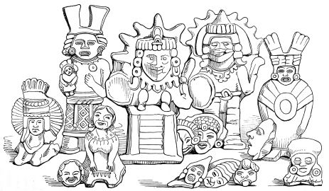 AZTEC FIGURES IN CLAY.
those of La Trinidad, about six leagues in nearly the same direction.
Besides these, there are other ruins of which the traveller was
informed, situated at a still greater distance, all of which present the
same general features as those already described, and probably belonged
to the same period, or were built by the same race. The whole region is
alleged to be full of these memorials of the number, power and wealth of
the ill-fated nations that once dwelt and worshipped on the eastern
slopes of the Mexican Cordilleras.
Domestic utensils made of the ordinary pottery of the country, but
skilfully and even artistically formed, have been exhumed from among
these ruins of ancient cities; and in the course of Mr. Norman's
explorations he unearthed two singular and grotesque images which
probably figured in the idolatrous worship of the Indians. Our traveller
found that similar images were used by the Indian women of the present
day, who suspended them about their necks as talismans, and especially
relied on them in seasons of sickness and danger. The images referred to
are hollow, with a small aperture near one of the shoulders, and are
filled with balls as large as a pea, which are supposed to have been
made of the ashes of victims sacrificed in former days to the gods. We
have ourselves seen numbers of these earthern figures in the valley of
Mexico, where they are vulgarly known as "Mexican's Idols." Travellers
have usually classed them among the Dii Penates or household gods of
the Aztecs or Toltecs, but we have regarded them either as the ornaments
of a primitive people or as the dolls and playthings of their children.
In our plates of antiquities discovered in the valley, several figures
are to be found which we think belong unquestionably to this class.
Sixteen leagues from the sea and fifty-two north of Vera Cruz, on the
eastern slope of the Cordilleras, lies the village of Papantla, in the
midst of plains which are constantly fertilized by streams that descend
from the mountains. It is the centre of a remarkably rich agricultural
district, capable of producing the most luxuriant crops of pepper,
coffee, tobacco, cotton, vainilla, sugar and sarsaparilla, and abounding
in all varieties of valuable woods; but the heat and maladies of the
burning climate prevent the whites from venturing to till so dangerous a
district. Accordingly we find that this Indian village has hardly a
single Spanish inhabitant or visiter except the priest and the traders
who come from the coast to traffic their foreign goods for the products
of the aborigines. Two leagues
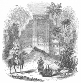 PYRAMID OF PAPANTLA.
from this secluded hamlet, lie spread over the plain, the massive ruins
of an ancient city, which in its palmy days was more than a mile and a
half in circuit. It is a matter of great regret that these relics have
never been sufficiently explored, drawn and described. The most
satisfactory account that we possess of them is that given in the
"Voyage Pittoresque et Archeologique" of Monsieur Nebel, who visited
them several years ago, and has sketched the beautiful pyramid
represented in the plate, which is unquestionably one of the most
perfect and symmetrical relics of antiquity within the present limits of
the republic. Time has done its work upon this remarkable remain; and
trees, plants and vines, which grow so rapidly in this teeming climate,
have sprung among its joints and stories.
The Indians of the neighborhood call this pyramid "El Tajin;" it
consists of seven bodies, stages or stories, each of which rises at the
same angle of inclination, and is terminated by a frieze and cornice. It
is constructed of sand-stone beautifully squared, joined and covered
with hard stucco, which appears to have been painted. The pyramid
measures one hundred and twenty feet on every side at its base, and is
ascended by a stair composed of fifty seven steps, each measuring one
foot in height, and terminating at the top of the sixth story. This
stairway is divided in three places, by square recesses two feet in
depth, resembling those which perforate the friezes on each of the
stories. The stair ends at the top of the sixth story, and the seventh,
which seems to be in ruins, is hollow, and was probably the shrine
wherein sacrifices were offered before the image of the god to whom the
pyramid was dedicated. Monsieur Nebel does not state the height of this
edifice; but as he gives the elevation of each of the fifty-seven steps,
we may calculate that the summit of the shrine is at least sixty-six
feet above the base.
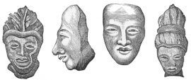 ANCIENT HEADS MADE OF CLAY.
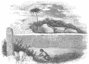 MAPILCA.
A few leagues from Papantla, near an Indian rancho called Mapilca, Mr.
Nebel found pyramids, sculptured stones, and the ruins of an extensive
city, which it was impossible for him to examine in consequence of the
thick vegetation with which they are covered in the dim recesses of the
forest. The artist was alone in the wilderness, and unaided except by a
few indolent Indians who were indisposed to further his researches. The
stone, which is presented in the annexed drawing, is twenty-one feet
long, and of a close grained granite; the figures, carved on its
surface, differ from the ancient sculptures found on this side of the
Cordilleras, and resemble those found in Oajaca, more than any others in
Mexico. Mr. Nebel caused an excavation to be made in front of this
relic, which he supposed had once formed part of an edifice, and at some
distance below the surface he struck upon a road formed of irregular
blocks, not unlike the old Roman pavements.
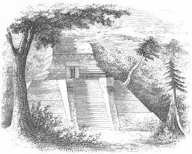 TUSAPAN.
About fifteen leagues west from Papantla, in a small plain at the feet
of the eastern Cordillera of Mexico, are the remains of Tusapan, which
is supposed to have been a city of the Totonacs. The vestiges of this
little Indian city are almost obliterated, and the only very significant
relics are the pyramidal edifice exhibited in the annexed plate, and a
singular fountain, a drawing of which is given in the work of M. Nebel.
The pyramid, built of stones of unequal size, extends thirty feet on
each of its sides at the base, and the summit of its single story is
reached by a flight of stairs. Upon the platform of this base a square
tower is erected, which is entered by a door whose posts and lintel, as
well as the friezes of the edifice, have been elaborately carved. In
front of the door, within the tower, stands the pedestal of the ancient
divinity, but the idol itself has been destroyed. The interior of this
apartment is twelve feet square, and its ceiling, like the external
roof, terminates in a point.
Around the pyramid are scattered masses of stones, sculptured into the
images of men and various animals; and from the inferior manner in which
the carving on these objects is executed, we may judge that this
religious temple was not the most celebrated architectural or artistic
work of the ancient inhabitants.
The fountain which we have already mentioned is a single female figure
in an indecent squatting attitude, nineteen feet high, and cut from
the solid rock. The remains of a pipe which conveyed the water to it,
are still visible behind the head, and the liquid passed through the
body of the gigantic image until it was discharged beneath into the
basin or canal, by which it was carried to the neighboring town. The
Indian tradition, as recounted by Nebel, states, that the ancient
inhabitants of this spot, abandoned it, in consequence of the
unfertility of the soil and the failure of the streams, and that they
took refuge in, or united themselves with the occupants of Papantla.
At the period of the Conquest of Mexico, this small island, which lies a
few miles from the present city and port of Vera Cruz, and under whose
lee is found the best anchorage on the Eastern Coast for vessels of war,
was unquestionably a spot sacred to sacrifice and burial.
But no one seems to have examined this island, with a truly antiquarian
spirit, until it was visited in 1841, by M. Dumanoir, who commanded a
French vessel of war which was then anchored at the island. Previous to
this time it had been trodden by thousands of idle sailors and landsmen
who raked its surface for the Indian relics of pottery and obsidian
which lay scattered in every direction; and, consequently there was
little of value to be discovered above ground. Accordingly, Monsieur
Dumanoir undertook to make suitable excavations, and, in the centre of
the islet he discovered various sepulchres, in which the skeletons were
found in a state of excellent preservation. Besides this, his trouble
was rewarded by the exhumation of large numbers of clay vases, covered
with paintings and etchings, together with idols, images, collars,
bracelets, arms, teeth of dogs and tigers, and a beautiful urn carved
either in white marble or in the alabaster which abounds in the
neighborhood of Puebla.
About thirty miles from the town of Jalapa, on a ridge of mountains in
the canton of Misantla, rises the Cerro or hill of Estillero, near which
there is a precipitous mountain on whose narrow strip of table land at
the summit, were discovered in 1835, the remains of an extensive ancient
city. The site of this town is perfectly isolated. Steep rocks and deep
ravines surround the mountain upon which it was built, and beyond these
dells and precipices there is a
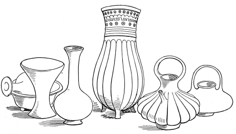 ANCIENT VASES AND VESSELS.
lofty wall of hills from whose summit the sea in the neighborhood of
Nautla is distinctly visible. The table lands upon which the ruins are
found is only approachable by the gentler declivities in the direction
of the hill of Estillero; and, at all other points, the lonely eminence
appears to have been sundered from the surrounding regions by some
volcanic convulsion.
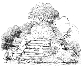 MISANTLA.
As the mountain plain on the summit is approached, the traveller first
discovers a broken wall of massive stones, feebly united by cement,
which seems to have served for the boundary of a circular plaza or
area in whose centre rises a pyramid eighty feet high, forty-nine feet
broad, and forty-two deep. It is divided into three stories or stages,
and along the sloping sides of the lower and broadest terrace, a
stairway leads to the first offset. The second stage is ascended by a
stair at the side, and the top of the third is reached by steps niched
into the corner of the pyramid. In front of the edifice, on the second
story, are two pilastral columns, which it is supposed may have been
portions of the stairway; but this part of the teocalli, and its upper
story are so wildly overgrown with trees and tropical vegetation that
the outline of the structure is greatly obliterated. On the summit, a
gigantic tree, has sent its roots deep into the spot which was doubtless
once the shrine of the Indian temple.
Beyond the wall of the circular area in which this edifice is placed,
are found the remains of the city or town, extending nearly three miles
north in a straight line. The foundations of all the houses are still
distinctly traceable. They were built of large square stones, and are
separated by streets at the distance of about three hundred yards from
each other. In some of the blocks of buildings the walls are yet
standing, at a height of between three and four feet above the level of
the ground. South of the city are seen the relics of a low narrow wall,
by which it was defended in that direction;—and north of it there is a
tongue of land, jutting out towards the precipitous edges of the
mountain, whose centre is occupied by a mound which the explorers have
supposed to be the ancient cemetery of the inhabitants. On the left
acclivity of the slope by which the town is approached are twelve
sepulchres, seven feet in diameter, and as many high, in which several
bodies were found, parts of which were in good preservation. The walls
of these tombs are constructed of cut stone; but the mortar that
probably once joined them, has entirely disappeared. Several erect and
sitting figures, carved in stone, were discovered on the site of this
city, and two blocks were found, filled with hieroglyphic characters.
Numbers of vases and utensils, were also unearthed; but they were
carried to Vera Cruz, and all trace of them has been subsequently
lost.[52]
About a league and a half from the Puente Nacional, or National Bridge,
to the left of the high road in the midst of a dense forest, and near
the banks of the stream known as the Rio del Puente, Don José Maria
Esteva found some interesting remains of antiquity in November of 1843.
They had been visited in 1819 or '20, by a priest, named Cabeza de Vaca,
who was then curate at Puente Nacional, but from that period until 1843,
they had been entirely lost sight of. The temple or teocalli, is
situated on the top of a small mount, elevated about one hundred and
fifty feet above the level of the stream, which runs at its feet. In
consequence of the inequality of the surface of the soil, the edifice is
thirty-three Spanish feet high, on some of its sides, and forty-two on
others. It fronts towards the east, and its platform, or upper level, is
reached by a stairway of thirty-four steps, so steep as to be almost
perpendicular to its base. The platform is forty-eight Spanish feet
broad, and seventy long. The semi-circumference of the base is stated
to be one hundred and six feet. The edifice is surrounded by six
stairways, one foot broad, and the distance between each step or stage
of the body of the teocalli, is about seven feet high nearest the base,
their height diminishing, however, as you ascend to those nearest the
platform. The whole structure is built of lime, sand and large stones
taken from the bed of the river, and although shrubs have grown both on
the platform and on the stairways, this interesting relic of antiquity
has been so completely protected, that its form is still perfectly
preserved. At first sight the edifice would seem to be perfectly solid,
yet upon examination it has been found to be hollow, and that its
ancient entrance was from the west. This entrance, however, is so small
that notwithstanding the efforts of laborers who were employed by the
explorer to clear the fallen rubbish and open a path, they were unable
to penetrate the whole of the interior chambers. The short time they
were enabled to devote to this work, and the fear of the Indians to
encounter wild beasts and serpents in the interior of the temple,
deterred Señor Esteva from further efforts, and thus, perhaps, one of
the most perfect remains of antiquity on the east coast of Mexico is
still very inadequately described.[53]
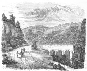 PUENTE NACIONAL.
This State was known, previous to the revolution, as the Itendencia de
San Luis Potosi, and included the colony of Nuevo Santander. It is now
bounded on the north by the North American State of Texas; on the
north-west by the Mexican State of Coahuila; on the west by the States
of New Leon and San Luis Potosi; on the south by San Luis Potosi and
Vera Cruz; and, on the east, by the Gulf of Mexico. The breadth of the
State varies from twelve to fifty-five leagues.
The coast of Tamaulipas is more than three hundred and fifty miles in
length, and is fringed with lagunes, varying from four to eighteen miles
in width, which are divided from the gulf by barriers and banks of sand.
The shallowness of the shores along the whole of this coast, and the
dangerous bars which choke the mouths of the rivers, render the
navigation difficult and dangerous for vessels of almost all classes. In
the northern part of the State, in the neighborhood of the Rio Grande,
the country is comparatively level. South of these high plains, however,
and some distance in the interior, the land is varied by a succession of
mountains, hills and vallies, which gradually slope eastwardly until
they are lost in the flats and sands of the sea coast. The Cerro de
Martinez, the Cerro de Xeres, the Cerro del Coronel, and the mountain
ridges, or sierras, de la Palma and del Carico, are the most remarkable
elevations. The land is well watered. Fine vallies extend along the Rio
del Norte or Rio Grande, the Tigre, Borbon, Panuco and Dolores. On the
coast are found the lagunes of La Madre, Morales and Tampico.
The climate of the interior of Tamaulipas is mild and healthy; but on
the coast an intense heat prevails during the greater part of the year,
and, combined with the rank vegetation and moisture, produces diseases
similar to those which scourge the adjacent shores of Vera Cruz. As soon
as the northers begin to blow, all nature—animal and vegetable—is
refreshed by the grateful change; but the hot season generally
recommences in March, and soon spreads miasma and death throughout the
whole of the low lands.
The population of Tamaulipas,—consisting chiefly of Meztizos and
Indians,—was estimated by the Mexican Calendar of 1833, at 166,824, who
were divided among three departments and eleven districts or cantons. In
1842 the population, as stated in the estimate for a congress, was
100,068; and if to this we add ten per cent. for the estimated increase
in seven years, we shall have 110,074 in 1850.
The chief productions and the indigenous plants are similar to those
found in the State of Vera Cruz; and considerable trade is carried on
with the interior—especially with the States of San Luis Potosi,
Zacatecas, and Queretaro,—in mules, oxen, horses, honey and wax. The
coasting and foreign commerce is conducted principally in the ports of
Tampico de Tamaulipas and Matamoros. From these places, large quantities
of European and North American manufactures, enter the middle and
northern States of the republic. Queretaro, San Luis, Nuevo Leon,
Coahuila, Zacatecas, Jalisco, Durango, Chihuahua and Sonora are all
benefitted by this trade in a greater or less degree; and the Panuco,
Rio Grande and other streams are all availed of partially for this
interior trade as far as they are navigable. At Soto la Marina an
important smuggling business was long and vigorously carried on.
The capital of this State is Victoria, formerly Santander, a town of
12,000 inhabitants. Tampico de Tamaulipas, on the northern bank of the
Panuco, which enters the Mexican Gulf five miles below the town, is the
principal commercial port of the State. Its bar is dangerous and its
harbor considered unsafe. Large vessels cannot approach the town, which
is situated among extensive marshes. It is visited almost every year by
the yellow fever; yet its foreign commerce is extensive and appears to
be increasing.
Soto la Marina is a small village and haven at the mouth of the river
Santander, on its left bank. It is composed chiefly of Indian huts, and
contains about 3,000 inhabitants.
Matamoros lies on the right bank of the Rio Grande or Rio Bravo del
Norte, at the distance of ten leagues from its mouth. It contains about
10,000 inhabitants, who have become well acquainted with the people of
the United States during the recent war. The climate of Matamoros is hot
and sickly, like that of Tampico or Vera Cruz; but as the river upon
which it lies is perhaps the most important in Mexico, and has proved
navigable by steamers for a considerable distance in the interior, it is
probable that this place will become the depot of a large and valuable
commerce destined for the supply of the northern States of the Mexican
confederacy. By the treaty of 1848, the Rio Grande became the boundary
between large portions of the two republics; and as the intervening
country between the Nueces and the Rio Grande is not considered at
present attractive for agricultural purposes, it is likely that it will
long continue unoccupied and unsettled, thus leaving the whole of our
commerce to be conveyed to Matamoros, or to our own neighboring
settlements on the opposite shore, for distribution throughout the
valley of the Rio Grande.
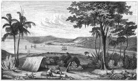 TAMPICO.
The other towns and villages in Tamaulipas worthy of note, are Altamira,
Horcasitas, Coco, Escandon, Llera, Santillana, Padilla, Hoyos,
Guadalupe, Reinosa, Camargo, Mier, Revilla, the most important of which
lie on the margin of, or near, the Rio Grande.
The only remains of Indian architecture and civilization of whose
existence we are aware, are those described in the small work published
by Mr. B. M. Norman in 1845, to which we have already alluded, entitled
"Rambles by Land and Water or Notes of Travel in Cuba and Mexico." This
gentleman's notices of the antiquities in this region are exceedingly
brief, sketchy and indefinite, nor are the illustrations with which his
text is accompanied, calculated to convey more vivid pictures of the
relics he visited or discovered in the course of his investigations
along the margins of the Panuco.
Departing from Tampico, in March, 1844, he ascended that river in a
canoe, paddled by an Indian, and before nightfall, on the second day of
his primitive voyage, reached Topila creek, three miles from the mouth
of which he landed at a rancho or cattle farm, belonging to Señor
Coss, of Tampico. Five miles from this spot, lying to the eastward of
another rancho, he found several considerable mounds, one of which was
more than twenty-five feet high and of a circular form. At its sides, a
number of layers of small flat well hewn stones were still to be seen;
while scattered about were many others of larger size and various
shapes. All were perfectly plain or unadorned, and had apparently been
used for the door posts and lintels of edifices.
On the following day, the traveller visited the rancho de las Piedras,
distant about two leagues and a half in a southerly direction from the
bank of the Topila. Passing through a dense wilderness, he reached after
much toil, an elevated table land or plateau, near a chain of hills
running through this section of country and known as the Cerro de
Topila. Here he found more scattered stones which had once formed parts
of buildings; while, further on, he discovered several mounds, whose
sides were constructed of loose layers of smooth and uniform blocks of
concrete sandstone. Most of these layers, had, however, fallen from
their places in the tumuli, and were heaped in masses near their base.
About twenty of these mounds, lay contiguous to each other, varying in
height from six to twenty-five feet, some being circular and others
square. The principal elevation in this group of pyramids covers an area
of about two acres, and at its base, Mr. Norman discovered a
cylindrical stone slab seven inches thick, four feet nine inches in
diameter, and pierced through the centre, lying upon the top of a
circular wall whose top was level with the ground. On removing this
stone he found a well filled up with broken stones and fragments of
pottery. The upper portion of the slab bore evidence of having been
originally sculptured, but the tracings of the chisel were so much worn
by time and seasons that they could not be drawn with accuracy. On the
top of the tumulus, in front of which this well was discovered, grew a
wild fig tree, whose gigantic height of more than an hundred feet,
indicates the great age of the work and the long period of its
abandonment.
The walls of the adjacent minor mounds had all fallen inward, from which
the traveller concluded that they had been used for sepulture; but he
does not seem to have taken the time or trouble to verify this
conjecture by personal explorations. The ground, for several miles
around, was strewn with loose hewn stones of various shapes, and broken
fragments of pottery, which had unquestionably formed parts of domestic
utensils. Fragments of obsidian, which had no doubt been the knives
and weapons of the former inhabitants of this spot, were also
plentifully scattered about, and every indication existed of a dense
population in the by gone days. These ruins are placed by Mr. Norman in
98° 31´ west longitude and 22° 9´ north latitude.
But the remains of edifices, pyramids and tombs were not the only relics
found by the traveller in these dense forests bordering the Atlantic
coast. The Indians who once dwelt in this district, like the Aztecs,
Zapotecs and Yucatese had evidently devoted themselves to sculpture; but
whether for the purpose of simple adornment or for idolatry, there are
no facts to apprise us with certainty. The most remarkable relic found
by Norman, was a large head, beautifully cut in fine sandstone, of a
dark reddish hue, which abounds in the neighborhood. The face stands out
in bold relief from the rough block, as if it had been left unfinished,
or as if it was originally designed to occupy a place among the
ornamental portions of an edifice. The industrious traveller caused this
object to be borne, with others, to Tampico, and has deposited it in the
collection of the New York Historical Society. Other stones, of a
somewhat similar character, attracted his attention, but the most
extraordinary sculpture he has described in his work is that to which he
assigns the name of the American Sphynx. It is the image of a gigantic
turtle, with the head of a man protruding boldly from beneath its carved
and curving case. The back was correctly and artistically wrought, and
all the lines of the scales were neatly cut in exact proportions. There
were also in many parts fainter lines, shewing that the peculiar and
graceful arabesques which are wrought by nature on the shell of this
amphibious animal, had not been overlooked by the artist. This huge
figure, raised on its four legs, was placed upon a large block of
concrete sandstone. All its parts were equally true to nature. It was
much mutilated, and the human head had been especially injured, but not
sufficiently to obliterate the artistic workmanship with which it had
been originally chiselled.
The place where Mr. Norman found these remains had evidently been the
site of a large city; and, proceeding with his excavations among huge
masses of earth or stones of every size and shape, he was, at length,
rewarded by the discovery of another ancient figure. It was merely a
human face, in full relief from the block, which was entirely cut away
from the top and bottom, but left in two nearly circular projections at
the sides. The ornaments on the head are peculiar, and are formed of
three balls, with slight indentations, connected together by a band
running across the top of the cerebrum and terminating at the sides just
above the gigantic ears, which are nearly half the size of the face. The
features and contour of the head are described as not resembling those
of the American or Mexican Indian in any of their lines. This head is
seventeen inches in length, twenty-one in width, including the ears, and
ten in thickness. It was found on the side of a large pile of ruins, the
remains of dilapidated walls, of which it had unquestionably formed one
of the ornaments. It is to be regretted that Mr. Norman was unable to
devote more time to the exploration of this region. His antiquarian
researches however formed only an episode in his travels through
portions of Mexico, and besides this, his labor was exceedingly great in
cutting his way through the dense shrubbery which covers the ground amid
a wilderness of trees, matted and woven together with thousands of
creepers or plants whose thorns pierced or obstructed him at every
moment. He had, moreover, to contend with myriads of annoying insects,
and he feared the bite of the poisonous alacranes or the spring of the
tiger that sometimes started from the thickets. He received no
assistance from the stupid Indians dwelling in the neighborhood. They
could not conceive that curiosity alone would prompt any one to
encounter the toil and danger which must be endured in explorations in
the Tierra Caliente of Mexico, and imagined that the search for gold and
buried treasure, rather than antiquities, was his real motive for
attempting to penetrate the recesses of their lonely wilderness.
OAJACA—EXTENT—BOUNDARIES—GEOLOGY—VALLEY—INDIANS—DEPARTMENTS—POPULATION—MINES—PORTS—PRODUCTIONS—CATTLE—TOWNS—ANCIENT
REMAINS—MITLA—THE PALACE—TOMBS—ANTIQUARIAN
SPECULATIONS—CONNECTION OF MEXICAN REMAINS—QUIOTEPEC, OR CERRO DE
LAS JUNTAS.
This rich and beautiful State lies, for 118 leagues, along the Pacific
Ocean. On the north-west, it is bounded by the State of Puebla, on the
north by Vera Cruz, and east by the State of Chiapas and the republic of
Central America or Guatemala. It extends from east to west about 115
leagues, and from north to south 322 leagues, containing an area of
5,046 square leagues.
We pass now from the hot and sickly sands and marshes of the eastern
coast to a region which has been considered by many writers and
travellers as the most delightful in Mexico. Beauty of natural scenery
and salubrity of climate, fertility of soil and richness of productions,
combine to render Oajaca valuable, not only in a commercial aspect, but
as a residence in which it would be agreeable to pass a life time. Nor
is this the opinion only of the present inhabitants, for the remains of
antiquity still found within the limits of the State, prove it to have
been the seat of Indian civilization long before the arrival of the
Spaniards. The geological structure of this State is different from that
of Puebla and Mexico; and the vegetation is quite as vigorous as that of
other prolific regions, without the rankness which produces rapid
decomposition and miasma. The rains are generally abundant from May to
October.
In our general description of the geological and geographical
characteristics of Mexico, we have already shown that the great
Cordillera, forming the spine of this continent, divides into two arms
after leaving the Isthmus, which connects North and South America. One
of these mountain ranges with its high vallies and table lands forms the
barrier along the Pacific, while the other spreads out its massive veins
throughout the middle and eastern portions of Mexico. Between these
formations, the Valley of Oajaca lies embosomed; and from this beautiful
and fruitful region, which was bestowed by the Spanish crown upon
Cortéz, he obtained his Marquisate del Valle de Oajaca, in which his
family still possessed, previous to the revolution, 49 villages, with a
population of 17,700 persons.
In these two mountain regions, thus sundered by the valley, have dwelt,
from the earliest periods, two Indian races known as the Mixtecas and
the Zapotecas; the former of which is characterised by activity,
intelligence and industry. Besides these tribes, seventeen others are
reckoned still to inhabit Oajaca.
The State is divided into eight departments, which are subdivided into
districts or cantons.
1st. The Department of the Centre, with the cantons of Oajaca, Partido
del Toranéo, Etla, Tlacolula, and Zimatlan.
2d. Department of Ejutla, with the cantons of Octolan, Miahuatlan, and
Pochutla.
3d. Department of Jamiltepec, with the cantons of Jamiltepec and
Juquila.
4th. Department of Tehuantepec, with the cantons of Tehuantepec,
Quechapa and Lachixila.
5th. Department of Teposcolula, with the cantons of Teposcolula,
Tlaxiaco and Nocnistlan.
6th. Department of Huajuapam, with the cantons of Huajuapam and
Justlahuaca.
7th. Department of Toochila and Villalta, with the cantons of Ixtlan,
Yalalag and Chuapam.
8th. The Department of Teutitlan del Camino, with the cantons of
Teutitlan and Teutila.
These eight departments and twenty-three cantons,—with nearly 700,000
inhabitants,—contain one city,—the capital, Oajaca;—eight towns; nine
hundred and thirteen villages; one hundred and thirty-seven large
haciendas; two hundred and thirty-five ranchos; sixty-eight sugar
mills or trapiches, and six estancias or cattle estates and grazing
farms. Besides these elements of agricultural wealth, Oajaca possesses
ten mills, driven by water power, nearly all of which lie in the
neighborhood of the capital, and are used chiefly for wheat. Corn is
ground or rubbed, for tortillas, on the metate by the Indian women
throughout Mexico; and consequently but little of this kind of grain is
ever brought to the mills. There are five mines or mineral workings in
the State, at Ystepéxi, Taléa, Teojomulco, Peñoles, and Las Péras, with
ten smelting and amalgamating establishments.
There are nine sea ports, roadsteads and anchorages in Oajaca, the best
of which are Tehuantepec, Huatulco, Escondido, Chacáhua, and Jamiltepec.
Corn, chile, agave, cotton, coffee, sugar, cacao, vainilla, tobacco,
cochineal, wax, honey, and a small quantity of indigo, are the staple
productions of this State. Nearly all the fruits which we have already
described as growing in the State of Vera Cruz, are produced here
abundantly, and of excellent quality.
The State is estimated as containing, on an average of years—
| Total, | 44,106 | | Horses. |
| 18,438 | | Mules. |
| 10,420 | | Asses. |
| 171,518 | | Neat cattle. |
| 213,156 | | Sheep. |
| 158,009 | | Goats. |
| 47,947 | | Hogs. |
| 663,600 | head of cattle. |
The worth of which is calculated, in the home market, at $3,332,757.
Gold, silver, copper, quicksilver, iron, rock salt, limestone, gypsum,
&c., are found in Oajaca. In the thirty-nine years between January,
1787, and March, 1826, the official registers show a product in the
State of 4,820 marks of gold, and 544,257 marks of silver; and in the
five years from March, 1826, to the end of 1830, 95 marks of gold, and
21,701 of silver. But these sums must not be regarded as perfect
indications of the absolute product of Oajaca, inasmuch as its proximity
to the sea, and the facilities for smuggling in the lonely districts of
the west coast have no doubt enabled the trading community to export a
large portion of the real avails of the mines, which, of course, never
appear in the authentic registers and returns of the State.
The chief towns and villages of this State are: Oajaca, the capital;
Guayápa or Huazapa, Talistaca, Santa Maria del Tule, Tlacochahuáya,
Teutitlan del Valle, Tlacolula, Mitla, the ancient Leoba; San Dionisio,
Totolapa, San Carlos, Villa de Nejapa, Quijechápa, Quiegolani,
Tequisistlan, Villa de Jalapa, Tlapalcatepec, Tehauntepec, San Francisco
de la Mar, Petapa, Juchuitan, Niltepec Yshuatan, Zanatepec, Tepanatepec,
Xoro or Xojocatlan, Cuylapa, Zachila, the ancient Teozapotlan; San
Bartolomeo de Zapéche, Zimatlan, Villa de Santa Anna, Chilateca, Santa
Cruz Mistepec, San Juan Elotepec, Etla, San Juan del Estado, San Pablo
Huizo or Guajolotitlan, Ejutla, Ocotlan, Chichicapa, Ayoquesco,
Miahuatlan, Pochutla, Santa Cruz de Huatulco, Juchatengo Tonamaca,
Jamiltepec, Acatepec, Juquila, Sacatepéc, Santa Maria Istapa,
Teojomulco, Huajuapan, Justláhuaca, Chicahuástla, Achintla, Teita, Villa
de Teposcolula, Talaxiaco, Santa Maria Chimalapa, Yanguitlan, Los
Pueblos de Almoloyas, San Miguel Chimalapa Nochistlan, Tilantongo,
Xaltepec, Teutitlan del Camino, San Antonio de los Cues, Tecomavaca,
Quiotepec, Cuicatlan, San Pedro Chiezapotl, Donomingullo, Coyula,
Teutila, Villalta, Zoochila, Zolaga, Quetzaltepec, Totontepec, Chuapan,
Chinantla, Istlan.
About ten leagues from the capital, on the road leading to Tehuantepec,
are the remains of what antiquarians have styled the sepulchral palaces
of Mitla, lying in the midst of a rocky granitic region, and surrounded
by sad and sombre scenery. According to tradition, these edifices were
erected by the Zapotecs, as palaces and sepulchres for their princes. It
is asserted that at the death of members of the royal family, their
bodies were laid in the vaults beneath, while the sovereign and his
relatives retired to mourn the loss of the departed scion in the
chambers above these solemn sepulchres, which were screened from the
public eye by dark and silent groves.
Another tradition declares that these edifices were the abodes of a sect
of priests, whose duty it was to dwell in seclusion and offer expiatory
sacrifices for the royal dead who reposed in the vaults beneath.
The village of Mitla was called Miguitlan, signifying, in the Mexican
tongue, a place of sadness; while by the Zapotecs it was named Leoba, or
"the tomb."
The palaces or tombs of Mitla, form three edifices, symmetrically
arranged in an extremely romantic site; the principal and best preserved
edifice has a front of nearly one hundred and fifty feet. A
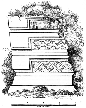 Scale of Varas.
RUINS AT MITLA.
Scale of Varas.
RUINS AT MITLA.
stair-way through a dark shaft leads to a subterranean apartment of one
hundred feet in length, by thirty in width, whose walls are covered with
Grecian ornaments similar to those on the exterior of the edifice, as
shown in the plate. These external walls are said to be decorated with
labyrinthine figures, formed by a mosaic of small porphyritic stones,
and we recognize in them the same designs which are admired in the
ancient vases, falsely called Etruscan, and on the frieze of the old
temple usually assigned to the god Redicolus, which lies near the grotto
of Egeria at Rome.
But the objects which chiefly distinguish the architectural remains of
Mitla from all other Mexican antiquities are six porphyritic columns,
which support the ceiling of a vast saloon. These singular
columns,—almost the only ones found in the New World,—evince the
extreme infancy of art;—they have neither bases nor capitals, and are
cut in a gradually tapering shape from a solid stone, more than fifteen
feet in length.
The distribution of the apartments in this extraordinary edifice
presents some striking analogies with the monuments of Upper Egypt,
described by Denon and the savants who composed the institute at
Cairo. Don Pedro de Laguna, who examined them carefully many years ago,
discovered on their walls some curious paintings of sacrifices and
martial trophies. In order to form an idea of the almost Cyclopean style
of architecture, we may remark the extraordinary dimensions of the
stones above the entrances to the principal halls. Mr. Glennie states
that one of these masses is eighteen feet eight inches long, four feet
ten inches broad, and three feet six inches thick. A second is nineteen
feet four inches long, four feet ten and a half inches broad, and three
feet nine inches thick, whilst a third is nineteen feet six inches long,
four feet ten inches broad, and three feet four inches thick. The
antiquarian will not fail to observe, that there is some similarity
between the exterior of these Oajacan remains and those which have
been uncovered and described in Yucatan, by Stephens, during his second
expedition. It is not improbable that an intercourse existed between the
inhabitants of these districts, prior to the Spanish Conquest. We
believe that these architectural remains and nearly all of those in
Yucatan, Chiapas and Guatemala, were the abodes and temples of the
Indians who dwelt in Mexico and the adjacent countries when Grijalva and
Cortéz first landed on our continent. The distance from Oajaca, through
Chiapas and Tabasco, to Yucatan is not too great to have prevented even
a rapid communication from Mitla to Uxmal, or Palenque. The reader will
recollect that the realm of Montezuma is alleged to have extended to
near the present limits of the Republic of Central America; nor will he
forget with what rapidity the well trained Indian couriers of the
Emperor passed over the three hundred intervening miles of mountain,
plain and valley, between Vera Cruz and the Valley of Mexico, in order
to inform their sovereign of the Spaniards' arrival and their leader's
determination to visit the Aztec Court. At Cozumel, and elsewhere in
Yucatan, the earliest Spanish adventurers were struck by the
architecture of the edifices which were inhabited by the Indians. In
their letters and narratives they always speak of these "buildings of
stone and lime" as indicating civilization. The Indian deities were, at
that time, unquestionably, worshipped in them. At Cholula, Tlascala, and
Tenochtitlan or Mexico, as well as at Tezcoco,—pyramids, dwellings,
palaces, walls, streets, causeways, were all built of stone cemented by
mortar, and many of these objects were profusely ornamented. There can
be no doubt of these facts, for they were attested at the time by
numerous witnesses, while many of the material relics of that age have
descended even to the present time, and may still be inspected in the
capital of the Republic. Why, then, should we hesitate to believe that a
vast chain of civilized, intelligent and affiliated nations,
co-existed on the central part of this continent in the sixteenth
century, and that the ruined cities, temples and pyramids which are
spread from the waters of the Gila as far south as Peru and Chili, and
whose wonderful remains are now gradually unearthed by the industry of
antiquarians, are the architectural fragments of their national
grandeur?
We do not conceive it necessary to throw back the Indian architects into
the gloom of antiquity, long anterior to the arrival of the Spaniards.
There is a natural yearning in the human mind for the mystery with which
a vague, indefinite epoch, surrounds ruins that are accidentally
discovered. But this is a poetical sentiment, rather than a fair
starting point in archaiological researches; and, in spite of the
national vanity which might be gratified by proving that the aboriginal
civilization of our continent was as old as that of Egypt, we shall
adhere to the belief that Mitla, Palenque, Uxmal and Quemada were
inhabited by the builders or their descendants, whilst the thrones of
Mexico and Peru were occupied by Montezuma and Atahualpa.
In 1844, an examination was made by order of the Governor of Oajaca of
the ancient remains situated near the village of Quiotepec, about
thirty-two leagues north from the capital of Oajaca. These ruins are
found on the Cerro de las Juntas, or Hill of the Union, so called from
its vicinity to the junction of the rivers Quiotepec and Salado.
The eminence is covered in almost every direction with remains of
military works of a defensive character, calculated to protect the
dwellings erected on the hill, and the extensive temple and palace,
whose massive ruins still crown the summit. These remains are said to
resemble those of Chicocomoc or Quemada, in the State of Zacatécas,
which will be fully described in our notice of that portion of Mexico.
The similarity consists in the style of the architecture, and the
evident mingling of defence and worship. There is no resemblance,
however, to the remains found in Yucatan as described by Stephens,
Catherwood and Norman, where the designs are all highly ornamental,
denoting a higher state of luxury, taste and progress in civilization.
The teocalli or temple of Quiotepec and that of Chicocomoc or Quemada
are both pyramidal, like most of the Aztec religious structures; but the
architectural style, generally, at the former place, is rather more
sumptuous than at Quemada.[54]
Besides these remains, there are many others in the State of Oajaca,
which are still inadequately known or described, such for instance, as
the turmuli and pyramids at Montealban, two leagues south-west from
Oajaca;—the relics of many strong-holds;—the turmuli at Zachila;—the
ruins at Coyúla and at San Juan de los Cués.
In the museum of the University of Mexico, and in the private collection
of the late Ex-Conde del Peñasco, we found some remarkable figures
chiselled from a finely grained sand stone, two of which are represented
in the succeeding pages. They were found in the State of Oajaca. Their
use or their symbolical character have never been accurately detected;
but in the last of the two we may observe quite a remarkable resemblance
to some of the idols still to be seen in the temples of India.
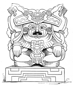 FIGURE FROM OAJACA.
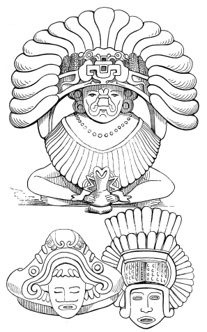 FIGURES FROM OAJACA.
PUEBLA—DIVISIONS—PRODUCTIONS—FACTORIES.—RIVER—STREAMS—PUEBLA
DE LOS ANGELES—CATHEDRAL—TOWNS—MINES,
QUARRIES—MOUNTAINS—POPOCATEPETL—ATLIXCO—OLIVARES—ASCENT OF THE
MOUNTAIN—THE CRATER—ELEVATION.—PYRAMID OF CHOLULA—VISIT TO THE
PYRAMID CORRECT DIMENSIONS.—TERRITORY OF
TLASCALA—HISTORY—POSITION—SIZE—PRODUCTIONS—TOWNS.
Nearly all of this State lies in the torrid zone, occupying a portion of
the table land, and stretching westwardly down the slopes of the Sierra
Madre to the Pacific Ocean, between the parallels of 16° 17´ and 20° 40´
north latitude. From the mouth of the river Tecoyáme to Mextitlan, it is
126 leagues long, and from Tehuacan to Mecameca, 53 leagues broad. It
contains an area of 2,700 square leagues. On the north it is bounded by
the State of Queretaro, north-easterly by the State of Vera Cruz,
easterly by Oajaca, westwardly by Mexico and south-westwardly, for 28
leagues, by the Pacific Ocean. The last enumeration of inhabitants to
which we have access, assigned 954,000 individuals to the State of
Puebla, in the year 1832; but the estimate made for the basis of a call
of congress in 1842, gave it only 661,902.
This State is divided into 25 partidos, or districts, the chief of
which are Atlixco, Guauchinango, Ométepéc, Puebla, Tepéaca, Tehuacan de
las Granádas, Tlapan, and Zacatlan. It possesses 5 cities and towns, 126
parishes, 590 villages, 412 haciendas or plantations, and 857 large
and small ranchos or farms. The surface of this State is divided
between mountains, vallies, plains or low lands; and produces corn,
wheat, barley, chile, maguey, beans and all the hardier, together with
some of the southern fruits and plants. The wheat flour of Puebla is
celebrated for its excellence, and has sometimes been exported to Havana
and South America.
In the neighborhood of Oajaca cochineal is sometimes produced; and on
the low lands towards the western coast, cotton, rice, and small
quantities of coffee and sugar are cultivated. The Llanos de Apam, in
the neighborhood of the State of Mexico are celebrated for their
fertility, and especially renowned for the excellence of the pulque,
produced from the maguey or Agave Americana.
Nearly four-fifths of the real property of Puebla either belongs or is
hypothecated to the church and to hospitals, and consequently the
agriculture of the State is not as well managed as if the land belonged
to independent farmers, who derived their wealth directly from the soil.
Great poverty prevails among the lower classes, and their sad condition
is generally attributed in Mexico to the mismanagement of real estate by
the clergy.
The water power in the neighborhood of the city of Puebla has given a
stimulus to manufactories, and the reader will find in our chapter upon
that branch of Mexican industry some interesting statistical facts
showing the progress made by the inhabitants of this portion of the
Republic.
The only river of any importance in Puebla is the Rio de Tlascala or
Papagallo, which rises in the table lands, and runs southerly from the
village of Ayútla to the Pacific. The Pascaqualca, Tacunapa, Tecoyama,
and the San José are insignificant streamlets along the coast.
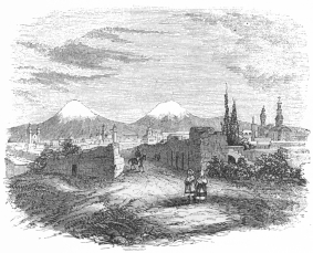 CITY OF PUEBLA.
The chief cities of this State are Puebla or Puebla de los Angeles—the
"City of the Angels,"—which is the capital and the seat of the State
government. It is a beautiful town, lying in the midst of a fruitful
plain bounded by the mountains, and shut in at the west by the gigantic
peaks of Popocatepetl and Iztaccihuatl. Broad, clean and well paved
streets cross it at suitable distances. The houses are large, convenient
and neat, and numerous churches forever send forth the music of their
bells. A beautiful public walk, planted with rows of trees, runs along a
small stream on the outskirts of the city; and an Alameda, of exceeding
beauty, lies opposite the extensive pile of San Francisco on the west.
In the centre of the town is a large well paved public square,
surrounded by portales or arches, similar to those of Bologna, in
Italy, while in its centre is the massive cathedral whose wealth is
renowned among the Roman Catholic churches of America. A splendid and
weighty chandelier, composed of gold and silver, weighing altogether
several tons, depends from the dome, whilst the figures of saints, the
tops of altars, and the recesses of chapels, gleam, on State occasions
with a display of precious metals and jewels which is perhaps unequalled
even by the cathedral of Mexico or the sanctuary of Guadalupe. There are
other establishments in Puebla belonging to the Franciscan and Augustin
monks, and several churches, which are celebrated for their elegance,
comfort and wealth. The Palace of the Bishop, in the vicinity of the
cathedral, is a massive edifice, containing a library of many thousand
volumes in a saloon 200 feet long by 40 broad.
The other towns of this State are:—Cholula, adjacent to the remains of
the Pyramid of Cholula, which will be subsequently noticed;—Atlixco;
Guauchinango, in the northern valley of the State, where the Indians
still indulge in their ancient sport of the Juégo del Volador or flying
game;—Tehuacan de las Granadas, containing near 6,000 inhabitants;
Tepeaca or Tepéyacac, where Cortéz laid the foundations of a city which
he called "Segura de la Frontéra;"—Huajocingo or Huexotzingo;
Chiautla, Tlapan, Tlacotepec, Amozoqué, San Martin, Nopaluca, Acajete,
Ojo de Agua.
In the eighteenth century various mines of gold and silver were wrought
in the old Intendencia de Puebla, at Yxtacmaztillan, Temistla, and
Alatlanquitepec in the district of San Juan de los Llanos, as well as at
Tetéla de Xonotla and at Zacatlan; but none of these are at present
productive. Quarries of fine marble exist at Totaméhuacan and Tecali,
two and seven leagues distant from the capital. Limestone is found in
quantities, and a beautiful transparent alabaster is also procured,
which is used for windows in the library, museum and churches. If the
transportation of these weighty
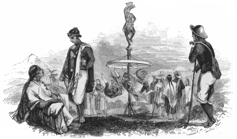 FLYING INDIANS.
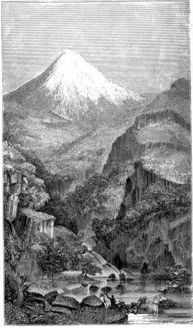 POPOCATEPETL.
articles were not so expensive in Mexico, this alabaster might be
profitably exported to Europe, where its extreme purity and clearness
would probably ensure its preference to all indigenous qualities.
Extensive salt works are carried on at Chila, Xicotlan, Ocotlan and
Zapotlan.
Some of the most remarkable geological characteristics of the Mexican
Republic are found in the three celebrated mountains of Popocatepetl,
Iztaccihuatl, and Malinche or Matlacueye, which lie in the State of
Puebla. The latter of these, sometimes called La doña Maria, lies
between the volcanoes of Puebla and those of Orizaba and Perote, but
does not require special mention except as forming a striking and
picturesque feature in the landscape. But the other two deserve our
special notice.
The mountains of Popocatepetl and Iztaccihuatl border the State of
Puebla on the west. The following account of the ascent of the former of
these gigantic volcanoes is founded on the journal published in Spanish
in May, 1827, by Messieurs Frederick and William Glennie, who were in
the service of the British United Mining Company, and Mr. John Taylour,
a merchant of the city of Mexico.
On the 16th of April, 1827, the party left the capital early in the day,
accompanied by their servant José Quintana, and, provided with
barometer, sextant, chronometer, telescope, and other instruments,
reached the village of Ameca, on the western slope of the mountain,
where they halted for the night.
On the 17th they continued their route, following the road to Puebla
which leads through the gap of the two mountains, intending to go to
Atlixco. In the highest part of the gap they took the road to the right
which is called "de los neveros," (those who procure ice for the
capital,) and having reached the limit of vegetation, which according to
their barometrical measurements is 12,693 English feet above the level
of the sea, they met with some men who informed them, that in this
direction they could not reach the summit, nor prosecute their way to
Atlixco on account of the great quantity of sand. With this information
they returned to the road they had left, and reached the village of St.
Nicolas de los Ranchos.
On the following day they continued towards Atlixco. The road here edges
along the eastern side of the mountain, skirting an extensive district
covered with large rocks and loose stones. Having understood that the
village of Tochimilco is nearest to the volcano, they determined to go
thither to obtain information relative to the adventure. The Alcalde
Don F. Olivares, who, 'though the owner of Popocatepetl, had never
reached the summit, gave them all the information he possessed, offered
to accompany them, and procured guides and carriers for their
instruments. They appointed the next day to go to his Hacienda de St.
Catalina, which is at the very foot of the principal mountain and
belongs to that estate.
On the 19th they proceeded to the hacienda, where they were soon joined
by Señor Olivares, who was prevented by some business from accompanying
them any farther. He furnished them a guide who conducted them through a
thick forest, to the highest limit of the pines, which they found to be
12,544 feet above the ocean. Here they passed the night. At midnight it
rained, which was soon afterwards followed by a severe hoar frost.
On the 20th of April, contemplating to reach the summit this day, they
distributed the instruments among the carriers, and mounted on the
mules, began the ascent at half after three in the morning by the light
of the moon. After travelling a short distance they left all vegetation,
and entered a district of loose stones and sand, which although hardened
considerably by the rain, greatly fatigued the mules. In this manner
they ascended on the south-west side of the mountain, until half past
six when they could proceed no further with the mules, as much because
they were too fatigued, as on account of the steepness of the volcano's
side. They therefore dismounted, and abandoning the mules, gave the
barometer in charge to Quintana. They resumed their ascent through a
soil composed of loose sand and stones, with many fragments of pumice
stone, being desirous of reaching some rocks which appeared to be
connected with the summit. Here, however, the difficulties commenced;
the acclivity was very steep, the footing so loose that every step they
made forward they slipped back nearly the same distance; and the
thinness of the air fatigued them so much that they could not advance
more than fifteen or twenty steps without resting. In this manner they
proceeded about half a mile, until they reached the rocks, where they
waited for the Indians who followed more slowly. During this time the
thermometer stood at 28° of Fahrenheit. The sky was perfectly clear, but
a dense stratum of vapor rested on the horizon, which prevented them
from perceiving any object, and made it appear as if they were in the
midst of an ocean. At 8 o'clock A. M. they first saw the sun. As soon as
the Indians arrived, they took a light breakfast, and continued
ascending among large loose stones, which have rolled from the summit,
and, arrested by each other in their course, have formed a kind of
zone, so lightly supported however, that the slightest touch sets them
in motion. This naturally alarmed the Indians, who declined going any
farther; but by persuasions and promises they succeeded in getting them
to advance. Seeing, however, that the road was becoming rather worse,
all further means of persuasion to induce them to proceed began to fail.
They endeavored to ascend through a gulley which they had perceived on
their left; but the way thither was very difficult, and was rendered
more perilous by clouds which prevented their distinguishing any thing.
Here the Indians entirely refused to stir any further, and having given
them part of the provisions, they were sent with the baggage to wait at
the place where they had encamped the night before. This circumstance
very much discouraged the travellers. Being left without instruments
they had to relinquish the physical and astronomical observations which
they had proposed to make, and thereby missed the principal object of
their journey. They nevertheless determined to persevere, for the
purpose of examining well the situation, and noting such points as might
facilitate any subsequent attempt undertaken with better preparations.
Soon after this the clouds dispersed, and they reached a passage which
was very steep and covered with loose stones, and through which they
ascended with much labor, extending their line so as to prevent the
stones rolling on those below. The fatigue and the pain in their knees,
obliged them to rest every eight or ten paces. After an hour's
travelling in this manner they reached a body of basaltic rock, which
being very steep they could not surmount but with great difficulty, and
only by leaping from one rock to the other, at great risk. After this
they got into a bed of loose sand, (apparently pumice stone reduced to
dust,) and ascended to a very high rock, which from Mexico appears like
a speck. The rock is a great mass of compact black basalt forming some
imperfect pillars, the fissures being filled with solid ice.
They observed from time to time small stones falling upon them, as if
thrown from above, and began to experience headache and nausea, which
affected Quintana more than the others. The barometrical observation
here showed an elevation of 16,895 English feet above the ocean. After
taking some slight refreshments, and resting about an hour, they
continued their ascent.
It is impossible to detail the particulars of the frequent difficulties
and risks encountered until the explorers reached the sandy acclivity
which forms the dome of the mountain, and the firmness with which they
overcame them. At this point they took another short rest—fancying
themselves very near the end of their labors, and deceived by the great
rarefaction of the air, which made objects appear much nearer than they
really were, they forgot what they had already undergone, and Mr.
Glennie was entirely taken up with the prospect of soon putting his
barometer in operation on the very summit. At this time Quintana who had
smoked a good deal and was otherwise much fatigued, complained of
excessive headache and fell down exhausted. They concluded that at these
great elevations smoking is as impracticable as the use of ardent
spirits. The servant was vainly encouraged to proceed, and finding it
impossible, they directed him to await their return where he was.
They had before them a smooth expanse of sand, which on their left was
covered, from the summit down, with ice or crystallized snow, forming a
great variety of cubic and prismatic figures. Continuing their ascent
along the edge of this snow, they heard a noise like distant thunder,
and concluding that it was raining somewhere, they proceeded about a
league, making frequent halts, being greatly distressed with violent
pains in the head and knees, nausea, and difficulty of respiration. They
had passed the whole day in absolute solitude; encountering neither
plant, bird nor even the least insect. All they saw around them, were
fractured rocks, that had undergone fusion, blistered fragments, and
heaps of rubbish, sand and ashes. While contemplating these images of
destruction, they unexpectedly, about five o'clock P. M., arrived at the
border of an immense abyss, throwing up a shower of stones, with a noise
similar to that produced by the waves of the sea beating against a wall.
Natural emotion and surprise obliged them to recede some paces. Their
hair stood on end—their shoulders fell—and they felt a sudden
nauseating emptiness of the stomach. Without being able to speak, they
could but look at each other, until this sensation of sickness and
horror had subsided. They then returned to observe the crater, and
examined the barometer, whose mercurial column measured only 15.63
English inches, while the thermometer attached to it was at 39° and the
detached one 33° Fahrenheit. They then sat down to contemplate the scene
around them, to take notes, and make drawings.
They observed that most of the stones which were thrown up in the
eruptions, fell within the crater, the rest fell over the south side.
The dull sound which was constantly heard within increased from time to
time, and terminated with an explosion, at which time stones, sand, and
ashes were thrown up. Those eruptions were frequent—some stronger than
others. From various places in the interior and near the edge of the
crater, arose small columns of smoke, the principal of which were three
on the east side, and at a considerable depth within the crater. The
crater itself has the appearance of a large funnel, whose sides are but
little inclined, and the bottom of which is not visible. The sides are
furrowed by numerous gulleys which descend from around the mouth of the
crater, having the appearance of the radii of a circle towards the
centre. There are three distinct rings, or excavations, which divide the
crater into four zones of different dimensions, the largest being that
nearest the mouth, and which is of solid rock, the others appear to be
composed of sand. The snow occupies only the exterior part of the
summit, and that part of the interior of the crater which faces to the
north, where its limits cannot be discovered. The mouth of the volcano
is nearly circular, about a mile in diameter, and appears much lower on
the eastern than on the western side. The lip of the southern side is
very thin, and so broken that it seems impossible to walk on it, while
the northern part, on the contrary, is broad and more even.
On account of a thick stratum of mist by which they were surrounded, the
intrepid travellers could only see the summit of the peak of Orizaba,
and the neighboring snow-capped mountains to the north.
Having completed the observations, and night approaching, they descended
by the same way towards the place where they had left the servant, with
the intention of passing the night there and returning to the summit
next morning; but finding the man in a high fever with a violent pulse
and headache, they resolved on descending. To relieve him, he was
carried over the most difficult places, and finding it impossible to
descend by the same path by which they had ascended in the day, they
took at once that bend of the mountain which is called "de los Neveros;"
and which, although very steep, is composed of loose sand through which
they descended very rapidly. It was after night when they arrived at the
limit of vegetation, but having taken a different direction, they did
not strike the place where they expected to meet the Indians. They made
a large fire as a signal, but the Indians did not make their appearance;
and on the following morning, the 21st of April, separating to the right
and left, and after shouting, they soon rallied the Indians. The
reunited party descended to the rancho de la Vaqueria, and from this
they passed through the village of Atlauca; at eight in the evening
reached Ameco, and on the 23d of April returned to Mexico.
| Names of places. |
N. Latitude |
Longitude east
from
Mexico. |
Elevation
above the
level of the
ocean. |
| Ameco a village | 19° 7´ 40´´ | 0° 23´ 30´´ | 8,216 | Eng. feet. |
| St. Nicolas de los Ranchos | 19° 4´ 21´´ | 0° 32´ 30´´ | 8,087 | do. |
| Tochimilco | | | 6,930 | do. |
| Superior limit of pines | | | 12,544 | do. |
| Limit of all vegetation | | | 12,693 | do. |
| Picacho de S. Guliermo[55] | | | 16,895 | do. |
| The most elevated border of the crater of the volcano of Popocatepetl | | | 17,884 | do. |
| Rancho de la Vaqueria | | | 10,784 | do. |
THE PYRAMID OF CHOLULA.
The vast plain of Puebla, separated from the Valley of Mexico by its
gigantic chain of bordering mountains, is full of interesting
associations and studies for the antiquarian; but, among all of the
sites signalized in the history of the Aztecs or of the Spanish
Conquest, no one is more generally sought by the traveller than the
Pyramid of Cholula. Its lofty remains lie about three leagues westward
from the city of Puebla, and are easily reached by a pleasant ride over
the plain. The pyramid was originally built of sun dried bricks, or,
adobes, rising in four stories connected by terraces. Many years ago,
in cutting a new road from Mexico towards Puebla, it became necessary to
cross a portion of the base of this pyramid, and, in the course of the
excavation, a square chamber was opened, which was found to be
constructed of stone with a roof supported by cypress beams. Some idols,
carved in basalt, a number of painted earthen vases, and two bodies were
found in this cavity, but as no care was taken of these relics by the
discoverers, and as their explorations were not prosecuted deeper into
the bowels of the gigantic mound, the world is now quite as ignorant of
its ancient uses as it was during the possession of the country by the
Spaniards. The most recent publication upon the subject of Cholula by
Señor Gondra, the Curator of the National Museum, in the University of
Mexico, merely repeats the thrice told tales of the last century.
The top of this pyramid is reached by paths that climb its sides amid
masses of debris and groves of bushes which have driven their roots
deeply between the fissures of the bricks. The level summit protected by
a parapet wall,—and once the shrine of Quetzalcoatl—the "Feathered
Serpent," or "God of the Air,"—is now adorned with a small dome-crowned
chapel, surrounded with cypresses and dedicated to the Virgin of
Remedios; while, from all parts of the eminence, a magnificent panorama
of the fruitful plain spreads out at the feet of the spectator.
The following extract from a communication by an officer of our army, in
1847, during the invasion of Mexico, contains some interesting facts,
and corrects scientifically the measurements of the pyramid which were
made by Baron Humboldt:
All the mornings of this elevated region, even in the rainy season, are
bright and charming; the sun rises in unclouded splendor, gilding one of
the most magnificent landscapes the imagination can conceive, whilst the
atmosphere is so pure and elastic that it is a positive pleasure to
breathe it. On such a morning, in company with the 4th regiment of
artillery, acting as infantry, and a squadron of horse, we sallied from
the city through the garita of Cholula, and soon found ourselves in
the extensive plain skirting the base of the volcanoes of
Puebla—Popocatepetl and Iztaccihuatl. Before us glittered in the
morning's sun their snow-capped summits; on our right rose the Malinche,
with its craggy crest partially enveloped in a wreath of mist; whilst
behind us, in the far distance, towered the indistinct form of the
Orizaba—that well-known landmark of the seaman, that serves to guide
him in calm and in storm, hundreds of miles along the Mexican coast. The
nearer landscape was as soft and picturesque as its more distant
features were grand and sublime. A green meadow or prairie extended
around us for some miles in every direction, dotted with villas and
haciendas, and relieved by occasional patches of cultivation, and
avenues and clusters of the beautiful shade willow. Herds of cattle and
horses grazed as quietly on the surrounding estates as though
"grim-visaged war" had long since "smoothed his wrinkled front," and our
military escort, as it wound its way over the fair landscape, with
glittering arms and glancing banners, seemed more like a holyday
procession than a band of stern veterans so recently from the conflict,
and so soon to enter it again. A ride of an hour and a quarter, which
our horses, as they snuffed the morning breeze and scented the fresh
grass of the meadows, seemed to enjoy as much as their riders, brought
us to the base of the far-famed pyramid, which, independently of its
historical recollection, and the great interest attached to it as a
work of art, forms one of the most picturesque features of the
landscape. At a short distance it presents the appearance of a natural
mound, covered with a luxuriant growth of trees and shrubbery, and is
surmounted by a simple chapel, whose belfry towers some eighty feet
above the pyramid. A road winds round the pyramid from base to summit,
up which we passed on horseback. This road is cut into the pyramid, in
some places, six or eight feet, and here one sees the first evidence of
the artificial construction of the latter. It is built of adobes, or
sun-dried brick, interspersed with small fragments of stone—porphyry
and limestone. Its dimensions, as stated by Humboldt, are: base 1,060,
elevation 162 feet; but its altitude is much greater. On the day of our
visit, Lieutenant Semmes, of the navy, who had provided himself with a
pocket sextant and tape-line for the purpose, determined its altitude to
be 205 feet. As this measurement differed so widely from that of
Humboldt, Lieut. S. requested Lieut. Beauregard, of the engineers, who
visited the pyramid a few days afterwards, to test his observations;
which Lieut. B., using a longer base, did, making the altitude 203 feet.
These two observations, from different points, with different bases, and
both with the sextant, show conclusively that Humboldt, who used a
barometer, is in error. The mean of the two is 204 feet, which we may
henceforth regard as the true height of this extraordinary
monument—being nearly half as great as that of the pyramid of Cheops in
Egypt. The pyramid of Cholula is quadrangular in form, and
truncated—the area of the apex being 165 feet square. On this area
formerly stood a heathen temple, now supplanted by the Gothic church of
our Lady of Remedios. The temple on this pyramid was, in the days of
Cortéz, a sort of Mecca, to which all the surrounding tribes, far and
near, made an annual pilgrimage, held a fair, and attended the horrible
human sacrifices peculiar to their superstition. Besides this great
temple, there were, as we learn from the letters of Cortéz to Charles
V., and also from the simple diary of his doughty old Captain, Bernal
Diaz, some 400 others in the city, built around the base of the larger.
The city itself contained 40,000 householders, and the whole plain was
studded with populous villages. The plain is now comparatively a desert,
and two or three thousand miserable leperos build their mud huts and
practice their thievish propensities upon the site of the holy city.
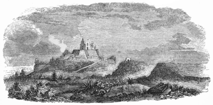 RUINS OF THE PYRAMID OF CHOLULA.
The history of Mexico has ever held in sacred regard the region of this
ancient republic, whence Cortéz and the Spaniards derived such eminent
assistance in the conquest of the Aztec Empire. Immediately after that
event it was erected into a province, under which character it was
always regarded until the political emancipation of Mexico from Spain,
and even after that event up to the period of the adoption of the Acta
Constitutiva, when Tlascala was raised to the dignity of a State, as an
integral part of the Mexican Republic. The constitution, sanctioned on
the 4th of October, 1824, deferred defining absolutely the political
character of this region; but on the 24th of November of the same year,
it was constitutionally declared to be a Territory of the Confederation.
When the Central Government was subsequently adopted, it was added,
under the denomination of a district, to the Department of Mexico; but
when the federal system was restored by the movement of the 6th of
August, 1846, which was afterwards nationalized by the decree of the
provisional government on the 22d of August of the same year, and
confirmed by the sovereign congress on the 18th of May, 1847, Tlascala
re-entered the federal association in its original character of a
territory.
Tlascala comprehends within its limits a superficial extent of four
hundred square leagues, and contains one city, one hundred and nine
villages, eighteen settlements, one hundred and sixty-eight haciendas or
large estates, ninety-four ranchos or small farms, eight grist mills,
two iron works, and one woollen factory. It is divided into the three
partidos of Tlaxco, Huamantla and Tlascala, the latter of which
contains the capital town of the same name about seven leagues north of
Puebla. The territory is of an oval form, lying between forty minutes
and one degree thirty-three minutes east longitude from Mexico, and
nineteen degrees, and nineteen degrees forty-two minutes of north
latitude. Its climate is mild and healthful, and its population, which
in 1837, was rated at about eighty thousand, has been found to increase,
on comparison of a number of years, about one thousand eight hundred and
seventy-eight annually, of which nine hundred and thirty-seven are
males, and nine hundred and forty-one females.
The productions of Tlascala are chiefly of a cereal character, but its
genial climate and soil are capable of yielding the fruits of the
tierras calientes, frias, and templadas.
The capital town of Tlascala is situated between two mountains, in 19°
16´ of north latitude, and 58´ east longitude from Mexico, near the only
stream of importance in the territory, known as the Rio Atoyac or
Papagallo, under which name it passes through the State of Puebla on its
way to the Pacific. The ancient numerous population of Tlascala is no
longer found within its limits, and perhaps not more than four or five
thousand individuals now inhabit it. But the town is nevertheless
handsome;—its streets are regular; its private houses, town hall,
bishop's palace and principal church are built in a style of tasteful
architecture, while on the remains of the chief Teocalli of the ancient
Tlascalans, a Franciscan convent has been built, which is perhaps one of
the earliest ecclesiastical edifices in the republic. In the town itself
and in its vicinity many relics and ruins of the past glory of Tlascala
are still found by antiquarians, but they have hitherto been undisturbed
by foreign visiters and remain unnoticed by the natives. Huamantla and
Tlaxco are the chief towns or villages in the partidos which bear
their names.
STATE OF MEXICO—AREA—DIVISIONS—POPULATION—FEDERAL
DISTRICT—VALLEY—HIGHWAYS—LAKES—ZUMPANGO, CRISTOVAL, CHALCO,
XOCHIMILCO, TEZCOCO—SALT-WORKS—CITIES—SAN
AUGUSTIN—FESTIVAL—TEZCOCO—TACUBA—TOLUCA—CASCADE OF
REGLA—TOWNS—VALLEY OF CUERNAVACA—ACAPANTZINGO—ITS INDIAN
ISOLATION—MINES IN THE STATE.
This State, which includes the national capital and the federal
district, lies between 16° 34´ and 21° 7´ of north latitude and 100°,
17, 30´´ and 105°, 7´, 30´´ W. longitude from Paris. It is bounded, west
by the States of Guanajuato and Michoacan; south-west by the shores of
the Pacific for 87 leagues; north by Queretaro; east by Puebla; and
north-east by Vera Cruz. Its greatest breadth from east to west, from
Chilapa on the boundaries of Puebla, to the haven of Zacatula, is, 104
leagues, and its extreme length from north to south, from Berdosas on
the confines of Vera Cruz, to the west coast in the neighborhood of
Acapulco and the boundary of Puebla in that direction, is, 124 leagues.
The area of the State is 5,842 square leagues, more than two-thirds of
which are covered with mountains and spurs of mountains, interspersed
with vallies lying between 6,500 and 7,500 feet above the level of the
sea. The Nevada de Toluca is the only mountain of extraordinary
elevation in the State of Mexico, which breaks the uniformity of its
lofty table lands. Popocatepetl and Iztaccihuatl, on the eastern limit
of the Valley of Mexico, belong, it will be recollected, to the State of
Puebla.
The political divisions consist of eight districts, with 38 partidos, or
cantons, and 183 ayuntimientos or municipalities, subdivided into about
450 cities, towns and villages, as well as into a great number of
haciendas, and minor dependencies.
1st. The district of Acapulco, with the cantons of Acapulco, Técpan,
Chilapa, Tixtla, and 13 municipalities.
2d. The district of Cuernavaca, with the cantons of Cuernavaca, Ciudad
Morelos or Cuautla de Amilpas, and Xonatepec, and 17 municipalities.
3d. The district of Tasco, with the cantons of Tasco, Axuchitlan,
Teloloapan, Texupilco, Sultepec, Temascaltepec, and Zacualpan, with 18
ayuntimientos or municipalities.
4th. The district of Toluca, with the cantons of Toluca, Ixtlahuaca,
Tenango, Tenancingo, and 25 municipalities.
5th. The district of Tlalpam, with the cantons of Tlalpam, Chalco,
Tezcoco, Teotihuacan, Zumpango, Tlanepantla, Quautitlan and 49
municipalities.
6th. The district of Tula, with the cantons of Tula, Huichapan, Actopan,
Xilotepec, Ixmiquilpan, Zimapan, and 25 municipalities.
7th. The district of Tulancingo, with the cantons of Tulancingo,
Pachuca, Apam, and 15 municipalities.
8th. The district of Huejutla, with the cantons of Huejutla, Mextitlan,
Zacualtipan, Yahualica, and 21 municipalities.
The population in these districts was estimated in 1842, according to
Mühlenpfordt, at:
| 1st District, | 101,250 |
| 2d" | 104,100 |
| 3d" | 187,444 |
| 4th" | 255,119 |
| 5th" | 278,800 |
| 6th" | 241,539 |
| 7th" | 128,166 |
| 8th" | 100,855 |
The call for congress in that year estimated the population of the State
at 1,389,502, to which if we add 10 per cent. for increase since that
period, we shall have a population at present of about 1,528,452.
The Federal District includes the city of Mexico, in the valley of that
name, together with the towns and villages of Tacubaya, Chapultepec,
Santa Fé, Tacuba, Guadalupe, Azcapotzalco, Los Reyes, St. Angel,
Mixcoac, and Mexicalcingo. Its inhabitants may be estimated at
450,000,—about 200,000 of whom reside in the capital.
The Valley of Mexico is in the midst of the ridges of the Mexican
Sierras, at a height of 7,500 feet above the level of the ocean. It is
oval in shape, and hemmed in on all sides by porphyritic mountains and
eminences, from which the volcanoes of Popocatepetl and Iztaccihuatl,
shoot up beyond the region of eternal snow.
Its greatest length, from the mouth of the stream of Tenango in the lake
of Chalco, to the foot of the Cerro de Sinóc, in the neighborhood of the
canal Huehuetoca is 191/2 leagues, and its greatest breadth, from San
Gabriel at Tezcoco, to the sources of the river Acapusalco at
Quisquiluca, is 131/4 leagues. Its area is 2583/8 square leagues,
231/3 of which are covered by lakes. On the south, east, and west, the
mountains maintain a probable average height of 10,000 feet above the
sea, while at the north their depression is considerable, and through
the gaps and vallies the waters of the lakes are discharged towards the
Gulf of Mexico.
Six great highways centre in the capital, and leave it to traverse the
principal districts of the confederacy.
1st. The road to Acapulco on the west coast, which passes out of the
valley over its southern rim of mountains at the point known as the Cruz
del Marquez, about 2,284 feet above the city of Mexico, or 9,784 above
the level of the sea.
2d. The road to Toluca, by Tianguillo and Lerma.
3d. The road to Queretaro, Durango, &c. called El Camino de tierra
adentro, which leads across the eminences at the north of the valley,
by an elevation of about 100 feet only above the level of the lakes.
This road is the highway for the internal trade of Mexico with the
northern provinces.
4th. The road to Pachuca and Real del Monte in the mining district,
across the Cerro Ventoso.
5th. The road to Puebla, across Bonaventura and the plains of Apam.
6th. The new road to Puebla and Vera Cruz, by Rio Frio and San Martin,
across the northern shoulder of the volcano of Popocatepetl. It greatest
elevation is at the barranca or ravine of Juanes, 10,486 feet above the
level of the sea. Besides the two last mentioned roads there is a third,
between the volcanoes of Popocatepetl and Iztaccihuatl, by Tlamanalco,
Ameca, La Cumbre, and Cruz del Correo, passing out of the valley of
Mexico into those of Cholula and Puebla.
Five lakes are embosomed in the valley in the immediate neighborhood of
Mexico:—
1st. The lake of Zumpango, is the northernmost, and has an area of about
11/4 square leagues. A dam, called La Calzada de la Cruz del Rey,
divides it into two basins, the westernmost of which is known as the
Laguna de Zilaltepec, and the easternmost, the Laguna de Coyotepec. It
is 26 feet higher than the mean level of the lake of Tezcoco, and
supplies the rivers Pachuca and Quautitlan. The little village of
Zumpango lies on its northern shore.
2d. The lake of San Cristoval is immediately south of the preceding, and
is likewise divided by a dam into two basins, the northern called the
Laguna de Xaltocan and the southern San Cristoval. In the first of these
divisions are the villages of Xaltocan and Tomantla, built upon islands.
This lake is twelve feet eight inches higher than that of Tezcoco, and
its superficial area nearly 4 square leagues. On its shore lies the
village of San Cristoval.
3d. The lake of Chalco spreads out at the southern extremity of the
valley, and contains the village of Jico built on an island in its
bosom. It is divided from the lake of Xochimilco by a dam, or calzada,
across which the road passes from Tuliagualco to San Francisco
Tlaltenango.
4th. The lake of Xochimilco is separated, as we have described, from
that of Chalco; both of these basins cover a superficial area of 61/2
square leagues; and their level, according to Baron Humboldt, is 3 feet
91/2 inches above the great square of Mexico.
5th. The lake of Tezcoco is that in which the ancient city of
Tenochtitlan was built upon the spot at present occupied by the modern
city of Mexico, whose walls, however, are now reached by a canal of
nearly a mile in length from the western borders of this inland sea. The
rivers Teotihuacan, Guadalupe or Tepeyacac, Papalotla and Tezcoco are
voided into it. The difference between its water-mark and the level of
Mexico, which in Humboldt's time was four feet and one inch has been
found by recent measurements to be 18 inches more. Its superficial
extent is about 10 square leagues, and its waters are plentifully
impregnated with salt, supplying the material for numerous works which
are rudely conducted. A thick crust or deposit of carbonate of soda
constantly whitens the edges of this lake, which are left bare by the
receding of the waters after they have been swept over the leeward
shores by the strong winds that occasionally prevail in the valley. The
deepest parts of the lake of Tezcoco never contain more than from 6 to 8
feet of water, while some portions are not covered by more than two or
three feet. There are two springs of mineral waters in the neighborhood
of the capital;—one at Guadalupe, three miles from Mexico, and another
at El Peñon, a volcanic pustule which rises abruptly from the plain on
the margin of the lake of Tezcoco. The temperature of the latter is
quite high.
The mode in which the valley is relieved from the danger of inundations
in consequence of the rising of the waters of the lakes has been
already noticed in a previous portion of this work.[56] The desague,
according to recent reports, requires considerable repairs and
improvements for the future security of the capital.
The principal cities, towns and villages of this State are:—The
national and state capital Mexico;—St. Angel, three leagues from the
capital;—Tacubaya, about equidistant from Mexico, containing a number
of beautiful residences, and an archiepiscopal Palace surrounded by
groves and gardens; Santa Fé, Tlalpam or San Augustin de las Cuevas,
four leagues south of the capital, situated upon the first slopes of the
mountains, and filled with charming dwellings, to which the Mexicans
occasionally retire during the warm season. It is in this town that the
festival of St. Augustin is kept in the month of May, and during the
three days of its celebration, Tlalpam is a scene of gaiety rarely
equalled elsewhere on this continent. Rich and poor pour out from the
capital to partake of the unrestrained amusements of the season, and
thousands of dollars are lost at the gambling table or in the cock-pit,
without which no Mexican festival is considered complete. The Mexican
ladies appear at the balls which are given every night, or during the
afternoon, on the green at the Calvario, and vie with each other in the
splendor and variety of their dresses.
Ajusco, is a village south of Tlalpam:—Chalco, lies on the borders of
the lake of that name, and is surrounded by the villages of Acohualpan,
Totolapan, Tapostlan, Jico, Tlapacoya, Xochimilco, Mexicalcingo,
Iztapalapan, Colhuacan, Huitzilopocho, Itztacualco, Churubusco, and
Cuyuacan, most of which are inhabited by Indians and Mestizos who supply
the markets of the capital. The Indians of Chalco, with their caballos
de palo or "wooden horses," as they fancifully call their boats, carry
on an extensive trade with Mexico and its vicinity. They navigate their
lake and the canal leading to it with great dexterity; and large boats,
capable of containing fifty or sixty persons, are almost daily seen
leaving the landings at Mexico in order to convey passengers and freight
to the neighboring country.
Tezcoco, lies on the eastern shore of the lake of that name, opposite
Mexico, and at the distance of about 12 miles. It is no longer a town of
much importance, but is interesting for its historical associations and
for the ancient remains within its limits and neighborhood which will be
subsequently described.
Tacuba is the site of the Spanish army's refuge after the noche triste
or "melancholy night," during which Cortéz and his band were driven
from the Aztec capital in the year 1520. The image of the Virgin of
Remedios, has been generally kept in a chapel in this village, and has
often been brought to the capital in seasons of danger, distress or
disease.
Tlanepantla; Quautitlan; San Tomas; San Cristoval Xaltocan; Tonantla;
Tehuiloyuca; Zumpango; Huehuetoca; are towns and villages north of
Mexico.
San Juan de Teotihuacan, and Otumba, lie east of the lake of Tezcoco,
and are interesting for the fertility of their neighborhood and for
their antiquities.
A ridge of lofty mountains, west of the capital, rising from the plain
beyond the limits of Tacubaya separates the valley of Mexico from the
valley of Toluca, in which is found the town of Toluca at the foot of
the porphyritic mountains of San Miguel Tutucuitlalpillo, at an
elevation of 8,606 feet above the level of the sea. It is a beautiful
town, celebrated for its soap and candle factories; and the epicures of
hams and sausages, procure their choicest dainties from its
neighborhood. Lerma, lies on the banks of the pond from which the river
Lerma springs; and Istlahuaca, twelve leagues from Toluca, is found in a
spur of the same valley.
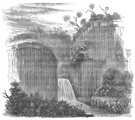 THE CASCADE OF REGLA.
The elevations, north of the valley of Toluca, which separate it from
the valley of the river Tula, vary from 10,000 to 7,500 feet, and, in
the bosom of the latter vale, is found the town of Tula, twenty-two
leagues north-west of the capital. It is regularly built, on broad
streets, and is celebrated for its Sunday-market, to which the Indians
and Mestizos of the adjacent country flock in numbers.
Tulanzingo and Apam, are the chief towns of the districts;—Pachuca is a
mining town 8,112 feet above the sea, and, next to Tasco, the oldest
mineral work in Mexico. It contains, with its suburbs of Pachuquillo,
about 5,000 inhabitants.
Real del Monte, is another mining town, two leagues northerly from
Pachuca, at an elevation of about 9,000 feet. Its climate is cold, and
its extremely rarefied air is dangerous for lungs unaccustomed to
breathe the atmosphere of such lofty regions. Within a few leagues of
this place is the celebrated Cascade of Regla.
Atotonilco el Chico, or El Chico, is also a mining village, 7,737 feet
above the sea, 4 leagues north-west from Pachuca, and 25 north-east from
Mexico. It is situated on the slope of a beautiful valley, surrounded by
high mountains, whose peaks peer above the tops of the forest. In the
vicinity of Chico, about 5 leagues west and north-west lie the mines of
Capula and Santa Rosa.
Atotonilco el Grande is a village 7 leagues north of Real del Monte.
Actopan and Itzmicuilpan lie in the midst of fine agricultural regions.
Zimapan, is a mining town, about 10 leagues north-west of Itzmicuilpan,
and 42 from Mexico, situated on the slope of a wide and deep valley,
which is watered by a copious brook.
San José del Oro, is a village and mining district, north of Zimapan.
Huejutla; Mextitlan; and Zacualtipan, complete the enumeration of
important towns or villages in this part of the State.
From the height of 9,784 feet above the sea, at the Cruz del Marquez,
the road descends across the sierra at the southern end of the valley of
Mexico, into the valley of Cuernavaca, which, as we have already
remarked in the historical part of this work, is a corruption of the
Aztec "Quaunahuac." This broad, beautiful and rich valley, lying between
three and four thousand feet lower than the valley of Mexico, winds
gradually into the vallies of Cuautla and Puebla around the eastern
spurs of Popocatepetl, and is remarkable for its fruitfulness and
salubrity. Sugar, coffee, indigo, and all the tropical plants and
trees, are successfully cultivated, and the 48 sugar estates
comprehended within its limits, produce not less than 200,000 hundred
weight of raw and refined sugar, besides 50,000 barrels of distilled
spirits.
The chief town is Cuernavaca, lying 3,998 feet above the sea, 3,426
below the city of Mexico, and 5,786 feet beneath the Cruz del Marquez,
from the neighborhood of which the whole panorama of this splendid
valley bursts upon the traveller. Cuernavaca rests on a tongue of land
projecting into the valley between two steep barrancas or ravines.
Plentifully supplied with water, and situated in the midst of the
tierra caliente, it is, of course, buried among luxuriant foliage
which is never touched with frost. The town may, therefore, be justly
called a garden, in whose midst rise the picturesque houses of the
townsfolk,—the walls of the church built by Cortéz,—and the dwelling
that was erected during the Spanish dynasty by the fortunate miner
Laborde. The grounds, attached to this edifice, were laid out with care
and taste. Lakelets spread out among the profuse vegetation; bellevues
were erected at every spot whence a favorite prospect of the valley
might be obtained; and bowers were built in the shadiest corners amid
lofty palms or choice varieties of native and exotic plants. Time and
neglect have done their work upon this beautiful structure; but the
vegetation is so abundant and graceful, that the ruined portions are
soon filled up and concealed by flowers or leaves. Few spots on earth
afford a more agreeable retreat to a man who is willing to pass his life
in a tropical climate and in a stagnant society.[57]
Acapantzingo is a village in the neighborhood of Cuernavaca, whose
Indian inhabitants are remarkable for their entire separation from the
rest of the Mexican population. They have never mingled their blood with
the Spaniards during the three hundred years of foreign dominion, but
have always preserved, intact, their own laws, habits, institutions,
language and customs. They work on the neighboring plantations; but,
with this exception, refuse all intercourse with the Mexicans, or part
in their government. The authorities have never forced them to abandon
their secluded system; but seem to have respected their feeble rights,
as the invaders respected the republic of San Marino in Italy during the
wars that succeeded the French revolution.
Cacahuamilpa, or Cacahuawamilpa, an Indian village in whose vicinity
lies the remarkable cavern of that name which winds
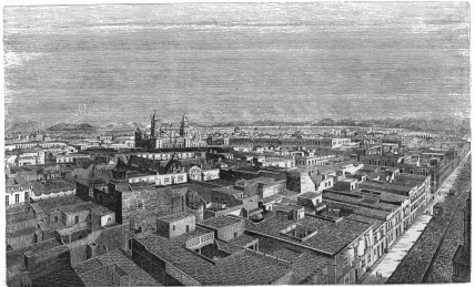 CITY OF MEXICO.
for many miles in the heart of the mountain, and is filled with some of
the most curious and gigantic stalagmites and stalactites on our
continent.
Yautepec is a village between the vallies of Cuautla and Cuernavaca; and
is celebrated for the excellence and quantity of its tropical fruits.
Zapotes, bananas, anonas, guayavas, pomegranates, pine apples grow
luxuriantly, with the least care or labor, and at least thirty thousand
dollars worth of sweet oranges are annually sent from it to the market
of Mexico.
Cuautla de Amilpas, or Ciudad Morelos, is a town in the valley of that
name, and made the staunch and memorable resistance to the Spaniards,
under the heroic Morelos, during the revolutionary war. It lies 24
leagues S. S. East from the Valley of Mexico,—13 east from Cuernavaca,
and is 4,019 feet above the level of the sea. Its climate and
productions resemble those of Cuernavaca, but it has never recovered
from the effects of the deadly siege.
Passing in a south-westerly direction from the Valleys of Cuautla,
Cuernavaca, Mexico and Toluca, we enter the rich metallic region of
Tasco which lies upon the declivities of the Sierra Madre, sloping
towards the Pacific. In this district we find the town of Temascaltepec,
which grew up in the midst of a mining country, formerly rich in the
production of silver, but now almost abandoned for such purposes. The
North Americans were induced to adventure largely in the mines of this
district immediately after the revolution, but their capitals were
entirely lost in works which were found to have been abandoned by the
Spaniards as valueless, long before they were sold by speculators to
companies from the United States. The climate of Temascaltepec is mild
and agreeable; and, when the mines were productive, it must have been an
agreeable residence. The inhabitants, who have abandoned their former
mineral speculations, now devote themselves to the manufacture of cotton
shawls and rebozos.
El Valle; Real del Cristo; Sultepec; La Plata; Texupillo; Zacualpan;
Huesultepec; Almoloyan; Malinaltenango and Tecamotepec are villages in
the vicinity of Temascaltepec.
Tasco is a mining town and capital of the canton or district of that
name, 5,853 feet above the sea. The village itself is not important, but
is nevertheless worthy of note as the oldest mining region in the
confederacy. Soon after the conquest it was wrought for tin, which
had been found in the neighborhood by the Indians; and in the year 1752,
Laborde, fully developed its mineral wealth in silver.
Extending our observations further to the south-west, we reach the
district of Acapulco, which is divided between the slopes of the
Sierra and the shores of the Pacific. The declivities of the
Cordillera are cut by deep vallies, which open their long and regular
vistas towards the ocean. The principal places in this part of the State
of Mexico, are Chilapa, with 4,000 inhabitants; Mezcala; Chilpantzingo;
Mazatlan; Apandaro, with 3,500 inhabitants; Zirandaro, and Acapulco.
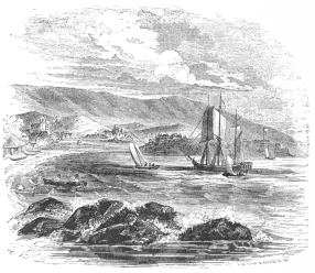 BAY OF ACAPULCO.
The city of Acapulco is the capital of its district and a port in the
Pacific in 16° 50´ 29´´ north latitude, and 102° 12´ 12´´ west longitude
from Paris. It lies in a bay, 19,700 yards long, from East to West,
protected by a ring of granitic hills and rocks, in which ships may
easily load. The entrance to the bay is broad; and the anchorage good,
but the water is not deep. Acapulco was formerly the seat of Spanish
trade between Mexico and the East; but its small population of 3,000
Mulattos, Zambos and a few Mexicans, who are chiefly pearl divers,
fishermen and farmers, fully indicates the decline of its commerce and
civilization.
The mountains of the State of Mexico are rich in deposits of precious
and base metals. North and north-east of the Valley of Mexico are the
mining districts and mines of Real del Monte, Moran, Atotonilco el
Chico, Pachuca, El Cardinal, Zimapan, Lomo del Toro, Macroni, Pechuga,
and San José del Oro. West and south-west of the Valley, are the
districts of Rancho del Oro, Temascaltepec, Real del Cristo, Sultepec,
Zacualpan, Tasco, Tepantitlan, Tetéla del Rio, and several others. These
were all diligently worked by the Spaniards prior to the revolution, but
have not been found as profitable by the foreigners who undertook their
management since the Independence of Mexico. In the year 1835, numbers
of British subjects and Germans formed companies to work these mines,
and although the results have been favorable in some places, the greater
part of these luckless enterprises have been altogether abandoned.[58]
Such has been the sad issue in most of the speculations in silver
mines; but we learn that a native company has explored and worked an
iron mine at the foot of the Volcano of Popocatepetl, which promises
to repay them for their trouble and expense with a plentiful supply of
this useful metal.
DESCRIPTION OF THE CITY OF MEXICO—CATHEDRAL—ITS ARCHITECTURE AND
RICHES—THE PALACE—UNIVERSITY—MARKET—CHAMBER OF DEPUTIES,
ETC.—PORTALES—MINERIA—LA MERCED—SAN DOMINGO—CHARACTERS AND
COSTUMES—PASEOS—ALAMEDA—AQUEDUCTS—PASSEO NUEVO AND DE LA
VIGA—ALAMEDA—DESCRIPTION OF IT—LIFE IN
MEXICO—THEATRES—OPERA—DOMESTIC LIFE—GENUINE BUT CAUTIOUS
HOSPITALITY—LEGEND OF THE VIRGIN OF GUADALUPE.
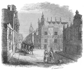 A STREET IN THE CITY OF MEXICO.
The city of Mexico has generally been reputed by travellers as the most
beautiful on the American Continent. Its picturesque site, in the lap of
the lovely valley, bordered by broad meadows and lakes, has doubtless
contributed greatly to this opinion, and it is, indeed, necessary for a
stranger to reside for a long time within
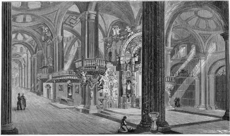 INTERIOR OF CATHEDRAL.
its walls before he becomes sufficiently disenthralled from the spells
of climate and national scenery, in order to do justice to the other
American capitals. Mexico, unquestionably, is the queen of Spanish
cities on this side of the Atlantic; but, in external taste, in modern
elegance, and an agreeable combination of splendor and comfort, it does
not compare favorably with the chief towns in the United States.
Built in regular, square blocks, on a dead level, it wants the
picturesque breaks or abruptness, which are only found on inequalities
of surface. Its houses, erected around quadrangles—with a court yard or
patio in the centre of each,—are stern and massive edifices; but they
have rather the air of castles designed for defence or seclusion, than
of habitations whose cheerful portals extend a hearty welcome to every
passer. They partake of the age in which they were constructed, and of
the traditionary architecture of Southern Europe. Yet,—in the pellucid
air of these lofty regions,—with its fancifully frescoed walls
basking in the pure sunshine, and relieved against the dark background
of surrounding mountains;—its streets filled with a motly and
picturesque crowd;—its towers and domes breaking the regular evenness
of the flat roofed dwellings,—and its splendid groves in the alamedas
and paseos,—Mexico is, indeed, a capital worthy a great nation, as
well as of the enduring recollection and praise of every traveller who
visits it.
The plan of the city is as regular as that of a checquer board. Its
straight streets divide it from east to west and north to south; whilst,
nearly in the centre, the great square or Plaza spreads out for many an
acre, surrounded by the chief edifices of the State, the Corporation or
the Church.
On the northern portion of the plaza is erected—on the alleged site of
the great teocalli, or pyramid temple of the Aztecs,—the cathedral,
with its adjacent Sagrario. It is, externally and internally, an
imposing building of the seventeenth and eighteenth centuries; for
although its architecture is neither regular, classical, nor conformable
to the rules of any distinct order, yet its massiveness and elaborate
detail, impart to it a certain degree of effective grandeur. We have
always found it impossible to receive, or impart an idea of
architectural beauty or magnificence by description alone. The best
writer can but catalogue dimensions and details, and his account is,
therefore, always more of a builder's estimate or bill, than a picture
which impresses our minds with a vivid image of the real object. We
turn, therefore, gladly from the feeble pen to the graphic pencil, and
refer the curious reader to the accurate plates which accompany this
volume, for a better idea of the internal and external appearance of
this sacred edifice, than we can convey by language alone.
Yet there are parts of the cathedral to which even the pencil cannot do
justice. The floor of this magnificent temple,—made of loose and heavy
boards, which are moveable at pleasure, in order to allow sepulture
beneath them,—is the only part of it which seems neglected or shabby.
Every thing else is gorgeous beyond conception, although the splendor is
more colonially barbaric, than nationally classic. Profusion is the
chief characteristic. It seems as if the priests and the pious
worshippers had designed to heap up rather than arrange their offerings
in honor of the Almighty, and as if their piles of precious metals would
form the most graceful as well as grateful emblem of their religious
sincerity. In the wilderness of columns, statues, shrines, oratories,
altars and fonts, the traveller stands amazed and confused; and leaving
the pictures of the church to demonstrate its complete effect, he
retreats upon the metallic standards which surround him, in order to
convey the best estimate of this queen of American temples.
The exterior walls front upwards of four hundred feet on the plaza, and
run back about five hundred feet to the narrow street of Tacuba.
Entering the main portal, whilst the huge bells are clanging in the two
steeples above it, you face the choir for the clergy, which is built
of rare, carved woods, and elaborately covered with gilded images, whose
burnished surface flashes in the sun-light. Beyond this is the high
altar, raised from the floor on an elevated platform, and covered with
ornaments, crosses, and candle-sticks, wrought in the precious metals.
From this sanctuary,—extending around the choir, and probably near two
hundred feet in length,—runs a railing, between four and five feet
high, and proportionally massive, composed of gold and silver very
slightly alloyed with copper. And on the summit of the high altar rests
the figure of the Virgin of Remedios, whose dowry in dresses, diamonds,
emeralds and pearls is estimated at not less than three millions of
dollars.
On the east of the cathedral, fronting the west, and bounding the whole
eastern limit of the plaza, is the national palace, formerly the
residence of the viceroys, and now occupied by the president, as a
dwelling. It is an immense quadrangular building, constructed on the
ground which it is supposed was covered by the palace of Axayacatl, in
which Cortéz was lodged by Montezuma, when he first arrived in the Aztec
capital. Besides affording room for the president and his family, this
huge edifice contains all the offices of the several secretaries of
state; the general treasury and tribunal of accounts; the supreme court;
the headquarters of the general-in-chief; the two chambers of deputies
and the senate, both of which are elegant apartments, and, especially
that of the deputies;—two barracks for infantry, cavalry, and a park of
artillery;—two prisons; some shops; a botanical garden; and the mint.
South of the National Palace, but not fronting the plaza, are the
University, containing the National Museum, in front of which is the
magnificent modern market, built during the administration of Santa Anna
in 1842.
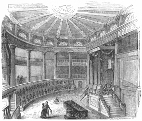 THE CHAMBER OF DEPUTIES.
Directly opposite the façade of the cathedral, in the south-eastern
corner of the plaza, is the Casa Municipal, or City Hall, which is
occupied partly by the corporate authorities, and partly by the
merchants' Lonja, or exchange. On the western side of the square there
are no public buildings; but the palace of Cortéz, which was erected by
the conqueror and rebuilt and still owned by his descendants, covers a
portion of its front and deserves to be mentioned for its associations
if not for its architectural beauty. The whole of the side walks on the
southern part of the plaza, and a portion of the western, beyond the
Calle Plateros, or street of the silversmiths, are protected by a broad
and massive corridor or portico, called the portales, in which the
traveller will constantly find crowds of hawkers, pedlars, shopmen,
letter writers, clothiers, fruit sellers, liquor venders, crockery
dealers and book hucksters. A few squares west of the plaza, is situated
the magnificent palace of the Mineria, or School of Mines, one of the
most elegant edifices in the capital.
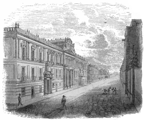 COLLEGE OF MINES—(EXTERIOR.)
In noticing the general splendour and luxury of ecclesiastical
architecture in Mexico we should not omit to mention particularly the
beautiful convent of La Merced, a view of whose elegant interior court
and corridor is presented in the opposite plate. Gloomier recollections,
however, are conjured up from the past by beholding the church of San
Domingo and the neighboring inquisition, which was the prison and the
place of torture to so many unfortunate victims dining the viceroyal
government of New Spain.
It is, in the centre or heart of the city, that all the characteristic
habits and costumes of the people may be most readily observed. The
great body of the crowd is, of course, composed of the common
classes—the males in their shirts and trowsers with a blanket thrown
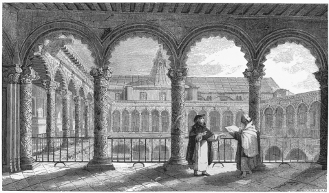 CONVENT OF LA MERCED
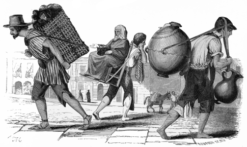 CARBONERO. BEGGAR. AGUADOR.
over their shoulders, and the females in chemise and closely cinctured
petticoat of fanciful colors, whilst their heads, and thinly clad
bosoms, are folded and partly concealed in their graceful rebozos.
Then there are the wretched leperos, whose long and tangled hair falls
in wierd strands over their tawny necks and dirty brows, beneath which
flash the sharp black eyes that are constantly on the watch for
something to do, to drink, to eat, or to steal. In the neighborhood of
the pulquerias or liquor shops, crowds of these social vermin swarm
and sleep.
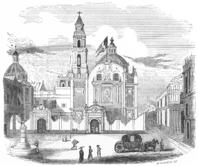 CHURCH OF SAN DOMINGO AND THE INQUISITION.
Pushing his way, eagerly and industriously through the crowd, the
laborious aguador, or water carrier elbows his way, as he trots his
rounds to fulfil his daily task with his twin jars of the refreshing
fluid, one of which he bears upon his back, suspended by a strap around
his brow, and balanced by another which depends from a leathern thong,
which rests upon the back of his head. Hard by the aguador, appear the
carbonero, or coal dealer,—the poultry seller,—the crockery pedlar, or
the porter,—all of whom bear their burdens on their shoulders, and move
along in that ambling trot which is peculiar to the laborers and Indians
of Mexico. Large numbers of women with oranges, pears, potatoes,
tomatoes, onions, lemons, guyavas, aguacates, chirimoyas, plantains,
fish and eggs, swell the increasing crowds. The butcher drives along a
diminutive donkey, on whose saddle he has erected his peripatetic
shambles, filled with beef or mutton, whilst, at the corners and on the
edge of the side walks, sit long rows of Indian women with pans of
savory chile sauces and heaping baskets or cloths of steaming
tortillas. All these eager venders of the necessaries and luxuries of
life, engage public attention by shouting the quality and value of their
wares at the top of their voices. Sound and motion are the predominant
features of the varied panorama; and the stunned stranger is glad to
retreat into quiet nooks and byeways in which he meets the stately
gentlewoman and cavalier, dressed in the becoming habiliments of their
station. When ladies go abroad in Mexico to shop or visit, they
universally use their coaches; yet every woman daily walks to
mass,—and, whilst engaged in this religious pilgrimage, exhibits the
old and habitual costume of black silk gown and lace mantilla, which she
has derived from her Spanish ancestors. This is a charming dress. It
exposes the black, lustrous hair of the graceful wearers, and fully
develops that majestic yet feminine gait with which the Mexican women
seem to glide and undulate along their path. The inseparable fan,—her
constant companion, play thing and interpreter, in the saloon, the ball
room, the theatre or the church,—rests carelessly, in her right hand,
which coquettishly clasps the folds of her mantilla; and, from beneath
its silken folds, her large lustrous eyes gleam soft and languishingly
above her pale but healthful cheeks. If Mexican ladies are not so
variously beautiful as the women of northern lands, in whose veins the
blood of many nations has mingled, they are most loveable creatures in
spite of the uniformity of their national type. There is a degree of
exquisite tenderness, and an expression of affectionate sincerity, in
the face of Mexican women, which instantly wins not only the respect but
the confidence of the gazer. Nor does their character in real life
contradict their amiable physiognomy. Faithful as a friend and as a
wife, the Mexican lady is a person, who, with the educational advantages
enjoyed by their northern sisters, would rightfully maintain as high a
position in the social scale, with, perhaps, a more delicate degree of
sensibility.
The lower classes of females are of course different from the upper
ranks both in appearance and personal qualities. They are of impure
blood. Spaniard, Indian, Negro and Malay, have
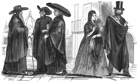 FRIAR. PRIESTS. LADY. GENTLEMAN.
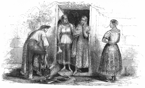 POBLANAS.
contributed to their ancestral pedigree, and their race is consequently
mixed; yet, impure as they are by descent they have not failed, like all
imitative inferiors to catch the manners and bearing of the aristocracy.
There is hardly a Mexican girl,—whose whole wardrobe consists of her
chemise, petticoat, rebozo, comb, looking-glass and shoes,—who does not
move along the street, when in full dress, with the queenly step and
coquettish display of eye and hair from beneath her cotton rebozo,
which we have just admired in the Mexican doña.
The costume of Mexican gentlemen is the usual European dress worn by the
same class among northern nations. But, in addition, the broad folds of
a massive cloak are always thrown over their shoulders upon the
slightest pretext or provocation of the weather, whilst their nostrils
are constantly refreshed by the fragrant fumes of a cigar or cigaritto.
The city of Mexico possesses two magnificent Passeos and an Alameda
in which all classes of the people habitually recreate themselves. The
city is supplied with water by splendid aqueducts, bringing the limpid
streams from the neighboring hills.
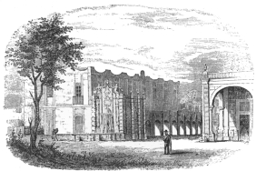 TERMINATION OF AQUEDUCT IN CITY OF MEXICO.
The Passeo Nuevo lies west of the city towards Chapultepec and
Tacubaya. It is a broad avenue, laid out tastefully amid the beautiful
meadows that surround the city, and is broken at intervals by fountains
of stone, and shaded by rows of stately trees. When the weather is
fine, which it usually is for six or eight months of the year, the
disengaged people pour out to this gay resort, near sunset, on foot, in
coach, or on horseback, to enjoy the refreshing breeze and to greet each
other on this social exchange. The Passeo is broad enough to allow
several coaches, to drive abreast if needful, but the course is usually
occupied by only two lines of advancing and returning carriages or
horsemen. This promenade parade circulates up and down the highway for
an hour; but when the evening bells toll for oracion, every hat is
raised for a moment and every horse's head immediately turned homewards.
The Passeo de la Viga, is on the other side of the city, and is
preferred by many persons to the Passeo Nuevo. It skirts one of the
canals leading to the lake of Chalco, and affords the stranger an
opportunity of observing the crowds of Indians who linger along the
banks, or push off at evening in their boats, crowned with flowers and
strumming their guitars if the day happens to be one of festivity.
This Passeo was constructed under the viceroyalty of Revilla-Gigedo,
whose improvements of the city and neighborhood of Mexico have
contributed so greatly to the elegance and beauty of the capital.
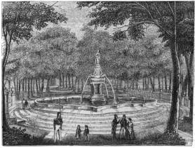 THE ALAMEDA FOUNTAIN.
The Alameda is a beautiful grove of lofty forest trees planted in a
rich soil in the western section of the city and on the road to the
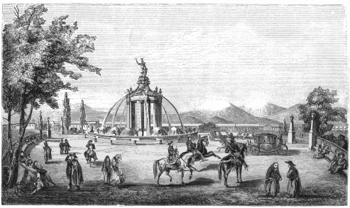 PASSEO NUEVO.
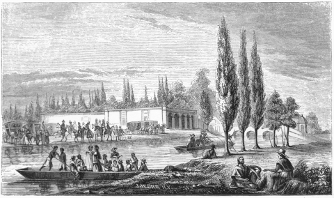 PASEO DE LA VIGA.
Passeo Nuevo. It occupies a space of ten or twelve acres, enclosed by a
substantial stone wall, which is surrounded by a deep and flooded moat.
The gates are closed daily at the Oracion; and the spot is thus
protected carefully from all improper uses as well as from wanton
destruction. Around the whole of the inner wall, lines of substantial
stone seats are erected, and, in front of them, an excellent carriage
road affords a drive for those who are not disposed to mingle in the
gayer circle of the passeos. Within this highway the plantations
begin. Paved paths cross and recross the dense groves in a labyrinth of
lines, while, at intervals, fountains and secluded benches break the
uniform solemnity and quietness of the spot. In the centre of the
enclosure, a massive fountain, surmounted by a gilded statue of Liberty,
rises nobly in the midst of a broad area, whose top is almost domed
with the arching branches of the trees, which admit a scant but lovely
light through a narrow aperture, like the sky-light of the pantheon at
Rome. The birds, unassailed for years within this grove, have flown to
it as a sanctuary, and the branches are forever vocal with their natural
music. Situated as it is on the edge of the town, and surrounded by
houses, it nevertheless seems buried in the depths of a forest; and
perhaps no spot, in America, is so fitted for the enjoyment of a quiet
man, who can either take his exercise on foot or horseback, beneath the
sheltering trees, or wile away his hours with book and pencil on the
comfortable seats in the shady woods. It is the favorite resort in the
morning of all classes who are obliged to rise betimes and go abroad for
health. Students, priests, monks, lovers, loungers, dyspeptics,
consumptives, nurses, and troops of lovely children resort to the
Alameda as soon as the gates are opened, and study, meditate, pray,
flirt, exercise, or romp, until their appetites or the sun warn them of
the flight of time.
In these drives, in dress, dining, domestic duties, mass, and theatre
the hours of a Mexican's day are chiefly consumed. This catalogue of
"idle occupations," does not, of course comprise all classes, but
includes that portion of the aristocracy which is every where set apart
by its fortunate exemption from necessary toil. In a country so rich as
Mexico this class must necessarily be large; and, if it begins the day
in plain black, and on its knees in chapels, it ends its waking hours
amid the blaze of dress and jewels in the family box in the theatre. In
most of the countries of southern Europe, and in all their old colonial
possessions, the theatre is one of the necessaries of life, and a box is
as indispensable as a dwelling. It forms a neutral ground upon which all
can meet without the requirements of a forced hospitality, and
consequently it affords all the pleasures of general society without the
necessity of expensive entertainment. There are great disadvantages
attending upon this constant dwelling in the public eye and in the blaze
of artificial light; yet it is so agreeable a mode of killing time in
Mexico, that the habits or the nature of the people must change
essentially before we may expect to find them surrounding nightly the
domestic hearth instead of the dramatic stage. Yet we should not be
unjust to the Mexicans in this condemnation of one of their agreeable
habits, which originates perhaps as much in their climate as in their
tastes. Fine skies and genial atmospheres drive people into the open
air. Wintry winds, desolate heaths, ice and snow, gather and group them
into the nestling places of home. When houses become in this way mere
shelters instead of shrines we might well pardon the taste which leads a
sensitive people to enjoy the beautiful landscape as long as day permits
it to be seen, or to retreat, at nightfall, into those splendid theatres
in which they may behold the mimic representation of that varied
activity of life to which their monotonous career is a comparative
stranger.
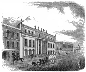 NEW THEATRE.
Nevertheless, a well-bred Mexican family is one of the most delightful
circles into which a genteel stranger can be admitted. The
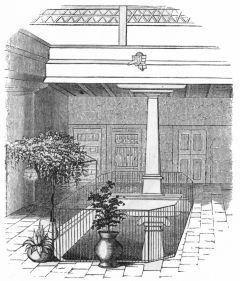 INTERIOR OF A MEXICAN HOUSE.
formal manners of the Spaniards have descended to the Mexicans. You are
received cordially but carefully, and you must either be useful or
known, before you are admitted into the confidence of a family. Until
this occurs your reception and departure from a Mexican dwelling are
quite as ceremonious as your initiation into a Masonic lodge. Bows,
gestures, shrugs, grimaces, and all the ordinary rites of external
politeness are plentifully bestowed on the stranger;—"But sad is the
plight of the luckless knight," who imagines that these elegant
formalities literally mean what they profess. Americans, especially,
whose extraordinary and loose social facilities habituate them to an
unrestrained intercourse with all the members of families as soon as
they are either prudently or imprudently introduced to them,—are often
in danger of making this sad mistake in Mexico. Neither wealth,
education, nor political position, entitle an individual in that
republic to pass the threshold of distant and civil intercourse. The
Mexican's house, purse, or daughter, are not at "your disposal,"
although he tells you that everything he possesses is "à la
disposicion de Usted!" Yet, when his acquaintance has ripened into
friendship, and he understands that you appreciate his tastes, his
country, his language, his prejudices, his religion, and his habits, or
do not visit him, as many foreigners have done, merely to scoff and
condemn,—then, indeed, the social manners of the Mexican relax into
intimacy, and the attention he bestows on you may be more firmly trusted
because it was so cautiously yielded. The stranger who penetrates a
Mexican house under such circumstances, finds its hospitality unbounded,
and its generous inmates his devoted and faithful servants either for
life or until he forfeits their esteem by treachery or misconduct.
 THE VIRGIN OF GUADALUPE.
In every Mexican church, monastery, convent, palace, house, hut, hovel,
hacienda, or rancho, the traveller will not fail to observe an image of
"The Virgin of Guadalupe." Many men receive the name of "Guadalupe," in
baptism, and almost every woman has it added to the others she receives
from her parents or sponsors. A saint whose tutelary influence is at
once so national and so curious deserves especial mention in the notice
of a country over whose people she is supposed to exercise a mysterious
dominion; and we therefore present the reader the following translation
from the Spanish of Don Ignacio Barillo y Perez, in which the history
of her miraculous appearance is set forth with more detail than we have
elsewhere encountered.
The story of the Virgin is implicitly believed by the great mass of the
people; and the wonderful picture, described in the following account,
adorned with invaluable precious stones, is now preserved in a massive
golden frame, in the collegiate church of Guadalupe erected at the foot
of the hill of Tepeyacac. On the 12th of every December, the anniversary
of the miraculous visit, the people pour forth from the capital to the
sacred shrine and witness the splendid rites instituted in honor of the
saint. In the temple and at the holy well, they are met by crowds of
country folks and Indians, who come from far and near on the same
errand, while the whole pompous ceremonial is countenanced by the
presence and apparent devotion of all the high officers of government
including the president himself.[59]
Tepeyacac is a small mountain whose southern side is a scarped and
inaccessible precipice which looks to Mexico, situated on the south of
it at the distance of about three miles. Its ascent, by whatever part
undertaken, except that of the pathways made to facilitate the access,
is extremely rough and stony. Its whole surface is covered with
crowsfeet, buck and hawthorn, which are common to such sterile wastes.
The Indian name, Tepeyacac, signifies the abrupt extremity or
termination of hills, and in this bluff, terminate all the hills to the
north of the capital.
It was celebrated in the days of heathenism for the worship paid in this
place to the mother of the false gods of the Indians, but it is more
celebrated at present for the adoration which is worthily paid to the
Mother of the true God in her beautiful temple.
As Juan Diego,—an Indian recently converted, of pure and unblemished
morals, though of lowly birth, was passing by this place on Saturday,
December 9th, 1531, on his way to hear mass and participate in the
Christian worship which the Franciscan fathers taught in the district of
Tlatelolco, at the hour of early dawn, he heard, upon attaining the brow
of the little mountain, which he was ascending on the western side, a
sweet, sonorous and harmonious music, as of little birds upon its
summit. The ravishing tones and rare melody attracted his attention and
arrested his steps. On looking up, as was natural, he saw a white and
shining cloud, surrounded by a rainbow, and in its centre a most
beautiful lady, like the image we now venerate in the sanctuary, who
calling with a sweet and gentle voice, addressed him in his own language
with wonderful suavity and told him she was the Virgin Mary, Mother of
God, whose mass and doctrine he was going to hear, and she commanded him
to go to the bishop and tell him that it was her will that a temple
should be built to her upon that spot, in which she would show herself a
pious mother towards him, his nation, devotees, and as many as should
solicit her support and protection in their hour of need. She directed
him to tell all he had seen and heard, and added: 'Be sure, my son, for
whom I feel a delicate and tender love, that I will repay all you do for
me; I will render you famous; and I will endow you with benefits for the
diligence and labor you display. Now, my servant, in whom I delight,
thou hast heard my desire, go thou in peace.'
The Indian promptly obeyed and went to the palace of the bishop, the
illustrious Señor Don Francisco de Zumarraga, who since the year 1528,
had resided in Mexico with the title of Protector of the Indians, and
who afterwards became the archbishop. The prelate heard him with
surprise, and prudently directed him to return on some other occasion,
when having well considered and examined into so singular an event, he
might deliberate as to what was proper to be done by him.
The Indian returned with the answer to the Most Holy Virgin whom he
found in the same place. Prostrating himself before her, with words of
submission peculiar to the Indians, he repeated the reply of the bishop,
adding that, in order to secure compliance with her will, it would be
necessary to send some person of authority and credit, as it appeared to
him he was not believed because he was an humble man and a plebeian. The
Most Holy Virgin, with no less benignity and suavity than on the
previous occasion, replied: 'To me neither servants nor followers whom
to send are wanting if I should I wish, since I have multitudes at my
command; but it is agreeable to me now that thou shouldst perform this
mission, and make the solicitation. Through your intervention I wish to
give effect to my will, and desire you to speak again with the bishop,
and tell him he must build a temple in honor of me on this spot; and
that it is the Most Holy Virgin Mary, Mother of the true God, who sends
you to him.' Juan Diego answered: 'Do not be offended, my Queen and Holy
Lady, at what I have said, which is not intended to excuse me from this
office.' Desiring to satisfy the Most Holy Virgin, although fearful the
bishop would not give credit to his story, he pledged himself to repeat
the message the next day; and promised, that at the setting of the sun,
he would be at that spot once more with the reply. Bidding adieu to the
blessed apparition with profound humility, he went to his village and
his house, but it is not known whether he mentioned to his wife, or
other person, his strange adventure.
The following day, Sunday, December 10th, 1531, Juan Diego went again to
hear mass and participate in the Christian worship. Upon the conclusion
of the service, he went diligently to discharge his mission, and
although the servants of the bishop delayed him a long time at the
entrance of the palace, he succeeded at length in coming into the
prelate's presence. With lively expressions of feeling, which made that
dignitary shed tears of tender pleasure, he prostrated himself before
the bishop, and told him he had a second time seen the Mother of God,
who commanded him to return and repeat that it was her will a temple
should be built in honor of her on the spot at which she appeared. The
bishop listened with great attention, and examined him with many
questions, in the answers to which he could detect no discrepancy; and,
in fine, knowing it could neither be a dream nor fiction of the Indian,
he told him that what he had said was not sufficient to ensure
credibility; that he must ask some sign from the Holy Lady, by which
it might be known that it was really the Mother of God who sent him.
The Indian, with intrepid confidence, replied that he would ask whatever
the bishop desired; when the latter, observing that he was not abashed,
but offered to ask for the signs, ordered him to go, but, meanwhile,
secretly despatched two confidential members of his family to follow the
Indian, and to observe with whom Juan Diego spoke on his arrival at the
hill of Tepeyacac. They did so; but when they arrived at the bridge over
the river that empties, at the foot of the hill, into the lake which
lies to the east of Mexico, the Indian disappeared from the spies who
were watching him. They examined the summit, brow, and circumference of
the hill, without failing, in their anxious solicitude, to explore every
ravine, fissure, and fragment of it, but not finding him in any part,
they concluded that the native was a deceitful impostor, and confirmed
in that idea, they returned to the bishop, begging him to punish the
Indian if he repeated his imposition.
As soon as Juan Diego, who was in advance of the servants, arrived at
the top of the hill, he found there the Most Blessed Mary awaiting the
prelate's answer. Pleased with his attention and promptitude, she
directed him to return the next day, when she would give him a sign that
would ensure credibility with the bishop. The Indian promised to do so,
but he could not comply with the mandate of Our Lady, to return the next
day, December 11th, 1531, as he found on reaching home that his uncle,
Juan Bernardino who held the place of father in his affections, had
fallen ill of a malignant fever, which the Indians call cacolixtli, on
which account he was detained that day in administering to him some
simples used by the Indians, all of which, however, he applied without
avail. At length, the infirmity assumed a fatal character, and the
patient asked Juan Diego to call in a priest, from whom he might receive
the Holy Sacrament and Extreme Unction.
The 12th of the same month, before the dawn of day, Juan Diego set out
for the Confessor, but on approaching the mountain near the place where
he had seen and spoken to the Most Holy Virgin, foreseeing that she
might blame him for his want of care in not having returned, and that
she might detain him to carry the signs to the bishop, and considering
moreover that the message he bore did not admit of delay, he pursued
another path lower down the mountain, towards the eastern part of the
hill, imagining that there he would not meet the Virgin. But this did
not turn out as he supposed, for passing the spot whence a fountain was
flowing, on turning to the brow of the hill, he saw the Holy Mother
descending from the summit to meet him in the path! The Indian,
surprised by the saintly apparition, was greatly alarmed; but the Holy
Virgin, with an affable countenance, said to him: 'Whither goest thou,
my son? What road is this thou hast taken?' Juan Diego was sadly
confused, frightened, and abashed; but the amenity with which Our Lady
met him renewed his courage; and prostrating himself at her feet, he
said: 'Do not be offended, Beloved Virgin, at what I am about to say to
you.' And, after saluting her to ascertain the state of her health, he
began to exculpate himself by briefly narrating the unfortunate
situation of his uncle, begging her to have a little forbearance with
him, and that he would return some other day to obey her commands.
The Holy Mary heard him with incomparable benignity, and replied, 'Hear,
my son, what I say. Do not allow yourself to be disturbed or afflicted
by any thing; neither fear infirmity, affliction, nor grief. Am not I,
your mother, here? Are you not under my shield and protection? Do you
need more? Give yourself neither trouble nor concern on account of the
illness of your uncle, who will not die of this present malady; and,
moreover, rest satisfied that even at this very instant he is perfectly
cured.'
The Indian, consoled and satisfied by the Virgin's assurance, was filled
with divine confidence, and without caring for any thing else, he asked
for the sign he was to take to the bishop. The Virgin told him to ascend
the hill to the spot where she had previously conversed with him, and
cutting the flowers he would find growing there, to collect them in his
tilma or blanket and bring them to her.
The Indian obeyed unhesitatingly, although he knew that these rude
wastes produced nothing but thorns even in the most flourishing
springtide.
Arrived, however, at the summit, he found a bed of various budding
flowers, odorous and yet wet with dew. He cut, collected and placed in
his tilma as many of them as it would hold and bore them to the Most
Holy Virgin, who awaited him at the foot of a tree, called by the
Indians Cuautzahautl, (a species of palm of wild growth, bearing only
white flowers similar to those of the white lily,) which grew in front
of and near the source of the fountain. The Indian bowed humbly and
exhibited the flowers which he had cut. The Virgin taking them in her
blessed hands impressed them with a holy virtue and arranged them in the
Indian's tilma, (which was, in fine, to be the repository of her
sacred image,) and said to him, 'This is the sign which I wish you to
take to the bishop, in order that he may build me a temple on this
spot;' and she charged him, saying, 'show no one what you have until you
arrive in his presence!'
With this she dismissed Juan;—and the Indian rejoicing in the sign,
(for he knew that through it his embassy would have a happy issue,) he
hastily took the path to Mexico.
Juan Diego arrived at the palace of the bishop with the credentials of
his embassy, and informed various members of the family that he wished
to speak with him. Nevertheless he could not obtain permission to enter,
until, enraged at his importunity and perceiving his tilma full of
something, they sought to ascertain what it contained; and although in
obeying the mandate of the Most Holy Virgin, he resisted and hid from
their sight these miraculous flowers, they did not desist from using
violence to discover what he seemed so anxious to conceal. Seeing,
however, that they were only flowers wet with dew, and admirable for
their beauty and fragrance, they thrice attempted to seize some without
being able to do so, for the powerful hand of the Virgin resisted their
violence, affixing the blossoms in such a manner to the tilma that
upon touching them they appeared painted or interwoven in the material
of the garment itself. This portentous novelty caused them to hasten to
the bishop with the information that Juan Diego was waiting to speak
with him.
As soon as the prelate was informed of the circumstances, he ordered the
Indian to enter instantly. As Juan displayed his tilma to show the
blessed sign, the flowers fell, and the image of the Most Holy Virgin,
which we venerate in the Sanctuary of Guadalupe, appeared miraculously
painted upon the tilma or garment of the Indian! At this wonderful
sight the astonished bishop and those about him prostrated themselves
and adored it with the greatest veneration. They were struck with the
beauty and freshness of the flowers flourishing in the midst of winter,
but much more by the heavenly beauty of the image before them, from
which they neither attempted nor were able to withdraw their eyes.
No less astonished was Juan Diego at seeing in his tilma the image of
the one who had commanded him to bear the sign to the bishop, when he
thought he was only bringing flowers.
The bishop arose, and with due reverence untied the knot that suspended
that sacred cloth from the back of the Indian's neck. He took it to his
Oratory, and, hanging it up with the greatest possible respect, gave
thanks to God for so striking a miracle; and thus he became the
treasurer and depository of the richest jewel in the crown of America.
The bishop detained and ministered unto the Indian that day, and, on the
following, went with a multitude to the hill, in order that he might
point out the spot upon which the Blessed Virgin desired that a temple
might be built.
Arrived at the hill, he indicated the places in which he had seen and
spoken with the Sovereign Queen,[60] and, asking permission to visit his
uncle Juan Bernardino, (whom he had left in danger,) the bishop gave his
consent, and ordered some of his companions to accompany Juan, directing
them, if they found Juan Bernardino well, to bring him thither.
Upon arriving at the village of Tolpetlac and approaching the house of
Juan Bernardino, the convalescent Indian came forth to receive his
nephew and ask why he was accompanied by so honorable a cortege.
Thereupon Juan Diego related what had transpired; when Juan Bernardino,
interrupting him, said, that in the self-same hour in which the Most
Holy Virgin announced his recovery, she had in fact not only cured him,
but had appeared and directed him to build a temple to her at Tepeyacac,
where her image should be called Holy Maria de Guadalupe.
The servants brought the two Indians to the presence of the bishop;—and
having examined Juan Bernardino concerning his infirmity, the manner in
which he had received his health, and the form under which Our Lady
appeared to him, and many other questions to satisfy himself concerning
such a strange occurrence, which he could hardly credit,—the bishop
took the Indians with him to his palace.
And now the fame of the miracle was rapidly spread abroad through the
whole city; and all the towns folks clamoring to have the sacred image
exposed to the adoration of the public, and running tumultuously to the
palace of the Bishop, he caused it to be borne to the Cathedral Church,
over whose highest altar it was placed during the building of the
hermitage at the place the Indian pointed out. Thither it was
transferred when the edifice was completed, which did not take place in
fifteen days as is the opinion of some Guadalupanian authors, but in two
years and fifteen days, on the 26th day of December, 1533."
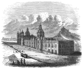 COLLEGIATE CHURCH OF GUADALUPE.
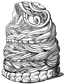 AZTEC SERPENT FIGURE.
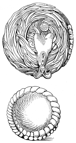 AZTEC SERPENT FIGURES.
ANTIQUITIES IN THE MUSEUM—STATUE OF CHARLES IV.—CONDITION OF THE
MUSEUM—FEATHERED SERPENTS—VICEROY'S
PORTRAITS—CORTÉZ—PORTRAIT—ARMOR—PEDRO DE
ALVARADO—IMAGES—VASES—TEZCOCO—PALACE—TROUGH—MASSIVE
MOUNDS—TESCOCINGO—HILL—ITS ANCIENT ADORNMENTS—ANCIENT BELLEVUE
AND RESERVOIR—TEZCOCAN SPLENDOR—BOSQUE DEL
CONTADOR—PONDS—LAKES—ARBORS—PYRAMIDS OF TEOTIHUACAN—HOUSES OF
SUN AND MOON—PATH OF THE DEAD—CARVED PILLAR—PILLAR AT
OTUMBA—PYRAMID OF XOCHICALCO—HILL OF XOCHICALCO—ITS STRUCTURES.
THE largest collection of the moveable antiquities of Mexico, belonging
to the Aztec and probably to the Toltec period of the occupation of the
valley or adjacent country, is found in the Museum which occupies two or
three rooms and part of the court yard of the University building. In
the centre of the quadrangle around which this edifice is erected is the
fine bronze statue of Charles IV., cast in the capital by a native
Mexican. It is an admirable work, and before the revolution stood in
front of the cathedral in the plaza or great square. The Spanish
sovereign is habited in an antique Roman dress, and is seated on
horseback. His right hand, holding a baton, is stretched forward, in an
attitude of command and the folds of a massive robe fall gracefully from
his neck, over the hind limbs of his horse. His brow is bound with a
laurel wreath, and a Roman blade rests on his thigh, whilst the animal
is represented in the act of advancing slowly and treading on a quiver
of arrows.
This statue is, of course, liable to some just criticism, founded on the
bad models for horses which the artist had recourse to in Mexico whilst
engaged in his task; and although a due degree of strict adherence to
historical portraiture did not permit him to exalt too much the personal
characteristics of the king, he has nevertheless contrived to infuse a
great deal of power into the statue so as to entitle it to a fair
comparison with some of the best European equestrian works in bronze.
All the minor parts of the figures and their decorations are finished
with the utmost neatness, and another
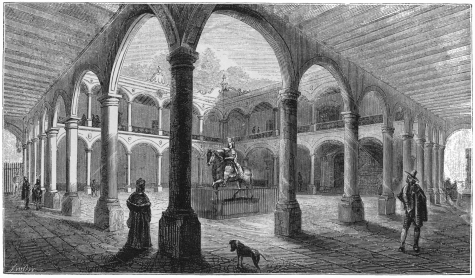 COURT OF UNIVERSITY.
proof is given, in this statue of the genius possessed by the natives
for the imitative arts. It was the work of Tolsa, and was first opened
to public view on its pedestal in the plaza, in the year 1803, under the
viceroyal government of Iturrigaray.
In a corner of this court yard, on the left of the portal, amid a
quantity of ancient lumber and relics, are the sacrificial stone and the
gigantic idol statue of Teoyaomiqui, described in the first volume of
this work. Here, too, are the huge serpent images, carved from basalt,
which are presumed to have been used in the worship of Quetzalcoatl—the
"feathered serpent,"—the "god of the air."
After an examination of the massive relics which lie in the court yard
of the University, we ascend by a broad stone staircase to the corridor
surrounding the quadrangle on the second floor. The lower story of this
edifice is occupied by the college chapel and the hall or recitation
room, whose lofty ceiling and windows, gloomy walls, and carved oaken
seats and pulpit, remind the stranger of the fine old monastic chambers
in similar institutions in Europe.
The apartments of the second floor open upon the broad corridor under a
light and tasteful arcade, and several rooms on the northern side are
devoted to the national collections, which, at the period of our visit
to Mexico in 1841 and 1842 were badly arranged and classified. The
salary devoted to the curator was scarcely adequate to support him, and
he probably paid more attention to the politics of the present day than
to the antiquities of the past. Nevertheless, we found him to be an
intelligent gentleman, fond of the relics, images and legends of the
Aztecs. He would, doubtless, have organized the valuable collection had
he been suitably aided, recompensed, or enabled to devote the whole of
his time to the archaiology of his country.
The first apartment on this side of the building is a sort of Spanish
lumber room, the wall of which is friezed with a series of the
viceroys, whilst, in a corner, stand the fragments of a throne, waiting,
perhaps, the order for their reconstruction upon the ruins of the
presidential chair. Hard by this royal relic, in appropriate contrast,
is an unfinished bas relief of a trophy of liberty; and above the
sculpture, suspended against the wall in a rough pine coffin, hangs an
Indian mummy, which was exhumed in the fields of Tlaltelolco north of
the capital. Another side of this saloon is occupied by full length
portraits of Ferdinand and Isabella. In the next chamber, west of this,
the mass of the smaller Aztec relics has been collected and preserved in
cases. A small library, containing some ancient manuscripts, and the
splendid work of Lord
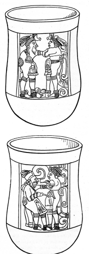 VASES FROM TULA.
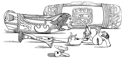 ANCIENT MUSICAL INSTRUMENTS.
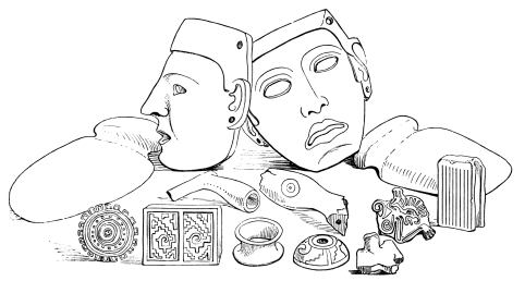 AZTEC MASKS, HATCHETS, PIPES, STAMPS, RING, DISTAFF.
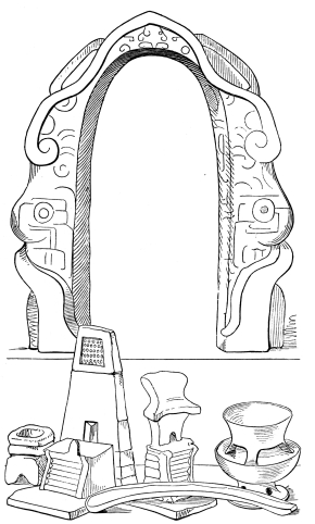 YOKE, KNIFE, SMALL VASES AND ALTARS USED IN AZTEC
SACRIFICES.
YOKE, KNIFE, SMALL VASES AND ALTARS USED IN AZTEC
SACRIFICES.
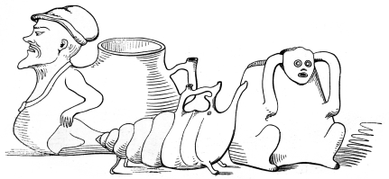 ANCIENT VASES AND VESSELS.
Kingsborough on Mexican antiquities, are preserved in this apartment,
while on the surrounding shelves, are deposited specimens of the
pottery, vases, pipes, idols, images, bows, arrows, axes, masks,
sacrificial instruments, beads and altars of the Aztecs.
Around the frieze of this room, as around that of the preceding, are
portraits of Mexican viceroys, at the head of which is the picture of
the conqueror Hernando Cortéz, from which the engraving in these volumes
has been accurately copied. Its authenticity is unquestionable, for its
history has been carefully traced to the period of the third viceroy,
Don Gaston de Peralta, Marques de Falces. This portrait represents the
hero of the conquest differently from any other picture we have found
either engraved or in oil, and exhibits the mingled air of elevated
veneration and command, of firmness and dignity, reflection and resolute
action, which are the chief historical characteristics of this
personage. In a corner, beneath the portrait, is a plain, unornamented
suit of steel armor, which belonged to the hero. Its small dimensions
convey no favorable impression of the hero's size or strength. The
armor, and patent of nobility granted by Charles V. to Pedro de
Alvarado, the companion of Cortéz, are also preserved in this saloon.
The royal document is exceedingly interesting from the fact that it
contains the autographs of the emperor and of Cortéz, who signed it as
El Marques del Valle de Oajaca.[61] Near these relics of two of the
leaders of the conquering army, preserved religiously under glass in a
golden frame, is the crimson silken banner, bearing the image of the
Virgin, crowned with a golden coronet and surrounded with twelve stars,
under which that army is alleged by the antiquarians to have marched the
second time against the Aztec capital.
In the apartment west of this, and facing on the plaza del Volador, are
the collections in natural history, which have been chosen apparently,
rather as curiosities than for scientific purposes. The specimens of
birds, beasts and reptiles, are indifferently preserved and classified,
and even the collection of minerals, which, in Mexico, ought to be of
the most perfect character, scarcely deserves mention as an important
illustrative cabinet.
The number of small images, which are usually called idols, contained in
the cases of the principal saloon is very large, and specimens are
presented from most parts of the territory comprised in the empire of
the Aztec sovereigns, as well as from Mechoacan. Some of the finest of
these, both large and small, are exhibited in the plates annexed to this
section; and we do not describe them minutely or singly, because they
depend for their interest upon their forms, which are better depicted in
drawings than language. Most of these were carefully delineated and
measured by the author of this work himself, and their accuracy may be
confidently relied on.
Two of the most beautiful and rare objects comprised in this collection,
are the terra-catta funeral vases, one of which is represented in the
accompanying engraving. It was exhumed some years ago in the northern
suburb of the capital, known as St. Juan Tlaltelolco, the neighborhood
of the ancient site of one of the Aztec teocallis. It is one foot ten
inches high, and one foot three and a half inches in diameter. Its upper
portion was filled with human skulls, and the lower with bones of the
rest of the frame, while the top was carefully covered with the circular
lid, which is given in the plate. The Indian head, winged and crowned
with a circlet of twisted bands and feathers, the graceful handles, and
the semicircle of sunflowers and ears of corn, which curves beneath the
central ornament, will give the reader an accurate idea of the reliefs
with which this vase is adorned. Besides these symbols of eternity,
fruition and fullness, the vessel still exhibits the brilliant colors of
blue, vermillion, lake, yellow and brown, with which it was originally
tinted.
Some beautiful specimens of the ancient musical instruments of the
Aztecs, are also preserved in this museum, and correct drawings of their
flageolets, whistles, drums and rattles, will be found in the
engravings.
We turn naturally from the ancient capital of the Aztec empire to the
remains of art and architecture which are yet found on the site of
Tezcoco, the second city in the realm, and in its vicinity. It was in
this place that Cortéz prepared for his second assault upon the city of
Tenochtitlan or Mexico, and here he put together and launched on the
lake the vessels which he had caused to be fashioned in Tlascala on the
other side of the mountains that bound the eastern edge of the valley of
Mexico. The spot where these vehicles of his troops across the waters of
Tezcoco were first deposited in their proper element is still pointed
out by the inhabitants, and is known as El Puente de las Brigantinas,
though it is now more than a mile from the shore of the lake.[62]
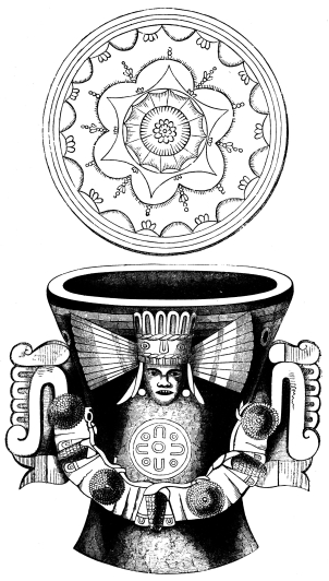 FUNERAL VASE AND COVER.
In the north-west section of the modern town of Tezcoco, on the top of a
shapeless mass of pottery, bricks, mortar and earth, which is thickly
overgrown with aloes, there are several large slabs of basaltic rock,
neatly squared and laid due north and south. According to the legends of
the spot this is the site of one of the royal residences, and like most
of the antiquities of Mexico, is connected with the name of the best
known emperor, as the palace of Montezuma. When Mr. Poinsett visited
Tezcoco in 1825, this heap had not been pillaged for modern
architectural purposes, as much as it has been since that period. Among
the ruins of the supposed palace he then found, a regularly arched and
well built passage, sewer, or aqueduct, which was formed of square
stones the size of bricks, cemented with the strong mortar which was so
much used by the Indians in all their works. In the door of one of the
rooms he noticed the remains of a "very flat arch," the stones
comprising which were of prodigious size and weight. On this spot, some
years ago, was found the sculptured basin, which, at the period of our
visit, had been transferred to and preserved in the collection of the
Ex-Condé del Peñasco in the city of Mexico.
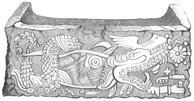 TROUGH FROM TEZCOCO.
In the southern part of Tezcoco, are the massive remains of three vast
pyramids, whose forms are still remarkably perfect. They succeed each
other in a direct line from north to south, and, according to our
measurement, are about four hundred feet in extent, on each of their
fronts, along the base line. They are built partly of burned and partly
of sun dried bricks, mixed up with fragments of pottery and thick
coverings of cement, through which neat canals had been moulded to
carry off the water from the upper terrace. Bernal Diaz del Castillo
informs us, that the chief teocalli of Tezcoco was ascended by one
hundred and seventeen steps; and, from the quantity of obsidian
fragments, images, vessels and heads of idols we found upon the sides of
these structures, it is not unlikely, that they, like the teocallis of
the capital were devoted to the same bloody and impious rites. In some
of the private houses of this town, many larger idols or images cut from
basalt are still preserved, and in 1825, Mr. Poinsett saw at the
residence of the commandant several of these figures, which were better
formed and designed than most of the Indian statues he had previously
encountered in his Mexican travels.
About three miles across the gently sloping levels which spread out east
of the town of Tezcoco, a sharp, precipitous conical mountain rises
abruptly from the plain, which is stripped of the forests that once
probably clothed its sides, and is now only covered with a thick growth
of nopals, bushes and aloes. From the quantity of Indian remains found
on this elevation and in its vicinity, there is no doubt that it was the
site of an Aztec palace, or was connected with the adjacent plain by
some architectural works that have been destroyed in the centuries that
have elapsed since the conquest. The traveller climbs this steep
mountain with great labor, and finds nearly every part of it covered
with the débris of ancient pottery and obsidian; and, in many parts of
his ascent, he is aided by the remains of the spiral road, cut in the
solid rock, which evidently once wound from its base to its top. Fifty
feet below the summit, looking exactly north, the massive stone of the
mountain has been cut into seats surrounding a recess leading to a steep
wall which is said to have been covered with a Toltec or Aztec calendar.
The sculptures upon the rock have, however, been destroyed by the
Indians, who cut through it as soon as they found the spot an object of
interest to strangers. These simple and superstitious beings imagined
that the quest of gold, alone, could induce travellers to leave the
capital, cross the lake, and toil up to the summit of this elevation,
and, accordingly they bored through the carved rock to obtain the buried
treasure, until they have formed a hole in the mountain, which is now
the hiding place and probably the home of a large number of squalid
wretches. On the absolute top of the mountain no traces of an edifice
are now observable; but as the Spaniards supposed it had been desecrated
by Indian rites in the olden time, it has been sanctified by the
erection of a cross, from whose feet the whole valley of Mexico, with
its lakes, plains, towns and majestic panorama of encircling mountains,
bursts on the sight of the wearied traveller.
Returning to the recess from the summit, and winding thence by a spiral
path down the eastern slopes of the hill, we find the road suddenly
ended by a wall which plunges precipitously down the mountain for about
two hundred feet. At this termination of the pathway, cut in the solid
rock, we found another recess, surrounded with seats, while, in the
centre of the area, was a circular basin, a yard and a half in diameter,
and three feet deep, into which water was formerly introduced, through
the small aperture in the square pipe which is delineated in the
engraving.
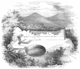 ANCIENT RESERVOIR.
This basin has, of course, been also connected with the fame of the
emperor, and is known as "Montezuma's bath." Its true use, however, is
perfectly evident to those who are less fanciful or antiquarian than the
generality of visiters. The picturesque view from this spot, over a
small plain set in a frame of the surrounding mountains and glens which
border the eastern side of Tescocingo, undoubtedly made this recess a
favorite resort for the royal personages at whose expense these costly
works were made. From the surrounding seats, they enjoyed a delicious
prospect over the lovely but secluded scenery, while, in the basin, at
their feet, were gathered the waters of a neighboring spring, which,
whilst refreshing them after their promenade on the mountain, gurgled
out of its stony channel and fell in a mimic cascade over the
precipitous cliff that terminated their path. It was to this shady spot
that they no doubt retired in the afternoon, when the sun was hot on the
west of the mountain, and here the sovereign and his court, in all
probability, enjoyed the repose and privacy which were denied them amid
the bustle of the city. Antiquarianism would be greatly assisted in its
researches and conjectures, if it recollected that the nature of
civilized men is the same in all ages, and that it is easier to judge
the architectural remains of our ancestors by this standard than by the
fanciful or classical rules, which they are dramatically disposed to
conjure up in order to interpret the past.
The hill or mountain of Tescocingo is connected with another hill on the
east by a tall embankment about two hundred feet high, upon whose level
top,—which may be crossed by three persons abreast, on horseback,—are
the remains of an ancient aqueduct, built of baked clay, the pipes of
which are now as perfect as on the day they were first laid. The water
was brought hither by a canal around the hill to which it is connected
by the embankment; while, east of this, and uniting the last hill with
another elevation, there is a second aqueduct raised on an embankment,
which was fed by other aqueducts and canals that formerly conducted the
water from the eastern mountains about three leagues distant.
Such are some of the remains of Tezcocan sumptuousness, in the
neighborhood of the ancient capital of this region; and, together with
the ancient grove of cypresses, known as El Bosque del Contador, lying
across the levels north-west of Tezcoco, may be regarded as the most
remarkable relics of the princes and people of the Tezcocan monarchy.
The grove of the Contador is formed by double rows of gigantic
cypresses, about five hundred in number, arranged in a square
corresponding with the points of the compass and enclosing an area of
nearly ten acres. At the north-western point of this quadrangle another
double row of lordly cypresses runs westwardly towards a dyke, north of
which there is a deep oblong
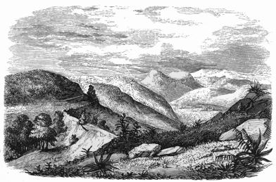 ANCIENT AQUEDUCT AT TEZCOSINGO.
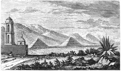 PYRAMIDS OF TEOTIHUACAN.
tank, neatly walled and filled with water. From the soft spongy
character of the soil in the centre of the great quadrangular
grove—which it is impossible for any one to cross without danger of
being mired in the unsubstantial morass,—it is supposed that the vast
area was once occupied by a lake, whose waters were probably forever
renewed by the hydraulic works we have already described in the
neighborhood of Tescocingo. Along the raised banks, and beneath the
shadows of the double line of majestic trees, were the walks and arbors
in which Nezahualcoyotl and his courtiers amused themselves. The ponds
and lakes were filled with fish and frequented by the wild fowl that now
cover the margins of the Mexican lakes; while the same benignant sky and
delicious climate that bless the descendants of the Spaniards, reigned
then, as now, over the dusky children of the soil.[63]
A ride on horseback of about three hours at a pleasant pace, will bring
the traveller from Tezcoco to the village of St. Juan, lying in an
extensive level bordered on all sides by ridges and mountain spurs,
except towards the east, where a depression in the chain leads into the
plains of Otumba, upon which Cortéz fought so remarkable a battle when
pursued by the victorious Aztecs. In the centre of the levels of St.
Juan are the two remarkable pyramids of Teotihuacan,—the
Tonatiuh-Ytzagual, or "house of the sun," and the Meztli-Ytzagual, or
"house of the moon." These vast masses first break upon the sight as the
ridge is crossed. At that distance the foliage and bushes that cover
them are not easily discerned, and the perfect figure of the original
structure seems to be revealed in all its freshness. As the objects are
approached, however, the work of time upon the monuments becomes
evident. The sharp pyramidal lines are all broken. Aloes, nopals,
magueys, mesquite and parasites crawl and cling over every part of the
ruined heaps; and the whole mass resembles a crumbling but gigantic pile
of rocks and earth, which is scarcely distinguishable from the adjacent
hills until its structure is closely examined.
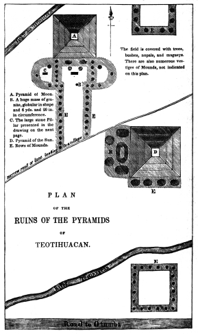 PLAN OF THE RUINS OF THE PYRAMIDS OF TEOTIHUACAN.
Ascending the one hundred and twenty-one feet of the house of the Sun,
we reach a level platform on the summit, whence a charming prospect
extends for many miles to the south and east over cultivated fields. At
the southern base of this pyramid, which measures six hundred and
eighty-two feet, there are four small mounds, and beyond these there is
a range of lesser tumuli running towards an elevated square of mounds
lying between the stream west of Teotihuacan and the present road to
Otumba. On the west front, five tumuli surround an oval mound whose
centre is depressed, and all of these jut out westwardly towards a line
of similar grave-like elevations lying on both sides of the avenue that
leads to the house of the Moon. This road is the Micoatl, or path of the
dead, which the ancient writers locate in the valley of San Juan.
The other pyramid, or house of the Moon is smaller, and like its
neighbor is composed of rock, stones, pottery and cement,—covered with
the debris of obsidian and terra-catta images which lie scattered from
the top to the base amid the tangled aloes and creepers that have struck
their roots deeply into the crevices. The house of the Sun is not known
to have any cavity within its body, but in the house of the Moon,
between the second and third terraces, a narrow passage has been
detected, through which two wells or sunken chambers, about fifteen feet
deep, may be reached by crawling on hands and knees over an inclined
plain for a distance of about eight yards. The walls of this cryptic
entrance, and of the sunken chamber are made of the common sun dried
bricks, but there are no remains of sculpture, painting, or bodies to
reward an antiquarian for groping through the dark and dusty aperture.
South of this pyramid of the Moon, is the Micoatl or path of the dead,
to which we have already alluded. Two elliptical elevations rise at the
south-east and south-west corner of the Teocalli, upon each of which
there are three mounds, whilst their diameters are bisected by other
rectilinear elevations upon each of which there are five similar mounds.
Four circular and one square mound lie within the area of this
inclosure, and the whole appears to form a massive portal of tumuli to
the majestic pyramid. A long double line of minor mounds stretches away
to the south on the sides of the avenue, until all traces of them are
lost in the field in front of the temple of the sun with whose groups of
tumuli this path was in all likelihood formerly united. The student will
obtain a better idea of the localities of these remains by examining the
plan which was carefully prepared by the author, on the spot, in 1842.
At B, on the plan, there is a large globular mass of granite measuring
nineteen feet eight inches in circumference, upon which there is some
rude carving which has been found to bear some resemblance to the Aztec
figure of the sun;—and in the semicircular enclosure among the
tumuli, at C, is placed the sculptured granite stone, represented in
the annexed cut. It lies due east and west. The dark shadow at B,
represents a sink or hollow three inches deep at the sides, and six at
the top and bottom. This is known as the "fainting stone," as it is
alleged that all who recline on its surface are sure to experience
lassitude, or loose animation for a while!
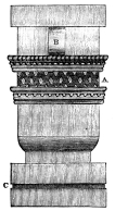
This place is famous in the ancient history of Mexico, but no remains of
importance have been found in its vicinity or within the limits of the
village. When Mr. Poinsett visited it during his residence in Mexico as
Envoy from the United States, he observed no relic of the past worthy of
examination or record except the fragment of a pillar represented in the
annexed drawing.
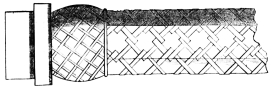
About eighteen miles south of Cuernavaca, in the State of Mexico, there
is a cerro or hill, known as Xochicalco or the "hill of flowers,"
whose summit is occupied by the remains of an ancient stone pyramid. The
traveller reaches this eminence after travelling over a wide plain
intersected by deep barrancas, and almost entirely denuded of trees and
shrubbery. The base of this hill is surrounded by the remains of a deep
wide ditch, and its top is attained by five spiral terraces, supported
by walls of stone joined with cement. At suitable distances from each
other, along the edge of this winding path are the remains of bulwarks
fashioned like the bastions of a fortification. On the summit there is a
wide extensive level, the eastern part of which is occupied by three
truncated cones, resembling the smaller mounds found among the pyramids
of Teotihuacan. On the other three sides of the esplenade there are
other masses of stones, which may have also been portions of similar
tumuli. The stones of which these lesser mounds were constructed have
evidently been nicely shaped and covered with a coat of stucco.
Passing upward, amid tangled trees and vines, along the last terrace,
and through the cornfield which is cultivated on the plain at top by an
Indian ranchero, the traveller at length stands before the remains of
the elegant structure that once crowned the summit with its carved and
massive architecture. The reports of engineers who visited this pyramid
in years long past, and the legends of the neighborhood, declared that
it originally consisted of five stories, placed upon each other at
regular intervals and separated by narrow platforms. But of all these,
nothing now remains except portions of the first body, which is formed
of cut porphyry and covered with the singular emblems which are
accurately represented in the annexed plate of the north-western angle.
Amid the neglect of the viceroyal government, and the revolutionary
disturbances subsequent to the rebellion against Spain, this beautiful
monument of ancient art, seems to have been entirely forgotten, save by
the neighboring haciendados or planters, who used it as a quarry, from
which they might supply the wants of their estates without the trouble
or expense of a stone cutter. In the middle of the eighteenth century
the fine terraces were yet perfect. But, as the country became settled
in the neighborhood, the farmers began to pilfer from the mass, and, not
long before we visited it in 1842, an adjacent land owner had carried
off large loads of the sculptured stones to build a dam in a neighboring
ravine, for the use of his cattle.
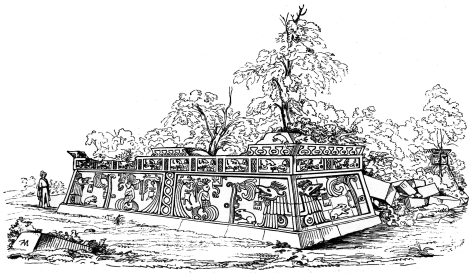 REMAINS OF THE PYRAMID OF XOCHICALCO.
The story of this pyramid that has been thus far spared, is rectangular;
and, facing north, south, east and west, in exact correspondence with
the cardinal points, it measures sixty-four feet on its northern front
above the plinth, and fifty-eight on the western. The distance between
the plinth and frieze is about ten feet, the breadth of the frieze is
three feet and a half, and the height of the cornice one foot and five
inches. The most perfect portion is the northern front; and, here, the
carving in relief, which is between three and four inches deep, is most
distinctly visible. The massive stones,—some of which are seven feet
eleven inches long, by two feet nine inches wide; five feet two inches
long, and two feet six inches broad, and five feet long, two feet seven
inches high, and four feet seven inches broad,—are all laid upon each
other without cement, and kept together simply by the pressure and
gravity of the general architecture. These dimensions of the fragments
of so splendid an edifice will give the reader an idea of the labor and
ingenuity which were employed in its construction. For it must be
remembered, that not only was the Indian skill taxed in the design and
shaping of the stones in the immediate neighborhood, but that the
weighty materials were drawn from a considerable distance, and borne up
a hill three hundred feet in height, without the use of horses. The
terraces supporting the spiral path, and their bastion-like bulwarks,
were subjects of equal labor; while the broad deep ditch, surrounding
the whole, was in itself a work exacting the most patient industry. Few
nations have probably devoted more time and toil to a work which was
perhaps partly religious and partly defensive.
These are the external works upon the Cerro of Xochicalco, but it
appears from good authority, and from the report of the neighborhood,
that the hill itself was partly hollowed into chambers. Some years since
a party of gentlemen, under the orders of government, explored these
subterranean retreats, and, after groping through dark and narrow
passages, whose side walls are covered with a hard and glistening gray
cement, they came to three entrances between two enormous pillars cut
from the rock of which the hill is formed. Through these portals they
entered a chamber, whose roof was a cupola of regular shape, built of
stones placed in circles, while at the top of the dome was an aperture,
which probably led to the surface of the earth or the summit of the
pyramid. Nebel, who visited the ruins some years ago, relates an Indian
tradition, that this aperture ascended immediately above an altar placed
in this chamber, and that the sun's rays fell directly on the centre of
the shrine when that luminary was vertical!
STATE OF MECHOACAN—BOUNDARIES—ELEVATIONS—VOLCANO OF
JORULLO—THEORIES OF HUMBOLDT AND LYELL—PRESENT CONDITION—RIVERS
OF
MECHOACAN—CLIMATE—HEALTH—INDIANS—DEPARTMENTS—AGRICULTURE—TOWNS—MINES—JALISCO—BOUNDARIES—POPULATION—RIVERS—LAKES—DIVISIONS—MANUFACTURES—AGRICULTURE—FACTORIES—GUADALAJARA—TOWNS—SAN
JUAN DE LOS LAGOS—TEPIC—SAN BLAS—MINES—ISLANDS—MINING
REGION—INDIANS—CHARACTER AND HABITS—CHURCH AND
SCHOOL—EDUCATION—BISHOPRIC—TERRITORY OF
COLIMA—EXTENT—CLIMATE—PRODUCTIONS—TOWNS.
THE State of Mechoacan is the old Spanish Intendencia of Vallodolid, and
includes a great part of the ancient Indian Kingdom of Mechoacan, or
Mechoacan of the Tarascos. It is bounded on the north by Guanajuato,
north-easterly of Querétaro, south-easterly by Mexico, westerly by
Jalisco, and south-westerly, for a short distance, by the Pacific.
This State lies chiefly on the western slope of the Cordillera, and is
cut up by hills and genial vallies. The highest point within its limits
is the Peak of Tancitaro, which, in all probability, is an extinct
volcano. East of this, and south of the village of Ario, the Volcano of
Jorullo burst forth on the night of the 29th of September, 1759.
The great region to which this mountain belongs has been already
described in our account of the geological structure of Mexico. The
plain of Malpais forms part of an elevated platform, between 2,000 and
3,000 feet above the level of the sea, and is bounded by hills composed
of basalt, trachyte, and volcanic tuff, clearly indicating that the
country had previously, though probably at a remote period, been the
theatre of igneous action. From the era of the discovery of the New
World to the middle of the last century, the district had remained
undisturbed, and the space, now the site of the volcano, which is thirty
leagues distant from the nearest sea, was occupied by fertile plains of
sugar cane and indigo, and watered by the two brooks, Cuitimba and San
Pedro. In the month of June, 1759, hollow sounds of an alarming nature
were heard, and earthquakes succeeded each other for two months, until,
in September, flames issued from the ground, and fragments of burning
rocks were thrown to prodigious heights.
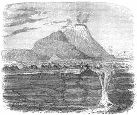 THE VOLCANO OF JORULLO.
"Six volcanic cones, composed of scoriæ and fragmentary lava, were
formed on the line of a chasm which ran in a direction from N. N. E. to
S. S. W. The least of these cones was 300 feet in height, and Jorullo,
the central volcano, was elevated 1,600 feet above the level of the
plain. It sent forth great streams of basaltic lava, containing included
fragments of rocks, and its ejections did not cease till the month of
February, 1760.
"Humboldt visited the country more than forty years after this
occurrence, and was informed by the Indians, that when they returned,
long after the catastrophe, to the plain, they found the ground
uninhabitable from the excessive heat. When he himself visited the
place, there appeared around the base of the cones, and spreading from
them, as from a centre, over an extent of four square miles, a mass of
matter of a convex form, about 550 feet high at its junction with the
cones, and gradually sloping from them in all directions towards the
plain. This mass was still in a heated state, the temperature in the
fissures being on the decrease from year to year, but in 1780 it was
still sufficient to light a cigar at the depth of a few inches. On this
slightly convex protuberance, the slope of which must form an angle of
about 6° with the horizon, were thousands of flattish conical mounds,
from six to nine feet high, which as well as large fissures traversing
the plain, acted as fumeroles, giving out clouds of sulphuric acid and
hot aqueous vapor. The two small rivers before mentioned disappeared
during the eruption, losing themselves below the eastern extremity of
the plain, and reappearing as hot springs at its western limit. Humboldt
attributed the convexity of the plain to inflation below; supposing the
ground, for four square miles in extent, to have risen in the shape of a
bladder to the elevation of 550 feet above the plain in the highest
part. But this theory is by no means borne out by the facts described;
and it is the more necessary to scrutinize closely the proofs relied on,
because the opinion of Humboldt appears to have been received as if
founded upon direct observation, and has been made the ground work of
other bold and extraordinary theories. Mr. Scrope has suggested that the
phenomena may be accounted for far more naturally by supposing that lava
flowed simultaneously from the different orifices, and principally from
Jorullo, united with a sort of pool or lake. As it poured forth on a
surface previously flat, it would, if its liquidity was not very great,
remain thickest and deepest near its source, and diminish in bulk from
thence towards the limits of the space which it covered. Fresh supplies
were probably emitted successively during the course of an eruption
which lasted a year; and some of these, resting on those first
emitted, might only spread to a small distance from the foot of the
cone, where they would necessarily accumulate to a great height.
"The showers, also, of loose and pulverulent matter from the six
craters, and principally from Jorullo, would be composed of heavier and
more bulky particles near the cones, and would raise the ground at their
base, where, mixing with rain, they might have given rise to the stratum
of black clay which is described as covering the lava.
"The small conical mounds called 'hornitos' or little ovens may resemble
those five or six small hillocks which existed in 1823 on the Vesuvian
lava, and sent forth columns of vapor, having been produced by the
disengagement of elastic fluids heaving up small dome-shaped masses of
lava. The fissures mentioned by Humboldt as of frequent occurrence, are
such as might naturally accompany the consolidation of a thick bed of
lava, contracting as it congeals; and the appearance of rivers is the
usual result of the occupation of the lower part of the valley or plain
by lava, of which there are many beautiful examples in the old lava
currents of Auvergne. The heat of the 'hornitos' is stated to have
diminished from the first; and Mr. Bullock, who visited the spot many
years after Humboldt, found the temperature of the hot spring very
low,—a fact which seems clearly to indicate the gradual congelation of
a subjacent bed of lava which, from its immense thickness, may have been
enabled to retain its heat for half a century. The reader may be
reminded, that when we thus suppose the lava near the volcano to have
been, together with the ejected ashes, more than 500 feet in depth, we
merely assign a thickness which the current of Skaptar Jokul attained in
some places in 1783.
"Another argument adduced in the support of the theory of inflation from
below, was, the hollow sound made by the steps of a horse upon the
plain; which, however, proves nothing more than that the materials of
which the convex mass is composed are light and porous. The sound called
"rimbombo" by the Italians, is very commonly returned by made ground
when sharply struck, and has been observed not only on the sides of
Vesuvius and of other volcanic cones where a cavity is below, but also
in plains, such as the Campagna di Roma, composed in a great measure of
tuff and other porous and volcanic rocks. The reverberation, however,
may be assisted by grottoes and caverns, for these may be as numerous in
the lavas of Jorullo as in many of those of Etna; but their existence
would lend no countenance to the hypothesis of a great arched cavity,
four square miles in extent, and in the centre 550 feet high.[64]
"Mr. Burkhart, a German director of mines, who examined Jorullo in 1827,
ascertained that there had been no eruption there since Humboldt's visit
in 1803. He, went to the bottom of the crater, and observed a slight
evolution of sulphurous acid vapors, but the "hornitos" had ceased
entirely to give forth steam. During the twenty-four years intervening
between his visit and that of Humboldt, vegetation had made great
progress on the flanks of the new hills, and the rich soil of the
surrounding country was once more covered with luxuriant crops of sugar
cane and indigo, and there was an abundant growth of natural underwood
on all the uncultivated tracts."[65]
The State of Mechoacan is extraordinarily rich in rivers and streams.
The Lerma, Balsas, Zitacuaro, Huetamo, Cluranúeco, Marquéz, Aztala,
Tlalpujahua, and some smaller streamlets and brooks are found in its
vallies; while the lakes and ponds of Cuizco or Aaron, Patzcuaro,
Huango, Tanguato, and Huaniqueo afford supplies to numerous
neighborhoods. The climate of Mechoacan is regular, not liable to
extraordinary or sudden changes, and remarkably genial. On the Pacific
coast and in its vicinity, as in the other middle and southern States of
the Confederacy, agues and intermittent fevers prevail; but the
population seems to have increased considerably since the beginning of
this century, and even in a larger proportion than in some other parts
of Mexico. In 1849, the number of inhabitants was estimated to be not
less than 590,000. Three Indian tribes still dwell within its borders:
1st, the Tarascos; 2d, the Otomies; 3d, the Chichimecas. The whole
southern half of the State is peopled with Indians.
Mechoacan is divided into 4 departments and 62 municipalities:
| 1. | Department | del Norte, with 14 municipalities. |
| 2. | " | del Oriente, with 15 municipalities. |
| 3. | " | del Sur, with 11 municipalities. |
| 4. | " | del Poniente, with 22 municipalities. |
These 4 departments contain the three cities of Morelia, Patzcuaro, and
Tzintzoutzan;—the three towns of Zitacuaro, Zamora, and Charo;—256
villages, 333 haciendas, and 1,356 ranchos, which are divided among
83 parishes.
The agricultural productions of Mechoacan are similar in character to
those of the other Western States of Mexico lying within the same
longitude. The best sugar plantations are about 12 leagues from
Patzcuaro. At the foot of Jorullo, cotton, indigo, cacao and sugar are
planted; and mainoc or cassava, potatoes and yams are sown in genial
spots, whilst maiz, wheat, barley and magueys are cultivated in the
higher and cooler regions. The finest tropical fruits are raised in the
warm portions of the State.
The capital of Mechoacan is Morelia, sometimes called Valladolid, or
Valladolid de Mechoacan. Its modern title is derived from the name of
the insurgent leader Morelos.
Morelia lies 6,398 feet above the level of the sea, in latitude 19° 42´
North, 103° 12´ 15´´ W. long. from Paris,—between the two streams which
water the Valley of Olid. It is a small, but handsome town, possessing
some fine churches, and a charming passeo and alameda. The climate is
mild and wholesome, but snow falls occasionally during the winter.
Patzcuaro lies on the south-eastern bank of the lake of that name.
Tzintzoutzan is about 4 leagues from Patzcuaro, in a northerly
direction, upon the banks of the same lake. It was once the capital of
the ancient Indian Kingdom of Mechoacan, but is now only a small
village of 2,000 inhabitants, who have nevertheless bestowed on it the
title of—"City." Some relics of the Tarascan architecture are said to
be found at this place, but we do not possess any authentic accounts or
drawings of them.
Zitacuaro is the capital of the old mining district 7 leagues south of
Angangueo, 6,451 feet above the sea, and contains about 2000
inhabitants. Many small Indian villages are also found in the
neighborhood, but they do not require special notice.
Angangueo is a mining town 7 leagues south of Tlalpujahua, with about
1,900 inhabitants.
San Pedro y San Pablo de Tlalpujahua, also a mining village and
district, 35 leagues north north-west from Mexico, eastward of Morelia,
and about 6 leagues south of the left bank of the Lerma. It lies in a
beautiful mountain region at the foot of the Cerro del Gallo, 8,386
feet above the sea. Two leagues north of Tlalpujahua, is the Hacienda
de Tepetongo, remarkable for its warm springs, which rising amid
volcanic rocks, maintain a temperature of 27° Reaumeur; and are freely
resorted to by the neighboring Indians. Cuizco; Huaniqueo; Zamora;
Tancuancicuaro; Tarecuato; Tlazazalca, Tanguato, are the remaining towns
and villages in this part of the country deserving mention. In the
Department del Norte, we find Sirisicuaro; Santa Anna; Araron;
Copandaro; Teremendo; Pareachecuaro, and Tirepiteo. In the Department
del Oriente lie San Felipé; Patambero; Enadio; Orocutui; Tusantla;
Clirangangueo; Tichiqueo; Huetano Pungarahuato; and Cayuca. In the
Department del Sur, are Ario; Tacambaro; Turicato; Churumuco; Santiago
Coalcoman; Uruapan and Tancitaro. In the Department del Poinente, we
find Chilchote, with about 4,700 inhabitants, and Tincuindui.
The mining districts of Mechoacan are Tlalpujahua, Angangueo, and
Ozumatlan. Formerly, the mines of Zitacuaro, Ingnaran, and a few other
districts were somewhat renowned for their value; but, at present, they
are either entirely abandoned or only slightly worked.
The present State of Jalisco and former Intendency of Guadalajara,
formed together with Zacatecas, the old Spanish kingdom of New Galicia.
It is bounded on the north by Durango; on the north-west by Sinaloa; on
the north and east by Zacatecas and Guanajuato; on the south and
south-east by Mechoacan and the Territory of Colima; and on the west by
the Pacific coast, for a distance of 160 leagues. The State stretches
from 19° 5´ to 23° 55´ of north latitude; and from 103° 45´ to 108° 28´
30´´ west longitude from Paris. Its population is estimated at about
700,000.
The greater part of Jalisco lies on the western slope of the Cordillera;
and its table lands, which resemble those of the great plateau of
Mexico, are somewhat cut up by mountain spurs. The upper regions
consequently are comparatively sterile, whilst the lowlands are rich and
fruitful.
The Sierras of Bayona, in the north-west end of Chalchihuitéc, in the
north-east of the State, are its most remarkable mountain ranges. The
Rio Grande de Santiago is the principal stream in Jalisco; but during
the six months of the dry season, its waters are either extremely
shallow or disappear altogether. The Bayona is a boundary between this
State and Sinaloa.
The Lake of Chapala, lies about fifteen leagues from the city of
Guadalajara, and forms a basin among the mountains of 36 to 40 leagues
in length by 5 to 8 in breadth. Its usual depth is about six and a half
fathoms. Its scenery is remarkably beautiful, and it supplies the
neighborhood plentifully with fish and water-fowl.
Jalisco is divided into eight Cantons or Departments:—Guadalajara,
Lagos, La Barca, Sayula, Etzatlan, Autlan, Tepic and
Colotlan;—containing 8 large cities and towns, 318 small villages, 387
haciendas or plantations, and 2,534 ranchos or farms.
The agricultural productions of Jalisco combine those of the tierras
calientas and the tierras templadas. On the upper plateaus, grain and
agaves are chiefly planted, and on the coast, sugar and cotton. A small
quantity of cochineal is also raised, and in the district of Autlan de
la Grana, plantations of the cacao-tree have been made. All the fruits
of the tropical and temperate zones are readily grown; sheep, mules,
horses, goats, neat-cattle, are raised in great abundance, and not less
than 10,000 head of cattle are found on many haciendas de Gañado.
The manufactures of Jalisco are chiefly confined to rude cotton fabrics
or some fanciful articles of dress. The people are celebrated for their
gold and silver embroidery upon leather which is used in the manufacture
of saddles and horse equipage.
Nearly all the importations into this State come either by land from San
Luis Potosi, the city of Mexico, or San Blas, which is the chief port of
Jalisco on the Pacific. A large portion of the foreign wares are
doubtless smuggled into the interior, or introduced through the corrupt
connivance of custom-house officers along the line of the west coast.
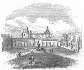 PLAZA OF QUADALAJARA.
The city of Guadalajara, 150 leagues from Mexico, the capital of
Jalisco, is situated upon an extensive plain. Its handsome streets are
airy, and many of the houses well built. There are fourteen squares,
twelve fountains, and a number of convents and churches, the principal
of which is the magnificent Cathedral, whose towers were injured by an
earthquake in 1818. An Alameda is beautifully laid out with irregular
alleys, planted with trees, interspersed with flowers, while, in the
centre, a fountain throws up a constant stream of excellent water.
Within the town, the Portales are the principal rendezvous, and
contain numerous shops and stalls filled with European and East India
fabrics, fruit of all kinds, earthenware from Tonala, shoes, mangas,
saddlery, birds, sweetmeats of Calabazato, and a thousand other
varieties to attract the passers by. Each of the stalls pays a small
ground rent to the convents of Guadalajara, and thus afford an ample
revenue to the brotherhoods.
The population of the town may be estimated at 50,000. Its air is mild
and wholesome, and during the season when the neighboring vegetation is
refreshed by rains, the scenery of Guadalajara is considered as
picturesque as that of the city of Mexico.
In the district of Lagos lies the town of San Juan de los Lagos, in a
deep ravine, almost upon a level with the river of the same name, and
with its mud houses and wild scenery, offers no evidence of the gay and
festive appearance it presents during the famous annual fair which is
held in it, commencing the 5th of December, and lasting eight days. At
that period, San Juan is the resort of merchants, with their wares from
all parts of the Republic, and all the planters or wealthy rancheros
within an hundred leagues, resort thither with their families.
There is a beautiful church in this town, dedicated to Our Lady of the
Lake, and medals struck in honor of her are sold at the door of the
temple.
In the district of la Barca are the towns of La Barca, Tlachichilco,
Chapala, Axixis, Ojotepec, Aranda and Atotomilco.
In the district of Etzatlan, we find the capital village of Etzatlan,
Cocula, San Martin, Améca, Tequila and Agualco.
In the district of Sayula, are Sayula, Zapotlan el grande, Zapotitli,
Tuspan and Zacualco.
In the district of Autlan, we find Autlan de la Grana, a town with
4,000 inhabitants, La Villa de la Purificacion, with 3,000, Mascota, San
Sebastian and Tecolotlan, which are large villages.
In the district of Tepic lies the town of Tepic, a fine well built
town in the midst of a rich mountain plain, 2,963 feet above the level
of the sea, and next to the capital, the finest and most populous town
in the State. Besides this, there are Pochotitlan, Compostella,
Ahuacatlan, S. Maria del Oro, Santiago, Centispac, Acaponeta, and
Guajicoria. Three leagues north-east of the latter, a warm spring is
found in the neighborhood of the Cerro de Huicalapa.
The capital of the district of Colotlan, is San Antonio de Colotlan,
containing about 4,000 inhabitants. In this district we also find Santa
Maria, a large and populous village lying 5,659 feet above the sea,
Huejucar, Cartagena, Tlaltenango and Bolaños, a mining town.
The best sea-port of Jalisco is that of San Blas, whose town lies in 21°
32´ 24´´ north latitude and 107° 35´ 48," west longitude from Paris,
upon a rock of basaltic lava, 90 feet high, isolated entirely on three
sides, and reached by a bad road on the fourth. The haven is
land-locked, and the anchoring ground good and deep; but during the
rainy season the levels around the rock which is the foundation of the
town, become filled with stagnant pools until the whole adjacent country
is covered with water. The burning sun of the coast acts rapidly upon
these shallow marshes and fills them with insects and miasma. San Blas
soon becomes uninhabitable, and its population betake themselves either
to Tepic, Guadalajara, or the first elevations of the mountains in the
interior.
The only mining region of any note in Jalisco is that of Bolaños. The
mines of Hostotipaquillo, near Tepic, are now abandoned; those of
Guichichila, Santa Maria del Oro, Santa Martin and Ameca, in the
district of Etzatlan, in the neighborhood of Cocula, are partially
wrought. Among the unexplored sites of base and spurious metals in this
State, we may mention those found in the vicinity of Compostella, those
near the ranchos of Rosa Morada and Buena Vista, towards the coast,
between the villages of Santiago and Acaponeta, and those near
Guajicoria, north of the last named village.
The Islands of La Isabela, San Juanico and Marias, lie on the Pacific
coast of Jalisco.
The aborigines of Jalisco, formerly warlike and devoted to a bloody
religion, belong to the tribes of Cazçanes, Guachichiles and Guamanes.
They are most generally tillers of the ground, adhering to the doctrines
of the Catholic church, and they have particular fondness for settling a
while in lonely and wild regions, and for changing their place of
residence frequently. The manners and customs of the Guachichiles are in
many respects peculiar. They still use the bow and arrow as weapons.
Their quivers are made of deer and shark skins, and the points of their
reed arrows are formed of a hard wood and rarely of copper. The garments
of the men consist of a kind of short tunic, roughly made by themselves
of blue or brown cotton material, with a girdle hanging down in front
and behind, to which is generally added a pair of trousers of tanned
goat or deer skin. Married persons, men as well as women, wear straw
hats with broad rims and high crowns, ornamented with a narrow ribbon of
bright colored wool and tassels. Their black bushy hair is worn very
long, bound with bright colored ribbons and tassels, or plaited in
queues. No unmarried person, male or female, dare wear a hat. The women
are clothed with an under garment of rough wool or cotton and a mantle
of the same material, which has an aperture on top through which they
pass their heads. When sober they are peaceable and easily controlled,
but when intoxicated violent and quarrelsome. At marriage the husband
has the right of taking his wife on trial and of sending her back to her
parents after some time if she should not please him, and this, even if
she should be pregnant by him. This, however, does not prevent such a
female marrying afterwards. If she gives satisfaction, the husband has
the ceremony performed by a priest or monk, who for this purpose makes a
yearly circuit, and often performs the marriage and a baptism at the
same time!
Church and school matters, particularly the latter, are provided for in
the State of Jalisco in an inferior manner to other parts of the Mexican
Republic. A few years ago, there were in the entire State only 113
elementary schools attended by not more than 6,167 children. The
instruction was limited almost exclusively to reading, for of this
entire number, according to official accounts, there were not more than
2,092 learning to write. For instruction in the higher branches there
were in the entire State only two indifferent institutions located in
the capital—one the Seminario Conciliar for instruction of the clergy,
with thirteen chairs and a species of academy, founded since the
revolution, called El Instituto, with chairs for anatomy, modern
languages, mineralogy, mathematics, &c. The seminary was attended by 120
boarders and 329 day scholars. The institution had one director, ten
professors, two assistant teachers, a secretary, etc.; the available
funds of the same consisted, independent of a fee paid by the wealthier
scholars, of scarcely any thing but an addition of two thousand and
seventy dollars granted by the State treasury. Jalisco felt deeply this
sad condition of public instruction, and numerous propositions for its
amelioration and thorough reformation were made, but money was wanting
and fit men for the professorships, and discretion and tact on the part
of the authorities, and it is scarcely to be expected that since that
time public instruction has been essentially bettered. The "Instituto"
since then has been made a university. The State forms a separate
bishopric. It was erected in the year 1548, and embraced at that time in
like manner the present States of Durango and New Leon. The bishop had
his seat first at Compostela; in 1569 it was transferred to Guadalajara.
In 1631 Durango was separated from Jalisco, and in 1777 both were made
distinct bishoprics. The episcopal chapter of Jalisco consisted of three
dignitaries, four canons and four prebendaries.
This territory is bounded north by Jalisco, south by Mechoacan, east by
both of these States, and west by the Pacific. It extends between the
degrees of 18° 18´ and 19° 10´ of north latitude, and 102° 51´ and 104°
2´ west longitude from Greenwich. Its surface is generally level, broken
by hills, from among which rises the mountain of Colima, the westernmost
of Mexican volcanoes. It lies in the north-eastern corner of the
Territory, and reaches a height of 9,200 feet above the level of the
sea.
The climate of Colima is warm—on the coast it is hot—but the territory
is generally considered healthy and fruitful in all portions. Its
population is estimated at about 45,000. Cotton, sugar, tobacco and
cacao are produced by its agriculturists, while on the coast large
quantities of salt are made from the waters of the sea. Rich iron
deposits have been recently found, and individuals have commenced
developing this important source of national wealth.
The chief town of the Territory is Colima, about two leagues south of
the volcano, containing between fifteen and twenty thousand inhabitants.
The other towns and villages are Almoloyan, with 4,000 people, Xala,
Ascatlan and Texupa. The haven of Manzanillo, or port of Colima, as it
is sometimes called, is seventeen leagues west of the capital; and with
but small expense to government might be made one of the best anchorages
in the Republic.
 THROWING THE LAZO.
SINALOA—BOUNDARIES—CLIMATE—DIVISIONS—INDIANS—PRODUCTS—TOWNS—MINES.—SONORA—BOUNDARIES—DIVISIONS—RIVERS—CLIMATE—INDIANS—TRADE—TOWNS—MINES.—TERRITORY
OF LOWER
CALIFORNIA—BOUNDARIES—CHARACTER—POPULATION—PRODUCTS—PEARLS—SALT—MINES—SEALS—WHALES—CLIMATE—PORTS—TOWNS—POPULATION.—STATE
OF GUERRERO.
Sinaloa is bounded on the south by Jalisco, on the east by Durango, on
the south-west by Chihuahua, on the north by Sonora and on the west by
the Pacific coast for a distance of 200 leagues along the Gulf of
California. It lies between 22° 35´ and 27° 45´ of north latitude and
107° and 113° west longitude from Paris. The river Cañas divides it from
Jalisco, and the Mayo from Sonora. Its length from south-east to
north-west is about 180 leagues, and its breadth in the centre 50 to 56
leagues. This State is partly mountainous and partly level coast land.
On the east it lies on the limits of the Cordilleras of Mexico. The
levels begin in the west near the boundaries of Jalisco, and stretch out
their broad sand-wastes to the town of Alamos and the river Mayo, until
they are lost in the State of Sonora. This region is scorched with a
blazing sun, and is of course but thinly peopled and little cultivated.
Near the city of Alamos a more genial country begins. The central and
eastern parts of Sinaloa are rich in table lands and values, while the
slopes of the mountains are thickly wooded. In the interior the rains
are not heavy nor the warmth intense. A mild and genial air prevails
during the whole year; but on the coast the heat is excessive, and all
who are able escape from it into the interior.
The State of Sinaloa is divided into three departments:—
1st. The department del Fuerte, with three cantons, viz: Fuerte,
Alamos and Sinaloa.
2d. The department of Culiacan, with two cantons, viz: Culiacan and
Cosalá.
3d. The department of San Sebastian, with three cantons, viz:
Sebastian, Rosario and Piastla.
The principal streams and rivers of this State are those of las Cañas,
or Rio de Bayóna, the boundary line in the direction of Jalisco; the
Rosario, and the coast streams of Mazatlan, Piastla, Elota and Tavala.
There are besides these the Culiacan or Sacuda, Imaya, Mocorito, Ocroni,
del Fuerte and Mayo.
The Indians belong to various tribes. The Coras, Nayarites, and
Hueicolhues are found in the south; north of these dwell the Sinaloas,
Cochitas and Tubares; and still further north, on the streams of the
Ocroni, Ahomé, del Fuerte and Mayo, we find some tribes of Guasáres,
Ahomes and Ocronis. The Mayos inhabit chiefly the regions west and
north-west of the town of Alamos.
The white inhabitants of this State are chiefly descendants of emigrants
from Biscay and Catalonia in Spain.
Sinaloa is regarded as a productive State, and yields good crops of
grain in the portions which are easily irrigated. Wheat, Indian corn and
barley, together with some cotton, sugar and tobacco, are cultivated
successfully; whilst all sorts of fruits and vegetables are found in
abundance.
The principal towns are Mazatlan, a port with anchorage on the west
coast, which is much visited by European and American vessels, and has
been the seat of a very large smuggling trade in which the wares of
India and of northern nations were exchanged for the precious metals of
Mexico, her grain and skins.
Asilos del Rosario and the Villa de San Sebastian lie in the department
of San Sebastian. San Ignacio de Piastla is the capital of a canton.
Culiacan lies in the department of Culiacan. Sinaloa or Villa de San
Felipe y Santiago de Sinaloa, the Villa del Fuerte or Montesclaros, and
Alamos, are the other towns of note in this State.
Sinaloa is rich in metallic deposits of base and precious metals, the
chief of which are found at Asilos de Rosario, Cosala, Copala, Alamos,
and San José de los Mulatos.
Sonora bounds eastwardly on Chihuahua and New Mexico; southwardly on
Sinaloa; and westwardly on the Gulf of California for 238 leagues
between the mouths of the Mayo and the Colorado. Its northern boundary
is now the line which divides the Republic of Mexico from the
Californian possessions of the United States.
The western and southern portions of Sonora are generally flat. In the
south, between the rivers Mayo and Yaqui and the Presidio of Buena
Vista, there is a fruitful region, whose productiveness is enhanced by
a number of small lakes formed during the rainy season on the levels,
which are used by the careful agriculturists for the irrigation of their
farms. On the eastern boundary of the State, the ridges of the
Cordillera begin to rise, until they tower into the massive mountains
which form the Sierra Madre, among the spurs of which many valuable
metallic deposits have been discovered. The fine and productive vallies
of Bavispe, Oposura, Sonora and Dolores are found in the neighborhood of
this mountain country.
Sonora is divided into two Departments:
1st. The Department of Arispe, with three cantons, viz: Arispe, Oposura
and Altar.
2nd. The Department of Horcasitas, with three cantons, viz: Horcasitas,
Ostimuri, and Petic.
The chief rivers are the Mayo, the boundary in the direction of Sinaloa;
the Yaqui or Hiaqui; the Rio Grande de Bavispe; Oposura; Sonora;
Dolores; Guayamas; Rio de la Ascencion; San Ignacio; Gila; San Francisco
or Rio Azul; San Pedro; Santa Maria and the Rio Colorado.
The climate of Sonora is warm throughout the year; but the early spring
is subject to remarkable and rapid changes of temperature, and to sudden
variations of wind between the north and east. From April to the end of
September the thermometer ranges between 75° and 84° Fahrenheit.
A large portion of Sonora is occupied by Indian tribes, some of which
are partially agricultural where they have been brought into contact
with the whites; but the greater portion may be regarded as belonging to
the wild nomadic bands which have hitherto harassed the northern
settlements of Mexico. In the eastern part of the State, on the banks of
the Sonora and Oposura, and in the vicinity of the town of Arispe and
the mineral region of Nocasari, we find large numbers of the Opátas.
North of the Ascencion, and stretching far inland from the coast, are
the Pimos Altos, the most northerly bands that have submitted to the
influences of Christianity or of partial civilization. The nomadic
tribes in the north and north-east of the State are Papayos or
Papábi-Otawas, the Yumas, the Cucapas or Cupachas, the Cajuenches, the
Coanópas, the Apaches Tontos, the Cocomaricopas, the Pimo Galenos, the
Apaché Gilenos, Apaché Mimbreños, and Apaché Chiricaguis. Of all these
wild and savage tribes, the Apachés are the most uncontrollable.
The trade of Sonora is chiefly carried on at Guyamas, in latitude 27°
40´ N. and 114° W. longitude from Paris,—one of the best harbors in
West Mexico, in a healthy region, containing about 3,000
inhabitants;—and at Petic, forty leagues north north-east from
Guyamas, in about 29° 20´ of north latitude. The latter town, containing
about 8,000 inhabitants, is the depôt for goods imported through the
port of Guyamas which are designed for the northern districts of Mexico.
Besides these two important places, there are the towns of San Miguel
Horcasitas, with 2,500 inhabitants; Arispe, with 3,000; San José de
Guyamas 350 to 400; Bayoreca; Onabas; Presidio de Buena Vista; El
Aguáge; Ures; Babiacora; Banamitza; Batuc; Matape; Oposura; Presidio de
Bavispe; Presidio de Fronteras; San Ildefonso Cieneguilla; Presidio de
Santa Gertrudis del Altar; Oquitoa; Presidio de la Santa Cruz; Presidio
de Tuscon; and Presidio de Tubac.
The mineral characteristics are similar to those of Sinaloa.
The Territory of Lower California is comprehended in that long
peninsular strip of land which extends from the present southern
boundary of the United States to Cape St. Lucas, and which is washed on
the east by the Gulf of California from the point where the Rio Colorado
debouches into it, and on the west by the waves of the Pacific ocean. It
lies between 32° 31´ 59´´ 58´´´, and Cape St. Lucas, in about 22° 45´ of
north latitude.
The country, generally, is represented to be one of the most
unattractive in the warm or temperate regions. The peninsula, about 700
miles long, varies in breadth from thirty to one hundred miles, its mean
breadth being about fifty. The surface of this region is formed of an
irregular chain of rocks, hills and mountains, which run throughout the
central portion of its whole length, and some of which attain a height
of nearly five thousand feet. Amid these dreary ridges there are
occasionally found a few sheltered spots which, though deluged by the
torrents, have not been swept clear of productive earth, and in these
there is a fertile soil of small extent, yielding a thin but nutritious
grass. There are few streams or springs; trees of magnitude are scarce;
and the heavy showers falling on the central rocky peaks and eminences
are drained on the east and west into the Pacific and Gulf of California
by the sloping sides of the peninsula, so as to bear with them into the
sea a large portion of cultivable soil. In the plains and in most of the
dry beds of rivers, water can be obtained by digging wells only a few
feet deep, and wherever irrigation has been adopted by means of these
wells, the produce of the fields has abundantly rewarded the
agriculturist. Much of the soil is of volcanic origin, being washed from
the mountains, as we have already stated, and its yield, by aid of
irrigation, is alleged to be quite marvellous. It is probable therefore,
notwithstanding the unfavorable aspect of the country as seen by a
casual visiter, that its evil repute is chiefly owing to the indolent
and roving character of the inhabitants, and that in the hands of an
industrious and agricultural people, it would be capable of supporting a
population much more numerous than the present. At an earlier period of
the Territory's history, under the dominion of the missions, when very
small portions of the soil were cultivated, and even those but rudely by
the Indians, the four districts of San José, Santiago, San Antonio and
Todos Santos, contained 35,000 souls, whereas the present population of
the whole peninsula is probably not more than nine or ten thousand.
During the epoch when the missions of California still flourished the
general barrenness of this territory did not subdue the energy of the
priestly fathers, who in the sheltered vallies near the different
mission sites, which were carefully selected, produced Indian corn,
grapes, dates, figs, quinces, peaches, pears and olives. Much of these
fruits was preserved and exported to the opposite coast of Mexico. But
these articles, together with pearls, tortoise-shell, bullocks' hides,
dried beef, soap and cheese constituted the whole product and commerce
of the peninsula. The waters of the gulf were in former days more
valuable to the Californians than the shores. During the sixteenth
century the pearl fishery produced a valuable revenue, and towards its
close, six hundred and ninety-seven pounds of the precious article were
imported into Seville from America; but at the last authentic dates of
twenty years past, the fishery in lower California had dwindled into
utter insignificance. Four vessels and two boats were alone engaged in
it; and the two hundred divers who still searched the bottom of the
coasts in their perilous trade, obtained only eighty-eight ounces of
pearls valued at little more than thirteen thousand dollars.
The pearl fishery seems, however, to have revived somewhat, shortly
anterior to the war with the United States, and a report from one of our
most intelligent officers in the Pacific at that period, states that the
annual exportation of pearls amounted then to between forty and fifty
thousand dollars.
Valuable mines of gold, silver, copper and lead are known to exist in
the peninsula, and although only a few are rudely worked, the labor
expended on them is amply rewarded. The salt mines, on the island of
Carmen, in the Gulf of California, near Loreto, are capable of supplying
the whole coast of Mexico and California. The surface of the lake
producing this valuable mineral is covered with a solid crust several
feet in thickness, which is cut in blocks, like ice, and conveyed to the
beach by convicts under the order of the Governor of Lower California,
who has hitherto enjoyed a monopoly of the trade with Mazatlan and San
Blas.
The country about La Paz, situated on the east coast, south of the bay
of La Paz, and near the Pichilingue cove, is represented to be valuable
for grazing. Some of the silver mines near San Antonio, about forty
miles south, are productively wrought. Gold dust and virgin gold are
brought to La Paz, and about one hundred thousand dollars of
platapina, are exported from it yearly. The whole coast abounds with
fish, clams and oysters. Among the islands of the gulf immense number of
seal are constantly found, and the whaling grounds on the Pacific coast
are of great value. Magdalena bay alone has, at one time, contained as
many as twenty-eight sail, all engaged in this fishery.
The coasts of Lower California are flat, sandy, irregular, and
frequently indented by coves, inlets and bays, while many islands lie
near and border them in the gulf. The climate is regarded as healthful;
the winter is short, and frost and ice are unknown. A pure air and a
deep blue sky surround and span the region; but the heat of summer is
intense, parching the thin soil, and rendering life almost insupportable
in the more exposed regions, or in the narrow and confined glens.
The principal ports visited by merchantmen or whalers on the west or
Pacific coast, are: 1st. That of San Quentin, in latitude 30° 23´, which
is said to afford a secure anchorage for vessels of every description,
and to be sufficient for the accommodation of a numerous fleet; and
2dly, the bay of Magdalena, which has acquired notoriety from being
resorted to every winter by numbers of whalers. It is protected by the
two large islands of San Lazaro and Margareta, and possesses many of the
characteristics of an inland sea, being navigable for the distance of
more than a hundred miles. It has several commodious anchorages. The bay
of San José, near Cape San Lucas, is ordinarily frequented by coasters,
and is sometimes visited by whalers and men-of-war, being the outlet of
a valley, unusually fertile for Lower California, which extends upwards
of forty miles inland, and affords probably the best watering and
provisioning place on the peninsula, though it is a mere roadstead
yielding no protection in the season of south-easters.
On the west coast of the Peninsula, north of Cape San Lucas, and between
that point and the 24th degree of N. latitude are the bays of San
Barnabé and De los Muertos. Between the 24th and 25th degrees is the bay
of La Paz, an extensive indenture, protected towards the gulf by
numerous isles and islets and affording excellent anchorages for vessels
of any draft or any number. In this vicinity are the principal pearl
fisheries as well as the most reputed mining districts. It is the outlet
of the cultivated valley of Todos Santos and of the produce of the whole
region lying between Santiago and Loreto. The cove or estero, opposite
the town of La Paz, furnishes spacious and secure anchorage, which may
be reached by vessels drawing not more than eighteen or twenty feet;
while the cove of Pichilingue, at the south-eastern extremity of the
bay, about six miles from the town, affords anchorage for vessels of any
size; but the inner bay can be reached only by merchantmen. The bar,
however, between the two is only a few yards in extent; and if the
importance of the place should ever justify it, the channel might be
deepened without much expensive labor. There is an anchorage at Loreto
at about 26° north, and there are several places of resort and anchorage
in the bay of Mulejé, between 26° and 27°, but none are deemed secure
for large or small craft at any season. Several other ports are found on
the gulf further north, which are visited occasionally by coasters, but
the region is as yet quite unexplored, and their commercial or military
value is of course unknown. Beyond the bay of Mulejé, which is nearly
opposite the Mexican port of Guyamas on the main continent, the gulf is
so much narrower than further south, that it becomes in a great degree a
harbor itself.
The only towns of any importance on the peninsula are those of Loreto,
and La Paz the capital and seat of government. The population is of
course chiefly an Indian and mixed race, for but few whites were ever
tempted to prolong their residence in this lonely and unattractive
region.
This State was created by virtue of the fourth article of the Acta de
Reformas, passed on the 18th of May, 1847, amending the constitution of
1847. By this article it was agreed that the State of Guerrero should be
formed of the districts of Acapulco, Chilapa, Tasco and Tlapa, and the
municipality of Coyucan,—the three first of which belonged to the
State of Mexico, the fourth to Puebla, and the fifth to
Mechoacan—provided the legislatures of these three States gave their
consent, within three months.
It is understood that this consent was yielded, but as the organization
of the new State has not been received, no elucidation of the geography
of the region can be given except in the descriptions of the three
original States whose districts were surrendered, and to which the
reader is referred in the preceding pages.
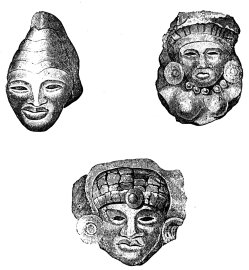 ANCIENT HEADS MADE OF CLAY.
STATE OF
QUERÉTARO—BOUNDARIES—DIVISIONS—CHARACTERISTICS—RIVERS—POPULATION
AND CLIMATE—DISTRICTS, ETC.—AGRICULTURAL
PRODUCTS—FORESTS—FACTORIES—CITIES—MINES.—STATE OF
GUANAJUATO—BOUNDARIES—EXTENT—SOIL—LAKE
YURIRAPUNDARO—CLIMATE—EFFECT OF
MALADIES—PRODUCTIONS—VINE—OLIVE—DIVISIONS—POPULATION—CITY OF
GUANAJUATO—TOWNS IN THE STATE—HACIENDA OF
JARAL—MINES—SILVER—COPPER—LEAD—CINNABAR.—ZACATÉCAS—BOUNDARIES—EXTENT—AGRICULTURE—DIVISIONS—POPULATION—TOWNS—ZACATÉCAS—-
AGUAS CALIENTES, ETC.—PRODUCT AND VALUE OF ZACATÉCAN MINES.—RUINS
OF QUEMADA IN ZACATÉCAS.
The State of Queretaro, one of the smallest members of the Republic, is
situated between 19° 35´ 42´´ 7´´´ and 21° 17´ 16´´ 45´´´ of north
latitude. By trigonometrical surveys made in 1837, the State was found
to contain 869 square leagues, which were divided between the six
districts as follows:
| 1 | District of | Querétaro | 157 | square leagues. |
| 2 | " | San Juan del Rio | 128 | " |
| 3 | " | Cadereyta | 115¼ | " |
| 4 | " | Toliman | 114¾ | " |
| 5 | " | Jalpam | 203¼ | " |
| 6 | " | Amealco | 150¾ | " |
| | | Total | 869 | |
This State is bounded on the north by the State of San Luis Potosi, west
and south-west by Guanajuato and Mechoacan, south by Mexico, and east by
Mexico and Vera Cruz. It lies entirely on the central plateau of the
Cordillera, and is consequently intersected by numerous mountain spurs
and elevated hills, some of which are entirely bare, while others are
covered with forests of various kinds of wood. The plains are frequently
cut up by deep barrancas or gullies, rivers and streamlets. The
agricultural portions of the State are consequently confined chiefly to
the vallies of San Juan del Rio, Querétaro, Cadereyta, Amealco, Toliman
and Jalpam, in which the soil, enriched by the vegetable products and
debris drained from the
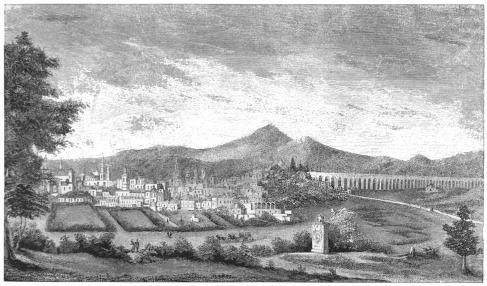 QUERETARO.
mountain sides, is usually found to be very productive. Querétaro is
generally remarked by travellers for the picturesque character of its
scenery and the beautiful site of its haciendas, cities and ranchos.
Mountainous as is this region, it has no single elevation of remarkable
character in the geography of the republic. In a country thus physically
formed and raised above the sea, important rivers are, of course, not
easily encountered, and although there are fifteen streams which are
dignified by the inhabitants with this title, the only two of importance
are the Tula or Rio de Montezuma, the boundary between the States of
Mexico and Vera Cruz, and the Rio Paté which has cut its deep and stony
bed in the porphyritic rock near San Juan del Rio. The temperature of
the whole region is exceedingly cool and the climate is agreeable and
healthy.
The population assigned to the State in 1845 was 180,161, classified
thus:
| Spaniards, Creoles and Europeans, | 36,032 |
| Indians, | 90,080 |
| Castes, | 54,049 |
| Total, | 180,161 |
Querétaro is divided into six districts, comprising eight partidos.
1st. The prefecture of Querétaro, with the partidos of the capital and
of La Cañada; in these two are found the town of San Francisco Galileo,
the villages of Santa Rosa and Huimilpam, and the hamlets of Santa Maria
Magdalena and San Miguel Carillo. 461/3 inhabitants to each square
league.
2d. The district of the municipality of San Juan del Rio contains the
village of Tequisquiapam, the hamlets of San Pedrito, San Sebastian, and
the rancheria of La Barranca de los Cocheros. 71 inhabitants to each
square league.
3d. The district of the municipality of Cadeyreta which contains the
mining posts of El Doctor and Maconi, and the villages of San José
Vizarron, San Gaspar, San Sebastian de Brual, and San Miguel Tetillas.
1832/3 inhabitants to each square league.
4. The district of Santa Maria Amealco, containing the village of
Huimalpam and the hamlets of San José de Ito, San Bartolo, San Miguel
Deti, San Juan de Güedó, San Miguel Tlaxcaltepec, San Pedro Tenango, San
Ildefonso, and Santiago Mexquitlan. 80 inhabitants to each square
league.
5th. The district of San Pedro Tolimán, contains the villages of San
Francisco Tolimanejo, Santa Maria Peñamillera, San Miguel Tolimán, San
Miguel de las Palmas, a mission station, Santo Domingo de Soriano, San
Antonio de Bernal, and the mining post of Rio Blanco. 213 inhabitants to
the square league.
6th. The district of Jalpam, contains three partidos and in these
there are two sub-prefectures, which are Landa and Aguacatlan a mining
post; besides these there are the villages of Concá, Sancillo, Bucareli,
Arroyoseco, Tancoyol and Xilapan; the mining posts of San José de los
Amoles and San Pedro Escanela; and the missions of Tilaco and Pacula. 64
inhabitants to the square league.
The whole State is calculated to contain 124 haciendas or large
plantations, and 392 ranchos or farms, while nearly 30,000 of its
inhabitants are engaged in agricultural pursuits.
The products of the soil are similar to those already described in the
other States on the central plateau. In the valleys some of the tropical
productions are found, but grain and cattle form the staples of the
farmer's care. Very thick forests are seldom found in any part of the
State, and many regions are almost entirely denuded. It will be seen
from our chapter upon the manufactures of Mexico, that Querétaro is
remarkable for the zeal and success with which it has applied itself to
this branch of industry. Most of the woollen fabrics of this State are
made of the Lana de Chinchorro which is produced within its limits, and
is commonly sold at $15 per 100 lbs. Besides this there is a species of
cotton, raised in some of the districts, used in the manufacture of a
favorite kind of mantas, shawls and rebozos. The trade of the State is
carried on chiefly with Mexico, Vera Cruz and San Luis Potosi.
The principal city is that of Querétaro, the capital and seat of
government, lying in 19° 58´ 2´´ 15´´´ N. latitude, and 1° 5´ W.
longitude from the meridian of Mexico, 6,365 feet above the sea. This
fine, picturesque and well built town, containing about 50,000
inhabitants, is situated on the sides and summit of converging hills,
and is divided into several parishes, or curatos, some of which are in
the body of the city and others in the suburbs, being separated from the
rest by a scant stream which has been dignified with the title of El
Rio—the river. Querétaro stands nearly 7,000 feet above the level of
the sea, and enjoys a delightful temperature. A noble aqueduct, two
miles in length, with arches ninety feet high, spanning a plain of
meadow land—joins a tunnel from the opposite hills, and supplies the
city with an abundance of excellent water from a distance of two
leagues. It is a magnificent and enduring structure, and the honor of
its erection is due to the taste and judgment of the Marquis de Valero
del Aguila, who caused it to be built at his own cost during his
viceroyal government of Mexico. Querétaro has become interesting in our
history, inasmuch as it was the city in which the treaty of peace
between Mexico and the United States was finally ratified by the Mexican
Congress in 1848.
The other important towns are those of San Juan del Rio, San Pedro de la
Cañada, and Cadereyta.
The chief mining district, and the only one of any note in the State, is
that of El Doctor, in the district of Cadereyta. Its principal veins
are those of El Doctor and San Cristoval; but famous as they once were,
they are now of but little importance. The quicksilver mine of San
Onófre, in the same region, is also failing.
The mining districts of El Doctor, Rio Blanco, Maconi and Escanelella,
contain 216 mines—divided as follows: five of gold; 193 of silver; 7 of
copper; 1 of lead; 1 of tin; 6 of quicksilver; 2 of antimony; 1 of
jaldre.
The State of Guanajuato is comprehended between 20° and 21° 49´ of north
latitude, and 0° 31´ 05´´ and 2° 51´ of longitude west from the meridian
of Mexico, and is situated upon the grand Mexican Cordillera. It is
bounded on the north by the State of San Luis Potosi, on the south by
Mechoacan, on the east by Querétaro, and on the west by Jalisco and
Zacatecas. Its superficial extent is 1,545 Mexican leagues of 261/2 to
the degree. With the exception of the State of Querétaro, Guanajuato is
the smallest of the Republic, yet it contains, comparatively, the
greatest number of inhabitants, as will be seen hereafter.
Large portions of the soil of Guanajuato are fertile; especially the
magnificent and productive plains of the Bajio, in the southern part of
the State, which extend for more than 34 leagues from Apasco to beyond
Leon;—and, in the north, where the splendid plains or Llanos of San
Félipe spread far and wide.
All the Sierra of Santa Rosa forms a chain of porphyritic mountains
and elevations of greater or less elevation, which pass under the
general name of Cerros. The highest of these, two leagues, north of
the capital is known as the Cerro de los Llanitos. It rises to the
height of 3,359 varas above the level of the sea, and is the loftiest
in the State. Besides these, there are the Cerros del Gigante, El
Cubilete, La Bufa, La Garrida, La Beata and San Juan de Mendoza.
The river Lerma, anciently known as Tolotlan, and commonly designated in
Guanajuato as the Rio Grande, is the only one which really merits
this name in the State, and crosses the southern portion of it for near
35 leagues. The river Laja and the river Turbio are of less consequence;
and all the other streams, though generally known among the people of
these districts by the dignified title of rivers, scarcely merit a
higher position among the fluvial characteristics of the State than
brooks or mountain torrents, which only obtain real consideration when
they are swollen by heavy rains.
The lake of Yurirapúndaro, is the only one which belongs to this
State;—it is four leagues long by one and a half in width, and embosoms
several islands. Its sweet waters are filled with small fish, which are
taken daily by the Indians, for the markets of the neighborhood and the
capital, but its actual depth is unknown.
The climate of Guanajuato is genial, its sky nearly always clear, and
its atmosphere pure. Owing to its site, immediately north of the torrid
zone, the inhabitants do not suffer the extremes of heat or cold.
Elevated about 8,000 feet above the level of the sea, its rarefied
atmosphere counteracts the direct rays of the sun, so that its mean
temperature is 21° of the centigrade thermometer, whilst it never
exceeds 28° in the months between April and June, which are generally
reckoned the warmest in this part of the Republic. During this season
the rain usually begins to fall, and lowers the temperature agreeably.
The north wind prevails during the greater part of the year; yet near
the period of the annual rains it changes for a while to the south,
bringing with it an abundance of moist vapor to fertilize the soil.
Nothing is sadder for the people of Guanajuato and the adjacent States
than to find, as sometimes happens, the months passing without this
customary change of wind. In such years the crops fail; the prices of
grain consequently rise, and the poor classes suffer extremely. The year
1786, is known in the annals of this region, as one well remembered
still for the famine that prevailed in consequence of a severe frost
that occurred on the 28th of the preceding August, blighting the
prospects of the farmer, and carrying off 8,000 victims in the capital
and the adjacent mines alone. In the month of May agriculture often
suffers from violent hail storms that prostrate the young grain which at
this season of the year is usually extremely dry in consequence of the
early heats and the want of irrigation.
The mild and pure climate of Guanajuato renders it a healthy residence.
In its southern part, about Salvatierra and Yurirapúndaro, intermittent
fevers, called los frios, or agues, occasionally prevail. Dropsy,
rheumatism, common lever, and dysenteries, which usually sweep off large
numbers of Mexicans, are milder and more
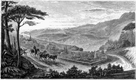 GUANAJUATO.
easily treated in this region than in other portions of the Republic.
The laborers in the mines formerly suffered from diseases of the chest,
arising probably from the mephitic vapors which were confined in the
badly ventilated galleries; but the Deputacion de la Mineria took this
subject into consideration, and have forced the owners of mines by
stringent laws to construct shafts and openings by which these buried
workmen may receive continual supplies of fresh air.
Maize, wheat, frijoles, beans, and the common cereal grains are produced
abundantly in the fertile plains of the Bajio and San Felipé. Corn,
though the chief product for consumption, not only for man but for
beasts, is often so abundant, that the farmers are obliged to export it
to other States. The quality of the wheat of this State is so excellent,
that when it will bear the cost of transportation, it is sent to the
national capital, where it commands a better price than even the grain
raised in the immediate vicinity of the city. The frijol,—a fine
dark, nutritious bean, which is commonly used throughout Mexico, by all
classes, from the highest to the lowest,—grows abundantly in
Guanajuato. The Chile pepper is used in Mexico, not only as a seasoning
for food as in other countries, but as an aliment of life, which is
placed on tables of all ranks at dinner. It is consumed both in its
green and dry states, and in the latter, it is exported from Guanajuato
to the capital, where the product of the haciendas or plantations at
Apaseo are preferred by the epicures as being of the best flavor in the
Republic. The vine, is also cultivated in various parts of this State,
especially at Dolores Hidalgo, Celaya, and Chamacuero, but as
manufactories of wine have not been established, its culture does not
extend beyond the quantity of grapes required for consumption in the
markets. The potato does not flourish in this State.
It is believed that the olive may be advantageously reared in
Guanajuato. At the beginning of the present century, Joaquin Gutierrez
de los Rios made the experiment at his hacienda de Sarabia, within the
district of Salamanca. The scarcity and dearness of oil in Spain, at
that period, in consequence of the war, enabled the mill established by
this person to supply the neighborhood with the article at such prices,
that the lucky proprietor realized a large income from his enterprize.
But during the insurrection in 1810, his property was destroyed, and
with it, a large part of his olive plantation. At present, considerable
plantations are making at several haciendas, especially at that of
Mendoza, where 30,000 olive trees had been already planted in 1849.
The State of Guanajuato is divided into four departments or
prefectures:—1st. San Miguel de Allende; 2d. Leon; 3d. Guanajuato; 4th
Celaya; whose capitals or chief towns bear the same names. The
possession by this State of the great and celebrated Veta Madre which
passes nearly through its centre, and of the wide and prolific plains of
the Bajio and of San Felipé renders it equally valuable as a mining and
agricultural region, and divides it fairly between the two branches of
industry. Its population may be estimated at about 560,000; twenty-five
per cent. of which comprises the whites, thirty-six per cent. the mixed
races, and thirty-nine per cent. the Indian. Guanajuato contains three
cities, four market-towns, thirty-seven villages, and four hundred and
fifty estates, plantations and farms.
The capital of the State is the city of Guanajuato, or Santa Fé de
Guanajuato, situated in 21° 0´ 15´´ north latitude and 103° 15´ west
longitude from Paris, about 6,869 feet above the level of the sea,
according to the measurement of Burkhart, and containing between 35,000
and 40,000 inhabitants. The town is perhaps the most curiously
picturesque and remarkable in the republic. "Entering a rocky Cañada,"
says a recent traveller, "the bottom of which barely affords room for a
road, you pass between high adobe walls, above which, up the steep, rise
tier above tier of blank, windowless, sun-dried houses, looking as if
they had grown out of the earth. You would take them to be a sort of
cubic crystallization of the soil. Every corner of the windings of the
road is filled with buildings of mining companies—huge fortresses of
stone, ramparted as if for defence. The scene varies with every
moment;—now you look up to a church with purple dome and painted
towers; now the blank adobe walls, with here and there a spiry cypress
or graceful palm between them, rise far above you, along the steep
ledges of the mountain; and again the mountain itself, with its waste of
rock and cactus, is all you see. The Cañada, finally seems to close. A
precipice of rock, out of a rift in which the stream flows, shuts the
passage. Ascending this by a twist in the road you are in the heart of
the city. Lying partly in the narrow bed of the ravine and partly on its
sides and in its lateral branches, it is only by mounting to some higher
eminence that one can realize its extent and position. At the further
end of the city the mountains form a cul de sac. The Cañada is a blind
passage which can only be left by the road you came. The streets are
narrow, crooked, and run up and down in all directions, and there is no
room for plazas or alamedas. A little triangular space in front of the
cathedral, however, aspires to the former title." Such is the aspect of
a city which is the focus of a mineral region surrounded by more than
one hundred mines, which are wrought by seventy-five thousand laborers.
In spite of all the natural difficulties and impediments for fine
architecture, Guanajuato contains some fine edifices, especially among
the private residences of the wealthy miners, such as the families of
Otero, Valenciana, Rhul and Perez Galvez. The church of the Jesuits was
built by the Marquis Rayas. Besides the cathedral, the town contains two
chapels, three monasteries, five convents, a college, a Bethlehemite
hospital, a theatre, a barrack, a mint, an university, and a gymnasium.
The Villa de Leon, is a market town west north-west from Guanajuato, in
21° 6´ 38´´ north latitude, and 103° 39´ west longitude, 6,004 feet
above the sea, in the productive plain of Leon.
San Felipé is another market town, 32 leagues north of Guanajuato, on
the road to San Luis Potosi, 6,906 feet above the sea. Ten leagues
north-east from San Felipé is the valuable estate of Jaral, the property
of the Marquis del Jaral, the wealthiest and largest land owner in
Mexico. His stock of cattle, comprising horses, mules, horned-cattle,
sheep and goats amounts to nearly three million head![66] Thirty
thousand sheep alone, and as many goats, are annually slaughtered on
this estate for the markets of Guanajuato and Mexico, where the sheep
sell for from two and a half to three dollars a piece, and the goats
from seventy-five cents to one dollar each!
Celaya is a city, and next in importance to Guanajuato in the State. It
lies in 20° 38´ north latitude, and 102° 52´ west longitude, near the
boundary of Querétaro, 6,020 feet above the sea, and contains about
15,000 inhabitants.
Salamanca is a market town in the Bajio, nine leagues west from Celaya,
and is the chief place of a region possessing twenty-nine haciendas, or
plantation estates, and sixty-nine valuable farms. Its population is
estimated at 15,000. Irapuato, lies about six leagues north-west from
Salamanca, and contains perhaps an equal number of inhabitants.
San Miguel Allende, formerly San Miguel el Grande, is the capital of
the department of that name, lies directly north of Celaya, on the river
de la Laja, where it cuts the division between the two departments.
Dolores Hidalgo is on the same stream, north-west of the last town, and
is remarkable in the annals of the country as the residence of the
priest Hidalgo, under whose auspices the revolutionary movement against
Spain originated.
The mineral products of this State have been and still continue very
valuable. The chief silver mines are those of Guanajuato, Villalpando,
Monte de San Nicolas, Santa Rosa, Santa Anna, S. Antonio de las Minas,
Comanja, El Capulin, Comangilla, San Luis de la Paz, San Rafael de los
Lobos, El Duranzo, San Juan de la Chica, Rincon de Zenteno, San Pedro de
los Pozos, El Palmar de la Viga, San Miguel y San Felipé. All these
mines and mineral districts recognize the jurisdiction of the Deputacion
de Mineria de Guanajuato, although some of them lie out of the immediate
boundaries of the State.
Besides the silver yielded at these places, copper and iron are produced
by some of them; and at El Gigante cinnabar has been discovered
disseminated among other substances. Lead is taken abundantly from the
mine of La Targea; but the mining operations of the State are chiefly
confined to silver.
In the southern part of the State large quantities of soda are found
near Celaya, Salamanca and Valle de Santiago; and in the north, in the
vicinity of San Felipé, the earth is impregnated, in many places, with
nitrate of potash or nitre. Mineral waters and thermal springs exist on
the southern slope of the Cerro del Cubilete, near Silao, and are used
by invalids; while in the jurisdictions of Leon, near Irapuato or San
Miguel Allende and Celaya, other warm and sulphur springs are found
which are beneficially frequented by persons who suffer from rheumatism
and cutaneous diseases.
This rich metallic region and State lies between the 21st and 25th
degrees of north latitude and 1021/2 and 1051/2 west longitude from
Paris. It is bounded on the north by Durango and Nuevo Leon on the east
by San Luis Potosi; on the south-east by Guanajuato; and on the west and
south-west by Jalisco. Its greatest breadth, from Sombrereté to Real del
Ramos, in the State of San Luis, is fifty-seven leagues, and its extreme
length is 90. The superficial area of the State is reckoned at 2,355
square leagues.
Zacatécas is a mountain country of the high plateau of Mexico, cut up by
spurs of the Cordillera and inhospitably arid. The region between
Catorcé in San Luis Potosi, and Sombrereté and Mazapil in Zacatécas is a
broad plain, interspersed by a few
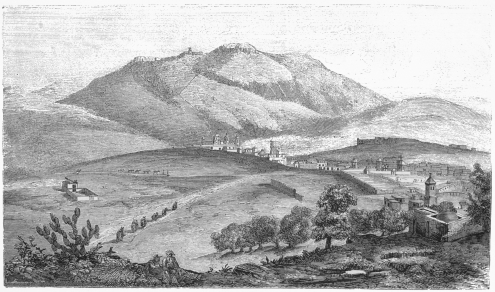 ZACATECAS.
swelling knolls, and an occasional group of hills or small mountains.
The agricultural productions are of course suitable to such a geological
structure; but in the Haciendas de Ganado, or cattle farms, immense
herds are constantly raised by the thrifty vaqueros of this region. As
the country is unusually dry, water tanks, algibes, and norias are
established on all the estates, and are watched with the greatest care.
There is no river of any note whatever in Zacatécas. The Arroyo de
Zacatécas, the Rio Xeres, the Rio Perfido, del Maguey, and Bañuelos, are
but slender streams.
Zacatécas is divided into eleven partidos or districts. 1st. Zacatécas,
2d Aguas Calientes, 3d Sombrereté, 4th Tlaltenango, 5th Villa Nueva, 6th
Fresnillo, 7th Xeres, 8th Mazapil, 9th Piños, 10th Nieves, and 11th
Juchipila; possessing in all 3 cities, 5 market towns, 34 villages and
mining works, 139 agricultural and cattle farms, 562 smaller similar
establishments, 683 ranchos, 11 convents for monks, 4 for nuns, and four
hospitals. The population has been calculated at about 350,000; and it
is remarkable that, according to reliable statistical data, 14,937 more
individuals were born than died in this State during the year 1830.
| Births,— |
males, |
14,709 |
Deaths— |
males, |
7,012 |
Births, |
28,795 |
| females, |
14,086 |
females, |
6,846 |
Deaths, |
13,858 |
| |
|
28,795 |
|
|
13,858 |
Increase, | 14,937 |
The most valuable agricultural district lies in the district of Aguas
Calientes. The best cultivation begins at the hacienda of San Jacinto,
12 leagues from the town of Zacatécas, and in this region it is reckoned
that the farmers annually gather from their harvests, 140,952 fanegas of
Corn (of 150 lbs.); 4,719 cargas (of 300 lbs.) of wheat; 7,293 fanegas
of frijoles or beans, and 4,291 arróbas (of 25 lbs. each,) of chile.
The mainspring of the wealth of Zacatécas is its mineral production. The
vein of the Veta Negra of Sombrereté has been the most productive in the
new or old world. El Pavellon, La Veta Grande, San Bernabé, and the
isolated hill of Proaño at Fresnillo constantly yielded in former times
the most extraordinary results for the labor bestowed in working them.
Their present value may be estimated from the chapter on Mines in the
preceding book.
The chief cities, towns and villages of this State are the capital,
Zacatécas, containing from 25,000 to 30,000 inhabitants. It lies in 22°
47´ 19´´ of north latitude and 164° 47´ 41´´ west longitude, at an
elevation of 7,976 feet.
The town itself is not visible until the traveller approaches within a
mile and a half, when it is seen below following the turns of a deep
barranca or ravine, of which the mountain of la Bufa, with a chapel on
its crest, forms one side. The streets are narrow and dirty, and swarm
with uncleanly children, whose appearance, like that of their squalid
parents, is by no means prepossessing. But the distant view of the city
is picturesque from the number of religious edifices which rise above
the roofs of the other buildings. In the vicinity of the plaza there
are some fine houses, and the market place presents a curious and busy
provincial scene.
Aguas Calientes is situated upon the banks of a stream of the same name,
in a broad and rich valley, at the distance of 25 leagues south of
Zacatécas. The neighborhood is famous for its warm thermal springs; the
chief of which, El Baño de la Cantera, lies a league south-west of the
town. Aguas Calientes contains several thousand inhabitants and is
celebrated for its woollen manufactories, among which the one belonging
to the family of Pimentel employed about 350 men and women at its looms.
Fresnillo is a mining town, and capital of its district, 14 leagues
north-west from Zacatécas, in the wide plain which divides the mountains
of Santa Cruz and Organos from the mountain ranges about Zacatécas. It
lies at the foot of the isolated knoll of Proaño, in which its mines are
situated. The neighborhood of the town is pretty, but the region which
intervenes between it and Sombrereté is a waste and sterile moorland.
Sombrereté is a mining town, and capital of its district, 25 leagues
north-westward of Fresnillo, lying at the foot of the mountain of
Sombreretillo, or "little hat," whose name is derived from a singular
formation of rock on its summit which resembles that article of dress.
In its vicinity are the once renowned and rich mines of La Veta Negra
and El Pavellon.
Upon the table lands between Sombrereté, Fresnillo, and Catorcé, in the
State of San Luis, are several towns or villages deserving of notice,
and the hacienda of Sierra Hermosa, a cattle estate, which is one of
the most remarkable in the Republic for its extent and production. It
covers an area of 262 sitios or square leagues, and supports immense
herds of horned cattle, horses, mules, goats and sheep. The latter,
alone, are estimated at 200,000 head, about 30,000 of which are annually
disposed of. The wool yielded by these animals amounts to from 4,000 to
5,000 arrobas yearly.
The other towns and villages of note are Asientos de Ibarra, Xeres,
Villanueva, Mazapil.
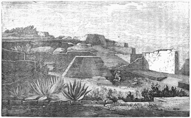 RUINS OF QUEMADA.
The Sierra de Piños, Chalchiguitéc, Los Angelos, Plateros, and other
metallic deposits were formerly celebrated for their productive value;
but they are now either partially or entirely abandoned.
We may deduce some interesting statistical information from the labors
of Berghes in regard to the mineral wealth of Zacatécas and the
productiveness of its mines. According to the tables of this writer,
published in 1834, it appears that from the year
| 1548 to 1810 the mines of this region produced | $588,041,956 |
| 1810 to 1818""" | 20,060,363 |
| 1818 to 1825""" | 17,912,475 |
| 1825 to 1832""" | 30,028,540 |
| | $656,043,335 |
| These rates gave an annual mean product, from |
| 1548 to 1810"""of | $2,244,434 |
| 1810 to 1818"""" | 2,507,545 |
| 1818 to 1825"""" | 2,558,925 |
| 1825 to 1832"""" | 4,003,128 |
It will be seen by reference to our table on page 88 of this volume,
that the value of the products of Zacatécas in the ten years from 1835
to 1844, was $43,384,215; giving a mean annual rate of $4,338,421, and
exhibiting the important fact, in spite of revolutionary troubles and
consequent social, commercial and industrial disorganization, that the
mineral yield of this region, instead of diminishing, has steadily
increased with every year. In 1845, the Mint in Zacatécas issued
$4,429,353.
The State of Zacatécas contains some remarkable remains of Indian
architecture on the Cerro de los Edificios, situated two leagues
northerly from the village of Villanueva, twelve leagues south-west from
Zacatécas, and about one league north of La Quemada, at an elevation of
7,406 feet above the sea.
"We set out," says Captain Lyon, in a volume of his travels in Mexico,
"on our expedition to the Cerro de los Edificios under the guidance of
an old ranchero, and soon arrived at the foot of the abrupt and steep
rock on which the buildings are situated. Here we perceived two ruined
heaps of stones, flanking the entrance to the causeway, ninety-three
feet broad, commencing at four hundred feet from the cliff.
"A space of about six acres had been enclosed by a broad wall, the
foundations of which are still visible, running first to the south and
afterwards to the east. Off its south-western angle stands a high mass
of stones which flanks the causeway. In outward appearance it is of a
pyramidal form, owing to the quantities of stones piled against it
either by design or by its own ruin; but on close examination its figure
could be traced by the remains of solid walls to have been a square of
thirty-one feet by the same height: the heap immediately opposite is
lower and more scattered, but, in all probability, formerly resembled
it. Hence the grand causeway runs to the north-east till it reaches the
ascent of the cliff, which, as I have already observed, is about four
hundred yards distant. Here again are found two masses of ruins, in
which may be traced the same construction as that before described; and
it is not improbable that these two towers guarded the entrance to the
citadel. In the centre of the causeway, which is raised about a foot and
has its rough pavement uninjured, is a large heap of stones, as if the
remains of some altar, round which we can trace, notwithstanding the
accumulation of earth and vegetation, the paved border of flat slabs
arranged in the figure of a six rayed star.
"We did not enter the city by the principal road, but led our horses
with some difficulty up the steep mass formed by the ruins of a
defensive wall, inclosing a quadrangle two hundred and forty feet by two
hundred, which to the east, is sheltered by a strong wall of unhewn
stones, eight feet in thickness and eighteen in height. A raised terrace
of twenty feet in width passes round the northern and eastern sides of
this space, and on its south-east corner is yet standing a round pillar
of rough stones, of the same height as the wall, and nineteen feet in
circumference.
"There appear to have been five other pillars on the east, and four on
the northern terrace; and as the vein of the plain which lies to the
south and west is very extensive, I am inclined to believe that the
square has always been open in these directions. Adjoining to this we
entered by the eastern side to another quadrangle, surrounded by perfect
walls of the same height and thickness as the former one, and measuring
one hundred and thirty-four feet by one hundred and thirty-seven. In
this were yet standing fourteen very well constructed pillars, of equal
dimensions with that in the adjoining enclosure, and arranged four in
length and three in breadth of the quadrangle, from which, on every
side, they separated a space of twenty-three feet in width, probably a
pavement of a portico of which they once supported the roof. In their
construction, as well as that of all the walls which we saw, a common
clay having straw mixed with it has been used. Rich grass was growing
in the spacious court where Aztec monarchs may once have feasted; and
our cattle were so delighted with it that we left them to graze while we
walked about three hundred yards to the northward, over a very wide
parapet, and reached a perfect, square, flat-topped pyramid of large
unhewn stones. It was standing unattached to any other buildings, at the
foot of the eastern brow of the mountain which rises abruptly behind it.
On the eastern face is a platform of twenty-eight feet in width, faced
by a parapet wall of fifteen feet, and from the base of this extends a
second platform with a parapet like the former, and one hundred and
eighteen feet wide. These form the outer defensive boundary of the
mountain, which from its figure has materially favored its construction.
There is every reason to believe that this eastern face must have been
of great importance. A slightly raised and paved causeway descends
across the valley, in the direction of the rising sun, and being
continued on the opposite side of a stream which flows through it, can
be traced up the mountains at two miles distant, till it terminates at
the base of an immense stone edifice which probably may also have been a
pyramid. Although a stream (Rio del Partido) runs meandering through the
plain from the northward, about midway between the two elevated
buildings. I can scarcely imagine that the causeway should have been
formed for the purpose of bringing water to the city, which is far more
easy of access than in many other directions much nearer to the river,
but must have been constructed for important purposes between the two
places in question; and it is not improbable once formed the street
between the frail huts of the poorer inhabitants. The base of the large
pyramid measured fifty feet, and I ascertained by ascending with a line
that its height was precisely the same. Its flat top was covered with
earth and a little vegetation: and our guide asserted, although he knew
not where he obtained the information, that it was once surmounted by a
statue. Off the south-east corner of this building, and about fifteen
yards distant, is to be seen the edge of a circle of stones about eight
feet in diameter, enclosing as far as we could judge by scraping away
the soil, a bowl-shaped pit, in which the action of fire was plainly
observable; and the earth from which we picked some pieces of pottery,
was evidently darkened by an admixture of soot and ashes. At the
distance of one hundred yards south-west of the large pyramid is a small
one, twelve feet square, and much injured. This is situated on somewhat
higher ground, in the steep part of the ascent to the mountain's brow.
On its eastern face, which is towards the declivity, the height is
eighteen feet; and apparently there have been steps by which to ascend
to a quadrangular space, having a broad terrace around it, and extending
east one hundred feet by a width of fifty. In the centre of this
enclosure is another bowl-shaped pit, somewhat wider than the first.
Hence we began our ascent to the upper works, over a well buttressed yet
ruined wall built of the rock. Its height on the steepest side is
twenty-one feet, and the width on the summit, which is level, with an
extensive platform, is the same. This is a double wall of ten feet,
having been first constructed and then covered with a very smooth kind
of cement, after which the second has been built against it. The
platform, (which faces to the south, and may, to a certain extent, be
considered as a ledge from the cliff,) is eighty-nine feet by
seventy-two; and on its northern centre stand the ruins of a square
building, having within it an open space of ten feet by eight, and of
the same depth. In the middle of the quadrangle is to be seen a mound of
stones eight feet high. A little farther on we entered by a broad
opening between the perfect and massive walls, to a square of one
hundred and fifty feet. This space was surrounded on the south-east and
west by an elevated terrace of three feet by twelve in breadth, having
in the centre of each side steps by which to descend to the square. Each
terrace was backed by a wall of twenty-eight feet by eight or nine. From
the south are two broad entrances, and on the east is one of thirty
feet, communicating with a perfect enclosed square of one hundred feet,
while on the west is one small opening, leading to an artificial cave or
dungeon, of which I shall presently speak.
"To the north, the square is bounded by the steep mountain; and, in the
centre of that side, stands a pyramid of seven ledges or stages, which
in many places are quite perfect. It is flat topped, has four sides, and
measures at the base thirty-eight by thirty-five feet, while in height
it is nineteen. Immediately behind this, and on all that portion of the
hill that presents itself to the square, are numerous tiers of seats
either broken in the rock or built of rough stones. In the centre of the
square, and due south of the pyramid, is a small quadrangular building,
seven feet by five in height. The summit is imperfect, but has
unquestionably been an altar; and from the whole character of the space
in which it stands, the peculiar form of the pyramid, the surrounding
terrace, and the seats or steps on the mountain, there can be little
doubt that this has been the grand Hall of Sacrifice or Assembly, or
perhaps both.
"Passing to the westward, we next saw some narrow enclosed spaces,
apparently portions of an aqueduct leading from some tanks on the
summit of the mountain, and then we were shown to the mouth of the cave,
or subterraneous passage, of which so many suspicious stories are yet
told and believed. One of the principal objects of our expedition had
been to enter this place, which none of the natives had ever ventured to
do, and we came provided with torches accordingly: unfortunately
however, the mouth had very recently fallen in, and we could merely see
that it was a narrow, well built entrance, bearing in many places the
remains of good smooth plastering. A large beam of cedar once supported
the roof, but its removal by the country people had caused the
dilapidation which we now observed. Mr. Sindal, in knocking out some
pieces of regularly burnt brick, soon brought a ruin upon his head, but
escaped without injury; and this accident caused a thick cloud of yellow
dust to fall, which, on issuing from the cave, assumed a bright
appearance under the full glare of the sun;—an effect not lost on the
natives, who became more than ever persuaded that an immense treasure
lay hidden in that mysterious place. The general opinion of those who
remember the excavation is that it is very deep; and from many
circumstances there is a probability of its having been a place of
confinement for victims. Its vicinity to the great hall, in which there
can be little doubt that the sanguinary rites were held, is one argument
in favor of this supposition; but there is another equally
forcible;—its immediate proximity to a cliff of about one hundred and
fifty feet, down which the bodies of victims may have been precipitated,
as was the custom at the inhuman sacrifices of the Aztecs.[67] A road or
causeway to be noticed in another place, terminates at the foot of the
precipice, exactly beneath the cave and over-hanging rock, and
conjecture can form no other idea of its intended utility, unless as
being in some manner connected with the dungeon.
"Hence we ascend to a variety of buildings, all constructed with the
same regard to strength, and inclosing spaces on far too large a scale
for the abode of common people. On the extreme ridge of the mountain
were several tolerably perfect tanks.
"In a subsequent visit to this extraordinary place, I saw some buildings
which had at first escaped my notice. These were situated on the summit
of a rock terminating the ridge, and about a mile and a half north
north-west of the citadel.
"The first is a building originally eighteen feet square, but having
the addition of sloping walls to give it a pyramidal form. It is flat
topped, and on the centre of its southern face there appears to have
been steps to ascend to its summit. The second is a square altar, its
height and base being each about sixteen feet. These buildings are
surrounded at no great distance by a strong wall, and at a quarter of a
mile to the northward, advantage is taken of a precipice to construct
another wall of twelve feet in width from its brink. On a small flat
space between this and the pyramid are the remains of an open square
edifice, to the southward of which are two long mounds of stone, each
extending about thirty feet; and to the north-east is another ruin,
having large steps up its side. I should conceive the highest wall of
the citadel to be three hundred feet above the plain, and the base rock
surmounts it by about thirty feet more.
"The whole place in fact, from its isolated situation, the disposition
of its defensive walls, and the favorable figure of the rock must have
been impregnable to Indians; and even European troops would have found
great difficulty in ascending those works which we have ventured to name
the Citadel. There is no doubt that the greater mass of the nation who
once dwelt here must have been established on the plain beneath, since
from the summit of the rock we could distinctly trace three straight and
very extensive causeways diverging from that over which we first passed.
The most remarkable of these roads runs south-west for two miles, is
forty-six feet in width, and crossing the grand causeway is continued to
the foot of the cliff immediately beneath the cave which I have
described. Its more distant extreme is terminated by a high and long
artificial mound immediately beyond the river toward the hacienda of La
Quemada. We could trace the second road south and south-west to a small
rancho named Cayotl, about four miles distant, and the third ran
south-west by south still farther, ceasing, as the country people
informed us, at a mountain six miles distant. All these roads have been
slightly raised, were paved with rough stones, still visible in many
places above the grass, and were perfectly straight.
"From the flatness of the fine plain over which they extended, I cannot
conceive them to have been constructed as paths, since the people who
walked barefoot and used no beasts of burden, must naturally have
preferred the smooth earthen foot-ways which presented themselves on
every side, to these roughly paved roads. If this be admitted, it is not
difficult to suppose that they were the centres of streets whose huts
constructed of the same kind of frail materials as those of the present
day, must long since have disappeared. Many places on the plain are
thickly strewn with stones which may once have formed materials for the
town; and around the cattle farms there are extensive modern walls
which, not improbably, were constructed from the nearest street. At all
events, whatever end these causeways answered, the citadel itself still
remains, and by its size and strength confirms the accounts given by
Cortéz, Bernal Diaz, and others of the conquerors of the magnitude and
strength of the Mexican edifices, but which have been doubted by
Robertson, De Pau, and others. We observed also in some sheltered
places, the remains of good plaster, confirming the accounts above
alluded to; and there can be little doubt that the present rough, yet
magnificent buildings were once encased in wood, as ancient Mexico, the
towns of Yucatan, Tabasco, and many other places are described to have
been in the voyage of Juan De Grijalvis in 1518, and also in the
writings of Diaz, Cortéz and Clavigero.
"The Cerro de Edificios and the mountains of the surrounding range, are
all of gray porphyry, easily fractured into slabs, and this, with
comparatively little labor, has furnished materials for the edifices
which crown its summit. We saw no remains of obsidian among the ruins or
on the plain—which is remarkable, as it is the general substance of
which the knives and arrow-heads of the Mexicans were formed; but a few
pieces of very compact porphyry were lying about and some appeared to
have been chipped into a rude resemblance of arrow-heads.
"Not a trace of the ancient name of this interesting place, or that of
the nation which inhabited it, is now to be found among the neighboring
people, who merely distinguished the isolated rock and buildings by one
common name, 'Los Edificios.' I had inquired of the best instructed
people about these ruins; but all my researches were unavailing until I
fortunately met with a note in the Abbé Clavigero's history of Mexico
which appears to throw some light on the subject. 'The situation of
Chico-moztoc, where the Mexicans sojourned nine years is not known, but
it appears to be that place, twenty miles distant from Zacatécas,
towards the south, where there are still some remains of an immense
edifice, which, according to the tradition of the ancient inhabitants of
that district was the work of the Aztecs during their migration; and it
certainly cannot be ascribed to any other people, the Zacatecanos
themselves being so barbarous as neither to live in houses nor to know
how to build them.'"
STATE OF SAN LUIS
POTOSI—BOUNDARIES—LAKES—RIVERS—CLIMATE—DEPARTMENTS—PRODUCTS—SAN
LUIS—TOWNS—MINING REGION.—NEW LEON—BOUNDARIES—CHARACTER
—RIVERS—CLIMATE—DEPARTMENTS—AGRICULTURE—GRAZING,
ETC.—MONTEREY.—COAHUILA—BOUNDARY—POSITION
—CLIMATE—PRODUCTIONS—TOWNS.—STATE OF
DURANGO—BOUNDARY—CHARACTER—DIVISIONS—STREAMS—PRODUCTIONS
—CITY OF DURANGO—TOWNS—MINES—IRON—SILVER—INDIAN
NECROLOGY—CAVE BURIAL.
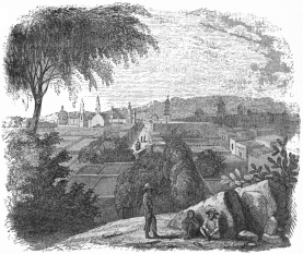 CITY OF SAN LUIS POTOSI.
The State of San Luis Potosi is bounded on the east by the State of
Tamaulipas; on the north by Nuevo Leon; on the west by Zacatécas; on the
south by Guanajuato and Querétaro, and on the south-east by Vera Crux.
The western portion of the State is quite mountainous; but towards
Tamaulipas, the Cordillera is somewhat broken, and a lower hilly
country stretches out towards the south-east. The Panuco and the
Santander are the only two rivers, and the lagunes of Chariel and Chila
the only two lakes of importance in the State.
The climate of the mountain region and table lands is cold, while that
of the lower elevations and flats towards the eastern boundary is much
warmer, and, at certain seasons, very unhealthy.
The State of San Luis Potosi is divided into four departments, ten
cantons, and fifty-two municipalities, with a population of over
300,000.
1st. Department of San Luis with the cantons San Luis, Santa Maria del
Rio and Guadalcazar.
2d. Department of Rio Verde, with the cantons of Rio Verde and del Maiz.
3d. Department of Tancanhuitz, with the cantons of Tancanhuitz and De
Valles.
4th. Department of Venado, with the cantons of Venado, Catorcé and
Ojocaliente.
The agriculturists of San Luis are engaged chiefly in the production of
corn, wheat, barley and fodder; all of which are yielded plentifully by
the genial soil of the State. But the toils of the farmer and the
generosity of the ground are not always repaid by suitable prices or a
good market. Corn ranges from fifty cents to seventy-five the fanega;
and even at this rate often lacks purchasers. Cattle are raised in large
quantities, as in Zacatécas, Durango and Chihuahua. Manufactures are
progressive. Woollen and cotton fabrics are produced of excellent
quality and favor among the masses. Glass, leather, pottery and metallic
wares are also made in large quantities, and a busy traffic in foreign
goods is carried on with the port of Tampico, and the States of
Zacatécas, Durango, Sonora, New Leon, Guanajuato, Mechoacan and Jalisco.
The position of this State, and especially of its principal town,
naturally makes it an entrepôt between the coast and the interior, for
imports from America and Europe. Nevertheless, a small trade, only,
exists in home products, and these are chiefly sent to New Leon and
Coahuila.
The chief towns are San Luis Potosi, the capital of the State and seat
of government, lying on a level plain, among the steep declivities of
the Cordillera in the neighborhood of the sources of the Panuco, in 22°
4´ 58´´ north latitude, 103° 7´ west longitude from Paris, 5,959 feet
above the sea. It is a regular, well built city, with broad, paved
streets, a fine plaza or public square, and six handsome churches,
three convents, and one hospital. Its population may be estimated at
35,000.
Guadalcazar, is the capital of the partido or district of that name,
18 leagues north-west of San Luis Potosi, in 22° 31´ 25´´ north latitude
and 102° 59´ 30´´ west longitude from Paris, 5,132 feet above the sea,
in a valley south of a mountain group which was once extremely
productive in mineral riches.
Rio Verde is the capital of the Department of Rio Verde, 34 leagues east
of San Luis. The town of Valles, with 3,500 inhabitants, lies on the
left bank of the Rio Montezuma, in the tierra caliente, on the
boundary of the State of Vera Cruz. Its neighborhood is rich in sugar
plantations and in tropical productions generally.
Venado, 29 leagues north of San Luis, is the chief town of its
Department; it lies on the road from the capital of the State to
Catorcé, and contains about 8,000 inhabitants.
In the partido Ojocaliente lies the town of that name, 28 leagues
north-west of the city of San Luis, and 10 leagues south-east of the
capital of Zacatécas, 6,714 feet above the sea.
Catorcé is a mining town, likewise in the department of Venado, and is
sometimes known by the sounding title of "Real de la purisima Concepcion
de Alamos de los Catorcé." The name is supposed to be derived from the
slaughter of fourteen Spanish soldiers who are said to have been killed
in its vicinity by a tribe of savages inhabiting these wild mountain
regions before the discovery of the adjacent mines.
Nothing can be more dreary, bleak and desolate than the aspect of the
Cordillera of Catorcé. A few narrow mule paths, or the worn bed of a
mountain torrent alone break the monotonous coloring of the mass; and
the town placed at the great height of 8,788 feet above the sea, is
completely hidden from below by the bold brow of the mountain.[68] There
is neither a tree nor a blade of grass on the steep and sterile flanks
of these rocky elevations, though seventy years ago the whole district
was covered with wood which might have endured for centuries had not the
improvident and wasteful spirit of the first adventurers wantonly
destroyed these valuable resources. Forests were burnt to clear the
ground, and the larger timber which was required for the mines when they
were wrought again after the revolution, was brought from a distance of
twenty-two leagues.
On reaching a high ridge above the adjacent valley, the town of Catorcé
is immediately perceived at the feet of the traveller, lying in a hollow
beyond which the mountain steeps again rise precipitously above a
thousand feet,—the course of the Veta Madre, or great "mother vein,"
being distinctly traced upon it by the buildings belonging to the mines
and miners. The site of the town is extremely singular, as it is
intersected by deep ravines, or barrancas, upon the ledges of which
many of the dwellings are erected. Some of these strange edifices, like
those of Edinburg, have one story on one side, and two or three on the
other; and most of them are surrounded by massive fragments of rock,
amongst which the laborers shelter themselves from inclement weather.
In this region the most valuable mines of the State of San Luis Potosi
have been found and wrought.
Within a few years past a profitable quicksilver mine was discovered,
south of the capital, in the jurisdiction of the Hacienda de Villela.
This mine, in the months of August and September, 1843, produced 1,068
pounds of the metal en caldo.
This fine portion of the present Mexican Confederacy was colonized at
the end of the sixteenth century by the Viceroy Monterey, and was then
known by the proud title of El Nuevo Reyno de Leon, or, the New Kingdom
of Leon. The modern State is bounded on the east by Tamaulipas; on the
north by Coahuila; on the west by that State and Durango; on the
south-west and south by Zacatécas and San Luis Potosi.
The geological formation of this State is generally mountainous. It lies
among the first spurs and ridges of the Sierra Madre, south of the Rio
Bravo, or Grande del Norte, and is interspersed with wide plains and
fruitful valleys which produce good crops under careful cultivation. The
rivers, all of which flow eastwardly towards the Gulf of Mexico, are the
Rio Tigre, the San Juan, the Rio Blanco or Borbón, and the Sabinas,
which passes into this State from Coahuila, and falls into the Rio Bravo
near Revilla. There are numerous other small streams and brooks, of no
geographical but of considerable agricultural importance. The climate is
generally warm, except among the higher ranges of mountains; and, in
summer, it is usually extremely hot, though healthy. The population is
estimated at about 130,000.
New Leon is divided into five Partidos or Departments, with 25
districts.
1st. Department of Monterey, with seven districts: Monterey, Salinas
Victorias, Absalo, San Nicolas Hidalgo, Pesqueria Grande, Santa
Catarina, and Guajuco.
2d. Department of Cadereyta Ximenes, with five districts: Cadereyta,
Santa Maria, Cerralvo, Agualequas, and Santa Maria de las Aldamas.
3d. Department of Monte Morélos, with three districts: Monte Morélos,
Mota and China.
4th. Department of Linares, with five districts: Linares, Galéana,
Hualahuises, Rio Blanco and Concepcion.
5th. Department of Aldáma, with five districts: Villa Aldáma,
Vallecillo, Sabinas, Lampazos and Tlascala.
The agriculture of New Leon has not been as carefully and successfully
pursued as it might have been, in the hands of a different population.
The annual product of the soil has been stated by the Mexican
authorities, to average 120,600 fanegas of corn; 5,700 fanegas of
frijoles or beans, and 46,500 hundred-weight of sugar;—the home market
affording one dollar per fanega for corn, three dollars per fanega for
frijoles, and three dollars per hundred weight for raw sugar.
The chief occupation of the landholders is the grazing of cattle, and
the yearly return of animals, shows that the State is quite productive
in this branch of rural labor. It is calculated by official reporters
that New Leon annually feeds and sends to market:—50,000 horses, 12,000
mules, 75,000 large horned cattle, and 850,000 sheep, goats, and hogs.
The local value of which is six dollars a head for horses, twelve for a
mule, four for neat cattle, and from fifty cents to a dollar, a piece,
for sheep, goats, and swine. The State is regarded as rich in minerals
of silver and lead, but the mining operations are almost abandoned,
except at Cerralvo and Vallecillo. Salt is made at the salt mines on the
banks of the Rio Tigre. The domestic trade is carried on in State
productions with Mexico and Querétaro, and North American or European
fabrics are imported through the port of Tampico de Tamaulipas.
The capital of the State is Monterey, in 25° 59´ north latitude and 102°
33´ west longitude from Paris, about 220 leagues north of the city of
Mexico, situated on the plain at the foot of the Sierra Madre on the
margin of one of the affluents of the Rio Tigre. Its population is
estimated at about 13,000, and its climate is considered agreeable and
healthy. Monterey is connected with the history of North American
victories, by the capitulation it made to General Taylor, September,
1846.
The other principal towns, villages and settlements in New Leon, are San
Felipé de Linares, containing 6,000 inhabitants, 40 leagues south-east
of Monterey; Buena Vista, a village 7 leagues north-west of Linares;
Cadereyta Ximenes, a small town of 2,000 people, 10 leagues south-east
of Monterey; Salinas Victorias, 10 leagues north of Monterey; Pesqueria
Grande, a village north-west from Monterey, and formerly the site of
silver mines and salt works; Villa Aldama; San Carlos de Vallecillo;
Lampazos; Agualequas; China, and Galeana.
Coahuila was formerly united with the ancient Mexican province of Texas,
until the revolution, which resulted in the independence of the latter,
sundered the bond and added it to the United States of North America.
The present State of Coahuila is bounded on the east by New Leon and
Tamaulipas; on the south by Zacatécas; on the west by the Indian
territory known as the Bolson de Mapimi, Durango and Chihuahua; and on
the north by Texas.
The whole State lies on the first steps of the Sierra Madre; its
southern portion, beyond the Rio Sabinas, is extremely mountainous; but
from the northern bank of this stream, the land sinks gradually into
levels until it is lost in the well-watered and fruitful plains of
Texas. The principal rivers in this State are the Rio Grande del Norte
or Rio Bravo, the Sabinas and the Rio Tigre; and the chief lakes or
lagunes are those of Parras and Agua Verde.
The climate of Coahuila is equable and healthy. From the middle of May
to the middle of August the greatest heat is generally experienced, and,
during this season, the country is torn by high winds which nearly every
day begin to blow at sunset. The population of the State is estimated at
about 97,000. Large bodies of Indians inhabit the lonelier regions of
Coahuila; and, in the north, beyond the Rio Grande, the country swarms
with ferocious tribes of Lipans and Cumanches. Agriculture is not
flourishing though the soil of large portions of the State is good and
capable of production. The remote position of Coahuila, and the thinness
of its population, have probably obliged the inhabitants to congregate
in towns and villages where they might afford each other mutual
protection against the frontier savages; and thus they have been
induced to abandon agriculture for the wilder life of vaqueros or
herdsmen. Wheat, corn, beans and vegetables are easily raised in the
best parts of the State, and in the vicinity of Parras extensive
vineyards have been planted which produce an excellent wine. Horses,
mules, wine and corn form the home commerce of the State; while in the
neighborhood of Santa Rosa, and of two or three other villages, a small
number of persons are engaged in the exploration of mines.
The principal town of Coahuila is Saltillo, or, as it is sometimes
called, Léona-Vicario, situated in the south near the boundary of
Nuevo Leon, twenty-five leagues westward of Monterey, at the foot of a
hill in the midst of a fruitful region. Its geographical position,
according to Wislizenius, is about 25° 25´ of north latitude, and 101°
west longitude from Greenwich. It is a well built town, whose straight
streets radiate at right angles from the public square, in the middle of
which a tasteful fountain constantly supplies the population with
excellent water. The population exceeds 20,000; and the town is
celebrated for the production of woollen blankets and serapes or
ponchos, which are in demand all over the Republic.
San Fernando, or, La Villa de Rosas, is a town and military post in
the north of the State, south of the Rio Grande, containing about 3,000
inhabitants.
Monclova, is a town of 3,700 inhabitants on the Coahuila, an affluent of
the Rio Tigre.
Parras lies west of Saltillo, on the east bank of the lake of the same
name, and some years ago was estimated to contain nearly 17,000
inhabitants, including the adjacent farmers, planters and their
laborers. It is celebrated for its grapes and wine, as we have already
remarked.
The other villages and settlements worthy of note are Villa Longia,
Viesca y Bustamante, Santa Rosa, Guerrero, Cienegas, Abasoto, Nadadores,
S. Buenaventura, San Francisco y San Miguel Aguayo, Capillania and
Candela.
Durango is bounded on the north by Chihuahua; on the west by Sinaloa; on
the east by Coahuila, and on the south by Zacatécas and Jalisco.
This State is penetrated, from near its centre, in a north-westwardly
direction by the main artery of the great Cordillera; and whilst the
north-eastern section of Durango slopes gradually downward towards the
waters of the Rio Grande, its south-western part lies high up among the
table lands and mountain spurs that lean towards Sinaloa and the Pacific
coast. The climate of this mountainous State is healthy and cool, and
its agricultural productions are similar to those of other Mexican
States whose geological formation resembles it.
Durango is divided into twelve partidos or departments:—Durango, San
Juan del Rio, Nombre de Dios, San Dimas, Mesquital Papasquiaro, Oro,
Indee, Tamasula, Cuencamé, Mapimi, and Nasas;—comprising 38
municipalities, 4 cities, 5 towns, 54 villages, 52 mineral works, 48
parishes, 111 haciendas, 48 estancias, and 521 ranchos. The population
is estimated at about 300,000.
The chief streams and bodies of waters in the State are the Rio Nasas,
Rio Guanábas, Rio Florida, and the lagunes of Cayman and Parras, the
latter of which, though lying in Coahuila, bounds upon the edge of
Durango.
The wealth of Durango exists in its minerals and in its cattle estates.
Its haciendas de cria produce immense quantities of horses, mules,
sheep and horned beasts which are readily sold in the various markets
and fairs of the republic. At the hacienda of La Sarca, a stock of
200,000 sheep and 40,000 mules and horses, is constantly kept on hand,
and at Ramos, which contains four hundred square leagues of land, 80,000
sheep are annually fed for their fleece, skins and carcasses. About
150,000 sheep are every year sent from Durango to the market of Mexico
alone.
In the valley of Poanas, fifteen leagues east from the capital, there
are fine corn lands; and in the deep valleys of the Sierra Madre even
sugar is raised wherever the exposure and the moisture of the situation
permits the successful cultivation of cane. Indigo and coffee grow wild
in the warm barrancas on the genial slopes of the Cordillera; but
neither of these articles is as yet cultivated by the planters. Cotton
is grown in the vicinity of the Rio Nasas, and the town of Cinco Señores
is the centre of a district covered with plantations which supply most
of the factories of San Luis Potosi, Zacatécas and Saltillo. Mescal, a
species of brandy is distilled in large quantities from the maguey which
grows abundantly in Durango.
The capital of the State, seat of government, and residence of the
bishop, is the city of Durango, sometimes known as La Ciudad de
Victoria, or, Guadiana. It lies under 24° 25´ north latitude and 105°
55´ west longitude, at an elevation of 6,847 feet above the level of the
sea, and sixty-five leagues north-westwardly from Zacatécas. It is in
the southern section of the State, and was originally founded, in 1559,
by the Viceroy Velasco, as a military post designed for the control of
the Chichimecas. Its population at present may be estimated at between
thirty and forty thousand.
This capital, and most of the other noted towns in Durango, owe their
existence to the mineral wealth of the neighborhood. Before the mines of
Guarisamey were discovered the city of Durango was a mere village, or
pueblo ranchero, containing, as late as 1783, no more than eight
thousand inhabitants. But the exploration of the mines infused life,
activity, and wealth into the population, and the State progressed
rapidly as its resources were developed. The fine streets of the
capital, its great plaza or square, its theatre, and all its public
edifices were erected by Zambrano, who is said to have extracted upwards
of thirty millions of dollars from his mines at Guarisamey and San
Dimas. A mint has been established in the city, and, besides this, it
possesses factories of cotton, glass and tobacco.
The towns of Villa del Nombre de Dios, with 7,000 inhabitants, San Juan
del Rio with 12,000 and Cinco Señores de Nasas, are almost the only ones
in the State unconnected with mines. The two first are supported chiefly
by the sale of Mescal distilled from the maguey or aloe; and the last,
by the extensive cotton plantations which have been already mentioned.
Besides these towns there are the Villa Feliz de Tamasula, north-west of
Durango on the boundary of Sinaloa; Papasquiaro with 6,000 inhabitants;
Guarisamey, a mining town, in a deep and warm valley, surrounded with
steep mountains near 9,000 feet high, and containing about 4,000 people;
La Villa de Mapimi, north of the Rio Nasas, on the borders of the Bolson
de Mapimi, and east of the Cerro de la Cadena, with about 3,000
inhabitants; Cuencame; El Oro; and many other villages and towns, too
numerous and too unimportant for separate notice, but which deserve
recollection as indicating the tendency of this region to aggregate
population. The State contained in 1833, 250,000 inhabitants, according
to good authority, and it is probable that at present it does not number
less than 300,000.
Durango is rich in mineral deposits. Iron abounds within a quarter of a
league of the gates of the capital. The Cerro del Mercado is entirely
composed of iron ores of two distinct qualities,—crystallized and
magnetic,—but almost equally rich, as they contain from sixty to
seventy-five per cent. of pure metal. Silver is also abundant in the
mountains; but the mines have been carelessly worked, and, in some
places, are abandoned for want of suitable machinery or enterprize. The
principal districts and places in which this precious deposit has been
found and profitably wrought, are at Gavalines, Guarisamey and San
Dimas, in the two last of which the fortunate adventurer Zambrano,
acquired, during twenty-five years, the extraordinary wealth he
possessed. These mines are divided into Tamasula, Canélas and Sianori,
lying on the western slope of the Cordillera; and Guanasevi, Indée, El
Oro, Cuencame and Mapimi, on the eastern declivities. They lie about
five days' journey west of the capital.
The following interesting sketch of Indian necrology is given in the
valuable and recent work of Mühlenpfordt upon the Mexican Republic.
In the State of Durango,—says this interesting German
author,—especially in the unexplored portion of the Bolson de Mapimi,
many relics of antiquity, important for the history of this country, are
probably hidden. In the summer of 1838, a remarkable old Indian cave of
sepulture was discovered in this singular region. Among the few
establishments which enterprizing settlers have founded in that lonely
territory which is overrun by wild Indians, one of the most important is
the estate of San Juan de Casta, on its western border, 86 leagues north
of the town of Durango. Don Juan Flores, its proprietor, rambling one
day with several companions in the eastern part of the Bolson, remarked
the entrance of a cavern on the side of a mountain. He went in, and
beheld, as he imagined, a great number of Indians sitting silently
around the walls of the cave. Flores immediately rushed forth in
affright, to communicate his remarkable discovery to his friends, who at
once supposed that the story of the adventurer was nothing but an affair
of fancy, as they no where found any trace or foot path to show that the
secluded spot had been hitherto visited. But, in order to satisfy
themselves, they entered the cavern with pine torches,—and their sight
was greeted by more than a thousand corpses in a state of perfect
preservation, their hands clasped beneath their knees, and sitting on
the ground. They were clad in mantles excellently woven and wrought of
the fibres of a bastard aloe, indigenous in these regions, which is
called lechuguilla, with bands and scarfs of variegated stuffs. Their
ornaments were strings of fruit-kernels, with beads formed of bone,
ear-rings, and thin cylindrical bones polished and gilt, and their
sandals were made of a species of liana.
STATE OF
CHIHUAHUA—POSITION—BOUNDARIES—EXTENT—CHARACTERISTICS—RIVERS—LAKES—INDIANS—DIVISIONS—CLIMATE—PRODUCTIONS—CATTLE
ESTATES—MINT—MINES—PRINCIPAL TOWNS—CHIHUAHUA—EL PASO DEL
NORTE—MILITARY IMPORTANCE—EL PASO WINE, ETC.—ANTIQUITIES—INDIAN
RAVAGES—THE BOLSON DE MAPIMI—MEXICAN MODES OF TRAVELLING AND
TRANSPORTATION—LITERA—MULES—ARRIEROS—CONDUCTA—COACHES—FREIGHT
WAGONS—MEXICAN HABIT OF HOME-STAYING—WANT OF EXPLORATION—MODERN
ADVANCEMENT.
The State of Chihuahua, containing an area of 17,1511/2 square leagues,
or 119,169 English square miles, and reaching from 26° 53´ 36´´ to 32°
57´ 43´´ north latitude, is bounded on the north by New Mexico, east by
Coahuila and Texas, south by Durango, south-west by Sinaloa, and
north-west by Sonora. The great mountain chain of Mexico, which is the
connecting link between the Rocky Mountains of the north and the Andes
of the south, is here known as the Sierra Madre, and occupies chiefly
the western part of the State, where its elevations attain a vast
height, and at length, descend abruptly, cut by deep barrancas or
ravines, until they are lost in the plains of Sonora and Sinaloa.
Mexican authorities state the highest point of the Sierra Madre, at the
Peaks of Jesus Maria, to be 8,441 feet above the level of the sea. The
greater portion of Chihuahua consequently lies, like Durango, upon the
plateau of Mexico, and only a small part upon the western slope of the
Sierra Madre. The loftier elevations of the Cordillera, as it passes
upward from Durango, lean towards the west until they pass the centre of
Chihuahua, and then bending once more, nearly north, pursue their way
through New Mexico into the remote wilderness of our Union. Towards the
east these steeps become gradually depressed until they are lost in the
vast and uncultivated regions of the Bolson de Mapimi, whose elevation
above the sea is still 3,800 feet, according to the measurement of Dr.
Wislizenius.
Seventeen rivers and streams flow through the territory of this State.
The Rio Bravo, or Rio Grande del Norte; the Rio Conchas; Florida;
Chihuahua; Tonachi; Llanos; Casas Grandes; San Buenaventura; Carmen;
Santa Isabel; Pasesiochi; Mulatos; Chiñapas; Parral; San Pedro;
Batopilas; and Rio Grande de Bavispe. The lakes or lagunes are those of
San Martin; Guzman; Patos, or Candelaria; Encinillas; and Castilla. The
river Nasas, which rises in Durango debouches in the Lake of Cayman, in
the Bolson de Mapimi. The climate resembles that of the adjoining State
of Durango. In the year 1834, the population, according to official
statistics was 145,182; at present, it is estimated at from 150,000 to
160,000, which number would give about 1.3 for each English square mile.
This is probably the actual number of inhabitants within the State,
exclusive of Indians and some wild dwellers among the mountains who were
not comprised in the census of 1833. Large numbers of aborigines occupy
the lonelier portions of Chihuahua. Tribes of Tepehuanés, Llanos,
Acotlames, Cocoyames and a few remnants of the Aztecs are found within
its borders. In the Bolson de Mapimi, and on the borders of the mountain
ranges of the Chanáte, El Diabolo Puerco, and Pilares, swarm numbers of
the Apaches Mescaléros and Farones, who are often engaged in war with
the savage and robber tribes of Cumanches, whose constant inroads into
the Mexican territory are a source of incessant annoyance and insecurity
to the people of the frontier. In the ravines and valleys of the Sierra
de los Mimbres, in the north-west of the State, the Apache Mímbreños are
found, while further south, in the wild and deep dells of Tararécua and
Santa Sinforosa various bands of the Tarahuamares still pursue their
hunter-life in perfect freedom.
There is some doubt, in consequence of the conflict of authorities, as
to the divisions of the State of Chihuahua. According to the Noticias
Estadisticas of Señor Escudero, published in 1834, it was composed of
four districts: Chihuahua, Hidalgo, Paso del Norte, and Guadalupe y
Calvo,—in the first of which are the partidos of Aldama,
Cosihuiriachi, Papigochi, and Jesus Maria de Rosales;—in the second,
the partidos of Allende and Jimenez;—in the third, the partidos of
Galeanas and Janos;—and in the fourth, those of Batopilas and Balleza
or Tepehuanes. According to an article published by the same writer in
the fourth volume of the Museo Mexicano, in 1844, he apparently
entertains the opinion that the same divisions still continue; but, if
the authority of another and very positive correspondent of the same
work is to be relied on in reference to the last mentioned period,
Chihuahua was divided into the partidos of Aldama, Allende, Balleza,
Batopilas, Concepcion, Cosihuiriachi, Galeana, Hidalgo, Jimenez, Paso,
and Rosales, formerly Tapacolmes.
Nature has endowed Chihuahua with a pleasant and temperate climate and a
fertile soil, which is said by those who are best acquainted with the
State to be capable of producing abundantly, if the county is ever freed
from savage inroads and filled with an industrious population of
agriculturists. The forests, the streams, the valleys and the plains,
all yield their tributes of valuable articles of trade. Vast herds of
cattle are fed upon the large haciendas de ganado; and the mountains
are veined with the precious deposits which form the wealth of so many
other Mexican States. The prompt settlement of the frontier, and the
security of its inhabitants against the Indians, under the protection of
armed forces by the conterminous Republics, seem to be all that is
requisite for the development of the fine natural resources of this
hitherto neglected State.
Field and garden cultivation is not much attended to by the present
inhabitants; but wherever farming operations are carried on in suitable
spots, corn, wheat, barley, frijoles, and all the finest fruits, plants
and vegetables, are found to repay bountifully the husbandman's labor.
Even indigo and cotton are found growing wild in some of the districts,
notwithstanding the proximity of the mountain region, and the bleaker
exposure of the soil.
At El Paso del Norte, the right bank of the Rio Grande, is covered for a
distance of seven leagues with excellent vineyards, whose capital fruit
produces an abundance of wine, which is greedily purchased in the
markets of the adjacent States. In the neighborhood of Aldama, Allende,
and of many other towns, the grape is also successfully cultivated, and
the liquor produced is highly esteemed by competent judges. But the
chief sources of the present prosperity of Chihuahua are its mines and
cattle. The best data in our possession assign to this State 56 large
estates, upon all of which about 70,000 horses, 190,000 horned cattle,
and 550,000 head of sheep, swine and goats are constantly fed. The
silver, gold and copper mines have been in former years exceedingly
productive, and even in 1844, the mint of Chihuahua, struck $61,632 in
gold, and 290,000 in silver. In 1814, the coinage of the same
institution reached the sum of $1,818,604 in silver, after which period
it ceased operating until 1832; but since then its annual emission has
never exceeded $544,244 in coins of both the precious metals. Gold was
first struck at this mint in 1841, and in 1842 it sent into circulation
$164,744, since which its issue has sensibly decreased. The best copper
mines at present known, are those of Santa Rita, near the union of the
Rio Florida with the Rio Conchas. Veins of iron, cinnabar, lead,
sulphur, coal, and nitre have been found and explored; but owing to the
disturbed and insecure condition of the State, are altogether abandoned.
The chief mining districts and mineral deposits are at Allende or San
Bartolomé; Santa Barbara; Chihuahua; Cosihuiriachi; Santa Eulalia; Jesus
Maria; Loreto; Moris; Mulatos; Minas Nuevas; Parral; San Pedro; El
Refugio; Santa Rita; Sierra Rica; Batopilas; Urique y Ximenes, or as it
is at present called, Guajuquilla. A considerable portion of the product
of these mines may have been extracted from the Mexican Republic, before
they were coined, by the inland trade with the United States, which has
been carried on extensively for many years. The gold dust, especially,
both of Chihuahua and New Mexico, has formed the principal return for
American merchandize; and thus the diminution of the Chihuahuan coinage
may be partially accounted for. Nevertheless we are informed by the best
authorities, as well as by the statistics of the mint, that the mines of
this State have been negligently wrought for some years past by the
unsettled inhabitants of the frontier.
The chief towns in the State are the capital, Chihuahua, situated 4,640
feet above the level of the sea, in 28° 38´ north latitude and 106° 30´
west longitude from Greenwich, containing a population of from 12,000 to
15,000. It lies in a beautiful valley opening towards the north, and
hemmed in, on the other sides, by the arms of the Sierra Madre. The city
is regularly built, on wide, clean streets, with many handsome and
convenient houses, plentifully supplied with water, which is brought to
the town by an aqueduct extending 6,533 varas. The plaza, or public
square, is quite imposing. Its spacious area is adorned with a fountain
and walks, with benches and pillars of white porphyry. Three sides of
this square are occupied with public edifices and stores, while on the
fourth is the cathedral.
The other towns are San Pedro de Batopilas, a mining post on the western
slope of the Cordillera, in a deep dell;—San José del Parral, at the
eastern foot of the Sierra Madre on the southern limit of Chihuahua,
about eighty leagues east of Batopilas, containing about 5,000
inhabitants; Valle de San Bartolomé, on the road from Chihuahua to
Durango; Allende, with 11,000 inhabitants; Santa Rosa de Cosihuiriachi,
with 3,000; and various other villages and Presidios of lesser note.
One of the most important towns in the State of Chihuahua, since the
annexation of a part of Mexico to the United Slates by the treaty of
1848, is El Paso del Norte. According to the observations of Dr.
Wislizenius, it lies in 31° 45´ 50´´ north latitude, 3,814 feet above
the level of the sea, on the Rio Grande, distant about 340 miles from
Santa Fé, and about 240 from the town of Chihuahua. The Rio Grande or
Rio del Norte, having escaped the mountain pass, runs here in an open
fertile field, at the beginning of which El Paso is situated. The town
is principally built on the right bank of the river while a few houses
are on the left. Stretched out along the stream for many miles, all its
dwellings are surrounded and embosomed in groves, gardens, orchards,
vineyards and cultivated fields as far as the eye can reach. The
position of this town is an important one, inasmuch as the road by it is
the only practicable one for wagons leading from Santa Fé to Chihuahua.
A circuitous road might, in case of necessity, be made from the right
bank of the river, on the northern end of the Jornado del Muerto, to the
copper mines near the sources of the Gila, and thence by Carmen to
Chihuahua; but it is by far more mountainous, winding and difficult than
the direct road through El Paso which has long been the only highway
between New Mexico and Chihuahua. Besides these advantages of commercial
intercourse, the point is deemed of the greatest value as a military
post, in which a well provided garrison could hold out against a
ten-fold stronger force.[69] The population of the town proper, and of
the line of settlements extending about twenty miles down the river is
estimated at from ten to twelve thousand.
Besides these important considerations, the valley of El Paso is
probably the most fertile country along the river. In addition to maize
and wheat the inhabitants raise a large quantity of fruits, such as
apples, pears, figs, quinces, peaches, &c., but especially an excellent
grape from which the celebrated El Paso wine is prepared, and a liquor
is made called by the Americans "Pass Whiskey." The grape which is so
extensively cultivated is of Spanish origin; it is blue, very rich and
juicy, and produces a strong, sweet, southern, straw-colored wine. For
want of barrels, the natives preserve the liquor in earthern jars or in
ox skins. The wine has a strong body, and when mellowed by age, has the
flavor of Malaga. Besides the blue grape, a white species is also
raised, having the flavor of the Muscadine, but it is believed that it
is not used for wine.
The mode of cultivating the vineyards in this region is simple. The
vines are covered in winter with earth, are kept clear from weeds, hoed
and pruned at the proper season, but they are not attached to stakes or
espaliers. The soil and climate are so genial that less labor is
required than in other countries; but a great deal of the fertility of
the beautiful valley must be ascribed to the ingenious system of
irrigation, which is produced by a dam constructed in the river above El
Paso, which turns a large body of water into a canal. This canal,
spreading into numerous branches and re-uniting again, provides all the
cultivated land with a sufficiency of moisture.
Some remains of antiquity are found in the north-western part of the
State, lying near the village and creek of the Casas Grandes, between
Janos and Galeana. Ruins of large houses, known as "Casas Grandes" in
the language of the country, exist in this neighborhood, built of
sun-dried bricks, or adobes, and squared timber. They are three
stories high with a gallery of wood and stairway from the exterior, with
very small rooms and narrow doors in the upper stories but without means
of entrance in the lower. Water was brought to the spot from a
neighboring spring by a canal; and a watch-tower, commanding an
extensive prospect, stands on an elevation two leagues south-west of it.
A series of mounds, containing earthen vessels, weapons, instruments of
stone, and fragments of white, blue and violet colored pottery, extends
along the banks of the Casas Grandes and Janos creeks.
The State of Chihuahua has suffered and still suffers greatly and
constantly from the incursions of the barbarians who ravage her
frontiers and descend boldly into the very heart of the settlements. The
uncertainty of life and insecurity of property have, of course,
prevented the development of a region so valuable for its mineral and
agricultural resources; nor is it likely that any sensible progress will
be made until the four warring tribes of Gileños, Mesclaros, Mimbreños
and Lipanes, are destroyed by the advance of the civilized nations from
the north as well as from the south.
A recent Mexican author, in describing the condition of Chihuahua,
declares that at "present every hacienda must be converted into a castle
of the middle ages, every shepherd into a soldier:—proprietors of
estates enjoy no security of their possessions, and the common people
gather themselves into villages to escape from the exposed country in
which they must become the victims of the bloodthirsty savages and
robbers from the wilderness."
There is a singular geological formation in the northern part of Mexico,
lying on the road between the cities of Chihuahua and Monterey, and
extending northwardly from the towns and haciendas of Mapimi, San Juan,
San Lorenzo and San Sebastian towards the Rio Grande, called the Bolson
de Mapimi, or Pouch of Mapimi. Leaving Mapimi, the road continues about
three miles to the eastern mountain chain, and then winding nearly two
miles through a cañon, or gorge, it leads to a very open level valley,
which is the commencement of the Bolson. Towards the right of the road,
eastwardly, at the distance of from three to five miles, a steep, high
mountain chain of limestone, rises precipitously, while another chain
towers up to the left, at the distance of about twelve miles. Both
chains gradually diverge, but especially the eastern arm, which
stretches north-eastwardly and then bends to the south-west, at an
angle, leaving a deep cul de sac or depression in the middle from
which the country has probably derived its name. All around is an
immense chapparal plain, while in the distance the Rio Nasas runs
towards the north into the immense basin, and forms the large Laguna de
Tlagualila, usually set down on maps and mentioned in geographical works
as Lake Cayman. The Nasas is said by Dr. Wislizenius to be the Nile of
the Bolson. Coming about 150 leagues from the western part of Durango,
from the Sianori mountains, it runs north-westwardly and northerly
towards this Pouch, and the wide and level country along the river is
yearly inundated by the floods, and owes its fertility to this
circumstance. The limits of the Bolson de Mapimi have never been clearly
defined either geographically or politically for its immense wilderness
has been neither fully explored or occupied in consequence of the danger
of encountering the robber hordes by whom its recesses are infested. The
northern portion is supposed to belong to the State of Chihuahua, and
the southern to Durango. Nor are its general physical properties clearly
known, though the common and perhaps erroneous impression in the country
is that it is a low, flat, swampy country and a mere desert. The two
terminating points of Dr. Wislizenius's transit through the Bolson are
Mapimi, where he entered it, and El Paso, or a point between Paso and
Parras, where he left it. At Mapimi, the elevation above the sea was
4,487 feet; in the valley of the Nasas, at San Sebastian, 3,785; at San
Lorenzo, 3,815; at San Juan, 3,775; and towards the eastern edge of the
Bolson, at El Paso, 3,990, and at Parras, 4,987. We perceive, therefore,
that the valley of the Nasas, which may be called the vein and centre of
the Bolson has a mean elevation of 3,800 feet; and though from 500 to
1,000 feet lower than the surrounding county, it nevertheless occupies a
considerable elevation above the sea.
The soil in the Bolson is less sandy and of a better quality than in the
higher country. Besides wheat and corn, a quantity of cotton is raised
in the valley of the river, and wine has been successfully tried. The
climate is represented to be so mild, that the root of the cotton plant
is seldom destroyed in winter, and thrives for many years.
We have dwelt upon the character and qualities of this extraordinary
depression among the mountain ridges of northern Mexico, because we
believe that when it is finally explored, the savages exterminated, and
the country opened to the advance of civilization, El Bolson de Mapimi
may become one of the most important and perhaps fruitful basins among
the temperate lands of Mexico.
We have completed the proposed task of sketching the history and
geography of Mexico, accompanied by notices of its social and political
condition, and of the remains of antiquity sprinkled over its territory.
We acknowledge the imperfection of the work, and its unsatisfactoriness
even to ourselves. But we have diligently searched the best authorities
that could be obtained at home and abroad, and, while we have omitted
nothing that might be relied on for the purpose of displaying the
physical and intellectual character of the country and people, we have
endeavored to indicate clearly those historical antecedents and
geographical peculiarities upon which the future progress or decline of
the nation is to be founded.
Perhaps no countries are more difficult for full and minute description,
in their present social state, than Mexico and the South American
nations. Mexico, as we have seen, is a mountain country, with very few
navigable streams opening the interior to travellers, and with badly
constructed roads, which were scarcely adequate for the most needful
transportation required for the subsistence of the people. As soon as
the way-farer left the coasts of the Gulf or of the Pacific he
penetrated the glens of lofty mountains, or slowly toiled along the
inclined plains of their precipitous sides. Wide levels opened in the
interior, at considerable distances, but these were separated by ridges
of the Cordillera which were, in fact, ramparts capable of defending a
warlike people almost without the aid of military improvement. Until
within a few years, the back of a horse or of a mule; an old fashioned
Litera swung between two beasts
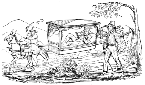 TRAVELLING IN A LITERA
of burthen, or an antiquated clumsy Mexican coach, were the only means
of travelling. Of these, the litera, a species of palanquin in which the
traveller reclined at ease upon his mattress and cushions, was by far
the most comfortable, and the use of this convenient vehicle is still
continued especially in the warmer parts of the country where exposure
to the sun is dangerous, and into which the modern diligence or stage
coach has not been introduced from the factories of the United States.
In many portions of Mexico, where the transportation has been for
centuries carried on by Arrieros with their mules and jackasses,
scarcely any thing of the original road remains, while the path that has
been so long trodden by the single file Atajos of these useful beasts
has been worn so deeply by their feet in the yielding soil or rock, that
the animals themselves are often concealed by the steep sides of the
gully. Thousands of sturdy Mexicans have for years been employed as
Arrieros in this business of mule-carriage. The "Conducta" is recognized
as one of the traditionary, time honored, and almost constitutional
institutions of the Republic, and it may easily be conceived that with
so powerful a body of honest, industrious men opposed to any new scheme
of transportation, it will require a long time for the enlightened
requirements of extended commerce to displace it. The fidelity of this
class has been already, elsewhere, alluded to; and whilst it is
personally reliable and responsible, its members are scarcely ever
attacked by the bands of robbers infesting the recesses of the
mountains, and laying in wait for less numerous, resolute or organized
way-farers. Millions were, and still are, often entrusted to them with
perfect confidence by the government and the people.
Nevertheless, within the last fifteen years the growing manufactures of
Mexico required a stouter means of transportation of heavy machinery
than the limbs of a mule, and the consequence was that intelligent
foreigners availing themselves of this want in the first instance,
gradually introduced heavy wagons like those of the European roulage
system, into which, by degrees, they forced a large portion of the bulky
commercial freight which was to be borne from the coast into the
interior. Simultaneously with this encroachment on the mule, the
arriero, and the litera, appeared the American stage coach, built in New
York; and together with the coach and its spirited horses, came the
"Yankee driver," whose accommodating and daring character soon made him
a favorite with those whose trade he in some measure injured, though it
did not serve to protect him or his passengers from the attacks of
robbers. The line of diligences or coaches established from Vera Cruz to
the capital, passing through Jalapa, Peroté and Puebla, was gradually
extended northwards from the capital through the principal mining and
commercial cities of the north, and thus the means of swift and
comfortable travel was at length, though only recently, supplied to a
small part of Mexico.
The danger of robbers, the wretchedness of the roads, the discomfort of
inns and the old fashioned Mexican habit of staying at home, have,
therefore, hitherto prevented the masses of the people from going
abroad. A journey of two or three hundred miles, for any purpose but
business or emigration, is still regarded as an important undertaking.
When families depart on such an expedition the preparations embrace
almost every comfort and luxury required at home, except a cow and a
piano. Until very lately nothing but shelter or the commonest food was
to be had at the miserable mesones or taverns along the roads. In most
of the less frequented regions this is still the case. It was necessary
therefore that travellers should be accompanied by a full complement of
servants, that they should carry with them an ample supply of bedding
and table furniture, that their long and numerous train should be fully
armed and equipped to fight its way if necessary, and that they should
be content to halt frequently, journey slowly, and linger on the road.
Inconveniences like these necessarily localized and confined all classes
of Mexicans except the very rich or those whose business imperatively
required them to encounter a life of expensive adventure. Nor was Mexico
a country of watering places and sea-side fashion, in which it was
customary, at certain seasons, for all whose means permitted, to fly
from the city to the fields or the shore for recreation and health.
Invalids, occasionally, under the stringent orders of physicians,
crawled to the warm baths or mineral waters which are abundant in a
volcanic country, but they were not followed by the idle crowds who
frequent similar places in Europe and the United States. Tens of
thousands are now living in the city of Mexico who have not even crossed
the lake to Tezcoco; while the fashionable or the wealthy are perfectly
satisfied if they make an annual peregrination in the month of May of
twelve miles to San Agustin de las Cuevas, where they spend three days
of frivolity, gambling, cockfighting, and dancing. The journeys of the
rest of the year are confined, as they are elsewhere in the Republic, to
an evening drive or ride on the Passeos and Alameda, or a more extended
excursion of a few miles to Tacubaya or San Angel. It was not the usage,
in the early days of Mexico or during the viceroyal government, to
travel for pleasure in a country conquered from the Indians, and still
ravaged by them or made insecure. The custom of the Spaniard has become
a habit of the Mexican. It may, in truth, be said that the spirit of
travel does not rule in Mexico, and that her people are stationary.
Railways do not traverse her valleys and plains, nor do electric
telegraphs convey the thoughts of her people thousands of miles in a
minute. Even the mail system is expensive, incomplete and inadequate.
Neither a steamboat nor a locomotive belongs to the nation.
In addition to all these habitual, accidental and geographical
difficulties of travelling over and exploring this mountain country, its
constant revolutionary state since the rebellion against Spain has
tended to retain people as much as possible either in the neighborhood
of their families or of their business and interests. Nor has scientific
education been extended sufficiently to form a large or enthusiastic
class of engineers who would have traversed the land and combined the
results of their observations. A few scattered students have, indeed,
published detached essays upon portions of the Republic, and the
Comision de Estadistica Militar is now engaged in gathering
statistical and geographical reports of the several States. But the
elements from which these bulletins are constructed do not seem to be
collected upon any uniform system of very responsible scientific
inquiry. The local authorities from whom much of the numerical
information is necessarily obtained, if they are connected with any of
the branches of taxation, or revenue collection, are generally
unreliable or corrupt, for, in consequence of the system of peculation
which has been carried on during the late disorganized epoch of Mexican
history, it was their interest to conceal rather than to disclose facts,
especially when those facts manifested the great value or production of
the region over which they presided.
Nevertheless, amid all these sad excuses for insufficiency or
inaccuracy, we may congratulate Mexico upon the effort which she is now
making to redeem herself from the past opprobrium. The war with the
United States has taught her many things, social as well as political.
Education is beginning to be more valued and extended. Periodicals and
newspapers are more freely published and diffused. Their leading
articles and scientific communications show that new classes of writers
as well as politicians are coming readily into the field in a period of
assured peace and order. These two elements of national progress will
enable Mexico to become acquainted with herself, and when her students
disclose the result of their discoveries, we shall be glad to see our
imperfect but honest efforts superseded by a work that will confer honor
upon Spanish science and literature.
PROFILE OF THE PLATEAU—MEXICO TO SANTA FÉ—SANTA FÉ TO THE GULF.
IN order to afford the geographical student an idea of the central
configuration of Mexico, we annex the following tables of the lines of
levelling made by Baron Humboldt, Dr. Wislizenius, Oteiza, and Burkart,
northwardly from the city of Mexico to Santa Fé; and eastwardly from
Santa Fé to Reynosa near the Gulf of Mexico. From the first of these we
learn that the plateau which forms the broad crest of the Mexican
Cordillera by no means sinks down to an inconsiderable height as was
long supposed to be the case but that it maintains, throughout, its
majestic elevation.
| 1st. Elevation above the sea from the city of Mexico to Santa Fé. |
| Mexico | 7,469 | ft. | above | sea. |
| Tula | 6,733 | " | " | " |
| San Juan del Ri | 6,490 | " | " | " |
| Querétaro | 6,362 | " | " | " |
| Celaya | 6,017 | " | " | " |
| Salamanca | 5,761 | " | " | " |
| Guanajuato | 6,836 | " | " | " |
| Silao | 5,911 | " | " | " |
| Villa de Leon | 6,133 | " | " | " |
| Lagos | 6,376 | " | " | " |
| Aguas Calientes | 6,261 | " | " | " |
| San Luis Potosi | 6,090 | " | " | " |
| Zacatécas | 8,038 | " | " | " |
| Fresnillo | 7,244 | " | " | " |
| Durango | 6,848 | " | " | " |
| Parras | 4,985 | " | " | " |
| Saltillo, | 5,240 | " | " | " |
| El Bolson de Mapimi | 3,785 | " | " | " |
| Chihuahua | 4,638 | " | " | " |
| Cosihuiriachi | 6,273 | " | " | " |
| Paso del Norte on the Rio Grande | 3,810 | " | " | " |
| Santa Fé in New Mexico | 7,047 | " | " | " |
| 2d. From Santa Fé in New Mexico to Reynosa on the Rio Grande. |
| Santa Fé | 7,047 | ft. | above | sea. |
| 3 miles N. of Alburquerque near the Rio Grande | 4,813 | " | " | " |
| Jornado del Muerto | 4,452 | " | " | " |
| Brazito | 3,918 | " | " | " |
| Upon crossing of the Rio Grande | 3,797 | " | " | " |
| Paso del Norte | 3,810 | " | " | " |
| S. of Rio Carmen | 4,219 | " | " | " |
| S. of Gallego | 5,317 | " | " | " |
| Rio Sacramento | 4,940 | " | " | " |
| Chihuahua | 4,638 | " | " | " |
| Aguachi | 5,952 | " | " | " |
| Cosihuiriachi | 6,273 | " | " | " |
| Bachimba | 3,956 | " | " | " |
| El Saucillo | 3,955 | " | " | " |
| Cadena | 5,056 | " | " | " |
| Mapimi | 4,487 | " | " | " |
| El Bolson de Mapimi | 3,785 | " | " | " |
| Parras | 4,985 | " | " | " |
| La Encantada | 6,104 | " | " | " |
| Saltillo | 5,240 | " | " | " |
| Rinconada | 3,381 | " | " | " |
| Monterey | 1,626 | " | " | " |
| Marin | 1,354 | " | " | " |
| Ceralvo | 1,006 | " | " | " |
| Mier | 417 | " | " | " |
| Camargo | 422 | " | " | " |
| Reynosa[70] | 104 | " | " | " |
"If we consider,"—says Humboldt in his Views of Nature,—"that in the
north and south direction the difference of latitude between Santa Fé
and the city of Mexico is more than sixteen degrees, and that
consequently the distance in a meridian direction, independently of
curvatures on the road is more than 960 miles, we are led to ask whether
in the whole world, there exists any similar formation of equal extent
and height, between 5,000 and 7,500 feet, above the level of the sea.
Four-wheeled wagons can travel from Mexico to Santa Fé. The plateau
whose levelling is here described is formed solely by the broad
undulating flattened crest of the chain of the Mexican Andes; it is not
the swelling of a valley between two mountain chains, such as the Great
Basin between the Rocky Mountains and the Sierra Nevada of California in
the Northern Hemisphere; or the elevated plateau of the Lake of
Titicaca, between the eastern and northern chains of Bolivia; or the
plateau of Thibet between the Himilaya and Quenlun, in the Southern
Hemisphere."—Page 209, Humb. Views of Nature.
| 1 onza—gold, = 16 dollars. |
| 1 peso—silver, = 1 dollar. |
| 1 real—silver, = 121/2 cents. |
| 1 medio real—silver, = 61/4 cents. |
| 1 quartillo—copper, = 31/8 cents. |
| 1 tlaco—copper, = 19/15 cents. |
| 1 foot = 0.928 feet English. |
| 1 vara (three feet Mexican) = 2.784 feet English = 2 feet 9.3141 inches English. |
| 1 legua (26.63 to 1 meridian) = 5000 varas = 2.636 miles English. |
| 1 onza—(8 ochavos)= 1 ounce. |
| 1 marco—(8 onzas)= 1/2 pound. |
| 1 libra—(2 marcos)= 1 pound. |
| 1 arroba—(25 libras)= 25 pounds. |
| 1 quintal—(4 arrobas) = 100 pounds. |
| 1 carga—(3 quintals) = 300 pounds. |
| 1 fanega—(140 pounds) = 2 bushels nearly. |
| 1 almuer—(almuerza) = 1/12 of a fanega. |
| 1 frasco = 5 pints nearly.[71] |
| Names of measures. |
Figures of
measures. |
Length of
the fig.
in measures. | |
Breadth
in varas. | |
Areas in sq.
varas. | |
Areas in
Cabellerias. |
| Sitio de ganado mayor, |
Square |
5,000 | |
5,000 | |
25,000,000 | |
41.023 |
| Criadero de ganado mayor, |
Square |
2,500 | |
2,500 | |
6,250,000 | |
10.255 |
| Sitio de ganado menor, |
Square |
3,333 | 1/3 |
3,333 | 1/3 |
11,111,111 | 1/9 |
18.232 |
| Criadero de ganado menor, |
Square |
1,666 | 2/3 |
1,666 | 2/3 |
2,777,777 | 7/9 |
4.558 |
| Caballeria de tierra, |
Right angled parallelogram |
1,104 | |
552 | |
609,408 | |
1 |
| Media cabelleria, |
Square |
552 | |
552 | |
304,704 | |
1/2 |
| Cuarto cabelleria or suerte de tierra, |
Right angled parallelogram |
552 | |
276 | |
152,352 | |
1/4 |
| Fanega de sembradura de maiz, |
Right angled parallelogram |
376 | |
184 | |
56,784 | |
1/12 |
| Solar para casa, |
Square |
50 | |
50 | |
2,500 | |
0.004 |
| Fundo legal para pueblos, |
Square |
1,200 | |
1,200 | |
1,440,000 | |
2.036 |
The Mexican Vara is the unit of all measure of length, the pattern and
size of which are taken from the Castilian Vara of the Mark of Burgos,
which is the legal vara used in the Republic. Fifty Mexican varas make a
measure called Cordel, used in measuring lands.
The legal league contains 900 cordels, or 5000 varas. The league
is divided into halves and quarters—this being the only division made
of it. Anciently the Mexican league was divided into three miles, the
mile into a thousand paces of Solomon, and one of these paces into
five-thirds of a Mexican vara—consequently the league had 3000 paces of
Solomon. This division is recognized in legal affairs, though it has
been long in disuse. The mark was equivalent to two varas and
seven-eighths, that is, 8 marks contained 22 varas, and was used in land
measure.
See Appendix No. 9 to Captain Halleck's Report on Californian
affairs,—pages 119 and 145 of Executive Document No. 17, 31st Congress,
1st Session.