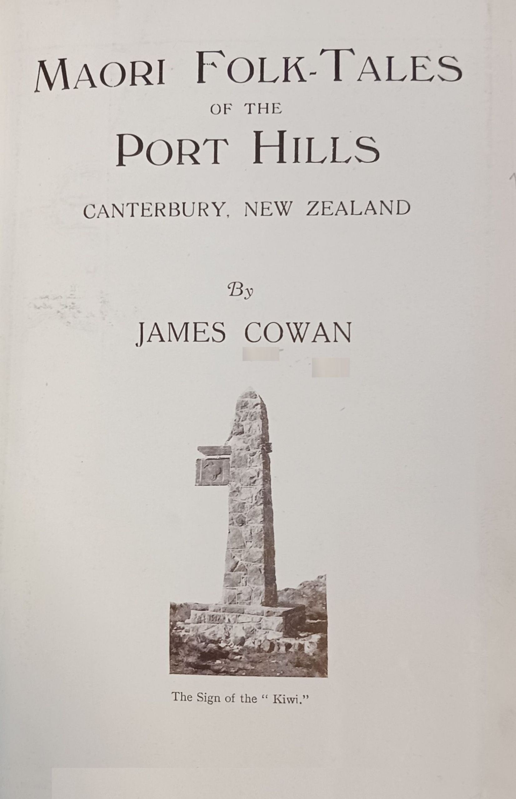
Auckland, Christchurch, Dunedin, & Wellington, N.Z.
Melbourne and London
1923
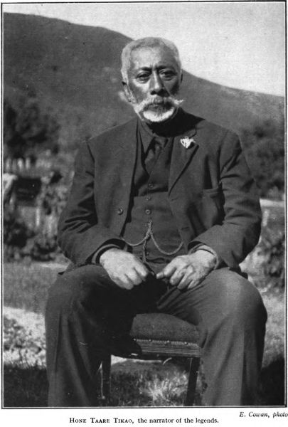
E. Cowan, photo
Hone Taare Tikao, the narrator of the legends.
PREFACE
In this little book I have endeavoured to interweave
with descriptions of the most picturesque parts of the
Canterbury Port Hills some of the Maori poetic legends
and historical traditions which belong to the
Range, and which have not previously been
recorded. These stories, I hope, will invest with a
new interest for many Canterbury pakehas the scenic
beauties of the Port Hills now opened up from end
to end by the Summit Road. Here I desire to record
also, with feelings of gratitude, the name of the
principal narrator of the legends, Mr. Hone Taare
Tikao, of Rapaki, a Ngai-Tahu gentleman whose
uncommonly retentive memory is a storehouse of
information on local history and who blends in
himself the gifts of the folk-lorist and the genealogist.
Some of the place-names were supplied by
the late Mr. T. E. Green (Tame Kirini), of Tuahiwi,
Kaiapoi, one of the last good native authorities on
the ancient history of the plains.
For the priceless gift of free access to these grand
tops of the Port Range the people are indebted to
the efforts and the gifts of a few public spirited
residents, but most of all to the exertions of
Mr. H. G. Ell, whose enthusiasm, prescience
of vision, and singleness of purpose in developing
the Summit Road along this mountain park have
properly earned him the admiration and the thanks
of thousands of his fellow-citizens who daily lift
up their eyes to the Hills and who find on those
hills their pleasure and their solace for town-tired
body and brain. And maybe if Mr. Ell’s name were
bestowed, like Tamatea’s of old, upon one of
these monumental crags still unchristened, it would
but fittingly preserve the memory of a man whose
title to such local honour and fame is certainly
greater than that of some of his forerunners whose
names the landscape bears.
J.C.
CONTENTS.
CHAPTER I. The Story of the Rocks.
The Port Hills and their geological history—The Dead Fire-Cones—“The
Fire of Tamatea”—Bold Cliff and
Mountain Scenery—Beauties of the Port Range
Maori Nomenclature of the Port Range—Hills of the
Rainbow God—“The Pinnacle of Kahukura”—Crags of
the Sounding Footsteps—Ancient Lyttelton: “The
Basket of Heads”—Ambuscades in the Bush
The Flanks of Te Heru-o-Kahukura—Tracks on the Mountain
Side—At Dyer’s Pass—Maori Name of Marley’s Hill—Exploring
the Kahukura Bush—Needles of the Ongaonga—The
Valleys and the Small Timber—“Crest of the
Rainbow”
The Bell on the Ribbonwood Tree—Tikao and his Traditions—The
Days of the Ngati-Mamoe—Te Rangiwhakaputa’s
Conquests—The Crags of Tamatea—A Sturdy Pagan—Evening
Picture at Rapaki
CHAPTER V. The “Ahi-a-Tamatea”: How the Sacred Fire Came to
Witch Hill.
The Giant’s Causeway—A Volcanic Dyke—Tamatea the
Polynesian Explorer—A Great March—The Camp at
Witch Hill—Tamatea’s Call for Fire—The Tipua Flames
from Ngauruhoe—“The Ashes of Tamatea’s Camp
Fire”
CHAPTER VI. Hills of Faery: The Little People of the Mist.
Legends of the Patu-paiarehe —The Fairies of the Port and
Peninsula Hills—Mountains of Enchantment—“The
Red Cloud’s Rest”—The Fairies and the Mutton-birds—The
Maero of the Woods—Mount Pleasant and its
Tapu
With the opening of tracks along the bold range of
heights between the Canterbury Plains and Lyttelton
Harbour, and the acquisition of new reserves for the
public, mainly through the efforts of one tireless
worker, Mr. H. G. Ell, Christchurch residents
are perhaps coming to a more lively sense of the value
of the Port Hills as a place of genuine recreation.
The Summit Road has made city people free of the
grandest hilltop pleasure place that any New Zealand
city possesses within easy distance of its streets, and
the worth of this mountain track, so easily accessible
and commanding so noble a look-out over sea and
plains and Alps, will increase in proportion to the
growth of the Christchurch population. The fragments
of the native bush which survive in the valleys
will be of surpassing botanical interest in
another generation or two, but the vegetation of the
hills inevitably will suffer many changes, and an
exotic growth will for the most part replace the
ancient trees. With all the alterations which man’s
hand may make in the reserves and along the public
tracks, however, the monumental rock-beauty will
remain the great and peculiar feature of the hills,
their most wonderful and unalterable glory. The Port
Range and the Banks Peninsula system of mountains
are indeed the most remarkable heights in the whole
of the South Island, not excepting the snowy Alps;
there is nothing like them outside the northern volcanic
regions, and in some aspects they carry a greater
scientific and scenic value than even the crater-cones
around the city of Auckland. What the Canterbury
coast would have been like but for the vast volcanic
convulsions which formed these ranges and huge
craters is not difficult to imagine. It would have been
a uniform billiard-table on an enormous scale, very
gently sloping to the sea, with scarcely a break but
for the snow rivers and with never a usable natural
harbour. Volcanic energy gave us Lyttelton and
Akaroa harbours, and shaped for us also the ever-marvellous
hills that are at once a grateful relief to
the eye from the eternal evenness of the plains and
a healthful place of pleasure for our city dwellers.
The passage of untold ages has so little altered
these fire-made ranges that build a picture-like ring
about Lyttelton Harbour that their origin and history
are plainly revealed to the climber and the Summit
Road stroller; the story of the rocks can scarcely be
mistaken. Geologists from the days of von Haast
have written much of the Lyttelton and Akaroa volcanic
systems, and in truth it is an ever-new and
ever-fascinating subject. There is hardly a more
interesting specimen of vulcanism in New Zealand,
for example, than the strange wall of grey-white lava
rock which Europeans call the Giant’s Causeway and
the Maoris “The Fire of Tamatea,” which protrudes
from the hilltop just above Rapaki, and which may
be seen again on the far side of the harbour, a
volcanic dyke that the ancient people—with surely
some perception of geological truth—connected in
their legends with the internal fires of the North
Island. Along the craggy hill faces again, and particularly
well in such places as Redcliffs and the
Sumner end of the range, it is easy to read the history
of the rocks in the alternate strata of solid volcanic
rock and the soft rubble that seems almost to glow
again with the olden fires. The most wonderful
example of this stratified formation is the face of the
south head of Akaroa Harbour; but it is possible to
study similar pages in the volcanic chapter of
Canterbury’s history without going many yards from
the Summit Road anywhere from the sea to the hills
above the harbour head.
The most perfect local example of an ancient crater
perhaps is one that does not seem to have attracted
much attention from scientific writers and lecturers,
and this may be mentioned as a type of the remarkable
places which build up the romantic ruggedness and
savageness of our harbour-palisading hills. It is to
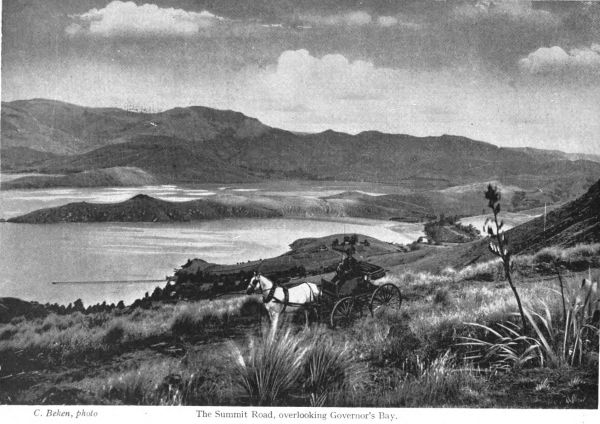
be studied especially well from the Lyttelton-Governor’s
Bay road. Above Corsair Bay and Cass
Bay there is a group of bold rocky peaks which, as
the traveller passes onward from Lyttelton, is seen
to curve inward in a huge half-cup, open to the south,
and down this open side are strewn the disorderly
remains of the old lava stream which flowed from the
core of the volcano and which ran out into the harbour
at Cass Bay in a tumbled black reef. It does not
require a great effort of imagination to reconstruct
that fire-cup as it must have appeared in the era
when the fantastic hills were still in the making and
shaping. The Maoris, with a quick eye for such
significant topographical features, gave the place a
name which blends history with legend, “Wheke’s
Sleeping Place.” Indeed, that strange hollow in the
hills might have made fit cradle for a Finn MacCoul.
Like the crater-topped cones of the Tamaki Isthmus,
it is softly grassed; a stray ngaio is the one remnant
of the bush that once covered the volcanic detritus;
but the hugely ramparted and square-hewn rim of
the basin stands indomitable and unchangeable, unmistakable
memorial of the active volcanic age. Such
bold crags are “the eyebrows of the hills”; they give
what would otherwise be tame landscapes dignity and
force and wildness, and an exploration of these fastnesses
of Nature so near our doors, and opened up by
the Summit Road, is not merely pleasurable, but is
fruitful in an intelligent appreciation of the amazing
forces which helped to mould the land in which we
live.
All along the fire-fused line of these Summit
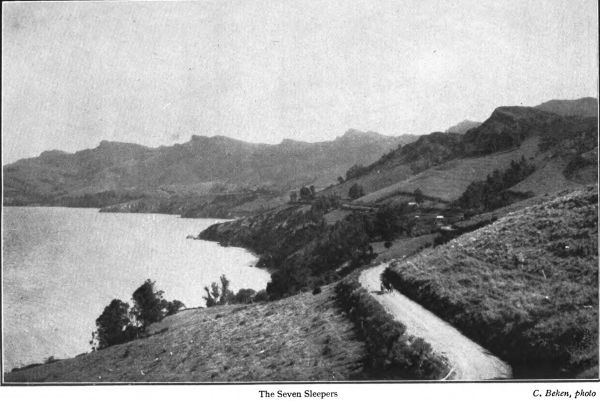
Peaks from the Lighthouse to the Seven Sleepers
and beyond there are amazingly bold bits of rock
and cliff scenery—abrupt escarpments like huge
redoubt walls, bearded with mountain flax, and
flakey from the attack of ages of winter frosts;
straight smooth cleavages that seem almost artificial,
so sharply and finely are they worked by
Nature, the great sculptor; rounded buttresses like
enormous pillars shoring up the mountain side;
caves here and there, old bubbles in the molten
lava, caves that might have sheltered some cannibal
highwayman in the days of stone club and face-tattoo;
strangely shapen projections of the cliff-edge,
some remindful of animal forms; tomahawk
faces of grey storm-beaten rhyolite dipping down
into the green arms of the little woods where the
tui’s rich echoing “bing-bong” and gurgling
chuckle are still heard in the shady depths when
the bush fruits are ripe. Here and there a little
watercourse, its fountain-head waters dripping
silently from some cool crevice in the rocks, all
arboured over by the matted roofing of
kotukutuku, twisty and witchy of branch, and
mahoe and glossy-green karaka of the plenteous
foliage. Watercourses that fit the bold mountain
The Seven Sleepers
C. Beken, photo
pictures about them; dry in summer, they come
down in tumultuous little cataracts in time of heavy
rain, plunging over the piled fragments of lava
rocks, and filling for a day or two the age-worn
pockets and pools and “pot-holes” in the winding
valleys all arched over with the close-growing
light timber. Deep down in these twisting gullies
below the straight cut harbour-facing cliffs, there
lingers still a certain quality of primitiveness and a
suggestion of the ancient adventure; an atmosphere
still in keeping with the legendry of these Hills.
Here in the leaf-thatched hollows of Taungahara
or the woven thickets that blanket the precipice
fronts of the Seven Sleepers still shall you have
intimate glimpses of wild nature. Up on the
tussock-swarded mountains of the hawk and deep
in the sudden valleys still may you, though so near
to the City, breathe the mind-refreshing fragrance
of the grand out-of-doors, hold healthy commune
with
“All the still-eyed Soul that broods
In wide wind-whispering solitudes—
Each cloud chase chequering hill and plain—
Moon-shadows—sunny silences—
Lone mists on fire in glens profound—
Old half-lit trunks of twisted trees
And stealthy gleams in gloomy woods.”
Chapter II.
THE PORT HILLS AND THEIR NAMES.
It is the Port Hills’ nomenclature, perhaps, that
carries the most poetic suggestions of any of the
Canterbury place-names, and here, perhaps, the
dwellers on the heights in the days to come when all
these Plain-ward-looking slopes are dotted with pretty
homes, will seek inspiration in such legendry and
history of the soil as we of the present generation
have preserved. There are names of dignity and
beauty clustered about those old lava-built crags
and ruined towers and tors past which the Summit
Road goes a thousand feet above the city.
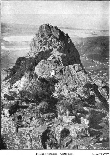
Finest of all is the Maori name of Castle Rock,
that from one point in the Heathcote Valley looks
like a colossal howitzer threatening the Plains. To
the old Maoris it was Te Tihi o Kahukura, “The
Citadel of Kahukura,” otherwise “The Pinnacle of
the Rainbow.” The explanation brings in a
reference to the religion of the tattooed pagan
pioneers who explored those hills and plains, and
planted their palisaded hamlets by creek-side and
in the sheltered folds of the ranges. Kahukura—Uenuku
in the North Island—was the principal deity
for what may be termed everyday use among the
ancient Ngai-Tahu. He was the spirit guardian
most frequently invoked by the tohungas , and he
was appealed to for auguries and omens in time of
war. Each hapu had its image of Kahukura, a
small carved wooden figure, which was kept in
some tapu place remote from the dwellings, often
a secluded flax clump, or on a high, stilt-legged
platform or whata. The celestial form of Kahukura
was the rainbow; literally the name means
“Red Garment.” Omens were drawn in days of
war from the situation of the arch of the “Red
Garment” when it spanned the heavens. The name
is sometimes applied to that phenomenon of days of
mist in the mountains, the “sun-dog,” from which
auguries were drawn. So when the Natives gave
the term to the Castle Rock they were conferring
upon it a name of high tapu befitting its bold and
commanding appearance.
And this is not the only Hills name that holds a
memory of the cult of the Rainbow-God. On the
tussocky slope where the track goes over from the
St. Martins tram terminus to the Summit Road
above Rapaki, joining the hill track near Witch
Hill, the tohungas kept in a sacred place one of the
wooden figures representing Kahukura, for karakia ,
consultation in time of need, and the spot
became known as “Te Irika o Kahukura,” or “The
Uplifting of the Rainbow God.” In time the name
was applied to the Cashmere Hills generally. And
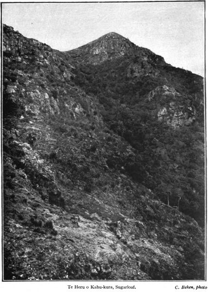
the lofty Sugarloaf peak immediately to the north
of Dyer’s Pass, was Te Heru o Kahukura, which
being interpreted, is “Kahukura’s Head-Comb.”
So the olden folk occasionally displayed a fine taste
in names; and although some of those names may
be a trifle long for pakeha use it would be well to
save them from oblivion.
Otokitoki—“The Place of Axes”—is the name of
Godley Head, the lofty cliff upon which the lighthouse
stands; its early-days pakeha name was
Cachalot Head. Working south from the lighthouse
we presently come to the deep bay of Te Awa-parahi,
where a little farmstead stands in its well-hidden
nest, between the lowering peaks. Nearer
Lyttelton, just where the Zigzag Road goes over
Evans Pass to Sumner, are the precipitous
Te Tihi o Kahukura. Castle Rock.
C. Beken, photo
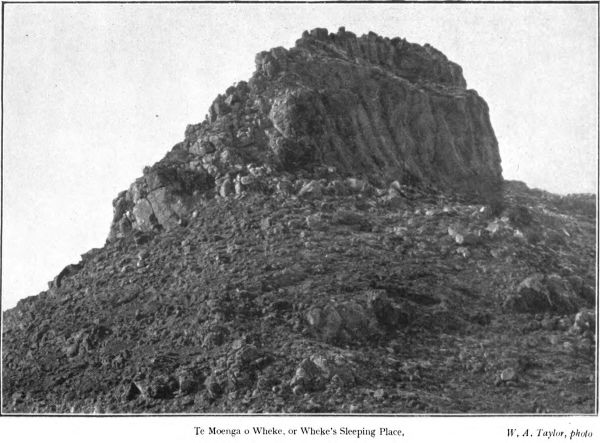
Te Moenga o Wheke, or Wheke’s Sleeping Place.
W. A. Taylor, photo
summit rocks of Tapuwaeharuru, “The Resounding
Footsteps,” a place-name met with
in more than one locality in the volcanic
country of the North. Far below is the little indent
of Te Awa-toetoe, or “Pampas-grass stream”
near the artillery barracks. Mount Pleasant, where a
Ngati-Mamoe
pa
once stood, was known to the
Maoris as Tauhinu-Korokio, a combination of two
names of shrubs common to the ranges. Passing
Castle Rock—Te Tihi o Kahukura—just on the
right hand or west as we travel towards Dyer’s
Pass, we have on the other hand Te Moenga o
Wheke, or “Wheke’s Sleeping Place” and Ota-ranui,
or “Big Peak,” the towering rough-hewn
crests of the Range looking down on Cass Bay and
lying east of the Summit Track. Then comes Witch
Hill, with “The Ashes of Tamatea’s Camp Fire,”
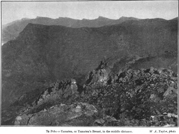
of which a legend later, and Te Poho o Tamatea, or
“Tamatea’s Breast,” overlooking the Rapaki native
settlement.
Oketeupoko, or, to divide it into its component
words, O-kete-upoko, is the Maori name of the
rocky heights immediately above the town of Lyttelton.
It means “The Place of the Basket of
Heads.” A sufficiently grim name this, remindful
of the Whanga-raupo’s red and cannibal past, for
the heads were human ones. When the olden
warrior Te Rangi-whakaputa set out to make the
shore of the Raupo Harbour his own, he encountered
numerous parties of Ngati-Mamoe, who put
up a fight for their homes and hunting-grounds.
One of these parties of the tangata-whenua , the
people of the land, he met in battle on the rocky
beach of Ohinehou where the white man’s breakwaters
and wharves now stand. He worsted them,
and the heads of the slain he and his followers
hacked off with their stone patus and axes. Some,
those of the chief men, Te Rangi-whakaputa placed
in a flax basket, and, bearing them up to the
craggy hill-crest that towered above the beach, he
set them down on a lofty pinnacle, an offering to
his god of battles. There they were left, say the
Maoris, he kai mo te ra, mo te manu —“food for the
sun and for the birds.” “O” signifies “the place
of,” “kete” basket and “upoko” head, and thus
was the place named, to memorise the tattooed
brown conqueror of old and the ancient people
whom he dispossessed on the shores of the Whangaraupo.
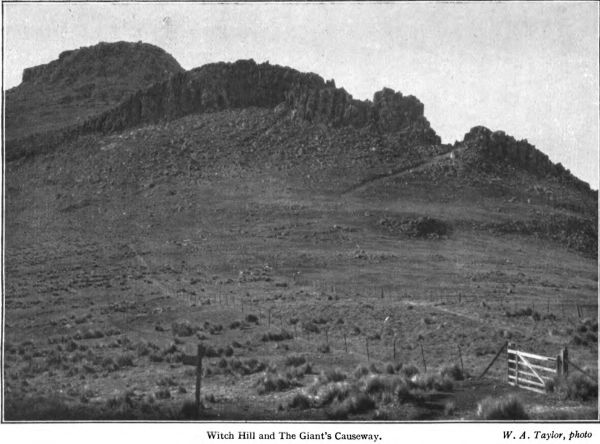
Witch Hill and The Giant’s Causeway.
W.A. Taylor, photo
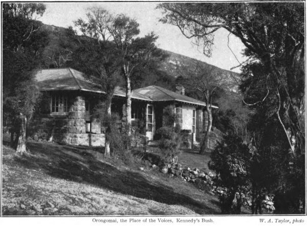
Orongomai, a melodious name when properly pronounced,
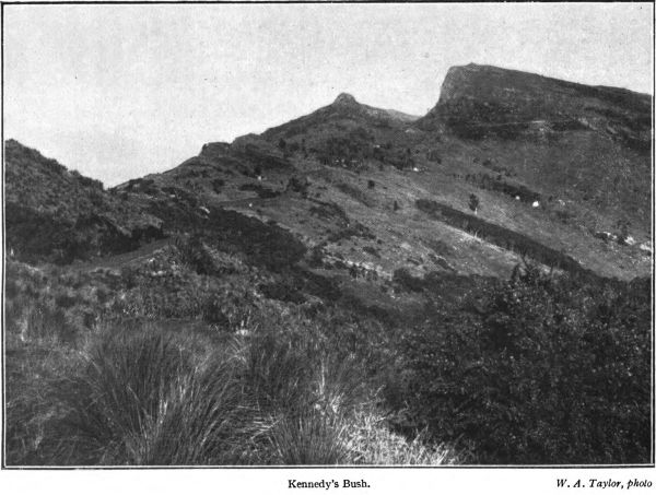
is the old Ngai-Tahu name of Cass Peak, the
rhyolite height which lifts 1780 ft. above the waters of
Governor’s Bay, overlooking the remnant of the
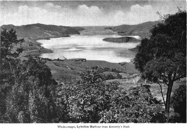
ancient forest at Kennedy’s Bush. It means “The
Place Where Voices are Heard,” or, literally,
“Place of Sounding-hitherward.” The name has
fittingly enough been given by Mr. Ell to
the stone house for visitors which stands under
the ribbonwood trees at the head of the Kennedy’s
Bush Valley. The story is that when Te Rangi-whakaputa
and his followers landed, in their search
for the Ngati-Mamoe, after taking the pa at Ohinetahi,
in Governor’s Bay, the scouts entered the bush, and
at the foot of Cass Peak heard the voices of a party
of men in the bush; these men were Ngati-Mamoe,
who had come across from their pa at Manuka, on
the plains side of the range. Led by the scouts—the
torotoro—the invaders rushed upon the Ngati-Mamoe
some of whom they killed. The survivors fled over
the hills to Manuka, a large pa which it is believed
stood on a knoll at the foot of the range not far from
Tai Tapu. (Mr. Ell, on being told of this tradition,
said that he believed the site of Manuka would be
found to be the spur running into an old swamp
upon which Mr. Holmes’s homestead is built, on
the old coach road south of Lansdowne, and about
two miles from Tai Tapu.) The Manuka village,
although a strong defensive position, was stormed and
taken by Te Rangi-whakaputa. In the vicinity, it is
said by the Maoris, there was a shallow cave under the
rocky hillside which was used by some of the Ngati-Mamoe
as a dwelling-place; it is known in tradition
as Te Pohatu-whakairo, or “The Carved Rock.” No
doubt it was so called from the natural markings
sometimes seen on the faces of these overhanging
rock shelters, such as were used as dwelling and
camping-places in many parts of the South Island by
the ancient people.
Ohinetahi[1]pa , defended with a palisade of split
tree-trunks and with ditch and parapet, stood near
the shore at the head of Governor’s Bay two hundred
years ago. After the place had been captured from
the Ngati-Mamoe by Te Rangi-whakaputa, his son
Manuwhiri occupied it with a party of Ngai-Tahu.
This chief Manuwhiri had many sons, but only one
daughter, and he named his pa after his solitary
girl, “The Place of the One Daughter.” The
Governor’s Bay school now occupies the spot where
this long-vanished stockaded hamlet stood.
[1] This name was adopted by the late T. H. Potts for his stone house at Governor’s
Bay, directly below Kennedy’s Bush.
Orongomai, the Place of the Voices, Kennedy’s Bush.
W. A. Taylor, photo
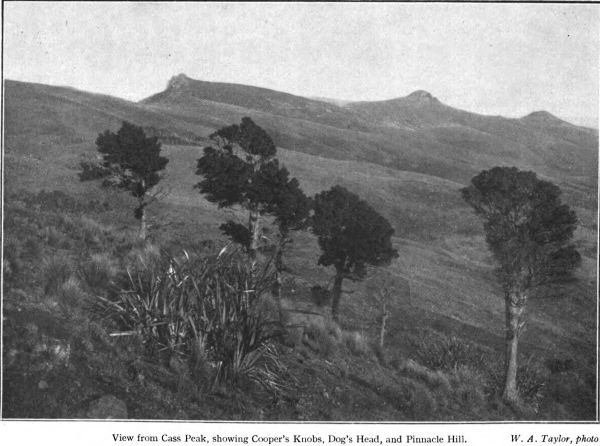
The name of Cooper’s Knobs, the highest of the
three tooth-like crags lifting abruptly above the head
of Lyttelton Harbour to an altitude of 1880 feet,
memorises, like so many others, an incident of the
head-hunting cannibal days. After the Rangi-whakaputa
and his merry men had conquered the
various Ngati-Mamoe pas around the harbour, they
found frequent diversion in hunting out stray
members of the fugitive
hapus
and converting them
to a useful purpose through the medium of the oven.
Often there were bush skirmishes, and although the
Ngati-Mamoe frequently put up a good fight, they
usually got the worst of the encounter. Mawete, the
chief of Ngati-Mamoe, and a party of men from
Manuka
pa
were on their way across the range to
Lyttelton Harbour to fish for sharks when they were
ambuscaded in the bush just below Cooper’s Knobs
by a band of Ngai-Tahu warriors. The Ngati-Mamoe
chief and most of his followers were killed in the
skirmish that followed, with the Maori weapons of
wood and stone, the spear, the
taiaha
, and the sharp-edged
patu
, and their bodies went into the oven, for
the Maori’s commissariat in that age was the flesh of
his foeman. And the Mamoe leader’s name still
clings to that wild craggy spot where he met his death
blow, for the peak which the
pakeha
has named
Cooper’s Knobs was called by the Ngai-Tahu conquerors
Omawete, meaning the place where Mawete
fell.
Beyond again are the peaks of Otuhokai and Te
Tara o Te Raki-tiaia; below the harbour head curves
into the bay of Te Rapu. Next as we go up to meet
the hills of Banks Peninsula is the bold precipice of
Te Pari-mataa, or “Obsidian Cliff,” with the great
volcanic dyke of Otarahaka, and then our present
pilgrimage ends, for we are right under the hugely
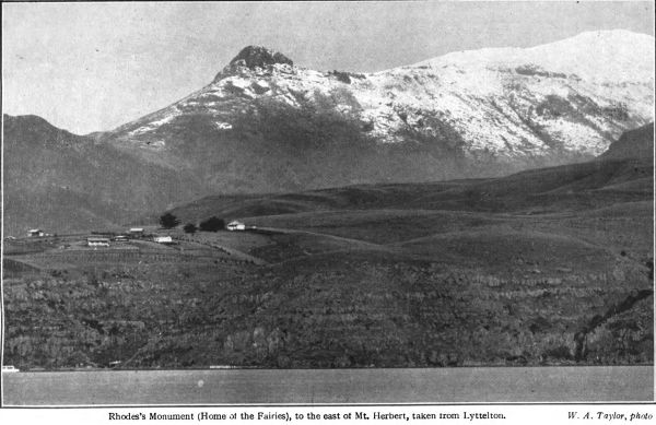
parapeted castle hill of Te Ahu-patiki—Mt. Herbert—with
its level top, where a lofty pa of Ngati-Mamoe
stood three centuries ago.
Cooper’s Knobs Dog’s Head Pinnacle Hill
View from Cass Peak, showing Cooper’s Knobs, Dog’s Head, and Pinnacle Hill.
W. A. Taylor, photo
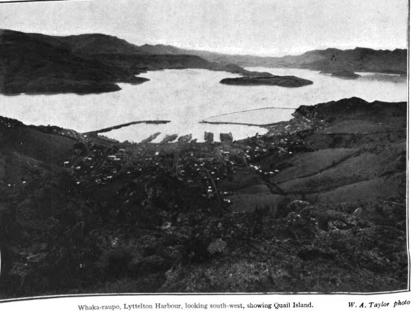
Te Whaka-raupo is the ancient name of Port Cooper
or Lyttelton Harbour. The name sometimes has been
given as Te Waka-raupo, which means “The Canoe
of Raupo reeds,” otherwise a raft or mokihi of the
type so often used on the South Island rivers. This,
however, is not correct. “Whaka” here is the Ngai-Tahu
dialectical form of “Whanga,” which is a
harbour or bay, as in Whangaroa and Whanganui.
Whaka-raupo, therefore, means “Harbour of the
raupo reed.” The tino or exact place from which the
harbour takes this name is Governor’s Bay, at the
head of which there was a swamp filled with a thick
and high growth of these reeds. It was here, at the
head of Governor’s Bay, that the stockaded pa Ohinetahi
stood; it was occupied by Te Rangi-whakaputa’s
son after the dispersal of the Ngati-Mamoe tribe in
these parts more than two hundred years ago.
Corsair Bay and Cass Bay, as the Kaumatua of
Rapaki tells us, have Maori names which contain a
reference not only to the ancient forests which clothed
the slopes of the Port Hills and descended to the
sandy beachside, but to one of the vanished practices
of the native people, fire-making by wood-friction.
Corsair Bay was named by Te Rangi-whakaputa,
Motu-kauati-iti, meaning “Little Fire-making Tree-grove,”
and Cass Bay was Motu-kauati-rahi, or
“Great Fire-making Tree-grove.” The bays were so
designated because on the shores and the slopes above
there were plentiful thickets of the kaikomako
(pennantia corymbosa), the small tree into
which Mahuika, a Polynesian Prometheus, threw
fire from his finger-tips, so that it should not be
extinguished by Maui’s deluge. A myth which to the
Maori quite satisfactorily accounts for the readiness
with which fire can be obtained from the kaikomako
by the simple process of taking a dry block of the
wood and rubbing a groove in it with a stick of hardwood—with,
of course an incantation to give more
power to the elbow—until the dust and the shavings
become ignited. The kaikomako wood is used as the
kauati , the piece which is rubbed; the pointed rubbing
stick which the operator works to and fro is the
kaurima . Motu in these two names is a tree-clump or
grove. There are none of the ancient fire trees on
the bay shores nowadays; the pakeha’s pinus insignis
and cocksfoot grass have long supplanted them.
Ri-papa is the full and correct name of Ripa
Island, in Lyttelton Harbour. It is an historic and
appropriate name, carrying one back to the ancient
days when the brown sailors hauled their long canoes
up on its little shelving beach. Ri means a rope, the
painter of flax by which canoes were dragged up on
shore, and papa is a flat rock. Ripapa is a white
man’s fort these days, but centuries before a British
gun was planted there it was a fortified place, though
the weapons of its garrison would hardly carry as
far as those of the present coast defence force. The
Ngati-Mamoe three hundred years ago had a small
village on this rocky islet, commanding the harbour-gate;
it was defended with a palisade. But when
the Rangi-whakaputa conquered the inhabitants of
Te Whaka-raupo, he took the island and named it
Ripapa—its first name is forgotten—and he built
a pa on the spot where the fort of the pakeha artillery-men
now stands.
Quail Island, the dark-cliffed isle of the lepers,
is known by the Maoris as Otamahua. Herein is a
reference to an era when the island was a birding
ground of the olden race. Many sea-birds, gulls and
puffins and divers, bred in the crannies of its fire-made
rocky shores, and the mainland Maoris canoed
across on fowling expeditions. The eggs (hua ) of the
sea-fowl were esteemed delicacies, especially by the
children (tamariki ), who were fond of roasting them
on their island expeditions. Manu-huahua , or birds
cooked and preserved in their own fat, and
done up in sea-kelp receptacles, as is the way in the
Stewart Island mutton-bird industry to-day, also
formed a large portion of the native supply of winter
food in these parts.
Looking out from the Port Hills the olden Maori
wayfarer surveyed the far-spreading Plains and the
name handed down from the days of the Waitaha
tribe, the forerunners of the Ngati-Mamoe, came to
his lips: “Nga Pakihi Whakatekateka a Waitaha.”
It is a barbed-wire fence, perhaps, to the average
pakeha, yet abbreviated it is not inappropriate as
a Plains homestead name. In the long ago, before
water-races and artesian wells, the trails across the
Plains from the Waimakariri to the Selwyn and
the Selwyn to the Rakaia and the Ashburton were
weary and thirsty tracks, for there were very few
springs of drinking water and the Maori disliked
the water of the cold glacial torrents. So the tired
and thirsting trail-parties, swagging it across the
wastes of tussock and cabbage trees, came to call
the district “The Deceptive Plains of Waitaha,”
for they discovered that it was unwise to rely upon
springs and streams on the long tramp. They made
water-bags of seaweed, the great bull kelp, which
they split and made watertight, and these poha
henceforth became as necessary to the kit of a
trans-“Pakihi” traveller as a water-bottle is to the
soldier in the field to-day.
The Heathcote River, whose native name has been
abbreviated to Opawa, was originally the
Opaawaho, which means “The outer, or seaward,
pa ,” otherwise “An outpost.” A tribe-section or
hapu of the Ngai-Tahu, about two hundred years
ago, built a village on the left bank of the river,
on a spot slightly elevated above the surrounding
swampy country; the exact spot must have been
close to the present Opawa Railway Station. The
name of the village was Poho-areare, or “pigeon
breasted,” after some chief of those days, and it
was because of its situation, the outermost
Kainga
of the Plains and swamp dwellers, commanding
the passage down the Heathcote to the
sea, that the river became known as the stream of
“The Outpost.” Here it may be recalled that the
hapus
who lived where Christchurch City now
stands were given a nickname by the outer tribes
at Kaiapoi and elsewhere. They were called
“O-Roto-Repo,” or more briefly, “O-Roto-re’,”
which means “In the Swamp,” or the “Swamp-Dwellers.”
They lived in a marshy region which
had its compensations in the way of abundant food,
for the swamps and creeks swarmed with eels and
wild duck. The upper part of the Heathcote was
the O-mokihi or “The Place of Flax-Stalk Rafts.”
The
tino
of the name, the place where it had its
origin, was an ancient lagoon-swamp at the foot of
the Cashmere Hills, which the river drained.
Another version of the Heathcote name is Wai-Mokihi,
or “Flax-stalk Raft Creek.” Lower down
the Heathcote, where the broad tidal shallows are,
the Maoris gave the place an equally appropriate
name; they called it O-hikaparuparu, which may
be translated as “The spot where So-and-so fell
in the mud,” or “Stick-in-the-mud,” which serves
equally well to-day. About Redcliffs, where the tramline
passes round from the broads and under the great
cave-riddled lava precipice, there belongs a rather
beautiful name, Rae-Kura, which is more modern than
most of the other Native designations. It means “Red-glowing
Headland,” or, let us say, “Rosy Point.”
Immeasurably more ancient is Rapanui, which
is the name of Shag Rock, in the Estuary; a place-name
that could very well be appropriated by some of
the near-by residents. It is a far-travelled name,
for it was brought by the first Maori immigrants
from Hawaiki, just as our white settlers brought
their Canterburys and Heathcotes and Avons with
them. We find it on the map of the Pacific some
thousands of miles away; it is one of the Native
names of Easter Island, that strange relic of a
drowned Polynesian land in Eastern Oceania. And
further out still, there is Tuawera, the Cave Rock
at Sumner, to which belongs a legend of love and
wizardry and revenge, to be narrated at another time,
in which the chief figures were a girl from Akaroa
named Hine-ao or “Daughter of the Dawn,” the
chief Turaki-po, of “The Outpost” village, and Te
Ake, the tohunga of Akaroa.
Chapter III.
ROUND THE SUGARLOAF.
“THE CREST OF THE RAINBOW.”
The saying that the best place to see the mountains
is from below, not from their summits, may
properly be qualified in its application to our Port
Hills by the opinion that the finest view of the
craggy range of old volcanic upjuts is that to be
had from a few hundred feet below the range
crest, on the Lyttelton Harbour side. Really to
appreciate the special and peculiar beauty of the
hills, with their nippled peaks and crags and their
age-weathered cliffs, one must travel along the
Lyttelton-Governor’s Bay road rather than view
the range from the Plains, where the smoothed and
settled ridges, like a series of long whalebacks, give
little hint of the sudden rocky wildness of the
precipitous dip to the harbour slopes. There, on
the white road that curves along the hillsides well
above the waters of the Whanga-Raupo, it is easy
to understand something of the fiery history of
these hills, when the hollow that now is Lyttelton
Harbour was one terrific nest of volcanoes and when
the tremendous forces of confined steam and gases
hurled whole mountain-tops skyward and helped to
give savage shape to the walls of rhyolite rock that
stand to-day little altered by the passage of the
untold centuries of years. Better still, truly to
understand this most wonderful part of Canterbury,
one should make a traverse of the upper parts
of the eastern dip by the new tracks, two or three
hundred feet below the pinnacles of the ridge. Off
Te Heru o Kahukura, Sugarloaf.
C. Beken, photo
the tracks if you care for the exercise there is rock-climbing
in plenty and there are scrambles under
the low-growing trees and along steep faces hanging
on to the flax clumps and the tough-branched
koromiko
. And at about this level on the Hills
side there are aspects of crag scenery, and crag and
woodland combined, that are altogether missed by
the stroller who keeps to the beaten track. Our
Christchurch artists need not go further away than
the inner dip of the range, the battered rim of the
ancient fire cauldron, for impressions of bold rock
faces straightly grand and honeycombed with
curious caves, and witchy-looking weathered old
trees; pictures that approach grandeur when the
storm clouds swirl about the tussock-topped tors of
Kahukura, the Rainbow God, giving the dark cores
of the olden volcanoes an added height and mystery,
or when they drift softly and mistily from the
deep gullies between the ridges like steam masses
from some hidden geyser.
The Mitchell Track that winds along northward
between the tumbled rocks and among the hill flax
gives the explorer a start on his traverse from
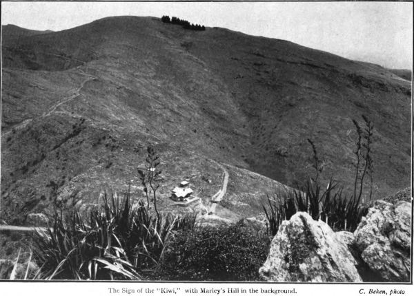
Dyer’s Pass. It begins just opposite the picturesque
stone-built tea-house with its swinging signboard
and its quaint inscriptions in the saddle of the
Pass, and it splendidly opens up the seaward face of
the Sugarloaf whose rounded summit lifts directly
over us yonder more than 1,600 feet above the harbour
level. Immediately below us, in the gully that long
ago was a channel for lava flow, the rocky depths
are softened by the foliage of a fragment of the
olden bush, a green covering for the valley floor.
The valley is more attractive outside, for almost
every vestige of the moss and ferns and underbrush
has disappeared before grazing stock and the
The Sign of the “Kiwi,” with Marley’s Hill in the background.
C. Beken, photo
sudden torrents that have poured down from the
ridge to make the little storm-creek flowing into the
harbour beside the grassy mound of Pa-rakiraki.
The lava-builded, notched and caverned walls of
the Sugarloaf shoot up above us just here like a
parapet, in regularly marked layers; tufts of flax
and tussock and wiry veronica beard the face of
the old fire-cliffs. Looking back at the Pass, just
before we round the first bend in the rocky traverse,
the cliff makes a terraced halt in its descent, and
here on this tussock-grown tiny level, broidered
with flax bushes and their honey-sweet
korari
blossoms, there is an eye-taking prospect of the
Dyer’s Pass dip to the soft-blue sunlit harbour and
of the black rock-faces and strong folds of the Port
Hills southward.
Immediately southward of the Pass road the land
goes easily swelling up into Marley’s Hill, a little
higher than our Sugarloaf, and now a story of old-time
explaining the meaning of the Maori name of
that airy saddle comes to mind.
The original name of the ridge leading southward
from Dyer’s Pass, and including Marley’s Hill, says
Hone Taare Tikao of Rapaki, is Otu-Tohu-Kai,
which being translated is “The Place Where the
Food Was Pointed Out.” The tradition is that
nearly two centuries ago, when the Ngai-Tahu from
the North conquered this part of the country from
the Ngati-Mamoe, a chief named Waitai ascended
this height from Ohinetahi (now Governor’s Bay),
taking with him Manuwhiri and other of the
children of the chief Te Rangi-whakaputa who had
taken possession of the harbour shores, in order to
point out to them the good things of the great
Plains. Waitai had already explored the country,
and was able to tell of its worth as a home for Ngai-Tahu.
When Waitai and his companions emerged from
the bush and topped the lofty round of the range,
he halted, and bade them look out over the wide,
silent country. He pointed to the reedy lagoons
and streams that silvered the flax and tussock
desert, where Christchurch City and its suburbs
now spread out leisurely and shade off into the
rural lands, and said: “Yonder the waters are thick
with eels and lampreys, and their margins with
ducks and other birds; in the plains beyond there
are wekas for the catching.” The Plains, as he
showed them, were plentifully studded with the ti-palm,
from which the sugary kauru could be
obtained. Then, turning in the other direction, he
spoke of the fish-teeming waters of the
harbour, where flounders, shark, and other
kai-matai-tai , “food of the salt sea,” were to be
had in abundance. Such were the foods of this
Wai-pounamu; and so good seemed the land to
those conquistadors as they stood there on the windy
height surveying the great new country fallen into
their hands, that they decided to remain in so
promising a place; and it is their descendants who
people Rapaki and other kaingas to-day.
Now we turn and, passing a rugged cornice in
the lava wall, descend into the gully to examine for
ourselves the tree-covering of old Kahukura’s
shoulders. There is a thick growth of flax on the
little terraces and steep slopes above the bush, and
in one place we force our way through a regular
jungle of it, growing so thickly as almost to
encourage the idea that a flax-mill would find
profitable business here. Some of the tall
korari stalks are well in flower and bees are busy;
on others the long dark-sheathed buds are just
unfolding. Flax-flower honey-water makes a
pleasant enough drink, and the Boy Scout tastes
and pronounces it good. There is a pretty Maori
love-lament in which a girl compares her sorrowing
self to this blossom of the flax:
“My eyes are like the wind-waved korari blossoms;
when the breeze shakes the flowers down fall
the honey showers; so flow my tears.”
A little lower and we are in the bush, taking care
as we enter it to give a wide berth to the insinuating
Maori nettle, the ongaonga , with its unhealthy-looking
light-coloured leaves covered with a thick
growth of fine spines or hairs. The Boy Scout sidles
warily past those bushes of ongaonga when he is
told of its poisonous qualities, and of an experience
the narrator had with it years ago in the King
Country bush. Away up yonder, in the Ohura
Valley, between the open lands of the King Country
and Taranaki, the ongaonga grew into tall shrubs,
ten or twelve feet high, and its virulence apparently
was in proportion to its growth. All of our
exploring party were more or less badly stung and
suffered the effects for a day or two, but the unfortunate
horses suffered most. Two of them went mad
with the poisonous stings, which swelled their sides
and legs, and a pack-horse actually drowned itself
by bolting into a creek and lying down in the water
in its desperate need of ease from the pain. Really
bad ongaonga stings provoke feverish sickness; and
so it is prudent to make a detour on these hill
slopes rather than encounter over-closely even these
insignificant little specimens. If you are on a
steep, slippery slope and reach out for a hand-grip,
as likely as not instead of a friendly flax or
tussock bunch the ongaonga will be there waiting
for you with his devilish little stinging hairs. And
don’t attempt to apply to our Maori Land nettle the
amiable counsel of old Aaron Hill that was given
out to us in our school days:—
Tender handed stroke a nettle
And it stings you for your pains;
Grasp it like a man of mettle,
And it soft as silk remains.
Don’t, if you value your skin, try that on the
ongaonga.
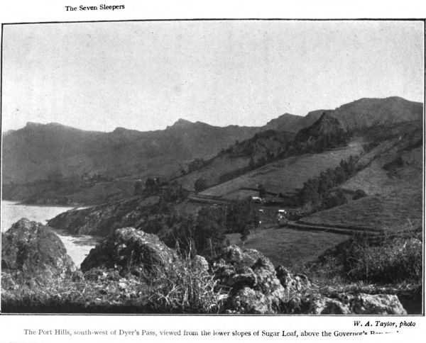
The Seven Sleepers
The Port Hills, south-west of Dyer’s Pass,
viewed from the lower slopes of Sugar Loaf, above the Governor’s Bay road
W. A. Taylor, photo
Lower down, however, the way is clear of this
bush plague, and we find ourselves under a shady
roof of thick foliage, woven of the cool green leaves
of the broadleaf, a small puka , the mahoe and
kowhai and other minor trees of the Maori bush
with much of the kotukutuku , the native fuchsia,
now come into flower, with its masses of slender
pendulous blossom giving promise of abundant
konini berries for the birds. (Like several other
New Zealand trees the fruit of the kotukutuku is
given a different name from the plant itself.) The
graceful lacebark or ribbonwood, too, is here in
plenty; there are some beautiful specimens on these
hills and slopes, and finest of all perhaps is the
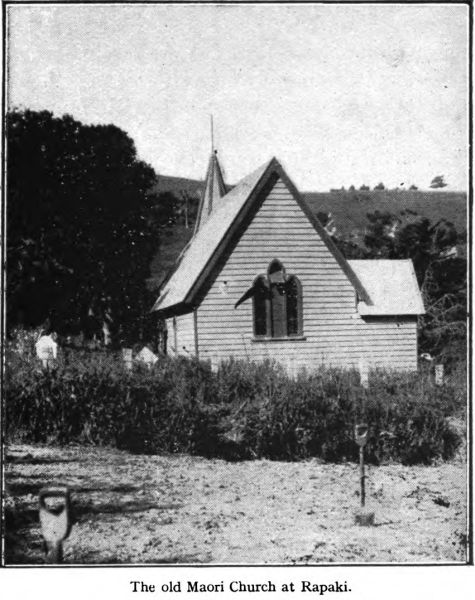
grand old houi that overshades the little Maori
Church at Rapaki. Aka vines interlace the close-growing
trees and here and there present tangling
obstacles to a passage along the gully sides. The
place lacks the softness of moss and fern underfoot
to which we are accustomed in the real bush; nevertheless
it has something of the atmosphere of the
olden forest wild; grateful bush scents are in our
nostrils, the leaf-covering is close, though the trees
are not tall, and the twisting character of growth
and the matting of creepers help to make compact
the tentage of green.
Making north-east with the general curve of the
Sugarloaf slopes we leave the first bush patch and,
breasting another wild garden of flax, with here
and there a cabbage-tree sweetening the air with
its creamy flowers, discover a deep trend to the
north-west into the main valley. Here, under a
steep-to uplift of the ancient igneous rock, curving
out above our heads in savage cornices and rude
attempts at gargoyles, we look down upon a picture
of surprising beauty, one of the many surprises
folded in among these Port Hills.
The old Maori Church at Rapaki.
On this side of the Heru-o-Kahukura the range is
deeply bitten into by a cup-shaped valley, with one
side of the cup, that facing the harbour, cut away
for the passage of the old lava streams and now
the rainy season watercourses. The inside of the
valley, too, is given the semblance of a fan by the
numerous converging tributary gullies, separated
by grassy and flax-grown ridges. There are perhaps
half a dozen of these subsidiary valleys, and each
one is filled with a sweet green mass of light bush
similar to that behind us. The higher the little
valleys, too, the more bush there is; the gully
bottoms are hidden everywhere with many tinted
foliage, a taller tree here and there protruding its
head above its fellows, and these remnants of the
ancient forest climb to the very parapets of dark
and grey rock that seem to form the main defences
of Kahukura’s citadel. The curving lines converge,
the shouldering ridges fall away as the now dry
watercourses blend into one hundreds of feet below
the rocky elbow of ours.
It is perhaps half a mile across the main gully
and we fix a course for the Summit track on the
ridge northwards and strike down through the
bush. Here in the shadowy depths there is some
bird life; the trill of the riroriro , the little grey
warbler, is almost constant, and an occasional fantail
flits about us; but the thrush is more numerous
than any native bird. When the bush bird-foods
are ripe the tui sometimes pays this valley a visit
from larger woodland tracks. There is a
curious wildness in the valley bottom under the
thicknesses of the broadleaf and the mahoe and
kotukutuku ; it is half-dark in the deepest part,
and great rocks lie hurled about, fire-born and
water-worn. The floods that sometimes tear down
have worn pot-holes here and there, and there
are shallow caves obscured by tangles of roots and
Whaka-raupo, Lyttelton Harbour from Kennedy’s Bush
coiling stems. There is a venerable kotukutuku , a
wizard of a tree, its whitened bark hanging in
strips like shaggy bits of beard, its trunk all
knotted and twisted, standing sentry at the entrance
to a little dusky cavern; its misshapen branches,
storm-battered, go searching around the broken top
of the black and grey rock. Other of the trees
take goblin-like shapes, and stretch out their bare
roots and feelers, unsoftened by carpet of moss or
ferns, to trip the intruder into their dim solitudes.
It is but a little bit of a wood, this bush in the
gully, but its aloofness and solitariness are made
complete by the close-growing habit of the small
timber and the great tossed-about rocks that
help to seclude it. Totara of some size, we
observe, once grew here; there is the tall, smooth
barrel of a tree now dead. In the next main gully
to the northward, the Taungahara bush, on the
Native reserve, there is at least one fine totara , and
some big fellows were cut down there not so very
long ago by the Rapaki people for fencing posts.
As we make upwards, with care evading the
diabolical ongaonga that haunts the bush outskirts,
we strike a steep face, with here and there a
dripping of water glistening on the moss-crusted
rock and on the little flax and koromiko plants that
root themselves in tiny crevices. To gain the graded
and formed track again, we swarm up the fifty-foot
cliff, with koromiko and aka and flax for hand-grips.
Above there is a jungle of koromiko , a veronica
which here assumes sub-alpine habit, and weaves
a wire entanglement, fortunately minus the barbs—the
tataramoa or bush-lawyer in the thicket below
supplies those in plenty. The butte here is topped
by a rock formation so regular and resembling
a ruined fortification that the Boy Scout opines it
would be a splendid place for a fight, and certainly
the old shattered tor of the fire-kings, with its
copses of wire-branched koromiko and its thick
flax-clumps, suggests itself as a first-rate natural
redoubt, where a few riflemen might hold out
among their rocks and shrubby cover against a
score of times their number.
The little bush on either hand here runs almost
to the ridge top, and we come suddenly out of the
koromiko thicket on to the great cave-worn
ramparts and have a clear track to the Summit
Road again. The picture from the breezy ridge is
worth the warm scramble up through the matted
bit of woodland. The long smooth rolls of hills go
down to the Plains on the one hand; on the other
the harbour and beyond the cloud-belted heights of
the Peninsula. A misty shower is sweeping over
the far indigo hills, and a rainbow shines out,
grandly spanning a sector of the Peninsula, from
the back of Purau to the ocean. And as we turn
southward the thought comes, observing the evenly
symmetrical round-sweep of the Sugarloaf summit
from here, that the Maoris of old-time, who, like
the ancient Incas saw in the rainbow the personification
of a deity, may very well have caught from
the peak’s likeness to the iris arch the poetic fancy
that induced them to name it Te Heru-o-Kahukura,
“The Comb (or crest) of the Rainbow God.”
By way of the easy return trail, we work back
southward under the upper cliffs. Out near the
Pass the crannied walls of old Kahukura echo to
the voices of a party of girls, a botany class from
the city. The instructor is improving the half-holiday
with a practical talk on the native flora, and
twenty notebooks are out and pencils busy.
“This,” announces the mentor as the class
clusters round, “is a very peculiar plant, Urtica
ferox, so called because——”
“Wow!” interrupts one of the earnest learners,
as she stoops to rub a plump ankle.“It stings
like billy-oh!” She has made the acquaintance of
the truculent ongaonga .
[2] Carved above the porch of the Summit Road Rest House on Dyer’s Pass.
Chapter IV.
RAPAKI: A VILLAGE BY THE SEA.
In the little Maori kainga of Rapaki, folded away in
a valley-fan of Lyttelton harbour-side, there is a tiny,
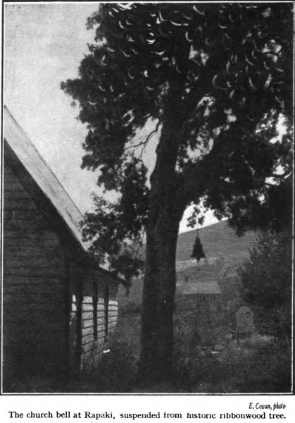
steep-roofed church, of old-fashioned build, and by
the side of this church stands a twisty-branched old
ribbonwood tree, that in summer showers over porch
and steeple its sweet, snowy blossoms, scented like the
orange tree. On the lowermost bough of this knotty
ribbonwood, the houhi , or houi , of the Natives, that
stood here before the church was built, over fifty
years ago, hangs the bell that calls the remnant of
Ngati-Irakehu to worship; and it is this sylvan belfry
that symbolises for me the intermingling of modernism
and ancientry in the Rapaki of to-day. Like the other
hapus of the Ngai-Tahu tribe, the Ngati-Irakehu and
their kin are now half-pakeha in blood; they have
intermarried with their European neighbours, and
their little township, with its sixty odd souls, is
scarcely to be taken at first sight for a Maori settlement.
The communal house, of characteristic Native
build, with its carved frontal barge-boards and its
gargoyle-like tekoteko perched above the entrance,
familiar to travellers in the Native districts of the
North, is wanting here; but a survey of the village
scheme, with its tree-shaded cottages grouped sociably
about the central green space, and the hall and school-house
and church, soon makes it plain that here stood
an old-time Maori kainga , of totara slabs and raupo
thatch, with maybe a tall stockade guarding its landward
side and stretching from cliff to cliff of the little
boulder-beached bay. The plan is the same; the
buildings have changed, for Rapaki to-day believes in
The church bell at Rapaki, suspended from historic ribbonwood tree.
E. Cowan, photo
sanitation and modern comforts. Here and there a
Maori tree, like our ribbonwood yonder, and a tattered
clump of light bush in the gullies or on a rocky cliff-top,
to remind us of the different setting when Rapaki
was tumultuous with wild Maori life; when tattooed
Ngai-Tahu were in fighting flower, and when dense
and beautiful forest covered the feet and shoulders of
all those dark volcanic crags and tors lifting above us
there like so many ruined castles battered by the
artillery fire of the gods. A remnant, a morehu , now
are tribe and forest; alike they have dwindled to a
shadow; “as the woods are swept away,” says the
Maori, “so shall the people vanish.” The young
people are so Anglicised that they use the pakeha
tongue chiefly; the older ones only cling to Maori
among themselves. Yet a brave little remnant, with
a fighting heart worthy of their warrior ancestry; for
of these descendants of fierce old Rangiwhakaputa
and Wheke every eligible young man went to the
Great War, and some salted with their bones the
world’s greatest battlefields. (No Kipling monopoly
in the phrase: “Bury me here,” said old Major
Pokiha, of the Arawa, a fighting chief of the last
generation—“bury me here as salt for the lands of
my heroes”). One-eighth of the population of little
Rapaki voluntarily enlisted. The well-plucked
Ngati-Irakehu and their kinsmen have title to say,
as Nelson said of old of his fighting sailors, “We are
few, but the right sort.”
The Kaumatua of Rapaki, the pleasant-mannered
kindly greybeard, Hone Taare Tikao, a gentleman of
true rangatira breeding and demeanour, is the best
informed man of his tribe-remnant on the Peninsula
and Port Hills history and legends and genealogical
recitals—whakapapa in the Maori tongue. Tikao was
born at Akaroa over seventy years ago. He is of the
Ngati-Irakehu hapu of the Ngai-Tahu tribe, and he is
descended by several lines from Te Rangiwhakaputa
and other of the warrior chiefs who wrested the
Whanga-raupo and the Whanga-roa—Aka-roa is the
modernised contraction—from the dusky men of
Ngati-Mamoe. From his parents and from Paora Taki,
a picturesque old rangatira who once was Native
assessor at Rapaki, and kindred people of the
generation that has gone, he learned the history
and legends of these parts.
The old man tells us first how this village came to
be named Rapaki—not Raupaki, as it is erroneously
spelled on the maps. The full name of the place is
Te Rapaki-a-Te Rangi-whakaputa which means “the
waist-mat of Te Rangi-whakaputa,” and to it,
obviously, there hangs a story, which when told leads
on to the tradition of the conquest of this district
from the Ngati-Mamoe a little over two centuries
ago. The Rangi-whakaputa’s name in these parts is
associated with Homeric exploits with the weapons of
old. This long-gone tattooed hero was the Hector of
the Whaka-raupo, and this well-hidden valley
curving down from the crags was the spot where he
settled awhile when the harbour-side fighting was
done. He was one of the northern invaders, a kinsman
and contemporary of Moki, Tu-rakau-tahi, and
other baresark warriors of the end of the seventeenth
century. On the beach below the present village he
left his waist-garment, a kilt of flax or toi leaves,
probably in connection with the act of tapa -ing the
place as his possession, and from the fact of this
rapaki , which would be a tapu one, being cast there
the place received its name. Te Rangi-Whakaputa’s
name has been translated as “Day of Daring,” or
“Day of Energy.” It suited this enterprising warrior,
who is described by his descendant Taare Tikao as a
great toa or brave. He was indeed a fine figure of a
man, nearer seven feet than six feet high, it is said,
very powerful, and a most skilful man in the use of
the taiaha , the Maori broadsword of hard tough
akeake , and the spear and the stone mere . All these
harbour-front villages and camping-grounds he captured
from the Ngati-Mamoe who, as Tikao says, were
the fourth iwi —race or tribe—to occupy the
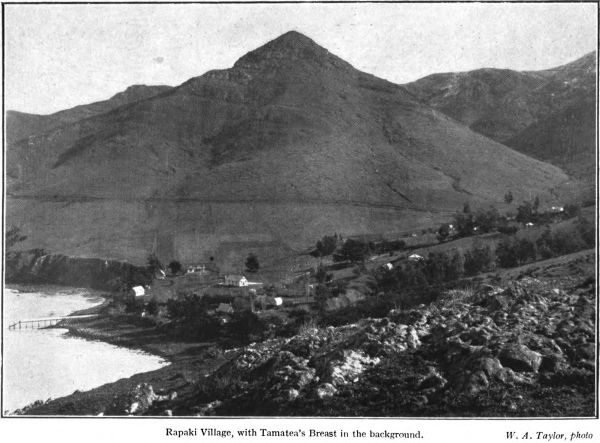
Rapaki Village, with Tamatea’s Breast in the background.
W. A. Taylor, photo
South Island; the first people were the Hawea, the second
the Rapuwai, the third the Waitaha and the fourth the
Ngati-Mamoe, whom the Ngai-Tahu dispossessed, in
their turn to be supplanted by the white-skins with
their bags of gold sovereigns and their land-sale deeds.
And this Homeric figure of two centuries ago, great
of stature and terrible in fight, had a son whose name
is scarcely less famous in the little-written traditions
of the conquest of the Whanga-Raupo. His name was
Wheke, which means “Octopus,” and like his father
he spread terror among the Ngati-Mamoe. With his
war parties he scoured all these ranges and tracked the
frightened fugitives into their most secret valleys and
caves. One of his camping-grounds on a war expedition
was yon fort-like nest of basalt towers and upjuts
above Cass Bay, overlooking our Lyttelton road; he
slept one night near the summit of one of these crags,
a wild hard camping place, and it is still known as
“Te-Moenga-o-Wheke” or “Wheke’s Bed.” And over
the doorway of the large meeting hall in the village of
Rapaki you will see the name of Wheke painted, in
memory of a brown hero whose bones have been dust
these two hundred years.[3]
[3] The following note describing the occupation of these localities
after the first conflict between the two great tribes of the South
Island was written by Mr. T. E. Green (Tame Kirini) of Tuahiwi,
Kaiapoi, who died in 1917, and who was an authority on the
history of his mother’s clan:—
“The Ngati-Mamoe were subdued by the Ngai-Tuhaitara section
of the Ngai-Tahu tribe under Moki, an account of whose expedition
is given in Canon J. W. Stack’s contribution to “Tales of Banks
Peninsula.” Te Raki (or Rangi) -whakaputa was of the Ngati-Kurii
section of the tribe; Ngati-Kurii carried their conquest no further
south than Kaikoura. From there southward is the conquest of
Ngai-Tuhai-tara. The second daughter of Te Rakiwhakaputa was the
wife of Tu-Rakautahi, the founder of Kaiapoi Pa, so Te Rakiwhakaputa
came to Kaiapoi after the settlement of the Ngai-Tuhaitara,
here accompanied by other Ngati-Kurii chieftains, namely,
Mako, Te Ruahikihiki and others, and dwelt in the vicinity of
Kaiapoi for some time. There is a spot on the eastern bank of the
Whakahume (the Cam), about half a mile from the Kaiapoi Woollen
Mills, named Te Pa o Te Rakiwhakaputa. Some occurrence there
enraged Parakiore, youngest son of Tu-Rakautahi and grandson of
Te Rakiwhakaputa, and he declared that he would have no interloper
in his midst, referring to his grandfather Te Rakiwhakaputa, (to
whom, for brevity, I shall now refer by his short name Te Raki) and
Mako (Mango) who was married to his aunt (Te Raki’s eldest
daughter). As a result of this attitude of his son, Tu-Rakautahi
said to Te Raki, ‘You must go out to the Whaka-raupo (Lyttelton
Harbour); there are sharks there for us two.’ Mako he sent to
Little River, to Wairewa, saying: ‘Yonder are eels for us two.’ To
Te Ruahikihiki he said, ‘Go to Taumutu (at Lake Ellesmere);
there are patiki (flounders) for us two there.’ Kiri-Mahinahina he
sent out to Paanau: ‘Go yonder and catch hapuku for us.’
“Now this is what the present generation living at these places
object to, the idea that their ancestors were sent there to procure
food supplies for Kaiapoi. As Moki, the younger brother of Tu
Rakautahi, headed the Ngai-Tuhaitara clan who conquered the
Peninsula, you will readily perceive that no chief would deliberately
go and settle on the territory of another, and particularly one so
powerful as Tu-Rakautahi, without his permission—which in this
case was given—and without tribute being paid annually for the
privilege. This was strictly carried out by them until the advent
of the pakehas. Of course Kaiapoi gave them kauru generally in
return, merely in Maori etiquette; some are now trying to make out
that the kauru (the sugar extract of the tii , or cabbage tree) was
the payment for their fish.”
When first I went round the high bend in the
harbour-side road from Lyttelton and saw Rapaki
village a-slumber in the afternoon sun below, all in
its green and gold of groves and flowers, grassy fields
lapped about it in soft folds, the sea coming up in
gentle breathings at the foot of the little cliffs, and
the grand old crags above, with one huge taiaha -head
of a peak lording it sentry-wise over all, I thought
that for beauty of setting very few Maori kaingas even
in the romantic bushlands and highlands of the North
Island were peers of this hamlet of the Ngai-Tahu,
almost jostled off the map by the crowding hordes
of the pakeha . Down the bend into the hollow, where
the ghost of a mountain stream goes tinkling through
the little gully, and the towns that are so near seem
a hundred miles away. The mat-kilted conquistador of
old who gave his name to the place had an eye for a
secure, well-hidden site for his pa . He could scarcely
have chosen a spot more snug about these savage
Port Hills. The dominating tors and marline-spikes
of fire-born rock and the great up-swell of land on all
sides but the sea ward off the cold winds. Loftiest of
all and nearest is that towering spear-head Te Poho-o-Tamatea,
a dark grey triangle of rhyolite, thrusting its
naked apex into the warm sky a thousand feet and
more above the groves and dwellings of Tikao’s people.
It looks what it is, the mountain guardian of Rapaki;
its presence, grimly grand on dark lowering days when
the mists trail about it and give it added height and
dourness, is no less overpowering in the night, when it
leans over the deep-cut valley of dreams, a huge
rugged blade of blackness etched against the sky. And
even in this day of sunshine, when every cave and
cranny in the Poho-o-Tamatea were searched by the
golden light and when the mystery of its fiery birth
stood revealed, the great spear-rock still seemed a place
of eeriness and tapu .
That old ribbonwood tree that quite overshadows
the little Rapaki church holds memories of the
vanished forests that once clothed all these Port
Hills and of the “flitting generations of mankind”
it has so long outlived. It is a dignified survivor of
the woodlands of the Rapaki-a-Te Rangi-whakaputa.
Once upon a time the indigenous timbers thickly
covered all these now-grassy slopes slanting quickly
from the rhyolite hilltop crags to the quiet waters
of the Whaka-Raupo. There were big trees—totara ,
rimu , kahikatea and mataii —but all have
gone long ago. Remains there but a remnant from
the general slaughter with fire and axe and crosscut
saw—a copse on yonder rocky point on the
Lyttelton side of the hamlet, where the poetically
named ake-rautangi , the ake of the “crying leaves”
and a few other shrubs hold their little stony fort;
and in Taare Tikao’s garden the kaumatua has
some treasured plants, such as the handsome
rau-tawhiri shrub, and the flowering hakeke , a
variety of ake , the leaves of which when crushed in
the hand have a lemon-like perfume; the Natives used
to boil them for the hinu kakara , the fragrant oil
expressed. But the old ribbonwood, or lacebark, or
thousand-jacket, as the bushman variously calls it, is
the tree that takes the eye. The Maoris of the north
call it whauwhi and houhere , here it is houhi or houi .
It takes its pakeha name from the peculiar characteristics
of the inner bark, which is tough and strong
of fibre and beautifully netted and perforated. The
early colonists have been known to use it for the
trimming of ladies’ hats and bonnets. I have seen a
war-dance party of Taupo Natives, more than a
hundred strong, kilted with short rapakis made of this
lacebark, deftly twisted and woven by their womenfolk
for the ceremonial leaping parade.
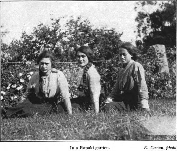
In a Rapaki garden.
E. Cowan, photo
That is the tree that extends its Maori mana tapu
and its twisting flowery branches over the village
church, with a little spire like an old-time candle
extinguisher, and it was under its shade that Tikao
told something of the past of these parts. The church
itself, as he remembered, was built in 1869 by the
Wesleyan Natives, but the Anglicans used it also, for
in those days there was no puhaehae , no violent jealousy
of sects. And in its very shadow, when the sun
westers, is a tangled grassy spot sacred to the memory
of a heathen chief who would have none of the white
man’s church or the white man’s beliefs. Mahuraki
was his name, a shaggy tattooed pagan of the first half
of the last century. He was exceedingly tapu , steeped
in wizardry and mysticism. Often the missionaries
besought him to become a Christian, but the grim
old warlock scoffed at the Rongo Pai. “Hu!”
he grunted, “what is your Karaiti? Who was he? My
god is Kahukura, the god whose sign is the rainbow.
As for yours, your Karaiti—he is a poriro , a misbegotten!”
And at last the sorely pained missionary
abandoned in despair the hopeless task of plucking the
ancient man from the burning. Mahuraki died
sixty years ago and was buried in a hole dug in the
floor of his thatched hut, which was left to decay. As
he lived, he died, a sturdy unregenerate pagan, and
the faith of Ihu Karaiti prevailed; the bell of the
Rongo Pai calls the kainga to prayers within a few
paces of Mahuraki’s grave, and the tohunga’s
mumblings are a forgotten creed. The tohunga
himself is by no means forgotten, for one of the names
of yonder lofty arrowhead of a crag that overlords
Rapaki is “Mahuraki’s Head.” The original name,
as we have seen, is Te Poho-o-Tamatea, which means
“Tamatea’s Breast,” so named by this barefooted
pioneer of Maori land surveyors by way of claiming
the land for his tribespeople. In about 1849-50, when
the commander of a British surveying ship made
the first survey of Lyttelton Harbour and
named the landscape saliencies, his Maori interpreter
asked the name of this sharp peak, whereupon our
old savage claimed that it was named after himself,
“Te Upoko-o-Mahuraki.” It was his way of perpetuating
his name and fame. But long-distance
pedestrian Tamatea fairly has prior claim.
So by the foot of the greenwood tree was begun the
talk of olden days that ended, as the sun declined
behind the historic crags of Tamatea, on Taare Tikao’s
hospitable verandah, overlooking the little village and
the soft blue placid waters of the Whaka-Raupo. It
was a rambling korero , wandering deviously from
pakeha times into romantic ancientry, when the wild
men lived in the woods and when war canoes filled
with fierce tattooed eaters of men swept up and down
this shining harbour of ours. The Kaumatua , describing
the old industrious age of his people, told by
way of example of the tribal communistic energies
how great flax nets fully a quarter of a mile long used
to be made for the catching of the shark in this sea
arm. These immensely long seines were six or eight
feet deep, and were worked by canoes, which would
take one end out into mid harbour, the other being
made fast, and sweep the great kupenga round the
shoals of fish making their way up the harbour with
the flood tide. Huge quantities of sharks and other
fish were caught in this manner, a fishing fashion
which was only possible under the old tribal system,
when the whole strength of the hapu was available
for such tasks.
Lest readers should question the dimensions of that
quarter of a mile seine, let me say that in quite recent
times, up to within the last thirty-five years or so, an
old Ngati-Pikiao chief, the late Pokiha Taranui
(better known as Major Fox), had a net nearly
a mile in length, which was used on special
occasions, such as the gathering of food for native
meetings; the locality was Maketu village, on the
shores of the Bay of Plenty. But those enormous
kupengas will never again be hauled through the fish-teeming
waters.
From Tikao, too, we hear something of the poetic
legend and nature-myth that steep those swart hills
above Rapaki. Yon savage Poho of rhyolite, and the
peaked and pinnacled cores of old volcanoes that
break through the grassy hills for mile after mile, all
have their tales of pre-pakeha years, of which we shall
chronicle something again. Just now we may content
ourselves with the gentler scenes in Rapaki valley,
where the kowhai has shed its showers of gold and the
pakeha fruit trees in blossom sweeten the soft air
deliciously. That patch of ploughed land behind the
settlement before long will show the first shoots of
kaanga , or maize; there is not much grown in this
island except by the Natives. The water-front, in spite
of its smart new jetty for the launches, is lonelier than
in the old days; for there was a time, long after the
war-canoe era, when three long whaleboats were hauled
up on the sand where the boulders are piled aside
yonder and often these could be seen pulling down to
Lyttelton laden with potatoes, corn and fruit. That
bit of beach is over-rough; but a little way to the
north, under the lee of a wild bit of a rocky headland
thick with beautiful light bush, is a gem of a white
beach, clean and hard and shining, a sandy alcove that
must have been made for picnicking. And from this
hillside turn in the road where we get our first glimpse
of Rapaki, we may also most fitly take our sunset
farewell of the kainga of an artist’s dream.
The sun is over the range, and Tamatea’s gloomy
peak is outlined in sharp symmetry against the
burning west. In the deep gullies between the spear-head
and the ridge of the Sacred Fire the smoky-blue
mists are already forming, and wreathing and
creeping around the tangled shrubberies of bush that
have escaped the general massacre. The harbour lies
a sheet of scarcely moving tender turquoise, just a
shade lighter than the face of the famous Tikitapu,
inaccurately called the Blue Lake by the pakeha ; high
beyond the shark’s-teeth of the peaks that someone has
named the Seven Sleepers are drawn in soft blue upon
the rose of the heaven above, their feet are bathed
in violet, and the purple mists swim wraith-like from
their hidden hollows. The sun goes, and the delicacy,
the tenderness of colour, the fading of landscape
details into a haze like the camp-fire smokes of the
legendary Patu-paiarehe , weave a veil of faery over
the valley and the darkening sea. The little boys and
girls of the settlement are still at play around the
meeting-hall, and every call and every laugh come
clearly through the velvet soft air. Down in a nearer
dwelling, a girl is rehearsing a poi -dance song,
and the lilt is familiar, the half-sad chant that begins,
“Hoki-hoki tonu mai,
Te wairua o te tau.”
(“Return, return again to me,
The spirit of my love.”)
It is the song crooned by the women and
the children in every kainga that, like slumbrous little
Rapaki down yonder, sent its young men to use
rifle and bayonet beside their pakeha brothers-in-arms
on the thundering battlefields half a world away.
Chapter V.
THE “AHI-A-TAMATEA.”
HOW THE SACRED FIRE CAME TO WITCH
HILL.
As we travel northward along the Summit Track
from the Poho-o-Tamatea, observing from this commanding
height—a thousand feet above little Rapaki
village, lying in its grassy nest below—how that
great spearhead of rock has in reality an almost
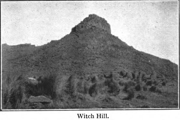
level top, we come to a remarkable broken wall of
grey lava moss-crusted and shrub-tufted, protruding
from the grassy flanks of the craggy knoll called
Witch Hill. It is in fact a huge dyke of once-molten
lava, cutting wall-like through the old lava flows and
trending southward across the shoulder of its parent
hill. From the very crest of the range it shoots in a
palisade of frost-shattered rock, towering thirty feet
and more in places above the stone-strewn tussocks,
and it stretches some distance in irregular cyclopean
steps down the steep slope towards Rapaki. There is
an old stone quarry on the face of Witch Hill, where
this dyke juts out like a broken castle wall of the
Patu-paiarehe , the Dim People of long ago, and just
there the old waggon track goes down over the
smoothed-out hills to the Canterbury Plains and the
green banks of the Opaawaho.
Witch Hill.
The Giants’ Causeway some fanciful pakeha has
named this wall of lava. To the Maori it is the “Ahi-a-Tamatea”
or “the Fire of Tamatea”, and a strange
nature legend there is thereto; a folk tale in which
fable and geologic myth are curiously blended. It is a
volcano myth which closely resembles, and is no doubt
a copy of, the North Island legend of Ngatoro-i-Rangi
and the origin of the Ngauruhoe volcano. The march
downhill of this curious upstanding dyke of lava,
grey against the more sombre tints of the range, may
be traced in the masses of lava boulders through which
the Rapaki water-course has cut its way in its lustier
days. And if you turn your face southward and
look far across the upper part of the harbour,
near the western slopes of Mount Herbert,
you will plainly see what seems a continuation of the
remarkable wall of lava which welled ages ago white-hot
from the cauldrons of Ruaimoko. Those grey-white
parapets of fire-made rock are the Ashes of the
Fires of Tamatea, and this is the wonderful tale of
Tamatea and his magic fire, a tale of old which brings
in, too, our great arrowhead peak, towering yonder
on Rapaki’s western side, yon huge upjut lording it
sentry-wise over the Maori kainga . The peak of
“Tamatea’s Breast,” is one of the very few landscape
saliencies in these parts which still remain in the hands
of the people of Takitimu descent. A venerable name
this, for it is quite six hundred years old and is a
connecting link with the greatest land-explorer in
Maori-Polynesian story, a prototype of the adventurous
“Kai-ruri,” the white surveyor of pakeha
pioneering days.
Tamatea seems to have been possessed of the true
“wander-hunger,” for when he arrived on the shores
of the North Island in his ocean-going canoe the
Takitimu (or Takitumu) from his Eastern Pacific
home—Tahiti or one of the neighbouring islands—via
Rarotonga—his restless heart impelled him to more
adventure. First making the land in the far north,
he voyaged on down the East Coast, sailing and
paddling from bay to bay, leaving here and there
some of his sea-weary crew, who intermarried with the
inhabitants, and he did not cease his sailorly enterprise
until he had reached the foggy shore of Murihiku, the
“Tail of the Land” which the white man calls Southland.
Here the Takitimu was hauled ashore and if one
is to accept literally the legend of the Maori, there she
is to be seen now, metamorphosed in marvellous
fashion into mountain form, the lofty blue range of
the Takitimu—mis-spelled “Takitimos” on the maps
and locally spoken of as “the Takitimos.” It is
curious that this isolated range—fairy-haunted in
native legend—lifting abruptly on all sides from the
tussocky plains that slope to Lake Manapouri, from
more than one point bears a resemblance to the form
of a colossal canoe upturned. Legend, too, says that
Tamatea settled awhile at the foot of the Canoe Mountains,
and that he had a camp village at the lower end
of Lake Te Anau, where eels and birds were abundant.
The Summit Road, overlooking Governor’s Bay.
C. Beken, photo
Then, wearying for the trail and the pikau , he set
out on a march which was nothing less than heroic,
from Southland to the newly-settled homes of his
people in the North. With a number of companions
and food bearers the barefooted explorer
trudged across country, through the unpeopled
tussock prairies of Otago and the plains now known
as Canterbury, fording or swimming the rivers or
crossing them on rude rafts (mokihi ) made of
bundles of flax-stalks or of dried raupo , until he
reached the hills that wall in Lyttelton Harbour. He
travelled along the range-top, as was the way of
the Maori explorer, until he neared the dip in the
sharp ridge at the back of Rapaki, over which the
Maoris and the pioneer white men made a track.
Now, Tamatea had carried with him, in a section of a hollow
rata log, as was the fashion of the Maori, a smouldering
fire for his nightly camps. No common fire this; it was an
ahi-tipua , a “magic blaze,” a sacred fire directly kindled from
that trebly-tapu fire which Uenuku, the great high priest of
far Hawaiki, had sent with his canoe voyagers. The Takitimu, being a
tapu canoe, carried no cooked food, and the only plants the
people brought in her were ornamental ones, for scent and beauty and
sweet flowers. She was a great double canoe, and could carry two
hundred people. Her consort was the canoe Arai-te-uru, which carried
“Te Ahi-a-Uenuku—Uenuku’s Fire”—and all kinds of food plants, even,
says Tikao, a grain which is said to have resembled the pakeha’s
wheat. Coming round Te Matau-a-Maui, Hawke’s Bay, the Arai-te-Uru
nearly capsized; she went over on her side, and continued in that
attitude until she finally overturned at Matakaea Point, near Oamaru,
where she still lies—turned to stone! The sacred fire was saved and
it was taken by the chiefs up the Waitaki River and placed there in
the ground; and there until about forty-five years ago it was still
actually burning, issuing from the earth in a little undying flame, and
it was called “Te Ahi a Uenuku.” (A seam of lignite is said to have
been found burning in the locality by the early settlers and explorers,
and this the Maoris
identified with the Hawaikian sorcerer’s magic blaze.)
But it seems that Tamatea’s fire so carefully
tended by the gods went out as he travelled slowly
up the hills from Otago, and none had been kindled
again when he reached the Port Hills. And as he and
his companions came out of the bush and passed out
on to the summit of the mountain above Rapaki, a
great storm of wind and rain, followed by hail and
snow, burst upon them from the south and they were
like to perish from the cold. It was freezing cold,
and Tamatea was without fire or the means of making
one, for no fire-making timbers grew in that spot.
In his extremity he stood upon the tall crag-top
yonder—the one that now is called “The Breast of
Tamatea”—and called aloud and karakia’d and made
incantations for sacred fire to be sent from the North
Island, the land of active volcanoes, to save the lives
of himself and his companions. He called to his elder
relative, Ngatoro-i-Rangi, and to the guardians of the
Ahi-Tipua, the volcanic fires.
And the chief’s fervent prayer was answered in a
moment. The fire, sent by the gods in the heart of
the North Island, burst forth from Tongariro and
speeding down the rift of the Wanganui River valley
it touched a spot near Nelson, and again it touched
Motu-nau—the small island close to the Canterbury
Coast—and then it appeared again in a magic blaze
on the side of Witch Hill, and the Maori explorers
warmed their frozen limbs and were saved. The fire
did not stop here in its wonderful flight, for it went
on across the harbour, and the white chute of rock,
like a huge sheep-dip trough, shining yonder above the
bay of Waiaki is the last of the sacred flames of
Tamatea.
And when the chief left the spot next day to continue
his journey he said, “Let this place be called
The Place where Tamatea’s Fire-Ashes Lie”; and so
to-day the rocky wall which the white man has named
the Giant’s Causeway is to the Maori “Te Whaka-takanga-o-te-Karehu-a-Tamatea.” And the volcanic
fire itself is “Te Ahi-a-Tamatea.”
Such is the story of Tamatea’s Fire as told by Hone
Taare Tikao, in reciting the legends learned from the
long-dead elders of his tribe. A legend embalming a
distinct perception of the geological history of these
hills. The Kaumatua truly says that the magical walls
of Tamatea’s Fire Ashes are of later origin than the
volcanic crags and hills which lie about them, and
across which they cut. The Wanganui River, down
which the sacred fire came from the crater of
Ngauruhoe, was then dry; it was a rift opened for it
by the Volcano Gods. Tikao speaks of a time when
the lower part of Lyttelton Harbour was not in
eruption, but when the upper part was; from the
southern side of Quail Island to the head of the bay
was a furnace; there was no water in it at that
immeasurably distant day. There are lava rocks, he
says, like those of the Ahi-a-Tamatea on the shore of
Quail Island; and then there are the always wonderful
cliff of Pari-mataa and the wall of Otarahaka on the
Mount Herbert side of the upper harbour.
Of the lava dykes Professor R. Speight writes in
his account of the geology of the Port Hills that they
radiate from the harbour as a centre and form, as it
were, the ribs of the mountain, holding it firmly
together and helping it to resist the enormous strains
to which it was exposed before and during eruptions.
“Judging from the persistent nature of these dykes,”
he adds, “it is clear that the mountain must have
been split at times from top to bottom, and the liquid
material which welled from the fissures must have
looked at night like a red-hot streak across the
country.”
Te Poho-o-Tamatea, or Tamatea’s Breast, in the middle distance.
W. A. Taylor, photo
And so, by way of the long Maori story, the one
solitary example of volcano-legendry the writer has
heard from the South Island, we come to the Rapaki
peak’s guardian name, Te Poho-o-Tamatea. The
explorer bestowed his name upon the height, tapa-ing
it after himself and his sacred breast, much as a
present-day traveller justly might claim the right to
map-name some peak after himself. Tamatea’s travels
led him far after he turned his back on the Port
Hills. He marched up on the coast to Kaikoura, and
there or further north he built a canoe, or, what is
more probable, borrowed or forcibly appropriated one
belonging to the tangata whenua who must already
have been living in the Marlborough country, and
crossed to the North Island. He canoed up the Wanganui
River—there is a curious rock, the end of which
the natives used to paint red with kokowai ochre, projecting
from the eastern bank many miles above Pipi-riki,
still known as Tamatea’s Rock—and crossed the
central plateau to Lake Taupo, and thence went on to
the East Coast. There are innumerable stories illustrating
his genius for exploration, and from end to
end of New Zealand place nomenclature memorises his
travels and justifies the name by which he is known in
history, Tamatea-pokai-whenua, or “Tamatea-who-travels-through-the-land.”
He was a true type of the pioneer and the path-finder,
the Fremont of Aotea-roa and the Wai-pounamu, the man
who heard the “one everlasting Whisper”—
Something hidden. Go and find it. Go and look behind the Ranges—
Something lost behind the Ranges. Lost and waiting for you. Go!
Chapter VI.
HILLS OF FAERY.
THE LITTLE PEOPLE OF THE MIST.
Our talk turned one day to the poetic legendary past
of the Port Hills above us and the Banks Peninsula
peaks yonder, hemming in Lyttelton Harbour in an
annular line of dead fire crags. They were the hills
of an artist’s dream this golden afternoon, all their
asperities of crag and bare bluff softened and gilded
by the mellow light of a calm, bright, windless day.
There was just the faintest of hazy films drawing over
the nearer hills from the waters. The sea below us at
Rapaki lay in unbreathing quiet, as soft, as bright and
blue as Kipling’s Indian Ocean. The rich purple of
distance painted the most remote of the Peninsula
peaks, and here and there a wispy tail of mist floated
about the head of a gully that cleft the crumpled hills
swelling up into the rocky summits of the Pohue and
the Ahu-patiki. Just where the land went steeply up
from the head of the bay to the shoulders of Te
Ahu-Patiki, otherwise Mount Herbert, we could see
the curious light grey rock wall of the Tarahaka,
above the Pari-mataa, “Obsidian Cliff,” like a great
chute down the mountain side, gleaming in the
sun, the tipua rock
of the fire gods. Nearer, in the middle of
the picture, were the black volcanic cliffs, and
the green slopes and pine-groves of the Lepers’ Isle,
the island which the Maoris of old called Otamahua,
mapped by the pakeha
as Quail Island; it was one tragic spot in the picture,
a place of living death.
The Kaumatua spoke of the hilltop homes of the
Patu-paiarehe , the fairies, whose craggy castles
defended by the thick dark woods and the fogs and
mists, ringed all this harbour round and made the
high places of the Peninsula an uncanny land, given
up to all manner of enchantments. Not that he
reposed implicit faith in the fairy stories himself, he
told them as he had heard them from his elders in
the days of long ago. “We are half pakeha ourselves
now, we Ngai-Tahu,” he said, “and our young
people deride these notions about the Patu-paiarehe .
Yet—these hills were different in my young days,
when the mists came down and the fog enveloped the
little streams tumbling down all the valleys from
the gloomy places. We went birding into the forest,
and we made clearings for cultivations and cut firewood
in the bush for sale to the pakeha. Sometimes,
when the mists came down and the fog enveloped the
hills, on still, calm days our old men and women would
say the fairies were out, the sun-shunning Patu-paiarehe ,
and it were well not to venture up the
range. On brooding quiet days our people could hear
the thin voices of the little folk—they were small, fair
people, as all the elders said—crying out to each other
and singing fairy songs and playing little songs on
their wooden or bone flutes, their koauau and putorino .
This Poho-o-Tamatea, the high peak behind the kainga
of Rapaki, was one of their homes, their pas , but
there were others, the high places of the fairies, all
around these hills, from my peak above there right
away along the peak-tops touched by the Summit
Road, right round to Cooper’s Knobs and then on to
the Peninsula, even to Otoki, the haunted mountain
which the pakeha calls Brazenose, on the southern side
of Akaroa town.”
Rhodes’s Monument (Home of the Fairies), to the east of Mt. Herbert, taken from Lyttelton.
W. A. Taylor, photo
The Kaumatua swept his finger across the southern
sky-line, the wild and broken peaks of Banks
Peninsula, rising up in powerful slants from the soft
blue of the harbour, creased with the gullies of water-courses.
“Over yonder,” he said, “are the chief pas
of the Patu-paiarehe , which I shall list for you: There
is the rock of Te Pohue, which pakehas call the Monument
between Purau and Port Levy; there is Hukuika
Peak, on the hill road between Pigeon Bay and Little
River; there is the mountain-top of Te U-Kura,
which commands all the hill-country of the
Peninsula—it is just at the back of the
stopping-place called Hilltop on the road from
Little River to Akaroa town. Also there are the
high rocky peaks which overlook Akaroa Harbour—Pu-Waitaha,
or French Hill, between Wainui settlement
and Buchanan’s; Otehore, a rocky flat-topped
height above French Farm, on the upper part of the
harbour; the summit heights above Akaroa town,
Purple Peak, Mount Berard and Brazenose—these we
call O-te-Patatu, Tara-te-rehu, and Otoki; and lastly
Tuhiraki, the sky-pencilling peak, which the French
named Mount Bossu, on the western side of the harbour.
All these were the mountain pas of the fairies.
“Now, amongst the fairy pas ,” the word-of-mouth
historian went on, “there are two places of
particular enchantment. One is that lofty palisade
of a peak which you call Brazenose, and the level-topped
hill above French Farm. Otoki—the Place of
the Axe—is the name for Brazenose, but there is an
ancient burying-ground there, upon the misty
mountain immediately above the little Maori
village of Onuku, on the beach side, which is
called Otehore; the Wahi-tapu , or cemetery,
makes it doubly sacred. This place and the
height above French Farm were both called
Otehore, and the people of the mists loved them well.
On the small piece of level ground on that Otehore
which stands above French Farm the fairy hapu of
those parts had their pa , and there they would gather
at night for their fairy meetings, and gather by day
also in the foggy weather when no Maori eye could
see them; and then would be heard their sweet fairy
songs, their waiatas , and the tunes they played upon
their flutes, sounding faintly from the cloudy mountain.”
Indeed, on dim and foggy days, and when the wet
vapours becloud the long-dead volcano land, it is not
difficult to enter into the spirit of the Maori fancy,
and in imagination people all these craggy pinnacles
with the Patu-paiarehe , and the wooded gulches with
Maeroero , the wild men of the bush. When the mists
steal down on the rhyolite knobs of the fire-fused Port
Hills and the Peninsula, craggy beyond description,
peaked in a hundred fantastic shapes, with great black
and grey nipples of lava protruding from the grassy
slopes and the woody ridges, the land has an eerie
look, fit playground for the Forgetful People, as the
old Irish would have called them. In the early morning
too, when the fogs are lifting from the bays, and here
and there a black broken thumb of a peak juts out
above the trailing vapours, or the mist-wreaths drape
in torn veilings the huge rampart-like scarps, and
when the first rosy sunbeams glorify the half-revealed
mountains, the poetic mind can well conceive of this
region as one of fairy wizardry and all manner of
dusk-time magic. One day when it rained and blew,
we were motoring over the hills from the Plains to
Akaroa, scarcely able to see twenty yards in
front of the car when we ran cautiously round to
Hilltop. Suddenly the dense masses of fog were rent
aside by the wind, and right above us, with a fore-ground
of blackened tree-stumps, remnant of the
ruined forest, we caught a glimpse of the black, jagged
tor which the Maori called Te Puha, thrust up like a
great spearhead by Ruaimoko, the Fire-God; in the
light of the Kaumatua’s stories it was easy to imagine
it a sentry-tower of the fairies, or of such a place of
witchery as the Ben Bulben of which we read in
W. B. Yeats’s “Celtic Twilight.”
There is another rugged, dark volcanic crag, wooded
about its base, crowning one of these Peninsula ridges,
of which the Old Man of Rapaki has a poetic story.
This is the pinnacle above and to the north of the
Hilltop Hotel, on the divide where the traveller gets
his first sight of Akaroa lying more than a thousand
feet below. The Kaumatua gave it as one of his fairy
peaks, its Native name is Te U-Kura, and as far as I
have been able to ascertain, it bears no official pakeha
name. Te U-Kura, he says, is an exceedingly ancient
designation; it was a name given by the fairies. It
means “The Resting Place of the Ruddy Light.” In
his younger days, when he lived at Tikao Bay, on the
shores of Akaroa harbour, he frequently observed for
himself the peculiar fitness of the Hilltop name. Often
at sunset a cloud-cap would rest lightly on the dark
skull of the fairy crag, and to this cloud the declining
sun would impart a bright red glow, the kura of the
Maori. This was a sign to the weather-wise that a
nor’-wester was blowing on the Canterbury Plains—a
tohu , or token, that was seldom astray. “U” means
to rest, as a canoe upon the beach. This surely is a
name that the pakeha should imprint upon his Peninsula
maps. It lends itself to more than one euphonious
variant in the pakeha -tongue, as “Red Cloud’s
Rest,” or “Place of the Sunset’s Glow.”
Behind the town of Akaroa, the grassy hills, lightly
wooded here and there like a beautiful wild park,
culminate in a craggy skyline, more than a thousand
feet above the fields and orchards on the town outskirts.
Dark tors of rhyolite, grassed to the base of
Cockayne’s Cairn Cass Peak
Kennedy’s Bush.
W. A. Taylor, photo
their nippled upswells, dreamy on sunny days in their
delicate wash of hazy blue. Here near the Stony Bay
road saddle, is the legend-haunted O-te-Patatu, the
old-time ridge of the fairies and the
titi
. The
titi
or
muttonbird has long since disappeared from the
Port and Peninsula hills, but in the Maori days it
was plentiful on many such high places. It loved to
build on lofty hills, where the soil was soft enough to
enable it to make its burrows. There was a cliff at
O-te-Patatu, says the
Kaumatua
, where the
titi
lived
and bred in great numbers in the long ago. The
Maori tribes who lived on the beaches and on the
trenched and parapeted promontories made expeditions
to the hilltop in the season when the young birds
were fat, and caught, cooked and preserved them in
kelp baskets and pottles, just as the Foveaux Strait
and Stewart Island Maoris do at the present time. But
the
Patu-paiarche
who lived on the crags of O-te-Patatu
and Tara-te-rehu also hunted these
titi
, and
slaughtered them in such numbers, in a most unfairylike
manner, that presently these fishy petrels became
extinct in that locality. A woman of the Ngai-Tahu,
or Ngati-Mamoe, at Akaroa, who was said to be in
love with a fairy, but who no doubt also loved the
palatable muttonbird, chanted this little
waiata
, a
song of fairy times which is still to be heard at
Rapaki and other Native villages:—
Titi whakatai aro rua
E hoki ra koe
Ki O-te-Patatu,
Ki te pa whakatangi
Ki te koauau,
Ki tauwene ai
E raro i au-e!
(Translation)
O titi, bird of the sea,
Bird of the hilltop cave,
Come back to O-te-Patatu,
To the lofty dwelling
Where the sweet sounds are heard,
The sound of the faery flute,
The music of the mountains
That thrilled me through and through!
The soft and plaintive flute song of the fair-skinned
folk who lived on these misty mountains seems to have
appealed to the Native heart, for it is described as
sweeter by far than the whakatangitangi , the “making
sound upon sound,” of the ordinary Maori flute-players.
Distance, aided by imagination, no doubt lent
it additional enchantment. And the Patu-paiarehe
men appear often to have made themselves agreeable
to the wahine Maori, for stories are told of women
being taken as wives by the fairy chiefs, and of girls
from the Maori villages wandering away into the
woods to meet their fairy lovers. The offspring of
such unions were always known by their extremely
fair skins, unnaturally pale, and their light flaxen
hair; they were korako or albinos.
And there was another people of the wilds. Sometimes
on dark nights the Maori villagers would see
the light of torches moving about in bays across
Lyttelton Harbour, then the Bay of Raupo, where they
knew there was no settlement of their tribe, and they
would say to each other, “See! The Maeroero are out,
spearing patiki.” The Maeroero were the wild men
of the woods, fierce hairy giants who sometimes captured
Maori women and carried them off to be their
wives in the bush of the Port Hills. The Maeroero are
described as having very long and sharp finger-nails,
so long that they were great claws, and it was with
these long talons that they speared the flatfish and
caught the birds in the forests.
The Summit Road pathway, through the Devil’s Staircase, or The Remarkable
Dykes (on the way to Kaituna)
To the matter-of-fact pakeha and the modernised
Maori there is a very simple explanation of these fairy
tales. The Patu-paiarehe and the Maero were simply
the remnants of aboriginal tribes, such as the Ngati-Mamoe
or the Waitaha or their predecessors, driven
away into the heart of the mountains and the forests,
where they lived a wild, secluded life, existing on the
foods of the wilderness. The old English and
Scottish belief in fairy people arose in much the same
way, the very word “pixy” comes from the name of
the Picts, who were driven into the hills and caves.
Nevertheless, for those who like to preserve their
Peter Pan fancies and illusions this theory may cheerfully
be disregarded, and we may still, on days of
mist and cloudy calm, imagine the little tribes of the
rocks flitting out from their caves and hollow trees
and raising as of old their thin voices in their waiatas
and piping their fairy sweet koauau music on the
level hilltop of Otehore or the dark rock of Tamatea’s
Breast.
MOUNT PLEASANT AND ITS “TAPU.”
Now the Old Man’s memories take him back seawards
across the Port Hills to the familiar knolls of
Tauhinu-Korokio. This is the Native name of Mount
Pleasant, the great grassy upswell of land lifting
sixteen hundred feet above sea-level and looking down
serenely on the vast curving sand-line of Pegasus
Bay. The Maori name is a combination of the names
of two Native shrubs which were very plentiful on
that portion of the hills in former times and specimens
of which may still be seen there. Tauhinu is a
heath-like plant found all over New Zealand; it is the
Pomaderis phylicaefolia of the botanists. It grows two
or three feet high, or sometimes higher, and it is so
plentiful and so prone to spread that it has been
placed on the Agricultural Department’s index expurgatorious
as a noxious weed, in spite of all the sweet
heathery perfume of its blossoms which the bees love.
The korokio is a small bushy black-branched growth
which the tauhinu , as the Maoris say, often embraces
and smothers, as the rata eventually smothers the
tree which it clasps. Tauhinu-korokio was an ancient
pa of Ngati-Mamoe which stood on the site of Major
Hornbrook’s old homestead and the present house of
Hinekura.
J. Cowan, photo
stay for visitors, just below a remnant of the ancient
bush on the northern and sunny slope of the green
mountain. There was a good spring of water close
by, and this important fact no doubt determined the
situation of the Ngati-Mamoe hillmen’s village. In
Ngai-Tahu times, after Te Rangi-Whakaputa had
conquered this pa in the course of his subjugation of
the Whaka-Raupo aborigines, the vicinity was found
by the Ngai-Tahu to be a very suitable spot for such
vegetable foods as the korau and the pora , or pohata,
now extinct; the roots, which were sweet, were dried in
the sun and stored in ruas , or underground pits and
earthed-in storehouses, as potatoes and kumara are
now. Kumara and taro , the tropic foods of the north,
did not flourish in the hill country of the south,
though they did well enough, with care, on favoured
parts of the Canterbury Plains and the Coast.
There is in Maori belief an exceedingly tapu spot
on Tauhinu-korokio, close to where the old Ngati-Mamoe
pa stood. It was probably either a tuahu or a
burying-place; the tuahu was the spot where the tribal
gods, or, rather, their symbols in wood and stone,
were kept, and where the wise men, the tohungas,
resorted for incantation and occult ceremonies and the
black art of the makutu, by which enemies might be
slain though they were at a great distance, by
thought transmission and the malignant projection of
the will. It is not well to camp there even now,
should you have Maori blood in your veins. The
flax-clumps and the tauhinu bushes still murmur the
name of Ngati-Mamoe, and though pakeha sheep have
long grazed over the site of Tauhinu-korokio and
pakeha voices make lively the mountain side, the soil
holds the mysterious spell of the tapu. Maoris who
have camped on the side of the track which goes over
the hills there have spent a night of inexplicable discomfort,
inexplicable, that is, but for the presence of
the tapu and the unseen spirits of Maoridom.
Taare Tikao himself says that many years ago, when
he was shearing at Major Hornbrook’s, he was
taken suddenly and mysteriously ill, and that the
illness was probably the effect of the local tapu.
However, these fancies need not trouble the
pakeha, whose constitution is not affected by even the
most virulent of Maori bedevilments.