WITH INTRODUCTION AND
Suggestions on the Use of the Map
BY
IDA CASSA HEFFRON (Late of the Cook County Normal School, Chicago, Ill. Lecturer
and Instructor in Pedagogics in Art, University Extension
Division, University of Chicago.)
EDUCATIONAL PUBLISHING COMPANY BOSTON
New York Chicago San Francisco
Copyrighted
By EDUCATIONAL PUBLISHING COMPANY
1900
CONTENTS.
PART I. Introduction.
1.
Necessity for the Study of Structural Geography as Preparatory
to the Drawing of Maps
In preparing the following lessons, in answer to the demand of the
public school teacher for such assistance, the aim has been to present
them in such a manner that both teacher and pupil may, through the
understanding and acceptance of the steps involved, become expert in
the development and delineation of original maps showing surface
structure in relief.
To this end, suggestions vital to the success of the would-be mapmaker
will be found in the Introduction.
In Part II. it is aimed to show that, with a clear mental image of
surface forms and areas, the expression of the same will be a simple and
easy matter, and a valuable preparation for the mapping of large areas or
continents.
For the illustrations a medium has been used, which, in many
respects, closely resembles in its results on paper the texture of chalk on
the blackboard.
The author desires to acknowledge her indebtedness to Francis W.
Parker, the head of the Chicago Institute, late Principal of the Chicago
City Normal School, for help derived from the study of his works, and
for the rare educational privilege enjoyed while working as a member of
his Faculty. Especially were the discussions under his leadership, at the
ever-to-be-remembered weekly meetings, a continual source of inspiration.
Under the new light thrown upon the subject of geography, as
presented by Colonel Parker, the impulse was first received which afterward
bore fruit in the development of a new method of map drawing; a
method which it was desired should be an adequate expression of the
solidity and continuity of the continental land mass.
The necessity for such a map Colonel Parker had himself realized for
years and had sought its delineation. With a desire to meet the pupil’s
needs in this respect, upon further study of structural geography the idea
was conceived of drawing maps which would show mass without outline,
and which would also represent relief.
This method of map drawing was called “Chalk Modeling,” and
from the first crude effort in this direction by the author, in the year
1891, at the Cook County Normal School, the “Chalk Modeled Map”
passed through many stages of development until it reached its present
form.
Thus to Colonel Parker himself is primarily due whatever of educational
value has resulted from the invention of the author or development
by others of what is called “The Chalk Modeled Map.”
Acknowledgments are also due Miss Louise Barwick, for the zeal
displayed in forwarding the development and delineation of the Maps of
the Continents, and for valuable assistance rendered in the drawing of the
same, as illustrations for this work.
I. C. H.
Chicago, Ill.
To the Teacher in General, and to the Members
of the C. C. N. S. Alumni Association in Particular,
Is this Book Respectfully Dedicated by
The Author.
Part I. INTRODUCTION.
NECESSITY FOR THE STUDY OF STRUCTURAL GEOGRAPHY PREPARATORY TO THE DRAWING OF MAPS.
The fundamental object in the study of Geography,
as we understand it, is to acquire mental images of the
present appearance of the earth’s surface; its structure, the
rocky material of which it is composed, and the causes and
effects of its changes, as a preparation for the home of
organic life.
It is a study of the earth as a material basis for the
evolution of man, and the development of civilization. It
leads up to a search for the laws and workings of the
creative forces—forces relating to our planet and to the
sun, the central source of light and heat.
This study has a different meaning to different persons.
To one it means the study of all that lies between
the covers of a book, or memorizing other people’s sayings.
To another it means “Connected information regarding
the condition of man’s life on this planet”—again “Geography
is a description of the earth’s surface, or anything
that affects or is affected by it.” A more common definition
is, “Geography is a description of the earth’s surface
and its inhabitants.”
An ability to recognize in present environment that
which leads to an understanding of geographical conditions
in general, is much to be desired and is the aim of the
teacher of the present day. Geologists tell us that the
same processes are going on now that have ever been in
operation, in the fitting of the earth for the habitation of
man. That these changes are taking place is implied
in the very fact that we are studying the earth’s present
appearance.
The study of the history of these changes, and of the
nature of the earthy material as shown in rock and soil,
and in vegetation, and of the influence of heat, light, air
and moisture, means the study of all the natural sciences;
not as special isolated studies, but bound together in one
great whole. So closely are they related, merging into
and impinging upon each other as they do, that there
seems to be no place or line of separation between
them.
The larger part of the surface of the earth (nearly
three-fourths) is covered with water, and the action of this
mighty agent, under the influence of that great dynamic
force and life-giving energy, heat, opens an immense field
for investigation.
These combined influences constitute the study of the
environment of all organic life; and knowing these in a
given case, we get an approximate idea of the stage of
development. The development of man, the highest type
of organic life, depends largely upon structural, climatic,
vegetable and animal environment.
To know these is to understand his habits of life, his
reasons for choice of homes, and to judge of his probable
advancement in civilization.
The powerful influence which the physical features of
the earth’s surface have exerted in shaping the current
of historical events, can hardly be realized, until thoughtful
investigation of the subject has been made. The
knowledge of geographical conditions, as climate, mountains,
valleys, rivers and seas, with vegetable and animal
life gives us the theatre of action for events in history.
As the mere existence of mountain range, desert,
sea or river, may be essentially the influence which has
led to the growth or downfall of empires, it is clearly
seen that a sound knowledge of structural geography is
absolutely necessary for all intelligent study of history;
no general relation of important occurrences can be traced
without it.
Nearly, if not equally necessary is it in the study of
literature. In order to properly appreciate the works of
our best writers, both of prose and poetry, an acquaintance
with nature, a scientific and geographical knowledge, local
and general, is very essential. It forms a basis for the
correct understanding of books, since the best writers and
thinkers of all ages have been students of nature. Their
writings are filled with lessons and illustrations, as well
as generalizations drawn from close observations of her
methods. If, then, a knowledge of structural geography is
requisite to the true understanding of man’s relation to
man and the world around him, it becomes important that
the subject be presented in such a manner as to attract and
hold the interest of the pupil; and properly presented there
can be nothing more interesting than the study of his
immediate environment—that which touches him in his
every day experience.
This study of his immediate environment is essential
to the forming of mental images of areas and surface forms
outside and beyond his sense grasp and to a comprehension
of the structure and surface contour of the world at
large: such mental images being fundamentally a necessity
to the delineation of adequate structural maps of the
whole or any part of the earth’s surface.
NECESSITY FOR FIELD LESSONS AND IMPORTANCE OF FORMING, IN CONNECTION WITH THEM, A HABIT OF MODELING, PAINTING AND DRAWING.
The study of geography, which in the past consisted
mainly in the memorizing of meaningless names with little
or no exercise of the reasoning faculties, or opportunities
for making generalizations through acts of comparison and
inference, has been superseded by instruction of a more
rational order.
We have learned that to memorize names and locations
of mountains, rivers and lakes, without seeing their
relation to a whole, or to make only superficial observations
of extended areas of land, results merely in indefinite
mental impressions, leaving out the very basis of all concise
and clearly defined geographical knowledge.
To the end that definite mental images may be
acquired, field excursions under the direction of competent
leaders are now advocated, and when entered upon with an
intelligent purpose are held to be indispensable factors in
the correct study of geography.
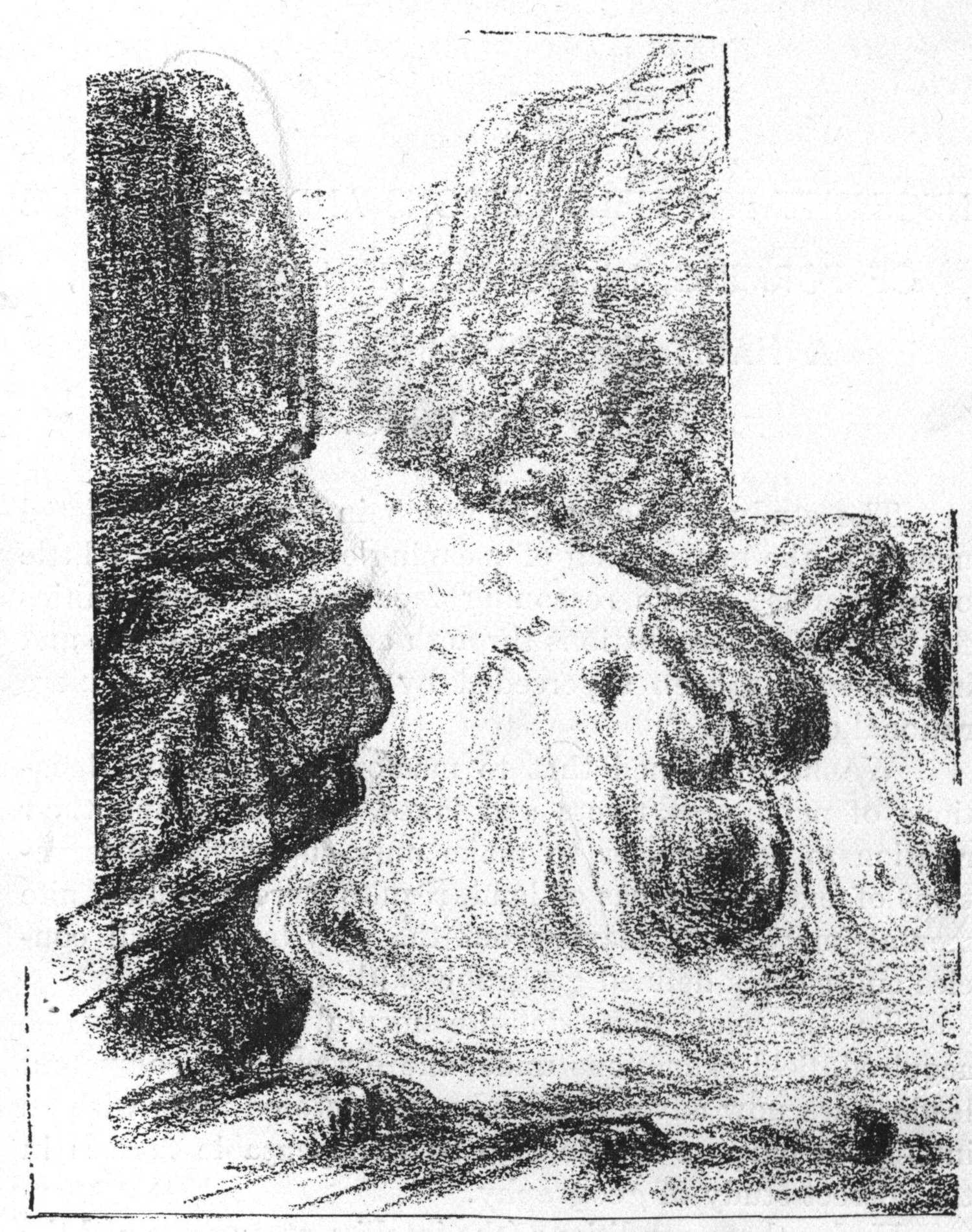
Section of Stream Showing Rapids.
Under these conditions (the intelligent purpose and the
competent leader), the pupil who visits a lake is likely to
have a more adequate mental image of old ocean, than one
who has never seen a lake or other large body of water.
One who has seen low hills with their out-cropping rock,
and the action of small streams upon them, will have a
better idea of what mountains and rivers may be.
In the new education the pupils are thus in the field
lesson brought face to face with nature. Through these
lessons the powers of the imagination are quickened and
strengthened by the continual observation of surface forms,
the true basis for all attempts to image the structure of the
earth.
Inferences are made at every step of the way as to the
history of the physical features observed, and the nature of
the forces that have acted upon them to shape and distribute.
Areas and forms of land are constantly being
compared as to shape, size, width, length and height, and
simple generalizations, formed from direct observations, are
combined with other generalizations, to form those that are
higher or more comprehensive. This is but a brief suggestion
of the part the field lesson bears to education in
general.
In the particular study of geography it must be borne
in mind that no essential knowledge can be gained except
through close observation of the earth’s surface forms.
As the true teacher of science in his classes in botany or
zoology leads his pupils to an individual study of plants
and animals, and also to a study of these in their surroundings,
their social relations, so also the student of
geography goes directly to nature for all fundamental
knowledge pertaining to the subject.
Field lessons, though conducted mainly as contributing
to the student’s fund of knowledge, are also a source of
pleasure, and may be made the foundation of a more
healthful love for and delightful companionship with
nature. They are not alone a mine of knowledge but also
a perfect well-spring of inspiration.
In every stream, plain and valley, new beauties of form
and color are continually presenting themselves. Varying
tints of landscape vistas, drifting cloud masses, softly
rounding hills, majestic mountain forms, the play of sunlight
and shadow; all make subtle appeal. Entering into
harmony with creation we are led into harmony with its
source.
Everything combined, all the wealth of color, warmth
of sunlight, song of birds, hum of insects and breath of
growing things, conspire to the unfoldment of the being on
all the planes of life’s expression, for, the first and controlling
impulse is toward expression; expression on the
physical, mental and emotional planes—in fulfillment of the
law of growth, for expression is a necessity to growth.
Expression. Geography has been said to be an
analytical study of the earth’s surface, or the study of
the separate landscape elements, such as form, color and
organic structure.
Geography is emphatically a study of form, the forms
of the earth’s surface features, each to be studied in
relation to other and contrasting forms, as well as in
relation to their environment.
Upon the pupils’ return from the field, the forms and
areas observed may be modeled in sand, sketched on paper,
or chalk modeled on the blackboard. Maps may be drawn
of the areas studied and sketches may be made in color of
stretches of different soils and verdure, together with the
atmospheric effects observed. Tints of sea, sky and cloud,
color and shades of rock and foliage are all speaking in
tones which the child may interpret and render intelligible
to others, through the medium of brush and paints.
It is of great importance to his future growth that the
student acquire the habit of freely expressing himself
through the art modes of modeling, painting and drawing,
since much of his mental power depends upon such expression;
for by holding in mind, while in the act of expression,
the images acquired through observation, more of the
details of the object or scene as well as the generalities are
recalled.
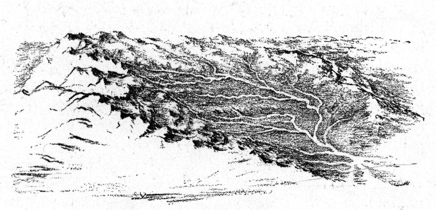
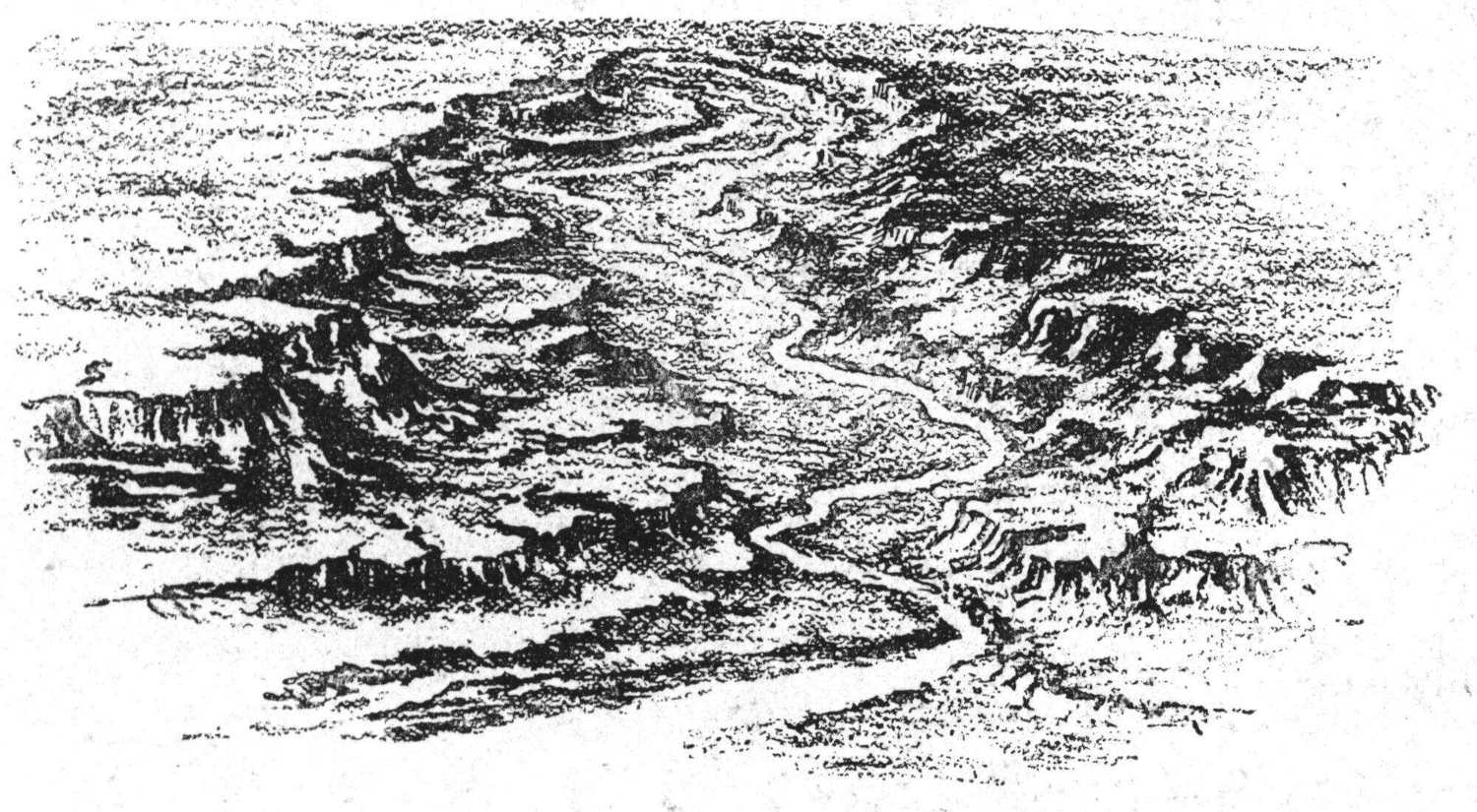
River Basin.
Expression thus reacts upon self, causing the mental
picture to be intensified and expression to become more
definite and complete. No other means are so adequate to
this end: i.e., the forming of distinct images in the mind,
unless it may be the giving of oral and written descriptions.
These, of course, should be demanded of the pupil
as well. By this demand the pupil sees the necessity of
closer observation and investigation that he may give a
fuller and more truthful expression, and with careful
leading he becomes a critic of his own thought and skill,
which is a step pre-eminently educative.
Aim of Field Lesson. A direct purpose or aim of the
field lesson in teaching geography should be to form a
clear idea or mental picture of a river basin as a basis
for imaging other river basins, and as a unit for the study
of the continent, or of all land surface: and to know the
river basin is to know its history; that is, the history of
the river itself, its valley, and the story of its building
and shaping.
It may not be possible for all students to make a study
of the whole of a river or brook basin, yet it may be done
by sections—getting a general idea of the slope of the
river bed, water-parting, slope and valley. The action of
the forces of nature may also be seen in the changes now
going on in the different sections—the cutting back of the
stream at its source, its eroding power, its carrying power,
and its building or leveling power.
If it is not possible to take the children to the field for
nature study, they may find fruitful sources of study
without.
City Schools. Nearly every school-house has some
surroundings that may be studied to advantage, except
those in closely built city streets; but even in such cases
there is always the work of rain, heat, frost, and wind to
study, as well as insect life. The drifting of sand and
snow, the frost on the window-panes, the forming of ice
around doors and windows and the effect of heat in its
melting, rain-drops, clouds, puddles of water in the slight
depressions of sills and walks, with tiny streams flowing
therefrom, are all to be observed.
Where did the dirt on the windows and sills come
from, especially after some snow-storm? Tiny seeds in
the corners where the winds have left them; insects in the
spring;—where did they come from? Where were they
all winter? These and many other hints might be given
for such study.
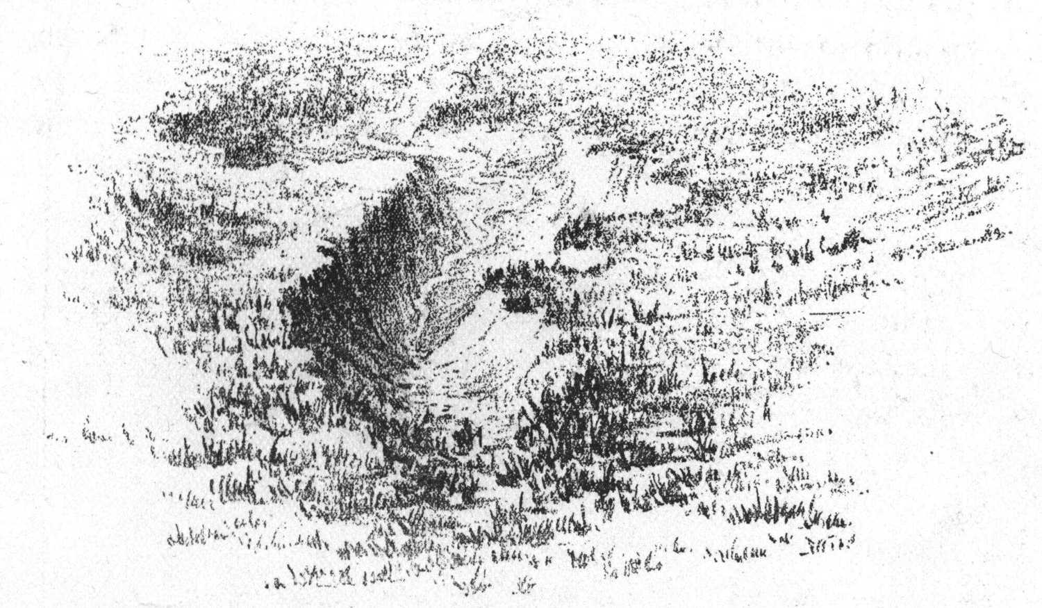
The Cutting Back of a Stream at Its Source.
The country furnishes a rich field for investigation.
Around every building and in many localities that can be
easily reached, most of the types of the earth’s surface
forms may be found. Care must be taken that they are
considered as types, or the pupil might answer the question,
“How high are mountains?” as the child did who said in
reply, “Two inches high.”
In the lower grades of school, much of the geography
work should be the direct lesson in the field followed by
lessons in school. The higher grades, also, should continue
the frequent field excursions which are begun in the
lower.
Source of Brook in Nearly Level Country.
Visits may be made to the hills, groves, lakes and
ponds of the vicinity, and upon returning to the school-room,
these and surrounding areas may be modeled in sand
or clay, painted in water-color or drawn on the blackboard.
Farm in Central New York.
Brook basins may be studied as presenting many if
not all of the features of the river basins. Maps may also
be made of these areas, as well as detailed drawings of
special features.
As has been said, the pupil should model and draw
continually, in connection with or after every lesson in the
field. It is the very best method by which to attain mental
growth, and should of course, be the genuine expression
of his own mental images gained through observation. He
should model and draw all surface features or areas seen in
his excursions. He may model, in sand, putty or clay,
maps of the areas of the school-yard, farms or parks in the
vicinity; or chalk model them, then indicate upon them the
boundaries of any sub-divisions they may have, such as
fields, clumps of trees, houses or other buildings.
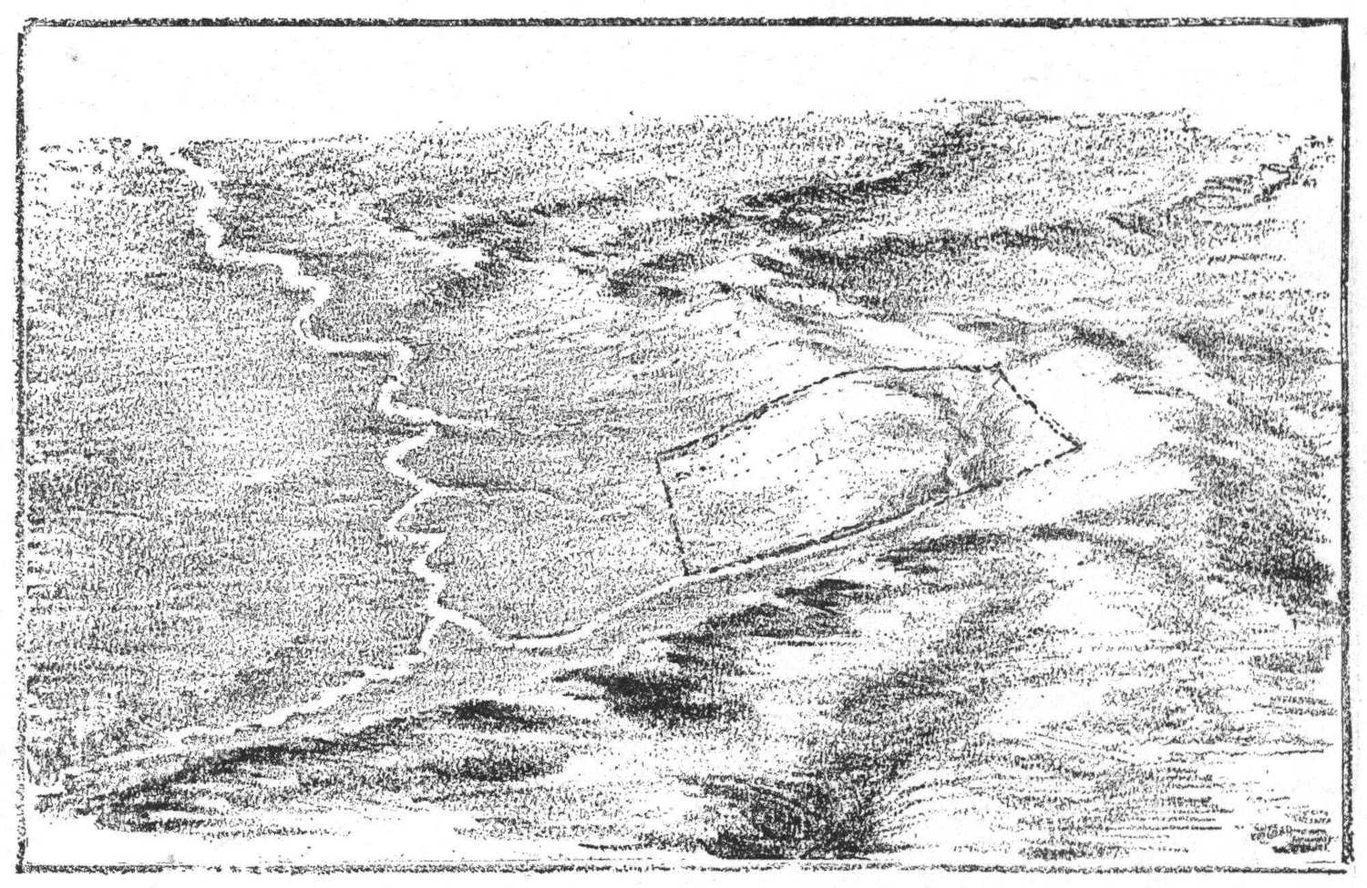
Map Showing Its Relation to the Brook and River.
Imaginary Areas. Let the pupil also sketch on the
blackboard, imaginary scenes and typical features of other
areas and countries under the same or contrasting climatic
and other conditions; always questioning, as he draws his
mental picture—if of a river, for instance—what is the
cause of its rapidity, what its probable depth and effect on
the soil, why it cuts here or builds there, and why the slopes
back of it are terraced as they are.
If he represents islands, he should ask himself the
question why they are rocky or alluvial; i.e., what their
origin; and never represent in any expression that which
is contradictory and so untrue to nature.
Landscapes typical of the different zones of temperature,
showing characteristic structure, vegetation, homes,
habits and occupations of inhabitants may be drawn.
Maps, also, of these areas and those adjoining, may
be chalk modeled. As the mind becomes stored with
separate images acquired through actual observation of
areas of the earth’s surface, gradually, by the combining
and blending of these, a new mental image, a comprehensive
picture is formed, corresponding in the main to the
general features of the whole earth, with its uplifted
masses and lower plains, its natural divisions of continents,
seas and oceans, its atmospheric and climatic conditions.
If the habit has been formed of chalk modeling
imaginary areas, as well as those within the sense grasp,
it will be a comparatively easy matter to chalk model a
map of the whole continent. On this the student may
mark the boundaries of all political divisions as he
studies them, and locate the important cities and places of
interest.
Practical Suggestions. Before we leave the subject of
field lessons, some practical suggestions in regard to them
are here offered.
Actual observations may be made on the action and
effects of rivers, underground water, rain, wind, heat and
frost.
The effects of glacial action, and the eruptive forces of
nature may also be seen in places.
To study river action it is not necessary to visit a
river (if there be none near); any small stream of water,
any tiny rivulet beside the roadway, tells its story of
wearing and building, its vertical cutting and its swinging
from side to side. It has its miniature valley, its basin and
water-parting and possibly a delta at its mouth. It may
also have its cascade or waterfall.
Rivulet Showing Fall of Water and Delta.
The wearing of rock, through the influence of rain,
frost and heat, may be seen in any stone building, fence or
pavement.
Effects of heat and moisture on vegetation, as influencing
the growth of plants and trees, should be noticed.
The growth of shrubs and trees during a dry season can be
measured and compared with that of wet seasons.
The observer should mark the effect of vegetation in
the action of rain on a grassy slope—how the grass protects
the soil, preventing it from being washed away, and how,
by holding back the water so that it flows more slowly, it
is less destructive in its action.
To add to the interest, the pupil may be led to
imagine the effects upon climate and streams, of the
denuding of large areas of their forests; also how rock
sculpturing, in the forming of gorges, cañons, etc., would
be modified by the volume and force of streams.
Observation should also be made on the making of
soils, their constituents and relative proportions of loam,
sand, gravel and clay, and the relation of these to plant and
animal life.
The part that the common earth-worm bears in constantly
uniting, enriching and otherwise preparing the soils
for the support of vegetable life, may be seen in many
areas. (It has been computed that in one year several
tons of soil are brought up and distributed by them, within
an area of an acre of land.)
A study made of the action of underground water, as
shown in common and intermittent springs, would be full
of interesting suggestions.
The effect of glaciers may be seen in part and their
tremendous influence imagined, by the presence of the
countless numbers of striated boulders, pieces of rock and
pebbles, which are strewn all over our prairies hundreds of
miles from any mountains which could have been their
home.
It is not necessary to witness the devastation of a
cyclone in order to study the effects of wind action. The
piling of sand on the sea-shore, the drifting of snow or the
whirling of dust in the street illustrate this. The observer
may notice where the dust blown from the street has
choked and buried the grasses and weeds beside it, and
imagine what might be the fate of forests in the path of
encroaching sand-dunes.
Sand-Dune on the Shore of Lake Michigan.
Pupils may be told of the dunes which travel great
distances: that one way by which this is known is by
noting trees and houses that were once back of the
traveling sand-hills and are now in front of them; also tell
of the sites of ancient cities long buried and now being
excavated and brought to light again.
IMPORTANCE OF LEARNING TO INTERPRET PICTURES AS AN AID TO IMAGING THE CONTINENT.
The ability to image the continent or any part of it,
from the reading of pictures, is of great importance. It is
an inexpressible aid to the imagination in the study of
areas that lie outside of the sense grasp. Good pictures
should be chosen: pictures showing several different views
of the same section of a country; pictures that are a
truthful representation of both detail and generalities.
(Many wood cuts are as good as photographs for this
purpose. Great care, however, should be taken that
they are faithful transcripts.)
After a close study of them, questions may be asked
the pupil as to climate, structure, nature of rock and soil;
whether it may be supposed to be an arid or fertile region;
whether the river basins are young or old; what agents
were most active in shaping its features, and what its
probable destiny: or the pupil may be led to give his own
inferences as to conditions, without direct questioning.
In this way contrasting sections of country may be
studied and compared, thus making the mental picture
more vivid and complete.
MAP OF ABYSSINIAN HIGHLAND.
(Drawn from information gained through
interpretation of pictures and written description.)
It is understood that these mental images gained from
such study of pictures, have as a basis, images acquired
from actual observation of the earth’s surface. From
this mental picture, supplemented by images gained
by oral and written descriptions, maps may be chalk
modeled which will contain all the essential features of
structure.
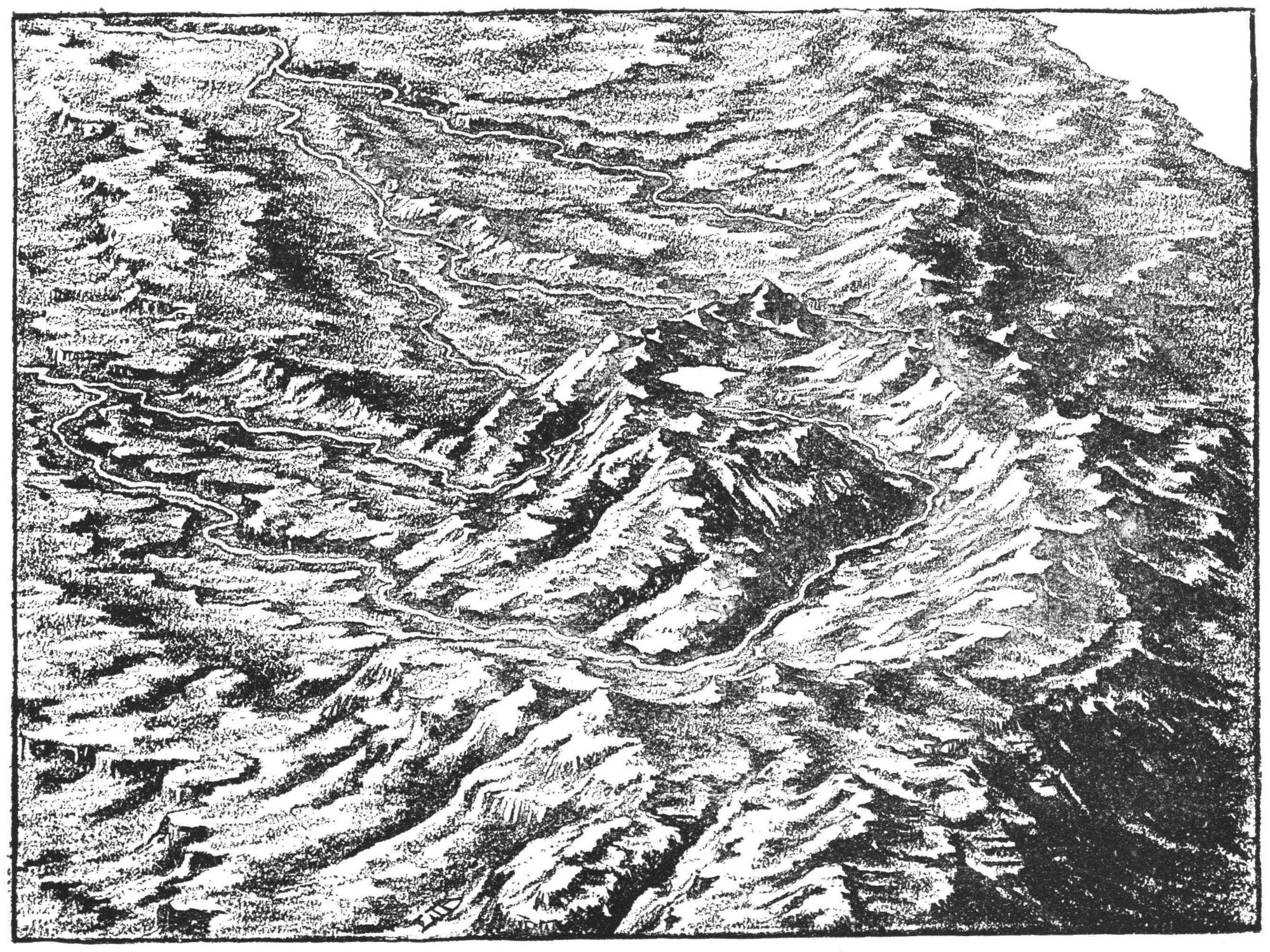
Young River Basin.
Valuable information for the making of maps
has been gained in this way; indeed, adequate maps
cannot be made without this means of acquiring the
necessary knowledge, which the delineator has not
been able to gain through travel and personal investigation.
Through this study or reading of pictures a natural
interest is aroused in the mind of the pupil to see located
on the map (that is, to see in relation to the whole)
countries and places of special interest; such as natural
wonders of structure, and remarkable instances of man’s
skill and power in overcoming obstacles and improving his
environment.
Especially will this be the case if the teacher accompanies
the descriptions with rapid illustrations on the
blackboard.
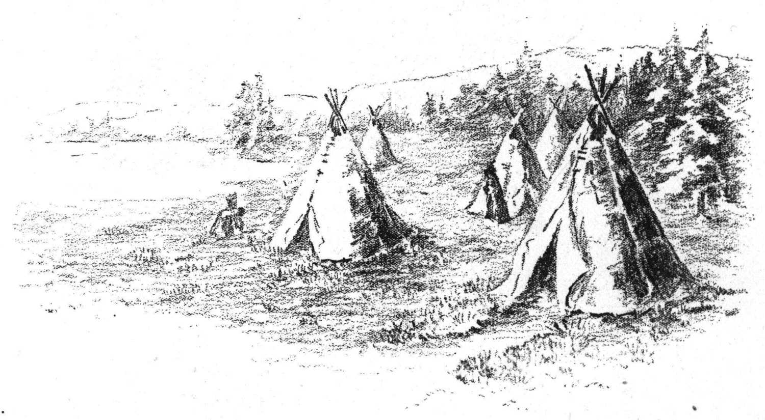
Tepee or Wigwam of the Sioux Indians.
Necessity for skill in drawing on the part of the
teacher, becomes very evident as the desirability of frequent
illustrations is felt, and the fact is also realized that by it
untold influence for good is exerted over the mind of the
pupil. It is an aid to correct mental picturing, which the
teacher cannot afford to omit.
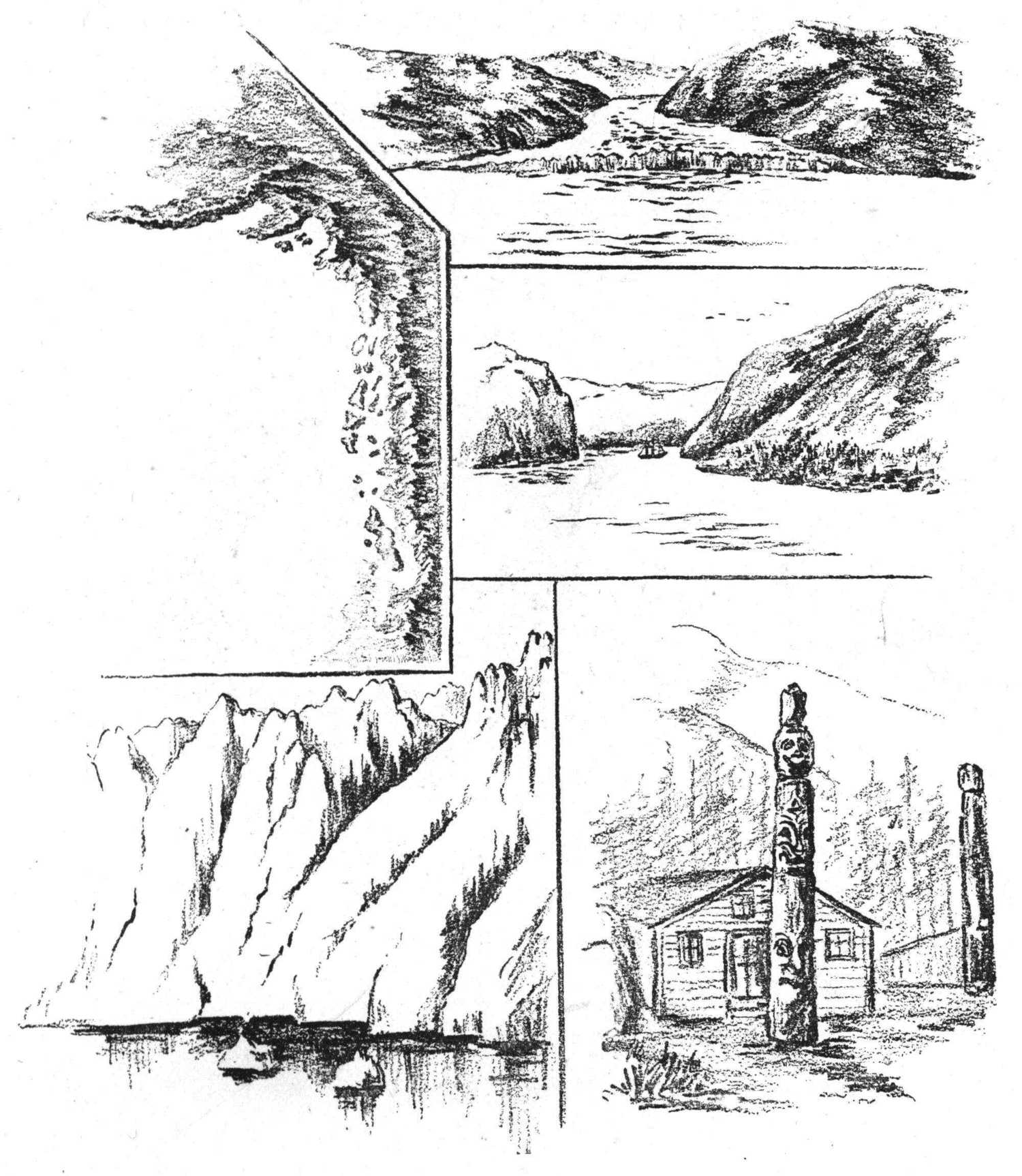
Coast of Alaska.
(Showing its drowned valleys caused by the gradual
sinking of the land, also glaciers, Alaskan hut and totem pole.)
Special features are more readily understood when
drawn in detail: as mountain peaks, stern or forbidding in
outline, or lofty and grand in their mantles of snow and
rivers of ice (Mt. Blanc); valleys with wooded slopes
and streams of water; lakes, waterfalls (Niagara Falls);
glaciers and icebergs, with typical scenes of Arctic regions,
including inhabitants with their homes (Muir Glaciers),
(Alaskan huts and totem-poles); deserts and oases, with
typical trees and surrounding objects (palm trees, pyramids,
camels); Indian homes and environment; dykes of
Holland, Suez Canal, St. Gothard Tunnel, Great Wall of
China, etc.
THE CHALK MODELED MAP.
MAPS OF THE PAST AND PRESENT.
As it is impossible to adequately teach the surface
features of a country with only a vague idea of its
structure, and with no aids in the form of pictures,
drawing or modelings by which these surface features may
be illustrated, there arises the necessity for maps.
These, to be of any real service, must be a representation
of the form and character of the area which is the
subject of study, and must indicate the relation of part to
part, parts to the whole, and the whole to parts.
As symbols and more than symbols, they must bring
to the mind vivid pictures of the real country or continent,
not as too commonly taught; “A mental picture of the
map, so clear and consistent ... that he (the pupil)
can read the answers to all questions concerning it, from
his mental map, as easily as he could from the printed one,
if it were before him.”
This is to limit and cramp the mind’s action, as the
pupil sees only the map and its corresponding concept of
map, its size, boundaries and patches of colored paper. It
gives no idea of relation or correspondence between the
map and the actual world of life, form and color.
Aim of Teacher. In using maps it should be the aim
of teachers to create in the mind a complete, harmonious
picture; the blending together of the several concepts of
structure, climate, drainage, soil, vegetation, animal life,
races of men, etc., corresponding to reality, or real life
in the real world.
The flat political maps of the past made no attempt
to show any structural features except those of horizontal
or level plains, markings which show the locations of
mountain ranges and volcanoes, and lines indicating rivers
and outlines of continents or coasts.
These maps have had comparatively little meaning to
the young pupil. There was in them no suggestion of
solidity or mass; the contents to him seemed flat and
thin, and confined between coasts which were sharply
defined. Tent-like mountains crossed ghost-like surfaces,
and thread-like rivers were made to zigzag along in an
erratic and irresponsible way, showing to him no reason
whatever for their being.
Many teachers or pupils have not known how to
interpret maps. They have not realized that, where rivers
rise in certain localities (especially if more than one rises
in the same place), there is a reason for their rising just
there and for their flowing in different directions; that
their source is probably at an elevation or rise of land
(called a divide or water-parting), that there is likely to be
more rainfall on the side of the mountain range that has
the more rivers, and that this has a close relation to the
direction of the prevailing winds.
Natural Boundaries. In the past study of these
maps, outlines of political divisions have been memorized.
It was not realized that many of the boundaries of those
areas were fixed in the beginning by the very nature of
the surface structure, and that they are where they are,
simply because they could not well be anywhere else.
(See Mexico, India, Italy.)
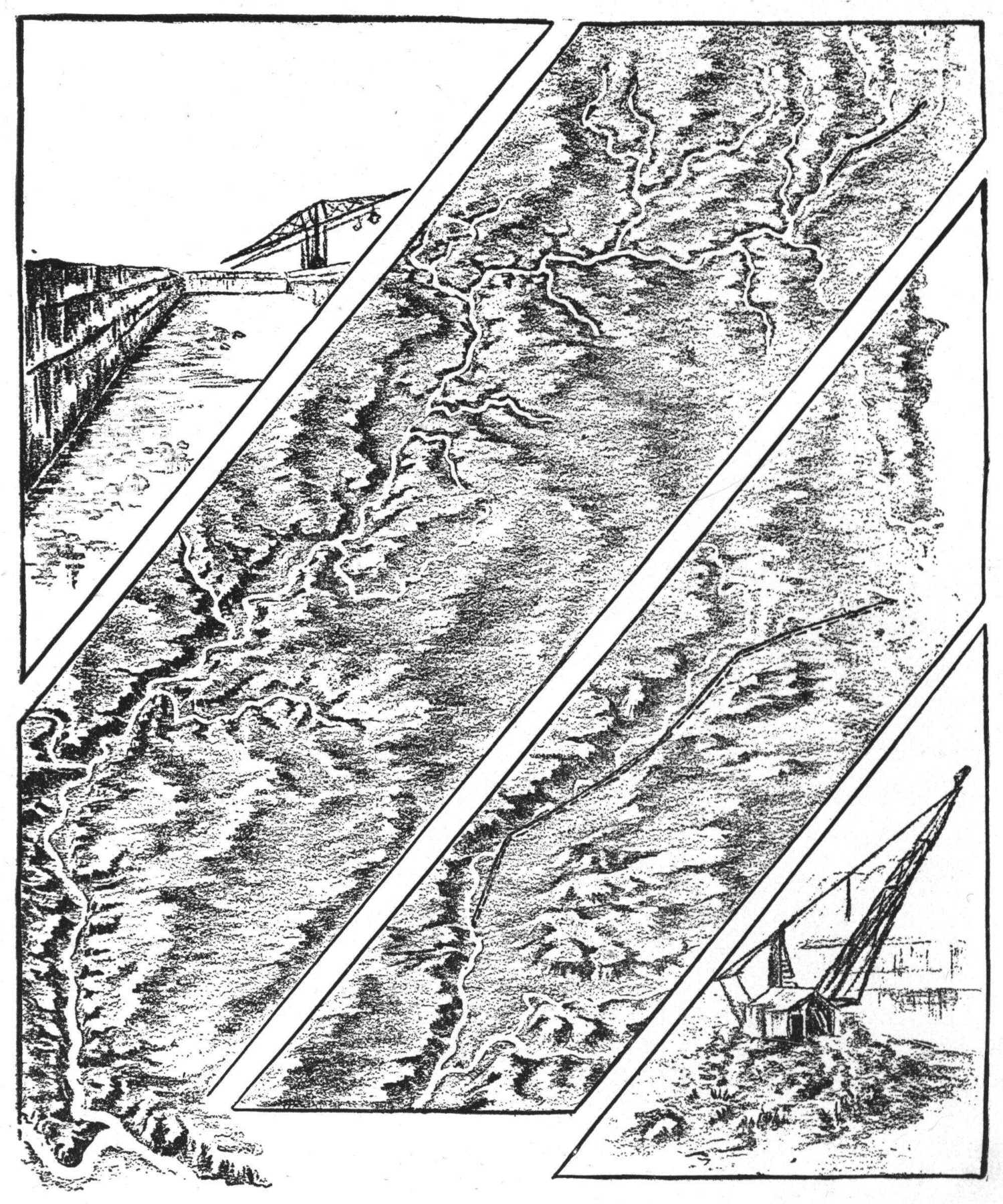
Map of the Chicago Drainage Canal.
(With larger map showing its relation to Lake Michigan
and the Mississippi River, also sections in detail.)
History. We have seen that the study of history
cannot be successfully taught without a knowledge of
structural geography on the part of teacher and pupil; so
we may say the same of maps, that their use is of fundamental
importance in that study, and the ability to read
them understandingly is as indispensable as it is in the
study of geography. To try to teach history otherwise
would be a waste of time and effort.
The habit of locating the events recorded, of tracing
upon the map the route of an army, or the line of an
important road or canal, and observing the impediments or
natural obstructions to be overcome, with the great advantages
to be derived therefrom, together with inferences as
to the time and labor required, has the effect of making the
study of history of living interest, especially if the map
used indicates such surface structure.
In the structural map the student readily sees the
meaning to commerce of the cutting of a canal which
would unite two large bodies of water, or the effect the
building of roads and bridges across hitherto impassable
regions would have upon the life and growth of a people
in the opening up of new and extensive areas to civilization,
and consequently the development of their own
internal resources.
The importance of this habit of usage, or constant
reference to the map, is also recognized when one realizes
how it fixes in the memory not only the location of cities
and boundaries of ancient empires, but the geographical
structure and environment associated with their growth and
with important historic events; making plain the reasons
for, or causes why, certain events occurred at certain
places, as the inevitable consequence of their environment.
Light dawns upon the pupil as he studies. He sees
that environment has been an important factor in the
development of the human race. He traces step by step
in imagination the growth of civilization, from the time
that man in his nomad stage first drove his herds into
the valley in search of food and water. There, finding
the soil productive, water unfailing in supply, and the
valley protected from marauders by natural barriers,
as desert or mountain walls, he fixes his home; in the
course of time comfortable dwellings are constructed,
land is cultivated and the place becomes a center of civilization.
In connection with this train of thought, the student
by contrast notes the far different effects of environment as
shown by life in the Arctic or other regions, and he turns
to his map with renewed interest and eager inquiry.
Literature. The habit also of locating on the map
every place, natural feature or country read about, should
be cultivated, as it is of importance in obtaining a correct
understanding of an author’s meaning.
If we did not have the knowledge of physical structure
in mind as a stage on which the actors move, much of
our literature would lose its value, becoming flat and
uninteresting.
To know the great lake region adds to one’s interest
in Longfellow’s “Hiawatha,” and the tales of the early
explorers; and a knowledge of the Catskills and the
geography of the Hudson River valley gives greater
zest to the enjoyment of Irving’s “Rip Van Winkle”
and “Sleepy Hollow.”
It is also necessary to the understanding of the stories
of Holland (“Hans Brinker”) that we know the habits of
the Hollanders arising from the physical characteristics of
their environment.
To read intelligently Scott, Dickens, George Elliot
and others is to understand the peculiarities of climate and
structure of the British Isles. The old Greek stories and
the German Folk Lore as well, demand for their understanding
and interpretation, that we place them not only in
relation to the habits and thoughts of the people, but also
to the physical foundation of the country itself.
Relief Map. The nearer a map corresponds in its
inherent form and material, to the surface features of the
earth which it is designed to represent, the more of reality
does it recall to the mind. The most effective map of this
kind and the one which corresponds most closely to the
reality is the modeled map of putty or plaster, showing
structure in relief.
These maps have been in use for years, and have been
of incalculable interest and benefit to those whose stock of
knowledge concerning geographical structure had been
mainly gathered from the flat political map and old modes
of teaching.
On seeing a relief map of one of the continents for the
first time, there arises a sense of wonder and surprise, and
as the realization dawns upon one of the continuity of the
great mass of land represented, with its altitudes and
depressions, and that it is one stupendous aggregation of
soil, rock and vegetation, surrounded by a great expanse
of water, a feeling of awe and astonishment is awakened.
As this new light comes to the student, he looks with
interest and eagerness to see the plan of it all. We do
not mean to say that he sees in the map before him an
actual correspondence to the earth’s surface structure, that
is, forms that are reproductions in miniature of mountain
range and valley, but he sees a representation of them calculated
to arouse his imagination to a lively degree. He is
enabled to picture to himself great slopes crowned by lofty
mountain peaks, and the meeting of their lower edges
where mighty rivers flow. He sees in imagination how
these waters have cut deep channels into the great uplifted
masses, how they have torn jagged gashes into their
rugged sides as they leaped and tumbled through dark
cañons, grinding off rocks that form sediment constantly to
be deposited later on upon the plain below. He easily
understands that they must act as a source of drainage for
wet lands and as channels for the irrigation of dry areas.
In looking upon the great bodies of water, oceans,
seas, lakes and gulfs, as represented on the maps, he
questions the relation of these waters to the land, their
depth and what place they fill in the economy of nature.
Indeed, the relief map has an awakening effect, quickening
the imagination and stimulating to mental effort—earnest
thought.
They are invaluable in their place and have come to
stay; yet on account of their weight and general unwieldiness
they are not practically as useful as maps which are
lighter and more easily handled.
The papier mache maps in relief, although much
lighter in weight, are still very bulky if made large
enough to be of much practical use as wall maps, since
they cannot be folded or reduced in size to facilitate
transportation, or removal from room to room.
The best of these, also, are modeled in such low relief
that they are better adapted to the use of pupils in the
higher than in the lower grades. Other maps of rather
recent date are the typographical map and the contoured
map. The former shows general altitudes by the use of
shades of color, and is of great value to one who can
interpret it, but only a confused mass of signs and symbols
to the young student, and thus not much more helpful to
him than was the old reference map.
In the contoured map, the altitudes are scientifically
represented by lines drawn to an exact scale, and such
maps are most valuable to students of the higher grades.
A structural map suitable to all grades of pupils, the
lower as well as the higher grades, seems highly essential;
especially should it be one that is adapted to the teacher’s
use while before the class—one to teach from. This should
be entirely different from a reference map. It should
plainly show the great facts of physical geography or surface
structure, as well as some detail, and this in a simple
form. For the lower grades there should be no lines to
mark the political divisions, neither should there be any
names of countries, states, or cities to designate localities.
Everything should be omitted that would have a tendency
to divert the attention from the chief function of the
map which is, to aid in the formation of a mental picture or
image, corresponding to the structural features of the real
country or continent.
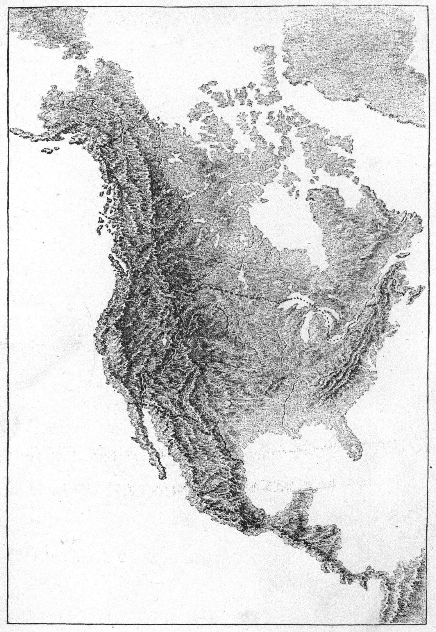
The Chalk Modeled Map. These maps, following the
use of the putty or plaster relief maps, should be the only
ones placed before the pupils of the third and fourth
grades, or even higher grades, until they have gained
mental power to read and understand the signs and
symbols of the map, and realize clearly the chief
structural features of the whole globe.
The student should be enabled by the use of maps to
picture in his mind the configuration of the whole earth;
the distribution and shape of land and water surfaces, the
great structural division of continents, the slopes and
counter-slopes with their crowned heights and level plains,
the great land masses and river basins, peninsulas, gulfs
and bays, islands and their relation to the mainland.
In fine, the whole world surface should become a
reality to him if the map is rightly taught. This will be an
easy matter for a teacher who is alive to the beauty of the
world around us and who has a personal knowledge or
clearly pictured concepts of the real country. Such an one
will readily see the value of the maps as an aid to the pupil
in gaining a comprehensive mental picture of the earth’s
surface.
She will remember that the mere placing of the maps
before the pupil is not enough, that they will be as
unmeaning to him as the flat political map, unless he has
already in mind the primary concepts acquired through
observation of surface forms, and has made his inference
as to cause from the effects seen.
Of what value will it be to him to know that certain
lines indicate a mountain range or river, unless he has an
approximate idea of what a mountain range or river is?
For the use of the more advanced pupils of the higher
grades, who see the relation of structural environment to
man in his development as a nation, the relation of natural
structural divisions to political divisions, these maps should
have lines drawn upon them to indicate the boundaries of
such divisions. Names, also, of countries, mountain and
river systems should be marked, and the large bodies of
water of the interior. Later on, the smaller divisions of
states and provinces, gulfs and bays, lakes and rivers, with
their tributaries, should be shown, and important cities may
also be located; in the end, all the data needed as a
reference map.
The map devised to fulfil these conditions, and now
in considerable use in this country, is called the “Chalk
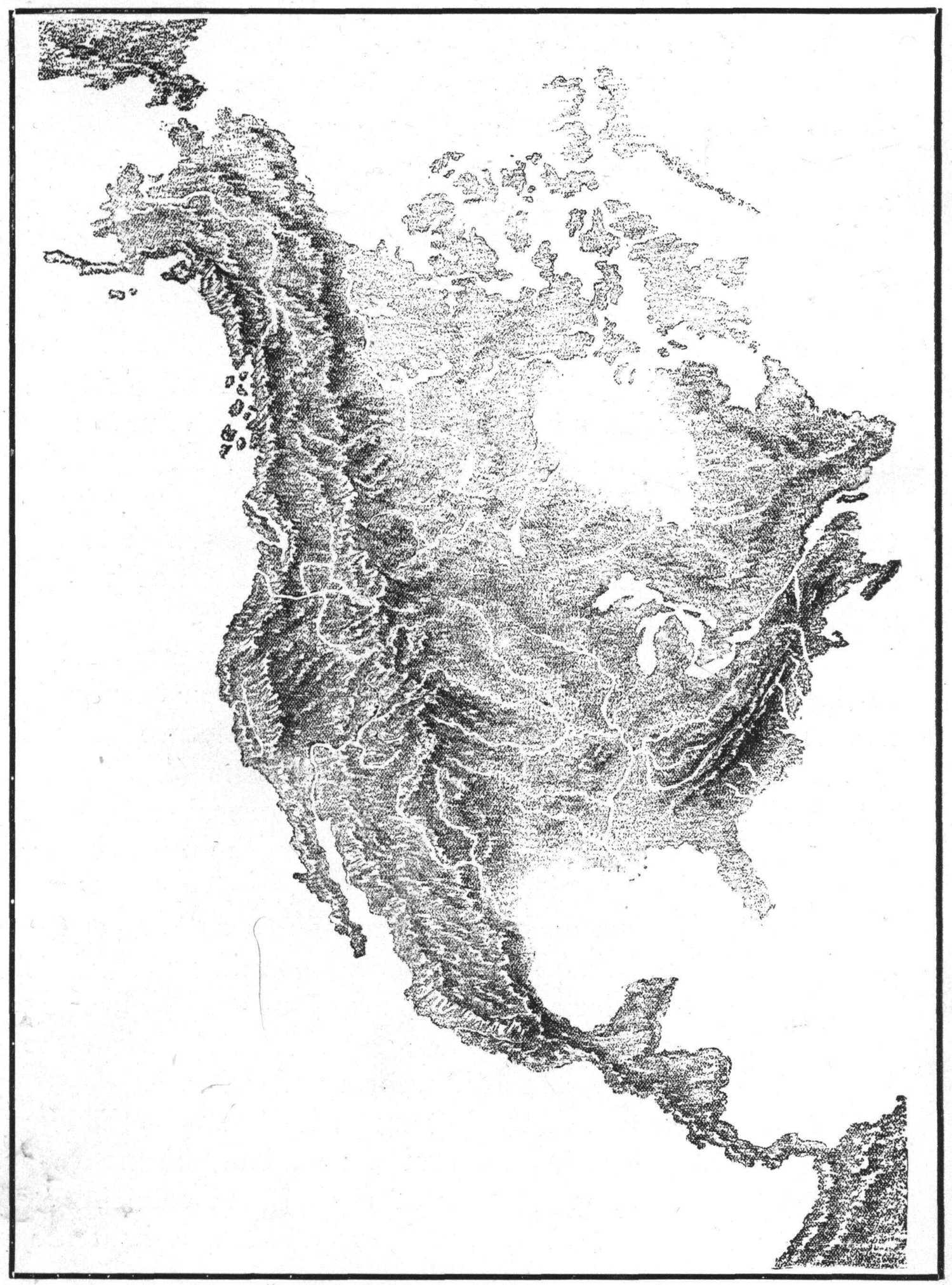
Modeled Map.” It is drawn to represent surface structure
in relief, giving much of the effect of an engraving or
photograph of a relief map, yet intrinsically more truthful
and artistic than any such representation could be.
There is an immense difference between this and a
drawing from a relief map, or from a photograph of one.
In this map the delineator expresses at first hand his own
concept of the continental structure, as the artist or poet
expresses in his work his own original ideas. We feel his
thought in the very quality of line used. We read how
the truths have appealed to his own consciousness. It
stands where the relief map itself stands, as representing
the delineator’s own mental image of such structure.
There are no lines drawn in this map that contradict
or confuse the meaning; all is direct, truthful and clear
in statement of fact. Each line has its own particular
meaning. If represents direction. Applied to land surface,
a vertical line means a perpendicular mountain or side
wall of plateau, horizontal lines indicate level areas, and
oblique lines a sloping surface.
Until recently, this map has not been available for
general use, except as each teacher made his or her own.
The latter, however, is the ideal way of teaching. To
draw a map of a continent or section of it, as is required,
in order to illustrate or emphasize any particular point
before the class, adds intensely to the interest of the lesson
and to the adequacy of concept gained by the pupil.
Too often, however, the opposite course is pursued.
The teacher’s conceptions of earth structure are perhaps
vague, or, teachers may not have been in the habit of representing
by drawings that which they may be able to picture
quite clearly in their own minds, even the desirability of so
doing may not have been entertained by them.
In fact, there are comparatively few who have been
persistent enough to make maps, for though there may be a
good knowledge of geography, clear mental pictures of
structure and the ability, also, to draw them, yet lack of
time necessary for their proper delineation has doubtless
often compelled the busy teacher to forego their execution.
Printed Wall Map. The Chalk Modeled map has
recently been presented to us in a more durable and serviceable
form for general use; a printed wall map, which
combines the latest geographical knowledge together with
the best available skill in delineation.
It does not embody all the desirable points of the
original, yet it has an added one, that of durability.
The introduction of “Nature Study” into the public
schools has contributed largely to the demand for such a
map. Pupils brought into close relations with nature,
naturally seek to relate the knowledge gained in this basic
study of geography, to the map; as in connection with the
field lessons, after actual observation of surface areas, the
student is led to model or draw what he has seen. This he
represents in pictorial form, as it appears to him, or he
charts or maps it from actual measurements.
Sometimes he tries to combine these methods so as to
show elevations as altitudes on his map or chart, but the
results are often very crude; a mere representation of hills
and mountains piled up on level ground.
He realizes that this is not a proper representation and
is often discouraged. He knows that peaks are related to
level ground by continuity of mass: that they are the
corrugated tops of great uplifted masses or swells of land,
and his failure to find this illustrated in the old maps has
led him to lose much of his interest in them, and to greet
the new one with ardor.
It appeals to his reason as a symbol more nearly
corresponding to the features of the country represented.
It is indeed the link needed to connect the political map
with the putty relief map.
Mass Without Outline. Not only can we say that
the Chalk Modeled map has been a great factor in the
better understanding of the surface contour and conditions
of the continental mass, thus advancing the true
study of geography, but that it has also awakened some of
the teachers of the public schools of the country, to the
lack of interest and lifelessness in the teaching of drawing
as it has prevailed in the schools in the past. It has been
the means of revealing to them the beauty and desirability
of delineating mass without a continuous hard outline.
The artist when inspired with his subject masses his
material in boldly and each stroke counts for the thing
he wants to say—it tells of the direction of surface,
or edge of mass, or detail.
In the new map, the representation of solidity and land
continuity as mass, with no hard and fast limitations of
land and water, such as the outlines so prominent in the
old reference maps, is a noticeable feature.
It is a well-known fact that a general or approximate
shape of the coasts of continents is all that can be known
from the most careful surveys; for in reality with every
season there is more or less change in coast line, caused by
wearing and building of ocean and river, as well as by the
occasional rising or sinking of stretches of land along the
coast. In course of time these changes become very
apparent.
The omitting of outlines of continents, then, in the
drawing of maps has been for a purpose. They have not
been necessary to the showing of limitation of continental
mass or the meeting of the surface plane of water with land
surface; and as the direction of all lines used in delineating
have their meaning, there can be truthfully none used
to represent something lying between land and sea, as
there is nothing there. Continental coast contours may be
as accurately shown as the occasion demands without the
use of any outline to confuse the eye or to contradict
the direction of line used to delineate the structure of the
land surface at the water’s edge. (See map illustrations in
Part IV.)
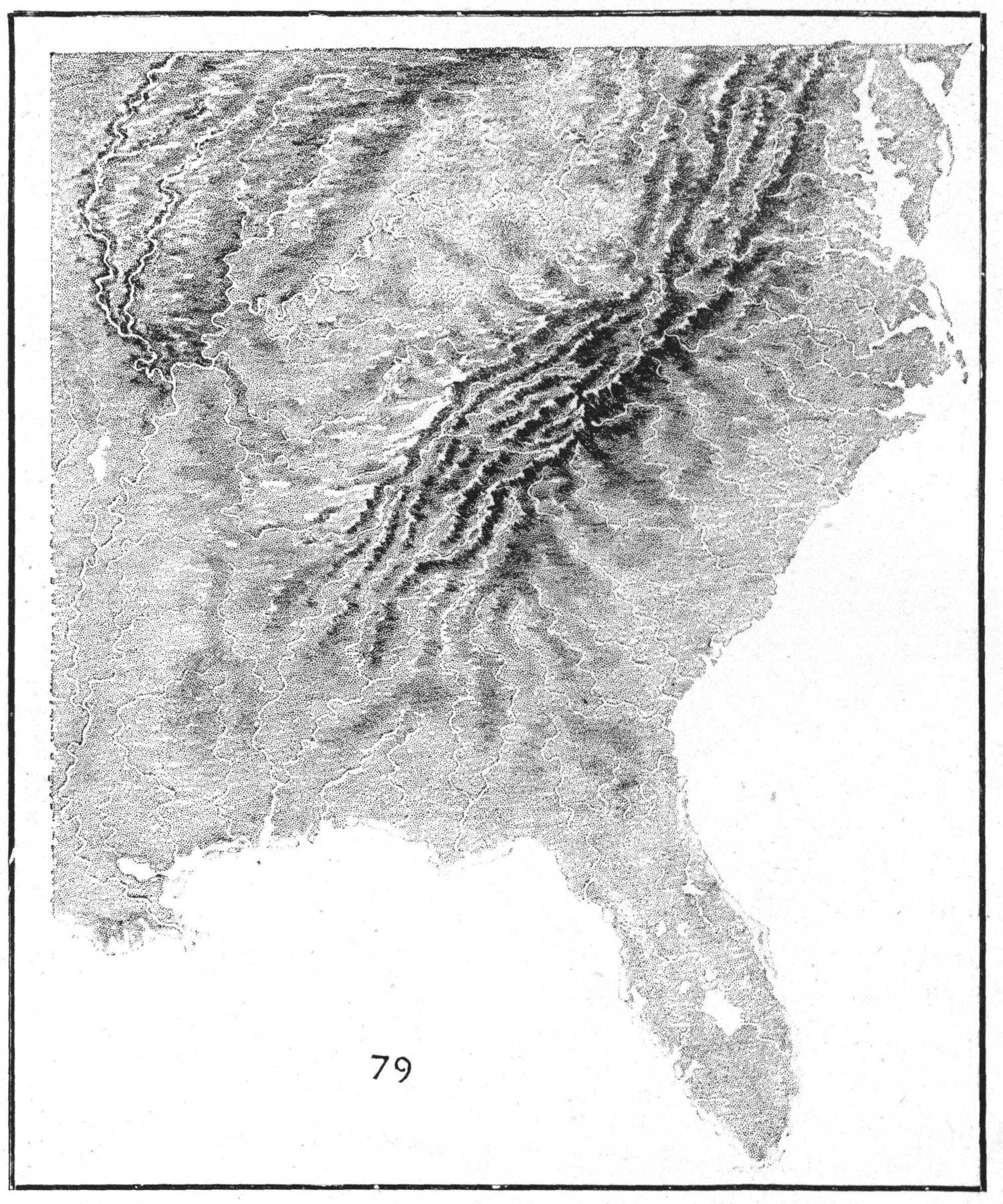
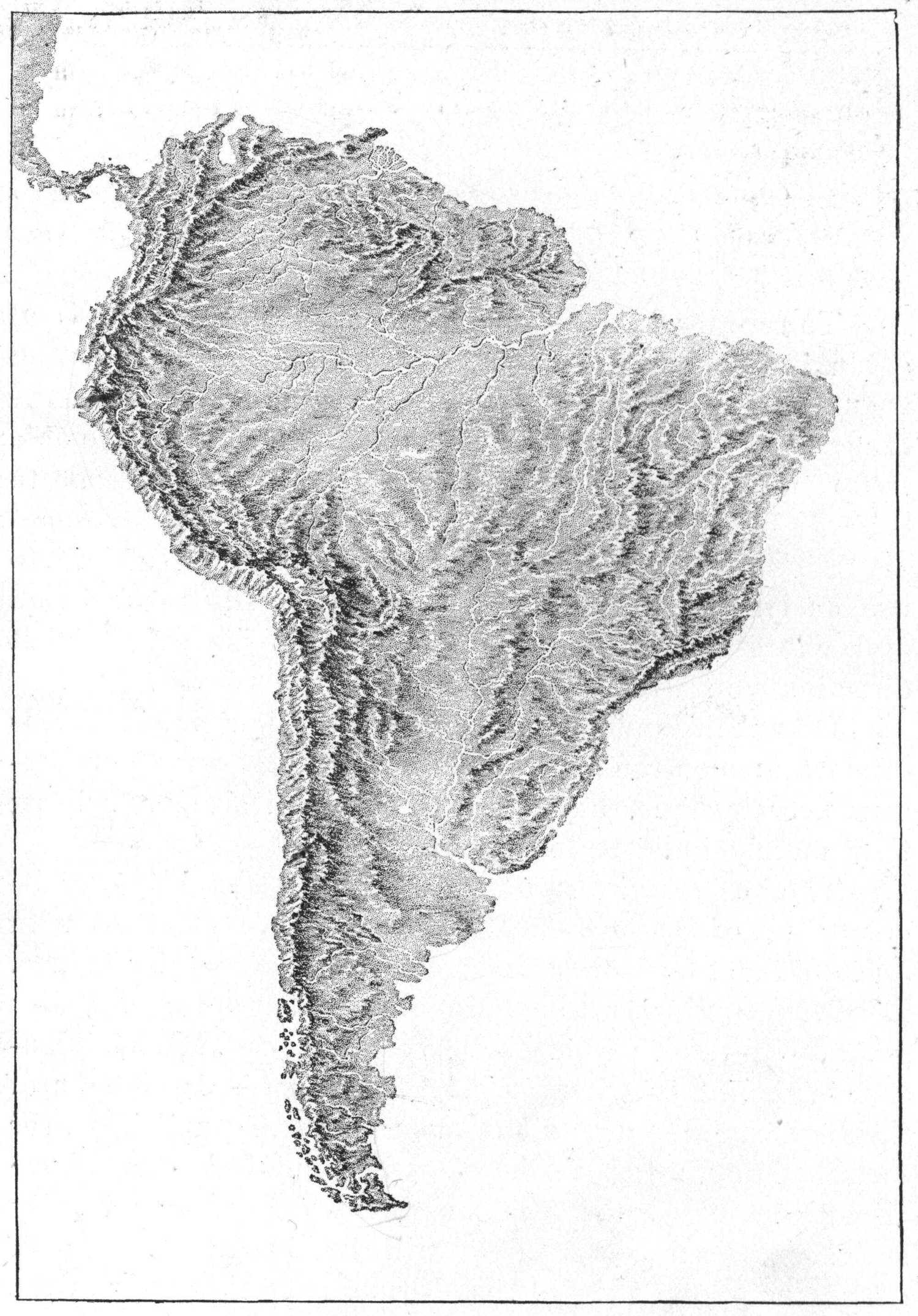
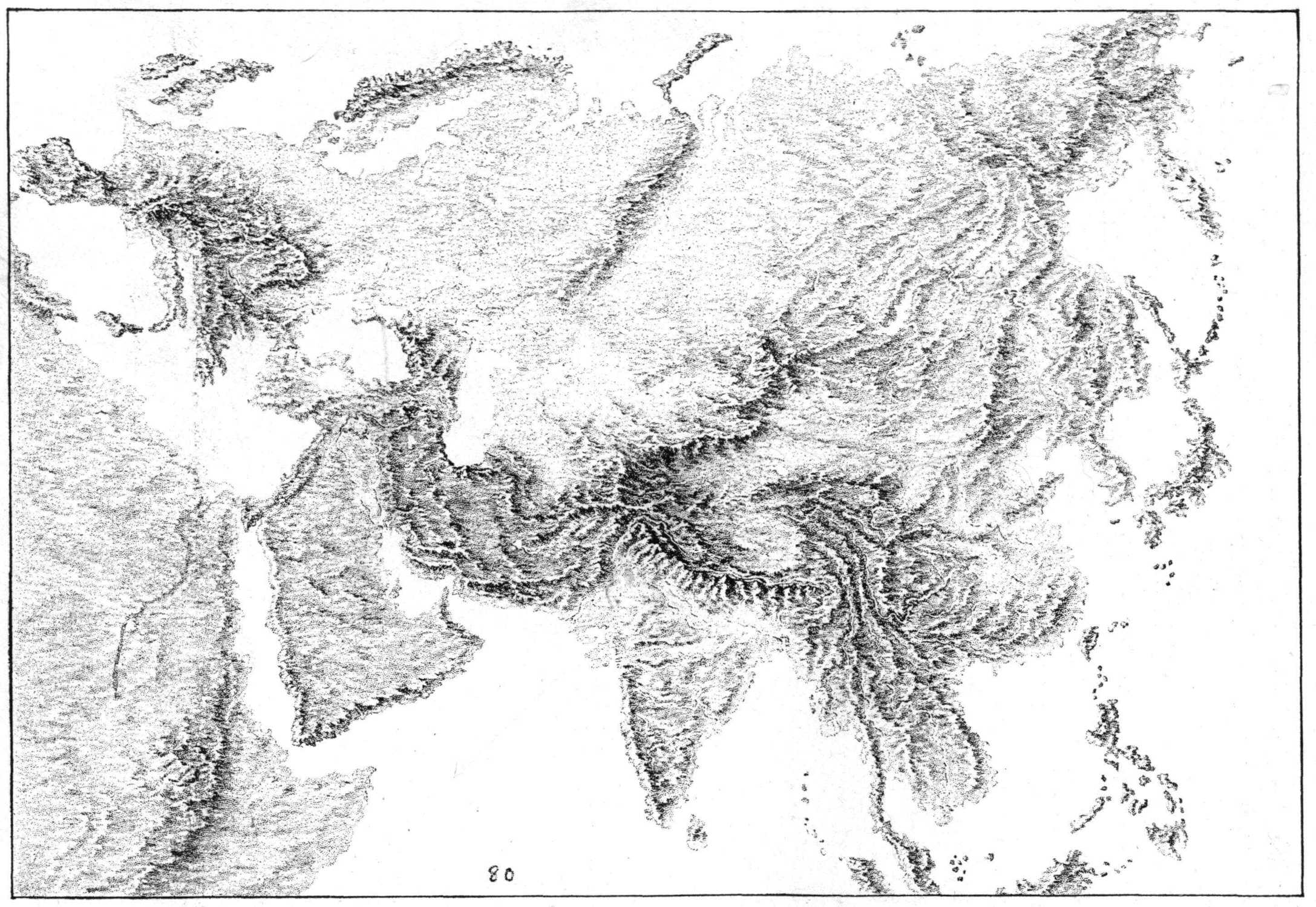
The most prominent feature of the new map is the
representation of the relief of the earth’s surface; showing,
as it does at a glance, the great back bone of the continent,
with its ragged broken line of peaks dividing the waters
of the two slopes; its great land masses, primary and
secondary; and its area or line of greatest depressions. Its
river basins also are plainly seen, and we infer the reason
for the general course of the rivers and read their history
from the sculpturing they have done.
We may note also the character of the mountain
ranges; whether they are young or old; where new land is
being made, and where areas are sinking. One can often
determine what the prevailing wind of a section may be
and the regions of greatest rainfall, and can judge of the
climate and vegetation; in short, very rational conclusions
concerning the life and habits of a people may be formed
from a study of the map alone, and the student can picture,
in imagination, the growth or advancement of nations
under the given conditions.
He will be enabled to see, as has been remarked in
substance before, that the mighty influences bearing upon
civilization have always been largely dependent upon the
geographical structure of a country; the relation of natural
divisions to existing political divisions will be noted, and
the reasons for the locations of great centers of commerce,
important cities, and military fortifications, will be
understood.
Altitudes. In common with all relief maps, altitudes
are shown in these, greatly exaggerated in comparison
with the horizontal distances, but this is essential in order
that the pupil may be able to grasp the general truths of
the organization of the continent.
Relief maps in relatively exact proportions will not
help to this, as the highest elevation would appear nearly
on a plane with the ocean level, and would be of no better
service for school use than the flat maps, from which no
idea of the general organism can be acquired by the young
student, if indeed it can be by one of riper years.
Also in all topographical surveys, and in the profile of
vertical sections of country found in many geographies, we
find the same exaggeration of height in relation to horizontal
distances, used to illustrate elevations and slopes.
These, with photographs or pictures of relief maps are
extensively used, as well as birds’-eye views, showing on
the part of the map-makers, a recognition of the importance
of the pupil’s gaining mental concepts of altitudes.
The latter, of course, must exercise his judgment in
relating the heights, to the horizontal distances given, as
he so continually does in every-day life in regard to other
matters.
The horizontal map distances should be related to
the other horizontal distances of the map, and the altitudes
to other altitudes, and these with reference, also, to the
tabulated lists found in every geography, of the heights of
mountain peaks and lengths of rivers.
“All knowledge of external things comes through
observation, comparison, and judgment.” To judge of
great altitudes, one must have a knowledge of the heights
within experience. To be able to gain a proper conception
of immense distances, as the distance across a continent,
comparison must be made with the distances one has
already measured or traveled.
In the measurements of areas, size of fields and
gardens, width of ponds, or heights of trees and hills, the
pupil has numerical facts from which he judges of other
forms and areas; as forests, marshes, plains, the width of
rivers and lakes, the heights of mountains and cliffs, or
length of rivers and mountain ranges.
Also in the measuring of the deposition of silt in small
streams, he may judge of the quantity that large rivers like
the Mississippi or Nile must carry; and from measuring
the yearly growth of vegetation in his own climate, he
judges what might be the growth in other climates. Thus
through observations, inferences, and comparisons, he is
enabled to read his map with some degree of power to
judge its distances and altitudes.
The aim in the preceding pages has been to show
the vital importance to the would-be delineator of Chalk
Modeled maps, of the thorough study of geography, in its
truest sense, and that the foundation of such study lies in
the field lesson, with its accompanying expression of the
knowledge gained there, of surface forms, areas and
structures.
The habit, also, of modeling and drawing in connection
with the study of geography, is conducive to the
wished-for end; i.e., an adequate knowledge and expression,
of the surface contour of the continent.
The chalk modeling of maps is in itself the simplest of
all modes of drawing. It may have been inferred from
what has been said on the subject of maps, that drawing
them consists merely in showing simple indications of
slopes; short or long, abrupt or gentle, and summits;
broken or rounded, river basins, character of water-partings,
valleys, lakes, rivers and coasts either bold and
rocky, or low and alluvial.
It would be as unnecessary for the purposes of
geographical instruction, as it would be impossible, to
draw absolutely correct maps of the earth’s surface.
Each mountain peak cannot be shown, nor every
indentation of coast-line, but the general trend or direction
of mountain ranges and rivers, and more or less of
geological structure can be portrayed in a conventional
manner.
It is not difficult to chalk model with reasonable
accuracy. The ability to do this, however, with any
degree of rapidity as well as accuracy, implies, as has just
been said, an adequate knowledge of the subject to be
represented. No mere imitation, or acquisition of technique,
or copying of maps, is educational, nor has it any
vital relation to the true study of geography. Like all
dead copies, it betrays in itself its lack of life, or of real
knowledge on the part of the delineator.
An instructor whose eyes are open to truth, can
generally tell from a pupil’s representation whether it is
the result of his own individual thought, the expression of
his own knowledge of the subject, or the reflex of another’s
thought.
If it is an expression of his own, there will be much
revealed in the touch and in the quality of line itself, that
could not be depicted in form or put into words. The
representation, also, will indicate to what degree the subject
has interested and inspired the individual, and how,
with a clear mental image, he has instinctively expressed
himself in the simplest and most direct manner possible
with the medium at hand.
In the following pages will be found suggestions as to
the method of chalk modeling, given in the form of a series
of lessons; the underlying principles in the lessons being
those on which is based all expression of thought in every
field of study and among all peoples.
The illustrations are not intended to be models for the
teacher or pupils to copy, but are meant to be helps or
encouragement to those who desire and have courage to
attempt to express their own mental images.
Busy teachers need only to realize that comparatively
little effort is necessary in order to acquire a certain
amount of success, if they have their subject in hand, that
is, if they have an adequate mental image of the object to
be sketched.
It is hoped that such success will prove a strong
inducement to a deep study of the subject of art, and
especially to the psychology of expression.
Part II. LESSONS.
REMARKS.
Chalk Modeling of surface forms is the easiest and
simplest method of geographical drawing, and one of the
best ways of beginning art work in the school-room, for
absolute definiteness of form and detail is not required, and
we know that generalities are represented much more
easily than details—large masses more easily than small
objects.
No one need hesitate to try to draw who can write or
gesture: this last we are all doing continually, either consciously
or unconsciously.
Watch the friend while telling some interesting story,
or while giving a description of some object or landscape.
Note the gestures unconsciously employed and how truthful
to the subject they are. Also notice that the more
intense the desire to make you understand, the more
adequate is the gesture.
No conscious thought is required as to what motion to
make, for the very desire to express brings with it both the
required word and action. This is spontaneity, and if a
pencil or crayon were in the hand of the narrator, with
paper or a blackboard near, a sketch might be the result,
and one quite adequate to its purpose.
If you are in earnest and truly desire to express your
thought by drawing or chalk modeling, you will forget
yourself in your effort to be understood. You will find a
way to accomplish your object, choosing and using the
right direction of line and giving the right accentuation
or emphasis without any special attention as to the method
of working.
Drawings may be made on the blackboard with
common blackboard crayon of medium softness, or with
charcoal or crayon upon paper. The blackboard is much
the more serviceable, as upon that you can draw with great
freedom, without fear of wasting paper or of spoiling your
work. Swing the arm out freely from the shoulder as you
work, give out that which you have to give, without fear,
generously. If it is but a line to indicate the edge of a
table, draw that line as though you were glad to draw it.
Express your thought boldly regarding the fact or object
you wish to make your statement about—fear not.
REPRESENTATION OF SURFACES WITH HINTS ON THE DELINEATION OF DISTANCES. LAND SLOPING FROM THE OBSERVER. LIGHT AND SHADE.
The most convenient length of crayon to use, is a piece
about an inch and a half or two inches long, yet we may
often profitably use the whole side or length of the crayon.
If we wish to represent broad surfaces, we will naturally
use the side of the crayon, as a child does. To show
narrower widths of surface press more upon the end of the
crayon, also use a long edge to represent the edges or
the meeting of surface planes. This manner of using the
crayon seems the most natural for the purpose, and it
certainly economizes time.
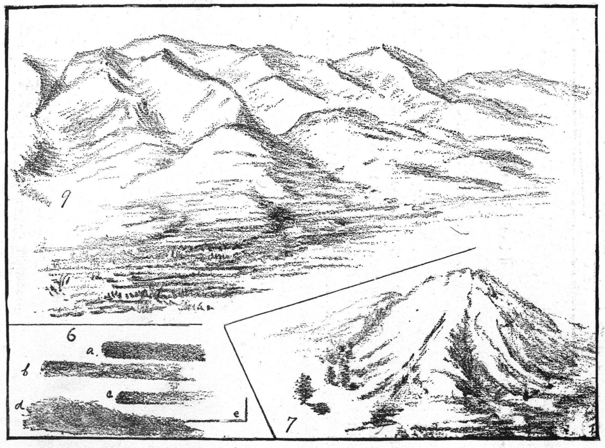
Line represents direction. When applied to surface
we understand it to indicate horizontal, vertical, oblique,
and curved surface directions. Try it and see if it is not
true that lines in one direction never indicate any other
direction; the vertical can never be mistaken for the
horizontal, or the reverse. For the representation of a
level plain, make simple strokes in the horizontal direction
with the side of the crayon, and to represent a vertical
surface as a cliff, make a stroke in the vertical direction
with the same broad side of the crayon. Oblique surfaces,
as slopes, are to be drawn with oblique strokes, and curved
surfaces like rounded hills, represented by continuous
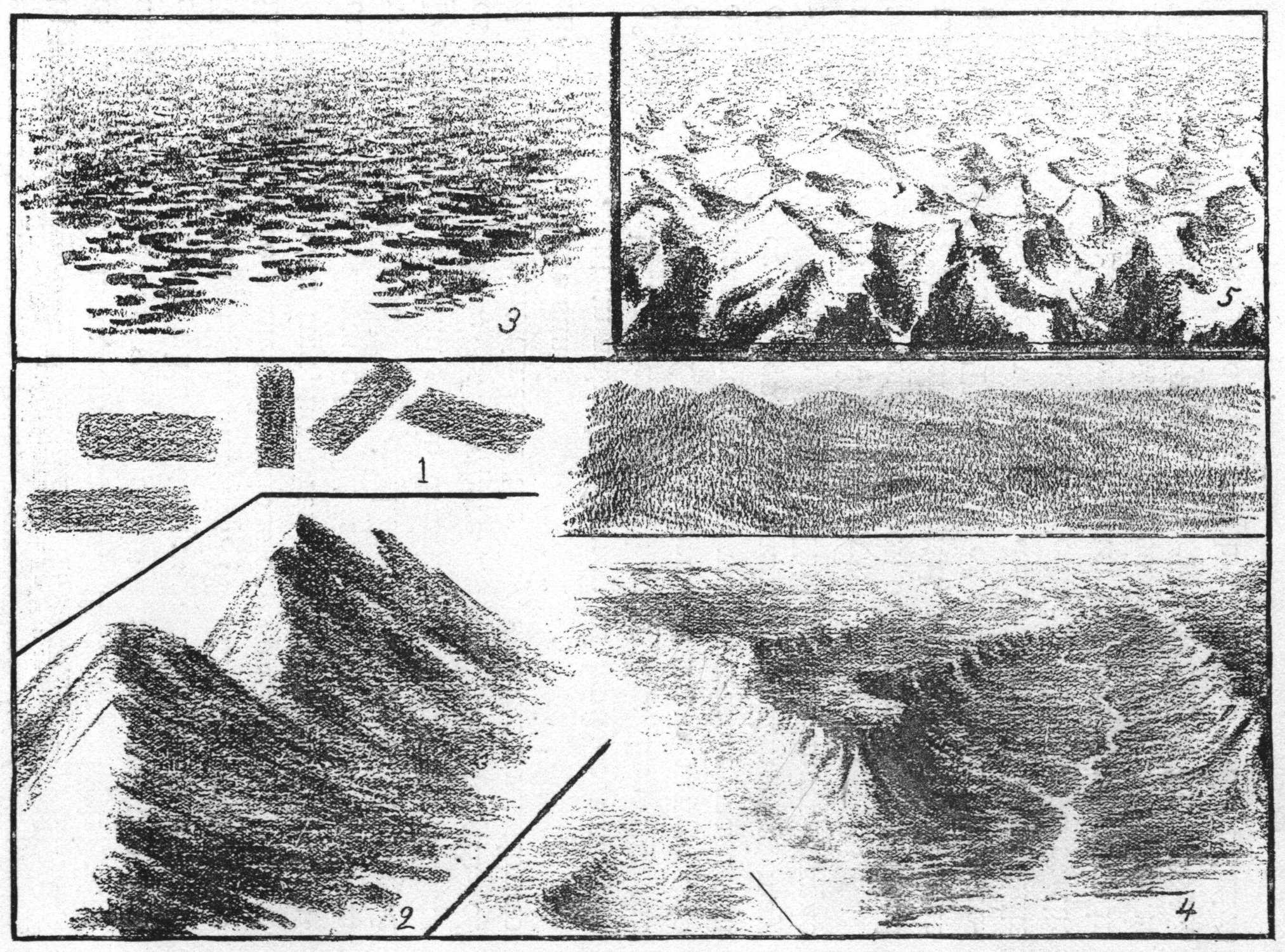
upward and downward strokes. (See Fig. 1.) In the
delineation of mountain masses, that are high with
abrupt declivities as well as gradual slopes, we use the
side of the crayon with an oblique stroke as in Fig. 2.
We see then that right direction of lines of themselves
illustrate surface planes, elevations or depressions.
1 2 3 4 5
Detail of structure, however, cannot be well brought
out except by effects of light and shade. Choose from
which direction your map or sketch is to be lighted, and
keep it always in mind while drawing. Study the effects
of light and shade everywhere. Note the length of
shadows at different times of the day, and their relation to
the position of the sun.
To represent an unbroken sweep of land or water, as
of a plain or lake, draw a broad unbroken line for the
distance, as all detail of surface forms seems to merge into
one horizontal mass; nearer to us, we perceive more detail
of landscape or broken land surface, which we may
represent with broken lines. This is the most simple
representation of level distance. (Note Fig. 3.)
In Fig. 4, or the representation of a plateau (upraised
mass of land), there are horizontal, vertical, and oblique
surfaces combined. The detail of structure in the foreground
is represented with some definiteness of line, while
the mountain slopes are quite indefinite. Notice that the
oblique and vertical lines are shorter in the distance than in
the foreground, and that the land seems to rise as it recedes
from us. Look out of doors and see if it is not so. Notice
rows of trees, houses, or telegraph poles, in their relative
height, also in their relation to the ground on which they
stand.
In the delineation of a valley between parallel mountain
ranges, keep in mind the proportionate height of
mountains to width of valley; for example, think of the
apparent width of street or railroad track at the farther
end, in comparison with the width of the same close by
you, and also notice that it decreases in definiteness as it
recedes into the distance. Note the width of the valley in
Fig. 4.
Fig. 5 represents land sloping from us as it recedes.
Note the more definite lines in the foreground, indicating
some detail of structure, and the indefiniteness, or less
distinct lines that indicate the distant hills, these lines
becoming more and more indistinct as the hills recede.
6 7 9
LAND SLOPING TOWARDS THE OBSERVER. QUALITY OF LINE. RELATIONS.
Each line drawn has its own characteristic meaning—its
own individuality, so to speak. It not only represents
direction, but carries with it a certain quality of effort or
mentality, as indecision, fear, courage, certainty. (See
Fig. 6, a.b.c.) We also see in it the habitual mental attitude
of the delineator. This is plainly seen in the quality
of line used by the timid, contrasted with that of the fearless—by
the unstable or changeable mind in contrast to
one who is clear in his thought (who “knows his own
mind”) and positive in his expression. (d.c.e.)
It follows, then, that to draw a firm line with ease and
rapidity, one must have a positive knowledge of what one
desires to express, just the length of the line and its relation
to all other lines; that is, one must see things or
objects in their right relations. All things in the universe
are related to each other—nothing stands alone. The
mountain is closely related to the valley, it has given of
its substance to build and enrich the latter, and its streams
have carried nourishment to help swell the river at its base.
In its delineation, therefore, one must keep in mind
the relation of its height to the width of the valley, and
to the plateau on which it may stand; the declivity of its
slopes, and their relation to the vertical direction, which
may be seen as an imaginary line drawn from the center
of the base to the zenith.
8 10
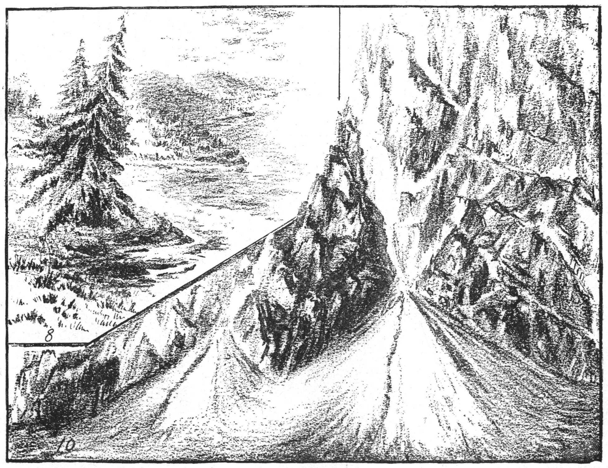
The trees beside the hill in Fig. 7 show the latter to
be very high. In Fig. 8 the hill becomes low because of
the relation of its altitude to the height of the trees in the
foreground.
The delineation of more or less detail also helps to
determine altitudes; as, to draw grasses, boulders or out-cropping
rocks on the hill side, would show that we were
near enough to the hill or knoll to see them in detail. Hills
in the far distance would be represented without much detail,
for they are too far away naturally for us to observe it.
To represent land sloping towards us as in Figs. 7, 9,
and 10, the foreground must be broken up, that is, represented
in more or less of structure detail. Fig. 9 shows
low hills at the foot of the mountain range sloping toward
the level land in the immediate foreground. Fig. 10 a
steep alluvial fan indicating the nature and character of its
structure by the direction and quality of line used. The
crumbling sandstone rock, showing the effects of weathering,
is indicated by short nearly vertical strokes, with the
thought of stratification also in mind. The flowing sand is
represented by vertical and oblique lines drawn in the
direction in which sand would naturally flow. We have
here three examples of land sloping towards us. One
represented by nearly horizontal lines, the others by
vertical or oblique lines. Grasses grow many blades
from one root. Their tendency may be vertical but many
influences combine to turn them from that direction. Use
an edge of the chalk with an upward or downward motion.
Knolls of any contour may be represented by drawing
grasses in the direction of the slopes as in Fig. 8.
11 12 13 14
HIGH AND LOW WATER-PARTINGS WITH MAP.
If your subject “possesses” you, there will be no
need of giving special thought to effects or results; these
will follow naturally from the state or quality of feeling
engendered in your mind by its contemplation; that is, if
one part of the surface to be represented is hard and rocky,
and another soft and yielding, and you have observed this
fact in relation to the whole, you will naturally show it in
the quality of line you use. No other hints can be given
that will help you so readily to the artistic touch as this,
together with the hints given in our last lesson as to the
necessity of an adequate knowledge of form and of
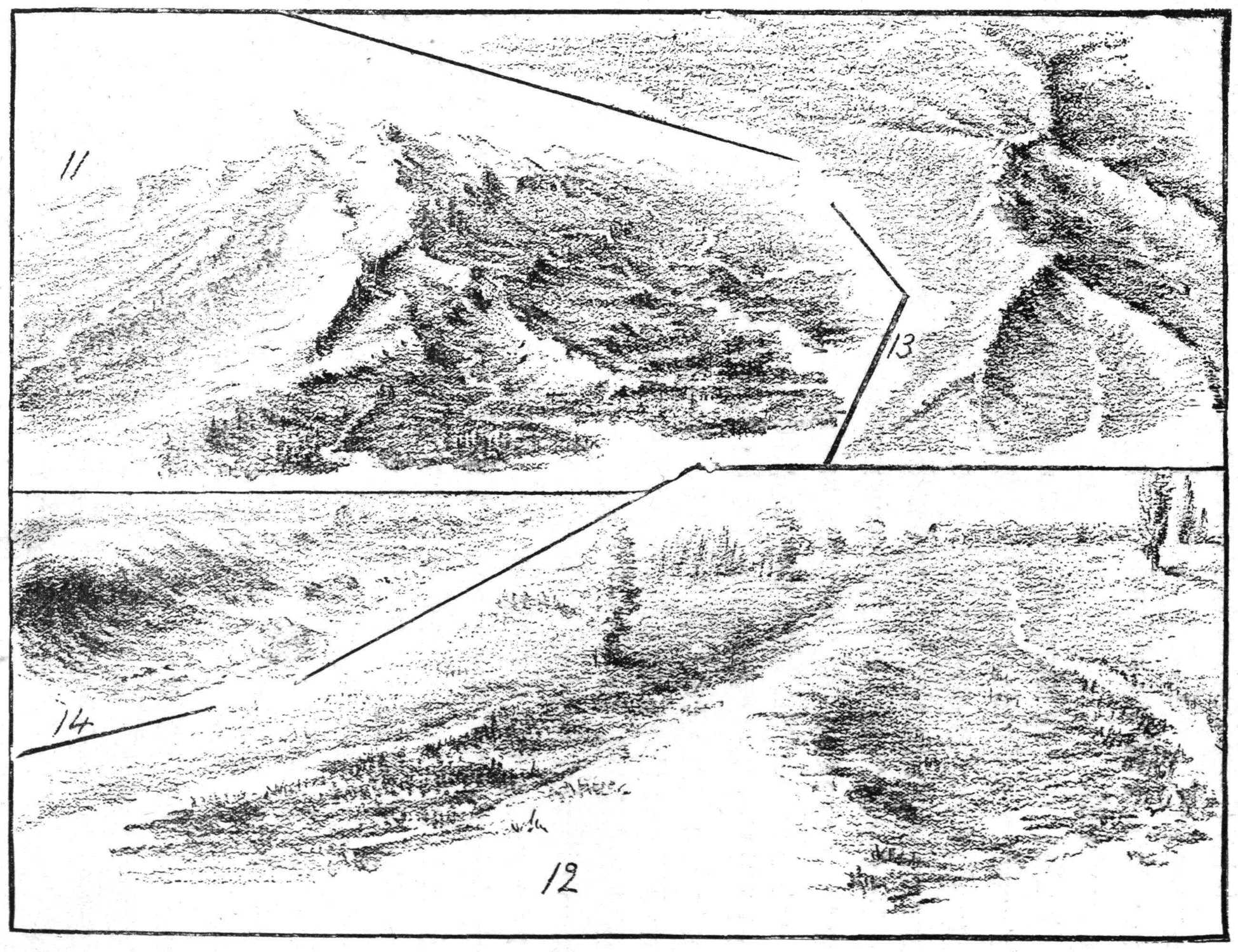
relationships or proportions. Fig. 11. A water-parting
high and mountainous. It shows its rocky structure in the
harsh and “liney” quality of the work as well as in the
surface contour. The paper is left white for the streams
of water. On the blackboard, when drawing maps with
chalk, use charcoal for the rivers, as in the rapid delineation
of such maps it takes too much time to save spaces for
them; and at the best it is such an exaggeration of the
width of streams, that it misleads the pupil.
Fig. 12 represents a low water-parting. Notice the
texture of line, soft and yielding, produced by thinking,
knowing and feeling that the surface was not rocky, but a
somewhat sandy soil, mixed with a little loam.
Perspective is shown by less of detail in the distance
than in the foreground; the trees in the latter being more
accurately drawn, as well as taller. The poplars at the
right of the picture also show that the ground is a little
uneven, as the distant ones seem to be partially below a
slight rise in the surface. Fig. 13 is a map or bird’s eye
view of a height of land worn down by streams running
in different directions, leaving the water-parting sharply
defined.
A little sketch of the sea shore (Fig. 14) illustrates
another quality of “touch.” In depicting water rolling
irresistibly on, a mighty force dashing against the shore
and breaking into showers of spray, you will naturally use
a steady, forceful but light touch in indicating its curves
and masses. “Feeling” and “touch” are something to be
experienced and not taught mechanically.
15 16 17 18 19
MEETING OF WATER AND LAND. LAKES, SPRINGS, ISLANDS. HIGH AND LOW TIDE.
The artistic appeals to the higher or finer qualities of
our nature, and to be artistic is to show forth or make
visible these qualities. Work which is truly artistic can
only be produced when we are in such harmony with our
subject that these qualities predominate. These truths are
so important that I ask you to experiment and discover
them for yourselves. How will you get the “atmospheric”
effect unless you realize that a certain volume of atmosphere
is between you and the distant object? How will
you keep true values unless you see truly (correctly)? In
all drawing of any special subject it should be the aim to
keep everything subordinated to the main point of interest,
just as in writing you make every word or sentence bear
upon the main point of your theme or your argument.
The meeting of land and water can never be represented
by a continuous line; as line indicates direction of
surface, and as the surface planes of both land and water
are continually changing, the direction of line is changing
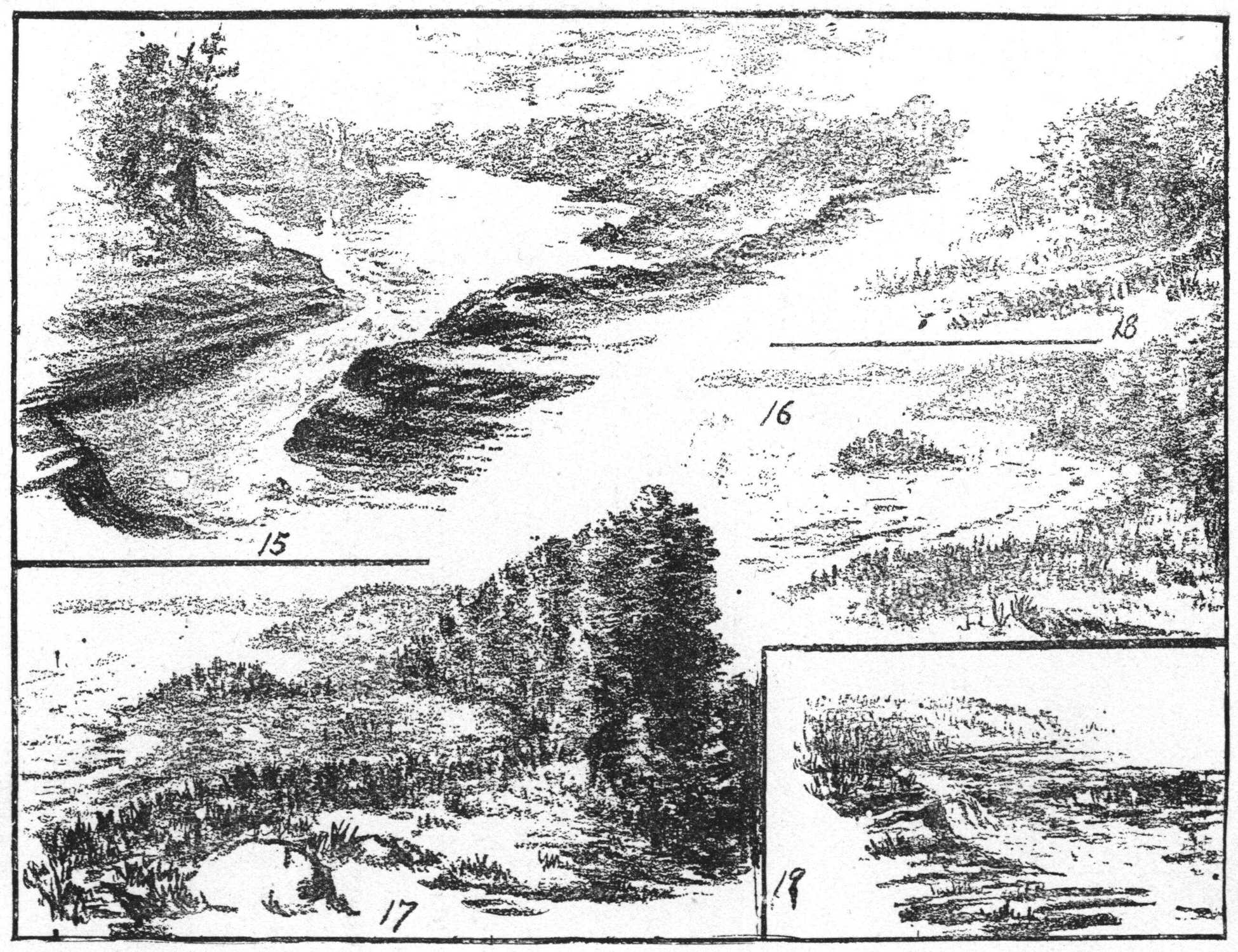
or being broken, even if on the same general plane. Fig.
15 (a lake among the hills) shows the horizontal plane of
water surface meeting the oblique surface of land. Where
the water falls over the rock, the oblique and curved lines
used are broken, to represent the nature of the rock underneath.
Notice that the depth of each little fall corresponds
with the stratification of rock. The water, as it recedes,
lies level, also. You will have no difficulty in drawing
ponds and lakes, if you think of the farther shores as less
distinct, and the waves, although rough and broken in
the foreground, as merged and blended together in the
distance.
20 21 22 23 24
Figs. 16 and 17 are high and low tide on the Piscataqua
River. (The ocean tides flow in for miles up the
river.) These illustrations show the broken, or short,
nearly horizontal lines used to indicate the tops of the little
waves and ripples in the foreground. As the water lowers
a little in the river, the island (Fig. 16) is seen, connected
with the mainland by an isthmus, or narrow neck of land;
and in Fig. 17 it is seen as a part of the mainland. Figs.
18 and 19 are springs flowing out from hillsides. Notice
the relation the grasses and rock bear to the water. Fig.
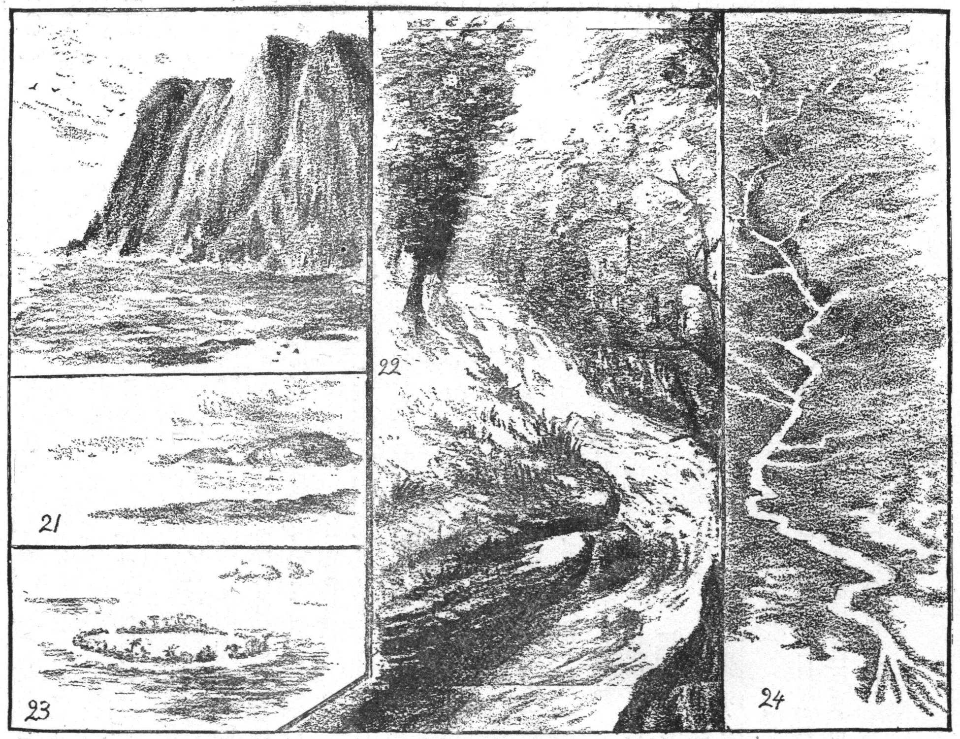
20 represents North Cape; Fig. 23, a coral island: both
show water in active motion, compared with that in Fig.
15, and with Fig. 21 (a rocky island). Fig. 22 shows
rapids in a New England stream. Notice the velocity and
volume of water. Fig. 24 is a map of the Mississippi
River. The upper part of the map is drawn without any
lines between river and land. The lower half has a line
drawn close to the edge of the water, to indicate the levees,
which are necessary in that region, to prevent inundation.
For a map of continental islands and drowned valleys, see
map of the fiord coast of Alaska, in the Introduction.
SKETCHES ILLUSTRATIVE OF WIND AND WATER EROSION.
All who will may learn to draw. It is that which we
most earnestly desire to do, that is accomplished in every
department of effort. All lesser interests will give place
to that which we consider of the greatest importance.
Therefore if we as teachers recognize the value of the habit
of sketching before our classes and greatly desire to be able
to draw with ease and rapidity, we will put ourselves into
right relationship to the work, and will undoubtedly
acquire the desired skill.
We have been observing all our lives; we have made
careful observations of many details of form and color,
perhaps, and close investigation of structure, but we have
not analyzed them into terms of drawing. We have not
been looking for the planes of surface, or the relative
proportions of parts, or for distance or foreground. Now,
however, with the desire to be able to sketch readily, we
will observe the object or landscape for that special
purpose. One sketch will represent only what has been
observed by looking in one direction without turning the
head. The most interesting point of the view will be that
at which one looks directly, and consequently it will be
the most important part of the sketch with every other
part subordinated to it.
25 26 27 28 29
In out of door sketching it will be necessary to
eliminate much that is seen, only drawing that which is
chosen to be the vital or interesting part of the picture,
with that which modifies, or is necessary to show it in its
completeness. Select your point of view, standing at such
a distance that all you care to study may be comprehended
in a glance.
30
Note the relation of earth to sky, and of trees to hills,
streams, or other objects to be included in the sketch. As
a help to find the true direction compare the surface planes
and edges with that which you know is vertical. Study
the light and shade, choose the simple broad tones which
will best express distance, middle ground and near details.
Work simply and easily, not straining after certain preconceived
effects. It is this particular truth or fact which
now appeals to you, which you are to express, and do not
hesitate to express it freely and boldly. Sketch everything,
anything, no matter how complicated it may seem to be,
and sketch often. The child does that, and learns to draw
by drawing.
31
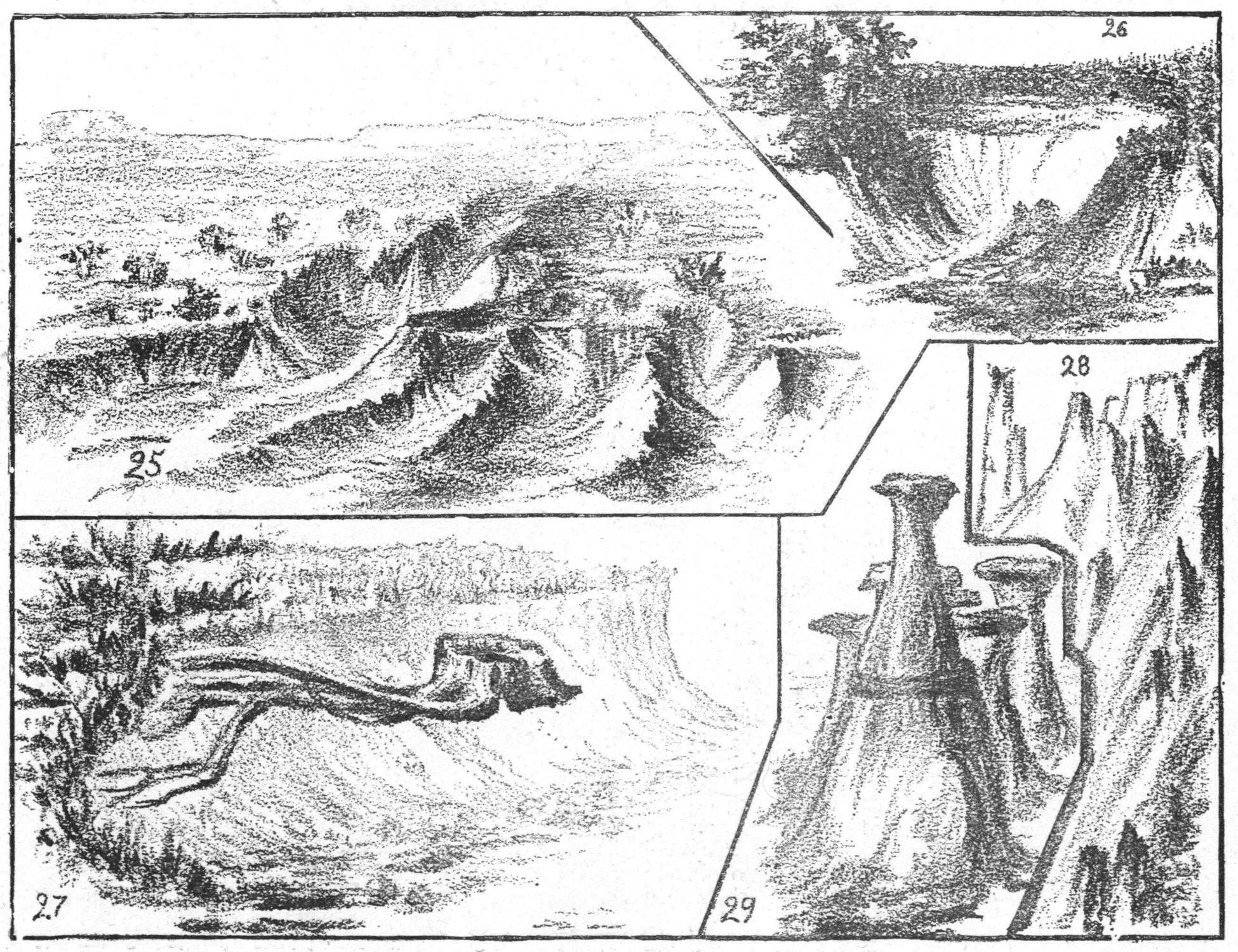
Fig. 25 shows the edge of a desert in Wyoming
Territory, where the only vegetation is sage brush. The
rains have worn a little gully in the general sandy level.
Notice the steep slant of the sandy sides. Fig. 26 is a
sketch of a hole in the sandy soil of a farm, on the banks of
the Au Sable River, New York. It was first worn by the
rains as a little gully on the upper edge of the bank, and
with every rain-storm more sand was washed out and
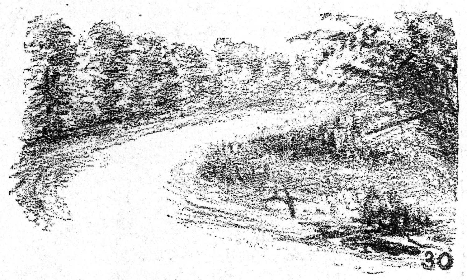
carried down into the river. A part of this is deposited
lower down the river, below the bank on the right, in the
sketch Fig. 30.
32
Use horizontal lines for the sandy level, and curved
lines to indicate the slow current in the water. Fig. 27
also shows the result of rain and wind erosion of the bank
behind the stump of the tree. Fig. 28 represents a section
of Yellowstone cañon, and Fig. 29 is a sketch from
Monument Park, Colorado. In both the latter are seen
examples of rain and wind erosion, more particularly in
Fig. 29. Notice the hard layers of rock that cap and protect
the softer sandstone beneath, and the hard pinnacles
that jut out from among the sliding sands in Fig. 28.
33
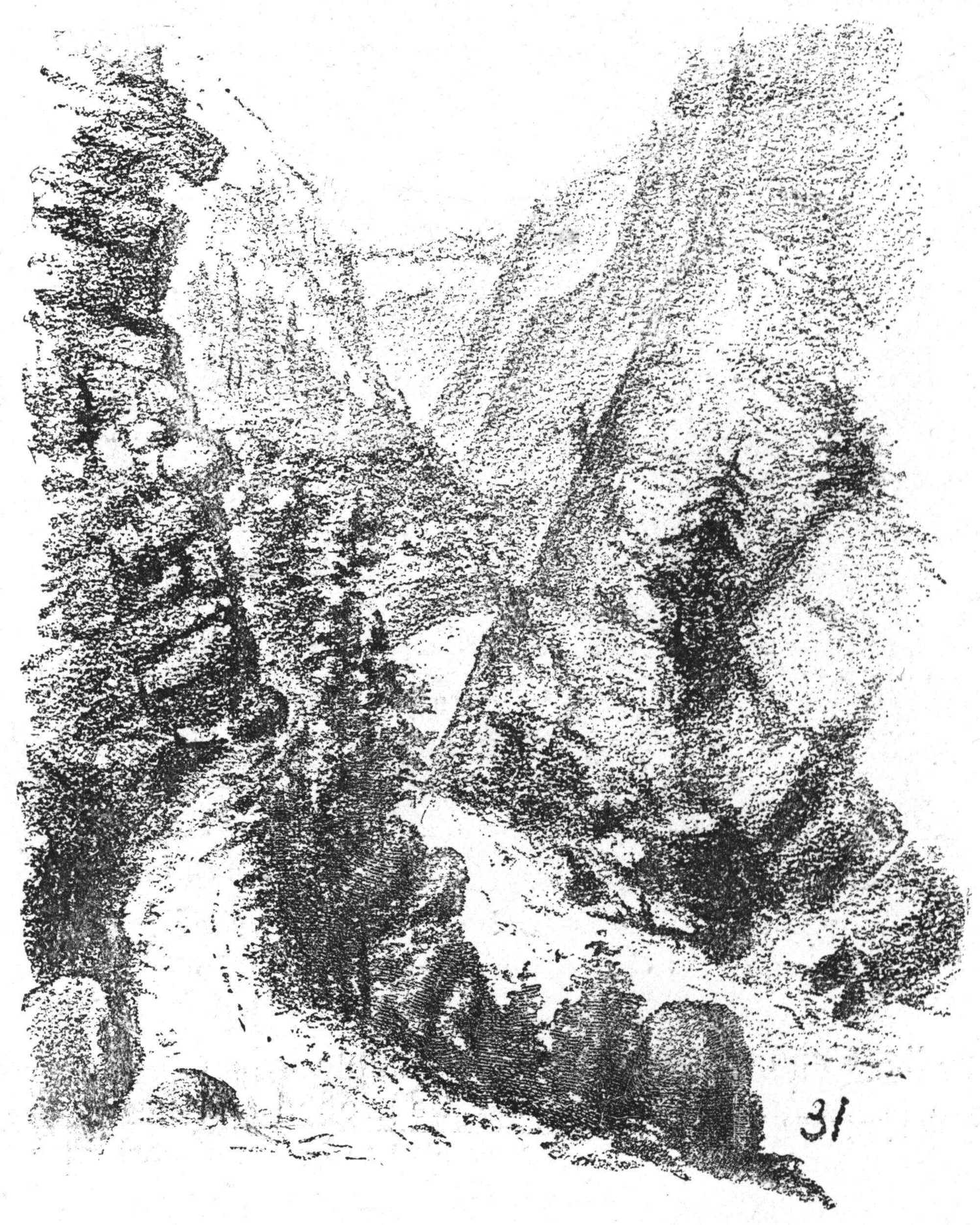
The effects of river erosion, together with the weathering
of rocks are seen in Fig. 31, which is a sketch of a
section of Wilmington Pass, in the Adirondacks. The
precipitous sides of rock, are shown with evergreens
growing wherever they can find a foothold in the soil
made by the disintegration of the rocks above. Boulders
and trees have been brought down by the loosening of
masses of rock, through the action of frost, heat, and
melted snow, causing obstructions in the stream, over and
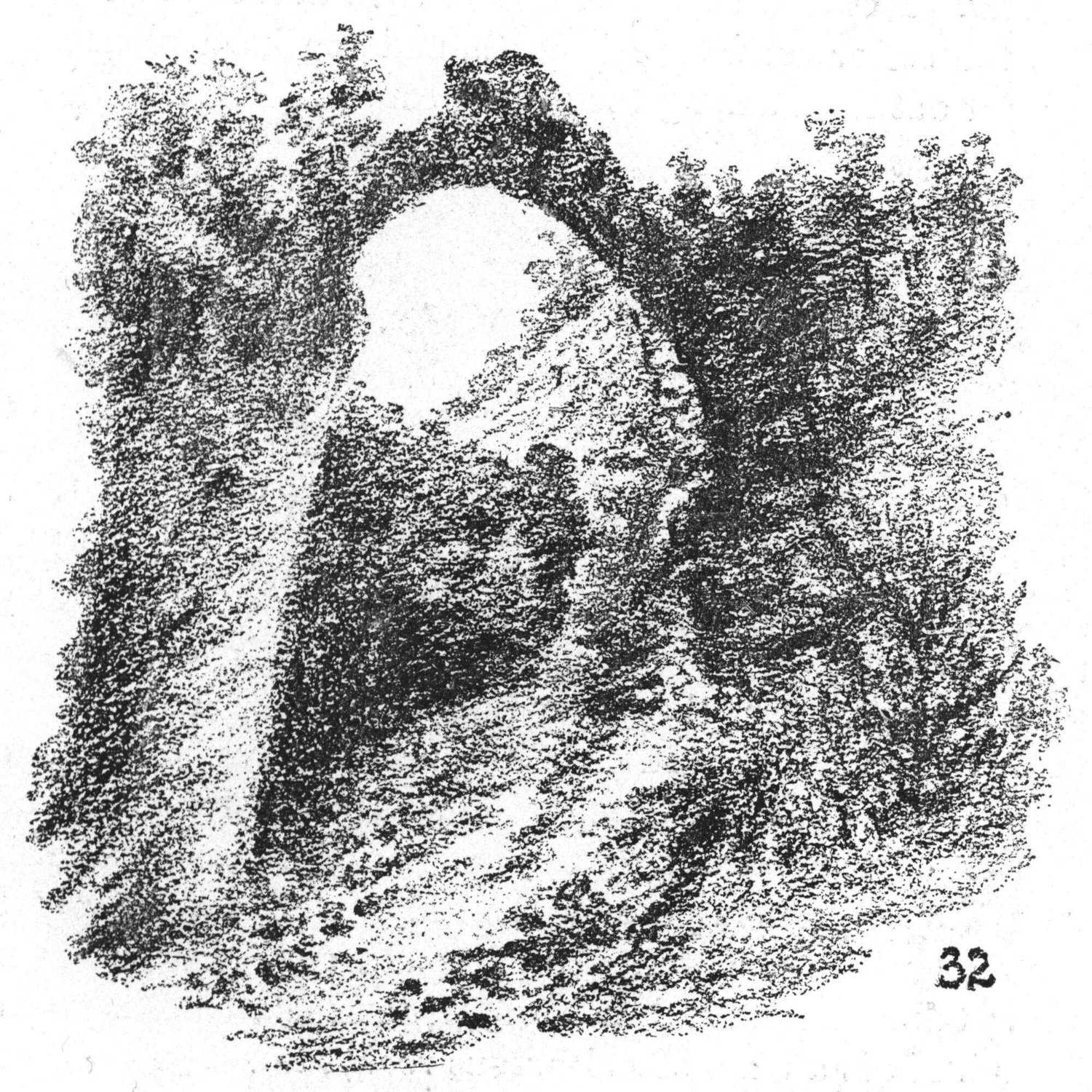
between which the waters tumble and roll. Fig. 32 is a
view taken from the beach of Arch Rock, at Mackinac
Island. It is a mass of calcareous rock, showing the result
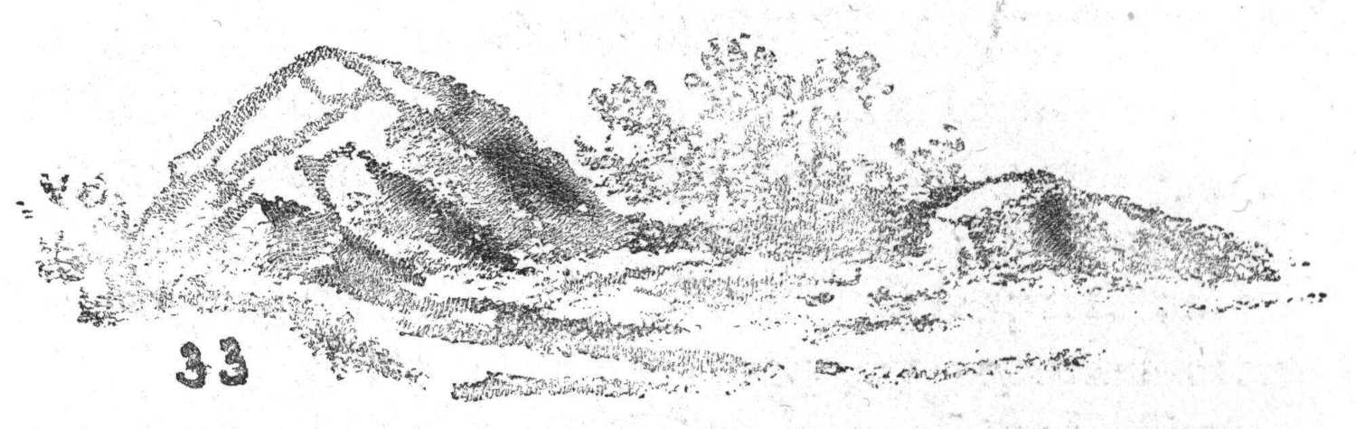
of lake erosion and weathering. The rock in Fig. 33
shows signs of disintegration from the action of wind and
rain.
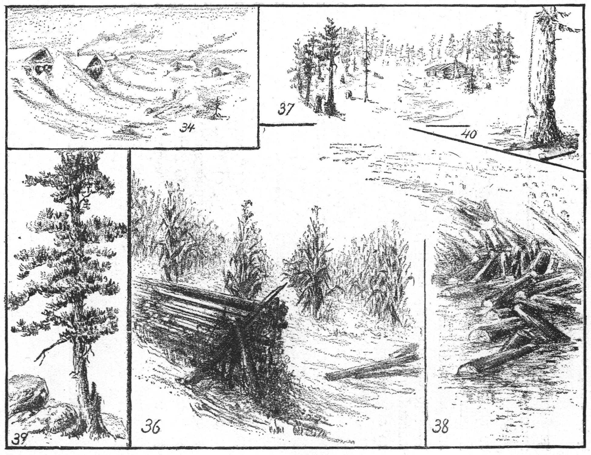
34 36 37 38 39 40
SCENES TYPICAL OF THE DIFFERENT ZONES.
Take the children into your confidence: that is, cause
them to feel that you are not sketching for their amusement
or for their admiration, but are trying to help them to a
better understanding of the subject. They will appreciate
your motive and be stimulated to increase their own efforts.
With every attempt to sketch on your part, additional
skill will be acquired, for it is only by repeated attempts
that progress is made. By such continued efforts you
not only gain the power to express the knowledge you
have, but are led to see wherein you are deficient and
require closer study of your subject. When we try to
express our knowledge of a subject by drawing, we are
often greatly surprised to find how little we know of it. It
is the same with writing or speaking. Our knowledge or
ideas of a subject should be arranged in orderly sequence,
so logical and clearly defined, that we shall not be obliged
to go back and modify or correct any part of our
expression. Such corrections in connection with drawing
destroy that pleasing quality which marks a sketch as
“artistic.” The teacher who appreciates the importance of
forming correct mental habits, will encourage in his pupils
the practice of accurate and thorough study of a subject,
before any attempts at expression are made.
35 42 43 44 45 46 47
In drawing from your imaginary picture, look at it
closely and carefully. Clear it up, classify its component
parts into primary and secondary, that is, decide which is
the most important and interesting part of the whole, and
to what degree the other parts are to be subordinated to
that, then analyze it into terms of drawing, i.e., vertical,
horizontal, etc.
In the scenes given in this lesson as typical of the
different zones of climate, some of the primary features
were gained through observation, some through pictures
supplemented by reading. Many of the sketches illustrating
the other lessons, as well as those in the Introduction,
will also give suggestions for this lesson, such as the
illustrations on Alaska, India, and the continents. These
need not be duplicated here.
In the scene from Siberia (Fig. 34), and in that of the
dunes in the Sahara desert (Fig. 35), notice the form of
both snow and sand drifts—their sharp edges and short and
long slopes. The corn-field in northern New York (Fig.
36), illustrates the law of receding parallel lines—that
they appear to converge as they recede, and if extended
far enough, would seem to meet at a point on the horizon
(the “point of sight”), a point immediately opposite the
eye. A line drawn from the top and one from the bottom
of each stalk in the front row, to the point of sight, will
show this. Notice how the stalks in the foreground are
brought out with more prominence than those farther away
and outside of the direct line of vision.
41 48 49
Figs. 37 to 40, inclusive, tell the stories of a lumber
camp (Northern Michigan); logs of cotton-wood floating
out into the Au Sable River (Adirondacks); a scarred and
storm-worn pine tree, also one gashed by the axe of the
wood-cutter. In contrast to the pine, notice the graceful
elm of New England, in Fig. 41, and in Fig. 42, the banana
tree of hot climates. Fig. 43 is a scene typical of the hot
belt (the Amazon region, where there is abundant rainfall),
and Figs. 44 and 45 show an oasis in the desert, also
cactus, as another typical form of vegetation. Fig. 46
represents a rice-field, and Fig. 47 cotton balls and flowers.
Figs. 48 and 49, showing a factory or “mill” in New
England, and the New York State harvest scene, are
typical of the cool belt, or temperate zone.
50 51
RIVER BASINS. COASTS.
Do not copy the sketches given in these lessons.
They are but suggestions to you, who will be able to
express your own thoughts and represent your own mental
pictures better than you can another’s. They are given to
show you that simple sketches will help a child to a clearer
understanding of the subject under consideration. As has
been said elsewhere, all such illustrations should be drawn
as they are needed to illustrate a given point in the
development of a lesson; for they carry more weight
than if sketched beforehand, that is, outside of the class
exercise.
To merely locate in your sketch a house, spring, tree
or man, will often be of great value to the pupil, though
you may feel timid about trying to draw it, or think you
have not the time. The experience of many teachers in
this respect may be illustrated by supposing a case.
A sketch is to be drawn, including the figure of a man,
animal or any object which has been considered difficult
and therefore somewhat avoided.
The teacher, by one or two rapid strokes in the right
direction, indicates the location and movement of this
figure, and proceeds with the lesson without any hesitation
or laborious attempts to really sketch it. The next time it
is necessary to represent it (perhaps in the second or third
lesson), sufficient confidence and skill have been gained to
encourage additional strokes in the development of form,
and every succeeding attempt has resulted in the addition
of details of structure, until almost without knowing it, the
necessary skill has been acquired to make an adequate
sketch. How? By doing, the teacher has been forced to
form the mental picture, which, once acquired, can be
represented, though it may be more or less crudely at first.
52 53 54 55 56
Fig. 50 illustrates the basin of a young river or brook,
with its slopes and system of drainage, just such an one as
may be seen near many country school-houses, and an
exaggerated type, only, of what may be found in the
streets and alleys of the city. Its source (a) is found in a
slight depression which, in the spring or after heavy rains,
becomes a pond, from which its waters overflow and trickle
down through two channels, which they have worn for
themselves. The soil brought down by these rivulets and
others which are tributaries to the main stream, may be
seen deposited at b, c, d, e, as flood plains, islands, and
delta. Notice the cañon cut by one of the tributaries
through the left slope of the basin, and the cascade and
waterfall where the debris brought down at high water has
formed an obstruction. In Fig. 51 is given a typical
Switzerland river basin. Figs. 52 to 55 inclusive, show
ocean wearing and rock weathering. “Hilt Rock” (Fig.
52) shows alternate layers of trap rock and sandstone. In
Fig. 53 (“Point Portal,” Pictured Rocks, Lake Superior),
is seen the effect of wave and wind wearing in soft rock,
and Fig. 54 (“Land’s End,” Cornwall, England), is an
example of wave wearing in hard rock. Fig. 55 (“Giant’s
Cause-way,” Ireland), shows the weathering and wearing
of basaltic rock. Fig. 56 is Eddystone Light-house,
(England).
57 58 59 60
In the drawing of maps, the meeting of land and
water can be as accurately drawn by the new method as by
the old. The following sketches illustrate the fact that
it is not necessary to use any line running contrary to the
general direction of surface, in order to represent any
contour of coast.
Figs. 57 to 60 are imaginary bird’s-eye views of coasts.
Fig. 57 shows a stretch of level land at the coast, with
broken or hilly land between it and the distant higher hills
or mountains: the latter being merely suggested in the
representation. A stream winds its way through the low
land to the ocean, where the silt which it has brought
down and the sands which have been washed up by the
sea, form a delta and sand-bars. Fig. 60 shows drowned
valleys, fiord coasts, and continental islands.
SUGGESTIONS ON THE USE OF THE CHALK MODELED MAP OF NORTH AMERICA IN FOURTH AND FIFTH GRADES.
It is hoped that these suggestions will aid many
teachers to realize that the Chalk Modeled maps signify
much more than the simple fact of high and low land, or a
representation of structural relief: that from them, together
with suitable pictures showing typical scenes in different
parts of the world, such valuable knowledge of the real
surface of the earth may be gained by the pupil, as will
enable him to appreciate the important relation sustained
by man to his environment, and also to his fellow man.
Previous to the study of the map of North America,
the pupil may be led to imagine the character of the
country to the north, south, east and west of his own
locality. He may travel in imagination across the continent
to either ocean, and may study different sections of
the country through pictures and from oral and written
descriptions. Such sections should also be chalk modeled,
showing the plateaus, mountain ranges, plains, valleys, arid
and fertile regions.
These drawings should be large, sometimes extending
the whole length of the blackboard from left to right, and
drawn in a semi-conventionalized manner, that is, in a style
that combines both landscape, and map drawing. This is
an essential link between the two and should play an
important part in the development of continental picturing:
the motive being (in all this) to have the pupil mentally
image the real continent, before the map or symbol is
presented to him. With such preparation, when the chalk
modeled map is placed before him he readily reads its
surface contour.
He notes the great highlands, plateaus, and mountains,
the plains, valleys, slopes, river basins, lakes and rivers.
He is then led to infer the character of soil, climate
and vegetation—everything, indeed, that relates to man’s
environment.
He is asked to locate the great forest regions that
furnish material for shelter and articles of household use;
to point out the areas best adapted to the growth of
different kinds of food-plants, and also those that furnish
material for clothing; to indicate the grazing lands where
herds of cattle feed; the mining regions, where coal for
fuel, iron, copper, silver, gold, and other valuable metals
and minerals are found.
Information necessary to inferences is given at the
moment required, such as altitudes, horizontal distances,
latitude, etc. The pupil is also encouraged to read and
acquire knowledge upon certain points for himself, that he
may bring it to the class for the benefit of others.
(The following questions may have some value to the
teacher in the further study of the map, but should by no
means be used as a set form or method of questioning.
They are only suggestions, given to those who may need
them in assisting the pupil to think and reason for
himself.)
His attention may be called to the triangular shape of
the land mass, with its greatest elevation in the west. He
may be told that its length is 5,700 and its greatest width
3,000 miles.
Questions may then be asked as follows: Into how
many slopes or great drainage systems is the continent
divided? Into what ocean do the waters of the long slope
flow? Those of the short slope? Locate and give general
direction of the continental axis. Trace this from Behring
Strait to Isthmus of Panama.
Compare its length with greatest width of continent.
Compare length of long slope (2,200 miles) with length of
short slope (500 to 700 miles). Which slope has the
longer coast-line? Mold in sand and chalk model,
showing the two slopes and continental axis. Compare
surface of both slopes. Which has the greater area of
highlands? Which of plains? Give number and comparative
size of lakes. Compare length and direction of rivers
on each slope. What is the character of the coasts and
harbors? What of the islands? Which slope has the
larger inland drainage system? Compare with oceanic
drainage system.
Locate highlands of each slope. Give the appearance
of the Appalachian Mountain System. Compare with the
Rocky Mountain System. What can be learned as to the
general formation and altitude of each slope? (Show
typical pictures.) What is the effect of altitude upon the
surrounding country? What on drainage? What is the
effect of large rivers upon plateaus?
Locate great central valley of North America. What
two great rivers flow through this valley? Trace the
Mississippi River from its source to its mouth. Trace
the Mackenzie River in the same way. What separates
the Mississippi basin from the Mackenzie basin? From the
Saskatchawan basin? Trace lowest line from the mouth
of the Mississippi to the mouth of the Mackenzie. Into
what does this line divide the continent? (Into two land
masses.)
Compare these two. In which is the continental axis?
(In the primary land mass.) The secondary land mass is
divided by the Appalachian Mountain System into two
slopes, of which the eastern is called the Atlantic slope.
Compare these slopes. Where do the Appalachian Mountains
begin? (In the St. Lawrence basin.) Nearly to
what gulf do they extend? (Gulf of Mexico.) What is
their direction? What separates the secondary land mass
into two parts—northern and southern? (The St. Lawrence
River.) The northern part is the peninsula of
Labrador. In this part trace the water partings of the
Hudson Bay river system.
In the primary land mass two immense mountain
ranges extend over 5,000 miles—nearly the entire length
of the continent. What are these mountains called?
Compare their general altitude with the low range of
mountains (100 feet high) crossing the Isthmus of Panama.
How wide is this Isthmus? (Fifty miles from coast to
coast.)
What is known about a certain canal which has been
begun in Panama? Is there any other important canal in
Central America?
Commencing in the southern part of Mexico, and
extending northerly and westerly, two great ranges bound
the great plateau of Mexico on the east and west. This
plateau is divided by the Rio Grande, Colorado, and other
rivers, at a distance of about 500 miles north. The
southern part of it is a volcanic region, in which are
Popocatapetl and other high mountains.
What can be told about the Colorado River? (Show
pictures of structure, also of ancient cliff dwellings.)
What is the character of the rock through which the river
cuts? Is it in the region of much rainfall or of no rainfall?
North of the great plateau is the great basin, 600 miles
wide and 900 miles from north to south, enclosed by the
Sierra Nevada, Wasatch and Rocky Mountains.
What is the character of the large lake found here?
Of what was it once a part? (Tell of old Lake Bonneville,
and the terraces which record the height of its ancient
waters, high up on the mountain sides, at the east of Salt
Lake. Show pictures of structure of country and the
effect of irrigation on the barren soil.)
What low range of mountains west of the Sierra
Nevada range? Describe the beautiful valley lying between
these ranges. Why is it fertile? What are its
products? Describe the great red-wood trees.
What peninsula south of this is formed by the union
of these two ranges? Locate Mt. Shasta, 14,442 feet high,
in the Cascade range (a part of Sierra Nevada), just north
of the California valley; also Mts. Tacoma, Hood, and
Ranier, in the same range. Find Mt. St. Elias, in Alaska—the
highest peak in North America, being 19,500 feet
above sea level. (Show pictures of these mountains. Tell
stories of Alaskan Indians.)
Yellowstone Park is in the Rocky Mountain range,
east and north of Mt. Shasta. What do you know of this
wonderful park? (Sketch geysers of Yellowstone Park.)
Can the prevailing wind of the Pacific slope be confidently
stated? What of the Atlantic slope? Compare the
number and character of rivers, also the coastal planes of
these two slopes.
What relation has the structure of a region to the
amount of rainfall? Locate the region of greatest rainfall
on the continent; also the region of no rainfall, or desert
region. Compare with the rainfall of the home region. (Let
the pupils chalk model the map again, showing the depressed
axis, great plateau and mountain ranges: also indicating
the character of coasts, whether high or low, and stating
whether they are building or wearing coasts, and why.)
Name the river basins of each slope. Locate the
basin of the Mississippi River, and trace its water partings.
Give the general direction of the river and the reason for
its flowing in this direction.
What great rivers are in the right slope of this basin?
Which is the largest river? Why are the waters of the
Missouri River colored? Which is the largest river in
the left slope? Compare the two slopes. Which is the
higher? Which has the greater number of river basins?
Locate the Ozark Mountains. Are there any lakes in this
basin? In which course of the river are the waterfalls
or cascades found? (Show pictures of St. Anthony and
Minnehaha Falls.)
What is the length of the Mississippi River in a direct
line? (1,275 miles, while the length by water way is 3,160
miles.) What is to be inferred from these data as to the
course of the river? What as to the slope of the land and
the character of the soil? What must be the effect on
navigation and commerce? In which course, upper,
middle, or lower, are most of the windings? (Tell of the
levees built to prevent the river from overflowing its banks.)
(The total length of the line of embankments, including
those on both sides of the river and its tributaries, is
42,500 miles.)
At what rate is the river lowering the continent?
(Enough sediment is annually carried down to cover
twelve miles square of surface one foot deep.)
Where is the soil being deposited? How far is the
river navigable? What canal is being dug to connect its
waters with those of Lake Michigan? Consider the effect
of this great work on the commerce of Chicago. What is
the temperature in the northern part of the Mississippi
River basin? What is the character of its vegetation?
Compare these with those of the southern part. Where
is the greatest rainfall? What besides fertile soil and
abundant rainfall, is necessary to insure luxuriant vegetation?
Name some fruits characteristic of the northern part
of the basin, also of the southern part.
Locate areas of land best adapted to the growing of
food plants; as grain, including rice; potatoes and sugar-cane;
also those best for grazing purposes; the raising of
cattle, sheep, etc. What plants produce materials for the
manufacture of clothing? What areas are especially suitable
to the growth of cotton? What to the growth of
flax and hemp? Locate coal mines, and other mining
districts; also lumber regions.
Where are the largest cities situated? Why are
they thus located? What localities are best adapted to
manufacturing purposes? Which to commerce? Interest
the children in the discovery of the “great river.” Read
accounts of Joliet’s and Marquette’s discoveries in 1673,
also LaSalle’s discovery of its mouth in 1682.
Study the history of the early colonists and show the
relation of their environment to their social and political
development.
The further study of history will require a constant
review of the geographical features of the continent, and
will show their relation to the political divisions. These
may be marked off upon the map with red chalk at the
proper time.
In a similar manner each river basin of the continent
may be studied separately, and the Hudson Bay basin.
Compare the Atlantic and the Pacific, river basin systems,
also Alabama and Texas systems of river basins.
Review the whole continent. See where the boundaries
of all natural divisions coincide with the political
divisions. Draw the continent, and mark all the large
political divisions on the map. Add, also, the continental
islands. How were these formed? What is a political
division? What is its use? Mention the government of
each division of the continent.
As the study of other continents are taken up, they
may be compared with this one, and with each other, in
regard to resemblances and differences.
61
MAP OF NORTH AMERICA.
It is supposed that in the course of their study, the
pupils have been in the habit of modeling in sand and chalk
modeling on the blackboard at every step of the way.
It may now be found that they are prepared to represent
the entire continent, first in two slopes, again in land
masses, and then as an aggregation of river basins, as
suggested in the last lesson.
Such a development of the map is illustrated in the
present lesson by four stages of chalk modeling. The first
stage is represented in Fig. 61. It shows the continent of
North America in two great slopes, one long one sloping to
the east, and a short one sloping to the west, from the
line of meeting of their upper edges, or what has been
termed the Continental Axis.
Fig. 62 represents the continent as sketched after a
study of it as simple land masses—a primary land mass,
and a secondary land mass, with the line of depression
at the meeting of the two opposing slopes. This line
is indicated by lines slanting downwards towards the
depressed axis.
62
The primary land mass is represented as one continuous
unbroken land mass extending from the Isthmus of
Panama to Behring Strait, and is itself divided into two
main slopes. The secondary land mass is likewise divided
into two slopes; it is also separated by the St. Lawrence
River basin into two parts, viz., the northern or Labrador
land mass, and the southern or Appalachian land mass.
Fig. 63 is drawn to represent the drainage, or principal
river basins; as, the Mississippi, Mackenzie, St. Lawrence,
and Saskatchawan basins, and the Hudson Bay river
system. In drawing small maps on paper it is necessary
to trace the rivers with a fine pencil point. For very large
maps, four of five feet long, spaces may be left, but great
care should be taken to keep them as narrow as possible,
so as not to exaggerate the width of the rivers more than
is necessary. Fig. 64 is drawn in more detail and the
great political divisions are marked upon it. On the blackboard
map these divisions may be marked with colored
chalk, and should follow the contour of the surface as
closely as possible.
For the teacher who wishes to rapidly chalk model a
map for immediate use in the class, the following hints may
be of service:
Plan to draw the continent in its proper proportions
within a given space. Imagine that you see it as already
drawn. Commence with the region best known or understood,
and draw as you mentally travel, to the north, south,
east or west. It may be that you will begin with the great
depressed regions, in which case draw the ascending slopes
and crowning altitudes as you mentally picture; or if the
great highlands or water partings are fixed upon as a
starting-point, the descending slopes should be drawn to
the line of meeting of other slopes, or to the sea level.
Break the line to indicate broken or uneven surface.
You will do this naturally, however, if you have in mind
the picture of a broken surface.
63
Keep the river basins definitely in mind, and the
character of streams and rivers: the character also of the
land structure; whether it is rocky or alluvial; sharp or
hard, or soft and yielding. Knowing that line represents
direction, and having a clear and distinct picture in mind
of the real country with its surface features, it will be an
easy matter to draw or represent it. Understand, as has
often been said, that the delineator is drawing from his own
mental image of a map, and not copying the work of
another. In the latter case no instructions are necessary,
as the practice is of no educative value, and should be
persistently discouraged.
While at work, always think of the continent as being
lighted from one direction, so as to show strong lights and
shadows (utilize the blackboard for shadows), this helps
to show altitudes; bear in mind, however, that these depend
mainly upon direction of line corresponding to direction of
surface.
It is to be remembered also, that knowing the geological
structure prevents one from drawing level lands first,
and from afterward delineating mountains as being piled
upon them. Mountains should be drawn where they
belong and valleys where they belong, with no contradictory
lines underneath to confuse the meaning.
With few exceptions, mountains are the crowning
points or peaks of slopes—their meeting place. They may
be the corrugated points of mountain ranges or of worn
down plateaus.
From whatever part of the continent the work is commenced,
let it be carried out in every direction until the
limit of land is reached, and then stop. Remember that
there is no line between land and water, either at sea-shore
or at lake-shore. The rivers may be drawn with
charcoal, accentuating the lower part of the river near
its mouth.
64
Let me say to the beginner—do not let any crude
results disturb or discourage you. You can chalk model
with an adequate amount of skill if you will. It simply
means a close study of nature, a clear knowledge of
geographical structure, and persistent effort.
65 66 67 68
NATURAL FEATURES OF INTEREST IN NORTH AMERICA.
It is the constant, persevering attempts—simply the
continual doing—that accomplishes the work of the world.
Devote ten minutes a day, if you cannot spare more time,
to your preparation for sketching in to-morrow’s classes.
By expressing your mental picture again and again you
clear it up, and the increased interest of your pupils in
the work will be ample reward. The experience gained
will probably show that your last attempt is a much more
complete expression than the first one; the repeated efforts
made having resulted in a more thorough knowledge of the
subject and therefore, a more complete representation.
As before stated in connection with the study of
North America, natural features of interest should be
sketched while with the class, at the same time locating
them on the map.
The mental images for such sketches, as well as for all
others, if not gained by actual observations, must be
acquired through the study of pictures and descriptions,
as has been remarked before, and should not be copied line
for line from another’s sketch.
69 70 71 72 73
In Fig. 65 (entrance to Mammoth Cave, Kentucky)
the stratification of the rocks is seen back of the entrance,
within it, and at the right in the rocks of the foreground.
(It is estimated that 12,000,000 cubic yards of limestone
have been worn away or displaced in the excavation of the
interior of this celebrated cave.)
Fig. 66 (Natural Bridge, Virginia) also plainly shows
the stratification of rock. What is the character of the
rock? What was the agency employed in the sculpturing
of both of these natural wonders?
In Fig. 67 (Niagara Falls) the general direction of
the mass is oblique. Notice how the water breaks as it
falls, owing to the resistance of the atmosphere. In the
“Palisades on the Hudson” (Fig. 68) notice the debris at
the foot of the vertical wall of stone, forming what is called
the talus slope. This is mostly overgrown with vegetation.
In Fig. 69 (a gorge in the cañon of the Colorado) the
stratification of rock and the almost vertical cliffs are the
principal features illustrated. Fig. 70 represents a lofty
peak in one of the cañons along the line of the Colorado.
Fig. 71 (Devil’s Slide, Weber Cañon, Utah) shows the
mountain side as worn back leaving the trap rock projecting.
(How came the harder rock there in this peculiar
shape?) Figs. 72 and 73 are geysers in Yellowstone Park—“Old
Faithful” and “the Sponge.” In the latter, notice
the corrugated formation, and the little stream that flows
from its base.
MAP OF MEXICO WITH SUGGESTIONS FOR FIFTH AND SIXTH GRADE TEACHERS.
In the study of political divisions, details of structure,
climate, etc., that were not brought out in the work on the
continent as a whole, should precede the historical study.
Again let it be stated, that the method and questions
here given are not to be followed literally; they are merely
presented as suggestive hints to teachers, who should frame
their own questions so as to best lead the pupil in his
study to a realization of what the country is in itself,
and how geographical conditions affect the history and
civilization of a people.
Having a general idea of the geographical features of
Mexico, the pupil in its closer study, may give its location
as lying south of the United States and extending from
Texas on the north to central America on the south. He
may describe its general shape as triangular or cornucopia
shaped. He may notice that the Rio Grande forms its
natural boundary on the north, for nearly three fourths of
the distance from gulf to ocean. What is the length of
this river? Compare with length of the Mississippi. How
far is it navigable? (About 500 miles.) What is its
character? (Swift, crooked, and obstructed by rapids and
sand-bars.) Notice the break in the great western range
of mountains, forming a depression between the Sierra
Madre and Sierra Nevada Ranges.
Just north of this break and west of the Colorado
River, in the state of California, lies the great Mohave
Desert, in which is the famous “Death Valley,” 100 feet
below the level of the sea.
From the Gulf of Mexico on the east and the Pacific
Ocean on the west the land rises in a succession of
terraces or plateaus, with elevations varying from 2,000
feet to 8,000 feet above sea-level.
The great central or upper plateau has an elevation of
about 3,000 feet at the north, but ascends gradually to the
height of 8,000 feet in the southern part. Compare this
with the Mohave Desert. With the great plateau of the
United States. With Florida (mean elevation 30 feet).
In this part, the eastern mountain wall of the great central
plateau, and the western, which is much higher of the two,
culminate in a knot of lofty mountains. This is a volcanic
region, and here a number of isolated volcanoes tower above
the uplands in a line from east to west. Of these snow-capped
volcanoes the highest are Popocatapetl and Orizaba,
which are about 17,500 feet above the sea-level.
Compare these with the highest peaks of the Rockies.
From this point the land abruptly lowers to the low Isthmus
of Tehuantepec and the Peninsula of Yucatan. Mexico has
an area of 744,000 square miles. Compare with area of
the United States (3,605,000).
Why are there more rivers flowing into the Gulf of
Mexico than into the Pacific Ocean? Where is the
greatest rainfall? What is the direction of the prevailing
wind? Can this be known from the map? The average
annual rainfall at the Gulf Coast is 150 inches. How does
this compare with that of Florida? (60 inches.) With
that of Chicago? (36 inches.) What is the rainfall on
the western coast? (There is scarcely no rain at all.)
Why? Where is the source of the rivers on the west
coast? The average rainfall of the plateau is 27 inches.
May we expect to find many rivers flowing from it? What
is likely to be the character of rivers flowing into the Gulf?
(They are swift torrents bearing trees and rocks, tearing
and cutting gorges and cañons from 800 to 1,000 feet deep.)
Compare these with rivers of the Atlantic Coast. How
are the sand-bars at the mouths of the rivers on the eastern
coast to be accounted for? What effect must they have
upon commerce? What may we conclude as to the
character of Mexican harbors? Would the water-ways
afford an enemy means of transportation to the heart of the
country? May we conclude that the natural structure of
the country affords protection from enemies? What influence
has this isolation had upon the progress of the people?
Has Mexico a navy? Why not?
Mexico has two seasons—the dry season and the
rainy season. The latter begins in June and lasts until
October. What is the prevailing wind in each season?
What influence has altitude upon climate? Mexico has
three zones of climate, according to altitude. The mean
temperature of the low lying coast zone or “Hot Lands” is
77 to 82 degrees Fah. at Acapulco on the western coast.
What is the climate? (Hot or dry.) What is the climate
on the eastern or Gulf coast, where the mean temperature
is 77 degrees Fah. rising at Vera Cruz sometimes to 110
degrees Fah.? (Hot, humid and unhealthy. In the rainy
season the land is partly under water—steaming. In the
dry season the ground is parched and the air oven-like.)
What is the character of vegetation, birds, and animals?
Compare vegetation with that of cold or cool regions
as to appearance, kinds of trees, etc., and its value or usefulness
to animals and man. Which city would be the most
desirable for a home?
What must be the natural effect of the existing
structure and climatic conditions upon the inhabitants of
these areas? What kind of houses would they be apt to
build? Draw type of houses with environment. The
plains rise from the coast gradually to the height of about
2,000 feet where the hills begin, and above these we find
other plains.
How does this altitude affect the climate? Vast herds
of cattle, horses and sheep roam these plains, and well
stocked ranches are in the northern part. Agriculture is
the chief occupation in the southern part. The soil being
largely volcanic is extremely fertile when irrigated. From
the height of 2,000 feet to about 7,000 feet we find the
“Temperate Lands.” These combine the conditions of two
zones. The heat and moisture of the “Hot Lands” uniting
with the cooler breezes of the uplands, produces one of the
most equable and delightful climates in the world.
The mean temperature is from 62 to 70 degrees Fah.
Compare this with the mean temperature of Chicago. The
heaviest annual rainfall recorded is 90 inches. Air-plants
and creeping vines are everywhere. Flowers are more
delicately fragrant, birds are songsters, and insects are
fewer than in the lower hot lands.
Tropical products are found at a height of 4,000 feet.
Rice, coffee, sugar-cane, tobacco and fruits like olives,
oranges and lemons are all found here.
Evergreens, oaks and cedars are here as well, while
maize and beans are seen growing all the way up from
the coast.
Grains grow best at a height of 6,000 feet. Compare
these conditions with those of the Hot Lands. Would the
temperate lands be a desirable place for a home? What
effect has the climate upon the people? Compare them
with inhabitants of the low lands. Draw typical scenes,
including houses, of temperate lands.
About 7,000 feet we find the “Cold Lands.” Here the
amount of rainfall is only one-sixth of that of the low lands.
Many small rivers having their source in the eternal snows
of the lofty mountain peaks, disappear before reaching the
lakes or lagoons. Why? Above 8,000 feet many varieties
of the fir tree are seen climbing the mountain slopes.
Only four mountain peaks are snow-capped all the year
round.
The mountains are rich in metals, especially silver.
Sulphur is obtained from the very throat of the crater of
Popocatapetl. Salt is obtained from the lakes. The
pupils should chalk model the plateau of Mexico showing
what they have learned of details of structure. On this
plateau every variety of surface is seen. Here are deserts,
wooded hills, quiet valleys, and broad level plains studded
with clear sparkling lakes which have no visible outlets.
What feeds these lakes? What is their character?
(Saline.) Why are they salt? Are they getting larger
or smaller? Why? Compare the surface here described
with that of Yucatan.
The soil of the latter is largely limestone. The
surface is low and monotonous, with scarcely a river or
brook of any considerable size.
Midway between Vera Cruz on the Gulf coast and
Acapulco on the Pacific in the valley or basin of Anahuac,
on a plateau of the interior, is situated the renowned city
of Mexico, at an altitude of about 7,800 feet above sea-level.
In which climate zone is it located? The valley is
about 55 miles long, and 30 miles wide, and is hemmed
in by mountains with the great volcanoes to the southeast.
Higher than any other, and the first to attract the
traveler’s eye as he enters the valley, is the mighty
Popocatapetl.
In the northern half of the valley are three small lakes
and a number of towns and villages. In the southern half
there are three large lakes and the city of Mexico. The
lowest part of the basin is Lake Tezcuco. This is only 6
feet below the level of the plateau on which the city stands.
The waters of this lake are salt, while Lake Xochimilco is
a fresh water lake, situated a few miles south of the city
and is 4 feet higher. It is from this lake that the city of
Mexico obtains its water supply. What is the population
of the city? What do you know of its people?
Throughout the lessons the pupil should be continually
led to imagine what the life of the people must be,
from what is known of their environment. Lead him also
to infer the reasons for their present state of advancement
in civilization. Have him sketch scenery, houses, utensils,
etc., illustrative of their modes of life.
Show pictures of ancient Aztec and Toltec ruins.
Tell of the people who came from the north and settled
in the marsh near Lake Tezcuco.
Speak of their great works—temples, aqueducts, dykes
and causeways. Refer to evidences of culture as shown
in ruins of buildings, fountains, baths, tapestries, etc.
What was their religion? Compare them with the
Indians of northern forest regions.
What were the motives of the Spaniards in the conquest
of Mexico? Describe the landing of Cortez and his
army and let the pupil infer the difficulties and dangers
encountered on their way into the country; the hot climate,
shifting sands, tropical marshes, slippery precipices, gorges
with swollen streams, and the mountains to be crossed.
Through a pass they went in single file into a sterile region
where there was no water: through a second defile, a
valley, and then another and more difficult gorge until the
summit reached, they descended into the interior valleys.
Here the Spaniards rested for four days, near the desert
infested with wolves and other wild animals. Tell of
Cortez’ attack on the great city—his repulse—the siege,
etc. Show that the results were largely determined by the
geography of the country.
Cortez conquered because the country being broken
up by mountains, plateaus and valleys naturally divided
the people into many small tribes, some speaking different
languages, who were under forced subjection to a federation
consisting of warrior bandits from the stronger cities.
Give the result of the conquest to the Mexicans, and
bring their history down to the present day if desired.
What class of people now inhabit Mexico? What
regions are most densely populated? What is the
population? Compare with the population of the United
States.
What is the form of government? Where are
the largest cities? Where the greatest seaports? Describe
the modifications of surface structure since the
conquest. (Lake Tezcuco has receded from the city
two and one half miles. How?) Tell of the floating
gardens.
74 75 76 77 78
The page of illustrations accompanying the above
suggestions include the Map of Mexico, Fig. 74, and also
a section of the map, Fig. 75, showing more plainly the old
valley of Anahuac, and Lake Tezcuco. Figs. 76 to 78 are
scenes typical of the country.
MAP OF SECTION OF THE UNITED STATES, FOR USE IN PREPARATORY LESSONS ON THE CIVIL WAR.
The section under consideration lies east of the Mississippi,
and south of the Ohio and Potomac Rivers.
The motive for its study is to trace the influence of
physical environment upon the character and motives of the
inhabitants.
2. Division into Belts. (a) mountainous; (b) hilly or
plateaus; (c) lowlands.
3. Interests of the People in these Sections to be Subserved.
(a) Protection of homes; (b) railroads; (c) factories
and cattle; (d) open navigation; (e) non-interruption of
labor.
4. Plans of Attack by the Enemy. (a) To gain a
stronghold in the mountains; (b) destroy railroads; (c)
obstruct rivers; (d) capture cattle; (e) devastate the
fields.
79
Locate on the map of the United States the special
section of country to be studied, and chalk model in detail
large map of the same. (See Fig. 79.) From this map,
together with typical pictures of scenery, i.e., mountains,
rivers, valleys, vegetation, industries, etc., the pupil may
imagine the general character of the land. What will
be his mental picture? (A rolling country, broken into
hills and valleys, with mountains more or less rounded
and generally clothed with vegetation.) Passing downwards
from the heights, the surface becomes more gently
undulating and finally stretches away in long level fields.
The pupil may imagine what might be seen from a
great height south of the whole section. Immediately
below is the sea. Florida at the right, low and green,
widens into the mainland in front. The sandy gulf
shores broken by many rivers and blending into light
greens, darken and turn into browns in the mountains.
Lines of grays and purples in the distance indicate the
farther mountain ranges. The gentle western slope, and
the more abrupt eastern one are clothed with rich foliage,
through which gleam the waters of many rivers.
What is the trend of the mountain ranges? (From
northeast to southwest. Three nearly parallel ranges are
seen with long valleys between.) Which is the most
important one? What is the whole mountain system
called? (The Appalachian System.) Give the names by
which the principal ridges are known. Where is the
greatest height? (In North Carolina—Mt. Mitchell,
6,710 feet high. From this point the mountains lower
gradually to the north, being in Pennsylvania from about
1,000 feet to 1,500 feet in height. To the south they drop
more rapidly, through Georgia and Alabama.)
Are there any natural divisions in the eastern slope?
(The mountains, piedmont, and tide-water regions. The
piedmont or old plateau region is hilly, while the tide-water
region, having been built by the rivers, is low and
near the coast often swampy and unhealthy. The rivers
are numerous, forming low islands at their mouths.)
What are the divisions of the western slope? (Mountains,
plateaus and valley country. The plateaus are long arms
of high land stretching out from the mountains, under the
names of the Cumberland and Tennessee. Rivers have cut
into the plateaus which gradually widen into the Ohio and
Mississippi.) What is the nature of the soil? (Rich, low
and level, adapted to the raising of cotton. Near the
Mississippi the land is often swampy and covered with a
dense rank growth of vegetation. The strong current of
the river often changes the course of its channel, thus
forming the numerous bayous or long narrow lakes found
in Arkansas, Louisiana and Mississippi.)
What is the vegetation of the mountain regions?
(Wooded with pine, oak and other mountain trees.)
What would be the chief products of this region? How
could the lumber be gotten out of the country? (Tell
of mines.) (Slightly wooded and richly turfed would
describe the middle section.) What would be the chief
occupations of the people? (Farming and stock-raising.
In the low valley country the products are tobacco, sugar,
rice and cotton.)
At the time of the Civil War, what were the chief
interests of the mountain people? (In consequence of
their industries they had comparatively slight interest in
the questions of slavery.)
Their knowledge of passes, cross-roads, sites for forts,
etc., would make them invaluable aids to either party. Of
what value might the possession of any special point be to
either side during the war? (It might be used as a fort or
arsenal. To the opposing side it might prove an entering
wedge by which other points might be gained and so divide
the people.)
What would be the interest of the miners? (They
would favor peace for the sake of uninterrupted labor. If
by war their work should be stopped their families would
be reduced to starvation.)
Near the mines would be found railroads. What
would be the policy of the South in regard to them? (To
protect them for their own use.) That of the North?
(Destruction or possession.) What would be the farmer’s
interest? (The protection of stock and farm products.)
In the lowland section the protection of railroads
would be one interest. What other interests would be
endangered by war? (Vast fields of cotton and other
southern products would be subject to trampling or
burning; fences, houses and other buildings likely to be
destroyed. The desertion of slaves would leave fields
uncultivated, want in the houses and homes unprotected.)
If crops could be raised and gathered, what of their
disposal? (The market would be smaller, their delivery
uncertain. Blockaded rivers and deserted railroads are
obstacles to commerce.)
What points would be desirable to gain against the
South? (a) (A foothold in the mountains and control of
the railroads leading thereto; (b) Possession of boats to
be used on the Mississippi in closing ports and the holding
of them; (c) Occupation of a line of points on the
Tennessee or the Cumberland River, and so push the
northern line farther down; (d) Possession of seaports
along the Atlantic coast.)
What could be planned for the opposite side? (a) (To
gain possession of Washington; (b) To fortify the northern
boundary of the Confederacy; (c) To protect the Mississippi
River and the coast.) Read extracts from war letters
of Grant, McClellan and others to show the relation of the
plans of the generals to the geography of the country.
MAP OF SOUTH AMERICA.
To repeat what has been said in substance again and
again, in the course of these lessons (it cannot be too often
brought to mind), if you know your subject, i.e., have the
knowledge, and desire to give it to others you will be able
to do so; more or less crudely it may be, but one learns to
do, only by doing.
Should you be in doubt as to the direction of line to
use, analyze the gestures you would naturally make in an
oral expression of the same subject, and see just what
direction you wish to represent.
Do not misunderstand in regard to the representations
of elevations on the map. These are not drawn to represent
actual shape, any more than actual size or height;
they merely indicate location.
The horizontal distances of the map should never be
compared with the altitudes, but compare altitudes with
altitudes, and horizontal distance with horizontal distance.
Lead the pupil also to continually compare the altitudes
given, with those within his sense grasp; e.g., Mt. Chimborazo
is about 20,500 feet in height. What is the height of
the highest building, hill or mountain the pupil has ever
seen? How many such elevations placed one above
another would equal the height of Chimborazo? By
such comparison the pupil will be in no danger of
getting a wrong idea of the altitude from the study of the
maps. Horizontal distances may be compared in the same
way. A given distance of thousands of miles may be
compared with a shorter distance within the experience of
the pupil.
MAP OF SOUTH AMERICA
Remember this method of drawing or chalk modeling
is designed chiefly to suggest to the mind the main
characteristic features of the continent.
To those who have read Lessons VIII. and IX. it is
scarcely necessary to illustrate the four stages in the
map of South America or other continents.
Notice that the land lowers towards the north in Peru
and Bolivia and also from the Guiana highlands. Get the
effect by reducing the size of the hills and mountains as
they recede, and by making them less definite.
80
MAP OF EURASIA WITH SECTIONS IN DETAIL.
Your pupils may soon excel their teacher in chalk
modeling. This is encouraging. The true teacher will
rejoice at such proofs of success in instruction and be
stimulated to renewed endeavors.
It is of such vital importance that pupils acquire the
habit of expression through drawing. Fig. 80 is a map of
“Eurasia” or Europe and Asia together as one continent.
It shows the highlands which divide the waters of the
northern or long slope, from those of the short slope, i.e.,
the backbone of the continent or continental axis. About
midway between the extreme eastern and western coasts,
note the high plateau or center from which many mountain
ranges radiate—the Pamir or “Roof of the World” 15,000
feet in height. The plateau of Thibet is also 15,000 feet
high, but towering above these are many lofty mountain
peaks, some reaching the height of 25,000 to 29,000 feet.
From these plateaus, those of Gobi and Iran, and the
highlands in Europe, the land lowers more or less abruptly
as it recedes to the north, east and south. To represent
the Arctic coast, where the land is mostly low, draw with
the horizontal stroke. Between this and the highlands
use broken horizontal or slightly curved lines to indicate
the broken hilly surface. Be careful to keep the great
depressions level around the Black, the Caspian and Aral
Seas.
81 82 83 84 85 86
87 88 89 90 91
The Scandinavian Peninsula (Fig. 81) is drawn more
in detail to show the fiord coast.
Fig. 82 is a typical view of the coast. A map of India,
with the Himalaya Mountains on the north, and the Hindu
Kush Mountains on the west, is seen in Fig. 83. Notice
the source of its three great rivers. Fig. 84 is a typical
view on the Bramahpootra River. Fig. 85 is a map of
Greece and Fig. 86 a view of the country immediately surrounding
the Acropolis. Figs. 87-91 are a map of Japan
and typical scenes illustrative of the country, houses, and
costumes of the people.
REVIEW OF INSTRUCTIONS. MAPS OF AFRICA AND AUSTRALIA.
In reviewing the directions for chalk modeling, the
following points are noted, (a) A mental picture made
clearer by expression; (b) A desire to express through the
medium of chalk and blackboard; (c) Analysis into terms
of drawing, as masses and sub-masses, direction of line,
light and shade; (d) Quality of line, attained through
“feeling” or harmony with the subject; (e) Artistic
expression (no modifications, as erasures or additions);
(f) Persistent effort.
Through the observance of the hints given on these
points adequate skill in execution may be acquired.
The plateaus of Africa and Australia are classed
together in this lesson. Little is known of the western
half of the latter, but the eastern half of Australia has its
rivers and river basins.
We see also how it has been worn into mountain
ranges; the highest part being in the southeast. Africa
is also wearing back from the coasts and the plateau itself
has many long river basins, the longest of which is that of
the Nile. The Nile is not only the longest river in Africa
but is the third river of the globe as to length. The valleys
of the continent are mostly very narrow, especially the
valleys of this river.
The Sahara Desert is represented as being broken into
a number of plateaus and depressed regions, which is
expressed by short, nearly horizontal lines.
The Abyssinian Plateau is given in detail in Fig. 92.
Notice that it lowers gradually towards the south, but
abruptly towards the north and that its surface is broken
into many plateaus and deeply cut river beds by tributaries
to the Nile.
92 MAP OF THE ABYSSINIAN PLATEAU.
BOOKS OF REFERENCE.
The following books of reference may be found useful in the study
of geography as a preparation for map drawing:
Abbott. Waste-land Wanderings. Appleton.
Agassiz. Journey in Brazil.
Appleton. Physical Geography.
Arrold. Through Persia by Caravan.
Baker. The Nile and Tributaries of Abyssinia.
Bartholomäi. Travels and Discoveries in North and Central America.
Bates. Bird’s-eye View of Central and South America.
Bates. The Naturalist of the Amazon.
Biart. The Aztecs.
Brown. Countries of the World.
Chamberlin and Salisbury. Geology. H. E. Holt & Co.
Croll. Climate and Cosmology. Appleton.
Croll. Climate and Time. Appleton.
Dall. Alaska and Its Resources.
Dallas. Caves. Humboldt Library.
Dana. Geological Stories.
Darwin. Formation of Vegetable Mould. Humboldt Library.
Davis. Elementary Meteorology.
Encyclopædias.
Fitzgerald. Australia.
Foster. The Mississippi Valley.
Geikie. Text-book of Geology. Macmillan & Co.
Geikie. Geological Sketches at Home or Abroad.
Geikie. Physical Geography. Macmillan & Co.
Geikie. Text-book of Geography.
Geikie. Earth Lore.
Gilbert. Lake Bonneville. U. S. Geological Survey.
Giberne. Ocean of Air.
Gilbert. Henry Mountains. U. S. Geological Survey.
Guyot. Earth and Man. Scribner.
Guyot. Physical Geography.
Guyot. Common School Geography.
Hale. Mexico.
Hart. Geology and Physical Geography of Brazil.
Hinman. Eclectic Physical Geography.
Hill. Physiography.
Huxley. Physiography.
Jackman. Nature Study for the Common Schools.
Jackman. Field Work in Nature Study.
Johnson. Surface Zones of the Globe.
Johnson. Geography—Physical, Historical and Descriptive.
Judd. Volcanoes.
Jukes-Brown. Hand-book of Physical Geography. Bell.
Kingsley. Town Geology. Humboldt Library.
Lawson. Geography of Coast Lines.
Le Conte. Elements of Geology. Appleton.
Longman. School Geography.
Longman. Physical School Atlas.
Lubbock. Beauties of Nature. Humboldt Library.
Lyell. Principles of Geology.
Mill. Realm of Nature. Scribner.
Milner. Gallery of Geography.
Mortimer. Journey Across Australia.
Nansen. First Crossing of Greenland.
Nordenskjold. Voyage of the Vega.
Ober. Travels in Mexico.
Palgrave. Dutch Guiana.
Parker. How to Study Geography. Appleton.
Poole. Egypt.
Reclus. Earth and Its Inhabitants. Appleton.
Reclus. Birds’-eye View of the World. Ticknor & Co.
Reclus. The History of a Mountain. Harper Bros.
Reclus. The Earth.
Reclus. The Earth, the Sea and the Sky. (2 Vols.)
Ritter. Comparative Geography. Van Antwerp.
Ritter. Geographical Studies. Bragg & Co.
Robert. The Earth’s History. Scribner.
Schuyler. Turkestan.
Shaler. Aspects of the Earth. Scribner.
Shaler. Nature and Man in America.
Shaler. Our Continent.
Squier. Peru.
Stanford. Compendiums of Geography and Travel.
Stanley. The Congo.
Stanley. In Darkest Africa.
Taylor. Arabia, India, China and Japan.
Treat. Home Studies in Nature. Harper.
Tyler. Anahuac, or Mexico and the Mexicans.
Tyndall. Forms of Water. Humboldt Library.
United States Geological Surveys from 4th to 12th Vols. Inclusive.
Vincent. Thirty Thousand Miles’ Travel in Australia.
Wallace. Darwinism.
— What Darwin Saw.
Williams. The Middle Kingdom.
Whymper. Travels and Adventures in Alaska.
Williams. Geography of the Ocean.
Winchell. Geological Excursions. Griggs.
Winchell. Sketches of Creation. Harper.
ADVERTISEMENTS
CHALK-MODELING.
Relief maps or representation of relief maps are absolutely essential
to the intelligent teaching of geography. The most effective means that I
have seen employed for the production of such maps is the chalk-modeling
so long and successfully taught by Miss Ida C. Heffron. I can think of
no other contribution to present text-books which would be of so great
service to the teachers as a book from which they may learn chalk-modeling,
to the end that any portion of a continent or country may be
placed in relief before the eyes of the children on whatever scale the
teacher desires.
I have known Miss Heffron’s work for the last fifteen years and
commend it without reserve.
O. T. Bright, Chicago, Ill.
It gives me great pleasure to commend Miss Heffron’s work to the
attention of school officers, and to school teachers who desire assistance
along the lines of expression in school work. Her large practical experience
in teaching children in all the grades of public school work, furnishes
a substantial basis for most excellent instruction in her chosen field.
Whatever success may have attended the introduction of Nature Study
into this school has been largely due to her intelligence and skill in
directing the work in drawing, painting and modeling.
Wilbur S. Jackman,
Teacher of Natural Science, Cook County Normal School.
The value of Drawing and Modeling as modes of expression cannot
be over-estimated. Every subject taught in our schools gains new power
and life, as the brush or pencil, the clay or tool, tells its own truth concerning
it. Literature, History, Science and Geography gain an immensely
added value: each one becomes a living thing if the teacher possess the
power to illustrate her subject. In Geography especially, the Chalk-Modeling
originated by Miss Heffron, while teacher of Drawing in the
Cook County Normal School, is of incalculable value. In fact, to those
in whose schools it has been introduced, the wonder is that pupils ever
comprehend the subject without its revealing and interpreting aid.
Kate Starr Kellogg,
Prin. of Lewis School, Englewood, Ill.
I have seen the results of Miss Ida Cassa Heffron’s work in teaching
Drawing, Painting, Modeling and Illustrative Drawing, and Chalk-Modeling
in Structural Geography, and I consider her work of the highest
importance. It gives to training teachers, and teachers of general experience
as well, a newer and deeper insight into the truth that Drawing with
its allied subjects is a form of expression.
Jesse Lowe Smith,
Supt. of Schools, Lexington, Ill.
FOR THE TEACHER’S DESK.
The Story of Our Planet.
By T. G. Bonney, D. Sc., LL. D., F. R. S., F. S. A., F. G. S., Professor
of Geology in University College, London; Fellow of St. John’s
College, Cambridge; and Honorary Canon of Manchester. With six
Colored Plates and Maps and about 100 illustrations. 1 Vol., large, 8vo.
Price, $3.00
Educational Publishing Co.
HELPS IN GEOGRAPHY.
People and Places Here and There.
In this series, designed primarily for supplementary reading in
schools, the plan has been to prepare books which shall have all the
charm and interest attaching to volumes of travels written by the
travelers themselves.
Stories of Australasia is evidently a success, possessing simplicity
and life. It is a difficult thing to get down to the plane of child life and
comprehension without devitalizing matter and style. You have done it
without loss of freshness.
D. L. Kiehle, St. Paul, Minn.
IN SAME SERIES.
Stories of India
Stories of China
Stories of Northern Europe
Stories of England
Fully Illustrated.
Price, Boards, 40 cents; Cloth, 60 cents.
Gentlemen:—People and Places, the sample copies of Australasia,
India, China, Northern Europe, and England are at hand. They are
handsome books and what I have read of them up to this time makes me
feel that all, all our schools ought to be supplied with a full set of such
books.
F. J. George, County Supt. Schools, Tell City, Ind.
Educational Publishing Co., Boston, Mass.
Read Lessons in Chalk Modeling (1900) by Ida Cassa Heffron — Full Text Online Free | Open Old Books