1876 ADAM of Bremen: Adami Gesta Hamburgensis Ecclesiae Pontificum ex
recensione Lappenbergii. Editio altera. “Scriptores Rerum Germanicarum.”
Hannoverae, 1876.
1862 ADAM of Bremen: Om Menigheden i Norden o. s. v. Overs. af P. W.
Christensen. Copenhagen, 1862.
1893 ADAMS von Bremen Hamburgische Kirchengeschichte. Übers. von J. C. W.
Laurent. 2. Aufl. Leipzig, 1893.
1839 AELIANUS (Claudius): Varia. “Vermischte Nachrichten,” Werke, Bd. I,
übers. von Ephorus Dr. Wunderlich. “Griech. Prosaiker in neuen Uebers.,”
hgb. v. Tafel, Osiander, und Schwab, Bd. 182. Stuttgart, 1839.
1894 AHLENIUS (Karl): Pytheas’ Thuleresa, “Språkvetenskapliga Sällsk. i
Upsala Förhandl.,” I, 1882-94, pp. 101-124, in “Upsala Universitets
Årsskrift,” 1894.
1900 AHLENIUS (K.): Die älteste geographische Kenntnis von Skandinavien.
“Eranos,” III, 1898-1899. Upsala, 1900.
1859 ALFRED, King: Anglo-Saxon Version of Orosius. Ed. by JOSEPH BOSWORTH,
London, 1859. As to Ottar, see also HENRY SWEET: An Anglo-Saxon Reader,
Oxford, 1884; R. RASK in “Skandinaviske Litteraturselskabs Skrifter,” XI,
Copenhagen, 1815, with Danish transl. and notes; G. PORTHAN: “Kgl.
Vitterh. Hist. o. Antique Acad. Handl.” VI, Stockholm, 1800, with Swedish
transl. and notes.
1845 d’AVEZAC (M. P.): Les Iles fantastiques de l’océan occidental au
moyen-âge. Paris, 1845.
1887 AVIENUS (Rufus Festus): Rufi Festi Avieni Carmina. Ed. Alfred Holder,
Innsbruck, 1887.
BATÛTA (Ibn): Voyages d’Ibn Batoutah, Texte arabe et traduction par
DEFRÉMERY et SANGUINETTI.
1902 BAUMGARTNER (A.): Island und die Färöer. 3 Aufl. Freiburg, 1902.
1876 BAUMSTARK (Anton), See TACITUS.
1880 BAUMSTARK (A.): Ausführliche Erläuterung des besondern
völkerschaftlichen Theiles der Germania des Tacitus. Leipzig, 1880.
1904 1905 BEAUVOIS (Eug.): “Journal de la Société des Américanistes de
Paris,” 1904, No. 2; 1905, No. 2.
1897 1906 BEAZLEY (C. Raymond): The Dawn of Modern Geography, I, 1897; II,
1901; III, 1906, London.
1898 BEAZLEY (C. R.): John and Sebastian Cabot. London, 1898.
1902 BÉRARD (Victor): Les Phéniciens et l’Odyssée. I, 1902; II, 1903.
Paris.
1880 BERGER (Hugo): Die geographischen Fragmente des Eratosthenes.
Leipzig, 1880.
1887-93 BERGER (H.): Geschichte der wissenschaftlichen Erdkunde der
Griechen. I, 1887; II, 1889; III, 1891; IV, 1893. Leipzig.
1904 BERGER (H.): Mythische Kosmographie der Griechen. Appendix to
Roscher’s “Mythol. Lexikon.” Leipzig, 1904.
1878 BETHMANN (L.) and WAITZ(G.), see PAULUS WARNEFRIDI.
1909 BJÖRNBO (Axel Anthon): Adam af Bremens Nordensopfattelse. “Aarb. f.
nord. Oldk o. Hist.” Copenhagen, 1909.
1910 BJÖRNBO (A. A.) Cartographia Groenlandica. Indledning og Perioden til
Aar 1576. Medd. om Grönland, XLVIII, 1. Copenhagen, 1911.
1910a BJÖRNBO (A. A.): Die echte Corte-Real-Karte. “Peterm. Geogr. Mitt.”
1910, II.
1904 BJÖRNBO (A. A.) and PETERSEN (Carl S.): Fyenboen Claudius Claussön
Swart o.s.v. “Kgl. Danske. Vid. Selsk. Skr.” 6. R., hist. filos. Afd. VI.
2. Copenhagen, 1904.
1908 BJÖRNBO (A. A.) and PETERSEN (C. S.): Anecdota Cartographica
Septentrionalia. Havnia, 1908.
1909 BJÖRNBO (A. A.) and PETERSEN (C. S.): Der Däne Claudius Claussön
Swart. Innsbruck, 1909.
1867 BLOM (O.): Om Kongespeilets Affattelsestid. “Aarb. f. nord. Oldk. o.
Hist.” Copenhagen, 1867.
1901 BOAS (Franz): Eskimo of Baffin Land and Hudson Bay. “Bull. Amer. Mus.
Nat. Hist.” XV, 1901.
1909 BOBÉ (Louis): Aktstykker til Oplysning om Grönlands Besejling.
“Danske Magazin,” 5. R., VI. Copenhagen, 1909.
1859 BOSWORTH (J.), see King ALFRED.
1910 BREDA (O. J.): Rundt Kensington-stenen. “Symra,” VI. Decorah 1910.
1877 BRENNER (Oskar): Nord- und Mitteleuropa in den Schriften der Alten.
Zuang. Diss. München, 1877.
1909 BRÖGGER (A. W.): Den Arktiske Stenalder i Norge. “Vid. Selsk. Skr.”
II Hist. filos. Kl., 1909. No. 1. Christiania.
1896 BRUUN (Daniel): Arkæologiske Undersögelser i Julianehaabs Distrikt,
1895. “Medd. om Grönland,” XVI. Copenhagen, 1896.
1902 BRUUN (D.): Det höie Nord. Copenhagen, 1902.
1899 BUGGE (Alexander): Vore forfædres opdagelsesreiser i Polaregnene.
“Kringsjå,” XI. Christiania, 1899.
1900 BUGGE (A.): Contributions to the History of the Norsemen in Ireland,
III. “Vid.-Selsk Skr.,” II Hist. filos. Kl. 1900. Christiania, 1901.
1904-06 BUGGE (A.): Vikingerne. Billeder fra vore forfædres liv. I, 1904;
II, 1906. Christiania.
1905 BUGGE (A.): Vesterlandenes Indflydelse på Nordboernes og særlig
Nordmændenes ydre Kultur o. s. v. i Vikingetiden. “Vid.-Selsk. Skr.” II
Hist. filos. Kl. 1904, No. 1. Christiania, 1905.
1908 BUGGE (A.): Nordlands skiftende Skjæbne. “Hist. Tidsskrift.” 4. R.,
V. Christiania, 1908.
1890 BUGGE (Sophus): Bidrag til Nordiske Navnes Historie. “Arkiv för
Nordisk Filologi,” VI. Lund, 1890.
1896 BUGGE (S.): Germanische Etymologien, Beiträge 3. “Gesch. d. Deutschen
Sprache in Literatur,” XXI. Halle, 1896.
1902 BUGGE (S.): Norges Indskrifter med de yngre Runer. Hönen-Runerne fra
Ringerike. Christiania, 1902.
1904 BUGGE (S.): Foranskudts, især i Navne. “Arkiv. för Nordisk Filologi,”
XXI. Lund, 1904.
1907 BUGGE (S.): Om nordiske folkenavne hos Jordanes. “Fornvännen.”
Stockholm, 1907.
1910 BUGGE (S.): Der Runenstein von Rök in Ostergötland, Schweden. Hgb.
durch Magnus Olsen. Stockholm, 1910.
1883 BUNBURY (E. H.): A History of Ancient Geography. London, 1883.
1904 CALLEGARI (G. V.): Pitea di Massilia. “Rivista di Storia Antica,”
VII, 4; VIII, 2; IX, 2. Padova, 1904.
1866 CHRIST (Wilhelm): Avien und die ältesten Nachrichten über Iberien und
die Westküste Europa’s. “Abhandl. d. Philos.-Philol. Classe d. K.
Bayerischen Akad. d. Wiss.,” XI. München, 1866.
1867 COLLINSON (Richard): The three Voyages of Martin Frobisher, 1576-8.
London, 1867.
1880 COSTA (B. F. de): Arctic Exploration. “Journ. of the American Geogr.
Soc. of New York,” XII. 1880.
1828 CROKER (T. Crofton): Fairy Legends and Traditions of the South of
Ireland. London, 1828.
1890 CRUSIUS (O.): Hyperboreer in “Roscher’s Mythol. Lexikon,” I, 2.
Leipzig, 1890.
1871 CUNO (J. G.): Forschungen im Gebiete der Alten Völkerkunde. Berlin,
1871.
1882 DAAE (Ludvig): Didrik Pining. “Hist. Tidsskrift” 2. R. III.
Christiania, 1882.
1888 DAAE (L.): Italieneren Francesco Negris Reise i Norge 1664-1665.
“Hist. Tidsskrift” 2. R. VI. Christiania, 1888.
1894 DAWSON (Samuel Edward): The Voyages of the Cabots in 1497 and 1498;
with an attempt to determine their landfall and to identify their island
of St. John. “Proc. and Trans. of the R. Soc. of Canada 1894,” XII.
Ottawa, 1895.
1896 DAWSON (S. E.): The Voyages of the Cabots in 1497 and 1498. A sequel
etc. “Proc. and Trans. of the R. Soc. of Canada.” 2 Ser. II, 1896.
1897 DAWSON (S. E.): The Voyages of the Cabots. Latest Phases of the
Controversy. “Proc. and Trans. of the R. Soc. of Canada.” 2 Ser. III,
1897.
1673 DEBES (Lucas Jacobsön): Færoe et Færoa Reserata. Det er: Færöernis oc
Færöeske Indbyggeris Beskrivelse o. s. v. Copenhagen, 1673.
1849 DELISLE (L.): Des Revenus Publics en Normandie au Douzième Siècle.
“Bibliothèque de l’École des Chartes.” IIIe Série, I. Paris, 1849.
1881 DESIMONI (Cornelio): Intorno a Giovanni Caboto Genovese etc. “Atti
della Società Ligure di Storia Patria.” Genova, 1881.
1897 DETLEFSEN (D.): Zur Kenntniss der Alten von der Nordsee. “Hermes,”
XXXII. Berlin, 1897.
1904 DETLEFSEN (D.): Die Entdeckung des germanischen Nordens im Altertum.
“Quellen u. Forsch. z. alten Gesch. u. Geographie.” Hgb. v. W. Sieglin. H.
8. Berlin, 1904.
DICUIL, see LETRONNE.
1870 DICUIL: De mensura orbis terræ, ed. Parthey. Berlin, 1870.
1890 DIODORUS SICULUS: Bibliotheca Historica. Ed. F. VOGEL. Leipzig, 1890.
1881 DOZY (R.): Recherches sur l’Histoire et Littérature de l’Espagne. 3.
éd. Paris, Leyde, 1881.
1836 EDRISI: Géographie d’Edrisi. Trad. par P. A. JAUBERT. “Recueil de
Voyages et de Mémories publ. p. l. Soc. de Géographie.” V. Paris, 1836.
1866 EDRISI: Description de l’Afrique et de l’Espagne par Edrisi. Publ.
avec trad. par R. Dozy et M. J. de Goeje. Leyden, 1866.
1741 EGEDE (Hans): De gamle Grönlands nye Perlustration eller
Naturel-Historie. Kiöbenhafn, 1741.
1794 EGGERS (H. P.): Om Grönlands Österbygds sande Beliggenhed. “Det kgl.
danske Landhusholdnings Selskabs Skrifter.” IV. Copenhagen, 1794.
1845 EINHARDI: Vita Caroli magni, ed. B. H. PERTZ. Hannover, 1845.
1891 EIRIKS Saga Rauda, og Flatöbogens Groenlendingaþáttr o. s. v. ved
Gustav Storm. “Samfund til Utg. af gammel nordisk Literatur,” XXI.
Copenhagen, 1891.
ERATOSTHENES, see BERGER.
1897 FABRICIUS (A.): Nordmannertogene til den Spanske Halvö. “Aarb. f.
Nord. Oldk. og Hist.” 2. R. XII. Copenhagen, 1897.
1865 FAQÎH (Ibn al-): Kitâb al-buldân. Ed. M. J. de Goeje.
Lugduni-Batavorum, 1865.
1910 FERNALD (M. L.): Notes on the Plants of Wineland the Good. “Rhodora,”
Journal of the New England Botanical Club. XII. Boston, 1910.
1872 FISCHER (M. P.): Documents pour servir à l’Histoire de la Baleine des
Basques. “Ann. d. Sciences Nat. Zoologie.” XV. Paris, 1872.
1886 FISCHER (Theobald): Beiträge zur Geschichte der Erdkunde und der
Kartographie in Italien im Mittelalter. Samml. Mittelalterl. Welt- und
Seekarten italienischen Ursprungs. F. Ongania. Venice, 1886.
1842-48 FORBIGER (Alb.): Handbuch der alten Geographie. I, 1842; II, 1844;
III, 1848. Leipzig.
1823 FRÄHN (C. M.): Ibn-Foszlan’s und anderer Araber Berichte über die
Russen älterer Zeit. St. Petersburg, 1823.
1881 FRIIS (Peder Claussön): Samlede Skrifter, utg. av Gustav Storm.
Christiania, 1881.
1883 GEELMUYDEN (H.): De gamle Kalendere, særlig Islændernes. “Naturen,”
VII. Christiania, 1883.
1883a GEELMUYDEN (H.): Den förste Polarexpedition. “Naturen,” VII.
Christiania, 1883.
1825 GEIJER (E. G.): Svea Rikes Häfder. I. Upsala, 1825.
1898 GEMINI Elementa Astronomiae. Ed. C. Manitius. Leipzig, 1898. (Greek,
with German transl.)
1895 GERLAND (G.): Zu Pytheas Nordlandsfahrt. “Beiträge zur Geophysik,”
II. Stuttgart, 1895.
1909 GJESSING (Helge): Runestenen fra Kensington. “Symra,” V. Decorah,
1909.
1891 GOEJE (M. J. de): La légende de Saint Brandan. “Actes du Huitième
Congrès internat. des Orientalistes, 1889.” Leiden, 1891.
1901-04 v. GRIENBERGER: Die nordischen Völker bei Jordanes. “Zeitschrift
für Deutschen Altertum.” XLV, 1901, XLVII, 1904. Berlin.
1854 GRIMM (Jacob): Deutsche Rechtsalterthümer. 2. Ausg. Göttingen, 1854.
1875-78 GRIMM (J.): Deutsche Mythologie. 4. Ausg. I, 1875; II, 1876; III,
1878. Berlin.
1880 GRIMM (J): Geschichte der Deutschen Sprache. I. 4. Ausg. Leipzig,
1880.
1863 GRÖNDAL (B.): Folketro i Norden, “Ann. f. Nord. Oldk. o. Hist.”
Copenhagen, 1863.
1838-45 “Grönlands Historiske Mindesmærker.” Utg. af d. Kgl. Nordiske
Oldskrift-Selskab. Copenhagen, 1838-1845.
1889 GUDMUNDSSON (Valtýr): Privatboligen paa Island i Sagatiden; samt
delvis det övrige Norden. Copenhagen, 1889.
1884 GUICHOT Y SIERRA (Alejandro): Supersticiones populares, recojidas en
Andalucia y comparados con las Portuguesas. “Biblioteca de las tradiciones
populares Españolas.” Madrid, 1884.
1889 GULDBERG (Gustav A.): En kort historisk Udsigt over Hvalfangsten i
ældre Tider. “Folkevennen.” N. R. XIII. Christiania, 1889.
1890 GULDBERG (G. A.): Om Skandinavernes hvalfangst. “Nord. Tidsskrift.”
Stockholm, 1890.
1894 GÜNTHER (S.): Adam von Bremen, der erste deutsche Geograph.
“Sitzungsberichte der Königlich böhmischen Gesellschaft der Wissenschaften
Phil. histor. Kl.” 1894.
1850 HAKLUYT (Richard): Divers Voyages touching the Discovery of America
and its Islands Adjacent. Hakluyt Society. London, 1850.
1903 HAKLUYT (R.): The Principal Navigations, etc. Hakluyt Society.
Glasgow, 1903.
1907 HAMBERG (Axel): Om eskimaernes härkomst och Amerikas befolkande.
“Ymer,” XXVII. Stockholm, 1907.
1855 HAMMERSHAIMB (V. U.): Færöiske Kvæder. 2. hefte. Copenhagen, 1855.
1891 HAMMERSHAIMB (V. U.): Færöisk Anthologi, I. Copenhagen, 1891.
1907 HANSEN (Andr. M.): Oldtidens Nordmænd Ophav og Besætning. “Gammel
Norsk Kultur i Tekst og Billeder,” Norsk Folkemuseum. Christiania, 1901.
1908 HANSEN (A. M.): Om Helleristningerne. Foren. t. norske
Fortidsmindesmærkers Bevaring, Aarsbog. 1908.
1909 HANSEN (A. M.): Peder Claussön om Sjöfinnernes Sprog. “Maal og
Minne.” Christiania, 1909.
1882 HARRISSE (Henry): Jean et Sebastian Cabot, leur origine et leurs
voyages, etc. “Recueil de voyages et de documents,” etc. I. Paris, 1882.
1883 HARRISSE (H.): Les Corte-Real et leurs voyages au Nouveau-Monde.
“Rec. de voy. et de doc.,” etc. III. Paris, 1883.
1892 HARRISSE (H.): The Discovery of North America. London, 1892.
1896 HARRISSE (H.): John Cabot the Discoverer of North America and
Sebastian his Son. London, 1896.
1900 HARRISSE (H.): Découverte et évolution cartographique de Terre-Neuve
et des Pays Circonvoisins, 1497-1501-1769. London, Paris, 1900.
1892-96 “Hauks bôk,” utg. af det kgl. Nordiske Oldskrift-Selskab (ved
Finnur Jónsson). Copenhagen, 1892-96.
1904 HEFFERMEHL (A. V.): Presten Ivar Bodde o. s. v. Hist. Skrifter
tilegn. Prof. Ludvig Daae o. s. v. af Venner og Diciple. Christiania,
1904.
1878 HEIBERG (Jacob): Lappische Gräber-schädel. “Archiv for Math. og
Naturvid.,” III. Christiania, 1878.
1905 HELLAND (Amund): Finmarkens Amt. “Norges Land og Folk,” XX.
Christiania, 1905.
1908 HELLAND (A.): Nordlands Amt. “Norges Land og Folk,” XVIII.
Christiania, 1908.
1893 HERGT (Gustav): Die Nordlandfahrt des Pytheas. Inaug.-Diss. Halle,
1893.
1901 HERRMANN (Paul): Erläuterungen zu den ersten neun Büchern der
Dänischen Geschichte des “Saxo Grammaticus,” I. Leipzig, 1901.
1904 HERTZBERG (Ebbe): Nordboernes gamle Boldspil. Hist. Skrifter tilegn.
Prof. Ludwig Daae o. s. v. af Venner og Diciple. Christiania, 1904.
1880 “Historia Norwegiæ,” see STORM, 1880.
1909 HOEGH (Knut): Om Kensington og Elbow Lake-stenene. “Symra,” V.
Decorah, 1909.
1865 HOFMANN (Conrad): Ueber das Lebermeer. “Sitzungsber. d. königl.
bayer. Akad. d. Wissenschaften,” II, 1. München, 1865.
1909 HOLAND (R. Hjalmar): Kensington-stenens sprog og runer. “Symra,” V.
Decorah, 1909.
1883 HOLM (G. F.): Beskrivelse af Ruiner i Julianehaabs Distrikt, der er
undersögte i Aaret 1880. “Medd. om Grönland,” VI. Copenhagen, 1883.
1894 HOLZ (Georg): Beiträge zur deutschen Altertumskunde. H. 1. Über die
Germanische Völkertafel des Ptolemaeus. Halle, 1894.
1870 HOMEYER (C. G.): Die Haus- und Hofmarken. Berlin, 1870.
1904 IRGENS (O.): Et Spörsmaal, vedkommende de gamle Nordmænds översöiske
fart. “Skrifter utg. av Bergens hist. Forening,” Nr. 10. Bergen, 1904.
1888 “Islandske Annaler” indtil 1578. Udg. f. d. “Norske hist.
Kildeskriftfond” ved Gustav Storm. Christiania, 1888.
1891 JACOB (Georg): Welche Handelsartikel bezogen die Araber des
Mittelalters aus den nordisch-baltischen Ländern? 2. Ausg. Berlin, 1891.
1891a JACOB (G.): Die Waaren beim arabisch-nordischen Verkehr im
Mittelalter. Berlin, 1891.
1892 JACOB (G.): Studien in arabischen Geographen. IV. Berlin, 1892.
1896 JACOB (G.): Ein arabischer Berichterstatter aus dem 10. Jahrhundert
etc. Artikel aus Qazwînîs Athâr al-bilâd. 3. verm. u. verb. Aufl. Berlin,
1896.
1866 JACUT’S Geographisches Wörterbuch. Hgb. v. F. Wüstenfeld. Leipzig,
1866.
1898 1902 JAKOBSEN (Jakob): Færöiske Folkesagn og Æventyr. Copenhagen,
1898-1902.
1901 JAKOBSEN (J.): Shetlandsöernes stednavne. “Aarb. f. nord. Oldk. o. s.
v.” 1901.
1900 JANTZEN (Hermann): Saxo Grammaticus. Die ersten neun Bücher der
dänischen Geschichte, uebersetzt und erläutert. Berlin, 1900.
1892-96 JÓNSSON (Finnur), see “Hauks bôk.”
1893 JÓNSSON (F.): En kort Udsigt over den Islandsk-Grönlandske Kolonis
Historie. “Nord. Tidsskrift.” Stockholm, 1893.
1894 JÓNSSON (F.): Den oldnorske og oldislandske Litteraturs Historie. I,
1894; II 1. 1898; II 2, 1901. Copenhagen. 1901
1897 JÓNSSON (F.): Sigurdarkvida en Skamma. “Aarb. f. Nord. Oldk.” o. s.
v. 2 R., XII. Copenhagen, 1897.
1899 JÓNSSON (F.): Grönlands gamle Topografi efter Kilderne. “Medd. om
Grönland,” XX. Copenhagen, 1899.
1900 JÓNSSON (F.): Landnámabók. Copenhagen, 1900.
1882 JORDANIS Romana et Getica, rec. Th. Mommsen, “Monumenta Germaniae
Historica.” Berolini, 1882.
1884 JORDANES Gothengeschichte. Übers. v. Wilhelm Martens. I. W.
Wattenbach: “Die Geschichtschreiber der deutschen Vorzeit. 6. Jahr.” I.
Leipzig, 1884.
1879 JOYCE (P. W.): Old Celtic Romances. London, 1879.
1903 KÄHLER (Friedrich): Forschungen zu Pytheas’ Nordlandsreisen.
Stadtgymnasium zu Halle a. S. Festschrift z. Begrüss. d. 47 Vers.
Deutscher Philologen u. Schulmänner im Halle. 1903.
1839 1868 KEYSER (R.): Om Nordmændenes Herkomst og Folkeslægtskab,
“Samlinger til det norske Folks Sprog og Historie,” VI, 1839. Reprinted in
“Samlede Afhandlinger.” Christiania, 1868.
1865 KHORDÂDHBEH (Ibn): Le Livre des Routes et des Provinces. Trad. par C.
BARBIER DE MEYNARD. Paris, 1865.
1889 KHORDÂDHBEH (Ibn): Kitâb al-Masâlik wa’l-mamâlik, auctore Abn’l-Kâsim
... Ibn Khordâdhbeh, etc. “Bibliotheca Geographorum Arabicorum,” ed. M. J.
de Goeje, VI. Lugduni-Batavorum, 1889.
1883 KOCH (John): Die Siebenschläferlegende, ihr Ursprung und ihre
Verbreitung. Leipzig, 1883.
1869 KOHL (J. G.): Die erste Deutsche Entdeckungsfahrt zum Nordpol.
“Peterm. geogr. Mitt.,” 1869.
1880 KOHL (J. G.): Documentary History of the Discovery of the State of
Maine. “Maine Historical Soc. Collections.” Portland, 1880.
1908 KOHLMANN (Phipp Wilhelm): Adam von Bremen. “Leipzigs Historische
Abhandlungen.” X. Leipzig, 1908.
1908 KOHT (Halvdan): Om Haalogaland og Haalöyg-Ætten. “Hist. Tidsskrift,”
4. R. VI. Christiania, 1908.
1909 KOHT (H.): Sagnet om Hvítramannaland. “Hist. Tidsskrift,” 4. R. VI.
Christiania, 1909.
1909 KRABBO (Hermann): Nordeuropa in der Vorstellung Adams von Bremen.
“Hansische Geschichtsblätter.” Heft. 1. Leipzig, 1909.
1891 KRETSCHMER (Konrad): Marino Sanudo der Ältere und die Karten des
Petrus Vesconte. “Zeitschr. d. Gesellsch. f. Erdkunde z. Berlin.” XXVI.
1891.
1891a KRETSCHMER (K.): Eine neue mittelalterliche Weltkarte der
vatikanischen Bibliothek. “Zeitschr. d. Gesellsc. f. Erdkunde z. Berlin,”
XXVI. 1891.
1892 KRETSCHMER (K.): Die Entdeckung Amerika’s in ihre Bedeutung für die
Geschichte des Weltbildes. “Festschr. d. Gesellsch. f. Erdkunde z.
Berlin.” 1892.
1897 KRETSCHMER (K.): Die Katalanische Weltkarte der Biblioteca Estense zu
Modena. “Zeitschr. d. Gesellsch. f. Erdkunde z. Berlin,” XXXII. 1897.
1909 KRETSCHMER (K.): Die italienischen Portolane des Mittelalters.
Veröff. d. Instituts f. Meereskunde u. d. geogr. Instituts a. d.
Universität Berlin, XIII. 1909.
1859 KUNSTMANN (Fr.): Die Entdeckung Amerikas nach den ältesten Quellen
geschichtlich dargestellt. “Monum. saec. Kgl. Bayerischen Akad. d.
Wissensch.” München, 1859.
1894 LAFFLER (L. Fr.): Om de Östskandinaviska Folknamnen hos Jordanes.
“Bidrag till Kännedom om de Svenska Landsmålen ock Svensk Folklif,” XIII,
No. 9. Stockholm, 1894.
1907 LÄFFLER (L. Fr.): Anmärkningar till professor Sophus Bugges uppsats
“Om nordiske Folkenavne hos Jordanes.” “Fornvännen,” 1907. Stockholm.
1870 “LAGENIENSIS”: Irish Folk Lore. Glasgow, 1870.
1881 LAMPROS (S. P.): Cananos Lascaris and Basileios Batatzes, two Greek
travellers of the 14th and 15th centuries. “Parnassos,” V. Athens, 1881.
(In Greek.)
1888 LANCARBANENSI (Caradoco): Vita Gildae, in “Monumenta Germaniae
Historica,” 4to. “Auctores antiguissimi,” XIII, III: Chronica Minora, Sæc.
IV, V, VI, VII, ed. Th. Mommsen. Berolini, 1888.
1900 “Landnámabók” utg. av det kgl. nordiske Oldskrift-Selskab, ved Finnur
Jónsson. Copenhagen, 1900.
1838 LAPPENBERG (I. M.): Von den Quellen, Handschriften und Bearbeitungen
des Adam von Bremen. “Archiv. der Gesellsch. f. ältere deutsche
Geschichtskunde.” VI. Hannover, 1838.
1876 LAPPENBERG, see Adam of Bremen.
1767 LEEM (Knud): Beskrivelse over Finmarkens Lapper. Copenhagen, 1767.
1852 LELEWEL (Joachim): Géographie du Moyen Âge. Breslau, 1852. Atlas,
1851.
1814 LETRONNE (A.): Recherches Géographiques et Critiques sur le livre de
Mensura Orbis Terræ, etc. par Dicuil. Paris, 1814.
1872 LIEBRECHT (Felix): Sanct Brandan. Ein lateinischer und drei deutsche
Texte. Herausg. von Schröder. “The Academy,” III, 1872.
1689 LILLIENSKIOLD (Hans Hansen): Speculum boreale, 1689. MS. (No.
948-949) in the Thott Collection in the Royal Library at Copenhagen. Copy
in the collections of the Norwegian Historical MSS. Commission.
1897 LÖNBORG (Sven Erik): Adam af Bremen och hans skildring af Nordeuropas
Länder och Folk. Akad. Afh. Upsala, 1897.
1861 MAÇOUDI: Les Prairies d’or. Par C. Barbier de Meynard et Pavet de
Courteille. “Coll d’ouvr. orient. Soc. Asiatique.” Paris, 1861.
1896 MAÇOUDI: Le livre de l’avertissement et de la revision. Par Carra de
Vaux. “Coll. d’ouvr. orient. Soc. Asiatique.” Paris, 1896.
1883 MANDEVILLE (John): The Voiage and Travaile of Sir John Maundevile.
Ed. by J. O. Halliwell. London, 1883.
1893 MARKHAM (Clements R.): Pytheas, the Discoverer of Britain. “Geogr.
Journal,” I. London, 1893.
1893 MARKHAM (C. R.): The Journal of Christopher Columbus and Documents
relating to the Voyages of John Cabot and Gaspar Corte Real. The Hakluyt
Society, LXXXVI. London, 1893.
1897 MARKHAM (C. R.): Fourth Centenary of the Voyage of John Cabot 1497.
“Geogr. Journal,” IX. London, 1897.
1895 MARX (Friedrich): Aviens ora Maritima. “Rheinisches Museum für
Philologie,” N. F. L. Frankfurt, 1895.
1901 1902 MATTHIAS (Franz): Über Pytheas von Massilia und die ältesten
Nachrichten von den Germanen. Wissensch. Beilage z. “Jahresbericht des
Königl. Luisengymnasiums zu Berlin.” Programm No. 62, 1901: Programm No.
64, 1902. Berlin.
1855 MAURER (Konrad): Die Bekehrung des Norwegischen Stammes zum
Christenthume. München, 1855.
1874 MAURER (K.): I. Grönland im Mittelalter. II. Grönlands
Wiederentdeckung. “Die zweite Deutsche Nordpolarfahrt,” 1869-1870. I.
Leipzig, 1874.
1874a MAURER (K.): Island von seiner ersten Entdeckung etc. München, 1874.
1857 MEHREN (A. F.): Fremstilling af de Islamitiske Folks almindelige
geographiske Kundskaber, o. s. v. “Ann. f. nord. Oldk. o. Hist.”
Copenhagen, 1857.
1874 MEHREN (A. F.): Manuel de la Cosmographie du Moyen Âge. Copenhague,
1874.
1902 MEISSNER (R.): Die Strengleikar. Halle a. S., 1902.
1822 MELA (Pomponius): Jordbeskrivelse. Ovs. a. J. H. Bredsdorff.
Copenhagen, 1822.
1895 METELKA (J.): O neznámêm dosud vydáni mapy Islandu Olaa Magna zr.
1548. “Sitzungsber. d. kgl. böhmischen Gesellsch. d. Wissensch., Cl. f.
Philos., Gesch. u. Philol.” Jahrg. 1895. Prag, 1896.
1895-97 MEYER (Kuno) and NUTT (Alfred): The Voyage of Bran son of Febal to
the Land of the Living. I, 1895; II, 1897. London.
1853 MICHELSEN (A. L. J.): Die Hausmarke. Jena, 1853.
1895-98 MILLER (Konrad): Mappe mundi. Die ältesten Weltkarten, I-III,
1895; IV-V, 1896; VI, 1898. Stuttgart.
1892 MOGK (E.): Die Entdeckung Amerikas durch die Nordgermanen. “Mitt. d.
Vereins f. Erdkunde z. Leipzig.” 1892.
1882 MOMMSEN (Th.), see JORDANES
1895 MOMMSEN (Th.), see SOLINUS.
1893 MUCH (Rudolf): Goten und Ingvaeonen. “Beitr. z. Gesch. d. Deutschen
Spr. u Lit.” XVII. Halle, 1893.
1895 MUCH (R.): Germanische Völkernamen. “Zeitsch. f. Deutsches Altertum,”
XXXIX. Berlin, 1895.
1895a MUCH (R.): “Alokiai Beitr. z. Gesch. d. Deutschen Spr. u. Lit.,” XX.
Halle, 1895.
1905 MUCH (R.): Deutsche Stammeskunde. “Sammlung Göschen.” Leipzig, 1905.
1870-1900 MÜLLENHOFF (Karl): Deutsche Altertumskunde. I, 1870; II, 1887;
III, 1892; IV, 1900. Berlin.
1889 MÜLLENHOFF (K.): Beovulf. Berlin, 1889.
1892 MÜLLENHOFF (K.): and SCHERER (W.): Denkmäler Deutscher Poesie und
Prosa. 3. Ausg. Berlin, 1892.
1909 MÜLLER (Sophus): De forhistoriske Tider i Europa. “Verdens Kulturen”
ved Aage Friis, II. Copenhagen, 1909.
1851 MUNCH (P. A.): Det norske Folks Historie. Christiania, 1851.
1852 MUNCH (P. A.): Geographiske Oplysninger om de i Sagaerne forekommende
skotske og irske Stedsnavne. “Ann. f. Nord. Oldk. o. Hist.” Copenhagen
1852.
1860 MUNCH (P. A.): Chronica Regum Manniæ ed. Christiania, 1860.
1895 MURRAY (John): A Summary of the Scientific Results, etc. Historical
Introduction. “Challenger’s Report,” Summary, I. London, 1895.
1890 NANSEN (Fridtjof): På ski over Grönland, Christiania, 1890. (Engl.
transl.) “The First Crossing of Greenland,” London, 1890.
1891 NANSEN (F.): Eskimoliv. Christiania, 1891. (Engl. transl., “Eskimo
Life,” London, 1893.)
1905 NIELSEN (Yngvar): Nordmænd og Skrælinger i Vinland. “Hist.
Tidsskrift,” 4. R. III: and in “Norsk geogr. Selsk. Årbog.” 1905.
1892 NIESE (B.): Entwickelung der Homerischen Poesie. Berlin, 1882.
1837 NILSSON (Sven): Några Commentarier till Pytheas’ fragmenter om Thule.
“Physiographiska Sällskapets Tidsskrift,” I, 1837. Lund, 1837-1838.
1838 NILSSON (S.): Einige Bemerkungen zu Pytheas Nachrichten über Thule
(from Swedish). “Zeitschr. Alterthumwiss.” 1838.
1862 1865 NILSSON (S.): Skandinaviske Nordens Ur-Invånare. Bronsålderen.
2. utg. Stockholm, 1862. Tillägg, 1865. In German translation: “Die
Ureinwohner des scandinavischen Nordens.” Das Bronzealter. 2. Ausg.
Hamburg, 1866.
1815 NOEL (S. B. J.): Histoire Generale des Pêches Anciennes et Modernes.
Paris, 1815.
1889 NORDENSKIÖLD (A. E.): Facsimile Atlas. Stockholm, 1889.
1892 NORDENSKIÖLD (A. E.): Bidrag til Nordens äldsta Kartografi. Utg. af
“Svenska Sällsk. f. Antr. o. Geogr.” Stockholm, 1892.
1897 NORDENSKIÖLD (A. E.): Periplus. Stockholm, 1897.
1899 NYSTRÖM (J. F.): Geografiens och de Geografiska Upptäckternas
Historia, till Början af 1800-Talet. Stockholm, 1899.
1905 OLSEN (Magnus): Det gamle norske önavn Njarðarlog. “Forh. i Vid.
Selsk.” Christiania, 1905.
1909 OLSEN (M.): Peder Claussön om Sjöfinnernes Sprog. “Maal og Minne.”
Christiania, 1909.
ONGANIA, see TH. FISCHER.
1878 PAULUS WARNEFRIDI: Historia Langobardorum. Ed. L. Bethmann et G.
Waitz. Script. Rer. Langob. et Italic. Saec. VI-IX. “Monumenta Germaniae
Historica.” Hannover, 1878.
1878 PESCHEL (Johannes): Das Märchen vom Schlaraffenlande. “Beitr. z.
Gesch. d. Deutschen Spr. u. Lit.,” V. Halle, 1878.
1866 PLINII (C.) Secundi: Naturalis Historia. Rec. D. Detlefsen. Berolini,
1866.
1881 PLINIUS: Die Naturgeschichte des Cajus Plinius Secundus. Übs. v. G.
C. Wittstein. Leipzig, 1881.
1893 PLUTARCH: Moralia, ed. BERNARDABIS. V. Leipzig, 1893.
1753 PONTOPPIDAN (Erich): Det förste Forsög paa Norges Naturlige Historie.
Copenhagen, 1753.
1800 PORTHAN (H. G.), see King ALFRED.
1829 PROCOPIUS: Des Prokopius von Cäsarea Geschichte seiner Zeit; III og
IV, Gothische Denkwürdigkeiten. Ubers. von P. F. Kanngiesser. Greifswald,
1829 og 1831.
1905 PROCOPIUS: Procopii Caesariensis opera omnia. Recognovit Jacobus
Haury, Leipzig, 1905.
1838 PTOLEMAEUS (Claudius): Claudii Ptolemæi Geographiæ libri octo. Ed. F.
G. Wilberg. Essendiæ, 1838.
1907 PULLÈ (F. L.) and LONGHENA (M.): Illustrazione del Mappamondo
Catalano della Biblioteca Estense di Modena. “VI Congresso Geografico
Itaniano, Venezia, 1907.” Venezia, 1908.
1848 QAZWÎNÎ: Zakarija b. Muhammed b. Mahmud el-Caswini’s Kosmographie.
Hgb. von F. Wüstenfeld. Göttingen, 1848.
1893 QVIGSTAD (J. K.): Nordische Lehnwörter in Lappischen. “Forhandl. i
Vid. Selsk.” Christiania, 1893.
1909 QVIGSTAD (J. K.): Peder Claussön om Sjöfinnernes Sprog. “Maal og
Minne.” Christiania, 1909.
1837 RAFN (C. Chr.): Antiquitates Americanae. Copenhagen, 1837.
1900 RANISCH (Wilhelm): Die Gautreksaga. “Palaestra,” XI. Berlin, 1900.
1815 RASK (R.), see King ALFRED.
1860 RAVENNA GEOGRAPHER: Ravennatis Anonymi Cosmographia et Guidonis
Geographican. Ed. M. Pinder et G. Parthey. Berolini, 1860.
1908 RAVENSTEIN (E. G.): Martin Behaim, his Life and his Globe. London,
1908.
1895 REEVES (Arthur Middleton): The Finding of Wineland the Good. London,
1895.
1892 REINACH (Salomon): L’étain celtique. “L’Anthropologie,” III. Paris,
1892.
1852-57 RINK (H.): Grönland, geografisk og statistisk beskrevet.
Copenhagen, 1852-57.
1866 RINK (H.): Eskimoiske Eventyr og Sagn. Copenhagen, 1866.
1871 RINK (H.): Om Eskimoernes Herkomst. “Aarb. f. nord. Oldk. o. Hist.”
Copenhagen, 1871.
1885 RINK (H.): Om de eskimoiske Dialekter som Bidrag til Bedömmelsen af
Spörgamaalet om Eskimoernes Herkomst og Vandringer. “Aarb. f. nord. Oldk.
o. Hist.” Copenhagen, 1885.
RINK (H.): The Eskimo Dialects as serving to determine the Relationship
between the Eskimo Tribes. Anthrop. Inst. of Great Britain and Ireland,
XV.
1887 1891 RINK (H.): The Eskimo Tribes. “Medd. om Grönland,” XI.
Copenhagen, 1887; and “Supplement” to XI. 1891.
1900 ROHDE (Erwin): Der Griechische Roman und seine Vorläufer. 2. Aufl.
Leipzig, 1900.
1892 RUGE (Sophus): Die Entdeckungs-Geschichte der Neuen Welt.
“Festschrift der Hamburgischen Amerika-Feier,” I. Hamburg, 1892.
1892 RUGE (S.): Die Entwickelung der Kartographie von Amerika bis 1570.
“Peterm. geogr. Mitt.” Erg. heft No. 106. Gotha, 1892.
1886 1790 RYDBERG (Viktor): Undersökningar i Germanisk Mythologi.
Stockholm, 1886. “Rymbegla” sive rudimentum compasti ecclesiatici veterum
islandorum. Ed. Stephanus Biörnonis. Havniæ, 1780.
1853 SAN-MARTHE: Die Sagen von Merlin. Halle, 1853.
1877 SARS (J. Ernst): Udsigt over den norske Historie. Christiania, I-IV,
1877 (2. utg.)—1891.
SAXO GRAMMATICUS, see HERRMANN and JANTZEN.
1873 SCHIERN (Frederik): Om Oprindelsen til Sagnet om de guldgravende
Myrer. Ovs. over det Kgl. Danske Vid.-Selsk. Forh. Copenhagen, 1873.
1888 SCHIRMER (Gustav): Zur Brendanus-Legende. Habilitationsschrift.
Leipzig, 1888.
1881 SCHLIEMANN (H.): Ilion. Leipzig, 1881.
1851 SCHOOLCRAFT (Henry R.): Historical and Statistical Information
respecting the History, Condition and Prospects of the Indian Tribes of
the United States. Philadelphia, 1851.
1901 SCHRADER (O.): Reallexikon der Indogermanischen Altertumskunde.
Strassburg, 1901.
1871 SCHRÖDER (Carl): Sanct Brandan. Erlangen, 1871.
1890 SCHUCHHARDT: Schliemanns Ausgrabungen im Lichte der heutigen
Wissenschaft. Leipzig, 1890.
1904 SCHULTZ-LORENTZEN: Eskimoernes Indvandring i Grönland. “Medd. om
Grönland,” XXVI. Copenhagen, 1904.
1898 SCHWEIGER-LERCHENFELD (A. v.): Der Bernstein als Handelsartikel bei
den Alten. “Oesterr. Monatschrift für den Orient.” Wien, 1898, No. 12,
Anhang.
1884 SCHWERIN (H. H. von): Herodots framställning af Europas Geografi.
Lund, 1884.
1905 SCHWERIN (H. H. von): De Geografiska Upptäckternas Historia.
Forntiden och Medeltiden. Stockholm, 1905.
1908 SCISCO (L. D.): The Tradition of Hvittramanna-land. “American
Historical Magazine,” III. 1908.
1896 SEIPPEL (Alexander): Rerum Normannicarum fontes Arabici. Fasc. I.
Christiania, 1896. (In Arabic.)
1886 SERBILLOT (Paul): Légendes, croyances et superstitions de la Mer.
Paris, 1886.
1908-09 SIRET (Louis): Les Cassitérides et l’empire Colonial des
Phéniciens. “L’Anthropologie,” XIX, 1908; XX, no. 2-4. Paris, 1909.
1899 SNORRE STURLASON: Kongesagaer oversat av G. Storm. Christiania, 1899.
1909 1910 SOLBERG (O.): Die Wohnplätze auf der Kjelminsel in Süd-Waranger.
“Vid. Selsk. Skr.,” II, 1909, No. 7. Christiania, 1910.
1907 SOLBERG (O.): Beiträge zur Vorgeschichte der Ost-Eskimo. “Vid. Selsk.
Skr.,” II, No. 2. Christiania, 1907.
1895 SOLINI (C. Julii): Collectanea rerum memorabilium, ed. Th. Mommsen.
Berolini, 1895.
1905 STEENSBY (H. P.): Om Eskimokulturens Oprindelse. Copenhagen, 1905.
1889 STEENSTRUP (Japetus): Nogle Bemerkninger om Ottar’s Beretning til
Kong Alfred om Hvalros- og Hvalfangst i Nordhavet på hans Tid. “Hist.
Tidsskr.,” 6. R. II. Copenhagen, 1889.
1876 STEENSTRUP (Johannes C. H. R.): Normannerne, I. Copenhagen, 1876.
1899 STEENSTRUP (K. I. V.): Om Österbygden. “Medd. om Grönland,” IX.
Copenhagen, 1899.
1880 STORM (Gustav): “Monumenta Historica Norvegiæ.” Latinske
Kildeskrifter til Norges Historie i Middelalderen, udgivne ved G. Storm.
Christiania, 1880.
1881 STORM (G.): see Peder Claussön FRIIS.
1886 STORM (G.): Om Betydningen av “Eyktarstadr” i Flatöbogens Beretning
om Vinlandsreiserne. “Arkiv. f. Nord. Filologi,” III. Christiania, 1886.
1887 STORM (G.): Studier over Vinlandsreiserne, Vinlands Geografi og
Ethnografi. Reprinted from “Aarb. for Nord. Oldk. o. Hist.” 1887.
Copenhagen, 1888.
1888 1889 STORM (G.): Studies on the Vineland Voyages. Extracts from “Mém.
d. l. Soc. Royale d. Antiquaires du Nord,” 1888. Copenhagen, 1889.
1888 STORM (G.): see “Islandske Annaler.”
1888 STORM (G.): Om Kilderne til Lyschanders “Gröndlandske Cronica.”
“Aarb. for Nord. Oldk. o. Hist.” Copenhagen, 1888.
1888a STORM (G.): Om det i 1285 fra Island fundne “Nye Land.” “Hist.
Tidsskr.” 2. R. VI. Christiania, 1888.
1889 1891 STORM (G.): Den danske Geograf Claudius Clavus eller Nicolaus
Niger. “Ymer.” Stockholm, 1889, 1891.
1890 STORM (G.): Ginnungagap. “Arkiv f. Nord. Filologi,” VI. (N. F. II).
Lund, 1890.
1890a STORM (G.): Om Biskop Gisle Oddsöns Annaler. “Arkiv f. Nord.
Filologi,” VI. (N. F. II). Lund. 1890.
1891 STORM (G.): see Eiriks Saga Rauða.
1892 STORM (G.): Nye Efterretninger om det gamle Gröland. “Hist.
Tidsskr.,” 3. R. II. Christiania, 1892.
1893 STORM (G.): Columbus på Island og vore Forfædres Opdagelser i det
nordvestlige Atlanterhav. “Norske geogr. Selsk. Aarbog,” IV. Christiania,
1893.
1894 STORM (G.): Om opdagelsen av “Nordkap” og veien til “det Hvite Hav.”
“Norske geogr. Selsk. Aarbog.” V. Christiania, 1893-94.
1895 STORM (G.): Utg. av Historisk-topografiske Skrifter om Norges og
norske Landsdele forfattede i Norge i det 16de Aarhundrede. Christiania,
1895.
1899 STORM (G.): Et brev til pave Nicolaus den 5te om Norges beliggenhet
og undre. “Norske geogr. Selsk. Aarbog,” X. Christiania, 1899.
1899a STORM (G.): Erik den Rödes Saga eller Sagaen om Vinland, oversat.
Christiania, 1899.
1899 STORM (G.): see SNORRE STURLASON.
1856 STRABO’S Erdbeschreibung, übs. v. A. Forbiger. Stuttgart, 1856-58.
1877 STRABONIS Geographica. Recogn. Aug. Meineke. Leipzig, 1877.
1776 STRÖM (G.): Beskrivelse over Söndmör. Soröe, 1776.
1910 SYDOW (C. W. von): Tors Färd till Utgård. “Danske Studier,” 1910.
1870 TACITI (C. Cornelii): Agricola. Ovs. a. H. W. Ottesen. Christiania,
1870
1881 TACITI (Cornelii): Germania. Erb. v. A. Baumstark. Leipzig, 1881.
1873 TACITUS (Cornelius): Germania Antiqva, etc. Ed. Karolus
Muellenhoffivs. Berolini, 1873.
1873 TACITUS (C.): Die Germania des Tacitus. Übs. v. Anton Baumstark.
Freiburg in Br., 1876.
1892 TARDUCCI (Francesco): Di Giovanni e Sebastiano Caboto. “R.
Deputazione Veneta di Storia Patria.” Venezia, 1892.
1894 TARDUCCI (F.): H. Harrisse e la Fama di Sebastiano Caboto. “Revista
Storica Italiana,” XI. fasc. IV. Torino, 1894.
1904 THALBITZER (William): A phonetical study of the Eskimo Language.
“Medd. om Grönland,” XXXI. Copenhagen, 1904.
1905 THALBITZER (W.): Skrælingerne i Markland og Grönland, deres Sprog og
Nationalitet. “Overs. over Kgl. Danske Vid. Selsk. Forh.,” No. 2.
Copenhagen, 1905.
1908-10 THALBITZER (W.): Bidrag til Eskimoernes Fortidshistorie. “Geogr.
Tidsskrift,” XIX, 1908; XX, 1909-1910. Copenhagen.
1822 THEOPHRASTUS: Historia Plantarum. German transl. Naturgeschichte der
Gewächse, ed. R. Sprengel. Altona, 1822.
1882 THOMSEN (Vilhelm): Ryska Rikets Grundläggning genom Skandinaverna.
Ofvers. ved Sven Söderberg. “Ur Vår Tids Forskning,” XXX. Stockholm, 1882.
1897 THORODDSEN (Th.): Geschichte der Isländischen Geographie, I, 1897;
II, 1898. Leipzig.
1889 TOMASCHEK (Wilhelm): Kritik der ältesten Nachrichten über den
skythischen Norden. “Sitzungsber. d. Philos.-Hist. Cl. d. R. Akad. d.
Wiss.” Wien, CLXX, 1889.
1843 THUE (H. J.): Om Pytheas fra Marseille og hans Reiser til det
nordlige Europa. “Nor,” II. Christiania, 1843.
1908 VANGENSTEN (Ove C. L.): Michel Beheims Reise til Danmark og Norge i
1450. “Vid.-Selsk. Skr.,” 1908, II, No. 2. Christiania.
1910 VANGENSTEN (Ove C. L.): Middelalderens Norges-Karter. “Norske Geogr.
Selsk. Aarb.,” 1910. Christiania.
1898 VAUX (Carra de): L’Abrégé des Merveilles, traduit de l’Arabe. Paris,
1898.
1856 VIGFÚSSON (Gudbrand): Safn til sǫgn Islands og Islenzkra Bókmenta
að fornu og nýju. Copenhagen, 1856.
1878 VIGFÚSSON (G.): Sturlunga saga. Oxford, 1878.
1844 WACKERNAGEL (Wilh.): Geographie des Mittelalters. “Zeitschr. f.
Deutsches Alterthum,” IV. Leipzig, 1844.
1902 WALKENDORF (Erik): Finmarkens Beskrivelse. Utg. av K. H. Karlsson og
Gustav Storm. “Norske Geogr. Selsk. Aarb.,” XII, 1900-1901. Christiania,
1902.
1833 WELCHER (F.G.): Die Homerischen Phäaken und die Inseln der Seligen.
“Rhenisches Museum für Philologie,” I. Bonn, 1833.
1789 WIELAND (C. M.): Lucians von Samosata Sämtliche Werke, IV, Wahre
Geschichte. Leipzig, 1789.
1895 WIKLUND (K. B.): Om kvänerna och deras nationalitet. “Arkiv f. nord.
Filologi,” XII. Lund, 1895.
1854 WUTTKE (H.): Cosmographia Aethici Istrici. Leipzig, 1854.
1837 ZEUSS (Kaspar): Die Deutschen und die Nachbarstämme. München, 1837.
1889 ZIMMER (Heinrich): Keltische Beiträge. “Zeitschr. f. Deutsches
Alterthum,” XXXIII. Berlin, 1889.
1891 ZIMMER (H.): Über die frühesten Berührung der Iren mit den
Nordgermanen. “Sitzüngsber. der Berliner Akademie,” 1891.
1893 ZIMMER (H.): Nennius Vindicatus. Über Entstehung, Geschichte und
Quellen der Historia Brittonum. Berlin, 1893.
1909 ZIMMER (H.): Über direkte Handelsverbindungen Westgalliens mit Irland
im Altertum und frühen Mittelalter. “Sitzüngsber. d. Kgl. Preussischen
Akad. d. Wissenschaften.” Berlin, 1909.
INDEX
Aasen, I., i. 352; ii. 9
Abalus, Island of, i. 70, 71, 72, 73, 118, 365
Ablabius, i. 129, 142, 144, 155
Abû Hâmid, ii. 145, 146
Abyss, at the edge of the world, i. 12, 84, 157-9, 195, 199; ii. 150, 154, 240
Adam of Bremen, i. 21, 59, 84, 112, 135, 159, 179, 182, 183, 184-202, 204, 206, 229, 252, 258, 303, 312, 353, 362, 363, 365, 367, 382-4; ii. 2, 11, 26, 29, 31, 32, 58, 63, 64, 65, 101, 143, 147-54, 165, 168, 177, 192, 214, 224, 237, 238, 240, 243, 278, 284
“Adogit,” Northern people, i. 131-3, 143, 194
Ææa, Isle of, i. 13
Ælian, i. 12, 16, 17
Æningia, i. 101, 104
Æstii (see Esthonians)
Æthicus Istricus, i. 154-5, 187, 188
“Ætternis stapi” (the tribal cliff), i. 18-9
Africa, Supposed connection with Wineland, i. 326; ii. 1-2, 29, 61, 240, 248, 280
Agathemerus, i. 44
Agricola, i. 107-8, 117
Agrippa, i. 97, 106
Ahlenius, K., i. 43, 93, 104, 112, 131
Aithanarit, i. 144, 153, 154
Alani, i. 188, 383
Albertus Magnus, ii. 158, 163, 178, 234
Albi, mappamundi at, ii. 183
Albion (see Britain), i. 38, 39, 117
Aleutians, ii. 69, 71
Alexander the Great, i. 19, 182, 363; ii. 57, 206, 207, 213
Alexander VI., Pope, Letter from, on Greenland (1492-3), ii. 106, 121-2
Alexander, Sir William, ii. 3
Alfred, King, i. 104, 160, 169-81, 204, 252; ii. 156, 243
Al-Gazâl, voyage to the land of the Magǵûs, ii. 200-2
Algonkin tradition, ii. 7-8, 93;
lacrosse among, ii. 40
Alociæ, i. 118, 119, 132
Amalcium (northern sea), i. 98-9, 105
Amazons, i. 20, 87, 88, 112, 114, 150, 154, 159, 160, 186, 187, 189, 198, 356, 383; ii. 64, 188, 197, 206, 209, 214
Amber, i. 14, 19, 22, 23, 27, 31-4, 70, 71, 72, 96, 101, 106, 109-10; ii. 207
Amdrup, Captain, i. 290
America, discovered by the Norsemen, i. 234, 248, 312; ii. 22, 61, 63
Ammianus Marcellinus, i. 44, 123
Anaxagoras, i. 12
Anaximander of Miletus, i. 11
Anaximenes, i. 11, 128
Angles, i. 180
Anglo-Portuguese expeditions of 1501, ii. 331-2, 357;
of 1502, ii. 332-4;
of 1503, ii. 334-5;
of 1504, ii. 335
Angmagsalik, Greenland, i. 261, 263, 282, 290, 291; ii. 73
“Anostos,” The gulf, i. 17, 158; ii. 150, 240
Ants, fabulous, i. 154, 336; ii. 197
Apollo, worshipped among the Hyperboreans, i. 16, 18, 19
Apollonius of Rhodes, i. 19, 44
Appulus, Guillelmus, ii. 162
Arabs, i. 362, 366; ii. 57;
their trade with North Russia, ii. 143-7, 194;
their culture, ii. 194-5;
possible exchange of ideas with the Irish, ii. 207;
Arab geographers, ii. 194-214
Arab myths, i. 382; ii. 10, 51, 197, 206-8, 213-4;
affinity to Irish, ii. 207
Arctic, origin of the word, i. 8;
Arctic Circle, i. 53, 55-7, 62, 76, 117
Arctic Ocean, Voyages in, i. 287; ii. 177 (see also Polar Sea)
Are Frode (Islendingabók), i. 165-6, 201, 253-4, 257, 258-60, 312, 313, 331, 332, 353, 354, 366, 367, 368; ii. 11, 16, 26, 58, 60, 77-8, 82, 86, 91
Are Mársson, voyage to Hvítramannaland, i. 331-2, 353-4, 377; ii. 42, 43, 46, 50
Argippæans, i. 23, 88, 114, 155
Arimaspians, i. 16, 19, 98
Arimphæi, i. 88; ii. 188
Aristarchus of Samos, i. 47, 77
Aristeas of Proconnesus, i. 19
Aristotle, i. 28, 40, 41, 44, 76, 182; ii. 48, 194
Arnbjörn Austman, lost in Greenland, i. 283
Arngrim Jónsson, i. 263; ii. 79
“Arochi” (or “Arothi”; see Harudes), i. 136, 148
Asbjörnsen, i. 381
Askeladden, Tale of, i. 341
Assaf Hebræus, ii. 200
Assyria, supposed communication with the North, i. 35, 36
“Astingi,” or “Hazdingi” (Haddingjar, Hallinger), i. 104
Athenæus, i. 46, 351
Atlamál en grœnlenzku, i. 273
Atlantic Ocean, i. 10, 39, 40, 77, 78, 252, 315, 316, 346; ii. 154, 293, 307, 308
Atlantis, i. 376; ii. 293
Aubert, Karl, ii. 253
“Augandzi,” i. 136
Austlid, Andreas, i. 340
Avallon, Isle of, i. 72, 365-6, 379; ii. 20
d’Avezac, M. P., i. 362; ii. 216, 290
Avienus, Rufus Festus, i. 37-42, 68, 83, 123, 128, 130
Aviones, i. 95, 118
Ayala, Pedro de, adjunct to the Spanish Ambassador in London, ii. 295, 297, 298, 299, 301, 310, 311, 324, 325-6
Azores, discovered, ii. 292;
expeditions from, ii. 293, 345, 346, 347
“Bacallaos,” name for Newfoundland, ii. 329, 337, 339
Bacon, Roger, ii. 215, 249
Baffin Land, i. 322, 323; ii. 41
Baffin’s Bay, i. 248, 250, 304, 305, 308, 309; ii. 41, 72
Bahlûl, Ibn al-, ii. 197
Balcia, Island of, i. 71, 72, 99, 100, 101, 185
Balder, i. 372
Baltic, amber from, i. 14, 22, 32, 34, 35, 96;
ancient names for, and ideas of, i. 93, 99, 100, 105, 109, 121, 131, 167, 169, 185; ii. 210, 211, 219;
representation of in mediæval cartography, ii. 219, 224, 227, 257, 269, 284, 286;
overland communication with the Black Sea, i. 244; ii. 199
Basilia, island, i. 70, 71, 99
Basques, as whalers, ii. 159-62
Bastarni (Bastarnæ), i. 111, 112, 113, 114
Batûta, Ibn, ii. 144, 145
Baumgartner, A., i. 193
Baumstark, A., i. 113
Baunonia, Island of, i. 70, 98
Bavarian geographer, The, i. 167
Bayeux tapestry, i. 239, 248, 249; ii. 237, 239
Bears, Polar, i. 191, 192, 323; ii. 72, 112, 177, 191
Beatus map, i. 198, 199; ii. 184, 185-6
Beauvois, E., ii. 40, 90
Beazley, C. R., ii. 215, 295
Bede, i. 151, 184, 193, 194, 199; ii. 20, 156
Behaim, Martin, ii. 86, 287-9, 359, 372
Beheim, Michel, i. 226; ii. 85, 86, 111, 117, 144, 270
Belcæ, or “Belgæ,” i. 89, 92
Benedikson, E., i. 59
Beormas, i. 171, 173-5, 214, 218, 219, 222; ii. 135 (see also Bjarmas)
Beowulf, i. 234, 372
Bérard, V., i. 348, 371, 379
Bergen, ii. 80, 120, 122, 125, 157, 169, 178, 210, 220, 221, 222, 260, 261, 264, 265, 266, 281, 286
Berger, H., i. 11, 12, 43, 75
“Bergos,” island, i. 106, 107
Bering Strait, i. 212, 223; ii. 68, 69, 84
Berneker, Prof., ii. 175-6
“Berricen” (or “Nerigon”), i. 53, 57-8, 106, 107
Bethmann and Waitz, i. 139
Bexell, ii. 56
Bianco, Andrea, map of Europe (1436), ii. 267, 282
Bible, The, i. 125, 126, 153, 184, 338, 358, 363; ii. 45, 46, 184, 185
Birds, used to find position at sea, i. 250-1, 257, 318
Bîrûnî, ii. 199, 200
Bishops of Greenland, i. 273, 283; ii. 29, 30-1, 98-9, 106, 108, 113-4, 121, 122, 134
Biskupa Sögur, i. 284; ii. 8
Bjarmas (see also Beormas), ii. 135-40, 167
Bjarmeland (Northern Russia), i. 173-5, 288; ii. 135-42, 154, 164, 165, 166, 168, 172, 237, 268;
“Farther Bjarmeland,” ii. 165-6
Bjarne Grimolfsson, Wineland voyager, i. 319, 320, 326, 329, 330; ii. 20
Bjarne Herjulfsson, traditional discoverer of Wineland, i. 314, 317, 334; ii. 21
Bjarneyjar (Bear-islands), Greenland, i. 301, 302, 304, 321, 322, 323, 335, 336
Björn Breidvikingekjæmpe, i. 360; ii. 49-50, 53, 54, 56
Björn Einarsson Jorsalafarer, ii. 82, 106, 112, 113
Björn Jónsson of Skardsá (Annals of Greenland), i. 263, 282-3, 288, 292, 295, 299, 301, 308, 309, 321, 377; ii. 35, 37, 82, 83, 239
Björn Thorleifsson, shipwrecked in Greenland, ii. 82
Björnbo, Dr. A. A., i. 200, 201, 202, 297; ii. 2, 31, 32, 116, 123, 127, 132, 147, 154, 193, 220, 221, 223, 224, 225, 226, 233, 234, 240, 249, 250, 253, 261, 262, 264, 273, 277, 278, 281, 283, 284, 287, 289, 332, 353, 368, 369, 370, 374, 375
Björnbo and Petersen, i. 226; ii. 85, 123, 124, 127, 219, 231, 234, 249, 250, 252, 253, 254, 255, 256, 258, 262, 263, 267, 273, 275, 277, 377
Bláserkr (Greenland), i. 267, 291-6
Blom, O., ii. 8
Boas, F., ii. 69, 70
Boats of hides (coracles, &c.), in the Œstrymnides, i. 38, 39;
Scythians, Saxons, &c., i. 154, 242;
Greenlanders’, i. 305;
Irish, ii. 92;
Skrælings’, in Wineland, i. 327; ii. 10, 19;
in Trondhjem cathedral, ii. 85, 89, 117, 269, 270;
in Irish tales, i. 336; ii. 20;
in Newfoundland (?), ii. 367;
Eskimo, see Kayaks and Women’s Boats
Bobé, Louis, ii. 126
Borderie, A. de la, i. 234
Borgia mappamundi, ii. 284-5
Bornholm, i. 169, 180; ii. 204, 265
Bothnia, Gulf of, i. 169, 187; ii. 269;
in mediæval cartography, ii. 219
“Boti,” i. 87
Bran, Voyage of, i. 198, 354, 356, 365, 370; ii. 56
Brandan, Legend of, i. 281-2, 334, 337, 344, 345, 358-364, 366, 376; ii. 9, 10, 13, 18, 19, 43-5, 50, 51, 61, 64, 75, 151, 206, 214, 228-9, 234
Brattalid, in Greenland, i. 268, 270, 271, 275, 317, 319, 320, 331
Brauns, D., i. 377; ii. 56
“Brazil,” Isle of (Hy Breasail, O’Brazil, &c.), i. 3, 357, 379; ii. 30, 228-30, 279, 294-5, 318;
expeditions to find, ii. 294-5, 301, 325
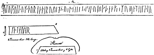
Breda, O. J., ii. 31
Brenner, O., i. 58
Brinck (Descriptio Loufodiæ), i. 378
Bristol, trade with Iceland, ii. 119, 279, 293;
Norwegians living at, ii. 119, 180;
expeditions sent out from, ii. 294-5, 298, 301, 304, 325, 326, 327, 330, 331
Britain, i. 193, 234, 240, 241;
visited by Pytheas, i. 49, 50-3;
Cæsar on, i. 79-80;
Mela on, i. 97;
Pliny on, ii. 106;
Ptolemy on, i. 117;
in mediæval cartography, ii. 220, 227
Brittany, cromlechs in, i. 22;
tin in, i. 23, 26, 27, 29-31, 38-42
Broch, Prof. Olaf, ii. 142, 175, 176
Brögger, A. W., i. 14
Brönlund, Jörgen, i. 2-3
Bruun, D., i. 164, 270, 271, 274, 275
Bugge, Prof. A., i. 136, 137, 138, 146, 163, 164, 166, 170, 173, 234, 245, 246, 258, 297, 304; ii. 7, 55, 80, 168, 201
Bugge, Sophus, i. 93, 94, 103, 132, 134, 135, 136, 138, 146, 148, 207, 273; ii. 27, 28, 175
Bulgarians of the Volga, ii. 142-5, 195, 200, 210
Bunbury, E. H., i. 30, 107
“Burgundians” (== Bornholmers ?), i. 169, 180
Burrough, Stephen, ii. 173
Cabot, John, i. 3, 115, 312; ii. 130, 295-330, 333, 343, 374, 377;
settles at Bristol, ii. 297;
voyage of 1496, ii. 299-301;
voyage of 1497, ii. 301-23;
voyage of 1498, ii. 311, 324-8, 349;
his discovery premature, ii. 343
Cabot, Sebastian, ii. 129, 130, 295-6, 299, 301-2, 308, 319, 326, 329, 330, 332, 333, 336-43;
reported voyage of 1508-9, ii. 336-40;
doubtful voyage of 1516 or 1517, ii. 340-2;
his credibility, ii. 296, 298, 303, 329, 338-40;
map of 1544, attributed to, ii. 303, 309, 310, 314-5, 319-20
Cæsar, C. Julius, i. 39, 40, 79-80, 92, 242
Callegari, G. V., i. 43, 58, 59
Callimachus, i. 375
Callisthenes (Pseudo-), ii. 213, 234
Calypso, i. 347, 355, 370; ii. 43
“Cananei,” i. 154-5
Canary Isles, i. 117, 348-50, 362, 376; ii. 2
Canerio map (1502-07), ii. 368
Cannibalism, among the Irish, Scythians, Celts, Iberians, i. 81;
Issedonians, i. 81;
Massagetæ, i. 81, 148;
in Scandinavia, i. 149
Cantino, Alberto, his map of 1502, ii. 316, 350-1, 355, 361, 362, 364, 365, 368-74;
his letter of Oct. 1501, ii. 349-52, 360, 361, 362, 363, 367, 372
Canto, Ernesto do, ii. 331
Cape Breton, i. 324, 329, 335; ii. 309, 312, 314, 315, 316, 317, 319, 321, 322;
John Cabot’s probable landfall in 1497, ii. 314-15
Capella, Marcianus, i. 123, 126, 184, 188, 195, 197, 334
Carignano, Giovanni da, compass-chart by, ii. 220-2, 227, 235
“Carte Pisane,” ii. 220
Carthage, Sea-power of, i. 45, 75
Caspian Sea, i. 10, 74, 76, 122; ii. 142, 183, 195, 197, 213
Cassiodorus, i. 120, 128-30, 132, 137, 138, 142, 154, 155, 203
Cassiterides, i. 23, 24, 25, 27-9, 89; ii. 47, 48
Catalan Atlas, mappamundi of 1375, ii. 233, 266, 292
Catalan compass-chart at Florence, ii. 231, 232-3, 235
Catalan compass-chart (15th century) at Milan, ii. 279, 280
Catalan sailors and cartographers (see Compass-charts), ii. 217
Catapult, used by the Skrælings, i. 327; ii. 6-8, 92
Cattegat, The, i. 93, 100, 101, 102, 105, 169, 180
“Cauo de Ynglaterra” on La Cosa’s map, ii. 314-5, 317, 321-2;
probably Cape Breton, ii. 314;
or Cape Race (?), ii. 321-2
Celts, i. 19, 41, 42, 68, 81, 208;
early Celtic settlement of the Faroes, i. 162-4;
of Iceland, i. 167, 258;
possible Celtic population in Scandinavia, i. 210;
mythology of the, i. 379
Chaldeans, i. 8, 47
Chancellor, Richard, ii. 135
Chinese myths of fortunate isles, i. 377; ii. 213
Christ, The White, ii. 44, 45, 46
Christ, Wilhelm, i. 14, 37
Christianity introduced in Iceland, i. 260, 332;
introduced in Greenland, i. 270, 272, 357, 332, 380;
decline of, in Greenland, ii. 38, 100-2, 106, 113, 121
Christian IV. of Denmark, ii. 124, 178
Christiern I. of Denmark, ii. 119, 125, 127, 128, 132, 133, 134, 345
Chukches, i. 212
Church, ii. 301
Cimbri, i. 14, 21, 82, 85, 91, 94, 99, 100, 101, 118, 145
Cimmerians, i. 13, 14, 21, 79, 145
Circumnavigation, Idea of, i. 77, 79; ii. 271, 291-3, 296-7
Clavering, ii. 73
Clavus, Claudius, i. 226, 303; ii. 11, 17, 85, 86, 89, 117, 248-76, 284;
his Nancy map and text, ii. 249, 250, 253, 255-69;
his later map and Vienna text, ii. 250, 251, 252-3, 254, 265-76;
his methods, ii. 252-3, 259-61;
his influence on cartography, ii. 276-9, 335, 368, 369, 370, 371
Cleomedes, i. 44, 52, 53, 55, 57, 134
Codanovia, island, i. 91, 93-4, 103
Codanus, bay, i. 90-5, 101, 102, 103, 105, 118
Collett, Prof. R., i. 345; ii. 91
Collinson, R., ii. 129
Columbus, i. 3, 77, 79, 115, 116, 312, 376; ii. 291, 292, 293, 294, 295, 296, 297, 300, 307, 310, 325
Compass, Introduction of, i. 248; ii. 169, 214, 215-6;
variation of, ii. 217, 307-8, 370-1
Compass-charts, ii. 215-36, 265, 279, 280, 282, 308, 313;
development of, ii. 215-8;
limits of, ii. 218
Congealed or curdled sea, beyond Thule, i. 65-9, 70, 100, 106, 121, 165, 181, 195, 363, 376; ii. 149, 200, 231
Connla the Fair, Tale of, i. 371
Contarini, G., ii. 303, 336, 337, 338, 342, 343
Converse, Harriet Maxwell, i. 377
Cornwall, Tin in, i. 23, 29, 31
Corte-Real, Gaspar, ii. 130, 328, 330, 331, 332, 347-53, 354, 357, 358-66, 373;
letters patent to (1500), ii. 347;
voyage of 1500, ii. 360;
voyage of 1501, ii. 347-53, 360-75;
his fate, ii. 353, 375;
his discoveries, ii. 354-5, 362, 364
Corte-Real, João Vaz, unhistorical expedition attributed to, ii. 359
Corte-Real, Miguel, ii. 353, 360, 361;
letters patent to, ii. 353, 355, 376;
voyage of 1502 or 1503, ii. 353, 376;
probably reached Newfoundland, ii. 376;
his fate, ii. 376
Corte-Real, Vasqueanes, refused leave to search for his brothers, ii. 377
Corte-Real, Vasqueanes IV., reported expedition of, in 1574, ii. 378
Cosa, Juan de la, map by, ii. 302, 309-18, 321, 374;
represents Cabot’s discoveries of 1497, ii. 311-2
Cosmas Indicopleustes, i. 126, 127, 128; ii. 183
Costa, B. T. de, ii. 129, 214
“Cottoniana” mappamundi, i. 180, 182, 183; ii. 192-3, 208, 220, 284
Cottonian Chronicle, ii. 303, 324, 326
Crassus, Publius, visits the Cassiterides, i. 27
Crates of Mallus, i. 44, 78-9
Croker, T. Crofton, i. 379
Cromlechs, Distribution of, i. 22, 239
Cronium, Mare, i. 65, 100, 106, 121, 182, 363, 376
Crops, in Thule, i. 63;
in Britain, i. 63;
in Greenland, i. 277
Cuno, J. G., i. 59
Cwên-sæ̂, i. 169
Cyclopes, i. 189, 196; ii. 10, 147, 148, 238
Cylipenus, i. 101, 104, 105
Cynocephali, i. 154-5, 159, 187, 189, 198, 383
Cystophora cristata (bladder-nose seal), i. 276, 286
Daae, L., i. 226; ii. 125, 129
Dalorto (or Dulcert), Angellino, ii. 226-30;
his map of 1325, ii. 177, 219, 226, 229, 235, 236;
his map of 1339 (Dulcert), ii. 229, 230, 235, 265, 266
Damastes of Sigeum, i. 16
Danes, i. 94, 121, 136, 139, 142, 143, 145, 146, 153, 167, 169, 180, 188, 245; ii. 115, 161
Darkness, Sea of, i. 40-1, 192, 195, 199, 363, 382; ii. 149, 204, 206, 212
Dauciones, i. 120, 121
Davis Strait, i. 269
Dawson, S. E., ii. 295, 307, 319, 321
Debes, Lucas, i. 375
Delisle, L., ii. 161
Delos, i. 375
Delphi, i. 18, 19
Democritus, i. 127
Denmark, i. 82, 94, 180, 185, 234; ii. 179, 201, 204, 205, 208, 237;
called “Dacia” on mediæval maps, ii. 188, 190, 222, 225;
representation of, in mediæval cartography, ii. 219, 225, 235, 250, 286
Denys, Nicolas, ii. 3
Desimoni, C., ii. 325
Deslien’s map of 1541, ii. 322
Detlefsen, D., i. 43, 70, 71, 72, 83, 84, 85, 93, 97, 99, 102, 119
Dicæarchus, i. 44, 73
Dicuil, i. 58, 160, 162-7, 252, 362; ii. 43, 51, 229
Dihya, Ibn, ii. 200-1, 209
Dimashqî, ii. 212-3
Diodorus Siculus, i. 23, 29-30, 44, 50, 51, 52, 58, 63, 71, 80, 87, 90, 346; ii. 48
Dionysius Periegetes, i. 114-5, 123, 356; ii. 47, 48, 192
Dipylon vases, i. 236-7
Disappearing (fairy) islands, i. 370, 378-9; ii. 213
Disc, Doctrine of the earth as a, i. 8, 12, 126, 127, 153, 198; ii. 182
Disco Bay, Greenland, i. 298, 300, 301, 302, 306, 307; ii. 72
“Dœgr” (== half a 24 hours’ day), used as a measure of distance, i. 287, 310, 322, 335; ii. 166, 169, 170, 171
Dogs as draught-animals, ii. 69, 72, 145, 146
Down Islands (Duneyiar), i. 285, 286
Dozy, R., ii. 55, 200, 201
Dozy and de Goeje, ii. 51, 204
Drapers’ Company, Protest of, against Sebastian Cabot, ii. 302, 330, 338, 342
Draumkvæde, i. 367, 381
Driftwood, in Greenland, i. 299, 305, 307, 308; ii. 37, 96
Drusus (The elder Germanicus), i. 83
“Dumna,” island, i. 106, 117; ii. 257
Dumont d’Urville, i. 376
Dvina, river, i. 173, 174, 222; ii. 135, 136, 137, 142, 146, 164, 176
Eastern Settlement of Greenland, i. 263, 265, 267, 271, 272, 274, 275, 276, 296, 301, 302, 307, 310, 311, 321; ii. 71, 82, 90, 107, 108, 112, 116;
decline of, ii. 95-100, 102
Ebstorf map, i. 102, 191; ii. 187
Edda, The older (poetic), i. 273
Edda, the younger (Snorra-Edda), i. 273, 298, 304, 342, 364
Eden, Richard, ii. 341
Edrisi, i. 182, 382; ii. 51-53, 202-8, 209, 210, 216;
his map, ii. 192, 203, 208, 220, 284
Egede, Hans, ii. 40, 41, 74, 101, 104, 105, 106
Egil Skallagrimsson’s Saga, i. 175, 218
Egyptian myths, i. 347
Einar Sokkason, i. 283, 294
Einar Thorgeirsson, lost in Greenland, i. 284
Einhard, i. 167, 179, 180, 185
Elk (achlis), i. 105, 191
Elymus arenarius (lyme-grass), ii. 5
Elysian Fields, i. 347, 349, 351
Empedocles, i. 12, 127
England (see Britain), Arab geographers on, ii. 204, 211;
maritime enterprise of, ii. 180, 294-5, 343;
in mediæval cartography, ii. 218
English State document (1575) on North-West Passage, ii. 129-30, 132
“Engronelant,” ii. 277, 279, 373
d’Enjoy, Paul, i. 377
Eratosthenes of Cyrene, i. 20, 29, 44, 47, 52, 55, 61, 73, 75-7, 78, 82, 115; ii. 292
Eric Blood-Axe, ii. 136
Eric of Pomerania, ii. 118, 119
Eric the Red, i. 252, 256, 259, 262, 280, 288, 293, 318-21, 324, 330, 337, 344, 368; ii. 22, 77, 88;
discovers Greenland, i. 260, 263, 266-70
Eric the Red, Saga of, i. 260, 266, 273, 291, 292, 293, 296, 310, 313, 314, 318, 322, 331, 332-5, 337, 338, 342, 343, 367, 382; ii. 4, 6, 8, 10, 11, 14, 15, 22, 23, 24, 42, 43, 50, 59, 61, 89, 91, 206;
its value as a historical document, ii. 62
Eric’s fjord (Greenland), i. 267, 268, 271, 275, 317, 318, 319, 321; ii. 112
Eric Upsi, bishop of Greenland, ii. 29-31
Eridanus, river, i. 31, 32, 34, 42
Eruli, i. 21, 94, 136, 137-8, 139-49, 153, 235, 245
Erythea, i. 9
Erythræan Sea, i. 10
Eskimo, i. 19, 51, 150, 212, 215, 216, 223, 231-2, 260, 298, 306, 307, 308, 309, 310, 368; ii. 10, 12, 16, 17, 19, 66-94, 102-6, 107, 111-2, 113-6, 333, 366-7;
fairy-tales and legends of, ii. 8, 105, 115;
ball-game among, ii. 40-1;
distribution of, ii. 66-74;
racial characteristics of, ii. 67-8;
their culture, ii. 68-9, 91-2;
Norse settlers absorbed by, ii. 100, 102-105, 106, 107-11, 117;
unwarlike nature of, ii. 114, 115-6
Esthonians (Æstii, Osti), Esthonia, i. 69, 72, 104, 109, 131, 167, 169, 170, 181, 186; ii. 205
“Estotiland,” fictitious northern country, ii. 131
Eudoxus, i. 46
Eyrbyggja-saga, i. 313, 376; ii. 42, 46, 48, 50
Fabricius, A., ii. 55
Fabyan, Robert, Chronicle (quoted by Hakluyt), ii. 303, 324, 326, 333
Fadhlân, Ibn, ii. 143
Fairies, Names for, i. 372-3
Fairylands, Irish, i. 357, 370-1, 379; ii. 60;
Norwegian, i. 369-70, 378; ii. 60, 213;
laudatory names for, i. 374;
characteristics of, i. 375-9; ii. 213-4
Faqîh, Ibn al-, ii. 197
Farewell, Cape, i. 261, 267, 280, 282, 284, 288, 291, 295, 307, 316; ii. 73
Faroes, The, i. 254, 255, 257, 316, 324, 362; ii. 51, 229, 262;
discovered by the Irish, i. 162-4, 233;
Irish monks expelled from, i. 252, 253;
early Celtic population in, i. 164, 253
Felix, The monk, in mediæval legend, i. 381
Fenni (Finns), i. 109, 112, 113, 114, 120, 149, 203
Ferdinand and Isabella of Spain, letter from, ii. 300
Fernald, M. L., ii. 3, 5-6
Fernandez, João (called “Lavorador”), ii. 331-2, 356;
letters patent to (1499), ii. 346, 356;
probably sighted Greenland (1500), ii. 356, 357, 375;
took part in Bristol expedition (1501), ii. 331, 356, 357;
Greenland (Labrador) named after him, ii. 358
Filastre, Cardinal, ii. 249-50, 278
Finland (see Kvænland), i. 206, 209, 210, 214;
the name confused with Vinland, i. 198, 382; ii. 31, 191;
and with Finmark, i. 382; ii. 191, 205;
in mediæval cartography, ii. 224
Finmark, i. 61, 173, 175, 177, 191, 198, 204, 210, 213, 220, 222, 225; ii. 86, 141, 163, 164, 172, 178, 179, 205, 211, 237;
the name confused with Finland, i. 382; ii. 32, 191, 205;
in mediæval cartography, ii. 221
“Finn,” The name, i. 198, 205-7, 210
“Finnaithæ” (Finnédi, Finvedi) (see Finns), i. 135, 137, 189, 198, 203, 204, 206, 382
Finn mac Cumhaill, i. 363; ii. 45
Finns, i. 109, 112, 113, 114, 120, 135, 136, 137, 149, 171, 173-8, 189, 198, 203-32, 382; ii. 68, 143;
Horned Finns, ii. 167
“Finns,” in southern Scandinavia, i. 103, 203, 205, 206-11; ii. 159
Finn’s booths (Finnsbuðir), in Greenland, i. 283, 296, 305
“Finnur hinn Friði,” Faroese lay of, ii. 33-4
Fisher, J., ii. 33, 121, 229, 249, 276, 277, 278, 279, 281
Fischer, M. P., ii. 161
Fischer, Theobald, ii. 216, 220, 230, 234
Fishing Lapps, i. 204, 205, 207, 218, 221, 223-32
Flateyjarbók, i. 254, 283, 313, 304, 317, 318, 324, 329, 331, 334, 338, 340, 343, 344, 359, 360; ii. 4, 14, 15, 18, 21, 22, 23, 25, 59, 61
Fletcher, Giles, i. 226
Floamanna-Saga, i. 280, 281; ii. 46, 81
Floating islands, Legends of, i. 375-7; ii. 213-4
Floki Vilgerdarson, sails to Iceland, i. 255, 257, 269
Florus, L. Annæus, i. 350
Forbiger, A., i. 58, 102
Forster, i. 179
Fortunate Isles (Insulæ Fortunatæ), i. 117, 198, 334, 345-53, 367, 370, 372, 373, 382-4; ii. 1-6, 24, 31, 42, 55, 59-61, 64, 191, 228, 280, 304
Fortunate Lake, Irish myth of, ii. 229-30
Foster-Brothers’ Saga, i. 276, 320; ii. 9, 18
Frähn, C. M., ii. 143, 145
Franks Casket, The, i. 176
Freydis, daughter of Eric the Red, i. 320, 328, 332, 333; ii. 11, 51
Friesland, Frisians, i. 95, 153, 205
Friis, J. A., i. 372
Friis, Peder Claussön, i. 224, 227-9, 232, 369; ii. 153, 158, 178, 268
Frisian noblemen’s polar expedition, i. 195-6, 200, 383; ii. 147-8
Frisius, Gemma, ii. 129, 132
Frisland, fabulous island south of Iceland, i. 377; ii. 131
Fritzner, ii. 9
Furðustrandir, i. 273, 312, 313, 322, 323, 324, 325, 326, 334, 336, 337, 339, 357; ii. 24, 36
Fyldeholm (island of drinking), i. 352
Gadir (Gadeira, Gades, Cadiz), i. 24, 27, 28, 30, 36, 37, 66, 79
Galvano, Antonio, ii. 336, 337, 338, 354, 364, 376
Gandvik (the White Sea), i. 218-9, 228; ii. 136-8, 164, 223, 237, 239
Gardar, discoverer of Iceland, i. 255-7, 263
Garðar, Greenland, i. 272, 273, 275, 311; ii. 106, 107, 108, 121, 122
“Gautigoth” (see Goths), i. 135
Gautrek’s Saga, i. 18-9
Geelmuyden, Prof. H., i. 52, 54, 311; ii. 23
Geijer, E. G., i. 60, 102, 111, 131, 205, 207
Gellir Thorkelsson, i. 366
Genoese mappamundi (1447 or 1457), ii. 278, 286, 287
Geminus of Rhodes, i. 43, 44, 53, 54, 57, 63, 64
Geographia Universalis, i. 382; ii. 32, 177, 188-91, 220, 227, 339
Gepidæ, i. 139, 142, 153
Gerfalcons, Island or land of, ii. 208, 227, 266, 289
Germania, i. 69, 71, 73, 87, 90, 95, 101, 108-14, 154, 169;
Roman campaigns in, i. 81, 83, 85, 97
Germanicus, The younger, i. 83
Germanus, Nicolaus, ii. 251, 276-9, 288, 290, 373
Germany, coast of, in mediæval cartography, ii. 219, 257
Gesta Francorum, i. 234
Gilbert, Sir Humphrey, ii. 340
Gildas, i. 234, 364
Ginnungagap, i. 12, 84, 158; ii. 35, 150, 154, 239-41
Giraldus Cambrensis, i. 379; ii. 151, 220, 245
Gisle Oddsson’s Annals, ii. 82, 100-2, 109
Gissur Einarsson, Bishop, i. 285
Gjessing, H., ii. 31
Glæsaria, island, i. 101, 106
Glastonbury, Legend of sow at, i. 378-9
“Gli,” mythical island, i. 364
Globes, used by the Greeks, i. 78;
introduced by Toscanelli, ii. 287;
Behaim’s, ii. 287-9;
Laon globe, ii. 290;
used by Columbus, ii. 287;
and Cabot, ii. 304, 306
Gnomon, The, i. 11, 45-6
Godthaab, Greenland, i. 271, 304, 307, 321; ii. 73, 74
Goe, month of, i. 264, 265
Goeje, M. de, i. 344, 362; ii. 51, 194, 197, 198
Goes, Damiam de, ii. 354, 366, 376, 377
Gokstad ship, i. 246
Gomara, Francesco Lopez de, ii. 129, 130, 131, 336, 337, 354, 364
Gongu-Rólv’s kvæði, i. 356
Göta river, i. 131; ii. 190, 205
Göter (Gauter), i. 120, 135, 141, 144, 147; ii. 190
Goths (Gytoni, Gythones, Getæ), i. 14, 21, 71, 120, 129, 130, 135, 137, 139, 145, 147, 153; ii. 143, 190
Gotland, i. 121, 180, 378; ii. 125, 237;
in mediæval cartography, ii. 219, 221, 224, 233, 265
Gourmont, Hieronymus, map of Iceland, ii. 122-3, 127
Graah, Captain, i. 297; ii. 104
Grail, Legends of the, i. 382
Grampus, i. 50-1
Granii, i. 136
Grape Island (Insula Uvarum), i. 358, 361, 363, 365, 366
Greenland, i. 184, 192, 194, 197, 199, 200, 201, 215, 223, 252, 315-21, 322; ii. 1, 5, 12, 25, 36, 38, 40-2, 66-94, 95-134, 167, 169, 177, 244, 345, 366;
Eskimo of, ii. 71-5;
discovered and settled by Norwegians, i. 258-78;
estimated population of settlements, i. 272;
conditions of life in i. 274-8, 319; ii. 96-7;
voyages along the coasts of, i. 279-311;
glaciers (inland ice) of, i. 288-95, 301, 308; ii. 246-7;
decline of Norse settlements in, ii. 90, 95-100;
last voyage to (from Norway), ii. 117;
last ship from, ii. 118;
geographical ideas of, ii. 237-40, 246-8, 254-5, 259-62, 270-6, 278, 279, 280;
east coast of, i. 271-2, 279-96, 308; ii. 168, 170, 171, 238;
uninhabited parts (ubygder) of, i. 279-311, 320, 321; ii. 28, 166, 172;
sixteenth-century discovery of, ii. 315, 332, 335, 352, 363, 364, 375;
called Labrador, ii. 129, 132, 133, 315, 335, 353;
in sixteenth-century maps, ii. 368-75
Gregory of Tours i. 234
“Greipar,” in Greenland, i. 298, 299, 300-1, 304
Grettis-saga, i. 313, 367
Griffins, i. 19, 254; ii. 263
Grim Kamban, i. 253
Grimm, J., i. 18, 94, 95, 355, 372; ii. 45, 56
Grimm, W., i. 373
Grip, Carsten, letter to Christiern III., ii. 126-8
Gripla, i. 288; ii. 35-6, 237, 239, 241
Gröndal, B., i. 371, 375
Grönlands historiske Mindesmærker, i. 262, 263, 271, 281, 282, 283, 284, 285, 288, 292, 294, 295, 296, 297, 298, 299, 300, 301, 302, 304, 305, 311, 333, 359, 377; ii. 1, 9, 14, 17, 22, 25, 31, 35, 46, 79, 82, 86, 100, 102, 106, 108, 112, 113, 117, 119, 120, 125, 127, 172, 237, 278
Grönlendinga-þáttr (see Flateyjarbók)
Groth, Th., ii. 103
Grottasongr, i. 159
Gudleif’ Gudlaugsson, story of his voyage, ii. 49-50, 53-4;
compared with Leif Ericson, ii. 50-1
Gudmund Arason’s Saga, i. 284
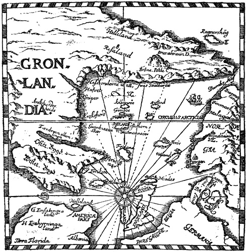
Gudmundsson, Jón, map by, ii. 34, 241
Gudmundsson, V., ii. 25
Gudrid, wife of Karlsevne, i. 318, 319, 320, 321, 329, 330, 333; ii. 14-5, 51
Guichot y Sierra, A., i. 376
Gulathings Law, ii. 140
Gulf Stream, i. 251; ii. 54
Gunnbjörnskerries, i. 256, 261-4, 267, 280; ii. 276
Gunnbjörn Ulfsson, i. 256, 261-4, 267, 280, 296
Gustafson, Prof. G., i. 237, 240
Gutæ, i. 120
Guta-saga, i. 378
Gutones (see Goths), i. 70, 71, 72, 72, 93
Gytoni (see Goths), i. 71
Hægstad, Prof. M., ii. 242
Hægstad and Torp (Gamal-norsk Ordbog), ii. 9
Hæmodæ (“Acmodæ,” “Hæcmodæ”), i. 90, 106
“Hafsbotn” (the Polar Sea), i. 283, 303; ii. 137, 151, 165, 166, 167, 168, 171, 172, 237, 240
Hakluyt. R., i. 226; ii. 129, 132, 152, 261, 319, 321, 326, 333
Håkon Håkonsson’s Saga, i. 299; ii. 139, 141
Halichoerus grypus (grey seal), i. 217; ii. 91, 155
Halli Geit, Tale of, ii. 239
Hallinger, i. 104, 247
Hallstatt, i. 24, 36
Hâlogaland (Hålogaland, Hâlogi, Halgoland, Halagland, Halogia, Helgeland), i. 61, 62, 64, 132, 135, 138, 175, 179, 194, 197, 200, 231, 247, 264, 381, 383; ii. 64, 137, 139, 140, 142, 165, 168, 172;
in mediæval cartography, ii. 227, 236
Halsingia, or Alsingia, i. 104
Hamberg, Axel, ii. 69
Hammershaimb, V. U., i. 356, 375; ii. 33
Hamy, ii. 220, 223, 229, 230, 234
Hanno, i. 37, 88, 350; ii. 45
Hans (John), king of Denmark, ii. 125, 128
Hanseatic League, ii. 99, 119, 125, 179, 218
Hansen, Dr. A. M., i. 149, 192, 206, 207, 208, 218, 221, 222, 228, 229, 230, 236-7, 239
Harold Fairhair, i. 253-4, 255, 258
Harold Gråfeld, ii. 136, 153, 154
Harold Hardråde, i. 185, 195, 201, 283, 383; ii. 147, 199;
his voyage in the Polar Sea, i. 195; ii. 148-54
Harpoons, i. 214-7, 277; ii. 145-6, 156-63
Harrisse, Henry, ii. 132, 230, 293, 294, 295, 296, 297, 300, 302, 303, 304, 305, 309, 314, 315, 319, 320, 326, 327, 329, 331, 332, 333, 334, 336, 341, 347, 348, 349, 353, 358, 359, 360, 365, 374
Harudes (Charydes, Charudes, Horder), i. 85, 118, 136, 143, 148, 246
Hauksbók, i. 188, 251, 256, 257, 261, 262, 264, 268, 286, 291, 293, 308, 309, 322, 327, 331, 333, 353, 367, 369; ii. 10, 11, 166, 169, 172, 216, 261
Hebrides (Ebudes, Hebudes), i. 57, 90, 106, 117, 123, 158, 159, 160, 161, 234, 273, 316; ii. 151, 200
Hecatæus of Abdera, i. 8, 9, 10, 15, 16, 98
Heffermehl, A. V., ii. 242
Heiberg, Prof. J., i. 219, 220
Heimskringla, i. 270, 313, 331; ii. 59, 137, 171, 239
Heiner, i. 138
Heinrich of Mainz, map by, ii. 185, 187
Helge Bograngsson, killed in Bjarmeland, ii. 139-40
Heligoland, i. 197
Helland, A., i. 226, 231, 369, 372, 373, 378, 381; ii. 46, 152, 177, 228
Helluland, i. 312, 313, 322, 323, 334, 336, 357; ii. 1, 23, 35-6, 61, 237
Helm, O., i. 14
Helsingland, Helsingers, i. 189; ii. 237
Henry V. of England, ii. 119
Henry VI. of England, ii. 119
Henry VII. of England, ii. 130, 298, 299, 302, 303, 322, 324, 326, 327, 331, 332, 333, 334, 337, 338, 340
Henry VIII. of England, ii. 319, 330, 334, 338, 341, 342, 343
Heraclitus, i. 12
“Herbrestr” (war-crash), ii. 8-9
Hereford map, i. 91, 92, 102, 154, 157, 190; ii. 186, 187
Hergt, G., i. 43, 51, 60, 65, 66, 67, 71, 72
Herla, mythical king of Britain, ii. 76
Hermiones, i. 91, 104
Hermits, in Irish legends, ii. 19, 43-6, 50
Herodotus, i. 9, 12, 20, 23, 24, 27, 31-2, 46, 76, 78, 81, 88, 114, 148, 155, 156, 161, 187
Hertzberg, Ebbe, ii. 38, 39, 40, 61, 93
Hesiod, i. 9, 11, 18, 42, 84, 348
Hesperides, i. 9, 161, 334, 345, 376; ii. 2, 61
Heyman, i. 342; ii. 8
Hielmqvist, Th., i. 381
Hieronymus, i. 151, 154
Higden, Ranulph (Polychronicon), i. 346, 382; ii. 31-2, 288-92, 220;
his mappamundi, ii. 188, 189, 192
Hilleviones, i. 101, 104, 121
Himilco’s voyage, i. 29, 36-41, 68, 83
Himinrað (Hunenrioth, &c.), mountain in Greenland, i. 302-4; ii. 108
Hipparchus, i. 44, 47, 52, 56, 57, 73, 77-8, 87, 116; ii. 197
Hippocrates, i. 13, 88
Hippopods, i. 91
Hirri, i. 101
Historia Norwegiæ, i. 204, 229, 252, 255, 256, 257, 298; ii. 1, 2, 17, 29, 61, 79, 87, 88, 135, 151, 167, 168, 172, 222, 227, 235, 239, 240, 280
Hjorleif, settles in Iceland with Ingolf, i. 166, 252, 254, 255
Hoegh, K., ii. 31
Hoffmann, W. J., ii. 39, 40
Hofmann, C., i. 59
Holand, H. R., ii. 31
Holberg, Ludvig, ii. 118
Holm, G. F., i. 271, 274
Holz, G., i. 85, 102
Homer, i. 8, 10-11, 13, 14, 25, 33, 77, 78, 196, 347, 348, 371; ii. 53, 54, 160
Homeyer, C. G., i. 214
Hönen, Ringerike, Runic stone from, ii. 27-9, 58
Honorius Augustodunensis, i. 375
Honorius, Julius, i. 123; ii. 183
Horace, i. 349, 350-1
Horaisan, Japanese fortunate isle, ii. 56-7, 213
Horder (see Harudes), i. 85, 118, 136, 138, 143, 147, 209, 246
Horn, Georg, (Ulysses peregrinans), ii. 132, 133
Horses, Swedish, i. 135;
in Greenland, i. 276
Hrabanus Maurus, i. 159, 167, 184
“Huldrefolk” (Norwegian fairies), i. 355, 356, 370-3, 381; ii. 12, 60
“Huldrelands” (see Fairylands)
Humboldt, i. 363
Huns, i. 188
Hvarf point, in Greenland, i. 263, 267, 269, 279, 288, 290, 292, 294, 295, 303, 310, 315; ii. 169, 171, 261
Hvergelmer, i. 158, 159
Hvítramanna-land (the White Men’s Land), i. 312, 313, 330, 353, 366, 368, 376; ii. 2, 19, 42-56, 60, 61, 92;
called Great Ireland, i. 330, 353, 366; ii. 42, 48;
Are Mársson’s voyage to, i. 331-2, 353-4; ii. 42, 46, 50
Hvitserk glacier, in Greenland, i. 283, 286, 288, 291, 292, 294-5, 303; ii. 122, 123, 124, 127, 128
Hyperboreans, i. 13, 15-21, 79, 81, 88, 89, 98, 128, 187, 188, 348; ii. 188
Iberians, in British Isles, i. 26;
in Brittany, i. 30;
cannibalism among, i. 81
Ibrâhîm ibn Ja’qûb, i. 187
Iceland, i. 181-4, 192, 193-4, 197, 201, 248, 251, 262, 263, 267, 278, 285, 286, 289, 295, 305, 308, 324, 337, 353, 362, 374; ii. 43, 49, 102, 112, 169, 170, 191, 211, 242, 244, 245, 281;
discovered by Irish monks, i. 59, 164-7, 233, 258;
identified with Thule, i. 59-60, 164, 193;
fables of ice in, i. 181, 183-4, 193; ii. 191;
Norwegian settlement of, i. 252-8;
called “Gardarsholm,” i. 255;
called “Snowland,” i. 255;
in mediæval cartography, ii. 225, 230, 231, 250, 262, 275, 279, 284, 286
Icelandic Annals (Islandske Annaler), i. 282, 284, 285, 305; ii. 25, 29, 36, 37, 82, 88, 99, 111, 112, 117, 118, 166, 172
Ictis, i. 29
“Illa verde,” on fifteenth and sixteenth century maps, ii. 279-81, 294, 318
Indian myths, i. 19, 92, 351, 356, 363; ii. 57, 213, 214
Indiana, North American, i. 327, 377; ii. 7, 12, 16, 23, 25, 68, 69, 90, 92, 93, 334, 367;
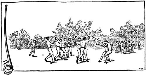
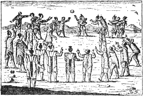
lacrosse among, ii. 39-41, 93
Ingævones, i. 101
Ingimund Thorgeirsson, lost in Greenland, i. 284
Ingolf Arnarson, first Norse settler in Iceland, i. 252, 253, 254, 255, 257, 267
Ingolf’s Fjeld, Greenland, i. 291, 293, 294, 296
Ingram, Dr., i. 179
Ireland (Hierne, Hibernia, Juverna, Ivernia, Ibernia), i. 38, 57, 80, 81, 90, 117, 179, 192, 234, 253, 326; ii. 201, 211, 244, 245;
connection with Iceland, i. 167, 258, 353;
whaling in, ii. 156
Irgens, O., i. 248, 250
Irish monks, i, 162-7, 362; ii. 43;
(“Papar”) in Iceland, i. 254, 258; ii. 77, 78
Irish myths, i. 281-2, 334, 336-9, 353-64, 370, 371; ii. 18, 19, 20, 43-5, 50, 53-4, 56, 60-1, 206, 207, 228-9, 234
Iroquois myth of floating island, i. 377
Isachsen, G., i. 300, 304, 306; ii. 168, 171
Isidorus Hispalensis, i. 44, 102, 151, 159, 160, 167, 184, 187, 345, 346, 347, 352, 353, 367, 382-4; ii. 2, 3-4, 58, 59, 64, 75, 183, 184, 185, 189, 247
Isles of the Blest, The, i. 9, 84, 348, 349, 351, 363, 370; ii. 59
Issedonians, i. 16, 19, 81
Italian sailors and cartographers (see Compass-charts), ii. 217
Itinéraire Brugeois, ii. 250, 256, 262, 263, 272
Itineraries, Roman, i. 116, 123, 153
Ivar Bárdsson’s description of Greenland, i. 262-3, 290, 292, 295, 302, 304; ii. 82, 87, 88, 102, 106, 107-11, 126, 166, 171, 241, 256, 261, 276
Ivar Bodde, probable author of the King’s Mirror, ii. 242
Jacob, G., i. 187, 284; ii. 145, 157, 202
Jakobsen, Dr. J., i. 163, 293, 374
Jan Mayen, i. 287; ii. 168, 169, 171
Japanese myth, ii. 56-8, 213
Jaqût, ii. 143, 144
Jaubert, P. A., ii. 204
Jenkinson, Anthony, ii. 152
Jensen, A. S., ii. 104
Jomard, ii. 220, 229
Jones Sound, i. 304, 306
Jónsbók, Icelandic MS., i. 316, 320, 329; ii. 24
Jónsson, Finnur, i. 166, 198, 256, 258, 260, 262, 265, 266, 273, 301, 305, 314, 331, 367; ii. 79, 107, 108, 167, 237
Jordanes, i. 104, 120, 129-38, 142, 143, 144, 145, 147, 148, 149, 153, 154, 155, 194, 203, 206; ii. 211
Jörgensen, N. P., i. 272, 274-5
Jotunheim, i. 303; ii. 147, 172, 238
Jovius, Paulus, ii. 111
Joyce, P. W., i. 360, 379
Julianehaab, Greenland, i. 267, 271, 274
Jutland, i. 69, 71, 72, 82, 85, 93, 94, 101, 102, 105, 117, 139, 144, 143, 147, 169, 180, 185, 246; ii. 192;
in mediæval cartography, ii. 219, 224, 225, 235, 257, 265
Kähler, F., i. 43, 68
Kandalaks, river and gulf, i. 174, 218-9, 222
Kara Sea, i. 212
Karelians (Kirjals), Karelia, i. 175, 218, 219, 220, 222, 223; ii. 85, 137, 140, 146, 167, 173, 174;
“Kareli infideles,” ii. 85, 117, 224, 225, 255, 262, 270, 271, 272
Karlsevne, Thorfinn, i. 260, 313, 318, 319, 331, 333, 336, 346, 354; ii. 14, 15, 18, 23, 25, 65;
voyage to Wineland, i. 320-30, 334-45;
battle with the Skrælings, i. 328; ii. 6-11
“Kassiteros,” Derivation of, i. 25-6
Kayaks, Eskimo, ii. 10, 68, 70, 72, 74, 85, 91, 92, 127, 270
Kemble, John M., i. 364
Kensington stone, Minnesota, ii. 31
Keyser, R., i. 58, 59, 60, 65, 93, 99, 104, 105, 107
Khordâḏbah, Ibn, ii. 195, 196-7
Kiær, A., ii. 63
Kingigtorsuak, Runic stone from, i. 297; ii. 84
King map (circa 1502), ii. 331, 354, 355, 358, 364, 373, 374
Kings Mirror, The, (Konungs-Skuggsjá), i. 3, 272-3, 277, 279-80, 300, 352; ii. 1, 2, 29, 87, 88, 95, 96, 98, 155, 157, 172, 193, 234, 242-8;
authorship of, ii. 242
Kjær, A., i. 324
Kjalarnes, i. 322, 323, 324, 325, 326, 329; ii. 23
Kjelmö, archæological find from, i. 212-9, 224
Kjölen range, i. 102, 224; ii. 222
Kleiven, Ivar, i. 340
“Knarren,” Royal trading ship to Greenland, ii. 38, 98-9, 106, 122
Knattleikr, Norse ball-game, ii. 38-9, 61, 93;
similar to lacrosse, ii. 39
“Kobandoi” (Cobandi), i. 93-4, 118
Koch, J., i. 156
Kohl, J. G., ii. 148, 340, 353
Kohlmann, P. W., i. 194
Koht, H., i. 247; ii. 43
Kola peninsula, i. 173, 174, 217, 223; ii. 135, 142, 165, 176
Koren-Wiberg, Christian, ii. 80
Krabbo, Hermann, i. 202
Krag, H. P. S., i. 340
Kraken, sea monster, i. 375; ii. 234, 244
Kretschmer, K., i. 10, 12, 14, 74, 78; ii. 215, 222, 223, 226, 228, 229, 230, 282, 284, 294, 313, 353
Kristensen, W. Brede, i. 347
Kristni-saga, i. 313, 331, 367; ii. 59
Kröksfjarðarheiðr (Greenland), i. 267, 299, 300-1, 304, 306, 308, 309, 310; ii. 72, 83, 88
Kulhwch and Olwen, Tale of, i. 342; ii. 8
Kunstmann, F., ii. 229, 378
“Kunstmann, No. 2,” Italian mappamundi, ii. 374
Kvænland (Cvenland, Cwênland; Finland), i. 155, 170, 175, 178, 198;
the name mistaken for “Land of Women,” i. 112, 186-7, 383; ii. 64, 214, 237
Kvæns (see Finns), Cwênas, i. 178, 191, 206, 207, 220, 223; ii. 137, 141, 167;
their name confused with “cyon” (dog), i. 155, 188
Labrador, i. 322, 323, 334, 335; ii. 5, 23, 41, 68, 105, 106, 131, 133, 308, 314, 335, 338, 352, 358, 364, 370;
== Greenland, ii. 129, 132, 133, 315, 331, 335;
the name of, ii. 331-2, 357-8
Lacrosse, ii. 38-41;
perhaps derived from Norsemen, ii. 40
Lactantius, i. 127
Læstrygons, i. 13, 78
Läffler, Prof. L. F., i. 132, 134, 136, 297; ii. 63
“Lageniensis,” i. 357, 379; ii. 228
Lagnus, bay, i. 101, 105
Lambert map, ii. 188, 259
Lampros, S. P., ii. 281
Landa-Rolf, i. 285-6
Landegode (Landit Góða), island off Bodō, Norway, i. 369-70, 372, 373, 374; ii. 60
Landnámabók, i. 166, 251, 255, 256, 258, 260, 261, 266, 273, 288, 291, 293, 313, 324, 330, 332, 353, 366, 367, 368, 369, 377; ii. 21, 42, 58, 60, 62, 166, 168, 169, 170, 172
Langebek, i. 179
Langobards, i. 138, 139, 155, 156, 159
Laon globe, ii. 290
Lappenberg, I. M., i. 193, 195, 303
Lapps, i. 61, 113, 150, 171, 173, 177, 190, 191, 203-8, 218, 220, 224-32, 372; ii. 76, 135, 164, 168, 175, 178;
their magic, i. 191, 204, 219, 227, 229; ii. 32, 77, 136, 137;
their archery, i. 227-30;
their languages, i. 228-9
Lascaris, Cananos, travels in the North, ii. 281
Las Casas, ii. 214
Latitude, calculation of, i. 46-8, 64, 76, 78, 116-7; ii. 22, 260, 307;
scale of, on Ptolemy’s and other maps, ii. 259, 260-1, 264, 274-5
Latris, island, i. 101, 105
Laurentius Kálfsson’s saga, ii. 8
Leardus, Johannes, mappamundi by, ii. 282
L’Ecuy globe (or Rouen globe), ii. 129, 131-2
Leem, K., ii. 178, 191
Leif Ericson, i. 270, 313, 314, 315-8, 321, 331, 332, 338, 339, 343, 346, 359, 380, 384; ii. 4, 21, 22, 25, 50, 51, 59, 65;
called “the Lucky,” i. 270, 313, 317, 331;
meaning of the name, i. 380-2;
discovers Wineland the Good, i. 313, 317, 332;
rescues the shipwrecked crew, i. 317;
introduces Christianity, i. 317, 332, 380
Lelewel, J., ii. 131, 203, 278, 282, 284, 286
Leucippus, i. 12, 127
Liebrecht, F., ii. 228
Ligurians, i. 41, 42, 114
Lik-Lodin, i. 282-3
Lillienskiold, Hans Hansen, i. 177
Lind, E. H., i. 332
“Liver Sea” (Lebermeer), i. 69, 181, 363; ii. 20, 51, 231
Lok, Michael, Map of 1582, ii. 130, 321, 323
Lönborg, S. E., i. 102, 112, 131, 135, 156, 174, 180, 193, 197; ii. 150
Longest day, calculation of, ii. 52, 54
Lot, F., i. 357, 379
Loth, J., i. 342
Lucian, i. 352, 355, 356, 360, 361, 363, 366, 376; ii. 54, 150
Lugii (Vandal tribe), i. 247
“Lycko-Pār” (“Lykke-Per”), i. 381
“Lykk-Anders,” Tale of, i. 381
Lyschander (Grönlands Chronica), ii. 101, 102, 111
Lytton, Lord, i. 350
Machutus, St., Voyage of, i. 334, 354, 363
Macrobius, i. 123, 126, 184; ii. 182, 193, 247
Maelduin, Voyage of, i. 336-7, 338, 355, 356, 358, 360, 361, 362, 363, 364, 366; ii. 9, 18, 45, 150
Maelstrom, Legends of the, i. 157-9; ii. 138, 150-3, 241
Mæotides, i. 88
Mæotis Palus (Sea of Azov), i. 89; ii. 199, 211, 283, 284
Maggiolo, map by (1527), ii. 321, 335, 358, 359
“Mag Mell” (the happy plain), i. 355, 357, 365, 370
Magnaghi, A., ii. 227, 230
Magnus Barfot’s Saga, i. 197
Magnussen, Finn, ii. 102
Maǵûs, Arab name for Northern Vikings, ii. 55, 196, 200, 201, 209, 210
Maine, coast of, ii. 316, 317
Mair, G., i. 35, 36, 37, 43, 47, 59
Manannán mac Lir, i. 363, 370; ii. 45
Mandeville, Sir John, ii. 271, 292
Manna, i. 338
Mannhardt, W., i. 365
Manuel, King of Portugal, ii. 346, 347, 352, 353, 375, 376, 377, 378
Mapes, Walter, ii. 75-6
Maps (see also Compass-charts), earliest Greek, i. 11, 76, 77, 78; ii. 182;
Ptolemy’s, i. 116-22;
wheel-maps, i. 151; ii. 183-8, 193, 218, 222;
T- and OT-maps, i. 151; ii. 183-4, 193;
Arab maps, ii. 203;
15th century mappemundi, ii. 281-7
Marcianus of Heraclea, i. 123
Margaret, Queen of Denmark, Norway and Sweden, ii. 118, 132
Marinus of Tyre, i. 115, 116, 121, 122; ii. 194, 249
Markham, Sir C. R., i. 43, 58, 64; ii. 295, 336, 373
Markland, i. 299, 305, 307, 312, 313, 322, 323, 324, 329, 334, 335, 336, 338; ii. 1, 19, 22, 23, 36, 37, 42, 61, 92-93, 96, 229, 279;
ship from M. reaches Iceland, ii. 22, 25, 36-8, 61, 229
Martellus, Henricus, ii. 276, 279
Martyr, Peter, ii. 303, 330, 336, 337, 338, 339, 342
Marx, F., i. 37
Massagetæ, i. 81, 148; ii. 188
Massalia, i. 31, 42, 43, 45, 46, 47, 48, 67, 70
Mas’ûdî, ii. 198-9, 207
Matthew Paris, ii. 281
Matthias, Franz, i. 36, 43
Maurenbrecher, B., i. 349
Maurer, K., i. 265; ii. 9
Mauro, Fra, map by, ii. 177, 278, 285, 286
Medici Atlas (1351), i. 362; ii. 229, 234-6, 236, 240, 255, 256, 257, 258, 259, 260, 261, 262, 263, 264, 265, 272-6
Mehren, A. F., ii. 143, 145, 212
Meissner, R., i. 255
Mela, Pomponius, i. 15, 19, 28, 38, 44, 55, 63, 72, 75, 85-96, 97, 101, 103, 114, 118, 131, 144, 155; ii. 32, 192, 208
Melville Bay, i. 305, 310
Mercator, Gerard, ii. 261;
his map of 1569, ii. 130
Meregarto, i. 69, 181-4, 193, 252; ii. 51
Mevenklint (Kolbeins-ey), i. 264, 286, 287; ii. 166, 169, 170, 172
Meyer, Kuno, i. 198, 354
Michelsen, A. L. J., i. 214
Midgards-worm, i. 364; ii. 234
Mid-glacier (Miðjǫkull), Greenland, i. 267, 288, 290, 293, 294, 295
Midnight sun (long summer day and winter night in the North), i. 14, 45, 53-4, 62, 79, 92, 98, 106, 131, 133-4, 140, 157, 165, 193, 194, 309-11; ii. 144, 190, 212, 281
Mikhow, Andrei, ii. 163, 173, 174
Mikkola, Prof., ii. 175
Miller, K., i. 77, 87, 90, 109, 115, 123, 150, 152, 180, 182; ii. 185, 186, 187, 192, 193, 223, 226, 282, 284
Modena compass-chart, ii. 230-1, 235, 266, 282
Moe, Prof. Moltke, i. 69, 247, 304, 332, 341, 342, 352, 358, 364, 366, 370, 372, 373, 374, 378, 379, 381; ii. 8, 11, 15, 16, 20, 33, 44, 45, 46, 51, 56, 75, 147, 213, 228, 242, 245
Mommsen, T., i. 57, 123, 129, 136, 137, 193; ii. 143
Monopoly of trade with Greenland, ii. 98, 118-9, 179-80;
with Finmark, ii. 179
Montelius, O., i. 239, 241
“Moorbrücken,” i. 36
Mordvins, ii. 142, 143, 199
Morimarusa, i. 99, 100, 105; ii. 58
Moskenström (Lofoten), i. 158; ii. 152-3, 154, 241
“Mǫsurr” (masur), wood from Wineland, i. 317; ii. 5, 25
Much, R., i. 93, 94, 95, 99, 110, 112, 119, 120, 246, 247
Müllenhoff, K., i. 37, 38, 41, 42, 43, 56, 57, 59, 60, 61, 65, 83, 85, 92, 93, 102, 103, 110, 111, 112, 113, 114, 120, 128, 132, 134, 136, 137, 145, 206, 207, 234, 235, 246, 247
Müllenhoff and Scherer, i. 181
Müller, I., i. 83
Müller, S., i. 22
Munch, P.A., i. 50, 132, 134, 136, 146, 179, 180, 205, 246, 247, 258, 331; ii. 154
Muratori, ii. 162
Murman coast, i. 212; ii. 173, 176, 269
Mylius-Erichsen, i. 2, 3
Naddodd Viking, i. 255-7
Nansen, F., First Crossing of Greenland, i. 281, 293
Nansen, F., Eskimo Life, ii. 72, 73, 105
Narwhale, i. 300, 303
Natives of North America, brought to England in 1501 or 1502, ii. 333;
probably Eskimo, ii. 334;
brought to Lisbon by Corte-Real’s expedition, ii. 348, 349, 351-2, 366-7;
perhaps Eskimo, ii. 367
Negri, Francesco, i. 226
Nepos, Cornelius, i. 87
Nestor’s Russian Chronicle, ii. 143
Newfoundland, i. 248, 322, 323, 324, 334, 335; ii. 23, 91, 308, 309, 312, 313, 314, 315, 317, 318, 321, 322, 329, 335, 337, 355, 362, 363, 364, 376;
discovery of, by Corte-Real, ii. 330, 354, 355, 362;
on 16th century maps, ii. 370-5;
fisheries of, ii. 330-1, 378;
called Terra de Corte-Real, ii. 354, 355, 376, 378
Newfoundland Banks, ii. 154, 309, 318, 363
New Land (Nyaland), i. 285-6
Nicholas V., Pope, Letter to, on Greenland, ii. 17, 86, 112, 116, 256, 270, 288, 366;
Letter from, on Greenland (1448), ii. 113-5, 278
Nicholas of Lynn, ii. 86, 151, 153, 214, 249, 256, 261, 270, 289
Nicolayssen, O., i. 375
Nielsen, Prof. Konrad, i. 219, 223; ii. 175
Nielsen, Prof. Yngvar, i. 369; ii. 29, 39, 90, 92, 154
Niese, B., i. 14
Nikulás Bergsson, Abbot, of Thverâ, (Icelandic geographical work), i. 198, 313; ii. 1, 2, 237, 256
Nilsson, Sven, i. 35, 60, 205
“Nisse,” Scandinavian fairy, i. 373, 381; ii. 15
Njál’s Saga, i. 372
Noel, S. B. J., ii. 160, 173
“Nordbotn,” (Norderbondt, Nordhindh Bondh, Nordenbodhn), the Polar Sea, i. 303, 304; ii. 171, 256, 259, 267, 268, 269
Nordenskiöld, A. E., i. 226; ii. 32, 220, 223, 229, 230, 234, 249, 250, 266, 282, 285, 357
Norðrsetur (Greenland), i. 267, 296, 298-307, 308, 309, 300; ii. 83, 88
Norðrsetudrápa, i. 273, 298
Normans, i. 145, 146, 153, 188, 234; ii. 159-62, 200-2
North Cape, i. 171, 172, 174; ii. 124
North Pole, whirlpool at, i. 159;
land at, ii. 239, 263, 272
North Sea, amber from, i. 14, 32, 34, 35
North-West Passage, i. 115; ii. 129, 130, 378
Norway, i. 58, 60-5, 147, 253, 292, 316, 324, 353; ii. 98-100, 169, 170, 204, 237;
the name of, i. 107, 179;
Jordanes on, i. 136-8;
Solinus MSS. on, i. 161;
Ottar on, i. 170-1, 175-80;
Adam of Bremen on, i. 188, 190-2, 194, 200;
anthropological characteristics in, i. 209-10;
fairylands in, i. 369-70;
whaling in, ii. 155-9;
Edrisi on, ii. 205;
Shîrazî on, ii. 211;
in mediæval cartography, ii. 219, 221, 225, 227, 230, 235-6, 257, 258-61, 265-9, 286
Norwegian seafaring, i. 62, 221, 223, 224, 233-5, 246-52, 287; ii. 135, 140;
decline of, ii. 179-81
Nova Scotia, i. 329, 335, 345; ii. 3, 5, 90, 91, 309, 314-6, 321;
probably discovered by John Cabot, ii. 314-6
Novaya Zemlya, i. 212, 248; ii. 165, 166, 173, 238
Novilara, Carvings on grave-stone at, i. 238, 239
Novgorod, ii. 140, 142
Nydam, Boat from, i. 110, 238, 241, 244, 246
Oceanus, i. 8, 9, 10, 11, 16, 79, 192, 198, 199, 200, 201; ii. 1, 154, 182, 198, 200, 204, 239, 248
Ochon, King of the Eruli, i. 141, 148
Odysseus, i. 13, 78; ii. 53, 54
“Œcumene” (the habitable world), i. 8, 10, 12, 45, 55, 76, 78, 79, 81, 82, 115, 121, 198; ii. 182, 217
Œneæ, or Œonæ (egg-eaters), i. 91, 92, 95, 131, 155
Œstrymnides, i. 28, 37-41;
== Cassiterides, i. 39
Ogygia, i. 182, 347, 355, 363; ii. 43
Olaf the Saint, i. 331; ii. 49, 50, 171
Olaf Tryggvason, i. 270, 316, 321, 339; ii. 50
Olaus Magnus, i. 205, 211, 228; ii. 17, 89, 111, 123, 124, 125, 127, 128, 129, 131, 139, 141, 152, 163, 173, 178
Oliveriana map (circa 1503), ii. 358, 369, 370, 374-5
Olrik, Axel, ii. 252, 253
Olsen, Gunnar, i. 377
Olsen, Prof. Magnus, i. 228, 219, 246, 297
Omar al ’Udhri, i. 284; ii. 156
Ongania (reproductions of maps), ii. 221, 234, 278, 282, 287
Oppert, J., i. 35
Orcades, i. 57, 90, 106, 107, 117, 123, 130, 160, 161, 192, 199, 200; ii. 186, 192, 200
Ordericus Vitalis, i. 382; ii. 31
“Orkan” (or “Orkas”), i. 50-3, 58, 90
Orkneys, i. 52-3, 90, 107, 113, 117, 192, 195, 258; ii. 55, 148;
in mediæval cartography, ii. 219, 228
Orosius, Paulus, i. 38, 44, 123, 151, 169, 184; ii. 183, 192, 193
Oseberg ship, i. 246, 247
Ostiæi, i. 69, 72
Ostiimans (Ostimnians), i. 38, 69, 72
Ost-sæ̂, i. 169
Ostyaks, i. 207; ii. 147
Ottar (Ohthere), i. 170-80, 204, 211, 213, 214, 218, 220, 225, 230, 231, 247; ii. 135-6, 142, 156, 159, 164, 173, 243
Panoti (long-eared), i. 92
Paris, Gaston, i. 359
Parmenides of Elea, i. 12, 123; ii. 182
Pasqualigo, Lorenzo, ii. 301, 302, 303, 312, 314, 316, 317
Pasqualigo, Pietro, Venetian Minister at Lisbon, ii. 347-9, 355, 360, 361, 362, 363, 365, 367, 372
Paulus Warnefridi, i. 136, 139, 155-60, 184, 187, 196, 203, 284; ii. 147, 148, 150, 153
Pechora, river, ii. 144, 146, 147, 173
Pedo, Albinovanus, i. 82-4; ii. 148
“Perdita” (the Lost Isle), i. 376; ii. 213
Permians, i. 174
Peschel, Johannes, i. 352; ii. 147
Peucini, i. 111, 112, 113, 114
Peyrere (Relation du Groënland), ii. 120
Phæacians, i. 347, 371, 378; ii. 53, 54
Philemon, i. 99, 100
Phoca fœtida, i. 177
Phoca grœnlandica (saddleback seal), i. 217, 276
Phoca vitulina, i. 217
Phœnicians, i. 24, 25, 27, 30, 33, 34-6, 40, 41, 99, 233, 249, 346, 349, 362, 376
Pilestrina, map of 1511, attributed to, ii. 374, 376, 377
Pindar, i. 18, 348
Pining, Didrik, ii. 123-9, 133, 345
Pistorius, ii. 173
Pizigano map (1367), ii. 229, 230, 236
Plato, ii. 46, 293
Pliny, i. 15, 19, 20, 26, 28, 30, 33, 37, 38, 44, 52, 53, 55, 57, 58, 65, 70, 71, 72, 75, 84, 85, 87, 93, 96-107, 118, 121, 123, 126, 134, 155, 162, 185, 334, 348, 349, 362, 376; ii. 48, 55, 59, 214
Plutarch, i. 156, 182, 187, 349, 363, 376; ii. 43
Polar Sea, i. 169, 172, 195-6, 213, 283, 303; ii. 145, 164, 165, 166, 171, 173, 174, 176, 177, 238
Polo, Marco, ii. 288, 289
Polus (equinoctial dial), i. 46, 48
Polybius, i. 43, 44, 45, 52, 56, 66, 67, 73, 74, 78, 80; ii. 160
Pontoppidan, Erich, i. 375
Porthan, H. G., i. 179
Portolani, ii. 216
Portuguese adventurers, Arab tale of, ii. 51-5
Portuguese chart of about 1520, at Munich, ii. 353, 354, 355, 356
Portuguese, maritime enterprise of, ii. 292-3, 345, 377
Posidonius, i. 14, 23, 27, 52, 79, 115; ii. 292, 297
Pothorst, associate of Pining, ii. 123-9, 133, 345
Priscianus Cæsariensis, i. 123
Procopius, i. 60, 94, 132, 134, 138, 139-50, 154, 194, 203, 372
Promised Land (see Tír Tairngiri and Terra Repromissionis)
Provisioning of Viking ships, i. 268-9
Psalter map, ii. 187, 188
Ptolemy, i. 26, 38, 44, 72, 75, 76, 79, 93, 99, 102, 111, 112, 115-22, 128, 130, 131, 132, 142, 143, 144, 246, 349; ii. 182, 194, 195, 197, 206, 208, 210, 211, 212, 220, 236, 249, 250, 254, 255, 256, 257, 258, 259, 260, 261, 262, 263, 264, 265, 266, 267, 275, 277, 278, 279, 280, 292
Puebla, Ruy Gonzales de, Spanish Ambassador to Henry VII., ii. 300, 324, 325
Pullè and Longhena, ii. 230
Purchas his Pilgrimes, ii. 126
Pygmies, ii. 17, 75, 76, 85, 86, 111, 117, 206, 255, 263, 269, 270
Pythagoras, i. 11, 12
Pytheas, i. 2, 29, 38, 41, 43-73, 74, 75, 77, 78, 80, 81, 82, 90, 92, 97, 100, 106, 116, 165, 172, 193, 234, 246;
date of his voyage, i. 44;
his astronomical measurements, i. 45;
his ship, i. 48;
in Britain, i. 50;
in Thule, i. 53;
on the sea beyond Thule, i. 65;
voyage along the coast of Germania, i. 69
Qazwînî, i. 187, 284; ii. 57, 144, 156, 202, 209-11, 234
Qodâma, ii. 198
Querini’s travels in Norway (1432), ii. 177, 286
Qvigstad, J. K., i. 173, 220, 221, 226, 228, 229, 372; ii. 210
Rafn, C., i. 304, 340; ii. 31, 33, 193
Ragnaricii (see Ranrike), i. 136
Râkâ, island in Arab myth, ii. 207-8
Ramusio, G. B., ii. 298, 303, 337, 338, 339, 340, 341, 354, 364
Ranii, i. 136, 137
Ranisch, W., i. 18
Ranrike, i. 136
Rask, R., i. 179
Raumarici (see Romerike), i. 136
Ravenna geographer, The, i. 144, 152-4, 203
Ravenstein, E. G., ii. 287, 289
Ravn Hlymreks-farer, i. 354, 366
Reeves, A. M., i. 267, 322; ii. 30
Reinach, S., i. 26, 27
Reindeer, i. 175, 176, 191, 204, 212, 217, 226, 227, 230, 276, 277
Reindeer-Lapps, i. 61, 190, 204, 205, 207, 218, 220-32; ii. 269
Reinel, Pedro, map by, ii. 321, 322, 358, 364, 370, 371, 374, 376, 377
Rheims mappamundi in MS. of Mela, ii. 282-3
Rhipæan, or Riphæan, Mountains, i. 13, 16, 79, 81, 88, 89, 98, 101, 128, 189, 190, 191, 194, 200; ii. 223
Riant, Paul, ii. 55
Ribero, Diego, map of 1529, ii. 315, 335, 356, 357, 359
Rietz, i. 373
Rimbertus, i. 167
Rink, H., ii. 8, 69, 70, 71, 106
Rock-carvings, Scandinavian, i. 236-41, 245
Rodulf, Norwegian king, i. 129, 132, 135, 136, 137, 138, 139, 143, 147
Roger II., Norman king of Sicily, ii. 202, 203
Rohde, E., ii. 57, 58, 234
Rök-stone, The, i. 138, 148
Rolf of Raudesand, i. 264, 315
Romerike, i. 136
Romsdal, i. 136, 137, 147
Rördan, Holger (Monumenta Historiæ Danicæ), ii. 129
Ross, H., i. 341, 352; ii. 13, 171
Rudimentum Novitiorum, Map in, ii. 32;
geography in, ii. 189
Rûm (Eastern and Central Europe), ii. 197, 209, 211
Rûs (Scandinavians in Russia), ii. 196, 197, 198, 199
Rusbeas, or Rubeas, promontory, i. 99-100, 102
Russia (see also Bjarmeland), i. 185, 187, 188, 191, 214, 383; ii. 141, 143, 164, 174, 195, 196, 197, 206
Ruste, Ibn, ii. 146, 198
Ruysch’s map (1508), i. 262; ii, 289
Rydberg, Viktor, i. 156, 158
Ryger (Ruger, Rugii), i. 136, 138, 147, 179, 209, 246
Rygh, K., i. 173, 304, 323, 324, 369
Rygh, O., i. 304, 324, 374; ii. 211
Rymbegla, i. 188, 249, 287, 322, 335; ii. 11, 167, 170, 239, 240, 256, 260, 263, 264, 271, 272
Sabalingii, i. 72, 118
Sævo, Mons, (or Suevus), i. 85, 101, 102
Sa’id, Ibn, ii. 177, 208-9
Sailing-directions, Icelandic, i. 262, 285, 288, 290; ii. 166, 168-71, 261
St. John, Island of, on sixteenth-century maps, ii. 320-1, 377
St. John, Valley of, New Brunswick, i. 335; ii. 3, 5
St. Lawrence, Gulf of, ii. 68
Sallust, i. 349; ii. 183, 186;
“Sallust map” at Geneva, ii. 282, 283
Samoyeds, i. 212, 223; ii. 143, 146, 175
Samson Fagre’s Saga, ii. 172
Sanali (long-eared), i. 91, 92
San-Marte, i. 365
Santa Cruz, Alonso de, ii. 332
Sanudo, Marino, ii. 222-5, 227, 262, 272, 282
Sargasso Sea, i. 40
Sarmatia, Sarmatians (Slavs), i. 87, 91, 95, 97, 101, 109, 113, 120, 170
Sars, J. E., i. 234, 258
Säve, P. A., i. 374
Savolotchie (the country on the Dvina), ii. 141-2
Saxo Grammaticus, i. 193, 206, 355, 364; ii. 101, 147, 165-6, 221, 222-3, 224, 227, 238, 242, 258, 259, 263
Saxons, i. 145, 153, 154, 180, 235, 242, 245
“Scadinavia,” or “Scatinavia,” i. 93, 101, 102-4, 105, 155, 156
“Scandia” (“Scandza”), i. 102-4, 106, 107, 119, 120, 130-1, 136, 142-4, 153, 155; ii. 254, 257
Scandinavia, regarded as a peninsula, i. 185; ii. 222;
as an island, ii. 186, 188, 225;
representation of, in mediæval cartography, ii. 221-5, 227, 234-6, 250, 258-69, 285, 286;
geography of, in Northern writers, ii. 237-9
Schafarik, i. 185
Schanz, M., i. 83
Schiern, F., i. 191
Schirmer, G., ii. 44
Schlaraffenland, i. 352
Schliemann, H., i. 24
Schönnerböl, ii. 152, 153
Schoolcraft, H. R., ii. 7
Schrader, O., i. 24, 34, 36
Schröder, C., i. 360; ii. 9, 19, 43, 44, 50
Schübeler, Prof., ii. 5
Schuchhardt, C., i. 14
Schultz-Lorentzen, ii. 73
Sciringesheal (Skiringssal), i. 179, 247
Scirri (Skirer), i. 101, 179, 247
Scisco, Dr. L. D., ii. 43
Scolvus, Johannes, ii. 129-33
Scotland, i. 161; ii. 204;
Pytheas in, i. 53-6;
in mediæval cartography, ii. 221, 257
Scottish runners, Karlsevne’s, i. 321, 324-5, 337, 339-43; ii. 65
Scythia, Scythians, i. 13, 16, 19, 20, 23, 69, 70, 71, 81, 85, 87, 88, 89, 95, 97, 98, 99, 101, 114, 153, 154, 185, 187
Sealand, i. 93, 94, 103, 105, 138;
in mediæval cartography, ii. 219, 254, 255, 257, 265
Seals, Sealing, i. 177, 216-9, 224, 276-8, 286-7, 299, 300; ii. 72, 91, 97, 155, 156, 165, 173, 243
“Sea-lung,” i. 66-7
Sébillot, P., i. 377
Seippel, Prof. Alexander, ii. 143, 196, 197, 198, 199, 200, 202, 203, 204, 205, 208, 210, 211
Seleucus, i. 77
Semnones, i. 85
Sena, island off Brittany, i. 29, 356; ii. 32, 47
Seneca, i. 82, 84
Seres, Serica (China), ii. 262, 271
“Sermende” (== Sarmatians ?), i. 170
Sertorius, i. 349-50
Setälä, Prof. E., i. 219; ii. 175
Seven Cities, Isle of the, ii. 293, 295, 304, 325
Seven Sleepers, Legend of the, i. 20, 156, 284
Severianus, i. 127
Shetland Isles, i. 52-3, 57, 58, 67, 90, 106, 107, 117, 161, 163, 179, 192, 234, 257, 292, 374; ii. 207;
in mediæval cartography, ii. 219, 228, 266
Ship-burials, i. 239, 241
Ships, Egyptian, i. 7, 23, 235, 237, 242, 243;
Greek, i. 48-9, 235, 237, 242, 243, 245;
Phœnician, i. 35, 237, 243, 245;
early Scandinavian, i. 110, 236-44;
Viking, i. 236, 238, 241, 242, 243, 246-7;
in Greenland, i. 305
Shîrazî, ii. 211-2
“Síd” (Irish fairies), i. 356, 371; ii. 16, 20, 45-6, 60
Sigurd Stefansson’s map of the North, ii. 7
Simonssön, Jón, i. 227
Sinclair, Legends of, in Norway, i. 339-41
Sindbad, i. 159; ii. 57, 234
Siret, L., i. 22, 24, 29
Sitones, i. 111-2
Skaði, Norse goddess, i. 103, 207
Skáld-Helga Rimur, i. 298-9, 300
Skåne, i. 72, 103, 104, 180;
in mediæval cartography, ii. 221, 222, 235, 257, 258, 267, 285
Skaw, The, i. 85, 100, 105, 186; ii. 204
Ski-running, i. 149, 157, 158, 203, 223; ii. 139
Skolte-Lapps, i. 214, 220, 231
Skrælings, in Greenland, i. 260, 298, 308, 312, 327; ii. 17, 77-90, 101, 108, 111, 117;
in Wineland, i. 260, 312, 313, 327-30, 368; ii. 6-11, 26, 60, 90-3, 206, 208;
in Markland, i. 329; ii. 15, 19, 20, 92-3;
in Helluland, ii. 35;
originally mythical beings, ii. 11-20, 26, 60, 75-6;
meaning of the word, ii. 13;
called Pygmæi, ii. 12, 17, 75, 270
Skridfinns (Screrefennæ, Scrithifini, Rerefeni, Scritobini, Scride-Finnas, Scritefini), i. 131-2, 140, 143, 144, 149-50, 153-4, 156-7, 170, 189, 191, 194, 198, 203-8, 210, 221, 222, 223, 382; ii. 139, 192
Skull-measurements, of Scandinavians, i. 209, 211;
of Lapps, i. 219-20;
of Eskimo, ii. 67
Slavs (see also Sarmatians), i. 167, 188, 208, 209, 210; ii. 142, 143, 197, 198
Sleswick, i. 70, 72, 101, 119, 179, 180; ii. 202, 204
Sluggish sea, outside the Pillars of Hercules, and in the North, i. 38, 40-1, 68, 83, 100, 108, 112-3, 130, 165
Smith Sound, i. 304, 306; ii. 71, 72, 73, 74
“Smörland” as a name for fairyland, i. 374
Snæbjörn, Galti, i. 264, 280
Snæfell (Greenland), i. 267, 308, 310
Snæfellsnes (Iceland), i. 257, 262, 267, 288, 290, 293, 294, 295
Snedgus and Mac Riagail, Voyage of, ii. 53-4
Snorre Sturlason, i. 270, 273; ii. 18, 64, 137, 239
Snorre Thorbrandsson, Wineland voyager, i. 313, 319, 320, 326, 327, 333
Söderberg, Prof. Sven, on Wineland, ii. 63-5
Solberg, Dr. O., i. 213, 214, 217, 219, 230, 306; ii. 72, 73, 103
Soleri map (1385), ii. 229
Solinus, C. Julius, i. 52, 55, 57, 64, 66, 99, 123, 126, 151, 160, 184, 189, 193, 348
Soncino, Raimondo di, Milanese Minister in London, ii. 296-7, 298, 301, 302, 303-5, 306, 307, 308, 309, 312, 314, 316, 323
Sörensen, S. A., i. 179
Spain, tin in, i. 23, 31;
suggested origin of the name of, i. 380;
Viking raids in, ii. 199, 200
Spherical form of the earth, Doctrine of, i. 11, 97, 126, 127, 151, 194, 199; ii. 185, 247
Spies, in land of Canaan, i. 339
Spitzbergen, i. 248; ii. 165, 168, 170, 172, 173, 179, 238
Steensby, H. P., ii. 69, 70
Steenstrup, Japetus, i. 172
Steenstrup, Johannes, ii. 161, 162
Stenkyrka (Gotland), Stone from, i. 239, 243
Stjórn (Norwegian version of Old Testament), i. 338; ii. 4
Stokes, Whitley, i. 357
Storm, Gustav, i. 132, 174, 196, 218, 228, 254, 255, 260, 284, 285, 292, 301, 305, 313, 314, 317, 321, 322, 324, 329, 333, 369; ii. 1, 2, 3, 7, 11, 14, 17, 19, 22, 23, 25, 27, 29, 30, 35, 36, 43, 47, 48, 75, 79, 82, 86, 90, 93, 99, 100, 101, 107, 111, 112, 114, 117, 118, 121, 122, 124, 129, 131, 136, 137, 141, 147, 150, 153, 158, 167, 168, 229, 235, 237, 240, 242, 249, 250, 256, 257, 258, 262, 267, 268, 270, 272, 279, 289, 294
Stow, John, Chronicle, ii. 333
Strabo, i. 14, 15, 20, 23, 24, 27, 28, 38, 42, 43, 44, 45, 50, 52, 53, 55, 56, 57, 61, 63, 64, 65, 66, 67, 69, 70, 72, 73, 74, 75, 76, 77, 80-2, 87, 111, 112, 161, 187, 349; ii. 47, 75, 160, 201
Straumsfjord (Wineland), i. 325, 326, 329, 330, 337, 343, 345
Ström, Han (Description of Söndmör), i. 370, 375
Strong Men, Island of, ii. 43, 46, 50, 61
Sturlubók, i. 255, 256, 257, 261, 262, 293, 331, 354, 367, 368; ii. 169, 261
Styx, i. 359, 372
“Suehans” (see Svear), i. 135, 137
Sueones (see Svear), i. 188-9
“Suetidi,” i. 136, 137
Suevi (Suebi), i. 87, 108-9
Suhm (Historie af Danmark), ii. 154
Suiones (see Svear), i. 110-2, 236, 238, 244, 245
Sun-dial, i. 46-7
Sun’s altitude, measurement of, i. 249, 250, 309-11; ii. 307
Svalbard (Spitzbergen ?), ii. 165, 166-73, 238
Svear (Swedes, Suiones, Suehans, Sveones, Sueones), i. 110-2, 135, 137, 167, 170, 188-9; ii. 190
Svein Estridsson, King of Denmark, i. 184, 188, 189, 195, 201, 383; ii. 148
Sverdrup, Otto, i. 306; ii. 70, 71
Sviatoi Nos, promontory, i. 171, 174; ii. 136, 138, 140, 155
Svinöi, name of island off Sunnmör, i. 369-70, 378;
island off Nordland, i. 378;
island in the Faroes, i. 375, 378;
probable origin of the name, i. 378
Sweden, i. 71, 101, 112, 134-5, 178, 187, 188-9, 210, 381, 383; ii. 190, 205, 237;
in mediæval cartography, ii. 219, 221, 222, 223
Swedes (see Svear and Göter)
Swedish legends and fairy-tales, ii. 55-6
Sydow, C. W. von, i. 342, 364
Tacitus, i. 69, 71, 83, 95, 104, 107-14, 131, 144, 149, 150, 203, 236, 238, 244, 245; ii. 47
Tanais (the Don), i. 66, 70, 78, 88, 151; ii. 186
Tarducci, F., ii. 295, 304, 319
Tarsis (Tarshish, Tartessos), i. 24, 28, 31, 38
Tartarus, i. 11, 68, 158; ii. 150, 240
Tartûshi, at-, i. 187; ii. 202
Tastris, promontory, i. 101, 105
Terfinnas, i. 171, 173-5, 204, 213, 218; ii. 146
“Terra del Rey de portuguall” on Cantino map, ii. 352, 363, 372;
== Newfoundland, ii. 363, 370
“Terra Repromissionis Sanctorum,” i. 357, 358, 359, 363, 364; ii. 19, 228
Teutones, i. 70, 72, 91, 93, 94
Thalbitzer, W., ii. 19, 67, 70, 73, 88, 90, 93
Thales of Miletus, i. 12, 33, 34, 47
Theodoric, King of the Goths, i. 128, 129, 136, 137, 138, 147
Theopompus, i. 12, 16, 17, 355
Thietmar of Merseburg, i. 229
Thomsen, V., ii. 175, 198, 199
Thor, i. 325, 333, 341, 343, 364;
“Thor-” names, i. 332-3; ii. 51
Thorbjörn Vivilsson, i. 318, 319, 320, 332
Thorbrand Snorrason, killed in Wineland, i. 313, 328, 333; ii. 10
Thore Hund’s expedition to Bjarmeland, ii. 137-8
Thorfinn, Earl of Orkney, i. 354; ii. 50
Thorgils Orrabeinsfostre, sails to Greenland, i. 280-2; ii. 81, 89
Thorgunna, Leif’s mistress, i. 316, 333
Thorhall Gamlason, Wineland voyager, i. 313, 319, 320, 333, 367
Thorhall the Hunter, i. 296, 320, 321, 325-6, 329, 333, 338, 343-4; ii. 24
Thorkel Gellisson, i. 253, 258, 260, 313, 354, 366, 367, 368; ii. 42
Thormod Kolbrunarskald, i. 276; ii. 18
Thorne, Robert, ii. 324, 341;
map by, 334, 335
Thoroddssen, Th., i. 262; ii. 225
Thorolf Kveldulfsson, i. 175, 231
Thorolf Smör, i. 257, 374
Thorsdrápa, i. 219
Thorstein Ericson, i. 249, 317-9, 320, 321, 331, 333;
attempts to find Wineland, i. 318
Thorvald Ericson, i. 318, 320, 329, 332; ii. 4, 13, 17-8
Thorvard, Wineland voyager, i. 320, 332
Three Brethren, Strait of the, ii. 130, 133
Thue, H. J., i. 60
Thule (Tyle, Thyle, Ultima Tile, &c.), i. 123, 134, 147; ii. 75, 149, 188, 192, 197, 198, 200;
visited by Pytheas, i. 53-64;
derivation of, i. 58-9;
== Norway, i. 60;
Mela on, i. 92;
Pliny on, i. 106;
Tacitus, i. 108;
Ptolemy, i. 117, 120, 121;
Jordanes, i. 130;
Procopius, i. 140-4;
Solinus MSS., i. 160-1;
Adam of Bremen, i. 193-4;
Dicuil on (== Iceland), i. 164-7;
Tjodrik Monk (== Iceland), i. 254;
Historia Norwegiæ (== Iceland), i. 255;
in mediæval cartography, ii. 219, 228, 257, 266, 268, 269
Thyssagetæ, i. 88
Tides, on W. coast of France, i. 40;
observed by Pytheas, i. 50;
on coast of N. America, ii. 316
Timæus, i. 44, 51, 70, 71
Tin in ancient times, i. 23-31;
derivation of Greek, Celtic and Latin words for, i. 25-7;
tin-trade in southern Britain, i. 68
“Tír fo-Thuin” (Land under Wave), i. 358, 370, 373
“Tír Mor” (The Great Land), i. 357, 367; ii. 48
“Tír na Fer Finn” (the White Men’s Land), ii. 44
“Tír na m-Ban” (Land of Women), i. 354, 355
“Tír na m-Beo” (Land of the Living), i. 357, 371
“Tír na n-Ingen” (Land of Virgins), i. 355, 356, 363; ii. 45
“Tír na n-Og” (Land of Youth), i. 357
“Tír Tairngiri” (Promised Land), i. 357; ii. 228
Tjodhild, wife of Eric the Red, i. 267, 270, 318, 331
Tjodrik Monk, i. 166, 254, 255, 256, 257
Toby, Maurice, Bristol chronicle, ii. 302, 305-6
Torfæus, Tormodus, ii. 7, 32, 34, 154, 241
Torlacius (Gudbrand Torlaksson), ii. 241
Torp, Prof. Alf, i. 25, 26, 27, 58, 59, 94, 107, 148, 181, 183, 210, 304, 361, 371; ii. 13, 14, 228
Toscanelli, ii. 287, 292, 296, 372
Trade-routes to the North in ancient times, i. 14, 21-2, 28, 31, 36, 75, 96
“Trág Mór” (the Great Strand), i. 339, 357, 371; ii. 48
Triads, in legend, i. 337-8; ii. 6
Triquetrum (regula Ptolemaica), i. 47
Trolls, attributes of, i. 327, 344; ii. 10, 14-6, 19, 76
Trondhjem, i. 192; ii. 85, 117, 177, 205, 227, 235, 264, 265, 266, 267, 268, 269, 270
Troy, Bronze in, i. 24, 25
Turcæ, i. 88
Tylor, E. B., i. 380
Tyrker (in Wineland story), i. 341, 343-4, 360; ii. 4
Ua Corra, Navigation of the Sons of, i. 338-9, 355, 361; ii. 20
Unger, C. R., i. 331, 338, 360
Unipeds (Einfötingar, Ymantopodes), i. 189, 329; ii. 11, 13, 17, 263
Urus (aurochs), i. 191
“Uttara Kuru,” i. 19, 351
Vandals, i. 247
Vangensten, O., i. 226; ii. 85, 111, 233, 268, 286
Van Linschoten, i. 376
Varanger Fjord, i. 213, 214, 217, 219, 220; ii. 178, 210-11
Varangians’ Sea (see Warank), ii. 210, 211, 212, 213
Vardöhus fortress, ii. 126, 127, 141
Varzuga, river, i. 174; ii. 135
Vaux, C. de, ii. 213
Velleius, i. 85
Venedi (Wends), i. 101, 113
Vener, Lake, i. 131; ii. 266
Veneti, i. 39, 40, 242
Venusberg myth, i. 355, 371
Verrazano’s map of 1529, ii. 335
Vesconte, Perrinus, map of 1327, ii. 229;
atlas of 1321, ii. 230
Vesconte, Pietro, ii. 222-5, 230, 255, 257, 258, 259, 276, 282, 283, 284, 285
Vigfússon, Gudbrand, i. 258, 314
Viking expeditions, the earliest, i. 234-5;
in Spain, ii. 200
Vikings, origin of the name, i. 244, 245
Viladeste, Mecia de, compass-chart of 1413, ii. 234
“Villuland” (Norse land of glamour), i. 377; ii. 206
Vincent of Beauvais, ii. 158
Vine, Wild, (Vitus vulpina), in N. America, i. 317; ii. 3-4
“Vinili,” i. 136
“Vinoviloth,” i. 136, 203
Virgil, i. 130, 157, 159, 363
Vistula, i. 71, 75, 95, 96, 101, 104, 119, 120, 121, 130, 131, 181
Vogel, i. 235
Volga, ii. 142, 143, 144, 146, 197
Voyage of 1267, to the north of Baffin’s Bay, i. 250, 307-11; ii. 82, 83, 88
Wackernagel, W., ii. 32, 189
Walkendorf, Archbishop Eric, ii. 86, 112, 117, 163, 174
Walrus, ii. 112, 155, 163, 165, 243;
hunting, i. 172, 176-8, 212, 216, 221, 276-8, 287, 300; ii. 72, 163-4, 173-8;
tusks, i. 172, 176, 192, 212, 217, 277, 300, 303; ii. 163, 174;
hide for ropes, i. 172, 176, 212, 277, 303; ii. 164, 178
Walsperger, Andreas, mappamundi by, ii. 283, 284, 286
Warank, Varyag, Varangi (Arab, Russian and Greek name for Scandinavians), ii. 196, 199, 200, 210-1
Wattenzone, Die, i. 68
Welcher, F. G., i. 371
Wends, i. 101, 113, 169, 180
Western Settlement of Greenland, i. 266, 271, 272, 300, 301, 302, 307, 311, 321, 322, 334; ii. 71, 90;
decline of, ii. 95-100, 102, 106, 107-111;
visit of Ivar Bárdsson to, ii. 108
West-sæ̂, i. 169, 170
Whales, Whaling, i. 251; ii. 145, 173;
in Bay of Biscay, i. 39; ii. 159, 161;
in Normandy, ii. 159, 161;
Norwegian, i. 172; ii. 155-9, 178, 243;
in Greenland, i. 276, 277; ii. 72;
in Ireland, ii. 156;
in the Mediterranean, ii. 162;
in legend, i. 325-6, 344, 363, 364; ii. 213, 234
Whirlpools (see Maelstrom)
White Men’s Land, The (see Hvítra-manna-land, and Tír na Fer Finn)
White Sea, i. 169, 171, 172, 174, 175, 218-9, 222; ii. 135-42, 164, 173, 179, 237
Wichmann, Prof., i. 219
Wîdsîð, i. 234
Wieland, C. M., i. 352, 362; ii. 54, 150
Wieser, von, ii. 249
Wiklund, K. B., i. 112; ii. 175
“Wildlappenland,” i. 226; ii. 256, 263, 268;
“Wildlappmanni,” ii. 269, 270
Wilhelmi, ii. 366
Wille, Prof. N., ii. 3
William of Malmesbury, i. 378
Wilse, J. N., i. 352
Wineland (Vínland, Vinland, Vindland, Winland, Wyntlandia, etc.), i. 184, 195, 196-8, 201, 249, 260, 273, 312-84; ii. 1-65, 90-3, 110, 154, 188, 190-1, 228, 239, 240, 293, 294, 304;
called “the Good,” i. 313, 353, 369, 373; ii. 60;
vines and wheat in, i. 195, 197-8, 317, 325, 326-7, 345-53, 382-3; ii. 3-6, 59;
== the Fortunate Isles, i. 345-53, 382-4; ii. 1-2, 61;
authorities for the Wineland voyages, i. 312-3;
discovered by Leif Ericson, i. 317;
Karlsevne’s voyage, i. 320-30;
Irish origin of ideas of, i. 167, 258, 353-69; ii. 60;
the name of, i. 353, 367; ii. 61;
summary of conclusions on, ii. 58-62
Winge, Herluf, i. 275
Winship, G. P., ii. 295, 305, 319, 320, 324, 326, 333, 336, 340, 341, 342
“Wîsu” (or “Isû”), Arabic name for a people in North Russia, ii. 143-6, 200, 270
Wizzi, i. 188, 383; ii. 64, 143
Wolf, Jens Lauritzön, i. 364
Wolfenbüttel, Portuguese 16th century map at, ii. 331, 332, 335, 356
Women, Land of (Terra Feminarum), on the Baltic, i. 186-7, 383; ii. 214
Women’s boats (umiaks), Eskimo, ii. 19, 70, 72, 74, 85, 92, 269, 270
Wonders, Book of (Arabic), ii. 207, 213-4
Worcester, Willemus de, ii. 294
Wulfstan, i. 104, 180
Wuttke, H., i. 154
Wytfliet, Cornelius, ii. 131
Xamati, i. 88
Xenophon of Lampsacus, i. 71, 99, 100
Yâǵûǵ and Mâǵûǵ, ii. 144, 212, 213
Ynglinga Saga, i. 135
York, Cape, i. 306; ii. 71
Yugrians, ii. 173, 174, 200
Zarncke, ii. 242
Zeno map, ii. 131, 132
Zeuss, K., i. 112, 120, 145, 234, 235
Ziegler, Jacob, i. 294; ii. 17, 86, 106, 111, 127, 128
Zimmer, H., i. 234, 281, 334, 336, 339, 354, 355, 356, 357, 358, 360, 361, 363, 364, 371; ii. 9, 10, 20, 44, 45, 53, 54, 150, 151
Zizania aquatica (wild rice), in N. America, ii. 5
Zones, Doctrine of, i. 12, 76, 86, 123; ii. 182, 193, 247
PRINTED BY
BALLANTYNE & COMPANY LTD
TAVISTOCK ST. COVENT GARDEN
LONDON
Footnotes:
[1] Cf. Grönl. hist. Mind., iii. pp. 216, 220; G. Storm, 1888, p. 12. The
latter part (in parenthesis) does not occur in the oldest MS.
[2] Storm thinks that Sir William Alexander’s “red wineberries” from the
south-east coast of Nova Scotia (in 1624) would be grapes, but this is
uncertain.
[3] “Vínber” (grapes) are mentioned in the whole of Old Norse literature
only in the translation of the Bible called “Stjórn,” in the
“Grönlendinga-þáttr,” and in a letter (Dipl. Norv.) where they are
mentioned as raisins or dried grapes. In addition, “vínberjakǫngull” (a
bunch of grapes) occurs in the Saga of Eric the Red.
[4] Schübeler, Christiania Videnskabs-Selskabs Forhandlinger for 1858, pp.
21, ff.; Viridarium Norvegium, i. pp. 253, f.
[5] It should be mentioned that the American botanist, M. L. Fernald, has
recently [1910] made an attempt to locate the Icelanders’ Wineland the
Good in southern Labrador, explaining the “vínber” of the Icelandic sagas
as a sort of currant or as whortleberry, the self-sown wheat as the
Icelanders’ lyme-grass (Elymus arenarius), and the “másurr” as “valbirch.”
By assuming “vinber” to be whortleberries he even thinks he can explain
how it was that Leif in the “Grönlendinga-Þáttr” was able to fill the ship
with “grapes” in the spring (and what of the vine-trees that he cut down
to load his ship, were they whortleberry-bushes?). Apart from the
surprising circumstance of the Icelanders having called a country Wineland
the Good because whortleberries grew there, the explanation is
inadmissible on the ground that whortleberries were never called “vinber”
(wineberries) in Old Norse or Icelandic. Currants have in more recent
times been called “vinbær” in Norway and Iceland, but were not known there
before the close of the Middle Ages. In ancient times the Norse people did
not know how to make wine from any berry but the black crowberry; but
there are plenty of these in Greenland, and it was not necessary to travel
to Labrador to collect them. Fernald does not seem to have remarked that
the sagas most frequently use the expression “vínviðr,” or else “vínviðr”
and “vínber” together, and this can only mean vines and grapes. His
explanation of the self-sown wheat-fields does not seem any happier. That
the Icelanders should have reported these as something so remarkable in
Wineland is not likely, if it was nothing but the lyme-grass with which
they were familiar in Iceland. On the other hand, it is possible that the
“másurr” of the sagas only meant valbirch. But apart from this, how can
the sagas’ description of Wineland—where no snow fell, where there was
hardly any frost, the grass scarcely withered, and the cattle were out the
whole winter—be applied to Labrador? Or where are Markland or Helluland
to be looked for, or Furðustrandir and Kjalarnes? Nor do we gain any more
connection in the voyage as a whole. It will therefore be seen that, even
if Professor Fernald had been right in his interpretation of the three
words above mentioned, this would not help us much; and when we find that
these very features of the vine and the wheat are derived from classical
myths, such attempts at explanation become of minor interest.
[6] Professor Alexander Bugge has pointed out to me that Schoolcraft
[1851, i. p. 85, pl. 15] mentions a tradition among the Algonkin Indians
that they had used as a weapon of war in ancient times a great round
stone, which was sewed into a piece of raw hide and fastened thereby to
the end of a long wooden shaft. The resemblance between such a weapon with
a shaft for throwing and the Skrælings’ black ball is distant; but it is
not impossible that ancient reports of something of the sort may have
formed the nucleus upon which the “modernised” description of the saga has
crystallised; although the whole thing is uncertain. This Algonkin
tradition has a certain similarity with some Greenland Eskimo fairy-tales
[cf. Rink, 1866, p. 139].
[7] As arquebuses or guns had not yet been invented at that time, this
strange name may, as proposed by Moltke Moe, come from “fusillus” or
“fugillus” (an implement for striking fire) and mean “he who makes fire,”
“the fire-striker.”
[8] Evidently saltpetre has been forgotten here, and so we have gunpowder,
which thus must have been already employed in war at that time, and
perhaps long before.
[9] Moltke Moe has found a curious resemblance to the description of the
“herbrestr” given above in the Welsh tale of Kulhwch and Olwen [Heyman:
Mabinogion, p. 78], where there is a description of a war-cry so loud that
“all women who are with child fall into sickness, and the others are
smitten with disease, so that the milk dries up in their breasts.” But
this “herbrestr” may also be compared with the “vábrestr” spoken of in the
Fosterbrothers’ Saga [Grönl. hist. Mind., ii. pp. 334, 412], which M.
Hægstad and A. Torp [Gamalnorsk Ordbog] translate by “crash announcing
disaster or great news” [cf. I. Aasen, “vederbrest”]. Fritzner translates
it by “sudden crash causing surprise and terror,” and K. Maurer by
“Schadenknall.” It would therefore seem to be something supernatural that
causes fear [cf. Grönl. hist. Mind., ii. p. 198]. The “Grönlandske
historiske Mindesmærker” mention in the same connection “isbrestr” or
“jökulbrestr” in Iceland. I have myself had good opportunities of studying
that kind of report in glaciers, and my opinion is that it comes from a
starting of the glacier, or through the latter skrinking from changes of
temperature; similar reports, but less loud, are heard in the ice on lakes
and fjords. Burgomaster H. Berner tells me that the small boys of
Krödsherred make what they call “kolabrest,” by heating charcoal on a flat
stone and throwing water upon it while simultaneously striking the embers
with the back of an axe, which produces a sharp report.
[10] Scorium (slag) is also used in mediæval Latin for “corium,” animal’s
skin, hide.
[11] The poles that are swung the way of the sun or against it seem
incomprehensible, and something of the meaning must have been lost in the
transference of this incident from the tale from which it was borrowed. It
may be derived from the kayak paddles of the Greenland Eskimo, which at a
distance look like poles being swung, with or against the sun according to
the side they are seen from. It may be mentioned that in the oldest MS. of
Eric the Red’s Saga, in the Hauksbók, the reading is not “trjánum” as in
the later MS., but “triom” and “trionum.” Now “triónum” or “trjónum” might
mean either poles or snouts, and one would then be led to think of the
Indians’ animal masks, or again, of the trolls’ long snouts or animal
trunks, which we find again in fossil forms in the fairy-tales, and even
in games that are still preserved in Gudbrandsdal, under the name of
“trono” (the regular Gudbrandsdal phonetic development of Old Norse
“trjóna”), where people cover their heads with an animal’s skin and put on
a long troll’s snout with two wooden jaws. But that snouts were waved with
or against the sun does not give any better meaning; there may be some
confusion here.
[12] It is worth remarking that Gustav Storm, although he did not doubt
that the Skrælings of Wineland were really the natives, seems nevertheless
to have been on the track of the same idea as is here put forward, when he
says in his valuable work on the Wineland voyages [1887, p. 57, note 1]:
“It should be remarked, however, that this inquiry [into ‘the nationality
of the American Skrælings’] is rendered difficult by the fact that in the
old narratives the Skrælings are everywhere enveloped, wholly or in part,
by a mythical tinge; thus even here [in the Saga of Eric the Red] they are
on the way to becoming trolls, which they really become in the later
sagas. No doubt it is learned myths of the outskirts of the inhabited
world that have here been at work.” In a later work [1890a, p. 357] he
says that it is “certain enough that in the Middle Ages the Scandinavians
knew no other people in Greenland and the American countries lying to the
south of it than ‘Skrælings,’ who were not accounted real human beings and
whose name was always translated into Latin as ‘Pygmæi.’” If Storm had
remarked the connection between the classical and Irish legends and the
ideas about Wineland, the further step of regarding the Skrælings as
originally mythical beings would have been natural.
[13] This is the same word as the Old Norse “skratti” or “skrati” for
troll (poet.) or wizard. “Skræa,” “sickly shrunken and bony person,” in
modern Norwegian, from north-west Telemarken [H. Ross], is evidently the
same word as Skræling; cf. also “skræaleg” and “skræleg”; further,
“Skreda” (Skreeaa), “sickly, feeble person, poor wretch,” from outer
Nordmör [H. Ross].
[14] It is, perhaps, of importance, as Professor Torp has mentioned to me,
that the word “blá” is more often used than “svart” (black), when speaking
of trolls and magic, as an uncanny colour. This may have been a common
Germanic trait; cf. Rolf Blue-beard.
[15] Grönl. hist. Mind., i. p. 242; G. Storm, 1891, p. 68.
[16] W. Thalbitzer’s attempt [1905, pp. 190, ff.] to explain the words,
not as originally names, but as accidental, misunderstood Eskimo
sentences, which are supposed to have survived orally for over 250 years,
does not appear probable (see next chapter).
[17] Moltke Moe has called my attention to the possibility of a connection
between “Avalldamon” and the Welsh myth of the isle of “Avallon” (the isle
of apple-trees; cf. vol. i. pp. 365, 379), to which Morgan le Fay carried
King Arthur. It is also possible that it may be connected with “dæmon” and
“vald” (== power, might). The possibility suggested above seems, however,
to be nearer the mark.
The Skrælings of Markland having kings agrees, of course, neither with
Indians nor Eskimo, who no more had kings than the Greenlanders and
Icelanders themselves. On the other hand, it exactly fits elves and
gnomes. The Ekeberg king and other mountain kings are well known in
Norway. The elves of Iceland had a king who was subject to the superior
elf-king in Norway. The síd-people in Ireland, the pygmies and gnomes in
other lands (such as Wales) also have kings. This feature again points,
therefore, in the direction of the fairy-nature of the Skrælings, like the
name “Vætthildr.”
[18] It might be objected that when it is so distinctly stated that “it
was there more equinoctial [i.e., the day and night were more nearly equal
in length] than in Greenland or Iceland, the sun there had ‘eykt’ position
and ‘dagmål’ position [i.e., was visible between 8 a.m. and 4 p.m.] on the
shortest day” [cf. Gr. h. Mind., i. p. 218; G. Storm, 1891, p. 58; 1887,
pp. 1, ff.], this shows that the Greenlanders were actually there and made
this observation. In support of this view it might also be urged that it
was not so very long (about forty years) before the Flateyjarbók was
written that the ship from Markland (see later) arrived at Iceland in
1347, and through the men on board her the Icelanders might have got such
information as to the length of days. This can hardly be altogether
denied; but it would have been about Markland rather than Wineland that
they would have heard, and Markland is only once mentioned in passing in
the “Grönlendinga-þáttr.” Moreover, it was common in ancient times to
denote the latitude by the length of the longest or shortest day (cf. vol.
i. pp. 52, 64), and the latter in particular must have been natural to
Northerners (cf. vol. i. p. 133). The passage quoted above would thus be a
general indication that Wineland lay in a latitude so much to the south of
Greenland as its shortest day was longer; they had no other means of
expressing this in a saga, nor had they perhaps any other means of
describing the length of the day than that here used. It appears from the
Saga of Eric the Red that Kjalarnes was reckoned to be in the same
latitude as Ireland (see vol. i. p. 326); as a consequence of this we
might expect that Wineland would lie in a more southern latitude than the
south of Ireland, the latitude of which (i.e., the length of the shortest
day) was certainly well known in Iceland. If, therefore, in a tale of the
fourteenth century, the position of Wineland is to be described, it is
natural that its shortest day should be given a length which according to
Professor H. Geelmuyden [see G. Storm, 1886, p. 128; 1887, p. 6] would
correspond to 49° 55′ N. lat. or south of it; in other words, the latitude
of France, and that was precisely the land that the Icelanders knew as the
home of wine, and that they would therefore naturally use in the
indication of a Wineland.
[19] Cf. Grönl. hist. Mind., iii. p. 220; Storm, 1887, p. 12.
“Húsa-snotra” is explained as a vane or similar decoration on the gable of
a house or a ship’s stern [cf. V. Guðmundsson, 1889, pp. 158, ff.]. The
statement given above shows that a “húsa-snotra” was something to which
great importance was attached, otherwise attention would not have been
called to it in this way. And in the “Grönlendinga-Þáttr” [Gr. hist.
Mind., i. p. 254] we read that Karlsevne, when he was in Norway, would not
sell his “húsa-snotra” (made of “mausurr” from Wineland) to the German
from Bremen, until the latter offered him half a mark of gold for it. One
might suppose that this ornament (vane-staff) on the prow of a ship or the
gable of a house was connected with religious or superstitious ideas of
some kind, like the posts of the high seat within the house, or the
totem-poles of the North American Indians, which stood before the house.
[20] On the initiative of Professors Sophus Bugge and Gustav Storm, a
thorough examination of the spot was made in 1901, the first-named being
himself present; but the stone was not to be found.
[21] I cannot accept the conjectures that Professor Yngvar Nielsen thinks
may be based upon this inscription [1905].
[22] It is true that only a portion of this work has been preserved, and
that Wineland may have been mentioned in the part that has not come down
to us (if indeed the work was ever finished); but this is not likely.
[23] Cf. Storm’s edition, 1888, pp. 19, 59, 112, 252, 320, 473.
[24] “Upsi” (or “ufsi”) would mean “big coalfish” or “coalfish.”
[25] It has been generally considered that it was not until 1124, when
Bishop Arnaldr was consecrated at Lund. In any case this is the first
ordination of which we have any information.
[26] Cf. G. Storm, 1887, p. 26; Reeves, 1895, p. 82.
[27] Cf. Ordericus Vitalis, Hist. Eccles., iii. 1, x. c. 5; Grönl. hist.
Mind., iii. p. 428; Rafn, 1837, pp. 337, 460, ff.; A. A. Björnbo, 1909, p. 206.
[28] In a similar fashion Torfæus [1705] confused Vinland and Vindland.
[29] Cf. Polychronicon Ranulphi Higden, etc. Rerum Britanicarum Medii Ævi
Scriptores, London, 1865, i. p. 322; Eulogium Historiarum, etc. Rer. Brit.
Script., 1860, ii. pp. 78, f.; W. Wackernagel, 1844, pp. 494, f.
[30] Cf. Nordenskiöld, 1889, p. 3; A. A. Björnbo, 1909, pp. 197, 205, 240.
[31] Cf. Hammershaimb, 1855, pp. 105, ff.; Rafn, Antiqu. Americ., pp. 330,
ff.
[32] This image of blood upon snow is taken from Irish mediæval texts, as
Moltke Moe informs me.
[33] Cf. Grönl. hist. Mind., iii. pp. 516, ff.; Storm, 1887, pp. 37, ff.
[34] G. Storm [1890, P. 347] thinks that something is omitted in Gripla
and that it should read: “suðr frá er Helluland, þá er Markland, þat er
kallat Skrælingaland” (to the South is Helluland, then there is Markland,
which is called Skrælingaland). But this seems doubtful; it would not in
any case explain why Furðustrandir is placed to the north of Helluland.
When Storm alleges as a reason that Helluland is never mentioned as a
place of human habitation, but only for trolls (in the later legendary
sagas), he forgets that the Skrælings were trolls, or, as he himself puts
it elsewhere [1890a, p. 357], that the Skrælings were not accounted “true
human beings.”
[35] The Menomini Indians, Fourteenth Ann. Rep. of the Bureau of
Ethnology, 1892-1893. Washington, 1896, vol. i. pp. 127, ff.; cf. also
“American Anthropologist,” vol. iii. pp. 134, f., Washington, 1890.
[36] “Journal de la Société des Américanistes de Paris,” 1905, No. 2, p.
319.
[37] Storm’s explanation [1887, pp. 68, ff.]: that it was Dicuil’s account
of the discovery of Iceland by Irish monks (see vol. i. p. 164) which
formed the basis of the myth of Hvítramanna-land, may appear very
attractive and simple; but Storm does not seem to have noticed the
connection that exists between the Irish mythical islands in the west and
those of classical literature. When he points out the similarity between
the six days’ voyage west of Ireland and Dicuil’s statement of six days’
voyage to Iceland (Thule) northward from Britain, it must be remembered
that in Dicuil this is merely a quotation from Pliny, and, further, that
the six days’ voyage has Britain and not Ireland for its starting-point.
In the Saga of Eric the Red Wineland lies six “dœgr’s” sail from
Greenland. Cf. that in Plutarch [“De facie in orbe Lunæ,” 941] Ogygia lies
five days’ voyage west of Britain, and to the north-west of it are three
islands, to which the voyage might thus be one of six days. Let us
suppose, merely as an experiment, that Ogygia, the fertile vine-growing
island of the “hulder” Calypso, was Wineland, then the other three islands
to the north-west might be Hvítramanna-land, Markland and Helluland, which
would fit in. The northernmost would then have to be the island on which
the sleeping Cronos is imprisoned, with “many spirits about him as his
companions and servants” (cf. vol. i. pp. 156, 182). Dr. Scisco [1908, pp.
379, ff., 515, ff.] and Professor H. Koht [1909, pp. 133, ff.] think that
Are Mársson may have been baptized in Ireland and have been chief of a
Christian tribe on its west coast, where Hvítramanna-land may have been a
district inhabited by fair Norsemen.
[38] Since the above was printed in the Norwegian edition of this book,
Professor Moltke Moe has found a “Tír na Fer Finn,” or the White Men’s
Land, mentioned in Irish sagas of the thirteenth and fourteenth centuries.
The white men (fer finn) are evidently the same as the “Albati” (i.e., the
baptized dressed in white). Tír na Fer Finn and Hvítramanna-land are
consequently direct renderings of the “Terra Albatorum” (i.e., the land of
the baptized dressed in white), which is mentioned in earlier Irish
literature. The origin of the Icelandic legend about Hvítramanna-land
seems thus to be quite clear.
[39] Hermits like this, covered with white hair, also occur outside
Ireland. Three monks from Mesopotamia wished to journey to the place where
heaven and earth meet, and after many adventures, which often resemble
those of the Brandan legend, they came to a cave, where dwelt a holy man,
Macarius, who was completely covered with snow-white hair, but the skin of
his face was like that of a tortoise [cf. Schirmer, 1888, p. 42]. The last
feature might recall an ape.
[40] The resemblance to the hairy women (great apes ?) that Hanno found on
an island to the west of Africa and whose skin he brought to Carthage (cf.
vol. i. p. 88) is doubtless only accidental. The hair-covered hermits may
be connected with stories of hermits and the hairy wild man, “wilder
Mann,” “Silvanus,” who, in the opinion of Moltke Moe, is the same that
reappears in the Norwegian tale of “Villemand og Magnhild” (== der wilde
Mann and Magdelin).
[41] White and snow-white women and maidens are, moreover, of common
occurrence also in Germanic legends [cf. J. Grimm, 1876, ii. pp. 803,
ff.]. Expressions like white or snow-white to depict the dazzling beauty
of the female body also occur in Icelandic literature, just as the
lily-white arms are already found in Homer. Cf. further such names as
Snjófriðr, Snelaug, Schneewitchen (Snow-white), etc. [Cf. Moltke Moe’s
communications in A. Helland, 1905, ii. pp. 641, f.]
[42] Before the convent on this island Brandan and his companions were met
by the monks “with cross, and cloaks [white clothes ?], and hymns”; cf.
the men in white clothes who cried aloud and carried poles in Eric the
Red’s Saga. On the “Strong Men’s Island” they also sang psalms, and one
generation wore white clothes.
[43] Cf. Dozy and de Goeje, 1866, p. 223, ff.; de Goeje, 1891, pp. 56, 59.
Moltke Moe has called my attention to this resemblance.
[44] The stench may be connected with ideas like those in the “Meregarto,”
the sailors stuck fast and rotted in the Liver-sea, see vol. i. p. 181.
[45] As Portugal was at that time under the Moors, Arabic must be regarded
as these men’s mother-tongue.
[46] They first drifted to the north-west in the outer ocean, and after
three days suffered intolerable thirst; but Christ took pity on them and
brought them to a current which tasted like tepid milk. Zimmer’s
explanation [1889, p. 216] of this current as the Gulf Stream to the west
of the Hebrides is due to modern maps, and is an example of how even the
most acute of book-learned inquirers may be led astray by formal
representations. That the Irish should have possessed such comprehensive
oceanographical knowledge as to regard this ocean-drift as a definitely
limited current is not likely, and still less that they should have
regarded it as so much warmer than the water inshore as to be compared to
tepid milk. The difference in temperature on the surface is in summer
(August) approximately nil, and in spring and autumn perhaps three or four
degrees; and of course the Irish had no thermometers. Last summer I
investigated this very part of the ocean without finding any conspicuous
difference. The feature may be derived from Lucian’s Vera Historia, where
the travellers come to a sea of milk [Wieland, 1789, iv. p. 188].
[47] It is doubtless due to this communication that an unknown Arabic
author (of the twelfth century) relates that the “Fortunate Isles” lie to
the north of Cadiz, and that thence come the northern Vikings
(“Maǵûs”), who are Christians. “The first of these islands is Britain,
which lies in the midst of the ocean, at a great distance to the north of
Spain. Neither mountains nor rivers are found there; its inhabitants are
compelled to resort to rain-water both for drinking and for watering the
ground” [Fabricius, 1897, p. 157]. It is clear that there is here a
confusion of rumours of islands in the north—of which Britain was the
best known, whence the Vikings were supposed to come—with Pliny’s
Fortunate Isles: “Planaria” (without mountains) and “Pluvialia” (where the
inhabitants had only rain-water). That the Orkneys in particular should
have been intended, as suggested by R. Dozy [Recherches sur l’Espagne, ii.
pp. 317, ff.] and Paul Riant [Expéditions et Pèlerinages des Scandinaves
en Terre Sainte, Paris, 1865, p. 236] is not very probable. We might
equally well suppose it to be Ireland, which through Norse sailors
(“Ostmen”) and merchants had communication with the Spaniards from the
ninth till as late as the fourteenth century [cf. A. Bugge, 1900, pp. 1,
f.]. The Arabic name “Maǵûs” for the Norman Vikings comes from the
Greek μάγος; (Magian, fire-worshipper), and originally meant
heathens in general.
[48] In one of his lays Björn Breidvikinge-kjæmpe also, as it happens,
speaks of Thurid as the snow-white (“fannhvít”) woman.
[49] See D. Brauns: Japanische Märchen und Sagan. Leipzig, 1885, p. 146,
ff.
[50] Cf. the resemblance to the second voyage of Sindbad, to the tales in
Abû Hâmid, Qaswînî, Pseudo-Callisthenes’ romance of Alexander, Indian
tales, etc. [cf. E. Rohde, 1900, p. 192].
[51] The Ringerike runic stone is not given here, as its mention of
Wineland is uncertain.
[52] It should be remarked that the beginning of this saga, dealing with
the discovery of Greenland by Eric the Red, is taken straight out of the
Landnámabók, and is thus much older.
[53] It would be otherwise on the west coast of Greenland, with its
excellent belt of skerries; but as the Eskimo could not reach this coast
without having developed, at least in part, their peculiar maritime
culture, it is, of course, out of the question that this can have been
their cradle.
[54] Cf. on this subject H. Rink [1871, 1887, 1891]; F. Boas [1901]; cf.
also H. P. Steensby [1905], Axel Hamberg [1907] and others. These authors
hold various views as to the origin of the Eskimo, which, however, are all
different from that set forth here. While Rink thought the Eskimo came
from Alaska and first developed their sea-fishing on the rivers of Alaska,
Boas thinks they come from the west coast of Hudson Bay, and Steensby that
they developed on the central north coasts of Canada. Since the above was
written W. Thalbitzer has also dealt with the question [1908-1910].
[55] This has been definitely and finally proved by the researches of Dr.
O. Solberg [1907], referred to in vol. i. (p. 306). It results from these
that the oldest stone implements of the Eskimo from the districts round
Disco Bay must be of very great age—far older, indeed, than I was
formerly [1891, pp. 6, f.; Engl. ed., pp. 8, ff.] inclined to suppose. It
results also from Solberg’s researches that, while the Eskimo occupied the
districts from Umanak-fjord southward to Egedesminde and Holstensborg
(from 71° to 68° N. lat.) during long prehistoric periods, they do not
appear to have settled in the more southern part of Greenland until much
later. As will be pointed out later (p. 83), it was especially in the
districts around Kroksfjarðarheidr that according to the historical
authorities the Skrælings were to be found. Since we may assume, as shown
in vol. i. p. 301, that this was Disco Bay, the conclusion from historical
sources agrees remarkably well with the archæological finds.
[56] Solberg, however, in the researches referred to, has been able to
show some development in Eskimo sealing appliances in the course of the
period since their first arrival in Greenland, but perhaps chiefly after
they had come in contact with the Norsemen and learnt the use of iron.
[57] As will be seen (cf. p. 72), this agrees surprisingly well with the
conclusions which Dr. Solberg has reached in another way in the work
already mentioned [1907], which was published since the above was written.
[58] Cf. also William Thalbitzer’s valuable work on the Eskimo language
[1904].
[59] Cf. Gualteri Mapes, De nugis curialium. Ed. by Thomas Wright, 1850,
pp. 14, ff.
[60] If it was the tradition of Karlsevne’s encounter with the Skrælings
that was referred to, then of course neither he nor the greater part of
his men were Greenlanders, but Icelanders, so that it might equally well
have been said that the Icelanders called them Skrælings.
[61] Cf. Christian Koren-Wiberg: “Bidrag til Bergens Kulturhistorie,”
Bergen, 1908, pp. 151, f. I owe it to Professor A. Bugge that my attention
was drawn to this interesting find.
[62] Jón Egilsson’s continuation of Húngurvaka, Grönl. hist. Mind., iii.
p. 469.
[63] It is striking how accurately this agrees with what we have arrived
at in an entirely different way with regard to the places inhabited by the
Eskimo in ancient times (see p. 73).
[64] From this it cannot, of course, be concluded that they were not
living there too at that time; it only shows that the voyagers did not
meet with them in the most northerly regions, although they saw empty
sites. As the Eskimo leave their winter houses in the spring and lead a
wandering life in tents, this need not surprise us.
[65] Cf. Björnbo and Petersen, 1904, pp. 179, 236.
[66] Jacob Ziegler (circa 1532), who probably made use of statements from
Walkendorf, confuses the Norsemen and Eskimo in Greenland together into
one people, who breed cattle, have two episcopal churches, etc.; but “on
account of the distance and the difficulty of the voyage the people have
almost reverted to heathendom, and are ... especially addicted to the arts
of magic, like the Lapps....” They use light boats of hides, with which
they attack other ships [cf. Grönl. hist. Mind., iii. p. 499].
[67] In the account attributed to Ivar Bárdsson, first written down in
Norway, the Skrælings also receive a good deal of attention.
[68] William Thalbitzer, the authority on the Eskimo, has lately [1909, p.
14] adduced the silence of the “King’s Mirror” and of the Icelandic Annals
on the subject of the Skrælings of Greenland as evidence that the Norsemen
had not met with them on their northern expeditions to Nordrsetur; but
what has been brought forward above shows that nothing of the kind can be
concluded from the silence of the “King’s Mirror” (which, moreover, says
nothing about the Nordrsetur expeditions); and why in particular the
Icelandic Annals should allude to the Skrælings in Greenland seems
difficult to understand. This is no evidence, especially as we see that
the Skrælings are mentioned in other contemporary authorities, such as the
Historia Norwegiæ, Ivar Bárdsson’s description, the account of the voyages
in 1266 and 1267, etc. Besides, in the last authority it is expressly
stated that there were Skrælings in Nordrsetur (Kroksfjardarheidr, cf. p.
83).
[69] E. Beauvois, 1904, 1905; Y. Nielsen, 1904, 1905; W. Thalbitzer, 1904,
1905.
[70] As so much weight has been attached to single words in order to prove
the similarity of culture between the Skrælings in Wineland and Markland
and those in Greenland, it is strange that no notice has been taken of
points of difference such as this, that the Skrælings in Markland are said
to dwell in caves, while the Greenlanders must have known, at any rate
from the dwelling-sites they had found, that the Skrælings in Greenland
lived in houses and tents.
[71] If we might suppose (which is not probable) that the missile
mentioned on p. 7, note, from a myth of the Algonkin Indians has any
connection with the Skrælings’ black ball which frightened Karlsevne’s
people, this would be another feature pointing to knowledge of the
Indians. Hertzberg’s demonstration that the Indian game of lacrosse is
probably the Norse “knattleikr” (pp. 38, ff.) may point in the same
direction; for it seems less probable that the transmission, if it
occurred, should have been brought about by the Eskimo.
[72] That it was due to changes in the climate, as some have thought, is
not the case. The ancient descriptions of the voyage thither and of the
drift-ice (cf. for instance, the “King’s Mirror,” vol. i. p. 279) show
exactly the same conditions as now.
[73] The driftwood that was washed ashore along the coasts could not
possibly suffice for shipbuilding; but they doubtless obtained timber also
from Markland (cf. pp. 25, 37).
[74] Existing royal documents show that the prohibition of trade with
these tributary countries was again strictly enforced by Magnus Smek in
1348, and by Eric of Pomerania in 1425.
[75] Cf. Islandske Annaler, ed. by Storm, 1888, p. 228.
[76] It is shown by Solberg’s [1907] researches that they did so.
[77] As stated on p. 86, Jacob Ziegler (circa 1532) also says that the
people of Greenland “have almost lapsed to heathendom,” etc. Although
mythical, this shows a similar tradition.
[78] Cf. Grönl. hist. Mind., iii. p. 258; F. Jónsson, 1899, p. 328.
[79] This seems very doubtful, as it is not known that a bishop ever
resided in the Western Settlement.
[80] It is true that this is not stated in the narrative; it is only said
that the Skrælings possessed the whole Western Settlement, and that Ivar
and his companions found no people there, either Christian or heathen, but
only wild cattle; and it may, of course, be doubtful whether the meaning
was that the whole settlement had been destroyed by a predatory incursion.
[81] This explanation offers, of course, the difficulty that it would not
be applicable to dairy cattle; but in this way of life the settlers may
have had to give up milking.
[82] These last ideas may well be supposed to have originated in a
confusion with the tales about Wineland.
[83] We find conceptions of the Skrælings as dangerous opponents or
assailants in Michel Beheim in 1450 [Vangensten, 1908, p. 18], Paulus
Jovius in 1534, Jacob Ziegler in 1532, Olaus Magnus in 1555, and others.
But it is evident that these conceptions are to a great extent due to myth
and superstition.
[84] Cf. Islandske Annaler, ed. by Storm [1888], pp. 365, f., 414, f.
Grönl. hist. Mind., iii. pp. 135, ff., 436, ff.
[85] According to my experience the bear avoids the walrus, and I have
never seen a sign of their fighting on land or on the ice.
[86] A complaint previously sent to the Pope, which, however, was false,
as will be shown later.
[87] Mention should be made of two other factors, which Dr. Björnbo has
suggested to me. It is possible that while the majority of the Norsemen
were compelled more and more to adopt the Eskimo mode of life in order to
support themselves, some more strong-minded individuals among them, and a
few zealous priests, may have resisted stubbornly, and this may have led
to fighting such as is spoken of in the legends. Nor must it be forgotten
that the relentlessness of the Eskimo is usually accentuated when dealing
with individuals who are only a burden to the community without benefiting
it; and no doubt some among the Norsemen may have been reduced to such a
position after the cessation of imports from abroad, since they were
inferior to the Eskimo in skill as fishermen and sealers.
[88] It is true that Clavus mentions the warrior hosts of the infidel
Karelians in Greenland; but this is evidently myth or invention (cf.
chapter xiii.).
[89] According to another authority it was not till 1413. In any case it
looks as if travelling took a good time in those days.
[90] As evidence of the state of things it may be mentioned that we read
in the Icelandic Annals [Storm, 1888, p. 290] under 1412: “No tidings came
from Norway to Iceland. The queen, Lady Margaret, died....” When
communication even with Iceland had fallen off to this extent, we can
understand its having ceased altogether with Greenland.
[91] Grönl. hist. Mind., iii. pp. 160, ff.
[92] See G. Storm, 1892, pp. 399-401. The letter was discovered some years
ago in the papal archives by a priest from Dalmatia, Dr. Jelič. Cf.
also Jos. Fischer, 1902, p. 49.
[93] Published by J. Metelka [1895].
[94] A. A. Björnbo, Berlingske Tidende, 1909; Björnbo and Petersen, 1909,
p. 249.
[95] Cf. L. Daae, 1882. Besides the authorities mentioned by Daae, See
“Scriptores rerum Danicarum,” ii. 563, where “Puthorse” is mentioned as
“pirata Danicus” together with “Pynning.” Cf. also Grönl. hist. Mind.,
iii. pp. 473, ff.
[96] This was the usual representation at that time; cf. Ziegler’s map of
1532.
[97] A. A. Björnbo, Berlingske Tidende, Copenhagen, July 17, 1909; Björnbo
and Petersen, 1909, p. 249.
[98] Monumenta Historiæ Danicæ, ed. Holger Rördam, i. Copenhagen, 1873, p.
28; L. Daae, 1882.
[99] Cf. G. Storm [1886]. B. T. de Costa [1880, p. 170] points out that
Hakluyt says that the voyage of this navigator is mentioned by Gemma
Frisius and Girava. Gemma Frisius published amongst other works a revised
edition of Petrus Apianus’s “Cosmographicus Liber” in 1529. Girava
published in 1553 “Dos Libros de Cosmographia,” Milan, 1556. I have not
had an opportunity of referring to these authorities; the former, if this
be correct, may have given information about Scolvus earlier than Gomara.
De Costa also says that on the Rouen globe [i.e., the L’Ecuy globe, see p.
131] in Paris, of about 1540, there is an inscription near the north-west
coast of Greenland stating that Skolnus [Scolvus] reached that point in
1476.
[100] Cf. R. Collinson, 1867, pp. 3, f.
[101] Lelewel’s conjecture [1852, iv. p. 106, note 50, 52] that Scolvus’s
name was Scolnus and that he came from a little Polish inland town near
the frontier of East Prussia, is, as shown by Storm [1886, p. 400],
improbable.
[102] Storm [1886, p. 399] thought that Wytfliet might have borrowed from
Gomara, and himself invented and added the date 1476, in order to
disparage the Spaniards and Portuguese as discoverers; but Storm was not
aware that this date, as we have seen, is mentioned in an earlier English
source.
[103] Cf. Harrisse, 1892, pp. 286, ff., 658. The inscription reads: “Quii
populi ad quos Johannes Scovvus danus pervenit. Ann. 1476.”
[104] Just as the above is at press, I have received a sheet of Dr.
Björnbo’s new work [1910, pp. 256, ff.], from which it appears that the
inscription mentioned above is already found on Gemma Frisius’s globe
engraved by Gerard Mercator, probably 1536-1537 (found at Zerbst, and
reproduced for the first time in Björnbo’s work). The inscription is
placed on the polar continent, to the north-west of Greenland, and reads:
“Quij populi ad quos Jōēs Scoluss danus peruenit circa annum 1476.”
Björnbo translates it: “Quij, the people to whom the Dane Johannes
Scolvuss (Scolwssen ?) penetrated about the year 1476.” (The
interpretation of the word “Quij” as the name of a people may be probable,
especially as the same word occurs, as pointed out by Björnbo, as the name
of a people on Vopell’s map of the world of 1445.) This is therefore the
oldest notice of Scolvus’s voyage at present known, and it may seem
possible, though not very probable, that he reached a land to the west of
Greenland. The L’Ecuy or Rouen globe (of copper) is evidently a copy of
the Frisius-Mercator globe, and has the same inscriptions. It may be to
the same source (or to a contemporary work of Gemma Frisius) that Hakluyt
referred (cf. above, p. 129, note 2), and several statements in the
English document of about 1575 (p. 129) seem also to be derived from it.
As Gomara calls Joan Scolvo “piloto,” which is not on the globe (but on
the other hand is found in the English document!), and as, further, he has
not the dates, he may possibly have had a somewhat different authority. It
is interesting to note, as shown by Björnbo, that the Frisius-Mercator
globe seems to betray Portuguese associations, and thus its information
about Scolvus may also have come from Portugal.
[105] G. Storm [Mon. hist. Norw., 1880, p. 78] thought that “Vegistafr”
might be “Sviatoi Nos” at the entrance to Gandvik (the White Sea).
[106] This was the market-place on the bank of the Dvina, presumably the
same that the Russians afterwards called Kholmogori, and that lay a little
higher up the river than Archangel (founded in 1572).
[107] This is Karelian for heaven or the sky-god; the Kvæns (Finlanders)
called their god “Jumala,” and the Finns (Lapps) theirs “Ibmel,” which is
the same word. [Cf. G. Storm’s translation of Heimskringla, 1899, p. 322.]
[108] From the account it would look as though Thore Hund was already well
acquainted with the country. Even if the tale as a whole is not
historical, a feature like this may point to the Norwegians having been in
the habit of visiting Bjarmeland, and therefore looking upon it as natural
that a man like Thore knew the country.
[109] Håkon Håkonsson’s Saga in Fornmanna-sögur, ix. p. 319.
[110] The Russian chronicles in translation, “Suomi” for 1848.
[111] Professor Alexander Seippel has given me valuable help in the
translation of the Arabic authors.
[112] The Volga was often called Itil after the town of that name, but was
later named after Bulgar (Bolgar == Volga).
[113] Cf. Frähn, 1823, p. 218.
[114] Chronica Nestoris, ed. Fr. Miklosisch, Vindobonæ, 1860, pp. 9, f.;
Nestors russiske Krönike, overs, og forkl. af C. W. Smith, Copenhagen,
1869, p. 29.
[115] Cf. T. Mommsen, 1882, pp. 88, 166.
[116] Jaqut, 1866, i. p. 113; cf. also Mehren, 1857, p. 171.
[117] Ibn Fadhlân’s mission as ambassador from the Caliph al-Muktadir
billâh of Bagdad to Bulgar took place, according to his own statements,
reproduced by Jaqût (ob. 1229), in the years 921 and 922 A.D. Ibn Fadhlân,
like Jaqût, was a Greek by birth.
[118] Jaqut, 1866, iv. p. 944; i. p. 113.
[119] This agrees with reality. Along the Volga one can reach the land of
the Vesses on Lake Byelo-ozero.
[120] Al-Qazwînî, 1848, ii. p. 416.
[121] Ibn Batûta, Voyages, etc., par Defrémery et Sanguinetti, ii. pp.
399, ff.
[122] This is doubtless an expression for a conveyance of some kind, which
must here have been a sledge.
[123] Cf. Frähn, 1823, pp. 230, ff.
[124] Cf. Peschel, 2nd ed., 1877, p. 107. There has also been found a
metal mirror with an Arabic inscription of the tenth or eleventh century
at Samarovo in the land of the Ostyaks, where the Irtysh and the Ob join.
[125] Cf. on this subject G. Storm, 1890, pp. 340, ff.; A. A. Björnbo,
1909, pp. 234, ff.
[126] Saxo also has conceptions of half-awake or half-dead (“semineces”)
giants in the underworld in the north as guardians of treasures (cf.
Gorm’s and Thorkel’s voyage). Moltke Moe thinks they may be derived from
ancient notions of the giants as the evil dead, who guard treasures.
[127] Kohl [1869, pp. 11, ff.] supposes that they may have carried on
piracy, and invented their story to explain to the bishop how they had
come by the booty they brought home and how they had lost their
companions, who may have been killed in fighting.
[128] Giraldus Cambrensis also mentions the dangerous whirlpool north of
the Hebrides.
[129] Cf. Amund Helland, Lofoten og Vesteraalen. Norges geologiske
Undersögelse. No. 23. Christiania, 1897, p. 106.
[130] Hakluyt: Principal Navigations, Glasgow, 1903, ii. p. 415.
[131] Cf. Storm, 1895, pp. 190, f.
[132] It is not impossible that it was of this Norwegian king Harold’s
voyage that Adam heard from the Danes; in that case he may readily be
supposed to have made a mistake and connected it with the King Harold who
was then living, to whom he also attributes a voyage in the Baltic; it is
a common experience that many similar incidents in which different persons
were engaged collect about one of them. The circumstance that Harold is
here mentioned without any term of abuse, with which Adam is elsewhere in
the habit of accompanying any mention of him, is perhaps, as already said
(vol. i. p. 195, note), of no particular significance. Harold Gråfeld was
much in Denmark, and reports of his expedition to Bjarmeland may well have
lived there, as in Iceland. If it is this to which Adam’s words refer,
this would also explain the curious silence of the Icelandic authorities
about Harold Hardråde’s alleged voyage in the Arctic Ocean.
[133] Professor Yngvar Nielsen [1904, 1905] thinks that Adam’s description
cannot be explained otherwise than as referring to a voyage to the west,
and probably a Wineland voyage. The Icelandic historian Tormodus Torfæus
regarded it in the same way two hundred years ago. Professor Nielsen even
thinks he can point to the Newfoundland Banks with their “surf caused by
the current” (?) as a probable place where King Harold turned back to
avoid the gulf of the abyss. I will not here dwell on the improbability of
so daring a man as Harold, whom we are to suppose to have sailed across
the Atlantic in search of Wineland, being frightened by a tide-race (of
which he knew worse at home) on the Newfoundland Banks, so as to believe
that he was near the abyss (“Ginnungagap”), and therefore making the long
voyage home again without having accomplished his purpose, without having
reached land, and without having renewed his supplies—of fresh water, for
instance. I can only see that all this is pure guesswork without any solid
foundation and far beyond the limits of all reasonable possibility. But in
addition, as Dr. A. A. Björnbo [1909, pp. 121, 234, ff.] has clearly
shown, the whole of this view becomes untenable if we pay attention to the
universal cartographical representation of that time, by which Adam of
Bremen was obviously also bound, and in particular it is impossible to
conclude from his words that Harold’s voyage should have been made to the
west.
[134] Suhm (Historie af Danmark, 1790) was the first to think that the
gulf of the abyss was the maelstrom by Mosken.
[135] A peculiarity of the account in the “King’s Mirror” is that whales,
seals and walruses are mentioned only in the seas of Iceland and
Greenland, and not off Norway, although the Norwegian author most
undoubtedly have heard of most of them in his native land. In the same way
the northern lights are only spoken of as something peculiar to Greenland.
Of the six species of seal that are mentioned, one (“örknselr”) must be
the grey seal or “erkn” (Halichoerus grypus), which is common on the coast
of the northern half of Norway, but is not found in Greenland.
[136] One might receive a different impression from Bede’s Statement that
in Britain “seals are frequently taken (‘capiuntur’), and dolphins, as
also whales (‘balenæ’)” [Eccles. hist. gent. Angl. i. c. 1]. But it is
uncertain whether this refers to regular hunting of great whales with
harpoons in the open sea, or whether it does not rather refer to stranded
whales, which must have been of frequent occurrence in those days, to
judge from the Norman and later English regulations regarding them.
[137] He belonged to the South Arabian tribe ’Udhra, “die da sterben, wann
sie lieben.”
[138] This is exactly what is still done with the whale on the west coast
of Norway.
[139] Cf. G. Jacob, 1896, pp. 23, ff.
[140] Louis the Gentle confirms a division of the property of the abbey of
St. Dionysius, which the abbot Hilduien had made in 832 [cf. Bouquet,
Historiens de France, vi. p. 580]. He says in this document that “we give
them this property ... on the other side of Sequana the chapel of St.
Audoenus for repairing and clearing fishing nets ... in Campiniago two
houses for fish ... the water and fish in Tellis ... and Gabaregium in
Bagasinum with all the manorial rights and lands attached, of which part
lies in the parish of Constantinus [Coutances] for taking large fish
(‘crassus piscis’).” It is probable that “crassus piscis” means Biscayan
whale (Balœna Biscayensis or glacialis), which at that time was common
on these shores. In that case the people of Côtantin would have carried on
whaling as early as the beginning of the ninth century, but of their
methods we can form no conclusions.
[141] It is possible that the peoples on the shores of the Indian Ocean
(and Red Sea) even in early antiquity caught whales and ate whales’ flesh
[cf. Noel, 1815, p. 23]. Strabo [xv. 725, f.; xvi. 767, 773] tells of the
great numbers of whales, 23 fathoms long, that Nearchus is said to have
seen in this ocean, and says that the Ichthyophagi (fish-eaters) used
whales’ bones for beams and rafters in their huts. Strabo thinks [i. 24]
that the mention of the monster Scylla (who catches dolphins, seals, etc.)
in the Odyssey [xii. 95, ff.] would point to large marine animals having
been taken in ancient times; but all this may be very doubtful.
[142] Cf. M. P. Fischer, 1872, pp. 3, ff. In 1202 the merchants of Bayonne
bound themselves to pay King John Lackland ten pounds sterling a year for
permission to catch whales between St. Michael’s Mount (in Normandy) and a
place called Dortemue [cf. Delisle, 1849, p. 131]. This may point to a
connection in the whale-fishery between the south of France and Normandy.
[143] Cf. Johannes Steenstrup, 1876, vol. i. p. 188. Professor Steenstrup
puts forward the view that it was the Danes who developed this whaling in
Normandy. This is scarcely possible. There cannot be much doubt that it
was the comparatively valuable Biscay whale or nord-caper that was the
chief object of the active whaling on the coast of Normandy, and that was
specially called “crassus piscis”; for it was precisely this species of
whale which then at certain times of the year appeared in great numbers
along the whole French coast, and which the Basques also pursued so
actively along the shores of the Bay of Biscay, Brittany and Normandy. The
name “crassus piscis” (i.e., the thick or fat fish) would also exactly
describe this species, which is remarkable beyond all other whales that
occur on the coasts of France for its striking breadth and bulk in
proportion to its length, which is about fifty feet. This whale was more
valuable than the other great whales that occurred along these coasts, and
was in addition much easier to catch. But this species certainly never
regularly frequented the shallow Danish waters, any more than other great
whales that might be an object of hunting. There is, therefore, scarcely a
possibility that Danish Vikings should have brought with them from their
native land any experience in hunting great whales. If we may assume that
the Normans were already acquainted with the hunting of great whales
before they came to Normandy, then it may have been Norwegians who
possessed this experience, which, in fact, agrees with the statement of
Qazwînî (see above).
[144] Muratori: Script. rer. Ital., v. p. 265. Cf. also Joh. Steenstrup,
1876, i. p. 188.
[145] The text has “culmi” (literally, straw), which gives no sense. We
must suppose that something has been omitted in the MS. of Albertus that
was used in the printed edition; or else he has taken the description from
an older source, which had it correctly, and from which later authors have
taken the same expression; for otherwise it is difficult to understand
their using it in a reasonable way. Erik Walkendorf (circa 1520) says of
the walrus in Finmark: “They have a stiff and bristly beard as long as the
palm of a hand, as thick as a straw (‘crassitudine magni culmi’), they
have rough bristly (‘hirsuta’) skin, two fingers thick, which has an
incredible strength and firmness”; but he says nothing about the method of
catching them [Walkendorf, 1902, p. 12]. Olaus Magnus [I, xxi. c. 25] says
that walruses (“morsi” or “rosmari”) appear on the northern coast of
Norway. “They have a head like an ox, have rough (bristly, ‘hirsutam’)
skin, and hair as thick as straw (‘culmos’) or the stalks of corn
(‘calamos frumenti’) which stands in all directions. They heave themselves
up by their tusks to the tops of rocks as with ladders, in order to eat
the grass bedewed with fresh water, and roll themselves back into the sea,
unless in the meantime they are overcome by very deep sleep and remain
hanging.” Then follows the same story of catching them as in Albertus
Magnus. This is done, he says, chiefly for the sake of the tusks, “which
were highly prized by the Scythians, Rutens and Tartars,” etc. “This is
witnessed also by Miechouita.” This description of Olaus is evidently put
together from older statements which we find in Albertus Magnus, in
Walkendorf, and in Russian sources, of which he himself quotes Mikhow (who
is also mentioned in Pistorius; see below).
[146] This was very valuable on account of its strength, and was much used
for ships’ cables, mooring-hawsers, and many other purposes.
[147] Saxo, viii. 287, f.; ed. by H. Jantzen, 1900, pp. 447, ff.; ed. by
P. Herrmann, 1901, pp. 385, ff.
[148] In the description of Greenland attributed to Ivar Bárdsson we read:
“Item from Langanes, which lies uppermost (or northernmost) in Iceland by
the aforesaid Hornns it is two days’ and two nights’ sail to Sualberde in
haffsbaane (or haffsbotnen).” [F. Jónsson, 1899, p. 323.]
[149] Monumenta hist. Norv., ed. G. Storm, 1880, pp. 74. f., 79.
[150] In the “Rymbegla” [1780, p. 350] is mentioned, together with other
fabulous beings in this part of the world, “the people called
‘Hornfinnar,’ they have in their foreheads a horn bent downwards, and they
are cannibals.”
[151] Cf. also A. Bugge, 1898, p. 499; G. Isachsen, 1907.
[152] True north of Langanes there is no land: Jan Mayen lies nearest,
N.N.E., and Greenland W.N.W. As the “leidar-stein” (compass) was known in
Iceland when Hauk’s Landnámabók was written (cf. vol. i. p. 248), magnetic
directions might be meant here, and the variation of the compass may at
that time have been great enough to make Greenland lie north (magnetic) of
Langanes. In that case it is perhaps strange that Langanes should be
mentioned as the starting-point, and not some place that lay nearer; but
it might be supposed that this was because one had first to sail far to
the east to avoid the ice, when making for the northern east coast of
Greenland. A large eastern variation would also agree with Jolldulaup in
Ireland lying south of Reykjanes, the uninhabited parts of Greenland lying
north of Kolbeins-ey (Mevenklint, see vol. i. p. 286), and the statement
in the Sturlubók that from Snæfellsnes it was “four ‘dœgr’s’ sea west
to Greenland” [i.e., Hvarf]. But it does not agree with this that from
Bergen (or Hennö) the course was “due west” to Hvarf in Greenland; and
still less does it agree with its being, according to the Sturlubók,
“seven ‘dœgr’s’ sail west from Stad in Norway to Horn in East Iceland.”
If these are courses by compass, we must then suppose a large eastern
variation between Norway and Iceland, which indeed is not impossible, but
which will not accord with a large western variation between Reykjanes
and Ireland. The probability is, therefore, that magnetic courses are not
intended.
[153] As already mentioned, a “dœgr” was half a day of twenty-four
hours, and a “dœgr’s” sail is thus the distance sailed in a day or in a
night. One might, perhaps, be tempted to think that here, where it is a
question of sailing over the open sea, and where it would therefore be
impossible to anchor for the night, as on the coast, a “dœgr’s” sail
might mean the distance covered in the whole twenty-four hours [cf. G.
Isachsen, 1907]; but it appears from a passage in St. Olaf’s Saga (in
“Heimskringla”), amongst others, that this was not the usual way of
reckoning; for we read there (cap. 125) that Thorarinn Nevjolfsson sailed
in eight “dœgr” from Möre in Norway to Eyrar in south-western Iceland.
Thorarinn went straight to the Althing and there said that “he had parted
from King Olaf four nights before....” The eight “dœgr” mean,
therefore, four days’ and four nights’ sailing. Precisely the same thing
appears from the sailing directions given above (p. 166) from Ivor
Bárdsson’s description, where four “dœgr’s” sea is taken as two days’
and two nights’ sail.
[154] Sometimes also called Nordbotn (cf. vol. i, pp. 262, 303), perhaps
mostly in fairy-tales. This form of the name is still extant in a
fairy-tale from Fyresdal and Eidsborg about “Riketor Kræmar” [H. Ross in
“Dölen,” 1869, vii. No. 23].
[155] Pistorius, Polonicæ historiæ corpus, 1582, i. 150. I have not had an
opportunity of consulting this work. We saw above (p. 163, note) that
Olaus Magnus also quotes Mikhow.
[156] Cf. Noël, 1815, p. 215.
[157] The idea may have arisen through a misunderstanding of stories that
the walruses often lie in great herds, close together, on the tops of
skerries and small islands, and are there speared in great numbers by the
hunters.
[158] He calls my attention to two papers by Professor Sophus Bugge [in
“Romania,” iii. 1874, p. 157, and iv. 1875, p. 363], in which the
etymology of the French word “morse” is discussed. Bugge first seeks to
explain the word (precisely as above) as a metathesis for “rosme,” from
the Danish “rosmer” == Old Norwegian “rosmáll,” “rosmhvalr.” In the second
paper he withdraws this explanation, and says that V. Thomsen has pointed
out to him the identity of “morse” with the Russian “morsh,” Polish
“mors,” Czeckish “mrž,” Finnish “mursu,” Lappish “morš.” The word
would “according to V. Thomsen be rather of Slavic (cf. ‘more,’ sea ?)
than of Finnish origin.” After what has been advanced above, this last
conclusion may be somewhat improbable. Professor Nielsen also refers to
Matzenauer, Cizi slova, p. 257, which I have not had an opportunity of
consulting.
[159] Professor Olaf Broch has described to me the peculiar river-boat
that is used far and wide in North Russia, and that is evidently a very
old type of boat. Broch saw it on the Súkhona, a tributary of the Dvina.
The bottom of the boat is a dug-out tree-trunk of considerable size, which
can only be found farther up the country. By heating the wood the sides
are given the desired shape, and to the dug-out foundation is fastened a
board on each side; Broch did not remember whether it was sewed or nailed
on. The boat is thus a transitional form between the dug-out canoe and the
clinker-built boat. This type of boat may also have reached the shore of
the Polar Sea; but there cannot have been timber for building it there.
[160] Cf. A. Helland, Nordlands Amt, 1908, ii. p. 888.
[161] Cf. K. Leem, 1767, p. 216.
[162] The Florentine MS. of it dates from the ninth century.
[163] For this reason they were also called OT-maps, which corresponded to
the initial letters of “orbis terrarum.”
[164] The work is preserved in the British Museum in a MS. of the
fourteenth century, which unfortunately has not been published. The
geographical descriptions in the Eulogium Historiarum of about 1360 (vol.
ii. Rerum Britann. Medii Ævi Script., London, 1860, cf. the introduction
by F. S. Hayden) may be taken from this work. It is evidently a MS. of the
same “Geographia” that W. Wackernagel found in the library at Berne, and
of which he published extracts relating to the North [1844]. It is
probably the same “Geographia Universalis,” again, that is published in
Bartholomæus Anglicus: De proprietatibus rerum, and in Rudimenta
Novitiorum, Lübeck, circa 1475.
[165] The name of “Dacia” for Denmark, which frequently occurs on maps of
the Middle Ages, arose through a confusion of the name of the Roman
province on the Danube with “Dania.”
[166] “Nero,” which appears before this word on the map (see vol. i. p.
183), is crossed out, and was evidently an error.
[167] Cf. Rafn, Antiquités Russes, ii. pp. 390, ff., Pl. IV.; K. Miller,
iii., 1895, p. 125.
[168] Cf. M. de Goeje in the “Livre des Merveilles de l’Inde,” ed. by v.
d. Lith and Devic, Leiden, 1883-86, p. 295.
[169] Bulgar was the capital of the country of the Mohammedan Bulgarians.
These were a Finnish people. From Bulgar or Bolgar comes the name Volga.
[170] For the origin of the name, see p. 55, note.
[171] Cf. Ibn Khordâdhbeh, 1889, pp. xx., 67, 88, 115; 1865, pp. 214, 235,
264.
[172] “Rûs” was the name of the Scandinavians (mostly Swedes) in Russia
who founded the Russian empire (“Gardarike” or “Sviþjoð hit mikla”).
[173] Among the four wonders of the world Ibn Khordâḏbah mentions “a
bronze horseman in Spain [cf. the Pillars of Hercules], who with
outstretched arm seems to say: Behind me there is no longer any beaten
track, he who ventures farther is swallowed up by ants.” So De Goeje
translates it. It might seem to be connected with the swarms of ants that
came down to the shore and wanted to eat the men and their boat on the
first larger island out in the ocean that Maelduin arrived at in the Irish
legend (cf. vol. i. p. 336); but Professor Seippel thinks it possible that
the original reading was “is swallowed up in sand” (and not by ants).
[174] This comes very near to Hippocrates’ words about the Amazons, that
the mothers burn away the right breast of their girl children, “thereby
the breast ceases to grow and all the strength and fullness goes over to
the right shoulder and arm” (cf. also vol. i. p. 87).
[175] Cf. V. Thomsen, 1882, p. 34.
[176] As to the trade in furs, etc., see above, pp. 144, f.
[177] Seippel, 1896; cf. Maçoudi, 1861, p. 275; 1896, pp. 92, f.; 1861, p.
213.
[178] Maçoudi, 1861, pp. 364, f.
[179] Seippel, 1896, pp. 42, 43.
[180] In the Russian chronicles the word is “Varyag” (plur. “Varyazi”),
and the Baltic is called “Varyaž’skoye More” (the Varægian Sea). It is
the same word as Varæger, Varanger, or Væringer (in Greek Varangoi) for
the originally Scandinavian life-guards in Constantinople. The Greek
princess Anna Comnena (circa 1100), celebrated for her learning, speaks of
the “Varangians from Thule” as the “axe-bearing barbarians.” In a Greek
work of the eleventh century, by an unknown author, it is said of Harold
Hardråde that “he was the son of the king of ‘Varangia’
(Βαραγγία).” The word is evidently from a Scandinavian root; but its
etymology can hardly be regarded as certain. It was probably used
originally by the Russians in Gardarike of their kindred Scandinavians,
especially the Swedes on the Baltic [cf. Vilhelm Thomsen, 1882, pp. 93,
ff.].
[181] The Persian version and as-Shîrâzî add “tall, warlike.”
[182] The Christian Jew Assaf Hebræus’s cosmography, of the eleventh
century, was probably written in Arabic, but is only known in a Latin and
a Hebrew translation [cf. Ad. Neubauer, in “Orient und Occident,” ed. Th.
Benfey, ii., Göttingen, 1864, pp. 657, ff.]. He mentions beyond “Scochia”
[Scotland] the land of “Norbe” [Norway] with an archbishopric and ten
bishoprics. In these northern lands, and particularly in Ireland, there
are no snakes. Many other countries and islands are beyond Britain and the
land of “Norve” [Norway], but the island of “Tille” [Thule] is the most
distant, far away in the northern seas, and has the longest day, etc.
There is the stiffened, viscous sea. Next the Hebrides (“Budis”) are
mentioned, where the inhabitants have no corn, but live on fish and milk
(cf. vol. i. p. 160), and the Orcades, where there dwell naked people
(“gens nuda,” instead of “vacant homines,” see vol. i. p. 161).
[183] Cf. R. Dozy, 1881, pp. 267, ff.
[184] This island may have been Noirmoutier, in the country of the Normans
of the Loire (according to A. Bugge).
[185] It is the name “Maǵûs,” from the Greek Μάγος (Magian,
fire-worshipper, cf. p. 55), that led the author into this error. Maǵûs
was used collectively of heathens in general, but especially of the Norse
Vikings [cf. Dozy, 1881, ii. p. 271].
[186] Her name may be read “Bud” (Bodhild ?), or—according to Seippel’s
showing—with a trifling correction, “Aud.”
[187] Probably this was made from Edrisi’s design and corresponded to the
map of the world in his work. Khalîl aṣ-Ṣafadî (born circa 1296)
also relates that Roger and Edrisi sent out trustworthy men with
draughtsmen to the east, west, south and north, to draw from nature and
describe everything remarkable; and their information was then included in
Edrisi’s work. If this is true (which is probably doubtful), these would
be real geographical expeditions that were sent out.
[188] Cf. Jaubert’s translation [Edrisi, 1836], where, however, the
geographical names must be used with caution. See also Dozy and De Goeje
[Edrisi, 1866].
[189] The Arabs have the same word for island and peninsula.
[190] Professor Seippel considers this the probable interpretation of the
name, and not “the island of the Danes,” as in Jaubert.
[191] Edrisi reckoned a degree at the equator as 100 Arabic miles,
according to which his mile would be fully a kilometre. According to other
Arab geographers the degree at the equator has been reckoned as 66⅔
Arabic miles, in which case the mile would be about 1.7 km., or nearly a
statute mile.
[192] This name is doubtless a confusion of Finmark and Finland.
[193] Of the names of these towns given on the map there can, according to
Seippel’s interpretation, be read with certainty “Oslô” and probably
“Trônâ” [Trondheim]. The third name is difficult to determine.
[194] This may be the same idea that we meet with again in the description
of the Skrælings in Eric the Red’s Saga, where we are told that they were
“breiðir i kinnum.”
[195] As, amongst others, the name “Norveci” is misplaced (in Jutland) in
the Cottoniana map (cf. p. 192), one might almost be tempted to suppose
that the cartographer had made use of Edrisi’s map without understanding
the Arabic names; but this would assume so late a date for the Cottoniana
map that it is scarcely probable.
[196] Cf. Seippel, 1896, pp. 138, ff.
[197] Al-Qazwînî, 1848, ii. pp. 356, 334, 412.
[198] Jacob, 1896, pp. 11, f.
[199] Seippel, 1896, p. 44.
[200] It might seem tempting to suppose that the some “Varanger” is
connected with “Warank”; but this can hardly be the case. Mr. J. Qvigstad
informs me that in his view the name of the fjord must be Norwegian, “and
was originally ‘*Verjangr’ (from ‘*Varianger’); thence arose ‘*Verangr,’
and by progressive assimilation ‘Varangr,’ cf. the fjord-names Salangen
(from Selangr), Gratangen (from Grytangr), Lavangen (from Lovangr) in the
district of Tromsö. In old Danish assessment rolls of the period before
the Kalmar war we find ‘Waranger.’” The first syllable must then be the
Old Norse “ver” (gen. pl. “verja”) for “vær,” fishing-station, and the
name would mean “the fjord of fishing-stations” (“angr” == fjord). In
Lappish the Varanger fjord is called “Varjagvuödna” (“vuödna” == fjord),
which “presupposes a Norwegian form ‘*Varjang’ (‘*Verjang’). The Lappish
forms ‘Varje-’ and ‘Varja-’ are abbreviated from ‘Varjag.’ The district of
Varanger is called in Lappish ‘Varja’ (gen. ‘Varjag,’ root ‘Varjag’).
Norwegian fjord-names in ‘-angr’ are transferred to Lappish with the
termination ‘-ag’; only in more recent loan-words do we find the
termination ‘-aηgga’ or ‘-aηggo,’ as in ‘Pors-aηgga.’”
O. Rygh thought that the first syllable in “Varanger” might be
the same as in “Vardö,” Old Norse “Vargey”; but this may be more doubtful.
[201] Cf. also Jordanes’ description of the great cold in the Baltic (vol.
i. p. 131).
[202] Seippel, 1896, pp. 142, 45.
[203] In another passage [c. i. 3] he says that “the habitable part
extends ... towards the north as far as 63° or 66⅙°, where at the
summer solstice the day attains a length of twenty hours” [cf. Ptolemy,
vol. i. p. 117]. But he nevertheless thinks (like the Greeks) that at the
north pole the day was six months and the night equally long.
[204] An expression from the Koran, which is used of barbarous peoples
(Gog and Magog) who do not understand the speech of civilised men.
[205] Cf. A. F. Mehren, 1874, pp. 19, 158, f., 21, 193.
[206] C. de Vaux, 1898, pp. 69, f.
[207] Cf. Moltke Moe, “Maal og Minne,” Christiania, 1909, pp. 9, ff.
[208] The same ideas also occur in European fairy-tales and generally in
the world of mediæval conceptions.
[209] Cf. K. Kretschmer, 1909, pp. 67, ff.; Beazley, iii. 1906, p. 511. It
has been asserted that the compass was discovered at Amalfi. This is not
very probable, but it seems that an important improvement of the compass
may have been made there about the year 1300.
[210] Cf. D’Avezac: Coup d’œil historique sur la projection des cartes
géographiques. Paris, 1863, p. 37; Th. Fischer, 1886, pp. 78, f.
[211] How early the error of the compass became known is uncertain. Even
if it was known, it seems that at any rate no attention was paid to it at
first; and thus the coast-lines were laid down on the charts according to
the magnetic courses and not the true ones. Later on a constant error was
assumed and the compass was corrected in agreement therewith; but the
correction differed somewhat in the various towns where compasses were
made.
[212] Björnbo and Petersen [1908, tab. 1, pp. 14, ff.] give a comparison
of these names from the most important compass-charts.
[213] Reproduced by Jomard, 1879; Nordenskiöld, 1897, p. 25.
[214] Reproduced by Th. Fischer-Ongania, 1887, Pl. III. [cf. pp. 117,
ff.]; Nordenskiöld, 1897, Pl. V. Cf. Björnbo, 1909, pp. 212, f.; Hamy,
1889, pp. 350, f.
[215] That, on the other hand, it should be directly connected with
Ptolemy’s representation, as alleged by Hamy [1889, p. 350], is difficult
to understand [cf. Björnbo, 1909, p. 213]; but an indirect influence,
e.g., through Edrisi’s map, is possible.
[216] Cf. K. Kretschmer, 1891, pp. 352, ff. Vesconte was a Genoese, but
resided for a long time at Venice.
[217] Cf. Saxo, ed. H. Jnsen, 1900, pp. 13, ff.; ed. P. Hermann, 1901, p.
12.
[218] On Marino Sanudo and Pietro Vesconte’s maps cf. Hamy, 1889, pp. 349,
f., and Pl. VII.; Nordenskiöld, 1889, p. 51; 1897, pp. 17, 56, ff.;
Kretschmer, 1909, pp. 113, ff.; Björnbo, 1909, pp. 210, f.; Björnbo, 1910,
pp. 120, 122, f.; K. Miller, iii. 1895, pp. 132, ff.
[219] K. Miller [iii., 1895, p. 134] reads “alcuorum” instead of
“aletiorum,” which would make it “the greatest abundance of flying
creatures” [i.e., birds, which would also be appropriate to the North].
But Miller’s reading is evidently wrong, from what Björnbo has seen on the
original.
[220] Cf. A. Magnaghi, 1898. The date is somewhat indistinct on the map,
and it is uncertain whether it is MCCCXXV. or MCCCXXX.
[221] The dark shading along the coast and across the country represents
mountain chains.
[222] As late as in Jeffery’s atlas, 1776, it is pointed out that this
island is very doubtful, but, according to Kretschmer [1892, p. 221], a
rock 6 degrees west of the southern point of Ireland still bears the name
Brazil Rock on the charts of the British Admiralty (?).
[223] Cf. “Lageniensis,” 1870, pp. 114, ff.; Liebrecht, 1872, p. 201;
Moltke Moe in A. Helland, 1908, ii. p. 516.
[224] Kunstmann [1859, pp. 7, ff.] thought that the names of the more
southerly islands might be derived from that of the red dye-wood “brasile”
or “bresil,” which afterwards gave its name to Brazil. He [1859, pp. 35,
f., 41], and after him G. Storm [1887], were therefore misled into the
belief that the island to the west of Ireland had also got its name from
the same dye-wood; neither of them can have known of the Irish myth about
this island. Both connect the appearance of the island on the Pizigano map
(1367) with the arrival of the Greenland sailors from Markland in Norway
in 1348, not being aware that the island is found on earlier maps. Storm
went so far as to suppose that the word “brazil” might have become a term
for a wooded island in general, and might thus be an echo of the Norse
name Markland (wood-land). J. Fischer [1902, p. 110] has again fallen into
the same error, but has remarked that the name was already found on
Dalorto’s map of 1339. Kretschmer [1892, pp. 214, ff.] has devoted a
chapter to the island of “Brazil,” but abandons the attempt to find the
origin of the name and of the island, regarding the derivation from the
name of the dye-wood as improbable. Hamy [1889, p. 361], however, noticed
the connection of the island with the Irish myth of “O’Brazil.”
[225] Buache read the inscription on the northernmost isle of Brazil on
the Pizigano map as “ysola de Mayotas seu de Bracir,” while Jomard makes
it “n̊ cotus sur de Bracir.” Kretschmer [1892, p. 219] has
examined the map, but can read neither one nor the other, as the text is
indistinct. On the other hand, he points out that on Graciosus Benincasa’s
map of 1482 the same island has a clearly legible “montorio” (on a map of
1574 “mons orius” is found), which he is equally unable to explain. It may
be added that on an anonymous compass-chart of 1384 [Nordenskiöld, 1897,
Pl. XV.] a corresponding island is marked “monte orius,” on Benincasa’s
map of 1457 “montorius,” and on Calapoda’s map of 1552 “montoriu”
[Nordenskiöld, 1897, Pl. XXXIII., XXVI.]. This is evidently our “montonis”
on Dalorto’s map of 1325 appearing again.
[226] The number with the preceding words is also evidently given in the
line below.
[227] Cf. Th. Fischer, 1886, pp. 42; Hamy, 1889, p. 366; Magnaghi, 1899,
p. 2. I have not been able to find this legend on Dalorto’s map of 1339
(in the reproduction in Nordenskiöld’s Periplus, Pl. VIII.), where
Magnaghi asserts that it is to be found.
[228] Cf. Hamy, 1888, 1903; Nordenskiöld, 1897, Pl. VIII.; Kretschmer,
1909, p. 188.
[229] This is the same form as on the later maps, pp. 231, 232, 233.
[230] For a description and reproduction of the Modena chart, see
Kretschmer, 1897; Pullè and Longhena, 1907.
[231] In the reproduction, pp. 232-233, “gronlandia” is given in the
inscription in the Baltic, taken from the reading of Björnbo and Petersen
[1908, p. 16]. Mr. O. Vangensten has examined the original at Florence and
found that this is a misreading, the correct one being “gotlandia.”
[232] On this chart there is a picture in the Northern Ocean to the west
of Norway of a ship with her anchor out by the side of a whale, with the
following explanation [cf. Björnbo, 1910, p. 121]: “This sea is called
‘mar bocceano,’ and therein are found great fish, which sailors take to be
small islands and take up their quarters on these fish, and the sailors
land on these islands and make fires, and cause such heat that the fish
feels it and sets itself in motion, and they have no time to get on board
and are lost; and those who know this, land on the said fish, and there
make thongs of its back and make fast the head of the ship’s anchor, and
in this way they flay the skin off it, whereof they make saraianes [ropes
?] for their ships, and of this skin are made good coverings for
haystacks.”
We have here a combination of two mythical features. One is the great fish
of the Navigatio Brandani, on which they land and make a fire to cook
lamb’s flesh, when the fish begins to move, and the brethren rush to the
ship, into which they are taken by Brandan, while the island disappears
and they can still see the fire they have made two leagues away. Brandan
told them that this was the largest of all the fish in the sea; it always
tries to reach its tail with its head [like the Midgards-worm, cf. vol. i.
p. 364] and its name is Iasconicus. The same myth is referred to in an
Anglo-Saxon poem [Codex Exoniensis, ed. Benj. Thorpe, London, 1842, pp.
360, ff.] on the great whale Fastitocalon, where ships cast anchor and the
sailors go ashore and make fires, upon which the whale dives down with
ship and crew. The idea of such a fish resembling an island is also found
in the northern myth of the havguva (cf. the “King’s Mirror”), or krake,
and is doubtless derived from the East. Tales of landing on an apparent
island which suddenly turns out to be a fish are found in Sindbad’s first
voyage, in Qazwînî (where the fish is an enormous turtle), and even in
Pseudo-Callisthenes in the second century [iii. 17, cf. E. Rohde, 1900, p.
192].
The second feature of flaying the skin is evidently the same as already
found in Albertus Magnus (ob. 1280), and must be referred to fabulous
ideas about the hunting of walrus, which was also called whale (see above,
p. 163). That walrus-hide was used for ships’ ropes is, of course, well
known, but that it should be also used for coverings of haystacks is not
likely, as it was certainly far too valuable for that.
[233] Cf. also the anonymous Catalan chart in the Biblioteca Nazionale at
Naples, reproduced in Björnbo and Petersen, 1908, Pl. I.
[234] Cf. Nordenskiöld, 1897, pp. 21, 58, Pl. X.; Hamy, 1889, pp. 414, f.;
Fischer-Ongania, Pl. V.
[235] Cf. Mon. Hist. Norv., ed. Storm, 1880, p. 77. The circumstance that
on one of the Sanudo maps (p. 224) Norway is divided into four peninsulas
may be connected with a similar conception.
[236] Cf. Finnur Jónsson [1901, ii. p. 948], who thinks that the part
dealing with the northern regions is not due to Nikulás. The hypothesis
put forward by Storm, in Grönl. hist. Mind., iii. 219, that it was Abbot
Nikolas of Thingeyre, appears less probable.
[237] If the old fishermen of the Polar Sea landed on any of these
countries (Novaya Zemlya, Spitzbergen), they would there have found
reindeer, which would again have strengthened their belief in the
connection by land.
[238] The reason for this might be supposed to be the very name of
Wineland, formed in a similar way to Greenland and Iceland, instead of
Vin-ey (Wine island). A “land,” if one knew no better, would be more
likely to be connected with the continent; whereas, if it had been called
“ey,” it would have continued to be an island, as indeed it is in the
Historia Norwegiæ (cf. p. 1).
[239] Storm [1890; 1892, pp. 78, ff.] and Björnbo [1909, pp. 229, ff.;
1910, pp. 82, ff.] have put forward views about these ideas of the
Scandinavians which differ somewhat from those here given (cf. above, p.
2), but in the main we are in agreement. I do not think Dr. Björnbo can be
altogether right in supposing that the Icelanders and Norwegians connected
Greenland with Bjarmeland, and Wineland with Africa, because the learned
views of the Middle Ages made this necessary; for this view of the world
also acknowledged islands in the ocean (cf. Adam of Bremen), perhaps
indeed more readily than it acknowledged peninsulas (cf. the wheel-maps).
But perhaps, after Greenland and Wineland had been connected with the
continents on other grounds, the prevailing learned view of the world
demanded that the Outer Ocean should be placed outside these countries, so
that they became peninsulas. But we have seen that side by side with this,
other views were also held (cf., for instance, the Rymbegla and the
Medicean mappamundi, pp. 236, 239).
[240] The name of the work (“Konungs-Skuggsjá” or “Speculum Regale”) had
its prototype in the names of those books which were written in India for
the education of princes, and which were called Princes’ Mirrors. In
imitation of these, “mirror” (speculum) was used as the title of works of
various kinds in mediæval Europe.
[241] Various guesses have been made as to who the author may have been
and when the work was written. It appears to me that there is much to be
said for the opinion put forward by A. V. Heffermehl [1904], that the
author may have been the priest Ivor Bodde, Håkon Håkonsson’s
foster-father. In that case the work must have been written somewhat
earlier than commonly supposed [Storm put it between 1250 and 1260], and
it appears that Heffermehl has given good reasons for assuming that it may
have been written several years before 1250. Considerable weight as
regards the determination of its date must be attached to the circumstance
that, in the opinion of Professor Marius Hægstad, a vellum sheet preserved
at Copenhagen (new royal collection, No. 235g) has linguistic forms which
must place it certainly before 1250, and the vellum must have belonged to
a copy of an older MS. On the other hand, Professor Moltke Moe has pointed
out in his lectures that the quotations in the “King’s Mirror” from the
book of the Marvels of India, from Prester John’s letter, are derived from
a version of the latter which, as shown by Zarncke, is not known before
about 1300. Moltke Moe therefore supposes that the “King’s Mirror,” in the
form we know it, may be a later and incomplete adaptation of the original
work. The latter may have been written by Ivar Bodde in his old age
between 1230 and 1240.
[242] If Professor Moltke Moe’s view is correct, that the “King’s Mirror,”
in the form which we know, is a later adaptation (cf. p. 242, note 2), it
may be supposed that the section on Ireland was inserted by the adapter.
Presumably a thorough examination of the linguistic forms would determine
whether this is probable.
[243] The famous Roger Bacon is said to have already made an attempt,
before Ptolemy’s Geography was known, to draw a map according to
mathematical determinations of locality; but the map is lost [Roger Bacon,
Opus majus, fol. 186-189]. The title of Nicholas of Lynn’s book is said to
have been: “Inventio fortunate qui liber incipet a gradu 54, usque ad
polum” (i.e., which book begins [in its description] at 54° [and goes] as
far as the pole) [cf. Hakluyt, Princ. Nav., 1903, p. 303]. This may show
that degrees were already in use at that time (1360) for geographical
description.
[244] On Claudius Clavus see in particular Storm’s work of fundamental
importance [1880-1891], and the valuable monograph by Björnbo and Petersen
[1904, 1909], also A. A. Björnbo [1910]. Cf. further Nordenskiöld [1897,
pp. 86, ff.], v. Wieser [Peterm. Mitteilungen, xlv. 1899, pp. 119, ff.],
Jos. Fischer [1902, cap. 5], and others.
[245] Cf. Axel Olrik, “Danske Studier,” 1904, p. 215.
[246] This “secundum” in the MS. must doubtless have been inserted by a
copyist. Björnbo and Petersen think the original had “ij,” which the
copyist took for a Roman numeral and replaced by “secundum.” As it might
seem strange that the man lived “‘in’ a river of Greenland,” Axel Olrik
thought that the word might have been “wit” (by, or near); but then it
becomes more difficult to understand how and why the word should have been
replaced by “secundum,” unless the copyist had some knowledge of Danish.
[247] “Danske Studier,” 1907, p. 228.
[248] Many vain searches were afterwards made (in 1451 and 1461) in the
monastery of Sorö for this MS. of Livy, and there may therefore be grounds
for doubting the statement to be true [cf. Björnbo and Petersen, 1909, pp.
197, f.].
[249] Cf. the maps on pp. 223, 224. As we certainly do not know nearly all
the maps that were in use at that time, I regard it as probable that
Claudius or his draughtsman had older maps, now lost, of this or a similar
type, which resemble the Nancy map even more closely than these two known
maps. But of course it is wiser to confine ourselves as far as possible to
those we know.
[250] Storm [1891, p. 16] was the first to hold that Clavus made use of
Italian compass-charts as his model for the delineation of the south coast
of Scandinavia, and that he also took names from them. Björnbo and
Petersen have rejected this view, as the names in Clavus’s text are
principally taken from other sources, and the Baltic has been given quite
a different shape. But the necessity of this change seems to have escaped
them, as it was caused by Clavus retaining Ptolemy’s outline for the South
coast of the Baltic.
[251] If we assume that the names “Wildhlappelandi,” “Pigmei,” etc., on
the Nancy map are due to Clavus himself, he may have had some authority
like that of the anonymous letter to Pope Nicholas V. (of about 1450),
which Michel Beheim may also have used (see later). From this source he
may have obtained the information about the land connection between the
land to the north-east of Norway and Greenland. As will be mentioned later
(p. 270), it is possible that this source was Nicholas of Lynn.
[252] Storm [1891, p. 15] also maintains that on the Nancy map Thule has
been incorporated with Norway, but Björnbo and Petersen [1904, p. 194;
1909, p. 158] think that this must be regarded as “one of the unfortunate
results of his desire to reduce all Clavus’s contributions to a single
one”; why, we are not told. According to my view there can be no doubt
that Storm is right. Clavus has made the south coast of Thule into the
southernmost coast of Norway, with its south-eastern point due north of
the island of Ocitis, and its south-western point north of the west side
of Orcadia, exactly as on Ptolemy’s map. In addition, this coast has the
same latitude and longitude as the South coast of Ptolemy’s Thule.
[253] Of course there is always the possibility that Clavus may have had
maps of the Medici type which resembled the Nancy map even more closely
than that with which we are acquainted.
[254] On this map the tongue of land in question is nameless, while on the
map of Europe in the Medicean Atlas it is given the name of “alogia,”
which shows it to have been regarded as a part of Norway (see the
reproduction, p. 260).
[255] As there is considerable difference between the coast-lines of
Europe on Ptolemy’s maps and those on the Medici maps, one’s scale of
latitude will vary according to the points one may choose for determining
it. The points here given were the first I tried, and as the resulting
scale seems to agree remarkably well with Clavus’s later map I have kept
to it, although of course Clavus may have proceeded in a somewhat
different way in determining the scale on his map; in particular he seems
on the older map to have arranged it so that the parallel for 63° passed
through the southernmost part of Norway, corresponding to Ptolemy’s Thule.
In order better to agree with this (cf. the left-hand scale of latitude of
the Nancy map) the degrees of latitude on the map above ought therefore to
be increased half a degree, and on the map, p. 236, nearly a degree.
[256] On the Nancy map the southern point of Greenland lies in 63° 30′;
but as we do not know how accurately this copy reproduces Clavus’s
original map, it is safer to confine ourselves to Clavus’s text.
[257] Gerard Mercator writes that according to a tradition an English monk
and mathematician from Oxford [i.e., Nicholas of Lynn] had been in Norway
and in the islands of the north, and had described all these places and
determined their latitude by the astrolabe [cf. Hakluyt, Principal
Navigations, 1903, p. 301]. It is therefore possible that Clavus may have
obtained the latitudes of some places, such as Stavanger and Bergen, from
his work; but in any case he cannot have got the latitude of the southern
point of Greenland from it. Moreover, if he had had such accurate
information to depend on, it would be difficult to understand why he
retained the incorrect latitudes which he obtained by introducing those of
Ptolemy on the Medici map; in his later map, indeed, he has used nothing
else.
[258] Cf. Sturlubók and Ivan Bárdsson’s description of Greenland. In
Hauk’s Landnáma we read that it was from Hernum (that is, north of Bergen)
that they sailed west to Hvarf. According to this, then, the southern
point of Greenland would be brought even farther north than Bergen.
[259] Although Dr. Björnbo now admits that the Medici map must have been
used for Clavus’s later map, he is still in doubt as to this being the
case with the older one (the original of the Nancy map); he is inclined to
think that this map may have been constructed from Northern sources,
sailing directions, etc. But there appear to me to be too many striking
agreements between the Medici map and the Nancy map for such an assumption
to be probable; and the following may be given as instances: the number of
bays between Skåne and the south coast of Norway, with the deepest bay on
the west; the resemblance between the south coast of Norway with its three
bays on the Nancy map and the south coast of the corresponding peninsula
to the north of Scotland on the Medici map; the high latitude of this
south coast on both maps; the agreement in latitude between the southern
point of Greenland and that of “alogia” in the Medici map; the remarkable
similarity in the relation between the longitudes of these two southern
points and the west coast of Ireland on both maps; the mutual relation in
latitude between the southern point of Greenland and the south coast of
Norway (with Stavanger); the far too northerly latitude of all these
places; the east coast of Greenland having the same main direction as the
east coast of the corresponding peninsula on the Medici map, etc. To these
may be added the similarity in the way the coast-lines are drawn, with
round bays. Each of these points of agreement may no doubt be explained,
as Björnbo suggests, as a coincidence and as having arisen in another way;
but when there are so many of them it must be admitted that a connection
is more natural.
[260] “Serica” on Ptolemy’s map of the world lies in the extreme
north-east of Asia, and is most likely China.
[261] It seems possible, as Mr. O. Vangensten has suggested to me, that
this name may here be due to a confusion of Vermeland with Bjarmeland.
Peder Claussön Friis [Storm, 1881, p. 219] says that Greenland extends
round the north of the “Norwegian Sea” “eastward to Biarmeland or
Bermeland.”
[262] Cf. Mandeville, 1883, pp. 180, 182, 183, f. Mandeville also says
that in the opinion of the old wise astronomers the circumference of the
world was 20,425 English miles; but he himself maintains that it is 31,500
miles.
[263] That the delineation of this coast is not based upon personal
examination, either by Clavus himself or by any possible informant, is
also shown by the fact that the coast has not a single real name. Even if
we suppose that Clavus, or his possible informant, during the voyage along
this coast, had been so unfortunate as not to meet with a single one of
the Norse inhabitants who might have communicated names, we cannot very
well assume that the crew of the ship on which the voyage was made were
totally unacquainted with Greenland; they must certainly have had plenty
of names and sea-marks.
[264] It must be remembered that Clavus’s latitudes are throughout too
high; his south point of Greenland lies about three degrees too far north,
in 62° 40′ instead of 59° 46′. If we carry this reduction to the most
northerly point he describes on the east coast, this will lie in about 62°
30′ instead of 65° 35′, and thus the coincidence with Cape Dan disappears.
His description of the east coast of Greenland in the Nancy map is quite
different.
[265] Such an inscription as this is quite in the style of Clavus’s great
prototype, Ptolemy, in whom we often find: “this is the end of the coast
of the known land.”
[266] It is worth remarking that Clavus puts his last point visible no
less than 1° 50′ (that is, 110 nautical miles) to the north of the limit
of the known land. If a statement like this was calculated to be taken as
derived from local knowledge, it would not in any case disclose much
nautical experience.
[267] On the influence of these men on the cartographical representation
of the North, see in particular J. Fischer, 1902.
[268] As shown by Björnbo and Petersen, this is evidently Clavus’s name
“Eyn Gronelandz aa” for a river on the east coast of Greenland, which was
misunderstood on Clavus’s map and made the name of the country, assisted
perhaps by the resemblance in sound with the name Engromelandi (for
Ångermanland), which Clavus has on the north side of Scandinavia (p. 248).
This resemblance of sound may also have had something to do with the
removal of Greenland to the north of Norway.
[269] Cf. Grönl. hist. Mind., iii. p. 168. Björnbo [1910, p. 79] by a slip
quotes the letter to Pope Nicholas V. of about the same date, instead of
that given above.
[270] According to Lelewel [Epilogue, Pl. 6] this peninsula bears the name
of “Grinland,” but this cannot be seen on the somewhat indistinct original
[cf. Björnbo, 1910, p. 80; Ongania, Pl. X.].
[271] Storm [1893], and following him J. Fischer [1902, pp. 99, ff.],
erroneously regard this island of Brazil as Markland (see above, p. 229).
[272] See J. Fischer, 1902, p. 99. Cf. also Björnbo, 1910, pp. 125, ff.,
who gives a drawing of the map.
[273] Two editions are reproduced in Nordenskiöld [1897, p. 61] and
Ongania [Pl. XIV.].
[274] Reproduced by Nordenskiöld [1897, p. 5] and Lelewel [1851, Pl.
XXXIII.]; Miller, 1895, iii. p. 138.
[275] Björnbo, by the way, only speaks of two islands, whereas in
Lelewel’s reproduction there are four islands, which is no doubt correct.
It seems, too, as though all four could be faintly distinguished in
Björnbo’s photographic reproduction [1910, p. 74].
[276] As to Behaim, see in particular Ravenstein, 1908.
[277] Cf. Storm, 1899, p. 5.
[278] Cf. Harrisse, 1892, pp. 655, ff.
[279] As is well known, the possibility has been suggested that during his
visit to Iceland in 1477 Columbus may have heard of the Norsemen’s voyages
to Greenland, Markland and Wineland, and that this may have given him the
idea of his plan. Storm has pointed out, convincingly it seems to me, the
untenability of the latter supposition. But it appears to me that he has
overlooked the possibility of Columbus having heard tales of these voyages
in Bristol, or, still more probably, on a Bristol vessel. As, of course,
he must have been able to make himself understood among the other sailors
on board, it would be unlikely that he should not have heard such tales,
if they were known to his ship-mates.
[280] Willelmus Botoner, alias de Worcester (1415-1484). MS. in Corpus
Christi College, Cambridge, No. 210; printed in “Itineraria Symonis
Simeonis et Willelmi de Worcestre,” ed. J. Nasmyth, Cambridge, 1778, pp.
223, 267. Cf. H. Harrisse, 1892, p. 659; Kretschmer, 1892, p. 219.
[281] The Island of the Seven Cities was a fabulous island out in the
Atlantic which is frequently alluded to in the latter part of the Middle
Ages.
[282] As to John Cabot and his voyages, see in particular Henry Harrisse
[1882, 1892, 1896, 1900], F. Tarducci [1892, 1894], Sir Clements R.
Markham [1893, 1897], Samuel Edward Dawson [1894, 1896, 1897], C. R.
Beazley [1898], G. Parker Winship [1899, 1900]. Harrisse amongst recent
authors has the special merit of having collected and arranged all the
authorities on John and Sebastian Cabot. Unfortunately I am unable to
follow him in his conclusions from these authorities as to the voyages of
John and Sebastian. It seems to me that, like most other writers, he pays
too much attention to later statements, derived directly or indirectly
from Sebastian Cabot, while he places too little reliance on what, in my
opinion, may be concluded with tolerable certainty from contemporary
sources. Sebastian Cabot’s statements on various occasions, so far as we
know them, prove to be mutually conflicting, and it looks as if this wily
man seldom expressed himself without some arrière-pensée or other, which
was more to his own advantage than to that of the truth. My views of John
Cabot’s voyage of 1497 on several points agree more nearly with those of
S. E. Dawson, and for later voyages with those of G. Parker Winship.
[283] Cf. Harrisse, 1896, pp. 1, ff.
[284] Cf. Harrisse, 1882, p. 325.
[285] The Minister Raimondo di Soncino says in his letter of December 18,
1497, to the Duke of Milan, that Cabot, “after having seen that the Kings
of Spain and Portugal had acquired unknown islands, had proposed to obtain
a similar acquisition for the King of England.” It cannot be concluded
from this that it was not till then that Cabot formed his plans, though
probably it was at that time that he first entered into negotiations with
the King of England. It is in the same letter that Soncino tells of
Cabot’s speculations on seeing caravans arriving at Mecca from the far
east with spices, etc. His son, Sebastian Cabot, who evidently on several
occasions made it appear as though he himself and not his father had
discovered the American continent, is reported (according to the statement
of the anonymous guest in Ramusio, see below) to have said that he [i.e.,
Sebastian] got the idea of his expedition after having heard of the
discovery of Columbus, which was a common subject of conversation at the
court of Henry VII. But even if Sebastian’s words are correctly reported,
which is doubtful, he must demonstrably have been lying, and therefore no
weight can be attached to his statement; if he could sacrifice his father
to his personal advantage, then no doubt, if he profited by it, he could
also sacrifice his birthright in the plan to the advantage of Spain, in
the service of which country he then was. Furthermore, Ayala’s letter,
quoted above, points to John Cabot having got expeditions sent out from
Bristol as early as 1491 to look for land in the west, and besides this we
know of such an expedition in 1480.
[286] They are dated March 5, in the eleventh year of the reign of Henry
VII. The eleventh year of Henry VII. was from August 22, 1495, to August
21, 1496.
[287] Cf. Harrisse, 1882, p. 315.
[288] It has been suggested that Cabot set out in 1496 and did not return
till August 1497 [cf. Church, 1897], but this cannot be reconciled with
the statements in the letters of Soncino and Pasqualigo that the
expedition had only lasted a few months.
[289] According to Soncino’s letter of December 18, 1497, Cabot was a poor
man. In addition to this he was a foreigner, and as such was scarcely
looked upon with favour; but on the other hand, the reputation of Italian
sailors was great at that time, and he may therefore have been respected
for his knowledge of seamanship and cartography, which was not possessed
by the sailors of Bristol.
[290] The only ones of these named in the authorities (Soncino’s letter,
December 18, 1497) are Cabot’s Italian barber (surgeon ?) from Castione,
and a man from Burgundy.
[291] Between 1493 and 1500 at least thirty expeditions went in search of
the coast of America. These were all certainly provided with charts, and
some of them also produced maps of their discoveries, but not one of these
has been preserved. [Cf. Harrisse, 1900, p. 14.]
[292] No importance can be attached in this connection to any of the
statements derived at second or third hand from Sebastian Cabot and
communicated by Contarini, Peter Martyr, Ramusio, and others. So far as
they are worthy of credence, they must refer to one or more later voyages.
The statement in the Cottonian Chronicle and in the Fabyan Chronicle
refers to the voyage of 1498.
[293] Harrisse’s reproduction of the letter [1882, p. 322] reads: “Vene in
nave per dubito ...”; while Tarducci [1892, p. 350] gives: “Vene in mare
per dubito ...”, where “mare” is perhaps a misprint for “nave” (?) In any
case the meaning must be that Cabot turned back and would not go farther
into the country for fear of being attacked by the inhabitants, which
might easily have been dangerous for him with his small crew.
[294] That is, the mystical “Island of the Seven Cities” out in the
Atlantic.
[295] It is interesting that here we find attributed to the newly
discovered country the two features, dye-wood and silk, which were the
most costly treasures characteristic of the land that was sought, exactly
in the same way as the Norsemen attributed to their Wineland the Good the
two features, wine and cornfields (wheat), which were characteristic of
the Fortunate Isles. Thus history repeats itself.
[296] Probably Castiglione, near Chivari, by Genoa.
[297] Cf. Encyclopædia Britannica, 9th ed., Edinburgh, 1875, iv. p. 350;
and G. P. Winship, 1900, p. 99.
[298] It is by no means improbable that Cabot, who was an expert
navigator, knew that great-circle sailing gave the shorter course. For
instance, he might easily have seen this from a globe, and we are told
that he himself made a globe to illustrate his voyage (cf. p. 304).
[299] It must also be remembered that on the Newfoundland Banks and off
the coast of Newfoundland and Nova Scotia fogs are extremely prevalent (in
places over 50 per cent. of the days) at the time of year here in
question, so that their first sight of land might be accidental.
[300] Harrisse [1896, pp. 63, ff.] does not seem to have remarked that
Cabot must necessarily have been longer on the westward voyage, when he
had the prevailing winds against him, than on the homeward voyage, when
the wind conditions were favourable.
[301] No particular weight, it is true, can be attached to the map of 1544
which is attributed to Sebastian Cabot, or which was at any rate
influenced by him, as the statements of this man can never be depended
upon. At the same time, the information given on this map to the effect
that Cabot first reached land at Cape Breton agrees in a remarkable way
with La Cosa’s map, as we shall see directly.
[302] The distance from Ireland to Newfoundland is fully 1600 geographical
miles, and to Cape Breton about 1900; but reckoned from Bristol it will be
about 280 miles more.
[303] To be perfectly accurate, the distance on La Cosa’s map between
Ireland and Cauo de Ynglaterra is 1290 geographical miles; between Bristol
and the same cape 1620 miles; while the distance between Cauo de
Ynglaterra and the name of Cauo descubierto is 1080 miles. If we reckon
17½ leagues to a degree, these distances correspond respectively to
376, 472 and 315 leagues; while 20 leagues to a degree give 430, 540 and
360 leagues. As the name of Cauo descubierto stands out in the sea to the
west of the cape it belongs to, the distance will be less, very nearly 300
leagues. Along the upper margin of the map a scale is provided, each
division of which, according to the usual practice, corresponds to 50
miglia. This gives us the distance from Ireland to Cauo de Ynglaterra as
1425 miglia, and from the latter to the name of Cauo descubierto 1200.
Reckoning 4 miglia to a legua, these distances will be 356 and 300
leagues.
[304] I here disregard altogether the common assertions that Cabot arrived
on the east coast of Newfoundland (at Cape Bonavista, or to the north of
it), or even on the coast of Labrador. This cannot possibly be reconciled
with La Cosa’s map, nor does it agree with the accounts of Pasqualigo and
Soncino, nor, again, with the information on the map of 1544 (by Sebastian
Cabot ?), if we are to attach any weight to this. Other trustworthy
documents are unknown. No importance can be attributed to the evidence of
Cabot’s having arrived in Labrador in 1497 which Harrisse (1896, pp. 78,
ff.) thinks may be seen in the circumstance that the English discoveries
are placed in the northernmost part of the east coast of North America
(between 56° and 60°) on the official Spanish maps of the first half of
the sixteenth century; this does not by any means counterbalance La Cosa’s
map, which speaks plainly enough. Even if Sebastian Cabot had the
superintendence of these later maps, this proves little or nothing. If it
was to his interest not to offend the Spaniards by emphasising his
father’s discoveries, he would scarcely have hesitated to omit them, or
allow them to be moved to the north. For on these very maps (e.g.,
Ribero’s of 1529) it is claimed that the whole coast to the south-west of
Newfoundland (“Tiera nova de Cortereal”) was discovered by Spaniards
(Gomez and Ayllon). But in addition to this, in so far as any importance
can be attributed to the inscriptions attached to “Labrador” on the
Spanish maps, they evidently, like others of the statements attributed to
Sebastian Cabot, do not refer to Cabot’s discoveries of 1497, which are
found on La Cosa’s map, but to discoveries made on later English voyages
from Bristol, on which ice was met with. If the map of 1544 can be
attributed to the collaboration of Sebastian Cabot, it further shows
clearly enough that he had no knowledge of the northern part of the east
coast of America, since he makes it extend to the east and north-east,
which is due to Greenland (Labrador) being included in it. The map is a
plagiarism of an earlier French one. Harrisse’s view results in complete
embarrassment in the interpretation of La Cosa’s map [cf. 1900, p. 21],
and he is obliged to abandon the attempt to make anything of it, since, of
course, it contradicts all he thinks may be concluded from the much later
Spanish maps. Moreover, since Harrisse insists so strongly on the
importance of the northerly latitudes of the English discoveries on these
maps (and on La Cosa’s) as a proof of their being on the coast of
Labrador, it should be pointed out that the latitudes of Newfoundland, for
instance, and Greenland, to say nothing of the West Indian islands, vary
on the maps; this shows that no weight can be attached to evidence of this
kind.
[305] It has been maintained that “Cauo descubierto” must denote the land
he first sighted; but the name only means “discovered cape,” and says
nothing as to its being discovered first or last. There may indeed have
been more about it on Cabot’s original map, and it happens that on La
Cosa’s map there is a hole in the parchment just after this name. That it
should be the same cape that on “Sebastian Cabot’s” map of 1544 is called
“Prima tierra vista” is not likely, as this lies at the extreme east of
the promontory of Cape Breton.
[306] For determining this I have to some extent relied on later maps,
chiefly the Cantino map, where the direction of the north-eastern coast of
Newfoundland gives a magnetic error of between 31° and 38°, and the
direction between Cape Farewell and Cape Race gives an error of 28°, which
is certainly somewhat too high.
[307] To this it might be objected that he says “the tides are sluggish,
and do not run” as in England (“le aque e stanche e non han corso come
qui”). The tide is considerable inside the Bay of Fundy, but on the coast
of Maine and in the outer waters of Nova Scotia it is slight in comparison
with the tide Cabot was acquainted with in the Bristol Channel.
[308] It must always be remembered that La Cosa did not have Cabot’s
original chart, on which the coast and the Bay of Fundy may have been
represented more in accordance with reality.
[309] La Cosa’s map may point to his having made a cruise in the open sea
westward from Cauo descubierto before turning, and having seen the coast
extending on, until in the far west it turned southward towards a
headland, perhaps Cape Cod, where La Cosa put his westernmost flag. But
this seems doubtful, and is only guessing.
[310] That the distance between these islands and Cauo de Ynglaterra is
less than half what it ought to be on La Cosa’s map cannot be considered
of decisive importance, since, as we have seen, the distances on this map
are in general not to be relied on. The name “S. Grigor” must certainly be
due to the Englishmen, while “Y. verde” may be due to Cabot or to La Cosa,
and may be the same name as is found on compass-charts of the fifteenth
century (cf. above, p. 279). La Cosa or Cabot may have taken these two
islands to be the same as “Illa verde” and “Illa brazil” on these older
charts, and while one of the islands has been given a new name perhaps
because there were other islands with the name of Brazil (?), or because
this island was nameless on some of the compass-charts; see above, p. 281,
the other has been allowed to retain the old name, which was originally a
translation of Greenland. This old land of the Norsemen is here brought
far to the south, and reduced to a very modest size, being confused with
peninsulas of Newfoundland.
[311] As evidence that a homeward voyage of twenty-three days would not be
unusually fast sailing for that time, it may be mentioned for comparison
that Cartier, in June and July 1536, took nineteen days from Cape Race to
St. Malo. Champlain made the same voyage in 1603 in eighteen days, and in
1607 he took twenty-seven days from Canso, near Cape Breton, to St. Malo.
[312] Cf. Dawson, 1897, pp. 209, ff.
[313] Hakluyt [Principal Navigations, London, 1589] gives a corresponding
inscription from the copy of this map which at that time was in the
queen’s private gallery at Westminster; it was engraved in London in 1549
by the well-known Clement Adams. As in 1549 Sebastian Cabot held a high
position with the King of England as adviser on all maritime matters, and
especially as cartographer, we must suppose that he was consulted in the
publication of so important a map, especially as it was attributed to
himself. We may therefore assume that the inscription was revised by
Sebastian Cabot. Hakluyt mentions this legend on Clement Adams’s map for
the first time in 1584 [cf. Winship, 1900, p. 56] and then says, as in the
first edition of Principal Navigations, that the date of the discovery was
1494; but in the 1600 edition of Principal Navigations he corrected it to
1497, for what reason is uncertain [cf. Taducci, 1892, p. 47; Harrisse,
1892, 1896; Winship, 1900, pp. 20, f.]. How the certainly erroneous date
1494 got on to the map of 1544 is unknown; it may be supposed that
MCCCCXCIIII is an error of reading or writing for MCCCCXCVII, the two
strokes of V being taken to be divided: II [cf. Harrisse, 1896, p. 61].
[314] Another possible explanation is that Cauo de Ynglaterra, Cabot’s
most eastern point of the country, was Cape Race in Newfoundland, in spite
of Sebastian Cabot’s having placed it at Cape Breton. As has been said, it
is very doubtful whether Sebastian Cabot was with his father in 1497,
though on the other hand he probably knew his father’s map, and in 1544
had a copy of it, or at any rate of La Cosa’s. Then he saw the French maps
representing Cartier’s discoveries, e.g., Deslien’s map of 1541; and it
was a question of identifying his father’s discoveries with this map. It
would then be perfectly natural to assume that C. de Ynglaterra answered
to Cape Breton, which looked like the easternmost point of the mainland in
that region, while farther east there was a group of islands which might
well answer to S. Grigor and Y. Verde on La Cosa’s map. Perhaps he also
had a note to the effect that it was on St. John’s day that the first land
was sighted. On his father’s map he found an island of St. John off this
promontory, or he knew it from the tradition of Reinel’s and later maps,
and so placed his “Prima tierra vista” at Cape Breton. If the view that C.
de Ynglaterra is Cape Race be regarded as correct, it might be assumed
that Cauo descubierto was really the place where Cabot first made the
land, perhaps in the neighbourhood of Cape Breton, and that from thence he
sailed eastward, the supposed 300 leagues, along the south coast of
Newfoundland. The two islands he discovered to starboard might then be
Grand Miquelon and St. Pierre, though this is not very probable, and he
would then have sailed between them and the land. But in that case we have
a difficulty with the two islands, S. Grigor and Y. Verde, which must then
lie east of Cape Race, where no islands exist. That they were icebergs
taken for islands is not very likely. It is more probable that, as already
suggested, they are the ghosts of the “Illa Verde” and “Illa de Brasil” of
earlier compass-charts (of the fifteenth century; see above, pp. 279,
318). But the whole of this explanation seems rather artificial, and the
even coast of La Cosa’s map is difficult to reconcile with the extremely
uneven coast-line we should get between Cape Breton Island and Cape Race.
There is the further difficulty, if La Cosa’s coast was the south coast of
Newfoundland, that we should have to assume that John Cabot was aware of
the variation of the compass, and allowed for it on his chart.
[315] This would be, according to the reckoning of that time, February 3,
1497, since the civil year began on March 25; in New Style it will
therefore be February 12, 1498.
[316] The MS. is preserved in the British Museum. Cf. G. P. Winship, 1900,
p. 47.
[317] The text has “vicinidades,” but Desimoni [1881, Pref. p. 15]
supposes it to be a misreading for “septe citades,” i.e., “the Seven
Cities.”
[318] “Spero” is obviously a slip of the pen for “spera.”
[319] Harrisse’s contention [1896, pp. 129, ff.], that this expression,
“surmysed to be grete commodities,” points to the chronicler here having
introduced statements about the first voyage, in 1497, is hardly well
founded. For Cabot discovered, according to the statements, no commodities
(except fish) in 1497; on the other hand, he supposed that by penetrating
farther to the west along the coast he would reach these treasures.
[320] Cf. G. P. Winship, 1900, p. 47. In the Cottonian Chronicle this
account is given under the thirteenth year of Henry VII.’s reign, which
lasted from August 22, 1497, to August 21, 1498. This has led some to
think it referred to the voyage of 1497, but that is impossible, as, of
course, Cabot had returned before the thirteenth year of Henry’s reign
began.
[321] In the note preceding this statement taken from Fabyan, Hakluyt has
made Sebastian Cabot leader of the expedition; but there is nothing to
this effect in the text.
[322] It was suggested above that the Burgundian who took part in Cabot’s
voyage in 1497 may have been from the Azores. It might be supposed that he
also accompanied João Fernandez or Corte-Real in 1500, and now took part
with Fernandez in the English undertaking, and in this way we should get a
connection; but all this is mere guessing.
[323] Possibly the first-named Portuguese was the origin of the name of
“Labrador.” On a Portuguese map of the sixteenth century, preserved at
Wolfenbüttel, it is stated that the country of Labrador was “discovered by
Englishmen from the town of Bristol, and as he who first gave the
information was a ‘labrador’ [i.e., labourer] from the Azores, they gave
it that name” [cf. Harrisse, 1892, p. 580; 1900, p. 40]. Ernesto do Canto
[Archivo dos Açores, xii. 1894] points out that in documents of as early
as 1492 there is mention of a João Fernandez who is described as
“llavorador,” and who was engaged with another (Pero de Barcellos) in
making discoveries at sea. “Llavorador” did not mean merely a common
labourer, but one who tilled the ground, an agriculturist, landowner. We
are then tempted to suppose that, as Do Canto assumes, this João Fernandez
llavorador is John Fernandus, who is mentioned in the letters patent of
1501. The name of Labrador first appears on Portuguese maps (cf. the King
map of about 1502), and is there used of Greenland. It may there be due to
this João Fernandez (llavorador), who, perhaps, returned to Portugal in
1502, as he is no longer mentioned in the letters patent of December 1502
[cf. Harrisse, 1900, p. 40, ff.; Björnbo, 1910, p. 174]. Possibly he may
have accompanied Corte-Real in 1500, or himself made a voyage in that year
(see next chapter), before he came to Bristol; of that we know nothing,
but in that case the name refers to some such Portuguese voyage, on which
we know that Greenland was sighted in 1500, though the voyagers were
unable to reach the coast (see next chapter). It may then be supposed that
the English expedition from Bristol in 1501, in which João Fernandez took
part, did reach the coast of Greenland, and therefore on later maps the
discovery was attributed to the English, who not only saw the coast, but
also landed on it. The Spanish cosmographer Alonso de Santa Cruz (born
1506) says: “It was called the land of Labrador because it was mentioned
and indicated by a ‘labrador’ from the Azores to the King of England, when
he sent on a voyage of discovery Antonio [sic] Gabot, the English pilot
and father of Sebastian Gabot, who is now Pilot Major (piloto mayor) to
Your Majesty” [cf. Harrisse, 1896, p. 80]. As this was written so long
after, and in Spain, it is not surprising that Cabot’s voyage of 1497 has
been confused with the voyage of 1501, especially as it was not to the
interest of Sebastian, who was still in Spain at that time, to correct
this. The statement agrees, moreover, with the legend on the Portuguese
map at Wolfenbüttel.
[324] Cf. Harrisse, 1896, p. 147.
[325] In the repetition of the same statement (from Fabyan) in Stow’s
Chronicle the eighteenth year is given as the date, i.e., August 22, 1502,
to August 21, 1503; but it is doubtful which is correct; it appears to me
that the text itself must be more original in Hakluyt; but the date occurs
in the heading added by himself.
[326] The most natural explanation of this seems to me to be that Fabyan,
whom Hakluyt quotes, thought that these savages were taken on the same
island [i.e., North America] that John Cabot had discovered [in 1497]; of
whose expedition in 1498 he had said that it had not returned during the
mayoralty of William Purchas, see above, p. 326. That Hakluyt also
interpreted Fabyan’s words thus seems to result from the fact that in his
later repetition of this, in “Principal Navigations,” in 1589 and
1599-1600, he has altered the heading, making it the fourteenth (instead
of the seventeenth) year of Henry VII. [i.e., August 22, 1498-August 21,
1499] when the three savages were brought to him. Hakluyt must then have
misunderstood it to mean that they were taken on the voyage of 1498.
[327] In Hakluyt’s heading to this statement we are told that it was
Sebastian Cabot who brought these savages; but his name is not mentioned
in the text itself, which appears to be more genuine than the heading, and
there is no ground for supposing that Sebastian took part in either of
these expeditions of 1501 or 1502; in any case he was not the leader. In
Stow’s version [Winship, 1900, p. 95] Sebastian Gabato is introduced into
the text as he who had taken the three men; but, as suggested above,
Stow’s text seems less original than Hakluyt’s. It is probable that both
Stow and Hakluyt may have started from the assumption that it was
Sebastian Cabot who made the voyage, and, therefore, that they
thoughtlessly introduced his name [cf. Harrisse, 1896, pp. 142, ff.]; on
the other hand it appears to me doubtful that his name should already have
occurred in Fabyan in this connection.
[328] Greenland is represented on the map conformably to the type that was
introduced on some mappemundi after Clavus’s map (cf. p. 278).
[329] As to the works of these authors, see Winship [1900]. Markham [1893]
reproduces them (except Contarini’s report of 1536) in translations,
which, however, must be used with some caution.
[330] These two ships and the three hundred men occur in Peter Martyr and
Contarini, as well as in Gomara and Galvano; while Ramusio only has two
ships and says nothing about the crews.
[331] In Peter Martyr’s original account no latitude is given.
[332] The meaning must be that these islands of ice were aground, but that
nevertheless a line of one hundred fathoms did not reach the bottom. The
ice must consequently have been over one hundred fathoms thick, which, of
course, was a remarkable discovery at that time.
[333] This was the name at that time (1550) for the whole south-eastern
part of the present United States.
[334] Cf. Winship, 1900, p. 89. Sir Humphrey Gilbert in 1576 repeats the
same statement almost word for word, saying that he has taken it from
maps, on which Sebastian Cabot had described “from personal experience”
the north-west passage to China [cf. Winship, 1900, pp. 17, 52; Kohl,
1869, p. 217].
[335] Cf. Harrisse, 1896, pp. 159, ff.; Winship, 1900, p. 44.
[336] We must then suppose that “Henry VII.” in Ramusio is an error for
“Henry VIII.”
[337] Cf. Harrisse, 1883, p. 44.
[338] Cf. Harrisse, 1883, Supplement post scriptum, pp. 6, ff.
[339] As remarked above (p. 328), it is possible that these objects
belonged to John Cabot’s unfortunate expedition of 1498.
[340] The document, as reproduced, has 1502. As the civil year at that
time began on March 25, the date given would correspond to January 24,
1503, according to our calendar. But, according to the tradition given in
later accounts, Miguel Corte-Real sailed in 1502, the year after his
brother (cf. the legend on the Portuguese chart of about 1520, p. 354).
Either we must suppose that the year or month in the document is an error,
or the tradition is incorrect.
[341] These five months are a little difficult to understand. Either they
must be reckoned from his departure—if we put that in May 1501, five
months will take us to October 1501, but then the other ship had returned
(see pp. 347, ff.)—or they must be reckoned from the return of the “two
ships” (in October), but that takes us to March 1502. Thus neither gives
good sense. Most likely, as in the case of the three ships instead of two,
it is an error in the document.
[342] Cf. Harrisse, 1883, p. 214.
[343] Cf. Kohl, 1869, p. 179, Pl. X.; Kretschmer, 1892, Pl. XII.; Björnbo,
1910, p. 212.
[344] It might be objected that Gaspar Corte-Real’s name is not mentioned
in the whole letter, and that he might thus have also been in command of
these “other caravels”; but in Pasqualigo’s letter to his brothers
Gaspar’s name is mentioned, and there too the meaning does not seem to be
that he was connected with the discovery in the previous year of the
country which could not be approached because of ice; but nothing definite
can be concluded on this point from the two letters.
[345] The connection with the latter is evidently brought about by the
south coast of the insular Greenland (Terra Laboratoris)—which we meet
with first on the King map (p. 373), and which was given a broad form like
that of the Greenland coast on the Oliveriana map (p. 375), but even
broader—being transferred westward towards America, to the north of the
coast of Corte-Real or Newfoundland, as we find it on the anonymous
Portuguese chart of about 1520 (p. 354) and on Reinel’s map (p. 321).
Maggiolo’s map (see above) forms a transitional type between these maps
and the Oliveriana. Greenland (Labrador) was later made continuous with
Newfoundland (cf. Ribero’s map of 1529, p. 357), and remained so on maps
for a long time (see the map of 1544, p. 320).
[346] The expedition attributed to João Vaz Corte-Real, on which he is
said to have discovered Newfoundland as early as 1464 or 1474, is
unhistorical, and is a comparatively late invention which is first found
in the Portuguese author, Dr. Gaspar Fructuoso, in his “Saudades da Terra”
[vi. c. 9], written about 1590 [cf. Harrisse, 1883, pp. 26, ff.]. Father
Antonio Cordeyro (Historia Insulana, Lisbon, 1717) says that the discovery
was made in company with Alvaro Martins Homen.
[347] It may also be supposed that from the ice off the south-west of
Greenland Corte-Real steered north-west and west, and met with the ice in
the Labrador Current, and was then obliged to turn southwards along the
edge of the ice until he sighted land.
[348] These times given by Cantino for the voyage are, of course,
improbable; if we might suppose that he meant weeks instead of months, it
would agree with the time naturally occupied on such a voyage. If we add
his one month for the homeward voyage to the seven months given above, and
if another month be reckoned for the stay in the country, we shall have
his nine months for the whole voyage.
[349] That the Eskimo lived in caves in the mountains or underground was a
not uncommon idea even in later times; see, for instance, Wilhelmi:
Island, Hvitramannaland, Grönland und Finland, 1842, p. 172.
[350] We do not know that the Indians of Newfoundland had hide-boats; but
it is not impossible.
[351] This land connection is found on the Canerio map of 1502-1507, which
is of the same type as the Cantino map and is an Italian copy, either of
the Cantino map itself or of a similar Portuguese map of 1501 or 1502 [cf.
Björnbo, 1910, p. 167].
[352] Since I contended, in a preliminary sketch of this chapter, which
Dr. A. A. Björnbo read, that the representation of Greenland on the
Cantino map was most probably based on a voyage along the west coast as
well as the east, Dr. Björnbo [1910a, pp. 313, ff.; 1910, pp. 176, ff.]
has examined the delineation of Greenland on the Oliveriana map, and found
that it represents discoveries made during a cruise, not only along the
east coast, but also along a part of the south-west coast, and he sees in
this a partial confirmation of my contention. He thinks it was during
Corte-Real’s voyage of 1500 that this cruise was made, and even supposes
that the prototype of the Oliveriana map was Corte-Real’s admiral’s chart
itself; but this I regard as very doubtful, as will appear from what I
have said above regarding the discoveries of 1500. Björnbo thinks that an
original map like the Oliveriana map is sufficient to explain the form of
the west coast of Greenland on the Cantino map, while the more northern
portion has been given a direction in accordance with the Clavus maps. I
have admitted to Björnbo the possibility of such an explanation. But the
more I look at it, the more doubtful it seems; for the form of the west
coast on the Cantino map has, in fact, not the least resemblance to that
of the Clavus maps; indeed, the very direction is different, more
northerly and more like the real direction, when allowance is made for the
probable variation. It appears to me, therefore, that we cannot assume
offhand that the Clavus maps could lead to a representation like that of
the Cantino map.
[353] Owing to the compass error varying in the course of the voyage, the
courses sailed will be more nearly parts of a great circle.
[354] According to the scale of the Cantino map this distance is about
2250 miglia, but according to Pasqualigo’s letters it should be 1800 or
2000, and according to Cantino’s letter 2800 miglia.
[355] This is not the place to discuss what is represented by the coast of
the mainland to the west of Cuba on the Cantino map, whether the east
coast of Asia, taken from Toscanelli’s mappamundi (or a source like
Behaim’s globe), or real discoveries on the coast of North America made by
unknown expeditions (?). In any case this coast has nothing to do with
Gaspar Corte-Real, and Sir Clements Markham [1893, pp. xlix, ff.] is
evidently wrong in thinking that this discoverer on his last voyage (in
1501) may have sailed along this coast.
[356] Yet a third type of representation of Greenland may be said to be
found on the so-called Pilestrina map (p. 377), perhaps of 1511 [cf.
Björnbo, 1910, p. 210], where Greenland forms a peninsula (from a mass of
land on the north) as on the Cantino map, but much broader still. On the
south-eastern promontory of Greenland is here written: “C[auo] de mirame
et lexame” (i.e., Cape “look at me but don’t touch me”), which may be
connected with the Portuguese voyage of 1500, when the explorers saw the
coast but could not approach it on account of ice. Finally, I may mention
the type of the Reinel map (see p. 321), where Greenland in the form of a
broad land has been transferred to the coast of America. On all these maps
with their changing representation of Greenland, Newfoundland has
approximately the same form and position.
[357] Cf. Harrisse, 1900, pp. 54, f.
[358] That Miguel Corte-Real really reached Newfoundland seems also to
result from the legend quoted above from the chart of about 1520, since he
would hardly be named on this coast unless there were grounds for
supposing that he arrived there; but this again must point to some of the
expedition having returned.
[359] If Miguel Corte-Real set out in 1503, and not in 1502 (cf. p. 353,
note 1), it must have been in 1504 that the King despatched these fresh
ships.
[360] It is reported that in 1574 Vasqueanes Corte-Real IV., father of
this Manuel, undertook an expedition to Labrador to find the North-West
Passage.
Transcriber’s Notes:
Footnote 18 appears on page 22 of the text, but there is no corresponding marker on the page.
Footnote 182 appears on page 200 of the text, but there is no corresponding marker on the page.