The birthplace of Greek geographical theory is to be
found, not in Greece proper, but in Asia Minor.
Miletus, a seaport of Ionia, near the mouth of the
Mæander, became the leading Greek city during the
seventh to the sixth centuries B.C., trading as far as
Egypt and throwing off colonies especially towards the
north, on the shores of the Hellespont and the Euxine.
It was thus an obvious repository for geographical
knowledge, besides being a famous centre of learning
in a wider sense. Thales of Miletus (640–546 B.C.),
father of Greek philosophers, geometers, and astronomers,
may have learnt astronomy from a Babylonian
master in Cos, and became acquainted with Egyptian
geometry by visiting that country; he applied geometrical
theory to the practical measurement of height
and distance. He has been wrongly credited with the
conception of the earth as a sphere. That conception
is actually credited to Pythagoras, who, born in Samos
probably in 582 B.C., settled in the Dorian colony of
Crotona in Southern Italy about 529 and founded
the Pythagorean school of philosophy. He (or his
school), however, evolved the correct conception of the
form of the earth rather by accident (so far as concerns
any scientific consideration) than by design, for the
Pythagorean reasoning was abstract in nature, in distinction
from that of the Ionian school, which sought
material explanations for the phenomena of the universe.
The Pythagoreans (whose view does not greatly affect
the later history of geographical theory) conceived the
earth as a globe revolving in space, with other planets,
round an unseen central fire whose light was reflected
by the sun, just as the moon reflects the sun’s light.
Later the philosopher Parmenides, of Elea in Italy
(c. 500 B.C.), considered the universe to be composed of
concentric spheres or zones consisting of the primary
elements of fire and darkness or night. Anaximander
(611-c. 547 B.C.), a disciple of the more practical Ionian
school, and a pupil or companion of Thales, conceived
an earth of the form of a cylinder. He is said to have
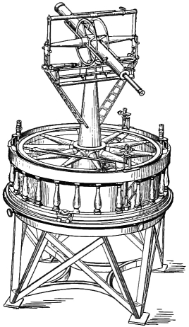
introduced into Greece the gnomon, a primitive instrument
for determining time and latitude, and to have made
a map. The first actual record of a Greek or Miletan
map, however, occurs half a century after his time,
when in 499 B.C. Aristagoras, tyrant of Miletus, asked
aid of Cleomenes of Sparta against Persia, and showed
him a map, engraved on bronze, of the route of his
proposed expedition. Anaximenes, of Anaximander’s
school, gave the earth an oblong rectangular form.
The physical division of land into continents, though
obvious, presupposes the existence of a certain measure
of geographical theory. Still more obvious as a primitive
division would be a division simply between “my
land” and “yours.” But there was a clear necessity at
a very early period for names to distinguish, generally,
the lands which lay on one side and the other of the
Ægean-Mediterranean waters. It may well be that the
names of Europe and Asia did not possess precisely this
application in their original forms. Their derivation
has been assigned to an Asiatic source; they signify on
this view the lands respectively of darkness or sunset
and of sunrise or light—that is to say, the lands
towards west and towards east. The earliest known
Greek reference to Europe, moreover, does not indicate
on the face of it a distinction from Asia, though it
does indicate a distinction from lands separated from it
partly or wholly by water. The Homeric hymn to
Apollo, which may be dated in the eighth or seventh
century B.C., refers to dwellers in the rich Peloponnese
and in Europe and in the sea-girt islands—albeit in
place of “Europe” some scholars would read a word
signifying simply “mainland.” The name of Europe,
if admitted here, is taken to mean no more than
northern Greece, and would thus lend some colour to
an early tradition that it was derived from a Macedonian
city called Europus. However this may be, it is easy
to conceive that the name of Europe, being at no time
given to a territory with defined frontiers, was capable
of an elastic application, which would be gradually
extended, or (as is more probable under primitive conditions
of geographical knowledge) would remain so
vague as to permit of no clear definition.
But when the names of continents emerge in Greek
usage they afford the necessary distinction between
the lands on either side of the Ægean-Mediterranean.
They so emerge in the 6th–5th centuries B.C., and the
distinction appears by that time to have been perfectly
familiar, though the precise application, as will be
seen, was a matter of controversy. The poet Æschylus
(525–456 B.C.), who, by the way, was also a traveller,
possibly to Thrace, certainly to Sicily, was acquainted
with the distinction, as appears, for example, from
passages in the historical drama of the Persæ, which
deals with the failure of Xerxes’s invasion of Europe
from Asia, and his retreat across the Hellespont. The
distinction would hardly have been introduced into a
stage-play if it had not been commonly recognized. In
Prometheus Unbound, again, Æschylus refers to the
river Phasis (Aras) as the boundary between Europe
and Asia. Finally, Herodotus states in an early
chapter of his work that the Persians appropriate
to themselves Asia and the barbarian races
inhabiting it, while they consider as separate Europe
and the Greek race, and he does not find it necessary
to offer any explanation of the names here. At a later
stage the continental distinction appears to have been
based on or associated with a distinction between
temperate and hot lands.
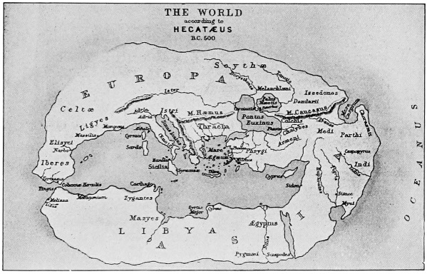
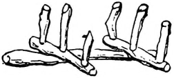
Fig. 2.—The World as supposed to have been conceived by Hecatæus.
Hecatæus of Miletus (c. 500 B.C.) has been hailed as
the father of geography on the ground of his authorship
of a Periodos, or circuit of the earth, the first
attempt at a systematic description of the known world
and its inhabitants. But even if he wrote such a work,
evidence has been adduced that the extant fragments
of it belong to a later forgery. However, he was a
Miletan and a traveller, besides a statesman. The
map which is supposed to have accompanied his work
maintained the old popular idea of the earth as a
circular disc, encircled by the ocean. Greece was the
centre of the world, and the great sanctuary of Delphi
was the centre of Greece. If this Periodos is taken as
a forgery, there is a parallel case in the Periplus of the
Mediterranean attributed to Scylax of Caryanda, a
contemporary of Hecatæus. If Scylax wrote any such
work, in its extant form it is a century and a half later
than his time. He is said to have explored the Indus
at the command of Darius Hystaspis, and to have
returned by the Indian Ocean to the Red Sea.
Herodotus of Halicarnassus (c. 484–425 B.C.) was a historian,
but was widely travelled, and understood the importance
of a knowledge of the geography of a country,
and its bearings on the history of its people. He only
introduces geographical information in so far as it
throws light on the history with which he is dealing, or
because it seemed to him of special interest, or as a
report of curious information obtained from the
countries which he visited; but he has certainly some
more exact information about the restricted world of
which Greece was the centre than any of his predecessors.
He visited Egypt and the Greek colony of
Cyrene, on the coast of what is now Tripoli. There
is reason to believe that in Asia he got as far as
Babylon on the Euphrates, and perhaps as far as Susa
beyond the Tigris. He crossed the Euxine to the
northern shore as far as Olbia on the Borysthenes,
and probably went round to the south-east coast to
the country of the Colchians, whose characteristics he
describes as if from personal knowledge. He does not
seem to have got very far west in the Mediterranean,
though he spent the latter part of his life in southern
Italy. There is little doubt that he visited several of
the Grecian islands. But apart from the information
about the countries round the Mediterranean which he
collected personally, his history contains material from
various sources concerning the countries and peoples
in Europe, Asia, and Africa. This information, on the
whole, is of the vaguest kind, and shows that the
Greeks whom Herodotus may be taken to represent
were only groping their way with regard to a knowledge
of the world outside the limits of their own
restricted sphere. This vague knowledge included a
considerable section of western Asia as far as the
Caspian Sea and the river Araxes. Herodotus had
also heard of India and of the Indus river, and had a
fair knowledge of the Persians, the Medes, and the
Colchians, as also of part at least of Arabia. Eastwards,
in what might be called Central Asia, he had
heard of the Bactrians and Sogdians to the south of
the Jaxartes (Syr-darya, the northern of the two
great affluents of the Sea of Aral), and of the Massagetæ,
Issedones, Arimaspians, and other races or
peoples; those to the north of the Jaxartes being
included, according to Herodotus, in Europe, which he
took to extend from the Pillars of Hercules (Strait of
Gibraltar) to the Hellespont and up the Phasis (Rion)
river, from its mouth in the Black Sea, to the Caspian.
He also divided Asia from Libya (Africa) along the
axis of the Red Sea, and was thus in conflict with
others who had divided Europe from Asia at the
Tanais, and Asia from Libya at the Nile. He would
not permit a theoretical boundary-line to “bisect a
nationality,” as the Nile does.
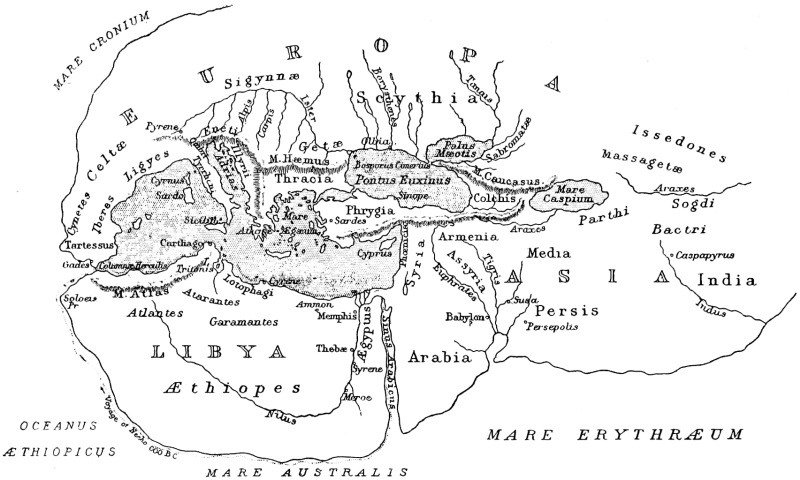
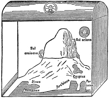
Fig. 3.—The World according to Herodotus B.C. 450.
It may be well to examine Herodotus’s geographical
knowledge in some detail, as representing the general
knowledge possessed by a student (increased by his
own travels) as distinct from that possessed by traders
and colonists in different particular directions. His
knowledge of Europe proper was contained within
rather narrow limits. He knew, from personal knowledge,
or from information obtained from merchants
and colonists familiar with the shores of the Euxine
(Black Sea), of the country lying to the north of that sea
for some distance, of the rivers which flowed into it
from the north and from the west, and of various
peoples either settled in or wandering over the land
that is now mainly included in Russia. His notions of
the comparative dimensions of the Euxine and of the
Mæotis Palus (Sea of Azov) are altogether erroneous, as
might have been expected; but he knew (though in
the main vaguely) of the Tanais (Don), the Borysthenes
(Dnieper), and other rivers which flow into those seas.
The Ister (Danube) he knew as a river of considerable
importance, but he made it rise in Spain and flow
north-east and east through the greater part of Europe.
He conceived it as corresponding to some extent in
the direction of its course with that of the Nile on the
other side of the Mediterranean. He had some vague
notion of the Iberians and of the Celts, as inhabiting
the country to the north of the Pillars of Hercules. He
knew something of the country lying to the north of
Greece, Illyria, Thessaly, and Thrace, and the Rhodope
mountains. He has much to tell of the Scythians
inhabiting the country north of the Black Sea, but it
is difficult to make out exactly to what race they
belonged and whither they had wandered; they may
have been the forerunners of the Slav peoples. Of
Europe to the north of the Danube, and of the
Scythian country, he had no information of any importance.
He did not believe in the Hyperboreans,
nor did he credit the statement that there was any sea
north of Europe. He has a good deal to say about
Africa. He had been up the Nile as far as the first
cataract to the old city of Elephantine, but above that
his information is vague and largely erroneous. He
knew of the great bend which the Nile takes to the
west above Elephantine, and had heard of Meroe on
the other side of that bend; but his notion of the
length of Africa was so erroneous that, instead of
carrying the Nile south into the interior of the continent,
he made it rise far to the west and run eastwards
before it turned north at Meroe. But he at
least controverted the view that it rose in the ocean
itself to the south—a belief based possibly on some
rumour, transmitted through many lips, of the existence
of great lakes towards its headwaters. As for a river
flowing west-and-east, in the west of the continent, he
had heard of such a river in a story of five Nasamonian
youths who travelled south from the shore of the
Syrtis, crossed the desert for many days, and were at
last taken captive by black men of small stature, who
carried them to a city on the banks of this river,
whence they were subsequently allowed to return. It
has been eagerly discussed what truth underlies this
story, and whether the river was the Niger in its
upper course; but at best the account added little to
the knowledge of distant Africa. The idea of a pygmy
people dwelling towards the southern shore of the
ocean is older than the Iliad in which it is found
(III, 3). Herodotus’s conception of the shape of
Africa did not carry its southward extension much
beyond the latitude of Cape Guardafui. He discarded
the popular conception of the round earth, regarding
it as longer from east to west than from north to
south. The philosopher Democritus of Abdera (born
c. 470–450) exhibited the same conception in a map
which he constructed.
An important episode in the progress of a more
accurate knowledge of the world of the Greeks was
the Retreat of the Ten Thousand under Xenophon in
401–400 B.C. The younger Cyrus had made a great
expedition from Sardis, in western Asia Minor, eastwards
through the Cilician Gates to the Euphrates, and
along the course of that river to the neighbourhood of
Babylon. He was accompanied by a band of Greek
mercenaries, who, after his defeat at Cunaxa, began
the retreat of which Xenophon left a graphic account,
containing what must have been to the Greeks much
new information concerning the region from the junction
of the Tigris and Euphrates northwards past Lake Van
and through the mountains of Armenia, north and west
to the shores of the Black Sea at Trapezus (Trebizond),
and along the south coast of the Black Sea, partly by
sea and partly by water, to Byzantium. Xenophon’s
story is an illustration of the well-known fact that war
is one of the chief means of promoting geographical
knowledge. This will appear more clearly in the next
important episode in the story of exploration—the
campaign of Alexander the Great.
In the interval there were one or two writers from
whose work something is to be gathered of Greek geographical
knowledge and theory about the middle of the
fourth century. The philosopher Plato (427–347 B.C.)
may be referred to here in connection with his story,
based on an Egyptian tradition, of the great island of
Atlantis, that land which plays so important a part in
later mythical geography. In the Egyptian story it lay
just beyond the Pillars of Hercules, and adjacent to it
was an archipelago. This would aid its later identification
with the Canaries, though it came also to be connected
with America and other known lands besides,
as well as giving name to an island in the Atlantic
Ocean, the disproof of whose existence may almost be
called modern. From Plato’s account of Atlantis as
the home of a powerful people who in early times
invaded the Mediterranean lands, it has also been
sought to associate the tradition with Crete at the
period of the Ægean civilization mentioned in the first
chapter.
Some fragments exist of the writings of the historian
Ephorus of Cyme in Æolis (c. 400–330 B.C.).
He seems to have endeavoured to cover the whole
field of the world as known to the Greeks, and conceived
the four most distant regions of the earth to
be occupied on the east by Indians, on the south by
Ethiopians, on the north by Scythians, and on the
west by Celts. The last he considered as occupying
all Spain, as well as Gaul. Strabo (p. 24) commended
his geographical work and his skill in separating myth
from history. A document of this period is the Periplus,
already referred to as known under the name of Scylax.
This class of work became more and more common as
navigation developed, and corresponded in some measure
to the modern Admiralty guide or pilot. The Periplus
is confined mostly to the regions known to the Greeks
bordering the Mediterranean. From the Pillars of
Hercules the writer follows the north coast eastwards,
including the Adriatic and the Euxine as far as the
mouth of the Tanais, which he regards as the continental
boundary. He then follows the Levantine
coast, the north African coast westward, and the west
African coast as far as the island of Cerne. He
incidentally makes what is regarded as the earliest
extant mention of Rome; but his notions of rivers
and other features away from the coast are generally
erroneous.
Aristotle (384–322 B.C.), in two of his extant works,
the Meteorologica and the treatise on the Heavens,
revealed something of his ideas on physical geography
and the figure of the earth and its relations to the
heavenly bodies. He believed the earth to be a sphere
in the centre of the universe, because that was a form
which matter gravitating towards a centre would necessarily
assume, also because the shadow cast by the
earth on the moon during an eclipse is circular. He
accepted the conclusion that the circumference of the
earth was 400,000 stadia (nearly 46,000 miles). His
views with reference to the cosmical relations of the
earth were the same as those adopted by Eudoxus of
Cnidus (fl. middle fourth century), but he did his best
to prove them. He adopted, however, the prevalent
view that the habitable world was confined to the
temperate zone between the tropics and the arctic
regions. He believed there must be a temperate zone
in the southern hemisphere, though he did not suggest
that it must be inhabited. In the Meteorologica he
treats of such subjects as weather, rain, hail, earthquakes,
etc., and their causes. He recognized that
changes took place in the relations of land and sea.
His knowledge of the origin and course of rivers
and their relation to mountain systems was confused,
and mainly erroneous; and it would seem that little
progress had been made in geographical knowledge
since the time of Herodotus. In the work of Aristotle’s
successor, Theophrastus of Lesbos (c. 372–287), an
important department of geographical study—that of
distribution—finds a place in its particular application
to plants.
Alexander the Great (356–323 B.C.), King of Macedon,
however, during the last few years of his life, made
possible by his campaigns a greater extension of Greek
geographical knowledge than had taken place almost
since Homeric times. When he passed eastward
through Mesopotamia, by Babylon, Susa, and Persepolis,
and through Media to the southern shore of the
Caspian Sea, he was in a region which, though an
ancient cradle of civilization, had been till then only
vaguely known to the Greeks. Beyond that he entered
new country, peopled by Herodotus and others with
dubious tribal names. He came almost into the heart
of Central Asia, founding a city on the upper course of
the Jaxartes. Passing southwards through Bactria and
across formidable ranges of mountains such as the
Hindu Kush, he struck the upper course of the Indus,
made his way down to its delta, and would have proceeded
right into the heart of India and followed the
Ganges to its mouth but for his mutinous troops. He
returned through the north of Baluchistan and Persia
to Ecbatana, and so homeward. He also sent a
member of his staff, Nearchus, by sea along the coast
of Baluchistan and Persia, in order to define it and to
ascertain the extent of the Persian Gulf. Dicæarchus
of Messana, a pupil of Aristotle, who died early in the
third century B.C., used the geographical results of
Alexander’s expeditions, including the distances
obtained by his bematists, or measurers by pacing.
Dicæarchus wrote a topography of Greece, and also
drew on a map a parallel or equator, for the first time,
so far as is known, along the length of the Mediterranean
and, with a distorted idea of their relative
directions, along the Taurus and Himalayan ranges.
Before his time, and probably contemporaneously with
Alexander’s campaigns, Pytheas of Massilia (Marseilles)
visited (practically discovered) Britain, and made mention
of Thule, six days’ voyage north of it, having
perhaps heard of the Orkneys and Shetlands. As
these islands, however, are at no such great distance as
is here suggested from the nearest point of Britain, the
name of Thule has been variously taken to represent
some part of Norway, the Faeröe, or Iceland: it certainly
seems by some later writers to be applied to
Scandinavia, and in literary usage came to signify the
uttermost north. Pytheas also obtained an idea of
the Baltic Sea, and is considered by some to have
entered it; he is stated to have reached the River
Tanais; but if that is to be considered as one of the
north European rivers, and not the known Tanais of
the Black Sea basin, its identity is doubtful. Pytheas
was a trained astronomer; he was one of the first to
calculate latitudes, and had that of Massilia nearly
correct; he heard of the unbroken summer daylight
and winter darkness of the far north, and he noted
various features of geographical interest, such as the
decrease in the number of different grain crops observed
as he travelled northward. He appears, in fact, from
the references in other authors, which alone furnish
us with knowledge of his work, in the light of a scientific
traveller of a type rare in his time.
Mathematical geography was carried a long step
forward by Eratosthenes (c. 276–194 B.C.), a native of
Cyrene, who became chief librarian at Alexandria under
Ptolemy III Euergetes. He calculated the circumference
of the earth. He considered Syene to be
situated on the tropic (which it was not, precisely),
because at noon on the day of the summer solstice the
sun appeared to shine directly down a deep well there.
He therefore observed the zenith distance of the sun
at Alexandria at the same time, and obtained his result
from this and the measured distance between Alexandria
and Syene. His result was to make the earth’s
circumference only about one-seventh greater than it
actually is. He also estimated the size of the habitable
earth (œcumene), and considered it, as a result, to be
about double as long from west to east as it was broad
from north to south. But his estimate of the distance
from what is now the extremity of Brittany to the
known eastern limit of India was about one-third too
great. On a map of the world he drew seven parallels,
using the few points of which the latitudes had been
worked out, and also seven meridians at irregular
distances apart. Hipparchus (middle and second half
of the second century), an astronomer, native of Nicæa
in Bithynia, who worked in Rhodes, drew an elaborate
series of parallels, and made the division into 360
degrees; the spaces between the lines he called climata,
or zones. The problem presented by meridians was
more difficult, for there was no instrument for the
calculation of longitude like the gnomon for that of
latitude. A well-recognised line was that taken to lie
from the mouth of the Danube to that of the Nile—Herodotus
had used this—and southward up the latter
river; but not only the line itself, but also the ideas
of intermediate points lying on it, were rather far from
the truth.
Eratosthenes in his writings also dealt with the
history of geography and with physical geography.
This last branch attracted a number of students about
this period and later, as, for example, Agartharchides
or Agatharchus of Cnidus (middle of the second
century B.C.). Crates of Mallus, in the first half of the
same century, expressed the view of the Stoic philosophers
that the spherical earth was divided into four
inhabited quarters—the Œcumene (the known world),
the Antipodes, the Periœci, and the Antœci. Posidonius
the Stoic (c. 130–50 B.C.), among his studies in various
departments of knowledge, included such subjects as
the ocean, volcanoes, and earthquakes; he observed
the interaction of the sun and moon in their influence
on tides. He recalculated the circumference of the
earth, but obtained an underestimate considerably
further from the truth than Eratosthenes’s overestimate;
and, owing to his high scientific reputation,
his error persisted in much later work. Posidonius,
before settling at Rhodes, had travelled widely in Africa,
Spain, and western Europe generally; and both he and
Agartharchides, like other writers of this period, and
Aristotle before them, recognized the importance of
the human side of geography, and the influence of
physical environment on the political and social régime.
Polybius (c. 204–122 B.C.) of Megalopolis in Arcadia,
historian, statesman, and military commander, was
inspired by extensive travel to introduce the results of
topographical and geographical studies throughout his
history. Among travellers who rank more nearly among
explorers there may be mentioned at this period Eudoxus
of Cyzicus (fl. c. 130 B.C.), who went on a trading expedition
to India, in command of a fleet which was
despatched by Ptolemy Euergetes of Egypt with the
specific object of exploring the Arabian Sea. Eudoxus
subsequently tried without success to circumnavigate
Africa, making at least two voyages along the east
coast. Finally, it must be remembered that at this
period the extension of the knowledge of the world was
mainly due no longer to Greek, but to Roman, activities,
and Roman conquests were pushed beyond the confines
of accurate Greek knowledge in various directions.
Much geographical material was made available by
writers on Roman military expeditions. Thus Pompey
was accompanied in the Caucasian region by Theophanes
of Mytilene, as historian of his campaigns; Julius Cæsar
wrote his own account of lands into which he carried
his arms (Gaul, etc.).
From all this it appears that, according to the lights
of knowledge at the time, a fair conception existed of
geographical study along the main lines which it follows
to-day. There was therefore occasion for a general
review of the whole subject; and this occasion was
seized by Strabo, a native of Amasia in Pontus, who
was born c. 63 B.C., and died in the second or third
decade of the following century. He was educated
partly at Rome, but his language and outlook were
Greek. He travelled much, as far as Etruria, the Black
Sea, and the borders of Ethiopia, as well as in Asia
Minor, though he knew comparatively little of Greece.
His geography, which was not finally completed till
towards the close of his life, was the first attempt at
covering the whole geographical field—mathematical,
physical, and human—and his range was thus wider
than that of Eratosthenes. Strabo used the recent
Roman authorities to some extent, such as Cæsar’s
Commentaries (in part) and a map of the Roman Empire
by M. Vipsanius Agrippa, son-in-law of Augustus,
which was set up in Rome; and he also preferred the
authority of Polybius to that of Pytheas, but his sources
were mostly Greek. His appreciation of them was not
always wise. He ranked the Homeric poems highly,
but discredited Herodotus, who on some points had
better information than he. He added nothing to the
mathematical branch, in which Eratosthenes was his
master. He thus accepted the spherical form of the
earth, its dimensions as laid down by his predecessors,
and its division into five zones. He recognized
Hipparchus’s view that further astronomical observations
were essential to precision in earth-measurement
and the position of points on the surface; but it was
outside his province to add to those existing. His
work in the physical field, however, improved upon that
of his predecessors, and his surveys of the features and
products of the various lands must have been singularly
valuable for reference. The apportionment of the
seventeen books of his geography is not without
interest as a rough guide to the distribution of available
material and to the author’s outlook. He devoted
two books to introductory matter, to Spain and France
two, to Italy two, to northern and eastern Europe one,
to Greece and adjacent lands three, to the main divisions
and remoter parts of Asia one, to Asia Minor three, to
India and Persia one, to Syria and Arabia one, to Egypt
and the rest of Africa one.
Rome did not carry on the Greek tradition of the
study of geographical theory. H. F. Tozer, quoting
J. Partsch, writes: “It has been aptly remarked that
the task which Eratosthenes set himself of measuring
the earth by means of the heavenly bodies, and that
of Agrippa, who measured the Roman provinces by
milestones, may be taken as typical of the genius of the
two nationalities respectively.” Thus Pomponius Mela,
purporting to survey the world in his De Chorographia
(written c. 50 A.D.), followed the coast and described
various countries in passing, but by no means all, and
added very little to geographical knowledge at large.
Pliny the Elder (c. 23–79) devoted three books and part
of another of his Historia Naturalis to geography; but
his geography may (at least in considerable part) be
compared with the arid text-book of a generation ago,
though in some instances his descriptions (as of features
in Palestine, Syria, and Armenia) are valuable. As bearing
on the quotation made above, it may be said here that
the famous Roman system of road building gave rise to
two classes of road-books (as they may be termed),
one consisting of lists of stations and distances, such
as the Antonine Itinerary (probably, in its original
form, of the late third or fourth century), the other
diagrammatic, such as the Peutinger Table (probably
of the first half of the third century, though named
after a scholar of the sixteenth), on which roads,
stations, and other details were presented in a map-like
form, but independently of true scale or direction.
The Roman agrimensores were skilled surveyors.
It is not, then, surprising that the two great theoretical
geographers next to be considered are not
associated with the capital of the Roman Empire. Of
the work of Marinus of Tyre nothing is known beyond
what is recorded by his immediate successor, Ptolemy,
who used and acknowledged his results—as far as concerned
the Mediterranean fully, and in respect of other
countries to a modified extent. Ptolemy, mathematician,
astronomer, and geographer, was a native of Egypt,
who worked at or in the neighbourhood of Alexandria
in the second century. His geographical book was
called Geographike Syntaxis. He carried mathematical
geography far beyond the standard of his predecessors.
He used the theoretical division of the globe into five
zones by the equator and the tropics, adopted Hipparchus’s
division of the equator into 360 degrees, and
worked out a network of parallels of latitude and
meridians of longitude, first thus applying these terms
in their technical sense. In mapping the habitable
world he used the Fortunate Isles, beyond the western
confines of Europe and Africa, as the location of his
prime meridian. The errors which resulted from the
vague idea as to the position of these islands (the
Canaries and Madeira), and from the fact that Ptolemy
followed Posidonius’s underestimate of the circumference
of the globe and made his degree at the equator
equal to 500 instead of 600 stadia,2 have been very
fully analysed, but cannot be even summarized here.
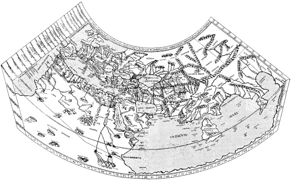
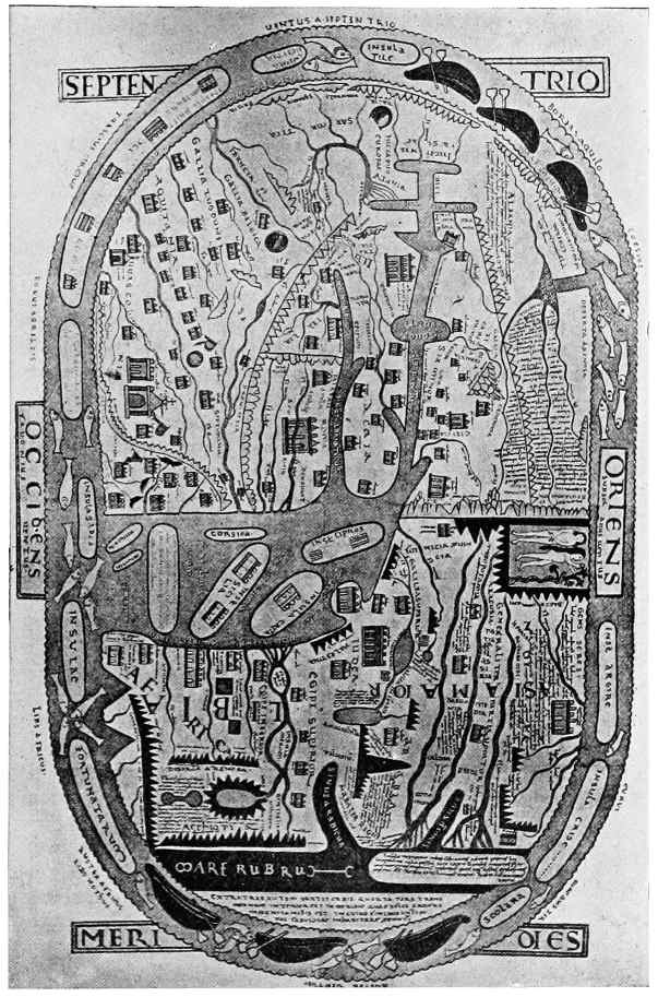
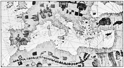
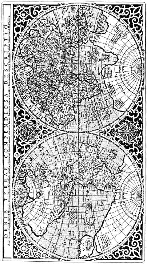
PTOLEMÆUS ROMÆ 1490.
Fig. 4.—The World according to Ptolemy.
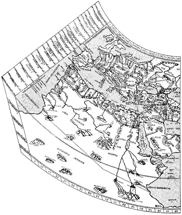
Fig. 4. (left side)
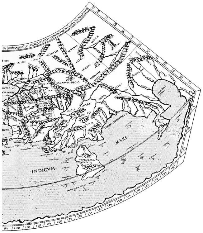
Fig. 4. (right side)
Ptolemy had a strong tendency to exaggerate the
size of the great land-masses—his Europe extended too
far west (and the Mediterranean was made too long
in consequence); his Africa was too wide, especially
towards the south; his Asia was vastly exaggerated
in its eastern extension, and many details, even in the
Mediterranean area, were made too large. Ptolemy
followed his predecessors in using the parallel of 36° N.
as the axial line of the Mediterranean. It passes
through the Straits of Gibraltar, the island of Rhodes,
and the Gulf of Alexandria, and was theoretically prolonged
eastward along the supposed line of the Taurus
mountains and the range known to lie north of India.
In respect to this line there were remarkable inaccuracies
in laying down the coasts of the Mediterranean and in
fixing the position of the points upon them. The sea
itself was made not only too long, but too broad;
Byzantium and the Black Sea were carried too far
north, and the size of the sea of Azov was immensely
exaggerated. On the other hand, Ptolemy restored
the correct view, held by Herodotus, of the Caspian
as an inland sea, and knew that the great river
Volga entered it. Yet again, he knew nothing of
Scandinavia, or of the land-locked Baltic Sea, marking
only a small island of Scandia, possibly by confusion
between the Scandinavian mainland and some Baltic
island. But his idea of the British Isles may be taken
as fairly correct, if allowance be made for their remoteness.
He laid down some parts of the coast very
fairly, but oriented the major axis of Scotland more
nearly from east to west than from north to south; he
also placed Ireland wholly more northerly than Wales.
There is plenty of evidence in Ptolemy’s work of a
growth of knowledge of remote lands, though much of
it is vague, if not actually unintelligible to us. Thus
in Asia he had an idea of the great central mountain
ranges (Pamir, Tian-shan, etc.), for silk-traders had by
now established trans-continental routes to China.
Ptolemy had also some conception of the south-eastern
coasts, which had probably been seen by Greek mariners
as far as southern China. But he wholly misunderstood
the form of the east of the continent, for beyond
the Golden Chersonese (Malay Peninsula) there lies a
vast gulf, the eastern shore of which represents his
view of China, extending southward far beyond the
equator, and facing west. Again, he had no conception
of peninsular India—unless, indeed, his huge island
of Ceylon (Taprobane) was drawn so by some confusion
with the peninsula, as it was certainly also confused
with Sumatra. Yet it would seem that he might have
gathered a more accurate idea of India from the
Periplus of the Erythræan Sea, a guide to navigators
dated about the year 80. This work furnished sailing
directions from the Red Sea to the mouth of the Indus
and the coast of Malabar, following the Arabian coast,
although the possibility of crossing the open sea with
the assistance of the monsoon was realized at a still
earlier date. And the Periplus distinctly indicates the
southward trend of the Indian coast-line.
Roman penetration of Africa gave Ptolemy some new
details; he also conceived the Nile as formed by two
headstreams arising in two lakes, possibly on the
strength of some hearsay of the facts, and he marked
the Mountains of the Moon in remoter Africa, which
again suggests hearsay of the heights of Ruwenzori,
Kenya, and others. The Romans had penetrated
Ethiopia, and possibly the region of Lake Chad, and
Ptolemy also used other sources of information about
North Africa which are unknown from previous writers,
but are completely vague and impossible to follow. Of
the shape of the continent he was almost completely
ignorant; he just realized that an indentation occurs in
the Gulf of Guinea, but gave it nothing like its proper
value, and carried the coast thence south-westward till
the continent is broader at the southern limit of his
knowledge than it is at the north.
Ptolemy’s work on physical features was on the
whole poor, and he neglected the human side of geography.
Discarding the idea of the circumfluent ocean,
he supposed the extension of unknown lands northward
in Europe, eastward in Asia, and southward in Africa,
beyond the limits in which he attempted to portray
their outlines; and he even suggested a land connection
between south-eastern Asia and southern Africa.
Before his time the precision of mathematical method
had far surpassed that of the topographical material to
which it was applied.
Pausanias, a Greek probably of Lydia and about contemporary
with Ptolemy, wrote a description (Periegesis)
of Greece, which, apart from the archæological value
which is its chief interest, contains references to various
phenomena of physical geography, while as a detailed
topographical work it stands alone in the literature of
which an outline has thus far been given.