Abbreviations of architectural terms:—
E.E. = Early English.
Dec. = Decorated.
Perp. = Perpendicular.
Abbots Langley (1½ mile S.E. of King’s Langley Station) is a
village on prettily wooded high ground near the river Gade. It is famous
as the birthplace of Nicholas Breakspeare, who, having vainly
endeavoured to be admitted as a monk in the great Benedictine monastery
at St. Albans, studied at Paris and eventually became Pope Adrian IV. He
died in 1158 at Anagni; tradition states that he was choked with a fly
whilst drinking. The village probably owes its name, first, to its
length, “Langley” signifying a long land; second, to the fact that in
the days of Edward the Confessor it was given to the Abbots of St.
Albans by Egelwine the Black and Wincelfled his wife. An entry in
Domesday records that there were two mills on this manor, yielding
30s. rent yearly, and wood to feed 300 hogs. The Church of St. Lawrence
has nave, aisles and clerestory; a chancel with S. aisle, and square
embattled tower. The windows are mostly Perp., but those of the S. aisle
are Dec. Note (1) the monument to Lord Chief Justice Raymond, died
1732; (2) the brasses in nave to Thos. Cogdell and his two wives, 1607,
and to Ralph Horwode and family, 1478. Late in the reign of Henry VIII.
the vicarage was rated at £10 per annum. An inscription in the chancel,
copied in Chauncy, reads “Here lieth Robert Nevil and Elizabeth his
wife, which Robert deceased the 28th of April in the year of our Lord
God 1475. This World is but a Vanity, to Day a man, to Morrow none.”
Prince Charles held a Court at Abbots Langley during the Reign of James
I.
Albury (3½ miles E. of Braughing Station) is a village near the
river Ash. The church, dedicated to St. Mary, dates from the fourteenth
century; it was recently restored. There was an earlier structure so far
back as the days of Stephen, in whose reign Robert de Sigillo gave the
profits of the church at Eldeberei to Geoffery, first Treasurer of St.
Paul’s Church, London. An interesting will, dated 4th November, 1589,
records that Marmaduke Bickerdy, Vicar of Aldebury, gave an acre of land
in the neighbourhood to provide a sum for distribution among the poor on
every Good Friday. In the chancel the mutilated effigies of a man and
woman are said to represent Sir Walter de la Lee and his wife. Sir
Walter sat in nine Parliaments in the interests of the county—at
Westminster, Northampton and Cambridge, and was Sheriff of Herts and
Essex. He died during the reign of Richard II. Albury Hall, close
by, is a fine old mansion, where the “Religeous, Just and Charitable”
Sir Edward Atkins, Knight, and Baron of the Exchequer, died in 1669. The
village is usually a quiet spot, with little business, but it is
pleasantly situated; the proximity of the river and some scattered
cottages and farms enhance its attractiveness.
Albury End is a small hamlet about 1 mile S.W. of Albury.
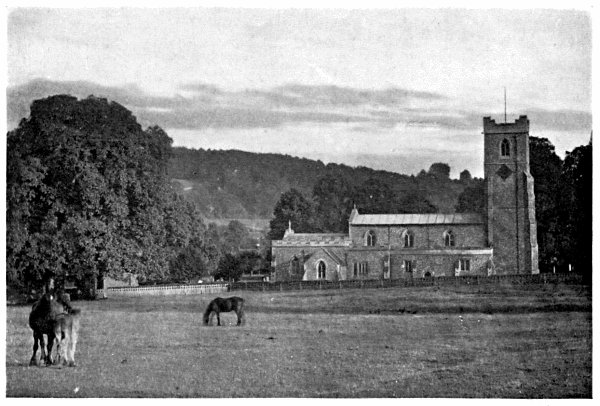
THE PARISH CHURCH, ALDBURY
Aldbury (1½ mile E. from Tring Station) is a village on the
Buckinghamshire border, nestled in a beautiful valley close to Ashridge
Park (q.v.). It is the “Clinton Magna” of Bessie Costrell, and the
author of that story, Mrs. Humphrey Ward, lived at Stocks, a few
minutes’ walk from the village. On the Tring side Aldbury is sheltered
by swelling fields and to the E. beech woods cover the hillside, which
is topped by the “Aldbury Monument,” a granite column about 100 feet
high erected to the memory of Francis, third Duke of Bridgewater, whose
labours and enterprise for the extension of canals earned for him the
well-known title “the father of inland navigation”. As a village of the
Old English type Aldbury has perhaps no equal in the county. In the
centre is the green and pond, under the shadow of an enormous elm; close
by stand the stocks and whipping-post, recently in excellent
preservation. The Church of St. John the Baptist is E.E.; it was
restored in 1867. Visitors should notice the old sundial on a pedestal
in the churchyard, and the Verney Chapel, which is separated from the
nave by a screen of stone, and contains a monument to Sir Robert
Whittingham, who was slain at the battle of Tewkesbury. The church also
contains memorials of the Hides and Harcourts, families who left several
charities to the poor of the parish. In the days of Edward the Confessor
the manor of Aldeberie was held by one Alwin, the king’s thane.
The ascent of the wooded slope towards the Bridgewater monument takes
the visitor through one of the most beautiful districts in the county,
and a noble prospect stretches before him as he looks back through the
beeches towards the village in the valley beneath.
Aldenham (2 miles S.W. from Radlett Station M.R.) is a village
pleasantly situated near the river Colne, reached by way of Berry Grove
at the W. end of the village. The churchyard is locally famous for the
tombs of a man and woman named Hutchinson, which, singularly enough,
have been riven apart and almost destroyed by three sycamore trees about
a century old. The Church of St. John the Baptist is largely Perp. with
earlier portions, and is worth a visit, if only for the oaken nave-roof,
believed to date from about 1480, and for the font of Purbeck marble,
probably 750 years old. An object of greater interest in some eyes is
the fine parish chest, formed from one massive piece of oak nearly ten
feet in length, and furnished with iron clamps and hinges of great size;
there are few finer old parish chests in England. Note also (1) the
triple sedilia in chancel; (2) the many brasses dating from 1450,
several of which are to the Cary family; (3) two palimpsest brasses in
the vestry, one of which bears a portion of a mutilated inscription to
one Long, an alderman of London, who died in 1536. The church was
restored in 1882 by Sir A. W. Blomfield, F.S.A. Aldenham House,
property of Lord Aldenham, dates from the days of Charles II., and
stands in a park of about 300 acres.
Aldenham Abbey, once known as Wall Hall, stands close to the parish
church; it is about a century old, and belongs to the Stuart family.
Aldwick Farm is 1 mile N.E. from Marston Gate Station, L.&N.W.R.
Allen’s Green, a hamlet 2 miles N.W. from Sawbridgeworth, contains
little of interest.
Almshoebury (1½ mile W. of Stevenage Station, G.N.R.) is about fifteen
minutes’ walk from the ruins of Minsden Chapel (q.v.).
Amwell is a tiny hamlet 1 mile S.W. of Wheathampstead Station,
G.N.R.
Amwell, Great, a parish and village 1½ mile S.E. of Ware
Station, G.E.R., is very prettily situated near the New River, and is
known by name to many who have never visited the neighbourhood, for the
village is frequently mentioned in the essays and letters of Charles
Lamb. The church stands on a wooded slope; near by are the village
stocks, the tiny island upon which stands a monument to Sir Hugh
Myddelton, the projector of the New River, and the stone bearing some
lines written by John Scott, the Quaker. The grotto constructed by the
poet may still be seen near the railway station at Ware. The church is
an architectural conglomeration, with several stained windows, one of
which was contributed by the children of the parish as an Easter
offering nearly seventy years ago. The structure was restored in 1866.
There is a piscina in the chancel, and one in the S. wall of the nave;
there are also two hagioscopes. “The chancel arch,” writes Canon Benham,
“seems to me Anglo-Saxon, and the chancel is a most curious apse.”
Thomas Warner, a friend of Shakespeare, and Isaac Reed, a Shakespearian
commentator, were both buried here.
Amwell End, once at the N.W. extremity of the parish of Great Amwell,
is now a part of Ware (q.v.).
Amwell, Little (about 1½ mile S.W. from Great Amwell), was formerly a
liberty in the parish of All Saints, Hertford; it has formed a separate
civil and ecclesiastical parish since 1864. The Church of Holy Trinity
is E.E. in style; it was erected in 1863. The district is now usually
called Hertford Heath. An interesting, pleasant ramble may be enjoyed by
walking from Hertford to Little Amwell, Great Amwell, and thence to
Ware, or vice versa.
Anstey (about 4½ miles N.E. from Buntingford Station, G.E.R.)
has a cruciform church of mixed styles: the nave is Dec., the transepts
E.E., the S. porch Perp. The tower rests upon four Norman arches; the
font also is Norman. The church was restored in 1871; many features of
architectural interest being wisely retained. The recumbent effigy in
the recess in S. transept is thought to be that of Richard de Anestie,
who founded the church in the fourteenth century. We learn from
Domesday Book that at the time of the Great Survey there was “pannage”
(i.e. acorn woods) at Anestie sufficient to feed fifty hogs, and
that the manor was worth fourteen pounds a year. There was once a castle
here, built soon after the Conquest, the site of which is supposed to be
marked by the remains of a moat still to be traced in the grounds of
Anstey Hall. The churchyard is entered by a covered lich-gate.
Appleby Street is a hamlet 3 miles N.W. from Cheshunt Station, S.E.R.,
and about 2 miles N.W. from the village.
Apsley End (about 1½ mile S. from Hemel Hempstead Station,
M.R., and 1¼ mile S.E. from Boxmoor Station, L.&N.W.R.) is an
ecclesiastical parish near the river Gade. The church, dedicated to St.
Mary, was built in E. Dec. style in 1871, and is well furnished and
decorated. One of the prettiest prospects in the neighbourhood is that
from Abbot’s Hill, a fine private residence, flanked by woods. The Gade
and Bulbourne Rivers unite, a little N.W. from the village, at a place
called Two Waters (q.v.).
Archer’s Green is on the river Maran, about ½ a mile S.E. from Tewin
Church and 1¾ mile N.W. from Cole Green Station, G.N.R. It adjoins
Panshanger Park (q.v.).
Ardeley, otherwise Yardley (6 miles S.W. from Buntingford
Station, G.E.R.), is a village and parish in a purely agricultural
district. It is famous through its connection with the Chauncy family,
who resided at Ardeley Bury for many generations; one of them, Sir Henry
Chauncy, was the author of a well-known history of Hertfordshire. The
family monument is outside of the church of St. Lawrence, some existing
portions of which date from the thirteenth century. The roofs of nave
and aisles are noticeable for the angels which they bear, of Tudor
character; visitors should observe, too, the early window in the
restored chancel. Ardeley Bury, in the days of Sir Henry Chauncy, was
an Elizabethan manor-house dating from about the year 1580, surrounded
by a moat; it was almost entirely rebuilt of brick in 1815-20, when it
became a castellated, imposing mansion. The manor of Erdeley was owned
by a succession of Saxon kings until Athelstan bestowed it upon the
church of St. Paul, London, as recorded in Dugdale’s Monasticon
Anglicanum; it was of the Dean and Chapter that the Chauncys rented
their estate. The river Beane rises near here. A stroll around Ardeley
and Ardeley Bury leads the visitor into some of the quietest spots to be
found in the county. The windmill on the hill above Cromer, near by, is
useful as a landmark when threading the many winding lanes in the
neighbourhood.
Arkley (1 mile W. from High Barnet) consists chiefly of a few
small houses at a spot once called Barnet Common. The view is extensive
in every direction, the village (strictly speaking the chapelry) lying
on high ground. The chapel of St. Peter was erected in 1840, the style
being a variety of Low Gothic; a chancel (E.E.) was added in 1898, and
has a good groined roof.
Ash, river; see Introduction, Section VI.
Ashbrook consists of a few cottages and a beer-shop, 1 mile N.E. from
St. Ippollit’s village, and midway between Hitchin and Stevenage
Stations, G.N.R.
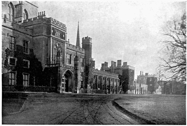
ASHRIDGE HOUSE
Ashridge is in a beautifully undulating district, immediately
N. of Berkhampstead Common, 1 mile E. from Aldbury Church and about 2
miles E. from Tring Station, L.&N.W.R. The present house, the seat of
Earl Brownlow, stands in a park of about 1,000 acres, well known for the
deer which are kept there; it was built by the first Earl of
Bridgewater, or rather by his architect, Wyatt, in 1808-14. It is a huge
structure, its greatest width being 1,000 feet; conspicuous portions are
the turreted centre, some good arched doorways and the large Gothic
porch. The site was formerly occupied by the palace of Edmund
Crouchback, Earl of Cornwall, and by the monastery which he built,
adjoining the palace, for the monks of the Order of Bonhommes, an Order
which he himself brought to this country from France. The earl died
here, but his bones were subsequently removed to Hailes Abbey in
Gloucestershire. The house contains some fine pictures, including, in
addition to works by modern masters, Rubens’ “Death of Hippolytus,”
Luini’s “Holy Family” and Titian’s “Three Cæsars”. In the chapel is a
fine brass to John Swynstede, Prebendary of Lincoln, 1395. It was
brought here from Edlesborough Church.
Ashwell is a village of considerable size on the Cambridgeshire
border. The village is 2½ miles N.W. from Ashwell Station, G.N.R. The
parish is very ancient, and is believed to have been the site of a
British settlement and of a Roman station. The former theory is
considered proved by the existing entrenchments, S.W. from the village,
called Arbury Banks; the latter theory is supported by the fact that
very many Roman relics, especially coins, have been discovered in the
neighbourhood. That it was formerly a place of importance has been
mentioned in the Introduction (Section V.); it was a town in Norman
times, and held four fairs each year. The Rhee, a tributary of the Cam,
rises in this village, at a spot surrounded by ash trees, and to this
fact the parish is thought to owe its name. When Sir H. Rider Haggard
was at Ashwell recently he was unable to say much for its agricultural
prosperity and outlook; but in Chauncy’s day the district produced “all
sorts of excellent Grain, especially Barley, which has greatly
encouraged the trade of Malting in this Borrough”. The same writer
mentions the stone quarry, from which he tells as that several
neighbouring churches had been built or repaired. The Church of St.
Mary the Virgin is mostly E.E. and is conspicuous for its spire-topped
western tower, 176 feet high, being equal to the length of the church.
Note (1) the large ambry in the S. aisle, once the lady-chapel, where is
also a fragmentary reredos; (2) the curious inscriptions on the inner
side of the tower walls, mostly undecipherable, one of which refers to
the plague that attacked the town in the fourteenth century; (3) the
really fine oaken pulpit, dating from the year 1627. There was formerly
a small monastic house in the town, a cell to Westminster Abbey. From
the village it is an open, breezy walk N. to Ashwell Common or S.E. to
Ashwell Field, between the village and the station.
Aspenden (1 mile S.W. from Buntingford Station, G.E.R.) may be
reached from the Old North Road by turning to the left before entering
Buntingford. It is a small, quiet, unimportant village; but much of it
is picturesque and interesting. Readers will remember that Macaulay was
at school here, and that it was the birthplace of Seth Ward,
mathematician and bishop, a contemporary and antagonist of Thomas
Hobbes. The church is a flint structure,—a conglomeration of many
styles. Notable features are the Easter sepulchre in the N. wall of
chancel, the Norman window close to it, the piscina, ambry and credence
table, discovered during the restoration of the church by Sir A. W.
Blomfield in 1873. There are also memorial windows to members of the
Lushington family, and an altar tomb, under a canopy of marble, to “Sir
Robert Clyfford” (d. 1508), who built the church porch in 1500, and to
his wife Elizabeth. The tomb bears brass effigies of these worthies,
which were once in the Church of St. Michael, Cornhill, but were brought
to Aspenden at the time of the fire of London. The aisle (S.) was built
by Sir Ralph Jocelyn in 1478. This Sir Ralph was lord of the manor; he
is remembered in history for his sally against Thomas Nevill, when that
adventurer attempted to rescue Henry VI. from the Tower. He was twice
Lord Mayor of London (1464 and 1476). He died in 1478 and was buried at
Sawbridgeworth.
Aston (2¼ miles N.E. from Knebworth Station, G.N.R.) has an
ancient church restored in 1883. There is E.E. work in parts of nave and
chancel, but other portions are largely Perp., especially the tower,
which is embattled. The alabaster reredos and several memorial windows
are worth notice; nor should visitors overlook the brass at the foot of
the chancel steps to one John Kent, his wife and ten children. This
worthy died in 1592; he was a servant of Edward VI., Mary and Elizabeth.
The village is scattered upon a hill a little W. from the river Beane,
and dates from Saxon times. The manor was once owned by three men under
the protection of Archbishop Stigand; afterwards by the Abbot of
Reading. It fell to the Crown at the Dissolution, like so many other
properties.
Aston Bury is a fine manor house of red brick, about ¾ mile S. from
the village, formerly the property of the Boteler family. The prospect
from the N. windows is a noble one, the district being varied and
undulating.
Aston End, a hamlet 1 mile N.W. from Aston, may be reached from
Stevenage Station, G.N.R., about 2½ miles. There is little here of
interest, but the neighbourhood is very pleasant and largely
agricultural.
Astrope Hamlet (½ mile E. from Puttenham) is midway between the
village of Long Marston and the Aylesbury Canal. It is close to the
Bucks border.
Astwick Farm is 2 miles N.W. from Hatfield Station, G.N.R.
Attimore Hall is 1½ mile S.W. from Welwyn Station, G.N.R.
Aubrey Camp (¾ mile S.W. from Redbourn) is conjectured to be the site
of an early British encampment.
Austage End lies in the parish of King’s Walden, in a purely
agricultural district.
Ayot Green is about ½ mile S.E. from and in the parish of Ayot St.
Peter’s (q.v.).
Ayot St. Lawrence (2½ miles N.E. from Wheathampstead Station
and about the same distance N.W. from Ayot Station, G.N.R.) has a new
and an old church. The former is in Ayot Park, and was designed by
Revett in a classical style. Note (1) the Eastern portico, with
colonnade on either side; (2) the memorial to Sir Lionel Lyde, Bart. (d.
1791), and to the architect of the church (d. 1804). The earlier
structure, still in ruins near the middle of the village, was Dec. of
an early period, with several singular features; the tower, however, was
Perp. “The Windows ... have been adorn’d with curious Pictures, in
stained and painted Glass, beyond many other Churches.” The village has
at different times been styled Eye, Aiot, Great Aiot, and Ayot St.
Lawrence, and was a parcel of the property of Harold Godwin. Ayot
House, standing in a beautiful park of 200 acres, was once the property
and residence of Sir William Parr, brother to Catherine Parr, Queen of
Henry VIII. A room in an older building in the rear of the present
mansion was once, according to local tradition, the prison of Catherine
Parr. There are shoes at Ayot House which belonged to Anne Boleyn and a
hat of Henry VIII.
Ayot St. Peter’s (¼ mile N. from Ayot Station, G.N.R.) lies in
a pretty district watered by the rivers Maran and Lea. The village is
small, but has a commodious Parish Room, containing a small library.
There was a mill here in the time of the Great Survey, the rent of which
was three shillings and 200 eels from the mill-pool per annum. A church,
bearing “a short spire erected upon the tower,” stood on the hill-top in
Chauncy’s day; in 1751 an octagonal structure of red brick was built by
the rector (Dr. Freeman) some distance from the village. This church was
demolished in 1862 and a new one built upon its site; in 1874 this was
in turn destroyed by lightning, and in 1875 the present church of St.
Peter, E.E. in style, was erected much nearer to the village. It
contains a very fine pulpit, carved by Miss Bonham, of Norwood, upon
which the figures of SS. Alban and Helen are conspicuous among others.
There are several memorial windows, tastefully designed, one of which,
to the memory of Mrs. I. A. Robinson, was designed by the architect (J.
P. Seddon). A delightful stroll may be taken from the village, westwards
to Wheathampstead or Lamer Park, or northwards to Codicote or Kimpton.
Nightingales are plentiful in the neighbourhood; the numerous thickets,
dense and secluded, affording excellent shelter to this shy songster.
Baas Hill is ¾ mile W. from Broxbourne Station, G.E.R.
Babb’s Green (nearly midway between Mardock and Widford Station,
G.E.R.) is a small hamlet.
Baker’s Grove is 1½ miles S.W. from Stevenage Station, G.N.R.
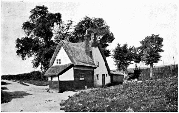
OLD COTTAGE, BALDOCK
BALDOCK, a small town in the northern extremity of the county, lies
between the chalk hills at the junction of the Great North Road and the
Roman Icknield Way. The malting industry is still busily pursued,
although the town is not so exclusively devoted to it as formerly. Very
fine barley was grown in the district before the reign of Elizabeth, and
the horse fairs, of which there are several annually, are well attended.
The township was founded by the Knights Templars, in whose time there
stood a Lazar-house a little eastwards from the town. The church,
dating from the fourteenth century, is large, and of considerable
architectural interest. The chancel and adjoining chapels are Perp. and
contain sedilia and piscinæ; the nave has eight bays and a lofty
clerestory. The rood-screen is co-extensive with the width of the entire
church; the octagonal font is of great antiquity (probably not less than
700 years); there are several brasses, two of which are of the early
part of the fifteenth century. Note also (1) the defaced slab, with
Lombardic inscription to Reynaud de Argenthem, (2) the piscina-like
recess in the N. chapel, (3) the Dec. pillars and arches of nave, (4)
the fine old chest near rood-screen (N. chapel). Baldock has been the
recipient of many bequests; existing charities are in the name of Roe,
Wynne, Pryor, Cooch, Clarkson, Smith, Parker, and a few others, the
whole aggregating a considerable annual sum. The Wynne Almshouses are in
the spacious High Street, where are also the fine town hall and fire
station, erected in 1896-7. Some side streets between the church and
station are noticeable for the variety of cottage architecture which
they display.
Barkway (4 miles S.E. from Royston station, G.N.R.) was a
village of some importance in the old coaching days, for it is on the
main road from Ware to Cambridge. It was partly burnt in 1592. There are
many quaint houses in the neighbourhood, and one or two inns seem to
still retain something of the atmosphere of the old régime. Near the
village, at a spot called Rokey Wood, a small bronze statue of Mars was
discovered some years ago. It is of Roman workmanship and is now in the
British Museum. Cyclists riding northwards or eastwards from Barkway
will find many hills to test their powers; but the air is exceptionally
good and the district decidedly worth visiting. The church (flint, with
stone quoins) is Perp. with embattled and pinnacled western tower; it
was restored in 1861. Several memorials are worth noticing: (1) marble
sarcophagus, with bust by Rysbrach, to Admiral Sir John Jennings (d.
1743); (2) brass on N. wall, found in the flooring during restoration,
to Robert Poynard (d. 1561), his wives Bridget and Joan, and his four
daughters; (3) monuments to Chester and Clinton families in chancel. The
once annual Pedlars’ Fair has been discontinued; as has also the Tuesday
market, which dated from the days of Henry III. In Saxon times the
village was called Bergwant, i.e., the way over the hill.
Barley, a village on the Essex border, is 2 miles N.E. from
Barkway, and lies on the same high road. The Church of St. Margaret was
restored in 1872, in fourteenth century Gothic, but the tower, which is
Norman, still stands. During the restoration some curious jars, of
ancient make, were found in the chancel walls, but were broken in the
efforts to dislodge them. There is a brass to Andrew Willet, D.D.,
rector of the parish and author of Synopsis Papismi (d. 1621).
Some interesting data for a book on the antiquities of Barley are
preserved in the pre-Reformation “Parish Hutch”. I may mention the
“towne house ... tyme out of mynde used and employed for the keeping of
maides’ marriages,” and the “Playstoe” or “common playinge place for the
younge people and other inhabitants of the said towne”. This “towne
house” may still be seen near the church.
Barleycroft End is S.E. from Furneaux Pelham (q.v.). It almost
adjoins that village.
BARNET, EAST (½ mile from Oakleigh Park Station, G.N.R.) is surrounded
by Middlesex except to the N.W. where it adjoins New Barnet. The old
village is situated at the meeting of the roads from High Barnet,
Southgate and Enfield. The Church of St. Mary the Virgin is very
interesting; it stands on the hill-top, at a sharp bend in the road,
about ½ mile S. from the village. It is said to have been founded about
the year 1100 by an abbot of St. Albans; if this date is approximately
correct this abbot must have been Richard d’Aubeny or de Albini, who
ruled the great monastery from 1097 to 1119, and in whose day the whole
manor (including Chipping or High Barnet) belonged to the Abbey of St.
Albans. The structure is Early Norman, with a western tower of brick,
through the lower portion of which the church is entered. The N. wall is
probably the most ancient church wall in this part of the county. There
is a lich-gate at the N. entrance to the churchyard. A son of Bishop
Burnet, the historian, was once rector here, and is buried in the
church. Tradition states that Thomson the poet was tutor to the son of
Lord Binning when that nobleman lived at the old Manor House, the site
of which is now a part of the rectory garden. Near the church, too,
stood once a house in which Lady Arabella Stuart was confined. Belmont
House (C. A. Hanbury, Esq., D.L., J.P.) marks the site where stood
Mount Pleasant, once the property of the Belted Will Howard, Warden of
the Western Marches, referred to in the “Lay of the Last Minstrel”.
Little Grove, a house on Cat Hill (Mrs. Stern), stands where stood
formerly the house of the widow of Sir Richard Fanshawe, Bart.,
Ambassador to Spain in the reign of Charles I. The whole neighbourhood
is varied and undulating; the eastern extremity of the parish touched
the confines of Enfield Chace until late in the eighteenth century.
BARNET, HIGH (formerly “Chipping Barnet” from the market granted by
Henry II. to the Abbots of St. Albans, which was held every Monday),
stands on the hill-top about 11 miles N.W. from London, and 9 miles S.E.
from St. Albans. As stated above, the manor belonged to the Abbots of
St. Albans, and Chauncy tells a story in this connection which is worth
repeating: “Anno 18, Edw. I., the Abbot of St. Albans (Roger de Norton,
24th Abbot) impleaded several Persons for prostrating his Ditch and
burning his Hedges and Fences in the Night at Bernet; Richard
Tykering, one of the Defendants, said, that because the Abbot enclosed
his Pasture with Hedge and Ditch, so that he and the Tenants there,
could not have their common, as their Ancestors were wont to have, they
did lay open the same. The Abbot answered that they ought not to have
Common there; but ’twas found by the Jury that the Tenants ought to have
Common; and Judgment was given against the said Richard Tickering only
for that he burnt the Hedge.” Other squabbles between abbot and peasant
are referred to in this book, in the section on St. Albans. The Parish
Church of St. John the Baptist stands at the junction of the roads from
London, Enfield and St. Albans. It has known many changes. A church
stood upon the spot so long ago as circa 1250, to which a detached
tower was added about a century later. The body of this structure was
almost wholly replaced by a new building, reaching to and including the
tower, near the end of the abbacy of John de la Moote (1396-1401). The
present church is the result of the restoration and enlargement under
the direction of Mr. W. Butterfield, in 1875; it is of flint and worked
stone, partly Dec. and partly Perp. The old tower was lowered
sufficiently to form a portion of the nave and a new embattled tower was
built, now a conspicuous landmark for many miles round. The present N.
aisle is entirely new. The nave is clerestoried, with eight bays; most
of the windows are of stained glass. The Ravenscroft mortuary chapel,
adjoining the S. transept, contains many monuments, the most conspicuous
being the altar-tomb and recumbent effigy in marble to Thomas
Ravenscroft (d. 1630), which was formerly in the chancel. Other
memorials are to James Ravenscroft (d. 1680) who founded and endowed the
almshouses in Wood Street near by, called Jesus’ Hospital, and to John
Ravenscroft (d. 1681). Note (1) the beautifully carved font screen,
pinnacled and crocketted; (2) the pulpit, adorned with carved figures of
men famous in English Church history; (3) the four ancient ledgers of
stone, two in the chapel and two in the tower-basement, all inscribed to
members of the Ravenscroft family. The church was formerly a
chapel-of-ease to that at East Barnet. A Roman Catholic church,
dedicated to SS. Mary the Immaculate and Gregory the Great, stands in
Union Street: it was built in 1850.
On Barnet Common there was formerly a medicinal spring known widely as
“Barnet Wells”; its chalybeate waters are referred to in Pepys’ Diary,
and more fully praised in The Perfect Diurnall (1652) and The Barnet
Well Water (1800). These waters were in such repute that one John Owen,
an alderman of London, provided £1 to be spent yearly in keeping the
well in fit condition. Barnet Fair, which is held annually early in
September, is attended by cattle dealers from all parts of England and
Scotland, and by showmen and adventurers of all kinds. It is certainly
one of the most famous horse fairs in the country. The ordinary cattle
market is held each Wednesday.
Battle of Barnet.—Of this engagement, so familiar by name,
very little is known accurately. Early in the spring of 1471, Edward
IV., assisted in his schemes by the Duke of Burgundy, quitted Flanders,
whither he had fled when the Earl of Warwick landed in the S. of England
with reinforcements from Louis XI.; touched, after a difficult passage,
at Cromer, where he heard of the resistance organised by Warwick, and
finally landed at Ravenspurgh on the Humber. Having been joined by
further followers at Nottingham he entered London on Holy Thursday, the
Lancastrians offering little resistance. Warwick collected his forces,
and the two armies met on Easter Sunday on Gladmore Common or Gledsmuir
Heath, to the N.W. of what is now Hadley Wood. The engagement was
desperately contested for five or six hours, with such varying success
that some accounts relate how messengers rode to London during the day
with the news that Edward was losing the battle. This, as it proved, was
not the case. Chauncy repeats the old tradition that a fog gathered over
the battle-field, that the Lancastrians slew one another in the mist and
confusion, and that this led to the death of Warwick. It is supposed
that the “King Maker” fell close to the spot now marked by Hadley High
Stone. This obelisk was erected a little distance off in 1740; but was
removed nearer to what is now thought the right position. Montacute,
brother to Warwick, was slain at the same spot.
BARNET, NEW, is a residential extension of High and East Barnet, being
situated between the two. Indeed, the whole of “Barnet” is now almost
merged into one; there being houses or shops almost from Hadley High
Stone to a little S. from Cat Hill. The Station Road is a wide pleasant
thoroughfare stretching from New Barnet Station, G.N.R., to the main
road from London to High Barnet. The whole district is excellent ground
for the student of modern domestic architecture, the examples of diverse
schools and styles being endless. The stretch of valley between the
railway and High Barnet, now largely built upon, is a new civil parish
called Barnet Vale. On a gentle slope in the centre, off Potter’s Road,
stands the new Church of St. Mark, in which services have been held for
twenty-four years, but which is still incomplete. Lyonsdown, an
ecclesiastical district founded in 1869, is scattered over high ground
S.W. from the station; it is almost wholly comprised of detached
residences and is considered exceedingly healthy. There is here a good
view, overlooking the stretch of hill and dale towards Cockfosters, New
Southgate, and the Alexandra Palace. The Church of the Holy Trinity,
erected in 1864, is Dec. and contains fine lancet windows to W. C. M.
Plowden, killed in Abyssinia. There are N. and S. porches, good of their
kind, and the apsidal chancel is well designed.
Barwick Ford is on the river Rib, about 2½ miles N.W. from Hadham and
3 miles S.W. from Standon Stations, G.E.R.
Bassett’s Green (1 mile S.E. from Walkern Church) is a small hamlet
between Walkern Hall and Walkern Bury. There is no railway station
nearer than 5 miles, Buntingford, G.E.R., and Stevenage, G.N.R., being
each about that distance.
Batchworth is a hamlet close to Rickmansworth Station, L.&N.W.R., at
the N.W. extremity of Moor Park (q.v.).
Batchworth Heath, 1½ mile S.E. from Rickmansworth, is on the Middlesex
border.
Batlers Green (¾ mile from Radlett Church, and 1 mile S.W. from the
station, M.R.) is in a pretty district, but contains little more than a
few scattered cottages and farms.
Bayford (3 miles S.W. from Hertford) is a parish and village on
rising ground, near the river Lea. It has a cruciform church, E.E. in
design, with facings of Kentish rag-stone, erected by W. R. Baker, Esq.,
in 1870-1. In the chancel are seven fine lancet windows of stained
glass. Note also (1) altar tomb and marble effigy to Sir George Knighton
(d. 1612); (2) two palimpsest brasses, one bearing a figure in
half-armour and the other a figure in plate-armour and ring-mail skirt,
of which the age is conjectural; (3) the fine lich-gate. In the
churchyard lies William Yarrell, the great ornithologist (d. at
Yarmouth, 1856).
Bayfordbury stands in a beautiful park, famous for its fine
cedars and pines, a little N. from the village. It is the seat of the
lord of the manor, H. W. Clinton-Baker, Esq., J.P. The house was
originally erected by an ancestor of the present owner, about 1760. Here
are the portraits of most of the members of the Kit Cat Club, painted by
Sir Godfrey Kneller; the MS. of the first book of Paradise Lost, and a
collection of letters of great literary interest, were recently sold to
America.
Bedmond, or Bedmont, together with Sheppeys, forms a large hamlet 1
mile N. from the village of Abbots Langley, and nearly 2 miles N.E. from
King’s Langley Station, L.&N.W.R.
Bedwell Plash is a hamlet 1 mile S.E. from Stevenage.
Beeson’s End is pleasantly situated near the S. extremity of Harpenden
Common, and about 1¾ mile nearly due E. from Redbourn Station, M.R.
Bell Bar, a hamlet in the parish of North Mimms, is near Brookman’s
Park, and about 2½ miles N. from Potter’s Bar Station, G.N.R.
(Middlesex).
Bendish lies on high ground, 2½ miles S.W. from St. Paul’s Walden
(q.v.). The nearest station is at Luton Hoo (Beds) about 4 miles S.W.
Bengeo (¾ mile N. from Hertford) is a village between the
rivers Beane and Rib; Ware Park is close by (N.E.). It is now in the
borough of Hertford. The old church dedicated to St. Leonard, is Early
Norman; there are very few churches of older foundation in
Hertfordshire. It was restored at several times between 1884 and 1893.
The bell in the wooden cote bears date 1636; a small Norman arch divides
the nave from the chancel; there are lancets and a Perp. window in the
apse. The monuments are mostly to local gentry. Eric, seventh Baron
Reay, is buried in the tiny churchyard. The new church, erected on the
hillside in 1855, is of Kentish rag. There are terra-cotta panels by
Tinworth in the reredos. The walk from Bengeo to Hertford, past the
sandy warren-hills, so beautifully clad with fir, larch, etc., with the
Lea winding through the low meadows on the left, is one of the finest in
the county.
Bengeo (Rural) was formerly a part of the same parish as the
above. Near by, at Chapmore End, is the Hertford County Reformatory for
boys.
Bennett’s End is the name of two small hamlets, one near Leverstock
Green (q.v.) and the other near Hemel Hempstead (q.v.).
Bennington (4½ miles N.E. from Knebworth Station, G.N.R.) was
once the residence of Mercian kings. The village and neighbourhood are
picturesque; the roads from Walkern, Hertford and Knebworth meet where
a tiny triangular green is shaded by fine elms. The river Beane is 1
mile to the W. The church is at the S. end of the village; it dates from
the fourteenth century. The nave is wide, with clerestory; the narrow
chancel has a chapel on the N. side. The tower is embattled, and
contains a ring of eight bells. There are triple sedilia, and stalls of
carved oak in the chancel; what was once a holy water basin is in the
porch. Note also (1) the oaken rood-screen, surmounted by a large cross;
(2) the memorial to the Cæsar family (1622-61); (3) the (supposed) tomb
of Sir John de Benstede (1432), a baron who sat in Parliament in the
time of Edward II., as we learn from Dugdale’s Monasticon; (4) Carved
oak reredos. Near the churchyard a large house of red brick stands on
the site of the castle of the Benstedes, in ruins when Chauncy wrote two
centuries back. Bertulf, King of the Mercians, held a council here in
850. Bennington Park (1¼ mile E.) is one of three deer parks in
Hertfordshire which figured in Domesday Book.
BERKHAMPSTEAD (Great) an interesting town in the W. of the county, is
situated on the little river Bulbourne, and is chiefly famous as the
birthplace of William Cowper, who was born in the rectory on 26th
November, 1731. The Grammar School was founded by Dr. John Incent in
1541. The castle, of which there are still ruins close to the L.&N.W.R.,
dates from before the Domesday Survey. Visitors must not expect to find
a castle here such as those at Carisbroke or Lewes. The ruins, although
of considerable extent, are fragmentary, and little more than the plan
of this stronghold can now be traced. The moats are double to the N.W.,
but triple elsewhere. Henry II. held a court here; and the castle was at
times the residence of many monarchs, particularly Edward III. The Black
Prince was a visitor here during his father’s reign. The Church of St.
Peter, on the N. side of the High Street, is by local authorities
claimed to be larger than any parish church in the county, saving only
St. Albans Abbey; but this distinction is also claimed for St. Mary’s,
Hitchin. The original structure was of great antiquity, dating from
pre-Norman times; but it was wholly rebuilt early in the reign of Henry
III. There are chantry chapels on either side of each transept; that
called “St. John’s Chantry” dates from about 1350. Among many other
features of interest note (1) fine groined roof of northern chantries;
(2) lancet windows in the chancel, containing fourteenth century glass;
(3) the E. window, a memorial to the poet Cowper; (4) tablet to Ann
Cowper, the poet’s mother; (5) brass to John Raven, Esquire to the Black
Prince; (6) altar tomb to John Sayer, head cook to Charles II.; (7)
mosaic reredos; (8) altar tomb and effigies of Richard Torrington (d.
1356) and Margaret his wife, in N. transept. During the restoration of
this transept in 1881 a portion of an ancient arch was discovered.
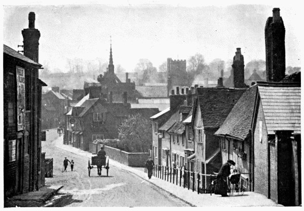
CASTLE STREET, BERKHAMPSTEAD
The Grand Junction Canal is close to the river Bulbourne, and partly
for this reason many small industries are pursued in the town, such as
the making of straw plait, scoops and shovels of various sorts, army
tent-pegs, etc. The present rectory is on a small hill near the church,
to the S. of the High Street; it stands on the site of the former house,
in which Cowper was born, and the old well-house, called “Cowper’s
Well,” may still be seen. There is a good library in the Mechanics’
Institute. The almshouses, for six widows, were founded in 1681, by the
John Sayer mentioned above. The Kings of Mercia are known to have
resided and held courts here; King Whithred summoned a council to meet
at Berghamstedt in 697.
Berkhampstead, Little (3 miles S. from Cole Green Station,
G.N.R.), has a stone church erected early in the seventeenth century. It
has a wooden belfry and spire. The building was restored in 1856-7, but
contains little of architectural or historical interest. There are,
however, several memorials, notably the altar table in memory of Bishop
Ken, born in the parish in 1637. On a hill N.E. from the church stands
the tall red-brick observatory erected by John Stratton in 1789, in
order, as it is said, that from its summit he might watch his ships in
the Thames. The tower has been called “Stratton’s Folly”.
Bernard’s Heath. (See St. Albans.)
Betlow is a lordship of Long Marston (q.v.)
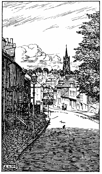
BISHOP’S STORTFORD
BISHOP’S STORTFORD is in the extreme E. of the county and on the Essex
border. It is an ancient town, deriving its name from the ford over the
river Stort, and from the fact that William I. gave the town to Maurice,
Bishop of London. It is famous for its Grammar School, at which the late
Cecil Rhodes, a native of the town, was educated. The site of Waytemore
Castle, built by William I., is on a mound near the road to Hockeril,
where a low, wide flint wall is partly surrounded by a moat. The church
of St. Michael on Windhill is Perp.; it was restored in 1859. There was
a former church on the same site; the present structure dates from say
1420-40. The nave has six bays; the tower is pinnacled and has a ring of
ten fine bells. Chauncy’s book has an interesting paragraph about this
church. “Three Gylds and a Chantry were founded in this church; the Gyld
of St. Mary; the Gyld of St. Michael; and the Gyld of St. John Baptist;
to which, An. 1476, Elizabeth Spycere gave Legacies, viz., to the two
former 13s. 4d. a piece, to the last 40s. These Saints had their altars,
and St. Michael his Tabernacle, on which much Cost had been bestowed;
but the Chantry was founded in the time of Richard III. and the
Settlement thereof cost much Money.” Chancel and nave are separated by a
screen of carved oak; the font (Norman) was discovered during the
restoration of the church; there is a piscina in the S. aisle. The
clerestory was added and the chancel restored in 1884; on the chancel
floor is a brass to Lady Margaret Denny (d. 1648), “a maid of honour in
ordinary for five years to Queen Elizabeth of blessed memory”. There is
also a memorial to Sir George Duckett, Bart. (d. 1822), who increased
the facilities for the navigation of the Stort, which is now navigable
by barges to the town. A cattle sale is held every Thursday, which is
market-day. The trade in malt is still very large. We read that in old
times a cross was erected on each of the four roads leading from the
town. The main thoroughfares are still in the form of a cross; going
down Windhill the visitor will find a bridge over the Stort before him,
and a main street on either side. The town can boast several of the
finest old inns in Herts.
Boreham Wood (1¼ mile N.E. from Elstree) is a large and rather
prettily situated hamlet.
Bourne End, 1 mile W. from Boxmoor Station, L.&N.W.R., contains little
more than an inn, a coffee-room, and a few cottages standing beside the
Grand Junction Canal.
Bovingdon (2½ miles S.W. from Boxmoor Station) is a large
village, built on the slopes of two hills, the centre of the village
being in the depression between them. The church dates from the end of
the eleventh century, but was rebuilt in 1846 in a Gothic style, with
pinnacled W. tower. Note (1) the effigy of an armoured knight under the
tower, dating from perhaps the middle of the fourteenth century; (2)
brasses to the Mayne family (1621-42). Some traces of a Roman
encampment and villa are shown on inquiry at a spot near the village.
Bowman’s Green (¼ mile N.E. from London Colney and 2 miles S. from
Smallford Station, G.N.R.) is a tiny hamlet near the river Colne and the
high road from Barnet to St. Albans.
Boxmoor is a village about 1½ mile S.W. from Hemel Hempstead.
The Grand Junction Canal flows between the village and the town. From
the station, L.&N.W.R., a motor car plies to and from Hemel Hempstead.
Many Roman remains have been found in the neighbourhood, particularly
some remains of two Roman villas, and many coins of the period of
Diocletian. The church, erected in 1874, is E.E. in design, and was
planned by Mr. Norman Shaw. It has N. and S. aisles and porches. There
was an earlier structure on the same site. Private residences are
increasing so rapidly that the place is now almost a suburb of Hemel
Hempstead.
Boydon’s Hill adjoins the village of Aldenham.
Bragbury End (1¼ mile E. from Knebworth Station, G.N.R.) is a hamlet
on the Great North Road.
Bramfield or Braintfield (3½ miles N.W. from Hertford Station,
G.N.R.) is a parish and village. The church is E.E., standing on the
site of an earlier edifice; the present tower and spire were built in
1840, and the church itself restored in 1870. We learn from Matthew of
Westminster that Thomas Becket held the living here as his first
charge; a pond near the church is called “Becket’s Pond”. Queen Hoo
Hall, N.W. from the village, is now a farmhouse, but was formerly an
Elizabethan residence, and gave the title to a romance partly written by
Sir Walter Scott. The neighbourhood is pleasant, and a pretty stroll may
be taken either N.E. to Woodhall Park or S. to Panshanger Park.
Brandley Hill is 1 mile N.W. from Aston.
Braughing has a station ¾ mile S.W. from the town, on the
Buntingford Branch of G.E.R. It is an ancient parish, the “Brachinges”
of Domesday Book, and was a Roman station. The church and few streets
of which the village consists are very picturesquely scattered on the
S.W. slope of a hill overlooking the river Quin, at the intersection of
the Roman Ermine Street and the road from Bishop’s Stortford to Baldock.
There was formerly a market each week, dating from the reign of Stephen;
also an annual fair, abolished many years ago. The church, close to the
hand-bridge over the river, is largely Perp., and contains a few
brasses, none of which are important. It has been partially restored on
several occasions during the last eighty years, and some of the modern
workmanship is very good. Note (1) open tracery in carved oak screen;
(2) oak pulpit; (3) finely carved font of Caen stone; (4) old font
outside, near the tower. At Cockhampstead (1½ mile E. from the church)
was once an Augustinian priory.
Breachwood Green (about 3½ miles N.E. from Luton Hoo Station, G.N.R.,
and 1 mile S. from King’s Walden Church) is a village on high ground
rather more than a mile from the Bedfordshire border. Pretty walks may
be taken S.E. to Bendish or S.W. to Chiltern Green.
Brent Pelham (1 mile from Essex border and 5 miles E. from
Buntingford) is an interesting village, formerly called Burnt Pelham
because, as tradition states, both village and church were destroyed by
fire during the reign of Henry I. Traces of the fire existed in the days
of Norden (circa 1548-1626). The church—near which the old stocks may
still be seen—is E.E., with the embattled western tower so frequent in
Herts. It is locally famous for a tomb in the N. wall, said to mark the
resting-place of one Piers Shonkes, a serpent slayer who lived in the
time of William I. The tomb bears some allegorical figures, which have
been the subject of diverse interpretations. Pelham Hall (E. E.
Barclay, Esq.), “a slight but well contrived House in this Mannor, near
the Church,” was built in 1620 by one Edward Newport. It was once owned
by the Floyers or Flyers, a family to whose memory there are several
memorials in the church.
Brickendon is now partly included in the borough of Hertford. There
are some imposing residences in the neighbourhood.
Bricket Wood is almost exactly midway between St. Albans and
Watford; it consists of some cottages scattered around an extensive
wood and common, crossed by L.&N.W.R. The station is ½ mile from the
“wood,” which is much frequented by picnic parties, school treats, etc.
The district is good ground for the field botanist and entomologist.
Broadfield (2¼ miles N.W. from Buntingford) is a hamlet near Cottered,
on the hill N. from that village. The hall was once a much larger
structure (engraved in Chauncy, vol. i.); it was in part rebuilt in
1882, but still retains a portion believed to date from the fifteenth
century.
Broadwater is a hamlet at the meeting of the roads from Stevenage,
Hatfield and Hertford. The nearest station is Knebworth (1¼ mile S.).
Broadway (1½ mile S.E. from Berkhampstead) has a Dec. chapel-of-ease
to the parish church. It was erected in 1854. A short walk takes one to
the ruined chapel of St. Mary Magdalen on the Bucks border.
Bromley (1½ mile S.E. from Standon Station, G.E.R.) is a small hamlet.
Broomin Green (¾ mile S.W. from Stevenage Station, G.N.R.) is a hamlet
near the railway and ½ mile from the Six Hills. (See Stevenage.)
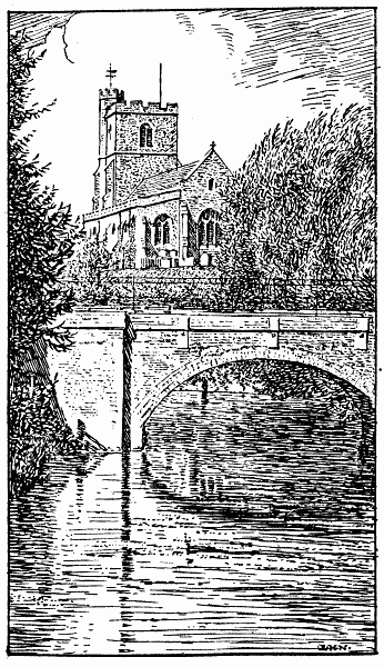
BROXBOURNE CHURCH
Broxbourne, a large village near the river Lea and New River,
is a favourite fishing resort. The church stands on high ground
overlooking the mill-leat; it is a fine Perp. structure, dating from
early in the fifteenth century. The N. chancel-chapel was built by Sir
William Say, “in honor a ye Trenete the yere of our Lord God 1522”; his
tomb is in the chancel. The church was restored in 1857; the roof is of
fine oak panelling; the font, on eight pillars, is probably Early
Norman. There are brasses to a priest holding a chalice (circa 1470);
to another priest in robes (circa 1510); to Sir John Borrell, mace
bearer to Henry VIII. (d. 1521); to Sir John Say (d. 1478), and his wife
(d. 1473). Note also (1) holy water basin near door; (2) marble effigies
of Sir Henry Cock (d. 1609), and his wife and family; (3) shield of arms
in centre of nave, with verses in English, bearing date 1630. From the
church a very picturesque walk may be taken through the village, to
Hoddesdon, by way of “Admiral’s Walk,” or beside the Lea past the
grounds of the Crown Hotel. Broxbournebury (Major G. R. B.
Smith-Bosanquet, J.P.) is in the beautiful park, 1 mile W., and is a
large imposing mansion in Jacobean style. In Church Fields and on the
London Road are large rose-nurseries, producing an immense number of
roses yearly. The neighbourhood is one of the most pleasant in the
county.
Buckland (3 miles N. from Buntingford, on the Royston Road) has
an E.E. church, built by Nicholas de Bokeland in 1348. The piscina at
the E. end of the S. aisle marks the site of what was formerly the
lady-chapel. The font is very possibly anterior to the Conquest; it is a
roughly hewn mass of Barnack stone. The low window in the S. wall of the
chancel was opened out during some renovations, and is thought to have
been connected with a confessional, as a coloured figure of the Virgin
was discovered on the wall. The theory, however, may be dismissed as
purely mythical. There is a brass to William Langley, a rector of the
church (d. 1478); a low-relief medallion by Chantrey to William Anthony
(d. 1819), and a brass to one of the Boteler family (1451). The interior
was restored in 1875; the new W. door, of oak, was added in 1881.
Buck’s Hill (2 miles S.W. from King’s Langley Station, L.&N.W.R.) is a
pretty hamlet. The nearest parish church is about 1¼ mile N.E. at
Chipperfield (q.v.).
Bulbourne, river. (See Introduction.)
Bull’s Green is 2¼ miles N.E. from Welwyn Station, G.N.R.
Bull’s Mill is 2½ miles N. from Hertford.
BUNTINGFORD, a small town on the river Rib, on the Royston-Cambridge
Road, consists chiefly of the long High Street and of a few small
by-ways, E. by the river side, and W. on the roads to Aspenden and
Cottered. Standing across the High Street is the cruciform church of St.
Peter, built in 1614-26 as a chapel-of-ease to Layston (q.v.). An old
brass tablet still preserved represents the holding of a Divine service
in the church before completion. There is also a portrait of Seth Ward
(see Aspenden); the almshouses a few yards W. were founded by him in
1684. “This town,” wrote Chauncy, “is of small antiquity, for there is
no mention of it in Domesdei Book, neither can I find anything of it
before Anno. 21. Edwd. III., when that King did grant one Market every
Week, and one Fair every Year in Buntingford, to Elizabeth de Burgo and
her Heirs, reserving the Yearly Rent of 6d.” At the N. end of High
Street is the old pound. Corney Bury (½ mile N.) is a fine old manor
house. Little of historic importance is to be gleaned in the town, but a
ramble from end to end is interesting by reason of the many quaint inns
and cottages, of all ages and styles, which meet the eye at every turn.
Burnham Green is a hamlet 1¼ mile N.E. from Welwyn Station, G.N.R.
Bury Green (1½ mile W. from Cheshunt Station, G.E.R.) is a small
hamlet near Theobald’s Park; also
Bury Green, a hamlet 2½ miles W. from Bishop’s Stortford.
Bury Hill and Bury Mill. (See Hemel Hempstead.)
Bury Stede. (See Hexton.)
Bush Barrow is 1¼ mile N. from Wallington, on Metley Hill, midway
between the village and the Icknield Way.
Bushey is a large village, now practically the S.E. suburb of
Watford. The station (L.&N.W.R.) is in the hollow between the village
itself and High Street, Watford; cyclists must be careful of the descent
towards that town. Near the centre of the village is a small green and
pond, and here stands the partly Dec. church of St. James, rebuilt in
1871 by Sir Gilbert Scott. The E.E. window, triple lancet, is to the
memory of Edwards Marjoribanks of the Hall (d. 1879) and his wife. Silas
Titus, whose name is remembered for his supposed authorship of the
notorious pamphlet Killing noe Murder, was born at Bushey and buried
in this church; there is a headstone to his daughter in the graveyard.
Bushey Heath (1 mile S.E. from the above) is on the Middlesex
border. It is now an ecclesiastical district, formed in 1889; the
church, an E.E. brick structure, dates from 1838; the porches were added
in 1882. The district is very healthy.
Bushey, Little, is E. from Bushey Heath, which it almost joins.
Bushey Mill is on the river Colne, ¾ mile N.E. from Watford Junction.
Butchery Green. (See Hertford.)
Bygrave (1¾ mile N.E. from Baldock Station, G.N.R.) has a small
church built of clunch from the Ashwell pits near by. It dates from
perhaps 1320. Note (1) octagonal font (about 1420-40), (2) slab on floor
to a former rector, a Huguenot (d. 1725), and (3) the piscina in
chancel. Close by, at the Manor House, are the remains of some moats
constructed five centuries ago by the resident knight, Sir John
Thornbury, because of the many marauders that infested the
neighbourhood. The place was once a market-town; the market, granted by
Henry III., was held each Monday. The village lies on high ground, a few
minutes’ walk N. from the Icknield Way.
Caldecote (about 3 miles N.N.E. from Baldock Station, G.N.R.)
has a Perp. church of rubble, containing a few memorials, a very finely
canopied holy water basin, and a font dating from, say, 1480.
Caldicot Hill is 1 mile E. from Bushey Heath, on the Middlesex border.
Cassiobury Park. (See Watford.)
Catlip is a hamlet near Chorley Wood Station, Met.R.
Chandler’s Cross (2½ miles S.W. from King’s Langley Station,
L.&N.W.R.) is a small hamlet.
Chapmore End is 2½ miles N. from Hertford.
Chelsing is near the river Rib, 3 miles N. from Ware.
Cherry Green (1 mile S.W. from West Mill Station, G.E.R.) is a small
hamlet.
Cheshunt, according to Grose’s Antiquities, the Durolitum
of Antoninus, is a large parish which contains much of interest. Its
ancient names, Cestre, Ceaster, Cestrehunt, leave little doubt that it
was a Roman station.[3] At Roman Urn Inn, near the station, G.E.R., is
an urn imbedded in the wall; it was discovered close by some years ago,
and is probably of Roman manufacture. Cheston, yet another old name of
this spot, has been thought to be derived from the chestnut trees once
plentiful in the neighbourhood, of which many of the houses were built.
William I. gave the manor to Alan the Red, Earl of Brittany, and it
remained an appendage to that earldom for a long time. Edward III.
granted a weekly market to be held in the town every Monday. The Church
of St. Mary the Virgin was built in 1420 by Nicholas Dixon, who held the
living of Cheshunt for thirty years. It is Perp., entirely embattled;
the W. tower has an octagonal cupola. Restoration was carefully effected
during 1872-4, under Mr. G. F. Bodley. The rood-screen, lectern and
pulpit are of carved oak, all comparatively new. The memorials are very
numerous; amongst them may be noted (1) brass on chancel floor to the
above-mentioned Nicholas Dixon (d. 1448); (2) brass to William Pyke (d.
1449); (3) two female effigies, 1500-20; (4) altar tomb in chancel to
Robert Dacres, Privy Councillor to Henry VIII. There are windows of
stained glass to a former vicar (d. 1858); to General Miles (d. 1860),
and, in the tower, to one Robert Archer, for thirty-six years parish
clerk. N. from the main street, near the river Lea, stood a small
Benedictine nunnery. It originally belonged to the Canons of Cathele,
but Henry III. turned them out and gave the property and rights to the
“Prioress and Nuns of Cesthont”. The college, a famous institution,
stands near the church; it was founded in 1768 by Selina, Countess of
Huntingdon, at Trevecca, near Talgarth, S. Wales, and removed to
Cheshunt after her death. A few years ago it was bought by the Church of
England, for use as a theological college. Close by, too, is the site of
Pengelly House, once the home of Richard Cromwell. Cheshunt Park (1 mile
N.) is full of memories of the Cromwells and the Russells. The Great
House, near Church Gate, was one of the many residences of Cardinal
Wolsey. Both the house and the moat are still preserved.
Chess, river. (See Introduction.)
Cheverell’s Green (1½ mile N.W. from Flamstead, and about 4 miles N.W.
from Redbourn Station, M.R.) is a small hamlet and green adjoining
Beechwood Park.
Childwick Green is 1 mile S. from Harpenden Common, and 2½ miles N.
from St. Albans.
Chipperfield (2½ miles W. from King’s Langley Station,
L.&N.W.R.) was made an ecclesiastical parish in 1863. The small church
on the common, E.E. in style, built in 1837, is of little interest.
There is a good lich-gate at the N. entrance to the churchyard. The
neighbourhood is pleasant and varied.
Chipping (2 miles N. from Buntingford) is a small village on the
Royston Road.
Chivesfield (or Chesfield) is 2 miles N.E. from Stevenage Station,
G.N.R. It is locally famous for its ruined church. One John Wykins was
rector here as early as 1323. The windows were partly destroyed in
1642. Some interesting memorials were extant in Chauncy’s day, and are
mentioned in the second volume of his Antiquities.
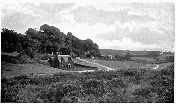
CHORLEY WOOD COMMON
Chorley Wood, a village 2½ miles N.W. from Rickmansworth, has a
station on the Met.R. near the Amersham Road. The church, E.E. in style,
dates from 1845, but was largely rebuilt in 1870. William Penn, the
Quaker, was married here. There are many pretty walks through the Valley
of the Chess, which flows between the village and Sarratt (q.v.).
Church End is a small hamlet in the parish of Albury, 3 miles E. from
Braughing Station, G.E.R.
Clapgate, a hamlet on the river Ash, is close to Church End.
Clay End (1½ mile S.E. from Walkern) is about equidistant—5
miles—from Stevenage or Westmill Stations.
Clay Hill is on the high road between Bushey and Bushey Heath
(q.v.).
Clothall (2¼ miles S.E. from Baldock) has an interesting
church, chiefly Perp., on a gentle hill. There is a good brass in the
chancel to John Vynter, first rector of the church (d. 1404), and one to
John Wright, Master of Trinity College, Cambridge, also rector here (d.
1519). On the S. of the church is a small Dec. chantry chapel. Note also
a sixteenth century brass to the wife and sixteen children of William
Bramfield of Clothall. The Saxons are said to have called the spot Cley
Hall, because it stood on a hill of clay. Clothall Bury is a little to
the E.
Cockernhoe Green is 2½ miles S.W. from Offley, and 2½ miles N.E. from
Luton Station (Beds).
Cockhampstead (2 miles N.E. from Braughing Station, G.E.R.) is near
Albury Hall.
Codicote (3 miles N.W. from Welwyn Station, G.N.R.) is a large
village on the Welwyn-Hitchin Road, with a pleasant heath a little W.
The Church of St. Giles is an ancient structure, E.E., restored in 1853;
it stands in a field ½ mile N. from the village. The S. chapel dates
from 1312. The embattled W. tower is a fine structure. There are several
memorial windows, comparatively modern.
Cole Green has a station on the G.N.R. branch line from
Hatfield to Hertford. From the station little is to be seen except the
Cowper’s Arms and a few cottages.
Coleman’s Green (1½ mile S.E. from Wheathampstead Station, G.N.R.) is
prettily situated near the “Devil’s Dyke” and Brocket Hall. John Bunyan
sometimes preached in a cottage here; a large chimney-stack, bearing an
inscription, still marks the spot, unless quite recently removed.
Collier’s End is on high ground, on the Old North Road, 2 miles S.W.
from Standon Station, G.E.R. It is a very typical English hamlet.
Colne, river. (See Introduction.)
Colney Heath (1 mile S. from Smallford Station, G.N.R.) is an
ecclesiastical parish. The brick church (1844) is in Byzantine style;
it has an apsidal chancel, and small N. porch and tower. The new West
Herts County Asylum is close by.
Colney Street, on the main road from Radlett to St. Albans,
forms an almost equilateral triangle with Park Street and Bricket Wood
Stations, L.&N.W.R. It is only a few minutes’ walk from the pretty
church at Frogmore (q.v.).
Common Moor may be visited from Croxley Green (¾ mile N.E. from
Rickmansworth) for an inspection of its large paper mill.
Cooter’s End is a tiny hamlet close to the M.R. on the Bedfordshire
border.
Corey’s Mill, a hamlet 1 mile N. from Stevenage Station, G.N.R., is
named from an old mill, burnt in 1878.
Cottered (3 miles W. from Buntingford) has a fine old church
(Perp.). There is a chapel on the N. side of the chancel erected by
Edward Pulter; the W. tower is embattled and carries a lofty spire.
Several memorials to the Pulter and Forester families are of the
seventeenth century. The church was restored in 1886. In the days of
William I. the vill of Chodrei belonged to Walchelin, Bishop of
Winchester. Cottered Lordship, a farmhouse near the village, is one of
the very oldest dwellings in the county. The writer is assured by an
expert that the front door dates from 1450-80!
Cromer, a hamlet 5 miles S.W. from Buntingford, is prettily situated
in a valley, in a purely agricultural district.
Cromer Hyde (1½ mile S. from Ayot Station, G.N.R.) consists of a
farmhouse, the Chequer’s Inn, and a few old and picturesque cottages.
The nearest church is ½ mile S.E. at the corner of Brocket Hall Park.
Croxley Green (¾ mile N.E. from Rickmansworth) is an ecclesiastical
parish near the river Chess. The church, built fifty years ago, is late
E.E. in style and has some good memorial windows.
Cuffley is a small hamlet about midway between Cheshunt and Potter’s
Bar (Middlesex) Stations, but a little N. from the straight line. The
Church of St. James at Goff’s Oak (q.v.) is 1 mile E.
Cumberlow Green is 4 miles N.W. from Buntingford.
Currants Bottom, on the Bucks border, is close to Chorley Wood
Station, Met.R.
Dane End, or Munden Street, is 4 miles S.W. from Standon Station,
G.E.R. The nearest church (½ mile N.) is at Little Munden.
Dane End, 4 miles S. from Royston, is close to the Old North Road.
There are a few cottages and two farms.
Dassells is a hamlet on the Old North Road, 1 mile E. from Westmill
Station, G.E.R. The little river Quin flows close by.
Datchworth (1½ mile S.E. from Knebworth Station, G.N.R.) has a
church with some Norman portions. Its spire is conspicuous for miles
round. The larger portion is, however, Dec. Note (1) some good stained
glass windows in chancel; (2) chalice dated 1630. The church was
restored in 1869-70. The place is very ancient; we read that four hides
of land at Decewyrth were granted by an early Saxon king to the
Monastery of St. Peter at Westminster, and that in the reign of Edward
III. Thomas de la Mere, Abbot of St. Albans, transferred the patronage
of this church to the king.
Dean End (¾ mile S. from Redbourn Station, M.R.) is a small hamlet.
Delamore End is ½ mile E. from Flamstead, and near the high road to
Dunstable. The nearest railway station is Redbourn, 2½ miles S.E.
Digswell, a village on the river Maran, is ½ mile S.W. from Welwyn
Station, G.N.R. Looking E. the visitor will notice the Great Northern
Viaduct over the Maran Valley—a truly magnificent structure of forty
arches. The church, beautifully situated on the hill, is E.E. It
contains a large but much mutilated brass to John Perient, Master of the
Horse to Joan of Navarre and Esquire to Richard II., Henry IV. and Henry
V. This interesting inscription being much defaced I will transcribe
from Chauncy: “Hic jacet Johannes Perient, Armiger pro corpore Regis
Richardi Secundi, et Penerarius ejusdem Regis, et Armiger. Regis Henrici
Quarti, et Armiger etiam Regis Henrici Quinti et Magister Equitum
Johannæ, filiæ Regis Navarr, et Regiæ Angliæ qui obiit—et Johanna uxor
ejus quondam capitalis Domicilla—quæ obiit 24 Aprilis Anno Dom. 1415.”
Note also brasses (1) to John Perient, son of the above (d. 1442); (2)
William Robert, auditor of the diocese of Winchester (d. 1484); (3) to a
civilian, his wife, and ten children (circa 1530); (4) to Thomas
Hoore, a mercer of London, his wife, and twelve children. The church was
restored in 1872.
Digswell Water is a hamlet ½ mile E. from Digswell Church, and close
to Welwyn Station.
Down Green is ½ mile W. from Wheathampstead Station, G.N.R.
Driver’s End, a hamlet 2 miles W. from Knebworth Station, G.N.R., is
on the S.W. confines of Knebworth Park. One mile S. is the village of
Codicote. The neighbourhood is very pleasant.
Dudswell, a few cottages on the Grand Junction Canal, is ½ mile N.W.
from Northchurch village, and 2 miles N.W. from Berkhampstead Station,
L.&N.W.R.
East End (1 mile S.E. from Cole Green Station, G.N.R.) is between
Panshanger Park and the River Lea. There is also a hamlet of the same
name on the Essex border, about 5 miles N.E. from Braughing Station,
G.E.R.
Eastwick (1 mile N.W. from Burnt Mill Station, G.E.R.) is a
parish near the Essex border, on the river Stort. The church, rebuilt in
1873, is in E.E. style. It is locally famous for its recumbent statue of
a knight in chain armour, resting on a raised slab; the legs are
crossed. There is neither date nor name; but it has been surmised (1)
that the crossing of the legs shows that he was probably a crusader, (2)
that the effigy dates from early in the thirteenth century and
represents a member of the De Toni or De Ros family. The former
conjecture is undoubtedly erroneous. There is a piscina in the chancel.
Elstree, formerly Idlestree, is a large village beautifully
situated on the Middlesex border; the station (M.R.) is to the N.E. at
Boreham Wood. At the N. end of the street a fine view stretches in the
direction of Radlett and St. Albans. The Church of St. Nicholas was
founded by the Benedictine monks of St. Albans in the fourteenth
century; the present structure is Dec. and dates from 1853. The
monuments are unimportant; but the wrought-iron chancel screen, designed
by Sir A. W. Blomfield, is worthy of careful scrutiny, as is also the
vestry screen of carved oak. The five-light E. window was presented by
the pupil of a former rector, John Morris, D.D. (d. 1848), to whom it is
a memorial. In the old churchyard, closed some years ago, was buried the
notorious robber and reputed murderer William Weare, who was murdered by
Thurtell on Gill’s Hill, 2½ miles N.W., in 1823. Here, too, was buried
Martha Reay, whose life was a chronicle of crime; she was mistress to
the Earl of Sandwich, and was killed on leaving Covent Garden Theatre,
in 1779. There is excellent fishing to be had at Elstree Reservoir, a
little W., in Aldenham parish. Some archæologists have thought that the
Roman city Sulloniacæ occupied (approximately) the site on which
Elstree stands, and Norden lent his authority to this hypothesis; but
there is little doubt that Brockley Hill near Edgware more closely
corresponds in position with the city mentioned in the Itinerary of
Antoninus.
Epping Green, a hamlet 1 mile S.E. from Little Berkhampstead, is at
the N. end of Punsborne Park. The nearest station is Cole Green
(G.N.R.), nearly 4 miles N.W.
Essendon is a pretty village on rising ground overlooking the
Valley of the Lea, 2 miles S. from Cole Green Station. The church,
standing in the park, was rebuilt in 1883; it was probably founded as
early as the twelfth century. It is now of flint, dressed with ancaster
stone. Note (1) alabaster monument to William Priestly (d. 1664); (2)
brass and effigy of William Tooke, auditor of the Court of Wards and
Liveries (d. 1588); (3) shields from the tomb of Henry Courtenay, son of
Henry, Marquess of Exeter; (4) chalice bearing date 1570, given to the
church by Elizabeth Reynes; (5) Baskerville Bible presented by the First
Marquess of Salisbury. During restoration several slabs to the Tooke
family (1635-55) were discovered. Essendon Place (David Citroen, Esq.)
is a fine house in a park of 100 acres; and Bedwell Park (C. G.
Arbuthnot, Esq.) should be visited, by special permission, to view the
Belvedere Collection, including one of Murillo’s many “Assumptions”.
Exnells, near the river Ash, is a small hamlet 2 miles N.E. from
Hadham Station, G.E.R.
Fanham Hall is 1 mile N.E. from Ware.
Fisher’s Green (½ mile N.W. from Stevenage) is a small hamlet.
Flamstead (2½ miles N.W. from Redbourn Station, M.R.) lies on high
ground near the river Ver. The name is a corruption of Verlamstead, the
river having formerly been called the “Verlam”. The church is in the
centre of the village; it is a large Dec. structure dating from the
fourteenth century; the nave is of six bays, with fine octagonal
pillars. The tower is very large and massive. Note (1) piscina in W.
wall of vestry, once a chapel; (2) piscina in chancel; (3) finely carved
oak chancel screen, dating from fifteenth century but restored in 1893;
(4) mutilated altar-tomb in nave, carved and crocketted, but bearing no
inscription, it is probably not later than 1400-20; (5) marble monument,
with Ionic columns, to Thomas Saunders of Beechwood; (6) brass to John
Oudeby, rector of the church (d. 1414); (7) effigy in armour to Sir
Bartholomew Fouke, Kt., for many years Master of the Household to Queen
Elizabeth (d. 1604). At Beechwood Park, so called because of the many
fine beeches in the neighbourhood, was once a Benedictine Nunnery. The
walk from Flamstead to Great Gaddesden, by way of Beechwood Park (about
6 miles), is very picturesque.
Flamstead Bury is 1 mile W. from Redbourn Station, M.R., and midway
between the N. end of the village and a spot called Heaven’s Gate.
Flamstead End (1½ mile N.W. from Cheshunt Station, G.E.R.) is a
considerable hamlet.
Flaunden (4 miles S.W. from Boxmoor Station, L.&N.W.R.) is a village
and parish on the Bucks border, with the river Chess 1¼ mile S. The
present church is modern, and local folk claim that it is the first
built by the late Sir Gilbert Scott. The font, and a few tiles, etc.,
were brought here from the old church at Flaunden Bottom near Chenies,
some ruins of which still remain. Chauncy tells us that Flaunden
belonged to the manor of Hemel Hempstead, that it was granted to one
Thomas Flaunden, who built a small church in the valley near the river
(Chess) with a small tower of timber at the W. end. Spiritual offices
were performed by a curate supplied from Hemel Hempstead, who served
Bovingdon and Flaunden by turns as duty required.
Folly, The (a small hamlet 1 mile N.W. from Wheathampstead Station,
G.N.R.), is passed on the way to Harpenden or Mackery End. A little
farther W. is Batford Mill on the river Lea.
Frithsden (or Friesden), a hamlet 2 miles N.E. from Great
Berkhampstead, stands in a beautiful district, with Ashridge Park to the
N.W. The nearest church is at the pretty village of Nettleden (q.v.) ½
mile N.E. High Park Road, Evesden Wood, Marigold Wood, Holly Bush Wood
and Frithsden copses are all adjacent and may be visited during an
hour’s ramble.
Frogmore (¾ mile S.E. from Park Street Station, L.&N.W.R.) is a
hamlet between the villages of Park Street and Colney Street. The church
is modern, in late Norman style; it stands close to the high road from
Radlett to St. Albans. There are several memorial windows to local
persons. The village flower show has been held for many years in July,
and is well patronised and widely known. The river Colne flows between
this hamlet and Park Street Station.
Furneaux Pelham (4 miles N.E. from Braughing Station, G.E.R.)
has an interesting E.E. and Perp. church. One of the six bells in the
embattled W. tower dates from before the Reformation; it bears, in
black-letter, the words “Sancta Katarina ora pro nobis”; upon the clock
in the tower are the words: “Time flies. Mind your business.” Note (1)
piscina and sedilia in chancel; (2) piscina in each aisle; (3) Newport
Chapel adjoining S. aisle, built by the Robert Newport whose brass and
effigy is in the nave (d. 1518); (4) brass (mutilated) in chapel,
representing two figures, temp. Richard II.; (5) ambry (lancet headed)
in chancel; (6) three ancient stone coffins, discovered during
restoration, one bearing the words: “Simonis de Furneaux Filius”. The De
Furneaux were a Norman family, to whom the village owes its name: Simon
de Furneaux was lord of the manor in the reign of Edward I. Close to
the church is Furneaux Pelham Hall (recently unoccupied), a fine
Elizabethan mansion whose owners suffered several misfortunes during the
civil wars.
Gaddesden, Great (3 miles N.W. from Hemel Hempstead), is a
village on the river Gade at the foot of the hill that leads to
Nettleden. The church is close to the river side, and immediately behind
the Cock and Bottle Inn. It is an ancient structure of “Roman bricks”
and flint (E.E.), believed to date from, say, 1290; the tower was
rebuilt in 1862. There are many memorials to the Halsey family, but few
others of any interest. Gaddesden Place, in a park ½ mile E., is the
seat of Rt. Hon. T. F. Halsey, Esq., D.L., J.P. It was built from
designs by Wyatt, in 1774, in an Italian style.
Gaddesden, Little (4 miles N. from Berkhampstead Station,
L.&N.W.R.), is a straggling village on the confines of Ashridge Park.
Pretty cottages and tastefully planned gardens meet the eye everywhere.
The church is Perp. and contains many monuments to the Egerton family,
Earls of Bridgewater: (1) Sir John Egerton, Kt. (d. 1649); (2) Lady
Frances, Countess of Bridgewater (d. 1635); (3) John, Viscount Brackley,
Lord of the Privy Council (d. 1686); (4) Elizabeth, Countess of
Bridgewater, a “transcendently virtuous lady” of “beauty so unparallel’d
that ’tis as much beyond the art of the most elegant pen, as it
surpasseth the skill of several of the most exquisite pencils ... to
describe and not disparage it” (d. 1663); (5) Ann, Lady Egerton (d.
1625); (6) Francis, third Duke of Bridgewater (d. 1803). The latter was
styled the Father of British Inland Navigation; and the tall column near
Ashridge Park, 1¾ mile W. from the church, was erected to his memory in
1832.
Gaddesden Green is practically one with the above, the marble cross
and fountain to the memory of Lady Marian Alford (d. 1888) being between
the village and the Green. Gaddesden Hoe is 2 miles E. from the S. end
of the Green.
Gaddesden Row (3 miles N. from Hemel Hempstead Station, M.R.) is a
straggling hamlet equidistant (about 2 miles) from Flamstead and Great
Gaddesden.
Gade, river. (See Introduction.)
Gallows Hill (½ mile S. from King’s Langley Station, L.&N.W.R.) is a
hamlet. The Booksellers’ Provident Retreat is here. It is also the name
of a hill between Hertford and Ware, on which stands the Joint Isolation
Hospital for the two towns.
Gannock Green is 2½ miles S. from Ashwell Station, G.N.R. The nearest
church is at Sandon. Gannock Farm is ½ mile E.
Gardener’s End (3½ miles W. from Buntingford) is a hamlet in the
parish of Ardeley.
Garston is 1¼ mile S.W. from Bricket Wood Station, L.&N.W.R.
Gibraltar, on the road from Harpenden to Luton, is on the Bedfordshire
border, close to Luton Hoo Park and Station, G.N.R.
Gilston (2 miles N. from Burnt Hill Station (Essex) and about
2 miles S.E. from Widford village) is a scattered parish. Chauncy says
it was probably waste ground at the time of the Conquest, as there is no
mention of it in Domesday Book. The church was very probably erected
by Geoffrey de Magnaville, who was Earl of Essex and Lord of the Manor
of Sabriesword (Sawbridgeworth) during the reign of Stephen. It is E.E.
and stands on the hill about ¼ mile N. from the Park. There is a fine
double piscina in the chancel, and some heraldic glass in the windows,
showing the coats of Astley, Bassett, Eastfield and Engayne. The
monuments to the Gore family are numerous; amongst those buried in the
church are (1) Sir John Gore, Kt. (d. 1659); he was twice sheriff of the
county, and a member of Cromwell’s second Protectorate Parliament; (2)
Dame Dorothy Gore (Kempe), second wife to the foregoing (d. 1645); (3)
Dame Persis, wife to Sir Humphrey Gore, Kt. (d. 1665); (4) in
churchyard, John, eldest son of the said Sir Humphrey (d. 1691). The
Feathers, a fine old inn (circa 1680), still stands in this village;
an excellent photograph of it was reproduced in the Home Counties
Magazine (Oct. 1901). Gilston Park, beautiful but not very extensive,
should be visited; for the mansion (A. S. Bowlby, Esq., M.A., J.P.,
etc.) stands near the site of New Place, successively the home of the
Chauncys, Gores and Plumers. The house was enlarged and beautified by
Sir Humphrey Gore, who was knighted at Whitehall in 1660. In 1701 it
passed into the hands of Col. John Plumer, whose family is so well known
to readers of the Essays of Elia. It was his grandson William (d.
1822) whom Lamb calls “a fine old Whig”. This William left no family, so
the house at Gilston Park and his other house, the famous “Blakesmoor in
H——shire” of Lamb’s essay, passed to his widow (and cousin) Jane
Hamilton, a daughter of Hon. George Hamilton, Canon of Windsor.
Goff’s Oak (2½ miles W. from Cheshunt Station, G.E.R.) is a hamlet
which owes its name to the fine oak, a part of which still stands near
the Goff’s Oak Inn at the S. extremity of Cheshunt Common.
Gorhambury. (See St. Albans.)
Gosmore (2 miles S.W. from Hitchin Station, G.N.R.) is a small
village. The nearest church is at Ippollitts (q.v.).
Gossoms End is on the road from Berkhampstead to Tring, ¼ mile S.E.
from Northchurch.
Graveley (1½ mile N.E. from Stevenage Station, G.N.R.) is a
village off the Great North Road. By walking from Stevenage towards
Little Wymondley a pretty view over Graveley may be obtained from a
gateway near some cottages on the right. The ancient church of brick and
flint is late Norman with embattled tower; it was restored in 1886-7.
The carved oak chancel-screen is ancient; there are windows of stained
glass to the memory of local rectors. The present N. aisle was added
during restoration. The manor of Graveley is of great antiquity; it was
given by William I. to William, Earl of Ewe. Graveley is perhaps Saxon
for “the Reeve’s land,” and Norden thinks the place took its name from a
Reeve of the county in pre-Norman times. Near the village a beacon was
employed “once upon a time” to give warning of the approach of enemies.
One mile N. from the church is Jack’s Hill, once the haunt of a robber,
“Jack o’ legs,” the hero of many a legend known in the district. His
grave is shown in Weston churchyard, 2 miles E. from Jack’s Hill.
Gravesend (3½ miles N.E. from Braughing Station, G.E.R.) is a hamlet
on the road from Little Hadham to Furneaux Pelham. Albury church is 1
mile S.
Green End is the name of three hamlets, (1) in the parish of Little
Munden, about 4 miles W. from Standon Station; (2) in the parish of
Sandon, about 4 miles N.W. from Buntingford Station (both stations
G.E.R.); (3) ½ mile N. from Boxmoor Station, L.&N.W.R.
Green Street.—There are two hamlets of this name in Herts, (1) 2½
miles N.W. from Bishop’s Stortford; (2) 1½ mile N.E. from Boreham Wood
Station (M.R.).
Green Tye is 1½ mile N.E. from Hadham Station, G.E.R.
Grub’s Barn (2 miles S.E. from Welwyn Station, G.N.R.) consists of a
farmhouse and several cottages on open breezy ground between Hatfield
and Tewin.
Grub’s Lane is near the outskirts of Hatfield Park, 3 miles S.E. from
the town.
Gubblecot (3 miles N.W. from Tring) is near the Aylesbury Canal. The
Tring reservoirs, famous for the rare waterfowl shot on those waters on
many occasions, are a little to the S.
Gustard Wood (1 mile N. from Wheathampstead Station G.N.R.) may be
visited for its golf links, of which there are few in the county.
Hadham (Great or Much) is an ancient village
and parish near the river Ash. The station, G.E.R., is 1¼ mile S.W. We
read that the Manor was given by King Edgar to the Bishops of London,
several of whom have resided at the old manor house. Katherine, mother
of Henry VI. and wife of Owen Tudor, gave birth to a son here, known as
Edmund of Hadham. The church of St. Andrew, near the river, is E.E.,
dating from about 1300. It has been much altered and restored. The very
fine S. porch is thought to be the work of Bishop Kemp (1459-89); the
massive, embattled W. tower is probably by Bishop Braybroke (circa
1400). Note (1) floriated cross and inscription to Simon Flambard,
Rector of Hadham Magna in 1331, and chaplain to Edward III.; (2) brass
to one Alban, also rector here (d. 1372); (3) monument in chancel to
Judith Aylmer, widow of John Aylmer, Bishop of London (d. 1618); (4)
fourteenth-century glass in E. window, a memorial to Thomas Randolph, a
recent rector; (5) three brasses in nave to members of the Newce family
(1579-1610); (6) fine oak chancel screen; (7) two piscinæ in chancel.
The old House, or Palace, dated from about 1400. Close to the village
(S.W.) lies Moor Park, which readers or tourists must not confound
with Moor Park, Rickmansworth (q.v.). The present mansion dates from
about 1780; its predecessor was an Elizabethan structure, once the
property of Sir John Gore, Kt. (see Gilston), and previously of Sir
Garratt Harvey, in whose day Archbishop Usher was a guest at “Moore
Place”. At Perry Green, 1 mile E. from Hadham Station, is a
chapel-of-ease, in E.E. style, erected in 1853. Hadham Cross is
beautifully situated in the valley, S. from the village and partly
hidden among trees.
Hadham Ford (3 miles E. from Standon Station, G.E.R.) is on the river
Ash, 1 mile S.W. from
Hadham (Little) formerly Hadham Parva. The parish enjoys
considerable historic importance through its connection with the Capel
family, Earls of Essex. The present earl owns large properties in the
neighbourhood, and has the title of Baron of Hadham. The church stands
between the village and the river, and is widely known for its fine S.
porch of timber, which it possibly owes to the proximity of Essex, in
which county such porches are comparatively common. The building is
mostly E.E., probably late twelfth century, but the tower, embattled and
pinnacled, is Perp. (circa 1380). Note (1) brass to Rd. Waren, a
rector of Great Hadham (circa 1470); (2) brass to a knight, his wife
and daughters (circa 1485); (3) Perp. chancel screen of oak; (4) on S.
side of chancel, memorial stone to “Arthur Lord Capel, Baron of Hadham,
who was murder’d for his loyalty to King Charles the First, March the
9th, 1648”. This was the Lord Capel whose heart was preserved in a
silver box and given to Charles II. at the Restoration, the earl having
wished his heart to be “buried with his master”. The chancel was
restored by Sir A. W. Blomfield in 1885. Hadham Hall (½ mile E. from
the church) is late Elizabethan, and has a magnificent corridor
extending the entire length of the house (135 feet) with finely
mullioned windows. Little Hadham Place (½ mile W. from the church) is
prettily situated. The manor of Hadham Parva formed part of the revenue
of Saxon Kings until King Edgar gave it to the monks of Ely.
Haileybury College (2 miles S.E. from Hertford) was founded at
Hertford in 1805 as the training college of the East India Company. It
is now one of our most famous public schools. The house, conspicuous
from the S.E., stands on high ground, and commands beautiful views over
the valley of the Lea, and, looking S.E., the neighbourhood of Epping
Forest. Note (1) the noble chestnut avenue towards the W. entrance; (2)
the great size of the quadrangle; (3) the beautifully decorated chapel
(by A. W. Blomfield), surmounted by a lofty dome; (4) the library,
containing some good portraits of former masters, one of which, Canon
Bradby, was painted by Herkomer.
Hall’s Green (4 miles N.E. from Stevenage) is on the hillside, 1 mile
S.E. from Weston church. A little farther S. note the fine view over
Cromer and Cottered, with windmill to the left.
Hammond Street is between Cheshunt Common and Flamstead End. The
nearest Station is Cheshunt, G.E.R., 2½ miles S.E.
Hammond’s End, on the outskirts of Rothamstead Park, is in the centre
of the pleasant varied scenery between the M.R. and the St.
Albans-Dunstable road. The nearest station is Redbourn, 1¼ mile S.W.
Handside (Upper and Lower) is the name of two hamlets in Lemsford
parish, both near Brocket Hall Park. Hatfield (about 3 miles S.) is the
nearest station, G.N.R.
Hare Street.—There are two places in the county bearing this
name: (1) a small hamlet partly in Ardeley and partly in Cottered
parish; (2) a large village on the Cambridge Road, 2 miles E. from
Buntingford. The village has several quaint old cottages, and is by no
means unpicturesque; but it contains little of historic importance. It
affords, however, a good centre from which to visit several old and
interesting churches (described elsewhere in these pages); Layston,
Wyddial, Anstey, and Great and Little Hormead being all within a short
walk.
Harmer Green (½ mile N.E. from Welwyn Station) is a small hamlet N.
from the Maran Valley.
Harpenden is well worth a visit and may be easily reached from
St. Pancras (24 miles), or from King’s Cross by changing at Hatfield.
Visitors wishing to inspect the church, or to ramble through the large
village, beautifully situated at the N. end of Harpenden Common, should
be careful not to choose the day of the annual races, the Friday before
Epsom week. The church was rebuilt (except the tower) in 1862, in E.
Dec. style; prior to 1859 the old structure had been a chapel-of-ease to
Wheathampstead (3 miles E.). It probably dated from say 1140 (temp.
Stephen) and was originally cruciform and late Norman. The first tower
is believed to have been destroyed by fire about 1470, after which the
present W. tower was built. Many alterations were made during the
seventeenth and eighteenth centuries; the original Norman clerestory, in
particular, being superseded by one of Low Perp. Note (1) Norman font;
(2) brass to William Cressye Esq. (d. 1558) and Grace (Johnson) his wife
(d. 1571); (3) brass to William Annabull (d. 1456), and Isabella his
wife. Chauncy quotes an inscription to one William Seabrooke (d. 1462)
and Joanna his wife, which is of some interest from the fact that the
name of Seabrooke is common to-day in this part of Herts; (4) E. window
of stained Munich glass; (5) window in N. transept to the family of the
late Sir J. B. Lawes of Rothamstead. Rothamstead (1 mile S.W.),
formerly the seat of the above, is in a finely wooded park. Erected
about 1470, it has been almost rebuilt at different times. From the
grand entrance, under the clock tower, there is a fine view looking S.
There is an annual Flower Show in the park. Harpenden Bury is 1 mile
N.W. from Rothamstead, on the river Ver.
Hatching Green is a hamlet on Harpenden Common, 1 mile S.W. from the
station, M.R.
HATFIELD may be visited by fast train from King’s Cross, G.N.R. (17
miles), the station being opposite the W. gates of the park. The older
parts of the town lie on the western slope of a hill close to the
railway; at the top stand the church and portions of the old palace,
beyond which, in the park, stands the fine mansion of the Cecils. The
town is of great antiquity; the Saxon Kings, who called it Heathfield
(the Hetfelle of Domesday Book), owned the manor until it was given
by Edgar to the monks of Ely. After Ely had been converted into a
bishopric by Henry I., the bishops made Hatfield one of their several
residences, which gave rise to its former name of Bishop’s Hatfield.
Their palace became a royal home during the reign of Henry VIII., and
was at one time occupied by his children Edward, Mary and Elizabeth. It
was to this old palace that Elizabeth was brought from the Tower soon
after her removal from Ashridge; whilst here she was in the custody of
Sir Thomas Pope, who treated her with kindness not always shown even
to royal prisoners. The story of her reception of the news that she was
Queen, of her first Council, held here in the palace, and of her
subsequent journey to London, has been too often narrated to need
repetition. Immediately after her death James I. paid a visit to
Theobalds Park, and had an interview with Sir Robert Cecil, a younger
son of Lord Burleigh, whom he presently created first Earl of Salisbury.
The exchange by the King of his manor of Hatfield for that of Theobalds
has been mentioned in the Introduction (Section X). The King promised to
build for Sir Robert a new house at Hatfield; the work was carried out
on a magnificent scale, and was completed sometime in 1611. The new
house stood a little E. from the old palace. To this house James paid an
early visit; one of its most stately apartments is called “King James’s
Room”.
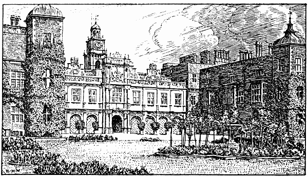
HATFIELD HOUSE
Hatfield House is still a fine example of early Jacobean architecture.
To be appreciated it must certainly be seen: any adequate account of its
architecture, its history and its treasures would fill such a volume as
this. In shape it is a parallelogram, about 280 feet long by 70 feet
wide, with two wings on the S. front. The centre between the two wings
is Italian Renaissance in style; the central tower, pierced by the great
gate, being of rich Elizabethan design. On the face of the third storey
of the tower are the armorial bearings of the Earl of Salisbury. This
S. front and the two wings enclose on three sides a quadrangle about 130
feet wide by 100 feet deep, beautifully laid out with flower beds and
lawns. The extremities of each wing take the shape of square, three
storeyed towers, surmounted by cupolas 20 feet high. Between the wings
runs a basement arcade, of eight arches on Doric pilasters, four on each
side of the gateway below the armorial bearings. The entire floor above
the arcade is occupied by the long gallery, 160 feet by 20 feet, and 16
feet high. At the W. end of this gallery is the library, at the E. end
is King James’s Room. The aspect of the house from the N. is not so
imposing; but there is a noble view over the grounds from the N.
terrace, and the central clock tower is a conspicuous object from the
most distant spots in the park. The library, graced by Zucchero’s
portrait of Robert, Earl of Salisbury, contains one of the most valuable
collections of MSS. in the country, but the State Papers have recently
been lodged in a room of greater security. A few of the treasures of
these two rooms may be mentioned: (1) more than 12,000 autograph letters
of the early Cecils; (2) the Diary of the “great Lord Burleigh”; (3) the
forty-two articles of Edward VI. with his autograph attached; (4) a
vellum MS. with miniature of Henry VII.; (5) the Norfolk correspondence;
(6) the Council Book of Mary Tudor; (7) early MS. of the Chronicle of
William of Malmesbury; (8) autograph MS. by Ascham.
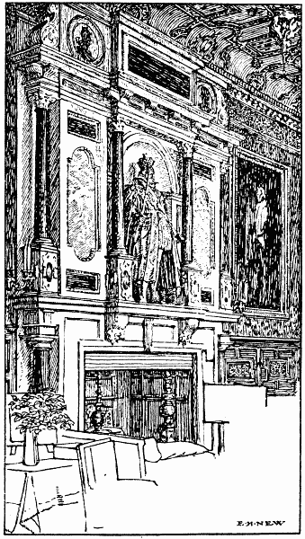
KING JAMES’S DRAWING-ROOM, HATFIELD HOUSE
King James’s Room has three fine oriel windows and is profusely
decorated. The great chimney-piece of marble mosaic, 12 feet wide, is
supported on black Doric columns, and surmounted by a statue in bronze
of James. Note the costly candelabra and gilt-framed furniture.
The Grand Staircase is hung with portraits of many Cecils, by Lely,
Vandyck, Kneller, Reynolds and other masters. Note the huge dimensions
of the carved balustrade; the strange rustic figures portrayed thereon;
and the lions grasping shields bearing heraldic devices. There are five
landings.
Among other apartments the following should be visited: (1) The
Chapel, with its fine Flemish windows representing scriptural stories,
marble altar-piece, and open stalls; (2) the Winter Dining Room,
looking out upon the N. terrace, about 30 feet square; this room
contains many valuable pictures, including Wilkie’s Duke of Wellington,
Van Somer’s James I. and Charles I., and Kneller’s Peter the Great; (3)
Great Banqueting Hall; (4) Summer Dining Room, near the foot of the
great staircase; the bust of Burleigh, in white marble, is above the
door; (5) the Armoury, full of treasures “rich and rare,” suits of
armour, relics of the Spanish Armada, various arms, etc. Other pictures
in various parts of the house include (1) William III., and Lady
Ranelagh, by Kneller; (2) half-length of Elizabeth with jewelled
head-dress and grotesquely embroidered gown; Mildred Coke, mother of the
first earl; Thomas Cecil, Earl of Exeter: all by Zucchero; (3) fine
whole-length of Mary, first Marchioness of Salisbury, by Reynolds.
The Park is the largest in the county, being about 9 miles in
circumference; it is undulating and beautifully wooded. There are some
superb avenues. Of Queen Elizabeth’s oak, N.E. from the N. terrace,
little is left saving a portion of trunk, railed round; but the Lion
Oak, between the house and the great W. gates, still puts forth leaves
in its season. The maze close to the house is only less famous than that
at Hampton Court.
The Church of St. Ethelreda is cruciform, largely Dec. and one of the
largest in the county. A Norman arch in the S. transept is thought to be
a portion of the original structure. It was completely restored, indeed
almost rebuilt, in 1872. The nave is 102 feet by 20 feet; the chancel
about 40 feet by 20 feet. There are N. and S. porches; the former looks
almost directly upon the great gate-house of the old palace. The most
important among many features of interest is the—
Salisbury Chapel, N. side of chancel, from which it is divided by an
arcade of three arches on Ionic granite columns. The whole is enclosed
by beautifully designed iron gates, the work, probably, of an unknown
Italian. Note the marble wainscotting, and the finely conceived and
executed allegorical paintings and mosaics on walls and roof. At the E.
side, on a slab of black marble supported by four kneeling figures in
white marble (representing the cardinal virtues) lies the recumbent
effigy of Sir Robert Cecil, first Earl of Salisbury, Lord High Treasurer
of England (d. 1612). The effigy is in robes, with official staff in
hand. Beneath the slab is a skeleton in white marble. Note also in this
chapel mezzo-relievo effigy to William Curll, Esq. (d. 1617), with
inscription, almost illegible, to the effect that he was a most
Christian knight who died in hope of a joyful resurrection.
On the opposite (S.) side of the chancel is the Brockett Chapel,
containing monuments to the Reades and Brocketts of Brocket Hall (see
below). Among them note (1) two recumbent female figures, above them the
arms of the Brockett family and beneath an inscription to Dame Elizabeth
Brockett (d. 1612) and an epitaph to Dame Agnes Saunders (d. 1588); (2)
medallion of a female by Rysbrack (1760); (3) bust of Sir James Reade,
Bart. (d. 1701), and of Sir John Reade, Bart. (d. 1711); (4) helmet of
Sir John Brockett on wall. There are piscinæ in the chancel and N.
transept, both discovered during restoration. The reredos, alabaster and
mosaic, has a fine crucifixion group, with SS. Alban and Etheldreda on
either side, carved by Earp, who also carved the pulpit of Caen stone.
Note the beautiful clustered shafts of marble on the font of Tisbury
stone, the gift of the late Marchioness of Salisbury.
Three miles N.N.W. is Brocket Hall. The Great North Road skirts the
park on the E. and the river Lea flows past the house from N.W. to S.E.
The present edifice was designed by Paine for Sir Matthew Lamb, Bart.,
whose son, Sir Peniston Lamb, Bart., became Viscount Melbourne in 1780.
By this nobleman the Prince Regent was sometimes entertained here, and
here, as stated in the Introduction, Lord Palmerston died in 1865. The
drawing-room and grand staircase have always been admired, but, as a
whole, the house is large and stately rather than beautiful. Elizabeth
is said to have visited here before she became Queen, and in the park,
as at Hatfield, an oak is shown as the one under which she loved to sit.
From the Hall the most charming walks may be taken in any direction;
e.g., through the park S.E. to Lemsford Mill, or S.W. to Cromer Hyde,
N.W. to Water End, or N.E. to Ayot Green. More charming still is the
ramble—permission should be requested—beside the winding Lea towards
Old Marford and Wheathampstead.
Hatfield Hyde (1¾ mile N.E. from Hatfield) is a hamlet in a pretty
district, with the river Lea and Hatfield Park a little S.
Haultwick lies 3 miles W. from the Old North Road; it is a hamlet 1
mile N. from Little Munden. The nearest station is Braughing, G.E.R.
(about 3½ miles E.), passing the S. side of Hamel’s Park.
Heavensgate (2 miles W. from Redbourn Station, M.R.) consists of a few
cottages in the centre of a district of small hamlets. The walk (2
miles N.) to Flamstead through Trowley Bottom is pleasant.
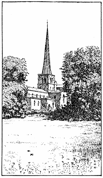
HEMEL HEMPSTEAD
HEMEL HEMPSTEAD.—Visitors from London should book to Boxmoor
(L.&N.W.R.) and walk N.E. over the little common or take the motor-bus
through Marlowes to the town (1½ mile). From St. Albans it is a pleasant
walk by way of Gorhambury and the village of Leverstock Green; from
Redbourn it is but a few minutes’ journey (M.R.). The town, until
recently an old “Bailiwick,” is on a hill, with central market place,
town hall and corn exchange. The church is very ancient; it is
cruciform, of flint and clunch stone. The oldest portions can hardly be
less than 750 years old; the nave, arcade and W. doorway are fine
examples of the period. Note (1) groined roof and Dec. windows S. side
of chancel; (2) transept roof, fourteenth century, restored in 1880; (3)
nave roof, fifteenth century, restored 1885; (4) great height of
octagonal, leaded spire, conspicuous for miles round (see illustration).
Among monuments note (1) figured brass, representing an armed man, to
Robert Albyn and Margaret his wife (1480); the inscription I transcribe
from Chauncy:—
“Robert Albyn gist icy
Et Margareta sa femme oubike luy
Dieu de lez almes eyt mercy”;
(2) monument to Sir Astley Paston Cooper (d. 1841).
Hemel Hempstead, according to Norden, owed its name (Heanhamsted) to
the high hemp-land on the E. side of the town. Offa, King of the
Mercians, gave six houses at Hemelhamstede to the Abbey of St. Albans;
but the remainder of the vill remained in the hands of Saxon Kings
until it was given to Earl Moreton by William I. The entry in Domesday
Book is in this case unusually interesting; the property held by Earl
Moreton is thus described: “Earl Moreton held Hamelhamstede in Treung
hundred, it was rated for 10 hides ... there are two Frenchmen born,
with thirteen Bordars, ... there are eight Servants, and four Mills of
seven and thirty Shillings and four Pence Rent by the Year, and three
hundred Eels wanting five and twenty, Meadow four Carucates, Common of
Pasture for the Cattle, and two Shillings Rent by the Year, Wood to feed
one thousand and two hundred Hogs; in the whole value it is worth two
and twenty Pounds, when he received it five and twenty Pounds, and Rent
in the time of King Edward (the Confessor). Two were Brethren, Men of
Earl Lewin, they held this mannor.” From Priory Hill, W. from the
church, a fine view may be obtained of the town below and the cornfields
beyond. Bury Mill is on the river Gade, at the foot of the hill.
Gadesbridge Park is on the left as you pass from High Street to
Piccott’s End; the House is on a beautifully wooded slope, W. from the
Gade; it is the residence of Sir Astley Paston Paston Cooper, Bart.,
J.P., etc. A good deal of straw plait is still made by the women of
this neighbourhood.
Heronsgate (3 miles W. from Rickmansworth) is a hamlet on the Bucks
border, with a small chapel-of-ease to St. Peter’s, Mill End, 1¼ mile E.
The building is modern, with one window of stained glass.
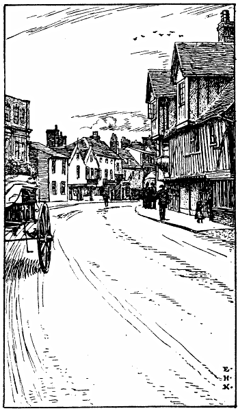
HERTFORD
HERTFORD, the county town, is of immemorial antiquity. The origin of the
name has elicited much learned conjecture, and Hertford is one of
several places held to be the Durocobrivis mentioned by Antonine. It
is the Herudsford (i.e. red ford) of the Venerable Bede. That it was
a town of some importance on the river Lea even in the days of the
Trinobantes seems indisputable. Norden conjectured that the true name of
the town was Hartford, so called because in Saxon times, when the
surrounding country was densely wooded, the harts crossed the river by a
natural ford at this spot. However this may be, the old borough seal,
three or four centuries ago, bore as a device a hart in shallow water.
The rivers Rib, Beane, and Maran all unite with the Lea in the immediate
neighbourhood. Some reference may be here made to the doings of Alfred
the Great in this neighbourhood. By putting together what is recorded by
William of Malmesbury, Henry of Huntingdon, Asser and others we learn
that in the twenty-third year of Alfred’s reign the Danes infested the
Thames with their ships, sailed up the Lea in the lighter of their
crafts, and built a fort about 20 miles from London, at or near what is
now the town of Ware. Presently, in the course of their many foraging
excursions, they sailed farther up the river towards Hertford, stripped
the people in the town and burnt down many houses. They afterwards
established a garrison near the town. Alfred brought his army down to
the river side the following year and made a careful survey of the
Danish fort and of the character and position of their ships. He is said
to have passed from place to place in a boat, drawn by a horse, and to
have carefully ascertained the depth of the water at different points.
The precise nature of his subsequent operations is not well known, but
he is said to have diverted the course of the river, to have erected a
dam (Shass) at Blackwall, and by these means to have grounded the Danish
fleet. The Danes held a treaty, and eventually withdrew into
Cambridgeshire and Gloucestershire; the Londoners came down to the scene
of Alfred’s ingenuity and destroyed or appropriated the Danish ships.
Of the castle, built by Edward the Elder in 905, there still remain
several large fragments of an embattled wall, partly Norman, and a
postern gate. Of its history only a few leading facts can be mentioned
here. William I. entrusted it to the keeping of Peter de Valoignes; it
was besieged by Louis the Dauphin, and capitulated on the Feast of St.
Nicholas in 1216; it was granted, together with the town, to John of
Gaunt, Earl of Richmond, in whose time Kings John of France and David
of Scotland were prisoners within its walls, and after the Earl had been
created Duke of Lancaster he held a court in the castle for three weeks.
It was the last prison house of Isabella, widow of Edward II. Henry IV.
gave the castle to his wife Joan; Henry V. to his wife Katherine of
France; and Henry VI. to his wife Margaret of Anjou. Elizabeth and James
I. are both said to have visited this castle. Charles I., on 3rd May, in
the sixth year of his reign, transferred it to William Earl of
Salisbury. It was seized by the Parliament during the Great Rebellion.
The Roman Catholic Church in St. John Street stands on or near the site
of the old Priory, founded during the reign of William I. by Ralph
Limesy and by him conveyed to the Abbot of St. Albans, who placed here
six Benedictine monks under Ralph, who became their first prior. The
Priory was dissolved in the twenty-sixth year of Henry VIII.; but the
church was rebuilt by Thomas Willis in 1629. It was “demolisht by order
of the Bishop of Lincoln” towards the end of the seventeenth century.
The church of All Saints, on high ground E. from the town, was destroyed
by fire in 1891, when almost everything perished. It was immediately
rebuilt as a Perp. structure of Runcorn stone, and consecrated in 1895.
In the main, the plan of the old church has been followed, but the
aisles are longer than formerly; note the fine clerestoried nave of five
bays, and hexagonal N. porch. The old building contained monuments to
Sir John Harrison, Kt., Farmer of Customs to Charles I. (d. 1669);[4] to
Isabel Newmarch, maid of honour to Isabella, daughter of Charles VI. of
France and second wife to Richard II.; and to Johannes Prest, “porter”
(janitor) to Katherine, wife of Henry V. The two latter monuments were
removed more than 200 years ago. Note the beautiful chestnut trees in
the avenue near the church, and the many quaint epitaphs on the
tombstones in the extensive graveyard. The Church of St. Andrew is
modern; it occupies the site of an older Perp. edifice, originally
founded before the Conquest. Close by in the market place is the Shire
Hall, a large brick building of “questionable shape” erected towards the
close of the eighteenth century. Malting, brewing and general trade in
corn and its products form the larger part of the industries of
Hertford. Between this town and Ware is the spot where Cromwell put a
summary period to the insurrection of the “Levellers” by shooting a
ringleader named Arnald.
Hertford Heath. (See Amwell, Little.)
Hertingfordbury may be visited from Hertford, the station
(G.N.R.) being 1½ mile S.W. The village is pleasantly situated on the
river Maran, on the S. confines of Panshanger Park. The church, partly
rebuilt by Earl Cowper in 1890-3, was founded during the fifteenth
century. It contains little of architectural interest, but the monuments
are numerous: (1) marble mosaic altar tomb to Sir W. Harrington, with
alabaster effigies of himself and wife and inscription in rhyme; (2)
slab to Thomas Ellis (d. 1608) and Grace his wife (d. 1612); (3)
recumbent effigy in marble to Lady Calvert, wife of Sir George Calvert,
Kt., who died in 1622; (4) to Dr. Jonathan Browne, Dean of Hertford (d.
1643); (5) very ancient brass inscription beneath chancel arch to two
daughters of Robert de Louthe, and one of similar age to Robert de
Louthe and his wife. The Cowper Chapel, N. side of chancel, contains
many monuments to that family, particularly a fine alto-relievo by
Roubeliac to Spencer Cowper (d. 1727), chief Justice of Chester in 1717.
Hexton (about 6 miles N.W. from Hitchin Station, G.N.R.) lies
on a tongue of the county surrounded W., N. and E. by Bedfordshire. The
Church of St. Faith, W. from the village, was rebuilt, with the
exception of the embattled tower, in 1824, as a Perp. edifice. The St.
Nicholas Chapel, N. side of chancel, takes the place of the chapel
bearing the same name in the former church. There is a memorial to Peter
Taverner (d. 1601), who was, I suppose, father to that Francis Taverner,
Esq., who compiled a record of the antiquities of Hexton and set it in
the chapel. Little space can be spared for excerpts in this volume, but
the details which Taverner brought together are so interesting that I
transcribe a part of them from a copy in my possession:—
“Near unto the Roman military Way called Icknild or Ikenild-Street,
which passeth by this Parish upon a very high Hill is to be seen a
warlike Fort of great Strength, and ancient Works, which seemeth to have
been a Summer standing Camp of the Romans: And near it on the Top of
another Hill called Wayting-Hill, a Hillock was raised up, such as the
Romans were wont to rear for Souldiers slain, wherein many Bones have
been found. The Saxons call’d this Fort Ravensburgh, from a City in
Germany, whereof the Duke of Saxony beareth the Title of Lord at this
Day. And this Town, which the Britains perhaps call’d Hesk of Reed,
which doth abound much in this Place; the Sazons call’d Heckstanes-Tune,
that is the Town of Reed and Stones, if not rather Hockstanes-Tune, that
is, the Town of Mire and Stones, for old Englishmen, call deep Mire,
Hocks: Or may be from Grates set in Rivers or Waters before Floodgates,
which are call’d Hecks; neither is it unlikely but that the Danes made
some Use of this Fort, for a Parcel of Ground near thereunto is called
Dane-Furlong to this Day. Some of these Conjectures may be true, but
this is certain, that Offa, a Saxon King, of the Mertians about 795,
founded the Monastery of St. Albans, in Memory of St. Alban, and that
Sexi an honourable and devout Dane (as it is in the Chartulary of the
Abby) about Anno Dom. 1030, gave to the said Monastery the Town of
Heckstane-Tune and the Abbot of St. Albans held this Mannor in the time
of King William the Conqueror.
“This Vill at that time did lie in the Half-hundred of Hiz, and from
that time during the Space of 510 Years, the Abbots of St. Albans were
Lords of the Mannors now call’d Hexton. They were also Patrons of this
Church (dedicated to St. Faith, which Saint had her Statue erected over
a Fountain near this Church Yard, call’d St. Faith’s Well) for John de
Hertford, the 23d Abbot, did appropriate this Church of Hexstoneston to
the said Monastery. The Cellarers of which Monastery kept the Court Leet
and the Court Baron, and received the Rents of the Demeasnes and
Customary Tenants of this Mannor; and the Sacrists had the disposing of
the Profits of the Rectory.
“The said Fort, which the common People call Ravensborough Castle, is
cast up in the Form of an Oval, and containeth sixteen Acres, one Rood,
and fifteen Poles of Ground, and is naturally strengthened with mighty
deep and very steep Combs, which the inhabitants call Lyn.
“The Town of Hexton is seated at the Foot of the Mountains, whence issue
many Springs of Water; the Mountains are a continued Rock of Stone.”
High Cross (3 miles N. from Ware) is a village and parish on
the Old North Road. It has a modern Dec. church of grey stone,
containing several good stained-glass windows, but little of
architectural interest. Youngsbury, a beautiful but small park, S.
from the village, has a fine Georgian residence (C. B. Giles-Puller,
Esq.). The little river Rib skirts the park on the S. side. There is a
small hamlet of the same name 1¼ mile S.W. from Radlett Station
(M.R.).
High Street is a small hamlet on the Cambridge Road, near the river
Quin. Braughing Station (G.E.R.) is 1¼ mile S.
High Wych (2 miles N. from Harlow Station, Essex) has an E.E. church,
built in 1861; the marble reredos, finely worked, was added in 1871. The
trade in malt is large for so small a place.
Highley Hill (1 mile S.W. from Ashwell Station, G.N.R.) is on the
Cambridgeshire border.
Hinxworth, formerly Hamsteworde and Henxworth (4 miles N. from
Baldock), is close to the Bedfordshire border. The parish is very
ancient. The church of St. Nicholas was erected about 1400 on the site
of an earlier structure. It is a mixture of several styles, partly
restored in 1881. Note (1) two canopied Perp. niches in S.E. angle of
nave, where was formerly the lady-chapel; (2) brass to John Lambard, a
master of the Mercers’ Company (d. 1487), and Anne his wife; (3) oak
roof in chancel, added in 1892; (4) rood-stairs. William I. divided
the vill between three Normans, Peter de Valoignes, Hardwin de
Scalers, and William Earl of Ewe, who owned much other property in
Hertfordshire. The vill was subsequently divided into two manors, one of
which belonged to William de Cantilupe, a Steward and Councillor to King
John, and the other, during the reign of Henry VII., to John Lambard
mentioned above. This manor was called Pulter; and the old house (now
Hinxworth Place, ½ mile S. from the village) was once inhabited by
some Cistercian monks of the Monastery of Pipewell (Northants). Note the
clunch walls and mullioned windows, in one of which, designed in stained
glass, are the armorial bearings of three former owners. Two hundred
years ago the village consisted of thirty-five dwellings, three of which
were almshouses.
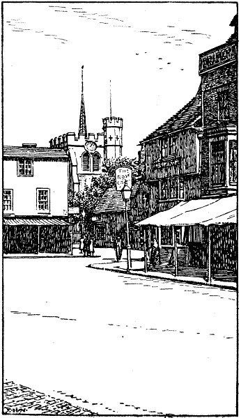
HITCHIN
HITCHIN is an ancient town, full of interest, 32 miles N. from King’s
Cross, G.N.R. It was formerly called Hitche, very probably from the
little river Hiz, which rises at Well Head, about 1½ mile S.W. from the
centre of the town. Roman coins and pottery, and even prehistoric
implements have been found in great quantities in the neighbourhood, and
there are traces of a prehistoric lake bed, to the S.E. The Priory,
immediately S. (R. H. J. Delmé-Radcliffe, Esq., J.P.), occupies the site
of a Carmelite monastery and Conventual church founded in the reign of
Edward II.; and the Biggin Almshouses, close to the church, still
preserve some of the old fabric of the Gilbertine Nunnery, founded in
the reign of Edward III. The Church of St. Mary (formerly St. Andrew),
just off the N.E. corner of the market-place, is thought to be the
largest parish church in the county, the other claimant for that honour
being St. Peters, Great Berkhampstead. The whole structure is embattled.
The square W. tower is of unusual size, but low in proportion. Entering
by the fine old S. porch we notice the niches for statues, none of which
remain, and the vaulted roof, badly battered and marred by—as is
supposed—the zealous iconoclasts of Cromwell’s army. Opposite, over the
N. porch, hangs a painting of the Adoration of the Magi, believed to be
by Rubens; it was formerly over the communion table. The church has been
restored at intervals since 1858; but the fine Perp. aisle-roofs still
remain. The font, of Ketton stone, is ancient, and formerly had statues
of the twelve Apostles in niches; these, however, have been mutilated
almost beyond recognition; the beautiful oak canopy is new. Note the
effigy in stone lying in the recess of the first window of the N. aisle,
believed to be that of Bernard de Baliol, founder of the Preceptory of
Knights Templars at Temple Dinsley (3 miles S.), and the mosaics of the
reredos, representing the Last Supper, Christ and the woman of Samaria,
Moses striking the rock, and other subjects from Scripture. The screens
of carved oak, between the aisles and chancel aisles, are among the
finest in the county. Memorials are numerous; some ancient brasses
having been brought to light during restoration. Among the brasses are
one (1) to John Beel, Margary his wife, and their eight children (1477);
this is near the pulpit; (2) to James Hert, B.D. (d. 1498); (3) to John
Pulter, a draper (d. 1421), and his wife Alice, the effigies almost
obliterated; (4) to Nicholas Mattok, and his wife Elizabeth (d. 1485);
this Nicholas was a fishmonger of London, and a merchant of the staple
of Calais; (5) portion of a brass, near the chancel steps, to John
Sperehawke, D.D., Canon of Wells (d. 1474).
Adjoining the W. end of the churchyard is Golden Square, once the
residence of Eugene Aram, from which we may pass into Bancroft, one of
the widest thoroughfares in the county. Close by is Tilehouse Street;
the Baptist Chapel, on the left, some way up the street, was restored in
1894: it stands on the site of the building in which Bunyan preached; a
chair which he gave is still shown in the vestry. It may here be
mentioned that George Whitefield and George Fox are both known to have
visited Hitchin during their missionary wanderings. A little farther W.
is Mount Pleasant, thought to be the birthplace of George Chapman, the
translator of Homer. That he finished his translation in this
neighbourhood is matter of knowledge; but what is told of his family
connections with Hitchin is little more than conjecture.
Between the town and the station, G.N.R., stands a modern church of red
brick, dressed with Bath stone, E. Dec. in style. There are good oak
stalls and a sedile in the chancel.
Hitchin was noted during the sixteenth century for its trade in wood and
malt. There were at one time tan-yards beside the Hiz, and the
buckle-makers of Bucklersbury gave that street its name. The
malting-yards occupied much of the ground on both sides of Bancroft. The
making of lavender water in the town is referred to in the Introduction.
Hockeril is now the E. suburb of Bishop’s Stortford, the bridge
over the Stort, near the Old Black Lion, connecting it with the town. It
has a modern Gothic church. The E. extremity of Hockeril is almost on
the border line between Hertfordshire and Essex.
HODDESDON (1½ mile N. from Broxbourne Station, G.E.R.) is an ancient
market town, lying on high ground among beautifully diversified
surroundings. It is known, at least by name, to all readers of The
Complete Angler; but the old Thatched House, to which Izaak Walton
often resorted, has long been a thing of the past. The Bull Inn still
remains where it stood in the time of Prior, whose allusion to it in his
Down Hall is invariably quoted in local handbooks:
“Into an old inn did this equipage roll,
At a town they call Hod’sdon, the sign of the Bull,
Near a nymph with an urn that divides the highway,
And into a puddle throws mother of tea”.
The stone figure to which Prior refers is no longer to be seen. At the
S. end of the High Street, on the right when entering the town from
Broxbourne, stands Rawdon House, an embattled Jacobean mansion of red
brick, built by Sir Marmaduke Rawdon in 1622. It was restored in 1877,
and the stucco with which it was formerly coated was removed. A tower,
with cupola roof, is at the rear of the house, which is now a convent
for Augustinian nuns.
The Church of St. Catherine, close to the site of the old Thatched
House, but W. from the opposite side of the High Street, dates from
1732; the tower was added in 1888. It is a large building of red-brick,
in mixed styles, with small windows of stained glass in the chancel. It
is not interesting.
Hollesmore End (2 miles W. from Redbourn Station, M.R.) is a small
hamlet.
Holwell is a village and parish transferred from Bedfordshire
to Hertfordshire in 1897. It is about 1½ mile N.E. from Pirton (q.v.);
the nearest station is Henlow, M.R., 2 miles N. The Church of St. Peter,
very much restored, was originally Perp. There is a xii century holy
water basin, and a very curious old brass to Robert Wodehouse, a priest
(1515), with figures of two wodehowses (wild forest men) and of a
chalice and paten.
Hook’s Cross (2 miles E. from Knebworth Station, G.N.R.) is a hamlet
on the main road from Hertford to Stevenage. Frogmore Hall stands in a
small park ½ mile E.; it is a large modern mansion of red brick and
stone facings. The grounds are very picturesque, and are divided by the
river Beane.
Hormead, Great (2½ miles E. from Buntingford), has a restored
fifteenth century church, perhaps 1400-20, containing a brass to a
benefactor, one William Delawood (1694) and a mural monument to
Lieut.-Col. Stables, killed at Waterloo. The village is close to the
river Quin, which flows between the church and Hare Street on the
Cambridge Road.
Hormead, Little (½ mile S. from the above), has a quaint little Norman
and E.E. church on the hill crest overlooking Hare Street. Leaving the
Cambridge Road at the S. end of that village, and crossing the river
Quin, the rounded arch of the Norman doorway on the N. side of the nave
catches the eye as we approach the village. The door itself is partly of
wrought iron work, seventeenth century; an engraving of it is in
Cussans’ History of Hertfordshire. There is excellently preserved work
in the Norman nave. It has been surmised that “Hormede” was formerly one
vill, that it was divided soon after 1100, and the two churches built
on the hill less than ½ mile apart. Ralph Baugiard and Eustace, Earl of
Boulogne, together held the manor of “Hormede” at the time of the Great
Survey, and the names Hormead Magna and Hormead Parva are of later
origin.
Horse Shoes (½ a mile N. from Smallford Station, G.N.R.) is a hamlet
in the parish of Colney Heath.
Howe Green, a small hamlet, is 1¼ mile S. from Cole Green Station,
G.N.R. Pretty walks may be taken S. to Bedwell Park, or N.W. to the mill
on the Lea, Rye Croft, and Mill Green.
Hunsdon (2 miles N.E. from Roydon Station, Essex) is a very
ancient village. The E. Perp. church of flint is thought to date from
1400, and the N. porch of oak is probably coeval with the main
structure. Note the finely carved Jacobean screen which divides the Cary
Chapel in the S. transept from the nave, and, in the chapel, the
imposing monument and alabaster effigies to Sir John Cary (d. 1617) and
his wife. The monument is built into the wall; behind it is a rather
long, but historically important inscription:—“Here resteth in Peace
Sir John Cary, Knight, Baron of Hunsdon (being the fourth Son to the
Right Honorable Henry Baron of Hunsdon) and the Lady Mary Hunsdon his
Wife, Daughter to Leonard Hide of Throcking in the county of Hertford,
Esq.; The Said Sir John Cary was sent to Barwick by the late Queen
Elizabeth of Famous Memory, in the Year of our Lord, 1593, to be
Marshall of the Town of Barwick, and Captain of Norham; afterwards he
was made Governor of the said Town and Garrison of Barwick, and Lord
Warden of the East Marches of England,... Scotland, and so he remained
until he returned into England with the most famous King James, where he
entered into the Possession of the Crown of England; and so having two
Sons and two Daughters ended this transitory Life, in an assured Hope to
rise again in Christ.” In the chancel windows are some white roses, and
a badge of the House of York; note also the canopies in these windows,
and the figures of Apostles in the W. window. On the N. wall of nave is
a fine brass to James Gray, showing a man shooting at deer with a
crossbow; this Gray was gamekeeper for thirty-five years at Hunsdon
House. Bishop Ridley preached from the pulpit on several occasions.
Hunsdon House stands between the church and Gilston Park. During the
reign of Edward IV., Sir John Oldhall “built here a fair House after the
mode of a Castle ... which building, ’tis said, cost £7,222”. This would
be an enormous sum of money in those days. The original structure had a
high tower and large courtyard. Henry VIII. made the house a palace, and
in so doing appears to have almost rebuilt it; it is known that his
children were often here, as the King had a high opinion of
Hertfordshire air. Queen Elizabeth gave the estate to Sir Henry Cary,
Kt., her cousin, and created him Baron Hunsdon. The “palace” was
surrounded by a moat, crossed by two bridges; the grand entrance and
lofty clock tower, the outhouses and grounds are elaborately depicted in
a print in Chauncy’s History. The present house was erected at the
beginning of this century, partly on a fresh site, but some portions of
what was the W. extremity of the old palace are built into the E. wing.
Two fine Jacobean chimney-pieces still remain; but little else is left
of the old Tudor home, and the moat has been levelled. The present
house, however, is an imposing, even noble structure of red brick, and
its position, backed by the grand old elms in the park, is very
picturesque. N.E. stood Hunsdon Lodge, the hunting lodge of Queen
Elizabeth.
Hunton Bridge is a pleasant little village at the meeting of
the roads from Watford, King’s Langley, and St. Albans, on the Grand
Junction Canal. The nearest station is King’s Langley (L.&N.W.R.), 1¼
mile N. There is a good modern inn and many pretty cottages, and folk in
search of rest and quiet might journey farther and find less suitable
retirement. The nearest church is at Langleybury (q.v.).
Ickleford, formerly Ickleton, is a village on the Roman
Icknield Way, which at this spot fords the little river Hiz; hence its
name. It is 2 miles N. from Hitchin. The church was restored in 1860;
but portions of the ancient fabric have been carefully retained, and a
small chapel added to the chancel. The tower is Norman, as are also part
of the nave arcade and the S. doorway. The chancel arch, pointed, is
finely carved; the stairs to the rood-loft still remain; there is a
piscina in the chancel. Note brass to Thomas Somer and his wife (circa
1400). S. from the church is Ickleford Manor, in a small park, for
some years the residence of Commander H. C. Dudley Ryder, R.N. It is not
of historic interest.
Ippollitts or St. Ippolitts (2 miles S.E. from Hitchin) was
formerly called Hippolits, Eppalets or Pallets, according to the taste
of the speaker. It was thought by Norden to owe its name to Hippolits, a
supposed Saint, who was very skilful in the treatment of horses. After
the Saint’s death a shrine was placed to his honour in the parish
church, and to this shrine near the high altar divers persons brought
their ailing steeds to be healed by the attendant priest with the help
of relics of the Saint. The relics were of efficacy commensurate with
the gifts of those who desired the Saint’s blessing! “The horses,” says
one writer, “were brought out of the North Street, through the North
Gate, and the North Door of the Church, which was boarded on purpose to
bring up the horses to the Altar.” The church was restored in 1878; it
is of flint and rubble, and is now chiefly Perp. and Dec. with a few
older portions. Note (1) ambry and double piscina in the chancel; (2)
brass in N. transept to Robert Poydres (d. 1401); (3) brasses in
chancel, with effigies, to the Hughes family, one of whom, Alice, was
daughter of Thomas Bybsworth, “an ancient dweller in this parish”; she
died 1594. There is a tumulus about 1 mile S.
Kelshall (2½ miles S.E. from Ashwell Station, G.N.R.) has a
restored, but interesting church, dedicated to St. Faith, partly Perp.
and partly Dec. Over the S. porch is a small chamber, and in the N.
aisle is a recess, the nature of which is not quite understood, but it
was probably used for the safe-keeping of banner-staves, crosses and
other pre-Reformation ornaments. There is a brass with two effigies to
“Rychard Adane and Maryon his Wyff” (d. 1400 and 1435 respectively). In
the churchyard is an old sundial on the shaft of a stone cross. John
Janeway, a young divine of astonishing spirituality, whose Life, by
his brother James, was subsequently prefaced by Robert Hall, was buried
here in 1657: Richard Baxter was one of his admirers. The Manor of
Chelesell was the property of the Abbot of Ely at the time of the
Conquest, having been given to that ancient foundation by the father of
Edward the Confessor.
Kensworth was transferred to Bedfordshire in 1897.
Kimpton (about 2¾ miles N. from Wheathampstead Station) lies
between the hills that lead N. to Whitwell and S.E. to Ayot St.
Lawrence. The village is very ancient, and was called Kimeton in Saxon
days. The church, a little N. from the centre of the village, has been
much restored: the N. aisle was added in 1861; the tower and the N.
porch (over which is a parvise, as at Kelshall) were restored in 1887-8;
the chancel in 1890, when the reredos was added. The building is E.E.
Note the finely carved oak screen separating the S. aisle from the Dacre
Chapel, formerly the rood screen, the piscina in the chapel itself, and
the stained glass in the E. window to Thomas, twenty-second Baron Dacre
(d. 1890), to whom the reredos is also a memorial. Kimpton Hoo, in a
beautiful park of about 250 acres, is 1 mile N.E. from the village. It
is the seat of Viscount Hampden. Pretty walks may be taken E. viâ
Kimpton Mill to Codicote, N. to Bendish and Whitwell, W. to Peter’s
Green, or S. to Lamer Park.
King’s Langley is a large and interesting village. The river
Gade flows between the main street and the station, L.&N.W.R. Paper and
straw plait are both made largely. The village owes its name to the fact
that Henry III. built a palace on a spot still marked by a few fragments
of ruin a little W. from the church, and the royal manor became known as
Langley Regis, whereas the Langley on the E. side of the river belonged
to the Abbey of St. Albans, and was called Abbot’s Langley (q.v.).
Edmund de Langley, fifth son of Edward III., was born in this palace in
1344. He became Duke of York, Earl of Cambridge and Lord Tivedale, and
married Isabel, a younger daughter of Don Pedro of Castile. In 1392
Richard II., with his first Queen, Anne of Bohemia, and many bishops,
earls, lords and ladies, kept Christmas at King’s Langley Palace.
Near the palace was founded, by one Roger Helle, a priory of Dominican
monks, which was enriched by Edward II. and several successive monarchs.
The body of Piers Gaveston was brought from Oxford and buried in the
church of this priory in 1315—he was beheaded on Blacklow Hill in
1312—and what was then believed to be the body of Richard II. was
brought to the same spot in 1400 for temporary sepulture. The priory was
dissolved, like most priories, in the days of Henry VIII.; but it was
restored by Mary. It was finally suppressed soon after the accession of
Elizabeth. The church, at the S.E. extremity of the village street, is a
Perp. structure of flint and Totternhoe stone; the W. tower is embattled
and has an angle turret. It has been partially restored. On the N. side
of the chancel stood formerly the tomb of Edmund de Langley and Isabel
of Castile (both mentioned above) which was brought from the priory
church at the Dissolution; it is now in the chapel at the end of the N.
aisle. There is, I believe, no absolute proof that this is the tomb of
Edmund and Isabel, but the evidence that it is so is very strong.
Chauncy, two centuries back, wrote: “On the north side of the chancel
there is a Monument raised about five foot, with the Arms of France and
England, with three Labels upon it, also the Arms of Peter, King of
Castile and Leons, by which Coats it seems to be the Tomb where Edmond
de Langley, the Fifth Son of Edward III. and Isabel his Wife, one of the
Daughters of Don Pedro, King of Castile, was [were] interr’d”. During
the removal of the tomb to its present position the bones of a male and
two females were discovered; they are presumably those of Edmund and
Isabel, and of Anne Mortimer, the wife of Edmund’s second son, Richard,
Earl of Cambridge. The tomb is covered by a slab 7 feet 3 inches long;
the sides are embossed with Plantagenet shields within cusps. Note the
beautifully carved open screen between chapel and chancel, and the
reredos, partly of marble, erected in 1877. The oaken pulpit is Perp.
There are several other monuments: (1) to Hon. Sir W. Glascocke of
Aldamhowe, Kt., Admiralty Judge in Ireland under Charles II. (d. 1688);
(2) brass to John Carter, “late of Gifres” (d. 1588); the inscription
states that he had two wives, that the first bore him four sons and five
daughters and the second five sons and four daughters; (3) brass to
William Carter and Alice his wife, 1528.
Sir John Evans, in 1862, found an almond-shaped river-drift flint
implement on a heap of stones in this neighbourhood.
King’s Walden (about 5 miles S.W. from Hitchin) has an ancient
church, carefully restored in 1868. It stands in the park of The Bury,
a large mansion, Elizabethan in style. The embattled tower has masonry
probably older than fourteenth century, and much of the nave arcade is
Norman. Note the sculptured capitals of pillars, curiously similar to
those at Old Shoreham. The chancel arch is E. Perp.; probably
substituting its E.E. predecessor on very close lines; the corbels bear
busts thought to resemble Henry VI. and Margaret of Anjou. In the
chancel are a double piscina, and two E.E. lancet windows. The chancel
screen is a really wonderful piece of work, in excellent
preservation. In the N. aisle is an ambry, and in the S. aisle a sedile
and two piscinæ, and on the N. side another ambry. The font stands at
the E. end of S. aisle, formerly the Chapel of the Virgin Mary.
Kinsbourne Green is on the Bedfordshire border, 2 miles N.E. from
Harpenden. The Kennels of the Hertfordshire Hunt are here. The hamlet is
close to Luton Hoo Park.
Kitter’s Green is a hamlet 1 mile S.E. from King’s Langley Station
(L.&N.W.R.). Abbot’s Langley old church (q.v.) is ½ mile N.
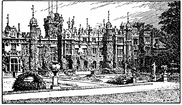
KNEBWORTH PARK
KNEBWORTH, famous as the home of Bulwer Lytton, lies on high ground 1
mile W. from the station (G.N.R.). The village is small, and in itself
of little interest; it was formerly called Chenepeworde, and
Knebbeworth. It is, however, ancient, and was valued in Domesday Book.
Sir Thomas Bouchier, K.G., who fought for the Earl of Richmond at
Bosworth Field, sold the manor of Knebbeworth to Robert Lytton, Esq.,
Keeper of the Wardrobe to Henry VII., whose son William was buried in
this parish. This Sir Robert began to erect a huge Tudor mansion on the
site of a fortress which had stood since the days of the Conquest; it
took several generations to complete it. The present house is the result
of the work of demolition and reconstruction in the days of the
novelist’s mother, and of the enlarging of 1883, when the S. wing and
entrance were added; it is pseudo-Gothic. The castellated parapet,
cupola-topped turrets, griffins upon pinnacles and many mullioned
windows are noticeable features from the grounds. Within, the finest
sight is the grand old banqueting hall, with its gallery for minstrels,
its Elizabethan oak-screen, and wainscots by Inigo Jones. Around, on all
sides, are suits of armour, some dating from the days of Henry VII. The
room is associated with memories of Elizabeth, who was sometimes
entertained at Knebworth by Sir Rowland Lytton, whom she knighted; he
was buried in the chancel of the little church in the park (see below)
in 1582. The room in which Elizabeth slept on these occasions is still
shown as “Queen Elizabeth’s Chamber,” and contains a finely carved
over-mantel (oak) and an oaken bedstead of colossal proportions. Among
the distinguished guests so often entertained here by Bulwer Lytton were
Dickens, Forster and Jerrold.
The grounds are nearly perfect, art and nature seaming to strive to
out-do one another. Well-kept lawns are figured by flower-beds of all
shapes and sizes; the rosery is very large; the great variety of
evergreens imparts every hue and shade to the extensive walks stretching
W. from the house. The lawns are divided here and there by stone
balustrades and overlooked by statues of classical and modern figures.
There are many nooks, pleasure houses and alcoves. A long avenue of
limes leads to the lake.
The church, a little N. from the house, is approached through lodge
gates. It is for the most part E.E. The oaken pulpit is octagonal; the
finely carved panels represent scenes in the life of Christ, one of them
bears the date 1567. At the N. side of the chancel, which has a piscina,
is the Lytton Chapel, “a little Chapel or Burying Place, built by the
Family of the Lyttons”. Among the members of the family buried in the
chapel were (1) Dame Judith Barrington, daughter of Sir Rowland Lytton,
and wife to Sir Thomas Barrington of Hatfield Broad Oak (d. 1657); (2)
Sir William Lytton, Kt. (d. 1660); (3) Sir Rowland Lytton, Kt. (d.
1674). To the Sir Rowland Lytton who died in 1582 (see above) there is a
fine brass with effigy, which also commemorates his wives Margaret and
Anne, and his three children. There are other memorials both in the
church and Lytton Chapel, among which note (1) brass to Simon Bache,
Treasurer of the Household to Henry V. and Canon of St. Paul’s (d.
1414); (2) brass to John Hotoft, who filled the same office in the
Household of Henry VI. (d. circa 1430). This brass formerly showed
effigies of Hotoft in armour with his wife beside him. Note also, near
the S. porch, two headstones with interesting inscriptions to servants
of the Lytton family, and close by, in the park, the mausoleum erected
by the mother of the novelist, who was buried within its walls. The
epitaph to her memory on the exterior was written by her son. Passing
out at the lodge gates we may turn left and reach a pretty dip, from
whence a walk of 3 miles N. over open country leads to Stevenage.
Knebworth Green skirts the S. side of the park.
Langley, a hamlet on the Hatfield-Hitchin road, is 2 miles S.W. from
Stevenage Station (G.N.R.). Langley Bottom is a few minutes’ walk N.
Langleybury (1 mile S. from King’s Langley Station, L.&N.W.R.) is
practically part and parcel of Hunton Bridge, the church standing W. and
the village E. of the main road from Watford to Hemel Hempstead. The
church is modern, a Gothic structure; on the S. is a good lich-gate.
Close to the S. porch is the large cross of Sicilian marble, by the
Florentine sculptor Romanelli, to the memory of the late W. J. Loyd, at
whose expense the church was erected. The walk from Langleybury to
Buck’s Hill (W.), by way of West Wood, leads through some lovely bits of
scenery, and should on no account be omitted. At the outset the confines
of Grove Park are on the left and the road dips up and down as the woods
are passed, and is shaded by fine beeches in many spots.
Layston was a village in Saxon times, but nothing now remains save the
ruins of the church, still almost intact, at the meeting of two lanes, 1
mile N.E. from Buntingford. It is a flint structure, E.E. and Perp. The
S. porch is in part demolished. There are monuments to the Crowch family
of seventeenth and eighteenth centuries.
Lea, river. (See Introduction, Section II.)
Leavesden (about 2½ miles N. from Watford) is a village in the
pretty district between Grove Park and Bricket Wood. The ecclesiastical
parish was formed seventy years ago from the parishes of Watford and St.
Albans. The huge brick building on high ground a little N. is the
Metropolitan District Asylum for Idiots; it was erected in 1869. The
church dates only from the formation of the parish and is situated at
Garston, 1 mile E. It was designed by Sir Gilbert Scott and is E.E. The
Grove, a large mansion of red brick, was erected in 1760 by one of the
Villiers family, but has been restored and altered. The house contains a
part of the pictures collected by Clarendon; comprising portraits by
Vandyck, Lely, C. Janssens, Zucchero, Van Somer, Kneller, Hogarth, etc.
The park is extensive and beautiful.
Lemsford is another modern ecclesiastical parish, formed sixty
years ago. It is nearly 3 miles N. from Hatfield, on the S.E. side of
Brocket Hall Park. It is widely known for its large mill on the river
Lea. The church, erected in 1859 as a memorial to the sixth Earl Cowper,
is E.E. and Dec., with a good E. window, also to the memory of the earl.
The tower (W.) is lofty and embattled.
Letchmore Heath (1½ mile S.W. from Radlett Station, M.R.) is a small
village.
Letchworth (2 miles N.E. from Hitchin) has a small Perp. church,
containing a curious old brass to Thomas Wyrley, an early Rector (d.
1475). The effigy represents him with a heart in his hands. Another
brass, much defaced, dates from circa 1400; it is to William Overbury
and Isabel his wife. The village, which almost adjoins that of Willian
(q.v.), is ancient, and was once the property of Robert Gernon, a
Norman warrior who fought at Hastings. There was a church at Leceworth
at least as early as temp. Henry I., for during the reign of that
monarch it was given “with all its appurtenances and twelve acres of
land” to the monastery at St. Albans. Letchworth Hall, now a manor
house containing some good carved oak, was built by Sir William Lytton
(circa 1620), and still bears on the S. front the arms of that family.
Letty Green is close to Cole Green Station, G.N.R.
Levens Green (1 mile S. from Great Munden) has a tiny chapel-of-ease
erected in 1893. The nearest station is Standon, G.E.R., 2½ miles E.,
between which and the hamlet lies the Old North Road.
Leverstock Green (1½ mile S.E. from Hemel Hempstead Station,
M.R.) is in a pleasantly diversified district, at the junction of the
roads from St. Albans and Abbot’s Langley. It has a modern church,
Gothic in style, erected just before the district was constituted an
ecclesiastical parish in 1850.
Ley Green is a hamlet 1 mile N. from King’s Walden Church, and about 4
miles S.W. from Hitchin. It is on high ground.
Lilley, a village on the Bedfordshire border, is 4 miles N.E.
from Luton (Beds). It was formerly called Lindley, and Lilly Hoo, and
the old manor, like so many others, was given to a Norman (Goisfride de
Bech) for services rendered at Hastings. The church is of ancient
foundation, but was rebuilt, in E. Dec. style, in 1870-71. Several old
memorials are still preserved, notably those to the Docwra family, early
seventeenth century. Putteridge Bury (1 mile S.) is in the centre of a
park of 450 acres; on or near the site of the house built by Thomas
Docwra, J.P. and High Sheriff of Herts, who died there in 1602. The
present mansion dates from the beginning of last century.
Little Heath is on the Middlesex border, 1 mile N.E. from Potter’s Bar
Station. The Dec. church, just off the Barnet-Hatfield road, is new.
London Colney, a village on the main road from Barnet to St.
Albans, is on the river Colne. The nearest station is that of the G.N.R.
at St. Albans, 2¼ miles N.W. The church, built by the third Earl of
Hardwicke in 1825, is a plain brick structure of Gothic character. Half
a mile E. is Tittenhanger Park, a large brick mansion with tiled roof
and dormer windows, built by Sir Henry Blount in 1654. The manor had
belonged to the Abbots of St. Albans, who had a residence on the same
spot, commenced during the abbacy of John de la Moote and completed
during that of John Wheathampsted. Henry VIII. and Catherine of Arragon
stayed here during the “sweatinge sicknesse” (1528).
Long Lane is a hamlet near the river Chess, 1½ mile S.W. from
Rickmansworth.
Long Marston, 1 mile N. from the Aylesbury Canal, is a village and
ecclesiastical parish in the extreme W. of the county. The nearest
station is Marston Gate, 1 mile N. The old church, a small Dec.
structure, was pulled down twenty years ago with the exception of the
tower, which stands in the disused graveyard. The new building,
adjoining the present burial ground, is Gothic, and contains some
portions of the old structure, and its two piscinæ.
Lower Green. (See Tewin.)
Ludwick Hyde is in the parish of Hatfield, 3 miles N.E. from that
town.
Luffenhall, a little hamlet, is in the hollow between Weston and
Cottered, 5 miles W. from Buntingford Station. The district is one of
winding lanes and field footpaths so characteristic of the county.
Lye End, 2 miles S. from Sandon Church, is a hamlet lying W. from the
Buntingford-Royston road.
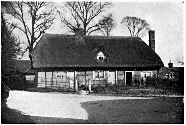
OLD COTTAGES NEAR MACKERY END
Mackery End, 1½ mile N.W. from Wheathampstead Station, G.N.R.,
is close to Batford and Pickford mills on the river Lea. Charles and
Mary Lamb had talked about the place “all their lives” and the essay by
the former entitled “Mackery End in Hertfordshire” need only be named
here. The place, as Lamb mentions, was also called Mackarel End. John
Wheathampsted, who became thirty-third Abbot of St. Albans in 1420, was
the son of Hugh Bostok or Bostock of the village from which he took his
name; his mother was the daughter of Thomas Makery, “Lord of Makeyrend”.
Mangrove is a hamlet, partly in Offley and partly in Lilley parishes;
Mangrove Green is on the S. outskirts of Putteridge Bury Park, on the
Bedfordshire border. The nearest station to the latter is Luton (Beds).
Maple Cross, a hamlet 2½ miles S.W. from Rickmansworth, is near the
river Chess. It lies between Mill End and West Hyde, on the road to
Uxbridge.
Maran, or Mimram, river. (See Introduction.)
Marford, Old and New, are hamlets on the river Lea. The latter
adjoins the E. side of Wheathampstead village; the former lies ¼ mile
farther E.; the cress-beds, the hand-bridge over the river, and some
dilapidated cottages render it a picturesque spot. On the opposite side
of the road from Hatfield to Wheathampstead lies The Devil’s Dyke, a
long, narrow gorge most beautifully wooded. It is a favourite haunt of
the nightingale, as the writer can testify.
Market or Markyate Street (3½ miles S.W. from Luton,
Beds) is a village on the high road from St. Albans to Dunstable. The
church, a little N. from the village, in Cell Park, is small and
uninteresting, with a chancel added in 1892. The mansion called Markyate
Cell, a little farther N., is old, and occupies the site of the old
Benedictine nunnery built by Geoffrey de Gorham, sixteenth Abbot of St.
Albans, at the instigation of Roger the Monk, the church of which was
consecrated in 1145. Cowper the poet was at school in the village, at
the house of Dr. Pitman.
Marlowes is a suburb of Hemel Hempstead (q.v.).
Marsh Moor lies between Hatfield Park and Mimms Park. It is a hamlet
in the parish of North Mimms, 2 miles S. from Hatfield.
Marston Gate is little more than the station (L.&N.W.R.) for Long
Marston, 1 mile S. It is nearly the extreme W. point of the county.
Mayden Croft, or Maiden Croft, is near the source of the river Hiz,
with the hamlet of Gosmore adjoining (S.E.). Some remains of a moat may
be traced, which are supposed to mark the site of a nunnery. The manor
is ancient; in the time of Edward III. it belonged to Sir Robert Nevill,
Kt.
Meesdon (6½ miles N.E. from Buntingford) has a very ancient
flint church, probably erected in the thirteenth century, but restored
in 1877. The S. porch is Jacobean. The pavement of the Sacrarium is a
mosaic of many coloured, vitrified tiles; it is almost unique in the
county and is undoubtedly of great age. There is also in the chancel a
curious monument and inscription to Robert Young, gent. (d. 1626). Most
of the population are to be found at Meesdon Green, ½ mile W. from the
church.
On Metley Hill, between the Icknield Way and the village of
Wallington, may be seen Bush Barrow, one of the many ancient mounds in
the county concerning which so little is known.
Micklefield Green (½ mile E. from Sarratt Church) is near the river
Chess and the Bucks border. The nearest station is Chorley Wood (Met.
R.) 2 miles S.W. The district is varied and undulating.
Mill End (1 mile S.W. from Rickmansworth) is on the Middlesex
border, close to the river Colne. The church (modern) is late Dec. in
style, and has several good stained windows. The village and parish were
only formed in 1875. There is also a hamlet of this name 1½ mile S.W.
from Buckland, on the Royston road.
Mill Green, at the N. end of Hatfield Park, is a pretty hamlet on the
Lea, near the old paper mill.
Mimms, North (3 miles N.W. from Potter’s Bar Station, G.N.R.),
is in one of the prettiest districts in the county, although so close to
Middlesex. The church and parsonage are in the park, ½ mile from the
village. Dedicated to St. Mary the Virgin, the church is Dec., unusually
pure in style. It is said to have been built by Sir Hugh de Magneville
(temp. Stephen); I should think it more probable that Geoffrey de
Magneville, then Lord of the Manor, was the real founder, as stated by
Chauncy. However this may be, the structure is now almost wholly of
later date. The monuments and brasses are numerous and very interesting;
several of the latter, now in the chancel, were moved from their
original positions on the floor during the restoration sixty years ago.
Among them we may note (1) large black marble monument in chancel
surmounted by a figure of justice, to John Lord Somers, Baron of Evesham
(d. 1716); (2) altar tomb in N. aisle, with Elizabethan effigy, to a
Derbyshire family named Beresford; the inscription is only in part
decipherable; (3) mutilated brass to Sir Robert Knolles (d. 14—), and
to Elizabeth his wife (d. 1458); (4) brass to Sir Henry Covert (d.
1488); (5) fine old brass to Richard Boteler and Martha (Olyff) his wife
(circa 1560); (6) brass, probably of Flemish workmanship, thought to
be a memorial to William Kesteven, vicar (d. 1361). This effigy is
closely described in Murray. “It is apparently Flemish, and resembles in
style that of Abbot de la Mare at St. Albans. He is vested in a chasuble
and stole, has a chalice on his breast, and over him is a rich canopy,
with, on the dexter side, St. Peter, and underneath SS. John the
Evangelist and Bartholomew, and in corresponding places on the sinister
SS. Paul, James the Great, and Andrew, with their respective emblems.
Above is the Almighty holding the soul of the deceased; at the sides are
two angels swinging censers.” Separated from the chancel by an oaken
screen is the chantry-chapel of St. Catherine, dating from early
fourteenth century.
North Mimms Park surrounds the fine Jacobean manor house of red brick,
recently in part restored, but originally built about 1600 by Sir Ralph
Coningsby; it is very extensive and can show some good carving, and a
chimney-piece dating from sixteenth century. E. from this park is
Potterels, a modern house standing in another but smaller park, and E.
again from Potterels is the more famous Brookman’s Park, where, in
1682, Andrew Fountaine erected the mansion soon afterwards purchased by
the great Lord Somers who died here in 1716. The house was completely
burnt down thirty years ago and has only in part been rebuilt. The
further stretch of park adjoining Brookman’s on the S. is Gubbins, or
more correctly Gobions, where formerly stood the old manor house in
which Sir Thomas More lived awhile with his family. The walks in each of
these parks are very fine, and most beautifully wooded; they command
distant views in many directions, and, in the autumn, are a perfect
study in colour. No London cyclist should fail to visit this picturesque
and interesting neighbourhood.
Mimms, South, recently included in the administrative county of
Herts, has a restored, E. Perp. church, with fine massive W. tower. The
Frowyk chantry, at E. end of N. aisle, contains a very ancient tomb with
recumbent effigy of a knight in armour, under a richly designed canopy.
The knight was a Frowyk, and there are also some mutilated brasses to
this family. The village is prettily situated on rising ground, 1½ mile
W. from Potter’s Bar Station, G.N.R. (Middlesex).
Moneybury Hill is on the Bucks border, close to the Bridgewater
Column, 2 miles S.W. from Tring Station.
Moor Green (3 miles W. from Buntingford Station, G.E.R.) is a hamlet
in Ardeley parish.
Morrell Green is a hamlet 2 miles E. from Barkway on the Essex border.
The nearest station is Buntingford, nearly 6 miles S.E.
Mortgrove, on the Beds border, is little more than a modern house, 1½
mile S. from Hexton.
Munches Green lies in the centre of that quiet district of villages
and hamlets which stretches between the G.N.R. and G.E.R. It is a hamlet
a little S.E. from Ardeley Bury and nearly 4 miles W. from Westmill
Station, G.E.R.
Munden, Great, formerly Mundon Furnival, from Gerrard de
Furnival, who was Lord of the Manor in the time of Richard I., is a
village 2 miles W. from Braughing Station, G.E.R. There is a Norman
doorway on the N. side of the church, and a small Perp. reredos which
was discovered during restoration in 1865. There is a brass in the
chancel to John Lightfoot, Canon of Ely (d. 1675). The hamlet of Nasty,
a little N.E. from the church, now takes Munden Furnival as its
alternative name, but the older historians give that title to the
district around the parish church.
Munden, Little, or Munden Frewell, is 2¼ miles S.W. from the
above, and 4 miles W. from Standon Station, G.E.R. The church,
conspicuously placed on the hill, dates from the thirteenth century; it
was restored in 1866-68. It is a structure of many parts, consisting of
nave of three bays, chancel, N. chapel, N. aisle, N. and S. porches, and
W. tower. Note the two altar tombs beneath the chancel arcade, at the S.
side of the chapel, each supporting the stone effigies of a male and
female, presumably man and wife. They bear no inscriptions, but from the
arms and shields figured on one of them it is conjectured to be the tomb
of Sir John Thornbury, Kt., and his lady; whilst the other is probably
that of his son Philip Thornbury and his wife: the former dates from
about 1340-50. Early in the fourteenth century the manor belonged to a
Knight named Frewell or de Freville, hence the old adjunct of the
village. Rowney Abbey, now a modern mansion, takes its name from
Rowenea Priory, founded by Conan, Duke of Brittany, about 1164, and
occupied for several generations by a Benedictine prioress and nuns. At
Munden Street, or Dane End, ¼ mile S. from Little Munden, were formerly
two or three large tumuli, long since levelled.
Nash Mills, on the river Gade, is a hamlet in the parish of Apsley
End, 2 miles S. from Hemel Hempstead. The House was the seat of Sir John
Evans, K.C.B., F.R.S., etc., the great archæologist, who had a rich
collection of coins, prehistoric flints, implements, etc., some of which
were discovered in the neighbourhood.
Nettleden was formerly in Bucks, but was transferred to Herts a few
years ago. The village is beautifully situated at the foot of a wooded
hill, at the meeting of the roads from Great Gaddesden and Little
Gaddesden. The small parish church is a Perp. structure of stone, with a
N. porch; it was partly rebuilt by the last Duke of Bridgewater, and was
restored in 1887. Note the carved oak pulpit, which, like that in Little
Gaddesden Church, was the gift of Lady Marian Alford (d. 1888). Sir John
Cotton, Vice-Chamberlain to Edward VI., was buried here. The nearest
station is Berkhampstead, L.&N.W.R., 2½ miles S.W.
New Mill is 1 mile N. from Tring, between the hamlets of Little Tring
and Tring Grove. The famous reservoirs, often the resting-place of rare
water-fowl, are within a short walk.
Newgate Street, a small hamlet in Hatfield parish, is, however, 6
miles S.E. from that town. It is in a prettily wooded district, close to
Ponsbourne Park.
Newnham (2½ miles N. from Baldock) is a village lying on high
ground, with an E.E. battlemented church on a little knoll above a
brook. It consists of chancel, nave of four bays with clerestory, S.
aisle and porch, and W. tower. The interior can show little of interest,
but there are brasses, (1) on chancel floor, to Sir William Dyer, Bart.
(d. 1680); (2) to a family, the man in civic costume (circa 1490);
(3) to Joan, wife of James Dowman (d. 1607), and her eight children.
Newsell, a hamlet 1 mile N. from Barkway, lies a little W. from the
Cambridge Road. The nearest station is Royston, G.N.R., 3½ miles N.W.
Newsell Park is a modern mansion S. from the hamlet.
No Man’s Land is a large tract of common, partly covered by furze,
stretching left from the road between Sandridge and Wheathampstead. Some
years ago a farmer close by collected quite a museum of stuffed birds,
etc., shot in the neighbourhood, which many persons visited, but I
understand the collection is now dispersed.
In 1884 Sir John Evans showed to Mr. W. G. Smith “a good white ovate
palæolithic implement,” one of two found on No Man’s Land Common. In
December, 1886, Mr. Smith visited the gravel pits there and found a
somewhat similar implement in situ; this latter is engraved in his
Man the Primæval Savage. At the same time Mr. Smith found two
neolithic celts on the common.
Nobland Green (1¼ mile N.W. from Widford Station, G.E.R.) is little
more than a farm and a few cottages.
Northaw (2 miles E. from Potter’s Bar Station, G.N.R.) is a
village on the Middlesex border, near the source of the river Colne, and
a place of considerable interest. In the wood N. from the village there
lived a hermit named Sigar, the subject of some monkish legends. He
lived about the time of Henry I., and was buried beside Roger the Monk
(see Markyate Street) in the S. aisle of the Baptistery of St. Alban’s
Abbey. There was originally a small church close to the village, E.E. or
perhaps late Norman; this was replaced by the cruciform church of St.
Thomas Becket, a pseudo-Perp. structure, destroyed by fire in 1881; the
present cruciform building of Ancaster stone is Dec. with a conspicuous
W. tower carrying four pinnacles. Note the piscina, three sedilia and
credence table in chancel; also the finely carved font of Ancaster
stone, on marble pillars, presented by the children of the parish. There
are several memorial windows, of only local interest; but the pulpit and
reredos are both good, the former showing the four Evangelists in
canopied recesses. Unfortunately, only a portion of the old registers
were saved from the fire of 1881.
Northchurch, or Berkhampstead St. Mary, forms one long street
with Great Berkhampstead, but is a separate village, 1 mile W. from
Berkhampstead Station, L.&N.W.R. The cruciform church is Dec.; it stands
in a small graveyard close to the high road to Tring. The most curious
memorial is the brass near the porch to Peter the Wild Boy, who was
found wild in a forest in Hanover in 1725 and brought to England at the
desire of Queen Caroline. He lived at a farm at Broadway (q.v.) and
died in 1785. There is also a curious sentence about this church in
Chauncy: “Henry Axtil, a rich Man starved himself, and was buried here
April 12, 1625, 1 Car. I.” The church was entirely restored in 1883,
when the present N. aisle was added.
Northfield, a small hamlet, is a little S. from Ivinghoe (Bucks).
Norton, near the tiny river Ivel and the Roman Icknield Way, is
1 mile W. from Baldock. The large building on the hill-top close by is
the Three Counties Asylum. The manor belonged to the Abbot of St. Albans
at the time of the Conquest; and in the year 1260 Roger de Norton, who
took his name from this village, became the twenty-fourth abbot of that
monastery. The church, E.E., is of great antiquity, some parts of it
having been little altered; it is of flint, and stands at the N.E. end
of the village. It contains two or three old memorials, but none of
historic interest. A pretty walk from the church leads through Norton
Bury and beside the Ivel to Radwell Mill.
Norton Green, between Knebworth Park and Stevenage, is ½ mile W. from
the Great North Road. It is a small hamlet.
Nup End (1½ mile W. from Knebworth Station, G.N.R.) is almost one with
Knebworth Green. Codicote church is 1 mile S.W.
Nuthampstead (about 5 miles N.E. from Buntingford Station, G.E.R.) is
a large hamlet on the Essex border. The parish churches of Barkway (W.),
Anstey (S.W.), and Meesdon (S.E.) may all be reached within a short
walk.
Offley or Offley St. Leger (3 miles S.W. from
Hitchin) is a village at the meeting of the ways from Hitchin, Temple
Dinsley, and Lilley. It owes its name to Offa, King of the Mercians, who
had a palace here, as we learn from his life by Matthew Paris, and its
adjunct to the St. Legiers, who became Lords of the Manor soon after the
Conquest. Miss Hester Salusbury, who became Mrs. Thrale, and afterwards
Mrs. Piozzi, used as a child to visit at Offley Place, in the park
close to the church. The old mansion was built by Sir Richard Spencer in
1600, and in part rebuilt early last century, when its style was changed
from Jacobean to a form of Gothic.
The church (restored Perp.) stands in the park, close to the road. Note
(1) monument in chancel to Sir H. Penrice, Kt. (d. 1752); a figure of
Truth standing on a sarcophagus of black marble, the whole finely
executed; (2) monument in white marble, by Nollekens, to Sir Thomas
Salusbury, Kt. (d. 1773), and Sarah his wife (d. 1804); (3) brass with
effigy, to John Samwell (d. 1529), and his wives Elizabeth and Joan; (4)
brass to a civilian and his family (circa 1530); (5) well carved Perp.
font.
Offley, Little, is a hamlet 1¼ mile N.W. from the above.
Offley Green is 4 miles N.W. from Buntingford Station, G.E.R. The walk
beside Julians Park to Rushden, 1 mile S.W., is very pleasant.
Offley Holes (2½ miles S.W. from Hitchin) is a small hamlet. Offley
Grange, Offley Hoo, Offley Cross and Offley Bottom are all in the
immediate neighbourhood, W. and N.W.
Old Hall Green (1½ mile W. from Standon Station, G.E.R.) lies W. from
the Old North Road. It is a small hamlet.
Oxhey (2 miles S. from Watford) is a hamlet on the Middlesex
border. It has a good modern church, E.E. in style. N. lies Oxhey
Place, on the site of the old home of the Heydon family, rebuilt by Sir
William Bucknall in 1668, and again by Hon. William Bucknall in 1799.
The chapel, close to the old mansions, was spared by both those
renovators, but has since been repeatedly restored. It contains many
interesting monuments, conspicuous among which is that on the S. wall to
Sir James Altham (d. 1617) who had built the chapel on the site of an
earlier structure in 1612. The old judge is represented kneeling in his
robes between two pillars, beneath a canopy of alabaster; behind him is
the effigy of his third wife Helen (Saunderson). Note the carved oak
seventeenth century reredos, occupying the whole of the E. end of the
chapel. It is divided into three compartments by two columns, massive
and twisted, with Corinthian capitals; these support a frieze, with
cornice and pediment. Note also the oak ceiling, and the five Tudor
windows (replaced). Oxhey Hall, N.W. from the chapel, is now a farm;
but can still show the wonderful ceiling of carved oak, in sixteen
panels, which must be very ancient.
PANSHANGER PARK, Lord Desborough, K.C.V.O, should be visited by all who
love an historic home surrounded by beautiful scenery. It lies almost
midway between Hatfield and Ware Parks; the house itself is 1½ mile N.
from Cole Green Station, G.N.R. The park is very extensive (about 900
acres); the river Maran flows through it from W. to S.E., opening into a
lake S. from the house. It is famous for its splendid timber; the
wonderful “Panshanger Oak,” one of the very largest in England, stands
W. from the house.
Panshanger is not a “correct” structure from an architectural
standpoint; the writer of Murray’s Handbook describes it well as “a
stucco-fronted, semi-castellated Gothic mansion of the Walpole-Wyatt
type”. Most ramblers, however, are not architects, and the grey stone
mansion and its surroundings are, as a whole, as picturesque as they can
well be. The greater part of it was built by Peter, fifth Earl Cowper,
in 1801; but the picture gallery, overlooking the terrace and gardens,
was a later addition. The house was partially burnt in 1855. The older
home of the family stood at Cole Green—then called Colne Green.
The famous Cowper Collection is largely the result of the taste and
perseverance of the third earl, who resided for some years at Florence.
Only a few of the pictures can be named here: Madonna, by Raphael
(1508); Holy Family, by Fra Bartolommeo; Mountainous Coast (fishermen in
foreground), by Salvator Rosa; Nativity, by Carlo Dolce; Virgin
Enthroned, by Paul Veronese; Third Earl Cowper and His Family; First
Earl Cowper, by Sir Godfrey Kneller; Francis Bacon, by Van Somer;
Turenne, by Rembrandt; Charles Villiers, Duke of Buckingham, by
Janssens. The whole collection is worth careful study. Permission to
view may be obtained when the family are away.
Park Street, a large hamlet with station 1/3 mile W.
(L.&N.W.R.), is on the river Colne, 2 miles S. from St. Albans. The
parish church is at Frogmore (q.v.).
Parker’s Green (4 miles S.W. from Westmill Station, G.E.R.) is a
hamlet adjoining Wood End.
Patient End may be reached from Braughing Station, G.E.R., 4 miles
S.E., the road being more direct than that from Westmill Station, about
the same distance as the crow flies. The hamlet lies between Albury and
Furneaux Pelham.
Patmore Heath is 1 mile S.E. from the above.
Pepperstock, a hamlet on the Beds border, is a little W. from the
Harpenden-Luton road, and close to Luton Hoo Park.
Perry Green (1¼ mile S.E. from Hadham Station, G.E.R.) is a small
scattered hamlet.
Peter’s Green, on the Beds border, lies at the meeting of several
roads; the Half Moon and Rising Star with a few cottages comprise the
hamlet. The descent W. towards Chiltern Green Station, M.R., commands a
fine view, looking towards Luton Hoo Park. The several ways (one is
hardly more than a lane) lead S.E. to Kimpton, S. to Harpenden, N. to
Lawrence End Park, and N.E. to Breachwood Green and Bendish.
Piccotts End is passed when going from Hemel Hempstead to Great
Gaddesden. It is on the river Gade, at the N.E. extremity of Gadesbridge
Park.
Pin Green (1½ mile E. from Stevenage Station, G.N.R.) lies between the
Great North Road and the river Beane.
Pirton (3½ miles N.W. from Hitchin) is an ancient village on
the Beds border, said to owe its name to one Peri, who possessed it in
Saxon times. William I. gave it to Ralph de Limesie, or Limesy, who
founded the church and gave the tithes of it to the Abbey of St. Albans.
The site of the castle built by Ralph is thought to be at Toot Hill, W.
from the church, where a moat may be traced. The church was originally
cruciform, but the transepts have long disappeared; the tower, massive
and embattled, still standing between nave and chancel. Restoration has
been carefully carried on recently; the tower was rebuilt in 1877, but
some Norman work may still be traced in its arches. Note (1) monument
and curious inscription to Jane, wife of Thomas Docwra (d. 1645); (2)
double piscina, fourteenth century, in S. wall of chancel.
Pirton should be visited for the fine old houses in its neighbourhood.
High Down, S. from the church, is Elizabethan, with gables, twisted
chimneys and mullioned windows; it was formerly the home of the
Docwras. Pirton Hall, on a hill N.W. from the village, is also
Elizabethan, and the Rectory Manor House and Hammond’s Farm are both
ancient. In the latter is some fine old carved oak.
Plummers is 1½ mile S.W. from Knebworth Station, G.N.R. It consists of
a few cottages.
Ponfield lies between Bedwell and Bayfordbury Parks. It is a small
hamlet nearly 2 miles S.E. from Cole Green Station, G.N.R.
Poplar’s Green is on the river Maran, on the W. edge of Panshanger
Park. The old church at Tewin is less than 1 mile N.W. The station is
Cole Green.
Potten End (2 miles N.E. from Berkhampstead Station, L.&N.W.R.) has a
modern chapel-of-ease to Nettleden (1 mile N.). The hamlet is prettily
situated between the rivers Gade and Bulbourne.
Preston (4 miles W. from Stevenage Station, G.N.R.) is a hamlet
beautifully situated on high ground. The Church of St. Martin is a small
building a few yards W. from the green, a modern erection; close by is
the Bunyan Chapel, and ½ mile N. is Bunyan’s dell, where the author of
the Pilgrim’s Progress often preached. Temple Dinsley, a manor house
a little E. from the Red Lion, stands on the site of the preceptory of
the Knights Templars, founded by Bernard de Baliol in the reign of
Stephen.
Primrose Hill is a hamlet in King’s Langley parish, ½ mile N. from the
station, L.&N.W.R.
Puckeridge, a village on the Old North Road, nearly 1 mile
S.W. from Braughing Station, G.E.R., was visited by Pepys on more than
one occasion. Here, at the White Hart Inn, the road divides, going left
nearly due N. to Royston and right to Cambridge. The village lies partly
in Standon and partly in Braughing parish. The nearest church is at
Standon, 1 mile S.E., but divine service is conducted in the church
schoolroom.
Puddephats (3 miles N.W. from Redbourn Station, M.R.) is a hamlet in
Flamstead parish.
Purwell Mill, on the river Purwell or Pirrel, 1 mile E. from Hitchin,
stands near the spot where the tesselated pavement of a Roman villa was
discovered many years ago, in excellent preservation.
Puttenham (1½ mile S. from Marston Gate Station, L.&N.W.R.)
lies near the Clinton chalk hills, in the extreme W. of the county, on
the Bucks border. The church, close to the village, is of several
periods, parts of the structure being E.E. and other portions Perp. and
Tudor. Several portions should be carefully noted: (1) very large
embattled W. tower, built of blocks of Ketton stone with flints laid in
squares between each block; (2) roof of nave, thought to date from
temp. Edward IV.; with two shields under the ridges, one bearing the
arms of Zouch, the church having belonged to the Priory of Ashby; (3)
solid oak pews, probably coeval with nave roof. The S. porch was rebuilt
in 1889. The vill of Puteham belonged to Leofwin, brother to Harold
Godwin; William I. gave it to his half-brother, Odo, Bishop of Bayeux.
Queen Hoo Hall. (See Bramfield.)
Rabley Heath (1 mile S.W. from Knebworth Station, G.N.R.) adjoins
Sallow Wood. Knebworth and Codicote churches are about equidistant (1¼
mile), N.W. and S.W. respectively.
Radlett, with station on M.R. (main line), is about 5 miles S.
from St. Albans, on the high-road from the Marble Arch to that city.
Seen left from the train the neighbourhood is very pretty, the spire of
the church showing among the trees some distance before the station is
reached. The cruciform church is modern (1864), E. Dec. in style, with
several good windows of stained glass. A picturesque ramble may be taken
by turning into any lane in the vicinity, especially towards the Valley
of the Colne, W. A potter’s kiln of the Roman Age was discovered here.
Radwell, on the Beds border, is in a charming district,
threaded by the little river Ivel, 1½ mile N.N.W. from Baldock. The mill
is reached by turning left after passing The Compasses, a quaint old
inn, where a story is told of the “Maid of the Mill,” a local beauty,
who captured many hearts in days long past.[5] Between The Compasses and
the mill stands the little Perp. church, very ancient, but in part
restored on several occasions. It has no tower, the two bells hanging
in a small turret at the W. end of nave. Here, as at Norton, there are
several memorials to the Pym family; and a few others worth noting: (1)
brass, with effigies, to John Bell, Gent. (d. 1516), and his two wives;
this was discovered during restoration, about twenty-five years ago, but
the inscription was copied by Chauncy, so it must have been hidden by
some alterations effected after, say, 1690; (2) marble monument to John
Parker, Kt. (d. 1595), and Mary, his wife (d. 1574); the latter was
buried at Baldock. There is also a small brass to Elizabeth (Gage or
Cage), wife of John Parker (d. 1602). The font is fourteenth century.
Radwell, formerly Reedwell, is said to owe its name to the many reeds
that grew by the river-side. There are plenty of moor hens, coots and
dab-chicks on the lake-like expansion of the Ivel near the mill.
Red Heath is in the parish of Croxley Green, 2 miles N.N.E. from
Rickmansworth.
Red Hill, 4 miles E. from Baldock, is a small hamlet in a very quiet
neighbourhood. The nearest church is at Wallington, ¾ mile N.W.
Julians, a substantial house in the park, ½ mile S., was built early
in the seventeenth century.
Redbourn (i.e., the road by the burn) lies on the old Watling
Street, 4 miles N.W. from St. Albans. The river Ver, here a small
stream, skirts the E. side of the village. The old manor, like that of
Abbots Langley, was given to the Abbey of St. Albans by Egelwine the
Black and Wincelfled, his wife, in the days of Edward the Confessor. St.
Amphibalus was probably buried here after his martyrdom; his barrow was
on the Common, and the story of the removal of his bones to St. Albans
is narrated in Matthew Paris, and is referred to in the Introduction
(Section IX.). The church of St. Mary, at Church End, ¾ mile W. from the
station (M.R.), dates from Norman times; the only existing portions of
the ancient structure are the three columns of the N. aisle arcade, but
much thirteenth and fourteenth centuries work still stands. It was
largely rebuilt by Abbot John Wheathampsted (temp. Henry VI.). Note
(1) almost unique carved oak rood screen, double canopied; (2) pointed
arches of S. side of nave, replacing those defaced during the
Commonwealth; (3) Eastern sepulchre and sedilia in chancel; (4) piscinæ
in N. aisle and lady-chapel; (5) brass in chancel, with eight kneeling
effigies, without date; (6) brass in chancel to Richard Pecock, or Pekok
(d. 1512). There are silk and corn mills on the Ver, close by.
Reed lies on the chalk range, midway between Buntingford and
Royston, about 3½ miles S. from Royston Station, G.N.R. The village lies
right from the Old North Road. One of the best Norman doorways in the
county is on the N. of the little church, which also contains good Dec.
portions. The tower alone was untouched during the restoration of sixty
years ago. Some remains of two moats are a little E. from the village;
Reed End, Reed Green and Reed Wood, are in the vicinity. The
neighbourhood is less wooded and picturesque than most of the county.
Revel End (1½ mile S.W. from Redbourn Station, M.R.) is a hamlet.
RICKMANSWORTH is in the extreme S.W. of the county; the rivers Colne,
Chess, and Gade unite here, close to the Grand Junction Canal; and it is
easy to understand why the place was formerly called “Rykemereswearth,”
i.e., the rich moor-meadow. It is a compact little town with many
quaint houses and quainter by-paths. The residence now called Basing
House, in the High Street, was for some time the home of William Penn,
the Quaker; a photograph of it was long since reproduced in the
Quiver. The manor was given by Offa to the Abbots of St. Albans, who
retained it till the Dissolution, after which Edward VI. granted it to
Nicholas Ridley, Bishop of London. Henry III. granted a market to be
held in the town every Wednesday; it was subsequently held on Saturday,
but has long been discontinued. Paper-making and brewing are now largely
carried on in the neighbourhood.
The church, at the S. end of Church Street, was rebuilt (except the
tower) in 1826; and again in 1870, from designs by Sir Arthur Blomfield.
It is Perp., almost entirely embattled, and is constructed of flints,
with stone dressings. Note (1) sedilia, piscina and modern oak stalls
in chancel; (2) restored marble altar tomb carrying shield of arms, and
inscription to Sir Henry Cary, Baron of Leppington and Earl of Monmouth
(d. 1661); (3) brass with effigy to Thomas Day (d. 1613), and his wives
Alice (d. 1585), and Joane (d. 1598); a separate inscription in the
“Ashbie Chapple” ran—I am not sure if it is still preserved:—
“Here ly byrid undyr this stone
Thomas Davy and his two Wyfs Alice and Joan”.
The vicarage is thought to be the oldest in Hertfordshire; it still
retains portions dating from the middle of the fifteenth century.
One mile S. is Moor Park (Lord Ebury). The house has undergone many
changes. George Nevil, Archbishop of York, built a house in the park in
the reign of Edward IV., and sometimes entertained that monarch, and we
read of a lodge (was it Nevil’s house?) being here when Cardinal Wolsey
owned the manor of “More Park”. The estate changed hands several times
before we find it in the hands of the unfortunate James Fitzroy, Duke of
Monmouth, who is believed to have built a large mansion on the site of
the present house. This mansion was almost rebuilt by B. H. Styles, a
man who made a fortune over South Sea Shares, and is said to have spent
£130,000 in erecting and adorning his house in this beautiful park, with
the assistance of the architect Leoni. The house that Styles built still
largely survives in the present structure, after several alterations
and much embellishment during eighteenth, nineteenth and twentieth
centuries. It is a large and stately mansion of Portland stone, with
fine Corinthian portico, the columns of which are about 50 feet high.
The vast hall was almost covered with classical and mediæval designs by
Sir James Thornhill, who had to sue Styles before he could obtain his
remuneration; note the huge statues supporting the five marble doorways.
The house may be seen to advantage some distance from the terrace; but
it must be remembered that it no longer retains its wings, which were
removed when Mr. T. B. Rous lived at Moor Park towards the end of the
eighteenth century.
Permission must be obtained before the park, grounds or house can be
inspected. The park contains about 500 acres and is famous for its
splendid timber, some of its oaks being of almost perfect development
and proportions.
RICKMANSWORTH
Rickmansworth Park, N. from the town, has a modern house well
situated. The park stretches nearly to Loudwater Mill on the river
Chess, and is, like Moor Park, beautifully wooded.
Ridge (2½ miles S.W. from Potter’s Bar Station, G.N.R.) is on
the Middlesex border, close to South Mimms. The village doubtless owes
its name to its situation on the hill. The small church is mainly Perp.,
but the chancel is E. Dec.; it contains several memorials to the Blount
family, including one to Charles Blount (1654-93). He was an infidel
of more bitterness than ability, as may be seen from his translation of
Philostratus’s Apollonius Tyanæus; readers may remember that his Just
Vindication of Learning, etc., was stigmatised by Macaulay as “garbled
extracts” from Milton’s Areopagitica. On being refused a licence to
marry his deceased wife’s sister, he committed suicide—Pope says he
“despatch’d himself”. The Blount family resided in the neighbourhood for
many generations; Sir Henry Pope Blount, father of the above-mentioned
Charles, “built here a fair structure of Brick, made fair Walks and
Gardens to it, and died seiz’d thereof”. He was the author of A Voyage
into the Levant.
Ringshall is a hamlet on the Bucks border, in the parish of Little
Gaddesden.
Roe Green (4 miles S.E. from Ashwell Station, G.N.R.) is in a pleasant
and very quiet neighbourhood. The nearest parish church is Sandon, about
1 mile N.E. Roe Wood is a little N. from the hamlet.
Roestock, a hamlet in the parish of North Mimms, is 1 mile N. from the
Park. Smallford Station, G.N.R., is 1 mile N.W.
Round Bush consists of a few cottages, 1½ mile S.W. from Radlett
Station, M.R.
Row Green (1¼ mile S.W. from Hatfield) lies close to the road from St.
Albans to Hatfield. Row Hyde is a little farther S.W.
Rowley Green, on the road from Barnet Gate to Shenley, is nearly 2
miles E. from Elstree Station, M.R.
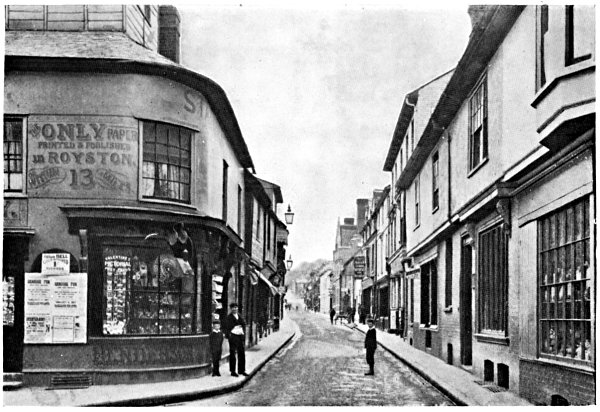
THE HIGH STREET, ROYSTON
ROYSTON, an ancient market town on the Icknield Way at its junction
with Ermine Street, was until recently partly in Cambs. It is supposed
to owe its name to a Dame Roesia who placed a cross here on the highway,
near which spot a monastery of Black Canons was founded by Eustace de
Mere and others in the reign of Henry II. Early in the reign of Henry
IV. the town was almost destroyed by fire. Royston enjoyed several
market privileges in the good old days, and it is recorded that early in
the fifteenth century wheat was so plentiful that it was sold in Royston
market for 12d. a quarter.
The church was erected close to the monastery late in the thirteenth
century, and at the Dissolution was constituted the parish church.
Thirty years ago it was restored, and more recently enlarged, and is now
an imposing structure of flint and rubble, E.E. in style. The tower (W.)
is embattled and carries four pinnacles. The fine lancet windows in the
chancel were discovered during restoration in 1872, as were also the
fragments of the old screen, since pieced together to form the present
pulpit and reading desk. The alabaster effigy in the chancel, of a
knight in armour, is believed to represent one of the Scales family.
There are several old brasses: (1) to William Taberam, Rector of
Therfield (d. 1432), this was large, but only the upper part now
remains; (2) to a civilian and his wife (circa 1500); (3) to Father
William Chamber, who founded an annual sermon to be preached in the
church on Rogation Mondays (d. 1546). There are some good modern windows
of stained glass.
James I., who had been entertained at Royston by Robert Chester during
his progress from Scotland to London, built a lodge near Royston Heath,
to which both he and Charles I. occasionally resorted, the latter being
brought here as prisoner in 1647. Some cottages still standing on the
outskirts of the Heath are said to have been used for stables when James
I. used to hunt in the neighbourhood, and by inquiring for the “Old
Palace” visitors will be shown what little remains of his Majesty’s
hunting lodge. The Heath is now famous for its fine golf links.
Beneath the old boundary between the two counties, and close to the Post
Office, is the famous Royston Cave, which visitors should not fail to
see. It was accidentally discovered in 1742 by some men who were digging
a hole in the market-place, and is now entered by a specially
constructed passage under the street. It was visited by Louis XVIII.
Hewn out of the solid chalk, its greatest height is about 25 ft., its
diameter about 17 ft. It contains curious, and in some cases uncouth
figures and coloured reliefs of saints, kings, queens, etc., of all
sizes and ages, and some crucifixes. The late Joseph Beldam, F.S.A., was
of opinion that the cave dates from pre-Christian times, that it became
in turn a Roman sepulchre and an oratory, and that it was closed during
the Reformation.
There are still the traces of several tumuli in the neighbourhood, and
ancient coins, etc., have been found, but the evidences of any Roman
occupation are not very convincing.
Royston is a somewhat quaint town, with some narrow byways and
odd-looking houses, amongst which the Old Plough Inn is not the least
noticeable.
Rush Green (1 mile S. from Ware) is a small hamlet.
Rushden, formerly Risendene and Risden (5 miles S.E. from Baldock),
has a stuccoed brick church, Dec. and Perp. Chauncy saw in it, “no
Inscription, Monument, or other Remark,” but in 1754 the monument of Sir
Adolphus Meetkerke, Kt., was brought here from St. Botolph’s,
Aldersgate. Meetkerke was Ambassador from Flanders to the Court of Queen
Elizabeth, and the author of several volumes. Note the canopy in nave,
thought to have covered a statue of the Virgin. In the reign of Henry
II. the patronage of the church was given by William Basset, Sheriff of
Leicestershire, to the Canons and Church of St. Peter’s at Dunstable.
Rustling Green is midway between Knebworth and St. Paul’s Walden
Parks. The district is prettily diversified by small woods. By the
shortest way through the park Knebworth Station is about 3½ miles E.
The Rye House, on the W. bank of the river Lea, is a famous
resort of fishermen, excursionists and folk wishing to see the Great Bed
of Ware, brought here from Ware in 1869. The bed is a huge construction
of solid oak, quaintly carved, and large enough to hold twelve adults,
as is proved by a story which can readily be found by the curious, but
which is unfit for repetition in these pages. It is alluded to by
Shakespeare, Byron and other writers. The present Rye House is modern,
but attached to it are some remains of the old House, some account of
which must be given here.
In his description of the “Mannor of the Rye” Chauncy says, “King Henry
VI. granted licence to Andrew Ogard and others, that they might impark
the scite of the Mannor of Rye, otherwise called the Isle of Rye in
Stansted Abbot, fifty Acres of Land, eleven Acres of Meadow, eight Acres
of Pasture and Sixteen Acres of Wood, erect a Castle there with Lime and
Stone, make Battlements and Loopholes &c.”[6] The castle built by Ogard
passed into the hands of the Baesh family; it was doubtless in part
rebuilt at different times, for what remains of it is of brick. In
course of time it became the property of Lieut., afterwards Col.,
Rumbold, known as “Hannibal” among his associates, who had been a
private in Fairfax’s famous regiment of 1648. This man was the
originator of the Rye House Plot.
The story of that plot may be recapitulated in few words. In the spring
of 1683 Charles II. and James Duke of York were at Newmarket. Rumbold
and some of his ultra-Republican friends heard that the Royal party
would return to London by way of Rye House. They met together and
arranged to secrete some men in the house, to create a disturbance as
the King passed and to kill him in the confusion which would follow. The
King escaped—probably, as most writers agree, because he left Newmarket
earlier than was expected. The plot soon became known, the Rye House was
searched and many persons were charged with High Treason. Two
illustrious men became implicated, through the allegations of Howard of
Escrick and others—Algernon Sidney and Lord Russell. Both were
certainly innocent, but both were beheaded, and Russell was buried at
Chenies in Bucks (almost on the Herts border). Rumbold fled to Holland,
joined the expedition which Argyle headed in Scotland, and was hanged in
Edinburgh in 1685. Visitors to the neighbourhood of the Rye House will
perhaps be assured that Rumbold suffered on a tree near by, but such was
not the case.
Sacombe (4 miles N.W. from Ware) lies scattered over a
considerable district. It was long ago called Suevecamp (i.e.,
Suaviscampus) because of its pleasant situation. The small Dec. church
stands on the hill, at the N. end of the Park; it is of ancient
foundation, but was entirely restored about fifty years ago. There are
two sedilia and a piscina in the chancel, and two brasses, to John
Dodyngton and Eleanor his wife (d. 1544 and 1550 respectively). Sacombe
Park is beautifully timbered; the present house of red brick dates from
about 1800.
ST. ALBANS is one of the most ancient and interesting places in England;
it became a city on the foundation of the Bishopric of St. Albans in
1877. It may be approached by road from London, (1) by way of Barnet and
London Colney, the G.N.R. Station (branch from Hatfield) being passed on
the left nearly a mile from the old clock tower and market-place; (2) by
way of Edgware, Elstree and Radlett, by which route, after passing St.
Stephens, the L.&N.W.R. Station (branch from Watford) is on the right
and the steep Holywell Hill leading to High Street is straight before.
The river Ver skirts the entire S. limits of the city itself; the field
that slopes upwards from the silk mill, in a N. direction, is called the
Abbey Orchard, and on the summit of the slope stands the great Abbey of
St. Alban.
As the ancient Roman city—the Verulamium of Antoninus—stood some
distance to the W., a brief account of it will be found under the
heading Verulam. The history of St. Albans itself commences with the
death of Alban, the proto-martyr of Britain, who was flogged with rods
and beheaded by the Romans for having sheltered the priest Amphibalus,
connived at his escape, and adopted his faith (circa 285-305; the
date is very uncertain). During the fifth century the Saxons captured
and destroyed Verulam and built a new town on the hill some distance E.
This they named Watlingceaster (the town on Watling Street), but when
(793) Offa built a monastery to the memory of Alban on Holmhurst Hill,
the traditionary site of the martyrdom, the town itself became known as
St. Albans. Gildas, Bede and other old authorities agree that an earlier
church stood on this spot; they state, indeed, that it was built soon
after the death of St. Alban.
The plan of the city is, like the Abbey, cruciform, four old high-roads
meeting together near the Clock Tower, N.W. from Dunstable, S.W. from
Watford, S.E. from London, N.E. from Wheathampstead. The latter unites
with the road from Harpenden and Luton at The Cricketers, ¼ mile N.W.
from St. Peter’s Church. The four roads, on entering the city, are
respectively called Verulam Road, Holywell Hill, London Road and St.
Peter’s Street; one of the oldest thoroughfares, however, is that called
Fishpool Street, which runs from near the W. end of the Abbey to the
flour mill on the Ver. Quite recently several of the oldest houses in
the neighbourhood were in this street; but some have now been pulled
down.
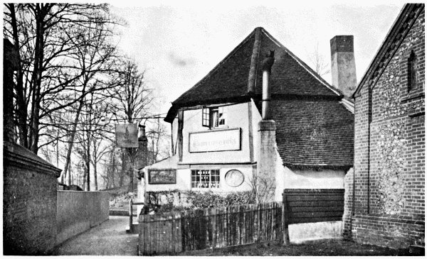
THE FIGHTING COCKS, ST. ALBAN’S
The oldest Inn in England
We will enter the city from the direction of St. Stephens. Crossing the
bridge over the Ver, we turn left by the Duke of Marlborough, pass
through the gate near the river side and keeping the cress-beds on
the left reach the silk mill. Turning right we ascend the hill W. of the
Abbey orchard, obtaining meanwhile a fine view of the stately W. front
of the Abbey itself, as reconstructed by Lord Grimthorpe. Our way into
the city lies through the old, partially ivy-clad Gate House, a relic
of the Benedictine Monastery; note the Perp. pointed arch and vaulted
roof. This was originally the entrance to the Abbey court, the “Magna
Porta” of the old monastic days. There was a former structure on or near
the same spot; this was blown down and the present building dates from
the rule of Thomas de la Mere, thirtieth abbot (1349-96). Used as a jail
some centuries ago, it has long been known as St. Alban’s Grammar
School; the battlemented house S.W. of the archway is the residence of
the head master. The claims of this school to be the oldest in England
cannot be adequately discussed here. Suffice it to say that documents
attesting its existence date from Abbot Richard de Albini (1097-1119);
his successor, Geoffrey de Gorham, came from Normandy to become its
master. Matthew Paris records that the school was afterwards kept by a
nephew of Abbot Warine (or Warren) de Cambridge, and had at that time
more scholars than any school in England. Passing through the arch we
notice on the left a small, triangular burial ground. The spot is called
Romeland. Here George Tankerville was burnt by order of Bishop Bonner,
on 26th August, 1556.
Passing straight forward into Spicer Street the Congregational
Chapel, founded in 1797, is on the right. A little farther on is
College Street; on the left side stands the house in which Cowper was
placed under the charge of Dr. Cotton when his insanity was most
pronounced. To reach the old Clock Tower we turn right into Verulam
Street and left into High Street. The Tower stands at the S. end of the
Market Place; note the quaint, narrow thoroughfare at its W. side,
called French Row. The Tower is Perp., of flint and dressed stone,
battlemented, and surmounted by a small spire; the basement has long
been utilised as a saddler’s shop. It dates from the fifteenth
century,[7] but was restored by Sir Gilbert Scott in 1864. In it hangs
the great bell “Gabriel” cast early in the reign of Edward III.; it is
now used for striking the hour and formerly tolled the curfew. In the
foreground, where the drinking fountain now stands, was “Eleanor’s
Cross,” erected, like the cross at Waltham (q.v.), by Edward I. in
memory of his Queen. It was destroyed about 1700. The old market-place,
so quaint even fifty years ago, is now largely occupied by modern shops;
partly by reason of a fire which occurred many years back.
Continuing our way up the market-place we pass the Town Hall or Court
House on the right, an Italian structure dating from 1826, and the
broad St. Peter’s Street opens before us, leading to the old church
dedicated to that saint. The church is one of three built by Abbot
Ulsinus in Saxon times; the date of their foundation is very uncertain,
but we may bear in mind that the first abbot, Willegod, ruled at the
close of the eighth century, that Ulsinus was the sixth abbot, and that
six others ruled during Pre-Norman times. St. Peter’s Church, largely
restored by Lord Grimthorpe, is therefore of great antiquity as a
foundation; the present structure is chiefly late Perp. with a lofty E.
tower carrying four pinnacles, the latter an addition by the restorer.
The position of the tower (elsewhere almost invariably W.) is explained
by the fact that the old church was cruciform, and that when, at the
beginning of last century, the extreme E. of the chancel and the
transepts were found much dilapidated they were pulled down, the old
tower thereby losing its central position. Note the E. Perp. arches
separating nave and aisles; the pulpit a good example of Belgian
carving, and the old stained glass in windows of N. aisle; the stained
glass in other windows is modern. Concerning the brass to Roger
Pemberton, Sheriff of Herts (d. 13th November, 1627), a story is told.
If the visitor passes out of the churchyard by the N.W. gate he will be
vis-à-vis to the almshouses founded in 1627 on the W. side of what was
then “St. Peter’s Street, Bowgate”. Pemberton is said to have been
shooting in the woods, to have shot a widow by accident, and to have
founded these almshouses for widows, and endowed them with £30 per
annum for ever as a salve to his conscience. There is an iron arrow over
the old brick gateway before the houses, which seems to countenance the
story. There were formerly many other brasses in the church, but the
inscriptions on some of them must now be sought in the county histories.
A few, however, remain, e.g., one with shield of arms to Mrs.
Elizabeth Wyndham (d. 1735). In the N. aisle is the tomb of Edward
Strong (d. 1723), “Master Mason” of St. Paul’s Cathedral; in the
churchyard lies Dr. Nathaniel Cotton, the friend of Cowper (see page
180) (d. 1788). Among those who fell in the battles of St. Albans (of
which more will be said presently) and were buried in this church or
graveyard were (1) Sir Bertin Entwysel, Kt., Baron of Brybeke in
Normandy; (2) Ralph Babthorpe and Ralph his son, of an old Yorkshire
family. As a matter of fact a great number of the slain were buried
here; Chauncy says “this Church and Churchyard was filled with the
Bodies of those that were slain in the two battles fought in this town”.
The two other churches founded by Abbot Ulsinus are those of St. Stephen
and St. Michael.
St. Stephen’s Church stands ¾ mile S.W. from the Clock Tower, at the
junction of the roads from Edgware and Watford. It was restored by Sir
Gilbert Scott in 1861-62; but still retains some ancient features;
e.g., the late Norman arch in N. wall, formerly in part separating
the nave from the N. aisle (now absent), and two Norman windows, widely
splayed, in W. wall. Note (1) brass eagle-lectern, believed to have been
formerly in the Abbey at Holyrood; (2) double piscina in S. aisle; (3)
fifteenth century font. The oldest brass, much worn, is in the S.
chapel; it is to the memory of William Robins, Clerk of the Signet to
Edward IV., (d. 1482) and Katherine his wife.
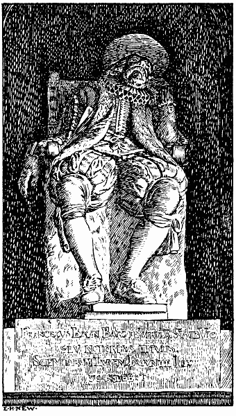
LORD BACON’S MONUMENT
St. Michael’s Church, about ¾ mile W. from the Clock Tower, stands on
gently rising ground close to the carriage road to Gorhambury. It is
believed to occupy, approximately, the centre of what was the ancient
city of Verulam (q.v.) and to mark the site of a Roman temple. It has
been restored, and the tower rebuilt, by Lord Grimthorpe; the work was
only completed two or three years ago. Flint and tiles taken from the
surrounding ruins by the builders still exist in the walls; but repeated
restorations have almost obliterated the evidences of its antiquity.
There are brasses (1) to Thomas Wolvey, an Esquire to Richard II. (d.
1430); (2) to “John Pecok et Maud sa femme” (circa 1340-50); but the
monument of paramount interest is that in the recess N. of the chancel,
to Francis Bacon, Baron Verulam and Viscount St. Albans (d. 9th April,
1626). The great philosopher and Lord Chancellor is represented as
sitting in a tall chair, leaning his head upon his left hand; a Jacobean
ruff is round his neck and a wide hat upon his head; the sculptor
(unknown) has succeeded admirably in imparting an air of abstraction to
the countenance. Of Bacon’s house at Gorhambury, 1½ mile farther W.,
little remains except some fragments of wall and tower, with projecting
entrance porch. In the yet remaining spandrels of the arches are
medallions of Roman Emperors; over the porch are the arms of Elizabeth.
The present mansion, a little E. from the ruins, was commenced in 1778
by James third Viscount Grimston; it has been considerably altered, but
retains the grand N. portico; the pediment, supported by ten Corinthian
columns, reaches to the roof. The hall is very large, and contains
portraits of Francis Bacon, George Villiers, Duke of Buckingham, and
other worthies. There are numerous pictures in other apartments,
including portraits of Sir Nicholas Bacon, Thomas Wentworth, Earl of
Stafford, Queen Elizabeth, Robert Devereux, Catherine of Braganza and
William Pitt.
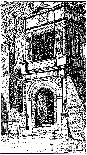
RUINS OF LORD BACON’S HOUSE
There were three monastic institutions on the outskirts of the town:—
(1) The Leper Hospital of St. Julian, founded by Geoffrey de Gorham,
sixteenth Abbot of St. Albans, on a spot close to St. Stephen’s Church.
Of this no vestige remains.
(2) The Hospital of St. Mary de Pré, for women-lepers, founded about
fifty years after the above by Warren de Cambridge, twentieth abbot, on
either side of the old Watling Street. Some of the graves in the
churchyard attached to the hospital were visible so recently as 1827,
and the cottages known as the “Three Chimnies,” originally part of the
hospital itself, were pulled down in 1849.[8]
(3) Sopwell Nunnery, founded by Abbot Geoffrey de Gorham about 1140,
at a spot a little S. from the Old London Road, on the river Ver. The
masses of ivy-mantled ruins still to be seen, and usually called the
“ruins of Sopwell Nunnery,” are, at least for the most part, the remains
of the house built by Sir Richard Lee, to whom the manor was granted at
the Dissolution.
ST. ALBANS ABBEY.—The Abbey has been so repeatedly altered and restored
that it may be said to illustrate every style of ecclesiastical
architecture from Norman to the present time. Opinions differ widely as
to the merits of that scheme of renovation and innovation completed
under the direction and by the munificence of Lord Grimthorpe, and no
attempt will be here made to criticise or extol the work of so great an
expert. Such a description of the venerable Abbey as an architect might
love to write would fill a volume in this series. After careful
consideration I have decided to sketch its history in such a way as to
show, however imperfectly, how it came to be what it is. I have been
careful to compare many authorities and to follow the consensus of
testimony wherever I have found discrepancy or contradiction.
It has already been stated that, according to Gildas, Bede and other
authorities, a church was erected on Holmhurst Hill after the martyrdom
of St. Alban. Concerning that church we know little more than that it
was almost destroyed by the Saxons. In 793, or very near that date, Offa
II., who had murdered the East Anglian King, Ethelbert, resolved to
found a monastery, encouraged, as we learn from William of Malmesbury,
by Charlemagne. The monastery was duly founded, for an abbot and 100
Benedictine monks, and the little church, renovated, became the original
abbey of the foundation. Having discovered the bones of St. Alban and
placed them in a costly reliquary, Offa conveyed them to this church,
intending to erect a nobler edifice for their reception; but it is
doubtful whether the design was carried out during his lifetime. Indeed,
we know little as to that enlarging and adornment of the church which
must surely have been effected in the days of the early abbots, and the
first hints of the erection of the great abbey occur in the lives of
Ealdred and Eadmer, eighth and ninth abbots, who collected immense
quantities of red, tile-like Roman bricks from the ruins of Verulam;
Matthew Paris tells us that Eadmer made some progress in the actual
rebuilding of the church. The twelfth abbot, Leofstan (d. 1066),
enriched the building with “certain ornaments”; but it was the
fourteenth abbot, Paul de Caen (1077-97), who, using the vast stores of
material collected by his predecessors, entirely rebuilt the church on a
scale almost commensurate with its present size.
The rebuilding of the Abbey Church by Abbot Paul de Caen occupied eleven
years. When completed, it was certainly one of the noblest and largest
structures in the kingdom. The length of this cruciform Norman church
was 426 feet. (The extreme length is now 550, due to additions presently
mentioned.) On the E. side of either transept were two apsidal chapels,
the one adjoining the presbytery aisle being in each case the larger of
the two; there was also an apse at the E. end of the presbytery. A
square, battlemented tower flanked the W. front on either side; but the
chief glory of Abbot Paul’s church was undoubtedly the enormous Norman
tower of four stages, triforium, clerestory, ringing-floor and belfry,
surmounted by parapets and flanked by angle turrets, of which such
considerable portions yet remain. Visitors who saw the Abbey thirty
years ago saw the E. portion of the nave, the transepts and the tower
substantially as built by Abbot Paul de Caen. The new Abbey was
dedicated 1115.
Geoffrey de Gorham, sixteenth abbot (1119-46), placed the relics of St.
Alban in a new shrine.
Robert de Gorham, eighteenth abbot (1161-67), erected the Chapter
House and Locutory (Abbot’s Cloister); his successor, Symeon
(1167-83), completed the erection and embellishment of the Shrine of
St. Alban, raising its height so that it could be seen from the High
Altar. During his abbacy the relics of St. Amphibalus were brought to
St. Albans, and the shrine of that saint was eventually erected in the
E. aisle. The Chapel of St. Cuthbert in the Baptistery, built by
Abbot Richard de Albini (1097-1119), was also dedicated about this time.
Warren de Cambridge, twentieth abbot (1183-95), placed the relics of St.
Amphibalus in a feretry, enriching it with gold and silver
ornamentation. He placed it behind the High Altar, near the feretry of
St. Alban.
John de Cella, twenty-first abbot (1195-1214), commenced to rebuild the
W. front, notably the three fine E.E. porches now replaced by those of
Lord Grimthorpe, but the work was completed by his successor William de
Trumpyntone (1214-35), who added the two flanking towers. This abbot
erected the rood screen between the nave and choir, added the octagon
above the tower after removing the Norman turrets and parapets, and
probably built those E.E. bays on each side of the nave which are
nearest to the W. front. He also restored portions of the S. transept
and S. aisle, and rebuilt St. Cuthbert’s Chapel on the spot now partly
occupied by the Rood Screen.
The E. end of the Abbey next received the attention of these
architect-abbots. Commencing at the second bay E. from the tower, John
de Hertford (1235-60) almost entirely replaced the Norman and E.E. work
of his predecessors by work which merged into a graceful E. Dec. The
work was carried on by his immediate successors, doubtless sadly
hindered by the turbulent state of the times. John de Norton (1260-90)
built the S. aisle of the Retro-choir, and part of the Lady-chapel,
but his work was supplemented by that of John de Berkhampstead
(1291-1302). John de Marinis (1302-8) removed the feretry and tomb of
St. Alban to the position which it occupied until about the time of the
Dissolution and spent 820 marks in the erection of a tomb of Purbeck
marble. Hugh de Eversden (1308-26) built the five moulded Dec. bays of
the S. aisle, replacing the Norman work, which had given way, and
completed the Lady-chapel at the extreme E., thereby greatly
increasing the length of the entire building. There was subsequently,
however, for a long period, a passage between the Retro-choir and the
Lady-chapel.
Abbot Michael de Mentmore (1335-49) completed the restoration of the S.
aisle and repaired the Cloister. His successor, Thomas de la Mere,
paved the W. floor, and no doubt minor restorations were almost
continually in progress during the latter half of the fourteenth
century; but a new chapter in the story of the Abbey commenced when John
de Wheathampsted became abbot (1420-40 and 1451-64). This celebrated
man, during the two periods of his abbacy, hardly rested in his efforts
to beautify the Abbey. It is stated in a Cottonian MS. that this abbot
constructed a little chapel near the shrine of St. Alban; this was
perhaps the Watching Loft (N. of Saint’s Chapel) in which the keeper
of the holy shrine and relics (Custos Feretri) spent much of his time.
John de Wheathampsted also built the tomb of Humphrey, Duke of
Gloucester (d. 1447), on the side of the chapel opposite the Watching
Loft (a few steps lead down to the coffin); prepared his own tomb W.
from that of the duke; built the great Perp. window over the W. porches,
now replaced by one Dec. in design, and the nine N. windows of Nave
and Ante-Choir; and was probably responsible for the paintings
discovered on the choir ceiling, and for many of the embellishments of
the Lady-chapel. Perhaps, however, his fame chiefly rests on the High
Altar Screen, which he designed, but which was erected by the
thirty-sixth abbot, William Wallingford (1476-84).
There were apparently few important features added to the Abbey, and but
little restoration effected during the rule of the last four abbots
(1492-1539). A few brief paragraphs concerning its modern restorations
and present appearance must now be added.
Those modern restorations date largely from the middle of last century.
Its condition, internally and externally, was at that time certainly
discreditable to everybody concerned in its welfare. In 1856 a National
Committee placed the matter in the hands of Sir Gilbert Scott, under
whose direction the building was in part restored; but public funds
presently failed and in 1879 the direction of the workers was undertaken
by one who had at once the inclination and the funds necessary to its
completion—Lord Grimthorpe.
The Abbey, from the W. porches to the E. end of the Lady-chapel and
the Chapel of Transfiguration, measures inside 520 feet, outside 550
feet; the entire transept length from N. to S., on the floor, 177
feet; the nave, the longest Gothic one in the world, 292 feet × 75
feet 4 inches; the Lady-chapel, 57 feet × 24 feet; the great Screens
are rather less than 170 feet apart; the height of the tower is 144
feet. Visitors will find some slight discrepancies as to measurements in
the several guides which have been compiled; but the foregoing figures
will assist them to realise the vast dimensions of the building. Its
area is approximately 40,000 square feet. Of special interest are:—
(1) The Tower, which is seen to greater advantage since Sir Gilbert
Scott removed the exterior plaster, thus exposing the wonderfully
preserved Roman tiles with which it was faced by Abbot Paul de Caen. The
four enormous piers upon which it rests were weakened by the ignorance
of early restorers, who cut into them freely, and dug graves in such
manner as to imperil their foundations. The most arduous work of Sir
Gilbert Scott was the strengthening of these piers, effected piecemeal
by partial reconstruction of the piers themselves and by laying a
durable substratum of cement right down to the chalk. The fine ring of
eight bells was rehung. Visitors will find the ascent of the spiral
staircase long and arduous, but will be rewarded by the almost
unrivalled view from between the merlons on its summit.
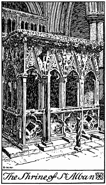
(2) St. Alban’s Shrine (in the Saint’s Chapel between the Altar Screen
and the Lady-chapel), already referred to (p. 188), disappeared about
the time of the suppression of the monastery (1539), and all traces of
it were lost except the fragment of Purbeck marble marking its former
site on the chapel floor. Yet that shrine, its genuineness unquestioned,
stands to-day on the site which it occupied centuries ago! Hundreds of
fragments of Purbeck marble were discovered when the central arches of
the Lady-chapel were opened by Dr. Nicholson previous to the
restorations of Sir Gilbert Scott. Subsequently, other fragments were
discovered and the whole collection, the importance of which was
suspected, was pieced together with indefatigable ingenuity by the late
John Chapple. The feretry itself, mentioned by Matthew Paris, which
was supposed to contain the relic of the martyr, has not, and probably
never will be, discovered. The vaulted niches are of clunch, but the
rest of the shrine is of Purbeck marble. Note the beautiful tracery of
these groined niches, the cusps of the arches and crocketted
pediments, and the carvings in the tympana, representing scenes from
the martyrdom of SS. Alban and Amphibalus.
(3) Shrine of St. Amphibalus (in N. aisle of presbytery). This was
discovered in fragments and pieced together in the same manner as that
of St. Alban. The whole, however, is of clunch, and, unfortunately,
incomplete. Note the fret-like sculpture round the basement, and the
name of the saint (imperfect) in carved capitals.
(4) High Altar Screen, or screen of Abbot Wallingford (restored at the
expense of Lord Aldenham); is in point of size, as in beauty, perhaps
unique in England. Note its resemblance to that at Winchester. It was
much dilapidated, its many statues having been entirely destroyed at the
time of the Reformation; but its restoration has been admirably
executed, the figures of SS. Alban and Amphibalus being especially
noticeable: the latter wears a Celtic, not a Roman tonsure. Note also
the figures of our Lord and His apostles in alabaster, and those of
Adrian IV., Bede, Hugh of Lincoln, St. Edmund and many others.
(5) Chantry Tombs of Abbot Ramryge and Abbot John Wheathampsted,
occupying respectively the last arches of N. and S. side of the
Sanctuary. Note the fine late Perp. work of the former, and the
Wheathampsted arms, three wheat-ears, on the latter.
(6) The Lady-chapel (enter through Retro-choir). This formerly
contained much of the finest work in the Abbey and traces of it are
still retained, despite its repeated and entire restoration. The present
vaulted roof of real stone replaces that of imitation stone built by
Abbot Hugh de Eversden. In post-Reformation days it was long used as the
Grammar School; but since the removal of the school to the Old Gate
House (1869) the chapel has gradually been brought into its present
state. Many of its most beautiful features—tracery, mouldings,
statuettes, carvings, etc.—had, however, been completely destroyed by
the boys. The marble pavement is new; the stained glass in the E. window
was presented by the Corporation of London. Note the wonderful variety
of carved flowers and fruits with which this chapel is embellished.
From Grose’s Antiquities (vol. viii.) I quote the following:—
“Mr. Robert Shrimpton, grandfather, by the mother’s side, to Mrs.
Shrimpton of St. Albans, was four times mayor of that town; he died
about sixty years since, being then about 103 years of age. He lived
when the Abbey of St. Alban flourished before the Dissolution and
remembered most things relating to the buildings of the Abbey, the
regimen of the house, the ceremonies of the church ... all of which he
would often discourse in his life-time. Among other things, that in the
Great Hall there was an ascent of fifteen steps to the abbot’s table, to
which the monks brought up the service in plate, and staying at every
fifth step, which was a resting-place, at every of which they sung a
short hymn. The abbot usually sat alone in the middle of the table; and
when any nobleman or ambassador or stranger of eminent quality came
thither they sat at his table towards the end thereof. When the monks
had waited a while on the abbot, they sat down at two other tables,
placed on the sides of the hall and had their service brought in by
novices, who, when the monks had dined, sat down to their own dinner.”
First Battle of St. Albans.—On May 23rd, 1455, the forces of King
Henry VI. assembled in the neighbourhood of St. Peter’s Street, and were
attacked by those of the Duke of York and Warwick the Kingmaker.
Advancing from the fields E. of the town, Warwick’s men appear to have
approached from Key Fields and Sopwell Lane, and, finally, having fought
their way into Holywell Hill, to have united with those of the Duke of
York, who had forced the town barriers farther N. The battle was
desperately contested; the bowmen, as usual in those times, playing a
conspicuous part; Henry VI. was wounded in the neck, Humphrey Earl of
Stafford in the right hand, Lord Sudley and the Duke of Buckingham in
the face—all with arrows. The wounded king took refuge in the cottage
of a tanner; here he was made prisoner and conducted by the Duke of York
to the Abbey. The town was at the mercy of the Yorkist soldiers during
the latter part of the day; many houses were looted and the Abbey was
probably spared only because the royal prisoner had been conducted
thither. Several illustrious persons slain in this battle were buried in
the Lady-chapel: (1) Henry Percy, second Earl of Northumberland; (2)
Edmund Beaufort, first Duke of Somerset; (3) John, Lord Clifford. Sir
Robert Vere, Sir William Chamberlain, Sir Richard Fortescue, Kts., and
many squires and other gentlemen also perished.
Second Battle of St. Albans.—On Shrove Tuesday, 17th February, 1461,
Queen Margaret defeated the Earl of Warwick, who retreated with
considerable loss, the battle being mostly fought out on Bernard’s
Heath, N. from St. Peter’s Church. This engagement also was stubbornly
fought out. According to Stow and Hollinshead, the Lancastrians were
thwarted in their efforts to pass through the town from S. to N., being
repulsed by arrows in the Market Place, and eventually reached Bernard’s
Heath by a circuitous route from the W. If this is so, visitors who
ramble down the High Street, turn right into Katherine Lane, coming out
of Wellclose Street near St. Peter’s Church, will probably tread in the
footsteps of the troops of Margaret. After the fight had been decided
the victorious Lancastrians poured back into the town, which was again
plundered, and the Abbey also partially stripped. This was during the
second abbacy of John Wheathampsted, and Stow records that the day after
the battle Queen Margaret, and the King (Henry VI.) were led by the
abbot and monks to the High Altar of the Abbey, where they returned
thanks for the victory.
St. Margaret’s, on the river Lea, has a small church with
several unimportant memorials. It was probably formed from one aisle of
an older edifice.
St. Margaret’s is also the name of a few cottages a little N.W. from
Great Gaddesden, near the site of the Benedictine convent of Muresley,
the refectory of which was almost intact early last century.
St. Paul’s Walden (4 miles S.W. from Stevenage Station, G.N.R.)
is a large and scattered parish; much of it is very picturesque. The
church, which was restored twenty years ago, is of several styles, but
contains little worthy of comment. Note the tablet on the W. wall of the
chapel to Henry Stapleford and Dorothy his wife. “The said Henry was
servant to Queen Elizabeth, King James and King Charles” (d. 1631). The
manor was formerly called first Waldene, then Abbot’s Walden, being
the property of the abbots of St. Albans. St. Paul’s Walden Bury, ½
mile S.W. from the church, is the seat of Lord Strathmore. Note the fine
avenues in the park, commanding good views of the house. The walk S. to
Whitwell, through the steep and twisted lane and across the bridge over
the Maran, keeping the “bog” and cress beds on the right, is very
pretty.
Sandon (3½ miles S.E. from Ashwell Station, G.N.R) has a flint
church, probably late fourteenth century. Several features should be
noted: (1) Perp. screen (oak) between nave and chancel; (2) old stained
glass in windows of both aisles; (3) fine Jacobean oak pulpit; (4) old
brass, with inscription which was imperfect 200 years back, to “Johannes
Fitz Geoffery, Armiger” (d. 1480); (5) piscina in each aisle; (6)
pinnacled and crocketted arches in chancel, over triple sedilia. The
church was partially restored in 1875. The manor of Sandone was owned
by Saxon kings; Athelstan gave ten houses in the vill to St. Paul’s,
London. The Old North Road to Royston is 2 miles E.
Sandridge (2½ miles N.E. from St. Albans) is on the road to
Wheathampstead, and is a thoroughly typical English village consisting,
for the most part, of one street, with the parish church near its N.E.
end. The parish stretches northwards to the Lea, and is very ancient;
the vill was given by Egfrith, a son of Offa, to St. Alban’s Abbey. It
owes its name to the nature of its soil. The church, one of the most
ancient in the county, has known much restoration, but still retains
Norman work. It was consecrated as a chapel a few years after the
consecration of St. Alban’s Abbey (1115); the chancel was rebuilt by
Abbot John Moote (circa 1400). The tower fell towards the end of the
seventeenth century and the structure which took its place was pulled
down and reconstructed in 1887. Note the old material in the apex, the
Perp. windows in the aisles, the clerestoried Norman nave and the Norman
font. There are N. and S. porches.
Churchill, Duke of Marlborough, derived his first title, Baron
Sandridge, from this parish; the Jennings family, from which his wife
Sarah was descended, possessed the manor for several generations.
Sandridge Bury, N.W. from the village, is beautifully situated.
Sarratt (1½ mile N. from Chorley Wood Station, Met. Extension)
is near the river Chess, on the Bucks border. The church is late Norman
and is remarkable for the saddle-back roof of its tower, running N. and
S., the only tower roof of its kind in Herts. The building is cruciform,
of flint, dressed with Totternhoe and Caen stone, and has a square
ambry, a very old piscina, and a double sedilia; the latter is E.E.
Richard Baxter is said to have preached from the Jacobean pulpit. There
are a few old memorials. The church is prettily situated, and a
picturesque walk may be taken N.W. to Sarratt Bottom, thence N.E. to
Sarratt Green, which during the last two or three centuries has
gradually outgrown Sarratt. Note the many fine old cottages on either
side of the village green. Sarratt owes its name to Syret, a Saxon.
SAWBRIDGEWORTH (formerly Sabysford, Sabridgeworth, Saybrichesworth and
now often called Sapsworth) lies at the S.E. extremity of the county, 4
miles S. from Bishop’s Stortford. The district is not very diversified,
but is open and pleasant. The history of the several old manor houses in
the neighbourhood would fill a large volume; those of Hyde Hall (E.)
and Pishiobury (S.) are engraved in Chauncy; the present mansion in
Pishiobury Park was built by Wyatt, and has a fine adjoining rosery.
The church stands between the town and the station (G.E.R.); it has a
good Perp. screen between the clerestoried Dec. nave and the chancel,
and a large canopied piscina in the N. aisle. The brasses are numerous:
note (1) to Sir John Leventhorpe (d. 1433) and Katherine his wife (d.
1431); the former was an executor to King Henry V.; (2) to several other
members of the Leventhorpe family, too numerous to mention; (3) to
Calpredus Jocelin (d. 147-), and his wives Katherine and Joan; (4)
inscription on brass, which was long ago transcribed as follows:—
“Of your Charite
Sey a Pater Nostre and an Ave
For the Sowl of William Chaunce
On whose Sowl Jesu have Mercy”.
Several monuments and brasses are to the memory of persons buried
elsewhere. Note the marble altar-tomb in chancel to John Jocelin or
Jocelyn (d. 1525) and Philippa his wife.
Shafton End and Shafton-Hoe lie a little E. from the Cambridge Road,
on the Essex border, about 4 miles S.E. from Royston.
Shaw Green is 4 miles S.E. from Baldock, near Julians Park.
Sheephall (2 miles N.N.E. from Knebworth Station, G.N.R.) is a
little E. from the Great North Road. It is a small village. The church,
E.E., is approached through a good lich-gate, and contains many
memorials, including two sixteenth-century brasses to members of the
Nodes family, one of which was Sergeant of the Buckhounds to Henry
VIII., Edward VI., Mary and Elizabeth (d. 1564).
Shenley (2 miles E. from Radlett Station, M.R.) is of interest
to many for its fine old “lock-up,” or cage, in the centre of the
village. We are on high ground here, and the tower of St. Alban’s Abbey
is well seen above the trees to the N.W. The village is scattered along
several converging roads, and the surrounding country is undulating and
beautifully wooded. Turn down the lane opposite the Black Lion to reach
the old church of St. Botolph, 1 mile N.N.W. from the cage. Note the
venerable yews, and the quaint old grave-boards in the graveyard; also
the altar-tomb to Nicholas Hawksmoor, a pupil of Wren, and the architect
of St. Mary Woolnoth, Lombard Street (d. at Shenley, 1736). The church
was partly rebuilt in the middle of the eighteenth century, when the
tower was demolished and a structure of timber, with quadrangular tiled
roof, eventually erected in its stead. This has disappeared, and the
“old parish church” is now an oblong building of flints, chalk-faced,
with tiled roof. Porters, in the park, a little W., was the residence
of Admiral Lord Howe. Salisbury Hall, a gabled manor house with
massive chimneys, surrounded by a moat, is Jacobean, and stands on the
spot occupied successively by the older houses of the Montacutes, and of
Sir John Cutts, Treasurer and Privy Councillor to Henry VIII. Eugene
Aram visited the neighbourhood.
Sleap’s Hyde (½ mile S.E. from Smallford Station, G.N.R.) is a hamlet
in the parish of Colney Heath.
Smug Oak, a few cottages, lies on the E. confines of Bricket Wood, ½
mile N.E. from that station, L.&N.W.R.
Smyth’s End adjoins Barley on the S. (q.v.).
Solesbridge Lane, on the river Chess, is close to Chorley Wood.
Southend and Southend Green are hamlets, (1) adjoining Stevenage on
the S., (2) ½ mile E. from Rushden.
Spellbrook is a hamlet nearly midway between Sawbridgeworth and
Bishop’s Stortford.
Stanborough, on the Hatfield-Welwyn road, is midway between Hatfield
and Brocket Hall Parks. The road which branches N.W. from the hamlet
leads to the modern church at Lemsford (q.v.).
Standon has several claims to notice. It is a large village, 1
mile E. from the Old North Road. A little W., and on the other side of
the railway, is the mansion which occupies the site of Standon
Lordship, a fine old manor house, of which hardly a vestige remains. It
was long owned by the Sadleir family, most illustrious of whom was Sir
Ralph Sadleir (d. 1587), who fought at Pinkie. (See below.)
The church, largely Dec., still retains some Saxon foundations, and has
singular features worthy of comment. The embattled tower is separate
from the main structure, standing on the S. side of the chancel; the
chancel is raised much higher than the nave, from which it is approached
by a flight of steps; note the hagioscope on either side of the chancel
arch. Within the chancel, on the S. side, stands the fine monument to
Sir Ralph Sadleir, consisting of altar-tomb and marble effigy in armour,
recumbent beneath a canopy supported by Corinthian pillars; note the
relieved figures of his sons and daughters on the lower part of the
tomb, also, suspended above, two helmets and other relics. The standard
pole captured at Pinkie rests beside the effigy. There are also several
old brasses. Close to the village, at Old Hall Green, are the Roman
Catholic College, Chapel and Cemetery; the college was founded at
Twyford, Hants, late in the seventeenth century, from whence it was
removed, first to Standon Lordship, and then (1769) to Old Hall. The
library is large and valuable.
Stanstead Abbots may be easily reached from St. Margaret’s
Station, G.E.R., ½ mile W. It was a place of considerable trade at the
time of the Conquest. The old flint church is E.E., with a chapel on the
N. side, built by Edward Baesh—whose monument it contains—in 1577. He
was lord of the manor of Stanstead Abbots and “General Surveyor of the
Victuals for the Navy Royal and Marine affairs within the Realms of
England and Ireland” (d. 1587). He married Jane, a daughter of Sir Ralph
Sadleir. (See Standon.) The six Baesh Almshouses were built and endowed
by his son, Sir Edward Baesh. Several brasses, some mutilated, are in
the church, notably one near the altar-rails to William Saraye or
Saxaye, late of “Grais In” (d. 1581). Stansteadbury, a huge gabled
mansion, largely rebuilt, stands in extensive grounds, and was the home
of the Baeshs and of their successors, the Feildes.
Stapleford, a village on the river Beane, is 3 miles N.N.W. from
Hertford. The church is Perp. with N. porch; it was enlarged nearly
fifty years ago, when the present tower was added.
STEVENAGE, a town on the Great North Road, has shifted from its original
position. It once stood farther N.E. and close to the church; but after
a terrible fire which destroyed a large proportion of its houses the
village was gradually rebuilt more directly on the famous old coaching
road. The first paper mill in England is said to have been built in this
parish. Several of its inns were standing when the regular coaches were
on the road.
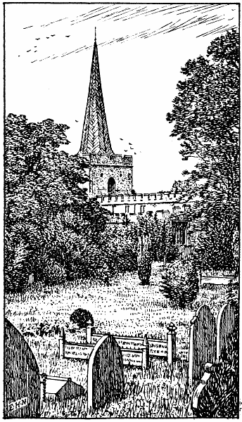
STEVENAGE CHURCH
The old Church of St. Nicholas, ¾ mile N.E., is reached through an
avenue of limes and chestnuts, headed by a new lich-gate. It is largely
E.E. Note the octagonal pillars and pointed arches of the nave and the
two small chapels attached to the chancel. The font at the W. end is
under an Early Norman arch. There are several modern windows of stained
glass, and a good brass, early sixteenth century, in the chancel. The
church at the S. end of the town was designed by Sir A. W. Blomfield
about sixty years back, but has since been much enlarged. Half a mile
farther S. on the main road are six almost equidistant mounds, thought
to be of Danish origin.
At the old Castle Inn, E. side of High Street, great numbers of persons
have been shown on the rafters in a barn the coffin of Henry Trigg,
whose will was proved in 1724; one of its provisions was that his body
should not be buried, but disposed of in that way. Little more than a
mile N.W. from the station, at Redcoats Green, stood, until 1893,
“Elmwood House,” the home of the Hermit of Hertfordshire. This man,
James Lucas, was descended from a good family, but for reasons never
satisfactorily explained he lived alone, and in a most filthy condition,
from October, 1849, to April, 1874. A concise and reliable account of
this peculiar man is issued by Messrs. Paternoster and Hales of Hitchin.
Stocking Pelham, on the Essex border (5½ miles N.E. from
Braughing Station, G.E.R.), has an E.E. church dating from early
fourteenth century; it has no tower. The chancel was restored in 1864.
The manor is very ancient, and was held by Simon de Furneaux in the
reign of Edward I., but the village now shows little of interest.
Swangles (2¼ miles N.E. from Ware) is a small hamlet a little S. from
the river Rib.
Symonds Green (¾ mile S.W. from Stevenage Station, G.N.R.) is a hamlet
between the Great North Road and the ruins of Minsden Chapel.
Symonds Hyde Farm and Wood are in a pleasant district, very
diversified, a little S.W. from Brocket Hall Park. Smallford and
Hatfield Station (G.N.R.) are from 2 to 3 miles S. and S.W.
respectively.
Tea Green, a hamlet near the Beds border, lies between Breachwood
Green and Putteridge Bury.
Tednambury and Tednam Mill are on the river Stort and right on the
Essex border. Sawbridgeworth Station (G.E.R.) is 1 mile S.
Tewin (about 2 miles S.E. from Welwyn Station, G.N.R.) is most
charmingly situated on high ground above the river Maran. The village is
divided into the Upper and Lower Green; the church, ¼ mile from the
latter, stands on a hill that slopes steeply to the river. Note the
altar-tomb in churchyard to Lady Anne Grimston (d. 1710). The tomb is
forced asunder by ash and sycamore trees growing together, a
circumstance popularly attributed to the sceptical opinions of Lady
Anne, who is said to have denied the doctrine of immortality, and to
have expressed the wish that such a phenomenon should happen if the
doctrine were indeed true. The church, which looks very old, is of
flint, brick and rubble, with a large diamond-faced clock on one side
of the tower. In the S. porch (entrance blocked up) is the marble
monument to Sir Joseph Sabine (d. 1739); who fought under Marlborough.
Note the pyramid, 15 feet high, and the recumbent effigy, dressed as a
Roman soldier. There is also in the S. aisle a good brass to one Thomas
Pygott (d. 1610), and a slab with an imperfect Lombardic inscription to
Walter de Louthe. Tewin Water, in the park, N.W., is prettily
surrounded by trees. Beautiful walks may be taken in almost any
direction, especially in the trend of the river Maran towards Digswell
and Welwyn.
Tharbes End is 1½ mile N.W. from Sawbridgeworth.
Theobald’s Park. (See Waltham Cross.)
Therfield (3 miles S.E. from Ashwell Station, G.N.R.) was,
according to Dugdale’s Monasticon Anglicanum, given to the church of
Ramsey by Etheric, Bishop of Sherbourne, about 980, and Chauncy
“guesses” that an abbot of Ramsey built Therfield church. The present
church is a modern Dec. structure, a little W. from the centre of the
scattered village. The Icknield Way skirts the parish on the N. and
many Roman relics have been discovered in the neighbourhood. There are
also several tumuli in the parish, which lies on high, chalky soil.
Thorley (2 miles S.W. from Bishop’s Stortford) can show a good
Norman doorway on the S. side of the little church; note the dog-tooth
moulding and twisted nook-shafts. The remainder of the building is
largely E.E.; there is a piscina in the chancel and—at the W.
entrance—a niche for a holy water basin. The font, as at Bishop’s
Stortford, was a modern discovery. Thorley Wash and Thorley Street are
between the church and the G.E.R.
Throcking (2 miles N.W. from Buntingford Station, G.E.R.)
stands on a hill. The church is E.E. and Dec., except the upper part of
the tower, of brick, added in 1660. The monuments include one by
Nollekens and one by Rysbrack, to members of the Elwes family, of whose
manor house there are still some traces adjacent to the Hall Farm. The
walk N.W. to Baldock, by way of Julians Park (7 to 8 miles), leads
across open, breezy country.
Thundridge and Wade’s Mill are on the Old North Road,
about 2 miles N. from Ware. The river Rib crosses the road at Wade’s
Mill. The present parish church, E.E. in style, was built about seventy
years ago, close to the bridge over the Rib; the tower of the old
church; “Little St. Mary’s,” with a Norman arch stands in the lower
meadows ½ mile E. On the W. side of the Old North Road, close to Wade’s
Mill, a low obelisk marks the spot where Thomas Clarkson resolved to
give his life to the cause of the abolition of slavery.
Titmore Green is 1½ mile N.W. from Stevenage Station, G.N.R.
Tittenhanger. (See London Colney.)
Todd’s Green adjoins Titmore Green.
Tonwell, on the main road from Ware or Stevenage, is a hamlet near
the river Rib. It has a modern chapel-of-ease. Ware is 2½ miles S.E.
Totteridge, on the Middlesex border, is 1 mile W. from the
Station (G.N.R.). Richard Baxter lived here for a short time. The
neighbourhood is well wooded and very pleasing to the eye. The church,
on the hill-top, dates only from 1790; but the site was occupied by an
earlier structure. The memorials are of no historic interest; but near
the enormous yew tree in the churchyard stands the tomb of the first
Lord Cottenham (d. 1851). Near by, too, lies Sir Lucas Pepys, physician
to George III. (d. 1830). Totteridge Park, W. from the village, was
the residence of Baron Bunsen, and of the above-mentioned Lord
Cottenham; the large, plain structure in which they lived, recently in
part rebuilt, was erected about a century ago, taking the place of the
fine old manor house, for some generations the home of the Lee family.
At Copped Hall, near the church, the late Cardinal Manning was born in
1808.
TRING is the most westerly place of any importance in Herts. The station
(L.&N.W.R.) is nearly 2 miles E. from the town, which is sheltered on
the N.W. by the chalk hills, a fresh spur of which crops out 3 mile N.E.
at Aldbury (q.v.). The church (Perp.) stands near the centre of the
town and is fortunate in having been restored under the direction of Mr.
Bodley in 1882. It is an embattled, flint structure; the tower has a
corner turret and is, like that at Hitchin, unusually massive. Note (1)
the clustered columns of the nave, (2) the quaint corbels, (3) the
large, imposing monument to Sir William Gore and his wife (d. 1707 and
1705 respectively); Sir William was Lord Mayor of London; (4) good Perp.
windows in each aisle.
Tring was formerly a considerable centre of the straw-plait industry,
which is still pursued to a less extent. The place is of great
antiquity, Treung hundred dating from the days of Alfred the Great.
William I. gave it to Robert Earl of Ewe, and Stephen kindly bestowed it
upon the monks of Faversham, “in perpetual Alms for the Health of the
Souls of Maud his Queen and all faithful People”. Edward II. granted to
Tring market rights.
Tring Park (property of Hon. N. C. Rothschild) is surrounded by
perhaps the most exquisite woods—largely of beech—in the whole county.
Much altered in modern times, it is said to have been designed by Wren,
and to have been visited by Charles II. The park is well kept, and
contains many living curiosities placed here by Lord Rothschild, a lover
of natural history. The Museum, at the top of Akeman Street,
containing a fine zoological collection, is the outcome of his
lordship’s energy and benevolence. The Museum House, to which it is
attached, is a prettily designed structure of red brick, with gables.
Tring, Little, is a hamlet 1¼ mile N.W. from the town, and Tring
Grove, a hamlet 1¼ mile N.E. The former is near the large reservoirs,
upon which several of the rare birds mentioned in the Introduction
(Section IV.) were observed.
Trowley Bottom (3 miles N.W. from Redbourn Station, M.R.) is a hamlet
a little S. from Flamstead, in one of the most thoroughly rural
districts in the county. The Roman Watling Street (St.
Albans-Dunstable road) is 1 mile N.E.
Turnford (1¼ mile S.W. from Broxbourne Station, G.E.R.) is a hamlet in
Cheshunt parish, on the New River. Broxbourne Bury Park is 1 mile N.
Two Waters owes its name to its position at the junction of two small
rivers—the Gade and the Bulbourne. It is in Hemel Hempstead parish, and
about 1 mile E. from Boxmoor Station.
Tyttenhanger. (See Tittenhanger.)
Upwick Green (4 miles N.W. from Bishop’s Stortford) is a hamlet on the
Essex border. Hadham Hall (see Little Hadham) is 1 mile S.
VERULAM. Of the old Roman municipium (Verulamium) there now remains
above ground little more than some large fragments of crumbling wall in
the valley of the Ver, immediately S.W. from St. Albans. Passing under
the old Gatehouse and crossing the bridge at the Silk Mill the visitor,
instead of turning right and following the course of the Ver, should
keep straight on and pass the small gate into Verulam Woods. On his
right as he follows the broad footpath will be the outer E. wall of the
Roman city; on his left what appears a long gorge, overgrown by bushes
and trees of many species, was once the fosse. Note the great
thickness and solidity of the walls, and the tile-like bricks, similar
to those in the Abbey tower, mingled with flints. Presently both wall
and fosse turn sharply W. and may be followed in that direction for a
considerable distance. The walls may also be traced at other spots
farther W., particularly a large mass known as Gorhambury Block,
believed to mark the boundary of the municipium in that direction.
It has been mentioned in the Introduction (Section IX.) that the only
Roman theatre known to have existed in England stood in this
neighbourhood. Its remains were discovered rather more than seventy
years ago in a field immediately W. from St. Michael’s Church; nothing
is now to be seen, for the excavations have been again covered. The
discovery included that of the stage, somewhat narrow, the auditorium,
with many rows of seats, and portions of the frescoed walls. Many coins
were found among the ruins.
Mention must be made of the fact that the Roman Verulamium was the
scene of the awful massacre in the time of Boadicea, when the Queen of
the Iceni, with a great number of followers, slew alike the British and
Roman inhabitants and partially destroyed the city (A.D. 61).
An account of this is in the Annals of Tacitus. The place was
subsequently rebuilt and occupied by the Saxons, who called it
Watlingceaster, or Werlamceaster.
Wade’s Mill. (See Thundridge.)
Wakely (2 miles W. from Westmill Station, G.E.R.) is a hamlet in
Westmill parish, consisting of a farm and a few cottages.
Walkern (4½ miles E. from Stevenage) is a large village, with
many picturesque nooks and cottages. The river Beane skirts it on the E.
side. The manor is very ancient; Chauncy speaks of “Walkerne” as a town,
and mentions a mill which stood in his day (1632-1719) at its S. end,
presumably where Walkern Mill now stands. The church, on a knoll sloping
to the Beane, is mostly Perp., but retains Norman work in the S. aisle;
the chancel is modern, E.E. in style. The effigy in Purbeck marble in a
recess of S. wall, of a knight in chain mail, is thought to represent
one of the Lanvalei family. If so, it forms an interesting link with a
remote past, for in the reign of King John one Alan Basset paid a
hundred marks to that monarch, and gave him a palfrey “that his daughter
might marry the heir of William de Lanvalley”. There are also effigies
on brass to the Humberstone family (sixteenth century). Walkern Hall
(1 mile S.E.) stands in a small but pretty park; Walkern Bury (1 mile
E.) can still show some remains of a castle.
Wallington (3½ miles E. from Baldock) lies in one of the most
quiet districts of the county, a district almost entirely agricultural.
The village is small; a few cottages are ancient and picturesque, but
there is little to notice. Take the lane opposite the Plough Inn to
reach the church, which can show a good Perp. roof and screen, and some
mutilated monuments and brasses in the chapel. The main structure is
Dec.; but the chancel was rebuilt forty years ago. A walk affording
views very characteristic of Herts may be taken from the footpath near
the walled pond adjoining the church, by bearing S.S.E. to Red Hill,
Rushden and Cottered.
Walsworth, a hamlet, is almost a suburb at the N.E. end of Hitchin, ½
mile from the station.
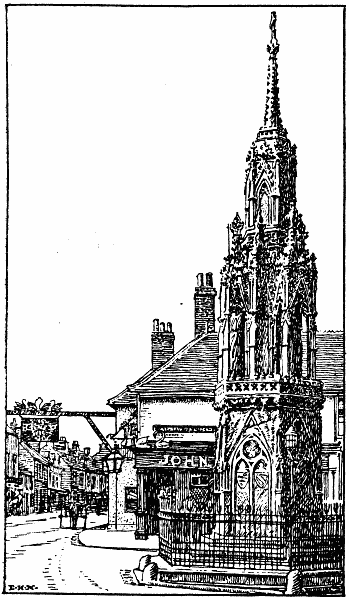
WALTHAM CROSS
WALTHAM CROSS, on the London-Cambridge road, owes its name, as is well
known, to the Cross which Edward I. erected to the memory of Queen
Eleanor about 1¼ mile W. from Waltham Abbey. The cross stands a little
W. from Waltham Station (G.E.R.), where the above-mentioned road meets
that which leads E. to the Abbey. Although frequently restored it is
perhaps even now more complete than any other Eleanor Cross still
existing. (That erected at St. Albans, as already stated, was destroyed
about 200 years ago.) It is, I believe, disputed as to whether it was
designed by Pietro Cavalini or not; it was completed in 1294. It is
hexagonal in shape, of three stages, diminishing from basement to
summit; the details of its sculpture can be readily seized by examining
Mr. New’s drawing. The restoration of 1833 was worked in Bath stone;
this was largely replaced by new material, in Ketton stone, only a
few years ago, at which time the Old Falcon Inn, which projected almost
to the cross, was pulled down, thus affording a view of the monument
from all sides.
The Four Swans, close to the cross, dates from 1260, as is testified on
the large, quaint sign-board which swings above the road; but only a few
portions of the present structure are of any great antiquity. There is a
modern church a little N. from the cross; but much of the district
commonly called Waltham is in Essex. Of great interest to visitors,
however, and about 1 mile W. from the Cross, is Theobald’s Park, a
brick mansion erected about 150 years back by Sir G. W. Prescott, Bart.
At one of the entrances to the park stands Temple Bar, brought here from
Fleet Street and erected in its present position in 1888. The house does
not occupy the site of the historic manor house visited by so many
sovereigns, which stood on a slight eminence some distance to the N.W.
It was William Cecil, afterwards Lord Burghley, who commenced to build
that famous mansion in 1560, and enlarged it considerably when he found
it pleasant in the eyes of many persons of high degree. Queen Elizabeth
was frequently a visitor at Theobalds. It was Burghley’s son, Robert
Cecil, who entertained James I. here as that monarch was on his way to
London and the English Crown, and James became so pleased with the house
and its surroundings that he obtained it from Cecil, giving him the
royal manor of Hatfield in its stead. It was from Theobalds that
Charles I. set out to raise his standard at Nottingham (1642). The house
was partially destroyed during the turmoil that ensued; after the
Restoration it was given by Charles II. to George Monk. It was
subsequently the property of the Earl of Portland and of several other
persons.
WARE was for a long period, and is perhaps now, the centre of the malt
trade in Herts, but brickmaking is also extensively carried on. The
river Lea skirts the town on the S. side, and is crossed by an iron
bridge near the Barge Inn. The High Street displays many new houses and
shops, but by turning into the smaller by-ways visitors may find quaint
cottages and picturesque nooks and corners. The town is very ancient,
but contained only a few persons at the time of the Conquest.
The cruciform church of St. Mary has been much restored; the body of the
present structure is Dec.; but the tower and chancel are Perp. Note (1)
the carved oak screen separating the S. transept from the Lady-chapel;
(2) sedilia, piscina and ambries in the chapel itself; (3) octagonal
font (temp. Henry IV.), bearing figures of saints on its panels; (4)
mural monument in S. transept to Sir Richard Fanshawe; (5) brass to W.
Pyrry or Pyrey (d. 1470) and his wives Agnes and Alice, the inscription
was apparently never completed; (6) curious brass figure near pulpit.
There is also a modern church in the New Road, E.E. in style, of Kentish
Rag and Bath Stone.
There was a Franciscan Priory a little W. from the church, which,
although sometimes said to have been founded by Margaret, Countess of
Leicester (temp. Henry III.), was probably of much earlier foundation,
though doubtless enlarged by that lady. It fell into decay after the
Dissolution, but some remains of the old buildings are still to be seen
at Ware Priory, a mansion occupying the site. The property formed a
separate manor, which was given to the Countess of Richmond by her son,
Henry VII.
Ware is not without literary association. The Johnny Gilpin, on the road
to Amwell, commemorates the hero of Cowper’s ballad; Pepys mentions his
visits to the town on several occasions; Dick Turpin, as the story runs
in Ainsworth’s Rookwood, passed through Ware in his famous ride to
York; Godwin, who figures so largely in the Lamb literature, was for
some years the Independent minister of the town. By a long ascent N.
from the town, we reach, by turning right, the hamlet of Ware Side,
picturesquely scattered over a slight depression close to Widford
(q.v.). W. from the town is Ware Park, a mansion on a beautiful
eminence.
Warren’s Green (about 4 miles N.E. from Stevenage Station, G.N.R.) is
a small hamlet.
Water End, on the river Gade, is on the S.W. confines of Gaddesden
Park. There are also hamlets of the same name (1) close to Ayot Station,
G.N.R.; (2) at the E. extremity of Mimms Park, 2 miles N.W. from
Potter’s Bar Station (Middlesex).
Waterford and Waterford Marsh are in Bengeo parish, on the river
Beane. On the marsh is some grazing common, free to all parishioners.
Waterside is the name of a few cottages (1) on the river Gade, near
King’s Langley village; (2) at Mill Green, 1 mile N.E. from Hatfield.
WATFORD, including its quickly rising suburbs, is much the largest town
in Hertfordshire. The Colne crosses the high road where it dips before
rising towards Bushey, and Chauncy says that the town derives its name
from the Wet Ford by which the river is crossed. The building of the
Junction Station (L.&N.W.R.), N.E. from the High Street, did much to
facilitate the growth of Watford and extend its trade; the railroad
diverges S.W. to Rickmansworth only, and N.E. to Bricket Wood, Park
Street and St. Albans; the main line from London passes through a long
tunnel before reaching King’s Langley Station. The antiquities of the
town itself are less interesting and indeed less known than those of
other towns in the county, and Chauncy, e.g., finds little to say
about it. The manor was long held by the abbots of St. Albans; then it
became Crown property, and after several changes of ownership passed to
William, fourth Earl of Essex, whose descendants are still lords of the
manor.
The parish church, on a small yard adjoining the S. side of the High
Street, is Perp., and was well restored about fifty years ago; with its
Katherine- and Essex Chapels it forms a large and imposing
structure. The latter chapel was built in 1595 by Bridget, Countess of
Bedford. Its monuments are very numerous and comprise (1) to Sir Charles
Morison, Kt. (d. 1599), and Dorothy his wife; note the fine kneeling
effigies; (2) to Sir Charles Morison, K.B., son of the foregoing (d.
1628), and the Hon. Mary (Hicks) his wife, with recumbent effigies one
above the other, and attendant figures of a daughter and two sons (note
the Corinthian columns which support the canopy overshadowing the
whole); both these Morison monuments were the work of Nicholas Stone,
mentioned in Walpole’s Anecdotes; (3) altar-tomb to the founder of the
chapel (d. 1600); (4) altar-tomb with Tuscan columns and recumbent
effigy to Elizabeth, wife of Sir William Russell (d. 1611). Among the
brasses are those to (1) Henry Dickson (d. 1610); George Miller (d.
1613) and Anthony Cooper, “servants to Sir Charles Morryson, Kt.”; (2)
imperfect, Hugo de Holes, Justice of the King’s Bench (d. 1415), and
Margaretta his wife (d. 1416); (3) Henry Baldwyn of Reedheath (d. 1601),
Alice, his wife, and three children; (4) James Moss, a messenger to
George II. (d. 1758).
There are modern churches: (1) St. John’s, in the Sutton Road, a Gothic
edifice completed in 1893; (2) St. Andrew’s, near the Junction, E.E. in
design, with a good stained glass window in the S. aisle, and a
beautiful Roman Catholic church by Bentley, architect of Westminster
cathedral. In Beechen Grove is one of the finest Nonconformist (Baptist)
chapels in the county; it dates from 1878 and is Italian in design.
Market day is on Tuesday.
CASHIOBURY PARK stretches from the N.W. end of Watford,
reaching—together with Grove Park, which it joins—to the parting of
the ways at Langleybury Church (4 miles N.W. from Watford Old Church).
It is crossed from N. to S. by the river Gade. The present mansion dates
from 1800; it was built by Wyatt for the fifth Earl of Essex. Disposed
around an open courtyard, its many handsome apartments make a noble
appearance; what was formerly part of the N. wing of the old mansion
built by Sir Richard Morrison and his son Charles in the sixteenth
century is still retained, although that house was largely rebuilt by
the first earl, from designs furnished by Hugh May. There is a fine
library, and three smaller ones, the collection of books being very
valuable; but in the estimation of many the pictures are still more so.
Among them may be named: (1) Arthur Lord Capel and his family, C.
Janssens; this was the Capel who defended Colchester and was beheaded in
1649; (2) Charles II., by Lely; (3) fifth Earl of Essex as a boy with
his sister, by Reynolds, in frame carved by Grinling Gibbons; (4)
Countess of Ranelagh, full length, by Kneller; (5) portrait by Rubens,
probably of Charlotte de la Tremouille, afterwards Countess of Derby;
(6) “Moll Davis” (actress), by Lely. There are many others, especially
further portraits of the Capel family. The park and grounds are
beautifully laid out. The park is open to the public; but the house is
shown only by special request.
Watton or Watton at Stone is a large village on the
Hertford-Stevenage road and the river Beane, 3½ miles S.E. from
Knebworth Station, G.N.R. Its position is very central, the roads from
Ware, Hertford, Great and Little Munden, Walkern, Stevenage, Welwyn and
Tewin all converging within the area of the main street. The church, at
the S. end of the village, is Perp.; it was entirely restored in 1851.
Note (1) piscina and triple sedilia in chancel; (2) doors formerly
leading to rood loft; (3) curious tombstone, E.E., in the churchyard;
(4) E. window of stained glass, dating from the Restoration; (5)
memorial window in the S. aisle to Lady Catherine Barrington. The
brasses are unusually old and interesting, e.g., (1) with canopied
effigy, to Sir Philip Peletot (d. 1361); (2) to Sir E. Bardolf (d.
1455); the effigy is that of his wife, his own having been long missing;
(3) to John Boteler (Butler) and family (1514). The Boteler family, to
whom there are many other memorials in the church, lived for many
generations in the manor house of Woodhall, burnt in 1771. The house
stood on high ground in the beautiful Woodhall Park, E. from Watton
Church, on the site occupied by the present fine mansion (Abel Smith,
Esq., J.P.). The Beane flows through the park and has been widened to
form a large sheet of water S. from the house.
Welham Green is between Hatfield- and Mimms Parks, 2 miles S. from
Hatfield Station.
Wellbury is 3 miles W. from Hitchin. Wellbury House (modern) stands
in a small park; two small places of few inhabitants, called “Old” and
“New” Wellbury, lie on the N.E. outskirts of the Park.
WELWYN, a small town in the Maran Valley, can show little of interest
beyond many quaint cottages, and the church, famous as that in which Dr.
Edward Young, author of Night Thoughts, officiated from 1730 to 1765.
He was buried in the church; the mural memorial to him was erected by
his son. The church is Dec., with E.E. portions; the piscina in the
chancel is ancient, the sedilia is modern. An inventory of the church
furniture, taken in 1541, shows that there were formerly three altars in
it. The avenue of limes in the rectory grounds was planted by Young;
there is a Latin inscription to the poet on a pedestal at its upper end.
His son was visited here by Dr. Johnson and James Boswell.
The walk S.E. to the station (1¼ mile) commands a fine view of the Great
Northern viaduct of forty arches over the deeper portion of the Maran
Valley. On the opposite (left) side of the road is Locksleys, a good
mansion by the river side, surrounded by charming grounds. One mile S.
is The Frythe, long the residence of the Wilshere family; at a rather
less distance N. is Danesbury, a prettily designed mansion in a small
park.
“King Etheldred ... willing to relieve his people from the barbarous
usuage and the inhuman actions of the insulting Danes ... sent
instructions to the Governors of all cities, boroughs and towns in his
dominions, commanding, that at a certain hour upon the feast of St.
Brice, all the Danes should be massacred; and common fame tells us that
this massacre began at a little town called Welwine in Hertfordshire,
within twenty-four miles of London, in the year 1012, from which Act,
’tis said this Vill received the name of Welwine, because the Weal of
this county (as it was then thought) was there first won; but the Saxons
long before called this town Welnes, from the many springs which rise in
this Vill; for in old time Wells in their language were term’d Welnes.”
One of the springs in the neighbourhood, now disused, was famous in
Young’s day for its chalybeate waters.
West End is a hamlet 2 miles S.W. from Cole Green Station, G.N.R. It
lies close to the N.W. corner of Bedwell Park, with the river Lea 1
mile N.
West Hyde, in the extreme S.W. of the county, near the river Colne,
has a modern cruciform church, Italian in style.
Westmill, a church and picturesque cluster of cottages in a
hollow a little W. from the Buntingford Road, is 1½ mile S. from that
town. The river Rib runs between the church and the station (G.E.R.).
The manor is ancient; it was given by William I. to Robert de Olgi.
Nathanial Salmon, author of a History of Hertfordshire published in
1728, was once curate here.
The church very probably dates from the end of the thirteenth century,
and is an E.E. flint structure. There are some old slabs in the chancel
to the Bellenden family, and one on the nave floor bearing an
inscription to one Thomas de Leukenor (?).
Westmill Green is a hamlet 1½ mile S.W. from Westmill Station, G.E.R.
Weston, a large village 3 miles S.E. from Baldock, has an
interesting, restored church, dating from about 1200. It has a N.
transept, in which are two good Norman windows; a piscina, E.E., is in
the nave. The massive embattled tower, which carries an octagonal, N.E.
turret, was rebuilt in 1867. In the churchyard may be seen two small
stones, about four yards apart, which, according to local tradition,
mark the grave of the Weston giant. The church was once a property of
the Knights Templars. There is what seems a second village just where a
narrow footpath leads from the Lufen Hall Road to the church, which
stands ½ mile E. from the long main street. Many folk may still be
noticed plaiting in the neighbourhood.
Weston Dane End (1½ mile S. from the above village) is a hamlet on
the road to Walkern.
Westwick Row (2 miles S.E. from Hemel Hempstead) is a hamlet near
Leverstock Green, in a charming neighbourhood.
Wheathampstead lies in a hollow, in the valley of the Lea.
Cyclists approaching the village from St. Albans by way of Sandridge and
No Man’s Land must beware of the steep descent from the Old Red Cow to
the Swan Inn. The place undoubtedly owes its name to the fine wheat
grown in the neighbourhood; it is very picturesque, particularly around
the church and vicarage, and by the waterside towards Brocket Hall.
The cruciform church, W. from the centre of the village, is E.E. and
Dec. with a few Perp. features. A doorway in the Brocket Chapel is
supposed to be Saxon, but I cannot say whether the supposition is
correct; the chapel also contains an altar-tomb with effigies of Sir
John Brocket and his wife, Margaret, bearing date 1543, and a piscina in
the S. wall. A brass of much interest is that to Hugh Bostock and his
wife, Margaret (circa 1450), showing their figures in robes. These
persons were the parents of John de Wheathampsted. (See St. Albans.) An
old marble tablet is to John Heyworth (d. 1558) and his wife Joan. Note
also the monumental effigies in N. transept to Sir John Garrard, Bart.
(d. 1637), and his wife Elizabeth (d. 1632). The reredos is very fine.
Forty years ago the village was truly rural, but the rebuilding of the
old mill between the church and station (G.N.R. branch from Hatfield to
Dunstable) and the erection of several modern shops in the main street
has altered its appearance. Wheathampstead House, close to the
station, is the seat of Earl Cavan; Lamer Park, a little N., slopes
pleasantly towards the fine home of A. G. B. Cherry-Garrard, Esq.
Mention must be made of the curious bronze vessel of the Anglo-Saxon
period, resembling a teapot, found in the neighbourhood some years ago.
It is figured and described in the recently published Victoria History
of Hertfordshire.
Wheathampstead Cross (1½ mile S.E. from Harpenden Station, M.R.) is 2
miles S.W. from the above village. It contains nothing but a few
cottages.
Whempstead, a hamlet in the centre of the county, is not easily
reached, being about 5 miles E. from Knebworth Station, G.N.R., and
rather farther N.W. from Ware. The so-called Whempstead Chapel,
recently demolished, was a small cottage, but it doubtless stood near
the site of an old chapel “founded and endowed about the beginning of
the thirteenth century by the family of Aguillon”.
White Barns, near the Essex border, is a hamlet ¾ mile N. from
Furneaux Pelham (q.v.).
Whitwell (4½ miles S.W. from Stevenage) is strictly a hamlet, but is a
place of some size, scattered along the S. bank of the river Maran. The
nearest parish church is at St. Paul’s Walden (q.v.), but there is a
modern Baptist chapel near the centre of the main street, and a small
church on the Bendish Road, formerly owned by the Countess of
Huntingdon’s Connection; it is now partially disused. The mill at the E.
end of the village, near the old tan-yard, was burnt down many years
ago, but has since been rebuilt.
Widbury is 1 mile E. from Ware.
Widford, so interesting in the eyes of all lovers of Charles
Lamb, is a small village on the river Ash, with a station (G.E.R.) a few
minutes W. from the church. Visitors, however, must remember that much
in the neighbourhood has changed since Lamb’s day. He himself recorded
the demolition of the old house “Blakesware” or, as he wrote it,
“Blakesmoor,” which he knew so well as a child; the church spire,
mentioned in his verses “The Grandame,” was rebuilt many years back; the
cottage at Blenheim close by, immortalised in Rosamund Gray, was
long ago rebuilt.
The church is Dec. and Perp.; there are sedilia in the chancel, the roof
of which was finely painted by Miss Gosselin forty years ago, and there
is a piscina in the nave. The circular stone staircase that formerly led
to the old rood-loft was built up during restoration. The present E.
window is to the memory of John Eliot—the missionary to the
Indians—born at Nazing early in the seventeenth century. There are very
few memorials; one might almost repeat the words written of the church
two centuries ago, “In this church are no gravestones”. The manor is
very ancient and was held in the reign of William I. by the Bishop of
London.
Wigginton lies on very high ground, commanding splendid views. The
village is about 1½ mile S.W. from Tring Station, L.&N.W.R.; the church,
near the parting of the roads at its S.E. extremity, is a small flint
structure, E.E. in style, with a modern N. aisle. It has no tower.
Champneys, near Wigginton Common (1 mile S.), is a prettily situated
mansion, rebuilt in 1874. It was formerly the residence of the Valpy
family.
Wilbury Hill, between Ickleford and Baldock, is crossed by the Roman
Icknield Way. The vallum, through which the Way passes, is thought to
mark the site of a Roman camp; Stukeley’s suggestion that it was
probably the site of a British oppidum is questioned by Salmon
(History of Hertfordshire, 1728). Roman coins have been found in some
abundance in the neighbourhood, notably a silver Faustina.
Wild Hill is between Hatfield and Bedwell Parks.
Willian, formerly Wylie (2 miles N.E. from Hitchin Station, G.N.R.),
is very ancient, mention of it as a property dating from the times of
the Mercian kings. The village lies 1 mile W. from the Great North Road.
The church is thought to date from the Conquest, but only an arch in the
chancel is Norman. Note (1) the monument to “Edvardus Lacon” (d. 1625),
and Joanna his wife (d. 1624); (2) small brass to Richard Goldon, a
former vicar (d. 1446—? 1417). A tiny graveyard surrounds the church.
Roxley Court (½ mile S.) is the property of Colonel Mortimer Hancock.
Wilstone, near the Aylesbury Canal, lies in a hollow 2 miles S.E. from
Marston Gate Station, L.&N.W.R. It has a modern church, E.E. in style,
consisting of nave only.
Windridge, a ward of St. Stephen’s parish, is 1½ mile S.W. from the
L.&N.W.R. Station at the foot of Holywell Hill, St. Albans.
Winter Green is on the N.W. confines of Knebworth Park, about 1 mile
from the church and 2 miles from the station (G.N.R.). The neighbourhood
is on high ground.
Woodend (3½ miles S.W. from Westmill Station, G.E.R.) has a numerous
population, but is, I believe, a hamlet in Ardeley parish. The modern
Chapel of St. Alban the Martyr is built largely of small stones, and has
a S. porch. Walkern Park is ¾ mile S.W.
Woodhall (1½ mile N.N.E. from Hatfield) is a scattered hamlet between
Stanborough and Hatfield Hyde. Two farms and several cottages bear the
name. Woodhall Woods are a little farther N.
Woodhill (about 3½ miles S.E. from Hatfield) is prettily situated,
with Brookmans, Hatfield and Bedwell Parks all within a short
walk. St. Mark’s Chapel-of-Ease was rebuilt in 1880, although originally
erected only in 1852 by the then Marquess of Salisbury.
Woodside is the name of at least three small places, (1) in the
neighbourhood of Hatfield, where Upper and Lower Woodside are at the
S.E. side of the park; (2) a ward in the parish of Cheshunt; (3) in the
parish of Leavesden.
Woollen’s Brook, on the Hoddesdon-Hertford road, has a tiny Mission
Church. It is a small hamlet, a little S. from Haileybury College.
Woolmer Green lies on the Great North Road, 1 mile S.E. from Knebworth
Station, G.N.R. The roads from Welwyn, Stevenage and Bramfield meet at
the S. end of the street. The hamlet is considerable.
Wormley (1 mile S.W. from Broxbourne Station, G.E.R.) is on the
New River. The church is at Wormley Bury, ½ mile W. from the village;
it is very ancient, but was restored twenty years ago. Note (1) Norman
font; (2) small Norman doorway on N. side; (3) “The Last Supper,” by
Giacomo Palma, a fine picture over the communion table; (4) rebuilt
chancel arch; (5) Perp. windows in nave; (6) tablet on S. wall to Gough
the antiquary (d. at Enfield, 1809). Gough completed a translation of a
French history of the Bible in his thirteenth year, which was printed
for private circulation; he subsequently translated Fleury’s work on
Israelitish customs and edited Camden’s Britannia. He bequeathed many
MSS. to Oxford University.
The church contains other modern monuments, and there are brasses (1) to
John Cleve, Rector (d. 1404); (2) to Edward Howton (d. 1479), his wife
and family; (3) to John Cok, his wife and eleven sons; date uncertain,
but presumably fifteenth century. Cok or Cock was the name of a very old
family in the neighbourhood, especially at Broxbourne.
Wyddial (1½ mile N.E. from Buntingford) was called Widihale
in Domesday Book, and was given by William I. to Hardwin de Scalers.
The walk from Buntingford up the hill to the ruined church at Layston
(q.v.), and thence to this village, leads through some of the quietest
spots in the county. The church is E.E., and stands on high ground a few
yards N. from the road and about 1 mile W. from the river Quin. It was
restored sixty years ago; but still retains two seventeenth-century
stained-glass windows in the aisle, and two Jacobean screens. The little
N. chapel of brick was built by one George Canon in 1632. The brasses
include (1) to George Gyll, Lord of the Manor (d. 1546); (2) to Dame
Margaret (Plumbe), a daughter of Sir Thomas Neville, Kt., and wife to
Sir Robert Southwell, Master of the Rolls (d. 1575). There are many
memorials to the Goulston family, several of whom were Lords of the
Manor; that to Sir Richard Goulston (d. 1686) bears a long inscription
in Latin. Wyddial Hall, in a small park close to the church, was the
property of the Goulstons.
Wymondley, Great or Much, is nearly 2 miles S.E. from
Hitchin Station, G.N.R. The church dates from early in the twelfth
century, but has been much restored. The font, the chancel arch, and
three windows in the chancel are said to be Norman; the tower is Perp.
The memorials are unimportant.
The neighbourhood is interesting. The Lords of the Manor of Wymondley
Magna were formerly, as the newspapers have recently reminded us,
Cup-bearers to the King at his Coronation. Near the church are some
traces of an ancient fortification; a little S., and opposite a row of
quaint cottages with heavily thatched roofs, stands Delamere House,
once the property of Cardinal Wolsey, who is said to have been visited
here by Henry VIII. At the Manor Farm, Edward VI.—according to
tradition—once slept; the Green Man, close by, on the W. side of the
main street, has been kept by successive generations of one family for
300 years. Forty years ago several Roman urns were discovered in the
neighbourhood, and the well-preserved pavement of a Roman villa was
unearthed, subsequently, at Purwell Mill, between the village and
Hitchin. Prehistoric implements have also been found.
Wymondley, Little, formerly Wymondley Parva, is 1 mile S. from
the above. The E. end of the street is crossed by the G.N.R. near the
tiny churchyard. The church is Perp.; and was largely rebuilt in 1875;
two earlier structures are thought to have occupied the site. It
contains several inscriptions, and some monuments to the Needham family
(seventeenth century). A Priory of Augustinian Canons, dedicated to St.
Mary, was founded here by Richard Argenton, in the reign of Henry III.;
it was suppressed at the Dissolution. When, in 1891, the Old Priory
farm-house was being altered, some portions of two E.E. arches were
disclosed, and are thought to show where the cloister of the Priory
stood. There is another E.E. arch in the house.
Yardley. (See Ardeley.)
Youngsbury. (See High Cross.)
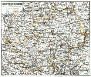
Map of Hertfordshire