1. Polybios, of course, is far the best authority. He was born
in Hannibal’s lifetime; and he mentions (iii. 48. 12) that before
he wrote his account of Hannibal’s passage of the Alps, he went
over the ground himself to make quite sure.
2. As he writes in Greek, he gives the distances in stades—nine
stades make an English mile—and (iii. 39. 6–10) he reckons 2600
stades from Cartagena to the Ebro, 1600 from there to Ampurias,
at the Mediterranean end of the Pyrenees, 1600 from there to the
crossing (diabasis) of the Rhone, 1400 along the river from its
crossing to the ascent (anabolê) of the Alps, and 1200 across the
Alps into Italy.
3. He says (iii. 39. 8) that he calculated the 1600 from Ampurias
to the crossing of the Rhone by the milestones on the Roman
road, reckoning eight stades to a Roman mile. Thus, in Roman
miles his distances would be 325 to the Ebro, 200 to Ampurias,
200 to the Rhone, 175 along the river, and 150 across the Alps.
He also says (iii. 56. 3) that Hannibal took fifteen days in marching
the 1200 stades, and (iii. 50. 1) took ten days in marching 800,
part of the 1400. Both cases give an average of 80 stades or 10
Roman miles a day; and this looks as if he knew the time employed
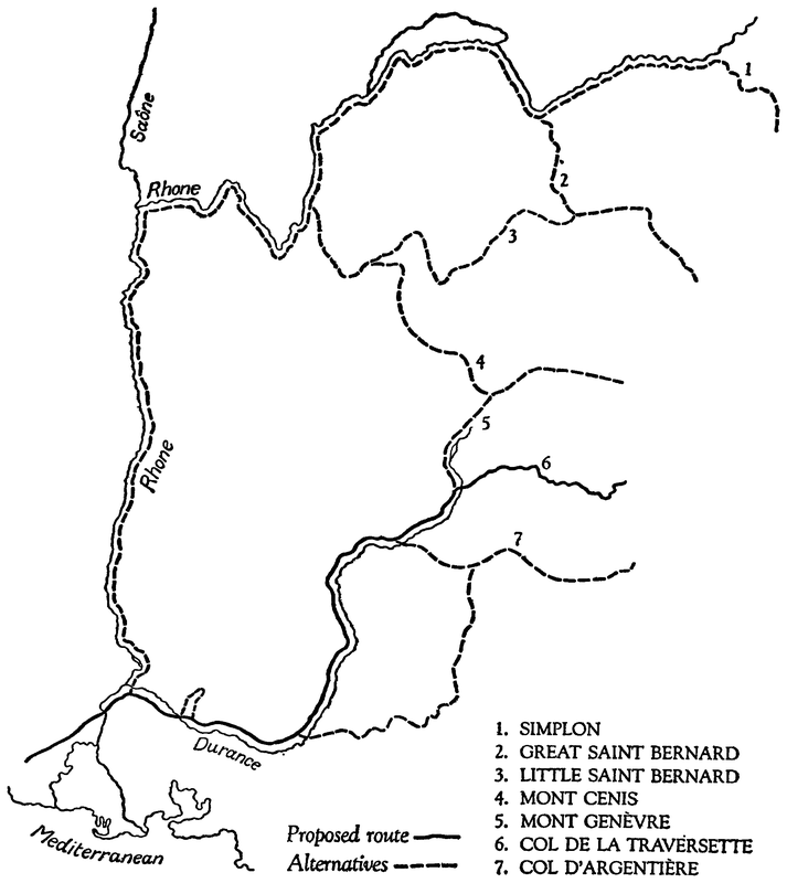
here but did not know the distance covered, and therefore calculated
the distance from the time. He certainly knew the time
employed upon the march of fifteen days, as he elsewhere gives
the days in detail, iii. 50. 5, 8, 52. 1, 2, 53. 5, 6, 9, 54. 4, 55. 6, 8,
56. 1. But Hannibal would not really have gone at the same pace
on the fifteen days when he was fighting his way through the
mountains as on the ten days when he was marching up the river
unopposed. Polybios must have taken a standard rate, and used
it indiscriminately when he had no help from milestones.
4. After giving distances which amount to 8400 stades or 1050
Roman miles in iii. 39. 6–10, he goes on in iii. 39. 11 to give their
total as about (peri) 9000 stades or 1125 Roman miles. There must
be an error in the total or the items. I fancy the total should be
8000 stades or 1000 Roman miles, as he was more likely to reckon
1050 as ‘about’ 1000 than as ‘about’ 1125. He mentions (iii. 56. 3)
that Hannibal took five months on the march; and 150 days for
the 1050 miles gives an average of 7 Roman miles a day. Large
forces could not move fast. The column would be some miles in
length, and the advance-guard might be close to the new camping-ground
before the rear-guard left the previous camp; and time
would have to be allowed for the rear-guard to come up.
5. Strabo was 150 years junior to Polybios; but the Roman
road from Spain would not have moved, and he says (iv. 1. 3)
that it crossed the Rhone at Tarascon. He goes on to say that it
bifurcated there, one branch going through Aix to Antibes on the
Mediterranean coast, while the other went through Cavaillon and
along the Durance to the beginning of the ascent (anabasis) of the
Alps, 63 miles from Tarascon, thence to Embrun, 99 miles further
on, and thence through the Briançon district in 71 miles to
Césanne, the first town in Italy. (The road must thus have crossed
the Alps by the pass of Mont Genèvre.) Strabo here treats the
beginning of the ascent of the Alps as a definite point, marked by
a milestone, just as Polybios treats the ascent of the Alps and the
crossing of the Rhone as definite points from which measurements
could be made.
6. Roman roads were not built capriciously; and the road from
Spain would not have crossed the Rhone at Tarascon unless there
was some substantial reason for crossing it just there rather than
a little higher up or a little lower down. This reason must have
existed at the time when Hannibal crossed the Rhone a few years
before the road was made; and by reckoning Hannibal’s march
according to the Roman milestones, Polybios rather implies that
Hannibal came that way. In any case Hannibal cannot have deviated
greatly from the Roman road, as that ran near the coast,
and Polybios says (iii. 41. 7) that Hannibal kept the sea upon his
right hand (dexion echôn) as he marched.
7. After mentioning (iii. 37. 8) that the Rhone entered the sea
by several mouths, Polybios says (iii. 42. 1) that Hannibal crossed
it where it was a single stream, about four days’ march from the
sea. It ceases to be a single stream at Arles, and divides there
into branches leading to the mouths; and Arles is eight English
miles below Tarascon and five-and-twenty from the sea. Four
days at ten miles a day—see paragraph 3—would give 40 Roman
miles, or 37 English, for the distance from Tarascon to the sea.
But as Hannibal was coming from the west, he would have to turn
inland at the westernmost mouth of the Rhone, somewhere near
Aigues Mortes, whence the distance would be fully forty miles.
No doubt, there were many crossing-places on the Rhone, and
any of them might be known as a Diabasis—see paragraph 2—as
this is merely the Greek for crossing. But there were many
crossing-places on the Rhine, yet there was only one Trajectum,
and many on the Euphrates, but only one Zeugma; and Polybios
always speaks of the Diabasis of the Rhone as if there were no other.
8. According to Polybios (iii. 41. 2, 4–9, 44. 3, 45. 1–6, 47. 1,
49. 1) Scipio was taking a Roman army from Italy to Spain by
sea, but stopped at the easternmost mouth of the Rhone and disembarked
the army there, on hearing that Hannibal had already
reached the crossing of the Rhone. He sent out cavalry to scout,
and Hannibal likewise sent out cavalry, having heard of the arrival
of the Roman ships. These two forces met: Scipio’s drove Hannibal’s
back and pushed on far enough to see his camp, and then
returned with information. Scipio forthwith (parautica) re-embarked
the baggage and then marched up along the river with
his whole force, as he was eager (speudôn) to attack the enemy.
But on reaching the crossing, he found that the enemy had left
their camp three days before, having started the morning after
the encounter of the cavalry.
9. If the camp was at Tarascon, Scipio’s cavalry had a ride of
sixty or seventy English miles, there and back, besides some
fighting on the way; and after their return there was the embarcation
of the baggage; so that Scipio could hardly have begun his
march till the next morning or next afternoon. He may have been
marching on three days, though not a full day’s march on the
first day and perhaps not on the third; and he would entrench his
camp each night with extra care, as the enemy were not far off.
Even so, his progress seems a little slow; but had he gone ten miles
further in the time, there would have been a serious check.
10. Ten miles above Tarascon the river Durance flows into the
Rhone. Livy (xxi. 31) says that, of all the rivers of Gaul, the
Durance was far the most difficult to cross, longe difficillimus
transitu; and he mentions that it happened to be swollen by rains
(forte imbribus auctus) at the time when Hannibal was there. If
Hannibal had crossed the Rhone more than ten miles above
Tarascon, he would have had the Durance between Scipio’s forces
and his own; and Polybios says nothing to suggest that there was
any obstacle between.
11. At this period the Romans had only a militia; and Scipio’s
marches must not be calculated on the scale of marches by the
regular army that Marius created a century later on. Still less
should they be calculated from statements by Vegetius, who lived
six centuries later and dealt with marches along Roman roads to
established forts and towns. At this period a Roman force entrenched
itself each night, and the entrenching took some time.
12. According to Polybios (iii. 49. 5–7) Hannibal marched up
along the river after leaving his camp at the crossing of the Rhone,
and arrived in four days at the Island, a populous and fertile place
with the Rhone running along one side of it and the Scôras along
the other. It was not strictly an island, but was (Polybios says)
of the shape and size of the Delta of the Nile, with river on two
sides and a range of mountains instead of the sea for the third
side. Livy (xxi. 31) follows Polybios almost word for word in
saying that Hannibal marched up along the Rhone to a district
called the Island, where another river flowed into the Rhone. But
he calls the other river the Arar, which is the Saône, and thus brings
Hannibal up to Lyons, 200 miles from the sea. This would mean
an average of 25 miles a day, the confluence being four days from
the crossing and the crossing being four days from the sea, whereas
Polybios gives an average of only 7 miles a day for the whole
march and 10 miles a day for 250 miles out of the final 325 after
the crossing of the Rhone: see paragraphs 3, 4.
13. As a reason for Hannibal’s going so far inland, Livy says
(xxi. 31) that Hannibal did not wish to fight a battle against the
Romans till he was actually in Italy, and the further he kept away
from the sea, the less was the risk of meeting the enemy. But this
is not borne out by what he says just afterwards (xxi. 32) where
he is copying from Polybios, iii. 49. 2, 3. He says there that Scipio
marched back to his ships on finding that the enemy had quitted
their camp at the crossing of the Rhone, re-embarked the army
and sent the bulk of it on to Spain, and returned to Italy himself
to take command there if Hannibal got through the Alps. The
march-back and the embarcation must have been as brisk as the
march-up, Polybios using the same term for both, speudôn, iii. 45. 4,
49. 4. Hannibal had good information: he soon knew of the arrival
of the Roman ships at the mouth of the Rhone—see paragraph 8—and
would soon know of their departure; and he would not go
200 miles inland to avoid the enemy if he knew they were not
there.
14. In order to reduce the distance, the editors of Livy have
tampered with the text, and have printed “Isara” in place of
“Arar,” thus changing the Saône into the Isère. They seem to have
forgotten Silius Italicus, iii. 442–476. He was almost a contemporary
of Livy—born only eight years after Livy’s death—and in
his description of Hannibal’s march he not only speaks of the
confluence of the Arar and the Rhone, but contrasts the rapidity
of the Rhone with the quiet flow of the Arar; and that is just the
difference between the Rhone and the Saône at Lyons, a difference
remarked by Seneca (LUDUS, 7) and other ancient writers. Silius
goes on to speak of the Tricastini and the Vocontii and the river
Durance exactly as Livy (xxi. 31) goes on to speak of them, and
in almost the same words. It seems clear that Silius had Livy’s
words before him when he wrote, and that he found “Arar” there,
not “Isara,” and had no doubts about the river being the Saône.
That really is decisive for the text of Livy. The only pretext of the
editors is that there is a mark like an s between the words ibi and
Arar in one of the manuscripts of Livy.
15. These editors were very unwise in making Livy say “Isara,”
as he would not have mentioned the confluence of the Isère and
the Rhone without saying a good deal more. The monuments of
the victory of 8 August 121 B.C. were at the confluence of the
Isère and the Rhone. Strabo mentions them (iv. 1. 11) and Livy,
who was his contemporary, must have known that they were
there. (Livy described the victory in one of his lost books, lxi,
the contents of which are known from the epitome.) Livy says
(xxi. 31) that as soon as Hannibal reached the confluence of the
Saône and the Rhone, he secured the support of the Allobriges.
If this had happened at the confluence of the Isère and the Rhone,
Livy would have made a telling point of the contrast between
Hannibal’s securing the support of the Allobriges for his onslaught
on Rome, and their subjugation by the Romans at the very same
place a century later on.
16. No doubt the Saône rises in the Vosges and not in what we
call the Alps; but Strabo (iv. 1. 11) and Ptolemy (ii. 10. 3) describe
it as rising in the Alps, and Livy is probably taking the same view
in saying that it rose there. It seems unwise to argue that he must
have meant the Isère because the Isère rises in the Alps.
17. Ammianus says (xv. 11. 17) that the Arar was also known
as the Saucona, Ararim, quem Sauconam appellant. He quotes
Timagenes by name in xv. 9. 2, and probably quotes him here, as
the pseudo-Plutarch (DE FLUVIIS, 6) quotes him for information
about the Arar, which information (it says) he copied from
Callisthenes. Timagenes was a contemporary of Livy; and I
suspect that when Livy was copying Polybios, he took Scôras
for Saucona or a variant of that name, but translated it as Arar
because this name was better known.
18. The editors of Polybios have also tampered with their text
and printed “Isaras” for “Scôras” in iii. 49. 6, as if the river was
clearly the Isère. They seem to have forgotten what he says in
the next sentence. As already mentioned in paragraph 12, he
says that the so-called island between the Scôras and the Rhone
was of the same shape as the Delta of the Nile, with these two
rivers as the sides and a range of mountains (instead of sea) as
the base. But it is a quadrangle, not a triangle, between the Isère
and the Rhone: the Isère on the south, the Mont du Chat on the
east, and the Rhone on the north as well as on the west, as its
course turns round a right-angle at Lyons. When Polybios wanted
to say that a place was quadrangular, he said so—he says tetragônos
topos in vi. 27. 2—and he would have said so here, if that
had been his meaning.
19. Some of the manuscripts have “Scôras” and others have
“Scaras”; and this discrepancy is not uncommon in manuscripts
of Polybios, as if they all were copied from the writing of a man
who made his Alphas and Omegas very much alike. Casaubon
altered “Scôras” or “Scaras” into “Araros” to make it agree
with Livy. Cluver altered it into “Isaras” to make it agree with
the alteration in Livy. Neither of them had any better reason
for the change. When editors doubt a reading they ought to
query it. These editors should have printed “Arar (? Isara)” and
“Scôras (? Isaras),” or printed “Arar” in the text and “Isara”
in a footnote, as in Drakenborch’s edition of Livy; but they have
printed “Isara” and “Isaras” in the text itself, and in many
editions they have not even added footnotes. Readers are thereby
misled, and think they have the authority of Livy and Polybios
for saying that the Island was at the confluence of the Isère and
the Rhone, when in reality they have only the authority of editors
who knew no more about the matter than they know themselves.
* * * * *
20. After taking Hannibal up to the confluence of the Saône
and the Rhone, Livy says (xxi. 31) that instead of making straight
for the Alps, Hannibal then turned to the left, ad lævam. Strabo
twice says (iv. 6. 7, 11) that there were two roads from Lyons to
Italy, one over the Pennine pass, and the second through the
territory of the Centrones, meeting the first in the territory of the
Salassi. These clearly were the Great and Little St Bernard routes,
meeting at Aosta; and if Hannibal was near Lyons and took the
Great instead of the Little, he might fairly be described as turning
to his left instead of making straight for the Alps. Livy says
(xxi. 38) that many people thought that Hannibal crossed the
Pennine pass (the Great St Bernard) as they fancied that the
name “Pennine” was derived from “Punic.” He also says that
Cœlius thought that Hannibal had crossed the “Cremonis jugum,”
and he assumes that this must be the Little St Bernard, as he
says that both these routes would have brought Hannibal into
the territory of the Libici, and Ptolemy (iii. 1. 30, 32) fixes Aosta
and Ivrea as the cities of the Salassi, and Vercelli and Lomello as
the cities of the Libici.
21. Livy (xxi. 38) rejects both the St Bernard routes as bringing
Hannibal down into the territory of the Libici, whereas everyone
agreed (quum inter omnes constet) that Hannibal came down
into the territory of the Taurini. This, however, is not exactly
what Polybios says. He remarks in iii. 55. 9 that although the
higher parts of the Alps were bare and tree-less and covered with
perpetual snow, there were trees and shrubs and habitations half-way
up the slopes (hypo mesên tên parôreian) on either side; and
he says in iii. 56. 3, 60. 2, 8 that Hannibal came down to the plains
of the Po in the territory of the Insubres and pitched camp just
below the slopes (hyp’ antên tên parôreian) and that he subsequently
(meta de tauta) attacked the Taurini who lived near the
slopes (pros têi parôreiai) and were hostile to the Insubres. Ptolemy
(iii. 1. 29, 31) fixes Novara, Como, Milan and Pavia as the cities
of the Insubres, and Voghera, Tortona, Turin and Bene as the
cities of the Taurini. Bene is about 35 miles south of Turin; and
if it was a city of the Taurini, Hannibal would have come down
into their territory if he crossed the Alps by the Col d’Argentière,
or by the Col de la Traversette, just as much as if he crossed
by Mont Cenis or Mont Genèvre.
22. Of course the boundaries between the territories of the
Taurini and the Insubres may not have been the same in Hannibal’s
time as in Ptolemy’s time or Livy’s. He may have come down
into territory which then belonged to the Insubres but afterwards
belonged to the Taurini, and might be described as territory of
the Taurini by writers of a later age.
23. Strabo says (iv. 6. 12) that only four passes across the Alps
were mentioned by Polybios. The nearest to the Mediterranean
went through the territory of the Ligures; the next, “which Hannibal
crossed,” through the territory of the Taurini; the next,
through the territory of the Salassi; and the fourth, through the
territory of the Rhæti. But the important words, “which Hannibal
crossed,” are not in all the manuscripts of Strabo, and therefore
are suspected as interpolations. Polybios does not mention
the Salassi or the Rhæti in the extant portion of his work; but a
pass through the territory of the Rhæti might have brought
Hannibal into the territory of the Insubres, as Strabo (vii. 1. 5)
says that these territories were conterminous, the Rhæti having
some territory on the south side of the Alps as well as on the north
side. The Rhætian pass might thus have been the Simplon; but
it is incredible that Hannibal should have crossed a pass so far
eastward as the Simplon or even the Great St Bernard.
24. Varro is quoted by Servius (AD ÆNEIDEM, x. 13) as mentioning
five passes across the Alps: one alongside the sea, through
the territory of the Ligures; a second, which Hannibal crossed;
a third, by which Pompey went to Spain; a fourth, by which
Hasdrubal came into Italy; and a fifth in the Graian Alps—presumably
the Little St Bernard: see paragraph 58. This agrees with
Strabo’s quotation from Polybios in making Hannibal cross the
next pass to the coast-road; and if it were Varro’s own statement
at first hand, it would have high authority. But similar interpolations
may be suspected here, as it makes Hannibal and Hasdrubal
cross different passes, whereas Livy (xxvii. 39) and Appian
(HANNIBAL, 52) agree in saying that Hasdrubal crossed the same
pass that Hannibal had crossed twelve years before.
25. Pompey crossed another pass. He wrote a letter to the
Senate after he had gone to Spain—the letter has been preserved
by Sallust, and is printed in most editions of his works—and in
this letter Pompey says that he has made a new road across the
Alps, taking another and more convenient route than Hannibal’s,
iter aliud atque Hannibal, nobis opportunius. In mentioning the
making of this road Appian says (DE BELLIS CIVILIBUS, i. 109)
that it passed near the sources of the Rhone and the Po, which
were not far apart. Strabo (iv. 6. 5) calls them the sources of two
tributaries of the Rhone and the Po, namely, the Durance and the
Dora; and this is enough to show that Pompey’s pass was Mont
Genèvre.
26. This was in 76 B.C., therefore in Varro’s lifetime, but after
Polybios was dead, and a few years before Strabo and Livy were
born. As already mentioned in paragraph 5, Strabo says (iv. 1. 3)
that the Roman road from Spain crossed the Rhone at Tarascon
and bifurcated there, one branch going through Aix to Antibes
on the Mediterranean coast, and the other going through Cavaillon
and along the Durance to “the beginning of the ascent of the
Alps,” 63 Roman miles from Tarascon, thence to Embrun, 99
miles further on, and thence through the Briançon district in
71 miles to Césanne, the first town in Italy. The road must thus
have crossed the Alps by Mont Genèvre, and presumably was
Pompey’s.
27. Strabo here speaks of “the beginning of the ascent of the
Alps” as a definite point, and reckons distances from there along
the Roman road. Polybios (iii. 39. 9, 10) likewise treats “the
ascent of the Alps” as a definite point, and reckons distances
from there in both directions along Hannibal’s line of march. Up
to that point he reckons the distance along the river, iii. 39. 9;
and he says that after marching along the river, Hannibal “began
the ascent of the Alps,” iii. 50. 1. As he makes no further mention
of the river, the inference is that Hannibal quitted the river at
that point; and if Polybios put the point where Strabo puts it,
this would mean that Hannibal turned off up the Verdon valley.
In that case the actual “ascent” would not be on the Roman road,
but on an older track diverging from it at the sixty-third milestone,
the point which Strabo calls “the beginning of the ascent.”
28. If Hannibal went up the Verdon valley, he would be heading
for a pass between Pompey’s and the coast-road; and this is
in conformity with Varro’s statements. I imagine that the route
would be from Mirabeau to Castellane and Colmars, thence to
Barcelonnette and across the Col d’Argentière to Borgo San
Dalmazzo near Cuneo. But the distance would exceed the 150
Roman miles (1200 stades) which Polybios has allotted to the
march from the “ascent” to Italy. He computes it as 10 miles
a day for 15 days, and there is no doubt about the 15 days, as he
sets them out in detail: see paragraph 3. But the usual average
could hardly be maintained in such wild country amongst hostile
tribes, and the distance really covered may have been much less.
29. Polybios (iii. 39. 9, 50. 1) puts the ascent 175 Roman miles
(1400 stades) from the crossing of the Rhone, and says that the
last 100 of the 175 were marched in 10 days. The first 75 would
answer to Strabo’s 63 from the crossing to the point he calls “the
beginning of the ascent,” the difference being that Strabo is reckoning
along the Roman road whereas Polybios would be reckoning
along the river, and the Rhone and Durance make a bend between
Tarascon and Cavaillon. The other 100 in Polybios would answer
to Strabo’s 99 to Embrun by the road along the Durance from
“the beginning of the ascent” near Mirabeau; and Polybios would
thus be speaking of some place near Embrun when he says that
Hannibal began the ascent after this march of 100 miles along the
river.
30. Hannibal might have quitted the Durance at La Bréole,
twelve miles below Embrun, gone up the Ubaye valley to Barcelonnette
and across the Col d’Argentière to Borgo San Dalmazzo,
a distance of about 80 Roman miles; or he might have quitted the
Durance at Mont Dauphin, ten miles above Embrun, gone up the
Guil valley to Abriès and across the Col de la Traversette to
Saluzzo, a distance of about 70 Roman miles. (The Col de la
Traversette is known also as the Col de Viso, and the Col d’Argentière
as the Col della Maddalena or Col de Larche.) As the
Guil is merely a mountain torrent, that route is not open to the
objection that Hannibal would still be marching “along the
river”—an objection that may be urged against the Ubaye and
the Verdon routes. Also, by going on past Embrun to Mont
Dauphin, Hannibal would be entering the territory of the Tricorii,
as Livy says he did: see paragraph 39.
31. Polybios does not give the river’s name when he says that
Hannibal marched up along the river as far as the “ascent.” He
often mentions the Rhone, but does not give the name of any
other river in those parts except the Scôras, a tributary of the
Rhone. There is no mention of a river Scôras in any ancient author
but Polybios; and the presumption is that although the name was
used in his time, it afterwards went out of use. As the Saône had
two names, Arar and Saucona, the Durance might also have two
names, Druentia and Scôras. This, of course, is merely a conjecture;
but it seems to meet the case.
* * * * *
32. Apparently, Livy thought the Scôras was the Saône—see
paragraph 17—in which case there is no question of Hannibal’s
marching up any other river than the Rhone. Livy, however,
contradicts himself. He says (xxi. 31) that instead of going
straight from the confluence to the Alps, Hannibal turned to the
left (ad lævam) into the territory of the Tricastini, skirted the
territory of the Vocontii and entered the territory of the Tricorii.
Whatever their exact boundaries may have been—see paragraph
39—these territories were east of the Rhone, north of the Durance
and south of the Isère. Consequently, Hannibal could not have
reached them by turning to the left, unless he was starting from
the confluence of the Durance and the Rhone. If he had been as
far north as the confluence of the Saône and the Rhone, or even
of the Isère and the Rhone, he must have turned to the right. This
should have struck the editors who tampered with the text of
Livy and changed the Saône to the Isère: they should have changed
it to the Durance, or else put “right” for “left.”
33. Livy very often contradicts himself, as he compiled his
history out of older histories and did not always take the trouble
to reconcile them. Polybios was his usual source for this part of
his work, but he quotes Cœlius on one point and Cincius on another,
xxi. 38, and when he quotes Polybios, he does not always quote
him accurately.
34. Livy says (xxi. 31) that after getting across the Rhone,
Hannibal marched up the other bank towards the interior of Gaul,
whereas Polybios says (iii. 47. 1) that he marched eastward (hôs
epi tên heô) going along the river up-stream. (His phrase for
“up-stream” here is “away from the sea, towards the interior of
Europe,” and in iii. 39. 9, speaking of the same march, his phrase
is “towards the sources.”) Livy has put Gaul for Europe, and
omitted “eastward.” But if Hannibal marched eastward here, he
must have marched along the Durance, not the Rhone, as the
Durance here runs from east to west and the Rhone from north
to south. No doubt, Polybios says (iii. 47. 2, 3) that the Rhone
had its sources on the north side of the Alps, its sources facing
west (pros tên hesperan), and that its course was south-west (pros
tas cheimerinas dyseis) to the sea. And as a general statement,
that is true; but if he had imagined that the Rhone was running
south-west at the point where Hannibal crossed it, he surely would
have said that Hannibal marched north-east—he would not distinguish
west and south-west in one sentence and confound east
and north-east in the next.
35. According to Polybios (iii. 49. 5, 8–13) Hannibal marched
in four days from the crossing of the Rhone to the so-called Island
between the Rhone and the Scôras, found a civil-war in progress
there, joined one faction in crushing the other, and obtained
supplies from the successful faction as the price of his support.
He must have crossed the Scôras and marched into the Island, as
Polybios says “joined in attacking and expelling”—synepithemenos
kai synekbalôn—which certainly implies that he did something
more than make a demonstration from the other bank.
And if the crossing over was comprised in the four days, the
march may have been less than 40 Roman miles at 10 Roman
miles a day: see paragraph 3.
36. Suppose that Hannibal marched up from Tarascon, going
first along the Rhone and then along the Durance from the confluence
of the two: he would reach a point just opposite Cavaillon
in 30 Roman miles. The obvious route from Tarascon to Cavaillon
is straight across country, on the line of the Roman road; and in
saying so emphatically that Hannibal marched along the river
(para ton potamon, iii. 47. 1) or close along the river (par’ auton
ton potamon, iii. 39. 9) Polybios may be saying it to negative the
notion of his marching straight across. Strabo mentions (iv. 1. 3)
that Cavaillon was on the Roman road from Tarascon to the Alps;
and as it was on the north bank of the Durance, people coming
from Tarascon must have crossed. He elsewhere (iv. 1. 11) mentions
the ferry (porthmeion) at Cavaillon in speaking of people
going from Marseilles to places between the north bank of the
Durance and the Rhone. The ferry would not have been established
there unless that was the most convenient place for crossing;
and when Polybios says that Hannibal reached the Island, he
presumably is speaking of the usual point for crossing to it, not
the point whence it could first be seen. In fact, whilst Scipio
was looking for Hannibal at the crossing of the Rhone, Hannibal
had reached the crossing of the Durance and could retire further
north if Scipio came on. Scipio, however, went back.
37. Livy’s version (xxi. 31) is that the civil-war in the Island
was between two factions of the Allobriges who lived near there;
and that after finishing off their war, Hannibal did not take the
direct route to the Alps, but turned to the left into the territory
of the Tricastini, skirted the territory of the Vocontii, entered
the territory of the Tricorii, and met no check until he reached
the Durance, but had serious difficulties there. Polybios, however,
says nothing of any difficulties at the Durance, nor does he mention
any of these tribes except the Allobriges; and he does not mention
this tribe here, but only at a later stage of Hannibal’s march. He
says (iii. 49. 13) that the successful faction in the Island sent a
force with Hannibal to act as rear-guard and keep off attacks by
the Allobriges; but if both the factions had been Allobriges, as
Livy says, Polybios would have spoken of attacks by the defeated
faction only, not attacks by the Allobriges.
38. Strabo says (iv. 1. 11) that in his time, which also was Livy’s
time, the Allobriges were merely husbandmen, though in former
ages they had armies of tens of thousands in the field. He mentions
Vienne, on the Rhone, as their chief town; but Dion Cassius
(xlvi. 50) shows clearly that they did not take Vienne till a century
and a half after Hannibal’s time—the city of Lyons was founded
in 43 B.C. to house the inhabitants of Vienne after the Allobriges
had driven them out. And other tribes may likewise have shifted
their position between Hannibal’s time and the time of Polybios
or Ptolemy or Strabo.
39. In dealing with the part of Provence on the east side of
the Rhone, Ptolemy (ii. 10. 7, 8) fixes Vienne as the city of the
Allobriges; Valence as the city of the Segallauni; Orange, Avignon
and Cavaillon as cities of the Cavari; and Vaison as the city of
the Vocontii; and he places the Tricastini east of the Segallauni,
north of the Vocontii and south of the Allobriges. He does not
mention the Tricorii, but Strabo says (iv. 1. 11, 6. 5) that the
Vocontii were “above” the Cavari, and the Tricorii “above” the
Vocontii. The Tricorii would thus be east or north-east of Embrun,
as he states (iv. 1. 3) that the territory of the Vocontii extended
along the Durance up to Embrun.
40. Strabo says here (iv. 1. 3) that the Roman road from
Tarascon to the Alps entered the territory of the Vocontii at “the
beginning of the ascent,” 63 Roman miles from Tarascon and
therefore near Mirabeau, and quitted it again at Embrun, 99 miles
further on. And as he says here that the road ran along the Durance,
and elsewhere (iv. 1. 11, cf. 6. 3, 4) treats the Durance as
the frontier of the Salyes, the road might be described as running
along the extreme edge of the territory of the Vocontii—per
extremam oram Vocontiorum agri—which is the phrase employed
by Livy (xxi. 31) for Hannibal’s line of march. The distances, the
63 and 99 miles, agree with what Polybios says of Hannibal’s
march—see paragraph 29—and the digression would not be included
in the distances he gives as marched “along the river,”
iii. 39. 9, 50. 1. It would thus appear that after Hannibal had
turned to the left into the territory of the Tricastini, he came back
on to the line of what was afterwards the Roman road, and
followed it from a point near Mirabeau to some point near Embrun.
41. Hannibal must have reached the Island the day after
Scipio reached the crossing of the Rhone, as Polybios says (iii. 49.
1, 5) that Hannibal was four days on the march and had started
from the crossing three days before Scipio got there. Polybios
also says (iii. 49. 3, 4) that Scipio went back as fast as he came,
re-embarked his forces and sailed off. Thus, by about the fifth
day after Hannibal reached the Island, there was nothing to
prevent his returning to the direct route to the Alps, supposing
that he had quitted it in order to avoid a battle with the Romans.
But this deviation, into the territory of the Tricastini, may really
have been part of Hannibal’s movements in the civil-war in the
Island, for Polybios says (iii. 49. 10) that Hannibal not only joined
one faction in attacking the other, but joined in driving it out.
As a matter of fact, Livy (xxi. 31) does not exactly say that Hannibal
entered the territory of the Tricastini: he merely says in
Tricastinos and afterwards says in Tricorios, whereas in the intervening
words, already quoted, he speaks of the “territory” of
the Vocontii; and the difference may be more than merely verbal.
42. Supposing that the Vocontii had the same boundaries in
Hannibal’s time as in Strabo’s time and Livy’s, Hannibal would
thus have quitted their territory at Embrun and therefore crossed
the Durance higher up. Livy (xxi. 31) mentions that the Durance
happened to be swollen by rains; and when in flood, it may be
difficult to cross, even in that early portion of its course. But when
he says that “of all the rivers of Gaul” it was far the most difficult
to cross, he must be thinking of the river a long way further down,
nearer to its confluence with the Rhone.
* * * * *
43. In the next part of his narrative (xxi. 32–35) Livy says
exactly what Polybios says (iii. 50–53) though he says it more
rhetorically; but where Polybios (iii. 50. 1) merely says “the river,”
Livy (xxi. 32) says “the Durance.”
44. On quitting the river and beginning the ascent, Hannibal
proceeded very cautiously, as he suspected that the Allobriges and
other natives would attack him. On the first day he soon halted,
and sent his guides out for intelligence: on the second day he
merely moved into position for a night attack, and had no fighting
till the third day, when he was going through a gorge. He had
occupied the summits on the previous night while the natives
were off guard; but the natives made their way along the slopes
and stampeded the cavalry-horses and the baggage-animals—the
natives were too much frightened of the elephants to go anywhere
near them. As the track was not only steep and narrow but ran
along a cliff, many of the animals were pushed over and fell down
the cliff; and the stampede got worse still when Hannibal charged
down from the summits to drive the natives off. He killed most
of the Allobriges, and then took the town that served them as a
base; and he remained there for a day, that is, the fourth day.
He made fair progress on the next three days, but on the fourth
day (that is the eighth day of the march) he was attacked again
while going through a gorge. The natives were on the higher ground,
and rolled rocks down or came down the slopes themselves and
threw stones by hand, causing a stampede again with heavy loss
of animals and men. Hannibal himself got through with the
advance-guard, but the remainder of the army spent the whole
night in getting through. The next day (the ninth) he reached the
summit of the pass.
45. There is next to nothing in all this to indicate the route.
As for the Allobriges whom Polybios (iii. 51. 9) mentions in the
fight at the first gorge, they certainly were not the population of
the district, as he says (iii. 49. 13–50. 3) they had been following
Hannibal’s army for a hundred miles or more, not daring to attack
it till it was entangled in hill-country where its cavalry could not
act. Narrow gorges can be found on any Alpine route, and also
rocks such as Polybios describes. He says (iii. 53. 5) that Hannibal
halted on the eighth night at a defensible white rock, ti leukopetron
ochyron. But “white rock” means no more than “bare rock,” for
he says elsewhere (x. 30. 5) that the white rocks themselves could
be climbed up by active men; and, clearly, the colour of the rock
would make no difference in the climb. There is, however, a rock
that is not only bare but white, the Roche Blanche, on the Little
St Bernard, another (near St Michel) on the Mont Cenis, and others
on other passes, all identified as Hannibal’s; but Polybios (iii. 53.
4, 5) places the rock at the far end of a gorge into which Hannibal
was led by the treachery of his guides. Thus, unless the rock was
at the point where he regained the proper route, it will not be
found on the main road of any pass at all; nor will the gorge be
found on the main road of any pass, as it was on a deviation.
Yet people have been identifying gorges on the main roads of the
different passes as the very gorge that Hannibal passed through
by deviating from the proper route.
46. Polybios (iii. 53. 5, 6) remarks, as something quite unusual,
that Hannibal was separated from a large part of his force on the
eighth night of the march. If the whole force was brought together
on the other nights, the rate of marching would be very slow.
Polybios (iii. 56. 4) says that, in spite of heavy losses in the Alps,
Hannibal arrived in Italy with 20,000 infantry and 6,000 cavalry;
and such a force, with elephants and baggage-train, would form
a column of enormous length when marching along a narrow
track. The head could not advance beyond a point which the rear
could reach on the same day; and the distance would be much
less than the average march—see paragraph 3—which Polybios
reckons as 10 Roman miles a day.
47. It is about forty Roman miles from the Durance at Mont
Dauphin to the summit of the Col de la Traversette, and also
about forty from the Durance at La Bréole to the summit of the
Col d’Argentière. Hannibal, however, deviated from whatever
route he meant to take. Polybios says (iii. 52. 3–8) that Hannibal
was led into a dangerous gorge by the treachery of some guides
he had engaged two days before, their object being to draw him
into a position where he could be attacked on every side from
higher ground. (Polybios has not made it clear why these guides
were engaged: he states in iii. 44. 5, 7, 48. 11 that guides had
come over from Italy to meet Hannibal at the crossing of the
Rhone—perhaps they were all killed at the first gorge.) Livy
(xxi. 35) suggests that instead of following the guides, Hannibal
took a line of his own as soon as he lost confidence in them, and
thus went astray into impassable places, per invia pleraque et
errores. His actual march must have been a good deal longer than
his intended route.
* * * * *
48. According to Polybios (iii. 54. 1–3) Hannibal made a speech
at the summit of the pass, telling the soldiers that the worst part
of their march was done; and he not only pointed to the plain of
the Po spread out before them, but indicated the position (topos)
of Rome itself. As he was a good 300 miles from Rome, he could
not have managed this unless he used a map. Herodotos says
(v. 49. 1, 5) that Aristagoras used a map to show the route, when
he was trying to induce the Spartans to march through Asia
Minor in 500 B.C.; and Hannibal may likewise have used a map
in 218 B.C., when maps were commoner. No doubt, a map could
not be seen except by men who were close by, but a speech could
not be heard by men who were far off; and I conceive that when
Hannibal (or any other general) addressed an army of 20,000 or
30,000 men, he relied on those who heard him to convey the substance
of his speech to those who could not hear. The more important
officers would be standing near the general, and they
would see the map and tell the others about it.
49. He must at any rate have had a good view of the plain
from the summit of the pass he crossed—else his speech would be
absurd—and there are (I believe) only two passes with summits
commanding such a view. In the old ALPINE GUIDE, pt. 1, p. 25,
ed. 1863, Ball describes the Col de la Traversette. “To those who
approach from the side of France, the view suddenly unfolded at
the summit, extending (in clear weather) across the entire plain
of Piedmont as far as Milan, is extremely striking.” On p. 55 he
endorses Bonney’s description of the Cenis passes. “Between the
plateau of the Little Mont Cenis and La Grande Croix [on the
Great Mont Cenis] a ridge can be gained by a few minutes’ walk,
whence is seen the country to the east of the Po, and the south of
the Tanaro, as far as the Apennines.” He says nothing (p. 57) of
any view from the Col du Clapier, just south of the Cenis passes
though north of the Cenis tunnel; but a similar view can be
obtained in a few minutes’ walk from there.—Polybios (iii. 54.
3, 4) says that Hannibal made his speech about the view while the
army was encamped upon the summit of the pass, but Livy
(xxi. 35) puts the speech the following day, immediately on starting
on the downward march; and he says that Hannibal halted
the men at an eminence (in promontorio quodam) commanding that
great view, and made his speech there. The word promontorium
suggests a point of view a little way off the road.
50. Several of the passes have a plateau at the top; and
Hannibal may have gone over one of these, as Polybios (iii. 53. 9)
and Livy (xxi. 35) say that he encamped at the top, and the
plateau would be a suitable place for camping. But they say
nothing about a plateau, only saying that he encamped to rest
the men who had arrived, and wait for the arrival of the others.
And as that is all they say, a plateau is not really so essential as
a view for determining which pass he crossed. In fact, if a plateau
was essential for his camping, he must have found a plateau every
night all through his march.
51. On the first day of his march down from the summit, he
came to a bad place where a landslip had destroyed the track for
a distance of about 300 yards, and he had to encamp there, as the
baggage-animals and elephants could not get past. One day’s
repairs made the track passable for the baggage-animals, and
these and the cavalry-horses were sent on ahead and turned out
to graze on the pastures down below. But three days’ repairs
were needed to make the track passable for the elephants, who
meanwhile nearly died for want of food.—That is the substance
of what Polybios says, iii. 54. 4–7, 55. 6–8, and Livy follows him.
52. The complete skeleton of an elephant was found on the
Little St Bernard two centuries ago. It is mentioned by Saint-Simon
in the preface to his HISTOIRE DE LA GUERRE DES ALPES.
(This was the campaign of 1744, in which he himself took part,
and his book came out in 1770.) He says, “On s’est encore plus
attaché de nos jours à soutenir qu’Annibal a dû passer par le
Petit St Bernard depuis qu’on assure qu’on a trouvé dans cette
montagne tous les ossemens d’un éléphant ... dans un pays qu’on
appelle dans plusieurs cartes La Grande Route des Romains.” But
Hannibal was not the only person who used elephants. For
instance, Suetonius mentions (NERO, 2) that Nero’s
great-great-great-grandfather went riding about Provence on an elephant
when he was there in 121 B.C.
53. The landslip that stopped the animals, did not stop the
men: the infantry went on and reached the plain in three days’
march from there. Polybios reckons (iii. 53. 9, 54. 4, 55. 6, 56. 1)
that Hannibal reached the summit on the ninth day, camped
there for two days, that is, the tenth and eleventh, came to the
landslip the next day, that is the twelfth, and reached the plain
on the third day from there, that is, the fifteenth day: which
agrees with his statement (iii. 56. 3) that Hannibal took fifteen
days to cross the Alps. The cavalry were left behind to repair the
track for the elephants, Polybios saying (iii. 55. 8) that it was
repaired by the Numidians, which is his usual name for Carthaginian
cavalry.
54. A landslip might occur on any pass, and almost every pass
has places where the track is steep and narrow and running along
a cliff, just as Polybios (iii. 54. 5–7) describes the track here. But
there are exceptionally bad places just below the summits of the
Col du Clapier and of the Col de la Traversette—the Clapier is
also known as l’Escalier, the descent being as steep as a staircase
for the first 4000 feet, and the Traversette takes its name from a
tunnel built in 1480 to avoid a precipitous bit near the top. And
both these summits command a wide view of the plain. From each
of these two summits the distance to the plain is about 30 English
(or 33 Roman) miles—measuring to Avigliana in the one case and
to Saluzzo in the other—and this would fully occupy four days,
as there was a landslip to be passed and in the earlier part of the
descent there was the snow. Polybios says (iii. 54. 5, 55. 1–5) that
the new autumn snow was lying loose on the old winter snow
which now was frozen hard; and men and animals slipped and
fell, when they trod through the new snow on to the icy surface
of the old.
* * * * *
55. From the summits of the other passes the distance to the
plain is about 40 English miles for the Argentière, measuring to
Borgo San Dalmazzo; about 45 for the Genèvre, to Avigliana;
about 55 for the Simplon, to Arona; about 60 for the Great St
Bernard, to Ivrea; and about 75 for the Little St Bernard, also
to Ivrea. These 75 miles (more than 80 Roman miles) would not
be marched in the four days; and even if the 55 or 60 could be
marched in that time, there would be a difficulty about the total
distance marched. Polybios makes it 2600 stades from the crossing
of the Rhone to Italy, and he reckons 8 stades to the mile, thus
arriving at a total of 325 Roman miles, or 300 English: see paragraphs
2, 3. Subtracting the 55 or 60, this leaves only 240 or 245
English miles from the crossing of the Rhone to the summits of
the Great St Bernard and the Simplon, or roughly 100 and 150
miles too little. And to reach either of those passes, Hannibal
would have to march along the lake of Geneva from one end to
the other, a distance of 45 miles. Polybios says repeatedly (iii.
39. 9, 47. 1, 50. 1) that Hannibal marched along a river, but says
nothing of his marching along a lake.
56. According to Livy, xxi. 38, most people thought (vulgo
credere) that Hannibal had crossed the Great St Bernard. But
this was not unreasonable if they thought that he was coming
from Lyons, as Livy and Silius say: see paragraph 14. And if
Polybios had not specified the distances, it might be argued that
the tributary which he calls the Scôras really was the Saucona, or
Saône; and that when he speaks of Hannibal’s marching along a
river, he means the Rhone all through. But if Hannibal had got
as far as that, he surely would have crossed the Simplon rather
than the Great St Bernard, as the Simplon would bring him down
into the territory of the Insubres, his allies against Rome.
57. Livy rejects the Little St Bernard as well as the Great on
the ground that it would likewise bring Hannibal down into the
territory of the Libici; and it cannot be the pass of which Polybios
speaks, as the summit has no view towards the plain, and is too
far away for Hannibal to reach the plain in four days’ march from
there. But Livy (xxi. 38) quotes Cœlius as saying that Hannibal
went that way. Cœlius was a contemporary of Polybios, though
perhaps a younger man; and Cicero remarks (DE DIVINATIONE, i.
24) that Cœlius copied from the writings of Silenos, a Greek who
was with Hannibal. That being so, Cœlius should be as trustworthy
as Polybios himself, yet contradicts him here. Livy, however,
may be quoting Cœlius quite correctly as saying that Hannibal
crossed the Alps per Cremonis jugum—an expression that does not
occur elsewhere—but may be wrong in thinking that Cœlius
thereby meant the Little St Bernard. He may be making a mistake
that Strabo made. There were two rivers called Duria in that
part of Italy—Pliny, iii. 16 (20), 118, Durias duas—now distinguished
as the Dora Riparia, which rises on the Mont Genèvre
pass and joins the Po near Turin, and the Dora Baltea, which
rises on the Little St Bernard pass, and joins the Po five-and-twenty
miles below Turin. Strabo (iv. 6. 5) makes these two rivers
into one, with the source of the Dora Riparia and the course of
the Dora Baltea. Livy may have made the same mistake and
fancied that Hannibal would go down the Dora Baltea into the
territory of the Libici, when Cœlius really meant the pass at the
source of the Dora Riparia.
58. There is also an ambiguity in the statement of Nepos
(HANNIBAL, 3) that Hannibal crossed the Graian Alps. This normally
would mean crossing by the Little St Bernard; but it might
also mean crossing by the Mont Genèvre, as Ptolemy (iii. i. 35, 36)
makes the Graian Alps include Briançon and Embrun. Tacitus
(HISTORIÆ, ii. 66) speaks of a legion marching from Turin across
the Graian Alps, clearly meaning the Genèvre or Cenis passes, as
the Little St Bernard is not accessible from Turin.
59. Servius quotes Varro as mentioning five passes through the
Alps, the coast-road, Hannibal’s road, Pompey’s road, Hasdrubal’s
road, and the road through the Graian Alps; thus making Hasdrubal
and Hannibal cross different passes, though other writers
make them cross the same pass: see paragraph 62. Thus, if
Servius quotes correctly, Varro seems to have assigned the Cenis
route to Hasdrubal. This route, or the St Bernard routes, would
suit an army coming from Lyons; and Hasdrubal most probably
came from that direction. According to Appian (HISPANIA, 28)
Hasdrubal came round the north-west corner of the Pyrenees—Hannibal
came round the south-east corner and marched along
the coast: see Polybios, iii. 39. 7, 8, 41. 7—and Hasdrubal must
have kept a long way from the coast, as Livy (xxvii. 39) speaks
of his meeting the Arverni, whose territory answered roughly to
Auvergne.
60. Possibly, and I think probably, some of the ancients confused
the routes of these two Carthaginian armies, and thus made
Hannibal go to Lyons when in reality it was only Hasdrubal who
went there. And such confusion might easily arise, as Hannibal’s
march was celebrated, whilst Hasdrubal’s was forgotten or ignored:
which is not surprising, as his march had no results. It was
Trasimene and Cannæ and their other disasters that made the
Romans remember Hannibal’s march so well, whereas they might
nearly have forgotten it, if he had been defeated and killed at the
Trebia, as Hasdrubal was at the Metaurus, immediately on entering
Italy.
61. In speaking of Hasdrubal’s march, Livy merely says (xxvii.
39) that after meeting the Arverni, he met other Gallic tribes and
Alpine tribes, and crossed the pass that Hannibal had opened up.
If he met the Arverni in Auvergne, he might take some such route
as Livy (xxi. 31) has assigned to Hannibal, first meeting the Allobriges,
then the Tricastini, the Vocontii and the Tricorii, and then
crossing the Durance on his way to the pass; and Livy may have
had this route in mind when he was writing of Hannibal, though
he excludes it by his statement that Hannibal turned to the left
to reach the territory of the Tricastini.
62. Livy says most distinctly that Hasdrubal used the pass
which Hannibal had opened up, xxvii. 39, per munita pleraque
transitu fratris, quæ antea invia fuerant. Appian (HANNIBAL, 52)
says the same thing in Greek, hôdopoiêmena proteron hypo Annibou.
Thus, if Hasdrubal went over the Little St Bernard or Mont Cenis,
Hannibal must have gone that way, and Livy must be wrong in
saying that he crossed the Durance in the territory of the Tricorii,
that is, above Embrun—he would not cross it there, except in
going to passes further south than Mont Genèvre, as the river
rises on that pass. On the other hand, if Hannibal crossed it there,
and Hasdrubal went over the Little St Bernard or Mont Cenis,
Livy (and Appian also) must be wrong in saying that they both
used the same pass; and there is Varro’s statement (though
only at second hand) that they used different passes: see paragraph
24.
63. The northern passes would best suit Hasdrubal, coming
from the Bay of Biscay and Auvergne, whereas the southern
passes would be better for Hannibal, coming from the Mediterranean
coast. Hasdrubal might gain by going to a southern pass
that Hannibal had opened up, but Hannibal would gain nothing
by going to a northern pass. And if he went up the Rhone to Lyons,
as Livy and Silius say, there is no sense in what Polybios says
about the distance marched. To reach Lyons he would have to
average 25 Roman miles a day instead of his usual 10 miles—see
paragraph 12—and he would then have to march 100 Roman
miles along the Rhone to the ascent of the Alps—see paragraph
29—and this 100 miles would bring him to Geneva, whereas the
distance is only 50 Roman miles to Yenne, where he presumably
would quit the Rhone if he were making for the Little St Bernard
or Mont Cenis.
64. There is no difficulty about the distance if the river was the
Durance, as Livy states explicitly in xxi. 32 and certainly implies
in xxi. 31. Excepting his mention of the Saône in xxi. 31, his
statements are consistent with the statements of Polybios as to
Hannibal’s route—he only supplements Polybios by quoting some
one else about the Vocontii and other tribes and the crossing of
the Durance. No doubt, Polybios says nothing of Hannibal’s
crossing any river but the Rhone; but he implies that Hannibal
crossed a tributary of it—see paragraph 35. If the tributary was
the Durance, he must have crossed it a second time a good deal
further up, if Livy’s statement is correct. Polybios might ignore
a second crossing just as he ignores the first, but Livy represents
this second crossing as an operation of great difficulty, the river
being then swollen by rain. His description, however, seems inapplicable
to the Durance so far up—see paragraph 42—and I
suspect that he was copying a description of the Durance much
further down its course.
* * * * *
65. To recapitulate all this. The main difficulty is that Polybios
speaks of a tributary of the Rhone as the Scôras, and no other
ancient author speaks of any river of that name. The river Saône
had two names, Saucona and Arar—see paragraph 17—and I conjecture
that the river Durance also had two names, Druentia and
Scôras, and that the name of Scôras was current when Polybios
wrote, but obsolete when Livy wrote. My reasons are:—
While Polybios (iii. 50. 1) merely says “the river,” Livy (xxi. 32)
says “the Durance”; and in this part of his narrative he is copying
Polybios almost word for word.
Polybios gives distances for Hannibal’s march along the river
which are curiously like the distances that Strabo gives for the
Roman road along the Durance from Tarascon to the Alps: see
paragraph 29.
Polybios says that Hannibal marched eastward from the crossing
of the Rhone, following the river up-stream. As the crossing
was at Tarascon (or close by) an eastward march would carry him
along the Durance, which here runs from east to west: see paragraph
34.
Livy says that on leaving the so-called Island at the confluence
of the tributary and the Rhone, Hannibal turned to the left into
the territory of the Tricastini instead of going straight on to the
Alps; and Hannibal could not have done this unless he was on
the route along the Durance to the Alps. He would turn to the
right to reach their territory if he were going along the Isère or
any other river further north; see paragraph 32.
66. On the other hand, there is Livy’s statement that the
tributary river was the Saône, contradicting his own statement
about Hannibal’s turning to the left, and also contradicting the
statements of Polybios about the length of Hannibal’s march.
But why should Livy contradict himself and also contradict
Polybios, whom he usually follows word for word? My suggestion
is that he took “Scôras” in Polybios for Saucona or a variant of
that name, and called the tributary the Saône without considering
what that implied. The error would not be striking, if Hasdrubal
went that way, as people would confuse his route with Hannibal’s.
67. There is really nothing in the argument that Hannibal
would not venture to march along the Durance as the Romans
might attack him on the flank. In the first place, there were no
Romans there. As soon as Scipio found he was too late to defend
the crossing of the Rhone, he went straight back to the coast, re-embarked
his army, and sailed off: he was not ashore for more
than about a week—see paragraph 41. In the second place,
Hannibal had no reason to fear the Romans. He was in superior
force, and could have crushed Scipio then as easily as he crushed
him at the Trebia two months later on, but he did not want to
fight just then, as he saw that victories in Provence would not
produce the same effect at Rome as victories in Italy itself: see
paragraph 13.
68. Supposing that Hannibal followed the Durance to some
point near Embrun, one wonders why he did not follow it to its
source at Mont Genèvre and cross that easy pass. But the summit
of the pass is less than ten miles from the river, and Polybios says
that Hannibal took nine days in going from the river to the summit—Livy
says nine days from the Durance. Nine days, I think,
are not inconsistent with the distance from the Durance at Mont
Dauphin to the Col de la Traversette, or from the Durance at
La Bréole to the Col d’Argentière; see paragraphs 46, 47. I think
Mont Dauphin the more likely point, partly because Hannibal
would have to go through the territory of the Tricorii (as Livy
says he did) in order to reach it, but not to reach La Bréole; and
partly because there is only a mountain torrent (the Guil) coming
down the valley there, but a river (the Ubaye) coming down the
valley at La Bréole, and Polybios might regard a march along the
Ubaye as a march along “the river.”
69. Whatever pass it was that Hannibal crossed, the summit
must have commanded a wide view of the plain of the Po, else he
would not have made his speech there. There is such a view from
the Col de la Traversette, but not from the summit of the Mont
Genèvre pass or from the Col d’Argentière; or in fact from any
other pass southward of the Little Mont Cenis and the adjacent
Col du Clapier. And those two passes are unlikely, as Hannibal
had no motive for going so far north.
70. The points that I have mentioned hitherto are only details
of the route, and are subordinate to one main point affecting the
entire route. The autumn was advancing; and it was a matter of
life or death for Hannibal to complete his march before the snows
had made the Alps impassable. He would therefore take the very
shortest route with no more digression than was really needed for
getting supplies or avoiding Scipio’s army during the week it was
ashore. And the shortest routes are by the Col de la Traversette
and the Col d’Argentière.
* * * * *
71. On questions of this sort no certainty can be attained, but
I think the balance of probability inclines to some such route as
I suggest for Hannibal. The earliest Roman road from Spain to
Italy crossed the Rhone at Tarascon and crossed the Durance at
(or near) Cavaillon, and then followed the Durance to its source
on the pass of Mont Genèvre. I think that Hannibal took this
route from Spain as far as Tarascon, but instead of going straight
across country (as the road did) from Tarascon to Cavaillon, he
followed the Rhone to its confluence with the Durance and then
followed the Durance to Cavaillon or somewhere near there. Then
he went out of his way, going a little to the north, either to avoid
Scipio or obtain supplies; but he returned to the Durance somewhere
near Mirabeau and followed it as far as Mont Dauphin—but
not as far as Mont Genèvre, for that was Pompey’s pass, and
Pompey’s was a different pass from Hannibal’s. Leaving the
Durance at Mont Dauphin, he went up the valley of the Guil,
seized the gorge below the Château de Queyras on the second night
and camped near Ville Vieille on the third and fourth nights;
camped near Aiguilles on the fifth night, near La Monta on the
sixth and somewhere above Les Chalps on the seventh; went
astray into a gorge next day, but reached the summit the day after,
and camped there on the ninth, tenth and eleventh nights. On
beginning the descent he was stopped by a landslip, and camped
there on the twelfth night; camped near Crissolo on the thirteenth
night, near Paesana on the fourteenth and near Saluzzo on the
fifteenth, but without his elephants, as the landslip stopped them
for three days.
72. In speaking of the battle of Raphia, the year after Hannibal’s
passage of the Alps, Polybios says (v. 84. 5, 6) that Antiochos had
Indian elephants and Ptolemy had African elephants, and that the
African gave way before the Indian, being no match for it in size
or strength. African elephants might be expected in an army
coming from Africa, yet Polybios speaks of the mahouts as
Indians (i. 40. 15, iii. 46. 7, xi. 1. 12) not only in Hannibal’s army
but in other armies coming from there. The elephants, however,
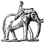
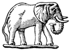
are clearly African (as shown by their large ears) on the coins the
Carthaginians struck at Cartagena while they were in possession
of Spain. The elephant here, and the other at the beginning, are
taken from two of these coins which are nearly contemporary
with Hannibal.
CAMBRIDGE: PRINTED BY W. LEWIS AT THE UNIVERSITY PRESS