The gold-fields of the Yukon Valley, at and near
Klondike River, are near the eastern boundary of
Alaska, from twelve to fifteen hundred miles up from
the mouth of the river, and from five to eight hundred
miles inland by the route across the country
from the southern Alaskan coast. In each case an
ocean voyage must be taken as the first step; and
steamers may be taken from San Francisco, Portland,
Ore., Seattle, Wash., or from Victoria, B. C.
The overland routes to these cities require a
word.
1. To San Francisco. This city is reached directly
by half a dozen routes across the plains and
Rocky Mountains, of which the Southern Pacific,
by way of New Orleans and El Paso; the Atchison
& Santa Fé and Atlantic & Pacific by way of
Kansas City, and across northern New Mexico and
Arizona; the Burlington, Denver & Rio Grande, by
way of Denver and Salt Lake City; and the Union
and Central Pacific, by way of Omaha, Ogden and
Sacramento, are the principal ones.
2. To Portland, Oregon. This is reached directly
by the Union Pacific and Oregon Short Line, via
Omaha and Ogden; and by the Northern Pacific,
via St. Paul and Helena, Montana.
3. To Seattle, Wash. This city, Tacoma, Port
Townsend and other ports on Puget Sound, are
the termini of the Northern Pacific Railroad and
also of the Great Northern Railroad from St. Paul
along the northern boundary of the United States.
The Canadian Pacific will also take passengers there
expeditiously by rail or boat from Vancouver, B. C.
4. To Vancouver and Victoria, B. C. Any of
the routes heretofore mentioned reach Victoria by
adding a steamboat journey; but the direct route,
and one of the pleasantest of all the transcontinental
routes, is by the Canadian Pacific Railway from
Montreal or Chicago, via Winnipeg, Manitoba, to
the coast at Vancouver, whence a ferry crosses to
Victoria.
Regular routes of transportation to Alaska are
supplied by the Pacific Coast Steamship Company,
which has been dispatching mail-steamships once a
fortnight the year round from Tacoma to Sitka,
which touch at Juneau and all other ports of call.
They also maintain a service of steamers between
San Francisco and Portland and Puget Sound ports.
These are fitted with every accommodation and luxury
for tourist-travel; and an extra steamer, the
Queen, has been making semi-monthly trips during
June, July and August. These steamers would
carry 250 passengers comfortably and the tourist
fare for the round trip has been $100.
The Canadian Pacific Navigation Company has
been sending semi-monthly steamers direct from
Victoria to Port Simpson and way stations the year
round. They are fine boats, but smaller than the
others and are permitted to land only at Sitka and
Dyea.
Such are the means of regular communication
with Alaskan ports. There has been no public conveyance
north of Sitka, except twice or thrice a
year in summer, in the supply-steamers of the Alaskan
commercial companies, which sailed from San
Francisco to St. Michael and there transferred to
small boats up the Yukon.
Whether any changes will be made in these
schedules for the season of 1898 remains to be
seen.
Special steamers.—As the regular accommodations
were found totally inadequate to the demand
for passage to Alaska which immediately followed
the report of rich discoveries on Klondike Creek,
extra steamers were hastily provided by the old
companies, others are fitted up and sent out by
speculative owners, and some have been privately
chartered. A score or more steamships, loaded with
passengers, horses, mules and burros (donkeys) to
an uncomfortable degree, were thus despatched from
San Francisco, Puget Sound and Victoria between
the middle of July and the middle of August. An
example of the way the feverish demand for transportation
is found in the case of the Willamette,
a collier, which was cleaned out in a few hours and
turned into an extemporized passenger-boat. The
whole 'tween decks space was filled with rough
bunks, wonderfully close together, for "first-class"
passengers; while away down in the hold second-class
arrangements were made which the mind shudders
to contemplate. Yet this slave-ship sort of a
chance was eagerly taken, and such space as was
left was crowded with animals and goods. Many
persons and parties bought or chartered private
steamers, until the supply of these was exhausted
by the end of August.
Two routes may be chosen to the gold-fields.
1. By way of the Yukon River. This is all the
way by water, and means nearly 4,500 miles of voyaging.
2. By way of the seaports of Dyea or Shkagway,
over mountain passes, afoot or a-horseback, and
down the upper Yukon River and down the lakes
and rivers by raft, skiff and steamboat.
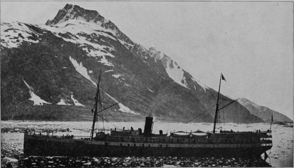 GLACIER BAY. STEAMSHIP QUEEN.
To describe these routes is the next task—first,
that by the way of St. Michael, and second—up the
Yukon River.
Route, via St. Michael and the Yukon River.—This
begins by a sea-voyage, which may be direct,
or along the coast. The special steamers (and future
voyages, no doubt) usually take a direct course
across the North Pacific and through the Aleutian
Islands to St. Michael, in Norton Sound, a bight of
Bering Sea. The distance from San Francisco is
given as 2,850 miles; from Victoria or Seattle, about
2,200 miles. The inside course would be somewhat
longer, would follow the route next to be described
as far as Juneau and Sitka, then strike northwest
along the coast to St. Michael.
This town, on an island near shore in Norton
Sound, was established in 1835 by Lieut. Michael
Tébenkoff, of the Russian navy, who named it after
his patron saint. Though some distance to the
mouth of the Yukon entrance, St. Michael has always
been the controlling center and base of supplies
for the great valley. The North American
Trading and Transportation Company and the Alaska
Commercial Company have their large warehouses
here, and provide the miners with tools,
clothing and provisions. Recently the wharf and
warehouse accommodations have been extended,
and the population has increased, but if, as is probable,
any considerable number of men are stopped
there this fall by the freezing of the river, and compelled
to pass the winter on the island, they will
find it a dreary, if not dangerous experience.
The vessels supplying this depot can seldom approach
the anchorage of St. Michael before the end
of June on account of large bodies of drifting ice
that beset the waters of Norton Sound and the straits
between St. Lawrence and the Yukon Delta.
A temporary landing-place is built out into water
deep enough for loaded boats drawing five feet to
come up at high tide, this is removed when winter
approaches, as otherwise it would be destroyed by
ice. The shore is sandy and affords a moderately
sloping beach, on which boats may be drawn up.
A few feet only from high water mark are perpendicular
banks from six to ten feet high, composed
of decayed pumice and ashes, covered with a layer
about four feet thick of clay and vegetable matter
resembling peat. This forms a nearly even meadow
with numerous pools of water, which gradually ascends
for a mile or so to a low hill, of volcanic origin,
known as the Shaman Mountain.
Between the point on which St. Michael is built
and the mainland, a small arm of the sea makes in,
in which three fathoms may be carried until the
flagstaff of the fort bears west by north, this is the
best-protected anchorage, and has as much water
and as good bottom as can be found much farther
out.
The excitement of the summer of 1897 caused an
enlargement of facilities and the erection of additional
buildings, forming a nucleus of traffic called
Fort Get There. Here will be put together in the
autumn or winter at least three, and perhaps more,
new river steamboats, of which only two or three
have been running on the lower river during the
last two or three years. These are taken up, in
pieces, by ships and fitted together at this point. All
are flat-bottomed, stern-wheeled, powerfully engined
craft, the largest able to carry perhaps 250 tons,
such as run on the upper Missouri, and they will
burn wood, the cutting and stacking of which on
the river bank will furnish work to many men during
the coming winter. To such steamers, or smaller
boats, all the persons and cargoes must be transferred
at St. Michael.
For the last few years there has been no trader
here but the agent of the Alaska Commercial Company,
and a story is told of the building of a riverboat
there in 1892, which illustrates what life on
the Yukon used to be. In that year a Chicago man,
P. B. Weare, resolved to enter the Alaskan field as
a trader. He chartered a schooner, and placed upon
it a steamboat, built in sections and needing only to
be put together and have its machinery set up, and
for this purpose he took with him a force of carpenters
and machinists. On reaching St. Michael
Weare was refused permission to land his boat sections
on the land of the Commercial Company's
post, and was compelled to make a troublesome
landing on the open beach, where he began operations.
Suddenly his ship carpenters stopped work.
They had been offered, it was said, double pay by
the rival concern if they would desist from all work.
Weare turned to the Indians, but with the same ill-success.
The Indians were looking out for their
winter grub. Here was the Chicago man 2,500
miles from San Francisco and only two weeks
left to him in which to put his boat together and
then hope for a chance to ascend the river before
winter came on. There was no time in which to
get additional men from San Francisco. In the
midst of his trouble Weare one day espied the revenue
cutter Bear steaming into the roadstead. On
board of her was Captain Michael A. Healy. That
officer, on going ashore and discovering the condition
of affairs, threatened to hang every carpenter
and mechanic Weare had brought up if they failed
to immediately commence work. The men went to
work, and with them went a gang of men from the
Bear. The little steamer was put together in a few
days, and the Bear only went to sea after seeing
the P. B. Weare steaming into the mouth of the
Yukon.
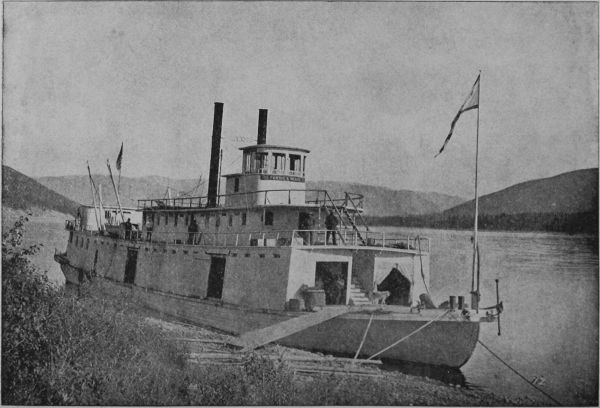 STEAMER PORTUS B. WEARE.
The Weare was enabled that summer to land her
stores along the Yukon, and was the only vessel
available for the early crowds of miners going to
Klondike.
The mouth of the Yukon is a great delta, surrounded
by marsh of timber—a soaking prairie in
summer, a plain of snow and ice in winter. The
shifting bars and shallows face out from this delta
far into Bering Sea, and no channel has yet been
discovered whereby an ocean steamer could enter
any of the mouths. Fortunately the northernmost
mouth, nearest St. Michael and 65 miles from it, is
navigable for the light river steamers, and this one,
called Aphoon, and marked by its unusual growth
of willows and bushes is well known to the local
Russian and Indian pilots. It is narrow and intricate,
and the general course up stream is south-southeast.
Streams and passages enter it, and it has
troublesome tidal currents. The whole space between
the mouth is a net-work, indeed, of narrow
channels, through the marshes.
Kutluck, at the outlet of the Aphoon, on Pastol
Bay, is an Indian village, long celebrated for its manufacture
of skin boats (bidars), and there the old-time
voyagers were accustomed to get the only
night's sleep ashore that navigation permits between
St. Michael and Andraefski. On the south bank
of the main stream, at the head of the delta, is the
Roman Catholic mission of Kuslivuk; and a few
miles higher, just above the mouth of the Andraefski
River, is the abandoned Russian trading post,
Andraefski, above which the river winds past Icogmute,
where there is a Greek Catholic mission. The
banks of the river are much wooded, and the current
even as far down as Koserefski averages over
three knots an hour. Above Koserefski (the Catholic
Mission station), the course is along stretches
of uninviting country, among marsh islands and
"sloughs," the current growing more and more
swift on the long reach from Auvik, where the Episcopal
mission is situated, to Nulato.
The river here has a nearly north and south
course, parallel with the coast of Norton Sound and
within fifty miles or so of it. Two portages across
here form cut-offs in constant use in winter by the
traders, Indians and missionaries. The first of these
portages starts from the mainland opposite the Island
of St. Michael, and passes over the range of hills
that defines the shore to the headwaters of the Anvik
River. This journey may be made in winter by
sledges and thence down the Auvik to the Yukon,
but it is a hard road. Mr. Nelson, the naturalist,
and a fur trader, spent two months from November
16, 1880, to January 19, 1891, in reaching the Yukon
by this path.
The other portage is that between Unalaklik, a
Swedish mission station at the mouth of the Unalaklik
River, some fifty miles north of St. Michael, and
a stream that enters the Yukon half way between
Auvik and Nulato. In going from St. Michael to
Unalatlik there are few points at which a boat can
land even in the smoothest weather; in rough
weather only Major's Cove and Kegiktowenk before
rounding Tolstoi Point to Topánika, where there is
a trading post. Topánika is some ten miles from
Unalaklik, with a high shelving beach, behind which
rise high walls of sandstone in perpendicular bluffs
from twenty to one hundred feet in height. This
beach continues all the way to the Unalaklik River,
the bluff gradually decreasing into a marshy plain at
the river's mouth, which is obstructed by a bar over
which at low tide there are only a few feet of water
except in a narrow and tortuous channel, constantly
changing as the river deposits fresh detritus. Inside
this bar there are two or three fathoms for a few
miles, but the channel has only a few feet, most of
the summer, from the mouth of the river to Ulukuk.
Trees commence along the Unalaklik River as
soon as the distance from the coast winds and salt
air permit them to grow; willow, poplar, birch and
spruce being those most frequently found.
The Unalaklik River is followed upward to Ulukuk,
where begins a sledging portage over the
marshes to the Ulukuk Hills, where there is a native
village known as Vesolia Sopka, or Cheerful
Peak, at an altitude of eight hundred feet above the
surrounding plain. This is a well-known trapping
ground, the fox and marten being very plentiful.
From Sopka Vesolia (Cheerful Peak) it is about
one day's journey to Beaver Lake, which is only
a marshy tundra in winter, but is flooded in the
spring and summer months. From the high hills
beyond the lake one may catch a first glimpse of the
great Yukon sweeping between its splendid banks.
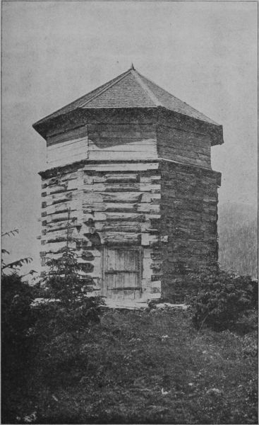 OLD RUSSIAN BLOCK HOUSE AT SITKA.
The natives call Nulato emphatically a "hungry"
place, and it was once the scene of an atrocious massacre.
Capt. Dall, from whose book much of the
information regarding this part of Alaska is derived,
describes the Indians here as a very great nuisance.
"They had," he explains, "a great habit of coming
in and sitting down, doing and saying nothing, but
watching everything. At meal times they seemed
to count and weigh every morsel we ate, and were
never backward in assisting to dispose of the remains
of the meal. Occasionally we would get desperate
and clean them all out, but they would drop
in again and we could do nothing but resign ourselves."
The soil on the banks of the Yukon and that of
the islands probably never thaws far below the surface.
It is certain that no living roots are found at
a greater depth than three feet. The soil, in layers
that seems to mark annual inundations, consists of
a stratum of sand overlaid by mud and covered with
vegetable matter, the layers being from a half inch
to three inches in thickness. In many places where
the bank has been undermined these layers may be
counted by the hundred. Low bluffs of blue sandstone,
with here and there a high gravel bank, characterize
the shores as far as Point Sakataloutan, and
some distance above this point begin the quartzose
rocks.
The next station on the river is the village of Nowikakat,
on the left bank. Here may be obtained
stores of dried meat and fat from the Indians. The
village is situated upon a beautiful bay or Nowikakat
Harbor, which is connected by a narrow entrance
with the Yukon. "Through this a beautiful
view is obtained across the river, through the numerous
islands of the opposite shore, and of the Yukon
Mountains in the distance. The feathery willows
and light poplars bend over and are reflected in the
dark water, unmixed as yet with Yukon mud;
every island and hillside is clothed in the delicate
green of spring, and luxuriates in a density of foliage
remarkable in such a latitude."
Nowikakat is specially noted for the excellence of
its canoes, of which the harbor is so full that a boat
makes its landing with difficulty among them. It is
the only safe place on the lower Yukon for wintering
a steamer, as it is sheltered from the freshets
which bring down great crushes of ice in the spring.
At Nuklukahyet there is a mission of the Episcopal
church and a trading store, but there may or
may not be supplies of civilized goods, not to speak
of moose meat and fat. This is the neutral ground
where all the tribes meet in the spring to trade.
The Tananah, which flows into the Yukon at this
point, is much broader here than the Yukon, and
it is here that Captain Dall exclaims in his diary:
"And yet into this noble river no white man has
dipped his paddle." Recently, however, the Tananah
has been more or less explored by prospectors
with favorable results towards the head of the river,
which is more easily reached overland from Circle
City and the Birch Creek camps.
Leaving Nuklukahyet, the "Ramparts" are soon
sighted, and the Yukon rapids sweep between bluffs
and hills which rise about fifteen hundred feet above
the river, which is not more than half a mile wide and
seems almost as much underground as a river bed
in a canyon. The rocks are metaphoric quartzites,
and the river-bed is crossed by a belt of granite.
The rapid current has worn the granite away at
either side, making two good channels, but in the
center lies an island of granite over which the water
plunges at high water, the fall being about twelve
feet in half a mile.
Beyond the mouth of the Tananah the Yukon
begins to widen, and it is filled with small islands.
The mountains disappear, and just beyond them the
Totokakat, or Dall River of Ketchum, enters the
Yukon from the north. Beyond this point the river,
ever broadening, passes the "Small Houses," deserted
along the bank at the time, years ago, when
the scarlet fever, brought by a trading vessel to the
mouth of the Chilkat, spread to the Upper Yukon
and depopulated the station. This place is noted
for the abundance of its game and fish.
The banks of the river above this point become
very low and flat, the plain stretching almost unbroken
to the Arctic Ocean.
The next stream which empties into the Yukon
is Beaver Creek, and farther on the prospector
bound for Circle City may make his way some two
hundred miles up Birch Creek, along which much
gold has already been discovered, to a portage of
six miles, which will carry him within six miles of
Circle City on the west.
Meanwhile the Yukon passes Porcupine River and
Fort Yukon, the old trading-post founded in 1846-7,
about a mile farther up the river than the present
fort is situated. The situation was changed in 1864,
owing to the undermining of the Yukon, which
yearly washed away a portion of the steep bank until
the foundation timbers of the old Redoubt over-hung
the flood.
Many small islands encumber the river from Fort
Yukon to Circle City, and the river flows along the
rich lowland to the towns and mining centers of the
new El Dorado, an account of which belongs to
a future chapter.
This voyage can be made only between the middle
of June and the middle of September, and requires
about forty days, at best, from San Francisco to Circle
City or Forty Mile.
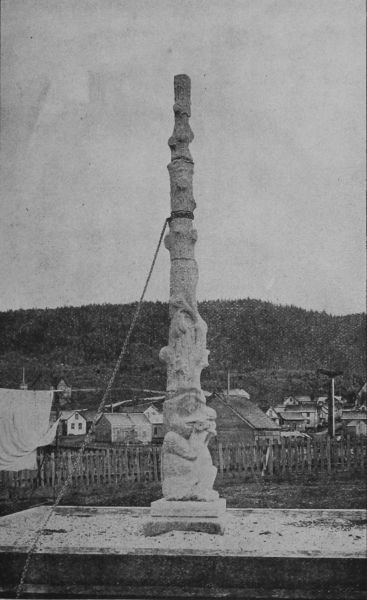 INDIAN TOTEM POLE, FORT SIMPSON.
Route via Juneau, the Passes and down the Upper
Yukon River. The second and more usual, because
shorter and quicker course, is that to the
head of Lynn Canal (Taiya Inlet) and overland.
This coast voyage may be said to begin at Victoria,
B. C. (since all coast steamers gather and stop
there), where a large number of persons prefer to
buy their outfits, since by so doing, and obtaining
a certificate of the fact, they avoid the custom duties
exacted at the boundary line on all goods and
equipments brought from the United States. Victoria
is well supplied with stores, and is, besides, one
of the most interesting towns on the Pacific coast.
The loveliest place in the whole neighborhood is
Beacon Hill Park, and is well worth a visit by those
who find an hour or two on their hands before the
departure of the steamer. It forms a half-natural,
half-cultivated area of the shore of the Straits of
Fuca, where coppices of the beautiful live oak, and
many strange trees and shrubs mingled with the all-pervading
evergreens.
Within three miles of the city, and reached by
street cars, is the principal station in the North Pacific
of the British navy, at Esquimault Bay. This
is one of the most picturesque harbors in the world,
and a beginning is made of fortifications upon a very
large scale and of the most modern character. This
station, in many respects, is the most interesting
place on the Pacific coast of Canada.
Leaving Victoria, the steamer makes its way cautiously
through the sinuous channels of the harbor
into the waters of Fuca Strait, but this is soon left
behind and the steamer turns this way, and that, at
the entrance to the Gulf of Georgia, among those
islands through which runs the international boundary
line, and for the possession of which England
and the United States nearly went to war in 1862.
The water at first is pale and somewhat opaque, for
it is the current of the great Fraser gliding far out
upon the surface, and the steamer passes on beyond
it into the darker, clearer, salter waters of the gulf.
Then the prow is headed to Vancouver, where the
mails, freight and new railway passengers are received.
From Vancouver the steamer crosses to Nanaimo,
a large settlement on Vancouver Island, where coal
mines of great importance exist. A railway now
connects this point with Victoria, and a wagon road
crosses the interior of the island to Alberni Canal
and the seaport at its entrance on Barclay Sound.
This is the farthest northern telegraph point. The
mines at Nanaimo were exhausted some time ago,
after which deep excavations were made on Newcastle
Island, just opposite the town. But after a
tremendous fire these also were abandoned, and all
the workings are now on the shores of Departure
Bay, where a colliery village named Wellington has
been built up. A steam ferry connects Nanaimo
with Wellington; and while the steamer takes in its
coal, the passengers disperse in one or the other village,
go trout fishing, shooting or botanizing in the
neighboring woods, or trade and chaffer with the
Indians. Nanaimo has anything but the appearance
of a mining town. The houses do not stretch
out in the squalid, soot-covered rows familiar to
Pennsylvania, but are scattered picturesquely, and
surrounded by gardens.
Just ahead lie the splendid hills of Texada Island,
whose iron mines yield ore of extraordinary purity,
which is largely shipped to the United States to be
made into steel. The steamer keeps to the left, making
its way through Bayne's Sound, passing Cape
Lazaro on the left and the upper end of Texada on
the right, across the broadening water along the
Vancouver shore into Seymour Narrows. These
narrows are only about 900 yards wide, and in them
there is an incessant turmoil and bubbling of currents.
This is caused by the collision of the streams
which takes place here; the flood stream from the
south, through the Strait of Fuca and up the Haro
Archipelago being met by that from Queen Charlotte
Sound and Johnstone straits. These straits are
about 140 miles long, and by the time their full
length is passed, and the maze of small islands
on the right and Vancouver's bulwark on the left
are escaped together, the open Pacific shows itself
for an hour or two in the offing of Queen Charlotte's
Sound, and the steamer rises and falls gently upon
long, lazy rollers that have swept all the way from
China and Polynesia. Otherwise the whole voyage
is in sheltered waters, and seasickness is impossible.
The steamer's course now hugs the shore, turning
into Fitz Hugh Sound, among Calvert, Hunter's
and Bardswell islands, where the ship's spars sometimes
brush the overhanging trees. Here are the
entrances to Burke Channel and Dean's Canal that
penetrate far amid the tremendous cliffs of the mainland
mountains. Beyond these the steamer dashes
across the open bight of Milbank Sound only to enter
the long passages behind Princess Royal, Pit
and Packer islands, and coming out at last into
Dixon Sound at the extremity of British Columbia's
ragged coast line.
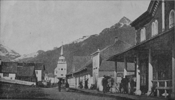 STREET IN SITKA.
The fogs which prevail here are due to the fact
that this bight is filled with the waters of the warm
Japanese current and the gulf stream of the Pacific
from which the warm moisture rises to be condensed
by the cool air that descends from the neighboring
mountains, into the dense fogs and heavy rain
storms to which the littoral forest owes its extraordinary
luxuriance. During the mid-summer and
early autumn, however, the temperature of air and
water become so nearly equable that fog and rain
are the exception rather than the rule.
Crossing the invisible boundary into Alaska the
steamer heads straight toward Fort Tougass, on
Wales Island, once a military station of the United
States, but now only a fishing place. Between this
point and Fort Wrangel another abandoned military
post of the United States, two or three fish canneries
and trading stations are visited and the ship goes on
among innumerable islands and along wide reaches
of sound to Taku Inlet (which deeply indents the
coast, and is likely in the near future to become an
important route to the gold fields), and a few hours
later Juneau City is reached.
Juneau City has been lately called the key to the
Klondike regions, as it is the point of departure for
the numberless gold hunters who, when the season
opens again, will rush blindly over incalculably rich
ledges near the coast to that remote inland El Dorado
of their dreams.
Juneau has for seventeen years been supported by
the gold mines of the neighboring coast. It is situated
ten miles above the entrance of Gastineau Channel,
and lies at the base of precipitous mountains,
its court house, hotels, churches, schools, hospital
and opera house forming the nucleus for a population
which in 1893 aggregated 1,500, a number very
largely increased each winter by the miners who
gather in from distant camps. The saloons, of which
in 1871 there were already twenty-two, have increased
proportionately, and there are, further, at
least one weekly newspaper, one volunteer fire brigade,
a militia company and a brass band in Juneau.
The curio shops on Front and Seward streets are well
worth visiting, and from the top of Seward Street a
path leads up to the Auk village, whose people
claim the flats at the mouth of Gold Creek. A curious
cemetery may be seen on the high ground across
the creek, ornamented with totemic carvings and
hung with offerings to departed spirits which no
white man dares disturb.
The few persons who formerly wished to go to
the head of Lynn Canal did so mainly by canoeing,
or chartered launches, but now many opportunities
are offered by large steamboats. Most of the steamers
that bring miners and prospectors from below
do not now discharge their freight at Juneau, however,
but go straight to the new port Dyea at the
head of the canal. Lynn Canal is the grandest fiord
on the coast, which it penetrates for seventy-five
miles. It is then divided by a long peninsula called
Seduction Point, into two prongs, the western of
which is called Chilkat Inlet, and the eastern Chilkoot.
"It has but few indentations, and the abrupt
palisades of the mainland shores present an unrivalled
panorama of mountains, glaciers and forests,
with wonderful cloud effects. Depths of 430 fathoms
have been sounded in the canal, and the continental
range on the east and the White Mountains
on the west rise to average heights of 6,000 feet,
with glaciers in every ravine and alcove." No Cameron
boundary line, which Canada would like to establish,
would cut this fiord in two, and make it useless
to both countries in case of quarrel. The magnificent
fan-shaped Davidson glacier, here, is only
one among hundreds of grand ice rivers shedding
their bergs into its waters. At various points salmon
canneries have long been in operation; and the
Seward City mines are only the best among several
mineral locations of promise. A glance at the map
will show that this "canal" forms a straight continuation
of Chatham Strait, making a north and south
passage nearly four hundred miles in length, which
is undoubtedly the trough of a departed glacier.
Dyea, the new steamer landing and sub-port of
entry, is at the head of navigation on the Chilkoot
or eastern branch of this Lynn Canal, and takes its
name, in bad modern spelling, from the long-known
Taiya Inlet, which is a prolongation inland for
twenty miles of the head of the Chilkoot Inlet. It
should continue to be spelled Tiaya. This inlet is
far the better of the two for shipping, Chilkat Inlet
being exposed to the prevalent and often dangerous
south wind, so that it is regarded by navigators as
one of the most dangerous points on the Alaskan
coast. A Presbyterian mission and government
school were formerly sustained at Haines, on Seduction
Point, but were abandoned some years ago on
account of Indian hostility.
The Passes.—Three passes over the mountains
are reached from these two inlets,—Chilkat, Chilkoot
and White.
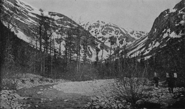 HEAD WATERS, DYEA RIVER.
Chilkat Pass is that longest known and formerly
most in vogue. The Chilkat Indians had several
fixed villages near the head of the inlet, and were
accustomed to go back and forth over the mountains
to trade with the interior Indians, whom they
would not allow to come to the coast. They thus
enjoyed not only the monopoly of the business of
carrying supplies over to the Yukon trading posts
and bringing out the furs, and more recently of assisting
the miners, but made huge profits as middle-men
between the Indians of the interior and the
trading posts on the coast. They are a sturdy race
of mountaineers, and the most arrogant, treacherous
and turbulent of all the northwestern tribes, but
their day is nearly passed. The early explorers—Krause,
Everette and others—took this pass, and
it was here that E. J. Glave first tried (in 1891) to
take pack horses across the mountains, and succeeded
so well as to show the feasibility of that
method of carriage, which put a check upon the
extortion and faithlessness of the Indian carriers.
His account of his adventures in making this experiment,
over bogs, wild rocky heights, snow fields,
swift rivers and forest barriers, has been detailed in
The Century Magazine for 1892, and should be read
by all interested. "No matter how important your
mission," Mr. Glave wrote, "your Indian carriers,
though they have duly contracted to accompany
you, will delay your departure till it suits their convenience,
and any exhibition of impatience on your
part will only remind them of your utter dependency
on them; and then intrigue for increase of
pay will at once begin. While en route they will
prolong the journey by camping on the trail for two
or three weeks, tempted by good hunting or fishing.
In a land where the open season is so short, and
the ways are so long, such delay is a tremendous
drawback. Often the Indians will carry their loads
some part of the way agreed on, then demand an
extravagant increase of pay or a goodly share of the
white man's stores, and, failing to get either, will
fling down their packs and return to their village,
leaving their white employer helplessly stranded."
The usual charge for Indian carriers is $2 a day
and board, and they demand the best fare and a
great deal of it, so that the white man finds his precious
stores largely wasted before reaching his destination.
These facts are mentioned, not because it is
now necessary to endure this extortion and expense,
but to show how little dependence can be placed
upon the hope of securing the aid of Indian packers
in carrying the goods of prospectors or explorers
elsewhere in the interior, and the great expense involved.
This pass descends to a series of connected
lakes leading down to Lake Labarge and thence by
another stream to the Lewes; and it requires twelve
days of pack-carrying—far more than is necessary
on the other passes. As a consequence, this pass is
now rarely used except by Indians going to the Aksekh
river and the coast ranges northward.
Chilkoot, Taiya or Parrier Pass.—This is the
pass that has been used since 1885 by the miners
and others on the upper Yukon, and is still
a route of travel. It starts from the head of
canoe navigation on Taiya inlet, and follows up a
stream valley, gradually leading to the divide, which
is only 3,500 feet above the sea. The first day's
march is to the foot of the ascent, and over a terrible
trail, through heavy woods and along a steep, rocky
and often boggy hillside, broken by several deep
gullies. The ascent is then very abrupt and over
huge masses of fallen rock or steep slippery surfaces
of rock in place. At the actual summit, which for
seven or eight miles is bare of trees or bushes, the
trail leads through a narrow rocky gap, and the
whole scene is one of the most complete desolation.
Naked granite rocks, rising steeply to partly snow-clad
mountains on either side. Descending the inland
or north slope is equally bad traveling, largely
over wide areas of shattered rocks where the trail
may easily be lost. The further valley contains several
little lakes and leads roughly down to Lake
Lindeman. The distance from Taiya is twenty-three
and a half miles, and it is usually made in two days.
Miners sometimes cross this pass in April, choosing
fine weather, and then continue down the lakes
on the ice to some point where they can conveniently
camp and wait for the opening of navigation
on the Yukon; ordinarily it is unsafe to attempt a
return in the autumn later than the first of October.
Lake Lindeman is a long narrow piece of water
navigable for boats to its foot, where a very bad river
passage leads into the larger Lake Bennett, where
the navigation of the Yukon really begins.
"The Chilkoot Pass," writes one of its latest travelers,
"is difficult, even dangerous, to those not possessed
of steady nerves. Toward the summit there is
a sheer ascent of 1,000 feet, where a slip would certainly
be fatal. At this point a dense mist overtook
us, but we reached Lake Lindeman—the first of a
series of five lakes—in safety, after a fatiguing tramp
of fourteen consecutive hours through half-melted
snow. Here we had to build our own boat, first
felling the timber for the purpose. The journey
down the lakes occupied ten days, four of which
were passed in camp on Lake Bennett, during a violent
storm, which raised a heavy sea. The rapids
followed. One of these latter, the "Grand Canyon,"
is a mile long, and dashes through walls of rock
from 50 to 100 feet high; six miles below are the
"White Horse Rapids," a name which many fatal
accidents have converted into the "Miner's Grave."
But snags and rocks are everywhere a fruitful source
of danger on this river, and from this rapid downward
scarcely a day passed that one did not see some
cairn or wooden cross marking the last resting place
of some drowned pilgrim to the land of gold. The
above is a brief sketch of the troubles that beset the
Alaskan gold prospector—troubles that, although
unknown in the eastern states and Canada, have for
many years past associated the name of Yukon with
an ugly sound in western America."
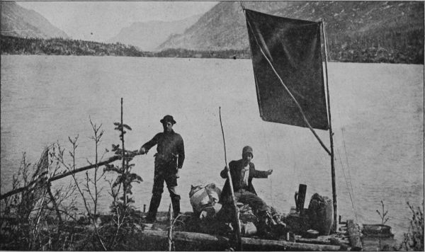 RAFT ON LAKE LINDEMAN.
It is probable that few if any persons need go over
this pass next year, and its hardships will become a
tradition instead of a terrible prospect.
White Pass.—This pass lies south of the Chilkoot,
and leaves the coast at the mouth of the
Shagway river, five miles south of Dyea and 100
from Juneau. It was first explored in 1887 and was
found to run parallel to the Chilkoot. The distance
from the coast to the summit is seventeen miles, of
which the first five are in level bottom land, thickly
timbered. The next nine miles are in a cañon-like
valley, beyond which three miles, comparatively
easy, take one to the summit, the altitude of which
is roughly estimated at 2,600 feet. Beyond the summit
a wide valley is entered and leads gradually to
the Tahko arm of Tahgish lake. This pass, though
requiring a longer carriage, is lower and easier than
the others, and already a pack-trail has been built
through it which will soon be followed by a wagon
road, and surveys for a narrow gauge railway are
in progress. At the mouth of the Shkagway River
ocean steamers can run up at all times to a wharf
which has been constructed in a sheltered position,
and there is an excellent town site with protection
from storms.
An English company, the British Columbia Development
Association, Limited, has already established
a landing wharf and is erecting a wharf and
sawmills at Skagway, whence it is proposed (as soon
as feasible) to lay down a line of rail some thirty-five
miles long, striking the Yukon River at a branch
of the Marsh Lake, about 100 miles below Lake Lindeman.
By this means the tedious and difficult
navigation between these two points will be avoided,
and the only dangerous parts of the river below will
be circumvented by a road or rail portage. Light-draught
steamers will be put on from Teslin Lake to
the cañon and from the foot of the latter to all the
towns and camps on the river.
Dyea is a village of cabins and tents, and little if
anything in the way of supplies can be got there;
it is a mere forwarding point.
Pending the completion of the facilities mentioned
above, miners may transport their goods over the
pack trail on their own or hired burros, and at Tahgish
Lake take a boat down the Tahco arm (11 miles)
to the main lake, and down that lake and its outlet
into Lake Marsh. This chain of lakes, filling the
troughs of old glacial fiords to a level of 2,150 feet
above the sea, "constitutes a singularly picturesque
region, abounding in striking points of view and in
landscapes pleasing in their variety or grand and impressive
in this combination of rugged mountain
forms." All afford still-water navigation, and as soon
as the road through White Pass permits the transportation
of machinery, they will doubtless be well
supplied with steamboats. Marsh Lake is 20 miles
long, Bennett 26, and Tagish 16½ miles, with Windy
Arm 11 miles long, Tahko Arm 20 miles, and other
long, narrow extensions among the terraced, evergreen-wooded
hills that border its tranquil surface.
The depression in which this group of lakes lies is
between the coast range and the main range of the
Rockies; and as it is sheltered from the wet sea-winds
by the former heights, its climate is nearly as
dry of that of the interior. The banks are fairly well
timbered, though large open spaces exist, and
abound in herbage, grass and edible berries. Lake
Marsh, named by Schwatka after Prof. O. C. Marsh
of Yale, but called Mud Lake by the miners, without
good reason, is twenty miles long and about two
wide. It is rather shallow and the left bank should
be followed. The surrounding region is rather low,
rising by terraces to high ranges on each side, where
Michie mountain, 5,540 feet in height, eastward, and
Mounts Lorue and Landsdowne, westward, 6,400
and 6,140 feet high respectively, are the most prominent
peaks. "The diversified form of the mountains
in view from this lake render it particularly
picturesque," remarks Dr. Dawson, "and at the time
of our visit, on the 10th and 11th of September, the
autumn tints of the aspens and other deciduous trees
and shrubs, mingled with the sombre greens of the
spruces and pines, added to its beauty."
Near the foot of this lake enters the McClintock
river, of which little is known. The outlet is a clear,
narrow, quiet stream, called Fifty-mile River, which
flows somewhat westerly down the great valley.
Large numbers of dead and dying salmon are always
seen here in summer, and as these fish never
reach Lake Marsh, it is evident that the few who are
able, after their long journey, to struggle up the
rapids, have not strength left to survive.
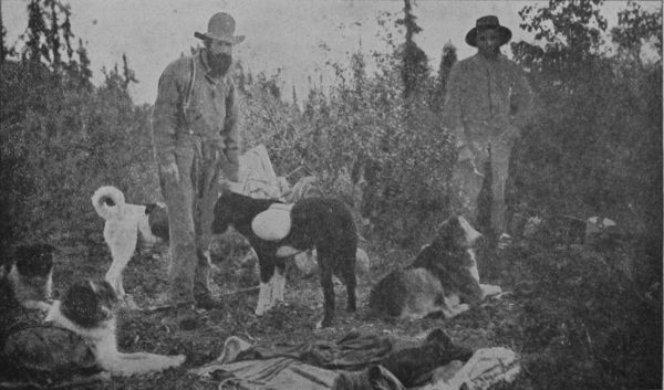 DOG PACK TRAIN.
The descent of the Lewes (or Yukon) may be said
to begin at this point, and 23 miles below Lake
Marsh the first and most serious obstacle is encountered
in the White Horse Rapids, and Miles Cañon.
Their length together is 2¾ miles, and they seem to
have been caused by a small local effusion of lava,
which was most unfortunately ejected right in the
path of the river. The cañon is often not more than
100 feet in width, and although parts of it may be
run at favorable times, all of it is dangerous, and
the White Horse should never be attempted. The
portage path in the upper part of the cañon is on
the east bank, and is about five-eighths of a mile
long. There a stretch of navigation is possible, with
caution, ending at the head of White Horse Rapids,
where one must land on the west bank, which consists
of steep rocks, very awkward for managing a
boat from or carrying a burden over. Usually the
empty boat can be dropped down with a line, but
when the water is high boat as well as cargo must
be carried for 100 yards or more, and again, lower
down, for a less distance. The miners have put
down rollways along a roughly constructed road
here to make the portage of the boats easier, and
some windlasses for hauling the boats along the
water or out and into it. It would be possible to
build a good road or tramway along the east bank
of these rapids without great difficulty; and plans
are already formulated for a railway to be built
around the whole three miles of obstruction, in the
summer of 1898, to connect with the steamboats
above and below that will no doubt be running next
year.
The river below the rapids is fast (about four
miles an hour) for a few miles, and many gravel
banks appear. It gradually subsides, however, into
a quiet stream flowing northwest along the same
wide valley. No rock is seen here, the banks being
bluffs of white silt, which turns the clear blue of the
current above into a cloudy and opaque yellow.
Thirteen miles (measuring, as usual, along the
river) brings the voyager to the mouth of the Tah-Keena,
a turbid stream about 75 yards wide and 10
feet deep, which comes in from the west. Its sources
are at the foot of the Chilkat Pass, where it flows
out of West Kussoa lake (afterwards named Lake
Arkell), and was formerly much employed by the
Chilkat Indians as a means of reaching the interior,
but was never in favor with the miners, and is now
rarely followed by the Indians themselves, although
its navigation from the lake down is reported to be
easy.
Eleven and a half miles of quiet boating takes one
to the head of Lake Labarge. This lake is 31 miles
long, lies nearly north and south, and is irregularly
elongated, reaching a width of six miles near the
lower end. It is 2,100 feet above sea level and is
bordered everywhere by mountains, those on the
south having remarkably abrupt and castellated
forms and carrying summits of white limestone.
This lake is a very stormy one, and travelers often
have to wait in camp for several days on its shores
until calmer weather permits them to go on. This
whole river valley is a great trough sucking inland
the prevailing southerly summer winds, and navigation
on all the lakes is likely to be rough for small
boats.
The river below Lake Labarge is crooked, and
at first rapid—six miles or more an hour, and interrupted
by boulders; but it is believed that a stern
wheel steamer of proper power could ascend at all
times. The banks are earthen, but little worn, as
floods do not seem to occur. Twenty-seven miles
takes one to the mouth of a large tributary from the
southeast,—the Teslintoo, which Schwatka called
Newberry River, and which the miners mistakenly
call Hotalinqu. It comes from the great Lake
Teslin, which lies across the British Columbia boundary
(Lat. 62 deg.), and is said to be 100 miles long;
and it is further said that an Indian trail connects it
with the head of canoe navigation on the Taku
river, by only two long days of portaging. Some
miners are said to have gone over it in 1876 or '77,
Schwatka and Hayes came this way; and it may
form one of the routes of the future,—perhaps even
a railway route. This river flows through a wide
and somewhat arid valley, and was roughly prospected
about 1887 by men who reported finding
fine gold all along its course, and also in tributaries
of the lake. As the mountains about the head of
the lake belong to the Cassiar range, upon whose
southern slopes the Cassiar mines are situated, there
is every reason to suppose that gold will ultimately
be found there in paying quantities.
This part of the Lewes is called Thirty-mile River,
under the impression that it is really a tributary of
the Teslintoo, which is, in fact, wider than the
Lewes at the junction (Teslintoo, width 575 feet;
Lewes, 420 feet), but it carries far less water. From
this confluence the course is north, in a deep, swift,
somewhat turbid current, through the crooked defiles
of the Seminow hills. Several auriferous bars
have been worked here, and some shore-placers, including
the rich Cassiar bar. Thirty-one miles below
the Teslintoo the Big Salmon, or D'Abbadie
River, enters from the southeast—an important river,
350 feet wide, having clear blue water flowing deep
and quiet in a stream navigable by steamboats for
many miles. Its head is about 150 miles away, not
far from Teslin Lake, in some small lakes reached
by the salmon, and surrounded by granite mountains.
Prospectors have traced all its course and
found fine gold in many places.
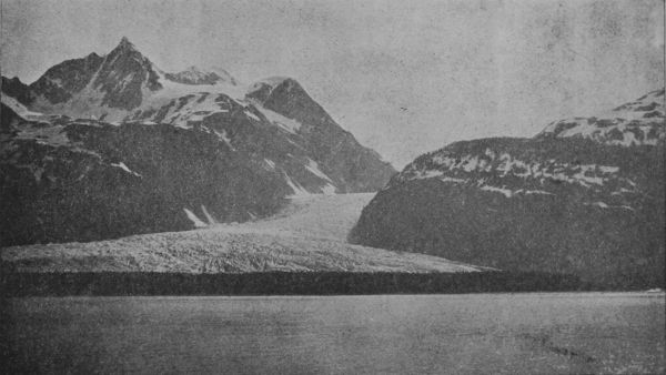 DAVIDSON GLACIER. CHILKAT INLET.
Thirty-four miles below the Big Salmon, west-north-west,
along a comparatively straight course,
carries the boatman to the Little Salmon, or Daly
River, where the valley is so broad that no mountains
are anywhere in sight, only lines of low hills at a
distance from the banks. Five miles below this river
the river makes an abrupt turn to the southwest
around Eagle's Nest rock, and 18½ miles beyond
that reaches the Nordenskiold, a small, swift, clear-watered
tributary from the southwest. The rocks of
all this part of the river show thin seams of coal,
and gold has been found on several bars. The current
now flows nearly due north and a dozen miles
below the Nordenskiold carries one to the second
and last serious obstruction to navigation in the
Rink rapids, as Schwatka called them, or Five-finger,
as they are popularly known, referring to five
large masses of rock that stand like towers in mid
channel. These other islands back up the water and
render its currents strong and turbulent, but will
offer little opposition to a good steamboat. Boatmen
descending the river are advised to hug the
right bank, and a landing should be made twenty
yards above the rapids in any eddy, where a heavily
loaded boats should be lightened. The run should
be made close along the shore, and all bad water
ends when the Little Rink Rapids have been passed,
six miles below. Just below the rapids the small
Tatshun River comes in from the right. Then the
valley broadens out, the current quiets down and a
pleasing landscape greets the eye as bend after bend
is turned. A long washed bank on the northeast
side is called Hoo-che-koo Bluff, and soon after
passing it one finds himself in the midst of the pretty
Ingersoll archipelago, where the river widens out
and wanders among hundreds of islets. Fifty-five
miles by the river below Rink Rapids, the confluence
of the Lewes and Pelly is reached, and the first sign
of civilization in the ruins of old Fort Selkirk, with
such recent and probably temporary occupation as
circumstances may cause. Before long, undoubtedly,
a flourishing permanent settlement will grow
up in this favorable situation.
The confluence here of the Lewes and Pelly rivers
forms the Yukon, which thenceforth pursues an uninterrupted
course of 1,650 miles to Behring Sea.
The country about the confluence is low, with extensive
terrace flats running back to the bases of
rounded hills and ridges. The Yukon below the
junction averages about one-quarter of a mile in
width, and has an average depth of about 10 feet,
with a surface velocity of 4¾ miles an hour. A
good many gravel bars occur, but no shifting sand.
The general course nearly to White River, 96 miles,
is a little north of west, and many islands are seen;
then the river turns to a nearly due north course,
maintained at Fort Reliance. The White River is
a powerful stream, plunging down loaded with silt,
over ever shifting sand bars. Its upper source is
problematical, but is probably in the Alaskan
Mountains near the head of the Tenana and Forty-mile
Creek.
For the next ten miles the river spreads out to
more than a mile wide and becomes a maze of islands
and bars, the main channel being along the
western shore, where there is plenty of water. This
brings one to Stewart river, which is the most important
right-hand tributary between the Pelly and
the Porcupine. It enters from the east in the middle
of a wide valley, and half a mile above its mouth is
200 yards in width; the current is slow and the water
dark colored. It has been followed to its headquarters
in the main range of the Rockies, and several
large branches, on some of which there are remarkable
falls, have been traced to their sources through
the forested and snowy hills where they rise. These
sources are perhaps 200 miles from the mouth, but
as none of the wanderers were equipped with either
geographical knowledge or instruments nothing
definite is known. Reports of traces of precious
metals have been brought back from many points
in the Stewart valley, but this information is as
vague as the other thus far. All reports agree that
a light draught steamboat could go to the head of
the Stewart and bar up its feeders. There is a trading
post at its mouth.
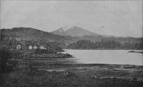 VIEW FROM INDIAN CHURCH, LOOKING NORTHEAST.
The succeeding 125 miles holds what is at present
the most interesting and populous part of the
Yukon valley. The river varies from half to three-quarters
of a mile wide and is full of islands. About
23 miles below Stewart River a large stream enters
from the west called Sixty-mile Creek by the miners,
who have had a small winter camp and trading store
there for some years, and have explored its course
for gold to its rise in the mountains west of the international
boundary. Every little tributary has been
named, among them (going up), Charley's Fork,
Edwards Creek and Hawley Creek, in Canada, and
then, on the American side of the line, Gold Creek,
Miller Creek and Bed Rock Creek. The sand and
gravel of all these have yielded fine gold and some
of them, as Miller Creek, have become noted for their
richness. Forty-four miles below Sixty-mile takes
one to Dawson City, at the mouth of Klondike River,—the
center of the highest productiveness and greatest
excitement during 1897, when the gold fields of
the interior of Alaska first attracted the attention
of the world. Leaving to another special chapter an
account of them, the itinerary may be completed by
saying that 6½ miles below the mouth of the Klondike
is Fort Reliance, an old private trading post of
no present importance. Twelve and a half miles
farther the Chan-din-du River enters from the east,
and 33½ below that in the mouth of Forty-mile
Creek, or Cone Hill River, which until the past year
was the most important mining region of the interior.
It took its name from the supposition that it
was 40 miles from Fort Reliance, but the true distance
is 46 miles. On the south side of the outlet of
this stream is the old trading post and modern town
of Forty-Mile, and on the north side the more recent
settlement Cudahy. Both towns are, of course,
on the western bank of the Yukon, which is here
about half a mile wide. Five miles below Cudahy,
Coal Creek comes in from the east, and nearly
marks the Alaskan boundary, where a narrowed
part of the river admits one to United States territory.
Prominent landmarks here are two great
rocks, named by old timers Old Man rock, on the
west bank, and Old Woman, on the east bank, in
reference to Indian legends attached to them. Some
twenty miles west of the boundary—the river now
having turned nearly due west in its general course—Seventy-mile,
or Klevande Creek, comes in from
the south, and somewhat below it the Tat-on-duc
from the north. It was ascended in 1887 by Mr.
Ogilvie, who describes its lower valley as broad and
well timbered, but its upper part flows through a
series of magnificent cañons, one of which half a
mile long, is not more than 50 feet wide with vertical
walls fully 700 feet in height. There are said to be
warm sulphur springs along its course, and the Indians
regard it as one of the best hunting fields,
sheep being especially numerous on the mountains
in which it heads, close by the international boundary,
where it is separated by only a narrow divide
from Ogilvie River, one of the head streams of the
Peel river, and also from the head of the Porcupine,
to which there is an Indian trail. Hence the miners
call this Sheep River. The rocks along this stream
are all sandstones, limestone and conglomerates,
with many thin calcite veins. Large and dense timber
prevails, and game is abundant.
Below the mouth of the Tat-on-duc several small
streams enter, of which the Kandik on the north
and the Kolto or Charley's River—at the mouth of
which there used to be the home of an old Indian
notability named Charley—are most important.
About 160 miles from the boundary the Yukon flats
are reached, and the center of another important
mining district—that of Birch Creek and the Upper
Tenana—at Circle City, the usual terminus of the
trip up the Lower Yukon from St. Michael.





 JUNEAU CITY.