Larger versions of most illustrations may be seen by right-clicking them
and selecting an option to view them separately, or by double-tapping and/or
stretching them.
Professor of Geology in Colgate University Author of “Geographic Influences in American History”
GINN AND COMPANY
BOSTON · NEW YORK · CHICAGO · LONDON
ATLANTA · DALLAS · COLUMBUS · SAN FRANCISCO
Copyright, 1907, by ALBERT PERRY BRIGHAM
ALL RIGHTS RESERVED
621.1
The Athenæum Press
GINN AND COMPANY · PROPRIETORS
· BOSTON · U.S.A.
PREFACE
This book grows out of the conviction that geography
in the schools must return somewhat to human interests.
In saying this the author will scarcely need to defend
himself against the charge of undervaluing physiography.
It is only a question of wise adaptation to youthful students.
Elementary history also needs to be placed in its
setting of physical conditions. It is here attempted to
promote both these objects in the study of the eastern
United States. If geography and history can be well correlated,
both of these great themes may be taught with
economy of time and with stronger interest.
Much more might be said concerning the growth of
centers, the agriculture, and the commerce, but the limits
of space are rigid. Hence roads and westward movements
have been made the main topic. The geography
is not taught formally, but is woven in with the story.
Care has been given to the maps of the several regions,
that they should clearly express the essentials and avoid
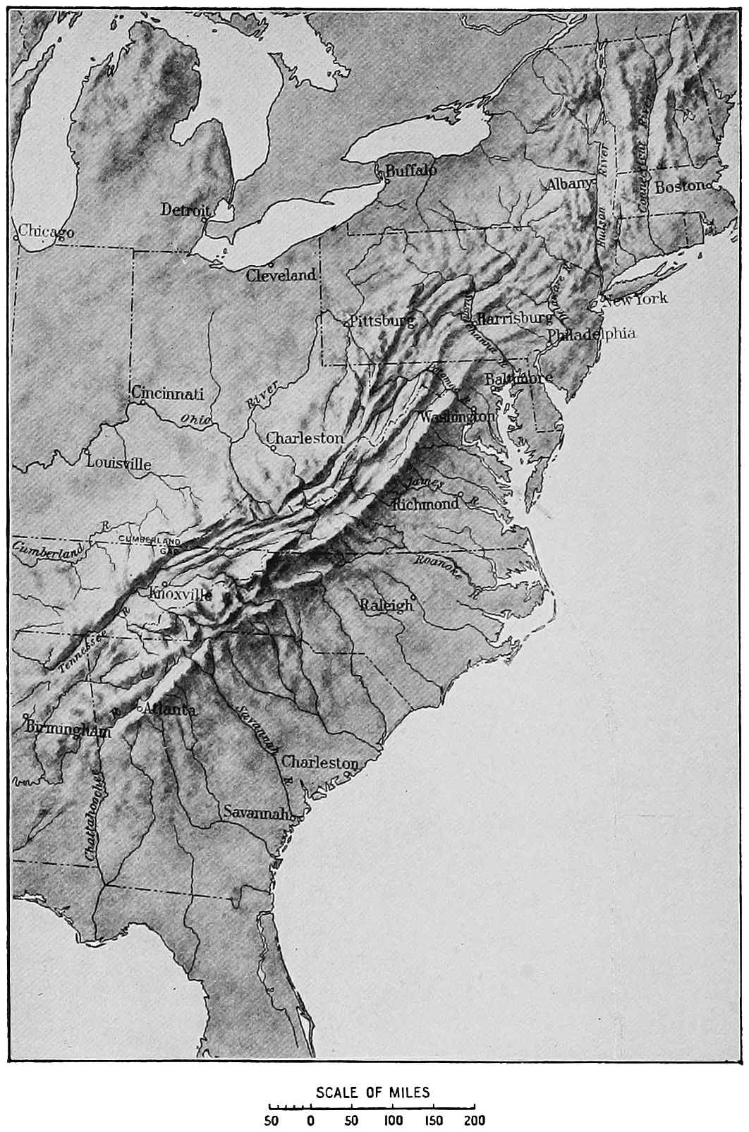
the vagueness of many small-scale representations of the
Appalachian belt.
FROM TRAIL TO RAILWAY — CHAPTER I BOSTON AND THE BERKSHIRES
From the time of the settlement of Massachusetts
Boston has had a large share of the business of the
country. Her natural advantages are great. On the one
hand there is her harbor, sheltered by many islands
from the storms of the Atlantic; on the other are tidal
rivers and level highways leading to the interior of the
state. Emerson, who was born in Boston, wrote:
Each street leads downward to the sea,
Or landward to the west.
For generations, as the city has grown, her people
have been crowding back the ocean by filling in the
shallows, and now her busy streets extend over acres of
“made land,” while from the south, the west, and the
north, lines of railway connect her with all parts of
America.
Not many years after the War of the Revolution a
Boston merchant ship went around the world. She took
on board a native at Hawaii, sold her load of furs in
Canton, rounded Cape Horn, and anchored at length in
Boston harbor. So great an achievement did this seem
that Governor Hancock and the people said fine things
and made merry.
This little ship was eighty-three feet long, and you
could measure off seven or eight times her length on one
of the big liners of to-day. Later the same ship set sail
again, and on the west coast of America, in one of the
roughest seas, her master, Captain Gray, saw the mouth
of a great river. He was determined to enter it. Having
crossed the breakers, he sailed up the river more
than twenty miles, and to-day it bears the name of his
ship, the Columbia. Boston was reaching out into the
wide world. Many years later this discovery had much
to do with securing the rights of the United States in
the Oregon country against the claims of Great Britain.
Young lads often went out on these voyages, and the
training made them strong men. There were dangers
on the ocean then which to-day we do not fear, for
pirates still lay in wait for merchantmen and foreign
powers took liberties with American ships. One vessel
seen in Boston harbor was named Catch-me-if-you-can.
Many years later, when Mr. Samuel Cunard of Halifax
took a contract to carry the royal mail between Liverpool
and America, there was an immediate protest from the
Boston merchants against ending the voyage at Halifax.
They urged the great commercial advantage of having
the ships run westward to Boston after stopping at Halifax,
and so powerful were these arguments that the first
Cunard liners came steaming into Massachusetts bay.
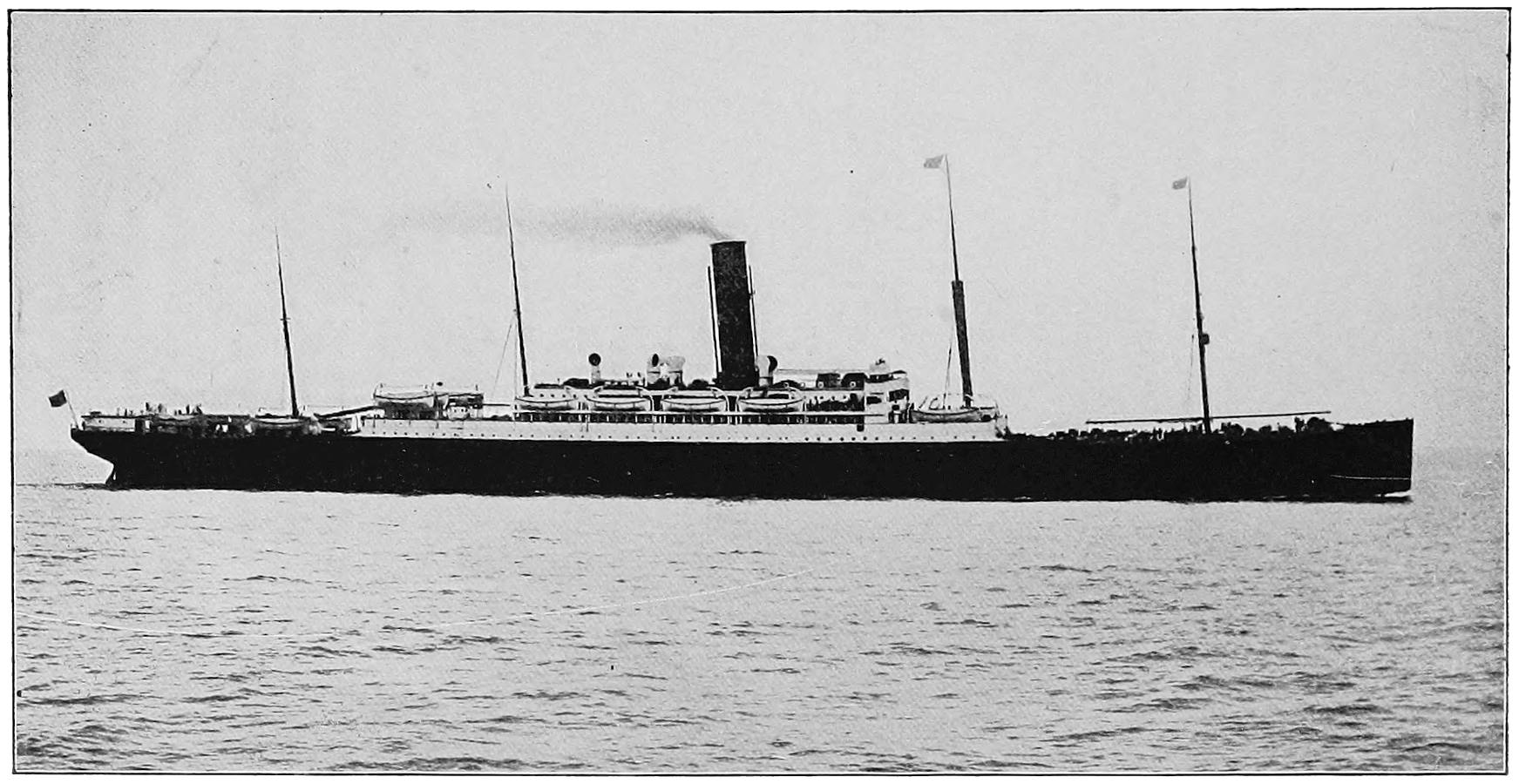
Fig. 1. One of the Cunard Steamships which sail from Boston To-day
This was not pleasant for New York people, who
tried to show that theirs was the better port. As if to
help in the fight against Boston, the harbor froze over
in the winter of 1844, and the Cunard ship, the Britannia,
could not sail. Determined to hold their own, the
Boston people engaged Frederick Tudor, a great exporter
of ice, to bring his machinery from the fresh-water
ponds and cut a way. He soon made a lane of
open water, and the Britannia sailed out for Liverpool.
While ocean trade was growing much had been done
on the land. Settlements were first made at Plymouth,
Salem, and Boston, and as soon as possible the rough
forest trails joining these towns were changed into
roads. Many ferries and bridges were needed to cross
the streams, and roads were carried back into the
country as the people settled farther from the sea.
After Providence was begun, in the Narragansett
country, and the rich lands along the Connecticut were
settled, there was need of roads across the hills of Massachusetts,
so that the colonists could visit each other,
exchange letters, and thus be less exposed to danger
from savages in the great American wilderness.
The highway leading along the east coast was called
Bay Road. A post rider went between Boston and
New York in 1704, and a rough path he had to travel.
It was thought remarkable, four years later, that a
woman, Madam Sarah Knights, made that journey.
She afterwards taught school in Boston, and Benjamin
Franklin was one of her pupils. Somebody scratched
these lines on a window pane in her schoolroom:
Through many toils and many frights
I have returned, poor Sarah Knights;
Over great rocks and many stones,
God has preserved from fractured bones.
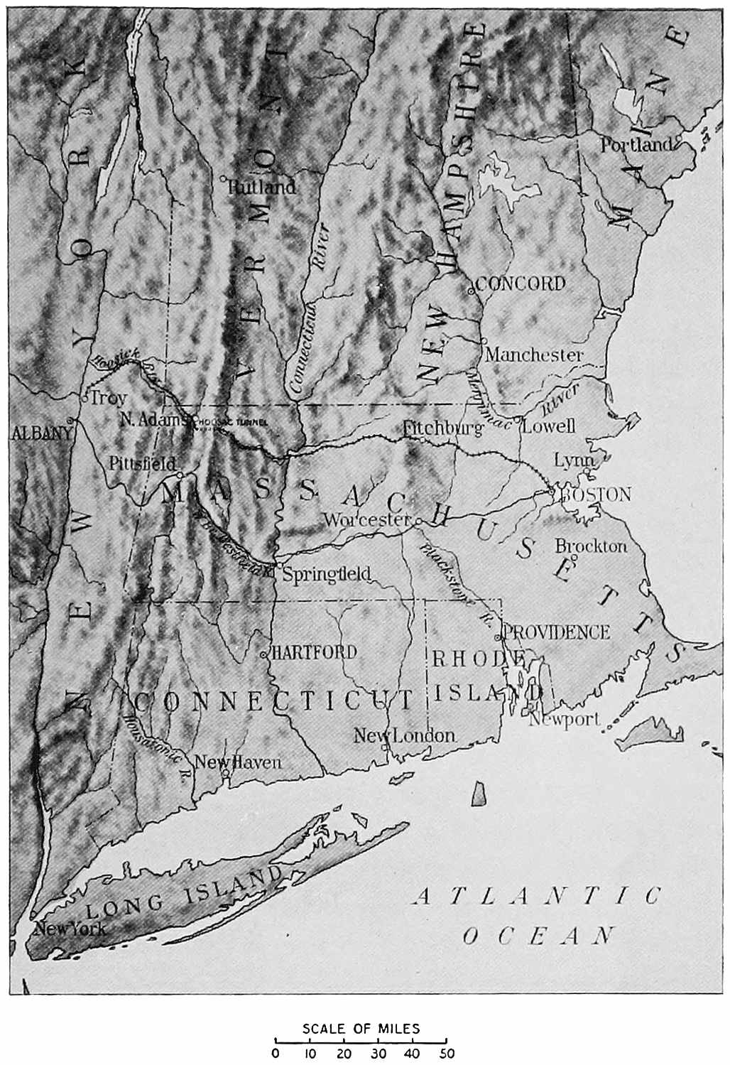
New England
Boston and Maine Railroad (Fitchburg Division)
+-+-+-+-+-+
Boston and Albany Railroad
—————
There is no doubt about the “great rocks and many
stones” of New England, but around Boston, at any
rate, one usually sees them now at a safe distance.
In western Massachusetts is the great Berkshire
country. Through most of its length the Housatonic
river runs to the southward. At the north the Hoosick
river flows from it, across a corner of Vermont, to the
Hudson. On the first is beautiful Pittsfield, and on the
second is busy North Adams with its mills. In sight
everywhere are the mountains, not very high and usually
covered with forest, but sometimes bold and rocky.
Farther north we should call them the Green mountains,
but here we name them the Berkshires. The eastern
range, which separates the Housatonic valley on the
west from the Connecticut valley on the east, is Hoosac
mountain, of which we shall hear again.
These long ranges of mountains run from north to
south, and while it was easy to follow the valleys between
them, it was hard to go across them from east to west
or from west to east. Boston and all the chief towns of
New England lay eastward, and the rest of the country
was west of the mountains. If a Massachusetts family
wished to settle in the fertile lands of western New
York or Ohio, they had to cross the mountains. In our
day the mountain region is full of towns and beautiful
summer homes, but then it was a wilderness which in
places was almost impassable. If it was difficult to
make a single journey between the Connecticut river
and the Hudson, it was quite out of the question to
carry grain and fruit from the West to Boston, and to
bring back in exchange the goods made in her factories.
Near Pittsfield, in the heart of the Berkshires, rises
the Westfield river, which has cut a deep valley eastward
through the mountains. Opposite the place where
this stream enters the Connecticut the beautiful city of
Springfield has now grown up, partly on the low grounds
and partly on a terrace. It is readily seen that the Westfield
valley forms a natural roadway from here westward
to Pittsfield, and on toward Albany and the Mohawk in
New York. We cannot say that the valley was made
for the cities, but the cities were made, in part at least,
because the valley was there.
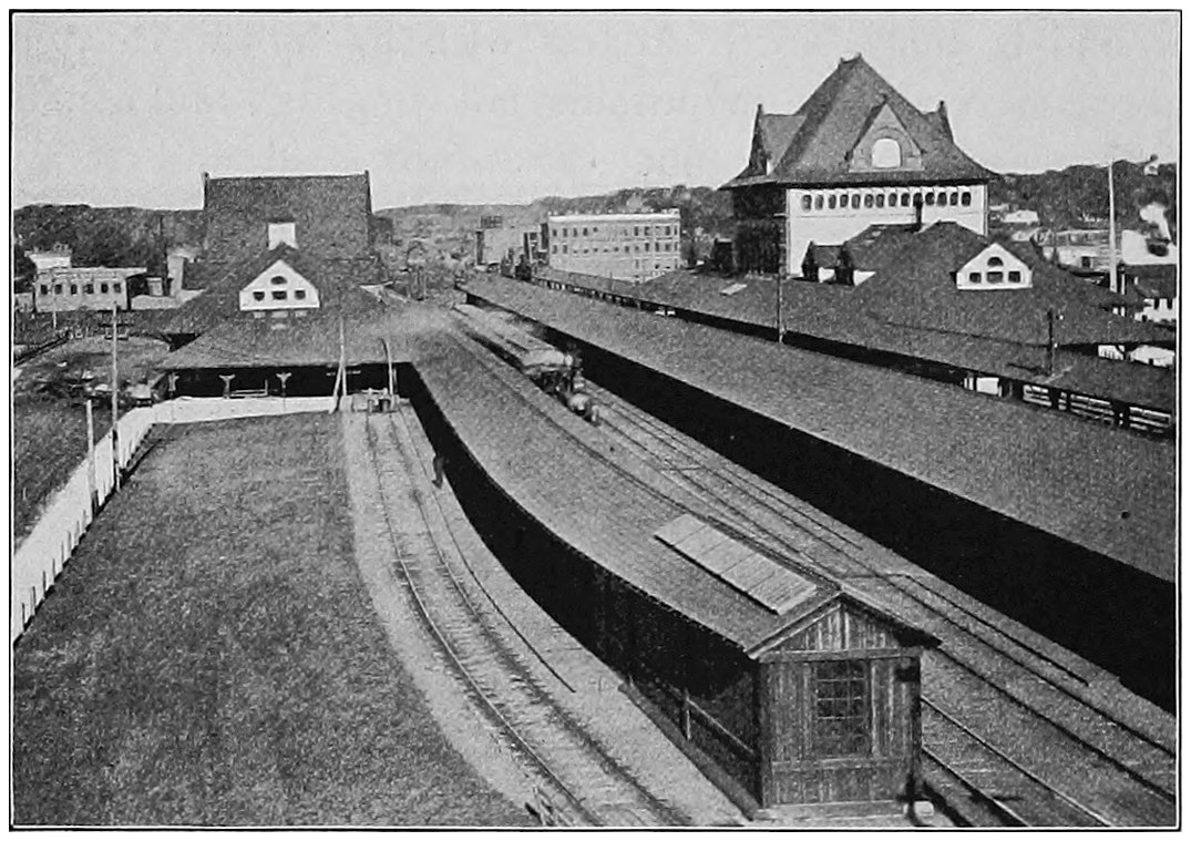
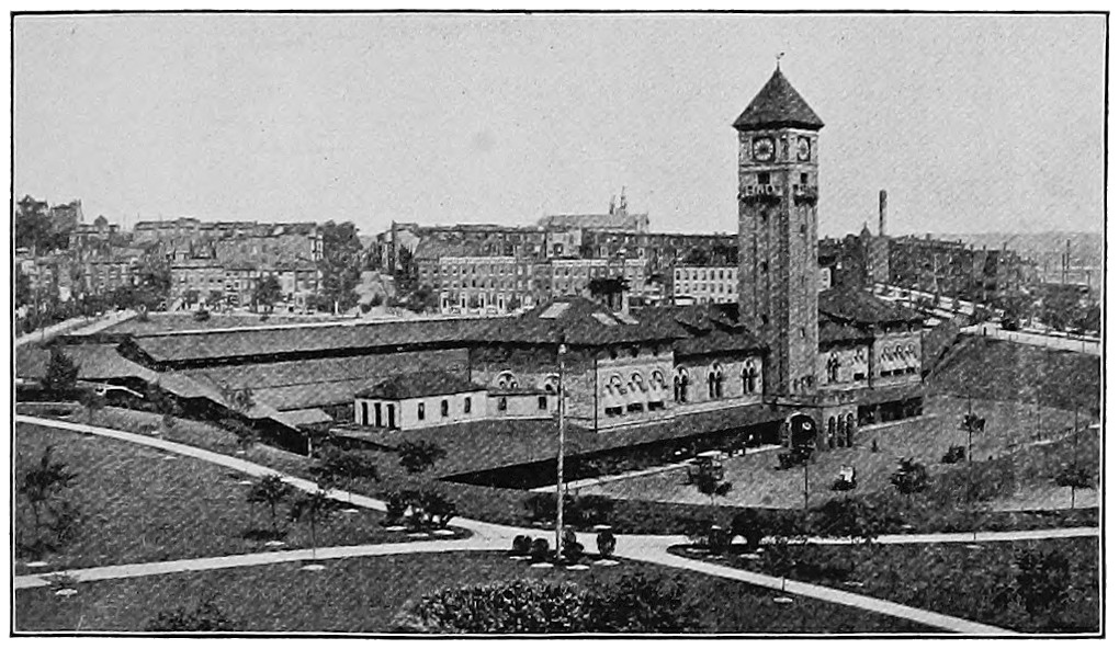
Fig. 2. Union Railway Station, Springfield, Massachusetts
The first roads that improved on the Indian trails
were, of course, made for wagons. The gorge of the
Westfield was so rugged that a hundred years ago it
seemed almost impossible to make a good wagon road
through it. There were some people, however, who
thought that it could be done and who determined to
do it. Their courage won, and before long there was a
good highway all along the roaring river. The bowlders
were rolled out of the way, the trees were cut, the roadbed
was made, and people could go east and west in the
stages without risk of losing their lives or even of breaking
their bones. This was accomplished soon after 1825,
but it did not solve all the problems of the Massachusetts
people, for, as we shall soon learn fully, the Erie canal was
finished in that year, and a long string of canal boats
began to carry produce from the West to New York.
The good people of Boston watched all this going on.
Every load of grain was headed straight eastward as if
it were coming to Massachusetts bay, thence to go by
vessel to Europe. But when it reached the Hudson it
was sure to turn off down that river to help load ships
at the piers of New York. And New England had only
a wagon road across the mountains! A wagon road will
never draw trade away from a tidal river, and thus we
can understand why a prominent Massachusetts man,
Charles Francis Adams, spoke of the Hudson as “a
river so fatal to Boston.” Boston might have all the
ships she wanted, but if she could not get cargoes for
them they would be of no use. Shipowners, seeing
that there was plenty of western freight in New York,
sent their boats there. It was indeed time that Boston
people began to ask themselves what they could do.
They still had ships, but these were usually “down
East” coasters, and the noble vessels from far eastern
ports, laden with spices and teas, silks, and all the spoils
of Europe and Asia, rarely came to Boston, but brought
more and greater loads to New York and Baltimore,
where they could lay in corn and wheat for the return
voyage. Even the Cunards transferred most of their
boats and finally all their mail steamers to New York.
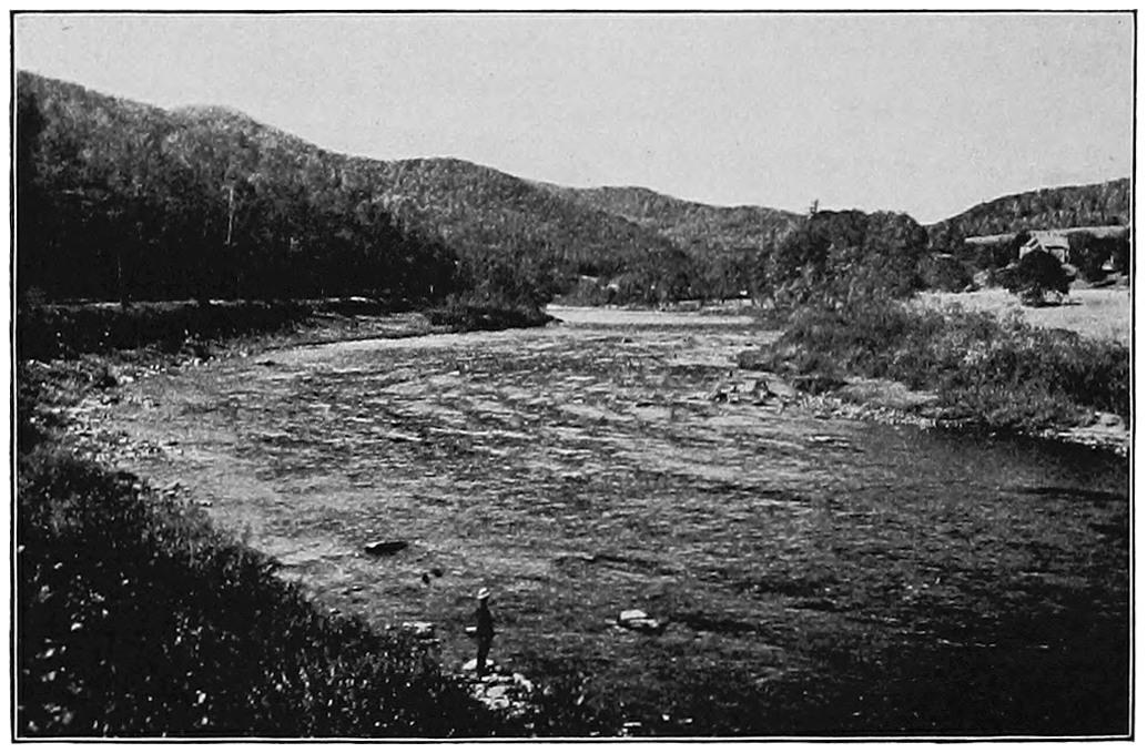
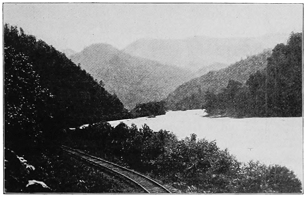
Fig. 3. The Valley of Deerfield River at Charlemont, Massachusetts,
on the Line of the Boston and Maine Railroad
The people of Boston first said, “We will build
another canal, up the Hoosick and down the Deerfield
valley, and then the canal boats will keep on to the east.”
As states often do, they appointed a commission to see
if the canal could be built, and what it would cost. But
what were they to do about Hoosac mountain, which
stood a thousand feet high, of solid rock, between the
Hoosick valley on the west and the Deerfield valley on
the east?
They decided that they would tunnel it for the water
way. Rather strangely they thought it could be done
for a little less than a million dollars. A wise engineer
made the survey for the canal, and when he remarked,
“It seems as if the finger of Providence had pointed
out this route from the east to the west,” some one who
stood near replied, “It’s a great pity that the same
finger wasn’t thrust through the mountain.” The plans
for the canal were finally given up, and though many
years later such a tunnel was made, it was not for a
canal, nor was the work done for a million dollars.
Every one was talking now of railways, but few
thought that rails could be laid across the Berkshires.
It was even said in a Boston paper that such a road
could never be built to Albany; that it would cost as
much to do it as all Massachusetts would sell for; and
that if it should be finished, everybody with common
sense knew it would be as useless as a railroad from
Boston to the moon. We need not be too hard on this
writer, for it was five years later when the De Witt
Clinton train climbed the hill from Albany and carried
its handful of passengers to Schenectady.
One of the friends of the railway scheme was Abner
Phelps. When he was a senior at Williams College, in
1806, he had thought of it, for he had heard about
the tram cars in the English coal regions. In 1826 he
became a member of the legislature of Massachusetts,
and the second day he was there he proposed that the
road should be built.
In time the project went through, but at first it was
planned to pull the cars with horses, and on the down
grades to take the horses on the cars and let them ride.
We do not know how it was intended that the cars
should be held back, for it was long before the invention
of air brakes. The line was built to its western end on
the Hudson in 1842, and thus Boston, Worcester, Springfield,
and Albany were bound together by iron rails.
There was only a single track and the grades were
heavy. The road brought little trade to Boston, and
most of the goods from the West still went by way of
the Hudson to New York. It was, however, a beginning,
and it showed that the mountain wall could be
crossed.
The subject of a Hoosac tunnel now came up again.
It would take a long time to tell how the tunnel was
made; indeed, it was a long time in making. It was
begun in 1850 or soon afterwards, and the work went
slowly, with many stops and misfortunes, so that the
hole through the mountain was not finished until November
27, 1873. On that day the last blast was set off,
which made the opening from the east to the west side;
and the first regular passenger train ran through July 8,
1875, fifty years after it had been planned to make a
canal under the mountain.
In order to help on the work the engineers sunk a
shaft a thousand feet deep from the top of the mountain
to the level of the tunnel, and from the bottom worked
east and west. This gave them four faces, or “headings,”
on which to work, instead of two, and hastened the finishing.
The whole cost was about fourteen million dollars.
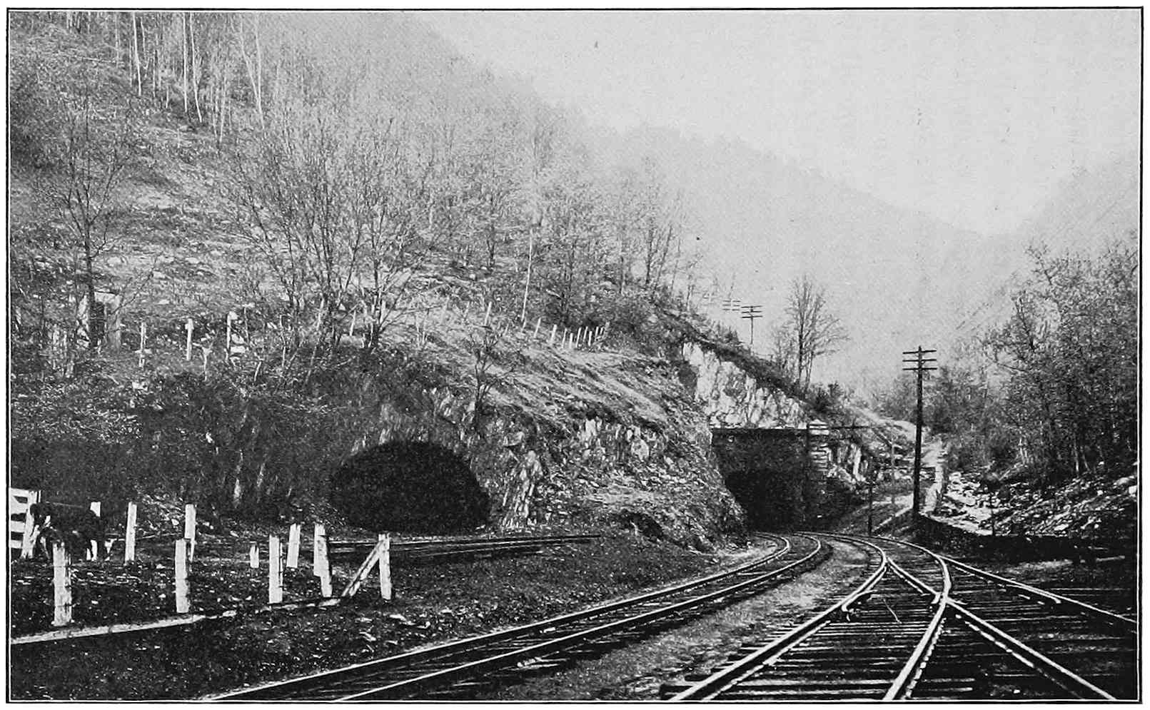
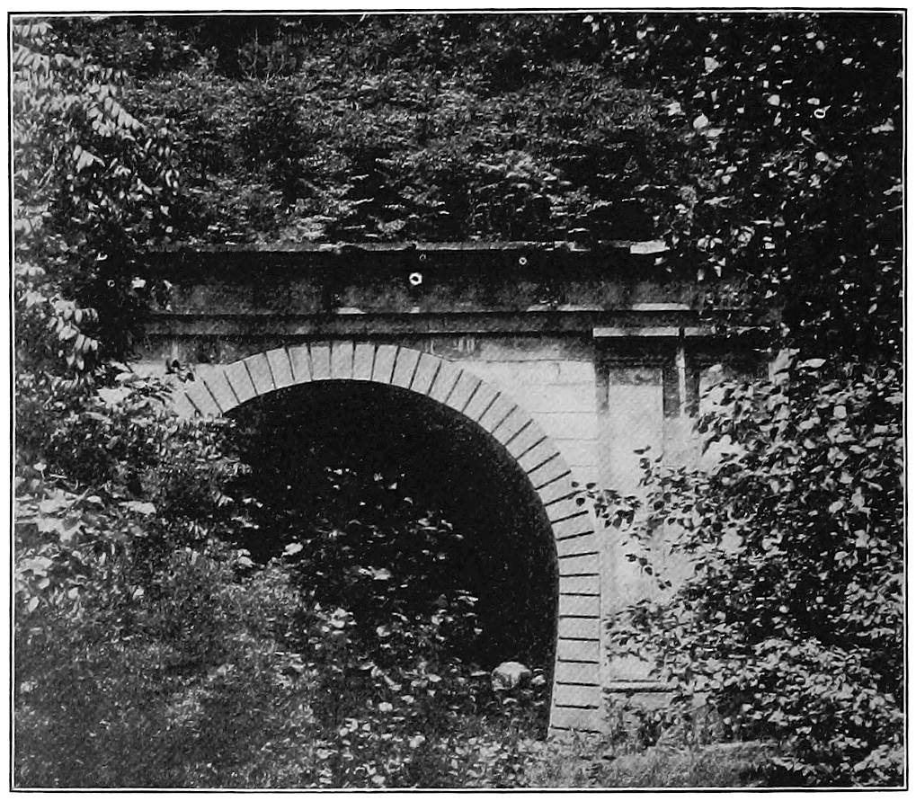
Fig. 4. Eastern Portal of the Hoosac Tunnel, Boston and Maine Railroad
It took great skill to sink the shaft on just the right
line, and to make the parts of the tunnel exactly meet,
as the men worked in from opposite directions. They
brought the ends together under the mountain with a
difference of only five sixteenths of an inch! You can
measure this on a finger nail and see how much it is.
The tremendous task was successfully accomplished,
and Boston was no longer shut off from the rest of the
country by the mountains.
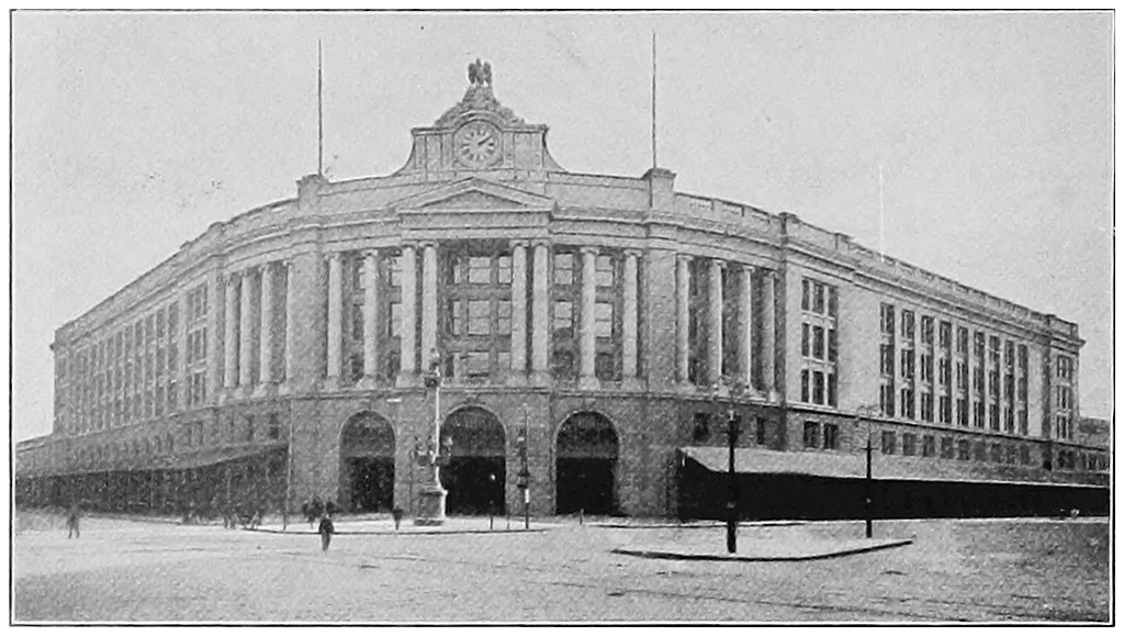
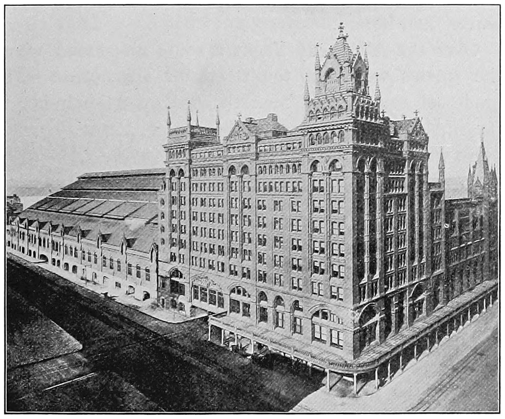
Fig. 5. The South Station, Boston
The end of it all is not that Boston has won all the
ships away from New York, but that gradually she has
been getting her share. Now she has great Cunarders,
White Star Liners, and the Leyland boats,—all giant
ships sailing for Liverpool,—and many other stately
vessels bound for southern ports or foreign lands. Now
you may see in Boston harbor not a forest of masts but
great funnels painted to show the lines to which the
boats belong, and marking a grander commerce than that
which put out for the Indies long years ago; for to-day
Boston is the second American port. The great freight
yards of the railways are close upon the docks, and
travelers from the West may come into either of two
great stations, one of which is the largest railway terminal
in the world. In and about Boston are more than a
million people, reaching out with one hand for the riches
of the great land to the west, and with the other passing
them over the seas to the nations on the farther side.
Man has taken a land of dense forests, stony hills, and
wild valleys, and subdued it. It is dotted with cities,
crossed by roads, and is one of the great gateways of
North America.
CHAPTER II PIONEERS OF THE MOHAWK AND THE HUDSON
If a stranger from a distant land should come to New
York, he might take an elevated train at the Battery
and ride to the upper end of Harlem. He would then
have seen Manhattan island, so named by the Indians,
who but three hundred years ago built their wigwams
there and paddled their canoes in the waters where great
ships now wait for their cargoes. If the visitor should
stay for a time, he might find that Harlem used to be
spelled Haarlem, from a famous old town in Holland.
He might walk through Bleecker street, or Cortlandt
street, or see Stuyvesant square, and learn that these
hard names belonged to old Dutch families; and if he
studied history, he would find that the town was once
called New Amsterdam and was settled by Dutchmen
from Holland. They named the river on the west of the
island the Great North river, to distinguish it from the
Delaware, or Great South river, and they planned to
keep all the land about these two streams and to call
it New Netherland.
Rocks and trees covered most of Manhattan island at
that time, but the Dutch had a small village at its south
end, where they built a fort and set up windmills, which
ground the corn and made the place look like a town in
Holland. The Indians did not like the windmills with
their “big teeth biting the corn in pieces,” but they were
usually friendly with the settlers, sometimes sitting before
the fireplaces in the houses and eating supawn, or mush
and milk, with their white friends. Little did the Indian
dream what a bargain he offered to the white man when
he consented to sell the whole island for a sum equal to
twenty-four dollars; and the Dutchman, to do him justice,
was equally ignorant.
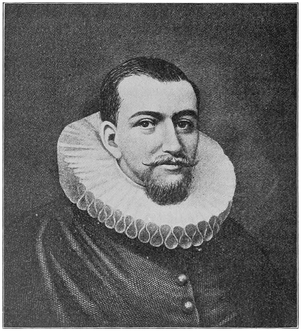
All this came about because Henry Hudson with a
Dutch vessel, the Half Moon, had sailed into the harbor
in 1609, and had explored the river for a long distance
from its mouth. Hudson was an Englishman, but with
most people he has had to pass for a Dutchman. He
has come down in stories as Hendrick instead of Henry,
no doubt because he commanded a ship belonging to a
Dutch company, and because a Dutch colony was soon
planted at the mouth of the river which he discovered.
Hudson spent a month of early autumn about Manhattan
and on the river which afterwards took his name.
Sailing was easy, for the channel is cut so deep into the
land that the tides, which rise and fall on the ocean
border by day and night, push far up the Hudson and
make it like an inland sea. In what we call the Highlands
Hudson found the river narrow, with rocky cliffs
rising far above him. Beyond he saw lowlands covered
with trees, and stretching west to the foot of the Catskill
mountains. He went at least as far as the place where
Albany now stands, but there he found the water shallow
and turned his ship about, giving up the idea of reaching
the Indies by going that way. He did not know that a
few miles to the west a deep valley lies open through
the mountains, a valley which is now full of busy people
and is more important for travel and trade than a dozen
northwest passages to China would be.
Fig. 6. Henry Hudson
It was not long before this valley which leads to the
west was found, and by a real Dutchman. Only five years
after Hudson’s voyage Dutch traders built a fort near
the spot where Albany now stands. Shortly afterwards,
in 1624, the first settlers came and founded Fort Orange,
which is now Albany. Arent Van Curler came over
from Holland in 1630 and made his home near Fort
Orange. He was an able man and became friendly with
the Indians. They called him “Brother Corlear” and
spoke of him as their “good friend.” A few years ago
a diary kept by Van Curler was found in an old Dutch
garret, where it had lain for two hundred and sixty
years. It told the story of a journey that he made in
1634, only four years after he came to America. Setting
out on December 11, he traveled up the valley of the
Mohawk until he reached the home of the Oneida Indians
in central New York. He stayed with them nearly
two weeks, and then returned to Fort Orange, where
he arrived on January 19. This is the earliest record of
a white man’s journey through a region which now contains
large towns and is traversed by many railway trains
every day in the year.
No one knows how long there had been Indians and
Indian trails in the Mohawk valley. These trails Van
Curler followed, often coming upon some of the red men
themselves, and visiting them in a friendly way. They,
as well as the white settlers who followed them, chose
the flat, rich lands along the river, for here it was easy
to beat a path, and with their bark canoes they could
travel and fish. The Indians entertained Van Curler
with baked pumpkins, turkey, bear meat, and venison.
As the turkey is an American bird, we may be sure that
it was new to the Dutch explorer.
These Indians, with whom Van Curler and all the New
York colonists had much to do, were of several tribes,—the
Mohawks, Oneidas, Onondagas, Cayugas, and
Senecas. All together they were known as the Iroquois
(ĭr-ṓ-kwoi´), or Iroquois Nation, a kind of confederation
which met in council and went forth together to war.
They called their five-fold league The Long House, from
the style of dwelling which was common among them,—a
long house in which as many as twenty families
sometimes lived. The Iroquois built villages, cultivated
plots of land, and sometimes planted apple orchards.
They were often eloquent orators and always fierce
fighters. Among the surrounding tribes they were greatly
feared. They sailed on lake Ontario and lake Erie in
their birch-bark canoes, and they followed the trails far
eastward down the Mohawk valley. Before the white
men came these fierce warriors occasionally invaded
New England, to the terror of the weaker tribes. Sometimes
they followed up their conquests by exacting a
tribute of wampum. After Fort Orange was founded
they went there with their packs of beaver skins and
other furs to trade for clothes and trinkets.
In fact the white man’s principal interest for many
years was to barter for furs. The Dutch, and soon afterwards
the English, bid for the trade from their settlements
on the Hudson, and the French did the same
from their forts on the St. Lawrence and the Great
Lakes. Thus there was much letter writing and much
fighting among the colonists, while each side tried to
make friends of the Indians and get the whole of the
fur trade. The result was that either in war or in
trade the white men and the savages were always going
up and down the Mohawk valley, which thus was a
well-traveled path long before there were turnpike roads,
canals, or steam cars.
When Van Curler made his journey into the Indian
country, he did not reach the Mohawk river at once on
leaving Fort Orange, but traveled for about sixteen
miles across a sandy and half-barren stretch of scrubby
pine woods. He came down to the river where its rich
bottom lands spread out widely and where several large
islands are inclosed by parts of the stream. South and
east of these flats are the sand barrens, and on the west
are high hills through which, by a deep, narrow gap, the
Mohawk flows. The Indians called this place “Schonowe,”
or “gateway.” It was well named, for entering
by this gate one can go to the foot of the Rocky mountains
without climbing any heights.
A few years before his death Van Curler led a small
band of colonists from Fort Orange, bought the “great
flats” from the Mohawk Indians, and founded a town,
calling it Schenectady, which is the old Indian name
changed in its spelling. No easy time did these settlers
have, for theirs was for many years the frontier town and
they never knew when hostile savages might come down
upon them to burn their houses and take their scalps.
In 1690, twenty-eight years after the town was founded,
a company of French and Indians from Montreal surprised
Schenectady in the night, burned most of the
houses, and killed about sixty of the people, taking
others captive. But Dutchmen rarely give up an undertaking,
and they soon rebuilt their town. It was an
important place, for here was the end of the “carry”
over the pine barrens from the Hudson, and here began
the navigation of the river, which for a hundred years
was the best means of carrying supplies up the valley
and into central New York.
The traveler of to-day on the New York Central Railway
sees on Van Curler’s “great flats” the flourishing
city of Schenectady, with its shops and houses, its college,
and its vast factories
for the manufacture
of locomotives and electrical
supplies.
It is true that the
Dutch pioneers played
an important part in the
early history of the state
and are still widely represented
by their descendants
in the Mohawk valley,
but the leading spirit
of colonial days on the
river was a native of Ireland
who came when a
young man to manage
his uncle’s estates in America. This was in 1738, nearly
fifty years after the Schenectady massacre. The young
man, who was in the confidence of the governor of New
York and of the king as well, is known to all readers of
American history as Sir William Johnson.
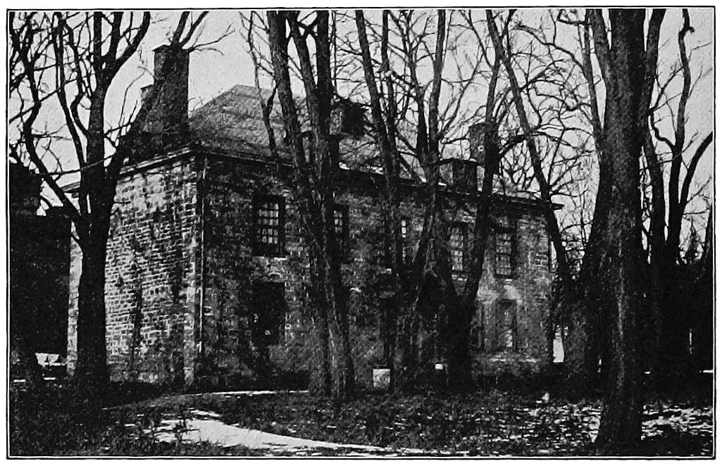
He built a fine stone mansion a short distance west
of the present city of Amsterdam and lived there many
years. He also founded Johnstown, a few miles to the
north, now a thriving little city. He dealt honestly with
the Indians, when many tried to get their lands by
fraud, and he served as a high officer in the French
and Indian wars.
As the Dutch settled the lower Mohawk valley, so
the upper parts were taken up and the forests cleared
by Yankees from New England. One of these was
Hugh White, a sturdy man with several grown children.
He left Middletown, Connecticut, in 1784, and came by
water to Albany, sending one of his sons overland to
drive two pair of oxen. Father and son met in Albany
and went together across the sands to Schenectady,
where they bought a boat to take some of the goods up
the river. Four miles west of where Utica now stands
they stopped, cut a few trees, and built a hut to shelter
them until they could raise crops and have a better
home. Thus the ancient village of Whitesboro was
founded. White was one of many hardy and brave men
who settled in central New York at that time, and they
doubtless thought that they had gone a long way “out
West.” Certainly their journey took more time than the
emigrant would now need to reach California or Oregon.
To cut the trees, build cabins, guard against the savages,
and get enough to eat and wear gave the settlers
plenty to do. Only the simplest ways of living were
possible. Until a grist mill was built they often used
samp mortars, such as the Indians made. They took a
section of white ash log three feet long, and putting
coals of fire on one end, kept them burning with a hand
bellows until the hole was deep enough to hold the
corn, which was then pounded for their meals of hominy.
By and by a mill was built, and here settlers often came
from a distance of many miles, sometimes carrying their
grists on their backs. A dozen years after White came,
General William Floyd set up another mill in the northern
part of what is now Oneida county. He was one of the
signers of the Declaration of Independence.
One settler cleared several acres and planted corn
with pumpkin seeds sprinkled in. The pigeons pulled
up all the corn, but hundreds of great pumpkins grew
and ripened. Since the crop was hardly enough, however,
for either men or beasts, the latter had to be fed
the next winter on the small top boughs of the elm,
maple, and basswood.
Much use was made of the river, for the only roads
were Indian paths through the woods on the river flats.
People and freight were carried in long, light boats
suited to river traffic and known as bateaux (bȧ-tō̟s´).
These could be propelled with oars, but poles were
necessary going upstream against a stiff current. It
was impossible to go up the Mohawk from the Hudson
above Albany, on account of the great falls at Cohoes;
hence the long carry to Schenectady. From that place,
by hard work, the boatmen could make their way up to
Little Falls, where the water descends forty feet in roaring
rapids. Here the loads and the bateaux had to be
carried along the banks to the still water above, where,
with many windings and doublings on their course, the
voyagers could reach the Oneida Carrying Place, or Fort
Stanwix. There they unloaded again, and for a mile or
more tramped across low ground to Wood creek, a little
stream flowing into Oneida lake, and thence into Oswego
river and lake Ontario. The city of Rome stands
exactly on the road followed by the “carry.” This was
an important place, and was called by the Dutch Trow
Plat, while to the Indians it was De-o-wain-sta, “the
place where canoes are carried across.” Several forts
were built there, of which the most famous was Fort
Stanwix. We should think Wood creek a difficult bit
of navigation. It was a small stream, very crooked, and
often interrupted by fallen trees. In times of low water
the boats were dragged up and even down the creek by
horses walking in the water.
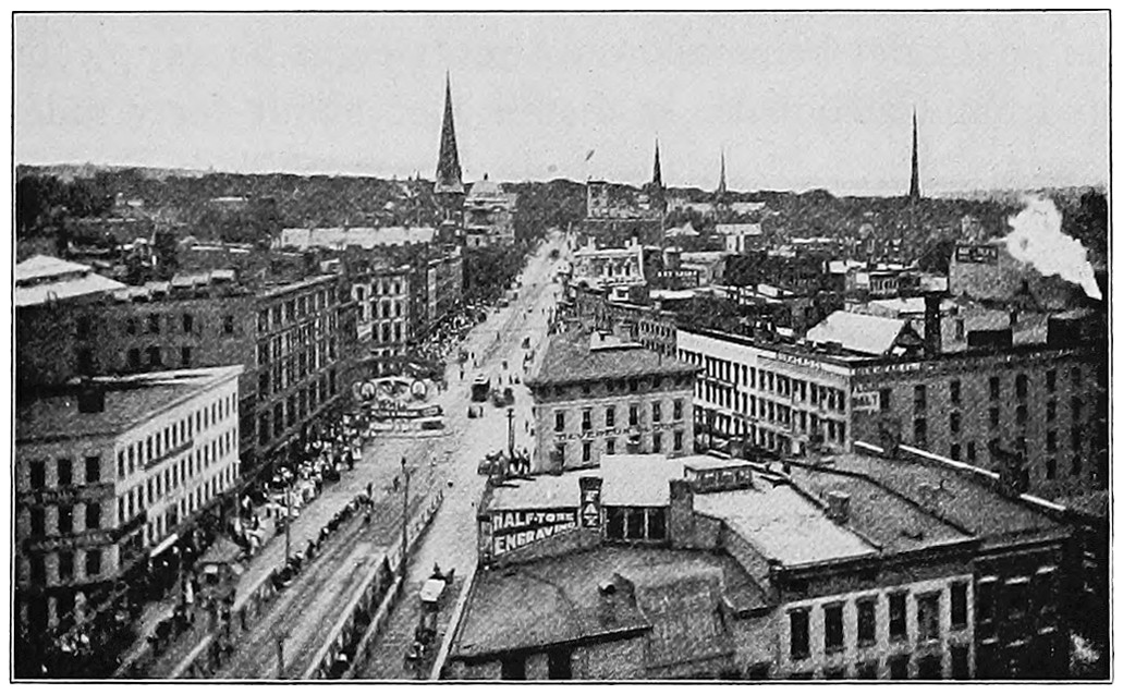
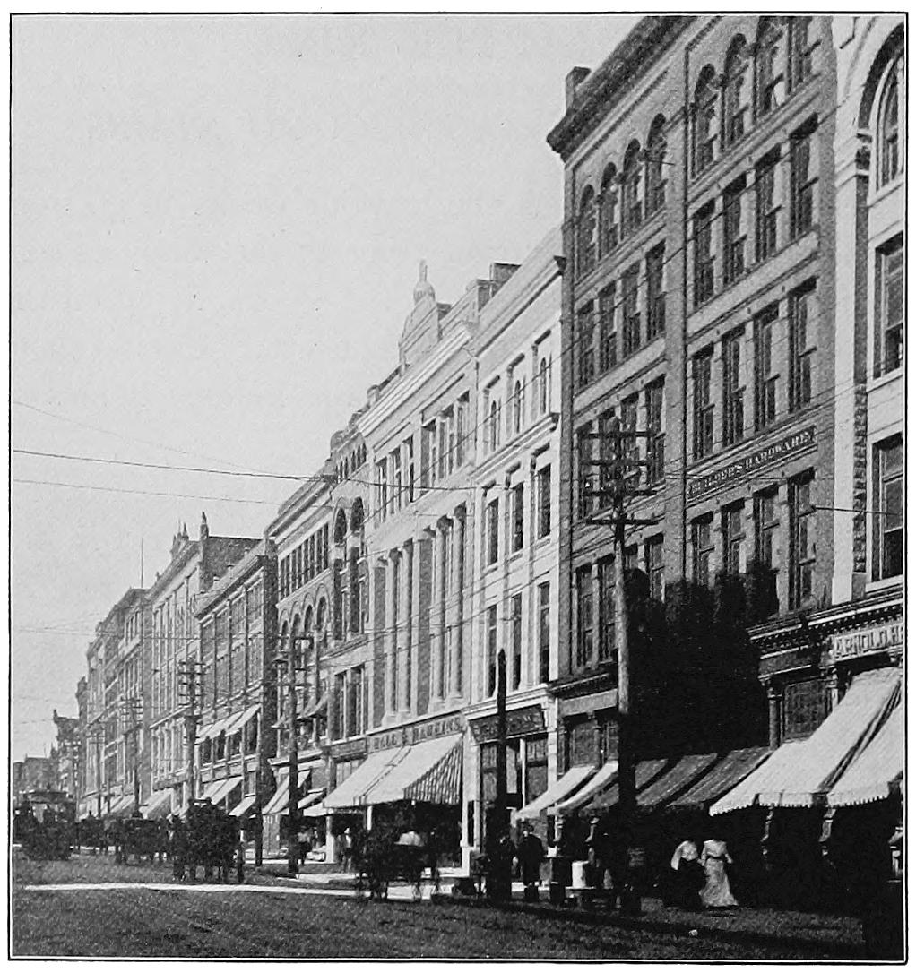
Fig. 8. Genesee Street, Utica
Part of the old Genesee road
The first merchant of old Fort Schuyler (Utica) was
John Post, who had served his country well through the
Revolution. In 1790 he brought hither his wife, three
little children, and a carpenter from Schenectady, after
a voyage of about nine days up the river. Near the
long-used fording place he built a store, at the foot of
what is now Genesee street. Here he supplied the simple
needs of the few families in the new hamlet, and
bought furs and ginseng of the Indians, giving in exchange
paint, powder, shot, cloth, beads, mirrors, and,
it must be added, rum also. Thus the fact that the river
was shallow at this point and could be passed without a
bridge or a boat led to the founding of the city of Utica.
The first regular mail reached the settlement in 1793,
the post rider being allowed twenty-eight hours to come
up from Canajoharie, a distance of about forty miles,
now traversed by many trains in much less than an
hour. On one occasion the Fort Schuyler settlement
received six letters in one mail. The people would
hardly believe this astonishing fact until John Post, who
had been made postmaster, assured them that it was
true. Post established stages and lines of boats to
Schenectady, and soon had a large business, for people
were pouring into western New York to settle upon its
fertile lands.
All the boats did not go down to Oswego and lake
Ontario. Some turned and entered the Seneca river,
following its slow and winding waters to the country
now lying between Syracuse and Rochester. But these
boats were not equal to the traffic, for the new farms
were producing grain to be transported, and the people
needed many articles from the older towns on the
Atlantic coast. Hence about a dozen years after Hugh
White built his first cabin by the river, the state legislature
took up the question of transportation and built a
great road, a hundred miles long, from Fort Schuyler, or
the future Utica, to Geneva, at the foot of Seneca lake.
The road as laid out was six rods wide. It was
improved for a width of four rods by the use of gravel
and logs where the ground was soft and swampy, as
much of it was in those days, being flat and shaded by
trees. Over the famous Genesee road, as it was called,
thousands of people went not only to the rich valley of the
Genesee in western New York but also on to Ohio, and
even to the prairies of the Mississippi river. Genesee
street in Utica and Genesee street in Syracuse are parts
of this road. The historian tells of it as a triumph, for
it was an Indian path in June, and before September
was over a stage had started at Fort Schuyler, and on
the afternoon of the third day had deposited its four
passengers at the hotel in Geneva. After this wagons
and stages began to run frequently between Albany and
Geneva. A wagon could carry fourteen barrels of flour
eastward, and in about a month could return to Geneva
from Albany with a load of needed supplies. In five
weeks, one winter, five hundred and seventy sleighs
carrying families passed through Geneva to lands farther
west.
Geneva was quite a metropolis in those days, when
there was nothing but woods where Syracuse and
Rochester now are. Regular markets were held there,
for there were fine farms and orchards about the beautiful
shores of Seneca lake. It is recorded as remarkable
that one settler had “dressed up” an old Indian orchard
and made “one hundred barrels of cyder.”
We might think that the founders of the city of
Rochester would have come in by the Genesee road,
but they did not. Far to the south, at Hagerstown in
Maryland, a country already old, lived Colonel Rochester.
He heard of the Genesee lands and at last bought, with
his partners, a hundred acres by the falls, where the city
now stands. When the little family procession passed
down the street and entered upon the long journey up
the Susquehanna valley to western New York, Rochester’s
friends in Hagerstown wept to see him go. They
thought that he had thrown his money away in buying
swamp lands where only mosquitoes, rattlesnakes, and
bears could live, but he saw farther than they did. If
he had been unwilling to take any risk, he would never
have laid out the first streets of the prosperous city
which now bears his name.
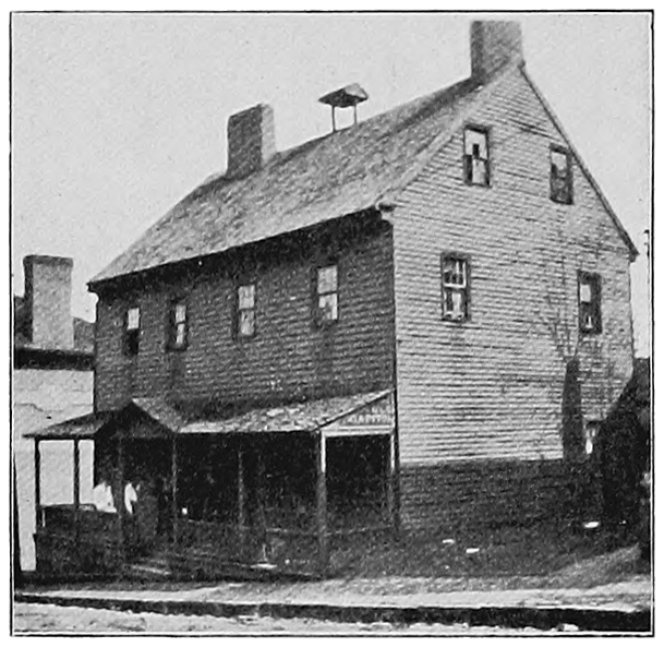
Fig. 9. Old Fort Johnson, Amsterdam, New York
Built by Sir William Johnson, 1742
Syracuse, like Utica and Rochester, had its own way
of beginning. We can truly say that at first salt made
the city. The beds of salt are not directly under Syracuse,
but are in the hills not far away. The water from
the rains and springs dissolves some of this salt, and as
it flows down it fills the gravels in and around the town.
While all was yet forest the Indian women had made
salt from the brine which oozed up in the springs. So
long ago as 1770, five years before the Revolution, the
Delaware Indians went after Onondaga salt, and a little
of it was now and then brought down to Albany. Sometimes
it was sold far down the St. Lawrence in Quebec.
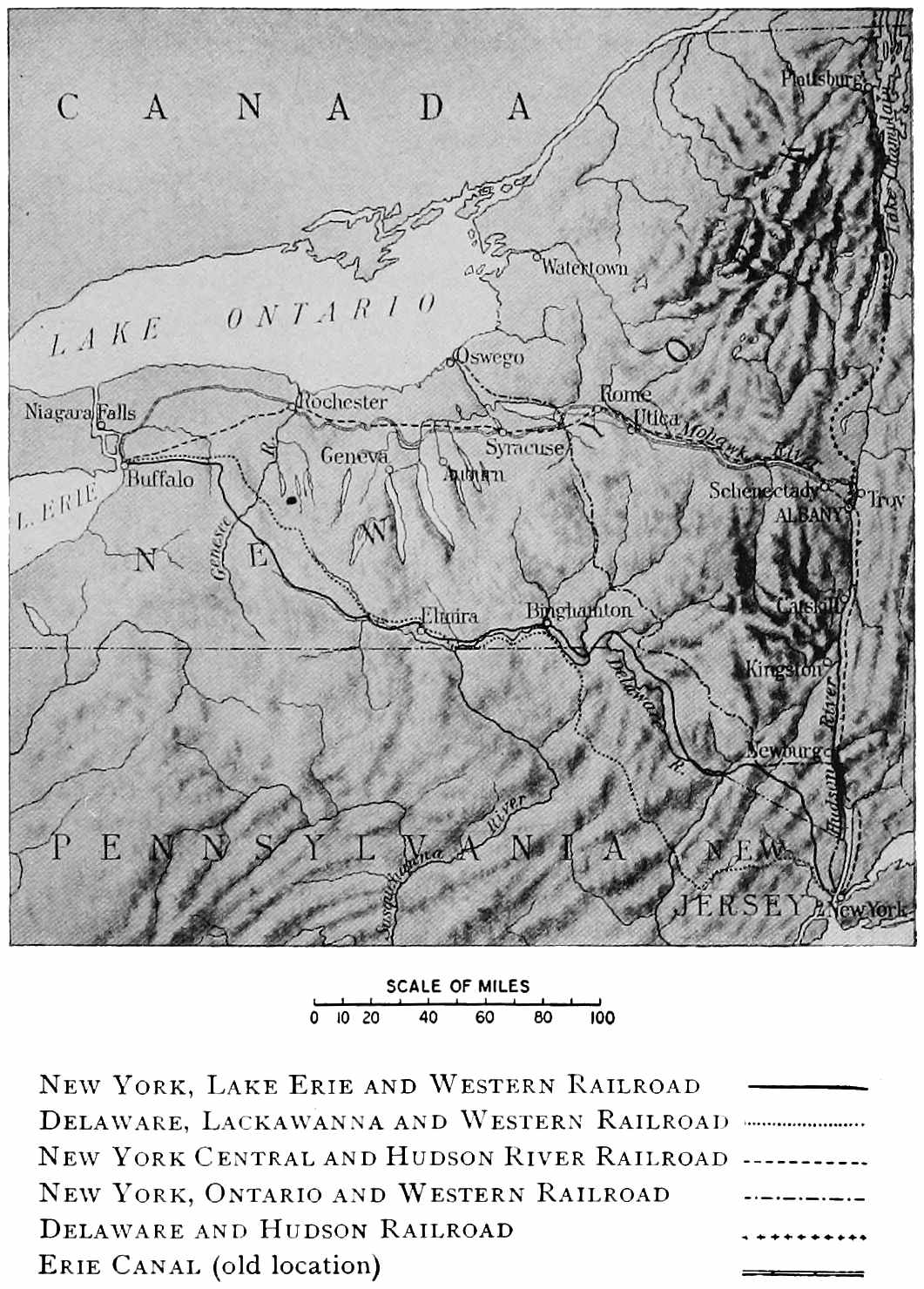
New York
New York, Lake Erie and Western Railroad
—————
Delaware, Lackawanna and Western Railroad
.....................
New York Central and Hudson River Railroad
- - - - - - - - -
New York, Ontario and Western Railroad
-·-·-·-·-·-·-·-
Delaware and Hudson Railroad
+-+-+-+-+-+
Erie Canal (old location)
=========
The pioneers first made salt there in 1788. This was
several years before the Genesee road was cut through
the woods. One of these men, a Mr. Danforth, whose
name a suburb of Syracuse now bears, used to put his
coat on his head for a cushion and on that carry out a
large kettle to the springs. He would put a pole across
crotched sticks, hang up the kettle, and go to work to
make salt. When he had made enough for the time he
would hide his kettle in the bushes and bring home his
salt. By and by so many hundreds of bushels were made
by the settlers that the government of the state framed
laws to regulate the making and selling of the salt, and
as time went on a town arose and grew into a city.
Many years later rock salt was found deep down under
the surface farther west, and since that discovery the
business of Syracuse has become more and more varied
in character.
The history of the state of New York shows well
how the New World was settled along the whole Atlantic
coast. The white men from Europe found first Manhattan
island and the harbor. Then they followed the lead
of a river and made a settlement that was to be Albany.
Still they let a river guide them, this time the Mohawk,
and it led them westward. They pushed their boats up
the stream, and on land they widened the trails of the
red men. Near its head the Mohawk valley led out into
the wide, rich plains south and east of lake Ontario.
Soon there were so many people that a good road
became necessary. When the good road was made it
brought more people, and thus the foundations of the
Empire State were laid.
CHAPTER III ORISKANY, A BATTLE OF THE REVOLUTION
About halfway between old Fort Schuyler, or Utica,
and Fort Stanwix, which is now Rome, is the village of
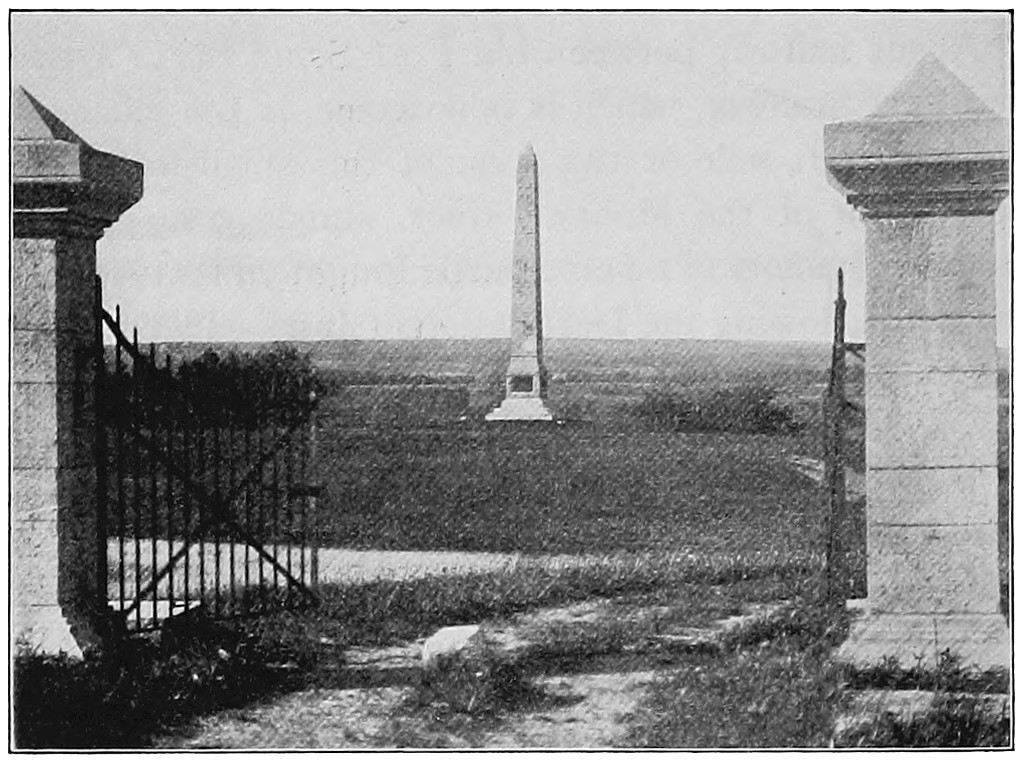
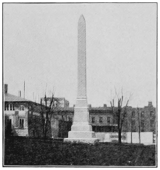
Oriskany. A mile or two west of this small town, in a
field south of the Mohawk river, stands a monument
raised in memory of a fierce battle fought on that slope in
the year following the Declaration of Independence. On
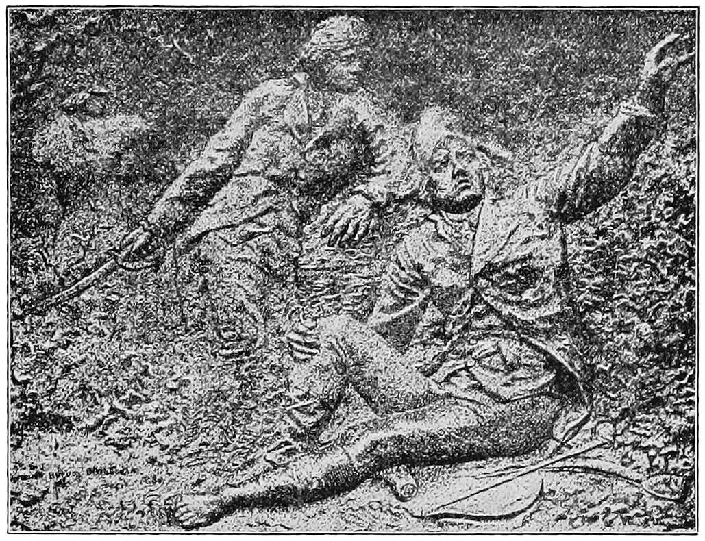
the pedestal are four tablets in bronze, one of which shows
a wounded general sitting on the ground in the woods,
with his hand raised, giving orders to his men. The time
was 1777, the strife was the battle of Oriskany, and the
brave and suffering general was Nicholas Herkimer.
On another of the tablets is this inscription:
Here was fought The battle of Oriskany On the 6th day of August, 1777. Here British invasion was checked and thwarted. Here General Nicholas Herkimer, Intrepid leader of the American forces, Though mortally wounded kept his command of the fight Till the enemy had fled. The life blood of more than Two hundred patriot heroes Made this battle ground Sacred forever.
After the battle Herkimer was carried down the
valley to his home, where a few days later he died.
On the field he had calmly lighted his pipe and smoked
it as he gave his orders, refusing to be carried to a safe
place and saying, “I will face the enemy.” If the battle
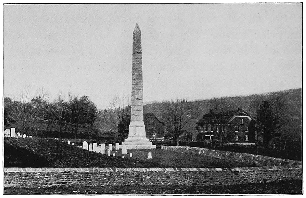
has its monument, so the hero that won it has his,
and the traveler on the New York Central Railway can
see both, but thirty miles apart, the one at Oriskany, the
other a short distance down the valley from Little Falls.
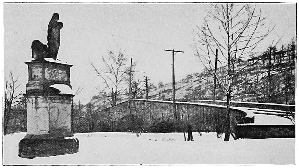
Fig. 10. Oriskany Battle Monument, a Few Miles
West of Utica
Herkimer was not a trained soldier, but a plain farmer
of the valley. His letters and military orders show us
that he could spell as poorly as any of his neighbors, and
that is saying a good deal. His army was made up of
these same simple neighbors, who, though they did not
know much about soldierly marching, were good shots
and hard hitters, fighting not for pay but to save their
liberty and to protect their homes from the cruel savages.
The names of many of these men are on the battle
monument,—names such as Groot, Petrie, Dunckel,
Klock, Kraus, Sammons, Schnell, Van Horn, and Zimmerman.
We do not need to be told that these were not
men of English blood; indeed, many of them belonged
to those same Dutch families which we saw settling in
the Hudson and Mohawk valleys. And some, like the
last one, were not Dutch but German, and their ancestors
came not from Holland but from a land farther up the
Rhine. They had been driven out by the persecutions
of one of the French kings and had come to America.
They had had a hard time, suffering much from taskmasters,
from poverty, and from the savages, until finally
they had gone farther west in the Mohawk valley and had
received good lands lying eastward from Utica. There
they became comfortable and prosperous. They answered
promptly the brave Herkimer’s call to arms, and many of
them gave their lives for home and country at Oriskany.
We must now tell the other side of the story and
see who the invaders were and where they came from.
In Revolutionary days nearly all the people of New
York were in its two great valleys. One could go up
the Hudson from New York, pass Albany and Fort
Edward, and, without finding high ground, enter the
valley of lake Champlain and go down to Montreal
on the St. Lawrence. Here, then, was an easy valley
road from the sea at New York into Canada. Coming
either way, one could turn off to the west at Fort
Orange or Albany and go up the Mohawk and down to
Oswego on lake Ontario. In these two valleys were all
the farms, the towns, and of course the forts. There
were forts at Oswego and where Rome, Utica, and
Albany are; at Fort Edward, Fort Ann, Ticonderoga,
and many other places, making a chain of defenses in
these valleys. West of the Hudson and south of the
Mohawk were the high, rough woods of the Catskills;
while west of lake Champlain and north of the Mohawk
were the rugged Adirondacks, without roads or clearings.
And because the roads, the homes, and the forts
were in the valleys, we shall almost always find the
armies and the fighting there.
This will help us to understand the plan which the
British made in 1777, by which they felt sure of crushing
the rebellion. The year before they had to leave
Boston and had come around to New York. New York
was not so large as Philadelphia then, but it was an
important place, for it was the key to the Hudson
valley. The British generals decided to send one army
up the Hudson to destroy the forts and beat back the
colonists. This army was under General Howe. Another
army, commanded by General Burgoyne, was to come
from the St. Lawrence up lake Champlain and through
the woods by Fort Edward to Albany. Burgoyne was a
brave officer, but he was conceited, and he felt too sure
that he could do his part easily. He was confident that
when he marched through the country many colonists
would run to place themselves under the English flag.
In a few weeks he learned that these backwoods Americans
were quite ready to meet and give battle to the
combined forces of the British regulars, the hired German
soldiers, and the Indians with whom they were
in league.
Fig. 11. General Nicholas Herkimer directing the
Battle of Oriskany
There was yet a third division in this campaign. A
British force under General St. Leger had come up the
St. Lawrence and lake Ontario to Oswego. St. Leger
also had with him many Indians, and these were commanded
by Joseph Brant, a famous chief, who had had
much to do with white men and who was well educated.
This third army was to go east, over the Oneida Carrying
Place and down the Mohawk to Albany. By this
pretty plan three armies, one from the south under
Howe, one from the north under Burgoyne, and one
from the west under St. Leger, were to meet in Albany.
They would put British soldiers in every fort on the
way, capture and disarm the rebels, and have all New
York under their feet. More than this, they would thus
shut off New England from Pennsylvania and Virginia,
cutting the unruly colonies into two parts so that they
could not help each other.
But the scheme, brilliant as it was, would not work.
None of the British armies reached Albany. Howe did
not, perhaps because he did not try. Burgoyne and
St. Leger did not, because they could not: there was
altogether too much in the way. We shall now see how
this happened.
St. Leger brought into the Mohawk valley from Oswego
an army of seventeen hundred men. Some were
British, some were Hessians or hired German soldiers,
and the rest were Indians under Joseph Brant. They
thought that it would not be much trouble to take Fort
Stanwix and then go down the valley, burning and
killing as they went, until they should meet the other
armies of the king at Albany. But the colonists sent
more soldiers to defend the fort, and Colonel Peter
Gansevoort, who was in command, had under him nearly
a thousand men. Just before the British came in sight
a stock of provisions, brought on several boats up the
river, had been safely delivered within the defenses.
This was early in August, and only about seven weeks
before Congress had adopted the style of American flag
which we know so well. There was no flag at Fort
Stanwix, so the garrison set about making one. They
cut up shirts to make the white. The blue came from a
cloak captured not long before in a battle, on the Hudson,
by Colonel Marinus Willett, one of the bravest
commanders within the fort. The red is said to have
been taken from a petticoat. Certain it is that a patriot
flag was made, and some think that it was the first
American flag ever raised over a fortification.
While the British were besieging Fort Stanwix, General
Herkimer had called out the men of the valley,
bidding all between the ages of sixteen and sixty make
ready for battle. The boys and old men were to do
their best to care for the families and to defend their
homes. Eight hundred men gathered under Herkimer
and marched to help the garrison of the fort. Hearing
of this, part of the British army, including the Indians,
came down the valley to head off Herkimer. They met
at Oriskany. The farmer soldiers were hurrying up the
valley without due watching for sudden attack, while the
enemy placed themselves in ambush around a low field
which was wooded and swampy. Through this field the
road ran, and when Herkimer’s men were well down
into it the Indians opened a hot fire, which threw the
patriots into disorder. They soon rallied and fought
fiercely for five hours, until two hundred of them had
lost their lives. Early in the battle Herkimer was shot,
but he forgot his pain when he saw his men victorious.
Much of the fighting was of the Indian sort, from behind
trees, for the Dutchmen well knew the ways of the
savages. They saw that when one man fired from behind
a tree an Indian would rush forward to tomahawk
him before he could load his gun for another shot. So
they were ordered to stand by twos and take turns in
firing. Thus when the Indian ran forward with his tomahawk
he would receive a bullet from the other man’s gun.
Fig. 12. Nicholas Herkimer’s Monument
To the right is the old mansion in which he lived. Near Little Falls,
New York
Under John Johnson, the son of Sir William Johnson,
were many Tories from the valley. They and the patriots
often recognized each other as former neighbors,
and then the fight was more stubborn than ever, for
the soldiers of freedom were bitterly angry to find old
friends in arms against them. During the battle a
terrific thunder-shower came up, and both sides stopped
fighting, having enough to do to keep their powder and
guns dry. The dark storm passed and the strife went
on again. At length the Indians grew tired and ran,
leaving the field to Herkimer and his little army. The
importance of a conflict is not always in proportion to
the size of the armies engaged, and in what it did for
freedom Oriskany takes high place among the battles
of modern times.
The enemy went back to the siege of Fort Stanwix,
and soon a new force of patriots under Benedict Arnold
was sent up the valley to relieve the fort. It was during
this march that an ignorant but cunning fellow
named Han Yost Schuyler was caught, tried, and condemned
to die as a spy. Because his friends pleaded for
his life Arnold finally told him that he might live if he
would go up to Fort Stanwix and make the Indians and
British believe that a great army was marching against
them. Meanwhile the man’s brother was held as a hostage,
to be punished if the promise was not fulfilled.
Han Yost did his part so well that St. Leger, taking
fright, left the fort in great haste and his expedition
was entirely broken up. Why he did not have a gay
march down to Albany is now quite plain.
A few days after the battle of Oriskany a number of
men drove some cattle to Fort Stanwix as food for the
soldiers. Several women went with them on horseback
to visit their husbands, who belonged to the garrison.
At the ford of the river, now the Genesee street crossing
in Utica, a big Dutchman, who did not wish to get wet,
leaped uninvited upon a horse behind one of the women.
The horse did not like the double load, and made great
sport by throwing the Dutchman into the middle of the
stream, while he carried his mistress over in safety.
General Burgoyne came nearer Albany than did
St. Leger. Indeed he went to Albany, but not until he
had lost his army. He had promptly captured Ticonderoga
on lake Champlain, and this success gave him
high hopes and sent rejoicing throughout Great Britain;
but the patriots, by felling trees and cutting away
bridges, hindered his southward march in every way.
He sent a thousand of his German soldiers across to
Bennington, among the Green mountains, to capture
stores which he knew were there. But General Stark
was there also, with a little army from New Hampshire
and Massachusetts, and the thousand Hessians did not
go back to help Burgoyne. He had left another thousand
to guard Ticonderoga, and so he was two thousand
short. All this time the patriot army was growing, for
the men of the Hudson valley were maddened when
they saw the bloodthirsty Indians marching with the
English, and, to Burgoyne’s surprise, they had no mind
to fight for the king. Howe did not come, St. Leger
did not come, and the provisions were getting short.
These could only come along the road from the north,
and the colonists were already marching in behind Burgoyne’s
army to cut his line of communications. He
knew that he must fight or starve. He chose to fight.
The battle was fought on Bemis Heights, a range of
hills west of the Hudson, a short distance north of the
little village of Stillwater. The British general, after
his defeat, withdrew a few miles northward and surrendered
his army near the present town of Schuylerville.
A tall monument marks the place. This was the battle
of Saratoga, fought in old Saratoga, which is several
miles from the famous resort of that name.
So it was that up and down these beautiful valleys
went armies and scouting bands, as well as peaceful
emigrants with their oxen, their stages, and their small
freight boats. One cannot go far along the Hudson or
the Mohawk without finding the site of an Indian village,
the foundations of an old fort, the homestead of
a Revolutionary hero, or an ancient place of worship.
When we see the great railways and swift trains, the
bundles of telegraph wires, the noisy cities and great
mills of to-day, we can remember Philip Schuyler, Sir
William Johnson, Marinus Willett, Peter Gansevoort,
and Nicholas Herkimer. There were no nobler patriots,
even in Virginia and Massachusetts, than these men of
the Mohawk valley.
CHAPTER IV THE ERIE CANAL
If we think that the men of a hundred years ago
were people with few wants, who were willing to let
others do the trading and make the fortunes, we are
quite in the wrong. They were as eager in business as
are the driving Americans of to-day. So long ago as
1683 Thomas Dongan, a well-born Irishman, came to
New York to be its governor. In his letters to the government
in London he said a great deal about the fur
trade and the danger of its going to other cities. Once
he reported that two hundred packs of beaver skins had
gone down the Susquehanna river and across to Philadelphia
instead of being brought by the Mohawk to
New York, and he thought that if this traffic continued
New York would be ruined.
As time went on the rivalry grew stronger and
stronger. All the cities on the coast were bidding for
the western trade. The “West” was then the Genesee
country, the plains along the Lakes, and the rich lands
of the Ohio valley. Some of the trade from the Lakes
and the Genesee went down the St. Lawrence. Heavy
articles especially were sent to Quebec, while lighter
freight was taken overland down the Mohawk. When
De Witt Clinton was stirring up the legislature and the
people of New York, he told them he was very sorry to
learn that merchandise from Montreal was sold in the
state for less than New York prices. This was because
there was transportation by water from Montreal, and
the St. Lawrence merchants could afford to undersell
those of New York.
Many people thought that the wheat and flour and
other products of western New York would all go down
the Susquehanna to Baltimore and Philadelphia. Rough
boats known as “arks” were built and floated down the
river in the high water caused by the melting of the
snows in the Allegheny highlands. From two to five
hundred barrels of flour were carried in one of these
craft. As the boats could not be sailed up the river,
they were taken to pieces at the end of the voyage and
sold for lumber. We have already seen that Colonel
Rochester followed this valley in migrating to the Genesee
river, and one writer calls attention to the fact
that in seven days several elderly people had come
quite comfortably by this route from Baltimore to Bath
in the southwestern part of New York. One could now
travel from San Francisco to New York and almost
halfway across the Atlantic ocean in that time.
Other cities also hoped to secure some of the profits
of dealing with the rapidly growing West. The tourist
on his way down the Potomac to Mount Vernon, the
home of Washington, will pass by Alexandria, a quiet
old town of about fifteen thousand people. Washington
himself thought it possible that Alexandria might get a
good share of the trade from Detroit and other places
on the Lakes and on the Ohio river. All this seems
strange to us, because since the days of our great-grandfathers
the traffic has been going largely to New York.
The cause of the change was the Erie canal. Yet in
1818, a few months after the canal was begun, an Albany
newspaper discussed very earnestly, as one of the chief
questions of the day, the danger that Philadelphia would
take away the western trade.
Flour, salt, and potash had been taken to New York
in large quantities, but all these products were carried
as far as Schenectady in little ten-ton boats, by way of
Wood creek and the Mohawk. As the business grew it
was seen to be impossible always to drag the boats up
Wood creek with horses, and that the small canal, ten feet
wide, which had been cut around the rapids at Little
Falls, could not serve the purposes of another generation.
Hence for many years there had been talk of a canal
to join the Lakes and the Hudson, thus making navigation
without a break from the interior of the country to
the Atlantic ocean at New York. The credit for first
thinking of such a canal has been claimed for several
men, but probably it was “in the air,” and many thought
of it at about the same time.
Gouverneur Morris, one of the famous New York
statesmen of the day, proposed that lake Erie should
be “tapped” and its waters led to the Hudson. The surface
of this lake is five hundred and seventy-three feet
above tide water at Albany. It was Morris’s idea to dig
a channel, with a gently sloping bottom, which should
send the water east in a stream deep enough to float
a boat. The water thus turned from its course would
go to Albany instead of flowing through the Niagara
and the St. Lawrence. There were, however, difficulties
about the plan which Morris did not understand, and it
was never carried out.
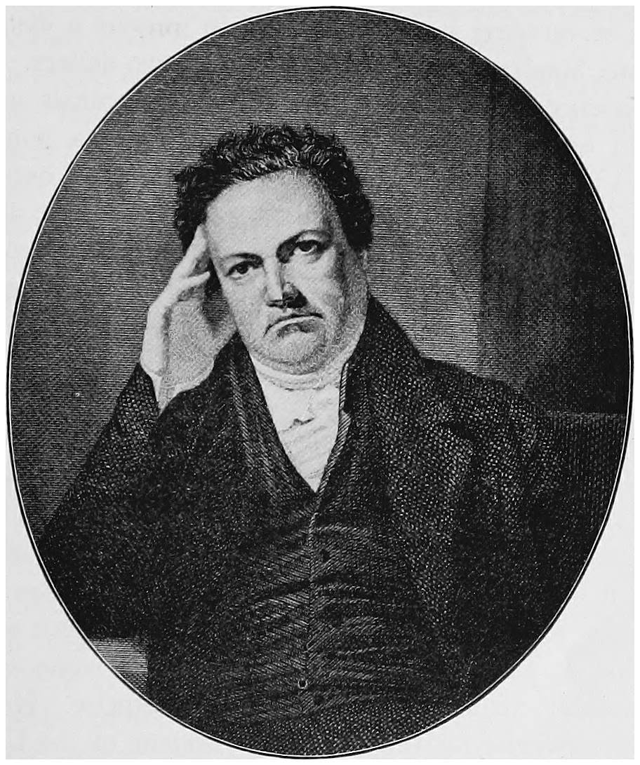
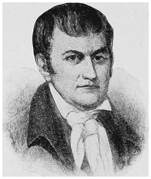
Fig. 13. De Witt Clinton
The great water way is often known as “Clinton’s
Ditch.” This name was doubtless given in ridicule by
those who did not think it could be built. There were
many who laughed at the surveyors when they saw them
looking about, using their levels, and driving their stakes
in the woods and swamps. It was even said that to dig
such a canal was impossible, that it would cost too much
money, that it would take too much time, and that the
canal itself could never be made to hold water.
But Clinton and his supporters believed in it, and
worked hard to make it a success. They said that the
cost of carrying a ton of produce in wagons a distance
of one hundred miles was about thirty-two dollars. The
experience of others had proved that in canals a ton
could be carried one mile for one cent, or a hundred
miles for one dollar. There is a great difference between
one dollar and thirty-two dollars, especially if the difference
is added to the cost of the wheat from which our
bread is made, or of the lumber used in building our
houses. Clinton himself thought that it might take ten
or fifteen years to make the canal, but, as we shall see,
it was finished in less time than he supposed.
Clinton declared very truly that New York was especially
fortunate, for the surface made it an easy task to
dig the ditch. There was no high or rough ground to be
crossed, there was plenty of water to keep the canal full,
and it would run through a fertile and rich country. As
Clinton was governor of New York during much of the
period in which the canal was made, his name is imperishably
connected with the great enterprise. He was
once candidate for the office of President of the United
States, but perhaps even that office, if he had been
elected, would not have given him so much honor as did
the building of this great public work.
Canals were not new in Clinton’s time. Long before
the Christian era began men had dug them to carry
water for various uses, such as irrigation and turning
machinery. Often, as for hundreds of years in the fen
country of England, canals have been used to drain wet
or flooded lands and for moving boats. Even beavers
have been known to dig ditches, which fill with water,
that they may float the wood which they cut to the place
where they build their dams and their homes.
If a region is perfectly level, only a ditch and water are
needed. But lands are not often level for more than short
distances; hence a canal consists commonly of a series
of levels at different heights. Of course the boats must
be passed from one level to another by some means. If
they are small, they can be dragged up or down between
two levels; but this method will not serve for large
boats carrying many tons of coal, lumber, salt, or bricks,
hence locks are generally used. A lock is a short section
of a canal, long enough for the boats used, and having
walls rising from the bottom of the lower level to
the top of the upper one. There are big gates at each
end. If a boat is to ascend, it runs into the lock on the
lower level and the lower gates are closed. A small gate
in the large upper gate is then opened and the water
runs in from above, slowly raising the water in the lock
and with it the boat. When the water in the lock is
even with the water in the upper level, the big upper
gates are swung open and the boat goes on its way. In
a similar manner boats go down from higher to lower
sections of the canal. Locks have been used in Italy and
in Holland for more than four hundred years.
On April 15, 1817, the legislature passed the law for
the construction of the long ditch, and the first spade
was set into the earth by Judge John Richardson at
Rome, New York, on July 4 of the same year. This
was forty-one years after the Declaration of Independence,
and it is plain that the country had grown much
in wealth and numbers when a single state could start
out to build a water way three hundred miles long.
After the first spadeful of soil had been lifted, the citizens
and the laborers eagerly seized the shovels, and
thus everybody had a small share in beginning the great
work. Guns were fired and there was much rejoicing.
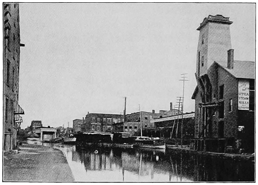
Fig. 14. Erie Canal, looking East from Genesee Street
Bridge, Utica
The men who took the contracts for digging short
sections of the canal were mainly farmers who had gained
good properties and who were living along the line. In
those days, if any one had visited the men at work, he
would not have seen crowds of foreign laborers living
in huts, but men born and reared in the country round
about. It was little more than twenty years since the
Genesee road had been built through central New
York, and there was still much forest. The trees grew
rank and strong, and it was no light task to cut through
the tangled network of roots that lay below the surface.
First the trees were cut down, making a lane sixty feet
wide, and in this the canal was dug to a width of forty feet.
Powerful machines that could draw out stumps and pull
over the largest trees were brought from Europe. The
wheels of the stump machine were sixteen feet across.
A plow with a sharp blade was also made, to cut down
through the heavy carpet of fibers and small roots.
Swiftly one piece after another of the canal was finished
and the water let in. The trench was found to hold
water, and boats were soon busy hauling produce from
town to town. In 1825 it was finished from Black Rock,
or Buffalo, to Waterford, above Troy. The work had taken
eight years and had cost a little less than eight million
dollars. De Witt Clinton was right and the croakers
were wrong. Perhaps it was hard at that time to find any
one who did not think that he had always wanted a canal.
There were, it is true, a few disappointed ones at
Schenectady. There the wagons from Albany had
always stopped, and there the boating up the Mohawk
had begun. As all the loads had to be shifted between
the river and the land journeys, there had been work for
many men. Thus the place had grown up, and now that
boats were to run through without change, some people
naturally thought that the town would die out, or would
at least lose much of its business. These few discontented
folk, however, were hardly to be counted, among
the thousands who exulted over the completed canal.
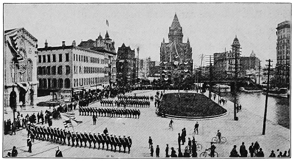
Fig. 15. Along the Canal in Syracuse
Copyrighted, 1899, by A. P. Yates, Syracuse, N.Y.
A great celebration was arranged, and the rejoicings
of the beginning were redoubled in the festivities at
the end. Boats were made ready at Buffalo to take
Governor Clinton and the other guests to New York.
When the first boat entered the canal from lake Erie
a cannon was fired. Cannon had been set within hearing
distance all the way to the sea along the line of the
canal. This way of sending news was the nearest approach
to the telegraph at that time. Soon the tidings
of the great event came booming down among the
cliffs of the Hudson and reached New York.1
1 The time allowed for the signaling from Buffalo to Sandy Hook
was one hour and twenty minutes. This programme was substantially
carried out. From Albany to Sandy Hook only twenty minutes were
required.
Two kegs of lake Erie water were put on one of the
boats at Buffalo, and we shall see what was done with
them. There were also two barrels of fine apples which
had been raised in an orchard at Niagara Falls. These
were not to be eaten on the way, one barrel being for
the Town Council of Troy, and the other for the city
fathers of New York. Many people on both sides of
the ocean are still eating fine apples from the trees
of the Genesee country.
One boat in the little fleet was called Noah’s Ark,
and on board were two eagles, a bear, some fawns,
fishes, and birds, besides two Indian boys. These were
sent to New York as “products of the West.” At every
town there was a celebration, and great was the excitement
in such cities as Rochester, Syracuse, Utica, and
Albany. There were salutes and feasts and speeches
and prayers, and the gratitude and joy of the people
fairly ran over. The greatest celebration of all was in
New York, where everybody turned out to do honor to
the occasion. The fine ladies boarded a special boat,
and the “aquatic procession” went down through the
bay to Sandy Hook. It was arranged that a messenger
of Neptune, the sea god, should meet the fleet, inquire
their errand, and lead them to his master’s realm. Here
Governor Clinton turned out the lake Erie water from
the two kegs into the sea as a symbol of the joining of
the lakes and the ocean. Then all the people went back
to the city and had speeches and parades, feasts and
fireworks, while the city-hall bell was rung for several
hours. The illumination was said to be a fine one, but
perhaps their lamps and candles would now look dim.
After the canal was finished the carrying business was
quite made over. Little was heard then about sending
western New York fruit and grain to Philadelphia or
Montreal or Alexandria. Freighting was so cheap that
a man who had been selling his wheat for thirty cents
a bushel now received a dollar for it. In the war with
England, only a few years before, it had cost more to
carry a cannon from Albany to Oswego than it had cost
to make it. The journey had now become an easy and
simple matter. Two farmers built a boat of their own,
loaded it with the produce of their farms, and took it
down Seneca lake and all the way to New York. They
were let out of the woods into the wide world.
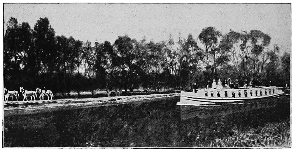
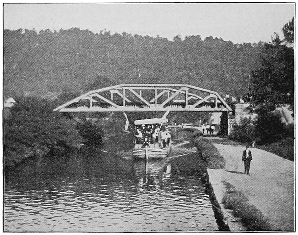
Fig. 16. Traveling by Packet on the Erie Canal
The canal was not entirely given up to the carrying
of freight. People thought that it was a fine experience
to travel in the passenger boats, which were
called “packets.” These were considered as remarkable
as are the limited express trains of to-day. The speed
allowed by law was five miles an hour. To go faster
would drive the water against the banks and injure
them. The fare was five cents a mile including berth
and table. It was said that a man could travel from
New York to Buffalo with “the utmost comfort” and
without fatigue. The journey cost eighteen dollars, and
only took six days! We, of course, cannot help thinking
of the Empire State Express, which leaves New
York at 8.30 A.M. and arrives in Buffalo at 4.50 P.M.
Fig. 17. Erie Canal and Solvay Works, Syracuse
If the journey of those days seems long to us, we
must remember that to most of the travelers the scenery
was fresh and interesting, for it was a visit to a
new land. The rocky highlands, the blue Catskills, the
winding Mohawk, and the towns and farms of the
interior were perhaps as full of interest as the morning
paper is on the trains of to-day. From Utica to Syracuse,
more than fifty miles, is one great level; but on
nearing Rochester the canal follows an embankment
across a valley, and the passengers in those days looked
wonderingly down on the tops of trees. At Lockport
they heard the clatter as they slowly rose by a long row
of locks to the top of the cliffs, and at Buffalo they
looked out on a sea of fresh water. At Utica, Rome,
Rochester, and other places, after a few years, side
canals came in from north and south, from Binghamton
and from the upper valley of the Genesee; and up in
the hills great reservoirs were built, with shallow canals
known as “feeders” leading down to the main trench.
These were built to make sure that there should be
water enough for dry seasons; for locks will leak, and
whenever a boat locks down a lockful of water goes on
toward the sea.
Now all was stir and growth. Buffalo had started
on its way to become a great city. Rochester ground
more wheat and Syracuse made more salt. There was
no doubt that New York would soon be known as the
metropolis of the western world, and “Clinton’s Ditch”
became the most famous of American canals.
CHAPTER V THE NEW YORK CENTRAL RAILWAY
The Erie canal had not long been finished when a
new way of carrying men and merchandise came into
use in New York. In the next year after the great
celebration the legislature granted a charter to build a
railroad from Albany to Schenectady. It is sometimes
said that this was the first time in America that cars
were drawn by means of steam. This is not true, but
New York was not far behind some other states, and
the De Witt Clinton train, of which a picture is shown
in this chapter, looks as if it must have been one of the
very earliest ones. This train made its trial trip in 1831,
which was seventeen years after George Stephenson
had built his first locomotive in England.
A railroad had been opened from Baltimore, a few
miles to the west, the year before, and about the same
time another was built in South Carolina. Two years
earlier, in 1829, the Delaware and Hudson Canal Company
brought from England three locomotives, one of
them built by Stephenson, to draw coal to their canal
from their mines at Honesdale, Pennsylvania. In 1826
a railroad four miles long was built at Quincy, Massachusetts,
to carry granite from the quarries to the sea.
It was called a tramway, and horses were used instead
of steam. If we go to England, we shall find that
tramways have been used there for more than a hundred
years. Thus it is not easy to say when the first
railroad was built, and all writers do not tell the same
story about it, but it is certain that steam cars were
first used and long roads with iron tracks were first
built a little less than a hundred years ago.
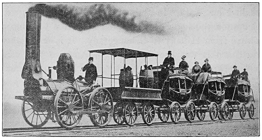
Fig. 18. The De Witt Clinton Train
If we study the De Witt Clinton train, we shall learn
several things. Both the engine and the coaches were
small and light compared with those used now. With
the great speed of to-day, all the parts of a train must
be very heavy in order to cling to the track. The engine
of those days had four light driving wheels, and the engineer,
it would seem, had to operate his engine while
facing wind and storm. The cab looks very much like a
common express wagon made heavier than usual; and if
we look at the passenger wagons, we shall see why passenger
cars are called coaches. The first ones were coaches,
and every picture of an old passenger train shows that
the cars were modeled after the coaches of the stage
lines of that age, except that the wheels were made
with flat rims, with flanges to keep them on the track.
The passengers certainly could not move about, and the
high perches on the top look somewhat dangerous. One
would think that the wind and the smoke of the locomotive
could not have been pleasant. The men could not
go into a smoking car, and if they had luncheon they
must have brought it in their pockets. Nor could they
tuck themselves snugly into a berth and sleep all night.
These things, however, were not needed upon a railroad
that was only eighteen miles long. To this day dining
cars and “sleepers” are not so much used in England
as in this country. Millions of people travel there, but
the land is small, they go swiftly, and can usually eat
and sleep at their journey’s end. They still speak of the
“wagons” of the “goods train,” and English freight cars
look almost like toys by the side of ours in America.
This shows us how closely the railways and cars are
related to common roads and vehicles.
People laughed at railroads in these early days and
had about as much faith in them as we now have in
flying machines. A few years ago men would have had
the same sport about wireless telegraphy, or about talking
between New York and Chicago with a telephone.
Mrs. Alice Morse Earle, who has written much about
early life in New England, says that the farmers did not
like railroads, for they thought that horses would soon
be useless and would then be killed, and that there would
be no demand for oats or hay. They were afraid, too,
that the noise would frighten the hens so that they
would not lay, that the sparks from the engine would
burn up everything, and that the people would go crazy.
There was some excuse for not enjoying railway
travel, for the roadbeds were often made of solid rock,
and the cars did not always have springs. The tracks
were made of strap iron spiked down to wooden stringers.
These iron straps would sometimes become loose,
and had an unpleasant way of curling up and piercing
the floor of the coach where people were sitting.
In these days it is more comfortable and probably
safer to ride in a railway train than behind a horse. The
Empire State Express runs from New York to Buffalo
in eight hours and twenty minutes. It makes but four
stops on the way and covers more than fifty-three miles
an hour. When we compare this with the packet-boat
time-table of seventy-five years ago we see how much
time is now saved.
To-day a man can board the Twentieth Century
Limited in New York City at 2.45 in the afternoon and
be set down in Chicago the next morning. He can do
business nearly all of one day by the sea, and nearly all
of the next day on the shore of lake Michigan. On
the way he will find easy chairs, books and papers, a
good bed, a fine table, a place to write, to be shaved, or
to take a bath, and he may even read from time to time
the prices of stocks as they are sent over the wire from
New York and Chicago. But our comfortable traveler
should not despise the early days. Perhaps he misses
some of the good times that the great-grandfathers had
in the Mohawk boats and along the Genesee road.
To go so fast and so far means that much has been
done since the first small train came across the sand
fields to Schenectady. Five years later the trains ran
up to Utica. This was two hundred and two years after
Arent Van Curler’s journey along the same river. In two
years more a little road, twenty-five miles long, had been
finished between Syracuse and Auburn; but it was not
until 1839, when another winter had passed, that the
link between Utica and Syracuse was completed. This
ran much of the way through woods and swamps, and
in some cases timbers or piles had to be driven deep to
hold up the track.
Fig. 19. The Twentieth Century Limited
These roads were built by different companies, with
no idea of joining them all into a through line. When, in
time, there was talk of this the Utica people did not like
it. They thought that it would ruin the business of their
town if passengers and freight need not be changed there
and if trains went rushing through. But after a while
all the links between New York and Buffalo were forged
into one chain, or became a “trunk line,” to put it in
the modern way. Of course it would cost less to haul
Genesee flour or Niagara county apples to New York if
they could go through in the same car in which they
were first locked. This soon became so plain that there
was no further question as to uniting the various roads.
We shall see how they all became one.
Cornelius Vanderbilt was of Dutch descent and was
born on Staten island in 1794. He grew up in the
steamboat business, and by industry and foresight became
the owner of various lines plying on the Hudson,
along the coast, and even across the Atlantic.
He had so much to do with shipping that at length
he was known as “Commodore” Vanderbilt, although
this was a nickname and not a real title. By and by
he began to buy railroads, and by 1869 he was able
to unite those of the Hudson and those west of Albany
into the New York Central and Hudson River Railroad.
His descendants have bought or leased many other roads,
which, taken together, are often called the Vanderbilt
system. This reaches far westward into many states and
joins other great cities to the metropolis by lines of
steel.
Fig. 20. Rounding the Noses, Mohawk Valley
Railways in Michigan and Ohio were tied to Vanderbilt’s
road, and wheat and many other products came
to Buffalo not only on cars but by ships on the Great
Lakes, and were then sent to New York and across the
ocean. So the canal gradually did less business and the
railroad did more, for people could travel faster by rail,
and some things, like meat and fruit, must be carried
swiftly or they will spoil on the way. Now, instead of
ten-ton boats on the Mohawk, or the slow-going craft
of “Clinton’s Ditch,” great freight trains rush down
the Mohawk valley, bearing nearly a hundred thousand
bushels of grain behind one engine. Such a load would
have fed George Washington’s armies for a long time.
After a while one track was not sufficient for so many
trains going east and west. Too much time was lost
in waiting on sidings and there was danger of collision.
For this reason a second track was put down, then a
third and a fourth, and now all the way from Albany to
Buffalo there are two tracks for passenger trains and
two for freight. Down the Hudson there are but two
tracks, because the space between the river and the uplands
is so narrow. Many years ago a rival road, called
the West Shore Railway, was built along the west bank
of the Hudson, and then westward to Buffalo. This with
its two tracks was bought by the owners of the Central
road, so that now they have six tracks across the state.
Even these are hardly enough, for every year the great
West has more people, raises more grain to ship to
eastern cities and to Europe, and requires more goods
from mills and factories along the Atlantic coast.
There are many local trains that run between New
York and Albany, or Albany and Syracuse, or Syracuse
and Buffalo. These are convenient for the smaller
towns and cities. Then there are many through trains
whose destination is Buffalo, Detroit, Chicago, Indianapolis,
or St. Louis. Quickly changing cars at lake
Michigan or the Mississippi river, the traveler is hurried
on to the Rocky mountains, the Pacific ocean, Alaska,
or the lands of Asia or Australia across the sea.
The New York Central is not the only great road that
runs westward through the state. The Erie road was
built through the southern counties from New York to
lake Erie, partly because the townships through which
it runs were jealous of the privileges which the great
canal gave to the people farther north. The Delaware,
Lackawanna and Western also comes from New York
through the coal region of Pennsylvania, and runs near
the Erie road to Buffalo.
The larger cities and the greater number of towns are,
however, along the Central Railway. Going up the
Hudson and the Mohawk, the traveler will hardly pass
one busy town before he is in sight of another. When
he looks across the river and sees Newburg he will
remember that in a plain old house in that city General
Washington had his headquarters. When he comes in
sight of Albany he will see the great Capitol building
standing high over all others. At Schenectady he will
think of Arent Van Curler and the old boatmen and
the dreadful French and Indian massacre. At Utica
he will pass the ford where thousands waded the river
as they went to the wilderness. At Rome he will be
reminded of the famous carry of Fort Stanwix, of St.
Leger, and of the heroes who drove him back to the
north. At Syracuse he will ride through miles of closely
built streets, and as he leaves the city on the west he will
see ancient vats with low sliding roofs. In these vats
countless bushels of salt have been made, as the sun has
slowly drawn off the water of the brine in vapor. There
were buildings, too, with chimneys and great boilers for
making salt; but in the main the city has other interests
now. It has mills and large stores, and is a railway
center.
At Rochester our traveler crosses the Genesee, and
remembers the hardy pioneer who left comfortable old
Hagerstown to build a city in the swamp and forest.
Colonel Rochester could have had no idea of the fine
city he was starting, or of the orchards, nurseries, and
wheat fields that would be around it, but he lived long
enough to see the flour mills at the falls doing a thriving
business. Thus wheat and flour made Rochester as salt
made Syracuse, and first the canal and then the great
railway took these useful things to market.
An hour or two more and the train pulls into Buffalo,
the second city of New York, looking on the lake and
stretching out its hands to the great world of inland sea
and prairie. To Buffalo come coal and iron and meat
and wheat and corn. Here great elevators receive grain
from the ships and load canal boats and railway cars for
the east. Here some of the New York Central trains
turn north and go by Niagara through Canada to the
west, while others pass off to the south and west and
go to Cleveland, Toledo, and Chicago. Since the day
when the two kegs were filled with water from lake
Erie, Buffalo has become a large city, a gateway of the
East and West. And since the De Witt Clinton train
crept from Albany to Schenectady, the New York Central
Railway has become great also, for every day hundreds
of trains of goods and men are coming and going between
the Lakes and the city by the sea.
CHAPTER VI OLD JOURNEYS FROM PHILADELPHIA TO THE WEST
The people of New York City like to say that Philadelphia
is slow, and would almost make one think that
all the men there wear Quaker hats and act like William
Penn. The citizens of Philadelphia, however, are not much
troubled by this, for they have a great and busy city,
and they like to remind the men of New York that Philadelphia
is a “city of homes,” and that the people do not
live in great tenement houses nor do all their business
in “sky scrapers.” The Liberty Bell hangs there, the
Continental Congress sat there, and the home of the
federal government was there before it was in Washington.
For a long time the Quaker City was the metropolis
of America, but as New York and Baltimore grew
they took away some of the trade that otherwise would
have gone to the city on the Delaware. It also ceased
to be the capital of the nation and thus had to depend
more on its shipping and inland business. Now to do
much inland business it was necessary not only to reach
the rich lowlands at hand but also to send out across the
mountains. This could not be done without roads.
When men went from New York City across the
mountains they found the Great Lakes and the rich
plains on their shores. So Philadelphia, looking over her
mountain wall, saw the noble valley of the Ohio river
and the young Pittsburg at its gateway. As New York
found a route to the West, so Philadelphia sought out
its highways to the country beyond the Appalachian
mountains. In this chapter and the next we shall see
where these highways ran.
The first roads were little like those of to-day, and the
stage drivers had to be steady, cool-headed men. There
were many stumps and logs in what was called a road,
and the teams were guided less by reins than by shouts
in a kind of language which the horses understood. A
traveler between Philadelphia and Washington said that
often the driver would call to the passengers to lean
out of the carriage on one side or the other, so that
their weight might keep the balance even. He would
say, “Now, gentlemen, to the right!” and the men
would lean out as far as they could; or, “Now, gentlemen,
to the left!” and over they would swing to the
other side.
Pennsylvania
Pennsylvania Railroad
—————
Baltimore and Ohio Railroad
+-+-+-+-+-+
National Road
- - - - - - - - -
Turnpike from Philadelphia to Pittsburg
-·-·-·-·-·-·-·-
It took strong wagons to travel such roads, and sometimes
the wheels were cut solid by sawing off short sections
of the butt of a great tree, much as the wheels
of a toy cart have been made by many boys. When a
driver was stuck in the mud he had to wait for other
teams to come up, when they would hook on with him
and drag him out upon hard ground again. They were
a rough but sociable company, the teamsters of those
days, feeding their horses and cracking their jokes at
the taverns which lined the turnpikes. They would
stand by one another loyally, but when they met some
fine gentleman on the road they did not object to taking
off a wheel or crushing the frame of his light carriage.
Fig. 21. Penn Square, Lancaster, Pennsylvania, looking
East along the “Lancaster Pike”
Out of West Philadelphia to-day leads a street known
as Lancaster avenue. It is the eastern end of the old
“Lancaster pike,” the town which gave name to the
road being sixty-six miles to the west. This is the oldest
turnpike road in the United States. When the pioneers
were clearing up the forests and building the Genesee
road in New York this region was already well settled.
If you ride from Philadelphia to Lancaster to-day, you
will see that it is an old country, and you will not think
it strange when you learn that so long ago as 1730, two
years before the birth of Washington, some of the inhabitants
were moving out beyond Lancaster. This means
that they went west of the Susquehanna, for Lancaster
is only about twelve miles east of that great river.
Many of the earlier settlers of this lowland region
west of Philadelphia were Germans. William Penn had
invited some of these people to come, and they had settled
near by in the place now known as Germantown.
In time many others settled both around Lancaster
and farther west. Hence we hear of “Pennsylvania
Dutch,” although they were not really Dutch, which is
a term belonging rather to Hollanders and their descendants.
There were also some Scotch-Irish, as they were
called,—descendants of Scotch people who had migrated
to the north of Ireland, whence their children had come
to America. These were Presbyterians, and some of them
had settled in New Jersey, where they founded Princeton
College.
The country between Philadelphia and the Susquehanna
is one of the richest and most fertile regions in
the world. Most of it is low, with gently rolling fields
and a few higher hills. One fine farm joins another, and
the great stone houses look as strong and as solid as if
they had grown up out of the ground. Huge chimneys
rise from the roofs and make one think of the warm
fire-places and well-spread tables of the thrifty German
farmers who built these houses and lived in them. The
barns, like the houses, are large; they are often built of
stone and whitewashed, and they still hold great harvests.
One side of the barn usually reaches several feet beyond
the high foundation, and is called an “overshoot.” As the
doors to the stables are under this, it seems to have been
planned as a protection against storms.
An English traveler went over the Lancaster pike in
1796 and found it worthy of praise. He said that it
was paved with stone, covered with gravel, and could
be traversed in any season of the year. About one mile
east of the public square in Lancaster a fine old arched
bridge of stone carries the turnpike across Conestoga
creek, a stream flowing southward into the Susquehanna.
It takes its name, which has become famous in American
history, from a small tribe of Indians who lived on its
borders. The early inhabitants made the water deeper
by building dams with locks, and sailed their boats with
loads of produce down to the Susquehanna. In the common
phrase of that time, they spoke of it as the “Conestoga
navigation.”
Fig. 22. Bridge on the “Pike” crossing Conestoga Creek One
Mile East of Penn Square, Lancaster, Pennsylvania
But the most interesting thing to which the name
Conestoga was given was a wagon that was invented in
this region. It was made very large and strong, to carry
freight, and was drawn by four, seven, or even a dozen
horses. Hundreds of these wagons were to be seen on
the Lancaster pike and on the other great roads of that
time. They were built, as freight cars are now, to carry
heavy loads long distances in safety.
Fig. 23. Tollhouse Eight Miles East of Lancaster,
Pennsylvania
These wagons were unusually long, and the boxes
curved upward at the ends, so that inside and out they
were shaped somewhat like a canoe. The advantage of
this was that the loads did not slide, but rode steadily
when the wagons went up and down steep hills. The
wheels were big and had wide tires, so that the heavy
loads would not cut the roads. The story is told that
one of these wagons with its load of tobacco weighed
more than thirteen thousand pounds, or almost seven
tons.
They were painted red and blue, and were covered
with a canopy of cloth, so that they looked like the
“prairie schooners” which in later days were the emigrant
wagons of the western plains. Each wagon had a
tool box fastened at the side, and a tar bucket and a
water pail hung beneath. The horses were well fed, well
matched, and strong, with good harnesses and many
jingling bells. The drivers were rough-and-ready men,
who snapped their whips in the daytime, told stories in
the evening, and slept at night on little mattresses of
their own in front of the barroom fire.
Hundreds of these wagons were going and coming on
the roads in the days when people were not dreaming of
freight trains, and no doubt the Conestoga seemed as
important then as the chief freight lines now appear
to us. In the French and Indian War, when there was
great need of wagons to carry Braddock’s stores, Benjamin
Franklin was asked to get some of these famous conveyances.
He succeeded, for many were to be found in this
part of Pennsylvania, and he sent on more than one
hundred and fifty of them. He nearly lost his fortune
in consequence, for he told the farmers he would see
that they were paid if the wagons and horses were
not returned. It cost the old patriot twenty thousand
pounds, but fortunately the government afterwards paid
the money back to him. Not long ago the writer saw
one of these wagons, with a boat-shaped box, but without
a canopy, in use on a farm near Lancaster.
Following the pike westward for twelve miles from
Lancaster, the traveler crosses the Susquehanna river
at Columbia. The old bridge was destroyed long ago,
but the present one, although it looks new, is hardly
used in a modern way. It is narrow, with a plank floor,
and it serves for railway trains and wagons, as well as
for foot passengers. There is no separate place for any
of these, so when a train or wagon goes on at either
end a telegram is sent to the other end to keep cars
and carriages from entering the bridge there.
Fig. 24. Hambright’s Hotel, on the “Pike,” Three Miles
West of Lancaster, Pennsylvania
Along the “Pike” is an electric road, which carries
people more swiftly and doubtless with less dust and jolting
than did the old stages. Hambright’s Hotel, shown
in the picture above, is on this road, and, with its big
chimneys and high, long-handled pump, shows how many
of the ancient hotels looked. They seem lonely enough
now, but they were gay and busy places then. It is very
appropriate that the company which runs all the street
cars in and about Lancaster calls itself The Conestoga
Traction Company.
Westward from the Susquehanna, in what we shall
know in a later chapter as the Great Valley, are some
comfortable old towns bearing the names of Carlisle,
Shippensburg, and Chambersburg. The pike passes
through these and on to the old town of Bedford. Then
it enters a high, rough strip of land that was covered
with forest long after Philadelphia had become a city
and the farmers about Lancaster had built their great
houses and barns. At the other end of this wilderness
was Pittsburg. The road from Bedford to Pittsburg was
cut through the woods in 1758, in the time of the French
and Indian wars, and is sometimes called Forbes’s road,
from the general who directed the making of it. It was
used in the time of the Revolution, and many forts were
built to guard it.
Fig. 25. Old Road House, One Mile West of Chambersburg,
Pennsylvania
This roadway was so important that the Pennsylvania
government, a few years after the Revolutionary War,
took it in hand and improved it. Thus there was a line
of travel over the older highway to Lancaster and Bedford,
and thence over the newer road to Pittsburg. The
whole road led from the seaboard to the Ohio river and
was often called the Pittsburg pike.
We have now learned of two great, well-trodden routes
from east to west,—the route of the Hudson and the
Mohawk through New York, and the route through
the southern parts of Pennsylvania from Philadelphia
to Pittsburg.
In laying out such roads the pioneers almost always
followed trails that the Indians had made. For long
generations the red men had followed the same paths,
beating them smooth and deep in the forest earth. The
white men widened the trail by using pack horses, loading
the beasts well with all sorts of things. The next
step was to cut away trees, take out the stones, and make
roads for wagons. Carrying by pack horses, however,
had become a great business, and the horse owners
were very angry when the wagons began to take away
their trade.
In 1830 a Pennsylvania citizen, then nearly a hundred
years old, told of seeing the first wagon reach Carlisle,
and he remembered how furious the “packers” were
because they feared that they would lose their business.
It did not occur to them that they could harness their
horses into teams, buy strong wagons, and be ready to
make money in the new way instead of the old. The
horse owners were quite as angry about stagecoaches,
and they sometimes destroyed the coaches and injured
the passengers to vent their spite. Moreover, as people
often like an excuse for doing wrong, and for harboring
mean feelings, these men said that the stage business
was bad for the cloth makers and tailors, because people
could ride in coaches without spoiling their fine clothes,
whereas when they rode on horseback they soon ruined
them and had to buy new ones. Almost any excuse will
serve those to whom no way seems good except their own.
Philadelphia now had its connection with Pittsburg
and the Ohio river and the rich lands bordering it, as
New York had its way leading to Buffalo and the Great
Lakes and the prairies. But the southern road crossed
a rougher country than did the northern one, and so it
was less easily kept in order and was harder to travel.
Hence Philadelphia, like New York, sought better means
of communication with the country on the other side of
the mountains.
CHAPTER VII THE PENNSYLVANIA RAILROAD
A horse railroad had been built from Philadelphia to
the Susquehanna river, and the big Conestoga wagons
were running along the pike to Pittsburg; but this was
not enough. New York had stirred the whole country
by its great canal, and the people along the Potomac
were thinking of similar schemes. Pennsylvania could
not rest idle, and decided to have a canal of its own.
In 1826 the ditch was begun at Columbia, where
the railroad ended, and, following the custom of the
times, those in charge started the work on Independence
Day. In four years they had dug the canal, let in
the water, and were running boats as far as Harrisburg.
A few miles above Harrisburg the canal turned away
from the main river and followed its great western branch,
the Juniata. This river cuts through the high ridges, or
flows between them as best it can, taking a very winding
course. The valley is often narrow and its sides are
steep and rugged. Still it has no heavy grades along the
bottom, and it led the canal diggers far into the mountains,
to a village called Hollidaysburg.
Here the highlands are so steep that the canal had to
stop. The Allegheny Front is almost fourteen hundred
feet above Hollidaysburg, and on the other side the
Conemaugh river rushes
swiftly down past the city
of Johnstown, which is
seven hundred and seventy-one
feet below the
summit. Hollidaysburg
and Johnstown are thirty-eight
miles apart, and the
uplands lying between are
so steep and high that to
cut through them was out
of the question. But those
who were interested in the
canal were not to be beaten,
and they kept on digging
both to the east and to
the west. Beyond Johnstown
they carried the
canal to the Ohio river
at Pittsburg.
Meantime the high
grounds on the divide were
not neglected. A famous
road, the Allegheny Portage
Railway, was built with
several inclined planes.
Stationary engines pulled
the cars up each slope,
but on the level parts of
the road they were drawn
by horses.
The road was not carried to the top, but nearly two
hundred feet below a tunnel was cut about a mile long.
The entrance to one end of this tunnel is shown in Fig. 27.
Fig. 27. Entrance to Tunnel, Old Portage Railway
The two great sections of the canal and the Portage
Railway were finished in 1835. Goods then went by
rail from Philadelphia to Columbia on the Susquehanna
river. There the boats took them to the east end of the
Portage road. The next haul was over the Allegheny
Front, with its lofty forests, to Johnstown. Then the
boats received the merchandise and landed it in Pittsburg,
whence other boats could carry it to any town on
the Ohio river.
The Hit or Miss was one of the boats that came
up to Hollidaysburg. It was desirable to take this particular
boat over the heights, so a car was built which
would fit its keel. The car was dragged up the east side
of the mountain and down to Johnstown, where the boat
was put into the water again and sent off to the Mississippi
river. We can now look across a gorge from the
coaches of the Pennsylvania Railroad, beyond Altoona,
and see the grade of the old Portage Railway.
Fig. 28. Broad Street Station, Philadelphia: Pennsylvania
Railroad
The canal almost put out of business the Conestoga
wagons on the dusty pike which had seen so much travel
by way of Carlisle and Bedford. But the people did not
stop with a canal. Like the men of New York, they
wanted something even better than that. They wished
to have a railroad all the way, and in 1846 the Pennsylvania
Railroad Company was incorporated. By this
time it was very well known that railroads were successful
both in America and in England, and that steam was
better than horses.
Over the Allegheny Front a route was found where
the grades were not too steep for locomotives. The
grade, of course, had been the one great hindrance to
the whole project, and when this difficulty was overcome
there was no reason why passengers should not be carried
from Philadelphia to Pittsburg, or a load of iron from
Pittsburg to Philadelphia, without changing cars. In the
year 1854 the Pennsylvania people triumphed, for they
had conquered the mountains and could run trains from
the banks of the Delaware to the Ohio river.
If we leave Philadelphia by the great Broad street
station of the Pennsylvania Railroad, we shall pass out
among the pleasant homes of West Philadelphia and
through the fine farms of the Pennsylvania lowlands,
until we come, in about an hour and a half, to the staid
old city of Lancaster. We have been here before, to
learn of turnpikes and Conestoga freighters.
The next stop, if we are on an express train, will be at
Harrisburg, a little more than a hundred miles from Philadelphia.
We have now come from the Delaware to the
Susquehanna, and are close to the mountains. Before we
go in among them let us see Harrisburg. It is a city of
fifty thousand people, and lies along the east bank of the
Susquehanna, which here is a great river a mile wide,
having gathered its tribute of waters from hundreds of
branching streams in Pennsylvania and New York.
Not far to the east a small stream runs parallel to
the main river, and the larger part of Harrisburg is on
higher ground between the two. On the highest part of
this ridge is the state capitol, a great building but recently
finished. Harrisburg is at the right point for the
state government. It is not in the center of the state,
to be sure, but it is at the rear of the lowlands which
reach in from the sea, and is just outside the great gateway
where roads from all the northern, western, and
central uplands come out on the plain. It is a convenient
center for coal and iron, and hence one sees along
the river below the city many blast furnaces, rolling
mills, and factories. To the northeast rich, open lands
stretch along the base of Blue mountain, and railroads
join Harrisburg to Reading, Allentown, Bethlehem, and
Easton. To the southwest bridges cross the Susquehanna,
and roads run to Carlisle, Hagerstown, and other
cities of the Great Valley (Chapter XI).
Thus the Pennsylvania Railroad, running northwest
from Philadelphia, crosses at Harrisburg other roads
that run to the southwest. As hamlets often gather
about “four corners” in the country, so cities grow up
where the great roads of the world cross each other.
Fig. 30. Pennsylvania Railroad
Shops, Altoona
Leaving Harrisburg
behind, we pass
the splendid new
bridge of the Pennsylvania
Railroad, across
the Susquehanna (Fig.
29), and go through
the gap in Blue mountain.
Soon we turn
away from the main
river and enter the
winding valley of the
Juniata. The grades
are easy, the roadbed
is smooth, and by deep
cuts through the rocks
the curves have been
made less abrupt. It is only when one looks out of the
car window that the land is found to be rugged and
mountainous.
All the greater valleys and ridges of the mountain belt
of Pennsylvania run northeast and southwest. The last of
these to be crossed on our journey is Bald Eagle valley,
from which the Allegheny Front rises to the northwest.
In this valley, near the place where the Portage Railway
began to scale the heights, and a little more than a
hundred miles from
Pittsburg, the Pennsylvania
Railroad
Company in 1850
founded a town and
called it Altoona.
Here they started
shops, which have
now grown to notable
importance. The
town became a city
eighteen years after
it was begun, and has
to-day about forty
thousand inhabitants.
In the railway
shops alone may
be found nine thousand
men repairing
and building locomotives,
passenger
coaches, and freight
cars. The Pennsylvania
Railroad Company
is now founding
a great school in
Altoona, where
young men may be
taught to become
skillful and efficient
in railway service.
Fig. 31. Horseshoe Curve, Pennsylvania Railroad
Altoona looks new, and with its endless freight yards,
its noisy shops, and its sooty cover of smoke from burning
soft coal, it is very different from quiet Lancaster,
which was old when forests covered the site of Altoona.
On our way to Pittsburg we are soon pulling up
the Allegheny Front by a great loop, or bend, which
enables the tracks to reach the summit more than a
thousand feet above Altoona. Nestling within the great
bend is a reservoir of water to supply the houses and
shops of the city lying below. Passing the highest point,
we find ourselves descending the valley of the Conemaugh
river to Johnstown, and surrounded by the high
lands of the Allegheny plateau.
Johnstown is much older than Altoona, for it was
settled in 1791, but it has not grown so fast, and has
only about as many inhabitants as the city of railroad
shops. Most people know of Johnstown because of the
flood which ruined the place in 1889. Several miles
above the town was a reservoir more than two miles
long and in several places one hundred feet deep. After
the heavy rains of that spring the dam broke on the last
day of May, and the wild rush of waters destroyed the
town. Homes, stores, shops, and mills were torn away
and carried down the river. Clara Barton of the Red
Cross, who went to Johnstown as soon as she could get
there, says that the few houses that were not crushed
and strewn along the valley were turned upside down.
More than two thousand men, women, and children
lost their lives, and those that were left were in mourning
and poverty. The whole land sent in its gifts of money,
clothing, and food, and the town was built up again into a
prosperous city. Near the city are found coal, iron, limestone,
and fire clay, and these things make it easy to establish
iron works. The Cambria Steel Company gives work
to ten thousand men in its shops, mines, and furnaces.
The main line of the Pennsylvania Railroad runs
down the rugged Conemaugh valley through Johnstown,
and is its chief means of traffic. As we go on to the
west we near Pittsburg, but first we pass through a
number of stirring towns. At one place fire bricks are
made, and the clay for molding them and the coal for
burning them are found in the same hill. In another
town there are coal mines and glass works. Farther
west the Pennsylvania road has more repair shops, and
Braddock is the great Carnegie town. We shall see why
many thriving young cities have grown up in this region
when we take up Pittsburg, about which they are all
clustered.
At Pittsburg we pull into one of the finest railway
stations in the United States. We may stop in the city
of coal and iron, or we may go on to the west, over one
of the main arms of the Pennsylvania Railroad system.
If we take the northern branch, it will carry us across
Ohio to Fort Wayne in Indiana and to Chicago. If we
board a train on the southern arm, we shall go through
Columbus and Indianapolis, and be set down on the
farther side of the Mississippi river at St. Louis.
North and south from the great east and west trunk
lines run many shorter roads, or “spurs.” On the east
there is a network of short roads in New Jersey, and one of
the busiest parts of the whole system is that which joins
Washington to Baltimore, Philadelphia, and New York.
Fig. 32. Rock Cut, along the Line of the Pennsylvania
Railroad
West from Philadelphia for a long distance there are
four tracks, and on either side may be seen neat hedges,
such as one finds along the railways of England. In the
mountains it is often hard to make a roadbed wide
enough for four tracks, and hence there may be only
three or even two in some places. No doubt four will
in time be built through to Pittsburg, for many millions
of dollars are spent in improving the road. Instead of
having a long circuit around the hills, tunnels and vast
cuts in the bed rock are made so as to straighten the
line. Thus both passenger and freight trains are able to
make better time, and the road can carry the stores of
iron and coal which are found in the lands on either side.
Some of the freight yards are always crowded with
cars, and at Harrisburg the company is building separate
tracks around the city, so that through freight trains
need not be delayed.
At New York the Pennsylvania Railroad now has its
station on the New Jersey side of the Hudson river,
but it is building a tunnel under the river. The company
has already bought several city blocks and has torn
away the buildings. Here it will build one of the greatest
passenger stations in the world. The tunnel will run
on to the east, under the streets and shops of Manhattan,
and under the East river. Thus under New
York and its surrounding waters trains can go to the
east end of Long Island.
Pennsylvania has told us the same story that we
learned from New York. We read it again: first, how
the Indian’s path was beaten deeper and wider by the
hoofs of the pack horse, bearing goods to sell and barter
in the wilderness; then how strips of forest were cut
down to make room for the Conestoga wagons and
the gay stages that swept through from Philadelphia
to Pittsburg. These in their turn became old-fashioned
when the canal and Portage Railway were done, and
now we sit in a car that is like a palace, and think canals
and Conestogas very old stories indeed. In future generations
swift air ships may take the wonder away from
the Empire State Express, and make us listen unmoved
when a man, standing in the station at Philadelphia, calls
the limited train for Pittsburg, Cincinnati, and St. Louis.
CHAPTER VIII THE NATIONAL ROAD
The sea reaches inland almost to the northeast corner
of the state of Maryland. This long, wide arm of the
ocean receives many rivers and is known as Chesapeake
bay. Near its north end is Baltimore, one of the four
great cities of our Atlantic coast. It is one hundred
and fifty miles from the open sea. If, instead of sailing
up the bay, we should turn toward the west, we could
go up the Potomac river, which is deep and wide. On
our way we should pass Washington’s estates at Mount
Vernon, the old city of Alexandria, and the national
capital, Washington. We could not sail much farther
because there are falls in the Potomac which ships cannot
pass. The Potomac runs so close to Chesapeake
bay that it is only forty miles from Washington across
to Baltimore.
Chesapeake bay is much like Delaware bay and the
tidal Hudson river, only it is larger than either. Baltimore
is at a greater distance from the open sea than
Philadelphia is, and Philadelphia is farther inland than
New York, but each of these cities tried to get as much
of the western trade as it could.
The natural way for the men of Baltimore and Alexandria
to go across to the west was up the Potomac
river and through its passes in the mountains. But
before they tried this they had settled much of the low,
flat land along the Potomac and about the Chesapeake
in Virginia and Maryland. This was often called “tide-water
country,” because the beds of the rivers are below
sea level, and the streams are deep enough for boats of
some size.
Fig. 33. Tollhouse West of Brownsville, Pennsylvania
When the land was first settled and the colonists
found that they could go almost everywhere by boat,
they paid small heed to making roads. They could visit
their neighbors on other plantations and they could load
their tobacco and take it to market by the rivers. Many
plantations were beside rivers of such great depth that
sailing vessels bound for London could come up to the
farmer’s wharf and get his crop of tobacco.
In early days the members of the legislature were not
always given so much per mile to pay the stage fares
between their homes and the capital, but they were
allowed the cost of hiring boats instead. Many ferries
were needed, and laws about them were made before
rules were laid down for bridges and roads. Several
lawmakers at one time would have been fined for their
absence from the legislature of the colony had they not
been excused because there was no ferry to carry them
over the river which they would have had to cross.
Around Annapolis “rolling roads” were made. These
were wide paths made as smooth as possible, in order
that large hogsheads of tobacco might be rolled, each by
two men, to the market in that old town.
After a time the lowlands of the coast region began
to fill up and the people were pushing westward, just as
they did in Pennsylvania and New York. No man had
so great a part in this westward movement as the young
surveyor, George Washington. In 1748 he was sixteen
years old, a tall, strong lad, full of courage and energy.
Lord William Fairfax, a rich English gentleman who
had settled in Virginia, had bought great tracts of forest
land up the Potomac behind the Blue Ridge mountains,
and he was eager to have them surveyed. Knowing
that Washington had studied surveying, Fairfax asked
him to undertake the task. The boy consented; he went
beyond the Blue Ridge into the country along the Shenandoah,
camped in the woods, swam the rivers, toughened
his muscles, learned the ways of the red men, and
three years later came back, a grown man, ready for
great things.
While Washington was getting his practice as a surveyor
the Ohio Company was formed to take up lands
along the Ohio river, and to keep the French from
settling there. Lawrence, Washington’s elder brother, was
one of the chief men of this company. In 1753 Washington
himself went west to the Ohio river. Day by day
the French were taking a firmer hold of that country,
and Dinwiddie, the old Scottish governor of Virginia,
looked about for some one to carry a warning letter to
the commander of one of their new forts. The messenger
was also to keep his eyes open and report what the
French were doing on the upper waters of the Ohio.
He chose Washington, saying, “Faith, you’re a brave
lad, and, if you play your cards well, you shall have no
cause to repent your bargain.” Washington did not wait,
but left on the day he received his commission, late
in October, 1753.
Christopher Gist, a famous frontiersman, was secured
as guide, and we can have no doubt that he and Washington
formed a team, ready to meet Frenchmen, red men,
and the dangers of river and forest. They made up their
little party where the city of Cumberland, Maryland, now
stands. It is far up the Potomac, in the heart of the
mountains,—a long way beyond the Blue Ridge and
the lands where Washington had been surveying.
At this place a large stream called Wills creek cuts
through one of the mountain ridges by a deep gorge
and enters the Potomac. On a hill, where these streams
come together, was Fort Cumberland, the great outpost
of Virginia and Maryland. A fine church now stands on
the ground of the old fort, in the heart of the busy city
of Cumberland. This was the starting point for Washington’s
expedition and for many later ones into the
western wilderness.
Washington made his dangerous journey with success.
He brought back a letter from the French commander,
but of much greater value was the story of all that he
had seen. The colonists now knew just what they would
have to do to keep possession of the Ohio lands.
It was not long before Washington went again as commanding
officer of a small army, and in 1755 he served
under General Braddock in the famous battle which
resulted in the defeat
of the English and the
death of their general.
Washington, as we
know, brought off the
troops with honor to
himself. In each of
these expeditions
something was done
toward cutting away
the trees and grading
a road from Fort Cumberland
to the head
of the Ohio river at
Pittsburg.
Fig. 34. Milestone on the Line of
Braddock’s Road, near Frostburg,
Maryland
On the line of Braddock’s
road, a dozen
miles west of Cumberland, is a milestone, set up about a
hundred and fifty years ago. A photograph of it is shown
above. It is a rough brown stone, standing in a pasture
half a mile outside the city of Frostburg, in western
Maryland. The stone was once taken away and broken,
but it has since been set up again and cemented into
a base of concrete. The view shows how it has been
split up and down. On one side are directions, and on
the other are the words, “Our Country’s Rights We
Will Defend.”
Braddock’s journey from Alexandria to Fort Duquesne
was an uncomfortable one, to say nothing of its disastrous
end. He bought a carriage to ride in, but the road was
not suited to a coach, as were the roads he knew in old
England. Beyond Cumberland, especially, in spite of all
the work his men could do upon it, it was so bad that
he was forced to take Washington’s advice and change
the baggage from wagons to pack horses.
Gradually, as time went on, these rough paths were
beaten down into smoother thoroughfares. The same
causes that led to the development of the North were
working also at the South. Along the Potomac, as in
New York and in Pennsylvania, the stream of colonial
life flowed westward. First the pioneers settled the lowlands
around Chesapeake bay and along the deep rivers;
then as their strength and courage reached beyond the
mountains they found the forests and fertile soil behind
the Blue Ridge. Farther within the rugged highlands
they built Fort Cumberland and sent out discoverers and
armies to the Ohio river. When the woods were cleared
and towns and states grew up on the Ohio, there was
frequent occasion to cross the mountains for trade, for
travel, and to reach the seat of government, which in
1801 was moved to Washington on the Potomac.
Fig. 35. Old Road House, Brownsville, Pennsylvania
These glimpses of colonial journeys will help us to
understand why the National Road came to be built.
About one hundred years ago the government began to
take a great interest in opening roads, especially across
the Appalachian mountains, to Ohio, Kentucky, and other
parts of the Mississippi valley. Washington, who died in
1799, had said much about this work, for he not only wanted
western trade to come to Virginia instead of going to New
Orleans, but he also felt that so long as the mountains kept
the East and the West apart we should never have one
common country, held together by friendly feelings.
The people of Baltimore, like those of New York and
Philadelphia, were eager to have the best road to the
West, that their business might be benefited. Not far
from Baltimore is an old place called Joppa, and several
roads are still known as “Joppa roads.” The town is
older than Baltimore and was once the chief trading
town in the northern part of Maryland; but Baltimore
was well situated on an arm of the great bay, and by
this time had gone far ahead of its old rival.
A number of good roads had been built in Maryland,
among them a famous one leading out westward to Frederick.
This was in the direction of Hagerstown, and still
farther west was Cumberland. The United States government
decided to build a great road to Ohio, beginning
at Cumberland. To get the benefit of this, the men of
Baltimore went to work to push the Frederick pike westward
to the beginning of the National Road.
So it came about in 1811 that the first contracts were
let for building parts of the National Road. We remember
that the Erie canal was not started until six years
later. The act of Congress which ordered the making of
the road provided that a strip four rods wide should be
cleared of trees, that it should be built up in the middle
with broken stone, gravel, or other material good for
roads, and that all steep slopes should be avoided. The
road was opened to the public in 1818, one year after the
Erie canal was begun. The original plan was to make it
seven hundred miles long, reaching from Cumberland to
the Mississippi river, but it was never carried out.
The Maryland roads, as we have seen, ran west from
Baltimore and Washington to Frederick, east of the Blue
Ridge; to Hagerstown, in the Great Valley; and to Cumberland,
in the mountains. Cumberland is a stirring
town of about twenty thousand people, and with its
great business in coal, iron, and railroads it seems like
a larger city. Thence the National Road runs through
the gap in Wills mountain (Fig. 36) to Frostburg, a dozen
miles west and fifteen hundred feet higher. The road
soon bears northward into Pennsylvania and crosses
the Monongahela river at Brownsville, about forty miles
south of Pittsburg. Coal is mined here, and boats were
running in those early days, as coal barges and steamboats
run to-day, down to the great iron city.
From Brownsville the pike leads over the hills and
comes down to the Ohio river at Wheeling, West Virginia.
It then passes on through Ohio, touching Columbus, the
capital, on the way to Indiana and the Mississippi.
We sometimes admire the cars marked with the sign
of the United States post office, which we see drawn
by a swift locomotive at a speed of sixty miles an hour;
but when the government put its mail coaches on the
National Road from Washington to Wheeling, no doubt
they seemed quite as wonderful to the people of that
time. And it was only twenty-five years since the people
of Utica had thought it so remarkable that six letters
had come to them in one mail! Soon passenger coaches
were rushing along at ten miles an hour, and sometimes
even faster. There were canvas-covered freight wagons,
each of which carried ten tons, had rear wheels ten feet
high, and was drawn by twelve horses. In those days
life was full of stirring interest on the National Road.
Fig. 36. Cumberland and the Gap in Wills Mountain
There were rates of toll for all sorts of animals and
wagons. The toll was higher for hogs than for sheep,
and more was charged for cattle than for hogs. If the
wagons had very wide tires, no toll was demanded.
Drivers sometimes lied about the number of people in
their stages, so as to pay less toll. The stages were not
owned by the drivers but by companies, which bid for
travelers and freight, as railways do now. There were
penalties for injuring milestones or defacing bridges,
showing that some people then were like some people
now. The companies had interesting names. There were
the “Good Intent,” “Ohio National Stage Lines,” the
“Pilot,” “Pioneer,” “June Bug,” and “Defiance.” Not
one of them cared for mud or dust, for horses or men,
if only it could be the first to reach its destination.
There must have been dust enough, for twenty coaches
with their many horses sometimes followed one another
in a close line.
Fig. 37. Bridge and Monument, National Road, near
Wheeling, West Virginia
Henry Clay was one of the chief advocates of this
road, and a monument built in his honor may be seen
near the bridge, shown in Fig. 37. It is a few miles east
of Wheeling. At Brownsville a small stream called Dunlap’s
creek flows into the Monongahela from the east.
Over it is an iron bridge on the line of the National
Road. According to a story told in Brownsville, Henry
Clay was once overturned as he was riding through
the creek before the bridge was built. As he gathered
himself up he was heard to say, “Clay and mud shall
not be mixed here again.” The story goes that he went
on immediately to Washington and got an order for the
building of the bridge.
Whether this be true or not, it is certain that he and
many other statesmen traveled over the National Road.
They could not have private cars, nor did they go in
drawing-room coaches, as we can if we choose. Anybody
might chance to sit beside these men of national fame,
as day after day they rode through the valleys and over
the mountains, stopping at the wayside hotels for food
and rest.
Some of the old hotels, tollhouses, and bridges, as they
look to-day, are shown in the illustrations in this chapter.
The road itself was long ago given up to the different
states and counties through which it runs, but it still
tells to the traveler who goes over it many a story of the
life of a hundred years ago.
CHAPTER IX THE BALTIMORE AND OHIO RAILROAD
Even after the Erie canal was built and long lines of
boats were carrying the grain and other products of the
West to New York, the men of Virginia and Maryland
did not give up the notion of still making the trade of
the western country come their way. They planned the
Chesapeake and Ohio canal, to reach the Ohio river, and
thought that other canals across the state of Ohio would
let them into lake Erie. By the Ohio river they would
connect with New Orleans and the upper Mississippi
river, and through lake Erie they could reach the towns
and farms that border lake Huron, lake Michigan, and
lake Superior.
A canal along the Potomac valley had been talked of
several years before the Revolution, when Richard Henry
Lee laid a plan for it before the Assembly of Virginia.
Doubtless others thought of it too, as of the Erie canal,
long before it was made. At the end of the War of
the Revolution Washington made a long journey into the
wild woods of New York. He went to the source of the
Susquehanna at Otsego lake, visited the portage between
the Mohawk and Wood creek, and saw for himself that
New York had a great chance for navigation and trade.
But he had a natural love for his own Virginia, and he
did not intend to let New York go ahead of his native
state. His journeys across the mountains as a surveyor
and as a soldier gave him a knowledge of the Ohio
country, and as he had himself taken up much good land
there, he wished to have an easy way, by land or water,
from the sea to the rich Ohio valley. So he thought
much about a canal to run by the side of the Potomac,
and he joined with others who felt as he did to form the
Potomac Company. They started a canal, but they found
so much in the way that they were not able to go far
with it.
Fig. 38. Mount Royal Station, Baltimore and Ohio Railroad,
Baltimore
The plan for a canal came up again twenty years after
Washington died, and in 1823 a charter was given for
building the Chesapeake and Ohio canal. New York had
then been six years at work on the Erie canal and would
finish it in two years more. If the Virginia and Maryland
people had known that most of them would be dead
before their canal was half done, and that it would never
be really finished, they would not have undertaken it.
Fig. 39. Chesapeake and Ohio Canal, Cumberland
They did not begin the work until five years later, in
1828. Then a great crowd came together at Georgetown,
now a part of Washington, on the Potomac, to see
the first earth thrown out. President John Quincy
Adams made the principal speech and then took a spade
to begin the digging. The spade hit a root and would
not go into the soil. The President set down his foot
more firmly, but still the spade would not move. At
last, determined to succeed, he pulled off his coat for
the job. The crowd liked this and cheered loudly, while
Mr. Adams accomplished what he had set out to do.
On this very day something else was going on at
Baltimore, forty miles away. Baltimore was not on the
Potomac, but her people did not propose to be left out of
the western trade on that account. After much disputing
a charter had been granted for building what became
one of the most famous, as it is one of the oldest, American
railways,—the Baltimore and Ohio. Hence Baltimore
had a celebration of her own on this same Fourth
of July, 1828.
They did not have the President of the United States
to help them, but they fared very well. They had great
faith in what they were doing, and doubtless would have
shouted even louder had they known what a great railroad
they were starting and what a hard time the canal
people would have.
There was only one man remaining of all the patriots
who had signed the Declaration of Independence almost
fifty years before. This was Charles Carroll of Carrollton,
and he was the guest of Baltimore on that day. A
prayer was offered, the Declaration was read, and after an
officer of the railway company had spoken Mr. Carroll
removed the first earth. As if nature would be kind to
an old man, no root made his work hard; and the superstitious
may say that the President’s toilsome digging
over in Georgetown was a bad omen for that enterprise.
It is easier to look back than to see into the future.
Both canal and railway went on building, but as they
needed nearly the same route in some places, they did
not get on well together. The canal was located in the
state of Maryland, along the north bank of the Potomac.
This was done in some measure because a large part of
the water which would be needed for the canal came
down from the uplands on the north side. It took twenty-three
years to dig the trench as far as Cumberland, so
that it was 1851 before boats could run between Cumberland
and tide water. The original plan of carrying the
canal beyond Cumberland and across the mountains was
never carried out.
Just below the point where Wills creek enters the
Potomac there is a dam, and from the pond so made the
water is taken into the upper end of the canal. Much
traffic has passed up and down the canal, but, on the
whole, it has not paid for the cost of building and repairing.
Sometimes it has been out of use, and a few months
ago the state of Maryland sold it for a small sum to
the Wabash Railway Company.
The North American Review has been published for
a long time. At least seventy-five years ago this magazine
printed two articles on the Baltimore and Ohio Railroad.
By reading them we can see how the intelligent
people of that time felt about building it.
In favor of the proposed railroad they said, first, that
it would not be closed by ice for several months each
year, as the Erie canal and the rivers were. Secondly,
they reminded the public that Baltimore is two hundred
miles nearer the Ohio navigation than New York is, and
one hundred miles nearer than Philadelphia. Thirdly,
they argued that New Orleans was a long way off, and
its climate hot and unhealthful. Provisions sent by that
route would be likely to spoil, and the traders taking the
goods down the river might fall sick. Further, the rivers
in a dry summer would be too low for navigation.
Fig. 40. Highest Point on Baltimore and Ohio Railroad,
at Sand Patch, Pennsylvania
Nor did Baltimore people think that the Erie canal
could get much trade except from regions close to lake
Erie, and they had noticed that lands not far from the
canal still sent a good deal of produce down the Susquehanna
river to Baltimore. There was no port south of
them that was so good as theirs; in short, they showed
a very proper pride in their own home and a conviction
that Baltimore was as good as any other American city,
if not, perhaps, a little better.
They said also that the lime used for building in the
city of Washington was brought all the way from Rhode
Island, while there was a great abundance of good limestone
in their own mountains, although it could not be
carried by wagons. There was coal also, in seams so
thick and wide that it could never be used up, but there
was no way of getting it down to the sea where it would
run factories, smelt iron, and propel the new steamships
that so soon would make the ocean a well-traveled highway.
Slate also was to be had, and marble, and gypsum,
and timber, but these could not be brought to the towns
where they might be used. There was, moreover, much
iron ore all along the proposed route, and we all know
that iron is the most important of the metals.
It had long before been learned that there were many
fish in Chesapeake bay, and that New England was not
to have the fishing business all to herself. Better even
than this, there were then, as there are now, places under
the shallow waters where countless oysters lived and multiplied.
It was said, even in 1827, that if there could be
a railroad to carry things quickly, oysters might be sent
to people living far from the sea.
Baltimore’s notion of swift carrying was much like
that of the Erie canal packet owners. Trains could go
four miles an hour, and thus goods might be sent from
Baltimore to the Ohio river in sixty-two and one-half
hours. Some hopeful people thought that the speed
might even be raised to eight miles an hour. When
cars run at that rate in these days we begin to talk
about getting out and pushing the engine.
The builders of the railroad had what seem to us curious
ideas of laying a foundation for the track. They dug
a trench in some places, putting into it broken stone,
and on this they laid long slabs of stone, or “stone rails.”
On these, in their turn, the iron rails were riveted down.
Until car springs were invented the jolting must have
been like that of a farm wagon.
Even when the track was finished no decision had
been made as to how the cars were to be moved. Mr.
Hulbert, in one of his stories of historic highways, tells
of several experiments which were made. Some one invented
a locomotive in which a horse was to tread an
endless belt and thus make the machine go, carrying
with it the horse and dragging the cars. On one trip,
when several newspaper men were present to report
the trial, the train ran into a cow and they were all
tipped out and tumbled down a bank. The method did
not have much praise in the papers. Sails were also
tried, and one car which was thus moved by wind was
called Æolus. This car, with its mast and other ship-like
rigging, made much talk, but that was all. And no
one could quite see how it would ever be possible to draw
a car on a curved track. This meant much, for it was
out of the question to build a railway through the mountains
without many curves, and some of them rather
short ones. But there were those who thought that if a
curved road were possible, it would be a good thing
because the engineer could occasionally look back along
the line and see how his train was coming on.
Fig. 41. Looking down the Potomac from Harpers Ferry
Maryland on the left; West Virginia on right and in foreground; Virginia in
the distance; Baltimore and Ohio Railroad and Chesapeake and Ohio canal
at the left; Shenandoah river enters under bridge on the right
But steam was to win the day. Mr. Peter Cooper had
a locomotive, called Tom Thumb, built in 1829, and an
old picture shows an exciting race between this little
engine and a horse car. The steam car won the race,
and it is now to be seen whether or not electricity will
drive steam out of business on the railways.
By 1833 the road was laid as far as Harpers Ferry, a
place made lively by armies and guns in the Civil War.
It is a rugged old town, built near the spot where the
Shenandoah joins the Potomac, and both together have
cut a fine gorge through the Blue Ridge. To-day as one
stands in the upper part of the village and looks down
through the great gorge, he sees the bridge and tracks
and trains of the Baltimore and Ohio, and the channel
of the Chesapeake and Ohio canal (Fig. 41). The railway
outstripped the canal, for the road was finished to
Cumberland in 1842, nine years before canal boats
floated into that place; and in 1853 the first train rolled
into Wheeling, on the Ohio river.
Another part of the road now runs farther north to
Pittsburg and leads on to Chicago, while yet another
passes south to Cincinnati and St. Louis. Eastward the
main line runs to Philadelphia and stops at the Whitehall
terminal in New York City. These long lines, with
many spurs and side lines, make up the Baltimore and
Ohio Railway system, which, like the Pennsylvania and
the New York Central, joins the seaports of the Atlantic
coast with the fields and cities of the Mississippi, and
carries in either direction the rich mineral products of
the intervening mountains.
Like her neighbors on the Atlantic, Baltimore stretches
out her hands to sea and land. The city was begun in
1730, at which time a Mr. Carroll sold the land for it
at forty shillings an acre. When Washington first went
to the Ohio there were only twenty-five houses in Baltimore,
but in 1770 there were twenty thousand people,
and the new city was drawing trade from Philadelphia.
In 1826, when the Erie canal was building, Baltimore
had become a city of sixty thousand inhabitants. Now
it has more than half a million people, and is the sixth
American city. In foreign trade, however, it stands
third, and its docks are busy places. The Hamburg-American,
the North-German Lloyd, and the Red Star
lines all send regular steamers between Baltimore and
Europe, and hundreds of others sail to ports on our own
coast, to the West Indies, and to South America. Baltimore
builds ships as well as sails them, to carry the
corn, flour, and meat of the prairies and the great plains
to foreign lands, and to bring back their products in
exchange. Where there are railways and ships there
are always merchants and factories. Out of the gains
of trade a Baltimore merchant built one of the most
famous of our schools, the Johns Hopkins University.
Fig. 42. Coke Ovens at Meyersdale, Pennsylvania
There has been no more important factor in the
development of the United States than is found in the
great railway systems, which, by linking all sections
together, give unity and strength to the whole fabric of
our government. Washington’s dreams of his country’s
future are already overtopped by her actual achievements,
and the most hopeful among those who first saw the
advantages of steam engines could hardly have looked
forward to the swift transportation of to-day.
In the year 1901 an American ship and American railway
trains ran a great race to London over land and sea.
The start was from Australia and the distance was more
than thirteen thousand miles. The race was not against
other ships and other trains, but against time. The mail
from Sydney in New South Wales usually went by the
Red sea and the Suez canal, a route which is a thousand
miles shorter than is the Pacific route, and which
took thirty-five days and a few hours. It happened on
August 13, in the morning, that three hundred and sixty-seven
sacks of important mail for London were piled
on the dock, beside which lay a new American ship,
the Ventura. Because no good British ship was at hand
that morning, the post-office authorities thought that
they would let the vessel with the Stars and Stripes
carry the mail. She did carry it, and on the evening of
September 2 she laid down the bags on the pier at
San Francisco.
The American railroads tried their hand at carrying
the British mail. The Southern Pacific took it swiftly
across to Ogden, in Utah. The Union Pacific seized it,
two hours late, and said that the time should be made
up. The train raced a thousand miles to Omaha and
made up some of the time but not all. Then it was
off for Chicago, where the Lake Shore road had a
“special” ready to overtake the Fast Mail. It ran two
hundred and forty-four miles in two hundred and sixty-five
and a half minutes, and did overtake it. Then came
Buffalo, New York, Queenstown, and London. The carriers
in that great city started out with the mail early in
the morning of September 14. If the bags had come by
the shorter route under the British flag, they would not
have reached London until September 16. This is what
great railways and great ships do in our time,—they
make neighbors of all men.
Fig. 43. The Observation End, Baltimore and Ohio Railroad
CHAPTER X CITIES OF THE OHIO VALLEY
If we look at a map, we shall see that the Allegheny
river flows southward from New York into western
Pennsylvania. The Monongahela river, rising among
the rough highlands of West Virginia, sends its waters
toward the north, and the two great streams join to
form the Ohio, which flows on far to the southwest. All
together they are like wide-spreading branches of an
apple tree uniting with the gnarled old trunk.
In the great crotch of the tree Pittsburg is snugly
placed. A narrow point of flat land lies between the
rivers just before they come together to make the Ohio,
and back of this point, to the east, rise steep hills.
Across the Allegheny and across the Monongahela the
banks rise sharply for several hundred feet, and there too,
wherever the slope is not too steep for houses to stand,
tens of thousands of busy people have their homes.
Fig. 44. Old Blockhouse, Pittsburg
The rivers are crossed by many bridges and are full
of boats. Up and down for miles their banks are smoky
and noisy with furnaces, and at night the iron mills
light up the valley with wonderful torches of flame leaping
into the black sky. If the great towns clustered
within an hour’s ride were counted in, Pittsburg would
now have a million people. Only a hundred years ago
she was, like many other cities in the New World, a humble
village between two rivers. As early as 1730 white
men journeyed here to trade with the Indians, who could
come from any part of the western country in their
canoes. Washington stood here November 24, 1753,
and in his description of the place wrote, “I think it
extremely well situated for a fort, as it has absolute
command of both rivers.” Men were to need forts for a
long time in that country, and the one which was soon
built on this site had a stirring history. In 1758 it was
recaptured from the French and named for England’s
prime minister, Pitt. Hence we have Pittsburgh, which
is the old spelling, but it is now common to drop the h,
and write it Pittsburg.
The old blockhouse of brick, which is still standing,
was built in 1764. Washington came back to the spot
in 1770, and found here about twenty houses, used by
men who were trading with the Indians. Arthur Lee,
in 1784, thought that the place would “never be very
considerable,” but he was not a good prophet. In 1816
it had become a city and has been steadily gaining in
importance since that time. Not much more than fifty
years later an historian of Pittsburg said that if Mr. Lee
could then come back, he would find a city bigger than
the six largest cities and towns in the Old Dominion.
The secret of Pittsburg’s success is in its location.
Many years ago it was called “the gate of the West,”
and through it has gone much of the trade between the
East and the lands beyond the mountains. Even from
New York the pioneers came by land and water to the
head of the Ohio, an undertaking by no means easy in
those days. A prominent man in Pittsburg once contracted
with the government to send provisions to Oswego,
and as he wished to make the long journey as
profitable as he could, he packed the provisions in strong
barrels that would hold salt. When these were emptied
they were filled for the return trip with Onondaga salt
and carried by lake Ontario to the Niagara river below
the falls. They were then taken around the falls and
across the lake to Erie, up French creek, over the
portage, and at length by boat to Pittsburg. It was a
roundabout way, but the enterprising dealer sold salt in
Pittsburg for half the price charged by the packers who
brought it by rough mountain roads from the East.
Improvements in methods of transportation caused an
increase in business activity. By the Pittsburg pike, by
the canal with its Portage Railway, and finally by the
Pennsylvania Railroad, trade was coming from Philadelphia.
Not less promptly did the men of Baltimore and
the Virginians reach Pittsburg by the trail, the National
Road, and the Baltimore and Ohio Railroad. Because
Pittsburg stood at the head of the Ohio it was a door to
the whole Mississippi valley, and men and goods quickly
found their way to it. Once there a boat would take
them over thousands of miles of river, or to New Orleans
and the open sea.
Henry Clay used to tell in Congress a good story
about Pittsburg. He said that a ship built at Pittsburg
sailed down the river, through the gulf, across the Atlantic,
into the Mediterranean, and anchored at Leghorn.
The captain handed his papers to the officer of the customhouse,
who did not credit them. “Sir,” said he,
“your papers are forged; there is no such port as Pittsburg
in the world; your vessel must be confiscated.”
Though the captain was frightened, he pulled out a map
and taught the Italian official a lesson in geography, making
him understand at last that one could sail a thousand
miles up the Mississippi and another thousand up the
Ohio, and that there was such a port as Pittsburg.
Fig. 45. Pittsburg
The first boats on the Ohio river were the light bark
canoes of the red men. These could sail in almost any
water, but they were easily broken and could carry only
light loads. When white men began to throng the river
and wanted to carry their families, household furniture,
tools, grain, and all the produce of the land, they needed
something larger and stronger. At first they built
barges, which were little more than great boxes made
water-tight. These they loaded and steered down the
stream as best they could. They did not expect to bring
them back, for such boats could not be pushed against
the current. Hence the barge builders at Pittsburg
always had work, for a new one had to be provided for
each fresh cargo.
Later men began to make keel boats, in which they
could not only go downstream but could also, by poling,
make a return voyage. These boats were about fifty
feet long and could carry twenty tons or more. Along
the sides were “running boards,” where the men went
up and down with their setting poles to drive the boat
against the current. The space between the running
boards was covered over to form a kind of cabin. It
was not an easy task to pole one of these boats up a
rapid, and the life on the river was a life of toil.
During the last twenty years before 1800, or while
Washington was President, a wealthy merchant of Philadelphia
took up traffic on the Ohio. He sent dry goods
and other merchandise overland to Pittsburg, thence
down the Ohio in a barge, and up the Mississippi to
Kaskaskia in Illinois, which was at that time an important
town. Here the cargo was exchanged for skins of
bear, deer, buffalo, and other animals, to be taken up
the Ohio and sent from Pittsburg to Philadelphia.
It took time to trade in this way. A summer was
needed to go down to New Orleans and back again with
a keel boat or a barge. When a boat came up “with furs
from St. Louis; cotton from Natchez; hemp, tobacco,
and saltpeter from Maysville; or sugar and cotton from
New Orleans and Natchez, it was a wonder to the many,
and drew vast crowds to see and rejoice over it.”
One of the river men. Captain Shreve, once took his
boat from New Orleans up to Louisville in twenty-five
days. The people celebrated this remarkable achievement
and gave the captain a public dinner. No doubt
they made as much ado as we should now make if a ship
should go from New York to Liverpool in three days.
They were quite right to make a feast in honor of the
occasion, for the time commonly allowed for the journey
had been three months.
The flatboat, which for years was used in river traffic,
was about forty feet long, twelve feet wide, and eight
feet deep. It had a flat bottom and was handled by
means of three oars on each side. Two of these were
called sweeps, and were almost as long as the boat itself.
At the stern was a still longer steering oar. When the
water rose in the autumn these boats carried loads of
produce and bore thousands of families who were seeking
homes farther west.
Old and young with their household treasures, which
often included the cow, sailed down in these rude house
boats to some chosen spot in the distant wilderness. It
was in a boat like these that the tall and awkward young
man, Abraham Lincoln, made a voyage to New Orleans
and first saw something of the outside world.
Redstone was an old name for Brownsville, where the
National Road crossed the Monongahela, and many
boats started from here in early days. It is said that an
old boatman was once hailed by a seeker after information.
“Where are you from?” was the first question.
“Redstone,” was the answer. “What is your lading?”
“Millstones.” “What is your captain’s name?” “Whetstone.”
“Where are you bound?” “For Limestone.”
The interesting part of the story is that these answers
were all true.
Large as the traffic was by the flatboats, it was greatly
increased when steamboats began to run on the rivers.
No other craft could hope to compete with these.
The boatmen owed a grudge to the steamboat, just as
the pack-horse men had hated the Conestoga wagon, for
they saw that their trade was lost, and it was hard to
try to make a living in some other way. For many years
the great passenger boats reigned supreme on the rivers
of the West, but at last they in turn were forced to give
way to the railroads. Such boats still run on the Ohio
and the Mississippi, but men do not travel on them
when they wish to go quickly.
Railroad cars, however, do not take the place of some
boats on the Ohio. Look out on the Monongahela at
Pittsburg and you may see large fields of boats,—many
acres of barges, for there are barges on the river still,
though they do not look like the old ones. They are of
great size and are sometimes made of steel. The coal,
taken from the hill out of which it is dug, is run on a
trestle along the river and dumped into one of these
boats. At Pittsburg the barges wait for the water to
rise to a “coal-boat” stage,—that is, until there is a
depth of at least eight feet all the way down the river
Then a number of barges are lashed together and a
steamboat pushes them down the stream. The water often
comes up suddenly, and the coal must be rushed to market
while the high water lasts. A single towboat sometimes
takes to New Orleans several acres of coal from
the great Pittsburg coal seam. This lies flat under the
hilltops and is mined from the edges where the rivers
have cut down through the coal, far into the beds of
rock that lie below.
Fig. 46. Coal Barges, Pittsburg
On the Monongahela the United States owns fifteen
dams with locks, and the river is thus “slacked” far
up into West Virginia. The dams change the river into
a series of long, still ponds, which are deep enough to
float the coal barges. Below Pittsburg, in the Ohio, is
another dam which sets the water back and makes a
harbor for the city.
There is no coal to send down the Allegheny, but there
are logs to be rafted, and there is much oil, for the river
flows through the petroleum region around Oil City.
Some of this is taken to refineries at Pittsburg and made
ready for use. Much natural gas is obtained by boring and
is used in the city for warming houses and for cooking.
Fig. 47. Pittsburg at Night
A cloud of smoke from the soft coal burned in so
many shops and furnaces hangs over the lower parts of
Pittsburg and has given it the name of “The Smoky
City.” James Parton says that on the first morning of
his visit there he felt sure that he was rising very early,
for the street lamps were all burning and he ate his
breakfast in a room lighted by gas. As the room was
filled with people, he thought Pittsburg was very enterprising,
and himself along with it, but he was quite taken
aback when he looked at his watch and found that it was
almost nine o’clock. Darker even than the streets are the
“rooms” in which thousands of miners, within a few miles
of the city, dig out coal with their picks and shovels.
If one rides into Pittsburg by night, he will see something
finer than fireworks. The train is likely to whirl
him past long rows of fiery ovens in which coal is being
made into coke. And in many towns near by, as well as
along the rivers by the city itself, the jets of flame will
show iron furnaces and steel mills, with grimy workmen
moving about in the strange light.
Fig. 48. Furnaces near Pittsburg
The iron ore for these furnaces is brought from many
parts of the country, but chiefly from the lands around
lake Superior. It is shipped down the lakes in large
steamers and loaded into cars at Cleveland or some other
port on lake Erie. Instead of carrying the coal to the
ore, the ore is thus brought to the coal, without which it
could not be worked. The reason for this is that Pittsburg
is much nearer the places where most of the iron
is to be used. If the coal of Pennsylvania were taken to
the iron mines of Minnesota and the furnaces built there,
much of the iron and steel would have to be carried back
a long way to Boston, New York, Philadelphia, and other
parts of the East.
Glass mills form an important part of the city’s industries
and have been in operation for a long time. Bottle
glass is manufactured here, besides three fourths of all
the plate glass of the United States. Perhaps it is because
bottles are made in Pittsburg that we find here
also the largest cork factory in the world.
Pittsburg is proud of the fact that she handles more
tons of freight in a year than any other city in the world.
Indeed, the tonnage is greater than that of New York
and Chicago taken together.
The old “point” between the rivers is filled with tall
buildings. Inclined railways run up the steep bluffs on
the further side of each river and lead to the beautiful
streets and the homes where many of the people live.
For Pittsburg is not all coal and furnaces and smoke,
but has fine churches, the great Carnegie Library and
Museum, and many schools. But it is mostly because of
the coal and the rivers that we find here a splendid city.
Sixty-three miles down the Ohio river, on its left bank,
is Wheeling, the largest city in West Virginia. The
business streets lie close to the Ohio, and the houses
extend up the steep slope to the east, while over a high
ridge comes the old National Road from the valley of
Wheeling creek. Wheeling was the goal of many heavily
laden wagons in the days of the pike, and because of the
river and many railroads has a large trade to-day. It
was settled in 1770 and is one of the oldest towns on
the river.
On the north bank of the great stream, in the southwest
corner of Ohio, is the largest city on the river. As
late as 1900 Cincinnati had a few thousand more people
than Pittsburg, but a “greater Cincinnati” would not be
so large as a “greater Pittsburg.”
In Cincinnati, as in Pittsburg, men do business on the
low grounds by the river, where offices and mills and
shops crowd one another, and the smoke of soft coal hangs
as a cloud above. Business hours over, the well-to-do
merchants climb out of the grimy town to the top of the
bluffs, and there find, in a clearer air and along open and
beautiful avenues, their comfortable homes. Down town
the turbulent river sometimes comes up forty or fifty
feet beyond its usual level and makes trouble in the
busy city, but Mt. Auburn and Walnut Hills are disturbed
neither by smoke nor by floods.
Rivers do not often flow in straight lines, and it is very
common for them to change their courses along their flood
plains. This habit of shifting belongs alike to great and
small streams, whether the Mississippi or the brook in the
meadow. The Ohio, like other rivers, often writes the letter
S, and in so doing at this point has swung off from its old
north bank, leaving a low plain with room enough for a hundred
thousand people to carry on their business. There is
always some good reason which has led to the settlement
and growth of a town, and the history of Cincinnati
shows no exception.
It was in early winter, 1788, when cakes of ice were
already floating on the river, that a number of men sailing
downstream stopped here and began a settlement.
The place was not readily named. It is said that the
matter was left to a frontier schoolmaster, and he did not
lose the chance to show how much he knew. He saw
that the Licking river comes into the Ohio on the Kentucky
side just opposite. So he set down an L. He
next remembered an ancient word os, meaning “mouth,”
and he put that down. Then he considered that anti
means “opposite” and that ville means “town.” So he
wrote the whole name,—L-os-anti-ville,—Losantiville,—“the
town opposite the mouth of Licking.”
We might wonder whether a town with a name like
that would ever grow into a great city. It did not have
to try, for it was not long before General St. Clair, who
had come there, made fun of the name and insisted upon
a new one. He and other officers of the American army
had formed a society commemorating their experience in
the Revolution, and in honor of the Roman patriot Cincinnatus
had called themselves the Order of Cincinnati.
St. Clair thought this a good name for the town, and
Cincinnati it has been since that time.
The place has its nickname also, and its people like to
call it the Queen City, which seems to go very well with
Beautiful River. Another name, rarely used and not
very pleasing, perhaps, to those who live there, is “Porkopolis,”
which came from the fact that for forty years
before the American Civil War more pork packing was
done in Cincinnati than anywhere else in the country.
Fig. 49. River Front, Cincinnati
Sir Charles Lyell, an Englishman who saw Cincinnati
in 1842, speaks of the “pork aristocracy,” explaining that
he means the men that had grown rich by packing pork,
and not the pigs that he saw running in the streets.
This shows how new some of our large business centers
are, though it would be a great mistake to suppose that
pigs and cows now run loose in western cities. In those
days such places were teaching the country how to “pack
fifteen bushels of corn into a pig,” and how to send the
produce of the farms to distant cities or other lands in
such a way as to get the most money for the least freight.
When Charles Dickens visited this country many years
ago he went to Cincinnati, and spoke well of the place.
This was a great compliment, for the famous English
story-teller was hard to suit when he was looking at
anything American. If he could come back to Cincinnati
now, he might find even more to please and surprise
him.
Cincinnati has always made much use of the river.
There were little boats in which the owners carried notions
and such things as a country store sells, peddling
them from one settlement to another along the banks.
There were barges and flatboats bearing families and
farm produce. Then came steamboats, which carried
everything,—passengers, grain, coal, merchandise, and
even circuses and menageries. We can imagine the
excitement among the small boys of a river town when
the circus boat told of its arrival by the fierce blast of
a loud steam whistle. There are steamboats yet and a
busy river front, but great railroads center here, and
trains run to Pittsburg and Philadelphia, Cleveland and
New York, Chicago and St. Louis, Nashville and New
Orleans. A vast business is done. There are many schools,
and to-day Cincinnati can boast of her music, of her
pictures and museums, and of the fine pottery that she
makes. She has thrown off the schoolmaster’s clumsy
name, she has many better things than pork, and she is
widely known as one of America’s great cities.
An early writer says that the Ohio is “by far the
noblest river in the universe.” He writes this in the
beginning of a history of Louisville, a book which was
printed in 1819. This in itself shows that Louisville is
one of the old cities of the Ohio valley. It is not so large
as Cincinnati or Pittsburg, but it is the chief city of the
great state of Kentucky.
The old boatmen, finding that the current was rapid
at a certain point, called it the “falls of the Ohio.”
A ledge of hard rocks in the bed of the river caused
the rapids and made it no easy task to navigate boats.
Finally a canal was dug by which the rapids might be
avoided at low water.
It was this ledge in the river that started the town
and finally made a city out of Louisville, for boats going
in either direction naturally stopped at the falls. There
was another reason, too, as we shall see when we learn
something of the “Wilderness Road,” which crossed
Kentucky from the eastern mountains and came out
on the river at Louisville. Back from the river also lay
the rich and fertile Blue Grass country for which Kentucky
is famous.
The canal was ready to take steamboats around the
ledge in 1831. Some of these boats had interesting
names, such as the Enterprise, the Vesuvius, the Comet,
the Volcano, the New Orleans, the Cincinnati, the
Experiment, the Rifleman, and the Rising States.
It was a wonderful life on the river, and Louisville got
her share of the gain of it, as she now shares the traffic
of the railroads. To-day she is a rich and beautiful city
of two hundred thousand people.
CHAPTER XI THE GREAT VALLEY
Alexander Spotswood was a famous governor of the
colony of Virginia. He was of Scottish parentage, but
he was born in Morocco, where his father was a surgeon.
The lad grew up to serve his country as a soldier, and
was wounded by a cannon ball in a great war then going
on in Europe. In 1710 the king sent him to Virginia
to be governor, an office which he filled for twelve years.
The people liked him, though he made some enemies
because he kept his soldierly ways and did not always
speak in gentle phrases. He was a kind, warm-hearted
man, nevertheless, loving his family and friends. His
energy, too, was well known, and he was always ready
to further a new scheme.
Because he started the first iron furnaces in America
he was called the “Tubal Cain of Virginia,” Tubal Cain
being known in sacred history as the first of metal
workers. Nothing was more important to the colonists
than iron, for they could not always bring tools and
kettles and nails and gun metal from England. The
governor showed his practical ability in other ways. He
brought over Germans who knew how to raise grapes
and make wine. He was interested in teaching the
Indians, and at one time he sent out ships and caught
“Blackbeard,” who, with his fellow-pirates, was prowling
about the coast. When the young Benjamin Franklin,
in Boston, heard of the capture he wrote a poem
about it.
In that day nearly all of Virginia was in the “tide-water
country,” but Spotswood had often heard of the valley
beyond the Blue Ridge. He made up his mind to go and
see this region, and brought together a party to make the
journey. They took their servants and pack horses and
carried provisions and many bottles of the wine which
the Germans had made. There was good hunting in the
unbroken forest and they had all the venison and other
wild meat they could have wished.
A good map of Virginia will show us Harpers Ferry,
where the Potomac river runs through a deep gap in the
Blue Ridge. Looking along the range to the southwest,
we shall find, about eighty miles away, Swift Run Gap,
not so low a pass, but one which made it easy to cross
the mountains and go down into the lowlands along the
Shenandoah river.
Spotswood and his friends climbed one of the peaks
of the Blue Ridge and named it Mt. George, after the
king. Another peak was named Alexander for the governor.
Down by the Shenandoah they buried a bottle
(the historian of Virginia thinks that by this time they
must have had several that were empty), and in the
bottle was a paper stating that they took possession
in the name of the king. They called the river the
Euphrates, but the name did not cling to it. We may
be glad of that, for the Indian name of Shenandoah is
much more musical.
Fig. 50. Luray, Shenandoah Valley
If Spotswood had crossed the lowlands, he would
have found himself among other mountains running parallel
to the Blue Ridge. Between the two ranges is the
valley of the Shenandoah, or, as it is quite as often called,
the valley of Virginia. The land is flat and the soil deep
and rich. The soft shales and limestone of ancient
higher lands have wasted away here, between the higher
mountains on either side, and thus we find a valley and
a fertile valley floor.
The place was wild and lonely when this band of
explorers visited it, but to-day it is a country rich in
interest and associations. If we go northeast we shall
pass Winchester, which became famous in the Civil
War. In another part of the valley is Luray, where the
limestones have been dissolved under the ground, making
a large cavern with beautiful stalactites. Still going
northward, we shall pass Harpers Ferry on our right
and cross the Potomac. On our right also, after we
cross the river, is Antietam, where a severe battle was
fought between Lee and McClellan. A little farther on
is Hagerstown, Colonel Rochester’s old home, in the
state of Maryland.
The next move would take us over into Pennsylvania,
through Chambersburg and Carlisle, about which we
already know, and across the Susquehanna to Harrisburg.
On our right, as we go up into Pennsylvania, is the low
South mountain, which is the Blue Ridge continued. All
this time we are in the Great Valley. The valley of
Virginia is but a part of the whole, which reaches through
several states and everywhere has the Blue Ridge on the
southeast and other ridges of the Appalachian mountains
on the northwest. Every part of the valley is thickly
settled and has fine houses and homes, because its soil
produces good crops and makes the people prosperous.
Southern Appalachian Region
Spotswood’s journey opened the way for families from
the tide-water region to settle beyond the mountains, but
they were not the only settlers. It was easy for the
people of the Great Valley in Pennsylvania, where the
land was earlier taken up, to push to the southwest along
the same valley. They found smoother traveling and
better farms than if they had gone up into the mountains
on the west. So we see that the valley, leading southwest,
guided the stream of emigrants in that direction.
The result was that the valley of Virginia was occupied
partly by people entering through Pennsylvania, and
partly by those who, like Spotswood, came through passes
in the Blue Ridge. It was thirty years later, when most
of the land was still a wilderness, that we find George
Washington crossing these same mountains to survey
for Lord Fairfax. His path lay between Harpers Ferry
and Swift Run Gap.
In this valley, during the Civil War, “Stonewall”
Jackson, Sheridan, and other well-known generals took
their armies up and down, and fought a number of battles.
The rich farms and full barns of the valley played
no small part in the strife by furnishing food for the
soldiers.
The headwaters of the James river are in the Great
Valley. One branch flows southwest and another northeast.
These come together and go out to the southeast
by a gap in the Blue Ridge. To-day we come up the
Shenandoah by the Norfolk and Western Railway, which
continues along these branches of the James. Before
long we reach Roanoke, a flourishing city just inside the
Blue Ridge. Then follows the crossing of the New river,
which flows northwest across the valley on its long
course to the Ohio.
Fig. 51. James River Gap in the Blue
Ridge, from the West
Now we are looking toward Tennessee, and the Great
Valley soon takes us to several long streams which help
to form the Tennessee
river. The
heads of these
streams we shall
find in Virginia,
and their names
are the Holston,
the Clinch, and
Powell’s river.
The Great Valley
in this southwestern part of Virginia is really divided
into several valleys by long and rather high ridges that
separate these rivers.
The main line of the Southern Railway, between
Washington and Knoxville, runs along the valley of the
Holston river and crosses from Virginia into Tennessee
at Bristol.
After we come into Tennessee the ridges that separate
the streams fall away again, and we find one great
valley, about forty miles wide. On the northwest the
Cumberland plateau and the Cumberland mountains rise
above it. On the southeast there loom up the Great
Smoky mountains on the border of North Carolina.
Great Smoky is only another name for the Blue
Ridge, for it is the same range, only higher and wider
than it is farther north.
Although this valley is a part of the Great Valley,
it is commonly called the valley of east Tennessee, its
people using the home name as they do in Virginia. The
Holston, the Clinch, and Powell’s river are not the only
branches of the Tennessee. Out of the Great Smoky
mountains there flow from the east the French Broad, the
Little Tennessee, and the Hiwassee. Knoxville stands
a little below the place where the Holston and French
Broad flow together, and Chattanooga is a hundred miles
farther down, where the Tennessee, now a lordly stream,
leaves the Great Valley and flows westward through a
deep valley in the Cumberland plateau. This lesson in
geography we must learn well, with the help of a map,
and we shall then see what the pioneers did as they followed
the rivers between the mountains.
It is an old road that runs from Pennsylvania to
Tennessee by the valley. It took the pioneer across
the Potomac through Winchester and Staunton in Virginia.
Farther on was a fortified place, Fort Chissel,
built in 1758, which was on the way to the Watauga
Settlement and Cumberland Gap. Of Watauga we
must now tell, and of the Cumberland Gap in the next
chapter.
Watauga is the name of a small river which flows out
of the mountains on the east, into the Great Valley, and
enters the Holston. In a pleasant spot on the banks of
this stream the first settlement of white men in Tennessee
was made. Some of the people had come along the
valley from Pennsylvania and Virginia, and others had
climbed over the mountains from North Carolina because
of the wrongs they had suffered there.
Many of these men and women had come from the
north of Ireland. They were not of Irish but of Scotch
blood, their ancestors having originally come from Scotland
to make the north of Ireland their home. For this
reason they are often called Scotch-Irish, but whatever
we name them, we are to remember that they were sturdy
and intelligent people. Conscientious and loyal Presbyterians
they were in faith, and by nature brave and full
of endurance. Their fathers had shed their blood for
freedom on Scottish fields, and the sons were not likely
to be frightened by a wilderness full of red savages.
Fig. 52. Hilly Farm Lands in the Great Valley, near
Knoxville
Besides the Scotch-Irish, there were many Germans
who had followed the valley from Pennsylvania, and
there were Huguenots also, besides a few Hollanders
and Swedes. A fort was built on the little river, and
around this defense grew up the Watauga Settlement.
There was no Tennessee in those days.
Many of the settlers had followed down the valleys
from earlier homes in Virginia, and it never occurred to
them that they were not still living in Virginia, and able
to call on the colony for help. But after a time a man
came to the settlement who was a surveyor, and for
some reason he thought that he would run the boundary
line of Virginia farther west. When he had done it, what
was the surprise of every one to find that they were not
in Virginia at all! If they belonged to any colony, it
was to North Carolina. Unfortunately there was a lack
of good government in that colony, and the prospect of
belonging to it was not a pleasant one; indeed, some of
the settlers had run away from North Carolina, and had
felt safer because the great mountains rose between
them and their former home.
There seemed nothing to do but to make a government
of their own, so they formed the Watauga Association,
about which writers of American history have said a
good deal. It would be interesting to see a copy of the
constitution that was drawn up by these backwoodsmen,
but it has been lost, with little hope that it will ever
be recovered. It is known, however, that there was a
committee of thirteen, really a legislature. This committee
chose five of their own number to form a court,
which had a clerk and a sheriff and made laws for all the
settlers. Roosevelt, in his Winning of the West, says
that these pioneers were the first to build a “free and
independent community” in America.
The two most important men of this little state in the
wild forest show us that the settlers came from widely
different places. James Robertson was one, and he came
over the mountains from North Carolina. John Sevier
was the other, and he came down the valley from Virginia.
We shall need to know what sort of men these
were.
James Robertson belonged to the Scotch-Irish people.
He was not one of the very first settlers at Watauga, but
came in the second year, 1770. He had no early education,
and his wife, an intelligent woman, taught him to
read. He went alone over the mountains, with only his
horse and gun, in search of a place for a home. He found
the settlers and admired the place which they had chosen,
but on his way back in the fall he lost his horse and
got his powder wet. He wandered about, almost starved,
until he met some hunters, who helped him home. He
told his neighbors of the lands in the valley, and as soon
as the winter was over his own family and sixteen others
started out for Watauga. He built a log house, went to
work on the land, and by his wisdom and energy soon
came to be a leader of the new colony.
John Sevier did not come until 1772. His father had
been a settler in the Shenandoah valley, and John followed
the streams, as we have traced them, to the Great
Valley. He was by birth a gentleman, using that word
to mean a man born of cultivated parents and familiar
with the world. He was well educated and was acquainted
with prominent men, such as Franklin and Madison.
Both he and Robertson were good fighters, as we shall
see.
It was not long before seven hundred Indian warriors,
angry because the white people had made homes on their
hunting grounds, stole in upon the settlement. An
Indian woman, Nancy Ward by name, who felt kindly
toward the whites, secretly warned them of the attack,
so that when the savages came they found all the men,
women, and children in the fort. It was not much of a
fort, but it saved their lives. The Indians kept up the
attack for six days, but the colonists, led by Sevier and
Robertson, held out against them and killed a number of
their braves. When nearly a week had passed the red
men, tired of the siege, went off through the forest.
Fig. 53. From the Pinnacle, Cumberland Gap, looking Northeast
along the Cumberland Mountains. The Great Valley
at the Right
At one time, when some lawless whites had killed
an Indian without reason, the members of the tribe
were very angry and threatened to avenge the murder.
Robertson, thinking that he could soften their anger,
went alone among the fierce Cherokees. He told them
that the Watauga people were very sorry the man had
been killed, and that they would try to find and punish
the murderer. As the Indians believed Robertson to be
an honest man, they did as he asked them to do and
the settlers were not disturbed.
The Watauga colonists had to live in a very rough
and simple way. They built their cabins of logs, with
what were called puncheon floors,—that is, floors made
of thick, rude slabs. Frequently a big slab served for a
table, three-legged stools for chairs, and a row of pegs
for a wardrobe. Roosevelt says that the dress of the
men was largely copied from that of the Indians, and
included a fur cap, leggings of buckskin or elk hide, and
a fringed hunting shirt. A heavy rifle was carried, which
was usually fired from a rest.
Garments and bed clothing were made of wool, which
was spun at home by the wives and daughters. The
women worked hard from morning till night, and the
men had many things to do. There were lands to be
cleared, crops to be raised, and game to be hunted and
dressed. Besides all these occupations it was necessary
to keep a constant lookout for hostile savages and to
have all means of defense ready in case of a sudden
attack. The Indians were so crafty and deceitful that
only the closest watchfulness saved the palefaces from
danger and death. Sometimes an unwary hunter, hearing
the gobbling of a turkey or the call of an owl, would
come out into an open place only to be laid low by the
red man’s bullet. These experiences developed a strong
and brave people.
The settlers often bartered things because they had no
money, and they were ignorant of many of the ways of
civilized life. Some of the frontiersmen did not know
that tea leaves should be steeped and used for a drink,
and tried to eat them with butter or salt.
When a boy was twelve years old he had to begin to
take a man’s part. A gun was given to him, and he
was placed at a loophole in the fort to help keep off the
savage foe. Thus the boys grew up to be real men,
knowing little fear, able to take care of themselves, and
helping to build one of the great states of the American
Union.
CHAPTER XII TO KENTUCKY BY THE CUMBERLAND GAP
Dr. Thomas Walker was a man of Virginia. He had
attended William and Mary College, and was well educated
for his times. As the agent of a land company
which had a grant of new lands in Kentucky, he, with
several companions, made a hard journey of six months
into the wilderness. They started at Charlottesville in
Virginia, went through the Blue Ridge into the Great
Valley, and then followed the valley southwest. One of
Walker’s companions bore the name of Ambrose Powell,
and as they followed one of the long streams that flow
to the southwest to form the Tennessee, they named it
Powell’s river. His son afterwards was an officer in the
Revolution, and it is said that A. P. Hill, a well-known
Confederate general in the Civil War, was his great-grandson.
These were, in fact, no common men who, in the year
1750, ventured out into the forest, over the roughest
trails we can imagine, among wild animals and savage
men. Following down Powell’s river, the travelers saw
rugged mountains on their right, the Cumberland range.
As they wished to explore the forests of Kentucky, they
were looking for a chance to pass the mountains, and by
and by they came in sight of a deep notch, cut at least
a thousand feet below the top of the mountain ridge
(Fig. 54).
Fig. 54. Cumberland Gap from the East
They turned aside to this and followed it out of the
Great Valley. They had to climb up about five hundred
feet through a wooded ravine in order to reach the top
of the pass, and there was a similar slope on the other
side. This brought them to an open valley and to a
river, which they followed through a gap in another
mountain range, the Pineville mountains.
Dr. Walker called the first pass the Cumberland Gap,
in honor of a well-known Englishman, and the name
has survived even to the present day. In like manner
we have the Cumberland mountains. Walker did not go
far enough west to find the beautiful Kentucky lands
on the Ohio river. After wandering about in the high,
rough country of eastern Kentucky, he finally reached
his Virginia home without having accomplished much
in the service of his company.
But he had found and named what has become one of
the most famous historical places in America, the Cumberland
Gap. He was not the first man to go through
it, for the Indians had long been familiar with it. Their
trail had traversed it for no one knows how many generations.
Not only did it lead directly to the open, fertile
country west of the mountains, but beyond it the warrior’s
trail stretched northward through the woods to
the Ohio river.
The Watauga Settlement was about fifty miles eastward
from the Cumberland Gap. As the hardy pioneers
did not make much of following a forest trail for fifty
miles, the Watauga colony was next door to Kentucky,
and the great gap in the Cumberland mountains was
only a step farther on, either for them or for travelers
to the West who might choose this route.
We must now follow the fortunes of the most famous
of Kentucky hunters and pioneers, who, while he did not
find or name the Cumberland Gap, often went through
it, and is remembered by most people in connection
with it. This man was Daniel Boone.
We could not find a better example of the movement
along the Great Valley to the southwest than the life of
Boone; for his childhood was spent on what was then
the frontier, and his experience was like that of hundreds
of others similarly reared.
Fig. 55. Daniel Boone
Boone was born near the Schuylkill river in Pennsylvania
in 1734, two years after the birth of Washington.
This part of Pennsylvania was still on the edge of the
wilderness, and from his early boyhood Boone knew
all about the Indians. His family were Quakers, and he
himself was quiet and thoughtful, learning to read from
the Quaker wife of his eldest brother, but getting most of
his education in the fields and woods. Though he could
read, he spelled almost as badly as did Nicholas Herkimer.
Boone had some experience as a blacksmith, which,
his biographer says, taught him how to mend his traps
and guns. He used to hunt in the woods in winter,
helping thus to feed the family, and with the skins which
he took to Philadelphia he bought powder, lead, and
hunting knives.
When Boone was about sixteen years old his family
decided to move. They went along the Great Valley, as
many were doing in those days, crossed the Potomac,
and traveled far through the valley of Virginia. Then
they turned east, crossed the Blue Ridge, and made a
home in the valley of the Yadkin river in North Carolina.
They were thus east of the mountains, and across, to the
west, was the Watauga Settlement.
While his home was in North Carolina Boone had an
experience which helped him to be a rugged pioneer, for
he went up to Virginia and across the mountains with
General Braddock, serving as wagoner and blacksmith.
He found himself in dangerous quarters in the battle,
where many of the teamsters were shot, but he managed
to cut his horses loose, mounted one of them, and
escaped.
On this expedition he made friends with John Finley,
and together they planned to go at some future time to
Kentucky by the Cumberland Gap and enjoy the fine
hunting in the forests of the West. Finley had already
made a journey down to the falls of the Ohio river.
At home Boone lived, like all others in those valleys,
in a small log cabin chinked with clay and warmed by
a large fireplace, in which, says his biographer, “the
young wife (for Boone was now married) cooked simple
meals of corn mush, pumpkins, squashes, beans, potatoes,
and pork, or wild meat of many kinds.”
Boone spent his time in farming, working at the forge,
and hunting; but he liked hunting best, and was never
so happy as in the thick forest alone with his gun. He
often went on long hunting trips, returning with bear’s
meat, venison, bear’s oil, and furs, the last to be sold
for other things needed at home.
Fig. 56. Pineville Gap, where the Cumberland River passes
Pineville Mountain a Few Miles beyond Cumberland Gap
In 1767 Boone and one or two friends made a hunting
tour into Kentucky, though they did not know they
were so far west as that. As they were kept there by
heavy snows, they camped at a “salt lick” and lived by
shooting the buffaloes and other animals that came to
get the salt.
The hunters returned to their homes in the spring
and did not go out until 1769. Meantime John Finley
was peddling in that south land, and one day surprised
Boone, and himself, too, by knocking at the door of
Boone’s cabin. He made the hardy pioneer a long visit,
and in the spring, having talked it all over many times,
they set out for Kentucky.
They crossed the Blue Ridge and the Great Valley
and came to Cumberland Gap. This was Boone’s first
journey to the great pass. It is pleasant now to stand
in the gap at the top of the pass and think of the
time when Boone with his hunting friends made their
way up from the east and went happily down through
the woods to the strange country on the west.
At one time they were taken by Indians, who plundered
their camp and stole all their furs. Most of the
party were discouraged and went back to the settlements,
but Boone and one companion were angry at their loss
and determined to stay and make it good. This was like
Boone, who knew nothing of fear, and who did not easily
give up what he wanted to do.
He made several trips to Kentucky and greatly liked
the new country. At length, having decided to take his
family with him and make his home there, he became
the leader of the pioneers that went out under the
Transylvania Company, as it was called.
They built a fort and founded a place named Boonesborough,
after the great hunter. But he was much more
than a hunter, being now a military commander and doing
surveying also for people who were taking up tracts
of new land. Houses and forts were built, forests were
cleared, and crops were raised. Such was the beginning
of the state of Kentucky.
It was not all simple and pleasant work, however.
In 1768, the year before Daniel Boone and John Finley
went through the Cumberland Gap, a great company of
Indians had gathered at Fort Stanwix, which we remember
from the battle of Oriskany, and by a treaty had
given to the English the rights to the Kentucky region.
But the powerful Cherokees of the southern mountains
were not at Fort Stanwix, and they had something to say
about the settlement of Kentucky lands. So Boone called
them together at a great meeting on the Watauga river,
and bought the Kentucky forests from them. This was
the time when an old chief said to Boone, “Brother, we
have given you a fine land, but I believe you will have
much trouble settling it.” The old Indian was right,—they
did have much trouble. Cabins were burnt, and
settlers were slain with gun and tomahawk, but Boone
and many others with him would admit no failure.
People began to pour in through the Cumberland Gap,
until more forests were cleared, the towns grew larger,
and the Indians, who do not like to fight in the open
country, drew back to the woods and the mountains.
Boone marked out the trail which was afterwards
known as the Wilderness road. It had also been known
as Boone’s trail, Kentucky road, Virginia road, and
Caintuck Hog road. A man who went out with Boone
in one of his expeditions to Kentucky kept a diary, and
in it he gives the names of some of the new settlers.
One of these was Abraham Hanks, who was Abraham
Lincoln’s grandfather. It was no easy journey that these
men made to Kentucky, and no easy life that they found
when they got there, but they planted the first American
state beyond the mountains, and the rough pioneers who
lived in cabins and ate pork, pumpkins, and corn bread
were the ancestors of some of our most famous men.
The Wilderness road has never been a good one, and is
no more than any other byroad through a rough country
to-day. Sometimes the early travelers, who always went
in companies for safety, would be too tired to go on until
they had stopped to rest and to get cheer by singing
hymns and saying prayers. But they made the best of
it, for they knew that they were going to a fine country,
which would repay them for their sufferings.
Fig. 57. Cornfield near Cumberland Gap
Boone and five other men were once in camp by a
stream, and were lucky enough to have with them the
story of Gulliver’s Travels. One of the young men, who
had been hearing the book read by the camp fire, came
in one night bearing a couple of scalps that he had taken
from a pair of savages. He told his friends that “he
had been that day to Lulbegrud and had killed two
Brobdingnags in their capital.” The stream near which it
happened is still called Lulbegrud creek. These wilderness
men made the best of things, and though they
worked hard and fought often, they were a cheerful and
happy company. They were not spoiled by having too
many luxuries, and they did not think that the world
owed them a living without any effort on their part.
Beginning about the time of the Declaration of Independence,
many people found the way to Kentucky by
the Great Valley, the Cumberland Gap, and the Wilderness
road. When fifteen years had gone by there were seventy
thousand people in Kentucky, along the Ohio river.
Not all had come by the gap, for some had sailed down
the river; but they all helped to plant the new state.
Moreover in fighting off the Indians from their own
cabins and cornfields they had protected the frontiers of
Virginia and others of the older states, so that Kentucky
was a kind of advance guard beyond the mountains, and
led the way for Ohio, Indiana, Tennessee, and other great
states in the West and South.
Down in the heart of Kentucky, by the Ohio river, is
a land long known as the Kentucky Blue Grass region.
The “blue grass,” as it is called, grows luxuriantly here,
as do grain and tobacco, for the soils, made by the
wasting of limestone, are rich and fertile. Wherever the
soil and climate are good, crops are large and the people
thrive. They have enough to eat and plenty to sell, and
thus they can have good homes, many comforts, books,
and education.
If the pioneers had had to settle in the high, rough,
eastern parts of Kentucky, it would not have been worth
while to suffer so much to get there; but they were on the
way to the Blue Grass country. Even before the coming
of the white man there were open lands which, perhaps
by Indian fires, had lost their cover of trees. Such lands
are often called prairies. These prairies, however, were
not so flat as those of Illinois, and they were bordered by
groves and forests. There were fine streams everywhere,
and near by was the great Ohio, ready to serve as a highway
toward Philadelphia or New Orleans.
Fig. 58. Kentucky Blue Grass
The Wilderness road came out on the river at the falls
of the Ohio, and here, as we have learned, a city began
to spring up, partly because of the falls and partly because
of the Blue Grass region lying back of it. In this
region we find the state capital, and here, along the roads,
may be seen old mansions belonging to well-to-do descendants
of the plucky men who came in by the Wilderness
road or steered their flatboats down the Ohio.
If we go back to Cumberland Gap, we shall see that
many things have happened since Boone’s time. In the
pass and on the Pinnacle, a thousand feet above on the
north, are ridges of earth, which show where busy shovels
threw up defenses in the Civil War; for armies passed this
way between Kentucky and the valley of Tennessee, and
made the gap an important point to be seized and held.
The road through the gap is still about as bad a path
as one could find. Near it on the east side of the mountains
is yet to be seen a furnace of rough stones, built
in those early days for smelting iron. But there is little
else to remind us of that
far-off time. To-day you
may, if you choose, pass
the mountains without
climbing through the
gap, for trains go roaring
through a tunnel a mile
long, while the echo of
the screaming whistles
rolls along the mountain
sides.
Fig. 59. Three States Monument,
Cumberland Gap
On the flat grounds
just inside the gap is
Middlesboro, a town of
several thousand people,
with wide streets and well-built shops and houses. Only
a few miles away are coal mines from which thousands of
tons of coal are dug, and this is one reason why the railroads
are here. There are endless stores of fuel under
these highlands, and men are breaking into the wilderness
as fast as they can.
But if we climb through the gap as Boone did, or ride
a horse to the Pinnacle, we may look out upon the wonderful
valley below, stretching off to the foot of the Great
Smoky mountains, whose rugged tops carry our eyes far
over into North Carolina. Or we may turn the other
way and follow Boone’s trail to the Blue Grass. Down
in the gap is a rough, weather-beaten pillar of limestone
about three feet high and leaning as the picture shows
(Fig. 59). It is almost, but not quite, where three states
come together, for it is here, at the Cumberland Gap,
that the corners of Virginia and Kentucky meet on the
edge of Tennessee.
CHAPTER XIII FRONTIER SOLDIERS AND STATESMEN
Not long before the Revolution began some treacherous
whites in the western country had murdered the
whole family of the friendly Indian chief, Logan. This
aroused the tribes and led to war. A piece of flat land
runs out between the two streams where the Great
Kanawha river joins the Ohio, in what is now West
Virginia. Here, on a day early in October, 1774, twelve
hundred frontiersmen were gathered under the command
of an officer named Andrew Lewis.
These backwoods soldiers were attacked by a thousand
of the bravest Indian warriors, commanded by Cornstalk,
a Shawnee chief. It was a fierce struggle and both sides
lost many men, but the pioneers held their ground, and
the red men, when they had had enough fighting, went
away. This battle at Point Pleasant finished what is
sometimes known as Lord Dunmore’s War, so called because
it was carried on under Lord Dunmore, the last
governor that the English king sent out to Virginia.
The successful white men were now free to go down
the Ohio river and settle on the Kentucky lands. Among
the patriots fighting for their frontier homes were our old
friends James Robertson and John Sevier of Watauga,
and another young man, Isaac Shelby. We are to hear
again about all these, for they were men likely to be
found whenever something important was to be done.
The Great Kanawha is the same stream that we have
called the New river where it crosses the Great Valley
in Virginia. We are learning how many great rivers
help to make up the Ohio, and what an important region
the Ohio valley was to the young country east of the
mountains.
The settlements of which we have just read were all
south of the Ohio river, for north of the river the
Americans did not possess the land. This means that
the country which now makes up the states of Ohio,
Indiana, and Illinois was in foreign hands. The people
were largely French and Indians, but they were governed
by the British.
In order to defeat the Americans, the British, in all
the years of the Revolutionary War, were stirring up the
Indian tribes against the patriots. Just as St. Leger had
Indian allies in New York, so British agents bribed
the Indians of the West and South to fight and make
as much trouble as possible.
George Rogers Clark was a young Virginian who had
gone out to Kentucky, which then belonged to the
mother state. He heard that Colonel Henry Hamilton,
who commanded the British at Detroit, was persuading
the Indians of that region to attack the frontier. He
set out for Virginia, saw Patrick Henry, the governor,
Thomas Jefferson, and other leading men, and gained permission
to gather an army. This was in 1777, the year
of Oriskany and Saratoga. He spent the winter enlisting
soldiers, gathering his forces at Pittsburg.
Late the next spring they went in boats down the Ohio
to the point where the muddy waters of the Mississippi
come in from the north. This alone was a journey of
a thousand miles.
Fig. 60. George Rogers Clark
Up the Mississippi from that place was Kaskaskia,
on the Illinois side. It is now a very small village, but
it is the oldest town on the Mississippi river and was
the first capital of Illinois. In the time of the Revolution
it was governed by the British, although most of
the people were French. Clark and his little army soon
seized the place and made the people promise obedience
to the new government.
There was another important old place called Vincennes,
on the Wabash river, in what is now Indiana.
When Colonel Hamilton heard what Clark was doing
he led an army of five hundred men, many of whom were
Indians, from Detroit to Vincennes. It took them more
than two months to make the journey. Clark sent some
of his men with boats and provisions and cannon down
the Mississippi, up the Ohio, and up the Wabash. He,
with most of his little force, went across the prairie. It
was a winter march and they had to wade through flood
waters for a part of the way.
He found the food and the guns and soon captured
Hamilton and his army. This was the last of British
government between the Ohio river and the Great Lakes.
At the close of the war the American messengers, who
were in Paris arranging for peace, could say that they
already had possession of all the land this side of the
Mississippi, so no excuse was left for the British to
claim it. In this way one frontier soldier saved several
great states for his country.
The frontiersmen had beaten Cornstalk at Point Pleasant
in 1774. Clark had won the prairie country five
years later; and the next year, 1780, saw the great
victory of Kings Mountain.
Lord Cornwallis was now chief general of the British.
He had conquered the southern colonies, the Carolinas
and Georgia. Two of his officers, Tarleton and Ferguson,
were brave and active commanders, and they were
running over the country east of the mountains keeping
the patriots down. Ferguson gathered together many
American Tories and drilled them to march and fight.
Fig. 61. On the French Broad, between Asheville and
Knoxville
The Watauga men, just over the mountains to the
west, were loyal patriots. Ferguson heard of them and
sent them a stormy message. He told them to keep
still or he would come over and scatter them and hang
their leading men.
They were not used to talk of this kind and they
determined to teach Ferguson a lesson. Isaac Shelby
rode in hot haste from his home to John Sevier’s log
house on the Nolichucky river. When he arrived he
found all the neighbors there; for Sevier had made
a barbecue, and there was to be a big horse race, with
running and wrestling matches. Shelby took Sevier off
by himself and told him about Ferguson. They agreed
to call together the mountain men and go over the Great
Smokies to punish the British general.
On September 25, 1780, they came together at Sycamore
Shoals on the Watauga river. Almost everybody
was there, women and children as well as men. Four
hundred sturdy men came from Virginia under William
and Arthur Campbell. These two leaders and most of
the men in the valley were sons of old Scotch Covenanters,
and they were determined to win. A stern Presbyterian
minister, the Reverend Samuel Doak, was there.
He had as much fight in him as any of them, and as they
stood in their rough hunter’s garb he called upon God
for help, preaching to them from the words, “The sword
of the Lord and of Gideon.”
They set out at once through the mountains, driving
beef cattle for part of their food supply, and every man
armed with rifle, tomahawk, and scalping knife. Roosevelt
says there was not a bayonet or a tent in their army.
The trail was stony and steep, and in the higher mountains
they found snow. They marched as quickly as
they could, for they wanted to catch Ferguson before
Cornwallis could send more soldiers to help him.
On the way several hundred men from North Carolina,
under Benjamin Cleveland, joined them. They had appointed
no commander when they started, but on the
march they chose one of the Campbells from Virginia.
When Ferguson found that they were pursuing him
and that he must fight, he took up a strong position
on Kings Mountain, in the northwest corner of South
Carolina. This hill was well chosen, for it stood by itself
and on one side was too steep for a force to climb.
Ferguson called his foes a “swarm of backwoodsmen,”
but he knew that they could fight, or he would not have
posted his own army with so much care. He felt sure
of success, however, and thought that Heaven itself
could hardly drive him off that hill.
As the patriot leaders drew near the British camp
they saw that many of their men were too weary to overtake
the swift and wary Ferguson, should he try to get
away. So they picked out about half of the force, nearly
a thousand mounted men. These men rode all night,
and the next day approached the hill. Those who had
lost their horses on the way hurried on afoot and arrived
in time to fight. When close at hand the riders tied their
horses in the woods, and the little army advanced to the
attack on foot.
They moved up the three sides of the hill. Ferguson
was famous for his bayonet charges, and the patriots had
no bayonets. So when the British rushed down on the
center of the advancing line the mountaineers gave way
and the enemy pursued them down the hill. Then the
backwoodsmen on the flanks rushed in and poured shot
into the backs of the British. Turning to meet these
new foes, the regulars were again chased up the hill and
shot by the men who had fled from their bayonets. Thus
shrewd tactics took the place of weapons. At length the
gallant Ferguson was killed, the white flag was hoisted,
and the firing stopped. Many British were slain, and all
the rest, save a very few who escaped in the confusion,
were made prisoners.
Fig. 62. John Sevier
It was a wonderful victory for the men from the valley.
They had come from a region of which Cornwallis
had hardly dreamed, and they had destroyed one of his
armies and killed one of his best commanders. The battle
turned the tide of the Revolution in the South, but the
victors hurried back as quickly as they had come. They
were not fitted for a long campaign, and, besides, they
had left their homes dangerously open to attacks from
savages. It was, however, the one battle of the Revolution
against white foes alone that was planned, fought,
and won by the men of the frontier.
As soon as John Sevier returned to the valley he
found plenty of Indian fighting to do. He was skilled
in this, and with the Watauga men, who called him
“Chucky Jack” and were devoted to him, he was a terror
to the red men of the southern mountains. He knew
all their tricks and how to give them back what he called
“Indian play.” At one time he took a band of his followers
and made a daring ride into the wildest of the
Great Smokies, to attack some hostile tribes. He burned
their villages, destroyed their corn, killed and captured
some of their warriors, and got away before they could
gather their greater numbers to crush him.
We must not forget James Robertson, who all this
time was doing his part of the farming and the fighting
and the planning for the new settlements. Already the
Watauga country began to have too many people and
was too thickly settled to suit his temper, and he was
thinking much about the wilderness beyond, near the
lower part of the Cumberland river. In a great bend on
the south bank of that stream he founded Nashborough
in 1779, naming it in honor of Oliver Nash, governor of
North Carolina. Five years later it became Nashville,
and now we do not need to explain where it was.
Robertson went out by the Cumberland Gap, but soon
left Boone’s road and went toward the west, following
the trails. When he and his followers reached the place
and decided upon it as suitable for settlement, they
planted a field of corn, to have something to depend
on for food later.
The next autumn a large party of settlers went out
to Nashborough. Robertson’s family went with them.
They did not go through the woods, but took boats to
go down the Tennessee river. Their course led them
along the Tennessee to the Ohio, then up the Ohio a
few miles to the mouth of the Cumberland, and up the
Cumberland to their new home. They had a long, dangerous
voyage, and some of the party were killed, for
the savages fired on them from the banks.
One of the boats, carrying twenty-eight grown people
and children, had a number of cases of smallpox on
board. The Indians attacked
this boat and killed or captured
the four sick travelers.
For their deed the savages
were badly punished, for
they took the disease, which
soon spread widely among
the tribes.
For a long time after
Nashville was begun the
pioneers had fierce encounters
with the Indians, and
in spite of all their care
many lives were lost. Robertson
was the strong man of the place, and was rewarded
with the confidence of the people.
When Tennessee became a state he helped to make
its constitution. He was a member of the state Senate
in 1798, and lived long enough to keep some of the
Indians from helping the British in the War of 1812.
He died in 1814.
Fig. 63. James Robertson
He was brave, and willing to endure hardship, discomfort,
and suffering in a good cause. He went alone
over the snows to Kentucky to get powder, and returned
in time to save the little town from destruction. The
Indians killed his own son, but he would not give up
the settlement. Plain man though he was, he gained
honor from the men of his time, and wrote his name on
the pages of American history.
We must learn a little more of Isaac Shelby, whom
we have seen fighting hard at Point Pleasant and Kings
Mountain. He was born
in the Great Valley, at
Hagerstown. When he
was twenty-one years old
he moved to Tennessee
and then across to Kentucky.
He fought in the
Revolution in other battles
besides that of Kings
Mountain, and before he
went to Kentucky he had
helped to make laws in
the legislature of North
Carolina.
Fig. 64. Sevier Monument,
Knoxville
It is rather strange to read that Kentucky was made a
“county” of Virginia. This was in 1776. In 1792, largely
through Shelby’s efforts, Kentucky was separated from
Virginia and became a state by itself. It was the first
state beyond the mountains, being four years older than
Tennessee and eleven years ahead of Ohio.
Isaac Shelby was the first governor of Kentucky, from
1792 to 1796, and years later he was governor again.
He fought in the War of 1812, and his name is preserved
in Shelbyville, a town of Kentucky. The Blue Grass
region has been called the “dark and bloody ground”
from the strifes of the red tribes and the troublous days
of the first settlers, but Shelby lived to see it the center
of a prosperous state.
Fig. 65. Old Statehouse at
Knoxville
John Sevier, too, had more honors than those of a
noble soldier. In front of the courthouse at Knoxville is
a plain stone monument raised in his memory (Fig. 64),
and down a side street is an old dwelling, said to be an
early statehouse of the
commonwealth which
is still associated with
his name. In 1785 the
state of “Franklin”
was organized and
named in honor of the
illustrious Benjamin;
but North Carolina,
being heartily opposed
to the whole proceeding,
put an end to it
without delay. Sevier,
as governor of the
would-be state, was imprisoned, but escaped, to the delight
of his own people, who were always loyal to him.
They sent him to Congress in a few years and in 1796
made him the first governor of Tennessee. He enjoyed
many honors until his death in 1815, which came soon
after that of his more quiet friend, James Robertson.
Both of these wilderness men had much to do with
planting the American flag between the Appalachian
mountains and the Mississippi river.
CHAPTER XIV CITIES OF THE SOUTHERN MOUNTAINS — INDEX — Transcriber’s Notes
In the old days it took the traveler weeks to go from
Pennsylvania or the Potomac river to the valley of east
Tennessee. He might camp in the woods, living on the
few provisions he could carry and on what he could shoot
in the forest, or he might share the humble homes of
chance settlers on the way.
Now he enters a vestibuled train and is rolled over a
smooth iron road along the streams and between the
mountains. Starting one day, he will find when he
wakes the next morning that the sun is rising over the
Great Smokies, while around him are the rich rolling
fields that border the Tennessee river.
If the traveler wishes to see the land and learn what
men have done in a hundred years, he will leave the
train at Knoxville. A carriage or an electric car will
carry him between blocks of fine buildings to a modern
hotel, where he will find food and bed and places to read,
write, rest, or do business, as he likes. Around him is a
busy city stretching up and down its many hills. Before
long he will wander down to the banks of the Tennessee
river and see the boats tied at the wharf, or he will
cross the great bridge to the hills beyond and look back
over the city.
Fig. 66. Street in Knoxville
On those hilltops are pits dug in the woods, and
some veteran of the Union or the Confederate army will
tell him that these are ammunition pits. The old soldier
will point across to where Fort Sanders stood, and will
describe those days in 1863 when Longstreet came up
and laid siege to the town, which was garrisoned by
Burnside and his army.
Our traveler need do little more than cross the great
bridge at Knoxville to find quarries of marble; and if he
goes up and down for a few miles, he will see rich deposits
of this stone. It is prized because it shows many
colors,—cream, yellow, brown, red, pink, and blue. The
colors often run into each other in curious and fantastic
ways, and the slabs and blocks when polished are beautiful
indeed. These marbles have been used to adorn
some of the finest buildings in America, including the
National Capitol.
Fig. 67. On the Campus of the University of Tennessee
Around Knoxville are fine farms also, just as we find
them about Harrisburg, Hagerstown, Winchester, and
almost everywhere else in the Great Valley. Our view
(Fig. 52) is taken near Knoxville and shows sloping fields
always ready to bear good crops. The soils have been
made by the wasting of the top parts of these same beds
of marble and of other rocks found along with it.
In Knoxville, on the edge of the city, is the University
of Tennessee, with many buildings upon its campus.
It is an excellent school and an old one as well, having
been founded in 1794. It was first named Blount College,
from one of the prominent public men of the valley
at that time, and is now one of the foremost schools of
the South.
Only seven years before that date two old Revolutionary
soldiers rode through the woods and picked out
these lands, which were given to them as a reward for
their service in the war. Here they built as a defense
against the savages a wooden fort, with log cabins at
the corners and a stockade with a stout barred gate.
Such a fort was greatly needed in those days whenever
a new settlement was made. After the two soldiers had
planted corn they went back to North Carolina to bring
their families over the mountains. This was the beginning
of Knoxville, which grew up around the fort and
soon spread over the hills and down to the river. The
settlement was named in honor of Henry Knox, who was
an able general in the Revolution and a good friend of
George Washington.
Now the railroads reach out in every direction. They
bring in the iron ore and the limestones of the valley.
They also run up into the Cumberland Gap, and to
Harriman, Tennessee, and bring back stores of coal,
thus making Knoxville a place for working iron. To
the east the Southern Railroad leads up the French
Broad (Fig. 61) through deep gorges into the heart of
the Great Smokies at Asheville, and across the Blue
Ridge to the lowlands of North Carolina.
All this is very different from the samp mortars and
the puncheon floors of early times, but the pioneers had a
keen eye for the soil and the waters and the trees, and it
is these which have helped to make the valley rich to-day.
Fig. 68. Marble Quarry near Knoxville
We must not forget that off to the west James Robertson
had founded a city that is even older than
Knoxville. In the great bend of the Cumberland, on its
south bank, in northern Tennessee, stands Nashville, as
we have already seen.
If we visit a large city in one of the countries of
Europe, we are quite likely to be told, or to read in
our guidebook, that its history goes back hundreds of
years, and any town that was started only a hundred
years ago would there seem young. But we measure
age differently in America, and a town like Nashville,
founded in 1780, we think is old indeed. It is not easy
to remember, as we ride along the streets and see the
shops and mansions of Nashville to-day, that this was
once a place of log cabins, and that the first settlers
had to sleep always with one ear open for the Indian’s
war cry.
That James Robertson had to learn to read from his
wife did not keep Nashville from becoming one of the
centers of education and refinement in the South. It
would take several lines to record the names of all the
colleges and universities that now have their seat in this
city. Robertson was the sort of man who, with the
opportunities of to-day, might have been the president
of one of these schools, or he might perhaps have gained
a fortune with which to help in their support. Farther
west, on the Mississippi river, stands Memphis, a city
still larger than Nashville; indeed, few southern states
can boast of so many cities as Tennessee possesses.
Besides these, there are fertile valleys, fine rivers and
mountains, productive forests, beds of iron ore and
coal, comfortable farms, and thriving towns. The state
is rich, too, in historical associations. Every part of
Tennessee saw the dark days of the Civil War, and in
the fields south of Nashville a great battle was fought.
When John Sevier went down the Tennessee river on
his Indian raids he noticed that the stream, making a
great bend, turns away from the valley and flows by a
deep gorge through the highlands of the Cumberland
plateau. We can take the train now at Knoxville, and a
ride of a little more than a hundred miles will bring us
to this place.
Fig. 69. State House, Nashville
By the river is a steep, high ground known as Cameron
hill. Let us go up to the top and look around. Stretching
away at our feet on the east is Chattanooga. Part
of the city as we see it from Cameron hill is shown in
the picture (Fig. 70). Beyond is the Tennessee, and we
are looking up the river to the northeast. The bridge
which we see is the only bridge across the river at
Chattanooga, even though it is now a large and busy
city. In the distance is high ground, a part of Missionary
Ridge, famous in the story of the Civil War.
If we turn around and look southward, we shall see
Lookout Mountain, rising fifteen hundred feet above
the river. A battle was fought on the steep slopes of
this mountain also; and a few miles to the southeast
is Chickamauga, one of the bloodiest battle grounds of
the war. On the edge of the city, kept with care, is the
National Cemetery, where rest the bodies of more than
twelve thousand soldiers, northern and southern, who
perished in the neighborhood of Chattanooga. Now all
the region is peaceful, and only the tablets of iron and
bronze, set up by the government on every battlefield in
the neighborhood, tell the story of the conflict as it
raged about the city.
Like Knoxville, Chattanooga has much coal and iron,
is the center of a number of railways, and does much
business. The railways run up the valley to Virginia,
and south to Atlanta and elsewhere in Georgia. They
stretch even further southward to Mobile and New
Orleans, while the lines to the west reach Memphis
and Nashville. Chattanooga is sometimes called the
“Gate City” because it stands near the opening of the
Great Valley into the wide plains along the gulf of
Mexico. The place, originally called Ross’s Landing,
was not settled until 1836, when Knoxville and Nashville
were about fifty years old. It has a noble site and may
well become a great city.
Here passed the boats that bore the first settlers to
Robertson’s colony on the Cumberland. There are no
Indians now to shoot from the banks, and you will see
on the river only rafts of logs floating down from the
forests in the mountains.
Fig. 70. Chattanooga, looking Northeast from Cameron Hill. Missionary Ridge in the Distance
Atlanta also is often called the “Gate City” of the
South. It stands more than a thousand feet above the sea,
in northern Georgia, where the Appalachian mountain
range is tapering down toward the southern plains.
Because Atlanta is so high it is cooler in summer than
most southern cities, and is always free from the scourge
of yellow fever and cholera.
It is a natural site for a city, for here at the end of the
great mountain system the long lines of railway that
follow the Atlantic coast swing around to the west,
passing on to the Mississippi and down to Mobile and
the ports on the gulf of Mexico. Other railways reach
Atlanta from Chattanooga and Knoxville in the Great
Valley, and still others lead the way to Savannah and
the Atlantic coast. Thus twelve lines of railway reach
out from Atlanta like the spokes of a wheel and connect
the city with all parts of the South. Let us take a map
of the United States and draw a line through Richmond,
Louisville, Nashville, and New Orleans. Notice how
many states lie southeast of this line, and remember
that of all the towns which they contain Atlanta is
the largest and most important. Indeed, in trade and
influence it surpasses many northern cities which are
much larger.
Fig. 71. Atlanta: Broad Street, looking North
Atlanta saw stirring times in the Civil War. It was
small then, having but about ten thousand people. In
1864 most of it was burned to the ground, and we may
truly say that it has grown to its present size in the short
period since that time. To-day its population numbers
more than one hundred thousand. During the recent
Spanish War the Department of the Gulf made its headquarters
here, so that Atlanta appears to be sought
both in war and in peace. The city was used as the
capital of Georgia soon after the Civil War, and in 1877
the people of the state voted that it should always be
the seat of government. Since that time they have
erected a capitol costing a million dollars, adorning the
interior with marbles from their own quarries.
Fig. 72. Fulton Bag and Cotton Mills, Atlanta
A few years ago an exposition was held at Atlanta to
show the world the achievements and hopes of the great
South. Everybody knew that the South raised cotton,
but Atlanta wished to prove that the South could also
spin and weave her famous product. Mr. W. G. Atkinson
was the governor of Georgia at that time. During
the exposition a day was chosen in which something
unusual should be done. Men went out into a field in
the morning and picked some cotton. It was ginned
and spun and woven in double-quick time. Then tailors
took some of the cloth, cut it, fitted it, and sewed it
into a suit of clothes. Governor Atkinson put on the
suit and visited the grounds of the exposition. In the
morning the cotton was in the field, in the evening
it was on the governor.
Suits are not made so
quickly as that on ordinary
days, but the South
spins and weaves millions
of dollars’ worth of cotton,
turning the mill wheels
with southern coal or
with the waters of swift
southern streams.
Fig. 73. Georgia Institute of Technology, Atlanta
Atlanta is not only at
the southern end of the
mountains, but it is on the
divide which separates the
streams of the gulf from
those of the Atlantic. On
the one hand, not far away,
is the Ocmulgee, flowing
to the ocean, while westward,
and distant but a
few miles, the Chattahoochee
flows toward the
gulf. The latter river has
been harnessed by man,
and eleven thousand horse
power measures the
amount of energy that
can be carried over the
wires to Atlanta to move
its cars and turn the
wheels of its factories.
The mills not only spin the cotton of the gulf plains but
also turn out fertilizers, work up the timber of the region,
and make a multitude of other things to swell the city’s
trade with her neighbors.
Fig. 74. Iron Furnace, Birmingham
Appropriate to her needs, Atlanta has had since 1887
a school of technology, in which she teaches her sons
how to develop the great resources of the South. Here
are shops and departments of engineering, and, not
least, instruction in making textiles, so that the cotton
of southern fields need no longer go to Massachusetts
or to England to be spun and woven.
The youngest great town of the southern mountain
region was started on an old cotton plantation in 1871,
thirty-four years before the writing of these lines. The
people knew that in Alabama as well as in Tennessee
coal and iron are found close together. So men built an
iron town and called it, after one of the greatest furnace
towns in the world, Birmingham. It is a noisy, busy
place, with wide streets, swift electric cars, and blazing
furnaces. To see it grow is like watching a new Pittsburg
rise up in the heart of the South.
From the Berkshire country at the north to the
southern end of the Appalachians, there are to-day thriving
towns and fertile fields. No longer does the mountain
wall cut off the products of the West from the markets
of the East. Yet hardly a hundred years ago the eastern
strip of country was practically shut off from the whole
territory drained by the Ohio and Mississippi rivers.
Indian trails and rough roads were the only means of
communication between the two sections. Great as are
the natural resources of both regions, their prosperity
has been bound up in the development of roads and
railways, and is due in large measure to the energy,
foresight, and self-sacrifice of those who crossed the
barrier and made it easy for others to follow them.
Punctuation, hyphenation, and spelling were made
consistent when a predominant preference was found
in the original book; otherwise they were not changed.
Simple typographical errors were corrected; unbalanced
quotation marks were remedied when the change was
obvious, and otherwise left unbalanced.
Illustrations in this eBook have been positioned
between paragraphs and outside quotations. In versions
of this eBook that support hyperlinks, the page
references in the List of Illustrations lead to the
corresponding illustrations.
Portions of the captions of some illustrations were
taken from the List of Illustrations.
The images have not been descreened because doing so
lost too much detail.
The index was not checked for proper alphabetization
or correct page references.
Page 18: The pronunciation mark above the first
“o” in “ĭr-ṓ-kwoi´” was an inverted “T”, which was
only visually approximated here.