In the following account of the more important of the castles which in
mediaeval times guarded the coast, it has been found convenient to
include a notice of those walled towns with which, in many cases, they
were closely associated. The mediaeval castle, generally speaking,
represents an effort to maintain the power of the feudal lord, and,
in a lesser and secondary degree, provision for resisting raids and
invasion by foreign enemies. Walled towns, on the other hand, when
situated on or near the coasts, or on navigable rivers, were primarily
designed for coast defence. The mediaeval castles which were built
in situations remote from the coast were the fastnesses and strongholds
of nobles fighting amongst themselves or against the king.
In the following accounts of the more important examples of castles and
walled towns wholly or partially designed for the defence of the
coast, occasion will be taken to point out the interesting series of
developments through which these mediaeval fortifications passed as
time went on. For example:
The massive keep of the Norman castles was able to resist fire and battering-ram
when the besieging force came near enough to apply them. Its strength
consisted in its thick walls, its height, and its massive masonry.
The Edwardian castle, on the other hand, presents certain structural
improvements which mark a great advance in military construction. The
walls, gates, and towers are so built as to present curved surfaces
to the engines of the enemy, with the result that missiles hurled against
them would glance off at various angles according to the direction
of the curve at the point of impact. The extent to which this development
of the curve is carried in the walls of many of the Edwardian castles
is quite remarkable and instructive. It shows that mere weight and
bulk were no longer relied upon, but constructive skill and the judicious use of materials were guiding principles in the military
architecture of the period.
The following list does not include the sixteenth century blockhouses
and other fortifications erected by Henry VIII, and in subsequent years.
The defences on the eastern coast of England consist of an extremely interesting
and important series of fortresses. In the extreme north is—
Berwick-upon-Tweed, a town which, from its position on the English
and Scottish border, has always been a place of strategic moment, and
which Queen Elizabeth spoke of as “the chief key of the realm.” In
the time of Edward I (1272-1307) it was encompassed by a great moat,
or ditch, 80 feet wide and 40 feet deep. A crenelated wall from 15
to 22 feet high, with 19 towers at intervals, was constructed during
the reign of Edward II (1307-1327). A castle had been erected at Berwick
during the reign of Henry II, and together with the Edwardian wall
and ditch must have formed an extremely formidable defence.
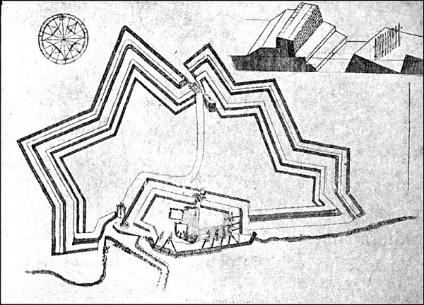
The mediaeval fortifications included a large area, and in the time of
Elizabeth a portion within this area was enclosed and strengthened
by works of more modern character, the main features of which comprised
five examples of the orillon type of bastion. The orillon was an enclosure
of flattened triangular form, projecting beyond the curtain. The middle
angle was obtuse, and the passage from the opening in the curtain into
the bastion was somewhat restricted. It is obvious that such a bastion
as this, which was introduced into England in the latter half of the
sixteenth century, would give the maximum range for defensive fire,
whilst affording most valuable means of protecting the flanks.
The fortifications of Berwick-upon-Tweed were primarily intended for defence
against the Scottish Border raiders and incursions coming overland,
but they also served to protect the town against the enemy approaching
by sea.
Bamborough.—The site of this castle must have been a place
of great natural strength, and probably a fortress, from prehistoric
times downwards.
It would not be inaccurate to describe it as one of the important and
historic spots in the kingdom. The castle dates from a period before
the Norman Conquest. Here the Danish raiders were successfully repelled
in 912. The castle was maintained in a good state of defence under
Henry I, and the keep is of the twelfth century. Structural repairs
were made at frequent intervals, viz., in 1183, 1197, 1198, 1201, and
1202. A new gate-house was built here in consequence of the invasions
of the Scots in 1383-4.
On several occasions Bamborough Castle has served as a prison, and it
was brought into considerable prominence during the Wars of the Roses.
The part it played in the various wars between England and Scotland
must have been important.[16]
Dunstanburgh.—Situated on a bold, rugged headland, this fine
castle reminds one of such great fortresses on the east coast as Scarborough
and Tynemouth. Its share in the Border troubles was perhaps less than
that of Bamborough.
Dunstanburgh is the largest castle in Northumberland, is built on a
remarkable plan, and comprises an area of ten acres, the main part
of which was occupied by the outer bailey. Its history is associated
with Simon de Montfort and Thomas of Lancaster.
The castle was mainly erected in 1313-14. The great gate-house of the
latter part of the fourteenth century, was planned and built on a colossal
scale, and still forms a striking object, even in its ruin. By the
sixteenth century the place had fallen into ruin.[17]
Warkworth.—This castle, remarkable for its eccentric plan,
was built about the middle of the twelfth century.
Tynemouth.—The priory and castle of Tynemouth (for it was
a combination of both) occupied a prominent position among the mediaeval
coast defences of England. The office of Prior of Tynemouth was one
of great importance. The person who held it was possessed of vast spiritual
and worldly influence. He maintained his own armed force, just as the Bishop of Durham did, and the gate-house[18] of
the priory was in reality a military fortress, a building of great
solidity and strength. It was approached by a barbican, the passage-way
being vaulted and furnished with a gate at each end.[19]
Scarborough.—This place was defended by walls or earthworks
and a fosse before the time of Henry III. Its castle was built as early
as the time of Stephen, and rebuilt or enlarged in the reign of Henry
II. During the Civil War Scarborough Castle was besieged. It was surrendered
in 1645, and has long been in ruins. It enclosed nineteen acres of
land and occupied a romantic site 300 feet above sea-level.
Hull.—From an early period this seaport has been defended
by fortifications. In the seventeenth century these comprised a moat
and a complete system of walls, fortified gates, and drawbridges. It
possessed five gates, called Hessle Gate, Myton Gate, Beverley Gate, Low
Gate, and North Gate, and two sally-ports. The whole fortified walls
were 2,610 yards, or slightly less than one-and-a-half miles in circuit.
In front of the principal gates were drawbridges and half-moon shaped
batteries. In the year 1540 the eastern side of the town was defended
by two blockhouses, erected by Henry VIII. These were known as the
North Blockhouse and the South Blockhouse, and both mounted guns when
the town was besieged during the Civil War. A castle was also built
on the eastern side of the town by Henry VIII.
King’s Lynn.—The eastern side of this important town was
in former times defended by a wall strengthened by nine bastions, and
by a broad and deep fosse over which were three drawbridges leading
to the principal gates. One of the latter and fragments of the wall
remain. From the statement of Stow in his
“Chronicle,” and from certain illustrations of the walls
as they existed in 1800, we may infer that the walls at any rate belonged
to the first half of the thirteenth century. The East Gate and the
West Gate were rebuilt on the sites of earlier gates in the fifteenth
century.
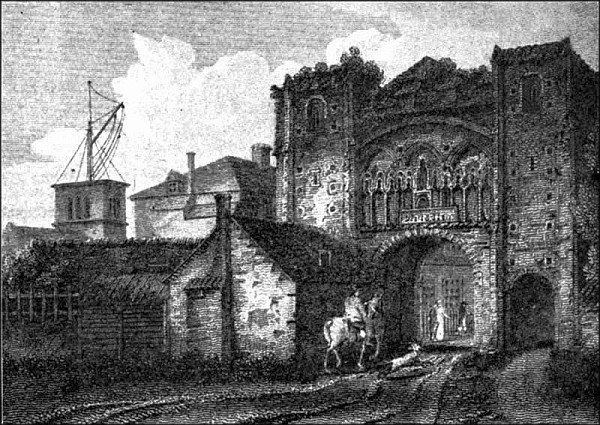 FIG. 19. NORTH GATE, YARMOUTH, 1807
Yarmouth.—The town-wall, of which some traces remain, measured
between six and seven thousand feet in compass, and possessed ten gates
and sixteen towers. Swinden,[20] the
historian of Yarmouth, states that the building of the wall
“was begun on the east side, and very probably at the north-east
tower in St. Nicholas’s churchyard, and so proceeded southward:
for in the 11th of Edward III we find them at work at the Black
Friars, at the south end of the town; and afterwards we trace
them to the north end, which, I presume, was the last part that
was finished.
“And there is a tradition, that the north gate was built by
the person or persons who had amassed considerable sums of money
by being employed in burying the dead in the time of the plague.
“As soon as the walls were finished, there was made a moat or ditch round the
town, with bridges at each gate: the whole so complete
that boats could pass with their lading to any part
of the town, for the conveniency of trade and commerce.
And so careful were the magistrates to preserve the
said moat from being filled or stopped with earth,
rubbish, stones, etc., that in the rolls of the leets,
there appear several fines, levied on different persons
for offending in that behalf. Thus the tower being fortified with a wall and moat,
towers, gates, and bars, was deemed a sufficient
defence against all assailants with bows and arrows,
slings, battering-rams, and all other missive engines
of those times. But afterwards, when great guns of
various denominations were employed in sieges, the
aforesaid fortification, it was adjudged, would make
but little resistance against them, without several
additional works, as mounts, ravelins, etc.”
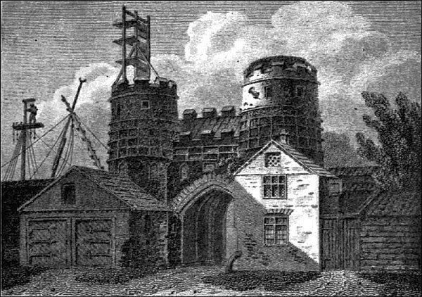 FIG. 20. SOUTH GATE, YARMOUTH, 1807
In the 36th year of Henry VIII the fortifications of Yarmouth were strengthened
by rampiring, or backing up the walls by earthwork mounds. Additional
works were constructed by Queen Mary in 1557, and by Queen Elizabeth,
the complete process of rampiring not having been finished until 1587,
the year before the coming of the Spanish armada. In the following
year it was considered desirable to secure the haven against any sudden
attacks of the enemy, and it was accordingly decided to construct jetties
of timber on either side of the entrance, whilst across the actual
entrance was placed a boom of massive timbers furnished with iron spikes,
and this was so constructed that it could be opened or closed at pleasure.
This work, including probably the two jetties and the boom, cost £120.
Traces of the wall of Yarmouth and its towers still remain, whilst other
evidence of the wall is the extraordinary way in which the houses are
crowded together, leaving only narrow alleys, or “rows,” for
the traffic. A plan of Yarmouth in 1819, published as a frontispiece to John Preston’s “Picture of Yarmouth,”
shows in an admirable way the congested state of the buildings within
the walls.
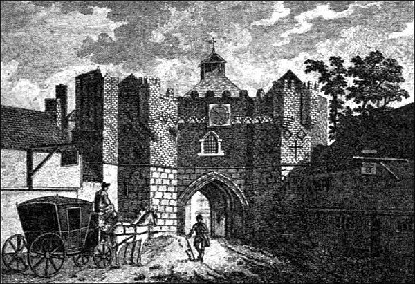 FIG. 21. ST. MATTHEW’S GATE, IPSWICH
From a print published in 1785
Ipswich.—There is a tradition that Ipswich was defended by
a wall and fortified gates soon after the time of the Norman Conquest,
but unfortunately no traces of either remain. Westgate Street preserves
the memory of the picturesque West Gate. The interesting old engraving shows St. Matthew’s Gate, now demolished.
There appears to have been a castle at Ipswich built by William the
Conqueror, and Roger Bigot, one of the Conqueror’s powerful nobles,
held it. With the exception of certain earthworks all traces of the
castle have perished. The form of the town in mediaeval times has been
made out by John Wodderspoon in his “Memorials of Ipswich,” 1850.
Orford.—This castle, situated half a mile from the River
Ore, in Suffolk (hence its name), commands a view of the sea, two miles
distant, owing to the fact that it is built on a mound partly natural
and partly artificial. All round is swampy ground.
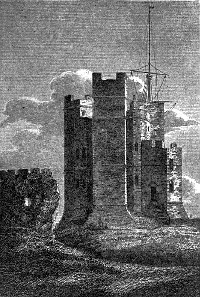 FIG. 22. ORFORD CASTLE, SUFFOLK, 1810
The building of Orford Castle was begun in 1166. Strictly speaking, perhaps,
it should not be called a castle: it was essentially a keep, and its
purpose primarily was to serve as an outpost for observation and for
the protection of the coast. The plan of the actual keep, if so we
may term it, was peculiar, being circular within, and so much modified
by the buttresses without as to
present the appearance of a large number of angles.
Harwich.—This ancient seaport situated on the extreme north-eastern
point of Essex has always been a place of some strategic importance.
It formerly was encompassed by a wall which had four gates and three
posterns. In addition Harwich once possessed a small castle and other
fortifications, but owing to the inroads of the sea these have for
many years been submerged. Traces of the walls or foundations of the
castle were seen, however, in 1784, when an unusually low tide laid
bare more than usual of the sea-bottom.
On the south side of the town are some ancient earthworks locally ascribed
to the Romans, although upon slender evidence.
Colchester, which is situated on the river Colne, and perhaps not
too far from the shore to take some part in the defence of the coast,
has been in its time a place of great importance and of formidable
strength. Its walls, of which considerable parts remain, are of Roman
workmanship, and its castle, built largely of Roman materials, and therefore by some regarded as Roman
in date, is almost unquestionably of Norman construction. It must be
admitted, however, that the castle presents several features which
differentiate it from the normal castles of the Norman period. Originally
the walls were furnished with four principal gates, viz.: Head Gate,
North Gate, East Gate, and St. Botolph’s or South Gate, and three posterns,
viz.: West Postern in St. Mary’s Street, Schere Gate or South Postern,
and Rye Gate or River Postern, but these have been demolished. The
north and west sides of the town were defended by strong earthworks.
The place was besieged for eleven weeks during the Civil War. It was
held by the Royalist party, and on its fall, two of its most gallant
defenders, Sir Charles Lucas and Sir George Lisle, were shot under
the castle walls.
The weakness of mediaeval castles, built merely for passive resistance,
has frequently been noticed, and what is true of them is equally true
of the mediaeval walled town. Forces shut up within walls are obviously unable to prevent an enemy from over-running a country.
It must be borne in mind, however, that the purpose of fortifications
behind walls was not, and never has been, merely intended to oppose
the ravages of the enemy. In that part of our military history which
is subsequent to the use of gunpowder, the uses of walled defence has
been varied and manifold. For example: they were intended to check
the enemy’s advance; to give time for mobilization; to protect the
strategical disposition of the army, especially in the early stages
of a campaign; to protect important junctions in the lines of communications;
and to safeguard magazines and stores against sudden and surprise attack
of the enemy.
Cowling.—The castle at Cowling or Cooling, situated about
seven miles to the east of Gravesend, and just two from the sea-shore,
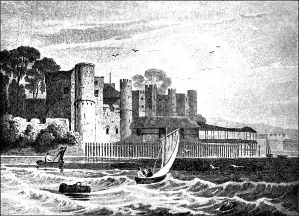
was built between 1380 and 1385 by John de Cobham. The gate-house,
built in the regular form in vogue during the latter end of the fourteenth
century, and comparable with that at Saltwood Castle and the West Gate of Canterbury,
still remains in good preservation, as well as a good deal of the walls
and angle-towers enclosing the inner ward, and certain parts of the
walling enclosing the outer ward. The gate-house just referred to is
on the south side of the outer ward, to which it gives access.
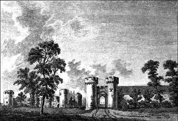 FIG. 23. COWLING CASTLE, KENT, 1784
Perhaps one of the most interesting things about Cowling Castle is the
fact that it was built expressly for the defence of the coast against
the French and the Spanish. This fact is rather pointedly referred
to in the following contemporary inscription enamelled on copper plates
attached to the eastern side of the gate-house:
Knouweyth that beth and schul be
That i am mad in help of the cuntre
In knowyng of whych thyng
This is chartre and wytnessyng.
The inscription is set out in the form of a regular charter, to which
is attached a seal bearing the Cobham arms, gules, on a chevron or,
three lions rampant sable.
The situation of Cowling Castle on low-lying ground near the coast is
a circumstance which confirms the idea that the fortress was built
for coast defence purposes. On the other hand, however, inscriptions
of this kind are of great rarity, and it has been suggested with great
show of reason, that whilst the purpose was partly for the defence
of the coast and partly to keep the people of Kent in order in what
were peculiarly troubled times, the inscription was so worded as to divert attention from
the latter. The suggestion is worthy of consideration, but the fact
remains that towards the end of the fourteenth century this part of
Kent was overrun by Frenchmen and Spaniards, who burned and destroyed
all the houses they came across, and Cobham’s intention in building
Cowling Castle was to check these incursions.
Rochester.—It is clear that Rochester has in its time been
an important part of our coast defences. It still retains many fragments
of its Roman wall, whilst its Norman castle is represented mainly by
a stately keep 70 feet square in plan, and 113 feet in height, which
forms an impressive object, and is in fact a remarkably fine example
of castle-building. The Norman keep was built between the years 1126
and 1139. The city wall, which was built in places on the site of the
Roman wall, dates from the year 1225.
Queenborough.—There is a tradition, possibly it is little
more, that a residence of the Anglo-Saxon kings of Kent was situated
here near
the north-western mouth of the Swale, the building being afterwards
known as the castle of Sheppey, in which island it is situated. The
whole fortress was rebuilt by Edward III about the year 1361 according
to plans made by William of Wykeham. Edward III in due course visited
the place and gave it the name of Queenborough in honour of his queen
Philippa.
As a coast defence a fortress on this site must have been of great value,
commanding as it did the north-western mouth of the Swale, and protecting
the water which divides the Isle of Sheppey from the mainland.
Henry VIII recognized the value of this point, and repaired it so as to
make it suitable for use as one of his coast castles.
The plan of the mediaeval fortress, as might be expected when one remembers
who designed it, is ingenious and remarkable.
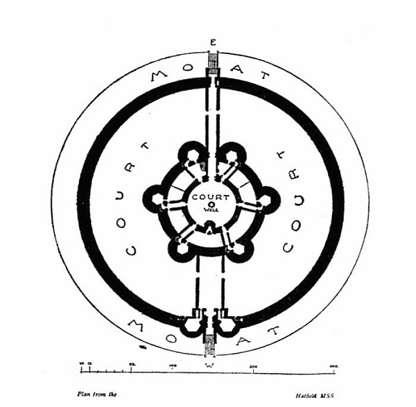 FIG. 24. PLAN OF QUEENBOROUGH CASTLE, KENT
The main interest of this castle consists in its plan, which proves it
to have been perhaps the earliest example of a fort as distinct from
a typical castle of the middle ages, in which there was always a certain amount of accommodation
for dwelling-house purposes. Queenborough Castle contained, mainly
in its six lofty circular towers, more than fifty rooms, but these
were of small size. The building of the castle was commenced in 1361
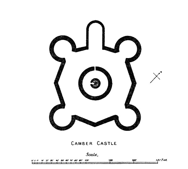
and finished about the year 1367. The plan was curiously symmetrical,
and not unlike that of Camber Castle, built in the time of Henry VIII,
but the elevations of the two fortresses display great differences. The lofty towers of Queenborough,
serviceable enough in the fourteenth century when artillery attacks
offered no serious menace, are wanting in Camber Castle, built in the
sixteenth century, and their place is taken by low squat towers which
offered little surface for cannon-shot.
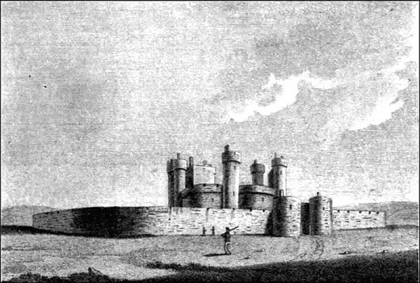 FIG. 25. QUEENBOROUGH CASTLE, 1784
From a drawing by Hollar Canterbury.—There were really two castles at Canterbury in
quite early times. The first, largely perhaps of earthwork, was the work of Duke
William of Normandy, and was constructed on and near what is now the
most southern point of the city wall. The purpose of the first castle
was to dominate and overawe the inhabitants of the city, and also to
furnish a convenient post for observing the surrounding country. The
castle was provided with a lofty moated mound for this particular purpose.
The hill called the Dane John has sometimes been confounded with the
original mound of the castle, but as a matter of fact the two were
not related in any way, the castle mound having been destroyed many
years ago, whilst that known as the Dane John was erected in the eighteenth
century.
The masonry castle, the ruined keep of which stands to the north-west
of the earlier castle, was built by Henry II between 1166 and 1174.
The keep measures in plan 88 feet by 80 feet, and, owing to the upper
storey having been pulled down in 1817, measures now only 45 feet in
height. The castle was originally enclosed by a rampart and wall with
several towers, and had its own gate to the city, and a barbican on
its eastern side.
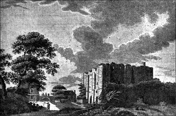 FIG. 26. CANTERBURY CASTLE IN THE EIGHTEENTH CENTURY
The city of Canterbury was enclosed by a wall built about the same time
as the castle (1166-1174). There were seven gates in the wall giving
access to the city, viz.: (1) Newingate, or St. George’s Gate; (2)
Ridingate; (3) Worthgate; (4) Westgate; (5) Northgate; (6) Burgate;
and (7) Queeningate. From the evidence of various old engravings it
is apparent
that several of the gates had been rebuilt at different times. Westgate,
the only one of the group which now survives, was erected in the reign
of Richard II, and is an unusually good example of the mediaeval town-gate
furnished, as it once was, with portcullis, machicolations, and other
apparatus for defence. It is also a building of great beauty both of
masonry and proportion.
Broadstairs.—This small town on the north-east coast of Kent,
which in former times did a good deal of trade in connection with the
North Sea fishing, still retains considerable traces of a gate, probably
of the fifteenth century, which commanded the only means of access
from the harbour to the town through a cutting in the chalk cliff.
It is known as York Gate, and although altered and repaired, still
possesses the massive lower part of the original gateway of flint and
stone, and the grooves for the portcullis.
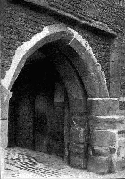 FIG. 27. THE FISHER GATE, SANDWICH, KENT
Sandwich.—The chief traces of the fortifications of this
ancient and once important town are an earthern rampart or wall of
considerable extent, a deep fosse, and two interesting and picturesque
gates.
We know that Sandwich once possessed a castle, and this probably in Anglo-Saxon
times, but its site is a matter of uncertainty. It must be borne in
mind that for many centuries Sandwich was the principal port for traffic
and merchandise to and from the Continent. It possessed a mint in the
Anglo-Saxon period, doubtless in the castle, and times out of number
it has taken an important part in repelling invading enemies and in
preserving the peace and liberty of our shores.
The Fisher Gate, although buried to some depth in an accumulation of soil,
retains several interesting features. One can still see the grooves
for its portcullis and the recessed space in its outer wall into which
the drawbridge fitted when drawn up. The gate is constructed of flints
and stone, a certain proportion of which are squared blocks of sandstone,
which from their size and shape may well have been derived from the
walls of the ruined castrum of Richborough, less than two miles distant.
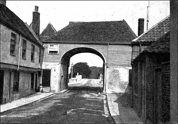 FIG. 28. THE BARBICAN GATE, SANDWICH, KENT
The Barbican is a peculiarly picturesque structure commanding the entrance
to the town on the south-east side by the ancient ferry across the
river Stour, which at this point is tidal and often rapid and deep.
There is a modern bridge. The gateway, which is flanked by two towers
presenting externally semicircular walls, is largely of Tudor masonry, arranged in chess-board fashion in black flint and
grey stone, and long flat bricks. On the southern side of the gateway
a modern door has been made into the south tower. Splayed embrasures
commanding the approach are visible within the tower. According to
local tradition these were intended for cannon. The upper part of the
gate is a modern restoration in woodwork.
Sandwich originally possessed five gates, but those described are the
only two which have survived.
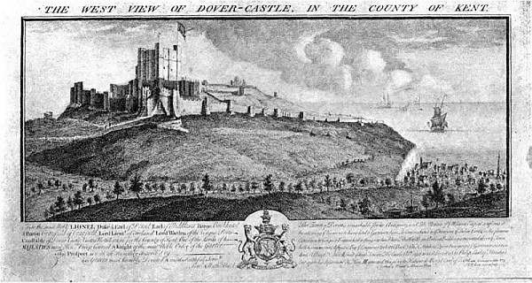
Dover Castle.—For the last seven and a half centuries Dover
Castle has been justly considered a fortress of paramount importance
in the defence of England. Its site is remarkable for more than one
reason. The steepness of the chalk cliffs towards the sea, and the
abruptness of the other slopes, natural and artificial, which encircle
it on the land side, give a peculiarly difficult, indeed, impregnable
character to the fortress. The height of the hill on which the castle
stands close to the narrowest part of the Channel which separates our shores from those of the Continent renders it a
spot of unusual importance for the purposes of observing the approach
of an enemy coming across the Straits of Dover.
Although there are no certain traces of defensive works on the eastern
heights of Dover before the time of the Norman Conquest, the natural
advantages of the site, and Caesar’s own words make it probable that
some kind of camp or look-out post was established at Dover in prehistoric
times. However, this is a matter of conjecture which lacks the confirmation
of actual archaeological evidence.
One of the first acts of the Norman Conqueror was to establish his power
over the English by building earthwork castles, and such a work was
thrown up on the eastern heights of Dover. Its form and extent are
unknown, but it may, with reasonable probability, be conjectured that
its central eminence was that upon which the keep was subsequently
erected in the reign of Henry II.
Dover Castle, as it exists to-day, presents a good example of the amalgamated
defences of several different architectural periods. Its important
position as the “Clavis et repagulum Angliae,” gives it a
national rather than local importance, and every part of it is of historical
interest. As a fortress which from Norman times, almost without intermission
to the present day, has retained its garrison and maintained a foremost
place in the defence of the realm, Dover Castle deserves more than
a passing notice in these pages.
During the reign of Henry I (1100-1135) masonry began to take the place
of earthwork defences, but in due time the need of stronger defences
became apparent, and during the reign of Henry II (1154-1189) the keep,
citadel, and defensive works to the north were carried out at the enormous
expense of nearly £5,000.
The keep, one of the most important of the new works, forms a striking
feature of the castle. In plan it is practically square, measuring
98 feet by 96 feet, exclusive of the fore-building, with walls at the
lowest stage no less than 24 feet in thickness. This is amongst the
largest buildings of its class in this country. Each of its three floors, basement, and first and second
storeys, is occupied by two large apartments, those on the second floor
being the chief or state apartments and possessing two tiers of windows.
Dover Castle suffered a siege in 1137, and again in 1216. The latter occurred
under the second constableship of Hubert de Burgh at the hands of the
Dauphin Louis of France. (See the section on the Cinque Ports, pp.
196-204.)
After this siege Dover Castle was strengthened by the construction of
an additional defensive work, commanding the plateau to the north of
the castle, and other works, including a subterranean passage, excavated
in the solid chalk, which still exists. These works were carried out
between 1220 and 1239. In 1371 a series of important repairs was effected,
and during the reign of Edward IV the Clopton tower was re-built, and
a sum of £10,000 was expended in placing Dover Castle in a state of
thorough repair.
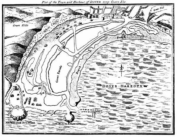 FIG.
29. BIRD’S-EYE VIEW OF DOVER TOWN AND HARBOUR,
FIG.
29. BIRD’S-EYE VIEW OF DOVER TOWN AND HARBOUR,
temp. QUEEN ELIZABETH
Further important works were carried out by Henry VIII in connection with his great
scheme of coast defence. In addition to the strengthening
of the actual works of the castle, it appears that “bulwarks
under Dover Castle,” probably near the level of the
sea-shore, and a “bulwark in the cliff” were
constructed at this period. An interesting plan of Dover,
made in the time of Queen Elizabeth, shows not only the Arckcliffe Bulwark and
the Black Bulwark, but also the walls and its towers inclosing
the town of Dover. The plan was published in the sixth
volume of
“Archaeologia,” and is here reproduced in much reduced size
by permission of the Society of Antiquaries.
In June 1666, and again in July 1667, an invasion of Dover by the Dutch
fleet was expected. The invasion of this particular part of the sea-coast
was never carried out, but the castle was provisioned for a siege,
and it is probable that the actual fortifications were improved and
augmented.
In the earlier part of the eighteenth century Dover Castle appears to
have been much neglected, and an engraved view by Buck, published in
or about the year 1735, indicates that certain parts of it had become
almost ruinous; but in 1779, owing to the war with our colonies, as
well as France and Spain, Dover Castle was hastily placed in a state
of extra defence in order to resist the threatened invasion by our
enemies.
The period of the Napoleonic menace saw great improvements at Dover Castle.
Much of the underground work on the north side of the castle, as well
as in other parts, belongs to this period. Of these and later works
it is not necessary to speak in this volume. They belong to defences
which are still effective, and at the present moment Dover Castle may
be regarded as a fortress of enormous importance in the safe-guarding
of our shores.
Folkestone.—No traces remain here of defensive work, but
a castle was built in quite early times, by William de Arcis, for the
protection of the town. Owing to the fall of the cliffs and the inroads
of the sea, this has long since been destroyed. It is probable that
there was some kind of protective work near the mouth of the little
river which here runs into the sea, but no traces seem to remain.
Saltwood.—Situated about two miles inland from Hythe, this
castle can hardly be described as a purely coast fortress, but it is
such a valuable example of the mediaeval castles of its time that it
deserves special attention. It must be remembered that the typical mediaeval castle,
with its elaborate defences, possessed a moral influence out of all
proportion to its strategic value. As soon as effective charges of
gunpowder were employed the weakness of mere walls of masonry became
at once apparent. Explosives were far more effective and disconcerting
than battering-rams.
Experience extending over many centuries teaches, what has been so thoroughly
proved by recent events on the Continent, that offensive tactics are
almost invariably preferable to those of a defensive character, even
when practised under the protection of the strongest and most elaborate
fortifications.
Still, as long as the only dangers were starvation and battering-rams,
the mediaeval castle was as nearly as possible a perfect form of defence.
Saltwood castle furnishes an excellent example of this.
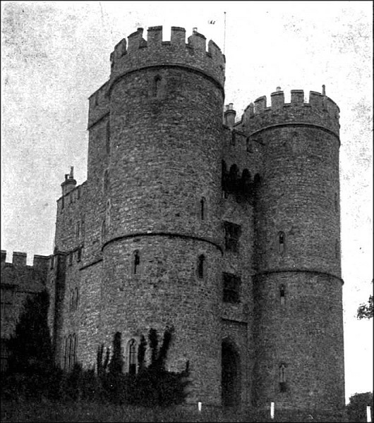 FIG. 30. THE GATE-HOUSE, SALTWOOD CASTLE, KENT
Its main structure is of late fourteenth century date. Elaborate and complicated
defences guarded the main entrance to the mediaeval castle. Before
the unwelcome visitor could enter, the following obstacles had to be surmounted.
First was the gateway in the outer wall of defence, access to which
was by means of a drawbridge spanning a deep but perhaps dry moat. This first gateway was furnished with portcullis,
and heavy timber doors capable of offering formidable resistance. The
outer gateway passed, the invaders would proceed across the outer bailey
towards the inner and far stronger gate-house, exposed all the while
to such missiles, arrows, cross-bow bolts, etc., as might be projected
from the battlements and loop-holes of the castle.
Here, at the entrance to the great gatehouse, the moat was generally wide,
deep, and filled with water. Supposing that the drawbridge was down
(a most unlikely circumstance), the enemy on approaching the gates
was confronted by the massive portcullis, and at least two pairs of
double timber gates beyond it, and whilst forcing the former he would
be within the range of heavy stones and every kind of dangerous and
unpleasant missile dropped or thrown from the machicolations situated
between the flanking towers almost on a level with the battlements
above. The massive and studded oak doors were constructed of a material
which was not easily fired, and they were barred with oak beams of the strength
and almost the consistency of steel. Even when these were burnt or
battered down the invaders would encounter a flanking fusilade from
the lateral passages.
On the other hand, if the drawbridge was up, it formed in itself an extremely
formidable barrier, because by means of chains passing through holes
in the wall it was drawn close to the gate-house tower and within the
recess specially made to receive it, leaving the under side of the
bridge flush with the surface of the gate-house wall.
It may be doubted whether anything in the whole range of military architecture
furnishes a more perfect system of defence than the gateway, walls,
ditches, moats, and drawbridges of a mediaeval castle; and it seems
probable that it would have proved invulnerable against a direct attack
from without had not the discovery of gunpowder put a new and terrible
weapon in the hands of the attacking force.
Elaborate precautions were taken to secure the walls of mediaeval castles
from attack. Experience proved that the massive masonry of Norman
times was inadequate. A new principle was universally adopted. The
plan of the castle was so arranged that every part of the enclosing
wall was commanded by means of mural towers. These additions not only
added to the passive strength of the work, but also when placed within
a bow-shot distance enabled the defenders, themselves protected, to
enfilade the intermediate curtain. Again, the use of curved walls and
mural towers gave free scope for constructive skill and favoured the
economical use of building materials.
Rye.—Wall and gates were built by Edward III. Of these the
Landgate remains. The Ypres Tower, a work of the time of King Stephen,
also survives. The first wall was built in the time of Richard I, and
of this there are no traces, whilst of the wall built by Edward III
one finds very few traces.
Winchelsea.—This town also was formerly walled and defended
by strong gates. Of the latter three still survive, viz., Strand Gate,
New Gate, and Land Gate.
Hastings.—This was the first castle built in England by the
Normans after the Norman Conquest, and, in accordance with the plan
of other fortresses of the period, consisted of a mound (shown in the
Bayeux tapestry) and two, if not three, attached baileys. One of the
baileys, called “Ladies Parlour,” is of rather small size,
comprising little more than one acre, a circumstance which has led
Mr. Harold Sands, F.S.A., an eminent authority on castles, to infer
that it could not have been the outer bailey. His inference was confirmed
by the discovery of the traces of another, and much larger, bailey,
containing about five acres, situated on the eastern and northern sides.
The masonry part of the castle was probably erected in the years 1171
and 1172. Further important parts of the castle were subsequently built,
notably in 1173-4, etc. The fall of the sandstone cliff, due to the
inroads of the sea, has destroyed a very large part of these works,
and what remains is a comparatively small part of the area of the castle.
The castle at Hastings mentioned in the
“Anglo-Saxon Chronicle” as having been built by the order
of Robert, Earl of Mortain, is not to be confounded with that fortress
whose ruins crown the hill overlooking Hastings. It was probably situated
on the shore of the western, or Priory valley at a point near the site
of the present railway station.
It may not be generally known that in former times Hastings was protected
on the sea side by a wall. This wall, which had a gateway and portcullis,
extended from the Castle Hill to the East Hill, and was so arranged
as to cut off the valley of the Bourne from the shore. A portion of
the wall is figured as being in existence in 1824, when “The History
and Antiquities of Hastings” was published by W. G. Moss. Slight
traces of the wall may still be seen. The steep character of the hills
of the Bourne valley rendered walls unnecessary on either side. This
wall at Hastings is in some ways comparable with the defensive gate
at Broadstairs already described.
A little to the west of this wall, situated on the very edge of the shore, was formerly
a fort, the memory of which is preserved in local names.
Pevensey.—The Roman castrum here, with its very interesting
masonry, has been described in the earlier part of this volume. Reference
has also been made to the construction of a mediaeval castle within
its area. It has long been supposed that there had been a Norman keep,
and this has been confirmed by recent excavation and examination of
the site.
Bramber.—An early earthwork, possibly a Danish camp, at Bramber,
has already been mentioned. The site was granted by William the Conqueror
to William de Broase, and a massive castle, of which certain ruins
remain, was erected by him. It is now, owing to modifications of our
river systems, somewhat remote from the main stream of the Shoreham
River (incorrectly called the Adur), but there is every reason to believe
that at the time of the Danes, and probably long after, it had a direct
communication by water with the sea. Shoreham itself, it may be added,
in 1346, furnished no less than twenty-six ships for Edward
III’s invasion of France.
Portsmouth.—The existence of remains of the Roman castrum
at Porchester, situated on the upper waters of Portsmouth Harbour,
goes to show that in those early times the value of this part of the
coast as a great harbour was recognized. It is curious, therefore,
that no town of any importance was built at Portsmouth until the twelfth
century. The actual building of the town was commenced in the reign
of Richard I, and a charter was granted in the year 1194. Confirmation
of this charter was made at various dates by successive sovereigns,
and important additions to the privileges were made in 1627 by Charles
I.
The town itself was defended by a wall with towers and gates, the date
of which is not clear; but from the position of the place on the south
coast, and open in a peculiar degree to invasion by the French, it
is reasonable to infer that the defences were made at an early period
in the history of the town, probably in the thirteenth or fourteenth
centuries.
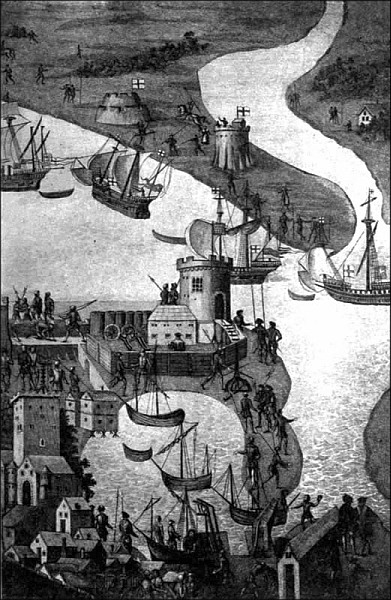 FIG. 31. ENTRANCE TO PORTSMOUTH HARBOUR,
temp. KING HENRY VIII
Leland in his “Itinerary” describes the defences as consisting
of a “mudde waulle armid with tymbre, whereon be great peaces
both of yron and brassen ordinaunces.” The circuit of the town
was a mile, and a ditch was constructed outside the wall. Leland records
that he heard in the town that the defences of the entrance to the
harbour (“the tourres in the hauen mouth”) were commenced
in the reign of Edward IV, continued in the time of Richard II, and
finished in that of Henry VII. In the time of Edward VI two towers
of stone were built, one on either side, at the mouth of Portsmouth
Harbour, and a chain of immense weight and strength was placed between
them in such a way as to form a defence against the advance of the
ships of the enemy. The actual chain, with large long links, is shown
on a plan of Portsmouth of the time of Queen Elizabeth.[21]
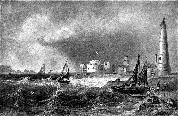
The approaches to Portsmouth, east and west, were commanded by several
forts and the two block-houses, popularly known as Southsea Castle and Hurst Castle, both works being
of the time of Henry VIII.
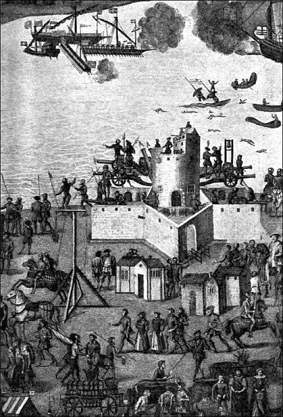 FIG. 32. SOUTHSEA CASTLE, temp. KING HENRY VIII
An extremely interesting picture, in the nature of a bird’s-eye view,
of the defences of Portsmouth and the adjacent coast-line, extending
as far as the northern shores of the Isle of Wight, is given in the
engraving showing the encampment of the English forces near Portsmouth,
1545, published many years ago by the Society of Antiquaries of London.
The original of this picture perished in the fire which destroyed Cowdray
House, the mansion of Viscount Montague, at Midhurst, Sussex, but fortunately
the Society of Antiquaries has preserved for us the copy of a picture
which is full of interest, as illustrating the mediaeval walls of Portsmouth
and the castles, forts, and other works as well as the guns, ammunition,
and methods of working them, in vogue for the defence of the coast
about the middle of the sixteenth century. One can see, too, the two
towers built at the mouth of the harbour for carrying the chain which
once protected it. The picture also comprises a bird’s-eye view of the naval forces of England and France drawn up
in battle order at the commencement of the action between the two navies
on 19 July 1545.
Southampton.—For many years Southampton took such a prominent
part as a seaport, and was such a favourite town for landing and embarking
during the Middle Ages, that it would indeed be remarkable if it had
been left undefended. As a matter of fact its mediaeval walls and towers
and gates were peculiarly strong. The walls varied from 25 feet to
30 feet in height, nearly 2,000 yards in length, and was strengthened
by 29 towers. There were seven principal gates, and four of them, as
well as large portions of the walls, remain. The gates which remain
are (1) the North, or Bar-gate; (2) God’s House, or South Castle-gate;
(3) West-gate, and (4) the Postern, now known as Blue Anchor-gate.
The following have been destroyed: (1) East-gate; (2) Biddle’s-gate;
and (3) the South, or Water-gate. There were also formerly a Castle
Water-gate (now walled up) and a Postern near the Friary and God’s House: the site of the latter is lost. The
mural towers were chiefly drums, or of half-round form. The masonry
of the wall, to a large extent, is of Norman work, and in some parts
the walls are rampired, or backed with earth to the summit.
 FIG. 33. GROUND PLAN OF SOUTHAMPTON
The castle at Southampton occupied not only nearly the whole of the north-western
corner of the area within the town-walls, but also the highest ground.
Although some authorities have regarded it as a Saxon or Danish castle,
the weight of evidence seems to be very much in favour of the view
that it was built very soon after the Norman Conquest. It also seems
probable that in the first instance it was mainly composed of an artificially-heightened
mound and other earthworks, crowned, perhaps, by palisades. In due
course, perhaps in the time of Henry I, a shell-keep of masonry was
built on the mound, and its wall-footings were carried on massive piers
of masonry, 8 feet square, and sunk 15 feet into the earth so as to
have the benefit of the original hard surface. The other parts of the
castle were built in masonry at about the same time or perhaps within
the next fifty years.
Southampton suffered much from repeated ravages of the Danes, and from
various other enemies at different times in the Middle Ages.
Wareham.—The early earthwork defences of this ancient town still exist on the
east, north, and west sides. They consist of a rampart
of some size with ditch on the outside and another ditch
of smaller dimensions on the inside. In plan, the earthworks
take a roughly quadrangular form, except that there is
no earthwork along the south front facing the River Frome.
A Norman castle, of which the mound still remains, was
formerly part of the protection of Wareham. It stood within
the south-western corner of the town.
Bristol.—Bristol has been a considerable sea-port from quite
early times, having been engaged in trading from about the year 1000.
The defences also date from an early period, as might be imagined where
great wealth and interests were at stake. The date of the first castle
is unknown, but it is said to have been rebuilt in the reign of King
Stephen, and in it he himself was imprisoned for nine years. It seems
probable that the earlier castle was one of the regular Norman defences
mainly of earth-work, whilst that subsequently built was a masonry
castle erected to take the place of or to strengthen the earthworks. The keep was square
and built very strong and massive.
The castle was situated on the eastern side of the town, and on ground
rising considerably above the level of the river. The town-wall, commencing
near the west corner of the castle, partially enclosed the town, following
the main course of the River Frome, and then taking an almost right-angle
turn to the north-east as far as the bank of the River Avon.
Of the numerous castles and walled towns of Wales it is not, perhaps,
necessary to speak in these pages, because it is obvious that their
function was not so much to defend the coast against foreign invaders
as to establish the power of the English, and to assist in the complete
conquest of Wales.
Lancaster.—An interesting and important Norman castle[22] was
built partly without and partly within the southern angle of the Roman castrum which was built here long before. The keep
is of fairly early Norman workmanship. The whole work is perhaps somewhat
remote from the coast—a little over four miles, in fact—but
being situated on the River Lune, it may well have taken its share
in coast defence.
Liverpool.—The castle here is believed to have been built
in the year 1089 by Roger de Poictiers. During the Civil Wars in the
time of Charles I it was dismantled, and its ruined walls were finally
pulled down about the year 1725. One or two forts for the protection
of Liverpool have been subsequently built on the north shore, but they
have been demolished to make way for new buildings connected with the
gigantic shipping trade done here.
Carlisle.—The defences of Carlisle are said to date from
Roman times. The present castle is well situated on the highest point
of ground within the city, about 60 feet above the river. Its walls
enclose a roughly triangular space of an extent of about three acres.
The keep, rectangular in plan, measures 66 feet by 60 feet and is at present 68 feet in height. It rose to
a greater height originally. As one would infer from the dimensions
of the keep, it is of Norman workmanship, but it has received a good
many strengthening additions in comparatively recent times. The keep
is situated in the inner ward which occupies the eastern end of the
castle enclosure. It is approached by means of two gate-houses, one
near the middle of the southern wall, leading into the outer ward,
and the other about the middle of the wall which separates the outer
and inner ward. The south wall of the castle is of Norman date: the
other walls are of both Norman and Edwardian construction. The castle
(doubtless as a fortress comprising mostly earthworks and palisading),
is attributed to William II. The work was doubtless continued (probably
in masonry), by Henry I, and completed in 1135 by David, King of Scotland,
who also heightened the city walls.
Carlisle was, perhaps, only in a very minor sense of any importance as
one of the coast defences of England. Its castle, its walls, and other defences were doubtless intended, primarily,
to keep the Scottish border raiders in check, and to serve as a military
base against Scotland.
The general principle of defending the coast by means of strong castles
erected near the shore was in due course extended in accordance with
local requirements. Thus, Tynemouth Priory, situated on the coast of
Northumberland, was provided as we have seen, with a gate-house closely
resembling in form and massive strength the gate-house of a mediaeval
castle. It is certain that its builders contemplated and provided for
military defence.
Houses of great personages, and of wealthy institutions such as monastic
houses were also built on a defensive or semi-defensive scale.