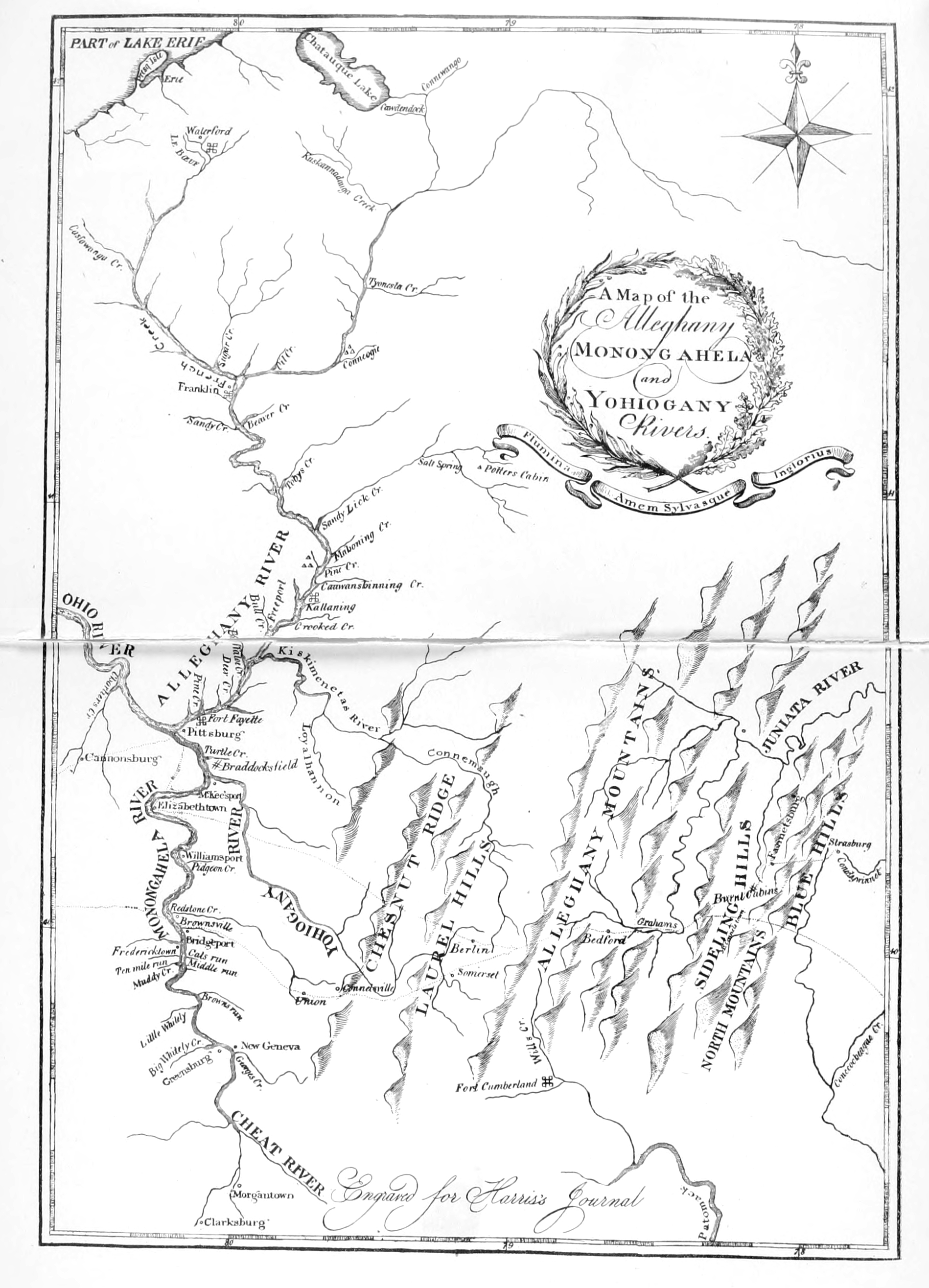
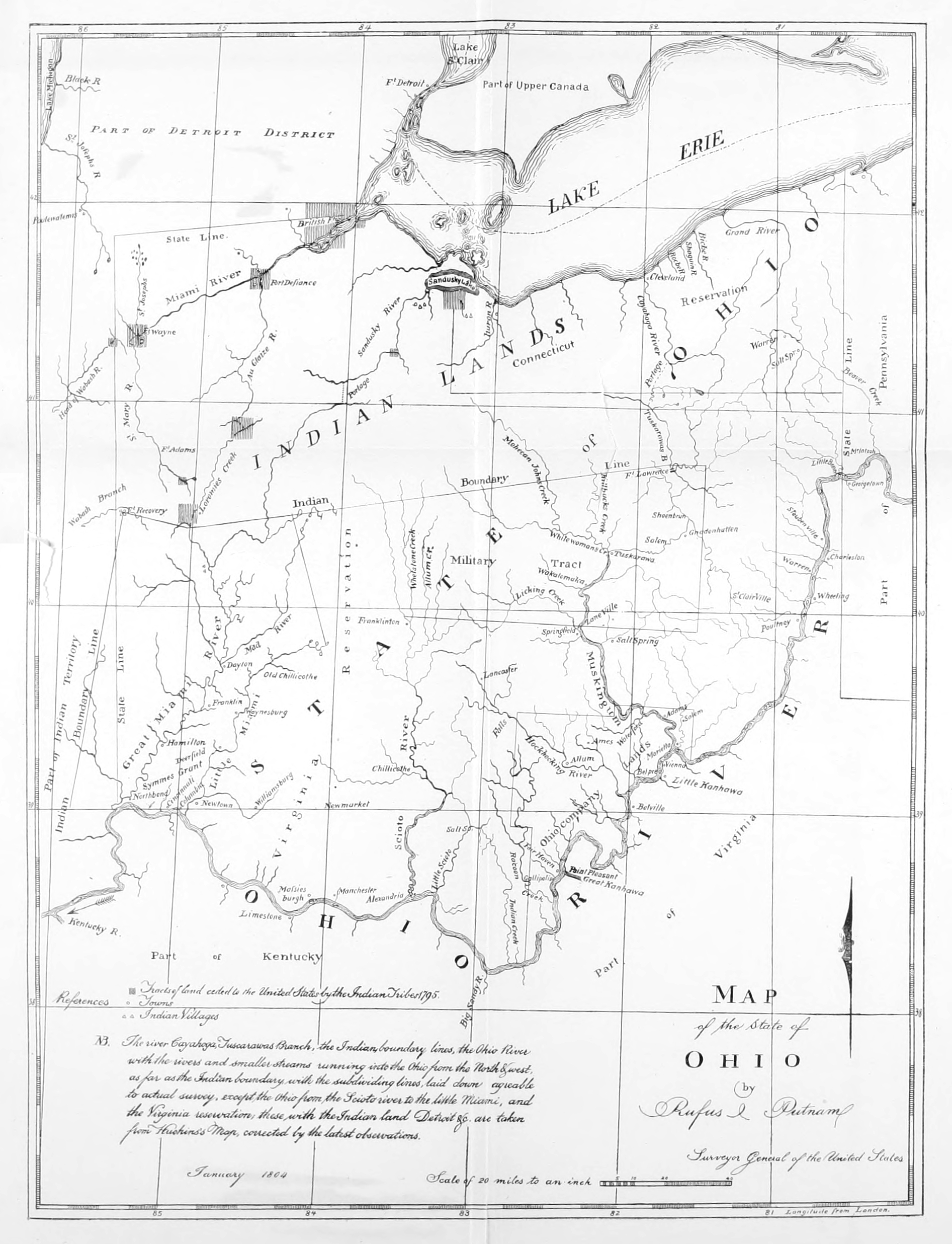
Long ‘s’ (ſ) were converted to ‘s’. Footnotes moved to the end of each book. There are two
anchors to footnote [122] in André Michaux’s Travels.
Obvious printing errors, such as backwards, upside down, missing or
partially printed letters and punctuation, were corrected. Final
stops missing at the end of sentences and abbreviations were added.
In the second book, manuscript page numbers are displayed within
brackets, e.g. {36}.
Words may have inconsistant spelling, diacriticals and
hyphenation in the text. These were left unchanged, as were obsolete and alternative spellings. Except as noted below,
misspelled words were not corrected.
A Series of Annotated Reprints of some of the best
and rarest contemporary volumes of travel,
descriptive of the Aborigines and Social and
Economic Conditions in the Middle
and Far West, during the Period
of Early American Settlement
Edited with Notes, Introductions, Index, etc., by
Reuben Gold Thwaites
Editor of “The Jesuit Relations and Allied Documents,” “Wisconsin
Historical Collections,” “Chronicles of Border Warfare,”
“Hennepin’s New Discovery,” etc.
Volume III
André Michaux’s Travels into Kentucky, 1793-96. François
André Michaux’s Travels West of Alleghany Mountains,
1802. Thaddeus Mason Harris’s Journal of a Tour
Northwest of Alleghany Mountains, 1803
Cleveland, Ohio
The Arthur H. Clark Company
1904
Copyright 1904, by
THE ARTHUR H. CLARK COMPANY
ALL RIGHTS RESERVED
The Lakeside Press
R. R. DONNELLEY & SONS COMPANY
CHICAGO
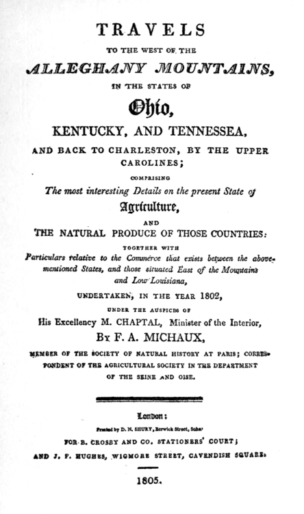
Travels to the West of the Alleghany Mountains,
in the States of Ohio, Kentucky, and Tennessea, and
back to Charleston, by the Upper Carolines ... undertaken
in the year 1802. September 24, 1801—March
1, 1803. François André Michaux
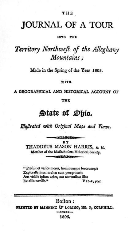
The Journal of a Tour into the Territory Northwest
of the Alleghany Mountains; made in the
Spring of the Year 1803. April 7—“beginning of July.”
Thaddeus Mason Harris, A.M.
We publish in this volume André Michaux’s journal
of his travels into Kentucky from 1793-96, Englished by
us from the French version in the Proceedings of the
American Philosophical Society; a reprint of the English
version of Travels to the West of the Alleghany Mountains,
made in 1802 by his son, François André Michaux;
and a reprint of Thaddeus Mason Harris’s Journal of a
Tour into the Territory Northwest of the Alleghany Mountains,
made in the Spring of the Year 1803—omitting,
however, as unnecessary to our present purpose, the
appendix thereto.
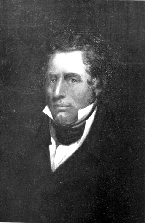
The Michauxs
André Michaux, whose name is known to scientists of
both hemispheres, was born at Satory, Versailles, in
1746. Destined by his father for the superintendence of
a farm belonging to the royal estate, Michaux early became
interested in agriculture, even while pursuing
classical studies. Upon the death of his young wife,
Cecil Claye, which occurred at the birth of their son,
François André (1770), he devoted himself to scientific
studies in the effort to overcome his grief. These naturally
took the direction of botany, and Michaux became
imbued with a desire to seek for strange plants in foreign
countries. From 1779-81 he travelled in England, the
Auvergne, and the Pyrenees; and later (1782-85), in
Persia, botanizing, and studying the political situation of
the Orient. He had intended to return to Persia, but
while in France (1785) the government requested that he
should proceed to North America in order to make a
study of forest trees, and experiment with regard to their
transplantation to France. Accordingly, in the autumn
of 1785, he left France, taking with him his young son.
Landing in New York he passed a year and a half in
that vicinity, herborizing, and attempting a botanical
garden. Finding the latitude of the Southern states,
however, more suited to his enterprise, he removed in the
spring of 1787 to Charleston. Purchasing a plantation
about ten miles from the city, he entered with enthusiasm
into the search for new plants and their culture upon his
estate. In this year he explored the mountains of the
Carolinas, and a twelve-month later made a difficult and
hazardous journey through the swamps and marshes of
Florida. The next year (1789) was occupied by a voyage
to the Bahamas, and another search among the
mountains for plants of a commercial nature—notably
ginseng, whose utility he taught the mountaineers.
In 1794 he undertook a most difficult expedition to
Canada and the arctic regions about Hudson Bay, and
upon his return proposed to the American Philosophical
Society at Philadelphia an exploration of the great West
by way of the Missouri River. A subscription was begun
for this purpose, and Jefferson drafted for him detailed
instructions for the journey;[1] but his services were needed
in another direction, and the Missouri exploration was
abandoned for a political mission.
The discontent of the Western settlers with regard to
the free navigation of the Mississippi had reached an
acute stage; the French minister to the United States
had come armed with instructions to secure the co-operation
of trans-Allegheny Americans for a raid upon the
Spanish territory of Louisiana, aimed to recover that
province for the power to which it had formerly belonged,
and make it a basis for revolutionary movements in
Canada, the West Indies, and ultimately all Spanish
America.[2] This minister arrived in Charleston in February,
1793, and selected Michaux as his agent to communicate
with the Kentucky leaders. An ardent republican,
already in the pay of the French government, and friendly
with influential men in government circles, Michaux
seemed a most desirable as well as the most available
agent possible. One characteristic was not, however,
sufficiently considered. Whatever may have been his
interest in the intrigue, whatever accounts thereof are
through caution or prudence omitted from the journal
here printed, one fact is evident—that Michaux was
chiefly devoted to the cause of science; these pages reveal
that a rare plant or new tree interested him much more
than an American general or a plot to subvert Spanish
tyranny.
His first Kentucky journey was, from the point of view
of the diplomats, but moderately successful. With the
collapse of the enterprise—due to the imprudence of
Genet, the firmness of Washington, the growing loyalty
of the Westerners to the new federal government, and
the change of leaders in France—Michaux returned to
botanical pursuits, and his later journeys appear to have
been undertaken solely in order to herborize. There are,
however, some slight indications in the text that he entertained
hope of continuing the enterprise, and of its ultimate
success. His inquiries, in the Cumberland, for
guides for the Missouri expedition, prove that he had by
no means abandoned his purpose of undertaking that
hazardous project.
But these long Western journeys had exhausted his
resources; for seven years he had had no remittance
from the French government, and was now under the
necessity of returning to Europe to attend to his affairs.
Accordingly in 1796 he embarked for France, and was
shipwrecked on the coast of Holland, losing part of his
collections; but his herbarium was preserved, and is now
in the Musée de Paris. He ardently desired to be sent
back to America; but his government offered him no
encouragement, and finally he accepted a post upon an
expedition to New Holland, and in November, 1802,
died of fever upon the island of Madagascar.
His son, François André, entered into his father’s pursuits
and greatly assisted him. While yet a lad, he accompanied
him on several arduous journeys in America;
at other times remaining upon the plantation, engaged
in the care of the transplanted trees. He returned to
France some years before his father, in order to study
medicine, and in the year of the latter’s death was commissioned
by the French minister of the interior to proceed
to the United States to study forests and agriculture
in general.
The journal of his travels was not originally intended
for print; but the interest aroused in the Western region
of the United States by the sale of Louisiana, induced its
publication. The first French edition appeared in 1804,
under the title, Voyage à l’ouest des Monts Alléghanys,
dans les États de l’Ohio, et du Kentucky, et du Tennessée,
et retour a Charleston par les Hautes-Carolines. Another
edition appeared in 1808. The first was soon Englished
by B. Lambert, and two editions with different publishers
issued from London presses in 1805. The same year
another translation, somewhat abridged, appeared in
volume i of Phillip’s Collection of Voyages. Neither of
these translations is well executed. The same year, a
German translation issued from the Weimar press.
The younger Michaux continued to be interested in
the study of trees, and spent several years in preparing
the three volumes of Histoire des Arbres forestiers de
l’Amérique Septentrionale, which appeared in 1810-13.
This was translated, and passed through several English
editions, with an additional volume added by Thomas
Nuttall under the title of The North American Sylva.
Michaux’s report on the naturalization of American
forest trees, made to the Société d’Agriculture du département
de la Seine, was printed in 1809.[3] His “Notice
sur les Isles Bermudas, et particulièrement sur l’Isle St.
George” was published in Annales des Sciences naturelles
(1806), volume viii. He also assisted in editing his
father’s work, Histoire des Chênes de l’Amérique; and his
final publication on American observations was Mémoire
sur les causes de la fièvre jaune, published at Paris in 1852.
Dr. Michaux died at Vauréal, near Pontoise, in 1855.
In 1824 the younger Michaux presented to the American
Philosophical Society at Philadelphia the notebooks
containing the diary of his father’s travels in
America—all save those covering the first two years
(1785-87), which were lost in the shipwreck on the coast
of Holland. The value of these journals has long been
known to scientists; their larger interest, as revealing
both political and social conditions in the new West, will
perhaps be first recognized upon this presentation of them
in English form. Written “by the light of his lonely
campfires, during brief moments snatched from short
hours of repose, in the midst of hardships and often surrounded
by dangers,” their literary form is deficient, and
frequent gaps occur, which doubtless were intended
to be filled in at some future moments of leisure. This
was prevented by the author’s untimely death in the
midst of his labors. For nearly a century the journals
existed only in manuscript. In 1884 Charles S. Sargent,
director of the Arnold Arboretum of Harvard University,
prepared the manuscript for the press, with explanatory
notes chiefly on botanical matters.[4] It was published in
the original French, in the American Philosophical
Society Proceedings, 1889, pp. 1-145.
From this journal of nearly eleven years’ travel in
America—from Florida on the south, to the wilds of
the Hudson Bay country on the north, from Philadelphia
and Charleston on the Atlantic coast to the most
remote Western settlements, and the Indian lands of the
Illinois, Kentucky, and Tennessee—we have selected
for translation and inclusion within our series, the portions
that concern particularly the trans-Allegheny
region. These relate to the expedition made to Kentucky
by way of the Ohio (1793), with the return over the Wilderness
Road and through the Valley of Virginia; and the
longer journey (1795-96) from Charleston to Tennessee,
thence through Kentucky to the Illinois, and back by a
similar route with side excursions on the great Western
rivers.
The journals of the elder Michaux “record the impressions
of a man of unusual intelligence—a traveller
in many lands, who had learned by long practice to use
his eyes to good advantage and to write down only what
they saw.” A part of the value of these documents to a
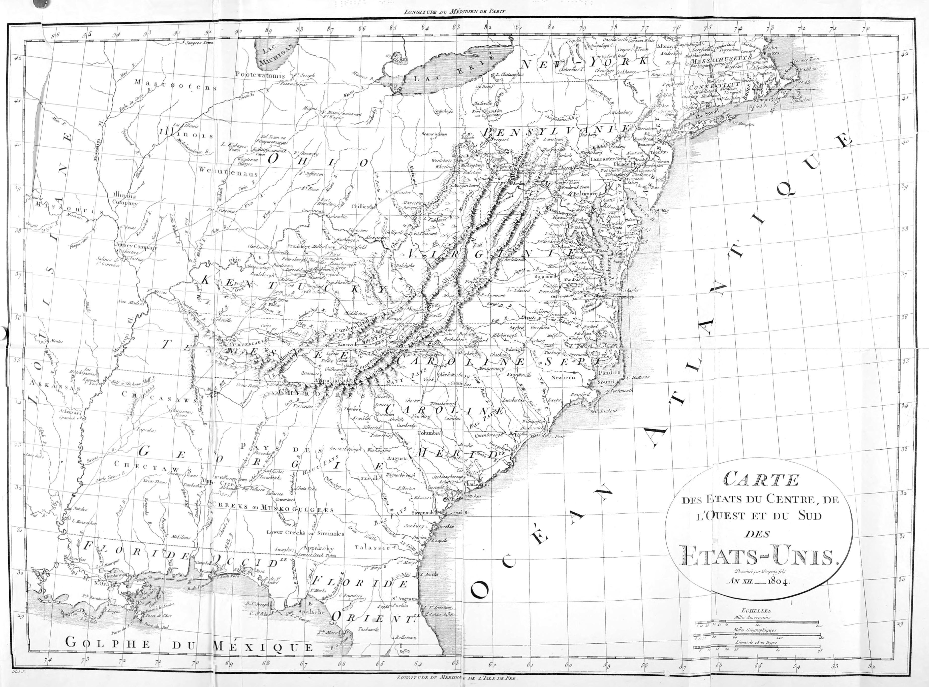
student of Western history consists in their accurate and
succinct outline of the areas of colonization. The extent
and boundaries of Michaux’s travels enable us to map
with considerable accuracy the limits of the settled
regions—first, that from Pittsburg down the Ohio to
just below Marietta; then, after passing a region without
a town, between Gallipolis and Limestone (Maysville,
Kentucky), the traveller enters the thickly occupied
area of Kentucky, bounded on the south and west by
the “barrens,” into which emigration was beginning to
creep. In the Illinois, Michaux’s unfavorable comment
upon the French habitants is in accord with that of other
visitors of the same nationality; his travels therein show
that the small French group were the only settlers, save a
few venturesome Americans at Bellefontaine, and “Corne
de Cerf.” In East Tennessee, the outpost was Fort
Southwest Point, where the Clinch and Holston meet;
thence, a journey of a hundred and twenty miles through
“the Wilderness” brought one to the frontier post of the
Cumberland settlements, at Bledsoe’s Lick. Upon Michaux’s
return, nearly a year later, the Cumberland frontier
had extended, and Fort Blount had been built forty
miles to the eastward as a protection for the ever-increasing
number of travellers and pioneers. The western
borders of Cumberland were also rapidly enlarging.
Clarksville, on the Cumberland River at the mouth of the
Red, had long been on the extreme border in this direction;
but Michaux found daring settlements stretching
out beyond, seizing the rich river bottoms and organizing
a town as a nucleus for scattered planters.
Michaux faithfully presents the conditions that confronted
travellers in his day—the lack of inns, the straying
of horses with the consequent annoyance and delay,
the inadequate means for crossing rivers, the frequent
necessity for waiting until a sufficient body of travellers
had collected to act as a guard through the uninhabited
regions. He also traversed nearly all the routes by which
emigration was pouring into the Western country—the
Wilderness Road to Kentucky, the routes from North
Carolina over the mountains to East Tennessee, the
Wilderness Road of Tennessee (this last a narrow and
dangerous link with the Cumberland settlements), the
paths thither to Louisville, and the Indian trails thence to
the Illinois; as well as the river routes—the Mississippi,
the Ohio, and the Cumberland.
Glimpses of the chief founders of the Western country
are tantalizing by their meagreness. We should have
valued more detailed accounts of conversations with
Clark, Logan, and Shelby, concerning Nicholas’s plan
for securing the navigation of the Mississippi; of the
attitude of Robertson, Blount, and Daniel Smith toward
the French enterprise; and of the impression made at this
early day by “a resident near the Cumberland River,
Mr. Jackson.” Particularly interesting is the record
of the number of Frenchmen who became prominent
and useful citizens of the West—Lucas at Pittsburg,
Lacassagne at Louisville, Tardiveau, Honoré, and
Depauw at Danville and vicinity; apart from the settlers
at Gallipolis, whose misfortunes our author deplores.
It is hoped that this English version of the elder Michaux’s
journals may prove a contribution of importance to
those interested in early conditions in the Mississippi
Valley.
Michaux’s published works are, Histoire des Chênes de
l’Amérique—which appeared in 1801, and is supposed
to have been recast or corrected by other scientists—and
Flora Boreali-Americana, written in Latin by Richard
from the plants which Michaux had collected in America,
and issued a year after the latter’s death.[5]
The few years that intervened between the journeys of
the elder and younger Michaux show the rapidity with
which the West was changing. Conditions of travel had
meantime been improved, and the development of resources
was proceeding with bounds. The opening of
the Mississippi had caused an immense growth in both
the extent and means of Western commerce; the son
describes ship-building upon the waters along which the
father had passed in Indian canoes. The increase in
the number, size, and appearance of the towns, and the
additional comforts in the homes of the people, were indicative
of a great and growing prosperity.
The younger traveller describes the inhabitants with
more particularity than his father. His observations
upon the characteristics of the people, their occupations
and recreations and their political bias, are those of an
intelligent and sympathetic narrator, with a predisposition
in favor of the Western settlers. His remarks in
chapter xii on the restlessness of the pioneers, their
eagerness to push onward to a newer country, their impatience
with the growing trammels of civilization, show
habits of close observation. His optimism with regard
to the future of the country, in thinking that within
twenty years the Ohio Valley would be “the most populous
and commercial part of the United States, and where
I should settle in preference to any other,” exhibits a
large comprehension of the forces and elements of Western
growth.
The American popularity of the younger Michaux’s
journal, in its own time, proved his ability to interpret
the ideas of our people, and the sympathetic interest of a
cultured Frenchman in the democratizing processes of
the New World.
Thaddeus Mason Harris
Thaddeus Mason Harris, author of the Journal of a
Tour into the Territory Northwest of the Alleghany
Mountains, was one of the coterie of liberal clergymen
who occupied the New England pulpits in the early part
of the nineteenth century. As a member of this group,
Harris’s observations of the Western country are of
peculiar interest. He had the training of the typical
New Englander—“plain living and high thinking.”
Born in Charlestown in 1768, his family were driven from
their home at the battle of Bunker Hill, and three years
later the father died of exposure contracted during his
service in the Revolutionary army. As the eldest of the
children, Thaddeus was sent to “board around” among
the neighboring farmers, one of whom took sufficient
interest in the promising lad to fit him for college. An
accidental supply of money at a later period, accepted as a
special interposition of Providence, made such an impression
upon the young man’s mind that he determined
to enter the ministry. He was graduated from Harvard
in 1787, in the same class with John Quincy Adams.
After a year’s teaching at Worcester, the position was
tendered him of private secretary to the newly-chosen
President Washington, but an attack of small-pox prevented
its acceptance, and the place was filled by Tobias
Lear.
In 1789 our author was “approbated to preach,” and
the following year received his A.M. degree, delivering
on the occasion the Phi Beta Kappa address. During
the two succeeding years he served as the librarian of his
alma mater, and was elected (1792) a resident member of
the Massachusetts Historical Society. The year 1793
saw Harris installed as pastor of the first church of Dorchester—a
relation which was continued through over
forty years of faithful and acceptable service. A careful
pastor, he exposed himself during the epidemic of yellow
fever in 1802 to such an extent that he contracted the
disease, and during his convalescence the Western journey
was planned and undertaken as a means of recuperation.
In this it was eminently successful, and upon his return
to Dorchester Harris plunged anew into literary and philanthropic
labors. Within the next few years he aided in
founding the American Antiquarian Society, the Massachusetts
Humane Society, the American Peace Society,
the American Academy of Arts and Sciences, and the
Archæological Society at Athens, and was chosen corresponding
member of the New York Historical Society.
His addresses and sermons on different occasions found
their way into print, until nearly sixty were published.
Harvard honored itself by conferring upon him the degree
of doctor of divinity in 1813, and during his entire later
life he acted as overseer in the college corporation. His
eldest son, a well-known entomologist, served as Harvard
librarian for twenty-five years (1831-56).
After a second severe illness (1833), Dr. Harris visited
Georgia, and thereupon published a biography of Oglethorpe.
In 1838 he resigned his pastorate and spent
his remaining five years in congenial literary pursuits,
serving for a time as the librarian of the Massachusetts
Historical Society. He is described as a “little quaint
old man, indescribably bent, but still wearing a hale
aspect, who used to haunt the alcoves of the library at
Harvard.” After March, 1842, the place of the old
scholar and reader in the college library was vacant.
Dr. Harris made no contribution of permanent value
to American literature, unless the present book may be
so considered. Besides the works mentioned, he aided
(1805) in putting forth an encyclopedia, and a Natural
History of the Bible; the result of the last-named labor
was pirated by an English firm, which issued it in several
editions. The Journal of a Tour, which we here republish,
sold well, and was soon out of print. In recent
years, the volume has brought a good price at antiquarian
sales. In addition to the journal proper, Harris added a
bulky appendix, entitled a “Geographical and Historical
Account of the State of Ohio,” from material collected
during his visit at Marietta, annexing thereto: a “Letter
to the Earl of Hillsborough on the navigation of the
Ohio (1770);” the “Act of Congress forming the State;”
the “Constitution of the State;” an “Account of the
destruction of the Moravian Settlements on the Muskingum;”
“Wayne’s Treaty;” and a number of papers
connected with the formation of the Ohio Company of
Associates, and the establishment of the Northwest Territory.
This appendix we have omitted as not within
the sphere of the present series, and as containing information
which can readily be secured elsewhere.
As an observer, two points characterize Harris’s narrative—his
enthusiasm for natural scenery, and the delight
shown in its description; and the dryness of his
statements with regard to the human life which he saw
en route. Its chief value lies in the accuracy which he
exhibits in data concerning the size of the towns, their
prosperity and growth, their business interests, and stage
of material development; in matters regarding the growth
of ship-building and navigation, the number of manufactories,
and the general material prosperity of the
region, Harris gives useful information. But as a picture
of Western life, or as a sympathetic relation of human
affairs in this region, the value is small. This arose in
part from the New Englander’s stout prejudices against
conditions unfamiliar to him. His attitude toward the
Western inhabitants is quite the contrary of that of the
younger Michaux, and forms thereto an effective foil.
As with previous volumes of this series, the Editor has
had the active co-operation of Louise Phelps Kellogg in
the preparation of notes.
R. G. T.
Madison, Wis., February, 1904.
[1] See documents in Original Journals of Lewis and Clark (New York, 1904),
appendix.
[2] See Turner, “Origin of Genet’s Projected Attack on Louisiana and the
Floridas” in American Historical Review, July, 1897; also documents in
American Historical Association Report, 1896 and 1897.
[3] See review in Monthly Anthology (Boston, 1810), viii, p. 280.
[4] The notes in the journals of the elder Michaux signed C. S. S., are those of
Sargent, found in the French edition and designed chiefly to elucidate botanical
references.
[5] The references in Sargent’s notes marked “Michx.,” refer to this Flora.
Journal of André Michaux , 1793-1796
Source: Englished from the original French, appearing in American
Philosophical Society Proceedings, 1889, pp. 91-101, 114-140.
JOURNAL OF ANDRÉ MICHAUX — FOOTNOTES:
On the 15ᵗʰ of July 1793, I took leave of Citizen Genet,
Minister of the Republic of France to the United States[1]
and started from Philadelphia on the same date at ten
o’clock at night to avoid the great heat, and to travel by
Moonlight. The 16th, being in company with ...
Humeau and ... Leblanc,[2] we journeyed 40 miles.
The 17th, passed by Lancaster and made 35 Miles.
The 18th, passed by Carlisle ... Miles and slept
at Chipesbourg [Shippensburg].
The 19th we slept at Strasbourg ... Miles.
Sunday the 20th, we started from Strasbourg, a small
town situate at the foot of the Mountains; one of our
horses having fallen sick we traveled only 21 Miles;
observed Magnolia acuminata, Azalea octandra, Kalmia
latifolia, Fagus castanea, Fagus pumila, Pinus 2-folia,
3-folia, Strobus: Abies Canadensis; Quercus castaneaefolia
etc.Juglans nigra.
The 21st of July started from Wells’s tavern, crossed the
Juniata river ... and noticed Rhododendron maximum,
Hydrangea frutescens, Trillium erectum; slept at
Bedford. 21 Miles.
The 22nd. Started from Bedford and breakfasted at a
place 4 miles distant where the Pittsburg Road divides
into two. We took the right hand road; the Rain compelled
us to stop and sleep only twelve Miles from Bedford.[3]
The 23rd we made 24 Miles and passed the summit of
the Alleganys.
The 24th we made 25 Miles.
The 25th we passed by Green’sburg and made 31 Miles.
The 26th Rain; we made only ... Miles.
The 27th, we made 19 Miles and arrived in Pittsburgh.
Total 32[4] Miles from Philadelphia.
The 29th herborised; recognized on the banks of the
Monongahela, Dracocephalum Virginianum,[6]Bignonia
radicans, Crotalaria alba? These plants grow on
the banks of the river which are submerged when the
waters are high.
The 30th of the same, recognized a Plant of the Genus
Ziziphora ... Cunila pulegioides[7]floribus tetandris;
Teucrium Canadense, Eupatorium aromaticum,
Sigesbeckia ...; Verbenae several species.
The 2nd of August recognized Aristolochia sipho or
macrophylla; Panax quinquefolium; Lobelia siphilitica;
Convallaria many species; Veronica ... Ozalis
stricta.
On the 6th of August I saw on the bank of the Monongahela
river opposite Pittsburgh a Coal mine at the entrance
of which there seems to be a thickness of 15 feet
of that mineral without admixture; sometimes a ferruginous
tint can be distinguished between the different
layers. In several spots soft rocks are to be found which
seem good for use as whet-stones for large tools; they
seem to me to consist of a combination of sandy, clayey
and ferruginous particles with particles of mica in very
rare instances.
The soil in the neighborhood of Pittsburgh is generally
clayey, the calcareous rocks or stones of a brown color,
consisting of much muddy clay. The soil between the
two rivers on which Pittsburgh is built, is alluvial; stones
rounded and worn by the rolling of torrents have even
been found in the earth, dug up while sinking wells at a
depth of more than 30 feet.
The 9th of August, when I was ready to start, the conductor
of the Boat on which I had embarked my baggage
came to tell me that he was waiting for the Boats destined
to convey the troops, especially as the Boat seemed too
deeply laden for that Season when the Waters are low;
there was an appearance of Rain.
The 10th the river seems to be falling.
The 11th, 12th and 13th we remained, awaiting the
departure.
The 13th three Boats arrived from the Illinois belonging
to Mr. Vigo.[8] They were manned by about 30 French
Canadian or Illinois oarsmen.
A Frenchman who has resided in America for 14 years
and whose business consists in shipping supplies of flour
to New Orleans, told me that he would give me Letters
for Illinois addressed to the Commandant of the Post of
St Louis. He is at present settled in Pittsbourgh and his
name is Audrain.[9] This Audrain is said to be in partnership
with one Louisière or Delousière who was exiled
from France for having been concerned in the plot to
deliver Havre to the combined English and Spanish
fleets. This Louisière is at present absent from Pittsburgh.
There is another Frenchman residing in Pittsburgh,
Mr Lucas de Pentareau, an excellent Democrat,
now absent. He passes for an educated man with legal
knowledge.[10]
Pittsburgh is situated at the confluence of the two rivers,
Monongahela and Allegany. These two rivers unite and
form the Ohio or Belle Rivière. There are a great many
more houses on the Monongahela river than on the Allegany.
The number of houses is about 250 and it increases
considerably every year. The ditches are still to be seen
that served as the entrenchment of the Fort built by the
French and called Fort Duquesne. The English, since
that time, had built another almost beside it at the angle
formed by the junction of the two rivers. It was built
of brick and the Americans are demolishing it to use the
bricks in building the houses that are being erected every
day at Fort Pitt.[11]
The Americans have a Fort of Palisades situated behind
the town on the bank of the Allegany River; it serves as a
Depot for the arrival of the troops that are being sent
against the Savages and as a Magazine for the Munitions
sent there from Philadelphia.[12]
Wednesday the 14th of August, started from Pittsbourgh
and slept at a distance of two miles only on the
point of a small island on which I found Acer negundo,
rubrum, saccharum; Evonimus capsulis glabris.[13]
The 15th recognized at 20 Miles from Pittsburgh Pavia
lutea, Panax quinquefolium; A Bryonia plant monoica
calyce 5-fido, corolla 5 partita floribus masculis spicatis
axillaribus floribus femineis quoque axillaribus germine
instructo spinis innocuis.[14] Our journey covered 28
Miles.
The 16th at 7 o’clock in the morning we crossed the
boundary line between Pennsylvania and Virginia. The
line is marked by cutting down the trees on a width of
about ... feet on the right and left of the Ohio or
Belle Rivière and this place is 45 miles from Pittsbourgh.
In the evening of the same day arrived at Buffalo Creek.
79 Miles from Pittsburgh.
The 17th passed by Willing [Wheeling] 92 Miles from
Pittsburgh;[15] this place is inhabited by about 12 families
as is also Buffalo Creek [Wellsburg]. Owing to the contrary
wind we traveled only 30 Miles.
Sunday August 18th 1793, saw several flocks of wild
Turkeys; wind contrary.
The 19th we made 50 Miles. There are no settlements
between Willing and Marietta, a small Town situate at
the mouth of the Muskingum river. We slept at the
place called Fort Harmar, situate opposite Marietta on
the right bank of the Muskingum river.[16]Dianthera
americana.
The 20th we spent the day there.
The 21st, we passed by Little Kanhaway,[17] Belpré, and
Belleville 34 Miles.
The 22nd we saw no settlements. Recognized Polymnia
canadensis; Acer rubrum foliis inferne glaucis; Acer
negundo, Acer saccharum, Acer foliis rugosis nervis
sublanuginosis; Annona triloba, Pavia lutea, Platanus
occidentalis.
The 23rd passed Great Kanhaway,[18] 4 miles before
arriving at Galliapolis on the opposite bank.
The 23rd we arrived at the settlement of Galliapolis
situate on the left bank of the Belle rivière. The houses
are all built of squared logs merely notched at the ends
instead of being Mortised (Log-house).[19]
The 24th remained over, visited doctor Petit who inspired
me with the greatest respect by his good sense, his
knowledge and his virtue. It seemed to me that humanity
is the only thing that keeps him attached to that unfortunate
colony.[20] Out of the 600 persons who came there
to settle, only about 150 remain.
Sunday the 25th started from Galliapolis; at a distance
of 35 Miles recognized Iresine celosioides on the banks of
the belle rivière where they are submerged by the great
inundations. Passed a small river called Gay [Guyandotte].
We saw no habitations; 40 Miles.
The 26th, saw no habitations; passed the river Scioto
... Miles.[21]
The 27th, saw a Settlement of several houses at the
place called Three Islands, ten miles before arriving at
Lime Stone;[22] these Settlements are considered the first
belonging to Kentuckey. We reached Lime Stone toward
evening.[23]
Limestone is considered the Landing place or Port of
Kentuckey. Goods are landed there that are sent from
Philadelphia for Danville, Lexington etc. A small town
founded six years ago at a distance of 4 Miles on the
Lexington road, is called Washington and is very flourishing
being situate in very fertile land.
The 29th I left the two Companions who had come with
me from Philadelphia. They continued their journey to
Louisville while I went on by way of the inland Settlements.
Colonel D. Orr offered me his Company to go
with him to Lexington whither he proposed to go in a
few days.
The 30th and 31st herborised while waiting until horses
could be procured for the journey to Lexington. Guilandina
dioica; Fraxinus (quadrangularis); Gleditsia triacanthos;
Serratula praealta; Eupatorium aromaticum,
Crepis Sibirica? etc.
Sunday 1st of September 1793. Dined at Colonel
Lee’s.[25]
The 2nd dined with ... Fox and prepared my
baggage for departure.
The 3rd the journey was put off until the Following
day. The soil in the vicinity of Washington is clayey
and blackish, very rich. The stones are of an opaque
bluish calcareous Substance, full of petrifactions of seashells.
The bones of those monster animals supposed to
be Elephants are found in the neighborhood.[26] It is to
be presumed that those bones belonged to marine Individuals,
judging by the great abundance of debris of marine
bodies collected in those places.
The 4th started from Washington; passed by a place
where the soil is impregnated with saline substances and
whither the Buffaloes used to go in great numbers to lick
the particles of Salt continually exuding from the surface
of the Soil. There are at this spot springs whose water
is bitter, putrid, blackish and full of mephitic air which
frees itself at the slightest movement of the soil by the
bubbles appearing on the surface of the spring as one
approaches. The people living in the neighborhood
erect ovens with kettles and extract Salt by the evaporation
of the water.[27] We traveled 33 Miles.
The 5th we made 27 miles and, at an early hour,
reached Lexington,[28] the chief town amongst the Settlements
of the State of Kentuckey. We passed a small
Settlement, looked upon as a town and called Paris, the
capital of Bourbon county.[29] It contains about 18 houses.
There are farming Establishments along the road and
travelers now go without danger from Lime Stone to
Lexington, a distance of Sixty six miles from one place
to the other. 66 Miles.
The 6th visited two persons residing in Lexington for
whom I had Letters of introduction.
The 7th herborised....
Sunday 8th of September was obliged to remain being
unable to hire a horse.
The 9th left Lexington, went through portions of forest
lands with very scattered Plantations. Crossed the
Kentuckey river the banks of which are very close to one
another; when the waters are low there is a height of
more than 100 feet from the bank of the river to the level
of the lands bordering on it and through which it runs. I
am told that in flood-time it rises to a height of 40 feet
in one day. On arriving there one would think himself
between two ranges of very steep Mountains but in fact
it is merely a torrent or a river whose Bed has been deeply
worn. The rocks on the banks are of a calcareous
nature. Several shrubs and Plants, natives of Carolina,
grow on the cliff with a southern exposure being secured
and protected from cold by the favorable situation offered
by the great depth of the bed of the river.
The 10th arrived in Danville[30] and visited several persons
for whom I had Letters: Colonel Barbee etc, Capt.
Peter Tardivau, a witty man[31] etc. etc.
The 11th, visited General Benjamin Logan whose
house is situate 12 Miles from Danville. I confided to
him the Commission entrusted to me; He told me he
would be delighted to take part in the enterprise but that
he had received a Letter a few days previously from J.
Brown[32] which informed him that negotiations had been
begun between the United States and the Spaniards
respecting the navigation of the Mississipi and the Creek
Indians; That a messenger had been sent to Madrid[33]
and that any one of the United States that would venture
to act in a hostile manner against the Spaniards before
the return of the first of December next, would be disapproved
by the federal Government; That he was going
to start the following day for his Establishment of Boulskine
[Bullskin] Creek and that, after I should have conferred
with General Clark, he hoped the latter would, in
consequence of what I should communicate to him, make
arrangements for further conferences together[34] etc. etc.
The 12th returned to Danville.
The 13th Visited (his Excellency) the Governor of the
State of Kentuckey, Isaac Shelby;[35] visited the hills called
Knob Licks;[36] Saw several Plants especially in the salt
lands enclosed in the interior of the territory of Kentuckey.
Andromeda arborea.
The 14th left Danville for Louisville, lodged with
Cumberland 19 Miles from Danville.
Sunday 15th of September 1793, 22 Miles from Danville
found a sort of Tragia, a monoecian Plant, fructification
in the manner of the Euphorbias. Shortly before
reaching Beardstown recognized the rocks and stones of
calcareous substances possessing all the forms of the
Madrepores. The tops of the Mountains (hills) one
has to cross, 3 or 4 Miles before reaching Beardstown,
consist entirely of these petrified madrepores. Recognized
many Plants not found elsewhere: Fagara of the
State of New York; Rhamnus (Carolinian) and Rhamnus
... etc etc. The neighborhood would be very interesting
for a Botanist to visit. Dined at Beardstown[37]
and slept 6 miles further. 31 Miles.
The country between Beardstown and Louisville
possesses no interest for a Botanist.
The 16th arrived at Louisville having traveled by the
new road.[38]29 Miles. In all 79 Miles from Danville.
The 17th of September visited General Clarke. I
handed him the Letters from the Minister and informed
him of the object of my Mission. He told me that he was
very eager for the Undertaking but that, although he had
written so long ago, he had received no answer and thought
it had been abandoned.[39] I told him that his Letter had
fallen into other hands and that the Minister had received
it only indirectly after his arrival in Philadelphia. He
informed me that a fresh circumstance seemed to oppose
an obstacle to it.[40]
The 18th remained at Louisville and herborised.
The 19th returned to visit General Clarke....
The 20th started from Louisville, passed by General
Clarke’s[41] and passed on to sleep near Salt river.
The 21st passed by Beardstown. Evonimus ramulis
quadrangulis capsulis muricatis.[42]
Sunday September 22nd arrived once more at Danville
at 5 o’clock in the evening. Wrote to Minister
Genet the same day by the Philadelphia Post.[43]
The 23rd I rested.
The 24th started for Lexington and slept at the Kentuckey
river crossing.
The 25th found that my horse had wandered away. I
slept at an inn where there was no Stable; my horse
jumped over the fence and I spent the whole day looking
for him.
While so engaged I saw on the sandy beaches: Iresine
celosioides; Mollugo verticillata; On the rocks; Heuchera
Americana; Asplenium rhyzophorum; Pteris nova; Parietaria
...; Hydrangea arborescens. On the limestone
mountains: Serratula 2 unknown species; Cuphea
viscosa; Didynamia gymnosperma novum genus; Didynamia
angiosperma novum genus. On the bank of the
Dickson river, Dirca palustris; Sophora floribus coerulis.
In the shady forests etc: Acer foliis argenteis an rubrum?
Acer saccharum; Fraxinus foliolis subintegris, Fraxinus
foliolis serratis ramis quadrangularis; Gleditsia triacanthos;
Guilandina dioica, Robinia pseudo-acacia; Evonimus
ramulis subrotundis, capsulis laevibus.
The 26th of September 1793, Rained all day; slept at a
mile from Kentuckey river at the house of ... Hogan[44]
who was kind enough to lend me a horse for
nothing to go in search of mine.
The 27th arrived at Lexington distant only 20 Miles from
the crossing of Kentuckey river called Hickman junction.[45]
The 5th of October started from Lexington.
Sunday the 6th of the same arrived at Danville. The
same day wrote to Citizen Minister Genet.
The 7th took lodgings at Puvit’s[46] and received my
baggage.
The 13th Sunday returned to Lexington and came
back on Sunday the 20th, to Danville. Not having received
general Clark’s answer I was unable to take advantage
of the Post to write to the Minister at Philadelphia.
The 10th of November 1793, Year 2 of the French
Republic, left Danville for Philadelphia after visiting
Colonel George Nicholas[49] near Danville. He laid stress
upon the plan he had proposed to me the previous day
regarding the Navigation of the Mississipi. Namely:
That the Naval Forces of the Republic should seize the
Mouth of the Mississipi, declare that the Country belonged
to them by right of Conquest and invite the Americans
of the Western Country to take advantage of the
freedom of Navigation. Then, if the Spaniards situated
higher up the river molested the Vessels carrying the
provisions conveyed by the Americans, the latter would
have the right to repel Constraint and force by force.
Thus the Spanish Government would have no reason to
complain of the United States having broken through
inasmuch as the country would be reputed in the possession
of the French Republic.
Slept at Crab orchard distant from Danville 22 Miles.
The 11th of November 1793, started from Crab Orchard
in company with 12 persons who had assembled
at that place to pass through the Woods inhabited and
frequented by the Savages. The tract between Crab
orchard and Houlston settlement is 130 Miles wide and
is called The Wilderness.[50] Slept at Longford Station.
10 Miles.
The 12th slept at Modnell Station 28 Miles.
The 13th slept at Middleton station. 28 Miles.
The 14th crossed low, swampy places where the water
was brown and stagnant. Six miles from Middleton
Post and 18 miles before reaching the top of Cumberland
Gap, saw a climbing fern covering an area of over six
acres of ground near the road.[51] At this season when the
Frost had produced ice from 3 to 4 lines thick, this plant
was not at all injured by it. In this territory are two
places, one called Flat lick and the other Stinking Creek.
Saw near the Carcass of a Stag the ... Raven
(Corvus corax). Davissas station 2 miles to the[52] ...
Cumberland Gap[53]26 Miles.
The 15th of November traveled through parts of very
high Mountains in the midst of which we crossed Clinch
river and slept at Houlston Station[54] in the house of one
... 27 Miles.
The 16th followed the bank of the Houlston river and
slept at the house of ... Amis Esquire, three Miles
from Hawkin Court house.[55]26 Miles.
Sunday the 17th the Rain compelled me to remain in a
a small Cabin near the North fork of Houlston. 25 Miles.
The 18th my horse was so tired owing to the rapidity of
the journey and the bad roads across the Wilderness that
I was obliged to stop after a Journey of only eleven Miles.
11 Miles.
The 19th started at daybreak. At the foot of the house
where I lodged, the Kentuckey road divides,[56] the right
one leads to Burke court house in North Carolina passing
by the Mouth of Wataga river; the other leads to Abington
court house, the first town of Virginia. As my horse was
still tired, I made only 20 miles.
The 20th I made 15 Miles; arrived at Abington.[57]
The 21st I slept 22 Miles from Abington near Seven
Miles Ford, the middle Branch of the Houlston.
The 22nd of November 1793 crossed Seven Miles ford.
The Holston river consists of three principal Branches,
namely: North fork, Seven Miles fork and South fork
of Holston river.
In the space of six miles after crossing that little river,
observed on the northern Hills bordering several small
rivers the Pinus abies canadensis, Thuya occidentalis,
Rhododendron maximum and also Magnolia acuminata
in places where the soil is very rich: Fagus chinquapin;
clayey soil, ferruginous Quartz rocks, Slates rare and
lime Stones sometimes interveined with white Quartz;
grey Squirrel (forgot to mention that, in passing Abington,
saw a Tortoise 8 inches in diameter petrified in a
black calcareous substance like the Rocks abounding in
the territory). Our day’s journey was 23 miles.
The 23rd of November slept in the house of a German.
During the night my horses strayed away. Between
Abington and With Court house[58] among the Mountains
Abies canadensis and Thuya occidentalis.
Sunday the 24th, passed by With Court house and at
about 18 Miles in the steep Mountains observed Pinus
Strobus, Pinus foliis ternis (pitch pine), Pinus foliis
geminis ..., Pinus abies canadensis, Rhododendron
maximum, Kalmia latifolia, Gaultheria procumbens,
Epigea repens: In more arid places, Fagus chinquapin,
Fagus castanea americana, Fagus sylvatica americana,
Andromeda arborea, Hypericum Kalmianum. Among
the damp rocks or those watered by the streams; Rocks of
silex and also of agate slightly transparent.
From Seven Miles ford to With Court house 36 Miles.
The 25th crossed the ferry called Peper’s ferry[59] on the
New River and afterward crossed from the West to the
East side of the Alleganies; slept on a branch of James
river called Catawba which flows eastward while the
New River flows West of the Mountains.
The 26th continued on my way to Botetort Court house
30 miles.
The 27th passed by Botetort Court house[60] and by the
south Branch of the James River 12 miles from Botetort.
The 28th passed by Lexington[61] 40 miles distant from
Botetort and by the north branch of James river to one
Mile from Lexington. Thuya occidentalis, Pinus Strobus.
The 29th of November, remained in Mac Dowall’s
house;[62] my horse’s leg was so swelled that he could not
walk.
The 30th journeyed 27 miles.
Sunday the first of December 1793 passed by Stanton,
a small and rather flourishing town situate 120 Miles
from Richemont and 75 Miles from Botetort.[63]
The 2nd passed by Rockyham or Rockytown[64] 20
miles distant from Stanton.
The 3rd passed by Woodstock,[65] another small town 37
Miles from Rockytown. Between Stanton and Woodstock
the country is mountainous, the soil rather fertile,
of a clayey nature, with calcareous rocks called Blue
limestone; Quercus rubra, alba; Fagus chinquapin and
Pinus foliis geminis, conis squamis rigidis et aculeatis.
Three miles before reaching that town, on the North of a
Hill on the road, Thuya occidentalis, Pinus foliis geminis,
Juniperus virginiana.
The 4th started from Woodstock, passed by Newtown.[66]
The 5th passed by Winchester,[67] 35 Miles from Woodstock,
formerly called Miller’stown.
The 6th passed by Charlestown[68] 22 Miles from Winchester.
Passed by Harspur ferry[69] across the Potomack
river 8 miles from Charleston and entered Maryland.
The 7th passed by Fredericktown[70] 20 Miles from Harspur
ferry (Potomack river) and 50 miles from Winchester.
Sunday the 8th passed by Woodberry and Littletown[71]
35 Miles from Fredericktown.
The 9th passed by Hanover, formerly MacAllistertown[72]
42 miles from Fredericktown and by Yorktown
18 Miles from MacAllistertown now Hanovertown.
The 10th passed by the Susquehanna river and entered
Pennsylvania eleven miles from Yorktown.[73] Passed
Lancaster 12 miles from Harris ferry on the Susquehanna
river and 24 miles from York.[74]
The 11th of December 1793 traveled 30 Miles.
Thursday the 12th, arrived in Philadelphia 66 miles
from Lancaster.
The 13th visited Citizen Genet, Minister Plenipotentiary
of the French Republic.
The 14th Visited Mr. Jefferson, Mr. Rittenhouse[75]
and ...
Sunday the 15th; Recapitulation of the journey, namely:
From Danville to Lincoln
12
miles
From Lincoln to Crab Orchard
10
From Crab Orchard to Langford Station
10
From Langford to Modrell Station
28
Modrell to Middleton Station
28
Middleton to Cumberland Gap
24
Cumberland to Davisses Station
2
Davisses to Houlston
27
Houlston to Hawkin Court house
22
Hawkin to ... Amis
3
Amis to North Fork of Houlston
25
North fork to Carolina fork
31
From the fork to Abington formerly Washington
Court House in Virginia
The 30th Germinal in the 3rd year of the French Republic
One and Indivisible (Sunday 19th of April 1795
old style) started to go and herborise in the high Mountains
of the Carolinas and afterward to visit the Western territories.
Plants seen before arriving at Monk’s corner:
Heuchera ..., Vicia 2 species, Smilax herbacea
erecta, Melampodium? ... Polygonum necessaria,
Silene Virginica, Phlox lanceolata then in flower, Valeriana.
Slept at 45 Mile House.
The 10th Floreal (20th of April,) around forty five
Mile house, Valeriana; 3 Miles before reaching Neilson’s
ferry Gnaphalium dioicuin, Uvularia? On the said 20th
of April a new tree of the Santee river, elm-leaved, fructus
muricati capsula muricata, semen unicum subovatum.[78]
These seeds were then almost ripe; Celtis occidentalis
flowers ...[79] and lower male flowers.
Slept 77 Miles from Charleston.
The 21st of April noticed on the Santee High-hills:
Phlox with white flowers and Phlox with pink flowers,
two different species, very small Phlox with lance shaped
leaves; Saw in the neighborhood of Monk’s corner Lupinus
hirsutus in flower. Dined with Dʳ ...; slept
at Statesboroug.
The 22nd passed by Cambden; five miles beyond, a new
Kalmia; it was not yet in flower. Slept 10 Miles beyond
Cambden.
The 23rd of April passed by Flat rock, by Hanging
rock Creek and slept at Cane Creek, Lancaster county,
in the house of a Mr May; my horse strayed away during
the night and following his traces it was found that he
had passed by Mr Lee’s.
The 24th I was obliged to look for him all day. Mr
Lee also sent his son and his negro to search for him.
He procured me a Horse to go on my quest and afterward
invited me to lodge with him; he overwhelmed me
with civilities.[80]
The 25th, the horse came to Mr Lee’s house of his
accord. Plants on the creek: Dodecatheon Meadia,
Asarum Canadense, Claytonia Virginica, Erythronium
dens-leonis.
Sunday 26th of April, started from Cane Creek, passed
by Land’sford on the Catawba river. But the real road
is from Cane Creek, ask for Colonel Crawford’s house or
Plantation on the Waxsaw, then pass MacClean Hands
ferry on the Catawba; Thence straight to the Iron works
called Hill’s Iron Works operated by Colonel Hill.[81]
Thus from Cane Creek to Waxsaw ... Miles;
From Waxsaw to Iron Works, York county ...
The 27th passed Iron Works about 32 miles from Cane
Creek.
The 28th passed by Armstrong[82] ford on the south
branch of the Catawba, 12 miles from Iron Works.
The same day passed by the dwelling of Bennet Smith
where there is a ... Magnolia, 12 Miles from
Armstrong ford.
The 29th passed by Lincoln,[83] 12 Miles from Bennet
Smith’s and 36 miles from Iron Works.
Thursday 30th of April passed by the dwelling of Old
man Wilson[84] 9 miles from Lincoln and 6 Miles from
Robertson’s. Reached Morganton[85] 30 Miles from Robertson.
The 1st of May spent the day at Morganton and herborised
in the neighborhood.
The 2nd spent the day at Colonel Avery’s,[86] 4 miles
from Morganton.
Sunday 3rd of May started for the Mountains; at a
distance of 14 Miles from Burke is Wagely’s house.
The Lineville Mountains at whose foot this house is
situated, abound in Magnolia auriculata. They were
then in flower. From Wagely’s to Captain Young’s is 8
Miles.
The 4th of May left Young’s. The distance to Ainswort’s
is 2 Miles but by going to the right one reaches the
foot of a very high Mountain 3 Miles from Young’s.
The summit is 5 Miles from Young’s.
From the summit of the Mountain at Young’s to
Bright’s, called Bright’s Settlement, the distance is 3
Miles and from Bright’s to Davin Port’s 2 Miles, making
10 Miles in all from Young’s to Davin Port’s.[87]
The 5th of May herborised in the vicinity of the dwellings
of Davin Port and Wiseman.
The 6th started for the Mountains, namely: Round
[Roan] Mountain and Yellow Mountain; Toe River
flows between these Mountains. All the Convallaria
were in flower as well as the Podophyllum diphyllum and
umbellatum.
Sunday 10th of May 1795 returned from the Mountains
to the dwelling of Davin Port.
The 11th herborised on the Mountains facing the
dwelling. The distance to the summit of the Bleue
Ridges at the part called Rompback is about 3 Miles; on
the first Mountains are to be seen in very great abundance
the Azalea foliis apice glandulosis, Azalea lutea. There
is no other Azalea on the Hills surrounding the dwellings
of Davin Port and Wiseman but this yellow-flowered
species. That on the River banks is generally that with
carnation flowers and that with white flowers.[88]
The 12th ascended the summit of the Blueridges,
Rhododendron minus in flower, Cypripedium Luteum.
The 13th of May started to continue my journey. At
Noon arrived at the foot of Yellow Mountain 10 Miles.
In the evening came to sleep at the house of John Miller
12 Miles from the Mountain. Thus there are 22 Miles
from Davin Port’s to Miller’s; at a distance of half a mile
one commences to cross Doe River.
The 14th followed and crossed Doe river 27 times. It
is dangerous when the waters are high. Slept at the
house of Colonel Tipton,[89] 20 Miles from Miller’s.
The 15th passed by Johnsboroug[90] 10 Miles from
Colonel Tipton’s dwelling and 84 Miles from Burke Court
house. Slept at the house of Anthony Moore near Noleychukey
river. During the night my horse strayed away.
The 16th, Sunday 17th, & 18th were spent in searching
for my horse.
The 19th bought another horse for the price of fifty
Dollars from an inhabitant of Noley Chukey river named
... Earnest, a neighbor of one Andrew Fox. The
Magnolia tripetala abounds on the banks of Noley
Chukey.
Wednesday 20th of May, passed by Green Court house
27 Miles from John’s Borough and the road to Kentuckey,
taking the right hand and passing by ... ferry on
the Holston river. Continuing straight on the road leads
to Knoxville. By going to the left a little before Green
the road leads to Frenchbroad.[91] The distance from
John Borough to Green Court house is 27 Miles.
The 21st passed by Bull’s Gap 18 Miles from Green.[92]
The 22nd passed by Iron Works[93] 30 Miles from Bull’s
gap. The distance to the river called Houlston river is
only four miles. Two miles from Iron Works is a Rock
of mineral, pieces whereof on being crushed and reduced
to powder dye cotton red; this mineral is boiled etc.
The 23rd as my horse was injured I was obliged to
remain a Mile from Iron Works on Mossy Creek at the
house of one Newman. Near his house (½ mile) is to
be found the mineral that I take to be Antimony.
Sunday 24th, arrived at Colonel King’s on the Houlston
river at the place called Macby ferry[94] 15 Miles from
Iron Works.
The 25th crossed the ferry and arrived at Knoxville 15
miles from Macby ferry, the residence of the Governor of
the Western territories, 110 Miles from Johnsborough.[95]
Plants and Trees of the Territory of Knoxville and of the
neighboring country: Quercus prinus saxosa; Quercus
prinus humilis; Quercus rubra; Quercus proemorsa; Quercus
tomentosa; Quercus pinnatifida; Quercus alba ...;
Ulmus viscosa; Ulmus fungosa; Fraxinus ...; Diospiros
Virginiana; Liquidambar styraciflua; Juglans nigra,
alba or oblonga, hiccory pignut. Platanus occidentalis;
Nyssa aquatica; Fagus castanea americana; Fagus pumila;
Fagus sylvatica americana; Magnolia acuminata; Betula
alnus americanus; Cercis Canadensis; Cornus florida;
Evonimus latifolius, Evonimus Americanus; Podophyllum
peltatum; Jeffersonia; Sanguinaria Canadensis; Trillium
sessile.
Remained the whole week at Knoxville and herborised
in the vicinity while awaiting a sufficiently numerous
caravan to pass through the Wilderness.
Sunday 31st of May received notice that twenty five
armed travelers were on the point of arriving at Knoxville.
Monday 1st of June 1795, old style, the journey was
again put off.
Thursday 4th of June started from Knoxville and slept
15 miles away at captain Camel’s at the place called
Camel [Campbell] station.
Friday the 5th, slept at the place called West Point on
Clinch river, a Post of soldiers guarding the frontiers of
the territory,[96] 25 Miles from Camel station.
The 6th started and crossed the river in a Scow or
ferry connected with West point station. Our journey
covered 10 miles. The Travelers consisted of 15 armed
men and more than thirty women and children.
Sunday 7th of June crossed the Mountains called Cumberland
Mountains, 22 Miles.
The 8th continued our march in the Mountains 23
Miles. Magnolia petalis basi purpureis.[97]
Tuesday 9th of June 1795, alternately ascended and
descended the Mountains. In the bottom lands Magnolia
tripetala in abundance, 25 Miles.
The 10th arrived at the Cumberland River, 10 Miles,
and slept beyond the 20th Mile.
The 11th arrived at Blodsoe Lick or Blodsoe station,[98]
20 Miles. 120 Miles in all of the Wilderness.
Slept at this place where there is food for men and
Horses.
Friday the 12th, came one mile to Colonel Winchester’s;[99]
slept there two nights to rest myself and my Horse.
Sunday the 14th herborised.
The 15th came to the house of a resident near Cumberland
River, Mr. Jackson;[100] soil fertile. Oaks, Quercus
prinus: Quercus rubra, Quercus glandibus magnis, capsulâ
includentibus, called Overcup White Oak.[101]Quercus
tomentosa,[102]Quercus praemorsa. 25 Miles.
The 16th arrived at Nashville 12 Miles.
Total 197 Miles from Knoxville to Nashville, the capital
of the Cumberland Settlements on the Cumberland
river.[103]
The 17th visited various persons, Daniel Smith,[104]
Colonel Robertson,[105] Captain Gordon, [G. M.] Deaderick,
Dr White, Thomas Craighead[106] etc. etc.
Herborised on the following days.
Trees of Nashville Territory:
Quercus prinus; Quercus phellos latifolia; Quercus
pinnatifida; Quercus foliis lyratis subtus tomentosis calycibus
maximis margine laciniatis glandibus includentibus
Vulgo; Over cup White Oak;[107]Quercus rubra; Quercus
tomentosa; Acer saccharum, Acer negundo, Acer rubrum;
Juglans nigra, oblonga, hiccory: Platanus occidentalis;
Liquidamber styraciflua; Ulmus viscosa fungosa;[108]Carpinus
Ostrya americana; Rhamnus Alaternus latifolius,
Rhamnus frangula?[109]frutex prunifer; Juniperus Virginiana.
Banks of Cumberland river Philadelphus inodorus;
Aristolochia siphotomentosa;[110]Mimosa erecta-herbacea;
Mirabilis[111]clandestina seu umbellata seu parviflora;
Hypericum Kalmianum grandiflorum.[112]
Soil of Nashville clayey, rocky, limestone Rocks somewhat
similar to the Kentuckey formation, position of the
Rocks horizontal, occasionally Quartz Veins in the Rocks,
abounding in marine petrifactions.
Sunday 21st of June 1795, killed and skinned some
birds.
Birds: Robin, Cardinal, Tetrao (grouse), Lanius Tyrannus
rare, Quantities of the Genus Muscicopa; few
species of the Genus Picus: Wild Turkeys. Quadrupeds:
Musk-rat, Beaver, Elk, dwarf Deer, Bears, Buffalos,
Wolves, small grey Squirrels.
Minerals: soil clayey. Limestone Rocks always in a
horizontal position; impure Slate, flocks of schistus;
Petrifactions of land and fresh-water shells.
Monday 22nd of June 1795 (Old style) 4th of Messidor
in the 3rd year of the Republic, started from Nashville
for Kentuckey; passed by Mansko’s Lick,[113] 12 miles from
Nashville; slept at Major Sharp’s[114] 29 Miles from Nashville.
The 23rd crossed the Barren oaks and slept at [Drake’s]
Creek. There is no house in the interval. The Soil
produces only black oaks. 30 Miles.
The 24th passed by Big Barren River. The man who
keeps the Ferry is well supplied with provisions.[115] The
distance is 3 Miles from [Drake] Creek.
Crossed the Barrens and slept on the ground without
a fire and without allowing my horse to graze at large
through fear of the Savages.
The 25th passed by Little Barren River, the first house
43 Miles from Big Barren River. Afterward passed by
Green River 6 Miles from Little Barren River.
The 26th passed by Roland [Rolling] fork, head of Salt
River, 30 Miles from Green River.
The 27th arrived at Danville 35 Miles from Roland old
fork.
From Nashville to Danville, the oldest town in Kentuckey
117 Miles.
Sunday 28th of June rested.
The 29th skinned three striped Squirrels (Sciurus
striatus)
The 30th herborised.
Wednesday 1st of July 1795 visited several residents.
Sunday 12th of July dined with the Governor of the
State of Kentuckey, Isaac Shelby.
Thursday 16th of July 1795 left Danville.
The 17th passed by Beardston forty three Miles from
Danville.
The 18th arrived at Stanford’s near Man’s Lick.[117]
Sunday 19th remained to await my Baggage.
The 20th remained, and being obliged to stay, watched
the Process of manufacturing Salt. The Wells for getting
the salt water are dug to a depth of about ...
feet. Muddy clay is met with to a depth of ... feet.
Then ... feet of slatey rock. When the rock is
pierced the salt water is found at a depth of more than
... feet. This slate burns in the fire as if impregnated
with bitumen or entirely made up of that substance.
Bones of those great marine bodies that are rather frequently
met with on the banks of the Ohio have been
found in the impure clay that was dug up to reach the
slatey rock.
The 21st of July, arrived at Louisville, 40 Miles from
Beardstown.
The 22nd and 23rd remained and herborised.
The 24th returned to Manslick, 16 Miles from Louisville.
Sunday 9th of August 1795, started from Louisville
and slept at Clarksville,[123] two miles from Louisville on
the opposite Bank of the Ohio.
The 10th we set out and arrived at Post Vincennes
situate on the Wabash River on Thursday the 13th of
August in the evening.[124] The distance is considered to
be one hundred and twenty five Miles. On the day of
our arrival we crossed a River about 20 miles before
reaching Post Vincennes and although the Waters were
then very low we were on the point of making a Raft for
the Country is not inhabited along this Road. Of all the
Journeys I have made in America in the past 10 years
this is one of the most difficult owing to the quantity of
Trees overturned by storms, to the thick brushwood
through which one is obliged to pass; to the numbers of
Flies by which one is devoured, etc.
The 14th, 15th and Sunday the 16th of August I was
obliged to rest having arrived almost ill. My horse,
while trying to jump over the trunk of a large fallen tree,
fell and threw me a great distance and I suffered for
several days from an injury to the lower part of the Chest
on the left side because the trigger of my gun had struck
there.
The 17th spent a portion of the day herborising on the
banks of the Wabash River.
Silphium perfoliatum, Silphium connatum, Silphium
laciniatum, Silphium grandifolium, Silphium trisoliatum,
Silphium pinnatifidum. Andropogon muticum; Holcus?
...; Poa ...; Quercus cerroides Chêne frisé,
Overcup White Oak; Quercus latifolia Chêne à latte
Ram’s Oak; Quercus ... Polygonum aviculare staminibus
5, Stylis 3; Polygonum aviculare majus staminibus
5, Stylis 3. Trifolium? pentandrum majus; Trifolium?
pentandrum floribus purpureis; Sanicula[129]marylandica
or [called] Racine à Becquel by the Illinois French and
Sakintépouah by the Pians[130] Savages: A decoction of the
root is a sovereign remedy for several diseases and for
long-continued venereal diseases.
Sunday 23rd of August 1795 started from Post Vincennes
situated on the Wabash River for the Illinois on
the Mississipi. We journeyed six Miles and camped
on the bank of a Little River [Embarras]. I had no
other company than a Savage and his wife. I had hired
the Savage for ten Dollars and promised him two Dollars
more to induce him to carry all my baggage on his horse.
The 24th we made about 25 Miles; the Savage was ill
and was obliged to stop more than three hours before
sunset.
The 25th crossed several Prairies. Observed a new
species of Gerardia.[131] Stalk commonly simple, oval
leaves opposite one another, sessile, axillary flowers purpurine
flowers.
The 26th the Provision of meat was consumed. The
Savage stopped very early, finding a favorable spot for
hunting. Moreover heavy Rain fell about three o’clock
in the afternoon. An hour after camping the Savage
came back laden with a Bear cub and with the two hams
of another and much older one. We boiled the kettle
twice and had enough to satisfy us. We roasted what
remained.
The 27th the Savage killed two Stags. We halted
very early to dry the Skins and to eat, for the Savage and
his wife ate five meals a day. Moreover, they regaled
themselves with the marrow of the bones which they ate
raw; for, being unable to carry away the meat, they contented
themselves with a piece of the animal’s loins.
The 28th of August 1795. Just as I was eager to see
Game the 1st and 2nd day, so was I afraid to see it then
owing to the waste of time. I was all the more anxious
to proceed that it rained every day. I had already been
obliged once to dry at a fire my baggage that had been
wet through especially four books of Botany and Mineralogy
I had with me, as I had been unwilling to expose them
to the hazards of the River and had sent by way of the
Mississipi two Trunks containing grey Paper, Powder,
Lead, Alum, Boxes for collecting Insects, and all the
articles required for making Collections of Plants, Animals,
Insects and Minerals.
Sunday 30th of August arrived at the village of Kaskaskia[132]
situated two mile from the Mississipi river
and half a mile from the Kaskaskia River. It is inhabited
by former Frenchmen under the American Government.
The number of families is about forty five. It is agreeably
situated but the number of inhabitants had decreased;
nothing is to be seen but houses in ruins and abandoned
because the French of the Illinois country, having always
been brought up in and accustomed to the Fur trade with
the savages, have become the laziest and most ignorant
of all men. They live and the majority of them are
clothed in the manner of the Savages. They wear no
breeches but pass between their thighs a piece of cloth
of about one third of an ell [in length] which is kept in
place before and behind above the hips by a belt.
The 31st of August herborised.
Tuesday the first of September continued my herborising;
also on the 2nd, 3rd and 4th of the same.
The 5th started for the village called Prairie du Rocher
about 15 miles distant from Kaskaskia.[133] Passed by the
village of St Philippe abandoned by the French and inhabited
by three families of Americans.[134] This village
is 9 Miles from Prairie du Rocher.
The 6th arrived at Kaskia [Cahokia][135] near the Mississipi
... Miles from Prairie du Rocher.
The 7th herborised and visited the neighborhood of
Kaskia.
The 8th started to return to Kaskaskia and arrived
there on the 9th.
The 10th continued herborising in the vicinity of Kaskaskia
Village until the 13th of the same month.
Sunday the 13th of September crossed over with a savage
guide to the south bank of the Kaskaskia River and
continued to herborise there until the 18th of the same
month.
The 18th and 19th Rained continually. Put my Collections
in order and gave my horse a rest.
Sunday the 20th ...
Kaskaskia 45 families; Prairie du Rocher from 22 to
24 families. St. Philippe 3 American families. Fort
de Chartres in ruins.[136] Kaskias 120 families. Americans
at Corne de Cerf and at Bellefontaine[137] 35 families. St
Louis flourishing[138] ... Prairies and hills.
Friday 2nd of October started to go by land to the
place where the Ohio falls into the Mississipi. Owing
to the difficulty experienced in crossing the Kaskaskia
river we traveled only 12 Miles.
The 3rd and Sunday the 4th Rained and we crossed
several prairies. Traveled about 27 Miles.
The 5th passed more Prairies intersected by strips of
Forest. My guide killed an Elk called Cerf by the
Canadians and French of Illinois. This animal is much
larger (twice as large) than the dwarf Deer of the United
States of which there is an abundance also in the Illinois
country and which the French of these countries call
Chevreuil. Its antlers are twice the size of those of the
European Stags. Below each of its two eyes is a cavity
which keeps closed but, by separating the two sides
like eyelids, one can insert a finger to the depth of an
inch. This cavity seems intended for the purpose of
secreting some kind of humor. In fact on opening the
cavity I found a substance of the form and consistency
of a hare’s dropping but of the size of an acorn. This
animal has canine teeth in the upper and lower jaw like
those of horses, called fangs. The hunters say that this
animal is always very fat. In fact this one was exceedingly
so. Traveled about 32 Miles.
The 6th entered the forests and crossed several rivers.
Traveled ... miles.
The 7th of October 1795 my guide killed a Buffalo
which he considered to be about four years old. It
seemed to weigh over nine hundred pounds. As it was
not very fat my guide told me it was very common to see
animals at that age weighing over twelve hundred pounds.
It seemed larger than any Oxen in France and to surpass
them in length and size.
Thursday the 8th saw another Buffalo thirty toises from
our Road. We stopped to look at it. It walked very
slowly but after a couple of minutes it stopped and,
recognizing us, ran away with extraordinary speed. On
the same day arrived at Fort Cheroquis otherwise called
Fort Massac by the Americans.[139] 125 Miles.
The 9th of October 1795 herborised on the bank of the
Mississipi: Platanus Liquidamber Bonducs, pekan Nut-trees,
hiccory Nut-trees, called by the French Noyers
durs; prickly Nuts (by the French Noyer amer) round
Nuts. White Oak, Quercus alba, Quercus rubra ramosissima,
Quercus cerroides (by the French chêne frisé and by
the Americans overcup White Oak), Quercus prinus,
Quercus integrifolia[140] or Quercus foliis junioribus omnibus
et adultis semper integerrimis margine undulatis
apice setaceis. This species of oak abounds in the
Illinois Country. It loses its leaves later than the other
species of Oak. The French inhabitants call it Chêne à
lattes. In Lower Carolina it is rather rare but keeps its
leaves until the month of February or March. It seems
to resemble the green Oak from which it differs in the
shape of its acorns.
Nyssa montana rather rare; Gleditsia triacanthos;
Robinia pseudoacacia (by the French fevier). The Gleditsia
triacanthos is called fevier épineux and the Guilandina
dioicaGros fevier and the seeds Gourganes. Note. On
the Illinois river is a species or variety of Guilandina
dioica whose seeds are twice as big as those on the Banks
of the Mississipi, Cumberland etc. Liana Rajanioides;
Anonymos[141]ligustroides; Vitis[142]monosperma,
this species
is found along the Rivers and not in the interior of the
forest; I saw it on the Kaskaskia River, on the Mississipi
in the vicinity of fort Massac, on the Tenasse river, but it
completely covers the banks of the Cumberland river
from its mouth to a distance of 45 Miles.
Sunday 11th of October 1795 started with a Guide to
ascend the Cumberland (Shavanon) river[143] in a Canoe.
The rain compelled us to return.
Tuesday the 13th hired two men at a dollar a day each
to ascend the Rivers of the Territory of the Cheroquis
Savages. Started from fort Cheroquis or Fort Massac.
The distance is six Miles to reach the mouth of the
Tenassee River called by the French of Illinois Cheroquis
River.[144] This river is very great and very wide.
After ascending it about six miles we saw the tracks of a
Bear on the bank. We stopped and entered the wood
when we came upon a she Bear with cubs. The dog
pursued the Mother, the cubs climbed a tree; I killed one
and the guides killed the two others. We passed the
night at that place.
The 14th very heavy Fog; we made only 5 Miles.
Rain began to fall about noon.
The 16th paddled or rowed about ten Miles owing to a
heavy Wind that began by a storm the previous evening
and continued a part of the day. We camped opposite
an Island or Chain of Rocks running nearly across the
River. Nevertheless there is a channel on the south
Bank that is fairly deep and sufficient for the passage of
large boats.
Banks of the Cheroquis river (Tenassee): Platanus;
Juglans pacana, Hiccori, pignut; Liquidambar; Quercus
rubra, prinus; Anonymos carpinoides; Anonymos ligustroides;[145]Betula austrolis grey-bark Birch,[146] which is
found throughout America from Virginia to the Floridas;
it differs from the Betula papyrifera; Bignonia catalpa;
Ulmus; Fraxinus; Vitis rubra or monosperma; Gleditsia
triacanthos; Diospiros; Smilax pseudochina; Bignonia
crucigera, radicans; Rajania ... Dioecia 8-dria;
Populus Caroliniana, by the French Creoles Liard, and
by the Americans Cotton tree. (Note: The Canada
Poplar is called by the Canadians Tremble and by the
English of Canada Quaking Aspen); Acer rubrum, saccharinum,
negundo; Anonymos ligustroides; Anonymos
ulmoides.[147]
(The 22nd of June 1795, according to the Gazette the
Agents of the French Republic were recognized by President
Washington
The 16th descended the river and camped at the mouth
of the Shavanon River called Cumberland river by the
Americans eighteen Miles from fort Massac; killed a
Canada Goose called by the French Canadians and
Illinois French Outarde; killed two water-Hens an
American kingfisher, an American pelican.
The 17th ascended the River about ten Miles; there
were numbers of wild Turkeys on the banks; the Rowers
and I killed five from the Canoe in passing, without landing.
The 18th continued on our way toward the upper part
of the River.
The 19th descended the river.
Tuesday 20th of October 1795 returned to Fort Cheroquis
or Fort Massac.
Trees and Plants in the neighborhood on the Banks of
the Ohio.
Platanus occidentalis, by the Americans Sycamore and
by the Illinois French cotonnier; Populus, by the Americans
Cotton tree and by the Illinois French, Liard;
Celtis occidentalis, by the Americans Hackberry tree and
by the French Bois inconnu; Liquidambar styraciflua,
by the French of Louisiana Copalm and by the Americans....
A Frenchman who traded among the Cheroquis Savages
cured himself of the Itch by drinking for ten days a decoction
of Chips of that tree which he called Copalm and
which is the true Liquidambar; Gleditsia triacanthos, fevier
(bean-plant) by the French and sweet locust by the Americans.
Sunday 25th of October 1795 Spiraea trifoliata is a
purgative used by the Savages and by the Illinois French.
They call it Papiconah. In the neighborhood of Fort
Cheroquis is found also the Geranium called herbe or
rather Racine à Becquet which is given for chronic Diseases
during several weeks; Veronica virginica called by
the French herbe à quatre feuilles (four-leaved grass) is
often added.
Sunday first of November I was obliged to defer my
departure, my Horse not having been found.
Friday the 6th my Horse was brought back to the Fort
and I at once made ready to start for the Illinois. Started
the same day and journeyed about 18 Miles.
The 7th the Rain began early in the morning and continued
all day. Remained camped under a Rock where I
had stopped the previous day with my Guide.
Sunday the 8th traveled through woods and Hills.
The 9th, the same.
The 10th arrived toward evening at the Prairies.
The 11th crossed the Prairies.
The 12th toward evening Re-entered the Woods once
more and slept 7 Miles from Kaskaskia river.
The 13th arrived before breakfast at Kaskaskia about
130 Miles from Fort Massac.
The 13th of November I rested.
Sunday the 14th went out to hunt Canada Geese.
The 15th put my Collections of seeds in order.
The 16th same occupation.
The 17th I went Hunting.
Thursday 18th started for Prairie du Rocher.
The 19th Duck Hunting.
The 20th Goose Hunting.
Sunday 22nd paid visits.
The 23rd, 24th, 25th, 26th, 27th and 28th visited the
Mountains of Rock bordering on the inhabited Country;
Opossums, Raccoons, aquatic Birds etc.
Sunday 29th of November went to the Village of St
Philippe called the Little Village.
The 30th visited Fort de Chartres.
Tuesday the 1st of December started for Kaskaskias
and remained there.
The 2nd and 3rd of the same Made arrangements with
Richard[150] to go by water to Cumberland.
The 4th returned to Prairie du Rocher.
The 5th prepared to start. Stuffed a white-headed
wild Goose.
The 6th started once more for Kaskaskias.
The 7th confirmed once more in my opinion that the
Second Bark of Celtis occidentalis (called in the Illinois
country Bois connu and toward New Orleans Bois inconnu)
is an excellent remedy for curing jaundice; a handful of
the roots or leaves of Smilax sarsaparilla is added to it;
it is used for about eight days as a decoction.
The 8th of December 1795. The French Creoles call
the species of Smilax found in the Illinois country, Squine.
Only the thorny species grows there; it loses its leaves in
the Autumn. The other species is herbaceous and
climbing.
The 9th of December. The root of Fagara as a decoction
is a powerful remedy for curing disease of the Spleen.
I have no doubt that the root of Zanthoxilum clava-Herculi
can be used for obstructions of the liver and Spleen.
The 10th: Bignonia Catalpa,[151] by the French Creoles
Bois Shavanon; Cercis canadensis, Bois noir (black
wood); Liriodendron tulipifera, Bois jaune (yellow wood);
Nyssa, Olivier (olive). In making Wheels for vehicles
the workmen use the Wood of Padus Virginiana for the
felloes, Elm for the Naves and white oak for the Spokes.
The 11th of December. Confirmed once more in my
opinion that the root of Veronica Virginiana, vulgarly
known as Herbe à quatre feuilles (four-leaved grass),
used as a decoction for a month, is effective for the cure
of venereal Diseases. Four or five of the roots are
boiled. As this beverage is purgative the strength of
this Ptisan must be increased or reduced by putting more
or less according to the effect it has on one. It is sufficient
for the first days that the bowels be relaxed and
looser than usual; it is not unusual that the bowels be
moved 3 or 4 times the first day.
I was informed at Illinois that Mackey a Scotchman
and Even a Welshman, started at the end of July 1795
from St Louis to ascend the Missouri in a 4 oared Barge.
They are aided by a Company whereof Charles Morgan,
a creole from the Islands, is Manager.[152]
December the [12th] 1795.
Sunday the 13th made my preparations for the journey
to Cumberland.
The 14th started for Cumberland; passed the Salt
spring on Spanish territory. Observed Tagetoides.
Learned the news of the peace between France and
Spain. Slept six miles from the Salt spring. Observed
on the banks of the Mississipi river Equisetum which the
French Creoles call Prêle. This Plant has here a circumference
of nearly one inch and the stalk is 4 feet high.
The 15th passed Cape St Côme[153] at the foot of which
the Mississipi makes an angle. Fish is caught here in
abundance; the distance from Kaskaskia is eighteen
Miles. Camped at Girardeau[154] 17 leagues from Kaskaskia.
The 16th continued for 6 hours with Hills and Rocks
on the shores of the river, then low land. We camped
at the place where the Belle Rivière [Ohio] falls into the
Mississipi. On the opposite bank was camped Governor
Don Gayoso, Governor of Natchez and upper
Louisiana.[155] He sent a Boat to find out who we were
and, learning that I was a passenger, he came to see me.
He told me the news of the Peace between France and
Spain. He offered me his services. The distance from
Cape Girardeau to the Mouth of the Belle Rivière is
eighteen leagues and in all 35 leagues from Illinois.
The 17th camped at a distance of about 7 leagues.
The 18th arrived near Fort Massac; seven leagues.
The 19th camped opposite the Mouth of the River
Cheroquis or Tenasse.
Sunday the 20th passed by la Pacanière; this is an extensive
Swamp on the North West side bordered by
Pekan Nut-trees situate opposite or rather a little before
entering the Cumberland River.
The same day Sunday 20th of December, entered the
River Shavanon or Cumberland River the mouth of
which is six long leagues from Fort Massac. Slept two
leagues above the Mouth.
The 21st rowed about 8 leagues.
The 22nd rowed about 7 leagues, and slept at the great
Eddy which is considered to be at a distance of forty five
miles from the mouth.[156]
The 23rd we camped above the Isle aux Saules (Willow
Island); rowed about 12 Miles or 4 leagues.
The 24th remained in camp. Rained all day. The
River which was very easy to navigate until today, rose
considerably and flooded the woods.
The 25th Rain continued to fall mixed with hail. Remained
in Camp.
The 26th Remained in camp on account of the rising
of the river whose current was too strong.
Sunday 27th of December 1795. rowed about 4 Miles
only owing to the difficulty of rowing against the current
of the river. Camped at the mouth of Little River.
The 28th crossed to the opposite bank. The current
was as rapid as on the previous days and compelled us to
camp. White frost.
The 29th it again Rained heavily. Remained in camp.
The 30th the River having overflowed and flooded all
parts of the woods, we shifted camp and returned to the
Little river; we ascended it until we came to a Hill high
enough to relieve us from the fear of being flooded.
Rain.
The 31st the weather became clear, the wind shifted
to the North but the river continued to overflow its
banks. Most of us went hunting wild Turkeys.
Friday first of January 1796. Wind from the north;
Frost; the River rose one inch during the night.
In the vicinity of Little river, the Country has Hills
scattered here and there. Soil clayey, very rich Mould,
Rock consisting of Silex very slightly ferruginous. Blue
Limestone.
Animals: Raccoons, dwarf Deer, Opossums, Buffaloes,
Bears, grey Squirrels, Beaver, Otter, Musk-rats (these
three species very rare).
Birds: Ravens, Owls of the large species, Cardinals,
blue Jays; green Parroquets with yellow heads of the
small species; Jays with red heads and throats.
Trees and Plants: Liriodendron; Liquidambar; yellow
chestnut Oak, red Oak; Annona; horn-bean.
The 2nd of January, still remained in camp at the same
spot. Weather cloudy. The River fell two inches only.
Sunday the 3rd Heavy wind. Nyassa montana is
called by the French Creoles Olivier Sauvage and by the
Kentucky Americans Black Gum tree and by the Pennsylvania
Americans Tupelo. Having nothing to do I
made ink with gall nuts which I gathered on the Oaks
in the vicinity of the spot where we were camped. It was
made in less than five minutes and will serve me as a
sample. In the neighborhood of Little river Liriodendron;
Liquidambar; Carpinus ostrya; Ulmus fungosa;
Padus Virginiana minor; Laurus benzoin etc.
The 4th rowed about 4 or 5 Miles. Camped near
rather high Hills consisting of shifting soil and rolled
boulders. Carpinus ostrya; Ulmus fungosa; Padus
Virginiana minor; Philadelphus inodorus; Nyssa
montana, by the Americans Black gum; Acer rubrum;
Viscum parasite; Fagus Americana and Orobanche Virginiana
a parasite on the roots of the Fagus Americana;
Betula spuria[157] called by the French Bouleau bâtard.
Tuesday 5th of January 1796 we rowed 7 Miles and
camped opposite Diev Island 12 Miles from Little River.
The 6th the snow that fell during the night had cooled
the weather. Steep limestone Rocks from the place
where we were camped continuing for about a Mile on
the east bank. Rowed about 8 Miles.
The 7th The River fell 19 inches during the night;
as the frost had lowered the water this led us to hope
that it would be easier to row against the current of this
river which is naturally hemmed in between Hills. Rowed
about 8 Miles.
The 8th the river fell 19 inches during the night.
Passed by the Island of the boundary line between Cumberland
and Kentuckey.
Plants on the Banks: Platanus occidentalis; Betula
australis or spuria; Acer rubrum; Ulmus Americana;
Fraxinus; Salix on the low Islands; Anonymos ligustroides.
Rowed about 10 Miles.
The 9th the river fell nearly five feet during the night.
We rowed about ten Miles.
Sunday 10th of January the River fell 4 feet during the
night. Continual Rain and Snow. Passed Yellow Creek
16 Miles before reaching Clark’s ville. Passed Blowming
grove (?) 13 Miles before reaching Clark’s ville. Rocks
and Hills. Passed Dixon Island (?) 10 Miles before
reaching Clark’s ville and at present the most remote
Settlement of Cumberland territory. This Settlement
consists of fifteen families who established themselves
there three months ago. The chief place of this settlement
is called Blount’s borough or Blount’s ville.
The 11th Rained all the previous night and a portion of
the day. Passed by a chain of Hills and by a rock called
Red painted rock on the right side of the River that is to
say on the north bank of the river 2 Miles from Clark’s
ville. Afterwards passed by the red river whose mouth
is likewise on the north side and a quarter of a mile from
Clark’s ville. Finally arrived at Clark’s ville.[158]
The 12th of January 1796, remained at Clark’s ville
on account of the river rising.
The 13th Doctor Brown of Carolina who had come to
found this new town Blount’s borough 10 Miles above
Clark’s ville, was at the latter place.[159]
The 15th bought a horse at the price of one hundred
Dollars.
The 16th departed; my horse ran away and I caught
him 6 Miles from Clark’s ville at the Mill, 10 Miles.
Sunday the 17th dined 10 Miles from Nashville at
Ebneston’s a quarter of a Mile from the Mill at the house
of an old Pennsylvanian, an educated man well informed
as regards foreign news.[160] Slept at Crokes 18 Miles from
Ebneston. The Widow Martin lives near there and her
house is better for travelers.
The 18th passed the Ridges, 15 Miles, without seeing
any houses as far as White Creek. Old Stumps[161] lives 5
miles from White Creek.
The 19th started from Stumps’ and arrived at Nashville
5 Miles.
Total from Clark’s ville to Nashville 54 Miles by land
and 70 Miles by water.
From St Louis to Kaskaskias
94
From Kaskaskias to the place where the Ohio
falls into the Mississipi
95
Miles
From there to fort Massac
45
Miles
From there to the mouth of the Cumberland
river
18
Miles
From there to Clark’s ville on the red river
120
Miles
From there to Nashville
60
Miles
Total 432 Miles
432
(Prices at Nashville): Dinner 2 shillings, Breakfast
or supper 1 shilling 4 pence; ½ Quart of Whiskey 1
shilling. Hay and maize for Horse 2 shillings. The
whole is six Shillings for one Dollar.
The 20th, 21st, and 22nd remained at Nashville.
The 23rd started from Nashville and journeyed 29¾
Miles; lodged with Major Sharp.
Sunday the 24th of January 1796 arrived at a Creek at a
distance of 29 Miles near which one Chapman keeps
lodgings at 3½ Miles; MacFaddin on Big Brown
[Barren] keeps a ferry and lodgings. Total 32½
Miles.
The 25th Rain and Snow.
The 26th Started for Green river. The ground was
covered with snow, the Roads rough and my horse fell
lame. I was obliged to walk. I made 12 miles. I was
unable to light a fire because the trees and wood were all
frosted. I spent the night nearly frozen. About 2
o’clock the Moon rose and I resolved to return to MacFaddin’s
where I arrived at 10 o’clock in the morning.
The 27th being overcome by cold and weariness, having
traveled afoot, having eaten nothing since the morning
of the previous day and not having slept during the night,
the toes of my right foot became inflamed. I bathed my
feet in cold water several times during the following
night and no sores resulted therefrom but for several days
the toes were numb and as if deprived of sensation.
The 28th I was compelled to go a distance of seven
Miles to get my horse shod and I went to sleep at Mr.
Maddison’s whose plantation was close by.
The 29th of January 1796 I started very early in the
morning as I had 38 Miles to travel without coming to an
inn or other habitation. I had been received with all the
civility that can be expected from a man who has had a
higher education than the other inhabitants of the
country. This Mr Maddisson was a Virginian and a
relative of the celebrated Madisson, Member of Congress.
This gentleman was a true Republican in his principles
and I spent a very interesting and very pleasant evening
at his house.[162] His wife surpassed him in offering me
every service that hospitality could suggest, which is
seldom met with in America except in the case of persons
better educated than the common people. That Lady
suggested that I should wear heavy woollen socks over
my shoes. She herself cut me out a pair and I was so
surprised at the comfort I derived from them on the following
days that I resolved never to travel in the season
of snow and frost without taking the precaution to have
a pair in my Porte Monteau. In the evening I came to a
place three Miles from Green river and slept at the house
of one Walter; I slept on the floor and my horse in the
open air; but I was accustomed to this.
The 30th I crossed the Green river ferry in the morning.
The cold was excessive and such as had not been felt for
Many years. At 9 Miles I passed by Bacon Creek and the
Cabin of a man but recently settled there and who was
unprovided with everything, even Maize, needed for
the sustenance of his household. At 22 Miles from
Green River is the House of one Ragon and I hurried on
to reach some better habitations before night. 26 Miles
from Green River I perceived a House 200 toises[163] from
the Road situate on the bank of a Creek. The inhabitant
was a German who had been settled there only a
year; he had a good stable, was well supplied with fodder
of wheat, straw, and Maize leaves for my horse, and I ate
Wheat bread for the first time since I had left Illinois.
My supper consisted of bread and milk and I found myself
very well treated. The name of my host was George
Cloes; a German by Birth; his house is situated on the
South fork of Nolin river.
Sunday the 31st passed by Huggins mill[164] on Nolin
river (good lodgings); at a quarter of a Mile the road on
the right hand leads to Beardston. At 2½ Miles the
new cut road is straight. At 9 Miles passed by Rolling
fork and 4 Miles further slept at Mr. Scoth’s on Beech
fork.
Monday 1st of February 1796 passed by Dr Smith’s
house 8 Miles from Beech fork and by Mackinsy 9 Miles
from Beech fork. From Mac Kinsy to Long Lake 6
Miles. From Longlake to Sheperdston on Salt river 4
miles.[165] From Shepperdston to Standeford 9 Miles
(good inn). From Standeford to Prince Old station 8
Miles. From Prince to Louisville 6 Miles.
The 2nd started from Prince’s and arrived at Louisville.
3½ Miles before arriving measured a Liriodendron
tulipifera on the left hand road whose size was
twenty two feet in circumference, making more than seven
feet in diameter. (Correspondent of Monsieur La Cassagne
and St. James Bauvais at New Orleans Monsieur
Serpe Trader at New Orleans.[166] Correspondent of
Monsieur La Cassagne at Philadelphia Geguir and
Holmes, Merchants, Philadelphia. Prices: Dinner 1
shilling 6 pence; Supper and Breakfast 1 shilling 6 pence;
Lodging 9 shillings; ½ quart of Brandy 2 shillings 3
pence; Horse per day on hay and maize 3 shillings 9
pence.)
The 3rd, 4th and 5th remained at Louisville, being
occupied in gathering together the Collections I had left
with one La Cassagne.
The 6th I saw General Clarke and he informed me of
the visit of Colonel Fulton who had come from France a
few months previously.[167]
Sunday the 7th breakfasted with General Clarke’s
Father whose house is 4 miles from Louisville. I wanted
to obtain more ample information regarding Lieutenant-Colonel
Foulton. I was told that he was to proceed to
Philadelphia immediately after having gone to Georgia.
That he was to embark for France and hoped to return
to America at the end of this summer 1796. The same
day, I started to return to Nashville. Slept at Standeford.
14 Miles from Louisville. (Supper 1 shilling,
Bed 6 pence. Hay for the horse for the night 1 shilling.
Maize 8 quarts 1 shilling 4 pence.)
Monday 8th of February 1796. (Breakfast 1 shilling)
Passed by Sheperdston 9 Miles from Standeford. Maize
for horse 3 quarts, 9 Pence, Virginia money, as in all
parts of Kentuckey and Cumberland. Passed by Long
lake, where Salt is made as well as at Sheperdston and
slept at Mackinsy’s 7 Miles from Longlake.
In swampy places in the vicinity of Longlake: Quercus
alba; Quercus cerroides; Fraxinus ...; Nyssa; Laurus
benjoin; Sassafras; Mitchella repens; Fagus sylvatica
americana.
On the hills: Pinus[168]foliis geminis conis oblongis
minoribus squamis aculeis retrocurvis. Saw planks of this
tree at the house of an inhabitant; the wood seemed to me
almost as heavy as that of the three leaved Pine of Carolina.
Tar is also made of it in this part of Kentucky.
The 9th I started very early in the morning from
Mackinsy’s. I had been very well received there that is
to say he gave me a supper of boiled Pork; the same for
breakfast. My horse fared very well on Maize fodder
and in a Stable that was not muddy like all those in
America when one lodges with Americans or with Irish.
I paid 3 shillings, being 1 shilling 6 pence for my horse
and as much for myself. I had paid 5 shillings for my
lodging the previous night and had not been so well satisfied.
As the daughter of this house was the smartest
of any I had ever seen in America I gave her a quarter
of a Dollar and the old man offered me a stuffed Tongue
but I thanked him, not being fond of salt meat.
It began to rain an hour after I started but I was fortunate
enough to pass Beechford and Rollingford. 13
Miles from Mackinsy’s.
I was obliged to stop at the house of an inhabitant a
Mile and a half from the crossing and the Rain compelled
me to pass the night there.
In the neighborhood there is Liriodendron with yellow
wood and in some parts Liriodendron with white wood.
The inhabitants prefer the yellow variety.
Wednesday 10th of February 1796, I had supped the
previous evening on Tea made from the shrub called
Spice-wood. A handful of young twigs or branches is
set to boil and after it has boiled at least a quarter of an
hour sugar is added and it is drunk like real Tea. There
was no Milk at the time and I was told that Milk makes
it much more agreeable to the taste. This beverage
restores strength and it had that effect for I was very
tired when I arrived. This shrub is the Laurus Benjoin
Linn. The Illinois French call it Poivrier and the hunters
season their meat with some pieces of its wood.
In the vicinity grows a plant[169] of the Orchis family
whose leaf remains all winter. There are seldom two;
the form is oval, furrowed, entire; the root bears two or
three very viscous bulbs. It is used in the Country to
mend broken crockery. It is called Adam and Eve. This
plant is more common in the rich low lands of the territory
West of the Allegany Mountains. I have also seen
it in Lower Carolina but it is very rare there. It is not
rare in Illinois.
Rain continued to fall all day and I was obliged to
spend the night in a house near Nolin Creek because the
river had overflowed its banks.
The 11th arrived at Huggins’s 12 Miles from Rollinford.
The 12th passed through a Country covered with grass
and Oaks which no longer exist as forests, having been
burned every year. These lands are called Barren lands
although not really sterile. The grasses predominate:
Salix pumila, Quercus nigra and Quercus alba called
Mountain White Oak. Gnaphalium dioicum also grows
there in abundance. It is called by the Americans White
Plantain.
The same day 12th of February 1796 passed by Bacon
Creek, a new settlement 19 Miles from Huggins Mill and
arrived at Green river 9 Miles from Bacon Creek. Slept
3 Miles further on at the house of one Walter.
The 13th of February traveled 37 Miles without seeing
a House through the lands called Barren lands. The
Salix pumila that grows there in abundance is the same
as that which is very common in the Illinois prairies as
one leaves Vincennes Post to go to Kaskaskia. Slept
beyond the Big Barren river.
Sunday the 14th traveled about 30 Miles. In all the
Houses the children were suffering from Hooping Cough.
This disease probably results from a simple Cold but the
reprehensible system of living continually on salt and
smoked meat fried in the pan produces those acrid
humors that render expectoration more difficult.
The 15th traveled 27 Miles and arrived at Nashville.
Supper, bed and breakfast 2 shillings.
The 16th started to go and visit Colonel Hays[170] a
wealthy inhabitant to whom I had been recommended
the previous year by Governor Blount, Governor of the
Country known under the name of Western territories,
South west of the Ohio. This Country, which is estimated
to have 60 Thousand inhabitants, in consequence
of the considerable annual immigration and of the rapid
increase of population, has just been erected into a State
governed by its own representatives under the new name
of the State of Tennesee from the name of a very large
river that runs through the whole Houlston Country, the
Cumberland Country, the Country of the Cheroquis
Indians and other adjacent countries. This large river
falls into the Ohio 9 Miles above fort Massac. It was
known by the French, who were the first to discover the
Countries in the interior of North America, under the
name of Cheroquis River and it is so designated on the
French Maps. I met at Colonel Hays’s several inhabitants
of the neighborhood who came to confer upon current
matters in connection with the election of new civil
and military Officers.
The 17th and 18th of February 1796 remained at
Colonel Hays’ on account of bad weather.
The 19th concluded the bargain for the purchase of a
Horse to convey the baggage, Collections of Plants,
Birds and other Things I had brought from Illinois and
recently from Kentuckey. Returned the same day to
sleep at Nashville.
The 20th spent the entire day in getting my collections
together and in packing them. Saw some French voyageurs
who spend all their lives in the Trade with the
Savages and asked the Terms on which I could obtain a
Guide to go up the Missouri river. One of them named
... told me he would willingly engage for a year for
the sum of 500 dollars in furs that is to say 1000 dollars in
money; another asked me 2000 dollars in money.
Sunday the 21st prepared for my journey.
The 22nd had my two horses shod.
The 23rd started and after making two Miles was
obliged to return on account of....
The 25th started to return to Carolina and slept 10
Miles away at the house of Colonel Mansko, a declared
enemy of the French because, he said, they have killed
their King. Although I had not dined I would not
accept his supper believing that a Republican should not
be under obligations to a fanatical partisan of Royalty.
I was greatly mortified that the night and the rain should
compel me to remain in his House. But I slept on my
Deer skin and paid for the Maize he supplied me with
to cross the Wilderness.
The 26th
Sunday 28th of February 1796 stopped ten miles from
the river on account of the Rain and because the Creeks
had overflowed their banks.
The 29th in the evening crossed the Creeks and slept
in the Wood near the road at a place where Reeds or
Canes were growing in abundance. This species of
grass which grows abundantly in many places which have
not been settled, is destroyed when completely eaten
by Cattle; Swine also destroy it by rooting in the earth
and breaking the roots. The stalk is sometimes as thick
as a goose quill, but in the rich lands bordering on the
rivers and between the mountains, some stalks are as
much as 2 and even three inches in diameter; the height
is sometimes from 25 to 30 feet. This grass is ramose
but it seldom bears fruit in the territory of Kentuckey,
in that of Tenesee or in that of the Carolinas. This
grass begins in the southern and maritime portion of Virginia.
Further South as in the Carolinas, in the Floridas
and in Lower Louisiana, this grass is found in abundance.[171]
Snow fell throughout the night and on the following
morning my two Horses that had been tied had their legs
swelled in consequence of the cold and of the continually
muddy roads over which I had traveled the previous day.
The 1st of March 1796 arrived at Fort Blount situated
on the Cumberland River.[172] Snow continued to fall during
a part of the day.
The 2nd remained over in order to pull young Shoots
of a new Sophora[173] I had remarked in the vicinity of
Fleen’s [Flinns] creek about 12 Miles from the Fort.
Snow covered the ground and I was unable to get any
young Shoots but Captain Williams, the young [officer]
stationed in the Fort cut down some trees and I found
some good seeds.
I also pulled up some roots of those trees to replant
them in my garden in Carolina.
The same day I had occasion to write to Governor
Blount.
The 3rd of March continued my journey; crossed
Fleen’s Creek several times. Saw again the small bulbous
umbelliferous plant I had remarked some days
previously. Toward evening the road was less muddy.
The 4th arrived at the Mountains called Cumberland
mountains.
The 5th passed several Creeks and Rivers on which is
an abundance of a climbing Fern of the genus....[174]
The land through which these rivers flow is less fertile
than the territory of Nashville or Cumberland settlement
and two-leaved Pines are found there in abundance.
Sunday 6th of March 1796 arrived at West Point on the
Clinch River.
The 7th slept at a distance of 15 Miles near the junction
of the Houlston river with that called Tenesee.
The 8th arrived at Knoxville.
The 9th Dined with Governor William Blount.
The 10th took my lodgings in the house of Captain
Louné near the Cumberland river.[175]
The 11th herborised on the opposite bank bordered by
steep rocks covered with Saxifrage, bulbous umbellifera
etc.
The 12th continued to herborise.
Sunday the 13th, Visited Captain Richard, Commandant
of the garrison.
The 14th herborised; saw in bloom, Anemone hepatica;
Claytonia Virginica; Sanguinaria.
Saw a new genus of Plant designated by Linnaeus
Podophyllum diphyllum and discovered some years ago
in Virginia while passing by Fort Chissel. This Plant is
less rare in the fertile lands of Kentuckey and Cumberland.
It is found in the neighborhood of Knoxville.
Dr Barton[176] called it Jeffersonia in a description he gave
of this Plant after seeing the flower of the Shoots I had
brought back to Philadelphia in the hands of the Botanist
Bartram.[177] The time when the plant flowers in the
neighborhood of Knoxville is about the 10th of March.
The 15th received the Letter from Governor Blount in
answer to that I had written him respecting the discovery
of a new Sophora in the neighborhood of fort Blount.
Started the same day and slept at a distance of 7 Miles.
Paid 2 shillings 3 pence for Supper and for Maize and
fodder for the Horses. Bundle of fodder 2 pence.
The 16th of March 1796 slept a mile from Iron Works
at the house of Mr Rice, Lawyer, 30 Miles from Knoxville.
Observed in bloom: Ulmus viscosa, Acer rubrum ♂ flower
on one individual and ♀ flower on another tree.
The 17th slept near Bull’s gap 30 Miles from Iron
Works.
The 18th passed by Lick creek and by Green court
house 18 Miles from Bull’s gap.
The 19th passed by Johnsborough 25 Miles from
Green [ville]. Several merchants are established at
Johnsborough who obtain their goods from Philadelphia
by land.
Sunday the 20th started from Johnsborough. Saw in
passing Mr Overton of Kentuckey,[178] Major Carter of
Wataga[179] at whose house I had lodged several years
previously with my son, and Colonel Avery.
Sunday 20th of March 1796 saw in bloom Corylus
americana, ♀ flower having the Styles or Stigmas of a
purpurine color. Ulmus viscosa geminis aureis floribus
4-5-6-andris, stigmatibus purpureis.
Acer rubrum ♂ flower on one individual and ♀ flower
on another. Slept at Colonel Tipton’s 10 Miles from
Johnsborough.
The 21st remarked that the Mountains were covered
in several places with Sanguinaria, Claytonia and Erythronium
with spotted leaves. These Plants were in
bloom. Magnolia acuminata et auriculata; Rhododendron;
Kalmia; Pinus abies canadensis, Pinus strobus;
Azalea etc. etc. grow in abundance at the foot of those
Mountains. Arrived at Lime Stone cove and slept at
Charles Collier’s 18 Miles from Colonel Tipton’s.
The 22nd crossed Iron Mountain and arrived at night
at David Becker’s, 23 Miles without seeing a house.
The 23rd started from Becker’s on Cane Creek to
Rider’s 6 Miles; from Rider’s to Widow Nigh’s 7 Miles;
from Nigh’s to Samuel Ramsey’s 2 Miles; from Ramsey’s
to David Cox’s on Paper Creek 4 Miles and from Cox’s
to Young’s 1 Mile; from Sam Ramsey’s to Davinport’s
8 Miles.[180] Total 23 Miles. Slept at Davinport’s.
Remarked the Salix capreoides in flower on the banks of
the streams.
The 24th visited the high Mountains opposite Davinport’s
house; pulled up several hundred Shoots: Azalea
lutea fulva; Anonymos azaleoides. Rhododendron minus
etc.
The 25th of March 1796. Saw in flower the Corylus
cornuta,[181]amentis [male] geminis quandoque solitariis squamis
ciliatis; antheris apice ciliates, stylis coccineis.
This species flowers about 15 days later than the species
of Corylus americana found in all the Climates of North
America even in lower Carolina in the neighborhood of
Charleston. The Corylus cornuta is found only on the
highest mountains and in Canada. Corylus americana
amentis [male] solitariis squamis externe tomentosis margine
nudâ; floris [female] stylis coccineis.
The 26th herborised and pulled Shoots of shrubs and
fresh Shoots to transport them to the garden of the Republic
in Carolina.
Sunday 27th of March....
The 28th prepared and packed my Collection of fresh
Mountain Plants.
The 29th started from Davinport’s and slept at the
house of ... Young. Violet with dentate reniform
leaves, villous petiole and yellow flower in full bloom on
the banks of streams and very cool places.
The 30th continued my journey and by mistake took a
road to the right leading to Wilkes [County]. Another
Viole lutea scopus foliosus foliis hastatis in flower in cool
places and also less damp places. This one is a little
more tardy than the previous one.[182]
The 31st arrived at Colonel Avery’s and slept at Morganton
or Burke Court house.
Friday 1st of April 1796, started from Morganton.
Slept at Robertson’s, formerly Henry Waggner’s, 30
Miles from Morganton.
The 2nd of April Epigea repens in full bloom as on
previous days; on several individuals all the female
flowers were without rudiments of Stamens while on
other individuals all the flowers were hermaphrodites.
Arrived at noon at the house of Christian Reinhart near
Lincoln. Remained all day to pull shoots of the Spiraea
tomentosa that grow in swampy spots.
Sunday 3rd of April arrived at Bennet Smith’s 12 Miles
from Lincoln; remained all day to pull shoots of a new
Magnolia[183] with very large leaves, auriculate, oblong,
glaucous, silky, especially the young leaves; the buds very
silky; Flowers white Petals with a base of a purple color.
Stamens yellow etc. Along the Creek on the bank of
which this Magnolia grows I also saw the Kalmia latifolia,
Viola lutea, foliis hastatis; Ulmus viscosa then in process
of fructification; Halesia; Stewartia pentagyna.
The 4th started and crossed Tuck-a-segee ford on the
Catawba[184] river 10 Miles from Bennet Smith’s. Took
the road to the left instead of passing by Charlotte and
slept 11 Miles from Catawba river.[185]
The 5th of April 1796 at a distance of 12 Miles took
once more the road leading from Cambden to Charlotte.[186]
Took Shoots of Calamus aromaticus that grows in
damp places in the neighborhood of Charlotte and of
Lincoln. Rhus pumila. Slept near Waxsaw Creek in
South Carolina about 35 Miles from Tuck-a-Segee ford.
The 6th at the house of Colonel Crawford near Waxsaw
Creek: anonymous Plant with leaves quaternate, perfoliate,
glabrous, entire. This same Plant grows in the Settlements
of Cumberland and in Kentuckey. Frasera
foetida.[187]
Passed by Hanging Rock; the distance from Waxsaw
to Hanging Rock is 22 Miles. To go to Morganton or
Burke Court house one should not pass by Charlotte,
but take the Road to the left 3½ Miles from Hanging
Rock.
About 20 Toises after leaving the fork of the two roads
(one of which leads to Charlotte) one sees the Anonymous[188]
shrub with a red root which has the appearance of
the Calycanthus. This shrub is the one I saw in the
vicinity of Morganton. Slept near Hanging Rock.
Thursday 7th of April 1796 arrived at Cambden; five
or six Miles before arriving there pulled Shoots of a new
Kalmia seen some years previously. The distance from
Hanging Rock to Cambden is 26 Miles.
Friday 8th of April started from Cambden, passed by
State’s borough 22 Miles from Cambden and slept at
Manchester 30 Miles from Cambden.
The 9th my Horses strayed away during the night,
having broken the Fence within which they were placed.
In the streams: Callitriche americana; fructificatio
simplex, axillaris sessilis, Calyx 2-phyllus, stamen unicum;
filamentum longum, latere geminis germen duplex?
styli duo longitudine staminis, stigmata acuta.
Started in the afternoon and slept at 15 Miles having
crossed 10 Miles of sand called Santee High Hills in the
space of which observed Phlox; Silene ...; Dianthus ...
in flower; Lupinus perennis et pilosus
in flower.
Sunday 10th of April 1796 arrived at the Santee River
at the place called Manigault ferry; before arriving there
observed Verbena (aubletia?) and on the banks of the
Santee, arbor Anonymous whose fruit (muricatis) covered
with soft points, was almost ripe.[190] Manigault ferry is
28 Miles from Manchester.
Two miles further on one takes the road to the right
called Gaillard road which is shorter than the ordinary
road but muddy in winter. Slept at the house of the
Widow Stuard 18 Miles from Manigault ferry. Tavern
dirty and without a supply of fodder for Horses.
The 11th started very early; at a distance of 5 Miles
remarked Lupinus perennis and Lupinus pilosus in
flower. Distance from Charleston 40 to 43 Miles. Arrived
at the garden of the Republic 37 Miles from the
Widow Stuard’s that is to say 47 Miles from Charleston.
Recapitulation of the journey from Illinois to Charleston.
From St Louis of the Illinois to Kaskias
4
Miles
To the village of St Philippe
45
To the Prairie du Rocher
9
To Kaskaskias
45
To the junction of the Mississipi and Belle Rivière
95
To Fort Massac
45
To the Junction of the Cumberland
and Belle Rivière
To David Becker’s beyond the Mountain
called Iron mountain
23
From Backer’s to Young’s
20
To Morganton or Burke
22
To Robertson’s
30
To Lincoln
16
To Tuck a Segee
22
To Wax Saw Creek
35
To Hanging Rock
22
To Cambden
26
To Manchester
30
To Manigault ferry
28
To Charleston
70
Total
1123
Miles
374⅓ leagues
[1] Edmond Charles Genet (Genest) was born at Versailles about 1765. His
father was a diplomat who was interested in English literature, and who welcomed
the American coterie in Paris to his home. Henrietta Genet, later
Madame Campan, was first lady of honor to Queen Marie Antoinette; her
brother was chosen at the early age of twenty-four, secretary—later, chargé
d’affaires—to the French embassy at St. Petersburg. His dispatches thence
were of so republican a tone, that in 1792 he was commissioned minister of the
new French republic, to Holland; but late in the same year was chosen for the
mission to the United States, where he arrived April 8, 1793. His career in
America is well known. After his commission was revoked, Genet became a
naturalized American citizen, married a daughter of Governor Clinton of
New York, and died at Jamaica, Long Island, in 1834.—Ed.
[2] Humeau and Le Blanc appear to have been agents of Genet, assisting in
this revolutionary movement. Nothing is known of the former. Le Blanc
was a citizen of New Orleans, well-affected to the French revolutionary cause.
He was to have been made mayor of New Orleans, when that city should fall
into the hands of the revolutionists. See American Historical Association
Report, 1896, pp. 1049, 1050.—Ed.
[3] For a description of the left-hand or southern branch of the road, known
as “The Old Glade,” see Harris’s Journal, post.—Ed.
[4] Evident error; perhaps 320 was intended.—C. S. S.
The distance in reality by this route was somewhat less than this.—Ed.
[5] Hugh H. Brackenridge was at this time the most prominent lawyer in
Pittsburg, whither he had come in 1781, after graduating at Princeton and
serving as chaplain in the regular army. Brackenridge was a Scotch-Irishman,
and a Democrat in politics; therefore he sympathized with the uprising
known as the Whiskey Rebellion, and wrote a work in its defense, although his
influence had been exercised to moderate its excesses. Gallatin defeated him
for Congress in 1794; but later he took his place upon the bench of the state
supreme court, and served with great ability until his death in 1816.—Ed.
[8] Col. Francis Vigo was a Sardinian, who came to Louisiana in the Spanish
army. Settling at St. Louis as a trader, he embraced the cause of American
independence, rendering substantial aid in many ways to George Rogers
Clark, in the latter’s Illinois campaigns. Vigo took the oath of allegiance to
the United States, and later settled at Vincennes, where he died in poverty in
1836. His just claims upon the government were not settled until thirty years
after his death.—Ed.
[9] A Spanish document of this period complains of Audrain as having misappropriated
funds for his contracts, also charges him with being a radical
republican, receiving all the patriots at his house, where dinners were given
and toasts drunk to the downfall of monarchy. See American Historical
Association Report, 1896, p. 1049.
The commandant at St. Louis was Captain Don Zenon Trudeau, who held
the office from 1792-99.—Ed.
[10] This Frenchman was known in Pittsburg as J. B. C. Lucas, and was
appointed associate judge of Allegheny County in 1800. His Democratic
principles were so strong that he brought about the impeachment of his colleague,
Judge Addison, a well-known Federalist.—Ed.
[11] The writer here uses the term “Fort Pitt” as the name of the town; the
brick fortification which was being demolished was the one known by that
name, built by Stanwix in 1759-61. It stood between the rivers, below Third,
West, and part of Liberty streets. A redoubt, built in 1764 as a part of these
works, is still standing, and has been restored by the Pittsburg chapter of the
Daughters of the American Revolution, whom it serves as a museum. See
Frontier Forts of Western Pennsylvania (Harrisburg, 1896), ii, pp. 99-159.—Ed.
[12] Fort Fayette, a stockade erected in 1792 for protection against the Indians.
It stood about a quarter of a mile above Fort Pitt, on the present Penn Street,
at the crossing of Garrison Avenue.—Ed.
[14] This is probably his Sicyos lobata (Echinocystis lobata of Torr. and Gray)
which, according to the Flora, was detected by Michaux “in occidentalibus
Pensylvaniae, juxta fluvium Ohio.” The “corolla 5 partita” is retained by
Richard in his description.—C. S. S.
[15] Wheeling was founded upon land taken up by Col. Ebenezer Zane in
1770. During Lord Dunmore’s War a stockade was built at this place, called
Fort Fincastle; later, the name was changed in honor of Patrick Henry, first
governor of the state of Virginia. Fort Henry was thrice besieged during the
Revolution—in 1777, 1781, and 1782. Many romantic incidents are told
of these events; most notable, that of the sortie for additional powder, successfully
executed by Elizabeth Zane. Colonel Zane laid out the place in town-lots
in 1793; two years later, the Virginia legislature incorporated it. In 1797
Wheeling became the seat of Ohio County; and early in the nineteenth century
appeared likely to surpass Pittsburg in prosperity, and as an important emporium
for Western trade.—Ed.
[16] The site for Fort Harmar was chosen by Gen. Richard Butler (1785), on
his journey to Cincinnati to make peace with the Miami Indians. A detachment
under Major Doughty began building the fort—named in honor of
Gen. Josiah Harmar—in the autumn of this year; its completion in 1786
afforded protection to the frontier inhabitants of Virginia. Two years later
(1788), the Ohio Company of Associates—New England veterans of the
Revolution—came out under the leadership of Gen. Rufus Putnam, and began
the settlement of Marietta, “the Plymouth Rock of the West.”—Ed.
[17] For the Little Kanawha, see Croghan’s Journals, vol. i of this series,
note 98.—Ed.
[18] For the Great Kanawha and its historical associations, see Croghan’s
Journals, vol. i of this series, note 101; also Thwaites, On the Storied Ohio.—Ed.
[19] For the history of this French settlement on the Ohio, see Journal of
F. A. Michaux, post.—Ed.
[20] Jean G. Petit was the most prominent man of this settlement, acting both
as physician and judge.—Ed.
[21] For a description of the Scioto, and its early historical importance, see
Croghan’s Journals, vol. i of this series, note 102; also Thwaites, On the Storied
Ohio.—Ed.
[22] The Three Islands were noted landmarks in the early history of Kentucky.
Kennedy and his company encamped there in 1773, but the settlement
was in a dangerous location, as this was near an Indian crossing place. In
1791, twenty men were told off to garrison the settlement. The upper island
was near Brush Creek, in Ohio. Only one island remains at this place.—Ed.
[23] Limestone (now Maysville) was long the chief river post for Kentucky,
but was not early settled owing to its exposure to Indian attacks. Bullitt and
the McAfees were there in 1773; Simon Kenton settled farther up on Limestone
Creek in 1776. The same year, George Rogers Clark landed at this place the
powder provided by Virginia for the protection of the Kentucky settlements.
The first blockhouse was built on the site of Limestone in 1783; four years
later, the town was incorporated by the Virginia legislature.—Ed.
[24] Alexander D. Orr was representative in Congress for Kentucky, from its
admission and through the fourth Congress (1792-97). A Virginian by birth
(1765), he removed to Mason County at an early period, and had much influence
in his neighborhood, where he lived as a planter until his death, June
21, 1835. Michaux’s visit to Colonel Orr is probably significant of the fact
that Orr was interested in the former’s mission.—Ed.
[25] Gen. Henry Lee was one of the earliest settlers in Mason County. Coming
to Kentucky as a surveyor in 1779, six years later he established Lee’s
Station, near Washington—one of the earliest in northeastern Kentucky.
Lee was Kentucky delegate in the Virginia house of burgesses (1788), a member
of the convention that adopted the federal constitution, and later member of
the Danville conventions for organizing the State of Kentucky; his political
influence, therefore, was important. Unlike many of the pioneers, he prospered
in business and amassed a considerable fortune, dying on his estate in
1845.—Ed.
[26] For the history of Big Bone Lick, see Croghan’s Journals, vol. i of this
series, note 104.—Ed.
[27] This was either May’s Lick, in Mason County, or the Lower Blue Licks,
in Nicholas County. It is evident that the buffalo had nearly disappeared
from this region, where less than thirty years before Croghan had found them
in such vast numbers. Butricke (Historical Magazine, viii, p. 259) says that
in 1768 they were scarce above the Scioto River. The last buffalo was killed
in the Great Kanawha Valley, about twelve miles below Charleston, West
Virginia, in 1815.—Ed.
[28] There is some doubt thrown upon the commonly-accepted statement
that the first cabin at Lexington was built in 1775, and the place named in
honor of the opening battle of the Revolution, news of which had just been
received. The permanent settlement was not made until 1779; the following
year the town was made county seat of the newly-erected Fayette County, and
itself incorporated in 1782.—Ed.
[29] Paris was laid out in 1786, the first court of Bourbon County being held
there in 1787. Two years later, it was incorporated by the Virginia legislature
as Hopewell; the present designation was adopted in 1790.—Ed.
[30] Danville was laid off as a town by Walker Daniel in 1781, and rapidly
rose to importance, being the centre of political activity and the seat of the
conventions in which statehood for Kentucky was agitated (1785-92). After
the admission of Kentucky as a state, Frankfort was chosen capital, and the
importance of Danville declined.—Ed.
[31] Joshua Barbee was born in Virginia, and after serving in the Revolution
removed to the vicinity of Danville, early in the Kentucky settlement. He
was militia officer in 1791, a member of the political club of Danville, and of
the state legislature. A man of wealth and prominence, his family became
intimately associated with Kentucky history. He died in 1839.
Pierre Tardiveau was a French merchant who had an extensive business in
the West, and connections in Bordeaux. With his partner, Honoré, he carried
on trade with New Orleans, and made frequent trips thither. Tardiveau
embarked in Genet’s enterprise, and was appointed interpreter in chief by
Michaux, who appears to have used him to communicate with agents in New
Orleans. See Claiborne, Mississippi (Jackson, 1880), pp. 152, 153; also
American Historical Association Report, 1896, pp. 952, 1026, 1096. Tardiveau
removed to Louisiana when it came under American dominion.—Ed.
[32] John Brown, one of Kentucky’s most prominent public men, was born at
Staunton, Virginia, in 1757, and while a student at Princeton joined the Revolutionary
army as aid to Lafayette. At the close of the war he removed to
Kentucky, was its first representative to the old Congress (1787-89); then to
Congress under the Constitution (1789-92), where he was employed in securing
the admission of Kentucky as a state. Upon that event (1792), Brown was
sent to the United States Senate, of which he remained a prominent member
until 1805. He was a personal friend of Washington, Jefferson (with whom
he studied law), and Madison, and when he died in 1837 was the last survivor
of the Congress of the Confederation. Brown was cognizant of Michaux’s
plans, and evidently sympathized with them, having been interested in previous
separatist movements for Kentucky. See Butler, Kentucky, and John Mason
Brown, “Political Beginnings of Kentucky,” Filson Club Publications No. 6.
Brown gave letters of introduction to Michaux. See American Historical
Association Report, 1896, pp. 982, 983, 1010.—Ed.
[33] Brown refers here to the embassy of Carmichael, and the negotiations
entered into by him and Pinckney, the minister at Madrid, that ultimately led
to the treaty of 1794.
The Creek Indians lay south of the United States territory in West Florida,
and were believed by the Westerners to be incited to attacks upon Americans
by the Spanish authorities of this province and of Louisiana.—Ed.
[34] Michaux went to what was known as St. Asaph’s, or Logan’s Station, in
Lincoln County, to see the well-known pioneer and Indian fighter, Gen. Benjamin
Logan. Next to Clark, Logan was, doubtless, the best known person in
Kentucky, and had been chosen by Genet as second in command of the expedition.
That he afterwards decided to enter upon this affair, seems evident
from his letter to Clark of December 31, 1793, in American Historical Association
Report, 1896, p. 1026. Logan was a Scotch-Irishman, born in Virginia
in 1743. When but fourteen his father died, and he was left as eldest son of
the family. Having removed to Holston, he was out with Bouquet in 1764,
and ten years later in Lord Dunmore’s War. Locating his station in Kentucky
in 1775, he brought out his family the following year, and sustained many
Indian attacks as well as led several aggressive campaigns against the savages.
As county lieutenant he was a safeguard for the new settlements, and was
revered and respected by all his neighbors. Having served in the legislature
and the convention that drew up the Kentucky constitution, he died at his
home in Lincoln County in 1802.—Ed.
[35] There was no better-known character in the West, than Governor Shelby.
Born in Maryland in 1750, the family were of pioneer stock, and early moved
to Western Virginia, where young Shelby was sheriff (1771), and lieutenant
under his father, Evan Shelby, at the Battle of Point Pleasant (1774). The
next year he surveyed in Kentucky, and then returned to the Holston to engage
in the Revolutionary struggles. To his forethought is attributed the success
of the battle of King’s Mountain, after which he served in the North Carolina
legislature. Removing to Kentucky in 1783, Shelby was welcomed as a hero
by the new community, and made the first governor of the State. He served a
second term during the War of 1812-15, reinforcing Harrison at a critical
juncture for the Western division of the army. Refusing the portfolio of war,
offered by Monroe in 1817, Shelby retired to his farm in Lincoln County, where
he died in 1826. Michaux carried letters to Shelby; see American Historical
Association Report, 1896, pp. 983, 984. On Shelby’s later attitude toward the
expedition, see ibid., pp. 934, 1023, 1040, note.—Ed.
[36] Knob Licks, Lincoln County, was formed as a settlement in 1776 by
Governor Shelby. De Pauw, one of the French agents, resided here. See
American Historical Association Report, 1896, pp. 977, 1002, 1023, 1102-1106.
The Knobs were a peculiar formation of detached hillocks.—Ed.
[37] Beardstown (Bardstown) was an important settlement in early Kentucky
history, established (1788) near the Salt River in what is now Nelson County,
and named for the proprietor, David Baird. It is now a small village, although
still the county seat.—Ed.
[38] For the founding of Louisville, see Croghan’s Journals, vol. i of this
series, note 106. The old road from Bardstown to Louisville went via the Salt
Works (Shepherdsville, Bullitt County), and was reckoned at forty-five miles.
See Speed, “Wilderness Road,” Filson Club Publications (Louisville, 1886),
p. 17. The new road was more direct, went across country from Bardstown,
and joined the old about ten miles below Louisville.—Ed.
[39] For the letters of Genet and Clark, see American Historical Association
Report, 1896, pp. 967, 986.—Ed.
[40] In Clark’s letter to Genet, he seems to indicate that this obstacle was the
leaking out of the secret, by which intimations might reach the Spaniards.
Possibly he refers to the Spanish mission which caused Logan’s hesitation;
see ante, note 33; also American Historical Association Report, 1896, p. 1007-1009.—Ed.
[41] The home of Clark’s father, with whom he resided, was known as “Mulberry
Hill,” situated in the environs of Louisville.—Ed.
[43] On the early mail routes, see Speed, Wilderness Road, pp. 65-68.—Ed.
[44] James Hogan was a pioneer of Kentucky who settled at Bryan’s Station
before 1779, and took a leading part in its defense against Indians (1781). He
was granted (1785) by the Virginia legislature the right to maintain a ferry
across the Kentucky River.—Ed.
[45] The principal ferry on the road from Danville to Lexington was at the
mouth of Hickman’s Creek, so named in honor of the first Baptist preacher in
Kentucky, Rev. William Hickman.—Ed.
[46] See letter of this date, written by Michaux to Clark (American Historical
Association Report, 1896, p. 1010), in which he gives his address at “Mᵗᵉ
Isham Prewitt, Jefferson County, near Danville.”—Ed.
[47] The original letter sent by this messenger is in the Wisconsin Historical
Library (Draper MSS., 55 J 5), and is printed in American Historical Association
Report, 1896, p. 1013.—Ed.
[48] This reply is given in American Historical Association Report, 1896, pp.
1007-1009. The break in the manuscript of Michaux’s diary is occasioned
by the completion of one blank book and the commencement of another.—Ed.
[49] Nicholas was one of a famous coterie of Virginia constitutional lawyers.
Born in 1743, the son of a distinguished lawyer, Robert Cary Nicholas, he
served as captain in the Revolution, and at its close qualified for the bar. His
services in the Virginia convention which adopted the federal constitution,
were important. Shortly after its close he removed to Kentucky, and there
aided in the adoption of its state constitution, which is reputed to have been
drawn up by his hand. Upon the formation of the state government, he was
chosen first attorney general. Nicholas adopted a moderate position in regard
to Western politics; the scheme here outlined, seems characteristic. In 1799
he was appointed law professor in Transylvania University, but died during
the same year.—Ed.
[50] Michaux returned to Philadelphia by the well-known “Wilderness Road,”
the chief means of exit from Kentucky. Parties frequently waited at Crab
Orchard—the western terminus in Lincoln County—until enough had gathered
to act as protection against the Indians. See Speed, “Wilderness Road,”
Filson Club Publications, No. 2 (Louisville, 1886); also Hulbert, Historic
Highways of America, vol. vi.—Ed.
[52] Three words are here frayed away in the manuscript of the Journal.—C.S.S.
[53] Cumberland Gap, in southeastern Kentucky, emerging into Tennessee,
was explored in 1750 by Dr. Thomas Walker, who named both mountains and
river in honor of the Duke of Cumberland, son of George II.—Ed.
[54] The Clinch and Holston rivers are upper waters of the Tennessee, in
southwestern Virginia and northeastern Tennessee. The settlements in these
valleys were among the first on the west-flowing streams. See map in Turner,
“State Making in the Revolutionary Era,” in American Historical Review,
i, p. 74.—Ed.
[55] Both of these stations are mentioned in an early journal; see Speed, Wilderness
Road, p. 21. The first was the seat for Hawkins County, Tennessee.—Ed.
[56] The forks of the road was at the junction of the north and south forks
of the Holston River, near the present town of Kingsport, Sullivan County,
Tennessee.—Ed.
[57] Abingdon, originally known as Wolf Hills, was one of the earliest settlements
in the Valley of Virginia, and the seat of Washington County. It was
established as a town in 1778. It is still the county seat, and a station on the
Norfolk & Western Railway.—Ed.
[58] Wytheville, near the centre of the county of that name, and its county
seat.—Ed.
[59] The early route through the Virginia Valley crossed New River at Ingles’s
Ferry, a short distance west of Blacksburg, Montgomery County. A new
road shortened the distance and crossed the New River about five miles farther
up the stream, at a ferry operated by the pioneer family of Pepper. They
are alluded to in the Draper MSS., Wisconsin Historical Library, I QQ 97.—Ed.
[60] Botetourt Court House, now Fincastle, the seat of Botetourt County
(established in 1769), was laid off as a town in 1772 on land donated for the
purpose by Israel Christian. It was named for the ancestral seat of Lord
Botetourt, an early governor of Virginia.—Ed.
[61] Lexington was established by law in 1777 as county seat for Rockbridge,
then newly-formed out of Augusta and Botetourt. See ante, note 28.—Ed.
[62] Col. James McDowell, who lived near Fairfield, Rockbridge County,
was a descendant of the Scotch-Irish settler, Capt. John McDowell, who came
to the valley as a surveyor in 1737, and was killed in the first Indian fight
therein (1742).—Ed.
[63] The present roads through the Valley of Virginia follow the course described
by Michaux, passing through the same towns. Staunton is one of the
earliest towns of the region, having been settled in 1732 by John Lewis, a Scotch-Irishman,
whose sons Andrew and Charles were among the most prominent
borderers. Andrew commanded the Sandy Creek expedition in 1756; and at
the battle of Point Pleasant in 1774, where Charles was slain. Staunton was
laid out as a town in 1748, at the “Beverly Mill Place,” but was not established
by act of legislature until 1761.—Ed.
[64] This town is generally known as Harrisonburg, from its founder, Thomas
Harrison (1780). The county of Rockingham was erected in 1778, and held
its first court at the house of Daniel Smith, which was two miles north of
Harrisonburg.—Ed.
[65] The upper or northern portion of the Valley of Virginia was first settled
by German emigrants from Pennsylvania. Woodstock was laid off as a town
by Jacob Miller, and established by law in 1761.—Ed.
[66] Newtown, or Stephensburg, was founded by Lewis Stephens on the site
of his father’s first claim. Peter Stephens came to Virginia in 1732, with Joist
Hite, an early settler of the northern portion of the Valley. His son established
the town in 1758, it being called Newtown to distinguish it from the
older Winchester. Newtown is now a small hamlet, without a post-office.—Ed.
[67] Winchester was built upon Lord Fairfax’s grant in 1752. In 1738 there
were two cabins at this place, which was then called “Shawnee Springs,” and
was the frontier outpost in that direction. The population was a mixture of
Germans and Scotch-Irishmen. Col. James Wood is accredited with the
foundation of the town of Winchester.—Ed.
[68] Charlestown, in what was then Berkeley County, but now the seat for
Jefferson County, West Virginia, was laid off (1786) upon his own land by
Col. Charles Washington, brother of the general, and christened from his own
Christian name.—Ed.
[69] Harper’s Ferry takes its name from the first settler, Robert Harper,
who formed part of the German emigration of 1734. Washington perceived
the strategic importance of this place, and recommended it as the site of a
national arsenal.—Ed.
[70] Frederick City, Maryland, was laid out in 1745 by Patrick Dulany, and
named in honor of the sixth Lord Baltimore. The first house, however, was
not erected on this site until 1748, when it became the seat of the newly-erected
Frederick County. Most of the early settlers were Germans, with an admixture
of Scotch-Irish. At Frederick the road from Virginia crossed the National
Road from Baltimore to Wheeling.—Ed.
[71] Woodsboro is a small village in Frederick County, Maryland. Littlestown,
in Adams County, Pennsylvania, was laid out in 1765 by one of the early
German settlers of the region, called Peter Klein (Little). It was frequently
called Petersburg in the earlier days. It is now a small station on the Fredericksburg
branch of the Pennsylvania Railway.—Ed.
[72] Hanover, York County, Pennsylvania, was laid out upon a tract granted
by Lord Baltimore to John Digges in 1728. The proprietors of Maryland
claimed this region, and Digges settled a number of German immigrants upon
his tract of 10,000 acres, which was known as “Digges’s Choice.” A Scotch-Irishman,
Richard McAllister, emigrated thither about 1749 and acquired
great influence over the German settlers of the neighborhood, where he kept
a store and tavern. He laid out the town and named it Hanover in 1763 or
1764.—Ed.
[73] Michaux is mistaken in placing the Pennsylvania boundary so far north,
as he had entered that state before reaching Littlestown. This territory, however,
had been in dispute between Pennsylvania and Maryland, but was settled
by the running of Mason and Dixon’s line in 1763. York was not settled on the
lands of the Penn estate until 1741, when there were 2,000 settlers within the
bounds of what is now York County. The town became an incorporated
borough in 1785.—Ed.
[74] For the early history of Harris Ferry, see Post’s Journals, vol. i of this
series, note 73.—Ed.
[75] Dr. Daniel Rittenhouse was one of America’s best known scientists. Born
in Pennsylvania in 1732, his talent for mathematics early manifested itself,
and he became a clock and instrument maker, and finally an astronomer of
much repute. He held important positions in the new State of Pennsylvania,
was its treasurer (1777-89), also first director of the United States mint. Rittenhouse
was employed to settle the boundary between Virginia and his own
state, and during 1784-85 was in service in the field, directing the running of
the line. He succeeded Franklin as president of the American Philosophical
Society in 1790, retaining the office until his death in 1796.—Ed.
[76] The manuscript is so frayed that the figures for these two distances are
destroyed. The footing requires 60 M. for the two.—C. S. S.
[77] Michaux remained in Philadelphia until February 9, 1794, chiefly occupied
with his botanical pursuits, and in getting his accounts audited. Proceeding
south on horseback, he arrived at Charleston March 14, 1794, where he
consulted with the French consul, Mangourit, concerning the Florida portion
of the expedition against French territory. See American Historical Association
Report, 1897, pp. 569-679. Upon the collapse of this project, Michaux
undertook a botanizing tour to the mountains of North Carolina, from July
14, to October 2, 1794. Upon his return, he had an attack of fever for “more
than six weeks,” and passed the remainder of the winter in arranging his garden
and classifying his plants.—Ed.
[78]Planera aquatica, Gmel. (P. Gmelini, Michx.).—C. S. S.
[79] A word here is illegible in the manuscript.—C. S. S.
[80] Probably this was Thomas Lee, son of a Revolutionary patriot, and
usually a dweller in Charleston. In 1792, however, he married and afterwards
lived for some time on his estate in the up-country. Born in Charleston in
1769, he was admitted to the bar in 1790, and later was assistant judge (1804-16),
and United States district judge (1823-39). He was one of the most prominent
South Carolinians of his day.—Ed.
[81] These were the most important iron-works in the state; their owner had
invented an improved water-blast, and had a forge, furnace, rolling mill, and
nail factory.—Ed.
[82] Col. Martin Armstrong was a Revolutionary soldier in command of the
local militia, and much engaged in the war against the Tories. After the
battle of King’s Mountain, he took over the command from Benjamin Cleveland.—Ed.
[83] Lincolnton is the seat of Lincoln County, which was originally part of Tyron.
The name was changed in 1779 in honor of the patriot leader, Gen.
Benjamin Lincoln. This entire region was a centre of agitation for independence;
and in 1780 a fierce battle between Whigs and Tories was fought at
Ramsour’s Mills, near Lincolnton.—Ed.
[84] Probably this was Capt. Zaccheus Wilson, a Scotch-Irish resident of
this region who migrated thither from Pennsylvania between 1740 and 1750.
Wilson was an ardent patriot, a member of the Mechlenburg convention in
1775, of the provincial congress of the state the following year, and a captain
at King’s Mountain in 1780. In 1796 he followed his brother David to Tennessee,
where he lived until his death in 1823 or 1824.—Ed.
[85] Morganton is the oldest town in the mountainous district of North Carolina,
having been founded during the Revolution, and named in honor of Gen.
Daniel Morgan. The settlers of this region were largely Scotch-Irish, who had
emigrated from Pennsylvania by way of the Valley of Virginia.—Ed.
[86] Col. Waightstill Avery was of New England origin, born in Connecticut
in 1743. At the age of twenty-three he was graduated at Princeton, and after
studying law in Maryland removed to North Carolina in 1769. He was very
influential in the upper country, a member of the Mechlenburg convention of
1775, and of the state provincial congress the following year. After a campaign
against the Cherokees, he was commissioned to negotiate a treaty with this
tribe in 1777. During the war Colonel Avery was in active service as a militia
officer; at its close he settled four miles from Morganton, calling his plantation
“Swan Ponds.” Five times Burke County sent him to the state legislature,
and in 1796 to the senate. Andrew Jackson challenged Avery to a duel
in 1788, but later became his firm friend. He died about 1821.—Ed.
[87] Michaux followed the well-known Bright’s trace, by which communication
was maintained between the settlements of East Tennessee and those
of Western North Carolina. Over this road came the men who won the victory
at King’s Mountain in 1780. Bright’s place is now in the possession of the
Avery family. Martin Davenport resided at a noted spring not far from Toe
River, in Mitchell County, North Carolina. He was a well-known Whig;
his son William became a man of prominence, several times representing his
county in the state legislature.—Ed.
[89] Col. John Tipton was one of the noted pioneers of Tennessee. Born in
Virginia, he early removed to Eastern Tennessee, and was engaged in the
defense of the frontier. Upon the inauguration of the state of Franklin, Tipton
joined the North Carolina party, and a fierce factional struggle ensued, which
culminated in the arrest of Colonel Sevier by Tipton’s agency. Tipton lived
east of Jonesborough, on Sinking Creek.—Ed.
[90] Jonesborough is the oldest town in Tennessee, having been founded in
1779 and named in honor of Willie Jones, Esq., an active patriot of Halifax,
North Carolina, and a warm friend of the Western counties. Jonesborough
was the first capital of Washington District, and is still the seat of Washington
county.—Ed.
[91] Greene Court House is now Greeneville, seat of Greene County. From
here two roads branch off, that to the right toward Cumberland Gap and Kentucky;
that to the left through Newport and Sevierville, along the French
Broad Valley. Michaux took, as he says, the right hand road, leaving it, however,
beyond Russelville, and continuing by this upper and less frequented
road to Knoxville.—Ed.
[92] Bull’s Gap is a pass in Bay’s Mountain, between Jefferson and Greene
counties, named probably for Captain Bull, an early pioneer.—Ed.
[93] This was one of the earliest forges in Tennessee; it was in Jefferson County,
not far from Mossy Creek.—Ed.
[94] McBee’s Ferry, crossing the Holston in the northwestern corner of Knox
County, was a well-known landmark of this region.—Ed.
[95] Knoxville was settled by James White in 1787, and at first called White’s
Station. In 1791 a town was laid out, named in honor of General Knox,
which after the establishment of territorial government became the capital.
The first governor of the territory was William Blount, who was born in North
Carolina in 1749, and was active both in the War of the Regulators (1771), and
in the Revolution. Blount was a member of the North Carolina legislature
and later of the national constitutional convention. Washington appointed
him governor of Southwest Territory, and on the admission of Tennessee as a
state he was chosen first state senator. For intriguing with foreign emissaries
he was impeached, and expelled from the Senate. The people, however, showed
their confidence by choosing him to the state senate (1797). He died in Knox
County in 1800.—Ed.
[96] Fort Southwest Point, as it was usually called, was erected in 1792 at
the junction of Clinch and Holston rivers, near the present town of Kingston,
as an outpost on the road to Western Tennessee, and a protection against the
Cherokee Indians. As late as 1803 travellers found it safer to go in company
through this wilderness. See journal of F. A. Michaux, post.—Ed.
[97] Probably M. macrophylla, Michx. In the Flora, it is described as only
growing “in regionibus occidentalibus fluvio Tennassee trajectis.”—C. S. S.
[98] Isaac Bledsoe was one of a party of hunters who discovered this lick
(near Gallatin, in Sumner County) as early as 1771. He removed hither in
1779 and founded a station; he was also one of the framers of the Cumberland
Association, and a faithful adherent of Robertson. His brother, Col. Anthony
Bledsoe, who had a reputation as a leader in the Holtson settlement, later
removed to Cumberland, and was an able second in command on Indian expeditions,
especially that against the Chickamaugas in 1787. He was killed by
Indians at Bledsoe’s Station in 1788. The spring at this place is now called
“Castilian Springs.”—Ed.
[99] Gen. James Winchester, born in Maryland in 1752, served in the Revolution,
after which he removed to Tennessee, and settled not far from Gallatin,
in Sumner County. He served in the territorial and state militia, and in 1812
was appointed brigadier-general in the regular army, superseding Harrison in
command of the Western division. Captured at the River Raisin, he was
exchanged in 1814, resigned the following year, and died at his home in Tennessee
in 1826.—Ed.
[100] Michaux’s remark indicates the obscurity of Andrew Jackson at this
early period of his history. He then lived upon a plantation called Hunter’s
Hill, thirteen miles from Nashville, not having removed to the “Hermitage”
(two miles beyond) until 1804.—Ed.
[101]Quercus macrocarpa, Michx.—here first mentioned.—C. S. S.
[103] Nashville was founded by James Robertson, who in 1779 came overland
from the settlements of Eastern Tennessee. Donelson’s party, which went via
the rivers, did not arrive until April of the following year. Being beyond the
jurisdiction of any state, the settlers drew up a compact under which they lived
until the organization (1783) of Davidson County as a part of North Carolina.
The town, named for the patriot General Nash, was until 1784 called Nashborough.
Nashville was incorporated in 1806. The legislature met at this
city in 1812-16 and after 1826, but the city was not made the permanent capital
until 1843.—Ed.
[104] See description of visit to Daniel Smith, brother-in-law of Andrew Jackson,
in Journal of F. A. Michaux, post.—Ed.
[105] Gen. James Robertson, the founder of West Tennessee, was born in
Virginia in 1742, but removed to North Carolina at an early age, and was one
of the first settlers of Watauga. In 1774 he took part in Dunmore’s War, defended
the Watauga fort in a siege in 1776, and three years later removed with
a party to the Cumberland. This settlement was maintained only by heroic
exertions, and the courage and wisdom of Robertson in his dealing with the
Indians. In 1790, Washington appointed him brigadier-general and Indian
commissioner. He died in the Chickasaw country in 1814.—Ed.
[106] These were all prominent early settlers of Cumberland. Captain Gordon
was commander in several Indian affrays, notably the Nickajack expedition,
and served under Jackson in 1813. Thomas Craighead was the first
clergyman in Nashville, where he arrived in 1785 and built a school-house at
Spring Hill. He was an especial friend of Andrew Jackson, whose wife was a
member of his church (Presbyterian).—Ed.
[111]Oxybaphus nyctagineus, Sweet. (Allionia nyctaginea, Michx.).—C. S. S.
[112] Probably Hypericum aureum, Bartram.—C. S. S.
[113] Mansco Lick was in the northeastern part of Davidson County, named
for its discoverer, Kasper Mansco (Mansker), who was one of the party of
Long Hunters in 1769. On his adventures, see Roosevelt, Winning of the
West, i, pp. 147 ff.—Ed.
[114] Major Sharp had formerly lived in Washington County, Virginia, whence
he had gone out to serve at the battle of King’s Mountain. He removed to
Kentucky soon after the Revolution, and later settled in the Barrens. His son,
Solomon P. Sharp, born in 1780, became one of the most noted Kentucky
lawyers and political leaders, serving in the thirteenth and fourteenth Congresses,
a friend and adherent of Calhoun. He was assassinated in the midst
of a brilliant career.—Ed.
[115] This was Andrew McFadden, who settled a station and ferry at this
point in 1785, and was a well-known character of that region.—Ed.
[116] A part of one leaf of the Journal is here left blank.—C. S. S.
[117] Mann’s Lick was a salt station before 1786; it was on the road from
Shepherdsville to Louisville, on the southern border of Jefferson County.—Ed.
[118] Probably some form of Quercus alba, Michx.—C. S. S.
[119]Hibiscus militaris, Cav. (H. hastatus, Michx.).—C. S. S.
[120] Here follow to the end of this part of the Journal separate memoranda
on loose sheets.—C. S. S. We omit these.—Ed.
[121] Michael Lacassagne was one of the richest and most prominent merchants
of Louisville; he enjoyed the confidence of the community, and was a member
of the Kentucky convention of 1787.—Ed.
[122] It is not clear what species are here referred to. Q. praemorsa is probably
Q. macrocarpa, and Q. cerroides some form of Q. alba, although later in
the journal it is spoken of as an overcup oak.—C. S. S.
[123] Clarksville, named in honor of Gen. George Rogers Clark, was intended
as the metropolis of the Illinois grant of 150,000 acres, which was made by the
Virginia legislature in 1783 to the officers and soldiers of the Illinois regiment
which had served with Clark. A board of trustees was established for the
town, and a few of the former officers settled here; but the place did not thrive,
and is now but a suburb of New Albany.—Ed.
[124] For the early history of Vincennes, see Croghan’s Journals, vol. i of this
series, note 113.—Ed.
[132] The French villages in Illinois resulted from the plans of La Salle; the
earliest grew up about Fort St. Louis, on the Illinois River. In 1700, the
Kaskaskia tribe of Indians removed to the river bearing their name, the Jesuit
missionaries and traders followed, and the village at this place began. The
inhabitants were chiefly descendants of the coureurs des bois, intermixed with
Indian blood. The Jesuit plantation at Kaskaskia consisted of two hundred
and forty arpents of land, well-cultivated and stocked with cattle, containing
also a brewery. When the Jesuits were suppressed, the buyer, Beauvais,
raised eighty-six thousand weight of flour from a single harvest. The French
dominion came to an end in 1765 (see Croghan’s Journals, vol. i of this series).
Kaskaskia was captured from the English in 1778 by George Rogers Clark,
and the American régime was instituted by John Todd, under appointment
from Virginia. See Mason, Chapters from Illinois History (Chicago, 1901),
pp. 250-279.—Ed.
[133] Prairie du Rocher was a small French village situated upon a grant made
to Boisbriant (about 1725) by the Mississippi Company, and by him transferred
to his nephew Langlois, who maintained seignioral rights therein until the
establishment of American government.—Ed.
[134] St. Philippe was founded upon Regnault’s grant. Pittman (Present
State of European Settlements on the Mississippi, London, 1770), says that when
he visited it (1766) there were sixteen houses, a small church, and one inhabitant,
dubbed “captain of the militia,” who had twenty slaves, many cattle, and
a mill.—Ed.
[135] Cahokia was probably the oldest settlement in the Illinois, although
Kaskaskia disputes its priority. A mission of the Séminaire des Missions
Etrangères was founded among the Tamaroa and Cahokia Indians about 1698,
and a French village sprang up around the place. In 1714 there was a large
accession of renegade coureurs des bois. See Wisconsin Historical Collections
(Madison, 1902), xvi, pp. 331, 332. After the English acquired the Illinois,
many inhabitants migrated from Cahokia to St. Louis.—Ed.
[136] Fort Chartres was the most considerable fortification built by the French
in the western part of America. The original fort was constructed in 1720 by
Boisbriant, commandant in Illinois for the Company of the Indies. In 1756,
the stronghold was rebuilt in stone, being described as an irregular quadrangle
with port-holes for cannon, houses, barracks, magazines, etc. For a contemporary
description, see Pittman, Settlements on the Mississippi, pp. 45, 46.
After 1765, Fort Chartres was garrisoned by the English; but in 1772 the erosion
by the river caused a portion to collapse, and the fort was abandoned.
For its present condition, see Mason, Chapters from Illinois History, pp. 241-249.—Ed.
[137] The earliest American settlements in Illinois were made by soldiers of
Clark’s army. Bellefontaine, in the present Monroe County, was the centre
for American life. More American families were reported a few years previous
to this. Probably the Indian wars and the allurements of the Indian trade had
caused some dispersal.—Ed.
[138] St. Louis was founded by Pierre Laclède in April 1764. He had secured
a license from the French governor of Louisiana to trade upon the upper Mississippi
and the Missouri. Upon arriving in the Illinois country, the previous
November, he chose the site for his new settlement, and spent the winter at
Cahokia making arrangements. Meanwhile the news of the transfer of Canada
and the Illinois to the British had arrived. Under the impression that France
had retained the left bank of the Mississippi, many Illinois settlers removed
thither with Laclède. St. Louis flourished under Spanish dominion, but was
known by its neighbors as “Pain Court” (Scant-bread) because its inhabitants
devoted more time to fur-trading than to agriculture. It was not until transferred
to the United States (March, 1804) that the career of St. Louis as a city
began.—Ed.
Fort Massac had been erected by the order of General Wayne in 1794, in
order to check the expedition which Michaux went to Kentucky to promote.
It was on the site of an old French post, which had been erected in 1757 by
Aubry, governor of Illinois. He first named it Fort Ascension, and proceeded
thence to reinforce Fort Duquesne at the forks of the Ohio. After the evacuation
of that fortress (1758), the Illinois troops dropped down to this place, and
renamed it Fort Massac, in honor of the Marquis de Massiac, minister of marine.
When the French surrendered the Illinois, the British neglected to fortify this
place, although recommended to do so by their engineers. Accordingly Clark
marched hither overland to his capture of Illinois.—Ed.
[141]Forestiera acuminata, Poir. (Adelia acuminata, Michx.).—C. S. S.
[142]Vitis riparia, Michx., or more probably, in part, at least, V. palmata,
Vahl. (V. rubra, Michx. in herb), a species which is often monospermous,
and which was discovered by Michaux in this region and merged by him with
his V. riparia.—C. S. S.
[143] The Cumberland River was usually known as the Shawnese River on
early maps. Doubtless this Indian tribe had dwelt thereon when first met by
white explorers.—Ed.
[144] So called because it took its rise in the Cherokee territory. See Weiser’s
Journal, vol. i of this series, note 33.—Ed.
[145]Forestiera ligustrina, Poir. (Adelia ligustrina., Michx.).—C. S. S.
[146]Betula nigra, L. (B. lanulosa, Michx.).—C. S. S.
[148] The interpolation of these names in the journal at this point, would
appear to indicate that the news of the appointments consequent upon the
arrival of the new French minister, Adet (June 1, 1795), had just reached
Michaux; also that his interest in political affairs was still active, and that other
motives may have led him to this country under feint of herborizing.—Ed.
[149] A blank of five days in the Journal occurs here.—C. S. S.
[150] A habitant named Pierre Richard is listed as a head of family at Kaskaskia
in 1783, and again in 1790.—Ed.
[151] This, doubtless, is C. speciosa, Warder, the only indigenous species in
this region.—C. S. S.
[152] The principal fur-trading company at St. Louis had been formed in
1794 by a union of all the traders at the suggestion of the governor, Trudeau;
at its head as manager was placed Jacques Clanmorgan (Ch. Morgan is a
misprint for Clanmorgan), who had for some time been in business in St. Louis,
but did not sustain an honorable reputation. He, however, succeeded in interesting
in his enterprises, a rich merchant of Canada, named Todd, and probably
the Scotchman and Welshman were his factors. See Billon, Annals of
St. Louis (St. Louis, 1886), pp. 283 ff.—Ed.
[153] Cape St. Cosme has been corrupted into Cape Cinque Hommes, in
Perry County, Missouri. It was originally named for Jean François de St.
Cosme, a Canadian Seminary priest who made a voyage down the Mississippi
in 1700, and was a missionary to the Illinois and Natchez. A few years later,
he was assassinated on the lower Mississippi by a band of savages, upon whom
Bienville later avenged his death. The term “Cap St. Cosme” is found on a
map of 1758.—Ed.
[154] Cape Girardeau was settled in 1794, the first house having been built
by a Frenchman. The later settlement, however, was almost exclusively
American; by 1803 there was a population of twelve hundred.—Ed.
[155] Don Manuel Gayoso de Lemos was educated in England and married
an American. During his governorship at Natchez he was employed by Carondelet
in intrigues with the inhabitants of Kentucky; he had come north at this
time for a conference with Sebastian, and to communicate with Wilkinson.
In 1797 he was made governor-general of Louisiana, and died two years later,
after a dinner given at New Orleans in honor of Wilkinson.—Ed.
[156] The town of Eddyville, Lyon County, Kentucky, was founded at this
eddy in 1799.—Ed.
[158] Clarksville was one of the oldest settlements of Cumberland, having
first been occupied (1780) by the Renfroe and Turpin families. As an advanced
outpost it was attacked many times by Indians, the latest onslaught
having occurred in 1794. The other settlements which Michaux mentions
were, as he says, of quite recent origin—incident upon the close of the Indian
war (1795), and the inrush of settlers over the new wagon road made this same
year to the Cumberland.—Ed.
[159] The entry for the 14th is omitted in the original publication.—Ed.
[160] Capt. John Edmeston was a well-known Indian fighter and leader of the
militia. An expedition against the Chickasaws, organized by him in 1792,
was forbidden by Robertson, because of negotiations pending with this warlike
tribe.—Ed.
[161] “Old man” Frederick Stumps was a German, who early made improvements
on White Creek, north of Eaton’s Station. His flight of three miles to
the latter station, with Indian pursuers close at his heels, was one of the traditions
of the settlement.—Ed.
[162] This was George Madison, brother of Bishop Madison of Virginia.
Born about 1763, he served in the Revolution while yet a boy, and enlisting in
the regular army was wounded at St. Clair’s defeat (1791), and again the following
year. Shortly after this visit of Michaux, Madison was appointed
state auditor, and removed to Frankfort, where he held the office for twenty
ensuing years. In 1812 he served as major in the army, was captured at Raisin
River, and sent as prisoner to Quebec. Upon his exchange, he was received
in Kentucky with great rejoicing, and elected governor (1816), but died during
the first year of his term.—Ed.
[163] A toise is a French linear measure equivalent to 6.395 English feet.—Ed.
[164] This mill was at the site of the present town of Hodgenville, seat of Larue
County. Abraham Lincoln was born about two miles south of this place, when
Larue was still part of Hardin County—Ed.
[165] Shepherdsville, the seat of Bullitt County, was incorporated as a town in
1793. Its site was at the falls of Salt River, and it was an important station in
early Kentucky history.—Ed.
[166] Gayoso mentions one Sarpy, a rich merchant of New Orleans, as concerned
in the plot against Louisiana (1793). Another merchant, Beauvais, was
similarly involved. Consult American Historical Association Report, 1896,
p. 1049.—Ed.
[167] Samuel Fulton, a native of North Carolina, who had lived for some time
among the Creek Indians, was agent for Clark in settling his accounts with the
French government. He arrived from France late in 1795, and Michaux’s
testimony was relied upon to secure the affidavits necessary to obtain recompense
from the French republic. See American State Papers, Indian Affairs,
i, p. 463. Consult, also, American Historical Association Report, 1896,
pp. 1047-1065.—Ed.
[170] Col. Robert Hays, a brother-in-law of Andrew Jackson, was born in
North Carolina, and served in the Revolution, being captured at Charleston.
He removed to Cumberland in 1784, was first United States marshal of Tennessee,
muster-master-general for Jackson in 1813, and died at his home near
Nashville in 1819.—Ed.
[172] Fort Blount was not a pioneer stronghold, but one erected by the government
shortly before Michaux’s visit, for protection of the settlers against the
Cherokees. It was on the north bank of Cumberland River, in the southwestern
part of Jackson County, about midway between the Eastern and Western
Tennessee settlements.—Ed.
[173]Cladrastis tinctoria Raf., discovered here by Michaux, although not included
in his Flora. A letter written by Michaux to Governor Blount suggesting
the value of the wood of this tree as a dye wood, was, according to the younger
Michaux, published in the Knoxville Gazette, on the fifteenth of March, 1769.
[See his journal, post.]—C. S. S.
[175] The Looneys were a prominent family in the early history of East Tennessee.
Captain David Looney was militia officer during the Revolution and
the Indian wars.—Ed.
[176] Dr. Benjamin S. Barton was one of the best known scientists and naturalists
of his day, as well as a skilful physician. Born in Lancaster, Pennsylvania,
he was educated in Europe and took up practice in Philadelphia. In
1789, he was made professor of botany and natural history in the University of
Pennsylvania; he was vice-president of the American Philosophical Society, and
member of other learned organizations. He was designated to edit the scientific
data of Lewis and Clark’s expedition, but died before accomplishing this
(1815).—Ed.
[177] William Bartram, son and co-worker of John Bartram, one of America’s
first naturalists, was born in Pennsylvania in 1739. He devoted his life to the
study of botany, travelling extensively for the discovery of plants. His head-quarters
were at the botanical gardens near Philadelphia.—Ed.
[178] John Overton was one of the best-known jurists of Tennessee. Born in
Virginia, he early emigrated to Kentucky, whence he removed to Nashville,
about the time Jackson began his career. He became Jackson’s partner and
warm friend. From 1804-10 he was judge of the superior court, and of great
service in adjusting land titles; the next five years (1811-16) Judge Overton
served on the supreme bench of the state. He was one of the early proprietors
of Memphis; and died near Nashville in 1833.—Ed.
[179] John Carter was the foremost man of the early Watauga settlement.
Coming from North Carolina, he had the prestige of family and a superior
education, and was chosen head of the new community, serving efficiently in
many capacities. He was concerned in the State of Franklin movement, and
was frequently called out at the head of the militia, on Indian expeditions.
Carter County was named for him, and he had therein a large estate.—Ed.
[180] Michaux returned across the mountains by a different route from the
one by which he went out. The northern or upper road over Yellow Mountain
appears to have been the more frequented; the lower road, over the Iron
Mountain range and down the Nolichucky, the more direct. See the younger
Michaux’s account (post) of the difficulties of this route, when he passed over
it six years later. Limestone Cove was probably at the mouth of Limestone
Creek, a tributary of the Nolichucky on the western or Tennessee side of the
mountain. Cane and Paper Creeks are small tributaries of the Nolichucky,
on the eastern or North Carolina grade of the mountains.—Ed.
[184] Tuckasegee Ford is between the present Gaston County and Mechlenburg,
about ten miles west of Charlotte.—Ed.
[185] Note: before passing the ford, I dined with ... Alexander, a very
respectable man from whom I have received many courtesies.—Michaux.
It is impossible to determine from this allusion, which of the numerous
Alexander family Michaux visited. The Alexanders of Mechlenburg were
noted as patriotic, God-fearing, Scotch-Irish Presbyterians, who had a large
share in the Revolutionary War in their country. Abraham presided at the
Mechlenburg Convention (1775), of which Adam and John McKnitt Alexander
were both members.—Ed.
[186] When one does not wish to pass by Charlotte in going to Lincoln, he must
inquire twelve or fifteen miles before reaching these, for the route to the left
which passes by Tuckasegee Ford.—Michaux.
[187] It has been suggested that this may refer to F. Caroliniana, Walt. (F.
Walteri, Michx.).—C. S. S.
[188] It is not at all clear what shrub Michaux refers to in this entry. Mr.
Canby, to whom several of the doubtful points in the Journal have been referred,
and whose knowledge of the plants of the Allegheny region is now unrivaled,
suggests that Michaux may have found Darbya. There is nothing in his
herbarium to indicate that he ever saw that plant, which was found, however,
by M. A. Curtis not far from Morganton.—C. S. S.
[189] Probably Silene Pennsylvanica as suggested by Mr. Canby, or S. Baldwinii,
as suggested by Mr. Meehan. In both of the species the petals are sometimes
rose colored.—C. S. S.
[191] Bledsoe’s Lick. A pioneer told Lyman C. Draper that this was often
called “the Bloody Ground,” because so many whites were there killed by
Indians—note in Draper MSS., Wisconsin Historical Society, 3 XX 18.—Ed.
Travels to the West of the Alleghany Mountains ,
by François André Michaux
Reprint from London edition, 1805
Carte des Etats du Centre, de L’Ouest et du Sud DES Etats-Unis.
Dessinée par Dupias fils An xii.__1804.
TRAVELS TO THE WEST OF THE ALLEGHANY MOUNTAINS, IN THE STATES OF Ohio,
KENTUCKY, AND TENNESSEA, AND BACK TO CHARLESTON, BY THE UPPER
CAROLINES; COMPRISING The most interesting Details on the present State of
Agriculture, AND
THE NATURAL PRODUCE OF THOSE COUNTRIES: TOGETHER WITH Particulars relative to the Commerce that exists between the above-mentioned States, and those situated East of the Mountains and Low Louisiana, UNDERTAKEN, IN THE YEAR 1802, UNDER THE AUSPICES OF
His Excellency M. CHAPTAL, Minister of the Interior, By F. A. MICHAUX, MEMBER OF THE SOCIETY OF NATURAL HISTORY AT PARIS; CORRESPONDENT
OF THE AGRICULTURAL SOCIETY IN THE DEPARTMENT
OF THE SEINE AND OISE.
LONDON: Printed by D. N. SHURY, Berwick Street, Soho; FOR B. CROSBY AND CO. STATIONERS’ COURT;
AND J. F. HUGHES, WIGMORE STREET, CAVENDISH SQUARE:
Departure from Bourdeaux.—Arrival at Charleston.—Remarks
upon the yellow fever.—A short description of the
town of Charleston.—Observations upon several trees,
natives of the old continent, reared in a botanic garden near
the city 117
Departure from Charleston for New York.—A short description
of the town.—Botanic excursions in New Jersey.—Remarks
upon the quercus tinctoria, or black oak, and the nut
trees of that country.—Departure from New York for
Philadelphia.—Abode 125
Departure from Philadelphia to the western country.—Communications
by land in the United States.—Arrival at Lancaster.—Description
of the town and its environs.—Departure.—Columbia.—Passage
from Susquehannah, York, Dover,
Carlisle.—Arrival at Shippensburgh.—Remarks upon the
state of agriculture during the journey 132
Departure from Shippensburgh to Strasburgh.—Journey over
the Blue Ridges.—New Species of rhododendrum.—Passage
over the river Juniata.—Use of the cones of the magnolia
acuminata.—Arrival at Bedford Court House.—Excesses
to which the natives of that part of the country are addicted.—Departure
from Bedford.—Journey over Alleghany
Ridge and Laurel Hill.—Arrival at West Liberty
Town 141
Departure from West Liberty Town to go among the mountains
in search of a shrub supposed to give good oil, a new species
of azalea.—Ligonier Valley.—Coal Mines.—Greensburgh.—Arrival
at Pittsburgh 149
Description of Pittsburgh.—Commerce of the Town and adjacent
countries with New Orleans.—Construction of large
vessels.—Description of the rivers Monongahela and Alleghany.—Towns
situated on their banks.—Agriculture.—Maple
sugar 156
Departure from Pittsburgh for Kentucky.—Journey by land to
Wheeling.—State of agriculture on the route.—West Liberty
Town in Virginia.—Wheeling 168
Fish and shells of the Ohio.—Inhabitants on the banks of the
river.—Agriculture.—American emigrant.—Commercial intelligence
relative to that part of the United States 188
Departure from Lexinton.—Culture of the vine at Kentucky.—Passage
over the Kentucky and Dick Rivers.—Departure
for Nasheville.—Mulder Hill.—Passage over Green River 206
Particulars relative to the manners of the inhabitants of Kentucky.—Horses
and cattle.—Necessity of giving them salt.—Wild
Horses caught in the Plains of New Mexico.—Exportation
of salt provisions 243
Departure for Knoxville.—Arrival at Fort Blount.—Remarks
upon the drying up of the Rivers in the Summer.—Plantations
on the road.—Fertility of the soil.—Excursions in a
canoe on the river Cumberland 255
Departure from Fort Blount to West Point, through the Wilderness.—Botanical
excursions upon Roaring River.—Description
of its Banks.—Saline productions found there.—Indian
Cherokees.—Arrival at Knoxville 258
Knoxville.—Commercial intelligence.—Trees that grow in the
environs.—Converting some parts of the Meadows into
Forests.—River Nolachuky.—Greensville.—Arrival at
Jonesborough 265
General observations on the state of Tennessea.—Rivers Cumberland
and Tennessea.—What is meant by East Tennessea
or Holston, and West Tennessea or Cumberland.—First
settlements in West Tennessea.—Trees natives of that
country 271
Different kinds of produce of West Tennessea.—Domestic manufactories
for cottons encouraged by the Legislature of this
State.—Mode of letting out Estates by some of the Emigrants 276
Departure from Jonesborough for Morganton, in North Carolina.—Journey
over Iron Mountains.—Sojourn on the
mountains.—Journey over the Blue Ridges and Linneville
Mountains.—Arrival at Morganton 283
Low part of the Carolines and Georgia.—Agriculture.—Population.—Arrival
at Charleston 301
Chapter I
CHAP. I
Departure from Bourdeaux.—Arrival at Charleston.—Remarks
upon the yellow fever.—A short description of
the town of Charleston.—Observations upon several
trees, natives of the old continent, reared in a botanic garden
near the city.
Charleston, in South Carolina, being the first place
of my destination, I went to Bourdeaux as one of the
ports of France that trades most with the southern parts
of the United States, and where there are most commonly
vessels from the different points of North America. I
embarked the 24th of {2} September 1801, on board the
John and Francis, commanded by the same captain with
whom I returned to Europe several years ago.[1] A fortnight
after our departure we were overtaken by a calm, within
sight of the Açorian Islands. Saint George’s and Graciosa
were those nearest to us, where we clearly distinguished
a few houses, which appeared built with stone and chalk;
and the rapid declivity of the land divided by hedges,
which most likely separated the property of different
occupiers. The major part of these islands abound with
stupendous mountains, in various directions, and beyond
which the summit of Pico, in a pyramidical form rises
majestically above the clouds, which were then illumined
by the rays of the setting sun. A gentle breeze springing
up, we soon lost sight of that charming prospect, and on
the 9th of October following entered the Charleston roads,
in company with two other vessels which had left Bourdeaux,
the one eighteen days, and the other a month before
us.
The pleasure that we felt on discovering the shore was
very soon abated. The pilot informed us that the yellow
fever had made dreadful ravages at Charleston, and was
still carrying off a great number of the inhabitants. This
intelligence alarmed the {3} passengers, who were fourteen
in number, the most of whom had either friends or
relatives in the town. Every one was fearful of learning
some disastrous news or other. The anchor was no
sooner weighed than those who had never been accustomed
to warm countries were escorted by their friends to
the Isle of Sullivan. This island is situated about seven
miles from Charleston. Its dry and parched-up soil is
almost bereft of vegetation; but as it is exposed to the
breeze of the open sea, the air is generally cool and pleasant.
Within these few years, since that bilious and inflammatory
disorder, commonly known by the name of
the yellow fever, shows itself regularly every summer at
Charleston, a great number of the inhabitants and planters,
who took refuge in the town to escape the intermittent
fevers which attack seven-tenths of those resident in the
country, have built houses in that island, where they sojourn
from the early part of July till the first frost, which
usually takes place about the 15th of November. A few
of the inhabitants keep boarding-houses, where they
receive those who have no settled residence. It has
been remarked that foreigners, newly arrived from
Europe or the states of North America, and {4} who go
immediately to reside in this island, are exempt from the
yellow fever.
However powerful these considerations were, they could
not induce me to go and pass my time in such a dull and
melancholy abode; upon which I refused the advice of my
friends, and staid in the town. I had nearly been the
victim of my obstinacy, having been, a few days after,
attacked with the first symptoms of this dreadful malady,
under which I laboured upward of a month.
The yellow fever varies every year according to the
intenseness of the heat; at the same time the observation
has not yet been forcible enough to point out the characteristic
signs by which they can discover whether it will
be more or less malignant in the summer. The natives
are not so subject to it as foreigners, eight-tenths of whom
died the year of my arrival; and whenever the former are
attacked with it, it is always in a much less proportion.
It has been observed that during the months of July,
August, September, and October, when this disorder is
usually most prevalent, the persons who leave Charleston
for a few days only, are, on their return to town, much
more susceptible of catching it {5} than those who staid at
home. The natives of Upper Carolina, two or three
hundred miles distant, are as subject to it as foreigners;
and those of the environs are not always exempt from it:
whence it results that during one third of the year all
communications are nearly cut off between the country
and town, whither they go but very reluctantly, and seldom
or ever sleep there. The supply of provisions at that
time is only made by the negroes, who are never subject
to the fever. On my return to Charleston in the month
of October 1802, from my travels over the western part of
the country, I did not meet, on the most populous road,
for the space of three hundred miles, a single traveller
that was either going to town or returning from it; and
in the houses where I stopped there was not a person who
conceived his business of that importance to oblige him
to go there while the season lasted.
From the 1st of November till the month of May the
country affords a picture widely different; every thing
resumes new life; trade is re-animated; the suspended
communications re-commence; the roads are covered
with waggons, bringing from all quarters the produce of
the exterior; an immense number of carriages and single-horse
chaises roll rapidly {6} along, and keep up a continual
correspondence between the city and the neighbouring
plantations, where the owners spend the greatest
part of the season. In short, the commercial activity
renders Charleston just as lively as it is dull and melancholy
in the summer.
It is generally thought at Charleston that the yellow
fever which rages there, as well as at Savannah, every
summer, is analogous to that which breaks out in the colonies,
and that it is not contagious: but this opinion is not
universally adopted in the northern cities. It is a fact, that
whenever the disease is prevalent at New York and Philadelphia,
the natives are as apt to contract it as foreigners,
and that they remove as soon as they learn that their neighbours
are attacked with it. Notwithstanding they have a
very valuable advantage that is not to be found at Charleston,
which is, that the country places bordering on Philadelphia
and New York are pleasant and salubrious; and that
at two or three miles’ distance the inhabitants are in perfect
safety, though even the disorder committed the greatest
ravages in the above-mentioned towns.
I took the liberty to make this slight digression, for the
information of those who might have to go to the {7}
southern parts of the United States that it is dangerous
to arrive there in the months of July, August, September,
and October. I conceived, like many others, that the
using of every means necessary to prevent the effervescence
of the blood was infallibly a preservative against
this disorder; but every year it is proved by experience
that those who have pursued that mode of living, which
is certainly the best, are not all exempt from sharing the
fate of those who confine themselves to any particular
kind of regimen.
Charleston is situated at the conflux of the rivers Ashley
and Cooper. The spot of ground that it occupies is
about a mile in length. From the middle of the principal
street the two rivers might be clearly seen, were it not for
a public edifice built upon the banks of the Cooper, which
intercepts the view. The most populous and commercial
part of the town is situated along the Ashley. Several
ill-constructed quays project into the river, to facilitate
the trading vessels taking in their cargoes. These quays
are formed with the trunks of palm trees fixed together,
and laid out in squares one above the other. Experience
has shown that the trunks of these trees, although of a
very spungy nature, lie buried in the {8} water many
years without decaying; upon which account they are
generally preferred for these purposes to any other kind
of wood in the country. The streets of Charleston are
extremely wide, but not paved, consequently every time
your foot slips from a kind of brick pavement before the
doors, you are immerged nearly ancle-deep in sand. The
rapid circulation of the carriages, which, proportionately
speaking, are far more considerable here in number than
in any other part of America, continually grinds this moving
sand, and pulverizes it in such a manner, that the
most gentle wind fills the shops with it, and renders it
very disagreeable to foot passengers. At regular distances
pumps supply the inhabitants with water of such a
brackish taste, that it is truly astonishing how foreigners
can grow used to it. Two-thirds of the houses are built
with wood, the rest with brick. According to the last
computation, made in 1803, the population, comprising
foreigners, amounted to 10,690 whites and 9050 slaves.
Strangers that arrive at Charleston, or at any town in
the United States, find no furnished hotels nor rooms to
let for their accommodation, no coffee-houses where they
can regale themselves. The whole of this is replaced by
boarding-houses, where every thing necessary {9} is
provided. In Carolina you pay, at these receptacles,
from twelve to twenty piastres per week. This enormous
sum is by no means proportionate to the price of provisions.
For example, beef very seldom exceeds sixpence a
pound. Vegetables are dearer there than meat. Independent
of the articles of consumption that the country
supplies, the port of Charleston is generally full of small
vessels from Boston, Newport, New York, and Philadelphia,
and from all the little intermediate ports, which
are loaded with flour, salt provisions, potatoes, onions,
carrots, beet-roots, apples, oats, Indian corn, and hay.
Planks and building materials comprize another considerable
article of importation; and although these different
kinds of produce are brought from three to four hundred
leagues, they are not so dear and of a better quality than
those of their own growth.
In winter the markets of Charleston are well stocked
with live sea-fish, which are brought from the northern
part of the United States in vessels so constructed as to
keep them in a continual supply of water. The ships
engaged in this kind of traffic load, in return, with rice
and cottons, the greater part of which is re-exported into
Europe, the freight {10} being always higher in the northern
than in the southern states. The cotton wool that
they keep in the north for their own consumption is more
than sufficient to supply the manufacturies, being but
very few: the overplus is disposed of in the country places,
where the women fabricate coarse cottons for the use of
their families.
Wood is extravagantly dear at Charleston; it costs from
forty to fifty shillings[2] a cord, notwithstanding forests,
which are almost boundless in extent, begin at six miles,
and even at a less distance from the town, and the conveyance
of it is facilitated by the two rivers at the conflux
of which it is situated; on which account a great number
of the inhabitants burn coals that are brought from
England.
As soon as I recovered from my illness I left Charleston,
and went to reside in a small plantation about ten miles
from the town, where my father had formed a botanic
garden. It was there he collected and cultivated, with
the greatest care, the plants that he found in the long and
painful travels that his ardent love for science had urged
him to make, almost every year, in the different quarters
of America. Ever animated with a desire of serving the
country he was in, he conceived that the climate of South
Carolina {11} must be favourable to the culture of several
useful vegetables of the old continent, and made a memorial
of them, which he read to the Agricultural Society
at Charleston. A few happy essays confirmed him in
his opinion, but his return to Europe did not permit
him to continue his former attempts. On my arrival at
Carolina I found in this garden a superb collection of
trees and plants that had survived almost a total neglect
for nearly the space of four years. I likewise found there
a great number of trees belonging to the old continent,
that my father had planted, some of which were in the
most flourishing state. I principally remarked two
ginkgo bilobas, that had not been planted above seven
years, and which were then upward of thirty feet in
height; several sterculia platanifolia, which had yielded
seed upward of six years; in short, more than a hundred
and fifty mimosa illibrissin, the first plant of which came
from Europe about ten inches in diameter. I set several
before my return to France, this tree being at that time
very much esteemed for its magnificent flowers. The
Agricultural Society at Carolina are now in possession of
this garden: they intend keeping it in order, and cultivating
the useful vegetables belonging to the old continent,
which, {12} from the analogy of the climate, promise every
success.[3] I employed the remainder of the autumn in
making collections of seed, which I sent to Europe; and
the winter, in visiting the different parts of Low Carolina,
and in reconnoitring the places where, the year following,
I might make more abundant harvests, and procure
the various sorts that I had not been able to collect during
the autumn.
On this account I must observe, that in North America,
and perhaps more so than in Europe, there are plants
that only inhabit certain places; whence it happens that a
botanist, in despite of all his zeal and activity, does not
meet with them for years; whilst another, led by a happy
chance, finds them in his first excursion. I shall add, in
favour of those who wish to travel over the southern part
of the United States for botanical researches, that the
epoch of the flower season begins in the early part of
February; the time for gathering the seeds of herbaceous
plants in the month of August; and on the 1st of October
for that of forest trees.
Chapter II
{13} CHAP. II
Departure from Charleston for New York.—A short
description of the town.—Botanic excursions in New
Jersey.—Remark upon the Quercus tinctoria or Black
Oak, and the nut trees of that country.—Departure from
New York for Philadelphia.—Abode.
In the spring of the year 1802 I left Charleston to go to
New York, where I arrived after a passage of ten days.
Trade is so brisk between the northern and southern
states, that there is generally an opportunity at Charleston
to get into any of the ports of the northern states you
wish. Several vessels have rooms, tastefully arranged
and commodiously fitted up, for the reception of passengers,
who every year go in crowds to reside in the northern
part of the United States, during the unhealthy season,
and return to Charleston in the month of November following.
You pay for the passage from forty to fifty {14}
piastres. Its duration varies according to the weather.
It is generally about ten days, but it is sometimes prolonged
by violent gusts of wind which casually spring up
on doubling Cape Hatras.
New York, situated at the conflux of the rivers from
the east and north, is much nearer to the sea than Philadelphia.
Its harbour being safe, and of an easy access in
all seasons, makes it very advantageous to the city, and
adds incessantly to its extent, riches, and population.
The town consists of more than 50,000 souls, among whom
are reckoned but a very small number of negroes. Living
is not so dear there as at Charleston; one may board for
eight or ten piastres a week.
During my stay at New York I frequently had an
opportunity of seeing Dr. Hosack, who was held in the
highest reputation as a professor of botany. He was at
that time employed in establishing a botanical garden,
where he intended giving a regular course of lectures.
This garden is a few miles from the town: the spot of
ground is well adapted, especially for plants that require
a peculiar aspect or situation. Mr. Hosack is the physician
belonging to the hospital and prison, by virtue of
which he permitted me to accompany him in one of his
visits, and I had by that {15} means an opportunity of
seeing those two establishments. The hospital is well
situated, the buildings are extensive, the rooms lofty and
well aired; but the beds appeared to me very indifferent;
they are composed of a very low bedstead, edged with
board about four inches wide, and furnished with a mattress,
or rather a pallias, filled with oat straw, not very
thick, coarse brown linen sheets, and a rug. The prison
is remarkable for the decorum, the arrangement, the
cleanliness that reigns there, and more especially for the
willingness with which the prisoners seem to work at the
different employments allotted for them.
Each seemed to be tasked according to his abilities or
profession; some were making shoes, and others manufacturing
cut-nails. These nails, made by the help of a
machine, have no point, and cannot be used for the same
purposes as others wrought in the usual way; notwithstanding,
a great many people prefer them for nailing
on roofs of houses. They pretend that these nails have
not the inconvenience of starting out by reason of the
weather, as it frequently happens with others; as upon the
roofs of old houses a great number of nails may be seen
{16} which do not appear to have been driven in more
than half or one-third of their length.
During my stay at New York, I took a botanical
excursion into New Jersey, by the river side, towards the
north. This part of New Jersey is very uneven; the soil
is hard and flinty, to judge of it by the grass which I saw
in places pulled up. Large rocks, of a chalky nature, as
if decayed, appeared even with the ground upon almost
all the hills. Notwithstanding, we observed different
species of trees; among others, a variety of the red oak,
the acorn of which is nearly round; the white oak, quercus
alba; and, among the different species or varieties of nut
trees, the juglans tomentosa, or mocker-nut, and the juglans
minima, or pig-nut. In the low and marshy places,
where it is overflowed almost all the year, we found the
juglans-hickery, or shell-barked hickery; the quercus
prinus aquatica, which belongs to the series of prunus,
and is not mentioned in the “History of Oaks.”[4] The
valleys are planted with ash trees, palms, cornus florida’s
poplars, and quercus tinctoria’s, known in the country by
the name of the black oak.
The quercus tinctoria is very common in all the {17}
northern states; it is likewise found to the west of the
Alleghany mountains, but is not so abundant in the low
part of Georgia and the two Carolinas. The leaves of
the lower branches assume a different form from those
of the higher branches; the latter are more sharp and
pointed. The plate given in the History of Oaks only
represents the leaves of the lower branches, and the shape
of them when quite young. Amid these numerous species
and varieties of oaks, the leaves of which vary, as to form,
according to their age, which generally confounds them
with each other; notwithstanding, there are certain characteristic
signs by which the quercus tinctoria may be always
known. In all the other species the stalk, fibres, and
leaves themselves are of a lightish green, and towards the
autumn their colour grows darker, and changes to a reddish
hue; on the contrary, the stalk, fibres and leaves of
the black oak are of a yellowish cast, and apparently very
dry; again, the yellow grows deeper towards the approach
of winter. This remark is sufficient not to mistake
them; notwithstanding, there is another still more positive,
by which this species may be recognised in winter,
when even it has lost its leaves; that is, by the bitter taste
of its bark, and the yellow colour {18} which the spittle
assumes when chewed. The bark of the quercus cinerea
has nearly the same property; and, finding this, I made
an observation of it to Dr. Bancroft, who was at Charleston
in the winter of 1802. Upon the whole, it is impossible
to be mistaken concerning these two kinds of oaks;
for the latter grows only in the dryest parts of the southern
states. It is very rarely more than four inches in
diameter, and eighteen feet in height; its leaves are lanceolated:
on the other hand, the quercus tinctoria grows
upwards of eighty feet in height, and its leaves are in
several lobes, and very long.
Among the species of acorns that I sent over from the
northern states of America to France, and those which I
brought with me in the spring of 1803, were some of the
black oak, which have come up very abundantly in the
nursery at Trianon. Mr. Cels has upwards of a hundred
young plants of them in his garden.
The species and variety of nut trees natural to the
United States are also extremely numerous, and might be
the subject of a useful and interesting monography; but
that work would never be precisely accurate provided the
different qualities of those trees are not studied in the
country itself. I have {19} seen some of those nut trees
which, by the leaves and blossom, appeared of the same
species, when the shells and nuts seemed to class them
differently. I have, on the contrary, seen others where
the leaves and blossoms were absolutely different, and the
fruit perfectly analogous. It is true there are some, where
the fruit and blossom are systematically regular at the
same time, but very few. This numerous species of nut
trees is not confined to the United States; it is remarked
in every part of North America from the northern extremity
of the United States as far as Mississipi; that is to
say, an extent of more than eight hundred leagues from
north to south, and five hundred from east to west. I
brought over with me some new nuts of six different
species, which have come up exceedingly well, and which
appear not to have been yet described.
I left New York the 8th of June 1802, to go to Philadelphia;
the distance is about a hundred miles. The stages
make this journey some in a day, others in a day and a
half; the fare is five piastres each person. At the taverns
where the stages stop they pay one piaster for dinner, half
one for supper or breakfast, and the same for a bed.
The space of ground that separates the two cities is completely
{20} cleared, and the farms are contiguous to each
other. About nine miles from New York is a place called
Newark, a pretty little town situated in New Jersey.
The fields that encompass it are planted with apple trees;
the cyder that is made there is accounted the best in the
United States; however, I conceived it by far inferior to
that of Saint Lo, Coutance, or Bayeux. Among the other
small towns by the road side, Trenton seemed worthy of
attention. Its situation upon the Delaware, the beautiful
tract of country that surrounds it, must render it a
most delightful place of abode.
Philadelphia is situated upon the Delaware, a hundred
miles distant from the sea; at this period the most extensive,
the handsomest, and most populous city of the United
States. In my opinion, there is not one upon the old continent
built upon so regular a plan. The streets cut each
other at right angles, and are from forty to fifty feet in
breadth, except the middle one, which is twice as broad.
The market is built in this street, and is remarkable for its
extent and extreme cleanliness; it is in the centre of the
town, and occupies nearly one-third of its length. The
streets are paved commodiously before the houses with
brick; pumps erected on both sides, about {21} fifty
yards distant from each other, afford an abundant supply
of water; upon the top of each is a brilliant lamp. Several
streets are planted with Italian poplars of a most beautiful
growth, which makes the houses appear elegantly
rural.
The population of Philadelphia is always on the increase;
in 1749, there were eleven thousand inhabitants;
in 1785, forty thousand; and now the number is computed
to be about seventy thousand. The few Negroes
that are there are free, the greatest part of whom go out
to service. Provisions are not quite so dear at Philadelphia
as New York; on which account the boarding houses
do not charge more than from six to ten piastres per week.
You never meet any poor at Philadelphia, not a creature
wearing the aspect of misery in his face; that distressing
spectacle, so common in European cities, is unknown in
America; love, industry, the want of sufficient hands, the
scarcity of workmanship, an active commerce, property,
are the direct causes that contend against the introduction
of beggary, whether in town or country.
During my stay at Philadelphia, I had an opportunity
of seeing the Rev. Dr. Collin, minister of the Swedish
church, and president of the Philosophical {22} Society;
Mr. John Vaughan, the secretary; Messrs. Piles, John and
William Bartram.[5] These different gentlemen had formerly
been particularly acquainted with my father, and I
received from them every mark of attention and respect.
Mr. Piles has a beautiful cabinet of natural history. The
legislature of Pensylvania have presented him with a
place to arrange it in; that is the only encouragement he
has received. He is continually employed in enriching it
by increasing the number of his correspondents in Europe,
as well as in the remote parts of the United States; still,
except a bison, I saw nothing in his collection but what
may be found in the Museum at Paris.
The absence of Mr. W. Hamilton deprived me of the
pleasure of seeing him; notwithstanding, I went into his
magnificent garden, situated upon the borders of the
Schuylkill, about four miles from Philadelphia. His
collection of exotics is immense, and remarkable for
plants from New Holland; all the trees and shrubs of the
United States, at least those that could stand the winter
at Philadelphia, after being once removed from their
native soil; in short, it would be almost impossible to find
a more agreeable situation than the residence of Mr. W.
Hamilton.[6]
Chapter III
{23} CHAP. III
Departure from Philadelphia to the Western Country.—Communications
by land in the United States.—Arrival
at Lancaster.—Description of the town and its environs.—Departure.—Columbia.—Passage
from Susquehannah,
York, Dover, Carlisle.—Arrival at Shippensburgh.—Remarks
upon the state of agriculture during
the journey.
The states of Kentucky, Tennessea, and Ohio comprise
that vast extent of country known in America by the
name of the Western Country. Almost all the Europeans
who have published observations upon the United States,
have been pleased to say, according to common report,
that this part of the country is very fertile; but they have
never entered into the least particulars. It is true that,
to reach these new settlements, one is obliged to travel
over a considerable tract of uninhabited country, and
that {24} these journies are tedious, painful, and afford
nothing very interesting to travellers who wish to describe
the manners of the people who reside in the town or most
populous parts; but as natural history, and more especially
vegetable productions, with the state of agriculture,
were the chief object of my researches; my business was
to avoid the parts most known, in order to visit those
which had been less explored; consequently, I resolved
to undertake the journey to that remote and almost isolated
part of the country. I had nearly two thousand miles
to travel over before my return to Charleston, where I
was to be absolutely about the beginning of October.
My journey had likewise every appearance of being
retarded by a thousand common-place obstacles, which
is either impossible to foresee, or by any means prevent.
These considerations, however, did not stop me; accordingly
I fixed my departure from Philadelphia on the 27th
of June 1802: I had not the least motive to proceed on
slowly, in order to collect observations already confirmed
by travellers who had written before me on that subject;
this very reason induced me to take the most expeditious
means for the purpose of reaching Pittsburgh, situated
at the extremity of Ohio; in consequence of which I took
{25} the stage[7] at Philadelphia, that goes to Shippensburgh
by Lancaster, York, and Carlisle. Shippensburgh,
about one hundred and forty miles from Philadelphia, is
the farthest place that the stages go to upon that road.[8]
It is reckoned sixty miles from Philadelphia to Lancaster,
where I arrived the same day in the afternoon.
The road is kept in good repair by the means of turnpikes,
fixed at a regular distance from each other. Nearly
the whole of the way the houses are almost close together;
every proprietor to his enclosure. Throughout the United
States all the land that is cultivated is fenced in, to keep
it from the cattle and quadrupeds of every kind that the
inhabitants leave the major part of the year in the woods,
which in that respect are free. Near towns or villages
these {26} enclosures are made with posts, fixed in the
ground about twelve feet from each other, containing five
mortises, at the distance of eight or nine inches, in which
are fitted long spars about four or five inches in diameter,
similar to the poles used by builders for making scaffolds.
The reason of their enclosing thus is principally through
economy, as it takes up but very little wood, which is
extremely dear in the environs of the Northern cities; but
in the interior of the country, and in the Southern states,
the enclosures are made with pieces of wood of equal
length, placed one above the other, disposed in a zig-zag
form, and supported by their extremities, which cross and
interlace each other; the enclosures appear to be about
seven feet in height. In the lower part of the Carolines
they are made of fir; in the other parts of the country,
and throughout the North, they are comprised of oak
and walnut-tree; they are said to last about five and twenty
years when kept in good repair.
The tract of country we have to cross, before we get
to Lancaster, is exceedingly fertile and productive; the
fields are covered with wheat, rye, and oats, which is a
proof that the soil is better than that between New York
and Philadelphia. The inns are very {27} numerous on
the road; in almost all of them they speak German. My
fellow travellers being continually thirsty, made the stage
stop at every inn to drink a glass or two of grog. This
beverage, which is generally used in the United States, is a
mixture of brandy and water, or rum and water, the proportion
of which depends upon the person’s taste.
Lancaster is situated in a fertile and well-cultivated
plain. The town is built upon a regular plan; the houses,
elevated two stories, are all of brick; the two principal
streets are paved as at Philadelphia. The population
is from four to five thousand inhabitants, almost all of
German origin, and various sects; each to his particular
church; that of the Roman Catholics is the least numerous.
The inhabitants are for the most part armourers, hatters,
saddlers, and coopers; the armourers of Lancaster
have been long esteemed for the manufacturing of rifle-barrelled
guns, the only arms that are used by the inhabitants
of the interior part of the country, and the Indian
nations that border on the frontiers of the United States.
At Lancaster I formed acquaintance with Mr. Mulhenberg,
a Lutheran minister, who, for twenty years past,
had applied himself to botany. He shewed {28} me the
manuscript concerning a Flora Lancastriensis. The
number of the species described were upwards of twelve
hundred. Mr. Mulhenberg is very communicative, and
more than once he expressed to me the pleasure it would
give him to be on terms of intimacy with the French
botanists; he corresponds regularly with Messrs. Wildenow
and Smith.[9] I met at Lancaster Mr. W. Hamilton,
whose magnificent garden I had an opportunity of seeing
near Philadelphia. This amateur was very intimate
with my father; and I can never forget the marks of
benevolence that I received from him and Mr. Mulhenberg,
as well as the concern they both expressed for the
success of the long journey I had undertaken.
On the 27th of June I set out from Lancaster for Shippensburgh.
There were only four of us in the stage, which
was fitted up to hold twelve passengers. Columbia,
situated upon the Susquehannah, is the first town that we
arrived at; it is composed of about fifty houses, scattered
here and there, and almost all built with wood; at this
place ends the turnpike road.
It is not useless to observe here, that in the United States
they give often the name of town to a group of seven
or eight houses, and that the mode of constructing them
is not the same everywhere. At {29} Philadelphia the
houses are built with brick. In the other towns and
country places that surround them, the half, and even
frequently the whole, is built with wood; but at places
within seventy or eighty miles of the sea, in the central
and southern states, and again more particularly in those
situated to the Westward of the Alleghany Mountains,
one third of the inhabitants reside in log houses. These
dwellings are made with the trunks of trees, from twenty
to thirty feet in length, about five inches diameter, placed
one upon another, and kept up by notches cut at their
extremities. The roof is formed with pieces of similar
length to those that compose the body of the house, but
not quite so thick, and gradually sloped on each side.
Two doors, which often supply the place of windows, are
made by sawing away a part of the trunks that form the
body of the house; the chimney, always placed at one of
the extremities, is likewise made with the trunks of trees
of a suitable length; the back of the chimney is made of
clay, about six inches thick, which separates the fire from
the wooden walls. Notwithstanding this want of precaution,
fires very seldom happen in the country places.
The space between these trunks of trees is filled up with
clay, but so very carelessly, that the {30} light may be
seen through in every part; in consequence of which
these huts are exceedingly cold in winter, notwithstanding
the amazing quantity of wood that is burnt. The doors
move upon wooden hinges, and the greater part of them
have no locks. In the night time they only push them
to, or fasten them with a wooden peg. Four or five days
are sufficient for two men to finish one of these houses,
in which not a nail is used. Two great beds receive the
whole family. It frequently happens that in summer the
children sleep upon the ground, in a kind of rug. The
floor is raised from one to two feet above the surface of
the ground, and boarded. They generally make use of
feather beds, or feathers alone, and not mattresses.
Sheep being very scarce, the wool is very dear; at the
same time they reserve it to make stockings. The clothes
belonging to the family are hung up round the room, or
suspended upon a long pole.
At Columbia the Susquehannah is nearly a quarter of a
mile in breadth. We crossed it in a ferry-boat. At that
time it had so little water in it, that we could easily see
the bottom. The banks of this river were formed by
lofty and majestic hills, and the bosom of it is strewed
with little islands, which {31} seem to divide it into several
streams. Some of them do not extend above five or six
acres at most, and still they are as lofty as the surrounding
hills. Their irregularity, and the singular forms that
they present, render this situation picturesque and truly
remarkable, more especially at that season of the year,
when the trees were in full vegetation.
About a mile from Susquehannah I observed an
annona triloba, the fruit of which is tolerably good,
although insipid. When arrived at maturity it is nearly
the size of a common egg. According to the testimony
of Mr. Mulhenberg this shrub grows in the environs of
Philadelphia.
About twelve miles from Columbia is a little town called
York, the houses of which are not so straggling as many
others, and are principally built with brick. The inhabitants
are computed to be upward of eighteen hundred,
most of them of German origin, and none speak English.
About six miles from York we passed through Dover, composed
of twenty or thirty log-houses, erected here and
there. The stage stopped at the house of one M’Logan,
who keeps a miserable inn fifteen miles from York.[10]
That day we travelled only thirty or forty miles.
Inns are very numerous in the United States, and {32}
especially in the little towns; yet almost everywhere,
except in the principal towns, they are very bad, notwithstanding
rum, brandy, and whiskey[11] are in plenty. In
fact, in houses of the above description all kinds of spirits
are considered the most material, as they generally meet
with great consumption. Travellers wait in common till
the family go to meals. At breakfast they make use of
very indifferent tea, and coffee still worse, with small
slices of ham fried in the stove, to which they sometimes
add eggs and a broiled chicken. At dinner they give
a piece of salt beef and roasted fowls, and rum and water
as a beverage. In the evening, coffee, tea, and ham.
There are always several beds in the rooms where you
sleep; seldom do you meet with clean sheets. Fortunate
is the traveller who arrives on the day they happen
to be changed; although an American would be quite
indifferent about it.
Early on the 28th of June we reached Carlisle, situated
about fifty-four miles from Lancaster. The town consists
of about two hundred houses, a few of them built
with brick, but by far the greatest part {33} with wood.
Upon the whole it has a respectable appearance, from a
considerable number of large shops and warehouses.
These receptacles are supplied from the interior parts of
the country with large quantities of jewellery, mercery,
spices, &c. The persons who keep those shops purchase
and also barter with the country people for the produce
of their farms, which they afterwards send off to the seaport
towns for exportation.
From M’Logan’s inn to Carlisle the country is barren
and mountainous, in consequence of which the houses are
not so numerous on the road, being at a distance of two
or three miles from each other; and out of the main road
they are still more straggling. The white, red, and black
oaks, the chesnut, and maple trees are those most common
in the forests. Upon the summit of the hills we observed
the quercus banisteri. From Carlisle to Shippensburgh
the country continues mountainous, and is not
much inhabited, being also barren and uncultivated.
We found but very few huts upon the road, and those,
from their miserable picture, clearly announced that their
inhabitants were in but a wretched state; as from every
appearance of their approaching {34} harvest it could only
afford them a scanty subsistence.
The coach stopped at an inn called the General Washington,
at Shippensburgh, kept by one Colonel Ripey,
whose character is that of being very obliging to all
travellers that may happen to stop at his house on their
tour to the western countries. Shippensburgh has
scarcely seventy houses in it. The chief of its trade is
dealing in corn and flour. When I left this place, a barrel
of flour, weighing ninety-six pounds, was worth five
piastres.
From Shippensburgh to Pittsburgh the distance is
about an hundred and seventy miles.[12] The stages going
no farther, a person must either travel the remainder of
the road on foot, or purchase horses. There are always
some to be disposed of; but the natives, taking advantage
of travellers thus situated, make them pay more than double
their value; and when you arrive at Pittsburgh, on
your return, you can only sell them for one half of what
they cost. I could have wished, for the sake of economy,
to travel the rest of the way on foot, but from the observations
I had heard I was induced to buy a horse, in conjunction
with an American officer with whom I came
in the stage, and who was also going to Pittsburgh.
We agreed to ride alternately.
Chapter IV
{35} CHAP. IV
Departure from Shippensburgh to Strasburgh--Journey
over the Blue Ridges—New species of Rhododendrum—Passage
over the river Juniata—Use of the Cones
of the Magnolia Acuminata—Arrival at Bedford
Court House—Excesses to which the Natives of that
part of the Country are addicted—Departure from
Bedford—Journey over Alleghany Ridge and Laurel
Hill—Arrival at West Liberty Town.
On the morning of the 30th of June we left Shippensburgh,
and arrived at twelve o’clock at Strasburgh, being
a distance of ten miles. This town consists of about
forty log-houses, and is situated at the foot of the first
chain of Blue Ridges. The tract of country you have
to cross before you get there, although uneven, is much
better; and you have a view of several plantations tolerably
well {36} cultivated. After having taken a moment’s
repose at Strasburgh, we pursued our journey notwithstanding
the heat, which was excessive, and ascended the
first ridge by an extremely steep and rocky path. We
reached the summit after three quarters of an hour’s
difficult walking, and crossed two other ridges of nearly
the same height, and which follow the same direction.
These three ridges form two little valleys, the first of
which presents several small huts built on the declivity;
in the second, which is rather more extensive, is situated
a town called Fenetsburgh, composed of about thirty
houses, which stand on both sides of the road; the plantations
that surround them are about twenty in number,
each of which is composed of from two to three
hundred acres of woody land, of which, from the
scarcity of hands, there are seldom more than a few
acres cleared. In this part of Pensylvania every individual
is content with cultivating a sufficiency for himself
and family; and according as that is more or less numerous
the parts so cleared are more or less extensive; whence
it follows, that the larger family a man has capable of
assisting him, the greater independence he enjoys; this
is one of the principal {37} causes of the rapid progress
that population makes in the United States.
This day we travelled only six-and-twenty miles, and
slept at Fort Littleton, about six miles from Strasburg,
at the house of one Colonel Bird, who keeps a good inn.
From Shippensburgh the mountains are very flinty, and
the soil extremely bad; the trees of an indifferent growth,
and particularly the white oak that grows upon the summit,
and the calmia latifolia on the other parts.
The next day we set out very early in the morning to
go to Bedford Court House. From Fort Littleton to the
river Juniata we found very few plantations; nothing but
a succession of ridges, the spaces between which were filled
up with a number of little hills. Being on the summit of
one of these lofty ridges, the inequality of this group of
mountains, crowned with innumerable woods, and overshadowing
the earth, it afforded nearly the same picture
that the troubled sea presents after a dreadful storm.
Two miles before you come to the river Juniata, the
road is divided into two branches, which meet again at
the river side. The right leads across the mountains,
and the left, which we took, appeared to {38} have been,
and may be still the bed of a deep torrent, the ground
being wet and marshy. The banks were covered with
the andromeda, vaccinium, and more particularly with a
species of rhododendrum, that bears a flower of the clearest
white; the fibres of the stamina are also white, and the
leaves more obtuse, and not so large as the rhododendrum
maximum. This singular variation must of course admit
its being classed under a particular species. I discovered
this beautiful shrub a second time on the mountains of
North Carolina. Its seeds were at that time ripe, and I
carried some of them over with me to France, which came
up exceedingly well. The river Juniata was not, in that
part, above thirty or forty fathoms broad, and in consequence
of the tide being very low, we forded it; still, the
greatest part of the year people cross it in a ferry-boat.
Its banks are lofty and very airy. The magnolia acuminata
is very common in the environs; it is known in the
country by the name of the cucumber tree. The inhabitants
of the remote parts of Pensylvania, Virginia, and
even the western countries, pick the cones when green to
infuse in whiskey, which gives it a pleasant bitter. This
bitter is very much esteemed in the country as a preventive
against intermittent {39} fevers; but I have my doubts
whether it would be so generally used if it had the same
qualities when mixed with water.
From the crossing of the river Juniata to Bedford Court
House, the country, although mountainous, is still better,
and more inhabited, than that we travelled over from
Shippensburgh. The plantations, although seldom in
sight of each other, are near enough to give a more animated
appearance to the country. We arrived at Bedford
in the dusk of the evening, and took lodgings at an
inn, the landlord of which was an acquaintance of the
American officer with whom I was travelling. His house
was commodious, and elevated one story above the ground
floor, which is very rare in that part of the country. The
day of our arrival was a day of rejoicing for the country
people, who had assembled together in this little town
to celebrate the suppression of the tax laid upon the
whiskey distilleries; rather an arbitrary tax, that had disaffected
the inhabitants of the interior against the late
president, Mr. Adams.[13] The public houses, inns, and
more especially the one where we lodged, were filled with
the lower class of people, who made the most dreadful
riot, and committed such horrible excesses, that {40}
is almost impossible to form the least idea of. The
rooms, stairs, and yard were strewed with drunken men;
and those who had still the power of speech uttered
nothing but the accents of rage and fury. A passion for
spirituous liquors is one of the features that characterise
the country people belonging to the interior of the United
States. This passion is so strong, that they desert their
homes every now and then to get drunk in public houses;
in fact, I do not conceive there are ten out of a hundred
who have resolution enough to desist from it a moment
provided they had it by them, notwithstanding their
usual beverage in summer is nothing but water, or sour
milk. They care very little for cyder, which they find
too weak. Their dislike to this wholesome and pleasant
beverage is the more distressing as they might easily
procure it at a very trifling expense, for apple trees of
every kind grow to wonderful perfection in this country.
This is a remark which I have made towards the east
as well as the west of the Alleghany Mountains, where I
have known lofty trees spring up from kernels, which
bore apples from eight to nine inches in circumference.
At Bedford there are scarce a hundred and twenty
houses in the whole, and those but of a miserable {41}
appearance, most of them being built of wood. This
little town, like all the rest on that road, trades in all
kinds of corn, flour, &c. which, with salt provisions, are
the only articles they sell for exportation. During the
war, in the time of the French revolution, the inhabitants
found it more to their advantage to send their corn, &c.
to Pittsburgh, there to be sent by the Ohio and Mississippi
to New Orleans, or embark them for the Carribbees,
than to send them to Philadelphia or Baltimore; notwithstanding
it is not computed to be more than two hundred
miles from Bedford to Philadelphia, and a hundred and
fifty from Bedford to Baltimore, whilst the distance from
Bedford to New Orleans is about two thousand two
hundred miles; viz. a hundred miles by land to Pittsburgh,
and two thousand one hundred miles by water from
Pittsburgh to the mouth of the Mississippi. It is evident,
according to this calculation, that the navigation of the
Ohio and Mississippi is very easy, and by far less expensive,
since it compensates for the enormous difference
that exists between those two distances. The situation
of New Orleans, with respect to the Carribbees, by this
rule, gives this town the most signal advantage over all
the ports eastward of the United States; and in proportion
as {42} the new western states increase in population,
New Orleans will become the centre of an immense commerce.
Other facts will still rise up to the support of this
observation.
On the following day (the 1st of July) we left Bedford
very early in the morning. The heat was excessive; the
ridges that we had perpetually to climb, and the little
mountains that rise between these ridges, rendered the
journey extremely difficult; we travelled no more than
six-and-twenty miles this day. About four miles from
Bedford the road divides into two different directions; we
took the left, and stopped to breakfast with a miller who
keeps a public house. We found a man there lying upon
the ground, wrapt up in a blanket, who on the preceding
evening had been bitten by a rattle-snake. The first
symptoms that appeared, about an hour after the accident,
were violent vomitings, which was succeeded by a
raging fever. When I saw him first his leg and thigh
were very much swelled, his respiration very laborious,
and his countenance turgescent, and similar to that of a
person attacked with the hydrophobia whom I had an
opportunity of seeing at Charité. I put several questions
to him; but he was so absorbed that it was impossible to
obtain {43} the least answer from him. I learnt from some
persons in the house that immediately after the bite, the
juice of certain plants had been applied to the wound,
waiting the doctor’s arrival, who lived fifteen or twenty
miles off. Those who do not die with it are always very
sickly, and sensible to the changes of the atmosphere.
The plants made use of against the bite are very numerous,
and almost all succulent. There are a great many
rattle-snakes in these mountainous parts of Pensylvania;
we found a great number of them killed upon the road.
In the warm and dry season of the year they come out
from beneath the rocks, and inhabit those places where
there is water.
On that same day we crossed the ridge which takes
more particularly the name of Alleghany Ridges. The
road we took was extremely rugged, and covered with
enormous stones. We attained the summit after two
hours painful journey. It is truly astonishing how
the vehicles of conveyance pass over so easily, and with
so few accidents this multitude of steep hills or ridges,
that uninterruptedly follow in succession from Shippensburgh
to Pittsburgh, and where the spaces between each
are filled up with an infinity of small mountains of a less
elevation.
{44} Alleghany Ridge is the most elevated link in Pensylvania;
on its summit are two log-houses, very indifferently
constructed, about three miles distant from each
other, which serve as public houses. These were the only
habitations we met with on the road from Bedford; the
remaining part of the country is uninhabited. We stopped
at the second, kept by one Chatlers, tolerably well supplied
with provisions for the country, as they served us
up for dinner slices of ham and venison fried on the hearth,
with a kind of muffins made of flour, which they baked
before the fire upon a little board.
Notwithstanding a very heavy fall of rain, we went to
sleep that day at Stanley Town, a small place, which,
like all those in that part of Pensylvania, is built upon a
hill. It is composed of about fifty houses, the half of
which are log-houses; among the rest are a few inns, and
two or three shops, supplied from Philadelphia; the distance
is about seven miles from Chatler’s; the country
that separates them is very fertile, and abounds with
trees of the highest elevation; those most prevalent in
the woods are the white, red, and black oaks, the beech,
tulip, and magnolia acuminata.
The horse we bought at Shippensburgh, and which {45}
we rode alternately, was very much fatigued, in consequence
of which we travelled but very little farther than
if we had been on foot; in the mean time the American
officer, my companion, was in haste to arrive at Pittsburgh,
to be present at the fête of the 4th of July in commemoration
of the American independence. In order
to gain a day, he hired a horse at Stanley Town, with
which we crossed Laurel Hill, a distance of four miles.
The direction of this ridge is parallel with those we had
left behind us; the woods which cover it are more tufted,
and the vegetation appears more lively. The name
given to this mountain I have no doubt proceeds from
the great quantity of calmia latifolia, from eight to ten
feet high, which grows exclusively in all the vacant
places, and that of the rhododendrum maximum, which
enamel the borders of the torrents; for the inhabitants
call the rhododendrum laurel as frequently as the calmia
latifolia. Some describe the latter shrub by the name of
the colico-tree, the leaves of which, they say, are a very
subtle poison to sheep, who die almost instantaneously
after eating them. At the foot of Laurel Hill begins the
valley of Ligonier, in which is situated, about a quarter of
a mile from the mountain, West Liberty Town, composed
{46} of eighteen or twenty log-houses. The soil of this
valley appears extremely fertile. It is very near this place
that the French, formerly masters of Canada, built Fort
Ligonier, as every part of the United States west of the
Alleghany Mountains depended on Canada or Louisiana.[14]
Chapter V
{47} CHAP. V
Departure from West Liberty Town to go among the
Mountains in search of a Shrub supposed to give good
Oil, a new Species of Azalea.—Ligonier Valley.—Coal
Mines.—Greensburgh.—Arrival at Pittsburgh.
On my journey to Lancaster Mr. W. Hamilton had
informed me that at a short distance from West Liberty
Town, and near the plantation of Mr. Patrick Archibald,
there grew a shrub, the fruit of which he had been told
produced excellent oil. Several persons at New York
and Philadelphia had heard the same, and entertained a
hope that, cultivated largely, it might turn to general
advantage. In fact, it would have been a treasure to
find a shrub which, to the valuable qualities of the olive-tree,
united that of enduring the cold of the most northern
countries. Induced by these motives, I left my {48}
travelling companion to go amongst the mountains in
quest of the shrub. About two miles from West Liberty
Town I passed by Probes’s Furnace, a foundry established
by a Frenchman from Alsace, who manufactures
all kinds of vessels in brass and copper; the largest contain
about two hundred pints, which are sent into Kentucky
and Tennessea, where they use them for the preparation
of salt by evaporation; the smaller ones are destined
for domestic uses. They directed me at the foundry
which road I was to take, notwithstanding I frequently
missed my way on account of the roads being more or
less cut, which lead to different plantations scattered
about the woods; still I met with the greatest civility
from the inhabitants, who very obligingly put me in my
road, and on the same evening I reached Patrick Archibald’s,
where I was kindly received after having imparted
the subject of my visit. One would think that this man,
who has a mill and other valuables of his own, might live
in the greatest comfort; yet he resides in a miserable
log-house about twenty feet long, subject to the inclemency
of the weather. Four large beds, two of which
are very low, are placed underneath the others in the
day-time, and drawn out of an evening {49} into the
middle of the room, receive the whole family, composed
of ten persons, and at times strangers, who casually entreat
to have a bed. This mode of living, which would
announce poverty in Europe, is by no means the sign of
it with them; for in an extent of two thousand miles and
upward that I have travelled, there is not a single family
but has milk, butter, salted or dried meat, and Indian
corn generally in the house; the poorest man has always
one or more horses, and an inhabitant very rarely goes on
foot to see his neighbour.
The day after my arrival I went into the woods, and in
my first excursion I found the shrub which was at that
moment the object of my researches. I knew it to be the
same that my father had discovered fifteen years before
in the mountains of South Carolina, and which, in despite
of all the attention he bestowed, he could not bring to any
perfection in his garden.[15] Mr. W. Hamilton, who had
received a few seeds and plants of it from that part of
Pensylvania where I then was, had not been more successful.
The seeds grow so soon rancid, that in the
course of a few days they lose their germinative faculty,
and contract an uncommon sharpness. This shrub,
which seldom rises above five feet in {50} height is diocal.
It grows exclusively on the mountains, and is only found
in cool and shady places, and where the soil is very fertile.
Its roots, of a citron colour, do not divide, but extend
horizontally to a great distance, and give birth to several
shoots, which very seldom grow more than eighteen
inches high. The roots and the bark rubbed together,
produce an unpleasant smell. I commissioned my landlord
to gather half a bushel of seed, and send it to Mr.
William Hamilton, giving him the necessary precaution
to keep it fresh.—On the banks of the creek where Mr.
Archibald’s mill is erected, and along the rivulets in the
environs, grows a species of the azalea, which was then
in full blossom. It rises from twelve to fifteen feet. Its
flowers, of a beautiful white, and larger than those of the
other known species, exhale the most delicious perfume.
The azalea coccinea, on the contrary, grows on the summit
of the mountains, is of a nasturtium colour, and blows
two months before.
Ligonier Valley is reckoned very fertile. Wheat, rye,
and oats are among its chief productions. Some of the
inhabitants plant Indian corn upon the summit of the
mountains, but it does not succeed well, the country
being too cold. The sun is not {51} seen there for three
quarters of an hour after it has risen. They also cultivate
hemp and flax, and each gathers a sufficient quantity
of it to supply his domestic wants; and as all the women
know how to spin and weave, they supply themselves and
family, by this means, with linen. The price of land is
from one to two piastres an acre. The taxes are very
moderate, and no complaints are ever made against
them. In this part of the United States, as well as in all
mountainous countries, the air is very wholesome. I
have seen men there upward of seventy-five years of age,
which is very rare in the Atlantic states situated south of
Pennsylvania. During my travels in this country the
measles were very prevalent. At the invitation of my
host I went to see several of his relatives and friends that
were attacked with it. I found them all drinking whiskey,
to excite perspiration. I advised them a decoction of the
leaves of the viscous elm, with the addition of a spoonful
of vinegar to a pint, and an ounce of sugar of maple. In
consequence of the country being poor, and the population
not very numerous, there are but few medical men
there; and in cases of necessity they have to go twenty
or thirty miles to fetch them.
{52} On the 4th of July I left Archibald’s, and posted
on toward Greensburgh, which is about eleven miles
from it. I had not gone far before I had to cross Chesnut
Ridge, a very steep hill, the summit of which, for an
extent of two miles, presents nothing but a dry and chalky
soil, abounding with oaks and chesnut trees, stunted in
their growth: but as I advanced toward Greensburgh
the aspect of the country changes, the soil becomes better.
The plantations, although surrounded with woods, are
not so far apart as in the valley of Ligonier. The houses
are much larger, and most of them have two rooms.
The land better cultivated, the enclosures better formed,
prove clearly it is a German settlement. With them every
thing announces ease, the fruit of their assiduity to labour.
They assist each other in their harvests, live happy among
themselves, always speak German, and preserve, as
much as possible, the customs of their ancestors, formerly
from Europe. They live much better than the American
descendants of the English, Scotch, and Irish. They are
not so much addicted to spirituous liquors, and have
not that wandering mind which often, for the slightest
motive, prompts them to emigrate several {53} hundred
miles, in hopes of finding a more fertile soil.
Prior to my arrival at Greensburgh[16] I had an opportunity
of remarking several parts of the woods exclusively
composed of white oaks, or quercus alba, the foliage of
which being a lightish green, formed a beautiful contrast
with other trees of a deeper colour. About a mile from
the town, and on the borders of a tremendous cavity I
perceived unequivocal signs of a coal mine. I learnt at
Greensburgh and Pittsburgh that this substance was so
common and so easy to procure, that many of the inhabitants
burnt it from economical motives. Not that there
is a scarcity of wood, the whole country being covered
with it, but labour is very dear; so that there is not a proprietor
who would not consent to sell a cord of wood for
half the sum that coals would cost, provided a person
would go a mile to fell the trees, and take them home.
Greensburgh contains about a hundred houses. The
town is built upon the summit of a hill on the road from
Philadelphia to Pittsburgh. The soil of the environs is
fertile; the inhabitants, who are of German origin, cultivate
wheat, rye, and oats with great success. The flour
is exported at Pittsburgh.
{54} I lodged at the Seven Stars with one Erbach, who
keeps a good inn.[17] I there fell into company with a
traveller who came from the state of Vermont, and
through necessity we were obliged to sleep in one room.
Without entering into any explanation relative to the intention
of our journey, we communicated to each other
our remarks upon the country that we had just travelled
over. He had been upward of six hundred miles since
his departure from his place of residence, and I had been
four hundred since I left New York. He proposed accompanying
me to Pittsburgh. I observed to him that I
was on foot, and gave him my reasons for it, as it is very
uncommon in America to travel in that manner, the poorest
inhabitant possessing always one, and even several horses.
From Greensburgh to Pittsburgh it is computed to be
about thirty-two miles. The road that leads to it is very
mountainous. To avoid the heat, and to accelerate my
journey, I set out at four in the morning. I had no trouble
in getting out of the house, the door being only on the
latch. At the inns in small towns, on the contrary, they
are extremely careful in locking the stables, as horse-stealers
are by no means uncommon in certain parts of the
{55} United States; and this is one of the accidents to
which travellers are the most exposed, more especially in
the southern states and in the western countries, where
they are sometimes obliged to sleep in the woods. It
also frequently happens that they steal them from the
inhabitants; at the same time nothing is more easy, as
the horses are, in one part of the year, turned out in the
forests, and in the spring they frequently stray many
miles from home; but on the slightest probability of the
road the thief has taken, the plundered inhabitant vigorously
pursues him, and frequently succeeds in taking him;
upon which he confines him in the county prison, or,
which is not uncommon, kills him on the spot. In the
different states the laws against horse-stealing are very
severe, and this severity appears influenced by the great
facility the country presents for committing the crime.
I had travelled about fifteen miles when I was overtaken
by an American gentleman whom I had met the
preceding evening at Greensburgh. Although he was
on horseback, he had the politeness to slacken his pace,
and I accompanied him to Pittsburgh. This second
interview made us more intimately acquainted. He informed
me that his intention {56} was to go by the side of
the Ohio. Having the same design, I entertained a
wish to travel with him, and more so, as he was not an
amateur of whiskey; being compelled, by the heat of the
weather, frequently to halt at the inns, which are tolerably
numerous, I had observed that he drank very little of that
liquor in water, and that he gave a preference to sour
milk, whenever it could be procured.[18] In that respect
he differed from the American officer with whom I had
travelled almost all the way from Shippensburgh.
About ten miles from Greensburgh, on the left, is a
road that cuts off more than three miles, but which is
only passable for persons on foot or on horseback. We
took it, and in the course of half an hour perceived the
river Monongahela, which we coasted till within a short
distance of Pittsburgh. A tremendous shower obliged
us to take shelter in a house about a hundred fathoms
from the river. The owner having recognized us to be
strangers, informed us that it was on that very spot that
the French, in the seven years’ war, had completely defeated
General Braddock; and he also showed us several
trees that are still damaged by the balls.[19]
We reached Pittsburgh at a very early hour, when {57}
I took up my residence with a Frenchman named Marie,
who keeps a respectable inn. What pleased me most
was my having accomplished my journey, as I began to
be fatigued with travelling over so mountainous a country;
for during an extent of about a hundred and eighty miles,
which I had travelled almost entirely on foot, I do not
think I walked fifty fathoms without either ascending or
descending.
Chapter VI
{58} CHAP. VI
Description of Pittsburgh.—Commerce of the Town and
adjacent Countries with New Orleans.—Construction
of large Vessels.—Description of the Rivers Monongahela
and Alleghany.—Towns situated on their Banks.—Agriculture.—Maple
Sugar.
Pittsburgh is situated at the conflux of the rivers
Monongahela and Alleghany, the uniting of which forms
the Ohio. The even soil upon which it is built is not
more than forty or fifty acres in extent. It is in the form
of an angle, the three sides of which are enclosed either
by the bed of the two rivers or by stupendous mountains.
The houses are principally brick, they are computed to be
about four hundred, most of which are built upon the
Monongahela; that side is considered the most commercial
part of the town. As a great number of the houses
are separated from each other by large spaces, the {59}
whole surface of the angle is completely taken up. On
the summit of the angle the French built Fort Duquesne,
which is now entirely destroyed, and nothing more is
seen than the vestige of the ditches that surrounded it.[20]
This spot affords the most pleasing view, produced by the
perspective of the rivers, overshadowed with forests, and
especially the Ohio, which flows in a strait line, and, to
appearance, loses itself in space.
The air is very salubrious at Pittsburgh and its environs;
intermittent fevers are unknown there, although
so common in the southern states, neither are they tormented
in the summer with musquitoes. A person may
subsist there for one-third of what he pays at Philadelphia.
Two printing-offices have been long established there,
and, for the amusement of the curious, each publish a
newspaper weekly.[21]
Pittsburgh has been long considered by the Americans
as the key to the western country. Thence the federal
forces were marched against the Indians who opposed the
former settlement of the Americans in Kentucky, and on
the banks of the Ohio. However, now the Indian
nations are repulsed to a considerable distance, and reduced
to the impossibility {60} of hurting the most remote
settlers in the interior of the states; besides, the western
country has acquired a great mass of population, insomuch
that there is nothing now at Pittsburgh but a feeble
garrison, barracked in a fort belonging to the town, on
the banks of the river Allighany.[22]
However, though this town has lost its importance as a
military post, it has acquired a still greater one in respect
to commerce. It serves as a staple for the different sorts
of merchandise that Philadelphia and Baltimore send,
in the beginning of spring and autumn, for supplying the
states of Ohio, Kentucky, and the settlement of Natches.
The conveyance of merchandise from Philadelphia to
Pittsburgh is made in large covered waggons, drawn by
four horses two a-breast. The price of carrying goods
varies according to the season; but in general it does not
exceed six piastres the quintal. They reckon it to be
three hundred miles from Philadelphia to Pittsburgh, and
the carriers generally make it a journey of from twenty to
twenty-four days. The price of conveyance would not
be so high as it really is, were it not that the waggons frequently
return empty; notwithstanding they sometimes
bring back, on their return to Philadelphia or {61} Baltimore,
fur skins that come from Illinois or Ginseng, which
is very common in that part of Pensylvania.
Pittsburgh is not only the staple of the Philadelphia
and Baltimore trade with the western country, but of the
numerous settlements that are formed upon the Monongahela
and Alleghany. The territorial produce of that
part of the country finds an easy and advantageous conveyance
by the Ohio and Mississippi. Corn, hams and
dried pork are the principal articles sent to New Orleans,
whence they are re-exported into the Carribbees. They
also export for the consumption of Louisiana, bar-iron,
coarse linen, bottles manufactured at Pittsburgh, whiskey,
and salt butter. A great part of these provisions come
from Redstone, a small commercial town, situated upon
the Monongahela, about fifty miles beyond Pittsburgh.[23]
All these advantages joined together have, within these
ten years, increased ten-fold the population and price of
articles in the town, and contribute to its improvements,
which daily grow more and more rapid.
The major part of the merchants settled at Pittsburgh,
or in the environs, are the partners, or else the factors,
belonging to the houses at Philadelphia. {62} Their
brokers at New Orleans sell, as much as they can, for
ready money; or rather, take in exchange cottons, indigo,
raw sugar, the produce of Low Louisiana, which they
send off by sea to the houses at Philadelphia and Baltimore,
and thus cover their first advances. The bargemen
return thus by sea to Philadelphia or Baltimore,
whence they go by land to Pittsburgh and the environs,
where the major part of them generally reside. Although
the passage from New Orleans to one of these two ports
is twenty or thirty days, and that they have to take a
route by land of three hundred miles to return to Pittsburgh,
they prefer this way, being not so difficult as the
return by land from New Orleans to Pittsburgh, this last
distance being fourteen or fifteen hundred miles. However,
when the barges are only destined for Limeston,
in Kentucky, or for Cincinnati, in the state of Ohio, the
bargemen return by land, and by that means take a
route of four or five hundred miles.
The navigation of the Ohio and Mississippi is so much
improved of late that they can tell almost to a certainty
the distance from Pittsburgh to New Orleans, which
they compute to be two thousand one hundred miles.
The barges in the spring season {63} usually take forty or
fifty days to make the passage, which two or three persons
in a pirogue[24] make in five and twenty days.
What many, perhaps, are ignorant of in Europe is,
that they build large vessels on the Ohio, and at the
town of Pittsburgh. One of the principal ship yards is
upon the Monongahela, about two hundred fathoms
beyond the last houses in the town. The timber they
make use of is the white oak, or quercus alba; the red oak,
or quercus rubra; the black oak, or quercus tinctoria; a
kind of nut tree, or juglans minima; the Virginia cherry-tree,
or cerasus Virginia; and a kind of pine, which they
use for masting, as well as for the sides of the vessels
which require a slighter wood. The whole of this timber
being near at hand, the expense of building is not so
great as in the ports of the Atlantic states. The cordage
is manufactured at Redstone and Lexinton, where there
are two extensive rope-walks, which also supply ships
with rigging that are built at Marietta and Louisville.
On my journey to Pittsburgh in the month of July 1802,
there was a three-mast vessel[25] of two {64} hundred and
fifty tons, and a smaller one of ninety, which was on the
point of being finished. These ships were to go, in the
spring following, to New Orleans, loaded with the produce
of the country, after having made a passage of two
thousand two hundred miles before they got into the
ocean. There is no doubt but they can, by the same rule,
build ships two hundred leagues beyond the mouth of the
Missouri, fifty from that of the river Illinois, and even
in the Mississippi, two hundred beyond the place whence
these rivers flow; that is to say, six hundred and fifty
leagues from the sea; as their bed in the appointed space
is as deep as that of the Ohio at Pittsburgh; in consequence
of which it must be a wrong conjecture to suppose that the
immense tract of country watered by these rivers cannot
be populous enough to execute such undertakings. The
rapid population of the three new western states, under
less favourable circumstances, proves this assertion to be
true.[26] Those states, where thirty years ago there was
scarcely three hundred inhabitants, are now computed to
contain upwards of a hundred thousand; and although
the plantations on the roads are scarcely four miles distant
from each other, it is very rare to find one, even
among {65} the most flourishing, where one cannot with
confidence ask the owner, whence he has emigrated; or,
according to the trivial manner of the Americans, “What
part of the world do you come from?” as if these immense
and fertile regions were to be the asylum common to all
the inhabitants of the globe. Now if we consider these
astonishing and rapid ameliorations, what ideas must we
not form of the height of prosperity to which the western
country is rising, and of the recent spring that the commerce,
population and culture of the country is taking by
uniting Louisiana to the American territory.
The river Monongahela derives its source in Virginia,
at the foot of Laurel Mountain, which comprises a part
of the chain of the Alleghanies; bending its course toward
the west, it runs into Pennsylvania, and before it reaches
Alleghany it receives in its current the rivers Chéat and
Youghiogheny, which proceed from the south west.
The territory watered by this river is extremely fertile;
and the settlements formed upon the banks are not very
far apart. It begins to be navigable at Morgan Town,
which is composed of about sixty houses, and is situated
upon the right, within a hundred miles of its embouchure.[27]
Of all the little towns built upon {66} the Monongahela,
New Geneva and Redstone have the most active commerce.
The former has a glass-house in it, the produce of
which is exported chiefly into the western country; the
latter has shoe and paper manufactories, several flour
mills, and contains about five hundred inhabitants. At
this town a great number of those who emigrate from the
eastern states embark to go into the west. It is also
famous for building large boats, called Kentucky boats,
used in the Kentucky trade; numbers are also built at
Elizabeth Town,[28] situated on the same river, about
twenty-three miles from Pittsburgh—the Monongahela
Farmer was launched there, a sailing vessel of two hundred
tons.
Alleghany takes its source fifteen or twenty miles from
lake Eria; its current is enlarged by the French Creek,
and various small rivers of less importance. The Alleghany
begins to be navigable within two hundred miles
of Pittsburgh. The banks of this river are fertile; the
inhabitants who have formed settlements there export,
as well as those of Monongahela, the produce of their
culture by the way of the Ohio and Mississippi. On the
banks of this river they begin to form a few small towns;
among the most considerable are Meadville, situated two
{67} hundred and thirty miles from Pittsburgh; Franklin,
about two hundred; and Freeport, scarcely one; each of
which does not contain above forty or fifty houses.
Let the weather be what it will, the stream of the
Alleghany is clear and limped; that of the Monongahela,
on the contrary, grows rather muddy with a few days
incessant rain in that part of the Alleghany Mountains
where it derives its source.
The sugar-maple is very common in every part of
Pennsylvania which the Monongahela and Alleghany
water. This tree thrives most in cold, wet, and mountainous
countries, and its seed is always more abundant
when the winter is most severe. The sugar extracted
from it is generally very coarse, and is sold, after having
been prepared in loaves of six, eight, and ten pounds each,
at the rate of seven-pence per pound. The inhabitants
manufacture none but for their own use; the greater part
of them drink tea and coffee daily, but they use it just
as it has passed the first evaporation, and never take the
trouble to refine it, on account of the great waste occasioned
by the operation.
Chapter VII
{68} CHAP. VII
Description of the Ohio.—Navigation of that river.—Mr.
S. Craft.—The object of his travels.—Remarks upon
the State of Vermont.
The Ohio, formed by the union of the Monongahela
and Alleghany rivers, appears to be rather a continuance
of the former than the latter, which only happens obliquely
at the conflux. The Ohio may be, at Pittsburgh, two
hundred fathoms broad. The current of this immense
and magnificent river inclines at first north west for about
twenty miles, then bends gradually west south west. It
follows that direction for about the space of five hundred
miles; turns thence south west a hundred and sixty miles;
then west two hundred and seventy-five; at length runs
into the Mississippi in a southwesterly direction, in the
latitude of 36 deg. 46 min. about eleven hundred miles from
Pittsburgh, and nearly {69} the same distance from Orleans.
This river runs so extremely serpentine, that in going down
it, you appear following a track directly opposite to the
one you mean to take. Its breadth varies from two
hundred to a thousand fathoms. The islands that are
met with in its current are very numerous. We counted
upward of fifty in the space of three hundred and eighty
miles. Some contain but a few acres, and others more
than a thousand in length. Their banks are very low,
and must be subject to inundations. These islands are a
great impediment to the navigation in the summer. The
sands that the river drives up form, at the head of some of
them, a number of little shoals; and in this season of the
year the channel is so narrow from the want of water, that
the few boats, even of a middling size, that venture to go
down, are frequently run aground, and it is with great
difficulty that they are got afloat; notwithstanding which
there is at all times a sufficiency of water for a skiff or a
canoe. As these little boats are very light when they
strike upon the sands, it is very easy to push them off into
a deeper part. In consequence of this, it is only in the
spring and autumn that the Ohio is navigable, at least
as far as Limestone, about a hundred and twenty {70}
miles from Pittsburgh. During those two seasons the
water rises to such a height, that vessels of three hundred
tons, piloted by men who are acquainted with the river,
may go down in the greatest safety. The spring season
begins at the end of February, and lasts three months;
the autumn begins in October, and only lasts till the first
of December. In the mean time these two epochs fall
sooner or later, as the winter is more or less rainy, or the
rivers are a shorter or a longer time thawing. Again,
it so happens, that in the course of the summer heavy
and incessant rains fall in the Alheghany Mountains,
which suddenly swell the Ohio: at that time persons may
go down it with the greatest safety; but such circumstances
are not always to be depended on.
The banks of the Ohio are high and solid; its current
is free from a thousand obstacles that render the navigation
of the Mississippi difficult, and often dangerous, when
they have not skilful conductors. On the Ohio persons
may travel all night without the smallest danger; instead
of which, on the Mississippi prudence requires them to
stop every evening, at least from the mouth of the Ohio
to Naches, a space of nearly seven hundred and fifty
miles.
{71} The rapidity of the Ohio’s current is extreme in
spring; at the same time in this season there is no necessity
for rowing. The excessive swiftness it would give, by
that means, to the boat would be more dangerous than
useful, by turning it out of the current, and running it
upon some island or other, where it might get entangled
among a heap of dead trees that are half under water, and
from which it would be very difficult to extricate them;
for which reason they generally go with the current,
which is always strong enough to advance with great
celerity, and is always more rapid in the middle of the
stream. The amazing rapidity of the Ohio has an influence
on the shape of the boats that navigate upon it,
and that shape is not calculated to accelerate their progress,
but to stem the current of the stream. All the
boats or barges, whether those in the Kentucky or Mississippi
trade, or those which convey the families that go
into the eastern or western states, are built in the same
manner. They are of a square form, some longer than
others; their sides are raised four feet and a half above
the water; their length is from fifteen to fifty feet; the two
extremities are square, upon one of which is a kind of
awning, under which the passengers shelter themselves
{72} when it rains. I was alone upon the banks of the
Monongahela, when I perceived, at a distance, five or six
of these barges, which were going down the river. I could
not conceive what these great square boxes were, which,
left to the stream, presented alternately their ends, sides,
and even their angles. As they advanced, I heard a
confused noise, but without distinguishing any thing, on
account of their sides being so very high. However, on
ascending the banks of the river, I perceived in these
barges several families, carrying with them their horses,
cows, poultry, waggons, ploughs, harness, beds, instruments
of agriculture, in fine, every thing necessary to
cultivate the land, and also for domestic use. These
people were abandoning themselves to the mercy of the
stream, without knowing the place where they should
stop, to exercise their industry, and enjoy peaceably the
fruit of their labour under one of the best governments
that exists in the world.
I sojourned ten days at Pittsburgh, during which I
several times saw the Chevalier Dubac, formerly an
officer in the French service, who, obliged, on account
of the revolution, to emigrate from France, at first went
to settle at Scioto, but very soon after {73} changed
his residence, and went to Pittsburgh, where he is now
in trade. He has very correct ideas concerning the western
country; he is also perfectly acquainted with the
navigation of the Ohio and Mississippi, having several
times travelled over New Orleans, and gives, with all
possible complaisance, to the few of his fellow-countrymen
who go into that country, instructions to facilitate
their journey, and prevent the accidents that might
happen to them.
During my stay at Pittsburgh I formed a most particular
acquaintance with my fellow-traveller Mr. Samuel Craft,
an inhabitant of the state of Vermont, whom I met, for
the first time, at Greensburgh. I learnt of him, among
other things, that in this state, and those contiguous to it,
the expences occasioned by clearing the land are always
covered by the produce of pearl-ashes, extracted from
the ashes of trees which they burn; and that there are
even persons who undertake to clear it on the sole condition
of having the pearl-ashes. This kind of economy,
however, does not exist in the other parts of North
America; for in all the parts of the east, from New
York westward, the trees are burnt at a certain loss. It
is true that the inhabitants of New England, which,
properly speaking, comprehends all the {74} states east
of New York, are acknowledged to be the most enterprising
and industrious of all the Americans, especially
those who understand domestic economy the best.
Mr. Craft then imparted to me the intent of his journey,
which was to be convinced that what he had seen published
upon the extraordinary salubrity and fertility of
the banks of the river Yazous was correct, and in that
case to acquire for himself and a few friends several acres
of land, and to go and settle there with two or three
families in his neighbourhood who were rather embarrassed.
The motive for his emigration to so remote a
country was founded, in the first place, on the length of
the winters, which in the state of Vermont are as severe
as in Canada, and which shackle the activity of its inhabitants
more than one third of the year; and in the next
place, upon the cheapness of the country’s produce: instead
of which, in those parts watered by the river Yazous,[29]
the temperature of the climate and the fertility of
the soil are favourable to the cultivation of cotton, indigo,
and tobacco, {75} the produce of which is a great deal
more lucrative than that of the northern part of the
United States, and the sale of which is assured by their
exportation to New Orleans, where they can go and come
by the river in less than a fortnight.
Chapter VIII
{76} CHAP. VIII
Departure from Pittsburgh for Kentucky.—Journey by
land to Wheeling.—State of agriculture on the route.—West
Liberty Town in Virginia.—Wheeling.
Mr. Craft and I agreed to go together to Kentucky
by the Ohio, preferring that way, although longer by a
hundred and forty miles, to that by land, which is more
expensive. However, as the season of the year being
that when the waters are at the lowest, to gain time, and
to avoid a considerable winding which the river makes
on leaving Pittsburgh, we were advised to embark at
Wheeling, a small town situated upon the Ohio, eighty
miles lower down the river, but not so far by land.[30] On
the 14th of July, in the evening, we set out on foot, and
crossed the Monongahela at John’s Ferry, situated on
the opposite bank, at the bottom of Coal-Hill, a very
lofty mountain which borders the river to a vast {77}
extent, insomuch that it conceals the view of all the
houses at Pittsburgh built on the other side.
After having coasted along the borders of the Ohio about
a mile and a half, we entered the wood, and went to
sleep at an indifferent inn at Charter Creek, where there
was but one bed destined for travellers: whenever it
happens that several travellers meet together, the last
that arrive sleep on the floor, wrapped in the rug which
they always carry with them when they travel into the
remote parts of the United States.
The following day we made upwards of twenty miles,
and went to lodge with one Patterson. On this route the
plantations are two or three miles distant from each other,
and more numerous than in the interior of the country,
which is a general observation of all travellers. The
inhabitants of this part of Pennsylvania are precise in
their behaviour, and very religious. We saw, in some
places, churches isolated in the woods, and in others,
pulpits placed beneath large oaks. Patterson holds a
considerable and extensive farm, and a corn-mill built
upon a small river. He sends his corn to New Orleans.
The rivers and creeks are rather scarce in this part of
Virginia, on which account they are obliged to {78} have
recourse to mills which they turn by horses; but the flour
that comes from them is consumed in the country, not
being susceptible of entering into trade. Nobody has
ever yet thought of constructing windmills, although
there are on the top of several of the hills places sufficiently
cleared, that offer favourable situations.
On the 16th of July we arrived at Wheeling, very much
fatigued. We were on foot, and the heat was extreme.
Our journey was rendered more difficult from the nature
of the country, which is covered with hills very close
together, to some of which we were almost half an hour
before we could reach the summit. About six miles from
Patterson’s we found the line of demarkation that separates
Pennsylvania from Virginia, and cuts the road at
right angles. This line is traced by the rubbish that is
piled up on lofty eminences, consisting of all the large
trees, in a breadth of forty feet. Twelve miles before
our arrival at Wheeling we passed by Liberty Town, a
small town consisting of about a hundred houses, built
upon a hill.[31] The plantations are numerous in the
environs, and the soil, although even, is extremely fertile.
The produce of the lands vary: they produce from
fifteen to twenty bushels of corn {79} per acre, when they
are entirely cleared, and only twelve to fifteen when the
clearing away is not complete, that is to say, when there
are many stumps remaining; for in clearing they begin
by cutting the trees within two feet of the ground, and
after that dig up the stumps. It is proper to observe
that the inhabitants give only one tillage, use no manure,
and never let the soil lie idle. The value of this land is
according to its quality. The best, in the proportion of
twenty to twenty-five acres cleared, for a lot of two or
three hundred, is not worth more than three or four
piastres per acre. The taxes are from a half-penny to a
penny per acre. The hands being very scarce, labour is
dear, and by no means in proportion with the price of
produce; the result of which is, that in all the middle and
southern states, within fifty miles of the sea, each proprietor
clears very little more than what he can cultivate
with his family, or with the reciprocal aid of some of his
neighbours. This is applied more particularly to the
western country, where every individual may easily procure
land, and is excited to labour by its incomparable
fertility.
Within a mile and a half of West Liberty Town the
road passes through a narrow valley about four miles
long, the borders of which, elevated in {80} many places
from twenty-five to thirty feet, present several beds of
coal from five to six feet thick, growing horizontally.
This substance is extremely common in all that part of
Pennsylvania and Virginia; but as the country is nothing
but one continued forest, and its population scarce, these
mines are of no account. On the other hand, were they
situated in the eastern states, where they burn, in the
great towns, coals imported from England, their value
would be great.
The trees that grow in this valley are very close together,
and of large diameter, and their species more
varied than in any country I had seen before.
Wheeling, situated on one of the lofty banks of the
Ohio, has not been above twelve years in existence: it
consists of about seventy houses, built of wood, which,
as in all the new towns of the United States, are separated
by an interval of several fathoms. This little town is
bounded by a long hill, nearly two hundred fathoms
high, the base of which is not more than two hundred
fathoms from the river. In this space the houses are
built, forming but one street, in the middle of which is
the main road, which follows the windings of the river
for a distance of more than two hundred miles. From
fifteen to twenty large {81} shops, well stocked, supply
the inhabitants twenty miles round with provisions.
This little town also shares in the export trade that is
carried on at Pittsburgh with the western country. Numbers
of the merchants at Philadelphia prefer sending their
goods there, although the journey is a day longer: but
this trifling inconvenience is well compensated by the
advantage gained in avoiding the long winding which
the Ohio makes on leaving Pittsburgh, where the numerous
shallows and the slow movement of the stream, in
summer time, retard the navigation.
We passed the night at Wheeling with Captain Reymer,
who keeps the sign of the Waggon, and takes in
boarders at the rate of two piastres a-week. The accommodation,
on the whole, is very comfortable, provisions
in that part of the country being remarkably cheap. A
dozen fowls could be bought for one piastre, and a hundred
weight of flour was then only worth a piastre and a
half.
Chapter IX
{82} CHAP. IX
Departure from Wheeling for Marietta.—Aspect of the
Banks of the Ohio.—Nature of the Forests.—Extraordinary
size of several kinds of Trees.
On the 18th of July in the morning we purchased a
canoe, twenty-four feet long, eighteen inches wide, and
about as many in depth. These canoes are always made
with a single trunk of a tree; the pine and tulip tree are
preferred for that purpose, the wood being very soft.
These canoes are too narrow to use well with oars, and in
shallow water are generally forced along either with a
paddle or a staff. Being obliged at times to shorten our
journey by leaving the banks of the river, where one is
under shade, to get into the current, or to pass from one
point to another, and be exposed to the heat of a scorching
sun, we covered our canoe a quarter of its length with a
piece of cloth thrown {83} upon two hoops. In less than
three quarters of an hour we made up our minds to continue
our journey by water; notwithstanding we were
obliged to defer our departure till the afternoon, to wait
for provisions which we might have wanted by the way;
as the inhabitants who live in different parts upon the
banks of the river are very badly supplied.
We left Wheeling about five in the afternoon, made
twelve miles that evening, and went to sleep on the right
bank of the Ohio, which forms the boundary of the
government, described by the name of the North West
territory of the Ohio, and which is now admitted in the
union under the denomination of the State of Ohio.
Although we had made no more than twelve miles we
were exceedingly fatigued, not so much by continually
paddling as by remaining constantly seated with our legs
extended. Our canoe being very narrow at bottom,
obliged us to keep that position; the least motion would
have exposed us to being overset. However, in the course
of a few days custom made these inconveniences disappear,
and we attained the art of travelling comfortably.
We took three days and a half in going to Marietta,
about a hundred miles from Wheeling. Our {84} second
day was thirty miles, the third forty, and on the fourth
in the morning we reached this little town, situated at the
mouth of the great Muskingum. The first day, wholly
taken up with this mode of travelling, so novel to us,
and which did not appear to me to be very safe, I did not
bend my attention further; but on the following day,
better used to this kind of navigation, I observed more
tranquilly from our canoe, the aspect that the borders
of this magnificent river presented.
Leaving Pittsburgh, the Ohio flows between two ridges,
or lofty mountains, nearly of the same height, which we
judged to be about two hundred fathoms. Frequently
they appeared undulated at their summit, at other times
it seemed as though they had been completely level.
These hills continue uninterruptedly for the space of a
mile or more, then a slight interval is observed, that sometimes
affords a passage to the rivers that empty themselves
into the Ohio; but most commonly another hill of
the same height begins at a very short distance from the
place where the preceding one left off. These mountains
rise successively for the space of three hundred
miles, and from our canoe we were enabled to observe
them more distinctly, as they were more or less distant
{85} from the borders of the river. Their direction is
parallel to the chain of the Alleghanies; and although
they are at times from forty to a hundred miles distant
from them, and that for an extent of two hundred miles,
one cannot help looking upon them as belonging to these
mountains. All that part of Virginia situated upon the
left bank of the Ohio is excessively mountainous, covered
with forests, and almost uninhabited; where I
have been told by those who live on the banks of the
Ohio, they go every winter to hunt bears.
They give the name of river-bottoms and flat-bottoms
to the flat and woody ground between the foot of these
mountains and the banks of the river, the space of which
is sometimes five or six miles broad. The major part
of the rivers which empty themselves into the Ohio have
also these river-bottoms, which, as well as those in question,
are of an easy culture, but nothing equal to the fertility
of the banks of the Ohio. The soil is a true vegetable
humus, produced by the thick bed of leaves with
which the earth is loaded every year, and which is speedily
converted into mould by the humidity that reigns in
these forests. But what adds still more to the thickness
of these successive beds of vegetable {86} earth are the
trunks of enormous trees, thrown down by time, with
which the surface of the soil is bestrewed in every part,
and which rapidly decays. In more than a thousand
leagues of the country, over which I have travelled at
different epochs, in North America, I do not remember
having seen one to compare with the latter for the vegetative
strength of the forests. The best sort of land in
Kentucky and Tenessea, situated beyond the mountains
of Cumberland, is much the same; but the trees do not
grow to such a size as on the borders of the Ohio. Thirty-six
miles before our arrival at Marietta we stopped at
the hut of one of the inhabitants of the right bank, who
shewed us, about fifty yards from his door, a palm-tree,
or platanus occidentalis, the trunk of which was swelled
to an amazing size; we measured it four feet beyond the
surface of the soil, and found it forty-seven feet in circumference.
It appeared to keep the same dimensions
for the height of fifteen or twenty feet, it then divided into
several branches of a proportionate size. By its external
appearance no one could tell that the tree was hollow;
however I assured myself it was by striking it in several
places with a billet. Our host told us that if we would
spend the day with him he would {87} shew us others as
large, in several parts of the wood, within two or three
miles of the river. This circumstance supports the observations
which my father made, when travelling in that
part of the country, that the poplar and palm are, of all
the trees in North America, those that attain the greatest
diameter.
“About fifteen miles,” said he, “up the river Muskingum,
in a small island of the Ohio, we found a palm-tree,
or platanus occidentalis, the circumference of which,
five feet from the surface of the earth, where the trunk
was most uniform, was forty feet four inches, which
makes about thirteen feet in diameter. Twenty years
prior to my travels, General Washington had measured
this same tree, and had found it nearly of the same dimensions.
I have also measured palms in Kentucky, but I
never met with any above fifteen or sixteen feet in circumference.
These trees generally grow in marshy places.
“The largest tree in North America, after the palm,
is the poplar, or liriodendron tulipifera. Its circumference
is sometimes fifteen, sixteen, and even eighteen feet:
Kentucky is their native country; between Beard Town
and Louisville we {88} saw several parts of the wood
which were exclusively composed of them. The soil is
clayey, cold and marshy; but never inundated.
“The trees that are usually found in the forests that
border the Ohio are the palm, or platanus occidentalis;
the poplar, the beach-tree, the magnolia acuminata, the
celtis occidentalis, the acacia, the sugar-maple, the red
maple, the populus nigra, and several species of nut-trees;
the most common shrubs are, the annona triloba, the
evonimus latifolius, and the laurus bensoin.”
Chapter X
{89} CHAP. X
Marietta.—Ship building.—Departure for Gallipoli.—Falling
in with a Kentucky Boat.—Point-Pleasant.—The
Great Kenhaway.
Marietta, the chief of the settlements on the New
Continent, is situated upon the right bank of the Great
Muskingum, at its embouchure in the Ohio. This town,
which fifteen years ago was not in existence, is now composed
of more than two hundred houses, some of which
are built of brick, but the greatest part of wood. There
are several from two to three stories high, which are
somewhat elegantly built; nearly all of them are in front
of the Ohio. The mountains which from Pittsburgh run
by the side of this river, are at Marietta some distance from
its banks, and leave a considerable extent of even ground,
which will facilitate, in every respect, the enlarging of the
town upon a {90} regular plan, and afford its inhabitants
the most advantageous and agreeable situations; it will
not be attended with the inconveniences that are met
with at Pittsburgh, which is locked in on all sides by
lofty mountains.
The inhabitants of Marietta were the first that had
an idea of exporting directly to the Carribbee Islands the
produce of the country, in a vessel built in their own
town, which they sent to Jamaica. The success which
crowned this first attempt excited such emulation among
the inhabitants of that part of the Western Country, that
several new vessels were launched at Pittsburgh and
Louisville, and expedited to the isles, or to New York
and Philadelphia. The ship yard at Marietta is situated
near the town, on the Great Muskingum. When I was
there they were building three brigs, one of which was of
two hundred and twenty tons burthen.
The river Muskingum takes its source toward Lake
Eria; it is not navigable for two hundred miles from its
mouth in the Ohio, where it is about a hundred and sixty
fathoms broad.[32] The country that it runs through, and
especially its banks, are extremely fertile.
Near the town of Marietta are the remains of several
{91} Indian fortifications. When they were discovered,
they were full of trees of the same nature as those of the
neighbouring forests, some of which were upwards of three
feet diameter. These trees have been hewn down, and
the ground is now almost entirely cultivated with Indian
corn.
Major-General Hart, with whose son I was acquainted
at Marietta, gave, in the Columbia Magazine for the
year 1787, Vol. I. No. 9, a plan and a minute description
of these ancient fortifications of the Indians: the translation
of which is given in his Travels in Upper Pennsylvania.
This officer, of the most distinguished merit, fell in the
famous battle that General St. Clair[33] lost in 1791, near
Lake Eria, against the united savages. When I was at
Marietta, General St. Clair was Governor of the State of
Ohio, a post which he occupied till this state was admitted
in the union. His Excellency coming from Pittsburgh
and going to Chillicotha, alighted at the inn where I
lodged. As he was travelling in an old chaise, and without
a servant, he did not at first attract my attention. In
the United States, those who are called by the wish of their
fellow-citizens to exercise these important functions do
not change their dress, continue dwelling in their own
houses, {92} and live like private individuals, without
showing more ostentation, or incurring more expense.
The emoluments attached to this office varies in every
state; that of South Carolina, one of the richest of the
union, gives its governor 4280 piastres, while the Governor
of Kentucky receives no more than twelve or fifteen
hundred. The inhabitants of the State of Ohio are
divided in opinion concerning the political conduct of
General St. Clair. With respect to talents, he has the
reputation of being a better lawyer than a soldier.
On the eve of my departure I met a Frenchman at
Marietta, who is settled on the banks of the Great Muskingum,
about twenty miles from the town. I regretted
much my inability to accept the invitation that he gave
me to go and see him at his plantation, which would have
given me time to make more extensive observations in
that part of the Western Country.
On the 21st of July we set out from Marietta for Gallipoli,
which is a distance of about a hundred miles. We
reached there after having been four days on the water.
The inhabitants of the country, by putting off from the
shore in the night time, would have made that passage in
two days and a half {93} or three days. According to the
calculation that we made, the mean force of the stream
was about a mile and a half an hour; it is hardly to be
perceived in those parts where the water is very deep;
but as you get nearer the isles, which, as I have said before,
are very numerous, the bed of the river diminishes in
depth, so that frequently there is not a foot of water out of
the main channel. Whenever we came near those shallows
the swiftness of the current was extreme, and the
canoe was carried away like an arrow, which led us to
observe that it was only as we distanced the islands that
the bed increases in depth, and that the stream becomes
less rapid.
On the day of our departure we joined, in the evening,
a Kentucky boat, destined for Cincinnati. This
boat, about forty feet long and fifteen broad, was loaded
with bar iron and brass pots. There was also an emigrant
family in it, consisting of the father, mother, and
seven children, with all their furniture and implements
of husbandry. The boatmen, three in number, granted
us, without difficulty, permission to fasten our canoe to
the end of their boat, and to pass the night with them.
We intended, by that means, to accelerate our journey,
by not putting up {94} at night, as we had before been
accustomed to do, and hoped to spend a more comfortable
night than the preceding one, during which we had
been sadly tormented by the fleas, with which the greater
part of the houses where we had slept, from the moment
of our embarkation, had been infested. However our
hopes were frustrated; for so far from being comfortable,
we were still more incommoded. In the course of my
travels it was only on the banks of the Ohio that I experienced
this inconvenience.
We were on the point of leaving them about two in
the morning, when the boat ran aground. Under these
circumstances we could not desert our hosts, who had
entertained us with their best, and who had made us
partake of a wild turkey which they had shot the preceding
evening on the banks of the river. We got into the
water with the boatmen, and by the help of large sticks
that we made use of as oars succeeded in pushing the
vessel afloat, after two hours’ painful efforts.
In the course of the night we passed the mouth of the
Little Kenhaway, which, after having watered that part
of Virginia, empties itself into the Ohio, on its right
bank. Its borders are not inhabited for more than
fifteen or twenty miles from its embouchure. {95} The
remainder of the country is so mountainous that they
will not think of forming settlements there this long time.
About five miles on this side the mouth of this little river,
and on the right bank of the Ohio, is situated Bellepree,
where there are not more than a dozen houses; but the
settlements formed in the environs increase rapidly.
This intelligence was given us at a house where we stopped
after having left the Kentucky boat.
On the 23d of July, about ten in the morning, we
discovered Point Pleasant, situated a little above the
mouth of the Great Kenhaway, at the extremity of a
point formed by the right bank of this river, which runs
nearly in a direct line as far as the middle of the Ohio.
What makes the situation more beautiful is, that for
four or five miles on this side the Point, the Ohio, four
hundred fathoms broad, continues the same breadth
the whole of that extent, and presents on every side the
most perfect line. Its borders, sloping, and elevated
from twenty-five to forty feet, are, as in the whole of its
windings, planted, at their base, with willows from
fifteen to eighteen feet in height, the drooping branches
and foliage of which form a pleasing contrast to the
sugar maples, red maples, and ash trees, situated immediately
{96} above. The latter, in return, are overlooked
by palms, poplars, beeches, magnolias of the highest
elevation, the enormous branches of which, attracted
by a more splendid light and easier expansion, extend
toward the borders, overshadowing the river, at the same
time completely covering the trees situated under them.
This natural display, which reigns upon the two banks,
affords on each side a regular arch, the shadow of which,
reflected by the crystal stream, embellishes, in an extraordinary
degree, this magnificent coup d’œil.
The Ohio at Marietta presents a perspective somewhat
similar, perhaps even more picturesque than the
one I have just described, through the houses of this little
town, that we perceived five or six miles off, the situation
of which is fronting the middle of the river, going up.
The Great Kenhaway, more known in the country
under that denomination than by that of the New River,
which it bears in some charts, takes its source at the
foot of the Yellow Mountain in Tennessea, but the mass
of its waters proceed from one part of the Alleghany
Mountains. The falls and currents that are so frequently
met with in this river, for upward {97} of four
hundred miles, will always be an obstacle to the exportation,
by the Ohio and the Mississippi, of provisions
from the part of Virginia which it waters. Its banks
are inhabited, but less than those of the Ohio.
Chapter XI
{98} CHAP. XI
Gallipoli.—State of the French colony Scioto.—Alexandria
at the mouth of the Great Scioto.—Arrival at
Limestone in Kentucky.
Gallipoli is situated four miles below Point Pleasant,
on the right bank of the Ohio. At this place assembled
nearly a fourth part of the French, who, in 1789 and 1790,
left their country to go and settle at Scioto: but it was not
till after a sojourn of fifteen months at Alexandria in
Virginia, where they waited the termination of the war
with the savages, that they could take possession of the
lands which they had bought so dearly. They were
even on the point of being dispossessed of them, on account
of the disputes that arose between the Scioto Company
and that of the Ohio, of whom the former had
primitively purchased these estates; but scarcely had
they arrived upon the soil that was destined for {99} them
when the war broke out afresh between the Americans
and Indians, and ended in the destruction of those unfortunate
colonies. There is no doubt that, alone and destitute
of support, they would have been all massacred, had
it not been for the predilection which all the Indian nations
round Canada and Louisiana have for the French.
Again, as long as they did not take an active part in
that war, they were not disturbed: but the American
army having gained a signal advantage near the embouchure
of the Great Kenaway, and crossed the Ohio, the
inhabitants of Gallipoli were united to it. From that
time they were no longer protected, nor could they stir
out of the inclosure of their village. Out of two that had
strayed not more than two hundred yards, one was scalped
and murdered, and the other carried a prisoner a great
distance into the interior. When I was at Gallipoli they
had just heard from him. He gained his livelihood very
comfortably by repairing guns, and exercising his trade
as a goldsmith in the Indian village where he lived, and
did not express the least wish to return with his countrymen.
The war being terminated, the congress, in order to
indemnify these unfortunate Frenchmen for the {100}
successive losses which they had sustained, gave them
twenty thousand acres of land situated between the
small rivers Sandy and Scioto, seventy miles lower than
Gallipoli. These twenty thousand acres were at the
rate of two hundred and ten acres to every family. Those
among them who had neither strength nor resolution
enough to go a second time, without any other support
than that of their children, to isolate themselves amidst
the woods, hew down, burn, and root up the lower parts
of trees, which are frequently more than five feet in
diameter, and afterward split them to inclose their fields,
sold their lots to the Americans or Frenchmen that were
somewhat more enterprising. Thirty families only went
to settle in their new possessions. Since the three or four
years that they have resided there they have succeeded,
by dint of labour, in forming for themselves tolerable
establishments, where, by the help of a soil excessively
fertile, they have an abundant supply of provisions; at
least I conceived so, when I was there.
Gallipoli, situated on the borders of the Ohio, is composed
solely of about sixty log-houses, most of which being
uninhabited, are falling into ruins; the rest are occupied
by Frenchmen, who breathe out a {101} miserable existence.
Two only among them appear to enjoy the smallest
ray of comfort: the one keeps an inn, and distills
brandy from peaches, which he sends to Kentucky, or
sells it at a tolerable advantage: the other, M. Burau,
from Paris, by whom I was well entertained, though unacquainted
with him. Nothing can equal the perseverance
of this Frenchman, whom the nature of his commerce
obliges continually to travel over the banks of the Ohio,
and to make, once or twice a year, a journey of four or
five hundred miles through the woods, to go to the towns
situated beyond the Alleghany Mountains. I learnt from
him that the intermittent fevers, which at first had added
to the calamities of the inhabitants of Gallipoli, had not
shown itself for upwards of three years. That, however,
did not prevent a dozen of them going lately to New
Orleans in quest of a better fortune, but almost all of
them died of the yellow fever the first year after their
arrival.
Such was the situation of the establishment of Scioto
when I was there. Though they did not succeed better,
it is not that the French are less persevering and industrious
than the Americans and Germans; it is that among
those who departed for Scioto not a tenth part were fit
for the toils they {102} were destined to endure. However,
it was not politic of the speculators, who sold land
at five shillings an acre, which at that time was not worth
one in America, to acquaint those whom they induced to
purchase that they would be obliged, for the two first
years, to have an axe in their hands nine hours a day; or
that a good wood-cutter, having nothing but his hands,
would be sooner at his ease on those fertile borders, but
which he must, in the first place, clear, than he who,
arriving there with two or three hundred guineas in his
purse, is unaccustomed to such kind of labour. This
cause, independent of the war with the natives, was more
than sufficient to plunge the new colonists in misery, and
stifle the colony in its birth.[34]
On the 25th of July we set out from Gallipoli for
Alexandria, which is about a hundred and four miles distant,
and arrived there in three days and a half. The
ground designed for this town is at the mouth of the
Great Scioto, and in the angle which the right bank of
this river forms with the north west border of the Ohio.
Although the plan of Alexandria has been laid out these
many years, nobody goes to settle there; and the number
of its houses is not more than twenty, the major part of
which are {103} log-houses. Notwithstanding its situation
is very favourable with regard to the numerous settlements
already formed beyond the new town upon the
Great Scioto, whose banks, not so high, and more marshy,
are, it is said, nearly as fertile as those of the Ohio. The
population would be much more considerable, if the inhabitants
were not subject, every autumn, to intermittent
fevers, which seldom abate till the approach of winter.
This part of the country is the most unwholesome of all
those that compose the immense state of Ohio. The
seat of government belonging to this new state is at
Chillicotha, which contains about a hundred and fifty
houses, and is situated sixty miles from the mouth of the
Great Scioto. A weekly newspaper is published there.[35]
At Alexandria, and the other little towns in the western
country, which are situated upon a very rich soil,
the space between every house is almost entirely covered
with stramonium. This dangerous and disagreeable
plant has propagated surprisingly in every part where
the earth has been uncovered and cultivated within twelve
or fifteen years; and let the inhabitants do what they will,
it spreads still wider every year. It is generally supposed
to have made its appearance at James-Town in
Virginia, whence it derived {104} the name of Jamesweed.
Travellers use it to heal the wounds made on
horses’ backs occasioned by the rubbing of the saddle.
Mullein is the second European plant that I found very
abundant in the United States, although in a less proportion
than the stramonium. It is very common on the
road leading from Philadelphia to Lancaster, but less
so past the town; and I saw no more of it beyond the
Alleghany Mountains.
On the 1st of August we arrived at Limestone in Kentucky,
fifty miles lower than Alexandria. There ended
my travels on the Ohio. We had come three hundred
and forty-eight miles in a canoe from Wheeling, and had
taken ten days to perform the journey, during which we
were incessantly obliged to paddle, on account of the
slowness of the stream. This labour, although painful,
at any rate, to those who are unaccustomed to it, was
still more so on account of the intense heat. We also
suffered much from thirst, not being able to procure any
thing to drink but by stopping at the plantations on the
banks of the river; for in summer the water of the Ohio
acquires such a degree of heat, that it is not fit to be
drank till it has been kept twenty-four hours. This excessive
heat is occasioned, on the one hand, by the {105}
extreme heat of the climate in that season of the year,
and on the other, by the slow movement of the stream.
I had fixed on the 1st of October to be the epoch of
my return to Charleston in South Carolina, and I had
nearly a thousand miles to go by land before I could
arrive there, in executing the design I had formed of
travelling through the state of Tennessea, which lengthened
my route considerably. Pressed for time, I relinquished
the intention I had formed of going farther down
the Ohio, and took leave of Mr. Samuel Craft, who pursued
by himself, in a canoe, his journey to Louisville,
whence, after having come down the Ohio and Mississippi,
he was to proceed up the river Yazous to go to Natches,
and then return by land to the state of Vermont, where he
expected to be about the middle of November following,
after having made, in six months, a circuit of nearly four
thousand miles.
Chapter XII
{106} CHAP. XII
Fish and shells of the Ohio—Inhabitants on the Banks of
the river—Agriculture—American Emigrant—Commercial
Intelligence relative to that part of the United
States.
The banks of the Ohio, although elevated from twenty
to sixty feet, scarcely afford any strong substances from
Pittsburgh; and except large detached stones of a greyish
colour and very soft, that we observed in an extent
of ten or twelve miles below Wheeling, the remainder part
seems vegetable earth. A few miles before we reached
Limestone we began to observe a bank of a chalky nature,
the thickness of which being very considerable, left no
room to doubt but what it must be of a great extent.
Two kinds of flint, roundish and of a middling size,
furnished the bed of the Ohio abundantly, especially as
we approached the isles, where they are accumulated
{107} by the strength of the current; some of a darkish
hue, break easily; others smaller, and in less quantities,
are three parts white, and scarcely transparent.
In the Ohio, as well as in the Alleghany, Monongahela,
and other rivers in the west, they find in abundance a
species of Mulette which is from five to six inches in
length. They do not eat it, but the mother-o’-pearl which
is very thick in it, is used in making buttons. I have
seen some at Lexinton which were as beautiful as those
they make in Europe. This new species which I brought
over with me, has been described by Mr. Bosc, under the
name of the Unio Ohiotensis.
The Ohio abounds in fish of different kinds; the most
common is the cat-fish, or silurus felis, which is generally
caught with a line, and weighs sometimes a hundred
pounds. The first fold of the upper fins of this fish are
strong and pointed, similar to those of a perch, which he
makes use of to kill others of a lesser size. He swims
several inches under the one he wishes to attack, then
rising rapidly, he pierces him several times in the belly;
this we had an opportunity of observing twice in the
course {108} of our navigation. This fish is also taken
with a kind of spear.
Till the years 1796 and 1797 the banks of the Ohio
were so little populated that they scarcely consisted of
thirty families in the space of four hundred miles; but
since that epoch a great number of emigrants have come
from the mountainous parts of Pennsylvania and Virginia,
and settled there; in consequence of which the plantations
now are so increased, that they are not farther
than two or three miles distant from each other, and
when on the river we always had a view of some of them.
The inhabitants on the borders of the Ohio, employ
the greatest part of their time in stag and bear hunting,
for the sake of the skins, which they dispose of. The
taste that they have contracted for this kind of life is
prejudicial to the culture of their lands; besides they have
scarcely any time to meliorate their new possessions,
that usually consist of two or three hundred acres, of
which not more than eight or ten are cleared. Nevertheless,
the produce that they derive from them, with the
milk of their cows, is sufficient for themselves and families,
which are always very numerous. The houses that
they inhabit {109} are built upon the borders of the river,
generally in a pleasant situation, whence they enjoy the
most delightful prospects; still their mode of building
does not correspond with the beauties of the spot, being
nothing but miserable log houses, without windows, and
so small that two beds occupy the greatest part of them.
Notwithstanding two men may erect and finish, in less
than three days, one of these habitations, which, by their
diminutive size and sorry appearance, seem rather to
belong to a country where timber is very scarce, instead of
a place that abounds with forests. The inhabitants on the
borders of the Ohio do not hesitate to receive travellers
who claim their hospitality; they give them a lodging,
that is to say, they permit them to sleep upon the floor
wrapped up in their rugs. They are accommodated
with bread, Indian corn, dried ham, milk and butter,
but seldom any thing else; at the same time the price of
provisions is very moderate in this part of the United
States, and all through the western country.
No attention is paid by the inhabitants to any thing
else but the culture of Indian corn; and although it
is brought to no great perfection, the soil being so full
of roots, the stems are from ten to twelve feet {110} high,
and produce from twenty to thirty-five hundred weight of
corn per acre. For the three first years after the ground
is cleared, the corn springs up too strong, and scatters
before it ears, so that they cannot sow in it for four or
five years after, when the ground is cleared of the stumps
and roots that were left in at first. The Americans in
the interior cultivate corn rather through speculation to
send the flour to the sea-ports, than for their own consumption;
as nine tenths of them eat no other bread but
that made from Indian corn; they make loaves of it from
eight to ten pounds, which they bake in ovens, or small
cakes baked on a board before the fire. This bread is
generally eaten hot, and is not very palatable to those
who are not used to it.
The peach is the only fruit tree that they have as yet
cultivated, which thrives so rapidly that it produces fruit
after the second year.
The price of the best land on the borders of the Ohio
did not exceed three piastres per acre; at the same time
it is not so dear on the left bank in the States of Virginia
and Kentucky, where the settlements are not looked
upon as quite so good.
The two banks of the Ohio, properly speaking, not
having been inhabited above eight or nine years, {111}
nor the borders of the rivers that run into it, the Americans
who are settled there, share but very feebly in the
commerce that is carried on through the channel of the
Mississippi. This commerce consists at present in
hams and salted pork, brandies distilled from corn and
peaches, butter, hemp, skins and various sorts of flour.
They send again cattle to the Atlantic States. Tradespeople
who supply themselves at Pittsburgh and Wheeling,
and go up and down the river in a canoe, convey
them haberdashery goods, and more especially tea and
coffee, taking some of their produce in return.
More than half of those who inhabit the borders of
the Ohio, are again the first inhabitants, or as they are
called in the United States, the first settlers, a kind of men
who cannot settle upon the soil that they have cleared,
and who under pretence of finding a better land, a more
wholesome country, a greater abundance of game, push
forward, incline perpetually towards the most distant
points of the American population, and go and settle
in the neighbourhood of the savage nations, whom they
brave even in their own country. Their ungenerous mode
of treating them stirs up frequent broils, that brings on
bloody wars, in which they generally fall victims; {112}
rather on account of their being so few in number, than
through defect of courage.
Prior to our arrival at Marietta, we met one of these
settlers, an inhabitant of the environs of Wheeling, who
accompanied us down the Ohio, and with whom we
travelled for two days. Alone in a canoe from eighteen
to twenty feet long, and from twelve to fifteen inches
broad, he was going to survey the borders of the Missouri[36]
for a hundred and fifty miles beyond its embouchure.
The excellent quality of the land that is reckoned to be
more fertile there than that on the borders of the Ohio,
and which the Spanish government at that time ordered
to be distributed gratis, the quantity of beavers, elks, and
more especially bisons, were the motives that induced
him to emigrate into this remote part of the country,
whence after having determined on a suitable spot to
settle there with his family, he was returning to fetch
them from the borders of the Ohio, which obliged him
to take a journey of fourteen or fifteen hundred {113}
miles, his costume, like that of all the American sportsmen,
consisted of a waistcoat with sleeves, a pair of pantaloons,
and a large red and yellow worsted sash. A
carabine, a tomahawk or little axe, which the Indians
make use of to cut wood and to terminate the existence of
their enemies, two beaver-snares, and a large knife suspended
at his side, constituted his sporting dress. A rug
comprised the whole of his luggage. Every evening he
encamped on the banks of the river, where, after having
made a fire, he passed the night; and whenever he conceived
the place favourable for the chace, he remained
in the woods for several days together, and with the produce
of his sport, he gained the means of subsistence,
and new ammunition with the skins of the animals that
he had killed.
Such were the first inhabitants of Kentucky and Tennessea,
of whom there are now remaining but very few.
It was they who began to clear those fertile countries,
and wrested them from the savages who ferociously disputed
their right; it was they, in short, who made themselves
masters of the possessions, after five or six years’
bloody war: but the long habit of a wandering and idle
life has prevented their enjoying the fruit of their labours,
and profiting by {114} the very price to which these lands
have risen in so short a time. They have emigrated to
more remote parts of the country, and formed new settlements.
It will be the same with most of those who
inhabit the borders of the Ohio. The same inclination
that led them there will induce them to emigrate from it.
To the latter will succeed fresh emigrants, coming also
from the Atlantic states, who will desert their possessions
to go in quest of a milder climate and a more fertile soil.
The money that they will get for them will suffice to pay
for their new acquisitions, the peaceful delight of which
is assured by a numerous population. The last comers
instead of log-houses, with which the present inhabitants
are contented, will build wooden ones, clear a greater
quantity of the land, and be as industrious and persevering
in the melioration of their new possessions as the
former were indolent in every thing, being so fond of
hunting. To the culture of Indian corn they will add
that of other grain, hemp, and tobacco; rich pasturages
will nourish innumerable flocks, and an advantageous
sale of all the country’s produce will be assured them
through the channel of the Ohio.
The happy situation of this river entitles it to be looked
upon as the centre of commercial activity between {115}
the eastern and western states. By it the latter receive
the manufactured goods which Europe, India, and the
Caribbees supply the former; and it is the only open
communication with the ocean, for the exportation of
provisions from the immense and fertile part of the United
States comprised between the Alleghany Mountains, the
lakes, and the left banks of the Mississippi.
All these advantages, blended with the salubrity of
the climate and the beauty of the landscapes, enlivened
in the spring by a group of boats which the current whirls
along with an astonishing rapidity, and the uncommon
number of sailing vessels that from the bosom of this vast
continent go directly to the Caribbees; all these advantages,
I say, make me think that the banks of the Ohio,
from Pittsburgh to Louisville inclusively, will, in the
course of twenty years, be the most populous and commercial
part of the United States, and where I should
settle in preference to any other.
Chapter XIII
{116} CHAP. XIII
Limestone.—Route from Limestone to Lexinton.—Washington.—Salt-works
at Mays-Lick.—Millesburgh.—Paris.
Limestone, situated upon the left bank of the Ohio,
consists only of about thirty or forty houses constructed
with wood. This little town, built upwards of fifteen years,
one would imagine to be more extensive. It has long
been the place where all the emigrants landed who came
from the Northern States by the way of Pittsburgh, and is
still the staple for all sorts of merchandize sent from
Philadelphia and Baltimore to Kentucky.
The travellers who arrive at Limestone by the Ohio
find great difficulty in procuring horses on hire, to go to
the places of their destination. The inhabitants there,
as well as at Shippensburgh, take this undue advantage,
in order to sell them at an {117} enormous price. As I
intended staying some time at Lexinton, which would
greatly enhance my expenses, I resolved to travel there
on foot; upon which I left my portmanteau with the landlord
of the inn where I stopped, which he undertook for a
piaster to send me to Lexinton, and I set off the same
day. It is reckoned from Limestone to Lexinton to be
sixty-five miles, which I went in two days and a half.
The first town we came to was Washington, which was
only four miles off.[37] It is much larger than Limestone,
and contains about two hundred houses, all of wood, and
built on both sides of the road. Trade is very brisk
there; it consists principally in corn, which is exported
to New Orleans. There are several very fine plantations
in the environs, the land of which is as well cultivated
and the enclosures as well constructed, as at Virginia
and Pennsylvania. I went seven miles the first evening,
and on the following day reached Springfield, composed
of five or six houses, among the number of which are two
spacious inns, well built, where the inhabitants of the
environs assemble together. Thence I passed through
Mays-Lick, where there is a salt-mine. I stopped there
to examine the process pursued for the extraction of salt.
The {118} wells that supply the salt water are about twenty
feet in depth, and not more than fifty or sixty fathoms
from the river Salt-Lick, the waters of which are somewhat
brackish in summer time. For evaporation they
make use of brazen pots, containing about two hundred
pints, and similar in form to those used in France for
making lye. They put ten or a dozen of them in a row
on a pit four feet in depth, and a breadth proportionate
to their diameter, so that the sides lay upon the edge of
the pit, supported by a few handfuls of white clay, which
fill up but very imperfectly the spaces between the vessels.
The wood, which they cut in billets of about three
feet, is thrown in at the extremities of the pit. These
sort of kilns are extravagant, and consume a prodigious
quantity of wood; I made an observation of it to the people
employed in the business, to which they made answer,
that they did not know there was any preferable mode;
and they should follow their own till some person or other
from the Old Country (meaning Europe) came and
taught them to do better. The scarcity of hands for
the cutting down and conveyance of the wood, and the
few saline principles that the water contains when dissolved,
occasions the salt to be very dear; they sell it at
from four to {119} five piasters per hundred weight. It is
that scarcity which induces many of them to search for
salt springs. They are usually found in places described
by the name of Licks where the bisons, elks, and stags
that existed in Kentucky before the arrival of the Europeans,
went by hundreds to lick the saline particles with
which the soil is impregnated. There are in this state
and that of Tenessea a set of quacks, who by means of a
hazle wand pretend to discover springs of salt and fresh
water; but they are only consulted by the more ignorant
class of people, who never send for them but when they
are induced by some circumstance or other to search over a
spot of ground where they suspect one of those springs.
The country we traversed ten miles on this side Mays-Lick,
and eight miles beyond, did not afford the least
vestige of a plantation. The soil is dry and sandy; the
road is covered with immense flat chalky stones, of a
bluish cast inside, the edges of which are round. The
only trees that we observed were the white oak, or quercus
alba, and nut-tree, or juglans hickery, but their stinted
growth and wretched appearance clearly indicated the
sterility of the soil, occasioned, doubtless, by the salt
mines that it contains.
{120} From Mays-Lick I went to Millesburgh, composed
of fifty houses; I went there to visit Mr. Savary, who
had been very intimately acquainted with my father, and
by his invitation I left my inn and went to lodge at his
house.[38] Mr. Savary is one of the greatest proprietors
in that part of the country; he possesses more than eighty
thousand acres of land in Virginia, Tenessea and Kentucky.
The taxes that he pays, although moderate, are
notwithstanding very burthensome to him; more so, as
it is with the greatest difficulty he can find purchasers for
his land, as the emigrations of the eastern states, having
taken a different direction, incline but very feebly
towards Kentucky.
Near Millesburgh flows a little river, from five to
six fathoms broad, upon which two saw-mills are erected.
The stream was then so low that I crossed it upon large
chalky stones, which comprised a part of its bottom, and
which at that time were above water. In winter time, on
the contrary, it swells to such a degree that it can scarcely
be passed by means of a bridge twenty-five feet in height.
The bridges thrown over the small rivers, or creeks, that
are met with frequently in the interior of the country, more
especially in the eastern states, are all formed of the {121}
trunks of trees placed transversely by each other. These
bridges have no railings; and whenever a person travels
on horseback, it is always prudent to alight in order to
cross them.
On this side Lexinton we passed through Paris, a
manor-house for the county of Bourbon. This small
town, in the year 1796, consisted of no more than eighteen
houses, and now contains more than a hundred and
fifty, half of which are brick. It is situated on a delightful
plain, and watered by a small river, near which
are several corn mills. Every thing seems to announce
the comfort of its inhabitants. Seven or eight were
drinking whiskey at a respectable inn where I stopped
to refresh myself on account of the excessive heat. After
having replied to different questions which they asked me
concerning the intent of my journey, one of them invited
me to dine with him, wishing to introduce me to
one of my fellow-countrymen arrived lately from Bengal.
I yielded to his entreaties, and actually found a Frenchman
who had left Calcutta to go and reside at Kentucky.
He was settled at Paris, where he exercised the
profession of a school-master.
Chapter XIV
{122} CHAP. XIV
Lexinton.—Manufactories established there.—Commerce.—Dr.
Samuel Brown
Lexinton, the manor-house for the county of Fayette,
is situated in the midst of a flat soil of about three hundred
acres, like the rest of the small towns of the United
States that are not upon the borders of the sea. This
town is traced upon a regular plan, and its streets, sufficiently
broad, cut each other at right angles. The want of
pavement renders it very muddy in winter time, and rainy
weather. The houses, most of which are brick, are disseminated
upon an extent of eighty or a hundred acres,
except those which form the main street, where they are
contiguous to each other. This town, founded in 1780,
is the oldest and most wealthy of the three new western
states; it contains about three thousand inhabitants.
Frankfort, the seat of government in Kentucky, which is
upwards of twenty {123} miles distant from it, is not so
populous.[39] We may attribute the rapid increase of
Lexinton to its situation in the centre of one of the most
fertile parts of the country, comprised in a kind of semicircle,
formed by the Kentucky river.
There are two printing-offices at Lexinton, in each of
which a newspaper is published twice a week. Part of
the paper is manufactured in the country, and is dearer
by one-third than in France.[40] That which they use for
writing, originally imported from England, comes by the
way of Philadelphia and Baltimore. Two extensive rope
walks, constantly in employ, supply the ships with rigging
that are built upon the Ohio. On the borders of the little
river that runs very near the town several tan-yards are
established that supply the wants of the inhabitants. I
observed at the gates of these tan-yards strong leathers of
a yellowish cast, tanned with the black oak; in consequence
of which I saw that this tree grew in Kentucky,
although I had not observed it between Limestone and
Lexinton; in fact, I had seen nothing but land either
parched up or extremely fertile; and, as I have since observed,
this tree grows in neither, it is an inhabitant of the
mountainous parts, where the soil is gravelly and rather
moist.
{124} The want of hands excites the industry of the
inhabitants of this country. When I was at Lexinton
one of them had just obtained a patent for a nail machine,
more complete and expeditious than the one made use
of in the prisons at New York and Philadelphia; and a
second announced one for the grinding and cleaning of
hemp and sawing wood and stones. This machine,
moved by a horse or a current of water, is capable, according
to what the inventor said, to break and clean
eight thousand weight of hemp per day.
The articles manufactured at Lexinton are very passable,
and the speculators are ever said to make rapid fortunes,
notwithstanding the extreme scarcity of hands.
This scarcity proceeds from the inhabitants giving so
decided a preference to agriculture, that there are very
few of them who put their children to any trade, wanting
their services in the field. The following comparison will
more clearly prove this scarcity of artificers in the western
states: At Charleston in Carolina, and at Savannah in
Georgia, a cabinet-maker, carpenter, mason, tinman,
tailor, shoemaker, &c. earns two piastres a day, and cannot
live for less than six per week; at New York and
Philadelphia he has but one piaster, and it {125} costs
him four per week. At Marietta, Lexinton and Nasheville,
in Tenessea, these workmen earn from one piaster
to one and a half a day, and can subsist a week with the
produce of one day’s labour. Another example may tend
to give an idea of the low price of provisions in the western
states. The boarding-house, where I lived during my
stay at Lexinton, passes for one of the best in the town,
and we were profusely served at the rate of two piastres
per week. I am informed that living is equally cheap in
the states of New England, which comprise Connecticut,
Massachusets, and New Hampshire; but the price of
labour is not so high, and therefore more proportionate
to the price of provisions.
Independent of those manufactories which are established
in Lexinton, there are several common potteries,
and one or two powder-mills, the produce of which is consumed
in the country or exported to Upper Carolina and
Low Louisiana. The sulphur is obtained from Philadelphia
and the saltpetre is manufactured in the country;
the materials are extracted from the grottos, or caverns,
that are found on the declivity of lofty hills in the most
mountainous part of the state. The soil there is extremely
rich in nitrous particles, which is evidently due
to {126} the chalky rock, at the expense of which all these
excavations are formed, as well as for vegetable substances,
which are casually thrust into their interior.
This appears to demonstrate that the assimilation of
animal matters is not absolutely necessary, even in the
formation of artificial nitrous veins, to produce a higher
degree of nitrification. Saltpetre of the first preparation
is sold at about sixpence halfpenny per pound. Among
the various samples I have seen, I never observed the
least appearance of marine salt. The process that is
used is as defective as their preparation of salt; I only
speak relative to the extraction of the saltpetre, not having
seen the powder-mills. I shall conclude by observing,
that it is only in Kentucky and Tenessea that saltpetre
is manufactured, and not in the Atlantic States.
The majority of the inhabitants of Lexinton trade with
Kentucky;[41] they receive their merchandize from Philadelphia
and Baltimore in thirty-five or forty days, including
the journey of two days and a half from Limestone,
where they land all the goods destined for Kentucky.
The price of carriage is from seven to eight piastres per
hundred weight. Seven-tenths of the manufactured articles
consumed in Kentucky, as well as in the other parts
of the {127} United States, are imported from England;
they consist chiefly in coarse and fine jewellery, cutlery,
ironmongery, and tin ware; in short, drapery, mercery,
drugs, and fine earthenware, muslins, nankeens, tea,
&c. are imported directly from India to the United States
by the American vessels; and they get from the Carribbees
coffee, and various kinds of raw sugar, as none but
the poorer class of the inhabitants make use of maple
sugar.
The French goods that are sent into this part of the
country are reduced to a few articles in the silk line, such
as taffetas, silk stockings, &c. also brandies and millstones,
notwithstanding their enormous weight, and the
distance from the sea ports.
From Lexinton the different kinds of merchandize
are despatched into the interior of the state, and the
overplus is sent by land into Tenessea. It is an easy
thing for merchants to make their fortunes; in the first
place, they usually have a twelvemonth’s credit from the
houses at Philadelphia and Baltimore, and in the next,
as there are so few, they are always able to fix in their
favour the course of colonial produce, which they take
in exchange for their goods: as, through the extreme
scarcity of specie, most of these transactions are done by
way of barter; the merchants, {128} however, use every
exertion in their power to get into their possession the
little specie in circulation; it is only particular articles
that are sold for money, or in exchange for produce the
sale of which is always certain, such as the linen of the
country, or hemp. Payments in money always bear a
difference of fifteen or twenty per cent to the merchant’s
profits. All the specie collected in the course of trade is
sent by land to Philadelphia; I have seen convoys of this
kind that consisted of fifteen or twenty horses.[42] The
trouble of conveyance is so great that they give the preference
to Bank bills of the United States, which bear a discount
of two per cent. The merchants in all parts take
them, but the inhabitants of the country will not, through
fear of their being forged. I must again remark, that
there is not a single species of colonial produce in Kentucky,
except gensing, that will bear the expense of carriage
by land from that state to Philadelphia; as it is
demonstrated that twenty-five pounds weight {129} would
cost more expediting that way, even going up the Ohio,
than a thousand by that river, without reckoning the
passage by sea, although we have had repeated examples
that the passage from New Orleans to Philadelphia or
New York is sometimes as long as that from France to
the United States.
The current coin in the states of Kentucky and Tennessea
has the same divisions as in Virginia. They
reckon six shillings to the dollar or piastre. The hundreds
which nearly correspond with our halfpence, although
having a forced currency, do not appear in circulation.
The quarters, eighths, and sixteenths of a piastre form the
small white money. As it is extremely scarce, it is supplied
by a very indifferent method, but which appears
necessary, and consists in cutting the dollars into pieces.
As every body is entitled to make this division, there are
people who do it for the sake of gain; at the same time
in the retail trade the seller will generally abate in his
articles for a whole dollar, than have their full worth
in six or eight pieces.
I have heard from several persons very well informed,
that during the last war, corn being kept up at an exorbitant
rate, it was computed that the exportations from
Kentucky had balanced the price {130} of the importations
of English goods from Philadelphia and Baltimore,
by the way of the Ohio: but since the peace, the demand
for flour and salt provisions having ceased in the Caribbees,
corn has fallen considerably; so that the balance of
trade is wholly unfavourable to the country.
During my stay at Lexinton I frequently saw Dr. Samuel
Brown, from Virginia, a physician of the college of
Edinburgh, and member of the Philosophical Society, to
whom several members of that society had given me letters
of recommendation. A merited reputation undeniably
places Dr. S. Brown in the first rank of physicians settled
in that part of the country. Receiving regularly the
scientific journals from London, he is always in the channel
of new discoveries, and turns them to the advantage
of his fellow-citizens. It is to him that they are indebted
for the introduction of the cow-pox. He had at that
time inoculated upward of five hundred persons in Kentucky,
when they were making their first attempts in New
York and Philadelphia. Dr. Brown also employs himself
in collecting fossils and other natural productions,
which abound in this interesting country. I have seen
at his house several relics of very large unknown fish,
caught in the {131} Kentucky River, and which were
remarkable for their singular forms. The analysis of
the mineral waters at Mud-Lick was to employ the first
leisure time he had. These waters are about sixty miles
from Lexinton; they are held in great esteem, and the
most distinguished personages in the country were drinking
them when I was in the town. The Philosophical
Transactions and the Monthly Review, published at
New York by Dr. Mitchel, are the periodical works wherein
Dr. Brown inserts the fruit of his observation and research.[43]
I had also the pleasure of forming an acquaintance
with several French gentlemen settled in that part of
the country: Mr. Robert, to whom I was recommended
by Mr. Marbois, jun. then in the United States; and
Messrs. Duhamel and Mentelle, sons of the members
of the National Institution of the same name. The
two latter are settled in the environs of Lexinton; the
first as a physician, and the second as a farmer. I
received from them that marked attention and respect so
pleasing to a foreigner at a distance from his country and
his friends; in consequence of which I now feel myself
happy in having this means of publicly expressing my
warmest gratitude.
Chapter XV
{132} CHAP. XV
Departure from Lexinton.—Culture of the vine at Kentucky.—Passage
over the Kentucky and Dick Rivers.—Departure
for Nasheville.—Mulder Hill.—Passage
over Green River.
I set out on the 10th of August from Lexinton to Nasheville,
in the state of Tennessea; and as the establishment
formed to naturalize the vine in Kentucky was but a
few miles out of my road, I resolved to go and see it.
There is no American but what takes the warmest interest
in attempts of that kind, and several persons in
the Atlantic states had spoken to me of the success which
had crowned this undertaking. French wines being one
of the principal articles of our commerce with the United
States, I wished to be satisfied respecting the degree of
prosperity which this establishment might have acquired.
{133} In the mean time, from the indifferent manner
which I had heard it spoken of in the country I suspected
beforehand that the first attempts had not been
very fortunate.
About fourteen miles from Lexinton I quitted the
Hickman Ferry road, turned on my left, and strolled
into the woods, so that I did not reach the vineyard till
the evening, when I was handsomely received by Mr.
Dufour, who superintends the business. He gave me an
invitation to sleep, and spend the following day with him,
which I accepted.
There reigns in the United States a public spirit that
makes them greedily seize hold of every plan that tends
to enrich the country by agriculture and commerce.
That of rearing the vine in Kentucky was eagerly embraced.
Several individuals united together, and formed
a society to put it in execution, and it was decreed that a
fund should be established of ten thousand dollars, divided
into two hundred shares of fifty dollars each. This
fund was very soon accomplished. Mr. Dufour, the
chief of a small Swiss colony which seven or eight years
before had settled in Kentucky, and who had proposed
this undertaking, was deputed to search for a proper
soil, to procure vine plants, and to do every thing he
{134} might think necessary to insure success. The spot
that he has chosen and cleared is on the Kentucky river,
about twenty miles from Lexinton. The soil is excellent
and the vineyard is planted upon the declivity of a hill
exposed to the south, and the base of which is about two
hundred fathoms from the river.
Mr. Dufour intended to go to France to procure the
vine plants, and with that idea went to New York; but
the war, or other causes that I know not, prevented
his setting out, and he contented himself with collecting,
in this town and Philadelphia, slips of every species that
he could find in the possession of individuals that had
them in their gardens. After unremitted labour he made
a collection of twenty-five different sorts, which he
brought to Kentucky, where he employed himself in cultivating
them. However the success did not answer the
expectation; only four or five various kinds survived,
among which were those that he had described by the
name of Burgundy and Madeira, but the former is far
from being healthy. The grape generally decays before
it is ripe. When I saw them the bunches were thin and
poor, the berries small, and every thing announced that
the vintage of 1802 would not be more {135} abundant
than that of the preceding years. The Madeira vines
appeared, on the contrary, to give some hopes. Out
of a hundred and fifty or two hundred, there was a third
loaded with very fine bunches. The whole of these vines
do not occupy a space of more than six acres. They are
planted and fixed with props similar to those in the environs
of Paris.
Such was then the situation of this establishment, in
which the stockholders concerned themselves but very
little. It was again about to experience another check
by the division of Mr. Dufour’s family, one part of which
was on the point of setting out to the banks of the Ohio,
there to form a settlement. These particulars are sufficient
to give, on the pretended flourishing state of the
vines in Kentucky, an idea very different to that which
might be formed from the pompous account of them
which appeared some months since in our public
papers.
I profited by my stay with Mr. Dufour, to ask him
in what part of Kentucky the numerous emigration of
his countrymen had settled, which had been so much
spoken of in our newspapers in 1793 and 1794. His
reply was, that a great number of the Swiss had actually
formed an intention to settle there; but {136} just as
they were setting out, the major part had changed their
mind, and that the colony was then reduced to his family
and a few friends, forming, in the whole, eleven persons.
I did not set out from the vineyard till the second day
after my arrival. Mr. Dufour offered, in order to shorten
my journey, to conduct me through the wood where
they cross the Kentucky river. I accepted his proposal,
and although the distance was only four miles we took
two hours to accomplish it, as we were obliged to alight
either to climb up or descend the mountains, or to leap
our horses over the trunks of old trees piled one upon
another. The soil, as fertile as in the environs of Lexinton,
will be difficult to cultivate, on account of the great
inequality of the ground. Beech, nut, and oak trees,
form chiefly the mass of the forests. We crossed, in the
mean time, the shallows of the river, covered exclusively
with beautiful palms. A great number of people in the
country dread the proximity of these palms; they conceive
that the down which grows on the reverse of the
leaves, in spring, and which falls off in the course of the
summer, brings on consumptions, by producing an
irritation of the lungs, almost insensible, but continued.
{137} In this season of the year the Kentucky River
is so low at Hickman Ferry that a person may ford it with
the greatest ease.
I stopped a few minutes at the inn where the ferry-boat
plies when the water is high, and while they were giving
my horse some corn I went on the banks of the river to
survey it more attentively. Its borders are formed by an
enormous mass of chalky stones, remarkably peaked,
about a hundred and fifty feet high, and which bear,
from the bottom to the top, evident traces of the action
of the waters, which have washed them away in several
parts. A broad and long street, where the houses are
arranged in a right line, will give an idea of the channel
of this river at Hickman Ferry. It swells amazingly in
spring and autumn, and its waters rise at that time, in a
few days, from sixty to seventy feet.
I met, at this inn, an inhabitant of the country who
lived about sixty miles farther up. This gentleman,
with whom I entered into conversation, and who appeared
to me to enjoy a comfortable existence, gave me strong
invitations to pass a week with him at his house; and as
he supposed that I was in quest of a spot to form a settlement,
which is usually the intention of those who go to
Kentucky, he offered {138} his services to shew me a
healthy soil, wishing very much, he said, to have an inhabitant
of the old country for a neighbour. It has often
happened to me, in this state as well as in that of Tennessea,
to refuse similar propositions by strangers whom
I met at the inns or at the houses where I asked a lodging,
and who invited me, after that, to spend a few days
in their family.
About a mile from Kentucky I left the Danville road,
and took that of Harrod’s Burgh,[44] to go to General
Adair,[45] to whom Dr. Ramsey of Charleston had given
me a letter of recommendation. I arrived at his house
the same day. I crossed Dick’s River, which is not half
so broad as the Kentucky, but is extremely pleasant at
this season of the year. Its bed is uniformly hollowed
out by nature, and seems cased with stone. Part of the
right bank, opposite to the place where they land, discovers
a beautiful rock of a chalky substance, more than
two hundred and fifty feet in height. The stratum forms
one continued mass, which does not present the smallest
interval, and which is only distinguished by zones and
parallels of a bluish cast, the colour of which contrasts
with the whiteness of the towering pile. On leaving its
summit, numerous furrows, hollowed {139} in the rock,
very near together, and which seem to run ad infinitum,
are seen at different heights. These furrows have visibly
been formed by the current of the river, which at distant
epochs had its bed at these various levels. Dick’s River,
like the Kentucky, experiences, in the spring, an extraordinary
increase of water. The stratum of vegetable
earth which covers the rock does not appear to be more
than two or three feet thick. Virginia cedars are very
common there. This tree, which is fond of lofty places
where the chalky substance is very near to the superficies
of the soil, thrives very well; but other trees, such as the
black oak, the hickery, &c. are stinted, and assume a
miserable appearance.
General Adair was absent when I arrived at his plantation.
His lady received me in the most obliging manner,
and for five or six days that I staid with her I received
every mark of attention and hospitality, as though I had
been intimately acquainted with the family.
A spacious and commodious house, a number of black
servants, equipages, every thing announced the opulence
of the General, which it is well known is not always,
in America, the appendage of those honoured with that
title. His plantation is situated {140} near Harrodsburgh
in the county of Mercer. Magnificent peach orchards,
immense fields of Indian wheat, surround the
house. The soil there is extremely fertile, which shews
itself by the largeness of the blades of corn, their extraordinary
height, and the abundance of the crops, that
yield annually thirty or forty hundred weight of corn per
acre. The mass of the surrounding forests is composed
of those species of trees that are found in the better sort
of land, such as the gleditia acanthus, guilandina dioica,
ulmus viscosa, morus-rubra, corylus, annona triloba. In
short, for several miles round the surface of the ground
is flat, which is very rare in that country.
As I could not defer my travels any longer, I did not
accept of Mrs. Adair’s invitation, who entreated me to
stay till her husband’s return; and on the 20th of August
I set out in order to continue my route toward Nasheville,
very much regretting not having had it in my power
to form an acquaintance with the General.
My first day’s journey was upward of twenty miles,
and in the evening I put up at the house of one Hays,
who keeps a kind of inn about fifty miles from Lexinton.
Harrodsburgh, which I passed {141} through that day,
at present consists only of about twenty houses, irregularly
scattered, and built of wood. Twelve miles farther I
regained, at Chaplain Fork, the road to Danville. In
this space, which is uninhabited, the soil is excellent, but
very unequal.
The second day I went nearly thirty miles, and stopped
at an inn kept by a person of the name of Skeggs. Ten
miles on this side is Mulder-Hill, a steep and lofty mountain
that forms a kind of amphitheatre. From its summit
the neighbouring country presents the aspect of an
immense valley, covered with forests of an imperceptible
extent, whence, as far as the eye can reach, nothing but
a gloomy verdant space is seen, formed by the tops of the
close-connected trees, and through which not the vestige
of a plantation can be discerned. The profound silence
that reigns in these woods, uninhabited by wild beasts,
and the security of the place, forms an ensemble rarely
to be met with in other countries. At the summit of
Mulder-Hill the road divides, to unite again a few miles
farther on. I took the left, and the first plantation that
I reached was that of Mr. Macmahon, formerly professor
of a college in Virginia, who came very lately to reside in
this part of the country, where he officiates as a clergyman.
{142} Skeggs’s inn, where I stopped after having left
Mulder-Hill, was the worst station that I took from
Limestone to Nasheville. It was destitute of every kind
of provision, and I was obliged to sleep on the floor,
wrapped up in my rug, without having been able to procure
a supper. As there was no stable in this plantation,
I turned my horse into a peach orchard for pasture.
The fences that inclosed it were broken down, and fearing
he would escape in the night, I put a bell on his neck,
such as travellers carry with them when compelled to
sleep in the woods. The peaches at that time were in
full perfection, and I perceived that my horse had been
feeding on them, from the immense quantity of kernels
lying under three or four trees. This was very easy for
him, as the branches, loaded with fruit, hung nearly to
the ground.
About eight miles hence I forded Green River, which
flows into the Ohio, after innumerable windings, and
runs through a narrow valley not more than a mile in
breadth. At the place where I crossed it it had not three
[feet?] of water in an extent from fifteen to twenty fathoms
broad; but in the spring, the only epoch when it is navigable,
the water rises about eighteen feet, as may be judged
by the roots of the {143} trees that adorn its banks, and
which are stripped naked by the current. Beyond the
river we regain the road, which for the space of two miles
serpentines in that part of the valley which is on the left
bank. The soil of these shallows is marshy and very
fruitful, where the beech tree, among others, flourishes in
great perfection. Its diameter is usually in proportion
to its height, and its massy trunk sometimes rises twenty-five
or thirty feet from the earth divested of a single
branch. The soil occupied by these trees is considered
by the inhabitants as the most difficult to clear.
Chapter XVI
{144} CHAP. XVI
Passage over the Barrens, or Meadows.—Plantations
upon the Road.—The View they present.—Plants discovered
there.—Arrival at Nasheville.
About ten miles from Green River flows the Little
Barren, a small river, from thirty to forty feet in breadth;
the ground in the environs is dry and barren, and produces
nothing but a few Virginia cedars, two-leaved
pines, and black oaks. A little beyond this commence
the Barrens, or Kentucky Meadows. I went the first
day thirteen miles across these meadows, and put up at
the house of Mr. Williamson, near Bears-Wallow.
In the morning, before I left the place, I wanted to
give my horse some water, upon which my host directed
me to a spring about a quarter of a mile from the house,
where his family was supplied; I wandered {145} about
for the space of two hours in search of this, when I discovered
a plantation in a low and narrow valley, where
I learnt that I had mistaken the path, and was obliged
to return to the place from whence I came. The mistress
of the house told me that she had resided in the Barrens
upwards of three years, and that for eighteen months
prior to my going there she had not seen an individual;
that, weary of living thus isolated, her husband had been
more than two months from home in quest of another
spot, towards the mouth of the Ohio. Such was the
pretence for this removal, which made the third since
the family left Virginia. A daughter about fourteen
years of age, and two children considerably younger,
were all the company she had; her house, on the other
hand, was stocked abundantly with vegetables and corn.
This part of the Barrens that chance occasioned me
to stroll over, was precisely similar to that I had traversed
the day before. I found a spring in a cavity of an orbicular
form, where it took me upwards of an hour to get
half a pail of water for my horse. The time that I had
thus employed, that which I had lost in wandering
about, added to the intense heat, obliged {146} me to
shorten my route: in consequence of which I put up at
Dripping Spring, about ten miles from Bears-Wallow.
On the following day, the 26th, I went twenty-eight
miles, and stopped at the house of Mr. Jacob Kesly,
belonging to the Dunker sect, which I discovered by
his long beard. About ten miles from Dripping Spring
I forded Big-Barren River, which appeared to me one
third broader than Green River, the plantation of one
Macfiddit, who plies a ferry-boat when the waters are
high; and another, belonging to one Chapman. About
three miles farther are the two oldest settlements on the
road, both of them having been built upwards of fourteen
years. When I was at this place, a boat laden with salt
arrived from St. Genevieve, a French village situated upon
the right bank of the Mississippi, about a hundred miles
beyond the mouth of the Ohio.
My landlord’s house was as miserably furnished as
those I had lodged at for several days preceding, and
I was again obliged to sleep on the floor. The major
part of the inhabitants of Kentucky have been there too
short a time to make any great improvements; they have
a very indifferent supply of any thing except Indian corn
and forage.
{147} On the 27th of August I set off very early in the
morning; and about thirteen miles from Mr. Kesley’s I
crossed the line that separates the State of Tennessea
from that of Kentucky. There also terminates the Barrens;
and to my great satisfaction I got into the woods.[46]
Nothing can be more tiresome than the doleful uniformity
of these immense meadows where there is nobody to be
met with; and where, except a great number of partridges,
we neither see nor hear any species of living beings, and
are still more isolated than in the middle of the forests.
The first plantation that I reached on entering Tennessea
belonged to a person of the name of Checks, of
whom I entertained a very indifferent opinion, by the
conversation that he was holding with seven or eight of
his neighbours, with whom he was drinking whiskey.
Fearing lest I should witness some murdering scene or
other, which among the inhabitants of this part of the
country is frequently the end of intoxication, produced
by this kind of spirits, I quickly took my leave, and put
up at an inn about three miles farther off, where I found
every accommodation. The late Duke of Orleans’ son
lodged at this house a few years before.[47] On the {148}
day following I arrived at Nasheville, after having travelled
twenty-seven miles.
The Barrens, or Kentucky Meadows, comprise an extent
from sixty to seventy miles in length, by sixty miles
in breadth. According to the signification of this word,
I conceived I should have had to cross over a naked space,
sown here and there with a few plants. I was confirmed
in my opinion by that which some of the country people
had given me of these meadows before I reached them.
They told me that in this season I should perish with
heat and thirst, and that I should not find the least shade
the whole of the way, as the major part of the Americans
who live in the woods have not the least idea that there is
any part of the country entirely open, and still less that
they could inhabit it. Instead of finding a country as it
had been depicted to me, I was agreeably surprised to see
a beautiful meadow, where the grass was from two to
three feet high. Amidst these pasture lands I discovered
a great variety of plants, among which were the gerardia
flava, or gall of the earth; the gnaphalium dioicum, or
white plantain; and the rudbekia purpurea. I observed
that the roots of the latter plant participated in some degree
with the sharp taste of the leaves of the spilanthus
{149} oleracca. When I crossed these meadows the
flower season was over with three parts of the plants,
but the time for most of the seeds to ripen was still at a
great distance; nevertheless I gathered about ninety
different species of them which I took with me to France.
In some parts of the meadows we observed several
species of the wild vine, and in particular that called by
the inhabitants summer grapes, the bunches are as large,
and the grapes of as good a quality as those in the vineyards
round Paris, with this difference, that the berries
are not quite so close together.
It seems to me that the attempts which have been made
in Kentucky to establish the culture of the vine would
have been more successful in the Barrens, the soil of
which appears to me more adapted for this kind of culture
than that on the banks of the Kentucky; the latter
is richer it is true, at the same time the nature of the
country, and the proximity of the forests render it much
damper. This was also my father’s opinion; he thought
that [of] the different parts of North America that he had
travelled through, during a sojourn of twelve years, the
States of Kentucky and Tennessea, and particularly
the Barrens, were the parts in which the vine might {150}
be cultivated with the greatest success. His opinion
was founded in a great measure upon the certainty that
the vegetable stratum in the above states lies upon a
chalky mass.
The Barrens are circumscribed by a wood about three
miles broad, which in some parts joins to surrounding
forests. The trees are in general very straggling, and
at a greater distance from each other as they approach
the meadows. On the side of Tennessea this border
is exclusively composed of post oaks, or quercus oblusiloba,
the wood of which being very hard, and not liable to rot,
is, in preference to any other, used for fences. This serviceable
tree would be easy to naturalize in France, as it
grows among the pines in the worst of soil. We observed
again, here and there, in the meadow, several black
oaks, or quercus nigra; and nut trees, or juglans hickery,
which rise about twelve or fifteen feet. Sometimes they
formed small arbours, but always far enough apart from
each other so as not to intercept the surrounding view.
With the exception of small willows, about two feet
high, selix longirostris, and a few shumacs, there is not
the least appearance of a shrub. The surface of these
meadows is generally very even; towards Dripping Spring
I observed {151} a lofty eminence, slightly adorned with
trees, and bestrewed with enormous rocks, which hang
jutting over the main road.
It appears there are a great number of subterraneous
caverns in the Barrens, some of which are very near the
surface. A short time before I was there, several pieces
of the rocks that were decayed, fell with a tremendous
crash into the road near Bears-Wallow, as a traveller
was passing, who, by the greatest miracle escaped. We
may easily conceive with what consequences such accidents
must be attended in a country where the plantations
are so distant from each other, and where, perhaps,
a traveller does not pass for several days.
We remarked in these meadows several holes, widened
at the top in the shape of funnels, the breadth of which
varies according to their depth. In some of these holes,
about five or six feet from the bottom, flows a small vein
of water, which, in the same proportions as it fills, loses
itself through another part. These kind of springs never
fail; in consequence of which several of the inhabitants
have been induced to settle in their vicinity; for, except
the river Big-Barren, I did not see the smallest rivulet or
creek; nor did I hear that they have ever attempted to dig
{152} wells; but were they to make the essay, I have no
doubt of their success. According to the observations
we have just made, the want of water, and wood adapted
to make fences, will be long an obstacle to the increase
of settlements in this part of Kentucky. Notwithstanding,
one of these two inconveniences might be obviated, by
changing the present mode of enclosing land, and substituting
hedges, upon which the gleditsia triacanthos, one
of the most common trees in the country, might be used
with success. The Barrens at present are very thinly
populated, considering their extent; for on the road where
the plantations are closest together we counted but eighteen
in a space of sixty or seventy miles.
Some of the inhabitants divide land of the Barrens in
Kentucky into three classes, according to its quality.
That which I crossed, where the soil is yellowish and
rather gravelly, appeared to me the best adapted for the
culture of corn. That of Indian wheat is almost the only
thing to which the inhabitants apply themselves; but as
the settlements are of a fresh date, the land has not been
able to acquire that degree of prosperity that is observed
on this side Mulder Hill. Most of the inhabitants who go
to settle in the country, incline upon the skirts, or along
{153} the Little and Big Barren rivers, where they are attracted
by the advantage that the meadows offer as pasture
for the cattle, an advantage which, in a great measure,
the inhabitants of the most fertile districts are deprived of,
the country being so very woody, that there is scarcely
any grass land to be seen.
Every year, in the course of the months of March or
April, the inhabitants set fire to the grass, which at that
time is dried up, and through its extreme length, would
conceal from the cattle a fortnight or three weeks longer
the new grass, which then begins to spring up. This
custom is nevertheless generally censured; as being set on
fire too early, the new grass is stripped of the covering that
ought to shelter it from the spring and frosts, and in
consequence of which its vegetation is retarded. The
custom of burning the meadows was formerly practised by
the natives, who came in this part of the country to hunt;
in fact, they do it now in the other parts of North America,
where there are savannas of an immense extent. Their
aim in setting fire to it is to allure the stags, bisons, &c.
into the parts which are burnt, where they can discern
them at a greater distance. Unless a person has seen
these dreadful conflagrations, it is impossible to form
{154} the least idea of them. The flames that occupy
generally an extent of several miles, are sometimes driven
by the wind with such rapidity, that the inhabitants, even
on horseback, have become a prey to them. The American
sportsmen and the savages preserve themselves from
this danger by a very ingenious method; they immediately
set fire to the part of the meadow where they are, and
then retire into the space that is burnt, where the flame that
threatened them stops for the want of nourishment.
Chapter XVII
{155} CHAP. XVII
General observations upon Kentucky.—Nature of the soil.—First
settlements in the state.—Right of property uncertain.—Population.
The state of Kentucky is situated 36 deg. 30 min. and
39 deg. 30 min. north latitude, and 28 deg. and 89 deg.
west longitude; its boundaries to the northwest are the
Ohio, for an extent of about seven hundred and sixty
miles, to the east of Virginia, and to the south of Tennessea;
it is separated from Virginia by the river Sandy
and the Laurel Mountains, one of the principal links of
the Alleghanies. The greatest length of this state is
about four hundred miles, and its greatest breadth about
two hundred. This vast extent appears to lie upon a
bank of chalky stone, identic in its nature, and covered
with a stratum of vegetable earth, which varies in its
composition, and is from ten to fifteen feet thick. The
{156} boundaries of this immense bank are not yet prescribed
in any correct manner, but its thickness must
be very considerable, to judge of it by the rivers in the
country, the borders of which, and particularly those of
the Kentucky and Dick rivers, which is one branch of it,
rise, in some parts, three hundred feet perpendicular,
where the chalky stone is seen quite bare.
The soil in Kentucky, although irregular, is not mountainous,
if we except some parts contiguous to the Ohio
and on this side Virginia. The chalky stone, and abundant
coal mines which lie useless, are the only mineral substances
worthy of notice. Iron mines are very scarce
there, and, to the best of my remembrance, but one was
worked, which is far from being sufficient for the wants
of the country.
The Kentucky and Green rivers empty themselves
into the Ohio, after a course of three hundred miles;
they fall so low in summer time, that they are forded a
hundred and fifty miles from their embouchure; but in the
winter and spring they experience such sudden and strong
increases that the waters of the Kentucky rise about forty
feet in four-and-twenty hours. This variation is still
more remarkable in the secondary rivers which run into
it; the latter, {157} though frequently from ten to fifteen
fathoms broad, preserve such little water in summer, that
there is scarcely one of them which cannot be crossed
without wetting the feet; and the stream of water that
serpentines upon the bed of chalky rock is at that time
reduced to a few inches in depth; in consequence of which
we may look upon the Kentucky as an immense bason,
which, independent of the natural illapse of its waters
through the channel of the rivers, loses a great part of
them by interior openings.
The Atlantic part of the United States in that respect
affords a perfect contrast with Kentucky, as on the other
side of the Alleghanies not the least vestige of chalky
stone is seen. The rivers, great and small, however distant
from their source, are subject to no other change in
the volume of their waters but what results from a more
or less rainy season; and their springs, which are very
numerous, always supply water in abundance; this applies
more particularly to the southern states, with which I am
perfectly acquainted.
According to the succinct idea that we have just given
of Kentucky, it is easy to judge that the inhabitants are
exposed to a very serious inconvenience, {158} that of
wanting water in the summer; still we must except those
in the vicinity of great rivers and their principal channels,
that always preserve water enough to supply their domestic
wants; thence it results that many estates, even among
the most fertile, are not cleared, and that the owners
cannot get rid of them without the greatest difficulty, as
the emigrants, better informed now a days, make no
purchases before they have a correct statement of localities.
Kentucky is that of the three states situated west of the
Alleghanies which was first populated. This country
was discovered in 1770, by some Virginia sportsmen,
when the favourable accounts they gave of it induced
others to go there. No fixed establishment, however,
was formed there before 1780. At that time this immense
country was not occupied by any Indian nation; they
went there to hunt, but all with one common assent made
a war of extermination against those who wished to
settle there. Thence this country derives the name of
Kentucky, which signifies, in the language of the natives,
the Land of Blood. When the whites made their appearance
there, the natives showed still more opposition to
their establishment; they carried for a long {159} time
death and desolation, and dispatched, after their usual
mode, their prisoners in the most cruel torments. This
state of things lasted till 1783, at which time the American
population having become too strong for them to penetrate
to the centre of the establishment, they were reduced
to the necessity of attacking the emigrants on their
route; and, on the other hand, they were deserted by the
English in Canada, who had abetted and supported them
in the war.
In 1782 they began to open roads for carriages in the
interior of the country; prior to this there were only
paths practicable for persons on foot and horseback.
Till 1788 those who emigrated from the eastern states
travelled by way of Virginia. In the first place, they
went to Block House, situated in Holston, westward of
the mountains; and as the government of the United
States did not furnish them with an escort, they waited
at this place till they were sufficiently numerous to pass in
safety through the Wilderness, an uninhabited space of a
hundred and thirty miles, which they had to travel over
before they arrived at Crab Orchard, the first post occupied
by the whites.[48] The enthusiasm for emigrating
to Kentucky was at that time carried to {160} such a
degree in the United States, that some years upwards
of twenty thousand have been known to pass, and many
of them had even deserted their estates, not having been
able to dispose of them quick enough. This overflow
of new colonists very soon raised the price of land in
Kentucky, from two-pence and two-pence halfpenny per
acre, it suddenly rose to seven or eight shillings. The
stock-jobbers profited by this infatuation, and, not content
with a moderate share of gain, practised the most
illegal measures to dispose of the land to great advantage.
They went so far as to fabricate false plans, in which
they traced rivers favourable for mills and other uses; in
this manner many ideal lots, from five hundred to a hundred
thousand acres, were sold in Europe, and even in
several great towns of the United States.
Till the year 1792, Kentucky formed a part of Virginia;
but the distance from Richmond, the seat of government
belonging to this state, being seven hundred miles from
Lexinton, occasions the most serious inconveniences to
the inhabitants, and their number rising considerably
above that required to form an independent state, they
were admitted into the union in the month of March following.
The {161} state of Virginia, on giving up its
pretensions to that country, consented to it only on certain
conditions; it imposed on the convention at Kentucky
an obligation to follow, in part, its code of laws, and particularly
to keep up the slave-trade.
Prior to the year 1782, the number of inhabitants at
Kentucky did not exceed three thousand; it was about a
hundred thousand in 1790, and in the general verification
made in 1800, it amounted to two hundred thousand.
When I was at Lexinton in the month of August 1802,
its population was estimated at two hundred thousand,
including twenty thousand negro slaves. Thus, in this
state, where there were not ten individuals at the age of
twenty-five who were born there, the number of the inhabitants
is now as considerable as in seven of the old
states; and there are only four where the population is
twice as numerous. This increase, already so rapid,
would have been much more so had it not been for a particular
circumstance that prevents emigrants from going
there; I mean the difficulty of proving the right of property.
Of all the states in the union it is that wherein the rights
of an individual are most subject to contest. I did not
stop at the house of one inhabitant who was persuaded of
{162} the validity of his own right but what seemed dubious
of his neighbour’s.
Among the numerous causes which have produced this
incredible confusion with respect to property, one of the
principal may be attributed to the ignorance of the surveyors,
or rather to the difficulty they experienced, in the
early stage of things, in following their professions. The
continual state of war in which this country was at that
time obliged them frequently to suspend their business,
in order to avoid being shot by the natives, who were
watching for them in the woods. The danger they ran
was extreme, as it is well known a native will go upwards
of a hundred miles to kill a single enemy; he stays for
several days in the hollow of a tree to take him by surprise,
and when he has killed him, he scalps him, and
returns with the same rapidity. From this state of things,
the result was that the same lot has not only been measured
several times by different surveyors, but more frequently
it has been crossed by different lines, which distinguish
particular parts of that lot from the lots adjacent, which,
in return, are in the same situation with regard to those
that are contiguous to them; in short, there are lots of a
thousand acres where a hundred {163} of them are not
reclaimed. Military rights are still looked upon as the
most assured. One very remarkable thing is, that many
of the inhabitants find a guarantee for their estates that
are thus confused; as the law, being always on the side
of agriculture, enacts that all improvements shall be reimbursed
by the person who comes forward to declare himself
the first possessor; and as the estimation, on account
of the high price of labour, is always made in favour of
the cultivators, it follows that many people dare not claim
their rights through fear of considerable indemnifications
being awarded against them, and of being in turn expelled
by others, who might attack them at the moment
when they least expected it. This incertitude in the
right of property is an inexhaustible source of tedious and
expensive law-suits, which serve to enrich the professional
gentlemen of the country.
Chapter XVIII
{164} CHAP. XVIII
Distinction of Estates.—Species of Trees peculiar to each
of them.—Ginseng.—Animals in Kentucky.
In Kentucky, as well as in Pennsylvania, Virginia and
Carolina, the estates are divided into three classes, for
the better assessment of the taxes. This division with
respect to the fertility of the land is relative to each of
these states; thus in Kentucky, for example, they would
put in the second class estates, which, east of the mountains,
would be ranked in the first, and in the third, those
which in Georgia and Low Carolina would be the second.
I do not mean, however, to say by this that there
are not some possessions in the eastern states as fertile
as in the western; but they are seldom found except
along the rivers and in the vallies, and do not embrace so
considerable a tract of country as in {165} Kentucky,
and that part of Tennessea situate west of the Cumberland
Mountains.
In these two states they appreciate the fertility of the
land by the different species of trees that grow there;
thus when they announce the sale of an estate, they take
care to specify the particular species of trees peculiar
to its various parts, which is a sufficient index for the
purchaser. This rule, however, suffers an exception
to the Barrens, the soil of which, as I have remarked, is
fertile enough, and where there are notwithstanding here
and there Scroby oaks, or quercus nigra, shell-barked
hickeries, or juglans hickery, which in forests characterise
the worst of soil. In support of this mode of appreciating
in America the fecundity of the soil by the nature
of the trees it produces, I shall impart a remarkable
observation that I made on my entering this state. In
Kentucky and Cumberland,[49] independent of a few trees
natives of this part of these countries, the mass of the
forests, in estates of the first class, is composed of the
same species which {166} are found, but very rarely, east
of the mountains, in the most fertile soil; these species are
the following, cerasus Virginia, or cherry-tree; juglans
oblonga, or white walnut; pavia lutea, buck-eye; fraxinus
alba, nigra, cerulea, or white, black, and blue ash; celtis
foliis villosis, or ack berry; ulmus viscosa, or slippery elm;
quercus imbricaria, or black-jack oak; guilandina disica,
or coffee tree; gleditsia triacanthos, or honey locust; and
the annona triloba, or papaw, which grows thirty feet in
height. These three latter species denote the richest
lands. In the cool and mountainous parts, and along the
rivers where the banks are not very steep, we observed
again the quercus macrocarpa, or over-cup white oak,
the acorns of which are as large as a hen’s egg; the acer
sacharinum, or sugar-maple; the fagus sylvatica, or
beech; together with the planus occidentalis, or plane:
the liriodendrum tulipifera, or white and yellow poplar;
and the magnolia acuminata, or cucumber-tree, all three
of which measure from eighteen to twenty feet in circumference;
the plane, as I have before observed, attains
a greater diameter. The two species of poplar,
i.e. the white and yellow wood, have not the least external
character, neither in their leaves nor flowers, by
which they may be {167} distinguished from each other;
and as the species of the yellow wood is of a much greater
use, before they fell a tree they satisfy themselves by a
notch that it is of that species.
In estates of the second class are the fagus castanea, or
chestnut tree; quercus rubra, or red oak; quercus tinctoria,
or black oak; laurus sassafras, or sassafras; diospiros virginia,
or persimon; liquidambar styraciflua, or sweet gum;
nyssa villosa, or gum tree, a tree which, in direct opposition
to its name, affords neither gum nor resin. Those
of the third class, which commonly are dry and mountainous,
produce very little except black and red oaks,
chestnut oaks of the mountains, quercus prinus montana,
or rocky oak pines, and a few Virginia cedars.
The juglans pacane is found beyond the embouchure
of the rivers Cumberland and Tennessea, whence they
sometimes bring it to the markets at Lexinton. This
tree does not grow east of the Alleghany Mountains.
The lobelia cardinalis grows abundantly in all the cool
and marshy places, as well as the lobelia sphilitica. The
latter is more common in Kentucky than in the other
parts of the United States that I travelled over. The
laurus {168} bensoin, or spice wood, is also very numerous
there. The two kinds of vaccinium and andromeda,
which form a series of more than thirty species, all very
abundant in the eastern states, seem in some measure
excluded from those of the western and the chalky region,
where we found none but the andromeda arborea.
In all the fertile parts covered by the forests the soil is
completely barren; no kind of herbage is seen except a
few plants, scattered here and there; and the trees are
always far enough apart that a stag may be seen a hundred
or a hundred and fifty fathoms off. Prior to the
Europeans settling, the whole of this space, now bare,
was covered with a species of the great articulated reed,
called arundinaria macrosperma, or cane, which is in the
woods from three to four inches diameter, and grows
seven or eight feet high; but in the swamps and marshes
that border the Mississippi it is upward of twenty feet.
Although it often freezes in Kentucky, from five to six
degrees, for several days together, its foliage keeps always
green, and does not appear to suffer by the cold.
Although the ginseng is not a plant peculiar to Kentucky,
it is still very numerous there. This induces
{169} me to speak of it here. The ginseng is found in
America from Lower Canada as far as the state of Georgia,
which comprises an extent of more than fifteen hundred
miles. It grows chiefly in the mountainous regions of
the Alleghanies, and is by far more abundant as the
chain of these mountains incline south west. It is also
found in the environs of New York and Philadelphia, as
well as in that part of the northern states situated between
the mountains and the sea. It grows upon the declivity
of the hills, in the cool and shady places, where the soil is
richest. A man cannot pull up above eight or nine pounds
of fresh roots per day. These roots are always less than
an inch diameter, even after fifteen years’ growth, if by
any means we can judge of it with certitude by the number
of impressions that are to be seen round the upper
part of the neck of the root, produced by the stalks that
succeed each other annually. The shape of these roots
is generally elliptical; and whenever it is biforked, which
is very rare, one of the divisions is always thicker and
longer than the other. The seeds of the ginseng are of a
brilliant red, and fastened to each other. Every foot
seldom yields more than two or three. They are very
similar in shape and size to the wild {170} honey suckle.
When they are disencumbered of the substance that envelopes
them they are flat and semicircular. Their
taste is more spicy, and not so bitter as the root. A
month or two after they are gathered they grow oily; and
it is probable to the rancidity which in course of time the
seed attains we must attribute the difficulty there is in
rearing them when they are kept too long. They are
full ripe from the 15th of September to the 1st of October.
I gathered about half an ounce of them, which was a
great deal, considering the difficulty there is in procuring
them.
It was a French missionary who first discovered the
ginseng in Canada. When it was verified that this plant
was the same as that which grows in Tartary, the root
of which has such valuable qualities in the eyes of the
Chinese, it became an article of trade with China. For
some time after its discovery the root was sold for its
weight in gold; but this lucrative trade was but of short
duration. The ginseng exported from America was so
badly prepared, that it fell very low in price, and the
trade almost entirely ceased. However, for some time
past it has been rather better. Though the Americans
have been so long deprived of this beneficial trade, it can
{171} only be attributed to the want of precaution that
they used either in the gathering or preparation of the
ginseng. In Chinese Tartary this gathering belongs
exclusively to the emperor; it is done only by his orders,
and they proceed in it with the greatest care. It commences
in autumn, and continues all the winter, the epoch
when the root has acquired its full degree of maturity
and perfection; and by the means of a very simple process
they render it almost transparent.
In the United States, on the contrary, they begin
gathering of ginseng in the spring, and end at the decline
of autumn. Its root, then soft and watery, wrinkles in
drying, terminates in being extremely hard, and loses
thus a third of its bulk, and nearly half its weight. These
causes have contributed in lowering its value. It is
only gathered in America by the inhabitants whose usual
occupations afford them leisure, and by the sportsmen,
who, with their carabine, provide themselves, for this
purpose, with a bag and a pickaxe. The merchants
settled in the interior of the country purchase dried ginseng
at the rate of ten pence per pound, and sell it again
from eighteen pence to two shillings, at the seaports.
I have never heard particularly what quantity {172} of it
was exported annually to China, but I think it must
exceed twenty-five to thirty thousand pounds weight.
Within these four or five years this trade has been very
brisk. Several persons begin even to employ the means
made use of by the Chinese to make the root transparent.
This process, long since described in several works, is still
a secret which is sold for four hundred dollars in Kentucky.
The ginseng thus prepared is purchased at six or
seven dollars per pound, by the merchants at Philadelphia,
and is, they say, sold again at Canton for fifty
or a hundred, according to the quality of the roots.
Again, the profits must be very considerable, since there
are people who export it themselves from Kentucky to
China.
They have again, in Kentucky, and the western country,
the same animals that inhabit those parts east of the
mountains, and even Canada: but a short time after the
settling of the Europeans several species of them wholly
disappeared, particularly the elks and bisons. The
latter, notwithstanding, were more common there than
in any other part of North America. The non-occupation
of the country, the quantity of rushes and wild peas,
which supplied them abundantly with food the whole
year round; and {173} the licks (places impregnated with
salt, as I have before mentioned) are the causes that kept
them there. Their number was at that time so considerable,
that they were met in flocks of a hundred and
fifty to two hundred. They were so far from being
ferocious, that they did not fear the approach of the
huntsmen, who sometimes shot them solely for the sake of
having their tongue, which they looked upon as a delicious
morsel. At four years old they weigh from twelve to
fourteen hundred weight; and their flesh, it is said, is
preferable to that of the ox. At present there are scarcely
any from Ohio to the river Illinois. They have nearly
deserted these parts, and strayed to the right bank of the
Mississippi.
The only species of animals that are still common in
the country are the following, viz. the deer, bear, wolf,
red and grey fox, wild cat, racoon, opossum, and three
or four kinds of squirrels.
The animals to which the Americans give the name of
wild cat is the Canadian lynx, or simply a different
species; and it is through mistake that several authors
have advanced that the true wild cat, as they look upon
to be the original of the domestic species, either existed
in the United States, or more northerly.
The racoon, or ursus lotor, is about the size of a {174}
fox, but not so tall and more robust. Taken young, it
very soon grows tame, and stays in the house, where it
catches mice similar to a cat. The name of lotor is
very appropriate, as the animal retires in preference in the
hollow trees that grow by the side of creeks or small rivers
that run through the swamp; and in these sorts of marshes
it is most generally found. It is most common in the
southern and western states, as well as in the remote parts
of Pennsylvania and Virginia. It is very destructive in
the corn fields. The usual method of catching this animal
is with dogs, in the dead of the night, as it is very rarely
to be seen in the day time. Its skin is very much esteemed,
throughout the United States, by the hat manufacturers,
who purchase them at the rate of two shillings each.
Nearer toward the houses the inhabitants are infested
with squirrels, which do also considerable damage to the
corn. This species sciurus corolinianus, is of a greyish
colour, and rather larger than those in Europe. The
number of them is so immense, that several times a day
the children are sent round the fields to frighten them
away. At the least noise they run out by dozens, and
take shelter upon the trees, whence they come down the
very moment after. {175} As well as the bears in North
America, they are subject to emigrations. Toward the
approach of winter they appear in so great a number,
that the inhabitants are obliged to meet together in order
to destroy them. An excursion for this purpose, every
now and then, is looked upon as pleasure. They go
generally two by two, and kill sometimes thirty or forty
in a morning. A single man, on the contrary, could
scarcely kill one, as the squirrel, springing upon the
branch of a tree, keeps turning round successively to put
himself in opposition to the gunner. I was at one of
these sporting parties, where, for dinner, which is generally
taken in some part of the wood appointed for the
rendezvous, they had above sixty of them roasted. Their
flesh is white and exceedingly tender, and this method of
dressing them is preferable to any other.
Wild turkies, which begin to grow very scarce in the
southern states, are still extremely numerous in the west.
In the parts least inhabited they are so very tame, that
they may be shot with a pistol. In the east, on the contrary,
and more particularly in the environs of the seaports,
it is very difficult to approach them. They are
not alarmed at a noise, {176} but they have a very piercing
sight, and as soon as they perceive the gunner they fly
with such swiftness that it is impossible for a dog to overtake
them for several minutes; and when they see themselves
on the point of being taken, they escape by resuming
their flight. Wild turkies usually frequent the
swamps and the sides of creeks and rivers, whence they
only go out morning and evening. They perch upon the
tops of the loftiest trees, where, notwithstanding their
size, it is not always easy to perceive them. When they
are not frightened, they return upon the same trees for
several weeks together.
For the space of eight hundred leagues east of Mississippi
there is only this one species of the wild turkey.
They are much larger than those that we have in our
farm-yards. In autumn and winter they chiefly feed on
chesnuts and acorns. At that time some are shot that
weigh from thirty to forty pounds. The variety of domestic
turkies proceeds originally from this species of
wild turkies; and when it has not been crossed with the
common species, it preserves the primitive colour of its
plumage, and that of the feet, which are of a deep red.
Though ever since the year 1525 our domestic turkies were
naturalized {177} in Spain, whence they were introduced
into Europe, it is probable that they are natives of some
of the more southern parts of America, where there may
be, I have no doubt, a different species from that found
in the United States.
Chapter XIX
{178} CHAP. XIX
Different kinds of culture in Kentucky.—Exportation of
colonial produce.—Peach trees.—Taxes
In the state of Kentucky, like those of the southern
parts, nearly the whole of the inhabitants, isolated in the
woods, cultivate their estates themselves, and particularly
in harvest time they assist each other; while some, more
independent, have their land cultivated by negro slaves.
They cultivate, in this state, tobacco, hemp, and different
sorts of grain from Europe, principally wheat and
Indian corn. The frosts, which begin very early, are
unfavourable to the culture of cotton, which might be a
profitable part of their commerce, provided the inhabitants
had any hopes of success. It is by the culture of
Indian corn that all those who form establishments commence;
since for the few {179} years after the ground is
cleared the soil is so fertile in estates of the first class,
that the corn drops before it ears. Their process in husbandry
is thus: after having opened, with the plough,
furrows about three feet from each other, they cut them
transversely by others at an equal distance, and set seven
or eight grains in the points of intersection. When they
have all come up, only two or three plants are left in the
ground; a necessary precaution, in order to give free
scope for the vegetation, and to insure a more abundant
harvest. Toward the middle of the summer the leaves
from the bottom of the stalk begin to wither, and successively
those from the top. In proportion as they dry
up they are carried away carefully, and reserved as a
winter sustenance for horses, which prefer that kind of
forage to the best hay.
In estates of the first class, that yield annually, Indian
corn grows from ten to twelve feet high, and produces, in
a common year, forty to fifty English bushels per acre,
and sixty to seventy-five in abundant years. Some have
been known, the second and third year after the land has
been cleared, to yield a hundred. The bushel, weighing
about fifty to fifty-five pounds, never sells for more than a
{180} quarter of a dollar, and sometimes does not bring
half the money.
The species of corn that they cultivate is long and flat
in point of shape, and generally of a deep yellow. The
time of harvest is toward the end of September. A
single individual may cultivate eight or ten acres of it.
The culture of corn is one of the most important of the
country; much more, however, with regard to exportation
than as an object of consumption. The county of
Fayette, of which Lexinton is the chief town, and the
surrounding counties, are those that supply the most.
Good estates produce from twenty-five to thirty bushels
per acre, weighing about sixty pounds, although they
never manure the ground, nor till it more than once.
The harvest is made in the commencement of July.
The corn is cut with a sickle, and threshed the same as in
other parts of Europe. The corn is of a beautiful colour,
and I am convinced, through the excellence of the soil,
that the flour will be of a superior quality to that of
Philadelphia, which, as it is well known, surpasses in
whiteness the best that grows in France.
The plough which they make use of is light, {181}
without wheels, and drawn by horses. It is the same in all
the southern states.
The blight, the blue flower, and the poppy, so common
in our fields among the corn, have not shewn themselves
in North America.
The harvest of 1802 was so plentiful in Kentucky, that
in the month of August, the time that I was at Lexinton,
corn did not bring more than eighteen pence per bushel,
(about two shillings per hundred weight). It had never
been known at so low a price. Still this fall was not only
attributed to the abundance of the harvest, but also on
account of the return of peace in Europe. They are
convinced, in the country, that at this price the culture
of corn cannot support itself as an object of commerce;
and that in order for the inhabitants to cover their expense
the barrel of flour ought not to be sold at New
Orleans for less than four or five dollars.
In all the United States the flour that they export is
put into slight barrels made of oak, and of an uniform
size. In Kentucky the price of them is about three-eighths
of a dollar, (fifteen pence). They ought to contain
ninety-six pounds of flour, which takes five bushels
of corn, including the expenses of grinding.
{182} The freightage of a boat to convey the flour to
Low Louisiana costs about a hundred dollars. They
contain from two hundred and fifty to three hundred
barrels, and are navigated by five men, of whom the
chief receives a hundred dollars for the voyage, and the
others fifty each. They take, from Louisville, where
nearly the whole embarkations are made, from thirty to
thirty-five days to go to New Orleans. They reckon it
four hundred and thirty-five miles from Louisville to the
embouchure of the Ohio, and about a thousand miles
thence to New Orleans, which makes it, upon the whole,
a passage of fourteen hundred and thirty-five miles; and
these boats have to navigate upon the river a space of
eight or nine hundred miles without meeting with any
plantations. A part of the crew return to Lexinton by
land, which is about eleven hundred miles, in forty or
forty-five days. This journey is extremely unpleasant,
and those who dread the fatigues of it return by sea.
They embark at New Orleans for New York and Philadelphia,
whence they return to Pittsburgh, and thence go
down the Ohio as far as Kentucky.
An inspector belonging to the port of Louisville inserted
in the Kentucky Gazette of the 6th of August {183}
1802, that 85,570 barrels of flour, from the 1st of January
to the 30th of June following, went out of that port to
Low Louisiana. More than two thirds of this quantity
may be considered as coming from the state of Kentucky,
and the rest from Ohio and the settlements situated upon
the rivers Monongahela and Alleghany. The spring and
autumn are principally the seasons in which this exportation
is made. It is almost null in summer, an epoch at
which almost all the mills are stopped for the want of
water. Rye and oats come up also extremely well in
Kentucky. The rye is nearly all made use of in the
distilling of whiskey, and the oats as food for horses, to
which they give it frequently in little bunches from two
to three pounds, without being threshed.
The culture of tobacco has been greatly extended
within these few years. The temperature of the climate,
and the extraordinary fertility of the soil gives, in that
respect, to this state, a very great advantage over that of
Virginia; in consequence of which tobacco and corn form
the principal branch of its commerce. It exports annually
several thousand hogsheads, from a thousand to
twelve hundred pounds each. The price of it is from
two to three dollars per hundred weight.
{184} Hemp, both raw and manufactured, is also an
article of exportation. In the same year, 1802, there has
been sent out of the country, raw 42,048 pounds, and
2402 hundred weight, converted into cables and various
sorts of cordage.
Many of the inhabitants cultivate flax. The women
manufacture linen of it for their families, and exchange
the surplus with the trades-people for articles imported
from Europe. These linens, though coarse, are of a good
quality; yet none but the inferior inhabitants use them,
the others giving a preference to Irish linens, which comprise
a considerable share of their commerce. Although
whiter, they are not so good as our linens of Bretagne.
The latter would have found a great sale in the western
states, had it not been for yielding Louisiana; since it is
now clearly demonstrated that the expense of conveying
goods which go up the river again from New Orleans to
Louisville is not so great as that from Philadelphia to
Limestone.
Although the temperature of the climate in Kentucky
and other western states is favourable to the culture of
fruit trees, these parts have not been populated long
enough for them to be brought to any great perfection.
Beside, the Americans are by no means so industrious
or interested in this kind of {185} culture as the European
states. They have confined themselves, at present,
to the planting of peach and apple trees.
The former are very numerous, and come to the greatest
perfection. There are five or six species of them,
some forward, and others late, of an oval form, and much
larger than our garden peaches. All the peaches grow
in the open field, and proceed from kernels without being
either pruned or grafted. They shoot so vigorously, that
at the age of four years they begin to bear. The major
part of the inhabitants plant them round their houses,
and others have great orchards of them planted crosswise.
They turn the hogs there for two months before the fruit
gets ripe. These animals search with avidity for the
peaches that fall in great numbers, and crack the stones
of them for the kernels.
The immense quantity of peaches which they gather
are converted in brandy, of which there is a great consumption
in the country, and the rest is exported. A few
only of the inhabitants have stills; the others carry their
peaches to them, and bring back a quantity of brandy
proportionate to the number of peaches they carried,
except a part that is left for the expense of distilling.
Peach brandy sells {186} for a dollar a gallon, which is
equal to four English quarts.
In Kentucky the taxes are assessed in the following
manner: they pay a sum equivalent to one shilling and
eight-pence for every white servant, six-pence halfpenny
for every negro, three-pence for a horse, two shillings per
hundred acres of land of the first class, cultivated or not,
seventeen-pence per hundred of the second class, and
sixpence halfpenny per hundred of the third class. Although
these taxes are, as we must suppose, very moderate,
and though nobody complains of them, still a great number
of those taxable are much in arrears. This is what I perceived
by the numerous advertisements of the collectors
that I have seen pasted up in different parts of the town
of Lexinton. Again, these delays are not peculiar to the
state of Kentucky, as I have made the same remark in
those of the east.
Chapter XX
{187} CHAP. XX
Particulars relative to the manners of the inhabitants of
Kentucky.—Horses and Cattle.—Necessity of giving
them salt.—Wild Horses caught in the Plains of New
Mexico.—Exportation of salt provisions.
For some time past the inhabitants of Kentucky have
taken to the rearing and training horses;[50] and by this
lucrative branch of trade they derive considerable profit,
on account of the superfluous quantity of Indian corn,
oats, and other forage, of which they are deficient at
New Orleans.
Of all the states belonging to the union, Virginia is
said to have the finest coach and saddle-horses, and those
they have in this country proceed originally from them,
the greatest part of which was brought by the emigrants
who came from Virginia {188} to settle in this state. The
number of horses, now very considerable, increases daily.
Almost all the inhabitants employ themselves in training
and meliorating the breed of these animals; and so
great a degree of importance is attached to the melioration,
that the owners of fine stallions charge from fifteen
to twenty dollars for the covering of a mare. These
stallions come from Virginia, and, as I have been told,
some were at different times imported from England.
The horses that proceed from them have slim legs, a
well-proportioned head, and are elegantly formed. With
draught-horses it is quite different. The inhabitants pay
no attention with respect to improving this breed; in
consequence of which they are small, wretched in appearance,
and similar to those made use of by the peasantry
in France. They appeared to me still worse in Georgia
and Upper Carolina. In short, I must say that throughout
the United States there is not a single draught-horse
that can be in any wise compared with the poorest race of
horses that I have seen in England. This is an assertion
which many Americans may probably not believe, but
still it is correct.
Many individuals profess to treat sick horses, but none
of them have any regular notions of the veterinary {189}
art; an art which would be so necessary in a breeding
country, and which has, within these few years, acquired
so high a degree of perfection in England and France.
In Kentucky, as well as in the southern states, the horses
are generally fed with Indian corn. Its nutritive quality
is esteemed double to that of oats; notwithstanding sometimes
they are mixed together. In this state horses are
not limited as to food. In most of the plantations the
manger is filled with corn, they eat of it when they please,
leave the stable to go to grass, and return at pleasure to
feed on the Indian wheat. The stables are nothing but
log-houses, where the light penetrates on all sides, the interval
that separates the trunks of the trees with which
they are constructed not being filled up with clay.
The southern states, and in particular South Carolina,
are the principal places destined for the sale of Kentucky
horses. They are taken there in droves of fifteen,
twenty and thirty at a time, in the early part of winter,
an epoch when the most business is transacted at Carolina,
and when the drivers are in no fear of the yellow
fever, of which the inhabitants of the interior have the
greatest apprehension. {190} They usually take eighteen
or twenty days to go from Lexinton to Charleston. This
distance, which is about seven hundred miles, makes a
difference of twenty-five or thirty per cent in the price of
horses. A fine saddle-horse in Kentucky costs about a
hundred and thirty to a hundred and forty dollars.
During my sojourn in this state I had an opportunity
of seeing those wild horses that are caught in the plains
of New Mexico, and which descend from those that the
Spaniards introduced there formerly. To catch them
they make use of tame horses that run much swifter, and
with which they approach them near enough to halter
them. They take them to New Orleans and Natches,
where they fetch about fifty dollars. The crews belonging
to the boats that return by land to Kentucky frequently
purchase some of them. The two that I saw
and made a trial of were roan coloured, of a middling size,
the head large, and not proportionate with the neck, the
limbs thick, and the mane rather full and handsome.
These horses have a very unpleasant gait, are capricious,
difficult to govern, and even frequently throw the rider
and take flight.
The number of horned cattle is very considerable in
Kentucky; those who deal in them purchase them {191}
lean, and drive them in droves of from two to three
hundred to Virginia, along the river Potomack, where
they sell them to graziers, who fatten them in order to
supply the markets of Baltimore and Philadelphia.
The price of a good milch cow is, at Kentucky, from
ten to twelve dollars. The milk in a great measure
comprises the chief sustenance of the inhabitants. The
butter that is not consumed in the country is put into
barrels, and exported by the river to the Carribbees.
They bring up very few sheep in these parts; for,
although I went upwards of two hundred miles in this
state, I saw them only in four plantations. Their flesh
is not much esteemed, and their wool is of the same
quality as that of the sheep in the eastern states. The
most that I ever observed was in Rhode Island.
Of all domestic animals hogs are the most numerous;
they are kept by all the inhabitants, several of them feed
a hundred and fifty or two hundred. These animals
never leave the woods, where they always find a sufficiency
of food, especially in autumn and winter. They grow
extremely wild, and generally go in herds. Whenever
they are surprised, or attacked by a dog or any other
animal, they either {192} make their escape, or flock together
in the form of a circle to defend themselves. They
are of a bulky shape, middling size, and straight eared.
Every inhabitant recognizes those that belong to him by
the particular manner in which their ears are cut. They
stray sometimes in the forests, and do not make their
appearance again for several months; they accustom
them, notwithstanding, to return every now and then to
the plantation, by throwing them Indian corn once or
twice a week. It is surprising that in so vast a country,
covered with forests, so thinly populated, comparatively
to its immense extent, and where there are so few destructive
animals, pigs have not increased so far as to grow
completely wild.
In all the western states, and even to the east of the
Alleghanies, two hundred miles of the sea coast, they are
obliged to give salt to the cattle. Were it not for that,
the food they give them would never make them look
well; in fact, they are so fond of it that they go of their
own accord to implore it at the doors of the houses every
week or ten days, and spend hours together in licking the
trough into which they have scattered a small quantity
for them. This want manifests itself most among the
horses; {193} but it may be on account of their having it
given them more frequently.
Salt provisions form another important article of the
Kentucky trade. The quantity exported in the first six
months of the year 1802 was seventy-two thousand barrels
of dried pork, and two thousand four hundred and
eighty-five of salt.
Notwithstanding the superfluity of corn that grows in
this part of the country, there is scarcely any of the inhabitants
that keep poultry. This branch of domestic
economy would not increase their expense, but add a
pleasing variety in their food. Two reasons may be assigned
for this neglect; the first is, that the use of salt
provisions, (a use to which the prevalence of the scurvy
among them may be attributed,) renders these delicacies
too insipid; the second, that the fields of Indian corn
contiguous to the plantations would be exposed to considerable
damage, the fences with which they are inclosed
being only sufficient to prevent the cattle and pigs from
trespassing.
The inhabitants of Kentucky, as we have before stated,
are nearly all natives of Virginia, and particularly the
remotest parts of that state; and exclusive of the gentlemen
of the law, physicians, and a small {194} number of
citizens who have received an education suitable to their
professions in the Atlantic states, they have preserved
the manners of the Virginians. With them the passion
for gaming and spirituous liquors is carried to excess,
which frequently terminates in quarrels degrading to
human nature. The public-houses are always crowded,
more especially during the sittings of the courts of justice.
Horses and law-suits comprise the usual topic of their
conversation. If a traveller happens to pass by, his horse
is appreciated; if he stops, he is presented with a glass of
whiskey, and then asked a thousand questions, such as,
Where do you come from? where are you going? what is
your name? where do you live? what profession? were
there any fevers in the different parts of the country you
came through? These questions, which are frequently
repeated in the course of a journey, become tedious, but it
is easy to give a check to their inquiries by a little address;
their only object being the gratification of that
curiosity so natural to people who live isolated in the
woods, and seldom see a stranger. They are never dictated
by mistrust; for from whatever part of the globe
a person comes, he may visit all the ports and principal
towns of the United States, stay {195} there as long as he
pleases, and travel in any part of the country without ever
being interrogated by a public officer.
The inhabitants of Kentucky eagerly recommend to
strangers the country they inhabit as the best part of the
United States, as that where the soil is most fertile, the
climate most salubrious, and where all the inhabitants
were brought through the love of liberty and independence!
In the interior of their houses they are generally
very neat; which induced me, whenever an opportunity
offered, to prefer lodging in a private family rather than
at a public house, where the accommodation is inferior,
although the charges are considerably higher.
The women seldom assist in the labours of the field;
they are very attentive to their domestic concerns, and
the spinning of hemp or cotton, which they convert into
linen for the use of their family. This employment alone
is truly laborious, as there are few houses which contain
less than four or five children.
Among the various sects that exist in Kentucky, those
of the Methodists and Anabaptists are the most numerous.
The spirit of religion has acquired a fresh degree of
strength within these seven or eight {196} years among
the country inhabitants, since, independent of Sundays,
which are scrupulously observed, they assemble, during
the summer, in the course of the week, to hear sermons.
These meetings, which frequently consist of two or three
thousand persons who come from all parts of the country
within fifteen or twenty miles, take place in the woods,
and continue for several days. Each brings his provisions,
and spends the night round a fire. The clergymen
are very vehement in their discourses. Often in the
midst of the sermons the heads are lifted up, the imaginations
exalted, and the inspired fall backwards, exclaiming,
“Glory! glory!” This species of infatuation happens
chiefly among the women, who are carried out of
the crowd, and put under a tree, where they lie a long
time extended, heaving the most lamentable sighs.
There have been instances of two or three hundred of
the congregation being thus affected during the performance
of divine service; so that one-third of the hearers
were engaged in recovering the rest. Whilst I was at
Lexinton I was present at one of these meetings. The
better informed people do not share the opinion of the
multitude with regard to this state of ecstacy, and on this
account they are {197} branded with the appellation of
bad folks. Except during the continuance of this preaching,
religion is very seldom the topic of conversation.
Although divided into several sects, they live in the
greatest harmony; and whenever there is an alliance
between the families, the difference of religion is never
considered as an obstacle; the husband and wife pursue
whatever kind of worship they like best, and their children,
when they grow up, do just the same, without the
interference of their parents.
Throughout the western country the children are kept
punctually at school, where they learn reading, writing,
and the elements of arithmetic. These schools are supported
at the expense of the inhabitants, who send for
masters as soon as the population and their circumstances
permit; in consequence of which it is very rare
to find an American who does not know how to read and
write. Upon the Ohio, and in the Barrens, where the
settlements are farther apart, the inhabitants have not
yet been able to procure this advantage, which is the
object of solicitude in every family.
Chapter XXI
{198} CHAP. XXI
Nasheville.—Commercial details.—Settlement of the
Natches.
Nasheville, the principal and the oldest town in this
part of Tennessea, is situate upon the river Cumberland,
the borders of which, in this part, are formed by a mass
of chalky stone upwards of sixty feet in height. Except
seven or eight houses that are built of brick, the rest, to
the number of about a hundred and twenty, are constructed
of wood, and distributed upon a surface of
twenty-five or thirty acres, where the rock appears almost
bare in every part. They cannot procure water in the
town without going a considerable way about to reach the
banks of the river, or descending by a deep and dangerous
path. When I was at Nasheville one of the inhabitants
was endeavouring to pierce the rock, in order to
make a well; but at that time he {199} had only dug a few
feet, on account of the stone being so amazingly hard.
This little town, although built upwards of fifteen years,
contains no kind of manufactory or public establishment;
but there is a printing-office which publishes a newspaper
once a week. They have also began to found a college,
which has been presented with several benefactions for
its endowment, but this establishment was only in its
infancy, having but seven or eight students and one professor.[51]
The price of labour is higher in this town than at Lexinton,
and the same disproportion exists between this price
and that of provisions. There appeared to be from fifteen
to twenty shops, which are supplied from Philadelphia
and Baltimore, but they did not seem so well stocked as
those at Lexinton, and the articles, though dearer, are of
an inferior quality. The cause of their being so dear
may be in some measure attributed to the expense of carriage,
which is much greater on account of the amazing
distance the boats destined for Tennessea have to go up
the Ohio. In fact, after having passed by Limestone,
the place where they unload for Kentucky, and which
is four hundred and twenty miles from Pittsburgh, they
have still to make a passage up the river of six {200} hundred
and nineteen miles to reach the mouth of the river
Cumberland, and a hundred and eighty miles to arrive
at Nasheville, which, in the whole, comprises a space of
one thousand five hundred and twenty-one miles from
Philadelphia, of which twelve hundred are by water.
Some merchants get their goods also from New Orleans,
whence the boats go up the Mississippi, the Ohio, and
Cumberland. This last distance is about twelve hundred
and forty-three miles; viz. a thousand miles from New
Orleans to the embouchure of the Ohio, sixty-three miles
from thence to Cumberland, and a hundred and eighty
from this river to Nasheville.
There are very few cultivators who take upon themselves
to export the produce of their labour, consisting
chiefly of cotton; the major part of them sell it to the
tradespeople at Nasheville, who send it by the river to
New Orleans, where it is expedited to New York
and Philadelphia, or exported direct to Europe. These
tradesmen, like those of Lexinton, do not pay always in
cash for the cotton they purchase, but make the cultivators
take goods in exchange, which adds considerably to
their profit. A great quantity of it is also sent by land to
Kentucky, where each family is supplied with it to manufacture
articles for their domestic wants.
{201} When I was there in 1802 they made the first
attempt to send cottons by the Ohio to Pittsburgh, in
order to be thence conveyed to the remote parts of Pennsylvania.
I met several barges laden with them near
Marietta; they were going up the river with a staff, and
making about twenty miles a day. Thus are the remotest
parts of the western states united by commercial interests,
of which cotton is the basis, and the Ohio the tie of
communication, the results of which must give a high
degree of prosperity to this part of Tennessea, and insure
its inhabitants a signal advantage over those of the Ohio
and Kentucky, the territorial produce of which is not of a
nature to meet with a great sale in the country or the adjoining
parts, and which they are obliged to send to New
Orleans.
I had a letter from Dr. Brown, of Lexinton, for Mr.
William Peter Anderson, a gentleman of the law at Nasheville,
who received me in the most obliging manner; I am
also indebted to him for the acquaintance of several other
gentlemen; among others was a Mr. Fisk, of New England,
president of the college, with whom I had the pleasure
of travelling to Knoxville.[52] The inhabitants are very
engaging in their manners, and use but little ceremony.
{202} On my arrival, I had scarcely alighted when several
of them who were at the inn invited me to their plantations.
All the inhabitants of the western country who go by
the river to New Orleans, return by land, pass through
Nasheville, which is the first town beyond the Natches.
The interval that separates them is about six hundred
miles, and entirely uninhabited; which obliges them to
carry their provisions on horseback to supply them on the
road. It is true they have two or three little towns to
cross, inhabited by the Chicasaws; but instead of recruiting
their stock there, the natives themselves are so
indifferently supplied, that travellers are obliged to be
very cautious lest they should wish to share with them.
Several persons who have been this road assured me,
that for a space of four or five hundred miles beyond the
Natches the country is very irregular, that the soil is very
sandy, in some parts covered with pines, and not much
adapted to any kind of culture; but that the borders of
the river Tennessea are, on the contrary, very fertile, and
even superior to the richest counties in Kentucky and
Tennessea.
The settlement of the Natches, which is described by
the name of the Mississippi Territory, daily acquires
{203} a fresh degree of prosperity, notwithstanding the
unhealthiness of the climate, which is such that three-fourths
of the inhabitants are every year exposed to intermittent
fevers during the summer and autumn; nevertheless,
the great profits derived from the cotton entice an
immense number of foreigners into that part. The
population now amounts to five thousand whites and three
thousand negro slaves.[53]
The road that leads to the Natches was only a path
that serpentined through these boundless forests, but the
federal government have just opened a road, which is on
the point of being finished, and will be one of the finest
in the United States, both on account of its breadth and
the solidity of the bridges constructed over the small
rivers that cut through it; to which advantages it will
unite that of being shorter than the other by a hundred
miles. Thus we may henceforth, on crossing the western
country, go in a carriage from Boston to New Orleans,
a distance of more than two thousand miles.
Chapter XXII
{204} CHAP. XXII
Departure for Knoxville.—Arrival at Fort Blount.—Remarks
upon the drying up of the Rivers in the Summer.—Plantations
on the Road.—Fertility of the Soil.—Excursions
in a Canoe on the River Cumberland.
On the 5th of September I set out from Nasheville for
Knoxville, with Mr. Fisk, sent by the state of Tennessea
to determine in a more correct manner, in concert with
the commissaries of Virginia, the boundaries between the
two states. We did not arrive till the 9th at Fort Blount,
built upon the river Cumberland, about sixty miles from
Nasheville; we stopped on the road with different friends
of Mr. Fisk, among others, at the house of General
Smith, one of the oldest inhabitants in the country, where
he has resided sixteen or seventeen years. It is to him
they are indebted for the best map of this state, which is
found in the Geographical Atlas, published by Matthew
Carey, bookseller, at Philadelphia. He confessed to
me, notwithstanding, that this map, {205} taken several
years ago, was in many respects imperfect. The General
has a beautiful plantation cultivated in Indian wheat
and cotton; he has also a neat distillery for peach brandy,
which he sells at five shillings per gallon. In his leisure
hours he busies himself in chemistry. I have seen at his
house English translations of the works of Lavoisier and
Fourcroy.[54]
We likewise saw, en passant, General Winchester, who
was at a stone house that was building for him on the
road; this mansion, considering the country, bore the
external marks of grandeur; it consisted of four large
rooms on the ground floor, one story, and a garret. The
workmen employed to finish the inside came from Baltimore,
a distance of nearly seven hundred miles. The
stones are of a chalky nature; there are no others in all
that part of Tennessea except round flints, which are
found in the beds of some of the rivers which come originally
from the mountainous region, whence they have
been hurried by the force of the torrents. On the other
hand there are so very few of the inhabitants that build
in this manner, on account of the price of workmanship,
masons being still scarcer than carpenters and joiners.
Not far from the General’s house runs a river, {206}
from forty to fifty feet wide, which we crossed dry-footed.
Its banks in certain places are upwards of twenty-five
feet high, the bottom of its bed is formed with flag stones,
furrowed by small grooves, about three or four inches
broad, and as many deep, through which the water
flowed; but on the contrary the tide is so high in winter,
that by means of a lock, they stop a sufficient quantity to
turn a mill, situated more than thirty feet in height.
We had now passed several of these rivers that we
could have strided over, but which, during the season, are
crossed by means of ferry-boats.
A few miles from General Winchester’s plantation, and
at a short distance from the road, is situated a small town,
founded within these few years, and to which they have
given the name of Cairo, in memory of the taking of
Cairo by the French.
Between Nasheville and Fort Blount the plantations,
although always isolated in the woods, are nevertheless,
upon the road, within two or three miles of each other.
The inhabitants live in comfortable log houses; the major
part keep negroes, and appear to live happy and in
abundance. For the whole of this space the soil is but
slightly undulated at times very even, and in general
excellent; in consequence of {207} which the forests look
very beautiful. It is in particular, at Dixon’s Spring,
fifty miles from Nasheville, and a few miles on this side
Major Dixon’s, where I sojourned a day and a half, that
we remarked this great fertility. We saw again in the
environs a considerable mass of forests, filled with those
canes or reeds I have before mentioned, and which grow
so close to each other, that at the distance of ten or twelve
feet a man could not be perceived was he concealed there.
Their tufted foliage presents a mass of verdure that diverts
the sight amid these still and gloomy forests. I have
before remarked that, in proportion as new plantations
are formed, these canes in a few years disappear, as the
cattle prefer the leaves of them to any other kind of
vegetables, and destroy them still more by breaking the
body of the plant while browzing on the top of the stalks.
The pigs contribute also to this destruction, by raking up
the ground in order to search for the young roots.
Fort Blount was constructed about eighteen years ago,
to protect the emigrants who came at that time to settle
in Cumberland, against the attacks of the natives, who
declared a perpetual war against them, in order to drive
them out; but peace having been concluded with them,
and the population being {208} much increased, they
have been reduced to the impossibility of doing them
farther harm, and the Fort has been destroyed. There
now exists on this spot a beautiful plantation, belonging
to Captain William Samson, with whom Mr. Fisk usually
resides. During the two days that we stopped at his
house, I went in a canoe up the river Cumberland for
several miles. This mode of reconnoitring the natural
productions still more various upon the bank of the rivers,
is preferable to any other, especially when the rivers are
like the latter, bounded by enormous rocks, which are so
very steep, that scarcely any person ventures to ascend
their lofty heights. In these excursions I enriched my
collections with several seeds of trees and plants peculiar
to the country, and divers other objects of natural history.
Chapter XXIII
{209} CHAP. XXIII
Departure from Fort Blount to West Point, through the
Wilderness.—Botanical excursions upon Roaring River.—Description
of its Banks.—Saline productions found
there.—Indian Cherokees.—Arrival at Knoxville.
On the 11th of September we went from Fort Blount to
the house of a Mr. Blackborn, whose plantation, situated
fifteen miles from this fortress, is the last that the whites
possess on this side the line, that separates the territory
of the United States from that of the Indian Cherokees.
This line presents, as far as West Point upon the Clinch,
a country uninhabited upward of eighty miles in breadth,
to which they give the name of the Wilderness, and of
which the mountains of Cumberland occupy a great part.
As Mr. Fisk was obliged to go to the court of justice,
which is held a few miles from thence in the county {210}
of Jackson; we deferred crossing the Wilderness for a
few days, and I profited by his absence to go and see
Roaring River, one of the branches of the Cumberland.
This river, from ten to fifteen fathoms broad, received
its name from the confused noise that is heard a mile distant,
and which is occasioned by falls of water produced
by the sudden lapse of its bed, formed by large flat stones
contiguous to each other. These falls, from six, eight,
to ten feet high, are so near together, that several of them
are to be seen within the space of fifty to a hundred
fathoms. We observed in the middle of this river, great
stones, from five to six feet in diameter, completely round,
and of which nobody could form the least idea how they
could have been conveyed there.
The right bank of Roaring River rises in some places
from eighty to a hundred feet, and surmounted at this
height by rocks that jet out fifteen or twenty feet, and
which cover again thick beds of ferruginous schiste,
situated horizontally. The flakes they consist of are so
soft and brittle, that as soon as they are touched, they
break off in pieces of a foot long, and fall into a kind of
dust, which, in the course of time, imperceptibly undermines
the rocks. Upon the flakes of schiste that are least
exposed to the air {211} and water, we observed a kind of
white efflorescence, extremely thin, and very similar to snow.
There exists again upon the banks of this river, and
in other parts of Cumberland, immense caverns, where
there are masses of aluminous substances, within so
small a degree of the purity necessary to be employed in
dyeing, that the inhabitants not only go to fetch it for
their own use, but export it to Kentucky. They cut it
into pieces with an axe; but nobody is acquainted there
with the process used on the Old Continent to prepare
the different substances, as it is found in trade.
Large rivulets, after having serpentined in the forests,
terminate their windings at the steep banks of this river,
whence they fall murmuring into its bed, and form magnificent
cascades several fathoms wide. The perpetual
humidity that these cascades preserve in these places
gives birth to a multitude of plants which grow in the
midst of a thick moss, with which the rock is covered,
and which forms the most beautiful verdant carpet.
All these circumstances give the borders of Roaring
River a cool and pleasing aspect, which I had never witnessed
before on the banks of other rivers. A {212}
charming variety of trees and shrubs are also seen there,
which are to be met with no where else. We observed
the magnolia auriculata, macrophilla, cordata, acuminata,
and tripetala. The fruit of these trees, so remarkable
for the beauty of their flowers and superb foliage, were in
the highest perfection. I gathered a few seeds to multiply
them in France, and to add to the embellishment of
our gardens. These seeds grow rancid very soon. I
endeavoured to remedy this inconvenience by putting
them into fresh moss, which I renewed every fortnight till
my return to Carolina, where I continued the same precautions
till the epoch of my embarking for Europe. I
have since had the satisfaction to see that my pains were
not fruitless, and that I succeeded by this means in preserving
their germinative faculty.
Major Russel, with whom I went to lodge after I had
taken my leave of Mr. Blackborn, and where Mr. Fisk
rejoined me, furnished us very obligingly with necessary
provisions for the two days journey through the territory
of the Cherokees. Notwithstanding the harmony that
at present subsists between the whites and these Indians,
it is always more prudent to travel five or six in a party.
Nevertheless as we were at a considerable distance from
the usual place of rendezvous, where the travellers put up,
we resolved {213} to set out alone, and we arrived happily
at West Point. This country is exceedingly mountainous,
we could not make above forty-five miles the first
day, although we travelled till midnight. We encamped
near a small river, where there was an abundance of grass;
and after having made a fire we slept in our rugs, keeping
watch alternately in order to guard our horses, and make
them feed close by us for fear of the natives, who sometimes
steal them in spite of all the precaution a traveller
can take, as their dexterity in that point exceeds all that
a person can imagine. During this day’s journey we saw
nothing but wild turkies, thirty or forty in a flight.
The second day after our departure we met a party of
eight or ten Indians, who were searching for grapes and
chinquapins, a species of small chesnuts, superior in
taste to those in Europe. As we had only twenty miles
to go before we reached West Point, we gave them the
remainder of our provisions, with which they were highly
delighted. Bread is a great treat for them, their usual
food consisting of nothing but venison and wild fowl.
The road that crosses this part of the Indian territory
cuts through the mountains in Cumberland; it is as
broad and commodious as those in the environs of Philadelphia,
in consequence of the amazing number {214}
of emigrants that travel through it to go and settle in the
western country. It is, notwithstanding, in some places
very rugged, but nothing near so much as the one that
leads from Strasburgh to Bedford in Pennsylvania.
About forty miles from Nasheville we met an emigrant
family in a carriage, followed by their negroes on foot,
that had performed their journey without any accident.
Little boards painted black and nailed upon the trees
every three miles, indicate to travellers the distance they
have to go.
In this part of Tennessea the mass of the forests is
composed of all the species of trees that belong more
particularly to the mountainous regions of North America,
such as oaks, maples, and nut trees. Pines abound in
those parts where the soil is the worst. What appeared
to me very extraordinary was, to find some parts of the
woods, for the space of several miles, where all the pines
that formed at least one fifth part of the other trees were
dead since the preceding year, and still kept all their
withered foliage. I was not able to learn the causes that
produced this singular phenomenon. I only heard that
the same thing happens every fifteen or twenty years.
At West Point is established a fort, pallisadoed round
with trees, built upon a lofty eminence, at the {215} conflux
of the rivers Clinch and Holston. The fedral government
maintain a company of soldiers there, the aim
of which is to hold the Indians in respect, and at the same
time to protect them against the inhabitants on the frontiers,
whose illiberal proceedings excite them frequently
to war. The objects of these insults were to drive them
from their possessions; but the government has prevented
this fruitless source of broils and wars, by declaring that
all the possessions occupied by the Indians within the
boundaries of the United States, comprise a part of their
domains.
The following trait will give an idea of the ferocious
disposition of some of these Americans on the frontiers.
One of them belonging to the environs of Fort Blount,
had lost one of his horses, which had strayed from his
plantation and penetrated some distance into the Indian
territory. About a fortnight after it was brought to him
by two Cherokees; they were scarcely fifty yards from
the house when the owner perceiving them, killed one
upon the spot with his carabine; the other fled and carried
the news to his fellow-countrymen. The murderer
was thrown into prison; but was afterwards released for
the want of evidence, although he stood convicted in the
eyes {216} of every one. During the time he was in
prison the Indians suspended their resentment, in hopes
that the death of their fellow-countryman would be revenged;
but scarcely were they informed that he was set
at liberty when they killed a white, at more than a hundred
and fifty miles from the place where the first murder had
been committed. To the present moment we have never
been able to make the Indians comprehend that punishment
should only fall upon the guilty; they conceive that
the murder of one or more of their people ought to be
avenged by the death of an equal number of individuals
belonging to the nation of that person who committed
the deed. This is a custom they will not renounce, more
especially if the person so murdered belongs to a distinguished
family, as among the Creeks and Cherokees there
exists a superior class to the common of the nation.
These Indians are above the middling stature, well proportioned,
and healthy in appearance, notwithstanding
the long fasting they frequently endure in pursuit of
animals, the flesh of which forms their chief subsistence.
The carabine is the only weapon they make use of; they
are very dexterous with it, and kill at a very great distance.
The usual dress of the men consists of a shirt,
à l’Européene, which {217} hangs loose, and of a slip of
blue cloth about half a yard in length, which serves them
as breeches; they put it between their thighs, and fasten
the two ends, before and behind, to a sort of girdle. They
wear long gaiters, and shoes of stag skins prepared.
When full dressed they wear a coat, waistcoat, and hat,
but never any breeches. The natives of North America
have never been able to adopt that part of our dress.
They have only on the top of their heads a tuft of hair,
of which they make several tresses, that hang down the
sides of the face, and very frequently they attach quills
or little silver tubes to the extremities. A great number
of them pierce their noses, in order to put rings through,
and cut holes in their ears, that hang down two or three
inches, by the means of pieces of lead that they fasten to
them when they are quite young. They paint their
faces red, blue, or black.
A man’s shirt and a short petticoat form the dress of
the women, who wear also gaiters like the men; they let
their hair grow, which is always of a jet black, to its
natural length, but they never pierce their noses, nor
disfigure their ears. In winter, the men and women,
in order to guard against the cold, wrap themselves in a
blue rug, which they always {218} carry with them, and
which forms an essential part of their luggage.
Near the fort is established a kind of warehouse where
the Cherokees carry ginseng and furs, consisting chiefly
of bear, stag, and otter skins. They give them in exchange
for coarse stuffs, knives, hatchets, and other articles
that they stand in need of.
I learnt at West Point, of several persons who make
frequent journies among the Cherokees that within these
few years they take to the cultivating of their possessions,
and that they make a rapid progress. Some of them have
good plantations, and even negro slaves. Several of the
women spin and manufacture cotton stuffs. The federal
government devotes annually a sum to supply them with
instruments necessary for agriculture and different trades.
Being pressed for time I could not penetrate farther into
the interior of the country, as I had intended, and I did
not profit by the letters of recommendation that Mr. W.
P. Anderson had given me for that purpose to the garrison-officers
in the fort.
They reckon thirty-five miles from West Point to
Knoxville. About a mile from West Point we passed
through Kingstown, composed of thirty or forty log
houses; after that the road runs upwards of eighteen
{219} miles through a rugged and flinty soil, although
covered with a kind of grass. The trees that occupy this
extent grow within twenty or thirty yards of each other,
which makes it seem as though this district changes from
the appearance of a meadow to that of a forest. After
this the soil grows better, and the plantations are not so
far apart.
Chapter XXIV
{220} CHAP. XXIV
Knoxville.—Commercial intelligence.—Trees that grow
in the environs.—Converting some parts of the Meadows
into Forests.—River Nolachuky.—Greensville.—Arrival
at Jonesborough.
Knoxville, the seat of government belonging to the
state of Tennessea, is situate upon the river Holston, in
this part nearly a hundred and fifty fathoms broad. The
houses that compose it are about two hundred in number,
and chiefly built of wood. Although founded eighteen
or twenty years ago, this little town does not yet possess
any kind of establishment or manufactory, except two
or three tan yards. Trade, notwithstanding, is brisker
here than at Nasheville. The shops, though very few in
{221} number, are in general better stocked. The tradespeople
get their provisions by land from Philadelphia,
Baltimore, and Richmond in Virginia; and they send
in return, by the same way, the produce of the country,
which they buy of the cultivators, or take in barter for
their goods. Baltimore and Richmond are the towns
with which this part of the country does most business.
The price of conveyance from Baltimore is six or seven
dollars per hundred weight. They reckon seven hundred
miles from this town to Knoxville, six hundred and forty
from Philadelphia, and four hundred and twenty from
Richmond.
They send flour, cotton and lime to New Orleans by
the river Tennessea; but this way is not so much frequented
by the trade, the navigation of this river being
very much encumbered in two different places by shallows
interspersed with rocks. They reckon about six
hundred miles from Knoxville to the embouchure of the
Tennessea in the Ohio, and thirty-eight miles thence to
that of the Ohio in the Mississippi.
{222} We alighted at Knoxville at the house of one
Haynes, the sign of the General Washington, the best
inn in the town. Travellers and their horses are accommodated
there at the rate of five shillings per day; though
this is rather dear for a country where the situation is by
no means favourable to the sale of provisions, which they
are obliged to send to more remote parts. The reason
of things being so dear proceeds from the desire of growing
rich in a short time, a general desire in the United
States, where every man who exercises a profession or art
wishes to get a great deal by it, and does not content himself
with a moderate profit, as they do in Europe.
There is a newspaper printed at Knoxville[55] which
comes out twice a week, and written and published by
Mr. Roulstone, a fellow-countryman and friend of my
travelling companion, Mr. Fisk. It is very remarkable
that most of the emigrants from New England have an
ascendancy over the others in point of morals, industry,
and knowledge.
{223} On the 17th of September I took leave of Mr.
Fisk, and proceeded towards Jonesborough, about a
hundred miles from Knoxville, and situate at the foot
of the lofty mountains that separate North Carolina from
the state of Tennessea. On leaving Knoxville the soil
is uneven, stony and very indifferent, of which it is an
easy thing to judge by the quantity of pines, or pinus
mitis, that are in the forests. We also found there an
abundance of Chinquapin oaks, or quercus prinus Chinquapin,
that seldom grow above three feet high, some of
which were that year so loaded with acorns that they were
bent to the ground. The sorel-tree, or andromeda arborea,
is also very common. This tree, that rises about
forty feet in the mountains, would be one of the most
splendid ornaments for our gardens, on account of its
opening clusters of white flowers. Its leaves are very
acid, and many of the inhabitants prefer them to shumac
for dyeing cottons.
I crossed the river Holston at Macby, about fifteen miles
from Knoxville; here the soil grows better, {224} and the
plantations are nearer together, although not immediately
within sight of each other. At some distance from
Macby the road, for the space of two miles, runs by the
side of a copse, extremely full of young suckers, the highest
of which was not above twenty feet. As I had never
seen any part of a forest so composed before, I made an
observation of it to the inhabitants of the country, who
told me that this place was formerly part of a barren, or
meadow, which had naturally clothed itself again with
trees, that fifteen years since they had been totally
destroyed by fire, in order to clear the land, which is a
common practice in all the southern states. This example
appears to demonstrate that the spacious meadows
in Kentucky and Tennessea owe their birth to some great
conflagration that has consumed the forests, and that
they are kept up as meadows by the custom that is still
practised of annually setting them on fire. In these conflagrations,
when chance preserves any part from the
ravages of the flame, for a certain number of years they
are re-stocked with trees; but {225} as it is then extremely
thick, the fire burns them completely down, and reduces
them again to a sort of meadow. We may thence conclude,
that in these parts of the country the meadows
encroach continually upon the forests. The same has
probably taken place in Upper Louisiana and New
Mexico, which are only immense plains, burnt annually
by the natives, and where there is not a tree to be
found.
I stopped the first day at a place where most of the
inhabitants are Quakers, who came fifteen or eighteen
years since from Pennsylvania. The one with whom
I lodged had an excellent plantation, and his log-house
was divided into two rooms, which is very uncommon
in that part of the country. Around the house magnificent
apple-trees were planted, which, although produced
from pips, bore fruit of an extraordinary size and luxuriance
in taste, which proves how well this country is
adapted for the culture of fruit trees. Here, as well as in
Kentucky, they give the preference to the peach, on
account of their {226} making brandy with it. At the
same house where I stopped there were two emigrant
families, forming together ten or twelve persons, who
were going to settle in Tennessea. Their ragged clothes,
and the miserable appearance of their children, who were
bare-footed and in their shirts, was a plain indication
of their poverty, a circumstance by no means uncommon
in the United States. At the same time it is not in the
western country that the riches of the inhabitants consist
in specie; for I am persuaded that not one in ten of them
are in possession of a single dollar; still each enjoys himself
at home with the produce of his estate, and the money
arising from the sale of a horse or a few cows is always
more than sufficient to procure him the secondary articles
that come from England.
The following day I passed by the iron-works, situate
about thirty miles from Knoxville, where I stopped some
time to get a sample of the native ore. The iron that
proceeds from it they say is of an excellent quality. The
road at this place divides into {227} two branches, both
of which lead to Jonesborough; but as I wanted to survey
the banks of the river Nolachuky, so renowned in that
part of the country for their fertility, I took the right,
although it was rather longer, and not so much frequented.
About six or seven miles from the iron-works we found
upon the road small rock crystals, two or three inches
long, and beautifully transparent. The facets of the
pyramids that terminate the two extremities of the prism
are perfectly equal with respect to size, they are loose,
and disseminated in a reddish kind of earth, and rather
clayey. In less than ten minutes I picked up forty.
Arrived on the boundaries of the river Nolachuky, I did
not observe any species of trees or plants that I had not
seen elsewhere, except a few poplars and horse-chesnuts,
which bore a yellow blossom. Some of these poplars
were five or six feet in diameter, perfectly straight, and
free from branches for thirty or forty feet from the
earth.
On the 21st I arrived at Greenville, which contains
scarcely forty houses, constructed with square {228}
beams something like the log-houses. They reckon
twenty-five miles from this place to Jonesborough. In
this space the country is slightly mountainous, the soil
more adapted to the culture of corn than that of Indian
wheat, and the plantations are situated upon the road,
two or three miles distant from each other.
Jonesborough, the last town in Tennessea, is composed
of about a hundred and fifty houses, built of wood, and
disposed on both sides the road. Four or five respectable
shops are established there, and the tradespeople
who keep them have their goods from Richmond and
Baltimore. All kinds of English-manufactured goods
are as dear here as at Knoxville. A newspaper in folio
is published at this town twice a week. Periodical sheets
are the only works that have ever been printed in the
towns or villages situate west of the Alleghanies.
Chapter XXV
{229} CHAP. XXV
General observations on the State of Tennessea.—Rivers
Cumberland and Tennessea.—What is meant by East
Tennessea or Holston, and West Tennessea or Cumberland.—First
settlements in West Tennessea.—Trees
natives of that country.
The state of Tennessea is situated between 35 and 36
deg. 30 min. latitude, and 80 and 90 deg. 30 min. longitude.
It is bounded north by Kentucky, south by the
territories belonging to the Indian Cherokees and Chactaws,
west by the Ohio, and east by the Alleghany Mountains,
which separate it from Virginia and North Carolina.
Its extent in breadth is nearly a hundred and three
miles {230} by three hundred and sixty in length. Prior
to the year 1796, the epoch of its being admitted into the
Union, this country comprised a part of North Carolina.
The two principal rivers are the Cumberland and Tennessea,
which flow into the Ohio eleven miles distant from
each other, and are separated by the chain of mountains
in Cumberland.
The river Cumberland, known to the French Canadians
by the name of the river Shavanon, derives its source in
Kentucky, amidst the mountains that separate it from
Virginia. Its course is about four hundred and fifty
miles. It is navigable, in winter and spring, for three
hundred and fifty miles from its embouchure; but in summer,
not above fifty miles from Nasheville. The river
Tennessea, named by the French Canadians the Cherokee
River, is the most considerable of all those that empty
themselves into the Ohio. It begins at West Point, where
it is formed by the junction of the rivers Clinch and Holston,
which derive their source in that part of the Alleghany
Mountains situated in Virginia, each of {231}
which are more than a hundred fathoms broad at their
embouchure. Both are navigable to an immense distance,
and particularly the Holston, which is so for two
hundred miles. The river French Broad, one of the
principal branches of the Holston, receives its waters from
the Nolachuky, is about twenty fathoms broad, and is
navigable in the spring. Thus the Tennessea, with the
Holston, has, in the whole, a navigable course for near
eight hundred miles: but this navigation is interrupted
six months in the year by the muscle shoals, a kind of
shallows interspersed with rocks, which are met with
in its bed two hundred miles from its embouchure in the
Ohio. From West Point the borders of this great river
are yet almost entirely uninhabited. The signification
of the name of Tennessea, which it bears, is unknown
to the Cherokees and Chactaws that occupied this country
before the whites. Mr. Fisk, who has had several conversations
with these Indians, never heard any precise
account; in consequence of which it is most likely that
this name has {232} been given to it by the nation that the
Cherokees succeeded.[56]
The Cumberland Mountains are but a continuation of
Laurel Mountain, which itself is one of the principal links
of the Alleghanies. These mountains, on the confines of
Virginia, incline more toward the west, and by the direction
which they take, cut obliquely in two the state of
Tennessea, which, in consequence, divides East and West
Tennessea into two parts, both primitively known by the
names of the Holston and Cumberland settlements,
and which afford each a different aspect, both by the
nature of the country, and by the productions that grow
there.
West Tennessea comprises two-thirds of this state.
The greater part of it reposes upon a bank of chalky
substance of the same nature, the beds of which are horizontal.
The stratum of vegetable earth with which it
is covered appears generally not so thick as in Kentucky,
and participates less of the clayey nature. It is usually,
in point of colour, of {233} a dark brown, without the
least mixture of stony substances. The forests that
cover the country clearly indicate how favourable the soil
is for vegetation, as most of the trees acquire a very large
diameter. Iron mines are also as scarce there as in Kentucky;
and provided any new ones were discovered, they
would have been worked immediately, since the iron that is
imported from Pennsylvania is at such an enormous price.
The secondary rivers which in this part of Tennessea
run into Cumberland are almost completely dry during
the summer; and it is probable enough, that when the
population grows more numerous, and the plantations are
formed farther from their banks, the want of water will
be more severely felt in this part than in Kentucky.
There are, notwithstanding, several large rivulets or
creeks that issue from excavations that are found at the
foot of the mountains, in different parts of the country: at
the same time it has been remarked that these kind of
sources never fail, although the water is not so deep in
summer. {234} Just at the mouth of these subterraneous
passages they are sometimes accompanied with a current
of air strong enough to extinguish a light. I observed
this particularly myself at the spring of the rivulet called
Dixon’s Spring, and of another situated about four miles
from Nasheville.
It was in 1780 that the whites first made the attempt
to travel over the Cumberland Mountains, and to settle
in the environs of Nasheville; but the emigrants were not
very numerous there till the year 1789. They had to
support, for several years, a bloody war against the Indian
Cherokees, and till 1795 the settlements at Holston and
Kentucky communicated with those in Cumberland by
caravans, for the sake of travelling in safety over so extensive
a tract of uninhabited country that separated them;
but for these five or six years past, since peace has been
made with the natives, the communications formed between
the countries are perfectly established; and although
not much frequented, they travel there with as
much safety as in any other part of the Atlantic states.
{235} This country having been populated after that of
Kentucky, every measure was taken at the commencement
to avoid the great confusion that exists concerning the
right of property in the latter state; at the same time the
titles are looked upon as more valid, and not so subject
to dispute. This reason, the extraordinary fertility of
the soil, and a more healthy climate, are such great inducements
to the emigrants of the Atlantic states, that
most of them prefer settling in West Tennessea than in
Kentucky. They reckon there, at present, thirty thousand
inhabitants, and five or six thousand negro slaves.
With a few exceptions the various species of trees and
shrubs that form the mass of the forests are the same as
those that I observed in the most fertile parts of Kentucky.
The gleditsia triacanthos is still more common
there.[57] Of this wood the Indians made their bows,
before they adopted the use of fire-arms.
We found particularly, in these forests, a tree which,
by the shape of its fruit and the disposition of its leaves,
appears to have great affinity with the {236} sophora
japonica, the wood of which is used by the Chinese for
dyeing yellow. My father, who discovered this tree in
1796, thought that it might be employed for the same
use, and become an important object of traffic for the
country. He imparted his conjectures to Mr. Blount,
then governor of this state, and his letter was inserted
in the Gazette at Knoxville on the 15th of March 1796.
Several persons in the country having a great desire to
know whether it were possible to fix the beautiful yellow
which the wood of this tree communicated to the water
by the simple infusion, cold, I profited by my stay at
Nasheville to send twenty pounds of it to New York, the
half of which was remitted to Dr. Mitchell, professor of
chemistry, and the other addressed to Paris, to the Board
of Agriculture, attached to the Minister of the Interior,
in order to verify the degree of utility that might be derived
from it. This tree very seldom rises above forty
feet, and grows, in preference, on the knobs, species of
little hills, where the soil is very rich. Several of the inhabitants
have {237} remarked that there is not in the
country a single species of tree that produces so great an
abundance of sap. The quantity that it supplies exceeds
even that of the sugar maple, although the latter is twice
its bulk. The epoch of my stay at Nasheville being that
when the seeds of this tree were ripe, I gathered a small
quantity of them, which I brought over with me, and
which have all come up. Several of the plants are at the
present moment ten or fifteen inches high. It is very
probable that this tree may be reared in France, and that
it will endure the cold of our winters, and more so, as,
according to what I have been told, the winters are as
severe in Tennessea as in any parts of France.
West Tennessea is not so salubrious as Holston and
Kentucky. A warmer and damper climate is the cause
of intermittent fevers being more common there. Emigrants,
for the first year of their settling there, and even
travellers, are, during that season, subject to an exanthemetic
affection similar to the itch. This malady, with
which I began to be attacked {238} before I reached Fort
Blount, yielded to a cooling regimen, and repeated bathings
in the rivers Cumberland and Roaring. This disorder
is very appropriately called in the country the
Tennessean itch.
Chapter XXVI
{239} CHAP. XXVI
Different kinds of produce of West Tennessea.—Domestic
manufactories for cottons encouraged by the legislature
of this state.—Mode of letting out estates by some of the
emigrants.
West Tennessea, or Cumberland, being situated under
a more southerly latitude than Kentucky, is particularly
favourable to the growth of cotton; in consequence of
which the inhabitants give themselves up almost entirely
to it, and cultivate but little more corn, hemp, and
tobacco than what is necessary for their own consumption.
The soil, which is fat and clayey, appears to be a recent
dissolving of vegetable substances, and seems, {240} till
now, less adapted for the culture of corn than that of
Indian wheat. The harvests of this grain are as plentiful
as in Kentucky; the blades run up ten or twelve feet high;
and the ears, which grow six or seven feet from the earth,
are from nine to ten inches in length, and proportionate
in size. It is cultivated in the same manner as in other
parts of the western country.
The crows, which are a true plague in the Atlantic
states, where they ravage, at three different periods, the
fields of Indian wheat, which are obliged to be sown
again as many times, have not yet made their appearance
in Tennessea; but it is very probable that this visit is only
deferred, as they do, annually, great damage in Kentucky.
I must also observe here that the grey European rats
have not yet penetrated into Cumberland, though they
are very numerous in other parts of the country, particularly
in those settlements belonging to the whites.
The culture of cotton, infinitely more lucrative {241}
than that of corn and tobacco, is, as before observed, the
most adhered to in West Tennessea. There is scarcely
a single emigrant but what begins to plant his estate with
it the third year after his settling in the country. Those
who have no negroes cultivate it with the plough, nearly
in the same manner as Indian wheat, taking particular
care to weed and throw new earth upon it several times
in the course of the season. Others lay out their fields
in parallel furrows, made with the hoe, from twelve to
fifteen inches high. It is computed that one man, who
employs himself with this alone, is sufficient to cultivate
eight or nine acres, but not to gather in the harvest.
A man and a woman, with two or three children, may,
notwithstanding, cultivate four acres with the greatest
ease, independent of the Indian wheat necessary for
their subsistence; and calculating upon a harvest of three
hundred and fifty pounds weight per acre, which is very
moderate according to the extreme fertility of the soil,
they will have, in four acres, a produce of fourteen hundred
pounds of {242} cotton. Valuing it at the rate of
eighteen dollars per hundred weight, the lowest price to
which it had fallen at the epoch of the last peace, when I
was in the country, gives two hundred and fifty-two dollars;
from which deducting forty dollars for the expenses
of culture, they will have a net produce of two hundred
and twelve dollars; while the same number of acres,
planted with Indian wheat, or sown with corn, would
only yield at the rate of fifty bushels per acre; and twenty-five
bushels of corn, about fifty dollars, reckoning the
Indian wheat at thirteen pence, and the corn at two shillings
and two pence per bushel; under the supposition
that they can sell it at that price, which is not always the
case. This light sketch demonstrates with what facility a
poor family may acquire speedily, in West Tennessea, a
certain degree of independence, particularly after having
been settled five or six years, as they procure the means of
purchasing one or two negroes, and of annually increasing
their number.
The species of cotton which they cultivate here is {243}
somewhat more esteemed than that described by the
name of green-seed cotton, in which there is a trifling
distinction in point of colour.
The cottons that are manufactured in West Tennessea
are exceedingly fine, and superior in quality to those I
saw in the course of my travels. The legislature of this
state, appreciating the advantage of encouraging this kind
of industry, and of diminishing, by that means, the importation
of English goods of the same nature, has given,
for these two years past, a premium of ten dollars to the
female inhabitant who, in every county, presents the best
manufactured piece; for in this part, as well as in Kentucky,
the higher circles wear, in summer time, as much
from patriotism as from economy, dresses made of the
cottons manufactured in the country. At the same time
they are convinced that it is the only means of preserving
the little specie that is in the country, and of preventing
its going to England.
The price of the best land does not yet exceed five dollars
per acre in the environs of Nasheville, and {244}
thirty or forty miles from the town they are not even worth
three dollars. They can at that price purchase a plantation
completely formed, composed of two to three hundred
acres, of which fifteen to twenty are cleared, and a log-house.
The taxes in this state are also not so high as in
Kentucky.
Among the emigrants that arrive annually from the
eastern country at Tennessea there are always some who
have not the means of purchasing estates; still there is no
difficulty in procuring them at a certain rent; for the
speculators who possess many thousand acres are very
happy to get tenants for their land, as it induces others
to come and settle in the environs; since the speculation of
estates in Kentucky and Tennessea is so profitable to the
owners, who reside upon the spot, and who, on the arrival
of the emigrants, know how to give directions in cultivation,
which speedily enhances the value of their possessions.
The conditions imposed upon the renter are to clear
and inclose eight or nine acres, to build a log-house, and
to pay to the owner eight or ten bushels {245} of Indian
wheat for every acre cleared. These contracts are kept
up for seven or eight years. The second year after the
price of two hundred acres of land belonging to a new
settlement of this kind increases nearly thirty per cent.;
and this estate is purchased in preference by a new emigrant,
who is sure of gathering corn enough for the supplies
of his family and cattle.
In this state they are not so famed for rearing horses
as in Kentucky; yet the greatest care is taken to improve
their breed, by rearing them with those of the latter state,
whence they send for the finest mare foals that can be
procured.
Although this country abounds with saline springs,
none are yet worked, as the scarcity of hands would render
the salt dearer than what is imported from the salt-pits
of St. Genevieve, which supply all Cumberland. It
is sold at two dollars per bushel, about sixty pounds
weight.
Chapter XXVII
{246} CHAP. XXVII
East Tennessea, or Holston.—Agriculture.—Population.—Commerce.
East Tennessea, or Holston, is situated between the
loftiest of the Alleghany and Cumberland Mountains. It
comprises, in length, an extent of nearly a hundred and
forty miles, and differs chiefly from West Tennessea in
point of the earth’s being not so chalky, and better watered
by the small rivers issuing from the adjacent mountains,
which cross it in every part. The best land is upon
their borders. The remainder of the territory, almost
everywhere interspersed with hills, is of a middling
quality, and produces nothing but white, red, black,
chincapin, {247} and mountain oaks, &c. intermixed
with pines; and, as we have before observed, except the
quercus macrocarpa, the rest never grow, even in the most
fertile places.
Indian wheat forms here also one of the principal
branches of agriculture; but it very seldom comes up
above seven or eight feet high, and a produce of thirty
bushels per acre passes for an extraordinary harvest.
The nature of the soil, somewhat gravelly, appears more
adapted for the culture of wheat, rye, and oats; in consequence
of which it is more adhered to than in Cumberland.
That of cotton is little noticed, on account of the
cold weather, which sets in very early. One may judge,
according to this, that Holston is in every point inferior
in fertility to Cumberland and Kentucky.
To consume the superfluity of their corn the inhabitants
rear a great number of cattle, which they take
four or five hundred miles to the seaports belonging to
the southern states. They lose very few of these animals
by the way, although they have to {248} cross several
rivers, and travel through an uninterrupted forest, with
this disadvantage, of the cattle being extremely wild.
This part of Tennessea began to be inhabited in 1775,
and the population is so much increased, that there is
now computed to be about seventy thousand inhabitants,
including three or four thousand negro slaves. In 1787
they attempted to form themselves into an independent
state, under the name of the Franklin State; but this
project was abandoned.[58] It is still very probable, and
has already been in question, that East and West Tennessea
will ultimately form two distinct states, which will
each enlarge itself by a new addition of part of the territory
belonging to the Cherokee Indians. The natives, it is
true, will not hear the least mention of a cession being
made, objecting that their tract of country is barely
sufficient to furnish, by hunting, a subsistence for their
families. However, sooner or later they will be obliged
to yield. The division of Tennessea cannot be long before
it takes place, whether under {249} the consideration of
convenience, or the enterprising disposition of the Americans.
It is commanded, on the one hand, by the boundaries
that Nature herself has prescribed between the two
countries, in separating them by the Cumberland Mountains;
and on the other, by their commerce, which is
wholly different, since Cumberland carries on its trade by
the Ohio and Mississippi, while Holston does most by
land with the seaports belonging to the Atlantic states,
and has very little to do with New Orleans by the river
Tennessea, and scarcely any with Cumberland and Kentucky.
Under this consideration, Holston is, of all parts
in the United States that are now inhabited, the most
unfavourably situated, being on every side circumscribed
by considerable tracts of country that produce the same
provisions, and which are either more fertile or nearer to
the borders of the sea.
What has been said relative to the manners of the inhabitants
of Kentucky will apply, in a great measure to
Tennessea, since they come, as the former {250} do,
from North Carolina and Virginia: still the inhabitants
of Tennessea do not yet enjoy that degree of independence
which is remarked among those of Kentucky.
They appear also not so religious, although, in the mean
time, they are very strict observers of Sundays. We
found but very few churches in Tennessea. Itinerant
preachers wander, in summer, through the different
countries, and preach in the woods, where the people collect
together.
Chapter XXVIII
{251} CHAP. XXVIII
Departure from Jonesborough for Morganton in North
Carolina.—Journey over Iron Mountains.—Sojourn on
the mountains.—Journey over the Blue Ridges and
Linneville Mountains.—Arrival at Morganton.
On the 21st of September 1802 I set out from Jonesborough
to cross the Alleghanies for North Carolina.
About nine miles from Jonesborough the road divides
into two branches, which unite again fifty-six miles
beyond the mountains. The left, which is principally
for carriages, cuts through Yellow Mountain, and the
other through Iron {252} Mountain. I took the latter,
as I had been informed it was much the shortest. I only
made nineteen miles that day, and put up at one Cayerd’s
at the Limestone Cove, where I arrived benumbed with
cold by the thick fog that reigns almost habitually in the
vallies of these enormous mountains.
Seven miles on this side Cayerd’s plantation, the road,
or rather the path, begins to be so little cut that one can
scarce discern the track for plants of all kinds that cover
the superficies of it; it is also encumbered by forests of
rhododendrum, shrubs from eighteen to twenty feet in
height, the branches of which, twisting and interwoven
with each other, impede the traveller every moment,
insomuch that he is obliged to use an axe to clear his
way. The torrents that we had continually to cross
added to the difficulty and danger of the journey, the
horses being exposed to fall on account of the loose
round flints, concealed by the ebullition of the waters with
which the bottom of these torrents are filled.
I had the day following twenty-three miles to {253}
make without meeting with the least kind of a plantation.
After having made the most minute inquiry with regard
to the path I had to take, I set out about eight o’clock in
the morning from the Limestone Cove, and after a journey
of three hours I reached the summit of the mountain,
which I recognized by several trees with “the road”
marked on each, and in the same direction to indicate
the line of demarcation that separates the state of Tennessea
from that of North Carolina. The distance from
the Limestone Cove to the summit of the mountain is
computed to be about two miles and a half, and three
miles thence to the other side. The declivity of the two
sides is very steep, insomuch that it is with great difficulty
a person can sit upon his horse, and that half the time
he is obliged to go on foot. Arrived at the bottom
of the mountain, I had again, as the evening before, to
cross through forests of rhododendrum, and a large torrent
called Rocky Creek, the winding course of which cut
the path in twelve or fifteen directions; every time I was
obliged to alight, or go {254} up the torrent by walking
into the middle for the space of ten or fifteen fathoms, in
order to regain on the other bank the continuation of the
path, which is very rarely opposite, and of which the entrance
was frequently concealed by tufts of grass or
branches of trees, which have time to grow and extend
their foliage, since whole months elapse without its being
passed by travellers. At length I happily arrived at the
end of my journey. I then perceived the imprudence I
had committed in having exposed myself without a guide
in a road so little frequented, and where a person every
moment runs the risk of losing himself on account of the
sub-divisions of the road, that ultimately disappear, and
which it would be impossible to find again, unless by
being perfectly acquainted with the localities and disposition
of the country, where obstacle upon obstacle oppose
the journey of the traveller, and whose situation would in
a short time become very critical from the want of provisions.
On the 23d I made twenty-two miles through a {255}
country bestrewed with mountains, but not so lofty as
that which I had just passed over, and arrived at the
house of one Davenport, the owner of a charming plantation
upon Doe river, a torrent about forty feet in breadth,
and which empties itself into the Nolachuky. I had
learnt the evening before, of the person with whom I had
lodged, that it was at Davenport’s my father had resided,
and that it was this man who served him as a guide across
the mountains when on his travels to discover their productions.
I was at that time very far from thinking that
at the same time when this worthy man was entertaining
me about his old travelling companion, I lost a beloved
father, who died a victim of his zeal for the progress of natural
history upon the coast of the island of Madagascar!
I staid a week at Davenport’s, in order to rest myself
after a journey of six hundred miles that I had just made,
and during this interval I travelled over the Blue Ridges
that encompass his plantation. On the 2d of October
1802 I set out on my journey {256} again, and proceeded
towards Morganton, a distance of thirty-five miles.
About four miles from Doe river I re-passed the chain of
the Blue Ridges. Its summit is obtained by a gentle
declivity, which is much longer and more rapid on the
eastern side, without being impracticable for carriages.
The journey over this mountain is computed to be about
four miles and a half.
About five miles from the Blue Ridges are the Linneville
Mountains, not quite so lofty as the latter, but steeper,
and more difficult to ascend. The road that cuts through
them is encumbered westward with large, flat stones,
which impede the traveller on his route. From the summit
of these mountains, which is not overstocked with
trees, we discovered an immense extent of mountainous
country covered with forests, and at their base only three
small places cleared, which form as many plantations,
three or four miles distant from each other.
From the Linneville Mountains to Morganton it is
computed to be twenty-five miles, where I arrived {257}
on the 5th of October. In this interval the country is
slightly mountainous, and the soil extremely bad; at the
same time we did not find more than four or five plantations
on the road. About a mile on this side the town we
crossed the northern arm of the river Catabaw, in this part
nearly fifty fathoms broad, although the source of this river
is only fifty miles. The rains that had fallen in the mountains
had produced a sudden increase of water, and the
master of the ferry-boat conceiving it would not last long,
had not thought proper to re-establish his boat, so that
I was obliged to ford. One of his children pointed out
to me the different directions that I had to take in order
to avoid the immense cavities under water.
Chapter XXIX
{258} CHAP. XXIX
General observations upon this part of the Chain of the
Alleghanies.—Salamander which is found in the torrents.—Bear
hunting.
In Pennsylvania and Virginia the Alleghanies present
themselves under the form of parallel furrows, but varying
in their length. They are mostly near together, and
form narrow vallies; but sometimes the interval that
separates them is from twenty to thirty miles in length;
again these spaces are filled with a multitude of hills of a
lesser elevation, confusedly scattered, and in no wise
affecting the direction of the principal chains. On the
confines of North Carolina and Tennessea the Alleghanies
are, {259} on the contrary, isolated mountains,
and only contiguous by their base; they embrace also in
diameter an extent of country less considerable, and which
is not computed to be more than seventy miles. The
furrow that bears more particularly the name of the Alleghany
Ridge in Pennsylvania, and that of Blue Ridge in
North Carolina, is the only one that, continuing uninterruptedly,
divides the rivers that run into the Atlantic
Ocean from those that swell the current of the Ohio.
The height of this chain is still infinitely less than that
of the neighbouring mountains. It is here that the Alleghanies,
which cross the United States for the space of
nine hundred miles, have the highest elevation. This
is the opinion of most of the inhabitants, who, from the
mountainous part of Pennsylvania and Virginia, have
emigrated on the confines of North Carolina, and who
know the respective heights of all these mountains.
That of the first rank is called Grandfather Mountain,
the next Iron Mountain, and thus in succession Yellow
Mountain, Black Mountain, and Table {260} Mountain,
which are all situate upon the western rivers. On the
top of Yellow Mountain, the only one that is not stocked
with trees, all the abovementioned may be seen.
We may again remark, in support of the preceding
observation, that from the 10th to the 20th of September
the cold is so keenly felt upon the mountains that the
inhabitants are obliged to make a fire, which is not the
case upon any of those in Virginia, although they are
situated more northerly by several degrees: and besides I
have since seen in my father’s notes that he had observed
trees and shrubs upon the Yellow and Grandfather
Mountains that he did not meet with again till he reached
Low Canada.
As the only ideas given concerning the height of the
Alleghanies are the result of observations taken in Virginia,
we see, according to that short exposition, that we
have but an inaccurate account; this induced me to point
out the highest mountains where their true elevation might
be ascertained. They are about three hundred and sixty
miles from Charleston, in {261} South Carolina, and five
hundred and fifty from Philadelphia.
The mineral kingdom is very little diversified in these
mountains. The mines which have hitherto been found
are chiefly those of iron. They are worked with success,
and the iron which they derive from it is of an excellent
quality.
In the mountainous parts of Pennsylvania and Virginia
the land, frequently dry and flinty, is of an indifferent
nature. Here, on the contrary, the soil far from being
flinty, is perpetually moist, and very fertile. We may
judge of it by the vegetable strength of the trees, among
which we observed the red and black oak, the sugar-maple,
the ash, the yellow-blossomed chesnut, or the
magnolia acuminata and auriculata, and the common
chesnut, which grows to a prodigious height. The side
of these mountains that looks north is sometimes covered
exclusively with the kalmia latifolia, or calico-tree, from
twelve to fifteen feet high. They frequently occupy
spaces of from two to three hundred acres, {262} which
at a distance affords the aspect of a charming meadow.
It is well known that this shrub excels every other in point
of blossom.
In the great woods the superficies of the soil is covered
with a species of wild peas, that rises about three feet from
the earth, and serves as excellent fodder for the cattle.
They prefer this pasturage to any other, and whenever
they are driven from it they pine away, or make their
escape to get to it again.
These mountains begin to be populated rapidly. The
salubrity of the air, the excellence of the water, and more
especially the pasturage of these wild peas for the cattle,
are so many causes that induce new inhabitants to settle
there.
Estates of the first class are sold at the rate of two
dollars, and the taxes are not more than a half-penny
per acre. Indian corn, wheat, rye, oats, and peach
trees, are the sole objects of culture.
In the torrents we found a species of salamander, called
by the inhabitants the mountain alligator; {263} many of
which are upwards of two feet in length.[59] It was in Doe
river that my father caught the one which is described in
The New Dictionary of Natural History, published by
Deterville.
The inhabitants of these mountains are famed for
being excellent hunters. Towards the middle of autumn
most of them go in pursuit of bears, of which they sell the
skins, and the flesh, which is very good, serves them in a
great measure for food during that season. They prefer
it to all other kinds of meat, and look upon it as the only
thing they can eat without being indisposed by it. They
make also of their hind legs the most delicious hams. In
autumn and winter the bears grow excessively fat; some
of them weigh upward of four hundred weight. Their
grease is consumed in the country instead of oil. They
hunt them with great dogs, which, without going near
them, bark, teaze, and oblige them to climb up a tree,
when the hunter kills them with a carabine. A beautiful
skin sells for a dollar and a half or two dollars. The
black bear of North {264} America lives chiefly on roots,
acorns and chesnuts. In order to procure a greater
quantity of them, he gets up into the trees, and as his
weight does not permit him to climb to any height, he
breaks off the branch where he has observed the most
fruit by hugging it with one of his fore paws. I have seen
branches of such a diameter that these animals must be
endowed with an uncommon strength to have been able
to break them by setting about it in this manner. In the
summer, when they are most exposed to want victuals,
they fall upon pigs, and sometimes even upon men.
Chapter XXX
{265} CHAP. XXX
Morganton.—Departure for Charleston.—Lincolnton.—Chester.—Winesborough.—Columbia.—Aspect
of the Country on the Road.—Agriculture, &c. &c.
Morganton, the principal town of the county of Burke,
contains about fifty houses built of wood, and almost
all inhabited by tradesmen. One warehouse only, supported
by a commercial house at Charleston, is established
in this little town, where the inhabitants, for
twenty miles round, come and purchase mercery and
jewellery goods from England, or give in exchange a part
of their produce, which consists chiefly of dried hams,
butter, tallow, {266} bear and stag skins, and ginseng,
which they bring from the mountains.
From Morganton to Charleston it is computed to be
two hundred and eighty-five miles. There are several
roads to it, which do not vary in point of distance above
twenty miles. Travellers take that where they think of
finding the best houses for accommodation: I took the
one that leads through Lincolnton, Chester, and Columbia.
The distance from Morganton to Lincolnton is
forty-five miles. For the whole of this space the soil is
extremely bad, and the plantations, straggling five or six
miles from each other, have but a middling appearance.
The woods are in a great measure composed of different
kinds of oaks, and the surface of the ground is covered
with grass, intermixed with plants.
Lincolnton, the principal town of the county of Lincoln,
is formed by the junction of forty houses, surrounded
by the woods like all the small towns of the interior.
Two or three large shops, that do the same kind of business
as that at Morganton, are established {267} there.
The tradesmen who keep them send the produce of their
country to Charleston, but they find it sometimes answers
their purpose better to stock themselves with goods from
Philadelphia, although farther by six hundred miles.
Some expedite them by sea to Carolina, whence they go
by land to Lincolnton. The freight, a little higher from
England to Charleston, and the enormous advance which
the merchants lay on their goods, appear the only motives
that make them give the preference to those of Philadelphia.
At Lincolnton they print a newspaper in folio, that
comes out twice a week. The price of subscription is
two dollars per year; but the printer, who is his own editor,
takes, by way of payment, for the ease of his country
subscribers, flour, rye, wax, &c. at the market price.
The advertisements inserted for the inhabitants of the
country are generally the surest profit to the printers.
The foreign news is extracted from the papers that are
published at the sea ports. The federal government, of
which the constant aim is {268} to propagate among the
people instruction, the knowledge of the laws, grants the
editors of periodical papers, throughout the whole extent
of the United States, the right to receive, free of postage,
the newspapers that they wish to exchange among themselves,
or those which are addressed to them.
The county of Lincoln is populated, in a great measure,
by Germans from Pennsylvania. Their plantations
are kept in the greatest order, and their lands well cultivated.
Almost all have negro slaves, and there reigns
much more independance among them than in the families
of English origin. One may form a correct idea of
the industry of some of them by the appearance of the
plantation where I stopped, situated upon a branch of
the Catabaw River. In eight hundred acres, of which
it is composed, a hundred and fifty are cultivated in
cotton, Indian corn, wheat, and oats, and dunged annually,
which is a great degree of perfection in the present
state of the agriculture of this part of the country.
Independant of this, he has built in his yard several {269}
machines, that the same current of water puts in motion;
they consist of a corn mill, a saw mill, another to separate
the cotton seeds, a tan-house, a tan-mill, a distillery to
make peach brandy, and a small forge, where the inhabitants
of the country go to have their horses shod. Seven
or eight negro slaves are employed in the different departments,
some of which are only occupied at certain
periods of the year. Their wives are employed under
the direction of the mistress in manufacturing cotton and
linen for the use of the family.
The whole of my landlord’s taxes, assessed upon his
landed property, and these different kinds of industry,
did not amount annually to more than seven dollars;
whilst under the presidency of J. Adams they had increased
to fifty; at the same time his memory is not held
in great veneration in Upper Carolina and the Western
States, where the political opinion is strongly pronounced
in the sense of opposition, and where nobody durst confess
himself publicly attached to the federal party.
{270} In all the towns that I travelled through every
tanner has his tan mill, which does not cost him above ten
dollars to erect. The bark is put into a wooden arch,
twelve or fourteen feet in diameter, the edges of which
are about fifteen inches high, and it is crushed under the
weight of a wheel, about one foot thick, which is turned
by a horse, and fixed similar to a cyder-press. For this
purpose they generally make use of an old mill-stone, or
a wooden wheel, formed by several pieces joined together,
and furnished in its circumference with three rows of
teeth, also made of wood, about two inches long and
twelve or fifteen wide.
From Lincolnton to Chester court house in the state
of South Carolina, it is computed to be about seventy
miles. For the whole of this space the earth is light and
of an inferior quality to that situated between Morganton
and Lincolnton, although the mass of the forests is composed
of various species of oaks; in the mean time the
pines are in such abundance there, that for several miles
the ground is covered {271} with nothing else. Plantations
are so little increased there, that we scarcely saw
twenty where they cultivate cotton or Indian wheat.
We passed by several that had been deserted by the owners
as not sufficiently productive: for the inhabitants of
Georgia and the two Carolinas, who plant nothing but
rice, choose frequently rather to make new clearings than
to keep their land in a state of producing annually, by
regular tillage, as they do in Europe, and even in New
England and Pennsylvania. The considerable extent of
this country, compared with the trifling population, gives
rise to these changes which take place after fifteen or
twenty successive harvests.
Chester contains about thirty houses, built of wood;
among the number are two inns and two respectable
shops. In the principal county towns of the Western and
Southern States, they have neither fairs nor markets.
The inhabitants sell the produce of their culture to shopkeepers
settled in the small towns, or what is more usual
in the south, they convey them in waggons to the sea
ports.
{272} From Chester the country grows worse in every
respect. The traveller no longer meets reception at
plantations; he is obliged to put up at inns, where he is
badly accommodated both in point of board and lodging,
and pays dearer than in any other part of the United
States. The reputation of these inns is esteemed according
to the quantity and different kinds of spirits that
they sell, among which French brandies hold always the
first rank, although they are often mixed with water for
the third or fourth time.
They reckon fifty-five miles from Chester to Columbia;
twenty-five miles on this side we passed through Winesborough,
composed of about a hundred and fifty houses.
This place is one of the oldest inhabited in Carolina, and
several planters of the low country go and spend the summer
and autumn there. Fifteen miles on this side Winesborough
the pine barrens begin, and thence to the sea
side the country is one continued forest composed of pines.
Columbia, founded within these twenty years, is the
seat of government for the state of South Carolina.
{273} It is built about two hundred fathoms from the
Catabaw River, upon an uniform spot of ground. The
number of its houses does not exceed two hundred; they
are almost all built of wood, and painted grey and yellow;
and although there are very few of them more than two
stories high, they have a very respectable appearance.
The legislature, formed by the union of the delegates of
different counties that send them in a number proportionate
to their population, meet there annually on the first of
December, and all the business is transacted in the same
month; it then dissolves, and, except at that time, the
town derives no particular advantage from being the
seat of government.
The inhabitants of the upper country, who do not
approve of sending their provisions to Charleston, stop
at Columbia, where they dispose of them at several respectable
shops established in the town.
The river Catabaw, about twenty fathoms broad, is
only navigable during the winter; the rest of the year its
navigation is stopped by large rocks that intercept {274}
its course. They have been, nevertheless, at work for
these several years past in forming a canal to facilitate
the descent of the boats, but the work goes on very slowly
for the want of hands, although the workmen are paid
at the rate of a dollar per day.
Columbia is about a hundred and twenty miles from
Charleston; for the whole of this space, and particularly
from Orangeburgh, composed of twenty houses, the
road crosses an even country, sandy and dry during the
summer; whilst in the autumn and winter it is so covered
with water that in several places, for the space of eight
or ten miles, the horses are up to their middles. Every
two or three miles we meet with a miserable log-house
upon the road, surrounded with little fields of Indian corn,
the slender stalks of which are very seldom more than
five or six feet high, and which, from the second harvest,
do not yield more than four or five bushels per acre.
In the mean time, notwithstanding their sterility, this land
is sold at the rate of two dollars per acre.
The extreme unwholesomeness of the climate is {275}
clearly demonstrated by the pale and livid countenances
of the inhabitants, who, during the months of September
and October, are almost all affected with tertian fevers,
insomuch that at this period of the year Georgia and the
Lower Carolinas resemble, in some measure, an extensive
hospital. Very few persons take any remedy, but wait
the approach of the first frosts, which, provided they live
so long, generally effect a cure. The negroes are much
less subject to intermittent fevers than the whites; and it
is seldom that in the great rice plantations there is more
than one fifth of them disabled on this account.
Chapter XXXI
{276} CHAP. XXXI
General observations on the Carolinas and Georgia.—Agriculture
and produce peculiar to the upper part of
these states.
The two Carolinas and Georgia are naturally divided
into the upper and lower country, but the upper embraces
a greater extent. Just at the point where the
maritime part is terminated the soil rises gradually till
it reaches the Alleghany Mountains, and presents, upon
the whole, a ground rather irregular than mountainous,
and interspersed with little hills as far as the mountains.
The Alleghanies give birth to a great number of creeks or
small rivers, the junction of which forms the rivers Pidea,
Santea, {277} Savannah, and Alatamaha, which are
hardly navigable above two hundred miles from their
embouchure. In the upper country the most fertile lands
are situated upon the borders of these creeks. Those
that occupy the intermediate spaces are much less so.
The latter are not much cultivated; and even those who
occupy them are obliged to be perpetually clearing them,
in order to obtain more abundant harvests; in consequence
of which a great number of the inhabitants emigrate into
the western country, where they are attracted by the extreme
fertility of the soil and low price of land; since that
of the first class may be purchased for the same money
as that of the second in Upper Carolina; and, as we have
already said, the latter is scarcely to be compared to
that which in Kentucky and Cumberland is ranked in
the third.
In the upper country the mass of the forests is chiefly
composed of oaks, nut trees, maples, and poplars. Chesnut
trees do not begin to appear in these states for sixty
miles on this side the mountains. {278} It is only in the
remote parts that the inhabitants manufacture maple
sugar for their use.
Through the whole of the country the nature of the
soil is adapted for the growth of wheat, rye, and Indian
corn. Good land produces upward of twenty bushels of
Indian wheat per acre, which is commonly worth about
half a dollar per bushel. A general consumption is made
of it for the support of the inhabitants since, except those
who are of German origin, there are very few, as we have
before remarked, that make use of wheaten bread. The
growth of corn is very circumscribed, and the small
quantity of flour that is exported to Charleston and
Savannah is sold fifteen per cent. cheaper than that imported
from Philadelphia.
The low price to which tobacco is fallen in Europe,
within these few years, has made them give up the culture
of it in this part of the country. That of green-seed
cotton has resumed its place, to the great advantage of the
inhabitants, many of whom have since made their fortunes
by it. The separation {279} of the seed from the felt
that envelopes them is a tedious operation, and which
requires many hands, is now simplified by a machine for
which the inventor has obtained a patent from the federal
government. The legislature of South Carolina paid
him, three years since, the sum of a hundred thousand
dollars, for all the inhabitants belonging to the state to have
the privilege of erecting one. This machine, very simple,
and the price of which does not exceed sixty dollars,
is put in motion by a horse or by a current of water, and
separates from the seed three or four hundred pounds of
cotton per day; while by the usual method, a man is not
able to separate above thirty pounds. This machine, it is
true, has the inconvenience of shortening by haggling it;
the wool, on that account, is rather inferior in point of
quality, but this inconvenience is, they say, well compensated
by the saving of time, and more particularly workmanship.[60]
It is very probable that the various species of fruit trees
that we have in France would succeed very well {280}
in Upper Carolina. About two hundred miles from the
sea-coast the apple trees are magnificent, and in the county
of Lincoln several Germans make cyder. But here, as
well as in Tennessea, and the greatest part of Kentucky,
they cultivate no other but the peach. The other kinds
of trees, such as pears, apricots, plumbs, cherries, almonds,
mulberries, nuts, and gooseberries, are very little known,
except by name. Many of the inhabitants who are
independent would be happy to procure some of them,
but the distance from the sea-ports renders it very difficult.
The major part of the inhabitants do not even
cultivate vegetables; and out of twenty there is scarcely
one of them that plants a small bed of cabbages; and
when they do, it is in the same field as the Indian wheat.
In Upper Carolina the surface of the soil is covered
with a kind of grass, which grows in greater abundance
as the forests are more open. The woods are also like a
common, where the inhabitants turn out their cattle,
which they know again by their {281} private mark.
Several persons have in their flocks a variety of poll oxen,
which are not more esteemed than those of the common
species. In the whole course of my travels I never saw
any that could be compared to those I have seen in
England, which beyond doubt proceeds from the little
care that the inhabitants take of them, and from what
these animals suffer during the summer, when they are
cruelly tormented by an innumerable multitude of ticks
and muskitos, and in the winter, through the want of
grass, which dries up through the effect of the first frosts.
These inconveniences are still more sensible, during the
summer, in the low country, through the extreme heat
of the climate. The result is, that the cows give but little
milk, and are dry at the end of three or four months.
In the environs of Philadelphia and New York, where
they bestow the same care upon them as in England, they
are, on the contrary, as fine, and give as great a quantity
of milk.
The horses that they rear in this part of the {282}
southern states are inferior to those of the western. The
inhabitants keep but very few sheep, and those who have
a dozen are accounted to have a great number.
The commercial intercourse of the Upper Carolines
and Georgia is carried on, in a great measure, with
Charleston, which is not much farther than Wilmington
and Savannah. The inhabitants go there in preference,
because the commerce is more active, and the sales more
easy. The articles they carry there consists chiefly in
short cotton, tobacco, hams, salt butter, wax, stag, and
bear skins, and cattle. They take, in return, coarse iron
ware, tea, coffee, powder sugar, coarse cloths, and fine
linen, but no bar iron, the upper country abounding in
mines of that metal, and those which are worked sufficing
the wants of the inhabitants. They also bring salt from
the sea-ports, since there are no salt pits in any part of
the Atlantic states. The carriage of these goods is made
in large waggons with four wheels, drawn by four or six
horses, that travel {283} about twenty-four miles a day,
and encamp every evening in the woods. The price of
conveyance is about three shillings and four-pence per
hundred weight for every hundred miles.
Although the climate of the Upper Carolinas is infinitely
more wholesome than that of the lower parts, it is
not, in the mean time, at two hundred miles, and even
two hundred and fifty, from the ocean, that a person is
safe from the yellow fever.
Eight-tenths of the inhabitants of this part of the country
are in the same situation as those of Tennessea and
Kentucky. They reside, like the latter, in log-houses
isolated in the woods, which are left open in the night as
well as the day. They live in the same manner with regard
to their domestic affairs, and follow the same plans
of agriculture. Notwithstanding there are many of them
whose moral characters, perhaps, are not so unspotted
as those of the western inhabitants, it is probably altered
by associating with the Scotch and Irish who come every
year in great numbers to settle in the country, and {284}
who teach them a part of their vices and defects, the usual
attendants on a great population. The major part of
these new adventurers go into the upper country, where
they engage to serve, for a year or two, those persons who
have paid the captain of the ship for their passage.
Chapter XXXII — FOOTNOTES:
{285} CHAP. XXXII
Low part of the Carolines and Georgia.—Agriculture.—Population.—Arrival
at Charleston.
The low country of the two Carolinas extends from
the borders of the sea for a hundred and twenty or a hundred
and fifty miles, widening as it gets towards the south.
The space that this extent embraces presents an even
and regular soil, formed by a blackish sand, rather deep
in parts, in which there are neither stones nor flints; in
consequence of which they seldom shoe their horses in
that part of the United States. Seven-tenths of the
country are {286} covered with pines of one species, or
pinus palustris, which, as the soil is drier and lighter, grow
loftier and not so branchy. These trees, frequently twenty
feet distant from each other, are not damaged by the fire
that they make here annually in the woods, at the commencement
of spring, to burn the grass and other plants
that the frost has killed. These pines, encumbered with
very few branches, and which split even, are preferred to
other trees to form fences for plantations. Notwithstanding
the sterility of the land where they grow, they
are sometimes interspersed with three kinds of oaks; viz.
the quercus nigra, the quercus catasbœi, and the quercus
obtusiloba. The wood of the two first is only fit to burn,
whilst that of the other is of an excellent use, as I have
before remarked.
The Pine Barrens are crossed by little swamps, in the
midst of which generally flows a rivulet. These swamps,
from ten to forty fathoms broad, are sometimes more than
a mile in length, and border on others, more spacious and
marshy, near the rivers. {287} Each have different degrees
of fertility, clearly indicated by the trees that grow
there exclusively, and which are not to be found in the
upper country. Thus the chesnut oak, or quercus
prinus palustris, the magnolia grandiflora, the magnolia
tripetala, the nyssa biflora, &c. flourish only in swamps
where the soil is of a good quality, and continually cool,
moist, and shady. In some parts of these same swamps,
that are half the year submerged, where the earth is
black, muddy, and reposes upon a clayey bottom, the
acacia-leaved cypress, the gleditsia monosperme, the
lyric oak, and the bunchy nut-tree, the nuts of which are
small, and break easily between the fingers. The aquatic
oak, the red maple, the magnolia glauca, the liquidambar
stiracyflua, the nyssa villosa, the Gordonia lasyanthus,
and the laurus Caroliniensis, cover, on the contrary, exclusively
the narrow swamps of the Pine Barrens.
The Spanish beard, tillandsia asneoides, a kind of moss
of a greyish colour, which is several feet in length, and
which grows in abundance upon the {288} oaks and other
trees, is again a plant peculiar to the low country.
In those districts where there are no pines, the soil is
not so dry, deeper, and more productive. We found
there white oaks, or quercus alba, aquatic oaks, or quercus
aquatica, chesnut oaks, or quercus prinus palustris, and
several species of nut-trees. The whole of these trees
are here an index of the greatest fertility, which does not
take place in the western country, as I have before observed.
The best rice plantations are established in the great
swamps, that favour the watering of them when convenient.
The harvests are abundant there, and the rice
that proceeds from them, stripped of its husk, is larger,
more transparent, and is sold dearer than that which is
in a drier soil, where they have not the means or facility
of irrigation. The culture of rice in the southern and
maritime part of the United States has greatly diminished
within these few years; it has been in a great measure
replaced by that of cotton, which affords greater profit to
the planters, {289} since they compute a good cotton harvest
equivalent to two of rice. The result is, that many
rice fields have been transformed into those of cotton,
avoiding as much as possible the water penetrating.
The soil most adapted for the culture of cotton is in
the isles situate upon the coast. Those which belong to
the state of Georgia produce the best of cotton, which is
known in the French trade by the name of Georgia cotton,
fine wool, and in England by that of Sea Island cotton.
The seed of this kind of cotton is of a deep black,
and the wool fine and very long. In February 1803 it
was sold at Charleston at 1s. 8d. per pound, whilst that
which grows in the upper country is not worth above
seventeen or eighteen pence. The first is exported to
England, and the other goes to France; but what is very
remarkable is, that whenever by any circumstance they
import these two qualities into our ports, they only admit
of a difference of from twelve to fifteen per cent. The
cotton planters have particularly to dread the frosts
that set in very early, and that frequently {290} do great
damage to the crops by freezing one half of the stalks, so
that the cotton has not an opportunity to ripen.
In all the plantations they cultivate Indian corn. The
best land brings from fifteen to twenty bushels. They
plant it, as well as the cotton, about two feet and a half
distance, in parallel furrows from fifteen to eighteen
inches high. The seed of this kind of Indian corn is
round, and very white. When boiled it is preferable to
that cultivated in the middle and western states, and in
Upper Carolina. The chief part of what they grow is
destined to support the negroes nine months in the year;
their allowance is about two pounds per day, which they
boil in water after having pounded it a little; the other
three months they are fed upon yams. They never give
them meat. In the other parts of the United States they
are better treated, and live nearly upon the same as their
masters, without having any set allowance. Indian corn
is sold at Charleston for ten shillings per bushel, about
fifty-five pounds weight.
{291} Thus rice, long cotton, yams, and Indian wheat,
are the only cultures in the maritime part of the southern
states; the temperature of the climate, and the nature of
the soil, which is too light or too moist, being in no wise
favourable for that of wheat or any kind of grain.
Through the whole of the low country the agricultural
labours are performed by negro slaves, and the major
part of the planters employ them to drag the plough; they
conceive the land is better cultivated, and calculate besides
that in the course of a year a horse, for food and
looking after, costs ten times more than a negro, the
annual expense of which does not exceed fifteen dollars.
I shall abstain from any reflexion concerning this, as
the opinion of many people is fixed.
The climate of Lower Carolina and Georgia is too warm
in summer to be favourable to European fruit-trees, and
too cold in winter to suit those of the Carribbees. The
fig is the only tree that succeeds tolerably well; again, the
figs turn sour a few days after {292} they have acquired
the last degree of maturity, which must doubtless be
attributed to the constant dampness of the atmosphere.
In the environs of Charleston, and in the isles that
border the coast, the orange-trees stand the winter in the
open fields, and are seldom damaged by the frosts; but at
ten miles distance, in the interior, they freeze every year
even with the ground, although those parts of the country
are situate under a more southerly latitude than Malta
and Tunis. The oranges that they gather in Carolina
are not good to eat. Those consumed there come from
the island of St. Anastasia, situate opposite St. Augustin,
the capital of East Florida; they are sweet, very large, fine
skinned, and more esteemed than those brought from
the Carribbees. About fifty years ago the seeds were
brought from India, and given to an inhabitant of this
island, who has so increased them that he has got an
orchard of forty acres. I had an opportunity of seeing
this beautiful plantation when I was at Florida in 1788.
{293} In the general verification of the United States,
published in 1800, the population of North Carolina,
comprising negro slaves, amounted to four hundred and
seventy-eight thousand inhabitants, that of Georgia to
one hundred and sixty-three thousand, and that of South
Carolina to three hundred and forty-six thousand. Not
having been able to see the private extracts of the two
former states, I am unacquainted with the proportion
that there is between the whites and blacks, and the
difference that exists between the population of the low
and high countries; however an idea may be formed by
the verification of South Carolina, where they reckon in
the low country, comprising the town of Charleston,
thirty-six thousand whites and a hundred thousand
negroes, and in the high country one hundred and sixty-three
thousand whites and forty-six thousand negroes.
I arrived at Charleston on the 18th of October 1802,
three months and a half after my departure from Philadelphia,
having travelled over a space of {294} nearly
eighteen hundred miles. I staid at Carolina till the 1st
of March 1803, the epoch when I embarked for France
on board the same ship that had taken me to America
eighteen months before, and arrived at Bourdeaux on the
26th of March 1803.
THE END
[1] The date given here is evidently wrong; the translation in Phillips’s Voyages
gives it as August 25, which corresponds with the arrival of Michaux in
Charleston.—Ed.
[2] The piastre was the Spanish dollar, then the common circulating coin in
the United States, and the one whose value was adopted in our dollar. A
South Carolina shilling was worth 3/14 of a dollar.—Ed.
[3] The services of the elder Michaux in introducing European plants into
America, were considerable. He is said also to have been the first to teach the
frontier settlers the value of ginseng.—Ed.
[4] The History of Oaks discovered in America by A. Michaux.—F. A. Michaux.
[5] Dr. Nicholas Collin was one of the most prominent members of the Philosophical
Society, elected in 1789, dying in 1831. It is a curious mistake of
Michaux’s to call him president, at a time when Jefferson held this position.
Dr. Collin was often acting chairman, and had been chairman of the committee
for raising funds for the elder Michaux’s proposed Western exploration
(1792).
Dr. John Vaughan was treasurer and librarian of the Society for many
years.
The Bartrams were famous botanists of Philadelphia, whom the elder
Michaux frequently visited. See ante, p. 97, note 177.—Ed.
[6] The gardens of William Hamilton were at this time the most famous in
the United States. They now form part of Woodlawn cemetery, West Philadelphia,
where some rare trees planted by him still exist.—Ed.
[7] Till the year 1802, the stages that set out at Philadelphia did not go farther
South than to Petersburg in Virginia, which is about three hundred miles from
Philadelphia; but in the month of March of that year, a new line of correspondence
was formed between the latter city and Charleston. The journey is about
a fortnight, the distance fifteen hundred miles, and the fare fifty piastres. There
are stages also between Philadelphia, New York, and Boston, as well as between
Charleston and Savannah, in Georgia, so that from Boston to Savannah, a
distance of twelve hundred miles, persons may travel by the stages.—F. A.
Michaux.
[8] For historical sketch of Shippensburg, see Post’s Journals, vol. i of this
series, p. 238, note 76.—Ed.
[9] Gotthilf Heinrich Ernest Muhlenberg was a brother of General Muhlenburg
of Revolutionary fame, and grandson of Conrad Weiser. He was born in
Pennsylvania in 1753, educated at Halle, Germany, and on his return to America
in 1774 was ordained as a Lutheran clergyman. He served charges in New
Jersey and Philadelphia until 1779, when he settled at Lancaster, where he
remained until his death in 1807. He was much interested in botany, and
devoted all his leisure to that pursuit, being a member of the American Philosophical
Society, and, as Michaux notes, in correspondence with many scientists.—Ed.
[10] The town of Columbia was situated at what was known as Wright’s
Ferry, one of the oldest crossing places on the Susquehanna.
Michaux’s father was at York, July 18, 1789, and describes it as “a pretty
enough little town situated at 59 miles from Fredericksburg (Md.). The
country appears to me to be but little cultivated in the environs. The inhabitants
are Germans as well as in Pennsylvania. They are generally very laborious
and very industrious.” On his later journey he does not describe this place,
see ante, p. 50.—Ed.
[11] They give the name of whiskey, in the United States, to a sort of brandy
made with rye.—F. A. Michaux.
[12] Michaux travelled to Pittsburg by way of the Pennsylvania state road
which was laid out and built 1785-87, following in the main the road cut for
Forbes’s army in 1758. This was the most important thoroughfare to the West,
until the Cumberland national road was built; and even afterwards a large
share of the traffic went this way. For a description of travel about this period
see McMaster, History of People of United States (New York, 1895), vol. iv,
chap. 33; and Albert, History of Westmoreland County, Pennsylvania (Philadelphia,
1882), chap. 35.—Ed.
[13] Michaux refers here to the excise tax that led to the “Whiskey Rebellion”
in this part of Pennsylvania. Its repeal was one of the first financial measures
of Jefferson’s administration, and had occurred at the session of Congress in
the spring of 1802.—Ed.
[14] Michaux is in error in saying that the French built Fort Ligonier. He
was probably misled by the name. It was named for Sir John Ligonier, commander-in-chief
of the land-forces of Great Britain (1751), and erected on
Loyalhanna Creek, Westmoreland County, Pennsylvania, during the advance
of Forbes’s army (1758). Fort Ligonier was thrice attacked, once after Grant’s
defeat (October 12, 1758), and in the following June by a party of French and
Indians. During Pontiac’s War, it endured a long siege, being relieved in
August, 1763. This outpost served to protect the frontier during the Revolution,
after which it was no longer garrisoned. General St. Clair made his later
home at this place, dying here in 1818.—Ed.
[15] Professor R. A. Harper, of the University of Wisconsin, thinks this plant
may have been some variety of sumac (rhus).—Ed.
[16] Greensburg was the successor to Hannastown, a place at the crossing of
Forbes’s road, and the Indian trail to Kiskiminitas Creek. The latter was
made the county seat at the erection of Westmoreland in 1773; but in 1782 was
totally destroyed by an Indian raid. In 1786, Greensburg was laid out, about
three miles southwest, as the seat of Westmoreland County; and here the first
court was held in January, 1787.—Ed.
[17] Horbach’s inn was the stopping place for the mail, its proprietor being a
contractor. It was situated on the corner of Main and East Pittsburg streets,
Greensburg.—Ed.
[18] These last sentences result from a faulty translation of the French. Michaux
stated that the gentleman’s intention was to descend the Ohio, and that
he was not fond of whiskey.—Ed.
[19] For a description of the present appearance of Braddock’s battle-field,
see Thwaites, On the Storied Ohio (New York, 1897, and Chicago, 1903), p.
17; also “A Day on Braddock’s Road,” in How George Rogers Clark won the
Northwest (Chicago, 1903).—Ed.
[20] Fort Duquesne, built in the summer of 1754 by the French commander
Contrecœur, and named for the governor of New France, was situated directly
in the point or angle made by the Monongahela and Allegheny rivers. It was
strengthened, and strongly garrisoned, during the four years which the French
possessed it; and was evacuated and burned by its commandant, DeLignery,
on the approach of Forbes’s army in November, 1758.—Ed.
[21] These newspapers were the Pittsburgh Gazette, founded in 1786; and the
Commonwealth, a Democratic journal begun about the time of Michaux’s
visit.—Ed.
[22]] Michaux here refers to the Indian wars of the Northwest, culminating
in the battle of Fallen Timbers in 1795, followed by the treaty of Greenville in
1796.—Ed.
[23] As early as 1752, the Ohio Company had built a storehouse, called the
“Hangard,” at the mouth of Redstone Creek, and it was described by the
French officer who (1754) explored that region and burned the English defenses.
After the capture of Fort Duquesne (1758), Bouquet sent Colonel
James Burd to build a fort at this place, which was named Fort Burd; but it
was long popularly known as Redstone Old Fort, because of the remains of
moundbuilding Indians to be seen at this point. The fort was abandoned
during Pontiac’s War (1763), but appears to have been garrisoned by the time
of Lord Dunmore’s War (1774). It was the rendezvous for Clark’s men in
1778, and in 1791 the assembly place for fomenters of the Whiskey Rebellion.
In 1785 the town of Brownsville was incorporated, and for many years continued
to be an important starting point for Western emigration. See Thwaites,
On the Storied Ohio, for descriptions of this movement, and of the region in
general.—Ed.
[25] I have been informed since my return, that this ship, named the Pittsburgh,
was arrived at Philadelphia.—F. A. Michaux.
[26] Kentucky was erected into a state in 1792, Tennessee in 1796, and Ohio
in 1802.—Ed.
[27] Morgantown, West Virginia, was settled originally in 1758 by the ill-fated
Deckers, who were massacred the following year; but not until 1768 was
it a permanent settlement established by the Morgan brothers. The town was
incorporated in 1785. It is now the seat of West Virginia University.—Ed.
[28] The settlement of Southwestern Pennsylvania—the Monongahela and
Youghiogheny valleys—was largely by emigrants from Virginia and the Southeast.
Elizabeth was founded by Stephen Bayard of Maryland, a Revolutionary
officer who came West after the war and formed a partnership with Major
Isaac Craig of Pittsburg. The site of the town was originally called New Store.
Bayard gave it the present name in 1787, in honor of his wife. It was from
this point that many travellers took boats for the Ohio journey.—Ed.
[29] The river Yazous runs into the Mississippi between the thirty-second and
thirty-third degree of latitude.—F. A. Michaux.
[30] An early trader on the Ohio, speaking of the return journey, says, “As soon
as we got to Wheeling, we went on foot to Pittsburgh, it being less fatiguing and
costing less time to walk 57 miles, the land distance, than to pole and
paddle 90 miles, the distance by the river.”—Cist’s Advertiser, November,
1849.—Ed.
[31] The boundary line between Virginia and Pennsylvania was the cause of
much disturbance, each colony claiming the region south of the Ohio. The
Monongahela Valley was settled largely from Virginia, and on several occasions
the conflict of jurisdiction nearly led to a border war. The settlers themselves
desired a new state. The controversy was finally settled by an agreement
between the states in 1780, although the lines were not finally run until 1785.
See Turner, “Western State Making in the Revolutionary Era,” in American
Historical Review, i, pp. 81-83.
West Liberty was established as a town November 29, 1787.—Ed.
[32] The translation here is faulty. It should be, “it is navigable for only two
hundred miles,” etc.—Ed.
[33] General Arthur St. Clair was a native of Scotland, who came to America
during the French and Indian War, and settled in Western Pennsylvania.
He served with much success in the Revolution, and in 1787 was president of
the Congress of the Confederation. He was appointed by Washington first
governor of the Northwest Territory, and served in that capacity 1788-1802.
He was unpopular because of the military defeat here mentioned, and his
Federalist principles. On his dismissal, in 1802, he retired to his home in
Pennsylvania, and died there in obscurity in 1818.—Ed.
[34] Michaux has here given a good account of the unfortunate French colony
founded on the banks of the Ohio, nearly opposite the mouth of the Great
Kanawha. The Scioto Company was an offshoot of the Ohio Company
formed by Manasseh Cutler and his associates. In May, 1788, the Scioto
Company employed Joel Barlow, “the patriot poet of the Revolution,” to go
to Paris and sell lands for them. The buyers were, as Michaux remarks,
unsuited to pioneer life; the company overcharged them, and then ensued litigation
in which the settlers lost the titles to their lands. The log-houses mentioned
by Michaux were built for the settlers on their arrival in October, 1790,
but the severity of the climate, Indian hostilities, and frontier hardships, decimated
their ranks. The present town has been built up by the energy of
American and German settlers, and in 1893 but three descendants of the French
settlers lived there. For further accounts, see Winsor, Westward Movement
(Boston, 1897), pp. 402-407, 498; “Centennial of Gallipolis,” in Ohio Archæological
and Historical Society Publications, iii; and Thwaites, On the Storied
Ohio.—Ed.
[35] Chillicothe, on the site of the famous Indian village, was laid out in 1796
by General Massie as an American town. It was in the heart of the Virginia
military district, and was chiefly settled by Southerners. It was the seat of
government for Ohio until 1816. The weekly newspaper was the Scioto Gazette,
begun at this place in 1800 by Nathaniel Willis, grandfather of the poet N. P.
Willis.—Ed.
[36] The banks of this river are now inhabited by the Americans, for forty
miles beyond its embouchure in the Mississippi; the number of those who are
settled there is computed to be about three thousand, and it increases daily
by the repeated emigrations that are made from Kentucky and the Upper
Carolinas.—F. A. Michaux.
[37] The route from Limestone to Lexington was the road whereby most of
the travel by way of the Ohio came into Kentucky. It passed through the present
county of Mason, along the western corner of Fleming, crossed the Licking
River in Nicholas County, and the South Fork of the same at Hinkston’s Ferry,
thence passed through Bourbon and Fayette counties to Lexington.
Washington was first settled by Simon Kenton, the well-known pioneer
hunter, in 1784; it was laid out as a town in 1786; and was the seat of Mason
County from 1788-1848. With the introduction of railroads, its importance
declined.—Ed.
[38] May’s Lick was named for John May of Virginia, its original owner,
who was killed by Indians when descending the Ohio in 1790.
Millersburg was settled by John Miller about 1784, on lands that he had
located in 1775 on Hinkston Creek, in Bourbon County. It is still a small
town and the present seat of Kentucky Wesleyan University, founded in 1817.
Henry Savary was an enterprising Frenchman who kept one of the first
stores in Millersburg.—Ed.
[39] The name of Kentucky’s capital is said to be taken from that of a pioneer,
Stephen Frank, who was killed on this spot in 1780. The site was first surveyed
in 1773 for the McAfees, but the place was not incorporated until 1786.
It was made the seat of government in 1793.—Ed.
[40] The first two newspapers were the Kentucke Gazette, founded by John
Bradford in 1787—the pioneer paper of the West; and the Kentucky Herald,
founded by James H. Stewart in 1795. See Perrin, “Pioneer Press of Kentucky,”
in Filson Club Publications (Louisville, 1887), No. 3.—Ed.
[41] This is a mistranslation; it should be, “the majority of the inhabitants of
Kentucky trade with Lexington merchants.”—Ed.
[42] The distance from Lexinton to Philadelphia, by way of Pennsylvania,
is about six hundred and fifty miles. Those who have occasion to go there on
business, generally set out in autumn, and take three weeks or a month to perform
the journey.—F. A. Michaux.
[43] Dr. Samuel Brown was a younger brother of John Brown, first delegate
from Kentucky to the Continental Congress. He was born in Virginia, in 1769,
educated at Carlisle, Pennsylvania, and took a medical course at Edinburgh.
One of the first physicians of Kentucky, he was professor of medicine in
Transylvania College, 1799-1806, and again in 1819. He later removed to
Huntsville, Alabama, where he died in 1830.—Ed.
[44] Harrodsburg, seat of Mercer County, is the oldest town in the state, the
first cabin being built there by James Harrod in 1774, and the fort in 1775.
In June, 1776, a convention was held at this place, which chose George Rogers
Clark a delegate to the Virginia legislature. He secured the appointment of Harrodsburg
as county town for the newly-erected Kentucky County. Until about
1785, therefore, Harrodsburg was the seat of government, but it declined in
importance before its neighbor Danville.—Ed.
[45] General John Adair was a South Carolinian who, after distinguished
Revolutionary services, emigrated to Kentucky about 1786, and settled in Mercer
County. He was a leader of Kentucky volunteers in St. Clair’s campaign
(1791); and served with distinction in the War of 1812-15, commanding the
Kentucky detachment at the battle of New Orleans. From 1820-24, he was
governor of the state, and was a Kentucky member of both the national House
of Representatives and the Senate, dying in 1840 at his Kentucky home.—Ed.
[46] Michaux passed from General Adair’s, through Mercer and Marion
counties, and over the range of Muldrow’s Hills, which until about 1785 formed
the southern boundary of Kentucky settlement. The “barrens,” lying south
and west, were so called from their lack of trees. The road led through Green,
Barren, and Allen counties, and entered Tennessee in Sumner County, about
forty miles northeast of Nashville.—Ed.
[47] The sons of the Duke of Orleans, Louis-Philippe and his two young
brothers, came to the United States and travelled extensively in 1797, visiting
the Southern and Western states, the Great Lakes, and New England. Finally
passing through the Mississippi Valley, they embarked at New Orleans for
Europe.—Ed.
[48] For an account of this road, see ante, p. 45.—Ed.
[49] In the United States they give the name of Cumberland to that part of
Tennessea situated to the west of the mountains of the same name.—F. A.
Michaux.
[50] As evidence of the interest of the early Kentuckians in the raising of horses,
it is noted that the first legislative assembly for Transylvania, meeting at Boonesborough
in 1775, passed an “act for preserving the breed of horses.”—Ed.
[51] The first newspaper published in Western Tennessee was the Tennessee
Gazette, begun in 1797; its name was changed to the Nashville Clarion, in 1800.
One of the acts of Robertson, founder of Nashville, was to secure from the
North Carolina legislature, in 1785, a bill for the “promotion of learning in
Davidson County.” A tract of land was granted, and the school organized
as Davidson Academy; this became Cumberland College in 1806. The year
of Michaux’s visit, a plan was made for the erection of a building, which was
not completed until 1807, and now forms part of Vanderbilt University.
Michaux seems to be in error in calling Moses Fisk the president of this
college; he solicited funds to keep the Academy in Nashville, but James Craighead
was president until 1809.—Ed.
[52] This was Moses Fisk, of Massachusetts, who graduated from Harvard in
the same class with Daniel Webster. A man of considerable fortune, he came
to Cumberland in the period after the Revolution, and was instrumental in
the educational and industrial development of this section. In 1805 he settled
at Hillham, Overton County, which he hoped to make an important city, and
built many turnpike roads about it. He was trustee of Davidson Academy,
and founded at Hillham an academy for young women.—Ed.
[53] Natchez was a prominent frontier town of the Southwest, which had had
a long and varied history. In 1715 the French of Louisiana established a
trading post at this place, and in 1716 Fort Rosalie was built. Thirteen years
later occurred the massacre of the garrison and inhabitants by the Natchez
Indians. While a fort was rebuilt at this place, there seems to have been
no settlement during the remainder of the French occupation. When this
territory passed into the hands of the English (1763) liberal land grants were
made, and Fort Panmure was erected on the site of Fort Rosalie; emigration
from the Southern states and the East then came into this region, especially
from New Jersey and Connecticut. After the beginning of the Revolution, an
attempt was made to secure the neutrality of the Natchez people, if not their
co-operation with the American cause. But the brutality of Captain Willing,
sent on this mission in 1778, alienated the inhabitants and kept them loyal
to Great Britain. On the outbreak of war between England and Spain (1779)
the Spanish governor Gayoso made an expedition into West Florida, and captured
Natchez with other British posts. The inhabitants rebelled and seized
Fort Panmure; but on the downfall of Pensacola, they were obliged to flee.
The Spaniards took possession by treaty in 1783, and under their régime, at
the close of the American Revolution, a large immigration took place. Land
speculation and intrigues ran riot. The Yazoo grants occupied this territory
in part. The United States claimed the Natchez district as within her boundaries.
In the treaty of 1795 with Spain, this claim was conceded, and a
commission was appointed to run a boundary line. In 1798 Mississippi Territory
was organized, Natchez being included therein. In the early days of the
Mississippi traffic, the commercial importance of the place was second only to
New Orleans. The Natchez trace, of which Michaux speaks, was one of the
most travelled roads of the Western country.—Ed.
[54] General Daniel Smith, born in Virginia about 1740, migrated to Tennessee
at an early age, and was first secretary of the territory south of the Ohio
(1790-96), United States senator (1798-99 and 1805-09), and major general
of militia. He was one of the most prominent of the early pioneers, a man of
education and wealth, and his home in Sumner County was the seat of wide
hospitality.—Ed.
[55] The newspaper referred to by Michaux was established by George Roulstone
at Rogersville in 1791; later it was removed to the capital, and called the
Knoxville Gazette.—Ed.
[56] The derivation of the word “Tennessee” is variously given: as from a
village of the Cherokee Indians, “Tanase;” a Cherokee word meaning “curved
spoon;” or from the Taensa Indians of the Natchesan family, who lived in
Louisiana within historic times.—Ed.
[57] The gleditsia triacanthus, or honey locust, is common to a large part of
the United States.—Ed.
[58] For an account of the movement for the State of Franklin, see Turner,
“Western State Making,” American Historical Review, i, pp. 256-261.—Ed.
[59] The protonopsis horrida, or a similar variety limited to the Alleghanies—protonopsis
fusca. The former is generally called the “hellbender.”—Ed.
[60] For the invention of the cotton-gin, and its effect on the growth of cotton
culture, see Hammond, “Cotton Industry,” in American Economic Association
Publications, i (new series).—Ed.
Journal of a Tour ... Northwest of the Alleghany
Mountains, by Thaddeus Mason Harris,
A. M.
Reprint from Boston edition, 1805; the Journal proper, omitting
the Appendix thereto
JOURNAL OF A TOUR
THE
INTO THE
Territory Northwest of the Alleghany
Mountains;
Made in the Spring of the Year 1803.
WITH
A GEOGRAPHICAL AND HISTORICAL ACCOUNT OF
THE
State of Ohio.
Illustrated with Original Maps and Views.
BY
THADDEUS MASON HARRIS, A. M. Member of the Massachusetts Historical Society.
“Profuit et varios mores, hominumque locorumque
Explorasse situs, multas cum peregrinavit
Aut vidisse ipsum urbes, aut narrantibus illas
Ex aliis novisse.”Vidæ, poet.
Boston: PRINTED BY MANNING & LORING, NO. 2, CORNHILL.
1805.
District of Massachusetts, to wit.
BE IT REMEMBERED, that on the first day of February, in the
twenty-ninth year of the Independence of the United States of America,
Thaddeus Mason Harris, of the said District, hath deposited
in this office the title of a Book, the right whereof he claims as Author,
in the words following, to wit:—“The Journal of a Tour into the Territory
Northwest of the Alleghany Mountains; made in the Spring of
the year 1803. With a geographical and historical Account of the
State of Ohio. By Thaddeus Mason Harris, A.M. Member of
the Massachusetts Historical Society.—Illustrated with 1. An original
Map of the Alleghany, Monongahela, and Yohiogany Rivers. 2. A
Map of the State of Ohio, by the Hon. Rufus Putnam, Esq. Surveyor
General of the United States, made from actual Surveys. 3. A Map
of the Tract appropriated by Congress for Military Services; on
which the Sections are laid down and marked by Numbers, &c. 4.
A Ground Plat of the City Marietta. 5. A View of the Ancient
Mounds and Fortifications on the Muskingum.”
In Conformity to the Act of the Congress of the United States, entitled,
“An Act for the Encouragement of Learning, by securing the
Copies of Maps, Charts, and Books, to the Authors and Proprietors
of such Copies, during the Times therein mentioned;” and also to an
Act, entitled, “An Act supplementary to an Act, entitled, An Act for
the Encouragement of Learning, by securing the Copies of Maps,
Charts, and Books, to the Authors and Proprietors of such Copies,
during the Times therein mentioned; and extending the Benefits
thereof to the Arts of Designing, Engraving, and Etching, Historical
and other Prints.”
N. GOODALE, Clerk of the District of Massachusetts.
A true Copy of Record. Attest:
N. Goodale, Clerk.
TO THE
Hon. RUFUS PUTNAM, Esq.
GENERAL IN THE ARMY OF THE UNITED STATES IN THE LATE REVOLUTIONARY
WAR, AND SINCE SURVEYOR GENERAL OF THE UNITED STATES, &C. &C.[1]
Permit me, dear Sir, to inscribe to you the following
pages, in grateful acknowledgment of the hospitality and
kindness you showed me while at Marietta, and of the
readiness with which you answered my inquiries respecting
the State of Ohio.
I am sensible that the geographical sketches I have
given of that Territory will appear very imperfect to you,
who have so intimate an acquaintance with every part
of it; but to others they may convey information more
particular and correct than has been hitherto published.
As the founder and father of the State, you will feel
interested in the details I have given; and, I hope, will
not be wholly disappointed {iv} with my attempt to describe
a part of our country so rapidly increasing in population
and importance.
Relying on your candor, and encouraged by the very
flattering manner in which you have seconded my proposals
for this publication, I am led to flatter myself that,
while you condescend to take the work under your patronage,
you will consider it as the offering of one whose address
on this occasion proceeds from the pure motive of
veneration for a character so worthily distinguished, and
from the honest ambition of being known as your friend.
THADDEUS MASON HARRIS
INTRODUCTION
Having long laboured under wasting sickness, which
obliged me for a time to relinquish the duties of my ministry;
my mind, naturally feeble and timid, sunk under its
depressions and yielded to despondency. To divert its
attention, by directing its regards to objects remote from
its corroding cares, and to benefit my bodily health by
means of exercise and change of climate, my physicians
urged my taking a journey.
A much esteemed neighbour, Mr. Seth Adams, was
about making an excursion into the Territory Northwest
of the Ohio, and proposed my accompanying him
thither. My brother in law, Mr. John Dix, kindly
offered to be my attendant, and assisted me in summoning
resolution for the undertaking.
On the 29th of March, 1803, we set out on the tour.
We took the post road from Boston, through New-York
and Philadelphia, to Lancaster; and thence, through
Carlisle and Shippensburgh, to Strasburgh at the foot of
the {vi} Alleghany Mountains. Here commence the extracts
from my journal.
For the gratification of my family and a few friends, I
kept a record of the occurrences each day afforded, and
some particulars of the several towns through which we
passed. I was advised, on my return, to communicate
the Geographical articles to the public; and I have consented,
from a willingness to contribute my mite, however
insignificant, to the common stock of the topographical
knowledge of our country.
I am aware that many of the remarks and observations
may appear desultory or trivial: but some indulgence is
due to them from the circumstances under which they
were made. They were first sketched down, as opportunity
presented, in a pocket-book with a lead pencil;
and at evening transcribed into my diary. They consist
of such reflections as were made upon the places and the
prospects immediately under my eye, and of such information
as could be collected from intelligent individuals
with whom I had the opportunity of conversing. The
whole is the fruit of those moments of leisure, (rescued
from a fatiguing journey) which the languor and pain of a
miserable state of health would permit me to employ.
I hope the freedom with which I have expatiated on
the description of forest and mountain {vii} scenery will
not be unpleasing to those who have never had the privilege
of beholding the grand and prominent features of
nature, or of penetrating its sequestered glooms. For
myself, I have always been an admirer of the sublime and
beautiful in creation; and the immediate effect upon my
feelings, produced by umbrageous forests, and by contemplating
extended prospects from lofty mountains, was
of so pleasurable and exalted a kind, that I wished to
retain the impression to myself, and, as well as I could,
communicate it to others, by a description taken on the
spot.
“A state of convalescence (says a fine writer[2]) appears
to me to be that of all others, which is most open to, and
which indulges most in, the melancholy and awful impressions:
and the transitions from the sublime to the
pleasing, and from the sounds of discordance to those of
melody, have their alternate and sympathetic effects, and
have consequently their attractions. Every object delights
the eye, and every murmur of the grove is in unison
with the soul. The convalescent has his hopes, his
wishes, and his fears; but the remembrance of sickness
melts them down to resigned patience, and humble expectation.”
{viii} An apology is necessary for the delay of the publication.
This has been partly occasioned by waiting for
the return of the subscription papers, and partly by the
length of time necessary to complete the engravings and
the impression.
To the candor of the Public,
I submit my work;
to the
providence and favour of Almighty God,
I commend my beloved Family;
and to the hopes,
not of the present,
but
of the future life,
I resign myself.
Dorchester
}
Jan. 1805.
PART I
Journey over the Alleghany Mountains into the State of Ohio
“Sylvæ umbrosæ, montes excelsi, fertilesque valles, varias præbent
amœnitates ad Viatorem delectandum”
JOURNAL
Thursday, April 7, 1803
Having ridden this morning from Shippensburgh, a
distance of eleven miles, we stopped at Strasburg to
breakfast.[3]
As we approached the Alleghany Mountains, their form
and magnificence became more and more distinct. We
had, for several days past, seen their blue tops towering
into the sky, alternately hidden and displayed by rolling
and shifting clouds. Now, we ascertained that some of
them were quite covered with trees; but that the rocky
and bleak tops of others were naked, or scantily fringed
with low savins.
These stupendous mountains seemed to stretch before
us an impassable barrier; but, at times, we could see the
narrow winding {12} road by which we were to ascend,
though it apprized us of the fatigue and difficulty to be
encountered in the undertaking. Our apprehensions,
however, were somewhat abated by information that, the
way, though more steep, was not so rough, nor much more
difficult than the Connewago Hills we had already passed.
Strasburg is a pleasant post-town in Franklin County,
Pennsylvania. It is situated at the foot of the Blue
Mountain, the first of the great range of the Alleghanies.
It contains about eighty houses, principally built of hewn
logs, with the interstices between them filled with flat
stones and mortar. They stand on a main street, which
runs from north to south. On the easterly side of the
street, a little back of the houses, is a fine spring of excellent
water, issuing from several fountains, over which are
small buildings erected for the purpose of preserving milk,
butter, and provisions, during the heats of summer. So
copious is the issue of water, that it soon forms a considerable
and never failing brook, which, within the distance
of half a mile, carries a mill. This stream is the westerly
branch of Conedogwinnet Creek, which {13} falls into
the Susquehannah opposite to Harrisburgh.
The inhabitants of this village are subject to severe
rheumatic complaints, in consequence of the sudden
changes of the weather in this vicinity to the mountain.
Near this place is shewn a large fissure in the side of the
mountain, occasioned by the bursting of a water-spout.
The excavation is deep. Trees, and even rocks, were
dislodged in its course.
The first mountain, which is three miles over, was not
so difficult to pass as we had apprehended. It is steep,
but there are some convenient resting places; and the
westerly side is rendered easy of descent by very judicious
improvements in the condition and turnings of the road.
The surface is very rocky; and the trees towards the top
are small, and but thinly scattered. The stone which
mostly prevails on its surface is granite, more or less perfect.
At the foot is a beautiful and fertile valley, about
half a mile wide, and fifteen miles long; irrigated by fine
springs, whose streams uniting form the pretty brook that
meanders through the fields and meadows of this enchanting
place.
{14} We stopped here awhile, to let our horses rest, and
to bask in the pleasant sunshine. Having been chilled
with the air on the summit of the mountain, we were
pleased with inhaling the warm breeze of the valley.
The contrast, between the verdant meads and fertile
arable ground of this secluded spot, and the rugged
mountains and frowning precipices by which it is environed,
gives the prospect we have contemplated a mixture
of romantic wildness and cultivated beauty which is
really delightful.
Hence we crossed the second mountain, four miles over,
and stopped to dine at Fannetsburg, a little village on a
graceful eminence swelling from the bosom of the vale.
The houses are all built of wood, mostly of hewn logs,
except our Inn, which is a handsome edifice of lime-stone.
In the afternoon we crossed the third ridge, which is
three miles and an half over; in some places steep and
difficult of ascent; and, passing part of the valley below,
reached a place called Burnt Cabins to lodge. The
settlement in this place is named from the destruction of
the first buildings erected here, at the time of the defeat
of Col. {15} Washington, at the Little Meadows in 1753.[4]
The temporary buildings of the first settlers in the wilds
are called Cabins. They are built with unhewn logs, the
interstices between which are stopped with rails, calked
with moss or straw, and daubed with mud. The roof is
covered with a sort of thin staves split out of oak or ash,
about four feet long and five inches wide, fastened on by
heavy poles being laid upon them. “If the logs be hewed;
if the interstices be stopped with stone, and neatly plastered;
and the roof composed of shingles nicely laid on, it is called
a log-house.” A log-house has glass windows and a chimney;
a cabin has commonly no window at all, and only
a hole at the top for the smoke to escape. After saw-mills
are erected, and boards can be procured, the settlers provide
themselves more decent houses, with neat floors and
ceiling.
Friday, April 8
A ride of thirteen miles this morning brought us to the
foot of another mountain, called Sideling Hills, eight
miles over. This is not like the others, a distinct ridge,
but a succession of ridges, with long {16} ascent and descent
on the main sides, and intermediate risings and short
vallies between.
It was a fine clear morning when we began to ascend.
As we advanced, the prospect widened and became very
interesting. The deep and gloomy valley below was a
vast wilderness, skirted by mountains of every hue and
form; some craggy and bare, and others wooded to the
top: but even this extensive wild pleased me, and gave
scope to boundless reflection.
Quitting the elevated region to which we had reached,
we descended about half a mile, and then rose another and
more lofty gradation. Hence the view was still more
diversified and magnificent, crowded with mountains upon
mountains in every direction; between and beyond which
were seen the blue tops of others more distant, mellowed
down to the softest shades, till all was lost in unison with
the clouds.
As we descended, we beheld the mists rising from the
deep vallies, and the clouds thickening around. It was
cold and blustering, and we expected an immediate tempest
and rain: but, as we mounted the third ridge, the
clouds broke away over {17} our heads; and, as they dispersed,
the sun would shine between and give a gliding radiance
to the opening scene. We soon got beyond the
clouded region, and saw the misty volumes floating down
to the vallies and encircling the lower hills; so that,
before we reached the summit, we had the pleasure of
looking abroad in an unclouded sky.
——“Here could we survey
The gathered tempests rolling far beneath,
And stand above the storm.”
The whole horizon was fringed with piles of distant
mountains. The intermediate vallies were filled with
clouds, or obscured with thick mists and shade: but the
lofty summits, gilded with the blaze of day, lighted up
under an azure heaven, gave a surprising grandeur and
brilliancy to the whole scene.
The descent is in many places precipitous and rocky.
At the bottom we crossed the Juniata in a ferry-boat.
Climbing the steep banks of the river, our rout was along
a range of hills exhibiting a succession of interesting landscape.
In many parts we were immersed in woods; then
again we came into open ground, and saw the winding {18}
river just below us, and the sides and tops of the mountains
soaring above. Sometimes we rode, for a considerable
distance, on the banks of the river; then we quitted
it to mount a hill, and here again,
“The bordering lawn, the gaily flowered vale,
The river’s crystal, and the meadow’s green,
Grateful diversity, allure the eye.”
Such transitions yield some of the sweetest recreations
which the varied prospect of nature can afford.
An accident in breaking our carriage, delayed us so
long, that it was evening before we arrived at our Inn.
We rode thirty miles this day.
Saturday, April 9
While our carriage is repairing we rest at Capt.
Graham’s, who resides in a delightful valley, belonging to
Providence township, in Bristol County.[5] His neat and
commodious dwelling is principally built with lime-stone,
laid in mortar. The rooms and chambers are snug, and
handsomely furnished; and the accommodations and entertainment
he provides are the best to be met with between
Philadelphia and Pittsburgh.
{19} A fine lawn spreads before the house, bordered on
one part by a meandering brook, and on the other by the
Juniata river, from the margin of which rise the steep
sides of Mount Dallas. The trees of other times add
hoary greatness to its brow, and the clouds which rest in
misty shades upon its head give it a frowning and gloomy
pre-eminence.
The Juniata rises from two principal springs on the
Alleghany mountains; one of which is very near the top,
and pours a copious stream. It receives, also, supplies
from many small rills in its course, and working out a bed
between the mountains, passes through a gap in the Blue
ridge, and empties into the Susquehannah, fifteen miles
above Harrisburg.
Back of us the woods with which one of the mountains
was clothed was on fire. During the darkness of the
night, the awfulness and sublimity of this spectacle were
beyond description; terror mingled with it, for, as we were
at no great distance, we feared that the shifting of the wind
would drive the flames upon us.
{20} Monday, April 11
We resume our journey; cross the two branches of the
Juniata, and arrive at Bedford, the chief town of Bedford
County in Pennsylvania, to breakfast. It is regularly
laid out, and there are several houses on the main
street built with bricks; even the others, which are of
hewn logs, have a distinguishing neatness in their appearance.
The Court House, Market House, and Record
Office, are brick; the Gaol is built of stone. The inhabitants
are supplied with water brought in pipes to a large
reservoir in the middle of the town. On the northerly
skirt of the town flows Rayston creek, a considerable
branch of the Juniata.
Bedford was made an incorporate town in 1795.
The officers of police are two Burgesses, a Constable, a
Town Clerk, and three Assistants. Their power is limited
to preserve the peace and order of the place.
Upon quitting the plain, we left a fertile soil clothed
with verdure, and a warm and pleasing climate; but, as
we ascended the mountain, the soil appeared more barren,
and the weather became colder. Yet here and there
we met with a little verdant spot {21} around a spring, or
at the bottom of a small indenture in the sides of the
mountain. Climbing hence, the prospect widened. Deep
vallies, embowered with woods, abrupt precipices, and
cloud-capt hills, on all sides met the view.
In these mountainous scenes nature exhibits her boldest
features. Every object is extended upon a vast scale;
and the whole assemblage impresses the spectator with
awe as well as admiration.
After many a wearisome ascent, we arrived at Seybour’s,
on the top of the Alleghany; and, having ridden
thirty-one miles, were sufficiently tired to accept even of
the miserable accommodations this Inn afforded for the
night.
Tuesday, April 12
On leaving our lodging on “the highest of hills,” we
had to descend through six miles of rugged paths, over
precipices, and among rocks, and then along a miry valley,
with formidable ascents in view.
The Alleghany, which we had now crossed, is about
fifteen miles over.
We descried at a distance the towering ridges of mountains,
beyond many an intermediate height; some encircled
with {22} wreaths of clouds, and others pointed
with fire kindled by the hunters, or involved in curling
volumes of smoke.
We were the principal part of the day passing the valley,
and mounting Laurel Hill, which is about three
miles in direct ascent, and lodged at Behmer’s near the
top, after a journey of twenty-four miles.
As the woods were on fire all around us, and the smoke
filled the air, we seemed to have ridden all day in a chimney,
and to sleep all night in an oven.
Wednesday, April 13
This mountain has its name from the various species of
Laurel with which it is clothed; (Rhododendron Maximum,
Kalmia Latifolia, &c.) There were several varieties
now in flower, which made a most elegant appearance.
Our road, which at best must be rugged and dreary, was
now much obstructed by the trees which had fallen across
it; and our journey rendered hazardous by those on each
side which trembled to their fall. We remarked, with
regret and indignation, the wanton destruction of these
noble forests. For more than fifty miles, to the west and
north, the mountains were burning. {23} This is done
by the hunters, who set fire to the dry leaves and decayed
fallen timber in the vallies, in order to thin the undergrowth,
that they may traverse the woods with more ease
in pursuit of game. But they defeat their own object;
for the fires drive the moose, deer, and wild animals into
the more northerly and westerly parts, and destroy the
turkies, partridges, and quails, at this season on their
nests, or just leading out their broods. An incalculable
injury, too, is done to the woods, by preventing entirely
the growth of the trees, many of which being on the
acclivities and rocky sides of the mountains, leave only the
most dreary and irrecoverable barrenness in their place.
We took breakfast at Jones’ mill, six miles from the top
of Laurel Hill; dined at Mount Pleasant, eleven miles
farther; and riding five miles in the afternoon, reached
M’Kean’s to lodge.
We left Fort Ligonier, built by Gen. Forbes in 1758,
to our right, and crossed the Chesnut Ridge, a very
rough and rocky mountain, the last of the great range, on
the Glade road. In dry seasons this is considered as much
better than what is called {24} “Braddock’s road;” but,
after heavy rains, it is almost impassable.
By the rout we took over the mountains the whole distance
from Strasburg is one hundred and eighteen miles.
The road is very rugged and difficult over the mountains;
and we were often led to comment upon the arduous
enterprize of the unfortunate General Braddock, by whom
it was cut. Obliged to make a pass for his army and
waggons, “through unfrequented woods and dangerous
defiles over mountains deemed impassable,”[6] the toil
and fatigue of his pioneers and soldiers must have been
indescribably great. But it was here that his precursor,
the youthful Washington, gathered some of his earliest
laurels.[7]
During the whole of this journey there are but a few
scattered habitations, of a very ordinary appearance.
The lands, except in the vallies, are of an indifferent quality,
and offer but little encouragement to the cultivator.
The Alleghany mountains, which we had now passed,
consist of several nearly parallel ridges, rising in remote
parts of {25} New-York and New-Jersey, and running a
southwesterly course till they are lost in the flat lands of
West-Florida. They have not a continued top, but are
rather a row or chain of distinct hills. There are frequent
and large vallies disjoining the several eminences; some of
them so deep as to admit a passage for the rivers which
empty themselves into the Atlantic Ocean on the East,
and into the Gulph of Mexico on the South. It is only
in particular places that these ridges can be crossed.
Generally the road leads through gaps, and winds around
the sides of the mountains; and, even at these places, is
steep and difficult.
The rocks and cliffs of the mountains are principally
grit, or free-stone; but in several places, particularly
towards the foot, the slate and lime-stone predominate.
Through the Glades, the slaty schist and lime-stone is
abundant. On Laurel Hill, and the mountains westward
of that, the fossil coal (Lithanthrax) abounds, and lies
so near the surface that it is discoverable in the gullies of
the road, and among the roots of trees that have been overthrown
by the wind.
{26} Thursday, April 14
Now that we have crossed all the mountains, the gradual
and easy slope of the ground indicates to us that we are
approaching those vast savannas through which flow “the
Western waters.” The plain expands on all sides. The
country assumes a different aspect; and even its decorations
are changed. The woods are thick, lofty, and extremely
beautiful, and prove a rich soil. A refreshing
verdure clothes the open meadows. The banks of the
brooks and river are enamelled with flowers of various
forms and hues. The air, which before was cold and
raw, is now mild and warm. Every breeze wafts a
thousand perfumes, and swells with the gay warblings
of feathered choristers.
——“Variæ, circumque supraque,
Assuetæ ripis volucres et fluminis alveo,
Æthera mulcebant cantu, lucroque volabant.”
The painted birds that haunt the golden tide,
And flutter round the banks on every side,
Along the groves in pleasing triumph play,
And with soft music hail the vernal day.
The long and tedious journey we had passed, through
lonesome woods and over rugged ways, contributed not
a little, perhaps, {27} to enhance the agreeableness of the
prospect now before us. Certainly there is something
very animating to the feelings, when a traveller, after
traversing a region without culture, emerges from the
depths of solitude, and comes out upon an open, pleasant,
and cultivated country. For myself I must observe, that
the novelty and beauty of the romantic prospects, together
with the genial influence of the vernal season, were
peculiarly reviving to my bodily frame for a long time
weakened by sickness, and exhilarating to my mind worn
down by anxiety and care.
We were now upon the banks of the Yohiogany River,
which we crossed at Budd’s ferry.[8]
A Map of the Alleghany Monongahela and Yohiogany Rivers.
The name of this river is spelt, by some writers Yohogany,
and by others Yoxhiogeni; by General Braddock
it was written Yaughyaughané;[9] but the common pronunciation
is Yokagany, and the inhabitants in these parts
call it “theYokriver.” It rises from springs in the
Alleghany mountain, which soon unite their streams in
the valley, or, as it is called, “the great meadows,” below.
The point where the {28} north branch from the northward,
the little crossing from the southeast, and the great
south branch, form a junction, three miles above Laurel
Hill, is called “the Turkey foot.”[10] With the accession
of some smaller runs, it becomes a very considerable and
beautiful river. Pursuing a northwesterly course, as it
passes through a gap in Laurel Hill, it precipitates itself
over a ledge of rocks which lie nearly at right angles to
the course of the stream, and forms a noble cascade, called
“the Ohiopyle Falls.” Dr. Rittenhouse, who has published
a description of these falls, accompanied with an
engraving, found the perpendicular height of the cataract
to be “about twenty feet, and the breadth of the river
two hundred and forty feet.[11] For a considerable distance
below the falls, the river is very rapid, and boils
and foams vehemently, occasioning a continual mist
to arise from it. The river at this place runs to the southwest,
but presently winds round to the northwest, and
continuing this general course for thirty or forty miles,
it loses its name by uniting with the Monongahela, which
comes from the southward, and contains perhaps twice
as much water.”
{29} The navigation of this river is obstructed by the
falls and the rapids below for ten miles; but thence to the
Monongahela, boats that draw but three feet of water may
pass freely, except in dry seasons.
The land in the vicinity of the river is uneven; but in
the vallies the soil is extremely rich. The whole region
abounds with coal, which lies almost on the surface.
We garnished our bouquet to day with the beautiful
white flowers of the Blood root, (Sanguinaria Canadensis)
called by the Indians “Puccoon:” they somewhat resemble
those of the Narcissus. This plant grows in mellow
high land. The root yields a bright red tincture, with
which the Indians used to paint themselves, and to colour
some of their manufactures, particularly their cane baskets.—The
root possesses emetic qualities.—Transplanted
into our gardens, this would be admired as an ornamental
flower, while the roots would furnish artists with a brilliant
paint or dye, and perhaps be adopted into the Materia
Medica as a valuable drug.
At Elizabethtown, about eighteen miles from Pittsburg,
we crossed the Monongahela.[12] Having collected particular
information {30} respecting this river and the
Alleghany, and an account of the settlements upon their
banks, I insert it in this place.[13]
The Monongahela takes its rise at the foot of Laurel
Hill in Virginia, about Lat. 38° 30′ N. Thence meandering
in a north by east direction it passes into Pennsylvania,
and at last, uniting its waters with those of the Alleghany
at Pittsburg, forms the noble Ohio.
The settlements on both sides of this river are fine and
extensive, and the land is good and well cultivated.
Numerous trading and family boats pass continually.
In the spring and fall the river seems covered with them.
The former, laden with flour, whiskey, peach-brandy,
cider, bacon, iron, potters’ ware, cabinet work, &c. all
the produce or manufacture of the country, are destined
for Kentucky, and New Orleans, or the towns on the
Spanish side of the Missisippi. The latter convey the
families of emigrants, with their furniture, farming
utensils, &c. to the new settlements they have in view.
These boats are generally called “Arks;” and are said to
have been invented by Mr. {31} Krudger, on the Juniata,
about ten years ago. They are square, and flat-bottomed;
about forty feet by fifteen, with sides six feet deep; covered
with a roof of thin boards, and accommodated with
a fire-place. They will hold from 200 to 500 barrels of
flour. They require but four hands to navigate them;
carry no sail, and are wafted down by the current.
The banks of the river opposite to Pittsburg, and on
each side for some distance, or rather the high hills whose
feet it laves, appear to be one entire body of coal. This
is of great advantage to that flourishing town; for it
supplies all their fires, and enables them to reserve their
timber and wood for ship building and the use of mechanicks.
Morgantown, which is one hundred and seven miles
from Pittsburg, may be considered as the head of navigation
on the Monongahela.[14]
This is a flourishing town, pleasantly situated on the
east side of the river. It contains about sixty dwelling-houses,
a Court-house, and stone Gaol. It is the shire
town for the counties of Harrison, {32} Monongalia,
Ohio, and Randolph, in Virginia.
Eight miles below this town the Cheat River enters;
three or four miles within the Pennsylvania line. “It is
200 yards wide at its mouth, and 100 yards at the Dunkard’s
settlement fifty miles higher; and is navigable for
boats except in dry seasons. There is a portage of
thirty-seven miles from this river to the Potomac at the
mouth of Savage river.”[15][16]
Two miles lower down it receives the waters of Dunkard’s
Creek on the west side; and ten miles lower George’s
Creek joins it on the east. Just below the mouth of this
creek is situated New Geneva, a thriving post-town, a
place of much business, and rendered famous by the
glass-works in its vicinity, which not only supply the
neighbourhood with window-glass, bottles, &c. but send
large quantities down the river. There is also a papermill,
and a manufactory for muskets, in the place. Arks,
and other boats are built here.[17]
A little below, and on the other side of the river, lies
Greensburgh, so called in honor of the late General
Greene. It is a neat little village.[18]
{33} Within the distance of twenty-three miles from
this enter Big Whitely Creek, Little Whitely, Brown’s run,
Middle run, Cat’s run, Muddy Creek, and Ten mile run.
Near the latter is Fredericktown, a pretty village on the
west side of the river.
Seven miles lower down, immediately above the mouth
of Dunlap’s Creek, on the east side, is Bridgeport, a
small thriving town, connected with Brownsville by a
neat bridge 260 feet long.
Brownsville, formerly called “Redstone old fort,”
is a post-town, belonging to Fayette County in Pennsylvania.
Though extremely pleasant, and commanding
a most extensive and interesting prospect of the river,
the creeks, and the fine country around, it seems rather
disadvantageously situated on account of the steep declivity
of the hill on which it is principally built. It contains
about one hundred and fifty houses, and five hundred
inhabitants. There is a Roman Catholic church here,
and four Friends’ meeting-houses in the vicinity.
An extensive paper-mill on Redstone Creek, a rope-walk,
a brewery, several valuable manufactories, and
within a few miles of the town twenty-four saw, grist, oil,
and {34} fulling mills, render this a place of much business.
The trade and emigration down the river employ
boat-builders very profitably. About one hundred boats
of twenty tons each are said to be built here annually.
On the south side of Redstone Creek formerly stood
Byrd’s Fort.[19]
About nineteen miles below is Williamsport, a growing
settlement, on the direct road from Philadelphia to
Wheeling.
Twelve miles lower is Elizabethtown, on the southeast
side of the river, containing about sixty houses. At
this place much business is done in boat and ship building.
The “Monongahela Farmer,” and other vessels of
considerable burden, were built here, and, laden with the
produce of the adjacent country, were sent to the West-India
islands.[20]
Eight miles farther is McKeesport, situated just below
the junction of the Yohiogany with the Monongahela.
Many boats are built here for transportation and the use
of those who emigrate to the western country. The place
is growing in business, and most probably will rise into
considerable importance.
{35} Having received the Yohiogany, and waters from
several creeks, the river winds its course, with replenished
stream, till it unites with the Alleghany below Pittsburg,
where it is about four hundred yards wide.
Braddock’s Field is at the head of Turtle Creek, seven
miles from Pittsburg. Here that brave, but unfortunate
General engaged a party of Indians, was repulsed, himself
mortally wounded, and his army put to flight, July
9, 1755.[21]
The Alleghany River, by the Delaware Indians
called “Alligewisipo,”[22] rises on the western side of the
mountain from which it derives its name. Its head is near
Sinemahoning Creek, a boatable stream that falls into
the Susquehannah; to which there is a portage of twenty-two
miles. Another branch tends towards Le Boeuf,
whence is a portage of only fifteen miles to Presq’ Isle,
one of the finest harbours on Lake Erie. This distance is
a continued chesnut-bottom swamp, except about one
mile from Le Boeuf, and two miles from Presq’ Isle;
and the road between these two places, some years ago,
for nine miles, was made by a kind of causeway of logs.[23]
There has been {36} lately an Act of the Assembly of
Pennsylvania for forming a turnpike over it.
Presq’ Isle, which owed its name to the form of a
large point of land jutting into the Lake, and by its curvature
making a very commodious harbour capable of admitting
vessels drawing nine feet of water, is now called
Erie; having been laid out a few years since by the Legislature
of the State upon a large scale, and made the shire
town of Erie county. Commanding an extensive trade
through the Lakes, and then down the Alleghany, Ohio,
and Missisippi, the situation of this place was considered
as very important, and great encouragement was given
to settlers. But a prevailing fever for some time retarded
the settlement. It is said, however, that this obstacle is
now nearly, if not entirely removed; and that the place
rapidly increases in population and importance.
A post-office is established here, which receives the
mail from Philadelphia once every second week.
Le Boeuf, now called Waterford, is a growing settlement
at the head of the north branch of French Creek.
A post-office is, also, kept here.
{37} The old French fort Le Boeuf, was about two
miles east from Small Lake. This was formerly one of
the western posts, but is now evacuated.[24]
Forty-eight miles lower down on French Creek is
Meadville, a thriving post-town, and the seat of justice
for the counties of Warren and Crawford, to the latter
of which it belongs. It contains about one hundred
houses, and several stores; and is a place of considerable
business.[25]
Immediately below the mouth of French Creek, at the
place where it unites with the northeasterly branch of the
Alleghany river, is Franklin, a post-town, containing
about fifty houses, and several stores. It is the shire town
for Venango county. The river is here two hundred
yards wide.
Near this was the antient post Venango, and on the
scite of this town was erected Fort Franklin in the year
1787, to defend the frontiers of Pennsylvania from the
depredations of the neighbouring Indians.
About one hundred miles lower down, as the river runs,
or one hundred and ninety-eight from Erie, is Freeport,
on the mouth of Buffalo Creek, and opposite {38} to
Kiskimenetas, a considerable branch of the Alleghany
river. The head waters of this branch are Little Conemaugh
and Stone Creek, which rise from the foot of the
Alleghany mountain, and pass in a N.N.W. direction
through gaps in the Laurel Hill and Chesnut Ridge.
After their junction the principal stream is called Conemaugh
River. But, having received Black Lick from
the N. E. and, seventeen miles from its mouth, Loyalhannon
Creek from the S.S.E. it is called the Kiskimenetas
River. It is navigable for batteaux forty or fifty
miles, and good portages are found between it and the
Juniata and Potomac rivers. A batteau is a flat-bottomed
boat, widest in the middle, and tapering to a point
at each end, of about 1500 weight burden; and is managed
by two men with paddles and setting-poles.
At the mouth of Sandy Creek, a vessel of 160 tons burden
was lately launched, took in her cargo, and sailed for the
West-Indies.
The principal creeks and tributary streams with which
the Alleghany river is replenished, are delineated on the
Map, I believe with a good degree of accuracy; but a
particular account of each it was not in {39} my power to
obtain. The junction of this river with the Monongahela
at Pittsburg has been already mentioned.
The Alleghany is remarkable for the clearness of its
waters and the rapidity of its current; and the freshets in
it are greater and more sudden than those of its connubial
stream.[26] It seldom happens that it does not mark its
course across the mouth of the Monongahela, with whose
turbid and sluggish waters it forms a very observable
contrast. It is curious, also, in the time of the spring
floods to see the Alleghany full of ice, and the Monongahela
entirely free. These floods are occasioned by the
dissolution of the immense bodies of ice and snow
accumulated during winter in those northern regions
through which the river passes, and by the heavy falls of
rain at the setting in and breaking up of winter.
Friday, April 15
We this morning arrived at Pittsburg, a post-town in
Pennsylvania, and the capital {40} of Alleghany County.
It is built at the point of land formed by the junction of
the two rivers; and is in N. Lat. 40° 26′ 15″, and Longitude
(in time) 5 hours, 19 minutes, and 53 seconds W. of
Greenwich.
Immediately on the point was erected the old French
garrison Du Quesne, built by M. de la Jonquier at the
command of the Marquis du Quesne, Governor of Canada,
in 1754.[27] General Forbes, who took it Nov. 25, 1758,
built a new fort, which he called “Fort Pitt,” in honor of
the Earl of Chatham; adjacent to the former, but higher
up the Monongahela. It was formerly a place of some
consequence in the annals of frontier settlements; but
fell into decay upon its being given up by its founders.
Being included in one of the manors of the Penn family, it
was sold by the proprietaries, and is now laid out in house-lots
as a part of the town of Pittsburg, which was built in
the year 1765.
The local situation of this place is so commanding that
it has been emphatically called “the key to the Western
Territory;” and it has rapidly increased in population,
business, and prosperity within a few years past. It contains
upwards of four hundred {41} houses, several of
them large and handsomely built of brick; forty-nine are
occupied as stores and shops. There are three congregations;
an Episcopalian, a Presbyterian, and a Seceder.
The number of inhabitants is about two thousand.
There are two printing-offices, each of which issue a
weekly news-paper; and many mechanics, who carry on
most of the manufactures that are to be met with in any
other part of the United States. Two glass-houses have
been lately erected, and are wrought to great advantage.[28]
They make window-glass, bottles, &c. This is an establishment
of the first importance to this part of the country;
for the transportation of these brittle articles from Philadelphia
over the mountains has been attended with much
hazard, as well as expense. Articles of cabinet work are,
also, made at Pittsburg of their native woods, which supply
many of the settlements on both sides of the Ohio and
Missisippi. The furniture made of the black walnut,
wild cherry, and yellow birch, is very strong and handsome,
and admits of a beautiful polish. The tinplate manufactory,
that for cutting nails, and the smiths’ shops for
making axes and {42} farming utensils, find a ready and
extensive market for all their articles.
Dry goods in general are sold nearly as cheap as at
Baltimore; other goods, are, on account of the carriage,
which is four dollars fifty cents from Baltimore and five
dollars pr. 100 lbs. from Philadelphia, proportionably
higher. The merchants here, as well as those of the
western country, receive their goods from Philadelphia
and Baltimore; but a small part of the trade being given
to New-York and Alexandria. The terms of credit are
generally from nine to twelve months. The produce
which they receive of the farmers is sent to New Orleans;
the proceeds of which are remitted to the Atlantic States,
to meet their payments.
Most of the articles of merchandize brought in waggons
over the mountains in the summer season, and
destined for the trade down the river, are stored at this
place, to be ready for embarkation. With these a great
many trading boats are laden, which float down the river,
stopping at the towns on its banks to vend the articles.
In a country, so remote from commerce, and of so great
extent, where each one resides {43} on his own farm, and
has neither opportunity nor convenience for visiting a
market, these trading boats contribute very much to the
accommodation of life, by bringing to every man’s house
those little necessaries which it would be very troublesome
to go a great distance to procure.
At and near this place, ship-building is an object of
great attention. Several vessels are now on the stocks;
and three have been launched this spring, from 160 to
275 tons burden.
The principal navigation of the Ohio river is during the
floods of the spring and autumn. The spring season commences
at the breaking up of the ice in the Alleghany,
which generally happens about the middle of February,
and continues for eight or ten weeks. The fall season is
occasioned by the autumnal rains in October, and lasts
till about the beginning of December, when the ice begins
to form. But the times of high-water can scarcely be
called periodical; for they vary considerably as the season
is dry or rainy, and with the later setting in or breaking
up of winter. Sometimes, also, the falling of heavy
showers on the mountains, during the summer, will so
{44} swell the sources of the Monongahela as to supply a
temporary sufficiency of water for the purpose of navigation.
In the time of the freshets the Ohio rises from fifteen to
thirty feet, and sometimes even higher; overflowing its
banks to a very considerable distance. The rise is generally
sudden, often ten feet in twenty-four hours. The
increase is not regular. At times the water will fall four
or five feet, and then rise again. The flood maintains
its greatest height about a week or ten days, and then
gradually subsides, till the river is reduced to its usual
depth. By spreading over the flat lands a rich coating of
leaves, decayed vegetables, and loam, washed down by
the rain from the sides of the hills, these inundations
greatly promote the fertility of the soil.
Fort Fayette, built a few years since, is within the
limits of the town of Pittsburg. It is erected on the banks
of the Alleghany. At present a garrison is kept there,
which, for the most part, is made head-quarters of the
United States army.[29]
The high ground back of the fort, called “Grant’s
hill,” commands a most extensive prospect, taking in a
view of the two rivers {45} for several miles above and
below their junction.[30]
The inhabitants use the water of the river here and
down the Ohio for drink and cookery, even in preference
to the spring water from the hills; for as yet they have not
practised the digging of wells. At first we were surprised
at this preference; but they assured us that the river water
was more wholesome and generally much more palatable.
We were soon convinced that this must be the case: for,
though the river water receives a great deal of decayed
wood, leaves, &c. from the creeks and runs that empty
into it, they are soon deposited on the shallows, and the
deeper places are very clear and fine. Even the turbid
water of the margin of the stream becomes pellucid by
standing in an open vessel over night, depositing its
feculencies at the bottom. But the spring water, issuing
through fissures in the hills, which are only masses of coal,
is so impregnated with bituminous and sulphureous particles
as to be frequently nauseous to the taste and prejudicial
to the health.
We observed several people near Pittsburg affected
with a tumour on the throat {46} like a wen. Inquiring
into the cause of it, we were informed that they imputed it
to some effect of the climate under the brows of the high
mountains where they reside, and added that even dogs
and some other animals were subject to it. Indeed we
saw a couple of goats who had this uncomfortable appendage
to their necks.
TheSeneca Indian Oil in so much repute here is
Petroleum; a liquid bitumen, which oozes through fissures
of the rocks and coal in the mountains, and is found
floating on the surface of the waters of several springs in
this part of the country, whence it is skimmed off, and
kept for use. From a strong vapour which arises from it
when first collected, it appears to combine with it sulphureous
particles. It is very inflammable. In these
parts it is used as a medicine; and, probably, in external
applications with considerable success. For chilblains
and rheumatism it is considered as an infallible specific.
I suppose it to be the bitumen which Pliny describes under
the name of Naptha, Lib. II. ch. 105.
{47} Tuesday, April 19
Crossed the ferry over the Monongahela, opposite the
glass-houses, and pursued our journey.
The country is very mountainous and broken, and the
road extremely rough and difficult. We were told that
our’s was the first private carriage that had ever passed it,
having been but lately opened, and used only by strong
waggons and carts.
We dined at Cannonsburg, a post-town, pleasantly
situated on rising ground near the north side of the west
branch of Chartier’s Creek. It is 18 miles S. W. from
Pittsburg, and 9 miles N. E. from Washington. It contains
about 100 houses, and has two congregations, and
meeting-houses; a Presbyterian and a Seceder. It has
been settled but twelve years, and already puts on the appearance
of a long cultivated region. There is an Academy
here in a very flourishing state; and the last session of
the Assembly a charter was granted for a College.[31]
At Washington, the chief town of a county of the
same name in Pennsylvania, situated on another branch
of Chartier’s Creek, we stopped to lodge.
{48} A Court-house and a large building for public
offices, of brick; and a Gaol and an Academy, of stone,
with a large number of handsomely built dwelling-houses,
give this town a very respectable appearance. It seems
to be a place of considerable business, and of thriving
manufactories and trade.[32]
Wednesday, April 20
Passed through Alexandria, a small town in Washington
County, Pennsylvania, on the Virginia line. It
contains between fifty and sixty dwelling-houses, and has
a large and decent house for public worship.[33] It is sixteen
miles S. W. from Washington, and the same distance
N. E. from Wheeling.
We dined at Shepherd’s Mills on Wheeling Creek, having
winded along a most romantic valley between high
mountains, and repeatedly crossed [seventeen times in
about five miles] the beautiful stream running through it.[34]
The proprietor of these mills resides in one of the best
built and handsomest stone houses we saw on this side
of the mountains.[35]
Quitting this secluded vale, we passed over a high
chain of mountains, whence we {49} overlooked the town
of Wheeling, and enjoyed fine and extensive views of a
hilly and well-wooded country, intersected by the river
Ohio.—We then descended into the town.
Wheeling is a post-town, in Ohio County, Virginia,
healthily and pleasantly situated on the sloping sides of a
hill gracefully rising from the banks of the Ohio. It is
laid out principally on one street; and most of the houses
are handsome, several being built with brick, and some
with faced stone.[36]
It is twelve miles S. W. of West Liberty, and fifty-four
miles from Pittsburg; three hundred and thirty-two miles
from Philadelphia, and twelve miles above Grave Creek.
It is increasing very rapidly in population and in prosperous
trade; and is, next to Pittsburg, the most considerable
place of embarkation to traders and emigrants, any
where on the western waters. During the dry season
great quantities of merchandize are brought hither, designed
to supply the inhabitants on the Ohio river and the
waters that flow into it; as boats can go from {50} hence,
when they cannot from places higher up the river.
Boat-building is carried on at this place to a great
extent; and several large keel boats and some vessels have
been built.
Opposite the town is a most beautiful island in the
river, containing about four hundred acres. Interspersed
with buildings, highly cultivated fields, some fine orchards,
and copses of wood, it appears to great advantage
from the town, and forms a very interesting part of
the prospect. After the eyes have been strained in viewing
the vast amphitheatre of country all around, or dazzled
with tracing the windings of the river, they are agreeably
rested and refreshed by the verdure and beauty of Wheeling
Island.
At Wheeling we left our carriage, and took passage
down the river in a keel boat.
Just below the town stands an old Fort, at the point of
land formed by the junction of Big Wheeling Creek and
the Ohio river.
The passage down the river was extremely entertaining,
exhibiting at every bend a change of scenery. Sometimes
we were in the vicinity of dark forests, which threw a
solemn shade over us as we glided by; sometimes we passed
along overhanging {51} banks, decorated with blooming
shrubs which timidly bent their light boughs to sweep the
passing stream; and sometimes around the shore of an
island which tinged the water with a reflected landscape.
The lively carols of the birds, which “sung among the
branches,” entertained us exceedingly, and gave life and
pleasure to the woodland scene. The flocks of wild geese
and ducks which swam upon the stream, the vast number
of turkies, partridges, and quails we saw upon the shore,
and the herds of deer or some other animals of the forest
darting through the thickets, afforded us constant amusement.
From Fish Creek, on the Virginia shore,[37] the country is
flat on the banks of the river; and, on the opposite side,
generally broken and rough, without much bottom-land;
the mountains and hills mostly rising contiguous to the
edge of the river. But, below the islands called “The
Three Brothers,” the bottom-lands on the N. W. side are
extensive and rich.
Map of the State of Ohio
by Rufus I. Putnam Surveyor General of the United States
Here fine cultivated plains and rising settlements
charm the eye amidst the boundless prospect of desolate
wilds. When we see the land cleared of those enormous
trees {52} with which it was overgrown, and the cliffs
and quarries converted into materials for building, we
cannot help dwelling upon the industry and art of man,
which by dint of toil and perseverance can change the
desert into a fruitful field, and shape the rough rock to
use and elegance. When the solitary waste is peopled,
and convenient habitations arise amidst the former retreats
of wild beasts; when the silence of nature is succeeded
by the buzz of employment, the congratulations of
society, and the voice of joy; in fine, when we behold competence
and plenty springing from the bosom of dreary
forests,—what a lesson is afforded of the benevolent intentions
of Providence!
Having been part of three days upon the river, we arrived
at Marietta, in the State of Ohio, on Saturday
morning, April 23d.
The second week after our arrival, in consequence of
three or four rainy days, the water in the Ohio rose fifteen
feet, and gave opportunity for several vessels, which were
waiting for a flood, to set sail. Accordingly on May 4th
the schooner “Dorcas and Sally,” of 70 tons, built at
Wheeling and rigged at Marietta, dropped down the
{53} river. The following day there passed down the
schooner “Amity,” of 103 tons, from Pittsburg, and the
ship “Pittsburg,” of 275 tons burden, from the same
place, laden with seventeen hundred barrels of flour, with
the rest of her cargo in flat-bottomed boats. In the evening
the brig “Mary Avery,” of 130 tons, built at Marietta,
set sail.[38]
These afforded an interesting spectacle to the inhabitants
of this place, who saluted the vessels as they passed
with three cheers, and by firing a small piece of ordnance
from the banks.
While at this place I collected several particulars respecting
the History and Geography of the State of Ohio,
from General Putnam, Judge Gilman, Judge Woodbridge,
and others, who obligingly answered my many
inquiries.[39] The information thus obtained, together
with that which resulted from various visits to neighbouring
towns and excursions into the interior country, I have
arranged by itself.
PART II
Returning
“What an excellent remedy, or, at least, what a palliative, for the sufferings
of the head and heart, is TRAVELLING. Alternate weariness and rest leave no
room for any train of ideas, and every thing conspires to render us as happy as
if our sufferings were ended.”
Duke de la RochefaucaltLiancourt’s Travels.
Vol. I. p. 173.
JOURNAL
Marietta
I soon found that the genial influences of a mild and
salubrious climate, aided by habitual exercise, daily improved
my bodily strength; while my mind, relieved of
its cares, was constantly occupied and amused with the
new and interesting scenery and the wonderful antiquities
in this neighbourhood; and my spirits were soothed and
cheered by the kind attentions of hospitality and friendship.
Thus led to indulge some encouraging prospects of
restoration to health, my thoughts turned towards my distant
home, which I had never expected to revisit. Taking
an affectionate leave of my brother, who inclined to settle
in the State of Ohio, and of my much esteemed friends
at Marietta, accompanied by Mr. Adams, I set out homewards
on Monday morning, June 6th.
{58} I quitted with regret a place where I had passed
a few weeks so pleasantly. I shall ever retain a grateful
sense of the hospitality with which I was received, and of
the respect and attention with which I was honored by
the inhabitants of Marietta and Belle Pré.
As we preferred traversing the woods to ascending the
river in a boat, we returned to Wheeling on horseback.
The industrious habits and neat improvements of the
people on the west side of the river, are strikingly contrasted
with those on the east. Here, in Ohio, they are
intelligent, industrious, and thriving; there, on the back
skirts of Virginia, ignorant, lazy, and poor. Here the
buildings are neat, though small, and furnished in many
instances with brick chimnies and glass windows; there
the habitations are miserable cabins. Here the grounds
are laid out in a regular manner, and inclosed by strong
posts and rails; there the fields are surrounded by a rough
zigzag log fence. Here are thrifty young apple orchards;
there the only fruit that is raised is the peach, from which
a good brandy is distilled!
{59} I had often heard a degrading character of the
Back settlers; and had now an opportunity of seeing
it exhibited. The abundance of wild game allures them
to be huntsmen. They not only find sport in this pursuit,
but supply of provisions, together with considerable profit
from the peltry. They neglect, of course, the cultivation
of the land. They acquire rough and savage manners.
Sloth and independence are prominent traits in
their character; to indulge the former is their principal enjoyment,
and to protect the latter their chief ambition.
Another cause of the difference may be that, in the
back counties of Virginia, every planter depends upon his
NEGROES for the cultivation of his lands; but in the State
of Ohio, where slavery is not allowed, every farmer tills
his ground HIMSELF. To all this may be added, that
most of the “Back-wood’s men,” as they are called, are
emigrants from foreign countries, but the State of Ohio
was settled by people from New-England, the region
of Industry, Economy, and steady habits.
{60} The wilderness through which we rode often presented
most delightful prospects, particularly as we approached
the bank of the river, which opened and enlarged
the view.
We frequently remarked that the banks are higher at
the margin, than at a little distance back. I account for
it in this manner. Large trees, which are brought down
the river by the inundations, are lodged upon the borders
of the bank; but cannot be floated far upon the champaign,
because obstructed by the growth of wood. Retaining
their situation when the waters subside, they obstruct and
detain the leaves and mud, which would else recoil into
the stream, and thus, in process of time, form a bank
higher than the interior flats.
Tuesday, June 7
There is something which impresses the mind with awe
in the shade and silence of these vast forests. In deep
solitude, alone with nature, we converse with God.
Our course through the woods was directed by marked
trees. As yet there is no road cut.
There is but little underwood; but on the sides of the
creeks, and near the river, {61} the papaw (Annona
glabra,) the spice bush, or wild pimento (Laurus benzoin,)
and the dogberry (cornus Florida,) grow in the greatest
abundance.
We often stopped to admire the grapevines in these
forests, which twine among and spread a canopy over the
summits of the highest trees. Some are nine inches in
diameter. They stretch from the root, which is often
thirty and forty feet from the trunk of the tree, and ascend
in a straight line to the first high limb, thirty and even
sixty feet from the ground. How they have reached such
an height, without the help of intermediate branches, is
unaccountable.
On the upper beach of one of the islands we saw a large
flock of Turkey Buzzards, attracted there by a dead carcass
that had floated down the river, and lodged upon the
bar. These birds did not fly upon our approach.
We reached Tomlinson, a small settlement near Grave
Creek, to lodge.[40] We propose spending tomorrow here
in viewing the surprizing forts and the “Big Mound,” in
this vicinity.
{62} Wednesday, June 8
“Behind me rises huge a reverend pile
Sole on this desert heath, a place of tombs,
Waste, desolate; where Ruin dreary dwells,
Brooding o’er sightless skulls and crumbling bones.”
We went out this morning to examine the antient monuments
about Grave Creek. The town of Tomlinson is
partly built upon one of the square forts. Several mounds
are to be seen. I think there are nine within a mile.
Three of them, which stand adjoining each other, are of
superior height and magnitude to those which are most
commonly to be met with. In digging away the side of
one of these, in order to build a stable, many curious stone
implements were found; one resembled a syringe; there
were, also, a pestle, some copper beads of an oval shape,
and several other articles. One of the mounds in Col.
Bygg’s garden was excavated in order to make an ice-house.[41]
It contained a vast number of human bones, a
variety of stone tools, and a kind of stone signet of an oval
shape, two inches in length, with a figure in relievo resembling
a note of admiration, surrounded by two raised rims.
Capt. Wilson, who presented the stone to my companion
Mr. Adams, observed that it was exactly the figure of
{63} the brand with which the Mexican horses were
marked.[42] One of the mounds was surrounded by a
regular ditch and parapet, with only one entrance. The
tumulus was about twelve feet high, and the parapet five.
The “Big grave,” as it is called, is a most astonishing
mound. We measured the perpendicular height, and it
was sixty-seven feet and a half. By the measurement of
George Millar, Esq.[43] of Wheeling, it is sixty-eight feet.
Its sides are quite steep. The diameter of the top is fifty-five
feet: but the apex seems to have caved in; for the
present summit forms a bason, three or four feet in depth.
Not having a surveyor’s chain, we could not take the circumference,
but judged that its base covered more than
half an acre. It is overgrown with large trees on all sides.
Near the top is a white oak of three feet diameter; one
still larger grows on the eastern side about half way
down. The mound sounds hollow. Undoubtedly its
contents will be numerous, curious, and calculated to
develop in a farther degree the history of the antiquities
which abound in this part of our country.
{64} As there are no excavations near the mound, and
no hills or banks of earth, we infer that it must have been
principally formed of sods skimmed from the surface, or of
earth brought from a great distance. The labour of collecting
such a prodigious quantity must have been inconceivably
great. And when we consider the multitude of
workmen, the length of time, and the expense, requisite to
form such a stupendous mound; when we reflect upon the
spirit of ambition which suggested the idea of this monument,
of great but simple magnificence, to the memory of
some renowned prince or warrior, we cannot but regret
that the name and the glory it was designed to perpetuate
are gone—LOST IN THE DARKNESS OF THE GRAVE![44]
Thursday, June 9
The route from Tomlinson to Wheeling was very
romantic. Sometimes we passed through shaded vales
of towering trees, and sometimes on a winding road along
the steep sides of a precipice, at the bottom of which flowed
the beautiful Ohio. The passage is circuitous and narrow,
and guarded from the steep descent to the river by a
slight parapet of logs or stones. If {65} you look below,
you fear that the stumbling horse will precipitate you
among crags and trees to the river’s edge; while from
above, loosened rocks seem to threaten to crush you by a
fall.
On these declivities grow the mountain raspberry
(Rubus montanus floridus,) in great plenty. It is a handsome
bush; and the flower, which is of a pale pink colour,
and of the size and appearance of that of the sweet-briar,
or hedge rose, gives it a very ornamental appearance.
We were told that the fruit is large, and exceedingly delicious.
Friday, June 10
Leave Wheeling, and proceed homewards in our carriage.
Lodge at Donegala, in Washington County,
Pennsylvania.[45]
Saturday, June 11
Pass through Washington and arrived at Brownsville
to spend the Sabbath. The remarks I made upon
the situation of this place have been transferred to the
preceding account of the settlements on the Monongahela
river.
{66} Monday, June 13
Dined, and spent the afternoon at Uniontown, in
company with the worthy Judge Addison, Judge Roberts,
and the Judges, lawyers, and gentlemen of the circuit
Court of Fayette County.[46]
Uniontown is the shire town of the County. It is a
very pleasant and thriving place, situated near Redstone
Creek, and principally built upon one straight street, the
side walks of which are neatly paved with large flat stones.
It contains about one hundred and twenty houses, many
of them well built, and some quite handsome. The public
buildings are a meeting-house, and a stone Gaol. There
is a printing-office in the town which issues a weekly newspaper.
Several manufactures are carried on in the place,
and much business done in the mercantile line to very
great advantage. Though the town has been settled but
fifteen years, it is, next to Pittsburg and Wheeling, the
most flourishing town through which we passed on the
western side of the mountains. Near it are some valuable
merchant-mills; and in the county are eighteen furnaces
and iron works, and several distilleries.[47]
{67} Towards evening we pursued our journey as far
as Connelsville, where we slept. This town has been
settled eight years. It is pleasantly situated on the
Yohiogany; and contains about eighty houses, and four
hundred inhabitants.[48]
Tuesday, June 14
Through woody and rugged ways we passed the Chesnut
Ridge, and Laurel Hill, and reached Somerset to
lodge: a distance of thirty-three miles. This is a pretty
place, the shire town of the County of the same name.
It has been settled eight years; contains about fifty houses,
several of them well built; some merchants’ stores, shops
of artists, a meeting-house, and a handsome Court-house
and Gaol built with stone.
Finding the afternoon too far spent to admit of another
stage, we concluded to pass the night here. After a repast
at the inn, we walked out to view the place, and inhale
the cool breezes of declining day. The sun was
just sinking below the western mountains, and fringed
their tops with a rich variety of fiery hues, which died
away into the most delicate tints of purple. We stood
contemplating this scene of admirable {68} beauty, till the
grey shades of evening shut it out from the view.
Wednesday, June 15
Beginning now to ascend the steep sides of the Alleghany,
the road is rough and tiresome, and the prospect
assumes a wilder and more romantic appearance at every
step we advance.
We crossed a considerable stream which dashes over
the rocks from the declivity of the mountain, and makes
the fourth fork of Buffalo-lick Creek; one of the principal
branches of the Yohiogany river. It issues from a spring
near the top of the mountain. The indistinct echoes of
the distant waterfall, and the plaintive murmurs of the
breeze breaking in upon the stillness of the desert region,
constitute an accompaniment corresponding with the
solemnity and grandeur of the whole scene.
We dined at Seybour’s on the top of the mountain.
We then visited the beautiful spring, near the house, on
the easterly brow of the mountain, which is the source of
Caicutuck, or Will’s Creek, whose waters enter the Potomack
at Fort Cumberland, an outer post built by General
Braddock in 1755.[49]
{69} Next we walked up to the higher ground, to enjoy
the prospect afforded by this stupendous elevation.
From this summit a sweep of hundreds of miles is visible,
except where remote intervening mountains break
the line of the horizon, which in other parts is lost in the
interminable azure wherewith the heaven and the earth
are blended. Ideas of immensity swelled and exalted our
minds as we contemplated a prospect partaking so much
of infinitude; and we felt some wonderful relations to an
universe without boundary or end.
Descending the mountain, we reached Metzker’s, an
obscure inn, to lodge.
Thursday, June 16
We rose early in the morning and pursued our journey.
For several miles we had an excellent road on the top of
Dry Ridge. The sky was clear. The stars shone
brightly. All was solemn and still, as if “nature felt a
pause.” For some time we but dimly discerned our way;
but, as the twilight became brighter, the prospect opened
before us. The increasing light of dawning day extended
the stretch of picturesque scenery. The horizon assumed
a {70} hue of tawny red, which gradually heightened into
ruddy tints, and formed a glowing tiara to encircle the
splendors of the rising sun. The orb of day rose with
uncommon grandeur among clouds of purple, red, and
gold, which mingling with the serene azure of the upper
sky, composed a richness and harmony of colouring which
we never saw surpassed. The vapours of the night rested
in the vallies below, and seemed to the view one vast
ocean, through which the projecting peaks and summits
of mountains looked like clusters of islands. The whole
scene was novel and interesting in the highest degree.
But we soon had to descend, and were immersed in fog
and vapour, and shut out from the pleasant light of the
sun for nearly half the day. The next mountain, however,
raised us above these low clouds, and presented us
with a view of the clear and unveiled sky.
Making a journey of twenty-eight miles this day, we
arrived at Martin’s, by the crossings of the Juniata, and
put up for the night.
Friday, June 17
Passing the Sideling Hills, we reach McConnel’s
town, a delightful, {71} well-watered village in Bedford
County, Pennsylvania, to dine. It is situated in the
valley, or, as it is called “the Cove,” between Sideling
and North Mountain. It has been built eight years;
contains about eighty houses, several of them handsomely
built with brick or stone, a number of stores and shops,
and a small Dutch meeting-house.
Quitting this sequestered place, we ascended the
North Mountain, and enjoyed from its top a variegated
and magnificent prospect. Deep below we saw the town
and beautiful vale we had passed, with the meandering
stream which runs through it. Scattered houses, and rich
cultivated farms, formed an interesting contrast with
the rugged mountains with which they were environed.
On the north and west the prospect is circumscribed by
ranges of mountains; but on the east and south a prodigious
expanse of country is laid open to the eye, and the
senses are almost bewildered in contemplating the vastness
of the scene.
To wander through the shady grove, to contemplate
the verdant pasture and the field of ripening grain, or to
admire the {72} flowery beauties of the garden, may
afford a pleasant recreation; but the majestic features of
the uncultivated wilderness, and the extensive views of
nature gained from the brows of a lofty mountain, produce
an expansion of fancy and an elevation of thought
more dignified and noble. When these great scenes of
creation open upon the view, they rouse an admiration
exalting as it is delightful: and while the eye surveys at a
glance the immensity of heaven and earth, the mind is
rendered conscious of its innate dignity, and recognises
those great and comprehensive powers with which it is
endowed. The Sublime in Nature, which, in its
effect is equally solemn and pleasing, captivates while it
awes, and charms while it elevates and expands the soul.
Saturday, June 18
We tarried last night at Campbell’s at the Cold Springs,
where we met with the most excellent accommodations,
and lodging peculiarly refreshing to weary wayworn
travellers; and rose this morning with renovated strength
and spirits to resume our journey.
{73} We stopped at Chambersburg to breakfast.
This is a fine town, situated on Conogocheague Creek,
through which might be opened an easy communication
with the Potomack. It is a post-town, and the capital
of Franklin County, in Pennsylvania; and is principally
built on two large streets which intersect each other at
right angles, leaving a public square in the centre. It
contains about two hundred and fifty houses, handsomely
built of brick or stone; two Presbyterian churches; a
Court-house of brick, and a stone Gaol. There is a
printing-office in the place, and a paper-mill in the vicinity.
It is a situation favourable to trade and manufactures,
and every thing looks lively and thriving. The land in
the neighbourhood appears rich and fertile, and is highly
cultivated.[50]
We dined at Horne’s on the top of the South Mountain,
and slept at Oxford, a small town which has been
built nine years, but does not appear to much advantage.[51]
Lord’s Day, June 19
Wishing to attend public worship at Yorktown, we
rose early this morning and arrived there by nine o’clock;
having passed {74} through Abbot’s Town, a pretty flourishing
village, the chief town of Adams County.[52]
Monday, June 20
Yorktown is a fine place, in pleasantness vying with
Lancaster, in neatness exceeding it. It is a post-town,
and capital of the county of York. It is situated on the
east side of Codorus Creek, which empties into the Susquehannah.
It is regularly laid out, principally on two
main streets which cross each other at right angles. It
contains more than five hundred houses, several of which
are handsomely built of brick, and some of stone. The
public buildings are a German Lutheran, a German
Calvinist, a Presbyterian, a Roman Catholic, and a
Moravian Church; a Quaker meeting-house; a Court
house; a stone Gaol; a Record office, and an Academy.
Hence our journey was through Lancaster, Reading,
and Bethlehem, in Pennsylvania; Warwick and Fishkill,
in New York; and Farmington and Hartford in Connecticut.
We reached home the beginning of July.
—“O quid solutis est beatius curis,
Cum mens onus reponit, ac peregrino
Labore fessi, venimus Larem ad nostrum!”
{75} Itinerary
The following directory of the Roads and Distances
over the mountains, from Lancaster in Pennsylvania, may
be of use to explain some particulars in the preceding
Journal, and prove of service to those who may have occasion
to make the same tour.[53]
MADE AT GRENVILLE COLLEGE IN THE STATE OF TENNESSEE
ByWilliam Chandler, a.m.one of the Tutors
March, 1803
Observations
Thermometer
The greatest degree of cold was on the
2d in the morning: the greatest degree of heat on the 26th P.M. Prevalent winds
from S. to W. A very little snow on the 9th. From the 1st to 7th fair; on the
7th and 8th much rain, and some thunder; on the 13th, 14th, 15th, 19th, and 27th
rain, much wind, and thunder. The remaining days sunshine and pleasant.
Peach trees bloom the latter end of this month.
Times of observation
Highest
Lowest
Mean
Morning.
65
63
44
Noon.
73
20
58
P.M.
75
20
63
Barometer
A.M.
28,80
28,14
28,50
M.
28,82
28,18
28,56
P.M.
28,78
28,33
28,55
April
The greatest degree of cold was on the
17th; the greatest degree of heat was on
the 29th. Prevalent winds from S. to
N.W. Rain on the 4th, 15th, 20th, 22d,
23d, and 25th. The atmosphere was
very smoky a considerable part of the
remaining days. On the 17th, 18th,
and 19th were frosts which destroyed
the young fruit, and the principal part
of the mast.
Not much thunder this month.
Thermometer
Times of observation
Highest
Lowest
Mean
A.M.
70
32
55
M.
78
50
69
P.M.
82
54
70
Barometer
A.M.
28,79
28,21
28,57
M.
28,79
28,21
28,58
P.M.
28,79
28,43
28,57
May
The greatest degree of heat was on the
17th; the least on the 9th, when there
was frost. Rain on the 1st, 4th, 5th,
6th, 7th, 17th, 18th, 20th, 22d, 24th,
25th, and 26th; the other days were fair; but
few of them smoky.
Not much thunder this month.
Thermometer
Times of observation
Highest
Lowest
Mean
A.M.
70
44
61
M.
82
58
73
P.M.
86
60
75
Barometer
A.M.
28,90
28,26
28,52
M.
28,91
28,26
28,52
P.M.
28,89.
28,27.
28,54
June
Greatest degree of heat on the 17th
and 27th, least on the 6th. Rain on the
4th, 5th, 12th, 15th, 16th, 18th, and 19th.
The remainder of the month pleasant. No days smoky.
The meazles have prevailed this, and
the preceding months, with greater
severity than had been known before.
In many instances they proved fatal.
Thermometer
Times of observation
Highest
Lowest
Mean
A.M.
76
61
69
M.
83
72
78
P.M.
87
72
83
Barometer
A.M.
28,80
28,33
28,54
M.
28,81
28,32
28,56
P.M.
28,77
28,29
28,54
{85} July
The greatest degree of heat was on the
12th and 13th; the least on the 6th and
7th. The thermometer has stood at 90
two or three times at between III. and
IV. P.M. We had rain on the 2d, 4th,
16th, 17th, and 24th.
For the two last months the prevalent
winds were from S.W. to W. We have
very few winds from the east. Storms
are heard to roar in the mountains,
fifteen miles south of this place, for
one or more days before they come.
Thermometer
Times of observation
Highest
Lowest
Mean
A.M.
77
64
71
M.
86
72
79
P.M.
89
75
73
Barometer
A.M.
28,79
28,39
28,58
M.
28,80
28,35
28,59
P.M.
28,78
28,34
28,57
Note. The time of P.M.
observation is a little past
the greatest heat of the day.
[1] General Rufus Putnam (born in Massachusetts, 1738) served in the French
and Indian War, and later with distinction in the Revolution. He is best known
to history as the superintendent of the Ohio Company and the founder of the
soldier-colony at Marietta. Self-educated, and rising to prominence by force
of will and character, his accomplishments in engineering and surveying, and
his services to Western development, were valuable. Washington appointed
him surveyor-general for the United States (1793), which position he held for
ten years, when removed as a Federalist by Jefferson. His interests during all
the later years of his life were bound up with those of Ohio and the Marietta
settlement. At his death (1824) he was (with the exception of Lafayette)
the last surviving general officer of the Revolutionary army.—Ed.
[2]Beckford. History of Jamaica, vol. i. p. 191.—Harris.
[3] Harris travelled westward by the Pennsylvania State Road, the great
thoroughfare to the Western country. It was completed about 1785, and passed
west from Carlisle through Shippensburg, Strasburg, and Bedford. Beyond
Bedford the road forked, and Harris took the lower, or Glade Road. Michaux
had gone out the preceding year by the northern branch, also reaching Carlisle
by a different route. For a more detailed description than Michaux gives, see
Cuming, Sketches of a Tour of the Western Country (Pittsburg, 1810), which
will be republished as vol. iv of the present series.—Ed.
[4] Harris is mistaken in his derivation of the term “Burnt Cabins.” Little
Meadows is nearly a hundred miles west of this place. Burnt Cabins took its
name from the dispossession of the settlers by the Pennsylvania authorities in
1750. About ten years previous, groups of Scotch-Irish had begun to push
over the Susquehanna into the attractive basin of the Juniata, which was still
unpurchased Indian territory. The aborigines were so incensed that a deputation
went to Philadelphia to protest, and an Indian war appeared imminent.
The government sent out a commission headed by Secretary Peters, and including
George Croghan and Conrad Weiser as members, to drive off the intruders
and burn their cabins. The official report is found in Pennsylvania
Colonial Records, v, pp. 440-449. The settlers themselves aided in the work,
and Peters remarked, “It may be proper to add, that the Cabbins or Log
Houses which were burnt were of no considerable Value, being such as the
Country People erect in a Day or two, and cost only the Charge of an Entertainment
[i.e., a log-rolling].” An Indian war was thus averted. The locality
has retained its name of Burnt Cabins to the present day.—Ed.
[5] This is a misprint for Bedford County, in which East and West Providence
townships are situated.—Ed.
[6] See Gen. Braddock’s letter to Sir T. Robinson, June 5th, 1755.—Harris.
[7] Harris’s allusions to the various roads are confusing and misleading.
The road (Pennsylvania State) which he left to the north, passing through
Ligonier and Greensburg, followed in the main the route cut (1758) for Forbes’s
army. Braddock’s Road lay much to the south of this, going out from Fort
Cumberland, Maryland, on the Potomac. The question of the availability
of these two roads was a point at issue during Forbes’s campaign. See Hulbert,
Historic Highways of America (Cleveland, 1903), vols. iv, v. Harris
took neither Forbes’s Road, nor Braddock’s (later the line of the Cumberland
National Road), but what was locally known as the “Old Glade Road,” a
branch of Forbes’s Road, leaving the latter four miles beyond Bedford, and
crossing to the Youghiogheny through Somerset and Mount Pleasant.—Ed.
[8] The Old Glade Road, also locally known as the Jones’s Mill Road, received
legislative appropriations during the early part of the nineteenth century, and
was quite as popular as its northern rival, the State Road. It crossed the
Youghiogheny at what is now known as West Newton, Westmoreland County.
The term Budd’s Ferry is found upon a map of 1792; but in the early part of
the century it was usually spoken of as Robbstown, from the name of the first
proprietor. The road is now known as the “Wellersburg and West Newton
plank.”—Ed.
[9] Letter to Sir T. Robinson, June 5, 1755.—Harris.
[10] The Youghiogheny is said to owe its name to the Kanawha Indians, and
to signify “four streams;” that is, the three branches—Laurel Hill Creek, the
northern; Castleman’s River, the middle, or southeast fork; and the South
fork—unite to form the fourth or main stream of the river. The point of
intersection was appropriately named Turkey’s Foot, and at the site is the
present town of Confluence, Somerset County.—Ed.
[11] The name of these falls in the Youghiogheny River probably signifies
“beautiful cascade.” At present the total descent is thirty-six feet, and the
direct fall sixteen. The cascade is utilized for water-power at the present
Falls City, Fayette County. For sketch of Rittenhouse, see Michaux’s Travels,
ante, p. 51.—Ed.
[12] For note on Elizabethtown, see F. A. Michaux’s Travels, ante, p. 162.—Ed.
[13] Partly from a little pamphlet, published at Pittsburg, called “The Ohio
Navigator,” with such other remarks as my own observation and inquiries
could supply.—Harris.
[14] For the early history of Morgantown, see F. A. Michaux’s Travels, ante,
p. 162.—Ed.
[16] The citation from Jefferson’s Notes on Virginia ends with the word
“seasons.” Jefferson does, however, discuss the portage from the Cheat to
the Potomac, which he says “will be from 15 to 40 miles, according to the
trouble which shall be taken to approach the two navigations.” A canal
connecting these two water-systems was a favorite project of both Jefferson and
Washington; the latter at one time estimated that it would not need to exceed
twenty miles in length.—Ed.
[17] New Geneva was originally laid out by Albert Gallatin, who came to
America in 1780, and four years later bought a farm at the junction of George’s
Creek with the Monongahela. The name of the town was given in honor of its
founder’s birthplace, and through his influence a number of Swiss emigrants
settled at this place. The glass works were established by Gallatin (1795) in
conjunction with two German partners, the Kramers brothers. Gallatin’s
country house near New Geneva was entitled “Friendship Hill,” and thereat
he entertained Lafayette on his last visit to America.—Ed.
[18] This is not to be confused with Greensburg, the county-seat for Westmoreland.
Greensburg (now Greensboro), here mentioned, is on the Monongahela
in Greene County, nearly opposite New Geneva, and was laid out by Gallatin’s
friend and compatriot, Badollet.—Ed.
[19] For the early history of Brownsville, and the erection of Fort Burd, see
F. A. Michaux’s Travels, ante, p. 159; also, Thwaites, On the Storied Ohio.—Ed.
[20] Many sailing vessels were built upon the Monongahela from 1810-11. In
the latter year the first steamboat was launched at Pittsburg, and sailing vessels
were soon superseded.—Ed.
[21] The site of Braddock’s field is now occupied by the manufacturing town
which takes its name from the unfortunate British general. See Thwaites,
On the Storied Ohio.—Ed.
[22] Loskiel’s History of Moravian missions in America.—Harris.
[23] For the early history of Presqu’ Isle, and the road built thence by the
French expedition of 1753, see Croghan’s Journals, vol. i of this series, p. 101,
note 62.—Ed.
[24] For the history of Fort Le Boeuf, see Croghan’s Journals, vol. i of this
series, p. 102, note 65.—Ed.
[25] Meadville was the earliest settlement in northwest Pennsylvania, west of
the Allegheny River. About 1788 a party came out from Wyoming Valley, led
by David Mead, who afterwards was judge and major-general of militia for
the district. The settlement was almost exterminated during the Indian
wars, and its inhabitants obliged to take refuge at Fort Franklin. Nevertheless,
Meadville was laid out as a town in 1793. It is the seat of Allegheny
College, founded in 1815.—Ed.
[26] The word freshet, says the late Dr. Belknap, means a river swollen by
rain or melted snow, in the interior country, rising above its usual level, spreading
over the adjacent low lands, and rushing with an accelerated current to
the sea.—Hist. of New Hampshire, v. 3. preface.—Harris.
[27] For a brief notice of Fort Duquesne, see F. A. Michaux’s Travels, ante,
p. 156, note 20.—Ed.
[28] For the two Pittsburg newspapers, see F. A. Michaux’s Travels, ante
p. 157, note 21. The glass works were built by General James O’Hara.—Ed.
[29] For a sketch of Fort Fayette, see Michaux’s Travels, ante, p. 32.—Ed.
[30] Grant’s Hill is so named from the defeat (Sept. 11, 1758) of a detachment
of Highlanders under Major Grant by a party of French and Indians from
Fort Duquesne. Grant, who had been sent out by Bouquet, commanding the
van of Forbes’s army, to reconnoitre, incautiously approached too near the
enemies’ stronghold, was surrounded, and driven back with many losses.—Ed.
[31] Canonsburg was named for its first settler, Colonel John Canon, who
took up the land under a Virginia warrant in 1773. Colonel Canon was a man
of note in Western Pennsylvania—justice of the peace, commander of the
militia, and representative in the assembly.
Jefferson College, to which Harris refers, owes its beginnings to Colonel
Canon, who in 1791 donated the lot and advanced money for building the first
structure. After long years of rivalry, Jefferson College was finally consolidated
(1869) with that of Washington, at the town of that name, under the
joint title of Washington and Jefferson College. Canonsburgh Academy
occupies the former college buildings.—Ed.
[32] The town of Washington, when laid out in 1780, was entitled Bassett
Town. The name was changed when it was chosen as the seat of Washington
County.—Ed.
[33] Alexandria, or West Alexander, was laid out by Robert Humphreys in
1796. Humphreys, who had been a Revolutionary soldier, serving under
Lafayette, took up the land on a Virginia military certificate, and named the
town in honor of his wife, whose maiden name was Martha Alexander.—Ed.
[35] This was the house of Moses Shepherd, son of Colonel David Shepherd,
one of the most prominent of the pioneer officers of Western Virginia. The
latter came West in 1773, and built a blockhouse and fort at the junction of
Big and Little Wheeling Creeks, where the village of Elm Grove is now situated.
Colonel Shepherd was county-lieutenant during the Indian wars, assisted at
both sieges of Wheeling, joined Brodhead’s expedition, and was of great use
in protecting the frontier. The house mentioned by Harris is said to be still
standing.—Ed.
[36] For the early history of Wheeling, see Michaux’s Travels, ante, p. 33,
note 15. There were two routes from Pittsburg to Wheeling; one more direct,
but rougher, passing through West Liberty, was taken by the younger Michaux
(q. v.) the year previous; the stage route, by way of Canonsburg, Washington,
and Alexandria was that chosen by Harris.—Ed.
[37] Fish Creek was on the “Warrior Branch,” a great Indian highway leading
from the Ohio into Tennessee. The locality is interesting for its connection
with the early life of George Rogers Clark, who explored the neighborhood
as early as 1772, and passed the succeeding winter in a log cabin about
a mile above Fish Creek. Clark was a leader among the young men on the
frontier, and held a school for them at the cabin of his friend Yates Conwell,
built directly at the mouth of Fish Creek. The two years passed here were
valuable in the experience thus gained of frontier life, which made his later
career so marked a success.—Ed.
[38] Michaux says (ante, p. 177) that the inhabitants of Marietta were the
first to conduct an exchange with the West Indies by means of vessels built at
their own docks.—Ed.
[39] Judge Joseph Gilman was a native of New Hampshire, where he had
served as chairman of the committee of safety during the troubled times of the
Revolution. He was one of the Ohio associates and removed to Marietta in
1789. Governor St. Clair appointed him probate judge, judge of the court of
common pleas, etc., until (1796) he was chosen one of the three judges of the
territory, an office which he filled acceptably until the organization of the state
of Ohio (1803), when he again became a local justice. Judge Gilman died at
Marietta in 1806 at the age of seventy.
His collaborator, Judge Dudley Woodbridge, was a Connecticut man,
graduate of Yale College, and educated for the bar. The Revolution interrupted
his legal studies, which he later resumed, and after removal to Ohio he
was one of the first justices of the new state. His son, William, became prominent
in politics, and was governor of Michigan.—Ed.
[40] Joseph Tomlinson was the son of a Scotch-Irish emigrant who had settled
in Maryland, where the former was born in 1745. He explored this region as
early as 1770, but made a permanent location in 1772. The first town that
Tomlinson attempted to establish (1795), he named Elizabethtown for his
wife. It was later merged in Moundsville, West Virginia, of which Tomlinson
was also proprietor and founder.—Ed.
[41] The Biggs family was an important one in the pioneer annals of Western
Virginia. The father migrated from Maryland, and about 1770 settled on
Short Creek above Wheeling. There were six sons noted as Indian fighters
of whom General Benjamin Biggs was best known, having served in Lord
Dunmore’s War and that of the Revolution, and acting as brigadier-general of
Ohio County militia during the later Indian wars. His papers form part of the
Draper Manuscripts Collection, belonging to the Wisconsin Historical Society.
Probably the Colonel Biggs mentioned by Harris was Joseph, he having bought
one of the first lots in Elizabeth (now Moundsville).
Joseph Biggs took part as a boy in the siege of Fort Henry, at Wheeling;
defended a besieged blockhouse in Ohio, opposite Wheeling, in 1791; and finally
died in Ohio about 1833. He claimed to have been in seventeen Indian fights
in and about the neighborhood of Wheeling.—Ed.
[42] This singular marking-stone is now deposited in Mr. Turell’s Cabinet
of Curiosities in Boston.—Harris.
[43] George Millar had one of the first potteries of this region at Wheeling,
and served as mayor of the town (1806-7).—Ed.
[44] For recent study of Indian mounds, consult Smithsonian Institution
Report, 1891 (Washington, 1893); also American Bureau of Ethnology, Twelfth
Annual Report (Washington, 1894).—Ed.
[45] Harris returned from Wheeling by a road which followed the route later
taken by the National or Cumberland Road from Wheeling to Uniontown, in
Fayette County. See Searight, The Old Pike: A History of the National Road
(Uniontown, Pennsylvania, 1894) for the building and continuation of this
road, as well as the Congressional debates thereon.
The town of Donegala has vanished from the map; it was probably at or
near the present Claysville, in Donegal Township, Washington County.—Ed.
[46] Judge Alexander Addison was a Scotchman who first entered the ministry;
afterwards studying for the bar, he became the first law judge in western Pennsylvania.
His opposition to the Whiskey Rebellion, and prosecution of its
leaders, and his strong Federalist attitude, made him many enemies among the
Western settlers, at whose instance he was impeached and removed from the
bench in 1802. Addison was succeeded by Judge Samuel Roberts, who had
been born and educated in Philadelphia. Admitted to the bar in 1793, he was
a successful lawyer when placed upon the bench (1803), where he remained
until his death in 1820.—Ed.
[47] The site of Uniontown was first occupied in 1767 by two Scotch-Irishmen,
who were bought out by Henry Beeson, whose blacksmith forge and mill early
attracted settlers. A blockhouse was built here in 1774, and two years later a
town was laid out, known as Beesontown. This did not flourish until after the
Revolution, when the present name of Uniontown gradually came into use.
The place was incorporated in 1796, and made the seat of Fayette County.—Ed.
[48] Connellsville, at the head of navigation of the Youghiogheny, was settled
by sons-in-law of Colonel William Crawford, for one of whom the town
was named, when laid out in 1793. It prospered because of its mills and
navigation interests, and in 1806 was incorporated as a borough.—Ed.
[49] Fort Cumberland was built the winter before Braddock’s campaign, by
the independent companies sent out from New York and North Carolina to
support Washington in his advance toward the forks of the Ohio. The first
title was Fort Mount Pleasant, soon changed in honor of the commander of the
British army. The fort was garrisoned until the close of the French wars in
1765, and never again re-occupied save for a few days during the Whiskey
Rebellion (1794). For a detailed history of this place, see Lowdermilk, History
of Cumberland (Washington, 1878).—Ed.
[50] For the early history of Chambersburg, see Post’s Journals, vol. i of this
series, p. 238, note 77. Harris returned east by the southern route, or Chambersburg
pike, which branched from the main route some twelve miles east of
Bedford, passed through the central part of Franklin and Adams counties, and
through York to Wright’s Ferry on the Susquehanna.—Ed.
[51] This is now known as New Oxford, a town in Adams County; it was laid
out by a German, Henry Kuhns, in 1792.—Ed.
[52] This territory was largely a German settlement, and few towns were
desired. Abbottstown was laid out by a pioneer of that name, as early as
1753, but not incorporated until 1835.—Ed.
[53] Those places where the best entertainment for travellers is furnished, are
distinguished by this mark.¶—Harris.
[54] At this place guests are regaled with a repast of fine trout.—Harris.
[55] From Bedford to Baltimore 143 miles, and to Pittsburg 111 miles.—Harris.
[56] The southernmost road is called the Glade road, and is considered as the
best except after heavy rains; the northernmost is called the Old or Forbes’s
road, and goes by Fort Ligonier. These roads unite twenty-eight miles on this
side of Pittsburg.—Harris.
[57] The whole distance from Boston to Wheeling, the road we went, is 817
miles, and from Philadelphia 472 miles.—Harris.
[59] Neat chambers, clean beds, and soft pillows; sweet water, and assiduous
attendance.—Harris.
[60] From Bedford our direction has been north to the amount of more than a
degree.—Harris.
[61] At this place I was so unfortunate as to break my Thermometer.—Harris.
“The bare title hardly conveys an idea of the interesting lore embraced in this admirably carried
out study of the roads and their part in the development of the country.”—Boston Globe.
The Historic Highways of America
by Archer Butler Hulbert
A series of monographs on the History of America as portrayed in the evolution
of its highways of War, Commerce, and Social Expansion.
Comprising the following volumes:
I
—Paths of the Mound-Building Indians and Great Game Animals.
II
—Indian Thoroughfares.
III
—Washington’s Road: The First Chapter of the Old French War.
IV
—Braddock’s Road.
V
—The Old Glade (Forbes’s) Road.
VI
—Boone’s Wilderness Road.
VII
—Portage Paths: The Keys of the Continent.
VIII
—Military Roads of the Mississippi Basin.
IX
—Waterways of Westward Expansion.
X
—The Cumberland Road.
XI, XII
—Pioneer Roads of America, two volumes.
XIII, XIV
—The Great American Canals, two volumes.
XV
—The Future of Road-Making in America.
XVI
—Index.
Sixteen volumes, crown 8vo, cloth, uncut, gilt tops. A LIMITED EDITION
only printed direct from type, and the type distributed. Each volume handsomely
printed in large type on Dickinson’s hand-made paper, and illustrated
with maps, plates, and facsimiles.
Published a volume each two months, beginning September, 1902.
Price, volumes 1 and 2, $2.00 net each; volumes 3 to 16, $2.50 net
each.
Fifty sets printed on large paper, each numbered and signed by the
author. Bound in cloth, with paper label, uncut, gilt tops. Price, $5.00
net per volume.
“The history of American trails and carries in colonial times; of paths, roads, and highways
in our national beginnings; and of our great lake, river, and railroad traffic in later times is and
has been of the first importance in our social and political history. Mr. Hulbert has shown
himself abundantly able to investigate the subject and put in good form the results of his labors.”—Professor
William M. Sloane, Princeton University.
“Mr. Hulbert has evidently mastered his subject, and has treated it very ably and enthusiastically.
History is too frequently a mere collection of dry bones, but here we have a book
which, when once begun, will be read eagerly to the end, so vividly does the author bring
scenes and personages before us.”—Current Literature.
“As in the prior volumes, the general effect is that of a most entertaining series. The charm
of the style is evident.”—American Historical Review.
“His style is effective ... an invaluable contribution to the makings of American History.”—New
York Evening Post.
“Should fill an important and unoccupied place in American historical literature.”—The Dial.
“The most important project ever undertaken in the line of Philippine
history in any language, above all the English.”—New York Evening Post.
The Philippine Islands
1493-1898
Being the history of the Philippines
from their discovery to the present time
EXPLORATIONS by early Navigators, descriptions
of the Islands and their Peoples, their History, and
records of the Catholic Missions, as related in contemporaneous
books and manuscripts, showing the political,
economic, commercial, and religious conditions of those
Islands from their earliest relations with European Nations
to the end of the nineteenth century.
Translated, and edited and annotated byE. H. BlairandJ. A. Robertson, with introduction and additional notes byE. G. Bourne.
With Analytical Index and Illustrations. Limited edition,
55 volumes, large 8vo, cloth, uncut, gilt top. Price $4.00
net per volume.
“The work is second in importance only to the original documents; to
the student it is even of greater value, since it places before him translations
of these historical data which would otherwise be totally inaccessible, and
without which no work on the Philippines could be definitive.”—American Anthropologist.
“At the present time few subjects are discussed so widely and so ignorantly
as matters relating to the Philippines.”—Chicago Chronicle.
“In addition to its value as accurate history, the work is full of interest
and of suggestions of thrilling mediæval romance and adventure among
strange scenes and wild people.”—Philadelphia Telegraph.