Alum Pot, the name of which is also found in such
forms as Allen and Hellan, lies just west of the Midland
Railway, about halfway between Horton and Ribblehead
stations, and on the north-east side of Ingleborough. It is
one of the most striking and most famous of the Yorkshire
potholes, being an elliptical opening in the limestone, 120 ft.
long and 40 ft. wide, with a perpendicular depth of 200 ft.
The exploration of it was begun by Mr. Birkbeck of Anley
in 1847, who, assisted by Prof. Boyd Dawkins and a large
party including three ladies, made a complete examination
in 1870.
Angler's Crag, on the south side of Ennerdale Water.
The steep portion is about 300 ft. There are also some
similar crags on Grike and Revelin, close by; but none of
them are worth a long walk, and the only resting-place near
is the Angler's Inn, at the foot of Ennerdale Water.
Apron-strings.—Throughout Scotland and the North of
England the traditional explanation of large heaps of stones
is that while some one (generally the Devil or Samson) was
carrying the stones in his apron the strings broke and the
stones fell in a heap. Many such heaps are to be found,
bearing the name of 'apronful' or 'bratful,' which means
the same thing. A good instance of the latter form is Samson's
Bratful, in Cumberland, between the rivers Bleng and
Calder. For another good instance see what is said about
Wade's Causeway in Murray's Handbook for Yorkshire, at
p. 206.
Aron.—So Wilkinson (in his 'Select Views') calls Great
End. It may be that he misunderstood his guide, who was,
perhaps, speaking at the time of Aaron Crags, which are on
Sprinkling Fell, and would be in the line of sight to any one
coming up from Borrowdale. In fact, the path to Sty Head
passes not only Aaron Crags on the left, but also Aaron
Slack on the right. It is, of course, tempting to suggest that
Aron was the original Keltic name of Great End; but in
Wales the name Aran is generally applied to mountains of
very different appearance to Great End.
Arrowhead, a prominent rock in the Napes of Great
Gable, being part of the ridge immediately west of Eagle's
Nest. It was climbed on April 17, 1892, by a large party,
including Messrs. Horace Walker, Baker, Slingsby, and others.
In the following year, on the last day of March, this climb
was repeated by Messrs. Solly, Schintz, Brant, and Bowen,
who continued it right on to the top of the ridge. They
kept rather more on the ridge itself than the former party
had done on the way to the Arrowhead, and from that point
the climb is along the crest of the ridge. It is not a difficult
climb for an experienced party. The ridge has been called
the Arrowhead Ridge.
ToList
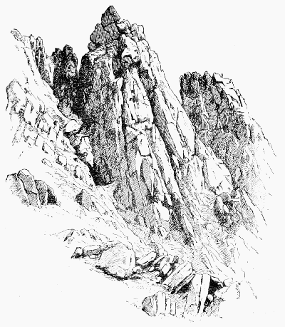
THE ARROWHEAD
(South side of Great Gable)
Ash Crag, a rock in Ennerdale, near the Black Sail
end of the Pillar Fell. It is the writer's belief that this is
the rock which the poet Wordsworth, in 'The Brothers,' has
confused with the Pillar Rock. At least a lad belonging to
an old Ennerdale family, the Bowmans of Mireside, was
killed by falling from this rock at a date closely corresponding
to that indicated in the poem.
Attermire, one of the most picturesque limestone scars
in Yorkshire. It is reached from Settle on the Midland
Railway, and may be seen on the way to Malham Cove.
Back-and-knee: the process of supporting or raising the
body in a 'chimney' by pressure against opposite sides with back
and knees, or, more usually, back and feet.
Band.—This word forms part of many hill names in the
North of England, and is also found in Scotland. Dr. Murray
deals with it in the 'New English Dictionary,' but not in a
satisfactory manner. He defines it as 'a long ridge-like hill
of minor height or a long narrow sloping offshoot from a hill
or mountain,' but it would be easy to adduce instances where
this could have no application. The word is used by Douglas
in his translation of Virgil to represent the Latin word
'jugum':
Himself ascendis the hie band of the hill;
and from this Jamieson concluded that the word meant
simply 'top of a hill'—a definition almost as unsuitable as the
last. The late Mr. Dickinson, the leading authority on the
Cumberland dialect, gave to the word the meaning of 'a
boundary on high uninclosed land,' and indeed the frequent
association of the word with personal names (often of clearly
Scandinavian character) seems to indicate some territorial
significance.
Bannerdale Crag (C. sh. 57) may be taken on the
way up Saddleback from Troutbeck station on the line
between Keswick and Penrith. About three miles up the
stream is Mungrisdale, and still farther up along the course
of the stream one fork leads to Scales Tarn and another to
Bannerdale, where there is a lead mine just north of the crags.
There is a rocky face some 600 ft. to 800 ft. high, offering
climbing, which is steep, but by no means first-rate.
Barf.—From the southern shore of Bassenthwaite Water
there is a fine steep scramble up this hill. On a bright
winter's day it is rather inspiriting, and the views are good.
The name is more frequent in Yorkshire, where, according
to Phillips, it has the meaning of 'a detached low ridge or
hill.'
Beachy Head, close to Eastbourne, in Sussex, is a
very fine bold chalk cliff, the first ascent of which is made
about once in every two years, if we may believe all that we
see in the papers. The truth is that there is a treacherous
incline of some 600 ft., formed of chalk and grass, both very
steep and often dangerously slippery; and during the Eastbourne
season the coastguards at the top find their principal
occupation in supplying mechanical assistance to exhausted
clamberers; but for difficulty these cliffs will not for a
moment compare with those of half the height which carry
on the line westward to Birling Gap. The tops of these in
many places literally overhang the sea, and there are few
points where a climber could make the slightest impression
upon them. On Beachy Head there is a dangerous-looking
pinnacle, which was climbed (by dint of cutting a step or two)
in April 1894, by Mr. E.A. Crowley.
Bear Rock, a queerly-shaped rock on Great Napes,
which in the middle of March 1889 was gravely attacked by
a large party comprising some five or six of the strongest
climbers in England. It is a little difficult to find, especially
in seasons when the grass is at all long.
Beck.—In the North of England (except in Northumberland
and Durham, where 'burn' prevails) this is the usual
word for a brook. It differs from a 'gill' in being more
open, and having banks less rocky and a stream somewhat
more copious. A gill may contain only a few drops of water,
or none at all, and still preserve its self-respect, but not so a
beck. Camden speaks of 'Beakes and Brookes.'
Bell enters into many North Country hill-names. It
is commonly said to indicate spots which were specially
devoted to the worship of Baal, and many arguments have
been based upon its occurrence and distribution. If there is
anything in this assertion, the 'high places' for the worship
of Baal must have been most capriciously selected. My own
belief is that the term is purely descriptive and is applied to
a convexity in the slope of a hill. In Lowland Scotch the
phrase 'bell of the brae' is not uncommon and has the same
significance.
Bell Rib End, a short drop on the narrow south ridge
of Yewbarrow. Though on a very small scale, it is not
without interest, and was a favourite with Mr. Maitland, one
of the early explorers of Wastdale.
Bield.—This word not only occurs frequently in place
names, but is still part of living speech in North England
and South Scotland. It means shelter of any kind for man
or beast, and in the latter case especially a fox or a sheep.
It is also used as a verb; in fox hunting, for instance, the
animal when run to earth is said to be 'bielded.'
Bink: a long narrow grassy ledge. (N. of Eng.)
Black Sail.—It has been suggested that this name, now
borne by the pass from Wastdale to Ennerdale between
Pillarfell and Kirkfell, may have originally been named from
the mountain it crossed, and so may possibly now preserve an
older name of one of those two mountains. Dr. Murray, writing
to a local paper some years ago, did not hesitate to affirm
positively that Pillar Fell is entirely due to the Ordnance
surveyors, and that the original name was Black Sail, a fact
which he said could be proved by historical evidence. It
would be extremely interesting to see this evidence, but the
name 'Pillar' certainly appears in maps published long
before that of the Ordnance. (See Sail.) The pass (1,750 ft.)
is very familiar to all climbing folk, being the ordinary way
of reaching the Pillar Rock from Wastdale Head. It is
generally preferred to Wind Gap on account of greater
variety of view and better 'going,' and some make use of it
even for the purpose of reaching the Ennerdale side of Great
Gable.
The route, however, has one disadvantage. It is hot. It
is no uncommon thing to hear enthusiastic frequenters of the
Lakes complaining of the popular misapprehension that the
sun never shines there, and urging that people are so unreasonable
as to notice the wet but to disregard the warmth.
Among these traducers of the Cumberland climate the frequenters
of the Black Sail route are not found. Argue not
with such; but some fair morning, when the reviler is most
rampant, lead him gently into Mosedale and watch with calm
delight while he pants painfully up the pass, trying his
utmost to look cool, with the sun, which he has maligned,
beating down squarely upon his back and exacting a merciless
revenge. Many a time will he turn about and feign rapture
at the taper cone of Yewbarrow and the bold outline of
Scafell; often will his bootlace strangely come untied before
his reverted glance catches the welcome gleam of Burnmoor
Tarn; but long before that time his heart within him will
have melted even as wax, and he will have registered a vow
that, when next the Cumberland sunshine is discussed, the
seat of the scornful shall know him no more. Mr. James Payn,
having occasion to allude to 'dry weather' in the Lakes, adds
demurely, 'which is said to have occurred about the year
1824'; but, from his own description of Black Sail, it is clear
that he deeply rued the sarcasm: 'You will begin to find
your pass quite sufficiently steep. Indeed, this is the severest
pull of any of the cols in the District, and has proved the
friend of many a gallant with his ladylove. To offer a young
woman your hand when you are going up Black Sail is in my
mind one of the greatest proofs of attachment that can be
given, and, if she accepts it, it is tantamount to the everlasting
"Yes!"' We may be sure that, before he reached the top, the
witty novelist experienced remarkably 'dry weather,' and
also some of those symptoms which elsewhere he has himself
described with such scientific accuracy: 'Inordinate perspiration
and a desperate desire for liquids; if the ascent be persisted
in, the speech becomes affected to the extent of a total
suspension of conversation. The temper then breaks down;
an unseemly craving to leave our companion behind, and a
fiendish resolution not to wait for him if his bootlace comes
undone, distinguish the next stage of the climbing fever; all
admiration of the picturesque has long since vanished,
exuded, I fancy, through the pores of the skin: nothing
remains but Selfishness, Fatigue, and the hideous reflection
that the higher we go the longer will be our journey down
again. The notion of malignant spirits occupying elevated
regions—Fiends of the Fell—doubtless arose from the
immoral experiences of the Early Climbers.'
Green's Guide (1819) records a touching instance of a
husband's attentions surviving a test which we saw above,
that even lovers find severe: 'This is a steep and craggy
ascent, and so laborious to man that it might be imagined
horses could not travel it; yet Mr. Thomas Tyson, of Wasdale
Head, has conducted Mrs. Tyson over this stony ground
while sitting on the back of her horse.'
In Switzerland one might look back after a day's work,
and fairly forget ups and downs so slight as Black Sail; but
many of the guide books speak of it in terms which might
apply to the Adler or the Felik Joch. For instance, Black's
Picturesque Guide (ed. 1872) says: 'The hardy pedestrian
with very minute instructions might succeed in finding his
way over the mountains, yet every one who has crossed them
will beware of the danger of the attempt and of the occasional
fatal consequences attending a diversion from the
proper path.' This is highly encouraging; and the enterprising
traveller who only breaks his neck two or three times
in the course of the journey will be of good cheer, for he is
making rather a prosperous expedition than otherwise.
Blea Crag, an isolated square stone on the left of the
path to the Stake, a long mile up Longstrath. It is climbed
on the side which looks down the valley. Messrs. Jones and
Robinson recorded their ascent of it in September 1893, but
it seems that four or five years ago there were traces on it of
a previous ascent.
'Crag' is not very commonly used of a single stone, as it
is here and in the case of Carl Crag.
Borrowdale.—'Divers Springes,' says old Leland in
his 'Itinerary,' 'cummeth owt of Borodale, and so make a
great Lowgh that we cawle a Poole.'
The 'Lowgh' is, of course, Derwentwater, and Borrowdale
is the heart of the finest scenery and the best climbing in
England. It may be said to stretch from Scafell to Skiddaw,
and excellent headquarters for climbers may be found in it at
Lowdore, Grange, Rosthwaite, and Seatoller. With the aid
of its wad mines and its Bowder Stone, it probably did more
during last century than anything else to arouse public
interest in the Lake country. The natives were not famed
for their intelligence, and many stories are told in support of
their nickname of 'Borrowdale gowks.'
There is another Borrowdale in Westmorland, and Boredale
is perhaps the same name.
Bowder Stone in Borrowdale was already a curiosity
about a century and a half ago, when it was visited by Mr.
George Smith, the correspondent of the Gentleman's Magazine.
Clarke, writing some years later, says it bore the
alternative names of Powderstone and Bounderstone; and
being 'thirty-one yards long by eight yards high, must therefore
weigh over 600 tons, and is said to be the largest self-stone
in England.' It is not really a 'boulder' at all, but the
word is rather loosely used in Cumberland.
Bow Fell (2,960 ft.).—The name is probably the same
as that of Baugh Fell, also called Bow Fell, in Yorkshire.
This graceful peak, standing as it does at the head of several
important valleys—Eskdale, Langdale, Dunnerdale, and
Borrowdale—is a great feature in Lake scenery. There is
not much rock-work on it, but a good deal of rough walking
and scrambling. From Borrowdale or Wastdale it is
approached by way of Esk Hause. On this side there is no
climbing, except that Hanging Knot, as the N. end of Bow
Fell is called, descends to Angle Tarn in a long, steep, rocky
slope which offers a pleasant scramble.
On the Eskdale side there is a gully or two which might
be worth exploring.
By inclining to the right hand on emerging at the top of
Hell Gill, or to the left hand from the pony-track at the foot
of Rossett Gill we reach Flat Crags, huge glacier-planed
slopes of rock, overlooked by what in winter is a fine couloir
of most alpine appearance. When Messrs. J. & A.R. Stogdon
ascended it (Alpine Journal, v. p. 35) the inclination of the
snow increased from 30° at the foot to 63° after 350 ft. or more,
and there was a large cornice at the top. In the account
which the same party inserted at the time in the Wastdale
Head Book steeper angles are given.
In summer it is merely an open scree-gully; but the
insignificant-looking chimney just N. of it, and only separated
from it by a narrow ridge, is quite worthy of attention,
though it has but one pitch in it after the one at the foot.
The descent is harder than the ascent, and takes about twenty
minutes.
There is a fine rocky walk along the S. ridge, called
Shelter Crags and Crinkle Crags, which descends towards
the head of Dunnerdale, but it is extremely unfrequented.
Bram Crag and Wanthwaite Crag flank the coach road
between Threlkeld and Grasmere on the east. The best
part is rather more than two miles south of Threlkeld station.
The climbing is somewhat similar to that about Swarthbeck
on Ullswater, but on better and sounder rock, and there is
more of it. A good day's work will be found among these
crags, and a fine specimen of a 'sledgate' is deserving of
notice.
Brandreth is between Borrowdale and the head of
Ennerdale. The name, which occurs elsewhere in the
neighbourhood, denotes a tripod (literally a 'grate,' usually
made with three legs). The meeting-point of three boundaries
of counties, parishes, &c. is often so named. Brandreth
has only one short bit of bold rock—one of the many
Raven Crags. It is hardly worth a special journey, but may
very easily be taken by any one who attacks Great Gable
from Borrowdale.
Brimham Rocks, in Yorkshire, are very easily visited
from Harrogate or from Pateley Bridge. From the latter
they are only four miles to the eastward. The station for
those who come from Harrogate is Dacre Banks, from which
the Rocks may be reached in an hour's walking. They are
of millstone grit and well deserve a visit, for nowhere are the
grotesque forms which that material delights to assume more
remarkable. Some resemble the sandstone forms common
about Tunbridge Wells, and many might very well stand for
Dartmoor Tors; but others at first sight seem so evidently
and unmistakably to suggest human handiwork that one can
feel no surprise at the common notion that they were
fashioned by the ingenuity of the Druids. Several of them,
though very small, can only be climbed with considerable
difficulty.
Broad Stand—a term commonly but, in my opinion,
incorrectly used to denote a particular route by which the
crags of Scafell may be ascended direct from Mickledoor.
There are numerous other places within a few miles of this
into the names of which this word 'stand' enters, and a consideration
of them leads me to the belief that it signifies 'a
large grassy plot of ground awkward of access.' This is
exactly what we find here. A break in the cliffs produces a
large open space which is the key to the ascent by the
Mickledoor Chimney, to that by the North Climb, and to
that which, being the oldest, easiest, and most frequented,
has arrogated to itself as distinctive the name of a feature
which it should only share with the other two. Really all
three routes are merely different ways of reaching the Broad
Stand.
One of the earliest recorded ascents is that of Mr. C.A.O.
Baumgartner in September 1850, an account of which was
sent by one of the people of the dale to the local paper in
these terms: 'The Broad Stand, a rocky and dangerous
precipice, situated between Scaw Fell and the Pikes, an
ascent which is perhaps more difficult than even that of the
Pillar Stone.' The late Professor Tyndall climbed it in 1859,
and described it in the Saturday Review of that year. It
evidently had a great reputation then, which was not, in his
opinion, entirely deserved. It seems to have been known in
1837 (see the Penny Magazine) to the shepherds; and even in
Green's time, at the beginning of the century, one or two
daring spirits had accomplished the feat.
Buckbarrow (C. sh. 79).—Broadcrag (more north-east)
is really part of it, and about 400 ft. high. Buckbarrow
rises near the foot of Wastwater, opposite the best part of
the Screes. When approached from the head of the lake
it appears as two huge rocky steps; but, as in the case of
Eagle Crag in Greenup, the steps are not really in the
same plane. Seen from the slopes of Lingmell, it forms
the boundary between the mountains and the plain, to which
it sinks in one very graceful concave curve. It is not
lofty—there are perhaps some 400 ft. of rock—but by the
shepherds it is reputed inaccessible. This is only true in
the sense that there are stiff bits on it which have to be
evaded. It is haunted by both the fox and the buzzard—connoisseurs
on whose taste in rocks the climber can generally
rely. There is also climbing in the whole line of rock (Broad
Crag) which stretches away towards Greendale. Since 1884,
when the writer first became acquainted with it, Buckbarrow
has become rather popular, considering its remoteness from
Wastdale Head.—At Christmas 1891 a strong party, led by
Messrs. Robinson, Hastings, and Collie, ascended it 'from
the fox's earth to the hawk's nest,' and on April 15, 1892,
a party containing several of the same members climbed
'the first main gully on this [the north] side. There are
two short chimneys at the end of this little gill—one in
each corner, about ten to twelve yards apart.' The left
one, up which Mr. Brunskill led, was considered the harder.
Afterwards Dr. Collie led two of the party up the face of
the cliff to the right of the next gully on the west, which is
marked by a pitch of about fifty feet low down. To a house
near the foot of Buckbarrow old Will Ritson and his wife
retired, after giving up the inn which they had kept for so
many years and made so famous at Wastdale Head.
Buresdale, the proper name of the valley between
Thirlmere and Threlkeld. Hutchinson, for instance, says:
'At the foot of Wythburn is Brackmere [i.e. Thirlmere], a
lake one mile in length ... from the N. end of this mere
issues the river Bure, which falls into Derwent below Keswick.'
He also mentions Buresdale in connection with
Layswater, yet another equivalent for Thirlmere. Guidebook
writers seem to have conspired together to obliterate
this name from the map, and to substitute for it the name
Vale of St. John, which Sir Walter Scott made famous.
To revive the name of the river would be an act of only posthumous
justice, now that the Manchester waterworks have
taken away all its water; but the valley is still there, and
ought to be called by its genuine old name, which is of Scandinavian
origin; compare with it the Bure river in Norfolk,
and fishermen will recall similar names in Norway.
Burn: the Scotch word for a brook is hardly found south of
the river Wear. In Wythburn, Greenburn, and other cases it
probably represents borran (stone heap).
Buttermere, a pleasant stopping-place from which many
of the Cumberland fells can be explored. It is a good centre
for Grassmoor, Melbreak and the Red Pike range, while
Borrowdale and Ennerdale are quite within reach. Once a
day the Keswick waggonettes swoop upon the place, bringing
trippers by the score, but at other times it is a quiet and enjoyable
spot.
Calf (The) (2,220 ft.), in Yorkshire, near Sedbergh.
Cautley Crag, on the E. side of it, is very steep. In this corner
of the county the Yorkshire climber experiences the intense
relief of seeing rocks which are neither chalk, limestone, nor
millstone grit.
Camping.—Camping out by rivers has always been
more popular in England than the same form of airy entertainment
among the mountains. The labour of carrying tents or
sleeping-bags acts as the chief deterrent. It is true that some
thirty years ago a distinguished member of the Alpine Club
applied to Scafell Pike, and one or two other spots where
England is loftiest, the practice, which he has carried out on
many of the higher peaks of the Alps and Pyrenees, of watching
sunset and sunrise from the loftiest possible gîte which
the mountain can afford. Mr. Payn, too, has given us a most
humorous narrative of how he and his friends encamped on
Fairfield. Also, about twenty years ago, four stalwart climbers
from Penrith made a regular camping tour of the Lakes.
Their tent was pitched on these spots: Penrith Beacon,
Red Tarn on Helvellyn, in Langdale under Pike o' Stickle,
Sty Head, in Ennerdale under Gable Crag, and on Honister.
It weighed only 5½ lbs., and yet had a floor space of 8 ft.
by 8 ft.
It may be that, just as bicyclists suffered by the scathing
definition 'cads on casters,' so the enthusiasm of the camper
may have received a check when he heard himself described
with cruel terseness as 'a fool in a bag.' Perhaps, again, our
climate is not one which offers much encouragement to any
but the hardiest of campers. In the Lakes by far the most
popular (and probably, therefore, the most convenient) place
is the shore of Ullswater, where tents have been seen even in
the depth of winter.
Carl Crag lies on the sea-shore in Drigg parish. Mr.
Jefferson says that it is of syenite, and measures in feet twelve
by nine by five and a half, but it is deep in the sand. The
legend is that while Satan was carrying it in his apron to
make a bridge over to the Isle of Man, his apron strings
(q. vid.) broke and let it fall. It is probably an erratic. With
the name compare Carlhow, Carlwark, &c.
Carrs, in Lancashire, in the Coniston range, north of
the Old Man. It is craggy on the east side. In Far Easdale
there is a line of crag which bears the same name. Clearly
neither can have anything to do with 'carrs' in its usual sense
in the north, viz. 'low marshy ground.'
Castle Rock (C. sh. 64).—This rock in Borrowdale
is said to have been crowned by a Roman fort. The
west side is craggy for a couple of hundred feet. It may
serve to occupy a few odd hours for any one stopping at
Grange, Rosthwaite, or Seatoller.
Caw Fell (C. sh. 73).—The name is possibly the
same as Calf, Calva; compare also Caudale, Codale, &c.
On the north side there is a craggy bit about 200 ft. high.
Chalk.—Though this can hardly be regarded as a good
rock for climbing, much excellent practice can be gained on
it. As a general rule, it is only sufficiently solid for real
climbing for the first twenty feet above high-water mark,
though here and there forty feet of fairly trustworthy rock
may be found. These sections of hard chalk are invariably
those which at their base are washed by the sea at high tide;
all others are soft and crumbly.
ToList
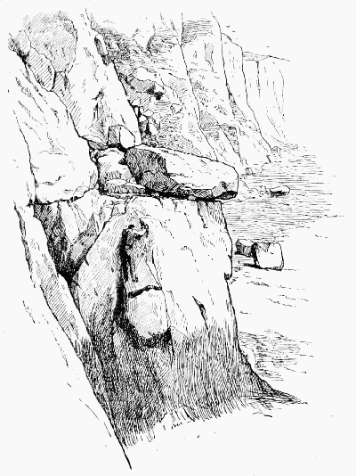
CHALK CLIFFS NEAR DOVER
Whilst any considerable ascent, other than up the extremely
steep slopes of grass which sometimes clothes the
gullies and faces, is out of the question, traverses of great
interest and no slight difficulty are frequently possible for
considerable distances. A good objectif may be found in the
endeavour to work out a route to the various small beaches
that are cut off from the outer world by the high tide and cliffs.
The best instances of this sort of work are to be found
along the coast to the eastward of Dover (between that town
and St. Margaret's). Between the ledges by which these
traverses are in the main effected, and the beach below,
scrambles of every variety of difficulty may be found, some
being amongst the hardest mauvais pas with which I am acquainted.
Owing to the proximity of the ground, they afford
the climber an excellent opportunity of ascertaining the
upper limit of his powers. Such knowledge is a possession
of extreme value, yet in most other places it is undesirable to
ascertain it too closely. Chalk, it must be remembered, is
extremely rotten and treacherous, very considerable masses
coming away occasionally with a comparatively slight pull.
In any place where a slip is not desirable, it is unwise to
depend exclusively on a single hold, as even the hardest and
firmest knobs, that have stood the test of years, give way
suddenly without any apparent reason. The flints imbedded
in the chalk are similarly untrustworthy; in fact, if they
project more than an inch or so, they are, as a rule, insecure.
The surface of the chalk is smooth and slimy if wet, dusty if
dry, and does not afford the excellent hold obtained on granite.
As a whole it may be regarded as a treacherous and difficult
medium, and one which is likely to lead those practising on
it to be very careful climbers.
To the westward of Dover (between it and Folkestone) a
great amount of climbing on grass and crumbly chalk slopes
can be obtained; almost every gully and face can be ascended
from the sea, or the S.E. Railway, to the top. It is desirable
to remember that in dry weather the grass and the earth
which underlies it is of the consistency of sand, and great
care is requisite; after rain the grass is of course slippery;
but the underlying material adheres more firmly to the cliff.
It is unnecessary to add that a slip on any of these slopes
would almost certainly prove fatal. On the face of Abbot's
Cliff, and to the westward (about halfway between Dover
and Folkestone), some traverses may be effected at a
height of 200 ft. or more above the base; they do not,
however, compare for climbing with the traverses on the
other side of Dover.
As one goes westwards, the angle of the cliffs becomes
less, and from Abbot's Cliff towards Folkestone it is rarely
necessary to use one's hands, though very nice 'balance' is
essential, as the results of a slip would usually be serious.
Above the Warren, still nearer Folkestone, the slopes become
easy, and after heavy snow afford excellent glissades.
The cliffs between Dover and St. Margaret's vary from
200 to 350 ft., whilst those between Dover and Folkestone
vary from 250 to 500 ft. in height.
In Sussex the chalk is well developed at and near Beachy
Head, where it attains a height of some 600 ft. Just west
of this come several miles of cliffs, lower indeed (about 300 ft.),
but amazingly vertical.
About Flamborough Head, in Yorkshire, this formation
attains fine proportions, while as far west as Devonshire
Beer Head is upwards of 400 ft. high.
Chimney: a recess among rocks resembling the interior of
a chimney open on one side. (See Back-and-knee.)
Chockstone: a northern word for a stone wedged between
the sides of a gully. A short word for this is greatly needed, and
I would suggest that it might be called a 'chock,' simply.
Clapham, a station on the Midland Railway, is an
excellent centre for Ingleborough and the Potholes.
Clark's Leap, near Swirl's Gap on Thirlmere, is a
jutting rock, so called from a suicide which took place there
over 100 years ago. It is one of many local absurdities
of the novel called 'The Shadow of a Crime' that this name
is brought in as an antiquity in the eyes of characters
supposed to be living two centuries ago.
Clough (Cleugh, Cloof, Cluff, Clowe) is a North of
England word for a kind of valley formed in the slope of a
hill. The first cut in carving a shoulder of mutton produces
a typical 'clough.' There is seldom any climbing about a
genuine clough, because it implies soil rather than rock. Dr.
Murray tells us that the word has no connection with the
Icelandic 'klofi,' yet assigns to the latter word the origin of
'cloof,' in the sense of the fork of a tree, or of the human
body. To a layman in such matters the two words bear a
singular resemblance, both in sound and in sense.
Collier's Climb on Scafell was made by Messrs.
Collier and Winser on April 2, 1893, and a very severe climb
it is. It begins from the Rake's Progress at a point 105 ft.
west from the North Climb. After a direct ascent of about
40 ft., a grassy platform on the right (facing the wall) is
reached. From here a narrow and somewhat awkward
traverse leads back to above the first part of the climb. This
traverse could probably be avoided by climbing directly upwards.
There follows an easy ascent for 30 ft. still directly
upwards. By traversing broad grassy ledges to the right—i.e.
towards Moss Gill—one of the inclined cracks so plainly seen
on the face of the cliff is reached, and the rest of the ascent
made in it. The only severe difficulties in the climb are:
1. at the beginning, in leaving Rake's Progress; 2. at one
point in the crack where there is not much handhold for
10 or 15 ft.
Combe Gill, a fine gill in the north end of Glaramara.
The climb is a little over two miles from Rosthwaite, and
about a mile less from Seatoller. A very fine mass of rock
(one of the many Eagle Crags) stands at the head of the
little valley, and up the centre of this crag lies the way. It
was climbed on September 1, 1893, by Messrs. J.W. Robinson
and W.A. Wilson, whose account of it is as follows: 'This
very fine gorge has three good-sized pitches in the lower part.
These were passed by climbing the right-hand edge of the
gill—interesting work. A return on to the floor of the gill
was made near the top of the third pitch, when a little
scrambling led to a very fine waterfall more than 100 ft. high.
Here climb in the water as little as you can; then diverge
slightly on to the right-hand wall of the gill just where the
water spouts over a small recess; next traverse across a rather
difficult slab into the cave under the final boulder, which is
climbed on the left-hand and is the last difficulty.'
Coniston, having the advantage of both railway and
steamboat, is very accessible, and, notwithstanding this, it is
agreeably free from the rush of excursionists. Practically it
has one fine mountain—the Old Man—and no more, though
Bow Fell and the Langdale Pikes are not entirely out of
reach. There is much good scrambling in the rocks which
fringe the Old Man and Wetherlam, and superb climbing in
Dow Crag.
Coniston Old Man.—Quarrymen and miners have
between them done an immense deal towards spoiling a very
fine mountain. They have converted to base industrial uses
the whole east side of the mountain, which Nature intended
for climbers. They have not yet invaded Doe Crag (q.v.),
which is really part of it, but practically no one goes up the
Old Man proper, except for the sake of the view, which is
magnificent, and no one ascends except from Coniston, varied
in a few cases by working north along the summit ridge
and descending via Grey Friars on to the pass of Wrynose.
ToList
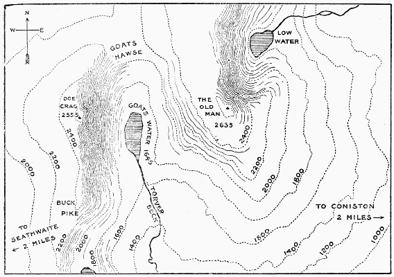
CONISTON AND DOE CRAG
Copeland.—Camden says of Cumberland: 'The south
part of this shire is called Copeland and Coupland, for that it
beareth up the head aloft with sharpedged and pointed hilles,
which the Britans tearme Copa.' Leland alludes to this when
he makes a ludicrously pedantic suggestion: 'Capelande, part
of Cumbrelande, may be elegantly caullid Cephalenia.' Cop
is found in Derbyshire also, as a hill-name, and hunting men
will not need to be reminded of the Coplow in Leicestershire.
Cornwall.—To the true-souled climber, who can enjoy
a tough bit of rock, even if it is only fifty, aye, or twenty feet
high, the coast of Cornwall with its worn granite cliffs and
bays has much to offer. It is interesting almost the whole
way round the coast. Granite prevails, but at Polperro we
have cliffs belonging to the Lower Devonian period, and for
some ten or twelve miles going west from Chapel Point we
find rocks of the Silurian order. At many points round
the Lizard Promontory there are remarkable rocks; but
some of the finest cliff scenery in England is to be found
between the Logan Rock and the Land's End. These are
on the regular tourist tracks, and conveniently reached from
good hotels; but the north coast of Cornwall is here easy of
access. There are fine cliffs about Gurnard's Head and
Bosigran, which are well worth a visit, from St. Ives or
Penzance (7 or 8 miles). There is a small inn at Gurnard's
Head. Bedruthan Steps are well-known, and Trevose Head,
Pentire (Padstow), Tintagel and Penkenner Point are only
a few of the many grand rock-scenes on this coast.
Coterine Hill.—Leland, in his 'Itinerary,' says that
Ure, Sawle, and Edon rise in this hill, and that 'the Hedde
of Lune River by al Aestimation must be in Coterine Hill,
or not far fro the Root of it,' adding that, in the opinion of
Mr. Moore of Cambridge, the river Lune 'risith yn a hill
cawlled Crosho, the which is yn the egge of Richemontshire.'
There is Cotter-dale on the Yorkshire slope of the hill
in which these rivers rise, and the celebrated Countess of
Pembroke, in 1663, when she crossed from Wensleydale
to Pendragon Castle, calls her journey 'going over Cotter,
which I lately repaired,' the last words showing that it was
a recognised pass.
In all probability Leland's form represents 'Cotter End,'
by which name, though not given in most of the maps, part
of the hill is still known.
Cove: often means 'cave' in Yorkshire and Scotland, but as
a rule it is a large recess in a hill-side.
Craven—Camden remarks that the country lying about
the head of the river Aire is called in our tongue Craven,
'perchance of the British word Crage, that is a Stone. For
the whole tract there is rough all over, and unpleasant to see
to; which [with?] craggie stones, hanging rockes, and rugged
waies.'
Modern climbers, however, find it hardly rocky enough
for them, at least above ground, and have been driven to
invent a new variety of climbing—the subterranean. Exploration
of the numerous potholes which honeycomb the
limestone hills has of late years become a favourite pastime,
and, in truth, it combines science with adventure to a marked
degree.
Any one who tarries for any length of time among these
Yorkshire dales should read Mr. H. Speight's handsome
volume, which gives a very complete account of the beauties
and the curiosities which they have to show.
Cross Fell, in Cumberland, long enjoyed the reputation
being one of the highest mountains in England, and as late
as 1770 its height was calculated at 3,390 ft., which is some
500 ft. more than it is entitled to. It was earlier than most
English mountains in becoming the object of scientific curiosity,
and an account of it will be found in the Gentleman's
Magazine for 1747. It is chiefly celebrated for the Helm
Wind originating from it.
Cumberland is the premier climbing county. The best
centres are Wastdale Head, Rosthwaite or Seatoller,
Buttermere, Keswick and Eskdale. The cream of the
climbing is on those fells which are composed of rocks
belonging to what is called 'the Borrowdale Series,' such as
Scafell Pillar, Gable, Bowfell, and as a rule the finest
climbs are found on the sides which face the north and east.
Cross Fell does not belong to the same mountain-system as
those just mentioned, and offers little climbing. The best cliffs
on the coast are about St. Bees Head.
Cust's Gully, on Great End.—To the large and increasing
number of men who visit the Lakes in winter,
perhaps no climb is better known than this. In the spring
of 1880, a party, including one of the greatest of lady
mountaineers, and over twenty members of the Alpine Club,
ascended this 'very interesting chimney or couloir, which,
being filled with ice and snow, gave unexpected satisfaction.
There is a very remarkable natural arch in this couloir, which
Mr. Cust claims to have been the first to discover, and he
was therefore entrusted with the guidance of the party.'
The orthodox approach is by way of Skew Gill, which is
conspicuous at the right hand on nearing Sty Head from
Wastdale. A short distance beyond the head of this gill
our gully is seen rising on the right, marked by the conspicuous
block of stone. Being, as the Scotch say, 'back of
the sun,' this gully often holds snow till comparatively late
in the season. Indeed, in winter, it is sometimes so much
choked with snow that the arch disappears, and it is even
said that self-respecting climbers, who recognise that a gully
ought to be followed with strictness, have felt bound to
reach the block by tunnelling, instead of walking over the
top. In the spring of 1890 there was a tremendous fall of
stones, by which the gully was nearly filled. Except in
snow time, loose stones are an objection, and many find it
more interesting to ascend by a small gully, almost a branch
of 'Cust's,' on the right hand. As climbs neither of them will
compare with the more eastern gullies.
Dale: curiously used in Derbyshire for each separate section
of a river valley, which elsewhere would form only one dale.
Dalegarth Force, in Cumberland, near Boot, in Eskdale.
The wall on the north side of this extremely pretty little
fall is very low; but, being granite, offers one or two problems
to the climber. Stanley Gill is another name for the same
place.
Dartmoor, a high upland moor, forming a vast reservoir,
from which most of the Devonshire rivers are fed. It
is curious rather than beautiful, and more interesting to the
geologist, the antiquary, and the fisherman than it is to the
mountaineer. Yet it is instructive even to him, for the frequency
of rain and mist and the paucity of landmarks which
can be seen more than a few yards off, coupled with the necessity
of constantly watching the ground, render it one of
the easiest places in the world in which to lose one's way in
any but the finest weather. There are no true hills, but here
and there a gradual rise of the ground is seen, with a lump
or two of granite grotesquely planted on the top of it. These
are the Tors. As a rule they are very small, but often present
problems to the climber, and are seldom without interest
of some sort.
A great many may be reached from Tavistock or the
little inn at Merivale Bridge.
Dead Crags (C. sh. 56) are lofty but disappointing rocks
on the north side of Skiddaw. There is perhaps 500 ft. of
steep crumbly rock, something like Hobcarton.
Deep Gill.—The name is not infrequent; for example,
there is one on the south side of Great Gable, east of the
Napes, but now it is always called Hell Gate. The Deep
Gill is on Scafell, and falls into the Lord's Rake. The first
mention of it was made in August 1869 by Mr. T.L. Murray
Browne, who wrote in the Visitors' Book at Wastdale Head:
'The attention of mountaineers is called to a rock on Scafell
on the right (looking down) of a remarkable gill which
cleaves the rocks of Scafell and descends into Lingmell Gill.
It looks stiff.' The rock alluded to is the Scafell Pillar and
the gill is Deep Gill. It is well described by Mr. Slingsby
in the Alpine Journal, vol. xiii. p. 93: 'After a couple of
hundred steps had been cut in the snow in Lord's Rake and
at the bottom of Deep Gill, which joins the former at right
angles, we reached the first block—a large rock perhaps
15 ft. square—which overhangs the gill, and so forms a cave.
Below the rock the snow was moulded into most fantastic
shapes by occasional water-drips from above. At the right
hand of the big rock a few small stones are jammed fast
between it and the side of the ravine, and they afford the
only route up above the rock. These stones can be reached
from the back of the little cave, and occasionally from the
snow direct. Hastings—who is a very powerful fellow and a
brilliant climber—and I got on the stones, as we did last
year. He then stood on my shoulder, and, by the aid of
long arms and being steadied by me, he reached a tiny ledge
and drew himself up. Mason and I found it no child's play
to follow him with the rope. Some two hundred more steps
in hard snow brought us to the only place where we could
attack the second block. Here three fallen rocks stop the
way, and on the left hand is the well-nigh ledgeless cliff
which terminates far away overhead in the Sca Fell Pinnacle,
or Sca Fell Pillar. On the right a high perpendicular wall
effectually cuts off the gill from the terraces of Lord's
Rake. On the left hand of the gill a small tongue of rock,
very steep, juts out perhaps 40 ft. down the gully from the
fallen block nearest to the Pinnacle wall, and forms a small
crack, and this crack is the only way upward. From a
mountaineer's point of view the stratification of the rocks
here is all wrong. The crack ends in a chimney about 20 ft.
high, between the wall and a smoothly polished boss of
rock. Hastings, still leading, found the crack to be difficult,
but climbed it in a most masterly way. All loose stones,
tufts of grass and moss, had to be thrown down, and, in the
absence of hand and foot hold, the knees, elbows, thighs, and
other parts of the body had to do the holding on, whilst,
caterpillar-like, we drew ourselves upward bit by bit. The
chimney is best climbed by leaning against the Pinnacle
wall with one's back and elbows, and, at the same time, by
walking with the feet fly-like up the boss opposite. From
the top of the boss a narrow sloping traverse, perhaps 12 ft.
long, leads into the trough of the gill. With a rope this is an
easy run; without one it would not be nice. A stone thrown
down from here falls over both blocks and rolls down the
snow out of the mouth of Lord's Rake on to the screes far
away below. The crack, chimney, and traverse, short distance
though it is, took us about an hour to pass. The climb
from Deep Gill to the gap from which the Pinnacle is ascended
is a very good one, which two men can do much
better than one. The Pinnacle itself from the gap is perhaps
25 ft. high, and is really a first-rate little climb, where the
hands and the body have to do the bulk of the work.'
ToList
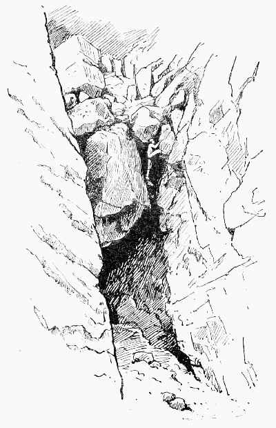
DEEP GILL, SCAFELL
(The Lower Pitch)
The date of Mr. Slingsby's attempt was March 2, 1885,
and that of his successful ascent March 28, 1886: but as
early as 1882 this climb had been made, piecemeal, by the
present writer, who, however, never, so far as he can remember,
blended the different items into a continuous climb until
the summer of 1884, when he descended the whole length of
the gill in company with Mr. Chr. Cookson, of C.C.C.,
Oxford. A yet earlier descent of the gill had been made at
Easter 1882 by Messrs. Arnold Mumm and J.E. King, of
the same college, who found such a phenomenal depth of
snow that the obstacles were buried, and they were able to
walk from end to end without using their hands. The same
thing happened again in January 1887, when Messrs. Creak
and Robinson were able to walk up over both pitches without
having even to cut a step.
The lower pitch may also be passed by using a recess resembling
one half of a funnel in the red rock of the vertical
south wall of the gill. The worst part of this is where you
leave the funnel and begin to coast round in order to re-enter
the gill. The space comprised between the two pitches can
be entered very easily by passing round the foot of the
Scafell Pillar, or with much more difficulty down the
vertical south wall. The upper pitch may be passed in two
ways, besides the incline. One is by means of a narrow side
gully, the upper stage of which is most easily passed by following
the ridge which divides it from the main gill. The
third way is the most direct and the most difficult, lying between
the incline and the great block. Mr. Owen Jones
seems to have invented it in the year 1892, and took up a
party by it on that occasion with the assistance of a good
deal of snow, and another party in the month of August 1893,
when there was no snow at all. There is no more fashionable
winter climb than Deep Gill, and about Christmas time
the clink of the axe echoes among its crags from dawn to
dusk.
It is reached from Wastdale Head in about an hour and
a half. The shoulder of Lingmell has first to be rounded,
and it makes little difference either in time or fatigue
whether this be done comparatively high up or by taking the
high road to the bridge near the head of the lake or by an intermediate
course. At any rate, a long grind up Brown
Tongue, in the hollow between Lingmell and Scafell, cannot
be avoided, and when the chaos called Hollow Stones
is reached a vast outburst of scree high up on the right
hand indicates the mouth of Lord's Rake. After a laborious
scramble up this scree the rake is entered, and only a few
yards further the lower pitch of Deep Gill is seen on the
left hand.
Deep Gill Pillar.—See Deep Gill and Scafell Pillar.
Derbyshire is well endowed in point of rock scenery,
but it is not really a climber's country. The rocks are of two
kinds—the Limestone, of which Dovedale may be taken as a
type, and the Millstone Grit, which prevails further north.
The former shows many a sharp pinnacle and many a sheer
cliff, but is often dangerously rotten, while the latter assumes
strange, grotesque forms, and, when it does offer a climb,
ends it off abruptly, just as one thinks the enjoyment is about
to begin. It is, nevertheless, much more satisfactory than
the limestone, and many pleasing problems may be found
on it, especially in the neighbourhood of the Downfall on
Kinder Scout. For this Buxton or Chapel-en-le-Frith is of
course a better centre than Matlock.
Devonshire.—The inland climbing in this county is
very limited. Of granite there are the Tors of Dartmoor
and the Dewerstone near Plymouth, and there is a remarkably
fine limestone ravine at Chudleigh, but there is little else
worthy of mention. But the coast of Devonshire is exceptionally
fine, and perhaps no other county can show such a
variety of fine cliffs. At Beer Head we have chalk; at
Anstis Cove, Torbay, and Berry Head limestone; at Start
Point and Stoke Point slate. For bold cliff scenery few
parts of the Channel can rival the piece between Start Point
and Bolt Tail.
On the north coast of Devon there are many striking
cliffs. Among them may be noticed Heddon's Mouth, Castle
Rock (at Lynton), some rocks about Ilfracombe, the granite
cliffs of Lundy, Hartland Point; in fact much of the coast
from Clovelly right away to Bude in Cornwall is remarkably
fine.
Dixon's Three Jumps, on Blea Water Crag (High
Street, Westmorland), so called from the famous fall here
of a fox-hunter about the year 1762.
Perhaps no one ever fell so far and yet sustained so
little permanent injury. As an instance of 'the ruling
passion strong in death,' or at least in appalling proximity
to death, it may be mentioned that, on arriving at the bottom,
he got on his knees and cried out, 'Lads, t' fox is gane oot at
t' hee eend. Lig t' dogs on an' aa'l cum syun.' He then
fell back unconscious, but recovered, and lived many years
after.
Another Dixon fell while fox-hunting on Helvellyn in
1858, but was killed. There is a monument to him on
Striding Edge.
Dodd: a round-topped hill. The word is common in the
Lowlands and in the North of England. It is often said to mean
a limb of a larger mountain, but Dodd Fell in Yorkshire would
alone refute this, being the highest hill in its neighbourhood.
Doe Crag, in Eskdale (C. sh. 74), is a bold rock, long
reputed inaccessible, low down on the north side of the
approach to Mickledoor from the east. The Woolpack
in Eskdale is the nearest inn. The rock, as a climb, is very
inferior to its namesake at Coniston (see Dow Crag).
Door Head, the col between Yewbarrow and Red Pike.
There is capital scree here, and a very rapid descent into
Mosedale may be made by it. Men who have spent the day
on the Pillar sometimes return to Wastdale Head round the
head of Mosedale, and wind up by racing down these screes
from the col to the stream below. The distance is about
650 yards, and the perpendicular drop about 1,200 ft. Anything
less than five minutes is considered very 'good time.'
Doup: any semicircular cavity resembling half an egg-shell
(N. of Eng.).
Dow (or Doe) Crag, in Lancashire, lies just west of
Coniston Old Man, being only divided from it by Goat's
Water. The climbing here is second to none. There are
three or four superb gullies. Perhaps the best is in a line
with the head of the tarn and the cairn on the Old Man,
and another scarcely, if at all, inferior is nearly opposite a
very large stone in the tarn. The first ascent of one was made
by Mr. Robinson and the writer in the year 1886; that of the
other by a party including Messrs. Slingsby, Hastings, E.
Hopkinson, and the writer in July 1888. The last-mentioned
(with indispensable aid from the rope) afterwards descended
an intermediate gully of terrific aspect.
ToList
DOE CRAG, CONISTON
The lowest pitch of the central gully. The top of the wedged block is reached
by mounting the shallow scoop on the left of the picture, and then coasting
round into the gully again.
Towards the foot of the tarn the gullies are much less
severe.
Above is an illustration of the first pitch of the gully
climbed in 1888. Mr. Hastings led up the shallow crevice
seen on the left of the picture, and on reaching the level of
the top of the pitch contoured the intervening buttress into
the chimney again. This is no easy matter and required
great care.
Dunald Mill Hole.—One of the earliest descriptions
of a 'Pothole' will be found in the 'Annual Register' for
1760, where this curiosity is treated of at some length. It
is a good specimen of a common type, and lies between Lancaster
and Carnforth.
Dungeon Gill, in Langdale, deserves mention in any
treatise on British climbing, inasmuch as the poet Wordsworth
has made it the scene of an early deed of daring performed
by an idle shepherd boy—
Into a chasm a mighty block
Hath fallen and made a bridge of rock,
The gulf is deep below.
The gulf and the mighty block are both there still; but there
is more pleasure in seeing the former than there is excitement
in crossing by the latter.
Eagle Crag.—Rocks of this name are pretty numerous
in the North of England, and, like the 'Raven Crags,' are, as
might be expected, always bold and precipitous.
On Helvellyn.—Canon Butler, in his article on the Lakes
in 1844, which appeared in Longman's Magazine, describes
in an amusing manner an adventure which he had on this
rock. It is on the right-hand side of the track from Patterdale
to Grisedale Hause.
In Easdale (W. sh. 17).—This is easily found by following
up the stream which runs into Easdale Tarn. There
is not more than 200-300 ft. of crag, and much of it is very
rotten, but with pretty bits of climbing here and there.
Grasmere is the only place from which it is conveniently
reached.
In Greenup (C. sh. 75) is as noble a rock as can be found
in England. As seen from Borrowdale near Rosthwaite it
has the appearance of two huge steps of rock, but the steps
are really separate rocks, one behind the other—Eagle
Crag and Pounsey Crag. Large portions of each of them
are quite unclimbable, and much of them is too easy to
be worth doing, so that the amount of interesting climbing
to be met with is less than might be expected. Close by is
Longstrath, where there is a little work which may be combined
with this (see Blea Crag and Serjeant Crag). The foot
of Eagle Crag is reached from Rosthwaite or Seatoller in
less than an hour.
Eagle's Nest—one of the ridges of the Napes lying
between the Needle and the Arrowhead. On April 15, 1892,
Messrs. Slingsby, Baker, Solly, and Brigg ascended it and
found it extremely difficult for 150 ft. At one point, about
on a level with the top of the Needle, there is room for one
person to sit down, and here the second man on the rope
joined the leader and gave him a shoulder up. To this place
they gave the name of the Eagle's Nest, and it is almost the
only point at which any material help can be given to the
leader.
The part just above this they considered the stiffest part
of the climb; but when they reached a patch of grass just
below a slanting chimney the difficulties moderated. From
the bottom to where the ridge joins the Needle Ridge they
took two hours and ten minutes.
Eel Crag.—The word 'Eel,' we are told, is identical
with 'Ill,' which is seen in Ill Bell and the numerous Ill
Gills, and means 'steep.' If so the name ought to be more
frequent in the Lake country than it is, and it might be suggested
that in some cases 'eagle' may have been worn down
to 'eel.' There are two crags of the name in Cumberland,
not very far apart.
In Coledale.—These rocks are steep, but too much broken
up to be really worth a visit on their own account. However,
after Force Crag has been tried, these are conveniently
near.
In Newlands (C. sh. 70).—Among the rocks which flank
Newlands on the east much good material may be found.
One is reminded a little of the Wastwater Screes, but of
course these are not on anything approaching that scale.
The greatest height of the craggy part is only about 400 ft.
Eight-foot Drop.—On the Pillar Rock is the passage
from the ridge of the Curtain down onto the lower part of the
Steep Grass. It figures in some of the earlier accounts as a
formidable feature of the ascent. Nowadays it is known how
much easier it is to keep on the flank of the curtain, and only
leave it when at the top of the chimney which runs up from
the head of Steep Grass. No 'drop' is, in fact, necessary; but
the climb, though not in any sense difficult, is generally regarded
as a good test of neatness of style.
Ennerdale.—For a valley which not only is one of the
largest and most impressive in the Lake country, but contains
moreover a share of the most perfect mountain in broad England—Great
Gable—and all of the most famous rock—the
Pillar—singularly little is popularly known of Ennerdale.
But, when we consider that the place is one which is, or
should be, hallowed to all devout Wordsworthians as the
scene of one of the finest productions of their poet, the thing
becomes incomprehensible. To begin with, the guide-books
have never done it justice. In area of paper covered with descriptions
of it English Lakeland is probably many square
miles ahead of any equal portion of the earth's surface. But
guide-book writers love to stand upon the ancient ways; and
any one who takes the trouble to compare West or Otley with
the works of to-day must admit that, except in matters of
detail, the advance has been incredibly small. The public
are better judges of accuracy than of enterprise, and what
pleases the public pays. These gentlemen, therefore, worthy
and painstaking as they are, share to some extent in the
narrow aspirations of the hireling, and, indeed, we are tempted
to believe that their motives in shunning Ennerdale were not
wholly foreign to the character of him who 'fleeth because he
is afraid,' for they have brought up a terrible report of the
dale. If, however, this has been a wise precaution on their
part, a means of deterring any inquirer from exposing their
want of energy, it has been rewarded with a large measure
of success. Here is an inviting prospect for a timid traveller:
'Ennerdale Lake ... is so wild in the character of its shores
and in its position among the mountains as to have caused
more terrors and disasters to strangers than any other spot
in the district. At every house from Wastdale Head to Ennerdale
Bridge stories may be heard of adventures and escapes
of pedestrians and horsemen in Mosedale and the passes of
Black Sail and Scarf Gap' (Whellan's 'History of Cumberland,'
1860). Can it be wondered at that, in the face of such
terrors as this, very few people find their way into Ennerdale,
except those who with fear and trembling cross the head of
it on their way between Buttermere and Wastdale Head?
Every guide-book, indeed, mentions Ennerdale and the Pillar
by name, because it gives an opportunity for quoting the
well-worn lines from 'The Brothers,' after which a few
meagre remarks may be expected to follow on the 'Pillar Mountain,'
the 'Pillar Rock,' and 'Ennerdale Lake,' expressions of
which not one, strictly speaking, is correct, for the proper name
of the first is beyond all doubt 'Pillar Fell,' 'mountain' being
an innovation of tourists and guide-book writers, who between
them have made 'Pillar Rock' sound more familiar than the
genuine name 'Pillar Stone,' and have almost ousted 'Broadwater'
in favour of 'Ennerdale Lake.'
Printed authorities are scanty, because Ennerdale is of
very recent discovery. The early guide-books simply know
nothing about it. West (1778) does not mention it, and the
gifted authoress of that touching poem 'Edwina' did not even
know how to spell its name:
But chiefly, Ennersdale, to thee I turn,
And o'er thy healthful vales heartrended mourn,
Vain do thy riv'lets spread their curving sides
While o'er thy glens the summer zephyr glides.
And yet Mrs. Cowley was by no means indifferent to such
points. Indeed, we owe the origin of this exquisite poem to
her etymological zeal and to her desire to immortalise the
brilliant suggestion that the name 'Wotobank' was derived
from some one having once said, 'Woe to this bank!' It may
even be that the spelling is a symbolical subtlety—a kind of
refinement on 'word-painting' intended to shadow forth to
less poetic minds, by the sinuosity of the superfluous 's,' the
unique manner in which the rivulets of this happy valley are
wont to 'spread their curving sides.' One of the earliest
visitors to Ennerdale appears to have been the artist Smith,
of Derby (1767), who sketched the lake, as did also Wilkinson
in 1810. Wordsworth had been there before 1800, and Green's
description shows that he was much struck by the scenery
of upper Ennerdale. But, though visitors to Ennerdale have
been and still are few, most of these few speak highly of its
beauties, 'partly perhaps,' says Mr. Payn, 'in consequence of
their having endured certain inconveniences (with which they
are anxious that you should also become acquainted) when
belated in that lovely spot.' The dale is not without its associations.
Formerly it was a deer forest, the property of the
Crown by forfeiture from the father of the ill-fated Lady
Jane Grey. The Sandford manuscript speaks enthusiastically
of 'the montaines and fforest of Innerdale, wher ther is
reed dear and as great Hartts and Staggs as in any part of
England. The bow-bearer is a brave gentleman.' But it is
now many years since the last of the herd was destroyed, and
no one living can remember the days when Ennerdale could
show—what in almost any landscape is a crowning beauty—the
stately figure of a great red stag. Certainly an element
of romance has here been lost; but how can that be felt so
long as here and there some aged man survives to keep green
among the dalesmen the memory of 't' girt wild dog'? The
stories told of this remarkable animal would fill volumes and
form a highly interesting study in contemporary mythology;
and yet, when we consider the state of unparalleled excitement
into which the whole countryside was thrown at the
time, and the assiduity with which it has ever since been
talking over the events of that stirring period, we shall find
cause to wonder, not that the story in some of its details should
have acquired a slight legendary flavour, but rather that the
great bulk of the incidents narrated should be so thoroughly
well authenticated. Certainly it is a lesson in faith, and
makes it easier to credit stories such as that which Ovid tells
with so much spirit of the Calydonian boar; for if in the days
of modern firearms a dog can defy a large district and kill a
couple of sheep a day for nearly half a year together, there is
less reason for doubting that in old days an amount of destruction
and devastation which would not discredit a modern
minister could be wrought by the unaided exertions of one
malevolent pig. For months the dog was hunted and shot
at, but seemed to lead a charmed life; in the excitement
farming operations were terribly neglected, until at last, in the
person of John Steel of Asby, arose the modern Meleager.
Many a story is told of that exciting time, and one
especially has hit the fancy of the dale. Until recently the
custom was that fox-hunts should take place on one particular
day of the week—a day the selection of which for a Southern
meet would, however convenient, be regarded with considerable
surprise. Possibly this custom was held to govern dog-hunting
also; for one Sunday, as the Rev. Mr. Ponsonby
(probably the identical 'homely priest' who is mentioned in
'The Brothers') was conducting Divine Service, the attentive
cars of the congregation caught the sound of some commotion
without, followed by the rush of hounds and the panting of
human lungs. There could be no mistaking these signs.
A faint murmur passed round the sacred building, 'T' girt
dog!' and in an instant the reverend gentleman was the
only male within the walls. A moment's pause, and then
female sympathy and female curiosity triumphed, and the
other and better half of the congregation disappeared. The
story goes in Ennerdale (but for this we decline to vouch)
that the aged pastor, casting a sorrowful glance upon the
empty benches, hastily adjusted the robes of his office, and
ere the last petticoat had fluttered from the porch was in full
career to join the headlong hunt.
For five months Ennerdale had been in a state of convulsive
excitement, for the first and last time, it is said,
'syn t' Flud'; the honour of having enlivened the dale is
fairly divided between the Deluge and the Dog.
To see Ennerdale as it should be seen, and to get a clear
idea of the surrounding district, there is no better plan than
to mount from Buttermere to Red Pike—the Rigi of Cumberland—and
from there follow with eye and, if necessary, map
the following account of a 'run,' telling how 'oald Jobby o'
Smeathat tallyho't a fox ya Sunday mworning, just as day
brak, oot ov a borran o' steeans, abeunn Flootern Tarn, i'
Herdas end; an' hoo it teukk ower be t' Cleugh gill an' t'
hoonds viewt him sa hard 'at he teuk t' Broadwater an'
swam 'cross t' hee end on't, an t' dogs went roond an' oop
t' Side Wood ... an' they whisselt him oop be t' Iron Crag,
an' be t' Silver Cwove an then throo t' Pillar, an' a gay
rough bit o' grund it is. Hoo he shakt 'em off a bit theer,
an' they at him agean an' meadd o' ring amang t' rocks.
Hoo they ran him roond be Black Sail, an' Lizza hee faulds
an' clam oot be t' Scarf Gap an' on to t' Wo' heead an' they
beeldit 'am onder t' Brock Steeans an' he was seaff aneugh
theer.'
With or without the fox-hunt this view from Red Pike is
magnificent, yet there are several others which run it very
close. What, for instance, can be better, just at the clearing
of a shower, than the look-out from the Pillar Fell on the
opposite side of the valley? From the gloom and grandeur
around it the eye travels right along to the smiling green of
the open country beyond the lake bordered by a line of
glittering sea. This view has one drawback in that you
cannot at one time be looking both from the Pillar and at it;
but then it is hardly possible to enter Ennerdale at all
without seeing this rock, the real glory of the valley, from
many effective points; and, moreover, no day there is complete
without a quiet half-hour spent in floating on the lake about
sunset; for, whether it be due to the westerly lie of the dale
or to some other cause, the fact remains that the Ennerdale
sunsets are not to be beaten among the Lakes. By the
early morning light the upper part of the valley should be
explored, and the marvellous view enjoyed from Haystacks:
from the 'bulky red bluff of Grasmoor' on the right to the
dark recess of Mosedale half seen upon the left all is beautiful;
separated from Crummock and Buttermere, which are both
well seen, by the steep Red Pike range, Broadwater throws
in a dash of life to relieve the desolation of upper Ennerdale,
while the richly coloured screes of Red Pike sweep down in
striking contrast to the forbidding frown of the Pillar Fell.
We have seen a fine water-colour sketch which renders this
view with great fidelity. It has additional interest as the
work of the first amateur who ever scaled the Pillar Stone—Lieut.
Wilson, R.N.
The scenery of Ennerdale, however, would not long have
remained beautiful if the Ennerdale Railway Bill, promoted
in 1883 and 1884, had been suffered to pass into law. That
scheme was happily defeated, and the only modern touches
added to the dale have been the galvanised wire railings
recently erected along the sky-line, and the blue indicators
set up on the Black Sail and Scarf Gap track.
Eskdale.—There are two dales of the name in Cumberland,
but the only one which is of interest to mountaineers is
reached by the little railway from Ravenglass. Lodgings,
largely used by Whitehaven people, are to be had, but the
most convenient inn is the Woolpack, about a mile up the
valley from the terminus of the line. From no place can
Scafell, The Pikes, or Bow Fell be more easily explored,
while the Coniston range is quite within reach, and the
Wastwater Screes are more accessible than they are from
Wastdale Head. The valley itself is only second to Borrowdale,
and there are grand falls and deep pools in the Esk.
There are also some good rocks, though not quite equal to the
description of Hutchinson, who says that 'Doe Cragg and
Earn Cragg are remarkable precipices, whose fronts are
polished as marble, the one 160 perpendicular yards in height,
the other 120 yards.' Both of these will be seen on the way
up to Mickledoor, the former standing on the right-hand side
at the foot of the steep ascent. It is strange that so few
climbers ever go to this valley.
Esk Pike, a name given by the shepherds to a peak of
2,903 ft., which stands at the head of the Esk valley. Being
left nameless by the Ordnance six-inch map, it has attracted
to itself the nearest name it could find, and is very commonly
called Hanging Knot, which, in strictness, applies only to the
north shoulder of Bow Fell, where it hangs over Angle Tarn.
It would save some confusion if this name had a wider currency
than it has. At the head of Eskdale there is a rather
good gully, which was climbed at the end of September 1892
by Messrs. Brunskill and Gibbs, whose account of it is that
'its direction is W.N.W., and it consists first of a short pitch
of about 10 ft.; then a slope of 20 ft. at an angle of 60°-65°,
the holds in which are fairly good; and, last, another pitch
at a somewhat similar angle, with an awkward corner of rock
to round. Above this to the top is an easy scramble.'
Fairfield (2,863 ft.), in Westmorland, sometimes called
Rydal Head in old books, stretches down to Grasmere and
Ambleside; but it is from Patterdale that it should be seen
and climbed. One of the best things on it is Greenhow End,
which stands at the head of Deepdale. The steep part, which
is not wholly crag, is 400 or 500 ft. high, and faces N.E.
This is the mountain which Miss Martineau so greatly
longed to ascend, and every one knows Mr. Payn's account of
how he encamped upon it.
There is another Fairfield in the Coniston Fells.
Falcon Crag, a couple of miles from Keswick, beside
the road to Borrowdale, is not more than 150 or 200 ft.
high, but at many points so vertical as to be quite unclimbable.
The steepest side is also the most exposed to the public gaze.
On the south side there is a deep gully in which excellent
scrambling is to be had.
Fellpole is a much better word than its foreign equivalent,
'alpenstock'. Except in the depth of winter on the
highest fells it is of much more use than an axe, which is, of
course, indispensable when there is much snow or ice. On
difficult rocks either axe or pole is a great incumbrance; but
where there is much scree, or steep grass, or broken ground,
all three of which abound on the Fells, a pole is a very great
comfort on the descent. Of course, while being used for this
purpose, it must be kept behind the body. On the steep nose
of Fleetwith a fatal accident occurred to a young woman
solely in consequence of her attempting to descend with her
stick held improperly in front of her. This is a fault which
nearly all beginners commit. Nevertheless, it is perfectly
legitimate to use the pole in that way if it is to break the
force of an abrupt drop from rest to rest—as, for instance,
when a slope is broken into binks separated by drops of from
three to six feet. In such cases a jump is often dangerous,
and the life of Mr. Pope, lost on Great Gable in 1882, is only
one of many which have been similarly sacrificed.
Force Crag is reached from Keswick by way of Braithwaite
station and the long Coledale valley. Here the track
of the disused mining tram is a well-engineered road direct
to the foot of the crag, where the fragments of the baryta
mine are littered about. The best climb is up to the basin,
into which pours the force, and then, leaving the force on the
right, ascend a steep, dry gully. The rock is very treacherous,
being not only loose, but covered with long fringes of rotten
heather. It is very difficult to get out, as the top part steepens
rapidly. The force is very fatal to sheep. On one occasion
the writer counted no less than six of their carcasses in the
basin.
Froswick.—It is most easily reached from Staveley or
Windermere by following up the valley of the Kent, or from
Ambleside by crossing the Garbourn Pass into the same
valley. This hill resembles Ill Bell and Rainsborrow Crag
in character, and has a very steep face towards the north-east,
300 or 400 ft. high. It is on sheet 20 of the Ordnance
map of Westmorland.
Gaping Gill Hole, in Yorkshire, on the south side of
Ingleborough, is most easily got at from Clapham, on the
Midland Railway. It lies higher up than the well-known
Clapham or Ingleborough Cave, and both should be visited
in the same expedition. The actual funnel is about 8 ft. by
20 ft., and Mr. Birkbeck, of Settle, partly descended it many
years ago. There is a ledge of rock about 190 ft. down, from
which a plumb-line drops a further distance of 166 ft.
Strangers often pass close to the place without finding it.
Gash Rock.—We are indebted to Colonel Barrow for
this name, which he bestowed on Blea Crag in Langstrath
apparently for no better reason than that he knew a man
called Gash, who did not know the name of the rock, or how
to climb it.
This rock is the 'spy fortalice' spoken of in Prior's Guide.
It is an upstanding block of squarish outline, conspicuous on
the left hand as one ascends Langstrath from Borrowdale.
It is climbed from the side which faces down the valley, and
is rather a stiff little rock of its inches.
It was climbed by Mr. Owen Jones and Mr. Robinson on
September 6, 1893, but there is some doubt whether it had
not been done before (see Blea Crag).
Gavel—apparently the local form in the North of
England of the Southern 'Gable.' In the older maps 'Great
Gable' is usually spelt in this way, and for part of that
mountain the name Gavel Neese (i.e. nose) still lingers
among the shepherds. Generally speaking, in the less frequented
parts, where the names are used only by the
shepherds, we find this form. Thus we have Gavel Fell
between Loweswater and Ennerdale, Gavel-pike on St. Sunday
Crag, Gavelcrag on the south end of High Street, and again
on Seat Sandal, and this form is used in the Lowlands of
Scotland, while on the more frequented Skiddaw we get
Gablegill. In Icelandic, 'gafl' is said to mean 'the end of a
house or of a ship.'
Gill (or Ghyll).—In a large part of the North of England
this is the regular word for a stream flowing between walls of
rock. It is by many regarded as a test-word for Scandinavian
settlements, and it is certainly more abundant in such
districts, but notice should be taken of the fact that in Kent
it is applied to the steep wooded slopes of a brook-valley.
There is good authority for both spellings, but the less
romantic of the two is to be preferred.
Gimmer Crag, just behind the inns at Dungeon Gill
in Langdale, has good scrambling on it. Mr. Gwynne says
of it: 'Between Harrison Stickle and the Pike O' Stickle,
commonly called the Sugarloaf, there is a splendid crag that
is full of opportunities. This fine piece of rock, although it
has the appearance of being easy, has the disadvantage of
being wet, and therefore more or less dangerous. However,
there are times even in the Lake District when the rain
ceases and the sun shines, and it is then that the climber
should gambol upon this crag.'
Glaramara—a long broken hill stretching from Stonethwaite
along the east side of Borrowdale to Esk Hause. Its
name is only less disguised than its nature in the description
given of it in the 'Beauties of England,' p. 65: 'Glamarara is
a perpendicular rock of immense height.' Sir W. Scott has
confused it with Blencathra. It contains very little climbing,
but Combe Gill and Pinnacle Bield may be mentioned.
Gordale Scar—a magnificent limestone ravine near
Malham Cove, in Yorkshire, on the line of the great Craven
Fault. Bell Busk is the nearest station, but Settle (6 miles)
is generally more convenient. It has been prosaically compared
to a winding street between enormously high houses,
with a river falling out of the first-floor window of one of
them. It is easy to pass out at the head, leaving the water
on the right hand; but on the other side of the water there is
quite a little climb, which, however, the writer has seen a
lady do without assistance.
Goyal.—This west-country word for a gully will not
require explanation for readers of Mr. Blackmore's 'Lorna
Doone.'
Grain: the northern word for a prong, and hence the usual
name for the branches of a stream.
Grassmoor (2,791 ft.) in the older maps and guide-books
(such as Robinson's) is often called Grasmere or Grasmire.
The only climbs which it presents are on the side which drops
steeply down towards the foot of Crummock Water, and the only
inns within a convenient distance are at Scale Hill (1 mile)
and Buttermere (3 miles). There are two gullies which furrow
the mountain side nearly from top to bottom. The more
southerly of these has two pitches in it close to the foot, and
the upper of the two is generally thought as hard as anything
on the mountain. The approved method of doing it is to
keep the back to the rock until the top of the pitch is nearly
reached, and then to break out on the south side. Above
this pitch the gully is of little interest. The north gully is of
more sustained merit, but, as seen from below, less prominent,
and therefore easily overlooked. It may, however, be recognised
by its liberal output of scree. It has three pitches near
the foot, and in all three the hold is somewhat scanty. The
first forms a narrow gully rising from left to right, and is the
highest and hardest. Higher up than these a broad wall of
rock some 40 ft. high cuts across the gully and gives a pretty
climb. Above the wall there is a branch to the left containing
one little pitch, but the main channel continues. Loose
stones are now the only source of excitement, and climbers
are recommended to get out to the right and finish the ascent
along the rocky ridge of the bank. It is very safe climbing
on this face, yet full of interest and instruction, and for the
initiation of a 'young hand' nothing could be better.
Great End (2,984 ft.) has not received justice at the
hands of the Government map-makers, who have scamped
their work most shockingly. The six-inch map would lead
the innocent, stranger to imagine that he could ascend from
Sprinkling Tarn by a smooth and gradual slope. The cliffs
are on the right-hand side on the way from Sty Head to Esk
Hause, and are reached from Wastdale or Borrowdale by way
of Sty Head, and from Langdale by Rossett Gill. The best
general view is from Sprinkling Tarn. Col. Barrow, when
citing Great End in his book as an instance of a mountain
with one impossible side, no doubt refers to these cliffs, which,
however, long before he wrote, had been climbed in every direction.
He might reasonably object to Cust's Gully, invented in
1880, as being quite at the end of the cliff; but from a point
some way below the foot of that gully there is an easy passage,
sloping up the face of the cliff very much like Jack's Rake on
Pavey Ark, and this passage was descended by Mr. Cust in
the same year that he discovered the gully. A little later a
couple of ardent fox-hunters got into difficulties in one of the
main gullies, and so drew more attention to these rocks. The
whole face was pretty thoroughly explored by the present
writer in the summer of 1882. Two very fine gullies face
Sprinkling Tarn. Great or Central Gully, the nearer of
the two to Cust's, is also the wider, but not quite so long as
the other. It has a copious scree at the foot, and more than
half-way up it divides into three. The central fork is grassy,
that to the right is more abrupt, while the left-hand way lies
for several yards up a wet slide of smooth and very steep
rock. On the slide itself there is hold enough for comfort;
but on getting off it at the head to the left hand there comes
a bit on a disgustingly rotten buttress which even good
climbers have often found very unpleasant. Above this the
gully is more open and very easy, but splendid climbing may
be had on either side of it.
ToList
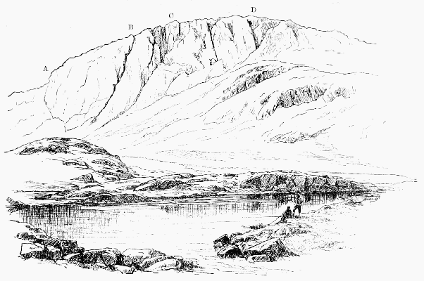
GREAT END FROM SPRINKLING TARN:
A, Position of Brigg's climb (not seen); B, The east gully; C, The great central gully; D, Cust's gully.
The South-East Gully, as it is usually called, has its
mouth only some 20 yards east from that of the last. Being
much narrower, it is bridged by numerous 'choke-stones,' and,
while less fine than the other in snow time, offers in summer
a better and rather longer climb. Half-way up or less there
is a fork, the dividing ridge forming quite a sharp arête.
Above it the forks coalesce, and as it nears the top the climb
can be varied a good deal.
Brigg's (or Holmes') Pitch, of which a photograph will be
found in the Climbers' Book at Wastdale Head, is still nearer
to Esk Hause, which it faces. Mr. Holmes and the Messrs.
Brigg, who climbed it on Easter Monday 1893, describe the
difficulty as consisting in a cave formed quite at the foot of
the cliff by a jammed stone, the top of which is reached by
way of the rocks on the north side of it.
Great Gable (2,949 ft.) may be ascended with equal
ease from Wastdale or the head of Borrowdale, and is within
easy reach of Buttermere. The simplest way up is by
Sty Head, from which half an hour's rough walking lands
one on to the top. The only alternative for Wastdale is
'Moses Sledgate,' alias Gavel Neese, a ridge of rather steep
grass, which offers a very direct way. There is a bit of
scrambling on White Napes, a rocky mass which tops the
Neese. Beyond this Westmorland's Cairn is left on the right
hand and the summit cairn comes into sight. People coming
from Buttermere usually go round the head of Ennerdale
over Green Gable, and this is the way generally taken by
Borrowdale visitors for the return journey. The climbing on
this mountain is quite first-class. The Napes, Napes Needle,
and Kern Knotts are separately described, but in addition to
these there are grand crags overlooking Ennerdale. These
are referred to in Col. Barrow's book in the passage where he
defies the Alpine Club to ascend the most difficult side of
certain Lake mountains.
ToList
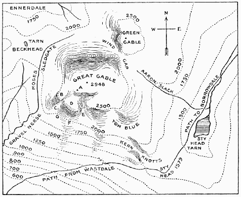
PLAN OF GREAT GABLE:
A, Westmorland's Cairn; B, White Napes; C, E, Little and Great Hell Gate;
D, Great Napes; F, Napes Needle.
No one seems even to have looked at these crags till in
1882 Mr. Pope met his death on this side of the mountain.
In that year the writer found that it was an easy matter to
coast along the face of the cliff at about two-thirds of the
height of it, and a year or two later that for all the ferocious
appearance of these rocks there is a natural passage by which
a mountain sheep of ordinary powers might ascend them.
Close to this are the remains of a sort of hut of loose stones,
evidently the refuge of some desperate fugitive of half a
century or more ago. Local tradition speaks of a notorious
distiller of illicit whisky, who was known to have a 'hide'
somewhere in this wild neighbourhood. The top of the easy
passage bears by prismatic compass 23° from the highest
cairn, and is marked by a large stone.
ToList
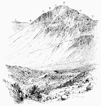
GREAT GABLE FROM THE SOUTH-EAST
A, Kirkfell; B, Beckhead; C, White Napes; D, Great Napes; E, Westmorland's
Cairn; F, Summit; G, Tom Blue; H, Kern Knotts.
The path to Sty Head is seen mounting from left to right.
To the east of this spot there is fine climbing, the rocks
being on a grand scale and difficult on that account. At
intervals large masses are detached by such agencies as frost,
and heavy falls result. One of these carried with it a slab
pinnacle which, though only about 15 ft. high, was remarkably
difficult. The writer, and Messrs. Hastings and Robinson
gave themselves the trouble of climbing it, and consequently
heard of its untimely departure with deep regret.
In April 1890 Mr. J.W. Robinson greatly assisted subsequent
climbers by inserting a sketch in the Wastdale Head
book, and this sketch has been the usual basis of later work.
Gable has the threefold excellence of being splendid to
look at, splendid to look from, and splendid to climb; and one
can easily understand the enthusiasm of Mr. F.H. Bowring,
who has ascended it over one hundred times.
Green Crag.—A good piece of rock, though not as sound
as it might be, at the head of Warnscale, the recess between
Fleetwith and Scarf Gap. It is reached from Buttermere
by way of Gatesgarth, and then by the quarry track which
goes up on the south side of Fleetwith to Dubs. There is a
fine gully in the crag which is unmistakable. A note of the
ascent of it was made by Messrs. J.W. Robinson and W.A.
Wilson in August 1889.
Griff—a valley-name in east Yorkshire, probably connected
with 'greave,' which is common in Derbyshire.
Phillips says that the Yorkshire word means 'a narrow, rugged
valley.'
Gurnard's Head, in Cornwall, not far from St. Ives,
is a fine promontory on which there is good climbing. It is
here that the greenstone ends and the granite begins, prevailing
from this point practically right on to the Land's End.
Hanging Knot.—See also Esk Pike. The steep breast
above Angle Tarn contains no continuous climb, but there
are several good bits in the rocks and gullies which connect
the terraces.
ToList
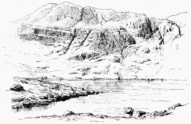
HANGING KNOT FROM ANGLE TARN
Hard Knot.—'Eske,' says Camden, 'springeth up at
the foote of Hardknot, an high steepe mountaine, in the top
whereof were discovered of late huge stones and foundations
of a castle not without great wonder, considering it is so steepe
and upright that one can hardly ascend up to it.'
This refers of course to the Roman camp, which is
nowhere near the top. The 'mountaine' scarcely deserves
the name; it is not high, and though rugged offers no climbing.
Writers much later than Camden refer to it as if it were one
of the highest hills in England. Even Gray, in his Journal,
says 'Wrynose and Hardknot, two great mountains, rise
above the rest.'
The usually accurate West introduces in the funniest way
both 'the broken ridge of Wrynose' and 'the overhanging
cliff of Hardknot' into his description of the view from Belle
Isle on Windermere, and says that they, with others,'form as
magnificent an amphitheatre, and as grand an assemblage of
mountains, as ever the genius of Poussin,' &c.; and then adds
a note to say that they 'are named as being in the environs,
and are in reality not seen from the island.'
Harrison Stickle, 'the next neighbour of Pavey Ark,
is another happy hunting-ground for beginners. There are
at least four good routes up. There is one to the north-east
which is fairly difficult. Due south there are two or three
rather steep gills, that may be climbed with a certain amount
of ease. But in no case should the climber, even on the
easiest of these routes, omit to use the rope and take every
precaution against preventable accidents.' Thus speaks Mr.
Gwynne in the Pall Mall Gazette, and to his remarks little
need be added, except that it must be borne in mind nothing
on this group is quite in the same class as Pavey Ark. The
obvious starting-point for either is Dungeon Gill at the very
foot, where there are two inns, but Grasmere is within easy
reach, being only about an hour further off.
Hause (hass, horse, -ourse, -ose): used in the North for a pass.
The word means 'neck' or 'throat,' the latter being the sense
most felt in local names, where it refers more to lateral contraction
than to vertical depression, being thus parallel to gorge rather
than to col.
Haystacks, just east of Scarf Gap, has one craggy
bit on it where, as appears from the curious map published in
the Gentleman's Magazine for 1751, eagles then built. The
name is often quoted as an instance of the Norse word which
occurs in Stack Polly, and frequently on the Scotch coast,
but West says it was called Hayrick (sic) on account of its
shape.
Hell Gate.—A channel on Great Gable, just by the east
end of the Napes. It is the outlet for immense quantities of
scree. The older name, Deep Gill, has during the last twenty
years being quite supplanted. The present name, if less
pretty, is more precise, and saves confusion with the better
known Deep Gill on Scafell.
Hell Gill.—There are many gills and becks bearing this
name. Speaking of one in Yorkshire, Leland says it is 'a
Bek called Hell Gill because it runnithe in such a deadely
place. This Gill commithe to Ure.' The idea is amplified
by Camden: 'Where Richmondshire bordereth upon Lancashire
amongst the mountaines it is in most places so
vast, solitary, unpleasant and unsightly, so mute and still also
that the borderers dwelling thereby have called certaine riverets
creeping this waie "Hellbecks." But especially that about
the head of the river Ure, which having a bridge over it of one
entier stone falleth downe such a depth, that it striketh in a
certaine horror to as many as looke downe.' The best known
Hell Gill, which at one time had considerable reputation as
a climb, is quite near the foot of Bowfell on the Langdale side.
Though on a small scale, it is highly picturesque. The south
fork is hardly passable in ordinary weather owing to a small
waterfall, below which is a deep pool flanked by perpendicular
walls of rock, and except in very dry seasons it is
necessary to crawl up the red rotten slabs, steep, slimy, and
wet, which form the north fork. The gill should be visited
more often than it is, as it is directly on one of the best ways
up the mountain from Dungeon Gill and Langdale generally.
Helm Crag.—Colonel Barrow, speaking of this hill,
observes that climbing among these rocks requires care.
There are places quite as dangerous and as difficult as on any
rock-work on the Alps. He was deterred from climbing the
rock which is supposed to resemble a mortar, by a slab of
rock slanting sideways, but in his opinion there was no great
difficulty, except that arising from the absence of hold for
hand and foot—an exception of some importance.
Helvellyn.—A mountain which belongs equally to
Grasmere and to Patterdale, though the latter has by far the
finest side of it. Striding Edge on this side was at one time
considered to present terrors such as the hardy mountaineer
was not likely to encounter elsewhere. This side is cut up
into deep coves, which are exceedingly steep and afford many
opportunities for scrambling, and near the path in Grisedale
there is one of the numerous Eagle Crags.
On the west side there is no climbing on the mountain
itself, but on the range of Dodds, which runs away to the
north, there is capital work to be found; see Bram Crag
and Wanthwaite Crags. It was in connection with Helvellyn
that Colonel Barrow issued his famous challenge to the
Alpine Club. After stating that he had ascended the mountain
by every possible way of getting up it, and that it is the
easiest of mountains to ascend from any direction that is
possible, he continues: 'No one, I think, will venture the
impossible, which may be found on all the highest mountains
in the Lake District. They have their precipitous sides for
adventurous climbers, who, I promise, will never get up them
even if they have a mind to try—viz., these, Great Gable,
Great End, Helvellyn, Fairfield, &c. Most of the difficult
things in the Alps have been accomplished. Here is a new
field for any of the adventurous climbers of our club: let them
try these precipitous sides!' Helvellyn was long regarded as
the loftiest of the Lake mountains, the height assigned to it
by West being 3,324 ft., and even its tame grassy slopes
towards Wythburn were thought very terrible indeed. In
the 'Beauties of England' Thirlmere is described as 'a scene
of desolation which is much heightened by the appearance of
the immense craggy masses, that seem to hang on the sides
of Helvellyn, from whose slopes they have apparently been
severed, but arrested in their tremendous progress down the
mountain by the impulse of gravitation. Huge and innumerable
fragments of rocks hang pendant from its sides, and
appear ready to fall and overwhelm the curious traveller who
dares to ascend its wild and fantastic heights.'
Heron Crag, Eskdale.—A rock in Eskdale (q.v.) which
was long reputed inaccessible. It was supposed to be 120
yards high, and to have a front like polished marble. It will
be found north of the Esk river, not far from Throstlegarth
(Cumberland, sheet 79).
High Level.—This name was bestowed about the year
1880 on a particular route, by means of which the north-east
foot of the Pillar Rock may be reached from Black Sail
along the face of the mountain, thus avoiding the descent
into Ennerdale and the subsequent laborious ascent to the
rock. The saving in time is very considerable, but the way
is so easily missed in thick weather that a stranger who
attempted it would probably gain nothing but an exciting
walk.
After reaching the slight hollow between Lookingstead
and Pillar Fell, Green Cove is seen below. Here a descent
may be made at once, but it is better to proceed westward
till about two dozen uprights of the iron railing are passed,
and then to descend, keeping as much to the left as the cliffs
will allow. The whole art of choosing a line along this face
is to cross each successive cove as high up as may be done
without getting impeded by rocky ground. The ridges which
separate the coves mostly form small headlands, and just
above each headland a strip of smooth grass crosses the
ridge. Economy in time is usually of more importance at
the end than at the beginning of a day, and it is well to know
that, whereas from the foot of the rock to Black Sail by
way of the valley would take up the greater part of an hour,
Mr. Hastings and the writer once timed themselves on the
High Level, and found that they reached Lookingstead in
18 minutes and the ford in Mosedale in seven minutes more.
High Stile, in Cumberland, between Ennerdale and
Buttermere, has a height of 2,643 ft., and on its north-west
side a few good crags. It is best reached by following up
the course of Sour Milk Gill from the foot of Buttermere to
Bleaberry Tarn, which can be reached from any of the inns
in an hour's walking. In a note made in the Wastdale Head
book in August 1887, Mr. Robinson called attention to these
rocks, and he it is who has done most of the exploration here.
The principal climbing is in and about a gully in the
centre. A course may be taken up very steep grassy binks
with the gully on the right hand. The gully itself was
climbed direct in September 1893 by Messrs. Jones,
Robinson and Wilson, and they found the second pitch very
difficult. The same party also ascended 'a short, black-looking
chimney away round on the left of the great crag,
and nearer the top of the mountain.' The very hard upper
pitch was passed on the right hand, and the final pull was by
the arms alone. Both climbs are in full view from Rigg's
Buttermere Hotel.
The mountain is called High Steel in some early maps,
and in that of the Ordnance it comes on sheet 69.
High Street, with the Roman road running all along its
ridge, lies between Patterdale and Mardale Green, in Westmorland.
It has a fine precipitous side towards the latter
place at Blea Water (see Dixon's Three Jumps), and at the
south end of it, about Gavel Crag and Bleathwaite Crag, there
are some good rocky faces, which can be readily found by
following up the course of the beck from Kentmere.
Hobcarton Crags have a considerable repute, which
they have only retained by reason of their not being very
easily got at. The simplest way of reaching them from
Keswick is to take the train to Braithwaite, then go up the
straight Coledale until Force Crag is passed, then trace the
stream which comes down the hill on the right. Hobcarton
is just over the ridge, and the crags are on the left-hand
side of the valley. A descent may be made of a ridge which
forms the right bank of a gill, which runs from near the
col where you are now standing; the gill itself is too rotten.
The Crags are very steep and very rotten; but there
is one curiosity about them, in the shape of a continuous
sloping ledge, growing very narrow indeed towards the top.
It rises gradually in the direction of Hopegillhead. The crags
are picturesque, but can be traversed in any direction without
difficulty, and present no definite climb. Another way of
reaching them from Keswick is by crossing Whinlatter Pass,
and on the far side turning up the first valley to the left hand.
Honister, one of the grandest crags in Cumberland,
is reached from either Buttermere or Borrowdale. It is one
of the chief attractions of the 'Buttermere Round' made
by the breaks from Keswick. If quarrymen could only have
been persuaded to let it alone, it would have been a delightful
climbing ground; as things are, we can only look and
long. Apart from the great crag there is a fine view of the
lakes below from the summit (called Fleetwith Pike). Owing
to its position near the black-lead mines, this was one of
the earliest Lake mountains of which we have a recorded
ascent. It was made before the middle of last century, and,
so far as can be made out, these early mountaineers ascended
from Seathwaite and passed to the northward of Grey
Knotts, and so to the top of Fleetwith. 'The precipices
were surprisingly variegated with apices, prominencies,
spouting jets of water, cataracts and rivers that were
precipitated from the cliffs with an alarming noise'
[Sourmilkgill]. On reaching the apparent top, they were
astonished to perceive a large plain to the west, and
from thence another craggy ascent, which they reckoned at
500 yards. 'The whole mountain is called Unnisterre or,
as I suppose, Finisterre, for such it appears to be.' In
about another hour two of the party gained this summit—'the
scene was terrifying—the horrid projection of vast
promontories, the vicinity of the clouds, the thunder of the
explosions in the slate quarries, the dreadful solitude, the
distance of the plain below, and the mountains heaped on
mountains that were lying around us desolate and waste,
like the ruins of a world which we only had survived
excited such ideas of horror as are not to be expressed.
We turned from this fearful prospect, afraid even of ourselves,
and bidding an everlasting farewell to so perilous
an elevation. We descended to our companions, repassed
the mines, got to Seathwayte, were cheerfully regaled by an
honest farmer in his puris naturalibus, and returned to
Keswic about nine at night.'
Hope (-hop, -up): used by Leland as equivalent to 'brook,'
but usually taken to mean a retired upland valley. The Icelandic
'hop' is applied to landlocked bays.
Hough—a hill name in east Yorkshire. Phillips says
that it is equivalent to 'barf,' and means 'a detached hill.'
It is pronounced 'hauf.' If this be the exact sense, it can
hardly be the same word as 'heugh,' which is used further
north for 'crag' or 'precipice,' and it is perhaps merely another
form of 'how' or 'haugh.'
How (-oe, -ah, -a, -haw): a Norse word for a burial mound,
found all over the North of England.
Ice-axe.—On the high Fells in time of snow an axe is
a safeguard of vital importance. Quite apart, too, from the
comfort and security which it alone can give, it is an
implement which can only be properly manipulated after
long practice, and consequently a beginner should eagerly
avail himself of every opportunity of acquiring dexterity in
the use of it. From Christmas to Easter there is nearly
always snow enough on the fells of Cumberland to give
excellent practice in step-cutting.
Ill Bell.—A Westmorland hill forming a series of
three with Froswick and Rainsborrow Crag. Its north
or north-easterly face is very steep for a height of about
300 ft. Staveley is perhaps the best starting-point for
these three; but they can be managed quite easily from
Ambleside or Mardale Green. Ill Bell is on sheet 20 of
the Ordnance map of Westmorland.
Ingleborough, 2,361 ft., one of the most striking of
the Yorkshire mountains, of which the poet Gray spoke as
'that huge creature of God.' Readers of the 'Heart of
Midlothian' will remember how it reminded Jeannie Deans
of her 'ain countrie.' The most exaggerated ideas of its
height formerly prevailed. Even in 1770 it was commonly
reckoned at 3,987 ft., and Hurtley actually gives 5,280 ft.
Its top is only about four miles from Clapham, and
ponies can go all the way. It is ascended far and away more
frequently than any other Yorkshire hill, and consists mainly
of limestone cliffs and slopes of shale, with a certain amount
of millstone grit.
Here are some very remarkable caves (see Alum Pot
and Gaping Gill Hole), and of some of these there is an early
description by Mr. Adam Walker in the Evening General
Post for September 25, 1779, which is quoted by West, and
an account of an ascent of it made in the year 1761 is also
extant.
Jack's Rake is a natural passage across the face of
Pavey Ark in Langdale. The first notice ever taken of it by
any but shepherds was a note in the visitors' book belonging
to the inn at Dungeon Gill by Mr. R. Pendlebury, who spoke
highly of it, considering it to be a striking yet simple excursion
among magnificent rock scenery. After a time the
world came to look at Pavey Ark, and seeing an impossible-looking
combination of ravine and precipice, concluded, not
unnaturally, that it must be what Mr. Pendlebury had found
a pleasant yet simple stroll. Under this delusion, they
began to try to climb what is now known as the Great Gully
in Pavey Ark, and did not expect to find a place anything
like the real Jack's Rake.
Mr. Gwynne, in 1892, says of it: 'Along the face of the
cliff there runs a ledge that looks from below hardly wide
enough for a cat to stand upon. However, if an attempt is
made to climb it, it will be found wide enough for two fat
men walking abreast. Towards the top it tapers off again,
and the climber will have to do a bit of scrambling to get on
to the summit of the precipice. This is a climb which offers
no difficulty whatever, unless the climber is given to attacks
of giddiness, and if that is the case there will hardly be any
need to tell him that he has no business there at all. This
ledge, however, offers a multitude of good opportunities to the
climber. It runs obliquely across the face of the precipice,
but it need not necessarily be followed throughout its length
by the mountaineer who wishes for something a little more
exciting.
'About halfway up there runs on to the ledge a chimney
which, when it is not a small waterfall, forms a pleasant
climb to some broken rock above, whence the summit is easily
reached. If, however, the water in the chimney makes it
uncomfortable and unpleasant for the climber, he may still
arrive at the top of it by choosing a long bit of steep smooth
rock to the left. There are two cliffs which afford fairly
good hand and foot holds, and from there the top of the
chimney is attained.'
It is remarkable that a gallery more or less resembling
this is found on many of the chief precipices in the Lakes.
There is a steeper one on the Ennerdale Crags of Great Gable;
there are two on the Ennerdale face of the Pillar Rock, and on
Scafell the Rake's Progress and Lord's Rake in their mutual
relation closely resemble this rake and the wide gully at the
north end of it.
ToList
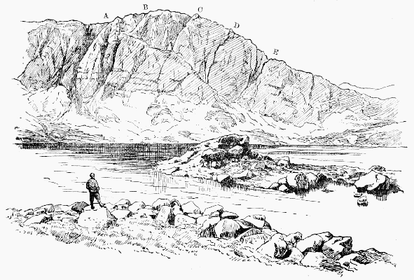
PAVEY ARK AND STICKLE TARN
A, Narrow gully; B, Big gully; C, D, Smaller gullies; E, Wide scree gully. From the foot of E to A runs Jack's Rake.
Kern Knotts are on the south side of Gable, close to
the Sty Head. There is a short but difficult gully here on
the side facing Wastdale, which was climbed by Messrs.
Owen Jones and Robinson in 1893, but described by them
under the name of Tom Blue, a rock much higher up the
mountain.
Keswick.—Though rather too distant from the very
best climbing, this is an excellent centre in point of variety.
Of Skiddaw and Saddleback it enjoys a monopoly, while
Helvellyn, Gable and Scafell Pikes are all within the
compass of a day's work. The railway is a convenience, of
course, but not as useful as one might expect in extending
the field of operations, because most of the places to which it
goes are of little interest. The town is very well supplied
with driving facilities, such as coaches, breaks and omnibuses.
The clay-slate of which the Skiddaw and Grassmoor
groups are composed provides climbing of smaller quantity
and inferior quality to that found among the harder rocks
of what is called the 'Borrowdale Series,' but there are a few
good scrambles west of Derwentwater, such as Eel (or Ill)
Crag, Force Crag, and Hobcarton. The nearest good rocks
are in the neighbourhood of Wallow Crag, but there is no
pleasure in climbing with a crowd of gaping excursionists
below. A much pleasanter day may be spent in a visit to
Wanthwaite. Of Keswick itself an early writer says that
the poorer inhabitants subsist chiefly by stealing or clandestinely
buying of those who steal the black-lead, which they
sell to Jews and other hawkers; but whatever changes the
character of the people has or has not undergone, it is not
easy to believe that the scenery is the same as that which
the early writers describe.
Camden's tone is neutral: 'Compassed about with
deawy hilles and fensed on the North side with that high
mountaine Skiddaw lieth Keswike;' but two centuries later,
when the place began to be fashionable, this description
would not have satisfied any one. The great characteristic
of the scenery was considered to be its power of inspiring
terror. Dr. Brown in his famous 'Letter' dwells upon the
'rocks and cliffs of stupendous height hanging broken over
the lake in horrible grandeur, some of them a thousand feet
high, the woods climbing up their steep and shaggy sides,
where mortal foot never yet approached. On these dreadful
heights the eagles build their nests, ... while on all sides of
this immense amphitheatre the lofty mountains rise round,
piercing the clouds in shapes as spiry and fantastic as the
very rocks of Dovedale.... The full perfection of Keswick
consists of three circumstances, beauty, horror and immensity
united.'
Kirkfell has two fine buttresses of rock at the back,
facing Ennerdale, but they are broken up and so only fit for
practice climbs. They are, however, not unfrequently
assailed by climbers who imagine themselves to be scaling
the crags of Great Gable. The direct ascent from Wastdale
is one of the steepest lengths of grass slope to be found
among these hills. The only gully on this fell is Illgill,
which faces Lingmell and contains two or three severe
pitches. It is rather seldom visited, and is exposed to falling
stones.
Lancashire.—Though some of the rough country which
borders on Yorkshire contains a rocky bit here and there,
Lancashire climbing has no real interest except in that part
of it which belongs to the Lake country. The climax of this
part is reached in the neighbourhood of Coniston. South of
the Lakes there are some limestone crags of striking form.
The impression produced on Defoe by what we consider the
exceptionally beautiful scenery of the Lune valley is curious.
'This part of the country seemed very strange and dismal to
us (nothing but mountains in view and stone walls for
hedges; sour oatcakes for bread, or clapat-bread as it is
called). As these hills were lofty, so they had an aspect of
terror. Here were no rich pleasant valleys between them as
among the Alps; no lead mines and veins of rich ore as in
the Peak; no coal-pits as in the hills about Halifax, but all
barren and wild and of no use either to man or beast.'
Langdale.—(See Bowfell, Pavey Ark and Pike
o'Stickle, Gimmer Crag, Harrison Stickle, Oak How.) By
many thought the finest valley in Westmorland; the name is
often written Langden or Langdon by old authorities.
Dungeon Gill has always been a favourite haunt of
climbing folk, and from this base strong walkers can easily
manage to reach Scafell, Gable, Coniston, Old Man, or Helvellyn
in the day.
Limestone is abundant in Derbyshire and Yorkshire,
and forms the fine cliffs of Cheddar in Somerset, Berry Head
in Devon, Anstis Cove and others; indeed most of the
south coast of Devon and Cornwall east of Penzance is of this
material. Chudleigh Rock and Morwell Rocks on the river
Tamar are very striking. West, speaking of this rock in
Lancashire, says, 'The whiteness and neatness of these rocks
take off every idea of horror that might be suggested by
their bulk or form.' In England it is very rare to find limestone
which is a satisfactory material on which to climb.
Lingmell, called Lingmoor by Wilkinson, is a mere
shoulder of Scafell Pike. It has, however, some fine cliffs
facing those of Great Napes on Gable; between these two
Housman thought a collision imminent. These used to be
thought inaccessible, but were climbed by Mr. Bowring about
1880. There is a striking view of them from near Sty Head.
The eye looks right along the dark ravine of Piers Gill, which
is apparently overhung by the long line of these crags, rising
from tongues of rock divided by huge fan-shaped banks of
scree. There is a good deal of chance about the climbing
here. It may be exciting, or you may just happen to avoid
what difficulties there are. It is a very treacherous rock,
especially low down, where curious long stone pegs are lightly
stuck in the ground and come away at the first touch. A
few feet below the top stands a curious pinnacle of forbidding
appearance, of which a sensational photograph has been taken;
but Mr. Robinson found one side from which the top is
reached with ridiculous ease. Further west there are gullies
facing Kirkfell which are worth climbing, though there is
much unsound rock. (See also Piers Gill.)
ToList
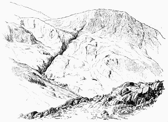
LINGMELL AND PIERS GILL
Lingmoor, rather over a mile south-east of Millbeck
Inn, and near Oak How, is a little pinnacle of which a photograph
and a description by Mr. H.A. Gwynne will be found
in the Climbers' book at that place. In old maps the name
is sometimes found applied to Lingmell.
Lord's Rake.—A well-known scree-shoot in the north
face of Scafell, for the ascent of which from Mickledoor it
offers an easy route without climbing. The earliest account
of its being used for this purpose is in the Penny Magazine
for 1837 at p. 293: 'It is very laborious and looks dangerous,
but in fact there is no risk except that of a sprained ankle.
It is through the Lord's Rake, a shaft between two vertical
walls of rock about five yards across all the way up, and
twenty or twenty-five minutes' hard climbing on all fours up
a slope of about 45°. The place must have been cut out by
a watercourse, but is now dry and covered with light shingle.
It looks right down into Hollow Stones (the deep vale between
the Pikes and Scafell), and most fearful it does look,
but it is not dangerous. When we reached the inn at Eskdale
over Scafell my shepherd was very proud of having
brought me through the Lord's Rake, and the people were
much surprised. It seems to be rather a feat in the country.
It is the strangest place I ever saw. It may be recommended
to all who can bear hard labour and enjoy the appearance of
danger without the reality.' 'Prior's Guide' contained the
first good description of this rake.
ToList
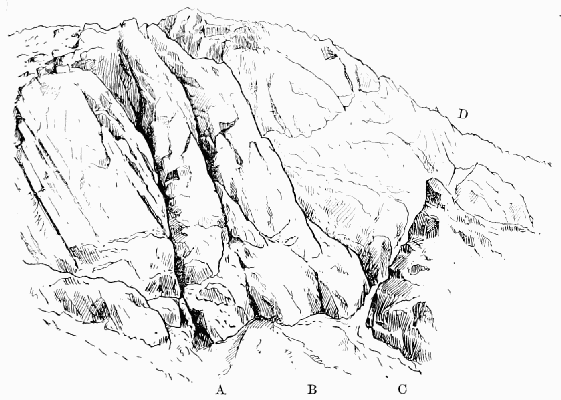
LORD'S RAKE AND RAKE'S PROGRESS
A, The foot of Moss Gill; B, The foot of Steep Gill; C-D, Lord's Rake;
C-A, Part of Rake's Progress.
Luxulion, in Cornwall, is of interest to the mineralogist
and the travelled mountaineer on account of its enormous
block.
According to Mr. Baddeley, this is the largest block in
Europe, larger than any of the famous boulders at the head
of the Italian lakes, and it may take rank with the largest
known, the Agassiz blocks in the Tijuca mountains near Rio
Janeiro. He gives the dimensions as 49 feet by 27 feet with
72 feet girth, yet makes no allusion to the Bowder Stone in
Borrowdale, which in another work he describes as being
60 feet long, 30 feet high, and weighing 1,900 tons. It would
appear, therefore, that the Bowder Stone is considerably
larger than the largest stone in Europe without being so remarkable
for size as another stone in England.
Malham Cove.—A fine example of the limestone scenery
of the Craven Fault. The river Aire gushes forth from the
base of the cove, which can easily be seen in the same excursion
as Gordale Scar. The nearest town is Skipton-in-Craven
and the nearest station Bell Busk, but Settle is very
little farther and will generally be found the most convenient
starting-point.
Mardale Green, at the head of Hawes Water, is a delightful
and little visited spot. In the way of climbing it
commands High Street, Harter Fell, Froswick, Ill Bell, and
Rainsborrow Crag. The best near climbs are about Bleawater
and Riggindale.
Mellbreak.—One of the few Cumberland fells which
the indefatigable Colonel Barrow seems to have left unvisited;
yet no one who stops at Scale Hill or Buttermere will consider
wasted a day spent upon it. The proper course is to
begin at the end which faces Loweswater village and ascend
by Frier's Gill, a nice little climb. Having reached the
top of the gill and then the summit plateau, proceed to the
hollow about the middle of the mountain, and from there
descend the highly curious Pillar Rake, which gradually
slopes down towards the foot of Crummock Water. It is not
a climb, but any one who is not content with the study of
mountain form can find climbing in the little gullies which
ascend the rocks above the rake. Sheet 63 of the Ordnance
map of Cumberland contains it.
Mickledoor Chimney, in the cliffs of Scafell, is not the
easiest, but the most obvious point at which to attack them.
It is conspicuous from the Pikes, and would probably be
selected by any experienced stranger as the most vulnerable
point. It was visited about the year 1869 by Mr. C.W.
Dymond, who contributed to 'Prior's Guide' the earliest
and best description of it. He says that, 'leaving Mickledoor
Ridge, you pass the fissure leading to Broad Stand, and continue
descending steeply for two minutes, which brings you
to a narrow gully in the rock, with a thread of water trickling
down it over moss. This is the cheminée to be ascended,
and there is no special difficulty in it until you are near the
top. Here the gully, of which the 'chimney' forms the
lower section, is effectually blocked for some distance, and
the only alternative is to climb out of it by the rock which
forms the right wall, and which is about 12 ft. high, the
lower six vertical and the upper a steep slant. This, which
can only be scaled à la chimney-sweep, is exceedingly difficult,
as is also the gymnastic feat of escaping to terra firma
from the narrow shelf on which the shoulder-and-hip work
lands you.' This is very clear and in the main correct,
but there is another and easier exit much lower down called
'the Corner,' and there is a third exit only a few feet from
the mouth of the chimney. All these are on the right hand,
for the opposite bank is not only much higher and much
smoother, but would lead to nothing if it were surmounted.
It is not really necessary to enter the chimney at all, for the
edge presented where the bank cuts the wall bounding the
screes is quite assailable, and just right of it there is a point
which may even be called easy; but two terrible accidents
which have occurred at this spot prove the necessity of care.
Until the extraordinarily dry season of 1893 the moss-grown
block at the very head of the chimney had never been
climbed. It was accomplished on the 12th of September by
Mr. W.H. Fowler. By standing on the shoulders of a tall
man he was able to reach a slight hold and to establish himself
on a rough rectangular block forming the floor of a recess
big enough to hold one man. The block above it was holdless,
and overhanging and loose stones were a great nuisance.
Micklefell.—The highest mountain in Yorkshire, but
except on that account it possesses no special attraction.
The best starting-point is the High Force Inn in Teesdale,
5 miles from Middleton. By making the round of the mountain
from High Force to Appleby some very fine rock-scenery
may be enjoyed.
Millstone grit.—A material which is very abundant in
Yorkshire and Derbyshire. It is fairly firm, but seldom
affords a climb of any sustained interest. Few kinds of rock
weather into such eccentric forms, and of this propensity
Brimham Rocks are a good example. It forms most of the
'Edges' in Derbyshire, and generally speaking a precipice
at the top of a hill is of this material, while those at the foot
are of limestone.
Moses' Sledgate is a curious track, which has evidently
been engineered with considerable care, running from near
Seatoller in Borrowdale at the back of Brandreth, round
the head of Ennerdale below Green and Great Gable, and
then over Beck Head and down Gavel Neese into Wastdale.
The question is, who made it and for what purpose was it
used? A few years ago, the writer, while climbing with two
friends among the crags on the Ennerdale side of Great Gable,
stumbled quite by chance on something which seemed to
throw a side-light on the question. This was a ruined hut
thickly overgrown with moss, and showing no trace of any
wood having been employed in its construction. The spot had
evidently been chosen primarily with a view to concealment,
and the result of enquiries kindly made since then by one of
my friends has been to elicit proof of certain traditions still lingering
among the older inhabitants of these dales concerning
a noted distiller of illicit spirits, who flourished and defied the
law among these wild retreats. At the same time it is not
easy to believe that a smuggler would have undertaken the
construction of such a path as this. In the South of England,
it is true that the smugglers were considerable roadmakers;
but that was at a time when smuggling was a great and
well-organised institution, and it seems much more probable
in this case that Moses made use of an old path constructed
for some purpose which had at that time been abandoned.
The terms 'Moses' Path' and 'Moses' Trod' are also used
to describe this track. It is not noticed in the guide-books,
but something is said about it by Mrs. Lynn Linton.
Moss Gill, on Scafell, is the next gully on the east or
Mickledoor side of Steep Gill. The name Sweep Gill ('from
the probable profession of the future first climber of its extraordinary
vertical chimneys') was suggested for it by Mr.
Gilson shortly after its discovery, but that name has been
entirely superseded. The first mention of it in the Wastdale
Head book is a note by the present writer in June 1889,
recommending it to any one in search of a new and difficult
climb. His party on that occasion was repulsed after reaching
the great blocks, which have only been passed since by
the aid of the artificial step subsequently cut in the rock. It
was tried again a fortnight later by a party under Mr. R.C.
Gilson, which got very nearly, but not quite as far. Two
days later the same party explored the gill from above and
descended in it for a considerable distance. It was not,
however, till three and a half years later, at Christmas, 1892,
that the climb was accomplished by Dr. J.N. Collie, G.
Hastings, and J.W. Robinson, and their account of it is:
ToList
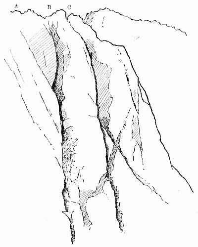
MOSS GILL AND STEEP GILL
A, Moss Gill (Collie's exit); B, Moss Gill (Collier's exit): C, Top of Steep Gill.
Just below the point to which A and B converge is the artificial step.
'The chief points in this climb are, First—to begin on
the rock wall to the right of the foot of the gill and not in the
very foot of the chimney itself, then enter the gill just below
the first great pitch, which may be turned by climbing the
wall on the right hand on to a grass ledge of considerable
size, called the "Tennis Court"; enter the gill from here
again, and pass into the cavern under the great boulder.'
'We found,' says Dr. Collie, 'that below the great slab
which formed the roof, another smaller one was jammed in
the gully, which, stretching across from side to side, formed
the top of a great doorway. Under this we passed and
clambered up on to the top of it. Over our heads the great
rock roof stretched some distance over the gill. Our only
chance was to traverse straight out along the side of the gill,
till one was no longer overshadowed by the roof above, and
then, if possible, climb up the face of rock and traverse back
again above the obstacle into the gill once more. This was
easier to plan than to carry out; absolutely no hand-hold,
and only one little projecting ledge jutting out about a
quarter of an inch and about two inches long to stand on,
and six or eight feet of the rock wall to be traversed. I was
asked to try it. Accordingly, with great deliberation, I
stretched out my foot and placed the edge of my toe on the
ledge. Just as I was going to put my weight on to it, off
slipped my toe, and if Hastings had not quickly jerked me
back, I should instantly have been dangling on the end of
the rope. But we were determined not to be beaten.
Hastings' ice-axe was next brought into requisition, and
what followed I have no doubt will be severely criticised by
more orthodox mountaineers than ourselves. As it was my
suggestion I must take the blame. Peccavi! I hacked a
step in the rock—and it was very hard work. But I should
not advise any one to try and do the same thing with an
ordinary axe. Hastings' axe is an extraordinary one, and
was none the worse for the experiment. I then stepped
across the mauvais pas, clambered up the rock till I had
reached a spot where a capital hitch could be got over a
jutting piece of rock, and the rest of the party followed. We
then climbed out of the gill on the left, up some interesting
slabs of rock. A few days later the gill was again
ascended by a party led by Mr. J. Collier. They did not
follow our track to the left after the overhanging rock had
been passed, but climbed straight up, using a crack which
looks impossible from down below, thus adding an extra
piece of splendid climbing to the expedition.'
Only four days after Dr. Collie, a party of five climbers,
led by Dr. J. Collier, made the second ascent of Moss Gill.
The description given by their precursors was of great assistance,
and except that the gill was entered much lower, the
same line was followed up to the traverse from the great
boulder. Here, instead of climbing out to the sky line on the
left side, the ascent of the gill itself was completed by climbing
the vertical moss-grown wall on the right. This part
was entirely new, and Dr. Collier's note of his variation, or
we may say correction, for his climb is the more direct of
the two, is that the ascent of the wall was made by using the
cleft of the gill for about 15 ft., when a resting place was
reached. Above this point they climbed about 15 ft., and
then traversed out on the face of the wall for about 8 ft. by
some ledges which afforded just sufficient hold. They then
ascended vertically about 6 or 8 ft., re-entering the cleft
above a small platform of jammed stones ('Sentry Box').
This gave a starting-point for the completion of the ascent,
which was made by climbing out on to the face of the wall to
enable the jammed stones at the top of the pitch to be turned.
These last stones did not appear to be secure and were
avoided. From this point the gill continues upward at an
easy slope, with one pitch of about 15 ft. to the back of the
small summit on the left of Deep Gill. Two days later the
ascent was repeated by Dr. Collier in company with Professor
H.B. Dixon and the late Professor A.M. Marshall,
the latter of whom inserted in the Climbers' book a remarkably
bold and effective outline sketch of the gill, with
explanatory notes. Speaking of the climb, he said that Mr.
Collier led throughout, and that the success of the climb was
due entirely to him. The climb is a very fine one, and,
except for the leader, is entirely free from danger. At the
very awkward return from Tennis Court Ledge into the
gully, the leader can by a short traverse fix himself directly
above the rest of the party. During the traverse from the
'window' the leader can fix the rope over the 'belaying-pin.'
In the great chimney the Sentry Box is a place of
absolute safety. The climb is difficult, but no part of the
chimney is harder than the short rock face leading up to
Tennis Court Ledge, and the most awkward traverse (if
covered with snow) is the one from Tennis Court Ledge back
into the gully. For a party of three 80 ft. of rope would be
enough; 100 ft. perhaps better. On January 9, 1893, Mr. O.G.
Jones attacked this formidable climb entirely by himself,
following Mr. Collier's route up to the foot of the Great
Chimney, and then Mr. Hastings' exit to the left. Heavy
snow had fallen since the previous ascents and the climb appeared
to be exceedingly difficult. Almost every hold had to
be cleared of snow; essential precautions rendered the climb
of five hours' duration, and it was not completed till after dark
(5.45 p.m.). While clearing snow from the more remote
portions of the Collie traverse from the window, in search of
the third step, the difficulty of balancing proved too great,
and he fell into the gully below. A rope had been secured
round the window and thus prevented his passing beyond
the snow patch on which he fell. The window 'sill,' already
loose, was on the verge of falling, and was therefore pushed
over into the gully. Returning two days later, he found that
the two lowest chimneys in the gill could be taken straight
up, and that the simplest way of reaching Tennis Court
Ledge is by 'backing up' the chimney till the level of the
recess in the right-hand face is reached. 'The recess is near
enough to be taken with a stride. It would seem that the
Tennis Court Ledge and traverse back into the gully may be
entirely dispensed with by continuing up the chimney, the
small jammed stones being firm enough to render the
necessary assistance. While making these suggestions concerning
small details in the climb, it may be mentioned that
at the Collie traverse, which the writer's experience leads
him to think is the most dangerous piece in the gill, an axe
may be of much help to a party. A man fixed on the
window sill may press the point of the axe into a conveniently
placed notch in the slab facing him, so that the
lower end of the handle shall supply a firm hand-hold for
any one stretching round the third step.
Heights calculated by Mr. Jones.
| Foot of Gill on Rake's Progress | 2,625 ft. |
| Snow Patch below Tennis Court Ledge | 2,805 " |
| Tennis Court Ledge | 2,840 " |
| Foot of jammed stone pitch | 2,870 " |
| Window in jammed stones | 2,895 " |
| Snow patch above | 2,920 " |
| Top of left-hand exit | 3,140 " |
| Top of Moss Gill proper | 3,170 " |
It must, however, be borne in mind that these measurements,
though useful for the purposes of comparison, cannot
be absolutely correct, seeing that Scafell itself is only
3,162 ft. high. On February 11 Messrs. Slingsby, Woolley,
and R. Williams found the gully very difficult owing to ice,
and recorded an emphatic protest against any one following
their example by attempting it, 'except when the rocks are
dry and quite free from ice.'
On the last day of March Messrs. Brunskill and Gibbs
followed, with a slight improvement, Dr. Collier's route, and
made the subjoined observations, taken apparently with
greater care than those by Mr. Jones:
| Foot of Gill at Rake's Progress | 2,570 ft. |
| Snow Patch above jammed stones | 2,865 " |
| Top of Great Chimney or Moss wall | 2,965 " |
| Top of Gill (neck leading to Deep Gill Pisgah) | 3,065 " |
It will be seen that while the points are all made lower
than Mr. Jones's table, the height between the commencement
of the climb and the snow patch above the jammed
stones is exactly the same—295 ft. In this case an observation
was taken at the cairn on the top of Scafell, and the
aneroid stood at almost exactly the correct figure, which
somewhat confirms the figures now given.
Napes.—A collection of fine rocks, starting up like a
stack of organ pipes on the south side of Great Gable. The
extremity of them nearest to Kirkfell is called White Napes,
and sometimes Gable Horn. East of this is a gap known as
Little Hell Gate. East of this comes Great Napes, and east
of them again is Great Hell Gate, which is called Deep Gill
in the Ordnance map.
In September, 1884, a note by the present writer in the
book at Wastdale Head drew attention to these excellent
rocks. They are now one of the most favourite climbs in
Wastdale, and contain the well-known Needle, the Bear Rock,
and the Arrowhead, with their respective gullies and arêtes.
Just west of Hell Gate there is a considerable width of very
large and steep rock, which continues nearly to the Needle
Ridge, with only a few steep and shallow gullies, in which
the grass is very rotten. West of this ridge there is a deep
gully, grassy, but exceedingly steep. The ridge beyond this
was ascended in April, 1892, by Messrs. Slingsby, Baker,
Solly, and Brigg, who called it the Eagle's Nest (q.v.). The
narrow gully west of this ridge is apparently that which
was climbed on December 29, 1890, by Mr. R.C. Gilson.
He describes it as 'the gully on the left as you face the
mountain of the gully coming down left of the Needle.' He
proceeds to say that it presented no special difficulty, except
at a point about one-third of the way up, where there was
a large boulder and a smooth slab thinly glazed with ice. It
was claimed as a first ascent when climbed on April 17,
1892, by Messrs. Solly and Schintz. West again of this is
the ridge of the Arrowhead (q.v.). We are here getting near
the end of Great Napes, which are separated on the west
from White Napes by the scree gully which is called Little
Hell Gate.
Napes Needle.—A rock of very striking form, which,
by an eminent mountaineer, has been compared to a violon-cello.
It stands at the foot of the Needle Ridge in the Napes,
and was first climbed by the writer about the end of June,
1886. The second ascent was made on March 17, 1889, by Mr.
G. Hastings, and the third by Mr. F. Wellford on June 22,
Mr. J.W. Robinson following on August 12 in the same
year.
ToList
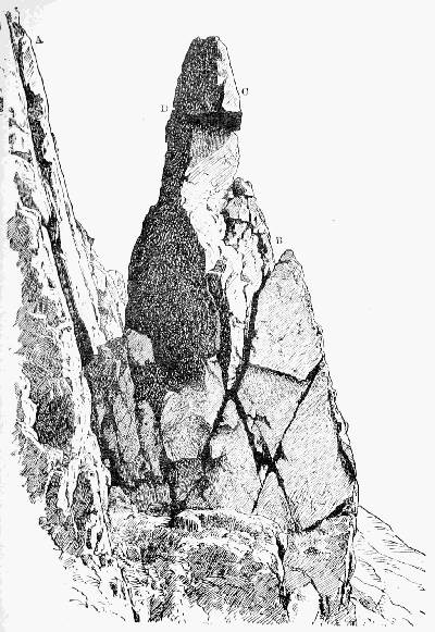
NAPES NEEDLE FROM THE WEST
A, Needle Ridge; B is reached from
below by means of a deep crack
which goes right through the rock.
In order to get to C from B it is
necessary to pass round behind to
the crack seen at D, along which
one may pass to C, and thence
direct to the top.
Miss Koecher (March 31, 1890) was apparently the
first lady to ascend.
It was first climbed from the west; the way on the
opposite side is perhaps less severe, but longer and more
varied.
The rock is frequently photographed, and an illustrated
article on it appeared in the Pall Mall Budget of June 5, 1890.
Needle Ridge is that ridge of the Napes on Great
Gable which is immediately behind the Napes Needle. It
was discovered in 1884 by the writer and Mr. Robinson, and
ascended by them in a somewhat desultory fashion; that is to
say, they cut in from the east side nearly at the top of the
difficult face which forms its lower extremity, and also
avoided the topmost piece by passing over on to the easy
terrace on the west side of the ridge. The arête was climbed
in a strict and conscientious manner for the first time by the
writer in 1886. This was a descent, and apparently the first
strict ascent was made by Messrs. Slingsby, Hastings
Hopkinson, and a brother of the writer.
North Climb.—The first to describe this climb on
Scafell was Mr. Seatree, who says:
'From the ridge we traversed a ledge of grass-covered
rock [the Rake's Progress] to the right, until we reached a
detached boulder, stepping upon which we were enabled to
get hand-hold of a crevice 6 or 7 ft. from where we
stood. To draw ourselves up so as to get our feet upon this
was the difficulty; there is only one small foot-hold in that
distance, and to have slipped here would have precipitated
the climber many feet below. Having succeeded in gaining
this foot-hold, we found ourselves in a small rectangular
recess, with barely room to turn round. From here it was
necessary to draw ourselves carefully over two other ledges
into a small rift in the rocks, and then traverse on our hands
and knees another narrow ledge of about 8 ft. to the left,
which brought us nearly in a line with Mickledoor Ridge.
From here all was comparatively smooth sailing.'
This climb had been made many years before (1869) by
Major Ponsonby Cundill, R.E., who left his stick in the deep
crack behind the ledge which Mr. Seatree traversed on his
hands and knees. The stick was found in 1884 by Mr. Chas.
Cookson. This ledge, by the way, should certainly be walked
or at least sidled in an upright attitude, otherwise ungainly
gambollings are necessary when the time comes for stepping
off at the other end. The descent of the North Climb is
decidedly difficult, unless the ascent has been made just
previously, and the climb whether up or down is an excellent
test of style.
A couple of yards to the left there is an alternative to
the 'rectangular recess,' and it is known as the 'Rift.' It
is to be done by a wild struggle. It was at one time the
wetter and harder of the two ways, but the conditions are
now reversed.
Old Wall.—On the east side of the Pillar Rock a
natural line of rock runs down to the head of Walker's Gully,
having, however, a narrow passage by means of which sheep
may reach the Low Man. A hundred years ago or more, the
shepherds built a wall of loose stones to stop the sheep, and
though little of the wall remains, the name clings to the spot.
At one time the North-east Route was usually spoken of as
the Old Wall Way.
Patriarch.—By this name the Rev. James Jackson, of
Sandwith in Cumberland, was very widely known. It is an
abbreviation of one which he himself invented and assumed—'Patriarch
of the Pillarites.' Some considerable mention of
him is made by Mr. Williamson, but his readers will be glad
to have further particulars, for this was a man of no ordinary
stamp. Born at Millom just before the series of naval
victories which closed the eighteenth century, he passed his
boyhood in the thick of the Buonaparte struggle and shared
in it personally when a mere lad. However, he soon changed
the colour of his coat and entered the Church; but long
before his connection with the Pillar he had ceased to take
any active part in his profession. Thenceforward he lived
at his ease, amusing himself by rambles and scrambles far
and near among the fells. 'I have knocked about,' he said
himself, 'among the mountains ever since, till I may almost
say "I knaw iv'ry craag."' That he was somewhat of an
egotist cannot be denied. In his letters as in his poems his
own feats form the burden of his song. To this point all
topics converged with the same certainty that all roads are
said to lead to Rome. He was never tired of relating how,
for instance, in his sixty-ninth year he had one day walked
46 miles in 14½ hours, on the third day following 56 miles in
18 hours, and after a similar interval 60 miles in less than
20 hours, thus accomplishing within one week three walks, any
one of which might well knock up many a man of half his age;
how, on another occasion, he had found two brethren of his
own cloth struggling feebly to surmount the difficulties of
Rossett Gill; how, taking pity upon their tender years,
he had transferred their knapsacks to his own venerable
shoulders and, striding on before, encouraged them to complete
their weary task. A man aged between sixty and
seventy might fairly plume himself on such an exploit. He
also rejoiced greatly in the fact that he had been the first
student of St. Bees College—a distinction of which, as he
justly said, no one could ever deprive him. But the feat on
which he especially prided himself was one of bodily
activity. During the third part of a century he held the
living of Rivington, near Bolton-le-Moors. It chanced that
the weathercock of his church had become loose, and the
masons rather shrank from the risk of going up to secure it.
Here was an opportunity which our friend could not forego;
and Rivington witnessed the unwonted spectacle of a beneficed
clergyman of the Church of England solemnly swarming up
his own steeple and making fast the vane 'under circumstances
of terror which made the workmen recoil from the
task, and the gazing rustics turn sick with horror at the
sight!' While walking proudly back to his parsonage
he composed a commemorative epigram which will bear
quotation:
Who has not heard of Steeple Jack,
That lion-hearted Saxon?
Though I'm not he, he was my sire,
For I am 'Steeple Jackson'!
Indeed, his fancy was as lively as his limbs were supple.
He was ever on the watch for some analogy or antithesis;
ever producing some new alliteration or epigram expressive
of such contrasts as that between his age and his activity.
His favourite description of himself was 'senex juvenilis'—an
idea which he frequently put into English, e.g.:
If this in your mind you will fix
When I make the Pillar my toy,
I was born in 1, 7, 9, 6,
And you'll think me a nimble old boy.
On the late Mr. Maitland, a well-known climber, as only
second to himself in age and ardour, he bestowed the title
'Maitland of Many Mounts' and 'Patriarch Presumptive of
the Pillarites.' There is nothing strange in his thus designating
a successor and bestowing titles of honour; for these are
matter of royal privilege, and he looked upon himself as the
Mountain Monarch and always expected climbers to attend
his mimic court and pay him homage. But he had many a
high-flown alias besides. When Mr. Pendlebury came under
his notice he contrasted himself with the Senior Wrangler,
rather neatly, as the 'Senior Scrambler'; after his ascent of
the Pillar he dubbed himself 'St. Jacobus Stylites'; and
many other titles are introduced into the occasional poems
on which he expended much of his ingenuity.
His bodily powers were not allowed to rust away. 'My
adopted motto,' he said, 'is "Stare nescio,"' and some idea
of his boundless love of enterprise may be formed from one
of his letters: 'I have been twelve months afloat on the wide,
wide sea. I have been beneath the falls of Niagara. I have
sung "God save the King" in the hall of St. Peter's; I have
ascended Vesuvius in the eruption of 1828; I have capped
Snowdon in Wales and Slieve Donard in Ireland, and nearly
all the hills in this district.... It only remains for me to mount
the Pillar Rock!' Before the end of the following May this
hope was gratified, and a proud moment it was for this veteran
climber when, seated serenely on the summit, he was able to
record in a Greek inscription (written, as he carefully notes,
'without specs') his ascent of the famous rock. Think of
the life, the energy, the determination that must have been
in him! Years seemed to be powerless to check the current of
his blood. Where are we to look for another of his age—he
was now in his eightieth year—showing any approach to the
same combination of enterprise, pluck and bodily vigour? It
cannot be wondered at that his success filled him with the
keenest delight. He wrote off at once in high glee to his
friends and felt quite injured if, in their reply or their delay
in replying, he detected any sign of indifference to his exploit.
But true to his motto 'Stare nescio,' he was not content with
this. Within a month we find him expressing a fear that his
title 'Patriarch of the Pillarites' might not be acknowledged
by 'the Western division of the Order,' and announcing his
intention of climbing the Pillar from the west also in order
to secure his claim. He playfully proposes, moreover, that
while he, 'the aged errant knight,' with his faithful squire
toiled up from the west, a certain fair Pillarite should arrive
at the summit from the east and crown his success on the
spot by the bestowal on him of her hand and heart. According
to all approved precedent the 'aged errant knight' ought
to have bound his lady's favour around his clerical hat and
ranged the mountains extorting from the passing tourist at
the point of his alpenstock a confession of her peerless beauty;
or for her sake betaken himself to the Rock and there passed
nights of vigil and days of toil assisting distressed damsels in
the terrible passage of the 'Slab.' Whatever he did, he made
no attempt on the west route. Perhaps despair of the reward
had cooled his zeal—zeal conditional like that of the Hindoo
teacher who, when asked whether he professed the creed which
he was anxious to teach, naïvely replied, 'I am not a Christian;
but I expect to be one shortly—if sufficient inducement
offers.'
There is a sad and sharp contrast in turning from his high
spirits and playful fancy to his sudden death. It has been
described elsewhere. Though fourscore and two was (as he
himself expressed it on the very day of his death) the 'howdah'
on his back, it cannot be said that the ever-growing
howdah had crushed its bearer. His vigour was unimpaired.
Like Walter Ewbank,
To the very last,
He had the lightest foot in Ennerdale.
Indeed, the same thing might have happened to a boy. It
was an accident; but it might be rash to say that it was a
misfortune, or that he would himself have regarded any other
death as preferable. His life had already been longer and
more varied than falls to ordinary men; but the change
could not long have been delayed. A few months would have
seen his faculties failing and his powers decayed. To a man
of his habits and temperament inaction would have been the
most terrible affliction, and though he might have dragged on
for years, his strength would truly have been labour and
sorrow.
Two years before he had stood close to this very spot.
'Almost all the mountains,' he said, 'which I had known in
youth, in manhood, and in old age were visible, and seemed
to give me a kindly greeting "for auld lang syne." In the
fervour of admiration I might have chanted, "Nunc dimittis,
Domine, servum tuum in pace."' We may well believe
that, had the old man foreseen his fate, he would have gladly
welcomed it, and have found for it no fitter place among all
his beloved mountains than this quiet cove almost within the
shadow of the majestic rock.
Patterdale is a place where a climber may spend a week
or two with much enjoyment, though the quality of the rocks
is by no means first-rate. It is the best centre for Helvellyn,
Fairfield, and St. Sunday Crag, and convenient for Swarthbeck
and the whole High Street range. On Place Fell, fine
as it looks, there is not much worth climbing. Deepdale
and Dovedale are both worth exploring.
Pavey Ark, one of the Langdale Pikes, is easily
reached in three-quarters of an hour from Dungeon Gill. On
it will be found some splendid climbing, including the Big
Gully, the Little Gully, Jack's Rake (q.v.), and many minor
points of interest. The two chief gullies stand on either side
of a buttress of rock, the top of which forms a tooth on the
sky line. The Little Gully is on the south side of it, and is
V-shaped, giving a very straightforward but pleasant climb.
But the Great Gully has two considerable difficulties, one
low down and the other near the top. The lower is caused
by a huge block covering a considerable cavern. The way
is either right through the cavern and out again through
a narrow hole, or up a high grassy bank on the right hand.
In either case a narrow place is reached, walled in between
the big block and a smaller one on the right hand. Here
the difficulty is that the walls nearly meet towards the top,
so that it is necessary, in order to get room for the head, to
go rather 'outside.' However, a second man with a rope
can hold the leader very securely, and a piece of rock having
come away, the headroom is much more commodious than
it used to be. Just below the level of Jack's Rake there are
some very 'brant and slape' inclines of wet or muddy rock,
which most people consider the worst part of the climb.
There is very little hold, and what there is was on the occasion
of the first ascent lubricated by a film of fine mud. On
reaching Jack's Rake several variations may be made, and
straight ahead there is a very neat little chimney. These
upper rocks are of splendid gripping quality; rough as a cow's
tongue, it would be quite difficult to make a slip on them.
The Big Gully was climbed by the writer in the summer of
1882, and the small one in June 1886. In March 1887 Mr.
Slingsby made a note about the former in the Wastdale
Head book. He says that it took his party two hours and
forty minutes, but his estimate of the height of the gully at
1,300 ft. is more than double of the truth, and must be due
to a slip of the pen.
ToList
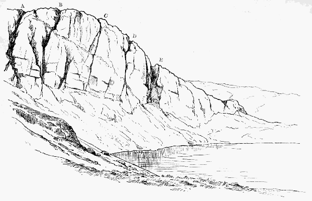
PAVEY ARK (NEAR VIEW)
A, Narrow gully; B, Big gully; C, D, Smaller gullies; E, Wide scree gully.
From the foot of E to A runs Jack's Rake.
In the book at Millbeck there is a note by the same distinguished
climber, dated May 30, 1887, in which he records
an ascent of this gully made by Miss Mabel Hastings, and
gives the height of it as 600 or 650 ft.
Penyghent.—The sixth in height of the Yorkshire hills,
but long supposed, on account of its finer shape, to be the
highest of them all. As late as 1770 it was reckoned at
3,930 ft. It can be ascended from Horton station in little
over an hour. Celtic scholars revel in the name; they practically
agree that it means 'head of something,' but cannot
accept each other's views as to what that something is.
When Defoe was in this neighbourhood he saw 'nothing but
high mountains, which had a terrible aspect, and more
frightful than any in Monmouthshire or Derbyshire, especially
Pengent Hill.'
Piers Gill, in Wastdale, on the north front of Lingmell,
has a vast literature of its own. As a rock ravine,
not in limestone, it is only second to Deep Gill on Scafell
and the great gully in the Wastwater Screes, both of which
are far less easy of access than this, which can be reached
from Wastdale Head in half an hour. The difficulties depend
entirely on the quantity of water. One, the 'cave pitch,'
may be passed at the cost of a wetting almost at any time;
but above it is another, known as the 'Bridge Fall,' from a
vast column of fallen rock which spans the stream a few
yards above it, which is at all times difficult, and in nineteen
seasons out of twenty wholly impossible.
Until the unprecedented drought of 1893 it had never
been climbed. Even then a less brilliant climber than Dr.
Collier would scarcely have succeeded. His ascent was
made on April 29, 1893, and his companions were Messrs.
Winser, W. Jones, and Fairbairn. The big pitch was found
to be 40 or 50 ft. high, the lowest part of it apparently
overhanging. The first few feet were climbed about three
feet to the right of the falling water, after which the leader
was able to reach the other side of the gill by stretching his
left foot across it just outside the water. By this means this
great and hitherto insuperable difficulty was overcome. Unless
we are entering on a cycle of dry seasons, the exploit is one
which will not be repeated for some time.
Various accidents and minor mishaps have taken place
in Piers Gill. One is described by Mr. Payn, and the injured
man was, I believe, a shepherd called Tom Hale. Mr. W.O.
Burrows had a bad fall above the bridge, and people descending
from the Pikes are often pounded about the same spot.
Some years ago a tourist had to pass the night in the gill
without food, but protested that he was 'quite consoled by
the beautiful scenery.' The discovery of the route up the
east side of the Pillar Rock was within an ace of being
delayed for years, owing to the band of bold explorers who
were to work it out becoming entangled in Piers Gill while
on their way to Wastdale Head.
The name is spelt 'Pease' by Mr. Payn and by most of
the early authorities, and judging by the analogy of other
places in the North of England this would appear to be more
correct.
Pike o' Stickle, also known as Steel Pike and sometimes
as the Sugarloaf, drops into Langdale from the north
in one continuous slope, which for length and steepness has
not many rivals in England. The top piece of the hill is
curiously symmetrical, and resembles a haycock or a thimble.
It is not easy to find satisfactory climbs on it. Mr. Gwynne
says of it: 'A very fine peak, that, viewed from the valley, has
very much the appearance of the Mönch. It runs down
towards the Stake Pass in a spur, which must be the starting-point
of most of the climbs on this mountain. There is a
curious gully here, too, which is worthy of the climber's
attention. It does not run from top to bottom, but suddenly
begins about the middle of the crag. The difficulty is to get
at this gully, and some pretty climbing can be obtained in
the attempt.'
Pillar Rock.—There are but three directions from which
the Pillar is commonly approached—namely, Ennerdale
(Gillerthwaite), Buttermere, and Wastdale Head. In each
case the guide-books (except Baddeley's) exhibit a suspicious
shyness of specifying any time for the walk. Wherever the
present writer gives times, they must be understood to be the
quickest of which he happens to have made any note; for
the best test of times is a 'reductio ad minima.' A journey
may be indefinitely prolonged, but it cannot be shortened
beyond a certain limit; thus, Scafell Pike cannot be reached
from Wastdale Head in much less than 60 minutes of hard
going, while the walk up the Pillar Fell cannot be cut down
much below 75 minutes. This supplies us with a trustworthy
comparison, although for a hot day that pace is not to be
recommended; in each case double the time is not more
than a fair allowance. Never let yourself be hurried at
starting, come home as hard as ever you like; it is the
chamois-hunter's system, and by far the best. Baddeley
seems to reverse the principle, for he allows 2 to 2½ hours for
the ascent via Black Sail, and says that it is shorter by Wind
Gap; yet for the descent from Wind Gap (which is, say,
20 minutes short of the summit) he gives as a fair allowance
2 to 3 hours. Perhaps he preferred conforming to what is
apparently the approved fox-hunting style:
ToList
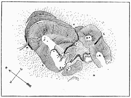
PILLAR ROCK
A, B, Summits of Shamrock; C, Shamrock gully; D, Pisgah; E, High Man;
G, Curtain; H, Steep Grass; I, Foot of Great Chimney; I, K, Walker's gully;
J, Low Man; L, J, West route; M, Waterfall; N, I, East Scree.
Harkaway! See, she's off! O'er hill and through whol
We spank till we're gaily nar done,
Than, hingan a lip like a motherless fwol,
Sledder heàmmward, but nit in a run.
ToList
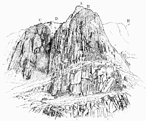
PILLAR ROCK FROM THE NORTH
A, High Man; B, Low Man; C, Shamrock; D, Walker's gully; E, Below this is the waterfall.
The terrace runs past the foot of Walker's gully to the foot of the waterfall.
[111]
ToList
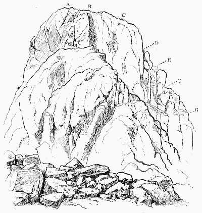
PILLAR ROCK FROM THE SOUTH
A, Top of rock and of West Jordan climb; B, Top of Central Jordan climb; C, Top
of East Jordan climb; D, G, The Curtain; E, The Notch; F, The Ledge.
The mass of rock in the foreground is Pisgah.
From Ennerdale: From Gillerthwaite, a farmhouse nearly
a mile and a half above the lake, the Pillar is not far distant;
but the direct way is exceedingly rough, and it will be found
best to make use of the path up Wingate Cove, skirting round
the mountain, when by that means a considerable height has
been gained. The way is so rough that many people think
it an economy of labour to go right on up the gap, and then
left over the summit of the mountain.
One of the best ways of approaching the Pillar is to sleep
at the little inn at the foot of the lake and row up from there
to the water head. For walking the whole way from the inn
to the fell-top Baddeley allows 3 to 3½ hours.
From Buttermere: After crossing Scarf Gap some keep
to the track as far as the summit of the Black Sail Pass, and
then turn to the right up the ridge of the Pillar Fell, while
others adopt the more laborious plan of working upwards
after descending the valley until nearly opposite the Rock,
which in this way is certainly seen to much greater advantage.
If the return be made by way of the mountain ridge,
some little time may be saved by descending into Ennerdale
down Green Cove, nearly half a mile short of Black Sail and
250 ft. higher; for Black Sail, being much nearer the head
of the valley than either Scarf Gap or the Pillar, can only be
used for going from one to the other at the expense of making
a considerable détour. For the ascent, however, Green Cove
is not so decidedly recommended, as many will prefer to
make the round by the regular pass for the sake of the more
gradual rise.
From Wastdale: The vast majority of visitors come from
this direction, and almost all follow the same track, plodding
up from Mosedale to the top of Black Sail and then turning
left along the ridge of the mountain. Mosedale, by the way,
must not be confused with any of the numerous other valleys
of the same name: it sometimes appears in the form 'Moresdale'
or 'Mossdale' (Moos-thal, near Laibach in Austria, is
exactly parallel), and generally indicates scenery of a dreary
character; for such valleys are often, as in this case, the
half-drained beds of ancient lakes, by the loss of which the
scenery has seriously suffered.
ToList
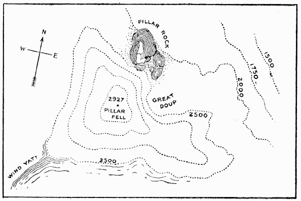
PILLAR FELL
Ladies who ascend by Black Sail will find it best to keep
to the path as long as possible, i.e. as far as the top of the
pass, but others may save something by breasting the hill on
the left soon after reaching Gatherstone Head, apparently
a glacier mound, which rises just beyond where the track
crosses the stream (Gatherstone Beck) which comes down
from the pass.
On reaching the ridge it is no doubt safer, especially if
there be mist about, for those who are not familiar with the
way to go right on to the flat top of the mountain; the proper
point from which to commence the descent is easily found,
in all weathers, by following the compass-needle from the cairn
to the edge of the mountain; a rough and steep descent of
400 ft. follows, which in winter demands considerable care. At
first the course is to the right, but it soon strikes a small ridge
which curves down to the Rock. It is, however, a waste of
labour to ascend to the summit of the mountain at all. The
ridge of the mountain is divided into steps, and at the foot
of the uppermost of these a deep cove called Great Doup is
seen on the right. It may be recognised even in a mist, as
it is just beyond a curious rock running out with a narrow
edged top many feet from the hill-side. Less than 100 yards
down the Doup the falling scree has nearly buried the cairn
and iron cross erected to the memory of the Rev. James
Jackson. Beyond this, as soon as the big rocks on the left
permit, the track skirts round, and after one or two ups and
downs comes into full view of the famous Rock. If, however,
the object be to reach the north or lowest side of the Rock,
it is not necessary to descend into Ennerdale from Black
Sail; for there is the High Level, a fine scramble all along
the breast of the mountain from Green Cove—the first large
hollow on the right, just beyond Lookingsteads; but the way
is rather intricate, and unless properly hit off involves considerable
fatigue and loss of time. At the very least half an
hour will be required in either direction, and a stranger will
certainly take much longer.
Those who are anxious to pursue 't' bainest rwoad' may
save ten minutes or more in the walk from Wastdale by
making use of Wind Gap at the head of Mosedale. Hard
work it undeniably is, but more shady than Black Sail, and—when
the way is familiar, though no one can go very far
wrong, unless he clings to the main valley too long and goes
up to Blackem (Black Combe) Head—quicker also, occupying
about ninety minutes. Mr. James Payn calls it (poetically)
'a sort of perpendicular shaft—a chimney such as no sweep
would adventure, but would use the machine—which is said
to be the dalesman's pass into Ennerdale; you may thank
your stars that it is not your pass.'
It really adds little to the labour of this way and affords
a far finer walk if the complete circuit of Mosedale be made
along the hill-tops. Ascending behind the inn and keeping
round just under Stirrup Crag—the north end of Yewbarrow,
Dore Head is soon reached, and it is easy walking by the
Chair, Red Pike, Black Crag and Wind Gap on to the
Pillar Fell.
For the return to Wastdale Wind Gap is very rough and
hardly to be recommended. Mr. Baddeley is not very consistent
about it, for he says, 'the best descent is by Windy
Gap'; but again, 'the descent from Windy Gap to Wastdale
is, for reasons stated before, unsatisfactory'; and thereupon
he recommends Black Sail. The latter gives a rapid descent—the
inn may be reached in twenty-five minutes from the
top of the pass; but a quicker return may be made by
crossing the ridge after emerging from Great Doup, and
shooting down Wistow Crags into Mosedale by a large gully
filled with deliciously fine scree.
Should it be preferred to make the circuit of Mosedale on
the return journey, an equally fine glissade may be enjoyed
from Dore Head; but the screes require judicious selection
and dexterity on the part of the slider.
ToList
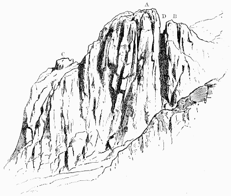
PILLAR ROCK FROM THE WEST
A, Summit of High Man; B, Pisgah; C, Low Man; D, Jordan Gap.
The West route ascends from this side to the depression between A and C.
It may here be said that stout walkers may visit all the
mountains of Wastdale Head in one day comfortably, and in
few places is a finer walk to be found. Start, say, at 10 A.M.
for Scafell; then, by Mickledoor, the Pike, Great End, Sty
Head, Great Gable and Kirkfell to the Pillar, returning in
the manner described above in time for dinner. In June
1864, as Ritson's Visitors' Book records, J.M. Elliott, of
Trin. Coll. Camb., made this round, including Steeple and
Yewbarrow, and found that it took eight and a half hours;
probably, however, he came over Stirrup Crag and not
Yewbarrow top, which would entail something like three
miles extra walking. He approached Scafell by way of
Mickledoor, returning from it to the same point, and those
who do not know the Broad Stand well had better follow
his example; for it is a bit of a climb, and the descent
especially is not easy to find. By going to Mickledoor first
(and there is no shorter way to Scafell) each man can see
what he has before him, and decide for himself whether it
would not be better to leave Scafell out of his programme.
Before entering into the history of the Pillar it is almost
indispensable to give a short general description of its main
features in order to assist the comprehension of the facts
narrated. Difficult as it must always be to find an image
which shall supply a stranger with any clear idea of a mass
so irregular and unsymmetrical as this, yet its general
appearance and the arrangement of its parts may be roughly
apprehended in the following manner:—Imagine a large
two-gabled church planted on the side of a steep hill. From
the western and loftier gable let there rise, at the end
nearest the mountain, a stunted tower. Finally let the
building be shattered and all but overwhelmed under an
avalanche of débris. What will be the effect? Naturally
the stream of stones will be much deeper above than below,
and, while nearly burying the tower and upper ends of the
roof, will flow along between the two gables and run off, as
rainwater would do, at the far end. Angular fragments,
however, remain at rest unless the slope is very steep, and
consequently a long talus will be formed sloping down to the
brink of the sudden drop at an angle of something like
45 degrees. Here we have a fair representation of the Pillar
mass: the tower will be the High Man, and the gable from
which it rises the Low Man. It will be readily understood
that the second gable may be a source of some confusion to
those who are ignorant that there is more than one, and
from some points may disguise or altogether conceal the
tower. This is why it is called the Sham Rock; but it is
only from below that it would be recognised as part of the
Pillar mass, for from above it is wholly insignificant. When
viewed from immediately below, the tower is concealed
behind the gable from which it rises, and the whole mass of
rock bears a rough resemblance to the letter M; but from
above, the High Man, with which alone the climber from
the east side has to reckon, is also the only part of the rock
which he is likely to observe. The result is that, when the
Low Man is mentioned to anyone who knows only the Easy
Way, the reply is usually on the model of the poet Wordsworth's
only joke: 'Why, my good man, till this moment
I was not even aware that there was a Low Man!' Yet the
Low Man is by far the finer object of the two, and its cliffs
are at least six times as high as those of what is called the
High Man. The only side from which the latter shows a
respectable elevation is the west, where the scree lies much
lower, because it has a free escape, instead of being pent up
between the two gables like the east scree.
In winter-time, when the inequalities are all smoothed
over with a sheet of hard snow, both sides of the rock are
rather dangerous, but especially the eastern, where a man
who slipped would have the greatest difficulty in stopping
himself before he shot over the precipitous gully at the end.
This gully (occupying, as it were, the place of the water-pipe)
is known, in allusion to an accident which occurred there in
1883, as Walker's Gully.
When the question arises of how to climb the High Man,
it is obvious that the scree just above it will be the nearest
point to the summit; but equally obvious that the climb,
though short, would be nearly vertical. The plan which at
once suggests itself for getting to the top is to work round to
the back of the rock and climb it from the top of the ridge
behind. The ridge may be reached from either side, and in
this fact we have the secret of two of the most important
climbs.
So much for the general appearance of the Pillar; but
the part which admits of the easiest and most varied attack
is the east wall of the High Man, and of this side it is
necessary to give a more detailed description. This part of
the rock is the only one which is at all well known to the
general public, and its chief features, being well marked,
have for the most part received, by common consent of
climbers, distinctive names. In order to see the formation
of the rock properly it is well worth the climber's while to
descend for a few yards and mount the Sham Rock on the
other side of the east scree. The peculiar structure of the
opposite wall may now be clearly seen.
ToList
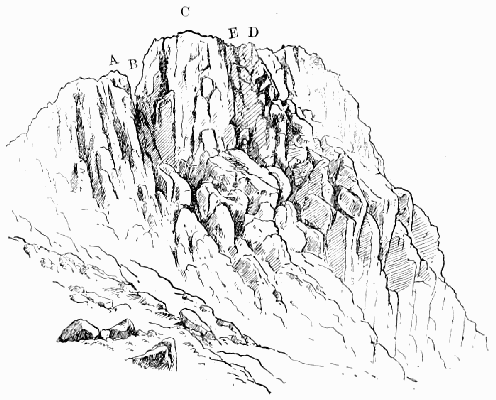
PILLAR ROCK FROM THE SOUTH-EAST
A, Pisgah; B, Jordan; C, Summit; D, Top of Curtain; E, Corner between the
Curtain and the main rock.
On our left hand, between the mountain and the rock, is
seen an outlying mass severed from the High Man by a deep
square-cut gap. When the Pillar is looked at from the
direction of the mountain-top, this gap is entirely concealed
by the outlying piece, which then appears to present a fairly
easy way direct to the summit. 'The climber (says Mr.
Williamson) mounts gaily and with confidence, only to find
himself cut off from the High Man by an impassable cleft.'
He sees it indeed with his eyes, but he cannot go up thither.
Hence the names—Pisgah for the false rock, and Jordan for
the chasm. A very well-known Pillarite once proposed to
bridge the cleft with a plank or ladder and hold a tea-party
on the top. This very original idea was not carried into
execution, but certainly, without some such application, the
passage of Jordan Gap is a formidable undertaking; for the
north wall is only less vertical than the other, and though
barely 60 ft. high—not much more, that is, than half as
much as must be climbed by any other route—this is
decidedly one of those cases in which the longer way round
will prove to be the shorter way up.
On the extreme right—and rather below us—is the nearly
level top of the Low Man; while not far from where broken
cliffs lead up to the higher rock a curious natural post standing
on the ridge marks the point from which a small deep
channel is seen to come down towards Walker's Gully.
This channel is of small importance, except that high up on
the southern bank of it the glacier markings are most distinctly
to be seen. The channel itself soon curves more
towards the north and plunges over the fearful cliff which
faces the Liza, forming the key to the great climb on that
face. From the foot of Jordan Gap a broad smooth slope of
rock runs horizontally along the face of the High Man,
giving to it somewhat the formation of the 'pent-house wall'
of a tennis court. The steepness of the scree, which runs
down from left to right before our feet, makes the drop from
this slope much greater at the Low Man end; but it will
give no false idea of this side to say that, roughly speaking,
the cliff is broken into three fairly equal portions, of about
60 ft. each, namely, a vertical wall above, connected with
a steep and rugged part below by a smooth stretch sloping
at an angle not far short of 40 degrees. The importance of
this 'pent-house' is very great; for, as it gives an easy
passage right across this face of the rock, every climb which
is possible from below may be cut into from the side, and
thus more than half the labour of the ascent is saved. Indeed,
any mountain which allows its entire front to be
traversed in this way by a passable ledge exposes every weak
point in so reckless a manner that the attack becomes marvellously
simplified.
Lastly should be noticed two rough curtains of rock which
run down from the top of the Stone near the centre, and
enclose between them what is called the Great Chimney.
This chimney is the key to the climb on this side. The curtain
on the south of it is the only one which is at all complete,
and as it forms a kind of arête running up to the
summit, it is known indifferently by either name—the
Curtain or the Arête.
The easiest way to picture to oneself the features of the
Great Chimney is to imagine a huge armchair, the 'seat' of
which measures 20 yards from back to front and is tipped
uncomfortably forward and downward at an angle of nearly
45 degrees. The Curtain forms the right 'arm,' and from a
level with the top of the 'back,' which is 50 ft. high, runs
down very nearly but not quite as far as the front edge of the
'seat.' In the narrow space thus left lies the Ledge, which
makes it possible to pass round under the end of the arm
and gain the 'seat,' which is called the Steep Grass. The
same point may also be reached by climbing, as an alternative
to the Ledge, over the lower part of the 'arm' through
a deep nick—the Notch; and in either case the joint between
'arm' and 'back,' being badly cracked, offers an easy way
(the 'small chimney' or 'jammed-stone chimney') of reaching
the top of the back, which is the edge of a small plateau
forming the summit of the High Man. Lastly, it should be
noticed that the Steep Grass can only be reached from below
by a severe climb of 70 ft.—the Great Chimney climb.
The side from which the Pillar is commonly climbed is
not that by which the summit was first attained. The first
successful attempt was made from the West, and it is doubtful
whether for a quarter of a century any other route was
known. But on the discovery of the Easy Way the older
route was forgotten, and now enjoys a reputation for difficulty
which is not deserved: it is looked upon as some little
distinction to have accomplished it. In the preface to one of
Wordsworth's poems the year 1826 is mentioned as the date
of the first ascent. This is confirmed by a comparison of
the second and third editions of Otley's 'Guide' (1825 and
1827), in the former of which the rock is declared unclimbable,
while the latter mentions the victory of 'an adventurous
shepherd.' The successful climber was not, however, a
shepherd, but a cooper, named Atkinson, and living at Croftfoot,
in Ennerdale. It is likely that his adventurous soul
may have been fired by Otley's declaration that the rock was
inaccessible. The perseverance of a friend has hunted out a
contemporary notice of the ascent in the county paper, which
remarks that, 'though the undertaking has been attempted
by thousands, it was always relinquished as hopeless.' This
proves, at all events, that even then the rock had a reputation.
Subjoined is a list of those who have followed on
Atkinson's track, so far as is known, up to 1873:
| J. Colebank (shepherd); |
| W. Tyson (shepherd), and J. Braithwaite (shepherd); |
| Lieut. Wilson, R.N.; |
| C.A.O. Baumgartner; |
| M. Beachcroft and C. Tucker. |
Summarising the various methods of ascending the rock,
we may say that the west side first yielded in 1826; the
east side probably about 1860; the south side in 1882, and
the north side in 1891. The Easy Way (as it is generally
called) on the east side was discovered in 1863 by a party
of Cambridge men led by Mr. Conybeare, and Mr. A.J.
Butler, the late editor of the Alpine Journal. Mr. Leslie
Stephen had visited the rock earlier in that year without
finding a way up it, but in 1865 he was more successful,
and wrote an account of it in Ritson's book; the account, as
usual, was first defaced and afterwards stolen. The Northeast,
or Old Wall, way was discovered by Matthew Barnes,
the Keswick guide, while with Mr. Graves, of Manchester.
The central and western climbs from Jordan were done by the
writer in 1882, as was the eastern one in 1884, the last being
scarcely justifiable under any circumstances, and especially
without a rope. The direct climb of the Great Chimney (starting
on the south wall of it) was done about the same time,
and curiously enough—for it is safe and comparatively easy—does
not appear to have been done since. The long climb
on the north face was accomplished by Messrs. Hastings,
Slingsby, and the writer in 1891. It has been described in
an illustrated article in Black and White (June 4, 1892),
and by Mr. Gwynne in the Pall Mall Budget. It should
not be touched except by experienced climbers.
Pinnacle Bield, on the east side of Glaramara, is a
rocky part of the mountain and a famous stronghold for
foxes. On the way up from Langstrath there is a very
steep bit for about 500 ft.
Pisgah.—A name given in 1882 to the outlying rock on
the south side of the Pillar Rock, from which it is severed
by an all but impassable chasm, not seen until it bars the
way. The term has in subsequent years been applied almost
generically.
Pitch: any sudden drop in the course of a rock gully, usually
caused by some large stone choking the channel and penning
back the loose stones behind it. Such a stone is then said to be
'jammed,' 'wedged,' or 'pitched,' and is sometimes called a
'chockstone' (q.v.).
Pot-holes are frequent in the Yorkshire limestone.
The rivers for considerable distances have underground
courses. At each spot where the roof of one of these tunnels
happens to fall in a 'pot-hole' is produced. They are very
numerous about Settle and Clapham. Some are of very
great depth and can only be explored with the aid of much
cordage and many lights. The explorer of pot-holes has to
face all the perils of severe rock climbing, and, moreover, to
face them for the most part in the dark. It would be hard
to imagine anything more weird than one of these darksome
journeys, rendered doubly impressive by the roar of unseen
waters and the knowledge that abrupt pitches of vast depth
are apt to occur in the course of the channel without the
slightest warning. (See Alum Pot, Dunald Mill Hole, Gaping
Gill Hole.)
Pow: a sluggish rivulet.
Professor's Chimney.—A name bestowed by Messrs.
Hopkinson on the exit most towards the left hand as one
comes up Deep Gill on Scafell. Out of this chimney, again
to the left, diverges that which leads up to the neck between
the Scafell Pillar and its Pisgah. To this latter chimney
the name is erroneously applied by many, though, indeed,
they might urge with some reason that if it comes to a
scramble for one name between two gullies the more frequented
ought to get it.
Rainsborrow Crag.—A noble rock in Kentdale, Westmorland.
It is, perhaps, most easily got at from Staveley,
but from Ambleside it is only necessary to cross the Garbourne
Pass, and the crag is at once conspicuous. It is of
the same type as Froswick and Ill Bell, but finer and more
sheer than either of them.
Rake: a word common in Derbyshire, Yorkshire, and the
Lakes, which has been much misunderstood. It usually happens
to be a scree-gully, but the fundamental idea is straightness.
Rake's Progress.—This is a natural gallery on the face
of the Mickledoor crags of Scafell. It has been best
described by Mr. Williamson, who says: 'Mickledoor may
be reached by scrambling up the steeply sloping screes which
form its Wastdale slope; but the easier and more romantic
approach is by the grassy ledge, which will be seen projecting
from the face of the Scafell precipice. This ledge or
shelf is in but few places less than four feet wide. In places
it is composed of shattered heaps of rock, which seem barely
to keep their equilibrium; but though there is a precipice of
considerable height on the left hand, the passage along the
ledge is free from risk so long as the rock wall on the right
is closely hugged. By one who watched from below the
passage along the ledge of some of the early pioneers of lake
climbing it was christened the Rake's Progress, and the
name appears apt when it is remembered that the ledge
leads from the lower limb of the Lord's Rake to the Mickledoor
Ridge.' The first published description of the Rake's
Progress is contained in a letter by the late Mr. Maitland to
one of the local papers in October 1881. He there states
that he had recently traversed it for the fifth time, but had
not previously to that occasion visited Deep Gill. Several
grand climbs start from the Progress, including North
Climb, Collier's Climb, Moss Gill, Steep Gill, and the Scafell
Pillar.
Raven Crag.—This name is generally the sign of a
hard, if not of a good, climb. One of the finest stands on
the west side of Thirlmere, near the foot, or what used to be
the foot of it before Manchester took it in hand; a second
is on the Pillar Fell just east of the rock; a third and
fourth on Brandreth and Gable, and indeed there is one on
almost every fell.
Red Pike, in Cumberland, overlooking Buttermere, is
a syenite hill, and commands a glorious view, especially
strong in lakes, but there is next to no climbing to be had on
it. The best way up it is to follow the course of Ruddy
Beck from the southernmost corner of Crummock Water,
but the rocky amphitheatre in which Bleaberry Tarn lies is
better seen if the somewhat rougher route by Sourmilkgill
and its east bank be followed.
Red Pike, also in Cumberland, is a Wastdale fell, and
lies between Yewbarrow and the Steeple. The north side of
it has abundance of small climbs, which, with the exception
of Yewbarrow, are, perhaps, more easily reached than any
others from the inn at Wastdale Head; but they are little
visited, because everyone wants to fly at the highest game
and do the climbs which are most talked about. This fell is
sometimes called Chair, from the fact of there being a
curious stone seat on it near the ridge, and not far from
Door Head.
Red Screes, in Westmorland (2,541 ft.), are very steep
in the direction of the Kirkstone (after which the pass of
that name is said to be called), falling about 1,000 ft. in a
horizontal distance of a quarter of a mile; but the ascent is
not more than an exhilarating scramble. There is a well-known
view from the top.
Rope.—Some remarks on the use of the rope as a safeguard
in climbing will be found in the Introduction.
Rossett Gill.—A rough pass just over 2,000 ft. in
height, which is the only approach from Langdale to Scafell,
Gable, and the Wastdale fells generally. On the Langdale
side you cannot go far wrong, but it is very rugged, so rugged
that Mr. Payn has caustically observed that all expeditions
in this region admit of being made by driving, by riding, or
by walking, 'except Rossett Gill, which must be done on all
fours.' On the Eskhause side the walking is perfectly easy,
but mistakes are very liable to occur. On this high ground
mists are extremely frequent, and blinding rain is abundant.
The result is that people making for Langdale are surprised
at having to mount again after the long descent to Angle
Tarn, and often end by going away to the left down Langstrath,
and find themselves to their great surprise in Borrowdale.
The only safeguard is, of course, to bear clearly in
mind that the ups and downs hereabout are considerable,
and to arm oneself with map and compass.
Saddleback (2,847 ft.) was at one time thought to be
higher than its neighbour Skiddaw. To Mrs. Radcliffe, on
the summit of the latter in 1795, the former was 'now preeminent
over Skiddaw.' 'The Beauties of England' informs
us that 'the views from the summit are exceedingly extensive,
but those immediately under the eye on the mountain
itself so tremendous and appalling that few persons have
sufficient resolution to experience the emotions which those
awful scenes inspire.' We have a very full account of an
ascent made in 1793. The narrator says: 'When we had
ascended about a mile, one of the party, on looking round,
was so astonished with the different appearance of objects in
the valley so far beneath us that he declined proceeding.
We had not gone much further till the other companion (of
the relator) was suddenly taken ill and wished to loose blood
and return.'
The great feature of the mountain is its southern front,
which is cut away to form enormous cloughs, divided by
narrow ridges. The latter are the Edges of Saddleback.
Narrow Edge (as Halls Fell top is now generally called) is
the finest and most romantic. It runs up from Threlkeld,
where there is a convenient station. The proper name of
Broad Edge is Gategill Fell. Part of Middle Tongue
straight behind the lead-mine is also very narrow. A writer
in the Penny Magazine for 1837 speaks of 'the serrated
precipices above Threlkeld,' and adds, 'One of these is called
Razor Edge.' That name, however, has now for many
years at least been used as the equivalent of Sharp Edge,
which is on the east side of the mountain and on the north
side of Scales Tarn, and at one time enjoyed a tremendous
reputation as a perilous climb.
The name of the mountain itself has been jeered at as a
post-boy's name, and romantically-minded people use the
name Blencathara, for which many Celtic etymons have
been suggested. The most usual form seems to have been
Blenkarthur, and only the more northern of the two peaks
was so called.
The quickest ascent of the mountain is from Threlkeld
up Narrow Edge, but if the return is to Keswick, it should
be made along the shoulder towards Skiddaw, and so by
Brundholme Wood.
Sail.—This word, in the opinion of Dr. Murray, the
learned editor of the new 'English Dictionary,' signifies 'a
soaring dome-shaped summit.' It occurs as a hill-name in
the Grassmoor group, near Buttermere in Cumberland; but
the characteristics required by the above definition are, to
say the least, not conspicuously evident either there or in
the other cases where this element is found in fell-country
place-names. (See Black Sail.)
St. Bees.—In Cumberland, on the west coast. Several
accidents have occurred on the cliffs here. They are of
sandstone, and incline to be rotten. The best are about
Fleswick Bay. The height is only about 200 ft. The Rev.
James Jackson—the Patriarch (q.v.)—lived at Sandwith close
by, and was fond of climbing about on these cliffs.
St. John's Vale.—A name of modern invention, which
has ousted Buresdale (q.v.). It is used in an article in the
Gentleman's Magazine for 1754, and also in 'Gray's
Journal,' which possibly misled Sir Walter Scott, whose
poem caused it to meet with general acceptance.
St. Sunday Crag, in Westmorland (sheet 19 of the Ordnance
map), is of far more importance than Helvellyn to the
views of and from Ullswater. Moreover, it has some capital
crags facing north-west, among which many a good rock-problem
may be found. They were long a favourite
scrambling-ground with Major Cundill, R.E., the inventor of
the North Climb on Scafell, and are within easy reach of
Patterdale.
Scafell (3,162 ft.) presents some fine rocks to Eskdale,
but the grandest rocks, both to look at and to climb, are
towards Mickledoor. As a climbing-ground it is perhaps
even more popular than the Pillar, especially in winter. In
consequence of this the ground has been gone over very
closely by climbers of exceptional skill, and climbing of a
somewhat desperate character has occasionally been indulged
in. This applies mainly to the west side of Mickledoor.
The other side is easier, and has long been more or less well
known.
Mr. Green says of it: 'The crags on the south-west [of
Mickledoor], though seeming frightfully to oppose all passage,
have been ascended as the readiest way to the top of Scafell,
and, amongst other adventurers, by Mr. Thomas Tyson, of
Wastdale Head, and Mr. Towers, of Toes [in Eskdale]; but
Messrs. Ottley and Birkett contented themselves by proceeding
for some distance in the direction of Eskdale, to a
deep fissure, through which they scrambled to the top of
Scafell.'
It might be thought that this 'fissure' was 'Mickledoor
Chimney,' but it is more likely that it was another and easier
gully a good way farther down.
Mr. Herman Prior's excellent 'Pedestrian Guide' (3rd
edition, p. 194) has a very clear and accurate account of it
from the pen of Mr. C.W. Dymond, who visited it about
1869, and another in Mr. C.N. Williamson's second article
in All the Year Round for November 8, 1884; and in the
local press scores of descriptions have appeared.
ToList
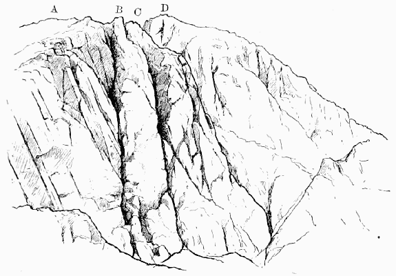
SCAFELL CRAGS
A, Top of Broad Stand; B, Pisgah; C, Scafell Pillar; D, Head of Deep Gill.
The beginning of the climb is very easily overlooked by a
stranger, being just a vertical slit about eighteen inches wide,
by means of which it is easy to walk three or four yards
straight into the mountain. It will be found by descending
the Eskdale slope from Mickledoor ridge for twenty-one
yards, and disregarding a much more promising point which
presents itself midway and is noticed both by Professor
Tyndall and Mr. Dymond. The floor of the proper 'adit'
rises slightly towards the inner end, and consequently allows
an easy exit to be made on the left-hand side. From this
point three large steps in the rock, each 7 ft. to 10 ft. high
have to be mounted, and many will be reminded of the
ascent of the Great Pyramid. What builders call the 'riser'
of each step is vertical, but the 'tread' of the two upper ones
becomes very steep and smooth, and when there is ice about
it, this is the chief danger of the climb. If a fall took place
it would probably be to the left hand, in which direction the
rock is much planed away, and forms a steep and continuous
slope almost to the foot of the Mickledoor Chimney.
ToList
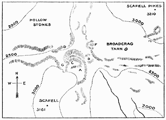
PLAN OF SCAFELL
A, Broad Stand; B, Mickledoor Ridge; C, Scafell Pillar; D, Lord's Rake;
F, Pikes Crag; G, Deep Gill.
This slope is climbable, but far from easy. At the top of
the steps the Broad Stand proper begins, at the head of
which there is one little bit to climb, and then a walk among
huge blocks of stone leads out on to the ridge of Scafell, close
to the head of Deep Gill.
The way is not easy to miss, but in descending—especially
in misty weather—mistakes are often made, either in finding
the entrance at the top or the steps at the bottom. The latter
difficulty is the more serious, but may be obviated by keeping
close to the foot of the cliff on the left hand and making
straight for Mickledoor ridge; when further progress is
barred, the exit is reached by a short descent to the right.
Scafell Pikes—the highest mountain in England
(3,210 ft.). Curiously enough the name seems to be very
modern. Till quite the end of last century it was always
known as 'The Pikes,' and it was only when careful surveys
promoted it that it became necessary to add the name of its
finer-shaped and better-known neighbour, to show what
'Pikes' were being spoken of. The present name, therefore,
and the older form, 'Pikes of Scafell,' really mean 'The
Pikes near Scafell.'
On the Eskdale side there are a few climbs, including
Doe Crag; but the best are on the side of Great End and
Lingmell, which are merely buttresses of it.
ToList
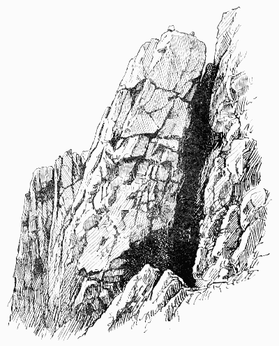
SCAFELL PILLAR (SEEN ACROSS DEEP GILL)
Scafell Pillar stands between Deep Gill and Steep Gill.
It has a short side close to the summit ridge of Scafell, and
a long side towards the Rake's Progress. The first ascent
was made on the short side by the writer on September 3,
1884, and the first from the Rake's Progress by Mr. Robinson
and the writer on the 20th of the same month.
ToList
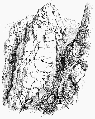
SCAFELL PILLAR AND THE UPPER PITCH OF DEEP GILL
They climbed by way of Steep Gill on to the Low Man,
and thence to the High Man. On July 15, 1888, a way was
made up the outside of the rock from near the foot of Steep
Gill by Messrs. Slingsby, Hastings, E. Hopkinson, and the
writer. Miss Corder made the first lady's ascent by the
short way (August 1887), and Miss M. Watson the first by
the outside route (June 1890), both ladies having the advantage
of Mr. Robinson's escort. Marvellous feats of climbing
and engineering have been performed by the brothers Hopkinson
in their endeavours to make a way direct into Deep
Gill, in which they have not entirely succeeded.
Scree: the débris of decaying rocks, forming a talus on the
lower parts of a mountain. It is the Icelandic 'skrida.'
Screes (The).—A long range flanking Wastwater on
the south-west. They are often called the 'Wastdale'
Screes, but it appears from Hutchinson that they were in
his time known as the 'Eskdale' Screes, and—like most
hills at that period—were said to be a mile high. Apparently
in those days they thought less of the climbs on it than of the
sheep-runs, which latter are in Eskdale. The rock is of very
loose construction and comes away at a touch, or without
one, sometimes many tons at a time; but it improves towards
the foot of the lake, and the great bastion opposite Wastdale
Hall is full of magnificent climbing. The writer, at the
suggestion of Mr. G. Musgrave, tried the great gully both
alone and in good company, namely, that of two of the party
which ultimately succeeded. Dr. Collie contributed a vivid
account of the first ascent to the Scottish Mountaineering
Journal, a publication which should be better known to
climbers. The party found no difficulty till they were in
the left-hand branch above the point where the gully divides,
and the first pitch gave them some trouble, as the stream,
being frozen, formed a cascade of ice, and they were forced
on to the buttress which divides the two gullies. Hastings
was sent on to prospect, whilst I had to back him up as far
as possible. With considerable trouble he managed to
traverse back to the left into the main gully, using infinitesimal
knobs of rock for hand and foot hold. We then
followed him, and found ourselves in a narrow cleft cut far
into the side of the hill. Perpendicular walls rose on either
side for several hundred feet; above us stretched cascade
after cascade of solid ice, always at a very steep angle, and
sometimes perpendicular. Up these we cut our way with
our axes, sometimes being helped by making the steps close
to the walls on either side, and using any small inequalities
on the rock-face to steady us in our steps. At last we came
to the final pitch. Far up above at the top, the stream
coming over an overhanging ledge on the right had
frozen into masses of insecure icicles, some being 20 ft.
to 30 ft. long. Obviously we could not climb up these.
However, at the left-hand corner at the top of the pitch a
rock was wedged, which overhung, leaving underneath a
cave of considerable size. We managed to get as far up as
the cave, in which we placed Robinson, where he hitched
himself to a jammed boulder at the back. I was placed in
a somewhat insecure position; my right foot occupied a
capacious hole cut in the bottom of the icicles, whilst my
left was far away on the other side of the gully on a small,
but obliging, shelf in the rock-face. In this interesting
attitude, like the Colossus of Rhodes, I spanned the gulf,
and was anchored both to the boulder and to Robinson as
well. Then Hastings, with considerable agility, climbed on
to my shoulders. From that exalted position he could reach
the edge of the overhanging stone underneath which Robinson
was shivering, and was thus enabled to pull himself up
on to the top. Robinson and I afterwards ascended this
formidable place by means of the moral support of the rope
alone. But I know that in my case, if that moral support
had not been capable of standing the strain produced by a
dead weight of about ten stone, I should probably have been
spoiling a patch of snow several hundreds of feet lower down
the gill. Above this pitch the climbing is easier as the gully
opens out.'
ToList
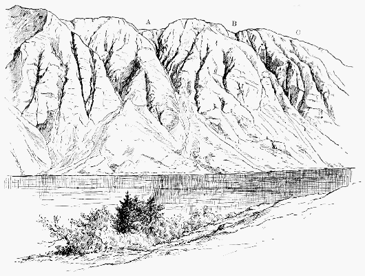
WASTWATER AND THE SCREES
A, A long gully, not very difficult; B, The great gully, extremely difficult; C, A minor gully, also very difficult.
Sergeant Crag.—About half a mile up the valley of
Longstrath, which bounds Glaramara on the east as Borrowdale
does on the west, there is a line of crag on the left
hand. The part nearest to Eagle Crag is called Sergeant
Crag, and is some 300 ft. higher than the other, which is
Bull Crag.
In these rocks there is a very fine gully, discovered in
1886 by Mr. Robinson and the writer, for whom a high wet
slab of smooth slate proved too difficult. In September last
the former returned to the attack accompanied by Mr. O.G.
Jones, who, taking a different and to all appearance more
difficult way to the right, forced his way over the two stones
which form the pitch. His companion followed by working
out of the gill to the right and in again above the obstacle,
and this way has commended itself to later climbers.
'There are six large pitches and several small ones. The
total climb must be 500 ft., and the climbing is of exceptional
interest all the way.'
Shamrock, in Cumberland, stands just east of the
Pillar Rock, divided from it only by Walker's Gully.
Seen from Scarf Gap it looks very well, and its outline
can with difficulty be distinguished from that of the main
rock. It derives its name (bestowed on it about 1882) from
this deceptive character. The face of it towards the north
affords a good climb, and on the east side there is a gully,
which is choked near the top by a block, which makes one
of the stiffest pitches in all Cumberland. It was first climbed,
with the aid of deep snow, by a party led by Messrs. Hastings
and E. Haskett Smith in March 1887, and in December 1890
Mr. Hastings succeeded in repeating his ascent without any
snowdrift to help him, as did Dr. Collier exactly two years
later.
Sharp Edge, on Saddleback, runs along the north side of
Scales Tarn. Mr. Prior's 'Guide' observes: 'The ascent
(or descent) by this Edge is considered something of an
exploit, but without sufficient reason. To a giddy head, indeed,
it is unquestionably several degrees worse than Striding
Edge, which it somewhat resembles; possibly, to a head so
constituted, just without the limits of safety, as Striding
Edge is decidedly well within them. The main difficulty lies
in the descent of the cliff above the "Edge," and in the two
or three rocky knolls by which this cliff connects itself with
the latter, and from which there is an unpleasant drop on
each side.... Excepting head, however, no other quality
of a cragsman is required for Sharp Edge; the footing is
ample, and the hands would be less called into requisition
than even on Striding Edge.'
This is a very just estimate, but it need hardly be said
that not only Sharp Edge but also those on the Threlkeld
side undergo marvellous changes in winter, and then give
splendid chances of real mountaineering practice.
Shuttenoer is mentioned by more than one of the old
authorities as one of the rocks at Lowdore between which
the water falls. My belief is that the intelligent travellers
of that date, not having mastered the 'Cummerlan' mak o'
toak,' mistook for the name of the rock what was merely
intended for a casual description of it, namely, 'Shuttan'
ower'—'shooting over,' 'projecting.'
Sike: a rill in marshy ground.
Silver Howe (1,345 ft.), near Grasmere, is only notable
as being the scene of the annual fell race, or 'Guides' race,'
as it is sometimes called, though there are few guides, and
of them very few would have any chance of success in this
race. The course is uphill to a flag and down again. The
time is generally about ten minutes to go up and something
less than five minutes to come down. It is a pretty race to
watch, but the scientific interest for mountaineers would be
increased if the course were free from all obstacles and of
accurately measured height and length.
Skew Gill.—A curious deep channel in the Wastdale
side of Great End, giving a convenient approach to the foot of
the gullies on the other side. To go by Grainy Gill and this
one, and so up Cust's Gully, has for many years been the
regulation expedition for the first day of a winter sojourn at
Wastdale Head.
Skiddaw (Cumberland, sh. 56) is 3,058 ft. high, 'with
two heads like unto Parnassus,' as old Camden observed,
and Wordsworth and others have repeated it after him.
On this characteristic, which is not very strongly marked,
many derivations of the name have been based. In older
writings, however, the word much more commonly ends in
-ow, a termination which in countless instances represents
the well-known word 'how.' Whatever its name may
signify, Skiddaw is not a mountaineer's mountain, and no
amount of snow and ice can make it so. As a local bard has
truly sung:
Laal brag it is for any man
To clim oop Skidder side;
Auld wives and barns on Jackasses
To tippy twop ma ride.
It is true that there are great facilities for procuring gingerbeer
on the way, but even that luxury is scarcely an adequate
compensation for the complete absence of anything like a
respectable rock on the mountain. Keswick has Skiddaw
almost entirely to itself, and on the matter of routes it will
be enough to say that by the back of Latrigg and the
gingerbeer shanties is the easiest way, and by Millbeck and
Carlside is the shortest and quickest, being made up of two
miles of good road and of two of steep fell as against five
miles of easy hillside.
The mountain used to enjoy a great reputation, and is put
first in Camden's 'Byword':
Skiddaw, Lauvellin and Casticand
Are the highest hills in all England,
and the early climbers of it were deeply impressed with the
importance of their adventurous undertaking.
Mrs. Radcliffe, in 1795, ascended 'this tremendous mountain,'
and says that when they were still more than a mile
from the summit 'the air now became very thin,' and 'the
way was indeed dreadfully sublime.' On reaching the top
they 'stood on a pinnacle commanding the whole dome of
the sky,' but unluckily 'the German Ocean was so far off as
to be discernible only like a mist.'
Even Hutchinson remarks that, on the top, 'the air was
remarkably sharp and thin compared with that of the valley,
and respiration seemed to be performed with a kind of
oppression.'
Skiddaw reserves what little natural ferocity it has for
Dead Crags on the north side, but there are also a few rocky
bits on the side which faces Bassenthwaite Water.
Smoking Rock is at the head of Great Doup, east
of the Pillar Stone and level with the ridge of the Pillar
Fell. For fear of the name being adduced as a proof of
recent volcanic action it is well to say that it is so called not
as itself smoking, but because a well-known climber of the
old school loved to smoke an evening pipe upon it.
It affords a pleasant climb taken on the outside straight
up from the foot. This was done by a party of four, of
whom the writer was one, on June 5, 1889. See a note in
the Wastdale Head Visitors' Book at p. 250.
Somersetshire has little to attract the mountaineer,
except the very remarkable limestone scenery on the south
side of the Mendips at Cheddar, Ebber and Wookey. There
are magnificent cliffs and pinnacles, especially at the first-named
place, but not many bits of satisfactory climbing.
The cliffs are rotten at one point, unclimbably vertical at
another, and perhaps at a third the climber is pestered by
clouds of angry jackdaws. Ebber Rocks are rather more
broken, but on the whole the climbing is not worth much at
either place, though the scenery both above ground and
below it is such as no one ought to miss.
Stand.—See under Broad Stand.
Steep Gill.—On Scafell, forming the boundary of the
Scafell Pillar on the Mickledoor side. It contains a very
striking vertical chimney more than 50 ft. high, the upper
part of which is rather a tight fit for any but the slimmest
figures. At the foot of this chimney on the right-hand side
there is an exit by which either the ridge of the Scafell Pillar
can be reached or the chimney circumvented. The Gill
becomes very wet and steep just below the top, and extreme
care is necessary in following it out on to the neck between
Scafell Pillar and the mountain. Except in dry weather this
bit may be considered a little dangerous. It is usual and
more interesting to work out here by a grass ledge on the
right on to the Low Man. The Gill was discovered by the
writer, and first climbed by him and Mr. Robinson in September
1884. A note by the former in the Visitors' Book
at Wastdale Head describes it as 'a chimney of unusual
steepness and severity.' The name is quite recent.
Steeple.—In Cumberland, separated from Pillar Fell
by Wind Gap. There are some grand scrambles on the
Ennerdale side of it, and it is extremely interesting to the
student of mountain structure to note the points of parallelism
between this group and that of Scafell, Wind Gap, of
course, representing Mickledoor.
Stirrup Crag, on the north end of Yewbarrow, is
probably the very nearest climb to Wastdale Head, and may
therefore be useful in cases when a wet day clears up towards
evening and exercise within easy reach is required. The
quickest way to it is to cross the beck by the bridge behind
the inn and go up the hill straight to the rectangular clump
of larches, and then on beyond it in the same direction.
There is a nice little climb on an isolated bit of rock, noted
by Mr. Robinson in the Wastdale book, at Easter in 1888.
The little rock should be crossed from north to south and
the same course continued up to the open fell above, after
which a short descent towards Door Head, keeping rather to
the left hand, will bring to light several small but pretty
rock-problems.
Striding Edge, a ridge on the east side of Helvellyn,
is called in one of the old maps Strathon Edge. The difficulties
of it have been absurdly exaggerated. Miss Braddon
wrote amusingly about the exploits upon it of a certain gallant
colonel, identified by Colonel Barrow with himself. In
winter it is sometimes an exciting approach to Helvellyn, in
summer just a pleasant walk. The idea of its danger probably
arose from the celebrity given to the death of Charles
Gough by the poems of Scott and Wordsworth.
Sty Head.—This name applies to the top only of the
pass from Borrowdale to Wastdale, though often incorrectly
used to designate the whole way from Seathwaite to Wastdale
Head. The natives always speak of the whole pass as
The Sty or The Stee. Hutchinson says, and the statement
has been repeated by Lord Macaulay, that this was at one
time the only road between Keswick and the West Coast.
It has lately been proposed to construct a driving road across
it, but the project is not likely to be carried out for some
time. The way is not easy to find on a really dark night.
Some years ago two tourists who had been benighted on the
pass wrote a most amusing account of their experiences in
the Graphic, and it is only a year or two since two well-known
Cumberland climbers were caught in the same ignominious fashion.
Swarthbeck, in Westmorland, and on the east shore of
Ullswater and the west slope of Arthur's Pike, would appear
to be identical with the 'chasm' noticed by Mr. Radcliffe in
1795. 'Among the boldest fells that breast the lake on the
left shore are Holling Fell and Swarth Fell, now no longer
boasting any part of the forest of Martindale, but showing
huge walls of naked rock and scars which many torrents
have inflicted. One channel only in this dry season retained
its shining stream. The chasm was dreadful, parting the
mountain from the summit to the base.' It occurred to
Messrs. T. and E. Westmorland, of Penrith, to explore it,
and they found it to be a capital little climb. They published
a bright and vigorous account of their climb in a Penrith
paper, in consequence of which a good sprinkling of climbers
have been induced to visit it. The writer has cause to
remember the steepness of this gill, for on one occasion, just
as the last few feet of the climb were being done, the alpenstocks,
which had been a great impediment all the way up,
slipped and fell, and were afterwards found on the scree at
the very bottom. The steamers stop at Howtown, about a
mile further up the lake, and the inn at that place is much
the most convenient place to start from.
Tarn Crag (Cumberland, sh. 57) is a precipitous bit of
not very sound rock, perhaps 200 to 300 ft. in height, rising
on the south-west side of Bowscale Tarn. There is a better-known
crag of this name just by Scales Tarn on Saddleback,
and, in fact, they are exceedingly numerous, which is
natural enough, seeing that it is essential to every genuine
tarn that it should be more or less under a precipice of
some sort.
Toe-scrape.—May be defined as 'foot-hold at or below
its minimum.'
Tors, on Dartmoor (q.v.).—The word is also found in
Derbyshire, though not there applied to quite the same kind
of rock. The Ordnance also give it in some instances in
the North of England; but there it is by no means clear that
they have taken pains to distinguish it from the sound of the
word 'haw' when there is a final t in the preceding word.
What, for instance, they call Hen Tor may be in reality
Hent Haw. In Scotland tor is, of course, a common component
in place names.
A few of the more interesting tors are—
Belliver Tor.—Turn squarely to the right two miles from
Two Bridges on the Moreton Hampstead Road.
Blackingstone Rock.—A true tor, though not on Dartmoor.
It is a fine piece of rock two miles east of
Moreton Hampstead. It is of loaf-like form, and gave
a difficult climb until a staircase of solid and obtrusive
construction was put there.
Brent Tor.—A curious cone of volcanic rock a long mile
south-west of Brentor Station, and fully four miles
north of Tavistock.
Fur Tor.—About six miles in a northerly direction from
Merivale Bridge, Two Bridges, or Princetown.
Hey Tor.—Four miles west of Bovey Tracy; was quite
a nice climb, but has been spoilt by artificial aids.
ToList
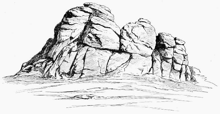
A TYPICAL TOR (HEY TOR, DARTMOOR)
Links (Great) Tor.—About two miles east of Bridestow
station.
Longaford Tor.—Strike off to the left about halfway
between Two Bridges and Post Bridge.
Mis Tor (Great and Little).—Two miles north from
Merivale Bridge. They are fine objects, especially the
larger.
Row Tor.—On the West Dart some four miles north of
Two Bridges. It has a very striking block of granite
on it.
Sheep's Tor.—About two miles east of Dousland Station.
It is finely shaped.
Shellstone Tor.—Near Throwleigh, about halfway between
Chagford and Oakhampton.
Staple Tor.—Under a mile north-west from Merivale
Bridge, and four miles east of Tavistock.
Vixen Tor.—One mile from Merivale Bridge, or four
miles north from Dousland Station. It is near the
Walkham River, and is almost the only tor which has
a distinct reputation as a climb. It is got at by means
of the cleft shown in the illustration. Here it is usual
to 'back up.' The struggles of generations of climbers
are said to have communicated a high polish to the
surface of the cleft.
Watern Tor.—Five or six miles west of Chagford, on the
left bank of the North Teign. It has three towers of
friable granite much weathered.
Yar Tor.—Halfway between Two Bridges and Buckland-in-the-Moor;
it has a curiously fortified appearance.
Vixen Tor.—One of the finest of the Devonshire
Tors (q.v.).
ToList
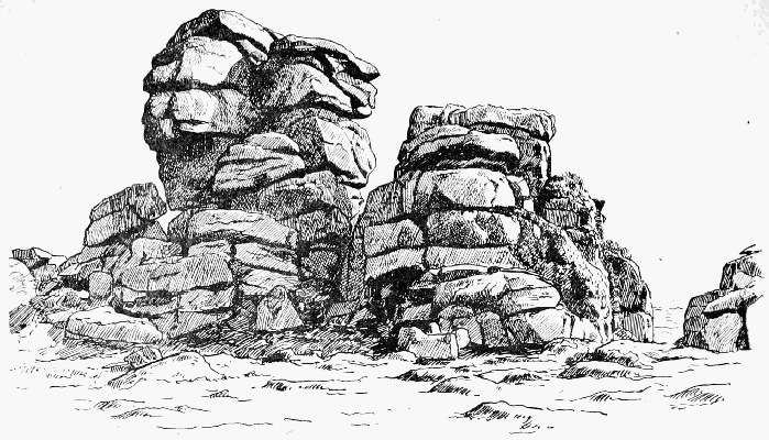
VIXEN TOR (DARTMOOR)
Walker's Gully is the precipice in which ends the
East Scree, between the Pillar Rock and the Shamrock.
It is named after an unfortunate youth of seventeen who
was killed by falling over it on Good Friday, 1883. He had
reached the rock with four companions, and found there two
climbers from Bolton, who had been trying for nearly three
hours to find a way up, and were apparently then standing
in or near Jordan Gap. Seeing Walker, they shouted to him
for advice as to the ascent. He thereupon endeavoured to
join them by sliding down on the snow; but he had miscalculated
the pace, and when he reached the rock at which
he had aimed, it was only to find that his impetus was too
powerful to be arrested. He shot off to one side, rolled over
once or twice, and then darted away down the steep East
Scree, passing the Bolton men, who could not see him owing
to that position, and disappeared over the precipice.
Wallow Crag, a long mile south of Keswick, is abrupt
but not high, and somewhat incumbered by trees. It contains
Lady's Rake, and Falcon Crag is really a continuation
of it. Both are too near Keswick to please climbers, who do
not enjoy having their every movement watched by waggon-loads
of excursionists.
Wanthwaite Crags (Cumberland, sh. 64) rise on the
east side of the stream which flows, or used to flow, from
Thirlmere. There is good climbing in them, and they are
easily reached from Keswick (1 hour), or Grasmere, taking the
Keswick coach as far as the foot of Thirlmere; and Threlkeld
station is nearer still (half an hour). The rocky part has a
height of 600 to 700 ft. Bram Crag, just a little south, is
really part of it.
Wastdale.—There are two valleys of this name, one
near Shap in Westmorland, and the other and more famous
in Cumberland, at the head of Wastwater. It is the Chamouni
of England, and would be the Zermatt also, only it
lacks the charm of a railway. Fine climbs abound among
the various fells which hem it closely in. (See under the
heads of Scafell, Lingmell, Great Gable, Pillar, Yewbarrow,
Steeple, Red Pike, and Great End.) A well-filled 'Climbing
book' is kept at the inn, where also are some fine rock-views
and a very complete set of large-scale maps. Men
with luggage must drive up from Drigg Station; those who
have none can walk over Burnmoor from Boot Station in
one hour and a half or less.
Westmorland, as a climber's county, is second only to
Cumberland. Langdale is perhaps the pick of it, but about
Patterdale, Mardale, and Kentdale abundant work may be
found, and there are few parts of the whole county which
have not small local climbs of good quality set in the midst
of charming scenery. Defoe's account of it is extremely
amusing:
'I now entered Westmorland, a county eminent only for
being the wildest, most barren, and frightful of any that I
have passed over in England or in Wales. The west side,
which borders on Cumberland, is indeed bounded by a chain
of almost unpassable Mountains, which in the language of
the country are called Fells.... It must be owned,
however, that here are some very pleasant manufacturing
towns.'
The notion of lake scenery being rendered tolerable by
manufacturing towns is one which may be recommended to
the Defence Society; but Mr. Defoe has not done yet:
'When we entered at the South Part of this County, I
began indeed to think of the mountains of Snowden in North
Wales, seeing nothing round me in many places but unpassable
Hills whose tops covered with snow seemed to tell us
all the pleasant part of England was at an end.'
Westmorland's Cairn is a conspicuous object at the
edge nearest to Wastwater of the summit plateau of Great
Gable. There is a wide-spread impression that this cairn,
which is built in a style which would do credit to a professional
'waller,' was intended to celebrate a climb; but
Messrs. T. and E. Westmorland, of Penrith, who built it in
July 1876, wished to mark a point from which they 'fearlessly
assert that the detail view far surpasses any view from
Scafell Pikes, Helvellyn, or Skiddaw, or even of the whole
Lake District.' At the same time the short cliff on the edge
of which the cairn stands is full of neat 'problems,' and it is
customary to pay it a visit on the way to Gable Top after a
climb on the Napes.
Wetherlam, in Lancashire, is about 2,500 ft., and has
some crags on the north side among which here and there
good climbing may be found. They can be reached in about
an hour and a half from either Coniston or the inn at Skelwith
Bridge. In an article signed 'H.A.G.' (i.e. Gwynne),
which appeared in the Pall Mall Gazette in April 1892, the
following description of a part of it is given: 'On the west
face there is a bold cliff that stands between two steep
gullies. The cliff itself can be climbed, and in winter either
of the gullies would afford a good hour's hard step-cutting.
Just now, after the late snowstorm, the mountaineer would
have the excitement of cutting through a snow-cornice when
he arrives at the top. The precipice itself is fairly easy. I
happened to find it in very bad condition. All the rocks
were sheeted with ice and extremely dangerous. In one
part there was a narrow, steep gully ending in a fall. It
was full of snow and looked solid. I had scarcely put my
foot on it when the snow slipped away with a hiss and left
me grabbing at a knob of iced rock that luckily was small
enough for my grasp. This climb, however, in ordinary
weather is by no means difficult.'
Whernside, in Yorkshire, was considered even as late
as 1770 to be the highest mountain in England, 4,050 ft.
above the sea.
White Gill, in Langdale, Westmorland, nearly at the
back of the inn at Millbeck, derives its chief interest from
the loss of the two Greens there, so graphically described by
De Quincey.
This and the other gills between it and Stickle Tarn afford
good climbing up the walls by which they are enclosed.
Winter Climbs.—Only a few years ago a man who
announced that he was going to the Lakes in the depth of
winter would have been thought mad. Exclamations of this
kind are even now not unfrequently called forth at that
season of the year; yet they seem to have little or no effect
in diminishing the number of those who year by year find
themselves somehow attracted to the little inns which lie at
the foot of Snowdon or of Scafell Pikes.
On Swiss mountains winter excursions have been made
even by ladies, and perhaps the British public was first
rendered familiar with the idea by Mrs. Burnaby's book on
the subject. But, in truth, the invention is no new one, and
those bold innovators who first dared to break through the
pale of custom and to visit North Wales or the Lakes in mid-winter
were richly repaid for their audacity; for there is
hardly any time of year at which a trip to Lakeland is more
thoroughly enjoyable.
In the first place, there is no crowd. You can be sure
that you will get a bed, and that the people of the house will
not be, as they too often are in the summer time, too much
overworked to have time to make you comfortable, or too
full of custom to care much whether you are comfortable or
not. Out of doors there is the same delightful difference.
You stride cheerily along, freed for a time from the din of
toiling cities, and are not harassed at every turn by howling
herds of unappreciative 'trippers.' The few who do meet
on the mountains are all bent on the same errand and 'mean
business'; half-hearted folk who have not quite made up
their minds whether they care for the mountains or not,
people who come to the Lakes for fashion's sake, or just to
be able to say that they have been there, are snugly at home
coddling themselves before the fire. You will have no companions
but life-long lovers of the mountains, and robust
young fellows whose highest ambition is to gain admission
to the Alpine Club, or, having gained it, to learn to wield
with some appearance of dexterity the ponderous ice-axes
which are indispensable to the dignity of their position.
Then what views are to be had through the clear, frosty air!
How different are the firm outlines of those distant peaks
from the hazy indistinctness which usually falls to the lot of
the summer tourist! What sensation is more delightful than
that of tramping along while the crisp snow crunches under
foot, and gazing upward at the lean black crags standing
boldly out from the long smooth slopes of dazzling white!
There is no great variety of colour; for the rocks, though a
few are reddish, are for the most part of grey in varying
shades; yet there is no monotony.
It is true that January days have one fault; they are too
short. Or shall we not rather say that they seem so because—like
youth, like life itself—they are delightful? They would
not be too short if they were passed (let us say) in breaking
stones by the roadside. After all, the hills hereabouts are
not so big but that in eight or nine hours of brisk exertion
a very satisfactory day's work can be accomplished. In short,
youth and strength (and no one can be said to have left these
behind who can still derive enjoyment from a winter's day
on the Fells) can hardly find a more delightful way of spending
a week of fine frosty weather.
Wrynose.—The pass between Dunnerdale and Little
Langdale, and the meeting-point of the three counties of
Cumberland, Westmorland, and Lancashire.
It would seem that we are poorer than our ancestors by
one mountain, for all the old authorities speak of this as a
stupendous peak. Defoe's Tour (1753) says: 'Wrynose, one
of its highest Hills, is remarkable for its three Shire Stones,
a Foot Distance each.' The name properly understood would
have put them right. The natives pronounce it 'raynus,'
and I have not the least doubt that it represents 'Raven's
Hause.' Indeed, in early charters the form 'Wreneshals' is
actually found, and the intermediate form 'Wrenose' is found
in a sixteenth-century map.
Yewbarrow (2,058 ft.; Cumberland sh. 74) is a narrow
ridge a couple of miles long, which, seen end-on from
the shore of Wastwater, has all the appearance of a sharp
peak. There is climbing at the north end about Door Head
and Stirrup Crag, while towards the south end there are
two very interesting square-cut 'doors' in the summit ridge,
apparently due to 'intrusive dykes,' and beyond them the
little climb called Bell Rib End.
Yorkshire (see Attermire, Calf, Craven, Gordale,
Ingleborough, Malham, Micklefell, Penyghent, Pot-holes,
Whernside)—a county whose uplands fall naturally into three
great divisions, only one of which, however, demands the
attention of the mountaineer. The chalk Wolds in the East
Riding, and the moorland group formed by the Hambleton
and Cleveland Hills, may be dismissed here with a mere mention.
The third division, which constitutes a portion of the
Pennine Chain, and, entering the county from Westmorland
and Durham on the north, stretches in an unbroken
line down its western border to Derbyshire on the south,
approaches more nearly to the mountain standard. Even in
this division, however, only that portion which lies to the
north of Skipton attains to any considerable importance. It
is in this latter district—in Craven, that is, and in the valleys
of the Yore, the Swale, and the Tees—that we must look for
the finest hill scenery in Yorkshire. Most of these mountains
consist of limestone, capped in many cases by millstone
grit, and of such summits some twenty-five or thirty
rise to a height of 2,000 ft. Very few of them, however,
exhibit individuality of outline, and, with the exception of
the low lines of limestone precipice which occasionally girdle
them, and of the wasting mill-stone bluffs which, as in the
case of Pen-hill or Ingleborough, sometimes guard their
highest slopes, they are altogether innocent of crag. If any
climbing is to be found at all, it will probably be among the
numerous 'pot-holes,' or on the limestone 'scars,' such as
Attermire or Gordale, which mark the line of the Craven
Fault. The Howgill Fells, north of Sedburgh, form an
exception to the above remarks. (See Calf.)
Although the climber may find little opportunity to
exercise his art among the Yorkshire mountains, yet the
ordinary hill-lover will discover ample recompense for the
time spent in an exploration of these hills and dales. The
ascent of Micklefell, of Great Whernside, of Penyghent, or
of Ingleborough, whilst not lacking altogether the excitement
of mountain climbing, will introduce him to many
scenes of novel character and of astonishing beauty. It is
only fair to mention that the Yorkshire waterfalls are second
to few in the kingdom.
It is necessary to add a word or two with regard to the
coast. The rapidly wasting cliffs to the south of Flamborough
are too insignificant for further notice. Flamborough
Head, where the chalk attains to a height of 436 ft., is
noticed elsewhere. (See Chalk.) The line of coast from
Flamborough to Saltburn, passing Filey, Scarborough, and
Whitby, presents an almost unbroken stretch of cliff, which,
however, will find greater favour with the landscape-lover
than the climber. These cliffs, which consist chiefly of the
oolite and lias series, are throughout crumbling and insecure,
and are very frequently composed of little more than clay
and shale. Rockcliff, or Boulby Cliff, however, near Staithes,
merits a certain amount of attention. In addition to not a
little boldness of outline, it enjoys—or, at any rate, enjoyed—the
reputation of being the highest cliff (660 ft.) on the
English coast.
PRINTED BY
SPOTTISWOODE AND CO., NEW-STREET SQUARE
LONDON