Progress of
discovery.
There was a struggling effort of the geographical sense of the
world for thirty years and more after the death of Columbus, before
the fact began to be grasped that a great continent was interposed
as a substantial and independent barrier in the
track to India. It took nearly a half century more before men generally
recognized that fact, and then in most cases it was accepted with
the reservation of a possible Asiatic connection at the extreme north.
It was something more than two hundred and twenty years from the
death of Columbus before that severance at the north was incontestably
established by the voyage of Bering, and a hundred and thirty years
longer before at last the contour of the northern coast of the continent
was established by the proof of the long-sought northwest passage
in 1850. We must now, to complete the story of the influence
of Columbus, rehearse somewhat concisely the narrative of this progressive
outcome of that wonderful voyage of 1492. The spirit of
western discovery, which Columbus imparted, was of long continuance.
The influence
of Ptolemy
and his
career.
"If we wish to make ourselves thoroughly acquainted," says Dr.
Kohl, "with the history of discovery in the New World, we must not
only follow the navigators on their ships, but we must look into the
cabinets of princes and into the counting-houses of merchants, and
likewise watch the scholars in their speculative studies."
There was no rallying point for the scholar of cosmography
in those early days of discovery like the text and influence
of Ptolemy.
We know little of this ancient geographer beyond the fact of his
living in the early portion of the second century, and mainly at Alexandria,
the fittest home of a geographer at that time, since this Egyptian
city was peerless for commerce and learning. Here he could do
best what he advises all geographers to do, consult the journals of
travelers, and get information of eclipses, as the same phenomena were
observed at different places; such, for instance, as that of the moon
noted at Arbela in the fifth, and seen at Carthage in the second hour.
Portolanos.
The precision of Ptolemy was covered out of sight by graphic
fancies among the cosmographers of succeeding ages, till about the beginning
of the fourteenth century Italy and the western Mediterranean
islands began to produce those atlases of sea-charts, which have
come down to us under the name of "portolanos;" and still
later a new impetus was given to geographical study by the
manuscripts of Ptolemy, with his maps, which began to be common in
western Europe in the beginning of the fifteenth century, largely
through the influence of communications with the Byzantine peoples.
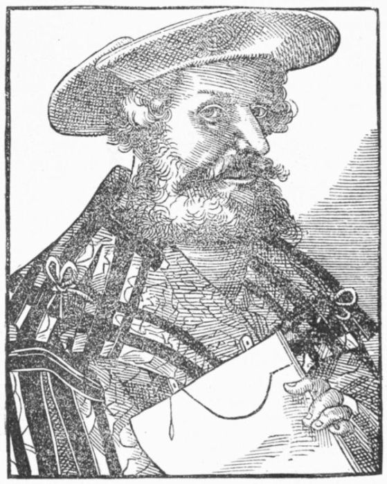 PTOLEMY.
[From Reusner's Icones.]
The portolanos, however, never lost their importance. Nordenskiöld
says that, from the great number of them still extant in Italy, we may
deduce that they had a greater circulation during the sixteenth century
than printed cartographical works. About five hundred of these
sea-charts are known in Italian libraries, and the greater proportion of
them are of Italian origin.
Latin text of
Ptolemy.
The Donis
maps.
It is a composite Latin text, brought into final shape by Jacobus
Angelus not far from 1400-1410, which was the basis of the early
printed editions of Ptolemy. This version was for a while circulated in
manuscript, sometimes with copies of the maps of the Old World having
a Latinized nomenclature; and the public libraries of Europe contain
here and there specimens of these early copies, one of which it is
thought was known to Pierre d'Ailly. It is a question if Angelus
supplied the maps which accompanied these early manuscripts, and
which got into the Bologna edition of 1462 (wrongly dated for 1472),
and into the metrical version of Berlingièri. These maps, whether
always the same in the early manuscripts or not, were later superseded
by a new set of maps made by a German cartographer, Nicolaus Donis,
which he added to a revision of Angelus's Latin text.
These later maps were close copies of the original Greek
maps, and were accompanied by others of a similar workmanship,
which represented better knowledge than the Greeks had. In 1478
these Donis maps were first engraved on copper, and were
used in the later editions of 1490, and slightly corrected
in those of 1507 and 1508. The engravers were Schweinheim and
Buckinck, and their work, following copies of it in the edition of
1490, has been admirably reproduced in The Facsimile Atlas of
Nordenskiöld (Stockholm, 1889).
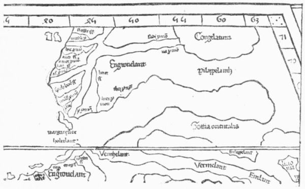 DONIS, 1482.
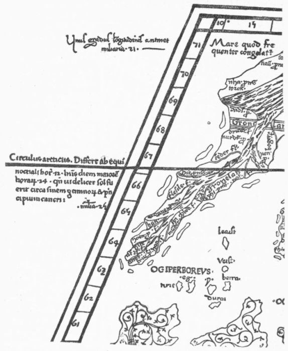
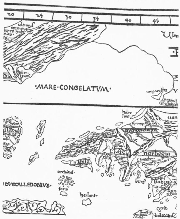
Greenland
in maps.
Meanwhile, editions of the text of Angelus had been issued at
Ulm in 1482, and giving additions in 1486, with woodcut maps, the
same in both issues on a different projection, assigned to Dominus
Nicolaus Germanus, who had, according to Nordenskiöld, completed
the manuscript fifteen years earlier. It is significant, perhaps, of the
slowness with which the bruit of Portuguese discoveries to the south
had traveled that there is in the maps of Africa no extension of
Ptolemy's knowledge. But if they are deficient in the south, they are
remarkable in the north for showing the coming America
in a delineation of Greenland, which, as we have already
pointed out, was no new object in the manuscript portolanos, even as
far back as the early part of the same century.
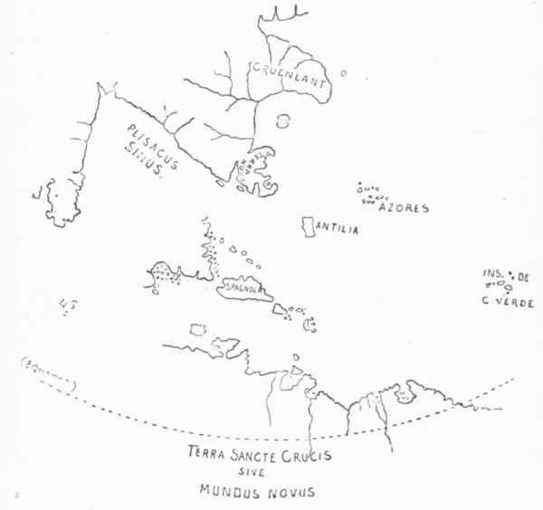 RUYSCH, 1508.
Two years after the death of Columbus, we find in the edition of
1508, and sometimes in the edition of 1507,—there is no difference
between the two issues except in the title-page,—the first engraved
map which has particular reference to the new geographical developments
of the age.
1507-8. The
Ruysch
map.
This Ruysch map shows the African coast discoveries of the Portuguese,
with the discoveries of Marco Polo towards the east. In connection
with the latter, the same material which Behaim
had used in his globe seems to have been equally accessible
to Ruysch. The latter's map has a legend on the sea between
Iceland and Greenland, saying that an island situated there
was burnt up in 1456. This statement has been connected by some
with another contained in the Sagas, that from an island in this channel
both Greenland and Iceland could be seen.
We also learn from another legend that Portuguese vessels had
pushed down the South American coast to 50° south latitude, and the
historians of these early voyages have been unable to say who the
pioneers were who have left us so early a description of Brazil.
Columbus
and the
Ruysch
map.
It is inferred from a reference of Beneventanus, in his Ptolemy,
respecting this map, that some aid had been derived from a map made
by one of the Columbuses, and a statement that Bartholomew Columbus,
in Rome in 1505, gave a map of the new discoveries to a canon of
San Giovanni di Laterano has been thought to refer to such a map,
which would, if it could be established, closely connect the
Ruysch map with Columbus. It is also supposed to have
some relation to Cabot, since a voyage which Ruysch made
to the new regions westward from England may have been, and probably
was, with that navigator. In this case, the reference to that part
of the coast of Asia which the English discovered may record Ruysch's
personal experiences. If these things can be considered as reasonably
established, it gives great interest to this map of Ruysch, and connects
Columbus not only with the earliest manuscript map, La Cosa of 1500,
but also with the earliest engraved map of the New World, as Ruysch's
map was.
Sources of
the Ruysch
map.
In speaking of the Ruysch map, Henry Stevens thinks that the
cartographer laid down the central archipelago of America from the
printed letter of Columbus, because it was the only account in print
in 1507; but why restrict the sources of information to
those in print, when La Cosa's map might have been copied,
or the material which La Cosa employed might have been
used by others, and when the Cantino map is a familiar copy of Portuguese
originals, all of which might well have been known in the
varied circles with which Ruysch is seen by his map to have been
familiar?
Portuguese
geography
and maps.
While it is a fact that central and northern Europe got its cartographical
knowledge of the New World almost wholly from Portugal,
owing, perhaps, to the exertions of Spain to preserve their
explorers' secrets, we do not, at the same time, find a single
engraved Portuguese map of the early years of this period
of discovery.
Portuguese
portolano.
Pedro
Reinel.
A large map, to show the Portuguese discoveries during years then
recent, was probably made for King Emanuel, and it has
come down to us, being preserved now at Munich. This
chart wholly omits the Spanish work of exploration, and records only
the coasts coursed by Cabral in the south, and by the Cortereals in the
north. We have a further and similar record in the chart of Pedro
Reinel, which could not have been made far from the same
time, and which introduces to us the same prominent cape
which in La Cosa's map had been called the English cape as "Cavo
Razo," a name preserved to us to-day in the Cape Race of Newfoundland.
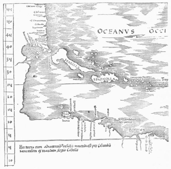 THE SO-CALLED ADMIRAL'S MAP.
Spain and
Portugal
conceal
their geographical
secrets.
There is abundant evidence of the non-communicative policy of
Spain. This secretiveness was understood at the time Robert Thorne,
in 1527, complained, as well as Sir Humphrey Gilbert in his
Discoverie, that a similar injunction was later laid by Portugal.
In Veitia Linage's Norte we read of the cabinets
in which these maps were preserved, and how the Spanish
pilot major and royal cosmographer alone kept the keys. There exists
a document by which one of the companions of Magellan was put
under a penalty of two thousand ducats not to disclose the route he
traversed in that famous voyage. We know how Columbus endeavored
to conceal the route of his final voyage, in which he reached the coast
of Veragua.
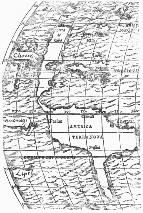 MÜNSTER, 1532.
 GLOBUS MUNDI.
A strait to
India.
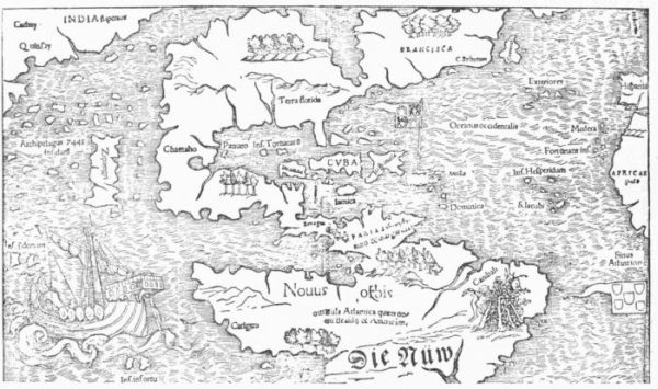
In the two maps of nearly equal date, being the earliest engraved
charts which we have, the Ruysch map of 1508 and the so-called Admiral's
map of 1507 (1513), the question of a strait leading
to the Asiatic seas, which Columbus had spent so much energy
in trying to find during his last voyage, is treated differently. We
have seen that La Cosa confessed his uncertain knowledge by covering
the place with a vignette. In the Ruysch map there is left the possibility
of such a passage; in the other there is none, for the main shore is
that of Asia itself, whose coast line uninterruptedly connects with that
of South America. The belief in such a strait in due time was fixed,
and lingered even beyond the time when Cortes showed there was no
ground for it. We find it in Schöner's globes, in the Tross gores, and
even so late as 1532, in the belated map of Münster.
 EDEN.
EDEN.
Earliest map
to show
America
made north
of the Alps.
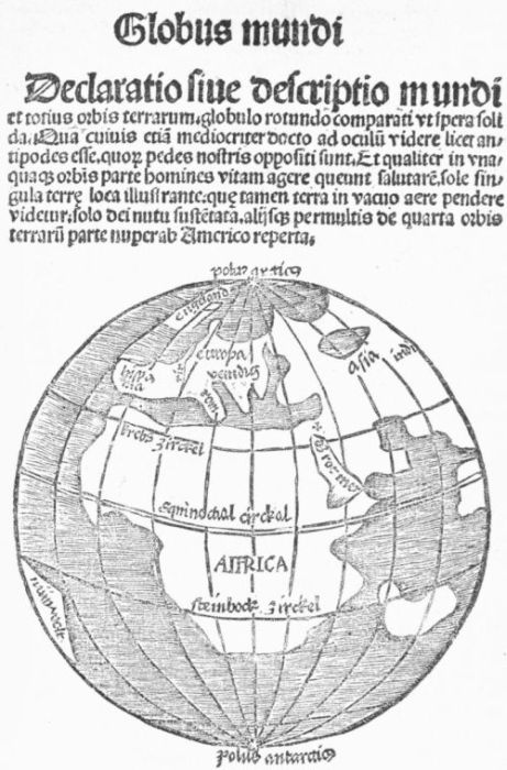
The map of the Globus Mundi (Strassburg, 1509) has some significance
as being the earliest issued north of the Alps, recording
both the Portuguese and Spanish discoveries;
though it merely gives the projecting angle of the South
American coast as representing the developments of the
west.
English references
to
America.
Richard
Eden.
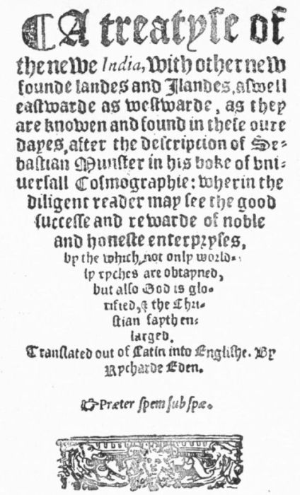
It is doubtful if any reference to the new discoveries had appeared
in English literature before Alexander Barclay produced in 1509 a
translation of Brant's Ship of Fools, and for a few years there were
only chance references which made no impression on the
literary instincts of the time. It was not till after the middle
of the century, in 1553, that Richard Eden, translating a
section of Sebastian Münster's Cosmographia, published it in London
as a Treatyse of the newe India, and English-reading people first saw
a considerable account of what the rest of Europe had been doing in
contrast with the English maritime apathy. Two years later
(1555), Eden, drawing this time upon Peter Martyr, did
much in his Decades of the Newe World to enlarge the English conceptions.
The naming
of America.
But the most striking and significant of all the literary movements
which grew out of the new oceanic developments was that
which gave a name to the New World, and has left a continent,
which Columbus unwittingly found, the monument of another's
fame.
1504. September.
Letter of
Vespucius.
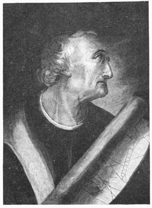
It was in September, 1504, that Vespucius, remembering an old
schoolmate in Florence, Piero Soderini, who was then the
perpetual Gonfalonière of that city, took what it is supposed
he had written out at length concerning his experiences
in the New World, and made an abstract of it in
Italian. Dating this on the 4th of that month, he dispatched it to Italy.
It is a question whether the original of this abridged text of Vespucius
is now known, though Varnhagen, with a confidence few scholars have
shared, has claimed such authenticity for a text which he has printed.
St. Dié.
Duke René.
It concerns us chiefly to know that somehow a copy of this condensed
narrative of Vespucius came into the hands of his fellow-townsman,
Fra Giovanni Giocondo, then in Paris at work as an architect
constructing a bridge over the Seine. It is to be allowed that
R. H. Major, in tracing the origin of the French text, assumes something
to complete his story, and that this precise genesis of the narrative
which was received by Duke René of Lorraine is open to some
question. The supposition that a young Alsatian, then in Paris, Mathias
Ringmann, had been a friend of Giocondo, and had been the
bearer of this new version to René, is likewise a conjecture. Whether
Ringmann was such a messenger or not matters little, but the time
was fast approaching when this young man was to be associated with a
proposition made in the little village of St. Dié, in the
Vosges, which was one of those obscure but far-reaching
mental premonitions so often affecting the world's history, without the
backing of great names or great events. This almost unknown place
was within the domain of this same Duke René, a wise man, who
liked scholars and scholarly tomes. His patronage had fostered there a
small college and a printing-press. There had been grouped
around these agencies a number of learned men, or those
ambitious of knowledge. Scholars in other parts of Europe, when they
heard of this little coterie, wondered how its members had congregated
there. One Walter Lud, or Gualterus Ludovicus, as they liked
to Latinize his name, a dependent and secretary of Duke René, was
now a man not much under sixty, and he had been the grouper and
manager of this body of scholars. There had lately been brought to
join them this same Mathias Ringmann, who came from Paris with all
the learning that he had tried to imbibe under the tutoring of Dr.
John Faber. If we believe the story as Major has worked it out,
Ringmann had come to this sparse community with all the fervor for
the exploits of Vespucius which he got in the French capital from
associating with that Florentine's admirer, the architect Giocondo.
 VESPUCIUS.
Coming to St. Dié, Ringmann had been made a professor of Latin,
and with the usual nominal alternation had become known as Philesius;
and as such he appears a little later in connection with a Latin
version of the French of Giocondo, which was soon made by another
of the St. Dié scholars, a canon of the cathedral there, Jean Bassin
de Sandacourt. Still another young man, Walter Waldseemüller, had
not long before been made a teacher of geography in the college, and
his name, as was the wont, had been classicized into Hylacomylus.
There have now been brought before the reader all the actors in
this little St. Dié drama, upon which we, as Americans, must gaze
back through the centuries as upon the baptismal scene of a continent.
Waldseemüller.
Cosmographiæ
Introductio.
The Duke had emphasized the cosmographical studies of the age by
this appointment of an energetic young student of geography, who
seems to have had a deft hand at map-making. Waldseemüller
had some hand, at least, in fashioning a map of the
new discoveries at the west, and the Duke had caused the map to be
engraved, and we find a stray note of sales of it singly as early as
1507, though it was not till 1513 that it fairly got before the world in
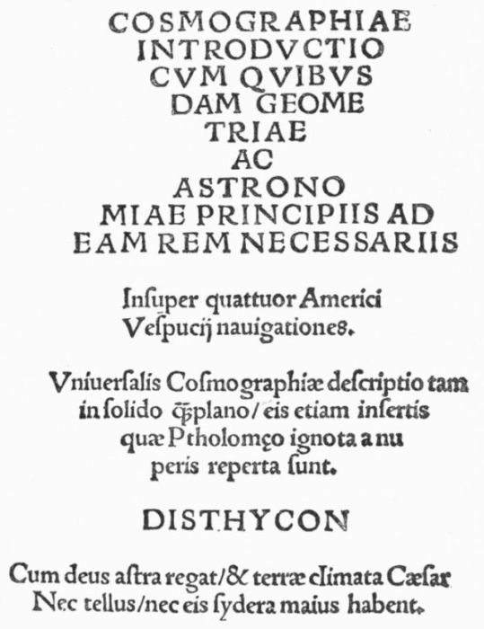
the Ptolemy of that year. Waldseemüller had also developed out of
these studies a little cosmographical treatise, which the college press
was set to work upon, and to swell it to the dignity of a book, thin as
it still was, the diminutive quarto was made to include Bassin's Latin
version of the Vespucius narrative, set out with some Latin verses by
Ringmann. The little book called Cosmographiæ Introductio
was brought out at this obscure college press in St.
Dié, in April and August, 1507. There were some varieties
in each of these issues, while that part which constituted the Vespucius
narrative was further issued in a separate publication.
 TITLE OF THE COSMOGRAPHIÆ INTRODUCTIO.
It was in this form that Vespucius's narrative was for the first time,
unless Varnhagen's judgment to the contrary is superior to all others,
brought before the world. The most significant quality of the little
book, however, was the proposition which Waldseemüller, with his
anonymous views on cosmography, advanced in the introductory parts.
It is assumed by writers on the subject that it was not Waldseemüller
alone who was responsible for the plan there given to name that part
of the New World which Americus Vespucius had described after the
voyager who had so graphically told his experiences on its shores.
The plan, it is supposed, met with the approval of, or was the outcome
of the counsels of, this little band of St. Dié scholars collectively. It
is not the belief of students generally that this coterie, any more than
Vespucius himself, ever imagined that the new regions were really disjoined
from the Asiatic main, though Varnhagen contends that Vespucius
knew they were.
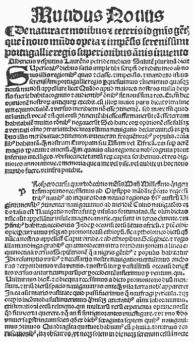
Mundus
Novus.
One thing is certainly true: that there wasno intention to apply
the name which was now proposed to anything more than the continental
mass of the Brazilian shore which Vespucius had coasted, and which
was looked upon as a distinct region from the islands which Columbus
had traversed. It had come to be believed that the archipelago of
Columbus was far from the paradise of luxury and wealth that his
extravagant terms called for, and which the descriptions
of Marco Polo had led the world to expect, supposing the
regions of the overland and oceanic discoverers to be the same. Further
than this, a new expectation had been aroused by the reports
which had come to Europe of the vaster proportions and of the brilliant
paroquets—for such trivial aspects gave emphasis—of the more
southern regions. It was an instance of the eagerness with which
deluded minds, to atone for their first disappointment, grasp at the
chances of a newer satisfaction. This was the hope which
was entertained of this Mundus Novus of Vespucius,—not
a new world in the sense of a new continent.
The Española and its neighboring regions of Columbus, and the
Baccalaos of Cabot and Cortereal, clothed in imagination with the descriptions
of Marco Polo, were nothing but the Old World approached
from the east instead of from the west. It was different with the
Mundus Novus of Vespucius. Here was in reality a new life and
habitation, doubtless connected, but how it was not known, with the
great eastern world of the merchants. It corresponded with nothing,
so far as understood, in the Asiatic chorography. It was ready for a
new name, and it was alone associated with the man who had, in the
autumn of 1502, so described it, and from no one else could its name
be so acceptably taken. Europe and Asia were geographically contiguous,
and so might be Asia and the new "America."
Eclipse of
Columbus's
name.
The sudden eclipse which the name of Columbus underwent, as the
fame of Vespucius ran through the popular mind, was no
unusual thing in the vicissitudes of reputations. Factitious
prominence is gained without great difficulty by one or for
one, if popular issues of the press are worked in his interest, and if
a great variety of favoring circumstances unite in giving currency to
rumors and reports which tend to invest him with exclusive interest.
The curious public willingly lends itself to any end that taxes nothing
but its credulity and good nature.
Fame of
Vespucius.
We have associated with Vespucius just the elements of such a success,
while the fame of Columbus was waning to the death,
namely: a stretch of continental coast, promising something
more than the scattered trifles of an insalubrious archipelago; a new
southern heavens, offering other glimpses of immensity; descriptions
that were calculated to replace in new variety and mystery the stale
stories of Cipango and Cathay: the busy yearnings of a group of
young and ardent spirits, having all the apparatus of a press to apply
to the making of a public sentiment; and the enthusiasm of narrators
who sought to season their marvels of discovery with new delights and
honors.
The hold which Vespucius had seized upon the imagination of Europe,
and which doubtless served to give him prominence in the popular
appreciation, as it has served many a ready and picturesque writer
since, was that glowing redundancy of description, both of the earth
and the southern constellations, which forms so conspicuous a feature
of his narratives. It was the later voyage of Vespucius, and not his
alleged voyage of 1497, which raised, as Humboldt has pointed out,
the great interest which his name suggested.
Columbus
and Vespucius.
Just what the notion prevailing at the time was of the respective
exploits of Columbus and Vespucius is easily gathered from
a letter dated May 20, 1506, which appears in a Dyalogus
Johannis Stamler de diversarum gencium sectis, et mundi
regionibus, published in 1508. In this treatise a reference is made to
the letters of Columbus (1493) and Vespucius (1503) as concerning
an insular and continental space respectively. It speaks of "Cristofer
Colom, the discoverer of new islands, and of Albericus Vespucius
concerning the new discovered world, to both of whom our age is
most largely indebted." It will be remembered that an early misnaming
of Vespucius by calling him Albericus instead of Americus, which
took place in one of the early editions of his narrative, remained for
some time to confuse the copiers of them.
Vespucius
on gravitation.
If we may judge from a diagram which Vespucius gives of a globe
with two standing men on it ninety degrees apart, each dropping a
line to the centre of the earth, this navigator had grasped, together
with the idea of the sphericity of the globe, the essential
conditions of gravitation. There could be no up-hill sailing
when the zenith was always overhead. Curiously enough,
the supposition of Columbus, when as he sailed on his third voyage he
found the air grow colder, was that he was actually sailing up-hill, ascending
a protuberance of the earth which was like the stem end of a
pear, with the crowning region of the earthly paradise atop of all!
Such contrasts show the lesser navigator to be the greater physicist,
and they go not a small way in accounting for the levelness of head
which gained the suffrages of the wise.
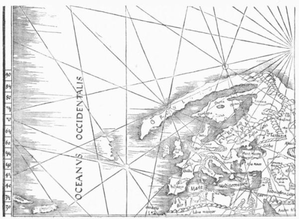 PART OF MAP IN THE PTOLEMY OF 1513.
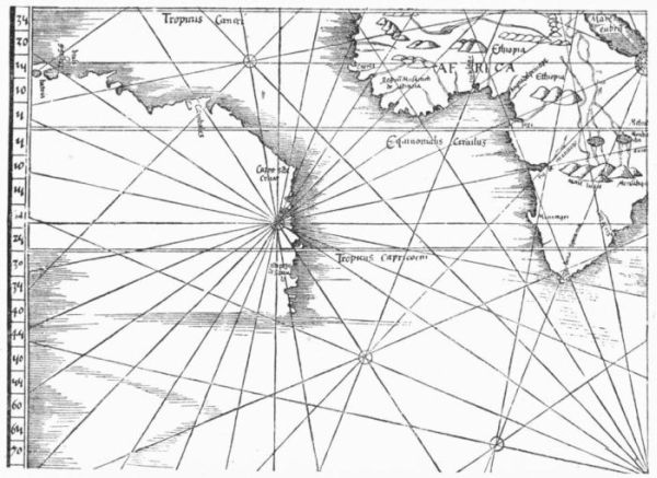 PART OF MAP IN THE PTOLEMY OF 1513.
1508. Duke
René died.
1509. Globus
Mundi.
When Duke René, upon whom so much had depended in the little
community at St. Dié, died, in 1508, the geographical printing
schemes of Waldseemüller and his fellows received a
severe reverse, and for a few years we hear nothing more of the edition
of Ptolemy which had been planned. The next year (1509),
Waldseemüller, now putting his name to his little treatise, was forced,
because of the failure of the college press, to go to Strassburg to have
a new edition of it printed (1509). The proposals for naming the
continental discoveries of Vespucius seem not in the interim to have
excited any question, and so they are repeated. We look in vain in
the copy of this edition which Ferdinand Columbus bought at Venice
in July, 1521, and which is preserved at Seville, for any marginal protest.
The author of the Historie, how far soever Ferdinand may have
been responsible for that book, is equally reticent. There was indeed
no reason why he should take any exception. The fitness of the
appellation was accepted as in no way invalidating the claim of Columbus
to discoveries farther to the north; and in another little tract,
printed at the same time at Grüniger's Strassburg press, the
anonymous Globus Mundi, the name "America" is adopted
in the text, though the small bit of the new coast shown in its map is
called by a translation of Vespucius's own designation merely "Newe
Welt."
1513. The
Strassburg
Ptolemy.
The Ptolemy scheme bore fruit at last, and at Strassburg, also, for
here the edition whose maps are associated with the name
of Waldseemüller, and whose text shows some of the influence
of a Greek manuscript of the old geographer which
Ringmann had earlier brought from Italy, came out in 1513. Here
was a chance, in a book far more sure to have influence than the little
anonymous tract of 1507, to impress the new name America upon
the world of scholars and observers, and the opportunity was not
seized. It is not easy to divine the cause of such an omission. The edition
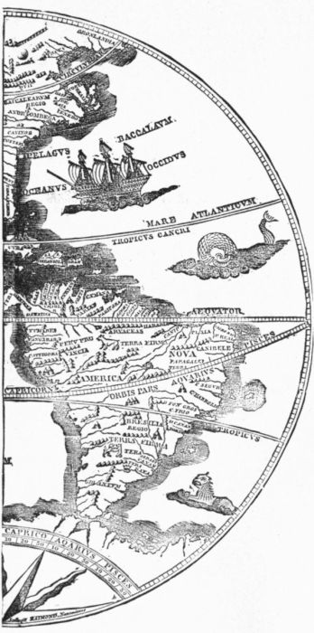
has two maps which show this Vespucian continent in precisely
the same way, though but one of them shows also to its full extent
the region of Columbus's explorations. On one of these maps the
southern regions have no designation whatever, and on the other, the
"Admiral's map," there is a legend stretched across it, assigning the
discovery of the region to Columbus.
We do not know, in all the contemporary literature which has come
down to us, that up to 1513 there had been any rebuke at the ignorance
or temerity which appeared in its large bearing to be depriving
Columbus of a rightful honor. That in 1509 Waldseemüller should
have enforced the credit given to Vespucius, and in 1513 revoked it in
favor of Columbus, seems to indicate qualms of conscience of which
we have no other trace. Perhaps, indeed, this reversion of sympathy
is of itself an evidence that Waldseemüller had less to do with the
edition than has been supposed. It is too much to assert that Waldseemüller
repented of his haste, but the facts in one light would indicate
it.
The name
America begins
to be
accepted.
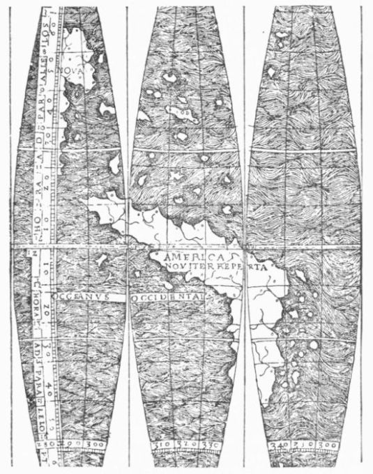 THE TROSS GORES.
Like many such headlong projects, however, the purpose had passed
beyond the control of its promoters. The euphony, if not
the fitness, of the name America had attracted attention,
and there are several printed and manuscript globes and
maps in existence which at an early date adopted that designation
for the southern continent. Nordenskiöld (Facsimile Atlas, p. 42)
quotes from the commentaries of the German Coclæus, contained in
the Meteorologia Aristotelis of Jacobus Faber (Nuremberg, 1512)
a passage referring to the "Nova Americi terra."
1516-17.
First in a
map.
To complicate
matters still more, within a few years after this an undated edition
of Waldseemüller's tract appeared at Lyons,—perhaps without his
participation,—which was always found, down to 1881, without a map,
though the copies known were very few; but in that year a copy with
a map was discovered, now owned by an American collector, in which
the proposition of the text is enforced with the name America on the
representation of South America. A section of this map is here given
as the Tross Gores. In the present condition of our knowledge of the
matter, it was thus at a date somewhere about 1516-17 that
the name appeared first in any printed map, unless, indeed,
we allow a somewhat earlier date to two globes in the Hauslab
collection at Vienna. On the date of these last objects there is,
however, much difference of opinion, and one of them has been depicted
and discussed in the Mittheilungen of the Geographische
Gesellschaft (1886, p. 364) of Vienna. Here, as in the descriptive
texts, it must be clearly kept in mind, however, that no one at this
date thought of applying the name to more than the land which Vespucius
had found stretching south beyond the equator on the east side
of South America, and which Balboa had shown to have a similar
trend on the west. The islands and region to the north, which Columbus
and Cabot had been the pioneers in discovering, still remained
a mystery in their relations to Asia, and there was yet a long time to
elapse before the truth should be manifest to all, that a similar expanse
of ocean lay westerly at the north, as was shown by Balboa to
extend in the same direction at the south.
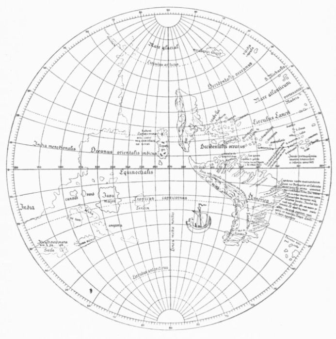 THE HAUSLAB GLOBE.
This Vespucian baptism of South America now easily worked its
way to general recognition. It is found in a contemporary set of
gores which Nordenskiöld has of late brought to light, and was soon
adopted by the Nuremberg globe-maker, Schöner (1515, etc.); by
Vadianus at Vienna, when editing Pomponius Mela (1515); by Apian
on a map used in an edition of Solinus, edited by Camers (1520);
and by Lorenz Friess, who had been of Duke René's coterie and a
correspondent of Vespucius, on a map introduced into the
Grüniger Ptolemy, published at Strassburg (1522), which
also reproduced the Waldseemüller map of 1513. This is
the earliest of the Ptolemies in which we find the name accepted on
its maps.
1522. The
name first in
a Ptolemy.
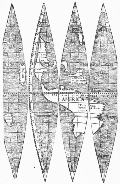 THE NORDENSKIÖLD GORES.
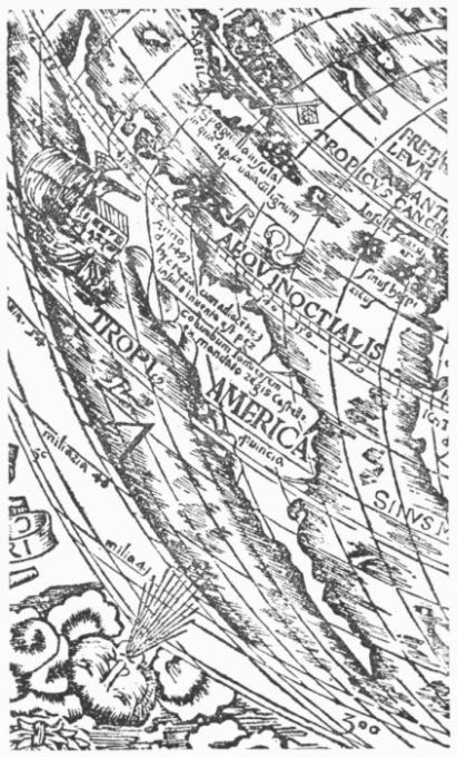 APIANUS, 1520.
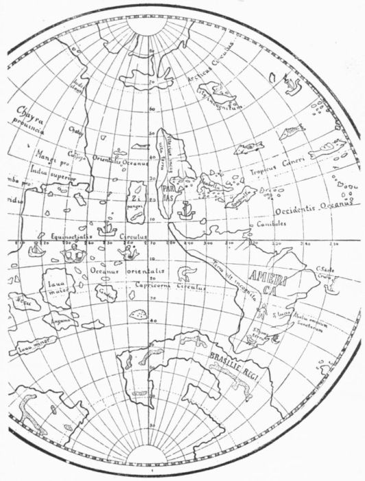 SCHÖNER GLOBE, 1515.
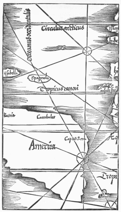 FRIESS (Frisius), IN THE PTOLEMY OF 1522.
There is one significant fact concerning the conflict of the Crown
with the heirs of Columbus, which followed upon the Admiral's death,
and in which the advocates of the government sought to prove that
the claim of Columbus to have discovered the continental shore about
the Gulf of Paria in 1498 was not to be sustained in view of visits by
others at an earlier date. This significant fact is that Vespucius is
not once mentioned during the litigation. It is of course possible, and
perhaps probable, that it was for the interests of both parties to keep
out of view a servant of Portugal trenching upon what was believed to
be Spanish territories. The same impulse could hardly have influenced
Ferdinand Columbus in the silent acquiescence which, as a contemporary
informs us, was his attitude towards the action of the St.
Dié professors. There seems little doubt of his acceptance of a view,
then undoubtedly common, that there was no conflict of the claims of
the respective navigators, because their different fields of exploration
had not brought such claims in juxtaposition.
Who first
landed on
the southern
main?
Vespucius's
maps.
Vespucius
not privy to
the naming.
Following, however, upon the assertion of Waldseemüller, that Vespucius
had "found" this continental tract needing a name, there grew
up a belief in some quarters, and deducible from the very obscure
chronology of his narrative, which formulated itself in a statement
that Vespucius had really been the first to set foot on any
part of this extended main. It was here that very soon the
jealousy of those who had the good name of Columbus in
their keeping began to manifest itself, and some time after
1527,—if we accept that year as the date of his beginning work on
the Historie,—Las Casas, who had had some intimate relations with
Columbus, tells us that the report was rife of Vespucius himself being
privy to such pretensions. Unless Las Casas, or the reporters to whom
he referred, had material of which no one now has knowledge, it is
certain that there is no evidence connecting Vespucius with the St.
Dié proposition, and it is equally certain that evidence fails to establish
beyond doubt the publication of any map bearing the name America
while Vespucius lived. He had been made pilot major of Spain
March 22, 1508, and had died February 22, 1512. We have no chart
made by Vespucius himself, though it is known that in 1518 such a
chart was in the possession of Ferdinand, brother of Charles
the Fifth. The recovery of this chart would doubtless render
a signal service in illuminating this and other questions of early
American cartography. It might show us how far, if at all, Vespucius
"sinfully failed towards the Admiral," as Las Casas
reports of him, and adds: "If Vespucius purposely gave
currency to this belief of his first setting foot on the main,
it was a great wickedness; and if it was not done intentionally, it looks
like it." With all this predisposition, however, towards an implication
of Vespucius, Las Casas was cautious enough to consider that, after
all, it may have been the St. Dié coterie who were alone responsible
for starting the rumor.
"America"
not used in
Spain.
1541. Mercator
first
applied the
name to
both North
and South
America.
It is very clear that in Spain there had been no recognition of the
name "America," nor was it ever officially recognized by
the Spanish government. Las Casas understood that it had
been applied by "foreigners," who had, as he says, "called
America what ought to be called Columba." Just what date should
attach to this protest of Las Casas is not determinable. If it
was later than the gore-map of Mercator in 1541, which
was the first, so far as is known, to apply the name to both
North and South America, there is certainly good reason
for the disquietude of Las Casas. If it was before that, it
was because, with the progress of discovery, it had become more and
more clear that all parts of the new regions were component parts of
an absolutely new continent, upon which the name of the first discoverer
of any part of it, main or insular, ought to have been bestowed.
That it should be left to "foreign writers," as Las Casas said, to give
a name representing a rival interest to a world that Spanish enterprise
had made known was no less an indignity to Spain than to her
great though adopted Admiral.
Spread of
the name in
central Europe.
It happens that the suggestion which sprang up in the Vosges
worked steadily onward through the whole of central Europe. That
it had so successful a propagation is owing, beyond a doubt, as much
to the exclusive spirit of the Spanish government in keeping to itself
its hydrographical progress as to any other cause. We
have seen how the name spread through Germany and Austria.
It was taken up by Stobnicza in Poland in 1512, in a
Cracow introduction to Ptolemy; and many other of the
geographical writers of central and southern Europe adopted the designation.
The New Interlude, published in England in 1519, had
used it, and towards the middle of the century the fame of Vespucius
had occupied England, so far as Sir Thomas More and William
Cunningham represent it, to the almost total obscuration of Columbus.
It was but a question of time when Vespucius would be charged
with promoting his own glory by borrowing the plumes of Columbus.
Whether Las Casas, in what has been quoted, initiated such accusations
or not, the account of that writer was in manuscript and could
have had but small currency.
1533. Schöner
accuses
Vespucius
of participation
in the
injustice.
The first accusation in print, so far as has been discovered, came
from the German geographer, Johann Schöner, who, having already
in his earlier globes adopted the name America, now in a tract called
Opusculum Geographicum, which he printed at Nuremberg in 1533,
openly charged Vespucius with attaching his own name to
a region of India Superior. Two years later, Servetus,
while he repeated in his Ptolemy of 1535 the earlier maps
bearing the name America, entered in his text a protest
against its use by alleging distinctly that Columbus was earlier than
Vespucius in finding the new main.
Within a little more than a year from the death of Vespucius, and
while the maps assigned to Waldseemüller were pressed on the attention
of scholars, the integralness of the great southern continent, to
which a name commemorating Americus had been given, was made
manifest, or at least probable, by the discovery of Balboa.
A barrier
suspected.
Let us now see how the course of discovery was finding record during
these early years of the sixteenth century in respect to
the great but unsuspected barrier which actually interposed
in the way of those who sought Asia over against Spain.
Discoveries
in the north.
1504. Normans
and
Bretons.
In the north, the discoveries of the English under Cabot, and of the
Portuguese under the Cortereals, soon led the Normans and
Bretons from Dieppe and Saint Malo to follow in the wake
of such predecessors. As early as 1504 the fishermen of these latter
peoples seem to have been on the northern coasts, and we
owe to them the name of Cape Breton, which is thought to
be the oldest French name in our American geography. It
is the "Gran Capitano" of Ramusio who credits the Bretons with
these early visits at the north, though we get no positive cartographical
record of such visits till 1520, in a map which is given by Kunstmann
in his Atlas.
1505. Portuguese.
Again, in 1505, some Portuguese appear to have been on the Newfoundland
coast under the royal patronage of Henry VII.
of England, and by 1506 the Portuguese fishermen were
regular frequenters of the Newfoundland banks. We find in the old
maps Portuguese names somewhat widely scattered on the neighboring
coast lines, for the frequenting of the region by the fishermen of that
nation continued well towards the close of the century.
1506. Spaniards.
There are also stories of one Velasco, a Spaniard, visiting the St.
Lawrence in 1506, and Juan de Agramonte in 1511 entered
into an agreement with the Spanish King to pursue discovery
in these parts more actively, but we have no definite knowledge of
results.
1517. Sebastian
Cabot.
1521. Portuguese.
The death of Ferdinand, January 23, 1516, would seem to have put
a stop to a voyage which had already been planned for Spain by Sebastian
Cabot, to find a northwest passage; but the next year (1517)
Cabot, in behalf of England, had sailed to Hudson's Strait, and thence
north to 67° 30', finding "no night there," and observing
extraordinary variations of the compass. Somewhat later
there are the very doubtful claims of the Portuguese to explorations
under Fagundes about the Gulf of St. Lawrence
in 1521.
1506. Ango's
captains.
Denys's
map.
1518. Léry.
By 1506 also there is something like certainty respecting the Normans,
and under the influence of a notable Dieppese, Jean
Ango, we soon meet a class of adventurous mariners tempting
distant and marvelous seas. We read of Pierre Crignon,
and Thomas Aubert, both of Dieppe, Jean Denys of Honfleur,
and Jean Parmentier, all of whom have come down to us through the
pages of Ramusio. It is of Jean Denys in 1506, and of Thomas Aubert
a little later, that we find the fullest recitals. To Denys there
has been ascribed a mysterious chart of the Gulf of St. Lawrence;
but if the copy which is preserved represents it, there
can be no hesitation in discarding it as a much later cartographical
record. The original is said to have been found in the archives of the
ministry of war in Paris so late as 1854, but no such map is found there
now. The copy which was made for the Canadian archives is at Ottawa,
and I have been favored by the authorities there with a tracing
of it. No one of authority will be inclined to dispute the judgment of
Harrisse that it is apocryphal. We are accordingly left in uncertainty
just how far at this time the contour of the Golfo Quadrago, as the
Gulf of St. Lawrence was called, was made out. Aubert is said to
have brought to France seven of the natives of the region in 1509.
Ten years or more later (1519, etc.), the Baron de Léry is
thought to have attempted a French settlement thereabouts,
of which perhaps the only traces were some European cattle, the descendants
of his small herd landed there in 1528, which were found on
Sable Island many years later.
1526. Nicholas
Don.
We know from Herrera that in 1526 Nicholas Don, a Breton, was
fishing off Baccalaos, and Rut tells us that in 1527 Norman
and Breton vessels were pulling fish on the shores of
Newfoundland. Such mentions mark the early French knowledge of
these northern coasts, but there is little in it all to show any contribution
to geographical developments.
 PETER MARTYR, 1511.
 PONCE DE LEON.
[From Barcia's Herrera.]
Attempts to
connect the
northern
discoveries
with those of
the Spanish.
1511. Peter
Martyr's
map.
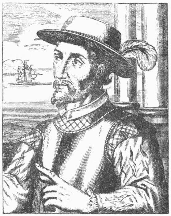
1512. Ponce
de Leon.
1513.
March.
Florida.
Before this, however, the first serious attempt of which we have
incontrovertible evidence was made to connect these discoveries
in the north with those of the Spanish in the Antilles.
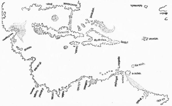
As early as 1511 the map given by Peter Martyr
had shown that, from the native reports or otherwise, a
notion had arisen of lands lying north of Cuba. In 1512
Ponce de Leon was seeking a commission to authorize him
to go and see what this reported land was like, with its fountain of
youth. He got it February 23, 1512, when Ferdinand commissioned
him "to find and settle the island of Bimini," if
none had already been there, or if Portugal had not already acquired
possession in any part that he sought. Delays in preparation postponed
the actual departure of his expedition from Porto
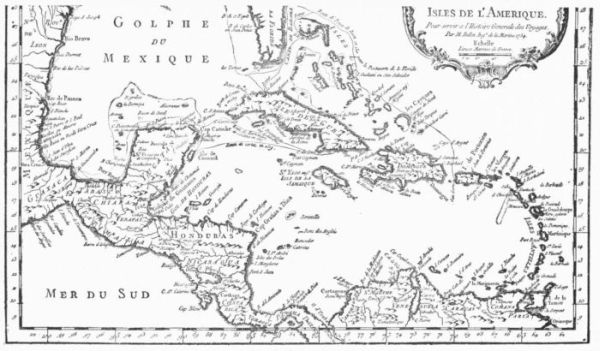
Rico till March, 1513. On the 23d of that month, Easter
Sunday, he struck the mainland somewhere opposite the Bahamas, and
named the country Florida, from the day of the calendar.
He tracked the coast northward to a little above 30° north
latitude. Then he retraced his way, and rounding the southern cape,
went well up the western side of the peninsula. Whether any stray
explorers had been before along this shore may be a question. Private
Spanish or Portuguese adventurers, or even Englishmen, had not
been unknown in neighboring waters some years earlier, as we have
evidence. We find certainly in this voyage of Ponce de Leon for the
first time an unmistakable official undertaking, which we might expect
would soon have produced its cartographical record. The interdicts
of the Council of the Indies were, however, too powerful, and the old
lines of the Cantino map still lingered in the maps for some years,
though by 1520 the Floridian peninsula began to take recognizable
shape in certain Spanish maps.
 PONCE DE LEON'S TRACK.
Bimini.
Just what stood for Bimini in the reports of this expedition is not
clear; but there seems to have been a vague notion of its
not being the same as Florida, for when Ponce de Leon got
a new patent in September, 1514, he was authorized to settle both
"islands," Bimini and Florida, and Diego Colon as viceroy was directed
to help on the expedition. Seven years, however, passed in
delays, so that it was not till 1521 that he attempted to make a settlement,
but just at what point is not known. Sickness and loss in encounters
with the Indians soon discouraged him, and he returned to
Cuba to die of an arrow wound received in one of the forays of the
natives.
1519. Pineda.
It was still a question if Florida connected with any adjacent lands.
Several minor expeditions had added something to the stretch of coast,
but the main problem still stood unsolved. In 1519 Pineda
had made the circuit of the northern shores of the Gulf of
Mexico, and at the river Panuco he had been challenged by Cortes as
trenching on his government. Turning again eastward, Pineda found
the mouth of the river named by him Del Espiritu Santo, which
passes with many modern students as the first indication in history of
the great Mississippi, while others trace the first signs of that river to
Cabeça de Vaca in 1528, or to the passage higher up its current by
De Soto in 1541. Believing it at first the long-looked-for strait to pass
to the Indies, Pineda entered it, only to be satisfied that it must gather
the watershed of a continent, which in this part was now named Amichel.
It seemed accordingly certain that no passage to the west was
to be found in this part of the gulf, and that Florida must be more
than an island.
1520.
Ayllon.
Spaniards in
Virginia.
While these explorations were going on in the gulf, others were conducted
on the Atlantic side of Florida. If the Pompey Stone which
has been found in New York State, to the confusion of historical students,
be accepted as genuine, it is evidence that the Spaniard had
in 1520 penetrated from some point on the coast to that region. In
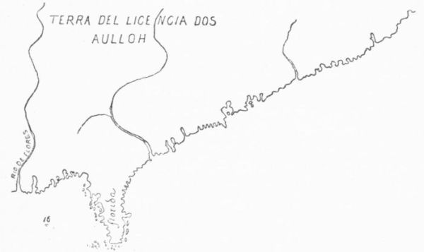
1520 we get demonstrable proof, when Lucas Vasquez de Ayllon sent
a caravel under Gordillo, which joined company on the way
with another vessel bound on a slave-hunting expedition,
and the two, proceeding northward, sighted the main coast at a river
which they found to be in thirty-three and a half degrees of north latitude,
on the South Carolina coast. They returned without further exploration.
Ayllon, without great success, attempted further explorations
in 1525; but in 1526 he went again with greater preparations, and
made his landfall a little farther north, near the mouth of the Wateree
River, which he called the Jordan, and sailed on to the Chesapeake,
where, with the help of negro slaves, then first introduced into this region,
he began the building of a town at or near the spot
where the English in the next century founded Jamestown;
or at least this is the conjecture of Dr. Shea. Here Ayllon died of a
pestilential fever October 18, 1526, when the disheartened colonists,
one hundred and fifty out of the original five hundred, returned to
Santo Domingo.
 THE AYLLON MAP.
1524.
Gomez.
Chaves's
map.
1529. Ribero's
map.
While these unfortunate experiences were in progress, Estevan
Gomez, sent by the Spanish government, after the close of
the conference at Badajos, to make sure that there was no
passage to the Moluccas anywhere along this Atlantic coast, started in
the autumn of 1524, if the data we have admit of that conclusion as
to the time, from Corunna, in the north of Spain. He proceeded at
once, as Charles V. had directed him, to the Baccalaos region, striking
the mainland possibly at Labrador, and then turned south, carefully
examining all inlets. We have no authoritative narrative sanctioned
by his name, or by that of any one accompanying the expedition;
nor has the map which Alonso Chaves made to conform
to what was reported by Gomez been preserved, but the essential
features of the exploration are apparently embodied in the great
map of Ribero (1529), and we have sundry stray references
in the later chroniclers. From all this it would seem that
Gomez followed the coast southward to the point of Florida, and
made it certain to most minds that no such passage to India existed,
though there was a lingering suspicion that the Gulf of St. Lawrence
had not been sufficiently explored.
Shores of
the Caribbean
Sea.
Ojeda and
Nicuessa.
Let us turn now to the southern shores of the Caribbean Sea. New
efforts at colonizing here were undertaken in 1508-9. By
this time the coast had been pretty carefully made out as
far as Honduras, largely through the explorations of Ojeda
and Juan de la Cosa. The scheme was a dual one, and introduces us
to two new designations of the regions separated by that indentation
of the coast known as the Gulf of Uraba. Here Ojeda and
Nicuessa were sent to organize governments, and rule their
respective provinces of Nueva Andalusia and Castilla del Oro for the
period of four years. Mention has already been made of this in the
preceding chapter. They delayed getting to their governments, quarreled
for a while about their bounds on each other, fought the natives
with desperation but not with much profit, lost La Cosa in one of the
encounters, and were thwarted in their purpose of holding Jamaica as
a granary and in getting settlers from Española by the alertness of
Diego Colon, who preferred to be tributary to no one.
All this had driven Ojeda to great stress in the little colony of San
Sebastian which he had founded. He attempted to return for aid to
Española, and was wrecked on the voyage. This caused him to miss
his lieutenant Enciso, who was on his way to him with recruits. So
Ojeda passes out of history, except so far as he tells his story in the testimony
he gave in the suit of the heirs of Columbus in 1513-15.
Pizarro.
New heroes were coming on. A certain Pizarro had been left in
command by Ojeda,—not many years afterwards to be
heard of. One Vasco Nuñez de Balboa, a poor and debt-burdened
fugitive, was on board of Enciso's ship, and had wit enough
to suggest that a region like San Sebastian, inhabited by tribes which
used poisoned arrows, was not the place for a colony struggling for
existence and dependent on foraging. So they removed the remnants
of the colony, which Enciso had turned back as they were escaping, to
the other side of the bay, and in this way the new settlement came
within the jurisdiction of Nicuessa, whom a combination soon deposed
and shipped to sea, never to be heard of. It was in these commotions
that Vasco Nuñez de Balboa brought himself into a prominence that
ended in his being commissioned by Diego Colon as governor of the
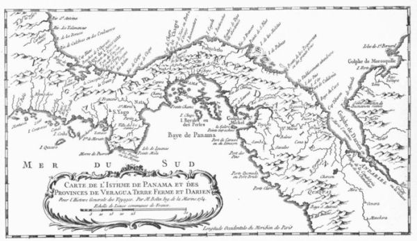
new colony. He had, meanwhile, got more knowledge of a great sea
at the westward than Columbus had acquired on the coast of Veragua
in 1503. Balboa rightly divined that its discovery, if he could effect
it, would serve him a good purpose in quieting any jealousies of his
rule, of which he was beginning to observe symptoms.
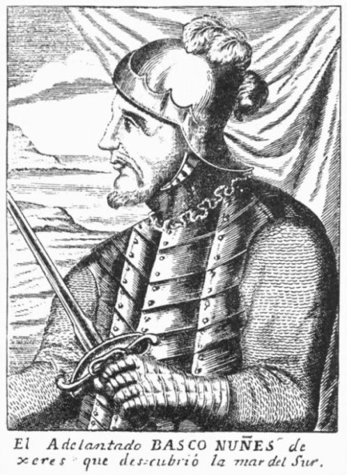 BALBOA.
[From Barcia's Herrera.]
1513. Balboa
and the
South Sea.
So on the 1st of September, 1513, he set out in the direction which
the natives hadindicated, and by the 24th he had reached a mountain
from the topof which his guides told him he would behold the sea.
On the 25th his party ascended, himself in front, and it was not
long before he stood gazing upon the distant ocean, the first
of Europeans to discern the long-coveted sea. Down the
other slope the Spaniards went. The path was a difficult one, and it
was three days before one of his advanced squads reached the beach.
Not till the next day, the 29th, did Vasco Nuñez himself join those in
advance, when, striding into the tide, he took possession of the sea
and its bordering lands in the name of his sovereigns. It was on Saint
Miguel's Day, and the Bay of Saint Miguel marks the spot to-day.
Towards the end of January, 1514, he was again with the colony at
Antigua del Darien. Thence, in March, he dispatched a messenger
to Spain with news of the great discovery.
Pedrarias.
1517. Balboa
executed.
This courier did not reach Europe till after a new expedition had
been dispatched under Pedrarias, and with him went a
number of followers, who did in due time their part in thridding
and designating these new paths of exploration. We recognize
among them Hernando de Soto, Bernal Diaz, the chronicler of the exploits
of Cortes, and Oviedo, the historian. It was from April till
June, 1514, that Pedrarias was on his way, and it was not long before
the new governor with his imposing array of strength brought the recusant
Balboa to trial, out of which he emerged burdened with heavy
fines. The new governor planned at once to reap the fruits of Balboa's
discovery. An expedition was sent along his track, which embarked
on the new sea and gathered spoils where it could. Pedrarias
soon grew jealous of Balboa, for it was not without justice that the
state of the augmented colony was held to compare unfavorably with
the conditions which Balboa had maintained during his rule. But constancy
was never of much prevalence in these days, and Balboa's chains,
lately imposed, were stricken off to give him charge of an exploration
of the sea which he had discovered. Once here, Balboa planned new
conquests and a new independency. Pedrarias, hearing of it through
a false friend of Balboa, enticed the latter into his neighborhood,
and a trial was soon set on foot, which ended in
the execution of Balboa and his abettors. This was in
1517.
It was not long before Pedrarias removed his capital to Panama,
and in 1519 and during the few following years his captains pushed
their explorations northerly along the shores of the South Sea, as the
new ocean had been at once called.
1515. Biru.
1519. Panama
founded.
As early as 1515 Pizarro and Morales had wandered down the
coast southward to a region called Biru by the natives, and
this was as far as adventure had carried any Spaniard, during
the ten years since Balboa's discovery. They had learned here of
a rich region farther on, and it got to be spoken of by the same name,
or by a perversion of it, as Peru. In this interval the town
of Panama had been founded (1519), and Pizarro and
Almagro, with the priest Luque, were among those to whom allotments
were made.
Peru.
Chili.
Chiloe.
It was by these three associates, in 1524 and 1526, that the expeditions
were organized which led to the exploration of the
coasts of Peru and the conquest of the region. The equator
was crossed in 1526; in 1527 they reached 9° south. It was not
till 1535 that, in the progress of events, a knowledge of the coast was
extended south to the neighborhood of Lima, which was founded in
that year. In the autumn of 1535, Almagro started south
to make conquest of Chili, and the bay of Valparaiso was
occupied in September, 1536. Eight years later, in 1544, explorations
were pushed south to 41°. It was only in 1557 that expeditions
reached the archipelago of Chiloe, and the whole coast of
South America on the Pacific was made out with some detail
down to the region which Magellan had skirted, as will be shortly
shown.
1508.
Ocampo
and Cuba.
It will be remembered that in 1503 Columbus had struck the coast
of Honduras west of Cape Gracias à Dios. He learned then of lands
to the northwest from some Indians whom he met in a canoe, but his
eagerness to find the strait of his dreams led him south. It was fourteen
years before the promise of that canoe was revealed.
In 1508 Ocampo had found the western extremity of Cuba,
and made the oath of Columbus ridiculous.
1517. Yucatan.
In 1517 a slave-hunting expedition, having steered towards the west
from Cuba, discovered the shores of Yucatan; and the next
year (1518) the real exploration of that region began when
Juan de Grijalva, a nephew of the governor of Cuba, led thither an
expedition which explored the coast of Yucatan and Mexico.
1518.
Cortes.
1519.
When Grijalva returned to Cuba in 1518, it was to find an expedition
already planned to follow up his discoveries, and Hernando
Cortes, who had been in the New World since 1504,
had been chosen to lead it, with instructions to make further explorations
of the coast,—a purpose very soon to become obscured in other
objects. He sailed on the 17th of November, and stopped along the
coast of Cuba for recruits, so it was not till February 18,
1519, that he sunk the shores of Cuba behind him, and in
March he was skirting the Yucatan shore and sailed on to San Juan
de Uloa. In due time, forgetting his instructions, and caring for other
conquests than those of discovery, he began his march inland. The
story of the conquest of Mexico does not help us in the aim now in
view, and we leave it untold.
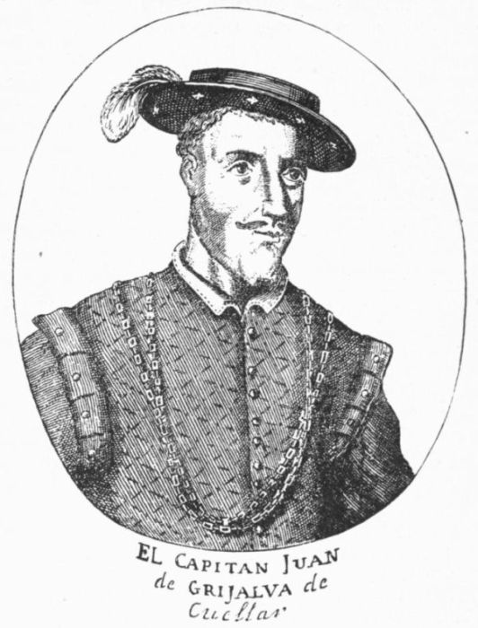 GRIJALVA.
[From Barcia's Herrera.]
Quinsay.
It was not long after this conquest before belated apostles of the
belief of Columbus appeared, urging that the capital of Montezuma
was in reality the Quinsay of Marco Polo, with its
great commercial interests, as was maintained by Schöner in his Opusculum
Geographicum in 1533.
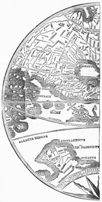
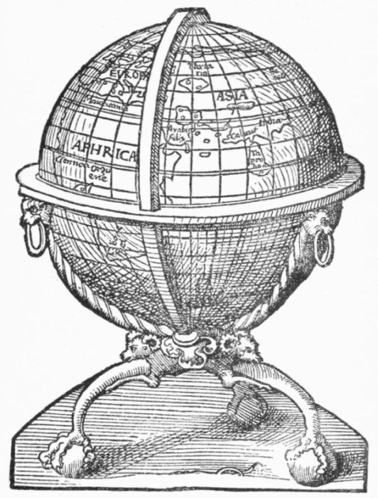 GLOBE GIVEN IN SCHÖNER'S OPUSCULUM GEOGRAPHICUM, 1533.
1520.
Garay.
Gulf of
Mexico.
1524. Cortes's
Gulf of
Mexico.
Yucatan as
an island.
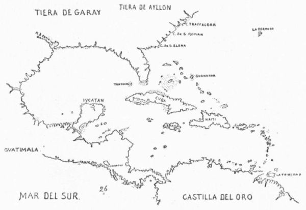
We have seen how Pineda's expedition to the northern parts of the
Gulf of Mexico in 1519 had improved the knowledge of
that shore, and we have a map embodying these explorations,
which was sent to Spain in 1520 by Garay, then governor of
Jamaica. It was now pretty clear that the blank spaces of earlier
maps, leaving it uncertain if there was a passage westerly
somewhere in the northwest corner of the gulf, should be
filled compactly. Still, a belief that such a passage existed somewhere
in the western contour of the gulf was not readily abandoned.
Cortes, when he sent to Spain his sketch of the gulf, which
was published there in 1524, was dwelling on the hope that
some such channel existed near Yucatan, and his insular
delineation of that peninsula, with a shadowy strait at its base, was
eagerly grasped by the cartographers. Such a severance finds a
place in the map of Maiollo of 1527, which is preserved in the Ambrosian
library at Milan. Grijalva, some years earlier, had been
sent, as we have seen, to sail round Yucatan; and though
there are various theories about the origin of that name, it
seems likely enough that the tendency to give it an insular form arose
from a misconception of the Indian appellation. At all events, the
island of Yucatan lingered long in the early maps.
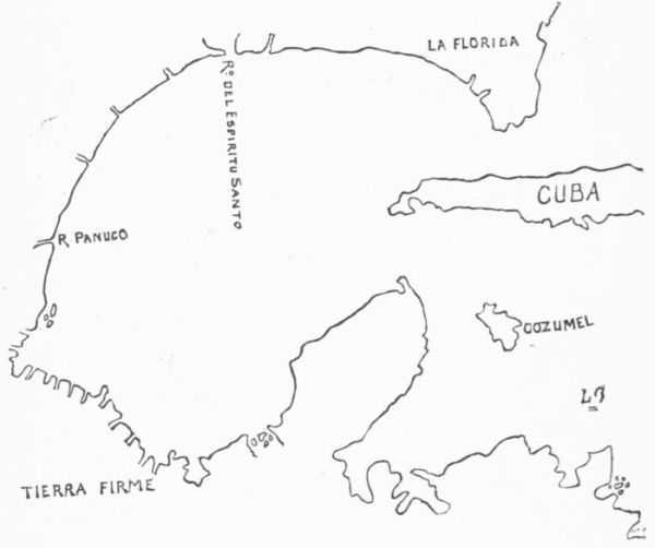 GULF OF MEXICO, 1520.
1523.
Cortes.
In 1523 Cortes had sent expeditions up the Pacific, and one up the
Atlantic side of North America, to find the wished-for passage;
but in vain.
Spanish and
Portuguese
rivalries.
Meanwhile, important movements were making by the Portuguese
beyond that great sea of the south which Balboa had discovered.
These movements were little suspected by the
Spaniards till the development of them brought into contact
these two great oceanic rivals.
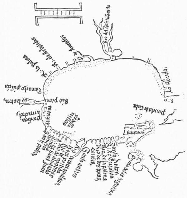 GULF OF MEXICO, BY CORTES.
1511. Moluccas.
A western
passage
sought at
the south.
The Portuguese, year after year, had extended farther and farther
their conquests by the African route. Arabia, India, Malacca, Sumatra,
fell under their sway, and their course was still eastward, until in
1511 the coveted land of spices, the clove and the nutmeg,
was reached in the Molucca Islands. This progress of the
Portuguese had been watched with a jealous eye by Spain. It was a
question if, in passing to these islands, the Portuguese had not crossed
the line of demarcation as carried to the antipodes. If they had,
territory neighboring to the Spanish American discoveries had been
appropriated by that rival power wholly unconfronted. This was
simply because the Spanish navigators had not as yet succeeded in
finding a passage through the opposing barrier of what they were beginning
to suspect was after all an intervening land. Meanwhile, Columbus
and all since his day having failed to find such a passage by
way of the Caribbean Sea, and no one yet discovering any
at the north, nothing was left but to seek it at the south.
This was the only chance of contesting with the Portuguese
the rights which occupation was establishing for them at the Moluccas.
1508. Pinzon
and
Solis.
On the 29th of June, 1508, a new expedition left San Lucar under
Pinzon and Solis. They made their landfall near Cape St.
Augustine, and, passing south along the coast of what had
now come to be commonly called Brazil, they traversed the
opening of the broad estuary of the La Plata without knowing it, and
went five degrees beyond (40° south latitude) without finding the
sought-for passage.
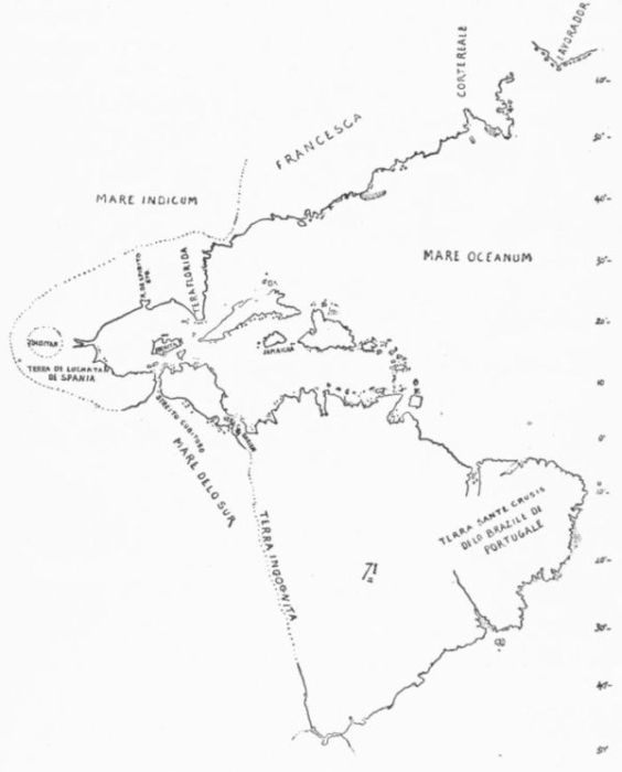 MAIOLLO MAP, 1527.
1511. Portuguese
at Rio
de Janeiro.
Ferdinand
Columbus
and the
western passage.
There is some reason to suppose that as early as 1511 the Portuguese
had become in some degree familiar with the coast
about Rio de Janeiro, and there is a story of one Juan de
Braza settling near this striking bay at this early day. It
was during the same year (1511) that Ferdinand Columbus
prepared his Colon de Concordia, and in this he maintained
the theory of a passage to be found somewhere beyond
the point towards the south which the explorers had
thus far reached.
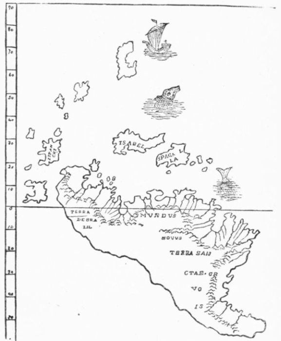 DE COSTA'S DRAWING FROM THE LENOX GLOBE.
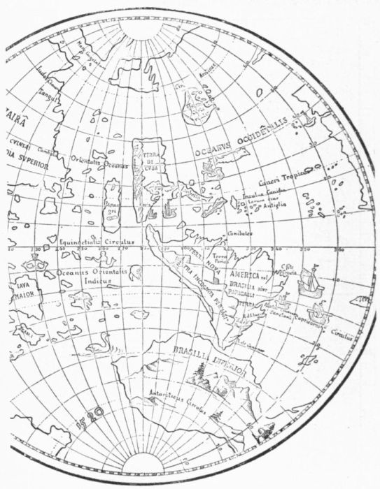 SCHÖNER'S GLOBE, 1520.
1516. Solis.
1519. Magellan.
A few years later (1516) the Spanish King sent Juan Diaz de Solis
to search anew for a passage. He found the La Plata, and
for a while hoped he had discovered the looked-for strait.
Magellan, who had taken some umbrage during his Portuguese service,
came finally to the Spanish King, and, on the plea that the Moluccas
fell within the Spanish range under the line of demarcation, suggested
an expedition to occupy them. He professed to be able
to reach them by a strait which he could find somewhere to
the south of the La Plata. It has long been a question if Magellan's
anticipation was based simply on a conjecture that, as Africa had been
found to end in a southern point, America would likewise be discovered
to have a similar southern cape.
It has also been a question if Magellan actually had any
tidings from earlier voyages to afford a ground for believing
in such a geographical fact. It is possible that other
early discoverers had been less careful than Solis, and had been misled
by the broad estuary of the La Plata to think that it was really an interoceanic
passage. Some such intelligence would seem to have instigated
the conditions portrayed in one early map, but the general
notion of cartographers at the time terminates the known coast at Cape
Frio, near Rio de Janeiro, as is seen to be the case in the Ptolemy map
of 1513. There is a story, originating with Pigafetta, his historian,
that Magellan had seen a map of Martin Behaim, showing a southern
cape; but if this map existed, it revealed probably nothing more
than a conjectural termination, as shown in the Lenox and earliest
Schöner globes of 1515 and 1520. Still, Wieser and Nordenskiöld
are far from being confident that some definite knowledge of such a
cape had not been attained, probably, as it is thought, from private
commercial voyage of which we may have a record in the Newe Zeitung
and in the Luculentissima Descriptio. It is to be feared that
the fact, whatever it may have been, must remain shadowy.
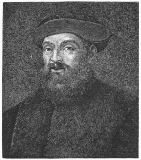 MAGELLAN.
Magellan's fleet was ready in August, 1519. His preparation had
been watched with jealousy by Portugal, and it was even hinted that
if the expedition sailed a matrimonial alliance of Spain and Portugal
which was contemplated must be broken off. Magellan was appealed
to by the Portuguese ambassador to abandon his purpose, as one likely
to embroil the two countries. The stubborn navigator was not to be
persuaded, and the Spanish King made him governor of all countries
he might discover on the "back side" of the New World.
In the late days of 1519, Magellan touched the coast at Rio de Janeiro,
where, remaining awhile, he enjoyed the fruits of its equable
climate. Then, passing on, he crossed the mouth of the La Plata, and
soon found that he had reached a colder climate and was sailing along
a different coast. The verdure which had followed the warm currents
from the equatorial north gave way to the concomitants of an icy flow
from the Antarctic regions which made the landscape sterile. So on
he went along this inhospitable region, seeking the expected strait.
His search in every inlet was so faithful that he neared the southern
goal but slowly. The sternness of winter caught his little barks in a
harbor near 50° south latitude, and his Spanish crews, restless under
the command of a Portuguese, revolted. The rebels were soon more
numerous than the faithful. The position was more threatening than
any Columbus had encountered, but the Portuguese had a hardy courage
and majesty of command that the Genoese never could summon.
Magellan confronted the rebels so boldly that they soon quailed. He
was in unquestioned command of his own vessels from that time forward.
The fate of the conquered rioters, Juan de Carthagena and
Sanchez de la Reina, cast on the inhospitable shore of Patagonia in
expiation of their offense, is in strong contrast to the easy victory
which Columbus too often yielded, to those who questioned his authority.
The story of Magellan's pushing his fleet southward and through
the strait with a reluctant crew is that of one of the royally courageous
acts of the age of discovery.
1520. October.
Magellan
enters
the strait.
On October 21, 1520, the ships entered the longed-for strait, and on
the 28th of November they sailed into the new sea; then
stretching their course nearly north, keeping well in sight of
the coast till the Chiloe Archipelago was passed, the ships
steered west of Juan Fernandez without seeing it, and subsequently
gradually turned their prows towards the west.
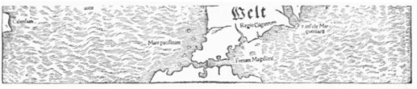
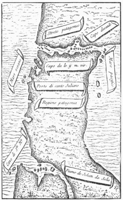 MAGELLAN'S STRAITS BY PIZAFETTA.
[The north is at the bottom.]
The western
way discovered.
It is not necessary for our present purpose to follow the incidents of
the rest of this wondrous voyage,—the reaching the Ladrones and the
Asiatic islands, Magellan's own life sacrificed, all his ships but one
abandoned or lost, the passing of the Cape of Good Hope by the "Victoria,"
and her arrival on September 6, 1522, under Del Cano, at the
Spanish harbor from which the fleet had sailed. The Emperor bestowed
on this lucky first of circumnavigators the proud motto, inscribed
on a globe, "Primus circumdedisti me." The Spaniards'
western way to the Moluccas was now disclosed.
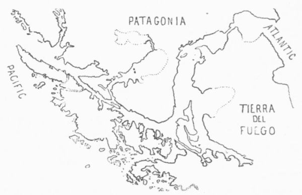 MAGELLAN'S STRAIT.
Pacific
Ocean.
The South Sea of Balboa, as soon as Magellan had established its
extension farther south, took from Magellan's company the
name Pacific, though the original name which Balboa had
applied to it did not entirely go out of vogue for a long time in those
portions contiguous to the waters bounding the isthmus and its adjacent
lands.
North America
and Asia
held to be
one.
For a long time after it was known that South America was severed,
as Magellan proved, from Asia, the belief was still commonly
held that North America and Asia were one and continuous.
While no one ventures to suspect that Columbus
had any prescience of these later developments, there are those like
Varnhagen who claim a distinct insight for Vespucius; but it is by no
means clear, in the passages which are cited, that Vespucius thought
the continental mass of South America more distinct from Asia than
Columbus did, when the volume of water poured out by the Orinoco
convinced the Admiral that he was skirting a continent, and not an island.
That Columbus thought to place there the region of the Biblical
paradise shows that its continental features did not dissociate it from
Asia. The New World of Vespucius was established by his own testimony
as hardly more than a new part of Asia.
1525.
Loyasa.
De Hoces
discovers
Cape Horn.
In 1525 Loyasa was sent to make further examination of Magellan's
Strait. It was at this time that one of his ships, commanded
by Francisco de Hoces, was driven south in February, 1526,
and discovered Cape Horn, rendering the insular character
of Tierra del Fuego all but certain. The fact was kept
secret, and the map makers were not generally made aware
of this terminal cape till Drake saw it, fifty-two years later.
It was not till 1615-17 that Schouten and Lemaire made clear the
eastern limits of Tierra del Fuego when they discovered the passage
between that island and Staten Island, and during the same interval
Schouten doubled Cape Horn for the first time. It was in 1618-19
that the observations of Nodal first gave the easterly bend to the southern
extremity of the continent.
1535. Chili.
The last stretch of the main coast of South America to be made out
was that on the Pacific side from the point where Magellan turned
away from it up to the bounds of Peru, where Pizarro and his followers
had mapped it. This trend of the coast began to be understood
about 1535; but it was some years before its details got
into maps. The final definition of it came from Camargo's
voyage in 1540, and was first embodied with something like accuracy
in Juan Freire's map of 1546, and was later helped by explorations
from the north. But this proximate precision gave way in 1569 to a
protuberant angle of the Chili coast, as drawn by Mercator, which in
turn lingered on the chart till the next century.
Cartographical
views.
We need now to turn from these records of the voyagers to see
what impression their discoveries had been making upon
the cartographers and geographers of Europe.
Sylvanus's
Ptolemy.
1511.
Bernardus Sylvanus Ebolensis, in a new edition of Ptolemy which
was issued at Venice in 1511, paid great attention to the
changes necessary to make Ptolemy's descriptions correspond
to later explorations in the Old World, but less attention
to the more important developments of the New World. Nordenskiöld
thinks that this condition of Sylvanus's mind shows how
little had been the impression yet made at Venice by the discoveries
of Columbus and Da Gama. The maps of this Ptolemy are woodcuts,
with type let in for the names, which are printed in red, in contrast
with the black impressed from the block.
Nordenskiöld
gores.
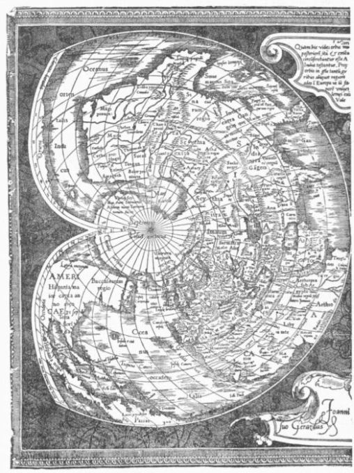
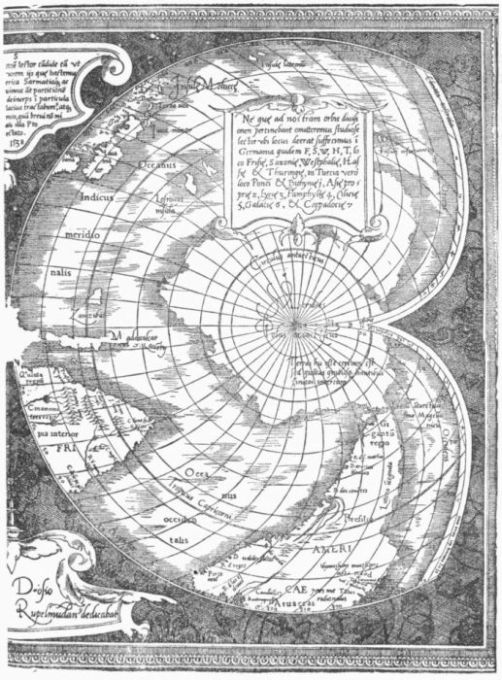
Sylvanus's map is the second engraved map showing the new discoveries,
and the earliest of the heart-shaped projections. It has in "Regalis
Domus" the earliest allusion to the Cortereal voyage in a printed
map. Sylvanus follows Ruysch in making Greenland a part of Asia.
The rude map gores of about the same date which Nordenskiöld
has brought to the attention of scholars, and which
he considers to have been made at Ingolstadt, agree mainly with this
map of Sylvanus, and in respect to the western world both of these
maps, as well as the Schöner globe of 1515, seem to have been based
on much the same material.
 FREIRE'S MAP, 1546.
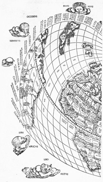 SYLVANUS'S PTOLEMY OF 1511.
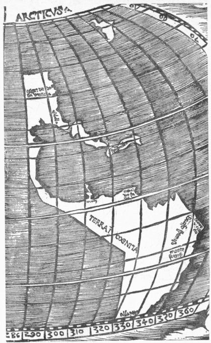 STOBNICZA'S MAP.
1512. Stobnicza
map.
We find in 1512, where we might least expect it, one of the most
remarkable of the early maps, which was made for an introduction
to Ptolemy, published at this date at Cracow, in Poland,
by Stobnicza. This cartographer was the earliest to introduce
into the plane delineation of the globe the now palpable division
of its surface into an eastern and western hemisphere. His
map, for some reason, is rarely found in the book to which it belongs.
Nordenskiöld says he has examined many copies of the book
in the libraries of Scandinavia, Russia, and Poland, without finding a
copy with it; but it is found in other copies in the great libraries at
Vienna and Munich. He thinks the map may have been excluded
from most of the editions because of its rudeness, or "on account of
its being contrary to the old doctrines of the Church." Its importance
in the growth of the ideas respecting the new discoveries in the western
hemisphere is, however, very great, since for the first time it gives
a north and south continent connected by an isthmus, and represents
as never before in an engraved map the western hemisphere as an entirety.
This is remarkable, as it was published a year before Balboa
made his discovery of the Pacific Ocean. It is not difficult to see
the truth of Nordenskiöld's statement that the map divides the waters
of the globe into two almost equal oceans, "communicating only in the
extreme south and in the extreme north," but the south communication
which is unmistakable is by the Cape of Good Hope. The extremity
of South America is not reached because of the marginal scale,
and because of the same scale it is not apparent that there is any connection
between the Pacific and Indian oceans, and for similar reasons
connection is not always clear at the north. There must have been information
at hand to the maker of this map of which modern scholars
can find no other trace, or else there was a wild speculative spirit
which directed the pencil in some singular though crude correspondence
to actual fact. This is apparent in its straight conjectural lines
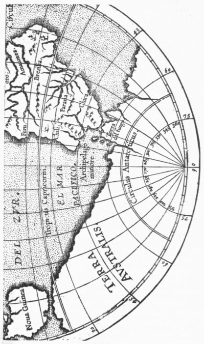
on the west coast of South America, which prefigure the discoveries
following upon the enterprise of Balboa and the voyage of Magellan.
The Lenox
globe.
Da Vinci
globe.
If Stobnicza, apparently, had not dared to carry the southern extremity
of South America to a point, there had been no such hesitancy
in the makers of two globes of about the same date,—the little copper
sphere picked up by Richard M. Hunt, the architect, in an
old shop in Paris, and now in the Lenox Library in New
York, and the rude sketch, giving quartered hemispheres separated on
the line of the equator, which is preserved in the cabinet of Queen
Victoria, at Windsor, among the papers of Leonardo da
Vinci. This little draft has a singular interest both from
its association with so great a name as Da Vinci's, and because it bears
at what is, perhaps, the earliest date to be connected with such cartographical
use the name America lettered on the South American
continent. Major has contended for its being the work of Da Vinci
himself, but Nordenskiöld demurs. This Swedish geographer is rather
inclined to think it the work of a not very well informed copier working
on some Portuguese prototype.
1507-13.
Admiral's
map.
1515.
Reisch's
map.
It is worthy of remark that, in the same year with the discovery of
the South Sea by Balboa, an edition of Ptolemy made popular a map
which had indeed been cut in its first state as early as 1507, but which
still preserved the contiguity of the Antilles to the region of the
Ganges and its three mouths. This was the well-known "Admiral's
map," usually associated with the name of Waldseemüller, and if this
same cartographer, as Franz Wieser conjectures, is responsible
for the map in Reisch's Margarita philosophica
(1515), a sort of cyclopædia, he had in the interim awaked
to the significance of the discovery of Balboa, for the Ganges has disappeared,
and Cipango is made to lie in an ocean beyond
the continental Zoana Mela (America), which has an undefined
western limit, as it had already been depicted in the
Stobnicza map of 1512.
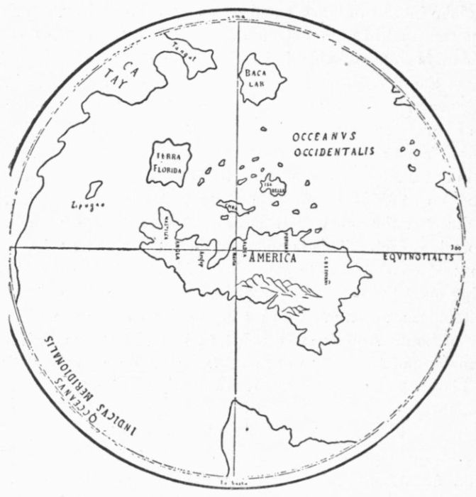 THE ALLEGED DA VINCI SKETCH.
[Combination.]
First modern
atlas.
It was in this Strassburg Ptolemy of 1513 that Ringmann, who had
been concerned in inventing the name of America, revised the Latin
of Angelus, using a Greek manuscript of Ptolemy for the purpose.
Nordenskiöld speaks of this edition as the first modern atlas
of the world, extended so as to give in two of its maps—that
known as the "Admiral's map," and another of Africa—the
results following upon the discoveries of Columbus and Da Gama.
This "Admiral's map," which has been so often associated with Columbus,
is hardly a fair representation of the knowledge that Columbus
had attained, and seems rather to be the embodiment of the discoveries
of many, as the description of it, indeed, would leave us to
infer; while the other American chart of the volume is clearly of
Portuguese rather than of Spanish origin, as may be inferred by the
lavish display of the coast connected with the descriptions by Vespucius.
On the other hand, nothing but the islands of Española and
Cuba stand in it for the explorations of Columbus. Both of these
maps are given elsewhere in this Appendix.
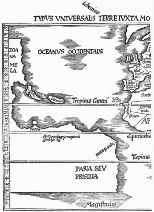 REISCH, 1515.
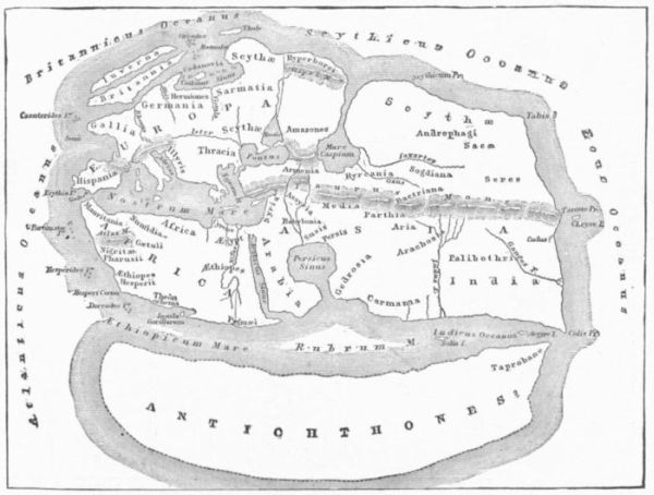 THE WORLD OF POMPONIUS MELA.
[From Bunbury's Ancient Geography.]
Asiatic connection
of
North
America.
We could hardly expect, indeed, to find in these maps of the Ptolemy
of 1513 the results of Balboa's discovery at the isthmus; but that the
maps were left to do service in the edition of 1520 indicates that the
discovery of the South Sea had by no means unsettled the public
mind as to the Asiatic connection of the regions both north and south
of the Antilles. Within the next few years several maps
indicate the enduring strength of this conviction. A Portuguese
portolano of 1516-20, in the Royal Library at Munich,
shows Moslem flags on the coasts of Venezuela and Nicaragua.
A map of Ayllon's discoveries on the Atlantic coast in 1520, preserved
in the British Museum, has a Chinaman and an elephant delineated
on the empty spaces of the continent. Still, geographical opinions
had become divided, and the independent continental masses of
Stobnicza were having some ready advocates.
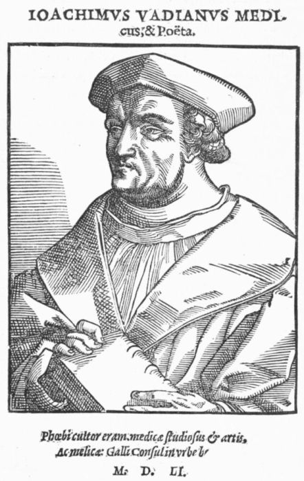 VADIANUS.
 APIANUS.
[From Reusner's Icones.]
Vienna geographers.
Pomponius
Mela.
Solinus.
Vadianus.
1520.
Apianus.
There was at this time a circle of geographers working at Vienna,
reëditing the ancient cosmographers, and bringing them into
relations with the new results of discovery. Two of these
early writers thus attracting attention were Pomponius Mela, whose
Cosmographia dated back to the first century, and Solinus,
whose Polyhistor was of the third. The Mela fell to the
care of Johann Camers, who published it as De Situ Orbis
at Vienna in 1512, at the press of Singrein; and this was followed in
1518 by another issue, taken in hand by Joachim Watt, better known
under the Latinized name of Vadianus, who had been born
in Switzerland, and who was one of the earlier helpers in
popularizing the name of America. The Solinus, the care of which
was undertaken by Camers, the teacher of Watt, was produced under
these new auspices at the same time. Two years later (1520) both of
these old writers attained new currency while issued together
and accompanied by a map of Apianus,—as the
German Bienewitz classicized his name,—in which further iteration
was given to the name of America by attaching it to the southern
continent of the west.
A strait at
the Isthmus
of Panama.
1515.
Schöner.
Antarctic
continent.
In this map Apianus, in 1520, was combining views of the western
hemisphere, which had within the few antecedent years found advocacy
among a new school of cartographers. These students represented
the northern and southern continents as independent entities,
disconnected at the isthmus, where Columbus had hoped to
find his strait. This is shown in the earliest of the Schöner
globes, the three copies of which known to us are preserved,
one at Frankfort and two at Weimar. It is in the Luculentissima
Descriptio, which was written to accompany this Schöner
globe of 1515, where we find that statement already referred
to, which chronicles, as Wieser thinks, an earlier voyage than
Magellan's to the southern strait, which separated the "America" of
Vespucius from that great Antarctic continent which did
not entirely disappear from our maps till after the voyage
of Cook.
1515.
Reisch.
Brazil.
It is a striking instance of careless contemporary observation, which
the student of this early cartography has often to confront, that while
Reisch, in his popular cyclopædia of the Margarita Philosophica
which he published first in 1503, gave not the slightest intimation of
the discoveries of Columbus, he did not much improve matters in
1515, when he ignored the discoveries of Balboa, and reproduced in
the main the so-called "Admiral's map" of the Ptolemy of 1513. It
is to be observed, however, that Reisch was in this reproduced
map of 1515 the first of map makers to offer in the
word "Prisilia" on the coast of Vespucius the prototype of the modern
Brazil. It will be remembered that Cabral had supposed
it an island, and had named it the Isla de Santa Cruz.
The change of name induced a pious Portuguese to believe it an instigation
of the devil to supplant the remembrance of the holy and
sacred wood of the great martyr by the worldly wood, which was commonly
used to give a red color to cloth!
Theories of
seamanship.
In 1519, in the Suma de Geographia of Fernandez d'Enciso, published
later at Seville, in 1530, we have the experience of one of
Ojeda's companions in 1509. This little folio, now a scarce book, is
of interest as first formulating for practical use some of the
new theories of seamanship as developed under the long
voyages at this time becoming common. It has also a marked interest
as being the earliest book of the Spanish press which had given consideration
at any length to the new possessions of Spain.
1522.
Frisius.
We again find a similar indisposition to keep abreast of discovery,
so perplexing to later scholars, in the new-cast edition of Ptolemy in
1522, which contains the well-known map of Laurentius Frisius. It
is called by Nordenskiöld, in subjecting it to analysis in
his Facsimile Atlas, "an original work, but bad beyond
all criticism, as well from a geographical as from a xylographical point
of view." One sees, indeed, in the maps of this edition, no knowledge
of the increase of geographical knowledge during later years. We
observe, too, that they go back to Behaim's interpretation of Marco
Polo's India, for the eastern shores of Asia. The publisher, Thomas
Ancuparius, seems never to have heard of Columbus, or at least fails
to mention him, while he awards the discovery of the New World to
Vespucius. The maps, reduced in the main from those of the edition
of 1513, were repeated in those of 1525, 1535, and 1541, without
change and from the same blocks.
 SCHÖNER.
The results of the voyage of Magellan and Del Cano promptly
attained a more authentic record than usually fell to the lot of these
early ocean experiences.
1523. Magellan's
voyage
described.
The company which reached Spain in the "Victoria" went at once
to Valladolid to report to the Emperor, and while there a pupil and
secretary of Peter Martyr, then at Court, Maximilianus Transylvanus
by name, got from these men the particulars of their discoveries, and,
writing them out in Latin, he sent the missive to his father, the Archbishop
of Salzburg,—the young man was a natural son
of this prelate,—and in some way the narrative got into
print at Cologne and Rome in 1523.
1523.
Schöner.
Rosenthal
gores.
Schöner printed in 1523 a little tract, De nuper ... repertis insulis
ac regionibus to elucidate a globe which he had at that time
constructed. It was published at Timiripæ, as the imprint
reads, which has been identified by Coote as the Grecized form of
the name of a small village not far from Bamberg, where Schöner was
at that time a parochial vicar. When a new set of engraved gores
were first brought to light by Ludwig Rosenthal, in Munich,
in 1885, they were considered by Wieser, who published an
account of them in 1888, as the lost globe of Schöner. Stevens, in
a posthumous book on Johann Schöner, expressed a similar belief.
This was a view which Stevens's editor, C. H. Coote, accepted. The
opinion, however, is open to question, and Nordenskiöld finds that the
Rosenthal gores have nothing to do with the lost globe of Schöner, and
puts them much later, as having been printed at Nuremberg about 1540.
Political aspects
of Magellan's
voyage.
Gomez.
The voyage of Magellan had reopened the controversy of Spain
with Portugal, stayed but not settled by the treaty of Tordesillas.
Estevan Gomez, a recusant captain of Magellan's
fleet, who had deserted him just as he was entering the
straits, had arrived in Spain May 6, 1521, and had his own
way for some time in making representation of the foolhardiness
of Magellan's undertaking.
On March 27, 1523, Gomez received a concession from the Emperor
to go on a small armed vessel for a year's cruise in the northwest,
to make farther search for a passage, but he was not to trespass
on any Portuguese possession. The disputes between Portugal and
Spain intensifying, Gomez's voyage was in the mean time put off for
a while.
Dispute over
the Moluccas.
Congress at
Badajos.
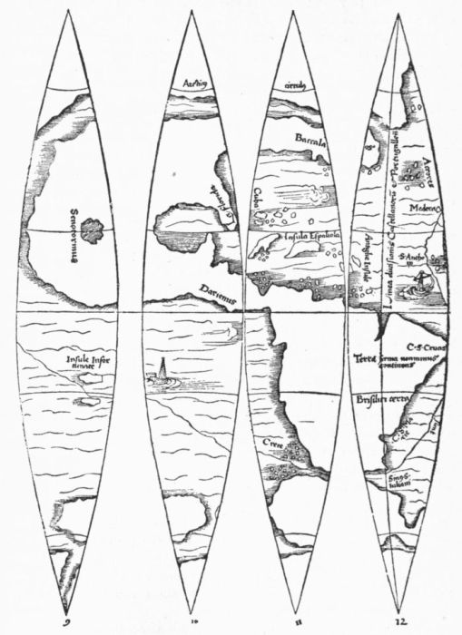 ROSENTHAL OR NUREMBERG GORES.
Gomara tells us that, in the opinion of his time, the Spaniards had
gained the Moluccas, at the conference at Tordesillas, by
yielding to the demands of the Portuguese, so that what
Portugal gained in Brazil and Newfoundland she lost in
Asia and adjacent parts. The Portuguese historian, Osorius, viewed
it differently; he counted in the American gain for his country, but
he denied the Spanish rights at the antipodes. So the longitude of
the Moluccas became a sharp political dispute, which there was an attempt
to settle in 1524 in a congress of the two nations that
was convened alternately at Badajos and Elvas, situated on
opposite sides of the Caya, a stream which separates the two countries.
Council of
the Indies.
Ferdinand Columbus, by a decree of February 19, 1524, had been
made one of the arbiters. After two months of wrangling, each side
stood stiff in its own opinions, and it was found best to break up the
congress. Following upon the dissolution of this body, the Spanish
government was impelled to make the management of the Indies
more effective than it had been under the commissions
which had existed, and on August 18, 1524, the Council
of the Indies was reorganized in more permanent form.
Gomez's
voyage.
An immediate result of the interchange of views at Badajos was a
renewal of the Gomez project, to examine more carefully the eastern
coast of what is now the United States, in the hopes of yet discovering
a western passage. Of that voyage, which is first mentioned in the
Sumario of Oviedo in 1526, and of the failure of its chief
aim, enough has already been said in the early part of this
appendix.
It has been supposed by Harrisse that the results of this voyage
were embodied in the earliest printed Spanish map which we have
showing lines of latitude and longitude,—that found in a joint edition
of Martyr and Oviedo (1534), and which is only known in a copy
now in the Lenox Library.
The purpose which followed upon the congress of Badajos, to penetrate
the Atlantic coast line and find a passage to the western sea, was
communicated to Cortes, then in Mexico, some time before the date of
his fourth letter, October 15, 1524. The news found him already
convinced of the desirableness of establishing a port on the great sea
of the west, and he selected Zucatula as a station for the fleets which
he undertook to build.
1526. Cortes
sends ships
to the Moluccas.
The Moluccas
sold to
Portugal.
Other projects delayed the preparations which were planned, and it
was not till September 3, 1526, that Cortes signified to the
Emperor his readiness to send his ships to the Moluccas.
After a brief experimental trip up the coast from Zucatula,
three of his vessels were finally dispatched, in October, 1527, on a disastrous
voyage to those islands, where the purpose was to confront the
Portuguese pretensions. It so happened, meanwhile, that Charles V.
needed money for his projects in Italy, and he called Ferdinand Columbus
to Court to consult with him about a sale of his rights in the
Moluccas to Portugal. Ferdinand made a report, which has not come
down to us, but a decision to sell was reached, and the Portuguese
King agreed to the price of purchase on June 20,
1530. Thus the Moluccas, which had been so long the goal
of Spanish ambition, pass out of view in connection with American
discovery.
There is some ground for the suspicion, if not belief, that the
Portuguese from the Moluccas had before this pushed eastward across the
Pacific, and had even struck the western verge of that continent which
separated them from the Spanish explorers on the Atlantic side.
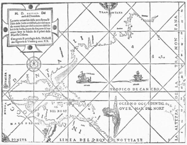 MARTYR-OVIEDO MAP, 1534.
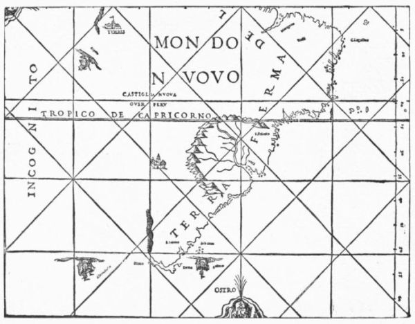 MARTYR-OVIEDO MAP, 1534.
North
America,
east coast.
Verrazano.
We come next to some further developments on the eastern coast of
North America. A certain French corsair, known from his
Florentine birth as Juan Florin, had become a terror by
preying on the Spanish commerce in the Indies. In January, 1524,
he was on his way, under the name of Verrazano, in the expedition
which has given him fame, and has supplied not a little
ground for contention, and even for total distrust of the
voyage as a fact. He struck the coast of North Carolina, turned
south, but, finding no harbor, retraced his course, and, making several
landings farther north, finally entered, as it would seem from his description,
the harbor of New York. The only point that he names
is a triangular island which he saw as he went still farther to the east,
and which has been supposed to be Block Island, or possibly Martha's
Vineyard. At all events, the name Luisa which he gave to it
after the mother of Francis I. clung to an island in this neighborhood
in the maps for some time longer. So he went on, and, if his landings
have been rightly identified, he touched at Newport, then at some
place evidently near Portsmouth in New Hampshire, and then, skirting
the islands of the Maine coast, he reached the country which he
recognized as that where the Bretons had been. He now ended what
he considered the exploration of seven hundred leagues of an unknown
land, and bore away for France, reaching Dieppe in July, whence,
on the 9th, he wrote the letter to the King which is the source of our
information. Attempts have been made, especially by the late Henry
C. Murphy, to prove this letter a forgery, but in the opinion of most
scholars without success.
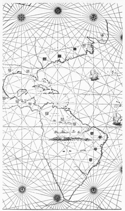 THE VERRAZANO MAP
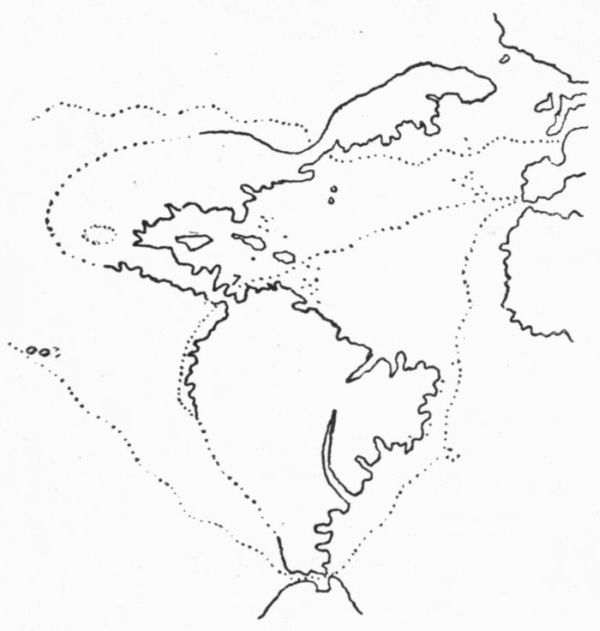 AGNESE, 1536.
The Verrazano
map.
Fortunately for the student, Hieronimo da Verrazano made, in 1529,
a map, still preserved in the college of the Propaganda at
Rome, in which the discoveries of his brother, Giovanni,
are laid down. In this the name of Nova Gallia supplants that of
Francesca, which had been used in the map of Maiollo (1527), supposed,
also, to have some relation to the Verrazano voyage.
The most distinguishing feature of the Verrazano map is a great
inland expanse of water, which was taken to
be a part of some western ocean, and which
remained for a long while in some form or
other in the maps. It was made to approach
so near the Atlantic that at one point there
was nothing but a slender isthmus connecting
the discoveries of the north with the country
of Ponce de Leon and Ayllon at the south.
The sea of
Verrazano.
It is in the Sumario (1526) of Oviedo that
we get the first idea of this sea of Verrazano,
as Brevoort contends, and we see it in the
Maiollo map of the next year, called
"Mare Indicum," as if it were an
indentation of the great western ocean of Balboa.
It was a favorite fancy of Baptista
Agnese, in the series of portolanos associated
with his name during the middle of the century,
and in which he usually indicated supposable
ocean routes to Asia. As time went
on, the idea was so far modified that this indentation
took the shape of a loop of the Arctic
seas, or of that stretch of water which at
the north connected the Atlantic and Pacific,
as shown in the Münster map in the Ptolemy
of 1540,—a map apparently based on the
portolanos of Agnese,—though the older form
of the sea seems to be adopted in the globe
of Ulpius (1542). This idea of a Carolinian
isthmus prevailed for some years, and may
have grown out of a misconception of the Carolina
sounds, though it is sometimes carried far
enough north, as in the Lok map of 1582, to
seem as if Buzzard's Bay were in some way
thought to stretch westerly into its depths.
The last trace of this mysterious inner ocean,
so far as I have discovered, is in a map made
by one of Ralegh's colonists in 1585, and preserved
among the drawings of John White in
the De Bry collection of the British Museum,
and brought to light by Dr. Edward Eggleston.
This drawing makes for the only time that I
have observed it, an actual channel at "Port
Royal," leading to this oceanic expanse, which
was later interpreted as an inland lake. Thus it was that this geographical
blunder lived more or less constantly in a succession of maps
for about sixty years, until sometimes it vanished in a large lake in
Carolina, or in the north it dwindled until it began to take a new lease
of life in an incipient Hudson's Bay, as in the great Lake of Tadenac,
figured in the Molineaux map of 1600, and in the Lago Dagolesme
in the Botero map of 1603.
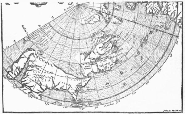 MICHAEL LOK, 1582.
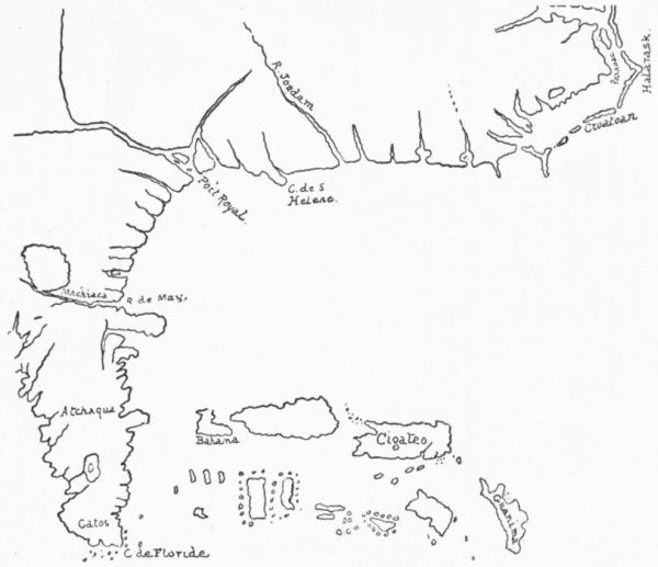 JOHN WHITE'S MAP.
[Communicated by Dr. Edward Eggleston.]
Norumbega.
It was apparently during the voyage of Verrazano that an Indian
name which was understood as "Aranbega" was picked up along the
northern coasts as designating the region, and which a little
later was reported by others as "Norumbega," and so passed
into the mysterious and fabled nomenclature of the coast with a good
deal of the unstableness that attended the fabulous islands of the Atlantic
in the fancy of the geographers of the Middle Ages. As a definition
of territory it gradually grew to have a more and more restricted
application, coming down mainly after a while to the limits of the later
New England, and at last finding, as Dr. Dee (1580), Molineaux
(1600), and Champlain (1604) understood it, a home on the Penobscot.
Still the region it represented contracted and expanded in people's
notions, and on maps the name seemed to have a license to wander.
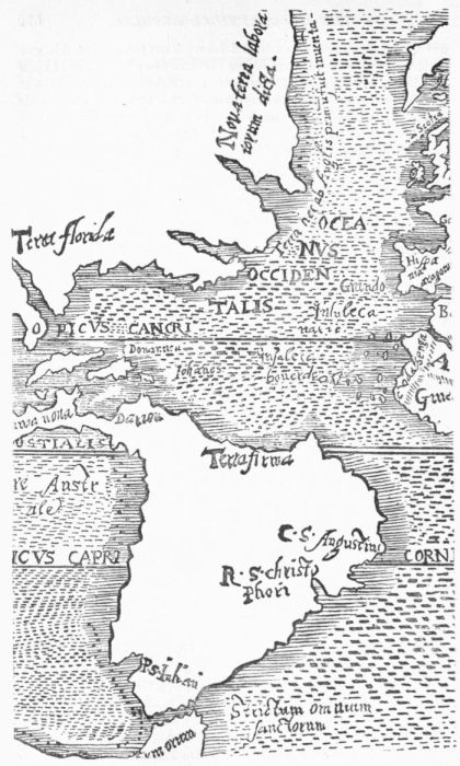 ROBERT THORNE, 1527.
The English
on the coast.
William
Hawkins.
During this period the English also were up and down the coast, but
they contributed little to our geographical knowledge. Slave-catching
on the coast of Guinea, and lucrative sales of the
human plunder in the Spanish West Indies and neighboring regions,
seem to have taken William Hawkins and others of his
countrymen to these coasts not infrequently between 1525
and 1540.
John Rut.
There is some reason to believe that John Rut, an Englishman, may
have explored the northeast coasts of the present United
States in 1527, a proposition, however, open to argument,
as the counter reasonings of Dr. Kohl and Dr. De Costa show. It is
certain that at this time Robert Thorne, an English merchant living in
Seville, was gaining what knowledge he could to promote English enterprise
in the north, and there has come down to us the map which
in 1527 he gave to the English ambassador in Spain, Edward Leigh,
to be transmitted to Henry VIII.
Progress of
maritime
art.
It was in 1526 when the Spanish authorities thought that the time
was fitting for making a sort of register of the progress of
discovery and of the attendant cartographical advances.
Nordenskiöld says that "from the beginning of the printing
of maps the graduations of latitude and longitude were marked
down in most printed maps, at least in the margin;" the most conspicuous
example of omitting these being, perhaps, in the work of Sebastian
Münster, at a period a little later than the one we have now
reached.
Latitude
and longitude.
In 1503 Reisch for the first time settled upon something like the
modern methods of indicating latitude and longitude in the
map which he annexed to his Margarita philosophica at
Freiburg, though so far as climatic lines could stand for
latitudinal notions, Pierre d'Ailly had set an example of scaling the
zones from the equator in his map of 1410. The Spaniards, however,
did not fall into the method of Reisch, so far as published maps
are concerned, till long afterwards (1534).
Italian
maps.
Up to the time when the Strassburg Ptolemy was issued, in 1513,
the chief activity in map-making had been in Italy. The
cartographers of that country got what they could from
Spain, but the main dependence was on Portuguese sources, though
the rivals of Spain were not always free in imparting the knowledge
of their hydrographical offices, since we find Robert Thorne, in
1527, charging the Portuguese with having falsified their records.
It is worthy of remark that no official map of the Indies was published
in Spain till 1790.
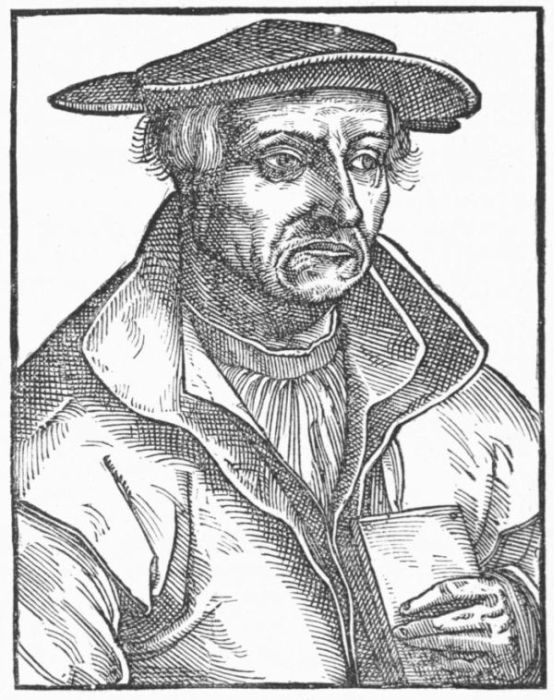 SEBASTIAN MÜNSTER.
[From Reusner's Icones, 1590.]
Cartographical
activity
north of the
Alps.
Map projections.
After 1513, and so on to the middle of the century, it was to the
north of the Alps that the cosmographical students turned
for the latest light upon all oceanic movements. The question
of longitude was the serious one which both navigators
and map makers encountered. The cartographers were trying all
sorts of experiments in representing the converging meridians
on a plane surface, so as not to distort the geography,
and in order to afford some manifest method for the guidance of ships.
Lunar observations.
Chronometers.
These experiments resulted, as Nordenskiöld counts, in something like
twenty different projections being devised before 1600. For the seaman
the difficulty was no less burdensome in trying to place his ship
at sea, or to map the contours of the coasts he was following. The
navigator's main dependence was the course he was steering and an
estimate of his progress. He made such allowance as he could for his
drift in the currents. We have seen how the imperfection of his instruments
and the defects of his lunar tables misled Columbus
egregiously in the attempts which he made to define
the longitude of the Antilles. He placed Española at 70° west of
Seville, and La Cosa came near him in counting it about 68°, so far
as one can interpret his map. The Dutch at this time were beginning
to grasp the idea of a chronometer, which was the device
finally to prove the most satisfactory in these efforts.
Earliest sea-atlas.
Reinerus Gemma of Friesland, known better as Gemma Frisius, began
to make the Dutch nautical views better known when he suggested,
a few years later, the carrying of time in running off the longitudes,
and something of his impress on the epoch was shown in the stand
which a pupil, Mercator, took in geographical science. The Spieghel
der Zeevaardt of Lucas Wagenaer, in 1584 (Leyden), was
the first sea-atlas ever printed, and showed again the Dutch
advance.
There were also other requirements of sea service that were not forgotten,
among which was a knowledge of prevalent winds and ocean
currents, and this was so satisfactorily acquired that the return voyage
from the Antilles came, within thirty years after Columbus, to be
made with remarkable ease. Oviedo tells us that in 1525 two caravels
were but twenty-five days in passing from San Domingo to the
river of Seville.
Two of the duties imposed by the Spanish government upon the
Casa de la Contratacion, soon after the discovery of the New World,
were to patronize invention to the end of discovering a process for
making fresh water out of salt, and to improve ships' pumps,—the
last a conception not to take effective shape till Ribero, the royal cosmographer,
secured a royal pension for such an invention in 1526.
Congress of
pilots at
Seville.
It was in the midst of these developments, both of the practical
parts of seamanship and of the progress of oceanic discovery, that in
1526 there was held at Seville a convention of pilots and
cosmographers, called by royal order, to consolidate and
correlate all the cartographical data which had accumulated
up to that time respecting the new discoveries.
Ferdinand
Columbus.
Ferdinand Columbus was at this time in Seville, engaged in completing
a house and library for himself, and in planting the park about
them with trees brought from the New World, a single one
of which, a West Indian sapodilla, was still standing in
1871. It was in this house that the convention sat, and Ferdinand
Columbus presided over it, while the examinations of the pilots were
conducted by Diego Ribero and Alonso de Chaves.
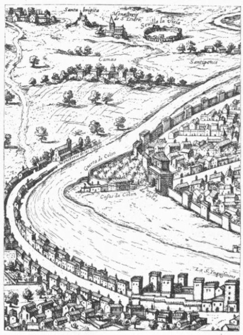 HOUSE AND LIBRARY OF FERDINAND COLUMBUS.
1527-29.
Maps.
There have come down to us two monumental maps, the outgrowth
of this convention. One of these is dated at Seville, in 1527, purporting
to be the work of the royal cosmographer, and has been
usually known by the name of Ferdinand Columbus; and
the other, dated 1529, is known to have been made by Diego Ribero,
also a royal cosmographer. These maps closely resemble each other.
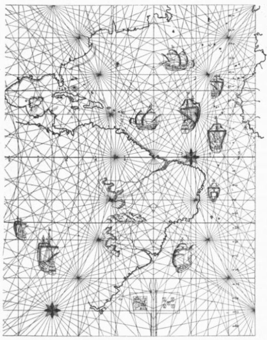 SPANISH MAP, 1527.
[After sketch in E. Mayer's Die Entwicklung der Seekarten (Wien, 1877).]
The Weimar chart of 1527, which Kohl, Stevens, and others have
assigned to Ferdinand Columbus, has been ascribed by Harrisse to
Nuño Garcia de Toreno, but by Coote, in editing Stevens on Schöner,
it is assigned to Ribero, as a precursor of his undoubted production
of 1529.
Idea of a
new continent
spreading.
We have seen how, succeeding to the belief of Columbus that the
new regions were Asia, there had grown up, a few years after his death,
in spite of his audacious notarial act at Cuba, a strong presumption
among geographical students that a new continent had been
found. We have seen this conception taking form with
more or less uncertainty as to its western confines immediately
upon, and even anticipating,
the discovery
of the actual South Sea
by Balboa, and can follow
it down in the maps
or globes of Stobnicza
and Da Vinci, in that
known as the Lenox
globe, in those called the
Tross and Nordenskiöld
gores, the Schöner and
Hauslab globes, the Ptolemy
map of 1513, and in
those of Reisch, Apianus,
Laurentius Frisius, Maiollo,
Bordone, Homem,
and Münster,—not to
name some others. In
twenty years it had come
to be a prevalent belief,
and men's minds were
turned to a consideration
of the possibility of this
revealed continent having
been, after all, known
to the ancients, as Glareanus,
quoting Virgil, was
the earliest to assert in
1527.
Reaction in
the monk
Franciscus.
About 1525 there came
a partial reaction, as if
the discovery of Balboa
had been pushed too far
in its supposed results.
We find this taking form in 1526, in an identification of
North America with eastern Asia in a map ascribed to the
monk Franciscus, while South America is laid down as a
continental island, separated from India by a strait only. The strait
is soon succeeded by an isthmus, and in this way we get a solution of
the problem which had some currency for half a century or more.
Orontius
Finæus.
Orontius Finæus was one of these later compromisers in cartography,
in a map which he is supposed to have made in
1531, but which appeared the next year in the Novus Orbis
(1532) of Simon Grynæus,
and was used in
some later publications
also. We find in this
map, about the Gulf of
Mexico, the names which
Cortes had applied in
his map of 1520 mingled
with those of the
Asiatic coast of Marco
Polo. We annex a
sketch of this map as
reduced by Brevoort to
Mercator's projection.
A map very similar to
this and of about the
same date is preserved
in the British Museum
among the Sloane manuscripts,
and the same
bold solution of the difficulty
is found in the
Nancy globe of about
1540, and in the globe
of Gaspar Vopel of 1543.
Johann
Schöner.
There is a good instance
of the instability
of geographical knowledge
at this time in the
conversion of Johann
Schöner from
a belief in an
insular North America,
to which he had clung
in his globes of 1515 and 1520, to a position which he took in 1533,
in his Opusculum Geographicum, where he maintains that the city
of Mexico is the Quinsay of Marco Polo.
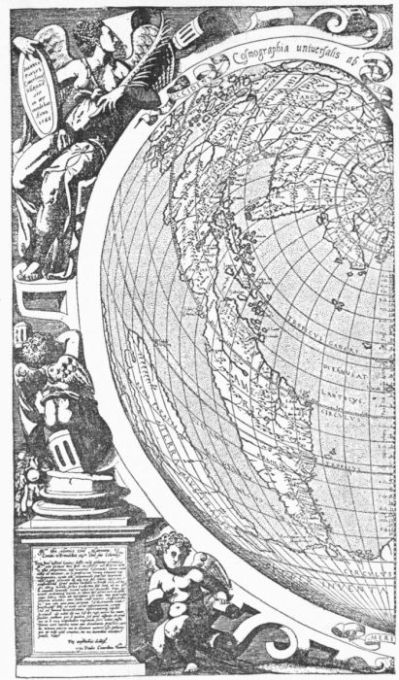 ORONTIUS FINÆUS, 1532.
[After Cimelinus's Copperplate of 1566.]
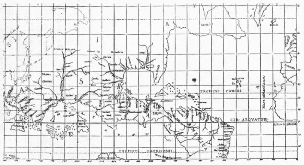 ORONTIUS FINÆUS, 1531.
[Reduced by Brevoort to Mercator's projection.]
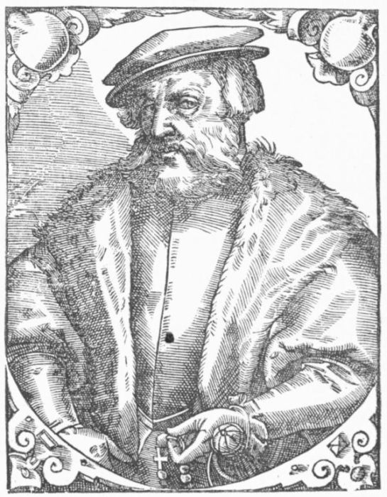 CORTES.
The Pacific
explored.
California.
Previous to Cortes's departure for Spain in 1528, he had, as we
have seen, dispatched vessels from Tehuantepec to the Moluccas, but
nothing was done to explore the Pacific coast northward till
his return to Mexico. In the spring or early summer of
1532 he sent Hurtado de Mendoza up the coast; but little success attending
the exploration, Cortes himself proceeded to Tehuantepec and
constructed other vessels, which sailed in October, 1533. A gale
drove them to the west, and when they succeeded in working back and
making the coast, they found themselves well up what proved to be
the California peninsula. They now coasted south and
developed its shape, which was further brought out in detail
by an expedition led by Cortes himself in 1535, and by a later one
sent by him under Francisco de Ulloa in 1539. Cortes had supposed
the peninsula an island, but this expedition of 1539 demonstrated the
fact that no passage to the outer sea existed at the head of the gulf,
which these earliest navigators had called the Sea of Cortes. The
conqueror of Mexico had now made his last expedition on the Pacific,
and his name was not destined to be long connected with this new
field of discovery, unless, indeed, it was a prompting of Cortes—hardly
proved, however—which attached to this peninsular region
the euphonious name of California, and which, after an interval when
the gulf was called the Red Sea, was applied to that water also. The
views of Ulloa were confirmed in part, at least, by Castillo in 1540,
who has left us a map of the gulf.
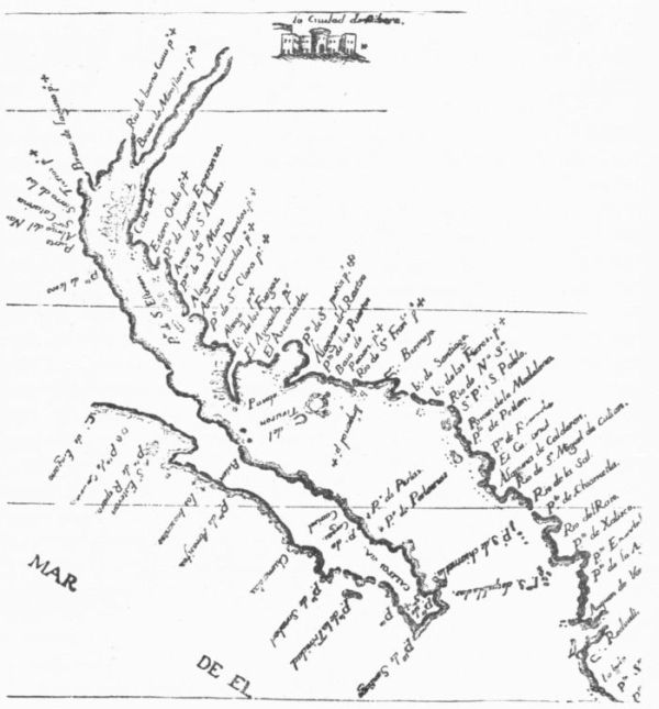 CASTILLO'S CALIFORNIA.
The outer coast of the peninsula as far north as 28° 30' had been
established in 1533. It was ten years later, in 1543, that Cabrillo,
making his landfall in the neighborhood of 33°, just within the southern
bounds of the present State of California, coasted up to Cape
Mendocino, and perhaps to 44°, or nearly, to that spot, in the present
State of Oregon. If Cabrillo, who had died January 3, 1543, did
not himself go so high, the credit belongs to Ferrelo, his chief pilot.
Late in 1542 Mendoza sent an expedition under Ruy Lopez de
Villalobos, across the Pacific, and if a map of Juan Freire, made in
1546, is an indication of his route, he seems to have gone higher up
the coast than any previous explorer.
The Atlantic
coast of
North
America.
While this development of the northwest coast of North America
was going on, there were other discoverers still endeavoring
on the Atlantic side to connect the waters of the two
oceans.
1534.
Cartier.
In April, 1534, Jacques Cartier, a jovial and roistering fellow, as
Father Jouon des Longrais, his latest biographer, makes
him out (Jacques Cartier, Paris, 1888), and who had led
the roving life of a corsair in the recent wars of France, was now
turning his energy to solve the great problem of this western passage.
He sailed from St. Malo, and for the first time laid open, by an official
examination, the inner spaces of the St. Lawrence Gulf, which
might have been, indeed, and probably were, known earlier to the
hardy Breton and Norman fishermen. We are deficient in a knowledge
of the early frequenting of these coasts because the charts of
such fishermen, and of those who visited the region for trade in peltries,
have not come down to us, though Kohl thinks there is some likelihood
of such records being preserved in a portolano of the British Museum.
The track of Cartier about the Gulf of St. Lawrence has caused
some discussion and difference of opinion in the publications of Kohl,
De Costa, Laverdière, and W. F. Ganong, the latter writer claiming,
in a careful paper in the Transactions of the Royal Society of Canada
for 1889, that in the correct interpretation of Cartier's first voyage
we find a key to the cartography of the gulf for almost a century.
The Rotz map of 1542 seems to be the earliest map which we
know to show a knowledge of Cartier's first voyage. The Henri II.
map of 1542 still more develops his work of exploration.
The chance of further discovery in this direction induced the French
king once more to commission Cartier, October 30, 1534, and early
in 1535 his little fleet sailed, and by August, after some discouragements,
not lessened when he found the water freshening, he began to
ascend the St. Lawrence River, reaching the site of Montreal. No
map by Cartier himself is preserved, though it is known that he made
such. Thenceforward the cartography of this northeastern region
showed the St. Lawrence Gulf in a better development of the earlier
so-called Square Gulf and of the great river of Canada. It is of record
that Francis I., in commissioning Cartier, considered that he was
dispatching him to ascend an Asiatic river, and the name of Lachine
even to-day is preserved as evidence of the belief which Cartier entertained
that he was within the bounds of China.
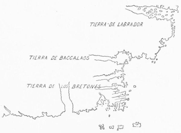 SKETCH FROM A PORTOLANO IN THE BRITISH MUSEUM.
John Rotz's
map.
John Rotz's Boke of Idiography—a manuscript of 1542, preserved
in the British Museum—shows, in his drawing of the region
about the Gulf of St. Lawrence, certain signs, as Kohl
thinks, of having had access to the charts of Cartier, and Harrisse
traces in them the combined influence of the Portuguese and Dieppe
navigators.
The Cartier voyages seem to have made little impression outside
of France, and we find for some years few traces of his discoveries
in the portolanos of Italy and in the maps of the rest of Europe. It
was only when the expedition of Roberval, in 1540-41, excited attention
that the rest of Europe seemed to recognize these French
efforts.
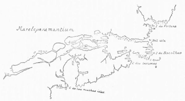 HOMEM, 1558.
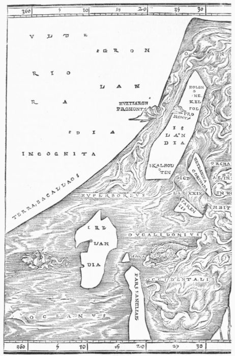 ZIEGLER'S SCHONDIA.
Cartier's
later
voyages.
Allefonsce.
The later voyages of Cartier, in 1541 and 1543, revealed nothing
more of general geographical interest. Indeed, the hope of
a western passage in this direction had been abandoned in
effect after Cartier's second voyage, although the pilot
Allefonsce, who accompanied a later expedition, had been
detailed to explore the Labrador coast to that end, and had
been turned back by ice. After this he seems to have gone south into
a great bay, under 42°, the end of which he did not reach. This may
have been the large expanse partly shut in by Cape Sable (Nova
Scotia) and Cape Cod, now called in the coast survey charts the Gulf
of Maine; or perhaps it may conform, taking into account his registered
latitude, to the inner bight of it called Massachusetts Bay. At
all events, Allefonsce believed himself on coasts contiguous to Tartary,
through which he had hopes to find access to the more hospitable
orient (occident) farther south. He apparently had something of the
same notion regarding the westerly stretch of water which he found
below Cape Cod, extending he knew not where, along the inclosure of
the present Long Island Sound.
In the years both before and after the middle of the century,
French vessels were on this coast in considerable numbers for purposes
of trade or for protecting French interests, but we know nothing of
any accessions to geographical knowledge which they made.
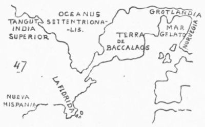 RUSCELLI, 1544.
Allefonsce speaks of the Saguenay as widening, when he went up,
till it seemed to be an
arm of the sea, and "I
think the same," he adds,
"runs into the Sea of
Cathay;" and so he
draws it on one of his
maps,—an idea made
more general in the map
of Homem in 1558, where
the St. Lawrence really
becomes a channel,
locked by islands, bordering
an Arctic Sea. Ramusio, in 1553, has inferred from such reports
as he could get of Cartier's explorations, that his track had lain in
channels bounded by islands, and a similar view had already been expressed
in a portolano of 1536, preserved in the Bodleian, which Kohl
associates with Homem or Agnese. The oceanic expansion of the
Saguenay is preserved as late as the Molineaux map of 1600.
River of
Norumbega.
It is to the work of Allefonsce that we probably owe another confusion
of this northern cartography in the sixteenth century. What
we now know as Penobscot Bay and River was called by
him the River of Norumbega, and he seems to have given
some ground for believing that this river connected the waters of the
Atlantic with the great river of Canada, just as we find it later shown
upon Gastaldi's map in Ramusio, by Ruscelli in 1561, by Martines in
1578, by Lok in 1582, and by Jacques de Vaulx in 1584.
Greenland
connects Europe
and
America.
While this idea of the north was developing, there came in another
that made the peninsular Greenland of the ante-Columbian maps
grow into a link of land connecting Europe with the Americo-Asiatic
main, so that one might in truth perambulate the globe
dryshod. We find this conception in the maps of the Bavarian
Ziegler (1532), and in the Italians Ruscelli (1544) and
Gastaldi (1548),—the last two represented in the Ptolemies of those
years published in Italy. But these Italian cosmographers were by no
means constant in their belief, as Ruscelli showed in his Ptolemy of
1561, and Gastaldi in his Ramusio map of 1550.
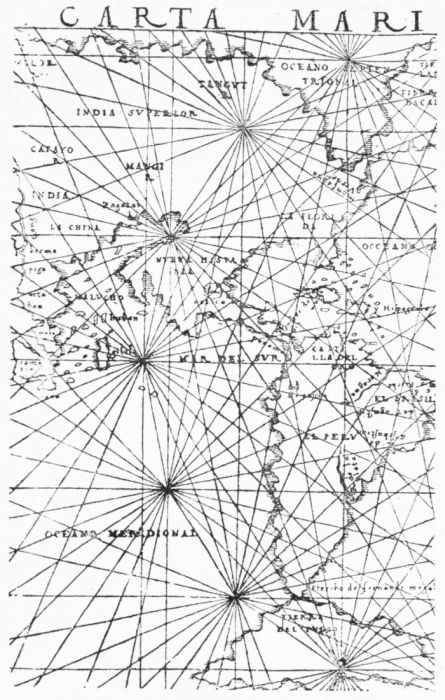 CARTA MARINA, 1548.
Asia and
America
joined in the
higher latitudes.
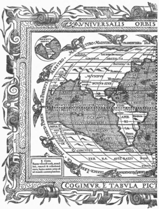 MYRITIUS, 1590.
As the Pacific explorations were stretched northward from Mexico,
and the peninsula of California was brought into prominence,
there remained for some time a suspicion that the
western ocean made a great northerly bend, so as to sever
North America from Asia except along the higher latitudes.
We find this northerly extension of the Pacific in a map of copper preserved
in the Carter-Brown library, which seems to have been the
work of a Florentine goldsmith somewhere about 1535; in the Carta
Marina of Gastaldi in 1548; and it even exists in maps of a later date,
like that of Paolo de Furlani (1560) and that of Myritius (1587).
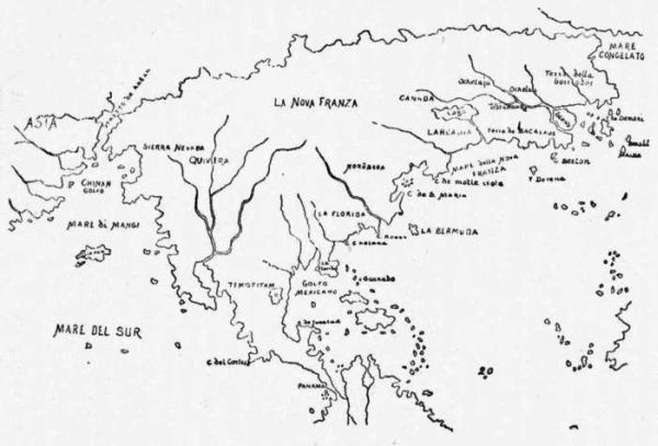 ZALTIÉRE, 1560.
Entanglement
of the
American
and Asiatic
coasts.
1728.
Bering.
This map of Myritius, which appeared in his Opusculum Geographicum,
published at Ingolstadt in 1590, is the work of, perhaps, the last of
the geographers who did not leave more or less doubt about the connection
of North America with Asia. So it took about a full century
for the entanglement of the coasts of Asia and America,
which Columbus had imagined, to be practically eradicated
from the maps. Not that there were not doubters, even
very early, but the faith in a new continent grew slowly
and had many set-backs; nor did the Asiatic connection fade entirely
out, as among the possibilities of geography, for considerably more
than a century yet to come. The uncertainties of the higher latitudes
kept knowledge in suspense, and even the English settlers on the
northerly coasts of the United States were not quite sure.
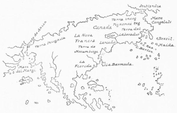 PORCACCHI, 1572.
Thomas Morton, the chronicler of a colony on the Massachusetts shores, felt
it necessary, so late as 1636, to make a reservation that possibly
the mainland of America bordered on the land of the Tartars. Indeed,
no one could say positively, though much was conjectured, that
there was not a terrestrial connection in the extreme northwest,
under arctic latitudes, till Bering in 1728, two hundred
and thirty-six years after Columbus offered his prayer
at San Salvador, passed from the Pacific into the polar waters. This
became the solution of the fabled straits of Anian, an inheritance
from the very earliest days of northern exploration, which, after the
middle of the sixteenth century, was revived in the maps of Martines,
Zaltière, Mercator, Porcacchi, Furlani, and Wytfliet, prefiguring the
channel which Bering passed. Much in the same way as the southern
apex of South America was a vision in men's minds long before Magellan
found his way to the Pacific.
1536.
Chaves.
1538.
Mercator.
1540. Hartmann
gores.
But we have anticipated a little. Coincident with the efforts of
Cartier to discover this northern passage we mark other navigators
working at the same problem. The Spaniard Alonso de
Chaves made a chart of this eastern coast in 1536; but we
only know of its existence from the description of it written by Oviedo
in 1537. In the earliest map which we have from the hand
of Gerard Mercator, and of which the only copy known was
discovered some years ago by the late James Carson Brevoort, of New
York, we find the northern passage well defined in 1538, and a broad
channel separating the western coast of America from a parallel coast
of Asia,—a kind of delineation which is followed in some globe-gores
of about 1540, which Nordenskiöld thinks may have been
the work of George Hartmann, of Nuremberg. This map
is evidently based on Portuguese information, and that Swedish
scholar finds no ground for associating it with the lost globe of Schöner,
as Stevens has done. A facsimile of part of it has already been
given.
1540-45.
Münster.
Sebastian Münster, in his maps in the Ptolemy of 1540-45, makes
a clear seaway to the Moluccas somewhere in the latitude of
the Strait of Belle Isle. Münster was in many ways antiquated
in his notions. He often resorted to the old device of the
Middle Ages by supplying the place of geographical details with figures
of savages and monsters.
We come now to two significant maps in the early history of American
cartography.
Columbus had been dead five and thirty years when a natural
result grew out of those circumstances which conspired to name the
largest part of the new discoveries after a secondary pathfinder. We
have seen that there seemed at first no injustice in the name of
America being applied to a region in the main external to the range
of Columbus's own explorations, and how it took nearly a half century
before public opinion, as expressed in the protest of Schöner in
1533, recognized the injustice of using another's name.
1541.
Mercator.
Whether that protest was prompted by a tendency, already shown, to give
the name to the whole western hemisphere is not clear; but certainly
within eight years such a general application was publicly made, when
Mercator, in drafting in 1541 some gores for a globe, divided the
name AME—RICA so that it covered both North and South America,
and qualified its application by a legend which says
that the continent is "called to-day by many, New India."
Thus a name that in the beginning was given to a part in distinction
merely and without any reference to the entire field of the new explorations,
was now become, by implication, an injustice to the great first
discoverer of all. The mischief, aided by accident and by a not unaccountable
evolution, was not to be undone, and, in the singular mutations
of fate, a people inhabiting a region of which neither Columbus
nor Vespucius had any conception are now distinctively known in the
world's history as Americans.
These 1541 gores of Mercator were first made known to scholars a
few years ago, when the Belgian government issued a facsimile edition
of the only copy then known, which the Royal Library at Brussels
had just acquired; but since there have been two other copies
brought to light,—one at St. Nicholas in Belgium, and the other in
the Imperial library at Vienna.
Henry II.
map.
1544. Cabot
map.
There are some indications on Spanish globes of about 1540, and
in the Desceliers or Henry II. map of 1546, that the Spanish
government had sent explorers to the region of Canada
not long after Cartier's earliest explorations, and it is significant that
the earliest published map to show these Cartier discoveries is the
other of the two maps already referred to, namely, the
Cabot mappemonde of 1544, which has been supposed a
Spanish cartographical waif. Early publications of southern and middle
Europe showed little recognition of the same knowledge.
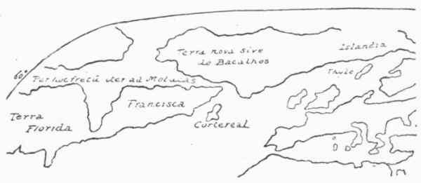 MÜNSTER, 1545.
The Cabot map has been an enigma to scholars ever since it was
discovered in Germany, in 1843, by Von Martius. It was deposited
the next year in the great library at Paris. It is a large elliptical
world-map, struck from an engraved plate, and it bears sundry elucidating
inscriptions, some of which must needs have come from Sebastian
Cabot, others seem hardly to merit his authorship, and one
acknowledges him as the maker of the map. There is, accordingly, a
composite character to the production, not easily to be analyzed so as
to show the credible and the incredible by clear lines of demarcation.
We learn from it how it proclaimed for the first time the real agency
of John Cabot in the discovery of North America, confirmed when
Hakluyt, in 1582, printed the patent from Henry VII. There is an
unaccountable year given for that discovery, namely, 1494, but we
seem to get the true date when Michael Lok, in 1582, puts down "J.
Cabot. 1497," against Cape Breton in his map of that year. As this
last map appeared in Hakluyt's Divers Voyages, and as Hakluyt tells
us of the existence of Cabot's maps and of his seeing them, we may
presume that we have in this date of 1497 an authoritative statement.
We learn also from this map of 1544 that the land first seen was the
point of the island now called Cape Breton. Without the aid of this
map, Biddle, who wrote before its discovery, had contended for Labrador
as the landfall.
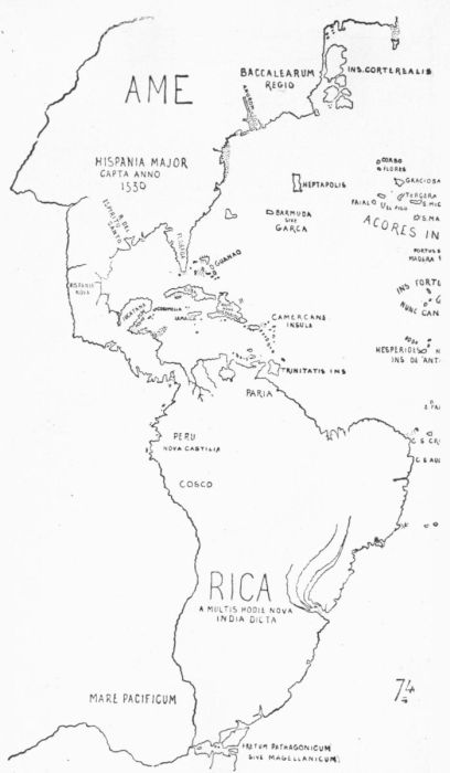 MERCATOR, 1541.
[Sketched from his gores.]
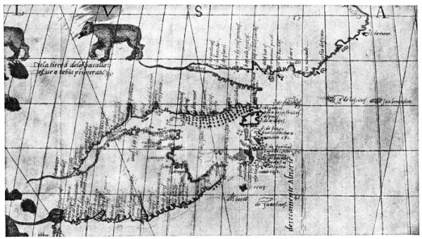 FROM THE SEBASTIAN CABOT MAPPEMONDE. 1514.
Scarcity of
Spanish
printed
maps.
We know, on the testimony of Robert Thorne in 1527, if from no
other source, that it was a settled policy of the Spanish government to
allow no one but proper cartographical designers to make
its maps, "for that peradventure it would not sound well to
them that a stranger should know or discover their secrets."
This doubtless accounts for the fact that, in the two hundred maps
mentioned by Ortelius in 1570 as used by him in compiling his atlas,
not one was published in Spain; and every bibliographer knows that
not a single edition of Ptolemy, the best known channel of communicating
geographical knowledge in this age of discovery, bears a Spanish
imprint. The two general maps of America during the sixteenth
century, which Dr. Kohl could trace to Spanish presses, were that of
Medina in 1545 and that of Gomara in 1554, and these were not of
a scale to be of any service in navigating.
Cabot's connection
with
the map of
1544.
There seem to be insuperable objections to considering that Sebastian
Cabot had direct influence in the production of the map now
under consideration. It is full of a lack of knowledge
which it is not possible to ascribe to him. That it is based
upon some drafts of Cabot is most probably true; but they
are clearly drafts, confused and in some ways perverted, and eked
out by whatever could be picked up from other sources.
That the Cabot map was issued in more than one edition is inferred
partly from the fact that the legends which Chytræus quotes from it
differ somewhat from those now in the copy preserved in Paris; and
indeed Harrisse finds reason to suppose that there may have been four
different editions. That in some form or other it was better known
in England than elsewhere is deduced from certain relations sustained
with that country on the part of those who have mentioned the map,—Livio
Sanuto, Ortelius, Sir Humphrey Gilbert, Richard Willes,
Hakluyt, and Purchas.
Whoever its author and whatever its minor defects, this so-called
Cabot map of 1544 may reasonably be accepted as the earliest really
honest, unimaginative exhibition of the American continent which had
been made. There was in it no attempt to fancy a northwest passage;
no confidence in the marine or terrestrial actuality of the region
now known to be covered by the north Pacific; no certainty about the
entire western coast line of South America, though this might have
been decided upon if the maker of the map had been posted to date
for that region. The maker of it further showed nothing of that presumption,
which soon became prevalent, of making Tierra del Fuego
merely but one of the various promontories of an immense Antarctic
continent, which later stood in the planispheres of Ortelius and Wytfliet.
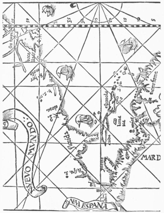 MEDINA, 1544.
Geographical
study
transferred
to Italy.
This map of Cabot was the last of the principal cartographical monuments
made north of the Alps in this early half of the sixteenth
century. The centre of geographical study was now
transferred to Italy, where it had begun with the opening of
the interest in oceanic discovery. For the next score years and more
we must look mainly to Venice for the newer development.
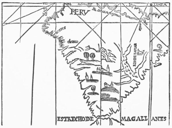 MEDINA, 1544.
1548, Gastaldi.
In the Venice Ptolemy of 1548, we have for the first time a series
of maps of the New World by Gastaldi, which were simply enlarged
by Ruscelli in the edition of 1561, except in a few instances,
where new details were added, like the making of Yucatan
a peninsula instead of the island which Gastaldi had drawn. They
were repeated in the edition of 1562.
Sea manuals.
Meanwhile the most popular sea manuals of this period were Spanish;
but they studiously avoided throwing much light on
the new geography.
That of Martin Cortes was the first to suggest a magnetic pole as
distinct from the terrestrial pole. Its rival, the Arte de Navegar of
Pedro de Medina, published at Valladolid in 1545, never reached the
same degree of popularity, nor did it deserve to, for his notions were
in some respects erratic.
The English in their theories of navigation had long depended on
the teachings of the Spaniards, and Eden had translated the chief Spanish
manual in his Arte of Navigation of 1561.
Ship's log.
A great advance was possible now, for a new principle had been devised,
and an estimate of the progress of a ship was no longer dependent
on visual observation. The log had made it possible
to put dead reckoning on a pretty firm basis. This was the
great new feature of the Regiment of the Sea, which the Englishman,
William Bourne, published in 1573; and sixteen years later, in 1589,
another Englishman, Blunderville, made popularly known the new instrument
for taking meridian altitudes at sea, the cross-staff, which had
very early superseded the astrolabe on shipboard.
The inclination or dip of the needle, showing by its increase an
approach to a magnetic pole, was not scaled till 1576, when Robert
Norman made his observations, and it is not without some service
to-day in that combination of phenomena of which Columbus noted
the earliest traces in his first voyage of 1492.
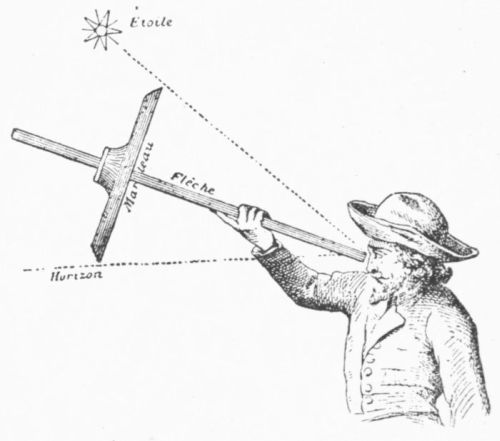 THE CROSS-STAFF.
Italian discoverers.
English discoverers.
It is significant how large a part in the cardinal discoveries of the
fifteenth and sixteenth centuries was taken by Italian navigators, seamen,
shipwrights, mathematicians, and merchants, whether
in Portugal or Spain, France or England. It is curious, too,
to observe how, when the theoretical work and confirmatory explorations
were finished, and the commercial spirit succeeded to that of science,
England embarked with her adventurous spirit. The death of
Queen Mary in 1558 was the signal for English exertion,
and that exertion became ominous to all Europe in the reign
of Elizabeth, accompanied by an intellectual movement, typified in
Bacon and Shakespeare, similar to that which stirred the age of Columbus
and the Italian renaissance.
John Hawkins.
John Hawkins and African marauders of his English kind were
selling negro slaves in Española in 1562 and subsequent
years, and from them we get our first English accounts
of the Florida coast, which on their return voyages they skirted.
New
France.
Spanish settlements
fail
at the north.
America had at this time been abandoned for a long while to Spain
and France, and the latter power had only entered into competition
with Charles V., when Francis I., as we have seen, had sent out Verrazano
in 1521 to take possession of the north Atlantic coasts. Out of
this grew upon the maps the designation of New France,
which was attached to the main portion of the North American
continent. And this French claim is recognized in the maps,
painted about 1562, on the walls of the geographical gallery in the
Vatican. So the French stole upon the possession of Spain in the
West Indies; and the English followed in their wake, when the death
of Mary rendered it easier for the English to smother their inherited
antipathy to France. This done, the English in due time joined the
French in efforts to gain an ascendency over Spain in the Indies, to
compensate for the loss of such power in Italy. The Spaniards,
though they had attempted to make settlements along
the Chesapeake at different times between 1566 and 1573,
never succeeded in making any impression on the history of this northern
region.
The cartography of the north was at this period subject to two new
influences; and both of them make large demands upon the credulity
of scholarship in these latter days.
André
Thevet.
Attempts have been made to trace some portion of the development
of the coasts of the northeastern parts of the United States
to the publications of a mendacious monk, André Thevet.
He had been sent out to the French colony of Rio de Janeiro in 1555,
where he remained prostrated with illness till he was able to reëmbark
for France, January 31, 1556. In 1558 he published his Singularitez
de la France Antarctique, a descriptive and conglomerate work,
patched together from all such sources as he could pillage, professing
to follow more or less his experiences on this voyage. He says nothing
in it of his tracking along the east coast of the present United
States. Seeking notoriety and prestige for his country, he pretends,
however, in his Cosmographie published in 1575, to recount the experiences
of the same voyage, and now he professes to have followed
this same eastern coast to the region of Norumbega. Well-equipped
scholars find no occasion to believe that these later statements were
other than boldly conceived falsehoods, which he had endeavored to
make plausible by the commingling of what he could filch from the
narratives of others.
The Zeni
story.
It was at this time also (1558) that there was published at Venice
the strange and riddle-like narrative which purports to give the experiences
of the brothers Zeni in the north Atlantic waters in the fourteenth
century. The publication came at a time when, with
the transfer of cartographical interest from over the Alps
to the home of its earliest growth, the countrymen of Columbus were
seeking to reinstate their credit as explorers, which during the fifteenth
century and the early part of the sixteenth they had lost to the peoples
of the Iberian peninsula. Anything, therefore, which could emphasize
their claims was a welcome solace. This accounts both for the
bringing forward at this time of the long-concealed Zeni narrative,—granting
its genuineness,—and for the influence which its accompanying
map had upon contemporary cartography. This map professed
to be based upon the discoveries made by the Zeni brothers, and
upon the knowledge acquired by them at the north in the fourteenth
century. It accordingly indicated the existence of countries called Estotiland
and Drogeo, lying to the west, which it was now easy to identify
with the Baccalaos
of the Cabots, and with
the New France of the
later French.
The Zeni
map.
"If this remarkable
map," says Nordenskiöld,
"had not received
extensive circulation
under the sanction
of Ptolemy's
name,"
for it was copied in the
edition of 1561 of that
geographer, "it would
probably have been
soon forgotten. During
nearly a whole century
it had exercised an influence
on the mapping
of the northern countries
to which there
are few parallels to be
found in the history of
cartography." It is
Nordenskiöld's further
opinion that the Zeni
map was drawn from
an old map of the north
made in the thirteenth
century, from which the
map found in the Warsaw
Codex of Ptolemy
of 1467 was also drawn.
He further infers that some changes and additions were imposed to
make it correspond with the text of the Zeni narrative.
The year 1569 is marked by a stride in cartographical science, of
which we have not yet outgrown the necessity.
1569. Mercator's
projection.
The plotting of courses and distances, as practiced by the early
explorers, was subject to all the errors which necessarily
accompany the lack of well-established principles, in representing
the curved surface of the globe on a plane chart.
Cumbrous and rude globes were made to do duty as best they could;
but they were ill adapted to use at sea. Nordenskiöld (Facsimile
Atlas, p. 22) has pointed out that Pirckheimer, in the Ptolemy of 1525,
had seemingly anticipated the theory which Mercator now with some
sort of prevision developed into a principle, which was applied in his
great plane chart of 1569. The principle, however, was not definite
enough in his mind for the clear exposition of formulæ, and he seems
not to have attempted to do more than rough-hew the idea. The hint
was a good one, and it was left for the Englishman Edward Wright to
put its principles into a formulated problem in 1599, a century and
more after Columbus had dared to track the ocean by following latitudinal
lines in the simplest manner.
It has been supposed that Wright had the fashioning of the large
map which, on this same Mercator projection, Hakluyt had included
in his Principall Navigations in 1599. Hondius had also adopted
a like method in his mappemonde of the same year.
1570. The
Theatrum of
Ortelius.
Decline of
Ptolemy.
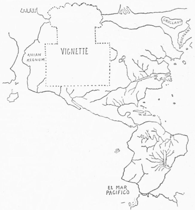 MERCATOR, 1569.
In 1570 the publication of the great atlas of Abraham Ortelius
showed that the centre of map-making had again passed
from Italy, and had found a lodgment in the Netherlands.
The Theatrum of Ortelius was the signal for the downfall
of the Ptolemy series as the leading exemplar of geographical ideas.
The editions of that old cartographer, with their newer revisions, never
again attained the influence with which they had been invested since
the invention of printing. This influence had been so great that Nordenskiöld
finds that between 1520 and 1550 the Ptolemy
maps had been five times as numerous as any other. They
had now passed away; and it is curious to observe that Ortelius seems
to have been ignorant of some of the typical maps anterior to his
time, and which we now look to in tracing the history of American
cartography, like those of Ruysch, Stobnicza, Agnese, Apianus, Vadianus,
and Girava.
Ortelius.
It has already been mentioned that when Ortelius published his
Theatrum, and gave a list of ninety-nine makers of maps
whom he had consulted, not a solitary one of Spanish make
was to be found among them. It shows how effectually the Council
of the Indies had concealed the cartographical records of their office.
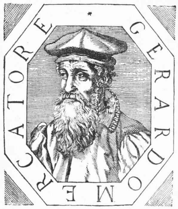 MERCATOR.
1577. English
explorations.
1548. Sebastian
Cabot.
It was eighty years since the English under John Cabot had undertaken
a voyage of discovery in the New World. The interval
passed not without preparation for new efforts, which
had for a time, however, been extended to the northwest
rather than to the northeast. In 1548 Sebastian Cabot had
returned to his native land to assume the first place in her
maritime world. His influence in directing, and that of Richard
Eden in informing, the English mind prepared the way for the advent
of Frobisher, the younger Hawkins, and Drake.
1576. Frobisher.
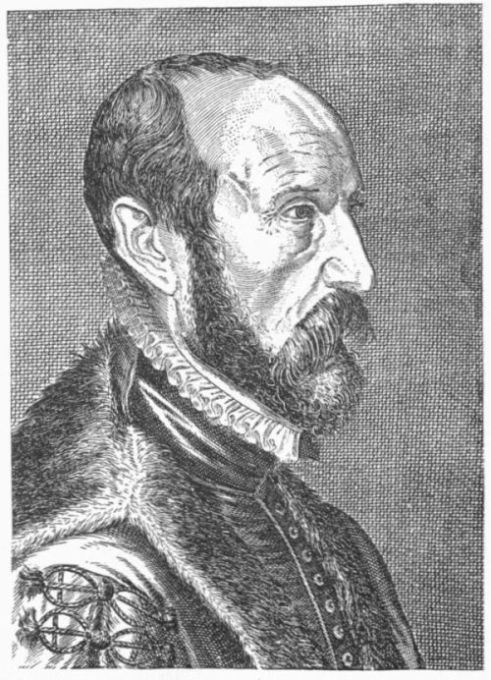 ORTELIUS.
1577-78.
Frobisher.
Frobisher's voyage of 1576 was the true beginning of the arctic
search for a northwest passage, all earlier efforts having been
in lower latitudes. He had sought, by leaving Greenland
on the right, to pass north of the great American barrier, and thus
reach the land of spices. He congratulated himself on having found
the long-desired strait, when, naming it for himself, he returned to
England. Frobisher attempted to add to these earlier discoveries by
a voyage the next year, 1577, but he made exploration
secondary to mining for gold, and not much was done. A
third voyage in 1578 brought him into Hudson's Straits, which he
entered with the hope of finding it the channel to Cathay. But in all
his voyages Frobisher only crossed the threshold of the arctic north.
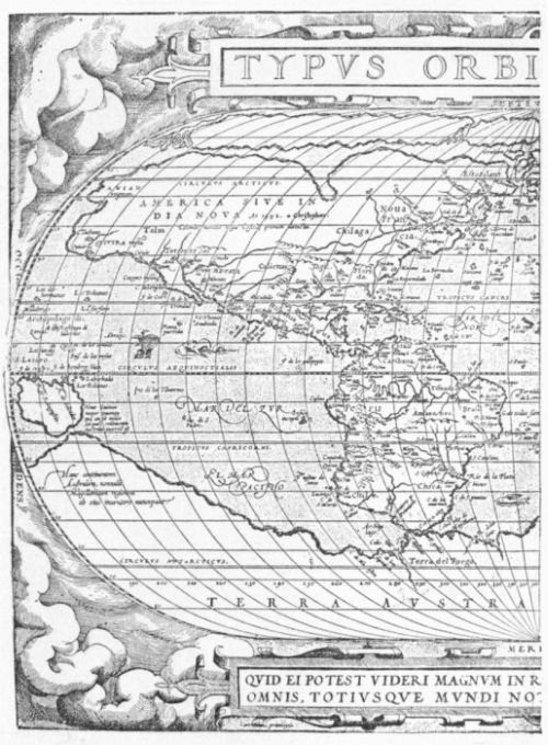 ORTELIUS, 1570.
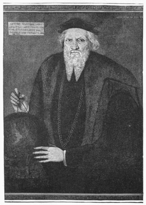 SEBASTIAN CABOT.
The Zeni influence.
It was one of the results of Frobisher's voyages that they served to
implant in the minds of the cartographers of the northern
waters the notions of the Zeni geography, and aided to
give those notions a new lease of favor. It is conjectured that Frobisher
had the Zeni map with him, or its counterpart in one of the recent
Ptolemies. This map had placed the point of Greenland under
66° instead of 61°, and under the last latitude this map had shown
the southern coast of its insular Frisland. Therefore, when Frobisher
saw land under 61°, which was in fact Greenland, he supposed it to
be Frisland, and thus the maps after him became confused. A like
mischance befell Davis, a little later. When this navigator found
Greenland in 61°, he supposed it an island south of Greenland, which
he called "Desolation," and the fancy grew up that Frobisher's route
must have gone north of this island and between it and Greenland, and
so we have in later maps this other misplacement of discoveries.
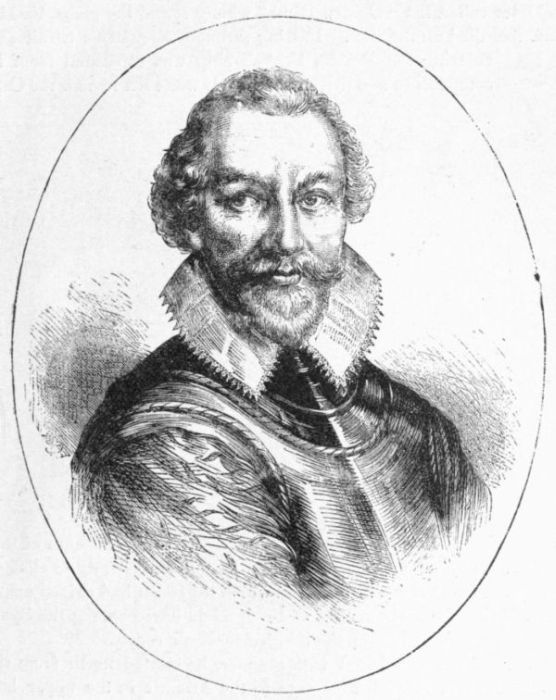 FROBISHER.
1577. Francis
Drake.
While Frobisher was absent, Drake developed his great
scheme of following in the southerly track of Magellan.
Drake sees
Cape Horn.
Four years before (1573), being at Panama, he had seen from a treetop
the great Pacific, and had resolved to be the first of the English
to furrow its depths. In 1577, starting on his great voyage of circumnavigation,
he soon added a new stretch of the Pacific coast to the
better knowledge of the world. When he returned to England, he
proved to be the first commander who had taken his ship, the "Pelican,"
later called the "Golden Hind" wholly round the globe, for Magellan
had died on the way. Passing through Magellan's Strait and
entering the Pacific, Drake's ship was separated from its
companions and driven south. It was then he saw the Cape
Horn of a later Dutch navigator, and proved the non-existence of that
neighboring antarctic continent, which was still persistently to cling to
the maps. Bereft of his other ships, which the storm had driven apart,
Drake, during the early months of 1579, made havoc among the Spanish
galleons which were on the South American coasts.
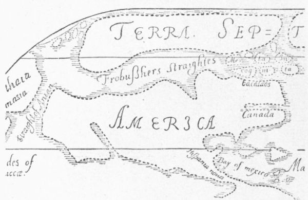 FROBISHER, 1578.
In March, 1579, surfeited with plunder, he started north from the
coast of Mexico, to find a passage to the Atlantic in the upper latitudes.
In the north
Pacific.
In June he had reached 42° north, though some have supposed that
he went several degrees higher. He had met, however, a
rigorous season, and his ropes crackled with the ice. The
change was such a contrast to the allurements of his experiences
farther to the south that he gave up his search for the strait that
would carry him, as he had hoped, to the Atlantic, and, turning south,
he reached a bay somewhere in the neighborhood of San Francisco,
where he tarried for a while. Having placed the name of New Albion
on the upper California coast, and fearing to run the hazards of
the southern seas, where his plundering had made the Spaniards alert,
he sailed westerly, and, rounding the Cape of Good Hope, reached
England in due time, and was acknowledged to be the earliest of English
circumnavigators.
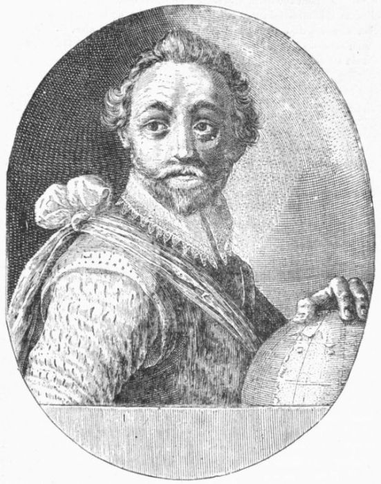 FRANCIS DRAKE.
It is one of the results of Drake's explorations in 1579-80 that
we get in subsequent maps a more northerly trend to the California
coast.
Confusion in
the Pacific
coast cartography.
Shortly after this, a great confusion in the maps of this Pacific region
came in. From what it arose is not very apparent, except
that absence of direct knowledge in geography opens a wide
field for discursiveness. The Michael Lok map of 1582 indicates
this uncertainty. It seemed to be the notion that the Arctic
Sea was one and the same with that of Verrazano; also, that it came
down to about the latitude of Puget Sound, and that the Gulf of California
stretched nearly up to meet it.
Francisco
Gali.
Proves the
great width
of the Pacific.
Francisco Gali, a Spanish commander, returning to Acapulco from
China in 1583, tried the experiment of steering northward
to about 38°, when he turned west and sighted the American
coast in that latitude. At this point he steered south, and showed
the practicability of following this circuitous route with less time than
was required to buffet the easterly trades by a direct eastern passage.
His experiment established one other fact, namely, the great width of
water separating the two continents in those upper latitudes; for he had
found it to be 1200 leagues across instead of there being a
narrow strait, as the theorizing geographers had supposed.
Gali seems also to have shown that the distance south from
Cape Mendocino to the point of the California peninsula was not more
than half as great as the maps had made it. His voyage was a significant
source of enlightenment to the cartographers.
Eastern
coast of
North America.
1579. The
English on
the coast.
To return to the eastern coasts, an English vessel under
Simon Ferdinando spent a short season in 1579 somewhere
about the Gulf of Maine, and was followed the next year by
another under John Walker, and in 1593 by still a third
under Richard Strong.
Sir Humphrey
Gilbert.
For eighty years England might have rested her claim to North
America on the discoveries of the Cabots; but Queen Elizabeth first
gave prominence to these pretensions when she granted to Sir Humphrey
Gilbert in 1578 the right to make a settlement somewhere in
these more northerly regions. Gilbert's first voyage accomplished
nothing, and there was an interdict to prevent a second, since England
might have use for daring seamen nearer home. "First," says
Robert Hues, "Sir Humphrey Gilbert, with great courage and forces,
attempted to make discovery of those parts of America which were
yet unknown to the Spaniards; but the success was not
answerable." The effort was not renewed till 1583, when
Gilbert took possession of Newfoundland and attempted to
make settlements farther south; but disaster followed him, and his ship
foundered off the Azores on his return voyage.
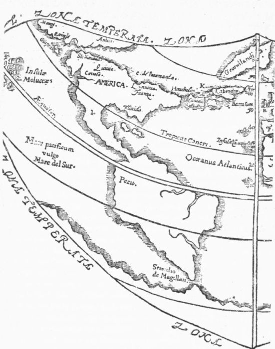 GILBERT'S MAP, 1576.
Sir Walter
Ralegh.
It was at this time that Sir Walter Ralegh came into prominence
in pushing English colonization in America. He had been
associated with his half-brother, Gilbert, in the earlier movements,
but now he was alone. In 1584 he got his new charter, partly
by reason of the urgency of Hakluyt in his Westerne Planting. Ralegh
had his eye upon a more southern coast than Gilbert had aimed
for,—upon one better fitted to develop self-dependent colonization.
He knew that north of what was called Florida the Spaniards had but
scantily tracked the country, and that they probably maintained no
settlements. Therefore to reach a region somewhere south of the
Chesapeake was the aim of the first company sent out under Ralegh's
inspiration. These adventurers made their landfall where they could
find no good inlet, and so sailed north, searching, until at last they
reached the sounds on the North Carolina coast, and tarried awhile.
Satisfied with the quality of the country, they returned to England;
and their recitals so pleased Ralegh and the Queen that the country
was named Virginia, and preparations were made to dispatch a colony.
It went the next year, but its history is of no farther importance to
our present purpose than that it marks the commencement of English
colonization, disastrous though it was, on the North American continent,
and the beginning of detailed English cartography of its coast,
in the map, already referred to, which seems to open a passage, somewhere
near Port Royal, to an interior sea.
1585-86.
John Davis.
In 1585-86 John Davis had been buffeting among the icebergs of
Greenland and the north in hopes to find a passage by the
northwest; on June 30, 1587, he reached 72° 12' on the
Greenland coast, and discovered the strait known by his name, and in
1595 when he published his World's Hydrographical Description, he
maintained that he had touched the threshold of the northwest passage.
He tells us that the globe of Molineaux shows how far he went.
English seamanship.
Seamanship owes more to Davis than to any other Englishman. In
1590, or thereabout, he improved the cross-staff, and giving
somewhat more of complexity to it, he produced the back-staff.
This instrument gave the observer the opportunity of avoiding
the glare of the sun, since it was
used with his back to that luminary;
and when Flamsteed, the
first astronomer royal at Greenwich,
used a glass lens to throw
reflected light, the first approach
to the great principle of taking
angles by reflection was made,
which was later, in 1731, to be
carried to a practical result in
Hadley's quadrant.
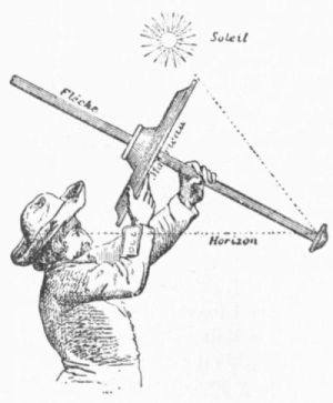 BACK-STAFF.
The art of finding longitude
was still in an uncertain state.
Gemma Frisius, as we have noted,
had as early as 1530 divined the
method of carrying time by a
watch; but it was not till 1726
that anything really practicable
came of it, in a timekeeper constructed by Harrison. This watch
was continually improved by him up to 1761, when the method of
ascertaining longitude by chronometer became well established; and
a few years later (1767) the first nautical almanac was published,
affording a reasonably good guide in lunar distances, as a means in
the computations of longitude.
1676.
In 1676 the Greenwich observatory had been founded to attempt
the rectification of lunar tables, then so erroneous that the
calculations for longitude were still uncertain. In 1701 Edmund
Halley had published his great variation charts. These dates
will fix in the reader's mind the advance of scientific skill as applied
to navigation and discovery. It will be well also to remember that
in 1594 Davis published his Seaman's Secrets, the first manual in the
English tongue, written by a practical sailor, in which the principles of
great circle sailing were explained.
1583-84.
Earliest marine
atlas.
1592. Dutch
West India
Company.
1598.
The first marine atlas had been printed at Leyden in 1583-84;
but the Dutch had not at that time taken any active part in
the development of discovery in the New World. Their
longing for a share in it, mated with a certain hostile intention
towards the Spaniards, instigated the formation of the
West India Company, which had first been conceived in the
mind of William Usselinx in 1592, though it was not put into execution
till twenty-five years later. It was claimed by the Dutch that in
1598 the ships of their Greenland Company had discovered
the Hudson River, though there can be little doubt that
the French, Spanish, and perhaps English had been there much earlier.
It is also claimed that the straits shown in Lok's map in 1582
had instigated Heinrich Hudson to his later search. But the truth in
all these questions which involve national rights is very much perplexed
with claim and counter-claim, invention and perversion, in
which historical data are at the beck of political objects.
1598. The
Dutch on
the North
American
coasts.
The English.
By the end of the sixteenth century the Dutch began to appear on
the coasts of the Middle and New England States, and the
cartography of those regions developed rapidly under their
observation; but it was through the boating explorations of
Captain John Smith in 1614 that it took a shape nearer the
truth. It is to him that the northerly parts owe the name
of New England, which Prince Charles confirmed for it. The reports
from Hudson, May, and others instigated a plan marked out in 1618,
but not directly ordered by the States General till 1621, which led to
the Dutch occupation of Manhattan and the neighboring regions, introducing
more strongly than before a Dutch element into the maps.
The English
leaders in
maritime
discovery.
Richard
Hakluyt.
When the seventeenth century opened, the English had come well to
the front in maritime explorations. A large-minded and
patriotic man, Sir Thomas Smith, did much in his capacity
as governor of the "merchants trading into the East Indies"
to direct contemporary knowledge into better channels. Dr.
Thomas Hood gave public lectures in London on the improvements
in methods of navigation. Richard Hakluyt,
the historiographer of the new company, had already shown that he
had inherited the spirit of helpful patronage which had characterized
the labors of Eden.
1600.
The search
for a western
passage
at the north.
1601. George
Waymouth.
We find the peninsula made by the St. Lawrence and the Atlantic
insularized from the beginning of the seventeenth century,
the transverse channel being now on the line of the Hudson,
then of the Penobscot, then of the St. Croix, and when the
seventeenth century came in, it was not wholly determined
that the longed-for western passage might not yet be found
somewhere in this region. On July 24, 1601, George Waymouth, a
navigator, as he was called, applied to the London East India Company
to be assisted in making an attempt to discover a
northwest passage to India, and the company agreed to his
proposition. The Muscovy Company protested in vain against such
an infringement of its own rights; but it found a way to smother its
grief and join with its rival in the enterprise. Through such joint
action Waymouth was sent by the northwest "towards Cataya or
China, or the back side of America," bearing with him a letter from
Queen Elizabeth to the Emperor of "China or Kathia." The attempt
failed, and Waymouth returned almost ignominiously.
Hudson at
the north.
In 1602, under instructions from the East India Company, he again
sailed, and now pushed a little farther into Hudson's Strait than
any one had been before. In 1609 Hudson had made some
explorations, defining a little more clearly the northern
coasts of the present United States; and in 1610 he sailed again from
England to attempt the discovery of the northwest passage, in a small
craft of fifty-five tons, with twenty-three souls on board. Following
the tracks of Davis and Waymouth, he went farther than they, and
revealed to the world the great inland sea which is known by his
name, and in which he probably perished.
Hudson's
Bay.
1615. Baffin's
Bay.
In 1612-13 Sir Thomas Button developed more exactly the outline
in part of this great bay, and in 1614 the Discovery, under
Robert Bylot and William Baffin, passed along the coasts of
Hudson's Strait, making most careful observation, and Baffin took
for the first time at sea a lunar observation for longitude, according to
a method which had been suggested as early as 1514. It was on a
voyage undertaken in the next year, 1615, that Baffin, exceeding the
northing of Davis, found lying before him the great expanse
of Baffin's Bay, through which he proceeded till he found a
northern exit in Sir Thomas Smith's Sound, under 78°. Baffin did
all this with an accuracy which surprised Sir John Ross, who was the
next to enter the bay, two centuries later. It was in these years of
Hudson and Baffin that Napier invented logarithms and simplified the
processes of nautical calculations.
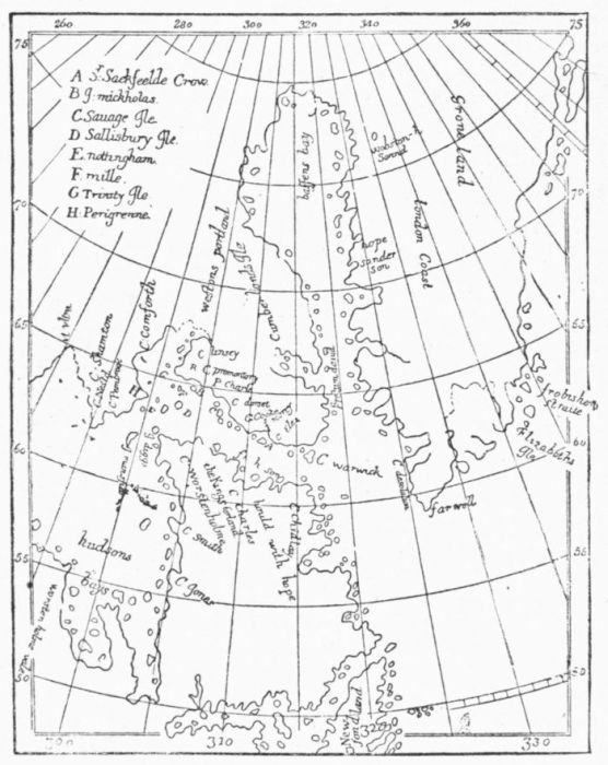 LUKE FOX, 1635.
1631. Luke
Fox.
Thomas
James.
The voyage of Luke Fox in 1631 developed some portions of the
western shores of Hudson's Bay, and he returned confident,
from his observation of the tides farther north, that they
indicated a western passage; and in the same year Thomas
James searched the more southern limits of the great bay
with no more success. These voyages put a stay for more than a
hundred years to efforts in this direction to find the passage so long
sought.
1602. Gosnold.
Up to 1602 the explorations of our northern coasts seem to have
been ordinarily made either by a sweep northerly from Europe, striking
Newfoundland and then proceeding south, or by a southerly sweep
following the Spanish tracks and coasting north from Florida.
In this year, 1602, the Englishman Gosnold, without
any earlier example that we know of since the time of Verrazano,
stood directly to the New England coast, and in the accounts of his
voyage we begin to find some particular knowledge of the contour of
this coast, which opens the way to identifications of landmarks. The
explorations of Pring (1603), Champlain (1604), Waymouth (1605),
Popham (1607), Hudson (1609), Smith (1614), Dermer (1619), and
others which followed are of no more importance in our present survey
than as marking further stages of detailed geography. Even
Dermer was dreaming of a western passage yet to be found in this
region.
Discoveries
on the Pacific
coast.
We must now turn to follow the development during the seventeenth
century of the discoveries on the Pacific coast.
1602. Viscaino.
Sebastian Viscaino, in his voyage up the coast from Acapulco
in 1602, sought the hidden straits as high as 42°, and
one of his captains reporting the coast to trend easterly at
43°, his story confused the geography of this region for
many years. This supposed trend was held to indicate another passage
to the Gulf of California, making the peninsula of that name an
island, and so it long remained on the maps, after once getting possession,
some years later (1622), of the cartographical fancy.
1643. De
Vries.
Some explorations of the Dutch under De Vries, in 1643, were the
source of a notion later prevailing, that there was an interjacent
land in the north Pacific, which they called "Jesso,"
and which was supposed to be separated by passages both from America
and from Asia; and for half a century or more the supposition, connected
more or less with a land seen by João da Gama, was accepted in
some quarters. Indeed, this notion may be said to have not wholly
disappeared till the maps of Cook's voyage came out in 1777-78, when
the Aleutian Islands got something like their proper delineation.
Confused geographical
notions of a
western sea.
In fact, so vague was the conception of what might be the easterly
extension of the northern sea in the latitudinal forties that
the notion of a sea something like the old one of Verrazano
was even thought in 1625 by Briggs in Purchas, and again
in 1651 in Farrer's map of Virginia, to bathe the western slope of the
Alleghanies.
1700.
Maldonado,
Da Fuca, De
Fonte.
Early in the eighteenth century, even the best cartographers ran
wild in their delineations of the Pacific coast. A series of
multifarious notions, arising from more or less faith in the alleged
explorations of Maldonado, Da Fuca, and De Fonte, some
of them assumed to have been made more than a century
earlier, filled the maps with seas and straits, identified sometimes
with the old strait of Anian, and converting the northwestern
parts of North America into a network of surmises, that look strangely
to our present eyes. Some of these wild configurations prevailed even
after the middle of the century, but they were finally eliminated from
the maps by the expedition of that James Cook who first saw the light
in a Yorkshire cabin in 1728.
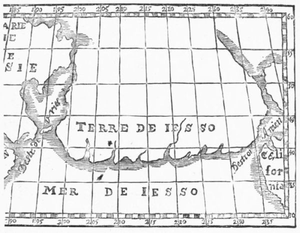 JESSO.
[After Hennepin.]
1724. Bering.
1728.
In 1724 Peter the Great equipped Vitus Bering's first expedition,
and in December, 1724, five weeks before his death, the
Czar gave the commanding officer his instruction to coast
northward and find if the Asiatic and American coasts were continuous,
as they were supposed to be. There were, however, among the
Siberians, some reports of the dividing waters and of a great land beyond,
and these rumors had been prevailing since 1711. Peter the
Great died January 28, 1725 (old style), just as Bering was
beginning his journey, and not till March, 1728, did that
navigator reach the neighborhood of the sea. In July he spread his
sails on a vessel which he had built.
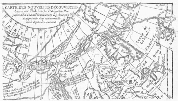 BUACHE'S THEORY, 1752.
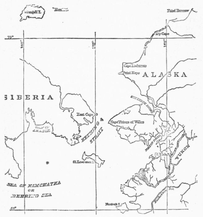 BERING'S STRAITS.
1732.
1741. Bering.
By the middle of August he had
passed beyond the easternmost point of Asia, and was standing out
into the Arctic Ocean, when he turned on his track and sailed south.
Neither in going nor in returning did he see land to the east, the
mists being too thick. He had thus established the limits of the
Russian Empire, but he had not as yet learned of the close proximity
of the American shores. His discoveries did not get any cartographical
record till Kiriloff made his map of Russia in 1734, using the map
which Bering had made in Moscow in 1731. The following
year (1732), Gvosdjeff espied the opposite coast; but it
was not till 1741 that Bering sailed once more from the
Asiatic side to seek the American coast. He steered southeast, and
soon found that the land seen by Da Gama, and which the Delisles
had so long kept on their maps, did not exist there.
Aleutian
Islands.
Thence sailing northward, Bering sighted the coast in July and
had Mount St. Elias before him, then named by him from that saint's
day in the calendar. On his return route some vague conception of
the Aleutian Islands was gained, the beginning of a better cartography,
in which was also embodied the stretch of coast which Bering's associate,
Chirikoff, discovered farther east and south.
Northern
Pacific.
In 1757 Venegas, uninformed as to these Russian discoveries, confessed
in his California that nothing was really known of the
coast line in the higher latitudes,—an ignorance that was
the source of a great variety of conjectures, including a large inland sea
of the west connecting with the Pacific, which was not wholly discarded
till near the end of the century, as has already been mentioned.
The search
for the
northwest
passage.
The search for the northwest passage to Asia, as it had been begun
by the English under Cabot in 1497, was also the last of all
the endeavors to isolate the continent. The creation of the
Hudson Bay Company in 1670 was ostensibly to promote
"the discovery of a new passage into the South Sea," but the world
knows how for two centuries that organization obstinately neglected,
or as far as they dared, the leading purpose for which they pretended
to ask a charter. They gave their well-directed energies to the amassing
of fortunes with as much persistency as the Spaniards did at the
south, but with this difference: that the wisdom in their employment of
the aborigines was as eminent as with the Southrons it was lacking.
It was left for other agencies of the British government successfully to
accomplish, with the aid of the votaries of geographical science, what
the pecuniary speculators of Fen Church Street hardly dared to contemplate.
1779. James
Cook.
The spirit of the old navigators was revived in James Cook, when
in 1779 he endeavored to pass eastward by Bering's Straits;
but it was not till forty years later that a series of arctic
explorations was begun, in which the English races of both continents
have shown so conspicuous a skill and fortitude.
Kendrick in
the "Columbia."
While the English, French, and Spaniards were dodging one another
in their exploring efforts along this upper coast, a Boston
ship, the "Columbia," under Captain Kendrick, entered the
Columbia River, then named; and to these American explorations,
as well as to the contemporary ones of Vancouver, the geographical
confusion finally yielded place to something like an intelligible
idea.
1790-95.
Vancouver.
It had also been the aim of Vancouver in 1790-95 "to ascertain
the existence of any navigable communication between the
North Pacific and the North Atlantic Oceans," and the correspondence
of the British government leading to this expedition has
only been lately printed in the Report of the Dominion archivist,
Douglas Brymner, for 1889.
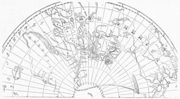 THE NORTHWEST PASSAGE.
Arctic explorers.
1850. McClure
finds
the northwest
passage.
The names of Barrow, Ross, Parry, and Franklin, not to mention
others of a later period, make the story of the final severance
of the continent in the arctic seas one of conspicuous
interest in the history of maritime exploration. Captain Robert L.
McClure, in the "Investigator," late in 1850 passed into Bering's
Straits, and before September closed his ship was bound in
the ice. In October McClure made a sledge journey easterly
over a frozen channel and reached the open sea, which
thirty years before Parry had passed into from the Atlantic
side. The northwest passage was at last discovered.
We have seen that within thirty years from the death of Columbus
the outline of South America was defined, while it had taken nearly
two centuries and a quarter to free the coast lines of the New World
from an entanglement in men's minds with the outlines of eastern
Asia, and another century and a quarter were required to complete
the arctic contour of America, so that the New World at last should
stand a wholly revealed and separate continent.
Nor had all this labor been done by governments alone. The private
merchant and the individual adventurer, equipping ships and sailing
without national help, had done no small part of it. Dr. Kohl
strikingly says, "The extreme northern limit of America, the desolate
peninsula Boothia, is named after the English merchant who fitted out
the arctic expedition of Sir John Ross; and the southernmost strait,
beyond Patagonia, preserves the name of Le Maire, the merchant at
whose charge it was disclosed to the world!"
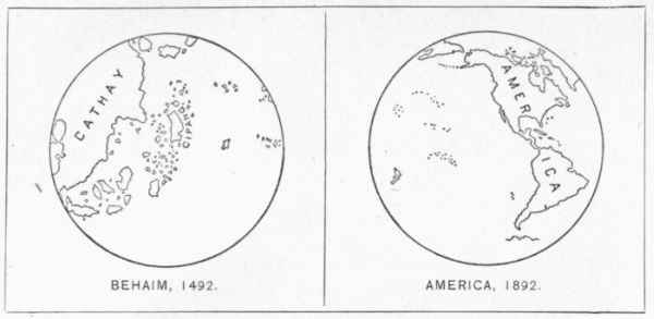
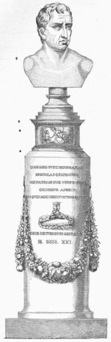
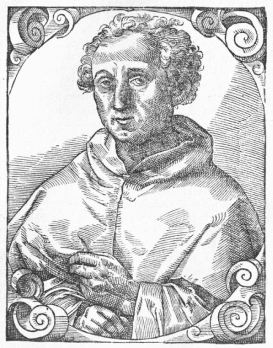
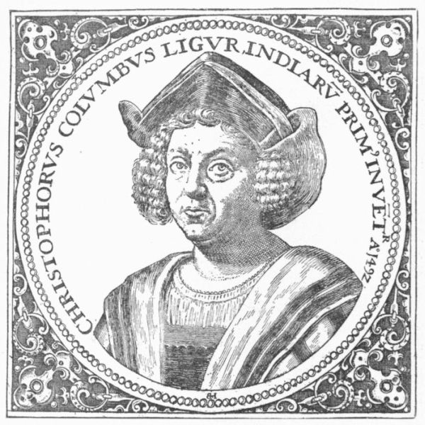
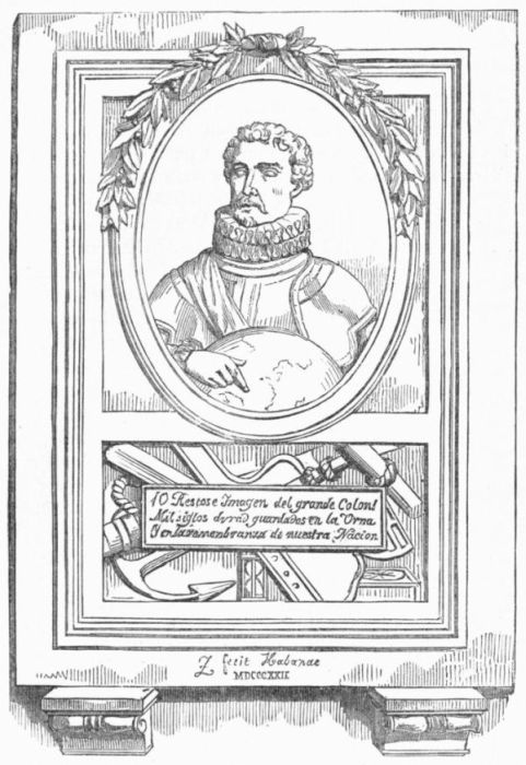
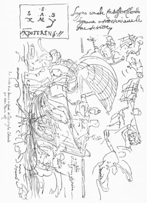
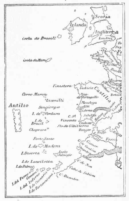
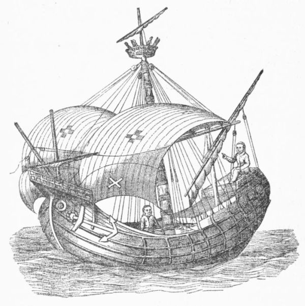
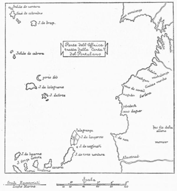
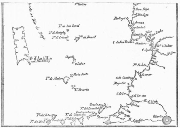
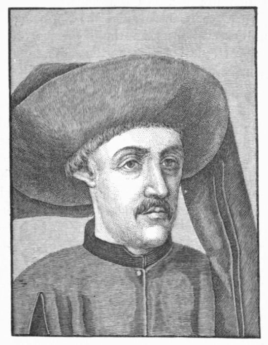
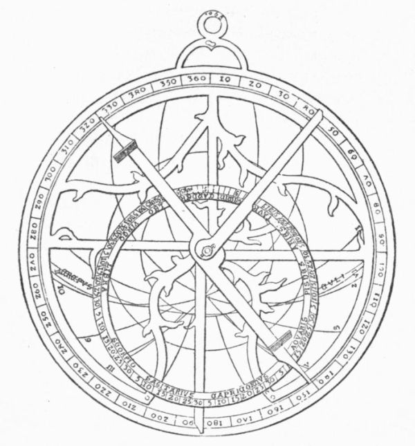
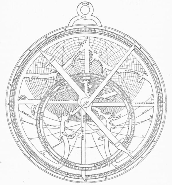
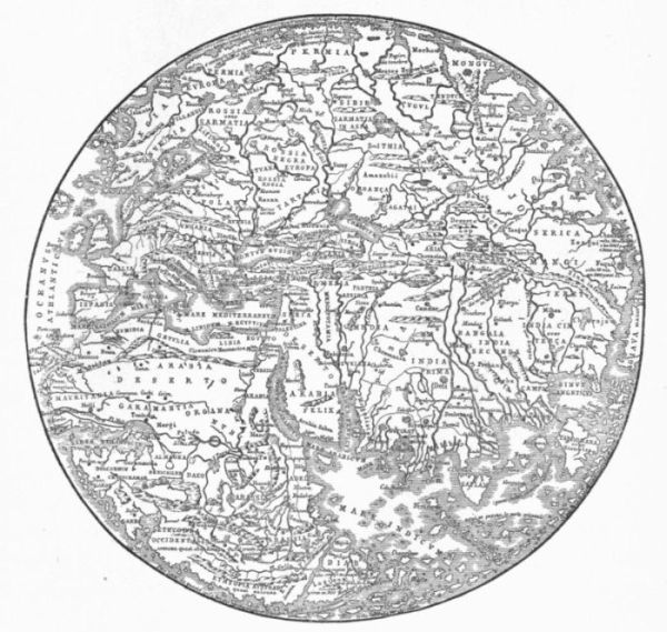
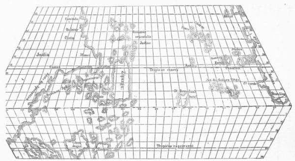
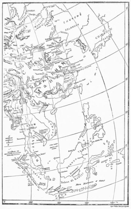
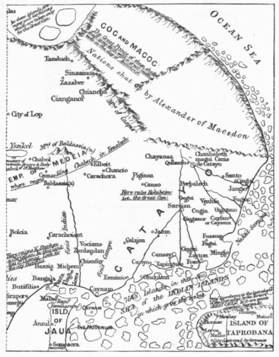
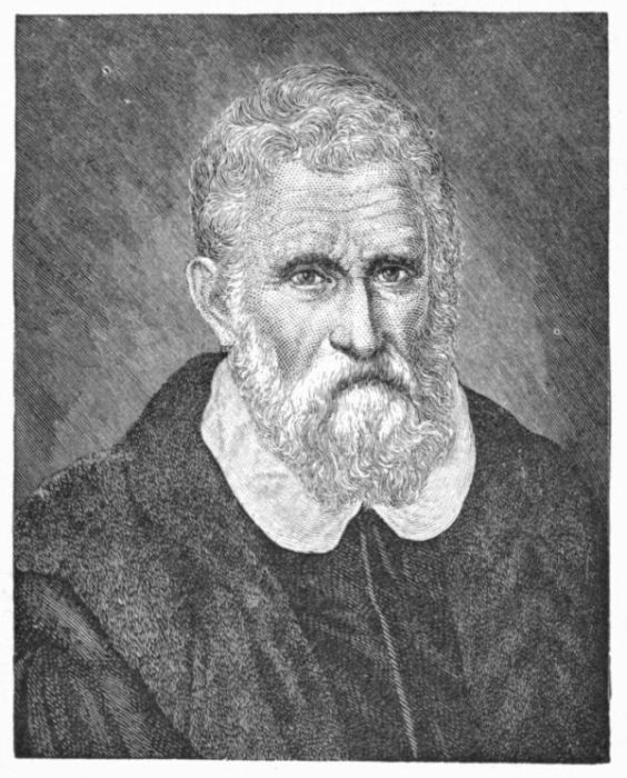
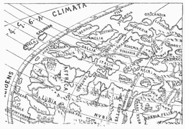
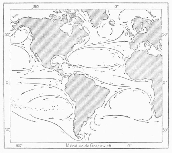
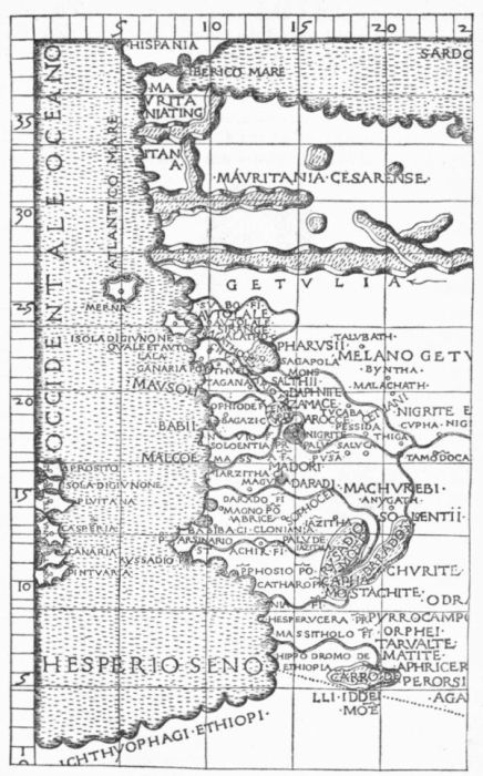
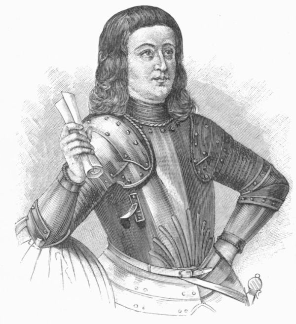
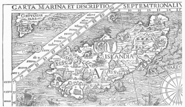
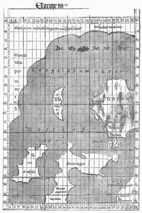
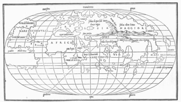
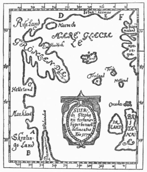
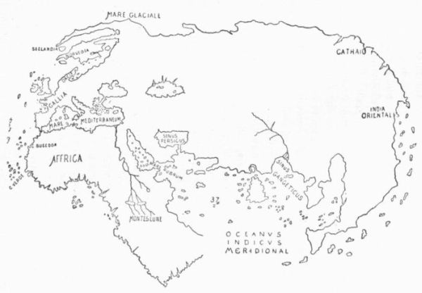
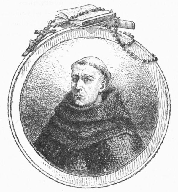
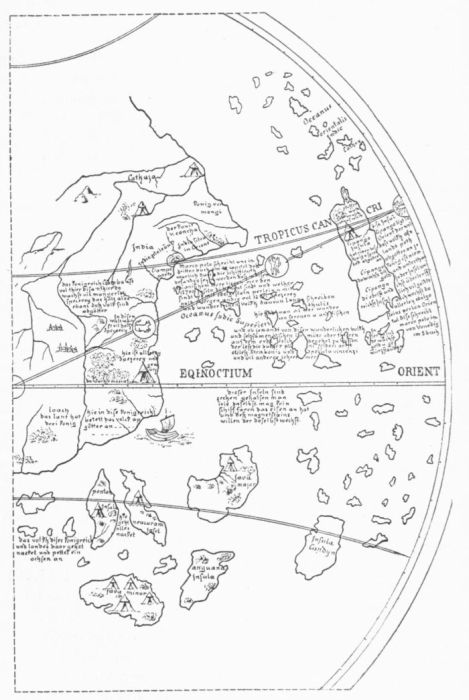
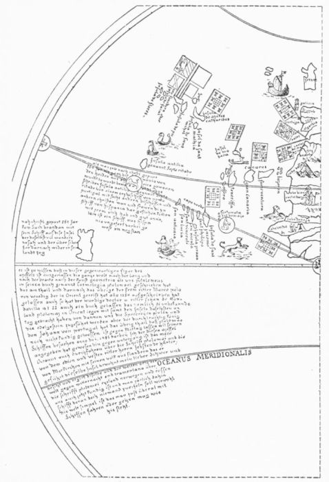
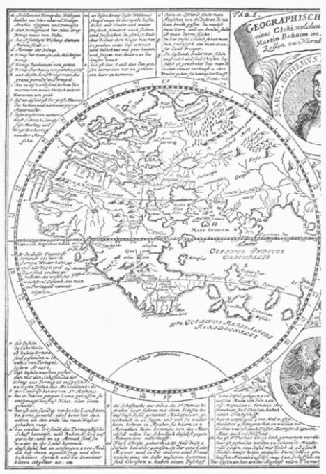
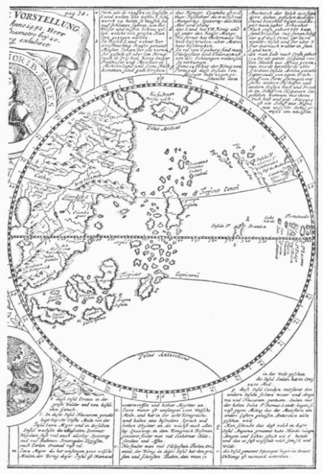
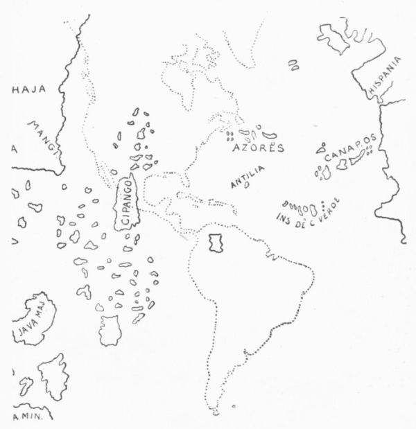
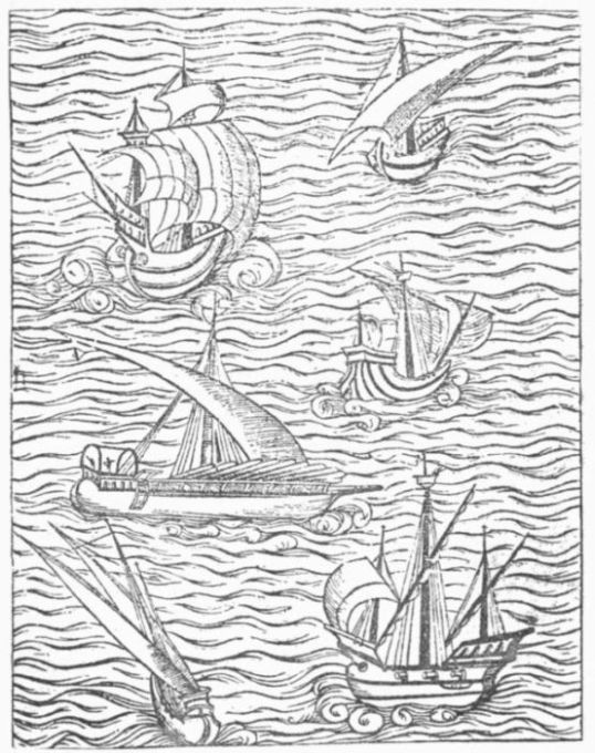
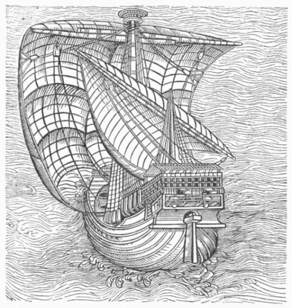
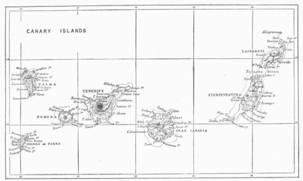
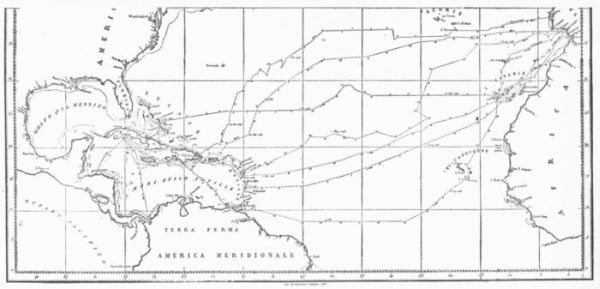
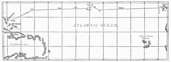
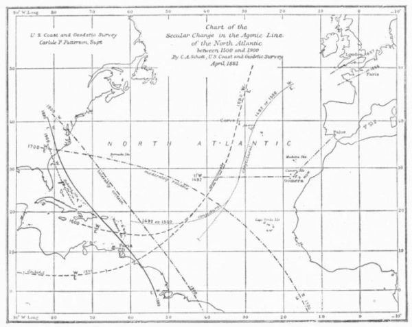
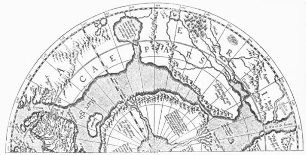
![THE LANDFALL OF COLUMBUS, 1492. [After Ruge.]](https://openoldbooks.sgp1.digitaloceanspaces.com/books/christopher-columbus-42059/images/illus-210.jpg)