Of all the pleasure resorts on the
American continent, probably
none receive annually so many
visitors as the famous cataract
where the waters of the upper
lakes so grandly plunge over
the precipice on their way to
Lake Ontario. The reasons for
this are, doubtless, first, the
wonderful attractiveness of the
Falls as an object of interest,
and, secondly, their ease of access,
and the consequent facility with which they may be visited. Situated
upon the main thoroughfare between the East and the West,
over which such a constant tide of travel is surging throughout the
entire year, it requires but little sacrifice of time on the part of many
to pay them a visit. But these are merely the casual visitors, in addition
to whom thousands annually come from all parts of the land, and
from over the ocean, to gaze upon this far-famed cataract.
We design to give in this chapter such facts as shall serve as a
complete guide for the tourist in visiting this resort, not only to all the
points of interest, but such other information as shall render his visit
enjoyable. Before entering into particulars, we present a general description
of Niagara, in a comprehensive view, which will assist the
reader in understanding the several detailed descriptions which follow.
Niagara River is the outlet of Lake Erie, connecting it with Ontario,
the lowest in the great chain of lakes, which unitedly are the
largest inland reservoirs in the world. The river is only 33 miles in
length, and the total descent in that distance is 334 feet, Lake Ontario
being that much lower than Erie, which is 565 feet above sea level.
About a mile above the Falls the waters commence to descend with
great velocity, constituting what is known as the Rapids, second in interest
only to the Falls themselves, and adding to the interest of the
latter by giving such an increased velocity to the water in its plunge
over the precipice. The total descent in this mile is 52 feet, and the
waters come rushing and tumbling along the rocky bed of the stream,
which is here considerably narrower than its general channel above.
Just above the Falls are several small islands, connected by a system
of bridges with one another and the American shore, and affording
a magnificent view of the Rapids. Standing on one of the bridges, or
the upper shore of an island, and looking up the stream, the view presented
is grand and impressive, as the resistless torrent seems ready to
overwhelm all in its course.
These islands, combined with a sharp curve in the course of the
stream, widen the channel to about 4,750 feet, one-fourth of which is
occupied by Goat Island, the largest of the group, which here extends
to the extreme verge of the precipice, and divides the stream and the
Falls into two distinct parts.
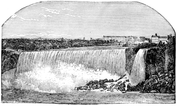
The American Fall is about 1,100 feet wide, and the remainder, or
Canada fall, about double the width, although from its curved or horseshoe
shape the line of the brink is considerably longer than the direct
breadth.
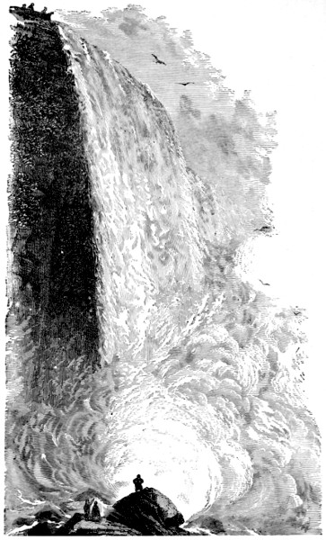
Our illustration presents a fine view of the American Fall from
below, looking northward. The waters here make a sheer descent of
164 feet, while the height of the Canadian Fall is from 12 to 14 feet
less, owing to the lengthening of the Rapids and the curve of the stream.
The volume of water in the Canada Fall is much greater, however,
than that of the American, and the impetus given by the Rapids carries
the water over the precipice with great velocity, and it forms a grand
curve in the descent, falling clear of the rocky wall into the bed of the
river below. The lower strata of this wall being of a loose, shaly
character, the action of the spray has hollowed it out, so that between
the wall of rock and the descending wall of water, a cavernous space
exists, into which the tourist may venture by a rocky and somewhat
perilous path from the Canada side. It is needless to add that a
water-proof suit adds materially to the comfort of those who thus
venture. Similar trips may be made under the American Fall, which
will be duly described in detail.
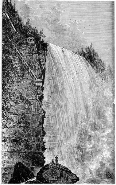
Below the Falls, on the American side, is a stairway and an inclined-plane
railway, leading to the water’s edge, and connecting with
a ferry which here crosses to the Canada shore by means of small
boats, amid the spray and over the turbulent waters, not yet at rest
from their mighty plunge.
The banks below the Falls are very high and precipitous, and the
channel contracts to less than a thousand feet, varying in the descent
to Lake Ontario, from 200 to 400 yards.
The entire river, from its source to its mouth, is an interesting
geological study. The changes that have taken place in the formation
of its banks, and the topography of the country through which it
passes, furnish much food for conjecture, upon which several theories
have been constructed, one of which seems to be quite universally
adopted, viz., that the Falls have gradually receded from a point
below
their present location, some say as far down as the high bluff at Lewiston,
seven miles from Lake Ontario.
AMERICAN FALL, FROM BELOW.
This recession is due to the action of the water upon the sections of
the rocky bed which have successively formed the verge of the cataract,
and which have doubtless varied in character along the course of the
river. The action of the spray and the violence of the rebounding
waters, combined perhaps with other causes, wore away the softer,
shaly substratum, until the harder but thinner upper stratum could no
longer support the massive weight and resist the velocity of the waters,
and fell into the channel below. This theory is abundantly supported
not only by the appearance of the Falls and the channel, but by several
occurrences of exactly this character. In 1818, massive fragments
fell from the American fall, and in 1828 a like occurrence took place in
the Horseshoe Fall, in each instance producing a concussion like an
earthquake.
A view of the Falls by Father Hennepin, made in the year 1678,
presents the feature of a distinct fall on the Canada side, somewhat
like that on the American side, or nearly at right angles with the main
fall. This was occasioned by a great rock, which divided the current
and turned a portion of it in that direction, and which has evidently
since fallen. (See engraving on page 36.)
How long a time would be required for the Falls to recede to Lake
Erie, is of course conjectural, as no data of sufficient reliability can be
established from which to make a calculation. Indeed, it is believed
by some geologists that higher up the river the formation of the bed is
of such a character as to successfully resist the further encroachments of
the water in that direction, the hard formation being of greater depth
and firmness.
But to the present generation Niagara Falls will remain an object
of great interest, and will doubtless continue to receive, as in the past,
the visits of great multitudes of tourists, either on account of their real
attractiveness, or because it is the fashion.
With this general view of the Falls, the reader will be prepared for
the details, which, taken together, make up the comprehensive whole,
and which constitute a visit to Niagara an event replete with lasting
memories.
It detracts not a little from the enjoyment of the spectator to find
that at this resort the oriental demand for “backsheesh” prevails in
the modified form of tolls, fees, etc., and that what is here enjoyed in
the line of sight-seeing must be paid for. Yet this is not to be wondered
at when we consider that the parties who own the vantage
ground must thus reap from it a sustaining harvest. What is legitimately
demanded of the visitor in the way of tolls and admission fees
may be considered as a sine qua non, and should not in the least mar
his pleasure, as he receives in such cases a full equivalent for his
expenditure.
There is one thing, however, which no tourist is prepared to meet
with composure, and which he will need to guard against here, namely,
extortion, or an unexpected or unreasonable demand for money in payment
for services not contracted for nor supposed to be in the market.
Much has been said and written about the extortions of Niagara hackmen,
until their practices have become a byword. In justice to some
of these individuals it should be said that there are among them honorable
men, who will do by you just as they agree, and will make no
effort to defraud. It is always safe, however, to make an agreement
with your driver as to the service he is to render you, and just what
you are to pay him in return. When the terms of your contract are
met, accept no further service without understanding its cost.
HORSESHOE FALLS AND RAPIDS.
The need of this precaution will be apparent from the following
facts. The lawful rate for carrying a passenger from one point to another
in the villages about the Falls is fifty cents, or one dollar from
village to village; yet a driver will frequently offer to carry a
passenger for ten cents. Once in the carriage, however, he is urged to
see this and that point of interest, and with the memory of the ten-cent
offer as a basis for prospective expenses, he often yields to the importunities
of the hackman, until he finds to his dismay that he has run
up a bill, by the legal tariff, of from three to five dollars. While the
man is charging him only what the law allows him to collect, the victim
is chagrined at the method by which it is extorted from him, and
it rankles as an unpleasant memory in his otherwise pleasurable recollections
of his visit.
We have been thus explicit in treating upon a subject to which no
Niagara guide book we have ever seen gives more than a passing allusion,
in order that the tourist may know what to expect, and how to
meet it in the very outset. If you choose to accept of a hackman’s “ten-cent”
offer, be sure that you take no more than is “nominated in the
bond,” lest with the “pound of flesh” there come a drop of blood more
costly than all the rest.
The approach to Niagara, by the line of the Michigan Central, is by
a route nearly parallel with the river, from above on the Canada shore,
and is beyond question, the best view to be had from any railroad train
conveying its passengers near the place. As the train draws near the
mighty cataract, the foaming rapids above the Falls burst upon the
view, as if to prepare the mind for the exhibition of resistless power to
be revealed in the grand plunge of waters into the abyss below.
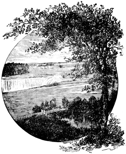
In a few moments the train comes to a halt in full view of the Falls,
with the Horseshoe or Canada Fall in the foreground, and Goat Island
and the American Fall directly across the river, with the deep gorge
between through which the river flows, spanned by the new suspension
bridge. The picture thus presented is one of surpassing beauty.
While a nearer view will impress the mind more completely with the
sublime majesty of the cataract, the comprehensive grouping here presented
will linger in the mind of a true lover of the beautiful, prominent
among the “pictures that hang on memory’s wall.”
The through passengers, who make no tarry at the Falls, remain in
the cars until the train arrives at Suspension Bridge, two miles below,
this arrangement continuing for the present season, until the completion
of the new bridge now in process of erection by the Michigan Central
Company. When this structure is completed, the trains will cross
the river in full view of the Falls. This, in addition to the view now
obtained from the train, will prove a strong attraction to through travelers,
inducing them to come by this route.
This village, formerly known as Clifton, extends along the Canada
shore of Niagara River, from near the Falls to the railroad suspension
bridge. The tourist who wishes to inspect the cataract first from the
Canada side, leaves the train at Niagara Falls station; and should he
choose to find a temporary abiding place on the Canada side, he will
find several well-kept hotels, at prices varying according to accommodations
desired. The largest and most commodious of these is the
Clifton House, which has been open to the public for more than forty
years, and has established a reputation as in all respects a first-class
house.
AMERICAN FALL, AS SEEN FROM CANADA SIDE.
The Prospect House is almost on the very verge of the Falls,
being located at Table Rock, and commands a fine view. The house
has an excellent reputation, its patrons being among the most celebrated
of the visitors, both from America and abroad.
The Brunswick, located a little farther down the bank than the
house just mentioned,—just far enough, the proprietor claims, to be
free from the annoyance of mist and spray, but sufficiently near to give
a beautiful prospect from its windows and balconies,—furnishes a
pleasant stopping place, less pretentious than some of its larger rivals,
but with all its appointments complete, and well calculated to promote
the comfort of its patrons. It can take good care of large or small
parties, and is indeed a desirable stopping place for those who wish to
tarry for a single day, or for a longer period, the terms being moderate
and the fare excellent.
Other houses there are on this side, of which the limits of this work
forbid even a mention. Indeed, the provisions for the care of tourists
indicate that for a considerable portion of the year at least, that constitutes
by far the largest business of the dwellers in the vicinity.
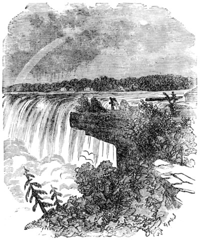
TABLE ROCK.
The Canada shore can claim one point over all other localities in
the vicinity of the Falls, in being the only place where a good view of
the cataract can be had without the payment of toll or admittance fees.
The effort now being made to create a public park on the New York
shore, and thus secure similar privileges in the “land of the free,” is
attracting much attention from tourists. Its results are as yet conjectural,
but so much has the value of the property become enhanced
by the very practices which this plan proposes to abolish, it seems now
like a great undertaking to accomplish what a few years ago would
have been much more easily brought about.
There are opportunities, however, to pay fees on the Canada side,
and to receive an equivalent in return. A staircase leading to the foot
of the Horseshoe Fall, permits a fine view from below, and in addition
a visit to the cavernous recess under Table Rock and Horseshoe Fall.
For the latter excursion, water-proof suits and the services of a guide
are necessary, and the experience is one long to be remembered.
Table Rock itself is an object of much curiosity. It is an overhanging
cliff, extending along the bank to the very junction with the Horseshoe
Fall. Its shape and dimensions have been several times changed
within the memory and observation of the present generation, and “the
oldest inhabitants” remember it as projecting far beyond its present
limits. In July, 1818, a mass some thirty or forty feet wide, and
about one hundred and sixty feet in length, fell into the bed of the
river. In December, 1828, three sections, comprising a very large
portion of the overhanging cliff, and extending to the verge of the
Horseshoe Fall, broke off and fell with a terrible crash. In the summer
of 1829, another large mass separated and fell, and in June, 1850,
still another, the latter about 60 feet wide by 200 long. The precipice
still hangs far out over the perpendicular, and with these losses in
view, the reader can readily imagine its appearance before the action of
the elements had robbed it of so much that made it celebrated.
Several other objects of interest are to be seen on the Canada side,
which will be mentioned further on in these pages, and we will now
proceed to a description of the principal objects of interest immediately
connected with the Falls. In crossing the river to the American
shore, the visitor has a choice of two methods. He may descend the
bank and cross by the ferry, or may go over the New Suspension
Bridge. If intending to return, he will do well to go over by the
bridge and re-cross by the ferry.
This structure, although opened to the public in 1869, is still called
the new bridge, to distinguish it from its elder brother, two miles
below. Previous to the construction of the New York and Brooklyn
bridge, it was the longest suspension bridge in the world, its roadway
being 1,300 feet in length, and its cables 1,800 feet long. It is 190
feet above the river, being suspended from two towers, each 100 feet in
height. Access may be had to the interior of the towers, and very fine
views are obtained from their summits.
From the bridge itself a magnificent view of the Falls may be had,
the finest, in fact, to be secured from any one point, the entire line of
the cataract being embraced in a single glance, and in closer proximity
than is possible elsewhere, except from below. The view down the
river is also a fine one, comprising the deep gorge through which the
stream flows, with its precipitous banks on either hand, and the Railroad
Suspension Bridge in the distance.
The strength of the new bridge is estimated by the engineers as
thirteen times greater than sufficient to bear any weight that can possibly
be placed upon it. The year of its completion it was subjected to
the severest gale it has ever had to withstand, and safely and successfully
“weathered the blast.” All fears, therefore, as to its security in
ordinary weather, are entirely groundless.
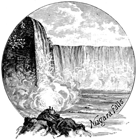
VIEW OF THE FALLS FROM THE FERRY.
Reaching the American shore by this method of crossing, the first
point of interest is
Depositing the fee of 25 cents at the toll-gate, we are soon within the
privileged domain. The grounds are what were formerly known as the
“Ferry Grove” and “Point View,” and previous to their improvement
were free to the public. The Company who purchased them, however,
have provided an almost endless variety of artificial adjuncts to render
the place attractive, and the small fee exacted for admission is not,
therefore, an unreasonable one.
At the verge of the American Fall, they have constructed a solid
wall at what is now called “Prospect Point,” extending it all along the
brink of the precipice, thus rendering secure from accident the place
where the finest view of the Fall can be obtained. Looking up the
stream, the foaming rapids, white-crested and tumultuous, greet the
vision in a continuous stretch, until water and sky seem to blend. In
the immediate foreground is the American Fall, its waters almost in
reach of the outstretched hand. Directly across the stream are Luna
and Goat Islands, while sweeping away to the right in a grand curve,
is the Horseshoe Fall. The American Fall is year by year assuming
the horseshoe form, by the wearing away of the cliff in the center, the
indentation in the front line of the Fall being quite prominently visible
from Prospect Point, although less noticeable from a front view.
The visitor who may be disposed to carry away a souvenir of this
locality will find a skillful photographer in readiness to make pictures,
stereoscopic or otherwise, of from one to twenty persons, with both the
American and the Horseshoe Fall as a background.
Near the Point is located a bazaar for the sale of curiosities, in
itself a museum well worthy of a visit, whether to purchase be the intention,
or only to inspect the articles exposed for sale.
The Ferry House is near the center of the Park, and is the upper
terminal station of the
A tunnel has been cut from the cliff to the margin of the river, at
an angle of about thirty degrees, and within it is built the railway, by
the side of which is a flight of stairs, numbering 290 steps. The cars
are raised and lowered by machinery, operated by a turbine wheel, and
are so arranged that one ascends while the other descends. This railway
has been in successful operation, without a casualty, for nearly
forty years. The timid, however, to whom the descent appears perilous,
have the choice of the stairway for reaching the river, and many
prefer to trust their own limbs in the climb, but are generally glad to
avail themselves of the car in returning. At the foot of the stairs, a
commodious building has been erected, from which a view of the Falls
from below may be had through windows which protect the visitor
from the spray. A nearer view may be obtained by donning a water-proof
suit, for which facilities are provided in the dressing-rooms, and,
with a trusty guide, taking a promenade upon “Hurricane Bridge,” at
the very foot of the American Fall, completing the trip by going behind
the cataract itself, which may be done in safety, and constitutes
a novel experience. The cavernous recess behind the curtain of falling
water extends nearly to the center of the Fall, and is filled with the
dashing spray which perpetually rises from the cauldron of waters.
The roar of the cataract echoes and re-echoes within this chamber, the
effect being heightened by the compression of the air; and the combined
effect upon the senses as one thus stands as it were within the very
grasp of Nature’s most powerful forces, serves to show the contrast
between puny man and his omnipotent Creator.
Between the foot of the Inclined Plane and the Canada shore, a
line of ferry boats has been established, affording a safe and pleasant
method of transit between those points, and a view of the Falls from
the river level. The best time for this trip is early in the morning or
an hour or two before sunset, and the impressions made upon the mind
in connection with it, will be among the most lasting of all the recollections
of Niagara.
Returning to the Park by the stairway or the car, as the traveler
may elect, we continue our examination of the objects of interest to be
found within its limits. Its shady groves and pleasant walks, remnants
of the natural forest improved by the hand of art, furnish
delightful resting places or promenades; and its Art Gallery, Concert
Hall, Pavilion, and other provisions for entertainment, serve to engage
the attention of the visitor, and make pleasant the hours that pass
while within the Park.
One of the most enjoyable features of the visit to Prospect Park is
that provided for the hours of evening. The illumination of the Falls
and fountains by the electric light is a pleasing spectacle, and well
worthy of a tarry to see. The electricity for the purpose is developed
by one of the largest sized dynamo machines, kept in operation by a
powerful turbine wheel, located in the Ferry building, the water-power
supplied by a canal. The brilliant light thus produced is concentrated
upon the Falls and Rapids, both in clear white and with prismatic
effects, rendering them even more beautiful by night than in the full
light of day.
An arrangement of fountains in which the waters are made to
assume a variety of shapes, with revolving wheels and jets of spray,
the whole illuminated with shifting lights of all colors, constitutes an
exhibition amply rewarding a long journey to behold. The observer is
fascinated by the ever-changing colors and gorgeous effects, more beautiful
than any pyrotechnic display, which it very much resembles, only
with intensified brilliancy of coloring, and more enduring in form.
Passing out at the gate of Prospect Park, a short walk brings us to
the toll-house of Goat Island, at the end of the bridge leading across to
the group of islands which divide the cataract into its two distinctive
parts. The largest of these bears the above name, which was given to
it from a trivial circumstance, illustrating how easily a nickname or
title becomes fastened “to stay” with a few repetitions, even from an
unauthorized source. More than a century ago, a Mr. John Stedman
placed some goats on the upper end of the Island, and through neglect
they were suffered to remain uncared for during the winter, and died
from exposure. Hence the name, which adheres to it, in preference to
its authorized name of “Iris Island.”
The group comprises, in all, some seventeen islands, large and
small, covering about sixty acres. The property belongs to the estate
of the late Judge Porter, to whom it was ceded by the State of New
York in 1818. Its possession at that time was regarded as of little
consequence, and the attempt to put a bridge across was deemed foolhardiness;
but it is said that an offer of a million and a half dollars
has recently been refused for the estate.
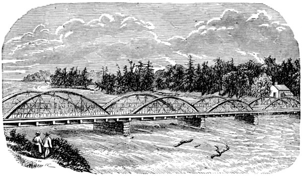
GOAT-ISLAND BRIDGE.
The first bridge was a frail structure, and was soon carried away.
It was replaced by a stronger one, which stood from 1818 to 1856,
when it was removed, and the present elegant structure substituted.
The foundations are heavy oaken cribs, filled with stone and plated
with iron. The bridge itself is of iron, in four arches, each of ninety
feet span, making a total length of three hundred and sixty feet. Its
width is twenty-seven feet, comprising a double carriageway, with footway
on either side. The bridge is a favorite place from which to view
the Rapids, as the waters near the precipice below.
The first island of the group is Bath Island, which is utilized as the
site of manufacturing enterprise, a large paper-mill occupying a position
to command some portion of the splendid water-power so idly
expending itself for naught. Crossing by a bridge of a single span to
Goat Island, we find ourselves in a spot where Nature has been comparatively
undisturbed. The forest remains almost in its primeval
simplicity, which fact renders this a most charming and popular resort.
Indeed, a visit to Niagara would be sadly incomplete were Goat Island
and its attractions to be omitted.
Ascending a slight rise from the bridge, the road leads into a shady
forest, and branches in three directions. The best method of visiting
the points of interest is to first turn to the right, and follow the road
or path to the foot of the Island, emerging from the forest near the
stairway and bridge leading to
This small but pleasant little islet divides the American Fall into
two sections, the stream over which we cross from Goat Island constituting
what is known as the Center Fall, beneath which is the Cave of
the Winds. The island lies low, and the visitor may touch the water
with the hand. The verge was formerly unguarded, but an iron railing
now prevents a repetition of the melancholy accident that occurred
here on the 21st of June, 1849, when the family of Mr. Deforest, of Buffalo,
in company with a friend, Mr. Charles Addington, were visiting the
scene. The latter, playfully catching up Annette, the little daughter
of Mr. Deforest, said, “I am going to throw you in.” With a sudden
impulse, the child sprang from his arms into the water. Horrified at
the result of his pleasantry, Mr. Addington sprang after her, and both
were immediately carried over the Falls. The mangled remains of the
child were recovered the same day, in the Cave of the Winds, and the
body of the unfortunate young man a few days later.
Returning to Goat Island, a short walk brings us to the building
used as the dressing-room in which to prepare for a visit to the
This trip is made by ladies as well as gentlemen, water-proof suits
being provided for any who wish to explore the famous cavern, and
experienced guides are in readiness to accompany the visitor. The
descent to the foot of the cliff is here made without the aid of machinery,
by means of a spiral staircase known as
This structure takes its name from the Hon. Nicholas Biddle, the
well-known president of the United States Bank, at whose expense the
enterprise of building it was carried out in 1829. The bank at this
place is 185 feet high. Part of this descent is accomplished by an
open stairway, of ordinary inclination, and the remainder by the perpendicular
shaft or tower, which is 80 feet high, the whole comprising
147 steps.
From the foot of the tower, a pathway to the right, under the
shadow of the overhanging cliff, leads to the Center Fall, which constitutes
the aqueous curtain of “Æolus’ Cavern.” A secure stairway
leads to the entrance of the Cave, and the visitor passes under the
Fall, into the stormy recess made in the solid rock. The Cavern derives
its name from the peculiar atmospheric effects produced by the
action of the falling water, the compression of the air establishing a
perpetual tempest, like that in which Æolus, the god of the wind, is
said to dwell.
The Cave is 100 feet high by 100 deep and 160 long, and its existence
is due to the action of the waters upon the shale, leaving the more
solid limestone rock overhanging.
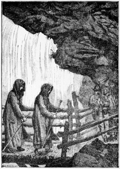
UNDER THE CATARACT.
As one of the many novel experiences to be met in a visit to
Niagara, the trip through this Cave will leave a lasting impression
upon the memory. The sensations which wind and storm will always
produce are here intensified by the novelty of the surroundings, and
the realization of the fact that the forces of Nature are perpetually accomplishing
here what they occasionally produce in the outer world.
Add to this the spice of personal risk, really less than it seems to be,
and the recollections of the occasion will be vivid and enduring.
From the foot of the stairway, another path leads to the river in
front, and still another toward the Canadian or Horseshoe Fall. The
latter is but little used, and is not kept in good condition. From a
scaffolding 100 feet high, erected near the stairway in 1829, Sam
Patch made his famous leap into the river, successfully accomplishing
a feat, the repetition of which at Genessee Falls, shortly after, cost him
his life.
Returning to the bank above, and continuing the walk along the
brink, the next interesting point of observation is
A stairway leads down to the Bridge, which crosses over to the
Rock where for forty years the well-known Terrapin Tower constituted
a landmark to be seen from all directions, standing as it did at the
very verge of the Falls. The rock itself furnishes a favorable outlook,
affording a near view of the Horseshoe Fall. The bridge is liable to
be slippery from the action of the spray, and care should be exercised
to avoid accident. In the winter of 1852, a gentleman while in the
act of crossing fell into the stream, and was carried to the very verge
of the Fall. By a remarkably fortunate circumstance, he lodged between
two rocks, when he was discovered by some of the citizens, who
rescued him by life lines, which he succeeded in fastening around his
body. He was carried to a hotel, and remained speechless for several
hours, so great was the shock to his nervous system.
Which is here seen to the best advantage, is about 144 rods wide, and
158 feet high. The depth of the water in the center is estimated at 20
feet. An experiment to demonstrate the depth was made in 1827.
An unseaworthy vessel, drawing 18 feet of water, increased by leakage
to more than 20 feet, was sent over the Falls, and cleared the ledge
without touching.
The name “Horseshoe” is hardly true to the present shape, which
is now more nearly rectangular. The horseshoe curve has been marred
by the falling of portions of the cliff at various times, until its original
symmetry has nearly departed. The precipice near the Terrapin Tower
has suffered loss from this cause, until it was regarded as unsafe to
continue the use of the Tower, and it was removed in 1873.
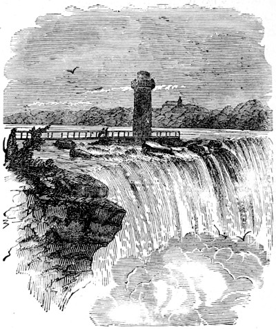
TERRAPIN TOWER.—REMOVED IN 1873.
Along the south shore of the island, the walk or drive toward the
east keeps in view the rapids, and leads us next to the group known as
the
These are connected with Goat Island and with one another by
three handsome bridges, affording a magnificent view of the Rapids,
the best, in fact, to be had from any point of observation. The scene
presented from the outer island, as you gaze up the river, upon the
vast expanse of foaming, turbulent water, seemingly threatening to
overwhelm you and the ground on which you stand, and yet dividing
as it passes you, or abating its fury as it reaches the shore at your feet,
is one to fill the soul with admiration and awe, as, perhaps, no other
view can do. The outlook from the bridges also awakens peculiar
emotions. Standing only a few feet above the rapidly coursing torrent
as it passes beneath you, the thought comes to the mind that here at
least, “there is but a step betwixt time and eternity.” The fascination
increases as the gaze is prolonged, and the mind which cannot be
impressed with the sublimity of the scene, must be, like the soul devoid
of music, “fit for treason, stratagem, and spoils.”
At the head of Goat Island, a little farther up the river, the view
is quite expansive, commanding both banks of the stream, and the
islands in the channel. Beginning at the right, the site of Fort Schlosser
is seen about a mile away, marked by a small white building and a
very large chimney. The name is associated with border history, the
fort having been built by the French, afterward ceded to the English,
and occupied as a military station by Captain Schlosser, from whom its
later name was derived, the French having given it the title of Little
Fort.
Lying in the channel which sweeps around Grand Island on the Canada
side, has an area of over three hundred acres, and is associated with
Fort Schlosser in the annals of border history, having been made the
rendezvous of the “Patriots” in the “Rebellion” of 1837, under the
leadership of McKenzie, who, with about twenty-five or thirty followers,
became disaffected with the Canadian authorities, and planted their
standard here as a rallying-point. The American steamer Caroline, a
small boat supposed to be in the service of the “Rebels,” was chartered
to run between the islands and the American shore. Friday, Dec. 29,
1837, she entered upon her work of “ferriage,” and after a profitable
day’s work was moved to the wharf at Schlosser’s Landing. The same
night, a detachment of British soldiers, under command of Capt. Drew,
seized her, set her on fire, and the little steamer went down the stream
in flames, and plunged over the Canadian Fall. The crew, and some
of the “patriots” who were on board, escaped to the shore, with the
exception of one man, Durfee, who was killed by a pistol shot in attempting
to escape.
The largest in the River Niagara, is twelve miles in length, its breadth
varying from two to seven miles. Its soil, unlike that of the islands
nearer the cataract, is very fertile, and much of it is under cultivation.
Its historic annals are less interesting than those just mentioned,
although one enterprise has a monumental reminder, still in a good
state of preservation. A gentleman who in the current vernacular of
to-day would doubtless be entitled a “crank,” conceived the project of
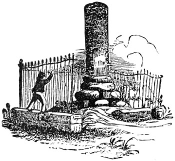
making this island a place of refuge for the scattered tribes of Israel.
In 1825 he laid the corner-stone of the “City of Ararat,” and erected
a monument with imposing ceremonies. The latter still serves to remind
the visitor that “cranks” are not original with the present
generation.
At the foot of Grand Island is a smaller one, of about three hundred
acres, called Buckhorn Island. The channel between them is
called “Burnt Ship Bay,” from the destruction of two armed
supply
vessels by the French garrison at Schlosser, near the close of the French
war of 1759, to prevent their acquisition by the English. They were
brought to this bay, and set on fire, and the circumstance is thus commemorated
by the name of the bay.
Corner’s Island, Gill Creek Island and Grass Island, all of them
small, lie near the American shore, and are important, commercially or
historically.
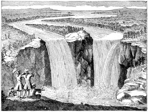
FATHER HENNEPIN’S SKETCH OF THE FALLS.
The first white man who saw the Falls, of whom we have any account,
was Father Hennepin, the noted explorer. We present above
a fac-simile of the sketch made by him, representing the Falls as they
were 200 years ago. We also give his extravagant description, preserving
the orthography and the quaint style in which it was written:—
“Betwixt the Lake Ontario and Erie, there is a vast and prodigious
Cadence of Water which falls down after a surprizing and astonishing
manner, insomuch that the Universe does not afford its
Parallel. ’Tis true, Italy and Suedeland boast of some such Things;
but we may well say they are but sorry Patterns, when compar’d to
this of which we now speak. At the foot of this horrible Precipice,
we meet with the River Niagara, which is not above a quarter of a
League broad, but is wonderfully deep in some places. It is so rapid
above this Descent, that it violently hurries down the wild Beasts
while endeavoring to pass it to feed on the other side, they not being
able to withstand the force of its Current, which inevitably casts them
headlong above Six hundred foot high.
“This wonderful Downfal is compounded of two great Cross-streams
of Water, and two Falls, with an Isle sloping along the middle
of it. The Waters which fall from this horrible Precipice, do foam
and boyl after the most hideous manner imaginable, making an outrageous
Noise, more terrible than that of Thunder; for when the
Wind blows out of the South, their dismal roaring may be heard more
than Fifteen Leagues off.
“The River Niagara having thrown it self down this incredible
Precepice, continues its impetuous course for two Leagues together, to
the great Rock above-mention’d, with an inexpressible rapidity: But
having past that, its impetuosity relents, gliding along more gently for
other two Leagues, till it arrive at the Lake Ontario or Frontenac.
“Any Bark or greater Vessel may pass from the Fort to the foot of
this huge Rock above-mention’d. This Rock lies to the Westward,
and is cut off from the Land by the River Niagara, about two Leagues
farther down than the great Fall; for which two Leagues the People
are oblig’d to transport their Goods over-land; but the way is very
good; and the Trees are but few, chiefly Firrs and Oaks.
“From the great Fall unto this Rock which is to the West of the
River, the two Brinks of it are so prodigious high, that it would make
one tremble to look steadily upon the Water, rolling along with a
rapidity not to be imagin’d. Were it not for this vast Cataract,
which interrupts Navigation, they might fail with Barks or greater
Vessels, more than Four hundred and fifty Leagues, crossing the Lake
of Hurons, and reaching even to the farther end of the Lake Illinois;
which two Lakes we may easily say are little Seas of fresh Water.”
The following extracts from an article written by Prof. Tyndall will
be of interest in this connection:—
“The fact that in historic times, even within the memory of man,
the Fall has sensibly receded, prompts the question, How far has this
recession gone? At what point did the ledge which thus continually
creeps backward begin its retrograde course? To minds disciplined in
such researches the answer has been and will be, At the precipitous declivity
which crosses the Niagara from Lewiston on the American to
Queenston on the Canadian side. Over this traverse barrier the
affluents of all upper lakes once poured their waters, and here the
work of erosion began. The dam, moreover, was demonstrably of
sufficient height to cause the river above it to submerge Goat Island,
and this would perfectly account for the finding by Mr. Hall, Sir
Charles Lyell, and others, in the sand and gravel of the island, the
same fluviatile shells as are now found in the Niagara River higher up.
It would also account for those deposits along the sides of the river,
the discovery of which enabled Lyell, Hall, and Ramsay to reduce to
demonstration the popular belief that the Niagara once flowed through
a shallow valley.
“The physics of the problem of excavation, which I made clear to
my mind before quitting Niagara, are revealed by a close inspection
of the present Horseshoe Fall. Here we see evidently that the greatest
weight of water bends over the very apex of the Horseshoe. In a
passage in his excellent chapter on Niagara Falls, Mr. Hall alludes to
this fact. Here we have the most copious and the most violent whirling
of the shattered liquid; here the most powerful eddies recoil
against the shale. From this portion of the Fall, indeed, the spray
sometimes rises without solution of continuity to the region of clouds,
becoming gradually more attenuated, and passing finally through the
condition of true cloud into invisible vapor, which is sometimes re-precipitated
higher up. All the phenomena point distinctly to the center
of the river as the place of the greatest mechanical energy, and from
the center the vigor of the Fall gradually dies away toward the sides.
The horseshoe form, with the concavity facing downward, is an obvious
and necessary consequence of this action. Right along the middle of
the river the apex of the curve pushes its way backward, cutting along
the center a deep and comparatively narrow groove, and draining the
sides as it passes them. Hence the remarkable discrepancy between
the widths of the Niagara above and below the Horseshoe. All along
its course, from Lewiston Heights to the present position, the form of
the Fall was probably that of a horseshoe; for this is merely the expression
of the greater depth, and consequently greater excavating
power, of the center of the river. The gorge, moreover, varies in
width as the depth, of the center of the ancient river varied, being narrowest
where that depth was greatest.
“The vast comparative erosive energy of the Horseshoe Fall comes
strikingly into view when it and the American Fall are compared together.
The American branch of the upper river is cut at a right
angle by the gorge of the Niagara. Here the Horseshoe Fall was the
real excavator. It cut the rock, and formed the precipice over which
the American Fall tumbles. But since its formation the erosive action
of the American Fall has been almost nil, while the Horseshoe has cut
its way for five hundred yards across the end of Goat Island, and is
now doubling back to excavate a channel parallel to the length of the
island. This point, I have just learned, has not escaped the acute observation
of Prof. Ramsay. The river bends; the Horseshoe immediately
accommodates itself to the bending, and will follow implicitly
the direction of the deepest water in the upper stream. The flexibility
of the gorge, if I may use the term, is determined by the flexibility of
the river channel above it. Were the Niagara above the Fall sinuous,
the gorge would immediately follow its sinuosities. Once suggested,
no doubt geographers will be able to point out many examples of this
action. The Zambesi is thought to present a great difficulty to the
erosion theory, because of the sinuosity of the chasm below the Victoria
Falls. But assuming the basalt to be of tolerably uniform texture, had
the river been examined before the formation of this sinuous channel,
the present zigzag course of the gorge below the Fall could, I am persuaded,
have been predicted, while the sounding of the present river
would enable us to predict the course to be pursued by the erosion in
the future.
“But not only has the Niagara River cut the gorge—it has carried
away the chips of its own workshop. The shale being probably crumbled,
is easily carried away. But at the base of the Fall we find the
huge boulders already described, and by some means or other these are
removed down the river. The ice which tills the gorge in winter, and
which grapples with the boulders, has been regarded as the transporting
agent. Probably it is so to some extent. But erosion acts without
ceasing on the abutting points of the boulder, thus withdrawing
their support, and urging them down the river. Solution also does its
portion of the work. That solid matter is carried down is proved by
the difference of depth between the Niagara River and Lake Ontario,
where the river enters it. The depth falls from seventy-two feet to
twenty feet, in consequence of the deposition of solid matter caused by
the diminished motion of the river. Near the mouth of the gorge at
Queenston, the depth, according to the Admiralty Chart, is 180 feet;
well within the gorge, it is 132 feet.”
Two miles below the Falls, the river is spanned by the structure so
widely known by the above name. The banks are here very precipitous,
and the river deep and rapid, and the erection of piers in the
stream being an impossibility, the structure is suspended from cables
passing over towers of solid masonry. The following statistics will be
of interest to those of our readers who revel in figures:—
| Length of span from center to center of towers |
822 |
|
feet. |
| Height of tower above rock on the American side |
88 |
|
„ |
| Height of tower above rock on the Canada side |
78 |
|
„ |
| Height of tower above floor of railway |
60 |
|
„ |
| Height of track above water |
258 |
|
„ |
| Number of wire cables |
4 |
|
| Diameter of each cable |
10 |
1⁄2 |
in. |
| Number of No. 9 wires in each cable |
3,659 |
|
| Ultimate aggregate strength of cables |
12,400 |
|
tons. |
| Weight of superstructure |
800 |
|
„ |
| Weight of superstructure and maximum loads |
1,250 |
|
„ |
| Maximum weight the cable and stays will support |
7,309 |
|
„ |
The bridge is a “two-story” affair, the upper part being used for
the railway, and the lower for carriages and foot passengers.
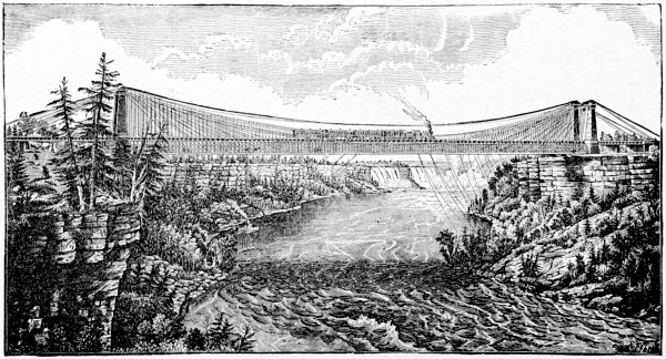
RAILWAY SUSPENSION BRIDGE, NIAGARA RIVER.
The narrowing of the channel in the vicinity of the Suspension
Bridge greatly accelerates the current, and the tremendous force with
which it rushes through the gorge from this point to the “Whirlpool,”
throws the water into violent commotion. When it is considered that
the calculated weight of the water that passes over the Falls every
hour is 100,000,000 tons, and that this volume of water must find its
way through a channel only about 300 feet wide, the terrific force with
which it rushes along may be at least partially understood. Although
the depth of the stream is here estimated at 250 feet, the force of the
current is such as to elevate the water from ten to forty feet above its
natural level.
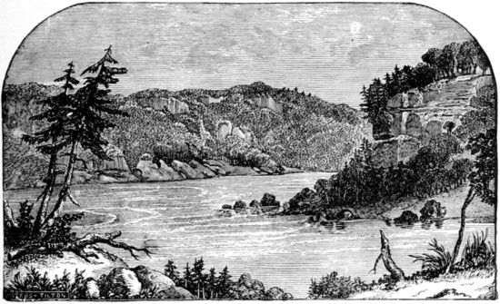
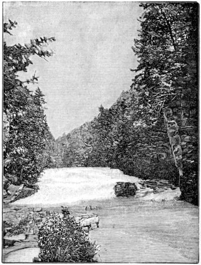
WHIRLPOOL AND RAPIDS.
At the Whirlpool, the river takes a sharp turn almost at a right
angle, circling around in the cauldron which it seems to have excavated
for itself, and finally making its exit through a narrow gorge, the vast
body of water no doubt passing out far below the surface, in a channel
of immense depth.
The Whirlpool may be seen to advantage from either the Canadian
or the American side. At the latter, the approach is through the
grounds of De Veaux College, the fee for admission going to the funds
of the institution. On the Canada side, extensive preparations have
been made for the accommodation of visitors by the Whirlpool Rapids
Park Company.
A river-side walk has been constructed, partially by excavation
from the side of the cliff, and a delightful park on the bank of the
river, with plenty of trees and shrubbery, renders a promenade on this
shore very attractive. An inclined railway, to facilitate the journey
between the upper and lower levels, has been constructed, and equipped
with cars, operating in a novel and ingenious manner. The cars have
tanks below the seats; these tanks are filled with water from a spring
at the back of the entrance building, by means of a pipe leading into
the tank. 50 lbs. weight of water is sufficient to overcome the balance
of the cars, and to carry the loaded car to the foot of the railway, the
light one being simultaneously drawn to the top by the same power.
Formerly these cars were operated by steam-power, but the present is
by far the safest and most economical plan, there being no machinery
to get out of order, no danger of damage from bursting of boiler, etc.,
the entire apparatus necessary being the check or governor, by which
the person in charge can regulate or stop the speed of the car with perfect
ease. These cars take 12 passengers each; the tanks are capable
of containing 2,800 lbs. of water. As they reach the foot of the incline,
a bolt or pin removes the fastening to the discharge pipe and
discharges the water, thus leaving the car in readiness for its next
ascent, which is made in about one and a half minutes. The total
length of the railroad is 285 feet.
At the water’s edge, a photographic studio is located, thus giving
to all an opportunity of being portrayed with the Whirlpool Rapids in
the backgrounds.
Returning again to the Falls, we find on the Canada side several
points of interest, not yet considered in these pages. At Table Rock
an opportunity is afforded of visiting the Museum, a collection of natural
curiosities, works of art, etc., well worthy of a visit. A zoological
garden is kept in connection, and an observatory affords a good outlook
from a lofty stand-point.
About a mile above the Falls, reached by a pleasant drive or walk,
across Cedar Island, in view of the Rapids, is the natural curiosity
known as the Burning Spring, the waters of which are highly charged
with sulphuretted hydrogen, which burns with a pale blue flame when
ignited. This is supposed to have its origin in a coal formation, believed
by some to be extensive, and worthy of mining. The proprietor,
however, has not sufficient faith in the feasibility of the scheme to undertake
it. Clark Hill Islands, a group of five, which are crossed in
the approach to the burning spring, are in the midst of the rapids, and
a fine carriage drive extends along their outer shores, affording a good
view of the current, which is here very rapid. These islands are connected
with the main land by two suspension bridges, which have been
named “Castor” and “Pollux.”
On Cedar Island, near the Horseshoe Falls, a Pagoda has been
erected, over 80 feet in height, from which a magnificent view can be
had. It is a noticeable landmark from all points in the vicinity of the
Falls.
As a spot, of no little historical interest, the scene of the decisive
battle between the English and American forces, July 25, 1814, receives
many visitors, of all nationalities. The ground is about a mile
and a half due west from the Falls, near the village of Drummondville,
named in honor of Gen. Drummond, who commanded the British forces
in the engagement. Two towers have been erected to mark the spot,
and from their summits a good view is had of the surrounding country.
It was the writer’s good fortune, on the occasion of his first visit to
the scene, some years ago, to listen to a description of the battle from
the lips of a surviving participant, who wore the British uniform on
the occasion, but who gave the American forces great credit for gallantry
in the fight. The total loss, in killed and wounded, was about
eighteen hundred men.
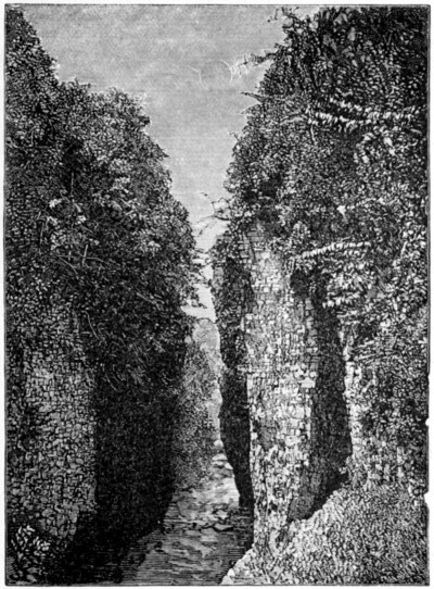
About half a mile below the Whirlpool, on the American side, a
gloomy cavern in the bank has received the above title. It is about
one hundred feet in depth, and from its forbidding aspect might well be
regarded as the property of his Satanic majesty. Tradition makes this
locality the scene of the massacre of the English supply train and escort
in 1763, by the Seneca Indians, instigated by the French traders.
The train was on its way from Fort Niagara to Fort Schlosser, and
only three of its number escaped alive, while of the escort only eight
returned to Fort Niagara.
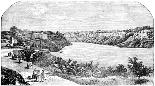
NIAGARA RIVER BELOW THE WHIRLPOOL.
Much that would be of interest to the reader might be written concerning
the Falls and the surroundings, but we have already devoted
a large amount of space to the subject, and must close with a few
necessary particulars. For the convenience of those who may need the
facts, we tabulate the rates of toll, carriage hire, etc., the latter being
the rate fixed by law as permissible. It may be well to add, however,
that most of the drivers are willing to make a special rate, considerably
lower than those given, and, as previously remarked, this should be
expressly agreed upon before starting out, including an understanding
as to the payment of the tolls and gate fees.
| Goat Island |
$ .50 |
| Cave of the Winds |
1.00 |
| Prospect Park |
.25 |
| Inclined Railway |
.25 |
| Shadow of the Rock |
1.00 |
| New Suspension Bridge |
.25 |
| Ferry |
.25 |
| Behind Sheet of Water (Table Rock) |
1.00 |
| Burning Spring |
.50 |
| Railway Bridge, over and back |
.50 |
| Whirlpool Rapids |
.50 |
| Whirlpool |
.50 |
For carrying one passenger and ordinary baggage from one place to
another in the village, 50 cents.
Each additional passenger and ordinary baggage, 25 cents.
For carrying one passenger and ordinary baggage from any point in
this village to any point in the village of Suspension Bridge, 1 dollar.
Each additional passenger and ordinary baggage, 50 cents.
Each additional piece of baggage other than ordinary baggage, 12
cents.
Children under 3 years of age, free.
Over 3 years and under 14 years, half price.
Ordinary baggage is defined to be 1 trunk and 1 bag, hat or band-box,
or other small parcel.
For carrying one or more passengers, in the same carriage, from
any point in this village to any point within 5 miles of the limits of
the village, at the rate of $1.50 for each hour occupied, except that in
every instance where such carriage shall be drawn by a single horse, the
fare therefor shall be at the rate of 1 dollar for each hour occupied.
Hotels.—Although a little out of its natural connection, this subject seems to
demand at least a paragraph. The constant influx of visitors, especially during
the summer months has created a demand for hotel accommodations at Niagara,
which has been met in the erection of such houses as the Cataract, International,
Spencer, Niagara, Kaltenbach, Goat Island, and a multitude of others, of various
grades of excellence, both at the Falls and Suspension Bridge.

 Principal
 Eastern
































 Portland & Ogdensburg R. R.’s,