The main text of this handbook is in Parts 1 and 2. There were many
2-page information segments inserted throughout this text. In this
etext these fourteen inserts have been moved to the end of Part 2,
to improve readability of the main text. Part 3 consists solely of
a further set of 1- and 2-page informational inserts.
Each insert is separated by a thick black horizontal line.
Some hyphens in words have been silently removed, some added,
when a predominant preference was found in the original book.
The Table of Contents in the Frontmatter has been augmented by the
transcriber to include fourteen entries in Part 2 for “A Glacial Base”,
and the other informational inserts.
The following minor changes have been made to the original text: Frontmatter: ‘along the the Cape’ replaced by ‘along the Cape’. Pg 54: ‘and others fishes’ replaced by ‘and other fishes’. Pg 93: ‘chower is made’ replaced by ‘chowder is made’. Pg 112: ‘Everett 66-67 dunin’ replaced by ‘Everett 66-67 dunlin’.
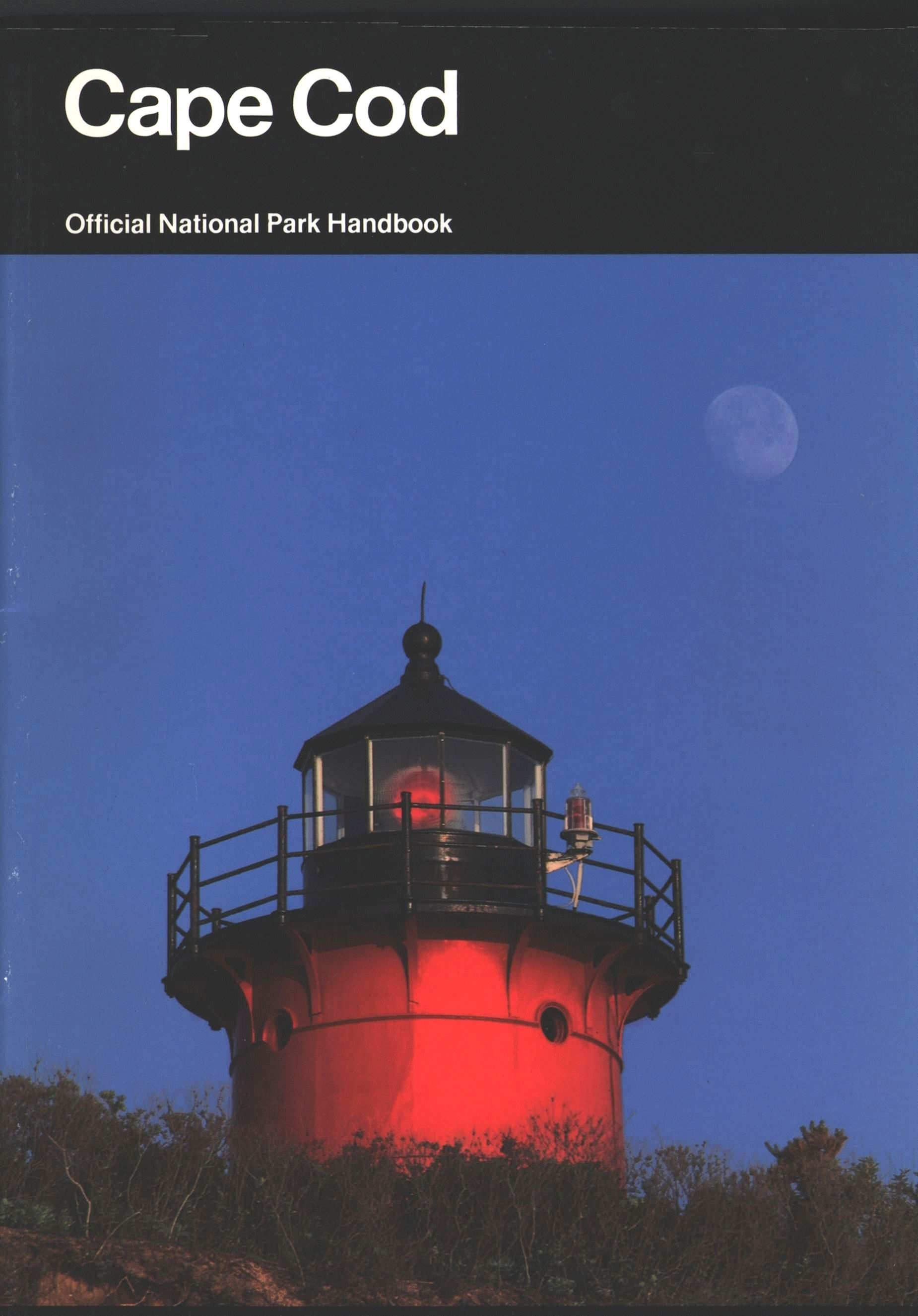
Cape Cod
Official National Park Handbook
Front cover: Nauset Light
hovers over an eroding cliff
facing the Atlantic Ocean in
Eastham.
Handbook 148
Cape Cod Its Natural and Cultural History
By Robert Finch
A Guide to Cape Cod
National Seashore
Massachusetts
Produced by the
Division of Publications
National Park Service
U.S. Department of the Interior
Washington, D.C.
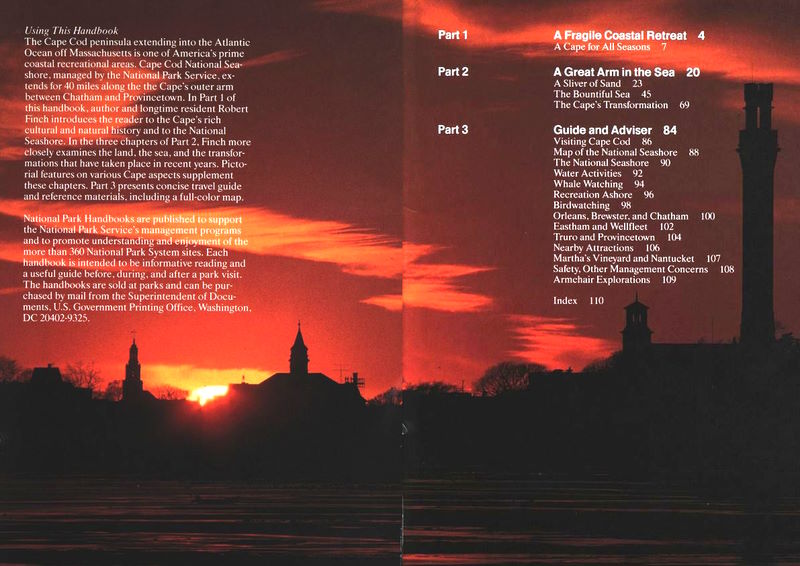
Using This Handbook
The Cape Cod peninsula extending into the Atlantic
Ocean off Massachusetts is one of America’s prime
coastal recreational areas. Cape Cod National Seashore,
managed by the National Park Service, extends
for 40 miles
along the Cape’s outer arm
between Chatham and Provincetown. In Part 1 of
this handbook, author and longtime resident Robert
Finch introduces the reader to the Cape’s rich
cultural and natural history and to the National
Seashore. In the three chapters of Part 2, Finch more
closely examines the land, the sea, and the transformations
that have taken place in recent years. Pictorial
features on various Cape aspects supplement
these chapters. Part 3 presents concise travel guide
and reference materials, including a full-color map.
National Park Handbooks are published to support
the National Park Service’s management programs
and to promote understanding and enjoyment of the
more than 360 National Park System sites. Each
handbook is intended to be informative reading and
a useful guide before, during, and after a park visit.
The handbooks are sold at parks and can be purchased
by mail from the Superintendent of Documents,
U.S. Government Printing Office, Washington,
DC 20402-9325.
Preceding pages: The sun sets over
Provincetown and the towering Pilgrim Monument. Such tranquil scenes
can be misleading, for the Cape is a place of shifting sands and
struggling grasses.
Part 1 A Fragile Coastal Retreat
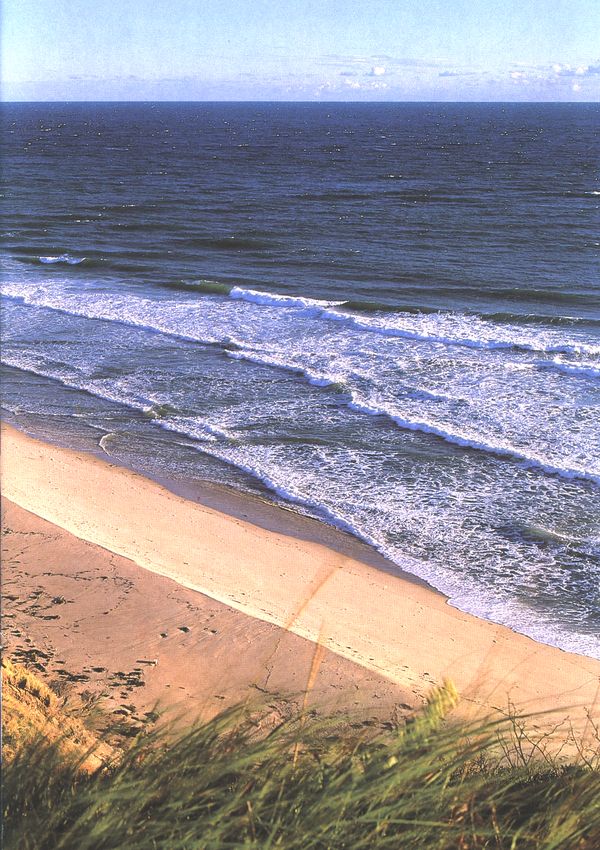
Summer, fall, winter, spring,
the interaction of the sea and
the land is clearly evident on
Cape Cod’s Outer Beach.
A Cape for All Seasons
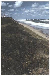
Majestically eroded, the great glacial bluffs of Cape
Cod’s outer beach rise from the open Atlantic,
separating the ocean from Cape Cod Bay. Its many-colored
sands and clays flow grain by grain, or in
sudden shelving slabs, to replenish the shore below.
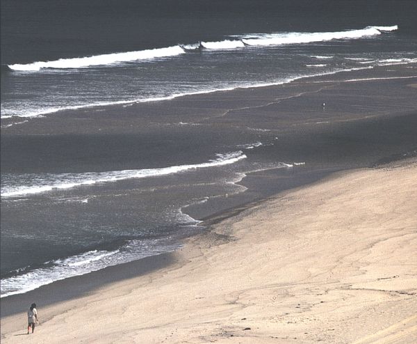
The beach, broad and gently sloping in summer,
short and steep in winter, arcs northward for more
than 20 miles, giving the walker a curved prospect
two or three miles ahead at most. And always,
coming onto the shore and reforming it, with measured
cadences in calm weather, with awesome fury
during northeast gales, is the sea. Here, as Henry
Beston put it, “the ocean encounters the last defiant
bulwark of two worlds.” There is no other landscape
like it anywhere.
Cape Cod holds a special place in America’s
landscape, history, and collective imagination. As
the world’s largest glacial peninsula, it juts farther
out into the Atlantic Ocean than any other part of
the United States. It was one of the earliest landfalls
of the European explorers in the 16th and 17th
centuries. Its purported identity as the “Wonderstrand”
of the Viking sagas remains apocryphal, but
it was—as every Cape Codder will be quick to tell
you—indisputably the first landing place of the
Mayflower Pilgrims in 1620, and it became one of the
oldest settled areas in the country.
Cape Codders early on took to the sea with a will,
and they have never relinquished it. Over the centuries
there developed on this thin peninsula a unique
maritime way of life that has produced some of the
most familiar objects and images in American culture.
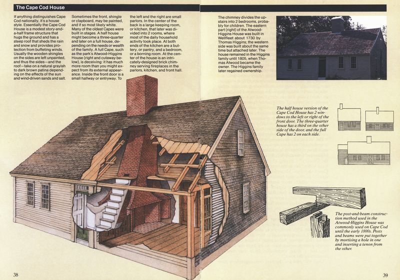
They include that durable architectural form,
the Cape Cod house; indigenous nautical designs
such as the Cape Cod catboat; tools like the quahog
bullrake; and such functional folk art as carved bird
decoys. Cape Cod bogs produced the first commercial
cranberries, that traditional part of our Thanksgiving
celebrations. The Cape’s villages, low hills,
and sandy shores are still dotted with gray shingled
windmills, looking like ungainly landbound ships,
whose great sheeted arms once ground corn and
pumped seawater for the making of salt; tall lighthouses
that stand sentry on bold eroding sea cliffs
and at the entrances to low, protected harbors;
stately sea captains’ houses with roofs crowned with
“widows walks” and yard gates framed by arched
whale jaws; and, from local wharves and piers, fleets
of colorful boats manned by fishermen who continue
to go out to harvest the sea as they have for centuries.
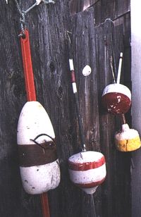
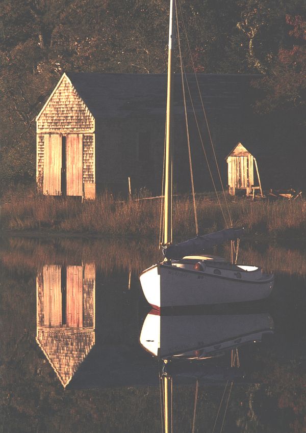
Fishermen’s floats, weathered-shingled
boathouses, and catboats—Cape
Cod’s coves reflect
its seafaring traditions.
Perhaps the most enduring image of all, however,
is that of the legendary “Cape Codder” himself. He
appears in many guises: as a Portuguese “banker”
fisherman trawling for cod in a small dory off the
Georges Banks; a Truro “mooncusser” salvaging the
booty from an 18th-century pirate ship wrecked on
the Cape’s “backside;” a Wampanoag Indian gathering
alewives, or migratory herring, in spring to plant
with her corn; a Wellfleet whaler casting his harpoon
at a right whale in the icy Arctic seas; a Yankee
clipper ship skipper from Brewster or Dennis helping
to open up the China Trade or setting a transoceanic
sailing record that still stands today; a Cape Verdean
girl picking ripe wine-colored cranberries in the long
rows of a Harwich bog; a Chatham Life Saving
Serviceman pulling his surfboat through a fierce
January gale to make a daring rescue of the crew of a
vessel grounded on one of the Cape’s treacherous
shoals; a Provincetown rum-runner in his weather-beaten
dragger eluding a Coast Guard cutter in the
fog; an “old salt” in sou’wester and knee boots
spinning yarns in Barnstable or Rock Harbor.
These and other versions of the protean Cape
Codder have been celebrated and recorded in story
and song since the founding of this country and have
become a part of our history and folklore. In fact,
few if any rural areas of comparable size have been
written, painted, and sung about so richly over the
years as the Cape landscape and its inhabitants.
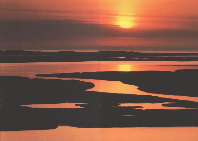
Pages 10-11: Because the
Outer Cape is such a narrow
strip of land with the Atlantic
on one side and Cape Cod
Bay on the other, sunrises and
sunsets can be spectacular.
Here the sun rises over Eastham’s
Nauset Marsh, which
was a harbor when Champlain
explored the area in 1606.
Still, the dominant image of Cape Cod for most
Americans today is probably that of one of the
Nation’s most popular summer playgrounds. For two
centuries countless visitors and vacationers have
escaped the burdens and the routines of daily life
for a day, a week, or a season of liberation, exploration,
relaxation, and recreation along the Cape’s
unsurpassed beaches, ponds, marshes, bays, pine
barrens, inlets, and dunes. Originally a summer
resort for Bostonians and other New Englanders, the
Cape now receives visitors from everywhere, at all
seasons of the year. One of the favorite summer
games for Cape children is to see how many different
state license plates they can spot. Not infrequently
they can get them all, including Alaska and
Hawaii—as well as the Canadian provinces, Mexico,
and several European countries. Where Cape Cod
once produced seamen who sailed around the globe
to bring home wealth and exotic treasures, the Cape
has in turn become host to much of the world,
providing the setting for countless beach parties,
clambakes, family outings, sailing and fishing trips,
summer romances, and increasingly, an appreciation
and enjoyment of its rich environment, history, and
natural resources.
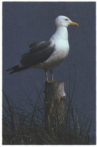
Gulls seem to be everywhere,
but the variety of birds makes
Cape Cod a birdwatcher’s
paradise throughout the year.
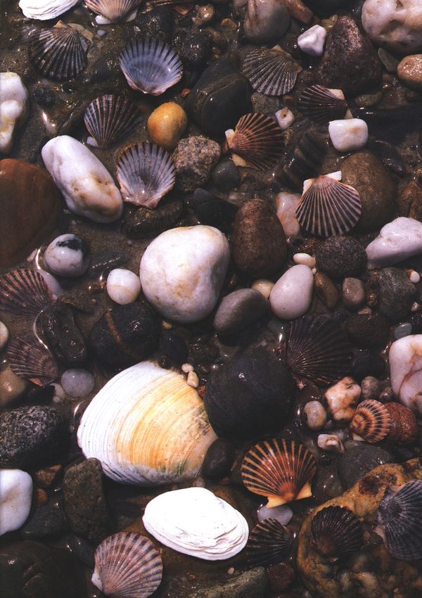
Along shorelines, tides rhythmically
polish shells and
cobbles.
What constitutes the enduring allure of a place
like Cape Cod? What makes more people than ever
cross the Cape Cod Canal bridges at all seasons in
search of something they believe lies in promise for
them here despite ever-increasing traffic jams,
crowded beaches, the continuing proliferation of
honky-tonk tourist traps, and the ongoing fragmentation
of woodlands and waterfronts by commercial
and residential development?
Over the centuries the universal and nearly perfect
image of Cape Cod as a flexed human arm has
provided an ambivalent symbol for what its settlers
and visitors have hoped to find here. For the fearful
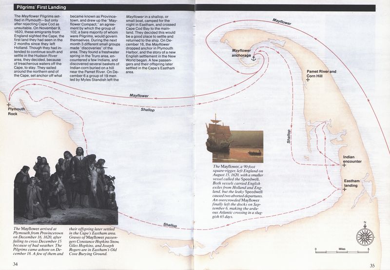
yet hopeful Pilgrim passengers on the Mayflower it
both beckoned and threatened, offering religious
liberty and land for settlement, yet at the same time
presenting, in William Bradford’s words, “a wild and
savage hue,” a “hideous and desolate wilderness”
that many of them would not survive.
To their maritime descendants the Cape offered
seemingly endless abundance from the sea and a
springboard to personal fortune; yet at the same time
it proved to be a treacherous barrier to sea traffic, a
graveyard for hundreds of ships that fell victim to the
Cape’s treacherous rips and shoals, or to fierce
northeast storms and gales. It was not by chance, or
merely to escape the wind, that most old Cape
houses are built well back from the shore. As
Rowena Myers, an 88-year-old lifetime resident of
Orleans once explained to me, “The old people
didn’t like to look at the sea once they were ashore.
It held too much pain for them.”
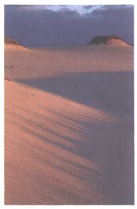
Winds and tides constantly
move the sands, tearing down
dunes and creating new ones.
Today Cape Cod beckons as never before to a
Nation increasingly starved, in Henry Beston’s words,
“for lack of elemental things, for fire before the
hands, for water welling from the earth, for air, for
the dear earth itself underfoot.” Seventy-five million
of us live within a day’s drive of Barnstable County.
During the past 30 years the Cape’s permanent
population has risen from 70,000 to 190,000, a figure
that nearly triples during the peak summer season.
Some come to walk the spacious curved length of
the Great Beach of Cape Cod, which Thoreau
claimed was a place where “a man may stand and put
all America behind him” (though at many public
beaches in July and August it may seem as if one has
most of America in front of him!). Others seek
quieter places like the soft pine barrens of the
interior woodlands, or one of the Cape’s hundreds of
clear kettle-hole ponds, or the dune country of the
Province Lands with its eccentric and colorful community
of dune shacks—an ever-shifting landscape
of mirages and stark, unexpected beauty.
Still others find, along the Cape’s many well-preserved
village streets, in its old farmhouses and
meandering stone walls of glacial boulders, its lighthouses,
fishing shacks, and aging fleets of sea-beaten
draggers and lobster boats, a deep sense of that
earnest, abiding, communal history that flourished
here for so long and which we seek to borrow to help
anchor our more modern, shifting lives.
Many are attracted to the energetic and often
outrageous bohemian diversity of a place like
Provincetown, or to the Cape’s many art galleries,
theaters, concerts, and museums. Some may hope
for a glimpse of the Kennedy compound in
Hyannisport or a movie star on the bench in front of
a local general store. Others look forward to a Cape
Cod lobster and clam dinner (which may, in fact,
have come from the waters off Maine or Alaska) at a
waterfront restaurant, or the seemingly endless array
of gift shops, night spots, and tourist diversions
(including increasingly elaborate miniature golf
courses with waterfalls and “historic reproductions”)—much
of which have little or no indigenous
connection with Cape Cod and can be had elsewhere,
but which somehow seem to mean more
when experienced here.
One element that seems to embrace and permeate
all of the Cape’s attractions is natural change. Change,
of course, takes place in any environment, but here
on the Cape it seems peculiarly pervasive, visible,
and dramatic, particularly along the ocean shore. I
like to point out to people who want to retrace
Thoreau’s famous walk along the Outer Beach that
they are likely to get pretty wet if they try it, since
Thoreau’s original path now lies several hundred feet
offshore!
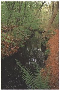
In stark contrast with the
sandy shorelines, the upper
Herring River in Wellfleet is
rich in vegetation.
We are subject to great periodic sea changes on
this peninsula. Tides rise and fall up to nine feet
twice a day, sweeping out in places in Cape Cod Bay
to reveal tidal flats over a mile in extent. Waves and
currents continuously undermine and cut into the
great glacial cliffs of the Outer Cape, removing an
average of three feet a year from our eastern boundary.
Autumn and winter storms rearrange the ocean
beaches, undermining the foundations of lighthouses,
beach parking lots, and shorefront cottages, strewing
the beaches at times with the carcasses of thousands
of sea creatures, from whelks to whales. Tides and
winds build and unbuild ridges and bowls of sand
dunes, which in turn march across the land, threatening
to bury marshes, forests, ponds, roads, and, in
the past, whole villages and harbors. Major storms,
like that of the Great Blizzard of February 6-7, 1978,
change the very outlines of Cape Cod, cutting barrier
beaches in two, creating new islands, flattening
entire dune systems, creating new inlets, and plugging
up old ones. The Cape is a river of sand into
which we can never step twice.
For whatever reasons we come, the continuing
attraction of the Cape to tourists and new residents
(known as “washashores”) has proven a mixed blessing,
providing a valuable source of income to the
local populace but also bringing an increase in
development and commercialization that threatens
the very things we seek here: clean air, unpolluted
waters and beaches, the harvest of the sea, unspoiled
vistas, a sense of rooted historical continuity, the free
interplay of natural forces and wild inhabitants, and
the opportunity for discovery and self-discovery in a
landscape that has had a perennial allure for the
human spirit for over three and a half centuries.
It was with the intent of preserving this experience
for the public at large, and not for just a privileged
few, that the idea for the National Seashore was born
more than 30 years ago. The formation of the
National Seashore was unique among the creation of
the Nation’s public parks. Prior to its establishment
in 1961, national parks, forests, seashores, and monuments
had been created from land already owned by
federal or state governments, or from land or funds
donated by private individuals. No federal monies
had ever been spent to create such places.
Today Nauset Light alerts
mariners off Eastham’s treacherous
Atlantic coast. Since the
days of the earliest Indian inhabitants,
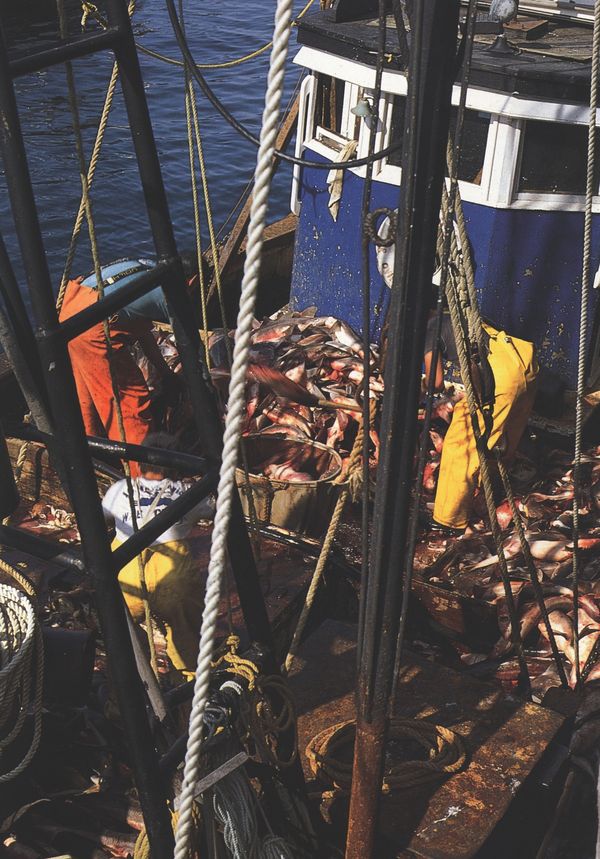
Cape Codders have
plied the bay and ocean for
food and related marine products.
Commercial fishing boats
still work out of Provincetown,
Chatham, and Wellfleet within
the National Seashore.
On August 7, 1961, when President John F. Kennedy
signed the legislation establishing Cape Cod
National Seashore, he declared: “I ... hope that this
will be one of a whole series of great seashore parks
which will be for the inspiration and enjoyment of
people all over the United States.” Since then, others
indeed have been created and Cape Cod National
Seashore has become one of the most popular of the
Nation’s public parks, with more than five million
visits each year. The diligent and dedicated participation
of the Seashore’s Advisory Commission, composed
of 10 state, county, and town representatives,
helped park officials devise the first comprehensive
master plan for the National Seashore. Nonetheless,
the “balancing act” of preservation, recreation, and
local rights has not always been an easy or a smooth
one. Debates continue over recreational demands
versus conservation, controversial uses such as beach
buggy access, and development within the park. But
there are relatively few who do not recognize not
only the economic importance of the Seashore but
the critical role it has played in realizing former
Senator Leverett Saltonstall’s dream of maintaining
Cape Cod “so that other Americans, in dire need of
the natural grandeur of the clean, open spaces, will
find an outlet from their crowded, grimy, urban
lives.”
What you will find here is a different experience
from what is offered in our national parks and most
of the other national seashores. There is stunning
scenic beauty and wildlife in abundance, to be sure,
and the chance to explore and enjoy them on foot,
horseback, or bicycle, in a canoe or a sailboat, on a
guided walk, at an interpretive talk, or, if you like,
simply lying on a beach before the rolling waves.
But there is also, by design and intent, the ongoing
presence of man, in the hundreds of historic houses,
lighthouses, Coast Guard stations, and summer cottages
that remain within the Seashore, and in the
continuing traditional uses of its lands and waters,
such as commercial fishing, lobstering and shellfishing,
hunting and berry picking.
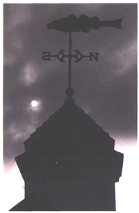
On a cloudy day, the Cape’s
most obvious icon, the codfish,
keeps track of the wind.
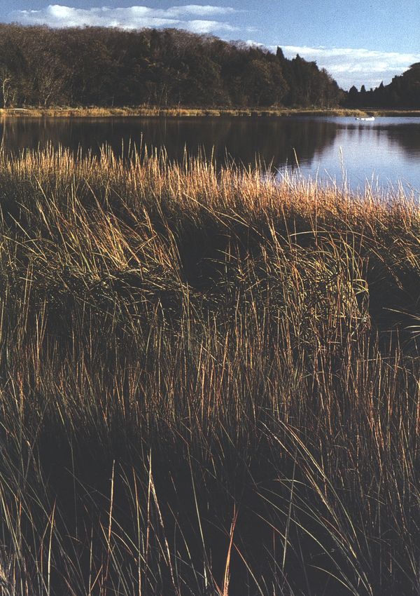
With a change in the weather,
Nauset Marsh glows in autumn
light.
The boundaries between Seashore lands, private
property, and community facilities are not always
obvious. The Provincetown airport and the Nauset
Regional High School in Eastham, for instance, both
lie within Seashore boundaries. Visitors are asked to
observe the “Private Property—Please Respect Owner’s
Rights” signs they encounter along many of the
Seashore roads and trails. A number of the more
popular beaches require local town parking stickers.
Cape Cod National Seashore, in other words, is not
so much a protected pristine preserve as an ongoing
experiment in cooperation between the Federal Government
and local communities and their residents
who continue to live, work, and play alongside, and
often within, the park itself.
Whether you choose to join the summer crowds,
or seek a solitary walk along the winter beach, we
hope this handbook will acquaint you with enough
knowledge of Cape Cod’s rich historic and natural
heritage so that your visit here, whether brief or
extended, will be more rewarding.
Part 2 A Great Arm in the Sea
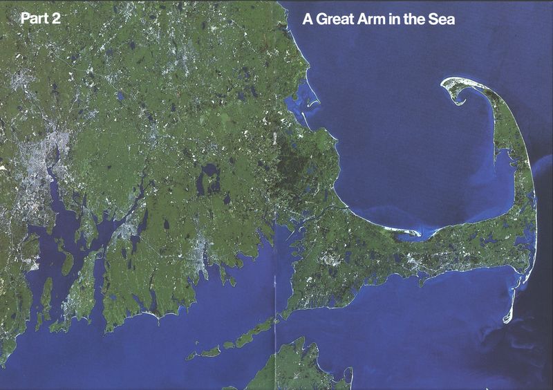
Pages 20-21: This satellite
view clearly shows the flexed
arm shape of the Cape.
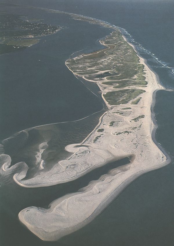
Overwashes of sand become
readily apparent from the
air over North Beach off
Chatham.
A Sliver of Sand
From the air the great curled arm of Cape Cod looks
like a mere film of sand, a whimsical momentary
shape floating on the vast ocean around it. Its flimsy
fabric appears torn and rent by hundreds of holes,
large and small, and dozens of slits at the edges,
where the water shows through. So sheer and vulnerable
does it appear that it seems as if the slightest
push might sink it beneath the sea.
This somewhat fanciful impression nonetheless
contains several grains of geologic truth, for water, in
its various guises, permeates the Cape’s past, present,
and future. Created by the frozen water of vast
glaciers, shaped today by the water of tides, waves,
currents, and storm surges, this prominent hook of
land is destined to succumb at last to the steadily
rising waters of the sea—all in the merest flick of
geologic time.
Some 75,000 years ago, when the Earth’s climate
entered a cooling period, the most recent of the vast
continental ice sheets, known as the Laurentide,
began to form across eastern Canada. As it spread
and thickened, much of the oceans’ waters became
trapped in its mass, lowering sea levels by several
hundred feet. The visible bulk of Cape Cod is
primarily the work of the Wisconsin Stage Glacier, a
towering wall of ice 10,000 feet thick that moved
south over New England some 25,000 years ago.
Grinding forward in rounded fronts, or lobes, the ice
sheared off the tops of mountains, gouged huge
valleys through granite hills, and plowed up tons
upon tons of rocks, material, and debris from what
had been the floor of the sea.
Advancing, hesitating, and advancing again, the
glacier moved as far south as Long Island, Block
Island, Martha’s Vineyard, and Nantucket. Then, as
the climate warmed, the front edges of the glacier
began to melt; the ice sheet retreated north of the
present outline of Cape Cod, dropping rocks and
large chunks of ice as it went. Then, as cooler
weather returned, it paused, and, as the flow of ice
exceeded the rate of melting, the glacial lobes once
more advanced. This time they pushed enormous
amounts of drift material across the face of the
Upper and Lower Cape, creating the Elizabeth Islands
in Buzzards Bay and the rocky, morainal hills
on the western and northern sides of the Upper
Cape.
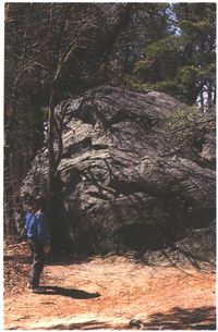
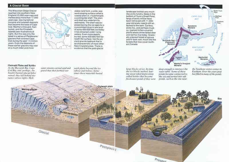
When the glacier melted, it
left behind huge rocks, known
as erratics, scattered on the
landscape.
As the glacier began its final withdrawal about
18,000 years ago, water from the melting ice carried
and sorted finer material, forming the gently sloping
southern and interlobate outwash plains of the Upper
and Lower Cape (see pages 26-27). Braided
meltwater streams covered the ice chunks that the
retreating glacier had dropped in thick, insulating
layers of outwash material. Eventually, perhaps centuries
later, the buried ice melted and the glacial
debris above it sank, creating the hundreds of kettle
holes that are characteristic of so much of the Cape’s
topography.
As the great ice sheets melted, the sea level began
to rise, forcing the Cape’s fresh groundwater upward.
When the freshwater level intersected with
these kettle holes, the Cape’s numerous kettle ponds,
so clear and deep, came into being. In some places
these meltwater deposits and kettle holes form a
highly irregular landscape of hills and hollows, such
as the “kame and kettle” fields of Eastham, which
can be seen on the bike trail from the Salt Pond
Visitor Center to Coast Guard Beach.
Farther north a prominent series of east-west
valleys cross the high plains of Wellfleet and Truro,
separated by the so-called “hogback” hills of Truro.
Most of these valleys only partially cross the Lower
Cape. An exception is the Pamet River Valley, which
traverses the entire forearm of the Cape, separated
from the ocean at its eastern end only by a fragile
line of dunes that is sometimes broken through by
major storms.
For many years geologists believed these valleys
were carved out by glacial meltwater streams, but a
more recent theory suggests a different origin, based
on a phenomenon known as “spring sapping.” Spring
sapping occurs when water emerges at the surface of
a plain to form a spring, or seep, which then erodes
back up the plain toward its head. There is evidence
that during the final period of glacial retreat a large
freshwater glacial lake existed to the east of Cape
Cod. The surface of this lake may have been as much
as 80 feet above present sea level, providing a powerful
head of water that may have leaked through the
porous outwash material of the Lower Cape, producing
springs that created the valleys we see today.
However they were formed, most of these valley beds
are dry today, or else they carry only the small,
sluggish streams that constitute Cape Cod’s “rivers.”
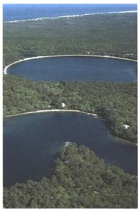
Kettle ponds formed over time
as underground freshwater
filled glacial depressions. Today
the life in these ponds
can be quickly affected by
humans.
After the glacier’s final withdrawal, Cape Cod was
only a rough sketch of its present streamlined form.
Its moraines, high tablelands, valleys, and kame
fields stood high and dry amid the surrounding
coastal plain that stretched a hundred miles to the
south and east, as far as the present-day Georges
Banks.
The sea, however, continued to rise and advance,
gradually filling the Gulf of Maine and covering the
continental shelf. It probably reached the edge of
the glacial Cape some 5,000-6,000 years ago. Now the
rough-hewn shapes left by the ice began to undergo a
process of planing, smoothing, elaboration, and elongation
under the more subtle hands of the sea.
Currents, tides, and storms began to chew away at
the outer shores of the Lower Cape, creating in time
what is surely the most impressive feature of the
Seashore, and perhaps the quintessential Cape Cod
landscape: the great marine scarp, or sea cliff, of the
Outer Beach.
Stretching some 15 miles from Coast Guard Beach
in Eastham to Head of the Meadow Beach in North
Truro, this curved headland presents a nearly unbroken,
undulating bulwark of bold, eroding bluffs,
composed of clay and sand and ranging in height
from 30 to more than 170 feet above the beach. From
South Wellfleet to North Truro the smooth rim of the
sea cliff is marked by a half-dozen pronounced dips
or “hollows,” which are the eroded cross-sections of
relict valleys. These hollows were later to play an
important part in the human history of this beach.
To the casual observer the cliff face appears
uniform, lying at a general “angle of repose” of some
27 degrees to the horizon. But look closely and you
will see that, as the Colorado River has done through
the Grand Canyon, the sea has cut open the geologic
book of the Cape’s history, exposing thousands of
years of history. Alternating layers of till—rock debris
deposited by the ice—meltwater-deposited sand
and gravel, and clayey silt tell of the glacial advance
and withdrawal, of inundation and ebb by the sea.
Large outcrops of blue clay, such as the 25-foot thick
“Clay Pounds” just north of Highland Light, are the
result of glacial lake sediments deposited during the
last deglaciation.
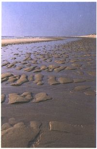
Low tide bares a wide expanse
of sand patterns and tidepools
at Coast Guard Beach.
The ocean also invaded parts of the land, creating
estuaries and embayments at the mouths of these
glacial valleys, such as those at Pamet Harbor and
Blackfish Creek. Several of the Cape’s “salt ponds,”
such as the one in Eastham below the visitor center,
were originally freshwater kettle ponds that have
been breached by the rising sea.
As Cape Cod was being smoothed, slimmed, and
invaded by the rising sea, it was also being lengthened.
Like a sculptor working in clay, the ocean currents
took much of the eroded cliff material and, carrying
it both north and south, created the elaborate forms
of the barrier beaches, barrier islands, and sand
hooks that give the Outer Cape its characteristic
filigreed coastline. Monomoy Island, North Beach,
Nauset Beach, Coast Guard Beach, and Jeremy Point
are some of the more prominent of these post-glacial
landforms, enclosing such important estuaries as
Pleasant Bay, Nauset Harbor, and Wellfleet Harbor.
Among the more unusual formations are the tombolos
of outer Wellfleet Harbor: the series of short sand
beaches that connect Bound Brook, Griffin, Great
Beach Hill, and Great Islands.
Of all these sea-spawned parts of Cape Cod,
however, the most impressive and extensive is undoubtedly
the Provincetown Hook. These 3,000 acres
of dunes at the northern tip of the Cape form a broad
recurved spit of sand that encloses Provincetown
Harbor, one of the finest deepwater harbors on the
East Coast and the initial port for the Mayflower
Pilgrims in 1620. Some oceanographers believe that
the hook began to form as much as 6,000 years ago
and has built up in a series of roughly parallel ridges,
or dune lines, widening out into the ocean.
In the protected bays and inlets behind these
elongating fingers of barrier beaches and islands, salt
marshes—one of the Cape’s most characteristic and
important ecosystems—began to form 4,000 to 6,000
years ago. Composed of a few species of salt-tolerant
grasses, primarily the stalky cord grass (Spartina alterniflora)
and the finer salt hay (Spartina patens),
these green salt meadows of the sea built slowly on
the accumulating sediment deposited in protected
areas of water by the tides and land runoff. Gradually,
as the sea rose relative to the land, the marshes
raised and spread themselves on a platform of their
own decay, forming thick beds of peat underneath
them. As the climate continued to warm, the Cape’s
woodlands evolved from boreal forests to the mixed
pine-oak woodlands we see today.
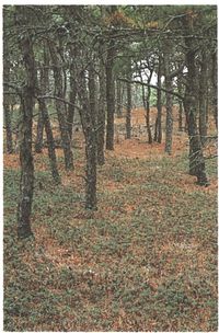
Pitch pine is the most common
tree on Cape Cod and
the only species of native pine
that grows in the National
Seashore. It survives on well
drained glacial sediments and
stable sand dunes and is very
fire resistant. In this stand on
Great Island, the undergrowth
is primarily bearberry.
As the Cape’s post-glacial environment grew more
diverse and complex, so did the culture of the people
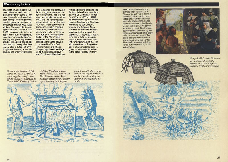
living on it. The first Native Americans on Cape Cod
are now thought to have arrived at least 9,000 years
ago. By the late Archaic Period, starting about 5,000
years ago, local Indian groups had developed a
seasonal pattern of movement based on multiple
resources. During the warmer months they settled
on the shores of bays, marshes, and fish runs,
trapping birds and collecting herring and shellfish.
In winter they retreated inland to the more protected
forested shores of ponds and other wetlands.
By the beginning of the Woodland Period, about
2,500 years ago, Indian settlements had grown even
more numerous, larger, and more sedentary. About
800 years ago agriculture and a variety of new
materials and tools had been introduced. One of the
most important of these “tools” was fire; with it the
Cape’s Native Americans changed the face of the
land.
Many early accounts attest to the extent and scale
of the Cape’s original woodlands. Even at Provincetown,
which must have always been the most barren
area of the Outer Cape, the Pilgrim leader William
Bradford observed “The whole countrie, full of
woods and thickets, wooded with oaks, pines, sassafras,
juniper, birch, holly, some ash, walnut, the wood
for the most part open and without underwood, fit to
go or ride in.”
Archeologists now believe that the Cape Cod
Indians may have practiced a form of low-level
woodland management, burning underbrush, or
wooded ridges, to provide browse for game and to
make hunting easier. Such burns may have promoted
the Cape’s characteristic pine barrens, tracts of open
woodlands composed primarily of pitch pine, a tree
adapted to periodic fires.
Some glacial lands, now vanished, still existed in
historical times. There are many early references, for
example, to Ile Nauset, or Nauset Isle, a point of land
that lay off Nauset Beach, perpendicular to the
coastline. It may have formed part of Cape
Mallebarre, the place of “dangerous shoals and
roaring breakers” that turned back the Mayflower
from its intended destination of Virginia. Nauset Isle
had sunk beneath the waves by the 18th century, but
another piece of early glacial real estate survived
much longer. In the late 19th century, Billingsgate
Island, off Jeremy Point in Wellfleet, was a flourishing
60-acre fishing community with livestock, a
schoolhouse, and a lighthouse. By 1915, however, the
island had been abandoned, and by 1942 it had
vanished, the victim of gradual erosion by currents,
storms, and rising sea levels. Today, at low tide, one
can view the remains of this Wellfleetian Atlantis
from the southern bluffs of Great Beach Hill: an
extensive spread of granite boulders brought over on
ships as riprap in a futile attempt to stem the tides.
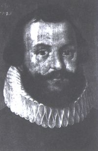
In Capt. Myles Standish the
Pilgrims had both a military
and temporal leader. He
helped found the Plymouth
Colony, led a group that
bought the colony from London
investors, and served as
assistant governor and treasurer
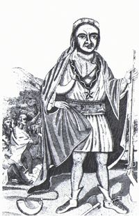
for 5 years. Metacomet,
or King Philip, shown in an
engraving by Paul Revere, was
killed leading the Wampanoags
in an unsuccessful war
concerning land disputes with
the English settlers in 1676.
To get some idea of the scope of erosion on the
Outer Beach, consider this: in 1990 an ancient
prehistoric site was uncovered at Coast Guard Beach;
archeologists have estimated that at the time of its
occupation, nearly 9,000 years ago, it was five miles
inland. More recent evidence of erosion can often be
observed on the Seashore’s ocean side. At Nauset
Light Beach, a circular brick foundation from one of
the former “Three Sisters” lighthouses (replaced in
1923 with the present single light) is frequently
uncovered in winter at the base of the cliffs, having
survived a 50-foot slide to the beach. Farther north,
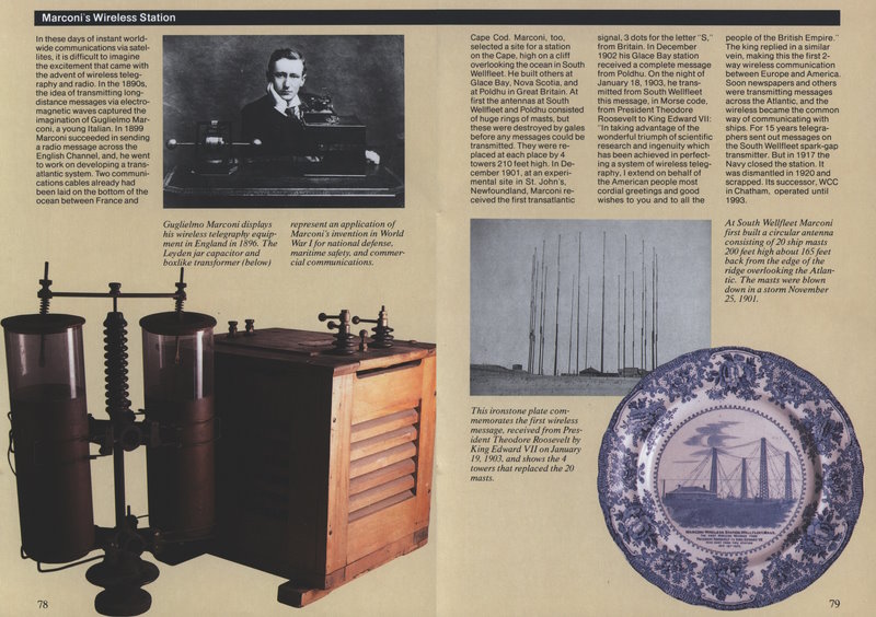
at the Marconi Site in South Wellfleet, Guglielmo
Marconi constructed his original transmitting towers
in 1901-1902, set back 165 feet from the edge of the
cliff. Today only two of the foundations remain; the
other two have fallen into the sea.
Few things remain in place on the edge of the cliffs
or on the dunes. They either move or disappear.
Cape Cod Light, first built in 1796, has been replaced
twice; the current tower sits some 600 feet
back from the site of the original one, though only a
little more than 100 feet from the present cliff edge.
The present Eastham Coast Guard Station, built in
1936, is a successor to the first one, which succumbed
to beach erosion. When the Seashore was established
in 1961, more than 80 cottages existed on its
barrier beaches. Today, as a result of subsequent
storms, less than one quarter of them remain.
Logs and other objects, including the remains of
old shipwrecks, are frequently uncovered by eroding
dunes and beaches. During a dramatic storm, while
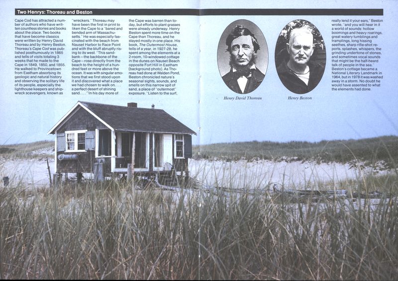
he was staying in the Outermost House in the 1920s,
Henry Beston described how the blackened skeleton
of an ancient ship that had been buried in a dune for
more than a century “floated and lifted itself free ...
thus stirring from its grave and yielding its bones
again to the fury of the gale.”
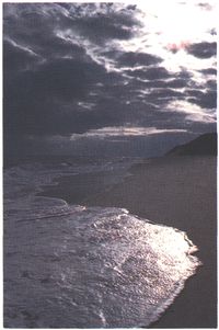
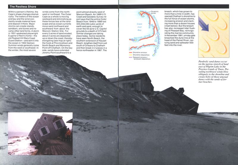
Fall and winter storms often
develop quickly and tear away
at the shorelines, removing
sands from one place and depositing
them elsewhere.
One survivor of this coastal erosion is the Old
Harbor Life Saving Station. Now a maritime museum
at Race Point Beach in Provincetown, it began life in
1897 twenty miles to the south on Chatham’s North
Beach. In 1977, in the face of imminent destruction,
the station was cut in half and floated on two barges
to its present site.
During the summer, the beaches of the Outer
Cape present a generally peaceful and benign aspect.
A wide, gently sloping shelf of sand lies between
the base of the sea cliffs and a rhythmic,
moderate surf. The summer shoreline’s peaceful
countenance encourages the illusion that all this
change and rearrangement of shoreline lies in the
settled past. There is little indication to the summer
visitor of the ferocity, violence, and transformation
that visit this coast in the “off-season.” But if one
returns in late autumn, when the prevailing winds
shift to the north and the east, when the first
northeasters of the season begin to chew away at the
wide summer beach, replacing it with a short, steep
winter berm, one begins to have a sense that this is
still a land in the making, that, as Henry Beston
observed, “Creation is here and now.”
In winter the ocean storms claw into the base of
these cliffs, undermining them. Along some stretches
erosion is gradual, with little rivulets of sand running
down the cliff face into the sea. At other places,
especially where there are large deposits of clay, the
process can be dramatic. Whole slabs of the marine
scarp may shelve off at once, and a single stretch of
cliff may lose 30 or 40 feet in one storm. In still other
areas the beach appears to be accreting, with wide
terraces of sand covered with beach grass building
out from the cliff base. But overall the Outer Beach
continues to erode, losing an average of three feet a
year.
On the barrier beaches the erosion process is
somewhat different, though the overall effect is also
retreat. Barrier beach dune lines are dynamic systems.
That is, they retreat and maintain themselves
by moving with, rather than resisting, the ocean’s
power. Normally the foreslopes of the dunes flatten
out during a severe storm, presenting a less steep
face to the waves, which helps to dissipate their
force. Meanwhile wind and occasional storm surges
that break through the line carry sand into the
estuary or marsh behind the dunes. These deposits
are gradually colonized by beach grass and other
beach plants, which begin the process of building up
another dune line as the foredunes continue to
erode. Evidence of this gradual retreat can be observed
by the occasional emergence in front of the
present dune lines of peat ledges, the remains of a
salt marsh or freshwater bog that once lay behind a
former line of dunes. In a healthy system and under
normal conditions a barrier beach “rolls over on
itself” in a smooth progression landward.
On occasion, however, even this process is
overwhelmed by an unusual manifestation of the
sea’s power. One such manifestation was the Great
Blizzard of February 6-7, 1978, called “The Storm of
the Century.” Carrying 15-foot tides and hurricane-force
winds, this storm rearranged many parts of the
Cape’s shoreline. Monomoy Island, for example, was
severed in two, and remains so today. But nowhere
were the effects more dramatic and visible than at
Eastham’s Coast Guard Beach. Storm surges
breached the dune line, flattening 90 percent of the
dunes themselves, carrying off most of the beach
cottages, including Henry Beston’s Outermost House,
and totally destroying the Seashore’s bathhouse and
large parking lot.
Provincetown has always been the Cape community
that has had to contend most with change.
During the 19th century the moving dunes of the
Province Lands threatened to bury its houses and silt
up its vital harbor. Subsequent erosion control and
beach grass plantings have so far kept the dunes at
bay, but a more implacable force may now be
threatening the town.
Over the past few decades oceanographers have
observed an acceleration in the rate of sea-level rise,
possibly the result of global warming. The sea may
now be rising as much as one foot every century,
which on low shorelines translates into a loss of 100
feet inland. Nowhere on Cape Cod does thick settlement
lie so close to the shore as along the low,
narrow streets of Provincetown. If present rises in
the level of the sea continue, or, as seems likely,
increase, the ocean may well claim this ancient
fishing community before the dunes do.
Meanwhile the bulk of the Provincetown Hook
continues to expand outward into the sea. The
dangerous Peaked Hill Bars represent, in current
oceanographic theory, the next ridge of Province Lands
dunes in the making, rising gradually from the sea.
But regardless of such gains, or the pains taken by
humans to stem the loss of land from the sea, the
Cape is inevitably losing more than it is replacing.
Oceanographers estimate that for every five acres of
shoreline lost to erosion, only two are replaced with
new land in the form of barrier beaches or sand
hooks. There is little doubt that the Cape’s ultimate
fate is to return to the sea that spawned and shaped
it. At current rates of sea-level rise, Cape Cod has at
best only another five to six thousand years before
the Puritan preacher Cotton Mather’s prediction
comes true, and “shoals of codfish be seen swimming
on its highest hills.”
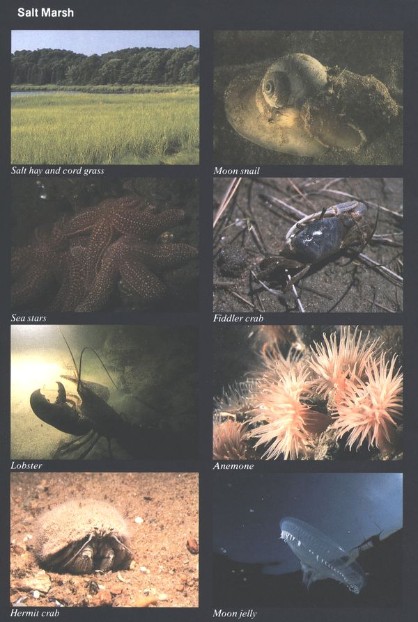
Salt Marsh
Salt hay and cord grass Sea stars Lobster Hermit crab
Moon snail Fiddler crab Anemone Moon jelly
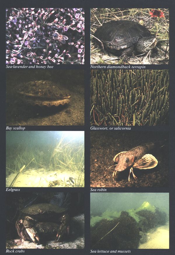
Sea-lavender and honey bee Bay scallop Eelgrass Rock crabs
Northern diamondback terrapin Glasswort, or salicornia Sea robin Sea lettuce and mussels
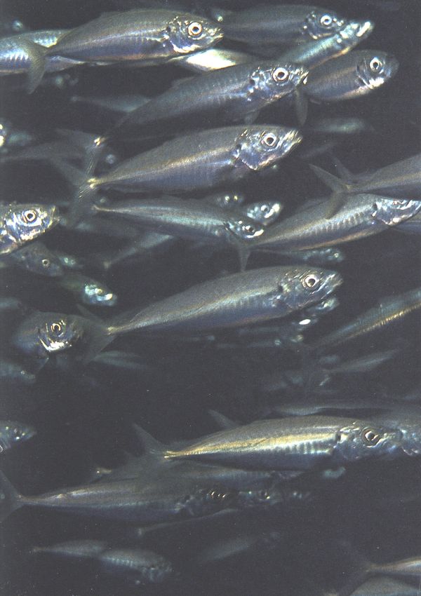
Schools of silversides, about
3 inches long, dart through
shallow waters feeding on
plankton. They in turn are fed
upon by other marine life and
birds such as gulls and terns.
The Bountiful Sea
The first English settlers who came to the Cape from
Plymouth in 1639 were farmers, not fishermen. It
took several generations for them to give themselves
fully to the life of the sea, though they early saw the
potential in it. In fact, even in their farming they
quickly took advantage of what the sea had to offer.
Alewives were gathered from local streams in spring
as a seasonal source of food, as well as fertilizer for
their cornfields, a practice taught to them by the
Wampanoag Indians. Eelgrass from the flats also
provided fertilizer, mulch, insulation for house foundations,
and even stuffing for mattresses. Lobsters
were so abundant that they were often blown ashore
in deep windrows. They were more valued as fertilizer
than food in colonial times, and in the 18th
century a petition was filed with the General Court
on behalf of indentured servants that they “not be
fed lobsters more than twice a week”!
Even more valued by these early Cape Cod farmers
were the salt marshes, or salt meadows. In a place
of little natural grassland, marshes were prized for
grazing. During the spring and summer cows were
pastured on the marshes, with boys sent along to
keep them from falling into the tidal creeks or
potholes, called “pannes.” In fall the salt hay was
scythed, stacked in ricks on raised wooden platforms
called “staddles,” and hauled to the barns by oxen or
horses wearing special wide wooden shoes to keep
them from sinking into the peat.
The Cape’s numerous bays, inlets, salt ponds, and
estuaries were also early recognized as marine cornucopias.
Foot-long oysters, scallops, crabs, eels,
flounder, diamondback terrapins, striped bass, mackerel,
and other fish were taken for local use, and
clam shells provided the lime for plastering colonial
walls.
Still, despite the many uses these early settlers
made of the marine riches around them, they did not
truly become men of the sea until they were forced
to by the land’s limitations and by their own mismanagement
of it. The Cape’s once-abundant woodlands
were cut and burned for farm and pasture land and
consumed for a seemingly endless array of local uses
and industries: heating homes; boiling seawater for
salt; building boats, gristmills, houses, and barns;
firing tar kilns; and trying out whale blubber, to
name just a few.
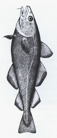
The Atlantic cod typically
weighs 10 to 25 pounds but
ranges up to 200 pounds. Its
bountiful numbers sparked
Massachusetts’ first major
maritime industry in the
1600s. A bottom dweller, the
cod soon attracted Cape
fishermen to the Grand Banks
off Newfoundland and to
Georges Bank off Cape Cod.
The thin glacial soil, exhausted by repeated cropping
and left unprotected by deforestation, soon
blew away. In Provincetown, unregulated cutting and
grazing in the Province Lands let loose the dunes,
which threatened to bury the town and fill up the
harbor. By 1800 dune ridges were advancing at a rate
of 90 feet a year. In 1847 Massachusetts geologist
Edward Hitchcock, visiting the Lower Cape, felt as if
he were “in the depths of an Arabian or Libyan
desert.”
Though the Cape’s soil was never very rich, the
waters around it teemed with abundance, and in the
sea Cape Codders found their true destiny. Thrust
some 30 miles out into the Atlantic, the Cape
partakes of two distinct marine environments. Cape
Cod Bay is part of the larger Gulf of Maine ecosystem,
a cold-water habitat influenced by the south-flowing
Labrador Current. The waters of Nantucket
Sound, averaging some ten degrees warmer, are
influenced primarily by the northward-flowing Gulf
Stream.
Such a range of temperature in its surrounding
waters, combined with numerous estuaries of varying
salinity, has produced one of the richest diversities
of marine habitats on the East Coast. A National
Park Service report states that the difference in flora
and fauna “between Cape Cod Bay and Buzzards Bay
is greater than that between Cape Cod Bay and the
Bay of Fundy, or between Buzzards Bay and the coast
of Virginia.” Warm-water species such as whelks, bay
scallops, diamondback terrapins, blue crabs, striped
bass and tuna inhabit the same waters as do more
northerly species such as blue mussels, Jonah crabs,
winter flounder, halibut, and, of course, cod.
Of all the creatures nourished by the sea, none has
been more important to the history of Cape Cod
than the Atlantic cod, Gadus morhua. In 1602, the
English explorer Bartholomew Gosnold was so impressed
by the schools of codfish surrounding his
vessel, the Concord, that he named this peninsula
after them, a name so apt that, in the words of Truro
historian Shebnah Rich, “blow high or low, cold or
hot, thick or thin, fish or no fish, it has hung on like a
lamper-eel from that day to this.”
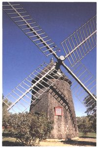
A few Pilgrims left Plymouth
and returned to the Cape and
settled in the Eastham area.
So, too, did this windmill. It
was built in Plymouth in the
1600s and was moved to Eastham
in 1793. The mill was
used in producing flour. Some
mills were used to pump seawater
as a part of saltworks.
The cod has always been what Captain John Smith
described in 1616 as “the maine staple” of the New
England fishing industry. More than a century before
the Mayflower landed, fleets of small ships from
Holland, Portugal, and the Basque region of Spain
had braved the North Atlantic annually to fish the
rich spawning grounds of the Grand Banks of Newfoundland,
salting their fish ashore and returning
with their catch to European ports. It is more than
likely that the first European visitors to Provincetown
Harbor—originally called Cape Cod Harbor—were
Portuguese fishermen who came ashore to cure, or
“make,” cod on the long sandy stretches there. Some
permanent European settlements may even have
existed there in the 1500s.
If the Plymouth settlers were unskilled as fishermen,
they were smart enough to sell the rights to fish
to others, and in 1670 a tax on the Provincetown
fisheries was established as a means of funding
public schools in Plymouth. As Thoreau put it,
schools of fish were used to provide schools for
children. As early as 1730, however, Cape fishing
captains were making voyages to the Grand Banks in
a “triangle trade:” taking salted cod to the West
Indies, exchanging fish for molasses and rum, and
bringing them back to the mainland where they were
sold to finance new and larger ships for more fishing
trips. But during the 18th century most fishing
remained inshore, or close to shore, and part-time.
Cape Codders remained half-farmers, half-fishermen,
and most took only enough for themselves and local
markets.
The British embargo on shipping during the American
Revolution was disastrous for the Cape’s nascent
fishing industry, but after the war it began to
come into its own. Shorter and more profitable runs
were made in smaller boats, and lightly salted “fresh”
fish was brought directly back for sale in Boston.
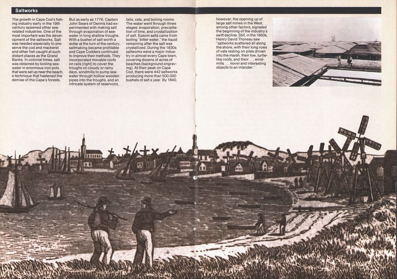
Fish flakes—low wooden slatted platforms on which
split cod was salted and sun-dried—became the
common method of curing fish. Because of its
capacious harbor, “where a thousand sail may safely
anchor,” and its extensive sandy beaches providing
ideal sites for fish flakes, Provincetown soon became
a magnet for the Cape’s burgeoning fish exports.
From a mere ten houses in 1755, it boasted a
thousand residents in 1802, and by 1840 the Cape-tip
community had become the preeminent fishing port
on Cape Cod, harboring more than 100 cod trawlers.
When Thoreau visited its narrow streets in 1849, he
counted over 200 mackerel schooners alone.
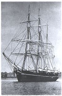
The whaler Charles W.
Morgan can be toured today
at Mystic Seaport in
Connecticut.
One of the major events in the growth of the
Cape’s fishing industry was the opening up of the
Georges Banks in 1821. Much closer than Newfoundland’s
Grand Banks, but just as fertile, this vast
glacial deposit, the work of the same ice sheets that
formed Cape Cod, had long been shunned because
of its dangerous shoals and currents. But the rising
price of cod and halibut tempted more and more
fishing captains to its waters. By the mid-1800s a
distinctive “banker” version of the Provincetown
schooner had evolved, sleeker and faster than the old
tub-hulled vessels, giving greater maneuverability on
the shoals and greater speed in getting the fish to
market first for the best prices. The schooners also
began carrying dories aboard. These small, double-ended,
highly seaworthy boats were launched from
the mother ship with two-man crews, who set out
hundreds of yards of hooked lines on floats, hauled
in their catch by hand, and waited to be picked up at
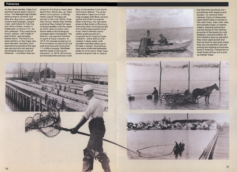
the end of the day. Deep-sea dory fishing, though it
greatly increased the yield of each voyage, also
increased the risks for the crews, especially if, as
frequently happened, these small rowboats became
separated from the schooners in fog or squalls.
After the Civil War the industrial revolution hit the
fishing market. Greater concentrations of capital,
larger boats, more expensive gear and faster transportation
for landed fish were required. Most Cape
towns did not possess the resources, the anchorage,
or the facilities to compete. They turned instead to
local handlining, trap, and weir fishing, or, as in
Wellfleet’s case, began to develop local shellfish
industries. But Provincetown, reinvigorated by the
arrival of the railroad in 1873 and by an influx of
Portuguese fishermen from the Azores in the late
1800s, remained a prominent New England fishing
port until the end of the century, when the increasing
demands of capital investment and labor forced the
town to yield to the ports of Boston and Gloucester.
Today Provincetown, Chatham, and several of the
other Cape towns still support small but tenacious
fleets of local draggers, trawlers, and lobster boats.
Declining stocks, smaller quotas, oil spills, competition
from foreign “factory ships,” and ever-more-expensive
gear have made it even harder for the
small fisherman to stay in business. But the independence,
challenge, the hope of a “big haul,” and
the unexplainable lure of the sea continue to attract
local residents to this ancient profession, and it is
likely they will continue to do so as long as there are
fish to catch.
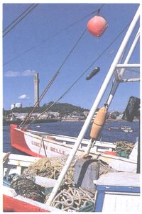
Colorful boats line up in
Provincetown harbor ready
for another day of commercial
fishing.
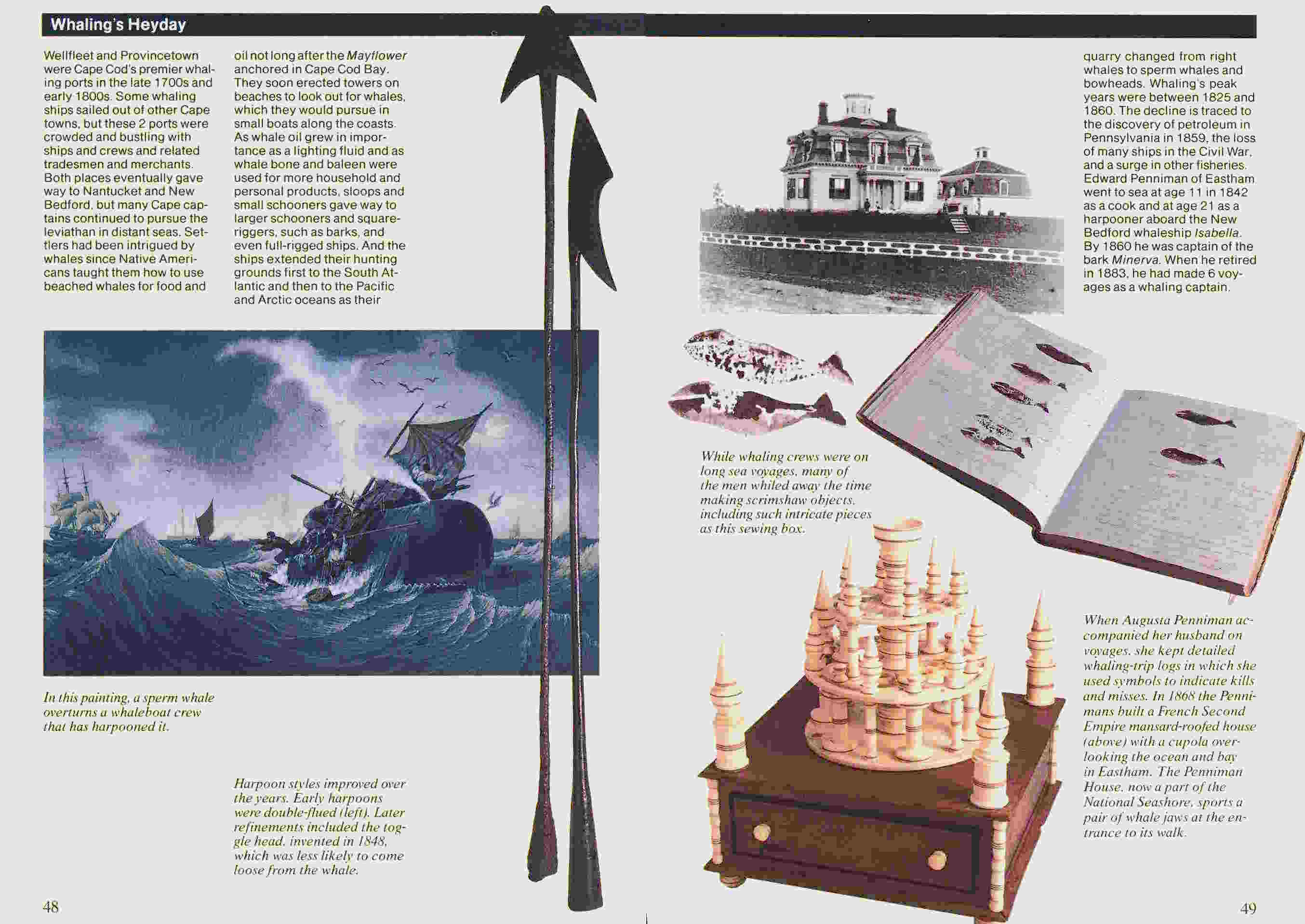
Though whaling was never as important to Cape
Cod as were its fisheries, it nonetheless formed an
significant chapter in the Cape’s maritime history. In
the early colonial days drift whales came ashore
frequently enough that they formed a portion of
some Congregational ministers’ salaries. Live whales
were common in Cape Cod Bay and Nantucket
Sound, and a modest inshore whaling industry developed
in the 17th century. In fact, in 1694 a Yarmouth
captain, Ichabod Paddock, was invited to Nantucket
to teach the Quaker residents the trade. He apparently
did such a good job that Nantucketers soon
became the preeminent New England whalers.
Try yards—areas where whale blubber was boiled
down, or “tried out,” to obtain the oil—were established
early in the 18th century on Barnstable’s
Sandy Neck, and in 1715 that town boasted some 200
inshore whalers. But such intensive exploitation soon
diminished the nearby stocks, and by 1750 the
inshore whaling industry was dying out.
As in fishing, so in whaling, Provincetown with its
unrivaled harbor became the Cape’s most important
port. At its peak, in 1876, seventeen deep-sea whaling
vessels sailed out of Provincetown. The last two
Cape whaling vessels made their final voyages from
Provincetown in 1920-21. They were the schooner
Cameo and the bark Charles W Morgan. The Morgan
is preserved at Mystic Seaport in Connecticut.
One species of cetacean has had a peculiar attachment
to the Cape shores over the centuries. The
pilot whale, or blackfish, is a medium-sized toothed
whale, 15-22 feet in length. It tends to travel in tight
groups, and large numbers of pilot whales frequently
strand themselves in the tidal creeks and on the
shallow flats of Cape Cod Bay, particularly in the
labyrinthine channels around Wellfleet Harbor. Scientists
are still trying to fathom the causes of these
mass strandings, but to the early Cape Codders they
were obviously a gift from God, providing both meat
and high-grade whale oil from the rounded “melon”
in the front of the whale’s head.
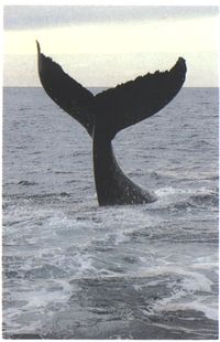
A humpback whale displays
its tail stock and flukes off
the Provincetown coast. Other
species of whales are also
commonly seen from spring
through fall, including finback,
minke, and right whales.
These marine mammals, once
hunted for their blubber and
baleen, now support a thriving
whale-watching industry.
Before long lookouts were posted to spot pods of
pilot whales coming inshore. Fleets of small boats
would then be launched, and their crew members
would circle the whales and beat their oars and blow
horns to “help” the panicked herd ashore. In 1855
Thoreau witnessed hundreds of blackfish driven
ashore at Great Hollow in Truro, and in 1880 a
school of more than 1,300 stranded in South Wellfleet
at Blackfish Creek, giving it its present name.
Strandings of pilot whales continued to be a source
of local income for Cape towns into the 1930s, when,
for reasons not clear, they largely disappeared. But
since the mid-1970s strandings have become common
again; in November 1982, sixty-five pilot whales
came ashore at Wellfleet’s Lieutenant Island.
In the eyes of many, Cape Codders attained their
greatest seafaring eminence as shipmasters in the
merchant marine. As captains during the early days
of the Republic, they were, as Cape historian Henry
Kittredge noted, “the first ambassadors of a young
nation.” Later, in command of the great clipper ships
of the mid-19th-century, they set a number of transoceanic
sailing records that still stand today. They also
made considerable fortunes for their owners, and for
themselves. This monetary bounty was translated
into the hundreds of substantial “captain’s houses”
that still stand along the streets of their home towns
from Sandwich to Provincetown. Brewster alone is
said to have counted more than 50 sea captains
residing there at one time.
But perhaps even more important than the fortunes
and exotic souvenirs these ship captains brought
home from foreign ports was the broad perspective
gained by their experience. It was said that many a
Cape Codder had been to China who had never gone
to Boston by land. Wives and children often sailed
with the shipmasters, and several of Cape Cod’s
small villages boasted a cosmopolitan culture unusual
among mid-19th-century New England towns.
Many of the retired ship captains became selectmen
in their towns, and, as Kittredge put it, “Narrow-mindedness
found barren soil in a district where two
houses out of every three belonged to men who knew
half the seaports of the world and had lived ashore
for months at a time in foreign countries.”
But the sea that brought such bounty and prosperity
to Cape Codders during the years between the
War of 1812 and the Civil War was not always kind.
There was a dark side to the Cape’s relationship to
the ocean, a side reflected in the numerous slate and
limestone markers in the Cape’s small burying
grounds that bear the inscription “Lost at Sea.”
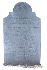
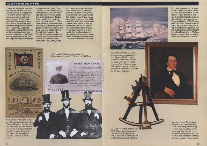
Over the years the sea has
taken the life of many a Cape
Cod fisherman. This stone,
in the Burying Ground of the
First Congregational Parish
of Truro, honors Mrs. Rebecca
Snow, who died Nov. 4, 1832,
and her husband, Capt.
Reuben Snow, who was lost at
sea in January 1825. The inscription
at the bottom reads:
“Tho’ in the dust, or in the
sea, their mortal bodies rest,
their spirits dwell in paradise.”
The 30-mile stretch of land between the Monomoy
Shoals on the south and Race Point on the north is
one of several East Coast stretches known as “Graveyards
of the Atlantic.” The Cape’s sandy outer shore
does not look as menacing as, say, the rocky coastline
of Maine or Nova Scotia. Its threats take more
subtle shapes, in the form of submerged sandbars and
treacherous rips, that can easily run a ship aground,
and where in winter gales waves will pound a vessel
to pieces as effectively as if it were on solid rock.
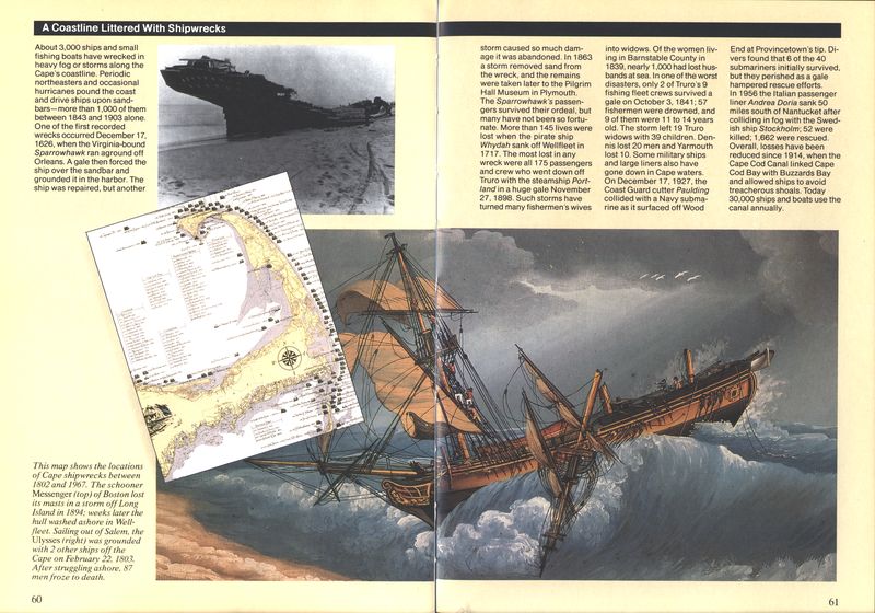
The first recorded shipwreck on Cape Cod was
the Sparrowhawk, an English vessel that struck a
sandbar off Orleans in 1626. Since then an estimated
3,000 vessels have been lost in the waters off the
Cape, most on the stretch of open Atlantic from
Chatham to Provincetown. One of the most famous
of the early wrecks was the pirate ship Whydah, a
300-ton galley commanded by “Black Sam” Bellamy,
which broke up on the bars off Eastham (now South
Wellfleet) on May 8, 1717. More than 145 lives were
lost in the wreck, and of the nine survivors, seven
were tried for piracy and hanged on Boston Common.
Cape Codders early on recognized that those who
went “down to the sea in ships” did not always come
back. The most deadly areas were the shoals and rips
off Monomoy—places known as “Cape Mallebarre”
and “Tucker’s Terror”—and the infamous Peaked
Hill Bars off the Atlantic, or back side, of Provincetown.
Not all losses occurred close to shore, however.
Once fishing vessels began making trips to the
Georges and Grand Banks, entire fleets were sometimes
caught in furious fall northeasters, winter
gales, and hurricanes. Perhaps the worst single storm,
in terms of its effects on local Cape communities,
was the disastrous October Gale of 1841. Dozens of
ships and more than 100 men were lost on Georges
Banks. Truro alone lost 57 men. When Thoreau
passed through Truro a decade after the storm, the
community was still in mourning: “‘Who lives in that
house?’ I inquired. ‘Three widows,’ was the reply.”
The first organized attempt to aid shipwrecked
sailors was made in 1794, when the Massachusetts
Humane Society began to build a series of Humane
Houses, or Charity Huts, along the Outer Beach.
Located at the “hollows” in the sea cliff for ease of
access, these Humane Houses were at first no more
than crude huts, irregularly stocked with straw,
matches, and a few other items of survival that might
see a shipwrecked sailor through the night. Later
they were equipped with small boats and rope lines
with mortars that volunteer crews might use to try to
reach sailors stranded offshore.
Cape Cod, or Highland, Light, the first lighthouse
on the Cape, was erected in 1796 atop the clay cliffs
in North Truro. In the next 70 years others followed:
the twin lights of Chatham in 1808; Race Point in
1816; Monomoy in 1823; Long Point in 1826; the
original “Three Sisters of Nauset” in 1838; and Wood
End in 1872. The establishment of these lights
significantly reduced the number of wrecks off the
back shore. But lighthouses and beacons were of
little help during intense fogs or furious northeast
storms when anchors dragged and sailing ships
caught rounding the Cape could not manage to stay
offshore. More often than not ships became trapped
between the outer and inner bars, and Cape residents
had to stand helplessly on the shore as men
froze in the rigging or were washed overboard into
icy seas only a hundred yards from land.
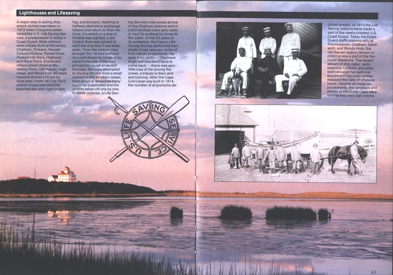
A major step in aiding these wreck victims was
taken in 1872, when Congress established the U.S.
Life Saving Service, the culmination of a series of
federal measures that had begun in 1847 with an
appropriation to subsidize the Massachusetts Humane
Society. Nine stations were initially built, and
eventually four others joined them. In 1915 the U.S.
Life Saving Service was merged with the Revenue
Cutter Service to form the U.S. Coast Guard.
Ironically, the sea disasters provided yet one more
way of making a living for Cape Codders. Compassionate
and selfless as they were in their efforts to
save lives and aid victims of wrecks wherever possible,
they were also pragmatic. Salvaging, or wrecking,
as it was called, provided windfalls for the local
populace. This practice gave rise to the legend of the
nefarious “mooncussers,” men who deliberately lured
ships to their doom with lighted lanterns on the
beach on dark, moonless nights.
There is no evidence that “mooncussing” was ever
engaged in by Cape Codders, but they were both
philosophic and industrious about what the sea
threw up on their shores, whether drift whales or
freighters filled with useful cargo. During the 19th
century wrecking became a true business. Salvaging
crews were organized and hired by owners of wrecked
ships to refloat or unload the vessels. Some local
farmers spent as much time on the beaches as they
did in their fields. E. Hayes Small of North Truro was
one such man. On one occasion, using heavy block
and tackle, cradles and eight horses, he hoisted
15,000 board feet of lumber off the beach to the top
of the 150-foot bluffs north of Highland Light.
In 1914, however, a long-envisioned project finally
became a reality and forever changed the history of
wrecks, wrecking, and lifesaving on Cape Cod. A
canal across the Cape, eliminating the entire arduous
and dangerous outside passage for ships sailing
between Boston and New York, had been dreamed of
by Pilgrim leader Myles Standish, proposed as early
as 1676, and approved in principle by George Washington.
However, despite numerous government studies
and the formation of at least four private canal
companies, nothing substantial was accomplished
until 1906, when New York financier Augustus P.
Belmont took control of the Boston, New York, and
Cape Cod Canal Company. Construction began on
June 19, 1909, and the first vessels sailed through the
newly completed Canal on July 29, 1914. The longest
sea-level canal in the world, it was widened to 500
feet in 1935, and the present Sagamore and Bourne
bridges were constructed. Today some 30,000 vessels
annually sail through its protected passage.
With the canal’s completion, the number of shipwrecks
off the back side of the Cape declined
precipitously, and so did the need for the 13 manned
Life Saving stations. In 1915 they were incorporated
into the newly-formed U.S. Coast Guard. Today the
Outer Cape has only two Coast Guard stations, one
at Chatham Light, the other in Provincetown Harbor.
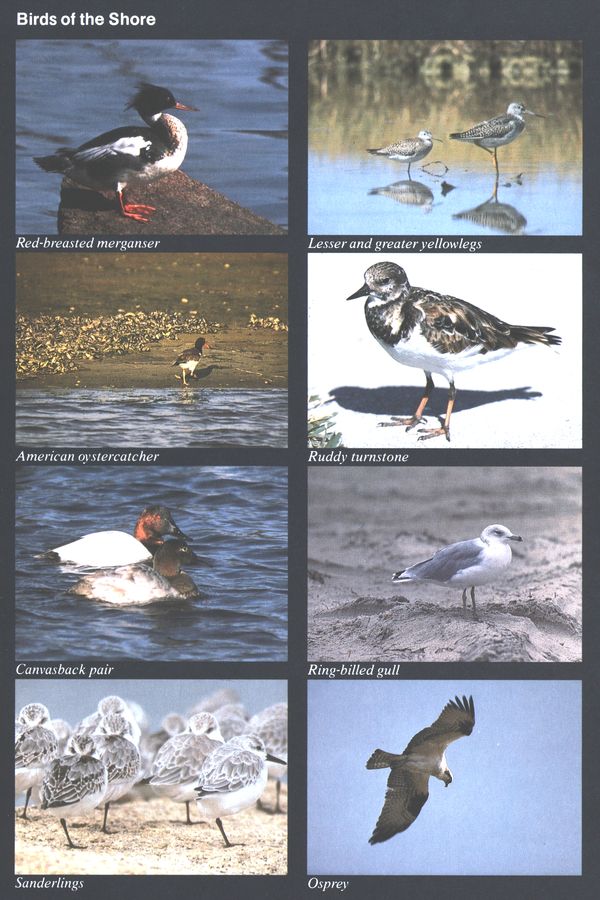
Birds of the Shore
Red-breasted merganser American oystercatcher Canvasback pair Sanderlings
Lesser and greater yellowlegs Ruddy turnstone Ring-billed gull Osprey
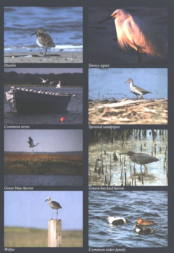
Dunlin Common terns Great blue heron Willet
Snowy egret Spotted sandpiper Green-backed heron Common eider family
The Cape’s Transformation
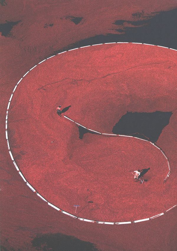
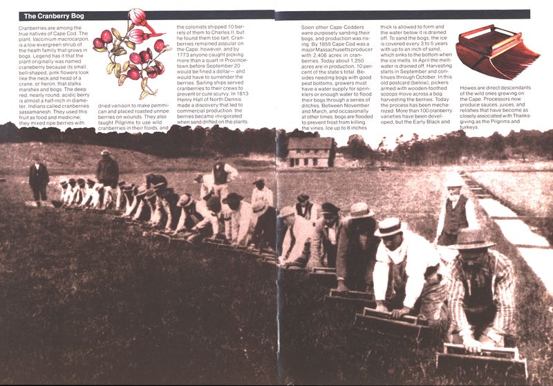
Workers flood and then corral
floating ripe cranberries
in the annual fall harvest.
The Cape Cod that Thoreau visited nearly a century
and a half ago was a rural, semi-isolated peninsula
with a distinct maritime culture. Villages were small;
most food and materials were obtained locally; travel
by land over sand roads was slow and difficult; and,
although many a local shipmaster had visited Singapore
and São Paulo, most native Cape Codders spent
their lives within a few miles of their birthplace,
except when they went to sea to fish. Language was
local, not only in its flat Cape accent, but in a host of
names and phrases attached to local plants, animals,
and weather.
Off-Cape visitors were rare and often regarded
with suspicion. Thoreau and his traveling companion,
William Ellery Channing, were initially mistaken
for bank robbers. Though a steamboat ran regularly
from Boston to Provincetown, travel elsewhere on
the peninsula was still difficult. Aside from a few
hardy, curious souls like Thoreau, the only regular
summer visitors to the Cape in the mid-19th century
were those attending the Methodist camp-meetings,
such as the one described by him at Millennium
Grove in Eastham. “At present,” he said of Cape
Cod, “it is wholly unknown to the fashionable world.”
Yet Thoreau was perceptive enough to realize that
“The time must come when this coast will be a place
of resort for those New Englanders who really wish
to visit the seaside”—though even he could not have
imagined how complete that transformation would be.
After the Civil War, the Cape entered a period of
economic decline that lasted for more than half a
century. With the decline of the merchant marine,
whaling, and fishing fleets, and the opening up of the
rich western prairies, many of the Cape’s younger
people left to seek their fortune elsewhere. Hundreds
of acres of farmland were abandoned. The Cape’s
population, which reached a high of 35,990 in 1860,
reached a low of 26,670 in 1920. Wellfleet lost 65 percent
of its population, and Truro nearly 75 percent.
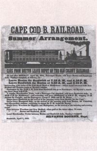
In 1851 trains ran in the summer
between Boston and
Sandwich. The fare was $1.50,
one way.
Ironically, it was the railroad—which initially contributed
to the decline in the packet boat and
merchant marine trade—that subsequently helped
revive the Cape’s economy. The Cape Cod Branch
Railroad first arrived at Sandwich in 1848. Rails were
gradually extended down-Cape, finally reaching
Provincetown in 1873. The completed railroad linked
Cape towns to the rest of New England and made
inland resources such as coal and lumber widely
available. More importantly, for the first time the
Cape itself became accessible to the region’s urban
population.
Oddly enough, the first railroad advertisements
enticed Cape Codders to Boston, rather than the
reverse. But it was not long before the “fashionable
world” began to discover the charms of Cape Cod.
“Summer folk,” including President Grover Cleveland,
began building substantial homes with imported
lumber along the shores of Buzzards Bay, Nantucket
Sound, and Pleasant Bay.
Bird shooting became a popular sport on the
Cape, and several gunning clubs were established for
vacationing sportsmen from Boston and New York.
These clubs, combined with the commercial hunting
of waterfowl and shorebirds for the food market and
millinery trade, took a tremendous toll on the Cape’s
bird populations from the Civil War until the passage
of the Federal Migratory Bird Treaties of 1916.
According to one report, 8,000 golden plovers and
Eskimo curlews were shot on the Cape in one day!
(The former species is now a rare migrant, the latter
presumed extinct.) At the same time, much of the
most valuable shorebird habitat was being destroyed.
Hundreds of acres of salt marshes were dredged to
expand harbors or filled in for development, agriculture,
and mosquito control.
A different kind of transformation began in Provincetown
in 1899, when Charles Hawthorne opened
his Cape Cod School of Art, officially initiating the
emergence of the Cape-tip as a major art colony. By
1916 there were five art schools operating in Provincetown.
That year also saw the formation of the
Provincetown Players, one of the most important
small theaters in the history of American drama. Its
founders—which included George Cram “Jig” Cook,
playwright Susan Glaspell, and author Mary Heaton
Vorse—produced original plays in a shack on a
harbor wharf, plays that included the early works of
a then-unknown dramatist, Eugene O’Neill.
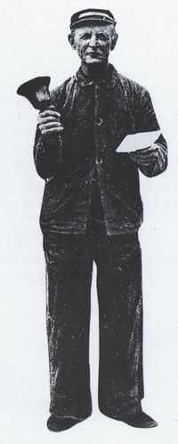
Walter Smith, 1849-1932,
retired in 1930 as at least the
seventh in a long line of town
criers that lasted into the late
1980s in Provincetown. Traditionally
they gave out news of
village events, antiques sales,
church suppers, and the like.
For a fee, they also advertised
products for local merchants.
Since then the towns of the Outer Cape have been
seasonal and year-round homes to a host of artistic
and literary figures. Edward Hopper, Edwin Dickinson,
Karl Knaths, Ross Moffett, Henry Hensche,
Hans Hoffman, Ben Shahn, Mark Rothko, Jackson
Pollack, Robert Motherwell, Alice Stallknecht, and
Arnold Geissbuhler are a few of the influential
painters and sculptors who have worked and lived on
the Outer Cape. Literary figures have included John
Reed, William Daniel Steele, John Dos Passos,
Edmund Wilson, Edna St. Vincent Millay, Mary
McCarthy, Elizabeth Bishop, Provincetown’s “Poet
of the Dunes” Harry Kemp, Norman Mailer, Howard
Nemerov, Alan Dugan, Stanley Kunitz, Marge Piercy,
and Annie Dillard.
A particularly rich vein of the Cape’s creative
activity has been the literary treatment of the landscape
itself. Thoreau’s Cape Cod (1864) was the first
recognized classic of this genre. Others have included
The Outermost House by Henry Beston, The
House on Nauset Marsh by Dr. Wyman Richardson,
The Great Beach by Brewster author John Hay, and
the poetry of Provincetown’s Pulitzer-Prize winner
Mary Oliver.
After World War I the first paved roads were
constructed down-Cape. With the arrival of the
automobile, the second wave of the Cape’s transformation
began. The weekender appeared. Cottage
colonies began to spring up in the towns and on the
beaches. Golf courses were built, including the Highland
Links in Truro and the Nauset Links in Eastham.
The Nauset Links fairways today are a cedar forest
through which the visitor can walk on the Seashore’s
Nauset Marsh Trail.
The Cape’s summer population began to mushroom,
and Provincetown in particular took on a
distinctively Bohemian ambience during the 1920s
and 1930s. At the same time, the descendants of the
Portuguese immigrants came to dominate Provincetown’s
fishing fleet. Even today nearly a third of its
permanent population claims Portuguese descent
and continues to give a distinctive Old World flavor
to this community’s cuisine, culture, and local
festivals.
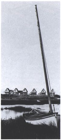
As the number of summer
visitors increased, inns and
cottages such as these in
Wellfleet were built to take
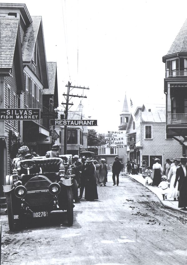
in lodgers. In 1911, Provincetown’s
Commercial Street,
right, had restaurants, lodgings,
ice cream shops, and
other facilities for tourists
arriving by car as well as by
boat.
Having lived with change throughout their history,
Cape Codders adjusted to these outside influences
with philosophy and pragmatism. As Cape historian
Henry Kittredge observed in 1930: “If whales no
longer visit their shores, rich city folk do, and with
easy adaptability Cape men and women take the
goods the gods provide them.” Some local residents
began to rent out rooms in their old Cape houses,
while others added on a front porch for a restaurant,
set up a gas station or a beach plum jelly stand in the
front yard, or an antiques store in the barn. Some
took advantage of less legal commerce of the era;
during Prohibition a number of trawler captains
turned to the more lucrative sea-trade of rum-running.
At least one native industry survived, in fact
flourished, during these years of decline and transformation.
Cranberries had been commercially raised
on the Cape’s bogs since the early 1800s, but the
coming of the railroad opened off-Cape markets for
the crop. The cranberry, as much as the cod, became
the symbol of Cape Cod. In recent years, because of
the success of modern marketing, many small bogs
that were abandoned over the last half century have
been put back into cultivation. One of these old bogs,
established by James Howe in the 1880s on North
Pamet Road in Truro, has been partially restored by
the National Park Service.
The third and unquestionably the most sweeping
transformation of the Cape’s culture and landscape
has occurred since World War II. With the building
of the Mid-Cape Highway and the expansion of the
post-war economy, the first waves of modern “washashores,”
or permanent immigrants, began to arrive
over the Bourne and Sagamore bridges. From 1940
to 1990 the Cape’s year-round population increased
from about 30,000 to more than 175,000, with a
summertime population that swells to 500,000 or
more. Each year from 1970 to 1990 an average of
5,000 acres (roughly the size of Provincetown) was
developed for residential and commercial uses.
Though the Cape has been technically an island
since 1914, it continues to be increasingly a part of
the mainland. The old, indigenous, rural maritime
culture of the Cape is irretrievably gone, though
small fishing fleets continue to go out of local
harbors and inlets. Cape Codders now live in a
cosmopolitan contemporary culture, sharing more
with their urban counterparts than with the sea
captains in whose 200-year-old houses they may
dwell or spend the night.
With this staggering growth and its resultant pressures
on the Cape’s resources and natural habitats,
there has been an increasing movement to protect
the Cape’s fragile landscape and its wildlife. The
most dramatic and sweeping manifestation of this
was the Congressional authorization of the Cape
Cod National Seashore itself in 1961, but a number
of homegrown environmental research, conservation,
and educational organizations have also been
established. These groups include the Center for
Coastal Studies in Provincetown, the Wellfleet Bay
Audubon Sanctuary, the Cape Cod Museum of Natural
History in Brewster, the Association for the
Preservation of Cape Cod, and the Compact of Cape
Cod Conservation Trusts.
In part because of the work of these and other
groups, general environmental awareness has also
grown. The Cape’s salt marshes are no longer regarded
as wasteland to be dredged for marinas or
filled for development but as one of the richest and
most productive marine habitats in the world. Local
kettle pond shores, once built up with little regard for
environmental impact, are now recognized as important
buffers protecting water quality and as important
habitat for certain flowering plants, some of
which are found in only a handful of sites worldwide.
No longer are local whales driven ashore or hunted
with harpoons. Instead, today’s Cape Codders ply a
lucrative trade running whale-watching trips out of
Provincetown and other ports, and a Cape Cod
Stranding Network has been established to aid
stranded whales and other marine animals.
Shorebirds, too, have ceased to be slaughtered by
the thousands on our beaches and in our marshes.
Instead, areas such as the Monomoy Wildlife Refuge
and the National Seashore provide protected feeding
and resting stations for thousands of migrating shorebirds
and waterfowl. Each summer sections of beaches
and dunes within the Seashore and elsewhere are
roped off and patrolled to insure the survival of such
local nesting species as terns and piping plovers, and
park talks and walks stress to visitors the importance
and fragility of these breeding areas.
Besides changes in human attitudes and practice,
natural changes in wildlife populations continue to
take place as well. As ocean waters warm, cold-water
species such as cod and halibut have moved farther
north, while warmer-water species such as striped
bass and bluefish seem to be increasing. Sizable
numbers of wintering harbor seals have appeared in
the Cape’s estuaries and offshore beaches in the past
20 years, and during the winter of 1989-90, for the
first time ever, some rare gray seals gave birth to
several pups on Monomoy Island. Willets and oystercatchers,
after a long absence, are nesting on Cape
beaches once again, and ospreys, responding to
artificial nesting platforms, have returned to Cape
bays and ponds after their disappearance during the
1960s from DDT poisoning. Other recent self-arrivals
on the Cape’s wildlife scene include opossums, house
finches, and even coyotes.
What do all these changes and transformations
teach us? It may be, most importantly, that we still
confront what the First Comers faced: the land itself,
sea-born and sea-shaped. When we learn its history
and observe the age-old forces that continue to work
today, the lesson seems to be that any human occupation
of the Earth is, at best, tentative and transitory,
and particularly so here. The waves, beaches,
dunes, and trees of the Cape continue to dance, and
we have begun to learn to dance with them—to
understand and adapt to the land’s rhythms, tempos,
and limits—so that we and those who come after us
may continue to enjoy all that it has to offer. For it is
we, residents and visitors alike, who are today’s Cape
Codders.
Wildflowers
White water lily Pink ladyslipper Dewberry Purple aster
Seaside goldenrod Beach plum St. Johnswort Sheep laurel
Beach heather, or poverty grass Beach-pea Canada mayflower Cypress spurge
A Glacial Base
The Wisconsin Stage Glacier
reached into southern New
England 25,000 years ago and
melted away more than 17,000
years ago, leaving behind
moraine and outwash deposits
that became the base of Cape
Cod, Martha’s Vineyard, Nantucket,
and the Elizabeth
Islands (see illustrations at
right). But this was only the
latest in a series of Pleistocene
glaciers that covered Cape
Cod during the past 1.5 million
years. Even the deposits of
these earlier glaciers may rest
on a much older and more
stable land form, a wide, seaward-sloping
surface called a
coastal plain or, if submerged,
a continental shelf. The plain
and shelf are underlain by
sediments. The shelf was exposed
during the ice ages by a
concomitant drop in sea level
of some 400-500 feet, but today
it lies drowned under rising
waters. Even more deeply
buried, some 500-800 feet beneath
the surface, lies the ancient
granite bedrock that is
so characteristic of most other
New England areas. There is
evidence that the post-glacial
landscape looked very much
like arctic tundra. Deep in the
bottom of Truro’s Great Pond,
twigs of arctic willow have
been retrieved with 11,000-year-old
scale insects still attached
to the bark. Caribou,
arctic fox, and perhaps musk
ox, roamed lichen-covered
plains where white-tailed deer
and red fox live today. Gradually
a boreal forest of spruce
and fir took root, much like the
forests that now cover northern
Canada.
Outwash Plains and Kettles
As the Buzzards Bay, Cape
Cod Bay, and, perhaps, the
South Channel glacial lobes
waned, they left behind moraines
(above right). Meltwater
streams carried sand and
gravel that then formed outwash
plains beyond the ice
(above and below). Sometimes
these materials buried
large blocks of ice. In time,
the ice blocks melted, leaving
steep-sided depressions
called kettles that became
freshwater ponds if they were
deep enough to intersect the
water table. Some of these
ponds became connected to
the sea and turned into salt
ponds, such as the one near
the Seashore visitor center in
Eastham. Over the years peat
has filled in many of the ponds.
The Restless Shore
Within a person’s lifetime, the
Cape’s shape changes dramatically.
The waters of the ocean
and bay and the wind constantly
erode material here
and deposit it there. Major
storms can create islands,
sandbars, and dunes and revamp
other land forms. A storm
in 1931 weakened playwright
Eugene O’Neill’s home—the
old Peaked Hill Bars Coast
Guard Station—and sent it into
the ocean in 1932 (below).
Summer winds generally come
from the west or southwest. In
the winter, the most severe
winds come from the northwest
or northeast. The Outer
Cape as a whole is moving
westward and diminishing as
these forces tear at the landscape
and as ocean currents
move sand northward and
southward from about the
Marconi Station Site. For
every 5 acres of sand eroded,
about 2 acres are deposited
up or down the coast, thereby
elongating (see map at right)
the hook at Provincetown and
North Beach and Monomoy
Point off Chatham. On the bay
side, sands have extended
Jeremy Point southward to a
point almost directly west of
Marconi Beach. An 1889 U.S.
Coast and Geodetic Survey report
says that the entire Outer
Beach from 1848 to 1888 lost
323,233,030 cubic yards of
earth and sand, enough to
cover the 55-acre U.S. Capitol
grounds to a depth of 375 feet.
Similar changes are taking
place today. Some residents
have seen North Beach, the
southern extension of Nauset
Beach, lengthen itself from just
south of Orleans to Chatham
and then break in 2 pieces in a
fierce northeaster in 1987. The
breach, which has grown to
more than a mile in width, has
opened Chatham’s shoreline to
the full force of ocean storms,
increasing erosion and claiming
more than a dozen houses
(inset below). But the breach
has also increased tidal flushing
of Pleasant Bay, reinvigorating
the marine community.
In November 1991, a 4-day gale
breached the dune line at the
head of the Pamet River, carrying
sand and saltwater 500
feet into the river.
Parabolic sand dunes occur
on the narrow stretch of land
east of Pilgrim Lake in the
Province Lands of Truro. Prevailing
northwest winds blow
obliquely to the shoreline and
create belts of these unusual
dunes with the sands of former
beaches.
Wampanoag Indians
The first human beings to live
here did not arrive by sea. In
all likelihood they came on foot
from the south, southwest, and
east, perhaps following caribou
or other game up the river valleys
across the then wide coastal
plain. These people, known
as Paleoindians, arrived at least
9,000 years ago. Little is known
about them, but they appear to
have been a nomadic people,
hunting and gathering in small
groups. The earliest period represented
by a variety of archeological
sites is 3,000 to 6,000
BP (Before Present). An archeological
site uncovered recently
by the ocean at Coast Guard
Beach suggests more permanent
settlements. This site has
been carbon-dated to more than
2,000 BP, and contains post
holes indicative of shelter construction.
These early Native
Americans created chipped
stone tools, fished in kettle
ponds, and likely wintered in
the Cape’s coniferous woodlands.
By the early 1600s
American Indians used or inhabited
all the lands now encompassed
by Cape Cod
National Seashore. These
Wampanoags lived in 6 villages
along the creeks and bays
from Chatham to Wellfleet, relying
on both the land and sea
for food. When French explorer
Samuel de Champlain visited
Cape Cod in 1605 and 1606,
he noted that villagers in what
became Eastham and Chatham
were raising corn, beans,
squash, and tobacco. They
tilled their fields with wooden
spades after burning off the
vegetation. They used crabs as
fertilizer but ate clams, quahogs,
oysters, and other shellfish.
Champlain noted that the
Monomoy band at Stage Harbor
in Chatham stored corn in
grass sacks buried 5 to 6 feet
in the sand. He thought they
were better fishermen and
farmers than hunters. The
Wampanoags lived in domed
shelters (below), which consisted
of a frame of saplings
bent into semicircles. These
semicircles were linked by circles
of saplings running parallel
to the ground. The Indians
covered the frames with grass,
reeds, and bark and left a large
hole in the roofs so smoke
could escape from fires in a
stone-lined pit in the center.
The dwellings were not clustered
but separated by cultivated
fields.
Native Americans broil fish
in this Theodore de Bry 1590
engraving (below) of a John
White watercolor. Samuel de
Champlain’s 1606 map (below
right) of Chatham’s Stage
Harbor area, which he called
Port Fortune, shows Wampanoags
attacking the French
upon learning that they intended
to settle there. The
French had stayed in the harbor
for 2 weeks drying out
their ship and repairing its
rudder.
Henry Botkin’s early 20th-century
painting depicts the
Wampanoags and Pilgrims
signing a treaty of friendship.
Pilgrims First Landing
The Mayflower Pilgrims settled
in Plymouth—but only
after rejecting Cape Cod as
unsuitable. On November 9,
1620, these emigrants from
England sighted the Cape, the
first land they had seen in the
2 months since they left
Holland. Though they had intended
to continue south and
settle in the Hudson River
area, they decided, because
of treacherous waters off the
Cape, to stay. They sailed
around the northern end of
the Cape, set anchor off what
became known as Provincetown,
and drew up the “Mayflower
Compact,” an agreement
by which the group of
102, a bare majority of whom
were Pilgrims, would govern
themselves. During the next
month 3 different small groups
made “discoveries” of the
area. They found a freshwater
spring in the Truro area, encountered
a few Indians, and
discovered several baskets of
Indian corn buried on a hill
near the Pamet River. On December
6 a group of 19 men
led by Myles Standish left the
Mayflower in a shallop, or
small boat, camped for the
night in Eastham, and crossed
Cape Cod Bay to the mainland.
They decided this would
be a good place to settle and
returned to the ship. On December
16, the Mayflower
dropped anchor in Plymouth
Harbor, and the story of a new
English settlement in the New
World began. A few passengers
and their offspring later
settled in the Cape’s Eastham
area.
The Mayflower, a 90-foot
square-rigger, left England on
August 15, 1620, with a smaller
vessel called the Speedwell.
Both vessels carried English
exiles from Holland and England,
but the leaky Speedwell
caused two aborted departures.
An overcrowded Mayflower
finally left the docks on September
6, making the arduous
Atlantic crossing in a sluggish
65 days.
The Mayflower arrived at
Plymouth from Provincetown
on December 16, 1620, after
failing to cross December 15
because of bad weather. The
Pilgrims came ashore on December
18. A few of them and
their offspring later settled
in the Cape’s Eastham area.
Graves of Mayflower passengers
Constance Hopkins Snow,
Giles Hopkins, and Joseph
Rogers are in Eastham’s Old
Cove Burying Ground.
The Cape Cod House
If anything distinguishes Cape
Cod nationally, it’s a house
style. Essentially the Cape Cod
House is a modest story-and-a-half
frame structure that
hugs the ground and has a
steep roof that sheds the rain
and snow and provides protection
from buffeting winds.
Usually the wooden shingles
on the sides are left unpainted,
and thus the sides—and the
roof—take on a natural grayish
to dark brown patina depending
on the effects of the sun
and wind-driven sands and salt.
Sometimes the front, shingle
or clapboard, may be painted,
and if so most likely white.
Many of the oldest Capes were
built in stages. A half house
might become a three-quarter
and later on a full house, depending
on the needs or wealth
of the family. A full Cape, such
as the park’s Atwood-Higgins
House (right and cutaway below),
is deceiving: it has much
more room than you might expect
from its external appearance.
Inside the front door is a
small hallway or entryway. To
the left and the right are small
parlors. In the center of the
back is a large keeping room,
or kitchen, that later was divided
into 2 rooms, where
most of the daily household
activity took place. At both
ends of the kitchen are a buttery,
or pantry, and a bedroom,
or a borning room. At the center
of the house is an intricately-designed
brick chimney
serving fireplaces in the
parlors, kitchen, and front hall.
The chimney divides the upstairs
into 2 bedrooms, probably
for children. The eastern
part (right) of the Atwood-Higgins
House was built in
Wellfleet about 1730 by
Thomas Higgins; the western
side was built about the same
time but attached later. The
house remained in the Higgins
family until 1805, when Thomas
Atwood became the
owner. The Higgins family
later regained ownership.
The half house version of the
Cape Cod House has 2 windows
to the left or right of the
front door. The three-quarter
house has a third on the other
side of the door, and the full
Cape has 2 on each side.
The post-and-beam construction
method used in the
Atwood-Higgins House was
commonly used on Cape Cod
until the early 1800s. Posts
and beams were put together
by mortising a hole in one
and inserting a tenon from
the other.
Whaling’s Heyday
Wellfleet and Provincetown
were Cape Cod’s premier whaling
ports in the late 1700s and
early 1800s. Some whaling
ships sailed out of other Cape
towns, but these 2 ports were
crowded and bustling with
ships and crews and related
tradesmen and merchants.
Both places eventually gave
way to Nantucket and New
Bedford, but many Cape captains
continued to pursue the
leviathan in distant seas. Settlers
had been intrigued by
whales since Native Americans
taught them how to use
beached whales for food and
oil not long after the Mayflower
anchored in Cape Cod Bay.
They soon erected towers on
beaches to look out for whales,
which they would pursue in
small boats along the coasts.
As whale oil grew in importance
as a lighting fluid and as
whale bone and baleen were
used for more household and
personal products, sloops and
small schooners gave way to
larger schooners and square-riggers,
such as barks, and
even full-rigged ships. And the
ships extended their hunting
grounds first to the South Atlantic
and then to the Pacific
and Arctic oceans as their
quarry changed from right
whales to sperm whales and
bowheads. Whaling’s peak
years were between 1825 and
1860. The decline is traced to
the discovery of petroleum in
Pennsylvania in 1859, the loss
of many ships in the Civil War,
and a surge in other fisheries.
Edward Penniman of Eastham
went to sea at age 11 in 1842
as a cook and at age 21 as a
harpooner aboard the New
Bedford whaleship Isabella.
By 1860 he was captain of the
bark Minerva. When he retired
in 1883, he had made 6 voyages
as a whaling captain.
In this painting, a sperm whale
overturns a whaleboat crew
that has harpooned it.
Harpoon styles improved over
the years. Early harpoons
were double-flued (left). Later
refinements included the toggle
head, invented in 1848,
which was less likely to come
loose from the whale.
While whaling crews were on
long sea voyages, many of
the men whiled away the time
making scrimshaw objects,
including such intricate pieces
as this sewing box.
When Augusta Penniman accompanied
her husband on
voyages, she kept detailed
whaling-trip logs in which she
used symbols to indicate kills
and misses. In 1868 the Pennimans
built a French Second
Empire mansard-roofed house
(above) with a cupola overlooking
the ocean and bay
in Eastham. The Penniman
House, now a part of the
National Seashore, sports a
pair of whale jaws at the entrance
to its walk.
Cape Codders and the Sea
Coastal packet boats, the first
commercial vessels on Cape
Cod, flourished in the first half
of the 19th century carrying
mail, passengers, salt, and
other cargo to Boston and
New York. These boats were
built in local yards from local
lumber and captained by local
men. The rivalry and pride
among the various Cape towns
for the fastest and most seaworthy
packets stood the Cape
men in good stead when the
new Republic began to engage
in international trade. Cape
Codders, in fact, were among
the first to sail the American
flag into many foreign ports
and uncharted seas. Captain
John Kendrick of Harwich
sailed from Boston in 1787 in
the Columbia, the first American
ship to circumnavigate the
globe. A Brewster captain, Elijah
Cobb, was captured by a
French frigate during the
French Revolution and made
a successful appeal to Robespierre
for release. After
the War of 1812, many Cape
Codders captained the first of
the transatlantic Liverpool
packets. But their true glory
awaited them on the decks of
the clipper ships, those majestic
sailing vessels of the 1840s
and ’50s. With their sleek hulls
and tapered sterns, towering
masts and double courses of
sails, their speed and maneuverability
in sailing into the
wind, the “Yankee clippers”
were generally regarded as the
finest wooden ships ever made.
They counted scores of Cape
Codders among their captains,
many of whom set transoceanic
sailing records that still stand
today. To cite only one, and
not the most modest example,
the following gravestone for
Freeman Hatch, 1820-89, can
be found in an Eastham cemetery:
“He became famous making
the astonishing passage in
the clipper ship Northern Light
from San Francisco in 76 days
6 hours—an achievement won
by no mortal before or since.”
This waterfront pass was issued to
lighthouse keeper C. E. Turner of Wellfleet.
This sailing card is for a clipper
ship named after its owner,
Osborn Howes, a Dennis native
who with his brother-in-law
ran an international shipping
fleet out of Boston in
the 1800s. He managed or
owned 43 vessels in his 87
years.
Decked out in top hats about
1855, Brewster sea captains
Charles Crosby (left) and
James Edwin Crosby flank an
unidentified English captain.
Asa Eldridge (right) of Yarmouth
served as captain of
the clipper ship Red Jacket
(above) when it set a record
crossing from New York to
Liverpool of 13 days, 1 hour.
Eldridge was lost in the North
Atlantic in February 1856 with
the steamer Pacific.
Sailors in the 19th century
used octants to determine
their latitude by measuring
the sun’s angle above the horizon
at noon. Tables converted
that figure for the day,
month, and year into distance
north or south of the equator.
Fisheries
As the name implies, Cape Cod
and fishing are nearly synonymous.
The Wampanoag Indians
were primarily farmers, but
they also dug clams, gathered
oysters and scallops, caught
crabs, and fished for herring
and other fishes, mostly in
freshwater or where it mixed
with saltwater. They used bone
hooks, spears, nets made of
plant fibers, and wooden-staked
weirs. The first European
settlers on the Cape also
were farmers, but they soon
learned how bountiful the sea
was and quickly refined and
developed various kinds of
fisheries. “I confess I was surprised
to find that so many men
spent their whole day, ay, their
whole lives almost, a-fishing,”
Henry David Thoreau observed
in the mid-1800s. How
they fished, where they fished,
and what they fished for have
changed greatly over the years
as some species were over-fished
and as technological
changes were introduced. The
Atlantic cod was the first fish
to spark a major industry. In
1878, 63 vessels sailed out of
Provincetown in search of cod
and returned with more than
7.5 million pounds. Wellfleet
led the Cape in fishing for
mackerel; in 1879, 30 schooners
followed the schools north
May to November from North
Carolina to Maine. The ships
returned to Cape ports from
long voyages with their catches
salted and dried for market.
After brief trips, the fish were
dried on the docks in Provincetown
and other ports (below left
and continuing counterclockwise).
Hard-shelled clams—called
quahogs and pronounced
as ko-hogs by Cape
Codders—were and are harvested
in deep water with
wooden-handled rakes up to
56 feet in length. Sometimes
nets were stretched between
poles to form weirs; high tides
would bring the fish in; and at
low tide men would go out—sometimes
with wagons and
horses—to remove their
catches. Early on fishermen
used small boats or dories to
fish with lines, then with nets
and wooden traps, in nearby
waters; trawling schooners
carried dories to the fishing
grounds of the banks for cod,
haddock, and groundfish. At
first lobsters were so plentiful
they were used as bait and
then as food for servants; today
they are not plentiful and are
among the highest-priced seafood
in America. Fishermen in
small boats still go out to pull
up lobster traps.
Saltworks
The growth in Cape Cod’s fishing
industry early in the 19th
century spawned other sea-related
industries. One of the
most important was the development
of the saltworks. Salt
was needed especially to preserve
the cod and mackerel
and other fish caught at such
distant places as the Grand
Banks. In colonial times, salt
was obtained by boiling seawater
in enormous iron pots
that were set up near the beach,
a technique that hastened the
demise of the Cape’s forests.
But as early as 1776, Captain
John Sears of Dennis had experimented
with making salt
through evaporation of seawater
in long shallow troughs.
With a bushel of salt worth a
dollar at the turn of the century,
saltmaking became profitable
and Cape Codders continued
to improve their methods. They
incorporated movable roofs
on rails (right) to cover the
troughs on cloudy or rainy
days, windmills to pump seawater
through hollow wooden
pipes into the troughs, and an
intricate system of reservoirs,
falls, vats, and boiling rooms.
The water went through three
stages: evaporation, precipitation
of lime, and crystallization
of salt. Epsom salts came from
boiling “bitter water,” the liquid
remaining after the salt was
crystallized. During the 1830s
saltworks were a major industry
in almost every Cape town,
covering dozens of acres of
beaches (background engraving).
At their peak on Cape
Cod, there were 442 saltworks
producing more than 500,000
bushels of salt a year. By 1840,
however, the opening up of
large salt mines in the West,
among other factors, signaled
the beginning of the industry’s
swift decline. Still, in the 1850s,
Henry David Thoreau saw
“saltworks scattered all along
the shore, with their long rows
of vats resting on piles driven
into the marsh, their low, turtle-like
roofs, and their ... windmills
... novel and interesting
objects to an inlander.”
A Coastline Littered With Shipwrecks
About 3,000 ships and small
fishing boats have wrecked in
heavy fog or storms along the
Cape’s coastline. Periodic
northeasters and occasional
hurricanes pound the coast
and drive ships upon sandbars—more
than 1,000 of them
between 1843 and 1903 alone.
One of the first recorded
wrecks occurred December 17,
1626, when the Virginia-bound
Sparrowhawk ran aground off
Orleans. A gale then forced the
ship over the sandbar and
grounded it in the harbor. The
ship was repaired, but another
storm caused so much damage
it was abandoned. In 1863
a storm removed sand from
the wreck, and the remains
were taken later to the Pilgrim
Hall Museum in Plymouth.
The Sparrowhawk’s passengers
survived their ordeal, but
many have not been so fortunate.
More than 145 lives were
lost when the pirate ship
Whydah sank off Wellfleet in
1717. The most lost in any
wreck were all 175 passengers
and crew who went down off
Truro with the steamship Portland
in a huge gale November
27, 1898. Such storms have
turned many fishermen’s wives
into widows. Of the women living
in Barnstable County in
1839, nearly 1,000 had lost husbands
at sea. In one of the worst
disasters, only 2 of Truro’s 9
fishing fleet crews survived a
gale on October 3, 1841; 57
fishermen were drowned, and
9 of them were 11 to 14 years
old. The storm left 19 Truro
widows with 39 children. Dennis
lost 20 men and Yarmouth
lost 10. Some military ships
and large liners also have
gone down in Cape waters.
On December 17, 1927, the
Coast Guard cutter Paulding
collided with a Navy submarine
as it surfaced off Wood
End at Provincetown’s tip. Divers
found that 6 of the 40
submariners initially survived,
but they perished as a gale
hampered rescue efforts.
In 1956 the Italian passenger
liner Andrea Doria sank 50
miles south of Nantucket after
colliding in fog with the Swedish
ship Stockholm; 52 were
killed; 1,662 were rescued.
Overall, losses have been
reduced since 1914, when the
Cape Cod Canal linked Cape
Cod Bay with Buzzards Bay
and allowed ships to avoid
treacherous shoals. Today
30,000 ships and boats use the
canal annually.
This map shows the locations
of Cape shipwrecks between
1802 and 1967. The schooner
Messenger (top) of Boston lost
its masts in a storm off Long
Island in 1894; weeks later the
hull washed ashore in Wellfleet.
Sailing out of Salem, the
Ulysses (right) was grounded
with 2 other ships off the
Cape on February 22, 1803.
After struggling ashore, 87
men froze to death.
Lighthouses and Lifesaving
A major step in aiding shipwreck
victims was taken in
1872 when Congress established
the U.S. Life Saving Service,
a predecessor to today’s
Coast Guard. Nine stations
were initially built at Monomoy,
Chatham, Orleans, Nauset,
Cahoon Hollow, Pamet River,
Peaked Hill Bars, Highland,
and Race Point. Eventually
others joined them at Monomoy
Point, Old Harbor, High
Head, and Wood End. All were
manned almost entirely by
local men. From 1872 to 1915,
station crews patrolled the
beaches day and night in rain,
fog, and blizzard, meeting at
halfway stations to exchange
tokens and return to their stations.
If a wreck or a ship in
trouble was sighted, a red
Coston flare was ignited to
alert the ship that it had been
seen. Then the station crew
brought the 18-foot surfboat
op a cart drawn by horse or by
hand to the site. If the surf
proved too rough to launch
the boat, the crew attempted
to shoot a life line from a small
cannon to the stricken vessel,
from which a “breeches buoy”
could be suspended and the
victims taken off one by one.
In these pictures, a Life Saving
Service crew poses at one
of the Chatham stations and in
a drill another crew gets ready
to haul its surfboat by horse to
the water. In the 43 years of
its existence, the Cape’s Life
Saving Service performed hundreds
of sea rescues, some of
truly heroic proportions. Despite
their motto—“You have
to go, but you don’t have to
come back”—there was very
little loss of life among the
crews, a tribute to their skill
and training. After the Cape
Cod Canal was built in 1914,
the number of shipwrecks declined
greatly. In 1915 the Life
Saving stations were made a
part of the newly-created U.S.
Coast Guard. Today the Coast
Guard staffs stations only at
Provincetown, Chatham, Sandwich,
and Woods Hole; the
old Nauset station (shown in
color) is now a part of the National
Seashore. The recent
advent of ship radar, radio
beacons, LORAN, and other
sophisticated navigational
equipment has even further
reduced the risks of offshore
travel. Despite all these improvements,
the sandbars and
storms of the Outer Cape have
not claimed their last victims.
Two Henrys: Thoreau and Beston
Henry David ThoreauHenry Beston
Cape Cod has attracted a number
of authors who have written
countless stories and books
about the place. Two books
that have become classics
were written by Henry David
Thoreau and by Henry Beston.
Thoreau’s Cape Cod was published
posthumously in 1865
and tells of visits totaling 3
weeks that he made to the
Cape in 1849, 1850, and 1855.
He walked to Provincetown
from Eastham absorbing its
geologic and natural history
and observing the solitary life
of its people, especially the
lighthouse keepers and shipwreck
scavengers, known as
“wreckers.” Thoreau may
have been the first in print to
liken the Cape to a “bared and
bended arm of Massachusetts.”
He was especially fascinated
with the beach from
Nauset Harbor to Race Point
and with the bluff abruptly rising
to its west. “This sandbank—the
backbone of the
Cape—rose directly from the
beach to the height of a hundred
feet or more above the
ocean. It was with singular emotions
that we first stood upon
it and discovered what a place
we had chosen to walk on ...
a perfect desert of shining
sand....” In his day more of
the Cape was barren than today,
but efforts to plant grasses
were already underway. Henry
Beston spent more time on the
Cape than Thoreau, and he
stayed mostly in one place. His
book, The Outermost House,
tells of a year, in 1927-28, he
spent among the elements at a
2-room, 10-windowed cottage
in the dunes on Nauset Beach
opposite Fort Hill in Eastham
(background photo). As Thoreau
had done at Walden Pond,
Beston chronicled nature’s
seasonal sights, sounds, and
smells on this narrow spit of
sand, a place of “outermost”
exposure. “Listen to the surf,
really lend it your ears,” Beston
wrote, “and you will hear in it
a world of sounds: hollow
boomings and heavy roarings,
great watery tumblings and
tramplings, long hissing
seethes, sharp rifle-shot reports,
splashes, whispers, the
grinding undertone of stones,
and sometimes vocal sounds
that might be the half-heard
talk of people in the sea.”
Beston’s cottage became a
National Literary Landmark in
1964, but in 1978 it was washed
away in a storm. No doubt he
would have assented to what
the elements had done.
The Cranberry Bog
Cranberries are among the
true natives of Cape Cod. The
plant, Vaccinium macrocarpon,
is a low evergreen shrub of
the heath family that grows in
bogs. Legend has it that the
plant originally was named
craneberry because its small,
bell-shaped, pink flowers look
like the neck and head of a
crane, or heron, that stalks
marshes and bogs. The deep
red, nearly round, acidic berry
is almost a half-inch in diameter.
Indians called cranberries
sassamanesh. They used this
fruit as food and medicine;
they mixed ripe berries with
dried venison to make pemmican
and placed roasted unripe
berries on wounds. They also
taught Pilgrims to use wild
cranberries in their foods, and
the colonists shipped 10 barrels
of them to Charles II, but
he found them too tart. Cranberries
remained popular on
the Cape, however, and by
1773 anyone caught picking
more than a quart in Provincetown
before September 20
would be fined a dollar—and
would have to surrender the
berries. Sailing ships served
cranberries to their crews to
prevent or cure scurvy. In 1813
Henry Hall of North Dennis
made a discovery that led to
commercial production: the
berries became invigorated
when sand drifted on the plants.
Soon other Cape Codders
were purposely sanding their
bogs, and production was rising.
By 1855 Cape Cod was a
major Massachusetts producer
with 2,408 acres in cranberries.
Today about 1,250
acres are in production, 10 percent
of the state’s total. Besides
needing bogs with good
peat bottoms, growers must
have a water supply for sprinklers
or enough water to flood
their bogs through a series of
ditches. Between November
and March, and occasionally
at other times, bogs are flooded
to prevent frost from killing
the vines. Ice up to 8 inches
thick is allowed to form and
the water below it is drained
off. To sand the bogs, the ice
is covered every 3 to 5 years
with up to an inch of sand,
which sinks to the bottom when
the ice melts. In April the meltwater
is drained off. Harvesting
starts in September and continues
through October. In this
old postcard (below), pickers
armed with wooden-toothed
scoops move across a bog
harvesting the berries. Today
the process has been mechanized.
More than 100 cranberry
varieties have been developed,
but the Early Black and
Howes are direct descendants
of the wild ones growing on
the Cape. Processors now
produce sauces, juices, and
relishes that have become as
closely associated with Thanksgiving
as the Pilgrims and
turkeys.
Marconi’s Wireless Station
In these days of instant worldwide
communications via satellites,
it is difficult to imagine
the excitement that came with
the advent of wireless telegraphy
and radio. In the 1890s,
the idea of transmitting long-distance
messages via electromagnetic
waves captured the
imagination of Guglielmo Marconi,
a young Italian. In 1899
Marconi succeeded in sending
a radio message across the
English Channel, and, he went
to work on developing a transatlantic
system. Two communications
cables already had
been laid on the bottom of the
ocean between France and
Cape Cod. Marconi, too,
selected a site for a station
on the Cape, high on a cliff
overlooking the ocean in South
Wellfleet. He built others at
Glace Bay, Nova Scotia, and
at Poldhu in Great Britain. At
first the antennas at South
Wellfleet and Poldhu consisted
of huge rings of masts, but
these were destroyed by gales
before any messages could be
transmitted. They were replaced
at each place by 4
towers 210 feet high. In December
1901, at an experimental
site in St. John’s,
Newfoundland, Marconi received
the first transatlantic
signal, 3 dots for the letter “S,”
from Britain. In December
1902 his Glace Bay station
received a complete message
from Poldhu. On the night of
January 18, 1903, he transmitted
from South Wellfleet
this message, in Morse code,
from President Theodore
Roosevelt to King Edward VII:
“In taking advantage of the
wonderful triumph of scientific
research and ingenuity which
has been achieved in perfecting
a system of wireless telegraphy,
I extend on behalf of
the American people most
cordial greetings and good
wishes to you and to all the
people of the British Empire.”
The king replied in a similar
vein, making this the first 2-way
wireless communication
between Europe and America.
Soon newspapers and others
were transmitting messages
across the Atlantic, and the
wireless became the common
way of communicating with
ships. For 15 years telegraphers
sent out messages on
the South Wellfleet spark-gap
transmitter. But in 1917 the
Navy closed the station. It
was dismantled in 1920 and
scrapped. Its successor, WCC
in Chatham, operated until
1993.
Guglielmo Marconi displays
his wireless telegraphy equipment
in England in 1896. The
Leyden jar capacitor and
boxlike transformer (below)
represent an application of
Marconi’s invention in World
War I for national defense,
maritime safety, and commercial
communications.
At South Wellfleet Marconi
first built a circular antenna
consisting of 20 ship masts
200 feet high about 165 feet
back from the edge of the
ridge overlooking the Atlantic.
The masts were blown
down in a storm November
25, 1901.
This ironstone plate commemorates
the first wireless
message, received from President
Theodore Roosevelt by
King Edward VII on January
19, 1903, and shows the 4
towers that replaced the 20
masts.
Part 3 Guide and Adviser
Visiting Cape Cod
Though Cape Cod has been
known as Massachusetts’ major
summer resort for many years,
it is now attracting a number of
travelers at all times of the year.
Today more than 5 million
people visit the Cape annually.
Those wishing to avoid
crowds may prefer to walk its
windswept beaches and tour its
historic sites between September
and June, the off-season.
That’s tip Number 1 in this
handbook’s Guide and Adviser
section, which focuses on that
part of Cape Cod containing
the National Seashore. This is
the area, known as the Lower
or Outer Cape, between Chatham
and Provincetown. Some
information also is provided
to help you travel throughout
the rest of Cape Cod and neighboring
offshore islands. The
first few pages deal with general
travel tips and activities information.
Then, 2-page spreads
take closer looks at towns
within or near the 27,000-acre
National Seashore. They are
followed by travel tips about
nearby Cape Cod attractions
and the islands of Martha’s
Vineyard and Nantucket.
Seasons
The summer beach season in
July and August attracts the
most vacationers, especially
families with children. But
enough tourist facilities are
open in the fall, winter, and
spring to take care of lodging
and food needs.
In July and August daytime
temperatures usually rise into
the 80s°F. From September
through November, temperatures
gradually decline from the
70s to the 50s, or lower. Fall’s
cool, brisk days make the Cape
a favorite destination for some
New Englanders on the Columbus
Day and Thanksgiving
holidays.
Winters are generally cold
and windy, with temperatures
averaging in the 30s during the
day and in the 20s at night. The
Atlantic Ocean and Cape Cod
Bay help to moderate the winter
temperatures, so the Cape’s
snowfall is considerably less
than the mainland’s.
As in all parts of New England,
spring is short, arriving at
the earliest in April and often
not until June. Like the fall,
however, spring can be one of
the most pleasant times on
Cape Cod because of the relative
solitude.
Transportation
Major highways leading to Cape
Cod are I-495 and Mass. 3 from
the Boston area and I-195 from
Providence, R.I., and Fall River,
Mass. On the Cape itself U.S.
6 is the primary road to and
through the National Seashore.
Those wishing to travel through
the Mid-Cape, or Upper Cape,
towns and villages may use
Mass. 6A on the north side or
Mass. 28 on the south. In the
summer, traffic moves slowly
on most roads and highways.
Buses Major bus lines serve
Hyannis on the Cape from Boston,
Providence, Fall River, and
New Bedford. Additional routes
run from Hyannis to Chatham
and Provincetown.
Air Service Flights operate
from Boston, Providence, and
New York City to Hyannis and
between Boston and Provincetown.
Private and charter planes
may use airstrips in Hyannis,
Chatham, and Provincetown.
Ferries A passengers-only
ferry runs in summer between
Boston and Provincetown. Passenger
and vehicle ferries operate
from Woods Hole and Hyannis
to Martha’s Vineyard
and Nantucket in the summer.
Ferry services to the islands are
limited in other seasons. For
further information: Woods
Hole, Martha’s Vineyard &
Nantucket Steamship Authority,
P.O. Box 284, Dept. CG, Woods
Hole, MA 02543-0284, telephone
508-540-2022; or Hy-line
Cruises, Ocean Street Dock,
Pier #1, Hyannis, MA 02601-4715,
telephone 508-778-2600.
Cape Cod National Seashore
Local Geographical Terms
Outer Cape generally refers to the
area from Chatham through Provincetown.
Lower Cape includes the same area as Outer
Cape but could encompass Brewster,
Harwich, and perhaps Dennis.
Upper Cape, not shown on this map,
refers to Bourne, Falmouth, Sandwich,
and Mashpee.
The National Seashore
The National Park Service operates
two major visitor centers
in Cape Cod National Seashore.
The Salt Pond Visitor Center
on U.S. 6 in Eastham has an
information desk, exhibits on
the natural and human history
of the Cape, audiovisual shows,
a bookstore, and special programs.
A foot trail from the
center goes by Nauset Marsh;
the bike path leads to the
beach. The Buttonbush Trail,
with special features for the
blind, is located next to the
visitor center parking lot. Ask
about other facilities and services
accessible to those with
disabilities.
The Province Lands Visitor
Center in Provincetown is
smaller than the one at Salt
Pond, but it offers similar services.
Exhibits and guided walks
focus on the life of the dunes.
Both visitor centers are open
daily from spring until late fall,
and the staffs at both centers
offer guided walks, talks, and
evening programs on the Cape’s
natural and human history. The
many subjects include life of
the marshes, seashore ecology,
geology, archeology, birdlife,
Indians, early settlers, and architecture.
These services are
provided daily in the summer
and on a reduced basis in the
spring and from Labor Day
through Columbus Day. Ask for
schedules at the visitor centers.
The Race Point Ranger Station
in Provincetown provides
year-round informational services.
Informational services
also are available in the winter
at the Salt Pond Visitor Center
and at park headquarters in
South Wellfleet.
Environmental Education
The National Seashore is host
to 2 environmental education
centers that accommodate
educational groups on an advanced
booking basis during
the school year. For further information,
write to the National
Seashore.
Camping
There are no campgrounds operated
by the National Park Service,
but a number of private
commercial campgrounds are
located within the boundaries
of the National Seashore. Otherwise
camping on park lands
is prohibited. The Roland C.
Nickerson State Park, on Mass.
6A in nearby Brewster, offers
camping on a first-come, first-served
basis from mid-April
to mid-October; there are no
trailer hookups. The park address
is Main Street, Brewster,
MA 02631-0003, and the telephone
number is 508-896-3491.
For information about private
campgrounds, write or telephone
the Cape Cod Chamber
of Commerce (see below).
The National Seashore is a
place of discovery, a place to
find bird tracks, horseshoe
crabs, shells, polished stones,
and life along trails.
Travel Services
Restaurants, hotels, motels,
gifts shops, stores, gasoline
stations, and other facilities are
located in nearby towns and
villages. Lodging reservations
are essential in July and August.
For information and to
make reservations, write: Cape
Cod Chamber of Commerce,
Routes 6 and 132, Hyannis,
MA 02601-0016; or telephone:
508-362-3225.
Further Information
For specific inquiries about the
Seashore prior to or after a visit,
write: Superintendent, Cape
Cod National Seashore, 99
Marconi Site Road, Wellfleet,
MA 02667; or telephone 508-349-3785.
Call the Salt Pond
Visitor Center at 508-255-3421,
or the Province Lands Visitor
Center (closed in winter) at
508-487-1256.
Water Activities
Coast Guard Beach Surf casting at Race Point, Provincetown Mussels Quohogs Softshell clam
The Cape’s recreational activities
are mostly water-related,
naturally. Its many beaches, harbors,
and inlets offer endless
opportunities whether you want
to swim, surf, sail, fish, water-ski,
use a motorboat, or just
sunbathe.
Swimming
Within the National Seashore,
lifeguard services, restrooms,
changing areas, and related facilities
are located at these
beaches operated by the National
Park Service from
Eastham to Provincetown:
Coast Guard, Nauset Light,
Marconi, Head of the Meadow,
Race Point, and Herring Cove
(see map on pages 88-89). Several
towns also have public
beaches; all of them charge
parking fees in the summer.
The water usually is quite
cold—temperatures may be in
the high 50s°F even in the summer—and
the surf can be rough
at times, so be especially careful.
Some parents with young
children prefer beaches on Cape
Cod Bay to those on the Atlantic
coast because the water is
warmer and usually calmer and
because the beaches slope more
gradually into the water. See
rip current warning, page 108.
Motorboating
The many inlets and harbors
along the coastlines make the
Cape appealing to motorboaters.
Most town harbors
have boat launching ramps, boat
rentals, and other facilities.
Marine supply stores are located
in most Cape towns.
Some harbors, such as Provincetown,
Wellfleet, Orleans,
Chatham, Harwich Port, and
Woods Hole, have docks, moorings,
and other marine facilities
for those visiting the Cape by
powerboat. Write to the Chamber
of Commerce or inquire
locally for specific information.
Sailing, Surfing, and Windsurfing
Sailboats and sailboards are a
familiar sight in Cape Cod waters
from Buzzards Bay and
Nantucket Sound to the Atlantic
itself and Cape Cod Bay. In
the National Seashore area,
bays and harbors in Chatham,
Orleans, Wellfleet, and Provincetown
are excellent for
those using small sailboats and
sailboards. The Atlantic coast
from Orleans to Provincetown is
usually good for surfboarding.
Special areas are designated for
their use at beaches run by the
National Park Service. If in
doubt, inquire locally.
Fishing
Saltwater fishing is one of the
most popular recreational activities
on the Cape. Surf-fishermen
line up on the more accessible
beaches to cast their lines
into the Atlantic for striped
bass, bluefish, and flounder,
while others seek secluded
spots to try their luck.
Charter fishing boats work
out of Chatham, Orleans, Wellfleet,
and Provincetown. Besides
the fish cited above, you
might catch halibut, haddock,
and mackerel.
No license is required for saltwater
sport fishing, but there
are size and number limits and
a state license is necessary for
fishing in the many freshwater
ponds. Commercial fishing is
not permitted within the National
Seashore. Inquire at town
offices or fishing supply stores
about regulations and for other
information.
Shellfishing
Because so many clams and
other shellfish have been harvested
for so many years, the
supplies are dwindling and
towns regulate their gathering
and areas and times when shellfishing
is allowed. You must
obtain a town shellfish permit.
While on the Cape, you
will hear about “mussels,”
“steamers,” “quahogs,” and
“little necks.” What are the
differences?
Mussels, which are dark blue
oblongs about 2½ inches long,
are found in groups attached to
rocks or pilings.
Quahogs are grayish hardshell
clams that are commonly
used in chowders. Small quahogs,
known as little necks or
cherrystones, are served raw.
Quahogs are dug with a wide-toothed
rake, or scratcher, primarily
along the Cape Cod Bay
shoreline at low tide and in the
shallows of Nauset Bay and
Pleasant Bay. From their boats,
commercial shellfishermen use
a heavy, long-handled rake that
looks like a wire basket on the
end of two long poles.
Softshells are whitish, oblong
clams that are steamed or fried.
They are dug with a small fine-toothed
rake, or clam hoe, at
low tide on sand flats facing the
Atlantic, Nantucket Sound, and
Cape Cod Bay. You can spot
their locations by tiny holes in
the sand. Sometimes they squirt
water at you as you step near
their holes.
Other common shellfish are
bay or sea scallops. Scallop
shells come in a variety of colors
and have ribs or elevated
ridges running from the top to
the outer edges. Bay scallops
usually are found in eelgrass
beds.
A tip to out-of-staters: Cape
Cod clam
chowder is made with
a milk base. Manhattan clam
chowder is made with a tomato
base. Do not expect the latter
on the Cape. Don’t even ask
for it!
Whale Watching
Humans trace their ancestry to
animals that left the sea and
moved onto land. Whales trace
their ancestry to a group of
mammals that left the land 60
million years ago and returned
to the sea. In relatively more
recent times, Cape Cod, Nantucket,
and New Bedford were
East Coast centers for the harvesting
of whales. Today, the
Cape is a major center for the
watching of whales. Commercial
sightseeing boats conduct
whale-watching tours of 3 to 8
hours from piers in Provincetown,
Barnstable, and Plymouth
from April to November. In the
spring whales can be seen off
the Cape migrating from the
south, and in the fall they can
be seen migrating from the
north. Whales commonly seen
off the Cape include the humpback,
minke, and finback. Right
whales are sometimes seen in
the fall and spring. Whales may
often be seen from land at Province
Lands Visitor Center and
from Race Point Beach. But
you will see the whales up
closer from a boat—and they
will get a chance to watch you.
Minke whale
Spouts rarely seen; sleek, like
finback, but much smaller;
body gray above, light underside;
white band on flippers;
narrow, pointed head; 15 to
35 feet long; seen in spring
and fall.
Right whale
V-shaped double spout; white
callosities on head; short,
rounded flippers; body black
above and below, with white
patches by chin and navel; no
dorsal fin; shows black tail
flukes when diving; 35 to 56
feet long; seen most often in
spring.
Humpback whale
Mushroom-shaped spout;
long, white flippers; barnacles
on snout; body black
above, splotches of white on
belly; very acrobatic, jumping,
spinning, slapping tail;
shows white patches on flukes
when diving; 30 to 56 feet
long; seen in spring and early
summer.
Finback whale
Tall, slender spout; flat,
wedge-shaped head; dark
gray above white belly; left
side dark gray, right side including
lower jaw white like
belly; gray stripes behind eyes
forming V’s on back; prominent
dorsal fin; rarely shows
tail when diving; 40 to 85 feet
long; seen in spring, summer,
and fall.
Recreation Ashore
Biking in the Province Lands Red Maple Swamp Trail
Recreational opportunities
abound on land as well as on
or in the water. The National
Seashore offers a number of
short trails, a major biking trail,
bridle paths, and birds, birds,
birds.
Biking
The 26-mile Cape Cod Rail
Trail follows an old railroad
bed from Dennis to South Wellfleet.
This trail connects the
National Seashore with Nickerson
State Park’s camping facilities
in Brewster.
Three bike trails are located
within the National Seashore.
The Nauset Trail, 1.6 miles
long, starts at the Salt Pond
Visitor Center and runs to
Coast Guard Beach.
The Head of the Meadow
Trail is 2 miles long and runs
between High Head Road and
Head of the Meadow Beach
parking area in Truro. The trail
commemorates the Pilgrims’
first discovery of fresh drinking
water in 1620.
The most difficult of the 3
trails is a 5¼-mile loop through
the dunes of the Province Lands
area. A 1-mile spur from the
loop leads to Herring Cove
Beach on Cape Cod Bay. A
half-mile spur leads to Race
Point Beach.
Bikers may also take a
roundtrip along the Cape
Cod Canal.
Bicycles may be rented
in Orleans, Eastham, and
Provincetown.
Safety Tips Check your
brakes, gears, and steering before
starting out, especially if
you are using an unfamiliar
bicycle. Wear a helmet.
All trails are two-way, so keep
to the right.
Be alert for hikers and watch
out for sand on the trails.
Use front and rear brakes
together, or you may be thrown
over the handlebars.
Do not speed.
Hiking
Walking the self-guiding trails
located throughout the National
Seashore is an excellent way to
get away from the hurly-burly
pace of the tourist areas and to
get a sense of the Cape’s natural
and human history. Most of
the trails are not arduous.
The Nauset Marsh Trail in
Eastham is a 1-mile loop that
starts at Salt Pond, a glacial
kettle pond that is fed twice
daily by the ocean. From the
trail you can get a close look at
the life of Nauset Marsh, which
was a bay when Champlain explored
the area in 1605.
The Beech Forest Trail on
Race Point Road near the Province
Lands Visitor Center consists
of 2 loops totaling 1 mile
and tells the story of dune
ponds and the elimination of
early forests of beech, oak,
pine, and cedar on the Lower
Cape.
The Atlantic White Cedar
Swamp Trail of 1.2 miles starts
at the Marconi Station Site in
Wellfleet, descends inland
through a landscape in which
the trees gradually grow taller
as the effects of the sea lessen.
The trail ends at a white cedar
swamp in a glacial kettle, and
returns to the parking area on
the Old Wireless Road.
For information on other
trails, see pages 100-105. While
hiking on the Cape, be on the
watch for ticks (see Lyme disease
precautions on page 108).
Horseback Riding
Because of the fragility of the
plants and soil, horseback riding
is restricted to three bridle
paths located in the Provincetown
area and on designated
dirt roads. Horses are not permitted
on nature trails.
The Sunset Trail starts near
Race Point Road and leads
through dunes to the ocean.
The West Trail starts at the
same point but passes through
shady pitch pine and black oak
forests and by freshwater ponds
and cranberry bogs. The Herring
Cove Trail traverses a narrow
barrier beach along Cape
Cod Bay.
Allow 2 hours for a round
trip on each of the bridle paths.
Ask for more information about
these trails at the visitor centers.
Birdwatching
Black duck Clapper railBelted kingfisher
Cape Cod is one of the best
places for birdwatching on the
East Coast. Besides the terns,
gulls, and ducks common to
most seashores, the Cape is a
seasonal home to a great number
of marsh and lowland dwellers
and a stopover for numerous
migratory species traveling the
Atlantic Flyway. More than 360
species have been recorded.
Some of the best places on
the Lower Cape for birdwatching
include Fort Hill, Coast
Guard Beach, and Nauset
Marsh in Eastham, the heathlands
near Marconi Station, the
Massachusetts Audubon Society’s
Wellfleet Bay Wildlife Sanctuary
in South Wellfleet, the
Pleasant Bay area and the
Monomoy National Wildlife
Refuge in Chatham, and, of
course, all the beaches in
between.
With the right weather conditions,
the Beech Forest in
Provincetown is good for seeing
spring migrants. Also in the
spring, migrating hawks may be
seen from many vantage points,
and autumn falcon flights on
Cape Cod can be spectacular.
Watch for seabirds from Race
Point Beach any time of the
year but particularly after
northeast winds.
Ask at the National Seashore
visitor centers about checklists
and other birding publications.
Piping Plover, a Threatened Species
All birds are protected within
the National Seashore, but the
piping plover is getting special
protection. This small, sand-colored
bird once was commonly
seen along the Atlantic
Coast, but its numbers dwindled
greatly because of habitat
loss. In 1918 the piping
plover came under the protection
of the Migratory Bird
Treaty. Its numbers rose until
the 1940s, when increases in
beach recreation and development
again threatened the
bird. In 1986 the piping plover
was listed by the Federal
Government as a threatened
species.
The National Park Service
and the U.S. Fish and Wildlife
Service are jointly making
efforts to protect piping plover
nesting areas on the outer
beaches. As a result, the piping
plover’s U.S. Atlantic coast
population now totals nearly
1,000 pairs.
To help protect this threatened
species, respect all areas
fenced or posted, stay away
from the birds and their nests,
keep pets leashed on beaches
where they are allowed, and
do not bury any garbage on
beaches, because it attracts
predators.
Orleans, Brewster, and Chatham
Chatham fishing wharfBrewster house Jonathan Young Windmill
On the Outer Cape in the summer,
the towns of Orleans,
Brewster, and Chatham provide
a full range of food, lodging,
and other services and facilities
for vacationers. Some facilities
remain open year round.
The National Seashore’s authorized
boundaries encompass
parts of Orleans and Chatham,
primarily on the relatively remote
Nauset Beach sandspit.
Orleans
The town is named for Louis-Philippe
de Bourbon, Duke of
Orleans, who later was the King
of France; he supposedly visited
this area while exiled during
the French Revolution. In
the War of 1812 residents
claimed to have driven off attacking
British ships.
Major industries in the late
1800s were commercial fishing,
shipbuilding, and saltmaking.
Today, Orleans offers a variety
of restaurants, lodging facilities,
shops, and travel-related
services with ready access to
the National Seashore.
The Nauset (Orleans) Beach
is within the National Seashore
but is town-owned and operated;
fees are charged in spring
and summer. A surfing area is
provided.
Boating opportunities
abound with 20 town landings
providing access to Cape Cod
Bay and to Pleasant Bay, which
in turn leads to the Atlantic
and Nantucket Sound. Several
boatyards offer boat and equipment
rentals.
Other places of interest:
Orleans Historical Society,
French Cable Station Museum,
Jonathan Young Windmill.
Brewster
The town of Brewster is on the
sheltered Cape Cod Bay side of
the upper arm where the trees
grow taller and the grass thicker
than they do between Eastham
and Provincetown. Old ship
captains’ houses and giant elms
line Mass. 6A, which meanders
through town. Numerous antiques
shops, restaurants, and
other travel facilities also line
the highway.
The Cape Cod Museum of
Natural History, a nonprofit
organization on Mass. 6A, preserves
in conjunction with a
town-owned reserve an ancient
herring run between Cape Cod
Bay and freshwater ponds. The
museum, open year round, offers
ecology exhibits, nature
trails, films, lectures, and, in
the spring, opportunities to
watch alewives run on Stony
Brook. For further information,
write: P.O. Box 1710, Brewster,
MA 02631-0016; telephone
508-896-3867.
At Stony Brook Mill, on
Stony Brook Road off Mass.
6A, you can see corn ground at
a water-powered gristmill and
tour a miller’s museum.
The Brewster Historical Society
Museum, on Mass. 6A
in East Brewster, exhibits local
history.
Roland C. Nickerson State
Park, on the eastern edge of
Brewster, is an excellent place
to camp if you plan to spend
much time in the National Seashore.
The park has 1,955 acres
with more than 400 campsites
available on a first-come, first-served
basis. Recreational activities
include freshwater
swimming, boating, bicycling,
and hiking. For bicyclists the
Cape Cod Rail Trail links the
state park with the National
Seashore 8 miles away. For further
information, write: Roland
C. Nickerson State Park, Main
Street, Brewster, MA 02631-0003;
telephone 518-896-3491.
For more information about
the town, call the Brewster
Board of Trade: 508-896-5713.
Chatham
Chatham sits at the Cape’s elbow,
facing both the Atlantic
and Nantucket Sound. As a result,
the morning fog seems to
stay a little longer in Chatham
than elsewhere on the Cape.
Commercial fishing boats still
work out of Chatham harbors,
but the main activity in the
summer is tending to vacationers’
needs. Main Street, Mass.
28, is a beehive of shops, motels,
and restaurants. The
Fourth of July parade and Friday
evening summer band concerts
are longtime Chatham
traditions.
An overlook near the Coast
Guard lighthouse on Main
Street provides excellent views
of the Atlantic and of the massive
swath cut through the
Nauset (North) Beach spit in a
storm in 1987.
Just south of the lighthouse,
on Morris Island, is the Monomoy
National Wildlife Refuge,
a difficult place to access but a
great place for birdwatching.
Guided natural history tours on
the island are available through
the Cape Cod Museum of Natural
History and the Wellfleet
Bay Audubon Sanctuary.
Chatham has a few small public
beaches and a large one,
Harding Beach on Nantucket
Sound. Remember, the waters
of Nantucket Sound are usually
calmer and about 5 degrees
warmer than those of the
Atlantic.
Diligent history buffs can locate
a marker at Stage Harbor
commemorating Samuel de
Champlain’s visit in 1606.
Other places of interest: Old
Atwood House, built in 1752,
on Stage Harbor Road; Chatham
Railroad Museum; Old
Gristmill; fishing boats unloading
at Chatham Fish Pier.
Eastham and Wellfleet
Penniman HouseOld Schoolhouse Museum Wellfleet church doorTrail to Great Island
The character of the Cape’s
landscape changes the farther
out you go from the mainland.
At Eastham and Wellfleet the
land becomes noticeably flatter,
the vegetation sparser, and
the sand more evident. You’ve
reached the Outer Cape—and
the National Seashore.
Eastham is home to the National
Seashore’s Salt Pond Visitor
Center, and Wellfleet is
home to its headquarters. A
stop at the visitor center east of
U.S. 6 is an excellent way to
discover—through films, exhibits,
publications, interpretive
programs, and guided walks—the
Outer Cape’s many natural
and historical features and recreational
opportunities (see
pages 90-91).
Eastham
When the Pilgrims landed on
Cape Cod, a small group led by
Myles Standish encountered
some Indians on Eastham’s bay
side. After the Pilgrims had
settled in at Plymouth, some of
them decided to move back to
the Cape, and in 1644 a group
founded Nauset, which has been
known as Eastham since 1651.
One of the Nauset founders,
Thomas Prence, governed the
whole of Plymouth Colony
from Eastham for a few years.
Symbolic of these Plymouth-Eastham
ties is the gristmill at
Windmill Park on the west side
of U.S. 6, about 2½ miles past
the Orleans border. The mill
was built in the 1600s in Plymouth
and was reconstructed
in Eastham in 1793. The mill is
open during the summer and
on weekends in the spring and
fall (see page 47).
The Penniman House on Fort
Hill Road is symbolic of another
Eastham era: the heyday
of sailing ships and whaling.
Edward Penniman was 11 years
old in 1842 when he left Fort
Hill and went to sea. By the
time he was 29 he was captain
of his own whaler and soon was
sailing to ports around the
world. He returned to Eastham
in 1868 to build this ornate
house complete with mansard
roof, kerosene chandelier, and
cupola (see page 49).
The Nauset Marsh Trail is a
loop that starts and ends at the
National Seashore’s Salt Pond
Visitor Center and goes past its
namesake, a former glacial kettle
pond that has been inundated
by seawater, a salt marsh
rich in wildlife, and an abandoned
farmstead.
Fort Hill Trail takes a loop
through the late-18th century
farmstead of Rev. Samuel Treat.
You can start at either of 2
parking lots on Fort Hill Road
south of the visitor center. It
winds past stone walls to Skiff
Hill and Fort Hill on the edge
of Nauset Marsh and then past
the Penniman House. The Red
Maple Swamp Trail is a spur
loop off the Fort Hill Trail.
Other places of interest:
whaling, lifesaving items, and
other artifacts at the Historical
Society’s Old Schoolhouse Museum
opposite Salt Pond Visitor
Center; Doane Rock, a
glacial erratic; Coast Guard
Beach and Nauset Light Beach;
Three Sisters Lighthouses;
local historical objects at Swift-Daley
House on U.S. 6.
Wellfleet
The town of Wellfleet—which
was a part of Eastham and
called Billingsgate until 1763—is
an old whaling port and still
a major fishing and shellfish
center on Cape Cod Bay. Some
say Wellfleet got its name from
being a “whale fleet” base,
while others say the name came
from the Wallfleet oyster beds
area of England.
The center of Wellfleet is
small but has several restaurants,
shops, art galleries, and
other facilities for vacationers.
The town boasts of its First
Congregational Church clock
that strikes ship’s time.
The Massachusetts Audubon
Society runs the 700-acre Wellfleet
Bay Wildlife Sanctuary
west of U.S. 6 in South Wellfleet.
Trails go through beach,
marsh, and pine forest. It’s a
good place for birdwatching.
Past the sanctuary, to the
east of U.S. 6, is the National
Seashore headquarters. Informational
services are provided
here when the Province Lands
Visitor Center is closed in the
winter.
The Marconi Station Site,
located past the headquarters
on a bluff facing the Atlantic, is
where Guglielmo Marconi
transmitted the first transatlantic
radio message, between
Theodore Roosevelt and the
King of England, in January
1903 (see pages 78-79).
While you’re at the Marconi
Station Site, take the 1.2-mile
Atlantic White Cedar Swamp
Trail (see page 97).
On Wellfleet’s west side, another
trail leads out to and
across Great Island, a glacial
remnant that has become a peninsula.
This former island was
once dotted with lookout towers
for whales and was the location
of houses and a tavern.
Other places of interest:
Atwood-Higgins House (inquire
at National Seashore visitor centers);
Wellfleet Historical Society
museum on Main Street;
Marconi Beach.
Truro and Provincetown
Truro rowboatsHighland Light Old Harbor Life Saving Museum, Provincetown Blessing of the fleet, Provincetown
The narrowing of the Outer
Cape and the power of nature
readily become evident in Truro
and Provincetown. Here the
way the wind and the sea move
sand around seems to be more
noticeable than elsewhere on
the peninsula.
Even in the summer, Truro is
relatively desolate for a Cape
Cod town, especially when
compared with its bustling
neighbor to the north, Provincetown,
with its writers, artists,
actors, and tourists.
Truro
Many towns claim many associations
with the Pilgrims, and
Truro can certainly claim its
own. Myles Standish and a
small Mayflower group discovered
a basket of corn that had
been buried by Indians on what
is now known as Corn Hill, and
another group found a freshwater
spring near Pilgrim Lake
(see pages 34-35).
The town, originally called
Pamet and then Dangerfield,
took the name of Truro in 1709
because of its similarities to an
area of seaside moors and valleys
by that name in England.
Whaling ships once worked
out of Pamet Harbor on Cape
Cod Bay, and until the 1860s
the town was a major port with
its related shipbuilding and fishing
facilities and its saltworks.
Most of the men made their
living at sea, and in 1841 the
town lost 57 fishermen in one
storm. Today the small center
of town has a few restaurants
and other facilities for travelers.
Highland Light—also known
as Cape Cod Light—is the second
lighthouse constructed on
the high bluff overlooking the
Atlantic at Truro. The first was
built in 1797 and the present
one in 1857. Today the U.S.
Coast Guard also maintains a
radio beacon here to assist ships
in their navigation. Nearby is
the Truro Historical Society’s
Highland House Museum.
The National Seashore has
two short trails in the Pilgrim
Heights area of North Truro.
Pilgrim Spring Trail takes you
through the area where a Mayflower
exploratory group supposedly
found a freshwater
spring. Small’s Swamp Trail
loops through a farmstead that
was abandoned in 1922; the
Small family built their house
in a glacial kettle-hole.
Other points of interest:
Pamet Cranberry Bog house; a
Paul Revere bell in the 1827 Bell
Church on Meetinghouse Road;
Head of the Meadow Beach.
Provincetown
The town has been a prominent
port and fishing community
since colonial days when
wharves lined the shores and
hundreds of sailing ships filled
the harbor. Today Provincetown
is still a major port, but cod,
mackerel, and hake have long
since replaced whales as the
major catch. And today, the
town is full of art galleries,
theaters, sidewalk cafes, restaurants,
and shops that come alive
in the summer when the population
jumps from about 3,000
to 30,000.
Symbolic of Provincetown’s
long history connected with the
sea is the town’s Blessing of the
Fleet festival on the last weekend
in June. In the harbor,
colorfully decorated fishing
boats pass before a Roman
Catholic bishop to receive his
blessing for a successful season,
and paraders wander
through the narrow streets to
honor Saint Peter, the patron
saint of fishermen.
Whereas the center of town
is located on the Cape Cod Bay
side of the Cape, another center
of interest, Race Point, is
on the Atlantic side. The National
Seashore’s Province
Lands Visitor Center on Race
Point Road has exhibits and
films about the area’s natural
and human history and is the
starting point for a bicycle trail
(see page 96). The center offers
a variety of guided walks and
talks and, from the observation
deck, views over the dunes of
the ocean—and possibly of
whales.
In the summer, the Old Harbor
Life Saving Museum at
Race Point Beach presents interpretive
talks and displays
about the Cape’s early lifesaving
activities. The station, on
the National Register of Historic
Places, was moved to Race
Point from Chatham in 1978.
For swimming and sunbathing,
the National Park Service
manages beaches at Race Point
and Herring Cove.
Back in town, the Pilgrim
Monument rises 255 feet, a
prominent reminder that the
Pilgrims landed here before
heading to Plymouth. Climb to
the top of this granite tower
and you are rewarded with wonderful
views of the Atlantic
and of Cape Cod Bay with the
Manomet bluffs near Plymouth
on the horizon. The ground-level
museum houses memorabilia
of the town.
The Provincetown Heritage
Museum at 356 Commercial
Street has a number of maritime
paintings, a half-size model
of the schooner Rose Dorothea,
the fishing boat Charlotte,
and other memorabilia.
Other points of interest: the
Seth Nickerson House, circa
1746, at 72 Commercial Street;
Provincetown Art Association
and Museum; Center for Coastal
Studies; whale-watching excursions
starting at the MacMillan
Wharf.
Nearby Attractions
Mayflower replica, Plymouth
Awashonks figurehead, New Bedford Whaling Museum
The historical, cultural, recreational,
and scenic attractions
of Cape Cod and the nearby
area are so multitudinous they
cannot be listed in this book.
Here, by community, are a few
sites related thematically to
the National Seashore.
Bourne
The 7-mile-long Cape Cod Canal
links Massachusetts Bay
with Buzzards Bay and saves
mariners 100 miles of traveling
around the Cape in hazardous
waters. The Army Corps of
Engineers manages the canal
and the 3 bridges that cross
it. The canal was first envisioned
by Myles Standish in
1624, and 150 years later
George Washington liked the
idea so much he ordered a
survey. But nothing happened
for years. New York financier
August Belmont took over the
construction in 1909 after it
had been worked on for nearly
30 years. He saw it through to
completion in 1914, but he lost
millions of dollars on it. The
Federal Government took over
the canal in 1928, and the Army
Corps deepened and widened
it. Stop at the canal visitor center
on Main Street in Bourne
Monday through Friday to see
a model of the canal and an
audiovisual show. Canal boat
tours are offered out of Onset
Bay Town Pier. Hikers and bicyclists
can take a 14-mile
roundtrip along the canal.
Woods Hole
The National Marine Fisheries
Service Aquarium has tanks of
seals, East Coast fish and shellfish,
and exhibits about fisheries.
The Marine Biological
Laboratory offers a tour in the
summer of a lab and of sea life
in holding tanks. It also presents
a slide show about its scientific
studies.
Mashpee
The Wampanoag Indian Museum
on Mass. 130 has exhibits
and artifacts of early Wampanoag
life (see pages 32-33).
Plymouth
In this Massachusetts Bay town
you can see Plymouth Rock,
the traditional landing spot of
the Pilgrims after they left Cape
Cod in 1620; go aboard a replica
of the Mayflower, tour
Plimoth Plantation, a reconstruction
of the Pilgrims’ first
village; and see a number of
other historic sites, plus Cranberry
World Visitor Center’s
exhibits on the cultivation and
harvesting of cranberries.
New Bedford
Nantucket and New Bedford
were the centers of New England’s
whaling industry in the
19th century. Today New Bedford
is still a key fishing port,
but whaling is an historical
attraction. The New Bedford
Whaling Museum on Johnny
Cake Hill features the 89-foot
Lagoda, a half-scale model of a
fully rigged whaling ship; a
large collection of scrimshaw;
and a multitude of whaling artifacts.
Nearby is the Seaman’s
Bethel, a sailors’ church with a
pulpit in the shape of a ship’s
prow. The church figured in
Herman Melville’s Moby Dick.
Martha’s Vineyard and Nantucket
Osprey Main Street, Nantucket
While visiting Cape Cod, consider
spending a day or two or
more on the islands of Martha’s
Vineyard and Nantucket, summertime
havens that share
much of the Cape’s cultural
history and scenic ambience.
Both islands were settled in the
1600s by colonists from the
Massachusetts Bay Colony, both
were major seaports linked with
Cape fisheries, and both have
attracted vacationers since the
steamboat days of the 1800s.
Despite these similarities, the
islands are distinctive.
Martha’s Vineyard is closest—only
7 miles and 45 minutes
by ferry from Woods Hole.
Nantucket is about 30 miles
from the Cape and 2 hours and
20 minutes by ferry from Hyannis.
And don’t feel you have to
take your car. Bicycles, mopeds,
taxis, and buses are available.
Martha’s Vineyard
New England’s largest island,
Martha’s Vineyard is 24 miles
long and 10 miles wide. Vineyard
Haven was a major port
until the Cape Cod Canal re-routed
ship traffic in 1914. Today,
the ferry stops at Vineyard
Haven and, in the summer, at
Oak Bluffs, an old Methodist
camp meeting site.
The Vineyard’s eclectic architecture
includes Victorian
gingerbread houses and cottages
in Oak Bluffs, sturdy
white clapboard sea captains’
houses in Edgartown, a mix of
styles in Vineyard Haven, fishing
shanties in Menemsha, and
cedar-shingled cottages
throughout the island.
Examine whaling artifacts at
the Dukes County Historical
Museum in Edgartown, look
for ospreys at the Felix Neck
Wildlife Sanctuary, inspect
solar- and wind-powered energy
sources at the Windfarm Museum,
and visit Gay Head’s
scenic cliffs overlooking the
Atlantic.
Nantucket
Nantucket is the name not only
of the island but of the county
and of the main town on the
island, which is 14 miles long
and 3½ miles wide. The island
is known for its more than 800
houses built between 1740
and 1840, for its brick sidewalks
and cobblestone streets,
for its encircling 55 miles
of beautiful beaches, and
for its whaling and Quaker
heritage.
Nantucket’s architecture reflects
the great wealth garnered
by its whaling merchants and
captains. The most notable
structures are the Three Bricks
and the Two Greeks, mansions
built across from each other by
Joseph Starbuck and William
Hadwen respectively.
Be sure to see the old whaleboat
and other seafaring artifacts
at the Whaling Museum;
ship captain portraits, old
baskets, and other historical
objects at the Peter Foulger
Museum; the elegant ballroom
in the William Hadwen House.
These sites are administered by
the Nantucket Historical Association
(508-228-1894). You may
also visit a re-created beach
station at the Nantucket Life
Saving Museum. And don’t be
startled if you hear Nantucketers
refer to the mainland as
America. It’s a sign of their
isolation and independence.
Information
Martha’s Vineyard Chamber of
Commerce, P.O. Box 1698,
Beach Road, Vineyard Haven,
MA 02568-1698; 508-693-0085.
Nantucket Visitor Services, 25
Federal St., Nantucket, MA
02554-3573; 508-228-0925.
Safety and Other Management Concerns
Deer tick magnified
Most of the regulations enforced
within the National Seashore
concern the protection of
natural and cultural resources.
Others deal with personal
safety. Please obey them.
● State law requires the
wearing of seatbelts by drivers
and passengers in Massachusetts.
● Do not disturb or damage
any natural features, including
flowers, trees, animals, dunes,
marine animal remains, or cultural
features, such as historic
structures and objects. It is permissible
to collect shells, but
metal detectors are not allowed.
● Keep beaches, trails, roadsides,
and other areas clean.
Put all litter in trash receptacles
or carry it away with you.
● Motorized vehicles, including
mopeds, are not allowed on
paved bicycle trails. Over-sand
vehicles must be used only on
designated sand routes, and a
permit—which may be obtained
at the Race Point Ranger
Station—is required. Indiscriminate
off-road driving is
prohibited.
● At the ocean, be alert for
underwater obstacles. Keep
children within reach. Be wary
of too much sun exposure. Glass
containers, rafts, rubber tubes,
snorkels, and masks are not permitted
on lifeguarded beaches.
Public nudity is prohibited
within the National Seashore.
● Kite flying is prohibited
within 500 feet of posted shorebird
nesting areas.
Rip currents, often incorrectly called rip tides,
occur when wave-driven
currents surge back to sea through gaps in an offshore bar,
then dissipate quickly in deeper water. To escape a rip current,
swim parallel to shore before heading in. Never swim against a
rip current!
● Keep pets under physical
restraint at all times. Leashes
must not exceed 6 feet. Pets
are not allowed in public
buildings, in picnic areas, on
lifeguarded beaches, on nature
trails, in posted shorebird
nesting areas, and on beaches
or in water of freshwater
ponds.
● At ponds gasoline-powered
motorboats, glass containers,
and any use of soaps and detergents
are prohibited.
● Open fires are not allowed
except when authorized by a
permit, which can be obtained
at visitor centers. Permits are
not required for stoves using
manufactured fuels, or for
charcoal grills when they are
used in designated picnic
areas at Beech Forest, Pilgrim
Heights, Great Island, and
Doane Rock, or on sandy or
rock beaches bordering tidewater.
● Avoid walking in sand
dunes so as not to affect the
fragile vegetation. Because
sand collapses easily, do not
climb cliffs and sandy slopes
or dig deep holes in the sand.
● Be alert for ticks. A bite
may transmit various ailments.
The deer tick is known to
carry Lyme disease. Inspect
yourself carefully if you walk
through grass or brush.
● Upland game and migratory
waterfowl may be hunted in
certain National Seashore areas
in specified seasons. Federal,
state, and local laws apply. Ask
for information on hunting opportunities
and regulations.
Note: Rangers can provide
first aid assistance. The closest
health clinics are in Provincetown,
Wellfleet, and Harwich,
and the nearest hospital is in
Hyannis.
Armchair Explorations
Eastern National Park & Monument
Association, a nonprofit
group that supports interpretive
and scientific efforts at Cape
Cod National Seashore, offers
books, maps, and other Cape
Cod items for sale at the park
and by mail. For a free list of
Cape Cod publications, including
a special selection for children,
write to the association
at Salt Pond Visitor Center, Rt.
6, Eastham, MA 02642-2113.
For a list of official handbooks
about other national parks,
write to the Division of Publications,
National Park Service,
P.O. Box 50, Harpers Ferry, WV
25425-0050.
Here is a partial list of books
and booklets about Cape Cod
and related subjects:
O’Brien, Greg, editor. A
Guide to Nature on Cape Cod
and the Islands. Written in
cooperation with Cape Cod
Museum of Natural History.
Penguin Books, 1990.
Beston, Henry. Outermost
House. Holt, Rinehart and
Winston, 1928. Reprint First
Owl Book Edition, 1992.
Burling, Francis P. The Birth
of Cape Cod National Seashore.
The Leyden Press, 1979.
Clark, Admont G. Lighthouses
of Cape Code, Martha’s
Vineyard and Nantucket: Their
History and Lore. Parnassus
Imprints, 1992.
Coulombe, Deborah A.
Seaside Naturalist: A Guide to
Nature Study at the Seashore.
Prentice-Hall, 1984.
Dalton, J. W. The Life Savers
of Cape Cod. Barta Press, 1902.
Reprint Parnassus Imprints,
1991.
Finch, Robert. Common
Ground: A Naturalist’s Cape
Cod. David R. Godine, 1981;
Outlands: Journeys to the Outer
Edges of Cape Cod. David R.
Godine, 1986; The Primal
Place. W. W. Norton, 1983.
Hay, John. The Great Beach.
Doubleday, 1963.
Kaye, Glen. Cape Cod: the
Story Behind the Scenery. KC
Publications, 1980.
Kittredge, Henry C. Cape
Cod: Its People and Their History.
Houghton Mifflin, 1930.
Reprint Parnassus Imprints,
1987.
Martin, Kenneth. Some Very
Handsome Work. Eastern National
Park and Monument Association,
1991.
Oldale, Robert. Cape Cod
and the Islands: The Geologic
Story. Parnassus Imprints, 1992.
Penniman, Augusta. Penniman
Journal: A Whaling Voyage.
Eastern National Park & Monument
Association, 1988.
Quinn, William P. Shipwrecks
Around Cape Cod. Lower Cape
Publishing, 1973.
Teal, John and Mildred. Life
and Death of the Salt Marsh.
1969. Reprint Ballantine Books,
1991.
Thoreau, Henry David. Cape
Cod. Houghton Mifflin, 1864,
and Penguin State, 1865. Reprint
Parnassus Imprints with
introduction by Robert Finch,
1984. Reprint Penguin Books
with introduction by Paul
Theroux, 1987.
Waldron, Nan Turner. Journey
to Outermost House. Butterfly
& Wheel Publishing, 1991.
Weinstein-Farson, Laurie.
The Wampanoag. Chelsea
House, 1989.
Willison, George F. Saints and
Strangers. Reynal & Hitchcock,
1945. Reprint Parnassus Imprints,
1983.
Index
Numbers in italics refer to
photographs, illustrations, or maps.
Library of Congress Cataloging-in-Publication
Data
Finch, Robert, 1943-
Cape Cod: its natural and
cultural history: a Guide to
Cape Cod National Seashore.
Massachusetts / by Robert
Finch; produced by the Division
of Publications, National
Park Service, U.S. Department
of the Interior.
p. cm.—(Official National
Park handbook, Cape Cod
National Seashore; handbook
148)
Includes index.
1. Cape Cod National Seashore
(Mass.)—Guidebooks.
I. United States. National
Park Service. Division of
Publications. II. Title. III.
Series: Handbook (United
States. National Park Service.
Division of Publications); 148.
⚝ GPO: 1997—417-646/40503
Printed on recycled paper
Reprint 1997
National Park Service U.S. Department of the Interior
The National Park Service expresses its appreciation to all
those persons who made the preparation and production
of this handbook possible. The Service especially thanks
Eastern National Park and Monument Association and The
Friends of Cape Cod National Seashore for their financial
support of this publication. All photos and artwork not
credited below come from the files of Cape Cod National
Seashore. Some materials are restricted against commercial
reproduction. The book was designed by Richard Sheaff.
John Arsenault 95 whale watchers
Frank Balthis, 106 Mayflower
Tony Bonanno 62-63 Nauset C. G. Station, 104 rowboats
Tom Cawley, 43 sea-lavender and terrapin, 66-67
snowy egret, ruddy turnstone, and willet, 82-83 nightshade,
heather, beach plum, cactus, dewberry, St. Johnswort, bellflower,
mayflower, aster, laurel, star-flower, and cypress
spurge
Concord Free Public Library 73 Thoreau
Donald Demers 38-39 Atwood-Higgins art, mortise
R. R. Donnelley GeoSystems 87 map, 88-89
Steve Dunwell back cover, 17, 19, 22, 68, 90 girl, 93 fisherman,
107 Nantucket
Richard Sheaff Collection 34 Pilgrims landing, 86 postcard
and driver, 92 swimmer, 93 lure, 96 bike art
Society for the Preservation of New England Antiquities 63
Chatham crew, 71, 76, 77
Spaceshots, Inc. 20-21 Landsat Cape Cod image
Tom Till front cover
Connie Toops 66 ring-billed gull
Robert Tope 26-27 waning glacier
Glenn Van Nimwegen 4-5, 14, 31, 37, 90 tracks
As the Nation’s principal conservation agency, the Department
of the Interior has responsibility for most of our
nationally owned public lands and natural resources. This
includes fostering sound use of our land and water resources;
protecting our fish, wildlife, and biological diversity; preserving
the environmental and cultural values of our national
parks and historical places; and providing for the
enjoyment of life through outdoor recreation. The Department
assesses our energy and mineral resources and works
to ensure that their development is in the best interest of
all our people by encouraging stewardship and citizen participation
in their care. The Department also has a major
responsibility for American Indian reservation communities
and for people who live in island territories under U.S.
Administration.
Cape Cod
Illustrated features and nearly 200 color
photographs and historic images complement
Robert Finch’s narrative about Cape Cod’s
rich natural and cultural history. Maps and a
guide section make this a practical handbook
for travelers to the Cape and the National
Seashore.