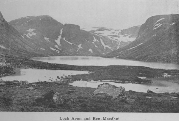
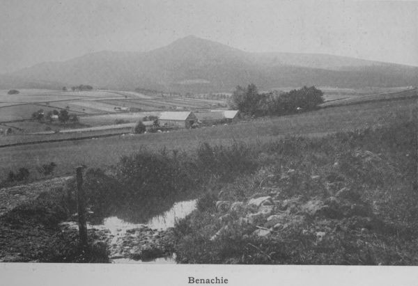
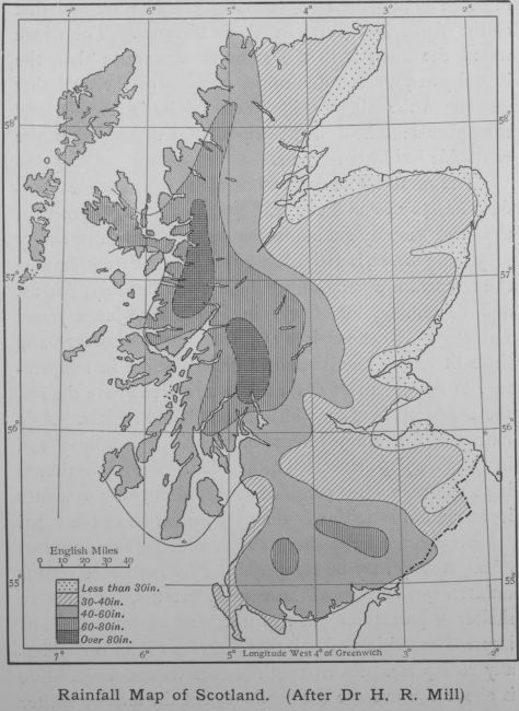
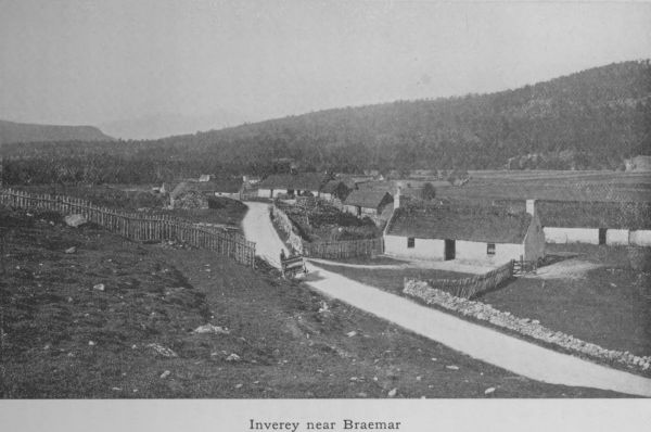
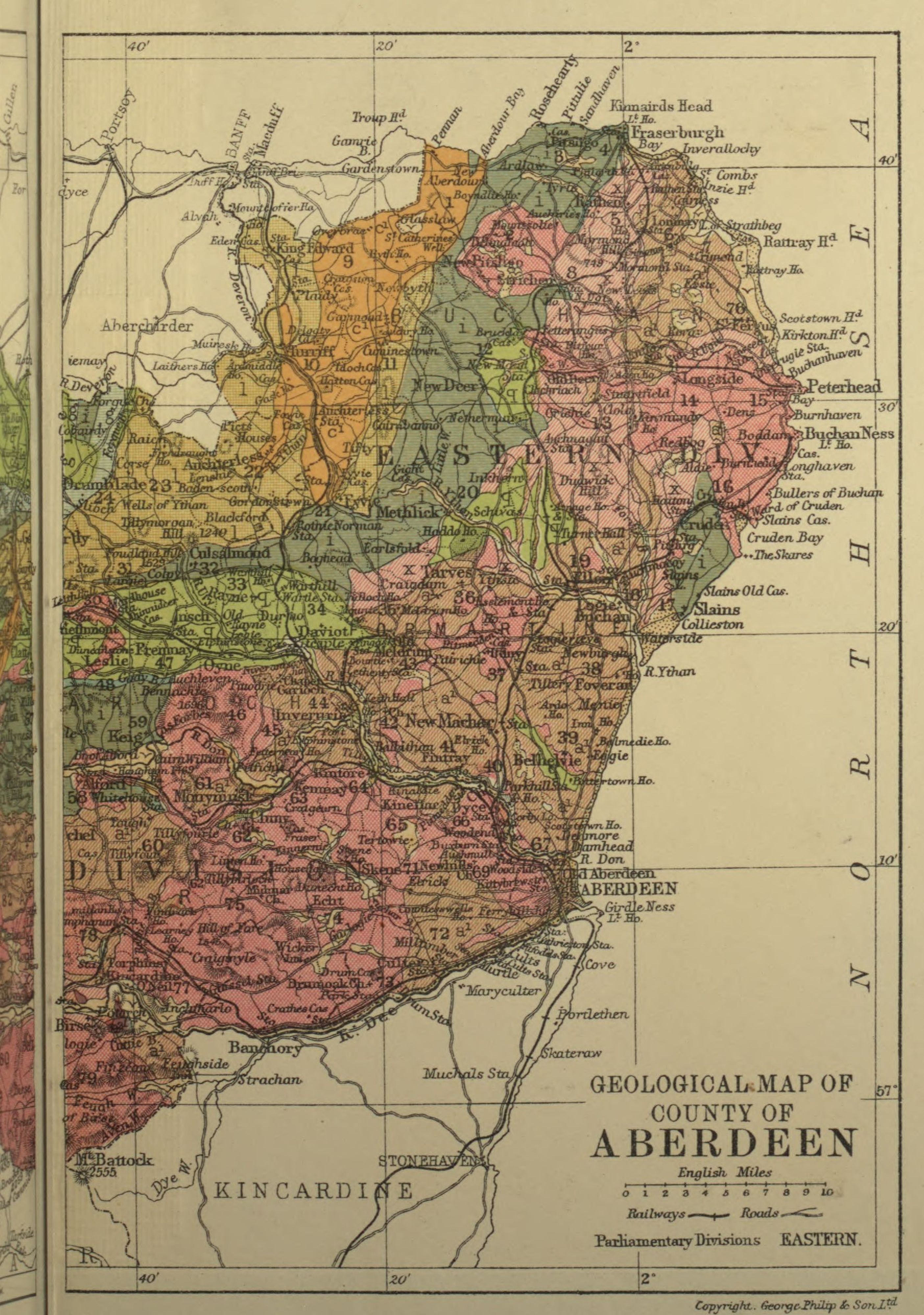
1. County and Shire. The Origin of Aberdeenshire.
The term “shire,” which means a division (Anglo-Saxon
sciran: to cut or divide), has in Scotland practically
the same meaning as “county.” In most cases the two
names are interchangeable. Yet we do not say Orkneyshire
nor Kirkcudbrightshire. Kirkcudbright is a stewartry
and not a county, but in regard to the others we call
them with equal readiness shires or counties. County
means originally the district ruled by a Count, the
Norman equivalent of Earl. It is said that Aberdeenshire
is the result of a combination of two counties, Buchan
and Mar, representing the territory under the rule of the
Earl of Buchan and the Earl of Mar. The distinction is
in effect what we mean to-day by East Aberdeenshire and
West Aberdeenshire; and the local students of Aberdeen
University when voting for their Lord Rector by
“nations” are still classified as belonging to either the
Buchan nation or the Mar nation according to their place
of birth.
The counties, then, are certain areas which it is
convenient for political and administrative purposes to
divide the country into for the better and more convenient
management of local and internal affairs. To-day
Scotland has thirty-three of these divisions. In a public
ordinance dated 1305, twenty-five counties are named.
They would seem to have been first defined early in the
twelfth century, but as a matter of fact nothing very
definite is known, either as to the date of their origin or
as to the principles which regulated the making of their
geographical boundaries. It is certain, however, that the
county divisions were in Scotland an introduction from
England. The term came along with the people who
were flocking into Scotland from the south. The lines
were drawn for what seemed political convenience and
no doubt they were suited to the times. To-day the
boundaries seem on occasion somewhat erratic. Banchory,
for example, is in Kincardineshire, while Aboyne and
Ballater on the same river bank and on the same line of
road and railway are in Aberdeenshire. If the carving
were to be done over again in the twentieth century,
more consideration would probably be given to the railway
lines.
A commission of 1891 did actually rearrange the
boundaries. Of the parishes partly in Aberdeen and
partly in Banff, some were transferred wholly to Aberdeen
(Gartly, Glass, New Machar, Old Deer and
St Fergus), while others were placed in Banffshire
(Cabrach, Gamrie, Inverkeithny, Alvah and Rothiemay).
How it happened that certain parts of adjoining counties
were planted like islands in the heart of Aberdeenshire
may be understood by reference to such a case as that of
St Fergus. A large part of this parish belonged to the
Cheynes, who being hereditary sheriffs of Banffshire were
naturally desirous of having their patrimonial estates under
their own legal jurisdiction, and were influential enough
to be able to stereotype this anomaly. This explains the
place of St Fergus in Banffshire; it is now very properly
a part of Aberdeenshire.
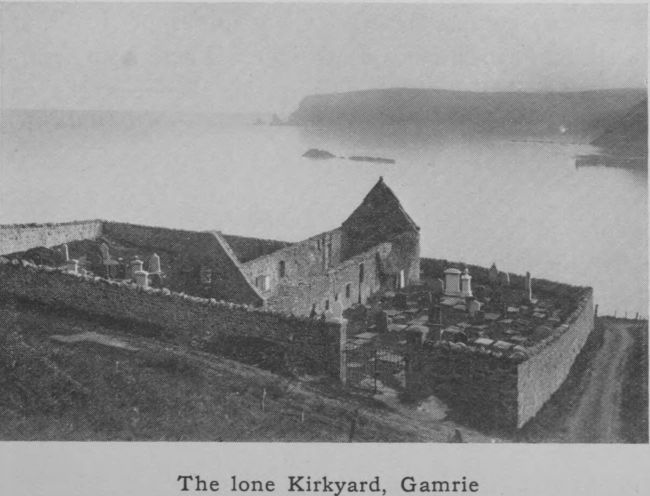
The lone Kirkyard, Gamrie
The county took its name from the chief town—Aberdeen—which
is clearly Celtic in origin and means
the town at the mouth of either the Dee or the Don.
Both interpretations are possible; but the fact that the
Latin form of the word has always been Aberdonia and
_Aberdonensis_, favours the Don as the naming river. As a
matter of fact, Old Aberdeen, though lying at no great
distance from the bank of the Don, can hardly be said to
be associated with Donmouth, whereas a considerable
population must from a remote period have been located
at the mouth of the Dee. Whatever interpretation is
accepted, it was this city—the only town in the district
conspicuous for population and resources—that gave its
name to the county as a whole.
The whole region between the river Dee and the
river Spey, comprising the two counties of Banff and
Aberdeen, forms a natural province. There is no natural,
or recognisable line of demarcation between the two
counties. Their fortunes have been one. The river
Deveron might conceivably have been chosen as the
dividing line, but in practice it is so only to a limited
extent. The whole district, which if invaded was never
really conquered by the Romans, made one of the seven
Provinces of what was called Pictland in the early middle
ages, and it long continued to assert for itself a semi-independent
political existence.
5. Watershed. Rivers. Lochs.
As we have already pointed out, the watershed coincides
to a large extent with the boundary line of the
county. The lean of Aberdeenshire is from west to east
so that all the rivers flow in an easterly direction to the
North Sea. On the west and north-west of the highest
mountain ridges, the slope of the land is to the north-east,
and the Spey with its several tributaries carries the rainfall
to the heart of the Moray Firth.
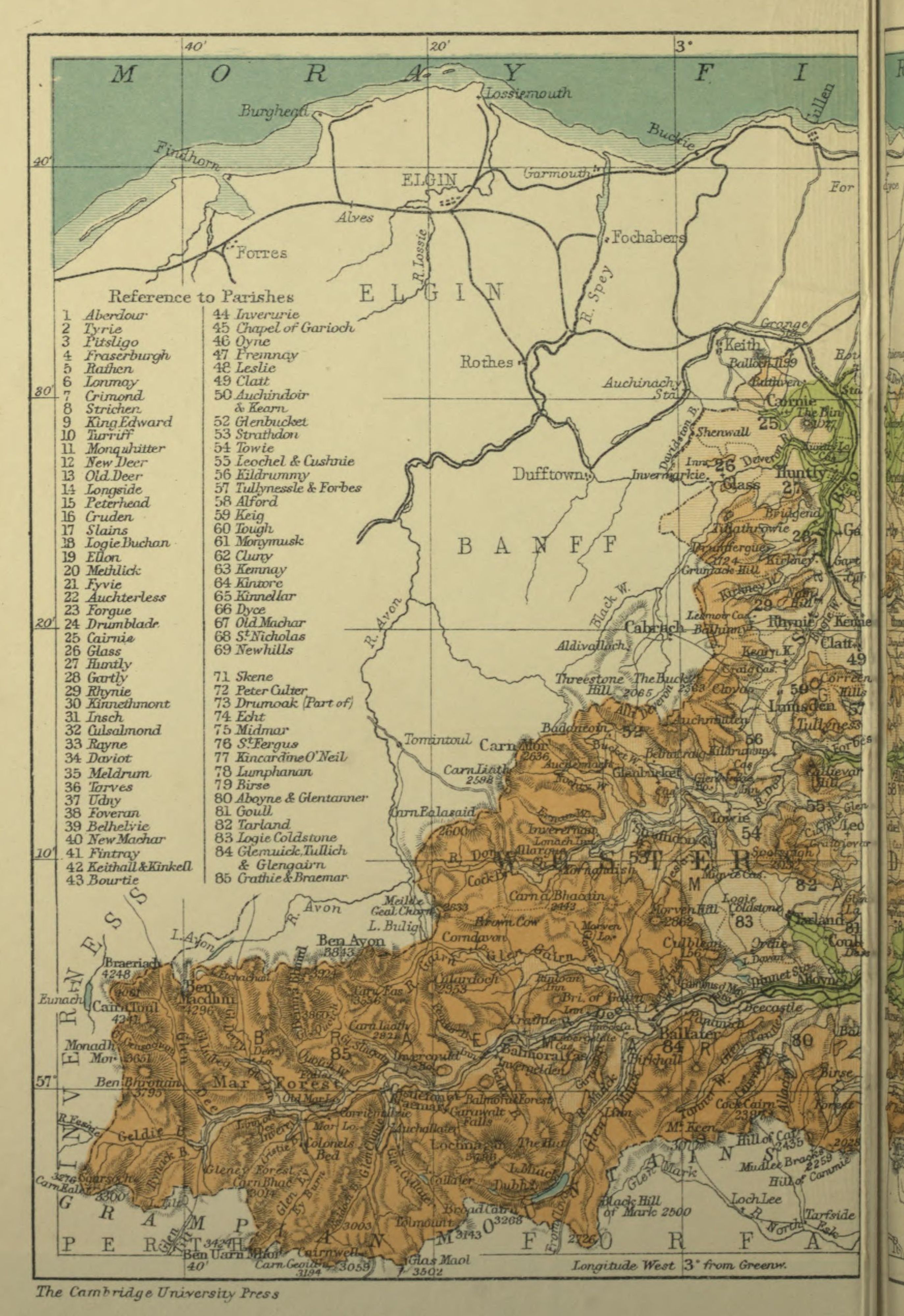
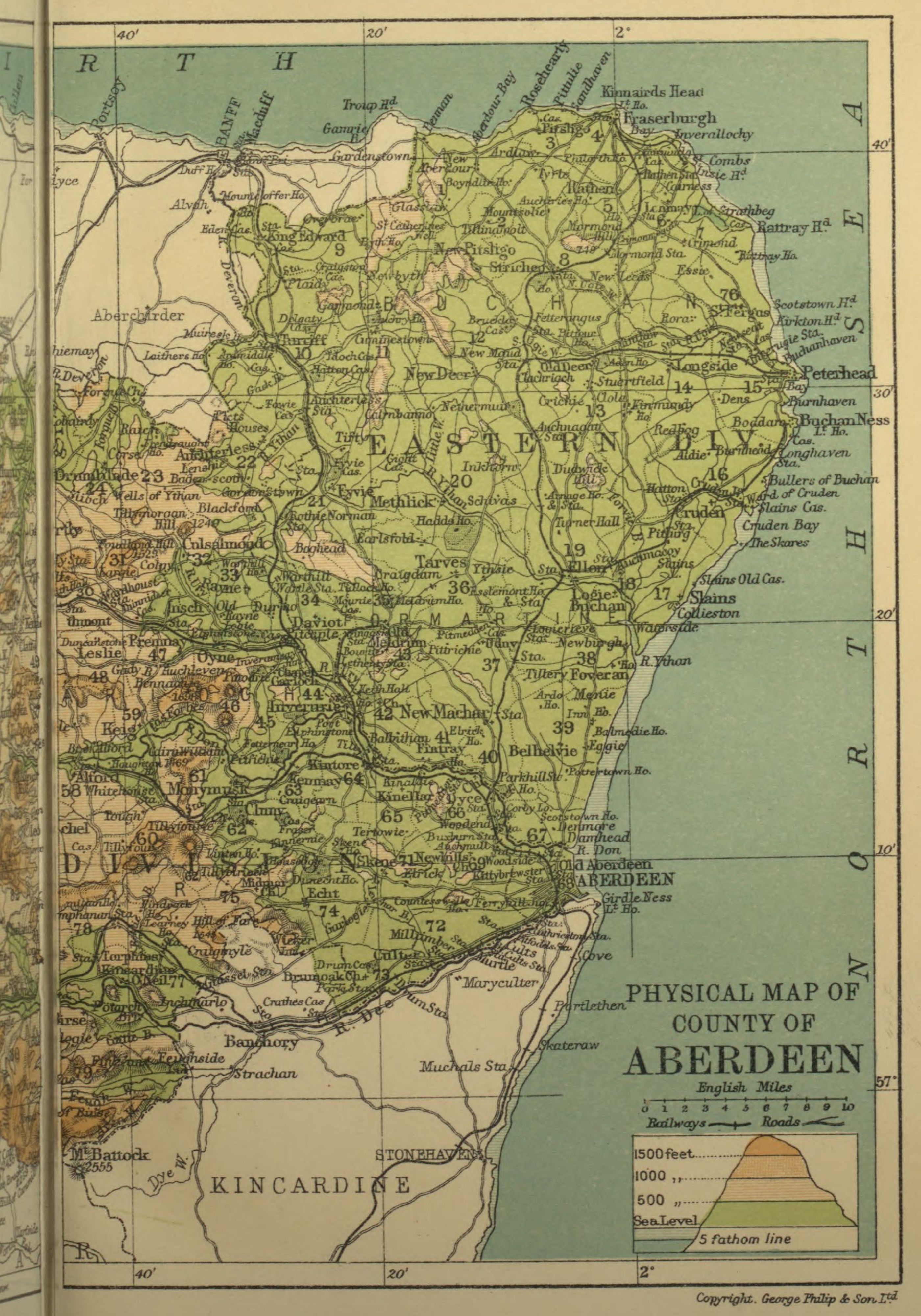
The chief river of the county is the Dee. It is the
longest, the fullest-bodied, the most picturesque of all
Aberdeenshire waters. Taking its rise in two small
streams which drain the slopes of Brae-riach, it grows
in volume and breadth, till, after an easterly course of
nearly 100 miles, it reaches the sea at Aberdeen. The
head-stream is the Garrachorry burn, which flows through
the cleft between Brae-riach and Cairntoul. A more
romantic spot for the cradle of a mighty river could
hardly be found. The mountain masses rise steep, grim
and imposing—on one side Cairntoul conical in shape,
on the other Brae-riach broad and massive, a picture of
solidity and immobility. The Dee well is 4060 feet
above sea-level and 1300 above the stream which drains
the eastern side of the Larig—the high pass to Strathspey.
As it emerges from the Larig, it is a mere mountain
torrent but presently it is joined at right angles by the
Geldie from the south-west, and the united waters move
eastward through a wild glen of rough and rugged slopes
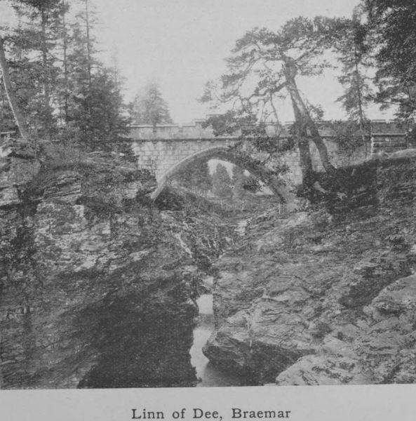
Linn of Dee, Braemar
and ragged, gnarled Scots firs to the Linn of Dee, 6-3/4 miles
above Braemar. There is no great fall at the Linn, but
here the channel of the river becomes suddenly contracted
by great masses of rock and the water rushes through a
narrow gorge only four feet wide. The pool below is
deep and black and much overhung with rocks. For
300 yards stretches this natural sluice, formed by rocks
with rugged sides and jagged bottom, the water racing
past in small cascades. The river is here spanned by
a handsome granite bridge opened in 1857 by Queen
Victoria.
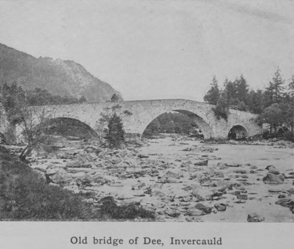
Old bridge of Dee, Invercauld
As the river descends to Braemar, the glen gradually
widens out, and the open, gravelly, and sinuous character
of the bed, which is a feature from this point onwards, is
very marked. Pool and stream, stream and pool succeed
one another in shingly bends, clean, sparkling and beautiful.
At Braemar the bed is 1066 feet above sea-level.
Below Invercauld the river is crossed by the picturesque
old bridge built by General Wade, when he made his
well-known roads through the Highlands after the rebellion
of 1745. Here the Garrawalt, a rough and obstructed
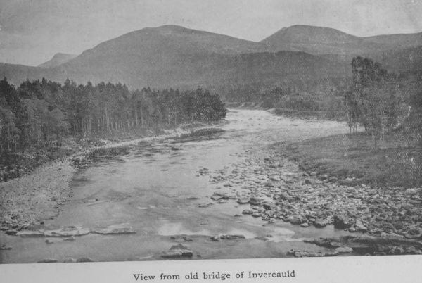
View from old bridge of Invercauld
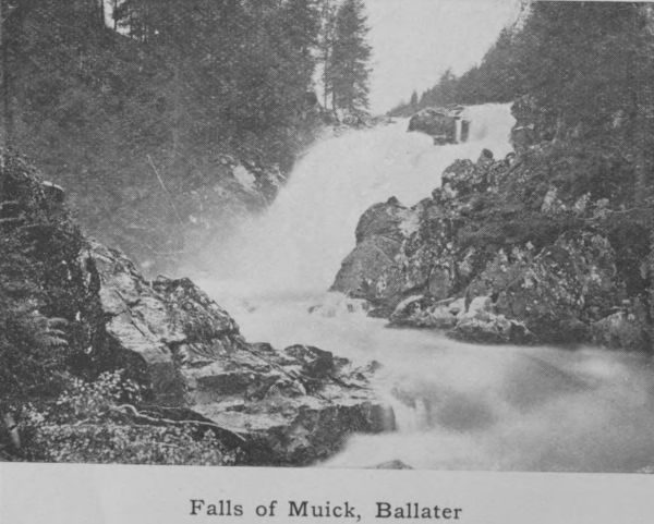
Falls of Muick, Ballater
tributary, joins the main river. From Invercauld past
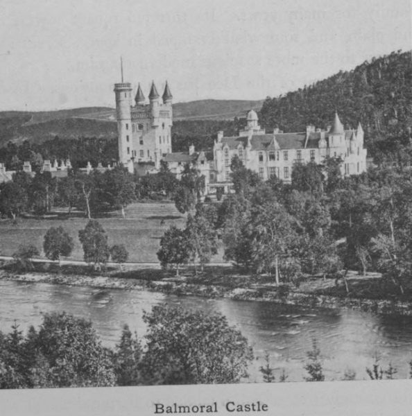
Balmoral Castle to Ballater is sixteen miles. Here the
bottom is at times rocky, at times filled with big rough
stones, at other times shingly but never deep. The average
depth is only four feet, and the normal pace under
ordinary conditions 3-1/2 miles an hour. From Ballater,
where the river is joined by the Gairn and the Muick,
the Dee maintains the same character to Aboyne and
Banchory, where it is joined by the Feugh from the
forest of Birse. Just above Banchory is Cairnton, where
the water supply for the town of Aberdeen, amounting
on an average to 7 or 8 million gallons a day, is taken off.
The course of the river near the mouth was diverted
some 40 years ago to the south, at great expense, by the
Town Council, and in this way a considerable area of
land was reclaimed for feuing purposes. The spanning
of the river at this point by the Victoria bridge, which
superseded a ferry-boat, has led to the rise of a moderately
sized town (Torry) on the south or Kincardine side of the
river.
The scenery of Deeside, all the way from the Cairngorms
to the old Bridge of Dee, two miles west of the
centre of the city, is varied and attractive. It is well-wooded
throughout; in the upper parts the birch, which
would seem to be indigenous in the district, adds to the
beauty of the hill-sides, while the clean pebbly bed of the
river and its swift, dashing flow delight the eyes of those
who are familiar only with sluggish and mud-stained
waters. It is not surprising therefore that the district
has attained the vogue it now enjoys.
The Don runs parallel to the Dee for a great part
of its course, but it is a much shorter river, measuring
only 78 miles. It rises at the very edge of the county
close to the point where the Avon emerges from Glen
Avon and turns north to join the Spey. It drains a valley
which is only ten or fifteen miles separated from the
valley of the larger river. In its upper reaches it somewhat
resembles Deeside, being quite highland in character;
but lower down the river loses its rapidity, becoming sluggish
and winding. Strathdon, as the upper area is called,
is undoubtedly picturesque, but it lacks the bolder features
of Deeside, being less wooded and graced with few hills
on the grand scale. It has not, therefore, become a popular
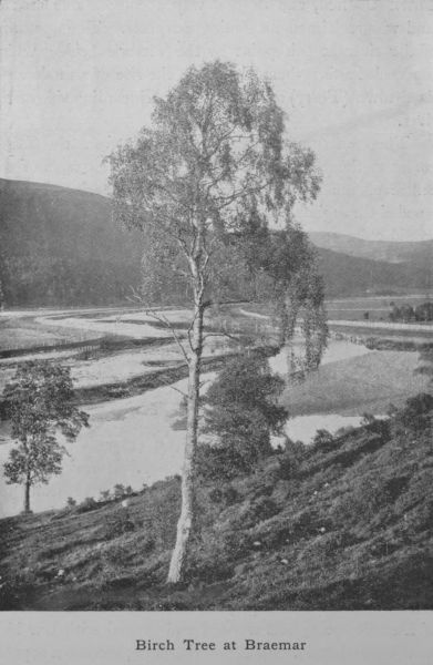
Birch Tree at Braemar
summer resort, but its banks form the richest alluvial
agricultural land in the county—
A mile o’ Don’s worth twa o’ Dee
Except for salmon, stone and tree.
This old couplet is so far correct. The Dee is a great
salmon river, providing more first-class salmon angling
than any other river of Scotland, while the Don, though
owing to its muddy bottom a stream excellent beyond
measure and unsurpassed for brown trout, is not now,
partly owing to obstruction and pollution, a great salmon
river. But the agricultural land on Donside, which for
the most part is rich deep loam, about Kintore, Inverurie
and the vale of Alford is much more kindly to the farmer
than the light gravelly soil of Deeside, which is so apt to
be burnt up in a droughty summer. In the matter of
stone, things have changed since the couplet took shape.
The granite quarries of Donside are now superior to any
on the Dee; but the trees of Deeside still hold their own,
the Scots firs of Ballochbuie forest, west of Balmoral,
being the finest specimens of their kind in the north.
The nether-Don has been utilised for more than a
century as a driving power for paper and wool mills.
Of these there is a regular succession for several miles
of the river’s course, from Bucksburn to within a mile
of Old Aberdeen. After heavy rains or a spring thaw
the lower reaches of the river, especially from Kintore
downwards, are apt to be flooded, and in spite of embankments
which have been erected along the river’s course,
few years pass without serious damage being done to the
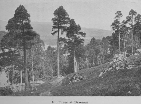
Fir Trees at Braemar
crops in low-lying fields. Some parts of Donside scenery,
notably at Monymusk (called Paradise), and at Seaton
House just below the Cathedral of Old Aberdeen, and
before the river passes through the single Gothic arch
of the ancient and historical bridge of Balgownie, are very
fine—wooded and picturesque, and beloved of more than
one famous artist.
The next river is the Ythan, which, rising in the low
hills of the Culsalmond district and flowing through the
parish of Auchterless and past the charming hamlet of
Fyvie, creeps somewhat sluggishly through Methlick and
Lord Aberdeen’s estates to Ellon. A few miles below
Ellon it forms a large tidal estuary four miles in length—a
notable haunt of sea-trout, the most notable on the east
coast. The river is only 37 miles long. It is slow and
winding with deep pools and few rushing streams; moreover
its waters have never the clear, sparkling quality
of the silvery Dee. Yet at Fyvie and at Gight it has
picturesque reaches that redeem it from a uniformity of
tameness.
The Ugie, a small stream of 20 miles in length, is
the only other river worthy of mention. It joins the
sea north of the town of Peterhead. In character it
closely resembles the Ythan, having the same kind of
deep pools and the same sedge-grown banks.
The Deveron is more particularly a Banffshire river,
yet in the Huntly district, it and its important tributary
the Bogie (which gives its name to the well-known historic
region called Strathbogie) are wholly in Aberdeenshire.
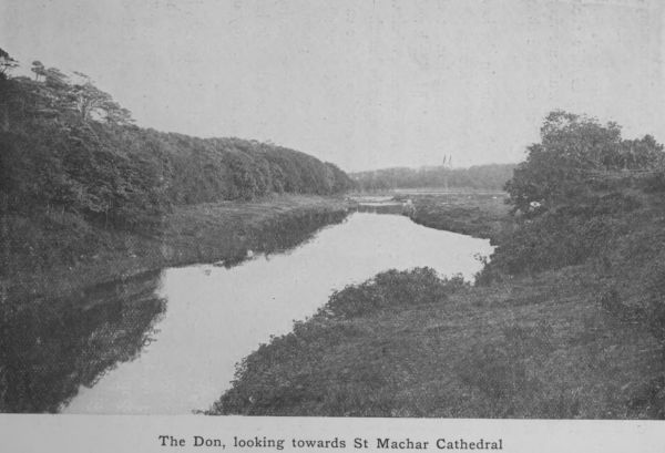
The Don, looking towards St Machar Cathedral
The Deveron partakes of the character of the Dee
and the character of the Don. It is neither so sparkling
and rapid as the one nor so slow and muddy as the other.
Around Huntly and in the locality of Turriff and Eden,
where it is the boundary between the counties, it has
some charmingly beautiful reaches. Along its banks is
a succession of stately manor-houses, embosomed in trees,
and these highly embellished demesnes enhance its natural
charms.
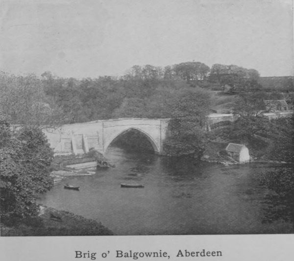
Brig o’ Balgownie, Aberdeen
Lakes are few in Aberdeenshire, and such as exist are
not specially remarkable. The most interesting historically
are the Deeside Lochs Kinnord and Davan which are
held by antiquarians to be the seat of an ancient city
Devana—the town of the two lakes. In pre-historic
times there dwelt on the shores of these lakes as also in
the valleys that converge upon them a tribe of people
who built forts, and lake retreats, made oak canoes, and
by means of palisades of the same material created artificial
islands. The canoes which have been recovered
from the bed of the loch are hollowed logs thirty feet in
length. Other relics—a bronze vessel and a bronze spearhead,
together with many beams of oak—have been fished
up, all proving the existence of an early Pictish settlement.
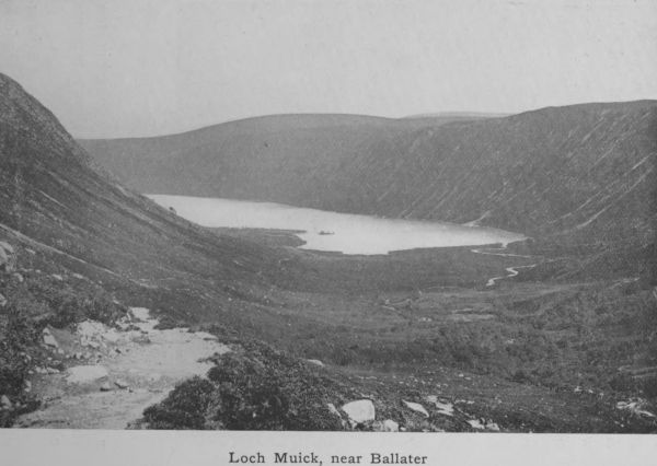
Loch Muick, near Ballater
Besides these, there is in the same district—but south-east
of Loch-na-gar, another and larger lake called Loch
Muick. From it flows the small river Muick—a tributary
of the Dee, which it joins above Ballater. South-west of
Loch-na-gar is Loch Callater, which drains into the Clunie,
another Dee tributary, which joins the main river at Castleton
of Braemar. On the lower reaches of the Dee are
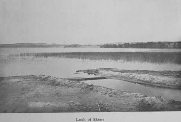
the Loch of Park or Drum, and the Loch of Skene, both
of which drain into the Dee. Both are much frequented
by water-fowl of various kinds.
The Loch of Strathbeg, which lies on the east coast
not far from Rattray Head, is a brackish loch of some
interest. Two hundred years ago, we are told, it was
in direct communication with the sea and small vessels
were able to enter it. In a single night a furious easterly
gale blew away a sand-hill between the Castle-hill of
Rattray and the sea, with the result that the wind-driven
sand formed a sand-bar where formerly there was a clear
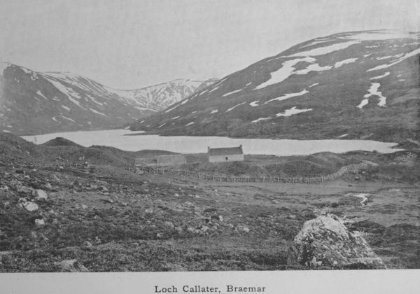
Loch Callater, Braemar
water-way. Since that day the loch has been land-locked
and though still slightly brackish may be regarded as an
inland loch.
6. Geology.
Geology is the study of the rocks or the substances
of which the earthy crust of a district is composed.
Rocks are of two sorts: (1) those due to the action of
heat, called igneous, (2) those formed and deposited by
water, called aqueous. When the earth was a molten
ball, it cooled at the surface, but every now and again
liquid portions were ejected from cracks and weak places.
The same process is seen in the eruptions of Mount
Vesuvius, which sends out streams of liquid lava that
gradually cools and forms hard rock. Such are igneous
rocks. But all the forces of nature are constantly at
work disintegrating the solid land; frost, rain, the action
of rivers and the atmosphere wear down the rocks; and
the tiny particles are carried during floods to the sea,
where they are deposited as mud or sand-beds laid flat
one on the top of the other like sheets of paper. These
are _aqueous_ rocks. The layers are afterwards apt to be
tilted up on end or at various angles owing to the contortions
of the earth’s crust, through pressure in particular
directions. When so tilted they may rise above water
and immediately the same process that made them now
begins to unmake them. They too may in time be so
worn away that only fragments of them are left whereby
we may interpret their history.
Loch of Skene
To these may be added a third kind of rock called
metamorphic, or rocks so altered by the heat and pressure
of other rocks intruding upon them, that they lose their
original character and become metamorphosed. They
may be either sedimentary, laid down originally by water,
or they may be igneous, but in both cases they are entirely
changed or modified in appearance and structure by the
treatment they have suffered.
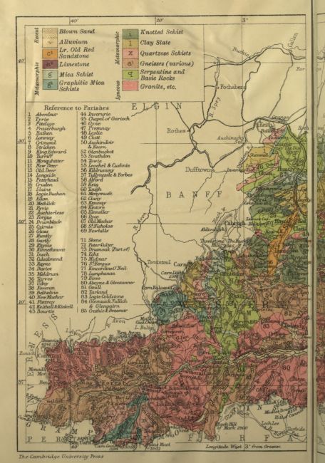
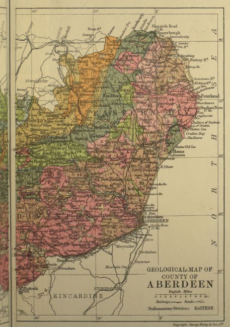
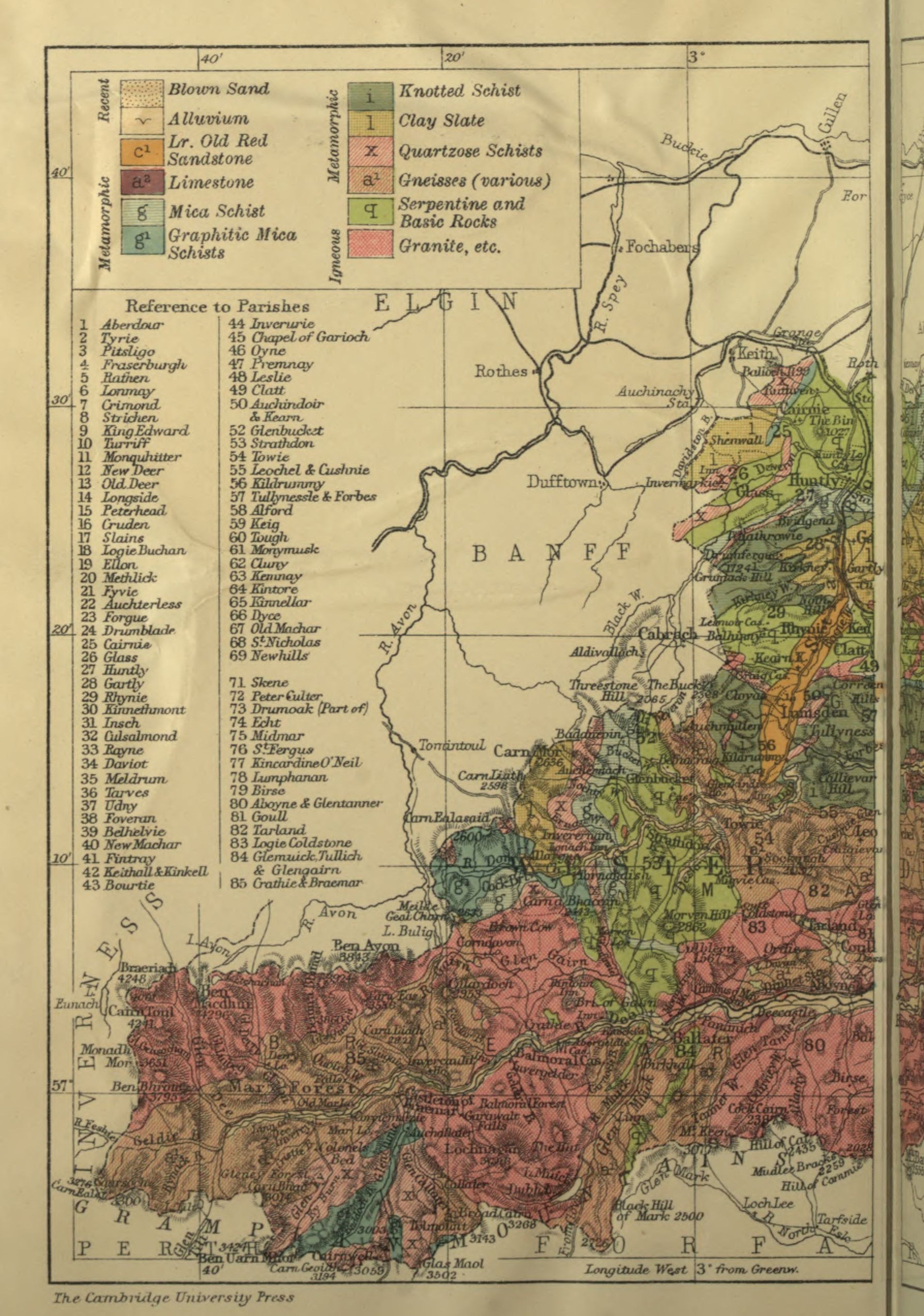
The geology of Aberdeenshire is almost entirely concerned
with igneous and metamorphic rocks. The whole
backbone of the county is granite which has to some
extent been rubbed smooth by glacial action; but in a
great part of the county the granite gives place to metamorphic
rocks, gneiss, schist, and quartzite. A young
geologist viewing a deep cutting in the soil about Aberdeen
finds that the material consists of layers of sand,
gravel, clay, which are loosely piled together all the way
down to the solid granite. This is the glacial drift, or
boulder clay, a much later formation than the granite
and a legacy of what is called the great Ice Age. Far
back in a time before the dawn of history all the north-east
of Scotland was buried deep under a vast snow-sheet.
The snow consolidated into glaciers just as in Switzerland
to-day, and the glaciers thus formed worked their way
down the valleys, carrying a great quantity of loose
material along with them. When a warmer time came,
the ice melted and all the sand and boulders mixed up
in the ice were liberated and sank as loose deposits on
the land. This is the boulder clay which in and around
Aberdeen is the usual subsoil. It consists of rough,
half-rounded pebbles, large and small, of clay, sand,
and shingle, and makes a very cold and unkindly soil,
being difficult to drain properly and slow to take in
warmth.
Below this boulder clay are the fundamental rocks.
At Aberdeen these are pure granite; but in other parts
of the county they are, as we have said, metamorphic,
that is, they have been altered by powerful forces, heat
and pressure. Whether they were originally sedimentary,
before they were altered, is doubtful; some geologists
think the crystalline rocks round Fraserburgh and Peterhead
were aqueous. Mormond Hill was once a sandstone,
and the schists of Cruden Bay and Collieston were
clay. The same beds traced to the south are found to
pass gradually into sedimentary rocks that are little altered.
Whether they were aqueous or igneous originally, they
have to-day lost all their original character. No fossils
are found in them. These rocks are the oldest and
lowest in Aberdeenshire. After their formation, they
were invaded from below by intrusive masses of molten
igneous rock, which in many parts of the county is now
near the surface. This is the granite already referred
to. Its presence throughout the county has materially
influenced the character and the industry of the people.
Wherever granite enters, it tears its irregular way
through the opposing rocks, and sends veins through
cracks where such occur. The result of its forcible
entrance in a molten condition is that the contiguous
rocks are melted, blistered, and baked by the intrusive
matter. Why granite should differ from the lava we
see exuding from active volcanoes is explained by the
fact that it is formed deep below the surface where there
is no outlet for its gases. It cools slowly and under great
pressure and this gives it its special character. If found,
therefore, at the surface, as it is in Aberdeen, this is because
the rocks once high above it, concealing its presence
have been worn away, which gives some idea of the great
age of the district. One large granitic mass is at Peterhead,
where it covers an area of 46 square miles, and forms
the rocky coast for eight miles; but the whole valley of
the Dee as far as Ben Macdhui, and a great part of Donside,
consist of this intrusive granite. It varies in colour
and quality, being in some districts reddish in tint as at
Sterling Hill near Peterhead, at Hill of Fare, and Corennie;
in other parts it is light grey in various shades.
The succession in the order of sedimentary rocks is
definitely settled, and although this has little application
to Aberdeenshire, an outline may be given. The oldest
are the Palaeozoic which includes—in order of age—
Cambrian,
Silurian,
Old Red Sandstone or Devonian,
Carboniferous,
Permian.
Of these the only one represented in Aberdeenshire is
the Old Red Sandstone, which occupies a considerable
strip on the coast from Aberdour to Gardenstown, and
runs inland to Fyvie and Auchterless and even as far as
Kildrummy and Auchindoir. The deposit is 1300 feet
thick. A visitor to the town of Turriff is struck by the red
colour of many of the houses there, a most unusual variant
upon the blue-grey whinstone of the surrounding districts.
The explanation is that a convenient quarry of Old Red
Sandstone exists between Turriff and Cuminestown. Kildrummy
Castle, one of the finest and most ancient ruins
in the county, is not like the majority of the old castles
built of granite but of a sandstone in the vicinity. The
same band extends across country to Auchindoir, where
it is still quarried.
The next geological group of Rocks, the Secondary
or Mesozoic, includes—in order of age—
Triassic,
Jurassic,
Cretaceous.
These are not at all or but barely represented. A patch
of clay at Plaidy, which was laid bare in cutting the railway
track, belongs to the Jurassic system and contains
ammonites and other fossils characteristic of that period.
Over a ridge of high ground stretching from Sterling Hill
south-eastwards are found numbers of rolled flints belonging
to the Cretaceous or chalk period, but the probability
is that they have been transported from elsewhere by
moving ice and are not in their natural place.
The Tertiary epoch is just as meagrely represented
as the Secondary. Yet this is the period which in other
parts of the world possesses records of the most ample
kind. The Alps, the Caucasus, the Himalayas were
all upheaved in Tertiary times; but of any corresponding
activity in the north-east of Scotland, there is no trace.
It is only when the Tertiary merges in the Quaternary
period that the history is resumed. The deposits of the
Ice Age, when Scotland was under the grip of an arctic
climate, are much in evidence all over the county and
have already been referred to. It is necessary to treat
the subject in some detail.
During the glacial period, the snow and ice accumulated
on the west side of the country, and overflowed
into Aberdeenshire. There were several invasions owing
to the recurrence of periods of more genial temperature
when the ice-sheet dwindled. One of the earlier inroads
probably brought with it the chalk flints now found west
of Buchan Ness; another brought boulders from the district
of Moray. South of Peterhead a drift of a different
character took place. Most of Slains and Cruden as well
as Ellon, Foveran, and Belhelvie are covered with a reddish
clay with round red pebbles like those of the Old
Red Sandstone. This points to an invasion of the ice-sheet
from Kincardine, where such deposits are rife.
Dark blue clay came from the west, red clay from the
south, and in some parts they met and intermixed as at
St Fergus. A probable third source of glacial remains
is Scandinavia. In the Ice Age Britain was part of the
continental mainland, the shallow North Sea having been
formed at a subsequent period. The low-lying land at
the north-east of the county was the hollow to which the
glaciers gravitated from west and south and east, leaving
their débris on the surface when the ice disappeared. So
much is this a feature of Buchan that one well-known
geologist has humorously described it as the riddling heap
of creation.
Both the red and the blue clay are often buried under
the coarse earthy matter and rough stones that formed
the residuum of the last sheet of ice. This has greatly
increased the difficulty of clearing the land for cultivation.
Moreover a clay subsoil of this kind, which forms a hard
bottom pan that water cannot percolate through, is not
conducive to successful farming. Drainage is difficult
but absolutely necessary before good crops will be produced.
Both difficulties have been successfully overcome
by the Aberdeenshire agriculturist, but only by dint of
great expenditure of time and labour and money.
The district of the clays is associated with peat beds.
There is peat, or rather there was once peat all over
Aberdeenshire, but the depth and extent of the beds are
greatest where the clay bottom exists. A climate that
is moist without being too cold favours the growth of
peat and the Buchan district, projecting so far into the
North Sea and being subject to somewhat less sunshine
than other parts of the county, provides the favouring
conditions. The rainfall is only moderate but it is distributed
at frequent intervals, and the clay bottom helps
to retain the moisture and thus promotes the growth of
those mosses which after many years become beds of peat.
These peat beds for long provided the fuel of the population.
In recent years they are all but exhausted, and the
facility with which coals are transported by sea and by rail
is gradually putting an end to the “casting” and drying
of peats.
Moraines of rough gravel—the wreckage of dwindling
glaciers—are found in various parts of the Dee valley.
The soil of Deeside has little intermixture of clay and
is thin and highly porous. It follows that in a dry season
the crops are short and meagre. The Scots fir, however,
is partial to such a soil, and its ready growth helps with
the aid of the natural birches to embellish the Deeside
landscape.
In the Cairngorms brown and yellow varieties of
quartz called “cairngorms” are found either embedded
in cavities of the granite or in the detritus that accumulates
from the decomposition of exposed rocks. The
stones, which are really crystals, are much prized for
jewellery, and are of various colours, pale yellow (citrine),
brown or smoky, and black and almost opaque. When
well cut and set in silver, either as brooches or as an
adornment to the handles of dirks, they have a brilliant
effect. Time was when they were systematically dug
and searched for, and certain persons made a living by
their finds on the hill-sides; but now they are more rare
and come upon only by accident.
7. Natural History.
As we have seen in dealing with the glacial movements,
Britain was at one time part of the continent and
there was no North Sea. At the best it is a shallow sea,
and a very trifling elevation of its floor would re-connect
Scotland with Europe. It follows that our country was
inhabited by the same kind of animals as inhabited
Western Europe. Many of them are now extinct, cave-bears,
hyaenas and sabre-toothed tigers. All these were
starved out of existence by the inroads of the ice. After
the ice disappeared this country remained joined to the
continent, and as long as the connection was maintained
the land-animals of Europe were able to cross over and
occupy the ground; if the connection had not been
severed, there would have been no difference between
our fauna and the animals of Northern France and
Belgium. But the land sank, and the North Sea filled
up the hollow, creating a barrier before all the species
in Northern Europe had been able to effect a footing
in our country. This applies both to plants and animals.
While Germany has nearly ninety species of land animals,
Great Britain has barely forty. All the mammals, reptiles
and amphibians that we have, are found on the
continent besides a great many that we do not possess.
Still Scotland can boast of its red grouse, which is not
seen on the continent.
With every variety of situation, from exposed sea-board
to sheltered valley and lofty mountain, the flora
of Aberdeenshire shows a pleasing and interesting variety.
The plants of the sea-shore, of the waysides, of the river-banks,
and of the lowland peat-mosses are necessarily
different in many respects from those of the great mountain
heights. It is impossible here to do more than
indicate one or two of the leading features. The sandy
tracts north of the Ythan mouth have characteristic
plants, wild rue, sea-thrift, rock-rose, grass of Parnassus,
catch-fly (Silene maritima). The waysides are brilliant
with blue-bells, speedwell, thistles, yarrow and violas.
The peat-mosses show patches of louse-wort, sundew,
St John’s wort, cotton-grass, butterwort and ragged
robin. The pine-woods display an undergrowth of blae-berries,
galliums, winter-green, veronicas and geraniums.
The Linnaea borealis is exceedingly rare, but has a few
localities known to enterprising botanists. The whin and
the broom in May and June add conspicuous colouring
to the landscape while a different tint of yellow shines
in the oat-fields, which are throughout the county more
or less crowded with wild mustard or charlock. The
granitic hills are all mantled with heather (common ling,
Calluna erica) up to 3000 feet, brown in winter and
spring but taking on a rich purple hue when it breaks
into flower in early August. The purple bell-heather
does not rise beyond 2000 feet and flowers much earlier.
Through the heather trails the stag-moss, and the pyrola
and the genista thrust their blossoms above the sea of
purple. The cranberry, the crow-berry and the whortle-berry,
and more rarely the cloudberry or Avron (Rubus
chamaemorus) are found on all the Cairngorms. The
Alpine rock-cress is there also, as well as the mountain
violet (Viola lutea), which takes the place of the hearts-ease
of the lowlands. The moss-campion spreads its
cushions on the highest mountains; saxifrages of various
species haunt every moist spot of the hill-sides and the
Alpine lady’s mantle, the Alpine scurvy-grass, the Alpine
speedwell, the trailing azalea, the dwarf cornel (Cornus
suecica), and many other varieties are to be found by
those who care to look for them.
As we have said, no trees thrive near the coast.
The easterly and northerly winds make their growth
precarious, and where they have been planted they look
as if shorn with a mighty scythe, so decisive is the slope
of their branches away from the direction of the cold
blasts. Their growth too in thickness of bole is painfully
slow, even a period of twenty years making no
appreciable addition to the circumference of the stem.
Convincing evidence exists that in ancient times the
county was closely wooded. In peat-bogs are found
the root-stems of Scots fir and oak trees of much larger
bulk than we are familiar with now. The resinous roots
of the fir trees, dug up and split into long strips, were the
fir-candles of a century ago, the only artificial light of
the time.
The district is not exceptional or peculiar in its fauna.
The grey or brown rat, which has entirely displaced the
smaller black rat, is very common and proves destructive
to farm crops—a result partially due to the eradication of
birds of prey, as well as of stoats and weasels, by gamekeepers
in the interest of game. The prolific rabbit is
in certain districts far too numerous and plays havoc with
the farmer’s turnips and other growing crops. Brown
hares are fairly plentiful but less numerous than they
were in the days of their protection. Every farmer has
now the right to kill ground game (hares and rabbits)
on his farm and this helps to keep the stock low. The
white or Alpine hare is plentiful in the hilly tracts and
is shot along with the grouse on the grouse moors. The
otter is occasionally trapped on the rivers, and a few foxes
Deer in time of snow
are shot on the hills. The mole is in evidence everywhere
up to the 1500 feet level, by the mole-heaps he leaves in
every field, and the mole-catcher is a familiar character
in most parishes. The squirrel has worked his way north
during the last sixty years, and is now to be found in
every fir-wood. The graceful roedeer is also a denizen
of the pine-woods, whence he makes forays on the oat-fields.
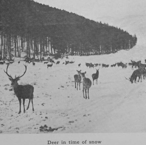
The red-deer is abundant on the higher and more
remote hills, and deer-stalking is perhaps the most exciting
as it certainly is the most exacting of all forms of Scottish
sport. The pole-cat is rarely seen; he is best known to
the present generation in the half-domesticated breed called
the ferret. The hedge-hog, the common shrew, and the
water-vole are all common.
The Dunbuy Rock
The birds are numerous and full of interest. The
coast is frequented by vast flocks of sea-gulls, guillemots,
and cormorants, while the estuary of the Ythan has
many visitants such as the ringed plover, the eider-duck,
the shelduck, the oyster-catcher, redshank, and tern. On
the north bank of this river the triangular area of sand-dunes
between Newburgh and Collieston is a favourite
nesting-place for eider-duck and terns. The nests of
the eider-duck, with their five large olive-green eggs
embedded in the soft down drawn from the mother’s
breast, are found in great numbers amongst the grassy
bents. The eggs of the tern, on the other hand, are
laid in a mere hollow of the open sand, but so numerous
are they that it is almost impossible for a pedestrian to
avoid treading upon them. Puffins or sea-parrots are
conspicuous amongst the many sea-birds that frequent
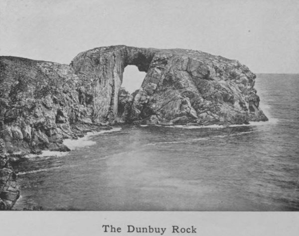
Dunbuy Rock. This island rock, half-way up the
eastern coast, is a typical sea-bird haunt, where gulls,
puffins, razorbills and guillemots are to be seen in a state
of restless activity. A colony of black-headed gulls has
for a number of years bred and multiplied in a small loch
near Kintore. A vast number of migratory birds strike
the shores of Aberdeenshire every year in their westward
flight. The waxwing, the hoopoe, and the ruff are occasional
visitors, the great northern diver and the snow-bunting
being more frequent.
The game-birds of the district are the partridge and
the pheasant in the agricultural region, and the red grouse
on the moors. The higher hills, such as Loch-na-gar, have
ptarmigan, while the wooded areas bordering on the highland
line are frequented by black-cock and capercailzie.
These last are a re-introduction of recent years and seem
to be multiplying; but, like the squirrel, they are destructive
to the growing shoots of the pine trees and are not
encouraged by some proprietors. The lapwing or green
plover’s wail is an unfailing sound throughout the county
in the spring. These useful birds are said to be fewer
than they were fifty years ago—a result probably due to
the demand for their eggs as a table delicacy. After the
first of April it is illegal to take the eggs, and this partial
protection serves to maintain the stock in fair numbers.
The starling, which, like the squirrel, was unknown in
this district sixty years ago, has increased so rapidly that
flocks of them containing many thousands are now a
common sight in the autumn. The kingfisher is met
with, very, very rarely on the river-bank, but the dipper
is never absent from the boulder-strewn beds of the
streams. The plaintive note of the curlew and the
shriller whistle of the golden plover break the silence
of the lonely moors. The golden eagle nests in the
solitudes of the mountains and may occasionally be seen,
soaring high in the vicinity of his eyrie.
Of fresh-water fishes, the yellow or brown trout is
plentiful in all the rivers, especially in the Don and the
Ythan. The migratory sea-trout and the salmon are also
caught in each, although the Dee is pre-eminently the
most productive. The salmon fisheries round the coast
and at the mouth of the rivers are a source of considerable
revenue. The fish are caught by three species of
net, bag-nets (floating nets) and stake-nets (fixed) in the
sea, and by drag-nets or sweep-nets in the tidal reaches
of the rivers. Time was when drag-nets plied as far
inland as Banchory-Ternan (19 miles), but these have
gradually been withdrawn and are now relegated to a
short distance from the river mouth, the rights having
been bought up by the riparian proprietors further up
the river, who wish to obtain improved opportunities
for successful angling. The Dee has, in this way, been
so improved that it is now perhaps the finest salmon-angling
river in Scotland.
The insects of the district call for little remark.
Butterflies are few in species and without variety. It
is only in certain warm autumns that the red admiral
puts in an appearance. The cabbage-white, the tortoise-shell,
and an occasional meadow-brown and fritillary are
the prevailing species.
The waters of the Ythan, the Ugie, and the Don are
frequented by fresh-water mussels which produce pearls.
These grow best on a pebbly bottom not too deep and
are 3 to 7 inches long and 1-1/2 to 2-1/2 broad. The internal
surface is bluish or with a shade of pink. The search
for these mussels in order to secure the pearls they may
and do sometimes contain was once a recognised industry.
To-day it is spasmodic and mostly in the hands of vagrants.
Many beds are destroyed before the mussels are mature
and this lessens the chances of success. The pearl-fisher
usually wades in the river, making observation of the
bottom by means of a floating glass which removes the
disturbing effect of the surface ripple. He thus obtains
a clear view of the river-bed, and by means of a forked
stick dislodges the mussels and brings them to bank,
150 making a good day’s work. He opens them at
leisure and finds that the great majority of his pile are
without pearls. If he be lucky enough, however, to
come upon a batch of mature shells he may find a pearl
worth £20. As a rule the price is not above ten or
twenty shillings. Much depends on the size and the
colouring. The most valuable are those of a pinkish hue.
8. Round the Coast.
The harbour-mouth, which is also the mouth of the
Dee, is the beginning of the county on the sea-board.
It is protected by two breakwaters, north and south,
which shelter the entrance channel from the fury of
easterly and north-easterly gales. To the south, in
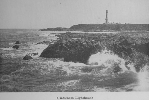
Kincardineshire, is the Girdleness lighthouse, 185 feet
high, flashing a light every twenty seconds with a range
of visibility stated at 19 miles. To the north of the
harbour entrance are the links and the bathing station.
The latter was erected in 1895 and has since been extended,
every effort being made to add to the attractiveness
of the beach as a recreation ground. A promenade,
which will ultimately extend to Donmouth, is in great
part complete; and all the other usual concomitants of
a watering-place have been introduced with promising
success so far, and likely to be greater in the near
future.
From Donmouth the northward coast presents little
of interest. All the way to the estuary of the Ythan
is a region of sand-dunes bound together by marum grass
and stunted whins, excellent for golf courses, but lacking
in variety. In the sandy mounds in the vicinity of the
Ythan have been found many flint chippings and amongst
them leaf-shaped flint arrow-heads, chisels and cores, as
well as the water-worn stones on which these implements
were fashioned. These records of primitive man as he
was in the later Stone Age are conspicuous here, and are
Girdleness Lighthouse
to be seen in other parts of the county. In the rabbit
burrows, which are abundant in the dunes, the stock-dove
rears her young. In 1888 a migratory flock of sand-grouse
took possession of the dunes, and remained for
one season.
Beyond the Ythan are the Forvie sands—a region
of hummocks under which a whole parish is buried.
The destruction of the parish took place several centuries
ago, when a succession of north-easterly gales, continued
for many days, whipped up the loose sand of the coast-dunes
and blew it onward in clouds till the whole parish,
including several valuable farms, was entirely submerged.
The scanty ruins of the old church of Forvie is the only
trace left of this sand-smothered hamlet.
Not far from the site of the Forvie church is a beautiful
semi-lunar bay called Hackley Bay, where for the
first time since Aberdeen was left behind, rocks appear,
hornblende, slate, and gneiss. At Collieston, a village
consisting of a medley of irregularly located cottages
scrambling up the cliff sides, a thriving industry used to
be practised, the making of Collieston “speldings.”
These were small whitings, split, salted and dried on
the rocks. Thirty years ago they were considered
something of a delicacy and were disposed of in great
quantities; now they have lost favour and are seldom to
be had. At the north end of the village is St Catherine’s
Dub, a deep pool between rocks, on which one of the
ships of the Spanish Armada was wrecked in 1588.
Two of the St Catherine’s cannon very much corroded
have been brought up from the sea-floor. One of them
is still to be seen at Haddo House, the seat of the Earl
of Aberdeen.
Northward we come upon a region of steep grassy
braes, consisting of soft, loamy clay, 20 to 40 feet deep,
and covered with luxuriant grasses in summer and ablaze
with golden cowslips in the spring months. Along the
coast are several villages which once populous with busy
and hardy fishermen are now all but tenantless. Such
are Slains and Whinnyfold crushed out of activity by the
rise of the trawling industry. The next place of note
is Cruden Bay Hotel built by the Great North of Scotland
Railway Company, and intended to minister specially
to the devotees of golf, for which the coast links are here
eminently suitable. The fine granite building facing the
sea is a conspicuous landmark. Just north of the Hotel
is the thriving little town of Port Errol, through which
runs the Cruden burn—a stream where sea-trout are
plentifully caught at certain seasons. The next prominent
object is Slains castle—the family seat of the Earls
of Errol. It stands high and windy, presenting a bold
front to the North Sea breezes. All its windows on the
sea-face are duplicate, a necessary precaution in view of
the fierceness of the easterly gales. Very few plants grow
in this exposed locality, and these only in the hollow and
sheltered ground behind the castle, where some stunted
trees and a few garden flowers struggle along in a precarious
existence. As we proceed, the rocky coast rises
higher and bolder and presents variable forms of great
beauty.
Beetling crags enclose circular bays with perpendicular
walls on which the kittiwake, the guillemot,
the jackdaw and the starling breed by the thousand.
The rock of Dunbuy, a huge mass of granite, surrounded
by the sea, and forming a grand rugged arch, is a summer
haunt of sea-birds and rock-pigeons.
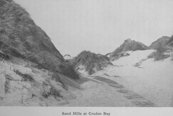
Sand Hills at Cruden Bay
After this, we reach the picturesque and much visited
Bullers of Buchan—a wide semi-circular sea cauldron, the
sides of which are perpendicular cliffs. The pool has no
entry except from the seaward side, and it is only in calm
weather that a boat is safe to pass through the low, open
archway in the cliff. In rough weather, the waves rush
through the narrow archway with terrific force, sending
clouds of spray far beyond the height of the cliffs. Under
proper conditions the scene is one of the grandest in
Aberdeenshire, and is a fitting contrast to the sublimely
impressive scenes at the source of the Dee, right at the
other end of the county. Beyond the Bullers, the coast
consists of high granite rocks, behind which are windswept
moors. Near Boddam is Sterling Hill quarry, the
source of the red-hued Peterhead granite. Here too is
Buchan Ness, the most easterly point on the Scottish
coast, and a fitting place for a prominent lighthouse.
The lantern of the circular tower (erected in 1827) stands
130 feet above high-water mark and flashes a white light
once every five seconds. The light is visible at a distance
of 16 nautical miles.
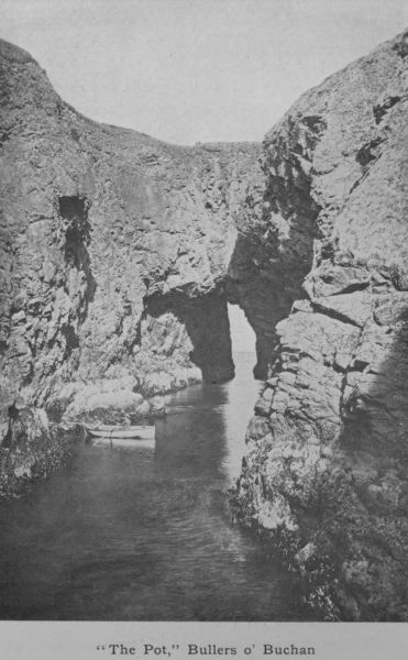
“The Pot,” Bullers o’ Buchan
At Peterhead, which is a prosperous fishing centre and the eastern
terminus of the bifurcate Buchan line of railway, is a great convict
prison, occupying an extensive range of buildings on the south side
of the Peterhead bay. The convicts are employed in building a harbour
of refuge, which is being erected under the superintendence of the
Admiralty at a cost of a million of money. The coast onwards to the
Ugie mouth is still rocky, but from the river to Rattray Head, the
rocks give place to sand-dunes similar in character to those further
south. Alongside of the dunes is a raised sea beach. They form the
links of St Fergus. Rattray Head is a rather low reef of rock running
far out to sea and highly suitable as a lighthouse station. In the
course of twelve years, the reef was responsible for 24 shipwrecks.
The lighthouse erected in 1895 is 120 feet high and the light gives
three flashes in quick succession every 30 seconds. It is visible 18
miles out to sea. Beyond this point is a region of bleak and desolate
sands. Not a tree nor a shrub is to be seen. The inland parts are
under cultivation, but the general aspect of the country is dismal and
dreary, and the very hedgerows far from the sea-board lean landwards
as if cowering from the scourges of the north wind’s whip. The country
is undulatory without any conspicuous hill. Beyond Rattray Head is
the Loch of Strathbeg already referred to. The tradition goes that
the same gale as blighted Forvie silted up this loch and contracted
its connection with the sea. On the left safely sheltered from the
sea-breezes are Crimonmogate, Cairness and Philorth—all mansion-houses
surrounded by wooded grounds. At the sea-edge stand St Combs (an echo
of St Columba), Cairnbulg and Inverallochy. Here occurs another raised
sea beach. Our course from Rattray Head has been north-west and thus we
reach the last important town on the coast—Fraserburgh.
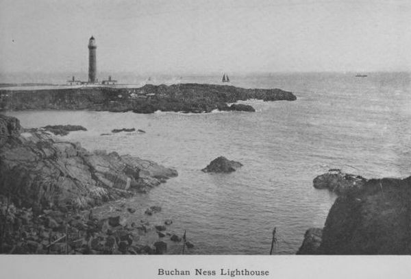
Buchan Ness Lighthouse
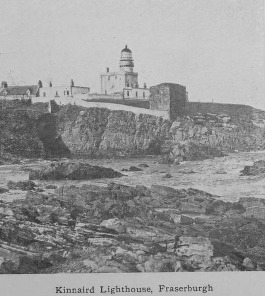
Kinnaird Lighthouse, Fraserburgh
Fraserburgh lies to the west of its bay. Founded by
one of the Frasers of Philorth (now represented by Lord
Saltoun), it is like Peterhead a thriving town. Like Peterhead
too, it is the terminus of one fork of the Buchan
Railway and a busy fishing centre. In the month of July,
which is the height of the herring season, “the Broch,”
as it is called locally, is astir with life from early morn.
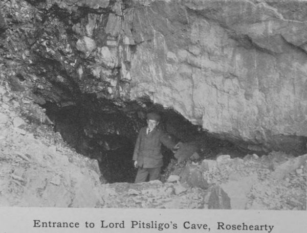
Entrance to Lord Pitsligo’s Cave, Rosehearty
More herrings are handled at Fraserburgh than anywhere
else on this coast, from Eyemouth to Wick. Between
Fraserburgh and Broadsea is Kinnaird’s Head. Here we
have another lighthouse which has served that purpose
for more than a century, an old castle having been converted
to this use in 1787. It was one of the first three
lighthouses in Scotland. Kinnaird’s Head is believed to
be the promontory of the Taixali mentioned by the Alexandrian
geographer Ptolemy as being at the entrance of
the Moray Firth. Here the rocks are of moderate height
but further west they fall to sea-level and continue so past
Sandhaven and Pittullie to Rosehearty. A low rocky coast
carries us to Aberdour bay, where beds of Old Red Sandstone
and conglomerate rise to an altitude of 300 feet.
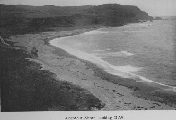
Aberdour Shore, looking N.W.
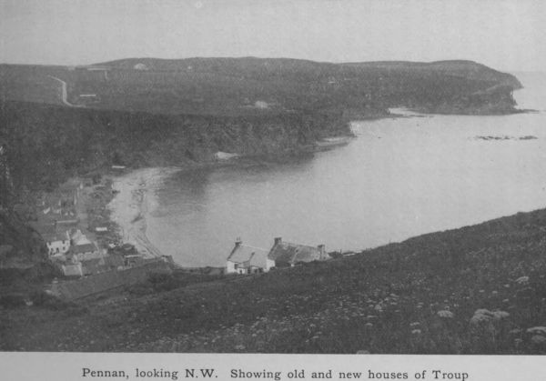
The conglomerate extends to the Red Head of Pennan—once
a quarry for mill-stones—where an attractive and
picturesque little village nestles at the base of the cliff.
The peregrine falcon breeds on the rocky fastnesses of
these lofty cliffs, which continue to grow in height and
grandeur till they reach their maximum (400 feet) at
Troup Head. Troup Head makes a bold beginning for
the county of Banff.
10. The People—Race, Language, Population.
The blood of the people of Aberdeenshire, though in
the main Teutonic, has combined with Celtic and other
elements, and has evolved a distinctive type, somewhat
different in appearance and character from what is found
in other parts of Scotland. How this amalgamation came
about must be explained at some length.
The earliest inhabitants of Britain must have crossed
from Europe when as yet there was no dividing North
Sea. They used rough stone weapons (see p. 114) and
were hunters living upon the products of the chase, the
mammoth, reindeer and other animals that roamed the
country. Such were palaeolithic (ancient stone) men.
Perhaps they never reached Scotland: at least there is no
trace of them in Aberdeenshire. They were followed
by neolithic (new stone) men, who used more delicately
carved weapons, stone axes, and flint arrows. Traces of
these are to be found in Aberdeenshire. A few short
cists containing skeletal remains have been found in
various parts of the county. In the last forty years some
fifteen of these have been unearthed. From these anthropologists
conclude that neolithic men lived here at the
end of the stone age, men of a muscular type, of short
stature and with broad short faces. They were mighty
hunters hunting the wild ox, the wolf and the bear in
the dense forests which, after the Ice Age passed, overspread
the north-east. They clothed themselves against
the cold in the skins of the animals which they made
their prey and were a rude, savage, hardy race toughened
by their mode of life and their fierce struggle for existence.
They did not live by hunting alone; they possessed
herds of cattle, swine and sheep and cultivated the ground
but probably only to a slight extent. Their weapons
were rude arrow-heads, flint knives and flint axes; and a
considerable number of these primitive weapons as well
as the bones of red-deer and the primeval ox—bos primigenius—have
been recovered from peat-mosses and elsewhere
throughout the district. Such have been found at
Barra, at Inverurie and at Alford.
Besides these remains, have been found urns made of
boulder clay, burned by fire and rudely ornamented.
These were very likely their original drinking vessels,
afterwards somewhat modified as food vessels, and were,
it is supposed, deposited in graves with a religious motive
in accordance with the belief common among primitive
peoples that paradise is a happy hunting-ground in which
the activities of the present life will continue under more
favourable conditions.
In addition to these relics the county has a great
number of stone circles, circles of large upright boulders
set up not at hap-hazard but evidently with some definite
object in view. These will be dealt with in a later
chapter. The probability is that the so-called Pictish
houses, the earth or Eirde houses found on Donside and
the lake dwellings at Kinnord already referred to, were the
homes of these people. But the whole subject is by no
means clear. The general opinion is that the north-east
was first inhabited by Picts, who may or may not have
been Iberians, and that after the Picts came the Celts;
but some critics hold that the Picts were only earlier
Celts. In any case the Stone Age was succeeded by the
Bronze Age, when Bronze took the place of Stone in the
formation of weapons. The Celts made their way
through Central France to Britain and ultimately to
Scotland. Unlike the people they found in possession of
Scotland, they were tall (5 ft. 9 in.) These are the
ancestors of the Gaelic speaking people of Scotland. They
are supposed to have amalgamated to some extent with
the Neolithic men whom they found on the spot, and it
is certain that they were christianised at an early period.
Later on Teutonic tribes, tall, longheaded and fairhaired
men crossed from the Baltic to Britain and in due course
they too reached Aberdeenshire. But up to the time of
David I (1124-1153) the population and institutions of
the north-east were entirely Celtic. The Saxon or Teutonic
element was introduced by way of the coast and the
trading towns. From the towns it spread to the country
districts. When Henry II expelled the Flemish traders
from England many migrated to the north and formed
settlements in many parts of the country, establishing
trade and handicraft, particularly weaving, and reclaiming
waste land. The defeat of Comyn, the Earl of Buchan,
by Bruce in 1308, when Bruce harried Buchan from end
to end and spared none, opened the way for lowland
immigrants and not only gave an impetus to Teutonic
settlements, but helped to kill out the Celtic language
and the Celtic ways. These immigrants are really the
ancestors of the present Aberdeenshire people, but they
have been greatly modified by absorbing the Celtic population
and mixing with it, for though reduced by slaughter,
and by an exodus to the hills, it had not entirely disappeared.
Scandinavians from Norway and Denmark also
found a footing at various periods in this north-eastern
region and these elements are all blended in the modern
Aberdonian. Celt, Saxon, Fleming and Scandinavian
came in one after the other and possessed the land, forming
a new people in which all these elements were fused.
Aberdonians are credited with a distinct individuality,
partly the result of race, partly due to environment. The
strain of practicality in the Teuton toned down the Celtic
imagination and warmth of feeling, and added a certain
tincture of the phlegmatic such as is so prominent in the
Dutchman. Hence the cautious “canny” nature of the
typical Aberdonian, dreading innovations, resisting agricultural
novelties, and disliking ecclesiastical changes.
They have been described as people
Who are not fond of innovations,
Nor covet much new reformations;
They are not for new paths but rather
Each one jogs after his old father.
This requires some elucidation. They are far from
slothful or indifferent. They will uphold with zeal the
cause they think right, but they must first reach assured
conviction that it _is_ right. They are not swift nor slow
to change, but firm.
The Celtic population was in fact absorbed, as we
have said, but a certain contingent betook themselves to
the mountains and for long kept up a warfare of reprisals
upon those who had dispossessed them. This caused no
end of trouble in Aberdeenshire but not without its uses
for it braced the occupants in the arts of defence and made
them alert and courageous.
No less potent a factor in the evolution of the
Aberdonian has been his struggle with a well-nigh irreclaimable
soil. The county is without mineral wealth,
and the only outlet for his energy was found in attacking
the boulder-strewn moors and in clearing them for the
plough. To this he set his mind in the eighteenth
century with grim determination. Small farmers and
crofters by dint of great personal toil and life-long self-sacrifice
transformed stony tracts of poor and apparently
worthless land into smiling and productive fields. It is
this struggle with a malignant soil, more than anything
else, that has made the Aberdonian; one triumph led on to
another, and to-day the spirit of enterprise in farming is
nowhere more pronounced than in this difficult county.
The place names are almost entirely Celtic, and even
when they appear to be Saxon they are only Gaelic
mispronounced or assimilated to something better known.
The parish of King Edward might very plausibly be
referred to the northern visits paid by the Hammer of the
Scots, but it is really Kinedar, with the Gaelic Kin (seen
in Kinnaird, Kintore and Malcolm Canmore), meaning a
head.
The county has a distinctive dialect, really imported
and originally uniform with the dialect of the Mearns,
and of Northumbria, the dialect spoken at one time all
the way from Forth to Humber. To-day it is called the
Buchan Doric and though varying somewhat in different
parts of the county and hardly intelligible in the Highlands
of Braemar, where Gaelic still survives, it is a
Teutonic speech with a thin tincture of Gaelic words
such as bourach, closach, clachan, brochan, etc.
The dialect contains many vocables not found in
literary English, such as byous and ondeemis for extraordinary,
but where the words are English, they are greatly
altered. It is characterised by broad, open vowels;
“boots” is pronounced “beets,” “cart” is “cairt,” “good”
is “gweed.” The final l is dropped; “pull” is “pu,”
“fall” is “fa.” Final ol becomes ow; “roll” is made
“row,” and “poll” is “pow.” Wh is always f: “white”
is “fite” and “who?” (interrogative) is “fa?” It is rich
in diminutives like the Dutch—a lassie, a basketie. The
finest embodiment of this striking dialect, giving permanent
life to its wealth of pathos and expressiveness, is Dr
William Alexander’s Johnny Gibb of Gushetneuk.
Scots wha hae, which is supposed to be a characteristic
phrase common to all the dialects, would be in Buchan—Scots
at hiz, which is largely Norse. “The quynie
coudna be ongrutten” is Buchan for “The little girl
could not help crying.”
The population of the county which a hundred years
before was 121,065 in 1901 was 304,439. Since the
county contains 1970 square miles this brings out an
average of 154 to the square mile—just a little over the
average of Scotland as a whole, but as Aberdeen city
accounts for more than half of the total, and towns like
Peterhead and Fraserburgh between them represent
25,000, the figure is greatly reduced for the rural districts.
The country districts are but thinly peopled, especially
on the Highland line, and the tendency is for the rural
population to dwindle. They either emigrate to Canada,
which is a regular lodestone for Aberdonians, or they
betake themselves to the towns, chiefly to Aberdeen itself.
Except in and around the principal town, the county has
hardly any industries that employ many hands. Agriculture
is the main employment, and modern appliances
enable the farmer to do his work with fewer helps than
formerly: hence the depopulation of the rural districts.
The towns tend to grow, the rural parishes to become
more sparsely inhabited.
11. Agriculture.
This is the mainstay of the county, and considering
the somewhat uncertain climate, the shortness of the
summer and the natural poverty of the soil, it has been
brought to marvellous perfection. The mountainous
regions are necessarily cut off from this industry except in
narrow fringes along the river banks, but in the low-lying
area it is safe to say that every acre of ground worth
reclaiming has been put to the plough. A century ago
the industry was rude and ill-organised, the county being
without roads and without wheeled vehicles, but the
advent of railways gave an impetus to the farming instinct
and an extraordinary activity set in to reclaim waste land
by clearing it of stones, by trenching, by draining and
manuring it. The proprietors were usually agreeable to
granting a long lease at a nominal rent to any likely and
energetic man who was willing to undertake reclamations
and take his chance of recouping himself for outlays
before his lease expired. Being thus secured, the farmer
or crofter had an incentive to put the maximum of labour
into his holding. He often built the dwelling-house, and
as a rule made the enclosures by means of the stones,
which, with great labour, he dragged from the fields. In
this way a great acreage was added to the arable land of
the county, and though some of it has fallen into pasture
since the great boom in agricultural prices during the
seventies in last century, the greater part of the reclaimed
soil is still in cultivation.
The area of the county, exclusive of water and roadways,
is 1955 square miles, or 1,251,451 acres. Of this
exactly one half is under cultivation, 628,523 acres.
When we remember that Scotland contains some nineteen
million of acres and that only 25 per cent. of this acreage
is arable land, it is apparent that Aberdeen with its
50 per cent. is one of the most cultivated areas. As a
matter of fact it has by far the largest acreage under
cultivation of any Scottish county. Next to it is Perthshire
with 336,251 acres. The uncultivated half is made
up of mountain, moor and woodlands. Part of this is
used for grazing sheep, as much as 157,955 acres being
thus utilised. In the matter of woods and plantations
the county with its 105,931 acres stands next to Inverness-shire,
which has 145,629. The trees grown are
mostly larch and pine and spruce, but the deciduous trees,
or hard woods, the beech, elm and ash, are not uncommon
in the low country, more especially as ornamental trees
around the manor-houses of the proprietors.
The crops chiefly cultivated are oats, barley, turnips
and potatoes. Wheat is not grown except now and again
in an odd field. The climate is too cold, the autumn
heat never rising to the point of ripening that crop
satisfactorily. Oats is the most frequent crop, and Aberdeenshire
is the oat-producing county of Scotland. A
fifth of the whole acreage under this crop in Scotland
belongs to Aberdeenshire. Perth, which is next, has only
one-third of the Aberdeenshire oat-area. Twenty thousand
acres are devoted to barley, only one-tenth of the
barley-area in Scotland. Over seven thousand acres go to
potatoes; the southern counties have a soil better adapted
to produce good potatoes; Forfar, Fife, Perth and Ayrshire
excel in this respect and all these give a larger acreage
to this crop. As regards turnips, however, Aberdeenshire
is easily first. Being a great cattle rearing and cattle
feeding district, it demands a large tonnage of turnip food.
It is estimated that a million and a half tons of turnips
are consumed every year in the county.
As regards cattle and horses the county has first place
in Scotland. In 1909 there were 204,490 agricultural
horses in the country and of these 31,592 were in Aberdeenshire,
while of 1,176,165 cattle it had 168,091. It
has a quarter of a million sheep, but here it falls behind
other counties, notably Argyll, which has nearly a million,
or one-seventh of all the sheep in Scotland.
Aberdeenshire is a county of small holdings. No
other county has so many tenants. Over five thousand
of these farm from five to 50 acres, while there are nearly
four thousand who farm areas ranging from 50 to 300.
This is part of the secret of its success. Earlier, the
number of small farms was greater, the tendency being
in the direction of throwing several smaller holdings
together to make a large farm.
The industry has been a progressive one. Up to the
Union in 1707 tillage was of the most primitive kind.
Sheep-farming for the sake of exporting the wool had
been the rule, but the Union stopped that branch of commerce.
Later on, about the middle of the eighteenth
century, the droving of lean cattle into England was
a means of profit. Meantime the system of cultivation
was of the rudest. A few acres round the steading,
called the infield, were cropped year after year with little
manuring, while the area beyond, called the outfield, was
only cropped occasionally. There was no drainage and
enclosures were unknown. Improvement came from the
south. Sir Archibald Grant of Monymusk and Mr
Alexander Udny of Udny were pioneers of better things;
they brought labourers and overseers from the Lothians
and the south of England, to educate the people in new
methods of culture. At first a landlord’s, it by and by
became a farmer’s battle; and ultimately in the nineteenth
century it was the farmers who did the reclaiming.
But the landlords set a good example by sowing grasses
and turnips.
Near Aberdeen, a boulder-strewn wilderness was converted
into fertile fields. The town feued the lands and
the feuars cleared away the stones, which they sold and
shipped to London for paving purposes; the process of
clearing cost as much as £100 an acre, a fourth of this
being recovered by the sale of the stones. This is typical
of what was done elsewhere. Gradually the bleak moors
were absorbed. A famine in 1782 opened the eyes of all
concerned. Hitherto there was not as much as 200 acres
in turnips. Hitherto also the heavy work-oxen, ten or
twelve of them dragging a primitive and shallow plough,
at a slow pace and in a serpentine furrow, had been
imported from the south. Now they began to be bred
on the spot. By and by cattle grew in numbers; by
and by, two horses superseded the team of oxen in the
plough.
But the chief factor in evolving Aberdeenshire into a
cattle-rearing and beef-producing county was the turnip.
Till turnips began to be grown in a large acreage, no
provision was possible for the cattle in winter. Hence
the beasts had to be disposed of in autumn. In 1820, as
many as 12,000 animals were sent in droves to England.
The advent of steam navigation in 1827 ended the
droving. Then began the trade in fat cattle, but it was
years before the county gained its laurels as the chief
purveyor of “prime Scots” and the roast beef of Old
England. The turnip held the key of the position; but
turnips will not grow well without manure. The canal
between Aberdeen and Inverurie carried great quantities
of crushed bones and guano to raise this important
crop.
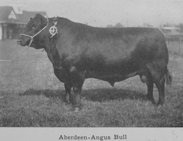
Aberdeen-Angus Bull
Cattle-breeding began with McCombie of Tillyfour
and the Cruickshanks of Sittyton, one with the native
black-polled cattle—the Aberdeen-Angus—and the others
with shorthorns. By dint of careful selection, great
progress was made in improving not only the symmetry
of the beasts but their size and beefy qualities. There
began a furore for cattle-rearing and prizes taken at
Smithfield made Aberdeen famous. Railway transit
came in as an additional help, and to-day the Christmas
market never fails to give its top prices for Aberdeenshire
beef.
Every year the beef of 60,000 cattle leaves the county
for the southern markets, chiefly London; this in addition
to supplying local needs, and Aberdeen has now 162,000
of a population. Cattle-rearing and cattle-feeding are
therefore at the backbone of Aberdeenshire agriculture.
A recent development is the export of pure-bred shorthorns
to America, more especially the Argentine Republic,
for breeding purposes. As much as £1000 has been given
for a young bull, in this connection.
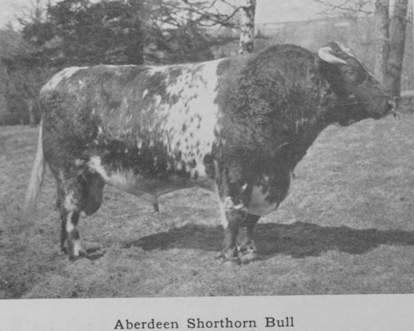
Aberdeen Shorthorn Bull
In the matter of fruit culture, Aberdeen is far behind
Perthshire and Lanark, which have a richer soil and a
superior climate. But the Aberdeen strawberries, grown
mostly on Deeside, are noted for size and flavour. In
1909 only 219 acres were devoted to this crop. The
cultivation of raspberries, which is so great a feature of
lower Perthshire, has made only a beginning in Aberdeen,
and the small profits that have come to southern growers
of this crop in recent years have acted as a deterrent, in
its extension.
13. Other Industries. Paper, Wool, Combs.
The industries apart from agriculture, work in
granite, and the fisheries are mostly concentrated in
and around the chief city. These, although numerous,
are not carried on in a large way, but they are varied;
and there is this advantage in the eggs not being all in
one basket that when depression attacks one trade, its
effect is only partial and does not affect business as a
whole. Paper, combs, wool, soap are all manufactured.
The first of these engages four large establishments on the
Don and one on the Dee at Culter. Writing paper and
the paper used for the daily press and magazines as well
as the coarser kinds of packing paper are all made in
considerable quantity. Esparto grass and wood pulp are
imported in connection with this industry. Comb-making
is also carried on, and the factory in Aberdeen is the
largest of its kind in the kingdom.
Textile fabrics are still produced, but the progress made
in these is not to be compared with the advances made
in the south of Scotland, where coal is cheap. Weaving
was introduced at an early period by Flemish settlers,
who made coarse linens and woollens till the end of the
sixteenth century, when “grograms” and worsteds,
broadcloth and friezes were added. Provost Alexander
Jaffray the elder in 1636 established a house of correction—the
prototype of the modern reformatory—where
beggars and disorderly persons were employed in the
manufacture of broadcloths, kerseys and other stuffs.
A record of this novelty in discipline survives in the
Aberdeen street called Correction Wynd.
In 1703 a joint-stock company was formed for
woollen manufactures at Gordon’s Mills on the Don,
where a fulling-mill had existed for generations, and
where the making of paper had been initiated a few
years earlier. The Gordon’s Mills developed the manufacture
of cloths of a higher quality, half-silk serges,
damask and plush, and skilled workmen were brought
from France to guide and instruct the operatives. To-day
high-class tweeds are made at Grandholm, and
such is the reputation of these goods for quality and
durability that in spite of high tariffs they make their
way into America, where they command a large sale
at prices more than double of the home prices.
In the olden days the cloth sold in the home markets
was a product of domestic industry. The farmers’
daughters spun the wool of their own sheep into yarn,
which was sent to county weavers to be made into cloth.
Aberdeenshire serge made in this way was sold at fairs
and was hawked about the county by travelling packmen.
The hosiery trade was worked on similar lines. The
wool was converted into worsted by rock and spindle,
and the worsted was knitted into stockings by the women
and girls of the rural population. One man employed
as many as 400 knitters and spinners. In the latter half
of the eighteenth century this industry brought from
£100,000 to £120,000 into Aberdeenshire every year.
Stockings were made of such fineness that they cost 20s.
a pair and occasional rarities were sold at four or five
guineas. In 1771 twenty-two mercantile houses were
engaged in the export trade of these goods, which went
chiefly to Holland. The merchants attended the weekly
markets and country fairs, where they purchased the
products of the knitters’ labour. Such work provided a
source of income to the rural population and was indirectly
the means of increasing the number of small holdings.
These were multiplied of set purpose to keep the
industrious element in the population within the county.
The invention of the stocking-frame together with the
dislocation of trade due to the Napoleonic wars made the
trade unremunerative and it came to an end with the
eighteenth century.
The linen trade began in 1737 at Huntly, where an
Irishman under the patronage and encouragement of the
Duke of Gordon manufactured yarn and exported it to
England and the southern Scottish towns. Silk stockings
were also made there. By and by linen works sprang
up on the Don at Gordon’s Mills and Grandholm as well
as within Aberdeen itself. The linen trade in the form
of spinning and hand-loom weaving was carried on in
most of the towns and villages of the county and several
new villages grew up in consequence, such as Cuminestown,
New Byth, Strichen, New Pitsligo, Stuartfield and
Fetterangus, in some of which the manufacture is continued
on a small scale to this day. Much flax was
grown in the county for a time to minister to this
industry, but gradually the crop disappeared as fibre of
better quality was imported from Holland. Yet the
spinning of linen yarn was widely practised as a domestic
industry when the woollen trade declined, and every
farmer’s daughter made a point of spinning her own
linen as the nucleus of her future house-furnishings.
The linen trade, except as regards coarser materials such
as sacking, has decayed. There is still a jute factory in
Aberdeen.
Another industry which employs a large number of
hands is the preserving of meat, fish, fruit, and vegetables.
There are several of these preserving works in
Aberdeen. Dried and smoked haddocks, usually called
“Finnan Haddies,” from the village of Findon on the
Kincardineshire coast, are one of the specialities of
Aberdeen. They had at one time a great vogue, and
are still largely in demand though the quality has fallen
off by the adoption of a simpler and less expensive method
of treatment.
Ship-building is another industry long established at
Aberdeen. In the days before iron steamships, fleets of
swift-sailing vessels known as “Aberdeen Clippers” were
built on the Dee and made record voyages to China in
the tea trade and to Australia. The industry of to-day
is concerned, for the greater part, with the building of
trawlers and other fishing craft, but occasionally an ocean
going steamer is launched. The trade is meantime
suffering from depression.
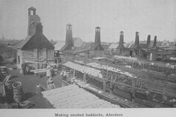
Making smoked haddocks, Aberdeen
Other industries well represented are soap and candle
making, coach and motor-car building, iron-founding and
engineering, rope and twine making, the manufacture of
chemicals, colours and aerated waters. Besides, Aberdeen
is a great printing centre and many of the books issued
by London publishers are printed by local presses.
14. Fisheries.
During the last quarter of a century the fishing
industry has made great strides, the value of fish landed
in Scotland having more than doubled in that period.
Nowhere has the impetus been more felt than in
Aberdeenshire, which now contributes as much as one-third
of the whole product of Scotch fisheries. Since 1886
the weight of fish caught round the Scottish coast has
increased from five million hundredweights to over nine
millions, while the money value has risen in even a greater
proportion from £1,403,391, to £3,149,127. To these
totals Aberdeen alone has contributed over a hundred
thousand tons of white fish (excluding herrings), valued
at over a million pounds sterling. Peterhead and Fraserburgh
are also contributors especially as regards herrings,
the former landing 739,878 hundredweights and Fraserburgh
very nearly a similar quantity. These three ports
amongst them account for one half of all the fish landed at
Scottish ports. When we consider the number of persons
collaterally employed in handling this enormous quantity
of merchandise, the coopers, cleaners, packers, basket
makers, boat-builders, makers of nets, clerks and so on,
apart altogether from the army of fishermen employed
in catching the fish, we see how far-reaching this
industry is, not merely in increasing the food-supply of
the country but in providing profitable employment for
the population. At Aberdeen, it is estimated, 13,512
persons are so employed and at the other two ports
combined, almost a similar number.
There are two great branches of the fishing industry—herrings
and white fish. The herrings are caught for
the most part, though not exclusively, in the summer,
July being the great month. They are captured with
nets mostly by steam-drifters as they are called, but also
to some extent by the ordinary sailing boats of a smaller
size than the drifters. Fraserburgh and Peterhead land
in each case double the weight of herrings that come to
Aberdeen. In recent years a beginning has been made in
May and June with gratifying success, but July and August
give the maximum returns. Later on in the year, when
the shoals have moved along the coast southwards, the
herring fleets follow them thither, to North Shields and
Hartlepool, to Yarmouth and Lowestoft; and bands
of curers, coopers and workers migrate in hundreds from
one port to another, employing themselves in curing the
fish. The bulk of the herrings are cured by salting, and
are then exported to Germany and Russia, where they
are much in demand.
Even more important is the white fishing. Aberdeen
is here pre-eminent, being perhaps the most important
fishing centre in the world. The total catch for Scotland
in 1909 was short of three million hundredweights, of
which Aberdeen with its large fleet of trawlers and
steam-liners accounted for 67 per cent. The most
important of the so-called round fish is the haddock, of
which over a million hundredweights are landed in
Scotland, Aberdeen contributing the lion’s share, three-fourths
of the whole. Next to the haddock comes the
cod, of which nearly three hundred and forty thousand
hundredweights were handled in the Aberdeen fish
market. The next fish is ling, and then come whitings,
saithe, torsk, conger-eels. The flat-fish are also important,
plaice, witches, megrims, halibut, lemon soles and turbot.
This last is the scarcest and most highly prized of all
flat fish, and commands a price next to that given for
salmon. Ling and halibut are still mostly caught by
hook and line; the turbot and the lemon sole on the
other hand are distinctively the product of the trawl net
and were little known until trawling was begun.
A certain small percentage of this great weight of
fish is consumed locally, but the great bulk of it is
packed in ice and dispatched by swift passenger trains
to the southern markets. The Aberdeen fish market,
extending for half a mile along the west and north sides
of the Albert Basin (originally the bed of the Dee) is the
property of the Town Corporation and is capable of dealing
with large catches. As much as 760 tons of fish have
been exposed on its concrete floor in a single day. In the
early morning the place is one of the sights of the city,
with the larger fish laid out in symmetrical rows on the
pavement, and the smaller fish—haddocks, whiting and
soles—in boxes arranged for the auction sale at 8 a.m.
The majority of the fishing craft are still sailing
vessels, but steam-drifters and motor-boats and steam-trawlers
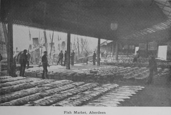
Fish Market, Aberdeen
are gradually driving the ordinary sail-boats from
the trade, just as the trawl net is superseding the old-fashioned
mode of fishing with set lines. Still about
86 per cent. of the number of boats employed is made
up of sailing vessels, but the tonnage is relatively small.
The quantity of fish caught by hook and line is only
one-tenth of the whole.
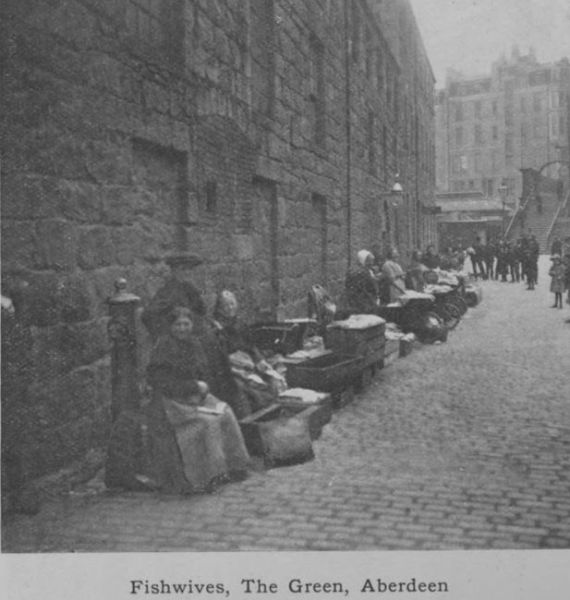
Fishwives, The Green, Aberdeen
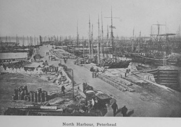
North Harbour, Peterhead
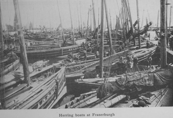
Herring boats at Fraserburgh
The amount of capital invested in boats and fishing
gear for all Scotland is estimated by the Fishery Board
at over £5,000,000. Of this total, Aberdeenshire claims
very nearly two millions. It is now the case that the
value of fish discharged at the fish market of Aberdeen
is as great as the yearly value of the agricultural land of
the whole county—truly a marvellous revolution.
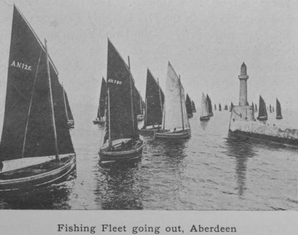
Fishing Fleet going out, Aberdeen
The herring fishery was prosecuted off the Scottish
coast by the Dutch, long before the Scotch could be
induced to take part in it. Many futile attempts were
made to exploit the industry but little came of them
till the nineteenth century. A beginning was made at
Peterhead in 1820 and at Fraserburgh a little earlier.
Aberdeen followed in 1836 but no great development
took place till 1870. The first trawler came on the
scene in 1882; to-day there are over 200 local vessels of
this type besides many from other ports.
The salmon fishery has long been famous and at one
time was relatively a source of much greater revenue
than at present. It still yields a considerable annual
surplus to the Corporation funds, but has been eclipsed
by the growth of other fisheries. The rateable value of
the salmon fishings on the Dee is nearly £19,000; those
of the other salmon rivers—the Don, Ythan and Ugie—being
much less. The fish are caught by fixed engines
in the sea—stake-nets and bag-nets—set within a statutory
radius of the river mouth, and by sweep- or drag-nets in
the tidal reaches of the rivers. A good many fish are
caught by rod and line throughout the whole course of
the rivers but angling is not the commercial side of
salmon-fishing.
16. History of the County.
Standing remote from the centre of the country,
Aberdeenshire has not been fated to figure largely in
general history. The story of its own evolution from
poverty to prosperity is an interesting one, but it is only
now and again that the county is involved in the main
current of the history of Scotland.
If the Romans ever visited it, which is highly doubtful,
they left no convincing evidence of their stay. Of positive
Roman influence no indication has survived, and no
conquest of the district can have taken place. The only
records of the early inhabitants of the district—usually
called Picts—are the Eirde houses, the lake dwellings or
crannogs, the hill forts or duns, the “Druidical” circles
and standing stones and the flint arrow-heads, all of which
will be dealt with in a later chapter.
Christianity had reached the south of Scotland before
the Romans left early in the fifth century. The first
missionary who crossed the Mounth was St Ternan, whose
name survives at Banchory-Ternan on the Dee, the place
of his death. St Kentigern or St Mungo, the patron saint
of Glasgow, had a church dedicated to him at Glengairn.
St Kentigern belonged to the sixth century, and was
therefore a contemporary of St Columba, who christianised
Aberdeenshire from Iona. In this way two great currents
met in the north-east. Columba accompanied by his
disciple Drostan first appeared at Aberdour on the northern
coast. From Aberdour he passed on through Buchan, and
having established the Monastery of Deer and left Drostan
in charge, moved on to other fields of labour. His name
survives in the fishing village of St Combs. He is the
tutelar saint of Belhelvie, and the churches of New Machar
and Daviot were dedicated to him. These facts indicate
the mode in which Pictland was brought under the
influence of Christianity.
The next historical item worthy of mention is the
ravages of the Scandinavian Vikings. The descents on
the coast of these sea-rovers were directed against the
monastic communities, which had gathered some wealth.
The Aberdeenshire coast, having few inlets convenient
for the entry of their long boats, was to a large extent
exempt from their raids, but in 1012 an expedition under
Cnut, son of Swegen, the king of Denmark, landed at
Cruden Bay.
Another fact of interest is the death of Macbeth, who
for seventeen years had by the help of Thorfinn, the
Scandinavian (whose name may be seen in the Deeside
town of Torphins), usurped the kingship of Scotland.
Malcolm Canmore led an army against him in 1057, and
gradually driving him north, beyond the Mounth, overtook
him at Lumphanan. There Macbeth was slain.
A Macbeth’s stone is said to mark the place where he
received his death-wound, and Macbeth’s Cairn is marked
by a clump of trees in the midst of cultivated land. The
farm called Cairnbethie retains the echo of his name.
Kincardine O’Neil, where Malcolm awaited the result of
the conflict, commands the ford of the Dee on the ancient
route of travel from south to north across the Cairn-o-Mounth.
Malcolm shortly after passed through Aberdeenshire
at the head of an expedition against the Celtic population
which had supported Macbeth. The Norman Conquest,
nine years thereafter, was the occasion of Anglo-Saxon
settlements in the county. The court of Malcolm and
Queen Margaret became a centre of Anglo-Saxon influence.
The old Gaelic language gave way before the new
Teutonic speech. The Celtic population made various
attempts to recover the power that was fast slipping from
their hands. Malcolm headed a second expedition to
Aberdeenshire in 1078, and on that occasion granted the
lands of Monymusk and Keig to the church of St
Andrews. He is said to have had a hunting-seat in the
forest of Mar, and the ruined castle of Kindrochit in the
village of Braemar is associated with this fact.
The earliest mention of Aberdeen is in a charter of
Alexander I, granting to the monks of Scone a dwelling
in each of the principal towns—one of which is Aberdeen.
A stream of Anglo-Saxons, Flemings and Scandinavians
had been gradually flowing towards the settlement at the
mouth of the Dee, where they pursued their handicrafts
and established trade with other ports. William the Lion
frequently visited the town and ultimately built a royal
residence, which after a time was gifted to the Trinity or
Red Friars for a monastery. The bishopric of Aberdeen
dates from 1150.
Edward I of England in 1296 at the head of a large
army paid these northern parts a visit. He entered the
county by the road leading from Glenbervie to Durris,
whence he proceeded to Aberdeen, exacting homage from
the burghers during his five days’ stay. From Aberdeen
he went to Kintore and Fyvie and on to Speyside, returning
by the Cabrach, Kildrummy, Kincardine O’Neil and
the Cairn-o-Mounth.
The next year Wallace, in his patriotic efforts to clear
the country from English domination, surprised Edward’s
garrison at Aberdeen, but unable to effect anything, hastily
withdrew from the neighbourhood. Edward was back
in Aberdeen in 1303 and paid another visit to Kildrummy
Castle, then in the possession of Bruce. Then Bruce,
having fled from the English court and assassinated the
Red Comyn at Dumfries, was crowned at Scone and the
long struggle for national independence began in earnest.
In 1307 he came to Aberdeen, which was favourable to
his cause. At Barra, not far from Inverurie and Old
Meldrum, his forces met those of the Earl of Buchan
(John Comyn) and defeated them (1308). It was not a
great battle in itself, but its consequences were important.
It marked the turn of the tide in the national cause.
The Buchan district, in which the battle took place,
had long been identified with the powerful family of the
Comyns; and after his victory at Barra, Bruce devastated
the district with relentless fury. This “harrying of
Buchan,” as it has been called, is referred to by Barbour
as an event bemoaned for more than fifty years. The
family of the Comyns was crushed, and their influence,
which had been liberal and considerate to the native race
of Celts, came to an end. The whole of the north-east
turned to Bruce’s support, and in a short time all Edward’s
garrisons disappeared. This upheaval created a fresh
partition of the lands of Aberdeenshire. New families
such as the Hays, the Frasers, the Gordons and the
Irvines, were rewarded for faithful service by grants of
land. The re-settlement of the county from non-Celtic
sources accentuated the Teutonic element in the county.
After Bannockburn, Bruce rewarded Aberdeen itself for
its support by granting to the burgesses the burgh as well
as the forest of Stocket.
The great event of the fifteenth century was the
Battle of Harlaw, which took place in 1411 at no great
distance from the site of the Battle of Barra. It was
really a conflict between Celt and Saxon, and was a
despairing effort on the part of the dispossessed native
population to re-establish themselves in the Lowlands.
The Highlanders were led by Donald of the Isles, who
gathering the clansmen of the northern Hebrides, Ross
and Lochaber, and sweeping through Moray and Strathbogie,
arrived at the Garioch on his way to Aberdeen.
The burghers placed themselves under the leadership of
the Earl of Mar (Alexander Stewart, son of the Wolf of
Badenoch), a soldier who had seen much service in various
parts of the world. The provost of the city, Robert
Davidson, led forth a body of his fellow-citizens and
joined Mar’s forces at Inverurie, within three miles of
the Highlanders’ camp. The two forces were unequally
matched—Donald having 10,000 men and Mar only a
tenth of that number, but of these many were mail-clad
knights on horseback and armed with spears. It was a
fiercely contested battle and lasted till the darkness of a
July night. The slaughter on both sides was great, but
the tide of barbarism was driven back. The Highlanders
retreated whence they came and the county of Aberdeen
was saved from the imminent peril of a Celtic recrudescence.
This is the only really memorable battle associated
with Aberdeenshire soil. Its “red” field, on which so
many prominent citizens shed their life-blood (Provost
Davidson and Sir Alexander Irvine of Drum being of the
number), was long remembered as a dreary and costly
victory.
Another battle of much less significance was that of
Corrichie, fought in Queen Mary’s reign in 1562 on the
eastern slope of the Hill of Fare, not far from Banchory.
It was a contest between James Stewart (the Regent
Murray, and half-brother of the Queen) and the Earl of
Huntly. Huntly was defeated and slain, and his son, Sir
John Gordon, who was taken prisoner, was afterwards
executed at Aberdeen. Queen Mary, it is said, was a
spectator both of the battle and of the execution.
In the seventeenth century, at the beginning of the
Covenanting “troubles,” Aberdeenshire gained a certain
notoriety as being the place where the sword was first
drawn. In 1639 the Covenanters mustered at Turriff
under Montrose, to the number of 800. The Royalist
party under the Earl of Huntly, to the number of 2000
but poorly armed, marched to the town with the intention
of preventing the Covenanters from meeting, but they
were already in possession, and when Huntly’s party saw
how matters stood, they passed on, the two forces
surveying each other at close quarters without hostile
act or word. This bloodless affair is known as the first
Raid of Turriff. A few weeks later a somewhat similar
encounter took place, when the Covenanters, completely
surprised, fled without striking a blow. The loss on either
side was trifling, still some blood was actually shed, and
the Trot of Turriff, as it was called, became the first
incident in a long line of mighty events.
Montrose, both when he was leading on the side of
the Covenant, and later when he became a Royalist
leader, paid several visits to Aberdeen, which, although
supporting the Royalist cause, suffered exactions from
both parties. In 1644 Montrose made a forcible entry
of the town, which resulted in the death of 150 Covenanters,
and in the plundering of the city. Later on, after
his victory over Argyll at Inverlochy, Montrose gained a
success for the Royalist cause at Alford (1645).
In 1650, after the execution of Charles I, his son
Charles II landed at Speymouth, and on his way south
to be crowned at Scone, visited Aberdeen, where he was
received with every manifestation of loyalty and goodwill.
The next year General Monk paid the town a
visit, and left an English garrison, which remained till
1659. The Restoration was hailed with rejoicing: the
Revolution with dislike. Yet at the Rebellion of 1715
scant enthusiasm was roused for the cause of the Pretender,
who himself passed through the city on his way from
Peterhead to Fetteresso. In the thirty years that passed
before the second Jacobite Rebellion, public sentiment
had grown more favourable to the reigning House. The
’45 therefore received little support in Aberdeenshire.
A few of the old county families threw in their lot with
the Prince, but the general body of the people were
averse to taking arms. The Duke of Cumberland, on
his way north to meet Prince Charlie at Culloden, remained
with his army six weeks in the city; when he
started on his northward march through Old Meldrum,
Turriff and Banff, he left a garrison of 200 men in Robert
Gordon’s Hospital, lately built but not yet opened. After
Culloden small pickets of troops were stationed in the
Highland districts of the county, to suppress the practice
of cattle-lifting. Braemar Castle and Corgarff Castle
in the upper reaches of the Dee and the Don still bear
evidence of their use as garrison forts. The problem of
dealing with the inhabitants of the higher glens, where
agriculture was useless, and where the habits of the people
prompted to raiding and to rebellion, was solved by enlisting
the young men in the British Army. The Black
Watch (42nd) as reorganised (1758) and a regiment of
Gordon Highlanders (1759) were largely recruited from
West Aberdeenshire, and this happy solution closed the
military history of the district.
17. Antiquities—Circles, Sculptured Stones, Crannogs, Forts.
Aberdeenshire is particularly rich in stone-circles.
No fewer than 175 of them have been recorded as
existing in the district. Unfortunately many of them
entirely disappeared when the sites were turned to agricultural
uses; others have been mutilated, and owing to
the removal of some of the stones, stand incomplete; a
few have been untouched, and from these we may judge
what the others were like. One of the best preserved is
that at Parkhouse, a mile south-west of the Abbey of
Deer. A circle of great blocks of stone, irregular and of
unequal height, some standing erect, some evidently fallen
down, is the general feature. Sometimes inside the circle,
but more usually in the circumference of the circle itself,
there is one conspicuously larger stone, in a recumbent
position. This it has been usual to call the rostrum or
altar stone. It is well marked at Parkhouse, being 14
feet 9 inches long, 5 feet 9 inches high, and estimated to
weigh 20 tons. The so-called rostrum is usually on the
south side of the circle and the stones facing it on the
north are of smaller size.
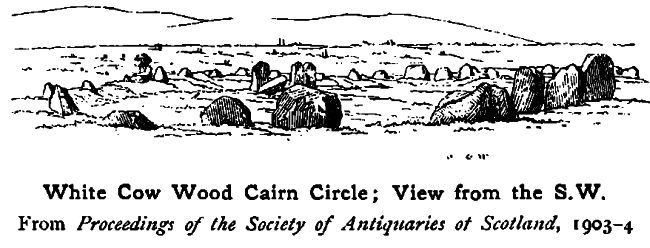
White Cow Wood Cairn Circle; View from the S.W.
From _Proceedings of the Society of Antiquaries of Scotland_, 1903-4
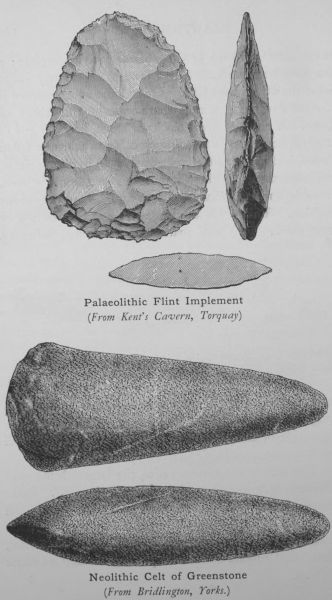
Palaeolithic Flint Implement
(From Kent’s Cavern, Torquay.)
Neolithic Celt of Greenstone
(From Bridlington, Yorks.)
The size of the circles varies, the largest being over
60 feet in diameter, the smaller ones less than 30. Parkhouse
measures 50 feet. They are found all over the
county, in the valley of the Dee, in the valley of the Don
at Alford, Inverurie and Dyce, as well as in Auchterless,
Methlick, Crimond and Lonmay. The recumbent stone
is invariably a feature of the larger circles. One of the
largest is in the circle at Old Keig in Alford—a huge
monolith computed to be 30 tons in weight. Other
good examples are at Auchquorthies, Fetternear and at
Balquhain near Inveramsay.
In the smaller and simpler circles, there is no recumbent
stone, and the blocks are of more uniform height.
What the circles were used for is still a matter of
dispute. They have for long been called “Druidical”
circles, and the received opinion was that they were
places of worship, the recumbent stone being the altar.
But there is no certitude in this view; and, indeed, the
fact that several exist at no great distance from each other
(more than a dozen are located in Deer) would seem to
be adverse to it. They were certainly used as places of
burying, and some antiquarians hold that they were the
burying grounds of the people of the Bronze Age. A
later theory is that they were intended to be astronomical
clocks to a people who knew nothing of the length of
the year, and who had no almanacs to guide them in the
matter of the seasons. The stone-circles, however, still
remain an unsolved problem.
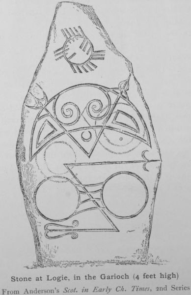
Stone at Logie, in the Garioch (4 feet high)
From Anderson’s Scot. in Early Ch. Times, 2nd Series
Besides the circles, Aberdeenshire has another class
of archaeological remains, called sculptured stones. These
are of three kinds: (1) those with incised symbols
only, (2) those with in addition Celtic ornament carved
in relief, and (3) monuments with Celtic ornament in
relief and no symbols. The first class is the only one
largely represented in Aberdeenshire and a good many
representatives are in existence. The symbols most commonly
seen are the crescent and sceptre, the spectacles,
the mirror and comb, and the so-called “elephant” symbol,
a representation of a beast with long jaws, a crest and
scroll feet. Another is the serpent symbol. What the
symbols signify is still a mystery, but the fact that the
stones with symbolism are unusually common in what
was known as Northern Pictland seems to point to their
being indigenous to that area. Out of 124 stones in the
first class Aberdeenshire has 42. It would seem as if the
county had been the focus where the symbolism originated.
The richness of the locality round Kintore and Inverurie
in symbol stones is taken to indicate that region as the
centre from which they radiated.
Another form of archaeological remains found in the
county is the Eirde or Earth-Houses. These are subterranean
dwellings dug out of the ground and walled with
unhewn, unmortared stones, each stone overlapping the
one below until they meet at the top which is crowned
with a larger flag-stone, or sometimes with wood. The
probability is that in conjunction with the underground
chambers there were huts above ground, which, being
composed of wood, have now entirely disappeared. At
many points in these earth-houses traces of fire and charcoal
are to be seen, stones blackened by fire and layers of
black ashes. In one at Loch Kinnord a piece of the
upper stone of a quern as well as an angular piece of iron
was found. It may be inferred that the inhabitants,
whoever they were, were agriculturists, and that the
period of occupation lasted down to the Iron Age.
Specimens of these houses, which usually go by the local
name of Picts’ houses, are found in the neighbourhood
of Loch Kinnord on Deeside, at Castle Newe on the
Don, and at Parkhouse, not far from the circle already
referred to.
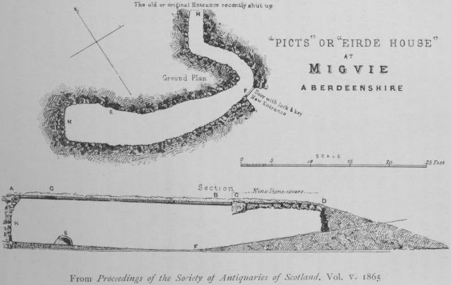
“PICTS” OR “EIRDE HOUSE” AT MIGVIE
ABERDEENSHIRE
From Proceedings of the Society of Antiquaries of Scotland, Vol. V. 1865
The common notion of the purpose of these underground
dwellings was that they were meant for hiding-places
in which the inhabitants took refuge when unable
to resist their enemies in the open, but if, as has now
been discovered, they were associated with wooden
erections above ground, they could not have served this
purpose. On the surface beside them were other houses,
cattlefolds and other enclosures; once an enemy was in
possession of these, he could hardly miss the earth-houses.
Moreover, the inhabitants, if discovered, were in a trap
from which there was no escape. It is more probable
that the dwellings were adjuncts of some unknown kind
to the huts on the surface. The fact that pottery and
bronze armlets have been unearthed from these underground
caverns proves that the earth-dwellers had
reached a certain advancement in civilisation. They
reared domestic animals, wove cloth and sewed it, and
manufactured pottery. They used iron for cutting
weapons and bronze for ornament, and must have possessed
a wonderfully high standard of taste and manual
skill.
Along with the earth-houses at Kinnord are found
crannogs or lake-dwellings. Artificial islands were created
in the loch by forming a raft of logs, upon which layers
of stones and other logs were deposited. As fresh
materials were added the raft gradually sank till it rested
on the bottom. The sides were afterwards strengthened
with the addition of stones and beams. In this way was
formed what is called the Prison Island on Loch Kinnord.
In all probability the other island in the same loch, the
Castle Island, may also be artificial, although it has usually
been regarded as natural. Crannogs in pairs—one large
and the other small—occur in several lochs.
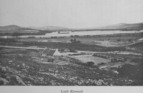
Loch Kinnord
A number of hill-forts, more or less disintegrated, are
traceable in the higher ground in the vicinity of Lochs
Kinnord and Davan. These show concentric lines of
circumvallation, with stronger fortifications at various
points. Vitrified forts, where the stones have been run
together by the application of heat, are found at Dunnideer
near Insch, and on the conical summit of Tap o’ Noth
near Rhynie. The Barmekin at Dunecht encloses an area
of more than two acres, and consists of five concentric
walls, three of earth-works and two of stone.
Numerous cairns, barrows or tumuli exist all over
the county, at Aberdour on the coast, at Birse, Bourtie,
Rhynie, Turriff, and elsewhere. Human remains have
been found in most of these; and as a rule flint arrow-heads
and other implements are also associated with
them.
18. Architecture—( a )— Ecclesiastical.
The history of Scotland from an architectural point
of view does not reach very far back into the past. Till
the tide of civilisation flowed into Scotland from the south
in the eleventh and twelfth centuries, there existed in the
country no architecture worthy of the name. When the
Normans became the ruling power in Britain, they brought
architectural ideas with them and these superseded the
crude attempts at church building hitherto made. The
Scottish churches built under the influence of Columba
were simple and rude, consisting of a small oblong chamber
with a single door and a single window. The Norman
style, which obliterated these structures, dates from the
twelfth century and, being carried along the coast of lowland
Scotland, gradually changed the manner of building.
It is characterised by simple, massive forms and especially
by arches of a semi-circular shape, sometimes enriched by
zig-zag, and by the use of nook shafts and cushion capitals.
Of this period the remains in Scotland are not numerous,
and they are very few in Aberdeenshire. The earliest
specimen we can point to is the ancient church of
Monymusk, which contains some Norman building incorporated
in the modern church erected on the old site.
Monymusk is on Donside seven miles up the river from
Kintore. It is a place of great antiquity. The Culdees
first appear there in the twelfth century, and the Earl of
Mar built a convent for them on condition that they
should submit to canonical rule. The lower part of the
church tower and the chancel arch are of the Norman
style. The tower has been entirely rebuilt except the
lower doorway, which has a round arch-head with a hood
mould enclosing it. These small fragments suggest that
they were part of the convent erected by the Earl of Mar
very early in the thirteenth century.
The rounded arch gave place in the thirteenth century
to the early Gothic, of which the most striking feature
is the pointed arch. This is the First Pointed Period.
Ornament was more general, the mouldings were richer
and more graceful and the foliage of trees was occasionally
copied. The windows were narrow, lofty and pointed,
giving an impression of space and lightness. Aberdeenshire
is too far north to have developed many examples of
this early style, but it has some. The Abbey of Deer is
perhaps the most ancient ecclesiastical building, but it is
now a complete ruin, all the best parts of it having disappeared
within the last fifty years. It was founded in the
thirteenth century. Deer had been an ecclesiastical centre
long before that time. The story goes that Columba and
his pupil Drostan travelled from Iona to Aberdeenshire
when Bede was Mormaer (Earl) of Buchan. They were
first at Aberdour on the coast, but ultimately journeyed
to Deer, where Columba requested the Mormaer to grant
him a site for a church. At first the Mormaer refused,
but his son fell ill and in consideration of the efficacy of
the prayers of the two holy men in bringing the youth
back to health, the Mormaer granted them the lands of
Deer and this was probably the first place in Aberdeenshire
where a regular Christian church was erected. No
trace of that church, built in the sixth century, is left.
The Abbey was an entirely different structure and not
begun till early in the thirteenth century. It was founded
by William Comyn, Earl of Buchan, and was really a
Cistercian Abbey, originally occupied by monks sent from
Kinloss. From the ruins now within the grounds of
Pitfour House, it can be made out that the length of the
building (nave and chancel) was 150 feet. A few mouldings
and the arches of some windows indicate that it
belonged to the first pointed period. The building was
of red sandstone probably brought from New Byth, some
12 miles distant. After the Reformation the Abbey fell
to decay and its walls became, as in many other cases, a
quarry from which other buildings were erected. In 1809
the ruins were enclosed with a wall by the then proprietor,
Mr James Ferguson of Pitfour, but since then they have
dwindled.
No mention of Deer is possible without reference to
the famous Book of Deer—a manuscript volume of the
highest value, emanating not from the Abbey but from
Columba’s monastery in the same region. The book
was brought to light in 1860 by the late Mr Henry
Bradshaw, University Librarian at Cambridge. It had
lain unrecognised in the Library since 1715. It contains
the Gospel of St John and other portions of scripture in
the writing of the ninth century; but of even greater
importance is the fact that on its margins it contains
memoranda of grants to the monastery, made by Celtic
chiefs of Buchan and all written in Gaelic. These
jottings are of the highest historical value.
Some traces of the Early Pointed style are found
in St Machar Cathedral (the greater part of which,
however, is much later). The old church of Auchindoir
close to Craig Castle has a good doorway and other features
of this period.
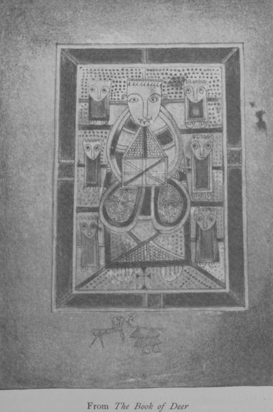
From The Book of Deer
From the middle of the fourteenth to the middle
of the fifteenth century (1350-1450) is in Scotland the
Middle Pointed Period. The windows were made larger,
the vaulting and buttresses less heavy. The Cathedral of
St Machar belongs in part to this time. The legend goes
that St Machar in obedience to the commands of Columba,
of whom he was a disciple, journeyed to Scotland and
at Old Aberdeen founded a church. This church in
the twelfth century became the seat of a bishopric
founded by David I. The original church was superseded
probably about 1165, the only relic of this Norman
period being part of the abacus of a square pier. All
other traces of earlier work have vanished. In the fourteenth
century Bishop Alexander Kyninmonth II rebuilt
the nave, partly of red sandstone with foliated capitals
of great beauty and decorated with naturalistic imitation
of leafage, one capital representing curly kail (colewort).
The same kind of decoration is seen in Melrose Abbey.
Later on the two impressive western towers, which are
to-day conspicuous objects in the eastern landscape to all
travellers northward-bound from Aberdeen, were added.
They form a granite mass of solid and substantial masonry,
and, being finished with machicolation, parapet-paths and
capehouses, were really like a castle in Early English
architecture. Still later on, in the sixteenth century,
Bishop Elphinstone, who founded the University of
Aberdeen, who built the first Bridge of Dee, and gave
a new choir to St Nicholas Church, completed the central
tower and placed in it fourteen bells “tuneable and
costly.” The sandstone spires over the western towers
were added by Bishop Dunbar early in the sixteenth
century, in place of the original capehouses. The central
tower fell in 1688, crushing the transepts.
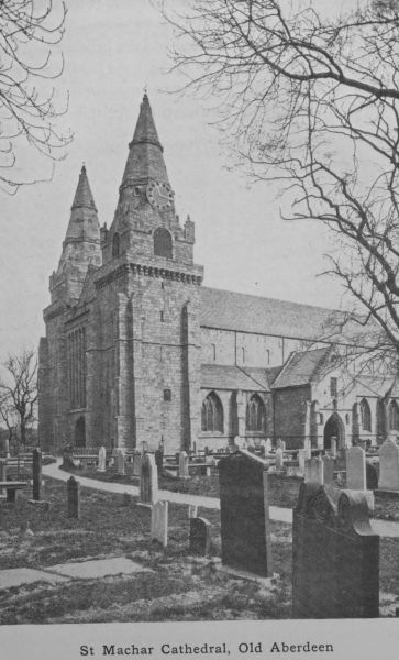
St Machar Cathedral, Old Aberdeen
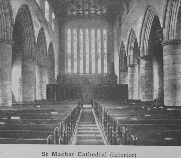
St Machar Cathedral (interior)
In 1560 the government ordered the destruction of
the altars, images and other monuments of the old faith,
and this cathedral suffered with the rest. It was despoiled
of all its costly ornaments and the choir was demolished.
The roof was stripped of its lead and the bells were carried
off. All that remains to-day is the nave (now the parish
church), a south porch, the western towers and fragments
of the transept walls, which contain tombs of
Bishop Lichtoun, Bishop Dunbar, and others. This is
the only granite cathedral in the country, and, though
dating from the Middle and late Pointed periods, has
reminiscences of the Norman style in its short, massive
cylindrical pillars and plain unadorned clerestory windows.
Another feature is the great western window divided by
six long shafts of stone. The finely carved pulpit now
in the Chapel of King’s College is a relic of the wood-carvings
destroyed in 1649. The whole is extremely
plain but highly impressive and imposing. Its flat panelled
oak ceiling decorated with heraldic shields of various
European kings, Pope Leo X, and Scottish ecclesiastics
and nobility (48 in all) is worthy of mention. This
heraldic ceiling was restored in 1868-71.
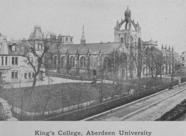
King’s College, Aberdeen University
Of later date is King’s College Chapel, at no great
distance from the Old Cathedral. It is a long, narrow
but handsome building begun in 1500, shortly after the
foundation of the University by Bishop Elphinstone.
The chapel and its graceful tower are the oldest parts of
the College buildings which had originally three towers.
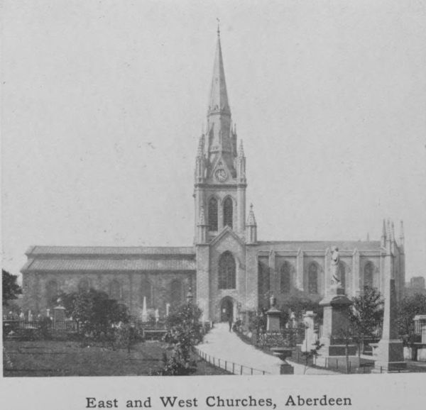
East and West Churches, Aberdeen
The surviving one is a massive structure buttressed nearly
to the top and bearing aloft a lantern of crossed rib
arches, surmounted by a beautiful imperial crown with
finial cross, somewhat resembling St Giles’s in Edinburgh.
The difference is that King’s College has four ribs while
St Giles’s has eight. The whole is of freestone from
Morayshire. The entire building is a mixture of Scottish
and French Gothic styles, and retains in the large western
window the semi-circular arch, a peculiarity of Scottish
Gothic throughout all periods. The canopied stalls and
the screen of richly carved oak, Gothic in design and
most beautifully handled, take a place among the finest
pieces of mediaeval carved work existing in the British
Empire. Their beauty and delicacy, according to Hill
Burton, surpass all remains of a similar kind in Scotland.
The chapel contains the tomb of Bishop Elphinstone. It
was once highly ornamented, but meantime is covered
with a plain marble slab. Its restoration is in prospect.
St Nicholas Church, Aberdeen (now the East and
West Churches) contains in its transepts and groined
crypt and in its wood-carving, interesting relics of twelfth,
fifteenth and sixteenth century work. The nave was
rebuilt in the Renaissance style of the time (1755).
Greyfriars Church, removed a few years ago to make
way for the new front of Marischal College, was a pre-Reformation
church, built by Alexander Galloway, Rector
of Kinkell, early in the sixteenth century. Its chief
features were its range of buttresses and a fine seven-light,
traceried window.
The Protestant churches that succeeded these ancient
buildings were inferior as architecture. It was only in
the nineteenth century that taste began to revive and
some attempt at grace and embellishment was made.
Architects began to study old styles, and this combined
with the increasing wealth of the country created a new
standard in ecclesiastical requirements. To-day our
churches tend to grow in architectural beauty.
19. Architecture—(_b_) Castellated.
The earliest fortifications in Scotland were earthen
mounds, surrounded with wooden palisades. They were
succeeded by stone and lime “keeps” built in imitation
of Norman structures. The presence of the Normans
in England during the eleventh and twelfth centuries
drove the Saxon nobility northwards, and they were
followed in turn by other Normans, who obtained possession
of great tracts of country. The rectangular
keeps of the Normans have in consequence formed the
models on which most of the Scottish castles were constructed.
In the thirteenth century there were castles
at Strathbogie, Fyvie, Inverurie and Kildrummy. These
have mostly been rebuilt in recent times and the more
ancient parts have disappeared. The general idea in
them all was a fortified enclosure usually quadrilateral.
The walls of the enclosure were 7 to 9 feet thick and 20
to 30 feet high. The angles had round or square towers,
and the walls had parapets and embrasures for defence and
a continuous path round the top of the ramparts. The
entrance was a wide gate guarded by a portcullis. The
comparatively large area within the walls was intended to
harbour the population of a district and to give temporary
protection to their flocks and possessions in times of danger.
Some of the finer examples, such as Kildrummy, closely
resemble the splendid military buildings of France in the
thirteenth century. One of the towers is usually larger
than the others and forms the donjon or place of strength,
to which retreat could be made as a last resort, when,
during a siege, the enemy had gained a footing within
the walls.
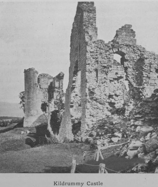
Kildrummy Castle
Kildrummy Castle is one of the finest and largest in
Scotland, and even in its present ruinous condition gives
an impression of grandeur and extent such as no other
castle in Aberdeenshire can rival. It was built in the
reign of Alexander II by Gilbert de Moravia, Bishop of
Caithness. Situated near the river Don, some ten miles
inland from Alford, and occupying a strong position on
the top of a bank which slopes steeply to a burn on two
sides, and protected on the other sides by an artificial
fosse, it was a place of great strength. Its plan is an
irregular quadrangle, the south front bulging out in the
centre towards the gateway. It had six round towers,
one at each angle and two at the gate. One of the
corner towers—the Snow Tower—55 feet in diameter,
was the donjon and contained the draw-well. The castle
possessed a large courtyard, a great hall, and a chapel, of
which the window of three tall lancets survives. It was
built in the thirteenth century, and therefore belongs to
the First Pointed Period. The stone used is a sandstone,
probably taken from the quarries in the locality, where
instead of the prevailing granite of Aberdeenshire a great
band of sandstone occurs.
This famous castle passed through various vicissitudes.
It was besieged in 1306 by Edward I of England and was
gallantly defended, but, in consequence of a great conflagration,
Nigel Bruce, King Robert’s brother, who was
acting as governor, yielded it to the English, he himself
being made prisoner and ultimately executed. Some of
the buildings date from this period, when it was rebuilt
by the English, but it soon fell into Bruce’s hands again.
Twenty years after Bannockburn it was conferred on the
Earl of Mar. The rebellion of 1715 was hatched within
its walls. Thereafter being forfeited by Mar, it eventually
came into the hands of the Gordons of Wardhouse.
Recently it was purchased by Colonel Ogston, who has
built a modern mansion-house close by and crossed the
ravine with a bridge, an exact replica of the historic
Bridge of Balgownie near Donmouth.
During the fourteenth century, Scotland, exhausted
with the struggle for national independence, was unable
to engage in extensive building. Beside, Bruce’s policy
was opposed to castle building, as such edifices were liable
to be captured by the enemy and a secure footing thereby
obtained. His policy was rather to strip the country, and
to destroy everything in front of an invading army, with
a view to starving it out. The houses of the peasantry
were made of wood and could easily be restored when
destroyed. The houses of the nobility took the form of
square towers on the Norman model and all castles of the
fourteenth century were on this simple plan—a square or
oblong tower with very thick walls and defended from a
parapeted path round the top of the tower. The angles
were rounded or projected on corbels in the form of round
bartizans. At first these parapets were open and machicolated.
As time went on, the simple keep was extended
by adding on a small wing at one corner, which gave the
ground plan of the whole building the shape of the letter
=L=. The entrance was then placed as a rule at the re-entering
angle. Such keeps are usually spoken of as built
on the =L= plan. The ground floor was vaulted and used
for stores or stables and as accommodation for servants.
The only communication between this and the first floor
was a hatch. In early castles the principal entrance was
often on the floor above the ground floor and was reached
by a stair easily removed in time of danger. Access from
one storey to another was by a corkscrew or newel stair
at one corner in the thick wall. Thus constructed a
tower could resist siege and fire, and even if taken, could
not be easily damaged.
Of this kind of keep Aberdeenshire has many excellent
examples, the most perfect, perhaps, being the Tower of
Drum. It stands on a ridge overlooking the valley of the
Dee. To the ancient keep built probably late in the
thirteenth century was added a mansion-house on a
different plan in 1619. The estate was granted to
William de Irvine by Bruce in recognition of faithful
service as secretary and armour-bearer. Previous to that,
Drum was a royal forest and a hunting-seat of the king.
The keep, which stands as solid and square to-day as it
did six hundred years ago, is quadrilateral and the angles
are rounded off. The entrance was at the level of the
first floor. The main stair is a newel. In the lowest
storey the walls are twelve feet thick, pierced with two
narrow loops for light. In a recess is the well. On the
top of the tower are battlements, the parapet resting on
a corbel-table continued right round the building.
Hallforest near Kintore is an example of a fourteenth
century keep. It was built by Bruce as a hunting-seat
and bestowed on Sir Robert de Keith, the Marischal. It
still belongs to the Kintore family but is now a ruin.
The fifteenth century brought a change in castle-building.
The accommodation of the keeps was circumscribed
and the paucity of rooms made privacy impossible.
One way of extending the space was, as we have said,
by adding a wing at one corner. Another mode was to
utilise the surrounding wall, for the keeps were generally
guarded by a wall, which formed a courtyard or barmekin
for stabling and offices. This was often of considerable
extent and defended by towers. As the country progressed
and manners improved, buildings were extended
round the inside of the courtyard walls. In the sixteenth
century the change went further and developed into the
mansion-house built round a quadrangle. The building
was first in the centre of the surrounding wall; ultimately
the courtyard was absorbed and became the centre of the
castle.
Balquhain Castle in Chapel of Garioch, two miles
from Inverurie, was originally a keep like Drum, but
being destroyed in 1526, it was rebuilt. Very little of it
now remains but its massive, weather-stained walls have
a commanding effect. The barmekin is still traceable.
Queen Mary is said to have passed the night prior to the
Battle of Corrichie at Balquhain. It was burned in 1746
by the Duke of Cumberland.
Many other castles on the same general plan are
dotted up and down the county. Some are in ruins, some
have been altered and added to on other lines, but the
original keep is still a marked feature in most of them.
Cairnbulg—recently restored—on the north-east coast
has a keep of the fifteenth century with additions of a
century later. Gight, now ruinous, but formerly celebrated
for its great strength, occupies a fine site on the
summit of the Braes of Gight, which rise abruptly from
the bed of the Ythan. It also is a fifteenth century
edifice built on the =L= plan. It has a historical interest
as having once belonged to Lord Byron’s mother, from
whom it was purchased by the Earl of Aberdeen.
Another of the same kind is Craig Castle in Auchindoir.
It was completed in 1518 and is also on the =L= plan. So
too is Fedderat in New Deer.
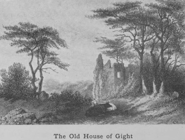
The Old House of Gight
In the sixteenth century the troubled reign of Queen
Mary was unfavourable to architecture, but towards the
end of it the rise of Renaissance art began to exert a decided
influence, especially on details and internal furnishings,
and in the next century gradually but completely dominated
the spirit of the art. Another influence at work
was the progress made in artillery. The ordinary castles
could not now resist artillery fire, and all attempts at
making them impregnable fortresses were abandoned, and
the only fortifications retained were such as would make
the buildings safe from sudden attack. In consequence,
what had before been grim fortresses were now transformed
into country mansions, whether on the keep or on
the quadrangle plan; and sites were chosen as providing
shelter from the elements rather than defence against
human foes. The Reformation, too, which secularised
the church lands and gave the lion’s share to the nobility,
was a notable influence in revolutionising architecture.
The nobility being now more wealthy were enabled either
to extend their old mansions or to build new ones. Hence
the great development that took place in the quiet reign
of James VI. The effect of the Union in 1603, which
drew many of the nobility to England, was civilising and
educative, and raised their ideas of house accommodation
as well as their standard of comfort and domestic amenity.
The change was of course gradual. The old keeps
and the castles built round a courtyard were still in
evidence, but picturesque turrets corbelled out at every
angle of the building, slated, and terminating in fanciful
finials, became the rule. The lower walls were kept
plain, the ornamentation being lavishly crowded only on
the upper parts. The roofs became high-pitched with
picturesque chimneys, dormer windows and crow-stepped
gables. All these features so characteristic of the mansion-houses
of the fourth period (1542-1700) are well marked
in Craigievar, which is one of the best preserved castles of
the time. Its ground plan is of the =L= type, but the turrets
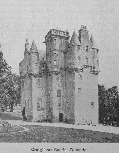
Craigievar Castle, Donside
and gables are corbelled out with ornamental mouldings
and the upper part of the castle displays that profusion of
sky-pointing pinnacles and multifarious parapets which
mark the period. The same is seen at Crathes and at
Castle Fraser. The last is altogether an excellent specimen.
It consists of a central oblong building with two towers
at the diagonally opposite ends, one square and the other
round, and is therefore a development into what has been
called the =Z= plan or stepped plan—induced by the general
use of firearms in defence. Here, as at Craigievar, gargoyles
originally used to carry off rain water from the
roof are brought in as a piece of fanciful decoration, apart
from any utilitarian purpose, and project from the walls
at places where rain-spouts are irrelevant.
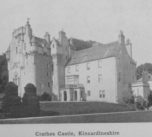
Crathes Castle, Kincardineshire
The castle has a secret chamber or “lug,” in which
the master of the house could over-hear the conversation
of his guests in the dining-hall. Nothing could better
illustrate the treachery and cunning which had been bred
by the difficulty of the times. Mr Skene, the friend of Sir
Walter Scott, minutely investigated this contrivance as it
exists at Castle Fraser, and no doubt his account of this
ingenious but dishonourable device for gaining illicit
information suggested King James’s “Lug,” so happily
described in The Fortunes of Nigel.
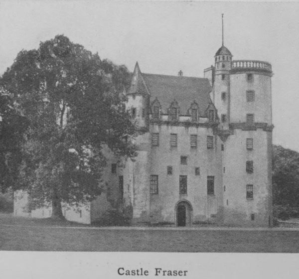
Castle Fraser
Castellated buildings of this class are so numerous in
Aberdeenshire that it is possible to name only a few.
One of the finest is Fyvie Castle on the banks of the
upper reaches of the Ythan in the very centre of the
county. It is not like many others a ruin, but a mansion-house
modernised in many respects, but still retaining all
the picturesque features of the olden time. It occupies
two sides of a quadrangle, with the principal front towards
the south, one side being 147, the other 137 feet in
frontage. At the three corners are massive square towers,
with angle turrets and crow-stepped gables. Besides these
towers, there are in the centre of the south front two
other projecting towers, which at 42 feet from the ground
are bridged by a connecting arch, eleven feet wide, the
whole forming a grand and most impressive mass of
masonry called the “Seton” tower, a magnificent centre
to what is perhaps the most imposing front of any
domestic edifice in Scotland. At the south-east corner
is the “Preston” tower, built by Sir Henry Preston, and
the earliest part of the building, dating from the fourteenth
century. In the south-west stands the “Meldrum”
tower, so-called from the succeeding proprietors (1440-1596).
They erected this part and the whole range of
the south front except the “Seton” tower already referred
to, which is a later addition. The Setons succeeded the
Meldrums and it is to Alexander Seton, Lord Fyvie and
Earl of Dunfermline, that the castle owes its greatest
splendours. Besides planning this tower, he ornamented
the others with their turreted and ornate details. He
also built the great staircase, which is a triumph of
architectural skill. It is a wheel or newel staircase of
grand proportions, skilfully planned and as skilfully executed.
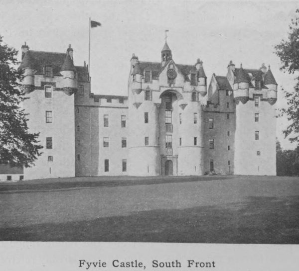
Fyvie Castle, South Front
The Gordon tower on the west was not added
till the eighteenth century, by William, second son of the
second Earl of Aberdeen. Its erection necessitated the
destruction of the chapel. Here one may see how the
Renaissance ideas were creeping in, especially the desire
for balance and symmetry. Two of everything was
beginning to be the rule. One wing must have another
to balance with it; one tower another to make a pair.
20. Architecture—(_c_) Municipal.
After a period of declining taste in architecture, a
revival began early in the nineteenth century under the
guidance of architects of genius such as Archibald
Simpson and John and William Smith. A great improvement
was thereby effected in the general aspect of
the city of Aberdeen, and their good work has been
enhanced by that of their successors. It is necessary to
repeat that it was long before the local granite came to
its own. The earlier buildings of importance were all of
sandstone; to-day he would be a bold architect who
suggested a sandstone building in Aberdeen. The use
of granite exercises an indirect effect on architectural
design. It lends itself to broad, classic, monumental and
dignified effects, while its stubborn quality is a check
against over-exuberance of detail, and fanciful, gimcrack
trivialities. The plainness of the buildings was often
remarked upon by strangers twenty years ago. The
newer buildings are not without adornment.
The County and Municipal Buildings (or the Town-House
as it is familiarly called) on the south side of
Castle Street were opened in 1870. They form a
magnificent pile which takes a high place amongst provincial
town-halls, as regards both vigour and originality
of treatment. The line of elliptical arches on the ground
floor and of small arcaded windows in the floor above
make an imposing front. The great tower, which rises
to a height of 200 feet and dominates the whole city, has
the castellated turrets which we have seen to be characteristic
of Scottish architecture. It is curious to see how
latter-day architects have not been able to get away from
this feature. It is conspicuous even in such buildings as
the Grammar School and the new Post Office. The
Municipal tower, if somewhat heavy-looking, is on the
whole effective. The small tower and spire on the east
is the old Tolbooth tower, of the seventeenth century,
preserved by being incorporated in the modern building.
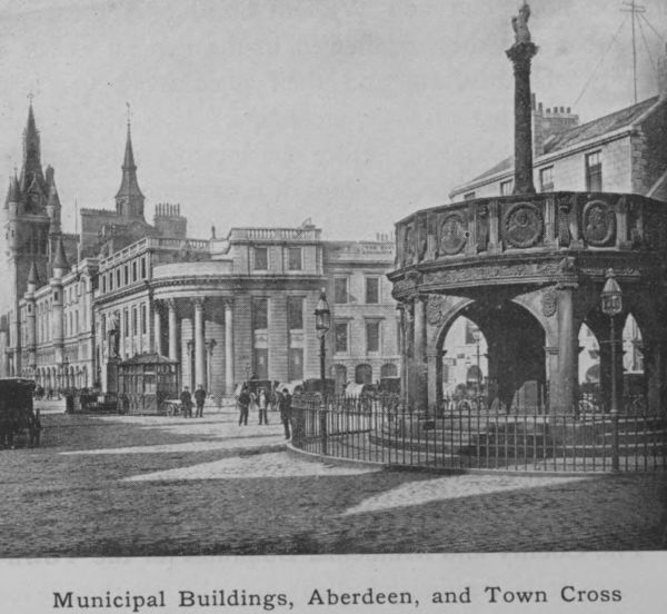
Municipal Buildings, Aberdeen, and Town Cross
The next public building that should be mentioned is
Marischal College, recently enlarged at a cost of nearly
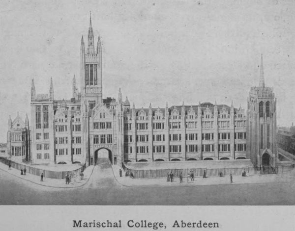
Marischal College, Aberdeen
£250,000. This is undoubtedly the finest piece of
modern architecture in the north of Scotland, and one of
the most handsome and graceful in the kingdom. The
College at the end of the nineteenth century was a work
of the Gothic revival occupying three sides of a quadrangle,
with a tower in the centre of one side. This tower has
been remodelled and greatly heightened so that it is now
a rival to the Municipal tower in the same street. It is
known as the Mitchell tower, in compliment to the donor,
the late Mr Charles Mitchell of Newcastle, whose name
is also associated with the public or graduation Hall of
the University. The old frontage of Marischal College
was a desultory line of commonplace houses, through
which by a narrow gateway entrance was gained to the
quadrangle. These have all been cleared away and now
a stately pile bristling with ornate pinnacles that sparkle
in the sun fills the whole length of 400 feet.
No less impressive than the delicately chiselled front
is the back view of the College from West North Street,
where a dip in the ground displays to advantage the great
mass of building, the Mitchell Hall with its great Gothic
window, its angle-turrets and lofty buttresses.
The Northern Assurance Office stands at the angle
between Union Street and Union Terrace. The clean
surface and clear-cut lines of the granite masonry are very
pleasant to the eye. Union Terrace contains some of
the best modern buildings in the city—the Grand Hotel,
the Aberdeen Savings Bank, which though very simple is
an admirable specimen of a front specially designed for
granite; the Offices of the Parish Council and the School
Board, original and striking, the Public Library, the
United Free South Church with its graceful dome, and
His Majesty’s Theatre—all serve to illustrate the changes
that are being rung on granite fronts in recent years.
The contrast between these more ornate buildings and
the severely classic simplicity of the Music Hall, a square
block with a portico of Ionic pillars, belonging to the early
nineteenth century, shows what a change in sentiment has
taken place. The feature of all the Aberdeen architecture
is the careful, conscientious workmanship, which always
gives the impression of lasting solidity. The material is
so irresponsive that without hard labour, no effect is
produced.
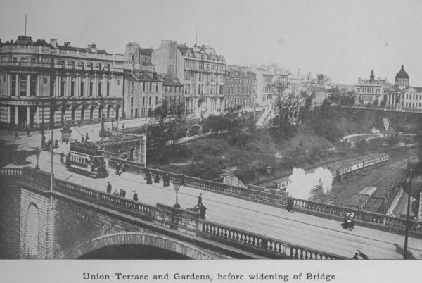
Union Terrace and Gardens, before widening of Bridge
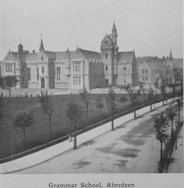
Grammar School, Aberdeen
We can do no more than mention some of the other
notable edifices in the city. The Grammar School,
erected in 1863, is a successful application of castellated
Gothic to a modern building—all the more effective that it
is well set back from the street. The contiguous Art
School and Art Gallery are modern buildings, each with
an order of columns and a pediment which break the long
low line of the façade. The elliptical arch that unites
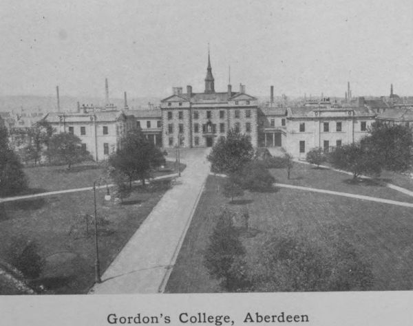
Gordon’s College, Aberdeen
them gives access to Gordon’s College, the centre portion
of which is a piece of sober eighteenth century work. The
wings and colonnades were added subsequently. The Head
Office of the North of Scotland and Town and County
Bank at the top of King Street has its entrance porch at
the angle with a colonnade of pillars. Near it is the
Town Cross, a hexagonal erection with Ionic columns
and a tapering shaft rising from the centre of the roof,
with a heraldic unicorn as terminal. It dates from the
end of the seventeenth century. In the panels of the
balustrade are half-length portraits of Scottish and British
Kings (including the seven Jameses). It is a fine example
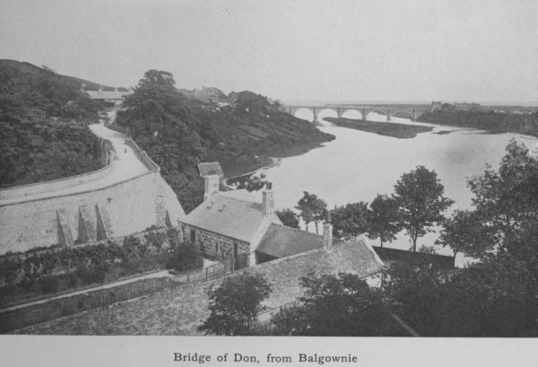
Bridge of Don, from Balgownie
of its class and was the work of a local mason. The
royal portraits are real and authentic. The Ionic screen
or façade between Union Street and the city churches
gives some idea of the severely classic architecture that
was the vogue in Aberdeen nearly a century ago.
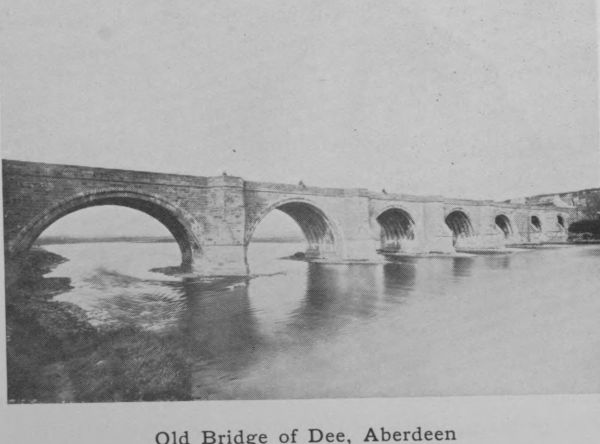
Old Bridge of Dee, Aberdeen
A word must be said about the chief bridges. Union
Bridge has a span of 130 feet, and was built in 1802 to
facilitate the making of Union Street. It was originally
narrower than the street and has recently been widened
to meet the requirements of increased traffic. The
Bridge of Don (Balgownie), probably built early in the
fourteenth century if not earlier, throws its one Gothic arch
over the deep contracted stream of the river. A small
bequest in the seventeenth century for its maintenance
has been so well husbanded that out of its accumulations
the cost of the new Bridge (£17,000), and other buildings
has been defrayed, and the capital value of the fund—called
the Bridge of Don fund—is to-day £26,500. The
new bridge, much nearer the sea and with five arches,
was designed by Telford and completed in 1830. The
Old Bridge of Dee (with seven arches) was founded by
Bishop Elphinstone and completed in 1527 by Bishop
Gavin Dunbar. In 1842 it was widened 11-1/2 feet. The
New (Victoria) Bridge, a continuation of Market Street,
was opened in 1882, since when quite a new and populous
city has sprung up on the south side of the river,
entirely eclipsing the old fishing village of Torry which
formerly monopolised this side of the water.
22. Communications—Roads, Railways.
In ancient times the chief means of communication
between Aberdeenshire and the south was the old South
and North Drove Road, which crosses the Cairn-o-Mounth
from Fettercairn in Kincardine, and, passing the Dye and
Whitestones on the Feugh, reaches the Dee at Potarch.
It then ran along the hill to Lumphanan and on through
Leochel to the Bridge of Alford, thence to Clatt and
Kennethmont and along the valley of the Bogie to
Huntly.
There was another—a supposed Roman road—which,
coming up from the direction of Stonehaven, crossed the
Dee at Peterculter, and, proceeding northward through
Skene, Kinnellar, Kintore and Inverurie, went on to
Pitcaple. Thence it passed through Rayne and across
the east shoulder of Tillymorgan to what has been regarded
as a Roman camp at Glenmailen, and by the Corse of
Monellie, Lessendrum and Cobairdy, to the fords of the
Deveron below Avochie.
Another ancient road crossed the mountains from
Blairgowrie by the Spittal of Glenshee, over the Cairnwell,
Castleton of Braemar, and the upper waters of
the Gairn to the valley of the Avon at Inchrory and
thence by Tomintoul to Speyside.
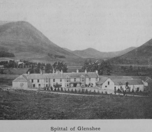
Spittal of Glenshee
After the ’45 General Wade adopted the southern
part of this road as the line of his great military route
from Blairgowrie to Fort George, but from Castleton
he turned to the east, went down the Dee valley to
Crathie, and thence across the hills to Corgarff in Upper
Strathdon from which he reached Tomintoul by the
“Lecht.” This route he completed in 1750.
These roads had naturally to lead to fords in the
rivers, and, when bridges came to be built, it was just
as natural that they should be placed in the line of
established routes. When the Bridge of Alford was
built over the Don in 1810-11 and the Bridge of Potarch
over the Dee in 1812-13, a new line of road was made
across country to connect them. It went from Dess
through Lumphanan and Leochel to the Don valley.
The first turnpike made in Aberdeenshire was the
road from the Bridge of Dee to the city of Aberdeen _viâ_
Holborn Street, which completed the northern section
of the great post-road between Edinburgh and Aberdeen.
This was in 1796.
About the same time was made the North Deeside
Road reaching from Aberdeen to Aboyne and thence to
Ballater, Crathie, and Braemar, where it met the Cairnwell
Road. Another was the Aberdeen and Tarland
route, which went by Skene and Echt with branches
joining on to those already in existence. One of these
struck off at Skene, and, crossing the hill of Tilliefourie,
proceeded to Alford. It was afterwards extended up the
Strath by Mossat, and Glenkindie to Corgarff, where it
met General Wade’s road.
The great post-road from Aberdeen to Inverness went
by Woodside, Bucksburn, Kintore, Inverurie, the Glens
of Foudland to Huntly and Cairnie on the boundary of
Banffshire. It had branches from Huntly to Portsoy
through Rothiemay and to Banff through Forgue by
the Bridge of Marnoch.
The Strathbogie Road from Huntly to Donside by
way of Gartly, Rhynie, and Lumsden joined the Strathdon
Road at Mossat. Though by no means the most
convenient, it is still used as the route along which the
mails are conveyed to Strathdon.
The Aberdeen and Banff Road left the post-road at
Bucksburn and passing through Dyce, New Machar, Old
Meldrum, Fyvie, Turriff, and King Edward made for the
Bridge of Banff.
In the eastern district the most important route was
that to Peterhead. It crossed the new Bridge of Don,
and, passing through Belhelvie, Ellon, and Cruden, came
to Peterhead by the coast. From there it went straight
across country to Banff by Longside, Mintlaw, New
Pitsligo, and Byth, thence over the Longmanhill to
Macduff. Later a coast route was made connecting
Peterhead and Fraserburgh, by way of St Fergus, Crimond
and Lonmay. Another continuation of it was along
the coast past Rosehearty, Pennan, Gardenstown and Troup
Head into Banffshire.
It was only during the nineteenth century that proper
and serviceable highways were constructed. Prior to that
time a few main roads had been made but side connections
were few and badly kept, so that wheeled vehicles, if they
had existed, would have been a useless luxury. Early in
the eighteenth century wheeled vehicles were absolutely
unknown. In 1765 the judges of the Circuit Court of
Justiciary first travelled to Aberdeen in chaises instead
of on horseback. The first mail coach did not arrive
till 1798. It took 21 hours between Edinburgh and
Aberdeen. Not till 1811 did passenger coaches begin
to ply between Aberdeen and Huntly. Then only was
it possible for the farmer to convey his products by
cart, which superseded the pack-horse as a means of
transport.
The upkeep of the roads was secured by a system
of tolls. Traces of the system still survive in the renovated
toll-bar houses, which in some cases retain a window
facing right and a window facing left to mark the approach
of vehicles from either side. Aberdeenshire abolished tolls
in 1865.
The Railway system reached Aberdeen in 1848. Prior
to that time for fifty years the stage coach plying between
Edinburgh and Aberdeen had been, apart from the sea-routes,
the only bond between this part of the country and
the south. A few years later, in 1854, what is now the
Great North of Scotland Railway was opened from Aberdeen
to Huntly, and two years thereafter was extended as
far as Keith. This is still the main line of railway in the
county. It touches in its course Dyce, Kintore, Inverurie,
Insch, and Huntly. By and by branch lines were constructed
forking off from it at various points; _first_ from
Inveramsay, through Wartle, Fyvie, to Turriff and ultimately
to Macduff; _second_ from Inverurie across country
to Old Meldrum; _third_ from Kintore up Donside by
Kemnay and Monymusk to Alford; and lastly from
Dyce through New Machar, Udny, Ellon to New
Maud, where it bifurcates, one fork going on to Peterhead
the other to Fraserburgh. This is the Buchan and
Formartine branch. Recently a sub-branch was made
from Ellon running to the coast and touching Cruden
Bay, its terminus being at Boddam within half an hour’s
distance of Peterhead. From Fraserburgh, a light railway
runs to Cairnbulg, Inverallochy and St Combs. The
only other line of railway in the county is the Deeside
line, which runs up the Dee valley as far as Ballater. It
was begun in 1853, and Banchory was the terminus till
1859, when an extension was made to Aboyne; then in
1866 it was extended to Ballater.
The lack of population and the paucity of goods apart
from agricultural products have handicapped the local railways,
which are far from prosperous. The chances of
extension in other directions are very remote. Meantime
outlying districts, such as Strathdon and Braemar, are
served by motors. The holiday and tourist traffic during
the summer months and the influx of sportsmen at the
shooting season are contributory sources of revenue, but
even these show no tendency to grow—a state of affairs
due to the prevalent use of private motor-cars.
Aberdeenshire has no canals and is never likely to
have. Prior to the advent of railways a canal, designed
by Telford, the great engineer, was constructed between
Aberdeen and Port Elphinstone on the south side of
Inverurie. It was opened for passenger and goods traffic
in 1806, and continued to serve the district until the
steam-engine sounded its knell. For nearly half a century
it was a bond between the chief city and the centre
of the county and, although it never was remunerative to
the promoters, and provided a very slow mode of conveyance,
it was of great public service. The railway line to
the north runs parallel at certain places to the track of this
canal, whose superannuated embankments may still be
recognised, after half a century, at various points between
Aberdeen and Inverurie.
23. Administration and Divisions.
In the twelfth century Scotland was divided into
Sheriffdoms, where the Sheriff was the minister of the
Crown for trying civil and criminal cases. The office
was hereditary until the rebellion of ’45, when its hereditary
character was abolished. Aberdeenshire has a
non-resident Sheriff-Principal (who is also Sheriff of Banff
and Kincardine) besides two resident Sheriff-substitutes.
These deal with ordinary civil cases such as debts, as well
as with criminal cases involving fine or imprisonment,
but not as a rule involving penal servitude, except forgery,
robbery and fire-raising.
The head of the county is the Lord-Lieutenant.
Next to him is the Vice-Lieutenant and a large number
of Deputy-Lieutenants and Justices of the Peace, but the
chief administrative body is the County Council, which
consists of 65 members. These elect the chairman and
vice-chairman, who are designated respectively convener
and vice-convener. County Councils were first established
in 1889. The county is divided into districts, and each
district has so many divisions, or parishes, which elect one
councillor. Aberdeenshire has 85 parishes, which are
grouped in eight districts: (1) Deer with fifteen electoral
divisions, (2) Ellon with seven, (3) Garioch with six, (4)
Deeside with six, (5) Turriff with seven, (6) Aberdeen
with nine, (7) Alford with four, and (8) Huntly with four,
making fifty-eight electoral divisions in all. The powers
of the Council are to maintain roads and bridges, to administer
the Contagious Diseases (Animals) Acts, to appoint
a medical officer of health and a sanitary inspector, to deal
with the pollution of rivers and to see to the protection of
wild birds. Previous to the passing of the Act of 1889
the Commissioners of Supply were the chief governing
body. They are still retained but have no jurisdiction,
except in so far as they elect members to the Standing
Joint Committee. This committee includes representatives
from the County Council appointed annually and
from the Commissioners of Supply, together with the
Sheriff _ex officio_. The Standing Joint Committee has
charge of the Police and controls all the capital expenditure
in the county.
Each district has a district committee consisting of
the county councillors for the divisions of the district
and of parish councillors selected by each parish council
of the district. Each parish has in this way two representatives
on the district committee, one elected by the
electors and the other appointed by the parish council.
This district committee is the local authority for administering
the Public Health Acts, but has no power to raise
money—that being the function of the County Council
as a whole.
By a later Act of 1894, a parish council was established
in every parish. The number of councillors in
landward parishes is fixed by the County Council and
in burghal parishes by the Town Council. The parish
council looks after the Poor Law and must provide for
pauper lunatics, sees to the levying of the school rate,
to the administration of the Vaccination Acts, and to the
appointment of Registrars.
The affairs of the county are therefore divided amongst
three bodies, the County Council, the District Committees
and the Parish Councils. Prior to 1890 the powers of
local administration lay with the Commissioners of Supply,
the Road Trustees and the Parochial Boards, whose functions
are now vested in these other bodies.
Each parish, besides having a Parish Council, has a
School Board, which, since 1872, has administered the
education of the parish. Education is free and compulsory
for all children between the ages of 5 and 14.
The schools are of three types—primary, intermediate,
and secondary. The intermediate schools provide a
three years’ course beyond the elementary stage, and the
secondary schools a further course lasting for two years.
The County Council now takes a certain share in
educational administration, having powers to allocate
grants of money to schools and bursaries to pupils. The
training of teachers, which until recently was in the hands
of the Churches (Established and United Free), has now
passed to a Provincial Committee elected by various representative
bodies.
Every burgh has a Town Council consisting of Provost,
Magistrates and Councillors, who hold their seats for
three years. The number of councillors varies with the
size of the town. In Aberdeen, the councillors are elected
by wards, of which there are eleven, each ward electing
three representatives, one of whom retires annually. The
Town Council of Aberdeen consists of 34 members, the
Dean of Guild being an _ex officio_ member. The Town
Council is the local authority for Public Health, and looks
after the streets, buildings and sewers. It owns the gas
works, water works, tramways, electric power station, and
public parks. It regulates the lighting, cleansing, and
sanitation. The Magistrates, who are elected annually
by the Council, are the licensing authority, and form the
police court for the trial of minor offences.
The city of Aberdeen is not like Peterhead and Fraserburgh
included in the administration of the county, being
itself constituted the county of a city, with a Lord-Lieutenant
of its own, who is the Lord-Provost _ex officio_.
It has its own Parish Council as well as its own School
Board.
Aberdeenshire is represented in Parliament by four
members—two for the county, east and west, and two
for the city, north and south. Some of the smaller
burghs, Kintore, Inverurie and Peterhead, are grouped
with similar burghs in Banff and Moray (Banff, Elgin,
Cullen) to form a constituency called the Elgin Burghs,
which returns one member. In addition, the University
of Aberdeen shares a member with the University of
Glasgow.
There is still a certain amount of overlapping and
confusion in the administrative divisions. For example,
Torry, which is on the Kincardineshire side of the Dee,
is really a suburb of Aberdeen, and as such elects members
to the Town Council, the Parish Council, and the School
Board, but it has no share in electing a member of Parliament
for Aberdeen, being in that regard part of Kincardineshire,
and voting for a representative of that county.
There are other similar anomalies.
24. The Roll of Honour.
It is an accepted fact that Aberdonians have intellectual
characteristics somewhat different from those of
their fellow-countrymen, the result partly of race, partly
and chiefly, we believe, of environment. We have already
alluded to the amalgamation of nationalities that went to
form the people of this north-eastern corner of the kingdom.
Doubtless the Spartan upbringing that was the rule
in the county served to develop sturdy character and good
physique. The result is that the Aberdonian has distinguished
himself in all parts of the Empire and even beyond
it. Not that he has often risen to the front rank of greatness,
but he is frequently found well forward among the
best of the second-class.
Their own county presenting no tempting openings
for ability, Aberdonians have migrated from the narrow
home-sphere in great numbers and have made their mark
as administrators, medical officers, and even as soldiers of
fortune. In the seventeenth and eighteenth centuries the
cadets of the great houses, exiled by the pressure of the
times, joined the service of continental kings and rose to
high rank in the armies of Sweden, France, and Russia.
Chief amongst these was James Keith, younger brother
of the last Earl Marischal, and born at Inverugie Castle.
After serving for nineteen years in Russia, he joined the
service of Frederick the Great, under whom he attained
to the highest military rank as Field-Marshal, contributing
to victories gained during the Seven Years’ War and conducting
the retreat from Olmütz. At the battle of Hochkirchen,
when charging the enemy, he fell mortally
wounded in 1758. Peterhead keeps his memory green
by a statue presented to it by the Emperor William I.
It is a replica in bronze of a similar effigy in Berlin.
Field-Marshal Keith is probably the native of Aberdeenshire
who has figured most largely in history. He was
Frederick’s right hand, and his military genius has been
fittingly acknowledged by Carlyle in his great work.
Another of the same type, though less eminent, was
Patrick Gordon of Auchleuchries, who fought both on
the Swedish and on the Polish side, but ultimately transferred
his sword to Russia, where he rose to the highest
rank, and on his death-bed was watched over and wept
over by Peter the Great. He was born in 1635 at Auchleuchries
near Ellon and died in 1699. He was a perfect
example of the successful military adventurer, one of the
type so skilfully depicted by Walter Scott in Dugald
Dalgetty.
The county has been a prolific recruiting ground for
the Army. After the ’45 Chatham’s device for breaking
down the clan system and diverting the energies of the
Highlanders into healthier channels by enlisting them in
British regiments was an inspiration of genius. In 1794
the Duke of Gordon raised during a few weeks a regiment
of Gordon Highlanders, which first distinguished itself
with Sir Ralph Abercromby in Egypt, and did noble
service also in the Peninsula and at Waterloo.
In the work of empire-making in India and elsewhere,
the Aberdonian has borne a notable part. He
has shown ability to exercise a singular mastery over
inferior races. Conspicuous in this respect was Sir Harry
B. Lumsden, who formed the Corps of Guides out of the
most daring free-booters of the North-West frontier of
India.
In statesmanship the county has been surpassed by
other districts, and yet it has the distinction of having
produced one Prime Minister—the fourth Earl of Aberdeen
(1784-1860), who was responsible for the Crimean
War, and whom Byron styled “the travelled Thane,
Athenian Aberdeen.”
The ecclesiasts of distinction are too numerous to
mention. Foremost amongst them was Bishop Elphinstone,
who, though not a native of the county, identified
himself with its interests when he became Bishop (1483),
founded the University, King’s College, the light of the
North (1494), and the church of St Machar (the Cathedral
in Old Aberdeen) and was a pioneer in all that makes for
educational enlightenment. He was instrumental in introducing
the art of printing into Scotland. His tomb is
very appropriately in King’s College, the centre from
which radiated the beneficent influence of his life.
Henry Scougal (1650-1678), scholar and saint, son of
Bishop Scougal and the inspirer of John Wesley, was a
student of King’s College. He had not been long ordained
in his charge at Auchterless before he was appointed to
the Chair of Divinity in King’s College. He died at
28; but his _Life of God in the Soul of Man_ is still greatly
prized by lovers of devotional literature. Dean Ramsay,
whose _Reminiscences of Scottish Life and Character_ (1858)
is a classic in humorous literature and one not likely soon
to be forgotten, was born in Aberdeen.
In medical science the roll of eminent names is long
and impressive, from Bannerman, who was physician to
David II, down to Arthur Johnston, who after an academic
career abroad, cultivated the muses at Aberdeen,
gaining fame as a writer of Latin verse. He was for
some time physician to Charles I. Born at Caskieben
in 1587, he was rector of King’s College in 1637, and
died in 1641. Dr John Arbuthnot, though a native of
Kincardineshire, was a student at Marischal College; as
the friend of Pope and Swift, and the wit and physician
at the Court of Queen Anne, he is likely to be remembered.
Another celebrated physician was Dr John Abercrombie,
who, born in Aberdeen, went to Edinburgh, and
became head of the profession and first physician to the
king in 1824. Others no less noted were Sir James
Clark; Sir Andrew Clark; Neil Arnott, a contemporary
with Byron at the Grammar School, and more famous as
natural philosopher than as physician, devising skilful inventions
in healing and ventilation; Sir James Macgrigor,
to whose memory a lofty obelisk in polished red granite
was erected in Marischal College quadrangle. After
standing there for years it was recently removed to the
Duthie Park. Macgrigor was a pioneer in the humanitarian
treatment of the sick and wounded in war, and was
chief of the Medical Staff in the Peninsular campaigns.
In natural science William Macgillivray is known by
his careful and authoritative work on the _History of British
Birds_. James Clerk Maxwell, who did so much for the
advancement of modern Physics, was for a few years
professor of Natural Philosophy in Marischal College.
Dr Alexander Forsyth, minister of Belhelvie, invented
the percussion lock, and Patrick Ferguson, a native of
Pitfour, invented the breech-loading rifle.
The county is remarkable for families with pronounced
hereditary intellectual gifts. The most noted case is that
of the Gregories, who sprang from John Gregory, minister
of Drumoak. It has produced fourteen Professors in British
universities, skilled in Mathematics, Astronomy, Chemistry
and Medicine. One of them was the inventor of the reflecting
telescope. The Reids, the Fordyces, the Johnstons
are other cases less remarkable, but still exceptional.
Philosophy is a sphere in which the Aberdonian has
left his mark. The greatest local name in this regard is
that of Thomas Reid, who created the Scottish school in
opposition to David Hume, and whose _Inquiry into the
Human Mind on the principles of Common Sense_ was
written while he was a Professor at King’s College.
Born at Strachan on the south side of the Dee, he was
for a time parish minister of New Machar. Later he
migrated in 1763 to Glasgow, as successor to Adam
Smith. His _Intellectual and Active Powers_ was written
after his retirement in 1780. Other philosophical writers
worthy of mention are, Dr George Campbell, who, besides
his dissertation on _Miracles_, wrote a _Philosophy of
Rhetoric_; Dr James Beattie, whose _Minstrel_ is still read
and whose _Essay on Truth_ had a great contemporary
reputation; Dr Alexander Bain, an analytical psychologist,
whose books _The Senses and the Intellect_ and _The
Emotions and the Will_ contain the most complete analytical
exposition of the mind. Bain was the first Professor
of Logic at Aberdeen, and in conjunction with his pupil
Croom Robertson started the philosophical Review called
_Mind_.
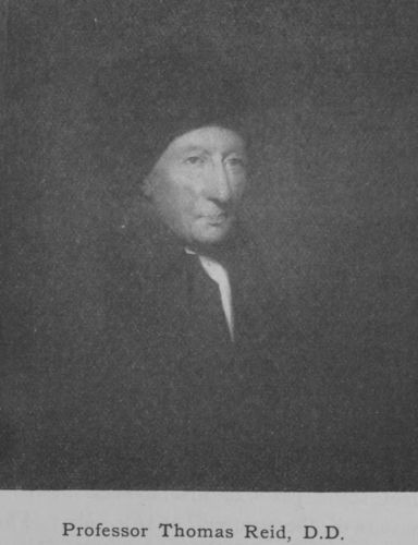
Professor Thomas Reid, D.D.
The sphere of imaginative literature is not the Aberdonian’s
sphere. Criticism, Philosophy, History, Science
are more in his way, and yet a few names can be given
as of some note in pure literature. Foremost in time and
unrivalled in his own department is Barbour, Archdeacon
of Aberdeen (1357). He studied at Oxford, and was contemporary
with Wycliffe and Chaucer. His great work
is _The Brus_, the most national of all Scottish poems. It
is instinct with the spirit of freedom, of chivalry and
romance, and details the struggles, the perils, and the
marvellous escapes of his hero Robert the Bruce, with
great simplicity, vividness, and directness. Alongside of
him we may place John Skinner, author of _Tullochgorum_,
_The Ewie wi’ the Crookit Horn_, and other well-known
songs. A native of Birse and for long episcopal minister
at Longside, he was the father of Bishop Skinner. His
fame rests on _Tullochgorum_, which Burns pronounced to
be the best of Scotch songs. Dr W. C. Smith, the author
of _Olrig Grange_ and _Borland Hall_, was born and educated
in Aberdeen. Dr George Macdonald, poet, novelist, and
critic, author of _Alec Forbes_ and other novels embodying
local colour and illustrating Aberdeenshire life and dialect
in the early part of last century, was a native of Huntly.
The best known poet connected with Aberdeen is Byron,
who spent some years of his boyhood in the city and
short periods of the summer on Deeside. These visits
to Ballater are reflected in his poem on Loch-na-gar and
elsewhere in his work. He left Aberdeen at the age
of 10 in 1798 and never saw it again.
History is a subject that has appealed to Aberdonians.
Dr David Masson’s monumental work on Milton must
be mentioned. Other historians are Joseph Robertson,
John Stuart, John Hill Burton, Bishop Burnet, who
wrote the _History of his Own Time_, Sir John Skene,
and Robert Gordon of Straloch, antiquarian and map-maker,
as well as his son James, minister of Rothiemay
and historian of the early years of the Troubles. The first
Principal of the University, Hector Boece, wrote histories
somewhat credulous and imaginative but quite authoritative
where his own times are concerned.
Of painters connected with the district may be mentioned
Jamesone, Dyce, and Phillip called “of Spain” from
his success with Spanish subjects. Architecture claims
Gibbs, whose Radcliffe Library at Oxford, and London
churches such as St Martin’s-in-the-Fields, still stand a
testimony to his art; the Smiths and Archibald Simpson
have already been mentioned. Sculpture owns the two
Brodies and Sir John Steell.
Scholars like Wedderburn and Ruddiman, Cruden of
_Concordance_ reputation, Dr James Legge, the Orientalist,
and Professor Robertson Smith, born in the Donside parish
of Keig, editor of the _Encyclopaedia Britannica_, Professor of
Arabic at Cambridge, and one of the most learned pundits
of his time—are but a few representatives of a long list.
The thirst for education and the well-taught parish
schools of the county contributed to bring about such
results. The doors of the University have for centuries
been opened by bursaries to the poorest boys, and in
this way many who were endowed with capacity above
ordinary entered the learned professions and rose to
eminence.
25. THE CHIEF TOWNS AND VILLAGES OF ABERDEENSHIRE.
(The figures in brackets after each name give the population in
1911, and those at the end of each section are references
to pages in the text.)
=Aberdeen= (161,952). From being entirely built of granite,
Aberdeen is best known as “The Granite City.” The light
grey stone gives the town a clean look which strikes visitors
from cities built of brick or of sandstone. Its many handsome
public buildings, banks, offices, churches and schools, all solid
and substantial, and of great architectural interest, are undoubtedly
finer than those of any other town of the same size
in the kingdom.
The first historical reference to it is in the twelfth century;
later a charter was obtained from King William the Lion,
granting the city certain trading privileges. Long before Edinburgh
and Glasgow had begun to show signs of rising to greatness,
Aberdeen was a port of extensive trade, but its growth was slow
until the dawn of the nineteenth century. In 1801, its population
was only 27,608; in 1831 this figure had doubled, and in recent
years, owing chiefly to the phenomenal growth of the fishing
industry, its progress has been rapid.
Aberdeen has long been a great educational centre. Its
Grammar School claims to have existed in the thirteenth century.
Its first University, King’s College in Old Aberdeen, was founded
in 1494 by Bishop Elphinstone, and its second, Marischal College
in New Aberdeen, by Earl Marischal in 1593. These were
united in 1860 as the University of Aberdeen. Since that time
the buildings of both Colleges have been largely added to, and
the number of professorships greatly increased. Its students in
the different faculties, Arts, Medicine, Science, Law and Divinity
are little short of 1000.
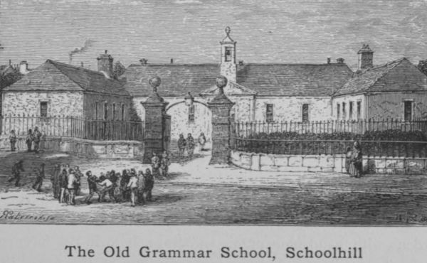
The Old Grammar School, Schoolhill
Being the only really large town in the county, and for that
matter in the whole north of Scotland, it tends to grow in
importance, and its business connections are ever extending. It
is the focus of the trawling industry, and of the granite trade;
while the agricultural interests of the county look to Aberdeen as
their chief mart and distributing medium. Its secondary schools,
its technical college, its agricultural college, its University, all
help to swell its population by bringing strangers to reside within
its boundaries. In itself it is clean, healthy and attractively
built, while its fairly equable climate, its relatively low rain-fall
(29 inches) and its equally low death-rate (14·2 per 1000) conduce
to its popularity as a residential town. Being the northern
terminus of the Caledonian Railway, and having excellent service
to London by the West Coast, the Midland, and the East Coast
routes, it obtains a large share of the tourist traffic; and the
sportsmen who fish in the Aberdeenshire rivers or shoot grouse
in the Aberdeenshire moors must all do more or less homage to
the county town.
The chief street of the city is Union Street created a century
ago at a cost which was considered reckless at the time but which
has been more than justified by the results. This first improvement
scheme, which has been followed up by others in recent
times, was the work of men with a wide outlook. Prominent
among the Provosts of enlightenment was Sir Alexander Anderson,
whose name is now at the eleventh hour stamped in memory
by the Anderson Drive—a fashionable west-end thoroughfare.
Union Street is the backbone from which all the other thoroughfares
radiate. It is broad and handsome and the buildings that
face each other across it are as a rule worthy of the street.
Union Bridge, one of Fletcher’s graceful structures, with a span
of 130 feet, makes a pleasing break in the line of buildings and
permits a view north and south along the Denburn valley. The
northern view, which shows Union Terrace and Union Terrace
Gardens with handsome public buildings, both in the foreground
and in the background, is undoubtedly one of the finest in the
city. The Duthie Park on the north bank of the Dee, the links
that fringe the northern coast, the picturesquely wooded amenities
of Donside, above and below Balgownie Bridge, the quaint other
world air of Old Aberdeen with its lofty trees, its grand cathedral
and the ancient crown of King’s College, these are all elevating
and meliorating influences that help to keep in check the
commercial spirit that rules about the harbour-quays and the
fish-market.
Aberdeen can boast of four daily newspapers besides several
weeklies. It claims the honour of having the oldest newspaper in
Scotland—_The Aberdeen Journal_—established in 1748. (pp. 3, 8,
11, 13, 20, 24, 37, 38, 39, 66, 68, 75, 80, 83, 85, 89, 91, 92, 94,
95, 101, 102, 107, 108, 109, 111, 126, 145, 162, 164, 165, 169,
172, 173.)
=Aberdour= (549) is a small village on the coast half-way
between Troup Head and Rosehearty. Sometimes called New
Aberdour to distinguish it from the parish, the village came into
existence in 1796. The parish is very ancient. Its church, now
in ruins, was dedicated to St Drostan, the disciple and companion
of St Columba. Aberdour is the birth-place of Dr Andrew
Findlater, once Head-master of Gordon’s Hospital (now College),
Aberdeen, and first editor of Chambers’s _Encyclopaedia_. (pp. 39,
62, 105, 119, 164.)
=Aboyne= (1525), properly called Charlestown of Aboyne in
compliment to the first Earl of Aboyne, is a picturesquely situated
village on Deeside with a high reputation for its bracing climate.
Near it is Aboyne Castle—for centuries the family seat of the
Marquis of Huntly. In the vicinity are Lochs Kinnord and
Davan. At Dinnet are beds of kieselguhr. (pp. 2, 8, 24, 31, 88,
117, 119, 162.)
=Alford= (pa. 1464), on Donside, is the terminus of the branch
railway from Kintore and the centre of a rich agricultural district
called the Vale of Alford. In the neighbourhood are several
interesting castles—Terpersie, Kildrummy and Craigievar. From
Alford the main Donside road leads up the valley to Strathdon
and Corgarff, from which there are passes both to Deeside and to
Speyside. (pp. 27, 71, 113, 115, 134, 160, 162.)
=Ballater= (1240), a small town beautifully situated on the
north side of the river Dee, in a level space enclosed by high
mountains, is 660 feet above sea-level. From Ballater coaches
drive daily to Braemar, passing Balmoral Castle half-way. (pp. 2,
8, 18, 24, 27, 33, 154, 162, 164, 176.)
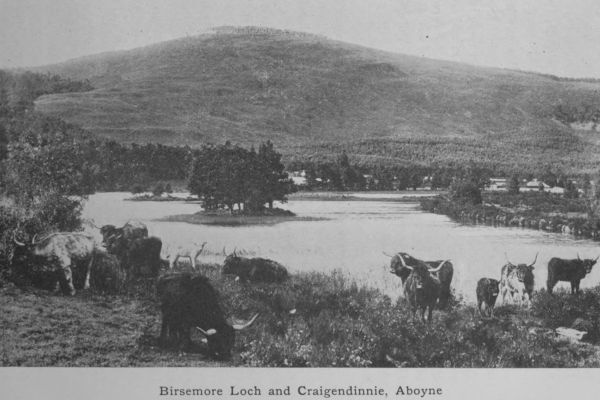
Birsemore Loch and Craigendinnie, Aboyne
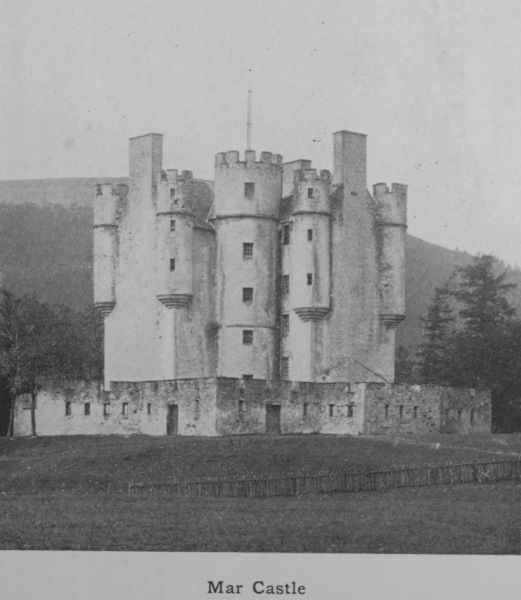
Mar Castle
=Braemar= (502), properly Castleton of Braemar, is the
highest village in the county, being 1100 feet above sea-level.
It stands at the junction of the Clunie and the Dee, and is finely
sheltered in a hollow amongst the surrounding mountains.
Braemar is a fashionable health resort. Some 10,000 strangers
visit it annually. At the beginning of the nineteenth century
it was not much more than a Highland clachan. Now it has
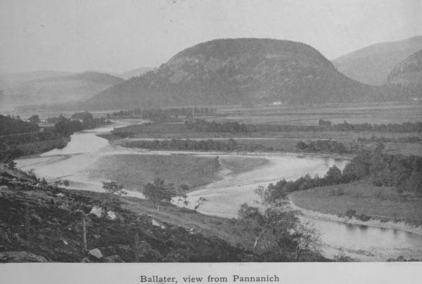
Ballater, view from Pannanich
spacious hotels with electric light and all modern conveniences on
a luxurious scale. Six miles distant is the famous Linn of Dee.
The Duke of Fife’s Highland residence, Mar Lodge, as well as
Mar Castle and Invercauld House, the home of the Farquharsons,
are all in the vicinity. From Braemar the ascent of Ben-Macdhui
is usually made, and sometimes also Loch-na-gar. A road leads
from Braemar up the valley of the Clunie and over the Cairnwell
to Blairgowrie. (pp. 8, 21, 22, 33, 66, 68, 75, 112, 161, 162.)
=Byth= (360), usually New Byth, is a village three miles from
Cuminestown, and founded in 1764. It is a bare and treeless
district. Near it are the hills of Fishrie with a large number of
crofts given off by the Earl of Fife in 1830 to poor people evicted
from other estates at a time when the fashion began of amalgamating
small holdings in larger farms. (pp. 91, 124, 163.)
=Collieston= is a fishing village circling round a romantic bay
near the parish church of Slains. Here in 1588 one of the ships
of the Spanish Armada (_Santa Catherina_) was wrecked. The
fishermen still call the creek St Catherine’s Dub. Several small
cannon have been recovered from the pool. Eighty years ago,
Collieston enjoyed a certain notoriety for smuggling, and the
graveyard of Slains close by contains evidence of the deeds of
violence that the contraband trade brought about. (pp. 38, 48, 54.)
=Culter=, eight miles west of Aberdeen, celebrated for its
paper-mills, which date back to 1750. This paper-mill, the
first of its kind in the north, manufactured superfine paper and
in particular the bank-notes of the Aberdeen Bank. (p. 89.)
=Cuminestown= (466), a village on the north side of
the Waggle Hill in Monquhitter, was established by Joseph
Cumine of Auchry in 1763. Joseph Cumine was a pioneer in
agricultural improvement. He planted trees and started the
manufacture of linen. About a mile distant is the smaller
village of Garmond. The villages were once much more populous
in the days when the spinning of flax and the knitting of stockings
were rural industries. (p. 40.)
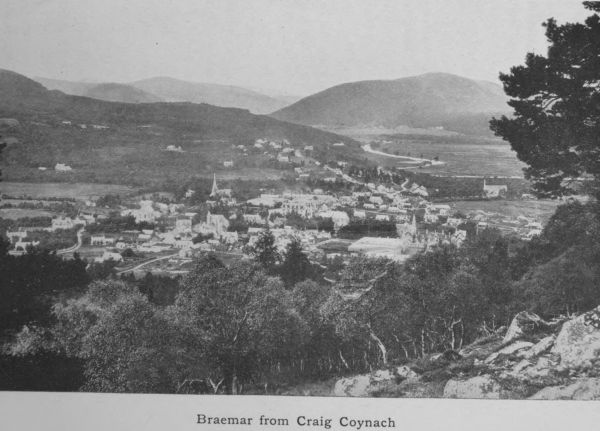
Braemar from Craig Coynach
=Ellon= (1307), a thriving town on the Ythan, is the junction
for the Cruden and Boddam Railway. It has a shoe factory and
large auction marts for the sale of cattle. The Episcopal Church—St
Mary’s on the Rock—was designed by George Edmund
Street and is a handsome building in Early English style. A
prominent divine in the pre-Disruption controversies, Dr James
Robertson, was parish minister of Ellon from 1832 to 1843.
Later he became a professor in Edinburgh University. Ellon is
a place of great antiquity. It was the seat of jurisdiction of the
Earldom of Buchan, and there the earls held their Head Court.
(pp. 29, 41, 163, 164, 171.)
=Fraserburgh= (10,570) is the third largest town in the county.
It is a busy, thriving place, being the great centre of the herring
fishing industry in Scotland. It was founded by Sir Alexander
Fraser, one of the Frasers of Philorth (now represented by Lord
Saltoun). The Frasers are said to have come into England with
the Normans. A royal charter was granted in 1546 erecting
“Faithlie” as it was then called into a free burgh of barony
with all the privileges. Sir Alexander Fraser was a great favourite
with James VI and was knighted at the baptism of Prince Henry,
1594: he was a man of enterprise; he built the town and the
harbour and erected public buildings. He received from King
James the privilege of founding a University in Fraserburgh, and
a building was set apart for this institution. Not only so but a
Principal was appointed in 1600. The College may have been
active for a few years, but very little is known of its history.
During the plague which raged for two years at Aberdeen, the
students of King’s College went for safety to Fraserburgh in 1647
and, it is supposed, occupied the old College buildings. A street
in the town is still called “College Bounds.” (pp. 8, 38, 59, 61,
76, 94, 95, 101, 102, 163, 164, 169.)
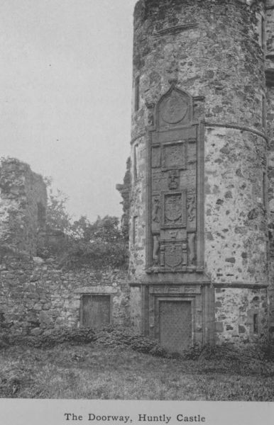
The Doorway, Huntly Castle
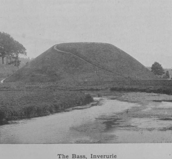
The Bass, Inverurie
=Huntly= (4229), the largest inland town of the county, is
situated at the confluence of the Deveron and the Bogie. It is
the centre of an extensive agricultural district—Strathbogie—and
has woollen and other manufactures. In the vicinity are the
ruins of Huntly Castle, the property of the Duke of Richmond
and Gordon. The first Lords of Strathbogie, being opposed to
Bruce’s claims of kingship, were disinherited and their lands
bestowed on Sir Adam Gordon, whose descendants became Earls
of Huntly, Marquises of Huntly and Dukes of Gordon. The old
castle of Strathbogie was destroyed after the battle of Glenlivet
in 1594, but rebuilt as Huntly Castle in 1602. Huntly is the
birth-place of Dr George Macdonald, poet and novelist. (pp. 29,
31, 91, 160, 162, 164, 176.)
=Insch= (616), a village on the Great North Railway, with
Benachie on one side, and the Culsalmond and Foudland Hills on
the other. The vitrified fort of Dunnideer is in the vicinity.
(pp. 119, 164.)
=Inverurie= (4069), a royal burgh at the confluence of the Ury
and the Don. The workshops of the Great North of Scotland
Railway were removed from Kittybrewster to Inverurie some
years ago, thereby increasing the population of the burgh. It is
one of the Elgin parliamentary burghs. The Bass of Inverurie
is a conical mound, long considered artificial, but now ascertained
to be a natural formation due to the action of the two rivers.
Inverurie has paper manufactures. In the neighbourhood is
Keith Hall, the seat of the Earl of Kintore. (pp. 27, 71, 80,
108, 109, 113, 132, 137, 160, 162, 164, 165, 169.)
=Kemnay= (948), about five miles up Donside from Kintore,
is well known for its extensive granite quarries, which sent stones
to build the Forth Bridge and the Thames Embankment. Near
it is Castle Fraser, one of the finest inhabited castles of the county.
Fetternear, once the county seat of the bishops of Aberdeen, is on
the opposite side of the river. (p. 83.)
=Kintore= (818) is a royal burgh of great antiquity. A mile
to the west are the ruins of Hallforest, destroyed in 1639. Kintore
has, in its vicinity, several “Druidical” circles and sculptured
stones. (pp. 27, 49, 108, 136, 160, 162, 164, 169.)
=Longside= (392) dates from 1801. A woollen factory
brought for a time prosperity to the village, but this has been
given up and the population dwindles. Rev. John Skinner, the
author of _Tullochgorum_, was for over sixty years minister of the
Episcopal Church at Linshart, close to the village of Longside.
Here also was born Jamie Fleeman, “the laird of Udny’s fool,”
a half-witted person whose blunt outspoken manner and shrewd
remarks are still widely remembered. (pp. 163, 176.)
=Maud= is the point where the Buchan railway bifurcates
for Peterhead and Fraserburgh. Maud is a centre for auction
sales of cattle. (p. 164.)
=Mintlaw= (377) was founded about the same period as Longside
and the fortunes of both villages, which are three miles apart,
have been similar. (p. 163.)
=Newburgh= (537), on the estuary of the Ythan, was at one
time notorious like Collieston for smuggling. Ships of small
burden still come up to its wharf at full tide and sometimes
proceed as far as Waterton. The bed of the estuary of the
Ythan is covered with mussels, much used in the past as bait by
the local fishermen, as well as for export to other fishing stations.
The revenue from this source has greatly fallen off in recent
years—line-fishing having suffered from the rise of trawling.
(p. 48.)
=New Deer= (675) is a village established about 1805.
Brucklay Castle, the seat of the Dingwall-Fordyce family,
recently converted into a mansion of the old Scottish castellated
style, and surrounded with tasteful grounds, is now one of the
most charming edifices in the district. A mile to the west is the
ruined castle of Fedderat. (p. 138.)
=New Pitsligo= (pa. 2226) is a village in the neighbourhood of
the sources of the Ugie, and extending for a mile in two parallel
streets along the eastern slope of the hill of Turlundie. It stands
500 feet above sea-level. The village takes its name from Sir
William Forbes of Pitsligo, who founded it in 1787. Here a
linen trade was at one time carried on; this gave place to hand-loom
weaving and ultimately to lace-making. The Episcopal
Church was designed by G. Edmund Street, and it is said to be
one of the best examples of his work in Scotland. The manufacture
of moss-litter from the peat in the neighbourhood was
recently started. (pp. 91, 163.)
=Old Deer= (179) is prettily situated on the South Ugie. The
district has memories of St Columba and St Drostan. In
the neighbourhood are the ruins of a Cistercian Abbey, and
“Druidical” circles. (pp. 2, 105, 113, 115, 117, 123.)
=Old Meldrum= (1110) was erected by charter into a burgh
of barony in 1672. It is well known for its turnip-seed. It
used to employ many persons in handloom weaving and in the
knitting of stockings. Both industries have fallen to decay, and
the population tends to dwindle. There is a long-established
distillery in the town. (pp. 108, 112, 163, 164.)
=Peterhead= (13,560), the most easterly town in Scotland, is
built of red granite. A century ago it was a fashionable watering-place,
and used to be a whaling station. Now its chief industry
is the herring fishing. South of the town a harbour of refuge is
being constructed by convict labour, from the convict prison close
by. The harbour of refuge will cost, it is said, a million of
money and its construction will occupy 25 to 30 years. A linen
factory once existed here, as also a woollen factory, which exported
cloth to the value of £12,000 a year. Both became extinct, but
the woollen industry was revived and still prospers. Another
prominent industry is granite polishing. At Inverugie Castle was
born Field-Marshal James Keith, whose statue stands in front of
the Town-House. The “Pretender” landed at Peterhead on
Christmas Day, 1715. Peterhead was erected into a burgh of
barony in 1593 by Earl Marischal, the founder of Marischal
College, Aberdeen. It continued to be part of the Earl’s estates
till the rebellion of 1715, when the lands were confiscated. The
Peterhead portion is now the property of the Merchant Maiden
Hospital of Edinburgh. (pp. 8, 29, 38, 39, 41, 57, 66, 68, 76, 83,
94, 95, 101, 102, 111, 163, 164, 169, 171.)
=Rosehearty= (1308) is a misspelt Gaelic name of which _Ros_,
a promontory, and _ard_, a height, are undoubted elements. The
little town stands on the shore a mile north of Pitsligo[1]. There is
a tradition that in the fourteenth century a party of Danes landed
and took up residence here, instructing the inhabitants, who were
mostly crofters, in the art of fishing. (pp. 62, 162.)
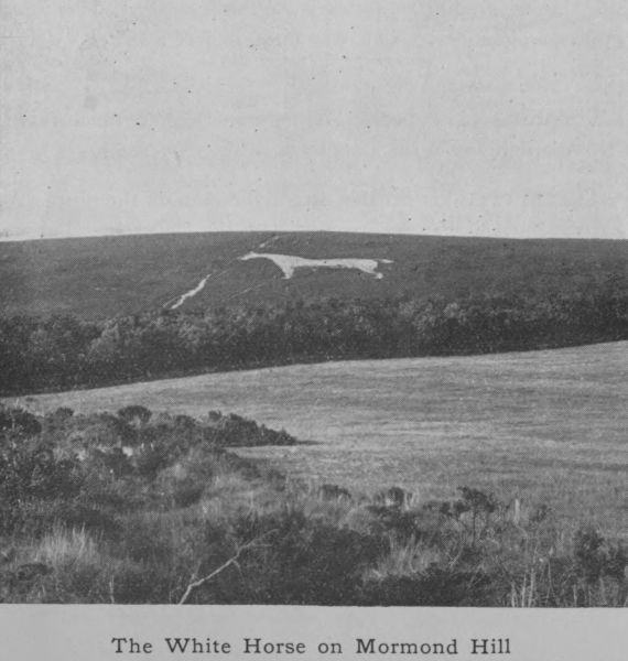
The White Horse on Mormond Hill
=Strichen= (1094) was formerly called Mormond, from the
hill at the base of which the village stands. This hill owing to
the comparatively level character of the surrounding country is a
conspicuous feature in the landscape for miles. On the south-western
side, the figure of a horse is cut out in the turf, the space
being filled up with white stones. This “White Horse” occupies
half an acre of ground and is visible at a great distance. On the
south side of the hill an antlered stag on a larger scale is figured
in the same manner. This was done so late as 1870. (pp. 11,
16, 38, 91, 158.)
=Torphins= (455), a rising village on Deeside, much resorted
to by Aberdonians in the summer months. (p. 106.)
=Turriff= (2346) is situated on a table-land on the north of the
burn of Turriff near its junction with the Deveron. Turriff is
midway between Aberdeen and Elgin; hence the couplet—
Choose ye, choise ye, at the Cross o’ Turra
Either gang to Aberdeen or Elgin o’ Moray.
Turriff is very ancient, being mentioned in the _Book of Deer_,
under the name of Turbruad, as the seat of a Celtic monastery
dedicated to St Congan, a follower of St Columba. The double
belfry of the old church (date 1635) is really a piece of castellated
architecture applied to an ecclesiastical edifice. The churchyard
gateway is also Early Scottish Renaissance. (pp. 11, 31, 40, 110,
112, 119, 163, 164.)
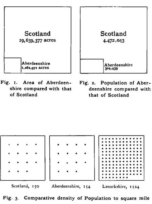
Fig. 1. Area of Aberdeenshire compared with that
of Scotland
Fig. 2. Population of Aberdeenshire compared with
that of Scotland
Fig. 3. Comparative density of Population to square mile
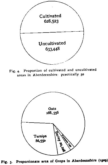
Fig. 4. Proportion of cultivated and uncultivated
areas in Aberdeenshire—practically 50%
Fig. 5. Proportionate area of Crops in Aberdeenshire (1909)
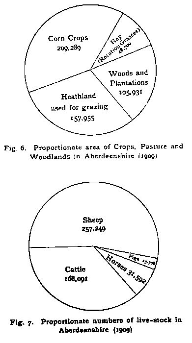
Fig. 6. Proportionate area of Crops, Pasture and
Woodlands in Aberdeenshire (1909)
Fig. 7. Proportionate numbers of live-stock in
Aberdeenshire (1909)
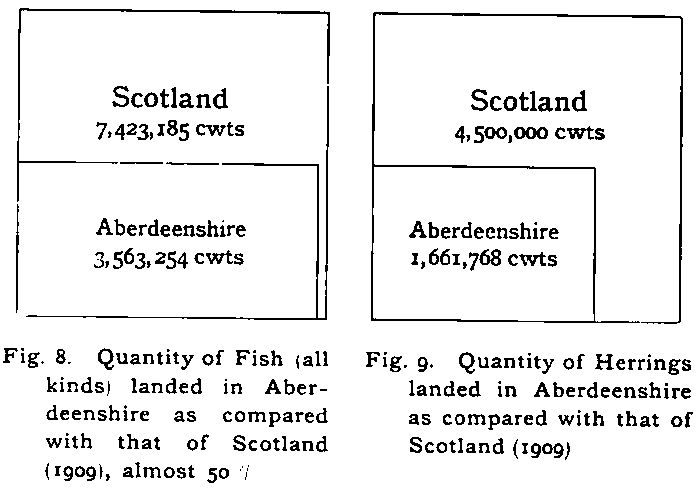
Fig. 8. Quantity of Fish (all kinds) landed in Aberdeenshire
as compared with that of Scotland (1909), almost 50%
Fig. 9. Quantity of Herrings landed in Aberdeenshire as
compared with that of Scotland (1909)