ADDITIONAL FACTS CONCERNING THE NATURAL
FEATURES OF THE GREAT PLAINS; THEIR
PRINCIPAL RIVERS AND VALLEYS; THEIR CLIMATE,
ETC., ETC.
"BY THE MOUTH OF TWO OR THREE WITNESSES."
In my endeavors to place Buffalo Land before the public in
its true light, I have felt a desire, as earnest as it is natural,
that my readers should feel that the subject has been
justly treated. The opinions of any one individual are liable
to be formed too hastily, and the country which before
one traveler stretches away bright and beautiful, may appear
full of gloomy features to another, who views it under different
circumstances. A late dinner and a sour stomach, before
now, have had more to do with an unfavorable opinion concerning
a new town or country than any actual demerits.
No two pairs of spectacles have precisely the same power, and
defects ofttimes exist in the glass, rather than the vision.
These considerations have been brought to my mind with
especial force when, after giving an account of our own expedition,
I have searched through the records of others. A
portion of the descriptions which I have been able to find are
the mature productions of travelers who, perched upon the top
of a stage-coach, or snugly nestled inside, have undertaken to
write a history of the country while rattling through it at
the best rate of speed ever attained by the "Overland Mail."
What the writers of this class lack in proper acquaintance
with their subject they usually make up by an air of profoundness,
and positiveness in expression, and the result has
more than once been the foisting upon the public of a species
of exaggeration and absurdity which Baron Munchausen himself
could scarcely excel.
As a rather curious illustration of the numerous absurdities
which have obtained currency concerning the plains, may be
mentioned the statement published more than once during the
winter of 1871-2, to the effect that the snow of that region
is different in character from that which falls elsewhere. In
support of this assumption, the fact is adduced that snow-plows
sometimes have but little effect upon it, on account of
its peculiar hardness, being pushed upon it, instead of through
it. A little more careful examination, however, would have
discovered that the snow itself is essentially similar to that
which descends elsewhere, but that the wind which drives it
into the "cuts" and ravines also carries with it a large
amount of sand and surface dirt; and this, packing with the
snow, causes the firmness in question.
The valuable surveys being made from time to time under
the auspices of the Government, in charge of persons of experience
and sagacity, are doing much to replace this superficial
knowledge with a more correct comprehension of what
the plains really are; and, altogether, we may well hope that
the time is not far distant when this whole wonderful region
will be as well understood as any portion of the national domain.
As the object of this work is to place before its readers all
the essential information now obtainable concerning the great
plains, no apology will be necessary for adding some of the
observations and opinions of other competent writers upon the
same subject. By far the most valuable source which I have
found to draw from in this connection, is the comprehensive
report published by Government, and bearing the title of
"United States Geological Survey of Wyoming and Contiguous
Territory, 1870. Hayden."
THE GREAT WEST.
Prof. Thomas informs us, in his report (embodied in Hayden's
survey), that, lying east of the divide, "the broad belt of
country situated between the 99th and 104th meridians, and
reaching from the Big Horn Mountains on the north to the
Llano Estacado on the south, contains one hundred and fifty
thousand square miles. If but one-fifth of it could be brought
under culture and made productive, this alone, when fully improved,
would add $400,000,000 to the aggregate value of the
lands of the nation. And, taking the lowest estimate of the
cash value of the crops of 1869 per acre, it would give an addition
of more than $200,000,000 per annum to the aggregate
value of our products.
"One single view from a slightly elevated point often embraces
a territory equal to one of the smaller States, taking in
at one sweep millions of acres. Eastern Colorado and Eastern
Wyoming each contains as much land sufficiently level for
cultivation as the entire cultivated area of Egypt."
FALL OF THE RIVERS.
The fall of the principal rivers traversing the region above
named is about as follows: Arkansas, to the 99th meridian,
eleven to fifteen feet to the mile; the Canadian, the same; the
South Platte, from Denver to North Platte, ten feet to the
mile; the North Platte, to Fort Fetterman, seven feet to the
mile. The descent of the country from Denver Junction to
Fort Hays is nine feet to the mile. Thus it will be seen that
abundant fall is obtainable to irrigate all the lands adjacent.
THE PRINCIPAL RIVERS AND VALLEYS OF BUFFALO LAND.
The Platte (or Nebraska), the Solomon, the Smoky Hill,
and the Arkansas, are the four largest rivers of Buffalo Land
proper, and form natural avenues to the eastward from the
mountains which shut it in upon the west.
THE VALLEY OF THE PLATTE.
Describing this, Hayden says: "West of the mouth of the
Elk Horn River, the valley of the Platte expands widely.
The hills on either side are quite low, rounded, and clothed
with a thick carpet of grass. But we shall look in vain for
any large natural groves of forest trees, there being only a
very narrow fringe of willows or cottonwoods along the little
streams. The Elk Horn rises far to the north-west in the
prairie near the Niobrara, and flows for a distance of nearly
two hundred miles through some of the most fertile and
beautiful lands in Nebraska. Each of its more important
branches, as Maple, Pebble, and Logan Creeks, has carved out
for itself broad, finely-rounded valleys, so that every acre may
be brought under the highest state of cultivation.
"The great need here will be timber for fuel and other economical
purposes, and also rock material for building. Still
the resources of this region are so vast that the enterprising
settler will devise plans to remedy all these deficiencies. He
will plant trees, and thus raise his own forests and improve his
lands in accordance with his wants and necessities.
"These valleys have always been the favorite places of abode
for numerous tribes of Indians from time immemorial, and the
sites of their old villages are still to be seen in many localities.
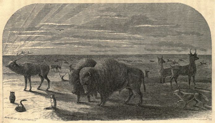
The buffalo, deer, elk, antelope, and other kinds of wild game,
swarmed here in the greatest numbers, and, as they recede
farther to the westward into the more arid and barren plains
beyond the reach of civilization, the wild nomadic Indian is
obliged to follow. One may travel for days in this region and
not find a stone large enough to toss at a bird, and very seldom
a bush sufficient in size to furnish a cane."
THE SOLOMON AND SMOKY HILL RIVERS.
The Solomon and Smoky Hill Rivers, while possessing some
of the general characteristics of the Platte, have more timber,
and the entire surrounding country is uniformly rolling. The
Smoky Hill is a visible stream only after reaching the
vicinity of Pond Creek, near Fort Wallace. Above that point
a desolate bed of sand hides the water flowing beneath. We
have spoken fully of these sections elsewhere.
THE ARKANSAS RIVER AND ITS TRIBUTARIES.
The Arkansas, passing through the southern portion of the
plains, has wide, rich bottoms, with a more sandy soil than is
found on the streams north. Its small tributaries have considerable
timber. All these valleys are being settled rapidly.
Again consulting Prof. Thomas' report, we find that "the
Arkansas River, rising a little north-west of South Park, runs
south-east to Poncho Pass, where, turning a little more toward
the east, it passes through a canyon for about forty miles,
emerging upon the open country at Canyon City. From this
point to the Eastern boundary of the Territory it runs almost
directly east.
"The mountain valley has an elevation of between seven
and eight thousand feet above the sea, while that of the plain
country lying east of the range varies from six thousand near
the base of the mountains to about three thousand five hundred
feet at the eastern boundary of the Territory. From Denver
to Fort Hays, a distance of three hundred and forty-seven
miles, the fall is three thousand two hundred and seven feet, or
a little over nine feet to the mile.
"The Arkansas River, from the mouth of the Apishpa to
the mouth of the Pawnee, a distance of two hundred and six
miles, has the remarkable fall of two thousand four hundred
and eight feet, or more than eleven feet to the mile.
"The headwaters of the Arkansas are in an oval park,
situated directly west of the South Park. The altitude of this
basin is probably between eight and nine thousand feet above
the level of the sea; the length is about fifty miles from north
to south, and twenty or thirty miles in width at the middle or
widest point. At the lower or southern end an attempt has
been made to cultivate the soil, which bids fair to prove a success.
Around the Twin Lakes, at the extreme point, oats,
wheat, barley, potatoes, and turnips have been raised, yielding
very fair crops. Below this basin the river, for twenty miles,
passes through a narrow canyon, along which, with considerable
difficulty, a road has been made. Emerging from this, it
enters the 'Upper Arkansas Valley' proper, which is a widening
of the bottom lands from two to six or eight miles. This
valley is some forty or fifty miles in length, and very fertile.
"The principal tributaries of the Arkansas that flow in from
the south, east of the mountains, are Hardscrabble and Greenhorn
Creeks (the St. Charles is a branch of the latter), Huerbano
River, which has a large tributary named Cuchara;
Apishpa River, Timpas Creek, and Purgatory River. On the
north side, Fountain Gui Bouille River and Squirrel Creek
are the principal streams affording water.
"This entire district affords broad and extensive grazing
fields for cattle and sheep, and quite a number of herders and
stock-raisers are beginning already to spread out their flocks
and herds over these broad areas of rich and nutritious grasses.
One of the finest meadows, of moderate extent, that I saw in
the Territory, was on the divide near the head of Monument
Creek, and near by was a large pond of cool, clear water. The
temperature of this section is somewhat similar to that of
Northern Missouri, and all the products grown there can be
raised here, some with a heavier yield and of a finer quality,
as wheat, oats, etc., while others, as corn, yield less, and are inferior
in quality."
As we descend the Arkansas, the valley becomes broader,
and it is often difficult to tell where the bottom ceases and the
prairie commences.
This stream attracted such a large portion of the immigration
of 1871 that it is already settled upon for some distance
above Fort Zarah. The soil is very rich, the climate pleasant
and healthy, and good success attends both stock and crop-raising.
STOCK-RAISING IN THE GREAT WEST.
Mr. W. N. Byers, who has lived for many years in
Colorado, lately contributed the following valuable article to
the Rocky Mountain News, treating more particularly of the
western half of the plains:
"After the mining interest, which must always take rank as
the first productive industry in the mountain territories of the
West, stock-raising will doubtless continue next in importance.
The peculiarities of climate and soil adapt the grass-covered
country west of the ninety-eighth degree of longitude especially
to the growth and highest perfection of horses, cattle,
and sheep. The earliest civilized explorers found the plains
densely populated with buffalo, elk, deer, and antelope, their
numbers exceeding computation. Great nations of Indians
subsisted almost entirely by the fruits of the chase, but, with
the rude weapons used, were incapable of diminishing their
numbers. With the advent of the white man and the introduction
of fire-arms, and to supply the demands of commerce,
these wild cattle have been slaughtered by the million, until
their range, once six hundred miles wide from east to west, and
extending more than two thousand miles north and south, over
which they moved in solid columns, darkening the plains, has
been diminished to an irregular belt, a hundred and fifty miles
wide, in which only scattering herds can be found, and they
seldom numbering ten thousand animals.
"There is no reason why domestic cattle may not take their
place. The climate, soil, and vegetation are as well adapted
to the tame as to the wild. The latter lived and thrived the
year round all the way up to latitude fifty degrees north.
Twenty years' experience proves that the former do equally
well upon the same range, and with the same lack of care.
Time, the settlement of the country, the growing wants of
agriculture, the encroachment of tilled fields, will gradually
narrow the range, as did semi-civilization that of the buffalo—first
from the Mississippi Valley westward, where that process
is already seen, and then from the Rocky Mountains toward
the east; but as yet the range is practically unlimited, and for
many years to come there will be room to fatten beeves to feed
the world.
"This great pasture land covers Western Texas, Indian
Territory, Kansas, Nebraska, and Dakota, Eastern New Mexico,
Colorado, Wyoming, and Montana, and extends far into
British America. The southerly and south-easterly portions
produce the largest growth of grass, but it lacks the nutritious
qualities of that covering the higher and drier lands farther
north and west. Rank-growing and bottom-land grasses contain
mostly water: they remain green until killed by frost,
when their substance flows back to the root, or is destroyed by
the action of the elements. The dwarf grass of the higher
plains makes but a small growth, but makes that very quickly
in the early spring, and then, as the rains diminish and the
summer heat increases, it dies and cures into hay where it
stands; the seed even, in which it is very prolific, remains
upon the stalk, and, though very minute, is exceedingly nutritious.
"In so far as the relative advantages of different portions
of this wide region may be thought by many to preponderate
over one another, we do not appreciate them at all, but would
as soon risk a herd in the valley of the Upper Missouri, the
Yellowstone, or the Saskachewan, as along the Arkansas, the
Canadian, or Red River. If any difference, the grass is better
north than south. One year the winter may be more severe in
the extreme north; the next it may be equally so in the south;
and the third it may be most inclement midway between the two
extremes; or, what is more common, the severe storms and
heavy snows may follow irregular streaks across the country
at various points. There are local causes and effects to be considered,
such as permanently affect certain localities favorably
or the contrary. For instance, nearer the western border of
the plains there is less high wind, because the lofty mountain
ranges form a shelter or wind breaker. Of local advantages,
detached ranges of mountains, hills, or broken land, timber,
brush, and deep ravines or stream-beds are the most important
in furnishing shelter, and, as a general thing, better
and always more varied pasture ground.
"There is never rain upon the middle and northern plains
during the winter months. When snow comes it is always
dry, and never freezes to stock. The reverse is the case in the
Northern and Middle States, where winter storms often begin
with rain, which is followed by snow, and conclude with
piercing wind and exceeding cold. Stock men can readily
appreciate the effect of such weather upon stock exposed to its
influence.
"The soil of the plains is very much the same every-where.
To a casual observer it looks sterile and unpromising,
but, when turned by the plow or spade, is found very
fertile. Near the mountains it is filled with coarse rock particles,
and under the action of the elements these become disproportionately
prominent on the surface. Receding from the
mountains, it becomes gradually finer, until gravel and bits
of broken stone are no longer seen. Being made up from the
wash and wearing away of the mountains, alkaline earths enter
largely into its composition, supplying inexhaustible quantities
of those properties which the eastern farmer can secure
only by the application of plaster, lime, and like manures.
These make the rich, nutritious grasses upon which cattle
thrive so remarkably, and to the constant wonder of new-comers,
who can not reconcile the idea of such comparatively
bare and barren-looking plains with the fat cattle that roam
over them.
"Besides the plains, there is a vast extent of pasture-lands
in the mountains. Wherever there is soil enough to support
vegetation, grass is found in abundance, to a line far above
the limit of timber growth, and almost to the crest of the
snowy range. These high pastures, however, are suitable
only for summer and autumn range; but in portions of the
great parks and large valleys, most parts of which lie below
eight thousand feet altitude above the sea, cattle, horses, and
sheep live and thrive the year round. The cost of raising a
steer to the age of five years, when he is at a prime age for
market, is believed to be about seven dollars and a half, or
one dollar and a half per year. A number of estimates
given us by stock men, running through several years, place
the average at about that figure. That contemplates a herd
of four hundred or more. Smaller lots of cattle will generally
cost relatively more. The items of expense are herding,
branding, and salt—nothing for feed."
THE CATTLE-HIVE OF NORTH AMERICA.
In this connection we may very properly quote from the
same writer the following paragraph in regard to the source
from whence all the cattle are now brought—that great
natural breeding ground, the prairie land of Texas.
"Texas is truly the cattle-hive of North America. While
New York, with her 4,000,000 inhabitants, and her settlements
two and a half centuries old, has 748,000 oxen and
stock cattle; while Pennsylvania, with more than 3,000,000
people, has 721,000 cattle; while Ohio, with 3,000,000 people,
has 749,000 cattle; while Illinois, with 2,800,000 people,
has 867,000 cattle; and while Iowa, with 1,200,000 people,
has 686,000 cattle; Texas, forty years of age, and with her
500,000 people, had 2,000,000 head of oxen and other cattle,
exclusive of cows, in 1867, as shown by the returns of the
county assessors.
"In 1870, allowing for the difference between the actual
number of cattle owned and the number returned for taxation,
there must be fully 3,000,000 head of beeves and stock
cattle. This is exclusive of cows, which, at the same time,
are reported at 600,000 head. In 1870 they must number
800,000—making a grand total of 3,800,000 head of cattle in
Texas. One-fourth of these are beeves, one-fourth are cows,
and the other two-fourths are yearlings and two-year olds.
"There would, therefore, be 950,000 beeves, 950,000 cows,
and 1,900,000 young cattle. There are annually raised and
branded 750,000 calves. These cattle are raised on the great
plains of Texas, which contain 152,000,000 acres. In the
vast regions watered by the Rio Grande, Nueces, Guadalupe,
San Antonio, Colorado, Leon, Brazos, Trinity, Sabine, and
Red Rivers, these millions of cattle graze upon almost tropical
growths of vegetation. They are owned by the ranchmen,
who own from 1,000 to 75,000 head each."
As specimen ranches, may be named the following: Santa
Catrutos Ranch belongs to Richard King. Amount of land,
84,132 acres. The stock consists of 65,000 cattle, 10,000
horses, 7,000 sheep, 8,000 goats. Three hundred Mexicans
are employed, and 1,000 saddle horses, on the place. O'Connor's
ranch, near Goliad, is an estate possessing about 50,000
cattle. The Robideaux ranch, on the Gulf, belonging to
Mr. Kennedy, contains 142,840 acres of land, and has 30,000
beef cattle in addition to other stock.
THE CLIMATE OF THE PLAINS.
Mr. R. S. Elliott, who has studied this matter carefully,
says: "The plains have been so often described as a rainless
region that great misconception in regard to the climate has prevailed.
The absolute precipitation is much greater than has
been in past years supposed, and is due to other causes. Meteorologists
who have described the rain-fall of the plains as
derived only or principally from the remaining moisture of
winds from the Pacific, after the passage of the Nevada and
Rocky Mountain ranges, have been greatly in error, and the
better conclusion now is, with all authorities who have given
any special attention to the subject, that the moisture which
fertilizes the Mississippi Valley, including the broad, grassy
plains, is derived from the Gulf of Mexico.
"At Fort Riley about sixty-nine per cent, of the annual precipitation
is in spring and summer; at Fort Kearney, eighty-one;
and at Fort Laramie, seventy-two per cent. From
observations at Forts Harker, Hays, and Wallace, on the line
of this road, the same rule seems to hold good. Records have
not been long enough continued at these three posts to give a
long average, but the mean appears to be between seventeen
and nineteen inches at Hays and Wallace, and possibly rather
more at Harker. The actual average for 1868 and 1869 at
Hays is 18.76 inches, and for the first six months of 1870 the
record is 10.68 inches. At Wallace the record for 1869 was
over seventeen inches, and in 1870, up to October 1, about the
same amount had fallen.
"Without records there can be only conjecture; and I can
only remark that there does not seem to be much diminution
in the annual rain-fall until we get as far west as the one
hundred and third meridian. Thence to the base of the
mountains (except perhaps in the timbered portions of the
great divide south of the line of this railway) the annual
average may be possibly two or three inches less than in the
midst of the plains—a peculiarity explained, hypothetically, by
the fact that the region 'lies to the westward of the general
course of the moisture currents of air flowing northward from
the Gulf of Mexico, and is so near the mountains as to lose
much of the precipitation that localities in the plains east and
north-east are favored with. The mountains seem to exercise an
influence—electrical and magnetical—in attracting moisture,
which is condensed in the cooler regions of their summits,
while the plains at their feet may be parched and heated to excess.'
This explanation may be fanciful, but the fact remains
that near the mountains the rains seem to decrease north of the
great divide; fortunately, however, this occurs in a region
where irrigation may be applied extensively and where there is
sufficient moisture to nourish bountiful crops of grass.
"The vegetation of the plains along wagon tracks and rail
road embankments shows a capability of production scarcely
suggested by the surface where undisturbed: wherever the
earth is broken up, the wild sunflower (Helianthus), and others
of the taller-growing plants, though previously unknown in
the vicinity, at once spring up.
"I have been on the plains all the time since early in May
till this date (22d of September). There has been much dry
weather, but I have not seen one cloudless day—no day on
which the sun would rise clear and roll along a canopy of
brass to the west. There has always been humidity enough to
form clouds at the proper height; and on many days they
would be seen defining, by their flat bottoms, the exact line
where condensation became sufficient to render the vapor visible.
I conclude, from all this, that abundant moisture has
floated over the plains to have given us a great deal more rain
than would be desirable if it had been precipitated.
"Sometimes a storm would be seen to gather near the
horizon, and we could see the rain pending from the clouds
like a fringe, hanging apparently in mid-air, unable to reach
the expectant earth. The rain stage of condensation had been
reached above, but the descending shower was re-vaporized apparently,
and thus arrested.
"These hot winds are not, so far as I have observed, apt to
be constant in one place for any considerable length of time;
they strike your face suddenly, and perhaps in a minute are
gone. They seem to run along in streaks or ovenfulls with the
winds of ordinary (but rather high) temperature. They do not
begin, I believe, till in July, as a general rule, and are over by
September 1, or perhaps by August 15. Their origin I take
to be, of course, in heated regions south or southwest of us;
but their peculiar occurrence, so capricious and often so brief,
I can not explain to myself satisfactorily.
"I may remark that this season, since about the 15th of
July, in these distant plains, has given us rain enough to make
beautifully verdant the spots in the prairie burnt off during
the 'heated' term in July. From Kit Carson eastward, the
rains have been, I think, exceptionally abundant. All
through the summer we have had dew occasionally, and it has
been remarked that buffalo meat has been more difficult of
preservation than heretofore—facts indicative of humidity in
the atmosphere, even where but little rain-fall was witnessed.
Turnips sown in August would have made a crop in this
vicinity—four hundred and twenty-two miles west of the state
line of Missouri,"
CLIMATIC CHANGES ON THE PLAINS.
"Facts such as these," continues the same writer, "seem to
sustain the popular persuasion that a climatic change is taking
place, promoted by the spread of settlements westwardly,
breaking up portions of the prairie soil, covering the earth
with plants that shade the ground more than the short grasses;
thus checking or modifying the reflection of heat from the
earth's surface, etc. The fact is also noted that even where
the prairie soil is not disturbed, the short buffalo grass disappears
as the 'frontier' extends westward, and its place is taken
by grasses and other herbage of taller growth. That this
change of the clothing of the plains, if sufficiently extensive,
might have a modifying influence on the climate, I do not
doubt; but whether the change has been already spread over a
large enough area, and whether our apparently or really wetter
seasons may not be part of a cycle, are unsettled questions.
"The civil engineers of the railways believe that the rains
and humidity of the plains have increased during the extension
of railroads and telegraphs across them. If this is the
case, it may be that the mysterious electrical influence in which
they seem to have faith, but do not profess to explain, has exercised
a beneficial influence. What effect, if any, the digging
and grading, the iron rails, the tension of steam in locomotives,
the friction of metallic surfaces, the poles and wires, the action
of batteries, etc., could possibly or probably have on the
electrical conditions, as connected with the phenomena of precipitation,
I do not, of course, undertake to say. It may be
that wet seasons have merely happened to coincide with railroads
and telegraphs. It is to be observed that the poles of the
telegraph are quite frequently destroyed by lightning; and it
is probable that the lightning thus strikes in many places
where before the erection of the telegraph it was not apt to
strike, and perhaps would not reach the earth at all.
"It is certain that rains have increased; this increase has
coincided with the extension of settlements, railroads, and telegraphs.
If influenced by these, the change of climate will go
on; if by extra mundane influences, the change may be permanent,
progressive, or retrograde. I think there are good
grounds to believe it will be progressive. Within the last
fifteen years, in Western Missouri and Iowa, and in Eastern
Kansas and Nebraska, a very large aggregate surface has been
broken up, and holds more of the rains than formerly. During
the same period modifying influences have been put in
motion in Montana, Utah, and Colorado. Very small areas
of timbered land west of the Missouri have been cleared—not
equal, perhaps, to the area of forest, orchard, and vineyards
planted. Hence it may be said that all the acts of man in this
vast region have tended to produce conditions on the earth's
surface ameliorative of the climate. With extended settlements
on the Arkansas, Canadian, and Red River of the south, as
well as on the Arkansas, on the river system of the Kaw Valley,
and on the Platte, the ameliorating conditions will be extended
in like degree; and it partakes more of sober reason
than wild fancy to suppose that a permanent and beneficial
change of climate may be experienced. The appalling deterioration
of large portions of the earth's surface, through the acts
of man in destroying the forests, justifies the trust that the culture
of taller herbage and trees in a region heretofore covered
mainly by short grasses may have a converse effect. Indeed, in
Central Kansas nature seems to almost precede settlements by
the taller grasses and herbage."
THE TREES AND FUTURE FORESTS OF THE PLAINS.
Mr. Elliott continues his article as follows: "The principal
native trees on the plains west of ninety-seventh meridian are:
Cottonwood, walnut, elm, ash, box-elder, hackberry, plum, red
cedar. To these may be added willow and grape-vines, and
also the locust and wild cherry mentioned by Abert as occurring
on the Purgatory. The black walnut extends to the one-hundredth
meridian. The elm and ash are of similar, perhaps
greater range. Hackberry has been observed west of one
hundred and first meridian. Cottonwood, elder, red cedar,
plum, and willow are persistent to the base of the mountains.
The extensive pine forest on the 'great divide' south of Denver,
although stretching seventy to eighty miles east from the
mountains, is not taken into view as belonging to the plains
proper. Its existence, however, suggests the use of its seeds in
artificial plantations in that region. The fossil wood imbedded
in the cretaceous strata in many parts of the plains is left out
of consideration, as belonging to a previous, though recent, geological
age; but the single specimens of trees found growing at
wide intervals are silent witnesses to the possibility of extended
forest growth.
"Were it possible to break up the surface to a depth of two
feet, from the ninety-seventh meridian to the mountains, and
from the thirty-fifth to the forty-fifth parallel, we should have
in a single season a growth of taller herbage over the entire
area, less reflection of the sun's heat, more humidity in the
atmosphere, more constancy in springs, pools, and streams,
more frequent showers, fewer violent storms, and less caprice
and fury in the winds. A single year would witness a changed
vegetation and a new climate. In three years (fires kept out)
there would be young trees in numerous places, and in twenty
years there would be fair young forests. The description of
the 'broad, grassy plains,' given in the foregoing pages, attests
their capacity to sustain animal life. For cattle, sheep, horses,
and mules, they are a natural pasture in summer, with (in
many parts) hay cured standing for winter. The famed Pampas,
with their great extremes of wet and drought, can not
bear comparison with our western plains. For grazing purposes,
the habitable character of our vast traditional 'desert' is
generally conceded, and hence it need not be enlarged on
here."
THE SUPPLY OF FUEL.
Of the question of fuel for the future dwellers upon the face
of Buffalo Land, Hayden, in his report, speaks as follows:
"The question often arises in the minds of visitors to this
region, how the law of compensation supplies the want of fuel
in the absence of trees for that use. Many persons have taken
the position that the Creator never made such a vast country,
with a soil of such wonderful fertility, and rendered it so suitable
for the abode of man, without storing in the earth beds of
carbon for his needs. If this idea could be shown to be true
in any case, we would ask why are the immense beds of coal
stored away in the mountains of Pennsylvania and Virginia,
while at the same time the surface is covered with dense forests
of timber. We now know that this law does not apply to the
natural world; and, if it did, this western country would be a
remarkable exception. The State of Nebraska seems to be
located on the western rim of the great coal basin of the
West, and only thin seams of poor coal will probably ever be
found; but in the vicinity of the Rocky Mountains, in
Wyoming, and Colorado, coal in immense quantities has been
hidden away for ages, and the Union Pacific Railroad has now
brought it near the door of every man's dwelling.
"These Rocky Mountain coal-beds will one day supply an
abundance of fuel for more than one hundred thousand square
miles along the Missouri River of the most fertile agricultural
land in the world."
Of this coal area, Persifor Frazier, Jr., says: "Those beds
which occur on the east flank of the Rocky Mountains have
been followed for five hundred miles and more, north and
south; and if it be true that these are 'fragments of one great
basin, interrupted here and there by the upheaval of mountain
chains, or concealed by the deposition of newer formations,'
then their extension east and west, or from the eastern range
of the Rocky Mountains or Black Hills to Weber Canyon,
where an excellent coal is mined, will fall but little short of
five hundred miles. Throughout this extent these beds of coal
are found between the upper cretaceous and lower tertiary (or
in the transition beds of Hayden), wherever these transition
beds occur, whether on the extreme flanks or in the valleys
and parks between the numerous mountain ranges. Assuming
that the eroding agencies together have cut off one-half of the
coal from this area, and taking one-half of the remainder as
their average longitudinal extent, we have over fifty thousand
square miles of coal lands, accounting the latitudinal extent as
only five hundred miles; whereas we have no reason to believe
that it terminates within these bounds, but, on the contrary,
good reason for supposing that it extends northward far into
Canada, and southward with the Cordilleras. All this territory
has been omitted in the estimate of the extent of our coal
fields."
DISTRICTS CONTIGUOUS TO THE PLAINS.
The reader has now had the salient features of the great
plains placed before him in succession. The more interesting
districts immediately adjoining will well repay the reader for a
brief consideration.
THE NORTH PLATTE DISTRICT.
A late writer, who has studied the country of which he
speaks very closely,[6] thus describes the North Platte District:
"The distance from the mouth of the North Platte, where
it joins the South Platte on the Union Pacific Railroad, to its
sources in the great Sierra Madre, whose lofty sides form the
North Park, in which this stream takes its rise, is more than
eight hundred miles. Its extreme southern tributaries head in
the gorges of the mountains one hundred miles south of the
railroad, and receive their water from the melting snows of
these snow-capped ranges. Its extreme western tributaries rise
in the Wahsatch and Wind River ranges, sharing the honor of
conveying the crystal snow waters from the continental divide
with the Columbia and Colorado of the Pacific. Its northern
tributaries start oceanward from the Big Horn Mountains,
three hundred miles north of the starting-point of its southern
sources.
"It drains a country larger than all New England and New
York together. East of the Alleghany Mountains there is no
river comparable to this clear, swift mountain stream in its
length or in the extent of country it drains.
"The main valley of the North Platte, two hundred miles
from its mouth to where it debouches through the Black Hills
out on to the great plains, is an average of ten miles wide.
Nearly all this area—two thousand square miles—is covered
with a dense growth of grass, yielding thousands of tons of
hay. The bluffs bordering these intervals are rounded and
grass-grown, gradually smoothing out into great grassy plains,
extending north and south as far as the eye can see.
"Of the country, Alexander Majors says, in a letter to the
writer of this article: 'The favorite wintering ground of my
herders for the past twenty years has been from the Caché a la
Poudre on the south to Fort Fetterman on the north, embracing
all the country along the eastern base of the Black Hills.' It
was of this country that Mr. Seth E. Ward spoke, when he
says: 'I am satisfied that no country in the same latitude, or
even far south of it, is comparable to it as a grazing and stock-raising
country. Cattle and stock generally are healthy, and
require no feeding the year round, the rich 'bunch' and
'gramma' grasses of the plains and mountains keeping them,
ordinarily, fat enough for beef during the entire winter,'
"All this region east of the Black Hills is at an elevation
less than five thousand feet. The climate, as reported from
Fort Laramie for a period of twenty years, is 50° Fahrenheit.
The mean temperature for the spring months is 47°, for the
summer months 72°, for autumn 60°, for winter 31°. The
annual rain-fall is about eighteen inches—distributed as follows:
Spring, 8.69 inches; summer, 5.70 inches; autumn, 3.69
inches. The snow fall is eighteen inches.
"There is in the North Platte Basin, east of the Black Hills
divide, at least eight million acres of pasturage, with the
finest and most lasting streams, and good shelter in the bluffs
and canyons. As I have said before, we can only judge of the
extent and resources of such a single region by comparison.
Ohio has six million sheep, yielding eighteen million pounds of
wool, bringing herd farmers an aggregate of four and one-half
million dollars. This eight million acres of pasture
would at least feed eight million sheep, yielding twenty-four
million pounds of wool, and, at the same price as Ohio wool,
six million dollars. Now, this money, instead of going to
build up ranches, stock-farms, store-houses, woolen mills, and
all the components of a great and thrifty settlement, is sent by
our wool-growers and woollen manufacturers to Buenos Ayres,
to Africa, and Australia, to enrich other people and other lands,
while our wool-growing resources remain undeveloped.
"As you follow the North Platte up through the Black Hill
Canyon, you come out upon the great Laramie plains, which lie
between the Black Hills on the east and the snowy range on
the west. These plains are ninety miles north and south, and
sixty miles east and west. They are watered by the Big and
Little Laramie Rivers, Deer Creek, Rock Creek, Medicine
Bow River, Cooper Creek, and other tributaries of the North
Platte. It is on the extreme northern portion of these plains,
in the valley of Deer Creek, that General Reynolds wintered
during the winter of 1860, and of which he remarks, on pages
seventy-four and seventy-five of his 'Explorations of the Yellowstone,"
as follows:
"Throughout the whole season's march the subsistence of
our animals had been obtained by grazing after we had reached
our camp in the afternoon, and for an hour or two between the
dawn of day and our time of starting. The consequence was
that, when we reached our winter quarters there were but few
animals in the train that were in a condition to have continued
the march without a generous grain diet. Poorer and more
broken-down creatures it would be difficult to find. In the
spring they were in as fine condition for commencing another
season's work as could be desired. A greater change in their
appearance could not have been produced even if they had been
grain-fed and stable-housed all winter. Only one was lost, the
furious storm of December coming on before it had gained sufficient
strength to endure it. The fact that seventy exhausted
animals, turned out to winter on the plains the first of November,
came out in the spring in the best condition, and with
the loss of but one of their number, is the most forcible commentary
I can make on the quality of the grass and the character
of the winter.'
"These plains have been favorite herding grounds of the
buffalo away back in the pre-historic age of this country.
Their bones lie bleaching in all directions, and their paths,
deeply worn, cover the whole plain like a net-work. Their
'wallows,' where these shaggy lords of animal creation tore
deep pits into the surface of the ground, are still to be seen.
Elk, antelope, and deer still feed here, and the mountain sheep
are found on the mountain sides and in the more secluded valleys
of the Sierra Madre range—all proving conclusively that
this has afforded winter pasturage from time immemorial.
Since 1849 many herds of work-oxen, belonging to emigrants,
freighters, and ranchmen, have grazed here each winter.
"South of the Laramie plains is the North Park, one of
three great parks of the Rocky Mountains, so fully described
by Richardson, Bross, and Bowles. This North Park is
formed by the great Snowy Range. It is a valley from six to
eight thousand feet high, ninety miles long, and forty miles
wide, surrounded by snowy mountains from thirteen to fifteen
thousand feet high. These mountain tops and sides are completely
covered with dense growths of forests; the lower hill-sides
and this great valley are covered with grasses. The
forests and mountains afford ample shelter from sweeping
winds. Here, as well as on the Laramie plains, the buffalo
grazed in great herds; and here the Ute hunters, from some
hidden canyons, dashed down among them on their trained and
fleet ponies, shooting their arrows with unerring aim on all
sides, and having such glorious sport as kings might court and
envy. The Indians are now gone from this valley, and the
buffalo nearly so. On the two million acres in this valley not
twenty head of cattle graze.
"This great park, splendidly watered by the three forks of
the Platte, and by a hundred small streams that drain these
lofty mountains of their snows and rains—rich in all kinds of
nutritious grasses, plentifully supplied with timber; on the
tertiary coal fields, with iron, copper, lead, and gold—has not
one real settler. There are a few miners, but where there
should be flocks and herds of sheep and cattle without number,
there is only the wild game—the elk, antelope, and deer."
THE VALLEYS OF THE WHITE EARTH AND NIOBRARA.
These streams are branches of the Missouri—the one mainly
in Dakota Territory, and the other in Nebraska. The following
graphic paragraphs concerning them are from Hayden
again:
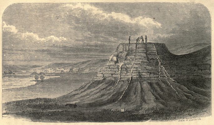
"I have spent many days exploring this region (the White
Earth Valley) when the thermometer was 112° in the shade,
and there was no water suitable for drinking purposes within
fifteen miles. But it is only to the geologist that this place
can have any permanent attraction. He can wind his way
through the wonderful canyons among some of the grandest
ruins in the world. Indeed, it resembles a gigantic city fallen
to decay. Domes, towers, minarets and spires may be seen on
every side, which assume a great variety of shapes when
viewed in the distance. Not unfrequently the rising or the
setting sun will light up these grand old ruins with a wild,
strange beauty, reminding one of a city illuminated in the
night, when seen from some high point. The harder layers
project from the sides of the valley or canyon with such regularity
that they appear like seats, one above the other, of some
vast amphitheater.
"It is at the foot of these apparent architectural remains
that the curious fossil treasures are found. In the oldest beds
we find the teeth and jaws of a Hyopotamus, a river-horse
much like the hippopotamus, which must have sported in his
pride in the marshes that bordered this lake. So, too, the
Titanotherum, a gigantic pachyderm, was associated with a
species of hornless rhinoceros. These huge rhinoceroid animals
appear at first to have monopolized this entire region, and
the plastic, sticky clay of the lowest bed of this basin, in which
the remains were found, seems to have formed a suitable bottom
of the lake in which these thick-skinned monsters could
wallow at pleasure."
Of the fauna of the Niobrara and Loup Fork Valleys, he
speaks as follows: "In the later fauna were the remains of a
number of species of extinct camels, one of which was of the
size of the Arabian camel, a second about two-thirds as large.
Not less interesting are the remains of a great variety of forms
of the horse family, one of which was about as large as the
ordinary domestic animal, and the smallest not more than two
or two and a half feet in height, with every intermediate grade
in size."
NEW MEXICO—ITS SOIL, CLIMATE, RESOURCES, ETC.
Bordering on what might be called the south-western corner
of the plains, or perhaps more properly forming, over its
eastern half, part of them, lies New Mexico. I find the following
valuable description of the soil, climate, and productions
of this section in the report of Prof. Cyrus Thomas:
"The best estimate I can make of the arable area of the
Territory is about as follows: In the Rio Grande district, one
twentieth, or about two thousand eight hundred square miles;
in the strip along the western border, one-fiftieth, or about six
hundred square miles; in the north-eastern triangle, watered by
the Canadian River, one-fifteenth, or about one thousand four
hundred square miles. This calculation excludes the 'Staked
Plains,' and amounts in the aggregate to four thousand eight
hundred square miles, or nearly two million nine hundred
thousand acres. This, I am aware, is larger than any previous
estimate that I have seen; but when the country is penetrated
by one or two railroads, and a more enterprising agricultural
population is introduced, the fact will soon be developed that
many portions now considered beyond the reach of irrigation
will be reclaimed. I do not found this estimate wholly upon
the observations made in the small portions I have visited, but,
in addition thereto, I have carefully examined the various reports
made upon special sections, and have obtained all the information
I could from intelligent persons who have resided in
the Territory for a number of years.
"As the Territory includes in its bounds some portions of
the Rocky Mountain range on which snow remains for a great
part of the year, and also a semi-tropical region along its
southern boundary, there is, of necessity, a wide difference in
the extremes of temperature. But, with the exception of the
cold seasons of the higher lands at the north, it is temperate
and regular. The summer days in the lower valleys are quite
warm, but, as the dry atmosphere rapidly absorbs the perspiration
of the body, it prevents the debilitating effect experienced
where the air is heavier and more saturated with
moisture. The nights are cool and refreshing. The winters,
except in the mountainous portions at the north, are moderate,
but the difference between the northern and southern sections
during this season is greater than during the summer. The
amount of snow that falls is light, and seldom remains on the
ground longer than a few hours. The rains principally fall
during the months of July, August, and September, but the
annual amount is small, seldom exceeding a few inches. When
there are heavy snows in the mountains during the winter,
there will be good crops the following summer, the supply of
water being more abundant, and the quantity of sediment
carried down greater, than when the snows are light. Good
crops appear to come in cycles—three or four following in succession;
then one or two inferior ones.
"During the autumn months the wind is disagreeable in
some places, especially near the openings between high ridges,
and at the termini of or passes through mountain ranges.
There is, perhaps, no healthier section of country to be found
in the United States than that embraced in the boundaries of
Colorado and New Mexico; in fact, I think I am justified in
saying that this area includes the healthiest portion of the
Union. Perhaps it is not improper for me to say that I have
no personal ends to serve in making this statement, not having
one dollar invested in either of these Territories in any way
whatever; I make it simply because I believe it to be true.
Nor would I wish to be understood as contrasting with other
sections of the Rocky Mountain region, only so far as these
Territories have the advantage in temperature. It is possible
Arizona should be included, but, as I have not visited it, I can
not speak of it.
"There is no better place of resort for those suffering with
pulmonary complaints than here. It is time for the health-seekers
of our country to learn and appreciate the fact that
within our own bounds are to be found all the elements of
health that can possibly be obtained by a tour to the eastern
continent, or any other part of the world; and that, in addition
to the invigorating air, is scenery as wild, grand, and
varied as any found amid the Alpine heights of Switzerland.
And here, too, from Middle Park to Los Vegas, is a succession
of mineral and hot springs of almost every character.
"The productions of New Mexico, as might be inferred from
the variety of its climate, are varied, but the staples will evidently
be cattle, sheep, wool, and wine, for which it seems to
be peculiarly adapted. The table-lands and mountain valleys
are covered throughout with the nutritious gramma and other
grasses, which, on account of the dryness of the soil, cure upon
the ground, and afford an inexhaustible supply of food for
flocks and herds both summer and winter. The ease and comparatively
small cost with which they can be kept, the rapidity
with which they increase, and exemption from epidemic diseases,
added to the fact that winter-feeding is not required,
must make the raising of stock and wool-growing a prominent
business of the country—the only serious drawback at present
being the fear of the hostile Indian tribes. But, as these remarks
apply equally well to all these districts, I will speak
farther in regard to this matter when I take up the subject of
grazing in this division.
"The cattle and sheep of this Territory are small, because
no care seems to be taken to improve the breed. San Miguel
County appears to be the great pasturing ground for sheep,
large numbers being driven here from other counties to graze.
Don Romaldo Baca estimates that between five hundred
thousand and eight hundred thousand are annually pastured
here—about two-thirds of which are driven in from other
sections. His own flocks number between thirty thousand
and forty thousand head; those of his nephew twenty-five
thousand to thirty thousand; Mr. Mariano Trissarry, of Bernalillo
County, owns about fifty-five thousand; and Mr. Gallegos,
of Santa Fé, nearly seventy thousand head.
"Don Romaldo Baca stated to me that his flocks yielded
him an annual average of about one and a half pounds of
washed wool to the sheep; that the average price of sheep was
not more than two dollars per head; that the wool paid all expenses,
and left the increase, which is from fifty to seventy-five
per cent. per annum, as his profit. From these figures some
estimate may be formed of what improved sheep would yield.
"Wheat and oats grow throughout the Territory, but the
former does not yield as heavily in the southern as in the
northern part. If any method of watering the higher plateau
is ever discovered, I think that it will produce heavier crops of
wheat than the Valley of the Rio Grande.
"Corn is raised from the Vermijo, on the east of the
mountains, around to the Culebra, on the inside; in fact, it is
the principal crop of San Miguel County, but the quality and
yield is inferior to that which can be produced in the Rio
Grande Valley and along the Rio Bonito. The southern
portion of the Rio Pecos Valley and the Canadian bottoms are
probably the best portions of the Territory for this cereal.
"Apples will grow from the Taos Valley south, but peaches
can not be raised to any advantage north of Bernalillo, in the
central section; but it is likely they would do well along some
of the tributaries and main valley of the Canadian River.
They also appear to grow well and produce fruit without irrigation
in the Zuñi country; and the valley of the Mimbres is
also adapted to their culture. Apricots and plums grow wherever
apples or peaches can be raised. I neglected to obtain any
information in regard to pears, but, judging from the similarity
of soil and climate here to that of Utah and California, where
this fruit grows to perfection, I suppose that in the central and
southern portions it would do well.
"The grape will probably be the chief, or at least the most
profitable, product of the soil. The soil and climate appear to
be peculiarly adapted for its growth, and the probability is that,
as a grape-growing and wine-producing section, it will be second
only to California. From Col. McClure I learned that the
amount of wine made in 1867 was about forty thousand gallons,
and that the crop of 1869 would probably reach one hundred
thousand gallons. I have not been informed since whether his
estimate was verified or not. A good many vineyards were
planted in 1869—at least double the number of 1868. Several
Americans, anticipating the building of a railroad through that
section, have engaged in this branch of agriculture. The wine
that is made here is said to be of an excellent quality.
"Beets here, as in Colorado, grow to an enormous size, and
it is quite likely that the sugar beet would not only yield heavy
crops, but also contain a large per cent. of saccharine matter.
I am rather inclined to believe that soil which is impregnated
with alkaline matter will favor the production of the saccharine
principle. I base this opinion wholly on observations made in
Utah in regard to its effect on fruit; therefore experiments may
prove that I am wholly mistaken. It is possible the experiment
has been tried; if so, I am not aware of it.
"The Irish potatoes are inferior to those raised further
north. Cabbages grow large and fine. Onions from the Raton
Mountains south have the finest flavor of any I ever tasted,
and therefore I am not surprised that Lieut. Emory found the
dishes at Bernalillo 'all dressed with the everlasting onion.'
But, as to the 'Chili,' or pepper, which is so extensively raised
and used in New Mexico, I beg to be excused, unless I can
have my throat lined with something less sensitive than
nature's coating. Sweet potatoes have been successfully tried
in the vicinity of Fort Sumner and along the head-waters of the
Rio Bonito. Melons, pumpkins, frijoles, etc., are raised in profusion
in the lower valleys; and I understand cotton was
formerly grown in limited quantities.
"As a general thing, the mountains afford an abundance of
pine for the supply of lumber and fuel to those sufficiently near
to them. Some of the valleys have a limited amount of cottonwood
growing along them. In addition to pine, spruce and
cottonwood, the stunted cedar and mesquit, which is found over
a large area, may be used for fuel. The best timbered portion
of the Rio Grande Valley is between Socorro and Doña Aña.
The east side of the Guadalupe range has an abundant supply
of pine of large size. Around the head-waters of the Pecos is
some excellent timber. Walnut and oak are found in a few
spots south, but in limited quantities, and of too small a size to
be of much value."
THE DISAPPEARING BISON.
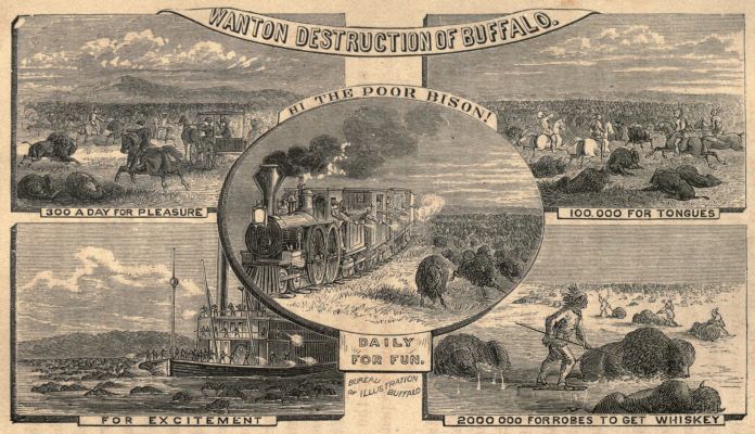
In connection with this general review of Buffalo Land, it
is interesting to note that while civilization, advancing from
the east, pushes our bison west, another tide of human beings,
creeping out from the mountains eastward, presses the buffalo
back before it. The brute multitude is thus between two
advancing lines, which will soon crush it. In confirmation of
this, I find the following in Hayden's notes of the country
along the base of the Laramie Mountains:
"These broad, grassy plains are not yet entirely destitute
of their former inhabitants; flocks of antelope still feed on the
rich, nutritious grasses; but the buffalo, which once roamed
here by thousands, have disappeared forever. No trace of
them is now left but the old trails, which pass across the
country in every direction, and the bleached skulls which are
scattered here and there over the ground. These traces are
fast passing away. The skulls are decaying rapidly, and this
once peculiar feature of the landscape in the West will be lost.
Two years ago I collected a large quantity of these bleached
skulls and distributed them to several of our museums, in
order to insure their preservation.
"There is also a singular ethnological fact connected with
these skulls. We shall observe that the greater part of them
have the forehead broken in for a space of three or four
inches in diameter. Whenever an Indian kills a buffalo, he
fractures the skull with his tomahawk and extracts the brains,
which he devours in a raw state.
"Indians or old trappers traveling through the enemy's
country always fear to build a fire, lest the smoke attract the
notice of the foe. The consequence is that they have contracted
the habit of eating certain parts of an animal in an
uncooked condition. I have estimated that six men may make
a full meal from a buffalo without lighting a fire. The ribs on
one side are taken out with a knife, and the concavity serves
as a dish. The brains are taken out of the skull, and the
marrow from the leg-bones, and the two are chopped together
in the rib-dish. The liver and lungs are eaten with a keen
relish; also certain portions of the intestines; and the blood
supplies an excellent and nutritious drink.
"Both Indian and buffalo have probably disappeared forever
from these plains. Elk, black-tailed deer, red deer,
mountain sheep, wolves, and the smaller animals, are still quite
abundant, especially in the valleys of the small streams, where
they flow down through the mountains. Elk Mountain and
Sheephead Mountain have always been noted localities for
these animals."
THE FISH WITH LEGS.
But while the buffalo has become extinct in that locality, an
inhabitant of the water may be preparing (query: in support
of the theory of development?) to take its place. I quote
again from Hayden:
"There are other attractions here, of which the traveler will
be informed long before he reaches the locality. The 'fish
with legs' are the only inhabitants of the lake, and numbers of
persons make it a business to catch and sell them to travelers.
During the summer season they congregate in great numbers
in the shallow water among the weeds and grass near the
shore, and can be easily caught; but in cold weather they
retire to the deeper portions of the lake, and are not seen
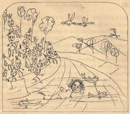
again until spring. These little animals are possessed of gills,
and, were it not for the legs, would most nearly resemble a
miniature cat-fish. But when warm weather comes, a form
closely resembling them, but entirely destitute of gills, may be
seen in the water swimming, or creeping clumsily about on
land. Sometimes they travel long distances, and are found in
towns, near springs or wet places, usually one at a time, while
those with gills are never seen except in the alkaline lakes
which are so common all over the West."
THE MOUNTAIN SUPPLY OF LUMBER FOR THE PLAINS.
In connection with this (the western) border of the plains,
it is interesting to note what the same writer says, of a future
supply of lumber:
"Not only in the more lofty ranges, but also in the lower
mountains, are large forests of pine timber, which will eventually
become of great value to this country. Vast quantities
of this pine, in the form of railroad ties, are floated down the
various streams to the Union Pacific Railroad. One gentleman
alone contracted for five hundred and fifty thousand ties,
all of which he floated down the stream from the mountains
along the southern side of the Laramie Plains. The Big and
Little Laramie, Rock Creek, and Medicine Bow River, with
their branches, were here literally filled with ties at one time;
and I was informed that, in the season of high water, they can
be taken to the railroad from the mountains, after being cut
and placed in the water, at the rate of from one to three cents
each. These are important facts, inasmuch as they show the
ease with which these vast bodies of timber may be brought to
the plains below and converted into lumber, should future
settlement of the country demand it."
"On the summits of these lofty mountains are some most
beautiful, open spots, without a tree, and covered with grass
and flowers. After passing through dense pine forests for
nearly ten miles, we suddenly emerged into one of these park-like
areas. Just in the edge of the forest which skirted it
were banks of snow six feet deep, compact like a glacier, and
within a few feet were multitudes of flowers—and even the
common strawberry seemed to flourish. These mountains are
full of little streams of the purest water, and for six months
of the year good pasturage for stock could be found."
THE END.
Variations in spelling and hyphenation have been retained.
Obvious printer errors have been silently corrected.
Page 341: "What is the nature of these creatures thus left stranded ..." The word "is" was supplied by the transcriber.