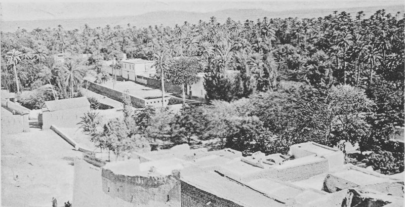
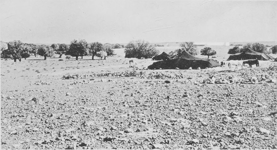
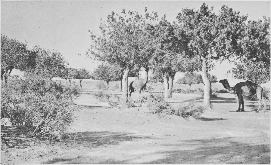
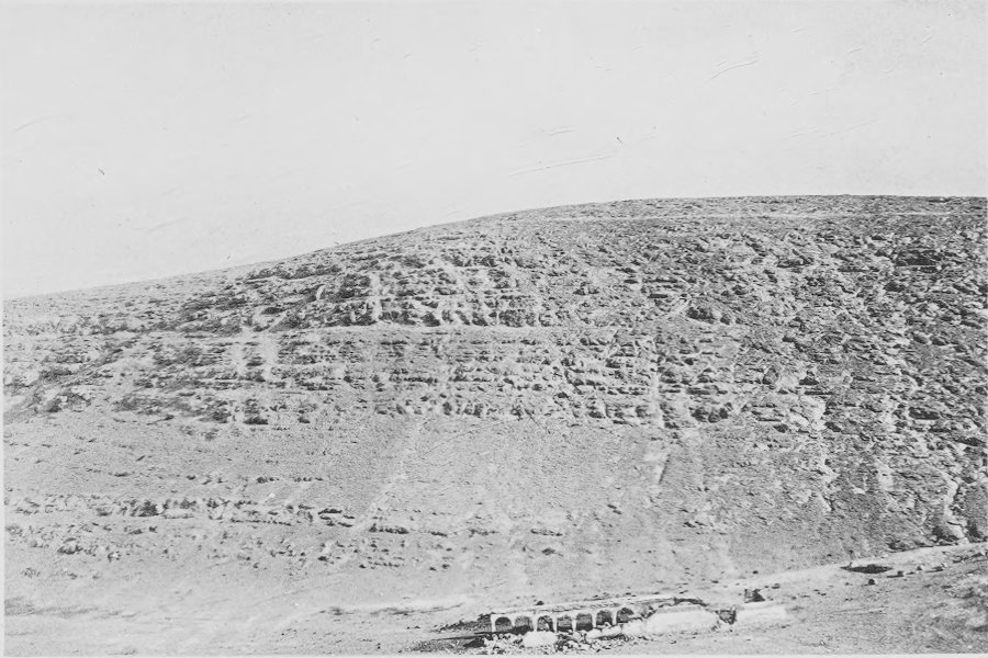
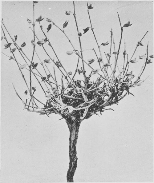
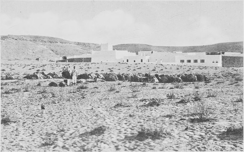
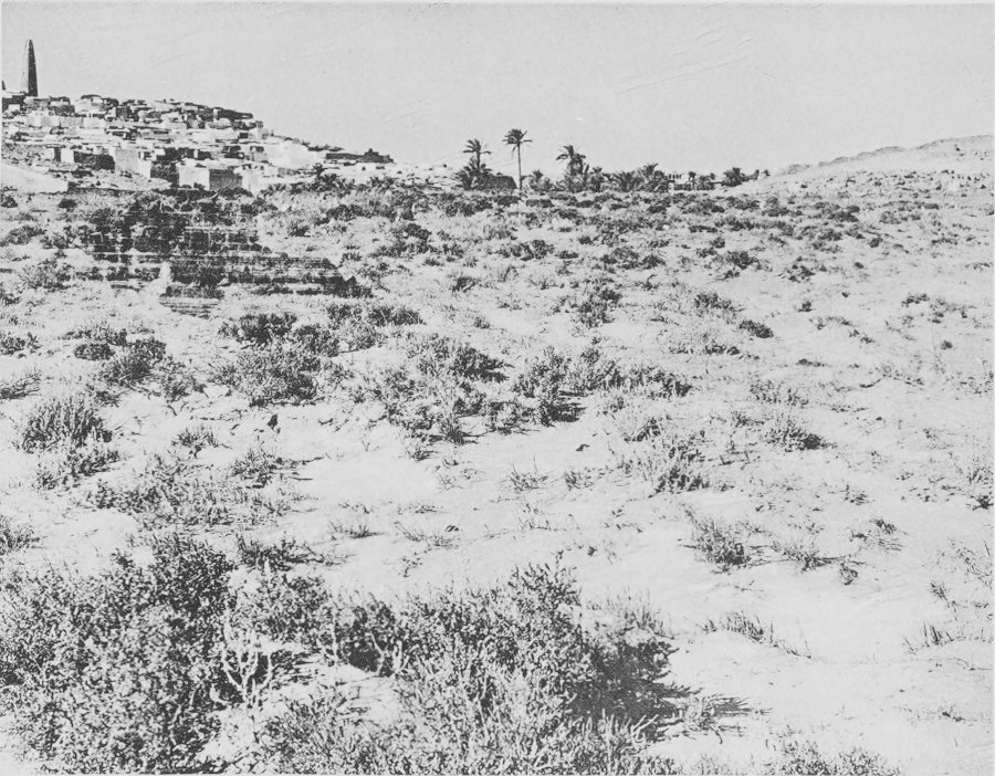
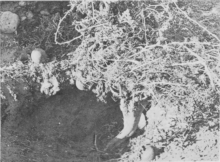
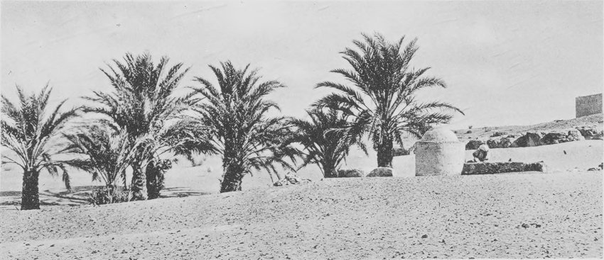
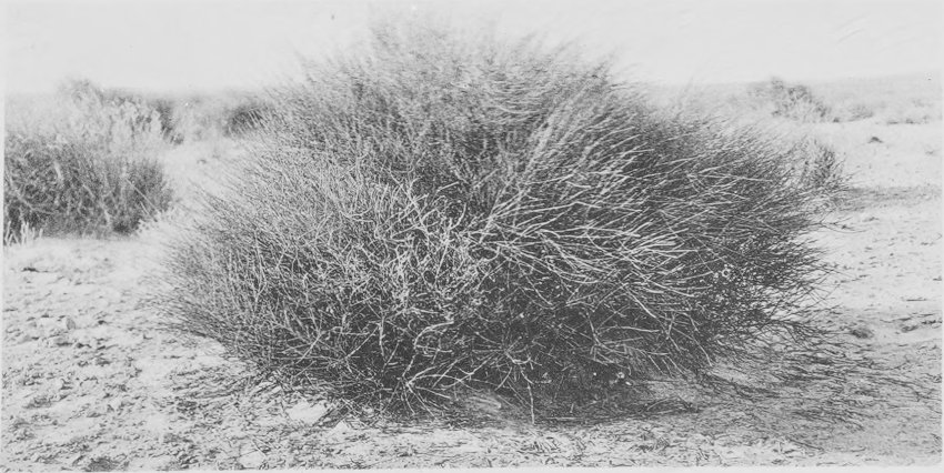
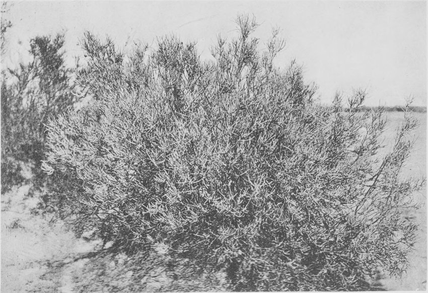
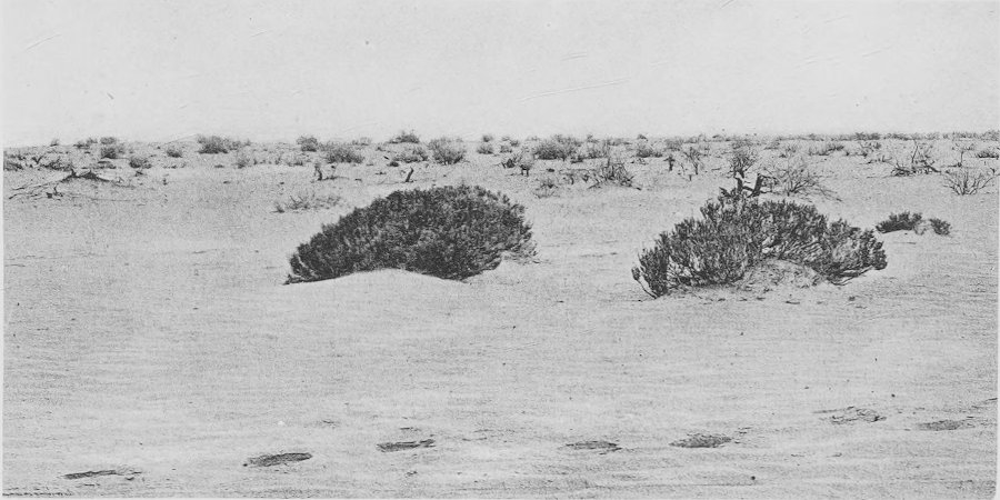
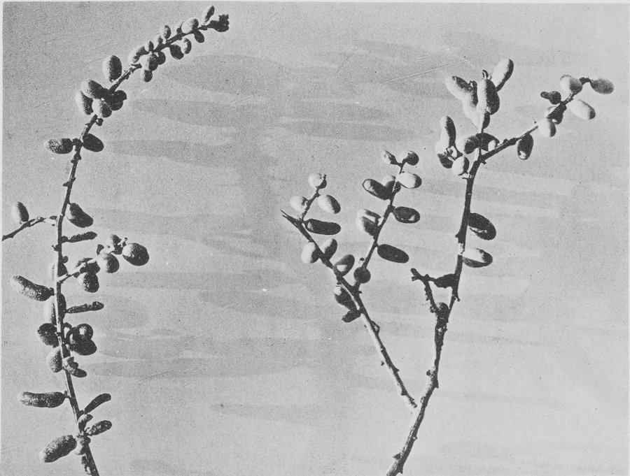
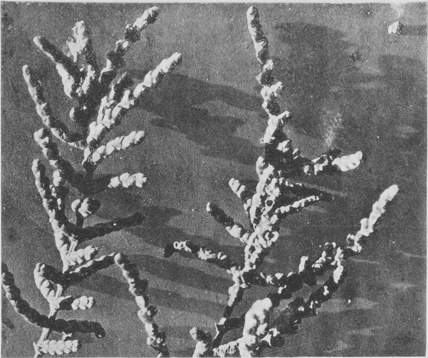
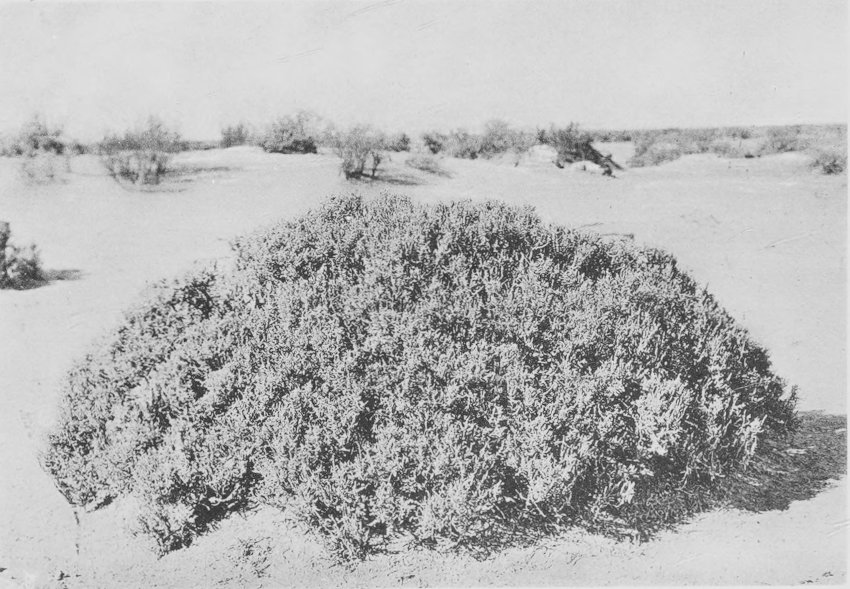
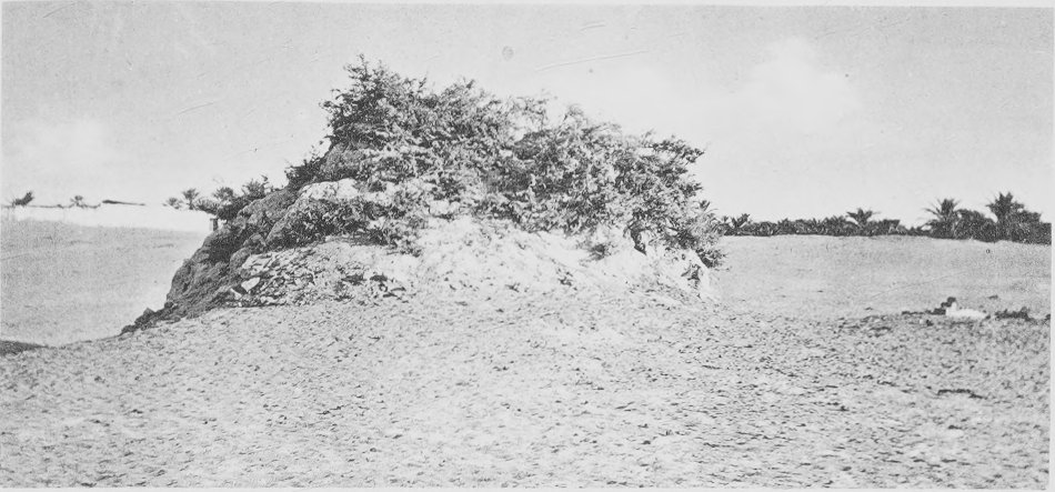
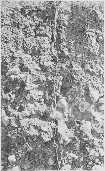
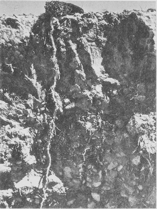
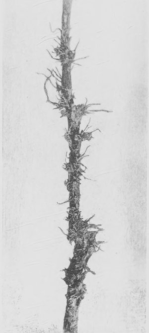
Near view of the daya of Tilrempt. The fortified
stage station, bordj, and a nomad camp are to be seen. The
flattened, level, lower surface of the trees is the effect of
grazing, mainly by camels.
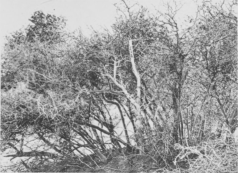
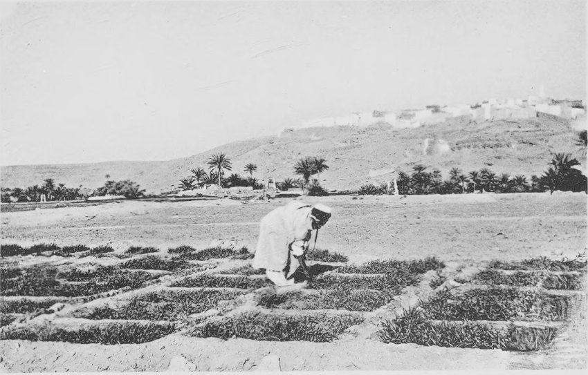
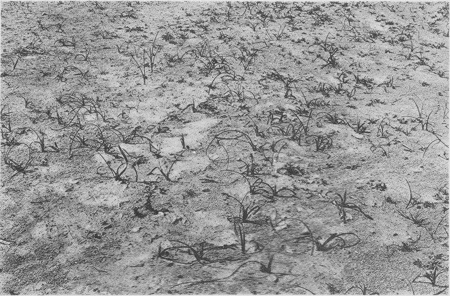
Agriculture at Ghardaia. The fields are divided
into plots about 3 by 4 feet in size, for the more economical use
of water. Young barley is shown growing (November).
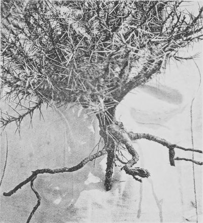
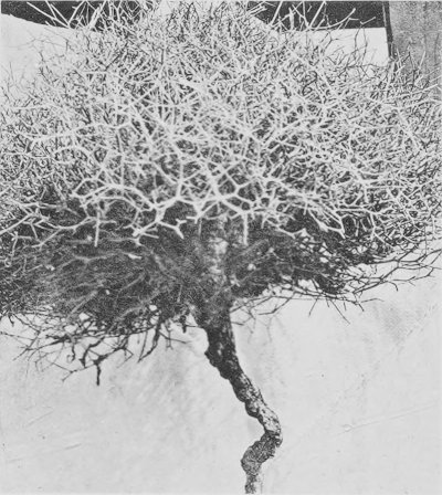
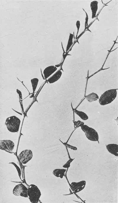
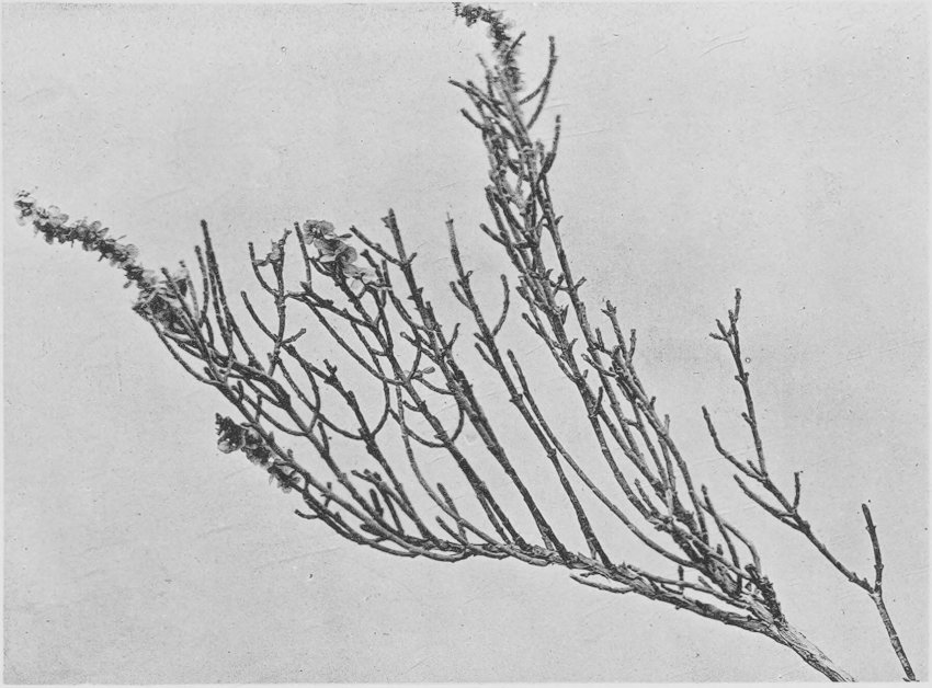
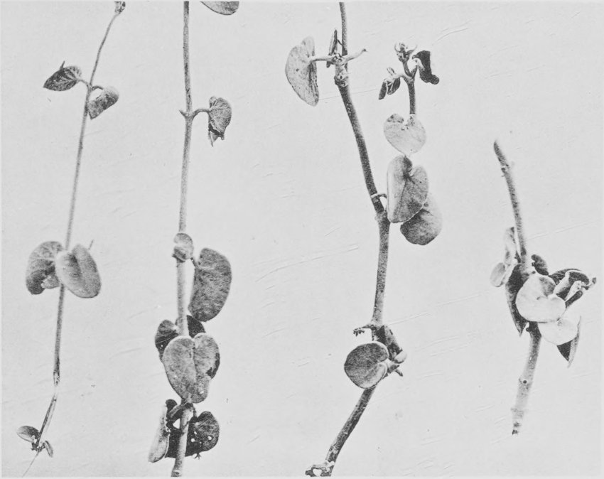
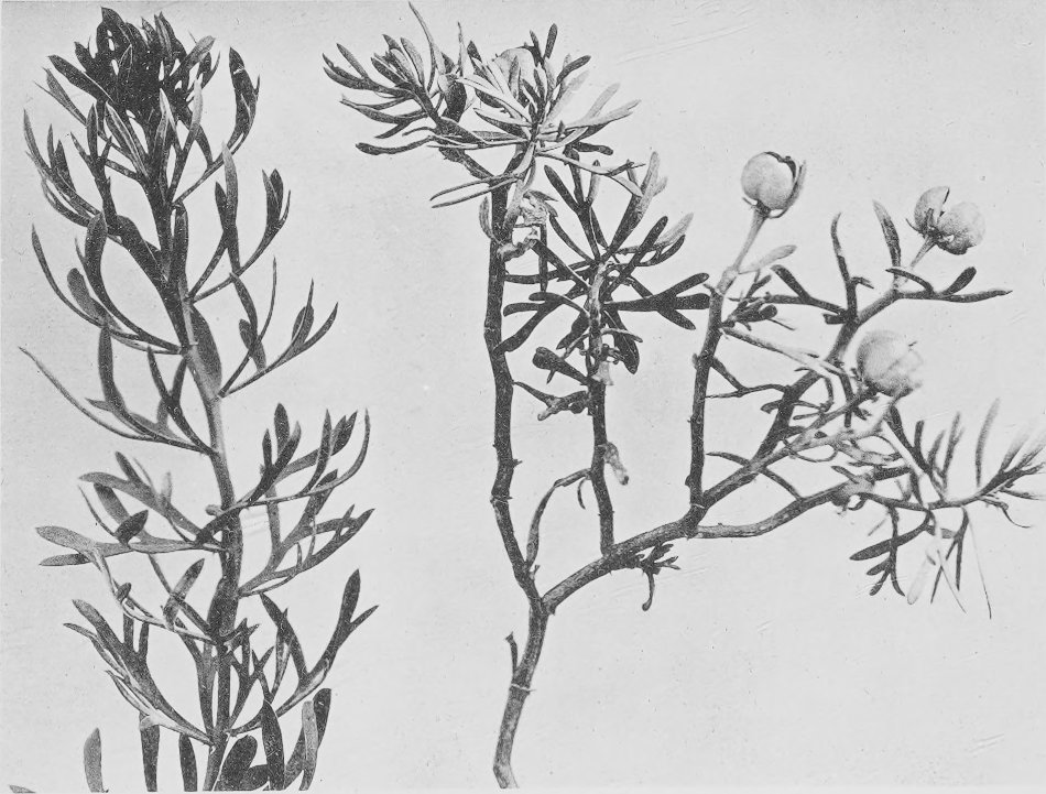
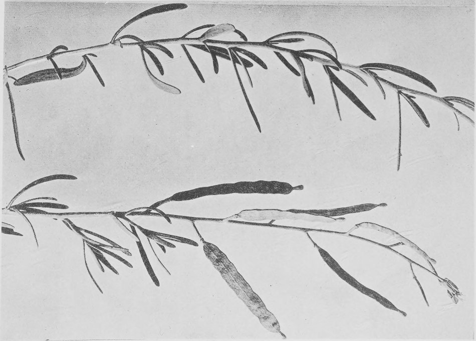
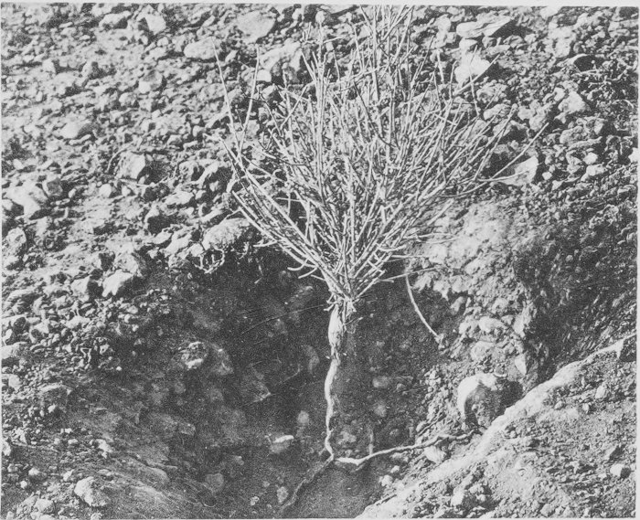
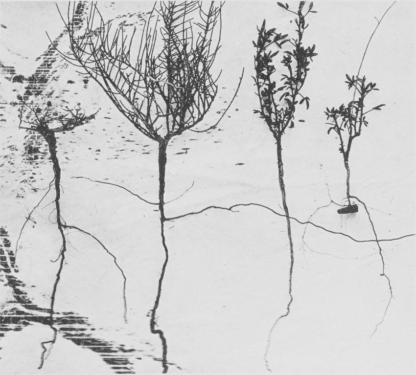
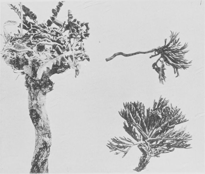
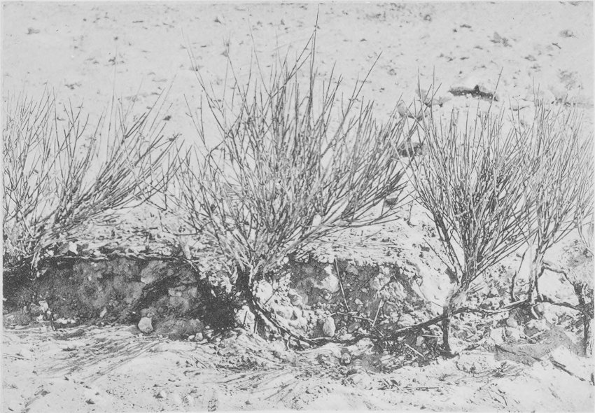
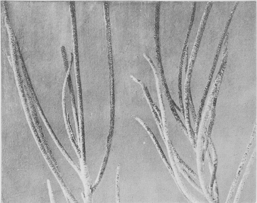
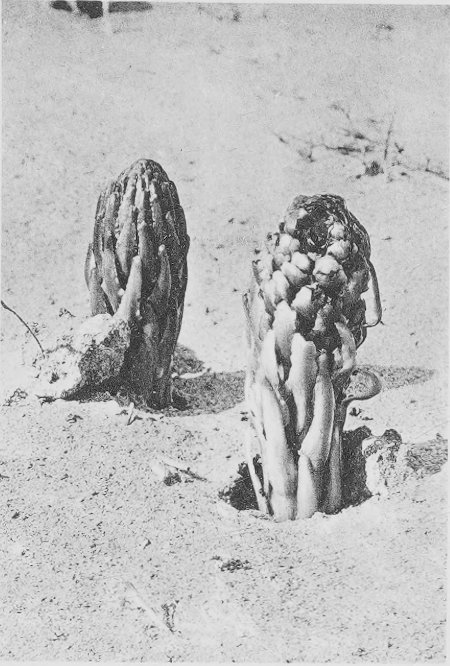
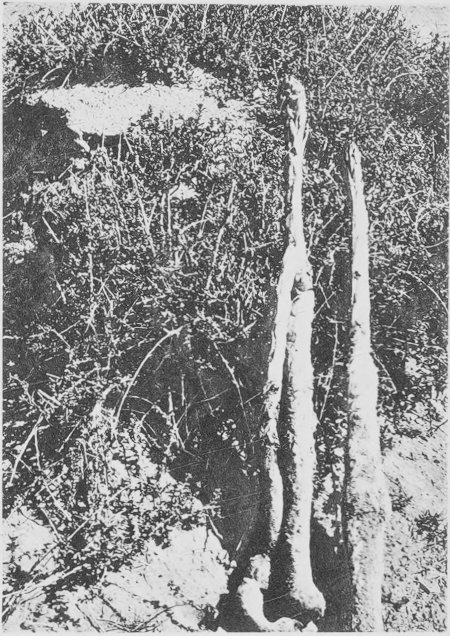
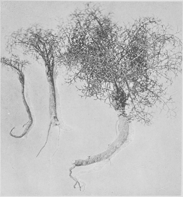
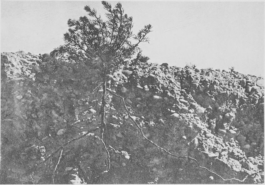
Root-systems of Helianthemum sessiliflorum
(right), Haloxylon articulatum, and Nolletia
chrysocomoides (left), from the flood-plain of the Oued M’Zab,
Ghardaia.
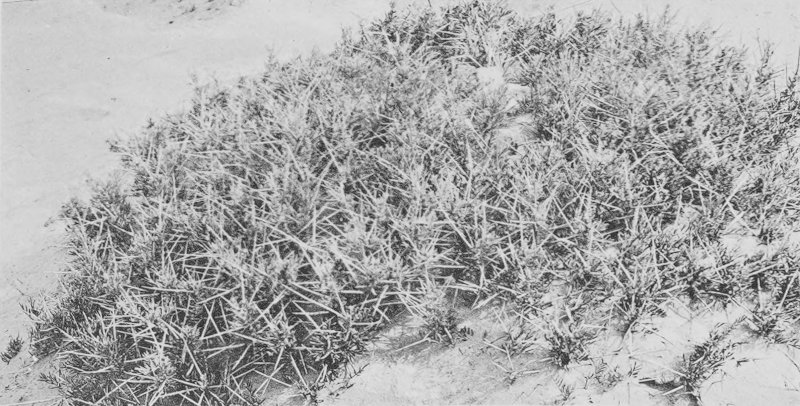
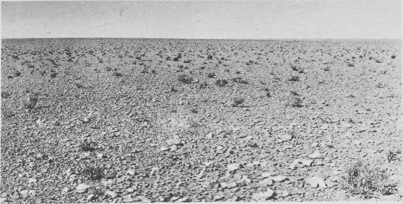
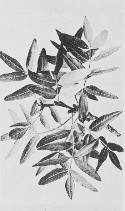
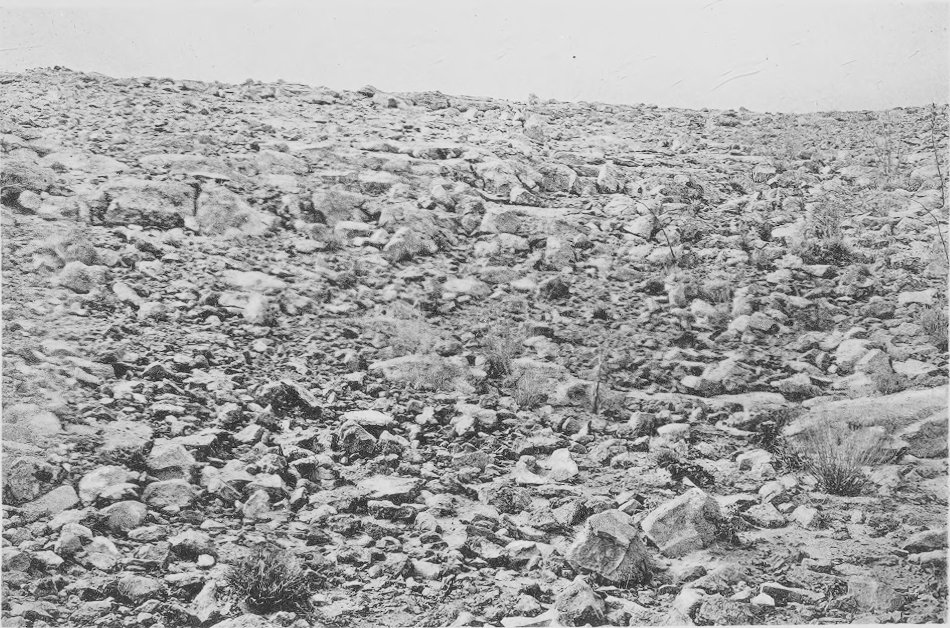
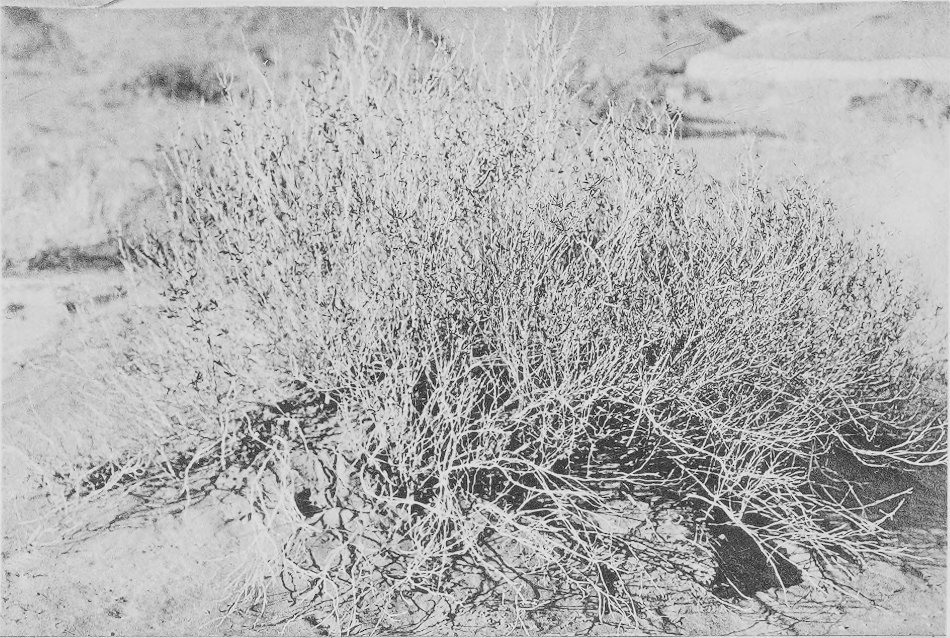
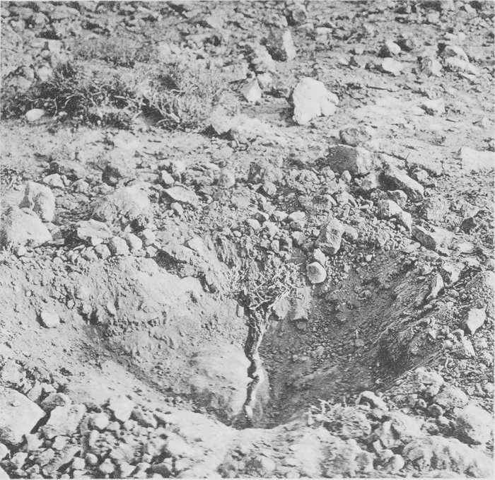
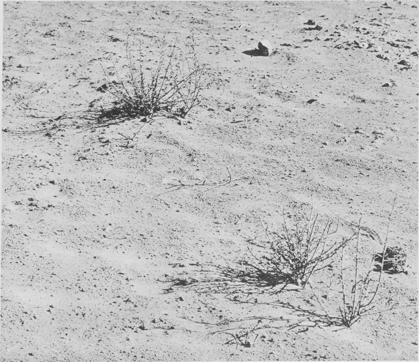
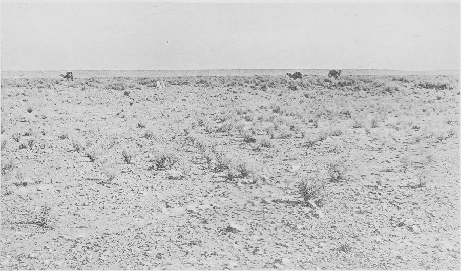
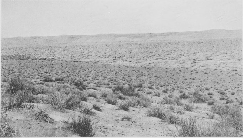
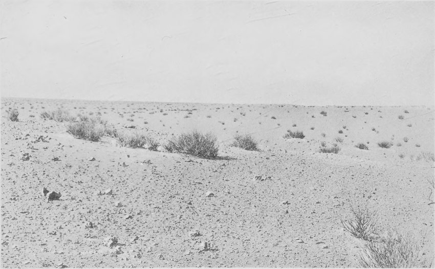
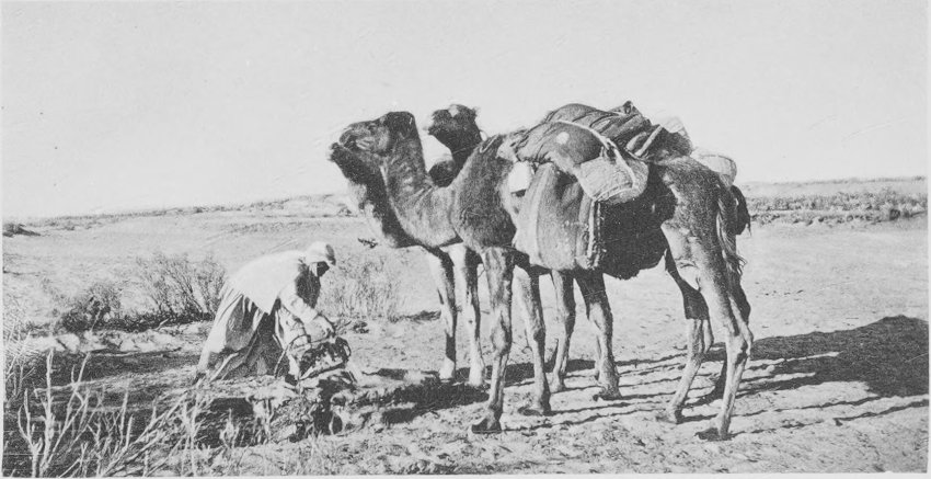
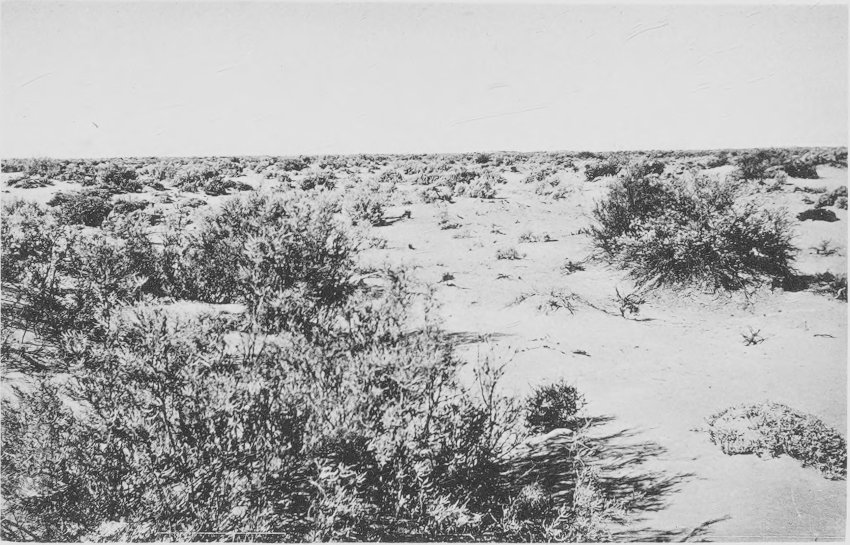
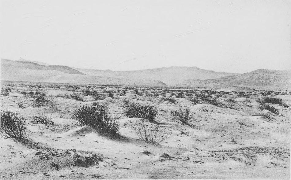
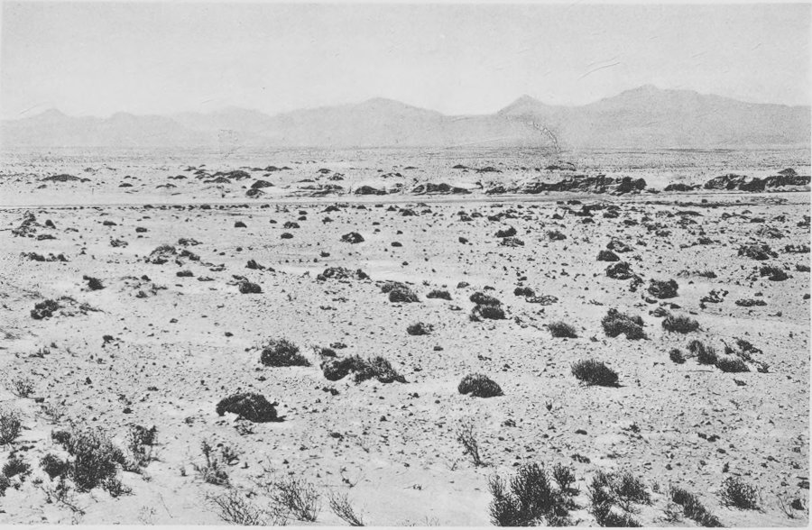
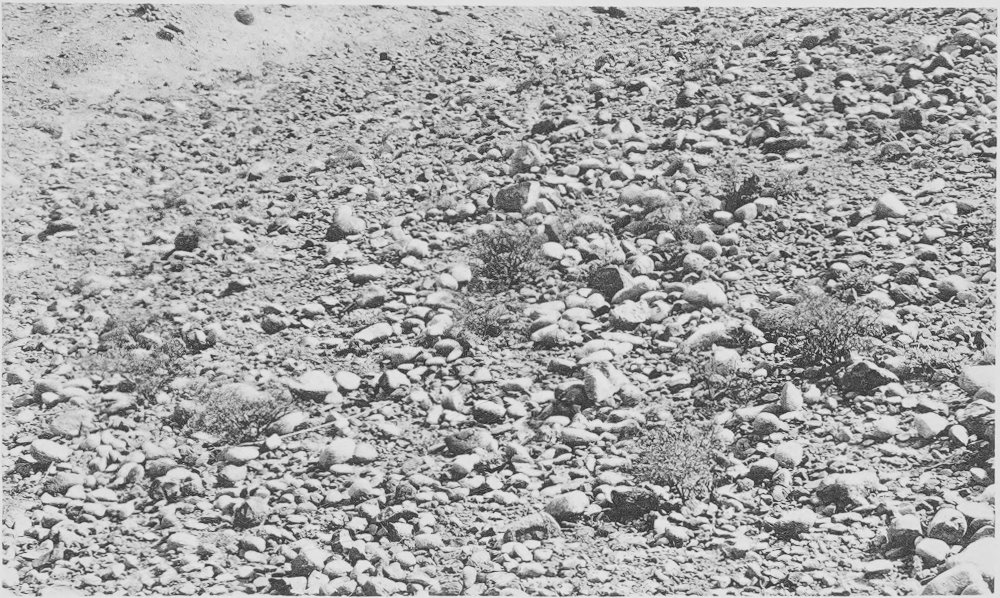
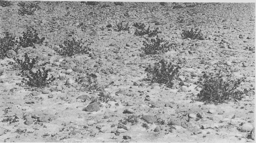
Ghardaia to Ouargla. View overlooking the hamada
about 28 km. from Ghardaia. The relatively abundant vegetation is
associated with a light cover of sand over the area shown. The
leading species are Aristida, Deverra, and
Haloxylon.
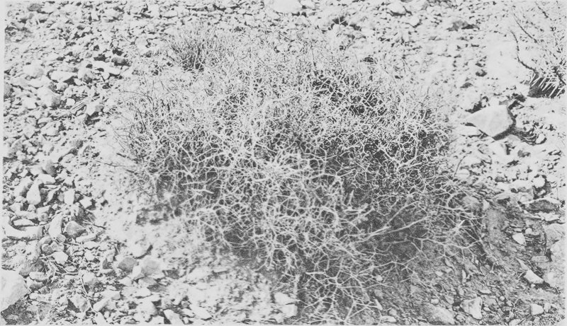
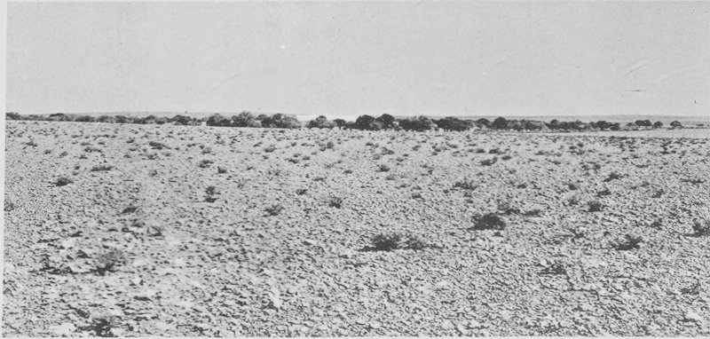
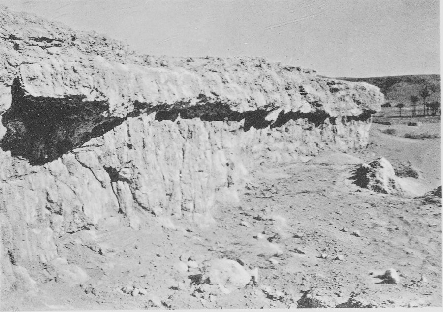
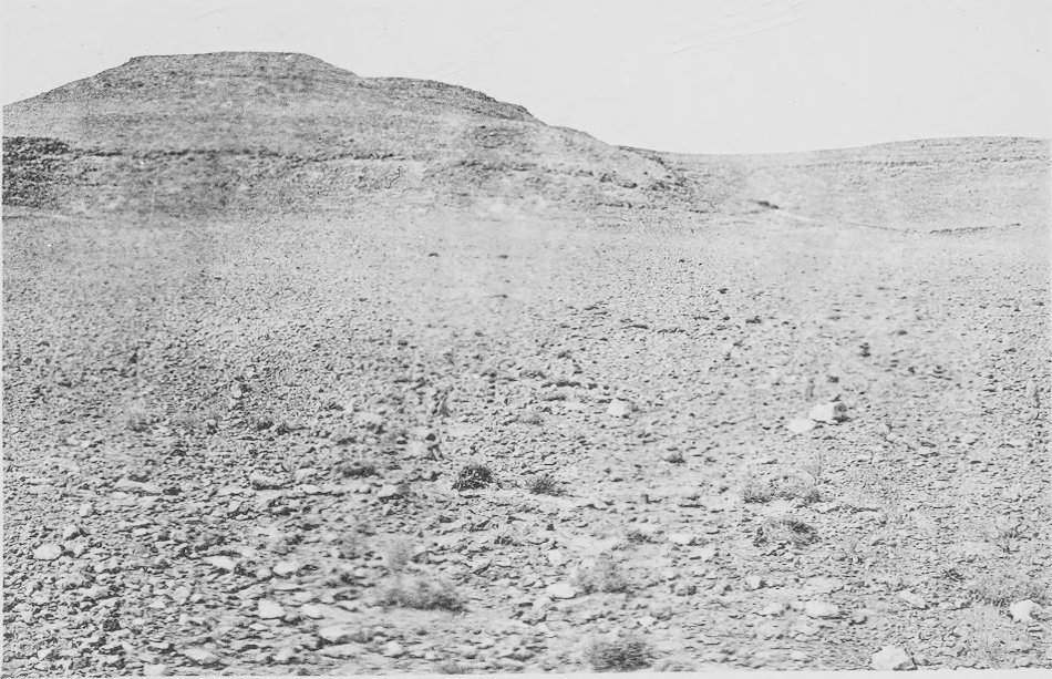
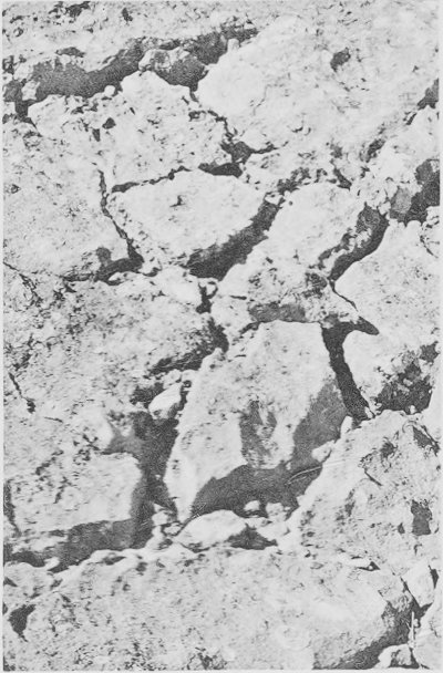
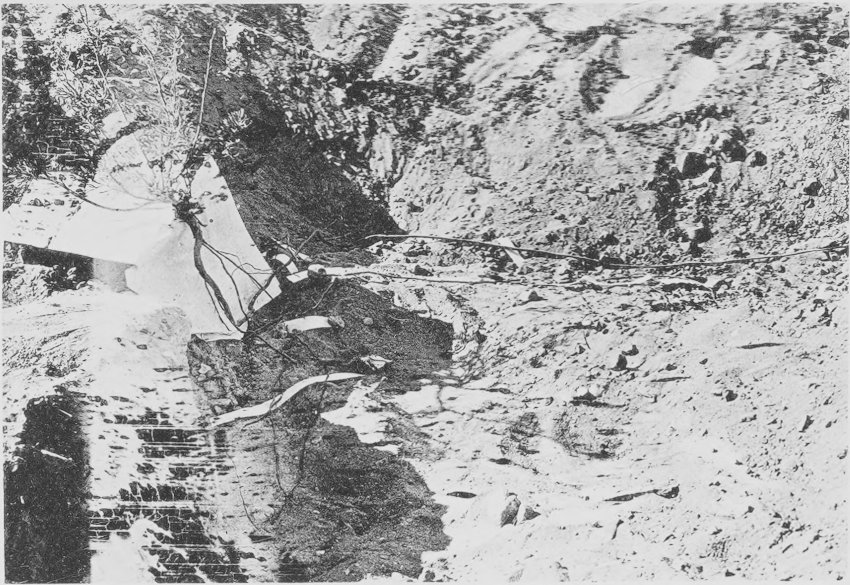
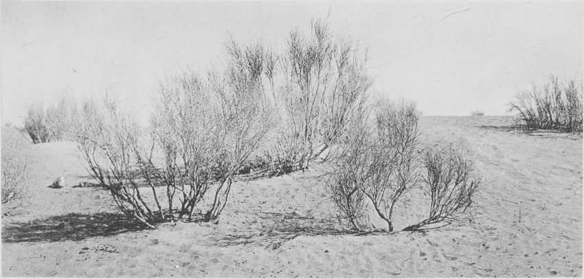
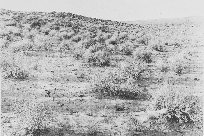
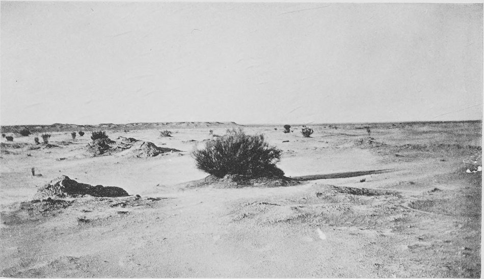
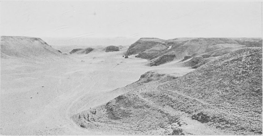
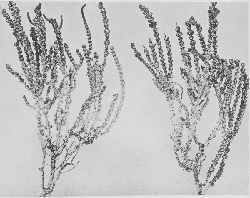
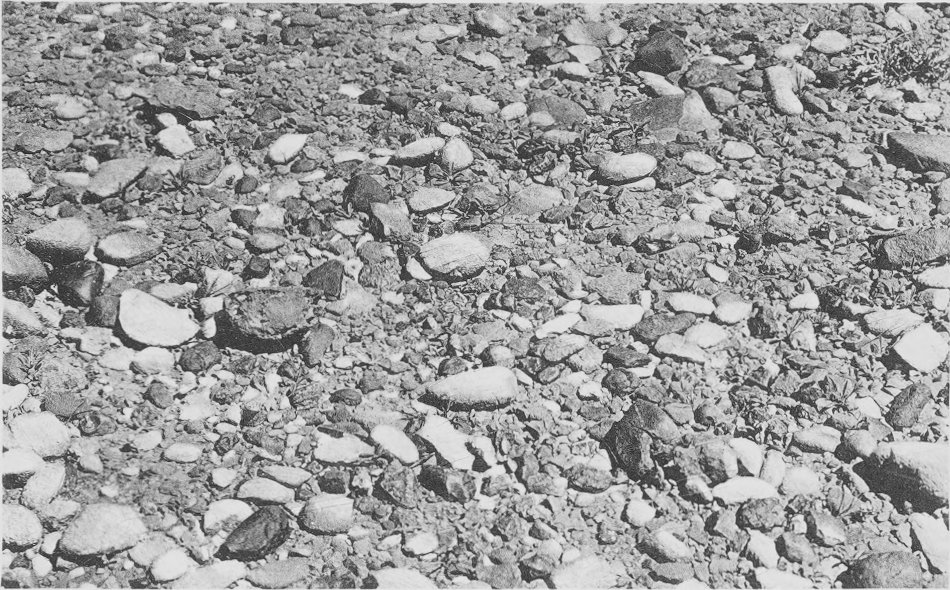
Ghardaia to Ouargla. View overlooking flood-plain
of the Oued M’Zab, or a tributary of this oued. The adjacent upland
is apparently without plant life.
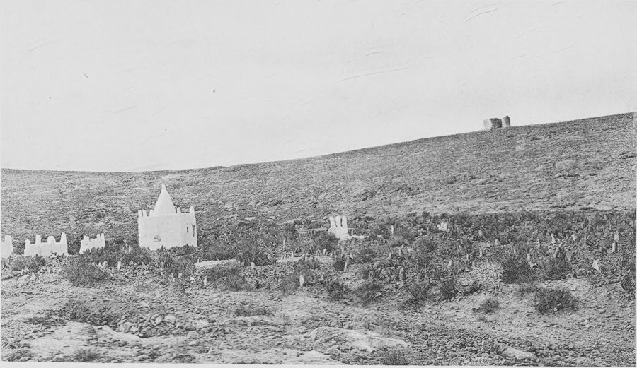
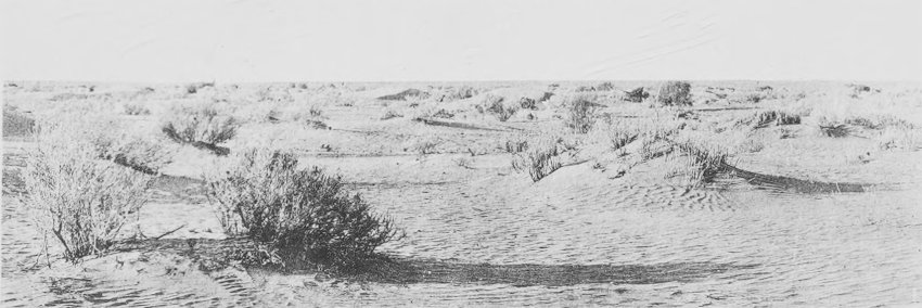
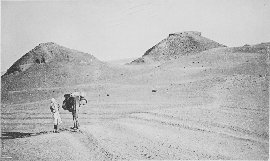
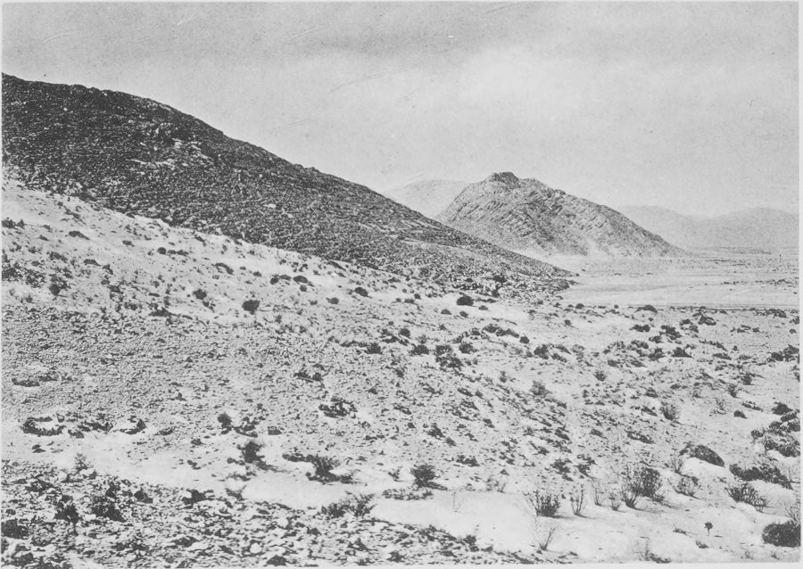
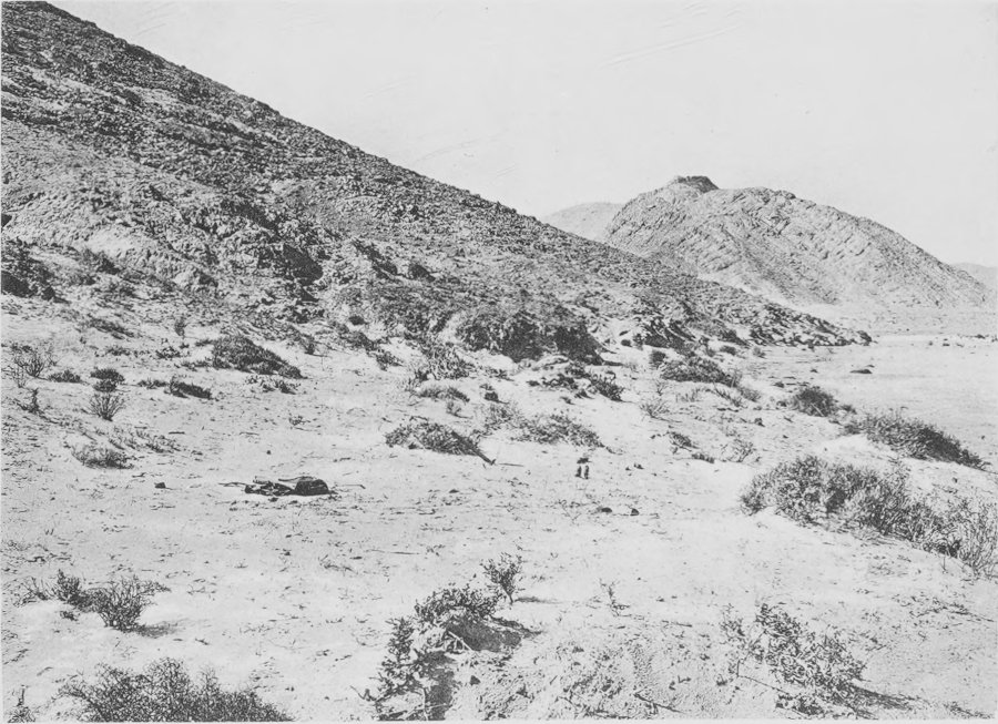
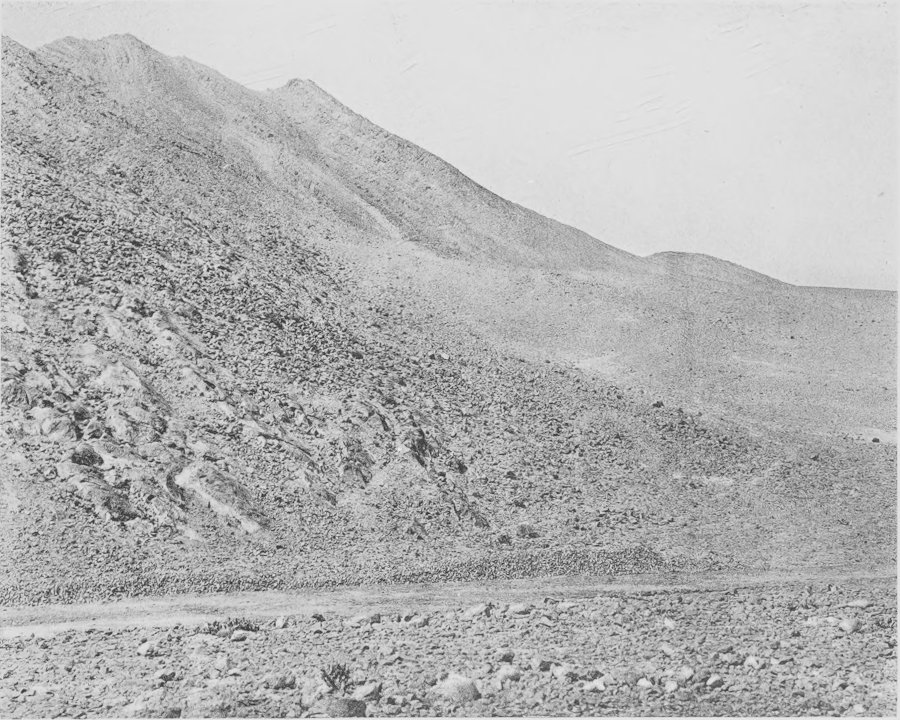
North base of Ed Delouatt hills, west of Biskra,
showing the low facing dunes. To the right is a glimpse of an oued
which pierces the hills in the middle distance.
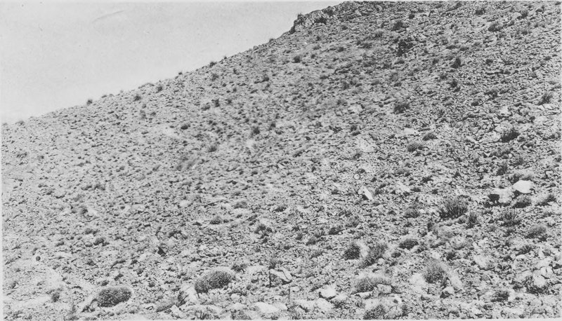
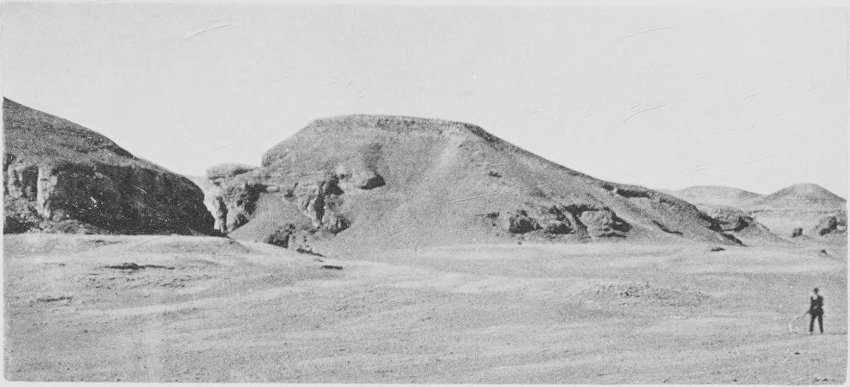
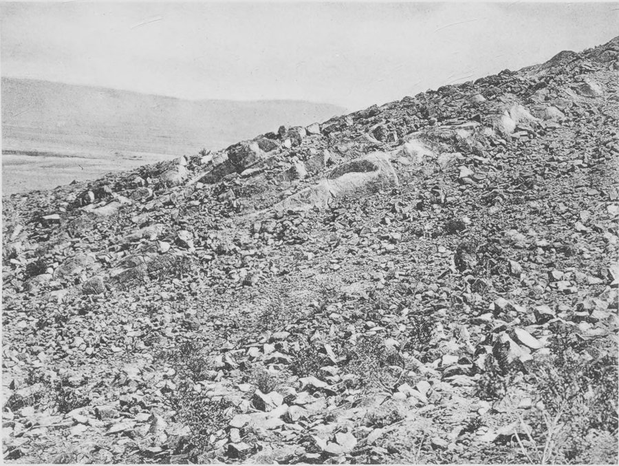
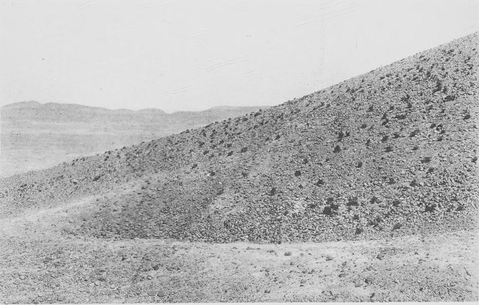
General view of the north face of the Djebel Bou
Rhezal, Biskra. Apparently barren, plants are rather numerous in
the rock crevices and small washes of the mountains.
BOTANICAL FEATURES OF THE ALGERIAN SAHARA.
INTRODUCTION.
The present paper is designed to give the results of some
field-work in southern Algeria in the autumn of 1910 and the spring
of 1911. The chief purpose of the tour was to examine the more
obvious features of the physiological conditions prevalent in the
region in question and, in connection with these observations, to
make some detailed studies of the root-habits of the most striking
species of the native flora. The route lay through the Atlas
Mountains, over the High Plateau, and for some distance into the
Sahara itself, returning by a somewhat similar way farther to the
east. The country traversed was extremely varied in topography and
in plant life, and probably the most southern regions seen may be
taken as typical of much of the western Sahara. The distance
covered in the more arid portions of the colony was about 1,000
miles.
An English-speaking tourist, or any tourist for that matter, is
something of a curiosity in southern Algeria. We were said to be
the second party of “Englishmen” who had passed over the
Ghardaia-Ouargla country in twenty-five years.
Leaving Algiers in October, diligence was taken to Ghardaia, the
most important town in southern Algeria and the end of the
diligence service. Beyond Ghardaia travel is by camel only. The
diligence journey, if made without stop, requires six days, running
night and day, except the first day’s run, which is by day only.
Pauses in the journey to Ghardaia were made at the leading towns or
stage stations (bordj), thus affording opportunity to observe
several localities in the High Plateau as well as the portion of
the desert just south of the Saharan Atlas. Stop-overs were made
thus at Medea, Boghari, Djelfa, Laghouat, and Tilrempt. A fortnight
was passed at Ghardaia, where the environs of the city were quite
thoroughly explored. As there are no roads between Ghardaia and
Ouargla, or between Ouargla and Touggourt, it was necessary to
organize a small camel-train, engage a cameleer (sokhrar) and
servants, and make special arrangements for the trip. Nine days
were required for the portion of the journey to Touggourt via
Ouargla. At Touggourt diligence was again taken for Biskra, two
days’ journey. The return journey to Algiers from Biskra was broken
at Batna for the purpose of visiting the fine forest of cedar
(Cedrus atlantica) in the mountains not far from the town.
When Biskra was revisited, in the spring of 1911, the northern
portion of Algeria was crossed on the way from Tunis, this
affording an opportunity to observe something of the
picturesqueness of the mountainous regions as well as the spring
flora.
I wish to take this
early opportunity to acknowledge my appreciation of assistance
received from different persons during the course of the Algerian
study, or as a means of preparing for it. I am especially indebted
to Prof. H. J. Hall, of Leland Stanford University, who was my
companion in Algeria and whose knowledge of the American deserts
made his advice doubly valuable. Dr. Keltie, secretary of the Royal
Geographical Society, provided letters and information of much use.
Dr. Trabut, government botanist of Algeria, whose acquaintance with
the country is extensive, very kindly identified all plants sent
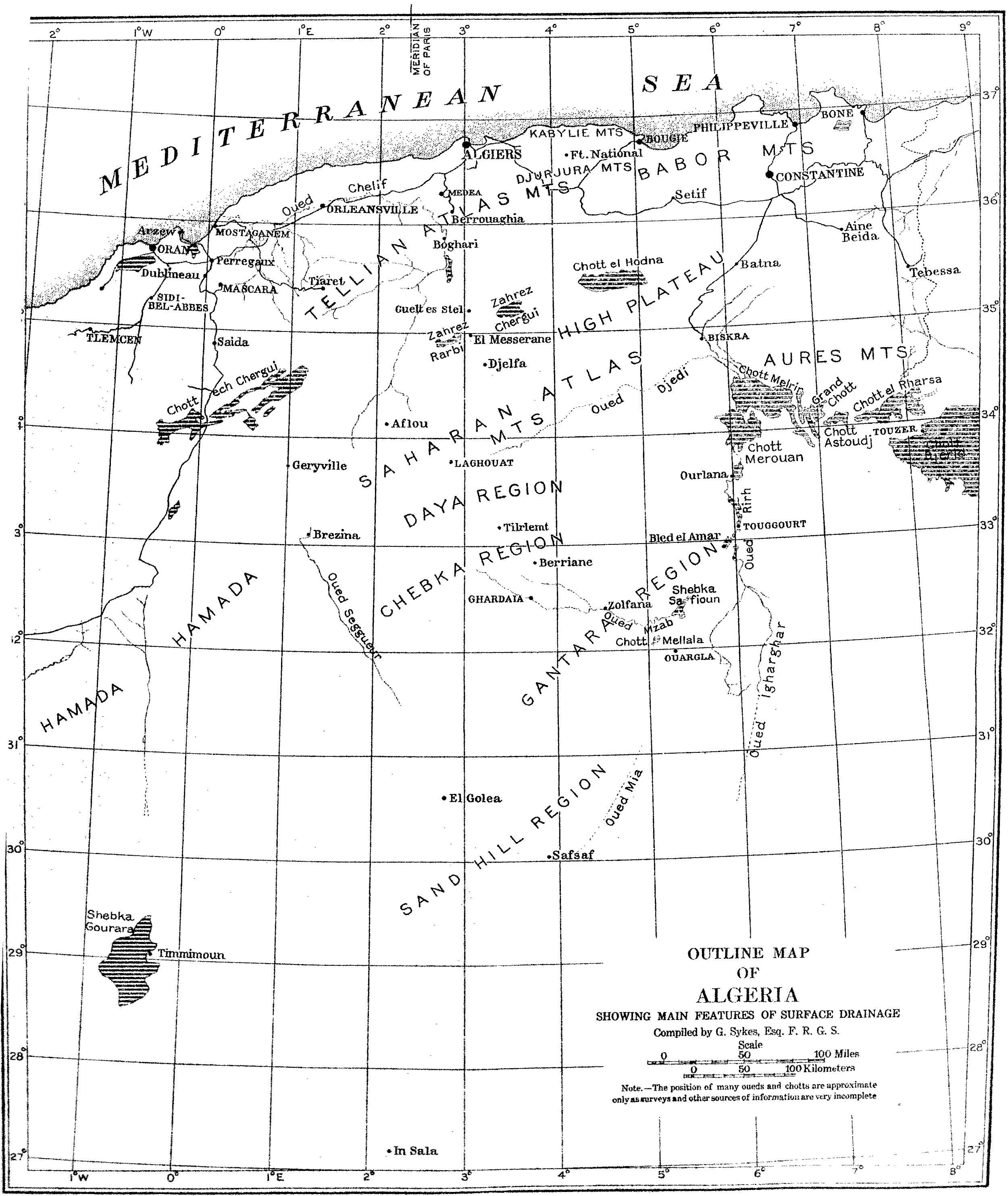
him and gave valuable aid in other ways. The map (plate A)
was prepared expressly for this study by Mr. Godfrey Sykes.
In a country where travel away from the beaten path is not
without discomfort, it is important that the way be made as smooth
as possible, not alone for comfort but for personal safety as well,
and it is therefore a pleasure to acknowledge the many kindnesses
shown by the civil and military authorities of the French colony,
as also by the American consul and vice-consul at Algiers.
GEOGRAPHICAL CHARACTERISTICS OF ALGERIA.
The French colony of Algeria is of large extent and possesses a
highly varied topography and great range in climate. With an
all-land connection with the continent of Europe in earlier
geologic times, the flora and fauna of this portion of northern
Africa are closely allied to the fauna and flora of southern Spain,
France, and Italy.
Algeria lies to the south of the Mediterranean Sea, between
Tunis to the east and Morocco to the west. The northern portion
extends somewhat beyond latitude 37°, or that of southern Spain,
southern Greece, and the southern part of Asia Minor. The limit of
the colony on the south is indefinite, reaching to about latitude
21°. Thus east and west the extent is about 650 miles, and north
and south 1,200 miles.
The most important topographical features of the northern part
of Algeria are the several mountain masses which together
constitute the Atlas range. Lowest in Tunis, where the Atlas
Mountains do not exceed 5,000 feet altitude, they attain their
greatest height in Morocco, over 13,000 feet. In Algeria an
altitude of about 7,500 feet is reached in the Aurés, Dj. Chelia,
and in the Great Kabylies. In the eastern portion of Algeria the
mountains extend to the coast, but farther west a narrow strip of
lowland separates them from the sea. In the east (in the department
of Constantine) they constitute a single general uplift, although
made up of several groups, but as one proceeds westward the
mountains separate into two ranges, which at the Morocco border are
about 125 miles apart. The two ranges have been called by various
names, among which are the Great Atlas for the southern range and
the Little or Maritime Atlas for the northern one. But it seems
best to use the names Atlas of the Sahara or Saharan Atlas and Atlas of the Tell or the
Tellian Atlas, names which are self-explanatory. The Tellian Atlas
and all territory between this range and the Mediterranean Sea is
known as the Tell, or the land of hills. This is the most important
part of Algeria from an agricultural standpoint, and furnishes
grain and other products. Here also are the most important forests,
oak, pine, and cedar. Between the two ranges of the Atlas lies the
region of the steppes or plateaus, in this study referred to as the
High Plateau, inasmuch as the average altitude is over 3,000 feet.
The steppe region is highest in the west and is wedge-shaped, in
conformity to the bounding mountains. In the eastern portion it
breaks up into mountain valleys. The topography of the High Plateau
is monotonous. The surface is gently rolling, and here and there
are undrained depressions, or chotts, where salts
accumulate. In rainy seasons the chotts contain water, but in the
arid summers they are dry. The region of the steppes is of no
agricultural value, although, as will appear below, the harvesting
of the alfa grass, which occupies vast areas, is of considerable
importance.
South of the Saharan Atlas lies the desert, comprising about
2,000,000 square miles, the topography of which is extremely
varied. For present purposes it is sufficient to say that in the
extreme southern portion of the Algerian Sahara, and crossed by the
Tropic, there is an extensive highland, the plateau of Idghagh,
where an elevation exceeding 5,000 feet is reached. All of the
Sahara to the west of this plateau, or to the west of a line drawn
north from it, appears to be above sea-level (much of it having an
altitude of 1,000 feet), and of greater geological age than that
portion of the desert lying to the east. North from the plateau of
Idghagh the country gradually descends to the depression of which
the great Chott Melghir is a part, a region below the level of the
sea. Here extends also one of the longest oueds of the Sahara, the
Oued Igharghar, which takes its rise in the plateau of Idghagh and
empties in the Chott Melghir, an entire length exceeding 700 miles.
In the western part of the Sahara the surface descends to the
Atlantic, but in the eastern part it falls away to the
Mediterranean.
Turning now to consider the part of southern Algeria with which
this study especially deals—lying between Laghouat and Ghardaia,
between Ghardaia and Ouargla, and between the latter place and
Biskra, all to the south of the Saharan Atlas—we find topographical
details which are probably representative of much of the rest of
the Great Desert. Laghouat has an elevation of 2,400 feet. It lies
on the northern edge of the region of the dayas. This region is
characterized by the poor development of its drainage and has a
slightly undulating surface with frequent depressions, each the
center of an area of rather small extent, from which it receives
flood-waters. The dayas differ from the other undrained areas, the
chotts, in that they do not contain an excess of salt, owing
probably to efficient
subdrainage. In the region of the dayas the surface falls away to
the south or the southeast until the region of the Chebka is
reached, which extends to the territory of the Beni M’Zab. In the
Chebka low and flat-topped mountains are so irregularly disposed as
to give rise to the name, meaning a net; they are separated by
valleys, narrow toward the northern portion of the region, but
expanding into small plains as one proceeds towards Ghardaia.
Ghardaia, the country of the Beni M’Zab, marks the southern limit
of the Chebka. At Ghardaia the altitude is 1,600 feet. Between
Ghardaia and Ouargla are undulating stony plains, the Gantara
(hamada), large salt spots, the chotts, and a prominent
range of sand mountains, areg desert, possibly 1,000 feet
high. At the eastern edge of the Gantara the general level of the
country drops suddenly about 200 feet to the Ouargla plain
(reg desert), with an altitude less than 500 feet; this is
an eroded flood-plain of the Oued Igharghar or its tributaries.
There are no navigable rivers in Algeria. The most important
river is the Chelif, which takes its origin in the Saharan Atlas,
crosses the High Plateau, breaks through the Atlas of the Tell,
and, turning westward, traverses obliquely the Tell for a distance
of about 108 miles before discharging into the sea. The Chelif is
the only stream which rises in the Saharan Atlas and pierces the
northern range. To the south of the Saharan Atlas are several
important oueds. One, the Oued Djedi, rises near Aflou and goes
easterly, past Laghouat, until it reaches the Chott Melrir, south
of Biskra; two others, the M’Zab and the Nessa, drain the region of
the Chebka, and taking an easterly or a southeasterly direction
reach the Oued Rirh or its upper extension. The Oued Rirh
constitutes the northern portion of the great Oued Igharghar, or a
tributary of this oued, and extends about 60 miles north from
Touggourt to the Chott Merouan. The region of the Oued Rirh is of
great economic importance from the production of dates, made
possible through the development of artesian wells by the French
government. The oueds as a whole are very like the arroyos of the
southwestern portion of the United States, in that they carry water
for a small portion of the year only, when the torrential rains
fill them with a muddy, rushing flood.
In the plains adjacent to the oueds, at Ghardaia especially, the
natives usually dig their wells, from which water for domestic as
well as for irrigating purposes is obtained. The flood-water of the
oueds is also diverted into ditches, or impounded for later use,
although the latter has not met with uniform success. The depths at
which water has been found vary greatly. At Ouargla the water lies
within 3 feet of the surface, although there are also very deep
artesian wells, and at Ghardaia it varies from 10 to 50 feet or
more. At the daya of Tilrempt the water in the deepest wells stands
as deep as 300 feet; it is drawn in a very primitive fashion for
purposes of watering flocks and for the bordj. The heaviest
vegetation is to be
found along the oueds and the nearby flood-plains. Here the water
relations are the most favorable and the oueds constitute highways
along which plants venture into the desert from the more humid
regions.
Very little study appears to have been given the soils of
Algeria. It has been stated that there are vast areas of light,
sandy soils, and also extensive tracts of marls, clays, and
alluvial soils.[1] Gypsum is an important element in the soils,
both those of the oases and probably of the open desert also; it
occurs in great quantity in the large chotts of the desert, along
with common salt and other salts. In the soils of the oases it acts
as a cementing material, “uniting the finer soil-grains into
aggregates which give the soil a much more sandy appearance than
would be suspected from the results of mechanical analysis.” At
Laghouat and at Ghardaia a light-colored, hard substance, closely
resembling the “caliche” of the southwestern United States, was
seen incrusting stones, filling cracks in rocks and crevices
between rocks, and in places forming a stratum, horizontally placed
(15 cm. more or less in thickness) underneath the superficial
soils. This is extremely hard and can be broken or cut with
difficulty. In the valley of the M’Zab, where it constitutes a
heavy substratum, it appears to be impervious to water. This
hardpan is used as threshing floors by removing the superficial
soils.
An unexpectedly small amount of sand was observed over the route
traversed. Near the southern edge of the High Plateau a sand belt
was encountered and a long stretch of low dunes was seen leading to
the eastward, which were said to reach nearly to Bou Saada; and
again at Laghouat there are dunes to the east of town as well as to
the west. Low dunes were seen in the valley of the Oued M’Zab, and
sand mountains, possibly 250 meters high, were passed on the way
from Ghardaia to Ouargla. Between Ouargla and Touggourt, also, sand
was encountered and the way lay across about 12 miles of low dunes;
to the north of Touggourt dunes are also to be seen; and finally,
some sand is to be found in the neighborhood of Biskra. Although,
thus, relatively little sand was met, much of the entire portion of
southern Algeria is covered by sand. Large areas of sand-covered
country lie to the east of the Oued Rirh, and especially southeast
of Touggourt, and also to the west of Ghardaia there is said to be
a large dune-covered territory. For the most part, however, the
surface of the plains crossed is covered with large or small
stones, mingled with which, or beneath which, there is a rather
fine clay-like soil. This constitutes the hamada, or stony desert,
of which the largest portion of the surface of the Sahara is
probably composed. Where stones are largely absent and the soil is
fine, usually of fluvian origin, the formation is known as “reg.”
Reg desert was encountered at and north of Ouargla, in the drainage
of the Igharghar or its tributaries, and south of Biskra. The
latter may not,
strictly speaking, be reg, but a wide-stretching bajada, and the
soil is probably only in small part deposited by rivers.
CLIMATE OF ALGERIA. — Table 1.— Seasonal distribution of rain. — Table 2.— Rainfall at Ouargla, in millimeters. — Table 3.— Seasonal distribution, in percentages, of rain. — Table 4.— Mean relative humidity, in percentages. — Table 5.— Evaporation in millimeters , 1908. — Table 6.— Evaporation-rainfall ratio, monthly , 1908. — Table 7.— Evaporation-rainfall ratio, seasonal , 1908. — Table 8.— Maximum daily range in temperature , 1904. — Table 9.— Absolute daily range in temperature. — Table 10.— Average maximum temperatures. — Table 11.— Sums of the daily maximum temperatures. — Table 12.— Soil and air temperatures, Ghardaia, July 2-11, 1911.
The climate of Algeria is mild and temperate. This is due to
several factors, among which are its situation relative to the
Mediterranean on the north and to the Atlantic on the west, as well
as to the great desert which constitutes its southern portion, the
great variation in topography, and the fairly low latitude. Taking
the colony as a whole, there is a great range in temperature,
precipitation, relative humidity, and evaporation, to mention only
such climatic features as have been reduced and are recorded; and
the range in the intensity and in the quality of the light must
also be great. The climate of the northern portion of Algeria is
coastal, while that of the southern portion is continental.
The distribution in time and in space and the amount of
precipitation are of the greatest importance as climatic features
of Algeria. The rainfall is heaviest on the littoral, and
especially heavy in the eastern portion of the littoral. An average
of 1,000 mm. is reported from the immediate vicinity of the
sea,[2] and as one goes southward the amount of
precipitation rapidly becomes less. In the Tell the average
rainfall is 570 mm., while on the High Plateau it is 310 mm. On the
desert the rainfall is uncertain both in amount and in time, except
that when rains occur the time coincides with the rainy season of
northern Algeria. At Biskra the annual precipitation is 199 mm., at
Laghouat it is 198 mm., at Ghardaia it is 114 mm., and at El Golea
it is 47 mm. In many places in the western Sahara, five years or
more go by without fall of rain.
The differences in the geographical distribution of
precipitation vary from year to year, as may be illustrated by
referring to that for the year 1908, which may be compared with the
normal usual distribution as given above. In the northern portion
of the country more rain than usual was reported; for example,
there was over 1,000 mm. on the littoral east of Algiers, and over
500 mm. on the High Plateau, but on the desert the amount was
somewhat less. At Laghouat it was 161 mm., at Ghardaia it was 89.2
mm., and at Ouargla it was 28 mm.
Besides the differences in amount of yearly rainfall,
well-marked seasonal amounts of precipitation are also to be noted.
In the northern portion of the colony rains are likely to occur in
winter and spring, the summer and early autumn being dry; and as
one goes south of the Saharan Atlas nearly the same conditions
obtain; that is, the rains usually fall during the rainy season of
the coast. The seasonal distribution of rain for the Tell,
including the stations of the littoral, the High Plateau, the
Saharan Atlas, and the desert, for a series of years including
1908, is given in table 1.
Season.
Tell (10).
High Plateau (8).
Saharan Atlas (10).
Desert (6).
Remarks.
mm.
mm.
mm.
mm.
Winter
469.9
119.3
(50.8)
113.5
37.4
The Tell is represented by Fort
National; the High Plateau by Geryville (with Ain Sefra, for 6
years, in parentheses); the Saharan Atlas by Djelfa; the desert by
Ouargla. The number of yearly records on which averages are
computed are given at the head of each column in parentheses.
Spring
300.0
80.5
(95.0)
88.2
39.0
Summer
38.1
66.5
(35.8)
50.4
3.7
Autumn
287.2
139.5
(58.5)
123.1
19.6
The seasonal percentages of precipitation give a more graphic
conception of the rainfall conditions for the four physiographic
provinces. In the Tell this percentage in winter is 42, in spring
27, in summer 4, and in autumn 27. On the High Plateau the
percentages are 30, 20, 16, and 34 for the four seasons
respectively. In the Saharan Atlas 30 per cent of the rain occurs
in winter, 24 in spring, 13 in summer, and 33 in autumn. In the
desert the percentages of rainfall are 37, 39, 4, and 20[3] for
the four seasons.
It is of interest also to note the number of days on which the
rain fell on an average each year over a period running from 7 to
12 years. Thus at two typical stations on the Tell rain was
reported on 102 and 118 days; at two stations on the High Plateau
it rained 65 and 83.8 days; at a station in the Saharan Atlas rain
was reported on 70 days; at desert stations, at Ouargla rain fell
on an average 14.2, and at Laghouat 49 days each year. As a
comparison, it may be mentioned that for ten years at Wady Halfi,
Egyptian Sudan, there were only 22 days on which rain-drops were
seen to fall. (Engler, loc. cit.)
The amount of precipitation varies greatly for the different
desert stations, usually becoming less as one goes south from the
High Plateau. As has already been mentioned, the average rainfall
at Laghouat, which lies at the southern base of the Saharan Atlas,
is 198 mm., the average at Ghardaia is 114 mm., while that at El
Golea is 47 mm. The latter station is about 225 miles south of
Laghouat, in the midst of the Sahara. The amount of rainfall,
however, is greatly influenced by altitude, although lack of
adequate precipitation data for the desert makes impossible a
detailed presentation of this phase of the subject. As the amount
of the yearly precipitation is less in the extreme southern part of
Algeria than it is nearer the Saharan Atlas, where the altitude
also is greater, it might be expected that the number of rainy days
would vary in a like manner. Such records as are at hand, however,
do not show this to be the case. For instance, at Ouargla rain
falls on an average 14.2 days, average of 7 years, while the rainfall is 90.2 mm.;
yet at El Golea, with a rainfall of 47 mm., there are 23.4 rainy
days each year.[4]
On the desert the rains are often of a torrential nature, as
facts presented above would indicate, and sometimes as much rain
falls within a few hours, or even a few minutes, as usually occurs
in an entire year. How much of the annual precipitation is of this
character and how much is of the non-torrential kind the usual
summaries leave entirely out of the account. It is well known that
the former type of storm is more destructive and less useful to
plants than the latter type. To illustrate the irregularity of the
rainfall in the northern Sahara the monthly precipitation at
Ouargla for several years is presented in table 2.
Year
Amt.
No. of days rain
Jan.
Feb.
Mar.
Apr.
May
June
July
Aug.
Sept.
Oct.
Nov.
Dec.
1900
0
1
0
0
0
0
0
0
0
0
0
0
0
0
1901
18
1902
70.5
8
0
0
11.3
0
0
0
0
1.8
0
46.4
11.0
0
1903
135.6
14
55.0
0
0
0
0
0
0
0
0
0
30.6
50.0
1904
35.0
26
20.0
0
0
0
0
0
0
0
0
9.0
4.0
2.0
1905
1906
15.0
0
2.0
4.0
0
0
4.0
80.0
41.0
80.0
1907
210.0
18
0
68.2
67
325.0
16.2
20.0
0
0
5.0
3.3
3.8
1.3
The seasonal distribution of rainfall at four desert stations
shows also marked irregularities. The distribution (in percentages)
is given in table 3.
Station.
Winter.
Spring.
Summer.
Autumn.
Ouargla
37
39
4
20
Laghouat
11
27
31
31
Ghardaia
15
23
13
49
Touggourt
13
30
3
53
The relative humidity at the desert stations is often very low,
sometimes running in midsummer between 7 and 9 per cent for 6 days,
and occasionally being too low to measure with the instruments
employed. The mean relative humidity (table 4) shows the general
very dry condition of the air of the desert as contrasted with a
station in the Tell, and also indicates something of the monthly
variations in this factor experienced among the desert stations
themselves. The averages given are from 4 to 8 years, except the
mean annual for In Salah, which is for 2 years only.
Station.
Jan.
Feb.
Mar.
Apr.
May
June
July
Aug.
Sept.
Oct.
Nov.
Dec.
Year.
Ouargla
61.0
58.6
60.3
51.2
52.0
49.0
44.1
44.7
50.7
56.8
59.1
52.7
54.6
El Golea
60.8
56.8
41.3
41.3
41.0
31.3
28.5
31.8
34.8
37.1
58.1
65.1
45.5
In Salah
51.5
48.0
45.5
40.4
34.6
32.0
23.4
24.6
17.2
38.0
52.2
58.7
42.6
Ft. National
87.4
80.3
87.6
86.6
96.6
80.4
75.8
62.8
80.2
87.7
92.8
88.4
85.1
A consideration of
the evaporation statistics of Algeria for the year 1908 shows some
interesting relations. It has already been observed that the
rainfall along the coast is less in the west than in the east, and
it will appear below that as a rule the temperature of the western
portion is lower than that of the corresponding regions lying to
the east. In both rainfall and temperature, however, the greatest
variation is to be found as one goes inland, when decreasing
rainfall and higher temperatures are encountered. A similar
relation obtains in evaporation, which becomes continuously greater
as the distance from the coast increases; that is, the average
evaporation for stations on the High Plateau is greater than for
stations in the Tell, and the evaporation at desert stations is
greater than the evaporation on the High Plateau. The total average
evaporation for the year, in millimeters, for 5 stations on the
littoral, was 1,365.3; for 7 stations in the Tell it was 1,378.6;
for 4 stations on the High Plateau 2,352.2, and for 3 stations in
the desert, 3,977.5. The least evaporation reported was at
Bouzarea, which was 989.9 mm., and the greatest was at Ghardaia,
5,309.7 mm.[5]
Table 5 gives in detail the monthly as well as the total
evaporation for the year at three desert stations and at Algiers
for 1908.
Station.
Jan.
Feb.
Mar.
Apr.
May
June
July
Aug.
Sept.
Oct.
Nov.
Dec.
Year.
Laghouat
88.9
102.3
143.4
203.1
289.2
373.9
421.2
379.6
264.8
173.9
153.8
159.2
2753
Ghardaia
172.4
233.4
340.7
528.7
611.7
699.1
749.2
693.0
468.8
329.4
257.7
225.5
5309
Touggourt
163.9
240.5
274.3
385.2
459.4
565.8
487.3
329.4
222.6
166.1
142.3
Algiers
84.2
96.8
90.5
118.3
151.8
158.6
175.0
205.0
165.5
129.0
136.1
143.2
1654
For a better personal appreciation of the rate of evaporation,
as well as for the purpose of comparison, I arranged an apparatus
to tell the water-loss from a free water-surface. It was also
desirable to determine the relative evaporation of the day and
night. As employed, the apparatus consisted of a flat tin dish,
with parallel sides, 10 cm. in diameter. To the side was attached,
by means of a rubber stopper, a bent glass tube of small diameter.
The water-loss was read on this tube. Observations were made at
Laghouat and at Ghardaia. Following is a summary of the results
obtained at Ghardaia: For a period of 7 days, after November 10,
the daily water-loss between 7 a.m. and 7 p.m. was as follows: 5,
8, 8.5, 10.5, 13, 9, and 7.5 mm. The evaporation between 7 p.m. and
7 a.m. was so slight, 1 mm. more or less, that it could not be well
determined by the apparatus used.
A good idea of the intensely arid character of the Algerian
climate, taken as a whole, is to be obtained by a study of the
relation between the total rainfall and the total evaporation, based on
the official climatic reports. In tables 6 and 7 the report for the
year 1908 is used. The figures represent the ratio (e⁄r)
between evaporation and rainfall, in which the amount of
evaporation is used as the numerator and the amount of
precipitation as the denominator. In the monthly
evaporation-rainfall table (table 6), in all cases where no
rainfall was reported for the month it was called 1 mm. In table 7,
however, which gives the seasonal evaporation-rainfall ratio, the
actual figures of the government report were in all cases employed,
since there was no season during the year 1908, even in southern
Algeria, when no precipitation occurred.[6]
Station.
Jan.
Feb.
Mar.
Apr.
May.
June.
July.
Aug.
Sept.
Oct.
Nov.
Dec.
Nemours
1.07
1.3
1.39
1.9
131
5.4
23.6
43.3
8.6
3.1
10.6
5.7
Cape Falcon
1.5
1.8
1.46
16.0
8.8
10.3
29.7
136.0
38.1
1.9
8.9
2.2
Oran
1.3
1.9
1.6
1.3
17.4
8.5
59.0
146.0
18.0
2.45
3.4
4.4
Algiers
0.63
1.3
0.5
1.1
22.3
11.7
219.0
28.8
5.07
1.06
1.2
1.1
Bouzarea
0.57
0.67
0.22
0.56
8.3
4.8
53.7
27.1
3.4
0.2
0.76
0.5
Maison-Carée
0.72
0.64
0.55
1.1
13.5
11.8
149.0
12.0
5.2
0.9
0.35
0.51
Ft. National
0.72
0.29
0.34
0.58
3.7
192
42.5
15.5
2.7
1.6
0.71
0.16
Sidi-bel-Abbès
0.63
0.76
0.6
1.1
18.8
18.5
77.8
37.8
14.8
1.4
1.9
0.8
Saida
0.67
0.64
0.36
0.83
2.2
6.9
86.7
12.1
4.7
5.8
1.2
0.78
Batna
1.6
2.3
1.5
2.5
46.5
33.4
24.4
7.6
3.5
4.9
2.6
1.6
Tebessa
4.6
6.05
21.2
3.9
252.0
2.8
9.8
14.8
1.1
3.9
3.5
3.7
Bou Saada
4.05
5.4
12.1
2.9
6.1
165
43.5
19.5
8.3
13.9
5.6
8.3
Barika
2.4
8.7
9.9
5.0
5.03
270
6.1
4.1
11.4
3.7
90.6
1.3
Ain Sefra
9.2
21.5
1.5
23.8
12.4
63.1
16.4
124.0
328.0
14.7
13.2
1.2
Geryville
6.3
1.9
2.1
23.9
2.5
16.7
22.5
23.4
3.4
2.1
4.1
3.9
Laghouat
3.09
4.7
9.8
203.0
7.0
373
421.0
21.0
25.9
14.2
154.0
104.0
Ghardaia
8.9
233.0
81.4
529.0
38.9
699
166.0
25.6
66.9
23.2
49.7
225.0
El Oued
53.9
27.7
67.0
629.0
369.0
465
509.0
482.0
68.6
46.1
215.0
123.0
Station.
Winter.
Spring.
Summer.
Autumn.
Annual.
Littoral:
Nemours
2.69
44.09
24.1
7.4
3.0
Cape Falcon
1.83
8.75
58.6
16.3
3.7
Oran
2.54
3.7
71.0
7.95
4.2
Algiers
1.0
7.96
86.4
2.44
1.8
Bouzarea
0.58
3.0
28.5
1.45
0.93
Maison-Carée
0.62
5.0
117.4
1.48
1.5
Tell:
Ft. National
0.39
1.4
83.2
1.67
1.1
Sidi-bel-Abbès
0.73
8.2
38.3
6.0
2.2
Saida
0.69
1.0
3.5
3.9
1.9
Batna
1.8
2.1
0.35
3.6
4.4
Tebessa
4.7
4.05
88.2
2.8
6.0
High Plateau:
Bou Saada
5.9
7.0
76.0
9.2
11.0
Barika
4.1
6.6
93.5
35.2
12.2
Ain Sefra
1.4
12.5
67.9
18.5
11.1
Geryville
7.0
9.8
20.8
3.2
3.5
Desert:
Laghouat
6.0
73.2
271.6
64.6
17.0
Ghardaia
154.9
416.3
293.7
195.9
59.7
El Oued
68.3
354.0
485.2
109.5
63.0
When we reduce the evaporation-rainfall ratios of the different
physiographic provinces to simple expressions we gain a
comprehensive view of
this important climatic factor for the colony as a whole. Thus the
annual evaporation-rainfall ratios are as follows: the littoral,
2.5; the Tell, 3.5; the High Plateau, 9.4; the desert, 46.5. The
relation of these expressions may also be given thus:
1:1.4:3.7:18.6, for the several regions above given, by which we
see how rapidly the aridity of the country increases as the desert
is entered. The present custom of considering the southern base of
the Sahara Atlas as the northern edge of the desert, in place of
including the High Plateau, as was done earlier, is thus well
grounded.
The temperatures of the air vary greatly for the different
regions, and usually the variation is to be directly related to the
positions of the stations as regards the coast and the altitude.
Along the coast, however, the temperatures vary even if the
stations are at approximately the same elevation. The mean annual
temperature at Oran is 16.9° C. and at La Calle 17.7° C., while a
study of the January temperatures shows that a similar relation
holds good for the entire south coast of the Mediterranean, between
Oran and Alexandria. Algiers furnishes one exception to this
statement, in that the mean annual temperature is 18.1° C. On the
High Plateau the mean temperature falls to 12.7° C. (Batna) and
13.5° (Setif). No records appear to have been made for the high
mountains of eastern Algeria, although the fact that snow may
remain in sheltered places as late as the latter part of July[7]
would indicate that the mean temperature at 2,000 meters elevation
is much lower than any above given. On the Algerian Sahara the mean
annual temperature is usually higher than at any point nearer the
coast, but even here there is considerable variation, depending,
among other factors, on the altitude of the stations and their
relation to the Atlas. The mean temperature is given by Engler as
20.5° C. for Biskra, 21.0° C. for Ghardaia, and 22.2° C. for El
Golea. As increased temperature means increased evaporation, we
have in this one factor a powerful agent making for aridity, and
when this is associated with decreasing rainfall, as one leaves the
coast region, its influence as a determinative factor in the
environment of plants is thus seen to be of great importance.
The annual variations in the temperature of the air are very
considerable throughout the colony and are especially great on the
desert and the High Plateau. At Algiers the variation is 40.7° C.,
at Setif it is 48.2° C., and at Ghardaia it is 47.9° C. An annual
absolute variation of 50° C. is not uncommon on the desert, and
Engler cites a range of 57.0° C. at Ghardaia.
The daily range of the temperature is also considerable for all
stations, but is especially marked in those of the High Plateau and
the desert. The daily range as given by Engler for the former is
17.4° C., and for the latter 20.0° C., but the range on the High
Plateau may be greater than 17.4° C., especially during the summer
months. For example, at Batna, in 1904, a range of 19.4° C. was reported in April,
20.2° C. in June, 21.8° C. in July, and 20.2° C. in December.
Except in December, the great ranges in temperature here cited were
on days when the sirocco was blowing from the desert; hence, the
usual daily range in temperature would be much less. In the Tell,
and especially along the coast, the range in temperature recorded
for any day is relatively little, although at the time of the
sirocco, as well as during the season of drought, the daily range
is not inconsiderable. Table 8 gives the maximum daily range for
the months of 1904, for two stations, along the coast, including
the Tell, and two stations on the High Plateau. The daily range
reported for Batna in June, July, and August, 1902, was somewhat
larger than the maxima given in table 8. In 1902 the maximum daily
ranges in temperature for the three months at Batna were 23.9° C.,
25.3° C., and 24.4° C.
Station.
Jan.
Feb.
Mar.
Apr.
May
June
July
Aug.
Sept.
Oct.
Nov.
Dec.
°C.
°C.
°C.
°C.
°C.
°C.
°C.
°C.
°C.
°C.
°C.
°C.
Algiers
9.0
13.0
13.0
13.6
12.7
13.0
15.0
15.4
11.2
14.0
10.8
10.6
Ft. National
10.4
13.8
13.0
12.4
13.0
12.8
12.4
14.8
16.4
11.2
11.6
11.0
Batna
11.5
15.4
16.4
19.4
20.2
21.8
16.4
16.0
19.4
20.2
Saida
14.0
17.0
14.0
18.0
18.0
19.0
19.0
18.0
18.0
14.0
13.0
13.0
The temperature conditions for the year 1908 will serve very
well to further illustrate this phase of the climate of Algeria. No
freezing temperatures were reported from the coast stations,
although at the northern base of the Atlas of the Tell several
degrees of frost were recorded. At Blida, for example, the
thermometer registered -4.0° C. as the minimum. Away from the
littoral at every station whose records were seen the lowest
temperatures were zero centigrade, or below. The coldest weather
was felt at Aflou, at the north base of the Dj. Amours, of the
Saharan Atlas, where -11.0° C. was reported. The summer was warm
along the coast and hot in the interior. The records of temperature
of 23 stations of the Tell were seen, and of this number, at only 8
was a temperature of 40° C. reached or exceeded. On the other hand,
at 44 out of 56 stations on the High Plateau and the desert, the
temperatures reported are as great or greater than 40° C. Where
temperatures below this figure were recorded the stations were
situated in the mountains.
The western portion of the Sahara is apparently not so hot as
the eastern portion. The mean annual temperature for Biskra is
20.3° C.; for Ghardaia it is 21° C.; for El Golea it is 22.2° C.;
and for Touggourt it is 23.4° C. The mean temperature at Cairo is
21.3° C.; for Suez it is 21.5° C.; and for Djedda, on the Red Sea,
it is 27.3° C. The absolute maximum temperatures in southern
Algeria for as many years and for two of the most southern army
posts, El Golea and In Salah, are as follows: El Golea, 47°, 46.5°,
48°, and 49.2° C.; In Salah, 50.0°, 49.2°, 50.2°, and 48° C.; at
Ouargla the maxima
are 50.2°, 51°, 52°, 49°, and 48.4° C. On account of the fact that
in the western Sahara at these stations in winter there are usually
freezing temperatures, the yearly range of temperature is 50.0° C.,
or over. The greatest range reported for the western Sahara is that
for Ghardaia as given by Engler, namely, 57°, from -7° to 50° C. At
Timmimoun, 1904, the range was from -3.0° to 53.1° C., or one of
56.1° C. The extreme absolute daily range in temperature on the
desert appears not to exceed that of certain stations on the High
Plateau, although, as shown below, the temperature variations on
the desert may be much larger than the records indicate. At
Laghouat and at Ghardaia the thermometers which I exposed showed a
daily range of from 10.5° to 12.5° C. only. The instruments were
placed on the outside of buildings, and usually on the second
story. As a contrast to this observed diurnal variation, an
opportunity was given to take temperatures on the open desert at a
time when the days were fairly warm and the nights were rather
cold. The place was between Touggourt and Ouargla. At 3 o’clock on
the afternoon of November 26, 1910, the shade temperature at the
place in question was 23° C. During the night the thermometer
registered -1.7° C. as the minimum, thus showing a drop of 24.7° C.
in something over 12 hours. Table 9 gives the extreme daily range
in temperature for three years observed at the stations named.
Station.
Jan.
Feb.
Mar.
Apr.
May.
June.
July.
Aug.
Sept.
Oct.
Nov.
Dec.
°C.
°C.
°C.
°C.
°C.
°C.
°C.
°C.
°C.
°C.
°C.
°C.
In Salah
21.6
23.0
24.4
24.6
22.0
23.2
23.4
22.0
29.0
20.0
23.4
22.6
Ouargla
20.8
25.4
24.0
25.0
27.0
26.0
26.0
27.8
24.6
23.0
20.0
23.8
A further examination of the maximum temperatures shows certain
climatic features of interest and of great importance as factors in
the environment of the desert plants, especially the high average
maxima and the large amount of heat received in the desert, as
indicated by a summation of the maximal temperatures. That the
greatest daily temperatures must be high is indicated by table 10,
which gives the average maxima for three to five years at three
typical desert stations.
Station.
Jan.
Feb.
Mar.
Apr.
May.
June.
July.
Aug.
Sept.
Oct.
Nov.
Dec.
°C.
°C.
°C.
°C.
°C.
°C.
°C.
°C.
°C.
°C.
°C.
°C.
Ouargla
21.9
18.3
30.9
37.8
41.1
47.1
49.4
47.7
44.3
40.0
31.0
25.0
El Golea
23.0
25.8
35.6
27.5
40.9
44.4
47.5
46.0
43.8
36.7
29.9
22.4
In Salah
27.4
30.1
37.2
41.0
43.4
47.6
44.3
47.1
45.9
41.3
37.0
27.1
The maximum temperatures show that the total amount of heat
received on the desert, as compared to that received in the
climatic provinces nearer the sea, is not only great, but also that
the amount is variable on the desert itself, one station receiving much
more heat at certain times of the year than another station. The
total heat for each station is arrived at by adding up the daily
maxima for the midseasonal months, January, April, July, and
October, and dividing by the number of years whose records were
consulted. The amounts given in table 11 are the averages for three
to four years, for three desert stations and for one station in the
Tell.
Station.
January.
April.
July.
October.
°C.
°C.
°C.
°C.
Laghouat
439
476
1,135
668
In Salah
641
1.027
1.455
1.121
Ouargla
570
909
1.444
923
Ft. National
230
470
697
564
The variation in total heat received at the three desert
stations may probably be explained partly at least by their
differences in latitude and in elevation above the sea, as well as
the different relations they hold to the highlands of the northern
portion of the colony. Laghouat lies immediately south of the
Saharan Atlas, latitude 33°48′, and at an elevation of 780 meters.
Ouargla is approximately 200 miles south of the mountains, latitude
31°55′, and altitude 150 meters. In Salah is in the midst of the
western Sahara, latitude 27°17′, and about 300 meters above the
sea. Fort National lies in the Tell about 30 miles from the sea,
and at an altitude of 916.3 meters. The latitude of Fort National
is 36°38′.
There are no published records of the soil temperatures of
southern Algeria. In the following table is given soil-temperature
data taken at Ghardaia by M. Buret. Maximum and minimum standard
chemical thermometers were used. They were placed in a horizontal
position in fixed tubes which were about 30 cm. in length.
Precautions were taken to properly insolate the instruments. The
depth was 15 cm.
Date.
Soil.
Air.
Maximum.
Minimum.
Maximum.
Minimum.
°C.
°C.
°C.
°C.
July
2
36.0
31.0
41.0
21.0
July
3
36.0
31.0
41.0
22.0
July
4
36.0
31.0
41.0
23.0
July
5
36.5
31.5
41.0
23.5
July
6
33.7
32.0
41.0
25.0
July
7
36.0
32.5
40.0
26.0
July
8
36.0
32.5
38.0
26.5
July
9
37.0
25.0
July
10
37.0
32.5
40.0
24.0
July
11
33.0
23.0
An examination of the meteorological reports for Algeria shows
that the direction of the prevailing winds varies considerably,
although the variation is possibly greater near the coast than in
the interior. The winds undoubtedly play an important rôle in the environment of
the vegetation of the country. At Algiers, in 1907, winds were
reported from the north 288 times, from the east 203 times, from
the west 224 times, and from the south 51 times. At Barika, on the
High Plateau, the number of times and the directions of the winds
for the same year are as follows: northeast, 203 times; east 242;
south 21, west 89, and southwest 93. At El Golea, on the desert,
the winds were as follows: north 192, northeast 614, southeast 107.
The winds from the north, or northerly winds, are cool and laden
with moisture, but they are most effective in regions near the
coast or in the mountains. Winds from the south are dry winds, and
are probably of great importance in limiting the distribution of
plants through the increased aridity caused by them.
The most important of these desert winds is the sirocco, a wind
that is most likely to blow in spring and summer, although
occurring in autumn also, and to a very limited degree in the
winter season. The sirocco crosses the Mediterranean and is felt in
the southern portions of France, on the Italian Riviera, and in
other parts of southern Europe. It is especially common on the High
Plateau; for example, during five years it was reported on an
average of 28.4 days each year. It does not generally last more
than three days, but at Batna, in July, 1902, it was recorded on
eight consecutive days. The sirocco operates to lower the relative
humidity and to raise the temperature. For instance, on the first
day of the eight-day sirocco above alluded to, the average relative
humidity was 16 per cent, while the average on the preceding day
was 25.6 per cent. It has already been remarked that on the days of
the greatest temperature variation the sirocco was usually blowing.
In the desert the winds often bring with them much dust and
sometimes last during several days; for example, one is reported at
In Salah, in May, 1904, for six consecutive days. Such winds on the
desert may come from the north, or at least may be northerly, and
when storms of this character are in progress, although possibly
destructive of animal life or at least comfort, the effects as
regards decreasing the relative humidity and raising the air
temperature are not so marked as is the case when the sirocco is
blowing.
SOME CHARACTERISTICS OF THE VEGETATION OF THE TELL.
Because of the similarity in the flora of Algeria and southern
Europe, a very good introduction to Algeria is by the way of
southern Spain, France, or Italy. As one approaches southern
France, for instance, he begins to see evidences of increasing
aridity. Upon passing Lyons grassy fields and heavy forests are
left behind, the hills become bare or covered with a chaparral-like
growth, and the practice of irrigation is observed on the plains.
The vegetation, especially of the region between Avignon and Nimes,
recalls that of portions of California, and one sees the mulberry,
the olive, and the pomegranate in abundance, and occasionally the
orange. Very much the
same conditions greet one when he arrives in Algiers, except that
along the littoral, at and in the vicinity of Algiers, there is a
wealth of native and especially of introduced plants, which give
little hint of the arid regions close at hand. The hills which make
a part of the beautiful city of Algiers contain fine plantations of
foreign trees, such as eucalyptus, conifers of various species,
acacias, figs, and a variety of fruit trees like the apricot,
peach, plum, apple, almond, orange, and others. In the fine public
squares one sees large palms also, and in the botanical garden are
bamboos, palms, bananas, India-rubber trees, and a large number of
forms from the subtropics. The great variety of introduced plants
which appear to thrive on the littoral again recalls portions of
California, where the kinds and numbers of introduced plants which
grow well are likewise large, and where the floral strangers are
gathered from the antipodes. But among the species there are also
many natives to the colony and which one will see when he begins to
travel away from the coast; for example, the cedar from the higher
mountains (Cedrus atlantica) and the fine pine (Pinus
halepensis) from lower altitudes; there are junipers and oaks,
among the latter the cork oak (Quercus suber), and fine
specimens of Pistacia atlantica and its protector the jujube
(Zizyphus lotus), the relationship of which will be given
later in this paper. Both of the last-named species are native to
the Sahara and are of rather frequent occurrence in the regions
visited.
Upon leaving Algiers one soon encounters a striking change in
the character of the vegetation, evidences of a rather small
rainfall and a low humidity, and one appreciates the fact that even
near the coast the climate of the colony is fairly arid. A fine
general view of the region about Algiers, giving at a glance its
setting and these features, is to be had from the heights behind
the city. In the words of Tristram (The Great Sahara):
Here we turned to observe the magnificent panorama of the city
and the harbour below, with the bay stretching far beyond, the
slopes of Mustapha on the right studded with villas, the Sahel
range terminating beyond the massive tower of the seminary of
Kouba, the conspicuous Maison Carée . . . planted where the plain
of the Metidjeh opens to the sea, the range of the lesser Atlas in
the distance beyond, and the peaks of the Djudjura, the last
stronghold of the Kabyles, behind them, capped with snow.
Crossing the plain of the Mitidja (Metidjeh), the route runs
through a country devoted largely to the raising of wine grapes,
with bare hillsides, or hills covered with low shrubs and small
trees, and, following a custom derived from France, with either
side of the highway lined with trees, mulberry and ash. At the base
of the Atlas we see large orange-groves and numerous fig trees. The
lower slopes of the mountains are covered with a chaparral-like
growth, and as one penetrates the mountains, ascending gradually
alongside the Oued Chiffa, he sees, among other forms, extensive
areas of dwarf palm, doum (Chamærops humilis), which
resembles remotely the familiar saw-palmetto of the southern
portion of the United States. The leaves of the doum are gathered
by the Arabs for making into baskets, rope and other useful
articles, and several donkeys laden with doum bales were observed being vigorously
driven marketward by their small bournoused masters. On the sides
of the gorge one sees species of delicate ferns, bunch-grass in
tumbling masses (very luxuriant where there is moisture), chestnut,
arbutus, and masses of evergreen ivy overhanging the way in places.
At one place, fairly high in the mountains, a colony of native
monkeys has found a safe retreat and may be frequently seen
gamboling among the rocks and the shrubs near the stream. They were
seen and described by Tristram about 50 years ago, who states that
they “are of the same species as those of the rock of Gibraltar.”
Here are a few oaks, myrtles, some “dherou” (Pistacia sp.),
and a few and scattering specimens of Pinus halepensis. The
upper portion of the mountain, at least of the part seen, is nearly
treeless, and is under some cultivation. After leaving the pass a
drive of a few minutes brought us to the old Roman town of Medea,
which appears from the character of the vegetation, both native and
introduced, to have a cooler as well as drier climate than Algiers.
Conspicuous among the ornamentals are the Judas tree and the plane,
both planted much about the town; among the fruits the apple is
cultivated extensively.
From Medea to Berrouaghia the mountain range is broken up into
large rounded hills, in part cultivated, but almost wholly open,
scantily covered with shrubs or trees and mainly grazed over by
large flocks of sheep and goats. About midway between the two
places we pass through an open forest of oaks, from whose boles the
bark has been removed. A chance acquaintance told us that the cork
was removed about once in four years, but this is probably not the
true cork oak (Quercus suber), which grows under more moist
conditions, as between Tunis and Constantine, or between the latter
place and Algiers, along the littoral. The altitude of this region
is somewhat under 4,000 feet.
From Berrouaghia to Boghari, which is on the northern edge of
the High Plateau, the route runs through an open grazing country,
with scattering oaks (Quercus ballota), juniper
(Juniperus oxycedrus), and “dherou” (Pistacia
lentiscus), and, among other herbaceous plants, not a little
bunch-grass, whose species I did not learn. On the northern slopes
of Mount Gorno, 3,500 feet, is an open forest of oak of the species
named, the formation recalling the chaparral of California. Upon
reaching the crest of the mountain one is suddenly brought to a
forest of pine (Pinus halepensis) which covers the entire
southern slope to the exclusion of other species of trees.
Spreading over the slope on the upper levels, it avoids the gulches
near the base and reaches out on the crests of the ridges for a
considerable distance. The width of forest where crossed is about
50 kilometers. In its habitat, which comprises the lower Atlas
Mountains, Pinus halepensis forms a rather small tree,
shapely, with rounded summit. When growing somewhat apart from its
fellows it is of a more squat appearance than when in the forest,
although the forest of the species is by no means a dense one.
THE FORESTS OF ALGERIA.
There are estimated to be between 5,000,000 and 8,000,000 acres
of forested land in Algeria. Although the forests lie mainly in the
Tell, certain species, notably Pinus halepensis, occur in
the Saharan Atlas as well. Trees also grow along the oueds,
especially on the High Plateau, but not in sufficient abundance to
constitute forests proper. The leading species are, among the
conifers, Cedrus atlantica and Pinus halepensis. The
junipers are of importance mainly as a fuel, but do not form
forests. Three oaks, namely, Quercus ballota, Q.
suber, and Q. lusitanica, are forest-making species, but
several other common forms, such as the olive, the plane, the ash,
and the betoum (Pistacia), may share in the making of a
mixed forest, but do not occur in sufficiently large numbers each
to constitute a forest. In 1908 in the civil domain the acreage of
the leading kinds of forest trees was as follows: oak, 1,853,520;
pine (Pinus halepensis), 1,398,470; juniper (about one-half
being Juniperus communis), 444,780; and Cedrus
atlantica, 85,000.
The species of trees are distributed in well-defined zones,
because of which they may to a large degree be segregated, or at
least the specific composition of the forest, if a mixed one, may
be determined. In altitudinal range, the oaks are found from
sea-level to 6,000 feet, within which each species may have its
characteristic range. For example, Quercus suber reaches
from sea-level to 2,500 feet; Q. ballota from 2,500 to 4,000
feet; and Q. lusitanica from 3,500 to 6,000 feet. Pinus
halepensis grows from the sea-level to 3,600 feet, and probably
much higher in the Saharan Atlas, while Cedrus atlantica is
to be found from 4,000 to 6,000 feet. Abies barborensis is
said to attain a higher altitude than the cedar.
Among the definitive physical factors by which the composition
of a forest is determined—the rainfall, the temperature, the soil,
and the altitude—probably of the first rank should be considered
the rainfall and the temperature, which are affected by the
altitude. In the case of the distribution of the cork oak, however,
the character of the soil plays an important rôle. This species
grows only on sandy soil, and where the rainfall exceeds 600 mm.
Because of the latter requirement the larger part of the cork-oak
forested area is east of Algiers, the annual rainfall to the west
of that place falling for the most part under 600 mm. Similarly the
minor features of distribution, inside of the specific range, may
be explained. For example, in the upper limits of its range,
Pinus halepensis appears chiefly on southern slopes, as on
Mount Gorno, while at the low altitudes it is to be found on the
northern face; temperature reactions apparently—familiar phenomena
in mountainous districts.
Because of the unison of response to common environmental
factors, much of the forested area, especially at the higher
altitudes, is composed of one species or one species largely
predominates. This is true of the pine and the cedar forests to a
marked degree; e.g., in the pine forests on Mount Gorno and
the cedar near Batna.
Commercially speaking, the cork oak is at present the most
important species in Algeria. It occupies about 600,000 acres, and
the yearly yield is valued at nearly $1,000,000. It may be seen
along the railroad between Tunis and Constantine and east of
Algiers. When old the species has a peculiarly gnarled appearance,
with a short, stout bole, usually hollow, which may become 10 feet
in diameter, with irregular, straggling branches. It is less
symmetrical in nature than under cultivation, as in the Santa Clara
Valley and Santa Barbara, California, where a few specimens may be
found. Another species of oak, Quercus ballota, of no great
commercial importance, provides the source of the acorns in general
use among the natives for food. The acorns are found in all
markets, even (as in Ouargla and Ghardaia) where transportation for
considerable distance is necessary; they are less astringent and
hence more pleasant than those of most species. Although Q.
ballota appears not to be planted for its fruit, it has been
stated (Kearney and Means, loc. cit.) that the Kabyles
preserve such selected trees as have superior fruit, which would
perpetuate the best-liked varieties. It may be remarked in passing
that the seeds of the pine are also in common use among the Arabs
as a food, although not employed so generally nor in so many ways
as the acorn.
The cedar (Cedrus atlantica), the most beautiful tree in
Algeria, is found in high altitudes only and on mountains separated
from one another, but always in the more northern Atlas ranges. In
the following mountain groups are to be found the main cedar
forests, namely: Ouarensis, Teniet, Blida, Babor, Maadid, and the
Aurés. The forest seen was that near Batna, near the western base
of the most important range in Algeria, the Aurés. Somewhat below
the lower limit of the Batna cedar forest is an open forest of oaks
(Quercus mirbeckii), Juniperus oxycedrus, and J.
phœnicea, mingled with which are shrubs suggesting those of the
desert, such as Acanthyllis numidica and Retama
sphærocarpa, as each genus is represented south of the Saharan
Atlas on the open desert. These species are mainly confined to the
southern facing, and hence on the side of the mountains opposite
the beginning of the cedar. By the roadside are to be seen also
several specimens of Juniperus oxycedrus badly infested with
the mistletoe (Arceuthobium oxycedri). In one instance the
unusual condition was observed of a mistletoe group remaining alive
on a host branch which appeared to be dead for several inches below
the point of attachment.
The first representatives of the cedar forest were encountered
as stragglers in the dry wash at the north base of the mountain on
which the forest is situated. In part these trees were shapely,
with a taper summit, and in part they were short, with a summit
broad and flat, in effect like an inverted cone. When the main
forest was entered the trees were mainly of the type first characterized, with widely
reaching lower branches and slender summits. In exposed places or
in older parts of the forest the trees of the second type were
often seen; and on the crest of the mountain the most bizarre
shapes (induced by wind action), the trunks nearly parallel to the
ground and the branches hugging the ground. In the upper portion of
the forest the trees were more widely separated than in the lower
portion, and here and there we met with really large specimens,
which must have been very ancient. One of the large trees had a
bole which 1 meter above the ground was about 5 meters in
circumference. The trees were fruiting freely, but we did not see
many seedlings. Why, was not apparent. There were no indications
that fires had swept over the mountain recently.
THE HIGH PLATEAU.
The vegetation of the High Plateau, taken as a whole, is sparse,
due in part to rather light annual precipitation, but largely to
the lack of efficient drainage, for which reason large areas are so
heavily charged with salts as to be inimical to most plants.
Halophytes form an important element in the flora of this region.
In the most intense salt areas no plants are to be found at any
season. Along the oueds such shrubs as species of Tamarix
and Zizyphus occur, and juniper may be seen in the more
elevated places, such as near Guelt-es-Stel or further toward
Djelfa.
The route followed across the High Plateau ran from Boghari to
Ain Ossera, Guelt-es-Stel, and Djelfa, which is in the midst of the
Saharan Atlas, and from thence to Laghouat.
BOGHARI TO LAGHOUAT.
Boghari, situated at the place where the Oued Chelif, having
come across the High Plateau, enters the Tellian Atlas on its way
through them to the Mediterranean, lies on the northern edge of the
High Plateau and in what appears to be a fairly arid region. The
oued at this place is rather narrow and has low banks. In its bed,
in October, were a few pools of water. On either side is the
flood-plain of the oued, several meters in width, sometimes partly
under cultivation. Tilled fields are to be seen to the west and not
far from the town. From the low mountains immediately to the west
of the town the steppes stretch unbroken (save by low hills) to
mountains bounding the southern horizon, possibly 100 miles
straight away. The mountains are the Dj. Sahari, the Saharan Atlas,
beyond which lies the desert.
The vegetation in the neighborhood of Boghari is at present
meager in amount and of small size. Along the banks of the Chelif
are a few tamarisks, and on the plain not far from the oued are a
few specimens of Zizyphus vulgaris and Pistacia
lentiscus and other low-growing shrubs. Owing to the large
number of sheep, goats, and camels which are driven through the
pass of the Chelif, or which are kept in the neighborhood by their
Boghari owners, few plants thereabouts fail to exhibit indications
of being eaten. In
fact, at Boghari the effects of grazing were first noticed, though
afterwards repeatedly seen. Only such plants as are poisonous,
distasteful, or heavily armed survive the predatory attacks of the
countless numbers of domestic animals.
The habitat of Pinus halepensis, which thus extends to
the very edge of the steppes, is to the east and west of the town.
To the west it forms an open forest and is associated with
Quercus ballota, growing on the crest and on the northern
slopes of the low mountains. Its abundant fruit, together with
acorns, is gathered assiduously by the Arabs for food. Juniperus
oxycedrus and J. phœnicea also occur.
After leaving Boghari and the plain by the Oued Chelif, the
route goes among low, rounded hills for a distance of about 24
kilometers, when it strikes boldly across the wide-extending plain.
The general appearance of the vegetation, away from the intensely
salty chotts, is that of low-growing shrubs on the plain, and of
somewhat higher shrubs or low trees along oueds. Of the former,
perhaps the most abundant are Noæa spinosissima and
Haloxylon sp., and by the oueds Tamarix sp. and
Zizyphus sp. Near Ain Oussera is a wide belt of Stipa
tenacissima, the alfa grass, which occurs nearly to the
exclusion of other species, and a second belt of alfa, several
kilometers in width where crossed, was seen very soon after leaving
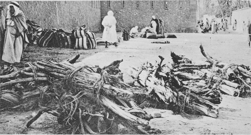
Guelt-es-Stel. At each of these places were seen large piles of the
grass baled ready for hauling to Algiers.
The alfa, or bunch-grass, covers large areas in Algeria as also
in Spain. In November the long leaves of the grass are dry, tightly
rolled, and rush-formed, in place of being flat as during the rainy
season or period of growth. The species reproduces largely by means
of much-branched rhizomes, from which spring the young, fleshy
leaves, enlarged at the base. In Algeria, “situées en territoire
civil,” there are 543,620 acres of alfa, mostly on the High
Plateau, but a part along the littoral in the province of Oran,
west of Algiers. The leading environmental influence upon the
peculiar distribution of the species is apparently that of
rainfall, reacting in this respect very like plants with storage
organs, avoiding alike regions where the rainfall is excessively
heavy or where it is so little as to cause marked desertic
conditions. It is apparently confined to sandy soils and is
replaced by others wherever the soil of a region (otherwise
appropriate for its growth) is of clay or is charged with any
considerable amounts of salts. It is an important article of export
from Algeria. Its total tonnage is said to amount to 80,000 each
year, bringing approximately $1,500,000. It is sent to England,
Belgium, and France, and used in the manufacture of fine grades of
paper, light, strong, and of a silky texture; also in making
baskets, hats, and mats, for which a superior grade of the grass,
commanding especially high prices, is employed (Kearney and Means,
loc. cit.).
Among other species commonly seen in crossing the steppes are
various salt-bushes, such as Haloxylon articulatum and
Anabasis articulata and especially Artemisia herba-alba, with
Tamarix and a few specimens of Pistacia along the
oueds or where water conditions are most favorable. Between the
belt of alfa last mentioned and El Masserane, a bordj, there is a
broad plain surrounded by low mountains, which are really the
northern extension of the broad Saharan Atlas, where salt-bushes
occur in a formation several kilometers, possibly 24, across. Here
in the summer the nomads, coming up out of the desert, find grazing
for their flocks, and even in October we saw countless numbers of
sheep and goats, and hundreds of camels, browsing the shrubs.
At El Masserane are specimens of large Tamarix, really
the size of small trees, growing near the bordj; and to the south
of the bordj we passed the first dunes encountered on the plateau.
These are part of a series of dunes which were seen to extend to
the horizon to the northeast, as we approached El Masserane, and
which, we were informed, reached as far as Bou Saada, nearly 90
kilometers distant. The dune flora was quite different from that of
the surrounding plain, owing to the total absence of salt plants,
and to the presence, among other species, of a Tamarix and a
large grass, the “drinn” (Aristida pungens), which was
subsequently frequently seen.
Soon after passing the dunes the way lay through a country with
low mountains, almost bare of vegetation, where scattering oaks and
junipers constitute the only species of plants, until we reached
the walled town of Djelfa.
DJELFA TO LAGHOUAT.
The bleakness and the bareness of the environs of Djelfa come
with a surprise when one considers that the rainfall of the place
is not inconsiderable, about 375 mm., and that the altitude is
about 1,110 meters, which insures a fairly low temperature and
hence a relatively low evaporation rate. The sparseness of the
vegetation is probably partly due to the fact that the rainfall
does not occur at one or at two seasons, as nearer the coast, but
is distributed fairly evenly between the four seasons, and also to
the long occupancy by the Arabs and the French, by which possibly
most of the useful native plants, large and small, have long since
been destroyed. Somewhat removed from the town, particularly on the
mountains to the west, is a forest of pines. Along the streets are
many shade trees, as Lombardy poplar, ash, locust, and others, and
within the town limits is a small but fine public park and
experimental garden with a large variety of shrubs and trees.
From Djelfa to Laghouat the road runs through barren mountain
passes, and is dreary and of little interest. Tristram’s
description of the approach to Laghouat, written about 1860, gives
very well the present condition of things:
The next day’s journey was through a rocky desert country. . . .
We afterwards passed a low-lying strip of sand-hills on the west,
with the marks of an ancient ocean beach; on the east a high range
of mountains, with the stratification regular and horizontal. . . .
Our next day’s ride was by a base of a continuous chain of steep
ridges, again with an
even water-line very near the crest, and presenting a singular
serrated appearance (the Djebel Lazareg). I counted no less than
127 little peaks rising above this straight horizontal line, almost
all of them of equal height, like the crests of a long sea-reef;
and lower down the sides were many tidal strings, if I may so term
them. Turning around to our left and crossing the dry channel of an
evaporated and aged “Wed,” we had some low headlands close behind
us—Ras Ainyah of the Arabs, “Prise d’eau” of the French—the scene
of a bloody combat under General Yusuf. Through an opening between
the mountains we debouched on a wide plain, and suddenly before us
stood an isolated rock. Two cliffs facing each other bore each a
bastioned tower, and in a depression between these lay a town.
The town, whose situation is thus so graphically presented, is
Laghouat, of which the leading present interest lies in the fact
that it is on the very edge of the Sahara proper. From the rocky
hills by the town one can see the serrated Saharan Atlas to the
north, extending northeast and southwest, and, turning, to the
south, an expansive and gently undulating bare plain, stretching
without a break to the horizon.
LAGHOUAT. — THE OASIS OF LAGHOUAT. — THE PLAIN. — THE DUNES NEAR LAGHOUAT. — THE MOUNTAINS ABOUT LAGHOUAT. — EFFECTS OF GRAZING ON VEGETATION NEAR LAGHOUAT.
The ancient Arab town of Laghouat, which is also an important
military post, is a very favorable place from which to begin a
study of the plants and the environment of the plants of the
northern Sahara. Its altitude (780 meters) is greater than that of
Ghardaia (520 meters), as also that of the latter place is greater
than the altitude of Ouargla (150 meters). The annual rainfall of
Laghouat is more than that at either of the places mentioned and
more dependable. The surface of the desert at Laghouat is, for
example, not of one type only, but characteristic of much of the
Sahara; that is, it is mainly stony, a hamada, but there are also
sand areas, a oued and its flood-plain. Finally, the plants growing
in the vicinity of Laghouat are largely typical of those found
farther to the south, as at Ghardaia and Ouargla, or even deeper in
the desert. It is of great interest to observe the change in the
habits of the plants, in their number, distribution, and other
features, when one leaves a less arid region and goes toward a
region of gradually increasing aridity, as when passing southward
from Laghouat.
The leading plant habitats are the oasis, the arid plain, and
the dunes. It is not likely that any of these habitats have been
greatly changed because of the settlement by Arabs. The arid plain
and the dunes surely have per se not suffered marked
alteration, and the oasis itself is probably not so different from
what it was formerly, as the great difference in plants growing in
it might at first lead one to suspect. More water is brought to the
surface at present than in primitive times, but if it were possible
to remove all introduced plants, and restore all native plants
peculiar to the oasis, there is no apparent reason why they should
not live there quite as successfully as in earlier times. It does
not follow that there has been no modification of the flora itself,
a result of the founding of a town at the oasis, and it will be
pointed out later that such has surely been the case, but to what
extent or in what way does not appear.
The oasis of Laghouat is situated on the Oued Mzi, the upper
portion of the Oued Djedi, one of the most important oueds of
Algeria. The Oued Djedi runs in an easterly direction from
Laghouat, receiving many tributary oueds en route, by a
rather long course to the great Chott Melrirh, which is southeast
of Biskra. Like other desert rivers, the Oued Djedi is dry most of
the year, but is occasionally filled to overflowing with a rushing
flood, which is of great erosive power and may be very dangerous to
the traveler. Above the town of Laghouat, where the Oued breaks
through the last pass of the Atlas, the flood-plain is narrow, but
upon leaving the pass the plain widens until in the immediate
proximity of the town it is about 1.5 kilometers in width. On
either side of the flood-plain stretches the arid plain (hamada),
usually stony, but near the mountains covered with low, slowly
moving sand ridges. To the south of the oasis, the arid plain
merges into the topography characteristic of the region of the
dayas.
The portion of the oasis devoted to the cultivation of date and
other trees, and to gardens, is about 3 square kilometers in size,
but arable land extends above and below the town, so that outside
of the oasis, as delimited above, there are about 6 square
kilometers, all of which have at times been under cultivation. The
last referred to is the flood-plain of the oued and is used mainly
for growing barley. By the edge of the oued, or along the
irrigating ditches, are several characteristic species of plants,
which may point to the character of the primitive flora; for
example, willows, oleander, and Tamarix, with a few palms.
The betoum (Pistacia atlantica), which must surely have been
an inhabitant of the oasis formerly, is now apparently wholly
absent. The species just mentioned are to be found between the town
and the pass above; but below the oasis, owing to an apparently
poorer water-supply, there are fewer large species. Among those
found are a few specimens of Rhus oxyacantha and Zizyphus
vulgaris, and it was probably below the town that the betoum
was to be found in earlier times.
The oasis is under intensive cultivation (see fig. 1). There are about 300 gardens, each bounded by mud
walls, and often separated by picturesque, meandering lanes. The
plant life, almost wholly introduced, is luxuriant. In some gardens
the effect is tropical, where vines reach from tree to tree, making
a canopy nearly sun-proof and separating the spreading tops of the
palms from the wealth of shrubbery and herbaceous plants beneath.
First among the trees of the gardens, in numbers as well as in
economic importance, is the date palm, of which there are said to
be about 30,000. Although this is small in comparison to the number
of date palms at Ouargla, Touggourt, or the Oued Rirh, the dates
are of great importance to the dwellers at Laghouat, where the
products of the gardens are almost all consumed. The living tree
provides shelter against the intense heat and light of the desert,
and the dead leaves constitute an important source of fuel in a
land where fuel is extremely hard to obtain. The flesh of the date
fruit is eaten by the Arab and the cracked seeds are given to the
camels. Without the
date a continuous occupancy of a remote oasis by the Arab is
clearly impossible. Besides the date palm fruit trees of other
kinds are abundant, among them the apricot, fig, mulberry, peach,
pear, and orange. The pomegranate and the table grape are also very
generally grown. The lowest story of the vegetation of the gardens
is composed of garden vegetables, such as artichoke, bean, carrot,
melon, pea, potato, squash, and radish. Among the ornamentals one
sees roses, asters, and chrysanthemums, and occasionally very
luxuriant cannas. One or two parks contain interesting introduced
trees and shrubs. We recognized among the trees Ailanthus,
Eucalyptus, umbrella, plane, poplar, pine, cypress, ash,
locust, willow, and St. John’s tree. The Barbary fig (Opuntia
ficus indica) is also common, but does not stray away from the
best-watered situations.
The part of the plain (hamada) studied lies to the west of the
oasis, between it and the adjacent hills, Mountains of the Nomads,
which are to the west of the pass of the Oued Mzi. Emerging from
the oasis, one finds himself on the arid plain, the transition from
the one to the other being abrupt. The plain, at first view, with a
covering of small stones and pebbles, gives the impression of total
barrenness. Not a tree, shrub, or herb appears to hide the bare
ground. The mountains are naked rock, while the harsh outline of
desert ranges and the distant low sand ridges give no evidence of
plant life. But a closer examination of plain, dune, and mountains
reveals the presence either of living forms or of the dried remains
of plants of a preceding moist season, in numbers and in kinds not
at first suspected.
Close to the oasis the plain forms the highway for caravans as
well as the drilling ground for army recruits, so that the herbage
is either trodden under foot or eaten to the roots. Somewhat
farther away, where the plain rises to meet the mountains, we first
encounter perennials large enough and abundant enough for
consideration, the most prominent being quedad (Acanthyllis
tragacanthoides), adhidh (Zollikoferia spinosa), rempt
(Haloxylon articulatum), and drinn (Aristida
pungens); Acanthyllis is perhaps the most numerous.
Quedad is the most striking plant native to Laghouat. It is a
shrub, related to Astragalus, usually not over 40 cm. high.
A single specimen consists of a group of unbranched or
little-branched stems, rather stout, of a grayish-green color, and
provided with long and stout spines. As a whole the plant has a
very close resemblance to small specimens of ocotillo
(Fouquieria splendens) of the southwestern United States.
During dry seasons the stems are bare, but when the rains return
leaves are put out in the axils of the spines, which are the
rachides of the leaves. The habit of quedad is shown in figs.
4 and 6. Although the species
is so well protected against attack by animals that it rarely, if
ever, suffers on that account, it is made a supplemental food
through the burning off of the spines. When thus prepared the
half-woody stems are eaten with avidity by camels.
The census of
Acanthyllis was taken on the upper portion of the arid plain
at a place where the plant seemed to be most abundant. On an area
16 by 16 meters, 92 specimens were found living. This was the
dominant species. Other species, present in less number, were so
badly eaten by animals as to be quite unrecognizable.
The root-system of Acanthyllis offered some points of
interest and a short study of it was made in the field. All of the
specimens whose roots were examined were growing in the habitat
above referred to and within a meter of one another. The leading
results of the observation are as follows: The largest specimen
studied possessed a tap-root 3 cm. in diameter at the crown.
Growing rapidly smaller as it ran downward, the root gave off four
laterals, of which a portion dipped at an acute angle to a depth of
20 to 30 cm., sending off branches by the way. One of the largest
of the laterals was traced 75 cm. and where left was 2 cm. beneath
the surface. The branches, at least of the main laterals, that is,
the roots of the tertiary order, for the most of their course ran
thus near the surface of the ground. One of the leading laterals
was followed to the base of a neighboring specimen of quedad, where
it lay close to the crown of the main root. The depth of the
penetration of the tap-root of this specimen was not learned. The
tap-root of a neighboring specimen ran directly downward 20 cm.;
then, turning sharply, it extended in a horizontal direction for a
distance of 70 cm. As the large laterals were wholly lacking on
this plant, the tap-root was the entire system—surely an anomalous
condition. On a third plant the tap-root penetrated the ground
about 4 cm. only, after which it turned and ran the rest of its
course within 4 cm. of the surface. The more superficial of the
roots of a fourth specimen were found to extend to the base of the
last plant mentioned. Thus it was found that the root-system of
Acanthyllis, as growing naturally, extends both widely and
deeply for a considerable distance, and that it is flexible to a
degree; in short, is generalized[8] and closely resembles that
of certain species of the Tucson region, particularly Covillea
tridentata, which grows under similar conditions.
The root-systems of three or four other species were also
examined. Of these Zollikoferia spinosa and Artemisia
campestris were growing in a little hollow in the plain close
by the habitat of Acanthyllis. Zollikoferia has a
very close habit of growth with dichotomous branching (compare
figs. 5 and 7). When dry the
branches are slender and of a woody hardness. The root-system of
this species is characterized by a pronounced tap-root
and by the absence of
large laterals, at least near the surface. The leading feature of
the root-system is, in short, its tap-root. A root-system of a
similar type was found in Artemisia herba-alba.
Rempt (Haloxylon articulatum) also occurs on the plain.
This is a shrubby perennial (half shrub?) which is possibly the
most often met of any species, or at least genus, in southern
Algeria. It is capable of enduring very arid conditions, is
unarmed, and is much eaten by all herbivorous animals. The plant
will be figured and especially referred to later in this study, so
that at this time only a brief definition will be given of its
root-system, which is a typically generalized one, penetrating the
ground fairly deeply if the character of the soil permits, but also
lying near the surface; there is also a relatively large number of
secondary and tertiary roots, characteristic of the generalized
type.[9]
Inspection of the soil showed it to be a sandy clay with a large
percentage of pebbles and stones and with greater depth of earth in
the hollows on the plain than on low ridges. It probably contains
some gypsum, since an outcropping of it occurs on the southern face
of the low mountains to the north. Taken as a whole, the soil
appeared very like that of the plain by Tilrempt and Ghardaia, as
well as between Ghardaia and Ouargla (Gantara). The soil will be
described later in this paper.
Dunes are not present in large enough numbers, or of large
enough size, to figure very prominently in the topography of the
environs of Laghouat; but they occur both to the east and to the
west of the town, those to the east being the larger. Sand is found
facing the south side of the Rocher des Chiens, a rocky hill on the
western edge of the oasis, and the south side of a portion of the
Nomad Mountains, to the north. There is also a succession of low
dunes between the Nomad Mountains and the oasis. The Rocher des
Chiens dune is moving from west to east, but the dune along the
face of the Nomad Mountains is probably stationary. The series of
dunes on the plain are moving toward the northeast.
An inspection of the dunes shows that the number of individuals,
as well as the number of species, is very limited. In fact there
are apparently fewer plants here than on the dunes of large size
subsequently encountered between Ouargla and Touggourt. The most
characteristic plant is “drinn” (Aristida pungens), but it
is by no means common; there are also a few specimens of
Tamarix growing near the Nomad Mountains. As frequently
happens where there are moving dunes, the passage of the dune
greatly changes the character of the flora. Although this feature
was not especially studied, it was noted that the number of grasses
where the dune had swept was greater than it was before this.
Acanthyllis tragacanthoides, a plant typical of the plain,
was found to survive the passage of the sand, although changed in
appearance in a characteristic manner. It will be recalled that the species has a top
consisting of several shoots, springing from the root-crown at the
level of the ground, and a root-system in which the laterals and
the main root are alike well developed. In order that a plant,
already established, can maintain this general relation during the
heaping up of the sand, the main root must grow at the crown as
fast as the sand encroaches. This is exactly what happens, so that,
when the dune has passed on, the shoot of the species is elevated
for a space equaling the depth of the sand, which is half a meter
or more. From the probability that Acanthyllis is of very
slow growth and that the dunes are low, it follows that the rate of
dune movement must be slow.
The southern spurs of the Saharan Atlas lie to the north of
Laghouat, within 3 miles of the oasis. This range (the Nomad
Mountains) is not over 266 meters in height. Higher mountains
extend both to the west and to the east, but only the Nomads are
visited. There are also two high, rocky hills on opposite edges of
the oasis, the town lying between, and it is perhaps because of
their presence that the water is forced to the surface, or near the
surface, and the oasis is formed. The hill to the west of the town
is called the Rocher des Chiens. On the south side of the Nomad
Mountains is a long outcropping of gypsum; the south face of these
mountains is also abrupt, carrying little soil; but on the northern
face the slope is gradual and there is much soil, although rocks
are abundant.
Two localities only in the Nomad Mountains were seen. One was in
a pass through which caravans travel en route to Laghouat,
from the High Plateau or the more distant Tell; the second to the
east of the pass is much less often visited by flocks. The physical
plant conditions appeared to be the same in both locations. As one
approaches the mountains from the south the number of plants grows
less until on the south face they quite disappear, but on attaining
the crest they quickly increase and form a noticeable element in
the landscape. In fact, the flora of the northern gentle slope,
where the soil conditions are relatively favorable, is much richer
than on the plain or the dunes. Had the shrubs been of good size
they would have been very conspicuous.[10]
A certain area on the north slope of the Nomad Mountains, not
far from the pass through which the Oued Mzi goes, was selected for
making a census of
the plant population. Here the number of individuals, as well as
their size, showed that the moisture relations were good as
compared with those of the plain. On an area 16 meters square 422
living perennials were found, mainly of the following species:
Acanthyllis tragacanthoides, Asparagus spinosa,
Deverra scoparia, and Zollikoferia spinosa. The most
numerous, Zollikoferia, was represented by 96 individuals.
The general character of the habitat and the plants is sufficiently
well shown in fig. 8 and does not need further
mention in this place.
It is generally recognized that a potent influence is exerted by
man, and the lower animals, in shaping the flora of an arid region,
not only as regards the kind and number of plants, but also as
concerns certain of the leading characteristics of the plants
themselves. The action is largely such as brings about a survival
of the “useless” forms, so that we do not know, from the plants we
meet in the desert to-day, how many or what kinds of plants it
might support. It also may be true that no desert shows the
modifying effects of the causes suggested more than the northern
Sahara.
The gazelle (Gazella dorcas) is the leading wild animal
preying upon the desert plants in the northern Sahara. It is
frequently seen by the traveler to-day and was present in large
numbers no longer ago than 50 years (Tristram). It is said by the
Arabs to feed on the fresh shoots and leaves of many species of
shrubs and trees, especially the betoum (Pistacia
atlantica), as well as on the annual vegetation for the
relatively short period when it is to be had. Other species of
gazelle, according to Tristram, range farther to the south. Other
herbivorous animals of the region are hares, antelope, moufflon,
and bubale. The moufflon, at the time of Tristram’s visit, was “far
from uncommon throughout the whole of the mountain districts,
whether wooded or bare,” but the bubale, “the wildest of the wild
game of North Africa,” appears not to go north of the Oued Rirh,
while its home is farther south. It is impossible to know the
number of wild animals subsisting on native desert vegetation, but
the list given, which might be extended, suggests that it is by no
means small. Although the population of wild herbivorous animals is
at present considerable, it was probably much greater a few years
ago, the decrease being due, as Tristram says, not so much to the
greatly increased population as to the more efficient weapons used
by the Arabs in hunting.[11]
Laghouat has been
inhabited by the Arabs continuously for about 1,000 years, during
which time the oasis and its environs have been the source of
supply of all of the fuel used and for much, if not the most, of
the food consumed both by the Arab and his flocks. Naturally, the
food for the inhabitants of the oasis is won from the oasis itself,
but that for the beasts is derived from the desert. While it is
impossible to learn the number of sheep, camels, and goats which
from century to century have ranged over the desert pastures, there
is no reason for supposing it was not large, as at present is the
case. For example, in the department of Algiers, in 1907-08, the
number of sheep is reported to have been 2,109,071; of goats
1,156,500, and of camels 23,912.[12] Of these a large
percentage is to be found in and to the south of the Saharan Atlas
Mountains. In portions of the colony farther south, or in regions
even more desertic than at Laghouat, the number of camels, sheep,
and goats is surprisingly large. The statistics for 1907-08 give
the population of the three classes of animals in the southern
territories, that is, the territories of Ain-Sefra, Ghardaia,
Touggourt, and the oases of the Sahara, as follows: sheep,
1,932,392; goats, 588,121; camels, 126,088.
The flocks of sheep and goats range at various distances from
the source of their water-supply. It is quite usual for the
goatherds to gather their flocks in early morning, returning to the
oasis in the evening to distribute the goats to their various
owners; but probably in most cases the flocks of sheep, with some
goats, return to water once in two or three days, thus being able
to stray from 20 to 40 kilometers into the desert. Being less
dependent on water, the camels range a much greater distance. It
thus appears that the area grazed over by the flocks of the Arabs
is fairly circular in form, with a radius of 40 or more kilometers
from the wells, and that the range of the camels may be much
greater than this. It should also be noted that the caravan routes
are broad tracts where all vegetation fit for fuel or food has been
utilized Between the two sources of destruction referred to, the
stationary and continuous and the frequent but not continuous,
little territory passes untouched as a source of food-supply.
A visit to the wood markets of the town indicates to what ends
the natives resort to obtain fuel. (See figs. 2
and 3.) Among many kinds of wood, some are from
the oasis itself, such as the willow, plane, and palm; some from
the mountains, like juniper, pine, and oak; and some from the oued,
like the jujube and Tamarix. Much of the fuel is at present
brought three days’ journey by camel. Usually the subaerial
portions only of the plants are used, but in the case of the jujube
both root and branches are gathered. The fuel requirements have
apparently brought about the extinction of some species from
certain of their earlier habitats; for example, the betoum (Pistacia
atlantica) probably formerly either grew in the oasis of
Laghouat or near by, since it was formerly in common use as a fuel.
Tristram mentions the betoum, and no other species, as a source of
fuel, but inquiry failed to show that at present this species is in
general use for this purpose; but the betoum is a familiar sight in
the region of the dayas south of Laghouat, where it is the only
arboreal species of the region.
From what has been said regarding the large numbers of domestic
animals that gain their entire living on the desert, it follows
that of plants growing within the range of the flocks only such as
are poisonous, distasteful, armed, or otherwise protected, escape
partial or complete consumption. Only such species as are too small
for fuel or can not be eaten by animals attain to the usual
development year by year. In the vicinity of Laghouat the most
prominent of the immune plants is the quedad (Acanthyllis
tragacanthoides), which is well protected by its stout spines;
and even this species is not wholly undisturbed. The jujube, also,
although not common here, is provided with short spines. It is
stated by Massart[13] that the camels used by him, not having
eaten for five days, consumed the branches of the jujube in spite
of the spines, and that Anvillea radiata, a composite with
acrid juice, was passed by. Perhaps the plants most frequently
eaten are of the genus Haloxylon, generally distributed from
the High Plateau southward into the region of the M’Zab. That this
genus is not exterminated is interesting, since it is rarely
permitted to come into flower and fruit, and it appears not to
reproduce to any extent, if at all, in a vegetative way.
FROM LAGHOUAT TO GHARDAIA. — REGION OF THE DAYAS. — DAYA OF TILREMPT. — THE CHEBKA.
From Laghouat the way lay through a gently rolling country, ever
dipping to the south and southeast. No mountains relieved the
monotonous horizon. “A hard stony desert alternated with rolling
sandhills,” followed by a “vast level plain dotted with dayas,” to
quote again from Tristram’s narrative. Somewhat to the south of
Laghouat depressions are met here and there, separated from each
other by the low ridges of the plain, which receive the drainage
each of a limited territory. (See figs. 10 and
11.) These are dayas, and are in fact oases with
an uncertain water-supply but with favorable soil conditions, so
that such rain as falls on them, or is conducted to them from
higher ground, sinks deeply and creates relatively favorable
conditions for plants. In that the daya is the center of a drainage
system, and has no visible outlet, it is comparable to the chott or
salt-spot, but it is to be distinguished from the chott by the
absence of salts in excessive amounts. That salts are not present
in the dayas in quantity is probably due to subterranean drainage,
the daya being in fact similar to the bolsons of western America. On the plain in the
northern portion of the daya region the following may be
observed:[14]
Echinops spinosus.
Citrullus colocynthis.
Teucrium polium.
Acanthyllis tragacanthoides.
Artemisia herba-alba.
Aristida obtusa.
Thymelæa microphylla.
Artemisia campestris.
Stipa gigantea.
Peganum harmala.
Haloxylon articulatum.
Noæa spinosissima.
Euphorbia guyoniana.
Anabasis articulata.
Asteriscus pygmæus.
In the dayas one sees Zilla macroptera, Peganum
harmala, but chiefly Zizyphus lotus and the betoum
(Pistacia atlantica), which is perhaps the only species of
tree outside of the oasis in this portion of the Sahara. Massart
mentions not seeing any tree away from oases from the time he left
Biskra until he reached the region north of Berrian, the northern
portion of the Chebka. As the betoum is so conspicuous among the
Saharan plants, and also from the very remarkable relationship
existing between it and the jujube, the species is of very great
interest. The relationship will be described under an account of
one of the largest dayas of the region, that of Tilrempt.
The daya of Tilrempt is one of the largest (about 103 hectares)
and is the most southerly of all. It lies near the southern margin
of the daya region, and is surrounded by a gently undulating plain
(hamada), whose surface is strewn with stones and pebbles, with
apparently an underlying stratum of impervious material, since such
is to be seen wherever erosions have laid it bare. The floor of the
daya is free from stones, being composed of soils of a fine texture
which have been washed or blown by the wind from the surrounding
higher country, and is apparently not underlaid by a hardpan.
Judging from the depth of the two wells at the daya (which were
dug, not bored), the deeper of which is said to be 95 meters, there
is an abundance of earth for the roots of the plants. Besides the
wells there is a cistern, sunk below the general level of the daya
floor, which receives and stores up flood-water; it is rarely
filled, but occasionally contains considerable water, possibly up
to one-fourth of its capacity; its filling is very uncertain,
depending on the rare and scant rains. According to Massart, no
rain had fallen during the two years previous to his visit, and the
cistern was empty when we were there. These observations are given
to show under what intensely arid conditions such a tree as the
betoum (mature specimens of which carry an immense evaporating
area) can become of large size, giving but slight evidence of a
severe struggle against such adverse conditions. The altitude of
the daya is about 600 meters.
As one crosses the plains in the vicinity of Tilrempt he notes
the scantiness of the vegetation. (See fig. 9.)
Here and there in the depressions are a few betoums, often only one
specimen, but usually more, and in the erosion channels leading to
the dayas is a sparse population of low, gray shrubs. Over the higher portions of the
plain, one is aware that small perennials, 20 to 30 cm. high, are
widely scattered, but it is the bare ground which gives the
character to the landscape. Among other forms are species of
Aristida and Stipa, Anabasis and
Haloxylon, with dwarfed specimens of Zizyphus lotus
in the washes near the dayas. The leading species, Haloxylon
articulatum, is much eaten by the flocks of sheep and goats
(over 7,000 sheep are said to obtain water at the daya), but
occasionally it is present in surprising numbers. For example, on a
slope to the northeast of the daya, and but a few meters distant,
227 living specimens of Haloxylon were counted on an area of
16 meters square; in another place, near the crest of a low hill to
the west of Tilrempt, where the conditions were probably as
unfavorable as any in the region, 118 specimens were found on an
area of the same size. In both squares there appeared to be no
other species present. Tilrempt is said to contain 2,400 betoum
trees, although the visitor would not be likely to estimate the
number at nearly so high a figure.[15] Numerous specimens of
jujube are also scattered through the daya, with some Peganum
harmala and Francœuria crispa.
As a person visits the floor of the daya he is struck by the
great beauty of the betoums. They are of a compact habit of growth,
shapely, and cast a dense shade, an unusual feature in a desert
tree. Attaining a height of 15 meters or more, the tree may have a
spread equaling or exceeding this amount. The bole of the largest
specimens is of large size; one was found 4.56 meters in
circumference, another 4 meters, while a third measured 3.36
meters. All measurements were made 1 meter from the surface of the
ground. No betoums, however, were seen to have developed in a
perfectly normal way, and this observation applies not only to
Tilrempt but to all other dayas seen, but they were disfigured in a
peculiar manner, the lower branches giving the appearance of having
been cut and removed at a height of 2.85 meters. In fact, this had
been done, and the lowest existing branches marked the highest
point to which a browsing camel can reach.
The leaves of the betoum are compound, consisting of 7 to 9
large leaflets. The branches are unarmed and the twigs, younger
branches, and leaves are eagerly eaten by whatever herbivorous
animals can reach them. (Fig. 12.) So much is
the betoum sought after as a food that it would be exterminated if
it were not protected by another plant, namely, the jujube.[16]
The character of the leaves and young shoots of the betoum may be
seen in fig. 15.
In considering the main characteristics of the jujube we find
that it is a
spreading shrub, frequently attaining a height of 3 to 4 meters,
with branches well armed with stout spines. The leaves are small,
simple, and leathery. (Compare fig. 14.) The
spines are so efficient as a means of protection that the shrub
shows no signs of being eaten by animals, although, as quoted
above, Massart remarks that after his camels had gone five days
without food they ate the jujube branches in spite of the
spines.
The unarmed betoum and the armed jujube have a very interesting
relationship, which is as follows: When the seeds of the betoum
germinate the seedling is eagerly eaten by animals if it chances,
as is usually the case, that the germination occurs on the open
daya floor; but if the seeds are carried to a Zizyphus and
germinate in its midst, the young plants may attain to a
considerable height before being seen by animals, and, being
protected by the encircling jujube, will continue growing until
they are too large to be easily killed through grazing. It usually
happens that once the betoum plant appears above the top of the
protecting shrub the camels attempt to reach the attractive shoots
and the jujube is trodden under foot. The jujube is thus ultimately
destroyed and a mound around the base of the young betoum is all of
it that remains. If the jujube is relatively small and the
developing betoum is discovered while still small, it will be much
eaten, and probably killed; but if it reaches a considerable height
before the discovery is made, only the lower branches will be
devoured and the specimen will survive. Massart was unable to find
any young betoums, but when my visit to Tilrempt was made,
November, 1910, there were several, although so well hidden as to
cause much trouble in finding them. A view of one of these is shown
in fig. 13.
The betoum is eaten by the gazelle as well as by domestic
animals, which are abundant enough in this region, and this fact is
probably of great influence in restricting its distribution. Fairly
numerous on the desert at present, according to Tristram the
gazelle was very abundant in earlier times; he speaks of their
tracks marking the plain like sheep-walks.
From what we have already seen regarding the ill effect of
grazing, it will appear that the relation between the betoum and
the jujube is a very vital one to the former; and it probably is
not too much to say that the distribution of the betoum in the daya
region is entirely dependent on that of the jujube, since there is
no other armed shrub in the region to afford the protection
essential to its survival; with relatively favorable moisture
conditions, considerable depth of soil, and a protecting jujube,
the betoum will flourish and reproduce now quite as well as in
former years.
No dayas were seen after leaving Tilrempt, and the aspect of the
country changed markedly and suddenly as the drainage became better
defined. The hills were more abrupt and in systems, and the valleys
became broad and continuous. At first the valleys were wide and
shallow, the hills being low and with flat summits, but as the
distance from the daya region increased, the valleys became deeper,
until at Ghardaia the effect was that of low, flat-topped mountains
with broad valleys between, thus remotely suggesting the topography
of southern Arizona. However, in southern Algeria the mountains are
not so high nor is the “mesa” (hamada) so extensive as in Arizona.
The general level of the daya region is prolonged as the summits of
the mountains of this the chebka region, while the valleys are
eroded to a new level, that of the plain of the M’Zab. A similar
condition is seen as one goes from Ghardaia to Ouargla, so that in
fact there are several immense terraces, reminders of that remote
period when there was more rainfall in this portion of the Sahara
than at present.
Although the drainage to the south of the daya region is well
developed, the valleys and mountains run in a rather confused way,
so as to give to the fancifully inclined Arab the idea of a net,
from which the name “chebka” is said to be derived.
The country from Tilrempt to Ghardaia is characterized by a
continuously decreasing amount of vegetation. In place of the
country as a whole having a covering, however sparse, as in the
daya region, one is apt to consider the chebka a barren desert,
absolutely devoid of plant life; but closer inspection dispels this
illusion and reveals the presence, in the more favorable
situations, of not a little vegetation.
In the northern portion of the chebka region one sees here and
there, on the bottoms, specimens of the jujube and the betoum, as
well as Zilla macroptera, Retama sphærocarpa, and
Coronilla juncea. On the rocks at Settafa, Massart reports
finding lichens, the first he had seen after leaving Biskra.
However, crustaceous lichens occur on the flat tops of the low
mountains by Ghardaia. Massart suggests that the absence of lichens
in the Sahara (possibly they are not to be found south of Ghardaia)
is because of the intense dryness and the great heat, the
temperature of the rocks becoming from 60 to 70° C.[17]
At Berriane, one of the M’Zab cities, there are over 30,000
palms of a superior sort, watered from over 400 wells. The
surroundings of this oasis are extremely desertic and a casual
survey of the route between this place and Ghardaia, 44 kilometers
distant, reveals almost no vegetation. Here the calcareous plain of
Cretaceous origin, the Chebka, is even more eroded than in the
portion farther to the north, and the valleys are wider. The soil
is a fine clay without an admixture of sand. It is only in the most
favorable places, along the washes, that plants are to be found,
and here are Deverra chlorantha, Anabasis articulata,
Gymnocarpon fruticosum, Artemisia herba-alba,
Ononis angustissima, Linaria fruticosa,
Antirrhinum ramosissima, and Haloxylon articulatum
(Massart, loc. cit.). Peganum harmala occurs very sparingly by the
roadside. The habits and the habitats of certain of the
above-mentioned species will be described in greater detail later
in this paper.
GHARDAIA. — THE OASIS OF GHARDAIA. — THE PLAIN (HAMADA) OF GHARDAIA. — THE MOUNTAINS ABOUT GHARDAIA. — THE VALLEY OF THE M’ZAB. — PROTECTED AREAS NEAR GHARDAIA. — ROOT-HABITS IN THE GHARDAIA REGION. — LEAF-HABITS IN THE GHARDAIA REGION. — GROWTH AND FLOWERING HABITS IN THE GHARDAIA REGION.
The Ghardaia region can be characterized as a vast plain, broken
to the north by low, irregularly disposed mountains, and stretching
for a great distance to the south and southeast with a fairly
monotonous surface, diversified only by oueds, chotts, or
occasional dunes, which may be the size of small mountains. Thus on
the one hand one finds the fairly diversified and stony Chebka and
on the other the hamada, which has been aptly described by
Brunhes[18] as “le désert par excellence, la vrai désert .
. . les grandes plaques pierreuses indéfinies des hamadas!”
The leading oued of this region is the M’Zab, which extends for
about 270 kilometers in a direction south of east across the
southern part of the Chebka. It takes its origin about 80
kilometers west of Ghardaia and extends to the vicinity of Ouargla,
where it debouches on the Ouargla plain. At Ghardaia the oued lies
in a valley, with abrupt sides, which is sunk about 60 meters below
the surrounding plain and which at this place is about 3 kilometers
in width. (See fig. 16.) There are four main
tributaries of this oued, all of which join it from the north or
the Chebka side. The valley of the M’Zab becomes more and more
shallow as one proceeds eastward and at last lies but little below
the general level of the country. Like the other deeper valleys of
the Chebka, the M’Zab Valley represents the work of erosion by
water at an earlier geological epoch, when the great terraces were
formed. The filling of the eroded valleys has perhaps taken place
during the long arid period since that time and has probably
proceeded very slowly.
It appears to be uncertain how long the M’Zab has been inhabited
by man, or, more accurately, by the race now dwelling there;[19]
but it has probably been not less than nine centuries.[20]
At Ghardaia are
several well-defined plant habitats, which may or may not be
distinct topographical areas, and which differ from one another in
exposure, soil conditions, and water relations. These are the plain
of the Chebka (hamada), the low and flat-topped mountains resting
on the plain of the Chebka, the walls of the M’Zab Valley, and the
valley floor with its gardens, cemeteries, and waste lands.
The soil conditions of the areas mentioned are very diverse. On
the valley walls and the mountains there are bold rock outcrops
with soil in the interstices only, and here the most intensely arid
conditions prevail. The soil on the hamada also is exceedingly
meager. Rocks of various sizes strew the surface. It is only
between them, as well as in the washes of gentle gradient, that the
best soil conditions of the plain are to be found. Here a cursory
examination shows a large admixture of small stones to the fine
clay, the prevailing soil type, and that at a depth less than 50
cm. A white hardpan, similar in appearance to the caliche of the
southwestern United States, may usually be encountered. In the
drainage depressions the soil is relatively more coarse than on the
more level portions of the hamada. There is also great variation in
the character of the soils of the valley. Above the upper palm
gardens, which are about 2 kilometers above the town of Ghardaia,
will be found much sand and fairly large stationary dunes, while
smaller dunes, shifted by the winds, are to be found at various
places in the valley. About 10 kilometers down the valley, toward
the east, the sand is blown against the valley sides, and in
certain places where the walls are low it has been sifted in a thin
layer over the plain itself. At the sister city of El Ateuf the
drifting sand is a continuous menace to the gardens.
Between Ghardaia and the upper palm gardens, and also between
this city and Beni Isguen and Melika, are bare areas, free from
sand or clay, where the soil is so hard as to be used for threshing
floors and where the small amount of grain grown in the valley is
threshed and winnowed. The hardpan is similar in appearance to the
caliche of the southwestern United States and may be essentially
the same. It is of wide extent in the valley and probably underlies
the largest portion of it. Near the threshing floors the upper
portion of the hardpan stratum is from 2 to 3 meters above the bed
of the oued M’Zab; the stratum is about 30 centimeters in thickness
and is of fairly uniform structure throughout. Beneath this is
another stratum, less well defined perhaps, of approximately the
same thickness, and with nearly the same character, but carrying a
noticeably large percentage of sand. The lower stratum is less hard
than the upper one. Underneath the second stratum is soil, largely
sand, containing rocks of various sizes. Where erosion of the oued
banks has occurred the soft lower hardpan stratum and the yet more
soft underlying soil are both removed, leaving the upper stratum
projecting as a shelf, sometimes as large as 2 by 4 meters in
extent. When the shelving banks break they remain practically
intact, partly buried by the sandy floor of the oued. (See fig.
17.)
Along the sides of
the valley, and at a distance more remote from the oued, there are
occasional washed-out areas, really box cañons, where the banks
show a slightly different condition of the hardpan from that just
described. Here there may be three strata of hardpan. The uppermost
is of the same stratum as the top stratum by the oued, and the
second stratum also resembles the lower one just described. There
is also a third hardpan stratum of a much different character, in
that it has a very large admixture of sand and gravel, and large as
well as small stones, making it more easily eroded than either of
the upper strata. The soil in which the roots studied were found
varied from a fine sand, with waterworn pebbles, near the oued, to
a clay mixed with sand nearer the sides of the valley. In places
the sand is cemented so as to resemble one of the hardpan strata
above described, but it is less hard and apparently is penetrated
by water without great difficulty.
The Oued M’Zab, whose channel is 15 meters more or less in
width, is dry most of the year, containing water for only a few
hours following the rare storms. Wells are very numerous in the
valley and furnish a good supply of water. At the time of my visit
to Ghardaia the water lay from 10 to 25 meters from the surface,
depending on the position of the wells. The depth to water in a
single well is said to vary from 1 or 2 meters to 15 meters; in
other words, the water-table of the valley varies 13 to 15 meters
between the dry and the moist seasons. No analysis of the water is
available, but it is reputed to be noticeably saline near and below
the town of Ghardaia, while above the town this quality is not
apparent to the taste. The water relations of the plain are much
less favorable for plants than those of the M’Zab Valley. In
addition to the fact that the soil of this area receives only such
water as falls directly on it, there is so little depth that the
water escapes shortly after it falls, leaving only the most
favorably situated soils, for example, those beneath shallowly
placed rocks, or between rocks, or in deeply penetrating cracks or
the depressions, with sufficient moisture for long use by plants.
The depth to water on the hamada is so great that successful wells
have never been dug.
Each of the cities of the M’Zab has its palm gardens as well as
gardens in which grains of various sorts and vegetables are grown.
Intensive gardening is practised and the fruits of the soil,
although won with great labor, are nevertheless not
inconsiderable.[21]
Perhaps the most palms are to be found about 2 kilometers above
Ghardaia, where they are so abundant as to form a small forest.
Here, in the most
thickly planted portions, one finds a veritable jungle in which the
desert glare is softened by the spreading tops of the palms and by
the close canopy of grape-vines which reach from one palm-stem to
another. There is a second story of apricots, peaches, almonds, and
figs, and on the floor one finds a variety of vegetables. Outside
of the palm gardens, and adjacent to them, are the plots in which
cereals are grown. These gardens are divided into diminutive
fields, frequently not larger than 1 by 1.5 meters, which are
separated by small irrigating ditches and smaller laterals, from
which they are given water (fig. 19). Here
barley, oats, and wheat are raised, and often with them are planted
carrots, turnips, or other vegetables. The main ditches are
rendered impermeable by heavy coats of plaster, making it possible
to use with the least waste the difficultly acquired water.
A superficial view of the plain (hamada) which lies both to the
north and to the south of the M’Zab Valley does not suggest any
vegetation whatever, at least during the dry season. The desert is
quite as barren in appearance, as, for example, portions of the
Libyan Desert are in reality. In every direction one sees
grayish-brown stones and bowlders, with little earth, and in some
places blackened stones, blackened by “fires from heaven” the Arabs
believe, but nothing to indicate the presence of plants. Tristram
has described the plain as “one mass of naked rock, rough stone,
and coarse débris, from the neighboring mountain, but without a
scrap of earth or a vestige of the minutest vegetation.” But close
study of the plain makes out a better case than this; in fact,
where the soil has accumulated in pockets, where there is a slight
drainage depression, or where spaces between the rocks are filled
with soil, careful examination shows the remains of annuals and not
a few living perennials; but like other intense deserts, plants,
even when relatively numerous, are not present in sufficient
numbers and not of sufficient size to give character to the
landscape or to hide the surface of the ground.
The plain on both sides of the valley was studied and a few
areas carefully examined with results which are summarized in the
following paragraphs.
It has already been mentioned that the walls of the M’Zab Valley
at Ghardaia are precipitous, rising between 60 and 100 meters from
the valley floor, their summits being the general level of the
plain. Both to the north and to the south of the valley there are
short but steep tributary gulches. In these gulches, and especially
at the heads of the gulches, are pockets filled with earth, and
here may be found some perennial vegetation. For example, at the
head of such a ravine, 3 kilometers north of the valley, 10
undetermined living species were found, of which 6 were perennials
and the balance were long-lived annuals or biennials. (See fig.
20.) In an analogous situation, but on the plain
to the south of the valley, the aspect being similar, a larger number of plants were
found, including, among other species, Aristida sp.,
Centaurea pubescens, Deverra scoparia, Fagonia
bruguieri, Peganum harmala, and Teucrium
pseudo-chamæpitys. A census of plants was taken, where the
individuals were most numerous, with the following result: On an
area 16 by 16 meters there were 330 living specimens. The three
dominant species were Aristida sp., Deverra scoparia,
and Helianthemum sessiliflorum.
On the level portions of the plain one sees almost no perennials
and only the dried remains of annuals, although here and there may
be found an isolated specimen of Peganum harmala or even of
Citrullus colocynthis, the latter strangely out of its
proper surroundings. In one place, also, a small date palm was
found surviving the extremely arid conditions. But on the hamada it
is only in relatively favorable situations that plants are to be
found. One such was given above and another was found on the open
plain, but near the base of a low mountain, where there was a
slight depression and where some water was received from the
mountain run-off. The area alluded to is 10 kilometers north of the
north valley wall; the south base of the nearest mountain is 100
meters to the north of the area. The ground inclines gently to the
south, and rises slightly both to the east and to the west. The
surface is thickly strewn with stones and the soil is clay mixed
with sand, the latter predominating in the center of the
depression, where there is also a relatively large proportion of
small pebbles. The area studied, 16 meters square, was so selected
that the depression crossed the middle portion, leaving the two
sides as representing the larger part of the plain. (Fig. 21.) In a country where the conditions of plant life are
so severe it is of interest to observe how slight advantages of
whatever kind, such as in the square under consideration, work for
the betterment of the vegetation. The dominating species was a
bunch-grass, probably Aristida sp., but there was also
present Haloxylon sp. (eaten to the surface of the ground by
the passing flocks) with other undetermined forms. On the area
given 414 living perennials were found with numerous dead annuals.
All of the plants were growing in the depression, there being, in
fact, none on the adjacent but somewhat higher parts of the hamada.
The character of the soil of this square and a discussion of the
root characters of plants growing in it are given in another
place.
How far the paucity of plants on the plain is owing to the arid
conditions obtaining there, apparently a sufficient explanation in
itself, and how far to the fact that herbivorous animals, wild as
well as domestic, for several centuries have been gaining their
food from the plain, can not at present be well told. Observations
given below, however, indicate that if areas are protected against
the depredations of animals, the plants are noticeably more
numerous and of a larger size than when there is no protection.
This conclusion applies to portions of the plain as well as to the
other habitats under discussion.
The vegetation of the low mountains and of the rocky valley
walls is extremely meager, mainly on account of the small amount or
total absence of soil. In certain places (for example, near Melika)
the plants of the hamada descend the rocky gulch nearly to the
floor of the valley, and a similar condition has already been noted
at the heads of two of the larger gulches. In such places we find
species of grass and Haloxylon articulatum mainly, but these
species are not typical of this habitat. Only two forms appear to
occur on the walls of the valley or on the mountains, and nowhere
else. These are the “kabar,” Capparis spinosa, and one or
more crustaceous lichens. (See figs. 22 and
23.) The kabar is a large shrub, 1 to 2 meters
high, which bears persistent and fairly large leaves. The shrub is
uneaten by animals, owing to some disagreeable flavor,[22]
but is provided with small spines. The species is poorly
represented, there being but few individuals, and it does not
exhibit exposure preference, but grows in crevices between rocks,
sometimes at the base of the walls, or wherever it can attain a
foothold. I have seen lichens on the flat and horizontal upper
surfaces only of a ridge of low mountains about 4 kilometers north
of the valley of the M’Zab; search failed to reveal any on the
north surface of the mountains or on any rocks vertically placed;
their position would thus subject them to the greatest temperature
ranges and to the most intense aridity (fig. 26).
The bottom lands, as already has been shown, are relatively
favorable for plant life; here the soil is the deepest and the
water relations are the best. Accordingly we should expect to find
in the valley of the M’Zab more plants than we have seen on the
plain, and we will not be disappointed in these expectations; but
it is almost certain that in primitive times the vegetation of the
valley was even richer than at present. In fact we now find in the
unprotected places only such plants as are too small for fuel or
are not good for food, and the useful sorts are largely wanting. In
other and similar valleys, which have not been so much disturbed by
man as the M’Zab and where primitive conditions still largely
obtain, there is a surprising wealth of vegetation. Such conditions
were seen between Ghardaia and Ouargla and will be specially noted
on another page.
At present no trees occur naturally in the valley in the
vicinity of Ghardaia or any of the sister cities. The French
portion of Ghardaia contains ornamental or shade trees, such as the
ash, sycamore, and betoum. The largest native shrubs are a species
of Tamarix, growing by the oued, and a few specimens of
Zizyphus lotus, the latter confined to the side gulches and
numbering half a dozen specimens. Among the most generally
distributed plants in
the valley are Peganum harmala (figs. 27
and 28) and Haloxylon articulatum; the
former is a half-shrub of wide distribution in southern Algeria,
occurring from Biskra on the north, and although not strictly
confined to the flood-plains of the oued is most abundant where the
soil is relatively deep. The leaves are rather large and do not
appear to have unusual protection against drought.[23]
Like its relative in the southwestern portion of the United States,
the creosote bush (Covillea tridentata), it is not eaten by
any animals, although not armed and not poisonous. This species,
therefore, is one of the few which to-day probably retains
essentially the same distribution and appearance it had before the
country was inhabited. It is interesting to note that
Peganum is generally distributed through the M’Zab Valley,
being especially abundant between Ben Isguen and Melika. Here in
November Peganum, except where trodden under foot by the
flocks and caravans, retained much of its foliage, although rain
was said not to have fallen for twelve months. In the protected
areas also, as will be mentioned below, this species was found to
be fresh green, showing little or no indication of the long
drought. Of other species found in unprotected places in the
valley, Haloxylon articulatum and Henophyton deserti,
although eaten by animals so as to be recognized only with
difficulty, were also fairly abundant. There were found also
Euphorbia guyoniana, called “le bain” by our French-speaking
Arab helper, because it is used by the natives as a soap, and
Nolletia chrysocomoides, Æluropus sp., and
others.
Of the plant habitats whose leading characteristics have been
briefly given above, only the oasis and its gardens are secure
against the inroads of animals. However, owing to the long
settlement of the region, rather large tracts of land are at
present in what must nearly approach their primitive condition. The
areas referred to are the cemeteries, which, for the reason
suggested, possess special interest to the botanist, showing
briefly what plants might be expected to occur in the region
naturally. The typical M’Zab cemetery is of varying size and
surrounded by a stone wall. No plants are introduced to decorate it
and no irrigation is practised within its walls. The only
disturbance of the natural condition of the land is in the use for
which it is set aside. The interments are so conducted that the
ground appears to be always used progressively, that is, there
is always an older
portion and always a newer portion, and the part once used is never
afterwards made use of again. From this fact, as well as others
which need not be entered into, the more ancient portion of the
cemeteries, after a lapse of several centuries, or even several
decades, without disturbance, must be in essentially the same
condition as regards the soil and water relations, which would be
most affected by the fact of interment, that they were in
pre-M’Zabite times.
Several cemeteries near Ghardaia and the other M’Zab towns vary
greatly in their position as well as exposure; some are on the
valley floor below the town of Ghardaia, and others are in side
cañons; one is on the south wall of the valley with a northern
exposure, and another is on the opposite wall and hence with a
southern facing; one cemetery is on the edge of the plain itself.
So far, therefore, as the flora of the older portions of these
areas represent the ancient vegetation of the same areas, we have
in them at present a means of learning something of the kinds as
well as the abundance and the habits of the plants which formerly
occurred here, and (by inference) of the plants which were in the
region in primitive times.
Below and not far from Ghardaia, in the valley floor, is a very
ancient cemetery, or rather a cemetery with a very ancient part. In
the old portion the drifting sand has obliterated all traces of
graves, which have long since been forgotten by the citizens of the
town. In the newer portion, farther from the edge of the oued and
on higher ground, the sand gives place to clay. In the older
portion of the cemetery may be found a fairly rich flora and rather
large plants—a striking contrast to the vegetation of the
unprotected area immediately without the wall. Here one finds
Haloxylon articulatum and Henophyton deserti, both
species eagerly eaten by animals, as well as Deverra
scoparia, Lithospermum callosum, Zilla
macroptera, and Helianthemum sessiliflorum; also grasses
and other plants which I did not know. Something of the abundance
and the large size of the plants is indicated in figs. 29,31, and 32.
In one of the cemeteries situated against the south wall of the
valley, but not including the wall, the conditions are somewhat
different from those just sketched; the soil is a sandy loam, with
rocks of various sizes in abundance, and here may be found a fairly
rich flora. In the ancient portion of this cemetery the most
numerous species is perhaps Haloxylon articulatum, also
Fagonia glutinosa, Fagonia bruguieri, Cleome
arabica, Echinopsilon muricatus, Helianthemum
sessiliflorum, Zollikoferia resediflora, Salsola
sp., and others. The plants are relatively abundant and of fairly
large size.
In a cemetery on the north wall of the valley, reaching from the
floor to the plain above, the wall is less precipitous than at
other places and there is a small amount of earth. The number of
species here is very limited, being confined almost wholly to
Haloxylon articulatum, which is fairly abundant; but in the
upper portion of the cemetery are also found Peganum harmala
and Capparis spinosa.
The cemetery
situated wholly on the edge of the plain has an unexpectedly large
number of plants, almost all of them Haloxylon articulatum,
which is of good size. Outside this protected area the species is
neither large nor abundant, since it is eagerly sought after by
camels, sheep, and goats, and a shoot no sooner appears than it is
eaten to the base.
The sentiments of the residents of Ghardaia, which led to the
establishment and protection of the cemeteries, made a close
botanical study of them injudicious. Enough was seen, however, to
establish several points, the most important being, at least for
the areas considered, that there is growing in them, without
irrigation, a somewhat rich flora composed of relatively large
perennials. And from this fact it seems probable, if also protected
against the predatory attacks of animals, that other areas under
the present rainfall and other physical environmental conditions
now obtaining would support a much heavier vegetation than is
generally the case. How far the presence of man and of his flocks
has otherwise modified the flora, especially as regards its
composition, is another question, but it certainly has not been
without its effect. In the portions of the M’Zab region, except
certain areas rather remote from the towns, where there is no
protection, the only forms which are at all abundant, or at least
conspicuous, are such as are armed, poisonous or distasteful, or
too small for use as fuel. Among these are Peganum harmala,
Zilla macroptera, Tamarix, and others seen later.
However, Haloxylon articulatum, although eaten by all
animals so as never to develop in a normal manner, is surprisingly
abundant, although by no means conspicuous.
Owing to the small amount of soil, close observation of the
root-systems of the plants growing on the mountains and the plain
was difficult; examination of the roots in the field was therefore
carried on mostly in the valley, although enough was seen of the
roots of plants in the other habitats to permit a characterization
of them. The roots of several species growing on the hamada close
to the valley were examined with the following as the leading
results: Deverra scoparia was found to have a main root
running directly downward 20 cm. without giving off large laterals;
at that depth it forked, the resultant branches running thereafter
in a horizontal direction. (See fig. 33.)
Teucrium pseudo-chamæpitys, Centaurea pubescens, and
Salvia ægyptica, all from the hamada to the north of the
M’Zab Valley, have pronounced main roots. A similar type of root
was seen in Zollikoferia resedifolia and Fagonia
bruguieri from the plain to the south of the valley. Grasses
growing on the plain had roots which, as usual with grasses, showed
more diversity, but on the whole penetrated rather deeply. The
root-system of Haloxylon articulatum is of the modified
generalized type, penetrating deeply also, and will be best
described as an inhabitant of the valley.
From these
observations it would appear that the roots of most of the plants
growing on the plain have a well-developed main root, and that few,
if any, perennial roots lie near the surface of the ground. This
condition is rather different from that seen at Laghouat, where the
root-system of typical inhabitants of a similar habitat is of the
strictly generalized type and may point to a difference in some
character of the habitat—for instance, the precipitation at
Ghardaia.[24]
In certain portions of the floor of the M’Zab Valley the soil
conditions favor full and normal development of all forms of
root-systems, but in other portions, because of the presence of an
impervious hardpan, such development is not possible. Where there
is hardpan the presence of species with obligate tap-roots is
precluded, while such as have a more flexible root-system (e.g.,
Peganum harmala) can to a degree accommodate themselves to
the unfavorable soil conditions. However, one instance was seen,
which will be reported below, where a plant with a tap-root was
found growing on a hardpan stratum so hard as to be excavated with
the greatest difficulty. The character of the root is very greatly
modified by the presence of the hardpan. Following is a sketch of
the root-systems of a few plants growing naturally in the
valley.
Peganum harmala is one of the most characteristic plants
of the floor of the M’Zab Valley; so far as my observations go, it
usually occurs where there is much soil and where the water
relations are the most favorable. Several studies of it were
carried out on plants growing in different parts of the valley. In
order to make the leading study of its roots, a typical habitat was
selected east of Ghardaia and nearly in the midst of the valley.
Here the upper soil, to a depth of about 20 cm., is a fine sand
carrying water-worn pebbles and coarse stones. Below the sand is a
denser stratum a few centimeters in thickness, but not the hardpan
described in another place. Below the harder stratum, to an
undetermined depth, are mingled sand and gravel coarser in texture
than the superficial sand.
The first specimen of Peganum studied in this habitat was
about 30 cm. high and in full leaf. Its roots were fibrous, that
is, they were not fleshy. The root-system consisted of a main root,
which ran directly downward 17 cm., and several laterals. Probably
owing to the influence of the hard stratum, the main root at length
turned abruptly and maintained a horizontal course for 1.5 meters. It was 1.35 cm. in
diameter at the crown and 2 mm. in diameter where left, at a depth
approximating 27 cm. The main root gave off a lateral 5.5 cm. from
the surface of the ground, which also branched; the ultimate
branches followed a fairly level course for 45 cm. At the sharp
bend of the main root another branch arose and this branched in
turn, the daughter branches going somewhat downward for over 43 cm.
Branches from the latter roots descended to within 8 cm. of the
surface. (See fig. 35.)
Differing in details, the roots of other individuals of the same
species in the same habitat have on the whole a root-system
essentially like the one just sketched. Even in relatively or
actually deep soil the roots of this species do not penetrate
deeply, but reach rather widely. They are of the generalized
type,[25] similar in many ways to the root-system of
Covillea tridentata of the Tucson region. When growing in a
habitat where hardpan comes close to the surface, the main root is
not so well developed, but there is a better development of
laterals than in the specimen more favorably situated as regards
soil, in the habitat above alluded to.
Growing in or near the habitat of Peganum harmala, whose
root-system has been sketched, were other species whose roots were
also examined. Among these were Haloxylon articulatum and
Euphorbia guyoniana; the former is one of the native plants
most eagerly sought by animals for food, for which reason it was
not found possible to secure for study specimens whose shoots were
entirely normal; but the plants finally chosen were the least
damaged of any found outside of the protected areas. The shoot of
the specimen of Haloxylon examined was about 50 cm. high;
its gnarled base showed that it had been subject to intermittent
attacks by animals. It was found to have a main root which ran
directly downward more than 30 cm.; at a depth of 10 to 15 cm. a
few small laterals took their origin. (Fig. 36.)
The other specimens studied showed the same type of root-system, so
that Haloxylon has here a well-developed main root.[26]
Growing not far from the two species whose root-systems have
just been sketched, and under similar soil conditions, were several
specimens of Euphorbia guyoniana, whose roots were also
examined. This plant has a habit of growing in groups whose members
are more or less widely separated. The first specimen studied was
one of a colony of a half-dozen whose habit of growth is shown in
fig. 38. Its shoot was about 15 cm. high and
bore several narrow, smooth leaves, and was 2.5 mm. in diameter at
the base. The shoot was found to go directly downward until it
joined a horizontally placed fleshy root, from which the other
individuals of the colony were seen to take their origin. This,
apparently a root-stock, was 8 mm. in diameter and gave off two
branches, 3 and 5 mm. in cross-section, which were also
horizontally placed.
On the southern
side of the oued, where the soil is cemented into a sort of
hardpan, E. guyoniana grows in greater abundance, frequently
in groups but also singly. Other observations confirm those above
reported, namely, that the species reproduces largely vegetatively,
new plants springing from old roots, which at Ghardaia are
essentially water- and food-storage organs. Only two other species
were seen to have water-storage capacity, namely, Citrullus
colocynthis, to be described directly, and Phelypæa
violacea, which was seen at Biskra and will be described
later.
In the habitat of Peganum, and a few meters distant, was
found a specimen of Henophyton deserti, which had been
little injured by flocks. The shoot of the plant was about 30 cm.
high, and, in spite of the long dry season, was in full leaf. It
possessed a long tap-root, of which 75 cm. was recovered. No
laterals were given off along the portion of the root seen. Other
specimens of the same species were also examined, and in every
instance a similar type of root was found.
Somewhat nearer the side of the valley, but growing where there
was considerable depth of sand, were several specimens of
Tamarix, the roots of one of which were partly exposed. The
plant studied was over 3 meters high and had not been injured by
animals. Its root was of the tap-root type, since the main root
went unbranched directly downward.
There occur in the valley a few specimens of Citrullus
colocynthis described by Schimper, in “Plant Geography,” as
follows:
A cucurbitaceous plant resembling our cultivated pumpkin, and
its long, juicy, relatively thick-foliaged and large-leaved shoots
remain green throughout the summer, producing fruits as large as a
child’s head. It presents, therefore, the appearance of being
protected in an unusual manner against the loss of water. As a
matter of fact, however, severed shoots dry up in a few minutes.
The extraordinary length of the roots of colocynth alone renders
its existence possible in the desert.
While the description of Schimper is a good one, it conveys the
idea of much greater luxuriance of growth than was observed for the
species at Ghardaia. As a matter of fact, the leaves of this plant
are small and much dissected, and the fruit is the size of an
orange. How deeply the roots penetrate the ground, or their length,
was not learned, but a very striking characteristic of the root is
its fleshiness, which is shown by fig. 37, and
the ability of the species to successfully withstand drought may
lie in the fact that it is thus provided with a very well-developed
and very well-protected water-storage organ, as much as in having a
great length of root. Citrullus occurs typically where there
is considerable depth of earth, especially close to oueds, although
it is rarely to be found on the plain and only where the soil is
deepest. In the latter habitat the possibility of a permanent
connection with a perennial water-supply is without question
excluded. The species is rather to be considered one of the forms,
rare to the Sahara, which possess a water-balance, and which has
the power of storing sufficient water during the widely separated
rainy seasons to last it during the period of drought. It can be pointed out here that
plants having hypogeous water-storage organs have a very different
relation to the climate of the desert than such as have such organs
above ground. The inclosing soil is a protection, nearly perfect,
against drying. Where the soil is removed the protected parts
quickly become dry.[27] Given two species, both having
water-balance, but one with the storage epigeous and the other
hypogeous, other conditions being equal, the latter should survive
under more arid conditions than the former. It is rather
surprising, therefore, that there are not more of the latter type
in the Sahara.
A few measurements of the root of a typical Citrullus
from the M’Zab Valley will give a concrete idea of the
water-storage capacity of the species. A specimen growing in the
oued near Ben Isguen was selected for examination (see fig.
37); it had a luxurious shoot and several
fruits. The shoot was found to arise from a large and aged root 26
cm. in diameter at the crown, but tapering rapidly, it was only 12
cm. in circumference at a point 14 cm. beneath the surface, where
it forked, giving off one branch which was 1.7 cm. and another 1.8
cm. in diameter; several smaller ones took their origin close to
the surface of the ground. In its general appearance the main root
of Citrullus is very like that of Cucurbita digitata,
which grows on the domain of the Desert Laboratory and in a similar
habitat.
Up to this point the plants whose roots have been described were
found growing where the soil was favorable to a fairly normal
development, but the soil of the valley is not all of this
character, and where hardpan is present the substratum is often
extremely hard and, one would think from inspection, impermeable to
water as well as impenetrable to roots. In such habitats the number
of individuals and also of species is very naturally limited.
About 2 kilometers west of Ghardaia is an area where the hardpan
reaches nearly or quite to the surface. Here Peganum harmala
is to be found, since its generalized type of root-system is
capable of not a little variation, adjusting the species to a
variety of soil conditions not otherwise possible. Associated with
Peganum was a single specimen, of dwarfed and badly eaten
form, growing out of the hardpan itself. The position of the plant
was so unusual that its root-system was in part excavated. The
form, an undetermined chenepod, was found to have the exceptional
form of root, thus proving the rule just suggested, for it had a
well-marked tap-root. A gnarled main root was found to take a
zigzag course through 27 cm. of hardpan to the softer stratum beneath. The
root did not follow a crack, but struck boldly downward through
soil so hard that it was removed by the use of a sharp iron
instrument and only with great difficulty.
Observations of the leaf characters of the desert perennials, as
shown in November, offer some points of interest, especially since
there had been no rain for a year previous to the visit. As would
be expected, the leaf-habit is various, ranging from scale-like or
none to fair size. Several species appear to be evergreen,
including Artemisia herba-alba, Capparis spinosa,
Echium humilis, Fagonia bruguieri, Gymnocarpon
sp., Haloxylon articulatum, Helianthemum
sessiliflorum, Henophyton deserti, Herniaria
fruticosa, and Salsola. Certain plants probably, as
Henophyton, are facultative evergreens, retaining the leaves
if the season is moist and dropping them if it is excessively dry;
several of this genus were seen without leaves, but with green
stems. (See, also, figs. 39,40, and 41.)
Some idea of the variation in size of the leaves of a single
species, as well as the average size of the leaves, will be had
from the results of a few measurements. The leaves of Henophyton
deserti range in length from 2 to 3.1 cm., and in breadth from
0.2 to 0.5 cm. The average length of 12 leaves from a single branch
7 inches in length was found to be 2.82 cm.; the average breadth
was 0.35 cm. On another branch, 23 cm. long, were 35 mature leaves
which averaged almost exactly the size of those just given. Since
these leaves are rather numerous and of good size, it will appear
at once that the species has a relatively large leaf-surface, even
if the area can not be stated more definitely. (Fig. 30.)
The evergreen shrub Capparis spinosa has the largest
leaves of any plant native to the Ghardaia region, and probably of
southern Algeria. Its leaves are bilateral and nearly round and are
placed upright on the branches; a series of 29 leaves from one
branch 33 cm. long varied from 2 to 3.2 cm. in length and slightly
less in width, the average being, length 2.9 cm., breadth 2.2
cm.
Euphorbia guyoniana has a deciduous leaf-habit. Its
leaves are rather small but numerous. A shoot 22 cm. long bore 40
leaves varying in length from 1.5 to 2.1 cm. and in breadth from
1.2 to 2.0 mm., with the average length and average breadth 1.7 cm.
and 1.6 mm. respectively.
It is worth noting that the surface of the leaves, as shown by
inspection, is, possibly, most often smooth, as, for example, in
Capparis, Henophyton, and Haloxylon. Dense
hairiness is an exception among the species seen, Lithospermum
callosum being the only plant striking in this regard.
Upon arriving at Ghardaia in November, it was surprising to find
several species of perennials, under strictly desert conditions,
putting on new growth, forming fresh leaves, or coming into flower.
Especially was this
unexpected in view of the fact that no rain had fallen in the
region for twelve months. A study of the roots in relation to the
depth to water showed also that most of the native plants, during
the dry season, could not have penetrated to a depth anywhere near
that of the water-table of the valley, and the water relations of
the plants growing on the plain above the M’Zab Valley were even
more severe. Further, most of the species do not possess
water-storage faculty. It should be noted that the only apparent
difference in the water relation between November and in early
autumn, or summer, was that of raising the relative humidity of the
air through the lower temperature. In a preceding section it has
been stated that little or no evaporation took place at night in
November at Ghardaia, and possibly less in the daytime than would
have been supposed. The leading environmental changes were, of
course, the lower daily temperature and the really cool nights.
It is not uncommon in the Arizona desert for a species to form
flowers or leaves, following a change in temperature, the moisture
conditions being not otherwise changed, but, so far as I know, the
temperature changes bringing about this result are always from a
cooler to a warmer condition and not the reverse. It would not be
expected, consequently, that in the present instance a renewal of
vegetative activities would follow as a direct result of a
lower temperature, although analogous changes are necessary before
certain species, after rest, will start development. Whatever may
be the immediate cause of the renewal of activity on the part of
the plants at Ghardaia as noted, the following species were seen to
have formed new leaves: Henophyton deserti and Zilla
macroptera; also the following fresh flowers with or without
shoot growth: Fagonia bruguieri, Haloxylon
articulatum, Henophyton deserti, Ononis
polyclada, and Zollikoferia resedifolia, and three other
species not determined.
GHARDAIA TO TOUGGOURT. — GHARDAIA TO OUARGLA—VEGETATION.
From Ghardaia the route, consisting of camel trails only,
pursued a course south of east to Ouargla, and from Ouargla a
direction east of north to Touggourt, over 400 kilometers, Ouargla
being about half-way. There are no villages between Ghardaia and
Ouargla and none between this place and a point 20 kilometers south
of Touggourt, so that in accounts of the vegetation or the
topography, lacking convenient points around which to center
descriptions, the device will be adopted of using distance
estimations to or from the three chief towns.
The trail followed the valley of the Oued M’Zab, or kept close
to it, for 63 to 73 kilometers before finally leaving it. It passed
the sister towns of Ghardaia and crossed short intervals of plain,
descending occasionally to the oued. The walls of the M’Zab Valley,
60 meters more or less at Ghardaia, become lower and less
precipitous as one goes down the drainage, until at length they
become little more than rounded banks. The low, flat-topped mountains, which are a
feature of the topography about Ghardaia, were soon left behind,
and nothing similar was encountered until the vicinity of Ouargla
was reached. Between Ghardaia and El Ateuf are small dunes in the
valley and sand is drifted along the base of the walls at various
places. Near and immediately east of this town the sand is
especially abundant and, being shifted by the winds, constitutes an
ever-present menace to the small gardens belonging to the
inhabitants of the place; in order to control its drifting, fences
of palm leaves are made or the sand is removed when it becomes too
abundant. Often the gardens are abandoned, leaving the palm fences
to mark their sites after the sand has gone beyond. Where the
air-currents are most powerful or most consistent, or the walls are
broken down, the sand may be carried in small quantities onto the
plain, where it constitutes a mulch, influencing in a striking
manner the character of the vegetation (fig. 42).
Finally leaving the valley of the M’Zab about 73 kilometers from
Ghardaia, the trails wound upwards through low rounded hills to the
hamada. This is the northern edge of the region of the Gantara, 100
by 150 kilometers or more in extent, reaching from the valley of
the M’Zab on the north to the region of the dunes to the south. It
slopes towards the Oued Igharghar, or the drainage depression
connected with this great oued. The Gantara has a few chotts and is
crossed by three oueds in the southern portion. It is probably the
most arid part of southern Algeria. About 60 kilometers of the
plain were crossed and here it was gently rolling and stretched
without a break to the horizon. The surface resembles that of the
hamada at Ghardaia, that is, stones of various sizes, usually
small, lie on its surface, but never forming a continuous cover, as
in some portions of the Arizona desert. The soil is brown, of fine
grain, and with little or no addition of sand. In the innumerable
little hollows the soil is deeper than on the slight rounded
ridges. Wind is apparently the most potent erosive agent.
Two chotts were encountered between Ghardaia and Ouargla, one
unimportant, the other large and with many features of interest.
The latter, the Chott Mellala, is about 10 by 15 kilometers in
size. The trail descends from the plain, winding through a zone of
rounded, cone-shaped hills or mamelons, to the floor of the chott,
which lies about 60 meters lower than the general level of the
plain. The chott was quite dry in November when we visited it, but
at rare intervals water is said to flood the central portion.
Toward the outer edges the floor is thrown into waves, where the
heavy incrustation of salts is broken. In the center the salt crust
forms an unbroken and level surface. Gypsum (calcium sulphate) is
the predominant salt. On the eastern side a long and high ridge of
sand rears its uneven summits. The height of this ridge was
estimated to be 250 meters, and was said by Massart to be the
largest seen by him in the Sahara. This dune we had seen lying on
the eastern horizon for one or two days before reaching the
chott.
The relation of
the Chott Mellala to the country to the north or the south was not
seen, but between it and Ouargla there lies a succession of smaller
and more irregular chotts, which together form a fairly
well-connected chain. These chotts are separated by low passes and
flat-topped hills whose summits are on a level with the neighboring
plain. Many of the hills are cone-shaped and in other topographic
features the region shows the eroding action of wind. About 7
kilometers from Ouargla an opening in the mamelons gives a view of
a plain extending on a lower level to the horizon. This is the reg,
or fluvial desert. The Ouargla plain, or reg, is connected with the
drainage of the great Oued Ighaghar and has a character which in
many ways is different from the Gantara, over which we had just
passed.
With the descent to the reg desert a more monotonous region is
encountered. In the vicinity of Ouargla and for some kilometers to
the north the topography is quite flat and gives the impression of
a flood-plain. To the east it stretches unbroken to the horizon,
but to the west it is bounded by a fairly abrupt wall, the Gantara
escarpment. At intervals of several kilometers low sand ridges
cross the route over the plain, and on the second day somewhat
higher ground was traversed and a sand ridge about 4 kilometers
across was encountered. The country then becomes somewhat more
broken and presents the appearance of being the remains of an
ancient and more elevated plain. About 56 kilometers from Ouargla
are the largest dunes crossed; where traversed, these were 10
kilometers from north to south and extended beyond our vision both
to the east and the west. This is apparently the edge of extensive
dune regions which lie mainly east of Touggourt and of the Oued
Rirh. For possibly the last 30 kilometers of the journey to
Touggourt there are dunes and chotts in alternation.
A word should be said regarding the hydrography of the region
whose surface features have been sketched above. Between the cities
of Beni M’Zab and Ouargla two wells were passed, although a route
could have been taken which could have included three wells. The
wells are 125 meters or less in depth and are maintained by the
government for the benefit of the caravans, as well as to provide
water for the large number of goats and sheep pastured in the
neighborhood. The situations of the wells are always in
depressions, either along the Oued M’Zab or in similar although
smaller drainage areas, and none are on the Gantara. At Ouargla and
on the reg desert to the north of the town the water lies very
close to the surface of the ground. It can be dipped with buckets
and the roots of the palms reach to the water-table. The water from
the shallow wells is strongly impregnated with salts. Before
reaching Touggourt standing water was seen where the trail crossed
certain chotts. Numerous artesian wells have been made by the
government which penetrate the ground several hundred meters and
give a large and continuous supply of sweet water.
The plants seen during the first day’s march from Ghardaia were
such as have already been observed to be characteristic of the
valley of the Oued M’Zab or of the neighboring hamada. The
vegetation of the hamada, usually very sparse, was noticeably more
abundant wherever the sand had been drifted over it from the dunes
of the valley, even if the thickness of the sand was so slight as
to be little more than a mulch. Here low grasses, much eaten, were
the prevailing forms. On the dunes in the valley of the M’Zab, 20
kilometers from Ghardaia, the number of species and individuals is
relatively large, the most abundant species being drinn
(Aristida pungens), although Deverra scoparia is also
fairly numerous. Somewhat farther on the route, and in a sandy
flat, besides these two species, there is much Ephedra
alata. On the slopes leading from this flat and on the plain
above, there is an almost pure stand of Rhantherium
adpressum.
Crossing relatively small portions of the plain, in place of
always following the bends of the Oued M’Zab, about noon of the
second day we reached the bordj Zolfana, in the valley of the Oued
amidst low and narrow dunes, which are moving slowly across the
flats. (Fig. 44.) No vegetation appears on the
dunes, but on the fixed sand between them, or on the stationary
dunes at the border of the flats, some plants are to be found.
Among these the most abundant, but really not numerous, are
Euphorbia guyoniana and retam (Retama retam), which
was often seen later along the line of march as well as in the
vicinity of Biskra. Retam superficially resembles Ephedra
alata in having rudimentary leaves and green, reed-like
branches; it is carefully avoided by animals, although Genista
saharæ, a very similar plant, which grows in like situations
between Ghardaia and Ouargla, is said by Massart (loc. cit.)
to be eaten greedily by them. (Fig. 43.)
A short distance beyond the bordj the bottoms suddenly widened,
the dunes disappeared, and for the remainder of the day’s march we
passed through the richest vegetation we had seen since reaching
the M’Zab region. (Figs. 45,46, and 47.) Here the shrubs were of
fair size and of sufficient abundance to give character to the
landscape. About the 63 kilometers camp the leading species are
Retama retam, Ephedra alata, and Haloxylon
schmidtianum. On the hamada adjoining the flat are several
species, including Aristida ciliata, Artemisia
herba-alba, Farsetia ægyptiaca, Farsetia
linearis, Gymnocarpon fruticosum, Helianthemum
eremophilum, Henophyton deserti, Marrubium
deserti, Salsola vermiculata, Teucrium polium,
Thymelæa microphylla, and Zollikoferia mucronata. On
the hamada just adjoining the place of our camp, however, there
appeared to be Haloxylon schmidtianum, to the exclusion of
other species.
After crossing the bottoms of the oued the trail climbed up to
the hamada and we did not see the M’Zab Valley afterward. The
vegetation of the hamada soon becomes very sparse and as far as the
eye can reach the appearance is that of entire bareness. But, as
was found to be the case near Ghardaia, close examination revealed the
presence of many living perennials as well as the remains of the
previous annual flora. This plain, the Gantara, of wide extent, is
the most arid region seen in southern Algeria. Massart estimates
that there is an average precipitation of 15 cm. on the desert,
but, from data previously cited, it would appear that this amount
is rarely attained; indeed, several months, or even two or more
years, may pass without any rainfall whatever. When one searches
the hollows he finds a few small perennials; plants are almost
wholly absent on the low ridges. But in some areas on the plain,
where superficial examination does not show any plants, a
surprising number were found. For example, on the level hamada, 96
kilometers from Ghardaia, on an area 16 meters square, 389 living
plants were found, but only 24 were so large as to be seen from a
distance; all were either eaten badly or trampled to the ground, so
that it could not be learned what the flora of the area might have
been had no animals interfered with its full development.
After leaving the 96 kilometer station the perennials were seen
to diminish rapidly in numbers and to decrease in size, until the
ridges of the low undulations were absolutely without plants, and
there were but few in the hollows. There was no apparent change in
the character of the hamada or in that of the soil. This sterile
condition persisted for 26 kilometers, when vegetation similar in
character to that previously seen was again encountered. The zone
of better vegetation lasted for 3 kilometers, when the country
became barren once more, which condition lasted for 10 kilometers.
The presence of barren belts on the Gantara, where the plants at
the best are insignificant in size as well as number and without
change in topography or soil, points to an especially arid belt.
This conclusion is further strengthened by the observation that the
plants found were relatively of very small size.[28]
The flora was also sparse upon the route followed by Massart
across the Gantara, which was apparently somewhat farther to the
north than the one now being described. He mentions having found
Argyrolobium uniflorum, Asteriscus graveolens,
Fagonia microphylla, Deverra chlorantha, Fagonia
glutinosa, Halogeton alopecuroides, Helianthemum
sp., and Herniaria fruticosa. He says that Deverra is
one of the rare glabrous forms on the hamada. It is said to have
the odor of parsley, and the Arabs have a belief that camels which
eat it become blind, but Massart’s camels were not injured by
eating the plant.
As we drew near the Chott Mellala, on the eastern edge of the
barren zone mentioned in the preceding paragraph, we suddenly
encountered a belt of Ephedra alenda, stretching to the
north and to the south as far as could be seen (fig. 49).
On one side was the barren zone, on the other the immense
plantation. Upon examination it was found that the Ephedra
was the only species of perennial. It had several points of
interest, but the short time at our disposal precluded more than a
superficial examination. Usually keen about the desert species, it
is curious to note that the Arabs appear not to recognize this,
called by them “alenda,” as being related to the larger species of
Ephedra with which they are well acquainted. It is a small
species, growing from 30 to 40 cm. high. It does not occur singly,
but has the habit of growing in groups of a half dozen or more.
Between the Ephedra colonies were only the dried remains of
the annual flora of the last rainy season. An examination of the
root-system of the species showed that, like other species of the
genus, it has a well-developed tap-root (fig. 50).
Alenda, however, has a root-habit which, although not
peculiar to it, is at least very striking and of great importance
to its survival. From the root-crown a stolon arises which extends
away from the parent for a distance of about a meter. From this
stolon there arise shoots which develop into daughter plants.
Through this method of reproduction the small colonies of the
species are formed and possibly the species mainly multiplied. From
the stolons small roots arise, giving aid to the mother root in
providing the offspring with moisture. This habit is very like that
of Kœberlinia spinosa of the Arizona desert, which has a
similar type of root-system and which reproduces vegetatively in a
similar manner. Alenda continued to be the dominant species
until near the edge of the big chott (Mellala), a few kilometers
east of where it was first seen.
Practically no plants were seen when descending through the
eroded portions of the hamada to the floor of the chott (fig.
52), but on reaching the bottom of the great
chott a surprisingly large number was observed, including
Anabasis articulata, Aristida pungens, Ephedra
alata, Limoniastrum guyonianum, Retama retam, and
Traganum nudatum (fig. 51). In the wide
central part of the chott, where the salts are perhaps most dense,
there are no plants; but on the eastern side are Euphorbia
guyoniana, Anabasis articulata, and Zygophyllum
sp. These small species were growing far apart and were badly
injured, either by being trodden under foot or by being eaten by
the passing animals. To the south of where we crossed the chott and
also to the north the sand mountains arise. After leaving Chott
Mellala we ascended gradually to go over a low pass separating it
from a small chott to the east. Here we obtained a backward view of
the sand mountains, low as seen from the pass, with sharp,
wind-made ridges, and bearing a few specimens of Aristida
pungens. Descending somewhat, another but smaller chott was
crossed. Between the latter chott and the Ouargla plain the plants
were very few and confined to the slopes and the higher ground,
avoiding almost wholly the depressions. Of those recognized,
Traganum nudatum was the most abundant. This is
the “vamran” of the
Arabs and is an inconspicuous shrub frequently seen later on the
way to Touggourt.
OUARGLA TO TOUGGOURT—VEGETATION.
Ouargla is an ancient, rambling town, somewhat in decay, set in
the midst of extensive palm gardens. There are said to be 500,000
date palms at the oasis. It was founded in the tenth century by the
M’Zabites and later taken possession of by the Arabs. The town is
peculiar in its situation and its gardens, lying, as before
described, in the flood-plain of an ancient river. The plants
cultivated in the town as ornamentals are fewer than at Ghardaia,
but of the same kinds, and (besides dates) the gardens contain
fewer fruits and apparently fewer kinds of vegetables. Between the
gardens one finds Tamarix in some abundance.
Leaving Ouargla by the western gate and turning north, we soon
passed through the crooked streets and reached the reg desert to
the north. There is little vegetation near Ouargla, but on some low
dunes extending over the reg we found Aristida pungens and
Phragmites sp., growing in a hollow. On the flood-plain
there were a large number of individuals and probably a large
number of species. Among the most conspicuous of the shrubs were
Retama retam and Limoniastrum guyonianum, the “zaita”
of the Arabs. (See figs. 56 and 57.) Zaita is a handsome shrub with cylindrical leaves
often covered with a fairly heavy salt incrustation. So abundant is
the exudation that in localities where the species is especially
abundant, as at our camp 32 kilometers south of Touggourt, the
plants have the appearance of being covered with snow. Although,
like many other species between Touggourt and Ouargla, zaita can
live where there are salts in excess, it appears not to be an
extreme type of halophyte and does not occur where the salts are
most dense. It was seen both on the dunes and on the low lands.
Other common halophytes are “souid” (Salsola tetragona),
“belbel” (Anabasis sp.), and Halocnemon strobilaceum,
which appears especially resistant. (See figs. 59,60,61, and
62.)
Other forms appear on the higher ground and on the plain about
50 kilometers from Ouargla, where Ephedra alata especially
is common. There are no dunes on the plain, but some sand swept
across it from the fluvial desert to the west passes eastward and
augments the dunes farther east. The larger specimens of
Ephedra are rather effective sand-binders and bring about
the formation of diminutive dunes. The effect on the growth of the
species by the piling sand is peculiar. As the sand accumulates it
covers the lower branches of the shoot; these are stimulated to
unusual growth and new branches may spring from them. Thus the
effect is similar to that habitually occurring in E. alenda,
but in E. alata the habit is not a fixed one. As an instance
of the length which such submerged branches may attain, it may be
mentioned that one, 2 to 3 cm. in diameter, was over 4 meters
long.
About 75
kilometers from Ouargla, and on a plain similar to that just
referred to, “dhamran” (Traganum nudatum) was the most
common species, but was by no means abundant. The census of an area
16 by 16 meters, taken in a locality where dhamran was dominant,
resulted in finding 31 living and a few dead plants, probably all
Traganum. It is to be understood that the vegetation of the
reg desert not far distant is much richer, not only in species but
especially in individuals, and also that the plants are much
larger.
From 56 kilometers to about 71 kilometers from Ouargla the route
lay over more or less continuous dunes, where the leading species
seen were Aristida sp., Ephedra sp., Euphorbia
guyoniana, Limoniastrum guyonianum, and Traganum
nudatum.
In or about the edges of the chotts, which are the leading
topographical features of the region immediately south of
Touggourt, the most common species are Haloxylon sp.,
Salsola tetragona, Limoniastrum guyonianum, and
Arabis aphyla. Besides these forms, about 28 kilometers
south of Touggourt fine specimens of Halocnemon strobilaceum
were seen growing in an extremely salty situation, to the total
exclusion of other species. Tamarix also is to be found in
and about salt spots near Touggourt. (See fig. 64.)
Both Massart and Doumet-Adanson (Bull. Soc. Bot. France, 39,
1892) have discussed the flora of the Touggourt-Ouargla region. The
following exhaustive list is given by the latter author as having
been collected between the two desert towns:
Henophyton deserti.
Ammodaucus leucotrichus.
Plantago ciliata.
Matthiola livida.
Mesembryanthemum sp.
P. psyllium.
Malcolmia ægyptica var. linearis.
Deverra chlorantha.
Scrophularia saharæ.
Moricandia cinerea.
Nolletia chrysocomoides.
Linaria fruticosa.
Sisymbrium pendulum.
Senecio coronopifolius.
Euphorbia guyoniana.
Savignya longistyla.
Anthemis monilicostata.
Atriplex dimorphostegius.
Reseda stricta.
Tanacetum cinereum.
Caroxylon tetragonum.
R. arabica.
Ifloga fontanesii.
Echinopsilon muricatus.
Helianthemum sessiliflorum.
Centaurea purpuracea.
Calligonum comosum.
H. ellipticum.
Amberboa omphalodes.
Haloxylon articulatum.
Randonia africana.
Rhantherium adpressum.
Anabasis articulata.
Frankenia pulverulenta.
Atractylis flava.
Cornulacea monocantha.
Silene nicoeensis.
A. prolifera.
Thymelea hirsuta.
Monsonia nivea.
A. microcephala.
Th. microphylla.
Erodium glaucophylum.
Tourneuxia variifolia.
Aristida flaccosa.
Fagonia glutinosa.
Catananche arenaria.
A. pungens.
F. frutescens.
Spitzelia saharæ.
Cyperus conglomeratus.
Polycarpæa fragilis.
Zollikoferia chondrilloides.
Ephedra fragilis.
Gymnocarpus decandrus.
Z. squamosa.
Erythrostictus punctatus.
Retama retam.
Scorzonera undulata.
Scilla sp.
Genista saharæ.
Echium humile.
Dipcadi serotinum.
Astragalus gumbo.
Echiochilon fruticosum.
Asphodelus pendulinus.
Anthyllis henoniana.
Arnebia decumbens.
Ruppia maritimus.
Neurada procumbens.
Statice pruinosa.
Chara fœtida.
Limoniastrum guyonianum.
TOUGGOURT TO BISKRA—PHYSICAL FEATURES AND VEGETATION.
From Ouargla to Touggourt we have found that the country
gradually descends, the former place being 124 meters and the
latter 77 meters above the level of the sea. From Touggourt, also,
for a distance of about 120 kilometers, the descent along the route
continues until at the Chott Merouan a level of 6 meters is
attained. The lowest places in every case are of course the chotts
and the connecting oueds. The most important chott of this series
is Melrirh, 11 meters or more below sea-level. This drainage system
is the northern culmination of the vast one of which the Oued
Igharghar is the most important part. In an earlier age water came
north in the oued from the highlands of central Sahara and poured
into the Chott Melrirh, having passed successively through the
lesser chotts farther south. At that time, also, the Chott Melrirh
probably was connected with the Gulf of Gabes.
From Touggourt to Chott Merouan, the lowest portion of the route
to Biskra, the topography is that of a region of chotts; that is,
there are salt spots surrounded on every side by higher ground,
which in many cases is of sand. From Chott Merouan the route passes
over a higher desert of a different character, which in part bears
a remote resemblance to the Gantara and in part to the Ouargla
plain. It is a vast plain, with little topographical diversity,
which rises to meet the Atlas Mountains to the west and north. In
the eastern portion it is somewhat rolling, stones are strewn
plentifully on its surface (hamada), and there has been
considerable erosion, so that gullies are formed. In the portion
nearer Biskra the surface is more level, the soil is fine (reg),
and there has been comparatively little erosion.
The soil of the chott region is largely of sand; on the hamada
there is much clay, while on the reg it is fine and easily blown by
the wind, and this in spite of the fact that the most vegetation
seen in the Sahara was in this region. A slight breeze picks up the
dust and carries it long distances in dark clouds. It fills the
throat, nose, and eyes of the traveler and makes crossing the reg
exceedingly disagreeable.
The plant life as seen along the portion of the route through
the chott region consists almost wholly of halophytes, as would be
expected, in addition to which, where for short distances the
hamada or dunes were crossed, there were forms characteristic of
such areas. The Tamarix is especially common in the region
and Limoniastrum guyonianum is also often met.
The date gardens of the Oued Rirh are justly famous. One passes
numberless plantations where the date is cultivated, and in the
neighborhood of each group of gardens one sees squalid Arab
villages. Over 19,000 tons of dates are said to be carried each
year by camel from the Oued Rirh to Biskra, whence they go to the
markets of the world. One day we passed 700 camels laden with dates
going to Biskra.
As soon as the chott region is left and the higher ground is
reached a different as well as a richer flora is encountered. Here
diversity of topography favors diversity of plant life. On the reg
near Biskra vegetation is especially abundant. Here, in fact, one passes through
large thickets of Tamarix and other species, and sees that
the desert is much less intense than that in the south, especially
in the region of the M’Zab, where in many respects the topography
is similar. The kinds of plants also, as the list below will
indicate, are different in the main from those farther to the
south. Where the surface is most rolling we find Tamarix sp.
on the heights, Zizyphus lotus in the hollows, and the
following grasses: Stipa tortilis, Hordeum maritimum,
and Phalaris minor. A salsolaceous shrub (Arthrocnemon
macrostachyum) may be found in washes, Nitraria and
Limoniastrum guyonianum on sandy places, and
Odontospermum pygmæum and Anastatica hierochuntica
occur between rocks. On clay flats one finds Halocnemon
strobilaceum and Suæda vermiculata, indicating the
presence of salts.
The preceding notes are in part from Massart. The following
species are given by Doumet-Adanson as having been collected by him
between Biskra and Touggourt:
Savignya longistyla.
Nitraria tridentata.
Nonnæa micrantha.
Eremobium lineare.
Astragalus gyzensis.
Lithospermum callosum.
Lonchophora capiomontana.
Ononis serrata.
Heliotropium undulatum.
Monsonia nivea.
Ammodaucus leucotrichus.
Plantago ciliata.
Erodium pulverulentum.
Cyrtolepis alexandrina.
P. albicans.
Fagonia sinaica.
Anacyclus clavatus.
Limoniastrum guyonianum.
Haplophyllum tuberculatum.
Pyrethrum fuscatum.
Statice pruinosa.
Lœfflingia hispanica.
Nolletia chrysocomoides.
Echinopsilon muricatus.
Paronychia nivea.
Tanacetum cinereum.
Traganum nudatum.
P. cossoniana.
Ifloga fontanesi.
Ephedra alata.
Herniaria fruticosa.
Artemisia herba-alba.
Cutandia memphitica.
Zygophyllum album.
Anvillæa radiata.
Erythrostictus punctatus.
Z. cornutum.
Atractylis flava.
Asparagus albus.
Peganum harmala.
A. prolifera.
Aristida pungens.
THE BISKRA REGION. — TOPOGRAPHY. [29] — PLANT HABITATS OF THE BISKRA REGION. — VEGETATION OF THE BISKRA REGION.
Biskra lies immediately south of the Atlas Mountains, in the
Department of Constantine, 220 kilometers from the Mediterranean
and about 400 kilometers from Ouargla. To the northeast of the
oasis lie the Aurés and to the west the beginning of the Saharan
Atlas, which run south of west across Algeria into Morocco. Just
north of the place are small hills and low, jagged
mountains—detached spurs from the main ranges. These are the Djebel
Bou Rhezal, running nearly northeast and southwest. The highest of
them, directly west of Biskra and about 8 kilometers distant, has
an altitude of 463 meters. The Bou Rhezal Mountains have a
precipitous southern face, but fall away more gradually to the
north, where the slope joins a wide and undulating plain. The
latter extends to the base of the main Atlas ranges. Southwest of
the oasis, and about 2 kilometers distant, a range of rocky hills
extends for a distance of about 6 kilometers, or until they join
the mountain range of the Saharan Atlas. These hills are called Ed Delouatt. To the
south of Biskra, as has already been stated, there extends a vast
plain, the reg, which dips gently to the south and drains into the
Chott Melrirh, 50 kilometers or more distant. The situation of
Biskra relative to the mountains on the one side and the desert on
the other, together with its altitude, governs the climate of the
place. Except Laghouat no vicinity in the desert proper was seen
with so great an amount of precipitation (about 200 mm.) as Biskra,
which is indicated by the relatively rich flora. One who has seen
only Biskra can not draw conclusions regarding the vegetation or
the conditions of plant life of those portions of the Sahara that
lie farther to the south, where much more intense conditions of
aridity obtain.
The soils of the vicinity of Biskra are various. That of the low
hills between the town and the Djebel Bou Rhezal is only a few
centimeters in thickness, but in the washes from the hills it is a
meter or more. Here the soil is a sandy loam with an admixture of
small stones and pebbles. On the flat ground to the north and to
the south of these hills it is of a finer texture, approaching the
adobe of the southwestern United States. On the reg to the south of
the oasis the soil is also fine, and in some places, if not
underlying the plain as a whole, there are strata of gravel at
varying depths beneath the surface. This soil in places carries
considerable salts. It dries to a powder during the long dry
seasons and is easily blown by the winds. Owing to outcropping
rock, the south face of the Bou Rhezal Mountains has but scant
soil, but that of the northern side resembles the soil of the low
hills to the south, which has already been characterized. Near the
town are dunes of good size. Especially to the southwest the sand
banks against Ed Delouatt hills is in large amount. In the opposite
direction, but farther from the oasis, the dunes are fairly
extensive.
The Oued Biskra is of great importance to the oasis, since it
carries water for several weeks of the year and furnishes water for
irrigation. Its channel lies about 3 meters, or possibly more,
below the general level of the oasis, and possibly in earlier times
may not have been so well defined as at present, spreading its
waters over its flood-plain during high water. The oued is made up
of several tributary oueds which cross the plain north of Djebel
Bou Rhezal, unite where there is a pass in these mountains, and
finally debouch on the reg to the south of the town, where the
channel becomes continually less well defined. Another oued takes
its origin in the Bou Rhezal Mountains in several independent
branches which unite at a pass in Ed Delouatt hills and extend for
a distance of 15 kilometers or more into the reg. One of the
feeders of this oued is from hot springs, Hamman es Salahine, about
8 kilometers northwest of Biskra.
From the preceding sketch of the leading topographical
conditions of the vicinity of Biskra it will be seen that the plant
habitats are more diverse than at any other place visited. For the
present purpose the habitats may be distinguished as follows: The alluvial
desert (reg), which lies on every side of the oasis save the north;
low hills adjoining the oasis on the north; Ed Delouatt hills,
southwest; the oueds and their flood-plains; the Dj. Bou Rhezal;
the hamada (?) lying both to the north and to the south of the
latter.
A glance over the list of plants which grow naturally in the
vicinity of Biskra[30] shows that many are the same as occur
farther south, with many unlike these, having affinities outside of
the desert proper; also, the number of plants as well as species is
greater at Biskra than farther south. This would be expected from
the greater rainfall and more diverse topography.
The flora of the Biskra oasis, according to the authors referred
to above, consists of 175 or more species. Of cultivated plants
there are 25 or more species, the most conspicuous being the date.
The other species are mostly the same as have already been noted at
other Algerian oases, except that both the peach and the apricot
are wanting at Biskra, although cultivated at Laghouat, Ghardaia,
etc. On the outskirts of the town the fairly extensive flood-plain
is given over mainly to the cultivation of grain, barley
predominating.
The hills and mountains, and the bajada at their base, as well
as certain oueds with water relations, exposure, and soils
different from those of the oasis, have also a very different
flora, which, for the most part, is desertic in character. For
purposes of comparison, some of the leading characteristics of the
plants growing in a half-dozen localities will be given.
As stated above, to the southwest of Biskra there runs a range
of hills, Ed Delouatt, to the south and the north of which may be
found interesting plants and plant conditions. On the south side
the slope (bajada) descends gradually to the great reg, and near
the base of the range, in the vicinity of the place where tradition
says a Roman town formerly existed, there is a wide, sandy plain,
reaching from the Oued Melah, which pierces Ed Delouatt hills,
nearly or quite to the western extension of the oasis. There are no
large dunes here, but sand billows about a meter in height and sand
hillocks diminutive in size. Between these the plain is fairly
level. Over this whole tract there seemed to be only one species
(Euphorbia guyoniana), but this was fairly abundant. (Fig.
65.) As at Ghardaia and elsewhere, this species
grows in small colonies because of its suckering habit, and acts to
a small degree as a sand-binder, each group being situated on a
sandy hillock. It will be remembered that this species at Ghardaia,
as well as at a certain bordj east of that place, had roots which
were somewhat fleshy as well as roots which were fibrous, on one
and the same plant. I was interested to learn whether similar
conditions should obtain at Biskra, since it had been learned, in
the case of two species of Opuntia in the Tucson
region, that a
different habit followed certain differences in habitat. Several
specimens of Euphorbia were removed with care from the soil
and in no case was it found that the roots were fleshy, but in
every instance they were entirely fibrous. It is supposed that the
reason for the variation in behavior may possibly be traced to
differences in the water relation, as was found to be the case of
the variation in cactus roots cited, but no experiments have been
made on Euphorbia to prove this.[31]
There is a variety of habitats on the opposite (north) side of
the hills, ranging from the large dune (which reaches the summit to
the west of the pass through which the oued passes and which must
be 100 to 150 meters above the oued) to the flood-plain, with water
very near the surface, during rainy season at least. There are
rocky slopes, also, and sandy slopes apart from the dunes referred
to, as well as a fine clay with sand admixture on the flood-plain.
In all of these habitats, except the large dune, the vegetation is
actually or relatively abundant. (See fig. 67.)
Among the rocks are small shrubs or half-shrubs, and also on the
plain below. Here one may find, among other species, Echiochilon
fruticosum, Helianthemum sp., Atractylis
serratuloides, Gymnocarpos fruticosum, Thymelæa
microphylla, Nitraria tridentata, and Acanthyllis
tragacanthoides. On the sandy slope was growing a very numerous
population of liliaceous forms, mainly, perhaps wholly,
Asphodelus fistulosus (fig. 72).
It has been noted that the oued which pierces Ed Delouatt is
made up of the confluence of all of the small oueds lying between
the Bou Rhezal Mountains to the north of Biskra and the hills lying
directly north as well as those (Ed Delouatt) to the southwest. The
united oueds reach the base of the hills nearly 1 kilometer east of
the pass, and turning abruptly follow the base the remainder of the
distance. At the place where the oued touches the range the soil is
moist nearly to the surface of the plain (reg) and for several
meters back from the oued. Here, then, the water relations of the
plants are such as to favor, probably most of the year, the growth
of mesophytes (?) or even of hydrophytes, but for some reason there
is not much vegetation there; whether large species have been
removed as for fuel, have been destroyed by animals, or never
existed, was not learned. The most interesting plant found was the
well-known parasite Phelypæa violacea, which grows,
according to Mobius, on a salsolaceous host.[32]
Only a few specimens
were seen at the time of the second visit to Biskra, in March, and
they were just appearing above the ground. (See figs. 69,70, and 71.)
When removed from the soil the longest specimen was found to have
penetrated over 59 cm.; it was 6.5 cm. in diameter at a point 50
cm. from the tip. The plants were exceedingly heavy, being gorged
with sap, and appeared to be able to absorb moisture from the wet
soil through the white and delicate epidermis of the entire portion
submerged. If this is the case the parasitical relation is of
especial interest, as the species is wholly dependent on its host
for organized foods, but not for water—a condition opposite that
found in such semi-parasites as the mistletoes, which obtain water
and unorganized foods in solution from the host, but which, save
for the fact of attachment, are otherwise independent of it.
To the northeast of Ed Delouatt hills and north of Biskra, but
immediately adjoining the town, is an irregular group of low,
rounded hills, mostly very arid, which support a scant vegetation
of typical desert plants. These hills, without a name, are eroded
to a degree and have shallow washes leading from them in every
direction. The soil appears to be thin, except in the washes, where
it has accumulated to the depth of a meter or more. On the rounded
summits it is rather fine, but in the washes there is much gravel
and larger stones. Here one finds the greatest range in exposure,
and probably also an accompanying difference in the temperature of
the air and soil.
In considering the vegetation of the hills it must be remembered
that no plants suitable for forage or large enough for fuel would
be left untouched, as the biotic factor is quite as much in
evidence in modifying the Biskra flora as that of the other regions
visited. As the plants are at present, however, and for whatever
definitive causes, there is a considerable variation in numbers and
apparently also in kinds. An examination of different parts of the
hills by which various exposures as well as other conditions are
seen bears out the hypothesis. On the southern slopes, particularly
the upper portions, the plant covering is especially poor. The
population of an area 16 by 16 meters in the upper south slope
included 134 perennials and numerous annuals. Of the species,
Haloxylon scoparium was the most numerous; there were also
Dæmia cordata, Thymelæa microphylla, and Fagonia
sinaica (figs. 78 and 80). All of these species were small, so that from
superficial examination the area appeared fairly barren (fig.
73).
When one crosses the hills to the north, so that northern and
northwestern exposures are seen, a striking difference is
immediately apparent. The northern slopes are much richer in
perennials than the opposite facing. The population of an area of
the size before taken shows this observation to be correct. On a
square 16 by 16 meters, with north exposure, 536 living perennials
and numerous annuals were found, with Haloxylon scoparium
again the dominant species. The species second in number was
Ferula vesceritensis, which is to be found chiefly on the
north exposure (figs. 74,75, and 77). There were also a few specimens of Acanthyllis
numidica, and many annuals, which, unlike those on the south
facing, were not in flower.
On the lower slopes, in the small and open gulches and the lower
portions of the washes and their flood-plains, the plants were most
numerous and include a variety of forms, with Peganum
harmala the most conspicuous and most numerous.
The roots of several species growing on the hills were studied
with the following as perhaps the leading results: The root-system
of Haloxylon scoparium, as has already been seen to be the
case with an allied species in the country of the M’Zab, may be
said to be a modification of the generalized type. One specimen,
partly exposed by erosion in a wash, had a tap-root over 113 cm. in
length (fig. 76). As this root was 4 mm. in
diameter where left, and was 8 mm. in diameter at the crown, it may
have penetrated much beyond the point where it was left, provided
the soil conditions continued favorable. The main root gave off two
large laterals, of which one left the parent root 8 cm. and the
other 18 cm. beneath the surface of the ground, but there were also
numerous filamentous roots about 2 cm. in length, which were borne
in tufts. (See fig. 79.) These resembled the
deciduous rootlets found on many perennials in the Tucson region
and doubtless function quite as they, namely, they are organized at
the beginning of the rainy season, operate to increase the
water-absorbing area of the plant quickly and greatly, and die as
soon as unbearably arid conditions set in.
In the same wash, where the soil was deep with an admixture of
small stones and pebbles, the roots of other species were also
examined. One of these was Peganum harmala, whose roots were
examined at Ghardaia. The root-systems of the plant in the two
regions were similar in being generalized. A main root was found
extending downward over 61 cm. and it gave off three good-sized
laterals, arising from 15 to 27 cm. beneath the surface. The
uppermost lateral took a horizontal course. Figure 82 gives a fairly good idea of the general character of
the root-system of the species.
There were many specimens of Plantago albicans growing in
the same habitat as Haloxylon and Peganum. Its
root-system was also studied with the following results: The
tap-root is strongly developed. In one instance the slender main
root was found to go straight down over 71 cm. Numerous laterals
were borne between 8 and 20 cm. beneath the surface of the ground.
The species has an interesting habit of propagating vegetatively by
means of fleshy stolons. An examination of the stolons showed them
to be of very unequal age, some having been lately formed, while
others had been organized in previous years and were no longer
living. Many specimens were examined to learn the probable service
of the fleshiness of its stolons, and the conclusion was that this
factor probably enables the species to pass over periods of
excessive drought.
Running across
country are the Bou Rhezal Mountains, of which the north and south
faces were examined in one or two places, on each side somewhat in
detail. The south face is precipitous and has little vegetation,
but there are many plants on the opposite face, especially near the
base, where the soil conditions are relatively favorable (fig.
84). Among the perennials were found a few
specimens of Rhus oxyacantha and Zizyphus lotus,
which, although dwarfed, were the largest plants seen away from the
oasis, being about 1.5 meters high. In another gulch were found the
following species: Acanthyllis tragacanthoides, Dæmia
cordata, Ferula vesceritensis, Haloxylon
scoparium, and other plants unknown. Toward the upper portions
of the gulches Haloxylon was seen to be especially abundant,
but in the bed of the washes and on their flood-plains
Peganum grows in large numbers (fig. 83).
In the most favorable places on the northern slope in March the
annuals were the most abundant observed in the vicinity of Biskra,
although even there they failed to completely conceal the ground.
Where the situation was less favorable as regards soil and water
conditions (for example, on the side of the gulches, on the summit
of ridges, and the like) there were almost no annuals and those
present were relatively small.
In this brief account of some of the most striking features of
the Biskra flora it should be noted that several habitats are
omitted as not being pertinent to the points in view. Especially,
nothing has been said regarding the flora of the salt flats along
the Oued el Hamman or that of the dunes, since the influences here
are largely edaphic, while the present interest lies mainly in the
relation between plants and climate; and the flora of the oasis has
been largely neglected for similar reasons.
Not only is there in certain regards a larger number of plants
in the Biskra region than had been previously seen in southern
Algeria, but there are certain types, mostly new, which point to
more favorable conditions of plant life. These are such forms as
have a water-storage habit, like Asphodelus, Ferula,
Plantago, and Phelypæa, which, although not wholly
absent farther south, appear to be much more numerous near Biskra.
The presence of bulbous plants is well known as being one of the
floral characteristics of the High Plateau, and it is also known
that similar forms are not to be found where the arid conditions
are the most severe, which probably accounts for the facts noted.
It may be pointed out also that plants at Biskra exhibit exposure
preference where soil conditions appear to be parallel. This
condition is not so marked farther in the desert as at Ghardaia,
for example, where, provided there is sufficient depth of soil,
apparently any species may be found on any exposure. In other
words, exposure preference implies a certain amount of water as
well as sufficient soil.
So far as shown by observations of the root-systems carried out
on similar species growing in the Biskra region and at Ghardaia,
the essential root characters of plants growing in the two regions
are the same. The single exception to this so far noted is that of
the roots of Euphorbia guyoniana, which, contrary to the expectation, are
apparently wholly fibrous at Biskra, although they are in part
fleshy farther south, where the soil conditions are surely more
arid. At Biskra, also, the only plant observed with typical
generalized root-systems (Peganum) does not grow where the
soil is shallowest, but where it is relatively deep. So far as
seen, also, plants growing where the soil is shallow have either a
generalized root-system or a root-system approaching this type,
even if the branching is only relatively deep.
GENERAL SUMMARY AND CONCLUSIONS. — THE ENVIRONMENTAL CONDITIONS OF PLANTS IN ARID REGIONS. — ENVIRONMENTAL FEATURES OF THE FLORA OF ALGERIA. — SOME EFFECTS OF TEMPERATURE AND RAINFALL IN SOUTHERN ALGERIA. — THE SOIL RELATION IN SOUTHERN ALGERIA. — ROOT-CHARACTERS AND SPECIES DISTRIBUTION IN SOUTHERN ALGERIA. — THE BIOTIC FACTOR. — COMPARISON OF SOME GENERAL FEATURES OF THE VEGETATION OF SOUTHERN ALGERIA AND OF SOUTHERN ARIZONA.
The environmental conditions encountered by plants in the arid
regions are widely different from those of moister regions.
Precipitation is not only slight, but it shows an enormous range in
variation from year to year; the rate of evaporation is high; the
temperature of the air and soil varies widely both during the day
and with the seasons; the light is of great intensity, and the soil
is low in humus content and may contain an excess of salts. These,
the most striking physical factors of deserts, are present in
different combinations with resultant differences among deserts,
and an arid region may be so large as to include such variation
within its borders. Also, a desert may be so far from the ocean, or
it may include such diversity of topography, as to show great
variation in biological features as well as in its surface
phenomena.
In the flora of any arid region, the mutual relations of the
constituents of the flora and its general and detailed relation to
the physical environment are quite different in the main from these
features in the flora of the more humid regions. Thus, the leading
relation is the relation to water, and on the response of the
plants to this relation much of the phenomena associated with plant
life in the desert directly depends. For example, in the extreme
deserts it is probable that the elements of competition between the
perennials, which is an important factor in the survival of a
species in the moister regions, is wholly lacking. It should be
noted, however, that in the less extreme deserts, as in the
vicinity of the Desert Laboratory, competition exists between
plants, although this is not at first apparent. In this case the
competition is not for room, but for water, and is not manifest by
palpable crowding, but by invisible competition of the roots. Thus
the reactions are with the physical environment and are exhibited
in a variety of ways, some of which concern the plants themselves
in an intimate manner, being morphological and physiological, some
being concerned with the flora as a whole. The environmental
responses are often obscure and complex, but in other instances
they are less obscure and apparently direct.
As is well known,
a desert flora is in part perennial, lasting with but little
outward change from season to season, and in part ephemeral,
consisting of short-lived species which appear with the rains and
which disappear with the return of the dry season. The ephemeral
flora differs in no essential regard from annuals of the moister
regions; also, the environment to which they are exposed closely
resembles the environment of the annuals of such regions. But the
perennial desert flora, on the other hand, offers very striking
departures from the corresponding flora of the moister regions,
just as the environment to which they are exposed for the most of
the year is also different. It will be sufficient, for the purpose
of bringing out the point of view, to notice a few of the leading
characteristics of desert plants and of their physical environment
and, in a few instances, to observe possible relations between the
two.
The most obvious features of desert plants are associated, in
whatever way, with the subaerial portions. Leaves are usually
greatly reduced or wanting, during the dry seasons at least. Spines
are frequently present and the exposed parts are often well covered
with hairs. The stomata are sometimes deeply sunken, the cuticle
often very heavy, and a waxy substance may cover leaves or stems.
The chlorophyll-bearing cells are arranged with the long axis at
right angles to the leaf or stem surface. All or most of these
characters are associated with the low humidity of the air. In
certain deserts plants are also to be found with greatly enlarged
stems and branches which serve as water-storage organs. It should
be noted, however, that plants which do not have a constant surface
undergo many marked changes with a betterment of the water
relations, particularly if this comes when the temperatures are
favorable. For example, many cacti organize leaves which are
unsuited in structure for periods of extreme drought, and which
consequently fall away soon after the close of the rainy season.
These leaves enormously increase the rate of transpiration at a
time when this is not injurious.
It is not in the subaerial parts alone, however, that the plants
of one desert are different from those of another, that plants are
unlike in the same desert, or that plants of a desert are different
from those of the more humid regions. The root-habits also exhibit
not a little diversity and show marked reactions to the pressure of
their environment. For instance, the desert shrubs of the region
surrounding the Desert Laboratory at Tucson have well-marked
root-systems, apparently constant under natural conditions, which
may roughly be designated as the tap-root type, the superficial
type, and the generalized type. Other conditions being equal,
species with characteristic root-types have also characteristic
distribution, or exhibit in other regards consistent reactions.
Thus, the widely extending and superficial type of roots is
confined, among independent plants, to such as have water-storage
capacity. The relation of this root-type to the distribution will
be mentioned later. Plants with a dominating tap-root are confined to areas where the
soil is relatively or actually deep, while species having
generalized roots have a local distribution which may be considered
the maximum.
The relation of the superficial type of root-system to the
distribution of the species is not so apparent in this relation in
plants as with the other types of roots, but is undoubtedly close
and possibly definitive. The absorption roots of plants with
water-balance mostly lie less than 10 cm. beneath the surface and
are thus subject to extreme desiccation for the maximum time, or in
other words they are exposed to favorable moisture conditions the
minimum time. How long the optimum water-absorption time may be for
such species is not known, but that it is longer than might be
supposed (from the period certain species can survive without
water) is highly probable from the facts concerning their
distribution. In brief, the best development of the fleshy species
in question occurs where the rainfall is periodic, occurring twice
each year, and they are wanting or sparse where the rainfall is
uncertain or occurs but once annually. Had these plants a deeply
penetrating type of root-system the local as well as the general
distribution would be very different from what it now is. Owing to
the unfavorable character of the rainfall in southern Algeria,
plants with a water-balance are wanting there, just as they are
wanting in portions of southwestern United States where the amount
or the character of the precipitation is likewise unfavorable.
Besides the characteristics of the root-systems of the desert
perennials whose significance has been sketched, there are other
features of importance. For example, the roots lying near the
surface bear tufts of delicate roots, which are formed during
periods of active growth and perish when such seasons cease. By the
organization of deciduous rootlets the absorption area of the
species is enormously increased, and quickly, without at the same
time increasing the distance of water transport.
There need be mentioned here only one additional feature of the
desert plants. It is now known, in brief, that the non-fleshy
perennials of the desert, not halophytes, may possess a very dense
cell-sap. This fact has been demonstrated in the subaerial parts of
several species, and is assumed to hold for the roots also of the
same species. As suggested, not all of the desert plants, however,
are capable of developing dense juices. Thus, certain fleshy
species, and such mesophytes of the desert as have been studied in
this connection, do not have more highly concentrated cell-sap than
the ordinary plants of the humid regions. Further, it appears that
desert species which, under natural conditions and during the dry
seasons, form extremely dense juices, lose this capacity when grown
under humid conditions. So far as is now known, species capable of
developing a cell-sap with high osmotic power have generalized
roots, although this may be of no especial significance; but the
relation of this capacity to survival in an arid substratum is
apparent and vital.
The physical environment of the plants of southern Algeria is,
in a few broad features, similar to that of the southwestern
portion of the United States. These regions have about the same
latitude, both are separated from a large sea by mountains, and the
range in altitude is similar. There are other features, however,
particularly as regards the amount and the distribution of the
precipitation, in which the two widely separated regions are very
unlike, and a correlated difference in the habit and composition of
the floras of the two regions is apparent.
The Algerian climate as a whole is a mild, temperate one, but
very diverse. The latitude and topography taken in connection with
the presence of large seas to the north and west, and a large
continent leading away to the south are its chief determinants. The
climate, therefore, of the northern portion is coastal; that of the
southern portion continental.
Probably the most important of the secondary factors which
modify the climate of Algeria is its highly varied topography. An
important mountain system, the Atlas, made up of many more or less
detached groups and secondary systems, a plateau or steppe lying
3,000 feet more or less above the sea, and finally the northern
edge of the Sahara, which has a very diverse topography of its
own—such is the surface of Algeria.
Algeria is divided into three climatic provinces corresponding
to the leading topographical differences: the Tell, including the
littoral, or portion between the maritime Atlas and the
Mediterranean; the High Plateau, or steppe, which lies between the
Tellian Atlas and the Saharan Atlas; and the desert. These
provinces have marked individual differences in rainfall,
temperature, and other climatic features.
In the Tell and the High Plateau the winds from the sea deposit
most of their moisture. Along the coast as much as 700 mm. of rain
is recorded, while in other parts of the Tell it is about 570 mm.
On the High Plateau the yearly precipitation sinks to 310 mm. In
the desert south of the Saharan Atlas, however, where the altitude
is lower and the temperature greater than in either of the other
provinces, the yearly rainfall is 200 mm. and less. In some years,
in fact, no precipitation whatever is reported in the desert.
The seasonal distribution of the rains in any arid or semi-arid
region is of great importance as a factor in shaping the character
of the vegetation. For example, in the semi-arid region of the
southwestern part of the United States, in the Tucson region, there
are two distinct rainy seasons—the rains of winter and those of
summer—and here the plants with a water-balance are an important
feature; but farther to the west, where there are no summer rains,
there are no succulents. In Algeria, also, there is but one rainy
season and it has already been noted that the absence of plants
with water-storage facilities is one of the leading characteristics
of its vegetation. The seasonal distribution of rains is as
follows: In the Tell, in winter it is 42 per cent, in spring 27 per cent, in autumn
27 per cent, and in summer only 4 per cent. On the High Plateau the
percentages are 30, 20, and 34 for winter, spring, and autumn, and
16 for summer. In the desert the percentages for winter, spring,
and autumn are 37, 39, and 20 respectively, while in summer 4 per
cent of the entire rainfall occurs. On the High Plateau, however,
and in the Saharan Atlas the distribution of rain is much more
equable, since 16 per cent falls on the High Plateau in summer and
13 per cent in the Saharan Atlas the same season. We have,
therefore, the interesting result that both in the Tell and on the
desert there is a long, dry summer season, but in the intervening
country more or less rain falls at this time of year. It seems very
probable that a careful study of the plants of these regions would
show reflected in the vegetation this peculiar character of
climate.[33]
The mean relative humidity changes in a marked manner as one
passes from the Tell, across the High Plateau, and enters the
desert. For example, at Fort National the mean relative humidity is
85 per cent. On the desert it varies from 54.6 per cent at Ouargla
to 42.6 per cent at In Salah. At times in midsummer the humidity in
the desert is too low to measure with instruments; it is often 7 or
9 per cent. On the other hand, the humidity in autumn is
surprisingly high, owing in part to the lower temperature and in
part to the northerly winds. However, no dew is reported and
probably its occurrence is rare.
With so great difference between the Tell and the desert in
relative humidity is associated marked variation in the rate of
evaporation. For example, at Algiers the total annual evaporation
is 1,654 mm., while at Ghardaia it is 5,309 mm., which is possibly
the greatest amount of evaporation thus far reported. Thus, the
difference in evaporation between the Tell and the desert is nearly
as the ratio 4 to 1.
The evaporation-rainfall ratios for the Tell, High Plateau, and
the desert are of great interest. The seasonal evaporation-rainfall
ratio for the littoral is 2.5 to 1; that of the Tell is 3.5 to 1;
that of the High Plateau is 9.4 to 1; and that of the desert is
46.5 to 1. If we represent the evaporation-rainfall ratio as unity,
the ratio for the Tell becomes 1.4 and the ratio of the High
Plateau becomes 9 to 3.7, while the desert ratio is 18.6.
The annual and daily variations of temperatures in the desert
are naturally relatively great. At Algiers the annual variation is
approximately 40.7° C., while at Ghardaia it is 47.9° C. As great
an annual variation as 57° C. has been observed at Ghardaia. The
daily variation of temperature is especially marked on the High
Plateau and the desert, ranging 17° C. more or less on the High
Plateau, and 20° C. more or less on the desert. These figures are
occasionally overstepped: for example, at Batna in July, 1904, when
the maximum daily range was 21.8° C.; and an
observation made by
the writer in the open desert between Ouargla and Touggourt, in
November, 1910, showed a variation of temperature of 24.7° C.
between 3 o’clock in the afternoon and 6 o’clock the following
morning.
The absolute maximum temperatures in southern Algeria are fairly
high. At El Golea, for example, they are 47°, 46.5°, 48°, and 49.2°
C., while at In Salah, about 700 miles from Algiers, the maximum
temperatures for four years have been found to be 50°, 49.2°, 50°,
and 48° C. It is interesting to note that at Ouargla, which is much
nearer the coast than In Salah, even higher temperatures have been
recorded. The maxima for as many years are as follows: 50.2°,
51.0°, 52°, 49°, and 48.4° C. Usually in winter freezing
temperatures are experienced at all stations in southern
Algeria.
Very little has been done on the soil temperatures in the desert
region, but at Ghardaia, in July, 1911, the temperature of the soil
15 cm. beneath the surface of the soil ranged, maximum from 36° to
37° C., minimum from 31° to 33° C., giving an absolute range of 6°
C.
In addition to the rainfall, the evaporation, and the
temperature, there is another important climatic factor which
should be taken into account, but which can not be stated in
accurate terms, i.e., air-currents. It is a matter of common
experience that one rarely observes a calm day on the desert, but
that usually the wind, which is often of considerable force, is
found to be blowing. This is unquestionably an important factor in
raising the total of evaporation and therefore in increasing the
arid conditions of this region. The winds which are most effective
in the direction mentioned are those which come from the desert and
are known as the “sirocco;” these are most likely to blow in spring
and summer, although they occur in autumn also, and to a very
limited degree in winter. When the winds blow from the north cooler
conditions occur, the relative humidity is lower, and therefore the
evaporation rate is less. The sirocco, or desert wind, crosses the
Mediterranean and is sometimes felt in southern Europe. It does not
generally last more than three days at one time, but at Batna, in
July, 1902, it was reported for eight consecutive days. When the
sirocco blows the humidity is likely to be markedly affected; for
example, at Batna during the eight-day sirocco alluded to, the
relative humidity fell from 25.6 to 16 per cent on the first
day.
While it is recognized that, generally speaking, climate shapes
the character of the vegetation, its immediate effects can not well
be measured, or, at least, have not been accurately measured, so
that it seems necessary to confine one’s observations to supposed
or probable effects, however unsatisfactory this may be. So far as
suits the present purpose, climatic effects may conveniently be
separated into those which are direct and those which are not
direct, remembering at the same time that the division is
purely arbitrary,
since the climate is a complex of various factors and its effects
on vegetation are also complex. Among the climatic factors whose
effects are most striking are the air temperature and the rainfall,
and only certain effects resulting from a variation of these will
be commented on here.
In parts of the Sahara visited where the most rain is reported,
especially Laghouat and Biskra, plants were observed to exhibit
exposure preference. Here the south or southerly facing slopes may
have a floral composition different from the opposite exposure. In
each instance the soil conditions, and apparently the moisture
conditions also, were alike. Exposure preference was not noticed in
the southern portions of the colony. Another temperature relation
was observed, namely, the renewal of growth in the autumn. This is
probably direct effect, although the point is not certain. In
Ghardaia it was seen that many of the perennials were taking on new
growth and coming into flower, although no rain had fallen for 12
months. Analogous conditions, with a significant difference, occur
each year in the Tucson region. Here with the change from a cooler
to a warmer temperature, as from winter to spring, or from spring
to summer, fairly independent of the rainfall, many perennials
organize flowers or shoots. But, so far as is known, no species
renews its vegetative activities with the coming of winter, or with
a decreased temperature and also independent of the rains,
although there are characteristic winter and summer plants. Judging
from analogy, therefore, it would appear that the stimulus to
development on the part of the M’Zabite plants may be from the
relatively better water relations made possible by a lower
temperature without rain. In November at Ghardaia the evaporation
rate is much below that of summer, that during the night being very
small. Further, it was told me by good authority that the same
species seen growing in autumn renew growth whenever rain chances
to come, whatever might be the season. But it should be remembered
that rain most commonly occurs in this region in winter, so that
the plants may have a rhythm to which they usually conform, but
from which they may depart, and that both stimuli (better water
relations and lower temperature) are the annually recurring factors
by which it may have been induced. Reference, of course, is made to
perennials only, as no annuals were seen until the rains of spring
made conditions favorable for their appearance.
The effects of a varying amount of precipitation are naturally
the most marked of any climatic factor. It is especially striking
as one goes south from the Mediterranean, crossing the Tell and the
High Plateau and entering the desert proper. Whether the effects
would be increasingly striking with deeper penetration of the
desert is doubtful. As is well known, a leading characteristic of
the vegetation of the littoral and of the Atlas Mountains is the
presence of forests of whatever species. As the littoral is left
behind the forests disappear until on the High Plateau there are
only straggling trees along the dried water-courses. This steppe
bears mainly shrubs,
many of which are halophytes, with the perennial grass, Stipa
tenacissima, and Artemisia herba-alba away from salt
spots. Such low forms are present in sufficient numbers as to give
character to the landscape and to conceal the surface of the ground
fairly well.
South of the Saharan Atlas a marked change occurs. Here, with a
rainfall of 200 mm. and less, the trees are confined to the dayas,
a narrow belt, the vicinity of oueds, and the oases, exclusively.
The shrubs of the hamada also decrease in numbers as one goes
south, and where the annual precipitation is least, as on the
Gantara between Ghardaia and Ouargla, large barren areas extend. At
no place on the hamada of the M’Zabite region are the shrubs
present in sufficient numbers or size to conceal the surface of the
ground or to give character to the landscape.
Aside from the effects following a lessened annual precipitation
there is also to be taken into account the increasing uncertainty
of rain, or its irregularity, which is also a marked characteristic
of the Saharan climate. In the desert, also, storms are likely to
be of the torrential type. I did not observe vegetation
characteristics which appeared directly traceable to the
irregularity in rainfall, but Hayward reports an interesting
condition observed by him in the southern Sahara, near Kidal, where
large tracts of Mimosa had died from an unusually long
period (five years) without rain.[34] It is not at all
improbable that to the cause named much is directly traceable which
is generally attributed to insufficient rainfall taken in the usual
sense. It is probable that the vegetation of the desert—the amount
as well as kind—is due to the capacity of desert forms to meet
successfully the occasional, even rare, conditions, of whatever
sort.
A very important environmental factor, although one which can
not at this time be adequately presented, is the soil relation.
Nowhere is the edaphic factor more important than in the desert,
where quantity and quality are always important and occasionally
even determining factors. In this connection I do not refer
particularly to dunes or to chotts, but to country soils, that is,
the sort most commonly to be found, which in southern Algeria is a
clay with sand present in greater or less amount. So far as the
relation of plant to soil refers to the presence or the absence of
the plant, the problem can be briefly stated thus: Given similar
kinds of soil and an equal precipitation, areas where, within
limits, there is greatest depth of soil will have the largest
number of plants, and areas with light soil covering will have few
or no plants. Also, having given sufficient soil, the kind of
plants present, together with certain root-types, will depend on
the soil depth. It should be understood that these generalizations
are supposed to apply to southern Algeria and not the deserts in
general, or at least not to semi-deserts where in certain regards a
very different condition obtains. The plant distribution thus
dependent on soil depth, and the root character also having
relation thereto, will be presented below; the soil conditions, so
far as they are known to me, can be given briefly in this
place.
From a few excavations on the hamada near Laghouat, on an
analogous area by Tilrempt, on the hamada at Ghardaia, between
Ghardaia and Ouargla (Gantara), and by Biskra, in each instance
with analogous topographical conditions, it was learned, in short,
that on formations of this sort the soil is usually less than 50
cm. in depth, although where there are rocks or in drainage
depressions the depth may be greater. In the oueds, where a
different type of soil occurs, greater soil depth is naturally
found; also on the reg, or alluvial plain, frequently at least the
flood-plain of oueds, the soil conditions are peculiar and the soil
is deeper than on the higher hamada. The special significance lies
not so much in the differences in the soil per se, but in
the differences in the water relation occasioned by variation in
depth. Owing to want of data in regard to penetration of water and
its retention on the Algerian soils, the soil-moisture relation can
only be gathered from inference. As regards rains, it is probable
that light showers, those so slight as not to penetrate over 1.0
cm., have little or no direct influence on the perennial
vegetation, but greater penetration directly benefits such plants.
The first conclusion is drawn from the observation that filamentous
rootlets (seemingly like the deciduous rootlets of the perennials
of the Tucson region) on Haloxylon at Biskra were not found
nearer the surface than 8 cm. Should the more superficial soil
layer be moist for any considerable time, there would apparently be
no reason why such temporary rootlets should not be formed nearer
the surface. However, should there be sufficient moisture in the
soil to permit absorption by roots, provided a slow rate was
adequate to replace the transpiration loss, which rate was made
lower by a more moist air, a slight rain would be of great
significance, even if it did not penetrate to any appreciable
depth. On the intensely arid desert such slight modifications of
the water relations as the lowering of the temperature as winter
approaches, causing decreased evaporation or rains, although
actually small in amount, may be of large moment to plants. Such a
condition was noted at Ghardaia,[35] where there had
been a drought for
over twelve months, but on the return of the cool season, with a
lower evaporation rate, growth was resumed and several plants came
into flower. This appeared to be not wholly the stimulus of lower
temperature, since I was informed by good authority that the plants
renewed their various activities whenever rains chanced to come,
whatever might be the season.
From the observations last given it appears that sufficient
moisture persists in the soil to tide perennials over the long
periods of drought, although not in sufficient amount to permit
active growth during the dry seasons. This is not an uncommon
occurrence with desert plants. For example, whenever in the Tucson
region the arid seasons are uncommonly long, or there has been a
relatively small rain, as 25 per cent less than usual, much of the
vegetation may remain dormant. Under such conditions an evergreen
like Covillea tridentata drops all save the youngest and
smallest leaves and maintains this nearly defoliate condition for
long periods, with little other change. The plant behavior noted is
always connected with insufficient moisture.
The soil in the oueds and probably also in the reg, as well as
that of the dayas, is of considerable depth. The soil depth, or
rather the depth before solid rock is encountered in the valley of
the Oued M’Zab at Ghardaia, is from 20 to 30 meters, or even more;
at the Daya Tilrempt the depth to water in one of the wells is
about 95 meters. Although there is much gravel and sand in the fill
of these depressions, it is likely that they afford the most
favorable soil conditions in the desert for the development of a
large root-system. Be that as it may, it is certain that large
plants, such as Tamarix and Pistacia, occur only in
such places.
Where there is most soil on the hamada, as in certain pockets
near the old hill town of Ghardaia, abandoned several centuries
since, one finds also the most and largest plants of this, the
hamada, formation. Moreover, at the time in November when growth
was noticed in the oued plants, it was also taking place in these
favoring situations, about 50 meters above the level of the valley
of the M’Zab and much above any possible permanent water-supply
such as is afforded by a water-table.
The various habitats, therefore, not including the oases, are
naturally closely associated with soil differences. These are few
and, in nearly each case, to name is sufficient definition. There
are dunes (areg), hamada or stony desert, reg or alluvial desert,
the daya, and the flood-plain of the oueds (reg?). Modification of
the hamada, reg, and oued flood-plain occurs whenever white
hard-pan (caliche) is present. The soil of the reg, often that of
the oued flood-plain and that of the daya, is fine alluvial and is
relatively or actually deep. The hamada has the poorest soil
condition, being underlaid by rock, and often or always by hard-pan
as well. Large stones and boulders are embedded in the soil or lie
on the surface. A modification of the hamada occurs whenever sand
is strewn over its surface, even if the sand is only a few centimeters in
thickness. This acts as an effectual mulch, increasing the
retentive capacity of the soil, and very strikingly changes the
character of the vegetation. The final habitat to be mentioned is
the salt spot, or chott, where gypsum constitutes an important
salt.
As regards their relative importance the habitats in southern
Algeria can probably be grouped in the following sequence, a
relation which very possibly holds good for the Sahara taken as a
whole: Hamada, dune, oued, flood-plain, reg, daya.[36]
The habitats are unlike as regards the relation to the rainfall
and its effects. This is in part due to the differences in soils,
or their depth, and in part to topographical differences. By the
latter the low-lying areas receive a relatively large amount of
water; and since their soil is relatively deep the water is
retained longer than on the hamada, for instance, where the soil is
shallow.
The habitat preferences of the plants of southern Algeria are
marked, as would be expected from the striking differences in the
habitats. On the dunes, for example, we find drinn (Aristida
pungens) as possibly the most commonly occurring and the most
widely distributed sand-plant. One finds on sandy areas also
Tamarix sp., Euphorbia guyoniana, Ephedra sp.,
Retama retam, Limoniastrum guyonianum (zaita), and
other forms in smaller numbers. On the oued banks there are
Tamarix, Nerium oleander (Laghouat), and, near the
oases, date palm and other introduced plants. On the flood-plains
will be found a large number of species, among the most typical of
which are Peganum harmala, Retama retam,
Ephedra, Genista sp., and Haloxylon sp. The
typical plants of the dayas are Pistacia atlantica and
Zizyphus lotus, the latter occurring on flood-plains and the
reg as well. On the chotts we find mainly such halophytes as
Anabasis articulata, Halocnemon strobilaceum,
Salsola sp., Limoniastrum guyonianum, and others. The
flora of the reg, so far as my observations show the conditions
obtaining, is essentially like that of the flood-plains, which
would be expected from the relation of the two habitats. South of
Biskra, however, where the reg is probably not of fluvial origin,
one finds a forest of Zizyphus lotus, and much
Ephedra sp. among the most striking forms. Finally, the
flora of the hamada, which has a peculiar stamp, can be briefly
characterized.
On the hamada are to be found the fewest species and the
smallest individuals. Probably most perennials of the hamada are
under 30 cm. in height. Among the species characteristic of the
hamada are Artemisia, Teucrium, Deverra,
Centaurea, Acanthyllis, Thymelæa,
Echinops, Henophyton, and Haloxylon. The last
named is possibly the most widely distributed, occurring in other
habitats as well.
The general principles bearing upon the relation between the
type of root-system and the distribution of the species, as
observed in southern Algeria, can be briefly stated. Often the
relation is close and apparent, but not always. For example, large
perennials, such as Tamarix and Zizyphus, have an
obligate specialized root-system, with a long tap-root. These
plants naturally occur where there is considerable depth of soil,
and hence are not to be found on the hamada, for instance, where it
is shallow. On the other hand, such species as have a generalized
root-system, like Acanthyllis and Haloxylon, are to
be found on the hamada, but they occur also in other habitats where
the soil is deep. The last type of root-system is flexible,
accommodating the species to a wide range of soil conditions. In
doing this the change in form is almost a change in type; for
example, the roots of Haloxylon on the hamada at Ghardaia
develop both laterals and a main root, but in deeper soil, as at
Biskra and Ghardaia also, the laterals are nearly suppressed and
the tap-root is the striking feature. A marked exception to the
rule that plants with a generalized type of root-system have also
the widest local distribution lies in Peganum harmala,
which, having roots of this character, is nevertheless restricted
to habitats where the soil is deep. The species is a half-shrub,
having a perennial subterranean portion and a short-lived subaerial
portion, the life of which appears to depend on the character of
the water-supply. As learned by Fitting, the species can develop in
its leaves a very dense sap, enabling it to extract water from a
very dry soil.[37] In spite of this fact it appears to act like an
annual in certain regards, requiring at all times, particularly
during the most arid season, a relatively good water-supply.
Thus, in brief, a study of the relation of the root-type of the
Algerian plants to the plant’s distribution leads to the same
general conclusion already obtained by similar but more extended
study in the Arizona desert, namely, that the connection is often a
very close one and often of definitive importance. Where the
root-type is an obligate type the distribution of the species is
much restricted, but where it undergoes modification with changed
environment the distribution of the species is much less confined.
It is of interest to note especially that as a rule it is the
latter kind of root-system that is developed by such plants as
occur where the soil conditions are most arid, that is, on the
hamada or its equivalent, and not the former, from which it follows
that the generalized type of root-system is really the xerophytic
type par excellence, and not the type with the most deeply
penetrating tap-root, as might be supposed.
It will be well to summarize some of the main facts regarding
another and important environmental feature of the Saharan plants,
namely, the relation to herbivorous animals. In the western Sahara,
wherever there is any forage, animals which subsist on it are to be
found. Of the wild animals the gazelle is probably the most
numerous and the most destructive. All travelers across the desert
have noted the presence of this animal. In the northern Sahara
Tristram remarked its abundance fifty or more years ago, and it may
be frequently seen by the traveler at the present time. In addition
to the native animals, the domestic animals, especially the sheep,
goats, and camels, are very numerous, very destructive of plants,
and range great distances for food. As a result, an area around
every well or oasis, extending as far as 40 kilometers or even much
more than this,[38] is repeatedly grazed over and has been
utilized in this manner for centuries. As a result only the
poisonous or the distasteful species, or the plants especially well
armed, are left undisturbed to grow and reproduce, while the
balance are more or less consumed, frequently so much so as to be
quite unrecognizable. From the large number of camels, sheep, and
goats which range the desert pastures it might be concluded that
the leading types of plants to be found would be such as are not
eaten by them, but this is not the case. On the other hand,
possibly the most generally consumed form is Haloxylon,
which grows on the oued flood-plain, the reg, and the hamada. Thus,
so far as this type is concerned, there is probably little or no
diminution in numbers because of the attacks of animals.
A similar conclusion would doubtless be drawn after study of
other forms, but there lies at least one notable exception, namely,
the influence of animal grazing on the distribution of the betoum
(Pistacia atlantica). The betoum, which is the largest
arboreal species in the Sahara, is confined to the region of the
Dayas; that is, to the country immediately south of Laghouat. The
tree is unarmed and is eagerly sought after by all herbivorous
animals for its foliage and tender twigs. Owing to the presence of
such animals, wild and domesticated, the young tree would have no
chance to survive were it not that, growing in association with it,
is the jujube (Zizyphus lotus), which is armed and is not
eaten by any animals. The jujube affords safe protection for the
seedling betoum, and in its capacity as nurse prevents predatory
attacks by animals during the critical period. The survival (and
probably the distribution as well) of the betoum is mainly
conditioned on the presence of its protector.
When I first visited southern Algeria it seemed improbable that
any portion of it, or at least any portion that I should be likely
to see, would exhibit the possibilities of plant growth as
unaffected by herbivorous animals. But finally there were found two classes of
plant formations in which animals either had not intruded at all,
or not to a harmful degree. One of these is the wide flood-plain of
the Oued M’Zab, or one of its tributaries, lying about 50
kilometers east of Ghardaia. Despite the fact that the flocks are
very numerous in the vicinity, and that the flood-plain is on the
regular caravan route between Ghardaia and Ouargla, there are few
signs of grazing. The entire plain is so well covered by shrubs
that the vegetation gives the tone to the landscape—a rare thing in
the desert. Here one finds Retama retam, Genista
saharæ, and Ephedra sp., as well as other species in
fair abundance. Thus the plants are not only numerous, but are of a
good size. It should be observed that on either side of the
flood-plain, on the hamada, scarcely any vegetation may be
found.
The second formation referred to is that of protected areas,
especially at Ghardaia, which have been little disturbed at any
time, and portions of them not at all disturbed for centuries.
These are the cemeteries. Such areas are situated not only in the
floor of the M’Zab Valley, where the plant conditions are
relatively favorable, but also on the hamada, where they are
relatively very unfavorable. Both in the valley and on the hamada,
as well as on the valley wall between the two wherever there
chances to be soil, the plants are relatively numerous and of fair
size. This fact has been detailed under the section on Ghardaia and
need not be more than mentioned here.
From these two general observations (exceptions to the usual
conditions), that on the flood-plain of the Oued M’Zab and the
cemeteries at Ghardaia, it is concluded that the grazing of animals
has had a very marked influence in modifying the flora of southern
Algeria. So far as could be told from the limited opportunity to
observe, the modification has gone along on at least two lines,
which are, of course, closely related. The size of the plants eaten
is much under normal for the particular locality, and at the same
time the capacity of the plant for reproduction has been greatly
lessened. That such species as are not touched by animals have not
spread more rapidly, or even have not become the dominant forms, is
an interesting problem, and one that would have to be worked out
for each species. It can be suggested, however, that the restricted
distribution probably lies in the fact that the struggle of desert
plants is mainly with an adverse physical environment rather than
with one another, and that such conditions would not be affected by
grazing animals. For example, large shrubs do not occur on the
hamada, hence Tamarix, Zizyphus, and Rhus, as
well as Peganum harmala, are limited to situations where the
soil is fairly deep and the water relatively favorable.
Euphorbia guyoniana also occurs only in sandy soil, and the
number of plants limited in their distribution to soil characters
is necessarily a large one.
When we compare the most striking characteristics of the
vegetation of the Algerian Sahara with that of the Tucson region
where the Desert Laboratory is situated, we find some interesting
differences, which may be summed up in the terms “desert” and
“semi-desert,” as applied to the two widely separated regions. What
is meant by these terms will be apparent from the following short
characterization:
Passing into the Sahara from the Saharan Atlas, over the route
which I followed, one encounters a great variety of topography, of
which the most extensive may for the moment be classed as plains.
The plains are divided into three well-marked regions, that of the
dayas, the Chebka, and the Gantara (hamada). The topography is
further diversified by oueds and their flood-plains and by low,
flat-topped mountains. On the northern portion of the plains one
encounters a sparse population of low perennials, and as Ghardaia
is approached the plains vegetation becomes continuously poorer
until at Ghardaia there appears to be none. On the hamada between
Ghardaia and Ouargla areas are to be crossed, several kilometers in
width, where perennials are wholly lacking. The decreasing plant
population of the plains, until it entirely disappears, is entirely
due to the increase in aridity as one goes from the mountains to
and across the Ghardaia-Ouargla country. The low mountains are
almost entirely barren. The flood-plains of the oueds, however,
support a surprisingly luxuriant population of perennials.
Should we contrast the topography and vegetation of the Algerian
Sahara with that of southern Arizona we would find little that is
similar and much that is different. The wide-stretching plains
(bajada) of southern Arizona are well covered with perennials of
good size. The water-courses are fringed with trees, and often an
open forest is to be found on the flood-plains. The low mountains
have a fairly dense plant population, partly of trees, and the
lower mountain slopes are often covered with a mixed flora of
shrubs and trees. It may be said that there is probably no large
area in southern Arizona, where the soil conditions are favorable
for plants, where the water conditions are too meager to support a
perennial flora of some sort. The greater aridity of the northern
portion of the Sahara is evident, therefore, from the great
contrast in its flora.
In crossing the plains of southern Algeria one is likely to call
a region barren when close inspection will show that this is not
the condition. In fact, it was found that areas on the plain, 16 by
16 meters in extent, carried as many as 330 or more perennials,
although a casual glance did not reveal the presence of any
conspicuous vegetation.[39] Both of these
conditions are the
immediate result of the small rainfall. The reason for the large
number of plants in certain areas, as above noted, lies in their
small size, since it would probably be difficult to find an equal
number on this area were the plants as large, for example, as in
southern Arizona. The fact that the perennials are inconspicuous is
in part because they are small and in part because the leaves are
either absent or greatly reduced.
When viewed somewhat more closely, one finds other features in
which the flora of southern Arizona and of southern Algeria are
unlike. Travelers, botanical as well as non-botanical, have
described the armed condition of the Saharan plants until the
impression is general that such plants as persist from season to
season are usually well provided with spines. What may be the
proportion of armed to unarmed plants in the northern Sahara I do
not know, but to a person familiar with the plants of southern
Arizona, where spinose forms are very numerous, the Algerian plants
do not appear especially well protected. As this appears to be a
general condition, it is scarcely an accident that the spines of
the American species of the genus Zizyphus, for example, are
much better developed than are those of the Algerian representative
of the same genus. From the circumstance that grazing by wild as
well as by domestic animals is very destructive in Algeria,
apparently more so than in Arizona, where the results of grazing
are scarcely to be noted, the general facts regarding spininess in
plants, as given above, suggest the really small influence such
animals play in shaping such a character in desert plants.
Finally, it need only be remarked that plants with a
water-balance are wanting in southern Algeria, and that they
constitute one of the striking features of the flora of the
southwestern United States.
PLATE 2
Fig. 4. Shoot-habit of Acanthyllis tragacanthoides.
Laghouat.
Fig. 5. Shoot-habit of Zollikoferia spinosa. Laghouat.
Fig. 6. Acanthyllis tragacanthoides on sandy plain.
Laghouat.
Fig. 7. Zollikoferia spinosa in habitat, plain (hamada).
Laghouat.
PLATE 3
Fig. 8. Detail of north slope of Nomad Mountains where
Zollikoferia spinosa is the dominant species. Laghouat.
Fig. 9. Vegetation of plain (hamada) at Tilrempt. The
conspicuous shrub is Haloxylon articulatum.
Fig. 10. The Daya of Tilrempt from the plain, showing the
character of the depression.
PLATE 4
Fig. 11. Near view of the Daya of Tilrempt. The fortified stage
station, bordj, and a nomad camp are to be seen. The flattened,
level, lower surface of the trees is the effect of grazing, mainly
by camels.
Fig. 12. Jujube (Zizyphus) shrubs and betoum (Pistacia) at the
Daya of Tilrempt.
PLATE 5
Fig. 13. A young specimen of betoum in the midst of a protecting
jujube, at the Daya of Tilrempt.
Fig. 14. Leaf and shoot habit of the jujube (Zizyphus lotus).
Daya of Tilrempt.
Fig. 15. Leaves of the betoum (Pistacia atlantica), from the
Daya of Tilrempt.
PLATE 6
Fig. 16. South wall of the valley of the Oued M’Zab at
Ghardaia.
Fig. 17. Detail of an eroded bank of the Oued M’Zab at Ghardaia.
The overhanging stratum is hardpan similar to the “caliche” of
southwestern United States.
PLATE 7
Fig. 18. Shoot-habit of Haloxylon articulatum, from the plain
near the Daya of Tilrempt.
Fig. 19. Agriculture at Ghardaia. The fields are divided into
plots about 3 by 4 feet in size, for the more economical use of
water. Young barley is shown growing (November).
PLATE 8
Fig. 20. Vegetation in upper part of a “draw” on plain north of
the M’Zab Valley Ghardaia.
Fig. 21. Situation of square No. 2. on plain north of valley at
Ghardaia.
PLATE 9
Fig. 22. Capparis spinosa at base of valley wall at
Ghardaia.
Fig. 23. Leaves of Capparis spinosa, from Ghardaia.
PLATE 10
Fig. 24. Leaf-habit of Dæmia cordata. Ghardaia.
Fig. 25. Shoot-habit of Salvia ægyptica. Ghardaia.
Fig. 26. Upper surface of rocks, showing small incrusting
lichens, on a low mountain about 5km. north of the M’Zab Valley,
Ghardaia.
PLATE 11
Fig. 27. Habitat of Peganum harmala, at Melika, Ghardaia.
Fig. 28. Shoot and leaf habit of Peganum harmala, from
Ghardaia.
PLATE 12
Fig. 29. Habit of Henophyton deserti at Ghardaia when growing in
a protected situation (cemetery).
Fig. 30. Leaf-habit of Henophyton deserti. Ghardaia.
PLATE 13
Fig. 31. View in a cemetery at Ghardaia, to show the relatively
abundant vegetation.
Fig. 32. View in an M’Zabite cemetery, Ghardaia. Haloxylon
articulatum is the leading species shown.
PLATE 14
Fig. 33. Habit of Deverra scoparia, from plain about 3km. north
of M’Zab Valley, Ghardaia.
Fig. 34. Root-habit of Gymnocarpos fruticosum, from plain about
3km. north of M’Zab Valley, Ghardaia.
PLATE 15
Fig. 35. Root-habit of a mature specimen of Peganum harmala,
from the floor of the M’Zab Valley near Ghardaia. The soil at the
place is comparatively deep. (See text for further
explanation.)
Fig. 36. Root-systems of Helianthemum sessiliflorum (right),
Haloxylon articulatum, and Nolletia chrysocomoides (left), from the
flood-plain of the Oued M’Zab, Ghardaia.
PLATE 16
Fig. 37. Shoot and root habit of Citrullus colocynthis. Oued
M’Zab, Ghardaia.
Fig. 38. Euphorbia guyoniana, in the valley of the Oued M’Zab at
Ghardaia.
PLATE 17
Fig. 39. Habit of Euphorbia guyoniana. Ghardaia.
Fig. 40. To the left, shoot of Centaurea sp., showing effects of
grazing; to the right, shoots of Teucrium pseudo-chamæpitys. From
Ghardaia.
PLATE 18
Fig. 41. Habit of Salsola sp. (below), and Echinopsilon
muricatus, from the M'Zab Valley, Ghardaia.
Fig. 42. Ghardaia to Ouargla. View overlooking the hamada about
28km. from Ghardaia. The relatively abundant vegetation is
associated with a light cover of sand over the area shown. The
leading species are Aristida, Deverra, and Haloxylon.
PLATE 19
Fig. 43. Retama retam, in dunes about 58km. from Ghardaia.
Fig. 44. Dates at the bordj Zolfana, about 58km. from Ghardaia.
One of two wells encountered between Ghardaia and Ouargla.
Fig. 45. Ghardaia to Ouargla. View overlooking flood-plain of
the Oued M’Zab, or a tributary of this oued. The adjacent upland is
apparently without plant life.
PLATE 20
Fig. 46. Vegetation on edge of the Oued M’Zab, about 63km. east
of Ghardaia, showing habitat of Rhantherium adpressum in
foreground.
Fig. 47. Sandy flood-plain of the Oued M’Zab, about 63 km. from
Ghardaia. Retama, Genista and Ephedra are the leading plants in
this place.
Fig. 48. Habit of Ephedra alata in habitat shown in figure 47.
This specimen was 1.5m. high.
PLATE 21
Fig. 49. View of habitat of Ephedra alenda, 138km. from
Ghardaia.
Fig. 50. Detail of suckering habit of Ephedra alenda, from
habitat shown in figure 49.
PLATE 22
Fig. 51. Vegetation, mainly Ephedra and Retama, of the western
edge of the Chott Mellala.
Fig. 52. Approach to western edge of the Chott Mellala, showing
characteristic rounded hills, or mamelons.
PLATE 23
Fig. 53. View between the Ouargla plain and the Chott Mellala,
showing characteristic appearance of eroded hills.
Fig. 54. Looking toward the Ouargla plain (reg).
Fig. 55. Shallow well about 25km. north of Ouargla.
PLATE 24
Fig. 56. Ouargla to Touggourt. Leaf-habit of Limoniastrum
guyonianum. The surface of the leaves is covered with an
incrustation of salts.
Fig. 57. Habit of Limoniastrum guyonianum. About 25km. north of
Ouargla.
PLATE 25
Fig. 58. Vegetation of the reg. desert, about 25km. north of
Ouargla. Ephedra and Retama are the leading species of the area a
spreading dune.
Fig. 59. Shoot-habit of Halocnemon strobilaceum, about 28km.
north of Ouargla.
PLATE 26
Fig. 60. Habit of Halocnemon strobilaceum, on the edge of a
chott, about 28km. north of Ouargla.
Fig. 61. Shoot and leaf habit of Anabasis articulata, about
32km. north of Ouargla.
PLATE 27
Fig. 62. Detail of the shoot-habit of Salsola tetragona?, about
25km. north of Ouargla.
Fig. 63. Habit of Nolletia chrysocomoides near the edge of a
chott, about 80km. north of Ouargla.
PLATE 28
Fig. 64. Tamarix sp. as a sand-binder near Bled-el-Amar, south
of Touggourt.
Fig. 65. Biskra. Habitat of Euphorbia guyoniana, looking toward
the Djebel Maouya, with the Chaine de Sfa in the background.
PLATE 29
Fig. 66. Characteristic vegetation on the north slope of the
Djebel Bou Rhezal, Biskra. Haloxylon scoparium is a prominent
species.
Fig. 67. North base of Ed Delouatt hills, west of Biskra,
showing the low-facing dunes. To the right is a glimpse of an oued
which pierces the hills in the middle distance.
PLATE 30
Fig. 68. Flood-plain of the Oued Hamman es Salahin, Biskra.
Halophytes of various species occupy the foreground.
Fig. 69. Habitat of Phelypæa violacea shown in figure 70.
PLATE 31
Fig. 70. Young shoots of Phelypæa violacea, at north base of Ed
Delouatt hills, Biskra.
Fig. 71. Habit of young specimens of Phelypæa. Except for about
15cm., plants were buried by sand. Biskra.
Fig. 72. Asphodelus sp. at north base of Ed Delouatt hills,
Biskra. Photographed in March.
PLATE 32
Fig. 73. Detail of square No. 1, on low hills north of
Biskra.
Fig. 74. Vegetation of north slope of the low hills which are
north of Biskra. Ferula vesceritensis is the perennial appearing in
the figure.
PLATE 33
Fig. 75. Detail of square No. 2, neat area shown in fig. 74.
Ferula and Haloxylon are the leading species.
Fig. 76. Root-habit of Haloxylon scoparium, from a wash near
Biskra.
Fig. 77. Young shoots and mature roots of Ferula vesceritensis.
North of Biskra.
PLATE 34
Fig. 78. Root-habit of Fagonia growing on edge of a wash.
Biskra.
Fig. 79. Large lateral root of Haloxylon, with numerous
deciduous rootlets, no longer functional.
Fig. 80. Shoot-habit, taken from above, of Fagonia from the
flood-plain of a small oued near Biskra.
PLATE 35
Fig. 81. Spring annuals, March 17th, on north slope of the
Djebel Bou Rhezal, Biskra.
Fig. 82. Root and shoot habit of Peganum harmala, Biskra. The
main root is especially well developed although the species has a
generalized root-system. (See text.)
PLATE 36
Fig. 83. Annuals growing with Peganum, near Biskra.
Fig. 84. General view of the north face of the Djebel Bou
Rhezal, Biskra. Apparently barren, plants are rather numerous in
the rock crevices and small washes of the mountains.
FOOTNOTES:
[1]Kearney and Means, Agricultural explorations
in Algeria, Bul. No. 80, Bur. Plant Ind., U. S. Dept. Agric.,
1905.
[2]A. Engler, Die Vegetation der Erde IX. Die
Pflanzenwelt Afrikas. 1 Bd., 1910, page 902.
[3]The seasonal distribution of rain (by
percentages) is somewhat different from that given by Engler, which
is given in the accompanying table.
Season.
Littoral.
Tell.
High plateau.
Winter
41
36
45
Spring
27
32
46
Summer
4
7
11
[4]The most recent records available, 1897-1908,
do not give a satisfactory account of the precipitation on the
desert. For instance, meteorological records covering eight years
for El Golea do not report on the rainfall. Records of five years
at In Salah take the rainfall into account on one year only, and on
that year no precipitation occurred.
[5]Unless otherwise stated, the climatological
statistics given in this paper were taken or compiled from
Observations Météorologiques du Riseau Africain, 1907-1908. The
evaporation data are based on readings of the Piche evaporimeter.
The amount of evaporation given in the text can be reduced to the
evaporation from a free-water surface by multiplying by 0.737
(Meteorological Notes, J. I. Craig. Cairo Scientific Journal, vol.
vi, May 1912).
[6]At Touggourt, however, no rain was reported
during the summer season of 1908.
[8]The Root Habits of Desert Plants. W. A.
Cannon. Carnegie Institution of Washington Publication No. 131.
1911. This paper gives a descriptive classification of the main
root-types in the deserts of the southwest, in which such a root as
found in Acanthyllis is called generalized, in
distinction to roots like those of most of the cacti, or
Zizyphus, the former having a system wholly superficial and
the latter a system wholly deeply placed, as specialized.
The specialized root-systems appear to be so fixed in character as
to be not easily changed, while the generalized type is flexible.
It will be self-evident that the type of root-systems may be of
great importance in determining the local distribution of a
species.
[9]Compare the root-system of H.
scoparium at Biskra, p. 64.
[10]The most striking change in the general
character of the vegetation which the traveler notices as he goes
from the less arid to the more arid portion of southern Algeria is
its decrease in amount. This occurs through dwarfing effects of
whatever cause and through a decrease in the number of individuals.
Within certain limits the results observed are to be attributed
mainly to the first of these, since there is often a surprisingly
large number of perennials on any given area. But in other and more
intensely arid regions (as portions of the Arabian-Egyptian desert,
and indeed a limited area on the hamada between Ghardaia and
Ouargla) plants are wholly wanting. Whether such is generally the
case on the reg or the hamada farther south in southern Algeria is
not known.
[11]Tristram remarks that it “seems that the
larger wild animals have been rapidly decreasing in numbers and are
in process of speedy extinction. Dr. Shaw, 150 years since,
enumerates in his travels . . . five species of ruminants, which
from his descriptions must be the bubale, the aoudad or wild sheep,
the addax, and the gazelle, as well as the stag. . . . As the
population has not increased, but rather retrograded, we can only
surmise that the substitution of the flint and steel gun for the
matchlock of the Bedouin . . . has been fatal in its results to all
larger game.” It may be remarked that the French impose such
restrictions on the Arab as regards the character of the guns he
may use (only the army and certain officials of the government
employing modern arms) that for the region visited Tristram’s
description holds fairly well for to-day.
[16]Massart, loc. cit., p. 314, suggests
that the Sahara may be gradually becoming more arid and says that
as a result the betoum is becoming more and more rare and may
become extinct. He says “L’extinction du Pistacia atlantica
présente le caractère, tout à fait exceptionnel, d’ètre uniquement
l’effet du climat.” It will appear from what is said in this study
regarding the effects of grazing in general, as well as the
especial effects on the betoum, that if the betoum is becoming
extinct the sole cause, or perhaps the main cause, is not the
adverse climate.
[17]Dr. Charles Amat, Le M’Zab et les M’Zabites,
p. 70, gives a somewhat higher temperature for the rocks of the
southern Chebka, placing it at 90° to 100° C., or even higher.
[18]Les Oasis du Souf et du M’Zab, La
Géographie, 1902.
[19]Foureau, d’Alger au Congo par le Tchad,
1902, mentions having met with indications of early settlement of
the Sahara by people now forgotten, and whose tombs, inscriptions,
and other remains, were well known by his Touareg servants,
although not at all understood by them. So far as I have learned,
however, it is not supposed that the region of the M’Zab was
inhabited before the coming of the Beni M’Zabs.
[20]There are seven cities of the Beni M’Zab, of
which five lie in the M’Zab Valley, close to one another. These are
El Ateuf, Ben Noura, Melika, Beni Isguen, and Ghardaia. In the
pre-French times these cities were bound together in a confederacy
with Ghardaia as the capital. The M’Zabites are at present, and
probably always have been, a peaceful trading folk. They are
heterodox Moslems. In an early time they aroused the antagonism of
their more warlike as well as more orthodox Arab neighbors of the
Tell, who drove them away from the coast region, and again from
Ouargla and other places settled by them, until safety was at last
secured in the eleventh century in the “inhospitable Chebka.” Palm
gardens were established which for centuries have been irrigated
laboriously by very primitive methods, and the inhabitants have
accumulated wealth in flocks and by barter. The relatively large
population (there were 92,761 inhabitants in 1908), the really
great number of domestic animals, and the great length of time
which the region has been occupied, are all factors of importance
in bringing about a modification in whatever way of the primitive
flora.
[21]In 1908, according to the Statistique
générale de l’Algérie, there were cultivated in the territory of
Ghardaia 572,114 fruit trees, among which were: almond, 5,850; fig,
101,722; date palm, 209,898; other sorts of fruits, 211,761. There
were also 17,268 hectares of grain under cultivation.
[22]We were informed by our Arab attendant that
the kabar, particularly the fruit, made such animals as ate it
insane. The spicy flavor of the plant might otherwise be
distasteful to animals.
[23]Fitting (Die Wasserversorgung und die
osmotischen Druckverhältnisse der Wüstenpflanzen, Zeitschr. f.
Bot., 4, 209-275, 1911) states that water-storage tissue is
wanting, that in addition to being large, the leaves are much
divided, without trichomes, and provided with thin cuticle. The
stomata are fairly large, rather numerous, and not sunk. The leaves
transpire rapidly and wilt soon after being removed from the stem.
The osmotic pressure of the cell-sap of the leaves was found to
equal 35.3 to 64 atmospheres, from which it is assumed that this
plant, like others growing under desertic conditions, has a root
cell-sap of great osmotic pressure, which permits it to extract
water from a fairly dry soil or at a rather rapid rate. But neither
at Biskra nor elsewhere, so far as I know, does Peganum grow
where the conditions are extreme, as might be concluded from the
habit of the plant as given above.
[24]It has already been shown that the number of
days on which rain may be expected to fall each year is greater at
Laghouat than at Ouargla, and probably at Ghardaia also. According
to reports, the rainy days at Laghouat vary from 20 to 84 (seven
years’ observation), with an average of 49 each year. The average
number of days on which rain falls at Ouargla is 14.2. The amount
of rain at Laghouat is 200 mm., at Ouargla 90.2 mm. It would
appear, therefore, that the average rain at Laghouat is less in
amount than the average rain at Ouargla; or, in other words, it
points to the torrential as being the type of the desert storm.
Since, other things being equal, the greater storms would penetrate
the ground the most deeply, we may here have an explanation of the
emphasis at Ghardaia on the tap-root as against the generalized
root as the type of the root-system.
[26]Compare the root-system of the species at
Biskra, p. 64.
[27]In the vicinity of Tucson (see The Root
Habits of Desert Plants) is to be found a slender-stemmed
Opuntia whose roots are fleshy and are placed within 2 to 4
cm. of the surface of the ground. It has been observed that if the
roots are examined in the midst of a dry season, as in June, they
are gorged with water, but if the soil is removed for a few hours
they become shriveled. A similar habit was seen in another species
of the same genus. Two other genera of the cacti from the Tucson
region have the water-storage organs wholly or partly protected by
the soil. In Cereus greggii the subterranean portion forms
an organ 15 to 30 cm. in diameter, and in the other form the fleshy
subaerial stem is partly drawn under the surface of the soil, so
that only the flat upper surface is visible.
[28]In the case of annuals the differences in
development of the shoot between plants well watered and those with
only a meager supply are very striking. In one instance in the
Tucson region specimens of Parietaria debilis growing in
extreme conditions, one moist and the other arid, varied in length
between 39 cm. and 8 mm., or a difference with a ratio of 49 to 1.
(Root Habits of Desert Plants, loc. cit.)
[29]The vegetation in the vicinity of Biskra is
so well known that a sketch will suffice as a basis of comparison
with the flora and conditions of plant life farther south.
[30]Liste des plantes observées aux environs de
Biskra et dans l’Aurés, Trabut et al., Alger, 1892.
[31]Briefly the case is as follows (see The root
systems of desert plants, loc. cit.): Opuntia
arbuscula growing near Tucson develops fleshy roots, but what
is probably the same species growing about 100 miles distant has
fibrous roots. Also, seedling opuntias have fleshy roots.
Opuntia vivipara, which occurs naturally in the bottom of an
arroyo (oued), may or may not have fleshy roots. By preliminary
series of experiments it was learned that all opuntias tested which
had an abundant water-supply developed fleshy roots, and it is
assumed from this that the differences in this character as
observed in nature had also such a physiological basis.
[32]Eine botanische Exkursion nach Algier and
Tunis, Bericht der Senckenbergischen Naturforschenden Gesellschaft
in Frankfort a. M., p. 76, 1910.
[33]Plants with subterranean water-storage
organs—bulbous plants—are said to be a feature of the High
Plateau.
[34]Through Timbuctu and across the Great
Sahara, 1912, p. 266.
[35]Soil samples were taken from the plain about
3 kilometers north of Ghardaia from an area where the vegetation is
relatively good (see p. 40). The surface of the soil at the place is
slightly depressed. Soil samples from the depressed area and
samples from portions of the plain adjacent to it were settled
under water, with the result that the proportion of fine soil was
found to be less in the depressed area. Samples of the soil from
the lower area were placed in air-tight cans and the moisture
content determined subsequently. The soil was found to contain 0.8
per cent water. Through the kindness of the Bureau of Soils, U. S.
Department of Agriculture, the critical moisture-content of the
same soil was determined, which was 5 per cent. The critical
moisture-content of mesa soil, taken from the creosote-bush slope
at the foot of Tumamoc Hill, Desert Laboratory, as determined by
the Bureau of Soils, is 10.5 per cent, which forms an interesting
comparison of nearly similar situations.
[36]The mountains have been disregarded, since
in southern Algeria they are nearly barren. The only exception to
this that I saw was that of the crustaceous lichens in small
numbers at Ghardaia. In the central Sahara, however, where the
mountains are of great elevation, the mountain climate brings about
favorable conditions for plant life.
[37]Die Wasserversorgung und die osmotischen
Druckverhältnisse der Wüstenpflanzen. Zeitschr. f. Botanik, 4,
1911.
[38]Hayward, loc. cit., p. 320, says that
at In Salah camels are driven 200 kilometers before finding
suitable grazing-grounds.
[39]It should be understood that such densely
populated areas are separated by wide stretches where are few or no
plants.
Transcriber's note:
pg 15 Added period
after: vegetation of the country