For the benefit of tourists who wish to visit the battlefields and
mutilated towns of France we have tried to produce a work combining
a practical guide with a history.
Such a visit should be a pilgrimage, not merely a journey across
a ravaged land. Seeing is not enough, one must understand: a
ruin is more moving when one knows what has caused it; a stretch
of country which might seem dull and uninteresting to the unenlightened
eye, becomes transformed at the thought of the battles which
have raged there.
We have, therefore, prefaced the description of our journeys by a
short account of the events which took place in the vicinity, and we
have done our best to make this account quite clear by the use of
many illustrations and maps.
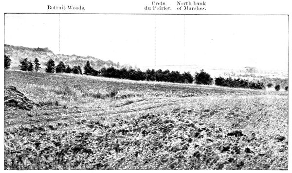
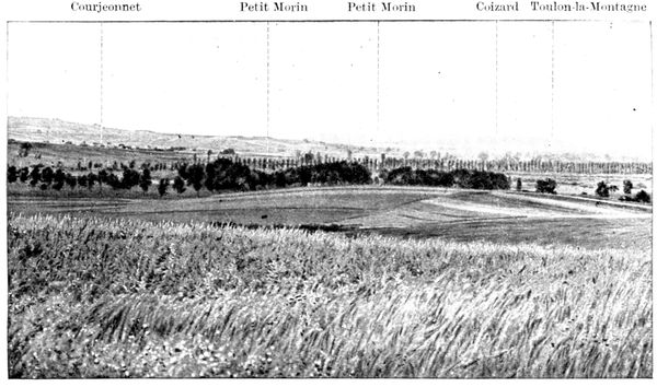
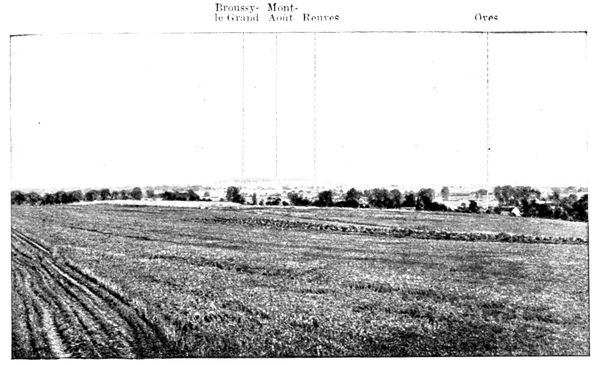
In the course of the description we give a brief military commentary
on the numerous views and panoramas contained in the
book.
When we come across a place that is interesting either from an
archæological or an artistic point of view, there we halt, even though
the war has passed it by; that the tourist may realise it was to
preserve intact this heritage of history and beauty that so many of
our heroes have fallen.
Our readers will not find any attempt at literary effect in these
pages; the truth is too beautiful and tragic to be altered for the sake
of embellishing the story. We have, therefore, after carefully sifting
the great volume of evidence available, selected only that obtained from
official documents or from reliable eye-witnesses.
This book was written before the end of the war, even then the
country over which it leads the reader had long been freed. The
wealth of illustration in this work allows the intending tourist to
make a preliminary trip in imagination, until such time as circumstances
permit of his undertaking a journey in reality beneath the
sunny skies of France.
IMPORTANT NOTE.—On pages 4 to 16 will be found a brief summarized
account of the Battle of the Marne and of the events which immediately
preceded it. We recommend the reading of these few pages attentively,
and the consultation of the maps annexed to the same, before reading
the descriptive part which commences at page 17.
A clear understanding of the action as a whole is absolutely necessary to
comprehend with interest the description of the separate combats.
THE BATTLE OF THE MARNE
(1914)
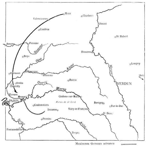
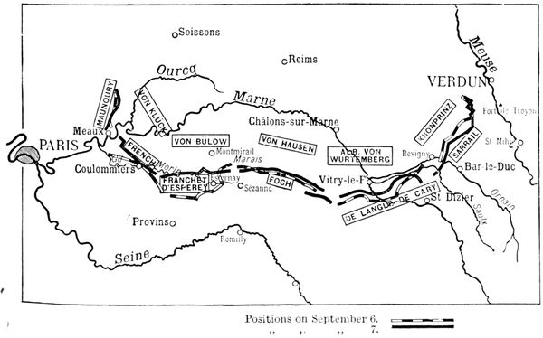
The above map gives a general view of the ground on which took place
successively: the battle of the frontier, the retreat of the Allies, the victorious
stand, and the pursuit of the retreating enemy.
The distance from Paris to Verdun is 140 miles as the crow flies; from
Charleroi to the Marne is 97 miles.
In consequence of the tearing up of that fateful "scrap of paper" which
preceded the invasion of Belgium by Germany, in violation of the common
rights of man, the Battle of the Frontier (also called the Battle of Charleroi) was
fought in August 1914 on the line Mons—Charleroi—Dinant—Saint-Hubert—Longwy—Metz.
On August 22, 1914, and the two succeeding
days this Allied offensive failed at Charleroi, in
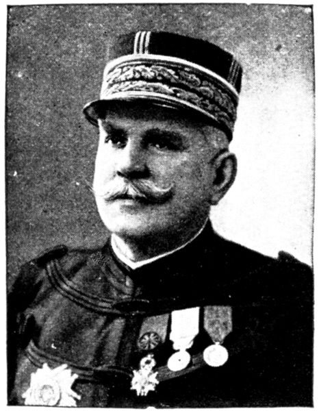
consequence of which the French Commander-in-chief,
General Joffre, broke off contact with the
enemy and ordered a general retreat.
It was impossible to do otherwise as the
enemy forces were greatly superior in numbers.
Moreover, they were well equipped with powerful
artillery and machine-guns, whereas the Franco-British
forces were short of both. Lastly, the
German soldier had long been trained in trench
warfare, whereas the Allies had yet to learn
this art.
To help in readjusting the balance between
the opposing forces, Joffre fell back in the direction
of the French reserves.
The respite thus afforded was utilized to re-arrange the commands, and
to train the reserves in the form of warfare adopted by the Germans. Meanwhile,
the latter greatly extended their line of communications and more or
less tired themselves.
Then began that heroic retreat, without precedent in history, which
attained a depth of 122 miles, and in the course of which the Allied soldiers,
though already fatigued, marched as much as thirty miles a day facing about
from time to time and counter-attacking fiercely, often with success.
The Germans followed in pursuit, overrunning the country like a plague
of locusts. Using their left wing as a pivot, their right undertook a vast
turning movement taking in Valenciennes, Cambrai, Péronne, and Amiens.
By August 27 Joffre had fixed up a plan according to which the offensive
was to be taken again at the first favourable opportunity. In view of the
execution of this plan an important mass of troops, under the orders of
General Maunoury, was formed on the French left.
General Maunoury's task was to outflank at a given moment the German
right wing while, at the same time, a general attack, or at least unflinching
resistance, was to be made along the rest of the front.
This was the Allies' reply to the turning movement of the German general
Von Kluck.
A first line of resistance offered itself on the River Somme, where fierce
fighting took place. It was, however, realized that the battle front could
not be reformed there successfully. Joffre wanted a flanking position not
only for his left wing, but also for his right, which the Somme line did not
offer. He therefore continued the withdrawal of the whole front towards
the River Marne and Paris.
On September 3 German cavalry patrols were signalled at Ecouen, only
eight miles from the gates of Paris. The inhabitants of the latter were
asking themselves anxiously whether they, too, would not have to face the
horrors of a German occupation. The suspense was cruel. Fortunately, a
great man, General Gallieni, was silently watching over their destinies.
This great soldier had just been made Military Governor of Paris, with
General Maunoury's Army, mentioned a moment ago, under his orders.
The entrenched camp of Paris and this army were, in turn, under the authority
of the French Commander-in-Chief, Joffre, who thus had full liberty
of action from Paris to Verdun.
On September 3 General Gallieni issued his stirring proclamation which
put soldiers and civilians alike on their mettle:
"Armies of Paris, Inhabitants of Paris, the Government of the Republic
has left Paris to give a new impulse to the National Defence. I have received
orders to defend Paris against invasion. I shall do this to the end."
The temptation to push straight on to the long-coveted capital must
have been very great for the German High Command. However, in view
of the danger presented by the Franco-British
forces, which were still unbroken, it was eventually
decided first to crush the Allied armies,
and then to march on Paris, which would fall
like 'a ripe pear.'
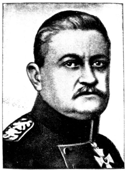
Seemingly ignorant of Maunoury's existence,
Von Kluck's Army slanted off eastwards in pursuit
of the British force, which it had received
orders from the Kaiser to exterminate and which
it had been harrying incessantly during its retreat
from the Belgian frontier.
There will be heated arguments for many
years to come as to whether the German High
Command was right or wrong in giving up the
direct advance on Paris, but whatever the consensus
of expert opinion on the point may eventually be, one thing is certain—Von
Kluck did not expect the furious attack by the Army of Paris, which
followed.
Later, he declared: "There was only one general who, against all rules,
would have dared to carry the fight so far from his base. Unluckily for me,
that man was Gallieni."
On September 3, thanks to the Flying Corps, General Gallieni learned
of the change of direction taken by Von Kluck's Army. Realising the
possibilities which this offered, he suggested a flank attack by the Army of
Paris. As previously mentioned, such an attack formed part of Joffre's
general plan, matured on August 27. It was, however, necessary that the
attack should be not merely a local and temporary success, as would have
been the case on the Somme line for instance, where the remainder of the
front was not in a favourable position for resistance, or attack.
On September 4, after conferring with General Gallieni, Joffre decided that
conditions were favourable for a new offensive, and fixed upon September 6
as the date on which the decisive battle should be begun along the whole
front.
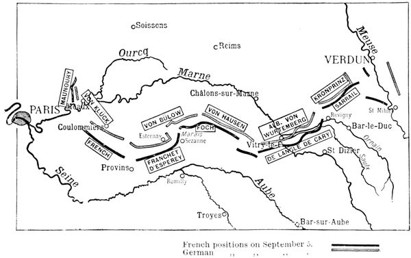
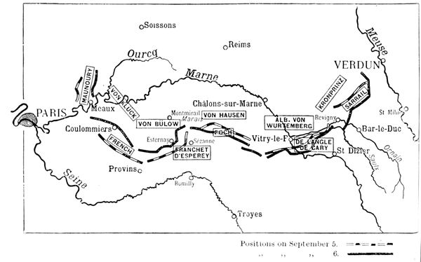
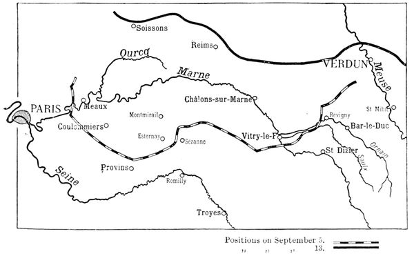
The map before you shows the respective
positions occupied by the opposing armies on
September 5, 1914, the eve of the great battle.
The Allied forces are represented by a thick
black line, those of the Germans by a black and
white line.
Joffre directed the operations first from Bar-sur-Aube
and afterwards from Romilly.
As you see, the half-circle formed by the
Allies, into which the Germans imprudently penetrated,
was supported at the western extremity
by the entrenched camp of Paris and at the
eastern extremity by the fortified position of
Verdun. The River Marne flows through the middle.
Although the battle was only to begin on the 6th, General Maunoury's
Army was already engaged the day before. Its orders were to advance to the
River Ourcq (see map), but, despite furious fighting, it was unable to get there.
The British forces were to occupy a line running north and south, with
Coulommiers as point of support. Unfortunately, the exceedingly fatiguing
retreat it had just accomplished, retarded the execution of the necessary
volte-face. The map shows them on the 5th, still far to the south of Coulommiers.
The fact that neither of these two forces was able to take up its assigned
position greatly increased the difficulties of the turning movement planned
by Joffre.
In front of the forces under Maunoury and French, were the right and
centre of the First German Army, under Von Kluck.
The Fifth French Army, under General Franchet d'Esperey, whose position
extended from the north of Provins to Sézanne, delivered a frontal attack
against the left wing of Von Kluck's army and the right wing of the Second
German army under Von Bulow.
At the right of Franchet d'Esperey's army was the Ninth French Army
under General Foch, whose task it was to cover his neighbour on the left
by holding the issues south of the Marshes of St.-Gond.
Opposing Foch was the left of Von Bulow's army, with the right of the
Third German Army commanded by Von Hausen.
The Fourth French Army, under General Langle de Cary, was minus two
army corps which had helped to form Foch's army. This diminution of
the forces of the Fourth Army prevented the latter from breaking off contact
with the enemy. While, at the extreme left, General Maunoury had already
begun his advance towards the River Ourcq, General Langle de Cary received
orders to hold up the opposing forces under the Duke of Wurtemberg.
Unfortunately, Langle de Cary's forces had not sufficient liberty of movement
to effect the necessary volte-face.
At the extreme right of the Allied front was the Third French Army, under
General Sarrail, established in a position extending from the north-east
of Revigny to Verdun, with a reserve group to the west of Saint-Mihiel,
to be moved either east or west, according to circumstances.
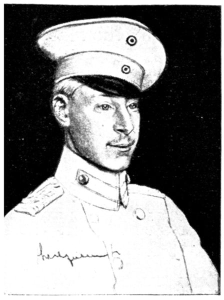
The forces opposing General Sarrail were commanded by the future
"War-Lord": the Crown Prince.
While the French were preparing to thrust back the invader, "War Lord
the Second," drunk with victory, ordered the pursuit to be continued as far as
the line Dijon—Besançon—Belfort: triumphal dreams destined to give place
first to surprise, then to uncertainty, and finally to the bitterness of defeat.
Posterity will compare this arrogant order of the Crown Prince's with the
stirring proclamation which Joffre caused to be made known to the whole
of the French army on the eve of the great battle:
"On the eve of the
battle, on which the future
of our country depends, it
is important to remind all
that there must be no looking
back. Every effort
mast be made to attack
and drive back the enemy.
Troops which can no
longer advance must at all
costs keep the ground they
have won, and die rather
than fall back. Under
present circumstances no
weakness can be tolerated."
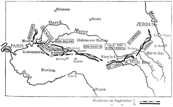
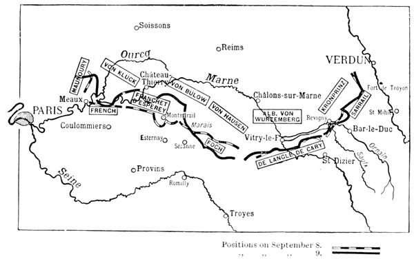
On this and the succeeding maps, the Allied positions of the previous
evening and at the end of the next day are shown.
The German positions are not shown, as too many lines might create
confusion in reading the maps.
Maunoury's Army effected an advance of about six miles, but his left was
unable to accomplish its task, which was to outflank the German right. Von
Kluck who, till then, seeming to ignore Maunoury had concentrated all
his efforts against the British and Franchet d'Esperey's Army, now perceived
this manœuvre. With the promptitude and audacity which particularly
marked his character, he completely changed his plans and rounded
on Maunoury. Taking advantage of the state of extreme fatigue of the
British forces, Von Kluck withdrew one of the army corps which were facing
them and despatched it by forced marches to the help of his right wing.
It was these unexpected reinforcements which enabled Von Kluck to hold
up Maunoury's left.
On this day the British army finally recovered itself, and reached a line
running from the north-west to the south-east of Coulommiers.
The armies of Generals Franchet d'Esperey
and Foch fought with great stubbornness. The
former wrested several dominating positions
from the Germans and approached Esternay,
but the latter was able only to maintain himself
on the line of resistance assigned to him south
of the Marshes of Saint-Gond.
General Langle de Cary was eventually able
to hold up the bulk of the troops under the
Duke of Wurtemberg on positions extending
from the south-west of Vitry-le-François to
Revigny.
The general plan of operations included an
attack by the Third Army, under General Sarrail,
against the German left wing, such attack to
coincide with that of General Maunoury at the other end of the line. This
was, however, anticipated by the Germans who, under the Crown Prince,
and in far greater numbers, forced back Sarrail's left and prevented all progress
on his right.
On September 7, Maunoury's army began to feel the effects of the German
heavy artillery, established out of range of the French 75's, and could advance
but very slowly.
However, at the end of the day, Maunoury still hoped to be able to
outflank the German right. Meanwhile, Von Kluck continued his risky
manœuvre, and detached a second army corps from the forces opposed to
the British, adding it to his right. Each was endeavouring to outflank the
other.
Fronting the British, there was now only a thin curtain of troops taken
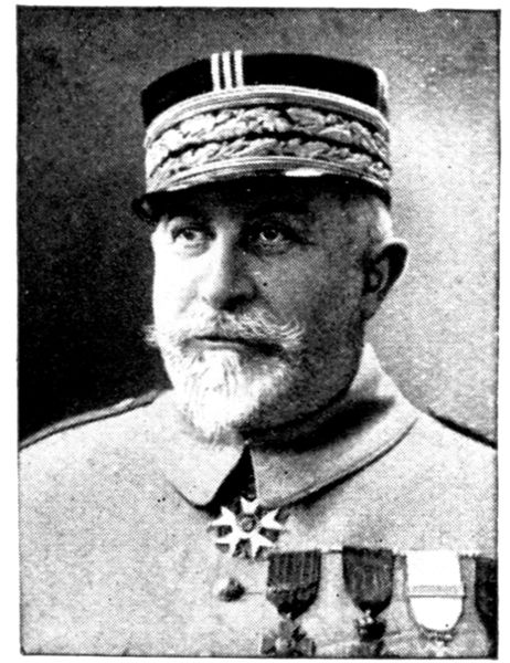
from two of the German army corps opposed to Franchet d'Esperey.
This small force fought with great stubbornness, in order, if possible, to
give Von Kluck time to crush Maunoury, before the advance by the British
and Franchet d'Esperey could become really dangerous.
The slow progress effected in the British sector
is explained by the extreme fierceness of the
struggle.
General Franchet d'Esperey took advantage
of the reduction of the forces opposed to him.
Vigorously pushing back the latter, he continued
his advance northwards, eventually reaching
and crossing the River Grand Morin.
This advance helped to lessen the effects of
the furious attacks that the Germans were then
making against General Foch's army.
In front of the latter, Von Bulow, whose
armies were still intact, realised the danger
which threatened Von Kluck, and, in order to
avert it, endeavoured to pierce the French front.
He concentrated the whole of his efforts against the 42nd Division, under
General Grossetti, whose arduous mission it was to maintain the connection
between the Fifth and Ninth Armies, under Franchet d'Esperey and Foch
respectively.
A terrific struggle followed, as a result of which Grossetti was forced to
fall back. Fortunately, as we have just seen, the right of Franchet d'Esperey's
Army was able, thanks to its advance, to come to the rescue and prevent
the French front from being pierced.
Before Von Hausen, the whole line fell back slightly.
Meanwhile, the Duke of Wurtemberg and the Crown Prince attacked
fiercely at the junction of the Fourth and Third French Armies under Langle
de Cary and Sarrail respectively.
The aim of the attack was to separate these two armies and force what
is known as the Revigny Pass. The latter is a hollow through which flow the
Rivers Ornain and Saulx, and the canal from the Marne to the Rhine.
While the Germans under the Duke of Wurtemberg attacked the right
of Langle de Cary's army, in the direction of Saint-Dizier, the Crown Prince
sought to drive back General Sarrail's left towards Bar-le-Duc.
The resistance of Langle de Cary's army began to weaken under the weight
of the greater opposing forces. On the other hand, General Sarrail's army
reinforced by an army corps sent by Joffre stood firm. At this juncture
General Sarrail learned that the Germans were getting very active in his
rear, on the heights above the River Meuse, and was accordingly obliged to
make dispositions to avoid being surprised by German forces who were
preparing to cross the river.
During the night of September 7-8 Gallieni, who had been following
carefully the different phases of the battle, despatched a division from Paris,
in all haste, to Maunoury's left to assist in turning the German right.
To do this with maximum rapidity, Gallieni made use of an ingenious
expedient, "a civilian's idea," as he termed it. He commandeered all the
taxicabs in Paris. Those running in the streets were held up by the police,
and the occupants made to alight. When the latter learned the reason, instead
of grumbling, they gave a rousing cheer. Eleven hundred taxis made the
journey twice during the night from Paris to the front transporting, in all,
eleven thousand men.
Unfortunately, the effect of these reinforcements was fully counterbalanced
by the troops which Von Kluck had brought up on the two previous
days from before the British front, and only the extreme tenacity and courage
of his troops enabled Maunoury to avoid being outflanked.
However, Von Kluck could not with impunity reduce his forces opposed
to the British. The latter pulled themselves together, crossed the Petit
Morin river and reached La Ferté-sous-Jouarre.
The danger feared by the German generals became apparent.
On this day of September
8, a German
officer wrote in his notebook:
"Caught sight of
Von Kluck. His eyes
usually so bright, were
dull. He, who was wont
to be so alert, spoke in
dejected tones. He was
absolutely depressed."
At the right of the
British army, General
Franchet d'Esperey continued
his rapid advance
and occupied the
outskirts of Montmirail.
Moreover, his troops co-operated efficiently in helping to check the violent
attacks of Von Bulow's army against Grossetti's division.
The Germans became more and more anxious, and rightly so, at the turn
events were taking on their right where Von Kluck's army was beginning
to be tightly squeezed between the armies of General Maunoury, the British
and General Franchet d'Esperey. Von Kluck was forced to retreat
and, in doing so, left exposed Von Bulow's army. The armies of Von Bulow
and Von Hausen received orders to crush Foch and break through the French
centre at all costs, so as to be able to turn Franchet d'Esperey's army on the
west, and that of Langle de Cary on the east.
The position was this: If the manœuvre succeeded, Joffre's entire plan
would fall to pieces. If, on the other hand, it failed a general retreat on the
part of the Germans would be inevitable.
Foch's army received a terrible blow. It was forced back in the centre,
and almost pierced on the right. However, Foch in no wise lost confidence,
but pronounced the situation to be 'excellent.' The fact was, he clearly
realised that these furious attacks were dictated by the desperate position
in which the Germans found themselves. He rallied his troops, hurled
them again against the Germans, but was unable to win back the ground
which he had just lost.
Von Hausen's fierce thrust also made itself
felt on Langle de Gary's left; the connection
between the latter's army and Foch's was in
great danger of being severed, and could only be
maintained by the rapid displacement of troops,
and by the intervention of a new army corps
despatched by Joffre just in time to restore the
balance.
While Von Hausen was striking on the left,
the Duke of Wurtemberg brought all his weight
to bear on Langle de Cary's right, with the
Crown Prince executing a similar manœuvre
against Sarrail's left.
The German plan was still the same, viz., to
separate the two armies and, if possible, isolate
Sarrail's army, so that the latter, attacked at the same time in the rear on
the heights above the Meuse, where the Germans had begun to bombard
the fort of Troyon, would find itself encircled and be forced to surrender.
On September 9, the battle reached its culminating point along the
whole front.
Under pressure from the right wing of Maunoury's army, and before the
menacing advance of the British forces which had reached Château-Thierry,
the Germans were obliged to withdraw from both banks of the River Ourcq.
In order to make this retreat easier along the banks of the Ourcq Von
Kluck, at the end of the day, caused an extremely fierce attack to be made
against the French left, which bent beneath the shock and was almost turned.
At that time, the situation was truly extraordinary: the Germans were
already retreating, while the French, stunned by the blow they had just
received, were in anxious doubt whether the morrow would not bring them
disaster.
The struggle seemed so hopeless, that orders were asked for, in view of
a possible retreat on Paris. However, General Gallieni refused to consider
this possibility and, faithful to Joffre's instructions, gave orders to "die rather
than give way." Maunoury's left continued therefore its heroic resistance.
Von Kluck's retreat along the Ourcq left Von
Bulow's army completely unprotected, and he
was, in turn, obliged to give way before Franchet
d'Esperey's left.
The latter continued to co-operate actively in
the heroic resistance of the French centre, by
taking in the flank the enemy forces which were
furiously attacking Foch. This general became
the objective of the last and most furious attacks
of Von Bulow and Von Hausen who, realizing
that should they fail they would be forced to
continue the retreat begun on their right, decided
to make one more attempt to crush in the French
centre.
They very nearly succeeded; all along the
line, the French were forced to fall back, and the southern boundary of the
Marshes of Saint-Gond was entirely abandoned.
The position, to the east of Sézanne, seemed hopeless. It was there that
the loss of ground was most dangerous, and it is perhaps necessary to explain
in detail this critical phase of the battle.
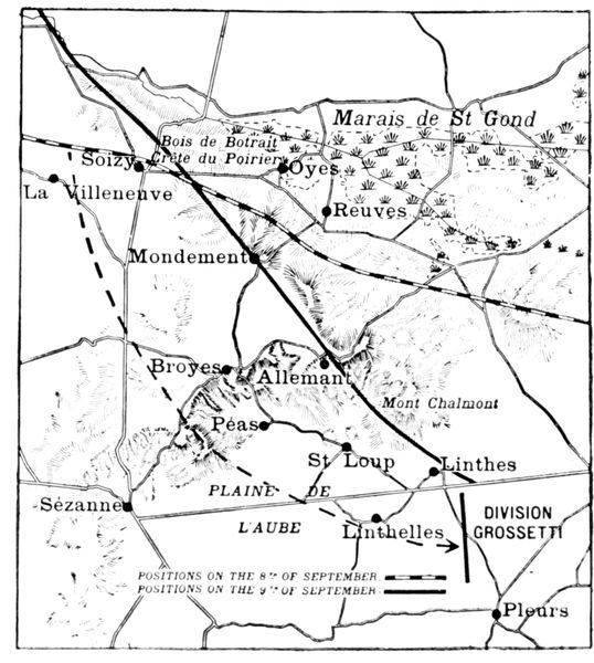
On the large-scale map below is shown the position of Foch's left and
centre on September 8 and 9.
It was in the region of Villeneuve and Soisy that General Grossetti's
Division had fought so heroically for four days. Absolutely decimated, it was
replaced on the morning of the 9th by one of the neighbouring army
corps under Franchet d'Esperey. This corps advanced during the day
but, further to the right, the Germans forced back the French from the
Woods of Botrait and from the crest of the Poirier, capturing the heights
of Mondement.
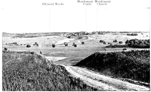
Mondement is situated on a narrow plateau, the last counterfort before
reaching the vast plain of the Aube. On the opposite side of this plateau
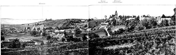
are to be seen the villages of Allemant and Broyes.
If the Germans, in possession of Mondement, had succeeded in reaching
these two villages on the day of the 9th, they would have attacked in the
rear those forces under Foch which were fighting in the plain. Mondement
had, therefore, to be held at all costs. Thus the battle pivoted on this
axis. In accordance with
Foch's instructions, the
Moroccan Division under
General Humbert, was
placed there and, with the
help of the 77th Infantry,
not only held its ground
but, recapturing the castle
during the day, forced
the Germans back on
the Marshes in the evening.
At the foot of the villages
of Allemant and
Broyes, the vast plain of
the Aube spreads itself
out, and it was there that
things were going badly
with Foch, the loss of
ground being serious.
The colonials under General
Humbert, who were
hanging on grimly to
the Plateau of Mondement,
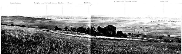
could see their comrades on the right falling
back as far as Mount Chalmont, while the enemy
fire reached successively Linthes and Pleurs.
If the centre had given way completely, the
defenders of Mondement would have been taken
in the rear, and obliged to abandon the plateau.
In other words, it would have meant complete
defeat.
To avert this terrible danger, Foch had only
Grossetti's Division which, as mentioned a few
moments ago, had been decimated by four days
of the fiercest fighting, and which he had that
morning taken from his left wing and sent to
the rear to rest.
Foch recalled this division, and hurled it
against the most critical point of his line between Linthes and Pleurs. He
hoped it would be in a position to attack about noon, but at three in the afternoon
it had not yet been reformed. These were hours of mortal suspense
along the whole front.
General Grossetti needed all his energy to reform the scattered units of his
division, and his men, who were on their way to the rear to rest, when they
were again ordered into the thick of the battle, had need of superhuman
courage to carry out the long fatiguing flank march of twelve miles, which
was to bring them that afternoon to Foch's centre.
Finally, at about four in the afternoon, Grossetti appeared on the scene and
the situation rapidly changed.
With what feelings of intense relief the defenders of Mondement must
have seen Grossetti's men moving eastwards to the attack and driving the
Germans back again behind Mount Chalmont. The enemy was literally
demoralized by this unexpected arrival of reinforcements.
The objective of Grossetti's attack was the junction of the armies of
Von Bulow and Von Hausen, viz.: the weakest point of the German front.
The German generals had at that time nothing with which to counter
this last effort of Foch's, and, realising that the battle was indeed lost, began
to make preparations for retreat.
Just as Franchet d'Esperey had supported Foch energetically on his
left, so, throughout
this fateful day,
Langle de Cary helped
him not less
effectually on his
right, where he violently
attacked Von
Hausen. However,
in the centre and on
the right, the troops
of Langle de Cary
could not do more
than hold their ground
against the furious
attacks of the Duke
of Wurtemberg's army.
Sarrail, in turn, supported Langle de Cary, by operating with his left
against the flank of the German forces, which were pressing that commander.
Meanwhile, his right was in a critical position, owing to the operations in his
rear by German forces on the heights above the Meuse. In spite of the
danger, and although he had been authorized by the commander-in-chief
to withdraw his right so as to escape this menace, Sarrail clung with dogged
tenacity to Verdun: he would not abandon his position, so long as the Meuse
had not been crossed, and while there was still the slightest hope of being
able to hold out.
The morning of the 10th witnessed a theatrical change of scene on the
French left, where it will be remembered Maunoury's army was in a most
critical position. After a night of anxious suspense, it was seen that the
Germans had abandoned their positions, and were retreating hastily towards
the north-east, to avoid being caught in the pincer-like jaws formed by the
Franco-British forces the previous day.
Thus Paris and France were saved, as Von Kluck's retreat carried away Von
Bulow's army with it, and Franchet d'Esperey crossed the Marne. Von
Hausen's right followed suit, pursued by Foch. The troops of the former
had crossed the Marshes of St. Gond during the night to avoid disaster.
Langle de Cary precipitated the retreat of Von Hausen's army. His right,
still under heavy pressure, was however obliged to fall back. Here, the Germans
were only held up by the increasingly effectual help rendered by
Sarrail's army. The latter withstood the furious attacks of the Crown Prince
without flinching, while on the heights above the Meuse, the fort of Troyon,
the heroic defence of which has since become famous, withstood the terrible
onslaughts of the enemy forces which sought to cross the river.
It was only on the 11th that the Duke of Wurtemberg followed the retreat
begun on his right the day before, and it was only during the night of the
12th-13th that the German retreat became general.
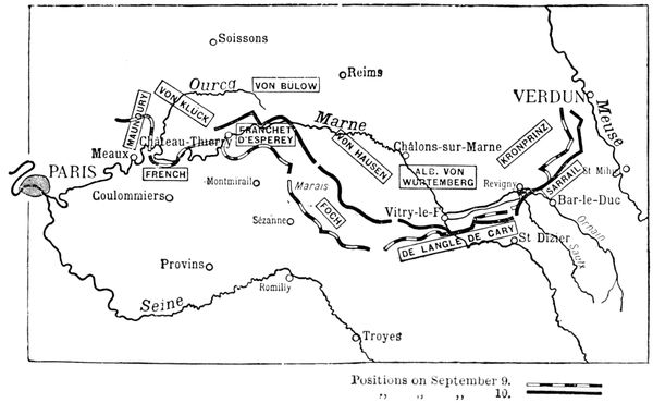
On the 13th the Germans reached their line of resistance, and, as will be
seen on the map before you, their front extended from Soissons to Verdun,
passing by Rheims. This map also shows the positions at the beginning
of the battle.
The foregoing sketch gives a general idea of the character of this great
battle, which has been called "The Miracle of the Marne," and for the winning
of which the following factors were responsible: firmness on the part of
the commander-in-chief; the clear and well-laid plan which he caused to be
executed by highly capable army commanders working in close collaboration
with one another; and, above all, the superhuman courage and endurance of
the soldiers.
As time passes, these memorable days stand out more and more gloriously.
The study in detail of this stupendous event will continue for centuries hence,
but its main lines, which we have been at pains to trace, already stand out
clearly. They recall all the old French traditions. The clearness of the
plan, the suppleness of manœuvre, the bold use of the reserves, remind one
of the Napoleonic era. The enthusiasm which galvanized soldiers and chiefs
alike dates back to the Revolution. And going back into the remote past,
it was the remembrance of the arresting on the soil of Gaul of the great barbarian
invasions which inspired the Victory of the Marne.
For the greater convenience of tourists, we have divided our guide to
the Marne Battlefields into the following sub-divisions, which correspond
to the three main sectors of the battle:
1, THE OURCQ.—Visit to Chantilly, Senlis, and Meaux.
2, THE MARSHES OF SAINT-GOND.—Visit to Coulommiers, Provins,
and Sézanne.
3, THE REVIGNY-PASS.—Visit to Châlons-sur-Marne, Vitry-le-François,
and Bar-le-Duc.
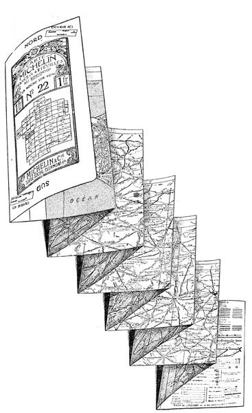
This tour is comprised in the section 11-12 of the Michelin map, Scale:
200,000 (see scale of kilometres on French map).
The circuit is about 850 km. and can be covered in six days, i.e. two days
for each part:
- Ourcq;
- Marshes of Saint-Gond;
- Pass of Revigny.
I., OURCQ.
1st day.—Leaving Paris in the morning through the Porte de la Chapelle
by N. 1 we cross Saint-Denis, then passing Pierrefitte turn to the right
by N. 16 which leads straight to Chantilly (34 km. from the gates of Paris)
through Ecouen, Le Mesnil-Aubry and Luzarches.
We visit the town (see pp. 22-36): lunch either at Chantilly (palatial
hotel) or at Senlis (good hotel) 9 km. from Chantilly; afternoon, visit Senlis
(pp. 39-67); dine sleep and at Senlis or Chantilly.
Tourists who wish to see the whole of the Castle and Park of Chantilly must
choose a Thursday, Saturday, or Sunday (see p. 31) and devote a part of the
afternoon to this visit.
2nd day.—Leave Senlis or Chantilly in the morning and reach Meaux
by the route given on pp. 68-75. The distance from Senlis is 65 km. (by the
direct route only 37 km.); lunch at Meaux (good hotel).
Afternoon.—Do the tour of the Ourcq as indicated on pp. 84-118. This
tour may be increased from 53 to 92 km., according to the time the traveller
has at his disposal or the speed of his car.
Dine and sleep at Meaux.
Alternate routes.—Tourists who consider the second day's distance
too great, as planned above, can leave Senlis in the afternoon and thus dine
and sleep at Meaux on the first day. They can visit Meaux in the morning
of the second day, lunch there and make the tour of the Ourcq in the afternoon,
returning to dine and sleep at Meaux.
II., MARSHES OF SAINT-GOND.
3rd day.—After mounting the course of the Grand Morin as far as La
Ferté-Gaucher via Crécy, Couilly and Coulommiers, the tourist will lunch
at Provins. In the afternoon he may visit the town, after which he will
proceed to Sézanne to pass the night.
4th day.—In the morning make the tour of the Marshes of Saint-Gond.
In the afternoon proceed to Fère-Champenoise, Sommesous, ascending the
valley of the Somme and spend the night at Châlons-sur-Marne.
III., PASS OF REVIGNY (273 km.)
5th day.—In the morning cover the distance from Châlons to Vitry-le-François
and visit the latter town before lunch.
After lunch leave Vitry for Bar-le-Duc where the tourist can dine and
sleep.
6th day.—In the morning the tourist may visit the lower town Bar-le-Duc
and effect the circular tour which we indicate round the town. He
will come back to Bar-le-Duc for lunch.
In the afternoon the tourist will visit the upper town proceeding thence
to Verdun. The latter town and the surrounding battlefields should be
visited with the help of the separate guide which has been dedicated to
them.
IMPORTANT NOTE
For details concerning hotels and garages see insides of cover.
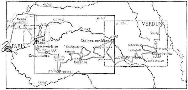
PLAN OF TOUR DESCRIBED IN THE PRESENT GUIDE
On the above plan, towns, of which a map is given in the present guide,
are shown by a circle enclosed in a small square; the large rectangles indicate
the boundaries of the coloured maps inserted in the guide, on which the
reader will be able to follow the itinerary.
(See map on next page)
ORIGIN AND MAIN HISTORICAL FACTS
Chantilly derives its name from that of the Gallo-Roman Cantilius, who
was the first to establish himself in the locality. The Castle (a fortress during
the Middle Ages) passed to the family of Montmorency in the fifteenth century
and in the seventeenth to that of Condé. These two illustrious families
brought Chantilly to a height of splendour which made it a rival of the royal
residences.
In 1830 the Duc d'Aumale succeeded the last of the Condés and at his death
(1897) bequeathed the domain, with the Condé Museum, which he had installed
in the castle (see pp. 24-35), to the 'Institut de France.'
The town itself, built in the seventeenth century, was for a long time
dependent on the castle. In our day it has become a big centre for horse
training and racing, the great race meetings in May, July and September
attracting huge crowds.
CHANTILLY IN 1914-1916
The Germans, coming from Creil, entered Chantilly on September 3,
1914, and occupied it for several days. The mayor was at once seized as
hostage but did not suffer the same tragic fate as the Mayor of Senlis. The
troops were billeted at the castle (see p. 28).
After the victory of the Marne, Chantilly became the seat of General
Joffre's headquarters and remained so until the end of 1916.
VISIT TO THE TOWN
Arriving by the Paris road the tourist will pass under the railway bridge,
then 600 yards further on turn to the right and come out on to the "Pelouse"
(Lawn). Turning round the Grand Condé Hotel on the left, he follows the
Boulevard d'Aumale as far as the Maison de Joffre, shown in the photograph
below.

JOFFRE
LEAVING
GENERAL
HEADQUARTERS
Joffre lived here until he was made Marshal of France.
The hundreds of officers and secretaries employed in the tremendous
work incumbent on the Generalissimo were lodged in the Grand Condé
hotel, near which the tourist has just passed. In contrast with this buzzing
hive, Joffre's house seemed the embodiment of silence and meditation.
Only two orderly officers lived with the generalissimo, and his door was
strictly forbidden to all unsummoned visitors, whoever they might be.
On leaving his office Joffre had the daily relaxation of a walk in the forest
near by. It was thanks to the strict routine to which he subjected himself
that the generalissimo was able to carry the crushing weight of his responsibility
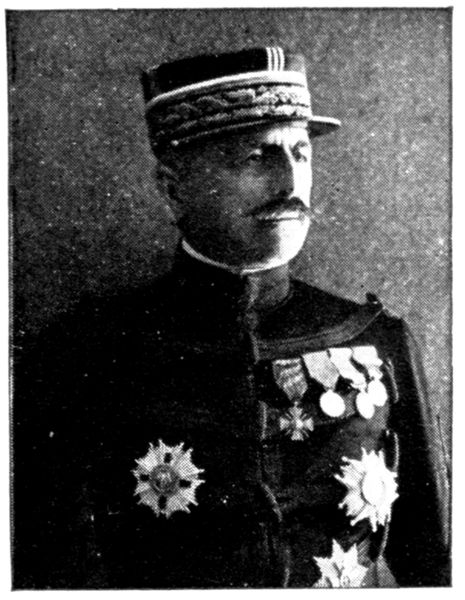
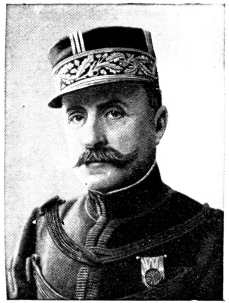
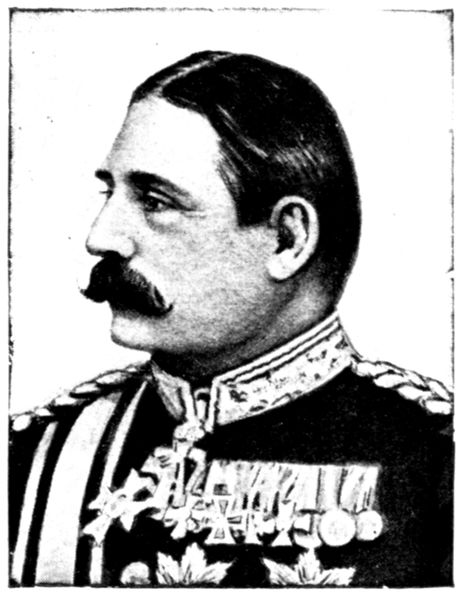
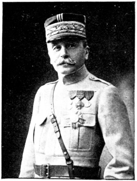
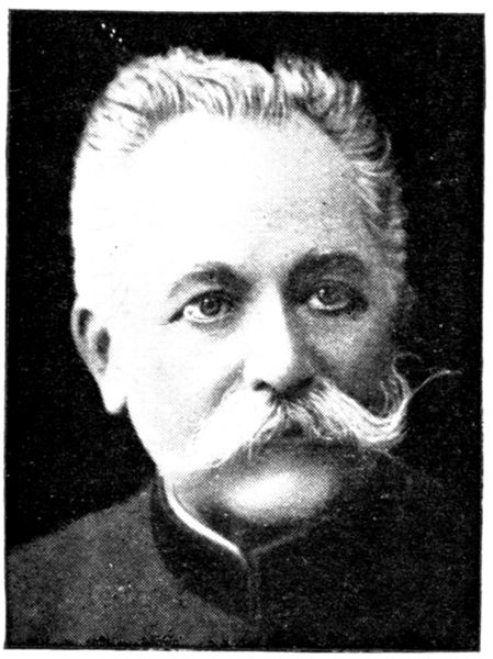
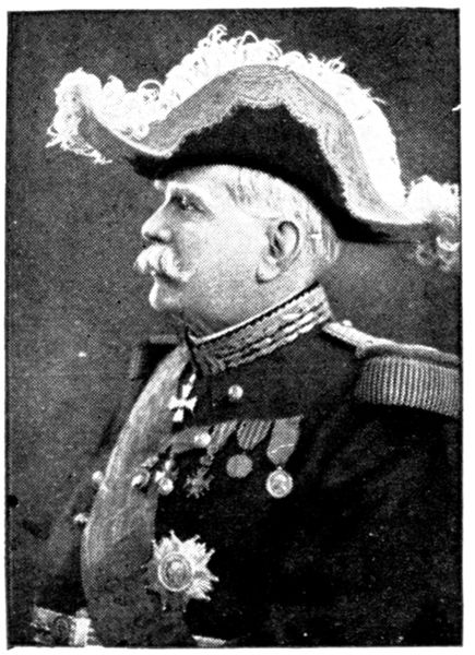
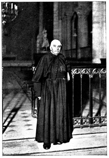
without faltering. We shall see, however, when comparing the peace
time photograph given on p. 1 with that on p. 22 that these years of war
have counted as double.
During the tragic hours of the Marne the general headquarters were first
at Bar-sur-Aube and then at Romilly. The commander-in-chief's intense
concentration of mind made him dumb and as though absent in the midst
of his colleagues, who received all his orders in writing. In a few days his
hair and moustache became perfectly white.
The Allies' grand councils of war were held in this house, which has
counted among its guests all the great actors of the war.
The military functions were held on the lawn. The photograph on the
next page was taken during a review.
After having seen Joffre's house we pass the few villas which separate it from
the Rue d'Aumale and bear to the right, skirting the lawn; next we turn to the left
into the Avenue de Condé, then to the right into the Rue du Connétable. In
front of the "Grandes Écuries" (great stables), which border the extreme
end of the road on the right, stands the equestrian statue of the Duc d'Aumale,
by Gérome (1899).
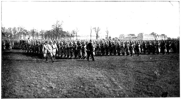
JOFFRE
HOLDING
A REVIEW
ON THE LAWN
Leaving the church we turn to the right, passing through the monumental
gateway, and go towards the castle. On the lawn (still keeping to the right)
we come to the principal façade of the "Grandes Écuries", Jean Aubert's
chef-d'œuvre, built between 1719 and 1740. They are seen on the right in
the above photograph.
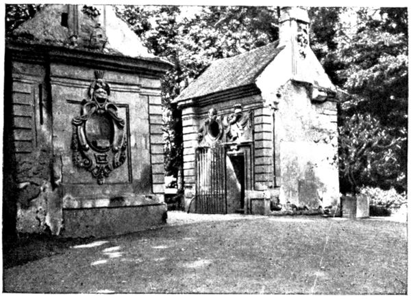
On the opposite side of the lawn stands a little chapel, erected in 1535,
by the high constable Anne de Montmorency, at the same time as six others
dotted here and there about Chantilly, in memory of the seven churches
of Rome which he had visited in order to obtain the indulgences pertaining
to this pilgrimage. He obtained the same grant from the Pope for the
chapels of Chantilly.
Of these only two now remain, that on the lawn—Sainte-Croix, and
another in the park—Saint-Paul.
The photograph below gives a view of the whole of the castle. The little
castle dates from the sixteenth century; the big castle is the work of a contemporary
architect, Daumet, who erected it on the basement of the old dwelling,
demolished during the Revolution. The Castle of Enghien, built in the
eighteenth century, is now occupied by the guardians entrusted with its
preservation. The water surrounding the castle teems with centenarian
carp. One can get bread from the concierge and, on throwing a few crumbs
into the moat, which passes beneath the entrance bridge, watch the onrush
of the huge fish.
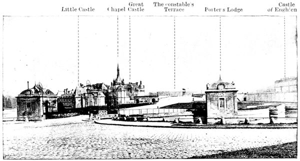
CASTLE OF
CHANTILLY
- Little Castle
- Chapel
- Great Castle
- The constable's Terrace
- Porter's Lodge
- Castle of Enghien
In the pages which follow we give a short historical account of the castle,
referring the tourist for further details to the extremely interesting work of
the curator, Mr. Gustave Macon: Chantilly and the Condé Museum.
SHORT HISTORICAL ACCOUNT OF THE CASTLE
In the Roman epoch Chantilly was the dwelling place of Cantilius. In the
Middle Ages it became a fortress belonging to the "Bouteiller" (cupbearer),
so named because of his hereditary functions at the court of the Capets.
(The "bouteille de France," originally in charge of the king's cellars, became
one of the greatest counsellors of the crown).
The castle then became the property of the d'Orgemonts, who rebuilt it
in the fourteenth century. In the fifteenth century it passed to the Montmorency
family. Towards 1528 the high constable Anne de Montmorency
had it transformed by Pierre Chambiges. Chambiges' work no longer exists
in Chantilly, but the tourist will be able to judge of his talent when he sees
the beautiful façades of the transept of the cathedral of Senlis (p. 57). The
little castle was built thirty years later by Jean Bullant. From that time
Chantilly has been famous. Francis I. often stayed there. Charles V.
declared that he would give one of his Low Country provinces for such a
residence. Henry IV. asked his "compère," the high constable Henri, to
exchange it for any one of his royal castles. Montmorency, much embarrassed,
extricated himself from this awkward situation by answering, "Sire, the house
is yours, only let me be the lodge-keeper."
Henri II. of Montmorency, drawn into a revolt against Richelieu, died on
the scaffold in 1632. His property was confiscated and Louis XIII., attracted
by the hunting at Chantilly, kept the place for his personal use.
It was there that he drew up with his own hand the "communiqué" to
the press, concerning the taking of Corbie (1636): "The king received news,
at 4 o'clock this morning, of the surrender of Corbie. He immediately went to
church to give thanks to God, then ordered all to be ready by 2 o'clock to sing
the Te Deum, the queen and everyone else to be present, and ordered despatches
to be sent commanding thanksgiving services in all the churches of this kingdom...."
In 1643, the queen, Anne of Austria, wishing to make some recognition
for the splendid victories won by the Duc d'Enghien (the future "Grand
Condé") gave Chantilly back to his mother, Charlotte de Montmorency.
The latter, married at fifteen, had been obliged to leave France with her
young husband in 1609, to escape from the attentions of Henri IV., still
gallant despite his fifty-six years.
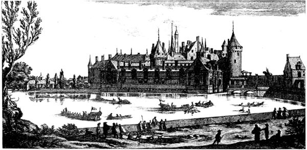
THE CASTLE
IN THE
SEVENTEENTH
CENTURY
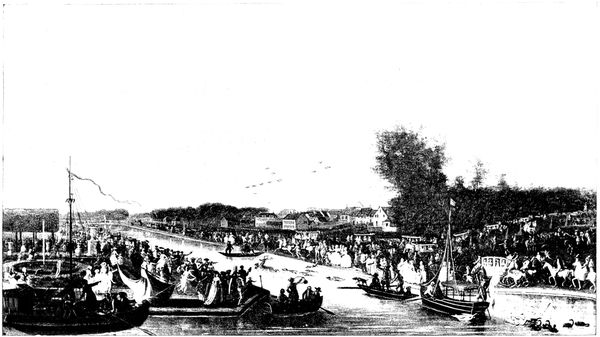
FESTIVITIES AT CHANTILLY IN THE EIGHTEENTH CENTURY.
A gay life began again in Chantilly, interrupted in 1650 by the revolt of
Condé, his exile and the confiscation of the domain, which then returned
to Louis XIV. until the Treaty of the Pyrénées (1659). The prince then
came into his own again but for long kept aloof from public affairs and
devoted himself to the embellishment of Chantilly with the same ardour
and mastery that he formerly gave to military operations.
In 1662, the transformation of the park and forest was placed in the
hands of the great architect, Le Nôtre. The work continued until 1684.
The result was a masterpiece, of which a great part is still in existence, but
of which the finest features (particularly the Great Cascades which spread
over the actual site of the town) disappeared during the Revolution. Below,
we give a view of these "Jeux d'eau" (fountains), which were considered one
of the wonders of the day.
In 1671, Louis XIV. spent three days at Chantilly, with all his court.
Marvellous festivities were held on this occasion. The guests of the château
alone filled sixty large tables; all the adjoining villages were full of officers
and courtiers, boarded and lodged at the prince's expense. In one of her
letters, Mme. de Sévigné tells of the tragic death of the superintendent, Vatel,
who had the responsibility of this vast organisation. Desperate at the
thought that fish would be lacking at the king's table, he went up to his
room, leant his sword against the wall, and transfixed himself upon it.
All the great men of the seventeenth century visited Chantilly. Bossuet,
the intimate friend of the great Condé, presented to him Fénelon and La
Bruyère, who became tutor to the Prince of Condé's grandson. Molière and
his company came to play (Condé was his patron, by whose intervention
the production of Tartufe was allowed). Boileau, Racine and La Fontaine
were habitual guests.
The development of Chantilly continued under Condé's successors, and
the castle was modified by Mansart. The Duc de Bourbon caused the
"Grandes Écuries" to be built by Jean Aubert. He established the manufacture
of porcelain there (ceased in 1870), the remaining pieces of which are
greatly sought after in our day.
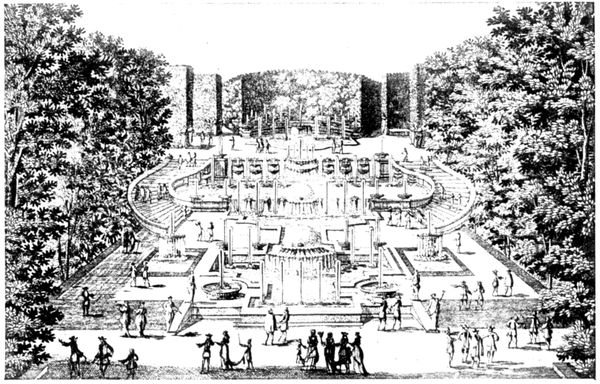
THE OLD
CASCADES
OF CHANTILLY
In 1722, Louis XV. stayed at Chantilly on his way back from his coronation
at Rheims. The festivities lasted four days; 60,000 bottles of wine and
55,000 lbs. of meat being consumed.
It was Prince Louis-Joseph who saw the Revolution. He had spent
enormous sums in embellishing Chantilly, besides the twenty-five million
francs which it cost him to build the Palais-Bourbon in Paris, the present seat
of the Chamber of Deputies. He erected the Castle of Enghien, named after
his grandson, the Duc d'Enghien, who was the first to inhabit it. (Early
marriages were usual in these great families: at the birth of the Duc d'Enghien
his father was sixteen years old and his grandfather thirty-six.) The Duc
d'Enghien died in 1804, shot in the moat of Vincennes.
The English garden and the hamlet are due to Louis-Joseph.
In 1789, after the Prince of Condé had gone into exile, the Parisians came
and removed the cannon from the castle (see reproduction of engraving below,
in which the castle appears as altered by Mansart). Thirty guns taken from
the enemy during the Seven Years' War, which were never used except for
firing salutes during fêtes, were brought in triumph to the Hôtel de Ville in
Paris, whence La Fayette had them sent to the arsenal.
The great cascades, the menagerie, the orangery and the theatre disappeared
during the revolutionary era.
Of the great castle nothing remained but the basement, whilst the town
grew and encroached on the park.
In 1814, the Prince de Condé returned to Chantilly and commenced the
restoration of the domain, a work continued by his son. The latter came
to a tragic end in 1830; he was found hanging from the fastening of a window
in his castle of Saint-Leu, and with him died the great family of Condé.
In his will he bequeathed Chantilly to one of his great-nephews: Henri
of Orleans, Duc d'Aumale, fifth son of King Louis-Philippe. After distinguishing
himself in the Algerian campaign, where he carried off the
Smalah of Abd-el-Kader in 1843, the Duc d'Aumale was exiled in 1848. He
established himself at Orleans House, at Twickenham, near London, where
he remained until 1871. It was during that time that he began the splendid
collections which later went to enrich the Condé Museum. On his return
to France he presided at the tribunal entrusted with the trial of Marshal
Bazaine.
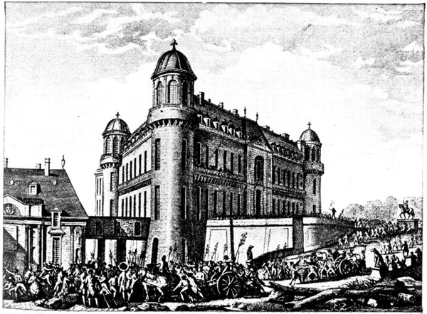
THE PARISIANS
AT CHANTILLY
IN 1789
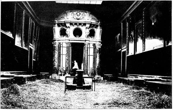
PICTURE
GALLERY
WHERE
THE GERMANS
SLEPT
(1914)
In order to house his collections, the Duc d'Aumale had the big castle
rebuilt, on plans made by the architect Daumet, from 1875 to 1882.
He died in 1897, bequeathing to the "Institut de France" the domain of
Chantilly and the Condé Museum, of which he was the founder.
The Castle in 1914
About 500 Germans stayed at the castle for twenty-four hours. These
reserve troops had not yet fought and did not take part in the battle. They
committed no excesses during their short stay. The great moral firmness
shown by the curators, Messrs. Élie Berger and Macon had great influence on
the conduct of the German soldiers. The troops were lodged in the big castle,
whilst the officers established themselves in the various suites of the small
castle.
The curators had sent the gems of the collection to Paris and sheltered as
many of the works of art as possible in the basement. This proceeding
caused some ill humour on the part of the German officer in command. As
seen in the photograph (page 28) straw was spread in the rooms of the
museum, on which the Germans slept. At the end of the room Chapu's
touching Jeanne d'Arc overlooks the scene of desolation. The Germans were
much impressed by the copy of the Duc d'Aumale's tomb in the museum,
where he is represented in the uniform of a divisional general. Many gave the
military salute when crossing the room. However, this did not prevent the
commandant from warning the curators that if his troops were fired on,
the castle would be burnt and they themselves shot.
Sylvie's House
If the tourist makes this journey on a day when the castle is closed, or if he has
not time to visit it, he will at least be able to glance at the charming corner of
the park where stands Sylvie's House. He need only take the path of Avilly
(it is the road which is on the right of the main entrance) and skirt the park railings.
After five minutes' walk he will reach the place from where the view below is taken.
He can return to the gates by the same road.
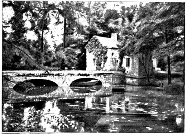
This little shooting lodge, at first called the "Park House," was built
in 1604 by the high constable Henri de Montmorency for King Henri IV.
Sylvie is the poetical name given by Théophile de Viau to his patroness
Marie-Félicie Orsini, who in 1612, at the age of fourteen, married Henri II.
of Montmorency, aged sixteen. The poet, Théophile de Viau, persecuted
in 1623 for the licentious publication of the Parnasse Satirique, was given
shelter at Chantilly and lodged in the Park House.
Condemned to be burnt alive, he was only executed in effigy through the
intervention of the Montmorencys.
In his Odes to the House of Sylvie, he extolled the grace and goodness of
the young duchess:
Mes vers promettent à Sylvie
Ce bruit charmeur que les neveux
Nomment une seconde vie....
The wish expressed by the poet in these lines was fulfilled and the name
of Sylvie became attached to the house and park surrounding it. The great
Condé rebuilt the house as it is to-day. (The rotunda seen in the photograph,
page 29, was added by the Duc d'Aumale.)
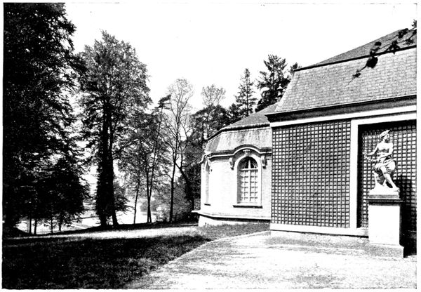
SYLVIE'S
HOUSE
AND THE PARK
In the eighteenth century Sylvie's House was the scene of the romance of
Mlle. de Clermont and Louis de Melun. The head of the house of Montmorency
objected to the marriage of his sister, Mlle. de Clermont, with this nobleman,
whose rank he considered insufficient. The young girl disregarded
this and made a secret marriage, soon ended by the tragic death of Louis de
Melun, who was killed by a stag at bay in the course of a hunt in Sylvie's
park. These various episodes in the history of Sylvie's House are recalled
in the paintings of Luc-Olivier Merson, installed by the Duc d'Aumale when
he turned the old house into a museum.
Visit to the Castle
The Castle, Sylvie's House, the Jeu de Paume, and the "Grandes-Écuries"
are open to the public from April 15 to October 14:
1, On Sundays, Thursdays and legal holidays, from 1 to 5 p.m., free;
2, On Saturdays, the same hours, one franc charged for each visitor.
The Park is open to the public all the year round on Thursdays, Sundays
and holidays: from 1 to 6 p.m., from April 15 to October 14, and till 4 p.m. for
the rest of the year.
The Condé Museum is extremely interesting.
We advise tourists to obtain the guide book sold at the entrance, which gives
all useful information for the details of the visit. The plan (p. 31) makes it
easy to find one's way about the museum. By following the numbering in this
plan the various rooms will be seen in the order in which they are marked in the
guide book.
The several photographs which follow can give but a faint idea of the
richness and interest of the collections made by the Duc d'Aumale.
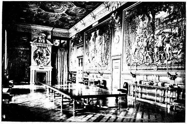
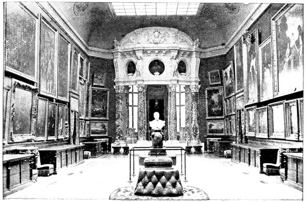
The following view shows the Gallery of the Stags, formerly the dining
room.
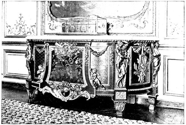
The picture on page 32 represents the magnificent carved and inlaid chest
(the work of Riesener, the great cabinet-maker), which stands in room 24
(plan p. 31).
The Duc d'Aumale gathered the gems of his collection together in the
room that he named the Santuario (No. 19 on plan, p. 31).
They are: The Virgin by Raphael, described as "of the House of Orleans,"
having belonged to that family for a very long time. This little panel,
painted about the year 1506, was bought for 160,000 francs in 1869. It is
reproduced on p. 32.
The Three Graces, another small panel painted by Raphael at about the
same time as The Virgin, was bought for 625,000 francs in 1885.
Esther and Ahasuerus, panel of a marriage chest, executed by Filippino
Lippi, was bought for 85,000 francs in 1892.
Forty Miniatures by Jehan Fouquet, taken from the Book of Hours,
by Estienne Chevalier: this leading work of the French school of the
fifteenth century was acquired for the sum of 250,000 francs in 1891.
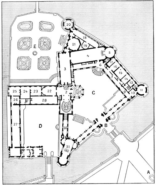
- Entrance.
- Grand Vestibule.
- Gallery of the Stags.
- Picture Gallery.
- Rotunda of the Museum (Senlis Tower).
- Vestibule of the Museum.
- Gallery of the House.
- Small Gallery of the House.
- Vestibule of House.
- The Smalah.
- The Minerva Tower (Tower of the High Constable).
- The Antiquity Room.
- Giotto Room.
- Isabelle Room.
- Orleans Room.
- Caroline Room.
- Clouet Room.
- Psyche's Gallery.
- Santuario.
- Treasure Tower.
- The Tribune.
- The Anteroom.
- Guardroom.
- La Chambre.
- The Great Study.
- The Monkey Parlour.
- The Prince's Gallery.
- Library.
- Great Staircase.
- Gallery of the Chapel.
- Chapel.
- Statue of the High Constable.
- Entrance (portcullis).
- Court of Honour.
- Court of the Little Castle.
- Flower Garden of the Aviary.
We must also mention the collection of portraits painted or drawn in
the fifteenth and sixteenth centuries, divided between the Gallery of the House
(7 on plan), the Clouet room (17 on plan) and the Gallery of Psyche (18 on
plan). In the Gallery of Psyche, the visitor will notice, besides the pictures,
the forty-four sixteenth century windows, representing the legend of Cupid and
Psyche. There is also a cast of the head of Henri IV.
Lovers of jewels should visit
the treasure tower (20 on
plan). Tn the Monkey Parlour
(26 on plan) will be seen
the screen painted by Huet,
representing the Monkey's
reading lesson, and on the
panels a charming eighteenth
century decoration, attributed
to the same painter.
In the Prince's Gallery
(27 on plan) the great Condé
had a series of pictures painted
representing the battles he had
fought.
In the trophy containing
his sword and pistols there
is also a flag taken in the
Battle of Rocroi in 1643. It
is the oldest standard captured
from the enemy that exists in
France.
In the middle of the gallery
stands the Table of the Vinestock,
carved out of one piece
taken from an enormous vine,
for the Connétable de Montmorency.
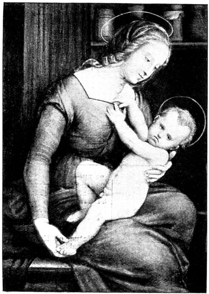
THE VIRGIN
OF ORLÉANS
BY RAPHAEL
In the modern chapel (31 on plan), the Duc d'Aumale placed a beautiful
altar, carved by Jean Goujon, also some sixteenth century wainscoting and
stained glass windows taken from the chapel of the Castle of Ecouen.
In the apse stands the funeral urn which holds the hearts of the princes
of the House of Condé.
Visit to the Park
This takes from three-quarters of an hour to an hour and a quarter.
On coming out of the museum we cross the Terrasse du Connétable, in the
middle of which stands the equestrian statue of Anne de Montmorency,
by Paul Dubois (1886). Leaving the Château d'Enghien on the right we enter
the covered way by the avenue which passes before the little chapel of Saint-Paul.
Saint-Paul and Sainte-Croix are all that remain of the seven chapels
erected by Anne de Montmorency (see p. 23). A little further on, on the left,
we come to the Cabotière, a building dating from the time of Louis XIII.
It derives its name from that of the barrister Caboud, an enthusiastic amateur
horticulturist, who made a magnificent flower garden in the park for the
great Condé.
The avenue ends at Sylvie's House (see p. 29). In the interior can be
seen paintings, tapestries, pieces of furniture, and beautiful panelling of the
seventeenth century, which have been placed in the rotunda. From Sylvie's
House there is a lovely view of the pond and park (see p. 29).
Leaving Sylvie's House on the right we walk about 150 yards down the path
which skirts it, then turn to the left and follow the path which leads straight to
the Hamlet (view on p. 35).
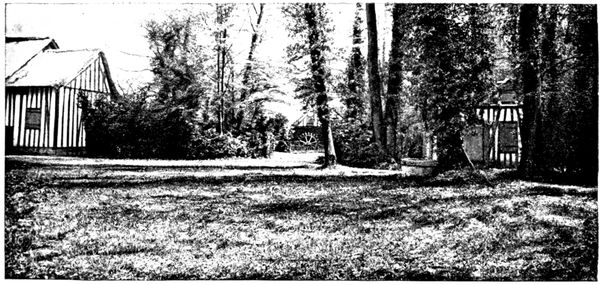
The Hamlet, which recalls that of the Petit Trianon at Versailles, dates
from 1775. At this period, under the influence of J. J. Rousseau's works,
nature and country life became the fashion, and it was the correct thing
for princes to play at peasants in miniature villages.
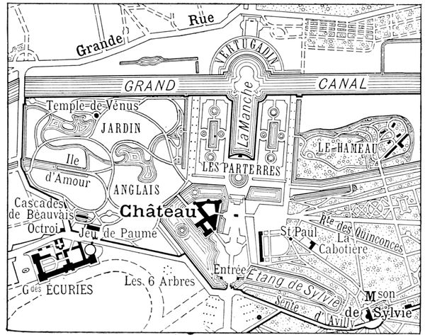
An author of the eighteenth century thus describes the Hamlet of Chantilly:
"Seven detached houses, placed without order, with thatched roofs, stand
in the middle of a lawn that is always green. Here is an ancient elm, there
a well; further on a fence encloses a garden planted with vegetables and
fruit-trees; a mill, its wheel turned by the brook; in front a stable, a dairy;
one house is used as the kitchen, another is the dining-room, so decorated
as to resemble a hunting lodge. One fancies one's self in the middle of a thick
wood, the seats imitate tree-trunks, green couches and clusters of flowers
rise from the ground; a few openings made between the branches of the trees
admit the light. A third cottage serves as billiard-room, a fourth is a library.
The barn makes a large and splendid drawing-room."
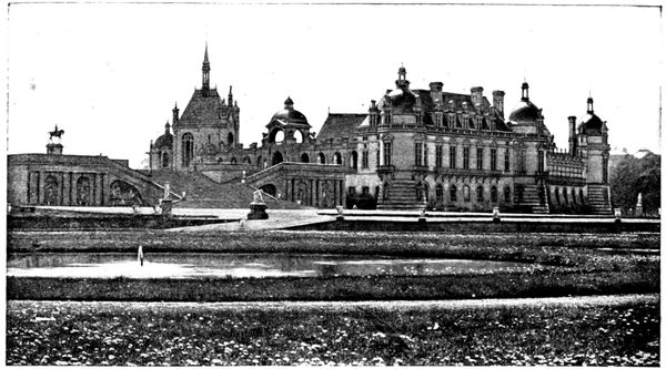
THE CASTLE
SEEN FROM
THE FLOWER
GARDENS
From the time when the hamlet came into being, there was never a big
fête at Chantilly without a supper in this pretty corner of the park. Innumerable
pots de feu illuminated the thickets; on the canal the guests drifted in
gondolas to strains of dreamy music; fancy-dress fêtes were held, and the
singing and dancing continued until dawn.
The hamlet is now greatly fallen into decay, nevertheless, it is worth
a visit.
Retracing our steps we bear to the left and, having crossed, the first bridge,
follow a pretty path which brings us into the flower garden of Le Nôtre, where
we get a good view of the castle (photograph above). One can go straight
back to the entrance gates by the staircase shown in the view. It is called the
Grand Degré (great stair), and was built in 1682 by the architect Gitard.
The groups which adorn the base of the Terrasse du Connétable, on each
side of the stairs, were drawn by Le Nôtre and carved by Hardy.
This walk, from the time of leaving the museum until the return to the entrance
gates, takes about three-quarters of an hour.
If one wishes to visit the English Garden and the Jeu de Paume, which
will take about forty minutes longer, one must walk past the north front of the
castle and follow the walk which opens in the middle of the thickets.
The English Garden was laid out in 1817 to 1819 by the architect Victor
Dubois, according to the orders of the last of the Condés, just returned
from exile. The site occupied by this garden, like the ground on which
stands the town of Chantilly, belonged to the ancient park, devastated
during the Revolution.
We pass near the Temple of Venus, which shelters a Venus Callipyge
of the seventeenth century, near the Island of Love, dating from 1765 and
on which are statues of Aphrodite and Eros. In the eighteenth century the
Island of Love contained a luxurious pavilion, in which nocturnal fêtes were
held, the canals and park being illuminated. The pavilion disappeared at
the time of the Revolution.
The ancient Cascades of Beauvais that one sees before arriving at the
Jen de Paume are remnants of the old park. They were the work of
Le Nôtre.
The Jeu de Paume, constructed in 1757, is transformed into a museum.
It contains various curiosities, notably Abd-el-Kader's tent, carried away
when the Smalah was captured by the Duc d'Aumale in 1843.
After 3 p.m. one can leave the park by the gate next to the Jeu de Paume.
We come out in front of the "Grandes Écuries" of the castle and can go in
and look round them. (Enter at the side that faces the lawn.)
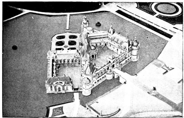
(Cliché André Schelcher.)
GENERAL VIEW OF THE CASTLE
(9 km.)
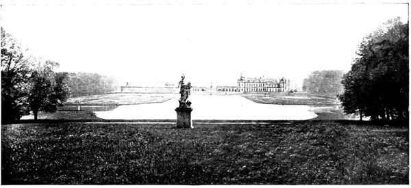
THE CASTLE
SEEN FROM THE
ROUTE
DE VINEUIL
Returning through the monumental gateway, we cross the Rue de Connétable
and go straight on, skirting the castle park on the right. We cross the Saint-Jean
Canal, then the Great Canal, then turn to the right into the High Street of
Vineuil. On the right one soon has a beautiful vista of the castle and park
(view above).
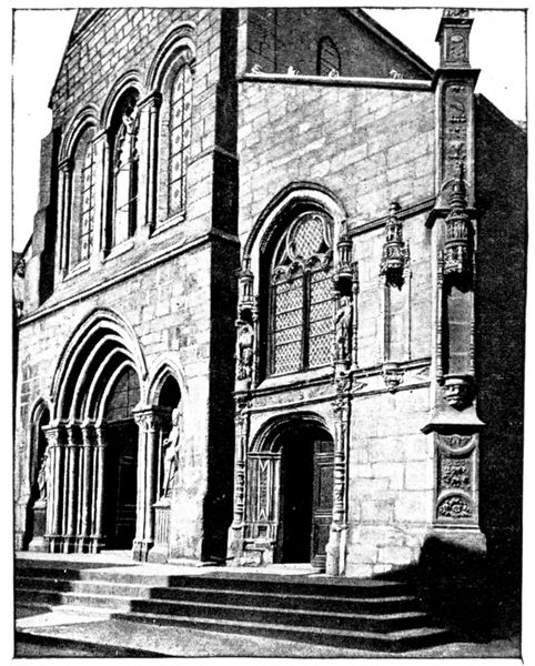
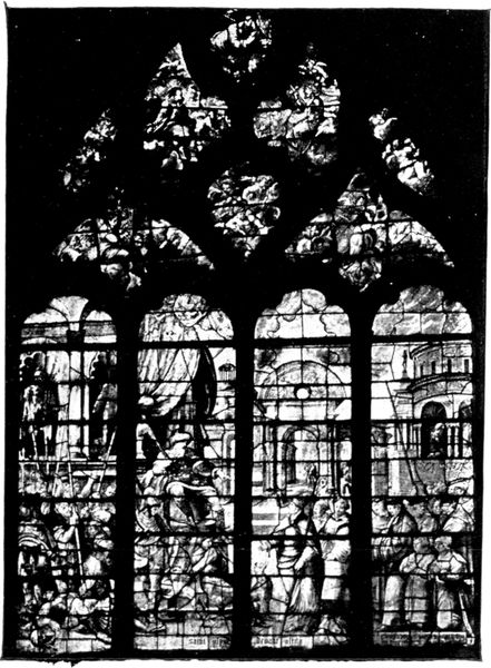
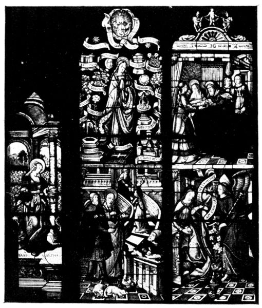
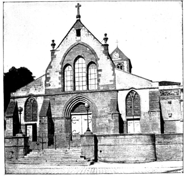
We now go through Saint-Firmin. The church, on the left, contains in
its choir Renaissance windows which are classed as historical monuments.
From Saint-Firmin to Senlis the road is easy. We enter Senlis by the
Creil Gate (see plan inserted between pp. 36-37). Turn to the left by the Avenue
Vernois and the line of boulevards to reach the station, where starts the itinerary
described further on, in Senlis.
ORIGIN AND CHIEF HISTORICAL EVENTS
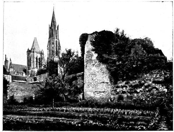
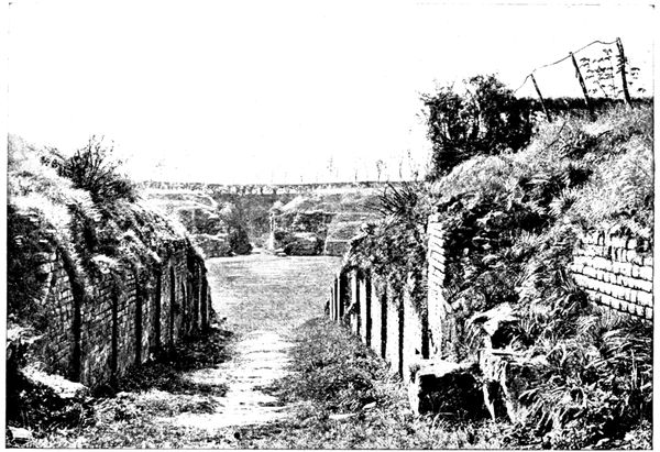
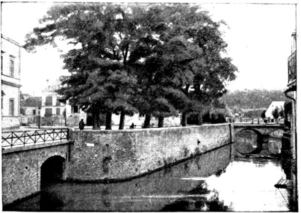
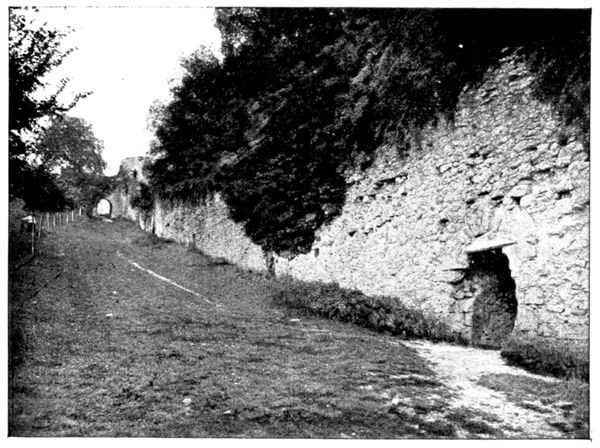
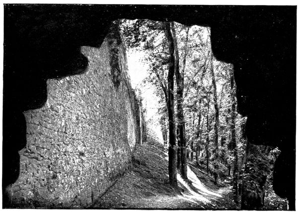
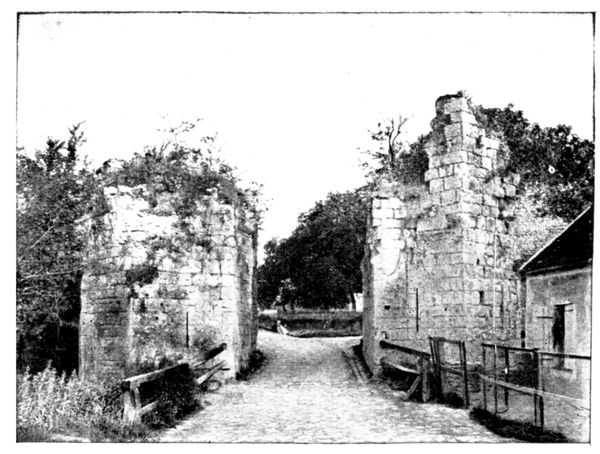
Senlis is of Gallic origin: it was the capital of the Sylvanectes. The
Romans surrounded it with fortifications, a great part of which still exist
(see view below).
The first kings of France, attracted by the hunting in the surrounding
country, frequently stayed at Senlis.
It was in Senlis Castle (see p. 61) that Hugues Capet was elected king by
the assembly of lords in 987.
The Capetians often returned to the birthplace of their dynasty and it
is to them that the town owes its chief buildings.
Taken by the peasants in the war of the Jacquerie in 1358, besieged by
the Armagnacs in 1418, it fell into the hands of the English and was delivered
by Joan of Arc in 1429. Senlis knew great vicissitudes in the fourteenth
and sixteenth centuries.
After Henri IV., who interested himself greatly in Senlis and lived in its
old castle, the kings of France gradually forsook the town in favour of
Compiègne, Fontainebleau and Versailles.
Occupied in 1871 by the Germans, it reappears in history in September
1914. The burning of the town and the summary executions which took
place there will be recalled in the course of the visit (pp. 38-52).
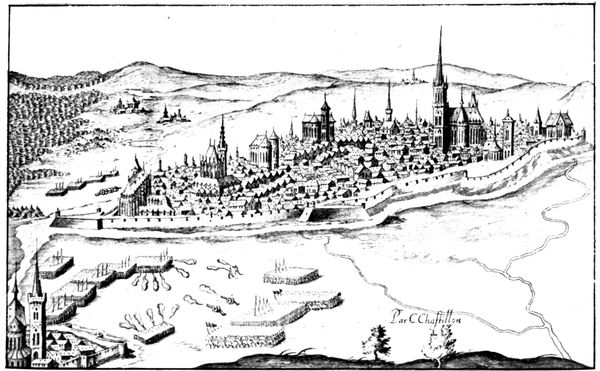
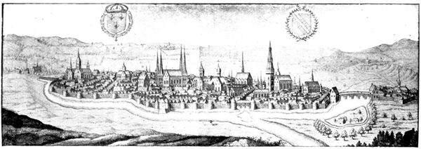
SENLIS IN THE SIXTEENTH CENTURY.
VISIT TO THE TOWN
(See plan inserted between pp. 36/37)
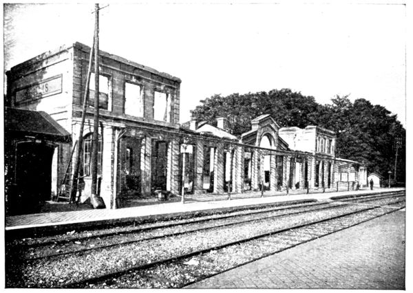
THE BURNT
STATION
(Sept. 1914)
At the Station
one gets one's first
view of the havoc
done to the town
by the events of
September 1914.
It was set on fire
on the 3rd.
Follow the station
road (Avenue de la
Gare), which leads
to the Compiègne
Gate.
This is the road
by which the Germans
entered Senlis
on September 2, at
about 3 o'clock in
the afternoon.
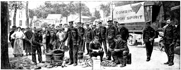
BRITISH
SOLDIERS
IN THE PLACE
DE LA GARE
(Sept. 1914)
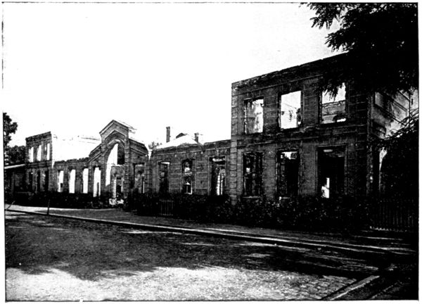
INTERIOR
OF THE BURNT
STATION
(Sept. 1914)
Whilst one part
of the advance
guard made the
tour of the town,
following the boulevards
and the
ramparts which
encircle it, other
groups descended
directly south by
the two main
streets which
cross Senlis, thus
making sure of a
thorough exploration.
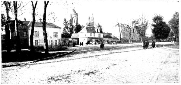
ENTRANCE
TO THE
RUE DE LA
RÉPUBLIQUE
BEFORE THE
WAR
The entrance lo the Rue de la République suffered a great deal, as
is shown by the two photographs, taken before and after the fire of September
2, 1914.
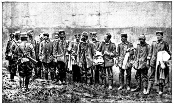
PRISONERS
IN FRONT
OF THE
GENDARMERIE
(Sept. 1914)
On the left, the toll-house is completely burnt down; in the centre, the
Hôtel du Nord and
the Restaurant Encausse
are in ruins.
The building on
the right is the
Gendarmerie.
The German prisoners
who appear
in the picture opposite
are leaning
against the wall of
these barracks.
They were the
few soldiers who,
remaining in Senlis
after the victory of
the Ourcq, were
captured by Zouaves sent from Paris in motor-cars.
Only a few years ago the Rue de la République was called the Rue Neuve-de-Paris,
although it dated from 1753. It was made in order to spare the
Court of Louis XV. the circuitous way and steep ascent of the old road,
which followed the Rue Vieille-de-Paris and the Rue du Châtel.
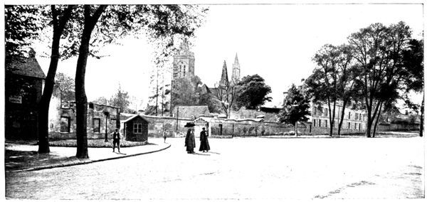
ENTRANCE
TO THE
RUE DE LA
RÉPUBLIQUE
AFTER
THE FIRE
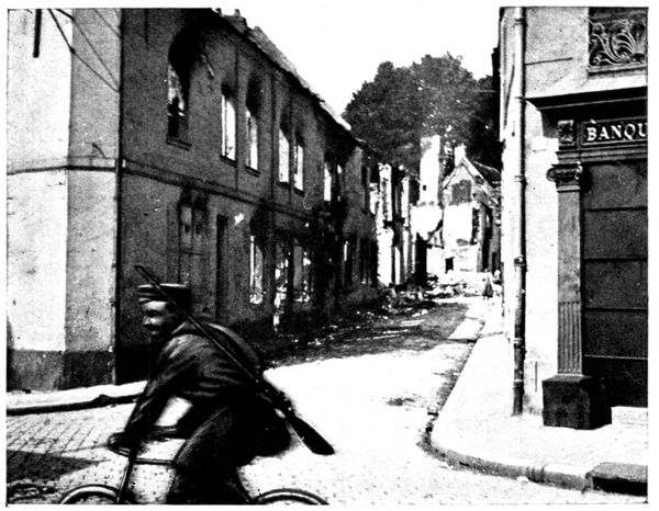
GERMAN CYCLIST AT THE ENTRANCE TO THE
RUE BELLOY (1914)
Descending the
Rue de la République
we come to the Rue
Bellon, which crosses
it. We turn to the
right, at the place
shown on the opposite
photograph, and
a few steps further
on, reach the Carrefour
de la
Licorne. This is
one of the most
devastated places
of the town. The
first view was taken
during the German
occupation, a German
cyclist being
snapshotted while
riding. The other
views show the
state of the ruins
in 1914 and the
present condition.
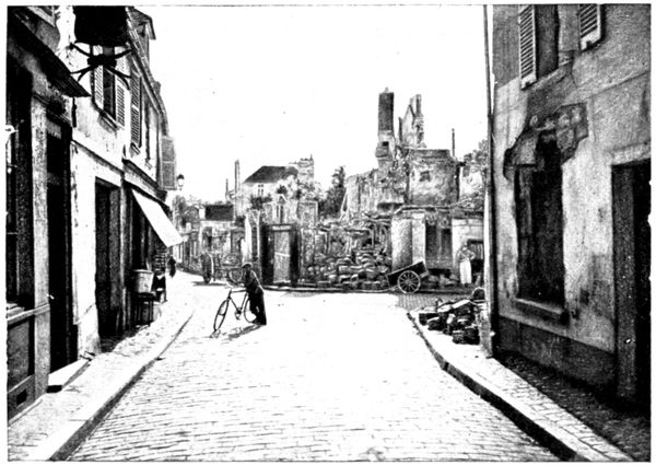
RUINS OF THE CARREFOUR DE LA LICORNE (1914)
We return to the
Rue de la République.
A few yards
down, on the right,
we see the charred
house, the gable-end
of which appears
in the view on
the following page.
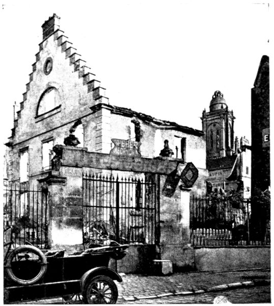
BURNT HOUSE RUE DE LA RÉPUBLIQUE (1914)
We next reach the level of the
Hôtel du Grand Cerf, of which the
signboard is seen on the view below.
The German headquarters staff
stayed there, and that is no doubt
the reason for its remaining intact.
The Mayor of Senlis, M. Odent,
was taken there on September 2,
after his arrest at the town-hall,
just before being taken to
Chamant to be shot. The proprietor
of the hotel having left the town,
the German officers commandeered
a restaurant keeper and
made him prepare a meal for
thirty people, with "ices and
champagne."
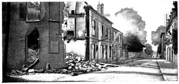
FIRE RUE DE LA RÉPUBLIQUE (1914)
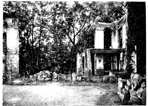
RUINS OF THE NOTARY'S HOUSE (1914)
The houses
which face the hotel
and which were
still burning when
the above photograph
was taken,
are those of the
local justice of the
peace and public
notary.
Looking through
the entrance gates
of the latter residence,
one beholds
the scene of desolation
reproduced
in the opposite picture.
BURNT
COURT
OF JUSTICE
(1914)
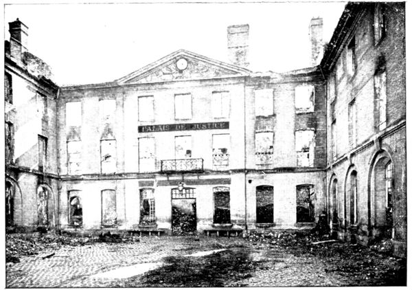
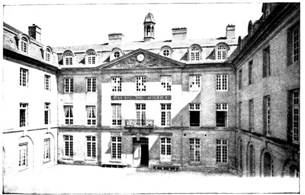
On the left of the
Rue de la République
we come to a building
which served
as the sub-prefect's
office and Court
of Justice. This
building, formerly
a hospital, dates
from the beginning
of the eighteenth
century.
The work of the
incendiaries is seen
by comparing the
opposite view with
that given below.
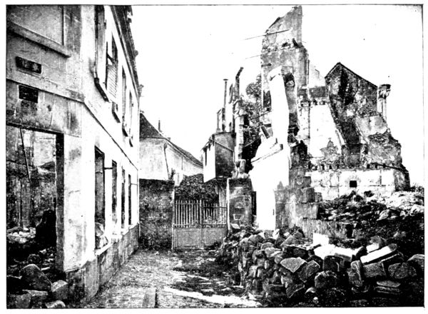
All the ruins already pointed out, as well as those that will be seen further
on, were made systematically.
RUE DE LA
RÉPUBLIQUE
(1914)
COURT
OF JUSTICE
BEFORE
THE WAR
The soldiers to whom this work was assigned arrived in columns; at the
sound of an officer's whistle a certain number of men left the ranks and
smashed in the doors of the houses and the shop-fronts; then others came
who started the fires with grenades and fuses; lastly, the patrols who
followed fired incendiary
projectiles
into those
buildings which
did not take fire
quickly enough.
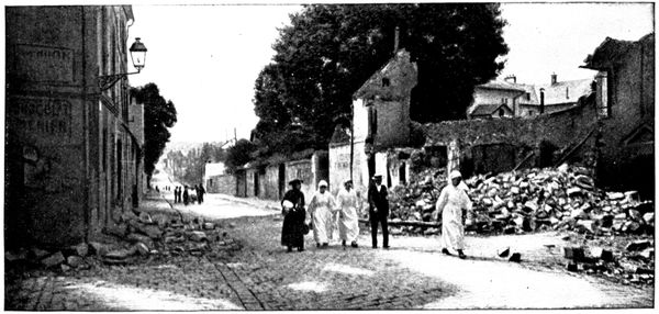
The above view
was taken during
the German occupation.
It shows
the Red Cross staff
conveying the
wounded from the
overflowing hospital
to the College
of Saint-Vincent.
RUINS
AT THE CORNER
OF THE
RUE DU TEMPLE
After crossing the
Nonette, one arrives
at the junction of
the Rue de la République
and the Rue
Vieille-de-Paris.
At the corner
stands the inn "Le
Débit Simon," of
which a view is
given below. Simon
was without doubt
the first victim of
the German occupation.
Tn the middle of
the afternoon a
German patrol,
who had just been drinking at the inn, was shot at by a French rearguard,
who had left Simon's a few moments before.
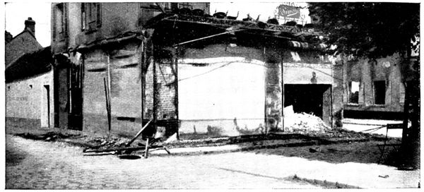
DÉBIT SIMON
(SIMON'S INN)
THE
PROPRIETOR
WAS KILLED
BY THE
GERMANS
The Germans immediately seized the innkeeper, accused him of having
fired, and shot him point-blank.
Other pretended reprisals were made, causing the death of twenty
unoffending civilians, of which the reader will learn the details further on.
The view below shows the corner of the Place Saint-Martin where
stands the Café
Simon. Two German
cyclists are
seen in the photograph,
which was
taken on September
4, 1914.
It will be noticed
that the one on the
left has a lady's
bicycle, which certainly
did not come
out of the Army
stores!
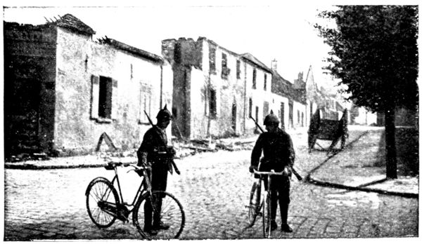
GERMAN
CYCLISTS
PLACE
SAINT-MARTIN
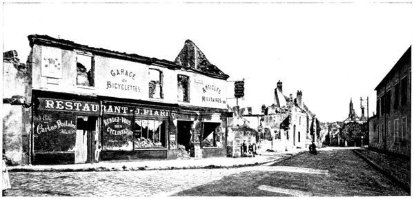
RUINS
FAUBOURG
ST. MARTIN
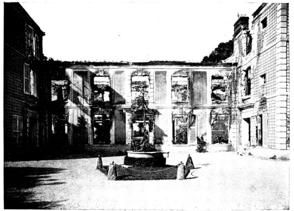
BURNT
BUILDING
17, FAUBOURG
ST. MARTIN
Following the Rue du Faubourg St. Martin shown above, the tourist will
pass a pretty estate (view below), the old quarters of the Gardes du Corps,
which was completely
burnt and
the ruins of which
produce a startling
effect.
In front, partly
burnt, are the headquarters
of the
Cavalry. Still further
on, at the
exit of the town,
is the Hospital.
It was there that
the battle raged
most fiercely.
The German advance-guards,
beating
back the French
soldiers delayed in the Faubourg St. Martin, were met by the fire of the
machine-guns stationed outside the town, along the road.
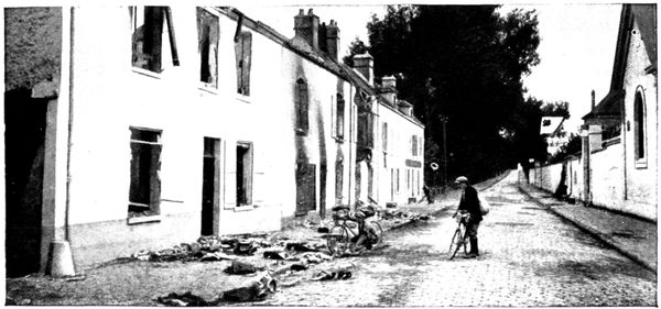
EQUIPMENTS
ABANDONED
DURING
THE BATTLE
The Germans penetrated into the hospital and the neighbouring gardens,
trying to outflank the French defences which they thought were placed on
the road, but a deadly fire from the transverse trenches made them fall back.
Furious at this, they seized the passers-by and made them walk in the middle
of the road, they themselves keeping close to the walls.
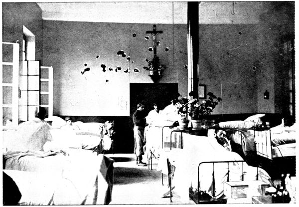
MARKS OF
GERMAN
BULLETS
IN THE
HOSPITAL
Among the hostages were a Mme. Dauchy and her young daughter. The
latter was shot in the leg. Georges Leymarie was killed; one of his companions,
Levasseur, while carrying the body along the pavement beside the
hospital wall, suffered the same fate. Two other hostages, Audibert and
Minouflet, the latter wounded, had also reached the pavement of the hospital.
A German officer discharged a revolver at Audibert and left him for dead;
he ordered Minouflet to show his wounds and, finding them insufficient,
put a bullet through his shoulder. Three other people fell. The shrieks
of the victims reached the French, who ceased fire. The surviving hostages
then slipped past the trees along the road, under German fire, up to the French
lines. The Germans took advantage of this to make a fresh attack, but
were repulsed.
The hospital, situated as it was in the midst of the fighting, was not spared,
A German officer, wounded by one of the first shots, entered the hospital
and meeting an old pensioner, M. Maumus, on the threshold, shot him down
in cold blood.
The ward where the French and Moroccan wounded lay was fired on with
machine guns, as shown in the above photograph. By a wonderful chance
no one was hit, the Crucifix also remained untouched in the centre of a wreath
of bullets.
The tourist will now, retracing his steps, turn to the right into the Rue des
Jardiniers, whence he will have a good view of the whole town. Always keeping
to the left he will pass through the Meaux Gate into the Rue de Meaux which
borders the College of St. Vincent (p. 64). (If on foot, it would be
better to follow the line of the ramparts Bellevue and Saint-Vincent, instead of the
Rue des Jardiniers. At the Meaux Gate he will go down the steps into the
Rue de Meaux.)
Back in the Rue de la République, he will go up as far as the Rue Odent,
which skirts the Hôtel du Grand Cerf. By this road he will arrive at the Place
de la Halle, continued to the right by the Rue Saint-Hilaire, which leads to the
church of Saint-Pierre (see p. 60).
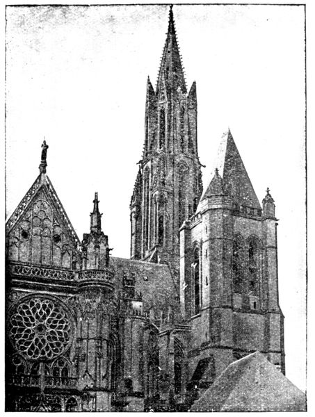
TRACES
OF SHELLS
ON THE
CATHEDRAL
(Photograph
by M. H.)
From the Place Saint-Pierre
one goes to the left into the
little Rue aux Flageards which
passes in front of the north doorway
of the cathedral, of which
a view is given opposite. The
tower on the right and the spire
were struck by several shells.
Continuing along the Place
Mauconseil and turning to the
left into the Rue Villevert one
reaches the charming square
which lies in front of the parvis of
the Cathedral.
(See pp. 53-59 for descriptions
concerning the artistic
features of the cathedral.)
Here we shall only give the
incidents of September 1914
in which the building shared.
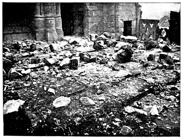
DÉBRIS
AT THE FOOT
OF THE
CATHEDRAL
TOWERS
(Photograph
by M. H.)
During the day of September
2, 1914, about fifty
shells struck the old church
and caused rather serious
damage, as shown in the
following photographs. The
vicar of the cathedral, the Abbé Dourlent, went about the streets of Senlis
during the bombardment and had 125 inhabitants, who had been unable
to find shelter in the cellars, escorted out of the town by one of his curates.
On his return to the vicarage, which stands at the foot of the tower (the
house visible in the photograph on p. 54, on the right, behind the two trees),
shortly after the Germans had entered the town, the vicar heard
violent and repeated blows in the cathedral. Coming out into the
square he saw cyclists, holding a large fragment of a statue (which had
been flung to the ground by a shell) with which they had battered
in the small door of the cathedral (that on the right in the view on p. 54).
Others, axes in their hands, were attacking the door of the steeple on the
south side of
the tower. The
Germans, revolver
in hand,
rushed at the
vicar, and their
leader commanded
him to
take them to
the top of the
steeple, accusing
him of having
allowed machine
guns to be placed
there which had
fired on them.
As they
climbed the
first step they
heard the first shots fired in the
lower part of the town.
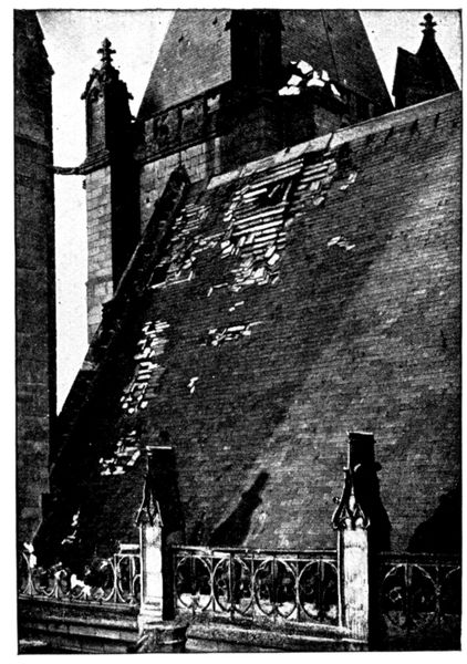
TRACES
OF SHELLS
ON THE
CATHEDRAL
The soldiers sprang up and
declared the vicar their prisoner.
The visit to the steeple confirmed
the Abbé Dourlent's declaration
that no one had been
up and that no military preparations
had ever been made there.
The men drew off, but a few
moments later the porter of the
town-hall brought the vicar the
order to render himself immediately
as hostage at the Grand
Cerf Hotel.
When he arrived the Headquarters
Staff had left, taking
with them the mayor, who was
shot that evening.
The incendiarism had already
started; the vicar saw incendiary
bombs thrown into the
houses facing the hotel, which
are shown in the photograph on
page 41. He entered the
vicarage, then returned to the Grand Cerf to learn what fate awaited him.
It was there that a German superior officer, who spoke French, said
these few words which throw light on the events at Senlis:
Poor Curé, poor Senlis, your civilians have fired on us and we have been
shot at from the top of your church tower, therefore Senlis is doomed. You
see that street in flames (the Rue de la République), well! this night the whole
town will be completely burned down.
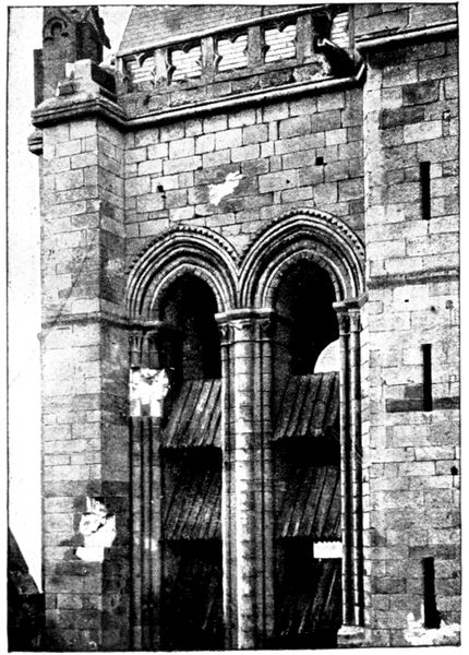
TRACES
OF SHELLS
ON THE
CATHEDRAL
We have orders to make of
Senlis another Louvain. A terrible
example is needed for
Paris and for the whole of
France.
The vicar implored for mercy
for the town, and the officer
promised to intervene with his
superiors in order to obtain a
mitigation of the sentence.
Whether he gained his point or
whether the giving up of the
direct march on Paris caused the
part of scape-goat assigned to
the peaceful little town to appear
of less immediate necessity,
the incendiarism was limited to
the Rue de la République and
the Quartier de la Licorne.
The tourist will visit the Cathedral
(see pp. 53-59), Saint-Frambourg
(p. 60), the Castle (pp. 61-63),
and will then go down the old
Rue du Châtel.
This road was the scene of an
outrage of 1789, famous in the
annals of Senlis. The clockmaker
Billon, seeing beneath his windows
the company of musketeers
from which, as usurer, he had
been dismissed, raised his musket
and killed the commandant and
several others. Trapped in his
house, he backed from room to
room still adding to the number
of his victims. At the moment
when they seized him the mine
that he had prepared exploded,
destroying his house and leaving
twenty-six dead and forty injured.
The Rue du Châtel ends in the
Square Henri IV., in the corner of
which stands the Town-hall. Its
façade (see below) dates from
1495. Above the door is the
bust of Henri IV., with an inscription
taken from the letters-patent
sent by the king to Senlis
as thanks for the town's resistance against the Leaguers:
"Mon heur a prins son commencement en la ville de Senlis, dont il s'est
depuis semé et augmenté par tout le royaume."
(My good fortune had its beginning in the Town of Senlis, whence it has since
sown itself and spread over all the kingdom.)
The Square Henri IV. received the first shells of the bombardment in
September, 1914, which killed a fireman on guard at the town-hall.
When the Germans penetrated into Senlis, one of their superior officers
went to the town-hall and asked for the "burgomaster."
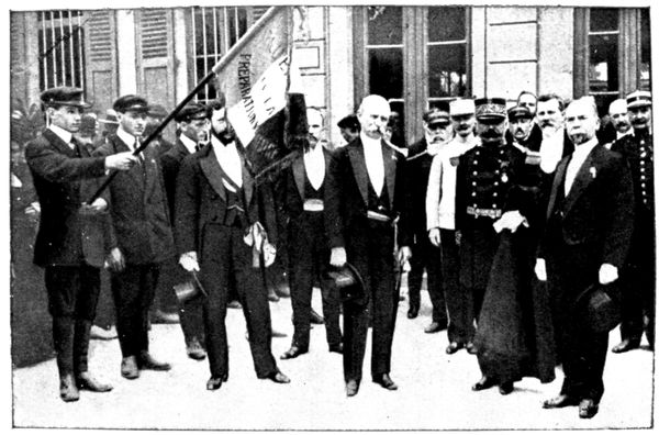
LAST
PHOTOGRAPH
OF M. ODENT
(in the middle)
The mayor, M.
Odent, came
forward.
For three generations
the
Odents had been
mayors of Senlis.
The grandfather
of the present
mayor distinguished
himself during the
cholera epidemic
in 1832; his father
was seized as hostage
in 1870 and
narrowly escaped
being shot.
On the eve of the German occupation, M. Odent took his family to Paris
and on his return to Senlis wrote a postcard to M. Cultru, oldest member
of the municipal council, as follows:—
"Having at last placed my wife in safety, I now belong entirely to Senlis."
M. Odent had the presentiment that he would not come out of German
hands alive; a fervent catholic, he performed his religious duties in view
of a swiftly approaching death, and fastened a crucifix on his breast.
Above we give the last photograph of M. Odent. It was taken on
August 5, 1914, during a military fête. M. Odent is in the middle.
The mayor was violently upbraided by the officer because of the deserted
aspect of the town—barely 1,000 inhabitants remained out of 7,000, and
during the bombardment houses and shops were closed. He was also
blamed for the absence of proclamations exhorting the inhabitants to deposit
their arms at the town-hall and to offer no resistance....
M. Odent pointed out the rapidity of events, and the peaceable ways of
the old city. He was nevertheless led before the headquarters staff at the
Grand Cerf Hotel. Immediately after, came the sound of the first shots fired
by the French rearguard at the lower end of the town. The officer was
furious and vowed that he would hold the mayor responsible and that his
head should answer for the lives of the German soldiers. The town-clerk
suggested to M. Odent that the deputy mayor should be fetched, but the
latter refused, saying: "One victim is enough."
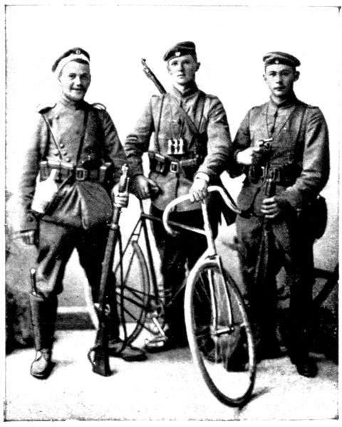
GERMAN
SOLDIERS
PHOTOGRAPHED
AT SENLIS
The resigned hostage was taken from the Grand Cerf to Chamant (see
p. 66). He was brutally treated, his
gloves snatched from him and flung
in his face, his stick seized and brought
down violently on his head. M. Odent
and some other hostages spent several
hours of cruel waiting for their fate.
At last, at about 11 o'clock in the evening,
they were brought before several
officers. After having been made to
stand at attention they were ordered
to lie flat, their hands stretched forward;
they were then again told to
stand at attention. The officers, satisfied
that they had thus asserted their
authority, for form's sake then proceeded
to interrogate the mayor, and
in spite of his denial persisted in accusing
him of having opened fire upon
the German troops. They then informed
him that he would be shot.
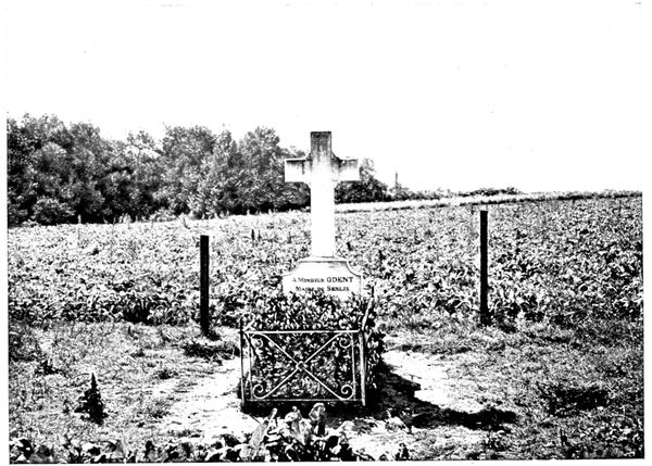
M. ODENT'S
GRAVE
AT CHAMANT
M. Odent returned to his companions in captivity, gave them his papers
and money, shook hands with them, and bade them a dignified farewell.
He then went back to the officers. At their command two soldiers dragged
him about ten yards further off and put two bullets through his head.
The ground was hastily hollowed out and the body was laid under such a
thin layer of earth that the feet were not covered. It was here that the cross
shown in the above photograph was erected. The tourist can visit it when
passing through Chamant (see p. 66). A few hours before the mayor's death
six other hostages had been shot and buried in the same field. M. Odent's
companions were more fortunate, they were sent back to Senlis the next
day. On September 12 the bodies of the mayor and the six other victims
were exhumed and taken to the cemetery in the town (see p. 52). Other
hostages narrowly escaped death. At about eight o'clock in the evening, in
the tailor's shop at the corner of the Rue du Châtel, in front of the town-hall,
three inhabitants were seized and taken to Chamant. To these, in the
course of the journey, were added a dozen others. They were about to
share the fate of the preceding hostages when one of them, who spoke German,
succeeded in inducing the Headquarters staff to set them free.
By the Rue Vieille de Paris (a continuation of the Rue du Châtel) we descend
to the lower part of the town. (In 1358 the "Jacques," masters of Senlis,
drove back the nobles who had entered the lower end of the road by rolling
down the slope heavily laden wagons which overturned anything that
happened to be in their way.)
In front of the old Convent of the Carmes, No. 3 of the Rue Vieille de Paris,
stand Megret's Baths, to which a café is attached. In the afternoon of
September 2 some Germans smashed in the door and demanded drink.
It was no doubt at that time that other German soldiers entered the café
Simon, a little further on (see p. 43). The two proprietors suffered the same
fate. Mégret had barely finished serving the patrol with a dozen bottles of
wine when a shot, fired point-blank, felled him to the ground.
On page 49 appears the photograph of three young German soldiers belonging
to that column of incendiarists and murderers who did so much damage
to Senlis. With threats they forced the photographer, M. Rozycki, to whom
we are indebted for the views taken during the German occupation, to take
the photograph we have reproduced.

PICTURE
IN THE
TOWN HALL
[Execution of
Hostages
in 1418]
A little way past the Convent of the Carmes (which is turned into barracks,
its chapel being used as a clothing store), we follow, on the right, the line of
ramparts that goes from the Rue Vieille de Paris (where the Paris gate used
to be) to the Place de Creil (where stood the gate of the same name).
These ramparts were made in the thirteenth and fourteenth and strengthened
in the fifteenth and sixteenth centuries.
The first portion is called le Rempart des Otages in memory of the
executions of 1418, during the fight between the Burgundians, who occupied
Senlis, and the Armagnacs, who besieged it.
The town, reduced to famine, was to surrender on April 18 if no help
arrived, and six hostages were handed over as guarantee: two abbots, two
nobles, and two commoners. Help was signalled on the day of the 18th;
but the Armagnacs, before leaving, decapitated four hostages at the foot of
the ramparts on which the tourist is standing. In return, the besieged flung
down from the walls the heads of twenty prisoners captured during a sally.
Six centuries have elapsed, but it will be seen that, towards hostages, the
Germans still retain the mental attitude of the Middle Ages.
A picture by Mélingue (reproduced above), which hangs in the town-hall,
commemorates the execution of the hostages of Senlis in 1418.
The next rampart is called the Montauban, after the square tower which
was added to it in 1588. It was in the dry moat below that the Archers'
Company held their practice. The head of the company, the "King of the
Crossbow," was exempted by Henri III. from paying taxes, and ever since
that remote period archery has always been held in honour at Senlis. At
certain fêtes as many as 4,000 archers were assembled, part of them belonging
to the town, the others coming from the surrounding country.
From the rampart, the view of old Senlis, spread out at the foot of the
cathedral, is particularly picturesque.
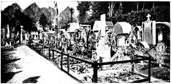
SOLDIERS'
GRAVES
IN THE
CEMETERY
From the Creil Gate, where you come out on leaving the ramparts, the
Arena can be visited (see p. 65). After that, turn down the Avenue Vernois,
at the end of which is seen the entrance to the cemetery. The monument raised
in memory of the hostages who were murdered in 1914 (view below) is in
the western part of the cemetery. In the northern part is the grave of the
soldiers who fell during the battles of Senlis (view above).
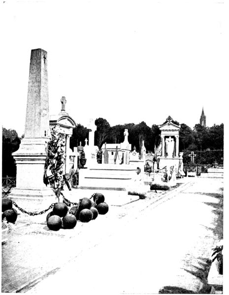
MONUMENT
OF THE
HOSTAGES
IN THE
CEMETERY
From the Boulevard Pasteur, which is a continuation of the Avenue
Vernois, there is
a pretty view of
the country.
At the corner
of the Rue Saint-Joseph
stands a
convent where
seventy nuns
remained during
the German
occupation.
Some German
soldiers made
them open the
door and demanded
wine:
"Oh!" answered
the Reverend
Mother, "the
nuns only drink
liquorice-water."
The tourist
now finds himself
at the Compiègne
gate,
from where he
began his visit
to the town. This
is also the starting
point fixed in
the itinerary for
the journey to
Meaux (see p. 66).
ARTISTIC SENLIS
(See plan inserted between pp. 36-37)
The Cathedral of Notre-Dame
(historical monument)
The cathedral was begun in 1153 on the site of a church which had been
destroyed and rebuilt several times since the third century. The work of
construction was slow, as funds
were often lacking, despite the
help given by the kings of
France. For several consecutive
years collections were repeatedly
made throughout the
country in order to obtain
resources for the bishop.
The consecration of the unfinished
church took place in
1191.
Towards 1240, the transept
was raised and the spire, which
is still the pride of Senlis, built.
In 1504, lightning set fire
to the cathedral, which went
on burning for two days.
Luckily the spire was saved.
The reconstruction of all the higher parts and of the façades of the transept
lasted until 1560 and completely transformed the appearance of the
building.
During the Revolution it was used as a ballroom and afterwards as a store-house
for fodder. In 1801 it became once more a place of worship.
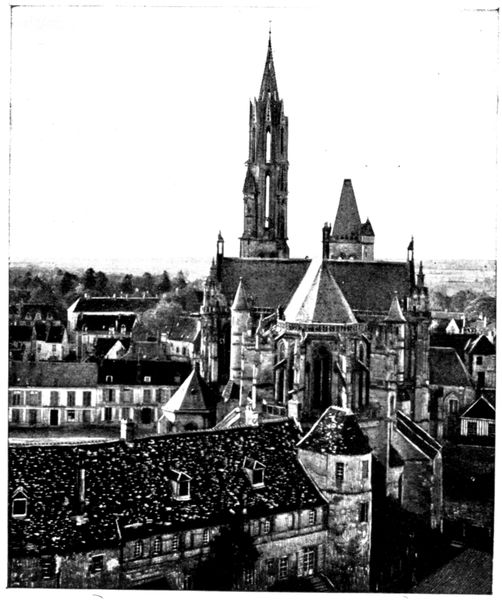
CATHEDRAL
SEEN FROM THE
STEEPLE
OF ST. PIERRE
It has been seen (p. 46-47)
that the cathedral was
not spared by the German
shells on September 2,
1914, and that its vicar
very nearly shared the
mayor's tragic fate.
The opposite view is
taken from the top of the
steeple of St. Peter's
Church.
In the foreground are
seen the buildings of the
old bishop's palace, standing
on a Gallo-Roman
site; one of the towers
of this enclosure was utilised
in their construction.
After 1790 Senlis was
no longer a bishopric, and
an archæological museum is
now established in the
old dwelling-place of the
bishops.
The west façade of the cathedral, which escaped the fire of 1504, has
retained the simplicity and bareness of the twelfth century church and is in
remarkable contrast with the richness of the side façades built in the sixteenth
century.
The great doorway, which will be fully described further on, is flanked by
two small doors surmounted by a tympanum, the arcading of which forms a
curious ornamentation.
The two towers were originally alike; it was only in the middle of the
thirteenth century that the spire was added to the south tower.
This SPIRE is a masterpiece of Gothic architecture and for nearly seven
centuries has been the admiration of architects and archæologists because of
the science, audacity and solidity of its construction, which was proof against
fire, the inclemency of the weather, and German shells.

THE SPIRE
OF THE
CATHEDRAL
Its summit is 255 feet above the ground.
Octagonal in shape, it rests on the square
base of the tower.
The transition from the square to the
octagon is masked by the four pinnacles
(each supported by three small columns),
which occupy the four corners of the
square.
The upper part of the spire is pierced
with eight highly ornamented dormer windows;
the arrises of the spire are decorated
with crockets.
This construction reveals the great art
of the architect, who knew how to break the
monotony of the spire's long, sloping lines
without making them appear heavy.
The little Place du Parvis shown above
is charming in its archaical decoration.
The edifice seen on the left of the photograph
is the old home of the Vermandois
family, modified in the fourteenth century.
One can walk round the courtyard of the
old dwelling, entering through the door
seen between two big trees.
Between the house of Vermandois and the
church stands the Chapter House (see p. 59).

THE WEST
DOOR
OF THE
CATHEDRAL
The twelfth century
doorway was damaged
during the Revolution.
The great statues were
decapitated but have
since been restored. The
bas-reliefs suffered considerably,
also.
This is the first doorway
consecrated to the
Virgin. Its design served
as a model for those of the
Cathedrals of Chartres,
Rheims, Amiens, and
Notre-Dame de Paris.
The bas-relief of the
lintel, shown below, represents,
on its left side, the
death of the Virgin. This
part is much damaged.
The apostles encircle the
bed on which the Virgin is
lying, two of them swinging
censers. Two winged-angels
bear away the Virgin's
soul, portrayed as a
new-born babe wrapped
in a swaddling cloth.
The right side, which represents the Resurrection of the Virgin, is in a
better state of preservation. An angel stands ready to crown Mary, who
is raised from her bed by three others, while a fourth leans forward the
better to see over those in front.
All this sculpture shows a truth and freedom of attitude of which very few
examples are found in the twelfth century.
Above the lintel, in the tympanum, is the Triumph of the Virgin;
the execution of this work is far from equal to that of the lintel.
In the niches of the arches are statues of the patriarchs, the prophets
and the kings of Judah.
The eight great statues which flank the door represent personages from
the Old Testament.
The one nearest the door, on the left, is Abraham. He holds his son by
the hair and stands ready to behead him, but an angel restrains his sword.
Beneath the pedestals of the large statues is a "Calendar," i.e., a set of
symbolical scenes typifying the twelve months of the year, or the seasons.
That of Senlis is carved with much spirit.
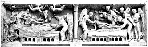
LINTEL
OF CATHEDRAL
DOORWAY
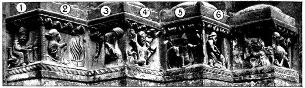
CALENDAR
OF THE
CATHEDRAL
(right)
| 1. |
January. |
The month of feasts. The peasant, seated at table, prepares to drink. |
| 2. |
February. |
Work is at a standstill. The peasant is at the fireside. |
| 3. |
March. |
Work begins again. The peasant digs. |
| 4. |
April. |
With the spring the time has come to care for the trees. |
| 5. |
May. |
The lord, his falcon on his wrist, goes forth to hunt. |
| 6. |
June. |
The peasant mows his meadows. |
| 7. |
July. |
It is the beginning of the harvest. |
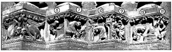
CALENDAR
OF THE
CATHEDRAL
(left)
| 8. |
August. |
The peasant threshes the grain. |
| 9. |
September. |
The peasant gathers the grapes. |
| 10. |
October. |
The peasant gathers in his crops. |
| 11. |
November. |
The peasant kills his pig. |
| 12. |
December. |
The peasant puts cakes in the oven for the fêtes at the end of the year. |
The south front of the cathedral has not the harmony of that of the
west.
The lower part of the apse dates from the twelfth century, with its radial
chapels and, above, the little semi-circular windows of the galleries. The
upper part of the church belongs to the sixteenth century.
The rich façade of the transept also dates from the sixteenth century.
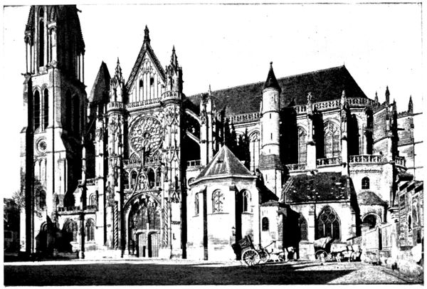
SOUTH FAÇADE
OF THE
CATHEDRAL
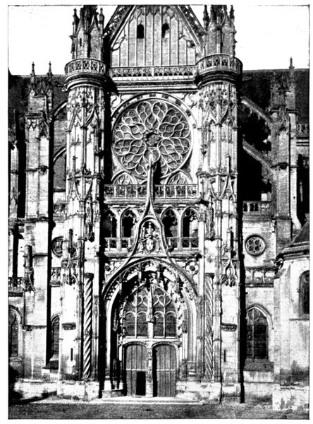
THE CATHEDRAL:
SOUTH
FAÇADE
OF TRANSEPT
The opposite view shows
the detail of the SOUTH FAÇADE
OF THE TRANSEPT designed
by Pierre Chambiges,
son and pupil of Martin
Chambiges. The latter worked
on the Cathedrals of Beauvais,
Sens and Troyes, and his
son drew inspiration from his
work for the execution of that
entrusted to him at Senlis; this
explains the great resemblance
that various portions of those
edifices bear to one another.
In comparing the south
portal with the western façade
one notes the development
of Gothic architecture from
the twelfth century, when
its restraint and simplicity
of line still recalled Roman
art, to the sixteenth century,
when rich, flamboyant
decoration flared in its final
splendour, making way for
the art of the Renaissance that the Italian wars brought into fashion.
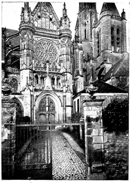
THE CATHEDRAL:
NORTH
FAÇADE
OF TRANSEPT
The appearance of this fine ensemble is spoilt by the adjacent polygonal
vestry erected on its right, which was rebuilt in the nineteenth century. A part
of it can be seen in the
above photograph; though
one can judge still better
of its ugly effect from the
photograph on the preceding
page.
The north façade of
the transept is, in its
general arrangement, the
same as that on the south,
but it is less richly ornamented.
On the pediment which
surmounts the entrance
are carved the salamander
and the "F" of Francis I.
On that of the south are
the arms of France.
The tourist should not
fail to look at the north
side of the Cathedral,
which is very picturesque.
On the north tower the
marks of German shells
are still to be seen.
They are clearly shown
in the photograph (foot
pp. 46-47).
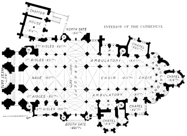
PLAN
OF CATHEDRAL
- E, stairs leading to galleries.
- G, chapel of transept (vault with pendentives).
- M, aisles of choir.
- O, radial chapels of the twelfth century (modern windows).
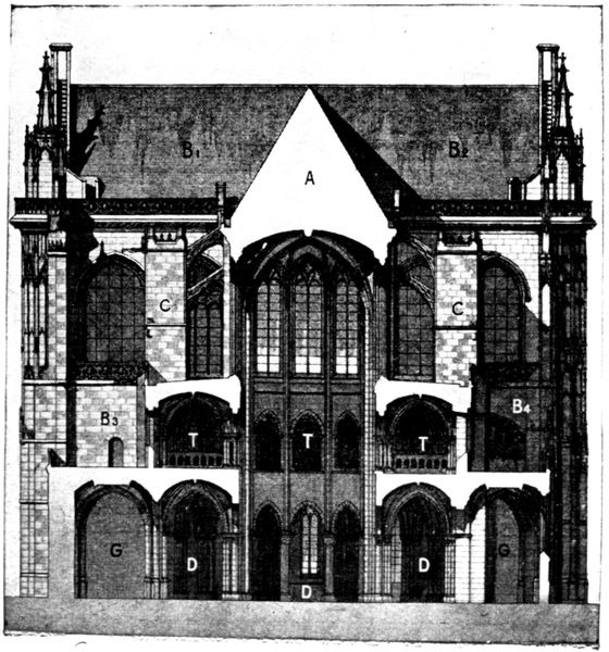
SECTION
OF CATHEDRAL
- A, roof of nave. B1, B2, B3,
B4, transept.
- C, piers supporting the vault
on the nave by means of
flying buttresses.
- D, first aisles of nave and ambulatory.
- G, second aisles of nave.
- T, galleries running round
the church.
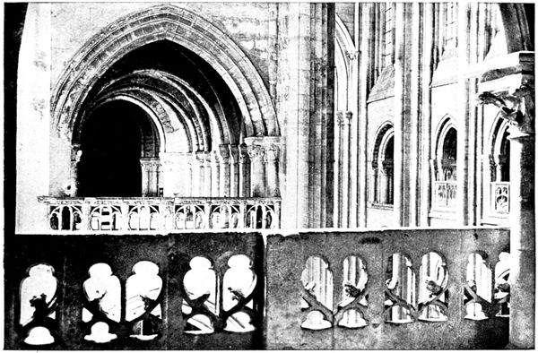
GALLERIES
OF THE
CATHEDRAL
The galleries of the cathedral are
among the most beautiful in France.
The above view, taken from the choir galleries
which overlook the southern part of
the transept, shows those of the nave in
enfilade.
In order to visit these galleries the key
must be obtained from the vestry.
In the chapel seen on the right as one
re-enters the church by the south door,
the visitor will notice the hanging bosses
of the vault of which a view is given
opposite.
In the chapter house at the north-west
end of the cathedral (see plan, p. 58), is
seen the curious capital of the central pillar, on which is carved a feast of
jesters.
The opposite view shows a fragment of it.
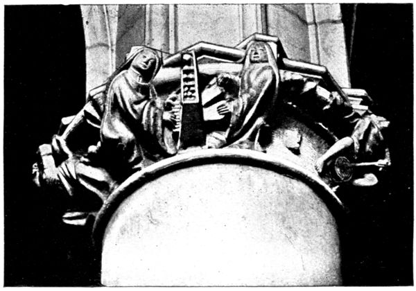
CAPITAL
IN THE
CHAPTER
HOUSE
(CATHEDRAL)
Two of the figures
are playing
the organ, that on
the right is working
the bellows, another
with a stick
beats the tambourine
that he holds
between his legs;
on the remainder
of the capital
other figures are
dancing.
The chapter house
was used by
the canons of the
cathedral.
Church of Saint-Frambourg
(historical monument)
This stands in a little street which opens on the south of the cathedral square.
The church can be seen from the square.
This church was founded
on the site of a Roman
temple, by Queen Adelaide,
wife of Hugues
Capet. Rebuilt in the
twelfth and thirteenth
centuries, transformed
into a "Temple of
Reason" during the
Revolution, it now serves
as a carpenter's workshop.
On the façade one can
distinguish the place intended
for a large rose
window, which, however,
was never finished.
On the left side of
the façade stood a tower,
since demolished.
The church has no roof left above the vaulting. To visit the interior
(consisting of a single nave of graceful proportions) apply to the carpenter. The
entrance to the workshop is seen on the left of the photograph.
Church of Saint-Pierre
(historical monument)
Market-day on Tuesdays and Fridays. If the tourist should wish to go to
the top of the belfry or to visit the church on other than market days, he must apply
to the concierge of the Tribunal (county court) in the square.
This old town of Senlis is so rich in relics of the past that it puts its ancient
religious monuments to quite profane uses.
We have seen above that Saint-Frambourg shelters a carpenter. Saint-Pierre
serves as a market, another church as a theatre, a fourth as a museum,
and others as clothing stores or barns. Five have completely disappeared;
as for the Abbey of Saint-Vincent, it has been turned into a college.
Saint-Pierre was founded in
1029 and reconstructed during
the thirteenth and fourteenth
centuries.
The roof of the nave was begun
in stone, but completed in
timber-work. The façade dates
from the sixteenth century and
recalls the work of Pierre Chambiges
in the cathedral.
The right-hand tower dates
from the seventeenth century.
From the upper platform
there is a splendid view of the
town and the surrounding
forests. Another more ancient
tower exists, the base of which
is the remains of the primitive
Roman church. The spire (the
top of which is seen in the
opposite photograph) was added
in the fifteenth century.
The Castle
(historical monument)
The castle belongs to the Count Turquet de La Boisserie, who allows it to
be visited. Apply to the concierge.
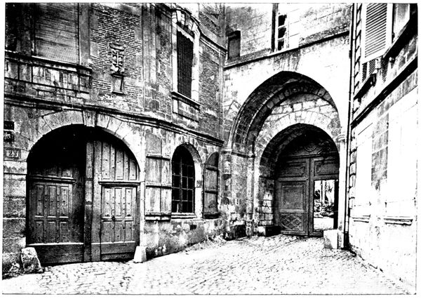
ENTRANCE
TO THE CASTLE
AND THE
HÔTEL DES
TROIS-POTS
The entrance shown in the above view is in the Rue du Châtel, quite close to
the square of Parvis-Notre-Dame. On the left side stands the old Hôtel des
Trois-Pots, so called from the signboard which hangs from the first floor,
and formed of three pots which are being filled by a thin stream of water.
This old dwelling recalls all the history of France from the Gallo-Roman
conquest to the reign of Henri IV.
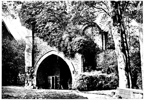
RUINS
OF THE
CASTLE
CHAPEL
The castle itself, of which only a part exists (visible on the left in the
above photograph),
was
erected on the
site of an old
Roman fort.
At the foot
ran the boundary
line of
the town,
partly formed
by the wall
which encloses
this side of the
estate and the
tower which flanks the north front of the buildings.
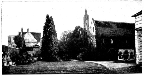
CASTLE
AND PRIORY
OF SAINT-MAURICE
The Merovingian and Carlovingian kings often inhabited the castle,
situated as it was in the midst of their favourite hunting-grounds.
It was the theatre of numerous historical events: Pépin, Duke of Aquitaine,
grandson of Charlemagne, died imprisoned there, and Baldwin of
Flanders carried off from there the daughter of Charles the Bald. In 987,
the last Carlovingian king having died while out hunting, the French lords
assembled in the castle and elected, as king, Hugues Capet whose dynasty
reigned in France until the Revolution. Philippe-Auguste held festivities
there on returning from his wedding with Elizabeth of Hainault. Saint
Louis founded the priory of Saint-Maurice.
During the Hundred Years War, Catherine of France was married to
Henry V. of England at Senlis, in 1420.
After Henri IV., the castle, being very dilapidated, was gradually abandoned.
Justice was still administered there until the falling in of the
Audience Chamber in the eighteenth century.
The interior of the castle is in ruins. There is one room to be seen, called
Henri IV.'s room, which is shown on the following page. It dates from the
thirteenth century, and is covered with fine panelling. The fireplace was
altered in the fifteenth century, but the big circular section flue remains just
as it was two centuries earlier.
On the left of this fireplace a thirteenth century window (now blocked up)
can still be distinguished.
The one at the
further end of
the room belongs
to the
sixteenth century.
In the photograph
some
tombstones
are seen, resting
against
the wall; on
a fragment
placed against
the chimney-piece
are the
arms of Diane
de Poitiers
(characterised
by the crescent); the two cannon balls are of stone; these were hurled from
catapults and from the first bombarding machines.
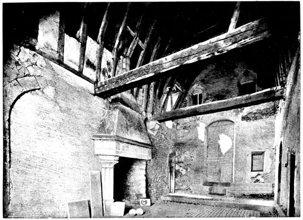
HENRI IV.'S
ROOM
IN THE CASTLE
Of the chapel built in the beginning of the twelfth century nothing remains
but ruins, a view of which is given (page 61). It was situated on the first
floor; a "semi-circular" arcade of the nave is still to be seen, on the right
side. The ground floor, vaulted like an arbour, formed a passage.
The priory of Saint-Maurice, of which one ivy-covered building still exists
(visible on the right of the photograph at the top of the preceding page), was
founded by Saint Louis in honour of Saint Maurice who commanded the
Theban legion, massacred under Diocletian for refusing to worship false gods.
In 1234 the king succeeded in obtaining the bodies of several of these
martyrs from the vicar of Saint-Maurice-en-Valais.
A church, copied from the Sainte-Chapelle in Paris, was built to shelter
these relics, but was destroyed during the Revolution.
Passing under the Roman enclosure by a subterranean passage, we arrive
at the old moat transformed into a kitchen garden. From here, there is a
very interesting view of the wall and the Roman towers, the cathedral and
the castle. A good idea of it is given by the photograph at the foot of the
preceding page.
The Roman enclosure continues towards the cathedral, passes by the
apse, from there to Saint-Frambourg, and its oval rejoins the castle by
the Place de la Halle, the Rue aux Fromages, and the Rue du Puits-Tiphaine.
It measured 312 m. (1,024 ft.) at its greatest diameter and 242 m. (794 ft.)
at its smallest diameter; twenty-eight towers adorned the walls which were
7 m. (23 ft.) high and 4 m. (13 ft.) thick.
The town, having grown, was cramped in the limits of the Roman city,
so the new ramparts were raised between the thirteenth and sixteenth
centuries; the tourist has already travelled over a part of them.
The platform of the Roman fort, which was followed by the castle, stood
on the part which (with the Rue Villevert) forms a corner of the estate. It
is reached by the narrow passage, made in the thickness of the sub-basement,
which led to the dungeons. It was in one of these (towards the year 870)
that Pépin, King of Aquitaine, died, imprisoned by order of Charles the Bald,
against whom he had revolted.
Subterranean passages connected certain important points of the castle.
They were supposed to lead as far as the Castle of Montépilloy (see p. 67)
and the Abbey of Châalis (see p. 70).
The old Abbey of Saint-Vincent
To view, apply to the concierge in the Rue de Meaux.
The Abbey of St.-Vincent was founded in 1065
by Anne of Russia, wife of Henri I., King of France,
in fulfilment of a vow.
The abbey church was rebuilt in the twelfth
century.
The tower, which dates from that period, is
square; it has two storeys with very high dormer
windows grouped in pairs on each front, which
give a very light appearance to the general
structure.
The other buildings belonging to the Abbey
were rebuilt in the seventeenth century. Inside, an
interesting cloister still exists, with a Doric
colonnade, shown on the opposite view.
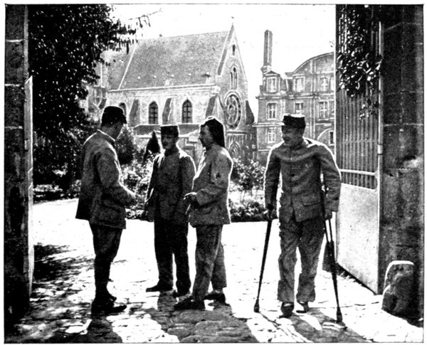
ENTRANCE
THE ABBEY
(RUE
DE MEAUX)
After the Revolution the Abbey was turned
into a hospital, then into barracks, and after that
into spinning mills. In 1836 it became the College
Saint-Vincent, counting among its pupils Marshal
Canrobert and the poet
José-Maria de Hérédia.
Many inhabitants of
Senlis took refuge in the
Abbey cellars during the
bombardment of September
2, 1914. St.-Vincent
soon served as
an annexe to the hospital,
which was too small to
hold all the wounded.
In the photograph (page
42) we see the transport
of the wounded
being carried on by the
Red Cross in September,
1914. This temporary
hospital remained after
the departure of the
Germans, which explains
the presence of the wounded seen in the foreground of the opposite view.
The Arena
(historical monument)
The gate at the entrance of the road leading from the Place de Creil to the
Arena is sometimes locked. Apply to the Syndicat d'Initiative (Hôtel du
Grand-Cerf) for the key.
The arena was discovered in 1864. It apparently goes back as far as
the third century.
The tiers encircle a track measuring 130 feet by 110 feet. Two large
entrances, which were vaulted, lead into the arena at each extremity of
the great axis. On the other axis are two little rooms, which were no doubt
reserved for the gladiators. In the southern one, niches are hollowed in
the wall: these probably served as cupboards.
(See maps inserted between pages 80-81)
via Chamant, Montépilloy, Baron, Châalis, Ermenonville.
Starting from the Compiègne Gate, we leave the town by the Route Nationale
(N 17). After having crossed the railway we turn to the right and follow N 32
as far as the first road on the right bordered with trees, which leads to Chamant.
A hundred yards this side of the village we enter a field enclosed by hedges, on the
right of the road (2½ km.). In this field, which appears in the photograph
(p. 50), the German troops were encamped. M. Odent, the Mayor of Senlis,
and six other hostages were shot there (pp. 49-50). M. Odent's grave is near
the wood which skirts the side of the field opposite the one which borders the
road. Near the enclosing hedge is the grave of a German captain.
Go on to the village of Chamant, turn to the right, then to the left as far as
the church, the steeple of which can be seen. This church dates from the twelfth
century, and was modified in the fourteenth and sixteenth. The Roman
spire, shown below, is remarkable. In the interior, the capitals and vaulting
decorated in many colours were restored at the expense of Napoléon the
Third, as was also the tomb of Lucien Bonaparte's wife, which is to be found
in the side chapel.
Go round the church, turn to the left, then to the right, near the firemen's
gymnasium.
The road, planted with trees, which forms a continuation (on the other
side of the Route Nationale) of the road on which we stand, leads (700 yards
further on) to the Castle of Chamant, where the German Headquarters Staff
stayed. The cellar was pillaged, and more than 1,200 bottles of champagne
were emptied.
This castle, which dates from the seventeenth century, was inhabited by
Lucien Bonaparte. Attached to it are important racing stables.
Follow N 17 for about 1,500 yards, then turn to the right towards Ognon
(8½ km.). Turn twice to the right in front of the church and go towards Barbery,
the factories of which can be seen from afar. Cross the railway (12½ km.) near
the station which was set on fire by the Germans, and keep straight on towards
the keep of Montépilloy (13½ km.), which stands on a neighbouring hill.
The castle, the
entrance to which
is shown on the
opposite view,
forms part of a
farm.
Its name comes
from Mons speculatorum
or "Mount
of the watchers."
It was built in the
twelfth century.
On August 15,
1429, Jeanne
d'Arc occupied it.
An English army
commanded by the Duke of Bedford was between Montépilloy and Senlis.
The battle took place on August 16, and enabled the troops of the king
of France to retake Senlis. The castle was dismantled under Henri IV.
To obtain a view of the whole and to realise the dominating position of
the castle one must, before entering it, walk a few steps along the road which
descends on the right of the farm.
The entrance door is flanked by two large towers. The bulky masses of
masonry, which supported the chains by which the drawbridge was worked,
are still to be seen. We cross the old moats, of which portions still exist. On
entering the courtyard we see the imposing ruins of the two towers, one
circular (of which
only one large piece
of the wall remains)
the other square.
We retrace our
steps.
On leaving the
village, near an iron
shed we turn into
the paved road on
the right and continue
about 400 yds.
The German guns
which bombarded
Senlis were placed
in the hollow on the
right. A German
grave will be noticed
in the meadow.
We return to the
road and go down
towards Barbery.
After the level crossing,
turn to the
right into the main
road. Journey 4½ km.
turn again to the
right, cross the railway
line, then the
village of Ducy;
climb a ridge and
descend by zig-zags
to Baron (27 km.).
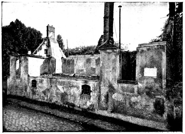
HOUSE WHERE
THE MUSICIAN
MAGNARD
PERISHED
IN THE FIRE
(Sept. 1914)
Entering Baron,
we turn to the left
in the High Street
and, 300 yards further
on, at the end of
the block, reach the
house of Albéric
Magnard.
It is marked by
a marble tablet
(visible in the
opposite view), on
which is engraved
the following inscription:
"Albéric Magnard,
musical composer, born
in Paris on the 9th of
June, 1865; died on the 3rd of September, 1914, shot and burnt in his house while trying
to defend it."
Celui-là qui, rebelle à toute trahison,
Et préférant la Muse à toute Walkyrie
A défendu son art contre la barbarie
Devait ainsi mourir défendant sa maison
Edmond Rostand,
de l'Académie Française.
(He who, revolting against treachery
And preferring the Muse to any Valkyrie
Defended his art against barbarity,
Was doomed thus to die, defending his home)
His inspiration entirely French, Magnard (as Rostand recalls in the above
lines) had kept his art free from German influence.
His artist's sensitiveness made him suffer intensely from the horrors
of invasion; he warned his friends that he was resolved to die rather than
submit to the rule of the conqueror and that his revolver held four bullets
for the enemy and one for himself.
He had sent his family back to Paris, only keeping his young son-in-law
with him. The Germans entered Baron on September 2. On the 3rd at
about 9 o'clock in the morning, a party of soldiers entered the grounds. The
composer had locked and barricaded himself in the villa. After summoning
him three times the Germans fired from the garden at the façade shown in
the view below.
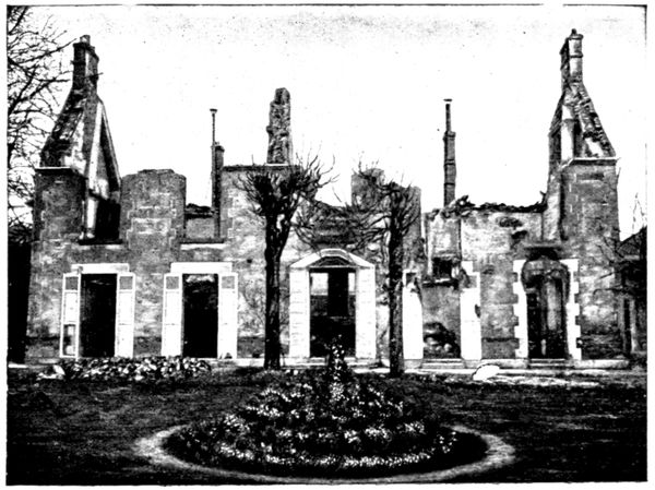
MAGNARD'S
HOUSE
(inner façade)
Magnard retaliated through the Venetian blinds of a window on the first
floor, killing one of the soldiers and wounding another. The composer's son-in-law
returning from
a short walk, arrived
at the beginning of this
scene. Seized and
bound to a tree, he
only escaped death by
passing himself off as
the gardener. After
having fired a few
rounds the Germans
awaited the instructions
of the commander.
The latter at first
decided to burn the
village as a reprisal
but on the entreaties
of the Public
Notary, Me. Robert, modified
the sentence and
ordered that the incendiarism
should be limited
to the villa Magnard.
After having hurriedly
pillaged the composer's
study, the soldiers set
fire to the kitchen with
straw and grenades.
When the smoke began
to rise Me. Robert and
Magnard's son-in-law
heard a report from the
interior of the house.
The author of Guercœur
and of Bérénice had no
doubt just died by his
own hand. An officer
then said to the Notary
"He takes the best way out." Magnard's body was consumed in the fire.
His revolver was found with three chambers empty.
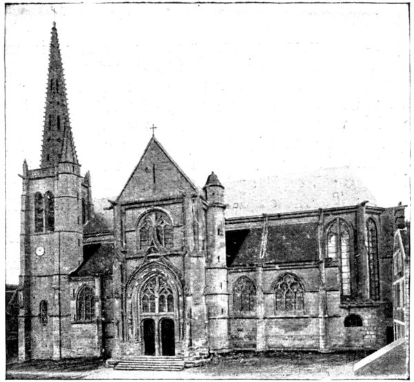
The village was looted. An officer ordered the Notary, Me. Robert, to
open his safe. As he at first refused to obey this order, the officer told two
of his men to load their weapons and Me. Robert was forced to hand over
the 8,300 francs the safe contained. While the Notary was occupied in
satisfying these demands, the Germans stole his silver, his jewellery and that
of his wife, even his personal linen, in exchange for which they left him their
dirty shirts. The cellar was entirely emptied by the officers, who took 1,471
bottles of rare wine.
The same witness saw an officer wearing nine women's rings and three
bracelets.
Returning from Magnard's house follow the High Street as far as the Church
(historical monument). This church is of the twelfth and thirteenth centuries,
with a fine steeple belonging to the fifteenth (view above).
There is beautiful panelling to be seen inside (view below). Jeanne
d'Arc received the
sacrament here
on the eve of the
battle against the
English below
Montépilloy, in
1429.
Follow the road
which is a continuation
of the High
Street. At this
point, and as far
as Senlis, rearguard
actions were
fought in Sept.
1914. After 3½ km.,
turn to the left.
In the field which
forms the corner of
the two roads there
is a German grave.
3 km. further on, turn to the left again into the road to Ermenonville, and after
having proceeded about 1,200 yards, go down the lane which leads, under the trees,
to the entrance of the domain which constituted the ancient abbey of Châalis.
CHÂALIS
At the very beginning of the twelfth century, on his return from the First
Crusade, a lord of Mello founded a priory at Calisium. In 1136 the king,
Louis le Gros, wishing to honour the memory of his brother, Charles le Bon,
who was assassinated in Bruges, transformed this priory into an abbey
which was placed under the management of the Order of Cîteaux, whose
growing power was beginning to make itself felt.
The Abbey flourished under the protection of the kings of France, the
bishops of Senlis, and the lords of Chantilly, and became of great importance.
Its present condition can only give a faint idea of its former disposition
and size.
The good king St. Louis often came to share the peaceful life of the monks,
cultivating the soil and the vine, looking after the bees, fishing for pike in
the ponds, and eating in the common refectory out of a wooden bowl, amidst
the tame birds that came from all the country around to join in the meals.
At the time of the Renaissance the Abbey fell in commendam, that is to
say it was no longer the property of the community but that of the abbot,
who was thenceforth chosen by the king, instead of being elected by the
monks. The first commendatory abbot was the Cardinal Hippolyte d'Este,
son of Lucretia Borgia. Reducing the monks to a bare pittance, the Cardinal
made free use of the Abbey revenues, which enabled him to build his famous
Villa d'Este at Tivoli and its magnificent gardens.
In 1570, the great Italian poet Tasso spent several months at Châalis
and there worked at his Jerusalem Delivered.
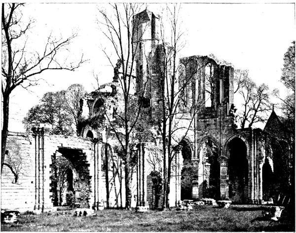
RUINS
OF THE
ABBEY
CHURCH
In the eighteenth century, the reconstruction of the Abbey was undertaken.
Jean Aubert, the architect of the "Grandes Écuries" at Chantilly and the
Hôtel Biron in Paris, was entrusted with the plans. The work was begun
but not completed. The abbatial building, which to-day contains the museum
and which can be seen on the left of the beautiful avenue leading to the
entrance gate, shows the dignified style that Aubert wished to apply to the
new edifice.
All these works ran the abbey into debt so Louis XVI. had it closed and
placed in liquidation. The Revolution completed its ruin. Sold as national
property, Châalis greatly suffered.
The buildings were for the greater part destroyed, the old church was
sold piecemeal at the rate of twelve sous (6d.) per cartful of stones.
In the nineteenth century the successive proprietors did their utmost to
reconstitute the domain. The grounds were bought back and the ruins consolidated.
The abbatial building became a castle, and the park was laid
out again. In 1902, Mme. Jacquemart-André bought the estate for 1,200,000
francs. She bequeathed it to the "Institut de France" with the museum
that she had established in the castle. The "Institut" took possession of it
in 1912, at the donor's death.
The Church.
The church, built at the beginning of the eighteenth century, is of great
interest from an archæological point of view, for it shows the first application
(by the Cistercians) of the Gothic style of architecture which had just made
its appearance in the "Ile de France." In the hundreds of abbeys created
by the original abbey of Cîteaux (situated near Dijon), the Roman style had
hitherto held sway. Beginning with Châalis, the Cistercians proceeded to
spread the pointed arch all over Europe, where soon more than 1,800 branch
abbeys were scattered.
The church of Châalis was vast, measuring 269 feet by 89 feet.
Its transept (the ruins of the northern part are seen in the view on the
preceding page) was remarkable for its enormous size, compared with that
of the choir, and for the seven radial chapels—one of which is clearly visible
on the right of the view—enclosed in each of its branches. An outline of
the nave remains (on the left of the photograph); it had twelve bays, preceded
by a porch. The steeple which rose from the tower was destroyed by
lightning in the seventeenth century. The monastery was connected with the
church, and the outline of the storied galleries is seen in the view below.
The abbot's chapel appears in the middle distance, on the right of the view
on the preceding page. It is designed in the style of the Sainte-Chapelle
in Paris.
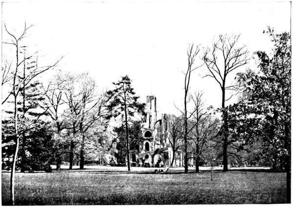
RUINS
OF THE CHURCH
SEEN FROM THE
ROUTE
DES ÉTANGS
Visit to the Domain of Châalis.
From April 15 to November 1, the museum and park are open on Thursday
afternoons, from 1 p.m. to 5 or 6 p.m. An interesting guide by the Curator,
Louis Gillet, is sold for 2 francs.
For the passing motorist the visit in detail is not indispensable. The
Museum, although interesting, is far from equal to that which Mme. Jacquemart
André established in her house in the Boulevard Haussmann, Paris,
and which she bequeathed to the "Institut" at the same time as Châalis.
As far as concerns the park and ruins, an adequate idea of them will be
obtained by following our itinerary.
From the entrance gate one sees: in front, the ruins of the church; to the
left, the castle, containing the museum. The whole is quite imposing.
At a moderate pace we take the road (on the right of the gate) which leads
to the ponds. After traversing them, through the enchanting scenery, of which
the photograph below gives some idea, the road runs through woodlands and brings
us back to the high road of Ermenonville, down which we turn to the left.
On the other side of this road spreads the second portion of the domain
of Châalis: the Désert, which formerly belonged to the park of Ermenonville.
In the neighbourhood of this park it consists of a lovely, wooded landscape,
with two ponds in the background; but at the other extremity there
is a great contrast, for an arid stretch of land, the "Sea of Sand," faces the
ponds of Châalis.
The Désert, like the park of Ermenonville, teems with memories of
Jean-Jacques Rousseau (see p. 73).
Skirting the ponds of the Désert we arrive at Ermenonville (40 km.).
The castle, which belongs to Prince Radzivill, is on the left of the road
(it is not open to visitors). The park (open to the public on Sundays, Thursdays
and holidays) is on the right.
The castle was occupied in September 1914, by German staff officers, who
contented themselves with pillaging the wine cellar.
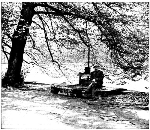
A CORNER
OF THE PONDS
OF CHÂALIS
The park of Ermenonville was designed by the Marquis de Girardin. This
ardent disciple of J. J. Rousseau did his utmost to make the park an illustration
of the philosopher's work. In the part which now pertains to
Châalis, the Désert, he claimed to reproduce in miniature the Alpine landscapes
where were laid the scenes of Julie ou la Nouvelle Héloise. This touching
worship succeeded in dispelling the misanthropy of Rousseau, who was
living in Paris in gloomy solitude. He accepted the Marquis's hospitality
and settled down at Ermenonville on May 20, 1778. On July 2, the "man
of nature" passed away amidst trees, flowers, and birds. He was buried in
the Island of Poplars ("L'Ile des Peupliers," view below), in the middle of
the pond that comes into view on the right of the road level with the centre
of the castle. Rousseau's influence on his century was immense, and for a
long time his tomb was the goal of universal pilgrimage. The philosopher's
remains are no longer at Ermenonville; the Convention had them exhumed
and transferred to the Panthéon.
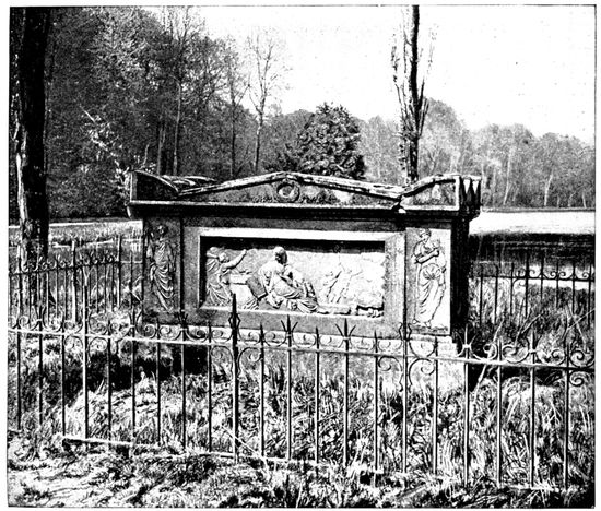
TOMB OF
J. J. ROUSSEAU
AT
ERMENONVILLE
Cross the village, leaving the statue of J. J. Rousseau on the left, and when
at the top of the hill turn to the left. Four kilometres further on is the Plessis-Belleville
School of Aviation. From there go straight on.
At Saint-Soupplets, at the branching off of the road with that of Dammartin
(54 km.), stands the Belle-Idée Inn, which was the scene of an interesting
exploit in September, 1914. A German officer and about fifteen men had
stayed in the inn after the evacuation of Saint-Soupplets, when a French
patrol, composed of Sergeant Vannerot and six men, entered. The officer
immediately fired at the sergeant, but missed. The latter then trans-pierced
him with a bayonet thrust, and the rest of the German troop
were killed or put to flight.
At Penchard (61½ km.) turn to the left beyond the town-hall. The road descends
towards Meaux, giving a beautiful view of the town, dominated by its cathedral.
In Meaux we turn to the left to go under the bridge and arrive at the cathedral
(65 km.) (see plan inserted pp. 74-75).
(See plan inserted between pp. 74-75)
ORIGIN AND MAIN HISTORICAL EVENTS
Meaux was the centre of a little Gallic nation: the Meldi—the inhabitants
of Meaux are called Meldois—and afterwards the capital of Brie. It was
joined to the royal domain in 1284.
Religious life was always very active in Meaux: six assemblies of prelates
were held there from the ninth to the thirteenth centuries, and two in the
sixteenth century.
It was the Treaty of Meaux, in 1229, which put an end to the crusade
against the Albigeois. At the time of the Reformation the religious wars in
that region became extremely violent. In the seventeenth century the diocese
became famous on account of its bishop, Bossuet, who was called the Eagle
of Meaux.
The town was taken and set on fire several times in the course of its
troubled history.
In 1358, the peasants in revolt, who were called the Jacques, were cut to
pieces below the walls by the French and English nobles.
MEAUX IN 1914
Happier now than in 1814 and 1870, Meaux escaped in September, 1914,
the horrors of invasion; and it was only crossed by some German patrols. A
few shells fell in the Faubourg Saint-Nicolas and even in the neighbourhood of
the cathedral, but no serious damage was done.
The British troops in retreat crossed the town on September 2 and 3
and blew up the Market bridge (view below) also the foot-bridge, further down
stream. The floating wash-houses, which might have served as pontoons,
had already been sunk.
Thirteen thousand out of the 14,000 inhabitants left Meaux with the
civilian authorities. The bishop, Mgr. Marbeau, showed great energy in
organising help for those who remained in the town and for the wounded that
poured in after September 5. In spite of the abnormal circumstances, a
Te Deum was sung in the cathedral for the election of the Pope Benoît XV.
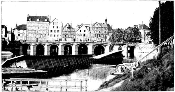
MARKET
BRIDGE
AND
WASH-HOUSES
(Sept. 1914)
VISIT TO THE TOWN
St.-Stephen's Cathedral
(historical monument)
Beautiful panorama is visible from the top of the belfry. To visit,
apply to the verger (gratuity).
The building of the
cathedral was begun at
the end of the twelfth
century and continued
until the sixteenth. It
has just been completely
restored.
The left tower, the
only one completed, has
no spire. That on the
right is called the Black
Tower, because of its
covering of slates. The
façade is in the decorated
Gothic style. A
beautiful rose window in
the middle dominates
the three doorways.
The middle doorway
and that on the right are
surmounted by acute
triangular gablets; that
on the left, of a more obtuse
ogive, is placed
under an arch in accolade.
The church is preceded
by a parvis dating
from 1610, which is
reached by means of
eight steps.
The stone used in the
present building has, unfortunately,
very little
resistance and is weather-worn. In the course of the revolutions witnessed
by the old cathedral, mutilations were added to the damage caused by
weather.
The three rows of statuettes which adorn each porch are much spoilt, as
are the bas-reliefs which decorate the tympanum.
The great statues which filled the niches have disappeared.
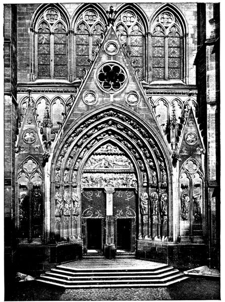
THE LIONS'
DOORWAY
(Cathedral)
After having viewed the
west façade, the tourist,
keeping to the right of
the cathedral, should go
and look at the Lions'
Doorway, which is on the
south front.
This thirteenth century
doorway, restored in the
nineteenth by Viollet-le-Duc,
takes its name from
the gargoyles, representing
lions, which flank it. It
is a reproduction of the
southern doorway of Notre-Dame
de Paris.
Entering the Cathedral
by the Lions' Doorway, the
tourist will be struck by
the lightness and richness
of the decoration of the
interior, which has been
subjected to extensive restoration.
The great height of the
aisles is noticeable. It is
explained by the existence,
in the original church, of
vaulted galleries which
were raised above the aisles,
as in Senlis and Notre-Dame de Paris. These galleries disappeared in the
great transformations which took place at the end of the twelfth century
and the aisles therefore remained notably super-elevated.
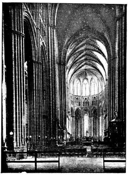
VIEW OF THE
NAVE OF THE
CATHEDRAL
The Tomb of the "Eagle
of Meaux" is in the choir, on
the right, marked by a tablet
of black marble.
The PULPIT (see on the right
in the opposite view) was made
from some of the panels from
the old pulpit where preached
the great Bossuet. The bishop
of Meaux, in spite of his cares
at court, worked very energetically
in his diocese and
preached in the cathedral
many sermons with that same
inspiration that shone through
the magnificent discourses delivered,
during his career
as a preacher, before the royal
audience.
He maintained strict discipline
among the clergy and
religious orders under his jurisdiction.
His contests with the
Abbess of Jouarre went as far
as a forcible seizure of the
abbey buildings.

TRANSEPT
AND CHOIR
OF CATHEDRAL
The opposite view shows
the further end of the
TRANSEPT, to which corresponds
the Lions' Door on
the exterior. The decoration
here is particularly rich.
Above the transept rose a
beautiful spire in timber-work
covered with lead, but
as it was in a very precarious
condition it was found necessary
to demolish it in 1640.
On the left of the view one
sees the commencement of
the CHOIR, the execution of
which shows to what heights
of lightness and boldness of
construction Gothic architecture
had arrived. The
walls between the piers are
hollowed out by piercings
and mouldings; it is a miracle
of equilibrium.
Originally the choir had
only three chapels, but two intermediary
chapels were added
in the fourteenth century.
When making the tour of
the choir the visitor will see
opening on the north into the courtyard of the old chapter house the beautiful
Porte Maugarni, dating from the fifteenth century. The name of Maugarni
(a gaolbird hanged on this spot in 1372, by order of the bailiff of Meaux) came
down to posterity by reason of the long lawsuit that the chapter of the
cathedral brought against the bailiff because of this execution, carried out in
ecclesiastical precincts.
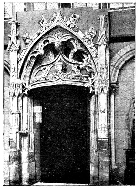
PORTE
MAUGARNI
(Cathedral)
Almost directly in front of the Porte Maugarni, with its back to the choir,
is a white marble statue representing the kneeling figure of a young knight,
Philippe de Castille. In 1603 his
father founded the barefoot order of
Notre-Dame-de-la-Merci. The statue
comes from the church belonging to
the convent of that order.
Beside the door is a stone figure of
Christ, of the sixteenth century.
One can also see in the second
chapel, beyond the great doorway in
the north aisle of the nave, the group
(in high relief) of the Visitation
(seventeenth century) and the picture
of the Adoration of the Wise Men,
attributed to Philippe de Champaigne.
The symmetrical chapel, on the south,
contains the tombstone of Jean Rose
and his wife. Jean Rose was one of
the great bourgeois of Meaux in the
fourteenth century. His name was given
to one of the boulevards of the town.
At the entrance to the nave the
seventeenth century organ is supported
by beautiful arcading.
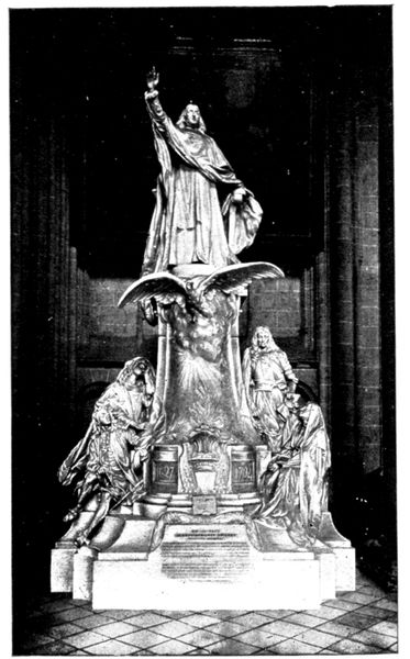
BOSSUET'S
MONUMENT
(Cathedral)
Bossuet's Monument, the work
of the sculptor Dubois (1907), stands
in the north aisle, near the main
entrance.
At the foot of the pedestal, on the
right, are represented Turenne and
Mlle. de Lavallière, converted by
Bossuet: Mlle. de Lavallière appears
in the garb of a nun. It will be
remembered how, after Mme. de
Montespan had replaced her in the
favour of the king, Louis XIV., she
withdrew to the convent of the Carmelites,
under the name of Sister
Louise de la Miséricorde. On the
left are Henrietta of France, queen
of England, whose funeral oration
was delivered by the "Eagle of
Meaux," and the Dauphin, whose
tutor Bossuet had been.
Behind the pedestal is a bust of
the Great Condé. Bossuet was his
friend, and frequently visited him in
his beautiful castle of Chantilly, and
often received him at the Bishop's
Palace. His death inspired the
"Eagle of Meaux" with one of his
most magnificent funeral orations.
The Old Chapter House
(historical monument)
Leaving the cathedral by the west door one walks into the courtyard of
the bishop's palace, the entrance to which is on the right of the square. At
the further end of the
courtyard is the old
Chapter House.
This old dwelling-place
of the canons of the
cathedral dates from
the thirteenth century, and
is in course of restoration.
Its curious, covered
outside staircase, which is
well seen in the opposite
view, is well known to
archæologists.
We have seen already,
in the case of the Porte
Maugarni, how vehemently
the canons defended
their prerogatives.
The Old Bishop's Palace
The old bishop's palace, the courtyard front of which faces the cathedral,
dates from the twelfth century, and was altered in the sixteenth and seventeenth.
On the ground floor are two fine vaulted twelfth century rooms. An
inclined plane leads to the second floor. According to tradition, one of the
bishops had it made that he might go up to his rooms without dismounting
from his mule.
Amongst the first-floor
rooms are those
of Marie-Antoinette and
the king. Meaux was
in fact a halting place
for Louis XVI. and the
royal family on their
return from Varennes.
The king's room was
also occupied by Napoléon
I. when he came
back from the Russian
campaign.
The town of Meaux is
now establishing a museum
in the buildings
of the bishop's palace.
The north front looks over a pretty garden, laid out by Le Nôtre (to be
seen on Thursdays and Sundays. On other days apply to the lodge-keeper in
the entrance courtyard. Gratuity.)
At the end of the garden, on the ramparts dating from the Middle Ages,
is a terrace. It is reached by a covered staircase placed at the north-east
angle. From there one has a beautiful view of the garden, the bishop's
palace and the cathedral (view above).
On the terrace stands a little pavilion known as Bossuet's Study. The
great bishop liked to work there, and often, by way of relaxation, took a
walk along an avenue of fine yew trees on the ramparts near by.
The Old Mills
After visiting the bishop's palace we go through the Rue Martimprey to the
banks of the Marne.
The view is extremely picturesque; on one side are the mills which dam
the river; on the other, is the beautiful Promenade des Trinitaires, with
its old poplars. The mills shown in the view below were rebuilt in the
sixteenth century. The other side of the buildings looks on to the market
bridge (view p. 74). These buildings, in spite of their age, withstood the
blowing up of the bridge in 1914.
Slightly downstream are the modern mills of l'Échelle, which replaced
mills similar to those of the market bridge, burnt in 1843.
FROM MEAUX TO MARCILLY
(28 km.)
(See plan inserted between pp. 78-79)
via Chauconin, Neufmontiers, Monthyon, Penchard, Chambry,
Barcy.
Start from Meaux in front of the cathedral. Go down the Rue Saint-Rémy,
pass under the railway bridge, then turn to the left and take the N 3 for about
2 km. Turn to the right in front of a beetroot factory and follow the road planted
with plane trees which leads to Chauconin (4 km.).
After having a peep at the little country church, we take a few steps
along the path shown in the view below. The houses which border it still
show traces of the incendiary fires of September, 1914. The Germans
occupied the village for a few hours on the 5th, just long enough to pillage
the dwellings and partly burn them by means of grenades flung on to the
roofs, and sticks of resin thrust under the doors.
Having crossed the village, we have before us the buildings and high chimney
of Proffit Farm, situated at Neufmontiers. Take the road which leads to
it. On reaching the level of the farm, some French and German graves
(of which a view is given on p. 81) will be seen to the right of the road.
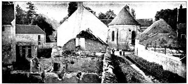
BURNT HOUSES
AT CHAUCONIN
The German grave is on the left, isolated. It is marked by a black cross
on which is painted the letter A. In the background can be distinguished
the wooded heights of Penchard, in the conquest of which fell the French
and Moroccan soldiers here buried.
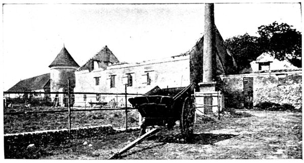
PROFFIT FARM
BURNT
BY THE
GERMANS
In front of the
graves is one of
the entrances of
Proffit Farm.
The view opposite
shows a part of the
courtyard. This
fine farmstead had
been marked down
and condemned in
advance.
The Germans
had themselves specially
guided there
from Chauconin. They looted the farmer's house: near the safe was found
one of the skeleton keys with which they tried to force it.
They then fired the stables and barns, where nearly 20,000 bundles of
straw made a gigantic blaze.
Skirting the walls of the farm, the road leads to the Church, where the
Germans installed an ambulance during their short occupation of September 5.
The inhabitants who remained in the village were commandeered and had
to carry in the German wounded, on ladders, from the surrounding neighbourhood.
On the morning of the 6th the French re-occupied Neufmontiers and
captured the ambulance (view below).
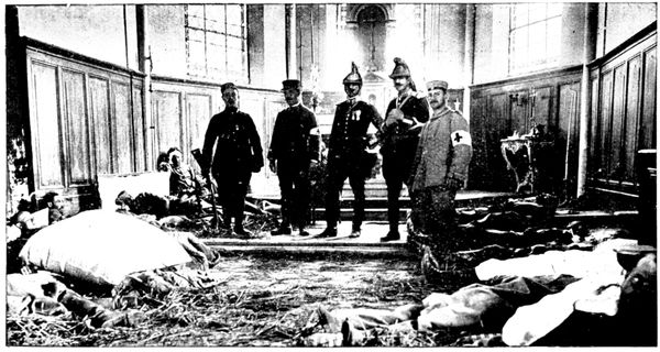
GERMAN
AMBULANCE
IN THE
CHURCH
Running between Proffit Farm and the church, the road slopes down to the brook le Rutel, which it crosses. At the fork of the road, turn to the right. A hundred yards further
on is the spot from which the Panorama A seen below (6½ km.) was taken, embracing the field of action of September 5.

A. PANORAMA OF MONTHYON PENCHARD. NEUFMONTIERS
- Road to Villeroy Iverny
- Heights of Cuisy
- Le Rutel
- Monthyon
- Road from Neufmontiers to Iverny Le Rutel
- Heights of Penchard
- Castle Park
- Neufmontiers
The advance guard of the Fourth German reserve corps had placed its artillery in the declivities of the heights of Monthyon and Penchard; the infantry troops and machine-guns
had advanced into the plain, utilising le Rutel and the Neufmontiers to Iverny road as entrenchments. The first cannon shot of the battle of the Marne was fired on the 5th of
September, at noon, from Monthyon at a French battery which was coming out of Iverny, and killed the captain. The fight was sanguinary all that day. The troops of the
55th division tried their hardest to push the Germans back beyond Monthyon but were stopped on the plain by the terrible fire of the machine-guns. At the same time the Moroccan
brigade attacked the heights of Penchard and carried them with the bayonet, but it could not maintain its position there and was forced back behind Neufmontiers and Chauconin,
which the Germans occupied. This occupation only lasted a few hours for, during the night, the German troops, threatened with being outflanked by the Seventh Corps further
north, abandoned their formidable positions at Monthyon—Penchard and the outposts at Neufmontiers—Chauconin. The next morning the French took possession.
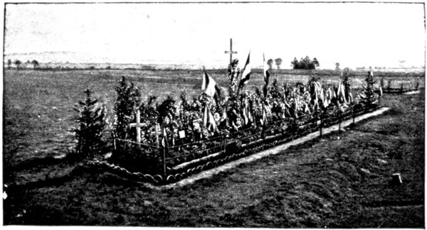
Continuing along the road to
Villeroy we come, after about
2 km. to the GREAT GRAVE
of which a view is given opposite.
It contains the bodies
of numerous officers and men
who fell in the surrounding
fields. At the extreme end
of the grave on the right is
buried the well-known writer,
Charles Péguy, whose death
seems to have been the one he desired when writing the following lines, now
famous:
Heureux ceux qui sont morts dans les grandes batailles
Couchés dessus le sol à la face de Dieu....
Heureux ceux qui sont morts pour leur âtre et leur feu
Et les pauvres honneurs des maisons paternelles....
Heureux ceux qui sont morts, car ils sont retournés
Dans la première argile et la première terre.
Heureux ceux qui sont morts dans une juste guerre,
Heureux les épis mûrs et les blés moissonnés.
At the fork of the road beyond the grave, go to the right towards Iverny. It
is within 200 yards of these cross-roads, in the field on the left of the
road, that Lieutenant Péguy was killed, shot through the head while
standing amidst his soldiers of the 276th, whom he had ordered to lie down.
On arriving at Iverny, turn to the right towards Monthyon. At the
entrance to this village, near the farm de l'Hôpital, there is a little pond
where the cases of shells abandoned by the Germans were emptied (view on
following page).
These cases belonged to the three batteries of 77's which were established
on the right of the road behind the farm buildings, in a depression of the
ground. We have seen above that these batteries started the cannonade
which began the battle of the Marne. Marked down by the French batteries
they hastily abandoned the position.
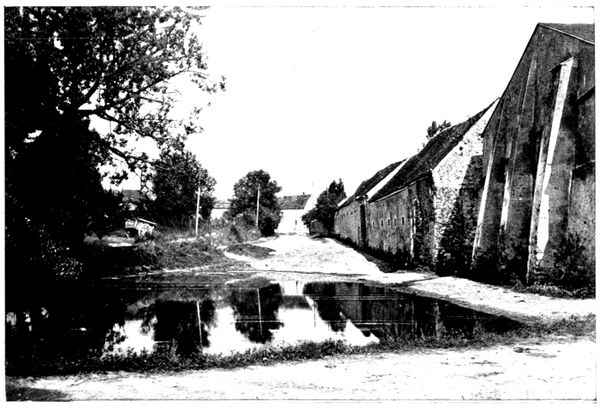
POND WHERE
THE GERMANS
THREW
THEIR SHELLS
Leaving the pond on the right we follow the road to the left which brings us
to the picturesque village of Monthyon (15 km.).
Despite the difference in spelling, it was the patrimonial fief of the celebrated
philanthropist Baron de Montyon (1733-1820), founder of several
prizes for good conduct and literature awarded yearly in solemn session by
the "Institut de France."
We have seen that Monthyon, attacked without success on the 5th by the
French, was on the 6th abandoned by the Germans. General de Lamaze
established his headquarters there.
On arriving at the church turn to the right and descend towards the highway
from Saint-Soupplets to Penchard.
Half-way down the slope will be seen on the left a villa which overlooks
all the countryside, and where the French staff had a first-rate observatory
during those hard days of September.
The view below, taken from the upper balcony, shows a corner of the
vast panorama seen from there.
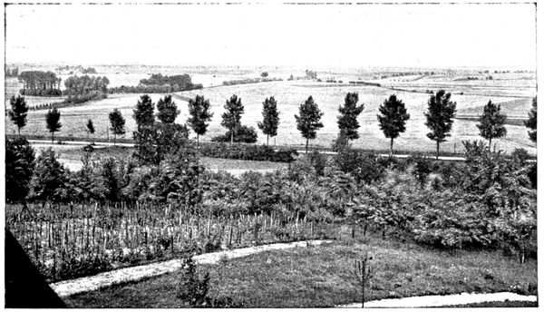
THE PLAIN
AT THE FOOT
OF MONTHYON
At the foot of the slope turn to the right towards Penchard and follow the
railway lines on the road.
Two kilometres further, on the left, an avenue planted with trees leads
to the Villa Automne, belonging to M. Charles Benoist, member of the
"Institut" and deputy of Paris.
There the Germans installed an ambulance which received the wounded
of the first battles with the Moroccans at Penchard.
Those who succumbed, among them several officers, were buried in the
garden of the estate.
The Moroccans captured the ambulance when they re-took possession of
Penchard.
The villa had been ransacked; the most highly appreciated trophy being
the owner's peaceful academician's sword.
At the entrance to Penchard (19 km.), keep to the right as far as the town-hall
square, where the motor can be left.
By the road which borders the town-hall on the right (about 150 yards from
there and going past the church) we reach the edge of the Penchard woods where
the view on the following page was taken. The tourist who enters these
woods for a walk, or a rest, will find graves here and there, the last traces
of the furious battles that were fought around.
Penchard was attacked the first time on September 5 by the Moroccan
brigade, which came from the Chauconin-Neufmontiersline, over which
the tourist has already travelled. The struggle was a desperate and particularly
bloody one on the edge of the wood now before us, as also in the
gardens of the neighbouring houses. The Moroccans had the advantage
in this hand-to-hand fight and towards noon succeeded in taking the village,
which they held for several hours under a violent bombardment.
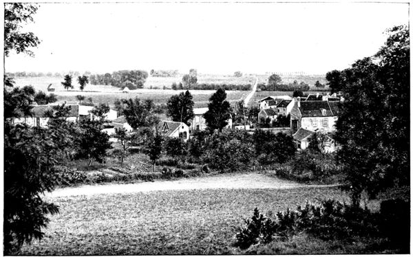
THE PLAIN
AT THE FOOT
OF PENCHARD
But we know that during this time the 55th division's attack on Monthyon
had failed, and the Moroccans, unsupported on their left, had to withdraw
beyond Chauconin-Neufmontiers.
On the 6th the brigade, renewing its efforts, found Penchard evacuated and
went on to the village of Chambry, towards which we will now direct our steps.
When leaving Penchard the Germans posted several spies in the woods,
their mission being to signal the positions of the French troops and artillery
to the aviators.
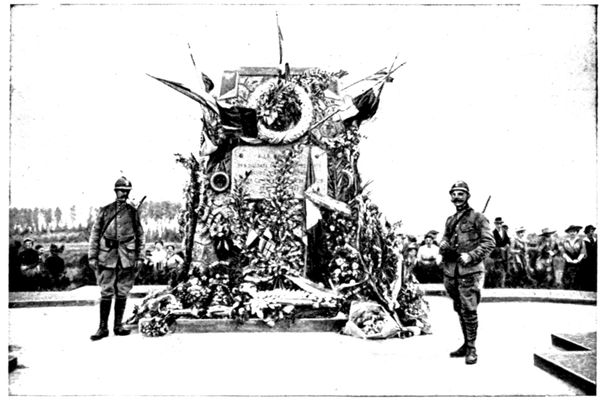
MONUMENT
OF THE
FOUR ROADS
One of them was caught and shot at the entrance to the wood in the evening
of the 8th. He wore the red-cross armlet and on him were found pennons and
rockets which he
used for signalling.
We must retrace
our steps as far as
the fork of the road
at the entrance to the
village and take the
road that runs to the
right.
Immediately after
this we come to the
crossways of three
roads; we follow the
middle one which
goes towards Chambry.
We arrive at the
Monument des
Quatre-routes, so called because it is placed at the crossing of the Barcy
to Meaux road with
that from Penchard
to Chambry.
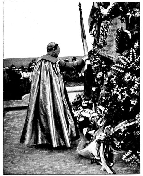
PATRIOTIC
CEREMONY
AT CHAMBRY
(Photo from
l'Illustration)
This monument
was raised by the
engineers, by order
of General Gallieni,
to the memory of
the Army of Paris.
Every year, commemorative
ceremonies
take place at
Meaux and on the
neighbouring battlefields,
particularly
at the monument of
the Quatre-Routes.
The view opposite
was taken in September
1916. The
bishop of Arras
Mgr. Lobbedey, who
some hours earlier
preached a touching
sermon from
Bossuet's pulpit in
the Cathedral of
Meaux, is here seen
placing the tricolour
flag at the foot
of the monument.
At the crossing of the Quatre-Routes, the tourist coming from Penchard continues
straight on to Chambry, which is seen a little further on in a hollow
(see photograph below).
Chambry (22 km.) is one of the points of the French right where the fighting
was fiercest. It was taken and retaken during the days of September
6, 7 and 8. Alternately bombarded by the French 75's (which at
Penchard and Monthyon had taken the place of the German 77's, driven
from their first line), and by the light and heavy artillery that the Germans
had established on the heights of Vareddes and Gué-à-Tresmes, Chambry,
as shown by the great number of new roofs, suffered heavily.
The Germans were thrown back from the western ridge of the hollow into
the village, which they were forced to abandon after violent hand-to-hand
fighting in the streets. They then entrenched themselves on the east flank
and particularly in the cemetery, which is seen in the view below.
Driven from the cemetery they fell back on their chief position, visible
on the panorama B (pp. 90-91), whence they made obstinate counter-attacks.
The soldiers of the 45th and 55th divisions fought for the ground foot by
foot, and finally remained masters of it at the cost of heavy losses. Zouaves,
Algerian sharp-shooters, and foot-soldiers of the line vied with each other
in heroism during these terrible days.
Having entered Chambry we cross the square, leaving the main street on the
left, and go straight on. We thus turn round the village by the east—that is
to say, on the front that had to withstand all the German onslaught.
The gardens which border the road contain several graves of soldiers who
were killed in battle and buried where they fell. The upper photograph
shows one of these graves. Some Algerian sharp-shooters fell there, as is
indicated by the crescent drawn on the tombstone placed at the head of
the grave. The tricolour cockade pinned below is that of "l'Œuvre du
Souvenir."
On the slope of the road, to the right, the French troops had established
a trench and some precarious shelters (see photograph below).
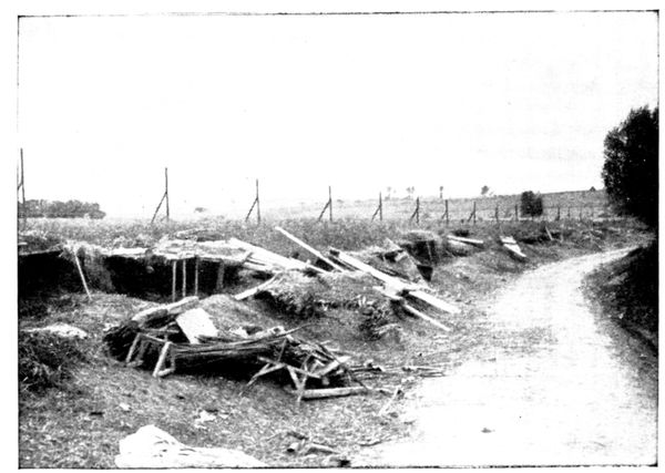
SHELTERS
DURING
THE BATTLE
This chance installation at the beginning of the war contrasts oddly with
the scientific work that the struggle on fixed positions has now made common.
It seems as though it could not have afforded anything more than
moral protection
against the German
artillery, which for
three days riddled
the position with
shells of 77, 105, and
even 150 calibre.
The road followed
by the tourist rejoins
the main street which
lay on his left as he
entered the village.
400 yards from
here, on the right,
lies the CEMETERY
of Chambry. Near
the entrance, on
the left, is a little
chapel, whose doors
were riddled with
bullets. It served as a temporary infirmary but was very quickly filled up.
We have seen already the importance of the position held by the Germans
in the cemetery.
Through embrasures pierced in the walls, rifles and machine-guns directed
a fierce fire on the French troops as they advanced to attack from the direction
of Chambry and Barcy. When the latter had taken the cemetery they, in
turn, made use of its defences. The bombardment growing too violent,
Zouaves and foot-soldiers took shelter in the trench outside the cemetery
walls, visible in the photograph on the following page. A goodly number
of these brave men remained there and took up the space that would have
sufficed for the dead of that small parish for many long years.
The cemetery of Chambry has become a pilgrimage centre. Every year,
in the month of September, numerous delegations come to cover the little
graves with flowers. The photograph below was taken in 1915. In the
middle of the crowd can be distinguished in the foreground, kneeling and
leaning against the wire, Mgr. Chesnelong, Archbishop of Sens; behind him
Mgr. Marbeau, Bishop of Meaux. The lieutenant seen on the left is the
Abbé Dugoux, who had just celebrated mass in the Cathedral of Meaux.
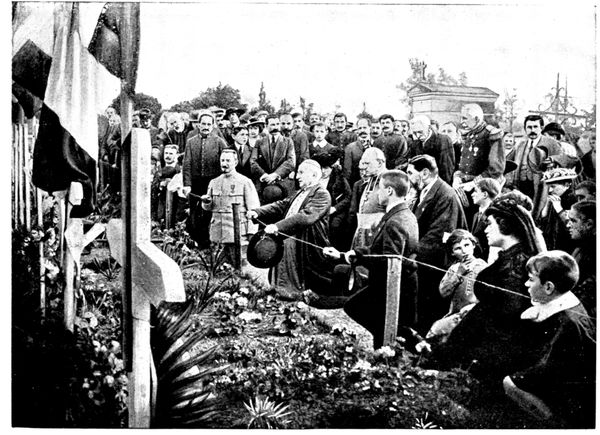
PATRIOTIC
CEREMONY
AT CHAMBRY
(Photo from
l'Illustration)
On leaving the cemetery one sees in front, on the slope of the road, the
remains of the trenches dug by the French to protect themselves against
counter-attacks from the heights of Varreddes.
Following the road, one soon sees the harrowing sight of the Plateau
of Chambry-Barcy, covered with graves. To the right especially, in the
fields which were crossed by the troops rushing to the attack from the hill
visible in the photograph below, one can reconstruct the progression of the
lines under fire by glancing along the succession of graves.
The principal line of the German defence during the days of September 7,
8 and 9 was established on a position leading from Étrépilly to Varreddes,
plainly visible on panorama B (pp. 90-91). The height shown in the photograph
below formed its southern extremity and its most salient point.
Trenches had been made there, supplied with machine-guns and supported
by batteries of 77's.
One realises what energy the French troops needed to advance thus, over
absolutely uncovered ground, under dropping fire. Several attacks were
unavailing; one of them reached the trenches, but the Germans, who had
every facility for bringing up their reserves, which were kept sheltered
in the declivity on the other side of the hill, thrust the French back on
Chambry.
At last, on September 9, the Germans having begun their retreating
movement, Zouaves, Moroccans, and foot-soldiers hustled their rearguards
and descended in pursuit of them into the hollow of Varreddes.
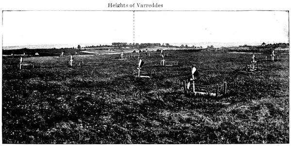
GRAVES
ON THE
CHAMBRY
PLATEAU
Continuing along the same road the tourist comes to a fork. Here he turns to the left towards Barcy and soon comes to a group of poplars, whence the panorama B (below) was taken.
This PANORAMA shows the objective of the French right during the days of September 7, 8, and 9. This was the little ridge which runs between Étrépilly and Varreddes,
followed by a road bordered here and there with poplars. This road was filled with trenches and machine guns which easily swept the uncovered ground that had to be crossed before
they could be reached.
The supporting artillery was in the middle distance, on the Trocy Plateau and the sides of the Varreddes hollow.

B. PANORAMA OF THE ÉTRÉPILLY-VARREDDES LINE
- Plateau north of Étrépilly
- Ridge from Étrépilly to Varreddes
- Torcy
- Ridge from Étrépilly to Varreddes
- Varreddes Road
- Heights of Varreddes
The 55th (Reserve) Division, the 45th Algerian Division, and the Moroccan Brigade hurled themselves against this redoubtable position for three days, while the 56th (Reserve) Division
attacked Étrépilly and the plateau which stretches to the north. The line fell on the 9th, but over the whole surface of this plain (which has been called "the Calvary of the Reserve
Divisions") lay numbers of dead who were buried, some where they fell, others in common graves. These graves, with their flags waving in the wind, give a veritable grandeur to
this landscape of gentle undulations.
In the view below, taken in front of one of these common graves on the
plateau, appears the then English premier, Mr. Asquith, who was anxious
to make the Ourcq pilgrimage during one of his visits to Paris. He is seen
standing on the right of the road, near the spot from where panorama B
was taken.
Arriving at Barcy (26 km.) the tourist will see the site of the great commemorative
monument which is to be raised by subscription after the war.
At the cross-roads near the entrance to the village, take the middle road which
goes through Barcy and leads to the church.
It was in the little square, opening out in front of the belfry and the
town-hall, that the second photograph (reproduced on the following page) was
taken, showing Mr. Asquith interrogating a little village girl come to fetch
water from the fountain.
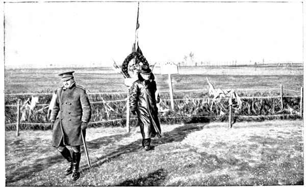
MR. ASQUITH
VISITING
THE
BATTLEFIELD
Behind the fountain stands Colonel Hankey, secretary of the Allies'
War Council; beside him is the French officer who directed and expounded
the visit; Mr. Asquith is in the middle; to the right his son-in-law, and on
the extreme right Mr. O'Brien, Sir Edward Grey's colleague.
On September 4 Barcy was the headquarters of a German division.
A few people, among them the brother of the Bishop of Meaux, had been
arrested near Varreddes, in Mgr. Marbeau's car, and taken before the general.
The latter, announcing that he meant to keep their car, told them to inform
the inhabitants of Meaux that on the morrow, at the same hour, his troops
would be before Paris. But on the morrow Maunoury's army had begun
its flank attack, and on the morning of the following day Barcy was carried
by the French troops arriving from Monthyon.

MR. ASQUITH
QUESTIONING
A LITTLE GIRL
Barcy served as starting point for the assaults on Chambry and on the
line of defence of Étrépilly-Varreddes; very often also as a place for
defensive withdrawals. The fighting was desperate; on September 6 the
246th had nearly twenty officers, including the colonel, out of action, whilst
the 289th found it necessary to attack three times during the day.
For three days the bombardment was terrific: the batteries of Étrépilly,
Varreddes, and Gué-à-Tresmes
rained shells on
the village and its approaches.
The church suffered
heavily, as shown by the
photographs on this page.
In the upper one is seen
the hole made by the heavy
projectile which brought
down the bell seen in the
foreground of the second
photograph. Many houses,
like those in the church
square, still bear traces of
the cannonade.
Others, less heavily
damaged, have been repaired.
Indeed, to look at
the farm sleeping in the
sunshine (see following
page), one would never
dream that it had lived
through such tragic days.
The new roofing of the
building on the left is all
there is to remind one that
it was not spared by the
shells.
Following the road by
which we arrived at the
church, we go towards Marcilly.
Before leaving Barcy,
we pass the cemetery
where lie buried many
officers and men who fell
in the neighbourhood of
the village.
The Germans entered
Marcilly on the evening
of September 4, and
abandoned it on the 6th,
fearing the outflanking
movement of the Seventh
Corps towards the north.
The village was the
centre of operations for the
56th (Reserve) Division. The photograph below shows General de Dartein's
temporary headquarters beside a haystack, not far from the village, whose
church can be seen in the background.
The tourist will have an opportunity of seeing in detail the objectives
of the division when passing through Champfleury, Poligny, and Étrépilly.
The struggle was very fierce and the bombardment incessant for three
days.
The road crosses Marcilly but we do not go beyond the church, which is a
very curious one, with its squat tower and rustic porch (see following page).
Beside it is the school where a light infantry sergeant, mortally wounded,
still found strength enough to write on the blackboard: "The 23rd battalion
Light Infantry, the 350th Infantry, and the 361st Infantry have beaten the
Prussians here. Vive la France!"
The few inhabitants who remained in the village also remember one of
the prisoners brought to the Pernet Farm, whose torn tunic gave glimpses
of a woman's chemise, trimmed with lace and little blue ribbons.
From the church square we turn back about 100 yards and take, on the left,
the road to Étrépilly.
At the end of the village is a GRAVE where foot-soldiers, light infantry and
artillerymen lie buried (see photograph overleaf).
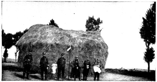
GENERAL
DE DARTEIN'S
TEMPORARY
HEADQUARTERS
AT MARCILLY
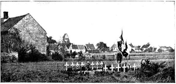
GRAVES
AT MARCILLY
(1917)
We soon arrive at the top of the
ridge which dominates Marcilly.
Turning round, the tourist will
have a wide view of Barcy, Monthyon,
and Penchard; passing to the
other side of the ridge he will see,
on the left, the prominent farms of
Champfleury and Nongloire.
The view below was taken during
the battles of September in a field on
the right of the road. We see a
whole section, which thought itself
in safety behind a haystack, destroyed
by the explosion of a shell.
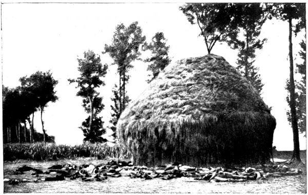
SECTION
DECIMATED
BY A SHELL
FROM MARCILLY TO ÉTRÉPILLY
(45 km.)
via Puisieux, Nogeon, Acy, Étavigny, Betz, Acy, Vincy
Étrépilly is 4 km. from Marcilly by the direct route, but we take the
tourist round a loop of 45 km. before reaching Étrépilly, so that he may
visit the front of the French left wing.
Arriving at a beetroot factory we come to a fork in the road and take the left
branch. Around this factory desperate battles were fought between the
troops of the 56th (Reserve) Division (who, having taken Marcilly, were trying
to take Étrépilly) and the Germans, who defended this advance guard of
their main position foot by foot.
The road crosses the Thérouanne; 50 yards further on, at the cross-roads,
we take the road on the right which rises towards the Farm of Champfleury
(5 km.). From this front, extending from the factory to the Champfleury
farm, the 56th Division made many attacks on the strong line formed by
Étrépilly and the plateau which spreads out north of the village, being also
successful in shattering all the German counter-attacks.
Champfleury, very important by reason of its dominating position (as
shown in the above photograph), was vigorously defended, but after two
unsuccessful assaults it was finally carried by the French. There they
were subjected for two days to a violent bombardment from Étrépilly,
Vincy, and Trocy, which made all their attempts to debouch both difficult
and costly.
The farm buildings suffered badly and the rooms of the farm-house were
reduced to ruins by shell-fire.
The view below shows the façade; the officers seen in the photograph
belonged to the staff of the 56th Division which took the farm. The owners
had evacuated Champfleury at the beginning of September; when they
returned they found in the billiard-room (which was smashed to pieces) a
jeering inscription signed by a German officer, regretting that they (the
owners) had not
been there to take
part in the cannoning
performed on
their table.
To enter the farm
follow a little lane
on the right for
about 100 yards.
Very likely it is still
possible to see the
various seats hidden
in the trees in
the garden, which
were used by the
look-out men.
From Champfleury the road descends towards Puisieux. The view below
shows the situation of this village, in a fold of the ground. In the background,
at the summit of the plateau, is seen the farm of Nogeon, which will
be visited in the course of the excursion.
On the tourist's left, and outside the limits of the photograph, is a depression
beyond which, in a position similar to Champfleury (see panorama D,
pp. 106-107), appears the farm of Nongloire.
From the plateau on which stands this farm the French artillery hammered
Champfleury and the Étrépilly position.
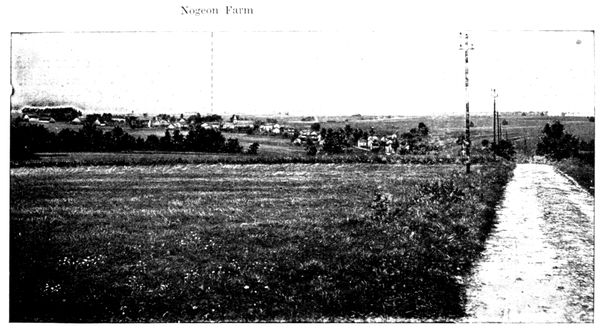
PUISIEUX
SEEN FROM
CHAMPFLEURY
On the right, also outside the photograph, is the farm of Poligny,
towards which we go, turning to the right, in Puisieux, into the Rue de Poligny.
The view below was taken from the Poligny road in September, 1914. In it
are seen guns, cartridges, and machine-gun belts abandoned on the battlefield,
and a French drum, which latter doubtless sounded the charge when
the troops of the Seventh Corps, starting from Puisieux, and supported by
the 56th Division coming down from Champfleury, went to attack the farm.
The struggle was desperate, for Poligny, like Champfleury, was an advanced
position of the Vincy-Étrépilly line, and the Germans defended it to the
utmost. Before leaving they set it on fire.
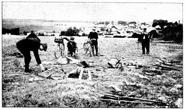
DÉBRIS OF THE
BATTLE IN
FRONT
OF PUISIEUX
The view below shows to what a lamentable condition this large farm was
reduced by bombardment and incendiarism.
Only a part of the courtyard can be seen here, but all the buildings belonging
to the farm, including the beetroot factory, are in the same state.
From Poligny the Germans fell back on their positions on the Étrépilly
Plateau, which is in the background of the photograph, and the farm became
a valuable point of support for the Seventh French Corps.
The German battery defending Poligny could not withdraw in its entirety,
the fire of the French 75's having destroyed at least one of the field-pieces, of
which a photograph is given below.
After this visit the tourist will return to the Puisieux Road (8½ km.) following
the road, he came by, and crossing the village by an S-shaped route, leave the
church on the right.
On the French front Puisieux formed the connecting point between the
right (group Lamaze) and the centre (Seventh Corps). It received many
shells from the batteries of 77's established on the Vincy-Étrépilly line and
from the heavy howitzers of the Trocy Plateau.
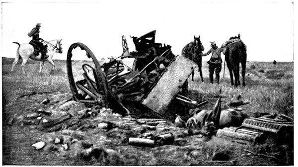
GERMAN
FIELD-PIECE
DESTROYED
NEAR POLIGNY
Having passed the church, the tourist arrives at a little square, with several
roads opening into it. He takes the one on the right, which leads him to the
plateau that dominates Puisieux on the north. On the left can be seen
the distillery of Fosse-Martin; straight ahead is the Nogeon Farm with its
beetroot factory.
West of Fosse-Martin, in a room in the Castle of Brégy, the flag of the
72nd Thuringian regiment was found, abandoned.
The French artillery, installed between Fosse-Martin and Bovillancy,
maintained a terrific fight against the German batteries at Étavigny, Vincy,
and Trocy. Colonel Nivelle, future generalissimo, commanded the Fifth
Artillery Regiment which had just done great deeds in Alsace, and whose
daring and enthusiasm shone forth anew on the
plateau of Multien.
Nogeon Farm was one of the principal
centres of battle during the days of September 6
to 9. Taken by the French after a hand-to-hand
fight, it was subjected to several counter-attacks
which, supported by violent bombardments,
completely destroyed it. But labour
soon claims its rights, and the view above shows
the rebuilding in progress.
From Nogeon, and the trenches around it,
the troops of the Seventh Corps gained Acy and
attempted to reach Vincy. The progression
towards this last position, over open ground
swept by an intense cannonade, was particularly
difficult. Many actions took place at night.
It was during one of these, in a bayonet charge
on September 7, that the soldier Guillemard,
having transfixed with his bayonet the officer
standard-bearer, captured a flag belonging to
the 36th Magdebourg Fusiliers, decorated with
the Iron Cross in 1870. Guillemard received
the Military Medal from the hands of General
Gallieni.
The young fellow shook with emotion during
the ceremony, and the general said good-humouredly:
"Now then, embrace me and
imagine I'm a pretty girl."
From Nogeon
the road descends
to Acy-en-Multien
(14½ km.) of which
the slender steeple
can be seen.
We cross the Gergogne
and go through
the village, following
the High Street
up to the twelfth
and thirteenth century
church, which
is classed as an
historical monument.
This church
came practically
unscathed through
the struggle which
drenched the village with blood.
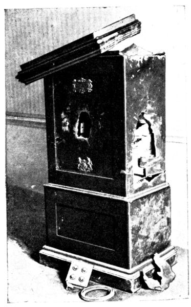
SAFE
DYNAMITED
BY THE
GERMANS
Acy's situation in the hollow of a valley
robbed its steeple of all value as an observatory;
it was therefore respected by the
artillery on both sides.
After glancing around the interior of the
old church, with its squat pillars, shown in
the above view, we go on along the High Street,
passing the town-hall.
Opposite is a photograph of the town-hall
safe, which was blown up by the Germans
during their occupation of the place.
A little further on is the cemetery, in front
of which is a big military grave.
Acy's churchyard was much too small
to hold all the heroes who fell on the territory
belonging to that parish.
In front of the cemetery, on the other side
of the road, stands the castle where the
Germans quartered themselves.
The view opposite gives but a slight idea
of the state in which it was found by its
owners.
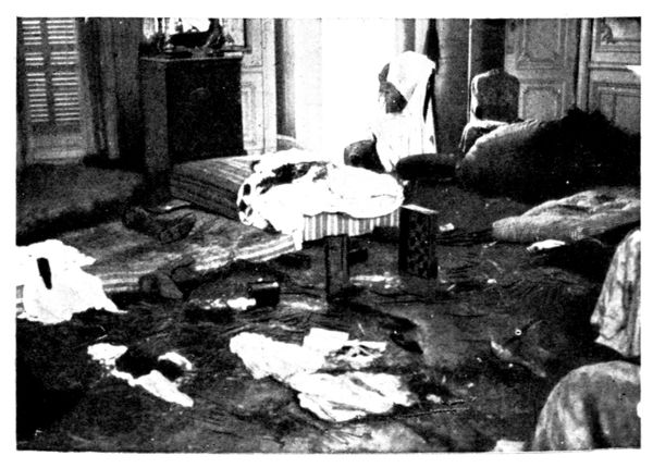
ROOM
IN THE CASTLE
WHERE
THE GERMANS
SLEPT
The park was
placed in a state
of defence and the
Germans made a
tenacious resistance
there.
The tourist will
now take the road
in front of the cemetery
which skirts
the castle railings.
Then turning to the
left he will follow
the zig-zag road
which climbs the
Étavigny Plateau.
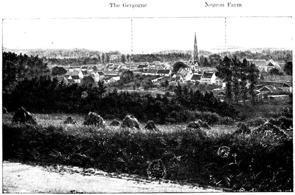
ACY
SEEN FROM THE
HEIGHTS OF
ÉTAVIGNY
The above panorama was taken from the last turn of the climbing path
and gives a good view of the valley in which Acy is built.
Here we can follow the course of the battle: the French held the Nogeon
Plateau, the Germans the valley and the heights where the tourist stands.
Troops belonging to the Seventh Corps descended on Acy from Nogeon and
came up in front of the village, others slipped along the Gergogne and made
a flank attack.
After furious fighting in the
streets, in the castle grounds and
in the little woods on the hillsides,
the Germans were flung back from
Acy to the heights of Étavigny.
They returned to the charge, and
in their turn drove the French back
to the Nogeon Plateau.
The village thus changed hands
several times, and this terrible beating
backwards and forwards caused
great losses on both sides.
Continuing his road to Étavigny,
the tourist will go over the position
that the Germans established on the
plateau.
The infantry and the machine-guns
were entrenched along the
road itself; the light and heavy
artillery were in the hollow on the
right. They showered shells on the
French positions at Nogeon, and in
return received the fire of the
batteries placed, as before mentioned,
between Fosse-Martin and
Bouillancy.
Arriving at Étavigny (18 km.)
our attention is at once drawn
to the church, which suffered terribly.
The part played in the
battle by the church of
Étavigny was very different
from the passive one
assigned to the church
of Acy. Its dominating
position afforded priceless
views of the French
lines to the observer installed
in its steeple. It
was therefore by shells
from the 75's that the
church was damaged (see
pp. 100 and 101).
Étavigny was taken and
retaken in the course of
the Battle of the Ourcq.
The struggle was hard,
the Germans making a
desperate resistance, as a
serious French advance in
this locality would have
meant the outflanking
of their whole line. They
succeeded in forcing the
troops of the Seventh
Corps off the plateau.
Taking the road to the right, beside the church, and continuing about 200 yards
we come to the cemetery, which is in a state of upheaval from the bombardment.
The photograph below was taken through one of the gaps.
The windmill pump, on the left of the view, was riddled with bullets.
From Étavigny the tourist can either return to Acy by the same road, or
follow the itinerary that we now give, which forms a loop around the northern
part of the battlefield. In the first case, the distance to Acy is 3½ km., in the
second 14 km.
Starting again from the church along the road which crosses the village,
continue straight on towards Boullare. Here keep turning to the left and take
the road to Betz. In the hollow on the left were placed the German batteries
which joined in action with those of Étavigny.

ÉTAVIGNY
CHURCH
SEEN FROM
THE CEMETERY
The road descends into a rather picturesque valley. Through it runs a small
river, the Grivelle, which we
must cross, then go through
Antilly, turning to the right
on entering, and to the left
at the fork in the road just
after leaving the village.
We arrive at Betz (26 km.).
Turn to the left near the
church.
Betz did not suffer
much from the guns, but
some of its houses were
burnt by the Germans,
notably the Hôtel du
Cheval Blanc (see p. 102),
which can still be recognised
by its signboard.
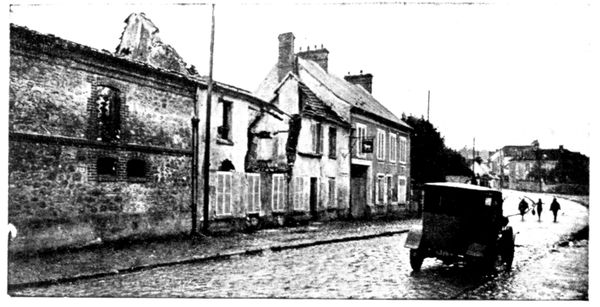
HÔTEL DU
CHEVAL BLANC
AFTER
THE FIRE
The castle was
occupied by a German
headquarters-staff,
who left it in
a deplorable state.
During the pursuit
the French
officers had to
abandon the idea
of lodging there:
one of them records
in his notebook:
"The German
officers have left disgusting traces of their passage; we see slices of melon,
bearing the marks of their teeth, in the wash-hand-basins, and enormous
heaps of empty and broken wine bottles."
The tourist will cross Betz by the main street, which is seen in the
above illustration, and at the further end of the village he will go straight
on under the railway, leaving the road to Nanteuil-le-Haudouin on the
right.
This last-named town has not been included in the itinerary, although
it played an important part in the ultimate manœuvre attempted by Von
Kluck—that of outflanking the French left wing. The paved road which
leads to it is bad, and the other roads by which one could rejoin the planned
route are extremely rough. Below we give a view of a corner of this battlefield.
It gives some idea of the great plain which extends from Betz to
Nanteuil, where the 7th and 61st French Divisions resisted with desperate
energy the furious attacks of the Fourth German Corps. The dead horses
seen in the photograph belonged to a French battery. The 75's, fully
exposed, supported the foot-soldiers in their efforts until they came almost
into actual contact with the enemy.
After passing under the railway the road rises to the plateau and soon
brings us near a commemorative monument, on the right (view on following
page).
Thence it passes through the Woods of Montrolles, where the 61st Division
particularly distinguished itself on the evening of September 8. Worn out
with fatigue, its reserve supplies exhausted two days before, it yet, by a
supreme effort, succeeded in driving back the Germans.
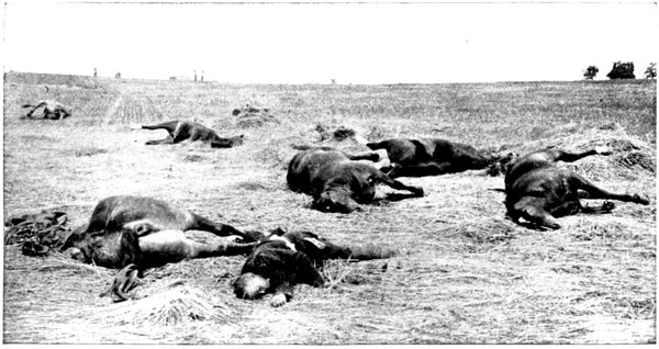
THE PLAIN
OF NANTEUIL-LE-HAUDOUIN
Having passed through
the Woods of Montrolles,
we soon come to a fork.
Here take the road on the
left.
To the right are the
Heights of Bouillancy,
where the French artillery
was placed; on the
left the Plateau of Étavigny
on which were the
German batteries.
A hollow, where runs
a river, separates the
two positions, between
which the artillery duel
was intense, preparing
and accompanying infantry
assaults which
succeeded one another from September 6 to 9, with alternate advances and
retirements.
The road then returns to Acy, skirting the wall of the Castle park. We again
pass the church and, on leaving the village, cross the Gergogne. Immediately
after the bridge turn to the left towards Vincy (35½ km.). The photograph
below shows that this village also suffered from incendiarism and
bombardment.
After passing through Vincy, bear to the left in order to pass in front of the
Manœuvre distillery, leaving the hamlet of that name on the left. Étrépilly
(41 km.) will be reached by the middle road of the crossways, which are about
1 km. further on past the distillery.
This Vincy-Étrépilly line formed part of the defensive front established
by the Germans west of the Ourcq, marked out further north by the localities
of Betz, Étavigny, and Acy, which have just been visited, and more to the
south, by the position seen on panorama B (pp. 90-91). The Germans had
made trenches and machine-gun shelters over the whole plateau, which
stretches on the right of the road towards the farms of Poligny and Champfleury.
On the right slope of the road one can still see the dug-outs where
the snipers sheltered themselves.
The position was attacked from September 6 to 9 by the 63rd Division
of the Seventh Corps and the 56th of the Lamaze Group which carried the
advance positions constituted by the farms of Nogeon, Poligny, and Champfleury.
They were stopped, however, on the line itself until the general
withdrawal of the German troops.
To reach the spot where the view below was taken, follow the track which branches off the road from Vincy to Étrépilly, between the memorial and the burnt hangar. This is the road
we see across the middle of the panorama. The tourist finds himself at the southern extremity of the Vincy-Étrépilly position, on the site of a German battery which was severely
treated by the French 75's.
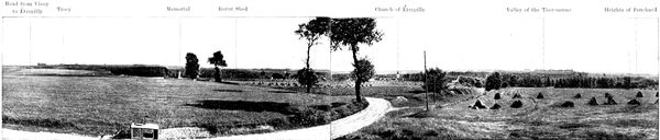
C. PANORAMA OF TROCY, ÉTRÉPILLY, LA THÉROUANNE.
- Road from Vincy to Étrépilly
- Trocy
- Memorial
- Burnt Shed
- Church of Étrépilly
- Valley of the Thérouanne
- Heights of Penchard
In the background is seen the Trocy Plateau, separated from the road by a hollow, in which flows a tributary of the Thérouanne. On the Trocy Plateau, where this itinerary
will in due course lead the reader, the Germans had established their powerful artillery, composed of heavy and light batteries, which swept the whole battlefield from Nogeon
Farm to Barcy, taking in Puisieux and Marcilly. Beyond the valley of the Thérouanne, south of Étrépilly, stretches the position of which the details appear in panorama B (pp. 90-91).
The view extends to the wooded Heights of Penchard, which are outlined against the horizon.
On the brow of the hill where stands the observer, fierce battles were
fought at the time of the attacks on Étrépilly. The 350th Infantry did
once, on the morning of the 7th, make their way into the village, following
the valley of the Thérouanne, but violent counter-attacks forced them back.
They returned to the charge at night and climbed from the river's edge
to the plateau. They were greeted by the fire of a machine-gun section
upon which two companies flung themselves with fixed bayonets. Two
field-pieces were taken. The French troops maintained their position
until ten o'clock in the evening, but finally, as the German reinforcements
poured in, were obliged to descend the slope and cross back to the right
bank of the Thérouanne.
Returning to the Étrépilly road we pass in front of the memorial raised
by the engineers in front of the cemetery, at the place where the battles
of Étrépilly reached their climax. A military grave has been made behind
the memorial.
The Germans had entrenched themselves in the cemetery, where they
succeeded in checking the night attack of the Zouaves on September 7.
The Second Regiment,
coming from
Barcy, reached
the village and
carried it at
the point of the
bayonet.
Without stopping,
the Zouaves
began to climb
the height at the
foot of which Étavigny
is built.
Their rush carried them as far as the cemetery, and here, met by a terrific
fire from the machine-guns, they tried to keep the position, but German
reinforcements having come up, they were forced to abandon the plateau,
evacuate the village, and return to their trenches at Barcy. Lieutenant-Colonel
Dubujadoux, commanding the regiment, was killed; three-fourths of
the officers and half the effective force fell in the course of this heroic
charge.
In front of the memorial the twisted metal framework of a burnt shed is
to be seen. According to certain accounts, the Germans, before evacuating
the position on September 9, used this shed to burn the bodies of those of
their soldiers who fell in the battles of Étrépilly. Some of the inhabitants
say that to these were added the badly wounded, whose hurts were such that
they could not be removed.
We believe, as a matter of fact, that a large pyre of corpses was set alight
here by the Germans, who generally burn their dead when they cannot carry
them away. But the hangar was destroyed by the French artillery which fired
repeatedly on that
side of the plateau
at the battery of
77's installed there,
at the cemetery,
and at the German
trenches.
In the cemetery
lie the heroes who
were killed in attempting
to regain it.
From the cemetery
the road descends
towards Étrépilly.
Turn to the right at the foot of the slope into Étrépilly and on leaving the village take the road on the left; cross the river, turn again to the left and follow the track which climbs the
plateau. After a few hundred yards the right slope disappears. It was at this point that panorama D was taken, showing, from the German side, the same battlefield seen from the
French side in panorama B (pp. 90-91).
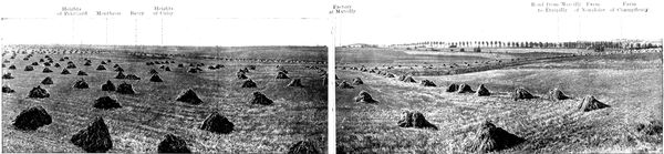
D. PANORAMA OF THE BATTLEFIELD OF THE FRENCH RIGHT
- Heights of Penchard
- Montheon
- Barcy
- Heights of Cuisy
- Factory at Marcilly
- Road from Marcilly to Étrépilly
- Farm of Nongloire
- Farm of Champfleury
The road on which the tourist now stands goes on to the heights of Varreddes. Bordered with trenches and machine guns, it constituted the principal line of the German defence south
of Étrépilly, the advance lines resting thus: the first on Penchard—Monthyon—Heights of Cuisy; the second on Chambry—Barcy—Marcilly. In this theatre of operations fought,
south of the Marcilly-en-Étrépilly road, the 55th (Reserve) Division, the 45th Division and the Moroccan Brigade; at Marcilly and on the plateau north of Étrépilly, which is
outlined on the extreme right of the panorama and crowned by the Champfleury Farm the 56th (Reserve) Division.
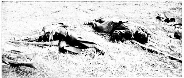
A CORNER
OF THE
BATTLEFIELD
Leaving the trenches hastily dug on the Chambry—Barcy—factory of
Marcilly line, the troops of the Lamaze group, before getting up to the
German trenches, had to cross two kilometres of uncovered ground, under
terrible fire. It was in one of these attacks, starting from Barcy, that Major
d'Urbal (brother of the general) fell at the head of his Zouaves as, waving
his cane, he drew them along. He was brought back to the French lines,
thanks to the devotion of one of the few officers who survived the attack,
helped by two Chasseurs d'Afrique. Because of his great height the commander's
body could not be carried back, and they were obliged to place it
on a horse. The group returned thus to Barcy under a hailstorm of bullets,
where a shell-hole in the cemetery served for a grave.
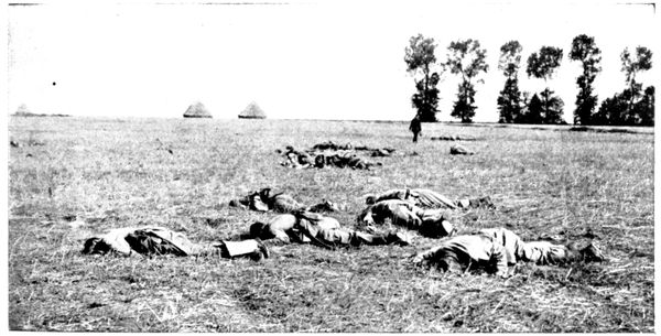
A CORNER
OF THE
BATTLEFIELD
In the counter-attacks, the Germans as they left their trenches also
suffered serious losses, as one can judge from the preceding photograph,
which was taken in front of the position.
The tourist will return to Étrépilly by the road he came, leaving the church
(the roof of which was hit by several shells) on the right, and taking the Trocy
Road on the left.
ÉTRÉPILLY TO MEAUX
(19 km.)
via Trocy, Gué-à-Tresmes, Varreddes.
The beautiful shady road that leads from, Étrépilly to Trocy first crosses
a hollow, then winds up the hillside to the plateau on which Trocy is built
(3 km.). On arriving,
turn to the left and so
enter the heart of the
village.
Trocy did not actually
suffer from the German
attacks, but it was bombarded
by the French
artillery. In front of
the horse-pond, on the
left of the little church,
stands a farm (view opposite)
which in 1917 still
showed traces of the "75"
shell which damaged its
roof. Other houses were
completely destroyed.
The Germans had concentrated
their chief
artillery forces on the
Trocy Plateau. Heavy and light batteries were in position north and south
of the village, the greater part being north, between Manœuvre, Plessy-Placy,
and Trocy.
The intense cannonade poured from this dominating platform very much
hampered the progress of the French centre.
The position was evacuated by the Germans on the 9th, not without
serious losses of light artillery, as shown by the photograph below and that
at the top of the following page.
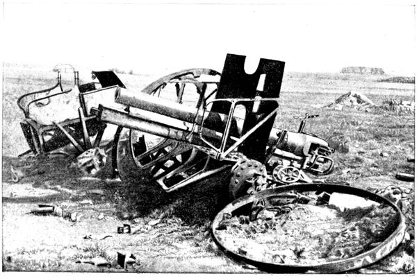
GERMAN GUN
DESTROYED
ON
TROCY
PLATEAU
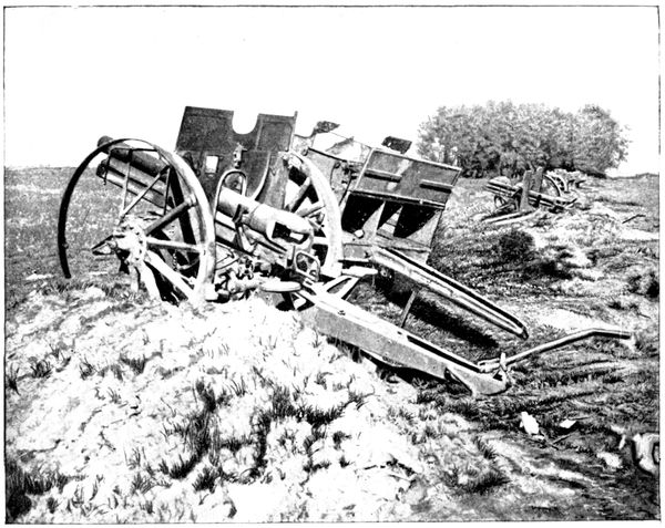
GERMAN GUNS
DESTROYED
ON
TROCY
PLATEAU
The limber (shown below), abandoned at the side of the road, is an infantry
limber which contained rifle and machine-gun cartridges.
The French artillery which swept the plateau hit it in the course of the
retreat.
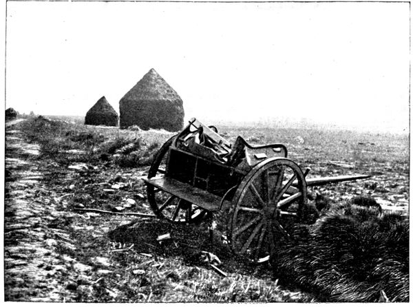
GERMAN
LIMBER
ON
TROCY
PLATEAU
Rounding the horse-pond, we take the road which runs under the monumental
gateway, a view of which is given above.
This gate is one of the chief remains of the fortifications which guarded
Trocy in the Middle Ages.
It will be seen that the strategic importance of the position has at all
times been appreciated at its full value.
Having passed through the gate, we take, 100 yards further on to the left,
the road that dips into a hollow, on the opposite slope of which stands out the
fine farm of Beauvoir.
We reach this farm by a zig-zag ascent which comes out on the Route Nationale
(N. 36). We then turn to the right and go down towards Gué-à-Tresmes.
This little place played the part, in relation to the extreme German left,
that Trocy played in the centre. It was a heavy artillery position supporting
the advanced line of defence.
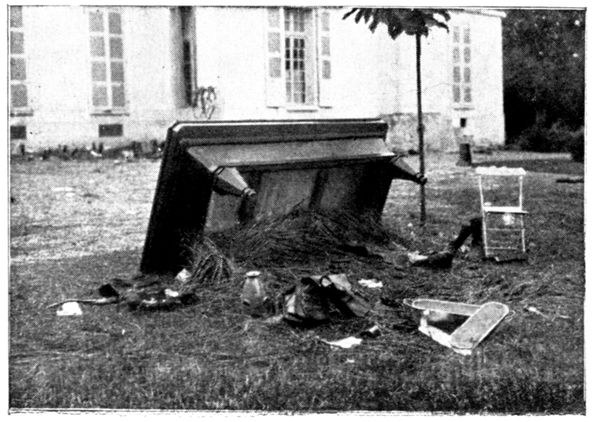
THE
BILLIARD-TABLE
OF
THE CHÂTEAU
At the entrance to the village, on the left side of the road, is a large
residence surrounded by a park. It was occupied by the Germans and converted
into a field hospital. In order to make room rapidly, the furniture was
flung outside. It was thus
that the billiard-table was
found in the park. A soldier
who was evidently a lover
of fresh air used it as a
shelter. On the opposite
photograph can be seen a
fish-kettle which did duty
as a basin: frequent washing
being indispensable
during those hot September
days.
The façade shown in the
view is the one which faces
the road.
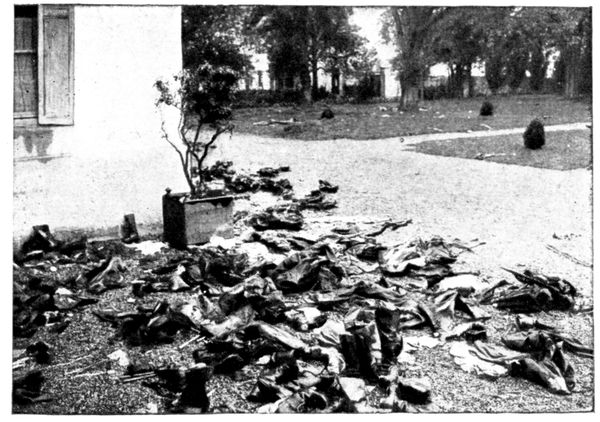
PERSONAL
BELONGINGS
LEFT AT
GUÉ-À-TRESMES
BY THE
GERMANS
A certain number
of German
wounded died in
the hospital and
were buried in the
garden; their belongings
were left
behind at the time
of the retreat, as
shown in the opposite
photograph.
This retreat
must have taken
the occupants unawares,
for a meal
was on the officers'
table when the
French troops entered
the château.
At the cross-roads, about 300 yards beyond the château, go to the left along
the Thérouanne. 200 yards further along this road is seen (on the right) the
place where a group of German artillery was hidden. Well-screened in the
hollow shown in the view below, several heavy batteries, for a long time out
of reach of the 75's, made extremely difficult the advance of the French
right on the Plateau of Chambry-Barcy. They also hampered the left, of
the British army and the 8th French Division on the left bank of the Marne.
In the course of this tour, we have already seen several examples of the
German battery positions. Wherever the ground allowed of it, the guns
were placed in a hollow, visible only to aerial observers. Telephones linked
them up with the posts established on the ridges whence the firing was
directed.
Returning to the Route Nationale, turn to the left towards Varreddes. On
both sides of the road, which was their main way of retreat, the Germans
had made lines of defence: trenches were dug and furnished with machine-guns,
and light batteries were established as supports.
The whole, which joined up with the defence works of Trocy, constituted
a position of withdrawal for the Étrépilly-Varreddes line, seen
in panorama B (pp. 90-91). This was the first stage of the retreat on
September 9.
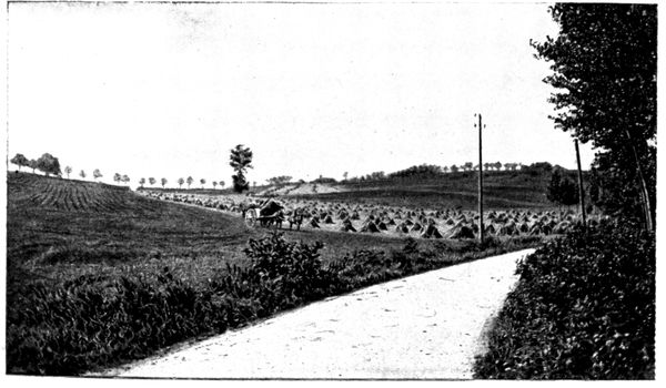
HOLLOW
WHERE
THE GERMAN
ARTILLERY
WAS PLACED.
This panorama was taken at the intersection of the Meaux-Soissons road (N 36) and a track which leads to Étrépilly, in the field bordering the road and where German
machine-guns were established in order to sweep with their fire the Route Nationale and the bottom of the hollow.
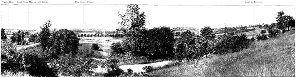
E. PANORAMA OF THE VARREDDES HOLLOW
- Varreddes
- Road from Meaux to Soissons
- The Ourcq Canal
- Road to Étrépilly
It is easy to understand why the Germans attached so much importance to the Varreddes position.
The slopes west of the hollow (they form the background on the left of the panorama) were protected from the blows of the French artillery, and by availing themselves of this
protection the Germans could easily bring up supplies or relieve the defenders on the crests, facing Chambry-Barcy. This ensured their resistance until the moment when
the general trend of the action forced them to fall back.
After having examined panorama E, continue the descent towards Varreddes
(12 km.). Before crossing the canal one can see, on the right, a '75'
shell which has remained fixed in the wall of an inn, of which the sign has
now become: "A l'obus."
We now enter the High Street of Varreddes.
At the entrance of the village is a certain number of houses that were
damaged by the bombardment.
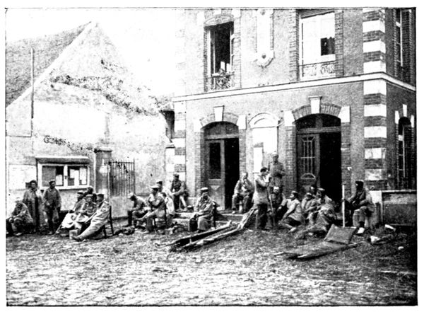
GERMAN
WOUNDED
IN FRONT
OF VARREDDES
TOWN-HALL
The German wounded, forsaken during the hasty retreat of September 9,
were sheltered and
nursed at the town-hall.
They are
seen in the opposite
view. When leaving
the village the Germans
took twenty
hostages with them,
all very old, among
them being the vicar.
Three succeeded in
escaping, but, for
the others, the retreat
proved (as
will be seen) a veritable
torture. Seven
of them were murdered.
On the first day they were forced to march seventeen miles. M. Jourdain,
aged 77, and M. Milliardet, aged 78, taken away with only slippers on their
feet, were the first to fail from exhaustion: they were shot point-blank. Soon
after, M. Vapaillé suffered the same fate.
The next day M. Terré, an invalid, fell, and was killed with revolver-shots;
M. Croix and M. Llévin stumbled in their turn and were also shot.
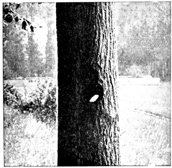
TREE
PIERCED
BY A 75
SHELL
All three were from 58
to 64 years of age. Finally,
M. Mesnil, aged 67, utterly
exhausted, gave in: his skull
was smashed in with blows
from the butt end of a
rifle.
The other hostages, better
able to endure, held on as
far as Chauny and were
sent to Germany by rail.
They were repatriated five
months later.
After having traversed
Varreddes and before re-crossing
the canal, a tree will
be noticed on the left of the
road (the 38th on the way
out) which has been pierced
by a '75' shell as if by a
punching-press.
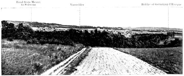
F. PANORAMA OF THE VARREDDES HOLLOW
- Varreddes
- Road from Meaux to Soissons
- The Ourcq Canal
- Road to Étrépilly
40 yards beyond the canal, on the right, are seen several tracks which scale the
heights. We climb the one on the right up to the summit, where the above
panorama was taken. This gives a view of the Varreddes hollow in the
opposite direction to that of panorama E (pp. 112-113).
Germigny, seen on the right of the photograph, is known through having
been Bossuet's summer residence. The Germans had a heavy battery there,
which bombarded Meaux in the early days of September. On the 8th they
re-crossed the Marne, blowing up the bridge behind them.
The appearance of a French reconnoitring party composed of a sergeant-major
and nine men had sufficed to cause the evacuation of the position,
which, with the river behind it, seemed a dangerous one. These ten heroes
were killed in the course of the battle and buried at Germigny. On the
9th, the Marne was crossed on a pontoon bridge built by British engineers,
under fire, whose heroic tenacity triumphed after seventeen fruitless
attempts.
The Germans, attacked besides on the heights where the tourist now
stands, were obliged to retire rapidly from the hollow by the Soissons Road,
under fire from the French batteries.
On the crest of the hill a track crosses the ascending one, near two isolated
walnut-trees. On the right this road goes to Étrépilly; it constituted the
German line of defence which is the subject of panorama B (pp. 90-91).
The tourist will go to the left between the two walnut-trees and explore
the crest which formed the redoubtable position occupying the background
of the view on p. 89. It was well provided with trenches,
machine-guns and light batteries, and all attacks against it failed, until
September 9.
Turning again to the left 1 km. further on, at the first fork in the road, the
reader will follow a little path which brings him back to the Route Nationale
at the point where he left it. The walk takes about 30 minutes. The two paths,
by which the ascent and descent have been made, served the Germans as
channels for bringing up supplies. Their rearguard, which disputed the
ground foot by foot, was routed there by a bayonet attack.
We now return towards Meaux. The retreating Germans followed this
road, but in a contrary direction and pursued by the French shells.
At the highest point, on the right, is seen the trunk of a tree decapitated
by artillery fire, at the top of which the workmen of the entrenched camp
of Paris have fixed a branch to form a cross: humble and touching tribute
to the brave men killed in going up to the attack.
Before arriving at Meaux we have a beautiful view of the town. We pass
under the railway; then, on the right, take the N. 3 or Rue du Faubourg-Saint-Nicolas,
which brings us back to the Cathedral (19 km.).
 Palatial and luxuriously appointed hotels.
 Well-appointed, first-class hotels.
 Comfortable hotels with modern improvements.
 Well-managed hotels with good accommodation.
 Hotels with good service for luncheon and dinner.
 Small hotels or inns where good meals are provided.



 104

 Ⓑ (wc)
Inner coach-house 6