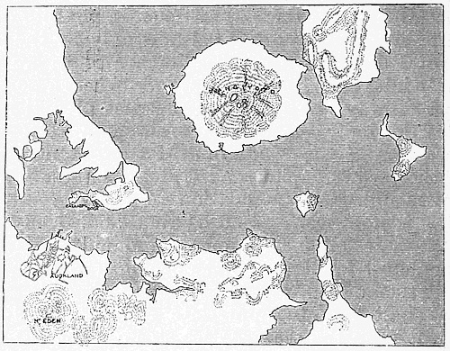
We started our tour with the great continental land-mass
of Australia; we shall end it with a visit to some
of the many hundred scattered islands of the Pacific
which are under British control and protection. 1
North-east from Auckland, for a thousand miles, we
steam through the open ocean, sighting no land
except perhaps the lonely Kermadec Islands, which
are, as we have seen, attached to the Government of
New Zealand, until we reach the fringe of the many
groups of coral islands and reefs which fill so much
of the Western Pacific. We shall touch first at Tonga
Tabu, the southernmost and largest of the Friendly
Islands, as Captain Cook called them, which lie just
north of the Tropic of Capricorn and rather more
than halfway round the globe eastward from London.
At Auckland we left behind us hills and fiords;
on our right as we enter this group is the small but
high volcanic island of Eua, the only one in the whole
group which contains a river; the main island, Tonga
Tabu, or Holy Tonga, lies on our left, and has a very
different aspect. A low mass, green with what prove to
be coconut palms, rises out of white surf and spray
breaking over reefs of coral rock. We round a low
headland and thread our way through winding channels
among the reefs; on one side is the low mainland, on
the other a string of green islets capping the reefs.
After anchoring in the roadstead for a visit from the 2
doctor we are hauled alongside the little ferro-concrete
wharf. Beyond is a picturesque white town, Nukualofa, 3
the capital of the island.
At the wharf half the population seems to be gathered
to meet us. Some are clothed, native fashion, in the
famous Polynesian mats or in the bark-cloth called
tapa, or even in cotton; others are in European dress.
The town with its white houses and verandas looks
quite civilised. The inhabitants remind us of the
New Zealand Maoris, though their colour is somewhat
lighter; in fact, both peoples belong to the same
great family, the Polynesians, or light-brown people
of the Pacific, which is spread over many of the island
groups which lie to the north-east and east of Tonga.
It is this race which roused the admiration of early
voyagers in these regions, both for its physical appearance
and its character.
The Friendly Islands, though a British Protectorate,
and, as regards all matters in which European interests
are involved, under the jurisdiction of the High Commissioner
of the Pacific, still have a native king and
Parliament. The inhabitants are Christians, and are in
a sense the most school-taught people in the Pacific.
They seem to delight especially in mathematics and
music, while shorthand is their usual method of writing.
Tonga was the last of the independent kingdoms to
come under European control. It was left to us as
the result of our negotiations with Germany, at the
end of the nineteenth century, and is now practically
an integral part of our Empire in the Pacific. During
the fifty years before we assumed control, it had made
rather remarkable progress, under its native ruler,
King George Tubou I., in the adoption, or perhaps the
imitation, of Western ideas. This was largely due to
the Wesleyan missionaries, and especially to the work
of one missionary who occupied the post of Prime
Minister.
We will now land and pay a call on the father
of the present king. He receives us in civilised fashion 4
on the veranda of his house, but we notice that chairs
are provided only for the guests; the rest sit on the
ground in native fashion. A bowl of kava is brewed
for us by pounding, squeezing and straining out the
juice of a root of a plant belonging to the family of the
pepper-worts. It is the native substitute for alcohol,
the use of which by any but white people is strictly
forbidden in Tonga. Without kava drinking, no
social ceremony is considered complete, even to-day;
and it has played an important part in the political
and religious gatherings of the past.
Let us now look round the island. It is only about (2)
thirty miles long and ten wide, shaped rather like the
human foot, with two bays running far inland in the
broadest part. The streets and the sea front of Nukualofa
are mostly covered with short grass, and the town
is partly hidden in the groves of coconut palms. It is
the same all over the island. In the drier season we
can follow broad grass tracks, for the most part
running round the island; on both sides of us is a dense
growth of palms, bananas, and tropical trees, such as
we see in the picture before us. Everything is moist 5
and green and flat; yet, in Tonga Tabu, as in all the
islands of this particular group, except Eua, we find
no rivers, since the island is merely a block of coral
rock, with a thin covering of rich soil, raised a few feet
above the level of the sea. It is a form of coral island
very common in this part of the Pacific.
We now leave Tonga Tabu for the northern islands
of the group. Our decks are crowded with passengers.
The natives are fond of travelling, and camp out on
our vessel with a miscellaneous collection of luggage
and food, including a number of pigs. We are bound
for the Haapai Group, through a mass of small islets
and foaming reefs; but away to the west rise several
lofty volcanoes, some of which are still active. We
are touching here one of the great volcanic lines of
the world, a line which we have already seen continued
in New Zealand. Off one of these islands, Tofua,
was the scene of the famous mutiny of the Bounty.
We come to anchor on the leeward side of Haapai,
at the one town, called Lifuka. There is no wharf here,
and we lie a long way from the shore, as we see in this 6
picture. We may land in the launch or in one of the
native boats which come out to meet us; and we can 7
survey the whole island in a short walk, as although
it is five miles long it is less than two miles wide at the
point where Lifuka stands. There is the same rich
foliage and tropical fruit as in Tonga Tabu, but if
we cross the island to the windward side we shall see
a difference from our calm anchorage on the west.
Here the south-east Trade Wind is blowing on-shore
and the rollers are pounding incessantly and breaking 8
into surf against the coral rocks. It is a contrast
which we find in most of the islands in this region.
We must hurry on to Vavau, the most northerly of
the three main groups of the Friendly Islands. Here
the main island is hilly, with high limestone cliffs and
ridges. It is the top of a vast mass, heaved up by
volcanic agency from the depths of the Pacific. So
we have Vavau Sound, studded with islands and
protected from the sea by cliffs and headlands running
out on either hand. Here is a view of the Sound; 9
it may remind us perhaps of a Scottish loch, until we
notice the coconut trees covering the hills and coming
right down to the water’s edge. Gradually the Sound
narrows, and after a rather abrupt turn we enter the
landlocked harbour of Niafu, with its little wharf and 10
its group of houses buried in the trees. There are
palms and bananas here as in the other islands, but
Vavau is especially the home of the orange. The
whole country round is a mass of orange trees, and
the ripe fruit strews the grassy roads on which we walk.
The picture is spoilt somewhat, especially near the
town, by the style of the buildings. There is timber
from New Zealand on the jetty, and the native grass
and reed hut is giving place to the wooden house with
galvanised iron roof, which is ugly and not well suited
to the climate. The importance of Vavau lies in its
deep and safe harbour, in a part of the world where
such are somewhat rare.
Many of the islands of this part of the Pacific are often
inaccessible, even for small vessels. Here we have
an interesting method of landing on them; the figure 11
in the water is a native postman, who is swimming
from our steamer to the island and carrying the mails
sealed up in a water-tight can. The natives are fine
swimmers and as much at home in the water as on the
land.
From Vavau, we turn north-west, and after crossing
about two hundred miles of open ocean reach the
Lau Islands. These are the easternmost of the Fiji
Islands and are, in Fiji, often spoken of as the Windward
Islands. Here is one of the islands of this group:
notice the white line of the fringing coral reef. 12
In this part of our voyage we follow the course
of the Trade Wind, as the Tongans have done for many
generations, and the missionaries after them. As a
consequence of the easy voyage down wind, the Tongans
have had great influence on Fijian affairs in the past;
they even established for themselves a kingdom, in
the Lau Group, shortly before Fiji was taken over by
Britain. Great navigators though they were, they had
less skill than the Fijians in boat-building and carpentry;
so they came to Fiji for their canoes. In Fiji canoe-building
is a hereditary occupation. In former times they
used great twin canoes, with a deck between; but now
the usual form is a single canoe with raised sides and 13
a solid outrigger, and carrying mat sails. This canoe
is capable of great speed, though it does not look very 14
safe. It is giving place now to boats of a European
type.
The Fiji Islands, the most important group in this 15
part of the Pacific, are really the higher parts of a
great bank in the ocean; the bank is fringed by reefs
and coral islands, and in the middle is the Koro Sea,
like a vast lagoon, with a wide opening to the south.
On the western side of the bank are the islands of Viti
Levu and Vanua Levu; these names, in the Fijian
language, mean respectively the “Great Viti” and
the “Great Land.” These two islands are by far the
largest in the group. Both are volcanic, with high
mountains and long rivers, and are quite different
from the ordinary coral island.
We touch first at Ovalau, a small volcanic island
eight miles by six. It lies some fifteen miles off the
nearest point of Viti Levu, from which it is separated
by shallow water much interrupted by reefs. Here is
a view from our steamer of one end of Ovalau. We 16
are approaching Levuka town, which stands on a
narrow strip of lowland hemmed in by a wall of 17
mountains. Levuka was one of the earliest settlements
of the white traders, and at a later period was the
capital of the group; but we can see that there is
little room for expansion. So the capital has been
transferred to Suva, on the southern side of Viti
Levu, where the conditions are very different. Before
leaving the island let us have a glimpse of the western
side. Here we see a typical coast village; across the 18
narrow strait is another island, and beyond it in the
distance rise the heights of the mainland.
On our way from Ovalau to Suva we pass near the
tiny islet of Bau, which is so near the mainland of Viti
Levu that we can walk almost dry-shod from one to
the other at low tide. Bau, small as it is, was once
the stronghold of the most powerful of the Fijian
chiefs from which they long effectually resisted both
Tongans and Europeans. The importance of Bau has
departed, but its chiefs are still looked up to as the
real aristocrats of the group, and their way of talking
is the standard for classical Fijian.
After passing Bau and the wide mouth of the Rewa 19
River, we reach Suva, which lies on the margin of a
wide bay almost enclosed by the protecting reef which
we see in the foreground of the picture. Inside the reef
is a spacious and safe anchorage for small or large
vessels. Here is a panoramic view of the harbour; 20
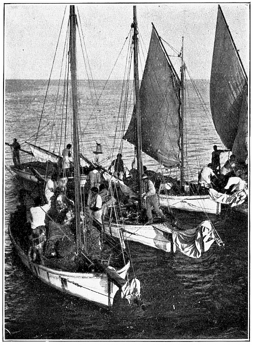
and here are some native vessels; notice that their
cargo consists of bananas. The houses are partly 21
hidden in the trees, so that the streets are very
different from our own. Here is a street scene:
notice that the women in the foreground are Hindus. 22
The Fijians are darker in colour than the Tongans, and
many still retain their strange national habit of wearing
their hair frizzed out in a huge mop. They differ
from both of the two great races of this part of the
Pacific, from the Friendly Islanders whom we saw to
the east and from the Solomon Islanders whom we shall
presently see to the west. In fact, the Fijians are
almost certainly a mixture of these two races, with the
addition of yet other strains.
We should expect that the mode of life and the
history of the Fijians would differ from that of the
inhabitants of the small coral islands, since they have
for their home a comparatively large area of land with
marked geographical peculiarities. Viti Levu is over 23
eighty miles from east to west and sixty from north
to south. It is a land of mountain and river; whereas
the ordinary coral island has no rivers worth the
name. A range of rugged mountains runs along the
northern coast, at no great distance from the sea,
the highest point being Mount Victoria, which rises
to 4500 feet. It is from this part of the island that
the long rivers Rewa and Singatoka flow to the
south-east, and a smaller stream, the Ba, to the
north-west. The third largest river, the Navua, rises
in other heights towards the south of the island,
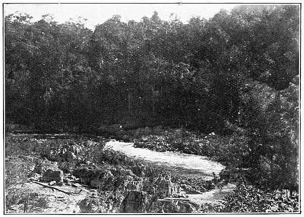
which we shall visit later. Here is a scene on the 24
Navua. The Rewa is long and winding, but it is
navigable for shallow draught steamers for about forty
miles from its mouth. The whole of the south-eastern
part of the island is wet and was originally covered
with forest; but the coast-lands to the north-west,
under the lee of the mountain ridges, are drier and
more open, as we may judge from this picture. We 25
can look across the forest, with its dense undergrowth
of fern and creeper, and narrow trails along which we
walk, and see in the distance the outlines of the jagged 26
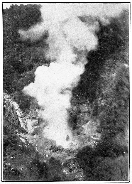
mountains of old volcanic rock. There are no active
volcanoes in the island, though hot springs in many
parts show that volcanic activity is not yet entirely
exhausted. Here are some of these springs. 27
Copyright.]
[See page 128.
Banana Boats: Suva.
Copyright.]
[See page 131.
Coconut Tree.
Copyright.]
[See page 133.
Making Mats: Fiji.
Rivers have been an important element in the
making of Fijian history, since it is in the fertile soil
of the river deltas that the crops of the natives flourish
best. Breadfruit and coconuts, together with the
roots of the taro and the spindle-shaped yam form
their principal food. The taro grows best in the wet
districts, or where there is running water; so that
the natives have long been familiar with simple methods
of irrigation. These staple foods are supplemented by
many kinds of wild tropical fruits and roots. The
natives have pigs and fowls, but these are kept for
state occasions; fish is the only usual non-vegetable
food. The Fijians are clever fishermen, whether using
the spear or arrow or net, or the fish-fences which they
build in the estuaries of the rivers. In fact, the island
provides them amply with all the food which they
need, though sometimes there is a shortage as they
lack means to preserve it. The taro and yams are
stored in earth-covered heaps, as we store potatoes;
and some of the vegetable food supply, especially
breadfruit, is buried in pits and used in a partially
fermented state. Here we have a formal presentation 28
of food, yams and turtle and the yangona root for
making the native drink called here yangona but
elsewhere kava. It is a typical Fijian scene.
The native is content to cultivate his patch of land
with simple implements, such as the digging stick,
and is not anxious to work harder than is necessary for
his own needs. He is not very ready to work for a
European employer, while all his traditions, and the
communal system under which he lives, make it impossible
for the industrious individual to accumulate
any private property.
The cultivation of produce for export is due to the
initiative of Europeans, and is largely carried on by
the East Indian immigrants who now form a very
considerable element in the population. We have
already noticed the Hindu women in the streets of
Suva. For a few years, during the American Civil
War, Fiji exported excellent cotton, but at the present
day its export trade consists practically of sugar,
copra or dried coconut, and bananas. The sugar-cane
is a native of the wet and fertile lowlands of the deltas;
but the cultivated kinds are mostly introduced from elsewhere.
We find the cane fields covering much of the
land along certain parts of the coast, and on the river
deltas of Viti Levu and Vanua Levu; and these are
connected by nearly two hundred miles of steam tramways,
which carry the cane to the centrally placed
mills. Here is a view across the Rewa, showing a 29
sugar mill; inside the ugly buildings we find the
elaborate European machinery for extracting the juice 30
from the cane. Here again we are in the cane fields
with Indian women at work. It is all unlike the native 31
agriculture, though it is very profitable to Fiji, since
sugar is the most valuable of all its exports.
The coconut industry is far more picturesque; it is
chiefly confined to the south side of Vanua Levu and to
Taveuni and the other islands. The nut is grown for
its kernel, which, when dried, is called copra, and yields
the coconut oil which we use for various purposes.
The tree grows everywhere in this region, but does not
flourish in Viti Levu owing to an insect pest which
seems peculiar to that island. The nut has always
been much used by the natives for food, but it is now
carefully cultivated for the production of copra. Here 32
is a plantation with the bungalow of the planter;
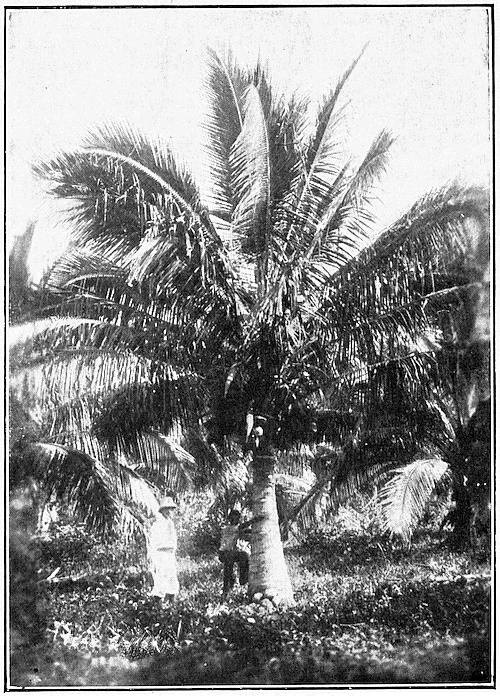
notice the hills in the background; here again is a 33
tree carrying its fruit in curious clusters just below
the crown of leaves. The natives, who are excellent
climbers, swarm up the taller trees to gather 34
any fruit which is wanted in a not quite ripe state, as
for eating or drinking; but the bulk of the nuts,
intended for copra, are allowed to ripen on the tree
until they drop off. The ripe nuts are then cut open, 35
the kernels extracted and dried in great trays and
put into bags for shipment.
We will now leave the coast for a short trip inland,
to see something of the country and the people in their
more primitive condition and less mixed type. We
travel up the Rewa river for about twenty miles, and
there turn westward across country. We have left
behind the steamer and the European trader and
planter and plunge suddenly into a strange and wild
world. At our first stopping place we are entertained
with a display which reminds us that a very short time
ago the Fijians were fierce fighters and cannibals. This
is the meke or native war-dance and song, now only
an interesting survival. First we see the dancers in
the distance, entering the village in two lines. Their 36
faces are hideous with lampblack and vermilion, and
they wear strange-looking dresses made of leaves. They
go through many complicated evolutions. They rush
towards us, stabbing with their long spears and swinging
their formidable clubs, and as suddenly rush away.
They stamp and charge and shout and imitate all the
movements of a battle. Finally they subside quietly. 37
The women also have their special dance, of which we
have here a picture. The war-dance is now only a 38
game, but it was far different before our occupation
of the islands. Though we still utilise the old tribal
organisation, and govern them through their native
chiefs and councils, we have forced the Fijians
to understand that fighting, raids and massacres are
an amusement no longer permitted. The constabulary, 39
which we see here with their rifles and maxim guns,
serve generally only in the coast regions, where they
represent a form of law and order which the Fijians
readily understand; but even in the interior certain
Fijians, less formally organised into a sort of rural
police, keep effective order. Our little trip might not
have been so safe or pleasant forty years ago.
We now leave the Rewa and strike across country
south-westward. Our road is a mere track, and often
we find streams to be crossed but no bridges to help
us. To our carriers this does not matter, as they are
not overburdened with clothes. They plunge in and 40
wade through the shallows, and they will carry us if
necessary. On the wider streams canoes must be
used, or a bamboo raft lashed roughly together. We
may notice that our carriers have slung our baggage
on poles carried on the shoulders of one or two men;
this is the regular native means of transport, for carts
are only used near the plantations, and by Europeans,
where roads are available. In the old time the women
would have carried the burdens, as it was thought
beneath the dignity of a man to carry anything but
his weapons.
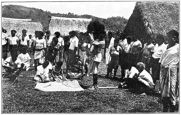
Presently we reach a village where we discover an
interesting native industry, the making of mats from 41
a kind of reed. Here we see girls at work weaving
the mats, and in one of the native huts they are making
baskets from the same material. The Fijians are clever
at this work, and both mats and baskets are important
articles in their daily life. They also used to make a
peculiar but very artistic pottery, such as we do not
find in the islands of Polynesia further east; but this 42
art is no longer practised except in a few places, and
for the production of pots for domestic use.
Perhaps the most noteworthy native manufacture
is that of tapa cloth for their dress. Tapa is made by
beating out the fibrous bark of the paper mulberry,
and sometimes of certain other trees. The art is known
in Polynesia generally, and the Fijians, like many of
the other islanders, also print the cloth in various
patterns and colours.
We continue our march, passing many villages.
Here is a corner in one of them; notice the native huts 43
of grass and reeds, very different from the wood and
corrugated iron of Suva. Notice, too, the coconut
palms growing all around. Here again we have a 44
more elaborately finished house, in the old style; and
here is the interior of the home of a chief; it looks 45
somewhat unfurnished to our eyes, though it is cool
and airy. At the next village the natives receive us
with a solemn presentation of food and yangona in a
rather dark hut. Here they are making the yangona. 46
Finally we reach Namosi, a picturesque native town
perched up in the mountains. The town lies in a kind
of pass between steep rocks, the “Gate of Namosi,” as 47
we see in the picture. The inhabitants are summoned
together by the beating of the town drum, a hollow log
of wood, and receive us sitting on the ground beneath 48
an ancient tree. We have reached the limit of our
journey; but short though it is, it has given us some
idea of the real Fijian as he is to-day, away from
direct European influence.
The conditions in the other large island, Vanua
Levu, are much the same as in Viti Levu. The island
is long and narrow, but with the same irregular mountain
structure, the same vegetation and the same
contrast of wet and dry on the opposite coasts. We
may remember that Ovalau, off the coast of Viti Levu,
was much concerned in the past with the politics of
the neighbouring mainland; the same was true of
Taveuni off Vanua Levu. The dwellers on the rich
coastlands of the larger islands led a very uncertain
life between the raiders from the sea and the wild tribes
of the interior. The sea was always the more important
factor in the life of the whole group of islands; it united,
while the land more often divided. We have already
noted its importance in the relations of Fiji and the
Friendly Islands.
Before we leave Fiji it is interesting to note that
the line which divides East from West passes through
this group, cutting the island of Taveuni into two; so
that in one part of Taveuni we can stand with one
foot in the East and the other in the West, or in other
words, one foot may be in a place nearly twenty-four
hours ahead of that occupied by the other according
to Greenwich Time.
The Fiji Islands are governed as a Crown Colony—the
only Colony so governed in the Pacific; and hitherto
the Governor of that Colony has also been High Commissioner
for the Western Pacific, that is to say, he has
been in charge of most of the scattered islands in the
Pacific which are more or less under British protection.
We have already visited one of his charges, the Friendly
or Tongan Islands. The number of these islands
under the High Commissioner is very great, but
unfortunately there is no regular means of communication
between Fiji and most of them. Every month
a steamer starts from Auckland, calls at Tonga Tabu,
Haapai and Vavau, and then goes on to Levuka and
Suva, exactly along the route which we have followed.
But from Suva this steamer goes on to Sydney in
Australia. Once a month, too, a steamer starts from
Sydney, along the same route but in the reverse direction,
to Auckland. With none of the other islands is
there any direct means of communication; and when
the High Commissioner wishes to visit them he must go
round in a warship. We will accompany him on one
of these tours, in order to see something of the other
British islands.
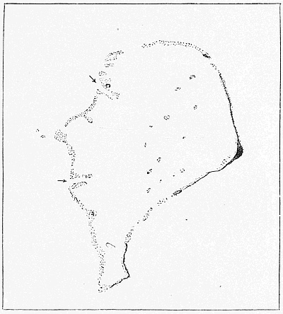
Funafuti.
The dotted portion represents the coral reefs, the black portion land,
and the arrows mark the deep-water channels.
Starting from Suva we steam a little west of north,
along the chain of the Ellice and Gilbert Islands,
which reaches quite up to the equator. These islands
are all coral atolls; Funafuti, in the Ellice Group,
serves as a type of all the rest. It consists of a lagoon, 49
about twelve miles across, roughly circular and surrounded
by a reef; the top of this reef appears here
and there above water in the form of coral islets, the
largest of which is Funafuti proper. The whole atoll
is merely the coral-rimmed summit of a huge mountain
rising from the great depths of the Pacific. Funafuti
is a complicated atoll; many of the smaller islands
of the Fijian group are volcanic, and show a different
kind of structure. In these we sometimes find the
old crater filled with water, while the remnants of the
slopes of the volcano form the shores of the lagoon.
A good instance of this structure is Totoya, towards 50
the south-east of the Fijian group. Here the enclosing
rim rises to over a thousand feet, but the sea has
broken through on the south and formed a lagoon.
The entrance is almost closed by the coral reef which
encircles the whole of the outside of the island. Coral
reefs grow everywhere if the water is shallow enough,
so that we find reefs not only around the coasts of the
islands but growing on banks which are isolated and
entirely covered by the sea.
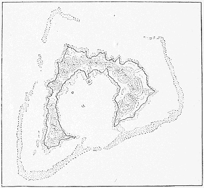
Totoya.
The dotted portions represent coral reefs.
North of the Ellice Islands are the Gilberts, arranged
also in rows from south-east to north-west. They,
too, are coral atolls, with a thin soil which will grow
nothing but coconuts and screw pines; none the less,
on coconuts and fish a fairly dense population supports
itself. They are, as we might expect, less civilised here
than in the larger islands which we have visited further
south.
From the Gilberts we turn south-west to visit another
great row of islands, the Solomons and New Hebrides.
On our way we pass Ocean Island, a small dot isolated
from the rest of the Gilbert Group. Here we find, in
addition to the natives, a considerable number of Europeans.
The island is being exploited commercially, but
instead of making copra they are digging out valuable
deposits of phosphates. Here are some of the natives, 51
and here is a picture showing the excavation of the
phosphatic coral rock. 52
Ocean Island has for us a further interest. North-west
of it lies Nauru, where also phosphates are obtained.
Nauru belongs to Germany, and the dividing
line between the British and German spheres runs
between the two islands. If we follow the line south-west,
we see that it cuts through the Solomons and
then turns sharply west to New Guinea which it
divides roughly into halves. Germany shares with the
United States the Samoa Islands, north-east of Tonga,
but her main sphere of influence is in this western
area.
On our voyage to the Solomons we pass another
curious island, or rather group of islands. This is
Ongtong Java, where the people differ from those of
the islands which we have visited up to this point.
We are approaching a region where we know little of
the character and origin of the natives, a region more
backward and savage than any other part of our
dominions in the Pacific.
The Solomons consist of a double row of long and
narrow islands, with high mountain ridges and many
volcanoes, some extinct, others still active. The largest
island, Bougainville, at the north end, is German;
the rest are British. They have long been known to
explorers, but until recently their history tells chiefly
of resistance by the natives against Europeans who
have attempted to open up intercourse with them.
Lately, thanks to the good influence of the missionaries,
and perhaps still more to the better regulations made
by the agents of the British Government for intercourse
between the wild men and the Europeans, considerable
advance has been made, and plantations of coconut
and other valuable products have been established
in many of the larger islands. Many of the tribes,
however, are still head-hunters and cannibals. The
islands are covered with great forests, and the plants
and animals, as well as the natives, resemble to some
degree those found in New Guinea. The people go
naked for the most part, except for necklaces and
bracelets of shells and teeth. Their houses are often
built on piles, like those of the Papuans. Here we see 53
a group engaged in a war-dance, and here is one of
their curiously ornamented canoes. 54
South-east of the Solomons we pass the Santa Cruz
Group; the name, as do many other names in this
part of the world, reminds us again of the early voyages
of de Quiros the Spaniard, who at the end of the
sixteenth century first discovered these distant islands.
Spain has disappeared from this part of the Pacific,
and the region of islands is divided between Germany
to the north, Britain in the Solomons, and Britain
and France in the New Hebrides.
Southward from Santa Cruz we pass almost at once
the northernmost of the long chain of the New Hebrides,
discovered towards the end of the eighteenth century,
almost simultaneously, by our own Captain Cook and
by the great French admiral Bougainville. Northernmost
of all, in the sphere of joint Anglo-French influence,
we pass the Torres and Banks Islands, great centres
of the famous Melanesian mission. Next we come to
Espiritu Santo, or Santo for short, at the northern end
of which is the great Bay of St. Philip and St. James,
within which, four centuries ago, Quiros built a town—a
town which lasted but a few months. He rejoiced
greatly because he thought that in that newly discovered
land he had reached the beginning of the
great Southern Continent which was supposed to extend
thence to the Antarctic regions.
Here and there round Santo there are a few mission
stations, and a few fairly prosperous plantations, some
English and some French; but the natives in the
interior are still very wild and occasionally raid the
European settlements. Here we see a vast crowd of
natives celebrating a feast. Now it is a peaceful 55
ceremony: it was far different in the past.
Next, still steaming southward, we pass between
two rows of islands, until, about where the two rows
join, we come to the Island of Efate, with its growing
town of Vila, the centre of Anglo-French administration.
Here is the seat of the Joint Court, and many
buildings of almost European type have recently been
erected for its use.
Still further south the New Hebrides reach, now in
a single line, almost down to the Loyalty Islands and
New Caledonia. These last two places are, however,
purely French possessions, and we may pass them by.
From Vila the Governor in his warship would probably
return eastward to Fiji. We may leave him at
Vila and take either the French or the British steamer,
which calls there once a month, and so make our way
direct to Sydney. But before leaving the subject of
the New Hebrides we may note that the islands of this
group are largely volcanic, and the people are not
unlike those of the Solomons, though perhaps rather
less savage. Here we have a picture showing their 56
former method of receiving visitors. It was from these
two groups that the brown labour for the Queensland
plantations was largely recruited in times past. The
New Hebrides are fertile, though not healthy for
Europeans; and when they have been reduced to
some order by white administration they may develop
a trade with Australia in various vegetable products;
since they are not limited to the coconut as are so
many of the coral atolls. The picture before us with 57
its coral reefs, its forest and its background of volcanic
hills, gives a very good idea of the scenery of these
islands.
We have now completed the circuit of our chief
possessions in the Western Pacific. There still remain
a few detached islands and groups on its eastern
borders which are under the jurisdiction of the High
Commissioner. Of these only two are of much interest.
Fanning Island lies almost in mid-Pacific, and halfway
along the usual route from Sydney to Vancouver.
A steamer from Sydney travels 1700 miles to its first
stop at Suva; then 1900 on to Fanning Island; thence
3400 to Vancouver, the starting place of the Canadian-Pacific
route to Europe. Fanning Island is in consequence
the mid-Pacific station of the Pacific cable. The
island and its near neighbour, Washington Island, are
small coral islands with lagoons, on which coconuts
have long been profitably cultivated. Both also have
valuable deposits of phosphates, due to the age-long
deposit of the droppings of countless seabirds on the
decomposing coral. These phosphates, as well as the
very abundant coconuts, are already exported, and
their value is likely to increase considerably before
long. Moreover, the probability that Fanning Island
may be made into a shelter and repairing station for
vessels crossing the Pacific adds largely to its value
as an asset of the Empire. Here are two pictures of 58
the island, typical of the kind of coral atoll which
is found isolated in the Pacific, instead of being, as are 59
most of the others which we have seen, a member of
a group.
Far away to the south-east, almost on the Tropic, 60
and halfway to South America, lies the lonely Pitcairn
Island, to which a few other scattered islets, British
possessions, are attached. Pitcairn has a population
of about a hundred and fifty souls, descendants of the
mutineers of the Bounty, who settled here with their
native wives in 1789. The present occupants represent
those who returned after the experiment of removing
to Norfolk Island in 1856. They had found themselves
overcrowded, since Pitcairn is a tiny island only two
miles long by three-quarters wide, rocky and volcanic,
though fertile. The island is of great interest from the
point of view of the history of the Pacific, since there
are remains on it of stone monuments, weapons, and
images which prove that even in this distant corner
of the ocean some early people must have settled long
before the Polynesians. In fact, there are traces of 61
such settlements all over the Pacific, which suggest
that the Polynesians themselves are merely modern
colonists, occupying the homes of an earlier and perhaps
more civilised race.