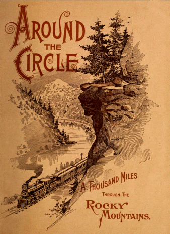
Around the Circle
A Thousand Miles Through The Rocky Mountains.
Will be sent free upon
application to
J. W. SLOSSON,
Acting General Agent,
236 Clark Street, Chicago.
W. M. RANK,
General Agent,
No. 219 Front St., San Francisco.
W. F. TIBBITS,
T. P. A., D. & R. G. R. R., Denver, Colo.
W. J. SHOTWELL,
General Agent, Salt Lake City, Utah.
E. T. JEFFERY,
Pres. & Gen. Mgr. D. &. R. G. R. R. Denver, Colo.
A S. HUGHES,
Traffic Manager, Denver, Colo.
T. W. BECKER,
Acting General Agent,
379 Broadway, New York.
H. V. LUYSTER,
T. P. A., D. & R. G. R. R.,
1008 Broadway, Kansas City, Mo.
W. R. PECK,
City Pass. Agt., D. & R. G. R. R.,
1662 Larimer St., Denver, Colo.
F. A. WADLEIGH,
Asst. Gen. Passenger Agent, Denver, Colo.
OTTO MEARS,
Pres. &. Gen. Mgr. R. G. S. R. R. Denver, Colo.
S. K. HOOPER,
Gen. Pass. Agent, Denver, Colo.
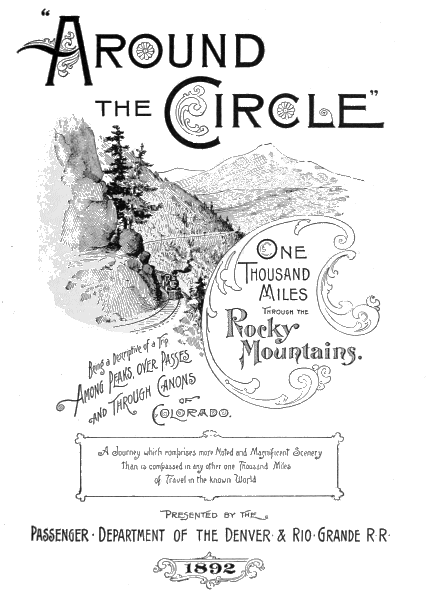
"Around the Circle"
One Thousand Miles Through The Rocky mountains
Being a Descriptive of a Trip
Among Peaks, Over Passes
and Through Cañons of
Colorado.
A Journey which comprises more Noted and Magnificent Scenery
Than is compassed in any other one Thousand Miles
of Travel in The known World
Presented by the
Passenger · Department of the Denver & Rio·Grande R·R·
1892
Rainbow Route—Silverton Railroad
Denver & Rio Grande R·R·—Scenic Line of the World
Rio Grande Southern R·R·—Silver San Juan Scenic Line
Copyright, 1892,
By S. K. Hooper, General Passenger Agent, Denver, Colo.
Denver & Rio Grande R. R.
THE TOURIST in search of grand and beautiful
scenery finds an embarrassment of riches in Colorado.
Among so many attractions he is at a loss
which to choose, and having made a choice, he is
frequently troubled with doubts as to the wisdom
of his selection. Recognizing this fact, the Passenger
Department of the Denver & Rio Grande
Railroad, after a careful and thoughtful discussion
of the situation, has decided to make a
selection of a tour that shall embrace the most varied and
picturesque scenery to be found on the line of any railroad
in the world, included in a single trip, at a moderate cost.
The excursion "Around the Circle" presents all these
advantages. It can be made comfortably in four days,
and no portion of the journey has to be retraced, thus
affording constant variety and keeping the interest of the
tourist pleasurably excited to the end. It is a remarkable
fact that this journey, if pursued in the line laid down in the following pages,
is cumulative in its character. Like a well-constructed drama, the interest
grows stronger and stronger with each stage of its progress, until the final
scene, which is an overpowering climax of grandeur and majesty. The
points of interest on the trip "Around the Circle" are practically innumerable.
The observing tourist will discover many beauties and attractions
which are not described by the writer. No attempt has been made to
include all that is worthy of mention. Only those scenes which are of
transcendent interest have been touched upon, and in the pages which follow,
the reader will only obtain a bird's-eye view of the tour. This being the
case, the tourist can readily imagine what pleasure lies before him. In this
instance distance does not lend enchantment to the view. To penetrate the
heart of the majestic mountains, to cross and re-cross the great Rocky
Range, to gaze with breathless awe into the defiles of abysmal chasms, and
to behold with reverent, upturned eyes the ancient summits of heaven-defying
snow-crowned peaks, are privileges that familiarity can never make
commonplace nor belittle. Such privileges are granted to the tourists
"Around the Circle," and with full confidence that he who takes the journey:
will find his brightest anticipations more than realised, this little book is
placed before him.
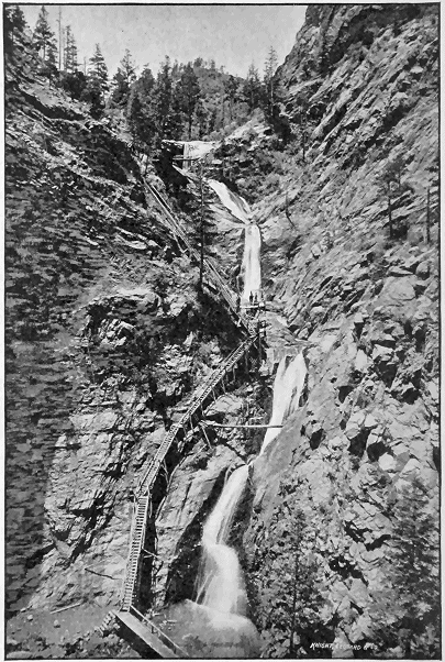
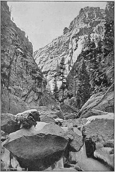
SEVEN FALLS—CHEYENNE CAÑON.
"AROUND THE CIRCLE."
THE journey "Around the Circle" on the Denver and Rio
Grande Railroad, from Denver to Silverton, Silverton to
Ouray, and return to Denver, or via the Denver & Rio Grande
to Durango, thence over the Rio Grande Southern R. R. to
Ridgway and return to Denver, briefly described in the
following pages, comprises more noted and magnificent scenery
than any other trip of similar length in the known world.
Piercing the heart of the Rocky Mountains, crossing and recrossing
the "Great Divide" between the Atlantic and Pacific slopes;
penetrating five cañons, each of which is a world's wonder, and no
two having the same characteristics; climbing four mountain passes
by rail and one by stage; achieving grades of 211 feet to the mile;
reaching heights 11,000 feet above the sea; penetrating gorges
whose walls soar a half mile in perpendicular cliffs above the track;
traversing fertile and picturesque valleys, watered by historic rivers;
passing through Indian reservations and in sight of frontier cantonments of
National troops; pausing in the midst of mining camps, where gold and silver
and coal and copper are being taken from subterranean recesses; in a
word, making the traveler familiar with peaks and plains, lakes and rivers,
cañons and passes, mountains and mesas; with strange scenes in nature,
aboriginal types of men, wonders of science and novel forms of art; surely
no other journey of a thousand miles can so instruct, entertain, entrance and
thrill the traveler as this trip "Around the Circle."
Every mile of the journey has its especial attraction. A thousand objects
of interest present themselves to view in rapid succession. A thousand novel
impressions photograph themselves upon the mind, a thousand landscapes of
wonderful and bewitching beauty beyond the power of pen or pencil, or brush
or camera to depict, can be seen from the windows of the car. Colorado is a
land of wonders, a land of surprises, a land of sharp and wonderful contrasts.
Take Toltec Gorge as a central point, and with a radius of two hundred miles
describe a circle. Within the confines of that magic ring will be found more
grand and wonderful scenery accessible by rail than within any similar circle
swept anywhere on the surface of the world! Pilgrimages are made across
the seas to behold the beauties of some one famed object The Via Mala
attracts one, Mount Blanc another, the Colosseum a third, and the tourist,
after all his great expenditure of time and money, comes away with one
impression.
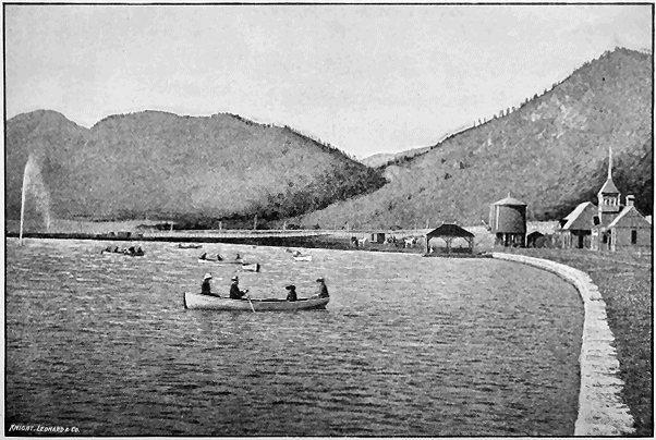
PALMER LAKE.
It ought to be the fashion for Americans to see something of their own
country before they rush across the ocean to gaze at the wonders of the Old
World. It is a good omen that many Americans appreciate this fact and are
turning their attention to the unsurpassed scenery of their native land. The
"Via Mala" is dwarfed into insignificance when compared with the "Royal
Gorge." The hundreds of peaks among the Rockies, reaching an altitude of
over fourteen thousand feet, should compensate one for the solitary grandeur
of "Mount Blanc," while the ruins of the "Cliff Dwellings" tell of a race
older than that which built the "Colosseum."
It would be impossible within the pages allotted for this book to give an
adequate description of even half the noteworthy things to be seen in a journey
"Around the Circle." All that can be attempted is briefly to characterize
a few of the most remarkable objects of interest, objects which deserve
to rank with the greatest natural attractions of the world, and most of which
have already become known as marvels, to behold which would amply repay
a journey across the continent.
The trip naturally begins at Denver, the great railroad center of Colorado,
and a city of more than ordinary attractiveness.
For a hundred and twenty miles the railroad extending to the south
follows the front range of the Rocky Mountains, which is in plain view on the
right and to the west. After Denver has been left behind, the tourist can
see from the car window the snow-covered pinnacles of Long's, James',
Gray's and Pike's Peaks standing in a wilderness of lesser mountains. Soon
a remarkable promontory rising from the summit of a conical hill and presenting
the appearance of an ancient round tower, attracts the tourist's
attention. This is Castle Rock, under whose battlements nestles a picturesque
village of the same name. Beyond Castle Rock the country becomes
more broken, the ascent being now begun at what is known as the Divide, a
range of hills extending eastward into the plains and rising to an elevation of
7,500 feet. Curious formations of sandstone frequently occur, the most notable
of which is called Casa Blanca, and can be seen on the right between
Greenland station and Palmer Lake. This enormous monolith is a thousand
feet in length and two hundred feet high, and on account of its size, its snow-white
walls and its castellated appearance, can hardly fail to attract attention.
On the summit of the Divide is Palmer Lake, a lovely little sheet of
water, so equally poised that its waters flow through outlets northward into
the Platte and southward into the Arkansas. Here has been established a
pleasant summer resort, and here also is Glen Park, where assemblies are
held each summer, modeled on those of the well-known Chautauqua.
CENTRE OF PIKE'S PEAK.
Beyond Palmer Lake, on both sides of the track, may be seen wonderful formations
of brilliant red sandstone, taking the form of castles, fortifications and
towers. One of the most striking of these has been named Phœbe's Arch,
being a great castle-like upthrust of glowing red rock, through which there is a
perfect natural archway. The descent of the Divide to Colorado Springs is
through an interesting country, the mountains to the west and plains extending
to the east. As Colorado Springs are approached, the great gateway to the
Garden of the Gods can be seen to the right, and Pike's Peak, rising to an
altitude of 14,147 feet, its summit white with snow, attracts instant attention.
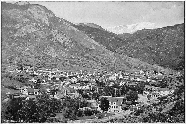
A side trip can here be taken, at nominal expense, to Manitou Springs, five
miles distant, the famous watering place of the west, a pleasure resort possessing
wonderful effervescent and medicinal springs, and surrounded by more
objects of scenic interest than any resort of a like character in the old or new
world, including "Garden of the Gods," "Glen Eyre," "Red Rock Cañon,"
"Crystal Park," "Ruxton's Glen," "William's Cañon," "Manitou Grand
Caverns," "Cave of the Winds," "Ute Pass," "Rainbow Falls," "Bear
Creek Cañon," "Cheyenne Mountain," "Pike's Peak," and hundreds of
others, to name which space is lacking.
The cog-wheel railroad to the summit of Pike's Peak is now completed and
in operation, and is the most novel railway in the world. When it reaches
its objective point above the clouds, at a height of 14,147 feet above sea level,
it renders almost insignificant by comparison the famous cog-way up Mount
Washington, and the inclined railway up the Rhigi in Switzerland.
The route is the most direct possible, and about nine miles in length.
The track is the same as that of the Mount Washington line, standard gauge,
with an eight-inch cast-steel cog-rail. The cars are set on low trucks to prevent
them from becoming top-heavy on curves or in a high wind. This is
almost an unnecessary precaution, as it is not expected to make the ascent
in less than two hours. On the ascent the cars are pushed by the engine,
but on the descent the locomotive is placed in front. The engine achieves
the tremendous grades by means of a cog-wheel, which fits into the cog-rail.
This mountain road is a great attraction, added to the many which already
render Manitou the greatest summer resort of the mid-continental region.
The run from Colorado Springs to Pueblo is down the valley of a pretty
little stream, the Fountaine qui Bouille, along whose banks are situated rich
farms, or as they are universally termed in the west, "ranches," on which
large crops are grown through the medium of irrigation. A hundred miles
to the westward may be seen the faint blue outlines of the Greenhorn range
of mountains, while to the eastward stretch the plains, the view of which is
limited only by the horizon. Pueblo is the great manufacturing city of central
Colorado. It has one of the largest steel manufactories in the world,
and a number of extensive smelters. Its close proximity to coal and iron
mines, and the fact that it has become a railroad center of much importance,
makes the future of the city exceedingly bright in promise. With a population
of over 20,000, constantly increasing, and with the energy and push of its
citizens, it cannot fail of achieving the greatest prosperity.
VETA PASS.
From Pueblo, 120 miles distant from Denver, the journey is continued to
the south, still across a level country, and to the left the Spanish peaks soon
rise to view. These mountains possess a peculiar attraction, rising, as they
do, directly from the plain in symmetrical, conical outlines, and reaching an
altitude respectively of 13,620 and 12,720 feet. The Indians, with a touch of
instinctive poetry, named these mountains "Wahatoya," or Twin Breasts.
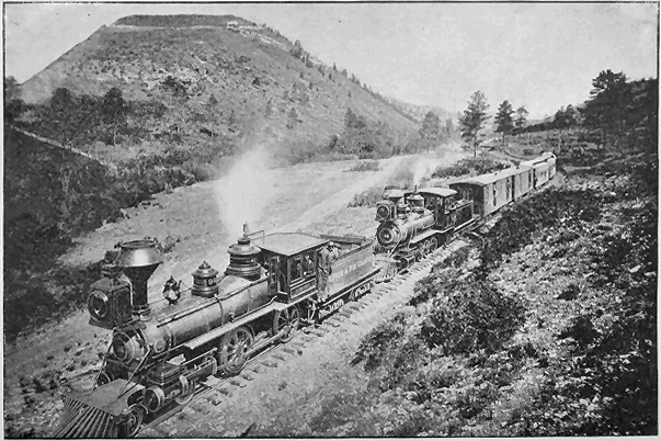
Shortly after sighting the Spanish Peaks, the ascent of Veta Pass is begun
The ascent of this famous pass is one of the great engineering achievements
of the Denver & Rio Grande Railroad. The line follows the ravine
formed by a little stream. La Veta Mountain rising to the right. At the head
of this gulch is the wonderful "Mule-Shoe Curve," the sharpest curve of the
kind known in railroad engineering. In the center of the bend is a bridge,
and the sparkling waters of the mountain stream can be seen flashing and
foaming in their rocky bed below. Standing on the rear platform of the Pullman
car as the train rounds the curve, the tourist can see the fireman and
engineer attending to their duties. From this point the ascent of Dump
Mountain begins, rocks and precipitous escarpments of shaley soil to the
right and perpendicular cliffs and chasms to the left. The ascent is slowly
made, two great Mogul engines urging their iron sinews to the giant task.
The view to the eastward is one of great extent and magnificence. The plains
stretch onward to the dim horizon line like a gently undulating ocean, from
which rise the twin cones of "Wahatoya," strangely fascinating in their symmetrical
beauty. At the summit of the pass the railroad reaches an elevation
of 9,393 feet above the sea.
Veta Mountain is to the right as the ascent of the pass is made, and rises
with smooth sides and splintered pinnacles to a height of 11,176 feet above the
sea level. The stupendous proportions of this mountain, the illimitable expanse
of planes, the symmetrical cones of the Spanish Peaks, present a picture
upon which it is a never-ceasing delight for the eye to dwell. The train
rolls steadily forward on its winding course, at last reaching the apex, glides
into the timber and halts at the handsome stone station over 9,000 feet above
the level of the distant sea. The downward journey is past Sierra Blanca and
old Fort Garland, and through that pastoral and picturesque valley known, as
San Luis Park.
WAGON-WHEEL GAP.
At Placer one can say that the descent of Veta Pass has been accomplished,
though it is still all down grade to Alamosa. This little town is situated
on the eastern border of the San Luis Valley and at the western extremity
of La Veta Pass.
From Alamosa station a magnificent view of Blanca is obtained, and this
majestic mountain, with its triple peaks capped with snow, and two-thirds
of its height above timber line, presents a noble and impressive spectacle.
To the north and south, silhouetted against a sky of perfect azure, are the
serrated pinnacles of the Sangre de Christo range. It would be difficult to
find, even in this land of peaks, a more impressive mountain view than that
obtained during the traversing of the San Luis Valley, on the eastern rim of
which Garland Station, the site of old Fort Garland, rests. Here is a park
7,500 feet above sea level, surrounded on all sides by ranges of rugged mountains
whose summits are whitened with perpetual snow. San Luis Park
has an area larger than Connecticut, watered plentifully by mountain streams
and traversed by the historic and beautiful Rio Grande del Norte. The soil
of this valley is fertile, and through the medium of irrigation the park is
rapidly becoming a great agricultural region.
From Pueblo the line diverges and the tourist may go via Veta Pass as
described above, or to Salida, and thence through the Poncha Pass to Villa
Grove and down through the beautiful San Luis Valley to Alamosa, noted
for its fine farms and phenomenal yield of agricultural products. From the
point named above there is a tangent of fifty-two miles and the San Luis
Valley portion is a straight line through one of the most fruitful and beautiful
sections of the State.
From Alamosa a delightful side trip can be taken to the Hot Springs at
Wagon Wheel Gap, and to the new and already famous mining camp,
Creede, for which a reduced rate will be given. A word about this wonderful
health and pleasure resort will not be out of place here. As the Gap is approached
the valley narrows until the river is hemmed in between massive
walls of solid rock which rise to such a height on either side as to throw the
passage into twilight shadow. The river rushes roaring down over gleaming
gravel or precipitous ledges. Progressing, the scene becomes wilder and
more romantic, until at last the waters of the Rio Grande pour through a cleft
in the rocks just wide enough to allow the construction of a road along the
river's edge. On the right, as one enters, tower cliffs to a tremendous height,
suggestive in their appearance of the Palisades of the Hudson. On the left
rises the round shoulder of a massive mountain. The vast wall is unbroken
for more than half a mile, its crest presenting an almost unserrated sky line.
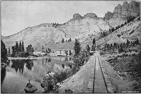
Once through the Gap, the traveler, looking toward the south, sees a valley
encroached upon and surrounded by hills
"Bathed in the tenderest purple of distance,
Tinted and shadowed by pencils of air."
SOUTH WILLOW CAÑON, CREEDE, COLO.
Here is an old stage station, a primitive and picturesque structure of hewn
logs, made cool and inviting by wide-roofed verandahs. Not a hundred feet
away rolls the Rio Grande river, swarming with trout. A drive of a mile
along a winding road, each turn in which reveals new scenic beauties, brings
the tourist to the famous springs. The medicinal qualities of the waters,
both of the cold and hot springs, have been thoroughly tested and proved
equal, if not superior, to the Hot Springs of Arkansas.
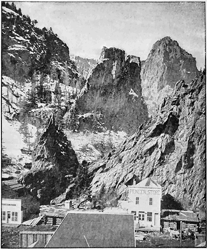
Ten miles beyond Wagon Wheel Gap is Creede; nothing yesterday, a
city of seven thousand people to-day. Here is Colorado's newest and richest
mining camp, bustling with all the activity of an older eastern city. Situated
in the heart of a cañon and extending through it and widening out on to the
less precipitous hills below, composed of buildings of all kinds, from the
temporary "shack" of the prospector to the more pretentious brick store.
The mountain side dotted with innumerable prospect holes, with an occasional
large building of unpainted pine, rising from which is a volume of
steam and smoke giving ocular evidence of the presence of a mine of more
than ordinary interest and value. To the tourist desiring to combine business
with pleasure, here is the opportunity to buy what at present seems only
"a hole in the ground," but which may some day develop into a mint within
Itself.
Leaving Alamosa and continuing the circle tour, after crossing San Luis
Park, and just before reaching Toltec Tunnel, a sharp curve takes the train
into a nook among the hills. To the left are great monumental and fantastic
forms of rock, while to the right are cliffs rising to a height of five or six
hundred feet above the track. From the quaint and curious formations which rise
to the left as this bend is rounded, it has been named Phantom Curve. In
half an hour Toltec Tunnel is reached, the great peculiarity of which is that
it pierces the top of a mountain instead of its base. For six hundred feet it
has been blasted through the living rock, and such is its solidity that no masonry
is needed to support the superincumbent rock masses above. When
the train emerges from the tunnel it rolls out upon a bridge of trestle-work set
like a balcony against the wall of stone. Beneath, to the left, is Toltec
Gorge. The traveler looks down fifteen hundred feet and, glancing upward,
sees the opposite wall of the gorge rising a thousand feet above him. The
scene is one of the most thrilling and unique in the whole journey "Around
the Circle." Below, at the bottom of the gorge, swirls and dashes a little
stream, whose waters are churned into snow-white foam, and the noise of
whose progress comes faintly to the ear, borne upward from those tremendous
depths.
RIO LAS ANIMAS CAÑON.
An object of interest to all visitors to Toltec Gorge is the Garfield Memorial,
a beautiful monument of granite, raised by the National Association of
General Passenger Agents, who held service at this spot on the 26th day of
September, 1881, at the time President Garfield was being buried at Cleveland, Ohio.
At Cumbres, the summit of the Cumbres range of mountains, is reached
an elevation of 10,115 feet, the journey of the descent is a trip fraught
with great variety of scenery and abounding in interest. Here may be seen
mountain meadows lush with vegetation, the surrounding hills being heavily
timbered and abounding in game.
At Ignacio the Indian reservation is entered, and the rude tepees of the
Southern Utes can be seen pitched along the banks of the Rio de las Florida.
Occasionally a glimpse can be caught of a stolid brave, tricked out in all his
savage finery, gazing fixedly at the train as it speeds by. Frequently there is
quite a little group of these aborigines at the station, and they are always
ready to exchange bows and arrows, trophies of the chase, or specimens of
their rude handiwork in return for very hard cash.
From Durango the tourist has the choice of two routes to complete the
"Circle" tour; either via the Rio Grande Southern Railroad, through the
Mancos Valley, the Lost Cañon, the Valley of the Dolores and the Dolores
Cañon to Rico, over the Lizard Head Pass by Trout Lake and Telluride, down
the San Miguel and Leopard Creek to Ridgway; or via the Denver & Rio
Grande, through the Animas Cañon to Silverton, over the Rainbow Route
(Silverton Railroad) to Ironton, and thence over the famous Ironton and Ouray
Stage Road to Ouray.
RIO GRANDE SOUTHERN ROUTE.
Leaving Durango via the Rio Grande Southern line, the tourist is whisked
across the Rio de Las Animas up Lightner Creek, past the silver and gold
smelters with their seething furnaces and smoke and dust-begrimed workmen,
and shortly past the famous coal banks where the black diamond is dug
from the bowels of Mother Earth, and from there hauled to the smelters
where it is used for the reduction and refining of its more exalted, but not
more useful brethren.
Up through the valley the train speeds along among huge pines which thus
far have escaped the woodman's axe, and which will be free from such invasion
as long as Uncle Sam claims this particular spot as the especial reservation
for the military post at old Fort Lewis.
From Fort Lewis the line passes through seemingly endless forests of pine
trees, and after the reservation is passed an occasional saw-mill is sighted
from its emitting unearthly screeches, which the knowing ones say is merely
the head sawyer sharpening up.
CLIFF DWELLERS.
Descending the mountain into the valley,
the beholder looks out on a broad expanse of fertile, well-watered country,
surrounded on all sides by snow-capped mountains, and dotted with the
rancheros of the hardy pioneer, who has been well repaid for his daring in
locating in this far-away but beautiful valley, by its productiveness, and now
that the railroad, that greatest of all civilizers, has come, he has abundant
opportunities for the disposition of his produce.
In the center of this valley lies Mancos station, which is the junction with
the main line of the proposed extension of this road into Arizona.
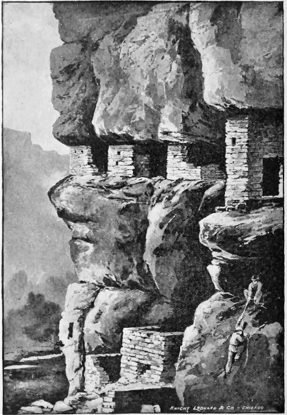
To the south of Mancos station within a day's drive, and easily accessible,
are the ruins of the strange habitations of an extinct and mysterious race
known as the Cliff Dwellers. To those seeking curiosities and wonders, the
great Cañon of the Mancos, the great Montezuma Valley, the McElmo
Cañon, the Lower Animas Valley and the Chaco Cañon are the wonderlands
of the world. They contain thousands of homes, and a town of the ancient
race of Mound Builders and "Cliff Dwellers," that has attracted the
curious ever since the discovery of America. The great Mancos Cañon contains
hundreds of these homes which were built and occupied hundreds of
years ago. Yet many of them are in a good state of preservation, and in
them have been found hundreds of specimens of pottery, and implements of
husbandry and warfare. This cañon is twenty miles south of Mancos, over a
good wagon road. The cañon is cut through Mesa Verda, a distance of
thirty miles, and the walls on either side rise to a perpendicular height of two
thousand feet. These cliff dwellings are built in the sides of this cañon, as
shown in the illustration. Fifteen miles farther west from the Mancos is situated
the great Montezuma Valley, where thousands of fine specimens of pottery
have been found among the ruins of that ancient people. On the west
side of this valley is the great McElmo Cañon, also full of the ancient homes
of the "Cliff Dwellers." Thirty-five miles south of Durango, in the valley of
the Animas, are some extensive ruins of the Aztecs, and fifty miles further
south are the wonderful ruins in the Chaco Cañon. These ancient Pueblos
are, without doubt, the most extensive and the best preserved of any in the
United States. Of these Prof. Hayden, in his report of the Geological Survey
of the United States for the year 1866, says: "The great ruins in the Chaco
Cañon are pre-eminently the finest examples of the works of the unknown
builders to be found north of the seat of ancient Aztec Empire in Mexico."
There are eleven extensive Pueblos in this cañon, nearly all in a good state
of preservation, and their appearance indicates that they were once the home
of fifteen hundred to three thousand people each. They are the most accessible
from Mancos of any point on the line of railroads. From the thousands
of ruins of cities, towns and families found throughout this great San Juan
Valley, it is evident that once this great valley was the home of hundreds of
thousands of this extinct race. That they were a peaceful and agricultural
race of people is evidenced by the large number of their implements of husbandry
and specimens of corn and beans found in these ruins, besides irrigating
ditches and reservoirs for the storage of water.
SULTAN MOUNTAINS.
Leaving Mancos, the road winds up the sloping sides of a flat-topped
mountain, and there on its summit, among huge pines centuries old, bubbles
up a clear, cold spring of sparkling water, forming the stream that flows down
through the beautiful Lost Cañon, and is called by the unpoetic name of
"Lost Cañon Creek."
Lost Cañon is a novelty in itself, as its sides are densely wooded and softly
carpeted with a thick bed of moss and leaves, beautifully colored by millions
of Colorado wild flowers whose delicate beauty is unrivaled.
Emerging from Lost Cañon the traveler is whirled up to the beautiful valley
of the Dolores River, with its many ranches and farms, past the town of the
same name. Off to the left, flowing to the eastward, comes bubbling down the
mountain side into the larger river, the West Dolores, and no more famous or
prolific trout stream exists than this.
Continuing on up the main river, the valley begins to narrow down, until we
are once more within the walls of a cañon which takes its name from the
stream flowing through it. While this cañon is not particularly deep, its
natural beauties are manifold and are sure to make a lasting and delightful
impression on the beholder.
Rushing out of the cañon the tourist is now landed at Rico. Rico is one
of the most important mining towns of the State, whose mines dot the mountain
sides, and whose product is packed in the cars on the backs of the ever-patient
and faithful burro, without which no mining camp can be complete.
The town is located in what was at one time the crater of a large volcano.
Precipitous mountains with poetic names arise upon all sides of it, gradually
widening, until by describing a circle of their summits they appear as the top
of a huge funnel. Among them is the famous Telescope Mountain, a freak of
nature only to be seen to form a proper realization of the aptness of its name.
The place has much of historic interest, as evidences of early Spanish discoveries
are found on many sides.
Leaving Rico, the line continues up the Dolores, which grows smaller and
smaller, until it becomes a mere silver thread winding in and out among huge
rocks and boulders. Thirteen miles north of Rico, and after climbing many
miles of three and four per cent, grades, the summit of the Lizard Head Pass
is reached at an elevation of nearly 11,000 feet. From the summit and to the
left will be seen the Lizard Head, a peculiar rock formation capping a tall,
bare mountain. This rock derives its name from its resemblance to the head
of a mountain lizard, though at the same time it may be said to resemble the
shaft of some large monument.
OPHIR LOOP.
Descending the pass through the mountain gorges over rushing mountain
streams, one finds one's self at Trout Lake. No more graphic description of
this sheet of beautiful blue water can be given than a verse from a poem by
"H. H."
"The mountain's wall in the water;
It looks like a great blue cup;
And the sky looks like another
Turned over, bottom side up."
Here the sport-inclined tourist may spend a few days, for the lake is inhabited
by thousands and thousands of mountain trout.
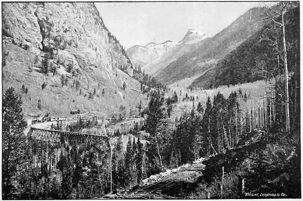
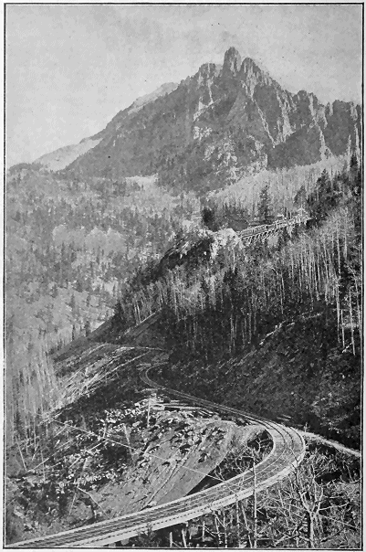
Shortly after leaving Trout Lake, the famous Ophir Loop is passed. Here
the skill of the engineer was taxed to its utmost, for the track winds in zig-zags
down the mountain side, rushing through a deep cut here, over a mountain
torrent and a high bridge there, darting around sharp curves, in and out of
snowsheds, until on the opposite mountain and high above us is to be seen a
line of freshly-turned earth, which the knowing ones say is the track over
which we have just passed.
From Vance Junction, a side trip of ten miles, which will well repay the
tourist, can be made to Telluride, a mining town of some 2,500 inhabitants,
nestling among snow-capped mountains, rising to stupendous heights and rich
in gold and silver.
From Vance Junction the journey is continued down the San Miguel River,
past Placerville, until the river leaves the rail, and again we commence to go
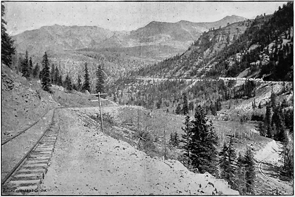
up; this time over the Dallas Divide. This pass resembles Marshall Pass,
though not quite so long. After reaching the summit, the line runs down the
eastern slope along Leopard Creek, high above it on the mountain side, giving
a most magnificent view of the Uncompahgre Range to the south with its
gentle slopes softly colored by the deep, dark foliage of dense pine and fir
forests, gradually rising until the mountains develop into a huge mass of
shattered pinnacles, their topmost points covered with the everlasting snow.
Arriving at Ridgway, a city of some 1,500 inhabitants, the journey is
again resumed on the original route via the Denver & Rio Grande.
ILIUM CURVE.
THE RAINBOW ROUTE.
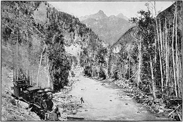
From Durango, the metropolis of the San Juan, to Silverton the scenery is
of surpassing grandeur and beauty. The railroad follows up the course of the
Animas River (to which the Spaniards gave the musical but melancholy title
of "Rio de las Animas Perdidas," or River of Lost Souls), until the picturesque
mining town of Silverton is reached. The valley of the Animas is
traversed before the cañon is reached, and the traveler's eyes are delighted
with succeeding scenes of sylvan beauty. To the right is the river, beyond
which rise the hills; to the left are mountains, increasing in rugged contour as
the advance is made; between the track and the river are cultivated fields
and cosy farmhouses, while evidences of peace, prosperity and plenty are to
be seen on every hand. Nine miles above Durango, Trimble Hot Springs
are reached. The spacious hotel stands within a hundred yards of the road
to the left of the track. Here are medicinal hot springs of great curative
value, and here, in the season, gather invalids and pleasure seekers to drink
the waters and enjoy the delights of this charming resort. Leaving the
springs behind, the train speeds up the valley, which gradually narrows as
the advance is made; the ascending grade becomes steeper, the hills close in,
and soon the view is restricted to the rocky gorge within whose depths the
raging waters of the Animas sway and swirl.
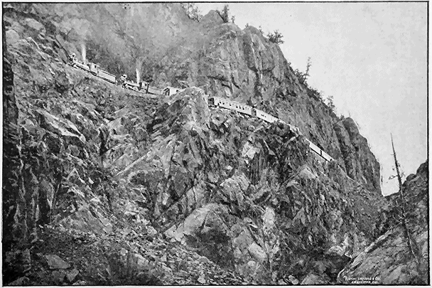
Animas Cañon has characteristics peculiarly its own. The railroad does
not follow the bed of the stream, but clings to the cliffs midway of their
height; and a glance from the car window gives one the impression of a view
from a balloon. Below, a thousand feet, are the waters of the river—in places,
white with foam; in quiet coves, green as ocean's depths. Above, five hundred
feet, climb the combing cliffs, to which cling pines and hemlocks. The
cañon here is a mere fissure in the mountain's heart, so narrow that one can
easily toss a stone across and send it bounding down the side of the opposing
rock wall until it falls into the waters of the river coursing through the abyss
below. Emerging from this wonderful chasm, the bed of the gorge rises until
the roadway is but a few feet above the level of the stream. The close, confining
and towering walls of rock are replaced by mountains of supreme
height. The Needles, which are among the most peculiar and striking of the
Rockies, thrust their sharp and splintered peaks into the regions of eternal
frost.
Elk Park is a quiet little nook in the midst of the range, with vistas of
meadows and groves of pines, a spot which would furnish the artist many a
subject for his canvass.
At the end of Elk Park stands Garfield Peak, lifting its summit a mile
above the track. Beyond are marshaled the everlasting mountains, and
through them for miles extends, in varying beauty and grandeur, the cañon
of the Animas. Frequent waterfalls glitter in the sunlight, leaping from crag
to crag, only to lose themselves at last in the outflowing river. Emerging
finally from this environment of crowding cliffs, the train sweeps into Baker's
Park and arrives at Silverton in the heart of the San Juan.
Silverton is interesting, both from its picturesque position and from the
fact that it is a mining town. The mountains by which it is surrounded on
all sides are honeycombed with the shafts and tunnels of innumerable mines.
Sultan Mountain, which overlooks the town, is a noble and impressive elevation,
and adds to the grandeur of the scene by its regal presence.
MOUNT BEATLE.
From Silverton the journey "Around the Circle" is continued by taking
the Silverton Railway, a road constructed up the difficult grades of Red
Mountain, and doing an immense business in the handling of ores which are
taken from these rich deposits; also employed in the transportation of passengers.
This wonderful road owes its construction to the genius, daring and
wealth of one man, Mr. Otto Mears, who has for years been the "pathfinder"
of the San Juan region, building toll roads and opening the gates of prosperity
to the many mining towns of this mountainous country. He is the sole owner
of the road, and has conquered engineering difficulties of the most astounding
character. The line does not as yet bridge the gap between Silverton
and Ouray, and from Ironton, its terminus, stages carry tourists over the
mountains to the latter point, where the trip is resumed by the Denver & Rio
Grande Railroad.
The stage ride forms one of the most attractive features of this most attractive
journey. Lasting only two hours, passing over the summits of ranges
and through the depths of cañons, the tourist will find this a welcome variation
to his method of travel and a great relief and recreation. The old fashioned
stage, with all its romantic associations, is rapidly becoming a thing of
the past. A year or two more and it will have disappeared, except in rare instances,
from Colorado. Here, in the midst of some of the grandest scenery
on the continent, the blue sky above and the fresh, pure, exhilarating mountain
air sending the blood bounding through one's veins, to clamber into a
Concord coach and be whirled along a splendidly-constructed road, costing in
some instances $40,000 a mile in its construction, to behold the grandest of
Nature's handiwork, and to be in such close communion with the everlasting
hills, is surely a novel and delightful experience.
The scenery on this journey between Silverton and Ouray is of the greatest
magnificence. This is especially true of that portion of the route traversed
by stage. The Silverton and Ouray toll road has long been noted for its
attractions in the way of scenery, the triangular mass of Mount Abraham's
towers to the left, while the road winds around the curves of the hills with the
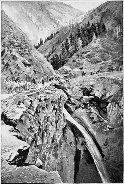
sinuosity of a mountain brook. The scene from the bridge over Bear Creek
is one which once beheld can never be forgotten. Directly under the bridge
plunges a cataract to a depth of 253 feet, forming a most noteworthy and impressive
scene. The toll road passes through one of the greatest mining regions
in the world, and the fame of Red Mountain is well deserved both from
the number and richness of its mines. Before Ouray is reached, the road
passes through Uncompahgre Cañon. Here the roadbed has been blasted
from the solid rock wall of the gorge, and a scene similar in nature and rivaling
in grandeur that of Animas Cañon is beheld.
MOUNT ABRAM, OURAY TOLL ROAD.
Ouray is one of the most beautifully situated towns to be found anywhere.
Its scenery is idyllic. The village is cradled in a lovely valley surrounded by
rugged mountains. The situation of the town is thus vividly described by
Ernest Ingersoll in the "Crest of the Continent": "The valley in which the
town is built is at an elevation of about 7,500 feet above the sea, and is pear-shaped,
its greatest width being not more than half a mile, while its length is
about twice that, down to the mouth of the cañon. Southward—that is, toward
the heart of the main range—stand the two great peaks, Hardin and
Hayden. Between is the deep gorge down which the Uncompahgre finds its
way; but this is hidden from view by a ridge which walls in the town and cuts
off all farther view from it in that direction, save where the triangular top of
Mount Abram peers over. Westward are grouped a series of broken ledges,
surmounted by greater and more rugged heights. Down between these and
the western foot of Mt. Hayden struggles Cañon Creek to join the Uncompahgre,
while Oak Creek leaps down a line of cataracts from a notch in the
terraced heights through which the quadrangular head of White House Mountain
becomes grandly discernible—the easternmost buttress of the wintry
Sierra San Miguel.
"At the lower side of the basin, where the path of the river is beset with
close cañon walls, the cliffs rise vertically from the level of the village, and
bear their forest growth many hundreds of feet above. These mighty walls,
two thousand feet high in some places, are of metamorphic rock, and their
even stratification simulates courses of well-ordered masonry. Stained by iron,
and probably also by manganese, they are a deep red maroon. This color does
not lie uniformly, however, but is stronger in some layers than in others, so
that the whole face of the cliff is banded horizontally in pale rust color, or
dull crimson, or deep and opaque maroon. The western cliff is bare, but on
the more frequent ledges of the eastern wall scattered spruces grow, and add
to its attractiveness. Yet, as though Nature meant to teach that a bit of
motion—a suggestion of glee was needed to relieve the somberness of utter
immobility and grandeur, however shapely—she has led to the sunlight, by a
crevice in the upper part of the eastern wall that we cannot see, a brisk torrent
draining the snowfields of some distant plateau. This little stream,
thus beguiled by the fair channel that led it through the spruce woods above,
has no time to think of its fate, but is flung out over the sheer precipice
eighty feet into the valley below. We see the white ghost of its descending,
and always to our ears is murmured the voice of the Naiads who are
taking the breathless plunge. Yet by what means the stream reaches that
point from above cannot be seen, and the picture is that of a strong jet of
water bursting from an orifice through the crimson wall, and falling into rainbow-arched
mist and a tangle of grateful foliage that hides its further
flowing."
CURRECANTI NEEDLE.
Resuming the railroad journey at Ouray, the traveler will find much to
interest him in the run past Ridgway, where the Rio Grande Southern connects
with the Denver & Rio Grande, to Montrose, where the main line is
again reached, and, with faces turned once more to the eastward, the homeward
segment of the "circle" is entered upon, and the greatest wonders of
all this wonderful journey lie before. From Cerro Summit a fine view can be
had of the Uncompahgre Valley, its river, and the distant peaks of the San
Juan and Uncompahgre ranges of mountains. Cimarron Cañon is entered
shortly after leaving Cerro Summit, the road following this cañon down Cimarron
Creek to where it empties into the Gunnison river. Here begins the
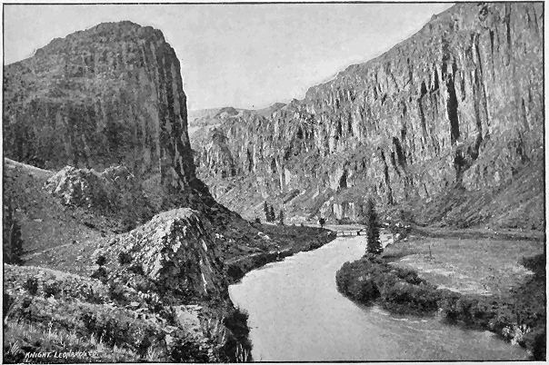
tourist's experience in the world-renowned Black Cañon of the Gunnison.
The name is a misnomer. There is nothing black about the cañon except
the shadows of the towering granite walls. The cliffs themselves show bright
and happy colors. Gay contrasts of pink and blue, bright complements of
red and maroon, all shades blended and differentiated, dashed on here and
there as with the broad, free-handed sweep of some master scenic painter.
The scene is varied, kaleidoscopic, constantly changing. Here the train
rolls along between frowning and exalted walls: there a stream of water,
Chippeta Falls, white as wool, pitches from the brow of a precipice two
thousand feet above; yonder a side cañon yawns with capacious mouth as if
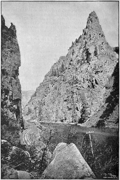
to engulf us. Now we are in a spacious amphitheater, in the center of which
stands a tremendous monument of solid stone, a spire graceful as if hewn by
the hand of a Gothic builder, and terminating in a sky-piercing pinnacle.
This is the famed "Currecanti Needle." Thus for twenty miles the ever-changing
variety of the Black Cañon holds the awe-stricken attention of the
traveler. At last the train rolls out into the valley of the Gunnison, and
pastoral scenes take the place of the tumultuous grandeur just beheld.
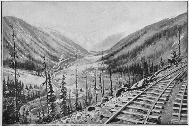
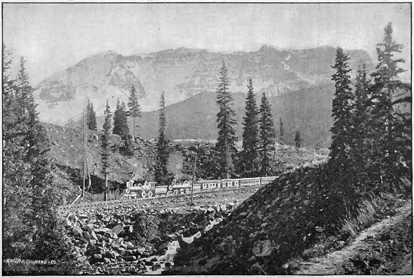
But soon a new marvel demands attention. The ascent of Marshall Pass
is just begun. We have just gone through the mountains, now we are to go
over them. The Pacific slope is now to be achieved. Two powerful engines
puff vigorously and take us spinning up the ringing grooves of this marvelous
road, climbing grades of 211 feet to the mile with as much apparent ease as
though we were traversing the level plain. What a varied panorama of
mountain views meets the gaze, and when the summit is reached. 10,852 feet
above the distant sea, the train pauses and the eye sweeps the prospect as far
as vision reaches. To the right, fading away into the blue distance, can be
seen the serrated range of the Sangre de Cristo Mountains, snow-covered
pyramids of transcendent beauty. To the left towers fire-scarred Mount
Ouray, a volcano whose fires died out ages ago, while opposite stands its
companion peak, Mount Shaveno. Beneath is the pathway of our ascent,
four lines in view, each one an ascending circle of our tortuous upward
journey.
CATHEDRAL SPIRE.
Half a dozen revolutions of the wheels and we are on the Atlantic slope.
The waters all run to the eastward now. One engine holds the train in
check. There are no smoke and cinders. Pneumatic breaks skillfully
applied by the engineer control the power of gravitation, which is the sole
force needed to carry the long train down its winding way. The sinuosity of
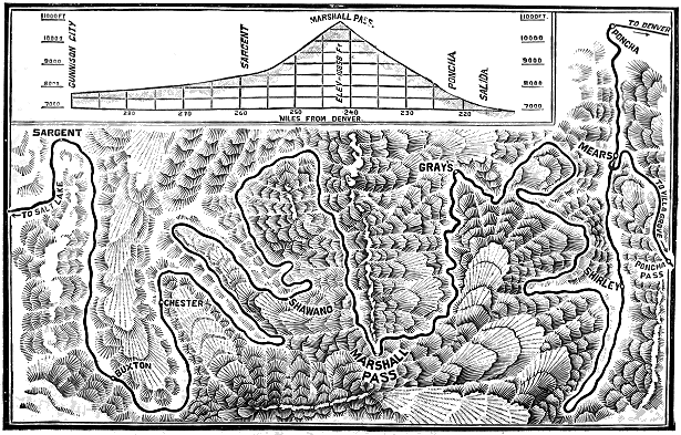
the descent is something indescribable. A glance at the illustration of the
alignment of the road over Marshall Pass will convey a better idea than anything
that could be said. The descent is ended at Poncha Springs, and the
train enters the valley of the Arkansas.
At Poncha are some of the most remarkable hot springs to be found anywhere
in the West. There are over one hundred of these springs; the water
varies in temperature from 90 to 185 degrees Fahrenheit. The analysis of the
Poncha Springs corresponds almost exactly with that of the waters of the Hot
Springs in Arkansas.
From the Arkansas Valley can be obtained a fine view of the Collegiate
range of mountains, including the peaks of Harvard, Yale and Princeton, all
of which reach an altitude greater than fourteen thousand feet.
The crowning attraction, the wonder of wonders, the marvel of marvels,
yet remains to be seen. The Grand Cañon of the Arkansas lies before us.
There are no words in the language which can describe this cañon. There
are no pigments on the artist's palette that can paint it; it is indescribable
and entirely beyond the reach of mimetic art. The Grand Cañon is seven
miles in length—seven miles of wonders, seven miles of the grandest, most
awful scenery in the world. To the right boils and surges the Arkansas River,
above which tower the red rocks of the cañon. To the left are cliffs, jutting
in places above the track, and rising to tremendous and awe-inspiring heights.
The progress down the cañon is by means of many intricate curves, and it
seems as though the engine would dash itself to atoms against the cliffs, but
each time a slight turn is made and the train rounds the promontory in safety.
Soon the tourist finds himself in the heart of the mountain. Peak upon
peak rises above him, until the splintered summits seem to touch the sky.
Darker and darker grow the shadows, narrower and still more narrow grows
the gorge, deeper and deeper grows the gloom, the river ceases its roaring,
the noise of the train is hardly perceptible, for the engineer has "slowed up,"
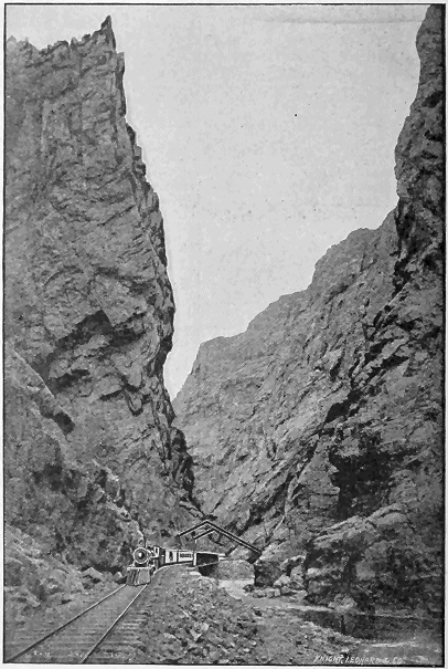
and the Royal Gorge is at hand. Here the cañon is not wide enough for
road and river, and here is one of the most remarkable feats of engineering.
Right across the gorge, fifty feet wide at the base and perhaps seventy at the
summit, which soars above to a height of nearly three thousand feet, a
series of great iron braces has been thrown, from which huge iron bars depend,
holding a long iron bridge in suspension, that clings to the face of the
cliff, and runs, not across, but parallel with the course of the river. The eye
can scarcely comprehend the stupendous height of the perpendicular cliffs
whose summits pierce the heavens half a mile above our heads.
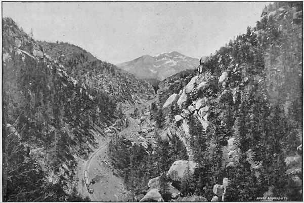
APPROACH TO THE BLACK CAÑON.
After beholding the Royal Gorge the traveler has a superlative comparison
for all that is wonderful and grand in nature. He has seen something which
he can never forget, and of the many marvels of this marvelous journey
"Around the Circle," the greatest of them all, the crowning glory, is the
Royal Gorge.
It will not be inappropriate to make some special mention of several of
the more important points of interest on the circle tour, and we add below a
short description of the "Royal Gorge," "Toltec Gorge," "Animas
Cañon," "Black Cañon of the Gunnison," and the "Marshall Pass."
THE BLACK CAÑON.
In all the world there is no place so beautiful, imposing, sublime and awful,
that may be so easy and comfortably visited, as the Black Cañon, for the iron
horse of the Denver & Rio Grande Railroad has a pathway through the cañon,
and he draws after him coaches as handsome and pleasant as those which he
draws on the level plain. Along many miles of this grand gorge the railroad
lies upon a shelf that has been blasted in the solid walls of God's masonry;
walls that stand sheer two thousand feet in height, and so close together that
for most of the distance through the cañon only a streak of sky, sometimes in
broad daylight, spangled with stars, is seen above.
"I'll look no more;
Lest my brain turn, and the deficient sight
Topple down headlong."
Unlike many of the Colorado cañons, the scenery in this one is kaleidoscopic,
ever changing. Here the train glides along between the close, regular
and exalted walls then suddenly it passes the mouth of another mighty cañon
which looks as if it were a great gateway to an unroofed arcade leading from
the pathway of some monstrous giant. Now, at a sharp turn, Chippeta
Falls, a stream of liquid crystal, pitches from the top of the dizzy cliffs to the
bosom of the sparkling river which dashes beside the road. Then a spacious
amphitheater is passed, in the centre of which stands Currecanti Needle,
solitary and alone, a towering monument of solid stone, which reaches to
where it flaunts the clouds, like some great cathedral spire. Truly there is
no gorge in all the Rocky range that presents such variety and grandeur as
the Black Cañon of the Gunnison.
TOLTEC GORGE.
MARSHALL PASS.
Marshall Pass is entered almost imperceptibly from Poncha Pass, and the
whole wonderful ascent might very readily be imagined as one and the same.
The summit is almost eleven thousand feet above the sea, and the tortuous
method by which the daring engineers of the Denver & Rio Grande Railroad
have achieved this summit can best be understood by a glance at the cut
illustrating the alignment of the track, shown on another page. As the train
progresses up the steep the view becomes less obstructed by mountain sides
and the eye roams over miles of cone-shaped summits. The timberless tops
of towering ranges show him that he is among the heights and in a region
familiar with the clouds. Then he beholds, stretching away to the left, the
most perfect of all, the Sierras. The sunlight falls with a white, transfiguring
radiance upon the snow-crowned spires of the Sangre de Cristo range. Their
sharp and dazzling pyramids, which near at hand are clearly defined, extend
to the southward until cloud and sky and snowy peak commingle and form a
vague and bewildering vision. To the right towers the fire-scarred front of
old Ouray, grand, solitary and forbidding. Ouray holds the pass, standing
sentinel at the rocky gateway to the fertile Gunnison. Slowly the steeps are
conquered, until at last the train halts upon the summit of the continental
divide which separates the waters of the Atlantic and Pacific. The traveler
looks down upon four lines of road, terrace beyond terrace, the last so far
below as to be quite indistinct to view. Wonder at the triumphs of engineering
skill is strangely mingled with the feelings of awe and admiration at the
stupendous grandeur of the scene.
ANIMAS CAÑON AND NEEDLE MOUNTAIN.
TOLTEC GORGE.
The approach to this great scenic wonder prepares the traveler for something
extraordinary and spectacular. A black speck in the distance against
the precipitous surface of a frowning cliff is beheld long before Toltec is
reached, and is pointed out as the entrance to the tunnel, which is the gateway
to the Gorge. As the advance is made around mountain spurs and deep
ravines, glimpses are caught of profound depths and towering heights, the
black speck widens into a yawning portcullis, and then the train, making a
detour of four miles around a side cañon, plunges into the blackness of Toltec
tunnel, which is remarkable in that it pierces the summit of the mountain
instead of its base. Fifteen hundred feet of perpendicular descent would
take one to the bottom of the gorge, while the seared and wrinkled expanse
of the opposite wall confronts us, lifting its massive bulwarks high above us,
"Fronting heaven's splendor,
Strong and full and clear."
When the train emerges from the tunnel it is upon the brink of a
precipice. A solid bridge of trestle-work, set in the rock after the manner of
a balcony, supports the track, and from this coigne of vantage the traveler
beholds a most thrilling spectacle. The tremendous gorge, whose sides are
splintered rocks and monumental crags, and whose depths are filled with the
snow-white waters of a foaming torrent, lies beneath him, the blue sky above
him, and all around the majesty and mystery of the mountains.
ANIMAS CAÑON.
Animas Cañon is one of the wildest and most picturesque gorges in the
Rocky Mountains. Through it the Rio de las Animas Perdidas, or "River
of Lost Souls," finds its way to the valley below. For a dozen miles north of
Durango the Denver & Rio Grande Railroad traverses the fertile and cultivated
valley of the Animas in its approach to the cañon. Soon the valley becomes
more broken and contracted, the approaching walls grow more precipitous
and the smooth meadows give place to stately pines and sighing
sycamores. The silvery Animas frets in its narrowing bed and breaks into
foam against the opposing boulders. The road climbs and clings to the rising
cliffs, and presently the earth and stately pines have receded and the train
rolls along a mere granite shelf in mid-air. Above, the vertical wall rises a
thousand feet; below, hundreds of feet of perpendicular depth and a fathomless
river. The cañon is here a mere rent in the mountain, so narrow one
may toss a pebble across, and the cramped stream has assumed the deep
emerald hue of the ocean. In the shadows of the rocks, all is solitary, and
weird, and awful. The startled traveler quickly loses all apprehension in the
wondrous beauty and grandeur of the scene, and, as successive curves repeat
and enhance the enchantment, nature asserts herself in ecstasy. Emerging
from the marvelous gorge, the bed of the cañon rapidly rises, until the roadway
is but a few feet above the stream. Dark walls of rock are replaced with
clustering mountains of supreme height, whose abruptness defies the foot of
man, and The Needles, the most peculiar and striking of the Rockies, thrust
their splintered pinnacles into the region of perpetual snow.
ROYAL GORGE.
THE ROYAL GORGE.
The crowning wonder of this wonderful Denver & Rio Grande Railroad
is the Royal Gorge. Situated between Cañon City and Salida, it is easy of
access either from Denver or Pueblo. After the entrance to the cañon has
been made, surprise and almost terror comes. The train rolls round a long
curve close under a wall of black and banded granite, beside which the ponderous
locomotive shrinks to a mere dot, as if swinging on some pivot in the
heart of the mountain, or captured by a centripetal force that would never
resign its grasp. Almost a whole circle is accomplished, and the grand amphitheatrical
sweep of the wall shows no break in its zenith-cutting facade.
Will the journey end here? Is it a mistake that this crevice goes through the
range? Does not all this mad water gush from some powerful spring, or
boil out of a subterranean channel impenetrable to us? No, it opens. Resisting
centripetal, centrifugal force claims the train, and it breaks away at a
tangent past the edge or around the corner of the great black wall which
compelled its detour and that of the river before it. Now what glories of rock
piling confront the wide-distended eye! How those sharp-edged cliffs,
standing with upright heads that play a handball with the clouds, alternate
with one another, so that first the right, then the left, then the right one beyond
strike our view, each one half obscured by its fellow in front, each showing
itself level browed with its comrades as we come even with it, each a score of
hundreds of dizzy feet in height, rising perpendicularly from the water and
the track, splintered atop into airy pinnacles, braced behind against the almost
continental mass through which the chasm has been cleft. This is the
Royal Gorge.
The following is a description of the points of interest in the exact order
on the Trip Around the Circle, starting from Denver:
Castle Rock.—32 miles from Denver, east side of track. A bold and
remarkable promontory rising from the plain.
Casa Blanca.—50 miles from Denver, between Greenland station and
Palmer Lake, west side of track. An enormous white rock, 1,000 feet long
and 200 feet high, presenting the appearance of a castle.
Palmer Lake.—52 miles from Denver. A beautiful sheet of water
on the exact summit of the Divide, altitude 7,238 feet.
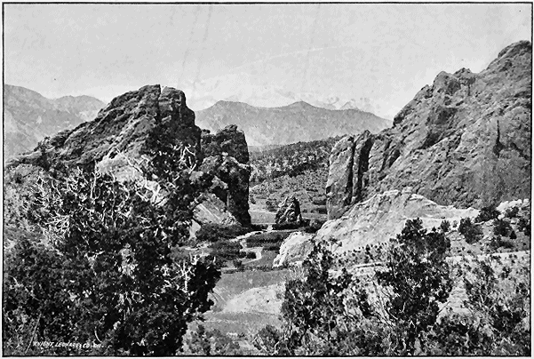
PIKE'S PEAK FROM THE GARDEN OF THE GODS.
Glen Park.—Half mile south of Palmer Lake, west side of track.
Colorado's Chautauqua.
Phœbe's Arch.—One mile south of Palmer Lake, east side of track.
A natural archway through a massive, castled rock of red sandstone.
Monument Park.—65 miles from Denver, distant view, west side of
track, from Edgerton station. A natural park filled with fantastic and
imitative rock formations.
Pike's Peak.—75 miles from Denver, 5 miles from Colorado Springs.
The most famous peak of the Rockies, altitude 14,147 feet. Easy of ascent
from Manitou.
Manitou Springs.—Manitou branch, 80 miles from Denver, 5 miles
from Colorado Springs. The Saratoga of the West. Popular summer resort,
wonderful effervescent and medicinal springs. Surrounded by more objects
of interest than any other pleasure resort in the world, including "Garden of
the Gods," "Glen Eyrie," "Red Rock Cañon," "Crystal Park," "Engleman's
Cañon," "William's Cañon," "Manitou Grand Caverns," "Cave of
the Winds," "Ute Pass," "Rainbow Falls," and "Bear Creek Cañon."
Garden of the Gods.—Manitou branch. One and one-half miles
from Manitou. Famous the world over as a most interesting and wonderful
park, abounding in strange and majestic rock forms.
Cheyenne Mountain.—Two miles south of Colorado Springs. One
of the most beautiful of the Rocky Mountains, in which are the Cheyenne
Cañons and the Seven Falls. Near the summit of this mountain is the
burial place of the author and poet, "H. H."
Spanish Peaks.—Two twin peaks rising from the plains, without any
foothills, forming a most striking picture. Visible all the way, to the
eastward, from Pueblo until the descent of Veta Pass into the San Luis Valley is
begun. Height of peaks respectively, 13,620 and 12,720 feet.
Sierra Blanca.—This monarch of all the Rocky Mountains, and the
loftiest in the United States with but one exception, can be seen from Garland
station, and remains in full view until the San Luis Park is left behind.
Elevation, 14,464 feet.
Wagon Wheel Gap.—Del Norte branch. The hot springs of the
Wagon Wheel Gap are famous for their curative qualities. The place is
exceedingly picturesque and has become a favorite health and pleasure resort.
The best trout fishing in the West. Distance from Denver, 310 miles.
Elevation, 8448 feet.
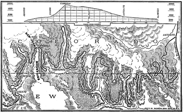
ALIGNMENT OF TOLTEC GORGE DISTRICT.
Creede.—Del Norte branch. New mining camp of great promise.
Population 8,000. The latest and greatest mineral discovery.
Entrance to the Gap.—Del Norte branch. The gap proper is a
cleft through a great hill with walls suggesting the palisades of the Hudson
and of about the same height. Through this gap flows the waters of the Rio
Grande del Norte, bright and sparkling, fresh from their mountain sources.
San Luis Park.—This park or valley is one hundred miles long by
sixty broad, altitude 7,000 feet, surrounded by mountains from 4,000 to 7,000
feet higher than the plain. The soil is fertile, and by irrigation is being
developed into a fine agricultural region. Distance from Denver, 250 miles.
Phantom Curve.—After Sublette, 305 miles from Denver, has been
passed, the road makes a great bend around the side of a mountain; on the
left rise tall monuments of sandstone cut by the elements into the form of
weird and fantastic figures; this has been appropriately named "Phantom
Curve."
Toltec Gorge.—From Big Horn, distant 298 miles from Denver, to
Cumbres, there is a succession of magnificent and awe-inspiring views. About
midway between the two, at Toltec station, 309 miles from Denver, is Toltec
Gorge. The road traverses the verge of this great chasm, the bottom of
which is 1,500 feet below. The best view is on the bridge immediately after
passing through Toltec Tunnel.
Garfield Memorial.—Just beyond the bridge at Toltec Gorge stands
a monument of granite in memory of President Garfield. On the 26th day
of September, 1881, the National Association of General Passenger Agents,
at the time President Garfield was being buried in Cleveland, held memorial
services at the mouth of Toltec Tunnel, and since have erected this beautiful
monument in memory of the event.
Cumbres Summit.—Distant from Denver, 329 miles. Summit of the
Conejos range. Elevation, 10,014 feet.
Trimble Hot Springs.—Health and pleasure resort, 459 miles from
Denver, 9 miles from Durango and 36 miles from Silverton. The springs are
noted for their strong remedial character. Elevation, 6,644 feet.
Animas Cañon.—Just beyond Rockwood, 469 miles from Denver, the
Animas Cañon begins. This gorge is formed by the breaking through the
range of the Rio de las Animas Perdidas. The road is built along a shelf cut
in the solid rock-wall of the cañon, which towers 500 feet above and drops
1,000 feet below the track. In this it differs from all other scenes on the line.
ALIGNMENT OF MARSHALL PASS DISTRICT.
The Needles.—After emerging from the western extremity of Animas
Cañon, the traveler can see The Needle Mountains, the most peculiar and
striking of the Rockies, thrusting their splintered pinnacles into the regions of
perpetual snow.
Elk Park.—Animas Cañon having been passed, the road enters Elk
Park, a beautiful little valley in the midst of the range, a spot rich in material
for the artist in search of new impressions.
Garfield Peak.—At the western extremity of Elk Park rises Garfield
Peak, a grand and impressive mountain towering to a height of a mile above
the track.
Sultan Mountain.—Silverton, the terminus of this branch of the
line, is 495 miles from Denver. It is surrounded by mountains rich in
mineral-bearing mines. One of the most picturesque of these is Sultan
Mountain, which reaches an elevation of 14,115 feet.
Ouray.—Picturesque mountain town. Hot springs of medicinal properties
make this a resort for health and pleasure. The mines surrounding
Ouray are among the richest in Colorado. Population, 3,000. Distance from
Denver, 388 miles. Elevation, 7,640 feet.
Los Pinos Agency.—The ruins of the old Los Pinos Agency can
be seen 13 miles from Montrose. The old store house and council chamber
are still standing.
Cantonment of the Uncompahgre.—Nine miles from Montrose
the road passes the Government post, where soldiers are still stationed.
Chippeta's Home.—Four miles from Montrose can still be seen the
late residence of Chippeta, the widow of Ouray, the dead Ute chief, who
was always the friend of the white man.
Uncompahgre Mountains.—After passing Montrose, 353 miles
from Denver, a fine view of the Uncompahgre Mountains, extending to the
southwest, can be obtained. Uncompahgre Peak, the monarch of the range,
rises to an altitude of 14,235 feet.
Cerro Summit.—The ascent is commenced directly after leaving
Cimarron station on the westward journey. From here the Uncompahgre
Valley, its river and the distant, picturesque peaks of the San Juan are within
full sight of the traveler.
Cimarron Cañon.—Western entrance to Black Cañon, the road
passing up Cimarron Creek, where it debouches in the Gunnison. The
Cimarron abounds in trout and the country round about swarms with large
game.
MANITOU.
Currecanti Needle.—Situated in a spacious amphitheater, midway
of the Black Cañon, this curious monolith towers upward like a great
cathedral spire.
Chippeta Falls.—A beautiful waterfall near the east end of Black
Cañon, that plunges from the summit of the cañon wall, descending in a
sheet of snowy spray to the Gunnison River below.
Black Cañon.—Twenty-five miles west from Gunnison. Along many
miles of this grand gorge the railroad lies upon a shelf hewn from the living
rock, which rises frequently to an altitude of over two thousand feet. The
cañon is sixteen miles in length, and abounds in many striking features.
Gunnison River and Valley.—Just after passing Gunnison City,
290 miles from Denver, the valley of the Gunnison is entered, and upon the
right, as one journeys westward, flows the beautiful Gunnison river.
Mount Shavano.—Shavano is a companion to Mount Ouray, and
rises on the opposite side of the track to an altitude of 14,238 feet.
Mount Ouray.—At the summit of Marshall Pass, 242 miles from
Denver. An extinct volcano whose crater can be plainly seen. Altitude
14,043 feet.
Marshall Pass.—Begins six miles from Poncha Junction, at Mears
Junction. The summit of the Pass has an altitude of 10,852 feet. From
this point a magnificent view can be had of the Sangre de Cristo range
extending to the southeast. The pass is a scenic and a scientific wonder,
grades of 211 feet to the mile are frequent, and the ascent and descent are
made by a series of most remarkable curves. The streams from the summit
flow eastward into the Atlantic and westward into the Pacific.
Poncha Pass.—Two miles from Poncha Junction; leads up to Marshall Pass.
Poncha Springs.—Five miles from Salida. Noted hot springs.
Temperature of the water varies in the different springs, 100 in number, from
90° to 185° Fahrenheit. A great health resort. Altitude, 7,480 feet.
Arkansas River and Valley.—The railroad crosses the Arkansas
River at Salida, and from the bridge, and until the town of Poncha Springs
has been passed, a fine view can be had of the river and its fertile valley.
Collegiate Peaks.—Harvard, Yale and Princeton peaks, plainly
seen from the vicinity of Salida to the northwest. Altitude, respectively,
14,383 feet, 14,101 feet, 14,199 feet.
BEAR CREEK FALLS.
Sangre de Cristo Range.—On approaching Salida, near the western
end of the Grand Cañon, there is a break in the walls through which fine
pictures of the Sangre de Cristo peaks present themselves.
The Royal Gorge.—The climax of all the grandeur of the Grand
Cañon of the Arkansas lies midway in this wonderful chasm. The best
view can be obtained from the famous hanging bridge. Here the walls of
the cañon rise to a perpendicular height of 2,600 feet above the track.
Grand Cañon of the Arkansas.—165 miles from Denver, between
Cañon City and Parkdale, eight miles long. The world-famed chasm
through which the river makes its way to the plains.
The following points of interest are located on the line of the Rio Grande
Southern Railroad between Durango and Ridgway:
Cliff Dwellings.—Those interesting ruins are located in the Mancos
Cañon and the Montezuma Valley, some twenty miles to the south of Mancos
station, and easily accessible from that point by a delightful drive over a
mountain road. A journey to this historic spot will well repay the time and
trouble it would involve. Teams with guides and drivers can be engaged at
Mancos.
Lost Cañon.—This small cañon is between Mancos and Dolores, and
hough not so long or high as numbers of others in the Circle tour, is nonetheless
interesting, as it possesses many novelties in the way of mountain
scenery.
Dolores Cañon.—While this cañon is not particularly deep, its
natural beauties are manifold, and are sure to make a lasting impression on
the beholder. This cañon is passed just before arriving at Rico.
Rico.—An important mining town of some 2,000 inhabitants, beautifully
situated in the center of a huge amphitheater of high, snow-capped mountains.
Lizard Head Pass.—A mountain pass similar to Marshall Pass,
crossing the Uncompahgre Range at an elevation of 10,248 feet. The serpentine
windings of the railroad up the mountain sides are full of interest.
Lizard Head.—A peculiar rock formation at the summit of the pass
of the same name resembling the head of a mountain lizard.
Trout Lake.—A beautiful little lake of clear, cold mountain water,
filled with thousands of trout. Good accommodations for the sportsman are
near at hand, and a few days can be pleasantly spent here.
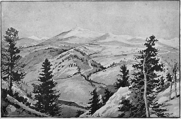
MOUNT OURAY, EAST SLOPE OF MARSHALL PASS.
The Ophir Loop.—The descent down the mountain side after leaving
Trout Lake is called as above, and is one of the most daring and intricate
pieces of railroad engineering that exists in the world.
Telluride.—Telluride is located on a branch from the main line some
ten miles away. It is surrounded on all sides by high mountains whose faces
are potted with innumerable mines, whose product is the chief source of revenue
to the 2,500 inhabitants of this beautiful mountain town.
San Miguel River.—Leaving Vance Junction, the line follows the
course of the San Miguel River through the beautiful Shenandoah Valley.
The Dallas Divide.—This divide is over a spur of the Uncompahgre
Range on grades of three and tour per cent. Leaving the summit, going
eastward toward Ridgway and to the right of the train, is the main range of
the Uncompahgre with its soft shaded sides towering into splintered pinnacles
above.
Ridgway.—The northern terminus of the Rio Grande Southern Railroad
and the junction of that road and the Denver & Rio Grande Railroad; a
city of some 1,500 inhabitants. Here are located the round-houses and the
shops of the Rio Grande Southern, giving employment to hundreds of machinists
and laborers.
HEALTH AND PLEASURE RESORTS OF THE ROCKY MOUNTAINS. — MOUNTAIN PEAKS AND PASSES OF COLORADO. — ELEVATION OF LAKES. — ALTITUDE OF TOWNS AND CITIES. — INFORMATION FOR TOURISTS.
Located on the Line of the Denver & Rio Grande Railroad.
On or Easily Reached from the "Around the Circle" Trip.
MINERAL SPRINGS.
Manitou Springs
Soda and iron.
Pueblo
Magnetic well.
Parnassus
Alkaline.
Carlile
Soda.
Cañon City
Soda.
Royal Gorge
Hot springs.
Wellsville
Hot springs.
Poncha
Hot springs.
Waunita
Hot springs.
Ouray
Hot springs.
Salt Lake City
Hot sulphur.
Buena Vista
Cottonwood hot springs.
Heywood
Hot springs.
Leadville
Soda springs.
Siloam Springs
Hot springs.
Steamboat Springs
Hot sulphur, iron and soda.
Glenwood Springs
Hot sulphur.
Wagon Wheel Gap
Hot springs.
Antelope Springs
Hot and cold.
Pagosa
Hot springs.
Ojo Caliente
Hot springs.
Trimble
Hot springs.
PLEASURE RESORTS.
Perry Park
Glen Park
Diana Park
Manitou
Beula
Salida
Lake City
Cimarron
Salt Lake City
Trout Lake
Buena Vista
Twin Lakes
Glenwood Springs
La Veta
Palmer Lake
Monument Park
Colorado Springs
Cañon City
Poncha Springs
Rico
Ouray
Provo
Lake Park
Cottonwood Lake
Evergreen Lakes
Steamboat Springs
Wagon Wheel Gap
Trimble Springs
Antelope Springs
Telluride
With Their Elevation Above Sea-Level.
FEET.
Blanca
14,464
Harvard
14,383
Massive
14,368
Gray's
14,341
Rosalie
14,340
Torrey
14,336
Elbert
14,326
La Plata
14,302
Lincoln
14,297
Buckskin
14,296
Wilson
14,280
Long's
14,271
Quandary
14,269
Antero
14,245
James
14,242
Shavano
14,238
Uncompahgre
14,235
Crestones
14,233
Princeton
14,199
Mount Bross
14,185
Holy Cross
14,176
Baldy
14,176
Sneffles
14,158
Pike's
14,147
Castle
14,106
Yale
14,101
FEET.
San Luis
14,100
Red Cloud
14,092
Wetterhorn
14,069
Simpson
14,055
Æolus
14,054
Ouray
14,043
Stewart
14,032
Maroon
14,000
Cameron
14,000
Handie
13,997
Capitol
13,992
Horseshoe
13,988
Snowmass
13,961
Grizzly
13,956
Pigeon
13,928
Blane
13,905
Frustum
13,883
Pyramid
13,895
White Rock
13,847
Hague
13,832
R. G. Pyramid
13,773
Silver Heels
13,766
Hunchback
13,755
Rowter
13,750
Homestake
13,687
Ojo
13,640
FEET.
Spanish
13,620, 12,720
Guyot
13,566
Trinchara
13,546
Kendall
13,542
Buffalo
13,541
Arapahoe
13,520
Dunn
13,502
Bellevue
11,000
Alpine Pass
13,550
Argentine Pass
13,100
Cochetopa Pass
10,032
Hayden Pass
10,780
Trout Creek Pass
9,346
Berthoud Pass
11,349
Marshall Pass
10,852
Veta Pass
9,392
Poncha Pass
8,945
Tennessee Pass
10,418
Tarryall Pass
12,176
Breckenridge Pass
9,490
Cottonwood Pass
13,500
Fremont Pass
1,540
Mosquito Pass
13,700
Ute Pass
11,200
Lizzro Head Pass
10,248
Seventy-two peaks between 13,500 and 14,300 feet in height
are unnamed and not in this list.
FEET.
Twin Lakes
9,367
Grand Lake
8,153
Green Lakes
10,000
Chicago Lakes
11,500
Evergreen Lakes
10,500
Seven Lakes
11,806
Palmer Lake
7,238
Cottonwood Lake
7,700
Trout Lake
9,800
Revised Since First Edition From Engineers' Measurements.
FEET.
Alamosa
7,546
Animas City
6,554
Animas Forks
11,200
Antonito
7,888
Aspen
7,775
Buena Vista
7,970
Cation City
5,344
Castle Rock
6,220
Colorado Springs
5,992
Crested Butte
8,875
Conejos
7,880
Cottonwood Springs
7,950
Cuchara
5,943
Cumbres
10,015
Delta
4,963
Del Norte
7,880
Denver
5,196
Durango
6,520
El Moro
5,879
FEET.
Ft. Garland
7,936
Granite
8,945
Grand Junction
4,583
Gunnison
7,680
Glenwood Springs
5,200
Howardsville
9,700
Irwin
10,500
Kokomo
10,631
Lake City
8,550
La Veta
7,024
Leadville
10,200
Las Pinos
9,637
Montrose
5,793
Malta
9,580
Manitou
6,324
Ojo Caliente
7,324
Ouray
7,640
Ogden, Utah
4,286
Pogosa Springs
7,108
FEET.
Pinos, Chama Summit
9,902
Poncha Springs
7,480
Palmer Lake
7,238
Pueblo
4,669
Red Cliff
8,671
Rico
8,735
Robinson
10,871
Rosita
8,500
Ruby Camp
10,500
Saguache
7,723
Salt Lake City
4,228
Silver Cliff
7,816
Silverton
9,224
Salida
7,050
Telluride
8,758
Trimble Springs
6,644
Westcliffe
7,864
Wagon Wheel Gap.
8,448
Tickets will be placed on sale May 1, and continued until October 31.
Tickets for the journey "Around the Circle" will be sold for $28.00
from Denver, Colorado Springs, Manitou and Pueblo.
Tickets will be good thirty days from date of sale.
Stop-overs will be allowed at any point or points on the trip for any
length of time within the life of the ticket.
Side trips can be taken to any point on the line, not covered by the
round trip, at one-half the regular rates.
The purchaser can have choice of route, going either via Silverton
and Ouray or Montrose and Ouray, or via the Rio Grande Southern
R. R.
The journey "Around the Circle" can be comfortably made in four
days, with rests at Durango, Silverton and Ouray. Or the entire
thirty days can be profitably and pleasantly spent in viewing the
wonderful scenery of the trip.
SEVENTY POINTS OF INTEREST "AROUND THE CIRCLE"
FOR ONLY
$ 28 $
ALL SEEN
FROM THE TRAIN
A THOUSAND MILES THROUGH THE ROCKY MOUNTAINS
DENVER
ROYAL GORGE
THE GRAND CAÑON
Arkansas River
COLLEGIATE RANGE
PONCHA HOT SPRINGS
Poncha Pass
SANGRE DE CRISTO
Atlantic Slope
MT. SHAVENO
MT. OURAY
Marshall Pass
Pacific Slope
Chippeta Falls
CURRECANTI NEEDLE
GUNNISON RIVER
Black Cañon
CIMARRON CAÑON
Cerro Summit
UNCOMPAHGRE MTNS.
U.S. CANTONMENT
OURAY
UNCOMPAHGRE CAÑON
BEAR CREEK FALLS
MOUNT ABRAHAMS
Ouray & Silverton Road
Red Mountain
SULTAN MTN.
SILVERTON
ELK PARK
NEEDLE MTNS.
Garfield Peak
Animas Cañon
TRIMBLE HOT SPRINGS
RIO LAS ANIMAS
DURANGO
Fort Lewis
Mancos Valley
Lost Cañon
DOLORES RIVER
DALLCE DIVIDE
RICO
TELLURIDE
TROUT LAKE
LIZARD HEAD
OPHIR LOOP
INDIAN RESERVATION
CUMBRE'S RANCE
LAS PIONS VALLEY
GARFIELD MEMORIAL
TOLTEC TUNNEL
TOLTEC GORGE
Phantom Curve
Rio Grande Riv.
San Luis Valley
Sierra Blanca
LA VETA PASS
Mule Shoe Curve
SPANISH PEAKS
PUEBLO
CHEYENNE MT.
PIKE'S PEAK
MANITOU
COLORADO SPGS.
GARDEN OF THE GODS
PHŒBE'S ARCH
PALMER LAKE
CASA BLANCA
CASTLE ROCK
Transcriber Note
Minor typos corrected. All references to Canon were changed to Cañon.
Table of Contents added to assist the reader.
Several paragraphs were split to accommodate the placement of illustrations.
The "Seventy Points of Interest" reproduced above only has 69 names shown!