Early Explorations—John Cabot—Bartholomew Gosnold—The
Old Colony—The Mayflower—Plymouth—Plymouth Rock—Duxbury—Samoset—Governor
Bradford—Miles Standish—Cape
Cod—Chatham—Barnstable—Truro—Highland Light—Provincetown—The
Puritan Compact—Quincy—Marshfield—Daniel
Webster—Minot's Ledge—Nantasket—Hingham—Squantum—Boston—Shawmut—Boston
Harbor and
Islands—Boston Common—Beacon Hill and the State House—The
Codfish—Boston Attractions—Old South Church—Old
State House—Faneuil Hall—Old Christ Church—Boston
Fire—Boston Development—The New West End—Parks and
Suburbs—Brook Farm—Newton—Nonatum Hill—Natick—Cochituate
Lake—Wellesley—Sudbury—The Wayside Inn—Charlestown—Old
Ironsides—Jackson's Head—Bunker Hill—Cambridge—Harvard
University—Henry W. Longfellow—James
Russell Lowell—Oliver Wendell Holmes—Margaret
Fuller—Waltham—Lexington—Concord in Middlesex and
its Bridge—Ralph Waldo Emerson—Nathaniel Hawthorne—Henry
D. Thoreau—The Alcotts—Massachusetts North
Shore—Lynn—Nahant—Swampscott—Marblehead—Salem
and the Witches—Beverley—Wenham Lake—Ipswich—Andover—Merrimack
River—Salisbury—Concord in New Hampshire—Manchester—Nashua—Lowell—Lawrence—Haverhill—Newburyport—Bridal
of Pennacook—Cape Ann—Gloucester—The
Fisheries—Norman's Woe—Wreck of the Hesperus—Land's
End—Thatcher's Island—Rockport—Lanesville—Granite—The
Fishermen.
EARLY EXPLORATIONS.
John Cabot was the first explorer of the coasts
of New England under British auspices. After
Columbus had discovered America, fabulous tales
were told of its outlying islands. The primitive
maps represented the Atlantic Ocean as full of
islands, some being very large, especially the Island
of Brazil, and the fabled Island of the Seven Cities.
The latter was said by sailors to be inhabited by
Christians who years before had fled from seven
cities of Asia, under their seven bishops, taking refuge
there. Bristol was then the leading English seaport,
and five years after the discovery by Columbus, John
Cabot started from it on a western voyage of exploration
in search of these famous islands. King
Henry VII. encouraged the enterprise, and in May,
1497, Cabot sailed in the little ship "Matthew," with
a crew of eighteen, and going westward he discovered
one of these islands, which he called the New Found
Land. It was Cape Breton Island, but being apparently
unproductive and without inhabitants, although
some signs of people were seen, he soon returned to
England. The greatest excitement followed his arrival
home, and the report got abroad that he had
discovered the Island of the Seven Cities and the
coast of Asia. Cabot became all the rage in England,
and a writer of that time records that Englishmen
called him "the Great Admiral," followed him
about "like madmen," that he was "dressed in silks,"
and "treated like a prince." Cabot, feeling his importance,
wanted his friends to share his good fortune,
so he appointed some of them governors, and others
bishops over the new world he had discovered, while
King Henry was so delighted at the success of the
voyage that he sent Cabot a letter of thanks and the
munificent present of £10. King Henry VII. was
always regarded as being "a little near."
In 1498, another and larger expedition was fitted
out, Cabot planning to sail westward until he reached
the land he had discovered in the previous year, and
then he thought by turning south he would come to
the Island of Cipango (Japan), where he would fill
his ships with spices and jewels, a half-dozen small
vessels making up the fleet. They took a more
northerly course than before, got among icebergs,
and where the summer days were so long there was
very little night. They reached Labrador, where
the sailors were frightened at the amount of ice, and
turning south, Cabot sailed along the American coast
nearly to Florida, once trying to plant a colony, but
being discouraged by the barren soil, abandoning it.
Yet sterile as the land might be, the waters were
filled with fish, so that Cabot called the country the
"Land of the Codfish," there was such an abundance
of them. The explorers recorded that the
bears were harmless, they could so easily get food,
describing how they would swim out into the sea and
catch the fish. Then Cabot disappeared from view.
Whether he died on the homeward voyage or after
he returned is unknown, as everything about his
subsequent career has faded from history. But his
two voyages were the foundation of the British
claim to the Atlantic coast from Labrador to Florida,
and the basis of all the English grants for the subsequently
formed American colonies.
Bartholomew Gosnold planted the first English
colony in the Old Bay State. Upon Friday, May 14,
1602, after elaborate preparations, he sailed from
Falmouth, England, in the ship "Concord," his party
numbering thirty-two, of whom about a dozen expected
to remain in the new country as settlers.
Crossing the ocean and coming into view of the
American coast, he steered south, soon finding his
progress barred by a bold headland, which encircled
him about. He had got into the bight of Cape Cod
Bay, and thus discovered that great bended, sandy
peninsula, to which he gave the name from the abundance
of codfish he found disporting in the waters.
Many whales were also seen, and vast numbers of
fish of all kinds. He tried to get out of the bay, and
coasting around the long and curiously hooked cape,
emerged into the Atlantic, and then coming down the
outer side got into Vineyard Sound, where he planted
his colony on Cuttyhunk Island, but soon abandoned
it. Gosnold returned to England, and in 1607 sailed
with Newport's expedition, carrying Captain John
Smith to Virginia.
THE OLD COLONY.
The first English settlement permanently planted
in New England was the famous "Old Colony" at
Plymouth. The Puritan Separatists, from the Church
of England, sought refuge from English persecution
in Holland, living in Leyden under their pastor, John
Robinson, for eleven years, when they decided to
migrate to America. They arranged with the Virginia
Company to send them across the ocean, and
about the middle of the summer of 1620 the little
band of Pilgrims sailed from Delft-haven, the port of
Leyden, on the "Speedwell," in charge of Elder Brewster.
The "Mayflower" joined at Southampton with
other Puritans from England, but the "Speedwell"
sprung a leak and they put into Plymouth roads.
Then they decided to go on in the "Mayflower" alone,
and the party left Plymouth early in September.
They were seeking Virginia, but found the land,
after a voyage of over two months, at Cape Cod, anchoring
inside the Cape. Then they thanked God,
"who had brought them over the vast and furious
ocean, and delivered them from all the perils and
miseries thereof, again to set their feet on the firm
and stable earth." While the ship lay there, the
famous "Mayflower Compact" was drawn up, pledging
the signers to obey the government that it established,
and John Carver was chosen the first Governor,
forty-one men signing the compact. After
nearly a month spent in exploration, their shallop
going all about the coasts, Plymouth was selected,
and the pioneers landed December 21, 1620, the day
being now annually celebrated as "Forefathers' Day."
Plymouth has a little land-locked harbor behind a
long and narrow sand beach, projected northward
from the ridge of Manomet below, this beach acting
as a protective breakwater to the wharves. The
harbor is so shallow, however, that there is little
trade by sea. The town spreads upon the bluff
shores, and on a plateau to the hills in the rear.
There is now a population of about nine thousand,
engaged mainly in manufacturing cordage and textiles,
and having a considerable fishery fleet. While
the town is of modern build, yet it is devoted to the
memory which gives it deathless fame, every relic of
the Pilgrims being restored and perpetuated. There
is little to be seen that comes from the olden time,
however, outside of the hills and harbor and original
streets, excepting the carefully cherished relics of the
"Mayflower's" passengers, that have been gathered
together. The choice of Plymouth as the landing-place
seems to have been mainly from necessity, when protracted
explorations failed to find a better place, and
the coming of winter compelled a landing somewhere.
The actual location was hardly well considered, the
Pilgrims themselves being far from satisfied. After
the "Mayflower" anchored inside of Cape Cod, several
weeks were passed in explorations, and finally, upon
a Sunday in December, 1620, a landing was made
upon Clark's Island, where religious services were
held, the first in New England. Upon the most elevated
part of this island stands a huge boulder, about
twelve feet high, called from some local circumstance
the "Election Rock." Its face bears the words taken
from Mourt's Relation, which chronicled the voyage
of the "Mayflower":
"Upon the Sabbath-Day wee rested, 20 December, 1620."
Eighteen of the Pilgrims thus "rested," after their
shallop, in making the shore, had been almost shipwrecked.
The next day they sailed across the bay to
the mainland, their first landing being then made at
Plymouth, and upon the second day, December 22d,
the entire company came ashore and the settlement
began.
Within the Pilgrim Hall, a fireproof building upon
the chief street, are kept the precious relics of the
"Mayflower" and the Pilgrims, with paintings of the
embarkation from Delft-haven and landing at Plymouth,
and old portraits of the leaders of the colony.
Among the interesting documents are autograph writings,
establishing a chain of acquaintanceship connecting
the original Pilgrims with the present time.
Peregrine White was the first child of the new colony,
the infant being born on the "Mayflower" after she
came into Cape Cod Bay, in November, 1620, and
he was only a month old when they landed. The
baby, surviving all their hardships, lived to a ripe old
age, and "Grandfather Cobb," born in 1694, knew
him well. Cobb, in his day, lived to be the oldest
man in New England, his life covering space in three
centuries, for he exceeded one hundred and seven
years, dying in 1801. William R. Sever, born in
1790, knew Cobb and recollected him well, and living
until he was ninety-seven years old, died in 1887.
These three lives connected the Pilgrim landing
almost with the present day. The old cradle that
rocked Peregrine White on the "Mayflower," and after
they landed, is preserved—an upright, stiff-backed,
wicker-work basket, upon rude wooden rockers.
One of the chief paintings represents the signing of
the memorable "Mayflower Compact." There are
also in the hall some of the old straight-backed chairs
of the Pilgrims, with their pots and platters, and
among other relics Miles Standish's sword. In the
court-house are the original records of the colony,
the first allotment of lands among the settlers, their
deeds, agreements and wills, and the patent given the
colony by Earl Warwick in 1629. There are also
shown in quaint handwriting, with the ink partly
faded out, records of how they divided their cattle,
when it was decided to change from the original plan
of holding them in common. Signatures of the Pilgrims
are attached to many of these documents.
Governor Carver died the first year, William Bradford
succeeding, and there is preserved in Governor
Bradford's writing the famous order establishing trial
by jury in the colony.
THE PLYMOUTH ROCK.
"The breaking waves dashed high
On a stern and rock-bound coast."
Thus begins Mrs. Hemans' beautiful hymn on the
landing of the Pilgrims. Unfortunately for the poetry,
however, sand is everywhere about, and scarcely a
rock or boulder can be seen for miles, excepting the
very little one on which they landed. Down near
the water-side is this sacred stone, worshipped by all
the Pilgrim descendants, the retrocession of the sea
having left it some distance back. It is a gray
syenite boulder, oval-shaped, and about six feet
long. It was some time ago unfortunately split, and
the parts have been cemented together. At the time
of the landing this boulder lay on the sandy beach,
partly embedded, being almost solitary on these
sands, for unlike the verge of Manomet to the southward,
and the coast north of Boston, this sandy shore
is almost without rocks of any kind. Dropped
here in the glacial period, and lying partly in the
water, the rock made a boat-landing naturally attractive
to the water-weary Pilgrims when they coasted
along in their shallop from Clark's Island, so they
stepped out upon it to get ashore dry-shod. The
rock is in its original location, but has been elevated
several feet to a higher level, is surmounted by an
imposing granite canopy, and is railed in for protection
from the relic-hunter. The numerals "1620"
are rudely carved upon its side, and a sort of fissure
in its face seems like the impress of a foot. Surmounting
the canopy is a scallop shell, the distinctive
emblem of the pilgrim. The scallop has been called
the "Butterfly of the Sea," and in the time of the
Crusades, a scallop shell fastened in the cap denoted
that the wearer had made a pilgrimage to the Holy
Land. Thus it is said in the Hermit:
"He quits his cell, the pilgrim staff he bore,
And fixed his scallop in his hat before."
Behind the Plymouth Rock rises the bluff shore
into Cole's Hill, having its steep slopes sodded, this
having been the place up which the Pilgrims climbed
after the landing. A view to the front shows the
wharves, and across the bay the narrow sandspit protecting
the harbor, while on the right hand is the
long ridge of Manomet, and over the water to the
left appear distant sand-dunes along Duxbury Beach.
Off to the northward rises the "Captain's Hill" of
Duxbury, surmounted with the monument to Captain
Miles Standish, erected in 1889, rising one hundred
and ten feet. Upon Cole's Hill was the first burial-place
of the Pilgrims, and here were interred about
half the intrepid band, who died from the privations
of the first winter. Their bones were occasionally
washed out by heavy rains, or found in digging for
the foundations of buildings, but all have been carefully
collected, and, with several of the dead thus exposed,
were again entombed in the canopy over
Plymouth Rock. A little way to the southward is
Leyden Street, running from the water's edge for
some distance back up the slope to the side of the
"Burial Hill," the first cemetery. This was the
earliest highway laid out in New England, although
it did not receive its present name until long afterwards.
Upon this street the Pilgrims built their first
rude houses, the lots extending southward from it to
the "Town Brook," a short distance beyond, which
supplied them with good water, and was the chief
feature inducing them to select this place for settlement.
The story of their landing is told in Mourt's Relation,
written by one of the actors in this great historical
drama. After describing their explorations
and hasty selection of the place, he continues: "So,
in the morning, after we had called on God for direction,
we came to this resolution, to go presently
ashore again, and to take a better view of two places
which we thought most fitting for us; for we could
not now take time for further search or consideration,
our victuals being much spent, especially our beer,
and it being now the 19th of December. After our
landing and viewing the places so well as we could,
we came to a conclusion, by most voices, to set on a
high ground, where there is a great deal of land
cleared, and hath been planted with corn three or
four years ago; and there is a very sweet brook runs
under the hillside, and many delicate springs of as
good water as can be drunk, and where we may harbor
our shallops and boats exceeding well; and in
this brook fish in their season; on the further side
of the river also much corn-ground cleared. In one
field is a great hill on which we point to make a
platform and plant our ordnance, which will command
all around about. From thence we may see into the
bay and far into the sea, and we may see thence
Cape Cod. Our greatest labor will be the fetching
of our wood, which is half a quarter of an English
mile; but there is enough so far off. What people
inhabit here we know not, for as yet we have seen
none. So there we made our rendezvous, and a
place for some of our people, about twenty, resolving
in the morning to come all ashore and to build
houses." About a week after landing they began
constructing their first fort on the hill, and allotted
the plots of land on their street, subsequently named
Leyden. Thus the town was begun, and behind it
rose two hills, the one now known as the Burial Hill
being at the head of this street, and elevated about
one hundred and fifty feet above the sea. Miles
Standish, with his military eye, for he had seen veteran
service in Flanders, selected this hill for the
fort, and here in 1622 was built the square timber
block-house that made them both a fort and a church,
the entire settlement as it then existed being enclosed
with a stockade for further protection. This caused
the hill to be named Fort Hill, and it was not until
long afterward that it was used as a cemetery and
called Burial Hill, the first interred being some of
the original Pilgrims after the graveyard on Cole's
Hill, down by the waterside, had been abandoned.
Upon Fort Hill was built the "Watch House,"
where an outlook was kept for the Indians. Stones now
mark the locations both of the fort and the watchhouse,
and surrounding them are the graves of several
of the "Mayflower" Pilgrims, with many of their
descendants, the dark slate gravestones having been
brought out from England. There is a fine outlook
from Burial Hill, far over the sea to the distant yellow
sand-streak of Cape Cod. About a half-mile
northward is the other hill, rising somewhat higher,
and upon it is the National Monument to the Pilgrims,
dedicated in 1889. This is a massive granite pedestal
forty-five feet high, surmounted by the largest
stone statue in existence, a colossal figure of Faith,
thirty-six feet high, and adorned by large seated
statues emblematic of the principles upon which the
settlement was founded, representing Law, Morality,
Freedom and Education. Upon this great monument
are also representations of the landing of the Pilgrims,
their names, and the "Mayflower Compact." It was
into this infant colony of Plymouth, after some weeks
of careful parley and investigation, there strode the
stalwart Indian Samoset, making their acquaintance
and paving the way for the subsequent treaty and
alliance with Massasoit, which for many years was
scrupulously observed by both parties, and not broken
until after he died. Canonicus, of the Narragansetts,
to the southward, sent to the colony after Massasoit's
death a sheaf of arrows bound with a rattlesnake's
skin as a token of hostility. Governor Bradford did
not want war, but he knew they must maintain a
brave outlook, so he promptly filled the skin with
powder and shot and sent it back to Canonicus, who
understood the grim challenge, and fearing the deadly
musketry, prudently restrained the hostile instincts
of his tribe. The privations of the first year, which
killed half the settlers, and were only relieved by
succor from England, are said to have originated the
New England Thanksgiving Festival Day, which has
since spread over the whole country. In December,
1621, they had their first Thanksgiving, upon the
arrival of a relief ship from abroad. Such was the
dawning of the ruling race of the American nation.
DUXBURY AND MILES STANDISH.
Upon the upper side of Plymouth Bay, enclosing
its northern portion, is one of those long peninsulas
of sand and rocks, abounding upon the Massachusetts
coasts, which projects about six miles southeastward
into the sea and terminates in a high knob, called the
Gurnet, with a hook turned inward. This elongated
sand-strip is Duxbury Beach, the town of Duxbury
being upon the mainland inside, a fishing village
probably best known as the terminus of the French
Atlantic Cable. It was at Duxbury that the first
regular pastor was Ralph Partridge, whom Cotton
Mather described as having "the innocence of a dove
and the loftiness of an eagle." The Pilgrims allotted
this district to Miles Standish and to their youngest
member, John Alden. Standish named it from Duxbury
Hall, in Lancashire, the seat of his English ancestors.
The brave Miles was not a Puritan and did
not belong to their church, but as he was an experienced
warrior, they made him the commander of their
standing army of twelve men. Is is said that there
have been only two renowned military chieftains in
history who were personally acquainted with all their
soldiers—Julius Cæsar and Miles Standish. The redoubtable
old captain lost his wife Rose soon after
the landing, and he then engaged the fascinating and
youthful Alden to do his courtship for him and woo
the gentle Priscilla Mullins, with the usual result that
the maiden preferred the more attractive Alden to
the grim old soldier. Standish has been described as
"a short man, very brave, but impetuous and
choleric, and his name soon became a terror to all
hostile Indians." His is the romance of early Plymouth,
for he has been made the hero of Longfellow's
poem, and of renowned operas and many New England
tales, while the fair Priscilla gave her name to
the great Long Island Sound steamer. Standish
lived upon the "Captain's Hill," out on the Duxbury
peninsula, the highest land thereabout, rising one
hundred and eighty feet, upon a broad point projecting
into Plymouth Bay. His monument is near the
site of his house upon the bare-topped, oval-shaped
hill, a rather bleak place, however, to have selected
for a home. Beyond it the projecting Duxbury
Beach ends in the high Gurnet, with twin lighthouses,
and then hooks inward to another bold terminating
bulb, the headland of Saquish. To the northward is
Clark's Island, where the Pilgrims first landed, a similarly
round-topped mass rising from the water. Thus
is Plymouth Bay environed, for to the southward its
long guarding ridge on that side, Manomet, projects
far into the sea.
CAPE COD.
The Old Bay State presents a front to the rough
Atlantic like a gladiator at bay. She has in Cape
Cod one defensive forearm boldly extended, and she
likewise is prepared, if necessary, to thrust out the
other, which keeps close guard upon her rugged granite
breast in Cape Ann. These capes are the portals
of Massachusetts Bay, and of the ocean entrance to
Boston. Everyone, in viewing the map, marvels at
the extraordinary formation of Cape Cod. Thoreau,
who in days gone by tramped all over the Cape, says,
"A man may stand there and put all America behind
him." This great sandy headland stretches eastward
from the mainland at Sandwich about thirty miles,
then turns north and northwest thirty miles more,
finally terminating in a huge hook, bent around to
the south and east again, and forming the spacious
landlocked harbor of Provincetown. At Harwich
and Chatham the elbow sharply bends, the shoulder
is at Buzzard's Bay, the wrist at Truro, and the
closing fingers make Provincetown's haven. The
Cape is nearly all white sand, with boulders occasionally
appearing, particularly near the extremity.
Thin layers of soil extend as far as Truro, but the
sand is seen through many rents, and the extremity
is completely bare, being a wilderness of sand, kept
in partial motion by the winds, and making constantly
shifting dunes. The prevalent northeast
winds and surf are regarded as having made the
hooked end of the Cape by gradually moving the
sands upon the shore around to the west and south.
This hooked end impressed the Colonial navigators,
and the ancient Dutch maps call it Staaten Hoeck,
and the enclosed waters Staaten Bay. The extremely
white sand, in contrast with the darker
rocks of more northern shores, led Champlain to
name it Cape Blanc. Gosnold, as already announced,
from the abundance of codfish named it Cape Cod,
whereof the faithful historian, Cotton Mather, who
records the fact, writes naïvely that he supposes it
will never lose its name "till swarms of codfish be
seen swimming on the highest hills."
This remarkable cape came near being an island,
Buzzard's Bay on the south and Cape Cod bay on
the north being so deeply indented that their waters
approach within about seven miles. The isthmus is
a low, broad alluvial valley stretching between, having
Monumet River flowing from Herring Pond south
into Buzzard's Bay, and the Scusset River north
from the divide, their headwaters only a thousand
yards apart, so that this narrow neck of land, nowhere
elevated more than twenty-five feet, is all that saves
the famous Cape from being an island. A canal was
projected there as early as 1676, and the proposed
"Cape Cod Ship Canal" has been regularly agitated
ever since, and may at some time be constructed,
saving the shipping from the long detour around the
Cape. This neck has been called "the collar of the
Cape," and beyond was the Indian domain of Monomoy.
Chatham then was Nauset, and Barnstable was
Cummaquid, these, as indeed every village on the
Cape, being famous nurseries of sailors and fishermen.
Here is some agriculture, the farms and towns
having roomy old houses, and the extensive cranberry
bogs showing one of the chief industries of the people.
Along the southern shore are Marshpee, Cotuit,
and Hyannis, all changing from fishing-ports to
modern fashionable watering-places. The surface is
composed of sharply defined hills of white sand, having
broad sandy levels between that are almost desert
plains. There are some trees, but the growth becomes
gradually stunted, as the journey is made out
upon the Cape, and villages are less frequent and
population sparser. Modern cottages crown the hilltops,
and the frequent cranberry bogs are as level as
a floor, being thickly grown with the myriad runners
and sombre foliage of the prolific plant.
Passing Yarmouth and Harwich, the railway turns
northward at the elbow of the cape, where Chatham
is on the ocean shore. Brewster is northward, and
Eastham, noted for its fortified church, whose colonial
pastor received by law, for his salary, part of every
stranded whale coming upon the shore. To the left
is Welfleet, on the bay shore, and to the right the
triple lighthouses of Nauset Beach, in front of which
the ocean tides divide, moving in opposite directions,
one current south to Nantucket Sound, and the other
north, to go around the Cape into Massachusetts
Bay. Northward is the sandy desert of Truro, the
"Dangerfield" of early days, regarded as the most
fatal coast in New England. This town of Truro
has been described as "a village where its able-bodied
men are all ploughing the ocean together as
a common field," while in North Truro "the women
and girls may sit at their doors and see where their
husbands and brothers are harvesting their mackerel
fifteen to twenty miles off on the sea, with hundreds
of white harvest-wagons." Here, upon the high
hill making the ocean shore, where the headland
curves from north around to the west, is the guardian
beacon of Cape Cod, the lofty Highland Light, forty-one
miles southeast of Boston Light, and whose powerful
white rays shine for twenty miles over the
ocean without, and the bay within. The tower stands
on a hill one hundred and forty-two feet high, and
the light is elevated nearly two hundred feet. Along
here Thoreau walked on the "sand-bar in the midst
of the sea," and as he gazed far over the ocean, thus
reflected: "The nearest beach to us on the east was
on the coast of Galicia in Spain, whose capital is
Santiago, though by old poets' reckoning it should
have been Atlantis, or the Hesperides; but Heaven
is found to be farther west now. At first we were
abreast of that part of Portugal entre Douro e Mino,
and then Galicia and the port of Pontevedro opened
to us as we walked along, but we did not enter, the
breakers ran so high. The bold headland of Cape
Finisterre, a little north of east, jutted toward us
next with its vain brag; for we flung back 'Here is
Cape Cod, Cape Land's Beginning.' A little indentation
toward the north—for the land loomed to our
imaginations like a common mirage—we knew was
the Bay of Biscay, and we sang, 'There we lay, till
next day, in the Bay of Biscay, O!' A little south
of east was Palos, where Columbus weighed anchor,
and further yet the pillars which Hercules set up."
THE PURITAN COMPACT.
At the extremity of Cape Cod is Provincetown,
among the sand dunes, a town with about forty-five
hundred inhabitants, encircling the harbor on its
western verge, a long, narrow settlement between
the high white sand-hills and the beach. There are
two main streets, one along the beach and the other
parallel to it back among the hills. Upon the highest
hill is the Town Hall, the mariner's landmark entering
the harbor, and from it are good views over
ocean and bay, displaying the curious end of the
Cape sweeping grandly around and enclosing the
spacious harbor with room enough for anchoring an
enormous fleet. To the west and south is the great
bended hook having Race Point on its northwesterly
verge and a lighthouse on the southern termination,
whence a tongue of beach juts over towards Truro.
This is a haven for many fishermen, and the people,
who are among the purest descendants of the original
Puritans, devote their energies largely to catching
mackerel and cod, curing and stacking the fish all
around the bay. The first appearance of Provincetown
in history was when the "Mayflower" entered
the harbor with the Pilgrims in November, 1620.
Cape Cod was the first land they saw after leaving the
English Channel, then not bare as now, but wooded
down to the shore. They anchored in the bay, and
the men were forced to wade "a bow-shoot" to the
shore to make a landing, and it was this wading and
subsequent exposure which gave them the colds and
sickness resulting in the deaths of so many during
the subsequent winter. It is recorded that upon
Monday, November 23, 1620, the women went ashore
to wash, and thus they inaugurated that universal institution
which has extended all over the country,
the great American Monday washing-day. It was
while anchored in Provincetown harbor the Pilgrims
framed and signed the celebrated Puritan Compact,
so long ruling Plymouth, which is regarded as the
foundation of constitutional government. John
Quincy Adams said of it: "This is perhaps the
only instance in human history of that positive original
social compact which speculative philosophers
imagined as the only legitimate source of government."
It was signed by forty-one Pilgrims, of
whom twenty-one died during the ensuing four
months. It reads:
"In the name of God, amen. We, whose names
are underwritten, the loyal subjects of our direct
sovereign lord King James, by the grace of God, of
Great Britain, France and Ireland, King, Defender
of the Faith, etc., having undertaken, for the glory
of God and advancement of the Christian faith and
honor of our King and country, a voyage to plant
the first colony in the northern parts of Virginia, do
by these presents solemnly and mutually, in the presence
of God and of one another, covenant and combine
ourselves together into a civil body politic, for
our better ordering and preservation, and furtherance
of the ends aforesaid; and by virtue hereof to
enact, constitute and frame such just and equal laws,
ordinances, acts, constitutions and offices, from time
to time, as shall be thought most meet and expedient
for the general good of the colony; unto which we
promise all due submission and obedience. In witness
whereof, we have hereunder inscribed our names
at Cape Cod, the 11th day of November (old style),
in the year of the reign of our sovereign lord King
James, of England, France and Ireland, the 18th,
and of Scotland, the 54th, Anno Domini, 1620."
Provincetown was a long time afterwards started,
and began with a few fishermen's huts, which grew
in the eighteenth century to a small village with extensive
fish-drying flakes. The people top-dressed
the soft sands with clay, shells and pebble, thus
making the streets. There are relics of wrecks all
about the extremity of the Cape, and it has had a
sad history, though now, being better lighted and
having life-saving stations, these terrible disasters are
rare. The town has become an attractive summer
resort, and has quite a development of pleasant
homes. The visitor mounts High Pole Hill to get the
view, and all around it is over the sea, for, gaze
whither one may as the winds blow freshly across
the Cape, the scene is of dazzling white sand or
deeply blue water.
APPROACHING MASSACHUSETTS BAY.
From Plymouth Harbor northward to Massachusetts
Bay is but a short distance. Inland from the
coast-line the land rises into the noted "Blue Hills
of Milton," their highest dome-like summit elevated
six hundred and fifty feet and surmounted by an Observatory.
These are granite hills, having the picturesque
town of Quincy stretching down to the sea,
with a broad fringe of salt marshes in front. Thus
are named the "Quincy granites," famous for building,
and it was to get these huge stones out that the
earliest rude railway in New England was constructed
in 1826, a line three miles long to Neponset
River, the cars being drawn by horses. It is said
by the geologists that these hills of Milton are an
older formation than the Alps, and their earliest English
name, designated by King Charles I., was the
Cheviot Hills. Among the salt marshes just north
of Duxbury is Marshfield, the home of Daniel Webster,
whose remains lie in an ancient graveyard on
an ocean-viewing hill not far away. Beside him are
the graves of his sons—Edward, killed in the Mexican
War, and Fletcher, killed at Bull Run in the
Civil War. An ornamental villa has replaced his
old house, which was burnt, and the homestead has
gone to strangers. Close by Webster's is the grave
of the early Pilgrim Governor Winslow, whose
quaint old dwelling is near. Quincy is famous as
the home of the greatest families of the original
colony of Massachusetts Bay—Quincy and Adams.
The antique church of Quincy, known as the Adams
Temple, has in the yard the graves of the two Presidents
Adams, father and son. John Hancock, whose
bold signature leads the Congress in the Declaration
of Independence, was a native of Quincy. It was
among the earliest Massachusetts settlements, having
been colonized by a number of Episcopalians at
Merry Mount, who were such jovial people that the
strict Puritans of Plymouth were aghast at their
goings on, and sent Miles Standish with the whole
army against them, and capturing the leaders shipped
them prisoners back to England. This severe treatment
was administered a second time before they
were subdued. Thomas Morton, who was among
those twice banished, wrote the New England Canaan,
giving this curious account of the aborigines:
"The Indians may be rather accompted as living
richly, wanting nothing that is needful, and to be
commended for leading a contented life, the younger
being ruled by the elder and the elder ruled by the
Powahs, and the Powahs are ruled by the Devill;
and then you may imagine what good rule is like to
be amongst them." This theory was generally prevalent
among the early colonists, for Cotton Mather
was convinced that "the Indians are under the
special protection of the Devill."
The coast, as Massachusetts Bay is approached,
rises into the rocky shores of Scituate and Cohasset.
Here is the dangerous reef of Minot's Ledge in the
offing, guarded by the leading beacon of the New
England waters, about four miles from the shore.
The original lighthouse was washed away in a terrific
storm in April, 1851. The catastrophe occurred in
the night, when those on shore heard a violent tolling
of the lighthouse bell, and in the morning the tower
was gone, with all the light keepers, the only relic
being a chair washed ashore, which was recognized
as one that had been in the watch-room of the tower.
Scituate was the birthplace of Samuel Woodworth,
author of the Old Oaken Bucket. These shores are
all lined with villas and attractive coast resorts, and
the noted Jerusalem Road is the chief highway of
Cohasset, following the coast-line around to the westward.
Here projects the narrow and strange peninsula
of Nantasket Beach, five miles out into the sea
to Point Allerton, then hooking around and terminating
in the town of Hull, and making one of the most
popular seaside resorts of Bostonians. Farther to the
westward, behind it, is Hingham Harbor, the quaint
old village of Hingham on its shores, settled in 1635,
having the oldest occupied church in New England,
dating from 1681. This most ancient church of
Yankeedom is a square building of the colonial style,
its steep roof sloping up on all four sides to a platform
at the top surrounded by a balustrade and surmounted
by a little pointed belfry. Still farther
westward, and within the entrance to Boston Harbor,
projects the bold bluff of Squantum, thrust out into
the bay, it having been named in memory of the old
sachem who ruled all the country round about when
Boston was first colonized, his home being on an adjacent
hill. Sturdy old Squantum was a firm friend of
the colonists, and when he was dying he besought
Governor Bradford to pray for him, "that he might
go to the Englishman's God in Heaven."
THE CITY OF BOSTON.
The approach to the New England metropolis, especially
by way of the harbor, is fine. The city rises
gradually ridge above ridge, until the centre culminates
in Beacon Hill, surmounted by the bright gilded
dome and lantern-top of the Massachusetts State
House. From all sides the land, with its varied surfaces
of hill and vale, slopes down towards the water
courses, leading into the deep indentation of Boston
Harbor. The pear-shaped peninsula, forming the
original town, was the Indian Shawmut, or the
"sweet waters," a name reproduced in many ways in
the modern city. William Blackstone, the recluse
Anglican clergyman of London who could not get
on there with the "Lords Bishops" and emigrated,
was the first white inhabitant of Shawmut, coming in
1623. Governor John Winthrop, of the Massachusetts
colony, who came out in 1630 to Salem, removed
to Shawmut the same year with Thomas Dudley and
a number of Puritans, crossing over from Charlestown
in a search for good water, which led them to
select this place, which, from its three hills, they
called the Tri-mountain, since shortened into Tremont.
Blackstone, having lived there in solitude for
several years, soon tired of having such near neighbors,
and in 1634 he sold out the whole town site to
them for about $150, and being disgusted with these
"Lords Brethren," as he had previously been with
the "Lords Bishops," avoided controversy by going
farther into the wilderness. Winthrop and Dudley
had come originally from Boston in England, and
making this the capital of the Massachusetts colony,
they gave it that name. The English Boston in Lincolnshire
grew around the monastery of the Saxon
St. Botolph, established in the seventh century, and
hence its name of Botolph's Town, which has been
condensed into Boston. Some years ago the English
Bostonians presented a Gothic window from the ruins
of old St. Botolph's to Trinity Episcopal Church in
Boston. When this Massachusetts colony was originally
established, one of Winthrop's depressed companions,
writing home, described Shawmut as "a
hideous wilderness possessed by barbarous Indians,
very cold, sickly, rocky, barren, unfit for culture, and
like to keep the people miserable." Yet the settlement
grew, and, as an early historian says, "Philadelphia
was a forest and New York was an insignificant
village long after its rival, Boston, had become
a great commercial town." In 1663 an English visitor,
describing the place, wrote that "the buildings
are handsome, joining one to the other, as in London,
with many large streets, most of them paved with
pebble-stones. In the high street toward the Common
there are faire houses, some of stone." The
young colony encouraged commerce and became possessed
of many ships, the earliest built at Boston
being the bark "Blessing of the Bay" of thirty tons,
a noted vessel belonging to Governor Winthrop, and
considered a wonder in her time. The first solid
wharf was built in 1673. It was Governor Winthrop
who put into one of his official messages this chunk
of wisdom: "The best part of a community is always
the least, and of that part the wiser are still less."
Anterior to the Revolution, Boston was the largest
and most important American city, then having
twenty-five thousand inhabitants.
Boston Harbor covers about seventy-five square
miles, having various arms, such as South Boston Bay
and Dorchester Bay, and the estuaries of the Charles,
Mystic and Neponset Rivers, which enlarge the
landing-spaces. The outer harbor has great natural
beauty, increased by the improvements and adornments
of buildings, the water surface gradually narrowing
towards the city, and dotted with craggy, undulating
islands, having long stretches of bordering
beaches, interspersed with jutting cliffs, broad and
bold promontories, and both low and lofty shores. The
adjacent coasts are lined with villages that gradually
merge into the suburbs of the great city. In this
spacious harbor there are at least fifty large and small
islands, and most of these, which were bare in Winthrop's
day, are now crowned with forts, lighthouses,
almshouses, hospitals and other civic institutions,
several being most striking edifices, giving a pleasing
variety to the scene. The splendid guiding beacon
for the harbor entrance stands upon Little Brewster
or Lighthouse Island, at the northern edge of Nantasket
Roads. This is Boston Light, elevated about
one hundred feet, a revolving light visible sixteen
miles. George's Island, near the entrance and commanding
the approach from the sea, has upon it the
chief defensive work of the harbor, Fort Warren,
about two miles west of Boston Light. Farther in,
and near the city, off South Boston, is Castle Island,
with Fort Independence, the successor of the earliest
Boston fort, the "Castle," built by Winthrop in 1634.
Opposite and about one mile northward is Governor's
Island, containing Fort Winthrop. This island was
originally the "Governor's garden," and Winthrop
paid a yearly rent of two bushels of apples for it.
These forts are nearly all constructed of Quincy
granite, but none has seen actual warfare. Long
Island spreads its high crags across the harbor, outside
of the inner forts, and has a lighthouse on its
northern end, while to the eastward is a low, rocky
islet, bearing as a warning to the mariner a curious
stone monument, known as Nix's Mate. It was here
the colonists used to hang the pirates caught on the
New England coasts. Upon Deer and Rainsford
Islands are hospitals and reformatories, and upon
Thompson's Island, which is fantastically shaped like
an unfledged chicken, is an asylum and farm-school
for indigent boys. Spectacle, Half Moon and Apple
Islands received their names from their shapes.
At the inward, western extremity of the harbor is
the pear-shaped Shawmut peninsula of Boston,
having water ways almost all around it. Upon the
one side is South Boston and upon the other Charlestown,
the comparatively narrow intervening water
courses of Fort Point Channel and Charles River
being in parts nearly roofed over with bridges, that
grudgingly open their draws to let through the vessels
laden with lumber and coal. To the northeast,
upon another peninsula, which formerly was an
island, is East Boston, having Chelsea beyond to the
northward. Towards the west, across the broadened
estuary of Charles River, is Cambridge, this
part of the estuary known as the Back Bay having
been largely encroached upon to create more land
for the crowded and spreading city. To the southward
are Roxbury and Dorchester, and to the westward
Brookline, Brighton and Somerville. Upon the
Shawmut peninsula, the original city of Boston covered
only seven hundred and eighty-three acres, but
by the reclamations this has been more than doubled.
It absorbed Dorchester Neck to enlarge South Boston;
took in Noddle's Island for East Boston; and
annexed about all the other suburbs, so that the city
now covers forty-three square miles. The hills have
been partly levelled and the whole face of the ancient
town altered, these improvements and the great
changes wrought by fires obliterating the older narrow
and crooked streets, having thus wrought a complete
transformation. The alignments of the colonial
maps can now hardly be recognized, and scarcely a
vestige, beyond the three old burying-grounds and a
few buildings, remains of primitive Boston. When
the first settlers coming from Charlestown saw Shawmut
or the Tri-mountain, it seemed to chiefly consist
of the three high hills which they called Copp's,
Beacon and Fort Hills, the highest of these, the
Beacon, being itself a sort of tri-mountain, having
three well-developed surmounting little peaks. These,
however, were afterwards cut down, although the
massive elevation of Beacon Hill, whereon the colonists
burnt their signal-fires, remains the crowning
glory of the peninsula.
BOSTON COMMON.
The city of Boston has a population of six hundred
thousand, and the centre around which it clusters
is the well-known Boston Common, set apart in
1634, and always jealously reserved for public uses,
the surface rising upon its northern verge towards
Beacon Hill. No matter by what route approached,
the city has the appearance of a broad cone with a
wide-spreading base, ascending gradually to the bulb-like
apex of the gilded State House dome. Occasionally
a tall building looms above the mass, or it is
surmounted by church-spires and the fanciful towers
of modern construction, or by a high chimney pouring
out black smoke; but it is a symmetrical scene
in the general view, though in many parts the surface
of the actual city is very uneven. The Common
rises towards the State House from the south
and west by a graceful plane interspersed with hillocks.
It is crossed by many pleasant walks, and
has broad open spaces used for sports and military
displays. It is rich in noble old trees, and covers
nearly fifty acres, while to the westward is an additional
level park of half the size, known as the
Public Garden, separated by a wide street accommodating
the cross-town traffic. This noted Boston
Common was the ancient Puritan pasture-ground,
and it is rich in traditions. In the colonial wars, the
captured hostile Indians were put to death here, their
grinning heads impaled on stakes for a public warning.
Murderers were gibbeted, witches burnt and
duels fought here. The impassioned George Whitefield,
in the middle of the eighteenth century, preached
here to a congregation of twenty thousand. An English
traveller in the late seventeenth century described
the place as "a small but pleasant Common
where the gallants, a little before sunset, walk with
their marmalet-madams till the bell at nine o'clock
rings them home." Sometimes it was a fortified
camp, and it was always a pleasure-ground, while
during the great fire of 1872, which destroyed the
chief business section with property valued at $70,000,000,
enormous piles of hastily saved goods filled
the eastern portions next to Tremont Street, bounding
it on that side. Beacon Street is the northern
border and Boylston Street the southern, there being
rows of stately elms upon the walks along these
streets and the pathways leading across the Common
in various directions.
Flagstaff Hill, the most prominent eminence, near
the centre of the Common, is surmounted by the
Soldiers' Monument, rising ninety feet, with a colossal
statue of America on the apex, overlooking the
city. It was designed by Milmore, and is one of the
most imposing memorials of the Civil War in the
country. Nearby stood the "Old Elm," which was
much older than the city, and was blown down in
1876. The adjacent sheet of water is the noted
"Frog Pond" of colonial memory, and dear to the
hearts of all old Bostonians. Near the northeastern
boundary the Brewer Fountain, famous for its magnificent
bronzes, the munificent gift of a prominent
citizen, pours out its limpid waters. A colossal
equestrian statue of Washington adorns the Public
Garden. These attractive grounds are additionally
embellished by tasteful little lakes, statues and lovely
floral displays. On the southern side of the Common
is the old Central Burying-Ground, which contains
the grave of Gilbert Stuart, the portrait painter,
who died in 1828. Beneath the edge of the Common
on the southern and eastern sides is the great Subway,
which crosses Boston, giving needed relief to
the congested traffic, and was completed in 1898 at
a cost of nearly $5,000,000, a most commodious,
airy and well-lighted tunnel, accommodating many
lines of electric cars, and providing speedy transit
across the crowded city.
THE STATE HOUSE.
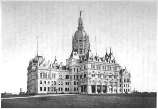
The famous Boston State House, fronting on Beacon
Street at the summit of the hill, stands upon
ground which, in the eighteenth century, was John
Hancock's cow-pasture, his residence, for many years
alongside, having been replaced by the ornamental
"swell-fronts" of the Somerset Club. This rounded
construction, known as the swell-front, is a distinctive
feature of the old-time Boston residential
architecture, and in many buildings the effect is
heightened by the luxuriant overrunning vines of the
Boston ivy, which is especially fine in the autumn.
A Corinthian portico fronts the State House, which
was built about the beginning of the nineteenth century,
but has since been repeatedly enlarged, the
latest extension being completed in 1898, so that the
whole building is now four hundred by two hundred
and twelve feet, the lantern on the dome rising one
hundred and fifty feet. Upon the terrace in front
are statues of Daniel Webster and Horace Mann.
The eastern side of the last extension has a small
park, and here, on top of Beacon Hill, has been
erected a reproduction, practically on the original
site, of the Beacon Monument, which was put there
in 1790 to commemorate the success of the Revolution,
but was removed in 1812. Within the State
House is the Memorial Hall, containing the battle-flags
of Massachusetts regiments and other historical
relics. Portraits, busts and statues of the great men
of Massachusetts adorn the interior rooms. From
the lantern surmounting the dome is the finest view
of Boston, with the mass of estuaries penetrating the
land on all sides, the harbor and islands, and over the
neighboring country for many miles. In the Representatives'
Chamber hangs, high on the wall, one of
the precious relics of the Old Bay State, the noted
carved codfish, typifying a great industry. In the
original State House preceding this one, down on
Washington Street, in the heart of the older town,
on March 17, 1785, Representative Rowe—who is
also said to have been the suggester of throwing the
tea overboard in Boston harbor—according to the
minutes moved, "That leave might be given to hang
up the representation of a codfish in the room where
the House sit, as a memorial of the importance of the
cod-fishery to the welfare of the Commonwealth, as
had been usual formerly." Leave was accordingly
given, and this emblem was brought in time to the
present State House and hung on the wall, and it has
always been an object of interest to visitors, not only
as emblematic of sundry fishery problems that perplex
the statesmen, but also as recalling a question
always of lively interest in New England and elsewhere,
"Does the codfish salt the ocean, or the
ocean salt the codfish?" Another great treasure is
held by the State Library, which has a hundred
thousand volumes; and the chief of its possessions,
exhibited under glass, is the "History of the Plimouth
Plantation," popularly known as the "Log of
the 'Mayflower,'" written by Governor William
Bradford. This manuscript, discovered in London
in 1846, was presented to Massachusetts in 1898.
NOTABLE BOSTON ATTRACTIONS.
A ramble through the older parts of Boston discloses
many objects of interest. Near the northern edge
of the Common, at the corner of Park and Tremont
Streets, is the old "Brimstone Corner," where stands
the citadel of orthodoxy, the Puritan meeting-house,
Park Street Church. Adjoining is an ancient graveyard,
the "Old Granary Burying-Ground," where
lie the remains of some of the most famous men of
Boston, John Hancock, Samuel Adams, Paul Revere,
James Otis, Peter Faneuil, many of the colonial Governors,
and also the parents of Benjamin Franklin, a
prominent monument marking the graves of the
latter. The rows of ancient, dark-looking and half-effaced
gravestones in this quiet burial-place, in
one of the busiest parts of the city, are an antique
novelty. Many noted buildings are near it—Tremont
Temple, the Horticultural and Music Halls, the
Athenæum, and not far away, fronting Pemberton
Square, the massive County Court-house of granite
in Renaissance style, four hundred and fifty feet
long, having in its imposing central hall a statue of
Rufus Choate. On Tremont Street was established
the first Episcopal Church in Boston, the King's
Chapel, the present building replacing the original
one in 1754. Adjacent is the oldest burying-place
of the colony, where lie the remains of Governor
John Winthrop and his sons, with other early settlers.
Most of the old gravestones in this yard have
been taken away from the graves and reset in strange
fashion as edge-stones along the paths. One of these
odd old stones of a greenish hue marked the grave
of William Paddy, dying in 1658. In an unique
poetical effusion it records these quaint words:
"Hear sleaps that blessed one
Whoes lief God help us all
To live that so when tiem shall be
That we this world must liue,
We ever may be happy
With blessed William Paddy."
Adjoining this old-time region is the splendid City
Hall, grandly rising beyond the graveyard, in Italian
Renaissance, with an imposing louvre dome. In
front, upon School Street, are statues of Benjamin
Franklin and Josiah Quincy.
Various intricate streets and passages lead eastward
from Tremont Street into Washington Street,
these two chief business highways in a certain sense
being parallel. Washington Street is the main thoroughfare
of the city, having prominent theatres,
newspaper offices, many of the largest stores and
great office buildings, and it finally crosses over into
the South End, being a wider and straighter street
in this newer portion. Benjamin Franklin was born
in a little old dwelling near Washington Street, where
now stands a newspaper office. Alongside is the
"Old South Church," the most famous church of
Boston, but now an historical relic and museum of
Revolutionary antiquities, the congregation having
built themselves a magnificent temple, the "New Old
South Church," upon Boylston Street, in the fashionable
quarter of the Back Bay. This ancient church
is a curious edifice of colonial style, built in 1729,
when it replaced an earlier building. It has a tall
spire and a clock, to which it is said more eyes are
upturned than to any other dial in New England.
The interior is square, with double galleries on the
ends, and its original condition has been entirely restored.
It is brimful of history, and was the colonial
shrine of Boston, wherein were held the spirited
meetings of the exciting days that hatched the Revolution.
Within it were arranged the preliminaries
leading to the march from its doors of the party of
disguised men who went down to the Liverpool wharf
and threw the tea overboard in December, 1773.
Behind the pulpit is the famous window through
which climbed Dr. Joseph Warren in 1775 to make
the oration on the anniversary of the "Boston
Massacre," that had so much to do with creating the
high condition of feeling producing the final defiance
of the British soldiery, culminating in the battle of
Lexington. The British afterwards turned the building
into a riding-school. Franklin was baptized in
the original church, and here Whitefield preached.
For nearly two centuries there was delivered, in this
noted church, the annual "election sermon" before
the Governor and Legislature. It was only by the
greatest exertions that the venerable building was
saved from the fire of 1872, which halted at its edge.
It now belongs to a patriotic society, who maintain it
as a precious historical relic.
Also fronting upon Washington Street is the "Old
State House," an oblong and unpretending building
at the head of State Street, dating from 1748, which
was the headquarters of the Massachusetts Provincial
Government. The "Boston Massacre," in March,
1770, originating in an encounter between a British
sentry and the crowd, resulting in the troops firing
upon the populace, occurred in the street on its eastern
side. Afterwards Samuel Adams, voicing the
public indignation, made within the building, in an
address to the Executive Council, his memorable and
successful demand that the British soldiery should be
removed outside the city. It has been restored as
far as possible to its original condition, even the figures
of the British "Lion and Unicorn," which had
been taken down in Revolutionary days, having been
replaced on the wings of the roof over the southern
front. The upper rooms contain a valuable collection
of relics and paintings, and much that is of interest
in connection with early Boston history. Opposite
are the tall Ames and Sears Buildings of modern
construction, while State Street extends northeast
through the financial district to the harbor, passing
the massive granite dome-surmounted Custom House.
Dock Square is not far away, and Change Alley
and other intricate passages lead over to the Boston
"Cradle of Liberty," Faneuil Hall. Old Peter Faneuil,
a Huguenot merchant, built it for a market and
presented it to the city in 1742, but it was unfortunately
burnt, being rebuilt in 1761. Within it were
held the early town-meetings, and it is still the great
place for popular assemblages. It was enlarged to
its present size in 1805. This famous Hall is a plain
rectangular building, seventy-six feet square inside,
the lower floor a market, and the upper portion an
assembly room. It is located, with surmounting
cupola, in an open square, and when anything excites
the public it is crowded with standing audiences,
there being no seats. Across the end is a raised
platform for the orators, behind which, on the wall, is
Healy's large painting, representing the United States
Senate listening to a speech by Daniel Webster, his
noted oration in the South Carolina nullification days
of 1832, when Webster was the champion of the
Union. There are numerous historical portraits on
the walls. The "Ancient and Honorable Artillery
Company," dating from 1638, occupy the floor above
the Hall, while in front of it and extending towards
the harbor is the spacious Quincy Market.
At the corner of Washington and School Streets
is another ancient building, its quaint gambrels and
gables recalling primitive architecture—the "Old
Corner Book-store," long a favorite literary haunt.
Northward, Washington Street extends to Haymarket
Square, and beyond is Charlestown Street,
passing by Copp's Hill, now reduced in size. Upon
this hill is the oldest Boston church,—Christ Church
in Salem Street,—dating from 1723, from whose
steeple, on the eve of the battle of Lexington, in
April, 1775, were displayed the lights giving warning
of the movement of the British troops starting
from Boston for Concord. These signals notified
Paul Revere, across the Charles River, who made his
famous midnight ride that roused the country. The
silver-plate, service-books and Bible of the church
were gifts from King George II., and in the adjacent
burial-ground are the graves of the three noted Doctors
Mather, who had so much to do with colonial
affairs and history—Increase, Cotton and Samuel—the
last dying in 1785. The great Boston fire of
1872, which ravaged the district east of Washington
Street for two days, extended over fifty acres, and destroyed
nearly eight hundred buildings. The section
was quickly rebuilt, however, with much finer structures,
and is now the chief wholesale business district
of Boston. The elaborate Government Building,
containing the Post-office and Courts, was erected,
since the fire, of Cape Ann granite, at a cost of $7,500,000.
In this district are enormous office-buildings,
insurance-offices, banks, extensive blocks of
stores, and the headquarters of the leading trades of
New England, the boot and shoe, cotton and woollen,
dry goods, paper and wool merchants, Boston being
the greatest wool mart in the country. When Boston,
having preserved Beacon Hill and reduced in
size Copp's Hill, decided to remove the third eminence
of the "Tri-mountain," Fort Hill, its earth
and rocks were used to give better commercial facilities
by filling in and grading the magnificent marginal
highway fronting the harbor, Atlantic Avenue.
In front of this broad street the wharves project
many hundreds of feet, having rows of capacious
storehouses in their centres, while on either side are
wide docks for the shipping. Here is conducted an
extensive traffic with all parts of the world, and to
these wharves come the yacht-like fishing-smacks to
unload their catch of cod and mackerel, while there
are piles of fish in the stores. Thus is realized the
significance of the emblematic codfish hanging in the
State House.
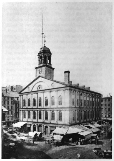
Faneuil Hall, Boston
BOSTON DEVELOPMENT.
When the great Boston fire had been quenched,
and an estimate was being formed of the enormous
losses, the significant statement was made that "the
best treasure of Boston cannot be burnt up. Her
grand capital of culture and character, of science and
skill, humanity and religion, is beyond the reach of
flame. Sweep away every store and house, every
school and church, and let the people with their history
and habits remain, and they still have one of
the richest and strongest cities on earth." This is
the prominent characteristic of Boston public spirit.
The people take the greatest pride in their city, its
high rank and achievements, and the wealthy and
energetic townsfolk are always alert to extend them.
There are more libraries, schools, colleges, art and
scientific collections, museums, conservatories of
music and educational foundations in and near Boston
than in any other American city. Magnificent structures,
the homes of art, science and education, are
scattered with prodigality all about. Next to the
Library of Congress, the Boston Public Library is
the largest in America. Bostonians love the fine
arts, and the many open spaces and public grounds
are adorned with statues of eminent men and groups
representing historical events. The people seem to
be always studying and investigating, the women as
well as the men pursuing the difficult paths of abstruse
knowledge, so that armies of them, fully
equipped, scatter over the country to impart the
learning of the "Modern Athens" to less fortunate
communities. There are many fine churches, especially
in the newer parts of the West End, whither
have removed into grand temples of modern artistic
construction quite a number of the wealthy congregations
of the older town. Boston is also full of
clubs, in endless variety, formed for every conceivable
purpose, and several of them very handsomely
housed.
To get available room and facilitate business, the
city has gathered the terminals of all the railways
into two enormous stations on the northern and southern
sides of the town, and for nearly a half century
it has been filling-in the fens and lowlands to the
westward, so that now this reclaimed West End is
the fashionable section, containing the finest churches,
hotels, and residences. Through this splendid district
extends for over a mile the grand Commonwealth
Avenue, two hundred and forty feet wide, its centre
being a tree-embowered park adorned by statues of
Alexander Hamilton, John Glover, William Lloyd
Garrison, and Leif Ericson, and having on either
side a magnificent boulevard. The bordering residences
are fronted by delicious gardens, and at regular
intervals fine streets cross at right angles, their
names arranged alphabetically, in proceeding westward,
with the well-known English titles, Arlington,
Berkeley, Clarendon, Dartmouth, Exeter, Fairfield,
Gloucester, Hereford, etc. Parallel to the Avenue
are also laid out Boylston, Marlborough, Newbury
and Beacon Streets through this favorite residential
section. Proceeding out Boylston Street are passed
the stately buildings of the Museum of Natural History,
and the Massachusetts Institute of Technology,
with twelve hundred students, the leading institution
of its kind in America. Beyond, at the intersection
of Dartmouth Street, is Copley Square, displaying
around it the finest architectural group in the city,
five magnificent buildings, three of them churches.
Trinity Episcopal Church, built on the northern side,
in free Romanesque, is formed as a Latin cross, with
a massive central tower, two hundred and ten feet
high. It has elaborate interior decoration and fine
windows. The Public Library, on the southern side,
is in Roman Renaissance, two hundred and twenty-eight
by two hundred and twenty-five feet, and sixty-eight
feet high, erected at a cost of nearly $2,400,000.
It contains eight hundred thousand volumes,
and the interior is excellently adapted to its uses,
being tastefully adorned. The Second Unitarian
Church, on the northern side of the square, built in
1874, was the church of the three Mathers, and of
Ralph Waldo Emerson. The Museum of Fine Arts,
on the eastern side of the square, is constructed of
red brick and terra-cotta, and contains extensive collections.
The fifth building fronting the square is
the "New Old South Church," in Italian Gothic, with
a tower rising two hundred and forty-eight feet.
Beyond this fashionable district, the "Back Bay
Fens" have been skillfully laid out in a series of
boulevards and parks, making a chain extending
several miles south and southwest through the suburbs,
Franklin Park, covering nearly a square mile,
being the chief. Here, on grounds with great natural
adornments, in Roxbury, Brookline, and Brighton,
is a region of much beauty. The surface is undulating,
finely wooded, dotted with lakes, and displaying
many costly suburban houses, in full glory of
garden and foliage. This pleasant region spreads to
Chestnut Hill, where the city has its great water reservoir,
holding eight hundred million gallons, the
favorite drive from Boston being to and around this
reservoir, the route giving splendid views from the
hilltop. Jamaica Pond and Jamaica Plain are near
by, two of Boston's attractive cemeteries being beyond
the latter, Mount Hope and Forest Hills. Here
is also the famous Arnold Arboretum, the greatest
institution of its kind, now part of the park system,
and having a grand outlook from its central hill. In
West Roxbury is the Martin Luther Orphan Home,
which now occupies the noted "Brook Farm," where
a group of cultivated people, led by George Ripley,
and including Hawthorne, Curtis, Dana, Channing,
Thoreau, Emerson, and Margaret Fuller, made their
famous attempt to found a socialistic community in
1841, but found that it would not work. It was described
as an experiment in "plain living and high
thinking," the articles of association calling it the
"Brook Farm Institute of Agriculture and Education,"
for the establishment of an "agricultural,
literary, and scientific school or college." Pupils
were taken, and in its most successful period there
were about one hundred and fifty persons in the
community; "kitchen and table were in common;
very little help was hired, but philosophers, clergymen
and poets worked at the humblest tasks, milking
cows, pitching manure, cleaning stables, etc.,
while cultivated women cooked, washed, ironed,
and waited at table; all work, manual or intellectual,
was credited to members at a uniform rate of ten cents
an hour." Later, it became a Fourieristic "phalanstery,"
under the title of the "Brook Farm Phalanx;"
then, in 1845, the chief building burnt down, and
financial difficulties following, the experiment, which
had excited world-wide comment, was abandoned in
1847.
NONATUM AND SUDBURY.
To the westward of Brighton is the extensive and
wealthy suburban city of Newton, a favorite place of
rural residence for Bostonians. Here rises, near
Newton Corner, the ancient Nonatum Hill, where the
Apostle Eliot first preached to the Indians, the name
being now classically modernized into Mount Ida.
Eliot converted these Indians, who became the Christian
tribe of Nonatum and formed their system of
government after the plan set forth in the Book of
Exodus, with rulers of hundreds, of fifties, and of
tens. For them the Bible was translated into the
Indian language by Eliot and printed at Cambridge
in 1663. They removed nearer to Charles River,
where there were better soils, at Natick, their village
consisting of three streets lined with little huts and
gardens, a large circular fort, and a building for a
church and school, at the same time having a rude
bridge constructed over the river. Natick is now a
busy shoemaking town, with about ten thousand
people, and in South Natick is the old Indian cemetery
and Eliot's Oak. To the northward of Natick
is Cochituate Lake, the chief source of Boston's water
supply, over three miles long, and having with tributary
ponds nearly a thousand acres area when full of
water in the spring. To the eastward of Natick is
Wellesley, where the famous Wellesley Female College,
with seven hundred students, has its spacious
buildings located in a beautiful park. To the northward
is the valley of Sudbury River, into which Lake
Cochituate discharges, and here at Sudbury was the
old colonial tavern which Longfellow has given renown
in his "Tales of a Wayside Inn":
"One autumn night in Sudbury town,
Across the meadows bare and brown,
The windows of the wayside inn
Gleamed red with firelight through the leaves
Of woodbine hanging from the eaves
Their crimson curtains rent and thin.
"As ancient is this hostelrie
As any in the land may be.
Built in the old Colonial day,
When men lived in a grander way,
With ampler hospitality.
A kind of old Hobgoblin Hall,
Now somewhat fallen to decay,
With weather stains upon the wall,
And stairways worn, and crazy doors,
And creaking and uneven floors,
And chimneys huge, and tiled and tall.
"A region of repose it seems,
A place of slumber and of dreams,
Remote among the wooded hills!"
Here Longfellow located his modern Canterbury
tales by the landlord, the student, the theologian, the
poet, the musician, and other sojourners, which have
become interwoven so attractively with our better
American literature.
CHARLESTOWN AND BUNKER HILL.
Across the Charles River, northward from the
Shawmut peninsula of Boston, is Charlestown, one
of the earliest settled suburbs, a large part of the
river front being occupied by the Navy Yard, which
covers a surface approximating a hundred acres.
Here were built many famous vessels of the older
navy, anterior to the change to steel construction,
and the first Government dry-dock in the country
was placed at this yard, which after the war of 1812
became one of the leading naval stations. Among
the historical features of the yard has been the famous
ship "Constitution," familiarly known as "Old Ironsides,"
which is again to be rebuilt for preservation.
This noted ship, with others that achieved renown in
the war of 1812, was kept at Charlestown, and all
of them having rotted, the Navy Department in
1830 decided to destroy them so as to save further
trouble, and an article announcing this appeared in a
Boston newspaper. Little did the naval authorities,
however, appreciate the sentimental love the country
had for the old "Constitution." Two days after the
newspaper announcement, Oliver Wendell Holmes,
then twenty-one years of age, published his poem of
"Old Ironsides," which caused such a sensation.
"Aye, tear her tattered ensign down!
Long has it waved on high,
And many an eye has danced to see
That banner in the sky;
Beneath it rung the battle's shout,
And burst the cannon's roar;—
The meteor of the ocean's air
Shall sweep the land no more.
"Her deck—once red with heroes' blood,
Where knelt the vanquished foe,
When winds were hurrying o'er the flood,
And waves were white below—
No more shall feel the victor's tread,
Or know the conquered knee;—
The harpies of the shore shall pluck
The eagle of the sea!
"O, better that her shattered hulk
Should sink beneath the wave;
Her thunders shook the mighty deep,
And there should be her grave:
Nail to the mast her holy flag,
Set every threadbare sail;
And give her to the god of storms,
The lightning and the gale!"
These stirring lines of earnest protest touched
the popular heart, there was an universal outburst
of indignation, and the "Constitution" was
saved. The old ship was rebuilt on her original lines,
only a few timbers, including the keel, being retained,
and the former allegorical figure-head was replaced
by one modelled in the image of Andrew Jackson,
then President of the United States. This change
was sanctioned by the Secretary of the Navy,
although Commodore Hull, who had charge of rebuilding
the ship, protested against it. The reconstructed
"Constitution" was launched in 1834, and
anchored, with her figure-head, but a short distance
from Charlestown bridge. Politics ran high at the
time, and the change caused great controversy, particularly
in and around Boston. One stormy night,
Captain Samuel W. Dewey, then a hardy young
sailor, managed without discovery to saw off Jackson's
head, and carried it away. When the mutilation
was disclosed next day there was another great
clamor, and so intense was the excitement that the
utmost exertions were vainly made to find the man
who did the daring deed. Dewey kept his secret for
several weeks, but suddenly, under an unexplainable
impulse, decided he would go to Washington and
give the sawed-off head to President Jackson himself.
He appeared before the Secretary of the Navy,
and stating that he was the man who had removed
the figure-head from the "Constitution," said he had
brought it along to restore it, exhibiting the grim
features tied up in a bandana handkerchief. The
Secretary was indignant, and spoke of having him
arrested, but Dewey said there was no statute that
he had violated, and the Secretary, calming down
finally, listened to the man's story of how he took
away the head, and agreed to take it to President
Jackson. He took the mutilated head over to the
White House, exhibited it to Jackson, and repeated
to him Dewey's story. When Jackson had heard
the tale he burst out in loud laughter, and pointing
at the head, said: "That is the most infernal graven
image I ever saw. The fellow did perfectly right;
you've got him, you say; well, give him a kick and
my compliments, and tell him to saw it off again."
Captain Dewey was afterwards called the "figure-head
man," and was given a public dinner in Philadelphia
on his return from Washington. He died at
an advanced age, in 1899.
The crowning glory of Charlestown is the Bunker
Hill Monument, marking the greatest historical event
of Boston, the famous battle fought June 17, 1775,
when the British stormed the Yankee redoubt on the
hilltop north of Charles River, which was then open
country, but long ago became surrounded by the
buildings of the expanding city, excepting the small
space of the battlefield, now reserved for a park
around the monument. The granite shaft rises two
hundred and twenty-one feet, upon the highest part
of the eminence. The Provincial troops had assembled
in large numbers north and west of Boston,
mainly in Cambridge to the westward, and hearing
that the British intended to occupy Bunker and
Breed's Hills, in Charlestown, a force was sent under
Colonel William Prescott, a veteran of the old French
war, in the night, to fortify Bunker Hill. Upon
crossing over, they hastily decided that it was better
to occupy Breed's Hill, which, while part of the same
ridge, was nearer Boston, and they constructed upon
it a square redoubt. The British ships in Charles
River discovered this at daylight, and began a cannonade;
American reinforcements were sent from
Cambridge; and in the afternoon General Gage attacked,
his onslaught being three times repulsed with
heavy slaughter, when, the Americans' ammunition
being spent, they could only resist with clubbed muskets
and stones, and had to retreat. Facing Boston,
in front of the monument, the direction from which
the attack came, is the bronze statue of Prescott, the
broad-brimmed hat shading his earnest face, as, with
deprecatory yet determined gesture, he uttered the
memorable words of warning that resulted in such
terrible punishment of the British storming column:
"Don't fire until I tell you; don't fire until you see
the whites of their eyes." The traces of the hastily
constructed breastworks of the redoubt can be seen
on the brow of the hill, and a stone shows where Dr.
Joseph Warren fell, he being killed in the battle.
He came to the fight as a volunteer, and had been
made a General in the Provincial army. The top of
the tall monument gives a splendid view in all directions
over the harbor and suburbs of Boston, with
traces of Mount Wachusett far to the westward, and
on clear days a dim outline of the distant White
Mountains. The corner-stone of the monument was
laid by Lafayette on his American visit in 1825, and
it was completed and dedicated in 1842, the oration
on both occasions being delivered by Daniel Webster.
One of his glowing passages thus tells the purpose
of the monument:
"We come as Americans to mark a spot which
must forever be dear to us and to our posterity. We
wish that whosoever, in all coming time, shall turn
his eye hither, may behold that the place is not undistinguished
where the first great battle of the Revolution
was fought. We wish that this structure
may proclaim the magnitude and importance of that
event to every class and every age. We wish that
infancy may learn the purpose of its erection from
eternal lips, and that weary and withered age may
behold it and be solaced by the recollections which
it suggests. We wish that labor may look up here
and be proud in the midst of its toil. We wish that
in those days of disaster which, as they come upon
all nations, must be expected to come upon us also,
desponding patriotism may turn its eyes hitherward,
and be assured that the foundations of our national
powers are still strong."
CAMBRIDGE AND HARVARD.
Various long causeways over the wide expanse of
Charles River where it spreads out to form the Back
Bay, and passing in front of the newly filled-in West
End, lead from Boston to the academic city of Cambridge.
This populous city, best known from Harvard
University, is beautifully situated on a plain, has
important manufacturing industries, handsome public
buildings, and a large number of elegant private residences
in spacious grounds ornamented with fine old
trees, shrubbery and flower-gardens. Cambridge was
settled soon after Boston, as the "Newe Towne," in
1630. Its Common contains the venerable "Washington
Elm," over three hundred years old, under
which, after the battle of Bunker Hill, General Washington
assumed command, July 3, 1775, of the American
army besieging Boston. Opposite the southern
end of the Common are old Christ Church, built of
materials sent out from England, and the First Parish
Church, with a Gothic steeple, having between them
the burying-ground of the old town. Of these,
Oliver Wendell Holmes has written:
"Like Sentinel and Nun they keep
Their vigil on the green;
One seems to guard and one to weep
The dead that lie between."
In the suburbs of Cambridge, adjoining Charles
River, is Boston's chief place of interment, Mount
Auburn Cemetery, a romantic enclosure of hill and
vale, covering one hundred and twenty-five acres,
with a grand development of tombs and landscape.
The tower upon the summit of the Mount gives a
beautiful outlook over the winding Charles River
valley and the Brookline, Brighton and West Roxbury
villa and park districts beyond, the distant view
being closed by the charming Blue Hills of Milton.
In this cemetery are interred many of the famous
men of Massachusetts, including Longfellow, Lowell,
Holmes, Everett, Sumner, Motley, Choate, Quincy,
Agassiz and Prescott.
The great Cambridge institution, however, is Harvard
University, the oldest, largest and wealthiest
seat of learning in America. In 1636 the Massachusetts
Legislature founded a school at the "Newe
Towne," voting £400 for the purpose, and in 1638
John Harvard, who had been for a short time a
pastor in Charlestown, died at the age of thirty-one,
and left to this school his library of two hundred and
sixty volumes and half his estate, valued at about
£800. Then the school was made a college and
named Harvard, and the town was called Cambridge
by the Legislature. The monument of the youthful
patron is in Charlestown, and, cast in heroic bronze,
he now sits in a capacious chair in front of the Harvard
Memorial Hall. This great University far antedates
its rival Yale at New Haven, for its first
class was graduated in 1642, and in 1650 "The
President and Fellows of Harvard College" were incorporated.
In fact, Harvard was founded only
ninety years later than the great College of English
Cambridge—Emmanuel. John Harvard and Henry
Dunster, who was the first President of Harvard,
and several other prominent Boston colonists, had
been students at Emmanuel, and thus from the older
Puritan foundation came the younger, and it was natural
to adopt for the town the name of the English
University city. The first New England printing-press
was set up in 1639 at Cambridge, and in the
Riverside Press and the University Press of to-day
it is succeeded by two renowned book-making establishments.
Closely allied, in a scientific way, has
also been at Cambridgeport for many years the
works of Alvan Clark & Co., the noted makers of
telescope lenses.
Harvard University has sent out many thousands
of famous graduates, and Longfellow, Holmes and
Lowell have been members of its faculty. It is liberally
endowed, has ample grounds, and there are over
sixty buildings devoted to the purposes of the University,
the annual disbursements exceeding $1,000,000.
Its government was formerly a strictly religious
organization, most of the graduates becoming clergymen,
but it was recently secularized so that no
denominational religion is now insisted upon, and
comparatively few graduates enter the pulpit. There
are schools of law, medicine, dentistry, divinity, agriculture,
the arts and sciences, all the learned professions
being provided for, but everything is elective.
In the various departments there are more than four
thousand students, taught by about four hundred
professors and instructors. It has some seven hundred
acres of land, interest-bearing endowments exceeding
$8,000,000, receives, besides, annual gifts
sometimes reaching $400,000, and has a library of
five hundred thousand volumes and almost as many
pamphlets. Much attention is given outdoor sports
and athletic training, Harvard having the finest
gymnasium in the country, and an athletic field of
twenty acres south of the river. Among the graduates
have been two Presidents, John Adams and his
son John Quincy Adams; also his grandson, Charles
Francis Adams, William Ellery Channing, Edward
Everett, George Bancroft, Jared Sparks, William H.
Prescott, Emerson, Holmes, Sumner, Lowell, Motley
and Thoreau.
The University buildings are in the centre of the
old city, enclosing two large quadrangles shaded by
elms. Massachusetts Hall, the oldest building now
standing, dates from 1720, Harvard Hall from 1766,
and University Hall from 1815. The most elaborate
modern building is the Memorial Hall, a splendid
structure of brick and Nova Scotia stone, three hundred
and ten feet long, having a cloister at one end
and a massive tower at the other. This was erected
in memory of the Harvard graduates who fell in the
Civil War; and in the grand Vestibule which crosses
the building like a transept, having a marble floor
and rich vaulted ceiling of ash, and fine windows
through which pours a mellowed light, there are
tablets set in the arcaded sides bearing the names of
the dead. Upon one side of this impressive Vestibule
is the spacious Saunders Theatre, used for the
commencements and public services, having as an
adornment the statue of Josiah Quincy, a President
of the College and long the Mayor of Boston. Upon
the other side of the Vestibule is the college Great
Hall, one hundred and sixty-four feet long and eighty
feet high, with a splendid roof of open timber-work
and magnificent windows. This is the refectory
where a thousand students can dine, and in it centre
the most hallowed memories of Harvard, portraits
and busts of the distinguished graduates and benefactors
adorning it, with the great western window
in the afternoon throwing a flood of rich sunlight over
the scene. Harvard has been patterned much after
the original Cambridge, thus adding to the English
vogue of many things seen about Boston. When
Charles Dilke visited America he wrote of Harvard,
"Our English Universities have not about them the
classic repose, the air of study, which belongs to
Cambridge, Massachusetts; our Cambridge comes
nearest to her daughter-town, but even the English
Cambridge has a breathing street or two, and a
weekly market-day, while Cambridge in New England
is one great academic grove, buried in a philosophic
calm, which our universities cannot rival as
long as men resort to them for other purposes than
work." The people at Boston told Dilke, when he
was here, that they spoke "the English of Elizabeth,"
and they heartily congratulated him at the same time
upon using what they said was "very good English
for an Englishman."
Adjoining Cambridge Common is Radcliffe College,
for women, named in honor of the English Lady Anne
Radcliffe, afterwards Lady Moulson, the first woman
giving a scholarship to Harvard (in 1640). Some
four hundred women receive instruction here from
Harvard professors, and the graduates are granted
the college degrees. Near by, in Brattle Street, is
the Craigie House, dating from 1759, which was
Washington's headquarters in 1775-6, and later, for
nearly a half century, was the home of Henry W.
Longfellow, until he died in 1882. Longfellow was
for twenty years Professor of Modern Languages in
Harvard, being succeeded in 1854 by James Russell
Lowell, whose home of Elmwood, an old colonial
house, is farther out Brattle Street. Lowell was born
in Cambridge in 1819, dying in 1891. Oliver Wendell
Holmes was born in Cambridge in 1809, and
being a skillful physician as well as a litterateur, he
was Professor of Anatomy and Physiology at Harvard
from 1847 till 1882. He resided in Boston on
Beacon Street, dying in 1894. Margaret Fuller,
the noted transcendentalist, was born in Cambridge
in 1810, and after writing several books, and achieving
fame as a linguist and conversationalist, she went
abroad, marrying the Marquis d'Ossoli in Rome, and
returning to New York, they were both lost by shipwreck
at Fire Island in 1850.
LEXINGTON AND CONCORD.
Following up the Charles River, about ten miles
west of Boston is Waltham, with twenty-two thousand
people, noted for the works of the American
Waltham Watch Company, the largest in the world,
producing nearly six hundred thousand watches and
movements in a year. The extensive factory buildings
spread along the river, and there are also large
cotton mills. General Nathaniel P. Banks was a
native of Waltham. To the northward and about
twelve miles from Boston is the quiet village of Lexington,
chiefly built on one long tree-shaded street,
which terminates at its western end in a broad Green
of about two acres, whereon a plain monument recalls
the eight Revolutionary patriots killed there April
19, 1775. A handsome Memorial Hall of brick is
built on the Green to commemorate the Lexington
soldiers who fell in the Civil War. It also contains
statues of John Hancock and Samuel Adams, and
of the "Minute Man of 1775" and the "Volunteer
of 1861."
The British commander in Boston, having learnt
that the Massachusetts patriots had collected arms and
military stores at Concord, about twenty miles northwest
of Boston, on the night of April 18, 1775, despatched
a force to destroy them, and incidentally to
capture Hancock and Adams, who were at Lexington.
The roads leading westward out of Boston were picketed
to prevent news being carried of the expedition,
but the signals from the old Christ Church on Copp's
Hill enabled Paul Revere to start from Charlestown
through Cambridge, and he made his rapid horseback
ride, arriving by midnight at Lexington. The bells
of the village churches rang out the alarm, signal-guns
were fired, and messengers were sent in every
direction to arouse the people. About five o'clock in
the morning Major Pitcairn with six British companies
arrived at Lexington, where the patriots, numbering
about seventy, were drawn up in line on the
Green. Pitcairn rode forward and shouted "Disperse,
ye rebels; throw down your arms and disperse!"
They held their ground, and a volley was fired over
their heads, when, not dispersing, a second volley was
fired, killing eight and wounding ten men, the first
blood shed in the American Revolution. The American
commander, seeing resistance was useless, withdrew
and dispersed his little band, some, as they retired,
discharging their muskets at the British, three
of the latter being wounded and Pitcairn's horse struck.
Then the British made a rapid movement to Concord,
and some of the military stores which had not been removed
were found and destroyed. Meanwhile about
four hundred Minute Men gathered near the North
Bridge over Concord River, about a mile from the
Common, and under orders they attacked and drove
away the British infantry, who had been placed on
guard there. As the morning advanced, the whole
country became aroused, and armed patriots assembled
from every direction, those of Lexington having
rallied and placed themselves along the Concord road.
The British commander was greatly alarmed and ordered
a retreat. They marched back to Boston under
a rattling fire, every house, barn and stone wall being
picketed by patriot sharpshooters, so that the road
was strewn with dead and dying British. Passing
through Lexington, the British met reinforcements,
but they were still pursued to Cambridge and Charlestown,
the slaughter only ceasing when they had got
under protection of the guns of the fleet. The British
loss was about two hundred and seventy, and
the Americans lost one hundred. In Concord the
British graves and the battle monuments are on one
side of the historic bridge, and on the other is a fine
bronze statue of the "Minute Man." This Concord
fight was the first organized attack made by the
Americans upon the British in the Revolution, thus
beginning the patriot rebellion against British rule,
as the Minute Men were acting under authority of
the Provincial Congress of Massachusetts, assembled
in Concord, and protecting their military stores.
"By the rude bridge that arched the flood,
Their flag to April's breeze unfurled,
Here once the embattled farmers stood,
And fired the shot heard round the world."
Concord has about six thousand people, and is
also famous for its literary history and associations.
It is near the tranquil Concord River and the junction
of the little Assabet and Sudbury Rivers, a pleasant
tree-embowered quiet place of rural residence. Peter
Bulkley, an English rector, who was oppressed by
Archbishop Laud, fled to New England, and in 1636
buying of the Indians their domain of Musketaquid,
founded the town and church of Concord, thus naming
it because of its peaceful acquisition. In the nineteenth
century it became noted as the home of some
of the greatest men of letters in America. Near
Concord bridge is an ancient gambrel-roofed house
built for Parson William Emerson in 1765, and from
its windows he watched the fight. This is the "Old
Manse" in which Ralph Waldo Emerson, himself
once a clergyman, and descended from seven generations
of clergymen, was born in 1803. Emerson
was known as the "Sage of Concord," or, as Fredrika
Bremer the novelist, who visited him there, described
him, the "Sphinx in Concord," and was the
head of the modern school of transcendental philosophy.
He died in 1882. Nathaniel Hawthorne
lived for awhile in the "Old Manse" at Concord, and
there wrote his "Mosses from an Old Manse." The
house was afterwards burnt. Hawthorne died in
1864. Both Emerson and Hawthorne are buried in
the attractive little Sleepy Hollow Cemetery, Emerson's
grave being marked by a large block of pink
quartz. Henry D. Thoreau, the eccentric but profound
scholar and naturalist, in 1845 built himself a
hut on the shores of the sequestered Walden Pond
near Concord, leading the life of a recluse, raising a
few vegetables, and now and then, to get a little
money, doing some work as carpenter or surveyor.
He was profoundly skilled in Oriental and classic literature,
and was an ardent naturalist, delighting in
making long pedestrian excursions to the forests,
lakes and ocean shores of New England. He never
voted, nor paid a tax, nor entered a church for worship,
and of himself he said, "I am as unfit for any
practical purpose as gossamer is for ship-timber."
Emerson tells us that "Thoreau dedicated his genius
with such entire love to the fields, hills and waters of
his native town, that he made them known and interesting
to all; he grew to be revered and admired
by his townsmen, who had at first known him only
as an oddity." Dying in 1862, he, too, is buried in
Sleepy Hollow Cemetery. In the Orchard House in
Concord lived the Alcotts, of whom Louisa M. Alcott,
author of Little Women, is so widely known.
Adjacent is the building used by the "Concord
School of Philosophy," established in 1879 by A.
Bronson Alcott. They also rest in the little Cemetery.
Thus is Concord famed, and it has well been
said of this historic old place that "it is dangerous
to turn a corner suddenly for fear of running over
some first-class saint, philosopher or sage."
THE MASSACHUSETTS NORTH SHORE.
The outer verge of Boston Harbor may be described
as protected on the south by the long projection
of Nantasket Beach, while on the northern side
there comes out, as if to meet it, another curiously-formed
peninsula, making the bluffs of Winthrop,
and a strip beyond terminating in the rounded headland
of Point Shirley. Deer Island, almost connected
with the Point, stretches farther, and we were
anciently told it was so called "because of the deare
who often swim thither from the maine when they
are chased by the wolves." All these places are popular
resorts, and their odd formations assist in making
the Boston surroundings picturesque. Some distance
up the coast, and eleven miles from Boston, is the
shoemaking city of Lynn, with seventy thousand
people, the flourishing society of the "Knights of
St. Crispin" ruling the shoemakers' "teams" and
largely running the politics of the town. Most of
the work is done by machinery, there being over two
hundred factories, making more women's shoes than
any other place in the country. The first colonists
were brought by their pastor from Lynn-Regis,
England, in 1629, and thus the town was
named. It spreads broadly along the water-front,
its attractive City Hall seen from afar, and many
ornamental villas adorning the shore. Out beyond
it, thrust into the sea, is the long, low and narrow
sand-strip barely a hundred yards wide, leading for
nearly four miles to Nahant. This is a most curious
formation, the name meaning the "Lovers' Walk,"
a mass of rocks and soil at the outer end of the
sand-strip covering nearly five hundred acres, and
crowned with villas, the neat tower of a pretty white
church rising on the highest part near the centre.
The Bostonians have made Nahant, thus surrounded
by the ocean, one of their most fashionable suburban
sections, and it is popularly known as "Cold Roast
Boston." This strange rocky promontory was originally
bought from the Sagamore Poquanum for a
suit of clothes, and it is now valued at over $10,000,000.
Many are the poems written about this
curious projection, and N. P. Willis says of it: "If
you can imagine a buried Titan lying along the
length of a continent, with one arm stretched out
into the midst of the sea, the spot to which I would
transport you, reader mine, would be, as it were, in
the palm of the giant's hand." Invocations have
been addressed to Nahant by Longfellow, Whittier
and Mrs. Sigourney; there Longfellow wrote part
of Hiawatha, Motley began his Dutch Republic, Prescott
wrote his Spanish histories, and Agassiz composed
Brazil.
The region beyond Lynn and Nahant is the famous
Massachusetts "North Shore," stretching to the extremity
of Cape Ann, a domain of villas and summer
homes, pleasant sea-beaches, and brisk towns with
interesting past history, now devoted largely to shoemaking
and the fisheries. From Boston State House
to the extremity of the Cape at Halibut Point, or the
Land's End, is thirty-one miles, and Lucy Larcom
thus attractively describes the route along the shore:
"You may ride in an hour or two, if you will,
From Halibut Point to Beacon Hill,
With the sea beside you all the way,
Through pleasant places that skirt the bay;
By Gloucester harbor and Beverley beach,
Salem's old steeples, Nahant's long reach,
Blue-bordered Swampscott, and Chelsea's wide
Marshes laid bare to the drenching tide,
With a glimpse of Saugus' spire in the west,
And Malden Hills in their dreamy rest."
Saugus, Lynn, Nahant, Swampscott, Salem and
Marblehead were originally the Indian domains of
Saugus, Naumkeag and Massabequash. Beyond
Lynn, most of the coast has undergone a modern
evolution from fishery stations to smart summer resorts;
and here, around the swamps and marshes,
abounding crags protrude, with many fine villas in
another fashionable Boston suburb, Swampscott, as
populous and almost as famous as Nahant, with huge
hotels down by the seaside. Swampscott merges
into Clifton, and then an uneven backbone of
granite covering about six square miles is thrust
into the ocean in the direction of Cape Ann, and is
hedged about with rocky islets. On one side this
granite peninsula forms Salem harbor, while on the
other a miniature haven is made by a craggy appendage
to the southeastward, attached to the main
peninsula by a ligature of sand and shingle. The
quaint old town of Marblehead occupies most of the
surface, and the appendage is the modern yachtsmen's
headquarters, Marblehead Neck. This is a
very ancient place, dating back to the early seventeenth
century, and was once pre-eminently nautical
and the second port in Massachusetts; but the sailors
and fishermen are missing, excepting those who man
the summer yacht fleets, and the people, like so
many other Massachusetts communities, have gone
largely into shoemaking, the big shoe-factories being
scattered about. The crooked narrow streets run
in all directions among and over the rocks, which
appear everywhere and have gained the mastery.
When George Whitefield, the preacher, visited Marblehead,
he gazed in astonishment upon these superabundant
rocks, and asked, in surprise, "Where do
they bury their dead?" Out on the headland is the
superannuated little Fort Sewall, once protecting the
port and commanding both harbors, and though the
walls are decaying, it is preserved as a memento of
the past. Fine villas are all about, and the numerous
islands add picturesqueness to the sea-view.
Elbridge Gerry, of "Gerrymander" fame, was a
native of Marblehead, and its hardy sailors formed
most of the crew of the old ship "Constitution"
when she fought and captured the "Guerriere," and
afterwards the "Cyane" and "Levant." Marblehead
was also the scene of "Skipper Ireson's Ride,"
which Whittier has made historic:
"Old Floyd Ireson, for his hard heart,
Tarred and feathered and carried in a cart
By the women of Marblehead!"
He had refused to take some of his townsmen off a
drifting wreck, because it would cost too much to
feed them on the way home.
SALEM AND THE WITCHES.
Westward of the Marblehead peninsula, there
stretches into the mainland another noted haven of
the olden time, Salem harbor, dividing it into two
arms, the North and South Rivers, having between
them the town, chiefly built upon a peninsula about
two miles long. This was the Indian domain of
Naumkeag, a name preserved in many titles there,
and meaning the "Eel-Land." It was the mother-colony
on Massachusetts Bay, the first house being
built in 1626, and old John Endicott having got a
grant from Plymouth for the colony, he came out and
founded the town two years afterwards, calling it
Salem, "from the peace which they had and hoped
in it." But despite this peacefulness, the people
soon developed warlike tendencies. They scourged
Philip Ratcliffe, and cut off his ears and banished him
soon after the founding, for "blasphemy against the
First Church," and when the port had got well under
way, an annual trade statement showed imports of
$110,000 in arms and cannon, against $90,000 in
everything else. The "First Church," formed in
1629, was the earliest church organization in New
England, and it still exists. There were then ten
houses in the town, besides the Governor's house,
which the early history describes as "garnished with
great ordnance;" adding, "thus we doubt not that
God will be with us, and if God be with us, who can
be against us?" John Winthrop was here as Governor,
briefly, in 1630, soon migrating to Shawmut,
to found Boston for the capital of the colony. After
the Revolution, Salem was the leading seaport of New
England; but its glory has departed, and the trade
has gone to Boston. In 1785 it sent out the first
American vessel that doubled the Cape of Good
Hope, and during a half century afterwards it held
almost a monopoly of the East India and China trade
with the United States, having at one time fifty-four
large ships thus engaged. The Salem ships also went
to the Southern seas, Japan and Africa. This trade
gave its people great wealth and influence, and it was
said, about 1810, that a Salem merchant was then
the largest shipowner in the world. But this has
retired into the dim past, and now it is a restful city
of about forty thousand people, its leading townsmen,
the descendants of the merchants and captains, living
in comfortable mansions surrounding the Common
and along the quiet elm-shaded streets in the residential
section. The rest of the population have
gone into shoemaking and other manufactures.
George Peabody, the philanthropist, was the most
noted citizen of Salem, born in the suburb of Danvers
(since changed to Peabody) in 1795, and, dying in
1869, his remains rest in Harmony Grove Cemetery.
In the Peabody Institute, which he founded in Danvers,
is kept as a sacred relic Queen Victoria's portrait,
her gift to him in recognition of his benefactions.
General Putnam, Nathaniel Bowditch, William
H. Prescott, the historian, W. W. Story, the sculptor,
and Nathaniel Hawthorne, were natives of Salem.
The East India Marine Hall is its most noted institution,
a fine building filled with a remarkable Oriental
collection, gathered in the many voyages made by
Salem ships, and also having a valuable Natural
History Museum, designed to show the development
of animal life. In the Essex Institute are interesting
historical paintings and relics, including the charter
given by King Charles I. to the colony of Massachusetts
Bay. Also, carefully kept near by, is the original
"First Church," built in 1634 for the organization
formed in 1629, and of which Roger Williams
was the pastor before the Puritans banished him from
the colony. When the enlarging congregation built
a more spacious church, this quaint little house, with
its high-pointed roof, diamond-paned windows and
gallery, which is revered as the shrine of Salem, was
removed to its present location. In Essex Street is
also the old "Roger Williams House," a low-roofed
structure with a little shop in front, his home for a
brief period in 1635-36. This house has acquired
additional fame as a relic of the witchcraft days, for
in it was held the court trying some of the witches in
1692, who were afterwards taken to the gallows or
Witch Hill, on the western verge of the town, to be
put to death. The witchcraft delusion began in the
Danvers suburb and soon overran most of New England,
the prosecutions continuing more than a year.
Nineteen proven witches were executed, while one,
under the ancient English law, was pressed to death
for standing mute when told to plead. Old Cotton
Mather, the historian and pastor, was a leader in the
movement against the witches.
The North Shore, beyond Salem Harbor, stretches
far along the rock-bound coast of Cape Ann. Here
all the old fishing towns have become modern villa-studded
summer resorts, picturesque and attractive
in their newer development. Beverley, Manchester-by-the-Sea
and Magnolia all have grand headlands
and fine beaches. Beverley also has shoe-factories,
and is proud of the memory of Nathan Dane, the eminent
jurist, who named Dane Hall, the Harvard Law
School. Manchester has the "Singing Beach," where
the white sand, when stirred, emits a musical sound.
Magnolia, on a rocky bluff, is adjoined by the attractive
Crescent Beach, and has around it very fine
woodland. To the eastward is Rafe's Chasm, sixty
feet deep and only a few feet wide, and off shore,
almost opposite, is the bleak reef of Norman's Woe.
Inland is Wenham Lake, near Beverley, noted for its
ice supply, upon which all these places depend, while
beyond, the Ipswich River comes down through the
pleasant town of Ipswich, covering both banks with
houses, and flowing into Ipswich Bay north of the
peninsula of Cape Ann. To the westward is Andover,
where the thrifty Puritan Fathers, having bought the
domain from the Indians "for twenty-six dollars and
sixty-four cents and a coat," established the noted
Andover Theological Seminary of the Congregational
Church, where its ablest divines have been taught in
what has been called "the school of the prophets."
Here, on "Andover Hill," abstruse theology has been
the ruling influence and intense religious controversies
have been waged, over three thousand clergymen
having been graduated. Mrs. Harriet Beecher Stowe
lived here after publishing Uncle Tom's Cabin, and is
buried here. Elizabeth Stuart Phelps was born here,
and wrote Gates Ajar in the venerable "Phelps
House." The Seminary buildings, the local guidebook
tells us, cause visitors to wonder "if orthodox
angels have not lifted up old Harvard and Massachusetts
Halls and carried them by night from Cambridge
to Andover Hill." Ipswich, too, has a famous Seminary,
but it is for the opposite sex. We are told that
one reason for the popularity of Ipswich Female Seminary
is that its location tends to softening the rigors
of study, as this is the place "where Andover theological
students are wont to take unto themselves
wives of the daughters of the Puritans." The indented
shore of Ipswich Bay was ancient Agawam,
of which Captain John Smith, coasting along in 1614,
recorded in his narrative that he saw "the many
cornfields and delightful groves of Agawam." The
fertile valley of Ipswich River is a veritable oasis
among the rocks, moors and salt-marshes that environ
it.
THE MERRIMACK RIVER.
Near the northern boundary of Massachusetts is
the famous Merrimack River, flowing northeastward
into the Atlantic, and noted for the enormous water-powers
it provides for the various mill-towns that
line its banks. It is a vigorous stream, having frequent
waterfalls and carrying a powerful current,
the name appropriately meaning "the swift water."
Oliver Wendell Holmes writes of it in The School
Boy:
"Do pilgrims find their way to Indian Ridge,
Or journey onward to the far-off bridge,
And bring to younger ears the story back
Of the broad stream, the mighty Merrimack?"
The Merrimack drains the southern slopes of the
White Mountains, and takes the outflow of Lake
Winnipesaukee, a vast reservoir, the waters being
regulated at its outlet to suit the wants of the mills
below. It flows southward through New Hampshire
into Massachusetts, turning northeast to the ocean.
The river passes near Salisbury, where Daniel Webster
was born in 1782; then, seventy-five miles northwest
of Boston, comes to Concord, the capital of
New Hampshire, which has a fine Capitol building
and quarries of excellent granite; and eighteen miles
below, it reaches Manchester, the chief city of New
Hampshire, having sixty thousand people and many
large mills owned by wealthy corporations. Here
are the Amoskeag Falls (the Indian name meaning
the "fishing-place"), the largest on the Merrimack,
having fifty-five feet descent, and their water-power
being utilized through two canals. The chief products
are textile goods, locomotives and steam fire-engines.
Eighteen miles farther southward the
Nashua River comes up from the southwest, having
passed the industrial town of Fitchburg on the way,
and here at its confluence with the Merrimack is
Nashua, another busy factory town. At Amherst,
not far away, Horace Greeley was born in 1811.
Crossing the boundary into Massachusetts, the river
comes to the Pawtucket Falls, having thirty-two feet
descent, and furnishing the water-power, twenty-six
miles northwest of Boston, for the great mills of
Lowell, the third city of Massachusetts, having a hundred
thousand people, and spreading along the Merrimack
at its confluence with Concord River, coming
up from Concord Bridge of Revolutionary fame. The
first mill was built at Lowell in 1823, and its industries
have assumed a wide range and enormous output,
though the operatives are nearly all French
Canadians, and the language heard in this once
Yankee mill-town is now mainly French. The Merrimack,
having turned northeast, next comes to Lawrence,
where it descends rapids of twenty-eight feet
in the course of a half-mile. Here the Lawrence
family, of which the noted Abbott Lawrence was the
chief, established a town of cotton and woollen mills,
utilizing the rapids by constructing a huge dam nine
hundred feet long and thirty feet high, in 1845, at a
cost of $250,000. Here are the great Pacific Mills,
among the largest textile works in the world, and the
city has over sixty thousand inhabitants. Nine miles
farther down the river is Haverhill, another manufacturing
town, with forty thousand people, largely
engaged in shoemaking. The poet John G. Whittier
was born in 1807 near Lake Kenoza, the scene of
his Snowbound, on the northeastern verge of Haverhill.
Below Haverhill the Merrimack is a navigable,
tidal stream, broadening into a spacious harbor at its
mouth in the town of Newbury, where the "ancient
sea-blown city" of Newburyport is built on the
southern shore, while five miles to the westward, on
the Pow-wow River, is Amesbury, long the home of
Whittier, who died in 1892, after having celebrated
this whole region in his poems. His house is maintained
as a memorial. Newburyport long since
turned its attention from commerce to making shoes
and other manufactures, and it now has about eighteen
thousand population. Its splendid High Street,
upon the crest of the ridge, one of the noted tree-embowered
highways of New England, stretches several
miles parallel to the river, down towards the
sea, bordered by the stately mansions of the olden
time. The Merrimack sweeps grandly along in front
of them with a broad curve to the ocean, three miles
below. The Newburyport Marine Museum contains
foreign curiosities brought home by the old-time sea
captains, and the Public Library, endowed by George
Peabody, occupies an impressive colonial mansion,
which has been flavored by the entertainment of
Generals Washington and Lafayette. The Old South
Presbyterian Church has the body of the famous
preacher George Whitefield, who died in Newburyport
in 1770, interred in a vault under the pulpit.
In a little wooden house behind this church, William
Lloyd Garrison, the Abolitionist, was born in 1805.
Caleb Cushing the jurist and John B. Gough the
temperance lecturer lived in Newburyport; but its
resident who probably achieved the greatest notoriety
in his day was "Lord" Timothy Dexter, an
eccentric merchant of the eighteenth century, who
made a large fortune by singular ventures, among
them shipping a cargo of warming-pans to the West
Indies, where they were sold to the planters at a stiff
profit for boiling sugar.
Whittier's home was on the Merrimack, and he
has written for the river a noble invocation:
"Stream of my fathers! sweetly still
The sunset rays thy valley fill;
Poured slantwise down the long defile,
Wave, wood, and spire beneath them smile.
"Centuries ago, that harbor bar,
Stretching its length of foam afar,
And Salisbury's beach of shining sand,
And yonder island's wave-smoothed strand,
Saw the adventurer's tiny sail
Flit, stooping from the eastern gale;
And o'er these woods and waters broke
The cheer from Britain's hearts of oak,
As, brightly on the voyager's eye,
Weary of forest, sea and sky,
Breaking the dull continuous wood,
The Merrimack rolled down his flood.
"Home of my fathers! I have stood
Where Hudson rolled his lordly flood:
Seen sunrise rest and sunset fade
Along his frowning Palisade;
Looked down the Appalachian peak,
On Juniata's silver streak;
Have seen along his valley gleam
The Mohawk's softly winding stream;
The level light of sunset shine
Through broad Potomac's hem of pine;
And autumn's rainbow-tinted banner
Hang lightly o'er the Susquehanna;
Yet wheresoe'er his step might be,
Thy wandering child looked back to thee:
Heard in his dreams thy river's sound
Of murmuring on its pebbly bound,
The unforgotten swell and roar
Of waves on thy familiar shore."
THE BRIDAL OF PENNACOOK.
It was in the valley of the Merrimack that Whittier
located the scene of his famous poem, the "Bridal
of Pennacook." This American epic tells—
"A story of the marriage of the chief
Of Saugus to the dusky Weetamoo,
Daughter of Passaconaway, who dwelt
In the old time upon the Merrimack."
Winnepurkit was the son of Nanapashemet, or the
New Moon, and was the Sagamore of Saugus, Naumkeag,
and the adjoining domain. He was of noble
blood and valor, and for his bride chose the daughter
of Passaconaway, the great chief, ruling all the tribes
in the Merrimack Valley, who lived at Pennacook,
now Concord. Not only was Passaconaway a mighty
chief, but he was also the greatest Powah or wizard
of his time, the colonial annalists gravely telling that
he could make trees dance, waters burn, and green
leaves grow in winter, through his necromancy.
When Winnepurkit married this wizard's daughter,
great was the feasting at this "Bridal of Pennacook."
Then Passaconaway caused a select party of warriors
to escort his daughter to her husband's home at Saugus,
where they received princely entertainment.
Not long afterwards the bride expressed a wish to
again see her father and her home at Pennacook,
whereupon her husband sent her thither, escorted by
a trusty band, who were graciously received and rewarded.
After some time Weetamoo desired to
return to Saugus, and her father sent word of this to
his son-in-law by messengers, requesting that a suitable
guard be provided to escort her down. But
Winnepurkit liked not this method, and bade the
messengers return with this reply, "That when his
wife departed from him he caused his own men to
wait upon her to her father's territories, as did become
him; but now that she had an intent to return,
it did become her father to send her back with a convoy
of his own people, and that it stood not with
Winnepurkit's reputation either to make himself or
his men so servile as to fetch her again." This reply,
as may be imagined, ruffled the old chief, and he
sent a sharp answer "That his daughter's blood
and birth deserved more respect than to be slighted
in such a manner, and therefore, if Winnepurkit
would have her company, he were best to send or
come for her." Neither would yield the point of
Indian etiquette, and the colonial narrator leaves it
to be inferred that she then remained with her father,
though it is supposed she subsequently rejoined her
husband. The poet has made good use of the story,
illustrating the scenery of the region with great
felicity, but giving the tale a highly dramatic ending.
Whittier makes the heart-broken bride, in her effort
to return to her husband, launch her canoe upon the
swollen Merrimack above the falls at Amoskeag when
a spring freshet was bringing down masses of ice:
"Down the vexed centre of that rushing tide,
The thick, huge ice-blocks threatening either side,
The foam-white rocks of Amoskeag in view,
With arrowy swiftness sped that light canoe.
"Sick and aweary of her lonely life,
Heedless of peril, the still faithful wife
Had left her mother's grave, her father's door,
To seek the wigwam of her chief once more!
"Down the white rapids, like a sere leaf whirled,
On the sharp rocks and piled-up ices hurled,
Empty and broken, circled the canoe,
In the vexed pool below—but where was Weetamoo?"
CAPE ANN.
Out in front of the region we have been describing
projects the famous "ridge of rocks and roses,"
the gaunt headland of Cape Ann. This is a ponderous
mass of hornblende granite, advanced forward
twelve to fifteen miles into the ocean, with Thatcher's
Island beyond, on which are the twin lighthouses
that guard the mariner, forty-two miles north of the
Highland Light on Cape Cod. The granite hills of
the iron-bound headland are fringed with forests,
while jagged reefs and rocky islets surround it,
against which the sea beats in perpetual warfare.
The surface is strewn with boulders, many of large
size, and beds of the finest white sand are interspersed.
The Indians called this promontory Wingaersheek,
and when Captain John Smith came
along he named it Cape Tragabizonda, in memory
of a Moslem princess who had befriended him when
a prisoner in Constantinople, also calling three small
islands off the cape the "Three Turks' Heads."
But King Charles I. would have none of this, however,
and called the headland Cape Ann, after his
royal mother, and thus it has remained. The haven
on the southern side, Gloucester harbor, was early
sought as a fishing station, being known in 1624, and
it received its name in 1642, most of the early settlers
coming from Gloucester in England. Champlain
found it a safe harbor when in peril, and writes of it
as "Le Beau Port." In August, 1892, this famous
fishery port celebrated its two hundred and fiftieth
anniversary with great fervor.
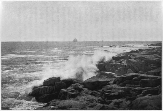
Along the Shore, Cape Anne,
Gloucester, Mass.
The prosperity of Gloucester has come from the
fisheries, it being the greatest cod and mackerel port
in America, and having the most extensive fleet of
fishing-boats in the world, exceeding six hundred,
employing over six thousand men. The population
approximates thirty thousand, and it is said their
earnings on the fishery product are over $4,000,000
annually. The earliest form of the Cape Ann fishing-smack
was known as the "Chebacco," two-masted,
cat-rigged, and of ten or twelve tons, made sharp at
both ends, and getting the name from the first place
of building, Chebacco Parish, in Ipswich, adjoining
the Cape. From this was developed the popular
American build of vessel known as the schooner, the
first one being launched at Gloucester in 1713. After
sliding down the launching-ways, she so gracefully
glided out upon the water that a bystander exclaimed
in admiration, "See how she schoons!" and thus was
she unexpectedly named, for a "schooner" has that
style of vessel been ever since called. Gloucester
surrounds its spacious harbor as a broad crescent,
having Ten Pound Island in front sentinelling the
entrance to the inner haven, so named because that
was the price said to have been paid the Indians for
it. The deeply indented harbor opens towards the
southwest, being protected from the ocean by the
long peninsula of Eastern Point, having a fort and
lighthouse on its extremity. Some seventy wharves
jut out from the circular head of the bay, with granite
hills rising behind, up which the town is terraced.
Shipping of all kinds are scattered about, including
large salt-laden ships, while fishermen and sailors
wander through the streets and assemble around the
docks, spinning yarns and preparing for fishing ventures
out to the "Banks." The odd old town around
the harbor has seen little change for years, but the
newer portions are greatly improved, having many
imposing buildings, including a fine City Hall. The
numerous churches have gained for it the title of
"Many-spired Gloucester," and no place could disclose
more picturesque sea views.
But the fishery interest pervades the whole town,
dwarfing everything else. The main street winds
about the head of the harbor, bending with the sinuosities
of the shore, and from it other streets, without
much regularity, go down to the wharves. Fishing-boats
are everywhere, with new ones building, and on
most of the open spaces are "cod-flakes," or drying-places,
where the fish are piled when first landed,
preparatory to being cut up and packed in the extensive
packing-houses adjoining the wharves. Here
many hundreds are employed in preparing the fish
for market, both men and women working. The best
fish are either packed whole or cut into squares, so
they may be pressed by machinery into what are
known as "cod-bricks," one and two-pound bricks
being put into forty-pound boxes for shipment. When
packed whole, the best fish are known as "white
clover," in this stage of what is called the fishery
"haymaking." This fish-packing is an enormous
industry, and the Gloucester product goes to all parts
of the world. But the fishery has its sombre side;
the vessels are small, rarely over one hundred tons,
and the crews are numerous, so that wrecks and loss
of life are frequent. Often a tremendous storm will
destroy a whole fleet on the "Banks," with no tidings
ever received; and scarcely a family exists in Gloucester
or its neighborhood that has not lost a member
at sea. Sometimes the badges of mourning are
universal.
An enormous development of rocks and boulders
is seen everywhere in and around Gloucester. The
houses are built upon rocks, the sea beats against
rocks; but though excellent building-material is here,
the houses are mostly of wood throughout the whole
Cape Ann district. There is almost universally
an ocean outlook over a sea of deepest blue. The
outer extremity of the harbor to the westward is a
long granite ridge ending in the popular watering-place
of Magnolia Point. Down on the Eastern
Point, alongside its terminating lighthouse, is a curious
granitic formation, the rocks reproducing an elderly
dame with muffled form and apron, known as "Mother
Ann," this rude image being locally regarded as representing,
in the eternal granite, the lady who named
the Cape, the royal mother of King Charles I. The
white flashing light upon Ten Pound Island between
them is said to have for one of its chief duties the
guiding of the mariner past the treacherous reefs of
Norman's Woe, just west of the harbor entrance,
which Longfellow has immortalized in his poem The
Wreck of the Hesperus. One "Goodman Norman"
and his son were among the first settlers near there,
and hence the name, but no record is found as to the
"Woe" he may have had. Neither is it known that
any wreck ever occurred on this famous reef. In
the winter of 1839 a terrific storm caused many
disasters around Cape Ann, and forty dead bodies,
one being a woman lashed to a spar, were washed on
the Gloucester shore. Longfellow read in a newspaper
the story of these wrecks and the horrible
details, one of the vessels being named the "Hesperus,"
and he somewhere saw a reference to "Norman's
Woe." This name so impressed him that he
determined to write a ballad on the wrecks. Late
one night, as he sat by the fireside smoking his pipe,
he conjured up the vivid scene and wrote the ballad.
He retired to bed, but, as he relates, it was not to
sleep; new thoughts crowded his mind, and he rose
and added them to the ballad, and at three o'clock in
the morning had finished his immortal poem. There
was no such wreck at the place, but his genius has
associated it with the iron-bound coast of Cape Ann,
and Norman's Woe is a monument consecrated to one
of America's greatest poets.
"It was the schooner Hesperus
That sailed the wintry sea;
And the skipper had taken his little daughter
To bear him company.
"And fast through the midnight dark and drear,
Through the whistling sleet and snow,
Like a sheeted ghost the vessel swept
Towards the reef of Norman's Woe.
"She struck where the white and fleecy waves
Looked soft as carded wool,
But the cruel rocks they gored her sides
Like the horns of an angry bull.
"Her rattling shrouds, all sheathed in ice,
With the masts went by the board;
Like a vessel of glass, she stove and sank,
Ho! ho! the breakers roared!
"At daybreak on the bleak sea-beach,
A fisherman stood aghast,
To see the form of a maiden fair,
Lashed close to a drifting mast.
"The salt sea was frozen on her breast,
The salt tears in her eyes;
And he saw her hair, like the brown sea-weed,
On the billows fall and rise.
"Such was the wreck of the Hesperus,
In the midnight and the snow!
Christ save us all from a death like this
On the reef of Norman's Woe!"
THE LAND'S END.
The impressive scenery and bold picturesqueness
all about attract many artists, who haunt the rocks
and sea views of Cape Ann. The whole district is
full of summer-homes, with flower-gardens and
shrubbery amid the rocks and boulders, and the
cliffs and ocean presenting an endless variety of
changing scenery. The outer extremity of the
Cape, long called Halibut Point, has been modernized
into the Land's End, thus being rightly named
as the termination of the great Massachusetts granite
ridge, which falls away sharply into the sea. Upon
the one hand Pigeon Cove, with its adjacent Sandy
Bay, indents the rocky buttress, while upon the other
side is Whale Cove. Just off the Land's End is the
noted Thatcher's Island, low-lying on the sea, elongated,
narrow and barren, with its tall twin lighthouses,
and having nearby, in front of Whale Cove,
the diminutive Milk Island. To the northward, off
Pigeon Cove, is another barren rock surmounted by
a lighthouse, Straitsmouth Island. These three outlying
islands were the "Three Turks' Heads," as
originally named by Captain John Smith. Thatcher's
Island has about eighty acres of mainly gravelly surface
strewn with boulders, being named from Anthony
Thatcher's shipwreck there in 1635 in the
most awful tempest known to colonial New England.
Rockport is a town of quarries extended around
Sandy Bay, protected by breakwaters, behind which
vessels come to load stone almost alongside the
quarry. Pigeon Cove is the port for shipping stone
taken out of Pigeon Hill, where the granite ridge is
humped up into a grand eminence. Lanesville, to
the north, is another large exporter of paving-blocks
and building-stone. Alongside is Folly Point, guarding
Folly Cove, at the northeastern extremity of the
Cape, and to the westward are the villages of Bay
View and Annisquam, with more quarries, and
having, not far away, flowing out to Ipswich Bay
through a lovely valley in the very heart of the
Cape, the attractive little Squam River. The people
of Cape Ann outside of Gloucester are almost all
quarrymen, their product, largely paving-blocks,
being shipped to all the seaboard cities. So extensive
is this trade that it is difficult to decide which
now brings the district most profit, the granite or the
fish. There is no doubt, however, that the greatest
fame of this celebrated Cape comes from its fisheries
and the venturesome men who make them so successful.
Edmund Burke, in the British House of Commons,
in 1774, thus spoke of these Massachusetts
fishermen: "No sea but what is vexed by their fisheries;
no climate that is not witness of their toils;
neither the perseverance of Holland, nor the activity
of France, nor the dexterous and firm sagacity of
English enterprise, ever carried their most perilous
mode of hardy industry to the extent to which it has
been pursued by this recent people—a people who
are yet in the gristle, and not yet hardened into manhood."
For three centuries, almost, this perilous trade has
been carried on, and they are fully as daring and
even more enterprising now than in the colonial days.
Thus Whittier describes them:
"Wild are the waves which lash the reefs along St. George's Bank,
Cold on the shore of Labrador the fog lies white and dank;
Through storm and wave and blinding mist, stout are the hearts which man
The fishing-smacks of Marblehead, the sea-boats of Cape Ann.
"The cold North light and wintry sun glare on their icy forms
Bent grimly o'er their straining lines, or wrestling with the storms;
Free as the winds they drive before, rough as the waves they roam,
They laugh to scorn the slaver's threat against their rocky home."