IV.
CROSSING THE ALLEGHENIES.
The Old Pike—The National Road—Early Routes Across the
Mountains—Old Lancaster Road—Columbia Railroad—The
Pennsylvania Route—Haverford College—Villa Nova—Bryn
Mawr College—Paoli—General Wayne—The Chester Valley—Pequea
Valley—The Conestogas—Lancaster—Franklin
and Marshall College—James Buchanan—Thaddeus Stevens—Conewago
Hills—Susquehanna River—Columbia—The Underground
Railroad—Middletown—Lochiel—Simon Cameron—The
Clan Cameron—Harrisburg—Charles Dickens and
the Camel's Back Bridge—John Harris—Lincoln's Midnight
Ride—Cumberland Valley—Carlisle—Indian School—Dickinson
College—The Whisky Insurrection—Tom the Tinker—Lebanon
Valley—Cornwall Ore Banks—Otsego Lake—Cooperstown—James
Fenimore Cooper—Richfield Springs—Cherry
Valley—Sharon Springs—Howe's Cave—Binghamton—Northumberland—Williamsport—Sunbury—Fort
Augusta—The
Dauphin Gap—Duncannon—Duncan's Island—Juniata
River—Tuscarora Gap—The Grasshopper War—Mifflin—Lewistown
Narrows—Kishicoquillas Valley—Logan—Jack's
Narrows—Huntingdon—The Standing Stone—Bedford—Morrison's
Cove—The Sinking Spring—Brainerd, the
Missionary—Tyrone—Bellefonte—Altoona—Hollidaysburg—The
Portage Railroad—Blair's Gap—The Horse Shoe—Kittanning
Point—Thomas Blair and Michael Maguire—Loretto—Prince
Gallitzin—Ebensburg—Cresson Springs—The Conemaugh
River—South Fork—Johnstown—The Great Flood—Laurel
Ridge—Packsaddle Narrows—Chestnut Ridge—Kiskiminetas
River—Loyalhanna Creek—Fort Ligonier—Great
Bear Cave—Hannastown—General Arthur St. Clair—Greensburg—Braddock's
Defeat—Pittsburg, the Iron City—Monongahela
River—Allegheny River—Ohio River—Fort
Duquesne—Fort Pitt—View from Mount Washington—Pittsburg
Buildings—Great Factories—Andrew Carnegie—George
Westinghouse, Jr.—Allegheny Park and Monument—Coal
and Coke—Davis Island Dam—Youghiogheny River—Connellsville—Natural
Gas—Murrysville—Petroleum—Canonsburg—Washington—Petroleum
Development—Kittanning—Modoc
Oil District—Fort Venango—Oil City—Pithole City—Oil
Creek—Titusville—Corry—Decadence of Oil-Fields.
THE OLD PIKE.
The American aspiration has always been to go
westward. In the early history of the Republic the
Government gave great attention to the means of
reaching the Western frontier, then cut off by what
was regarded as the almost insurmountable barrier of
the Alleghenies. General Washington was the first
to project a chain of internal improvements across
the mountains, by the route of the Potomac to Cumberland,
then a Maryland frontier fort, and thence by
roads to the headwaters of the Ohio. The initial
enactment was procured by him from the Virginia
Legislature in 1774, for improving the navigation of
the Potomac; but the Revolutionary War interfered,
and he renewed the movement afterwards in 1784,
resulting in the charter of the Chesapeake and Ohio
Canal, of which Washington was the first President.
Little was done at that early period, however, in
building the canal, but the Government constructed
the famous "National Road," the first highway over
the Allegheny Mountains, from Cumberland in Maryland,
mainly through Southwestern Pennsylvania, to
Wheeling on the Ohio. This noted highway was
finished and used throughout in 1818, and, until the
railways crossed the mountains, it was the great route
of travel to the West. It was familiarly known as
the "Old Pike," and Thomas B. Searight has entertainingly
recorded its pleasant memories, for it has
now become mainly a relic of the past:
"We hear no more of the clanging hoof,
And the stage-coach, rattling by;
For the steam king rules the travelled world,
And the Old Pike's left to die."
He tells of the long lines of Conestoga wagons,
each drawn by six heavy horses, their broad wheels,
canvas-covered tops and huge cargoes of goods; of
the swaying, rushing mail passenger coach, the fleet-footed
pony express; the flocks of sheep and herds
of cattle, the droves of horses and mules sent East
from the "blue-grass" farms of Kentucky; and occasionally
of a long line of men and women, tied two
and two to a rope, driven by a slave-master from the
South, to be sold in the newer region of the Southwest.
He describes how the famous driver, Sam
Sibley, brings up his grand coach at the hotel in
Uniontown with the great Henry Clay as chief passenger,
and then after dinner whirls away with a
rush, but unfortunately, dashing over a pile of stone
in the road, the coach upsets. Out crawls the driver
with a broken nose, and a crowd hastens to rescue
Mr. Clay from the upturned coach. He is unhurt,
and brushing the dust from his clothes says: "This
is mixing the Clay of Kentucky with the limestone
of Pennsylvania." Many are the tales of the famous
road. One veteran teamster relates his experience
of a night at the tavern on the mountain side—thirty
six-horse teams were in the wagon-yard, one hundred
mules in an adjoining lot, a thousand hogs in another,
as many fat cattle from the West in a field, and the
tavern crowded with teamsters and drovers—the
grunts of the hogs, the braying of the mules, the
bellowing of the cattle and the crunching and stamping
of the horses, "made music beyond a dream."
In 1846 the message arrived at Cumberland at two
o'clock in the morning that war was declared against
Mexico, and a noted driver took the news over the
mountains, past a hundred taverns and a score of villages,
one hundred and thirty-one miles to Wheeling,
in twelve hours. Over this famous road the Indian
chief Black Hawk was brought, but the harness
broke, the team ran away and the coach was smashed.
Black Hawk crept out of the wreck, stood up surprised,
and, wiping a drop of blood from his brow,
earnestly muttered, "Ugh! Ugh! Ugh!" Barnum
brought Jenny Lind over this road from Wheeling,
paying $17.25 fare apiece to Baltimore. Lafayette
came along it in 1825, the population all turning out
to cheer him. Andrew Jackson came over it four
years later to be inaugurated the first Western President,
and subsequently also came Presidents Harrison,
Polk and Taylor. What was thought of the
"Old Pike" in its day of active service was well expressed
at a reception to John Quincy Adams. Returning
from the West, he arrived at Uniontown in
May, 1837, and was warmly welcomed. Hon. Hugh
Campbell, who made the reception address, said to the
ex-President: "We stand here, sir, upon the Cumberland
Road, which has broken down the great wall
of the Appalachian Mountains. This road, we trust,
constitutes an indissoluble chain of Union, connecting
forever, as one, the East and the West."
In the early part of the nineteenth century, Lancaster
in Pennsylvania was the largest inland city of
the United States. It is sixty-nine miles from Philadelphia,
and the "old Lancaster Road," the finest
highway of that period, was constructed to connect
them. This began the Pennsylvania route across the
Alleghenies to the West, which afterwards became
the most travelled. In 1834 the Pennsylvania Government
opened its State work, the Columbia Railroad
between the Delaware and the Susquehanna.
In 1836 there were four daily lines of stages running
in connection with this State railroad between Philadelphia
and Pittsburg, making the journey in sixty
hours. Gradually afterwards the Pennsylvania Railroad
was extended across the mountains, and the
Baltimore and Ohio Railroad was completed to
Wheeling, and they then took away the business
from the "Old Pike" and all the other wagon or
canal routes to the Ohio River.
CHESTER AND LANCASTER VALLEYS.
Let us go westward across the Alleghenies by the
Pennsylvania route. East of the mountains it traverses
a rich agricultural region, limestone valleys,
intersected by running streams and enclosed between
parallel ridges of hills, stretching, like the mountain
ranges, across the country from northeast to southwest.
It is a land of prolific farms and dairies, and
for miles beyond Philadelphia the line is adjoined by
attractive villages and many beautiful suburban
villas. Three noted institutions of learning are
passed—Haverford College, the great Quaker College,
standing in an extensive wooded park; the
Roman Catholic Augustinian College at Villa Nova,
with its cross-surmounted dome and twin church
spires; and the Bryn Mawr College for women, one
of the most famous in the United States. This is a
region first settled by Welsh Quakers, and the name
Bryn Mawr is Welsh for the "great hill." It is a
wealthy and extensive settlement, and its College has
spacious buildings and over three hundred students.
At the Commencements they all join in singing their
impressive College hymn:
"Thou Gracious Inspiration, our guiding star,
Mistress and Mother, all hail Bryn Mawr,
Goddess of wisdom, thy torch divine
Doth beacon thy votaries to thy shrine,
And we, thy daughters, would thy vestals be,
Thy torch to consecrate eternally."
A few miles beyond is Paoli, preserving in its name
the memory of the Corsican patriot Paoli, and the
birthplace of the Revolutionary General "Mad Anthony"
Wayne. Here the British defeated the
American patriots in September, 1777. It stands on
the verge of one of the garden spots of Pennsylvania,
the Chester Valley, a charming region of broad
and smiling acres, bounded on the northwest by the
Welsh Mountain and Mine Hill, and a veritable land
of plenty. The Brandywine and Valley Creeks
water it, flowing out respectively to the Delaware
and the Schuylkill. Beyond the long ridge of Mine
Hill is Lancaster County, another land of rich farms,
with many miles of grain and tobacco fields. Mine
Hill is the watershed between the Delaware and the
Susquehanna, the fertile Pequea Valley being at its
western base. This is a great wheat country, and
from here was sent the first American grain across
the Atlantic to feed Europe, the Lancaster County
wheat, in the days before the railroads brought it
from the West, ruling prices for the American markets.
It was hauled out in the ponderous Conestoga
wagons, named after the Indian tribe which formerly
ruled this region—their name signifying "the great
magic land." They were a quarrelsome people,
fighting all the neighboring tribes, and becoming
deadly foes of the whites. Repeated wars decimated
them, until in 1763 their last remnant, being hunted
almost to death, took refuge in the ancient jail at
Lancaster, and were cruelly massacred by the guerillas
called the "Paxton Boys."
In the midst of the wheat lands and bordering the
broad Conestoga Creek, flowing down to the Susquehanna
at Safe Harbor, is the city of Lancaster, its
red sandstone castellated jail being a conspicuous object
in the view. This city was originally called
Hickory Town, but in the eighteenth century its
loyal people christened it Lancaster, and named the
chief streets, intersecting at the Central Market
Square, King and Queen Streets, with Duke Street
parallel to the latter. Prior to 1812 it was the capital
of Pennsylvania. Lancaster is an attractive and
comfortable old city of thirty-five thousand population,
with many mills and factories and large tobacco
houses. It has a splendid Soldiers' Monument in the
Central Square, with finely sculptured guards, representing
each branch of the service, watching at the
base of the magnificent shaft. Upon the outskirts
are the ornate buildings of Franklin and Marshall
College, a foundation of the German Reformed
Church, and it also has a Theological Seminary. The
charm of Lancaster, however, is Woodward Hill
Cemetery, on a bold bluff, washed by the Conestoga
Creek, which forms a graceful circle around its base.
Upon the surface and sides of the bluff the graves
are terraced. Here is the tomb of James Buchanan,
the only President sent from Pennsylvania, who died
in 1868, at his home of Wheatland on the outskirts
of the town. Another noted citizen of Lancaster
was Thaddeus Stevens, who long represented it in
Congress, and was the Republican leader in the
House of Representatives during the Civil War, and
afterwards until his death in 1868. He was the
great champion of the emancipation of the negro
race, and refused to be buried in the cemetery because
negroes were excluded. Upon the grave which
he selected in Lancaster are these words: "I repose
in this quiet and secluded spot, not from any natural
preference for solitude, but finding other cemeteries
limited by charter rules as to race. I have chosen it
that I might be enabled to illustrate in death the
principle which I have advocated through a long life
—equality of man before his Creator." When Lancaster
was the chief town of the Colonial frontier in
1753, it was the place where Braddock's unfortunate
expedition against Fort Duquesne at Pittsburg was
organized and equipped, the work being mainly directed
by Benjamin Franklin. Robert Fulton was
born in Lancaster County, and he grew up and was
educated at Lancaster, going afterwards to Philadelphia.
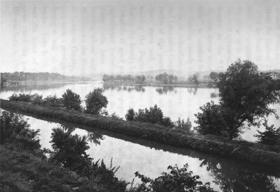
The Susquehanna West of Falmouth
THE SUSQUEHANNA RIVER.
The line westward from Lancaster crosses one
long ridge-like hill after another stretching broadly
over the country, and finally comes to the outlying
ridge of the Allegheny range, the South Mountain,
beyond which is the great Appalachian Valley.
One railroad route boldly crosses this mountain
through the depressions in the Conewago hills, where
the picturesque Conewago Creek, the Indian "long
reach," flows down its beautiful gorge to the Susquehanna,
and this railroad finally comes out on that
river at Middletown below Harrisburg; the other
route follows a more easy gradient westward ten
miles to Columbia, and this is used by the heavier
freight trains. Coming towards it over the hills, the
wide Susquehanna lies low in its broad valley, enclosed
by the distant ridge of the Kittatinny bounding
Cumberland County beyond the river. As it is
approached, the thought is uppermost that this is one
of the noblest, and yet among the meanest rivers in
the country. Rising in Otsego Lake in New York,
it flows over four hundred miles down to Chesapeake
Bay, receives large tributaries, its West Branch
being two hundred miles long, rends all the Allegheny
Mountain chains, and takes a great part of
the drainage of that region in New York and Pennsylvania,
passes through grand valleys, noble gorges
and most magnificent scenery, and yet it is so thickly
sown with islands, rocks and sand-bars, rapids and
shallows, as to defy all attempts to make it satisfactorily
navigable excepting by lumber rafts, logs and
a few canal boats. Thus the Indians significantly
gave its name meaning the island-strewn, broad and
shallow river, and it is little more than a gigantic
drain for Central Pennsylvania.
On its bank is Columbia, a town of busy iron and
steel manufacture, as the whole range of towns are
for miles up to and beyond Harrisburg. At Columbia
first appeared, about 1804, that mysterious agency
known as the "Underground Railroad," whereby
fugitive slaves were secretly passed from one "station"
to another from "Mason and Dixon's Line"
to Canada, mainly through the aid and active exertions
of philanthropic Quakers. All through Chester
and Lancaster Counties and northward were laid the
routes of this peculiar line, whose ramifications became
more and more extensive as time passed,
making the Fugitive Slave Law almost a nullity
during the decade before the Civil War. There were
hundreds of good people engaged in facilitating the
unfortunate travellers who fled for freedom, and
many have been the escapades with the slave-hunters,
whose traffic long ago happily ended. At
Middletown the Swatara River flows in from the hills
of Lebanon County, there being all along the Susquehanna
a prodigious development of the steel industry
as well as rich farms on the fertile bottom
lands. Here is the historic estate of Lochiel, which
was the home of Simon Cameron, who for many
years ruled the political destinies of Pennsylvania.
He was born in 1799 at Maytown, near Marietta, on
the Susquehanna, a few miles above Columbia, in
humble circumstances, and came as a poor printer's
boy to Harrisburg, rose to wealth and power, and
when he was full of years and honors placed the
mantle of the United States Senatorship upon his
son. Their "Clan Cameron" which ruled Pennsylvania
for two generations has been regarded as the
best managed political "machine" in the Union,
having in its ranks and among its allies not only politicians,
but bankers, railway managers, merchants,
manufacturers and capitalists, and men in every walk
of life, ramifying throughout the Keystone State.
Harrisburg, the capital of Pennsylvania, stands
upon the sloping eastern bank of the river in the
grandest scenery. Just above, the Susquehanna
breaks through the Kittatinny at the Dauphin Gap,
giving a superb display of the rending asunder of
the towering mountain chain. Opposite are the
forest-clad hills of York and Cumberland bordering
the fertile Cumberland Valley spreading off to the
southwest, while behind the city this great Appalachian
Valley continues between its enclosing ridges
as the Lebanon Valley northeast to the Schuylkill
River at Reading. Market Street is the chief Harrisburg
highway, and the Pennsylvania Railroad is
the back border of the town. The State Capitol, set
on a hill, was burnt, and is being rebuilt. A pleasant
park encloses the site, and from the front a wide
street leads down to the river, making a pretty view,
with a Soldiers' Monument in the centre, which is an
enlarged reproduction of Cleopatra's Needle. The
Front Street of the city, along the river bank, is the
popular promenade, and is adorned with the Executive
Mansion and other fine residences, which have a
grand outlook across the broad expanse of river and
islands. Bridges cross over, among them the old
"camel's back," a mile long, and having its shelving
stone ice-breakers jutting up stream. This is the
old wooden covered bridge that Charles Dickens
wrote about in his American Notes. On his first
American visit he came into Harrisburg from York
County on a stage-coach through this bridge, and he
wrote: "We crossed the river by a wooden bridge,
roofed and covered on all sides, and nearly a mile in
length. It was profoundly dark, perplexed with
great beams, crossing and re-crossing it at every possible
angle, and through the broad chinks and crevices
in the floor the river gleamed far down below,
like a legion of eyes. We had no lamps, and as the
horses stumbled and floundered through this place
towards the distant speck of dying light, it seemed
interminable. I really could not persuade myself at
first as we rumbled heavily on, filling the bridge with
hollow noises—and I held down my head to save it
from the rafters—but that I was in a painful dream,
and that this could not be reality." The old bridge
is much the same to-day as when Dickens crossed it.
Harrisburg was named for John Harris, who established
a ferry here, and alongside the river bank
is the little "Harris Park" which contains his grave.
The stump of the tree at the foot of which he was
buried is carefully preserved. A drunken band of Conestoga
Indians came this way in 1718, and, capturing
the faithful ferryman, tied him to the tree to be tortured
and burnt, when the timely interposition of
some Indians from the opposite shore, who knew him
and were friendly, saved him. His son succeeded
him and ran the ferry, and an enclosure in the park
preserves this spot of historic memory.
LINCOLN'S MIDNIGHT RIDE.
It was from Harrisburg that Lincoln took the
famous secret midnight ride, "in long cloak and
Scotch cap," which enabled him to escape attack and
possible assassination when going to be inaugurated
President in 1861. Lincoln arrived in Philadelphia
on his way to Washington February 21st, and had
arranged to visit Harrisburg next day, address the
Pennsylvania Legislature, and then proceed to Washington
by way of Baltimore. In Philadelphia General
Scott and Senator Seward informed him that he
could not pass through Baltimore at the time announced
without great peril, and detectives who had
carefully examined the situation declared his life in
danger. Lincoln, however, could not believe that
anyone would try to assassinate him and made light
of the matter. On the morning of February 22d he
raised a flag on Independence Hall in Philadelphia,
and then went by railway to Harrisburg. There his
friends again urged him to abandon his plan and
avoid Baltimore. He visited the Legislature, and
afterwards, at his hotel, met the Governor, several
prominent people being present, among them Colonel
Thomas A. Scott, then Vice-President of the Pennsylvania
Railroad. Again the subject was discussed,
and he was urged to avoid the danger threatening
next day, being reminded that the railway passenger
coaches were drawn through the Baltimore streets
by horses, thus increasing the chances of doing him
harm. He heard them patiently and answered,
"What would the nation think of its President stealing
into the Capital like a thief in the night?" But
they only the more strenuously insisted, and finally
he yielded, consenting to do whatever they thought
best. Colonel Scott undertook the task, and during
the early evening quietly arranged a special train to
take Lincoln to Philadelphia, where he would get
aboard the regular night express and be in Washington
by daylight. Colonel Ward H. Lamon, a personal
friend, was selected to attend Lincoln. As the
party left the hotel a large crowd cheered them, and
the Governor, Andrew G. Curtin, the better to conceal
the intention, called out in a loud voice, "Drive
us to the Executive Mansion." This was done, and
when they had got away from the crowd the carriage
was taken by a roundabout route to the station.
Lincoln and Lamon were not noticed by the few people
there, and quietly entering the car, left for Philadelphia.
As soon as they had started Scott cut every
telegraph wire leading out of Harrisburg, so nothing
could be transmitted excepting under his control.
Lincoln got to Philadelphia without trouble, was put
aboard the express at midnight, and then at dawn
Scott reunited his wires and called up Washington, a
group of anxious men around him. Soon the message
came back, slowly ticked out from the instrument,
"Plums delivered nuts safely." Scott knew
what it meant; he jumped to his feet, threw up his
hat and shouted, "Lincoln's in Washington." The
Baltimore plotters were thus foiled, as the new President
passed quietly through that city before daylight,
and several hours earlier than they had expected
him.
THE CUMBERLAND AND LEBANON VALLEYS.
Harrisburg stands in the centre of the great Appalachian
Valley, where it is bisected by the broad
Susquehanna. To the southwest it stretches away
to the Potomac as the Cumberland Valley, and to
the northeast it spreads across to the Schuylkill as
the fertile Lebanon Valley. The high mountain wall
of the Kittatinny bounds it on the northwest, with
all the rivers, as heretofore described, breaking out
through various "gaps." In the Colonial days, when
Indian forays were frequent, the Province of Pennsylvania
defended the entrances to this fertile valley
by a chain of frontier forts located at these gaps,
with attendant block-houses, each post garrisoned by
from twenty to eighty Provincial soldiers, as its importance
demanded. Benjamin Franklin, who was
then commissioned as a Colonel, was prominent in
the advocacy of these frontier defences, and he personally
organized the settlers and arranged the garrisons.
Fort Hyndshaw began the chain on the
Delaware, there were other forts on the Lehigh and
Schuylkill, and Fort Henry located on the Swatara,
now Lebanon, while just above Harrisburg was Fort
Hunter, commanding the passage of the Susquehanna
through the Dauphin Gap.
Over in the Cumberland Valley, about nineteen
miles from Harrisburg, is Carlisle, a town of some
nine thousand people, in a rich country, and the
chief settlement of that valley. Here is located in
what were formerly the army barracks, coming
down from the time when this was a frontier post,
the Government Indian Training School, where about
eight hundred Indian boys and girls are instructed,
being brought from the far western tribes to be
taught the arts and methods of civilization. These
Indian children are numerous in the streets and on
the railway trains, with their straight hair, round
swarthy faces and high cheek bones, and show the
surprising influence of a civilizing education in
humanizing their features and modifying their nomadic
traits. They have quite a noted military organization
and band at the School. Dickinson College,
a foundation of the Methodist Church, is at
Carlisle, having begun its work in 1783, when it was
named after John Dickinson, then the President of
Pennsylvania, who took great interest in it and made
valuable gifts. Among its graduates were President
James Buchanan and Chief Justice Roger B. Taney.
Carlisle was President Washington's headquarters in
1794, during the "Whisky Insurrection" in Western
Pennsylvania. After the United States Government
got fairly started, the Congress in 1791 imposed
a tax of seven cents per gallon on whisky.
This made a great disturbance among the frontier
settlers of Pennsylvania, who were largely Scotch-Irish,
the population west of the Kittatinny to the
Ohio River being then estimated at seventy thousand.
They had no market for their grain, but they
made it into whisky, which found ready sale. A
horse could carry two kegs of eight gallons each on the
bridle paths across the mountains, and it was worth a
dollar a gallon in the east. Returning, the horseback
load was usually iron worth sixteen cents a
pound, or salt at five dollars a bushel. Every farmer
had a still, and the whisky thus became practically
the money of the people on account of its purchasing
value. Opposition to the tax began in riots. A
crowd of "Whisky boys" from Bedford came into
Carlisle and burnt the Chief Justice in effigy, setting up
a liberty pole with the words "Liberty and No Excise
on Whisky." President Washington called for troops
to enforce the law, and this angered them. One John
Holcroft, a ready writer, appeared, and wrote sharp articles
against the law and the army, over the signature
of "Tom the Tinker." These were printed in handbills,
and the historian says "half the trees in
Western Pennsylvania were whitened with Tom the
Tinker's notices." Officials sent to collect the tax
were roughly treated, farmers who paid it were
beaten by masked men, and one man who rented his
house to a tax collector was captured at midnight by
a crowd of disguised vigilants, who carried him into
the woods, sheared his hair, tarred, feathered and
tied him to a tree.
Soon there were gathered at Carlisle an army of
thirteen thousand men from Pennsylvania, New Jersey,
Maryland and Virginia, under Governor Henry
Lee of Virginia. President Washington and Secretary
of the Treasury Alexander Hamilton came to
Carlisle, and accompanied the troops, in October,
1794, on their march across the mountains to Bedford.
The Governors of New Jersey and Pennsylvania
led the troops of their respective States, and
in the army were many Revolutionary veterans. As
they advanced they found Tom the Tinker's notices
on the trees, of which the following is a specimen:
"Brethren, you must not think to frighten us with
fine arranged bits of infantry, cavalry and artillery,
composed of your watermelon armies taken from the
Jersey shores. They would cut a much better figure
in warring with crabs and oysters about the banks of
the Delaware. It is a common thing for Indians to
fight your best armies in the proportion of one to
five; therefore we would not hesitate to attack this
army at the rate of one to ten."
The soldiers riddled these notices with bullets and
pressed on, hunting for "Tom Tinker's men," as the
insurgents came to be called. But they never seemed
able to find them. All the people seen told how they
were forced by threats, and when asked where the
persons were who threatened them, replied, "Oh,
they have run off." The army finally reached Pittsburg,
the people submitted to the law and paid the
tax, the insurrection was suppressed, and the army
returned and was disbanded. The whisky excise
was peacefully collected afterwards until the tax was
repealed.
In the Lebanon Valley east of Harrisburg are important
iron furnaces, and here are the "Cornwall
Ore Banks," which is one of the greatest iron-ore
deposits in the world—less rich than some others,
possibly, but having a practically exhaustless supply
almost alongside these furnaces. There are three
hills of solid iron ore, one of them having been
worked long before the Revolution, the original furnace,
still existing, dating from 1742. This great
Cornwall iron mine was bought in 1737 for $675,
including a large tract of land. A half-century later
$42,500 was paid for a one-sixth interest, and to-day
a one-forty-eighth interest is estimated worth upwards
of $500,000. These ores have some sulphur
in them, and are therefore baked in ovens to remove
it. They yield about 50 per cent. of iron. A geologist
some time ago reported upon the ore banks that
there were thirty millions of tons of ore in sight
above the water-level, being over three times the
amount taken out since the workings began in the
eighteenth century. The deposits extend to a depth
of several hundred feet under the surface, thus indefinitely
multiplying the prospective yield.
THE SUSQUEHANNA HEADWATERS.
Otsego Lake, the source of the Susquehanna
River, is one of the prettiest lakes in New York
State, and is at an elevation of eleven hundred
feet above tide. It is nine miles long and about a
mile wide, the Susquehanna issuing from its southern
end at Cooperstown, a hamlet of two thousand
people, beautifully situated amid the high rolling
hills surrounding the lake. The name of the lake
comes from the "Ote-sa-ga rock" at the outlet, a
small, round-topped, beehive-shaped boulder a few
rods from the shore, just where the lake condenses
into the river. This was the Indian Council rock, to
which they came to hold meetings and make treaties,
and it was well-known among the Iroquois and the
Lenni Lenapes. James Fenimore Cooper, the novelist,
who has immortalized all this region, called
the lake the "Glimmerglass." His father, Judge
William Cooper, founded the village of Cooperstown
in 1786, afterwards bringing his infant son
from Burlington, New Jersey, where he was born in
1789. Here the great American novelist lived until
his death in 1851, his grave, under a plain horizontal
slab, being in the little churchyard of Christ
Episcopal Church. There is a monument to him in
Lakewood Cemetery, about a mile distant, surmounted
by a statue of his legendary hunter
"Leatherstocking," who has been described as "a
man who had the simplicity of a woodsman, the
heroism of a savage, the faith of a Christian, and the
feeling of a poet." The old Cooper mansion, his home,
Otsego Hall, was burnt in 1854, and its site is marked
by a rock in the middle of the road, surrounded by a
railing. "Hannah's Hill," named after his daughter,
and commanding a magnificent view, which he always
described with rapture, is on the western shore of the
lake, just out of town. The charm of Cooper's genius
and the magic of his description have given Otsego
Lake a world-wide fame. In one place he described
it as "a broad sheet of water, so placid and limpid
that it resembled a bed of the pure mountain atmosphere
compressed into a setting of hills and woods.
Nothing is wanted but ruined castles and recollections,
to raise it to the level of the scenery of the
Rhine." And thus has the poet sung of it:
"O Haunted Lake, from out whose silver fountains
The mighty Susquehanna takes its rise;
O Haunted Lake, among the pine-clad mountains,
Forever smiling upward to the skies,—
A master's hand hath painted all thy beauties;
A master's mind hath peopled all thy shore
With wraiths of mighty hunters and fair maidens,
Haunting thy forest-glades forevermore."
All around Otsego Lake and its neighborhood are
the scenes which Cooper has interwoven into his
novel, The Deer-Slayer. About seven miles northwest
are the well-known Richfield Springs (magnesia
and sulphur), near Candarago Lake. This Indian
name, meaning "on the lake," has recently been revived
to supersede the old title of Schuyler's Lake
for this beautiful sheet of water, enbosomed in green
and sloping hills, which is the chief scenic charm of
Richfield. To the eastward from Otsego Lake is the
romantic Cherry Valley, another attractive summer
resort, and the scene of a sad Indian massacre in
1778, the site of the old fort that was then captured
being still exhibited, with the graves of the murdered
villagers, to whom a monument has been erected. A
few miles farther, in a narrow upland wooded valley
surrounded by high hills, are the Sharon Springs
(sulphur and chalybeate), which in earlier times were
so popular with our German citizens, who were attracted
by the resemblance to the Fatherland, that
the place was called the "Baden-Baden of America."
The name of Sharon came from Sharon in Connecticut,
and the spring water is discharged with a crust
of white and flocculent sulphur into a stream not inappropriately
called the Brimstone Brook. In this
valley, east of the springs, one of the last Revolutionary
battles was fought, Colonel Willett's American
force in 1781 routing a detachment of Tories and
Indians with severe loss. There are grottoes in the
neighborhood abounding in stalactites and beautiful
crystals of sulphate of lime. Not far away is the
noted Howe's Cave, an immense cavern, said to extend
for eleven miles underground, being an old
water-channel in the lower Helderberg limestone, and
which has many visitors, attracted by its fine display
of stalactites and grand rock chambers, with the
usual subterranean lake and stream. All this region
was originally settled by Germans from the Palatinate.
The Susquehanna, steadily gaining in volume,
flows in wayward course down rapids and around
many bends to Binghamton, near the southern border
of New York, where it receives the Chenango River,
and its elevation has declined to eight hundred and
sixty feet. This is a busy manufacturing city and
railway junction, having forty thousand inhabitants.
The first settlers came in 1787, and William Bingham
of Philadelphia owning the land at the confluence
of the rivers, the town was afterwards named
for him. The Chenango Canal connects the Susquehanna
waters from here with the Erie Canal, about
ninety miles northward, at Utica, the Indian word Chenango
meaning "the bull thistle." Entering Pennsylvania,
the Susquehanna now flows many miles past
mountain and village, around great bends and breaking
through the Allegheny ridges, passes along the Wyoming
Valley, already described, and finally going out
through the Nanticoke Gap, reaches Northumberland,
where it receives its chief tributary, the West Branch.
This great stream comes for two hundred miles from
the westward through the Allegheny ranges, passing
Lewisburg, the seat of the Baptist University of
Lewisburg, Milton, and the noted lumber town of
Williamsport, famous for its great log boom. This
arrangement for collecting logs cost a million dollars,
and extends about four miles up the river above the
town, with its massive piers and braces, and will
hold three hundred millions of feet of lumber. The
river front is lined with basins and sawmills. In earlier
years this boom has been so filled with pine and hemlock
logs in the spring that the river could almost
anywhere be crossed on a solid floor of timber. Unfortunately,
however, the vast forests on the slopes
of the Alleghenies have been so generally cut off that
the trade has seriously declined. At Northumberland
lived Dr. Joseph Priestley, the discoverer of
oxygen gas, who died there in 1804, and is buried in
the cemetery.
The Susquehanna now becomes a broad river, and
just below flows past Sunbury, the railway outlet of
the extensive Shamokin coal district. This town
was originally Fort Augusta, built in 1756 to guard
the Susquehanna frontier just below the junction of
its two branches. In the French and Indian War
it had usually a garrison of a regiment, and it was
then regarded as the best defensive work in Pennsylvania.
After that war it gradually fell into decay,
although during the Revolution it was always a
refuge for the Susquehanna frontier settlers fleeing
from Indian brutality and massacre. Many prominent
officers of the Revolutionary army received
their military training at this fort. The settlement
was originally called Shamokin, from the Indian
name of the creek here falling into the Susquehanna—Schakamo-kink,
meaning, like Shackamaxon, "the
place of eels." For fifty miles below Sunbury the
broad Susquehanna winds among the mountain
ranges, traversing one after another, until its channel
is narrowed to pass through the great Dauphin Gap
in the Kittatinny, five miles above Harrisburg, where
the river bed has descended to an elevation of three
hundred and twenty feet above tide.
THE BEAUTIFUL BLUE JUNIATA.
A long, low bridge carries the Pennsylvania Railroad
across the river in front of Dauphin Gap, and a
short distance above, in a delta of fertile islands, the
Susquehanna receives its romantic tributary, the
Juniata, flowing for a hundred miles from the heart
of the Alleghenies, and breaking out of them through
a notch cut down in the long ridge of the Tuscarora
Mountain. Here is the iron-making town of Duncannon,
settled by the sturdy Scotch-Irish, who were
numerous along the Juniata and in its neighboring
valleys, and who suffered greatly from Indian forays
in the early days of the frontier. Upon Duncan's
Island, the chief one in the delta, at the mouth of the
Juniata, was the place of the council-fire of the Indian
tribes of all this region. Now, this island is
mainly a pleasure-ground, having spacious and shady
groves, while the canal, crossing it from the Susquehanna
to the Juniata, goes directly through an extensive
Indian mound and burial-place. We will enter
the fastnesses of the Alleghenies by the winding
gorge of the "beautiful blue Juniata," flowing
through magnificent scenery from the eastern face
of the main Allegheny range out to the great river.
It breaks down ridge after ridge, stretching broadly
across the country, and presents superb landscapes
and impressive mountain views. The route is a
series of bends and gorges, the river crossing successive
valleys between the ridges, now running for
miles northeast along the base of a towering mountain
and then turning east or southeast to break
through it by a romantic pass. The glens and mountains,
with ever-changing views, give an almost endless
panorama. Softness of outline, massiveness and
variety, are the peculiarities of Juniata scenery. The
stream is small, not carrying a great amount of water
in ordinary seasons, and it seems as much by strategy
as by power to have overcome the obstacles and made
its mountain passes. The rended mountains, steep
tree-covered slopes and frequent isolated sentinel-like
hills rising from the glens, have all been moulded into
rounded forms by the action of the elements, leaving
few abrupt precipices or naked rocks to mar the regularity
of the natural beauties. The valleys and lower
parts of the mountain sides are generally cultivated,
the fields sloping up to the mantle of forest crowning
the flanks and summits of the ridges. Every change
of sunshine or shadow, and the steady progress of
the seasons, give new tints to these glens and mountains.
At times the ravines are deep and the river
tortuous, and again it meanders across the rich flat
bottom lands of a broad valley. In its winding course
among these mountain ranges, this renowned river
passes through and displays almost the whole geological
formation of Pennsylvania. The primary
rocks are to the eastward of the Susquehanna, and
the bituminous coal measures begin on the western
Allegheny slope, so that the river cuts into a rock
stratification over six miles in thickness, as one after
another formation comes to the surface.
We go through the narrow Tuscarora Gap, and
are journeying over the lands of the Tuscaroras, one
of the Iroquois Six Nations, who came up from the
South, and were given the name of Tuscarora, or the
"shirt-wearer," because long contact with the whites
had led them to adopt that garment. Beyond the
Gap, the Tuscarora Valley is enclosed on its northwest
side by the Turkey Mountain, the next western
ridge, and it was a region of terrible Indian conflicts
and massacres in the pioneer days, when the first fort
built there was burnt, and every settler either killed
or carried off into captivity. Here was fought the
"Grasshopper War" between the Tuscaroras and
Delawares. They had villages on opposite sides of
the river, and one day the children disputed about
some grasshoppers. The quarrel involved first the
squaws and then the men, a bloody battle following.
Mifflin, an attractive town, is located here, and to the
westward the Juniata breaks through the next great
ridge crossing its path, passing a massive gorge
formed by the Shade and Blue Mountains, flowing for
miles in the deep and narrow winding canyon between
them, the far-famed "Lewistown or Long
Narrows," having the railway hanging upon one
bank and the canal upon the other. Broken, slaty
shingle covers most of the hill-slopes, and in the broad
valley, above the lengthened gorge, is Lewistown,
nestling at the base of a huge mountain at the outlet
of the beautiful Kishicoquillas Valley, spreading up
among the high hills to the northward—its name
meaning "the snakes are already in their dens."
The hero of this attractive region in the eighteenth
century, and then its most distinguished inhabitant,
was Logan, the chief of the Mingoes and Cayugas,
whose speeches, preserved by Thomas Jefferson, are
a favorite in school declamation. He was of giant
mould, nearly seven feet high, and lived at Logan's
Spring in the valley. He was the friend of the
white men, but when the frontier became too well
settled for him longer to find the deer on which he
subsisted, selling their skins to the traders, he went
westward to the Ohio River, locating near Wheeling.
Here, without provocation, his family were cruelly
massacred, and this ended Logan's love for the
whites. He became a relentless foe, wreaking indiscriminate
vengeance, until killed in the Shawnee
wars beyond the Ohio, having joined that hostile
tribe. The Lewistown Narrows are the finest mountain
pass of the Juniata, the peaks precipitously
rising over a thousand feet above the river, which
forces a passage between them for more than eight
miles, the densely wooded cliffs so enclosing and
overshadowing the gorge as to give it an appearance
of deepest gloom.
THE STANDING STONE AND SINKING SPRING.
Westward beyond the valley rises the next ridge
pierced by the Juniata in its outflow, Jack's Mountain,
and its gorge is known as "Jack's Narrows."
Here penetrated Captain Jack Armstrong in the
early colonial days, a hunter and Indian trader, whose
cabin was burnt and wife and children massacred,
making him always afterwards an avenging Nemesis,
roving along the Juniata Valley and killing Indians
indiscriminately. Jack's Narrows is a pass even
more contracted than that below Lewistown, and a
profusion of shingle and broken stone covers its
mountain sides, the deranged limestone strata in
places standing almost upright. Mount Union is in
the valley east of this pass, and beyond it is the
chief town of the Juniata, Huntingdon, which has
about eight thousand people. This was the oldest
settlement on the river, ninety-seven miles west of
Harrisburg, the ancient "Standing Stone," where the
Indians of the valley for centuries met to hold their
councils. The earliest white settlers came in 1754.
The original Standing Stone of Huntingdon, erected
by the Indians, was a granite column, about fourteen
feet high and six inches square, covered with strange
characters, which were the sacred records of the
Oneidas. Once the Tuscaroras stole it, but the
Oneidas followed, and, fighting for their sacred
treasure, recaptured it. When the whites came
along, the Oneidas, who had joined the French, went
west, carrying the stone with them. Afterwards, a
second stone, much like the first, was set up, and a
fragment of it is now preserved at Huntingdon.
Here was built a large fort anterior to the Revolution,
which was a refuge for the frontier settlers.
The "Standing Stone" is engraved as an appropriate
symbol on the city seal of Huntingdon, being surrounded
by a representation of mountains, and the
name of "Oneida" (the granite) is preserved in a
township across the river. Selina, the Countess of
Huntingdon, who was a benefactor of the University
of Pennsylvania, had her titled name given the city.
The then University Provost, Dr. William Smith,
became owner of the town site, and thus remembered
her generosity. About fifty miles southwest of Huntingdon,
amid the mountains, is Bedford, noted for its
chalybeate and sulphur springs, discovered in 1804,
which have long been a favorite resort of Pennsylvanians
on account of their healing waters. The
whole country thereabout is filled with semi-bituminous
coal measures, furnishing a lucrative traffic.
Diminishing in volume, our attractive Juniata
flows through a rough country above Huntingdon,
after threading the pass in the lofty Warrior Ridge.
Extending off to the southwestward is Morrison's
Cove, a rich valley under the shadow of the long
mountain ridge, which was settled in 1755 by the
Dunkards. These singular people, among whose cardinal
doctrines are peace and non-resistance, were attacked
by the Indians in 1777, who entered the valley
and almost exterminated the settlement. Most
of them bowed submissively to the stroke of death,
gently saying "Gottes wille sei gethan" (God's will
be done). One, however, resisted, killed two Indians
and escaped; but afterwards returning, the
Dunkard Church tried him for this breach of faith,
and he was excommunicated. In this region is the
Sinking Spring, a strange water course originally appearing
in a limestone cave, where it comes out of an
arched opening, with sufficient water to turn a large
mill; but it soon disappears underground, the concealed
current being heard through fissures, bubbling
far below. Then it returns to the surface, flowing
some distance, enters another cave, passing under
Cave Mountain, and finally reappears and falls into
the Juniata, making, in its peculiar waywardness, as
remarkable a stream as can anywhere be found.
Here our famous Juniata River, dwindled to a little
creek, comes down the mountain side, and we penetrate
farther by following up the Little Juniata. It
has brought us, through the great ridges, into the
heart of the Appalachian region, to the eastern base
of the main Allegheny Mountain, on the flanks of
which are its sources. It has displayed to us a noted
valley, full of the story of early Colonial contests,
massacres and perils, the scenes of the fearless missionary
labors of Brainerd the Puritan and Loskiel
the Moravian. Brainerd recognized the pagan idolatry
of the Indians, and did not hesitate to take the
Bible to their solemn religious festivals and expound
its divine principles, to spoil the incantations and
frustrate the charms of their medicine men. Once
a Nanticoke pontiff got into a hot argument with
Brainerd, saying God had taught him religion and
he would never turn from it; that he would not believe
in the Devil; and he added that the souls of
the dead passed to the South, where the good lived
in a fair city, while the evil hovered forever in outer
darkness. Many are the romances of the attractive
Juniata:
"Gay was the mountain song
Of bright Alfarata,
Where sweep the waters of
The blue Juniata:
'Strong and true my arrows are,
In my painted quiver,
Swift goes my light canoe
Adown the rapid river.'"
CROSSING THE MOUNTAIN TOP.
At the eastern base of the main Allegheny range
a long mountain valley stretches broadly from the far
northeast to the southwest, and here is Tyrone, a settlement
of extensive iron works, and the outlet of
the greatest bituminous coal-fields of Central Pennsylvania,
the Clearfield district, the town of Clearfield
being about forty miles to the northwest. Northeast
of Tyrone, this valley is called the Bald Eagle Valley,
a picturesque and fertile region; and to the
southwest it is the Tuckahoe Valley. At the base
of the Bald Eagle Mountain, thirty-three miles from
Tyrone, is the town of Bellefonte, another iron region,
handling the products of the Bald Eagle and
Nittany Valleys, and receiving its name from the
"Beautiful Fount" which supplies the town with
water. This is one of the most remarkable springs
in the Alleghenies, pouring out two hundred and
eighty thousand gallons of the purest water every
minute. Following the Tuckahoe Valley southward,
at the base of the main Allegheny range we come to
the Pennsylvania Railroad town of Altoona, and
eight miles farther to Hollidaysburg. Each is a representative
town—Hollidaysburg of the past methods
of crossing the mountain top, and Altoona of the
present.
In 1836 Mr. David Stephenson, the famous British
railway engineer, made a journey across Pennsylvania
by the methods then in vogue, and wrote that he
travelled from Philadelphia to Pittsburg, three hundred
and ninety-five miles by the route taken, in
ninety-one hours, at a cost of three pounds sterling,
about four cents a mile, and that one hundred and
eighteen miles of the journey, which he calls "extraordinary,"
were by railroads, and two hundred and
seventy-seven miles by canals. This was the line
used for twenty years, a main route of travel from
the seaboard to the West, having been put into operation
in 1834. It followed the Columbia Railroad
from Philadelphia to Columbia on the Susquehanna,
the canal up the Susquehanna and Juniata Rivers to
Hollidaysburg, a portage railroad by inclined planes
over the main Allegheny Mountain ridge to Johnstown,
and the canal again, down the Conemaugh and
Allegheny Rivers to Pittsburg. There were one
hundred and seventy-two miles of canal from Columbia
to Hollidaysburg, which went through more than
a hundred locks and crossed thirty-three aqueducts,
having risen about six hundred feet above the level
at Columbia when it reached the eastern face of the
mountain. The canal west of Johnstown was one
hundred and five miles long, descended sixty-four
locks, and went through a tunnel of one thousand feet.
The Portage Railroad of thirty-six miles crossed the
mountain by Blair's Gap, above Hollidaysburg, at
twenty-three hundred and twenty-six feet elevation,
through a tunnel nine hundred feet long. There
were ten inclined planes, five on each side. The
steepest side of the Allegheny Mountain being its
eastern face, the railway from Hollidaysburg to the
summit, though only ten miles long, ascended fourteen
hundred feet, while twenty miles of railway on
the western side descended eleven hundred and
seventy-two feet. The cars hauled up the planes
each carried three tons of freight, and three cars
were hauled at a single draft. There could be
twenty-four cars carrying seventy-two tons passed
over in one hour, which was ample for the traffic at
that time, the average business being three hundred
tons of freight a day. This amount would be carried
in less than ten of the big cars of to-day. It
took passengers eight hours to go over the mountain,
halting one hour on the summit for dinner.
This route was superseded by the Pennsylvania
Railroad crossing above Altoona, opened in 1854, a
road made for ordinary trains; and then Hollidaysburg
became a town of iron manufacture, losing the
bustle and business of the Portage, which was abandoned.
The railroad company acquired a large tract
of land between the main Allegheny range and the
Brush Mountain to the southward, which has a deep
notch, called the "Kettle," cut down into it, opening
a distant prospect of gray mountain ridges behind.
Here has been established the most completely representative
railway city in the world, having enormous
railway shops, a gigantic establishment, and a
population of thirty-five thousand, almost all in one
way or another dependent on the Pennsylvania Railroad.
Altoona is at an elevation of about eleven
hundred feet above tide, and the railway climbs to
the summit of the mountain by a grade of ninety
feet to the mile, winding around an indented valley
to get the necessary elevation. At its head this valley
divides into two smaller glens, with a towering
crag rising between them. Having ascended the
northern side, the railway curves around, crossing
the smaller glens upon high embankments, doubling
upon itself, and mounting steadily higher by running
up the opposite side of the valley to the outer edge
of the ridge. This sweeping curve gives striking
scenic effects, and is the noted Pennsylvania "Horse
Shoe," and the huge crag between the smaller glens,
in which the head of the Horse Shoe curve is partly
hewn, is Kittanning Point. This means the "great
stream," two creeks issuing out of the glens uniting
below it; and here was the route, at sixteen hundred
feet elevation, of the ancient Indian trail across the
mountain, the "Kittanning Path," in their portage
between the Juniata and Ohio waters. It shows how
closely the modern railroad builder has followed the
route set for him by the original road-makers among
the red men. The Pennsylvania Railroad carries
four tracks over the mountain, piercing the summit
by two tunnels at about twenty-two hundred feet elevation,
with two tracks in each. The mountain rises
much higher, and has coal mines, coke ovens and
miners' cabins on the very top. This is the watershed
dividing the Atlantic waters from those of the
Mississippi, flowing to the Gulf, and Gallitzin, a flourishing
mining village, is the summit station of the
railway.
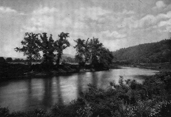
The Conemaugh near Florence
GOING DOWN THE CONEMAUGH.
In the latter part of the eighteenth century there
were but two white men living in all this region.
The first one there was Thomas Blair, whose cabin
was on the mountain at Blair's Gap, where the Portage
Railroad afterwards came over. The other was
Michael Maguire, who came along in 1790, and
going through the Gap, concluded to settle among
the Indians about twelve miles away, at what was
afterwards Loretto. These rugged pioneers spent
most of their time fighting and watching the Indians
and wild beasts, and gathered a few companions
around them. Here afterwards came Prince Demetrius
Augustine Gallitzin, who left the Russian
army in 1792 and visited America, designing to
travel. He became a Catholic priest, and liking
these mountains, established a mission at Loretto in
1798, spending a fortune in maintaining it, his missionary
charge ultimately extending over the whole
mountain region. He attracted a population of about
three thousand, chiefly Germans and Irish, repeatedly
refused the episcopacy, and continued his labors until
his death at Loretto in 1840. His remains lie in
front of his church, surmounted by a monument,
while the centenary of this St. Michael's Church of
Loretto was marked in October, 1899, by erecting
his bronze statue, the Prelate-Prince Gallitzin being
portrayed as he appeared in the Allegheny wilderness,
wearing cassock, surplice and a skull-cap in
lieu of the beretta, this being his usual head-gear at
service. Loretto, named after the city on the Adriatic,
was the first nucleus of population in this elevated
district, and is about five miles north of the
railway. Loretto was the first settlement in this region,
but afterwards the coal and iron attracted the
Welsh, who came in numbers, and founded the town
of Ebensburg, about eleven miles from the railway.
They gave their familiar name of Cambria to the
county. Here on the mountain side, at an elevation
of over two thousand feet, are the Cresson Springs,
a noted health resort, with a half-dozen medicinal
springs, the chief being an astringent chalybeate and
a strong alum.
The route west of the mountain is down the valley
of the Conemaugh, in a district underlaid with coal,
and having at every village evidence of this industry.
The Conemaugh is "the other stream" of the Indians,
and winding down its tortuous valley, with
coal and iron all about, the railway comes to the settlement
of Conemaugh, which spreads into the larger
town of Johnstown, the seat of the great Cambria
Steel Works. The Conemaugh Valley is a deep
canyon, and Conemaugh village was the western terminus
of the mountain portage, where the canal
began. A little flat space about a mile beyond, at
the junction of Stony Creek, was in early times an
Indian village, then known from its sachem as "Kickenapawling's
Old Town." When the white men ventured
over the mountain, there came among them a
hardy German pioneer named Joseph Jahns, who
built a log cabin on the flat in 1791, and from him
the cluster of little houses that grew afterwards became
known as Jahnstown. Then came the Welsh
miners and iron-workers, and they set up charcoal
furnaces, and soon changed the name to Johnstown.
From this humble beginning grew the largest iron
and steel establishment in Pennsylvania. Its ores,
coal and limestone were originally all dug out of the
neighboring ridges, though now it uses Lake Superior
ores. The Conemaugh Valley is here enclosed
by high hills, and in the centre of the town the railroad
is carried across the river on a solid stone bridge
with low arches.
This region, on May 31, 1889, was the scene of
one of the most appalling disasters of modern times.
A deluge of rain for the greater part of two days had
fallen upon the Alleghenies, and made great freshets
in both the Juniata and the Conemaugh. On the
South Fork of the Conemaugh, fifteen miles above
Johnstown, is Conemaugh Lake, a reservoir there
formed by damming the stream, so that it covered a
surface of five hundred acres—the dam, a thousand
feet long, being in places one hundred feet high. This
had been made as a fishing-ground by a club of Pittsburg
anglers. The excessive rains filled the lake,
and the weakened dam burst, its twenty millions of
tons of waters rushing down the already swollen Conemaugh
in a mass a half-mile wide stretching across
the valley and forty to fifty feet high, carrying everything
before it. The lake level was about three hundred
feet higher than Johnstown, and every village,
tree, house, and the whole railway, with much of the
soil and rocks, were carried before the resistless flood
to Johnstown, where the mass was stopped by and
piled up behind the stone railway bridge, and there
caught fire, the resistless flood, to get out, sweeping
away nearly the whole town in the valley bottom.
This vast calamity destroyed from three to five thousand
lives, for no accurate estimate could be ever
made, and ten millions of property. It took the flood
about seven minutes of actual time to pass over the
fifteen miles between the lake and Johnstown, and
there was left, after it had passed, a wide bed, like a
great Alpine glacial moraine, filled with ponderous
masses of sand and stones and wreckage of every
description, the resistless torrent being afterwards reduced
to a little stream of running water. It required
many months to recover from this appalling destruction;
but the people went to work with a will and rebuilt
the town, the steel works and the railway, which
for a dozen miles down the valley had been completely
obliterated. This terrible disaster excited
universal sympathy, and a relief fund amounting to
nearly $3,000,000 was contributed from all parts of
the world.
LIGONIER AND HANNASTOWN.
The whole mountain district west of Johnstown is
filled with coal mines, coke ovens and iron furnaces,
this being the "Pittsburg Coal District." The Conemaugh
breaks through the next western ridge, the
Laurel Mountain, and the broadening river winds
along its deep valley between high wooded hills. It
is a veritable "Black Country," and ten miles beyond,
the river passes the finest mountain gorge on the
western slope of the Alleghenies, the deep and winding
canyon of the Packsaddle Narrows, by which the
Conemaugh breaks out of the Chestnut Ridge, the
western border of the Allegheny ranges. For two
hundred miles the railroad has gone through or over
range after range, and this grand pass, encompassed
by mountains rising twelve hundred feet above the
bottom of the gorge, is the impressive exit at the
final portal. The main railroad then leaves the
Conemaugh, and goes off southwestward along the
slope of Chestnut Ridge towards Greensburg and
Pittsburg. The river unites with the Loyalhanna
Creek below, and then flows as the Kiskiminetas
down to the Allegheny. The name of Loyalhanna
means the "middle stream," while the tradition is
that an impatient Indian warrior, anxious to move
forward, shouted in the night to his comrades encamped
on the other river—"Giesh-gumanito"—"let
us make daylight"—and from this was derived
its name of Kiskiminetas. A branch railroad from
here goes to Blairsville, named in memory of the
solitary pioneer of Blair's Gap, and another northward
leads to the town of Indiana. The great Chestnut
Ridge which the main railway runs along, gradually
descending the slope, is the last mountain the westbound
traveller sees until he reaches the Rockies.
For seventy miles to the southwestward the Chestnut
Ridge and Laurel Mountain extend in parallels, their
crest lines being almost exactly ten miles apart, and
enclosing the Ligonier Valley, out of which flows
northward the Loyalhanna Creek, breaking through
the Chestnut Ridge. Near this pass in 1757 was
built Fort Ligonier, another of the frontier outposts
which resisted the incursions of the French and Indians,
who then held all the country to the westward.
In the Chestnut Ridge at Hillside is the "Great
Bear Cave," an extensive labyrinth of passages and
spacious chambers stretching more than a mile underground,
which, like most such places, has its subterranean
river and its tale of woe. A young girl,
stolen by gypsies, to escape from them took refuge
in this cave, and losing her way, perished, her bones
being found years afterwards. Explorers since have
always unwound balls of twine in this labyrinth, to be
able to retrace their steps.
In a good farming district of the Westmoreland
region is Greensburg, another railway junction where
branches go southward to the Monongahela coalfields.
Robert Hanna built a house near here in the
eighteenth century, around which gathered some
thirty log cabins, and the place in course of time became
known as Hannastown, prominent in the early
history of Western Pennsylvania. Here was held
the first court convened west of the Alleghenies, and
here were passed the patriotic resolutions of May 16,
1775, upon receipt of the news of the battle of Lexington
at the opening of the Revolution, which
sounded the keynote for the Declaration of Independence
the following year. Here also first appeared
during the Revolution General Arthur St.
Clair, an immigrant from Scotland, the grandson of
the Earl of Roslyn, who lived in an humble house on
Chestnut Ridge. He served in the French and Indian
wars, and was the British commander at Fort
Ligonier. Horrible Indian massacres and terrible
retributions by the settlers were the chief features
of the Revolutionary War in Westmoreland. At its
close, the whites sent an expedition in 1782 against
the Wyandottes, which was defeated. The savages
soon wreaked fearful vengeance, raiding the region
in July of that year and burning Hannastown, which
was never rebuilt. Greensburg appeared soon afterwards,
however, and in 1875 it celebrated the centenary
of the Hannastown resolutions with patriotic
spirit. In its Presbyterian churchyard lie the remains
of General St. Clair, who, after founding and
naming the city of Cincinnati, returned here, and
died in 1818, at the age of eighty-four, in his lonely
cabin on Chestnut Ridge, in unmerited poverty and
obscurity. The stone over his grave has this significant
inscription: "The earthly remains of General
Arthur St. Clair are deposited beneath this
humble monument, which is erected to supply the
place of a nobler one due from his country." Being
in a region of fine agriculture and prolific mines,
Greensburg is a prosperous and wealthy town.
BRADDOCK'S DEFEAT.
Natural gas is added to coal and coke in the region
beyond Greensburg, and the villages display
flaring gas torches at night for street lamps. The
whole country, north, south and west, is a network of
railways and a maze of mines, having long rows of
burning coke ovens lighting the sky with their lurid
glare. Here are mined the Westmoreland gas coals.
The valley of the Monongahela River, coming up
from West Virginia, approaches from the southward,
a great highway for coal boats out to the Ohio and
the West, also receiving a large coal tribute from its
branch, the Youghiogheny, flowing by crooked
course through Fayette County. Alongside the
Monongahela is the great Edgar Thomson Steel
Works, one of the chief establishments of the Carnegie
Steel Company, making railway rails. Here is
the famous Colonial battlefield of Western Pennsylvania,
made immortal by General Braddock's defeat
in July, 1755. This region was then a thick forest,
through which an Indian trail coming over the Monongahela
led to the junction of the two rivers forming
the Ohio, where the French had established their
stockade and trading post of Fort Duquesne. Braddock
came into this region from beyond the mountains,
his object being the capture of the fort. His
defeat, a great event in our Colonial history, was due
to his ignorance of the methods of Indian fighting
and his refusal to listen to those who understood it;
but he paid the penalty with his life, being shot, as
was believed at the time, by one of his own men,
after having had five horses shot under him. It was
in rallying the defeated remnant that Washington,
the senior surviving officer, won his first military
laurels. Braddock crossed the river and was caught
in an ambuscade, eight hundred and fifty French and
Indians surprising and defeating his force of about
twenty-five hundred British regulars and Virginia
Provincial troops, the loss being nearly eight hundred.
Washington led the remnant back to Virginia,
carrying Braddock about forty miles on the
retreat, when he died. He was buried at night in
the centre of the road, Washington reading the Episcopal
burial service by torchlight, and the defeated
army marched over the grave to conceal its location
from the enemy. A handsome monument is erected
on the battlefield at Braddock's. And thus, through
iron mills and coal mines, amid smoke and busy industry,
the Pennsylvania Railroad enters Pittsburg,
the "Iron City."
THE GREAT IRON CITY.
The Monongahela River coming from the southward,
and the Allegheny River flowing from the
northward, drain the western defiles of the Alleghenies,
and at Pittsburg unite to form the Ohio River.
Each comes to the junction through a deeply-cut
canyon, and at the confluence is a triangular flat upon
which the original town was built. Like most American
rivers, all these have names of Indian origin.
Monongahela is the "river of high banks, breaking
off in places and falling down." Ohio is a Seneca
word, originally pronounced "O-hee-o," and meaning
the "beautiful river" or the "fair water," and Allegheny
in the language of the Delawares has much
the same signification, meaning "the fairest stream."
All the Indians regarded the two as really the same
river, of which the Monongahela was a tributary.
The first white men exploring this region were the
French, who came down from the lakes and Canada,
when they spread through the entire Mississippi
Valley. In 1753, however, Washington with a surveying
party was sent out by Virginia and carefully
examined the site of Pittsburg, advising, on his return,
that a fort should be built there to check the advance
of the French, and the next year this was
done. Scarcely was it completed, however, when
the French sent a summons to surrender, addressed
"From the Commander-in-chief of His Most Christian
Majesty's troops now on the Beautiful River to
the Commander of those of Great Britain." A
French force soon appeared, and the fort was abandoned.
This began the French and Indian Colonial
War that continued seven years, the French then
erecting their famous fort and trading-post guarding
the head of the Ohio, which they named after the
great French naval commander of the seventeenth
century, Marquis Abraham Duquesne. Then came
Braddock's defeat in 1755, and for some time the region
was quiet. Moravian missionary influence, however,
had by 1758 detached many of the Indians
from the French interest, and after another British
attack and repulse, General Forbes came with a
large force, and the French abandoned the fort and
blew it up. Immediately rebuilt by the English, a
Virginia garrison occupied the post, and it was
named Fort Pitt. Then a larger fort was built at a
cost of $300,000 and garrisoned by artillery, which
the enemy vainly besieged in 1763. The next year
a town site was laid out near the fort, and in 1770 it
had twenty log houses. After the long succession of
wars and massacres on that frontier had ceased, the
village grew, and business began developing—at
first, boat- and vessel-building, and then smelting
and coal mining and the manufacture of glass. In
1812 the first rolling-mill started, and the war with
England in that year caused the opening of a cannon
foundry, which became the Fort Pitt Iron Works.
The village of Fort Pitt had become Pittsburg, and
expanded vastly with the introduction of steam, and
it became an extensive steamboat builder for the
Western waters. Railroad connections gave it renewed
impetus; natural gas used as a manufacturing
fuel was a wonderful stimulant; and it now conducts
an enormous trade with all parts of the country, and
is the seat of the greatest iron, steel and glass industries
in America.
Few views are more striking than that given from
the high hills overlooking Pittsburg. Rising steeply,
almost from the water's edge, on the southern bank
of the Monongahela River, is Mount Washington,
three hundred and fifty feet high. Inclined-plane
railways are constructed up the face of this hill, and
mounting to the top, there is a superb view over the
town. The Allegheny River comes from the northeast
and the Monongahela from the southeast, through
deep and winding gorges cut into the rolling tableland,
and uniting form the Ohio, flowing away to the
northwest also through a deep gorge, although its
bordering ridges of hills are more widely separated.
Pittsburg stands upon the low flat surface of the
peninsula, above the junction of the rivers, which has
some elongated ridgy hills, stretching eastward
through the centre. Its situation and appearance
have thus not inaptly been compared to a flatiron,
the point being at the head of the Ohio, and these
ridgy hills making the handle. The city has overflowed
into extensive suburbs across both rivers, the
aggregate population being more than a half-million.
Numerous bridges span the rivers, the narrow shores
between the steep hills bearing a mixed maze of railways
and factories. Countless chimney-smokes and
steam-jets come up in all directions, overhanging the
town like a pall; and so impressive is the obscuration,
combined with the lurid glare of furnaces and the
weird white gleam of electric lights, that the elevated
view down into Pittsburg seems a veritable pandemonium.
So startling is it on a lowering day that it
has been pointedly described by one who thus for the
first time looked upon the "Smoky City," far down
in its deep basin among the high hills, as appearing
like "Hell with the lid off." There are plenty of
railways in the scene, and scores of odd-looking,
stumpy-prowed little steamboats built high above the
water, having huge stern-wheels to drive them, with
their noses thrust up on the sloping levee along the
river bank, whereon is piled the cargoes, chiefly of
iron products. The swift current turns all the sterns
down stream, so that they lie diagonally towards the
shore. Fleets of flat, shallow coal barges are moored
along, waiting to be made up into tows for their
journey down the Ohio, as Pittsburg has an extensive
river trade, covering over twenty thousand miles
of Western waters. Out of the weird and animated
scene there come all sorts of busy noises, forges and
trip-hammers pounding, steam hissing, railroad trains
running, whistles screeching, locomotives puffing,
bells ringing, so that with the flame jets rising, and
the smokes of all colors blowing about, there is got a
good idea of the active industries of this very busy
place.
PITTSBURG DEVELOPMENT.
This wonderful industrial development all came
within the nineteenth century. There is still preserved
as a relic of its origin the little block-house
citadel of the old Fort Pitt, down near the
point of the peninsula where the rivers join. This
has recently been restored by the Daughters of the
American Revolution—a small square building with
a pyramidal roof. The surrounding stockade long
ago disappeared. There is in the Pittsburg City
Hall an inscribed tablet from Fort Pitt bearing the
date 1764. The old building, which was the scene
of Pittsburg's earliest history, for it stands almost on
the spot occupied by Fort Duquesne, is among
modern mills and storehouses, about three hundred
feet from the head of the Ohio. Pittsburg, after an
almost exclusive devotion to manufacturing and business,
began some years ago to cultivate artistic tastes
in architecture, and has some very fine buildings.
There is an elaborate Post-office and an interesting
City Hall on Smithfield Street; but the finest building
of all, and one of the best in the country, is the magnificent
Romanesque Court-house, built at a cost of
$2,500,000, and occupying a prominent position on
a hill adjoining Fifth Avenue. There is a massive
jail of similar architecture, and a "Bridge of
Sighs" connects them, a beautifully designed arched
and stone-covered bridge, thrown for a passageway
across an intervening street. The main tower,
giving a grand view, rises three hundred and twenty
feet over the architectural pile, and, as in Venice, the
convicted prisoner crosses the bridge from his trial
to his doom. There are attractive churches, banks
and business buildings, and eastward from the city,
near Schenley Park, is the attractive Carnegie Library
and Museum in Italian Renaissance, with a
capacity for two hundred thousand volumes, a benefaction
of Mr. Andrew Carnegie, originally costing
$1,100,000, to which he has recently added $1,750,000
for its enlargement. The residential section is
mainly on the hills east of Pittsburg and across the
Allegheny River in Allegheny City, there being
many attractive villas in beautiful situations on the
surrounding highlands.
But the great Pittsburg attraction is the multitude
of factories that are its pride and create its prosperity.
Some of these are among the greatest in the
world—the Edgar Thomson Works and Homestead
Works of the Carnegie Steel Company, the Duquesne
Steel Works, the Keystone Bridge Company, and
others. The Edgar Thomas mills make over a million
tons of rails a year, and at Homestead fifteen
hundred thousand tons of steel will be annually produced,
this being the place where nickel-steel armor-plates
for the navy are manufactured. They largely
use natural gas, and employ at times ten thousand
men at the two great establishments. The Duquesne
Works, just above Homestead on the Monongahela,
have the four largest blast furnaces in the world,
producing twenty-two hundred tons of pig-iron daily.
The Keystone Bridge Works cover seven acres, and
have made some of the greatest steel bridges in existence.
The Westinghouse Electrical Works manufacture
the greatest dynamos, including those of the
Niagara Power Company, and the Westinghouse Air-Brake
Works is also another extensive establishment.
In the Pittsburg district, covering about two hundred
square miles, the daily product of mines and factories
is estimated at $6,000,000.
The two men whose names are most closely connected
with Pittsburg's vast industrial development
are Andrew Carnegie and George Westinghouse.
Carnegie was born at Dunfermline, Scotland, in
1837, and his father, a potter, brought him to Pittsburg
when eleven years old. He began life as a telegraph
messenger boy, attracted the attention of
Colonel Thomas A. Scott, and was by him brought
into the service of the Pennsylvania Railroad. Then
he entered business, and became the greatest developer
of the iron and steel industries of Pittsburg
and its wealthiest resident. He some time ago sold out
his interests to the Carnegie Steel Company, in which
he is largely interested. Westinghouse, born in New
York State in 1846, combined with business tact the
genius of the inventor. He invented and developed
the railway air-brake now in universal use, has established
a complete electrical lighting and power system,
and was the chief adapter of natural gas to
manufacturing and domestic uses, being the inventor
of many ingenious contrivances for its introduction
and economical employment. He had a gas well
almost at his door, for Pittsburg overlaid a great deposit.
The enormous coal measures underlying and
surrounding the city have been its most stable basis
for industry and profit, as the Pittsburg coal-field is
one of enormous output. The deposits of Lake Superior
furnish the ores for its furnaces, and the railroad
development is such that each enormous establishment
now has its special railroad to fetch in the ores
from Lake Erie, where they are brought by vessels.
Across in Allegheny City, where most of these ore-bringing
roads go out, about one hundred acres in
the centre of the city are reserved for the attractive
Allegheny Park, one portion rising in a very
steep hill, almost at the edge of the Allegheny River.
Upon its top, seen from afar, stands a Soldiers' Monument,
a graceful column, erected in memory of four
thousand men of Allegheny County who fell in the
Civil War. Soldier statues guard the base, and look
out upon the smokes and steam jets of the busy city
below, and thousands climb up there to enjoy the
grand view.
COAL, COKE AND GAS.
The four counties adjoining Pittsburg turn out
over thirty millions of tons of bituminous coal in a
year. To carry this coal away, besides railways, the
city has about a million and a half of tonnage of river
craft of various kinds, a greater tonnage than all the
Mississippi River ports put together. Its coal boats
go everywhere throughout the Western water ways,
and two thousand miles down the Ohio and Mississippi
to New Orleans. Its stumpy but powerful little
tugs, with their stern-wheels, will safely convey fleets
of shallow flatboats, sometimes over twenty thousand
tons of coal being carried in a single tow. These flatboats
are collected in the rivers about Pittsburg,
waiting for the proper stage of water on the Ohio;
and to regulate the depth at the city the curious
movable dam was constructed at Davis's Island, four
miles below Pittsburg, at a cost of $1,000,000, the
dam opening when necessary to let freshets through,
and having a lock five hundred feet long and one
hundred and ten feet wide to pass the boats. The
Monongahela River above Pittsburg has for miles a
series of coal mines in the high bordering banks, the
river being lined with coal "tipples," which load the
flatboats; and it is also provided with a series of
dams, which aid navigation and divide the channel
into a succession of "pools." The very crooked
Youghiogheny flows in at McKeesport, fifteen miles
above Pittsburg, another river of coal mines, whose
name was given as a signification of its crookedness by
the matter-of-fact Indians, the word signifying "the
stream flowing a contrary, roundabout course." This
river comes northward out of the chief coke district of
America, in the flanks of the long Chestnut Ridge, the
Connellsville coke region sometimes turning out ten
millions of tons annually from its ovens. Railways
run in there on both river banks to Connellsville, a
town of six thousand people, in the midst of the coke
ovens, and about fifty-six miles south of Pittsburg.
Pittsburg is decreasing its use of natural gas for
manufacturing, as the diminishing supply and greater
distance it has to be brought are making it too costly
for the iron and glass works, which are returning
again to coal and coke, but the city is still said to use
forty-five thousand millions of cubic feet in a year,
mostly for domestic purposes. Pittsburg stands in a
great but partly exhausted natural-gas district. The
gas is stored under pressure beneath strata of rock,
being set free when these are pierced. This is a
gaseous member of the paraffin series, of which
petroleum is a liquid member, and is mainly marsh-gas,
the "fire-damp" of the miner. It originates in
the decomposition of animal and vegetable life, and
usually has but little odor, whilst its illuminating
power is low, but in fuel value eight cubic feet equal
one pound of coal. It was first used at Fredonia,
New York, in 1821, for lighting purposes, being procured
from a well. The natural-gas region is the part
of Pennsylvania west of the Alleghenies, extending
into New York, Ohio and West Virginia; and gas is
also found in Indiana, Illinois, Kentucky and Kansas.
It is held under enormous pressure within the
pockets beneath the rocks, and when first reached in
drilling, the tension has been known to equal a thousand
pounds per square inch. It is not uncommon,
when a well is drilled, to have all the tools and casing-pipe
blown out, while an enormous thickness of
masonry has to be constructed to hold down the cap
that covers the well. Its use began in Pittsburg in
1886, the chief field of supply then being Murrysville,
about twenty miles east of the city, while there
are also other fields southwest and east of Pittsburg.
The pipes underlie all the streets, and a main route
of supply is along the bed of the Allegheny River.
There are said to be about sixteen hundred miles of
pipes laid down to lead the gas to Pittsburg from
the different fields.
PETROLEUM.
The great petroleum fields lie in and near the
Pittsburg region, in the basin of the Allegheny and
Ohio Rivers, and extend from New York southwest
to West Virginia, and also into Ohio. This region
has had enormous yields in different parts of the
river basin, the wells, however, ultimately dwindling
as their supplies are drawn out. The petroleum industry,
which has been one of the greatest in Pennsylvania,
has been gradually all absorbed by the
Standard Oil Company, which is probably the most
extensive industrial combination in America, and certainly
the most powerful. Yet we are told that
those financial magnates began their wonderful
career with an aggregate capital of only $24,000,
largely borrowed money. There have been forty
millions of barrels of petroleum taken from this great
basin in a single year. The oil wells are bored in
many places, south, southwest, north and northeast
of Pittsburg. The "Panhandle Railroad," which
crosses West Virginia to the Ohio, exhibits many of
them. A branch of this railroad goes to Canonsburg,
and thence to the town of Washington, on the
old "National Road," thirty miles from Pittsburg.
At Canonsburg was founded in 1773 Jefferson College,
in a log cabin, which has now become the Jefferson
Theological Seminary of the Presbyterian
Church. Washington is a town of about four thousand
people, rambling over a pleasant hilly region in
Southwestern Pennsylvania, having as its chief institution
Washington and Jefferson College, also a
Presbyterian foundation, started in 1806 in what
was then a remote Scotch-Irish colony beyond the
mountains. Near this town in 1888 were struck the
greatest petroleum wells the world ever knew. One
of them, the Jumbo well, in sixty days after the first
strike had poured out one hundred and forty thousand
barrels of oil, flowing a steady circular stream
of almost white oil, about five inches in diameter, at
the rate of forty-two hundred gallons an hour. Another
well, afterwards bored not far away, in its
freshness of infancy poured out sixty-three hundred
gallons an hour. Additional wells were bored with
almost the same results; but they all afterwards
dwindled, and finally ceasing a free flow, had to be
pumped. This is the universal experience of all the
oil regions, the "gushers," soon after the great
strikes, giving out, as the store of petroleum in the
reservoirs beneath becomes exhausted. But all this
shows how enormous is the natural wealth of the
Pittsburg district—oil, coal, coke and gas, with iron,
steel and glass, electricity and railways, contributing
to the wonderful prosperity.
The greatest petroleum field, however, was up the
Allegheny River, in Northwestern Pennsylvania, and
the first wells bored to obtain it were sunk at Titusville,
on Oil Creek, in 1859. The early settlers
knew of the appearance of oil about the headwaters
of the Allegheny in New York and Pennsylvania,
and the name of Oil Creek was given a stream for
this reason in Allegheny County, New York, and also
to the one in Venango County, Pennsylvania. The
Indians had long collected the oil on the shores of
Seneca Lake in New York, a course that the white
settlers followed, and it was for years sold as a medicine
by the name of Seneca or Genesee oil. When
its commercial value for illuminating purposes began
to be recognized, Colonel E. L. Drake went to Titusville
to see if it could be obtained in sufficient quantities.
He bored the first well about a mile south of
Titusville, and on August 26, 1859, the oil was
struck at a depth of seventy-one feet. The drill
suddenly sunk into the cavity of the rock beneath,
and the oil rose within a few inches of the surface.
A small pump was introduced which brought out four
hundred gallons daily, and then a large pump, increasing
the daily flow to a thousand gallons. Soon
a steam-engine was applied, and the flow continued
uninterrupted for weeks. Titusville had at the time
three hundred people. Many wells were sunk in the
neighborhood with varying success, and the product
of the Oil Creek district became so large that the
market could not absorb it, and at the beginning of
1861, with two thousand wells in operation, the price
declined to twenty-five cents per barrel. The two
great wells were the Empire, originally yielding
twenty-five hundred barrels daily, and the Phillips,
nearly four thousand barrels. In 1863 the production
had slackened, but the uses had expanded, and
prices rose proportionately. Vast fortunes were then
rapidly made, and as soon squandered. In the first
twelve years of the development of this district,
which extended over about four hundred square
miles, there were taken from some four thousand
wells forty-two millions of barrels of oil, which were
marketed for $163,000,000. At first it was carried
away by the railroads, of which several sent branches
into the district, but there have since been laid extensive
lines of pipes which convey it in various directions,
and largely to New York and Philadelphia
for foreign export. When this district was at the
height of its yield it produced four hundred millions
of gallons a year.
ASCENDING THE ALLEGHENY.
From Pittsburg, through bold and pleasing scenery,
we ascend the Allegheny River, the broad channel
flowing grandly around stately bends enclosed between
high hills. Thirty miles above Pittsburg the
Kiskiminetas comes in, and in a region of coal
mines and furnaces is found the town of Kittanning,
which retains the name of the Indian village standing
there in Colonial days. This original Indian village
was attacked by Colonel Armstrong and three hundred
troops at dawn on August 8, 1757, and the Indians,
who sided with the French, refusing to surrender,
they were pretty much all killed and their
village burnt. Armstrong's name is preserved in the
county. Beyond is Brady's Bend, a great curve of
the river, and here are seen the derricks of many deserted
oil wells, as the farther journey above for
miles also discloses. This was the Modoc oil district.
The Morrison well was struck in 1872, yielding five
hundred barrels daily, and immediately a town was
laid out, not inappropriately called Greece City, and
it soon had a large population. This was a prolific
oil region at one time, and back from the river were
the well-known oleaginous towns of Modoc City,
Karns City and Petrolia. The Allegheny River
gradually leads us up to Venango County, which was
the chief oil region. Franklin, the capital of the
county, has about five thousand inhabitants, and is
built at the mouth of French Creek, the site of the
old French Fort Venango, which Indian word meant
"a guiding mark on a tree." It stood on a commanding
ridge, and was one of the chain of posts the
French built from the lakes across to the Ohio, to
hold their possessions, dating from 1753. The French
had a large garrison there, but after Canada was captured
the English got possession, and in 1763 it was
the scene of a terrible massacre, the Indians taking
it, murdering the entire garrison, and slowly roasting
the commandant to death.
Five miles above, Oil Creek flows into the Allegheny,
and here is Oil City, the petroleum headquarters.
It has had a varying history, being once
almost destroyed by flood and twice by fire, but
maintains its supremacy and is a complete oil town—the
air filled with petroleum odors, and the lower
streets saturated with the fluid. On the Allegheny,
nine miles from Oil City, is Oleopolis, and a short
distance inland is Pithole City, which was one of the
famous oil towns whose rise and decline were so phenomenal.
A few farmers here tried to get a scanty
subsistence from the rocky and almost barren soil,
where, on a hill, there was a fissure two to four feet
wide, called the "pithole," from which came out at
intervals hot air and bad smells. This was on the
Holmden farm, which had been nominally valued at
five dollars an acre. Somebody thought he detected
the smell of oil among the odors coming up, and a
well was bored. It struck oil in the winter of 1864-65,
and was the greatest strike made down to that
time—the United States Well yielding seven thousand
barrels daily. Multitudes flocked thither, and
in six months Pithole City arose in the wilderness
with fifteen thousand inhabitants, two theatres, an
opera house, a daily newspaper, and seventy-two
hotels of various degrees. Numerous wells were
sunk, and the oil sold at $5 to $8 per barrel, being
readily sent to the seaboard. The Holmden farm
was soon sold for $4,000,000. There were some
amazing speculative trades made. The story is told
of a well striking oil and a speculative bystander at
once buying a three-fourths interest in it for $18,000,
agreeing to pay the money next day. Turning away
from the seller, he met a man seeking such an investment,
and promptly resold his interest for $75,000,
receiving immediate payment. The yield of this region
was so prolific that railroads and pipe lines were
soon constructed to carry the oil away. Pithole had
its great boom in the autumn of 1866, wells being
bored in every direction, and real estate fetching
enormous prices. One old fellow who had a few
acres of arid land in the centre of the excitement sold
his farm and hovel for $800,000, paid him on the spot
in $1000 notes; and then he sorrowfully bemoaned,
as he took a last look at the hovel he had occupied
all his life, "Now I haint got any home." The rise
of this wonderful town was rapid, and its downfall
came all too soon. The oil supply became exhausted,
the speculators left, the inhabitants dwindled in number,
and by 1870 Pithole had reverted almost to its
original condition. The chief hotel, which had cost
$31,000 to build, was afterwards sold for $100, and
the population had declined in 1873 to nine families.
The valley of Oil Creek is filled with derricks and
oil tanks, having a few pumping engines at work, but
most of the derricks are over abandoned wells. Eighteen
miles up Oil Creek is Titusville, and when the
oil yield was at its height, about 1865, this valley
had a population of seventy-five thousand people.
Titusville is pleasantly built in the broadened intervale,
surrounded by hills, the streets being wide and
straight, and the residences comfortable, each in its
garden enclosure. There are oil refineries, and iron
works which make engines, tubing and other supplies;
and the town, which has eight thousand people,
is a headquarters for the Standard Oil Company.
Twenty-seven miles farther northward is Corry, a
prominent railroad centre, at the northern entrance
to the Pennsylvania "Oil Dorado," as the region has
been popularly called. Its name of Corry was that
of the farmer who originally cultivated the soil when
the place became a railway station in 1861, and the
location of oil refineries then began its prosperity.
There are now about six thousand inhabitants. It is
within a short distance of the New York State boundary,
and marks the northern limit of the Pennsylvania
oil region. This whole district, once the prominent
petroleum field of Pennsylvania, has been
eclipsed, however, by other and more prolific oil
basins. Fortunes were made here, but most of the
wealth passed away; and the history of the Pennsylvania
petroleum trade and its vicissitudes, with the
absorption of everything of value by the Standard
Oil Company, has emphasized the truth so pointedly
told by Robert Burns, that "The best laid schemes
o' mice an' men gang aft a-gley." Its wonderful
tide of prosperity and its subsequent ebb recall Shelley's
lines "To Men of England":
"The seed ye sow another reaps;
The wealth ye find another keeps;
The robes ye weave another wears;
The arms ye forge another bears."