III.
THE VALLEY OF THE DELAWARE.
Delaware Bay—Cape May—Cape Henlopen—Delaware Breakwater—Maurice
River Cove—The Pea Patch—Newcastle—Mason
and Dixon's Line—Fort Christina—Wilmington—The
Duponts—Brandywine—William Penn—West Jersey—Pennsylvania—Upland—The
Ship "Welcome"—Philadelphia—Shackamaxon—The
Lenni Lenapes—The City Hall—Independence
Hall—Benjamin Franklin—Betsy Ross and
the American Flag—Stephen Girard—Girard College—Notable
Charities and Buildings—Christ Church—Old Swedes'
Church—Longfellow's Evangeline—Cathedral of St. Peter
and St. Paul—University of Pennsylvania—City of Homes—John
Bartram and his Garden—Fairmount Park—Laurel
Hill—Wissahickon Creek—Germantown—Johannes Kelpius—The
Schuylkill River—Tom Moore—Pennsylvania Dutch—
Valley Forge—Reading—Port Clinton—Pottsville—Anthracite
Coal-fields—New Jersey Coast Resorts—Atlantic City—Ocean
Grove—Asbury Park—Long Branch—St. Tammany—Poquessing—Rancocas—The
Neshaminy—The Log College—Bristol—Burlington—Pennsbury
Manor—Bordentown—Admiral
Stewart—Joseph Bonaparte—Camden and Amboy Railroad—Delaware
and Raritan Canal—Trenton Gravel—Trenton,
its Potteries, Crackers and Battle—The Swamp Angel—Morrisville—General
Moreau—Princeton and its Battle—General
Mercer—Princeton University—Jonathan Edwards—Marshall's
Walk—Pennsylvania Palisades—Forks of the
Delaware—Easton—Lafayette College—Ario Pardee—Phillipsburg—Morris
Canal—Lake Hopatcong—Lehigh River—Bethlehem—Lehigh
University—The Moravians—Count Zinzendorf—Teedyuscung—Allentown—Lehigh
Gap—Mauch
Chunk—Asa Packer—Coal Mining—Summit Hill—The
Switchback—Nescopec Mountain—Wyoming Valley—Wilkesbarre—Harvey's
Lake—Scranton—Wyoming Massacre—The
Foul Rift—The Terminal Moraine—The Great Glacier—Belvidere—Delaware
Water Gap—The Wind Gap—Minsi
and Tammany—The Minisink—The Buried Valleys—Nicholas
Depui—George La Bar—Stroudsburg—Pocono
Knob—Bushkill—Walpack Bend—Pike County—Dingman's
Choice—Waterfalls—Milford—Tom Quick, the Indian Killer—Tri-States
Corner—Neversink River—Port Jervis—Delaware
and Hudson Canal—High Point—The Catskill Flags—Hawk's
Nest—Shohola—The Lackawaxen and its Battle—The
Sylvania Society—Horace Greeley—Blooming Grove—Pocono
High Knob—Hawley—The Wallenpaupack—The Indian
Orchard—Honesdale—Washington Irving—The Gravity
Railroad—Carbondale—Mast Hope—Narrowsburg—Cochecton—Hancock—Delaware
Headwaters—Popacton River—Mohock
River—Deposit—Oquaga Creek and Lake—Lake
Utsyanthia—Ote-se-on-teo, Source of the Delaware.
DELAWARE BAY.
The famous navigator of the Dutch East India
Company, Hendrick Hudson, was the first white man
who entered Delaware Bay. He discovered it on
August 28, 1609, two weeks before he entered
Sandy Hook Bay and found the Hudson River.
When Thomas West, Lord De La Warr, Governor
of Virginia, was driven by stress of weather into the
bay in 1611, his name was given the river. In
1614 another redoubtable old skipper of the Dutch
East India Company, Captain Carolis Jacobsen Mey,
searching, like all the rest of the navigators of those
days, for the northwest passage to Asia and the Indies,
came along there with a small fleet of sixty-ton
frigates, and tried to give the river and its capes his
names; but only one of these has survived, Cape
May. The southern portal at the entrance, which he
wished to make Cape Carolis, was named a few
years afterwards, by the Swedes, Cape Henlopen.
The Indians called the river "Lenape-wihituck,"
or the "river of the Lenapes," meaning "the original
people," or, as sometimes translated, the "manly
men," the name of the aboriginal confederation that
dwelt upon its banks. It had various other names,
for when the Swedes came, the Indians about the bay
called it "Pantoxet." In an early deed to William
Penn it is called "Mackeriskickon," and in another
document the "Zunikoway." Some of the tribes up
the river named it "Kithanue," meaning the "main
stem," as distinguished from its tributaries, and
those on the upper waters called it the "Lemasepose,"
or the "Fish River," for the Upper Delaware
was then a famous salmon stream, and its early
Dutch explorers thus came to calling it the "Fish
River" also. The Delaware, from its source in the
Catskills to the sea, is about three hundred and sixty
miles in length.
The estuary of Delaware Bay is about sixty miles
long and thirty miles broad in the widest part, contracting
towards the north to less than five miles.
The capes at the entrance are about fifteen miles
apart. As a protection to shipping, the Government
began, on the Cape Henlopen side, in 1829, the
construction of the famous Delaware Breakwater.
It consists of a stone breakwater about twenty-six
hundred feet long facing the northeast, and an icebreaker
about fourteen hundred feet long, at right
angles, facing the upper bay. These were completed
in 1870, there being an opening between them of
about sixteen hundred feet width, which was afterwards
filled up. The surface protected covers three
hundred and sixty acres, and the whole work cost
about $3,500,000. It was estimated in 1871 that
fully twenty thousand vessels every year availed
of the protection of this breakwater, the depth of
water being twenty-four feet behind it—sufficient for
most of the shipping of that day. But as vessels
have become larger and of deeper draft, they have
not been able to use it, and the Government has recently
begun the construction of another and larger
breakwater for a harbor of refuge in deeper water
adjoining the regular ship channel, some distance to
the northward. Delaware Bay divides the States of
Delaware and New Jersey. The first settlement in
Delaware was made by the Dutch near Lewes in
1630, but the Indians destroyed the colony; and in
1638 a colony of Swedes and Finns came out under
the auspices of the Swedish West India Company,
landed and named Cape Henlopen, and purchased
from the Indians all the land from there up to the
falls at Trenton, finally locating their fort near the
mouth of Christiana Creek, and naming the country
Nya Sveriga, or New Sweden. The Swedes and
Dutch quarrelled about their respective rights until
New York was taken by the English in 1664, after
which England controlled. The first settlement in
New Jersey was made by Captains Mey and Jorisz
in 1623, who built the Dutch Fort Nassau a short
distance below Philadelphia; but it did not last.
Delaware Bay is an expansive inland sea, subject
to fierce storms, and broadening on its eastern side
into Maurice River Cove, noted for its oysters. A
deep ship channel conducts commerce through the
centre of the bay, marked by lighthouses built out
on mid-bay shoals, and, as the shores approach, by
range lights on the banks, the Delaware Bay and
River being regarded as the best marked and lighted
stream in the country. Up at the head of the bay,
years ago, a ship loaded with peas and beans sank,
and this in time made at first a shoal, and afterwards
an island, since known as the "Pea Patch." Here
and on the adjacent shores the Government has lately
erected formidable forts, which make, with their torpedo
stations in the channel, a complete system of
defensive works in the Delaware, first put into active
occupation during the Spanish War of 1898, as a protection
against a hostile fleet entering the river. Over
in the "Diamond State" of Delaware, near here, on
the river shore, is the aged town of Newcastle, quiet
and yet attractive, having in operation, and evidently
to the popular satisfaction, the whipping-post and
stocks, a method of punishment which is a terror to
all evil-doers, and is said to be most successful in preventing
crime, as thieves and marauders give Newcastle
a wide berth. This was originally a Swedish
settlement, the standard of the great Gustavus
Adolphus being unfurled there in 1640, when it
was called Sandhuken, or Sandy Hook, it being a
point of land jutting out between two little creeks.
The Dutch soon captured it, changing the name to
New Amstel; and about 1670 the settlement, then
containing nearly a hundred houses, became New
Castle, under English auspices. The northern boundary
of the State of Delaware, dividing it from Pennsylvania,
is an arc of a circle, made by a radius of
twelve miles described around the old Court House
at Newcastle, which still has in its tower the bell presented
by Queen Anne.
MASON AND DIXON'S LINE.
In coming over by railroad from the Chesapeake
to the Delaware, the train, after crossing the broad
Susquehanna and the head of Elk, and rounding in
Maryland the Northeast Arm of Chesapeake Bay,
soon enters the State of Delaware near the northeastern
corner of the former State. This corner is
at the termination of the crescent-shaped northern
boundary of Delaware. The northern boundary of
Maryland here beginning and laid down due west, to
separate it from Pennsylvania, is the famous "Mason
and Dixon's Line," surveyed by Charles Mason and
Jeremiah Dixon, two noted English mathematicians
and astronomers in the eighteenth century. This
boundary gained great notoriety because it so long
marked the northern limit of slavery in the United
States. For almost a century there were conflicts
about their respective limits between the rival proprietaries
of the two States, producing sometimes riot
and bloodshed, until, in 1763, these men were brought
over from England, and in December began laying
out the line on the parallel of latitude 39° 43' 26.3"
North. They were at the work several years, surveying
the line two hundred and forty-four miles west
from the Delaware River, and within thirty-six miles
of the entire distance to be run, when the French and
Indian troubles began, and they were attacked and
driven off, returning to Philadelphia in December,
1767. At the end of every fifth mile a stone was
planted, graven with the arms of the Penn family on
one side and of Lord Baltimore on the other. The
intermediate miles were marked by smaller stones,
having a P on one side and an M on the other, all
the stones thus used for monuments being sent out
from England. After the Revolution, in 1782, the
remainder of the line was laid down, and in 1849
the original surveys were revised and found substantially
correct.
When the little colony of Swedes and Finns under
Peter Minuet came into Christiana Creek in April,
1638, and established their fort, they began the first
permanent settlement in the valley of the Delaware.
It was built upon a small rocky promontory, and they
named it Christina, in honor of the daughter of Gustavus
Adolphus. The Dutch afterwards captured it
and called it Fort Altena; but the town retained part
of the original name in Christinaham, and the creek
also retained the name, the English taking possession
in 1664. The Swedes, however, regardless of the
flag that might wave over them, still remained; and
their old stone church, built in 1698, still stands, down
near the promontory by the waterside, in a yard
filled with time-worn gravestones. This old Swedes'
Church of the Holy Trinity, the oldest now on the
Delaware, was dedicated on Trinity Sunday, 1699,
and Rev. Ericus Tobias Biorck came out from Sweden
to take charge as rector. It was sixty by thirty feet
and twenty feet high, and a little bell tower was
afterwards added. The ancient church was recently
thoroughly restored to its original condition, with
brick floor, oaken benches, and stout rafters supporting
the roof. This interesting church building is in
a factory district which is now part of Wilmington,
the chief city of Delaware, a busy manufacturing
community of sixty-five thousand people, built on
the Christiana and Brandywine Creeks, which unite
about a mile from the Delaware. This active city
was laid out above the old settlement, in 1731, by
William Shipley, who came from Leicestershire,
England. Ships, railway cars and gunpowder are
the chief manufactures of Wilmington. The Brandywine
Creek, in a distance of four miles, terminating
in the city, falls one hundred and twenty feet, providing
a great water power. Up this stream are the
extensive Dupont powder-mills, among the largest in
the world, founded by the French statesman and
economist, Pierre Samuel Du Pont De Nemours,
who, after the vicissitudes of the French Revolution,
migrated with his family to the United States in
1799, and was received with distinguished consideration.
He afterwards was instrumental in securing
the treaty of 1803 by which France ceded Louisiana,
and was in the service of Napoleon, but finally
returned to America, where his sons were conducting
the powder-works, and he died near Wilmington in
1817. Admiral Samuel Francis Dupont, of the
American Navy, was his grandson. Farther up the
Brandywine Creek, at Chadd's Ford and vicinity,
was fought, in September, 1777, the battle of the
Brandywine, where the English victory enabled them
to subsequently take possession of Philadelphia.
WILLIAM PENN.
Above Wilmington, the Delaware River is a noble
tidal stream of about a mile wide, flowing between
gently sloping shores, and carrying an extensive
commerce. The great river soon brings us to the
famous Quaker settlements of Pennsylvania. William
Penn, who had become a member of the Society
of Friends, was bequeathed by his father, Admiral
Sir William Penn, an estate of £1500 a year and
large claims against the British Government. Fenwick
and Byllinge, both Quakers, who had proprietary
rights in New Jersey, disputed in 1674, and
submitted their difference to Penn's arbitration. He
decided in favor of Byllinge, who subsequently became
embarrassed, and made over his property to
Penn and two creditors as trustees. This seems to
have turned Penn's attention to America as a place
of settlement for the persecuted Quakers, and he engaged
with zeal in the work of colonization, and in
1681 obtained from the king, for himself and heirs,
in payment of a debt of £16,000 due his father, a
patent for the territory now forming Pennsylvania,
on the fealty of the annual payment of two beaver
skins. He wanted to call his territory New Wales,
as many of the colonists came from there, and afterwards
suggested Sylvania as specially applicable to
a land covered with forests; but the king ordered the
name Pennsylvania inserted in the grant, in honor,
as he said, of his late friend the Admiral. In February,
1682, Penn, with eleven others, purchased
West Jersey, already colonized to some extent.
Tradition says that some of these West Jersey colonists
sent Penn a sod in which was planted a green
twig, to show that he owned the land and all that
grew upon it. Next they presented him with a dish
full of water, because he was master of the seas and
rivers; and then they gave him the keys, to show he
was in command and had all the power.
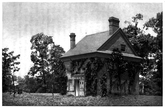
Penn's Letitia Street House, Removed to
Fairmount Park
When William Penn was granted his province, he
wrote that "after many waitings, watchings, solicitings
and disputes in council, this day my country was
confirmed to me under the great seal of England."
He had great hopes for its future, for he subsequently
wrote: "God will bless and make it the seed of a
nation; I shall have a tender care of the government
that it will be well laid at first." Some of the
Swedes from Christina had come up the river in
1643 and settled at the mouth of Chester Creek, at a
place called Upland. The site was an eligible one,
and the first parties of Quakers, coming out in three
ships, settled there, living in caves which they dug
in the river bank, these caves remaining for many
years after they had built houses. Penn drew up a
liberal scheme of government and laws for his colony,
in which he is said to have had the aid of Henry, the
brother of Algernon Sidney, and of Sir William
Jones. He was not satisfied with Upland, however,
as his permanent place of settlement, but directed
that another site be chosen higher up the Delaware,
at some point where "it is most navigable, high, dry
and healthy; that is, where most ships can best ride,
of deepest draught of water, if possible, to load or
unload, at the bank or key-side, without boating or
lightening of it." This site being selected between
the Delaware and Schuylkill Rivers, and the city laid
out, Penn, with about a hundred companions, mostly
Welsh Quakers, in September, 1682, embarked for
the Delaware on the ship "Welcome," arriving at
Upland after a six weeks' voyage, and then going up
to his city site, which he named Philadelphia, the
"City of Brotherly Love."
The first explorers of the Delaware River found
located upon the site of Philadelphia the Indian settlement
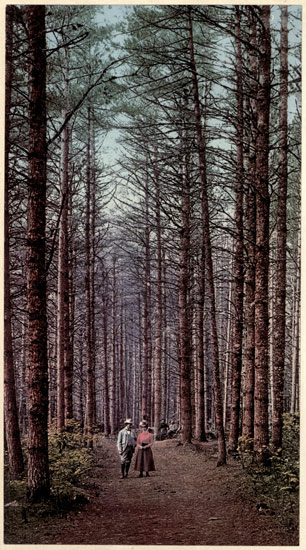
of Coquanock, or "the grove of long pine
trees," a sort of capital city for the Lenni Lenapes.
Their great chief was Tamanend, and the primeval
forest, largely composed of noble pine trees, then covered
all the shores of the river. The ship "Shield,"
from England, with Quaker colonists for Burlington,
in West Jersey, higher up the river, sailed past
Coquanock in 1679, and a note was made that "part
of the tackling struck the trees, whereupon some on
board remarked that 'it was a fine spot for a town.'"
When Penn sent out his advance agent and Deputy
Governor, Captain William Markham, of the British
army, in his scarlet uniform, to lay out the plan of
his projected city, he wrote him to "be tender of
offending the Indians," and gave instructions that the
houses should have open grounds around them, as he
wished the new settlement to be "a green country
town," and at the same time to be healthy, and free
from the danger of extensive conflagrations. Penn
bought the land farther down the Delaware from the
Swedes, who had originally bought it from the Indians,
and the site for his city he bought from the
Indians direct. They called him Mignon, and the
Iroquois, who subsequently made treaties with him,
called him Onas, both words signifying a quill pen,
as they recognized the meaning of his name. Out on
the Delaware, in what is now the Kensington shipbuilding
district, is the "neutral land of Shackamaxon."
This word means, in the Indian dialect,
the "place of eels." Here, for centuries before
Penn's arrival, the Indian tribes from all the region
east of the Alleghenies, between the Great Lakes,
the Hudson River and the Potomac, had been accustomed
to kindle their council fires, smoke the pipe
of deliberation, exchange the wampum belts of explanation
and treaty, and make bargains. Some
came by long trails hundreds of miles overland
through the woods, and some in their birch canoes by
water and portage. It was on this "neutral ground"
by the riverside that Penn, soon after his arrival,
held his solemn council with the Indians, sealing
mutual faith and securing their lifelong friendship for
his infant colony. This treaty, embalmed in history
and on canvas, was probably made in November,
1682, under the "Treaty Elm" at Shackamaxon,
which was blown down in 1810, the place where it
stood by the river being now preserved as a park.
Its location is marked by a monument bearing the
significant inscription: "Treaty Ground of William
Penn and the Indian Nation, 1682—Unbroken
Faith." Thus began Penn's City of Brotherly Love,
based on a compact which, in the words of Voltaire,
was "never sworn to and never broken." It is no
wonder that Penn, after he had seen his city site, and
had made his treaty, was so abundantly pleased that
he wrote:
"As to outward things, we are satisfied, the land
good, the air clear and sweet, the springs plentiful,
and provision good and easy to come at, an innumerable
quantity of wild fowl and fish; in fine, here is
what an Abraham, Isaac and Jacob would be well
contented with, and service enough for God, for the
fields here are white for harvest. O, how sweet is
the quiet of these parts, freed from the anxious and
troublesome solicitations, harries and perplexities of
woeful Europe."
The Lenni Lenapes, it is stated, told Penn and his
people that they often spoke of themselves as the
Wapanachki, or the "men of the morning," in allusion
to their supposed origin in the lands to the eastward,
towards the rising sun. Their tradition was
that at the time America was discovered, their nation
lived on the island of New York. They called it
Manahatouh, "the place where timber is got for
bows and arrows." At the lower end of the island
was a grove of hickory trees of peculiar strength
and toughness. This timber was highly esteemed
for constructing bows, arrows, war-clubs, etc. When
they migrated westward they divided into two bands.
One, going to the upper Delaware, among the mountains,
was termed Minsi, or "the great stone;" and
the other band, seeking the bay and lower river,
was called Wenawmien, or "down the river." These
Indians originated the name of the Allegheny Mountains,
which they called the Allickewany, the word
meaning "He leaves us and may never return"—it
is supposed in reference to departing hunters or warriors
who went into the mountain passes.
THE QUAKER CITY.
The great city thus founded by William Penn is
built chiefly upon a broad plain between the Delaware
and Schuylkill Rivers, about one hundred miles
from the sea, and upon the undulating surface to the
north and west. The shape of the city is much like
an hour-glass, between the rivers, although it spreads
far west of the Schuylkill. The Delaware River, in
front of the built-up portion, sweeps around a grand
curve from northeast to south, and then, reversing
the movement, flows around the Horseshoe Bend
below the city, from south to west, to meet the
Schuylkill. The railway and commercial facilities,
the proximity to the coal-fields, and the ample room
to spread in all directions, added to the cheapness of
living, have made Philadelphia the greatest manufacturing
city in the world, and attracted to it 1,300,000
inhabitants. The alluvial character of the shores of
the two rivers surrounds the city with a region of
the richest market gardens, and the adjoining counties
are a wealthy agricultural and dairy section.
Clay, underlying a large part of the surface, has furnished
the bricks to build much of the town. Most
of the people own their homes; there are over two
hundred and fifty thousand dwellings and a thousand
miles of paved streets, and new houses are put up by
the thousands every year as additional territory is
absorbed. When Penn laid out his town-plan, he
made two broad highways pointing towards the cardinal
points of the compass and crossing at right
angles in the centre, where he located a public square
of ten acres. The east and west street, one hundred
feet wide, he placed at the narrowest part of the hour-glass,
where the rivers approached within two miles
of each other. This he called the High Street, but
the public persisted in calling it Market Street. The
north and south street, laid out in the centre of the
plat, at its southern end reached the Delaware near
the confluence with the Schuylkill. This street is
one hundred and thirteen feet wide, Broad Street, a
magnificent thoroughfare stretching for miles and
bordered with handsome buildings. Upon the Centre
Square was built a Quaker meeting-house, the
Friends, while yet occupying the caves on the bluff
banks of the Delaware that were their earliest dwellings,
showing anxiety to maintain their forms of religious
worship. This meeting-house has since multiplied
into scores in the city and adjacent districts;
for the sect, while not increasing in numbers, holds its
own in wealth and importance, and has great influence
in modern Philadelphia. Afterwards the Centre
Square was used for the city water-works, and finally
it was made the site of the City Hall.
The bronze statue of the founder, surmounting the
City Hall tower at five hundred and fifty feet elevation,
clad in broad-brimmed hat and Quaker garb,
carrying the city charter, and gazing intently northeastward
towards the "neutral land of Shackamaxon,"
is the prominent landmark for many miles
around Philadelphia. A blaze of electric light illuminates
it at night. This City Hall, the largest edifice
in America, and almost as large as St. Peter's
Church in Rome, has fourteen acres of floor space and
seven hundred and fifty rooms, and cost $27,000,000.
It is a quadrangle, built around a central court about
two hundred feet square, and measures four hundred
and eighty-six by four hundred and seventy feet.
The lower portion is of granite, and the upper white
marble surmounted by Louvre domes and Mansard
roofs. This great building is the official centre of
Philadelphia, but the centre of population is now far
to the northwest, the city having spread in that direction.
The City Hall, excepting its tower, is also being
dwarfed by the many enormous and tall store and
office buildings which have recently been constructed
on Broad and other streets near it. Closely adjacent
are the two vast stations of the railways leading into
Philadelphia, the Broad Street Station of the Pennsylvania
system, and the Reading Terminal Station,
which serves the Reading, Baltimore and Ohio and
Lehigh Valley systems. Also adjoining, to the northward,
is the Masonic Temple, the finest Masonic edifice
in existence, a pure Norman structure of granite
two hundred and fifty by one hundred and fifty feet,
with a tower two hundred and thirty feet high, and
a magnificent carved and decorated granite Norman
porch, which is much admired.
The great founder not only started his City of
Brotherly Love upon principles of the strictest rectitude,
but he was thoroughly rectangular in his ideas.
He laid out all the streets on his plan parallel to the
two prominent ones, so that they crossed at right
angles, and his map was like a chess-board. In the
newer sections this plan has been generally followed,
although a few country roads in the outer districts,
laid upon diagonal lines, have been converted into
streets in the city's growth. Penn's original city also
included four other squares near the outer corners of
his plan, each of about seven acres, and three of them
were long used as cemeteries. These are now attractive
breathing-places for the crowded city, being
named after Washington and Franklin, Logan and
Rittenhouse. The east and west streets Penn named
after trees and plants, while the north and south
streets were numbered. The chief street of the city
is Chestnut Street, a narrow highway of fifty feet
width, parallel to and south of Market Street. Its
western end, like Walnut Street, the next one south,
is a fashionable residential section, both being prolonged
far west of the Schuylkill River. In the
neighborhood of Broad Street, and for several blocks
eastward, Chestnut Street has the chief stores. Its
eastern blocks are filled largely with financial institutions
and great business edifices, some of them
elaborate structures.
INDEPENDENCE HALL.
Upon the south side of Chestnut Street, occupying
the block between Fifth and Sixth Streets, is Independence
Square, an open space of about four acres,
tastefully laid out in flowers and lawns, with spacious
and well-shaded walks. Upon the northern side of
the square, and fronting Chestnut Street, is the most
hallowed building of American patriotic memories,
Independence Hall, a modest brick structure, yet the
most interesting object Philadelphia contains. It was
in this Hall, known familiarly as the "State-house,"
that the Continental Congress governing the thirteen
revolted colonies met during the American Revolution,
excepting when driven out upon the British
capture, after the battle of the Brandywine. The
Declaration of Independence was adopted here July
4, 1776. The old brick building, two stories high,
plainly built, and lighted by large windows, was begun
in 1732, taking three years to construct, having cost
what was a large sum in those days, £5600, the population
then being about ten thousand. It was the
Government House of Penn's Province of Pennsylvania.
There has recently been a complete restoration,
by which it has been put back into the actual
condition at the time Independence was declared. In
the central corridor stands the "Independence bell,"
the most sacred relic in the city. This Liberty bell,
originally cast in England, hung in the steeple, and
rang out in joyous peals the news of the signing of
the Declaration. Running around its top is the significant
inscription: "Proclaim Liberty throughout
the Land unto all the Inhabitants Thereof." This
bell was cracked while being rung on one of the anniversaries
about sixty years ago. In the upper
story of the Hall, Washington delivered his "Farewell
Address" in closing his term of office as President.
The eastern room of the lower story is where
the Revolutionary Congress met, and it is preserved
as then, the old tables, chairs and other furniture
having been gathered together, and portraits of the
Signers of the Declaration hang on the walls. The
old floor, being worn out, was replaced with tiles, but
otherwise the room, which is about forty feet square,
is as nearly as possible in its original condition.
Here are kept the famous "Rattlesnake flags," with
the motto "Don't Tread on Me," that were the
earliest flags of America, preceding the Stars and
Stripes. Of the deliberations of the Congress which
met in this building, William Pitt wrote: "I must
declare that in all my reading and observation, for
solidity of reasoning, force of sagacity, and wisdom
of conclusion, under such a complication of difficult
circumstances, no body of men could stand before the
National Congress of Philadelphia." In this building
is Penn's Charter of Philadelphia, granted in
1701, and West's noted painting of "Penn's Treaty
with the Indians." There are also portraits of all the
British kings and queens from Penn's time, including
a full-length portrait of King George III., representing
him, when a young man, in his coronation robes,
and painted by Allan Ramsay.
Other historic places are nearby. To the westward
is Congress Hall, where the Congress of the United
States held its sessions prior to removal to Washington
City. To the eastward is the old City Hall, where
the United States Supreme Court sat in the eighteenth
century. Adjoining is the Hall of the American
Philosophical Society, founded by Benjamin
Franklin, and an outgrowth of his Junto Club of
1743. It has a fine library and many interesting
relics. Franklin, who was the leading Philadelphian
of the Revolutionary period, came to the city from
Boston when eighteen years old, and died in 1790.
His grave is not far away, in the old Quaker burying-ground
on North Fifth Street. A fine bronze statue
of Franklin adorns the plaza in front of the Post-office
building on Chestnut Street. Farther down
Chestnut Street is the Hall of the Carpenters' Company,
standing back from the street, where the first
Colonial Congress met in 1774, paving the way for
the Revolution. An inscription appropriately reads
that "Within these walls, Henry, Hancock and
Adams inspired the delegates of the colonies with
nerve and sinew for the toils of war." On Arch
Street, east from Franklin's grave, is the house where
Betsy Ross made the first American flag, with thirteen
stars and thirteen stripes, from a design prepared
by a Committee of Congress and General Washington
in 1777. In this committee were Robert Morris
and Colonel George Ross, the latter being the young
woman's uncle. It appears that she was expert at
needlework and an adept in making the handsome
ruffled bosoms and cuffs worn in the shirts of those
days, and had made these for General Washington
himself. She had also made flags, and there is a
record of an order on the Treasury in May, 1777,
"to pay Betsy Ross fourteen pounds, twelve shillings
twopence for flags for the fleet in the Delaware
River." She made the sample-flag, her uncle providing
the means to procure the materials, and her
design was adopted by the Congress on June 14,
1777, the anniversary being annually commemorated
as "Flag Day." Originally there was a six-pointed
star suggested by the committee, but she proposed
the five-pointed star as more artistic, and they accepted
it. The form of flag then adopted continues
to be the American standard. She afterwards married
John Claypole, whom she survived many years,
and she died in January, 1836, aged 84, being
buried in Mount Moriah Cemetery, on the southwestern
border of the city.
GIRARD COLLEGE.
The name of Girard is familiar in Philadelphia,
being repeated in streets, buildings, and financial and
charitable institutions. On Third Street, south from
Chestnut Street, is the fine marble building of the
Girard Bank, which was copied after the Dublin Exchange.
This, originally built for the first Bank of
the United States, was Stephen Girard's bank until
his death. One of the greatest streets in the northern
part of the city is Girard Avenue, over one hundred
feet wide, stretching almost from the Delaware
River westward far beyond the Schuylkill River,
which it crosses upon a splendid iron bridge. In its
course through the northwestern section, this fine
street diverges around the enclosure of Girard College,
occupying grounds covering about forty-two
acres. Stephen Girard, before the advent of Astor
in New York, amassed the greatest American fortune.
He was born in Bordeaux in 1750, and, being a
sailor's son, began life as a cabin boy. He first appeared
in Philadelphia during the Revolution as a
small trader, and after some years was reported, in
1790, to have an estate valued at $30,000. Subsequently,
through trading with the West Indies, and
availing of the advantages a neutral had in the
warlike period that followed, he rapidly amassed
wealth, so that by 1812, when he opened his bank,
he had a capital of $1,200,000; and so great was the
public confidence in his integrity that depositors
flocked to his institution. He increased its capital
to $4,000,000; and when the war with England began
in that year he was able to take, without help, a
United States loan of $5,000,000. He was a remarkable
man, frugal and even parsimonious, but
profuse in his public charities, though strict in exacting
every penny due himself. He contributed liberally
to the adornment of the city and created many
fine buildings. He despised the few relatives he had,
and when he died in 1831 his estate, then the largest
known in the country, and estimated at $9,000,000,
was almost entirely bequeathed for charity.
Stephen Girard left donations to schools, hospitals,
Masonic poor funds, for fuel for the poor, and other
charitable purposes; but the major part of his fortune
went in trust to the city of Philadelphia, partly
to improve its streets and the Delaware River front,
but the greater portion to endow Girard College.
This was in the form of a bequest of $2,000,000 in
money and a large amount of lands and buildings,
together with the ground whereon the College has
been built. He gave the most minute directions
about its construction, the institution to be for the
support and instruction of poor white male orphans,
who are admitted between the ages of six and ten
years, and between the ages of fourteen and eighteen
years are to be bound out as apprentices to various
occupations. A clause in the will provides that no
ecclesiastic, missionary or minister of any sect whatever
is to hold any connection with the College, or
even be admitted to the premises as a visitor; but
the officers are required to instruct the pupils in the
purest principles of morality, leaving them to adopt
their own religious beliefs. The College building is
of white marble, and the finest specimen of pure
Grecian architecture in the United States. It is a
Corinthian temple, surrounded by a portico of thirty-four
columns, each fifty-five feet high and six feet in
diameter. The building is one hundred and sixty-nine
by one hundred and eleven feet, and ninety-seven
feet high, the roof being of heavy slabs of
marble, from which, as the College stands on high
ground, there is a grand view over the city. Within
the vestibule are a statue of Girard and his sarcophagus.
The architect, Thomas U. Walter, achieved
such fame from this building that he was afterwards
employed to extend the Capitol at Washington.
There are many other buildings in the College enclosure,
some being little less pretentious than the College
itself. This comprehensive charity has been in
successful operation over a half-century, and it supports
and educates some sixteen hundred boys, the
endowment, by careful management, now exceeding
$16,000,000.
Philadelphia is great in other charities, and notably
in hospitals. Opposite Girard College are the
magnificent buildings of the German Hospital and
the Mary J. Drexel Home for the education of
nurses, established by the munificence of John D.
Lankenau, the widowed husband of the lady whose
name it bears. The Drexel Institute, founded by
Anthony J. Drexel, is a fine building in West Philadelphia,
with $2,000,000 endowment, established for
"the extension and improvement of industrial education
as a means of opening better and wider avenues
of employment to young men and women," and
it provides for about two thousand students. The
Presbyterian, Episcopal, Jewish, Methodist and Roman
Catholic hospitals, all under religious care, are
noted. Philadelphia is also the great medical school
of the country, and the University, Jefferson, Hahnemann
and Women's Colleges, each with a hospital
attached, have world-wide fame. The oldest hospital,
the Pennsylvania Hospital, occupying an entire block
between Spruce and Pine and Eighth and Ninth
Streets, was founded in 1752, and is supported almost
entirely by voluntary contributions. In 1841 it
established in West Philadelphia a separate Department
for the Insane. The Medico-Chirurgical Hospital
is a modern foundation which has grown to
large proportions. There are many libraries—not
only free libraries, with branches in various parts of
the city, for popular use, supported by the public
funds, but also the Philadelphia Library, founded by
Franklin and his friends of the Junto Literary Club
in 1731, and its Ridgway Branch, established, with
$1,500,000 endowment, by Dr. James Rush—a spacious
granite building on Broad Street, which cost
$350,000. One of the restrictions of his gift, however,
excludes newspapers, he describing them as
"vehicles of disjointed thinking." The Pennsylvania
Historical Society also has a fine library pertaining
to early Colonial history, and many valuable relics
and manuscripts, including the first Bible printed
in America, and the original manuscripts of Home,
Sweet Home, and the Star-Spangled Banner.
NOTABLE PHILADELPHIA BUILDINGS.
There are many notable structures in Philadelphia.
The United States Mint, opposite the City Hall, and
fronting on Chestnut Street, has executed nearly all
the coinage of the country since its establishment in
1792, the present building having been completed in
1833. It contains a most interesting collection of
coins, including the "widow's mite." A fine new
mint is now being erected on a much larger scale in
the northwestern section of the city. The Bourse,
on Fifth Street near Chestnut, erected in 1895 at a
cost of $1,500,000, is the business centre, its lower
hall being the most spacious apartment in the city,
and the edifice is constructed in the style of Francis
I. The white marble Custom House, with fine Doric
portico, was originally erected in 1819, at a cost of
$500,000, for the second United States Bank, this
noted bank, which ultimately suspended, having been
for many years a political bone of contention. On the
opposite side of the street, covering a block, is a row
of a half-dozen wealthy financial institutions, making
one of the finest series in existence, granite and
marble being varied in several orders of architecture.
The Post-office building, also on Chestnut
Street, a grand granite structure in Renaissance,
with a façade extending four hundred feet, cost over
$5,000,000. The plain and solid Franklin Institute,
designed to promote the mechanical and useful arts,
is not far away.
Down nearer the river is the venerable Christ
Church, with its tall spire, built in 1727, the most
revered Episcopal church in the city, and the one
at which General Washington and all the Government
officials in the Revolutionary days worshipped. William
White, a native of the city, was the rector of
this church and chaplain of the Continental Congress,
and in 1786 was elected the Episcopal Bishop of
Pennsylvania, being ordained by the Archbishop of
Canterbury at Lambeth in February, 1787. He presided
over the Convention, held in this church in
1789, which organized the Protestant Episcopal
Church in the United States. Christ Church still
possesses the earliest chime of bells sent from England
to America, and the spire, rising nearly two hundred
feet, is a prominent object seen from the river.
Bishop White died in 1836, aged 88. He was also,
in his early life, the rector of St. Peter's Church, another
revered Episcopal church at Third and Pine
Streets. In its yard is the grave of Commodore
Stephen Decatur, the famous American naval officer,
who, after all his achievements and victories, was
killed in a duel with Commodore Barron in 1820,
his antagonist also dying. The most ancient church
in Philadelphia is Gloria Dei, the "Old Swedes'"
Church, a quaint little structure near the Delaware
River bank in the southern part of the city, built in
1700. The early Swedish settlers, coming up from
Fort Christina, erected a log chapel on this site in
1677, at which Jacob Fabritius delivered the first
sermon. After he died, the King of Sweden in
1697 sent over Rev. Andrew Rudman, under whose
guidance the present structure was built to replace
the log chapel; and it was dedicated, the first Sunday
after Trinity, 1700, by Rev. Eric Biorck, who had
come over with Rudman. Many are the tales told
of the escapades of the early Swedes in the days of
the log chapel. The Indians on one occasion undermined
it to get at the congregation, as they were
afraid of the muskets which the men shot out of the
loopholes. The women, however, scenting danger,
brought into church a large supply of soft-soap,
which they heated piping hot in a cauldron. When
the redskins made their foray and popped their heads
up through the floor, they were treated to a copious
bath of hot soap, and fled in dismay. This is the
"Old Swedes'" Church at Wicaco of which Longfellow
sings in Evangeline. The poet, in unfolding
his story, brings both Evangeline and Gabriel from
Acadia to Philadelphia in the enforced exodus of
1755, and thus graphically describes the Quaker
City:
"In that delightful land which is washed by the Delaware's waters,
Guarding in sylvan shades the name of Penn, the Apostle,
Stands on the banks of its beautiful stream the city he founded.
There all the air is balm, and the peach is the emblem of beauty,
And the streets still re-echo the names of the trees of the forest,
As if they fain would appease the Dryads whose haunts they molested.
There, from the troubled sea, had Evangeline landed an exile,
Finding among the children of Penn a home and a country.
Something, at least, there was, in the friendly streets of the city,
Something that spake to her heart and made her no longer a stranger;
And her ear was pleased with the Thee and Thou of the Quakers,
For it recalled the past, the old Acadian country,
Where all men were equal, and all were brothers and sisters."
In Philadelphia it is said Evangeline lived many
years as a Sister of Mercy, and it was thus that she
visited the ancient almshouse to minister to the sick
and dying on a Sabbath morning:
"As she mounted the stairs to the corridors, cooled by the east wind,
Distant and soft on her ear fell the chimes from the belfry of Christ Church,
While intermingled with these, across the meadows were wafted
Sounds of psalms that were sung by the Swedes in their church at Wicaco."
There she found the dying Gabriel, and both, according
to the tradition, are buried in the yard of the
Roman Catholic Church of the Holy Trinity, at Sixth
and Spruce Streets:
"Still stands the forest primeval; but far away from its shadow,
Side by side, in their nameless graves, the lovers are sleeping.
Under the humble walls of the little Catholic churchyard,
In the heart of the city, they lie unknown and unnoticed.
Daily the tides of life go ebbing and flowing beside them,
Thousands of throbbing hearts, where theirs are at rest and forever;
Thousands of aching brains, where theirs no longer are busy;
Thousands of toiling hands, where theirs have ceased from their labors;
Thousands of weary feet, where theirs have completed their journey."
In the ancient graveyard of "Old Swedes" is
buried Alexander Wilson, the American ornithologist,
who was a native of Scotland, but lived most of
his life in Philadelphia, dying in 1813. The largest
church in the city is the Roman Catholic Cathedral
of St. Peter and St. Paul, fronting on Logan Square,
an imposing Roman Corinthian structure of red sandstone,
two hundred and sixteen by one hundred and
thirty-six feet, and crowned by a dome rising two
hundred and ten feet. The chief institution of learning
is the University of Pennsylvania, the most extensive
and comprehensive College in the Middle
States, dating from 1740, and munificently endowed,
which occupies, with its many buildings, a large surface
in West Philadelphia, and has three thousand
students. This great institution originated from a
building planned in 1740 for a place in which George
Whitefield could preach, which was also used for a
charity school. This building was conveyed to trustees
in 1749 to maintain the school, and they were
in turn chartered as a college in 1753 "to maintain
an academy, as well for the instruction of poor children
on charity as others whose circumstances have
enabled them to pay for their learning." This charitable
feature is still maintained in the University by
free scholarships.
Philadelphia is eminently a manufacturing city,
and its two greatest establishments are the Cramp
Shipbuilding yards in the Kensington district and the
Baldwin Locomotive Works on North Broad Street,
each the largest establishment of its kind in America.
The city has spread over a greater territory than
any other in the United States, and sixteen bridges
span the Schuylkill, with others in contemplation, its
expansion beyond that river has been so extensive.
The enormous growth of the town has mainly come
from the adoption of the general principle that every
family should live in its own house, supplemented by
liberal extensions of electrical street railways in all
directions. Hence, Philadelphia is popularly known
as the "City of Homes." As the city expanded
over the level land, four-, six-, eight-and ten-room
dwellings have been built by the mile, and set up in
row after row. Two-story and three-story houses of
red brick, with marble steps and facings, make up
the greater part of the town, and each house is generally
its owner's castle, the owner in most cases
being a successful toiler, who has saved his house
gradually out of his hard earnings, almost literally
brick by brick. There is almost unlimited space
in the suburbs yet capable of similar absorption,
and the process which has given Philadelphia this
extensive surface goes on indefinitely. The population
is also regarded as more representative of
the Anglo-Saxon races than in most American
cities, though the Teuton numerously abounds and
speedily assimilates. The greatest extent of Philadelphia
is upon a line from southwest to northeast,
which will stretch nearly twenty miles in a continuous
succession of paved and lighted streets and
buildings.
FAIRMOUNT PARK AND SUBURBS.
Philadelphia, excepting to the southward, is surrounded
by a broad belt of attractive suburban residences,
the semi-rural region for miles being filled
with ornamental villas and the tree-embowered and
comfortable homes of the well-to-do and middle
classes. Down the Schuylkill is "Bartram's Garden,"
now a public park, where John Bartram established
the first botanic garden in America, and where
his descendants in 1899 celebrated the two hundredth
anniversary of his birth on June 2, 1699.
His grandfather was one of the companions of William
Penn, and John Bartram, who was a farmer,
mastered the rudiments of the learned languages,
became passionately devoted to botany, and was pronounced
by Linnæus the greatest natural botanist in
the world. Bartram bought his little place of about
seven acres in 1728, and built himself a stone house,
which still exists, bearing the inscription, cut deep in
a stone, "John and Ann Bartram, 1731." He wrote
to a friend describing how he became a botanist:
"One day I was very busy in holding my plough
(for thou seest I am but a ploughman), and being
weary, I ran under a tree to repose myself. I cast
my eyes on a daisy; I plucked it mechanically and
viewed it with more curiosity than common country
farmers are wont to do, and I observed therein many
distinct parts. 'What a shame,' said my mind, or
something that inspired my mind, 'that thou shouldst
have employed so many years in tilling the earth
and destroying so many flowers and plants without
being acquainted with their structure and their
uses.'" He put up his horses at once, and went to
the city and bought a botany and Latin grammar,
which began his wonderful career. He devoted his
life to botany, travelled over America collecting
specimens, and died in 1777. At the mouth of the
Schuylkill River is League Island, where the United
States has an extensive navy yard, and a reserve
fresh water basin for the storage of naval vessels
when out of commission. The attractive Philadelphia
suburban features spread westward across the
Schuylkill, and are largely developed in the northwestern
sections of Germantown and Chestnut Hill,
Jenkintown and the Chelten-hills. In this extensive
section the wealth of the people has of late years
been lavishly expended in making attractive homes,
and the suburban belt for miles around the city displays
most charming scenery, adorned by elaborate
villas, pleasant lanes, shady lawns and well-kept
grounds.
The chief rural attraction of Philadelphia is Fairmount
Park, one of the world's largest pleasure-grounds.
It includes the lands bordering both sides
of the Schuylkill above the city, having been primarily
established to protect the water-supply.
There are nearly three thousand acres in the Park,
and its sloping hillsides and charming water views
give it unrivalled advantages in delicious natural
scenery. At the southern end is the oldest water
reservoir of six acres, on top of a curious and isolated
conical hill about ninety feet high, which is
the "Fair Mount," giving the Park its name. The
Schuylkill is dammed here to retain the water, and
the Park borders the river for several miles above,
and its tributary, the Wissahickon, for six miles
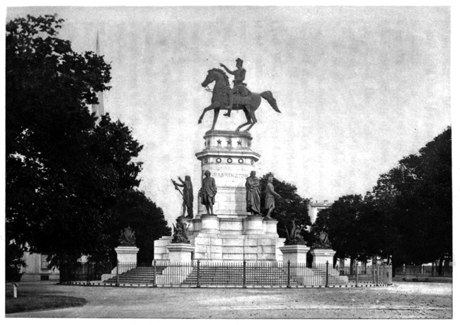
farther. The Park road entering alongside the Fairmount
hill passes a colossal equestrian statue of
George Washington, and beyond a fine bronze statue
of Abraham Lincoln, and also an equestrian statue
of General Grant. The roadways are laid on both
sides of the river at the water's edge, and also over
the higher grounds at the summits of the sloping
bordering hills, thus affording an almost endless
change of routes and views. The frequent bridges
thrown across the river, several of them carrying
railroads, add to the charm. An electric railway is
constructed through the more remote portions, and
displays their rustic beauty to great advantage. All
around this spacious Park the growing city has extended,
and prosperous manufacturing suburbs spread
up from the river, the chief being the carpet district
of the Falls and the cotton-mills of Manayunk,
the latter on the location of an old-time Indian village,
whose name translated means "the place of
rum." In this Park, west of the Schuylkill, was
held the Centennial Exposition of 1876, and several
of the buildings remain, notably the Memorial Art
Gallery, now a museum, and the Horticultural Hall,
where the city maintains a fine floral display. William
Penn's "Letitia House," his original residence,
removed from the older part of the city, now stands
near the entrance to the West Park.
A large part of the northeastern bank of the
Schuylkill adjoining the Park is the Laurel Hill
Cemetery. Its winding walks and terraced slopes
and ravines give constantly varying landscapes,
making it one of the most beautiful burial-places in
existence. In front, the river far beneath curves
around like a bow. Some of its mausoleums are of
enormous cost and elaborate ornamentation, but generally
the grandeur of the location eclipses the work
of the decorator. Standing on a jutting eminence is
the Disston Mausoleum, which entombs an English
sawmaker who came to Philadelphia without friends
and almost penniless, and died at the head of the
greatest sawmaking establishment on the Continent.
At one place, as the river bends, the broad and rising
terraces of tombs curve around like the banks of
seats in a grand Roman amphitheatre. Here is the
grave of General Meade who commanded at Gettysburg.
In a plain, unmarked sepulchre fronting the
river, hewn out of the solid rock, is entombed the
Arctic explorer who conducted the Grinnell expedition
in search of Sir John Franklin, Dr. Elisha Kent
Kane. A single shaft on a little eminence nearby
marks the grave of Charles Thomson, the Secretary
of the Continental Congress that made the Declaration
of Independence. Some of the graves are in
exquisite situations, many having been chosen by
those who lie there. Here are buried Thomas Godfrey,
the inventor of the mariner's quadrant; General
Hugh Mercer, who fell at the head of the
Pennsylvania troops in the Revolutionary battle of
Princeton, the Scots' Society of St. Andrew having
erected a monument to his memory; Commodore
Isaac Hull, who commanded the American frigate
"Constitution" in the War of 1812 when she captured
the British frigate "Guerrière;" Harry Wright,
the "father of base-ball," who died in 1895; and
Thomas Buchanan Read, the poet-artist. At the
cemetery entrance is the famous "Old Mortality"
group, carved in Scotland and sent to Philadelphia.
The quaint old Scotsman reclines on a gravestone,
and pauses in his task of chipping-out the half-effaced
letters of the inscription, while the little pony
patiently waits alongside of him for his master and
Sir Walter Scott to finish their discourse.
The peculiar charm of Philadelphia suburban
scenery, however, is the Wissahickon—the "catfish
stream" of the Indians. This is a creek rising in
the hills north of the city, and breaking through the
rocky ridges, flowing by tortuous course to the
Schuylkill a short distance above Laurel Hill. It is
an Alpine gorge in miniature, with precipitous sides
rising two to three hundred feet, and the winding
road along the stream gives a charming ride. Populous
suburbs are on the higher ridges, but the ravine
has been reserved and carefully protected, so that
all the natural beauties remain. A high railway
bridge is thrown across the entrance of the gorge at
the Schuylkill, and rounding, just beyond, a sharp
rocky corner, the visitor is quickly within the ravine,
the stream nestling deep down in the winding fissure.
For several miles this attractive gorge can be
followed; and high up on its side, in a commanding
position near the summit of the enclosing ridge, one
of the residents has placed a statue of William Penn,
most appropriately bearing the single word at its
base—"Toleration." This splendid gorge skirts the
northwestern border of the popular suburb of Germantown,
and the creek emerges from its rocky confines
at the foot of Chestnut Hill, where it rends the
ridge in twain, and the hillsides are dotted with attractive
villas. This is a fashionable residential section
whose people have a magnificent outlook over
the rich agricultural region of the upper Wissahickon
Valley and the hills beyond.
In Germantown is the historic Chew House, bearing
the marks of cannon balls, which was the scene
of the battle of Germantown in October, 1777, when
the British under Lord Howe, then holding Philadelphia,
defeated General Washington, and the darkest
period of the Revolution followed, the Americans
afterwards retiring to their sad winter camp at Valley
Forge. This suburb of Germantown is almost
as old as Philadelphia. It was originally settled in
1683 by Germans who came from Cresheim, a name
that is preserved in the chief tributary of the Wissahickon.
Their leader was Daniel Pastorius, who
bought a tract of fifty-seven hundred acres of land
from William Penn for a shilling an acre, and took
possession on October 6th. Their settlement prospered
and attracted attention in the Fatherland. In
1694 a band of religious refugees, having peculiar
tenets and believing that the end of the world was
approaching, determined to migrate to Germantown.
They were both Hollanders and Germans, and came
from Rotterdam to London, whence, under the guidance
of Johannes Kelpius, they sailed for America
upon the ship "Sara Maria." They were earnest
and scholarly men, and Kelpius, who was a college
graduate, was a profound theologian. They called
themselves the "Pietists." Upon their voyage they
had many narrow escapes, but every danger was
averted by fervent prayers. Their vessel ran
aground, but was miraculously floated; they were
nearly captured by the French, but, mustering in
such large numbers on the deck of the "Sara
Maria," they scared the enemy away; they were
badly frightened by an unexpected eclipse of the
sun; but in every case prayers saved them, and on
June 14th they safely landed in Chesapeake Bay,
marching overland to the Delaware and sailing up to
Philadelphia, where they disembarked.
In solemn procession, on June 23, 1694, led by
Kelpius, they walked, two and two, through the little
town, which then had some five hundred houses.
They called on the Governor, William Markham, representing
Penn, and took the oath of allegiance to
the British Crown. In the evening they held a
solemn religious service on "the Fair Mount," at
the verge of the Schuylkill. In it they celebrated
the old German custom of "Sanct Johannes" on St.
John's eve. They lighted a fire of dry leaves and
brushwood on the hill, casting into it flowers, pine
boughs and bones, and then rolled the dying embers
down the hillside as a sign that the longest day of
the year was past, and the sun, like the embers,
would gradually lose its power. The next morning
was the Sabbath, and they went out to Germantown,
where they were warmly welcomed. They built
their first house, since called the Monastery, near the
Wissahickon Creek, where they worked and worshipped.
Their house they called "The Woman of
the Wilderness," and upon its roof, day and night,
some of them stood, closely observing the changing
heavens. With prayers and patience they watched
for the end of the world and the coming of the Lord,
and they obeyed the ministry of Kelpius. He lived
in a cave, and as his colony of enthusiasts gradually
dwindled, through death and desertion, he came to be
known as the "Hermit of the Wissahickon." Here
he dug his well two centuries ago, and the "Hermit's
Pool" still exists. He constantly preached
the near approach of the millennium, and exhibited
his magical "wisdom stone." Finally, wearying yet
still believing, he gave up, cast his weird stone into
the stream, and in 1704 he died, much to the relief
of the neighboring Quaker brethren, who did not
fancy such mysterious alchemy so near the city of
Penn. These "Pietists," or "Kelpians," as they were
afterwards called, dispersed over the country, and
had much to do with guiding the religious life and
mode of worship among the early German settlers in
Pennsylvania. Everywhere in German Pennsylvania
there are traces of their influence, and especially
at Ephrata and Waynesboro they have had pious and
earnest followers. After the death of Kelpius, their
last survivor in Germantown was Dr. Christopher
DeWitt, famed as a naturalist, an astronomer, a
clock-maker and a magician. He was a close friend
of John Bartram, lived an ascetic life, became blind
and feeble, and finally died an octogenarian in 1765,
thus closing with his life the active career of the
Kelpian mystics.
THE SCHUYLKILL RIVER.
One of the romances of Fairmount Park is attached
to the little stone cottage, with overhanging
roof, down by the Schuylkill River bank, where tradition
says that the Irish poet, Tom Moore, briefly
dwelt when he visited Philadelphia in the summer of
1804. This cottage tradition may be a myth, but
the poet when here composed an ode to the cottage
and to the Schuylkill, which is as attractive as the
bewitching river scene itself. The famous ballad
begins:
"I knew by the smoke that so gracefully curled
Above the green elms that a cottage was near,
And I said, 'If there's peace to be found in the world,
A heart that was humble might hope for it here.'"
Tom Moore's letters written at that time generally
showed dislike for much that he saw on his American
journey, but he seems to have found better things at
Philadelphia, and was delighted with the Quaker hospitality.
His ode to the Schuylkill shows that its
beauties impressed him, and gives evidence of his regard
for the people:
"Alone by the Schuylkill, a wanderer roved,
And bright were its flowery banks to his eye;
But far, very far, were the friends that he loved,
And he gazed on its flowery banks with a sigh.
"The stranger is gone—but he will not forget,
When at home he shall talk of the toil he has known,
To tell with a sigh what endearments he met,
As he stray'd by the wave of the Schuylkill alone!"
The Schuylkill River is the chief tributary of the
Delaware, an Allegheny Mountain stream about one
hundred and twenty miles long, coming out of the
Pennsylvania anthracite coal-fields, and falling into
the Delaware at League Island in such a lowland region
that its mouth is scarcely discernible. In fact,
the early Dutch explorers of the Delaware passed
the place repeatedly and never discovered it; and
when the stream above was afterwards found by
going overland, and traced down to its mouth, they
appropriately called it the Schuylkill, meaning the
"hidden river." The Indian name was the "Gans-howe-hanne,"
or the "roaring stream," on account
of its many rapids. The lowest of these, which
gave the name of the "Falls" to a Philadelphia
suburb, was obliterated by the backwater from the
Fairmount water-works dam. The river valley is
populous, rich in manufactures and agriculture, and,
as it winds through ridge after ridge of the Allegheny
foothills, displays magnificent scenery. Both
banks are lined with railways, which bring the anthracite
coal from the mines down to tidewater.
Journeying up the Schuylkill, we pass the flourishing
manufacturing towns of Conshohocken and Norristown
and come into the region of the "Pennsylvania
Dutch," where the inhabitants, who are mostly
of Teutonic origin, speak a curious dialect, compounded
of German, Dutch, English and some Indian
words, yet not fully understood by any of those races.
These industrious people are chiefly farmers and
handicraftsmen, and they make up much of the population
of eastern Pennsylvania, while their "sauerkraut"
and "scrapple" have become staple foods in
the State. Twenty-four miles above Philadelphia,
alongside a little creek and almost under the great
Black Rock, a towering sandstone ridge, was the
noted Valley Forge, the place of encampment of
Washington's tattered and disheartened army when
the defeats at Brandywine and Germantown and the
loss of Philadelphia made his prospects so dismal in
the winter of 1777-78, one of the severest seasons
ever experienced in America. The encampment is
preserved as a national relic, the entrenchments
being restored by a patriotic association, with the
little farmhouse beside the deep and rugged hollow,
near the mouth of the creek, which was Washington's
headquarters. Phœnixville and Pottstown are
passed, and Birdsboro', all places of busy and prosperous
iron manufacture, and then the river valley
leads us into the gorge of the South Mountain.
READING AND POTTSVILLE.
The diminutive Schuylkill breaks its passage
through this elevated range, with Penn's Mount on
one side and the Neversink Mountain on the other,
and here is located the most populous city of the
Schuylkill Valley—Reading, with seventy thousand
population, a seat of iron-making and extensive railway
shops, having a fertile agricultural region in the
adjacent valleys. This expanding and attractive city
gives its name to, and obtains much of its celebrity
from the "Philadelphia and Reading Railway," the
colossal financial institution whose woes of bankruptcy
and throes of reconstruction have for so many
years occupied the attention of the world of finance.
This great railway branches at Reading, and its
western line runs off through red sandstone rocks
and among iron mills and out upon a high bridge,
thrown in a beautiful situation across the Schuylkill,
and proceeds over the Lebanon Valley to the Susquehanna
River at Harrisburg. This rich limestone
valley, between the South Mountain and the Blue
Ridge, is a good farming district, and also a wealthy
region of iron manufacture. The Reading system
also sends its East Pennsylvania route eastward to
Allentown in the Lehigh Valley, and thence to New
York. Factory smokes overhang Reading, through
which the Schuylkill flows in crooked course, spanned
by frequent bridges, and puffing steam jets on all
sides show the busy industries. A good district surrounds
Reading in the mountain valleys, and the
thrifty Dutch farmers in large numbers come into
the town to trade. The high forest-clad mountains
rise precipitously on both sides, with electric railways
running up and around them, disclosing magnificent
views. The "old red sandstone" of these enclosing
hills has been liberally hewn out to make the ornamental
columns for the Court House portico and build
the castellated jail, and also the red gothic chapel
and elaborate red gateway of the "Charles Evans'
Cemetery," where the chief townsfolk expect, like
their ancestry, to be buried. The visitor who wishes
to see one of the most attractive views over city,
river, mountain and distant landscape can climb by
railway up to the "White Spot," elevated a thousand
feet above the river, on Penn's Mount. This
point of outlook is an isolated remnant of Potsdam
sandstone, lying, the geologists say, unconformably
on the Laurentian rock.
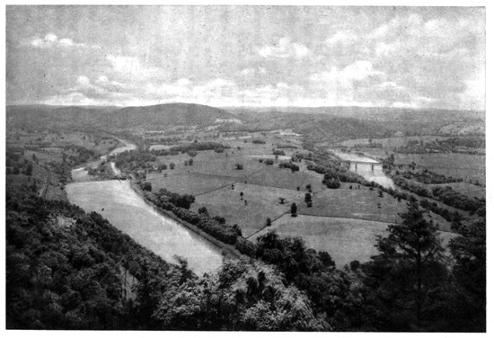
Loop of the Schuylkill from Neversink
Mountains
Beyond Reading, the Schuylkill breaks through
the Blue Ridge at Port Clinton Gap, eighteen miles
to the northwest. The winding and romantic pass
is about three miles long, and just beyond there is, at
Port Clinton, a maze of railway lines where the
Reading Company unites its branches converging
from various parts of the anthracite coal-fields. The
Little Schuylkill River here falls into the larger
stream, and a branch follows it northward to Tamaqua,
while the main line goes westward to Pottsville.
The summit of the Blue Ridge is the eastern
boundary of the coal-fields, and the country beyond
is wild and broken. The next great Allegheny
ridge extending across the country is the Broad
Mountain beyond Pottsville, though between it and
the Blue Ridge there are several smaller ridges, one
being Sharp Mountain. The country is generally
black from the coal, and the narrow and crooked
Schuylkill has its waters begrimed by the masses of
culm and refuse from the mines. Schuylkill Haven,
ninety miles from Philadelphia, is where the coal
trains are made up, and branches diverge to the
mines in various directions. Three miles beyond is
Pottsville, confined within a deep valley among the
mountains, its buildings spreading up their steep
sides, for here the malodorous and blackened little
river breaks through Sharp Mountain. This is a
city of fifteen thousand people, and the chief town of
the Schuylkill or Southern coal-field, which produces
ten millions of tons of anthracite annually. The
whole country roundabout is a network of railways
leading to the various mines and breakers, and there
are nearly four hundred miles of railways in the
various levels and galleries underground. We are
told that in the eighteenth century John Pott built
the Greenwood Furnace and Forge, and laid out this
town; and afterwards, when coal-mining was developed,
there came a rush of adventurers hither; but
of late years Pottsville has had a very calm career.
To the northward of the Schuylkill or Southern
coal-field, and beyond the Broad Mountain, is the
"Middle coal-field," which extends westward almost
to the Susquehanna River, and includes the Mahanoy
and Shamokin Valleys. Both these fields also extend
eastward into the Lehigh region; and it is noteworthy
that as all these coal measures extend eastward
they harden, while to the westward they soften.
The hardest coals come from the Lehigh district, and
they gradually soften as they are dug out to the
westward, until, on the other side of the main Allegheny
range, they change into soft bituminous, and
farther westward their constituents appear in the
form of petroleum and as natural gases. The region
beyond Pottsville is unattractive. Various railways
connect the Schuylkill and Lehigh regions, and cross
over or through the Broad Mountain. The district
is full of little mining villages, but has not much else.
It is a rough country, with bleak and forbidding hills,
denuded of timber by forest fires, with vast heaps of
refuse cast out from the mines, some of them the accumulations
of sixty or seventy years. Breakers
are at work grinding up the fuel, which pours with
thundering noise into the cars beneath. The surface
is strewn with rocks and débris, and the dirty waters
of the streams are repulsive. These blackened
brooks of the Broad Mountain are the headwaters of
the Schuylkill River.
THE NEW JERSEY COAST RESORTS.
The Delaware River divides Pennsylvania from
New Jersey, and at Camden, opposite Philadelphia,
there has grown another large city from the overflow
of its population. Ferries, and at the northern
end of Philadelphia harbor an elevated railway
bridge, cross over to Camden, while for miles the
almost level surface of New Jersey has suburban
towns and villas, the homes of thousands whose business
is in Philadelphia. The New Jersey seacoast
also is a succession of watering-places where the
population goes to cool off in the summer. The
whole New Jersey coast of the Atlantic Ocean is a
series of sand beaches, interspersed with bays,
sounds and inlets, a broad belt of pine lands behind
them separating the sea and its bordering sounds
and meadows from the farming region. This coast
has become an almost unbroken chain of summer resorts
from Cape May, at the southern extremity of
New Jersey, northeastward through Sea Isle City,
Avalon, Ocean City, Atlantic City, Brigantine, Beach
Haven, Sea Girt, Asbury Park, Ocean Grove, Long
Branch, Seabright, etc., to Sandy Hook, where the
long sand-strip terminates at the entrance to New
York harbor. To these many attractive places the
summer exodus takes the people by the hundreds of
thousands. The chief resort of all is Atlantic City,
which has come to be the most popular sea-bathing
place of the country, the railroads running excursion
trains to it even from the Mississippi Valley. Three
railroads lead over from Philadelphia across the
level Jersey surface, and their fast trains compass
the distance, fifty-six miles, in an hour. The town
is built on a narrow sand-strip known as Absecon
Island, which is separated from the mainland by a
broad stretch of water and salt meadows. Absecon
is an Indian word meaning "the place of the swans."
The beach is one of the finest on the coast, and along
its inner edge is the famous "Board Walk" of Atlantic
City, an elevated promenade mostly forty feet
wide, and four miles long. On the land side this
walk is bordered by shops, bathing establishments
and all kinds of amusement resorts, while the town
of hotels, lodging-houses and cottages, almost all
built of wood, stretches inland. The population
come out on the "Board Walk" and the great piers,
which stretch for a long distance over the sea. It is
the greatest bathing-place in existence, and in the
height of the season, July and August, fifty thousand
bathers are often seen in the surf on a fine day, with
three times as many people watching them. Enormous
crowds of daily excursionists are carried down
there by the railways. The permanent population is
about twenty thousand, swollen in summer often
fifteen- or twenty-fold. Atlantic City is also a popular
resort in winter and spring, and is usually well
filled at Eastertide.
The other New Jersey resorts are somewhat similar,
though smaller. Cape May, on the southern extremity
of the Cape, is popular, and has a fine beach
five miles long. The coast for many miles northeastward
has cottage settlements, the beaches having
similar characteristics. Many of these settlements
also cluster around Great Egg Harbor and Barnegat
Bay, both favorite resorts of sportsmen for fishing
and shooting. Asbury Park and Ocean Grove are
twin watering-places on the northern Jersey coast
which have large crowds of visitors. The former is
usually filled by the overflow from the latter, who
object to the Ocean Grove restrictions. Ocean Grove
is unique, and was established in 1870 by a Camp
Meeting Association of the Methodist Episcopal
Church. Here many thousands, both young and
old, voluntarily spend their summer vacations under
a religious autocracy and obey the strict rules. It is
bounded by the sea, by lakes on the north and south,
and by a high fence on the land side, and the gates
are closed at ten o'clock at night, and all day Sunday.
The drinking of alcoholic beverages and sale of tobacco
are strictly prohibited, and no theatrical performances
of any kind are allowed. No bathing,
riding or driving are permitted on Sunday, and at
other times the character of the bathing-dresses is
carefully regulated. There is a large Auditorium,
accommodating ten thousand people, and here are
held innumerable religious meetings of all kinds.
The annual Camp Meeting is the great event of the
season, and among the attractions is an extensive
and most complete model of the City of Jerusalem.
To the northward is Long Branch, the most fashionable
and exclusive of the New Jersey coast resorts,
being mainly a succession of grand villas and
elaborate hotels, stretching for about four miles along
a bluff which here makes the coast, and has grass
growing down to its outer edge almost over the
water. In the three sections of the West End,
Elberon and Long Branch proper, the latter getting
its name from the "Long branch" of the Shrewsbury
River, there are about eight thousand regular
inhabitants, and there come here about fifty thousand
summer visitors, largely from New York. The great
highway is Ocean Avenue, running for five miles
just inside the edge of the bluff, which, in the season,
is a most animated and attractive roadway. The
hotels and cottages generally face this avenue. The
most noted cottages are the one which General Grant
occupied for many years, and where, during his
Presidency in 1869-77, he held "the summer capital
of the United States," and the Franklyn Cottage,
where President Garfield, after being shot in Washington,
was brought to die in 1881. The most
famous show place at Long Branch is Hollywood, the
estate of the late John Hoey, of Adams Express
Company, who died there in 1892, its elaborate
floral decorations being much admired.
SHACKAMAXON TO BRISTOL.
Journeying up the Delaware from Philadelphia, we
pass Petty Island, where the great Indian chief of
the Lenni Lenapes, Tamanend, had his lodge—the
chieftain since immortalized as St. Tammany, who
has given his name to the Tammany Society of politicians
who rule New York City. Petty on the old
maps is called Shackamaxon Island, a derivation of
the original Indian name of Cackamensi. St. Tammany
is described as a chief who was so virtuous
that "his countrymen could only account for the perfections
they ascribe to him by supposing him to be
favored with the special communications of the Great
Spirit." In the eighteenth century many societies
were formed in his honor, and his festival was kept
on the 1st of May, but the New York Society is the
only one that has survived. Farther up, the Tacony
Creek flows into the Delaware, the United States
having a spacious arsenal upon its banks. The name
of this creek was condensed before Penn's time, by
the Swedes, from its Indian title of Taokanink. Beyond,
the great manufacturing establishments of the
city gradually change to charming villas as we move
along the pleasant sloping banks and through the
level country, and soon we pass the northeastern
boundary of Philadelphia, at Torresdale. This boundary
is made by the Poquessing Creek, being the aboriginal
Poetquessink, or "the stream of the dragons."
Across the river, on the Jersey shore, formerly
roamed the Rankokas Indians, an Algonquin tribe,
whose name is preserved in the Rancocas Creek,
which is one of the chief tributaries flowing in from
New Jersey. At Beverly, not far above, is one of
the most popular suburban resorts, the villas clustering
around a broad cove, known as Edgewater, which
appears much like a miniature Bay of Naples. Over
opposite is the wide Neshaminy Creek, flowing down
from the Buckingham Mountain in Pennsylvania, its
Indian title of Nischam-hanne, meaning "the two
streams flowing together," referring to its branches.
The earliest settlers along this creek were Scotch-Irish,
and their pastor in 1726 was Rev. William
Tennent, the famous Presbyterian preacher, who
founded the celebrated "Log College" on the Neshaminy,
"built of logs, chinked and daubed between,
and one story high," as it was well described. From
this simple college, which was about twenty feet
square, were sent out many of the famous Presbyterian
preachers of the eighteenth century; and from
it grew, in 1746, the great College of New Jersey at
Princeton, and in 1783 Dickinson College, at Carlisle,
Pennsylvania, besides many other schools which
were started by its alumni. William Tennent's son,
Gilbert, was his assistant and successor. The great
Whitefield preached to an audience of three thousand
at this College in 1739. He was attracted there
by Gilbert Tennent's fame as a preacher, and of
him on one occasion wrote, "I went to the meeting
house to hear Mr. Gilbert Tennent preach, and
never before heard I such a searching sermon; he
is a son of thunder, and does not regard the face of
man."
The Delaware River broadens into two channels
around Burlington Island, having on either hand the
towns of Bristol and Burlington, both coeval with the
first settlement of Philadelphia, and Bristol at that
early day having had an ambition to become the location
of Penn's great city. The ferry connecting
them was established two years before Penn came to
Philadelphia, and in the eighteenth century they had
a larger carrying trade. Bristol began in 1680
under a grant from Edmund Andros, then the Provincial
Governor of New York, for a town site and
the ferry, which is curiously described in the Colonial
records as "the ferry against Burlington," then the
chief town in West Jersey. The settlement was
called New Bristol, from Bristol in England, where
lived Penn's wife, Hannah Callowhill. It was the
first county seat of Bucks when Penn divided his
Province into the three counties—Chester, Philadelphia
and Buckingham. It was for many years
a great exporter of flour to the West Indies. Its
ancient Quaker Meeting House dates from 1710,
and St. James' Episcopal Church from 1712; but
the latter, which received its silver communion
service from the good Queen Anne, fell into decay
and has been replaced by a modern structure.
Its Bath Mineral Springs made it the most fashionable
watering-place in America in the eighteenth
century, but Saratoga afterwards eclipsed them, and
their glory has departed. Prior to the Revolution,
Bristol built more shipping than Philadelphia;
and, while quiet and restful, its comfortable homes
and the picturesque villas along the Delaware
River bank above the town tell of its prosperity
now.
OLD BURLINGTON.
The ancient town of Burlington, clustered behind
its "Green Bank" or river-front street on the New
Jersey shore, antedates Philadelphia five years. The
Quaker pioneers are believed to have been the first
Europeans who saw its site. The noted preacher
George Fox, in 1672, journeyed from New England
to the South, and rode on horseback over the site of
Burlington at Assiscunk Creek, reporting the soil as
good "and withal a most brave country." When
Penn became Trustee for the insolvent Billynge, a
Proprietor of West Jersey, much of his land was
sold to Quakers, who migrated to the American
wilderness to escape persecution at home. Thus
Burlington was the first settlement founded by Quaker
seekers after toleration in the New World:
"About them seemed but ruin and decay,
Cheerless, forlorn, a rank autumnal fen,
Where no good plant might prosper, or again
Put forth fresh leaves for those that fell away;
Nor could they find a place wherein to pray
For better things. In righteous anger then
They turned; they fled the wilderness of men
And sought the wilderness of God. And day
Rose upon day, while ever manfully
Westward they battled with the ocean's might,
Strong to endure whatever fate should be,
And watching in the tempest and the night
That one sure Pharos of the soul's dark sea—
The constant beacon of the Inner Light."
In the spring of 1677 the "goode shippe Kent,"
Gregory Marlowe, master, sailed from London, bound
for West Jersey, with two hundred and thirty
Quakers, about half coming from London and the
others from Yorkshire; two dying on the voyage.
They ascended the Delaware to the meadow lands
below the mouth of Assiscunk Creek, landing there
in June, and in October made a treaty with the Indians,
buying their lands from the Rancocas as far
up as Assunpink Creek at Trenton. Their settlement
was first called New Beverly, and then Bridlington,
from the Yorkshire town whence many of them came,
but it finally was named Burlington. They made a
street along the river, bordered with greensward, and
called the "Green Bank," and drew a straight line
back inland, calling it their Main Street, and the Londoners
settled on one side and the Yorkshiremen on
the other. The old buttonwood tree, to which was
moored the early ships bringing settlers, still stands
on the Green Bank, a subject of weird romance.
Elizabeth Powell, the first white child, was born in
July, 1677. The next May, 1678, they established
a "Monthly Meeting of Friends" at Burlington, of
which the records have been faithfully kept. In
June the graveyard was fenced in, and the old Indian
chief, Ockanickon, a Quaker convert to Christianity,
was among the first buried there. In August the first
Quaker marriage was solemnized in meeting, this
first certificate being signed by ten men and three
women Friends as witnesses. In 1682, just as Penn
was coming over, they decided to build their first
meeting house—a hexagonal building, forty feet in
diameter, with pyramidal roof, which was occupied
the next year. In 1685 they decided that a hearse
should be built, the entry on the record being an
order for a "carriage to be built for ye use of such
as are to be laid in ye ground."
Burlington grew, and was long the seat of government
of the Province of West Jersey, being the
official residence of the Provincial Governors, the
last of whom was William Franklin, natural son of
Benjamin Franklin. It had wealthy merchants and
much shipping, and, despite its peacefulness, equipped
privateers to fight the French. Its famous old Episcopal
Church of St. Mary had the corner-stone laid in
1703 under the favor of Queen Anne, who made a
liberal endowment of lands, much being yet held, and
gave it a massive and greatly prized communion service.
This old church is cruciform, with a little belfry,
and a stone let into the front wall bears the inscription
"One Lord, one faith, one baptism." In
the extensive churchyard alongside is the modern
St. Mary's Church, of brownstone, with a tall spire,
also cruciform. This is the finest church in Burlington.
When "Old St. Mary's" was built with its belfry,
the Friends did not like the innovation, and long
gazed askance at the "steeple house," as they called
it; so that Talbot, the first rector, sturdily retaliated,
calling the Quakers "anti-Christians, who are worse
than the Turks." Many of St. Mary's parishioners
of to-day are descended from these maligned Quakers.
The early records of the Meeting are filled with entries
showing that charges were brought against members
for various shortcomings. One was admonished
for "taking off his hat" at a funeral solemnized in
the "steeple house;" others gave testimony of "uneasiness"
on account of the placing of "gravestones
in the burial-ground;" a query was propounded,
"Are Friends in meeting preserved from sleeping or
any other indecent behavior, particularly from chewing
tobacco and taking snuff?" A record was also
made of testimony against "a pervading custom of
working on First days in the time of hay and harvest"
when rain threatened. The descendants of
these good people have established St. Mary's Hall
and Burlington College, noted educational institutions.
Probably the most famous son of Burlington was
the distinguished novelist, James Fenimore Cooper,
born in 1789, but taken in his infancy by his parents
to his future home at Cooperstown, in Central New
York. The town was bombarded by the British gunboats
that sailed up the Delaware in 1778, but since
then the career of Burlington has been eminently
peaceful.
BORDENTOWN AND ITS MEMORIES.
Above Burlington Island the Delaware winds
around a jutting tongue of flat land, "Penn's Neck,"
which is one of the noted regions of the river, the ancient
"Manor of Pennsbury." This was Penn's
country home, originally a tract of over eight thousand
acres, the Indian domain of "Sepessing." His
house, which he occupied in 1700-01, was then the
finest on the river, but it long ago fell into decay, and
the manor was all sold away from his descendants
during the eighteenth century. At the eastern extremity
of "Penn's Neck," on the New Jersey shore,
is White Hill, with the village of Bordentown beyond,
up Crosswick's Creek. Here is a region redolent
with historical associations. The old buildings
along the river bank were the railway shops of the
famous "Camden and Amboy," whose line, coming
along the Delaware shore, goes off up Crosswick's
Creek to cross New Jersey on the route to New
York. Above is the dense foliage of Bonaparte
Park, now largely occupied by the Convent and
Academy of St. Joseph. Bordentown was a growth
of the railway, having been previously little more
than a ferry, originally started by Joseph Borden.
Its most distinguished townsman was Admiral Charles
Stewart, "Old Ironsides" of the American navy, a
relic of the early wars of the country, his crowning
achievement being the command of the frigate "Constitution"
when she captured the two British vessels,
"Cyane" and "Levant." He was the "Senior Flag
Officer" of the navy when he died in 1860 on his
Bordentown farm, to which he had returned. The
old house where he lived is on a bluff facing the river.
He was the grandfather of the noted Irish leader,
Charles Stewart Parnell.
To Bordentown, in 1816, Joseph Bonaparte, the
ex-King of Naples and of Spain, and eldest brother of
Napoleon, came to live, as the Count de Survilliers,
and bought the estate known since as Bonaparte
Park. It was through Stewart's persuasion, mainly,
that he located there, the estate covering ten farms
of about one thousand acres. Lafayette visited him
in 1824, and Louis Napoleon, afterwards Napoleon
III., in 1837. Joseph returned to Europe in 1839,
dying in Florence in 1844. Another famous resident
of Bordentown was Prince Murat, the nephew
of Napoleon and of Joseph, and the son of the dashing
Prince Joachim Murat, who was King of the
Sicilies, and was shot by sentence of court-martial
after Waterloo. Prince Murat came in 1822, bought
a farm, got married, lived a rather wild life, but was
generally liked, and, going through various fortunes,
returned to France after the Revolution of 1848 and
was restored to his honors. He was with Marshal
Bazaine in the capitulation of Metz in 1870 and became
a prisoner of war, and died in 1878.
THE STORY OF CAMDEN AND AMBOY.
The great memory of Bordentown, however, is of
the famous railroad, originally begun there, whose
managers for nearly a half-century so successfully
ruled New Jersey that it came to be generally known
throughout the country as "the State of Camden and
Amboy." In the little old Bordentown station, which
still exists, set in the bottom of a ravine, with the
house built over the railroad, were for many years
held the annual meetings of the corporation; and its
magnates also met in almost perpetual session, to generally
run things, social, political and financial, for the
State of New Jersey, and semi-annually declare magnificent
dividends. Not far from this station a monument
marks the place of construction of the first piece
of railway track in New Jersey, laid by the Camden
and Amboy Company in 1831. Upon this track the
first movement of a passenger train by steam was
made by the locomotive "John Bull," on November
12th of that year. This granite monument, erected
in 1891 to commemorate the sixtieth anniversary,
stands upon a foundation composed of the stone blocks
on which the first rails were laid, and two of these
original rails encircle it. A bronze tablet upon the
monument represents the old "John Bull," with his
primitive whisky-cask tender, and the two little old-time
passenger coaches which made up the first train
he drew. Thus began the great railroad highway
between the two chief cities of the United States.
The original method of transport between Philadelphia
and New York was by steamboat on the
Delaware to South Trenton, stages from Trenton to
New Brunswick on the Raritan River, and then by
steamboat to New York. This was the "Union
Line," which for many years carried the passengers,
and of which John Stevens was the active spirit. He
conceived the first idea of a railway, and in 1817
procured the first railway charter in America for a
railroad upon his stage route between Trenton and
New Brunswick. In subsequent years there were
advocates both of a railway and a canal across New
Jersey, his son, Robert L. Stevens, being the railway
chieftain, while Commodore Robert F. Stockton
championed the canal, the rival projects appearing
before the New Jersey Legislature in 1829-30, and
causing a most bitter controversy. It is related that
the conflict was ended in a most surprising manner.
Between the acts of a play at the old Park Theatre
in New York, Stevens and Stockton accidentally met
in the vestibule, and after a few minutes' talk agreed
to end their dispute by joining forces. The result
was that on February 4, 1830, both companies were
chartered—the "Camden and Amboy Railroad and
Transportation Company" and the "Delaware and
Raritan Canal Company." In furtherance of this
compromise, what is known as the celebrated "Marriage
Act" was passed a year later, creating the
"Joint Companies," their stock being combined at
the same valuation, though each had a separate organization.
They were given a monopoly of the
business, paying transit dues to the State of ten cents
per passenger and fifteen cents per ton of freight
carried, and this afterwards practically paid all the
expenses of the New Jersey State Government. The
railroad was completed between Bordentown and
Amboy in 1832, and on December 17th the first passengers
went through, fifty or sixty of them. It was
a rainy day, and the cars were drawn by horses, for
they could not in those days trust their locomotive
out in the rain. The next year regular travel began,
galloping horses taking the cars from Bordentown
over to Amboy in about three hours, there being
three relays. Later in the year the locomotive
"John Bull" took one train daily, each way. In
1871 all the railway and canal properties of the two
companies, which had become very extensive, were
absorbed by the Pennsylvania Railroad, which pays
as rental 10 per cent. annual dividends on the stocks.
The line of the Delaware and Raritan Canal
begins at Crosswick's Creek in Bordentown, and is
constructed alongside the Delaware River up to
Trenton, and thence across New Jersey to the Raritan
River at New Brunswick. This is a much-used
"inside water route," and it had one of the old lines
of the railroad constructed on the canal bank all the
way. It was in former times a very profitable
route, and is said to have made most of the dividends
of the old monopoly, as it carried the greater part of
the freight between the cities. It was originally projected
in 1804, but the scheme slumbered for years.
When the route was surveyed through Princeton,
where Commodore Stockton lived, he became interested,
and he induced his father-in-law, John Potter,
of South Carolina, who had over $500,000 in the
United States Bank, to withdraw the money and invest
it in the canal, he being the chief shareholder.
Thus his fortune was not only saved from the bank's
subsequent collapse, but was increased by the profitable
investment. The canal is forty-three miles long,
with fourteen locks in its course, having an aggregate
rise and fall of one hundred and fifty feet. Its
enlargement to the dimensions of a ship canal is suggested.
THE TRENTON GRAVEL.
In journeying up the Delaware and approaching
Trenton, we have passed through a region of most
interesting geological development. All along are
evidences of the deposit of the drift from above,
which is popularly known as the "Trenton gravel."
The Delaware flows southeast from the Kittatinny
Water Gap to Bordentown, and then, impinging
against the cretaceous stratified rocks of New Jersey,
abruptly turns around a right-angled bend and goes
off southwestward towards Philadelphia. The river
has thus deposited the Trenton gravels, composed of
the drift of most of the geological formations in its
upper waters, throughout its course, on the Pennsylvania
side from Trenton down below Philadelphia.
This deposit is fifty feet deep on the river bank in
Philadelphia, and underlies the river bed for nearly a
hundred feet in depth. At Bristol the deposit stretches
two miles back from the river, and at Trenton it is
almost universal. The material, which in the lower
reaches is generally fine, grows coarser as the river
is ascended, until at Trenton immense boulders are
often found imbedded. We are told by geologists
that at the time of the great flood in the river which
deposited the gravel, the lower part of Philadelphia,
the whole of Bristol and Penn's Neck and almost all
Trenton were under water. The gravel has disclosed
bones of Arctic animals—walrus, reindeer and
mastodon—and also traces of ancient mankind.
The latter have been found at Trenton and on Neshaminy
Creek, indicating the presence of a race of
men said to have lived about seven thousand years
ago. The river has also made immense clay deposits
all along, which was done at a time when the
water flowed at a level more than a hundred feet
higher than now.
In the early geological history of the Delaware it
is found that all southern New Jersey lay deep beneath
the Atlantic, whose waves broke against the
ranges of hills northwest and north of Philadelphia,
and an inlet from the sea extended into the great
Chester limestone valley behind them. This whole
region, then probably five hundred feet lower than
now, was afterwards slowly upheaved, and the waters
retreated. Subsequently the climate grew colder,
and the great glacial ice-cap crept down from Greenland
and Labrador, forming a huge sea of ice, thousands
of feet thick, which advanced on the Delaware
to Belvidere, sixty miles north of Philadelphia. Then
there came another gradual change; the land descended
to nearly two hundred feet below the present
level, and again the waters overflowed almost the
whole region. This was ice-cold, fresh water, bearing
huge icebergs and floes, which stranded on the
hills, forming a shore on the higher lands northwest
of Philadelphia. The river channel was then ten
miles wide and two hundred feet deep all the way
down from Trenton, and a roaring flood depositing
the red gravel along its bed. As the torrent, expending
its force, though still filled with mud and
sand from the base of the glacial ice-cap, became
more quiet, it laid down the clays, the stranded icebergs
dropping their far-carried boulders all along
the route. This era of cold water and enormous
floods is computed to have occupied a period of
about two hundred and seventy thousand years, and
then the "Ice Age" finally terminated. The land
rose about to its present level, the waters retreated,
and elevated temperatures thawed more and more of
the glaciers remaining in the headwaters, so that
there came down the last great floods which deposited
the "Trenton gravel." The river was still
wide and deep, and Arctic animals roamed the
banks. Mankind then first appeared, living in primitive
ways in caves and holes, and hunting and fishing
along the swollen Delaware ten thousand years
ago. Occasionally they dropped in the waters their
rude stone implements and weapons, which were
buried in the gravel, and, being recently found, are
studied to tell the story of their ancient owners.
The river deposited its gravel and the channel shrunk
with dwindling current, moving gradually eastward
as it eat its way into the cretaceous measures. The
primitive man retired, making way for the red Indian,
and the present era dawned, with the more
moderate climate, and with again a slow sinking of
the land, which the geologists say is now in progress.
TRENTON AND ITS BATTLE MONUMENT.
Trenton, the capital of New Jersey, is thirty miles
from Philadelphia, a prosperous city with seventy
thousand people. The first and most lasting impression
many visitors get of it is of the deep rift cut
into the clays and gravels of the southern part of the
town, to let the Pennsylvania Railroad go through.
Here, as everywhere, are displayed the lavish deposits
of the "Trenton gravel" as the railway passes
under the streets, and even under the Delaware and
Raritan Canal, to its depressed station alongside Assunpink
Creek of Revolutionary memory, the chief
part of the city spreading far to the northward.
Trenton is as old as Philadelphia, its reputed founder
being Mahlon Stacy, who came up from Burlington
Friends' Meeting, while the settlement was named
for William Trent, an early Jersey law-maker. The
Trenton potteries are its chief industry, established
by a colony of Staffordshire potters from England,
attracted by its prolific clay deposits; and the conical
kilns, which turn out a product worth five or six millions
of dollars annually, are scattered at random
over the place. Their china ware has been advanced
to a high stage of perfection, and displays exquisite
decoration. The Trenton cracker factories are also
famous. The finest building is the State House, as
the Capitol is called, the Delaware River's swift current
bubbling over rocks and among grassy islands
out in front of the grounds. At Broad and Clinton
Streets, the intersection of two of the chief highways,
mounted as an ornament upon a drinking-fountain,
is the famous "Swamp Angel" cannon, brought
from Charleston harbor after the Civil War. This
was one of the earliest heavy guns made, plain and
rather uncouth-looking, about ten feet long, and
rudely constructed in contrast with the elongated and
tapering rifled cannon of to-day, and it rests upon a
conical pile of brownstone. It was the most noted
gun of the Civil War, an eight-inch Parrott rifle, or
two-hundred-pounder, and, when fired, carried a
one-hundred-and-fifty-pound projectile seven thousand
yards from a battery on Morris Island into the
city of Charleston, which was then regarded as a
prodigious achievement. It is a muzzle-loader, weighing
about eight tons, and burst after firing thirty-six
rounds at Charleston, in August, 1863, the fracture
being plainly seen around the breech.
Trenton's great historical feature is the Revolutionary
battlefield, now completely built upon. Washington,
having crossed the Delaware on Christmas
night, in the early morning of December 26, 1776,
marched down to Trenton, and surprised and defeated
the Hessians under Rahl, who were encamped north
of Assunpink Creek. A fine battle-monument stands
in a small park adjoining Warren Street, at the point
where Washington's army, coming into town from
the north, first engaged the enemy. Here Alexander
Hamilton, then Captain of the New York State Company
of Artillery, opened fire from his battery on the
Hessians, who fled through the town, along Warren,
then called King Street. The monument is a fluted
Roman-Doric column, rising one hundred and thirty-five
feet, surmounted by a statue of Washington,
representing him standing, field-glass in hand, surveying
the flying Hessians, his right arm pointing
down Warren Street. The elevated top of this
monument gives a grand view over the surrounding
country, the course of the Delaware being traced for
miles. The subsequent fortnight's campaign ending
in the battle of Princeton revived the drooping spirits
of the Americans, and was said by as accomplished
a soldier as Frederick the Great to be among "the
most brilliant in the annals of military achievements."
Trenton is at the head of tidewater on the Delaware,
the stream coming down rapids, known as the "Falls."
On the Pennsylvania side is Morrisville, called after
Robert Morris, who lived there during the Revolution.
His estate subsequently became the home of
the famous French General Jean Victor Moreau, the
victor at Hohenlinden, who was exiled by Napoleon
in 1804. He returned to Europe afterwards at the
invitation of the Czar Alexander, and devised for him
a plan for invading France. They were both at the
battle of Dresden in 1813, and were consulting about
a certain manœuvre when a cannon ball from Napoleon's
Guard broke both Moreau's legs, and he died
five days afterwards.
PRINCETON BATTLE AND COLLEGE.
A few days after Washington's victory at Trenton,
Cornwallis, in January, 1777, advanced across Jersey
to crush the Americans, but he was repulsed at
the ford of Assunpink Creek in Trenton. Then
Washington resorted to a ruse. Leaving his camp-fires
brightly burning near the creek at night to deceive
the enemy, he quietly withdrew, and made a
forced march ten miles northeast to Princeton, and
fell upon three British regiments there, who were
hastening to join Cornwallis, defeating them, and
storming Nassau Hall, in which some of the fugitives
had taken refuge. Trenton is in Mercer County,
named in honor of General Hugh Mercer, who fell in
this battle, at the head of the Philadelphia troops.
Princeton is a town of about thirty-five hundred inhabitants,
a quiet place of elegant residences, in a
level and luxuriant country. It is the seat of the
College of New Jersey, originally founded at Elizabeth,
near New York, in 1746, and transferred here
in 1757. It is best known as Nassau Hall, or Princeton
University, being liberally endowed, and having
notable buildings surrounding its spacious campus,
and is a Presbyterian foundation, which has about
eleven hundred students. The original Nassau Hall
erected in 1757, but burnt many years ago, was so
named by the Synod "to express the honor we retain
in this remote part of the globe to the immortal
memory of the glorious King William the Third, who
was a branch of the illustrious House of Nassau."
Dr. John Witherspoon, the celebrated Scotch Presbyterian
divine, who was one of the signers of the
Declaration of Independence, was for thirty years its
President, and among the early graduates were two
other signers, Richard Stockton and Benjamin Rush.
The final conflict of the battle of Princeton raged
around this venerated building, and Washington presented
fifty guineas to the College to repair the damage
done by his bombardment. In the adjacent
Presbyterian Theological Seminary have been educated
many able clergymen. In Princeton Cemetery
are the remains of the wonderful preacher and metaphysician,
Jonathan Edwards, who became President
of the College in 1758, dying shortly afterwards. A
panegyrist, describing his merits as a great Church
leader, compressed all in this remarkable sentence:
"These three—Augustine, Calvin and Jonathan Edwards."
His son-in-law and predecessor as President
was Rev. Aaron Burr; and near his humble
monument is another, marking the grave of his grandson,
who was an infant when the great preacher died,
and whose career was in such startling contrast—the
notorious Aaron Burr, Vice-President of the United
States.
MARSHALL'S WALK.
The Delaware River above Trenton is for miles a
stream of alternating pools and rapids, with canals on
either side, passing frequent villages and displaying
pleasant scenery as it breaks through the successive
ridges in its approach to the mountains. Alongside
the river, in Solebury, Bucks County, in the early
part of the eighteenth century, was the humble home
of the pioneer and hunter, Edward Marshall, who
made the fateful "walk" of 1737, the injustice of
which so greatly provoked the Indians, and was a
chief cause of the most savage Indian War of Colonial
times. All the country west of the Delaware, as
far up as the mouth of the Lackawaxen River, was
obtained from the Indians by the deception of this
"walk." The Indians in those early times measured
their distances by "days' journeys," and in various
treaties with the white men transferred tracts of land
by the measurement of "days' walks." William Penn
had bought the land as far up as Makefield and
Wrightstown in Bucks County, and after his death
his descendants, Thomas and Richard Penn, became
anxious to enlarge the purchase, and this "walk"
was the result. After a good deal of preliminary
negotiation, several sachems of the Lenni Lenapes
were brought to Philadelphia, and on August 25,
1737, made a treaty ceding additional lands beginning
"on a line drawn from a certain spruce tree on
the river Delaware by a west-northwest course to
Neshaminy Creek; from thence back into the woods
as far as a man can go in a day and a half, and
bounded in the west by Neshaminy or the most
westerly branch thereof, so far as the said branch
doth extend, and from thence by a line to the utmost
extent of the day and a half's walk, and from thence
to the aforesaid river Delaware; and so down the
courses of the river to the first-mentioned spruce
tree." The Indians thought this "walk" might
cover the land as far north as the Lehigh, but there
was deliberate deception practiced. An erroneous map
was exhibited indicating a line extending about as far
north as Bethlehem on the Lehigh, and this deceived
the Indians. The white officials had previously been
quietly going over the ground far north of the Lehigh,
blazing routes by marking trees, all of which was
carefully concealed, and Marshall and others had been
employed on these "trial walks." A reward of five
hundred acres of land was promised the walkers.
Marshall and two others, Jennings and Yeates,
were selected to do the walking, all young and athletic
hunters, experienced in woodcraft and inured to
hardships. The walk was fixed for September 19th,
under charge of the Sheriff, and before sunrise of
that day a large number of people gathered at the
starting-point at Wrightstown, a few miles west of
the Delaware. An obelisk on a pile of boulders now
marks the spot at the corner of the Quaker Burying
Ground, bearing an inscription, "To the Memory of
the Lenni Lenape Indians, ancient owners of this region,
these stones are placed at this spot, the starting-point
of the 'Indian walk,' September 19, 1737."
The start was made from a chestnut tree, three Indians
afoot accompanying the three walkers, while
the Sheriff, surveyors and others, carrying provisions,
bedding and liquors, were on horseback. Just as the
sun rose above the horizon at six o'clock they started.
When they had gone about two miles, Jennings gave
out. They halted fifteen minutes for dinner at noon,
soon afterwards crossed the Lehigh near the site of
Bethlehem, turned up that river, and at fifteen minutes
past six in the evening, completing the day's journey
of twelve hours actual travel, the Sheriff, watch in
hand, called to them, as they were mounting a little
hill, to "pull up." Marshall, thus notified, clasped his
arms about a sapling for support, saying "he was
almost gone, and if he had proceeded a few poles
farther he must have fallen." Yeates seemed less
distressed. The Indians were dissatisfied from the
outset, claiming the walk should have been made up
the river, and not inland. When the Lehigh was
crossed, early in the afternoon, they became sullen,
complaining of the rapid gait of the walkers, and several
times protesting against their running. Before
sunset two Indians left, saying they would go no
farther, that the walkers would pass all the good
land, and after that it made no difference how far or
where they went. The third Indian continued some
distance, when he lay down to rest and could go no
farther.
The halt for the night was made about a half-mile
from the Indian village of Hokendauqua, a name
which means "searching for land." This was the
village of Lappawinzoe, one of the sachems who had
made the treaty. The next morning was rainy, and
messengers were sent him to request a detail of Indians
to accompany the walkers. He was in ugly
humor and declined, but some Indians strolled into
camp and took liquor, and Yeates also drank rather
freely. The horses were hunted up, and the second
day's start made along the Lehigh Valley at eight
o'clock, some of the Indians accompanying for a short
distance through the rain, but soon leaving, dissatisfied.
The route was north-northwest through the
woods, Marshall carrying a compass, by which he
held his course. In crossing a creek at the base of
the mountains, Yeates, who had become very lame
and tired, staggered and fell, but Marshall pushed
on, followed by two of the party on horseback. At
two o'clock the "walk" ended on the north side of
the Pocono or Broad Mountain, not far from the
present site of Mauch Chunk. The distance "walked"
in eighteen hours was about sixty-eight miles, a
remarkable performance, considering the condition
of the country. The terminus of the "walk"
was marked by placing stones in the forks of five
trees, and the surveyors then proceeded to complete
the work by marking the line of northern
limit of the tract across to the Delaware River. This
was done, not by taking the shortest route to the
river, but by running a line at right angles with the
general direction of the "walk;" and after four days'
progress, practically parallel to the Delaware, through
what was then described as a "barren mountainous
region," the surveyors reached the river, in the upper
part of Pike County, near the mouth of Shohola
Creek, just below the Lackawaxen.
The Indians were loud in their complaints of the
greediness shown in this walk, and particularly of the
carrying of the surveyors' line so far to the northward,
which none of them had anticipated. Marshall
was told by one old Indian, subsequently, "No sit
down to smoke—no shoot squirrel; but lun, lun, lun,
all day long." Lappawinzoe, thoroughly disgusted,
said, "Next May we will go to Philadelphia, each
one with a buckskin, repay the presents, and take
the lands back again." The lands, however, were
sold to speculators, so this was not practicable, and
when the new owners sought to occupy them, the
Indians refused to vacate. This provoked disputes
over a half-million acres, a vast domain. The Penns,
to defend their position, afterwards repudiated the
surveyors, and they never fulfilled their promise to
give Marshall five hundred acres. This did not
mend matters, however, and the Lenni Lenape Indians'
attitude became constantly more threatening,
until the scared Proprietary invited the intervention
of their hereditary enemies, the Iroquois Confederation,
or Six Nations. In 1742 two hundred and
thirty leading Iroquois were brought to Philadelphia,
and the dispute submitted to their arbitration. They
sided with the Proprietary, and the Lenni Lenapes
reluctantly withdrew to the Wyoming Valley, part
going as far west as Ohio. But they thirsted for revenge,
and when the French began attacking the
frontier settlements, these Indians became willing
allies, making many raids and wreaking terrible vengeance
upon the innocent frontiersmen throughout
Pennsylvania. Marshall, who never got his reward,
removed his cabin farther up the Delaware, above
the mouth of the Lehigh. The Indians always pursued
him, as an arch-conspirator, for a special vengeance.
They attacked his cabin, killing his wife
and wounding a daughter, he escaping by being absent.
They made a second attack, and killed a son.
His whole life was embittered by these murders, and
he lost no opportunity for retaliation, removing, for
greater safety, to an island in the river. They pursued
him for forty years, a party of Indians, during
the Revolution in 1777, coming all the way from
Ohio to kill him, but he eluded them and escaped.
His closing years, however, were passed peacefully,
and he died at the age of ninety at his island home
in the Delaware.
THE NARROWS AND THE FORKS.
The Tohickon Creek, the chief stream of Bucks
County, flows into the Delaware at Point Pleasant,
its Indian name of Tohick-hanne meaning "the
stream crossed by a drift-wood bridge." Here in
the river are many rapids or "rifts," some having
been given curious names by the early raftsmen who
used to "shoot" them—such as the "Buck Tail
rift," the "Cut Bite rift," the "Man-of-War rift,"
the "Ground Hog rift," and the "Old Sow rift."
The river makes many sweeping curves in passing
through the gorges, and it displays the Nockamixon
Rocks or "Pennsylvania Palisades," a series of about
three miles of beetling crags, of rich red and brown
sandstone, rising four hundred feet, almost perpendicularly,
and making a grand gorge known as the
Narrows. The ridge which the river thus bisects is
known as Rock Hill in Pennsylvania, and across in
New Jersey stretches away to the northeast as the
Musconetcong Mountain. Above, the Musconetcong
River, the Indian "rapid runner," flows in at Reigelsville,
a town on both sides of the Delaware.
This was the Indian village of Pechequeolin in the
early eighteenth century, where iron works, the first
on the Delaware, were started in 1727, famous for
making the "Franklin" and "Adam and Eve"
stoves that were so popular among our ancestors, the
latter bearing in bold relief a striking representation
of our first parents in close consultation with the
serpent. Just above, the Delaware comes out
through the massive gorge of the Durham Hills or
South Mountain, north of which the Lehigh River
flows in from the southwest amid iron mills and slag
heaps, with numerous bridges bringing the various
Lehigh coal railways across from Easton to Phillipsburg.
This is the confluence with the Lehigh,
known in early times as the "Forks of the Delaware."
To this place the Lenni Lenapes often came
to treat and trade with the Penns, and a town was
founded there when John Penn was the Proprietor.
He was then a newly-married man, and had courted
his bride, a daughter of Lord Pomfret, at her father's
English country-house of Easton in Northamptonshire.
So the new town was called Easton and the county
Northampton, at the junction of the Delaware with
the Indian Lechwiechink, signifying "where there
are forks." This name was shortened to Lecha, and
afterwards became the Lehigh. The two towns literally
hang upon the hillsides, Mount Parnassus
looking down upon Phillipsburg, named after the old
chief Phillip, who had the original village there,
while Easton is compressed between the South Mountain
and the long ridge of Chestnut Hill, rising seven
hundred feet, where the Paxinosa Inn recalls the
sturdy Paxanose, the last of the Shawnee kings who
lived east of the Alleghenies. Through these towns
and across the bridges spanning the Delaware roll
constant processions of coal trains bringing the anthracite
out from the Lehigh and Wyoming coal-fields
to market.
Easton dates from 1737 and has about fifteen
thousand people, but its growth did not come until
the coal trade was developed. The Lehigh Canal
started this, and upon it Asa Packer was a boatman
before the railway era, and carried goods for
the industrious Frenchman, Ario Pardee, who then
had a mill and store at Hazleton, back in the interior.
These were the two leaders in developing the
Lehigh coal trade. The chief institution of Easton
is Lafayette College, a Presbyterian foundation, its
main building being Pardee Hall, a gift of Ario
Pardee. It is largely a school of the mine, and is
devoted to that branch of scientific research. Here
often came the famous Teedyuscung, the eloquent
sachem of the Lenni Lenapes, who, in the councils
at the "Forks," pleaded for his people's rights. The
last remnant of his tribe, having been pressed farther
and farther towards the setting sun, now live as
the "Delaware Indians" out in Oklahoma, there
being barely ninety of them, where Hon. Charles
Journeycake, at last advices, was the "King of the
Delawares," the successor of Teedyuscung and of
St. Tammany. Phillipsburg was originally settled by
Dutch, and its prosperity was based chiefly on the
Morris Canal, which crossed New Jersey through
Newark to New York harbor, a work since abandoned
for transportation purposes. It was a wonderful
canal in its day, crossing mountain ranges of nine
hundred feet. This was made possible by the high
elevation of Lake Hopatcong, which furnished most
of the water for the levels. While some of the elevations
were overcome by locks, the greater ones
were mounted by inclined planes up which the boats
were drawn, the machinery of the planes being
worked by water-power taken from the higher canal
levels. Its chief usefulness now is the supply of
water to Newark, the descent from Lake Hopatcong on
that side being nine hundred and fourteen feet. This
beautiful lake, supplied with the purest spring water,
is nine miles long and about four miles wide, dotted
with islands, its rock-bound shores encompassed by
surrounding mountains giving charming scenery.
Small steamboats navigate it, and the name Hopatcong
means "Stone over the Water," referring to an artificial
causeway of stone the Indians had, connecting
with one of the islands, but which is now submerged.
BETHLEHEM AND THE MORAVIANS.
The Lehigh River flows out of the Alleghenies
through a deep and tortuous valley which rends the
mountain ridges until it strikes against the South
Mountain range, here called the Durham Hills, and
then turns northeast along its base to the Delaware.
At this bend the Saucon Creek comes in from the
south and the Monocacy Creek from the north, and
here, twelve miles from Easton, is Bethlehem. This
manufacturing town of twenty thousand population
is one of the noted places of the Lehigh Valley. A
large part of the lowlands along the river are occupied
by the extensive works of the Bethlehem Steel
Company, where the big guns, armor and crank-shafts
are made for the navy, while on the slopes of
the South Mountain are the noble buildings of the
Lehigh University, the munificent benefaction of
Asa Packer, supporting four hundred students of the
technical studies developing mining and railways.
On the hill slopes of the northern river bank is the
original Moravian town, oddly built of bricks and
stone, with a steep slate roof on nearly every house.
It was one of the earliest and the most important of
the settlements in America of the refugee followers
of John Huss, the "Congregation of the United
Brethren," and for a century was under its absolute
government. In the winter of 1740 the first trees
were cut down that formed the log hut which was the
first house on this part of the Lehigh. Count Zinzendorf,
their leader, arrived from Moravia, with his
young daughter Benigna, before the second house
was built, and celebrated with the settlers the Christmas
Eve of 1741. They had called the place Beth-Lechem,
"the house upon the Lehigh," but it is
related that towards midnight on this occasion Zinzendorf,
becoming deeply moved, seized a blazing
torch and earnestly sang a German hymn:
"Not Jerusalem—lowly Bethlehem
'Twas that gave us Christ to save us."
Thus the young settlement got its name. Receiving
large accessions by immigration, it soon grew
into activity, and outstripping Easton, became the
commercial depot of the Upper Delaware and the
Lehigh, sending missionaries among the Indians, and
during the Revolution was a busy manufacturing
town. For the first thirty years it was a pure "commune,"
the church elders regulating the labor of all
the people, and afterwards, until 1844, the church
council of the "Congregation" ruled everything, this
exclusive system being then abandoned. Proceeding
up a winding highway from the river, the old "Moravian
Sun Inn" is passed, the building, dating from
1758, being modernized; and mounting the higher
hill above the Main Street, the visitor soon gets into
the heart of the original Moravian Colony, among the
ancient and spacious hip-roofed, slate-covered stone
houses, with their ponderous gables. Though dwelling
in communism, the Moravians strictly separated the
sexes in house, street, church and graveyard, taking
good care of the lone females, whether maidens or
widows. Here are the "Widows' House" and the
"Single Sisters' House," quaintly attractive with
their broad oaken stairways, diminutive windows,
stout furniture and sun-dials, tiled and flagged pavements,
low ceilings, steep roofs and odd gables. The
"Sisters' House" was built in 1742. The "Congregation
House" and "Theological Seminary" are also
here; and, best known of all, the Moravian "Young
Ladies' Seminary," an extensive and widely celebrated
institution, dating from 1749, whose educational
methods are those founded by the noted John
Amos Commenius, who flourished in the seventeenth
century, and whose life-size portrait bust is sacredly
preserved in the school, as is also the old sun-dial
of 1748 on the southern front of one of the buildings.
The Moravian Church, a large square building,
fronts the Main Street, and here are held the great
festivals at Christmas and Easter which bring many
visitors to Bethlehem. Its most interesting adjunct is
the "Dead House" alongside, a small pointed gothic
steep-roofed building, which is used whenever a member
dies. The public announcement of the death is
made at sunrise from the church cupola by the "trombone
choir," who go up there and vigorously blow
their horns, one standing facing each of the four
points of the compass. The funeral services are held
in the church, but the corpse is not taken there, it
being deposited in the "Dead House," and guarded by
the pall-bearers during the ceremony. This ended,
a procession solemnly marches farther up the hill,
led by the trombones, playing a dirge, escorting the
corpse and mourners to the ancient graveyard. Here
are the graves of the faithful, resting beneath grand
old trees, all the men on one side of the central path
and the women on the other. There are no monuments
or family lots, but the graves stretch across
the cemetery in long rows, each row being completed
before another is begun, the latest corpse, without
reference to relationship, being laid alongside the
last interred, so that the row of graves shows the
chronological succession of the deaths. All are
treated alike, the dead bishop resting alongside the
humblest of the flock, a small square stone being laid
upon each flattened grave, marked with name and
date of birth and death, and usually a number. Only
one person—a woman—has any sign of distinction
above the others in this unique cemetery. She was
Deaconess Juliana Nitschman, wife of Bishop John
Nitschman, who died in 1751, greatly beloved by
the Congregation, and was honored by being given
a special grave in the path in the centre of the
yard, between the men and the women. There
are some fifty graves of Indian converts in the early
days, among them "Tschoop of the Mohicans,"
whom Cooper, the novelist, has immortalized, the
brave and eloquent father of his hero Uncas. The
record of the conversion of the famous King Teedyuscung
is kept in the Moravian Congregation,
and his exploits are frequently described in their
annals. He lived on the meadow land down by
the river, having gone there in 1730 from near
Trenton, where he was born about 1700, and in 1742
he released the lands at Bethlehem to the Moravians.
He was impressed by the persuasions of the preachers,
and after a long probation, in 1750 was baptized under
the name of Gideon. Bishop Cammerhoff, on March
12th, made an entry which, translated, reads, "To-day
I baptized Tatius Kundt, the chief among sinners."
He was made Grand Sachem of the Lenni Lenapes
in 1754, but he backslid from the Church, and joined
in the pillage and massacre of the Colonial wars. He
became dissipated, but was afterwards reconciled to
the whites and removed to Wyoming, where the Iroquois
in 1763 made a raid, and finding him in a
drunken stupor in his wigwam, they set fire to it and
he was burnt to death.
During the Revolution the Moravians were of
great use to the army, conducting hospitals at Bethlehem
and providing supplies. In 1778 the "Single
Sisters" made and presented to Count Pulaski a finely
embroidered silk banner, afterwards carried by his
regiment, and preserved by the Maryland Historical
Society. Longfellow has beautifully enshrined this
memory in his "Hymn of the Moravian Nuns" at its
consecration:
"When the dying flame of day
Through the chancel shot its ray,
Far the glimmering tapers shed
Faint light on the cowled head,
And the censer burning swung
Where before the altar hung
That proud banner, which, with prayer,
Had been consecrated there;
And the nuns' sweet hymn was heard the while
Sung low in the dim mysterious aisle—
"'Take thy banner. May it wave
Proudly o'er the good and brave,
When the battle's distant wail
Breaks the Sabbath of our vale;
When the clarion's music thrills
To the heart of these lone hills;
When the spear in conflict shakes,
And the strong lance, quivering, breaks.'"
MAUCH CHUNK AND COAL MINING.
The Lehigh above Bethlehem comes through the
clear-cut "Lehigh Gap" in the Blue Ridge, which
stretches off to the northeast, where are two other
notches, one cut partly down and the other deeply
cut—the first being the "Wind Gap" and the other
the "Delaware Water Gap." The Indians used to
tell the early pioneers that the wind came through
the one and the water through the other. The Jordan
Creek flows out from the South Mountain, and in
the valley is Allentown, the chief city of the Lehigh,
having thirty thousand people, and numerous factories
and breweries. Here is the township of Macungie,
which is Indian for "the feeding-place of bears."
It was to Allentown, when the British captured Philadelphia,
that in 1777 were hastily taken the Liberty
Bell and the chimes of Christ Church and St. Peter's
Church, being concealed beneath the floor of old Zion
Church to prevent their capture and confiscation.
Above Allentown the Lehigh traverses the valley between
the South Mountain and the Blue Ridge, passing
Catasauqua, "the thirsty land," and Hokendauqua,
seats of extensive iron manufacture, the first of these
establishments on the Lehigh, founded in 1839 by
David Thomas, who came out from Wales for the
purpose. Then we get among the slate factories in
crossing the vast slate measures that adjoin the Blue
Ridge, and go quickly through the deep notch in the
tall and here very narrow ridge, the waters foaming
over the slaty bed, its thin layers standing up in long
straight lines across the stream. Beyond is another
valley, and then comes the wide-topped range known
as the Broad Mountain. In this valley was Gaudenhutten,
where the Indian trail, known as the "Warrior's
Path," crossed the Lehigh, and where the first
Moravian missionaries from Bethlehem came and
built a church and converted the Indians. It was the
scene of one of the terrible massacres of the Colonial
wars. Within the gorge of the Broad Mountain is
the oddest town on the Lehigh, Mauch Chunk.
This noted coal town has two principal streets—one
laid along the front of a mountain wall above the
river bank, and the other at right angles, stretching
back through a cleft in the mountain. Most things
are set on edge in Mauch Chunk, and the man who
may have the front door of his house on the street
often goes out of an upper story into the back yard,
which slopes steeply upward. Mount Pisgah rises
high above, crowned with the chimneys of the machine-house
of an inclined-plane railway. A view
from it discloses a novel landscape beneath, the railroads,
canal, river and front street all being compressed
together into the narrow curving gorge which
bends around Bear Mountain, the "Mauch Chunk"
over opposite. The red sandstone is universal, and
the chocolate-colored roads leading out of town are
carved into the mountain walls. Through the centre
of the place the river pours over a canal dam, its
roaring mingled with the noise of constantly moving
coal trains. The curious conical Bear Mountain,
around which everything curves, rises seven hundred
feet high, and the town, which has about four thousand
people, rests at various elevations, wherever
houses can get room to stand—in gullies or gorges,
or hanging on the hillsides. From every point of
view rises the tall and quaintly turreted tower of
St. Luke's Episcopal Church, looking like an ancient
feudal castle of the Rhine, which was built as a memorial
of Asa Packer by his widow; for here was
his home, and his grave is in the cemetery almost
over the roof of his house.
At Summit Hill, nine miles northwest of Mauch
Chunk, the anthracite coal of this region was first
discovered. Philip Ginter, a hunter, found it while
roaming over Sharp Mountain in 1791. This "stone
coal" was carried down to Philadelphia and exhibited,
and a company was formed, taking up ten thousand
acres on the mountain and opening a mine. For
thirty years they had disappointments, as nobody
would use the coal, which cost about $14 per ton to
transport to Philadelphia. To cheapen this, efforts
were made to improve the navigation of the Lehigh,
out of which grew the canal which was the early
route of the coal to that city. Asa Packer once said
that in 1820 three hundred and eighty-five tons went
to Philadelphia, and this choked the market. In
1827, when the mining at Summit Hill had got a
good start, the "Switchback" gravity railroad was
built to bring the coal out from the mines to the river
at Mauch Chunk. The loaded coal cars ran by their
own momentum nine miles down a grade of about
ninety feet to the mile. To get the cars back, they
were hauled up the inclined plane on Mount Pisgah,
then run by gravity six miles inland to Mount Jefferson,
where they were hauled up a second plane, and
then they ran three miles farther by gravity to the
mines. This route was used for many years, but was
afterwards superseded by another railway, and now
the famous "Switchback" is a summer excursion
route for tourists who delight in the exhilarating
rides down the gravity slopes. At Summit Hill and
in the Panther Creek Valley, a large output of coal is
mined and sent through a railway tunnel to the
Lehigh, and there is at Summit Hill a burning mine
which has been smouldering more than a half-century.
Asa Packer developed this region, while, farther
up the river, branch lines come in from the Mahanoy
and Hazleton regions, which were the field of
operations of Ario Pardee; and the two went hand
in hand in fostering the prosperity of the Lehigh
Valley.
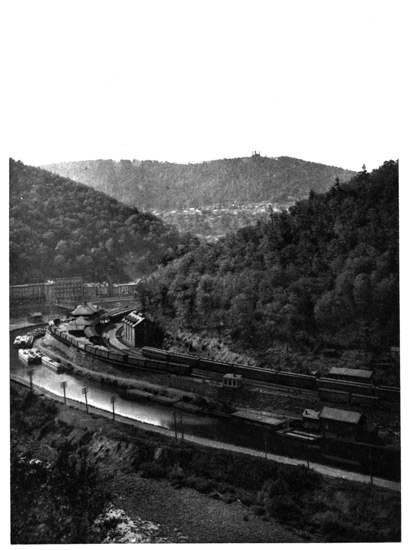
Mauch Chunk
The upper waters of the Lehigh flow through a
wild canyon, the river at times almost doubling upon
itself as it makes sharp bends around the bold promontories.
Enormous hills encompass it about, the
stream often flowing through the bottom with the
rush and foam of a miniature Niagara rapids. The
canal, abandoned above Mauch Chunk, was destroyed
by a freshet many years ago, but the amber-colored
waters still pour over the dilapidated dams and
through the moss-grown sluices. There are log
houses for the lumbermen, also an almost obsolete
industry, and finally the railways abandon the diminutive
Lehigh and climb over the desolate Nescopec
Mountain, to go through the Sugar Notch and
down the other side into the Vale of Wyoming and
to the banks of the Susquehanna. Upon the eastern
slopes of the Nescopec the Lehigh has its sources,
gathering the tribute of many small streams between
this ridge and Broad Mountain.
THE VALE OF WYOMING.
The railroads cross the height of land between the
sources of the Lehigh and the affluents of the Susquehanna,
through the Sugar Notch, at about eighteen
hundred feet elevation. When the train moves
out to the western verge of Nescopec Mountain
there suddenly bursts upon the gladdened sight the
finest scenic view in Pennsylvania—over the fair
Vale of Wyoming, with all its gorgeous beauties of
towns and villages, forests and farms, under the
bright sunlight, and having laid across it the distant
silver streak of the glinting Susquehanna River, all
spread out in a magnificent picture seen from an elevation
of twelve hundred feet above the river level.
For nearly twenty miles the Susquehanna can be
traced through the long, trough-like valley, from
where it breaks in through the Lackawannock Gap
in the North Mountain, under Campbell's Ledge, far
to the northward, away down south to where it passes
out the narrow gorge at Nanticoke Gap. The long
ridges of the Nescopec and Moosic Mountains enclose
the valley on one side, and over on the other are the
great North Mountain or Shawnee range, and the
higher ridge of the main Allegheny range behind.
In the distant northeast the view is prolonged up the
Lackawanna Valley. In this splendid Wyoming
Vale, spread out like a map, is a landscape of rich
agriculture, dotted over with towns and villages, coal-breakers
and huge culm-piles, the long snake-like
streaks of railways crossing the scene bearing their
little puffing engines. It looks much like what one
sees out of a balloon. Here is the village of Nanticoke,
then Plymouth, then the spreading city of
Wilkesbarre, and, far beyond, the foliage-hidden
houses of Pittston, near the gorge where the river
flows in. Between them all are clusters of villages
and black coal heaps, with myriads of the little green
and brown fields, making distant farms. The river
reaches sparkle in the light as the long shadows are
cast from the mountains, and the train runs rapidly
down the mountain side and across the valley to its
chief city, Wilkesbarre.
When the broad and shallow and rock-strewn
river Susquehanna, on its way down from Otsego
Lake in New York to the Chesapeake, breaks through
the North Mountain, its valley expands to three or
four miles in width, making a fertile region between
the high enclosing ridges which the Indians called
Maughwauwama, or the "extensive flat plains."
This sonorous name underwent many changes, finally
becoming known as Wyoming. Luzerne County is
the lower and Lackawanna County the upper portion
of this noted valley, which is the greatest anthracite
coal-field in the world. These Wyoming coal measures
underlie seventy-seven square miles, having
veins averaging eighty feet in thickness, and about
eighty thousand tons to the acre, the aggregate deposit
of coal being estimated to exceed two thousand
millions of tons. The large population and enormous
production have caused all the railways to send
in branches to tap its lucrative traffic, so that it is the
best-served region in Pennsylvania. It has two
large cities—Wilkesbarre, in Luzerne, and Scranton,
in Lackawanna. Wilkesbarre is on the eastern Susquehanna
river bank, a town of forty thousand
people, named after the two English champions of
American Colonial rights. It covers much surface
in the centre of the valley, with suburbs spreading
far up the mountain sides. But from almost every
point of view in the city the outlook is over black
culm-heaps or coal-breakers or at rows of coal cars,
so that there is a monotony in the steady reminder
of the source of their riches, the omnipresent anthracite.
About twelve miles northwest of Wilkesbarre,
up in the North Mountain range, is the largest lake
in Pennsylvania—Harvey's Lake—elevated nearly
thirteen hundred feet and covering about two square
miles. It is named after one of the early pioneers
from Connecticut, and its outflow comes down to the
Susquehanna near Nanticoke Gap. Its pleasant
shores are a favorite resort of the Wilkesbarre people.
The flourishing city of Scranton is about nineteen
miles north of Wilkesbarre, in the Lackawanna Valley.
It has grown to a population of a hundred thousand
people, and is picturesquely situated among the
coal mines, with a higher elevation than Wilkesbarre,
being nearly eleven hundred feet above tide, at the
confluence of the Roaring Brook with the Lackawanna
River; and it has extensive iron industries,
being the chief city of northeastern Pennsylvania.
The Wyoming and Lackawanna coal pits, while the
greatest anthracite producers, are not generally so
deep as those of the Lehigh or Schuylkill regions.
The deepest Pennsylvania shaft goes down seventeen
hundred feet near Pottsville. Some of the Wyoming
galleries run a mile and a half underground from the
shaft, following the coal veins underneath and far
beyond the Susquehanna.
This noted Wyoming Vale, in the early history
of the Pennsylvania frontier, was bought from
the Iroquois Indians, the "Six Nations," by an
association of pioneer settlers from Connecticut.
Good management, due largely to the judicious
methods of the early missionaries, kept them at
peace with the Indians. Count Zinzendorf, with a
companion, came up from Bethlehem in 1742, before
the Connecticut purchase, and founded a Moravian
mission among the Shawnees in the valley. It is
said that they were suspicious of European rapacity
and plotted his assassination, and the historian relates
that the Count was alone in his tent, reclining
upon a bundle of dry weeds, destined for his bed, and
engaged in writing or in devout meditation, when the
assassins crept stealthily up. A blanket-curtain
formed the door, and, gently raising the corner, the
Indians had a full view of the patriarch, with the
calmness of a saint upon his benignant features. They
were struck with awe. But this was not all. The
night was cool, and he had kindled a small fire. The
historian continues: "Warmed by the flame, a
large rattlesnake had crept from its covert, and, approaching
the fire for its greater enjoyment, glided
harmlessly over one of the legs of the holy man,
whose thoughts at the moment were not occupied
upon the grovelling things of earth. He perceived
not the serpent, but the Indians, with breathless attention,
had observed the whole movement of the
poisonous reptile; and as they gazed upon the aspect
and attitude of the Count, their enmity was immediately
changed to reverence; and in the belief that
their intended victim enjoyed the special protection
of the Great Spirit, they desisted from their bloody
purpose and retired. Thenceforward the Count was
regarded by the Indians with the most profound veneration."
When the Revolution came, the settlement was a
thriving agricultural colony of about two thousand
people, scattered over the valley, with a village on
the river shore just above the present site of Wilkesbarre.
In June, 1778, a force of British troops,
Tories and Indians entered the valley and attacked
them, and on July 3d the terrible Wyoming massacre
followed, in which the British officers were unable to
set any bounds to the atrocious butchery by their
savage allies, who killed about three hundred men,
women and children. The poet Campbell has painted
the previous pastoral scene of happiness and content in
"Gertrude of Wyoming," and told the tale of atrocity
perpetrated by the savages, which is one of the most
horrible tragedies of that great war. This poem tells
of
"A stoic of the woods—a man without a tear."
Beside the river below Pittston and near the village
of Wyoming, having the great North Mountain
for a background, was Fort Forty, the scene of the
chief atrocities of the massacre, the site being now
marked by a granite obelisk. Here is the burial-place
of the remains of the slaughtered. "Queen
Esther's Rock" is pointed out, where the half-breed
Queen of the Senecas, to avenge the death of her
son, is said to have herself tomahawked fourteen defenceless
prisoners. Most of the survivors fled after
this horror, and they did not return to the valley
until long after peace was restored, when the infant
settlement was renewed in the founding of Wilkesbarre.
Far up on the side of the grand peak guarding
the northern portal of the Lackawannock Gap is
the broad shelf of rock which embalms in "Campbell's
Ledge" the memory of the great English poet
who has so graphically told the harrowing tale.
THE TERMINAL MORAINE.
The Delaware River above the "Forks," at the
mouth of the Lehigh, breaks through a narrow notch
in the Chestnut Hill ridge known as the "Little
Water Gap," while farther to the northeast the ridge
continues through New Jersey as the Jenny Jump
Mountain. Above this is the noted "Foul Rift,"
where the river channel is filled with boulders and
rocks of all sizes and shapes, the dread of the raftsmen
who gave it the name, for many a raft has been
wrecked there. But while this place is shunned by
the navigator, it has an absorbing attraction for the
geologist. This was where the great "Terminal
Moraine" of the glacial epoch crossed the Delaware,
recalling the "Ice Age," to which reference has
already been made. When the vast Greenland ice-cap
crept down so as to overspread northeastern
America and northwestern Europe and filled the intervening
Atlantic bed, it broke off many rocky fragments
in its southward advance, scratching the surfaces
of the ledges, and the fragments held in its
grip, with striated lines and grooves in the direction
of its movement. The ice steadily flowed southward,
coming over mountain and valley alike in a continuous
sheet, enveloping the ocean and adjacent continents,
and finally halted on the Delaware about
sixty miles north of Philadelphia. Its southern
verge spread across America from Alaska to St.
Louis, and thence to the Atlantic on the northern
coast of New Jersey. Its southern boundary entered
Western Pennsylvania near Beaver, passing northeast
to the New York line; then turning southeast, it
crossed the Lehigh about ten miles northwest of
Mauch Chunk and the Delaware just below Belvidere.
It crossed New Jersey to Staten Island, traversed
the length of Long Island, and passed out to
sea, appearing on Block Island, Cape Cod, St.
George's Bank and Sable Island Shoal, south of Nova
Scotia. The boundary of the glacier west of the
"Foul Rift" on the Delaware appears as a range of
low gravel hills, which are piled upon the slate hills
of Northampton farther west, and reach the base of
the Blue Ridge three miles east of the "Wind Gap."
The boundary here mounted and crossed the Kittatinny
ridge sixteen hundred feet high, being well
shown upon its summit, and then passed over the intervening
valley to the Broad Mountain or Pocono
range. The Delaware at the "Foul Rift" is elevated
two hundred and fifty feet above tide; and
where the glacier boundary crossed the mountains in
the interior it was at about twenty-six hundred feet
elevation on the highest land in Potter County, the
Continental watershed.
This vast glacier was so thick as to overtop even
Mount Washington, for it dropped transported boulders
on the summit of that highest peak in New
England. Its southern edge in Pennsylvania was at
least eight hundred feet thick in solid ice. A hundred
miles back among the Catskills it was thirty-one
hundred feet thick, and two hundred miles back in
northern New England it was five thousand to six
thousand feet thick, being still thicker farther northward.
The Pocono Knob, near Stroudsburg, in Pike
County, Pennsylvania, out-topped the glacier, and
jutted out almost like an island surrounded by ice.
The late Professor H. Carvill Lewis, who closely
studied this glacier, has described how, all over the
country which it covered, it dropped what is known
as the "northern drift," or "till," or "hardpan," in
scattered deposits of stones, clay, gravel and débris
of all kinds, brought down from the northward as the
ice moved along, and irregularly dumped upon the surface,
thickly in some places and thinly in others, with
many boulders, some of enormous size. It abraded
all the rock surfaces crossed, and transported and
rounded and striated the fragments torn off in its resistless
passage. The line of farthest southern advance
of the ice is shown by the "Terminal Moraine,"
stretching across country, which put the
obstructions into the "Foul Rift." A glacier always
pushes up at its foot a mound of material composed
of fragments of rocks of all shapes and sizes, which
the ice has taken up at various points along its flow
and carried to its terminus, thus forming the moraine.
This "Terminal Moraine" has been traced and carefully
studied for four hundred miles across Pennsylvania,
showing throughout a remarkable accumulation
of drift materials and boulders, heaped into
irregular hills and hollows over a strip of land nearly
a mile wide. The action of the Delaware River currents
at the "Foul Rift" has washed out the finer
materials and cobblestones, leaving only the larger
boulders and rocks to perplex the navigator.
Some of the performances of this great glacier in
the region adjacent to the Delaware are remarkable.
It has carried huge granite boulders from the far
north and planted them all along the summit of the
Kittatinny where it crossed. It has torn out big
pieces of limestone, some of them thirty feet long,
from their beds in Monroe County, north of this
range, carried them in the ice more than a thousand
feet up its steep northern face and over the summit,
finally dropping them on the south side in the moraine
in the slate valley of Northampton. These immense
limestone rocks made comparatively short
journeys, but one ponderous boulder of syenite from
the Adirondacks was found in Northampton, well
rounded and dressed, having travelled in the ice at
least two hundred miles. There has also been found
a "glacial groove" upon the rocks of the Kittatinny
near the Water Gap, where some ponderous fragment,
imbedded in the ice, as it moved along has
gouged out a great scratch six feet wide and seventy
feet in length. Although this ice had evidently resistless
power in its slow motion, yet it seems to have
had small influence upon the topography of the
country. It appears to have merely "sand-papered"
the surfaces of the rocks. It passed bodily across
the sharp edges of the upright sandstone strata of
the Kittatinny, yet has not had appreciable effect in
cutting the ridge down, the glaciated portion east of
the "Wind Gap" appearing as high and as sharply
defined as the unglaciated part to the westward of
the moraine. The glacier made many lakes north
of the moraine, due to the "kettle holes" and obstruction
of streams by unequal deposits of drift.
It is inferred in the estimates of the duration of the
glacier, from astronomical data, that the cold period
began two hundred and eighty thousand years ago,
the greatest cold being many thousand years later.
The intense cold began moderating eighty thousand
years ago, but the sea of ice remained long afterwards,
and steadily diminished under the increasing
heat. So many thousand years being required for
melting, there are data inducing the belief that the ice-cap
did not retreat from this part of the country back
to Greenland until within ten thousand or fifteen thousand
years ago. Then came the floods of water from
the melting glacier, and it is significant that the Indians
in the spacious valley northwest of the Kittatinny
called that fertile region the "Minisink," meaning "the
waters have gone," indicating their legendary memory
of the floods following the melting and retreat of the
glacier and the final outflow of its waters.
THE DELAWARE WATER GAP.
Belvidere, the "town of the beautiful view,"
nestles upon the broad terraces under the Jersey
ridges at the mouth of Pequest Creek, and looks prettily
out upon the high hills and distant mountains
across the Delaware. Above the town, the river
makes a great bend to the westward in rounding the
huge and almost perpendicular mass of Manunka
Chunk Mountain, a name which has been got by a
process of gradual evolution from its Indian title of
"Penungauchung." Here, through a gorge just
above, is got the first view of the distant Water
Gap, cleft down in the dark blue Kittatinny ten
miles away. Approaching it as the river winds, all
the views have this great Gap for the gem of the
landscape, the ponderous wall of the Kittatinny
stretching broadly across the horizon and steadily
rising into greater prominence as it comes nearer.
"I lift my eyes and ye are ever there,
Wrapped in the folds of the imperial air,
And crowned with the gold of morn or evening rare,
O, far blue hills."
As it is gradually approached, the Gap and its enclosing
ridge attain enormous proportions, dwarfing
the smaller hills, among which the narrow, placid
river flows below; and it is realized how tame are
all the other ridges through which the Delaware has
passed compared with this towering Blue Ridge,
having the low-lying Blockade Mountain just behind,
and partly closing the Gap. Soon we reach the foot
of the range, and, bending with the river suddenly
to the left, enter the Gap. Scarcely have we entered
when the river, which has been swinging to the left,
bends around again gradually to the right, and in a
moment we are through the gorge, the river then
circling around the Blockade Mountain, which has
been so named because it seems always stupidly in
the way.
The Indians called the Water Gap "Pohoqualin,"
meaning "the river between the mountains." The
Delaware flows through it with a width of eight hundred
feet and at an elevation of about three hundred
feet above tide. It is twenty-nine miles northeast of
the Lehigh Gap where the Lehigh River passes the
Blue Ridge, and there are five other gaps between
them, of which the "Wind Gap," heretofore referred
to, is the chief. For many years this Wind Gap
provided the only route to reach the country north
of the Kittatinny. About two and a half miles southwest
of the Delaware is "Tat's Gap," named in
memory of Moses Fonda Tatamy, an old time Indian
interpreter in this region, and familiarly called
"Tat's" for short. The greatest of all these passes,
however, is the Water Gap, where the Blue Ridge,
rent asunder, has two noble peaks guarding the portals,
towering sixteen hundred feet high, and named
in honor of the Indians—Mount Minsi in Pennsylvania,
after the tribes of the Minisink, and Mount Tammany
in New Jersey, for the great chief of the
Lenni Lenapes.
"Crags, knolls and mounds, in dire confusion hurled,
The fragmentary elements of an earlier world."
The Water Gap is a popular summer resort, there
being numerous hotels and boarding-houses in eligible
locations all about it, and the romantic scenery
has been opened up by roads and paths leading to all
the points of view. It is on such a stupendous
scale, and exhibits the geological changes wrought
during countless ages so well, that it always attracts
the greatest interest. To the northward spread the
fertile valleys of the Minisink; and the Delaware,
which below the Gap flows to the southeast, passing
through all the ridges, comes from the northeast above
the Gap, and flows along the base of the Kittatinny
for miles, as if seeking the outlet which it at length
finds in this remarkable pass.
THE MINISINK.
From the elevated points of outlook at the Water
Gap the observer can gaze northward over the fertile
and attractive hunting-grounds of the Minsis, the
land of the Minisink stretching far up the Delaware,
and from the Kittatinny over to the base of the
Pocono Mountain. This is the region of the "buried
valleys," remarkable trough-like valleys, made during
an ancient geological period, and partially filled up
by the débris from the great glacier. From the Hudson
River in New York, southwest to the Lehigh, and
just beyond the Kittatinny range, two long valleys,
with an intervening ridge, stretch across the country.
The Delaware River, from Port Jervis to Bushkill,
flows down the northwestern of these valleys, then
doubles back on itself, and breaks through the intervening
ridge at the remarkable Walpack Bend into
the other valley, and follows it down to the Water
Gap. The northwestern valley begins at Rondout
on the Hudson, crosses New York State to Port
Jervis, where the Delaware, coming from the northwest,
turns to the southeast into it, occupying it for
thirty miles to Bushkill, and then the valley continues
past Stroudsburg, just above the Water Gap, to the
Lehigh River at Weissport, below Mauch Chunk.
The other valley is parallel to it at the base of the
Kittatinny. These valleys, underlaid by the shales
as bed-rocks, have been filled up with drift by the
glacier from one hundred to seven hundred feet in
depth, and they constitute the famous region of the
Minisink.
In this fertile district was the earliest settlement
made by white men in Pennsylvania, the Dutch from
the Hudson River wandering over to the Delaware at
Port Jervis through these valleys, and settling on the
prolific bottom lands along the river, many years before
Penn came to Philadelphia. They opened copper-mines
in the Kittatinny, just above the Water
Gap, and made the old "Mine Road" to reach them,
coming from Esopus on the Hudson. The records at
Albany of 1650 refer to specimens brought from "a
copper-mine at the Minisink." The Provincial authorities
at Philadelphia do not appear to have had
any clear knowledge of settlers above the Water
Gap until 1729, when they sent a surveyor up to
examine and report, and he found Nicholas Depui in
a snug home, where he had bought two islands and
level land on the shore from the Indians some time
before. Like the Dutch settlers above, Depui had
no idea where the river went to. He was a French
Huguenot exile from Holland, and, without disputing
with the surveyor, he again bought his land, nearly
six hundred and fifty acres, in 1733, from the
grantees of the Penns. His stockaded stone house
was known as Depui's Fort, and after him the Water
Gap was long called "Depui's Gap." Old George
La Bar was the most famous resident of the Water
Gap. Three brothers La Bar, Peter, Charles and
Abraham, also French Huguenots, lived near the
Gap, and each married a Dutch wife. In 1808,
however, this region became too crowded for them,
and Peter, at the age of eighty-five, migrated to Ohio
to get more room. When ninety-eight years old his
wife died, and in his one hundredth year he married
another out on the Ohio frontier, and lived to the ripe
age of one hundred and five. Peter, when he migrated,
left his son George La Bar at the Gap, where
he had been born in 1763. George was the famous
centenarian of Pennsylvania, who died at the age of
one hundred and seven, being a vigorous axeman
almost until the day of his death. He was too young
for a Revolutionary soldier, but when the War of
1812 came he was too old. In 1869, at the age of
one hundred and six, a visitor describes him as felling
trees and peeling with his own hands three
wagon-loads of bark, which went to the tannery.
He never wore spectacles, always used tobacco, voted
the straight Democratic ticket, and at every Presidential
election from Washington to Grant, and could
not be persuaded to ride on a railway train, regarding
the cars as an innovation.
In this region of the Minisink is the pleasant town
of Stroudsburg, the county-seat of Monroe, its beautiful
valley being well described by a local authority
as "full of dimpling hills and fine orchards, among
which stalwart men live to a ripe old age upon the
purest apple whisky." Its finest building, the State
Normal College, handsomely located on an elevated
ridge, has three hundred students. The town was
named for Jacob Stroud, a pioneer and Indian fighter,
who was with General Wolfe when he scaled the
Heights of Abraham, and, capturing Quebec, changed
the map of Colonial America. Marshall's Creek
comes down to join its waters with Brodhead's Creek
below Stroudsburg, and a few miles above displays
the pretty little cataract of Marshall's Falls. Six
miles northwest of Stroudsburg is the Pocono Knob,
rising in stately grandeur as it abruptly terminates
the Pocono Mountain wall on its eastern face. It
was this Knob which stood out as an island in the
edge of the great glacier, a deep notch separating its
summit from the plateau behind, and the Terminal
Moraine encircles its sides at about two-thirds its
height. In the river bottom lands are fertile farms,
and a great deal of tobacco is raised. Thus the river
leads us to Bushkill and the great Walpack Bend.
The Delaware, coming from the northeast, impinges
upon the solid sandstone wall of the "Hog's Back,"
the prolongation of the ridge dividing the two
"Buried Valleys." This ridge bristles with attenuated
firs, and hence its appropriate name. The Big
Bushkill and the Little Bushkill Creeks, uniting, flow
in from the west, and the Delaware turns sharply
eastward and then back upon itself around the ridge
into the other valley, and resumes its course southwest
again down to the Water Gap. This double
Walpack curve, making a perfect letter "S," is so
narrow and compressed that a rifleman, standing on
either side, can readily send his bullet in a straight
line across the river three times. The Indian word
Walpack means "a turn hole." The Delaware here
is a succession of rifts and pools, making a constant
variation of rapids and still waters, with many spots
sacred to the angler, and displaying magnificent
scenery as the lights and shadows pass across the
beautiful forest-covered hills enclosing its banks.
BUSHKILL TO PORT JERVIS.
Bushkill village is in a picturesque location, opening
pleasantly towards the Delaware. It is also just
over the Monroe border, in Pike County, long ago
described by Horace Greeley as "famous for rattlesnakes
and Democrats," but now more noted for its
fine waterfalls and attractive scenery, its many streams
draining numerous beautiful lakes, and dancing down
frequent roaring rapids in the journey to the Delaware.
The falls of the Little Bushkill near the village
is the finest cataract in Pennsylvania. From
Bushkill, bordering the eastern bank of the Delaware,
for thirty miles up to Port Jervis, is one of the
best roads in the world. The Marcellus shales of the
Buried Valley, which form the towering cliffs bordering
the river along the base of which the road is laid,
make a road-bed as smooth and hard as a floor, the
chief highway of this district, for the railway has not
yet penetrated it. Over on the other side of the
river the great Kittatinny ridge presents an almost
unbroken wall for more than forty miles from the
Water Gap up to Port Jervis. Frequent creeks
come in, all angling streams, the chief of them being
Dingman's, which for several miles displays a series
of cataracts, and at its mouth has the noted Pike
County village of "Dingman's Choice," at which is
located the time-honored Dingman's Ferry, across
the Delaware. The source of Dingman's Creek is
in the Silver Lake, about seven miles west of the
Delaware, and in its flow it descends about nine hundred
feet, breaking its way over the various strata of
Catskill, Chemung and Hamilton sandstones. The
upper cataracts, called the Fulmer and Factory Falls
and the Deer Leap, are located in a beautiful ravine
known as the Childs Park, while, below, the creek
pours over the High Falls, one hundred and thirty
feet high, a short distance from the river. Near this
is the curious Soap Trough, an inclined plane descending
one hundred feet, always filled with foam,
down which comes the Silver Thread, a small tributary
stream. The gorge by which Dingman's Creek
comes out is deep and massive, the entrance being
a narrow canyon cut down into the Marcellus shales
which make the towering cliffs along the river.
There are also fine cataracts on the Raymondskill and
the Sawkill, flowing into the Delaware above. The
cliffs here rise into Utter's Peak, elevated eight hundred
feet, giving a magnificent view along the valley.
The little town of Milford, the county-seat of Pike,
is one of the gems of this district, spread over a
broad terrace on the bluff high above the Delaware,
with a grand outlook at the ponderous Kittatinny in
front, rising to its greatest elevation at High Point,
six miles away, where a hotel is perched on the summit.
Surrounded by mountains, the late N. P
Willis, when he visited Milford, was so impressed by
its peculiar situation that he described it as "looking
like a town that all the mountains around have disowned
and kicked into the middle." Thomas Quick,
Sr., a Hollander, who came over from the Hudson
in 1733, was the first settler in Milford. His noted
son, Thomas Quick, the "Indian Killer," was born
in 1734. "Tom Quick," as he was called, was
brought up among the Indians, and had the closest
friendship for them; but when the terrible Colonial
war began, the savages, in a foray, killed and scalped
his father almost by his side, Tom being shot in the
foot, but escaping. Tom vowed vengeance, and ever
afterwards was a perfect demon in his hatred of the
Indians, sparing neither age nor sex. After the
French and Indian war had closed and peace was
proclaimed, he carried on his own warfare independently.
The most harrowing tales are told of his
Indian murders, some being horribly brutal. He
never married, but hunted Indians and wild beasts all
his life, and was outlawed by the Government, it
being announced that no Indian who killed him
would be punished; but he finally died in bed in
1796. He was entirely unrepentant during his last
illness, regretting he had not killed more Indians;
and after saying he had killed ninety-nine during his
life, he begged them to bring in an old Indian who
lived in the settlement, so that he might appropriately
close his career by killing the hundredth redskin.
The most noted Milford building is "Pinchot's
Castle," on the hillside above the Sawkill, a Norman-Breton
baronial hall, the summer house of the Pinchot
family of New York, whose ancestor, a French
refugee after Waterloo, was an early settler here.
Seven miles above Milford the Delaware River
makes the great right-angled bend in its course, from
the southeast to the southwest, which is known as the
"Tri-States Corner," and here, on the broad flats at
the mouth of the Neversink River, is the town of
Port Jervis. From the village of Deposit, ninety
miles above, the Delaware descends in level five hundred
and seventy feet; and from Port Jervis down
to the Water Gap, forty-three miles, the descent is
one hundred and twenty-seven feet. In the first it
falls six feet per mile and in the latter only three
feet, the difference being caused by the entirely
changed conditions above and below the great bend.
Above, the Delaware flows through the ridges by a
winding ravine cut transversely across the hard rocks
almost all the way, while below, it meanders parallel
to the ridges along the outcrop of the softer rocks of
the Marcellus shales and Clinton formations in the
long, trough-like buried valleys. The Neversink
comes from the northeast through one of these valleys
which is prolonged over to the Hudson, the
source of the Neversink being on a divide of such
gentle slope that the large spring making the head
sends part of its waters the other way, through
Rondout Creek into the Hudson. A long, narrow
peninsula, just at the completion of the great bend,
juts out between the Neversink and the Delaware,
ending in a sharp, low, wedge-like rocky point, the
extremity being the "Tri-States Corner," where the
boundary line between New Jersey and New York
reaches the Delaware, and ends in mid-river at the
boundary of Pennsylvania. This spot was located
after a long boundary war, and the fact is duly recorded
on the "Tri-States Rock," down at the end
of the point. The Delaware and Hudson Canal, constructed
in 1828, and coming over from Rondout
Creek through the Neversink Valley, made Port
Jervis, which was named after one of its engineers.
The canal goes up the Delaware to the Lackawaxen,
and then follows that stream to Honesdale. The Erie
Railway also comes through a gap in the Kittatinny
(here called the Shawangunk Mountain, meaning the
"white rocks"), descends to Port Jervis, and then
follows up the Delaware. These two great public
works have made the prosperity of the town, which
has a population of over ten thousand. The long
and towering ridge of Point Peter, forming the northwestern
boundary of the Neversink Valley, and
thrust out to the Delaware, bounding the gorge
through which the river comes, overlooks the town.
On the other side is the highest elevation of the Kittatinny
and the most elevated land in New Jersey,
High Point, rising nineteen hundred and sixty feet.
THE CATSKILL FLAGS.
The broadened valley of the Delaware extends a
short distance above Port Jervis, the canal and railway
rounding the ponderous battlements of Point
Peter and then proceeding up the river, one on
either bank. About three miles above the "Port,"
as it is familiarly called, the valley contracts to a
rock-enclosed gorge, for here the Delaware emerges
from its great canyon in the Catskill series of rocks,
in the bottom of which it flows from Deposit, at the
northern boundary of Pennsylvania, eighty-seven
miles above. The remarkable change seen in the
surrounding topography indicates the presence of a
different rock formation from that passed below, and
the river runs out of the Catskill rocks over the
"Saw-mill rift." For thirty miles above, to the
northern line of Pike County, at Narrowsburg, the
river banks mostly are only mere shelves a few rods
wide, and frequently present nothing but the faces
of rocky walls, rising perpendicularly from the water
to a height of six hundred feet or more. From the
expanding limestones below, the valley here suddenly
contracts in the flags and ledges of the Catskill series.
All the small streams coming from the bluffs back of
the cliffs descend with rapid fall, and frequently over
high cascades. These Catskill flags, built up in vast
construction, rear their gaunt and weather-beaten
jagged walls and wood-crowned turrets on high.
Perched far up on the New York side, at the narrowest
part of this remarkable gorge, is an eyrie
called the "Hawk's Nest," which gives a wonderful
view, reached by a road carved out of the rocky side
of the abyss. This road, hung on the perpendicular
wall five hundred feet over the river, is the only
available route to the part of New York north of
Port Jervis. The canal and railway, far below, are
each set on a shelf cut out of the rocky banks. The
enclosing cliffs rise higher as the river is ascended,
sometimes reaching an elevation of twelve hundred
feet; and here for miles are seen the famous Delaware
and Starucca flags, rising hundreds of feet in a
continuous wall of bluish-gray and greenish-gray
flaggy sandstones. They are extensively quarried
and shipped to New York. Both railway and canal
construction through this deep cleft were enormously
costly.
THE BATTLE OF LACKAWAXEN.
Here is Shohola Township, on the Pennsylvania
shore, a wild and rocky region fronting on the river
for about ten miles, and Shohola Creek rushes down
a rocky bed through a deep gorge to seek the Delaware.
It was at this place the surveyors' line was
drawn from the Lehigh over to the Delaware, after
Marshall's fateful walk. The "Shohola Glen," a
favorite excursion ground, has the channel of the
creek, only forty feet wide, cut down for two hundred
feet deep into the flagstones, and it plunges over
four attractive cascades at the Shohola Falls above.
A short distance northward the Lackawaxen flows
in through a fine gorge, broadening out as the Delaware
is approached; and the canal, after crossing the
latter on an aqueduct, goes up the Lackawaxen bank.
A grand amphitheatre of towering hills surrounds the
broad flats where the Lackawaxen brings its ample
flow of dark amber-colored waters out of the hemlock
forests and swamps of Wayne County to this picturesque
spot. Here was fought, on July 22, 1779, the
battle of Lackawaxen or the Minisink, the chief
Revolutionary conflict on the upper Delaware. The
battlefield was a rocky ledge on the New York side,
elevated about five hundred feet above the river,
amid the lofty hills of Highland Township, in Sullivan
County. The noted Mohawk chief, Joseph Brandt,
with a force of fifteen hundred Indians and Tories,
came down from Northern New York to plunder the
frontier settlements. Most of the inhabitants fled
down to the forts on the Lehigh or across the Blue
Ridge, upon his approach; but a small militia force
was hastily gathered under Colonels Hathorn and
Tusten to meet the enemy, whom they found crossing
the Delaware at a ford near the Lackawaxen.
Hathorn, who commanded, moved to attack, but
Brandt rushed his Indians up a ravine, intercepting
Hathorn just as he got out on the rocky ledge, and
cutting off about fifty of his rear guard. Hathorn
had ninety men with him, who quickly threw up a
rude breastwork, protecting about a half-acre of the
ledge. Their ammunition was scant, it was a terribly
hot day, they had no water, and were soon surrounded;
but for six hours they bravely defended
themselves, when, the ammunition being all gone,
the Indians broke through their line. Tusten was
attending the wounded, and with seventeen wounded
men, whom he was alleviating, was tomahawked, all
being massacred. The others fled, many being slain
in the pursuit. Forty-four of the little band were
killed, and the fifty in the rear guard who had been
cut off were never afterwards heard of. Years afterwards,
the bones of the slain in this terrible defeat
were gathered on the field and taken across the Blue
Ridge to Goshen for interment, and in 1822 a monument
was erected at Goshen in their memory, Colonel
Hathorn, who was then living, making an address.
On the centenary anniversary in 1879 a monument
was dedicated on the field, where faint relics of the
old breastwork were still traceable on the rocky ledge
perched high above the river, almost opposite the
mouth of the Lackawaxen.
THE SYLVANIA SOCIETY.
The county of Wayne is separated from the county
of Lackawanna by the great Moosic Mountain range,
the divide between two noted rivers, the Lackawaxen
and the Lackawanna. The former, draining its
southeastern slopes to the Delaware, was the
"Lechau-weksink" of the Indians, meaning "where
the roads part," evidently referring to the parting of
the Indian trails at its confluence with the Delaware;
the latter, flowing out to the Susquehanna on its
northwestern side, was the "Lechau-hanne," or
"where the streams part," signifying the forks of
two rivers. We ascend the Lackawaxen, finding the
route up the gorge along the canal towpath, once the
great water way of the Delaware and Hudson Company
for bringing out coal, but now abandoned, as
the railway route is cheaper. This canal, opened in
1828, was one hundred and seventeen miles long, and
ascended from tidewater on the Hudson at Rondout to
four hundred and fifty feet elevation at Port Jervis,
and nine hundred and sixty-five feet at Honesdale.
Its route throughout is through grand river gorges
and the most magnificent scenery.
It was in this beautiful region, just south of the
river, that Horace Greeley, in 1842, started what he
called the "Sylvania Society," founded to demonstrate
the wisdom of "the common ownership of
property and the equal division of labor," which
Greeley was then advocating by lectures and in his
newspaper. Many eminent persons took stock in the
society at $25 per share, and the experiment of co-operative
farming was begun in a region of rough
and rocky Pike County soil, where the amateur
farmers also found amusement, for it is recorded that
"the stream was alive with trout, and the surrounding
hills were equally well provided with the largest
and liveliest of rattlesnakes." They had weekly lectures
and dancing parties, the colony at one time
numbering three hundred persons, Mr. Greeley, who
took the deepest interest, frequently visiting them.
The society was a success socially and intellectually,
but the labor problem soon caused trouble. A Board
of Directors governed the farm and assigned the
laborers their work, the principle of equality being
observed by changing them from one branch of labor
to another day by day. But trouble soon came, for
there were too many wayward sons sent out from
New York to the colony who never had worked and
never intended to, but preferred going fishing. Various
of the females also decidedly objected to taking
their turns at the washtub. The abundance of rattlesnakes
had influence, and one day a venturesome
colonist brought in seventeen large rattlers, causing
dire consternation. They tanned the skin of one
big fellow, and made it into a pair of slippers, which
were presented to Mr. Greeley on his next visit. As
is usually the case, the colonists had ravenous appetites,
and it was impossible to raise enough food
crops to feed them, so that food had to be bought,
and the capital was thus seriously drawn upon. In
1845 they had a prospect of a generous yield at the
harvest, when suddenly, on July 4th, a deadly frost
killed all their crops; and this ended the experimental
colony. In two days everybody had left the
place, and Greeley was almost heartbroken at the
failure of his cherished plans. A mortgage on the
farm was foreclosed and the land sold to strangers.
A Monroe County farmer, who had invested $1800
in the enterprise and lost it, became so angry at the
collapse that he went to New York, as he said, "to
give Horace Greeley a Monroe County Democrat's
opinion of him." He found the great editor at work
in the Tribune office, and began berating him. Greeley,
as soon as a chance was given, asked his visitor
how much he had lost by the failure. He replied,
"Eighteen hundred dollars;" when, without further
parley, Greeley drew a check for the amount and
handed it to him. The farmer was so astonished and
impressed by this most unexpected action that he immediately
became, as he afterwards stated, "a Greeley
Whig," and remained one all his life.
ASCENDING THE LACKAWAXEN.
At Glen Eyre, the Blooming Grove Creek flows
merrily into the Lackawaxen, coming out from Blooming
Grove Township to the southward, an elevated
wooded plateau in the interior of Pike, which is the
common heading ground for numerous streams radiating
in every direction, and containing a score of
attractive lakes. This region is a wilderness where
deer, bears and other wild animals roam, while the
streams are noted angling resorts. In it are the two
famous "Knobs," the highest elevations of the whole
Pocono range, the southern or "High Knob" rising
two thousand and ten feet, out-topping the Kittatinny
"High Point." This "Knob" stands like a pyramid,
at least five hundred feet above all the surrounding
country, excepting its neighbor, the "North Knob,"
which is only one hundred feet lower. These are the
northeastern outposts of the Pocono range. Upon
the top of the "High Knob" is a large boulder of
white conglomerate, dropped by the ice in the glacial
period, and this summit gives the most extensive
view in Pennsylvania, over dark, fir-covered ridges
in every direction, interspersed with lakelets glistening
in the sunlight. There is not a house to be seen,
and scarcely a clearing, but all around is one vast
wilderness. The greater part of this region is the
estate of the "Blooming Grove Park Association,"
covering thirteen thousand acres, surrounded by a
high fence, and stocked with game and fish, there
being over $300,000 invested in the enterprise.
Here elk and deer are bred, there are abundant hares
and rabbits, and also woodcock, grouse and snipe
shooting. The spacious club-house is elevated high
above the rocky shores of Lake Giles, a most beautiful
circular sheet of clear spring water, fourteen
hundred feet above tide, and to it the anglers and
hunters take their families and enjoy the pleasures of
the virgin woods.
The Wallenpaupack Creek, coming out of the
Pocono plateau and the Moosic Mountain, makes the
boundary between Pike and Wayne Counties, and
flows into the Lackawaxen at Hawley. For most of
the distance its course is deep and sluggish, but approaching
the edge of the terrace, within a couple of
miles of the Lackawaxen, it tumbles over cataracts
and down rapids through a magnificent gorge, so
that, from its alternating characteristics, the Indians
rightly called it the Walink-papeek, or "the slow and
swift water." It descends a cascade of seventy feet,
and then goes down the Sliding Fall, a series of rapids
interspersed with several small cataracts. Farther
down are two cascades of thirty feet each, and then
the main plunge, the Paupack falls of sixty-one feet,
almost at its mouth, the whole descent being about
two hundred and fifty feet. Hawley has thriving
mills, whose wheels are turned by this admirable
water-power, and it is also a railway centre for coal
shipping. Its people are noted makers of silks, and of
cut and decorated glassware. Judge James Wilson,
one of the signers of the Declaration of Independence,
was an early settler on the Wallenpaupack.
Above Hawley, in a broadened intervale of the
Lackawaxen, was the famous "Indian Orchard,"
where the first settlement, made in 1760, grew afterwards
into Honesdale, now the county-seat of Wayne.
This was a tract of land in the valley upon which the
lofty Irving Cliff looks down; and it was named from
a row of one hundred apple trees which the Indians
had planted at regular intervals along the river bank.
The tradition was that ninety-nine trees bore sweet
fruit, while one every alternate year had a crop of sour
apples. Upon a large clearing at the water's edge,
paved with flat stones, the Indians held their feasts
and performed their religious rites. The orchard
and stones have disappeared, but the plow still turns
up Indian relics. This place was selected by the
Delaware and Hudson Company for the head of their
now abandoned canal, at the base of the Moosic
Mountain, and it was named Honesdale, in honor of
the first president of the canal company, Philip Hone,
described as "the courtliest Mayor New York ever
saw." Within the town the two pretty streams unite
which form the Lackawaxen, making lakelets on the
plain, and from the shore of one of these the rocks
rise almost perpendicularly nearly four hundred feet.
In 1841 Washington Irving came here with some
friends, making the journey on the canal, and climbed
these rocks to overlook the lovely intervale, and thus
the Irving Cliff was named. Writing of his visit, he
spoke in wonder of the beautiful scenery and romantic
route of the Delaware and Hudson Canal, saying:
"For many miles it is built up along the face of perpendicular
precipices, rising into stupendous cliffs,
with overhanging forests, or jutting out into vast
promontories, while upon the other side you look
down upon the Delaware, foaming and roaring below
you, at the foot of an immense wall or embankment
which supports the canal. Altogether, it is one of
the most daring undertakings I have ever witnessed,
to carry an artificial river over rocky mountains, and
up the most savage and almost impracticable defiles.
For upward of ninety miles I went through a constant
succession of scenery that would have been
famous had it existed in any part of Europe."
From Honesdale a gravity railroad crosses the
Moosic Mountain into the Lackawanna Valley at Carbondale.
This was originally used to bring the coal
out for the canal, but has been abandoned for this
purpose, being now confined to passenger service. It
has twenty-eight inclined planes, and crosses the summit
at Far View, at an elevation of nearly two thousand
feet. The first locomotive brought to America,
built at Stourbridge, England, in 1828, the "Stourbridge
Lion," was used on the levels of this railroad,
the face of a lion adorning the front of the boiler
giving it the name. When brought out in 1829 the
triumphant claim was made that it "would run four
miles an hour." The road passes over extended
mountain tops, giving far-seeing views; and among
these sombre rounded ridges in the wilderness of
Wayne are the sources of the Lackawaxen. Carbondale,
built on the coal measures of the upper
Lackawanna Valley, has about eighteen thousand
population; but all its coal now goes to market by
other railway routes, the gravity road and the canal
being found too expensive carriers in the fierce competition
of the anthracite industry.
THE HEADWATERS OF THE DELAWARE.
The Delaware, above the Lackawaxen, flows between
massive cliffs in a deeply-cut gorge through
the flagstones. At Mast Hope, years ago, was got the
biggest pine tree ever cut on the Delaware for a vessel's
mast. The "Forest Lake Association," another
hunting- and fishing-club near here, has an extensive
estate covering the high ridge between the Delaware
and the Lackawaxen. At Big Eddy the river makes
a sort of lake two miles long, of pure spring water,
the widest and deepest part of the Delaware beyond
tidewater. Stupendous cliffs contract the river above
at the Narrows, where the village of Narrowsburg is
built, and this region and the neighboring lake-strewn
highlands of Sullivan County, New York, were the
chief scenes of Cooper's novel, The Last of the Mohicans.
As we advance through its upper canyon,
the Delaware grows gradually smaller, but the enclosing
ridges recede and leave a broad and fertile
valley. Here are the villages of Damascus and Cochecton,
connected by a bridge, and having together
probably a thousand inhabitants. The original Indian
village was Cushatunk, meaning the "lowlands,"
and from this Cochecton is derived. It was the sad
scene of various Indian forays and massacres before
and during the Revolution. For many years lumbering
and tanning were great industries in this region,
but they have almost entirely passed away.
We are coming to the headwaters of the Delaware.
At Hancock, elevated about nine hundred feet above
tide, the Delaware divides. The Popacton, or east
branch, comes in, the Mohock, or western branch,
however, being the larger stream, and making the
boundary between Pennsylvania and New York
above their junction. These two branches, after
flowing nearly parallel for a long distance across
Delaware County, New York, separated by a broad
mountain ridge about eleven miles wide, unite around
the base of a great dome-like hill at Hancock, the
spot having been appropriately named by the Indians
Sho-ka-kin, or "where the waters meet." Thirteen
miles above is Deposit, at the New York boundary,
where Oquaga Creek comes down from the mountains
to the westward. This was formerly an important
"place of deposit" for lumber, awaiting the
spring freshets to be sent down the Delaware, and
hence its name. High hills surround Deposit, the
river makes a grand sweeping bend, and nearby is
the beautiful mountain lake of Oquaga, of which Taylor
writes: "If there is a more restful place than
this, outside 'God's acres,' I have failed to find it;"
adding, "The mountain road to the lake is picturesque
enough to lead to Paradise." The headwaters
of the Delaware rise upon the western slopes of the
Catskill Mountains in Delaware and Schoharie Counties,
New York. The source is about two hundred
and seventy miles almost directly north of Philadelphia.
In a depression on the western slope of the
Catskill range, at an elevation of eighteen hundred
and eighty-eight feet above tidewater, is the head of
the Delaware, Lake Utsyanthia, a secluded little sheet
of the purest and most transparent spring water. It
is also called Ote-se-on-teo, meaning the "beautiful
spring, cold and pure." It is a mirror of beauty in
a wooded wilderness, its surroundings being most
wild and picturesque. From this little lakelet flows
out the Mohock, winding down its romantic valley,
and receiving many brooks and rills, passing a village
or two, and bubbling along for forty miles to Deposit,
and thence onward as the great river Delaware
to the ocean. Thus Tennyson sings of the Brook:
"I chatter, chatter, as I flow
To join the brimming river,
For man may come, and man may go,
But I go on forever."