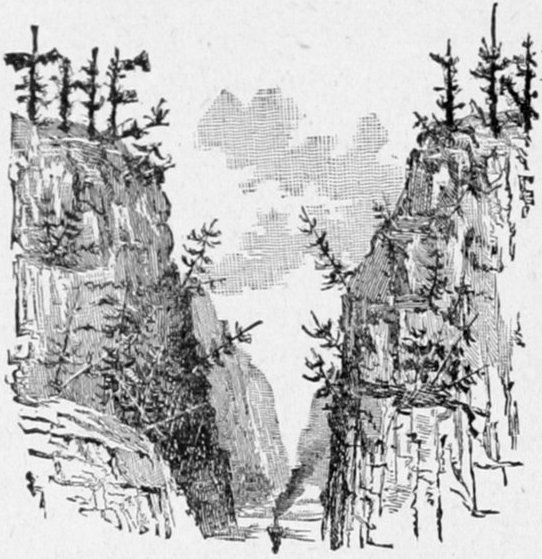
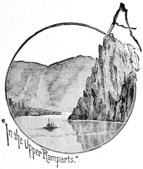
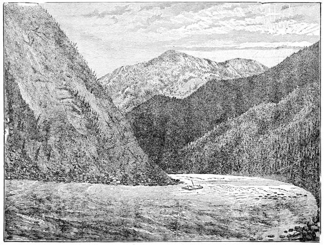
At the site of old Fort Selkirk
commences the Upper Ramparts
of the Yukon, or where
that mighty stream cuts
through the terminal spurs of
the Rocky Mountains, a distance
of nearly four hundred
miles, the first hundred of
which, terminating near the
mouth of the Stewart River, are
almost equal to the Yosemite or Yellowstone in stupendous
grandeur.
I was very anxious to determine beyond all reasonable
doubt the relative sizes of the two rivers whose waters
unite just above old Fort Selkirk, as upon this determination
rested the important question whether the Pelly
or the Lewis River of the old Hudson Bay traders, who
had roughly explored the former, ought to be called the
Yukon proper; and in order to settle this point I was
fully prepared and determined to make exact measurements,
soundings, rate of current and any other data
that might be necessary. This information, however, was
unnecessary except in a rough form, as the preponderance
of the old Lewis River was too evident to the most
casual inspection to require any exactness to confirm it.
The ratio of their respective width is about five to three,
with about the ratio of five to four in depth; the latter,
however, being a very rough approximation; the Lewis
River being superior in both, and for this reason I abandoned
the latter name, and it appears on the map as the
Yukon to Crater Lake at its head.
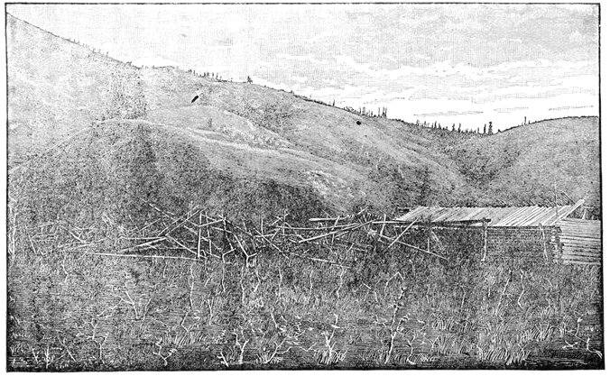
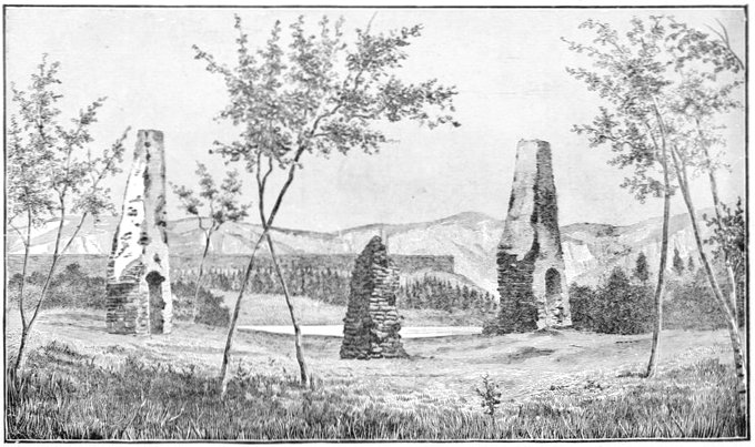
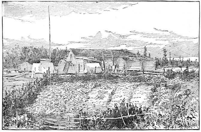
At old Fort Selkirk nothing but the chimneys, three
in number—two of them quite conspicuous at some distance—are
left standing, the blackened embers scattered
around still attesting the manner of its fate. From the
careful and substantial manner in which the rubble stone
chimneys were constructed, this Hudson Bay Company
post was evidently intended to be permanent, and from
the complete destruction of all the wood work, the Chilkat
Indians, its destroyers, evidently intended that its
effacement should be complete. The fate of this post has
been alluded to in an earlier part of the narrative. Here
we remained two or three days, making an astronomical
determination of position, the mean of our results
being latitude 62° 45' 46" north, longitude 137° 22' 45"
west from Greenwich.
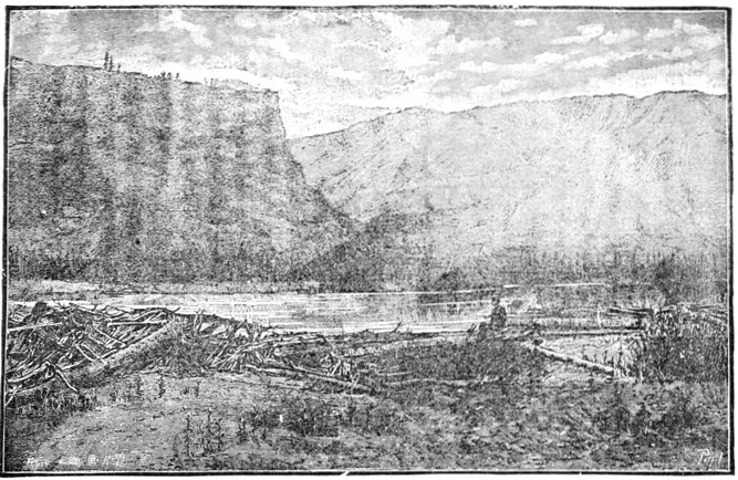
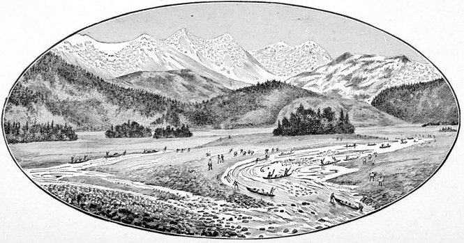
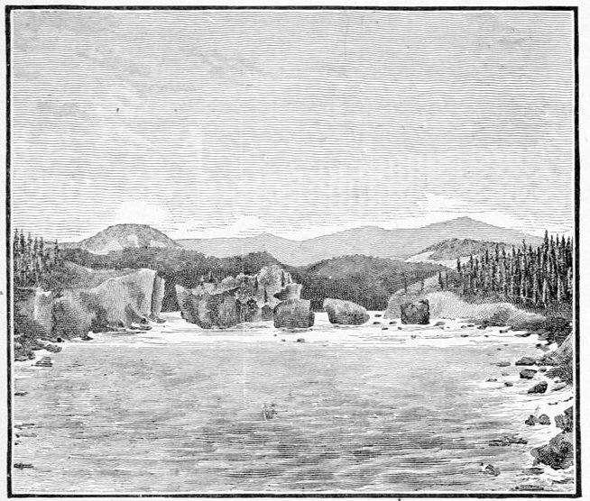
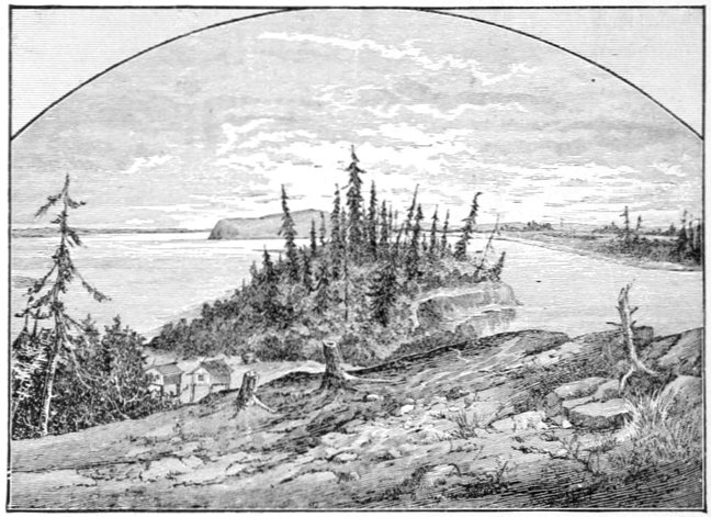
LOOKING INTO THE MOUTH OF THE PELLY RIVER.
(The Pelly enters between the black perpendicular bluff and the high hills beyond.)
No meteorological observations were taken thus far on
the river, the party not being furnished with a complete
set of instruments, and our rapid passage through a vast
tract of territory making the usefulness to science
highly problematical. The nearest point to the
Upper Yukon at which regular observations of this
character are recorded is the Chilkat salmon-cannery
of the North-west Trading Company, on Chilkat
Inlet. The two regions are separated by the Kotusk
Mountains, a circumstance which makes meteorological
inferences very unreliable. Climatology is better
represented, however, in regard to the subject of
botany. Quite a number of botanical specimens were
collected on the Upper Yukon, and have since been
placed in the able hands of Professor Watson, curator of
the Harvard herbarium, for analysis. While only a
partial and crude collection made by an amateur, it has
thrown some little light on the general character of the
flora, as limited to the river bed, which we seldom
quitted in the discharge of our more important duties
connected with the main object of the expedition. Professor
Watson's report on this small collection will be
found in the Appendix.
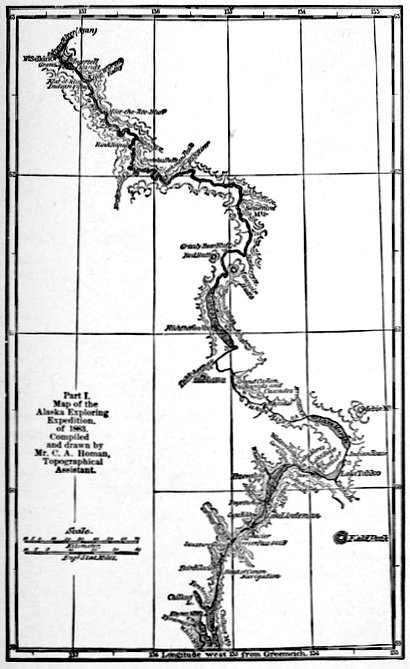
The extent of the Alaskan expedition of 1883 was so great
that I deemed it best to divide the map of its route into convenient
sections; and the three subdivisions, the second
of which this chapter commences, were made wholly with
reference to my own travels. It is therefore not intended
in any other way as a geographical division of this great
river, although it might not be altogether unavailable or
inappropriate for such a purpose. The Middle Yukon,
as we called it on our expedition, extends from the site of
old Fort Selkirk to old Fort Yukon, at the great Arctic
bend of the Yukon, as it is sometimes and very appropriately
termed—a part of the stream which we know approximately
from the rough maps of the Hudson Bay Company's
traders, who formerly trafficked along these
waters, and from information derived from pioneers of
the Western Union Telegraph Company and others.
This part of the river, nearly five hundred miles in
length, had, therefore, already been explored; and to
my expedition fell the lot of being the first to give it a
survey, which though far from perfection, is the first
worthy of the name, and is, I believe, like that of the
Upper Yukon, sufficient to answer all purposes until
such time as commerce may be established on the river
subservient to the industries, either of mining or of fishing,
that may hereafter spring up along its course.
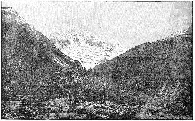
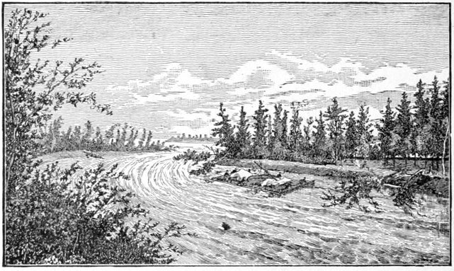
I have just spoken of the comparative sizes of the
Pelly and Lewis Rivers, as showing the latter to be
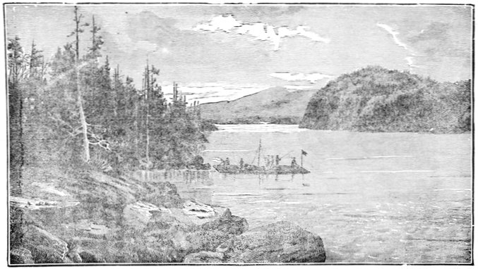
undoubtedly the Yukon proper; and the view on page
209, taken looking into the mouth of the Pelly from an
island at the junction of the two streams, as well as that
on page 213, looking back up the Yukon (old Lewis
River), from the site of old Selkirk, shows the evident
preponderance of the latter, although in the case of
the Pelly but one of its mouths, the lower and
larger of the two that encircle the island, can be
seen distinctly.
The bars at the mouth of the Pelly are a little richer
in placer gold "color" than any for a considerable distance
on either side along the Yukon, creating the
reasonable inference that the mineral has been carried
down the former stream, an inference which is strengthened
by the reports that gold in paying quantities has
been discovered on the Pelly, and is now being worked
successfully, although upon a somewhat limited scale.
Even the high, flat plateau on which old Fort Selkirk
was built is a bed of fine gravel that glistens with grains
of gold in the miner's pan, and might possibly "pay"
in more favorable climes, where the ground is not frozen
the greater part of the year. Little did the old traders
of the Hudson's Bay Company imagine that their house
was built on such an auriferous soil, and possibly little
did they care, as in this rich fur district they possessed
an enterprise more valuable than a gold mine, if an
American can imagine such a thing.
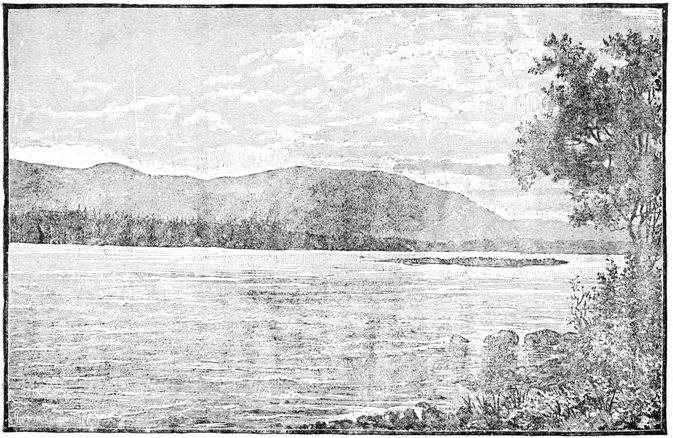
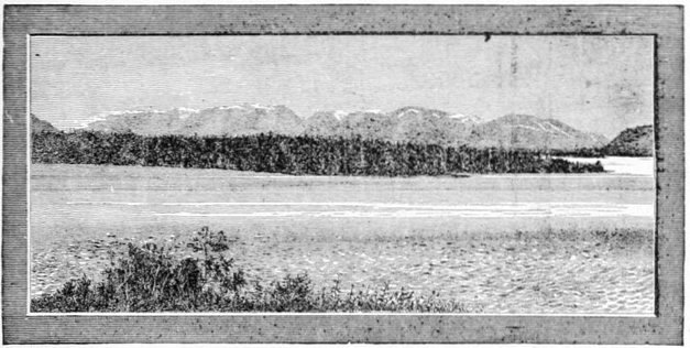
VIEW LOOKING UP THE YUKON FROM THE SITE OF FORT SELKIRK.
The perpendicular bluff of eruptive rock, distinctly
columnar in many places, and with its talus reaching
from half to two-thirds the way to the top, as shown in
the view looking into the mouth of the Pelly, on page
209, and the view on page 205 also, extends up that
stream on the north or right bank as far as it was visited,
some two or three miles, and so continues down the Yukon
along the same (north) bank for twelve or thirteen miles,
when the encroaching high mountains, forming the upper
gates of the ramparts, obliterate it as a later formation.
In but one place that I saw along this extended front of
rocky parapet was there a gap sufficient to permit of
one's climbing from the bottom, over the rough débris, to
the level grassy plateau that extended backward from
its crest; although in many places this plateau could
be gained by alpine climbing for short distances, up the
crevices in the body of the steep rock. This level
plateau does not extend far back before the foot of the
high rolling hills is gained.
In the illustration on page 209 the constant barricades
of tangled driftwood encountered everywhere on the
up-stream ends and promontories of the many islands of
these rivers are shown, although the quantity shown in
the view falls greatly below the average, the heads of the
islands being often piled up with stacks ten or twenty
feet high, which are useful in one way, as forming a dam
that serves during freshets and high water, to protect
them more or less from the eroding power of the rapid
river.
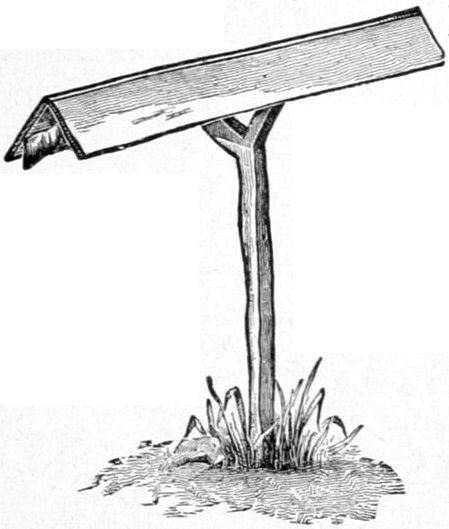
A grave or burial place of the Ayan (or Iyan) Indians
probably some three months old, planted on the very
edge of the river bank near the site of old Fort Selkirk,
was a type of the many we afterward saw at intervals
from this point for about two-thirds of the distance to
old Fort Yukon, and is represented on page 217. Before
burial the body is bent with the knees up to the breast,
so as to occupy as little longitudinal space as possible,
and is inclosed in a very rough box of hewn boards two
and three inches thick, cut out by means of rude native
axes, and is then buried in the ground, the lid of the
coffin, if it can be called such, seldom being over a foot
or a foot and a half below the surface of the pile. The
grave's inclosure or fence is constructed of roughly-hewn
boards, standing upright and closely joined edge to edge,
four corner-posts being prolonged above, and somewhat
neatly rounded into a bed-post design represented in the
figure, from which they seldom depart. It is lashed at
the top by a wattling of willow withes, the lower ends of
the boards being driven a short way into the ground,
while one or two intermediate stripes of red paint resemble
other bands when viewed at a distance. From the
grave itself is erected a long, light pole twenty or twenty-five
feet in height, having usually a piece of colored cloth
flaunting from its top; although in this particular
instance the cloth was of a dirty white. Not far away,
and always close enough to show that it is some superstitious
adjunct of the grave itself, stands another pole
of about equal height, to the top of which there is
fastened a poorly carved wooden figure of a fish, duck,
goose, bear, or some other animal or bird, this being, I
believe, a sort of savage totem designating the family or
sub-clan of the tribe to which the deceased belonged.
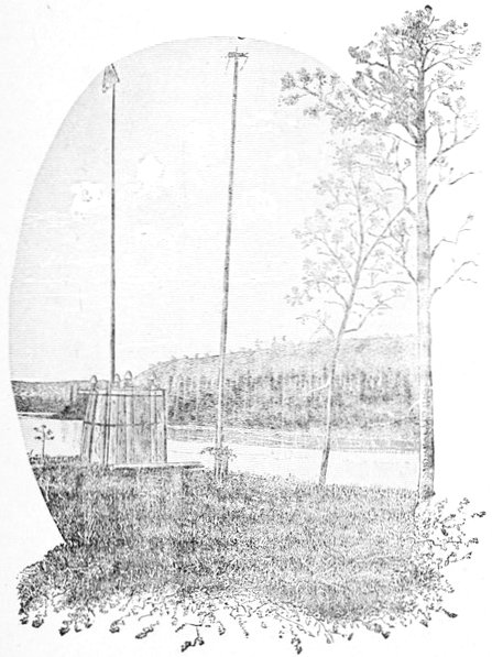
AYAN GRAVE NEAR OLD FORT SELKIRK.
Looking across and down the Yukon River.
This second pole may be, and very often is, a fine young
spruce tree of proper height and shape and convenient
situation, stripped of its limbs and peeled of its bark.
The little "totem" figure at the top may thus be easily
placed in position before the limbs are cut off. It is sometimes
constructed as a weather-vane, or more probably
it is easier to secure firmly in its position by a wooden
pin driven vertically, and so as the green wood seasons
and shrinks it becomes as it were a sepulchral anemoscope
without having been so intended. These poles may be
horizontally striped with native red paint, and the outside
pole has one or more pieces of cloth suspended from
its trunk. These graves are always near the river shore,
generally on the edge of a high gravel bank which is in
course of excavation by the swift current, and when
fresh and the boards white are visible from a distance of
many miles. There is no tendency, as far as I could see,
to group them into graveyards, beyond the fact that they
are a little more numerous near their semi-permanent villages
than elsewhere, the convenience of interment being
evidently the controlling cause of location. Leaving out
the two high poles, there is a rough resemblance to the
graves of civilized countries; and no doubt much of
their form and structure is due to the direct or indirect
contact with civilization. My own Indians (Chilkats)
told me that they formerly placed the bodies of their
dead on pole scaffoldings in the branches of the trees near
the river bank, somewhat after the manner of the Sioux
and other Indian tribes of our great western plains; and
in one instance a very old, rotten and dilapidated scaffold
in a tree was pointed out to me as having once served
that purpose, although there were no indications to confirm
the story; but these might have easily been obliterated.
They also make small scaffoldings or little
caches in the lower branches of trees to protect their contents,
usually provisions and clothing, from bears, wolves,
and possibly from their own dogs, of which they possess
large numbers of a black and brown mongrel breed. In
the summer time these curs are eminently worthless except
as scavengers for the refuse decaying salmon, but
in the winter season they are used to draw the rude
native sledges and to assist in trailing moose and
caribou.
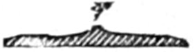
CROSS-SECTION AYAN
CANOE PADDLE.
Mr. Homan succeeded in getting a photograph
(page 221), of a group of Ayan or Iyan Indians, with
their birch-bark canoes. We found it very difficult to
keep these nervous fellows still; and, as far as fine
rendering of features is concerned, the photograph was
not perfect. Their birch-bark canoes are the best on
any part of the long river for lightness, compactness,
and neatness of build and design, and form a most
remarkable contrast to the unwieldy dilapidated "dug-outs'"
of the Tahk-heesh Indians above them on the
Yukon. The Ayan canoe paddle, well
shown in outline in the hands of one of
the group, is of the cross-section on this
page, the ridge or rib r being always held to the
rear in using it. In addition to the paddle, the canoeman
keeps with him two light poles, about as long as
the paddle itself, and as heavy as its handle; and these
are employed in ascending the river, the pole man
keeping near the shallow shores, and using one in each
hand on either side of the canoe, poling against the
bottom. So swift is the river in these parts (and in fact
it is extremely rapid during its entire course), that the
native canoemen use no other method in ascending it,
except for very short distances. The Eskimo method,
in use on the lower part of the river, of harnessing dogs
to their craft like canal horses and towing them along
the banks, I did not see in operation during my stay
among the Ayans, although they possessed all the
requisites for such an easy and convenient method of
navigation. In descending the river the current is the
main motive power, especially for long journeys, and the
paddle is only sparingly used to keep the canoe in the
swiftest part of the stream. When required, however,
they can go at a speed that few canoemen in the world,
savage or civilized, can equal.
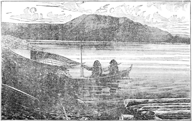
AYAN INDIANS AND THEIR BIRCH-BARK CANOES.
Two species of fish were caught from the banks near
the site of Selkirk, the grayling being of the same kind
we had caught near the rapids just above and below the
Grand Cañon, and had found in varying numbers from
Perthes Point in Lake Bove, to the mouth of White
River, nearly a hundred miles below Selkirk, averaging
a trifle over a pound in weight; and a trout-like salmon,
caught occasionally from Lake Nares to White River,
sometimes with an artificial fly, but more frequently on the
trout lines with baited hooks that were put out over night
wherever we camped. A most disgusting and hideous
species of eel-pout monopolized our trout lines whenever
they were put out at this point, from which even the
invincible stomachs of our Indian allies and visitors had
to refrain. Small black gnats, somewhat resembling the
buffalo gnats of the plains, were observed near Selkirk
in considerable numbers, and our Indians hinted that
they indicated the presence of large game, a story which
we would gladly have had corroborated, but in this we
were disappointed.
We got away from Selkirk on July 15th, shortly after
noontime, having waited for a meridian culmination of
the sun in order to take an observation for latitude.
The country gradually becomes more mountainous as
we descend, and this bold character continues with but
slight exceptions for over a hundred miles further. The
river view reminded me strongly of the Columbia River
near the Cascades, the Hudson at West Point, or the
Potomac at Harper's Ferry, differing only in the presence
everywhere of innumerable islands, a permanent
characteristic of the Yukon, and one in which it exceeds
any other stream known to me, whether from observation
or description.
Although we had understood from the few Indians
who had visited us in their canoes, that their village was
but a few miles below Fort Selkirk, we had become so
accustomed to finding insignificant parties of natives,
here and there, that it was a great surprise to us when
we suddenly rounded the lower end of an island about
four o'clock that afternoon, and saw from a hundred and
seventy-five to two hundred wild savages drawn up ready
to receive us on the narrow beach in front of their brush
village on the south side of the river. Our coming
had evidently been heralded by couriers, and all of the
natives were apparently half-frantic with excitement for
fear we might drift by without visiting them. They ran up
and down the bank wildly swaying their arms in the air,
and shouting and screaming to the great fleet of canoes
that surrounded us, until I feared they might have unfriendly
designs, and in fact, their numbers appeared
so overwhelming when compared with our little band that
I gave the necessary orders in respect to arms so as to
give the Indians as little advantage as possible in case
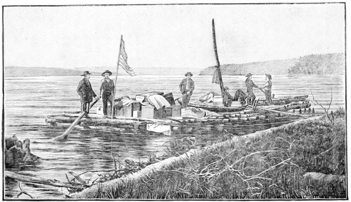
of an encounter at such close quarters. A line was carried
ashore by means of these canoes, and every man,
woman and child in the crowd made an attempt to get
hold of it, the foremost of them running out into the
ice-cold water up to the very arm-pits in order to seize
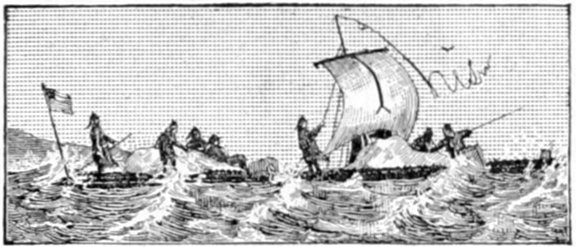
it, and the great gridiron of logs went cutting through
the water like a steam-launch, and brought up against
the shore in a way that nearly took us off our feet.
Immediately after our raft was securely moored, the
crowd of Indians who lined the narrow beach commenced
singing and dancing—men and boys on the (their) left,
and women and girls on the right. The song was low and
monotonous, but not melodious, bearing a resemblance to
savage music in general. Their outspread hands were
placed on their hips, their arms akimbo, and they swayed
from side to side as far as their lithe bodies would permit,
keeping time to the rude tune in alternate oscillations
to the right and left, all moving synchronously and
in the same direction, their long black masses of hair
floating wildly to and fro, and serving the practical purpose
of keeping off the gnats and mosquitoes which otherwise
might have made any out-door enjoyments impossible.
During all this time the medicine men went through
the most hideous gymnastics possible along the front of
the line, one who had a blue-black blanket with a St.
George's cross of flaming red in its center being especially
conspicuous. He excelled in striking theatrical attitudes
of the most sensational order, in which the showy
blanket was made to do its part, and he was forthwith
dubbed Hamlet by the men of the party, by way of a substitute
for his almost unpronounceable name. Even after
the performance, this pompous individual strutted along
the banks as if he owned the whole British North-west
territory; a pretension that was contradicted by his persistent
begging for every trifling object that attracted his
eye, as though he had never owned any thing of value in
his life. After the singing and dancing were over, a few
trifling presents were given to most of the Indians as a
reward for their entertainment. A photograph was attempted
by Mr. Homan of this dancing group, but the day
was so unfavorable, with its black lowering clouds, the
amateur apparatus so incomplete, and the right moment
so hard to seize, that the effect was a complete failure.
Once or twice we got the long line in position in their best
attitudes, "Hamlet" looking his most ferocious, and resembling
a spread eagle with the feathers pulled out, but
just as the photographer was ready to pull the cap off the
camera, some impatient young fellow, inspired by the
crowd and the attitude of dancing, would begin to
hum their low song of Yi-yi-yi-yi's and it was as impossible
to keep the others from taking up the cadence and
swaying themselves as it was to arrest the earth's
revolution.
From a book written by a previous traveler on the
lower river, who pretended to a knowledge of the tribes
upon its upper part also, I had been deluded into the
idea that useful articles—such as knives, saws, and files,—were
the best for trading purposes with these Indians,
or for the hire of native help; but I was not long in finding
out that this was most gratuitous misinformation; for
the constant burden of their solicitations was a request
for tea and tobacco, small quantities of which they get
by barter with intermediate riparian tribes. These
wants I found to extend among the natives throughout
the whole length of the river in varying degrees, and, as
the former article is very light, I would especially recommend
it to those about to enter the country for purposes
of scientific research, for which it is such a grand field.
Next to tea and tobacco, which we could only spare in
small quantities, fish-hooks seemed to be in good demand
among this particular tribe; and the very few articles
they had to spare, mostly horn spoons, and birch-bark
ladles and buckets were eagerly exchanged. Below
White River, fishing on the Yukon with hook and line
ceases, and fish-hooks are worthless as articles of exchange.
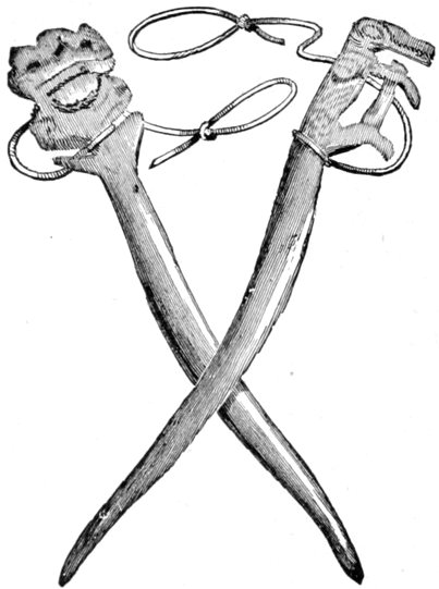
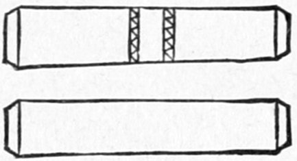
Another article freely brought us was the pair
of small bone gambling-tools (shown
on this page) so characteristic of the
whole north-west country. They have
been described when speaking of
the Chilkat Indians and I saw no
material difference in their use by this particular tribe.
AYAN AND CHILKAT
GAMBLING TOOLS.
Scale ½.
These Indians call themselves the A-yans—with an
occasional leaning of the pronunciation toward I-yan;
and this village, so they said, contained the majority of
the tribe, although from their understanding of the
question they may have meant that it was the largest
village of the tribe. Their country, as they claim it,
extends up the Pelly—the Indian name of which is
Ayan—to the lakes, up the Yukon from this point to
the village of Kitl-ah-gon, and down that stream to
near the mouth of the White and Stewart Rivers, where
they are succeeded by a tribe called the Netch-on'-dees
or Na-chon'-des—the Indian name of the Stewart River
being Na-chon'-de. They are a strictly riparian race
of people and define their country only as it extends
along the principal streams. From the river as a home
or base, however, they make frequent hunting excursions
to the interior in the winter time for moose and
caribou. This village, which they called Kah-tung,
seemed to be of a semi-permanent character; the houses
or huts made of spruce brush, over the top of which
there was an occasional piece of well-worn cloth or dirty
canvas, but more often a moose or caribou skin. These
brush houses were squalid affairs, and especially so
compared with the bright intelligent features of the
makers, and with some of their other handicraft, such
as their canoes and native wearing apparel. The little
civilized clothing they possess is obtained by barter with
neighboring tribes, and has generally been worn out by
the latter before they exchange, hence it is tattered and
filthy beyond measure, and in no wise so well adapted
to their purpose as the native clothing of buckskin. One
could hardly stand up in these brush houses, they were
built so low, and any attempt to do so was frustrated by
the quantities of odoriferous salmon hanging down from
the squat roofs, undergoing a process of smoking in the
dense clouds that emanated from spruce-knot fires on
the floor. These ornaments, coupled with the thick
carpeting of live dogs upon the floor, made the outside
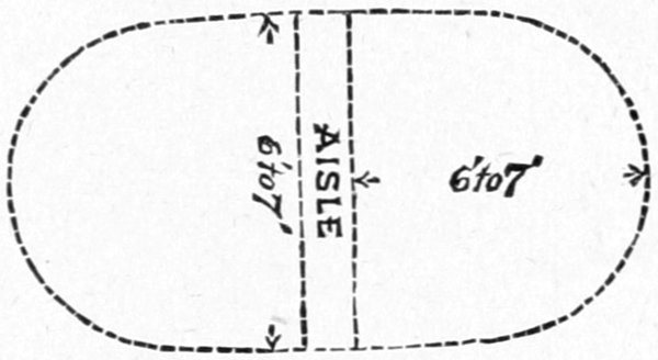
of the house the most pleasant part of it. The houses
were generally double, facing each other, with a narrow
aisle a foot or two wide between, each one containing a
single family, and being about the area of a common or
government A tent. The ridge-poles were common to
the two houses, and as both leaned forward considerably
this gave them strength to resist violent winds. The
diagram on this page gives a ground plan of an Ayan
double brush-house. The village of Kah-tung contained
about twenty of these
squalid huts, huddled near
the river bank, and altogether
was the largest Indian
village we saw on the
whole length of the Yukon
River.
PLAN OF AYAN SUMMER HOUSE OF BRUSH.
There was a most decided Hebrew cast of countenance
among many of the Ayans; more pronounced, in fact,
than I have ever seen among savages, and so much so as
to make it a subject of constant remark.
Their household implements were of the most primitive
type,—such as spoons of the horn of the mountain goat,
very similar to those of the Tlinkits, but by no means so
well carved; and a few buckets, pans, and trays of birch-bark,
ingeniously constructed of one piece so as not to
leak, and neatly sewed with long withes of trailing roots.
(The finer thread-like spruce roots, well-boiled, are, I believe,
generally used by them in sewing their birch-bark
canoes and utensils.)
Their present village was, as I have said, evidently
only of a semi-permanent character, used in the summer
during the time that salmon were ascending the river to
spawn; the bright red sides of this fish, as they were
hanging around, split open, forming a not inartistic contrast
with the dark green spruce boughs of the houses
and surrounding forests; the artistic effect, however, was
best appreciated when holding one's nose. Scattered
around in every direction was a horde of dogs that defied
computation, and it must be an immense drain on their
commissariat to keep these animals alive let alone in good
condition. The amount of active exercise they took,
however, would not suffice to reduce them in flesh, for
their principal occupation seemed to be unlimited sleep.
KON-IT'L, CHIEF OF THE AYANS.
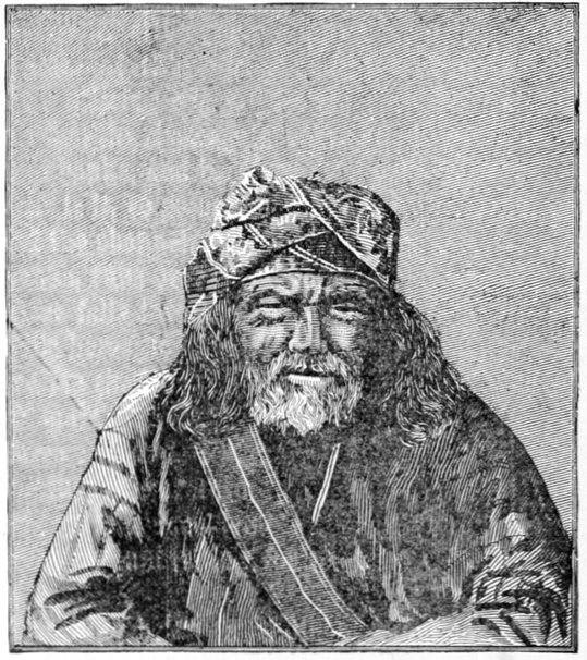
Although we were not successful in getting a photograph
of the long group of dancers, we were more fortunate with
a group of the chiefs and medicine-man "Hamlet," from
which the portrait on this page, of Kon-it'l, their chief,
is taken. It was impossible to get them to face the
camera at such short range until one of the members of
the exploring party took his position with them, while
Mr. Homan secured the photograph.
The Ayan mothers, instead of carrying their babes on
their backs with their faces to the front, as is usually
done by savage women, unless when using a cradle, turn
them around so as to have them back to back, and carry
them so low as to fit as it were into the "small of the
back."

Most of the Ayan men, and especially the younger
members, were armed with bows and arrows, but there
was quite a considerable sprinkling of old flintlock
Hudson Bay Company muskets among them, which they
had procured by trade many years ago when Fort Selkirk
flourished, or by intertribal barter, and their cost to
these poor savages was almost fabulous. The Company's
manner of selling a gun was to set it upright on the floor
of the trader's store, and then to pile up furs alongside
of it until they reached the muzzle, when the exchange
was made, many of the skins being those of the black
and silver-gray fox, and their aggregate value being
probably three to four hundred dollars. Their bows and
arrows were of the stereotyped Indian make, with no distinguishing
ornament or peculiarity of construction
worthy of notice.
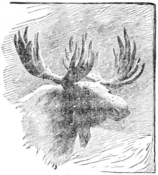
The moose arrows used by this tribe, shown in illustration
on this page, have at the point the usual double
barb of common arrows, while one side is prolonged for
two or three inches into a series of barbs; these latter
they claim have the effect of working inward with the
motions of the muscles of the animal if it be only
wounded. Once wounded in this manner these sleuth-hounds
of savages will remain on the trail of a moose for
days if need be, until this dreadful weapon has reached
a vital point, or so disabled the animal that it easily succumbs
to its pursuers. In hunting moose in the summer
time, while these animals are swimming across the lakes
or broad streams, I was told by one of my interpreters
who had often traded among them, and was well acquainted
with their habits and customs, that these Ayans
(and in fact several tribes below them on the river), do
not hesitate to jump on the animals' back in the lake or
river, leaving the canoe to look after itself, and dispatch
the brute with a hand knife, cutting its throat or stabbing
it in the neck as illustrated on page 261. Of course,
a companion in another canoe is needed to assist in getting
the carcass ashore, and secure the hunter's canoe.
They often attack the moose in their canoes while swimming
as described by previous explorers on the lower
river, but say that if by any unskillful movement they
should only wound the animal it may turn and wreck
their vessel, which is too great a loss for them to risk.
A flying moose will not turn in the water unless irritated
by wounds. The knives they use in hunting are great
double-edged ones, with flaring ornamental handles, well
illustrated in the upper left hand corner of the picture
mentioned. They tell me these knives are of native
manufacture, the handles being wrapped with moose
leather so as to give the hand a good grip. Altogether,
they are most villainous and piratical looking
things.
CROSS-SECTION THROUGH AYAN WINTER TENT.
Only one or two log-cabins were seen anywhere in the
Ayan country, and these had the dilapidated air of
complete and permanent abandonment, although this
whole district of the river is teeming with timber appropriate
for such use. Probably the nomadic and restless
character of the inhabitants makes it irksome for them
to dwell in such permanent abodes, in spite of the great
comfort to be derived in their almost Arctic winters from
such buildings, if well constructed. The severity of the
winter is shown by the moist banks of the river, the
appearance of which indicates that they have been frozen
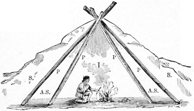
some six or eight feet in depth. In winter the Ayans
live mostly in tents, but by an ingenious arrangement
these ordinarily cold habitations are made reasonably
comfortable. This winter tent is shown in cross-section
above, I being the interior, and P P the tent poles
well covered with moose or caribou skins. A second set
of poles, P P, are given a wider spread, inclosing an air
space, A S, a foot or two across. These, too, are covered
with animal skins, and a thick banking of snow, ss,
two or three feet deep is thrown over the outside tent
during the coldest weather of winter, making a sort of
hybrid between the Eskimo igloo, or snow house, and
the Indian skin lodge.
Many of the Ayans were persistent beggars, and next
morning, the 16th of July, we got an early start before
many of them were about, for as a tribe they did not
seem to be very early risers.
Nearly directly opposite the Kah-tung village the perpendicular
basaltic bluffs shown in the view at the mouth
of the Pelly cease; and from this point on, the hills on
both sides of the river were higher and even mountainous
in character; "the upper gates of the upper ramparts."
From this point on down through the ramparts small
black gnats became annoyingly numerous and pugnacious,
while the plague of mosquitoes seemed to abate a
little. The mosquito-bars, which were some protection
from the latter, were of no use against the former, the
little imps sailing right between the meshes without
even stopping to crawl through. Veils with the very
finest meshes would be needed to repulse their onslaughts,
and with these we were not provided.
That day, the 16th, we drifted forty-seven miles,
through a most picturesque section of country, our journey
being marred only by a number of recurring and
disagreeable thunder showers that wet us to the skin.
Everywhere in conspicuous positions near the edge of
the river banks we saw straggling and isolated Ayan
graves, resembling, in general, the one photographed at
Selkirk, and not unlike pretty little white cottages, when
seen from the distance projected against the somber
green of the deep spruce forests.
About thirty-four miles beyond old Selkirk a small
but conspicuous mountain stream came in from the
south, which I named after Professor Selwyn, of Ottawa,
Canada.
The river was still full of islands, however, many of
which are covered with tall spruce, and look very picturesque
in the almost cañon-like river-bottom, the steep
mountain sides being nearly devoid of heavy forests.
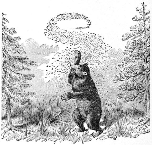
In one of the many open spaces far up the mountain
side, we saw a huge black bear, evidently hunting his
daily meal among the roots and berries that there
abound. Although we passed within half a mile of him,
he took no more notice of us than if our raft had been
a floating chip, and we did not disturb his search with
any long-range shots.
A little further down, and on the same side of the
river, the northern, we saw three white mountain goats
on the very highest ridges of the hills. Timid as they
are, the only notice they deigned to give us was that
such as were asleep roused themselves and stood gazing
at us until we had drifted well past, when they began
grazing leisurely along the ridge.
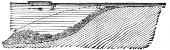
About this time our attention was quite forcibly called
to a singular phenomenon while riding on the raft, which
was especially noticeable on quiet sunny days. It was a
very pronounced crackling sound, not unlike that of a
strong fire running through dry cedar brush, or that of the
first rain drops of a thunder storm falling on the roof of
a tent. Some of the men attributed it to the rattling on
the logs of the raft of a shower of pebbles brought up by
the swift current from underneath, which would have
been a good enough theory as far as the sound was
concerned; but soundings in such places invariably
failed to touch bottom with a sixteen-foot pole, and,
moreover, when we were in shallower and swifter waters,
where the bottom was pebbly, the sounds were not
observed. As the noise always occurred in deep water
of a boiling character, figuratively speaking,—or in that
agitated condition so common in deep water immediately
after a shoal, a condition with which our experience in
prying the raft off shoals had rendered us familiar—I
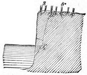
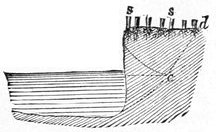
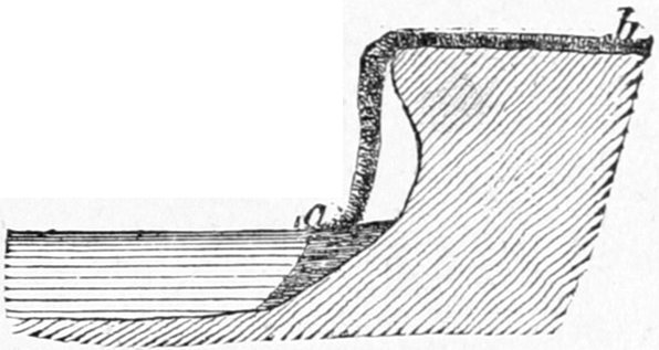
attempted to account for it upon the theory explained
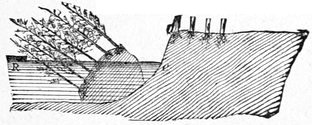
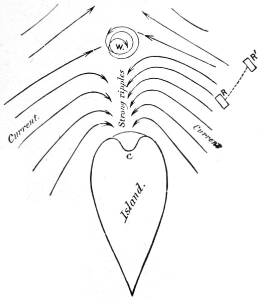
by the figure just below. The raft x, drifting with the
arrow, passes from a shallow to a deep stretch of water.
The Yukon River is a very swift stream for its size (we
drifted that day, July 16, forty-seven and a half geographical
miles in eleven hours and fifty minutes, and
even this rate cannot represent the swiftest current), and
the pebbles, carried forward over the shallows and
reaching the crest a,
are borne along by
their own inertia and
the superficial current,
and literally dropped
on a gravel-bank at some point forward, such as b, and,
water being so excellent a conductor of sound, an observer
on a low floating craft, during quiet days, might distinctly
hear this falling, whereas it would not be heard if the
pebbles were simply rolling along the bottom in swifter
and noisier water. The suddenness with which this
crackling commenced and the gradual manner in which
it died out, seem to confirm this idea. A series of
soundings before and after the occurrence of these singular
noises would have settled this theory; but the sound
recurred so seldom (say twice, or perhaps three times, a
day in this part of the river), that it was impossible to
predict it in time to put the theory to the test, unless
one kept constantly sounding while upon the river. It
was observed on the lower river in a much less degree,
and probably might there have passed unnoticed if
previous experience had not recalled it to our attention.
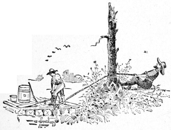
That evening we camped at 8 o'clock, after trying to
conduct our cumbersome vessel to a pretty little spot for
the purpose, but our well-used "snubbing" line parted
at the critical moment and we drifted down into a most
miserable position among the high, rank willow shoots,
laden with water from the recent rains. Towing or
"tracking" our craft back against the swift current
with our small force was plainly out of the question, and
as the river bank seemed of the same character, as far as
we could see, some two or three miles, we made the best
of it and camped, for we were getting used to such
experiences by this time.
Next morning, about 7 o'clock, when we were nearly
ready to start, we found four Ayan Indians, each in his
birch-bark canoe, visiting our camp. They came from
the Kah-tung village above, having left it, as they said,
shortly after our departure on the preceding day, and had
camped for the night on the river just above us. They
expressed great surprise at the distance we had made by
simple drifting, having until this morning felt certain that
they had passed us the day before around some one of the
many islands in the broad river. They were going down
the river some two or three hundred miles to a white
trader's store of which they spoke, and we kept passing
each other for the next three or four days. They had
spoken at the Kah-tung village of this trading station
(which we took to be Fort Yukon), which
they said they could reach in three days; kindly
adding that we might make the distance with our
craft in a week or so. They now changed their
minds and thought we might only be a day or two behind
them. I found that the progress of the raft, when care
was taken to keep in the swiftest current, for twelve or
fourteen or perhaps sixteen hours a day, with no unusual
detentions, fully equaled the average day's journey of
the Indian canoes, which remained in the water not more
than six or seven hours a day; their occupants stopping
to hunt every animal that might be seen, as well as to
cook a midday lunch at their leisure. In fact my own
Indians, who had traded among them, more than hinted
that they were hurrying considerably in order to go along
with us and to reach the white trader's store as a portion
of our party.
These same four fellows, when they met us on the morning
of the 17th, had with them the carcass of a black
bear, which they offered for sale or barter; and on our
buying one hindquarter, which was about all that we
thought we could use before spoiling, they offered us the
rest as a gift. We accepted the offer to the extent of
taking the other hindquarter, for which we gave them a
trifle, whereupon the rest of the carcass was left behind
or thrown away on the beach, a circumstance which was
explained to us by the fact that all four of these Indians
were medicine-men, and as such were forbidden by some
superstitious custom from eating bears' flesh. They told
us that the animal was the same black bear we had seen
on the northern hillsides of the river the day before.
The morning of the 17th and certain other periods of
the day were characterized by a heavy fog-bank, which
did not quite reach the river bottom, but cut the hillsides
at an altitude of from three hundred to five hundred
feet above the level of the stream. The fog gave a dismal
and monotonous aspect to the landscape, but proved much
better for our physical comfort than the previous day, with
its alternating rain and blistering heat. We found these
fogs to be very common on this part of the river, being
almost inseparable from the southern winds that prevail
at this time of the year. I suppose these fogs proceed
from the moisture-laden air over the warm Pacific which
is borne on the southern winds across the snow-clad and
glacier-crowned mountains of the Alaskan coast range,
becoming chilled and condensed in its progress, and
reaching this part of the Yukon valley is precipitated as
rain or fog. The reason that we had escaped the fogs on the
lakes was that the wind came across tracts of land to the
south, and the hygrometric conditions were different.
A little further down the Yukon, but within the upper
ramparts, we suffered from almost constant rains that
beat with the southern winds upon our backs.
Shortly after one o'clock in the afternoon we floated
by the mouth of the White River flowing from the south
west, which has the local name of Yú-ko-kon Heena, or
Yú-ko-kon River, a much prettier name than the old one
of the Hudson Bay traders. The Chilkats call it the
Sand River, from the innumerable bars and banks of
sand along its course; and many years ago they ascended
it by a trail, which when continued leads to their own
country, but is now abandoned. Some forty to fifty
miles up its valley the Indian trading trail which leads
from the headwaters of the Tanana to old Fort Selkirk
crosses its course at right angles; and since the destruction
of Fort Selkirk in 1851, the Tanana Indians, who
then made considerable use of the trail to reach the fort
for trading purposes, employ it but little; and only then
as far as the White River, whose valley they descend to
reach the Yukon.
This stream resembles a river of liquid mud of an
almost white hue, from which characteristic it is said to
have derived its name from the old Hudson Bay traders—and
no better illustration of its extreme muddiness can
be given than the following: One of our party mistook
a mass of timber that had lodged on the up-stream side
of a low, flat mud-bar, for floating wood, and regarded
it as evidence of a freshet, a theory which seemed corroborated
by the muddy condition of the water, until
the actual character of the object was established by
closer observation as we drifted nearer. The mud-bar
and adjacent waters were so entirely of the same color
that the line of demarcation was not readily apparent,
and had it not been for the drift rubbish around the
former it might have escaped our scrutiny even at our
short distance from it. The Indians say that the White
River rises in glacier-bearing lands, and that it is very
swift, and full of rapids along its whole course. So
swift is it at its mouth, that as it pours its muddy waters
into the rapid Yukon it carries them nearly across that
clear blue stream; the waters of the two rivers mingling
almost at once, and not running distinct for miles side
by side, as is stated in one book on Alaska. From the
mouth of the White or Yu'-ko-kon to Bering Sea, nearly
1,500 miles, the Yukon is so muddy as to be noticeable
even when its water is taken up in the palm of the hand;
and all fishing with hook and line ceases.
About four in the afternoon the mouth of the Stewart
River was passed, and, being covered with islands, might
not have been noticed except for its valley, which is very
noticeable—a broad valley fenced in by high hills. A
visit to the shore in our canoe showed its mouth to be
deltoid in character, three mouths being observed, and
others probably existing. Islands were very numerous
in this portion of the Yukon, much more so than in any
part of the river we had yet visited, and as the raft had
drifted on while I went ashore in the canoe, I had a very
hard task to find it again and came within a scratch of
losing it, having passed beyond the camp, and being
compelled to return. It was about nine o'clock in the
evening and the low north-western sun shone squarely in
our faces, as we descended the river, eagerly looking for
the ascending smoke of the camp-fire, which had been
agreed upon, before separation, as the signal to be kept
going until we returned. The setting sun throwing its
slanting rays upon each point of woods that ran from
the hillsides down to the water's edge, illumined the top
of them with a whitish light until each one exactly
resembled a camp-fire on the river bank with the feathery
smoke floating off along the tree tops. Even my Indian
canoeman was deceived at first, until half a dozen appearing
together in sight convinced him of his error.
All these islands were densely covered with spruce and
poplar, and the swift current cutting into their alluvial
banks, though the latter were frozen six or eight feet
thick, kept their edges bristling with freshly-fallen timber;
and it was almost courting destruction to get under
this abatis of trees with the raft, in the powerful current,
to avoid which some of our hardest work was necessary.
The preservative power of this constantly
frozen ground must be very great, as in many places we
saw protruding from the high banks great accumulations
of driftwood and logs over which there was soil two and
three feet thick, which had been formerly carried by the
river, and from which sprung forests of spruce timber,
as high as any in sight, at whose feet were rotting trunks
that must have been saplings centuries ago. Yet
wherever this ancient driftwood had been undermined and
washed of its dirt and thrown upon the beach along with
the tree but just fallen, the difference between the two
was only that the latter still retained its green bark, and
its broken limbs were not so abraded and worn; but
there seemed to be no essential difference in the fiber of
the timber.
The evening of the 17th, having scored forty geographical
miles, we camped on a low gravel bar, and
bivouacked in the open air so clear and still was the
night, although by morning huge drops of rain were falling
on our upturned faces.
On the 18th, shortly after noon, we passed a number
of Tahk-ong Indians, stretched upon the green
sward of the right bank leisurely enjoying themselves;
their birch-bark canoes, sixteen in all, being pulled up
on the gravel beach in front of them. It was probably a
trading or hunting party, there being one person for each
canoe, none of whom were women. Already we observed
an increase in the size and a greater cumbrousness
in the build of the birch-bark canoes, when compared
with the fairy-like craft of the Ayans, a characteristic
that slowly increased as we descended the river until the
kiak, or sealskin canoe of the Eskimo is encountered
along the lower waters of the great river. Of course
this change of build reflects no discredit upon the skill
of the makers, as a heavier craft is required to navigate
the rougher water, as the broad stream is stirred up by
the persistent southern winds of the Yukon basin.
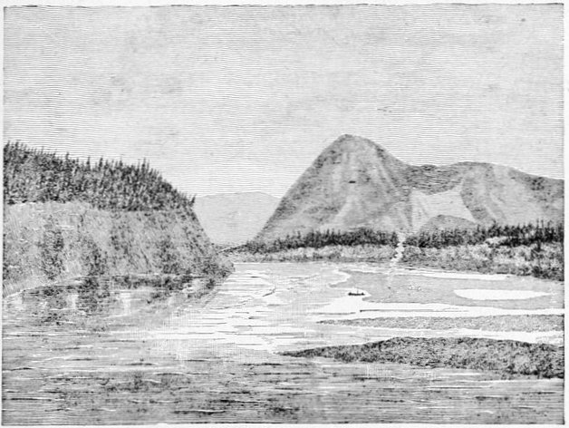
MOOSE-SKIN MOUNTAIN, AND CAMP 32 AT THE MOUTH OF DEER
RIVER.
About 8.30 P.M. we passed an Indian camp on the
left bank, which, from the seeming good quality of their
canvas tents as viewed from the river, we judged might prove
to be a mining party of whites. From them we
learned that there was a deserted white man's store but
a few miles beyond, but that the trader himself, had
quitted the place several months before, going down to
salt-water, as they expressed it. This was evidently the
same trader the Ayans expected to meet at a little semi-permanent
station of the Alaska Commercial Company
dubbed Fort Reliance; and they seemed quite discomfited
at his departure, although he had left the preceding
autumn, and as we afterward ascertained more from
fear of the Indians in his neighborhood than any other
reason.
We camped that night at the mouth of a noticeable
but small stream coming in from the east, which we
afterward learned was called Deer Creek by the traders,
from the large number of caribou or woodland reindeer
seen in its valley at certain times of their migrations.
At this point of its course the Yukon River is extremely
narrow in comparison with the distance from its head—about
700 miles,—and considering its previous mean
width, being here only two hundred or two hundred and
fifty yards across. It certainly must have great depth
to be able to carry the immense volume of water of so
swift and wide a river as it is above, for the current does
not seem to increase appreciably in this narrow channel.
Directly northward in plain sight is a prominent landmark
on this part of the river, viz., a high hill called by
the Indians "the moose-skin mountain." Two ravines
that converge from its top again diverge when about to
meet about half way down the mountain slope, and
along these two arms of an hyperbola there has been a
great landslide, laying bare the dull red ocherous soil
beneath, which contrasts almost vividly with the bright
green of the grass and foliage of the mountain flank, and
in shape and color resembles a gigantic moose-skin
stretched out to dry. That day's drift gave us forty-seven
and a half miles, and all our scores were good
while passing the ramparts, the delays from sand, mud
and gravel bars being very small.
Believing that I was now in close proximity to the
British boundary, as shown by our dead reckoning—kept
by Mr. Homan,—I reluctantly determined on giving a
day (the 19th of July) to astronomical observations,—reluctantly
because every day was of vital importance in
reaching St. Michael's, near the mouth of the river, in
time to reach any outgoing vessels for the United States;
for if too late to catch them, we should have to spend a
dismal and profitless year at that place. That day, however,
proved so tempestuous, and the prospect so uninviting,
that after getting a couple of poor "sights" for
longitude, I ordered camp broken, and we got away
shortly after eleven o'clock.
A few minutes before one o'clock we passed the
abandoned trading station on the right bank of the
river, which we surmised from certain maps and from
subsequent information to be the one named Fort
Reliance. It was a most dilapidated-looking frontier
pile of shanties, consisting of one main house, probably
the store, above ground, and three or four cellar-like
houses, the ruined roofs of which were the only vestiges
remaining above ground. The Indians said that Mr.
McQuestion, the trader, had left on account of severe
sickness, but his own story, when we met him afterward
on the lower river, was that he was sick of the Indians,
the main tribe of which were peaceful enough, but contained
several ugly tempered communistic medicine-men
who had threatened his life in order to get rid of his
competition in the drug business, which resulted greatly
to their financial detriment.
Nearly opposite Fort Reliance was the Indian village
of Noo-klak-o, or Nuclaco, numbering about one hundred
and fifty people. Our approach was welcomed by
a protracted salute of from fifty to seventy-five discharges
of their old rusty muskets, to which we replied
with a far less number. Despite the great value of powder
and other ammunition to these poor isolated savages,
who are often obliged to make journeys of many hundreds
of miles in order to procure them, and must oftentimes
be in sore need of them for hunting purposes, they
do not hesitate in exciting times—and every visit of a
stranger causes excitement—to waste their ammunition
in foolish hangings and silly salutes that suggest the
vicinity of a powder magazine. I suppose the expenditure
on our visit, if judiciously employed in hunting,
would have supplied their village with meat for probably
a month; and yet we drifted by with hardly a response.
This method of saluting is very common along the river
from this point on, and is, I believe, an old Russian custom
which has found its way thus far up the stream,
which is much beyond where they had ever traded. It
is a custom often mentioned in descriptions of travel further
down the river. The permanent number of inhabitants,
according to Mr. McQuestion, was about seventy-five
or eighty; and therefore there must have been a
great number of visitors among them at the time of our
passing. They seemed very much disappointed that we
did not visit their village, and the many who crowded
around the drifting raft in their little fleet of canoes
spoke only of tea and tobacco, for which they seemed
ready to barter their very souls. Their principal diet in
summer and early fall is furnished by the salmon of the
Yukon, while during winter and spring, until the ice
disappears, they feed on the flesh of moose and caribou.
A trader on the upper river told me that the ice of the
stream is removed from the upper ramparts and above
principally by melting, while all that covers the Yukon
below that part is washed out by the spring rise of the
river, there being fully a month's difference in the matter
between the two districts. Noo-klak-o' was a semi-permanent
village, but a most squalid-looking affair,—somewhat
resembling the Ayan town, but with a much
greater preponderance of canvas. Most of the native
visitors we saw were Tanana' Indians, and I was somewhat
surprised to find them put the accent, in a broad
way, on the second syllable, Ta-nah'-nee, differing
radically from the pronunciation of the same name by
the Indians at the mouth of the river, and by most white
travelers of the Lower Yukon. From this point a trail
leads south-westward over the mountains to a tributary
of the Tanana, by means of which these Indians visit
Noo-klak-o. The 19th was a most disagreeable day, with
alternating rain showers and drifting fog, which had followed
us since the day of our failure in securing astronomical
observations, and to vary the discomfort, after
making less than thirty miles we stuck so fast on the
upper point of a long gravel bar that we had to carry
our effects ashore on our backs, and there camp with
only half a dozen water-logged sticks for a camp-fire.
What in the world any mosquito wanted to do out on that
desert of a sand-bar in a cold drifting fog I could never
imagine, but before our beds were fairly made they put
in an appearance in the usual unlimited numbers and
made sleep, after a hard day's work, almost impossible.
Starting at 8:10 A.M., next morning, from Camp 33, at
11:30 we passed a good sized river coming in from the
west, which I named the Cone-Hill River, from the fact
that there is a prominent conical hill in the center of its
broad valley, near the mouth.
Just beyond the mouth of the Cone-Hill River we
suddenly came in sight of some four or five black and
brown bears in an open or untimbered space of about an
acre or two on the steep hillsides of the western slope.
The raft was left to look after itself and we gave them a
running volley of skirmish fire that sent them scampering
up the steep hill into the dense brush and timber,
their principal loss being loss of breath. By not attending
to the navigation of our craft in the excitement of
the short bear hunt we ran on a submerged rock in a
current so swift that we swung around so rapidly as
almost to throw a number of us overboard, stuck for a
couple of minutes with the water boiling over the stern,
and in general lost our faith in the ability of our vessel
to navigate itself. In a previous chapter I have mentioned
having been told by a person in southern Alaska,
undoubtedly conscientious in his statement, and having
considerable experience as a hunter, that the black and
brown bear of his district never occupied the same
localities, and although the sequence of these localities
might be as promiscuous as the white and black squares
on a checker-board, yet each species remained wholly on
his own color, so to speak; and this led him to believe
that the weaker of the two, the black bear, had good
reason to be afraid of his more powerful neighbor. This
day's observation of the two species living together, in
one very small area, shows either an error of judgment
on the part of the observer mentioned, or a difference of
the ursine nature in different regions.
After leaving the Stewart River, which had been identified
by a sort of reductio ad absurdum reasoning, I
found it absolutely impossible to identify any of the
other streams from the descriptions and maps now in
existence, even when aided by the imperfect information
derived from the local tribes. Indianne, my Chilkat-Tahk-heesh
interpreter, got along very well among the
latter tribe. Among the Ayans were many who spoke
Tahk-heesh, with whom they traded, and here we had
but little trouble. Even lower down we managed to get
along after a fashion, for one or two of the Ayan medicine-men
who came as far as Fort Reliance with us,
could occasionally be found, and they understood the
lower languages pretty fairly, and although we struggled
through four or five tongues we could still make out
that tea and tobacco were the leading topics of conversation
everywhere. Beyond Fort Reliance, and after
bidding adieu to our four Ayans, we were almost at sea,
but occasionally in the most roundabout way we managed
to elicit information of a limited character.
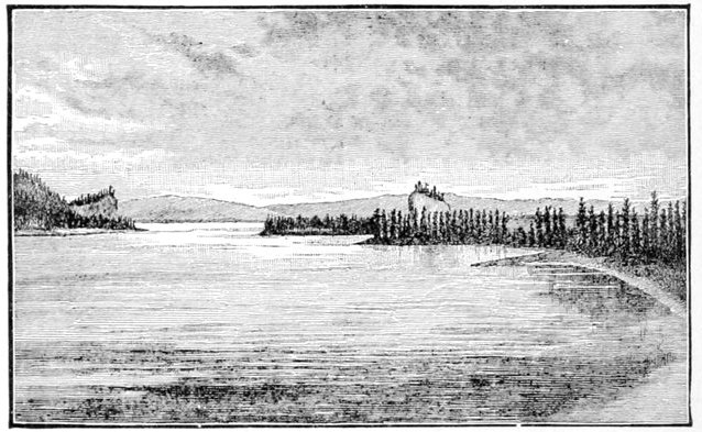
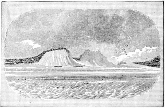
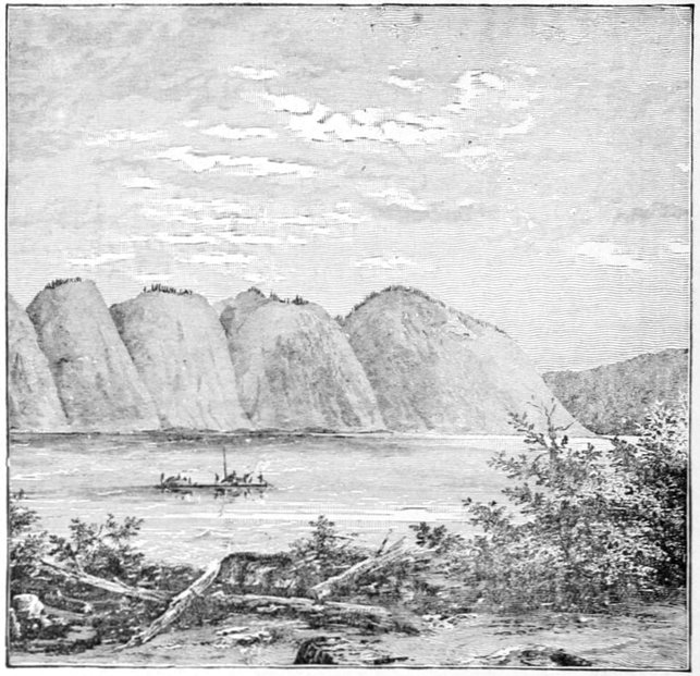
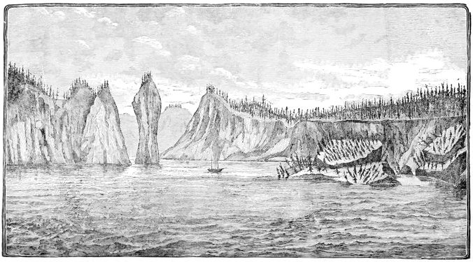
ROQUETTE ROCK.
(As we approached looking down the stream.)
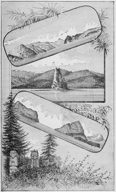
About the middle of the afternoon of that day, the
20th, we floated past a remarkable-looking rock, standing
conspicuously in a flat level bottom of the river on
the eastern side, and very prominent in its isolation. I
could not but notice the strong resemblance between it
and Castle Rock on the Columbia River, although I
judge it to be only about one-half or two-thirds the size
of the latter, but much more prominent, not being overshadowed
by near and higher mountains. I called it the
Roquette Rock, in honor of M. Alex. de la Roquette,
of the Paris Geographical Society. The Indians have a
legend connected with it, so it is said, that the Yukon
River once flowed along the distant hills back of it, and
that the rock formed part of the bluff seen in the illustration
just below, overhanging the western shore of
the river, both being about the same height and singularly
alike in other respects. Here the bluff and rock
lived many geological periods in wedded bliss as man
and wife, but finally family dissensions invaded the
rocky household and culminated in the stony-hearted
husband kicking his wrangling wife into the center of
the distant plain, and changing the course of the great
river so that it flowed between them to emphasize the
perpetual divorce. The bluff and the rock, so my informant
told me, are still known among the Indians as
"the old man" and "the old wife." Despite a most
disagreeable day, on the 20th we showed a record of
forty-five geographical miles, by way of compensation
for the dark lowering clouds that hung over us like a pall.
The scenery passed that day would have been picturesque
enough when viewed through any other medium than
that of a wretched drizzle of rain. Just before camping
we saw high perpendicular bluffs of what appeared
to be limestone, frowning over us from the eastern
shore, which were perforated with huge caverns that
would have made good dens for bears, but their situation
was such that no bears not possessing wings could have
reached them. On the map this bluff figures as Cave
Rock.
We got a late start on the 21st, the wretched weather
being good for late sleeping if for nothing else, the middle
of the forenoon finding us just pulling out. At
noon we passed a good-sized river coming in from the
east, but if it had been mapped we were unable to identify
it. A few minutes afterward we swung around a
sharp bend in the river and saw a confused mass of
brush or logs that denoted an Indian village in the distance,
a supposition confirmed by the number of canoes
afloat in its front and by a motley crowd of natives on
the bank, well mingled with the inevitable troop of dogs
that to the eye of the experienced traveler is as sure a
sign of an Indian village as both Indians and houses
together. This was the first Indian village we had encountered
on the river deserving the name of permanent,
and even here the logs of which the cabins, six
in number, were built, seemed to be mere poles, and by
no means as substantially built as it might have been
with the material at hand. It was perched up on a high
flat bank on the western side of the river, the gable ends
of the house fronting the stream, and all of them very
close together, there being only one or two places wide
enough for a path to allow the inmates to pass. The
fronts of the houses are nearly on the same line, and this
row is so close to the scarp of the bank that the "street"
in front is a very narrow path, where two persons can
hardly pass unless one of them steps indoors or down
the hill; and when I visited the village the road was
so monopolized by scratching dogs that I could hardly
force my way through them. This street may have been
much wider in times of yore—for it seemed to be quite
an old village—and the encroachments of the eroding
river during freshets may have reduced it to its present
narrowness. If so, it will not be long before the present
village must be abandoned or set back some distance.
Further up the river we saw a single pole house projecting
over the bank about a fourth or a third of its
length, and deserted by its occupants. The body of the
houses is of a very inferior construction, in which ventilation
seems to be the predominating idea (although
even this is not developed to a sufficient degree, as
judged by one's nose upon entering), and the large door
in front is roughly closed by a well-riddled moose or
caribou skin, or occasionally by a piece of canvas so
dirty that at the distance of a few feet it might be
taken for an animal's skin. The roofs are of skins
battened down by spruce poles, which, projecting beyond
the comb in irregular lengths, often six and eight feet,
gave the whole village a most bristling appearance. A
fire is built on the dirt-floor, in the center of the habitation,
and the smoke left to get out the best way it can.
As the occupants are generally sitting flat on the floor,
or stretched out at full length on their backs or stomachs
in the dirt, they are in a stratum of air comparatively
clear; or, at least, endurable to Indian lungs.
The ascending smoke finds ample air-holes among the
upper cracks of the walls, while that dense mass of it
which is retained under the skins of the roof, making it
almost impossible to stand upright, is utilized for smoking
the salmon which are hung up in this space. The
Indian name of the village is Klat-ol-klin', but it is generally
known on the Middle River as Johnny's Village,
after the chief's Americanized name. That dignitary
was absent on a journey of several days down the river,
at the time of our arrival.
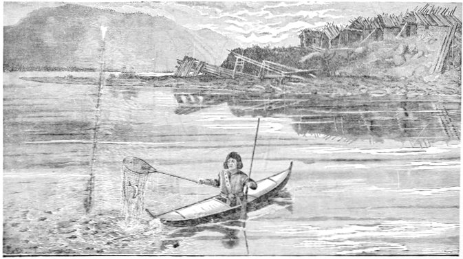
KLAT-OL-KLIN' (JOHNNY'S) VILLAGE (LOOKING UP THE YUKON RIVER)
A number of long leaning poles, braced on their downhill
ends by cross uprights, were noticed on the gravel
beach in front of the village; these serve as scaffoldings
upon which to dry salmon in the sun, and to keep them
from the many dogs while undergoing this process.
While taking a photograph of the town, two or three
salmon fell from the poles; and in a twinkling fully
sixty or seventy dogs were huddled together about them
in a writhing mass, each one trying to get his share,—and
that of several others. The camera was sighted toward
them, a hurried guess made as to the proper focus, and
an instantaneous view attempted, but the negative looked
more like a representation of an approaching thunder
shower, and I never afterward printed from it. Occasionally
in these rushes a row of scaffolding will be knocked
down, and if it happens to be loaded with salmon the
consequent feast will be of a more extensive nature.
These dogs were of a smaller breed, and noticeably of a
darker color, than the Eskimo dogs of the lower river.
They are employed by these Indians for the same purposes,
but to a more limited extent.
It was at this village that what to me was the most
wonderful and striking performance given by any natives
we encountered on the whole trip was displayed. I refer
to their method of fishing for salmon. I have already
spoken of the extreme muddiness of the Yukon below
the mouth of the White River; and this spot, of course,
is no exception. I believe I do not exaggerate in the least
when I say, that, if an ordinary pint tin-cup were filled
with it, nothing could be seen at the bottom until the sediment
had settled. The water is about nine or ten feet
deep on the fishing banks in front of the houses, where
they fish with their nets; or at least that is about the
length of the poles to which the nets are attached. The
salmon I saw them take were caught about two hundred
or two hundred and fifty yards directly out from the shore
in front of the houses. Standing in front of this row of
cabins, some person, generally an old man, squaw or
child, possibly on duty for that purpose, would announce,
in a loud voice, that a salmon was coming up the
river, perhaps from a quarter to a third of a mile away.
This news would stir up some young man from the
cabins, who from his elevated position in front of them
would identify the salmon's position, and then run down
to the beach, pick up his canoe, paddle and net, launch
the former and start rapidly out into the river; the net
lying on the canoe's birch deck in front of him, his
movements being guided by his own sight and that of a
half dozen others on the high bank, all shouting advice to
him at the same time. Evidently, in the canoe he could
not judge well of the fish's position, especially at a distance;
for he seemed to rely on the advice from the
shore to direct his movements until the fish was near
him, when with two or three dexterous and powerful
strokes with both hands, he shot the little canoe to a
point near the position he wished to take up, regulating
its finer movements by the paddle used as a sculling
oar in his left hand, while with his right he grasped
the net at the end of its handle and plunged it into
the water the whole length of its pole to the bottom
of the river (some nine or ten feet); often leaning
far over and thrusting the arm deep into the
water, so as to adjust the mouth of the net, covering
about two square feet, directly over the course of the
salmon so as to entrap him. Of seven attempts, at
intervals covering three hours, two were successful (and
in two others salmon were caught but escaped while the
nets were being raised), salmon being taken that weighed
from fifteen to twenty pounds. How these Indians can
see at this distance the coming of a single salmon along
the bottom of a river eight or ten feet deep, and determine
their course or position near enough to catch them
in the narrow mouth of a small net, when immediately
under the eye a vessel holding that number of inches of
water from the muddy river completely obscures an object
at its bottom, is a problem that I will not attempt to
solve. Their success depends of course in some way on
the motion of the fish. In vain they attempted to show
members of my party the coming fish. I feel perfectly
satisfied that none of the white men could see the slightest
trace of the movements to which their attention was
called. Under the skin roofs of their log-cabins and on
the scaffoldings upon the gravel beach were many hundred
salmon that had been caught in this curious way.
The only plausible theory which I could evolve within
the limits of the non-marvelous, was, that the salmon
came along near the top of the water, so as to show or
indicate the dorsal fin, and that as it approached the
canoe, the sight of it, or more likely some slight noise,
made with that intention, drove the fish to the bottom
without any considerable lateral deviation, whereupon
they were inclosed by the net. But my interpreters told
me (and I think their interpretation was correct in this
case, roundabout as it was), that this superficial swimming
did not take place, but that the motion of the fish
was communicated from the deep water to the surface,
often when the fish was quite at the bottom.
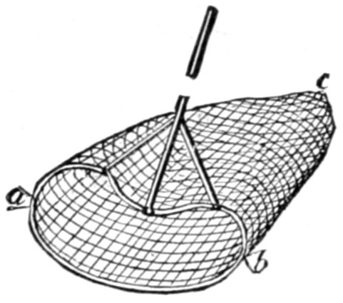
KLAT-OL-KLIN FISHING NETS.
Scale, 1-30.
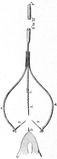
The nets used have already been partially described.
The mouth is held open by a light wooden frame of a
reniform shape, as shown in the
figure on this page, and as one
may readily see, this is of great
advantage in securing the handle
firmly by side braces to the rim
of the net's mouth as shown, that
being undoubtedly the object
sought. Further down the river
(that is, in the "lower ramparts"),
the reniform rim becomes circular; thus of
course increasing the chances of catching the fish; all
the other dimensions, too, are greatly increased. When
the salmon is netted, a turn is immediately given to the
handle, thus effectually trapping the fish below the
mouth of the net, and upon the dexterity thus displayed
no little of the fisherman's success depends. Two salmon
were lost upon this occasion after they had actually
passed into the net, owing to lack of agility in this operation.
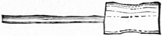
When fully entrapped
and brought alongside, a fish-club,
as shown, is used to kill
the salmon immediately by a
hard blow over the head, for the struggles of so large
a fish might easily upset a frail canoe.
Up to this time the birch-bark canoes on the river had
been so fragile and "cranky" that my Chilkat Indians,
who were used to the heavy wooden canoes of their country,
felt unsafe in employing them for all purposes, but
these were so much larger and stronger in build, and our
old Tahk-heesh "dug-out" so thoroughly worthless,
that we felt safe in buying one at this village, but for a
number of days "Billy" and "Indianne" paddled very
gingerly when making excursions in it.
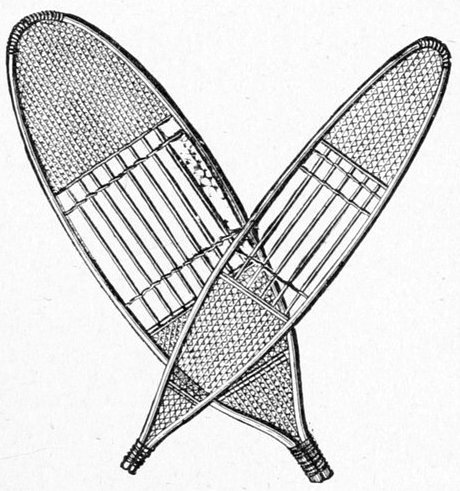
A few Hudson Bay toboggan sledges were seen on
scaffolds at and near the village; they seem to be the
principal sledges of this part of the country. The snow
shoes of this tribe differed from those of the Chilkats by
trifling modifications only, being a sort of compromise
between the hunting and packing snow shoes of the
latter.
About a mile or a mile and a quarter below Klat-ol-klin',
and on the same side of the river, is a fairly constructed
white man's log cabin, which had once been used
as a trading store, but was now deserted. We afterward
learned that this trading station was called Belle Isle,
and had only been built two years before, having been
abandoned the preceding year as not paying. The Indians
evidently must have surmised that the trader
would return, as they respected the condition in which
he left the building, in a manner most creditable to their
honesty, no one having entered or disturbed it since he
left. They evidently care very little for beads as ornaments,
for I saw none of them wearing that much coveted
Indian adornment, while great quantities were
scattered around by the trader's store, having been
trampled into the ground. At no place on the river did
I find such an eagerness for beads as characterizes the
American Indians of milder climes, but nowhere did I
see such total disregard for them as was shown here.
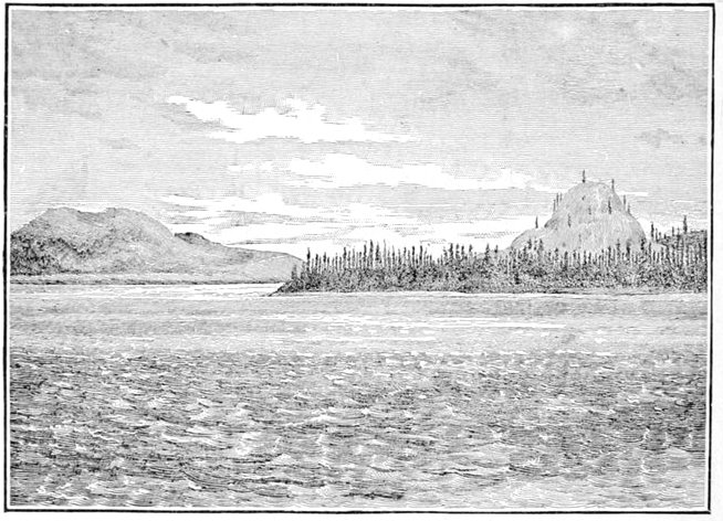
Near Belle Isle is a prominent hill called by the Indians
Ta-tot'-lee, its conspicuousness heightened by the
comparative flatness of the country which lies between
two entering rivers and a great bend of the Yukon. As our
survey showed it to be just within Alaska, bordering on
the boundary between it and the British North-west Territory,
I gave it the additional name of Boundary Butte.
The country was now noticeably more open, and it was
evident that we had already passed the most mountainous
portion of the chain, the intersection of which by the
river forms the upper ramparts.
The next day we made thirty-six miles, and as the
whole day had been a most disagreeable one when at six
o'clock we got drawn into an eddy, near which was
a fair place to camp, I ordered the raft made fast and the
tents pitched.
That day—the 22d—while under way, we saw a large
dead king-salmon, floating belly upwards with the current,
and we kept near it for some time. This spectacle
became more familiar as we descended, while everywhere
we met with the rough coarse dog-salmon strewn upon
the beach, frequently in such numbers, and tainting the
air so strongly with the odor of their decay, that an
otherwise good camp would be spoiled by their presence.
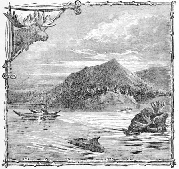
MOUNT TA-TOT'-LEE, OR BOUNDARY BUTTE.
(Also showing Middle Yukon River Indians' methods of killing swimming moose.)
The river rose ten inches that night—a fact easily
accounted for by the protracted and often heavy rains.
The forenoon of the 23d was very gloomy, but shortly
after noon the weather surprised us by clearing up.
At 3:30 that day we came upon another Indian town
called Charley's Village; but the current was so swift
that we could not get the raft up to the bank so as to
camp alongside, but we were successful in making a
sand-bar about half a mile below. Charley's Village was
an exact counterpart of Johnny's, even as to the number
of houses—six—and the side of the river—the western;
and considering this and the trouble to reach it, I did not
attempt to photograph it. When attempting to reach it
with the raft, so anxious were the Indians for our success,
that as many as could do so put the bows of their canoes
on the outer log of the raft, and paddled forward with
as much vehemence as if their very lives depended upon
the result. In three or four minutes they had worked
themselves into a streaming perspiration, and had
probably shoved the huge raft as many inches toward
the bank. We found a Canadian voyageur among them
of the name of Jo. Ladue, who, as a partner of one of the
traders on the lower river, had drifted here in prospecting
the stream for precious mineral. "Jo," as he is familiarly
known, speaks of the natives of both these villages as
Tadoosh, and says they are the best-natured Indians from
here till the Eskimo are met with. Ladue had a fairly-made
scow over twenty feet long, about half a dozen
wide, and three deep, which he wanted to hire us, but
as it would not hold all the party and effects we had to
decline the tender, despite his emphatic assurances that
we could not safely go much further with our raft. It
was with Ladue that I first noticed particularly the pronunciation
of the name of the great river, on whose waters
we were drifting, a pronunciation which is universal
among the few whites along its borders, and that sounded
strangely at first; that is with the accent on the first
syllable, and not on the second, as I had so usually heard
it pronounced in the United States. That night, the 23d,
the mosquitoes were perfectly unbearable in their
assaults, and if the weather had not turned bitterly cold
toward morning I doubt if we could have obtained any
sleep at all, for the mosquito-bars seemed to be no protection
whatever.
I think I established one mosquito theory of a practical
bearing, on a pretty firm basis, while upon this trip "in
the land of the mosquito's paradise;" and that was, if
the insects are so thick that they constantly touch each
other on the mosquito-bar when crawling over it, it will
be no protection whatever, if the meshes are of the usual
size, and they will come in so fast that comfort is out of
the question, but otherwise there is some chance which
increases as their numbers diminish. Even if there are
two or three to the square inch of your bar of many
square yards, it surprises you how few get through, but
the minute they begin crawling over each other they
seem to become furious, and make efforts to squeeze
through the meshes which are often rewarded with success,
until a sharp slap on the face sounds their death
knell. The doctor, in a fit of exasperation, said he
believed that two of them would hold the legs and wings
of another flat against its body, while a third shoved it
through; but I doubt the existence of co-operation
among them. I think they are too mean to help one
another.