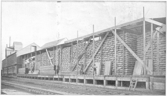
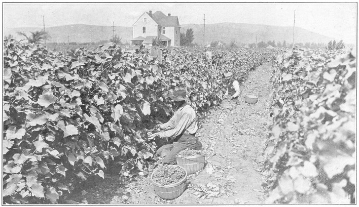
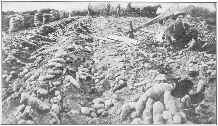
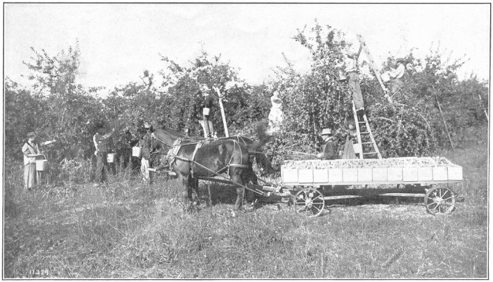
Adams county is in the center of southeastern Washington, cut out
of the once great desert plateau, covered with sage brush. It has
developed into one of the most important food-producing counties
of the state. It has a population of about 13,000 and covers 1,908
square miles of territory.
Its climate is not different from that of the balance of the district
in which it is situated, and, although some days in winter are
severely cold and some in summer hot, its dry atmosphere softens
the asperity of its cold, and its generous crop yields are full
compensation for the heat of the summer's sun. Its mean temperature
ranges from 30 degrees to 40 degrees in winter and from 50 to 74
degrees in summer. Its usual coldest days are 20 degrees to 25
degrees and its hottest ranging above 100 degrees. Its rain and
snow give about 12 inches of water. It has one small stream, a
tributary of the Palouse river.
The Northern Pacific railway cutting the county diagonally from
northeast to southwest and the Oregon Railroad & Navigation railway
across its southeast corner and near its south and west borders
furnish good facilities for handling its generous wheat crops. To
these are soon to be added the Chicago, Milwaukee & St. Paul, the
Portland & Seattle, and the North Coast roads, giving the county
very superior railroad facilities.
Wheat is its great staple crop, and the last year out of a crop
acreage of 275,000 gave to the world nearly 6,000,000 bushels, an
average of upwards of 20 bushels to the acre. When this average is
compared with that of the wheat fields of the Mississippi valley,
it is no wonder that the value of its realty has increased for
the purposes of taxation more than 300 per cent. in the past six
years. Horses, cattle, hogs and sheep are to a limited extent raised
on the farms, and are important adjuncts to its prosperity.
Ritzville is the county seat, and has a city hall, electric
lights and water system, flour and feed mills, and is the chief
distributing center of the county.
Lind will be one of the important points on the Chicago,
Milwaukee & St. Paul railway, now building across the county.
Washtucna also is to have another outlet for its wheat over
the Portland & Seattle railway, projected and building. All these towns
have good schools, churches, warehouses, mercantile establishments,
and all enjoy an abundance of prosperity from the marketing of
the crops.
Asotin county occupies the extreme southeastern corner of the state,
being separated from Idaho on the east by the Snake river and from
Oregon on the south by the state boundary. Its population is about
7,500, its area 640 square miles.
It takes in a portion of the Blue mountains, from which numerous
small streams furnish abundant water for all domestic farm purposes
and for irrigating quite a large area of lands, which makes the
county ideal for the stock-raiser and fruit-grower.
The irrigation of the low lands has had a wonderful effect in
stimulating the fruit industry, and resulted in a great advance
in land values, particularly about Clarkston and Cloverland, while
the cool water of the mountain streams and their grassy slopes
make the dairy business especially profitable. General farming,
however, is still the standby of the bulk of the population. At
Clarkston the lands irrigated and planted to orchards have reached
in many instances a value of $1,000 per acre, the waters being
taken out of Asotin creek. About Cloverland, waters from George
creek have wrought almost an equal increase in values. Cloverland
is on a plateau about 2,500 feet above sea level, and the lands
irrigated and planted to winter apples are paying handsome dividends
to their fortunate owners. On ordinary farm lands wheat yields 25
to 50 bushels per acre and barley from 40 to 60 bushels per acre.
The transportation is limited to the power of steamboats on the
Snake river and the Oregon Railroad & Navigation railway, which
is reached at Lewiston, across the river from Clarkston.
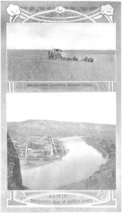
Asotin, the county seat, situated about seven miles south
of Clarkston, on the Snake river, has about 1,500 people within
its borders. It
Page 48
has a flour mill, warehouses, churches, schools, public library,
light and water systems, and is a prosperous, thriving town.
Clarkston, an important commercial center, is situated on
the flats of the Snake river, in the northeast part of the county.
Its population somewhat exceeds that of Asotin. It has all the
business institutions of a thriving town, is the main distributing
point for a large area, and is rapidly growing.
Cloverland, Craigie and Anatone are thriving
smaller towns.
Benton county is bounded north, east and south by the Columbia
river and west by Yakima and Klickitat counties. It has an area
of 1,600 square miles and a population of about 9,000 people.
The Yakima river traverses the center of the county in a very crooked
course, through the valley of which the Northern Pacific railroad
winds its way to the top of the Cascades. Both north and south of
the valley of the Yakima are extensive hill and plateau lands,
which are being rapidly utilized for general farming. The valley
lands are arid and useless without irrigating water.
Extensive irrigation projects are in successful operation and projected
to bring a very large portion of the valley lands into successful
use, for these lands, when irrigated, are of unsurpassed fertility.
Lands capable of irrigation have rapidly risen in value during the
past few years because of the immense yields of all crops under
irrigation.
The Northern Pacific railway through its center, the Portland &
Seattle around its southern and eastern border and the North Coast
coming into the Yakima valley from the northeast and the southeast,
together with the shipping on the Columbia river, give abundant
means of marketing its products, while several local electric roads
are projected to connect its towns and help to open up the newly
developed portions of the county.
General farming on the uplands, truck-gardening and fruit-raising
on the irrigated lower lands are the chief occupations. On account
of the great fertility of the volcanic soils and the early springs,
Benton county is able to supply the large towns with fruits and
vegetables some two weeks earlier than most other sections, giving
it quite an advantage in prices. The county is rapidly growing
in population and prosperity.
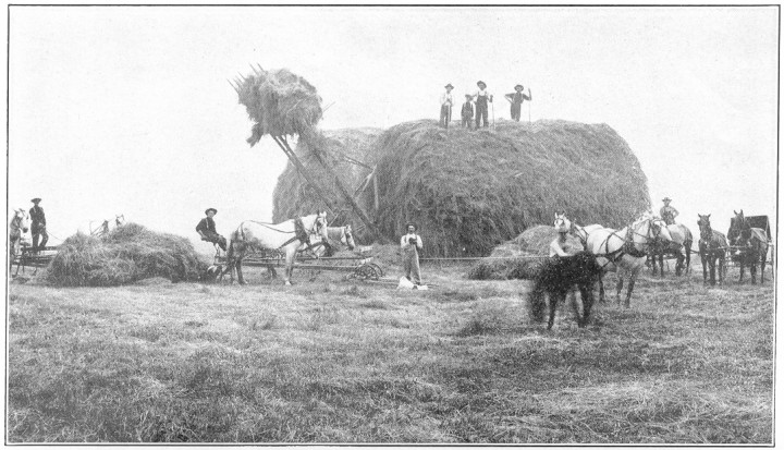
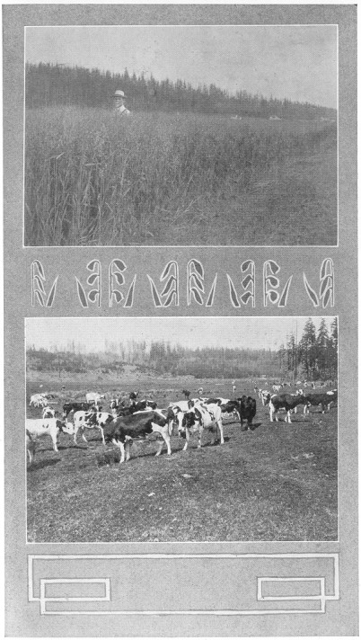
Plate No. 39.—Stacking Hay in Kittitas County.
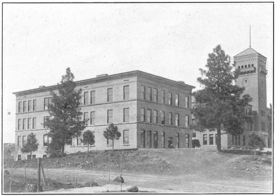
Plate No. 40.—New Training School, Ellensburg, Kittitas County.
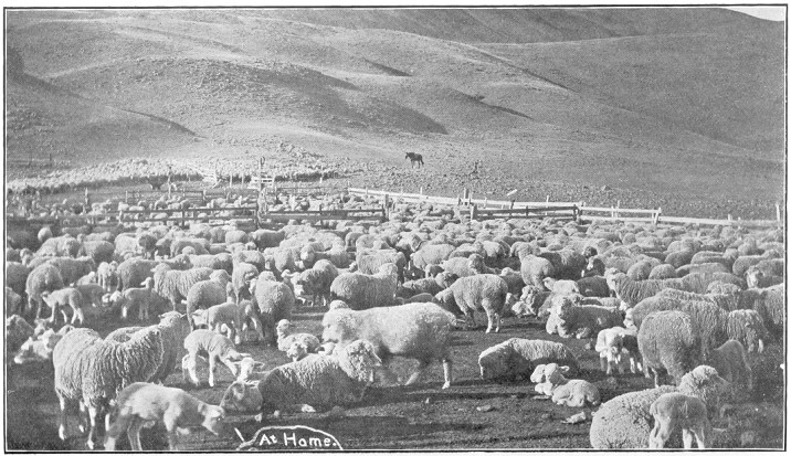
Plate No. 41.—Sheep-Raising in Klickitat County.
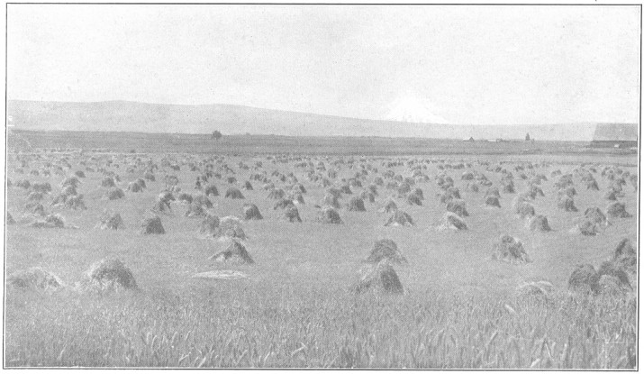
Plate No. 42.—Wheat-Raising in Klickitat County.
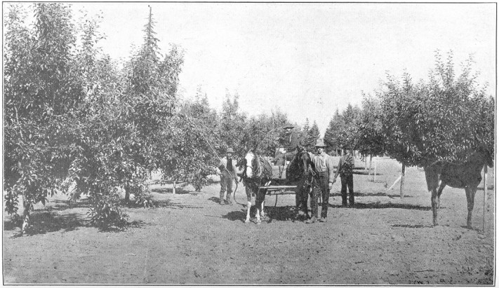
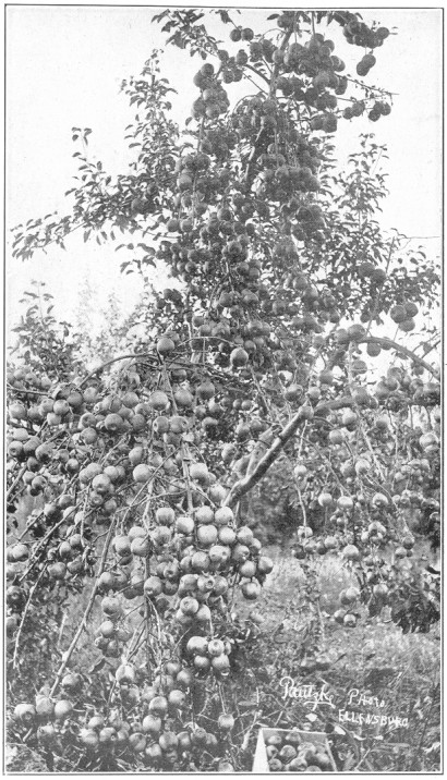
Plate No. 43.—Eighty-Acre Orchard in Klickitat County.
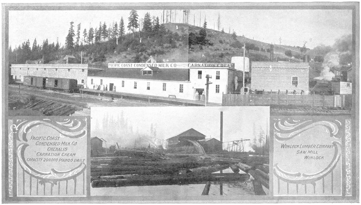
Plate No. 44.—Manufacturing Scenes, Chehalis, Lewis County.
Prosser, its chief town and county seat, is on the Yakima
river and Northern Pacific railway in the western central part
of the county, and has about 2,000 population. It is the chief
distributing center of the county. It has three weekly newspapers,
six churches, good water supply, banks, stores, warehouses, lumber
yards, etc.
Kennewick, at the easterly center of the county, on the
Northern Pacific and Portland & Seattle railroads and on the Columbia
river, is a town of much importance, having about 1,500 people. It is
noted for the remarkable earliness of its fruits and vegetables. It
has the usual business, church and school establishments, including
an ice and cold storage plant.
Kiona, on the Yakima river, midway between Prosser and Kennewick,
Carley and Peterson, in the southern portion of the
county, on the Columbia river, are all growing and prospering smaller
towns.
Chehalis county is central among the counties bordering on the
Pacific, the towns about Grays Harbor being its seaports. It has
an area of 2,600 square miles and a population of 35,000.
Its industries arise out of its vast timber belts, its fertile
low lands, and its fisheries. It is said to have 800,000 acres of
magnificent timber lands, the great bulk of it unmarketed. Logging
and the manufacture of wood products make up its chief occupation,
though general farming and fruit-raising is rapidly gaining. The
lands of the county when reclaimed from the forests are fertile
and respond generously to the labor of the husbandman. In 1906,
15,000 apple trees were planted in the county. The fishing industry,
including the canning of salmon, sardines, clams and oysters, is
a thriving industry and destined to develop into much larger
proportions.
Grays Harbor is open to the ocean, but is splendidly protected
and has safe anchorage. It is the largest lumber shipping port in
the state. The Humptulips and Chehalis rivers empty their waters
into the bay, and are both navigable for some distance.
In addition, the Northern Pacific railroad skirts both sides of
the bay and a logging railroad from Shelton, in Mason county, has
nearly reached the ocean, going through the county from east to
west. Other railroads have surveying parties in the field, and
a conflict is on to share the vast lumber-carrying trade of the
county with the Northern Pacific, which has till now monopolized
it.
Chehalis county is one of the most important counties in the state,
and offers an abundant opportunity for Yankee energy to exercise itself
Page 50
in almost every avenue of business. Its opportunities and resources
are numerous and vast. The newcomer may look long and find no better
place for his talents.
Montesano is the county seat, located at the head of navigation
on the Chehalis river, and on the Northern Pacific railway. It
has a population of about 3,500. It has sawmills, sash and door
factories, and is surrounded by a prosperous farming community,
dairying being very remunerative.
Aberdeen is the commercial metropolis of the county. Nearly
$15,000 is daily paid out to wage-earners. Much commerce from the
ocean is centering here, 736 vessels clearing from Grays Harbor in
1907. Seven hundred and seventy-seven thousand dollars has been
appropriated by congress for the improvement of the harbor. The
city has terminal rail rates, and the Northern Pacific and Chicago,
Milwaukee & St. Paul railroads are hustling after its trade. The
business portion of the city is built of stone, brick or cement.
It has eleven large sawmills, many shingle mills and various other
factories for utilizing the products of its timber, besides fish
and clam canneries and other factories. Its population, now about
15,000, is rapidly growing.
Hoquiam, Aberdeen's nearby neighbor, has a population crowding
11,000, and is a hustling manufacturing and commercial center, not
different in its general business from Aberdeen.
Elma, twelve miles east of Montesano, is a town of 2,700.
Cosmopolis, south of the river from Aberdeen, has about 1,200,
and is a sawmill town.
Oakville, Markham and Satsop are small growing
towns on the Northern Pacific railway. Many other embryo towns
will in time grow into prosperous business centers.
Chelan county is one of picturesque beauty and abundance of both
developed and undeveloped wealth. It faces the Columbia river eastward,
while its back rests against the peaks of the Cascades, 5,000 to
6,000 feet above the sea. Lake Chelan is the largest fresh water
body in the state, fifty miles long and one to four wide, and lies
400 feet higher than the Columbia river.
Chelan county has 2,000 square miles, much of it mountainous and
full of minerals. Its population is at present about 14,000.
Horticulture, agriculture, lumbering, stock-raising, mining and
dairying all flourish on the bountiful natural fitness of the county
for these occupations. The climate is attractive. It is a sunshiny
county.
Steamers ply up and down the Columbia river. The Great Northern
railway crosses the county through the valley of the Wenatchee
river and the Washington & Great Northern railway is projected along
the western boundary of the Columbia river.
All kinds of temperate zone fruits mature here in wonderful perfection
and abundance. The valleys run with water from the mountains to
irrigate the lands, and furnish vast power, much of it undeveloped.
Hills in the western part of the county are timbered and all the
vacant lands are grass covered. Over 1,000,000 fruit trees have
been planted in the last three years in the county.
The mountain foothills are full of mineral veins of copper, gold,
silver, lead and molybdonite. Some have been producing for twenty
years. Trout in the streams and game on the hills add to its
attractiveness.
Wenatchee is the county seat and largest town, having about
3,500 people. It is located on the Columbia river near where the
Great Northern railway crosses it. It is the chief distributing
center for the county and much other territory, chiefly north of
it.
Leavenworth, westward of Wenatchee, and also on the railroad,
has a population of 1,200 and is a division point.
Chelan, at the foot of Lake Chelan, has about 700 people.
Cashmere, on the railroad, is of about equal size.
Lakeside, Peshastin and Entiat are smaller
towns, all thriving and growing.
Clallam county occupies 2,000 square miles of the northwestern
part of the Olympic peninsula, having 35 miles of shore land on
the Pacific and 90 miles on the straits. The Olympic mountains
and foothills cover the southern half mostly, while the northern
half is made up of lower hills and valleys. Several large lakes
nestle among the mountains; one of them, Lake Crescent, is a famous
summer resort. Lake Crescent is known as the home of the celebrated
Beardslee trout. The eastern and southern parts have a rainfall
sometimes nearing 100 inches annually, while in the eastern northerly
part it is about 20 to 25 inches only.
An important section of the county is that known as Sequim Prairie
This is a level district of about 5,000 acres, located three miles
back from Port Williams. Most of it is under irrigation, and the
soil thus treated produces marvelous crops.
Lumber, fish, agricultural products and coal comprise its chief
resources. The timber of the county is very vast and very little
exploited. Its proximity to the ocean makes it very advantageous
for all fishing industries. Its valleys are noted for the fertility
of their soils, and many a farmer has grown wealthy from their
cultivation.
Facilities for getting about are limited to boats and wagons. A
splendid boat service is maintained with Seattle and other Sound
ports, and a system of public roads is now in process of construction
that will be unexcelled in the state. Several surveying parties
are now in the woods and it is believed that Grays Harbor and the
Straits of Juan de Fuca will be soon united with railroad iron
and Clallam county will come to its own.
Port Angeles, located about 60 miles from the ocean on the
Straits of Fuca, is the largest town and county seat. It has a
splendid harbor, with fine anchorage, furnishing a safe refuge for
ships when the storms rage outside.
Dungeness and Sequim, three miles from Port
Williams, are important farming centers, both noted for their
dairy products, and contribute largely to make Clallam the second
county in the state in the value of its dairy products.
Quillayute, Forks, Beaver, Blyn and
Gettysburg are other small settlements waiting for the railroads
to open up the country and render their natural resources available
for the good of the world.
Clarke county lies on the north shore of the Columbia river, opposite
Portland, Oregon. It has 600 square miles of territory. It was
one of the earliest settled parts of the state, and its timber
as yet uncut is large. It is extremely well watered. The Columbia
and Lewis rivers border it on three sides with navigable waters.
It has a mild climate, very fertile soil, and splendid markets
at its doors, abundant rainfall, and agriculture is successfully
carried on without irrigation.
The Northern Pacific railway connects its various towns with both
Portland and Seattle, and the North Bank and Oregon & Washington
railroad, paralleling the Northern Pacific, will add greatly to
the facility and cheapness of its transportation. From Vancouver
northeasterly a road is in operation nearly across the county,
headed for North Yakima and the East.
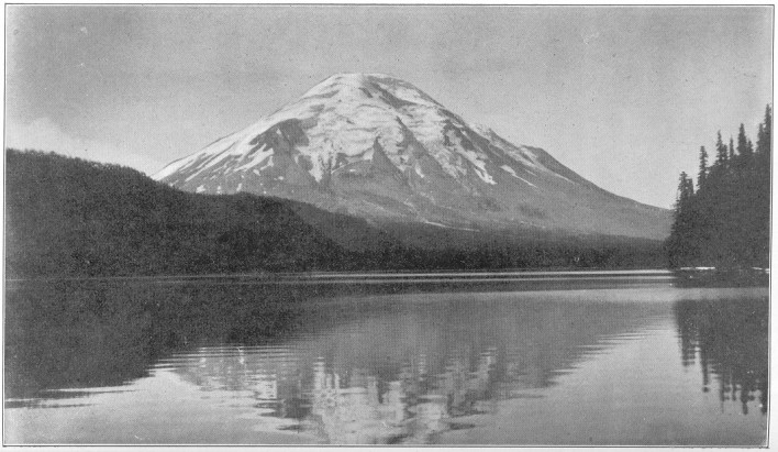
Plate No. 45.—Mt. St. Helens and Reflection in Spirit Lake, Lewis County.
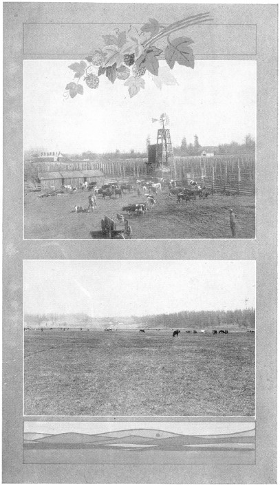
Plate No. 46.—LEWIS COUNTY SCENES. Dairy Farm and Hop Field. A
Valley Ranch.
Much of the southern part of the county is devoted to fruit-raising,
prunes being a very prominent factor in the county's output. General
agriculture, with dairying, are very profitable, and to these are
to be added fishing, lumbering and mining.
Vancouver has a population of about 8,000, and is rapidly
growing. It is the county seat, and is connected with Portland,
Oregon, by a trolley line. The Northern Pacific, Union Pacific,
Oregon Railroad & Navigation and North Bank railroads all compete
for its traffic. It is the central distributing point of the county,
and is the United States military headquarters for Washington, Oregon
and Alaska. It is well represented in business establishments,
including barrel factory, fruit cannery, ship yard, iron foundry,
shoe factory, and others.
La Center, Etna, Nacolt, Amboy and
Brush Prairie are smaller towns, all holding out an inviting
hand to the newcomer, and offering desirable opportunities for
new business in both merchandising and agriculture, as well as in
lumbering and its kindred industries. Clarke county is one well
worth investigating by intending settlers, both on account of its
latent possibilities and because of its peculiarly desirable climatic
conditions, and its abundant competing transportation facilities,
both by rail and water.
Columbia county is one of the four counties in southeastern Washington,
lying on the Oregon state line and south of the Snake river. A forest
reserve in the Blue mountains covers much of the southern portion of
the county, which is heavily timbered. The Northern part of the
county is made up of rolling prairie lands, of great fertility on
account of the large proportion of clay added to the volcanic ash,
which composes most of the soils of eastern Washington. Irrigation
is here unnecessary, and abundant crops reward the agriculturist.
The climate is mild, healthful and vigorous, inclining to much
outdoor life the year around.
Columbia county is essentially an agricultural county, but of late
years is branching out into fruit-raising and dairying with marked
success. Apples and pears predominate among the fruits, though
all others do well. Wheat is, however, still its great product,
and both the Northern Pacific and Oregon Railroad & Navigation
railroads are in operation through the northern part of the county
to carry away its rich grain harvests.
The citizens of Columbia county are among the most prosperous of
the state, its average of per capita wealth being exceeded by only
three other counties.
Dayton, the county seat, has a population of about 3,500
people, is situated about in the center of the county, and is the
chief town for the county's exports, as well as the distributor of
its merchandise. It is a substantially built city, with flour and
feed mills, and general mercantile establishments of importance. All
the public interests, including schools and churches, are generously
provided for. Its chief exports are grain, fruit, livestock and
wool.
Starbuck, in the northern part of the county, is a shipping
point of no mean importance on the Oregon Railroad & Navigation
railway.
Cowlitz county lies immediately north of Clarke county, bordering
about 40 miles on the Columbia river. It has about 1,100 square
miles of territory, and about 13,000 people. The southwestern portion
is largely composed of level valley lands, while its northeastern
part is occupied by the foothills of Mount St. Helens. The drainage
is all westerly and southerly into the Columbia river. Cowlitz river
is navigable as far as Castle Rock, and is an important factor in
the transportation problem.
Timber is the great source of industry at present, the county having
about two-thirds of its area heavily covered and unexploited. About
40 saw and shingle mills are engaged in disposing of its logs.
Agriculture follows close on the heels of the lumberman everywhere
in western Washington, and nowhere are better results in general
farming and dairying obtained than in Cowlitz county.
Cowlitz coal fields have not yet been largely utilized, but will
be extensively developed in time.
Aside from the river navigation, this county is well supplied with
transportation facilities by rail. The valley of the Cowlitz river
affords the natural highway for roads between the Columbia river
and Puget sound, and is already traversed by the Northern Pacific,
while the Union Pacific systems and the North Coast road are projected
over practically parallel lines through the county. From Kalama
all three systems extend south to Portland and Vancouver.
Kalama, on the bank of the Columbia river at the ferry crossing
of the Northern Pacific railway, is the chief town and county seat.
There are here extensive electric power plants and a gravity water
system. The chief industries grow out of the lumbering and fishing
interests. It has about 1,250 people, but is just now rapidly growing,
owing to its superb transportation facilities by both rail and
water.
Page 55
Kelso and Castle Rock are both important towns on
the railroads and Cowlitz river, each having about 1,500 people.
At Kelso, which is near the Columbia river, considerable fish are
caught and packed, yet the timber furnishes the chief industry.
Fruit and dairying and general agriculture provide a large part
of the support for the town merchants.
Ostrander, Carrolton, Catlin, Ariel
and Lexington are smaller towns, all prospering and being
built up into substantial business centers by the steadily increasing
development of the latent resources of the county.
This county offers many opportunities for business to the newcomer
in either merchandising, manufacturing or farming.
Douglas county occupies the big bend of the Columbia river, having
about 1,800 square miles of territory. Formerly there were 4,500
square miles. The last legislature carved the county in two, giving
Grant county the southeastern part, about 2,700 square miles of
territory, and leaving 1,800 to the northeastern part, with the old
name. The bend of the Columbia on the northeast and Grant county
on the southeast, compose its boundary. This division boundary
follows the northeastern bank of the Grand coulee, and following
its general direction meets the Columbia river where the Great
Northern railroad touches its valley, thus putting all of that
railroad in this new county, excepting only a few miles of the
railroad along the banks of the river in the southeastern corner
of Douglas county. Douglas county is essentially a high plateau,
some of it 1,500 feet above the main bank. Waterville is the county
seat, and considerable land along the valley of the Columbia is
being irrigated and proving to be of great value for fruit and
grain growing.
In the southeastern part of the county are some lands covered with
black basaltic rocks, but the great bulk of the lands are rich
in a volcanic ash soil, and produce large crops of grain without
irrigation. A wrong view of the county can easily be impressed
upon the traveler by rail; he will see so many of the basaltic
rocks from the car windows but once up out of the canyon which
the railroad follows, he will find himself in view of an expanse
of wheat fields so vast and rich as to astonish him.
As already indicated, this county is essentially a grain producer.
Wheat and oats are marketed in large quantities. Fruit-growing
and stock-raising are important adjuncts to the county's wealth.
It is comparatively new, and lands can be had at very reasonable
prices.
As now constituted, Douglas county will rely wholly upon the steamboat
crafts on the river to get its grain to market. Its trade, however,
Page 56
is too vast to be passed by, and already two lines of railroad,
the Washington & Great Northern and North Coast, are projecting
into the very center of its vast wheat fields. With these roads
completed as projected, Douglas county will have easy access to
both water and rail transportation, and renewed importance will
be given to its farming industries.
Waterville is its chief town and county seat. It is among
the wheat fields, in a broad plain, about seven miles east of the
Columbia river, to which it is connected by good roads for stages
and freight wagons. It has one of the U. S. general land offices. It
has good schools and churches, water and electric lighting systems,
both owned by the city. It has a population of about 1,200 people,
and is well supplied with business houses, flour and feed mills,
a brick yard, bank, etc.
Bridgeport, a town of some 400 people, is situated in the
northern part of the county on the Columbia river east of its junction
with the Okanogan river, and is an important wheat-shipping point,
having a regular steamboat service. A bank, flour mill, warehouses
and general stores are serving the community, but other industries
await the newcomer.
Douglas, Farmer, Jameson, Mansfield
and Hollister are growing agricultural centers.
Ferry county is about in the center of the northern part of eastern
Washington, stretching from the northern boundary of the state
to the Columbia river, which marks its southern and southwestern
boundary. The southern half of the county is within the Colville
Indian reservation, and is therefore wholly undeveloped. The lands,
however, have in fact been allotted and the remainder will be thrown
open for settlement in the near future.
Altogether it has an area of 2,200 square miles, and a population
of 5,000. It is principally composed of low mountains, well timbered,
with valleys furnishing fine grazing.
The climate of the county is such as prevails generally in northeastern
Washington—a couple of months of snow in winter, affording
plenty of sleighing, skating, etc. Summers are very pleasant, and
spring and fall delightful.
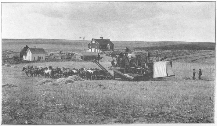
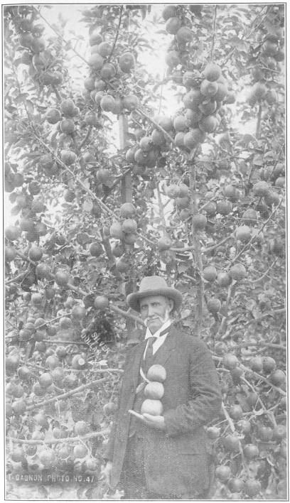
Plate No. 47.—A Ranch Scene in Lincoln County.
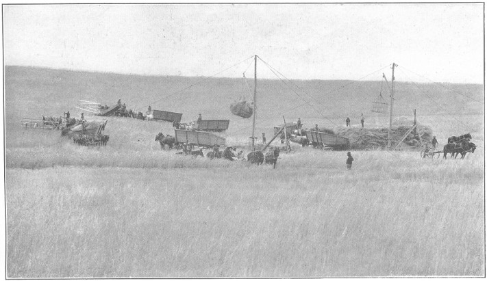
Plate No. 48.—Harvest Time in Lincoln County.
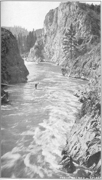
Plate No. 49.—View of Spokane River in Lincoln County, Showing
Possibility of Power Development.
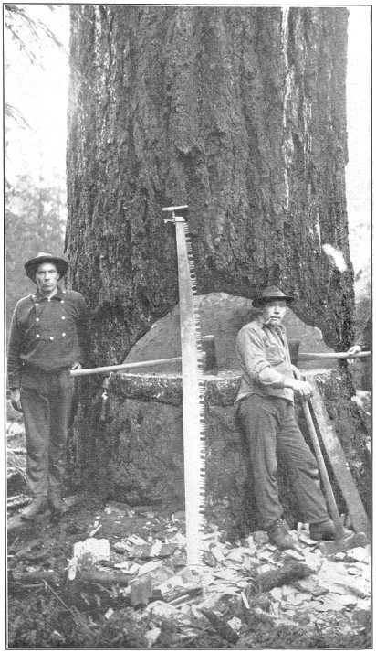
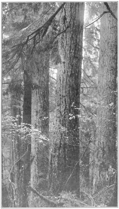
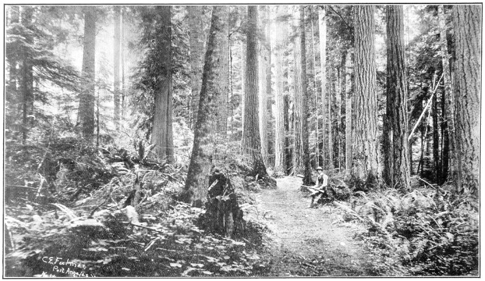
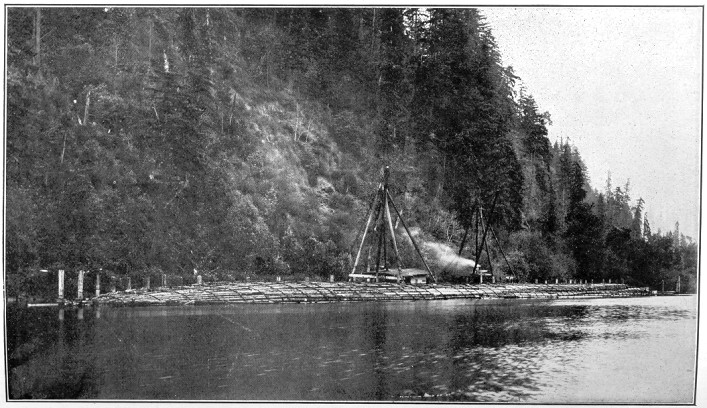
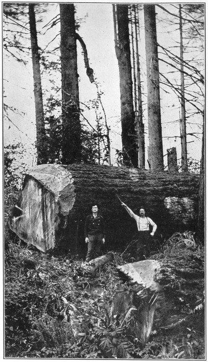
Plate No. 50.—Mason County Timber.
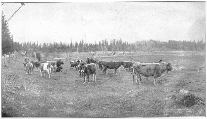
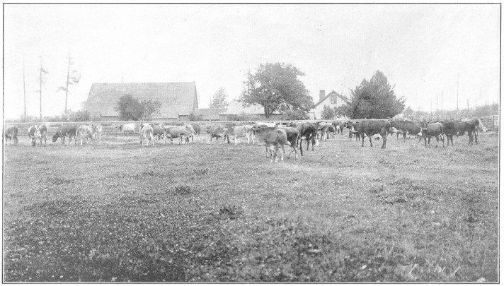
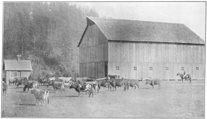
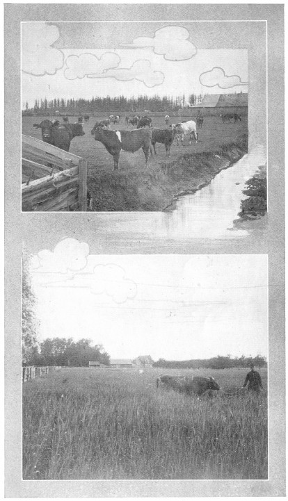
Plate No. 51.—Dairy Scene in Mason County.
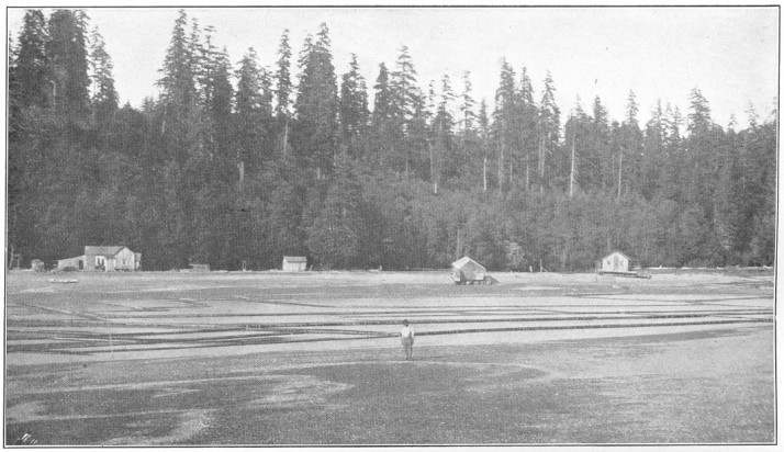
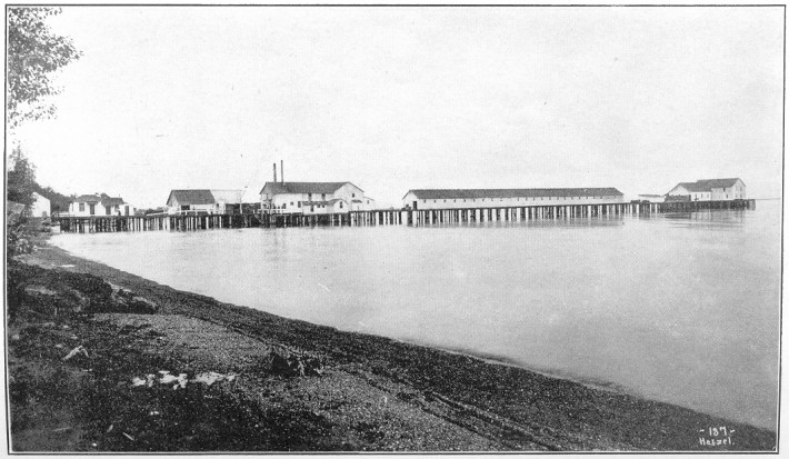
Plate No. 52.—Oyster Beds in Mason County.
The bulk of the resources of this county are yet dormant. The mountains
are full of minerals; timber is abundant; grassy hillsides are
tempting to the sheep and cattle, while the soil is rich, and when
tilled will be found to produce excellent crops. The county has
a fine future for wealth from all these sources, and, while the
mines are
Page 57
first to be made productive, without doubt the fruits and cereals
will come into their own in time and furnish much of its wealth.
Two railroads reach the center of the northern half of the county,
terminating at Republic, the county seat. These railroads have
pushed in here after the precious metals mined in the vicinity.
The Columbia river is navigable most of its course on the county
boundary, barring some obstructions which the national government
will remove and thus open up to river navigation to the ocean the
fruits of toil in Ferry county.
Republic, the county seat, is the only large town in the
county, and has a population of about 1,250 people.
It is the distributing point for supplies for the mines and ships
out much ore for the smelters.
Ferry county altogether offers exceptional opportunities for the
homeseeker in a variety of occupations, as already indicated.
Franklin county occupies the basin formed by the junction of the
Columbia and Snake rivers, being bounded east, south and west by
them. The southern portion of the county is scarcely 300 feet above
sea level, and the soil is fine and sandy. The northern part of
the county is somewhat higher and composed of successive benches
till they reach an altitude of 1,000 feet. It is only a few years
since these lands were all considered barren and useless. Yet in
1906 these bench lands in this county added 1,500,000 bushels of
wheat to the world's supply and in the following season nearly
doubled that output.
There are no forests, the land being covered with bunchgrass and
sagebrush.
Along the rivers some farmers have irrigated small parcels of land
by pumping water, but the bulk of the irrigable lands are awaiting
the action of the U. S. Reclamation Service, which it is thought
will ultimately be engaged in an extensive irrigation problem to
reclaim thousands of acres now arid and barren. The warm climate
of these low Bandy lands has already been proven to be immensely
advantageous to the gardener and fruit-grower, and the lands wonderfully
productive when the magic influence of plenty of water renders the
sources of plant life soluble.
The wheat crops now being produced come from the bench lands without
irrigation.
The Northern Pacific railway passes diagonally through the county
and crosses the Columbia river near Pasco. The Oregon Railroad &
Page 58
Navigation railway taps the wheat belt in the northern part of
the county and the North Coast is projected through it, while the
Portland & Seattle follows the north bank of the Snake river along
its southwestern boundary, thus giving the county four systems
of railroad, besides the Columbia river steamboats.
Pasco is the county seat, in the extreme southern portion of
the county, near the Columbia river, and is more noted as a railroad
center than as a shipping point, on account of the fact that the
surrounding lands are as yet unirrigated. It has a population of
about 1,800, and is just now enjoying new vigor and much building
in anticipation of its future usefulness as a commercial center
for distribution of both merchandise and agricultural products.
Connell, in the northern part of the county, is a shipping
point of importance, and has two railroad lines and a third one
coming. In addition to the cereals, many sheep and horses are being
raised and shipped out of the county from this vicinity.
Garfield county is the second from the southeast corner of the
state, and extends from the Snake river on the north to the state
boundary on the south. It has 627 square miles of territory and
a population of about 7,000.
The southern portion is included in the Wenaha forest reserve, and
is quite heavily timbered. The northern portion is an extremely
prolific farming region, made up of undulating lands with deep
rich soil, composed of clays and volcanic ash. No irrigation is
necessary, and very heavy crops of grain are annually matured.
As already intimated, the chief source of income for the county
comes from the tillage of the soil. Of the crops raised, barley is
in the lead, having furnished 1,800,000 bushels in 1907, which places
this county second of all counties in the state in the production of
this cereal. Wheat and oats are also largely produced. Stock-raising
in the southern ranges of the county is very profitable, and much
fruit is of late years being produced. Indeed, Garfield county is
well up to the front in the per capita wealth of its citizens.
Pomeroy is the county seat and chief distributing center
of the county. It is situated in the north central part of the
county, on the Pataha river and the Oregon Railroad & Navigation
railway. It has a population of nearly 2,000.
It is lighted with electricity, has a gravity water system, and all
the machinery for doing all the business naturally coming to a town
Page 59
of its size. It has a fine high school and graded schools, churches,
newspapers, banks, warehouses, big stocks of goods, fire department,
cet.
Grant county occupies about 2,700 square miles of what was formerly
Douglas county, comprising the lands southeast of the Grand and
Moses coulees, bordering on the southwest on the Columbia river,
with Adams and Lincoln counties on its eastern border.
Ephrata is the county seat, on the Great Northern railway. The
northern part of the county is traversed by the Great Northern
railroad, and has developed into a vast region of grain production
without irrigation, although originally supposed to be valueless
for cereal-raising.
The southern part is new and comparatively undeveloped, but is
crossed by the Chicago, Milwaukee & St. Paul railway, just now
giving this new county great impetus. The southern portion of the
county has long been a grazing ground for herds of cattle and horses,
but it is thought now it will be turned into a prosperous region
of small farms.
While the county is cut by several coulees, it is chiefly composed
of large areas of bench lands, comparatively level, barring a range
of hills in its southwestern corner called Saddle mountains. There
is considerable water in the county, Moses lake being quite a large
body of water with bordering swampy lands, about in the center,
and Wilson creek, in the northern and Crab creek, in the southern
part, furnishing considerable stock water.
The lands tributary to the Great Northern railway already produce
great quantities of grain and livestock, and these will continue
to be its staple crops until irrigation may come in and stimulate
fruit production, for which it is thought much of the lands will
be suitable.
Both the Great Northern and Northern Pacific railway systems are in
the grain fields of the northern part of the county. The Milwaukee
road crosses the southern part, the N. & S. is projected along its
western border, paralleling the Columbia river, which is navigable,
thus affording all the county, excepting the central portion, good
facilities for marketing its products. As the county develops,
beyond question branch lines will penetrate this portion, and Grant
county will become as well supplied as any other portion of the
state with facilities for commerce.
Ephrata, the county seat, is a small village on the Great
Northern railway about midway of the county and the center of a
large wheat-growing section. Its transformation into an important
town is rapidly
Page 60
going on, the new county government calling for a variety of new
occupations to center here.
Wilson Creek, near the eastern border of the county, is
a larger town whose chief industry is marketing grain. It is an
important distributing point, with prospects of larger growth.
Quincy is a station on the Great Northern and is also an
important wheat-shipping point.
Soap Lake, on a lake of the same name, is noted as a resort
for the rheumatic.
Bacon, Coulee City, and Hartline are stations
on the Northern Pacific railway in the northeastern part of the
county.
Grant county is new, but has large undeveloped resources, and is
awaiting the newcomer with abundant offerings for his energy and
labor.
Island county is entirely composed of a group of islands in Puget
sound, the largest two being Whidby and Camano. It has a land area
of 227 square miles and a population of about 5,000.
Lumber, agricultural products and fish make up the county's resources.
Considerable of the timber, particularly from Whidby island, has been
removed, and wheat, oats, hay, potatoes, fruits, poultry, butter,
eggs, etc., are now shipped out to the splendid nearby markets at
the chief seaport towns on Puget Sound.
The soils in the northern part of Whidby island are of remarkable
fertility, some of them producing as much as 100 bushels of wheat
per acre and immense crops of potatoes.
In season the waters of the county abound in salmon and other salt
water fish, and many of the citizens of the county find profitable
employment in connection with the fishing industry.
Coupeville is a town of some 400 people and the county seat,
situated on a beautiful bay in the northern part of Whidby island.
It is chief distributing point for the county, has a sawmill, shingle
mill, fruit-drying establishment, stores, churches, schools, a
newspaper, etc.
Oak Harbor, further north, is the center of a large farming
and logging district. Two canneries are in successful operation.
Utsalady, San de Fuca, Camano, Clinton,
and Langley are smaller villages gradually becoming summer
resorts for people from the large cities of the sound. Steamboats
furnish good transportation from all parts of the county.
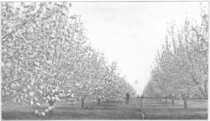
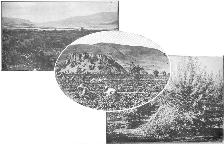
Plate No. 53.—An Okanogan County Orchard in Bloom.
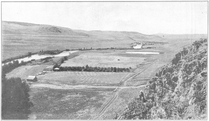
Plate No. 54.—A View of the Country Along the Okanogan River in
the Vicinity of the Okanogan Irrigation Project.
Jefferson county is the second county south of the entrance of
Puget sound, stretching from the Pacific ocean eastward over the
peaks of the Olympic mountains to Hood's canal, and turning north
gets a long waterfront also on Puget sound, and taps the Straits
of Fuca. It has a population of 11,000 people and 2,000 square
miles of territory.
The resources of this county are largely undeveloped, and yet it
is one of the oldest settled counties in the state. Originally its
entire area, barring a few small patches, was heavily timbered,
and it is estimated that the county still has twenty billion feet of
standing timber. Its soil is remarkably fertile, and the products
of its farms have long been famous.
The Olympic mountains contain veins of precious metals, iron and
manganese, none of which have as yet been thoroughly developed.
Fishing for salmon, sardines, shrimps, clams and crabs is a very
important industry.
The soils of the county are largely sedimentary, having been washed
down from the mountains for ages, assisted by the decomposition of
vegetable matter accumulated through centuries. In the valleys, where
most of the farming is being done, these soils produce remarkable
crops under the influence of the charming climate the county affords.
The rainfall in the eastern part of the county is moderate, but
ample for all purposes; the average rainfall is about 20 inches.
The temperature rarely exceeds 80 degrees in summer, while the
winter months average about 45 degrees.
Such soils and such climatic conditions combine to force wealth
upon every industrious tiller of the soil. Clover yields from four
to six tons per acre.
Oats and vetches for ensilage purposes yield five to seven tons
per acre. Fifty to seventy-five tons of cabbage or mangles per
acre are not uncommon, and onions and potatoes produce from six
to ten tons. The fruit trees, particularly cherries, apples, and
pears, produce wonderful crops. Cattle can graze ten months in the
year or more, and the products of the dairies of Jefferson county
cannot be excelled.
Because of the light rainfall and moderate weather, this county is
admirably suited to poultry-raising. Green food can be had twelve
months in the year. Runs can always be open, and with proper care
hens can be made to pay $3.00 per year each.
Port Townsend, at the entrance of Puget sound, is the county
seat and chief commercial center of the county. It has a population of
Page 62
about 6,000. It is the headquarters for many government institutions,
including the U. S. customs service, U. S. revenue cutter service,
marine hospital service, hydrographic service, quarantine service,
and U. S. artillery for the Puget sound district.
Three great forts; Worden, Flagler, and Casey, are located here,
forming the chief defense to Puget sound. Fort Worden joins the
city limits. The present garrison force is 2,000. The scenery from
the city is grand and beyond compare.
Its business interests are varied and extensive. Two canneries
for salmon and sardines are here located, boiler works, a machine
shop for building electric and gasoline engines, a shipyard, sash
and door factory, lumber mills, and shingle mills, a by-product
plant producing wood alcohol, turpentine, etc.
The city is substantially built and its homes are artistically created.
The harbor has twenty-five miles of waterfront and fine anchorage
of from nine to eighteen fathoms, and is an ideal refuge for all
seagoing craft.
The city has gas and electric lights, paid fire department, fine
churches, splendid schools, and a magnificent gravity water system
furnishes the town of Irondale, Hadlock and Forts Worden and Flagler,
having plenty of water to spare for thousands mote.
Irondale is practically a suburb of Port Townsend, having
the only pig iron plant in the state. It is an extensive and growing
concern, using bog iron from the vicinity and other ores from different
sources.
Port Ludlow, Duckabush, Bogachiel, Port
Discovery, Quilcene, and Chimacum are small villages
scattered about the county and are centers of agricultural activity.
King county is distinguished by having Seattle for its county seat.
The county is an empire in itself, stretching from the shores of
Puget sound to the peaks of the Cascade mountains, and containing
more than 2,000 square miles of territory. It also includes Vashon,
one of the large islands of the sound.
King county's sources of revenue are varied and extensive. Its
lumber industry, growing out of the vast forests within its borders
not only, but from the cutting of logs brought in from other sections
of the state, is immense.
Its agricultural lands are not surpassed in fertility by any, and
include not only the alluvial deposits in its river bottoms, but
great areas of shot clay and other soils splendidly adapted to
fruit culture.
Its mining industries include not only very great acreage of coal
measures, which have been producing coal for commercial purposes for
local and foreign trade for thirty years and are scarcely scratched
as yet, but also fissure veins of the precious metals—gold,
silver, lead,
Page 63
copper, antimony, arsenic, and also iron, asbestos, fire clays,
kaolin, granite, sandstones, lime ledges, and others.
Its fishing industries in its own waters and from the ocean give
employment to a large number of men and its fish are shipped even
as far east as Boston, Massachusetts.
Its power capacity, in addition to its wood and coal, includes
great falls and rapids and many large streams which are already
harnessed, but only in part, and driving vast quantities of machinery
in this and adjoining counties.
In commercial possibilities King county is unrivaled. Its combination
of lakes, rivers and salt water harbors have no superior on the
globe, and the fact of its supremacy is demonstrated by the tabulated
statistics of state officers, which show that King county possesses
one-fifth of the population of the state and has more than one-quarter
in value of taxable property of the state, and pays one-fourth of
taxes collected within the state borders.
In scenery, which is no mean asset of the county, it is also
unsurpassed. Vast ranges of mountains, sheets of fresh and salt
water, rivers, hills and plains, forests, and grassy fields combine
and interlace in a thousand directions to entrance and delight
the artistic eye.
In game, including bear, deer, mountain goats, cougar, grouse,
pheasants, quail, mountain trout, salmon and other fishes, make
many a paradise for the sportsman.
In addition to its salt waterways, with 75 miles of shore lands,
and its navigable fresh water lakes, there are centering in the
county coming in from all directions seven transcontinental lines of
railroads, making King county and its metropolis a great distributing
center for the commerce between the American continent and the
continents of Asia and the islands of the Pacific. Besides these
steam roads, electric trolley lines are making a network of
inter-communication between all parts of King county not only, but
reaching out into the adjoining counties.
Seattle is the county seat and great metropolis of King
county and the state, with a population crowding, if not exceeding,
275,000 people. It covers the hills and lowlands surrounding Elliot
bay, an indentation of Puget sound, and a part of the land between
the sound and Lake Washington, a freshwater lake of great beauty
paralleling the sound for 23 miles and from one to three miles
wide. It also includes two smaller lakes, whose sloping shores
are covered with the homes of its citizens. From its hills the
snow-capped mountains of the Cascade and Olympic ranges and Mount
Rainier's towering peak are visions of surpassing beauty. A constant
stream of coming and going water craft from all quarters of the
globe frequent its harbor. Its business buildings of brick, stone,
iron and concrete tower heavenward over four avenues, and many
cross streets and miles of its low lands are
Page 64
covered with railroad tracks, warehouses and manufacturing plants.
Its grammar schools, high schools, and State University are equipped
with magnificent buildings and grounds. Its streets and homes are
brilliantly lighted with electricity from its own power plants,
while the purest water, sufficient for a million people, flows
through its water mains, all owned and controlled by the city.
A multitude of factories are providing a small part of the merchandise
and composes the groundwork of her commerce.
The shores of Elliot bay are lined with wharves accommodating the
largest sea-going ships. Its last assessed valuation of property
was $203,168,680, and its tax to be raised $975,210.
More than 150 miles of street-car tracks are within her borders
and a nickel pays for a 15-mile ride.
Georgetown, in the southern part of Seattle, but not a part
of it as yet, has a population of about 5,000, and is an important
manufacturing center. Here are the car shops of Seattle Electric
Company, gas works, foundries, breweries, machine shops, brick
and tile works and many other industries.
Renton, Issaquah, Ravensdale, Black Diamond,
and New Castle are coal mining towns.
Kent, Auburn, Kirkland, Vashon, North
Bend, Tolt, Fall City, and Maple Valley
are agricultural towns of importance.
Kitsap county is nearly surrounded by the waters of Puget sound
and Hood's canal, forming the larger part of the great peninsula
which these waters would make an island were a six-mile ridge in
Mason county opened up to them. It has extensive and numerous bays
and inlets, with magnificent anchorage, and contains in its center
the great Port Orchard navy yard, destined to become one of the
largest seats in the United States for Uncle Sam's naval activities.
The chief resource of the county is in the lumber. Some of the largest
mills of the state are located within its borders.
It is estimated that there are yet 200,000 acres of uncut timber in
its borders, and its mills are turning out 600,000 feet of lumber
daily, besides vast quantities of shingles.
The fishing industry now includes oyster culture, which is rapidly
becoming very important. About the county are located many villages
supported by the tillage of the soil from its reclaimed forest
lands.
Kitsap county has no railroads, but its waterways are so vast and
intricate that all its corners are reached by steamers, and travel
is cheap and freight conveniently handled in all parts of the county.
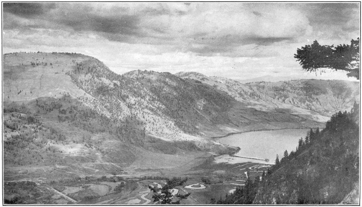
Plate No. 55.—An Okanogan County Valley, Palmer Lake.
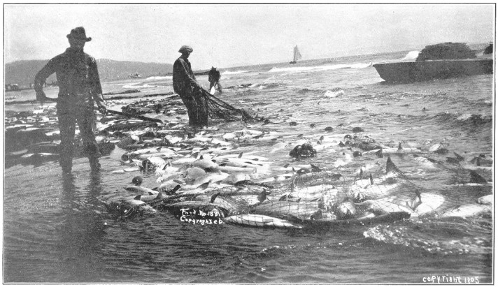
Plate No. 56.—McGowan Seining Grounds, Sand Island, Pacific County.
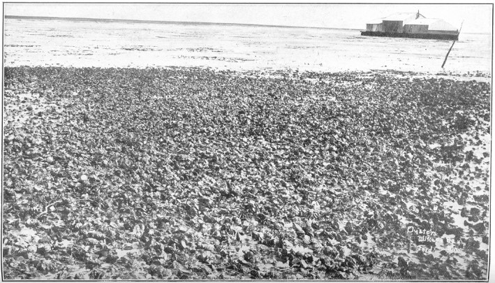
Plate No. 57.—Oyster Culture in Willapa Harbor, Pacific County.
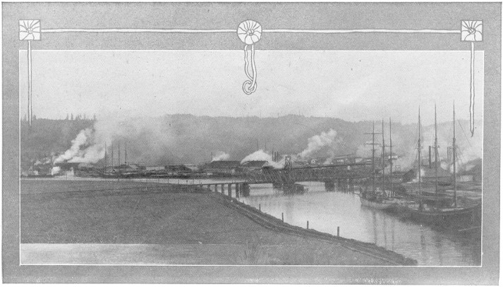
Plate No. 58.—View of the Waterfront at Raymond, Pacific County.
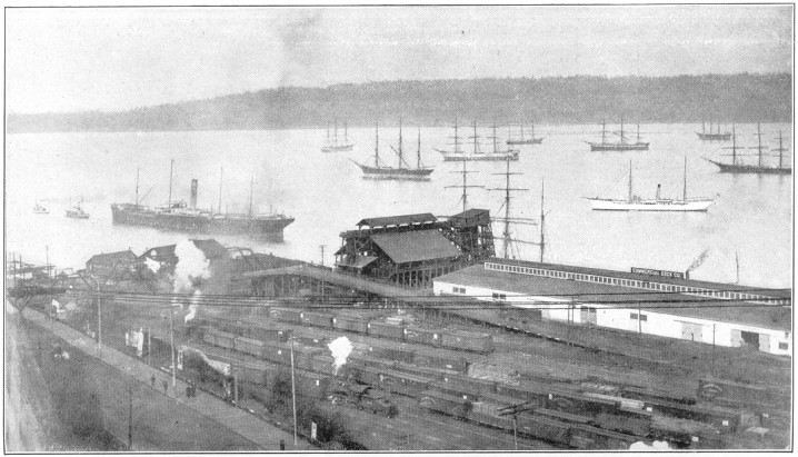
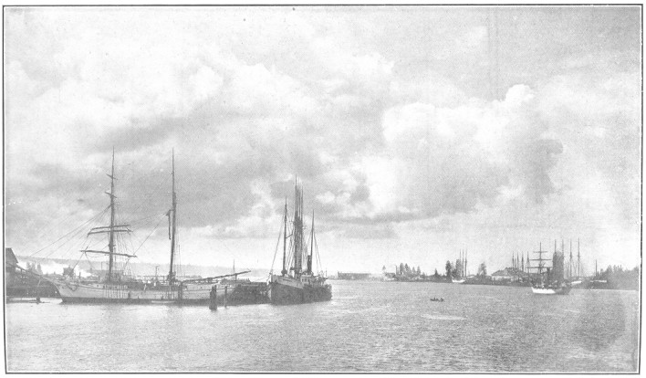
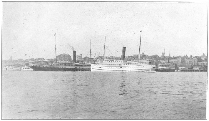
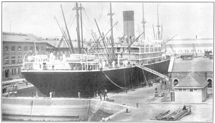
Plate No. 59.—A View of a Portion of Tacoma's Harbor, Showing
Ships Waiting to Load Lumber and Wheat for Foreign Ports.
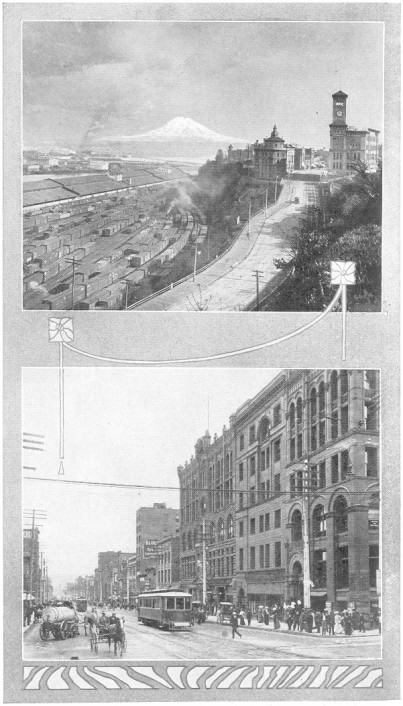
Plate No. 60.—Railroad Yards and a Corner of the Business Section,
Tacoma.
Port Orchard, the county seat, is on the bay of the same
name and opposite the navy yard. It is the chief distributing point
for a larger part of the cultivated lands of the county, and exports
not only agricultural products, but also shingles. The surrounding
lands are well suited for dairying, fruit-growing and poultry-raising,
which is also true of the entire county.
Bremerton, adjoining the navy yard, is the largest town in
the county, having about 4,000 people and rapidly growing. It has
a fire department, electric light and water systems, newspapers,
banks, about 1,000 or more wage-earners and is a hustling town.
Charleston is another smaller town adjoining the navy yard
on the west and rapidly growing.
Port Blakeley is an important milling and shipbuilding town
of nearly 2,000 people, opposite Seattle. Its lumber goes to all
parts of the world.
Port Gamble is a sawmill town of importance contributing
to swell the large output of lumber shipped out of the county.
Chico, Tracyton, Keyport, Paulsbo,
Seabeck, Crystal Springs, Colby, Bangor,
Burley, Port Madison, and Olalla are all small
villages, making progress as agricultural centers and as furnishing
summer homes for business men.
Kittitas county is located about in the center of the state, and
takes in the upper reaches and most of the watershed of the Yakima
river. It has a population of about 20,000 in an area of 2,400
square miles. On its northwestern side it is bordered by two ranges
of the Cascade mountains, while its southwestern side lies on the
Columbia river.
Among the sources of the Yakima river are three large lakes, Keechelus,
Kachess and Cle-Elum, most beautiful bodies of mountain water and
the sources of the great irrigation systems now fathered by the
national government and making the Yakima valley a veritable garden
pot of orchards and vegetables, grasses and flowers.
The central portion of the county is a valley comprising 250,000
acres, about one-fourth of which is under irrigation, and has long
been noted for its prolific crops of hay and many herds of dairy
cows.
The foothills of the mountains have precious metals, coal and iron.
The streams abound in trout and much game is in the mountains.
The Northern Pacific and Chicago, Milwaukee & St. Paul railroads,
coming into the county from the south and west, cross at Ellensburg
Page 66
and then follow the valley of the Yakima to the crest of the Cascades
giving abundant facilities for making markets east and west to all
parts of the country.
Ellensburg, the county seat, is situated on a level bench
in the Yakima valley and on the railroads. It is a town of upwards
of 5,500 people, and is substantially built, chiefly of brick.
There are creameries, flourmills, sawmills, and warehouses, banks,
breweries newspapers, electric lights, and gravity water system,
churches, schools, among which is one of the state normal schools.
It is also a division point on the Northern Pacific railway, and
is the chief distributing point in the county for farm products
and merchandise.
Roslyn is the chief coal-mining town, situated on the railroad
well up in the foothills of the mountains. It has about 4,500 people.
It has gravity water and electric lights, and is a substantial,
thriving and growing town. From the coal mines in the vicinity the
best coals of the state are mined in large quantities and shipped
all over the state.
Cle-Elum is another coal mining town, on the Northern Pacific
railway, with a population of about 2,500. Tributary to Cle-Elum
is a wide mining territory, for which it is the chief distributing
point.
Thorpe is a smaller village likely to develop into an important
trading point.
Klickitat county is central among the southern tier of counties
of the state, bordering 80 miles on the Columbia river, with an
average width of 20 miles. It has a population of about 14,000
and an area of 1,800 square miles.
There is a great variety in its climate, the elevation varying from
100 to 3,500 feet above the sea level.
The soil is chiefly volcanic ash, disintegrated basalt and alluvium.
It is deep and much of it sub-irrigated. The principal crops are
wheat, barley, rye, oats, and corn.
The wheat lands yield from 15 to 40 bushels per acre.
Among the fruits raised are apples, peaches, pears, cherries, English
walnuts, almonds, plums, prunes, grapes, apricots, and all the
small fruits.
Wheat lands vary in price from $10 to $50 per acre. It is estimated
that 7,000 acres will be planted to fruit and nut trees this current
year, while last year 75,385 apple trees, 14,675 peach trees, and
17,345 grape vines were planted.
As already indicated, the strength of the county is in its soil and
agriculture is its great source of wealth. Stock-raising is a chief
industry, the slopes of the mountains on its northern boundary furnishing
Page 67
abundant pasturage. The southeastern part is fast developing into
a fruit-growing region, while agriculture and grain-growing is
more general in the central and southern portion.
The Columbia river, with a railroad on each side of it and numerous
ferries, makes ample provision for transportation, while the Goldendale
branch reaches well up into the center of the county.
Goldendale, the county seat and metropolis, is located in
the center of the county, 120 miles east of Portland. It is the
terminus of the Goldendale branch of the Spokane, Portland & Seattle
railway, making connection with the main line at Lyle. It is located
in the heart of a splendid agricultural section and at the edge
of the great timber belt.
White Salmon, located in the splendid fruit section, is
a thriving town. It is an important railroad point on the North
Bank and is the outlet for the products of an extensive fruit,
timber and dairying region.
Cliffs, the division point of the Spokane, Portland & Seattle
railway, is the trading center of many square miles of territory.
The best nut land in the county is located near here.
Bickleton, the trading point of an extensive wheat section,
is in the eastern part of the county. An electric road has been
surveyed, which will, when completed, give this town railway connection.
Lyle, Roosevelt, Columbus, Bingen, and
Centerville are growing trading points.
Lewis county is one of the largest counties in western Washington,
having an area of 2,593 square miles of territory and about 40,000
people. It occupies a large part of the drainage basins of two large
rivers, the Cowlitz and Chehalis—one emptying its waters into
the Columbia river and the other into Grays harbor. It reaches
from the peaks of the Cascades 100 miles toward the ocean, but
is cut off 30 miles from the coast, and is about 30 miles wide.
Mount Rainier is just north of its extreme eastern portion and
about one-fourth of the county is within the Rainier forest reserve.
At present the chief industry of the county consists of manufacturing
its forests into the various forms of lumber and its products, the
lumber cut aggregating four hundred million feet and two hundred
million shingles.
Next in importance probably are the precious metal and coal deposits
of the county, which have, however, been but little developed.
The coal measures include bituminous, lignite and anthracite, and
are of great extent in the foothills of the eastern part of the
county. Two systems of railroads have been projected into these
fields, and the nearest, carrying lignite and bituminous coals,
are being commercially developed.
Page 68
Agriculture, including especially dairying and fruit culture, takes
the place of the forests as they are removed and bids fair to reach
in importance, in time, the lumber and coal resources. To this
end, the soil fertility, the mild climate and cool mountain waters
conspire.
Lewis county is in the path of all railroads coming in from the
south or through the Columbia gap in the Cascades. Already the
Northern Pacific railway and the Union Pacific railway cross the
county, and the North Coast contemplates traversing the entire
Cowlitz valley, while the Tacoma Eastern is already into the
northwestern part of the county on its way toward the same goal.
The county cannot be too well supplied, for its vast treasures
when developed will furnish immense products for transportation.
Chehalis and Centralia are the two twin cities of
the county—less than five miles apart and of about equal
importance. From Chehalis the Northern Pacific railway branches
off, following the upper reaches of Chehalis river and ending on
Willapa bay, while from Centralia the same road branches, following
the lower Chehalis river, to Grays harbor.
Chehalis is the county seat, with a population of 5,000
and rapidly growing, and has electric lights, sanitary sewerage
system, paved streets, fine business blocks, and a large and growing
trade. Near the city is located the State Training School.
Centralia has a population of about 7,000 people, chiefly
engaged in running sawmills, shingle mills, sash and door factories,
and other woodworking plants. It has a large city hall, ten churches,
fine schools, banks, business houses, water systems, fire department,
and is a hustling, thriving town.
Winlock is a town of 1,200 people on the railroad in the
southern part of the county, and a distributing point of much
importance.
Pe Ell is a town of 1,000 people on the South Bend branch
of the Northern Pacific railway, chiefly engaged in milling and
agricultural pursuits.
McCormick, Littell, Kosmos, Little Falls,
Adna, Dryad, Doty, and Kopiah, are all
centers of industry in various parts of the county.
Lewis county as a whole offers wonderful opportunities for newcomers
in all pursuits—commercial, agricultural, and mining.
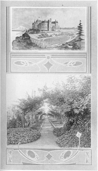
Plate No. 61.—Tacoma High School and Stadium. Rose Arbor in Point
Defiance Park, Tacoma.
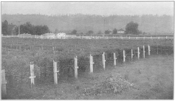
Plate No. 62.—A Red Raspberry Field in the Puyallup Valley,
Pierce County.
Lincoln county, adjoining Spokane county on the west, is one of
eastern Washington's great granaries. Its northern boundary is
defined by the Columbia and Spokane rivers. The bulk of its lands
are rolling prairies of great fertility. It has about 2,300 square
miles of territory and about 25,000 people.
The bulk of the county consists of the rolling prairie land
characteristic of the great wheat belt of the state. There are
some mineral lands in the northern part of the county and here
and there will be found considerable stretches of timber. In its
northern portion the county is well watered by the Columbia and
Spokane rivers, while in the southwestern section and elsewhere
numerous small creeks and lakes occur.
The great resource of Lincoln county is its wheat fields, which
in 1907 produced to exceed 8,000,000 bushels. Other cereals and
hay are important crops. Along its northern part, particularly
on the bottom lands of the rivers, much fruit is grown, including
peaches and all the small fruits. Diversified farming is growing
in favor among the farmers. Compared with other counties of the
state, Lincoln county ranks as follows in the number of its stock:
Horses, second place; hogs, second place; cattle, sixth place.
The county also stands fourth in the number of its school houses
and spends annually $100,000 for school support.
In wealth per capita, Lincoln county leads the state, showing for
assessment purposes an average holding of real estate of $1,163
and $226 in personalty.
The county is traversed from west to east its entire length by the
Great Northern and the central Washington branch of the Northern
Pacific railroads, some distance from its side lines, so that very
little of the county is more than 12 miles from a railroad shipping
point. There are 170 miles of railroad tracks in the county.
Davenport, the county seat and largest town in the county,
is situated on the central Washington branch of the Northern Pacific
railway near the middle eastern portion of the county, and has a
population of about 2,800 people. Its business blocks are chiefly
built of brick. It owns its own water system, is lighted with
electricity, has fine school buildings and churches. Its court
house cost about $80,000. It is surrounded by splendid farms and
annually ships out about 1,250,000 bushels of wheat.
Page 70
Wilbur, a town of 1,500 people, on the Northern Pacific
railway, is a very important shipping and distributing center.
It has large flour mills, warehouses, five churches, and schools,
electric lights, and water system, bank, newspaper, parks, and
important commercial institutions.
Almira, in the western part of the county, on the Northern
Pacific railway, is another prosperous and growing grain center
with about 600 people.
Harrington, on the Great Northern railway, is a town of
some 1,200 people. It has a beautiful location, commands the trade
of a large farming county, ships grain and livestock, and is a
prosperous and growing town.
Creston, Egypt, and Bluestem are smaller growing
commercial centers.
Mason county lies on the upper reaches of Puget sound, having the
Olympic mountains at its north, where about one-fourth of the county
is in the Olympic forest reserve. Its total area is about 900 square
miles, and it has a population of about 6,000. Hood's canal penetrates
well into the center of the county in its great bend, giving it a
very long salt-water shore line. From the Olympic mountains numerous
streams flow into the Puget sound, while others empty their waters
into Gray's harbor.
The county is a great forest of splendid timber, which has been
only to a limited degree cut out. The soil of the foothills and
valleys Is composed chiefly of shot clays and alluvial deposits,
making good farming, stock-raising and fruit-growing lands.
Logging and its allied industries constitute the main industries
of the county, Much of the logs are shipped out of the county to
feed sawmills in other parts of the Sound.
Raising and marketing oysters is an important source of wealth to
the county.
There is already considerable acreage for farming and stock-raising,
stock finding pasturage the year round. This industry will grow
as the land is cleared.
The county affords splendid hunting and fishing in season.
The county is so cut into by the inlets and bays of the sound that
it has splendid transportation facilities by steamer to all the
sound ports. The Northern Pacific railway reaches its southern
boundary. No other railroads traverse the county but its logging
railroads, which can give only a limited service.
Shelton is the county seat, situated on an arm of the sound
at the terminus of the logging railroad, and has about 1,200
inhabitants. Steamers from its wharves reach all the parts of the
sound directly or by connection with others.
The logging industry, manufacturing lumber, cultivating oysters,
fishing and farming are the chief industries of its people. It has
four churches, good schools, a newspaper, good stocks of goods,
volunteer fire department, electric lights, gravity water system.
The logging industry, which centers here, employs 2,000 men and
pays out $120,000 a month.
Lake Cushman is a summer resort in the mountains famous for
its big trout catches.
Allyn, on an arm of the sound, is central to much oyster
lands, logging camps and fruit orchards.
Arcadia, also on the sound, is central to considerable
stock-raising and lumbering.
Detroit is a prosperous village, proud of the grapes grown
on some of its logged-off lands.
Matlock is a town on the logging railroad and central to
large logging operations.
Okanogan, the largest county in the state, lies on the northern
boundary just east of the Cascade peaks. It has an area of 4,500
square miles and a population estimated at 13,000.
About one-fourth of the county, a district of great latent resources,
is still within the Colville Indian reservation, but is soon to
be thrown open to settlement.
This county is endowed with great natural resources and a delightful
climate, and is destined to become thickly populated.
The mountains and their foothills have large and numerous veins
of metals and are covered also with extensive forests. The rolling
hills of the south and center are rich in agricultural possibilities,
suitable for stock, and great crops of cereals and fruits. The
Okanogan river and its branches drain the greater portion of the
county, rising in British Columbia and flowing south through the
center of the county and joining the Columbia river on the south
boundary. The Methow river drains a large portion of the western
part and makes a paradise for the frontiersman along its sloping
sides.
Until now the rivers and wagon roads are the only paths of commerce.
But into this blossoming empire the railroads are looking with
longing eyes. The Great Northern, however, has already tapped the
Page 72
northern boundary and projected a line down the Okanogan and Columbia
rivers to Wenatchee. Other railroads will follow, as the prize is
too great not to be divided.
Conconully, the county seat, is situated among the foothills
and mines west of the Okanogan river. In addition to the mining
industry, the raising of sheep and cattle is followed by the citizens.
The town has a population of about 500 people.
Oroville is the chief town on the railroad, near the northern
border, and is the terminus of the road. It has about 500 people
and is growing. It is an important ore-shipping point, surrounded
also by good fruit-raising and agricultural lands, yet unirrigated.
Brewster, at the junction of the Columbia and Okanogan rivers,
has a population of about 200, and is an important grain and
fruit-shipping point.
Okanogan is on the river of the same name, about midway
between Brewster and Conconully, and to this point the steamers
ply in the higher waters of the river.
Twisp is a growing village in the Methow valley, devoted
chiefly to fruit-growing and mining. It is an important distributing
center.
Pateros has steamer connection with Wenatchee, and is an
importing, growing center.
Beck, Bonaparte, Anglin and Bodie are
other new and growing commercial centers.
Chesaw, in the northern part, and Nespelim, in the
southeastern part, are important locations.
Pacific county is the extreme southern county, which borders on the
ocean at the mouth of the Columbia river. Although a small county
with only 900 square miles, it has about 100 miles of salt-water
frontage. Willapa harbor, at the northwest, is capable of being
made accessible to all ocean ships, while Shoalwater bay, a body
of water 20 miles long and separated from the ocean by a long slim
peninsula, furnishes probably the best breeding ground In the state
for oyster culture. The county at large is an immense forest, in
the center of which is a range of hills dividing the watershed so
that some of the streams flow into the Columbia river at the south,
some west into Willapa harbor, and others, through the Chehalis
river, reach Grays harbor.
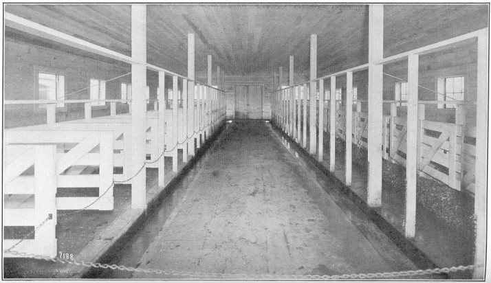
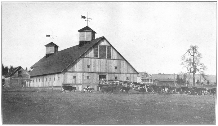
Plate No. 63.—Modern Sanitary Dairy Barn, on Farm of Hon. W. H.
Paulhamus, Sumner, Pierce County.
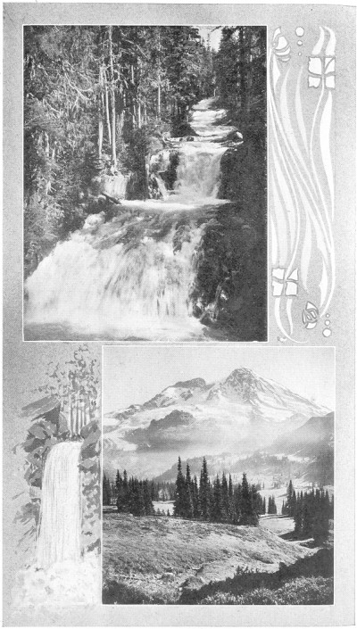
Plate No. 64.—Views in Rainier National Park, Reached by Railroad
and Driveway from Tacoma.
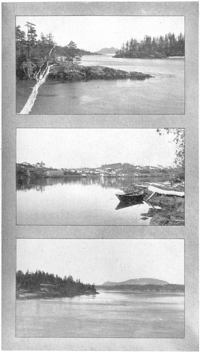
Plate No. 65.—San Juan County Views.
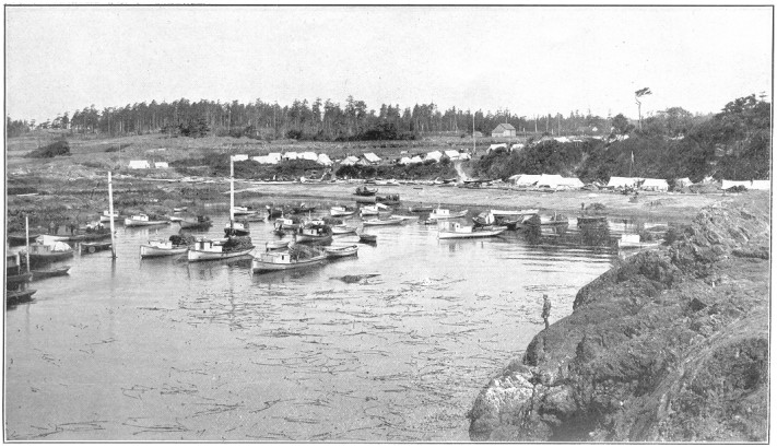
Plate No. 66.—Purse Seiners' Camp at Eagle Gorge, San Juan County.
As already indicated, its timber and its fisheries are the great
sources of wealth for the county, although stock-raising, dairying,
fruit-growing and general farming are constantly growing in importance.
Page 73
The county probably has eleven billion feet of standing timber,
and daily cuts with its 64 sawmills about 775,000 feet of lumber
and one million shingles.
Both native and cultivated oysters are largely marketed, as are
also clams, crabs, shrimp and fish. A splendid market for all farm
products is afforded by the mills and lumber camps and summer campers
on the beach.
The Northern Pacific railway reaches Willapa harbor, cutting the
county centrally east and west. On the long ocean beach from the
mouth of the Columbia river northward is a railroad about 20 miles
long, made profitable by the extensive patronage of the summer
campers. Added to these are the water crafts which frequent the
harbor and the Columbia river, and altogether make access to all
parts of the county easy.
South Bend, the county seat, situated near the mouth of
the Willapa river, is a rapidly growing town of 3,000 people and
destined to become an important ocean port. The harbor is capacious,
well protected, has fine anchorage, and is handicapped only by a
few feet of mud at the bottom, which Uncle Sam will soon remove.
At low tide there is now from 20 to 30 feet of water in the channel
of the river and at South Bend it is 1,000 feet wide. South Bend
is the terminus of the Northern Pacific railway. It has electric
lights, water works, good schools, fine churches, bank, sawmills,
planing-mills, sash and door factories, fish canneries, newspapers,
etc., and is about to build a $50,000 courthouse.
Raymond, a new manufacturing town on the harbor and railroad,
a few miles from South Bend, has 2,500 people and is rapidly growing
in importance. Raymond is not yet five years old; has a monthly
payroll of $100,000; sawmills and factories representing an invested
capital of $4,900,000, employing 1,200 men; an electric light plant;
a city telephone system, owned by local capital; a salt-water fire
protection system; is about to build two bridges, costing $30,000
each, and is adding new manufacturing plants at the rate of one a
month. The city gives free factory sites, and has both rail and
ocean transportation from factory locations to the markets of the
world.
Ilwaco is a fishing post of importance near the southwest
shore of the county, with 900 population.
Chinook, Frankfort and Knabton are other fishing
points on the Columbia river of importance. Nahcotta is an
ocean summer resort.
Pierce county, though not the largest, is one of the most important
counties in the state. Its area of 1,800 square miles occupies
much of the upper reaches of Puget sound on both sides and extends
southeasterly, taking in the Rainier National Park of 2,225,000
acres, and Mount Rainier (Tacoma) 14,526 feet above sea level and
less than 60 miles from salt water, covered with eternal snow, an
endless scene of majestic grandeur, giving the county a greater
variety of elevations and more beautiful and startling scenery than
any other county in the United States. Its northeastern boundary
is the White river, its southwestern boundary the Nisqually river.
It has about 125 miles of salt-water shore lands, with innumerable
bays and inlets and several important islands. Originally one vast
forest, much of it now is covered with fruitful fields of grain,
grass and orchards.
Its climate is mild and salubrious, its soils of great variety
and fertility, and its mountains and foothills full of coal and
precious metals.
The resources of Pierce county are varied and of great value. Its
central part is one great coal field, covered with forests, producing
annually about 1,000,000 tons of coal. Gold, silver and copper are
among its precious metals, but not extensively mined as yet.
Its rivers possess almost immeasurable water power. One plant on
the Puyallup river at Electron has an ultimate capacity of 40,000
horse-power, 20,000 horse-power of which is now in use. The city of
Tacoma is engaged in the construction of a plant on the Nisqually
for municipal use, the capacity of which will be 20,000 horse-power.
The 12,000 horse-power plant at Snoqualmie Falls also furnishes
current for city lighting, street railway and manufacturing purposes
in Tacoma.
All the cereals are successfully raised; dairying is one of the
most important industries; fruit-growing, particularly in small
fruits, such as strawberries, raspberries, blackberries, cherries,
etc., is very profitable and is engaging a great deal of attention.
Fish are caught in quantities and shipped to eastern markets, but
Pierce county's greatest natural wealth is in its vast forests.
An idea of the value can be had when it is said that $6,000,000
worth of lumber was cut in 1908 in Tacoma alone. In addition to
these great natural resources, Pierce county's commercial industries
are so great as to place it in the front rank of counties of the
Northwest. The great sawmills, woodworking plants and factories of
various kinds in the city of Tacoma alone employ 11,800 people, and
the value of their output last year amounted to over $43,000,000.00.
Pierce county is fast becoming a network of transcontinental railroads
centering in Tacoma, which, coupled with the steamboat traffic on the
Sound, gives the county splendid traffic facilities. Pierce county
Page 75
for years was a non-competitive railroad point, the Northern Pacific
being the only road to enter its vast fields of wealth. Within the
last two years, however, the Chicago, Milwaukee & St. Paul, the Union
Pacific system, and the Great Northern, realizing the wealth of the
county and the importance of Tacoma as a manufacturing center, the
value of her perfect harbor for shipping, the vastness of her great
stretch of level tidelands for factory sites and terminal yards, and
the low cost at which freight can be transferred from the rails to
the sails or vice versa, have entered the field and are now
spending $11,000,000 on construction and terminal work in the city
of Tacoma. The addition of these new roads means a wonderful impetus
to the trade of Tacoma. The Tacoma Eastern railroad, a beautiful
scenic route, beginning at Tacoma, runs in a southeasterly direction
through a wonderfully fertile country and vast forests of splendid
timber, to Rainier National Park and Mount Rainier (Mt. Tacoma).
Several trolley lines are in operation, reaching all the near-by
towns and connecting Tacoma and Seattle.
In addition to these lines, many steamboats and crafts of all kinds,
plying the waters of Puget Sound and the Pacific ocean, find abundant
wharfage and anchorage in the harbor of Tacoma. The products of
the world in large quantities pass through Tacoma in process of
distribution. A constant stream of small crafts, running about
the waters of the county, accommodate the local traffic.
Tacoma, with a population of about 125,000, is the county
seat of Pierce county, and situated on Commencement bay. Its harbor,
one of the finest in the world, and its railroad terminals, unexcelled
on the Pacific Coast, as already indicated, are the center of a
vast commerce by rail and water. At its door is an immense amount
of water power, already developed, driving her street cars and the
machinery in many of her factories. Coal and coke are in abundance
within a few miles of the city, the coal being used extensively
for steam and conveyed from the trains to the boats by immense
electric bunkers. The coke is largely utilized in the largest lead
and copper reduction plant on the coast. The great Guggenheim smelter
at Tacoma reduces and turns out annually lead, copper, gold and silver
worth about $10,000,000. Along her wharves are immense elevators,
grain warehouses and flouring mills. Tacoma yearly ships out more
grain than any other city on Puget sound. In and around the city
are large saw and shingle mills, which last year cut 527,604,000
feet of lumber and 434,000,000 Shingles. Her factories and shops
have $24,000,000 invested and employ 11,800 wage-earners, and her
large flour mills ship their products to all parts of the world.
Her packing-house products amounted to $5,000,000 in 1908. The
largest car shops west of the Mississippi are located here. Her
downtown streets are lined by large business blocks; she has 185
miles of street and suburban railway, and over 75 miles of paved
streets.
Page 76
There are four daily newspapers, 8 banks, 1,120 acres in parks,
and many beautiful and expensive public buildings. The city hall
cost $200,000; the court house, $500,000; her high school building,
the most beautiful on the coast, cost a half million dollars, and the
United States government is completing a $500,000 federal building.
Puyallup is one of Pierce county's prosperous towns, having
about 7,000 population, in the wealthy Puyallup valley. This is
the center or a great fruit-growing district, in which the farmers
have combined and market their crops through an association, sending
their berries in patent refrigerator cars into far-away markets.
It is also quite a large manufacturing center, with a payroll of
$45,000 per month.
Buckley, with a population of 1,500, is the center of large
sawmilling, farming and mining industries.
Orting is a town with 800 people, chiefly engaged in gardening
and farming. The State Soldiers' Home is located near, and adds
considerable trade to the town.
Sumner has a population of 1,000, is located in the Puyallup
valley, and its people form a part of the farmers' association,
engaged in fruit-growing, dairying and gardening.
Steilacoom is one of the most beautiful little summer resort
towns on Puget sound and is connected with Tacoma by two electric
lines.
Sylvan, Gig Harbor, Rosedale, Elgin,
Long Branch, Blanchard, and Bee are very prosperous
villages of Pierce county, and are located on the shores of Puget
sound.
Spanaway, Eatonville, Alderton, Elbe,
Meridian, Kapowsin, and McMillan are villages
in the interior, on the railroads.
Wilkeson, South Prairie, Carbonado, Fairfax,
Pittsburg, and Melmont are coal-mining towns of
importance.
San Juan county is a group of islands lying between the waters
of the Straits of Fuca and the Gulf of Georgia, off the southeast
shore of Vancouver island. It has about 200 square miles of territory
and about 4,500 people.
There are three large islands and several smaller ones. The islands
are covered with soil and timber not different from the main land
adjoining. Heavy timber in the forests, fine clay loams in the
bottom lands, shot clay on the hillsides, big ledges of lime rock
and other minerals and great shoals of fish in the waters are the
foundations for prosperity for the citizens of the county.
The soils of the islands yield generously to good tillage, and
wheat, oats, barley, potatoes and hay yield large crops. Dairying
is profitable. Poultry-raising and fruit-growing, are especially
attractive. Sheep and
Page 77
cattle find splendid pasture. Great quantities of salmon and other
fish are taken in the waters, and game-deer and wild fowl—are
abundant.
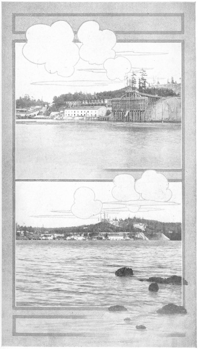
Plate No. 67.—Two Views of the Lime Works at Roche Harbor, San
Juan County.
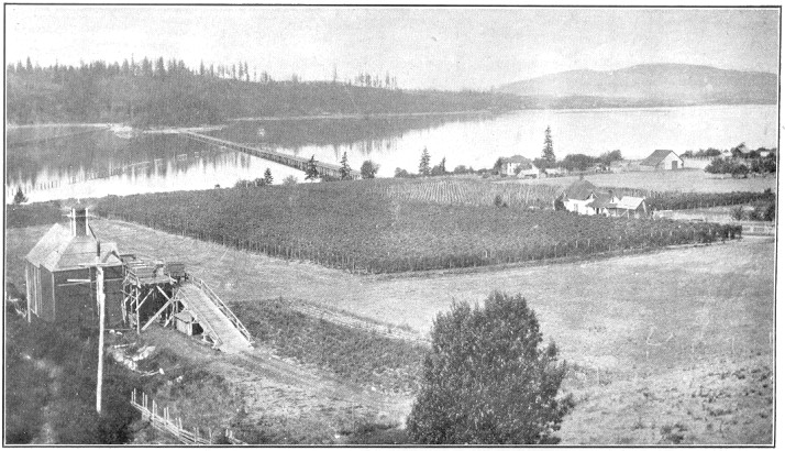
Plate No. 68.—A Typical Farm Scene in Skagit County.
There is no transportation save by water, but the islands are in
the way of traffic from so many different directions that all parts
are well served by steamboats.
SAN JUAN ISLAND is the largest of the group, and its chief industries
are farming, raising stock, salmon-fishing, and manufacturing lime.
Friday Harbor, on this island, is the county seat and largest
town, with about 500 people. A telephone system is in operation
throughout the island.
Roche Harbor is the home of great lime kilns.
ORCAS ISLAND is the leading fruit-growing district of the county.
East Sound, near the center of the island, at the foot of
Mount Constitution, is a picturesque and charming fruit-growing
section and summer resort.
Orcas is an important center of the fruit and sheep raising
industries.
LOPEZ ISLAND is a beautiful stretch of fertile agricultural land,
much of it under tillage, and is the home of a prosperous community
of farmers and stock-growers.
Lopez is the chief commercial center, with a cannery and
creamery.
Skagit county is the next county to the northwest corner of the
state, stretching from Rosario straits to the peaks of the
Cascades—about 100 miles east and west and 24 miles north
and south. Its area is 1,800 square miles, with a population of
about 35,000.
It is a county of great diversities in climate, topography and
resources. The Skagit river and its branches drain nearly the entire
county from the mountains to the saltwater. Its deltas are great
flat fields of wonderful fertility. Its valleys also, where cleared
of forests, are very rich alluvial lands. Its upper lands carry
a great burden of forests and are full of hidden treasures.
The resources of the county are its forests and minerals, its
agricultural products, and fishes. Its great cereal crop is of
oats; hops, fruits, hay and barley follow in the order named in
importance, while the products of the dairy are rapidly multiplying.
Its minerals include the precious metals, iron, lead, coal, marble,
limestone, granite, sandstone, etc.
Aside from its water transportation, the Great Northern and the
Northern Pacific railways cross its westerly end and send a branch
line through the valley of the Skagit river well up towards the
mountains and to the salt water at Anacortes. And other roads are
building, while there are 168 miles of modern graveled wagon roads.
The facilities for getting about are excellent.
Mt. Vernon is the county seat, with about 4,000 people. It
is on the Great Northern railway, on the navigable Skagit river,
and is a city of much commercial importance to the agricultural
district around it. The soil in the vicinity is renowned for its great
fertility and astonishing crops of oats, hay and grass. Creameries and
a milk-condensing plant are supported profitably to all concerned.
Anacortes is the chief town of the county, on the salt water.
It has about 6,000 people, and is a center of lumbering and fishing.
Factories for drying, salting, and canning salmon, halibut, and
cod are increasing industries. There is also a fertilizing plant
and a plant producing charcoal and the by-products of combustion,
wood alcohol, turpentine, etc.
Sedro-Woolley, on both the Northern Pacific and Great Northern
railways, has a population of 4,000, engaged in lumber industries,
fruit, and vegetables, canning, dairying and gardening. It has a
monthly payroll of $125,000.
Burlington, on the Great Northern railway, has 1,800 people,
and factories for making various wood products, concrete blocks,
lumber, shingles and condensed milk.
La Conner is a great oat and hay shipping point. It is at
the mouth of the Skagit river and on tide water, and has 800 people.
Hamilton, at the head of navigation on the Skagit river,
is a mining and lumbering town of 300 people.
Bay View, Sammish, Minkler, Prairie,
Fir, and Birdsview are other shipping points.
Baker, on a branch of the Great Northern railway, has 400
people, and is a center of cement factories.
Skamania county, in the south central part of the state, has its
southern boundary on the Columbia river, with Lewis county to the
north. It is chiefly within the forest reserve, and includes Mount St.
Helens on the west and Mount Adams on its eastern border. Altogether
it has an area of 1,636 square miles, chiefly mountainous, and about
3,000 people.
The north fork of the Lewis river drains the most of the mountainous
region, while a lot of small streams drain the southern part, emptying
into the Columbia river.
The climate is a mean between that of eastern and western Washington,
and is very mild and salubrious. The soil of the valleys in the
region of the Columbia river is very fertile.
The chief resource of the county is in its timber and lumber, yet
its mineral and agricultural wealth is becoming better known and
appreciated yearly. The fruit raised in its valleys is of excellent
flavor, early in season, and the soil is generous in its yield.
Splendid pasturage in the foothills encourages stock-raising, and
fishing in the Columbia river is profitably followed by some of
the citizens.
Boats on the Columbia river and a railroad on each side of it are
the means of transportation, and ample for the residents of the
county in its southern portion. The coming of the North Bank railroad
has given a decided stimulus to the growth of the county.
Skamania county has developed slowly and the bulk of its natural
wealth is still practically untouched. Its minerals, well known
to be valuable, are attracting the attention of prospectors, while
the forests, fisheries and farming lands will furnish a competence
to hundreds of additional familles. The scenery, combined with
the fishing and hunting afforded, are additional attractions that
will prove alluring to many newcomers.
Stevenson, a small town on the Columbia river and railroad,
is the county seat and has a population of about 450.
Tributary to Stevenson is considerable improved land, and the people
are engaged in stock-raising, fruit-growing and farming.
Butler is a town of about 300 people on the railroad and
river.
Carson, Cape Horn, Mt. Pleasant and Bear
Prairie are smaller villages, destined to become centers of
commercial distribution.
Snohomish county extends 36 miles in width from the Sound to the
peaks of the Cascade mountains, adjoining King county on the north.
It has an area of some 2,500 square miles of territory, a population
of about 63,000 people, and a great storehouse of wealth in its
natural resources. It is one of the largest and richest counties in
the state, with a mild and healthful climate, magnificent scenery,
great diversity of landscape, innumerable water falls and plenty
of game.
The forests of Snohomish are very extensive and but little depleted.
Fir, cedar, hemlock and spruce are its chief trees. Nearly one-half
of the area of the county is heavily mineralized with veins of
gold, silver, copper, lead, nickel, iron, and other ores. There
are also vast ledges of marble, granite and other building stones.
In diversified agricultural possibilities, few counties can excel
Snohomish. Its general soils in its valleys are alluvial, and produce
astonishing crops; about the deltas of its rivers, the riches of
the salt water and the mountains have combined to make a soil that
will endure for ages and annually astonish the husbandman with
its generosity. Upon its uplands, its clay and decaying herbage
have combined for ages to create a soil wonderfully adapted to
produce grass and fruits, and the industrious are luxuriating in
nature's prodigality.
Rainfall is abundant, but not excessive, and crops of the cereals
and fruits are never failures.
This county is splendidly provided with transportation facilities;
many steamboats ply its salt waters and part way up the three great
rivers that flow into the Sound. Two transcontinental railroads
cut the western part of the county in two. The trunk line of the
Great Northern follows the valley of one river from the southeast
to the coast, while two branch lines run up the other two great
valleys, past the center of the state, toward the mountains, while
a dozen spurs and short logging and coal roads act as feeders to
the main lines, thus giving all the towns of the county access
to all the Sound markets, and those of the east and the ports of
the Pacific ocean.
Everett, situated upon a fine harbor on the shores of Puget
sound near the mouth of the Snohomish river, is the county seat
and metropolis of the county. It has a population of 35,000, and
is fast developing into a commercial and manufacturing center of
importance.
The largest steamers afloat can find wharfage at her docks and
safe anchorage in her waters. It has upwards of 3,000 men employed
in its factories and mills, with a monthly payroll aggregating
$230,000.
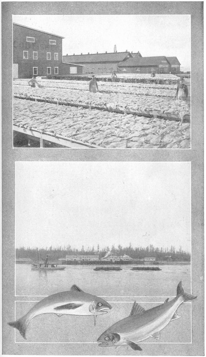
Plate No. 69.—Codfish and Salmon Packing Plants at Anacortes,
Skagit County.
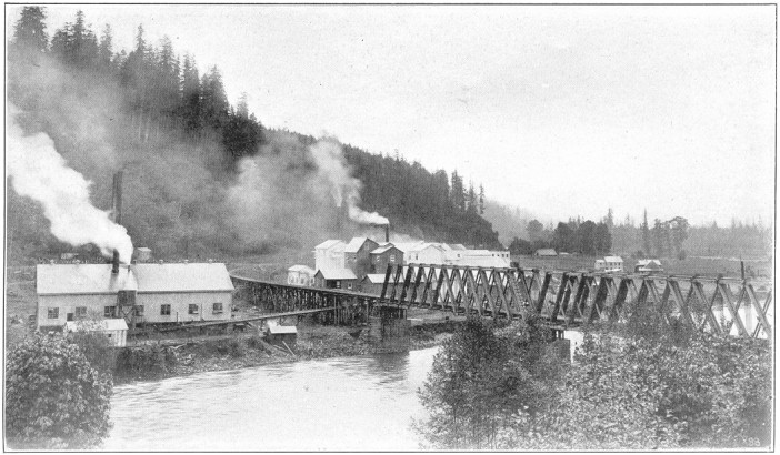
Plate No. 70.—Plant for the Manufacture of Portland Cement,
Located in Skagit County.
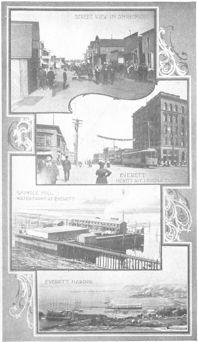
Plate No. 71.— Snohomish County Views.
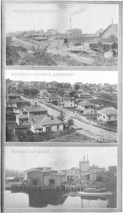
Plate No. 72.—Snohomish County Industrial Scenes.
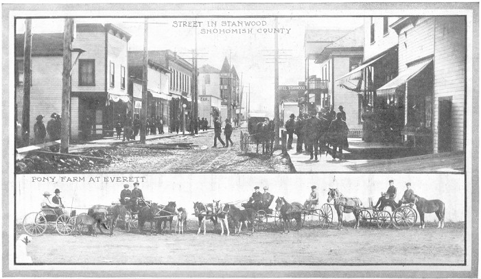
Plate No. 73.—Street Scene in Stanwood, Snohomish County. A Pony
Farm at Everett, Snohomish County.
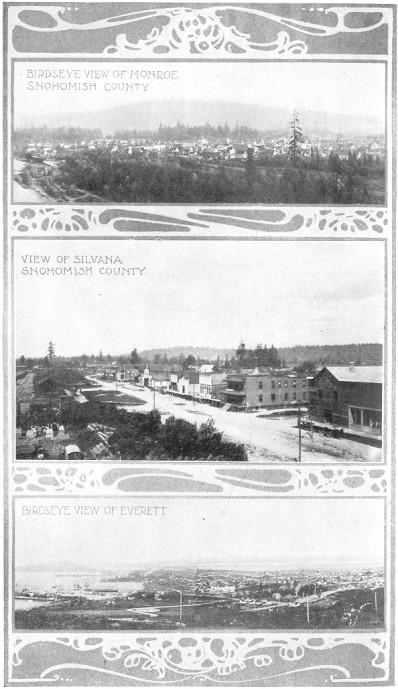
Plate No. 74.—City and Town Views, Snohomish County.
Page 81
They are engaged in the manufacture of lumber, shingles, sash and
doors; in railroad shops, pulp and paper mills, and smelters; in
running tug boats, driving piles, making iron castings, and tanning
hides; packing meats and fish; making turpentine, charcoal, flour,
butter, and many other commodities. Its banks have $4,000,000 on
deposit. Its paper mills produce 26 tons of paper daily. Its smelter
is a constant producer of the precious metals and their by-products.
The city is substantially built, having all the conveniences of a
modern city, with wide streets and wide sidewalks; has both gas and
electricity for lights, and a good water system. Some of its streets
are paved with preserved wooden blocks and some with asphalt.
Everett is a sub-port of entry of the Puget sound country. The
United States has spent half a million dollars improving the mouth
of the Snohomish river for a fresh-water harbor.
Snohomish is a city of 4,000 people, on the Snohomish river,
which is navigable, and is connected with Everett by a street car
line. It is also on the Northern Pacific and Great Northern railways,
and is the distributing center for a large agricultural district.
It has a number of shingle and sawmills, and is headquarters for
a good deal of the mining industry of the county.
Stanwood is a town of about 800 people, on the Sound and
railway, in the northwestern part of the county. It is a center
of farming interests and lumber industries.
Arlington is a mining and lumbering town on the Northern
Pacific railway, well up toward the mountains. It has a population
of 2,000 and is growing.
Monroe is a town of 2,400 people, on the line of the Great
Northern railway, in the center of a large farming and milling
industry.
Edmonds, a town of 2,000 people, is on the Sound and Great
Northern railway, near the King county line; chiefly engaged in
sawing lumber and making shingles.
Sultan, Granite Falls, Gold Bar, Darrington,
and Monte Cristo are all centers of mining and other industries.
Marysville, Mukilteo, Silvana, Getchell,
and Pilchuck are centers of lumbering and farming.
Spokane county lies in the extreme eastern section of the state.
The area of the county is 1,680 square miles.
The transportation facilities are the best of the Inland Pacific
Northwest. Three transcontinental railroads—the Northern Pacific,
Chicago, Milwaukee & St. Paul, and Great Northern—traverse the
County from east to west; a fourth transcontinental line, the Oregon
Railway & Navigation company, enters from the southwest, and a fifth
transcontinental road, the Spokane International (C. P. R.), enters
Page 82
the county from the northeast and terminates at Spokane. The Spokane
Falls & Northern extends north into British Columbia and to Republic
and Oroville, Wash. Electric trolley lines connect Spokane with
the outlying towns in every direction. The total railway mileage
in the county is approximately 429 miles.
The northern portion of the county is somewhat mountainous, and
is covered with a fine growth of pine and tamarack timber; much of
this section is suitable for agriculture, while all is adapted to
grazing. The central part of the county is rolling and is traversed
by the Spokane river; the central section to the west of the city
of Spokane is fine agricultural land, while to the east of Spokane
is the Spokane valley, which is rapidly being brought into a high
state of cultivation by means of irrigation. There are about 40,000
acres in this valley capable of irrigation; 3,000 acres are now
irrigated and under cultivation. The southern portion of the county
is rolling, and comprises some of the finest agricultural land in the
state. Large areas of this section are utilized for wheat-raising,
while here are grown the finest sugar beets in the world.
Lumbering is a considerable industry, while stock-raising and dairying
are also extensively engaged in. Over 1,000,000 bushels of wheat
are grown annually. The flour mills of the county have a combined
capacity of 3,600 barrels daily.
In fruit-growing Spokane is one of the leading counties of the
state. The value of the fruit produced in the county amounts to
nearly $3,000,000 annually. The following table shows the distribution
of the five important fruits.
| Trees planted |
1908— |
|
Total. |
| [*]Apples, |
253,630 |
|
713,567 |
| Pears, |
15,470 |
|
39,232 |
| Peaches, |
59,323 |
|
94,769 |
| Cherries, |
56,405 |
|
106,909 |
| Plums and Prunes, |
11,815 |
|
29,128 |
| Miscellaneous |
2,910 |
|
10,000 |
| |
399,553 |
Total planted
| 1,003,615 |
[Footnote *: Is 25 percent. of the total number of apple trees planted
in the state in 1908.]
There are 165 school districts in the county and eighteen towns
where graded schools are maintained. The total valuation of assessed
property with improvements (1908) is $77,120,360; personal property,
$10,527,030.
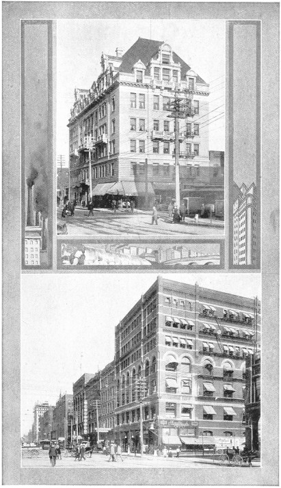
Plate No. 75.— (1) Spokane Club Building, Spokane. (2)Riverside
Avenue, Looking East from Post Street, Spokane.
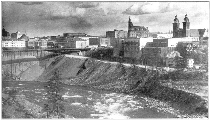
Plate No. 76.—Spokane River and Bridge at Spokane, Showing Fill
for New Concrete Structure to Cost $500,000.
Spokane, situated on the Spokane river, is the county seat of
Spokane county, and is the metropolis of eastern Washington, having a
Page 83
population estimated at 120,000. Spokane is the center of a great
wheat-raising section and is the principal mining and commercial
center between the Cascades and the Rocky mountains. A conservative
estimate of the total value of manufactured products for 1908 is
$17,000,000. There are over 12,000 wage-earners, receiving over
$10,000,000 annually. The principal industrial establishments are
lumber mills, flour mills, machine shops, agricultural machinery,
brick plants, iron works, foundries, pottery, cereal food, furniture,
etc.
The industrial prosperity of the city is due largely to the mines
in the vicinity, the great agricultural resources of the surrounding
country, and to the extensive water power which offers special
inducements to manufacturers. The Spokane river here has a total
fall of 132 feet, which furnishes a minimum of 33,000 horse-power,
of which 15,000 horse-power is developed.
There are four national banks, with a combined capital of $3,425,000.
The city owns its own water works, from which an annual revenue
of more than $325,000 is derived.
The educational facilities are excellent. There are twenty-three
public school buildings, constructed of brick and stone, and costing
$1,450,000. There are three daily newspapers, having a combined
circulation of 45,000. Here is located the U. S. circuit court;
the headquarters of the U. S. district court, eastern division;
U. S. military post (Fort Wright); the government headquarters
of the postal inspector service, known as the Spokane division,
which includes the states of Washington, Montana, Idaho, Oregon,
and the territory of Alaska, and a U. S. land office. Postoffice
receipts for 1908 amounted to $360,504.
Cheney, 10 miles southwest of Spokane, is a town of 1,500
people. Here is located one of the state normal schools, having
about 400 students.
Medical Lake is an important town, having the Eastern Washington
Hospital for the Insane near-by, It is a noted health resort.
Rockford is an important agricultural town of 1,200 people.
Hillyard is an important place of 1,500 people, having the
car shops of the Great Northern railway as its chief business.
Stevens county, in the extreme northeastern corner of the state,
has an area of 4,500 square miles and a population of about 24,000.
It is a county of great and diverse resources, is splendidly watered
with large rivers, the Columbia bounding it on the west, and the
Spokane on part of its southern line. Three ranges of low mountains
extend across the county nearly north and south. Between these the
Colville river and the Pend d'Oreille flow generally northerly
through grand and beautiful valleys.
Agriculture in all its branches, lumbering and kindred pursuits,
and the mining of precious metals and building stones make up its
chief sources of wealth.
The farms in the Colville valley are noted for their heavy hay
crops, producing abundantly all the cereals, including corn, the
clovers, timothy and alfalfa.
Dairying and stock-raising are important industries. To these the
climate and soils are well adapted. Some lands have been irrigated
with great benefit, but the bulk of the farming is successful without
irrigation.
Fruit-raising is receiving deep interest of late, and the county
bids fair to compete for honors with the very best localities in
the state for the hardier fruits.
Lumbering and saw-milling engage the attention of a large number
of the people, the product of the mills finding a ready market
in the farming region, large cities and mining camps.
Mining of the precious metals is a growing and an attractive industry.
The ores include gold, silver, lead, copper, tungsten and iron, while
quarries of limestone, marble, onyx, fire-clay, etc., abound.
In addition to the navigable waters of the Columbia and Pend d'Oreille
rivers, which traverse the outskirts of the county, the Great Northern
railway through the Colville valley from the southern to the northern
boundary, reaches most of the agricultural and mining centers and
renders good service. The western part of the county, comparatively
undeveloped, deserves much more attention.
Colville is both the county seat and principal town in the
county, having a population of 1,600 people, and is a growing town,
a distributing center on the railroad, surrounded by prosperous
farming communities.
Northport is the center of much mining activity and has a
large smelter for the reduction of ores of the precious metals.
It has a population of 1,200.
Chewelah is a center of agriculture, mining and lumbering
industries in the center of the county, having about 1,000 people.
Newport, in the southeastern part of the county, is an important
agricultural distributing center. A dozen other smaller towns offer
great opportunities to the homeseeker.
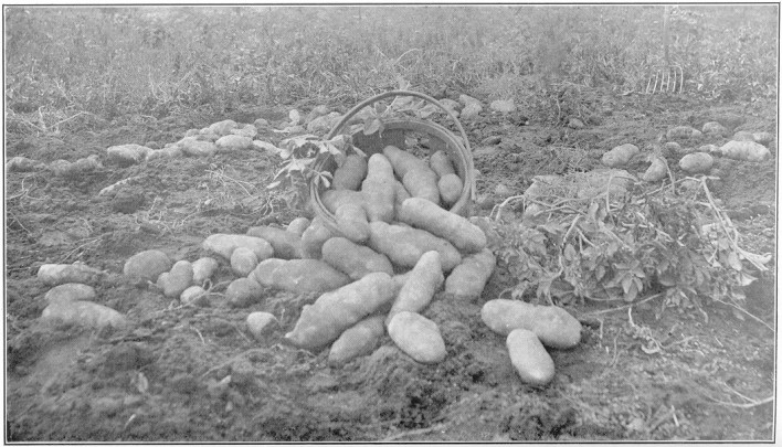
Plate No. 77.—Raising Potatoes in Young Orchard, Spokane County.
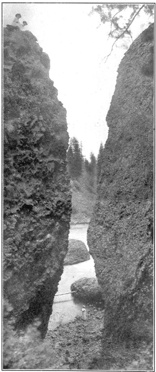
Plate No. 78.—Basalt Columns, Spokane River at Spokane.
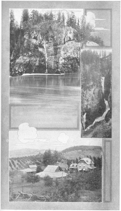
Plate No. 79.—STEVENS COUNTY VIEWS. "Where the Elephant Drinks,"
a Remarkable Crag on the Bank of the Pend d'Oreille River. A Typical
Fruit Ranch. Flume Creek Falls.
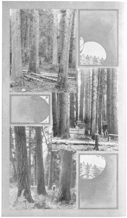
Plate No. 80.—Stevens County Timber. Cedar Forest. White Pine
Forest. Yellow Pine Forest.
Thurston county is known as having the state capital, Olympia,
within its borders, and as including the extreme southern reaches
of Puget sound. It is a county of wooded hills and valleys with
a few open prairies well watered by mountain streams, chief of
which is the Nisqually, which forms its dividing line from Pierce
county, and the Des Chutes river, which makes a splendid waterfall
of some 85 feet, a few miles south of Olympia. It has an area of
about 700 square miles, 100 miles of salt-water shore, a population
of about 20,000, and a delightful climate and magnificent scenery of
lofty mountains; great expanse of inland salt water, and green-clad
islands and fields in every direction.
The county is one of the oldest settled portions of the state,
and has a great variety of natural resources, among which are its
timber areas, its agricultural fields, its coal mines, its fisheries,
including clam and oyster beds, gray sandstone quarries, and a
great variety of clays.
The sawmills of the county are still a very important industry
and shiploads of lumber are sent out from its wharves. All the
cereals and grasses yield abundant crops; root crops are extensive;
fruit of great variety and fine flavor is very prominent. Dairying
is flourishing, the county having more dairies than any other in
the state. Coal mining is in its infancy, but has progressed far
enough to demonstrate the existence of vast areas of lignite coal,
having some six veins and having a combined thickness of 61 feet
of coal. About 50,000 sacks of oysters are annually marketed.
The Northern Pacific railway connects Olympia with all the important
Sound ports and the east, and all the transcontinental roads coming
to the Sound from the south will pass through the county. Together
with its salt-water deep harbors, these give the county splendid
competition and variety of commercial facilities.
Olympia, the chief town of the county, at once the county
seat, state capital and county metropolis, is situated on one of the
deep-water inlets of Puget sound. Its population is about 12,000.
While it has a beautiful sandstone structure, now used for capitol
purposes, the state is about to erect a new capitol building, to
cost $1,000,000. The foundation is already built. Olympia has one
of the U. S. land offices and the U. S. surveyor-general's office.
It is lighted and furnished with power for street-car and other
purposes from the power of Tumwater falls. The city is a beautiful
one of fine homes, shaded streets and parks, surrounded by a very
prosperous agricultural community,
Page 86
producing great quantities of fruit, dairy and poultry products.
Several other smaller towns on the railroads are local centers of
commercial activity.
Wahkiakum is a small county, having only 275 square miles of territory,
located on the Columbia river in the southwestern corner of the
state, near the ocean. Its population is about 4,000. The county
is heavily timbered and well watered. In many parts of the county
the soil is exceptionally fertile. The climate is mild, but somewhat
humid. In the northern part are some low mountains, from which the
drainage is south through the county to the Columbia river.
The resources of the county consist in its timber, its fertile soil,
and the fish in the river and ocean.
Logging, saw-milling, and industries growing out of these; agriculture,
dairying, and fishing are the chief occupation of its people. There
are several logging concerns in the county and large saw-mills.
Fish canneries dot its river shores; several creameries and dairies
are manufacturing butter, while its farms produce hay, potatoes,
fruits, cattle, hogs, poultry, eggs, and other products, chiefly
for the Portland market. Many of its citizens are fishermen and
some make considerable sums trapping fur animals in the winters.
The Columbia river is the great highway of the county; no railroads
are within its borders or near. Owing to the small area of the
county, this condition is no great drawback, as all the people have
ready access to the river wharves.
Cathlamet, on the Columbia, is the county seat, with about
500 people, and is the chief distributing center of the county.
Rosburg, Deep River, Brookfield, Altoona,
and Skamokawa are centers of industry. This county offers
exceptional opportunities for the frontiersman.
Walla Walla is the county of many waters. It is the most western
of the southeastern counties of the state, and is bounded north
and west by the Snake and Columbia rivers. It has 1,296 square
miles and a population of about 30,000. The elevation varies from
350 feet at the Columbia river to 2,500 feet along its eastern
border. It is a succession of plains and rolling hills, covered
with bunch-grass, with some trees along the streams. Its soil varies
from quite sandy volcanic ash in the low lands near the Columbia to a
Page 87
heavier clay loam in the eastern parts. In common with much of
eastern Washington, these lands increase in fertility with successive
cultivations. The climate is mild, healthful and vigorous.
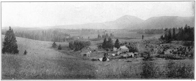
Plate No. 81.—Farm Scene Near Colville, Stevens County.
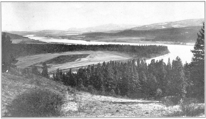
Plate No. 82.—View of Calispell Valley and Pend d'Oreille River,
Stevens County.
Walla Walla county is essentially agricultural. Its chief resource
is its soil fertility. This is such that few farmers can be found
who have not bank accounts.
The annual production of wheat in Walla Walla county is about 5,000,000
bushels. Barley is also a profitable crop. Oats and some corn are
also raised. Large crops of alfalfa hay are annually marketed,
chiefly from irrigated lands. Fruit of all kinds is abundant. There
are 2,500 acres devoted to orchards. Market gardening is an important
and growing industry.
There are 310 miles of railroads in this county, both the Northern
Pacific and Oregon Railroad & Navigation Company railroads competing
for the traffic. In addition to the railroads, steamboats are plying
the rivers around the edge of the county, giving additional facilities
for transportation.
Walla Walla, the county seat, has a population of about
22,000 and is the commercial center for the southeastern part of
the state. Its streets are paved. The city owns its own system
of water, at a cost of $600,000. It is lighted with electricity
and gas, has large banks and business houses, U. S. land office,
U. S. courts, U. S. cavalry post, an Odd Fellows' home, and a Home
for Widows and Orphans. There are manufacturing industries employing
400 men, turning out $2,000,000 of productions annually. An electric
system of street cars traverses the streets and is projected into
several other near-by towns.
Waitsburg is an important agricultural town of about 1,600
people, in the western part of the county, having both railroad
systems, and ships great quantities of grain. It has large flouring
mills, warehouses, fine schools and churches, and is a prosperous,
thriving town.
A large number of shipping points on both systems of railroads are
growing commercial centers.
Whatcom county lies on the boundary of British Columbia, stretching from
the Straits of Georgia to the peaks of the Cascade mountains—24
miles wide and 100 miles long, The eastern half or more of the
county is included in the national forest reserve, with Mount Baker,
10,827 feet high, in the center of the county. It is one of the
important counties on tide water, and has an area of 2,226 square
miles and a population of about 70,000.
Page 88
The climate is not different from the general Puget sound climate
being mild and healthful. There are no severe storms, no sultry
heat and no severe cold.
It is estimated that Whatcom county has three billion feet of standing
timber. This is its greatest source of wealth. The western half
of the county, outside of the lumbering, etc., is blessed with
a wealth of soil responding to the farmer's labor generously.
The eastern half of the county is essentially a mountainous,
forest-covered mining region, and has in store many veins of nearly
all the metals.
Game of great variety of animals and fowls and fish are abundant.
The people of Whatcom county are engaged in lumbering and running
saw-mills, one of the largest of the state being in this county;
manufacturing of various kinds from the raw products in the county,
including shingle mills and shingle machinery factory, salmon canneries,
planing mills, barrel factories, Portland cement factory, and many
others. Of no small importance is farming, fruit-growing and dairying.
Prospecting and mining engage the attention and labor of a large
number of citizens.
Aside from having a long salt-water coast, open to traffic from
the ocean, with splendid harbors, the county is traversed in all
its agricultural half by a network of railroads, by the Northern
Pacific, Great Northern, B. B. and B. C. railroads. These furnish
exceptional means of traffic to all industries excepting the mining.
The county has also an admirable system of wagon roads, some planked,
some graveled and some graded and drained, covering about 700 miles.
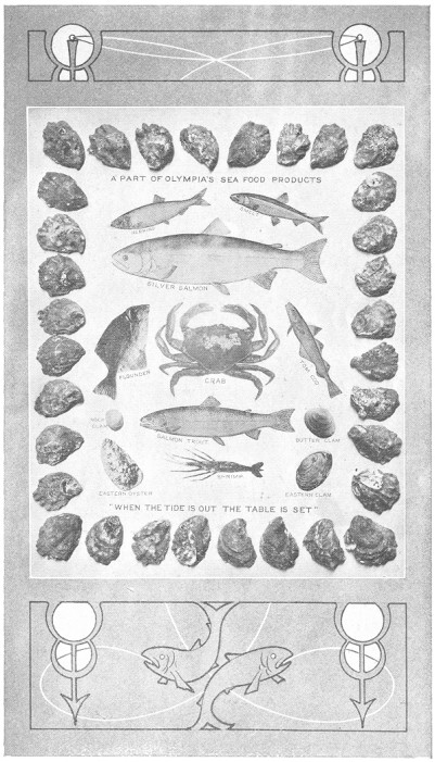
Plate No. 83.—Products of Thurston County Waters.
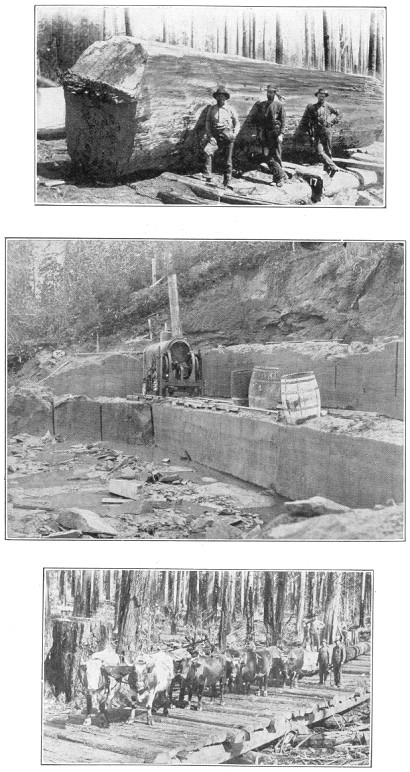
Plate No. 84.—Thurston County Stick. 14,000 Feet. Sandstone Quarry,
Tenino, Thurston County. Logging with Oxen. Early Days in Thurston County.
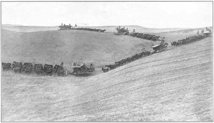
Plate No. 85.—Five Combined Harvesters at Work on a Walla Walla
County Wheat Farm.
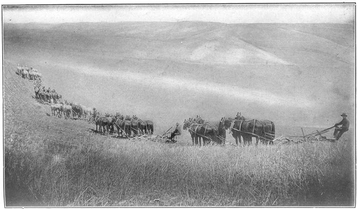
Plate No. 86.—Ploughing the Ground for Wheat-Growing, Walla Walla
County.
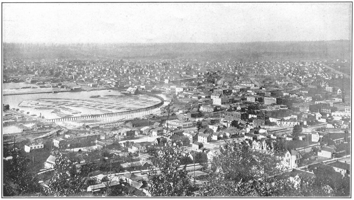
Plate No. 87.—Bird's-Eye View of a Portion of Bellingham, Whatcom
County.
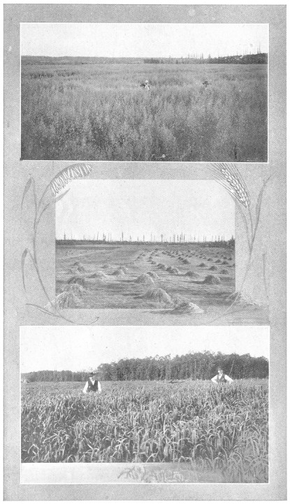
Plate No. 88.—Typical Farm Scenes in Whatcom County.
Bellingham, on a salt-water bay of the same name, is the
county seat, and commercial metropolis not only for this county but
much other territory. It has a population of about 40,000 people.
Into it all the railroads center, while the harbor is one of the best
in Washington. It is largely a manufacturing town, having plants for
the production of sash, doors, columns, tin cans, boilers, engines,
flour and feed, canned fish, condensed milk, and many others. It is
a substantial, live business community of wide-awake people, and
growing rapidly. It has a gravity water system, electric lights,
and gas plant.
Blaine is a city of about 3,000 inhabitants, situated close
to the Canadian line and on the Great Northern railway. Timber and
lumber manufactures are the chief sources of its prosperity. Fishing
and the canning of salmon are also important industries. The railroad
Page 89
company has recently expended considerable sums in improving its
facilities. Blaine is a growing community.
Sumas, on the Canadian border, is a lumbering town of 1,100
people.
Lynden is an agricultural center of 1,200 citizens.
Ferndale is a lumber center of 1,000 people. Besides, there
are a dozen smaller business centers in the county, growing and
prosperous.
Whitman county is one of the chief agricultural counties of the
state, lying immediately south of Spokane county and on the Idaho
state line, having the Snake river for its southern boundary. The
county is a plateau of rolling prairie lands, a large portion of
which is farmed, watered by a number of streams, which are utilized
for irrigation purposes in some of the bottom lands—although
the rainfall is sufficient to mature crops, and no irrigation is
had on the great bulk of the farms. The area is about 2,000 square
miles. The population is about 40,000. The soil is a strong mixture
of volcanic ash and clay of great fertility and permanence. Twenty
years of wheat-growing still leaves the soil able to produce from
25 to 50 bushels per acre.
All the resources of the county originate in this splendid soil.
For growing all the cereals and fruits and vegetables it has no
superior. The county is well settled, and probably no county can
excel Whitman county in the per capita wealth of its farmers. The
products of the county are varied, and include wheat, oats, barley
and hay, all giving splendid yields—wheat from 30 to 50 bushels,
oats 60 to 100 bushels, barley from 50 to 80 bushels, and hay from
4 to 6 tons per acre. Potatoes, sugar beets and other vegetables
produce fine crops.
The hardier fruits, such as apples, pears, plums and cherries,
are successfully raised in all parts of the county, while on the
bottom lands, along the Snake river, peaches, melons, etc., are
produced in abundance. Seventy-five carloads of fruit go out annually
from one orchard.
Wheat gives up five and one-half million bushels to the farmers
each year. Oats one and three-fourths million and barley about
one-half million bushels. Whitman county has more banks than any
county in eastern Washington besides Spokane.
Whitman county is as well, or better, provided with railroads than
any agricultural county in the state. The Northern Pacific, O.
R. & N., Chicago, Milwaukee & St. Paul and the S. & I. railroads
are all interlaced about its grain-fields. These all connect with
Spokane, and give access to all eastern and western markets.
Colfax, the county seat, situated near the center of the
county, on the railroads and Palouse river, is the largest town
in the county, with about 3,600 population. The town owns its own
water system, has electric lights, fine court-house, banks, mills,
warehouses, etc.
Pullman is a town of 3,000 people, near which is located the
Washington State College, a large educational institution supported
by the state, having about 1,000 students. It is an important
grain-shipping point. It has a public water system, electric lights,
and is a thriving and growing commercial center.
Palouse is a railroad center of 2,500 people, a large shipping
point for grain, live stock, fruits and pottery.
Oakesdale is a town of 1,500 people, having three railroads,
and is an important shipping point.
Tekoa has a population of about 1,400, is a railroad center,
and is a large shipper of fruits and grain.
Garfield has a population of 1,000, and ships much grain
and other produce.
Rosalia has 1,000 population, and is an important grain center.
This county has a dozen other shipping points where from 300 to 700
people are supported by the business originating on the tributary
farms.
Yakima county is one of the large and important counties in the
state, having the Yakima Indian reservation included within its
boundaries. Its area is 3,222 square miles and it has a population of
about 38,000. It is watered by the Yakima river and its tributaries,
and through its valleys the railroads from the east find their
easiest grade toward the Cascade passes. It is a county of level
valleys and plateaus, having a soil made up chiefly of volcanic
ash and disintegrated basaltic rocks, of great depth, which yields
fabulously in cereal and grass crops, fruits and vegetables with
the magic touch of irrigation. Artificial watering is 30 years old
in this valley, and yet only a very small area was thus treated
until the matter was taken up by the national government. But now
vast areas are being provided with water, and the consequent growth
and development of the county is wonderful.
A series of lakes in the mountains are being utilized as reservoirs,
and from these lakes the waters are being distributed in many directions
in the large irrigating canals. When the projects now under way are
completed, more than 200,000 acres will be under ditches.
Yakima's wealth consists in the combination of its soil and water
and climate. The county, lying east of the Cascade mountains, in
Page 91
large part at a low elevation, receives somewhat severe heat in
the summer, which gives the opportunity successfully to ripen the
less hardy fruits—peaches, apricots, grapes, etc. The county
has half a million bearing trees and two and one-half million young
trees growing in its orchards.
Naturally the industries of the county consist in exploiting its
natural resources, and so we find Yakima citizens busy in raising
fruits, hay, grain, and garden vegetables, to supply the big cities
of the Sound. Its last year's contribution will probably exceed
ten million dollars in value.
Of the items which compose this large sum, fruit is probably chief
in importance. Alfalfa and grain-hay is an important item, as is
also the crop of melons and potatoes. The combined fields of alfalfa
and orchards make ideal bee pasturage, and Yakima honey is a constant
factor of barter in the Sound cities. The upland farms produce
quantities of all grains—wheat, oats, and barley—and
some field corn is successfully raised in the warmer parts. Sheep,
cattle and horses are also exported. Hops are a large crop.
North Yakima is at once the county seat and chief metropolis
of the entire Yakima valley, having a population of about 12,000. It
is situated on the Northern Pacific railway and Yakima river, and
is the distributing center for both merchandise and farm products
for a large surrounding territory.
The State Fair, supported by the state, holds annual exhibits here.
It has extensive fruit canneries, flour mills, lumber mills, other
woodworking factories, large warehouses, paved streets, big business
blocks, fine churches, schools, banks, newspapers, etc.
Sunnyside, a town built up among the irrigated farms, has
a population of 1,500. Here are a cannery, pulp mill, creameries,
etc.
Toppenish and Mabton are commercial centers of importance
of about 700 inhabitants each, and growing.